Trip Date: April 25, 2021
2021 NEW MEXICO ADVENTURE VACATION
Wheeler Peak Day Climb
Williams Lake
Wheeler Peak (13,161 ft)
Trip Report Summary
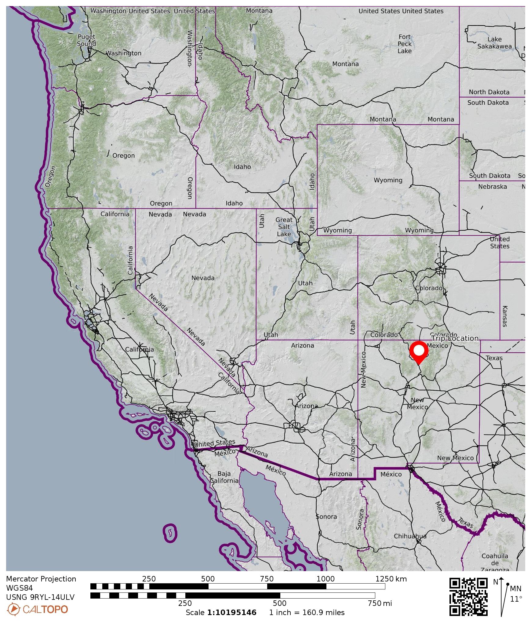
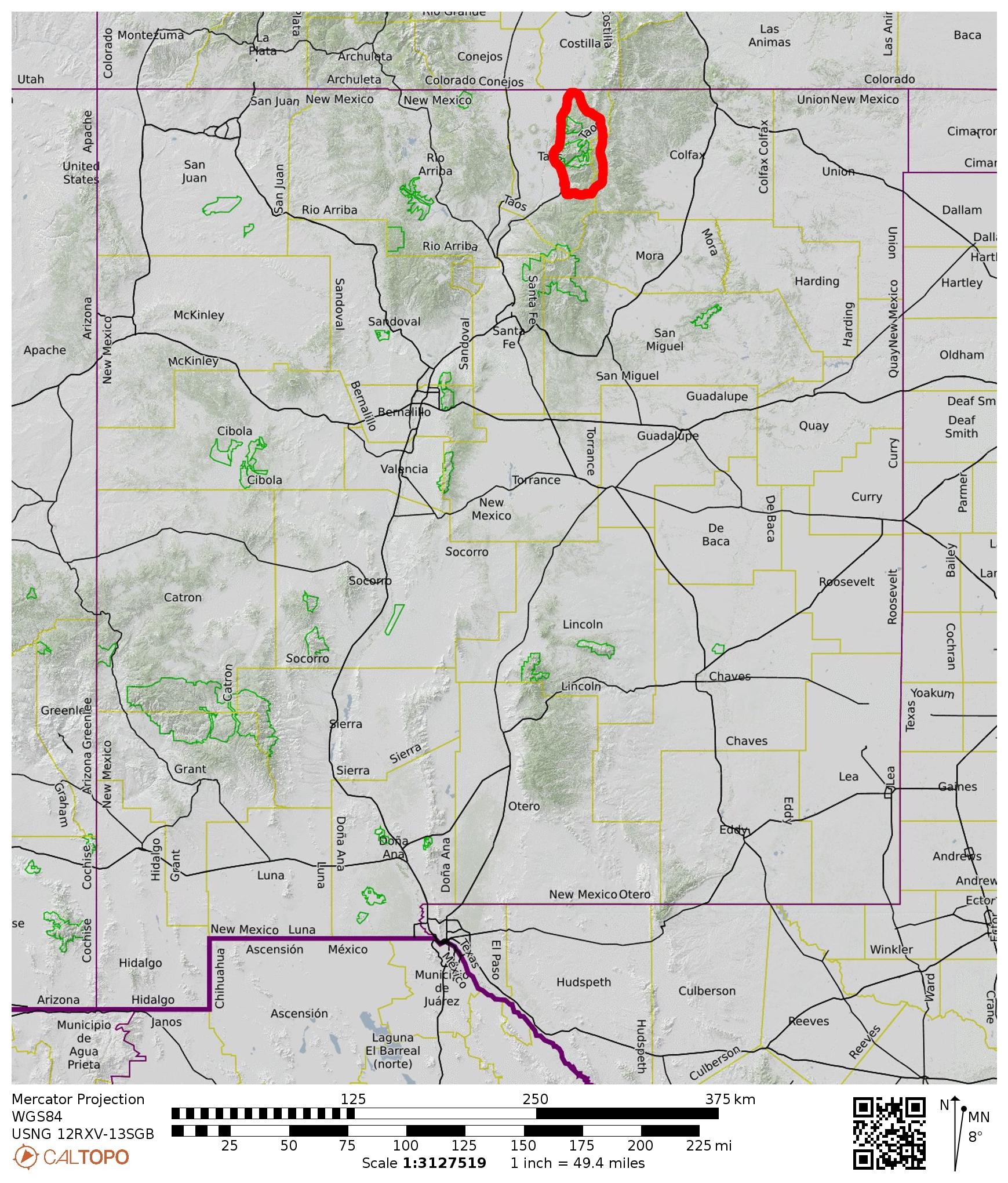
Region: New Mexico
Sub-Region: Rocky Mountains
Sub-Sub-Region: Sangre de Cristo Mountains
Sub-Sub-Sub-Region: Taos Mountains
Areas: Carson National Forest & Wheeler Peak Wilderness
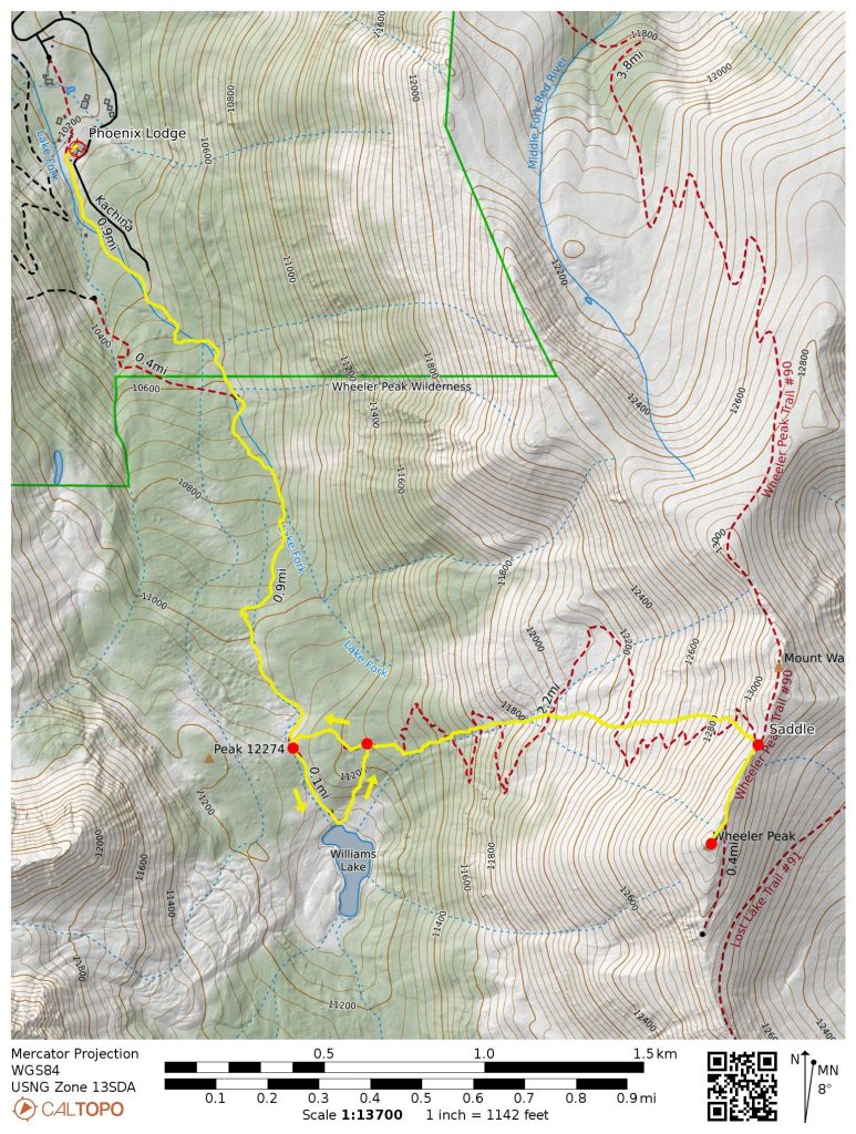
Starting & Ending Point: Phoenix Lodge at Taos Ski Valley Resort on Kachina Road (Elev. 10,200 feet)
Waypoints: Lake Fork of Hondo River & Williams Lake & Wheeler Peak summit (snow hike & rock scramble)
Summit: Wheeler Peak (snow hike & rock scramble via Northwest Slope—North Ridge)
Approximate Stats: 6.5 miles traveled; 3300 feet gained & lost; 3.8 hours up; 2.1 hours down.
…
Full Trip Report
Eileen and I wrapped up our New Mexico vacation with a climb of Wheeler Peak in the Taos Mountains, a sub-range of the famous Sangre de Cristo Mountains. At 13,161 feet, Wheeler Peak is the highest summit in New Mexico, making it a magnet for peak-baggers and state high-pointers around the country. Throughout the summer months, the ascent is merely a high-elevation hike via a well-defined trail. During the spring months, however, it becomes a more challenging snow climb. I managed to add an extra layer of difficulty by being somewhat ill-prepared for the conditions encountered.

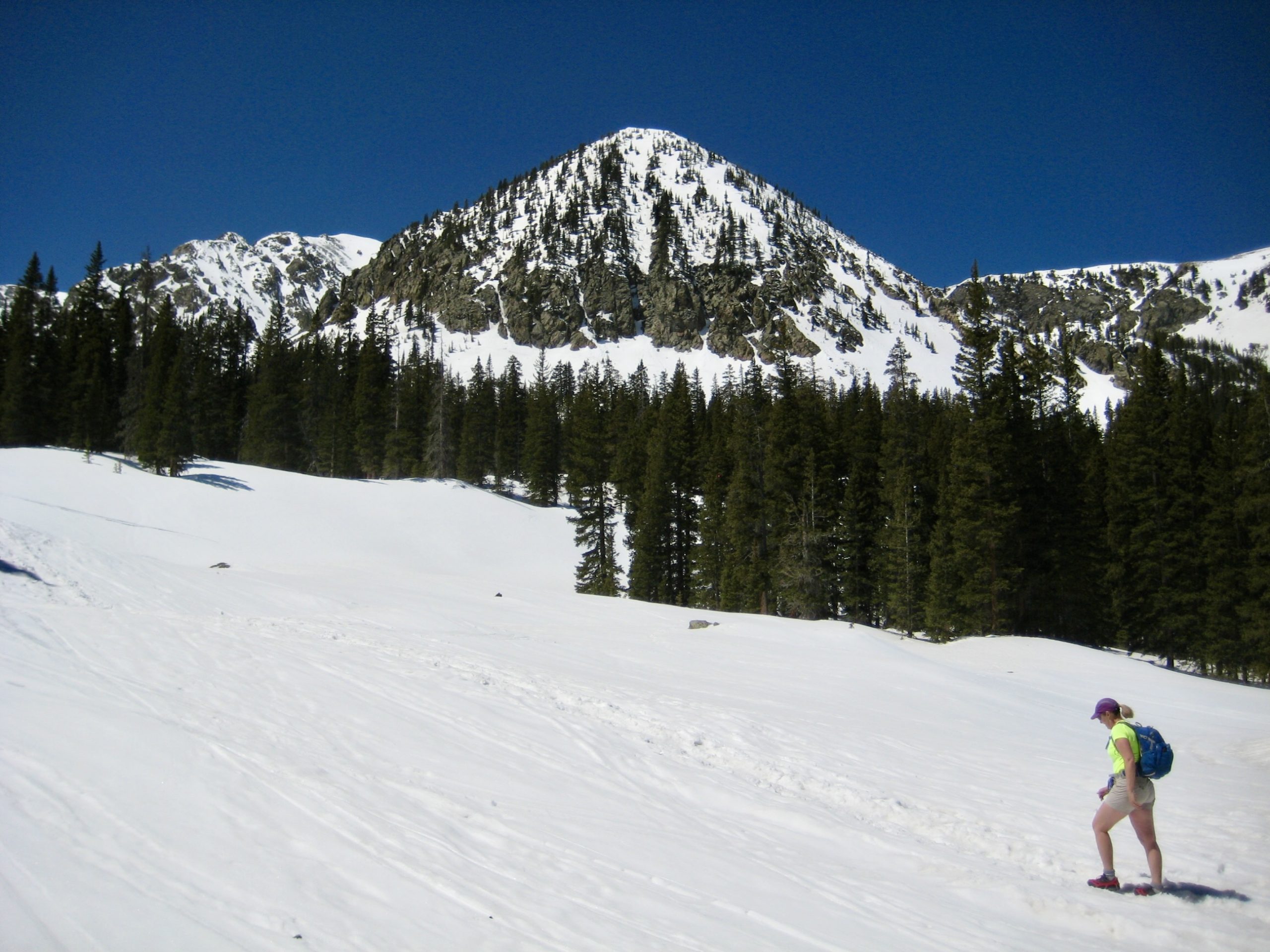
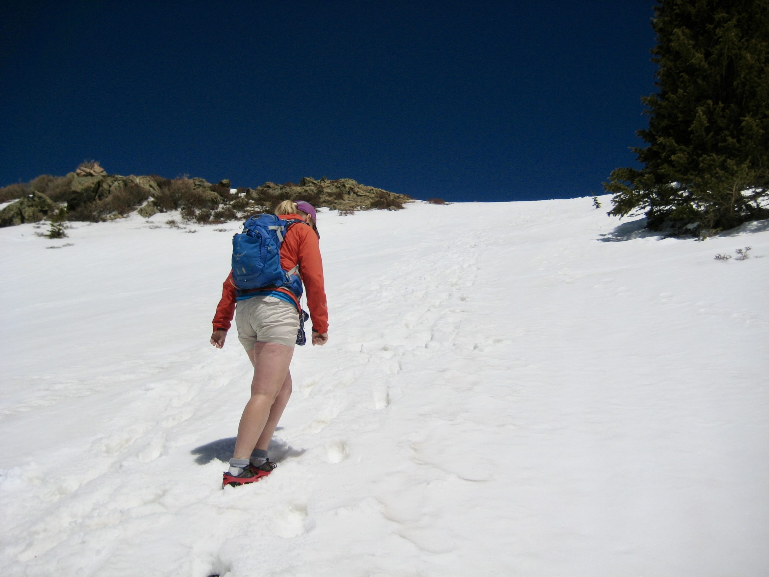
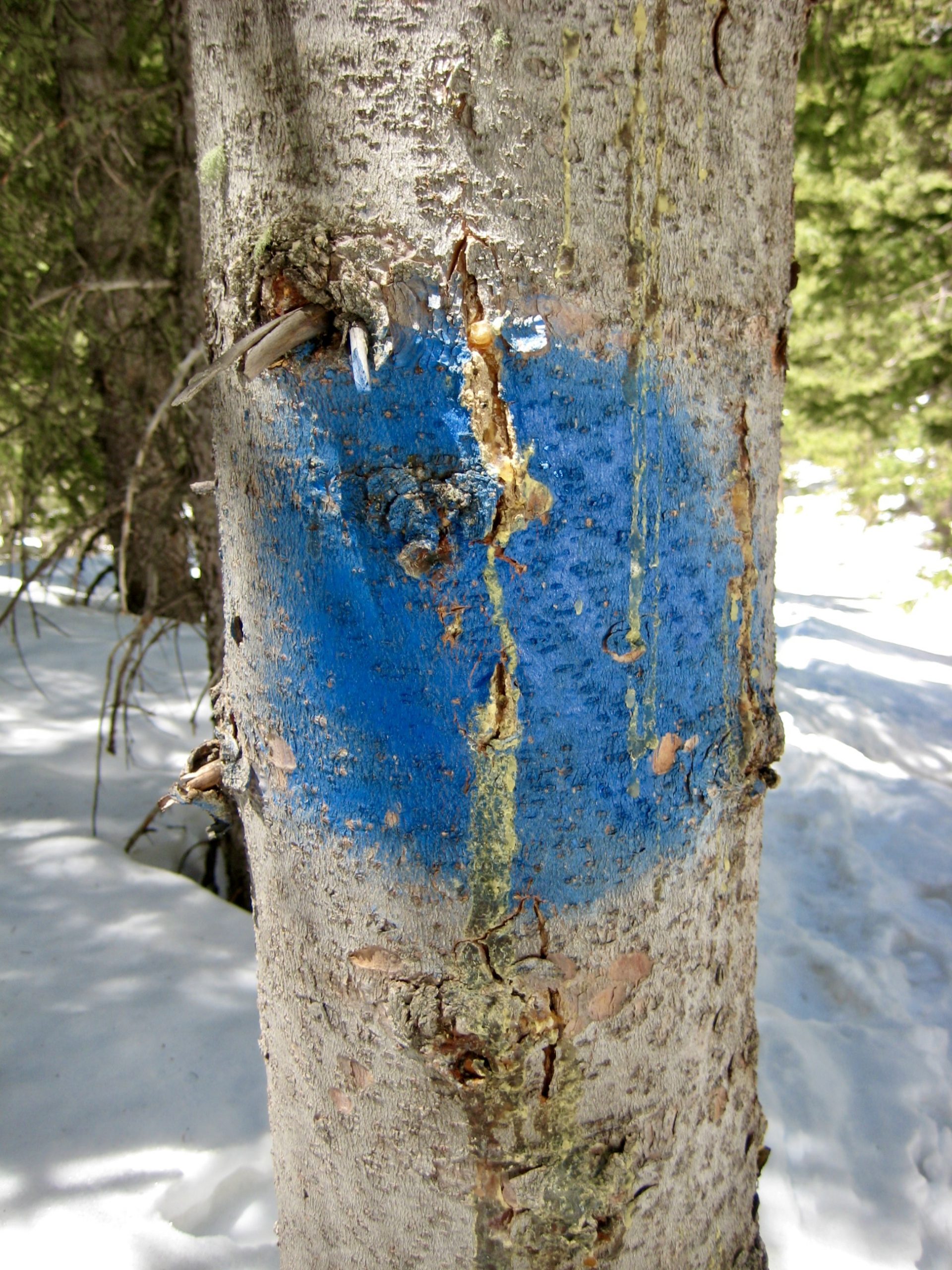
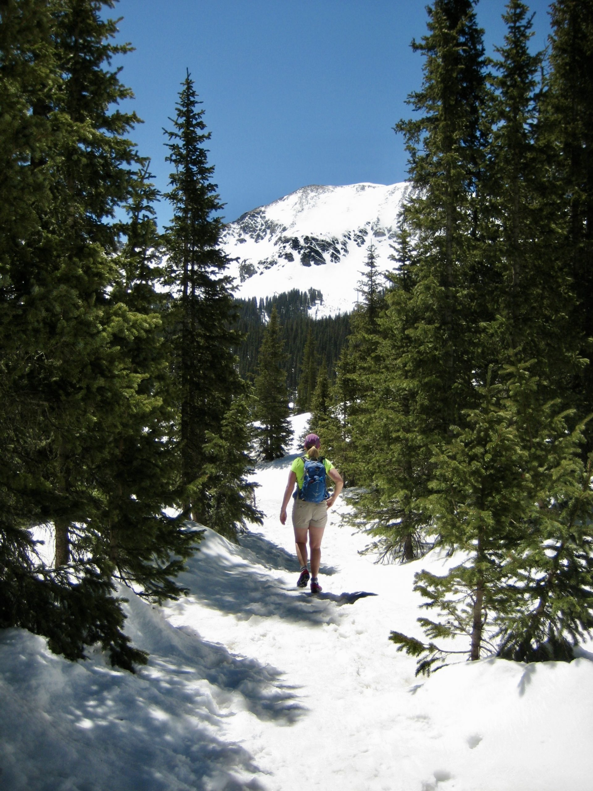
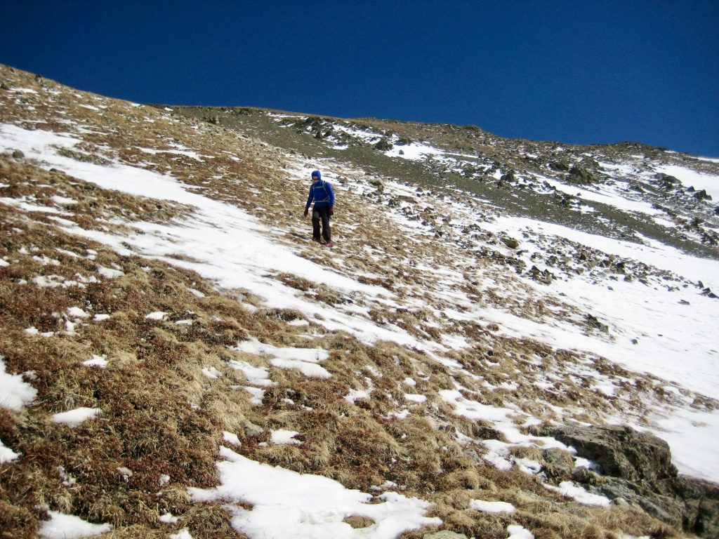
We began our trek at the Phoenix Lodge within Taos Ski Valley Resort, along with several dozen other people. Because the ski area had recently closed for the season, it was possible to start here rather than at the lower “official” Williams Lake / Wheeler Peak Trailhead. Wearing microspikes on our trail shoes, we started hiking up the hard-packed snow trail. Navigation was very easy, thanks to myriad footsteps in the snow and hundreds of blue circles painted on trees.
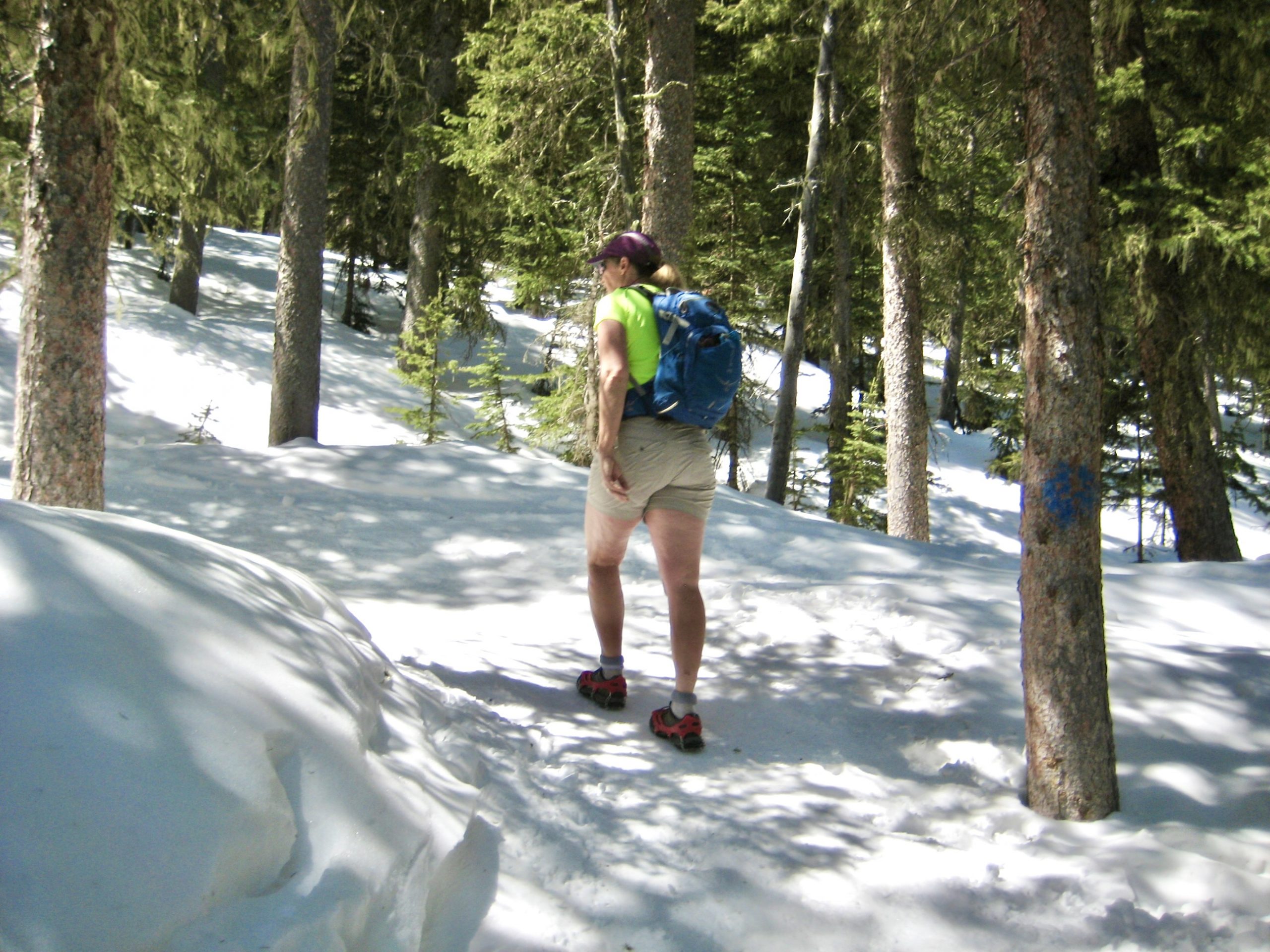
The morning was gloriously sunny, and the weather forecast promised more of the same all day, albeit with breezy conditions up higher. We had little concern regarding “breezy conditions” on such a fine day, especially when we crossed through a large clearing in perfectly calm air.

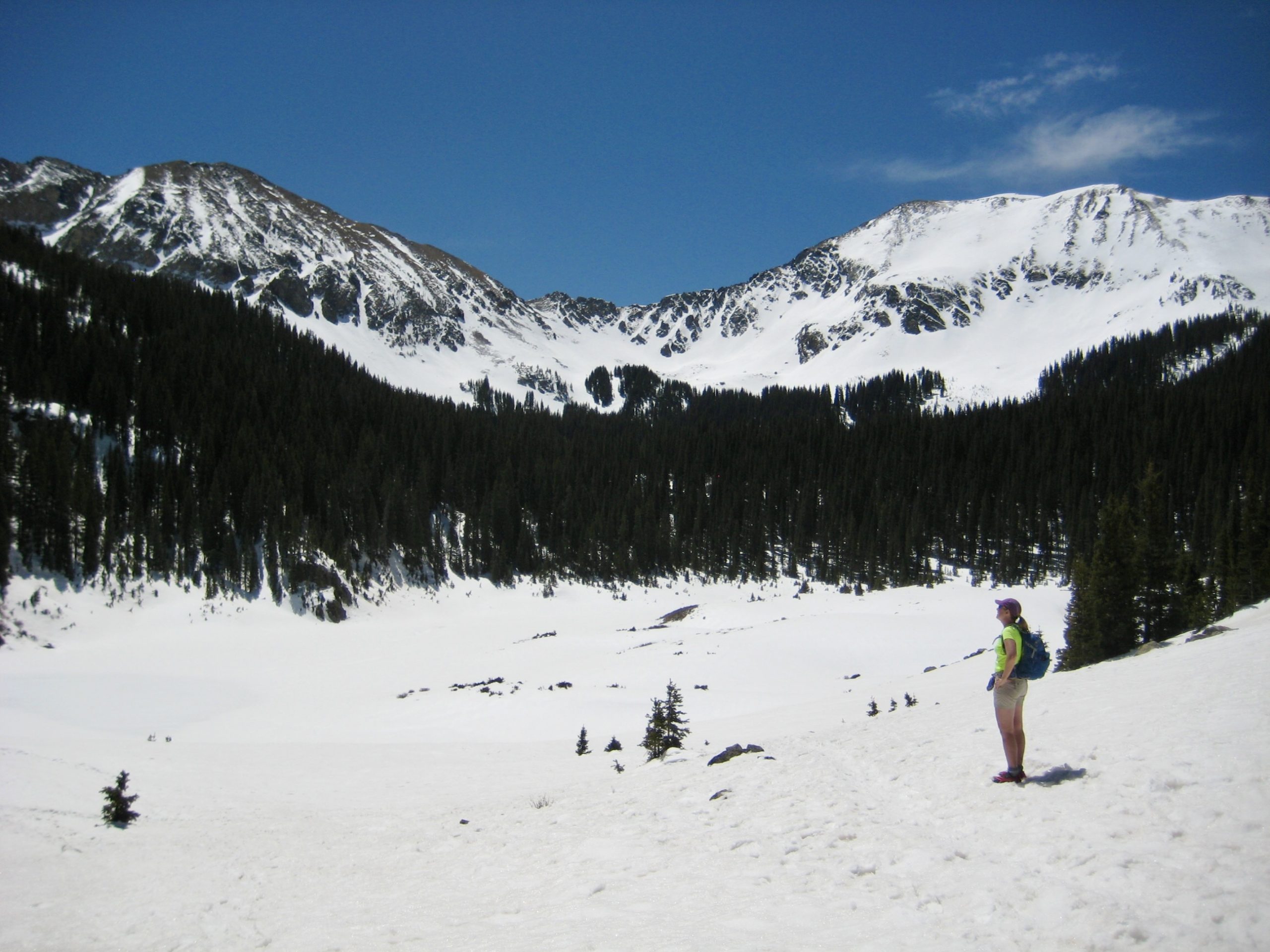
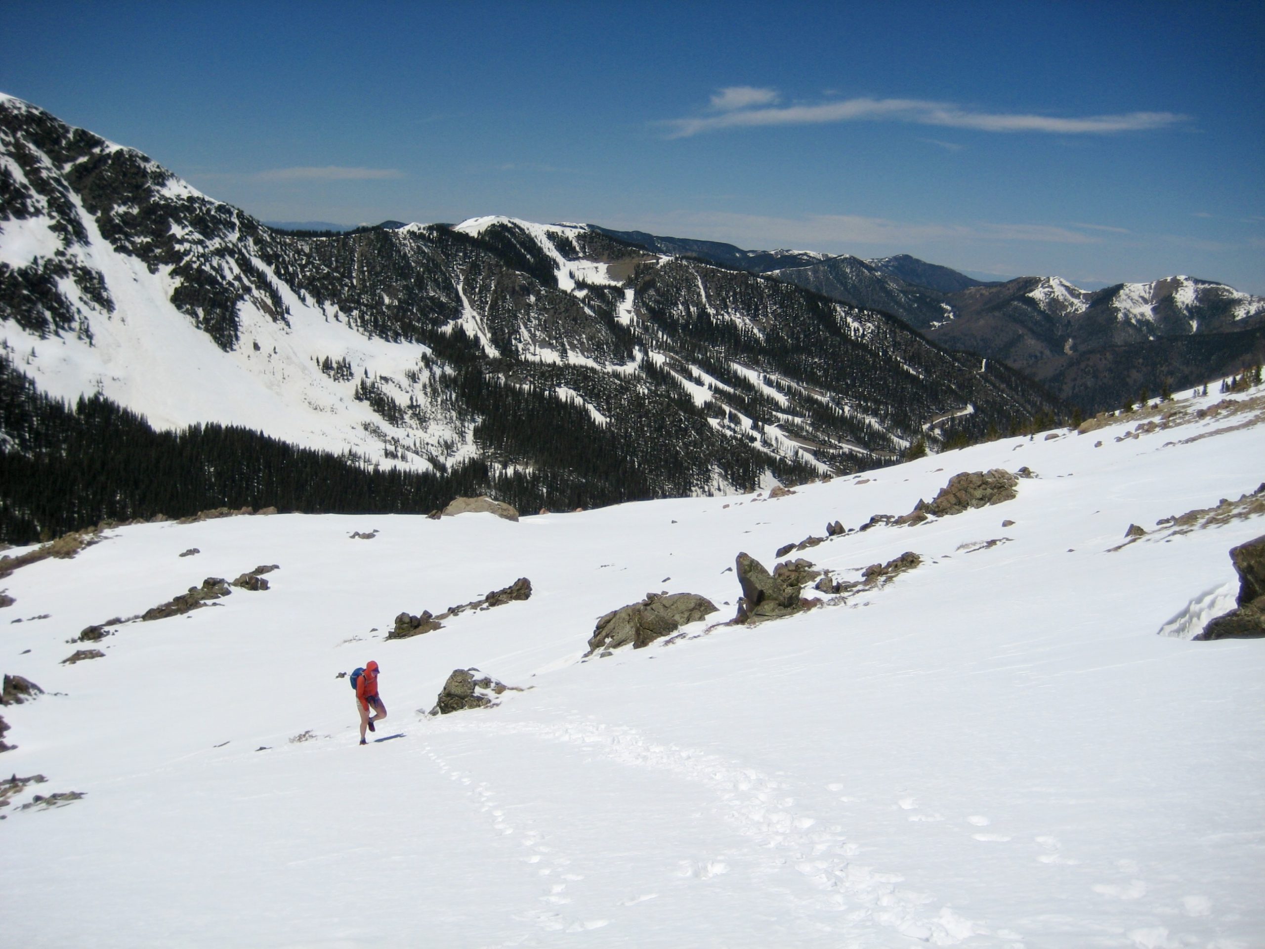
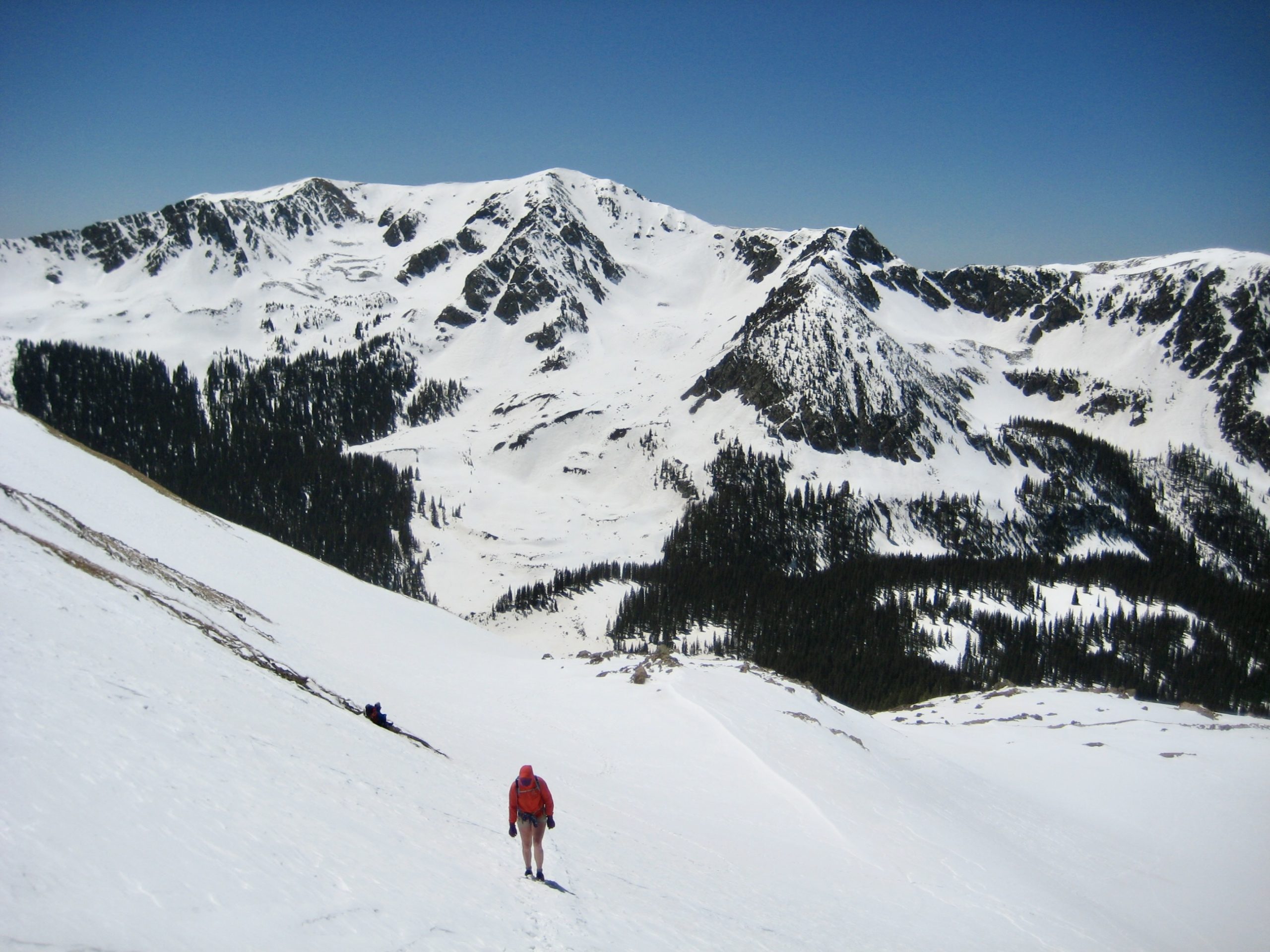
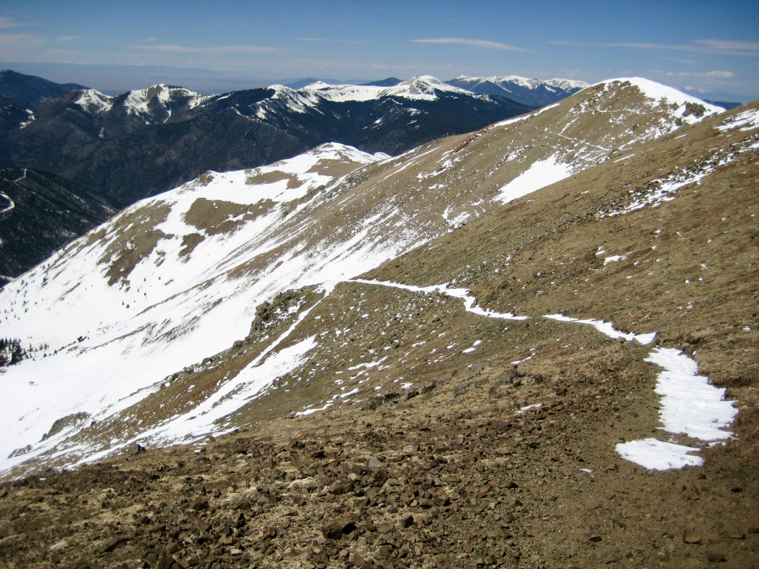
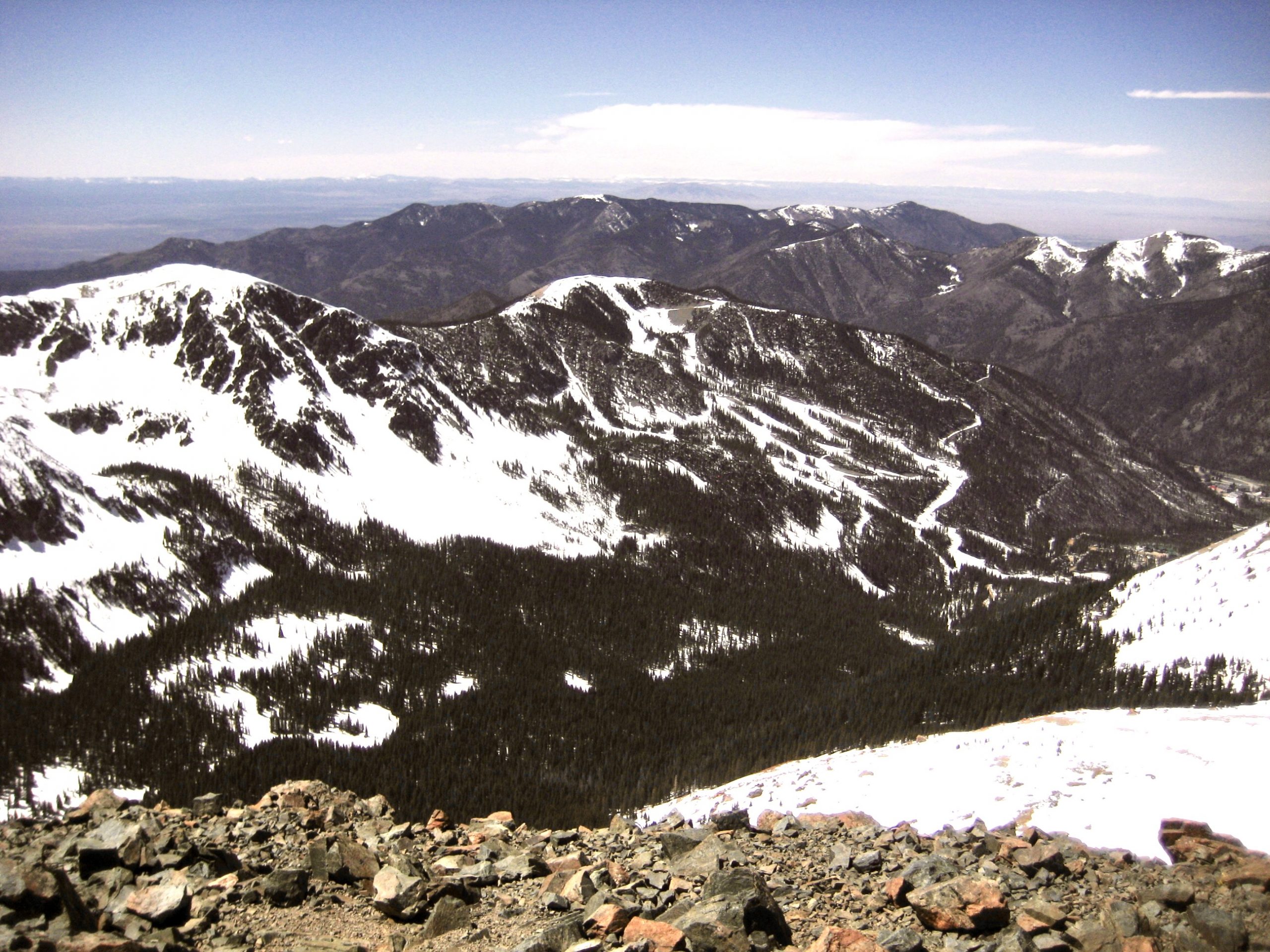
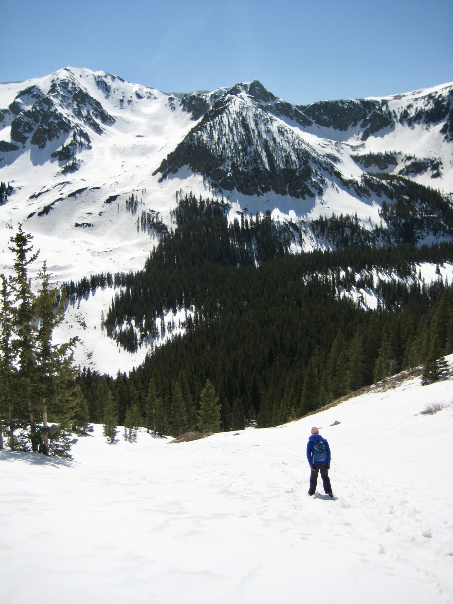
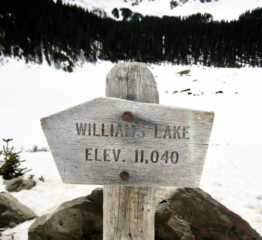
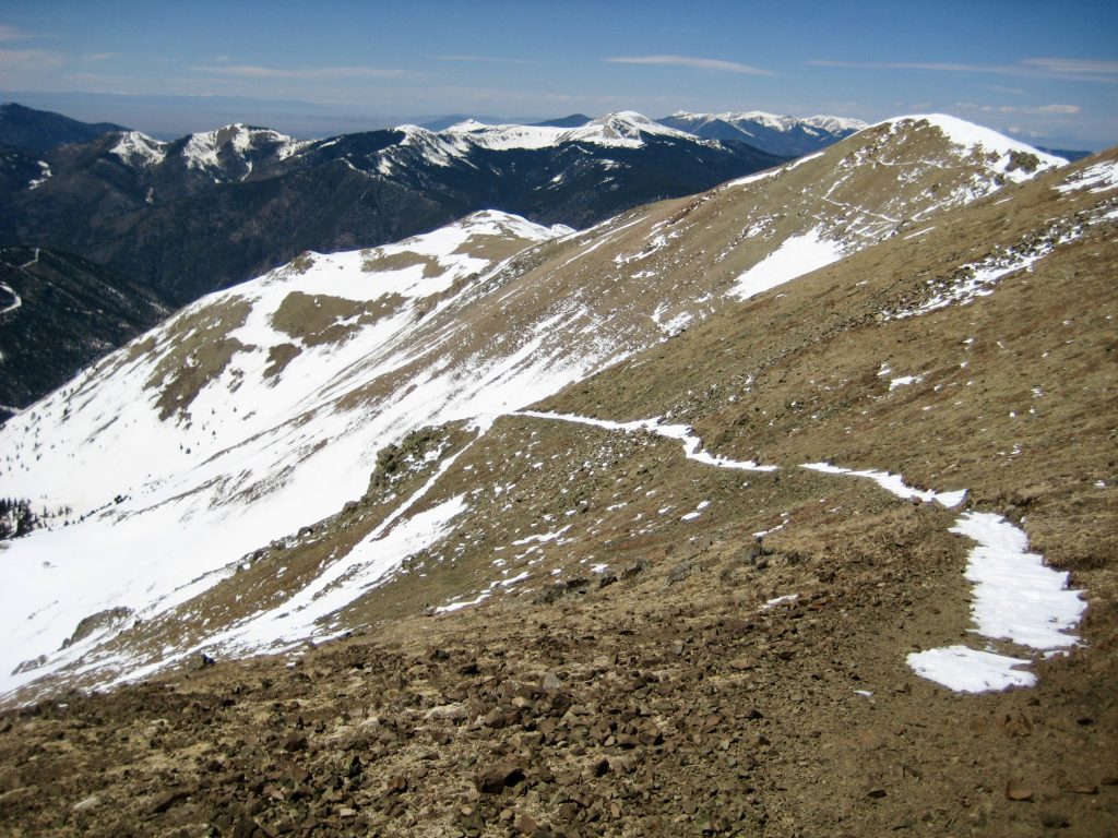
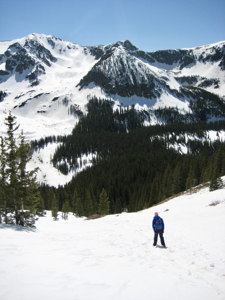
Shortly after passing a junction with the Wheeler Peak Trail, we arrived at snow-covered Williams Lake (1.1 hours + 900 feet from TH). This lake occupies the floor of an impressive cirque, and it appeared to be the final destination for most hikers on the trail.
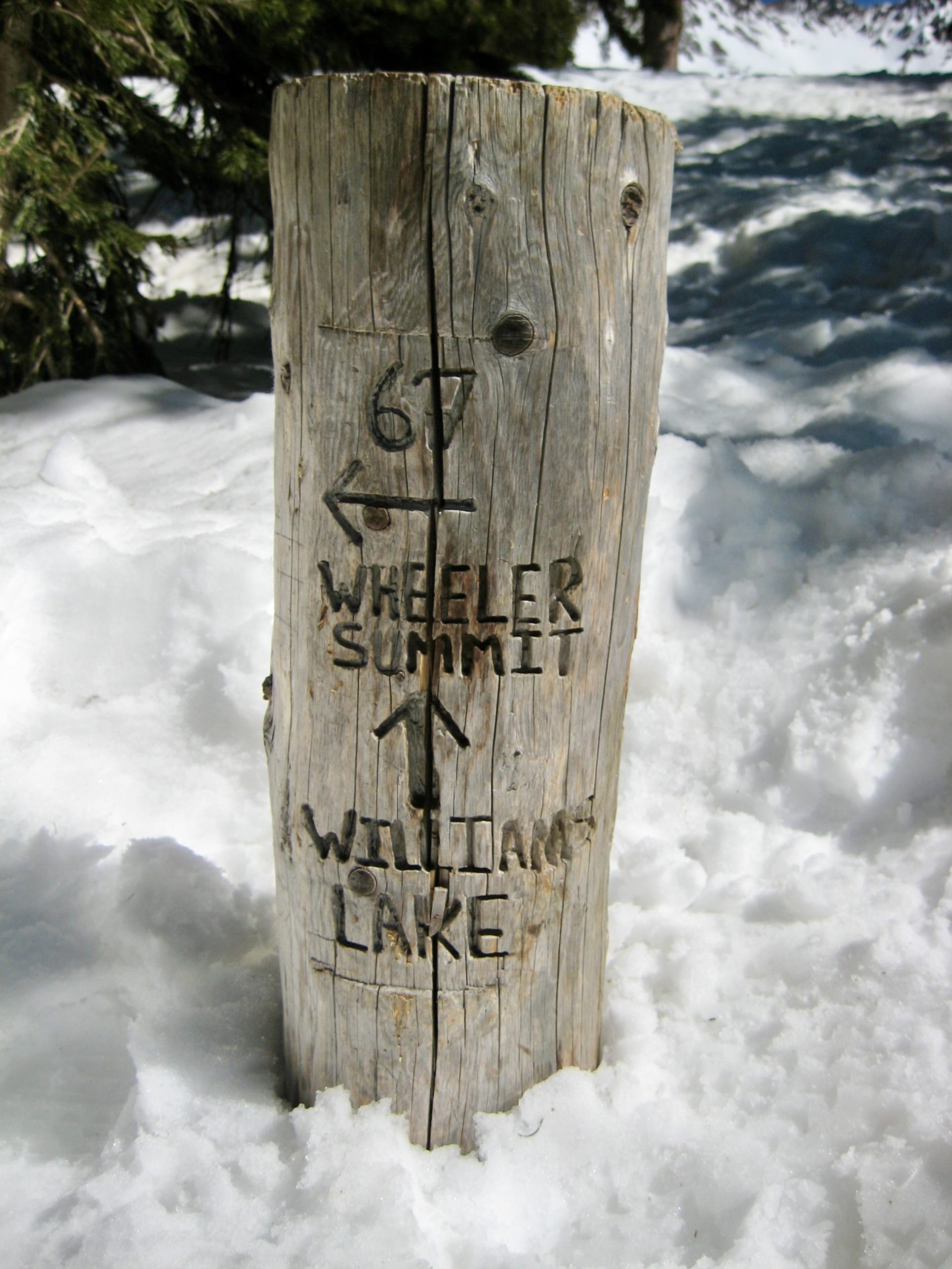
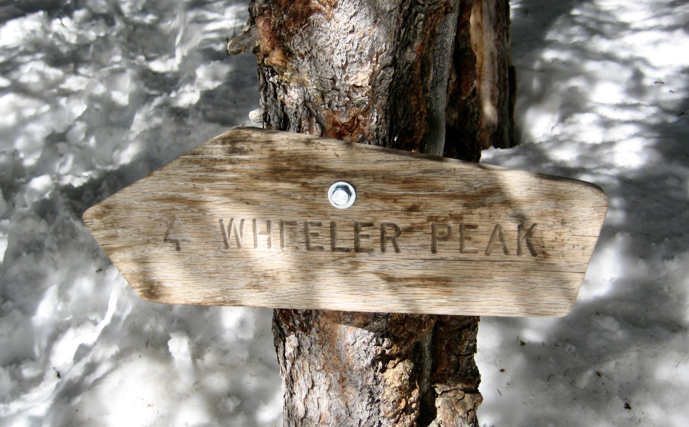

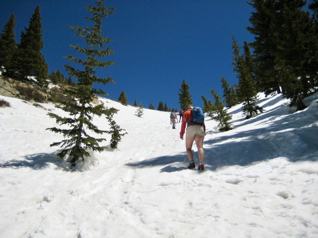
From Williams Lake, we angled back northward to intersect the Wheeler Peak Trail. More footsteps and blue circles took us through dense forest to the bottom of a long snow chute. A dozen or more people could be seen going up and down this chute. Eileen and I didn’t have ice axes—nor did anyone else—so we were glad to find that the snow was quite soft. Up we went.
As we booted up the snow chute, we talked to several people coming down. Only one person (a state high-pointer, not surprisingly) reported having reached the summit; the others had turned around below the summit due to high winds. Hmm…that sounded like more than just “breezy conditions.”
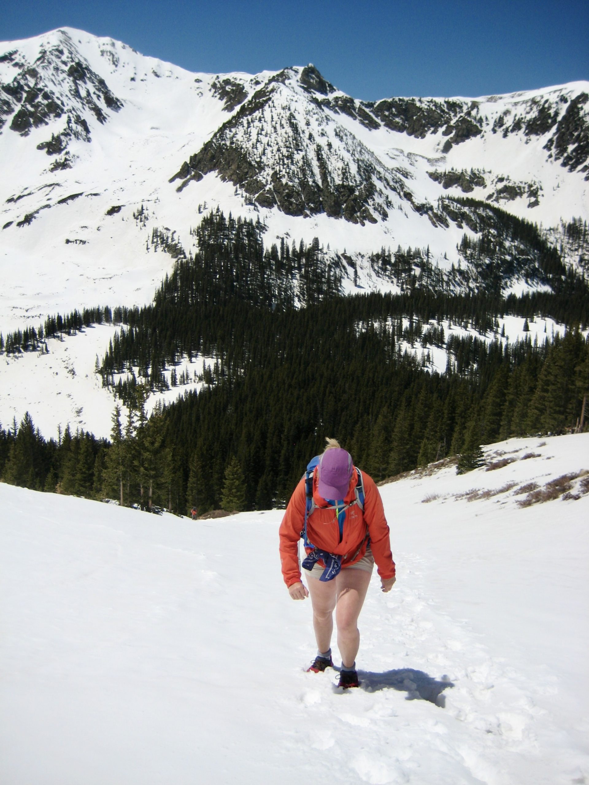
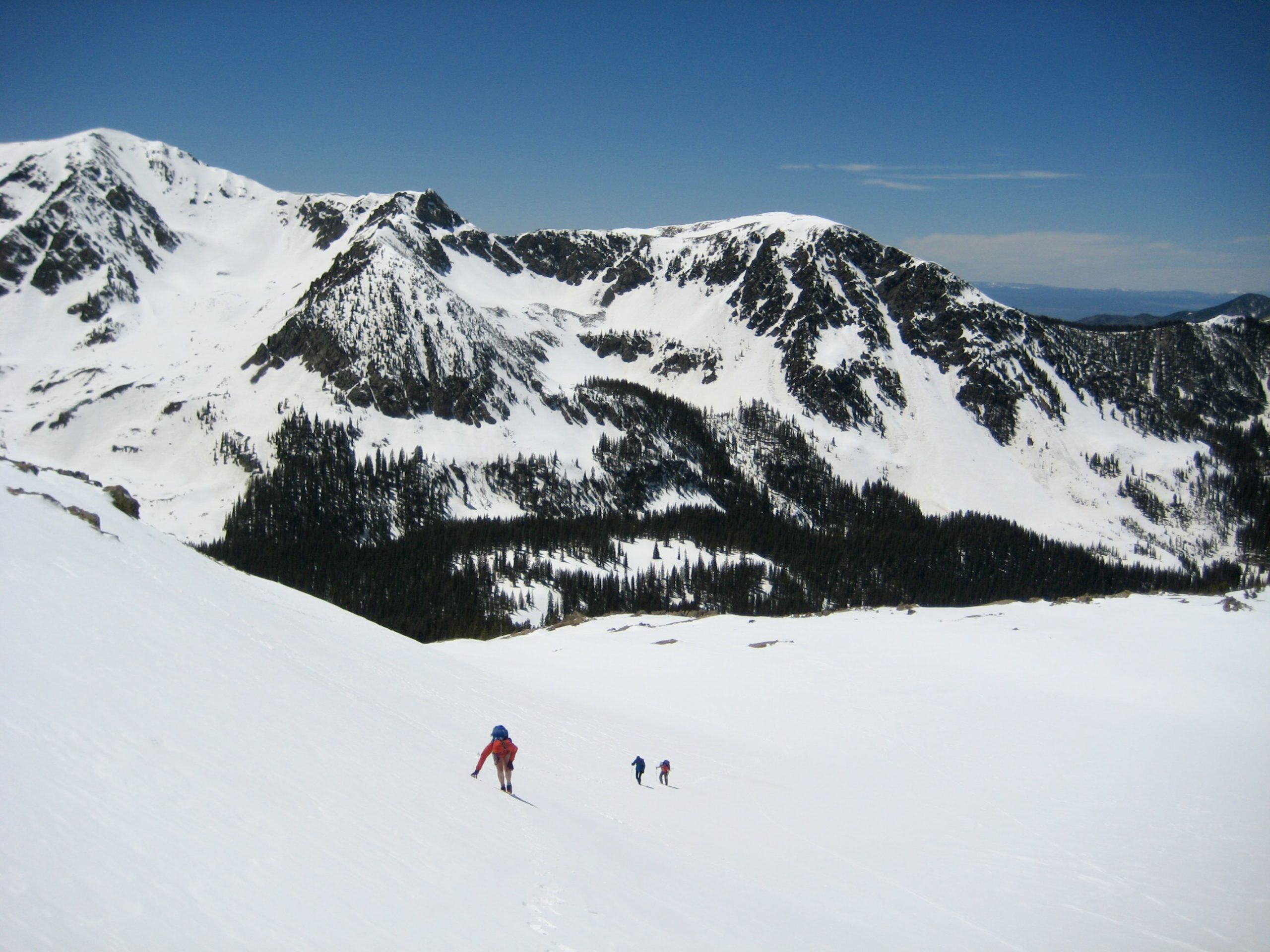
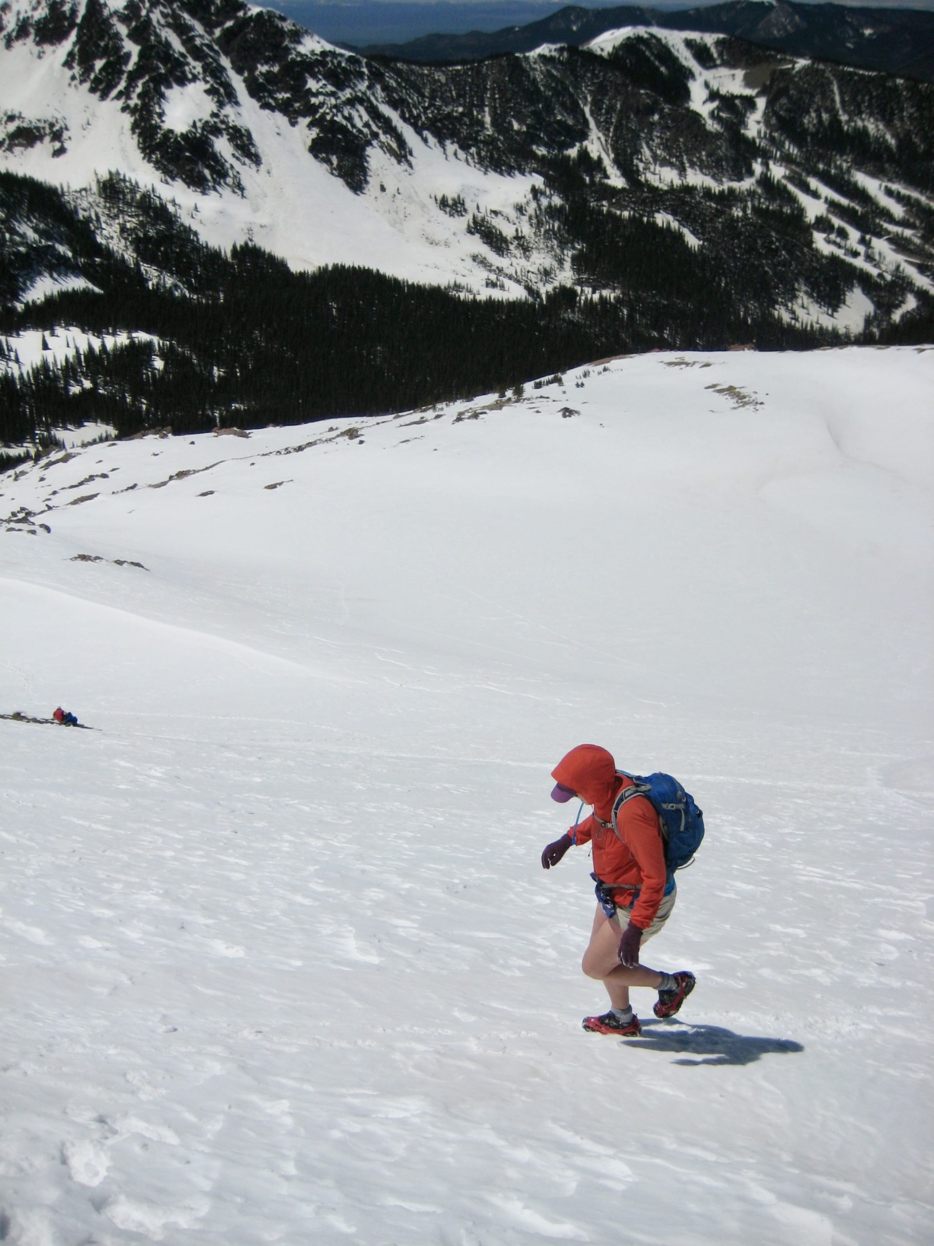
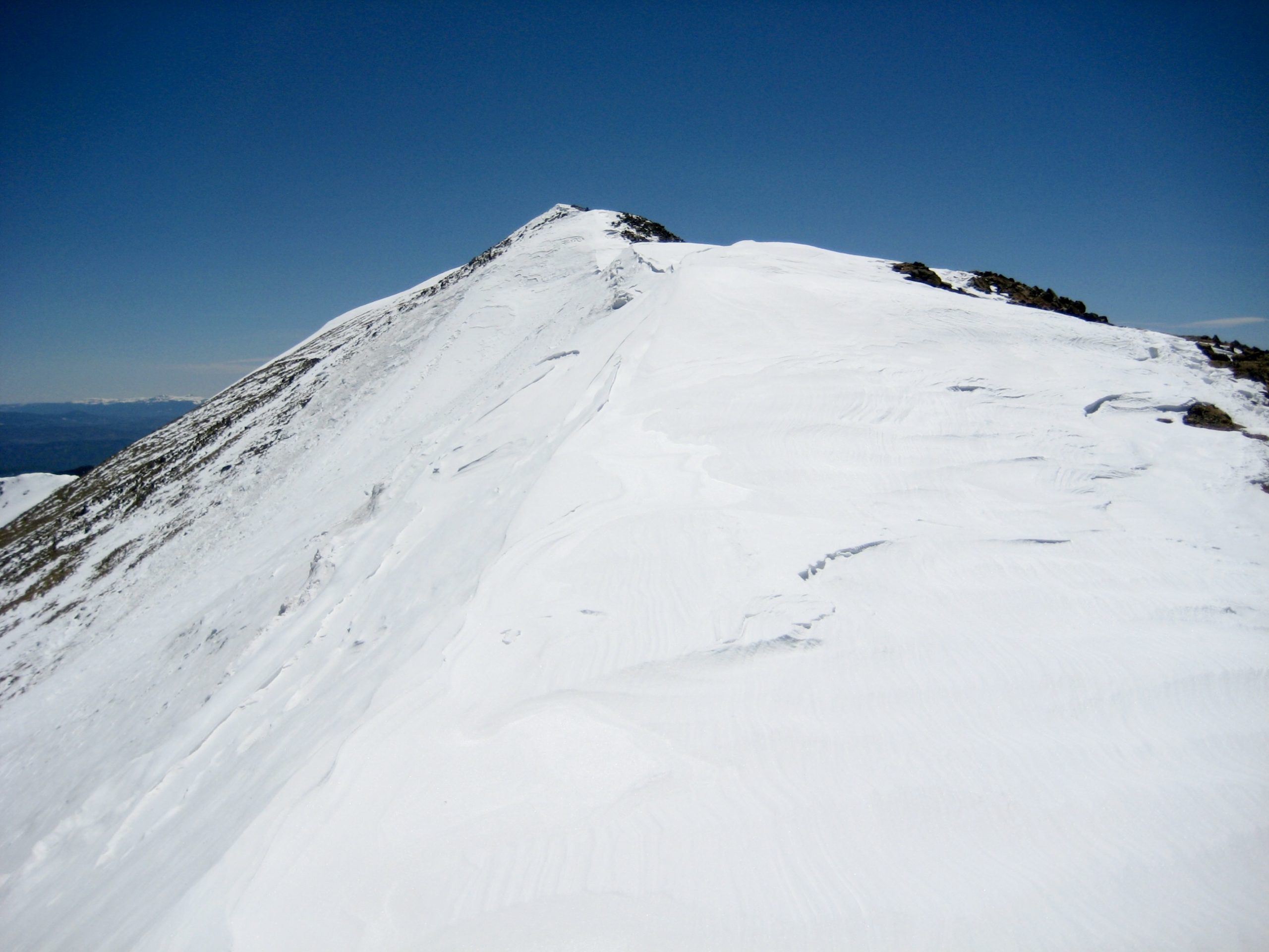
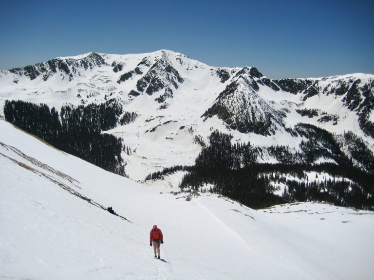
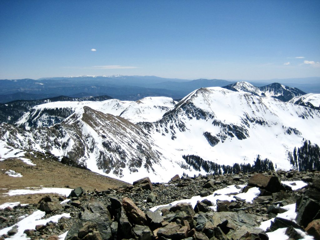
After gaining about 1000 feet, we entered a large snow basin on the northwestern flank of Wheeler Peak. Here, we began zigzagging up broad slopes, generally aiming for a saddle in the ridge crest above. Snow conditions became highly variable—ranging from soft to firmly wind-packed to crusty to rock hard—and our microspikes continually balled up, making our footing very insecure. Now I was really wishing for a pair of trekking poles or even an ice axe, but at least the runout was very safe.


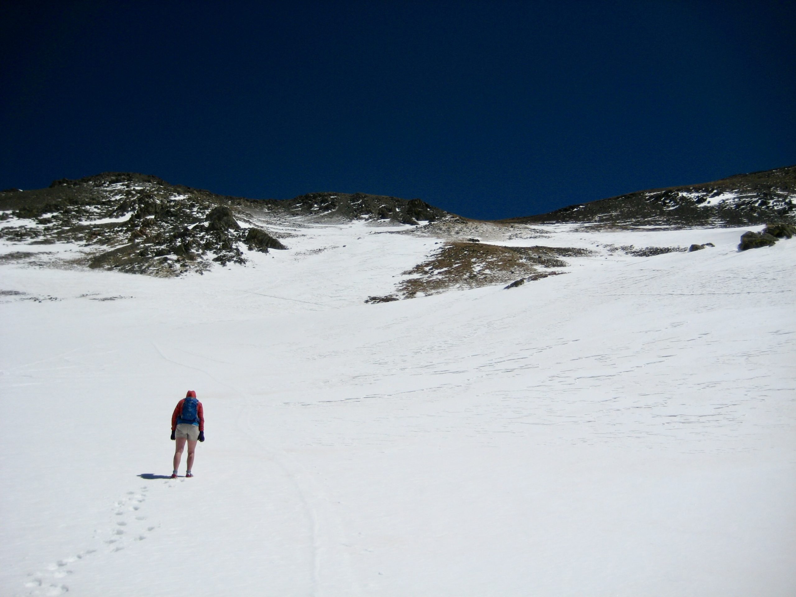
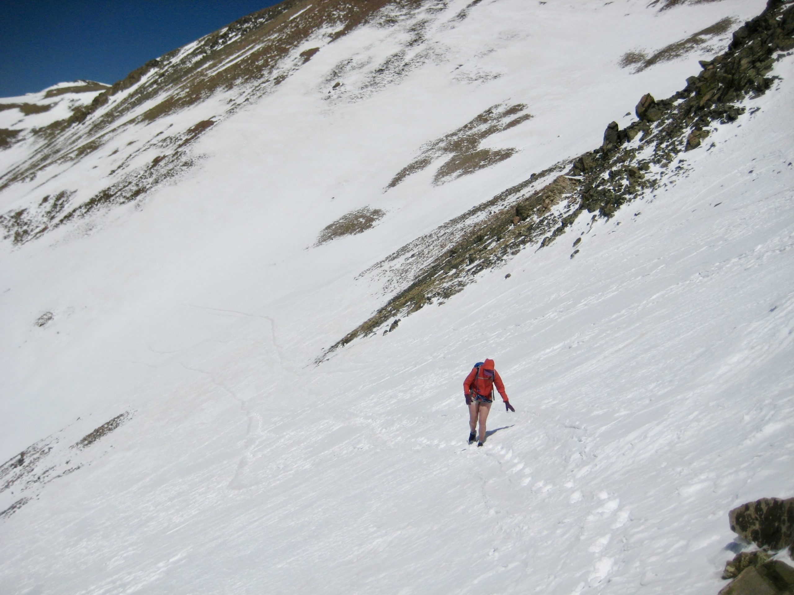
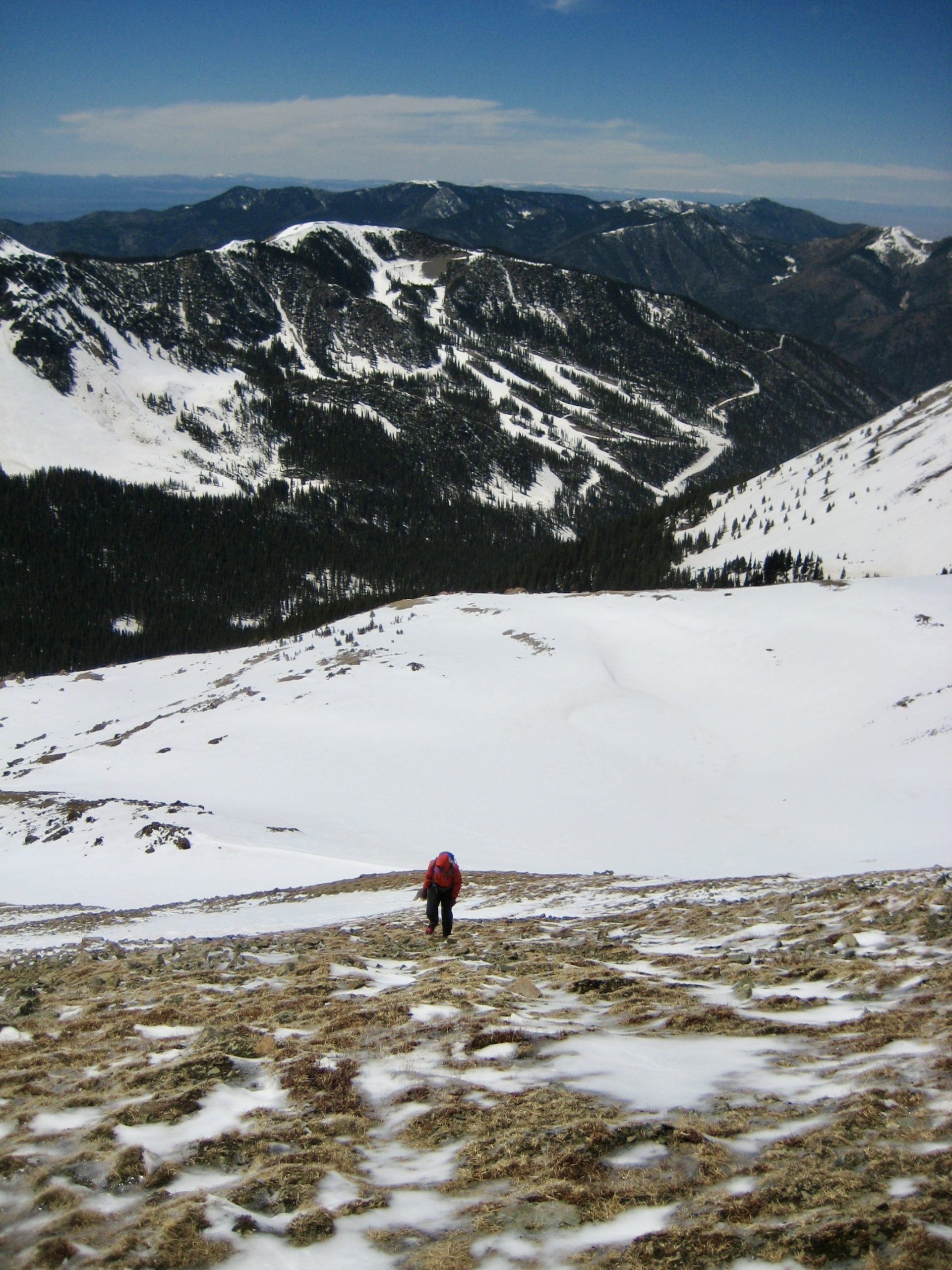
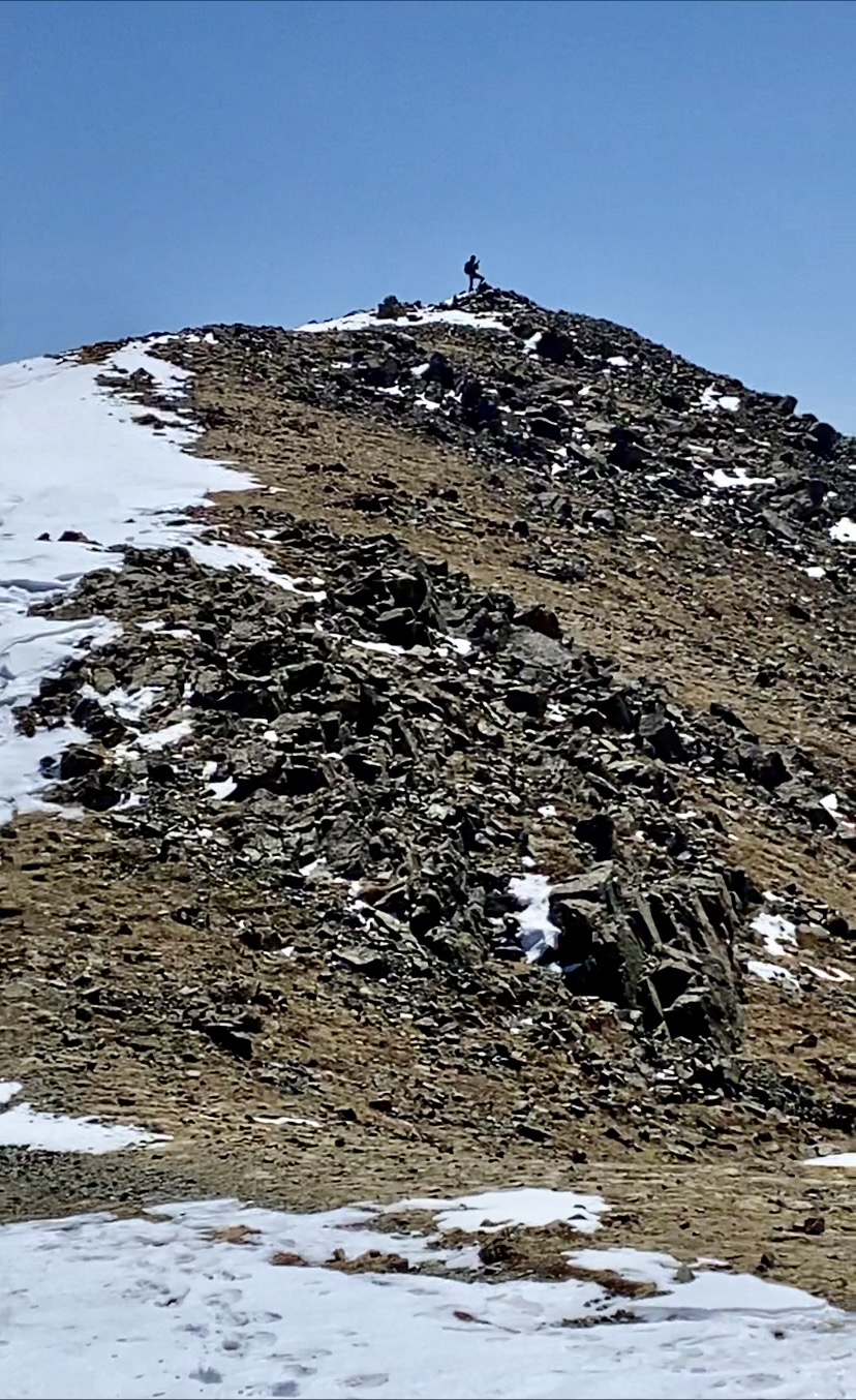
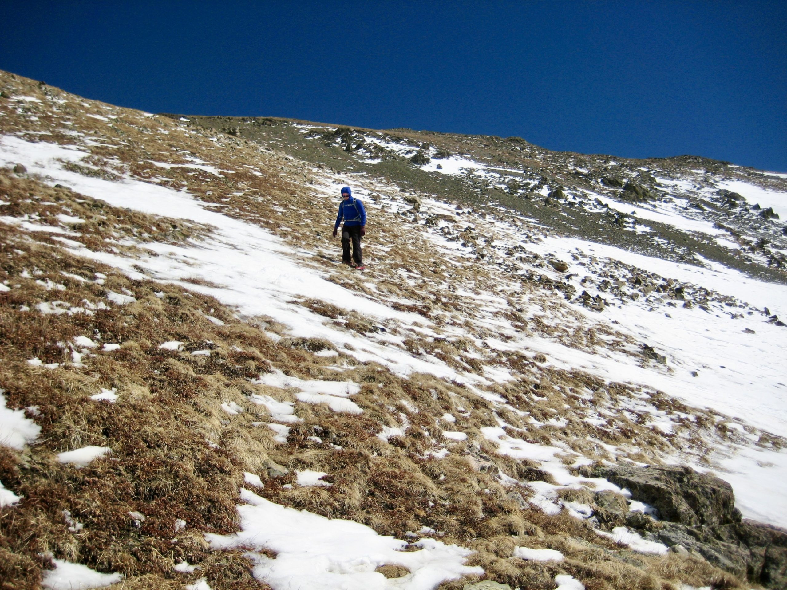
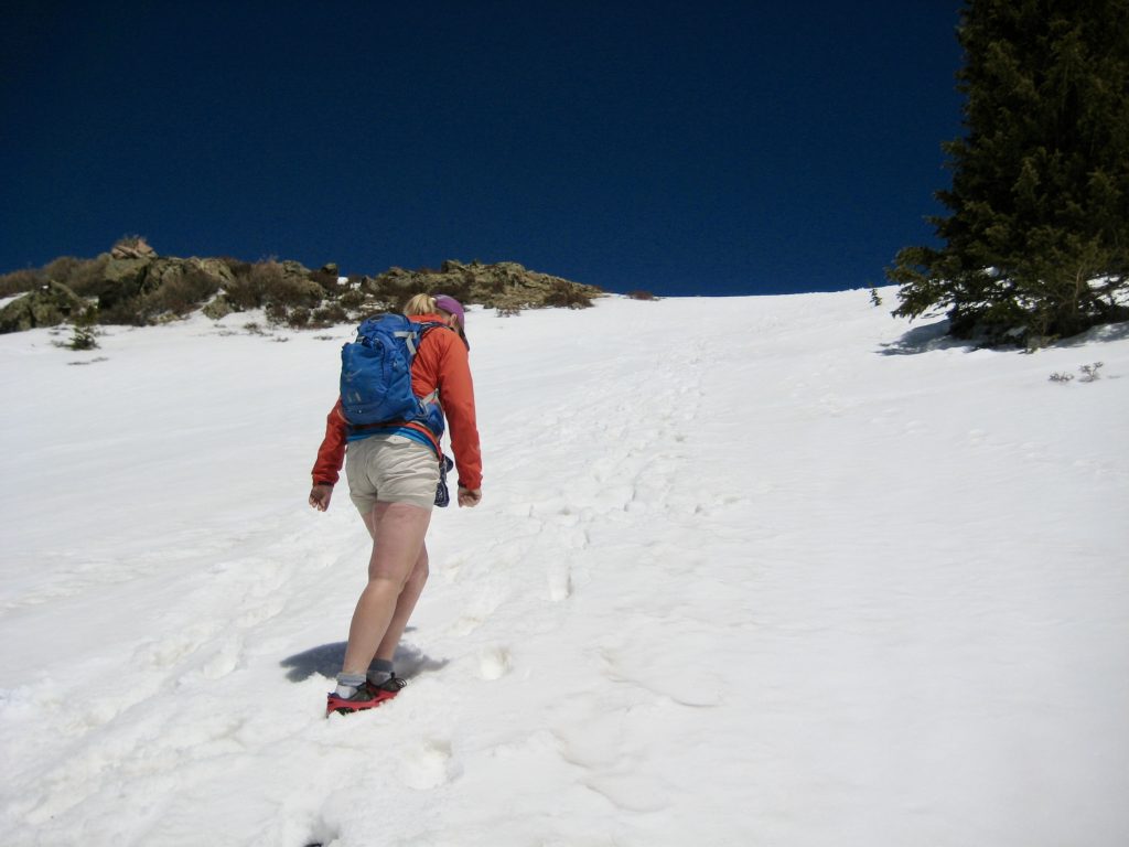
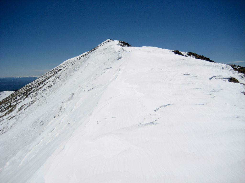
We carefully made our way across the steepest snow slopes, oftentimes down on all fours. Yikes! A party of two had been following us up to this point, but they turned around somewhere in here. It was a relief to finally reach a long, barren slope of alpine tundra, leaving the snow behind. Although the tundra was glazed with ice, our microspikes gained excellent purchase.

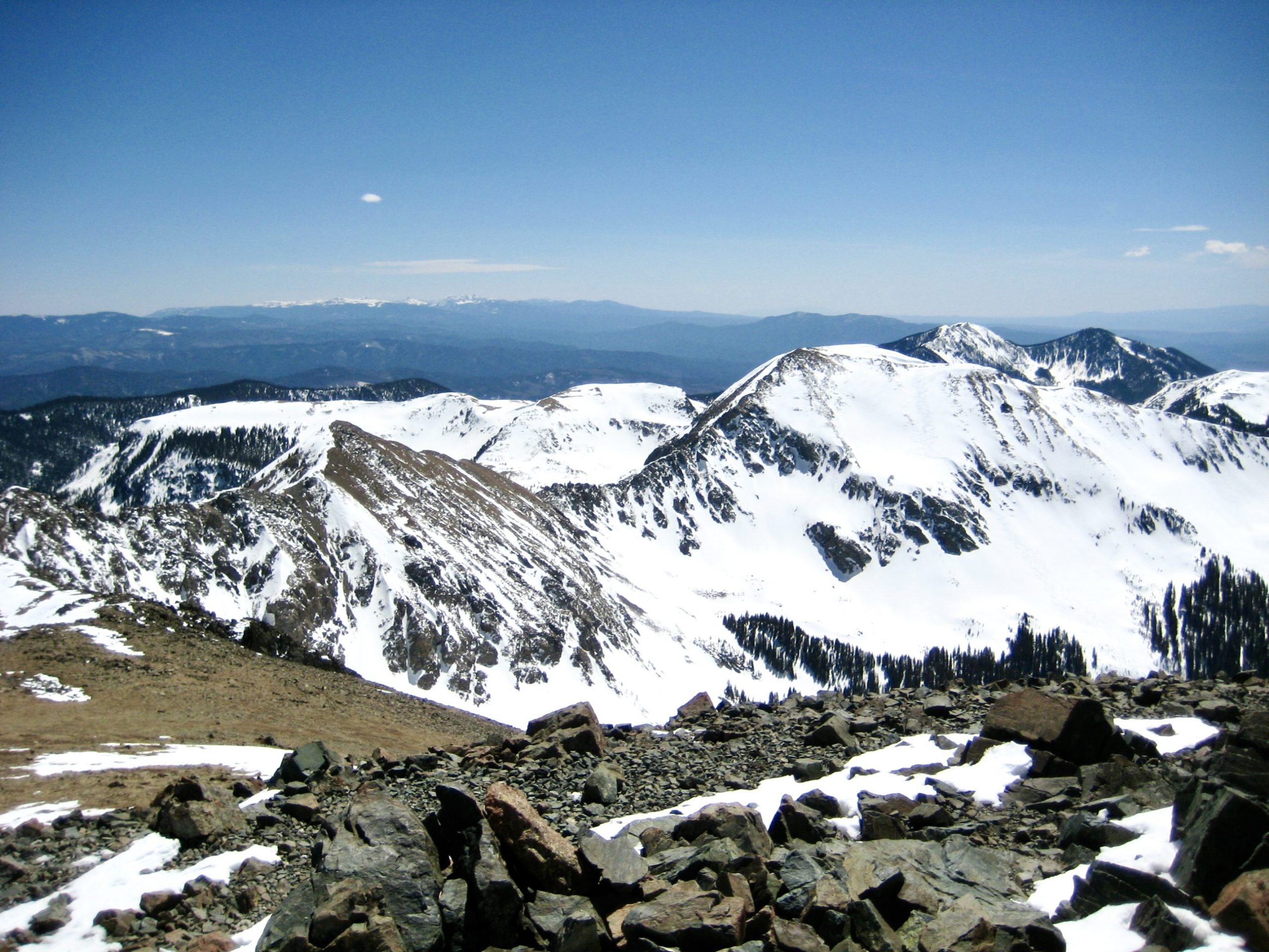
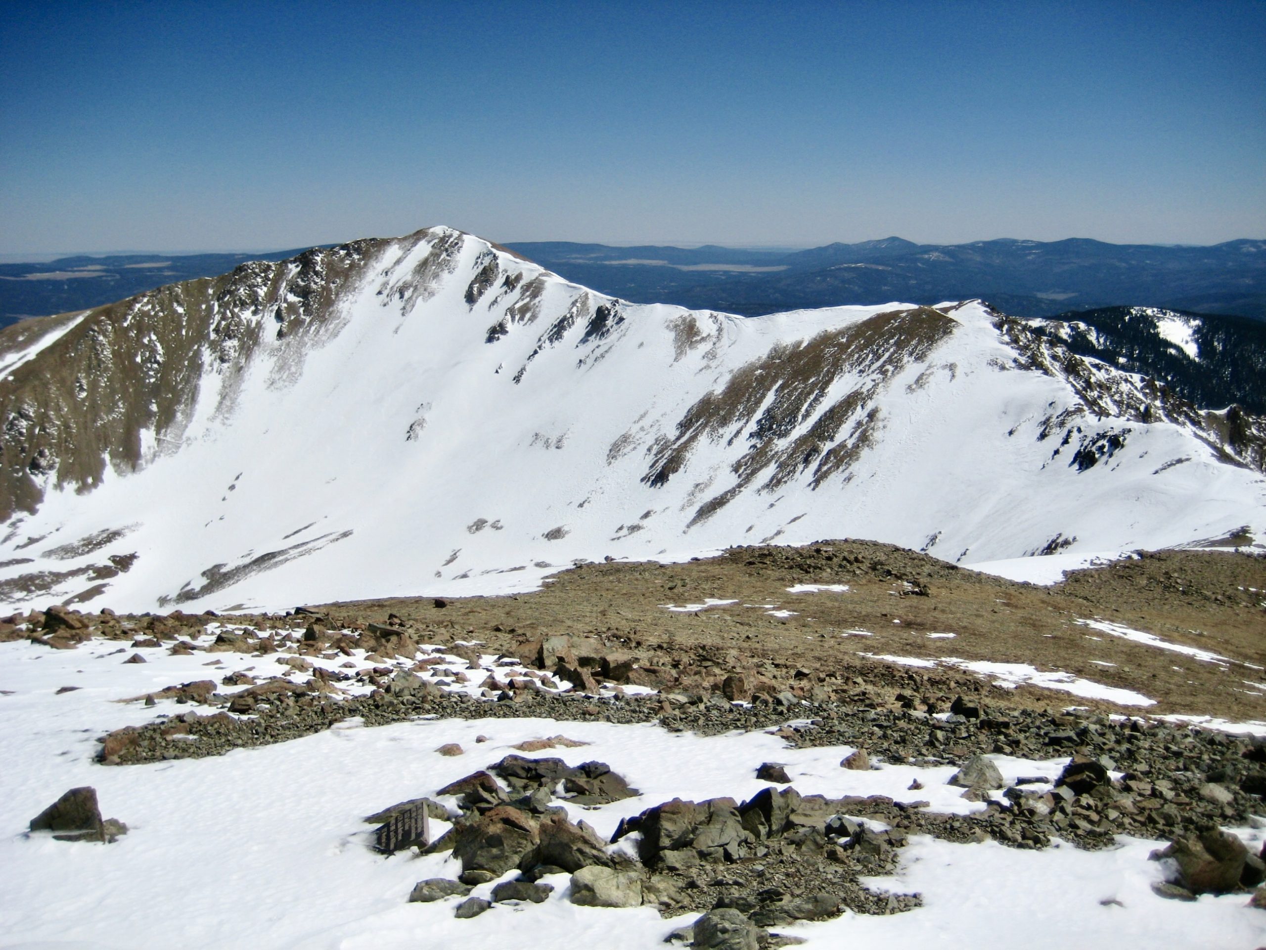
The tundra slope led us upward, across the formal trail, to a broad saddle in the ridge between Wheeler Peak and Mt. Walter. From this saddle, our objective summit was visible ¼ mile away, accessible by a relatively easy ridge run.
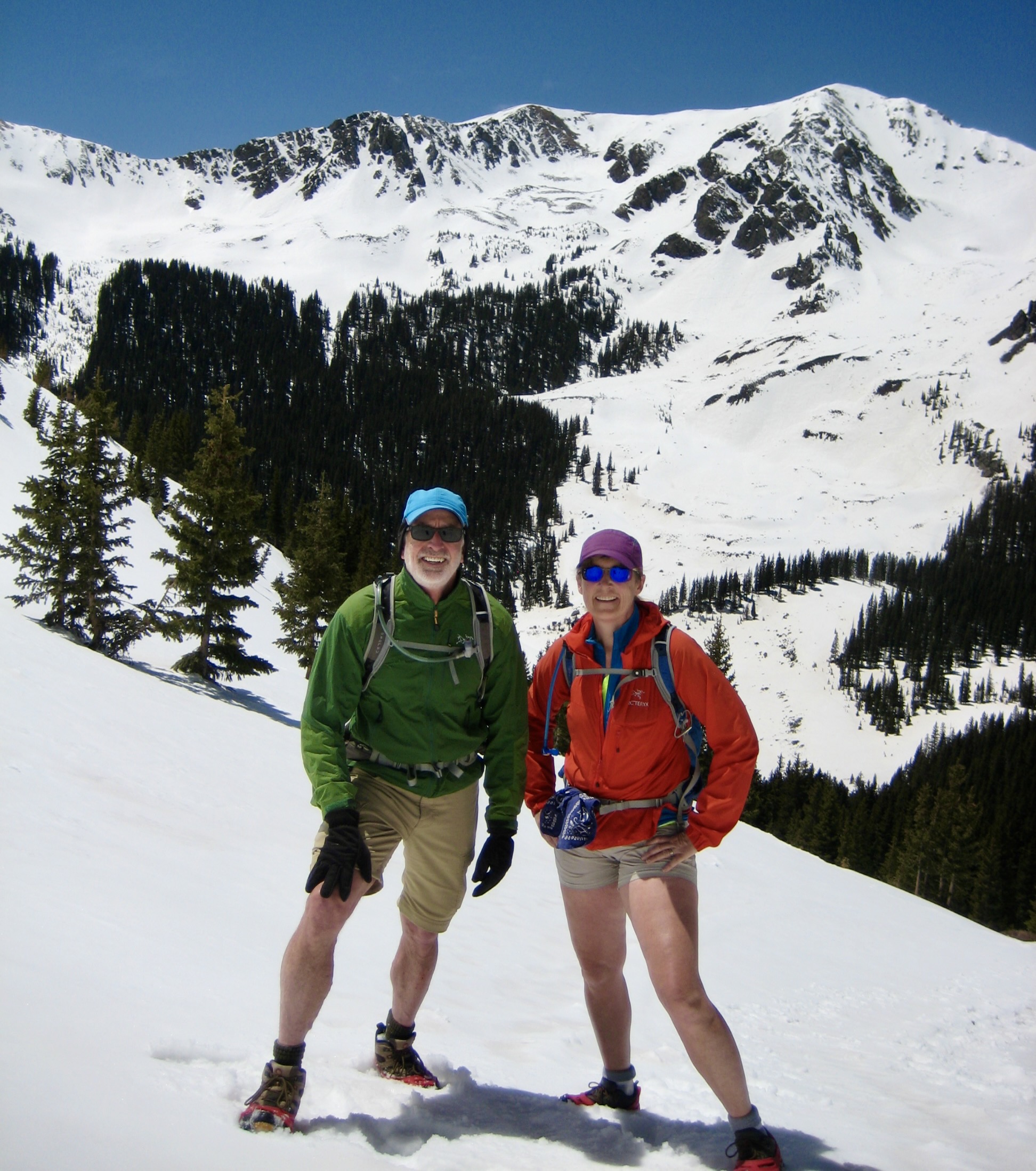
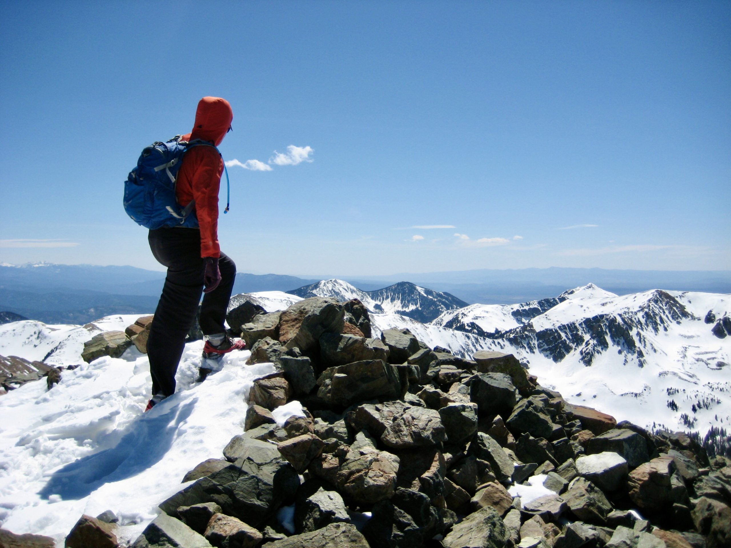
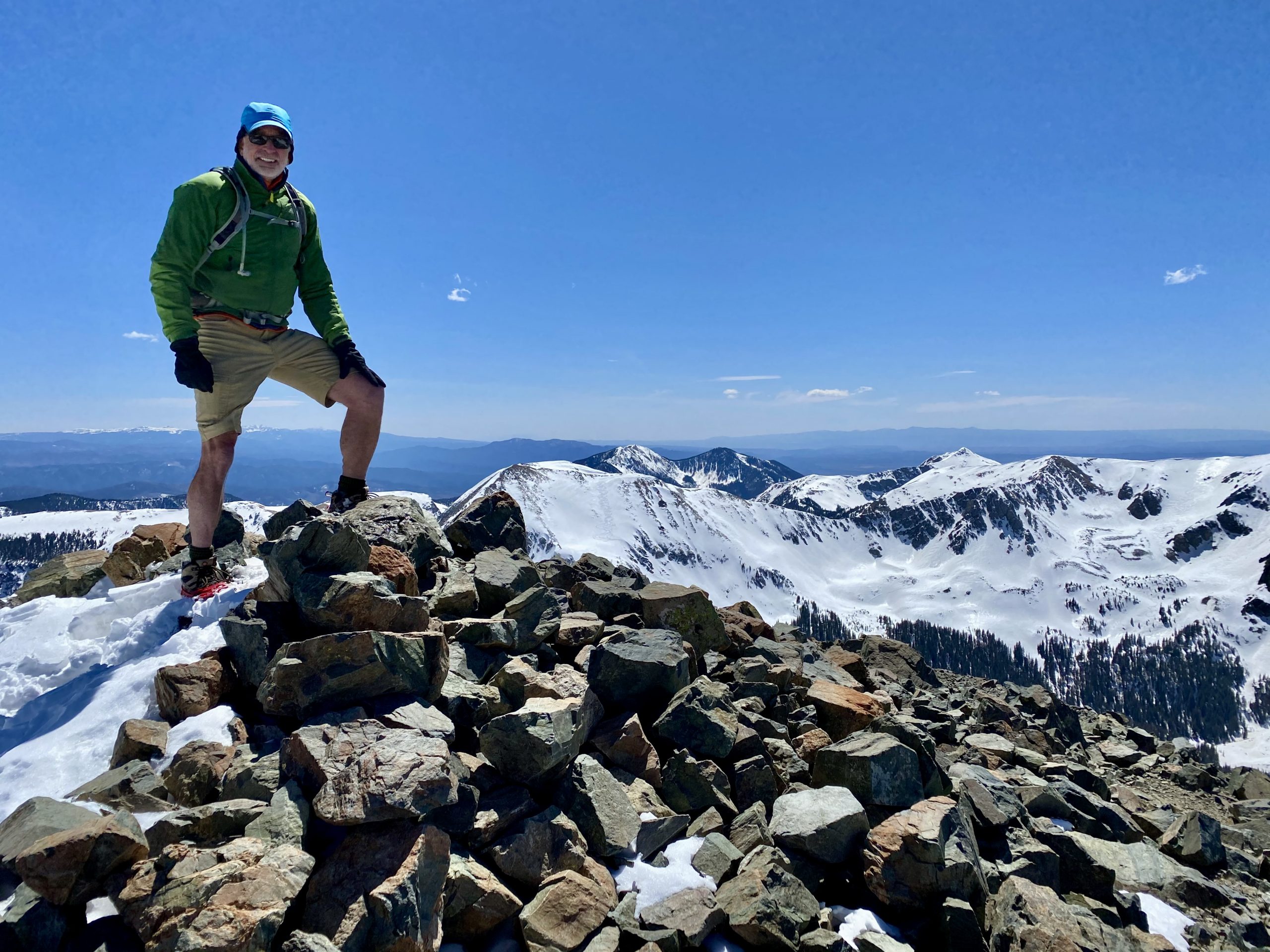
For the past hour, the wind had become steadily stronger and colder. At the ridge saddle, we were battered by gusts approaching 50 mph. I was wearing every item of clothing that I’d brought, but it wasn’t enough; I was chilled to the bone! In an effort to generate some heat, I hurried ahead to the summit. This was not a fast ascent, though, because I was frequently knocked off balance by wind gusts and had to hunker down until each gust abated.
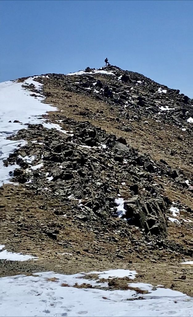
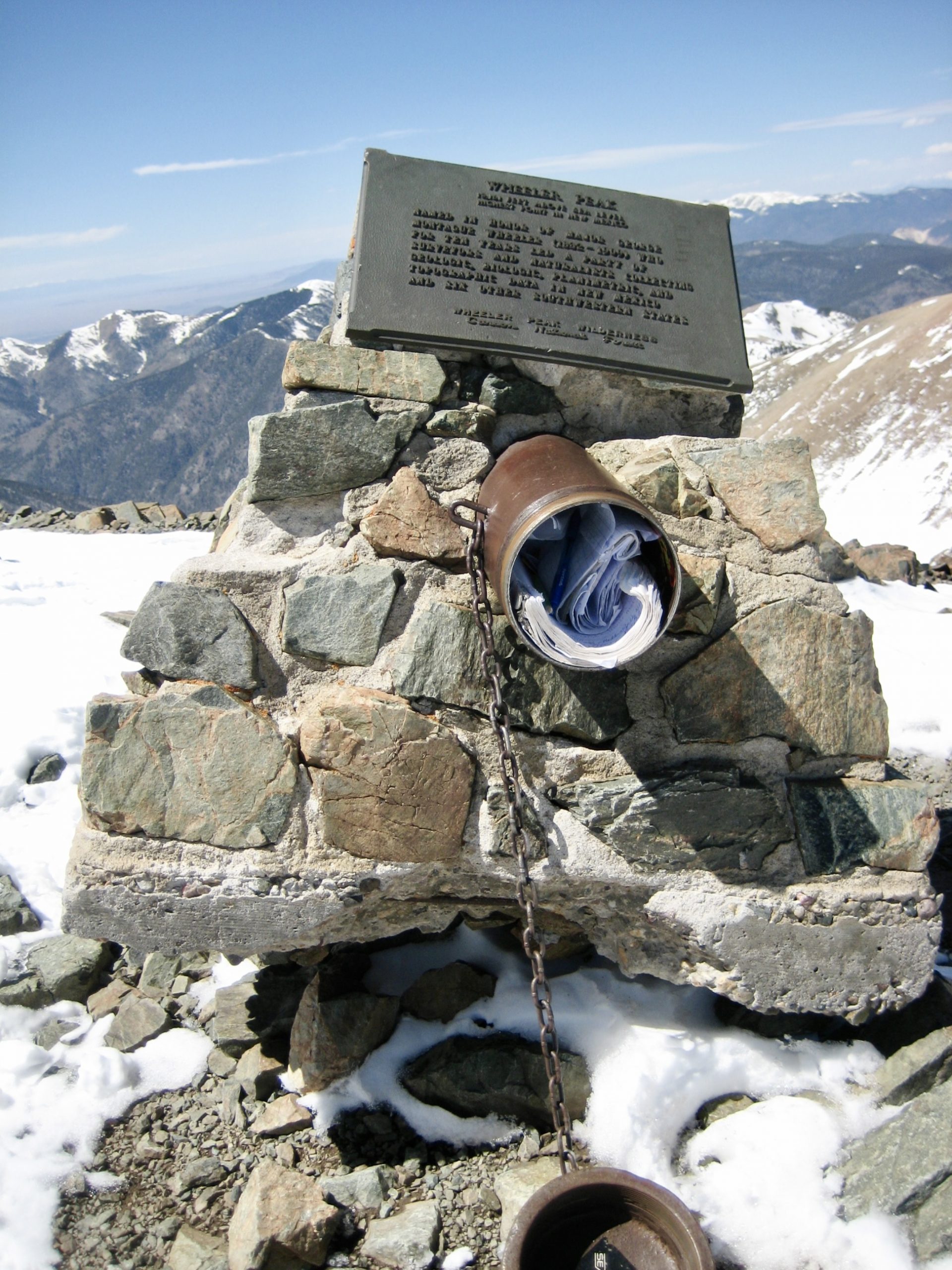
Eileen had the same problem with the wind, but she soon joined me on the summit (3.8 hours + 3250 feet from lodge). Despite a continual onslaught by ferocious gusts, we stayed long enough to soak in the view from this marvelous vantage. The snowy Taos Mountains surrounded us, and far to the north, the Sangre de Cristo Mountains could be seen extending into Colorado.

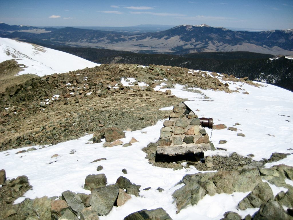

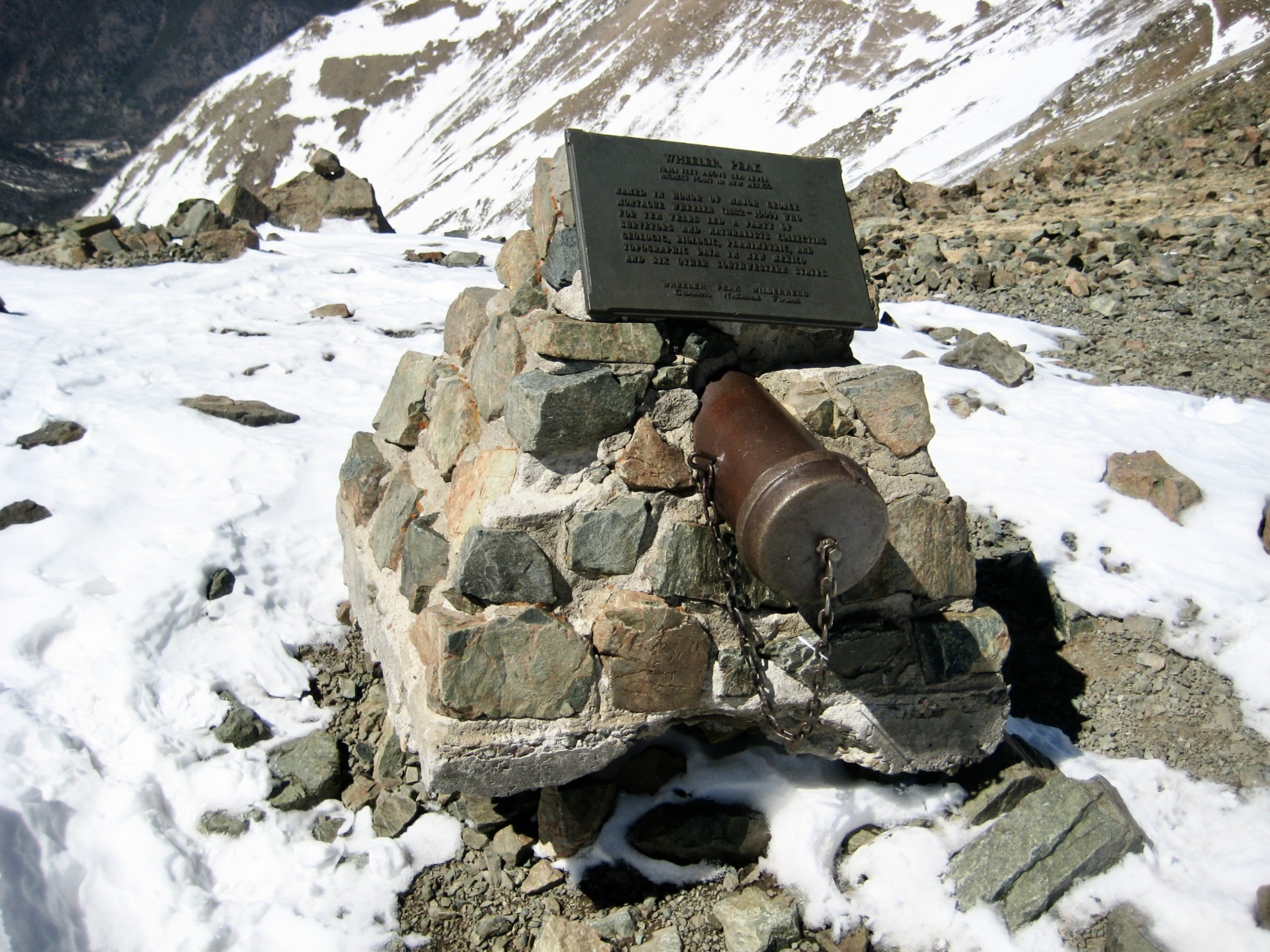
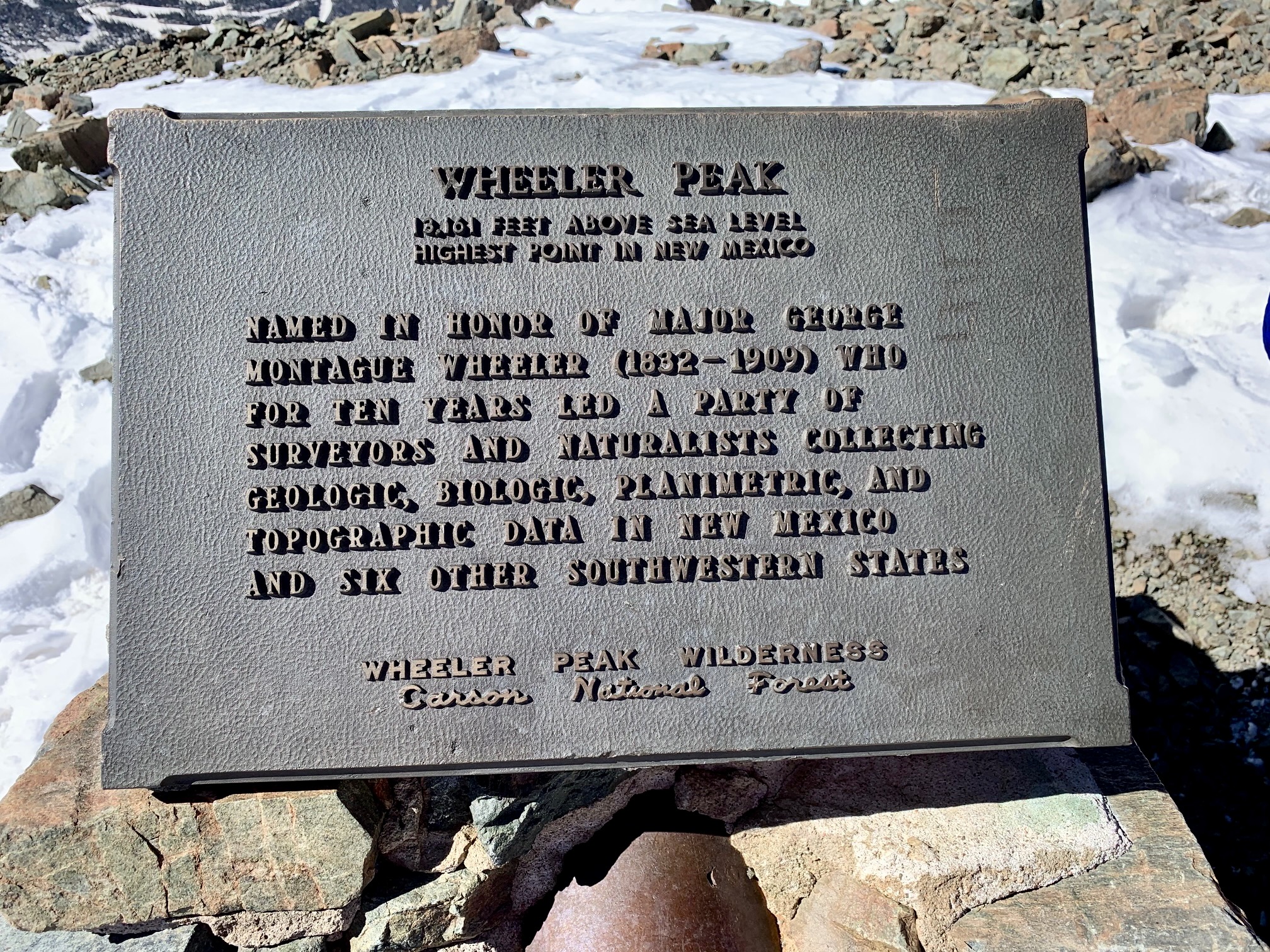
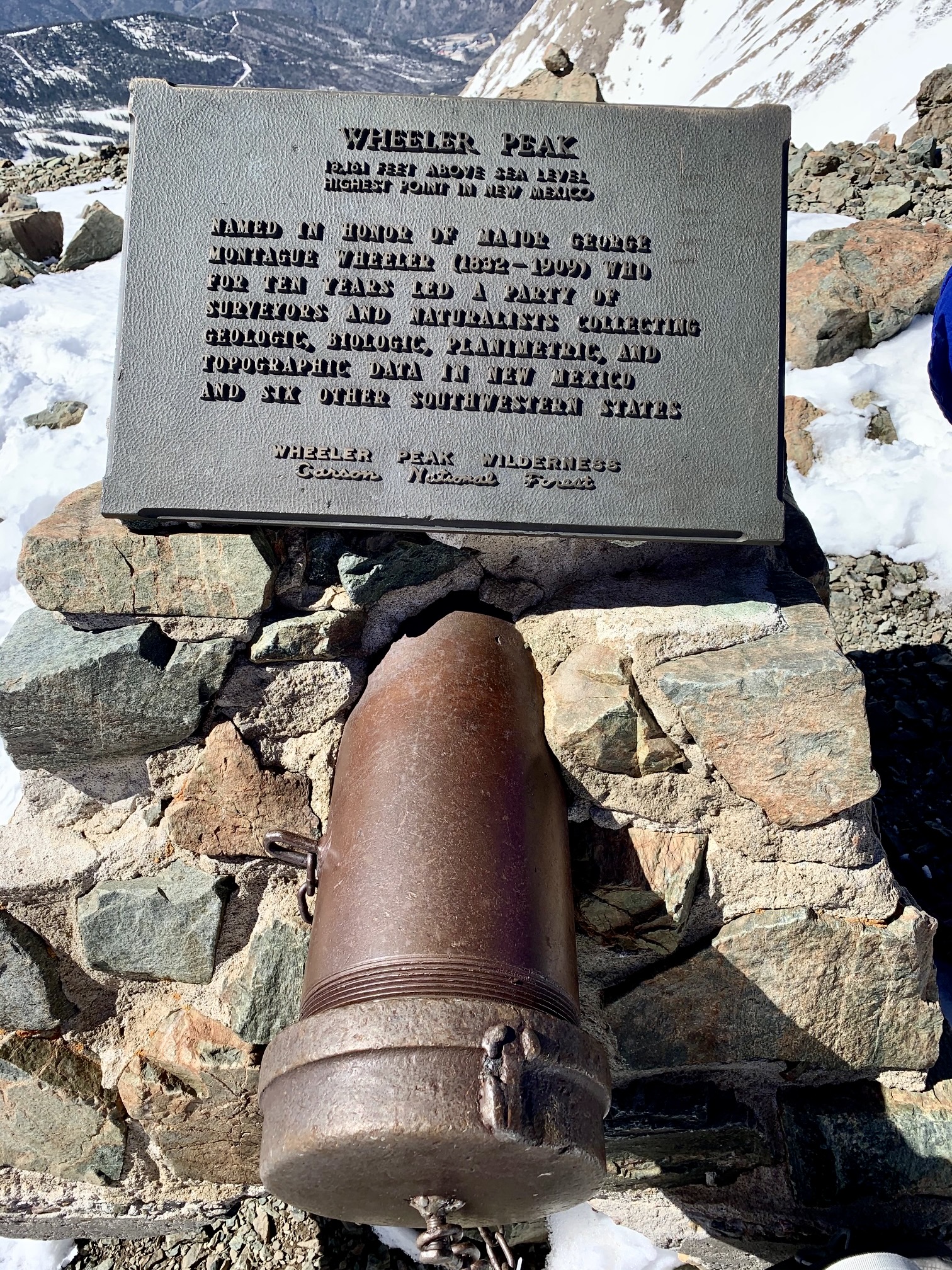
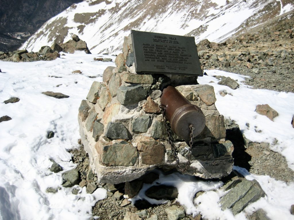
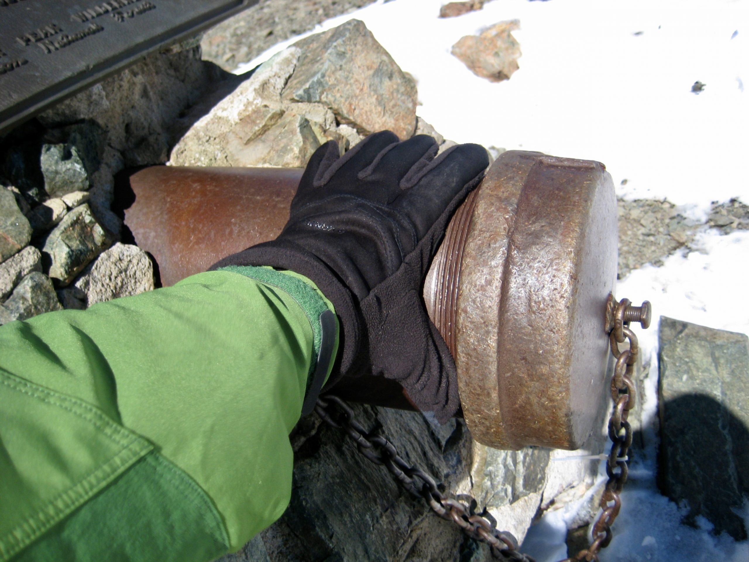
A few steps below the summit, there is a stone monument bearing a commemorative plaque and a large cast-iron register pipe with a threaded cap. The pipe was stuffed full of notebooks and papers. We didn’t bother signing in.
After spending 10 minutes on the summit, I was shivering uncontrollably and getting too close to hypothermia for my personal taste. Eileen, on the other hand, was fairly comfortable and even loaned me one of her jackets. We quickly descended by first hiking down the upper trail, then booting down the tundra slope as far as possible, and finally plunging down the snow chute.
We eventually bottomed out at the trail junction near Williams Lake, then followed the well-beaten snow trail back to Phoenix Lodge (2.1 hours from summit). Despite the sketchy snow slopes, wet feet, bitter cold wind, and close call with hypothermia, it had been a fabulous ending to our New Mexico vacation.
Route Map
…
Photo Gallery
Click to enlarge…