Trip Date: April 28-30, 2026
2026 COLUMBIA PLATEAU ADVENTURE VACATION
Bladerunner Crag Climb & Loop Hike
Southern Blade Circumnavigation Hike
Great Blade Peak Hike & Climb
Lake Lenore Caves
North Notch
Bladerunner Crag (~1620 ft)
The Mushroom (~1610 ft)
South Notch
East Lenore Coulee
Watchdog Rock
Great Blade Peak (~1720 ft)
Trip Report Summary
Region: Columbia Plateau (Washington)
Sub-Region: Lower Grand Coulee
Area: Lake Lenore Caves State Park Heritage Site
Campsite: Sun Lakes – Dry Falls State Park
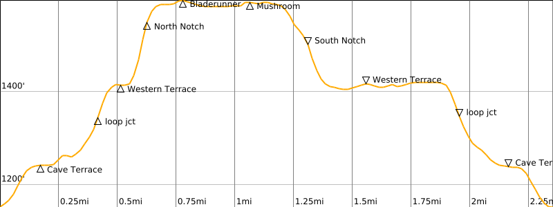
Daytrip 1: Bladerunner Crag Climb & Loop Hike
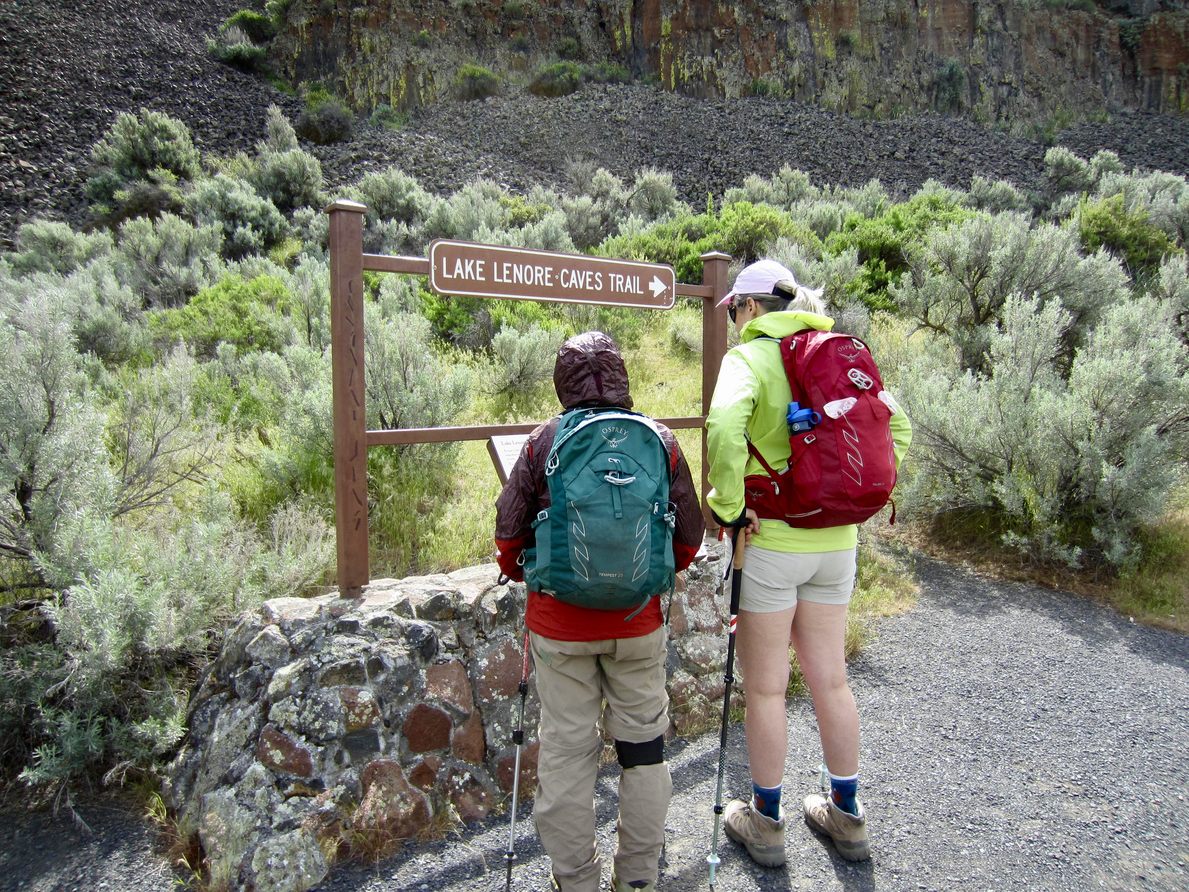
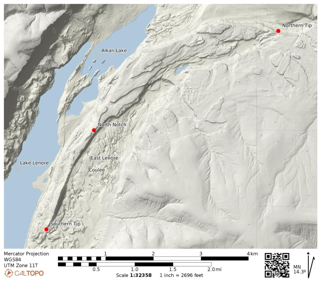
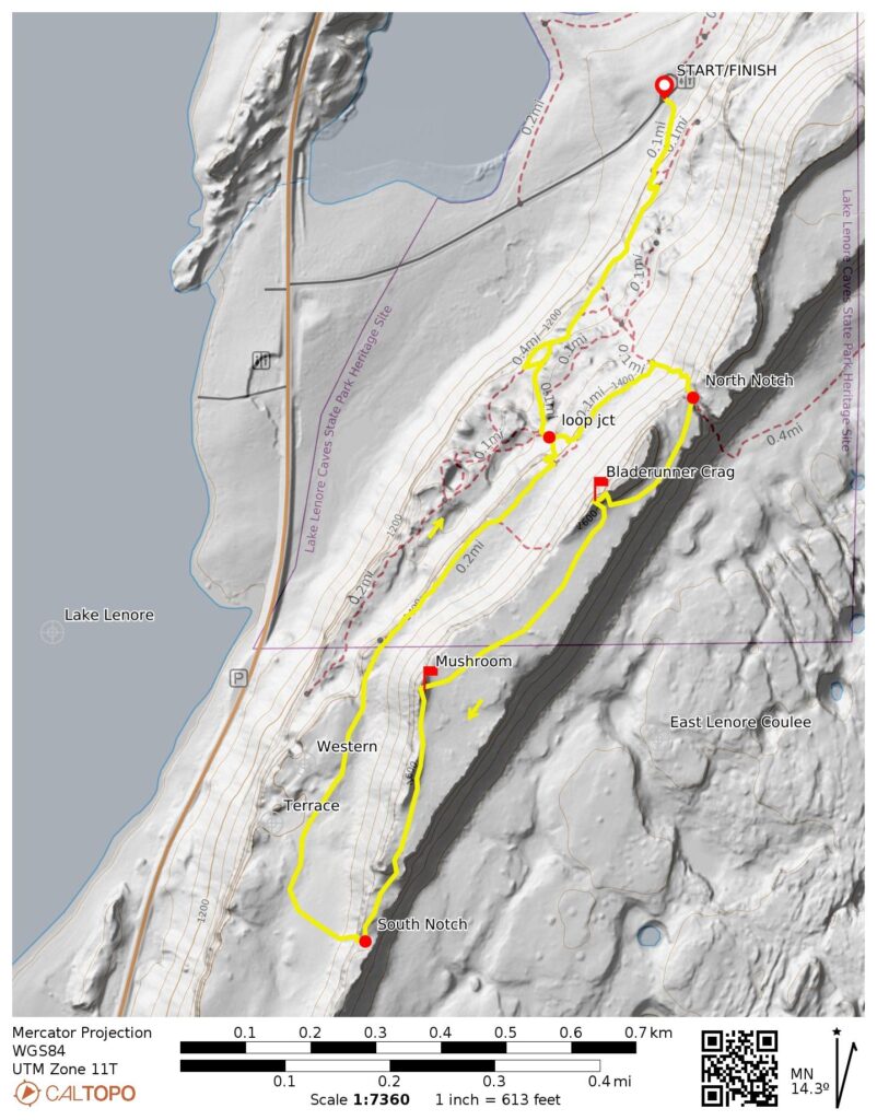
Starting & Ending Point: Lake Lenore Caves Trailhead off Highway 17 (Elev. 1150 feet)
Loop Way Points: Cave Terrace & Lake Lenore Caves & Western Terrace & North Notch & Bladerunner Terrace & Bladerunner Notch & The Great Mushroom & South Notch & Western Terrace & Cave Terrace (trail hike & off-trail hike & rock scramble)
Summit: Bladerunner Crag (rock scramble via East Cleft)
Approximate Daytrip Stats: 2.4 miles traveled; 550 feet gained & lost; 4.8 hours elapsed.
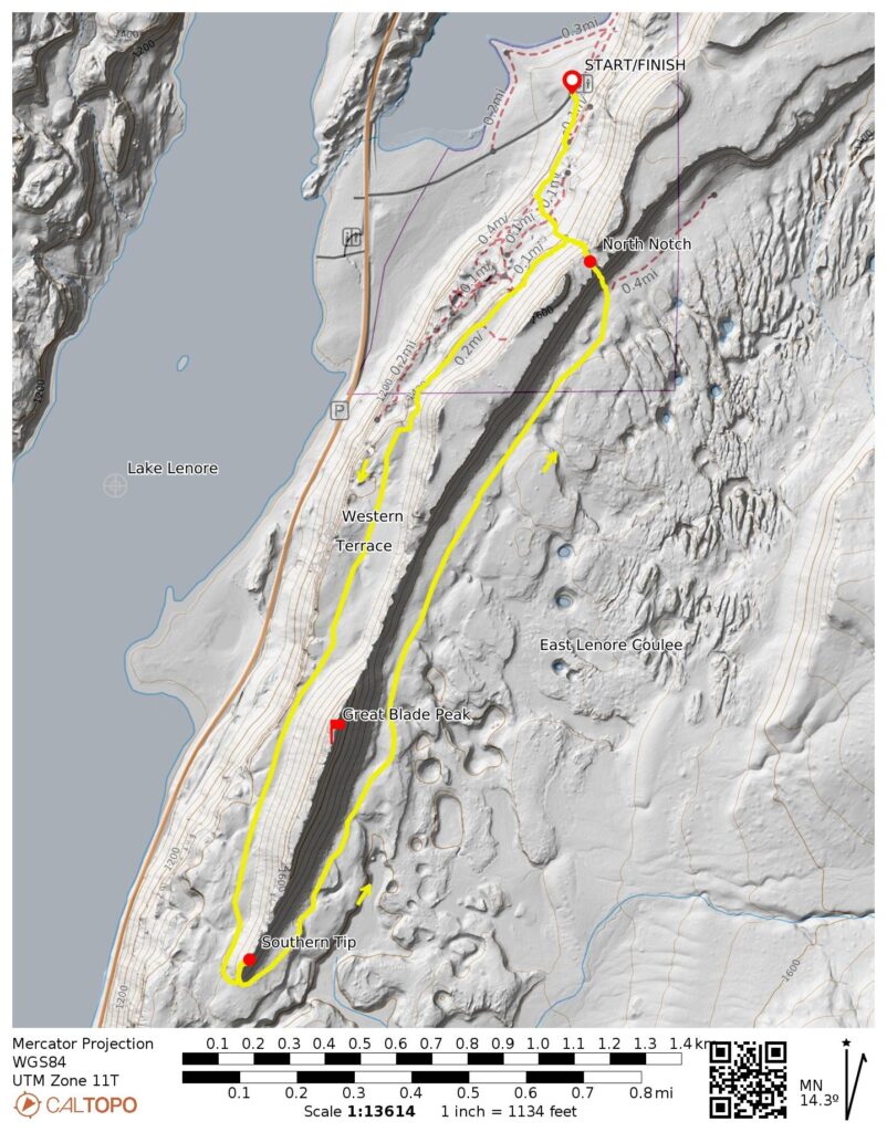
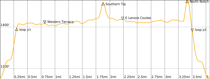
Daytrip 2: Southern Blade Circumnavigation Hike
Starting & Ending Point: Lake Lenore Caves Trailhead off Highway 17 (Elev. 1150 feet)
Loop Way Points: Cave Terrace & Western Terrace & Southern Tip & East Lenore Coulee & North Notch & Western Terrace & Cave Terrace (trail hike & off-trail hike & rock scramble)
Approximate Daytrip Stats: 3.8 miles traveled; 550 feet gained & lost; 5.5 hours elapsed.
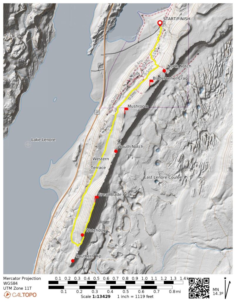
Daytrip 3: Great Blade Peak Hike & Climb
Starting & Ending Point: Lake Lenore Caves Trailhead off Highway 17 (Elev. 1150 feet)
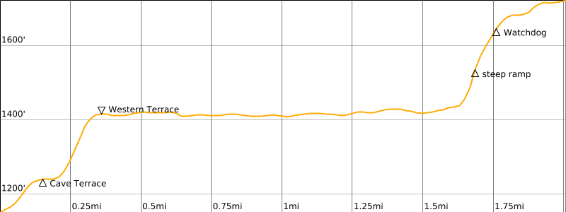
Way Points: Cave Terrace & Western Terrace & Southwest Ramp & Southern Terrace & Watchdog Rock & South Ridge & Great Blade Peak summit (trail hike & off-trail hike & rock scramble)
Summit: Great Blade Peak (off-trail hike & rock scramble via Southern Terrace—Watchdog Face—South Ridge)
Approximate Daytrip Stats (round trip): 4.0 miles traveled; 600 feet gained & lost; 6.0 hours elapsed.
Approximate Total Trip Stats: 10.2 miles traveled; 1700 feet gained & lost.
Trip Overview
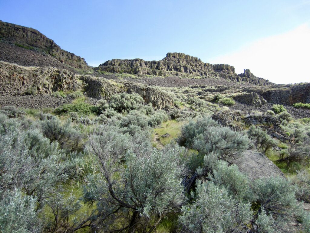
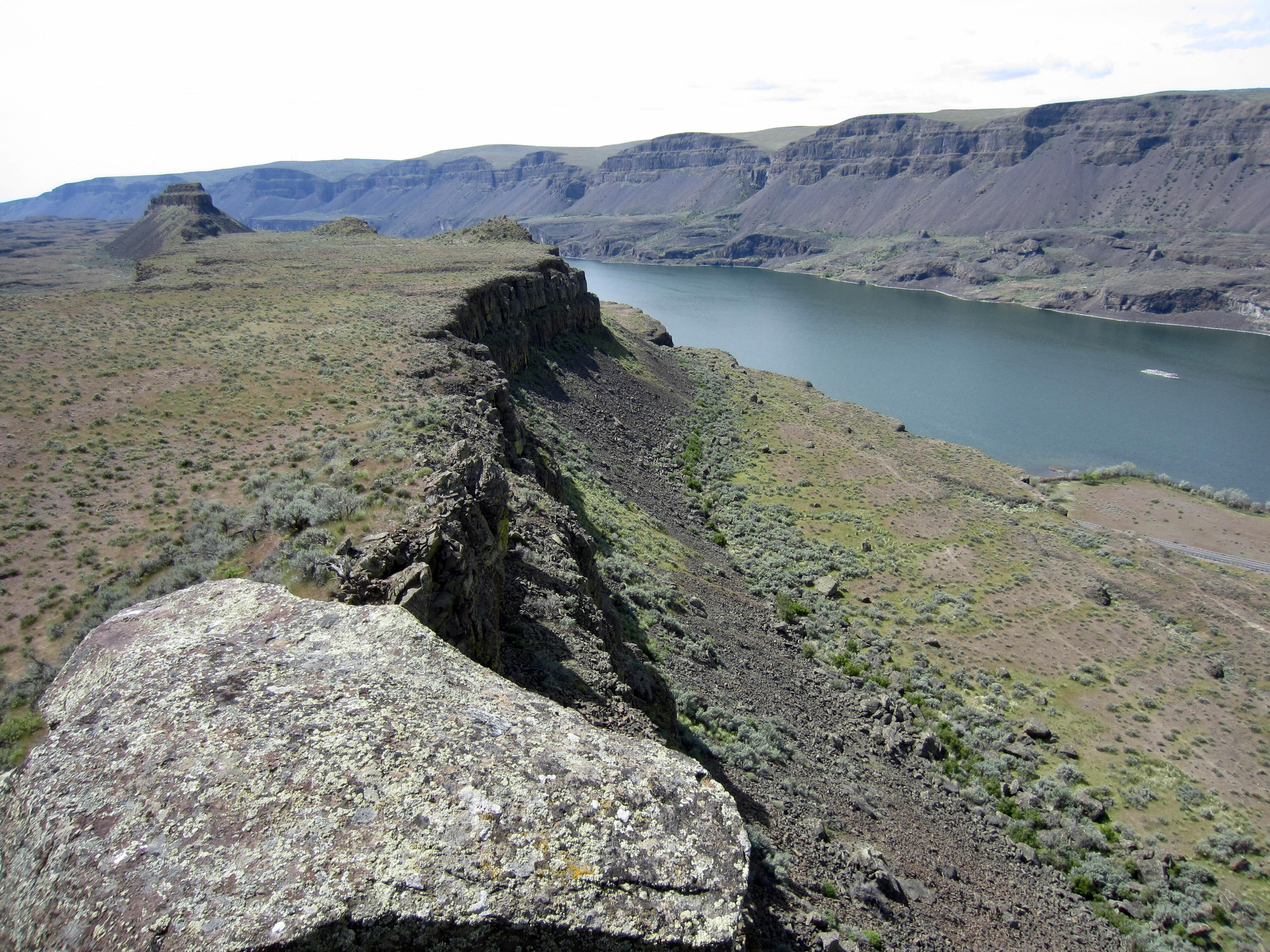
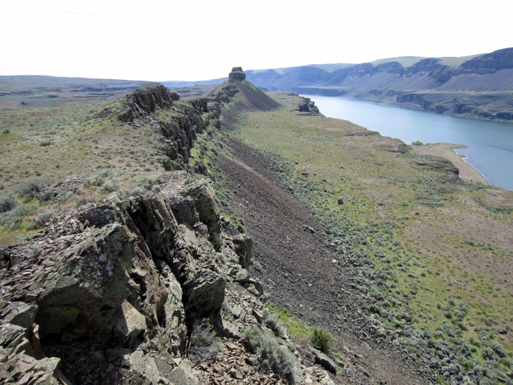
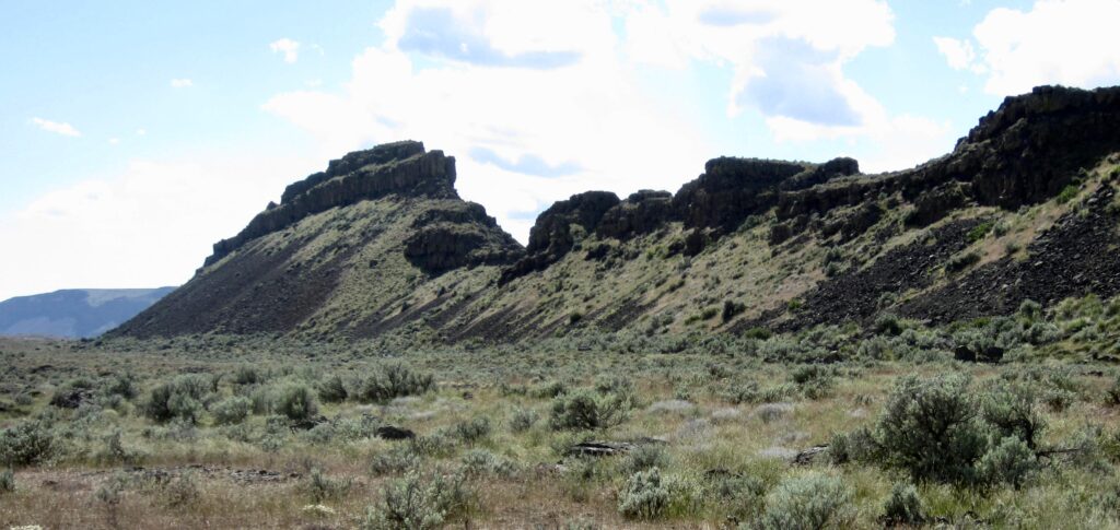
The Great Blade is an intriguing geological feature located within Lower Grand Coulee, approximately midway between Dry Falls and Soap Lake. It comprises a slender, arcuate ridge of basalt, with a total length of more than 4 miles and a width ranging from a maximum of about ½ mile to a minimum of a few dozen feet. Geographically, it separates Lake Lenore and Alkali Lake from East Lenore Coulee. The name “Great Blade” was derived from a topographic description given by legendary geologist J Harlan Bretz in 1928.
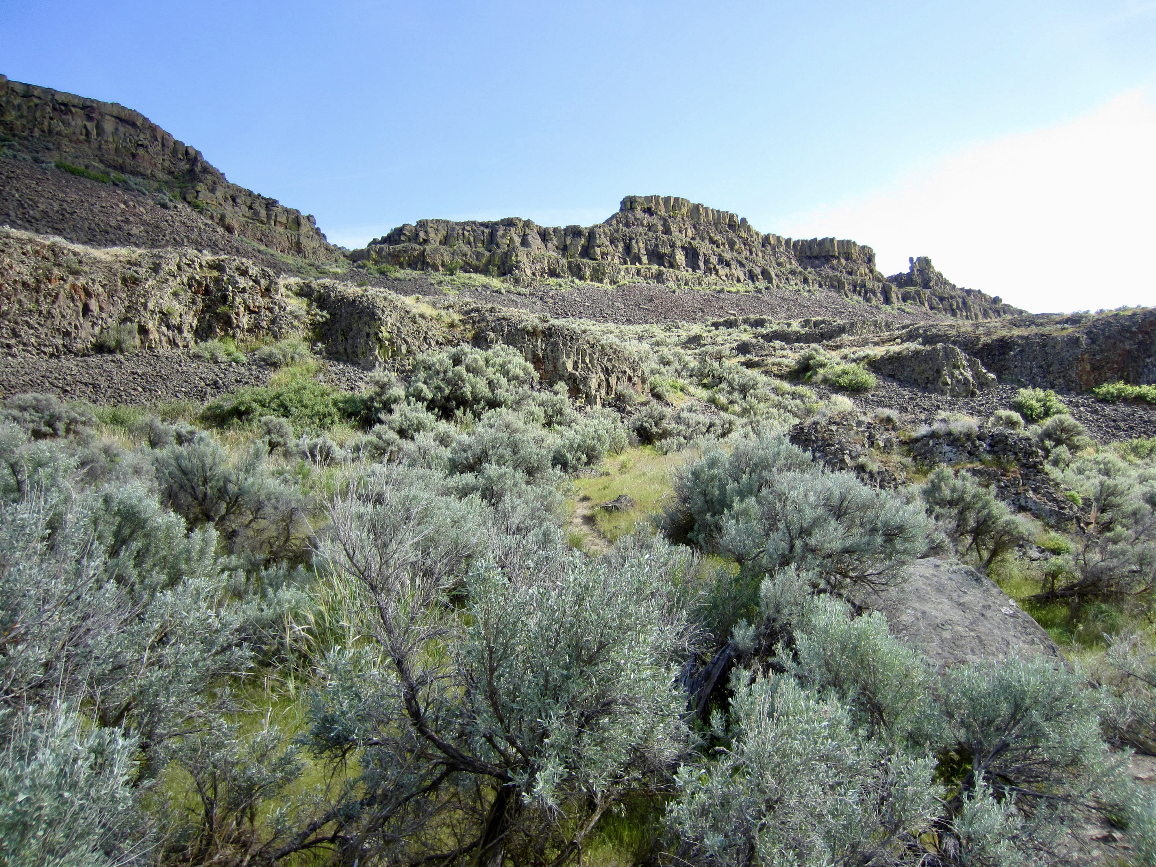
A bird’s-eye view reveals that The Great Blade does indeed closely resemble a huge, curved knife or marlinspike with a relatively wide “handle” represented by the northern half, and a “blade” or “spike” represented by the remarkably narrow southern half. These two halves are divided by the North Notch, a pronounced gap in the ridge. From a hiking a scrambling perspective, the southern half is of most interest because it is higher and craggier. The highest point on the landform—Great Blade Peak—stands close to the southern tip, with 600 feet of relief above lake level.
.
For the third consecutive year, Eileen, Fay, and I spent several days in April hiking and scrambling around the sunny Columbia Plateau. This year’s trip involved a thorough exploration of The Great Blade from our base camp at Sun Lakes State Park, which is located several miles to the north. As usual, we started our trip with no stated itinerary and very few objectives; instead, we just made it up as we went along. Once again, this lack of planning served us very well. We ultimately completed three daytrips that included lots of desert scenery, two sporty scrambles, three interesting summits, occasional bits of trouble, and a bushel of fun!
.
Full Trip Report
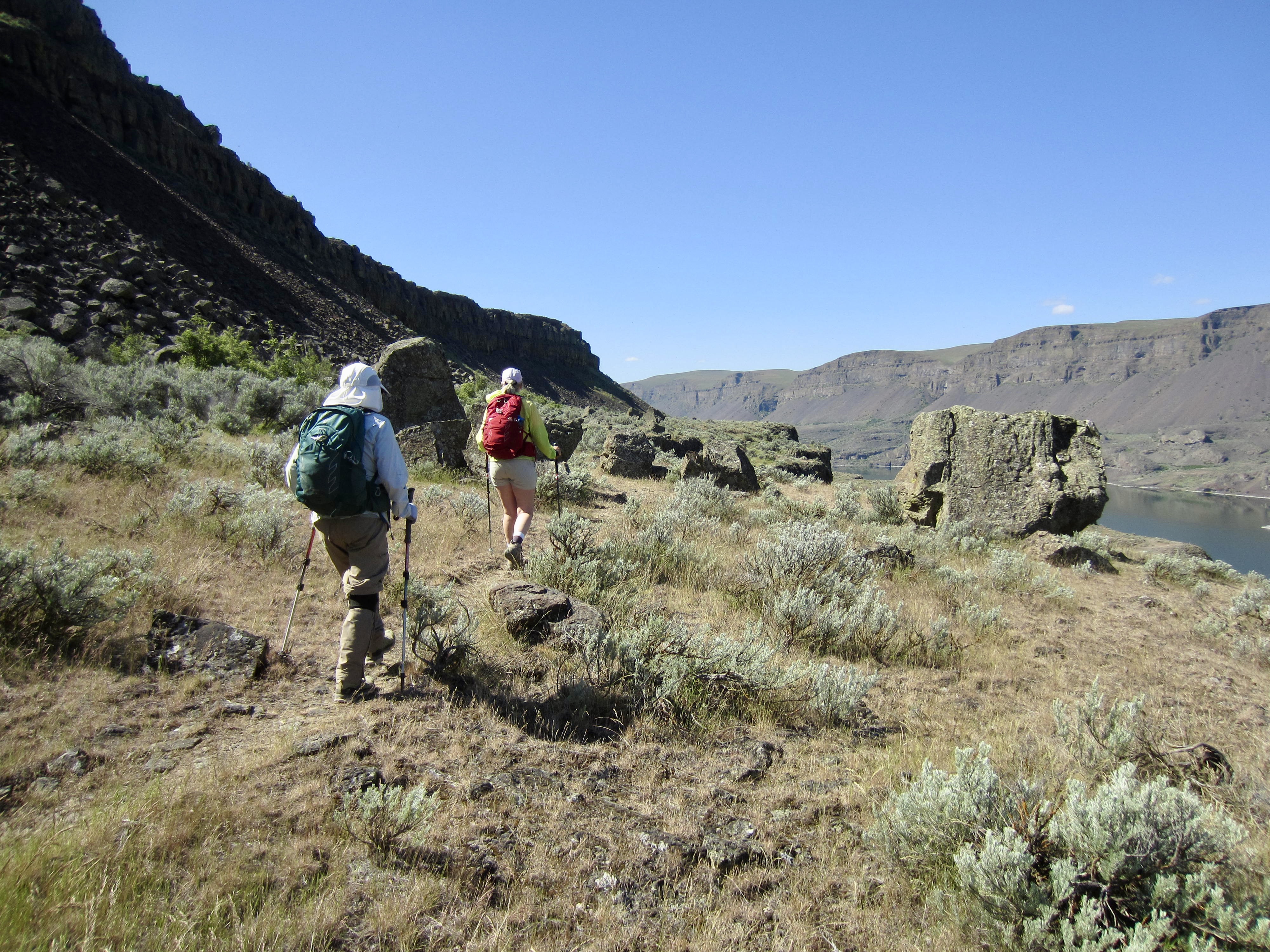
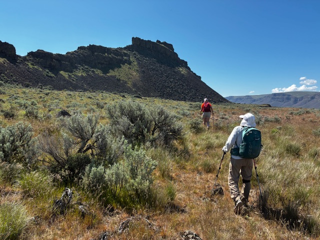
All three of our daytrips began and ended at the Lake Lenore Caves Trailhead, which is situated at the western base of The Great Blade. From here, an extensive network of formal and informal trails provides access to numerous points of interest on or below the southern half of the blade. Our weather throughout was very favorable for hiking and scrambling, with cool, breezy mornings and warm, sunny afternoons, but there were surprisingly few other people wandering about.

…
…
Daytrip 1: Bladerunner Crag Climb & Loop Hike
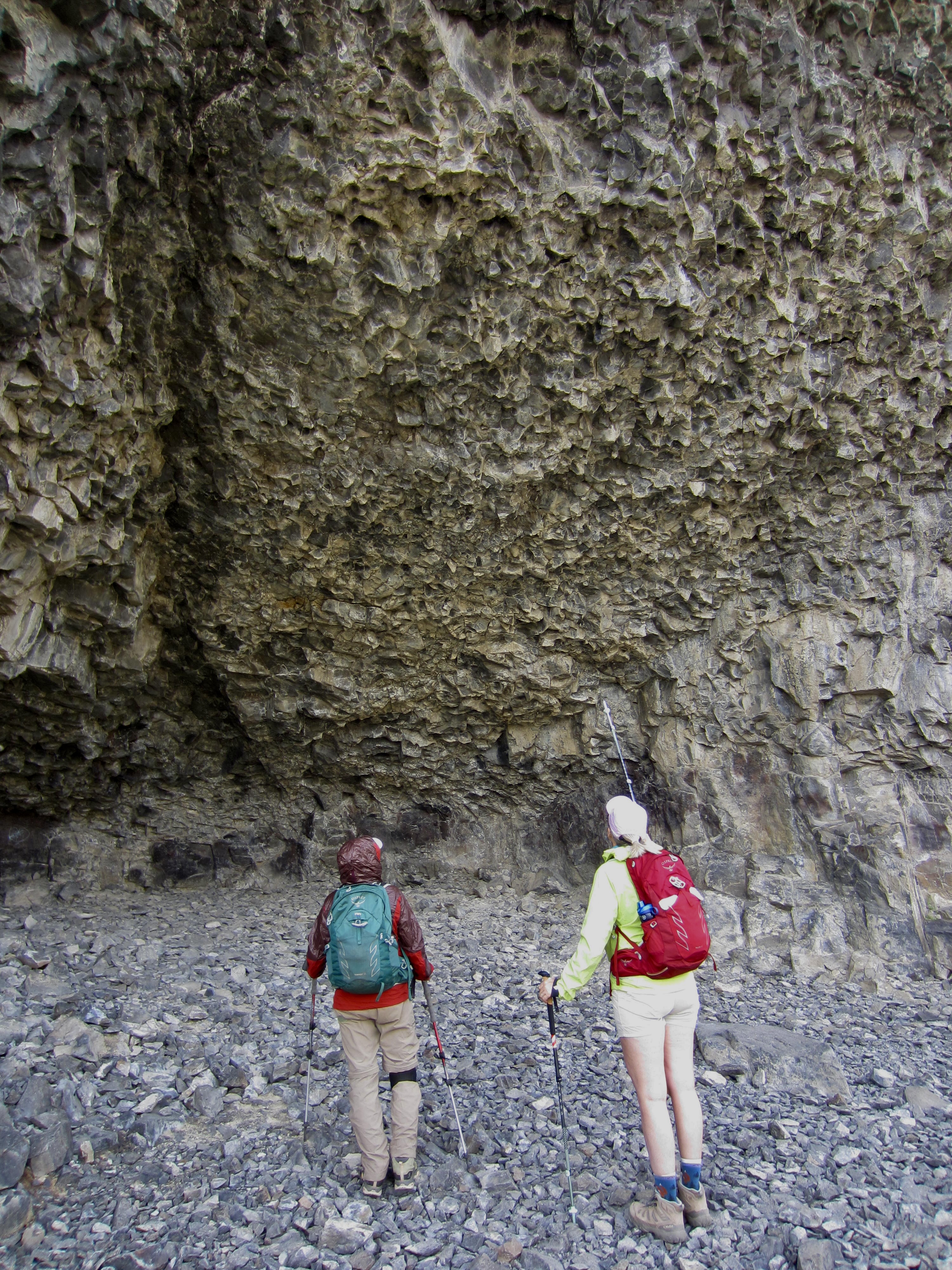
We left the trailhead on a cool Tuesday morning and hiked up a paved trail to the first major terrace, then we continued over to several of the Lake Lenore Caves. It’s a bit of a stretch to call these “caves,” because they are really just shallow pockets that were scoured into the basalt cliffs by catastrophic floodwaters some 15,000 years ago. Nonetheless, it was interesting to see the underside of the flow-top layer, with its heavily chiseled texture.
.
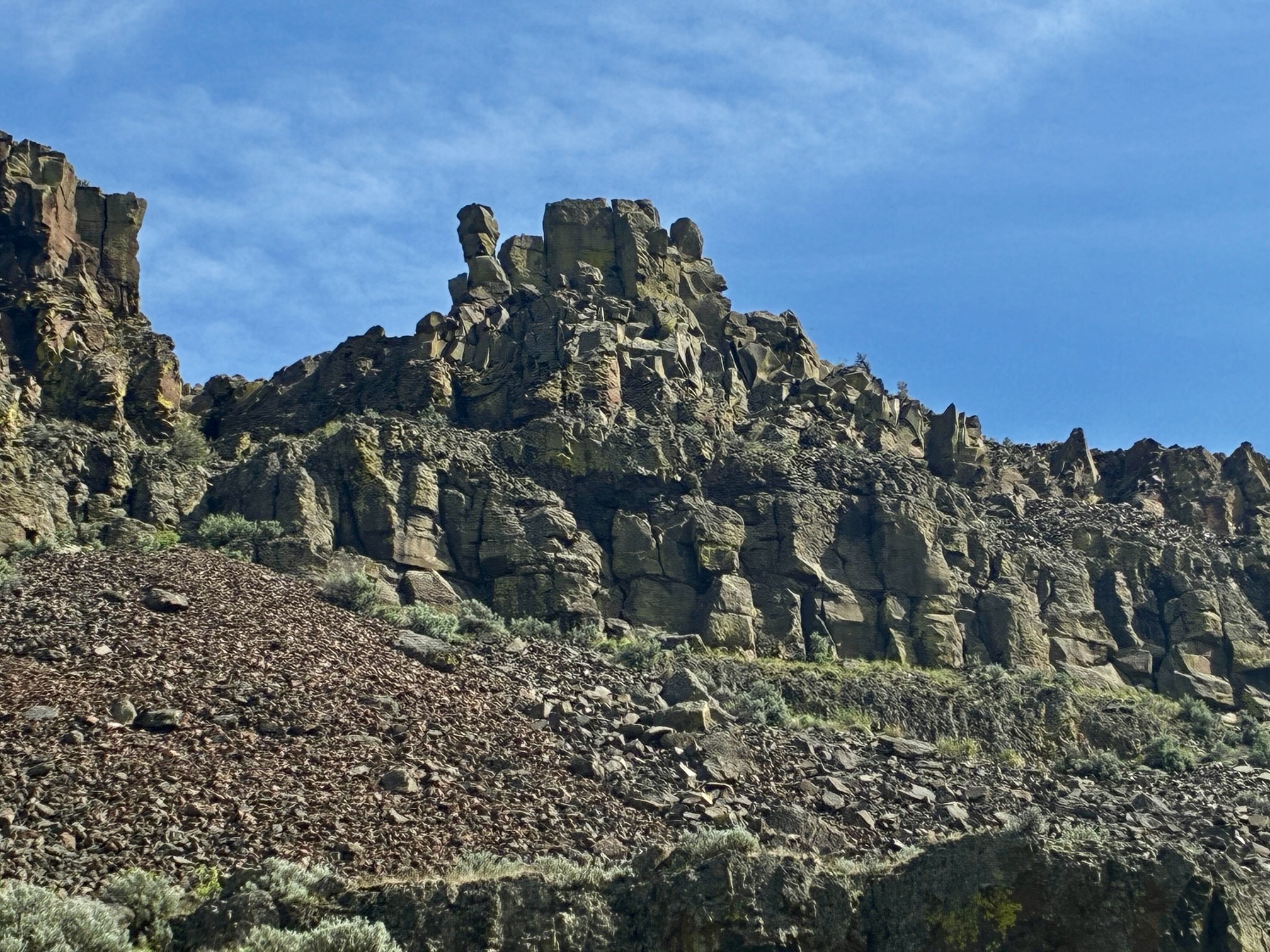
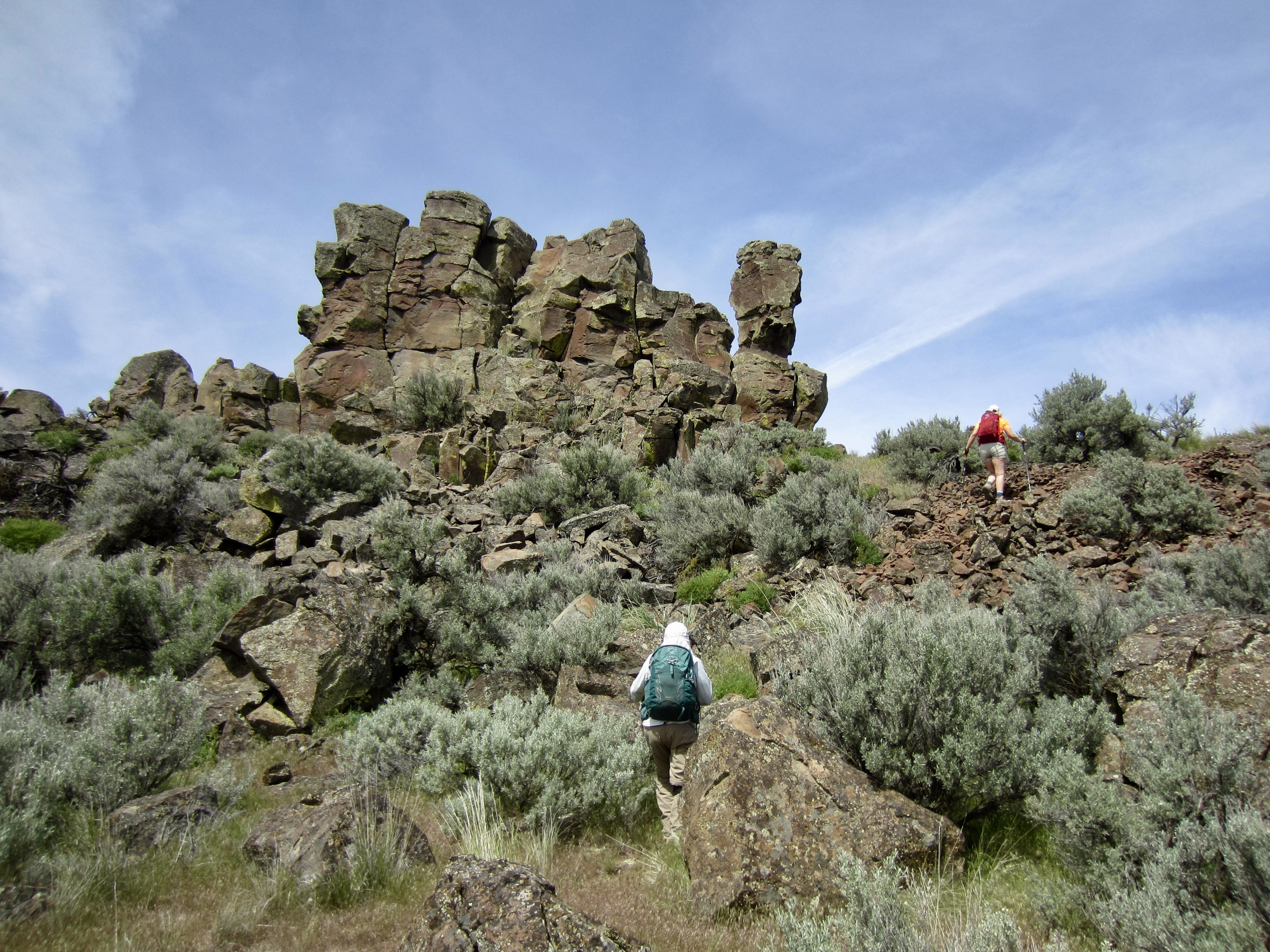
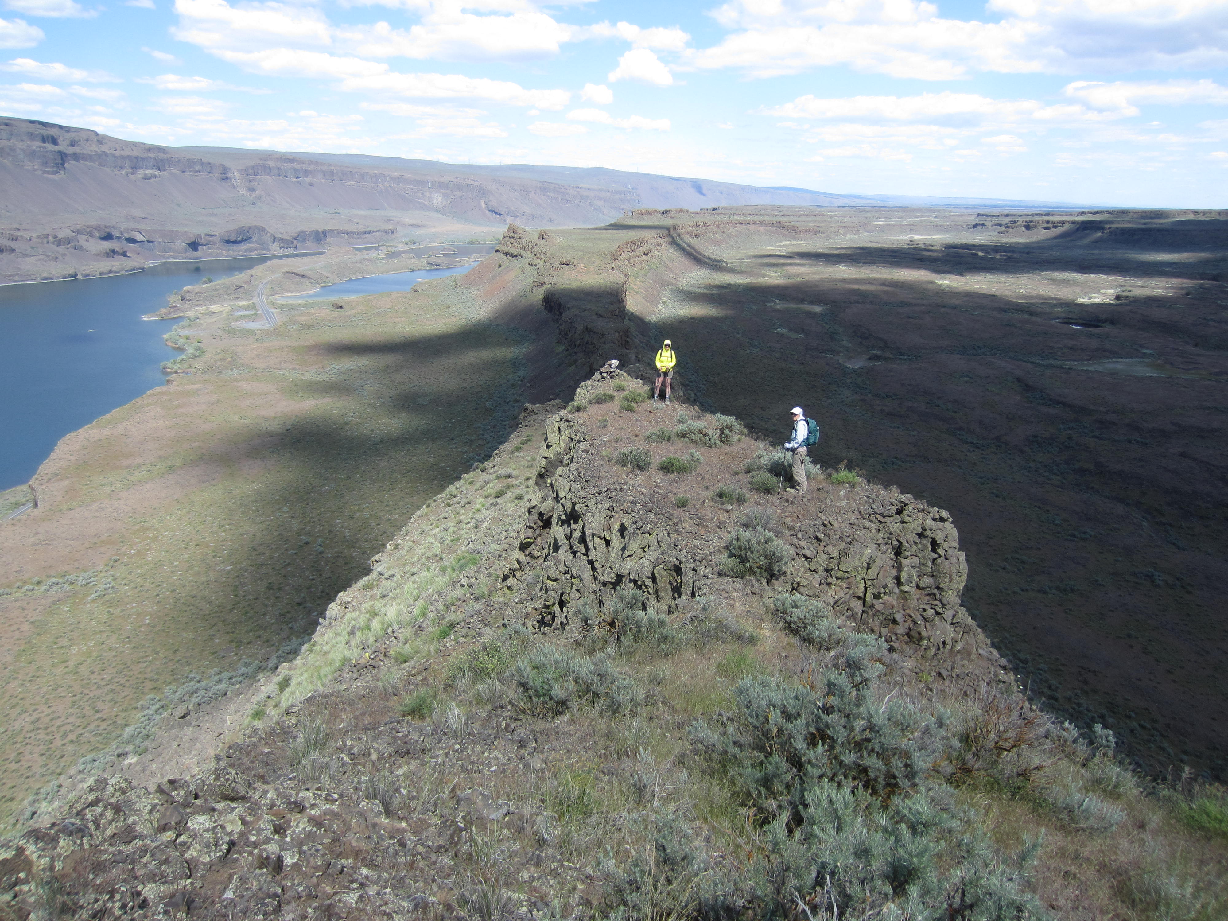
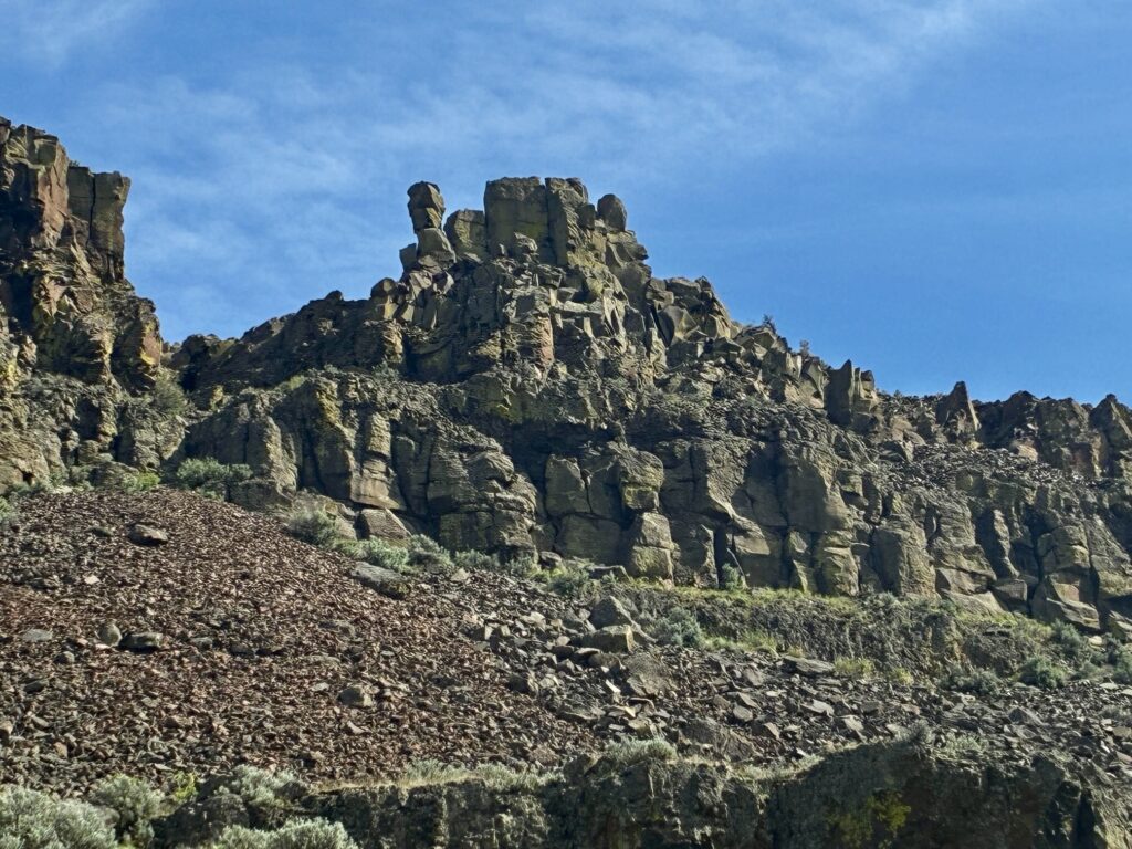
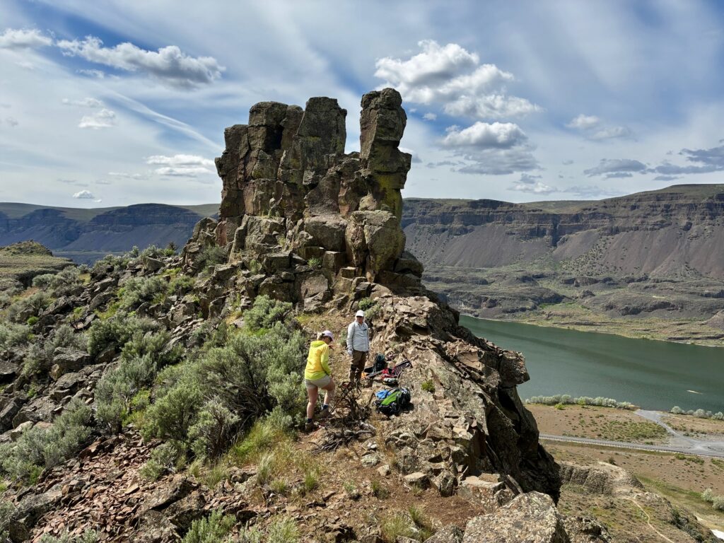
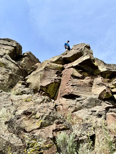
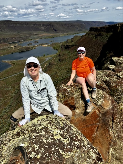
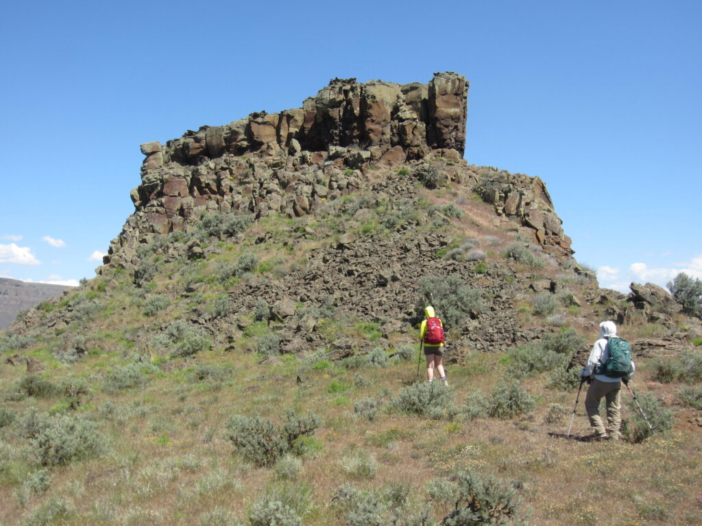
High above the cave terrace, we couldn’t help but notice a distinctive crag standing atop The Great Blade. This crag consists of a blocky fin with a detached pinnacle, lending the appearance of a turtle or a teapot or even a chicken with a pharaoh’s head, and we joked about climbing it. Later in the day, we dubbed it “Bladerunner Crag” in keeping with The Great Blade theme.
.
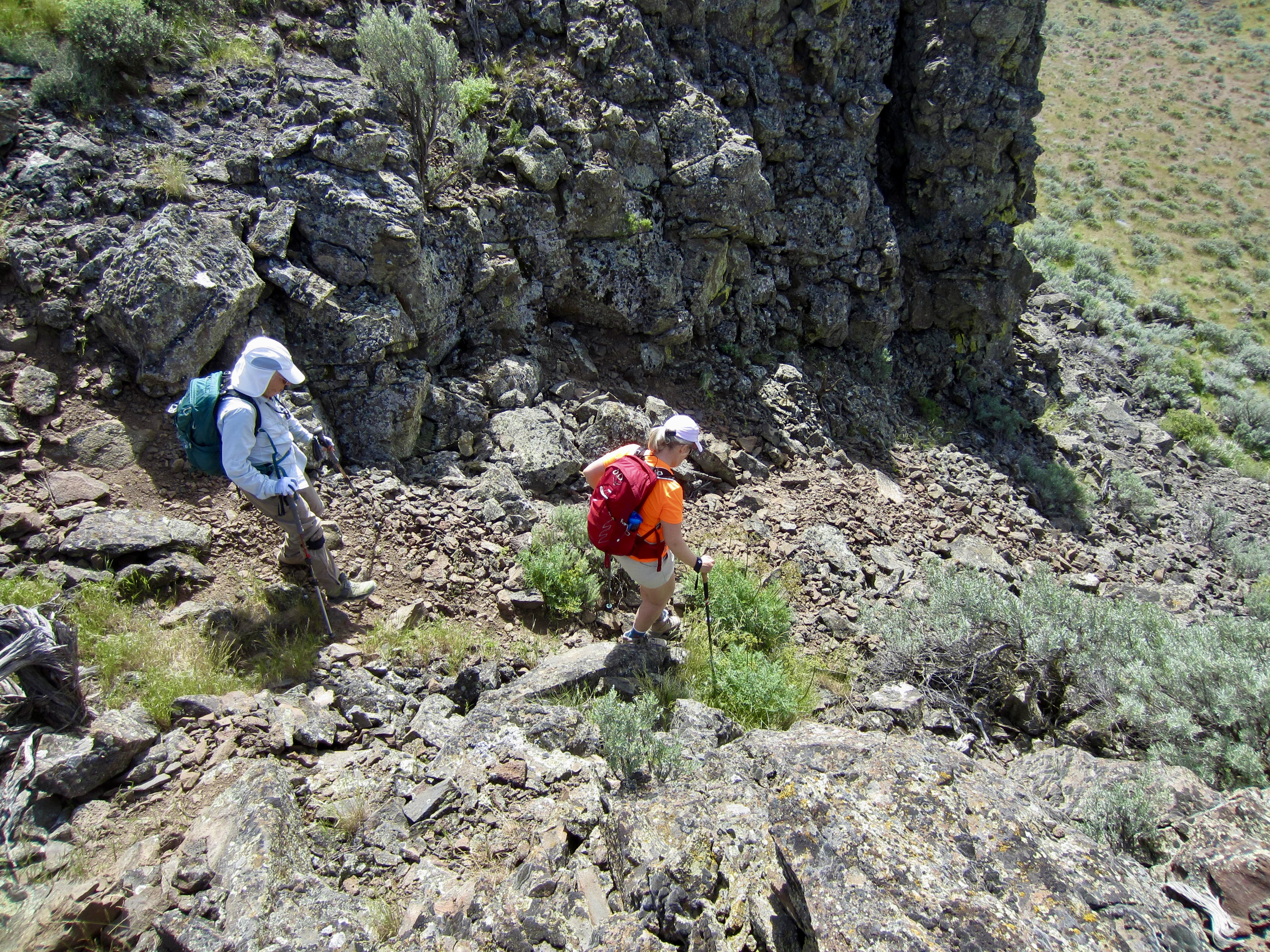
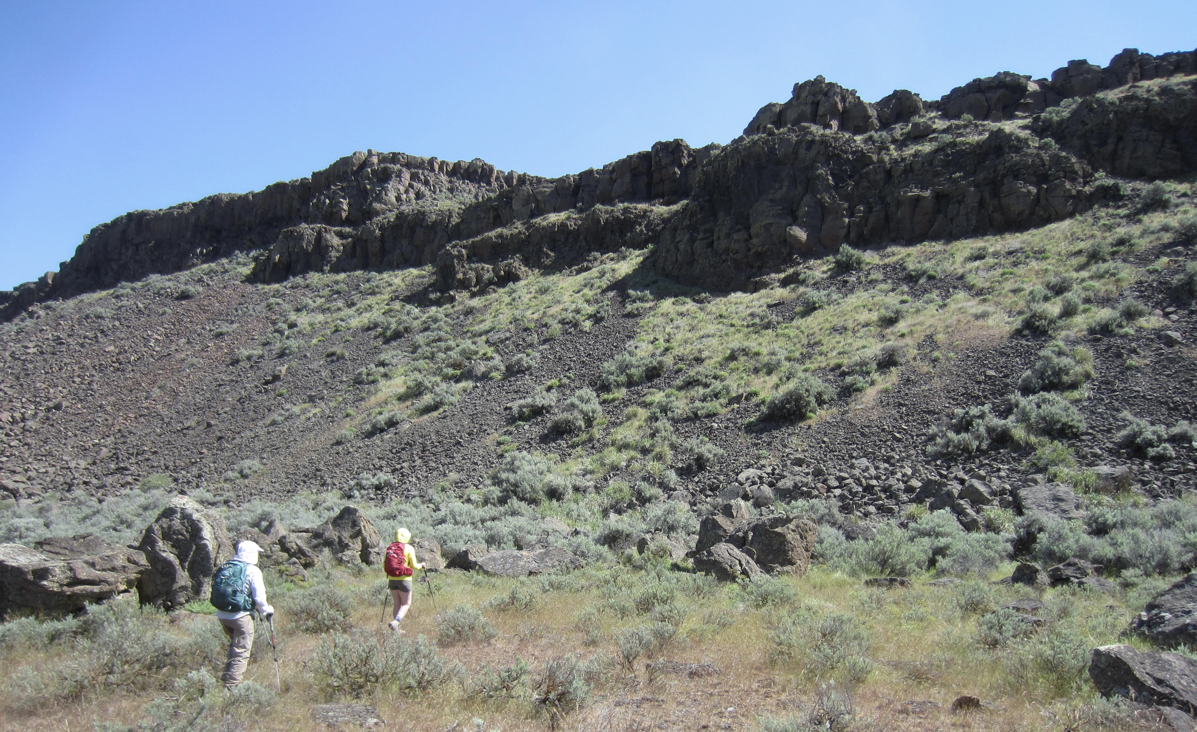
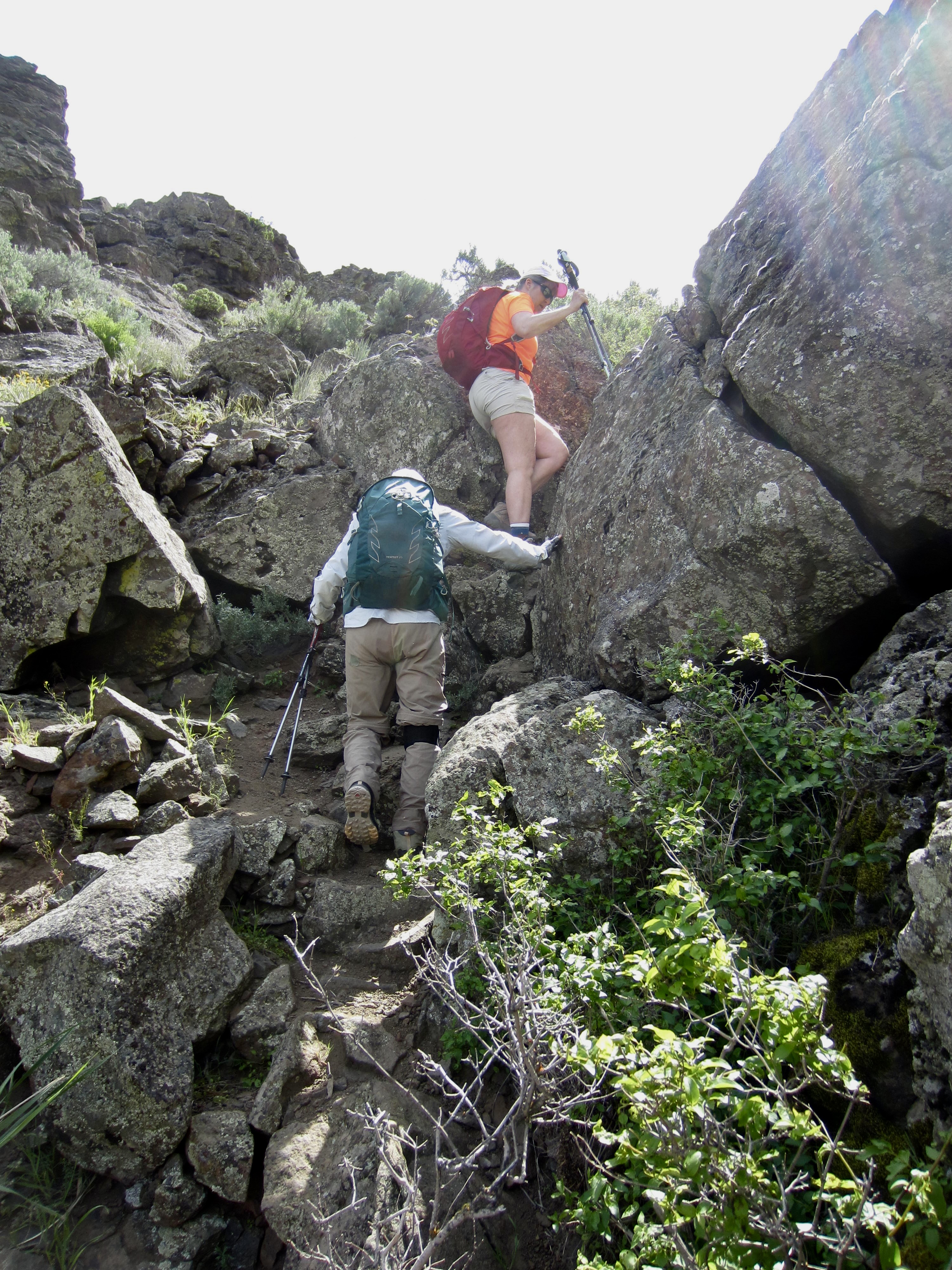
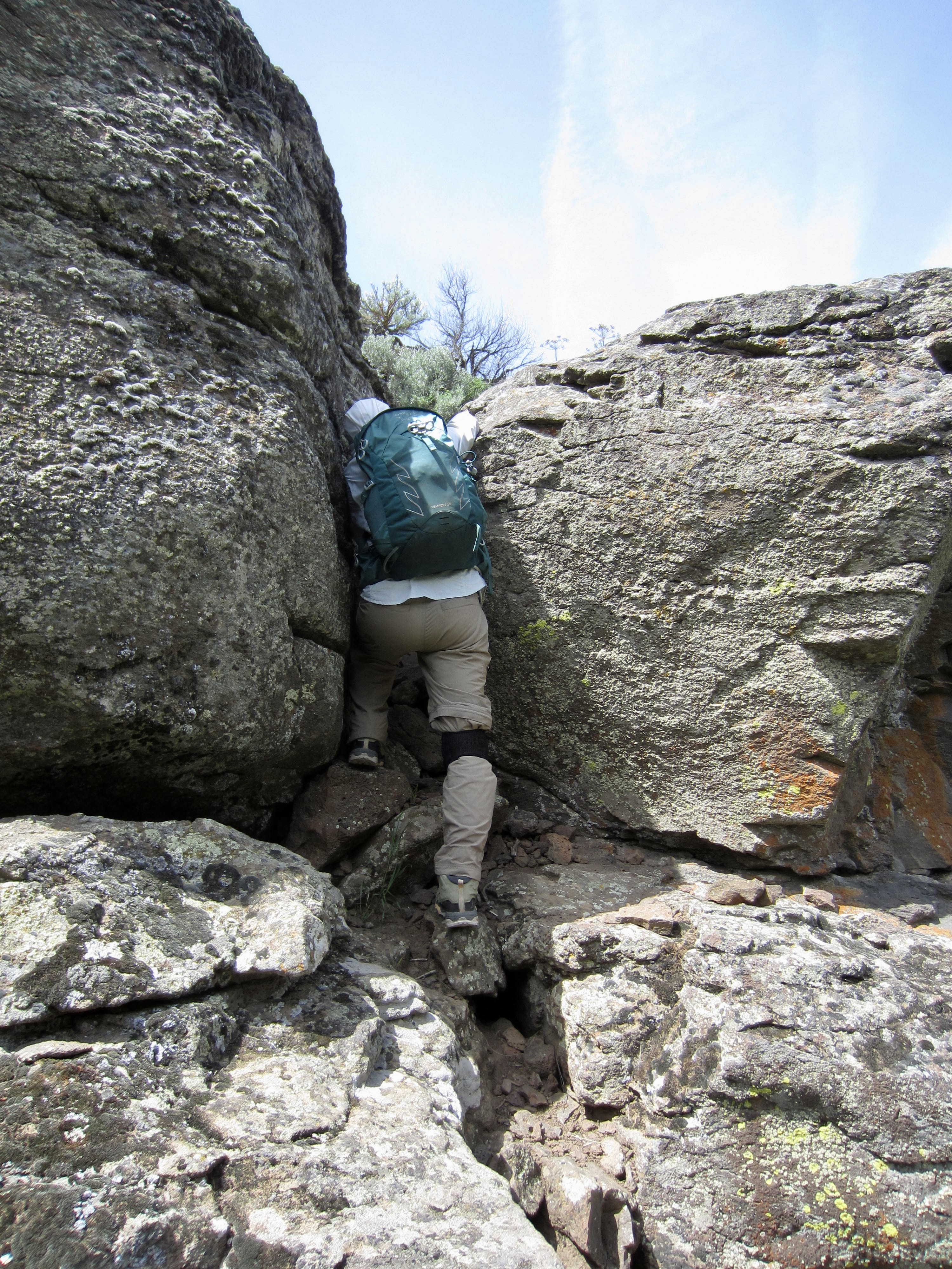
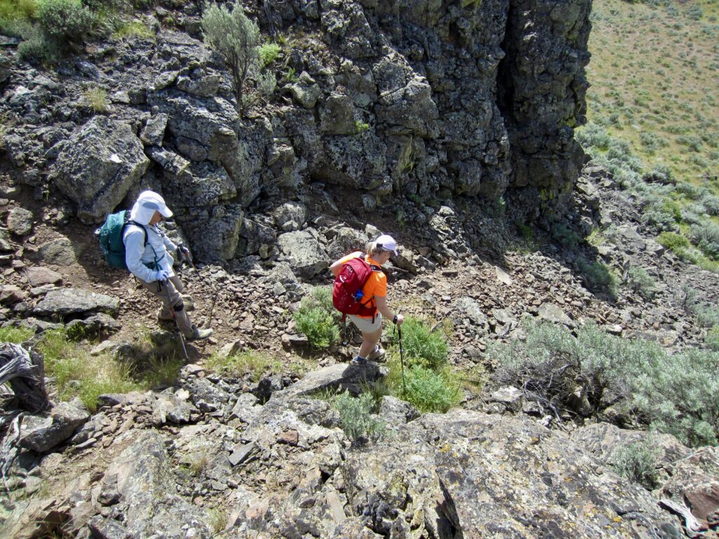
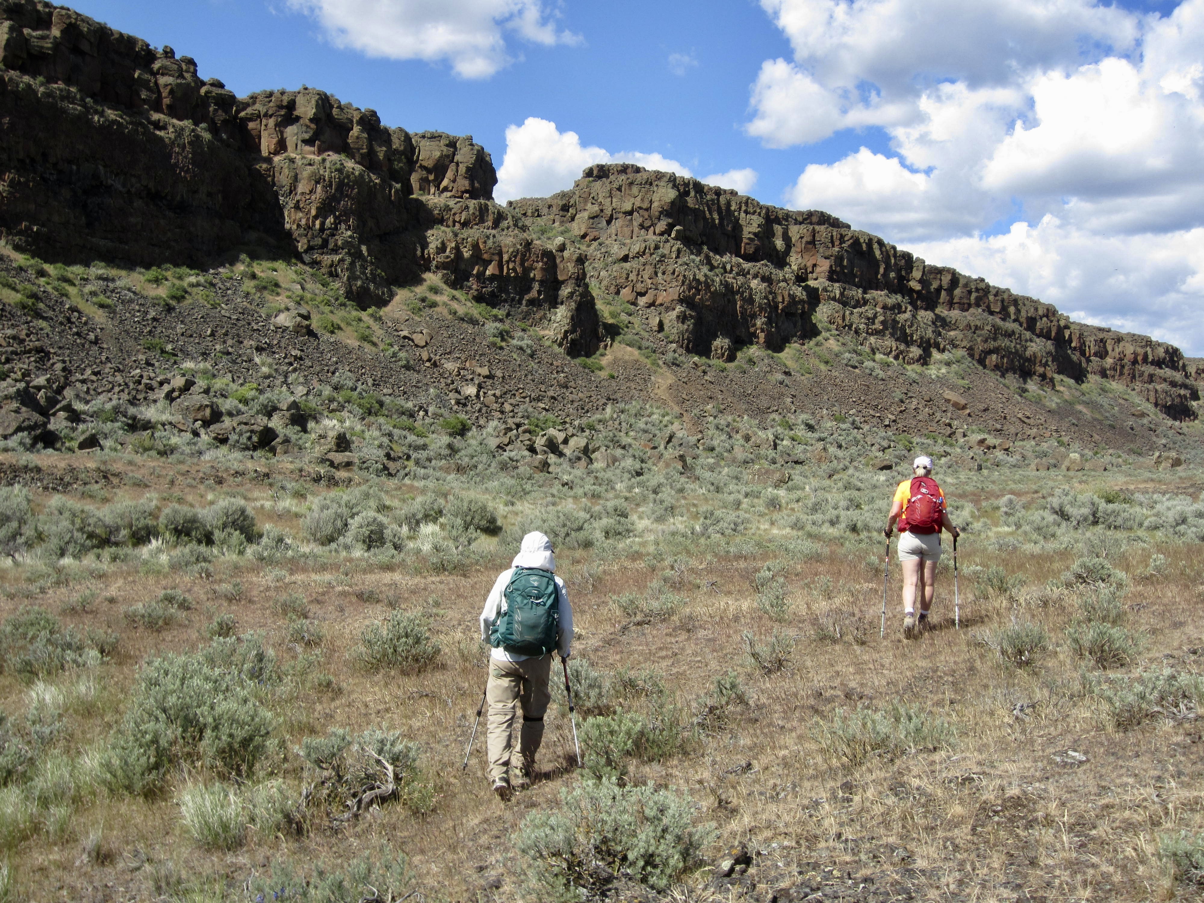
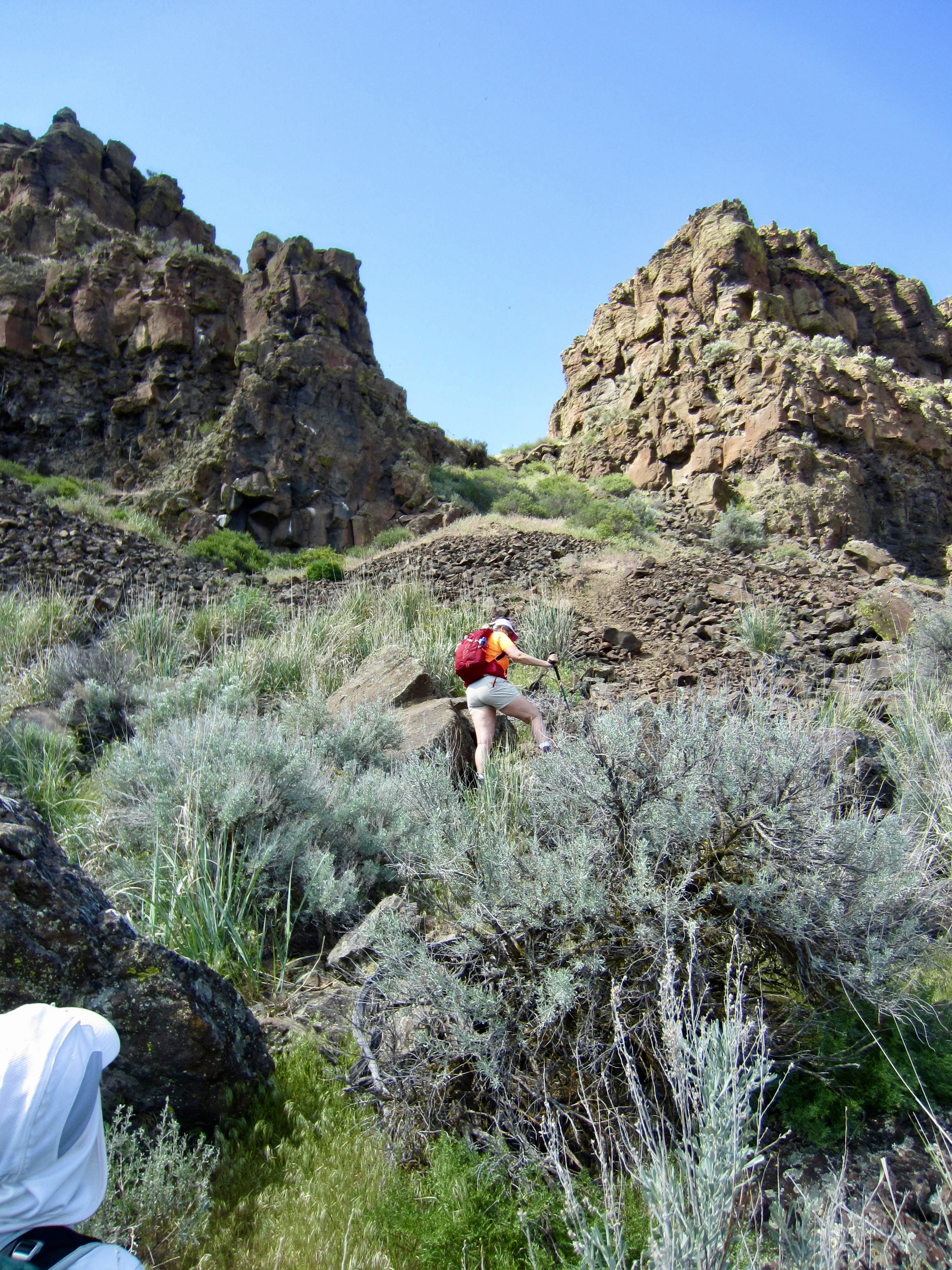
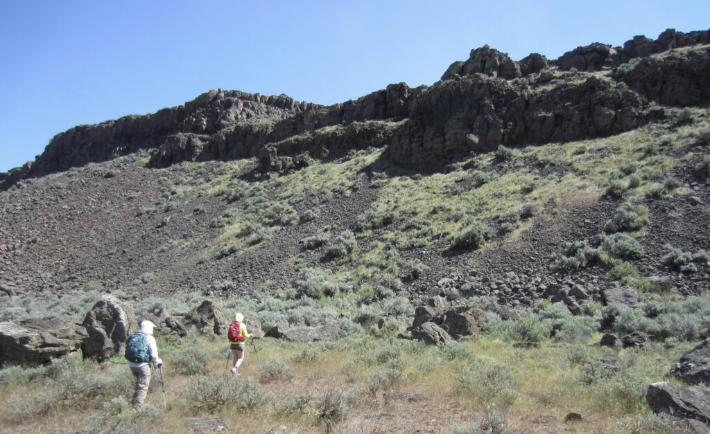
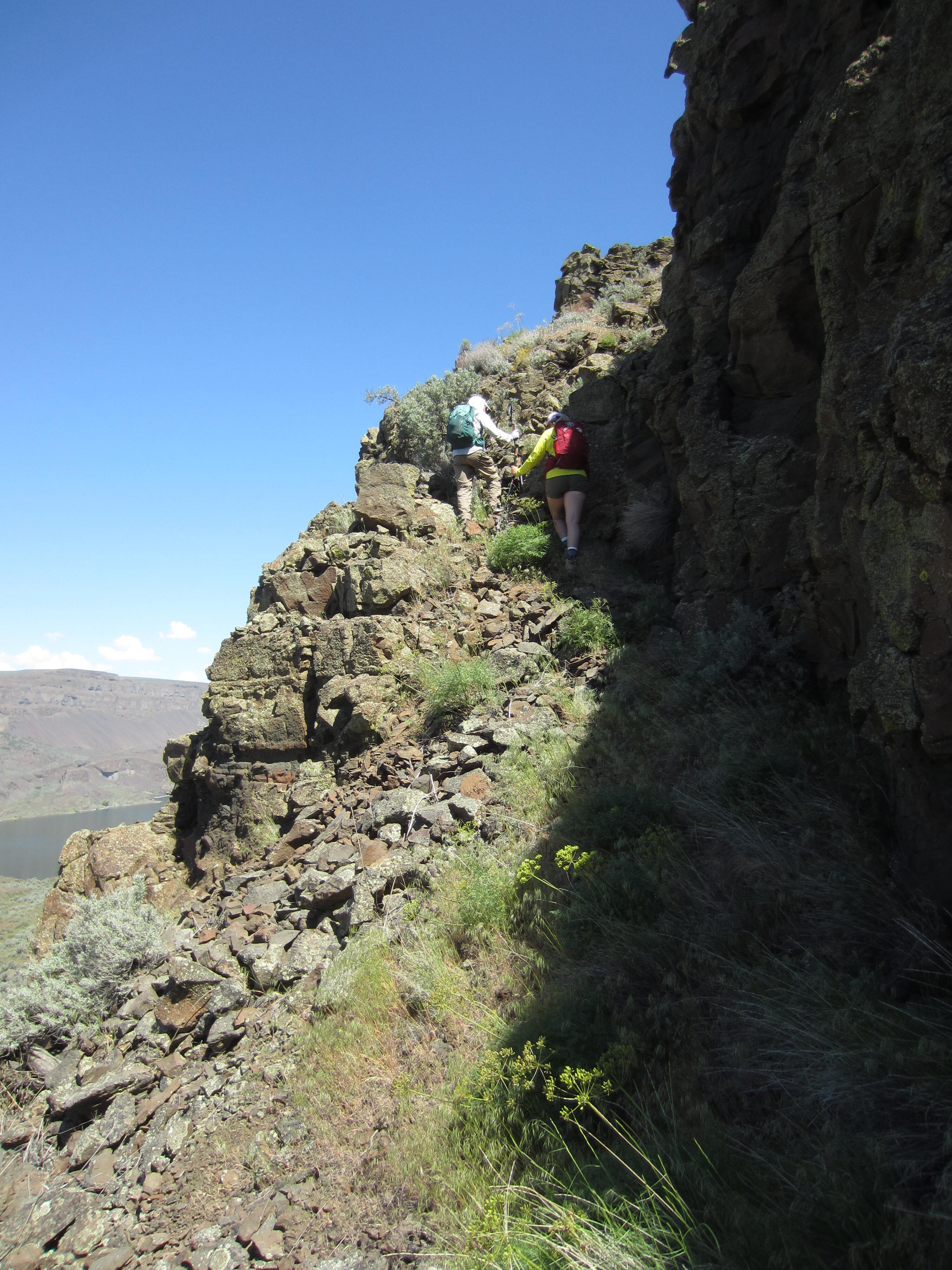
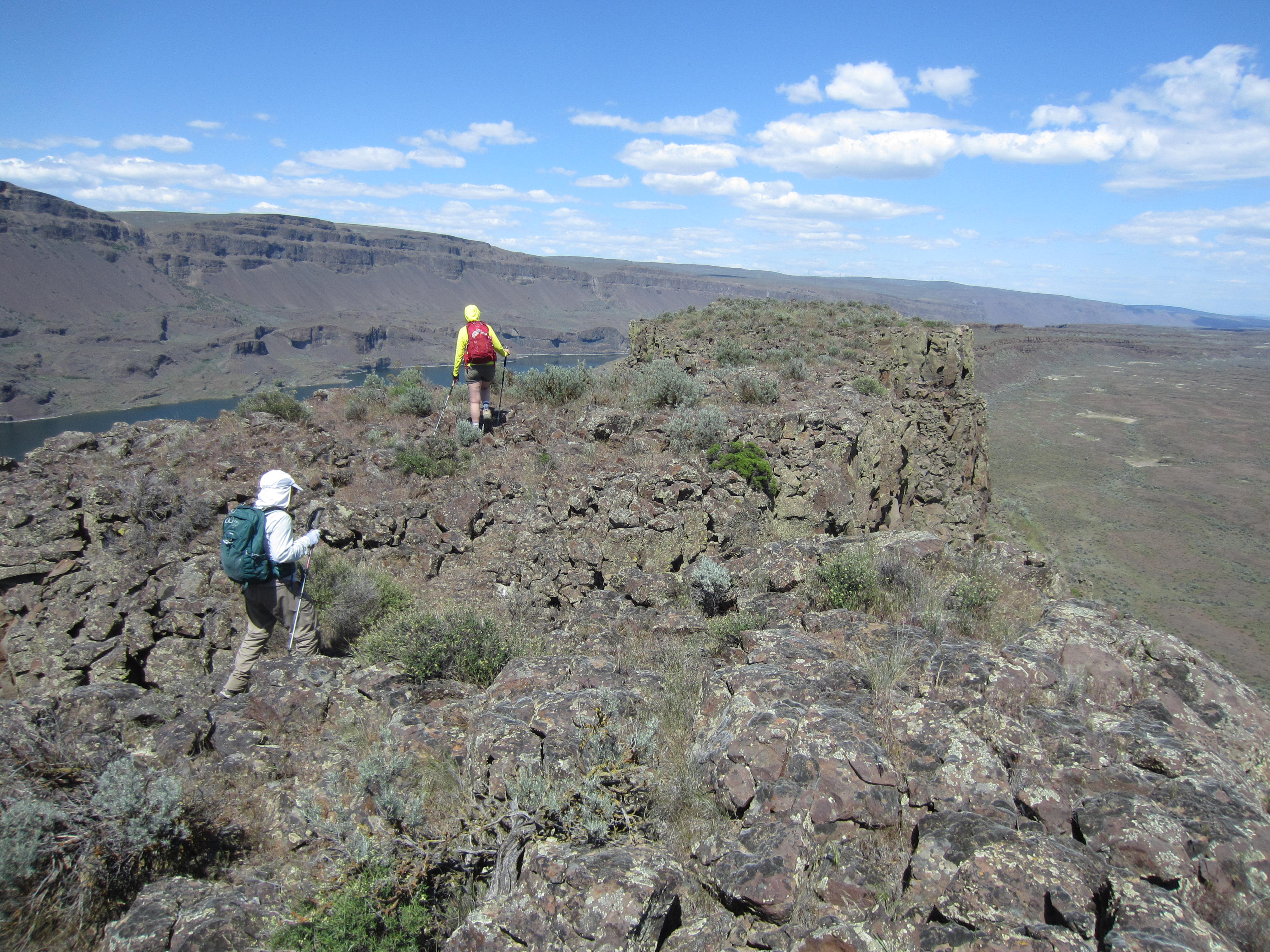
From the Lake Lenore Caves, we followed a primitive trail that angled up to the left, hoping that it might take us to the ridge crest. By good fortune, it led us through the sagebrush and up a talus slope until directly below the North Notch. A short Class 2-3 scramble brought us into the notch, which effectively separates the northern and southern halves of The Great Blade. We then turned right (south) and scrambled up a Class 3 crack to gain a high, grassy terrace.
.
.
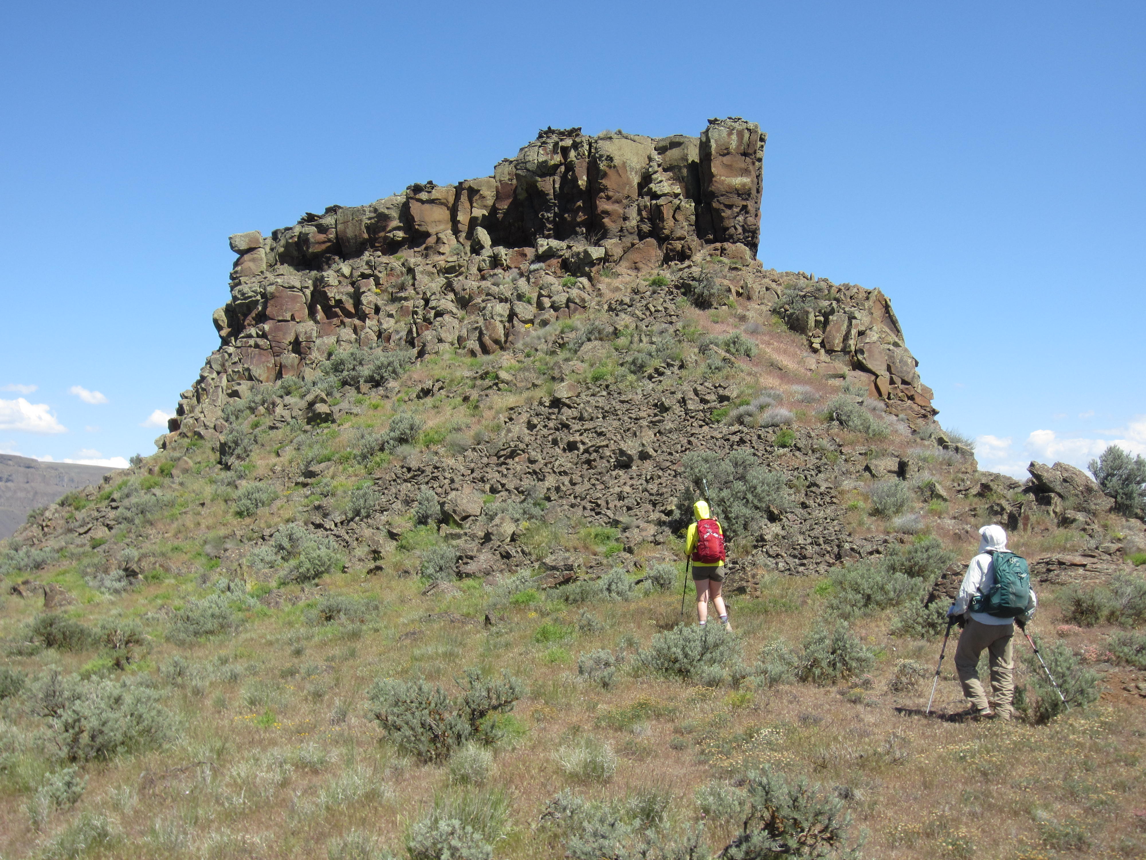
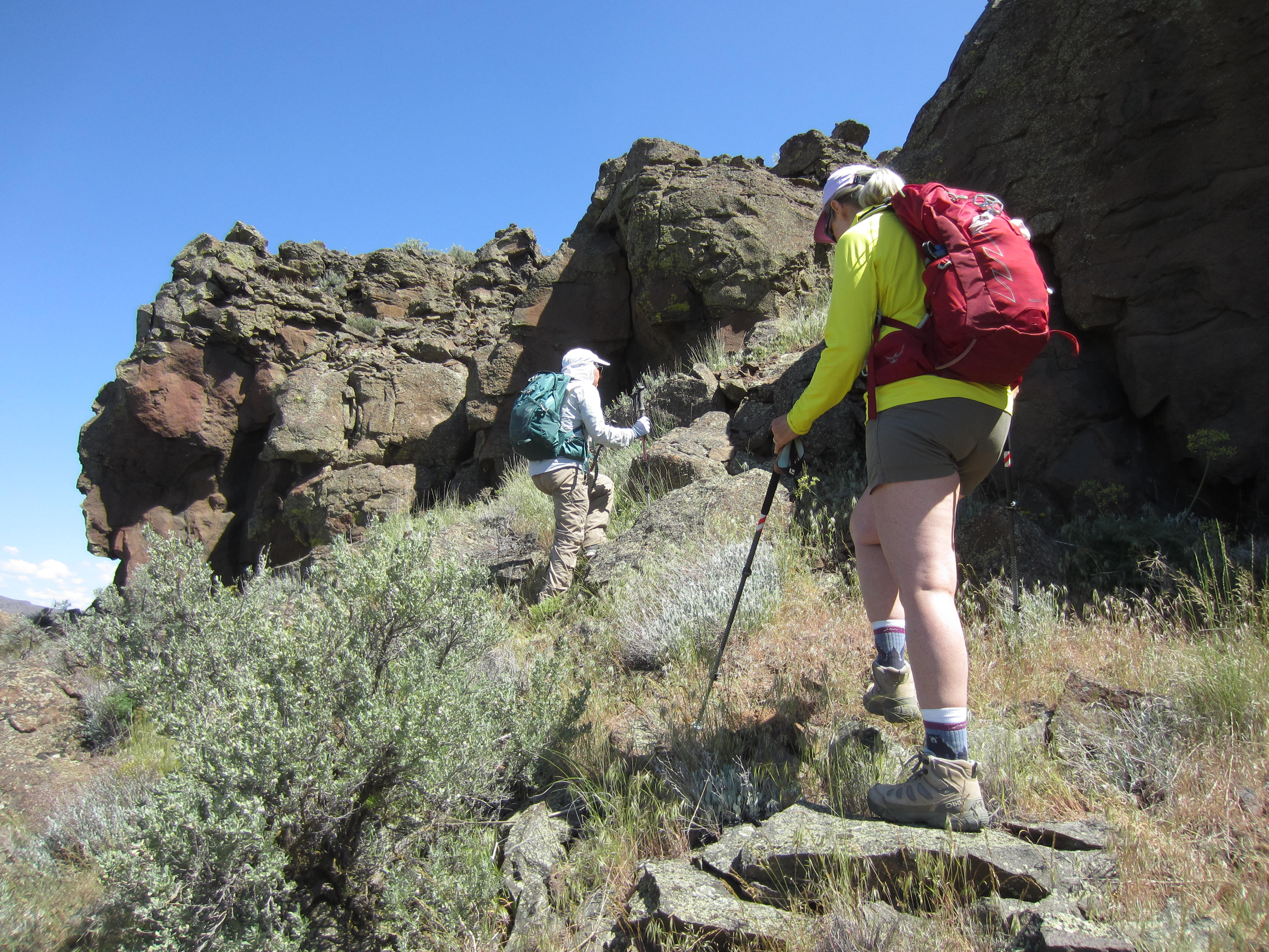
The high terrace, which could logically be called Bladerunner Terrace, is extremely level, such that we were easily able to hike southward around the eastern side of a tabletop mesa composed of stocky basalt columns. On the far end of this mesa, we found ourselves face-to-face with Bladerunner Crag.

.

.
.
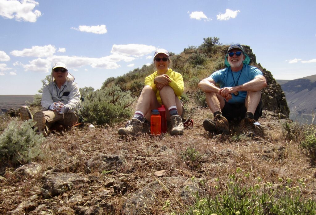
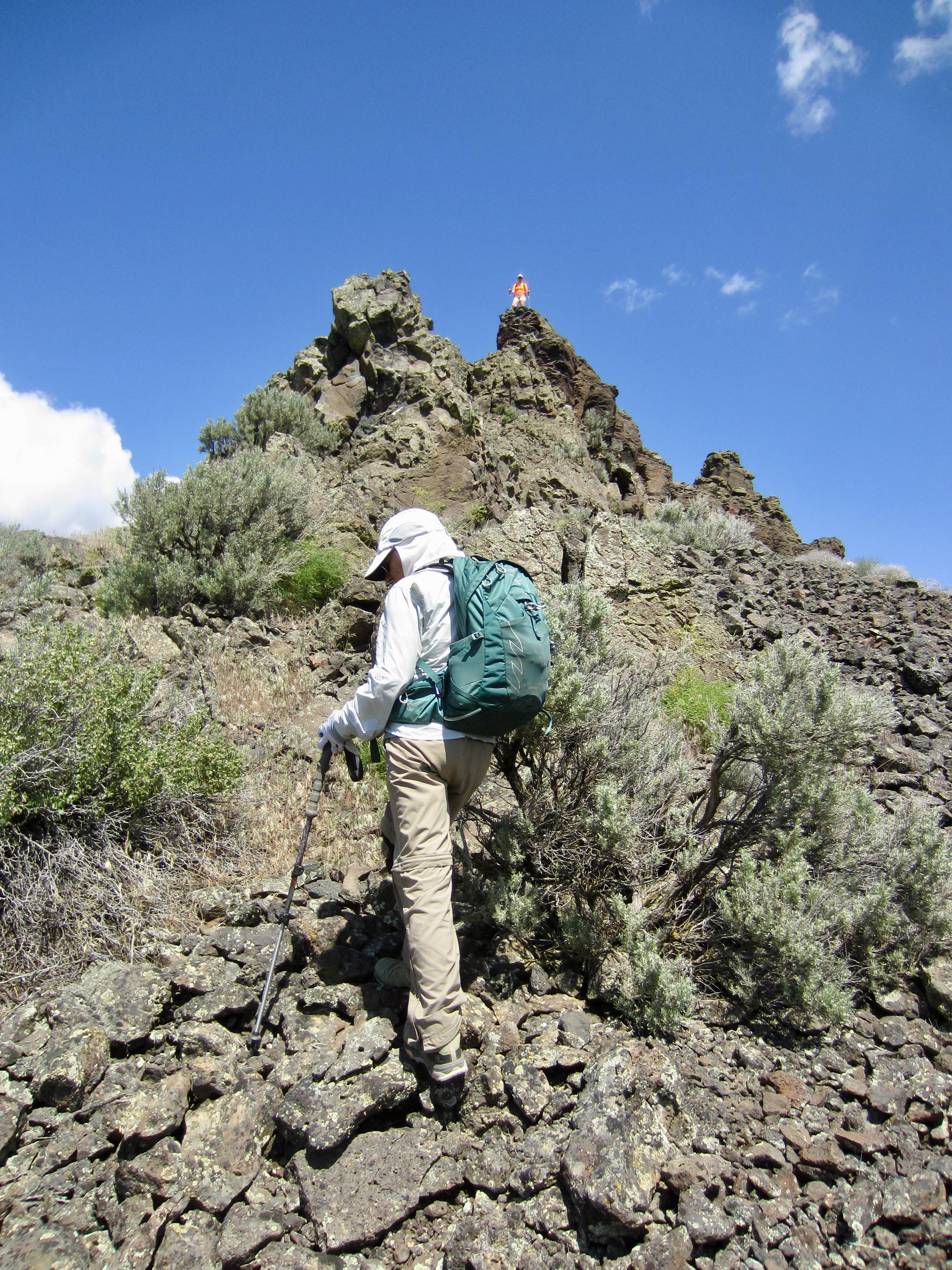
Although Bladerunner Crag looked like a serious little crag climb, Eileen and I couldn’t resist the urge to at least poke around a bit. I traversed over to a deep cleft on the east face, and a sporty Class 3-4 scramble put me on top with a combined feeling of surprise, delight, and apprehension. Fay initially rejected any notion of climbing it, but with some encouragement and strategic spotting by Eileen, her summit fever kicked in. A short time later, all three of us were sitting atop the crag, enjoying a truly unique view of The Great Blade!
.
.
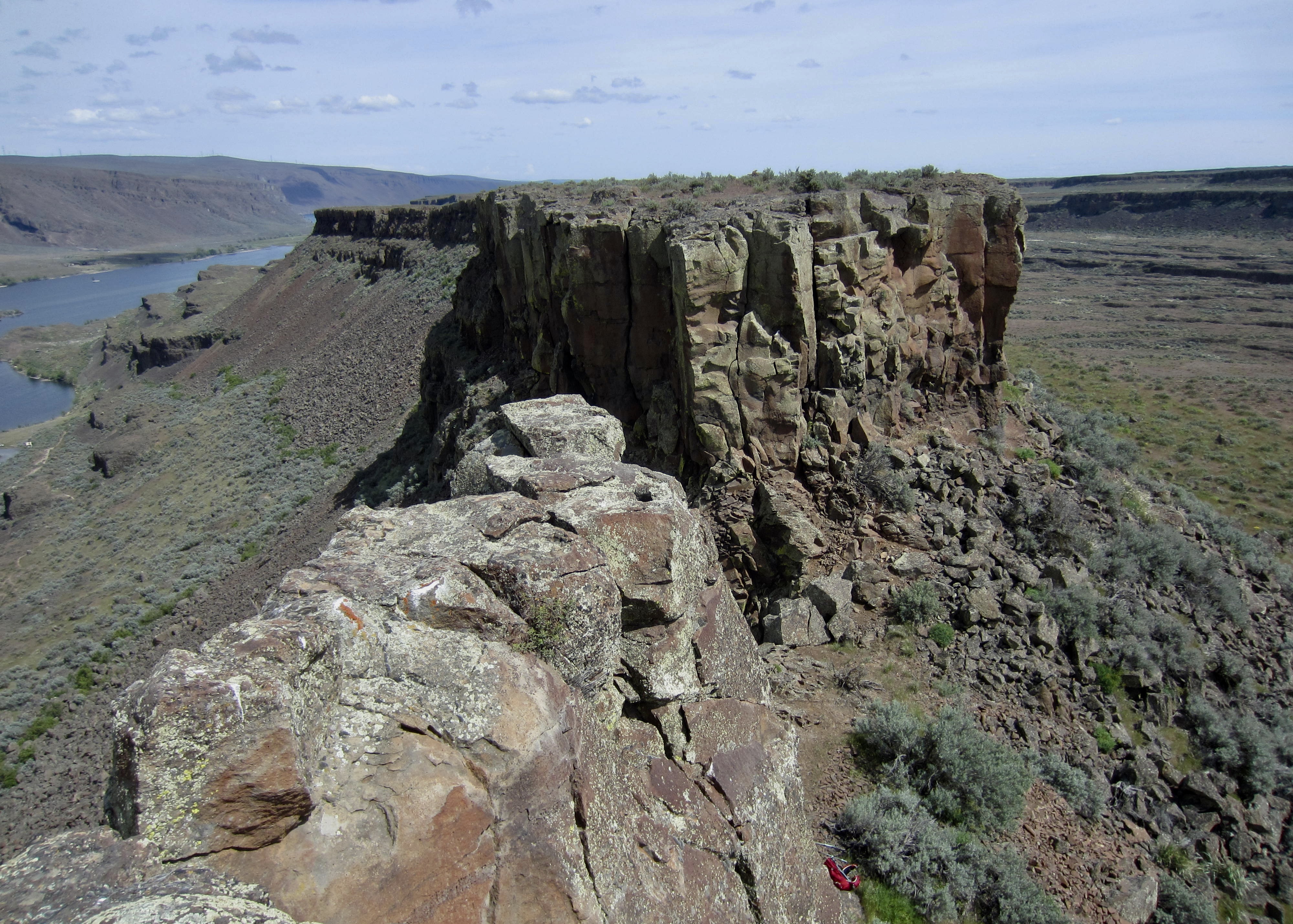
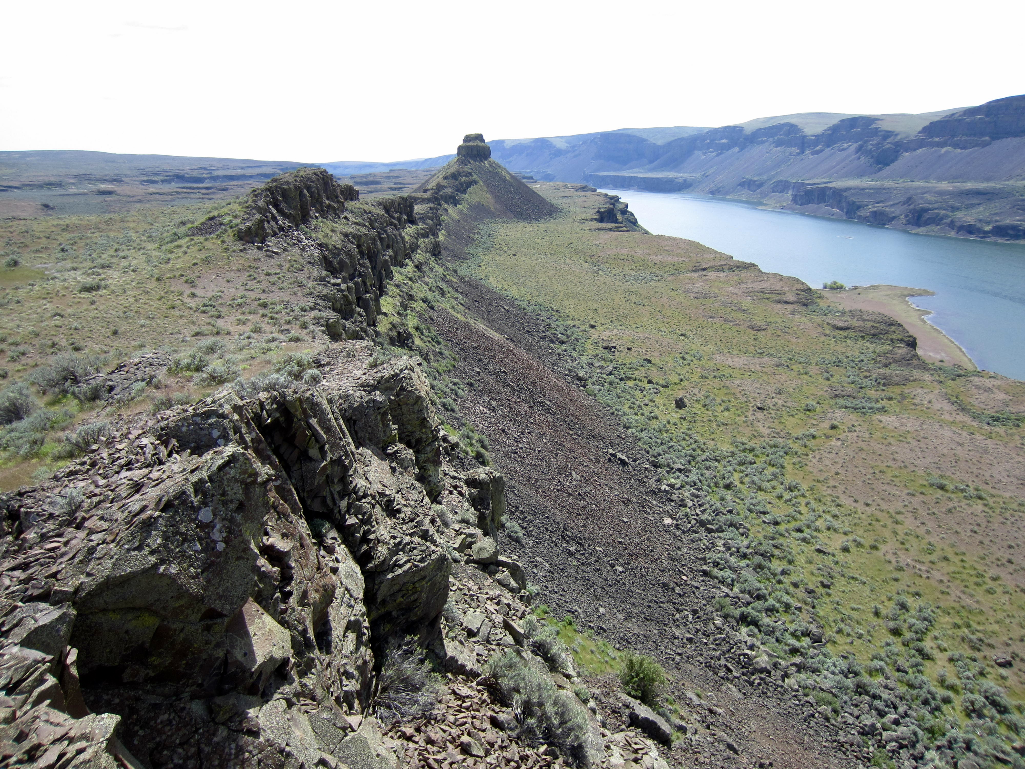
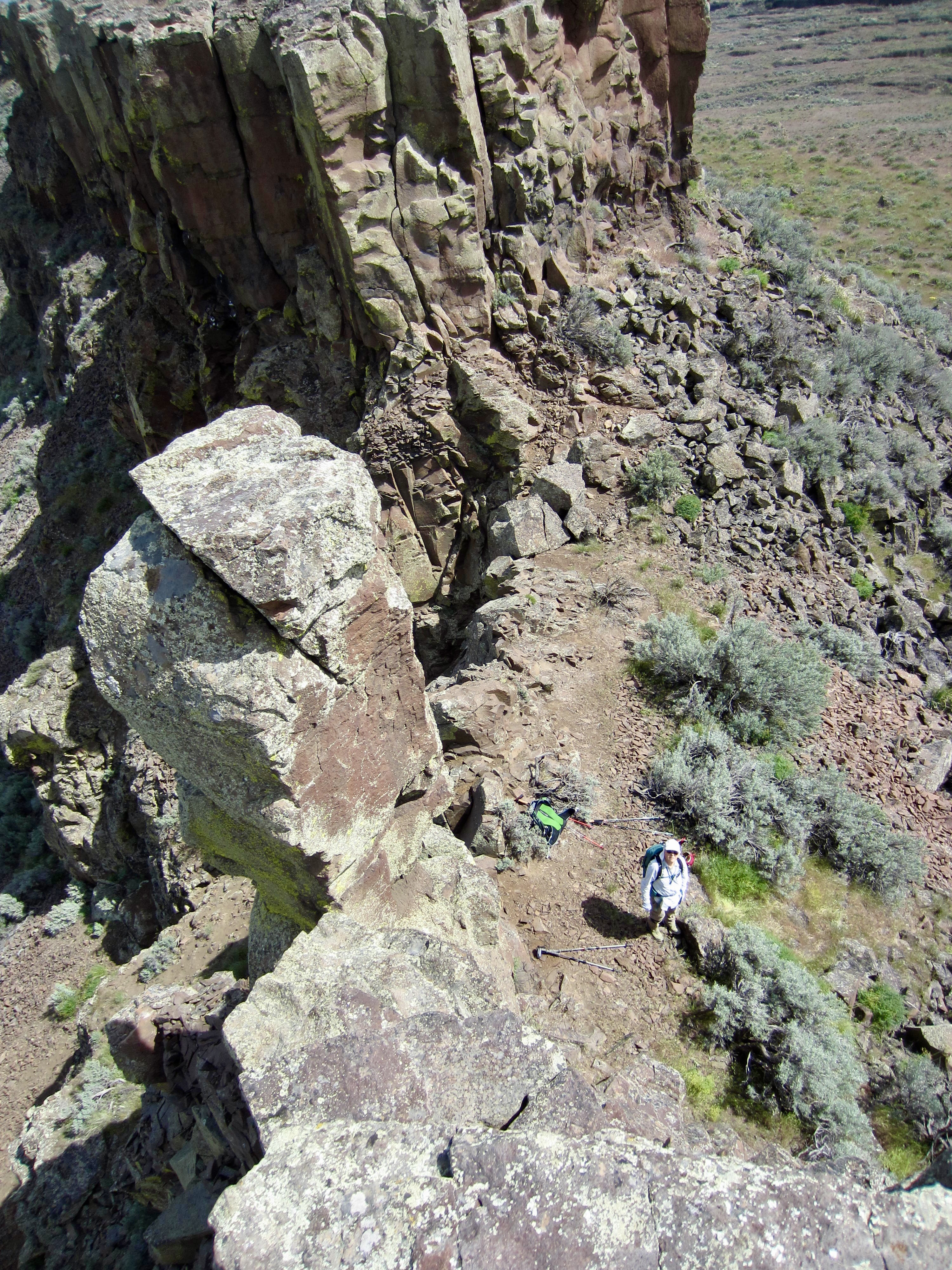
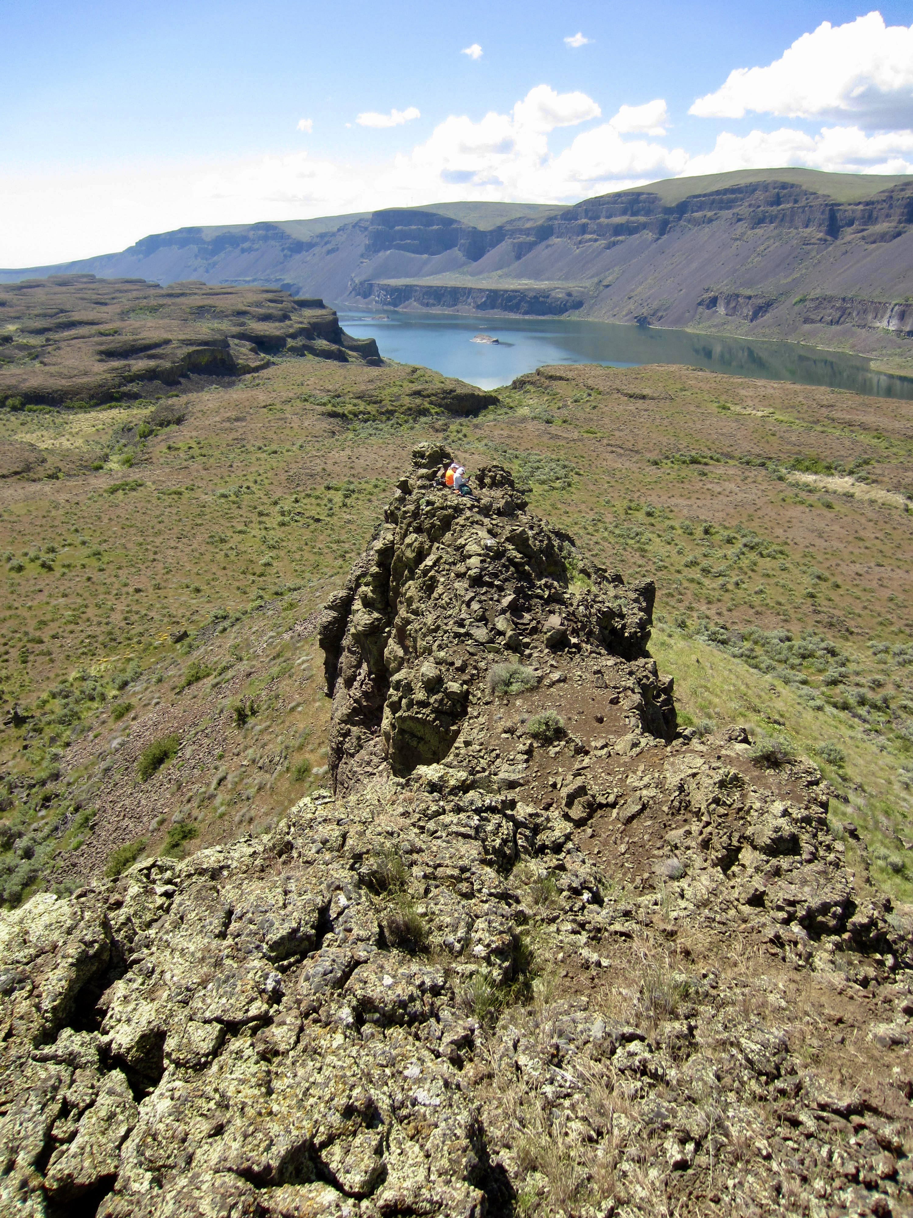
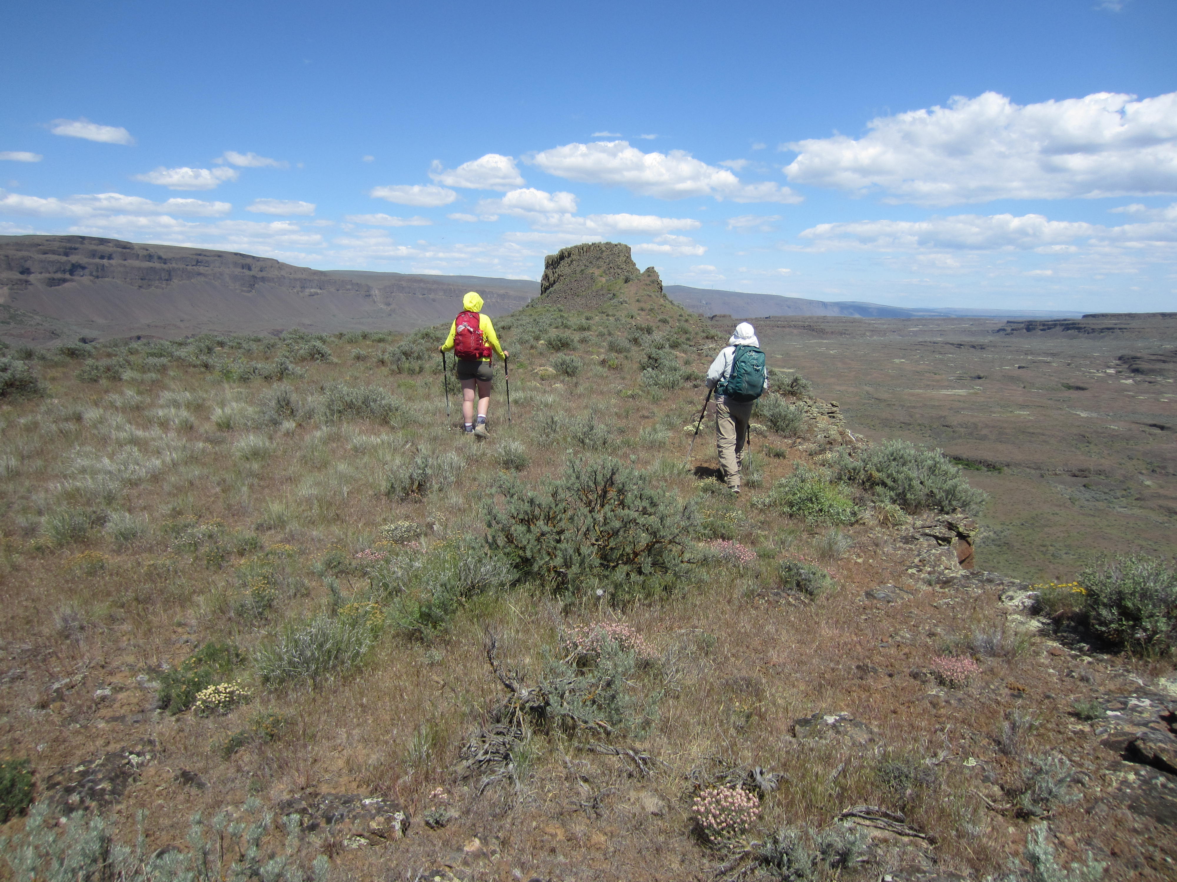
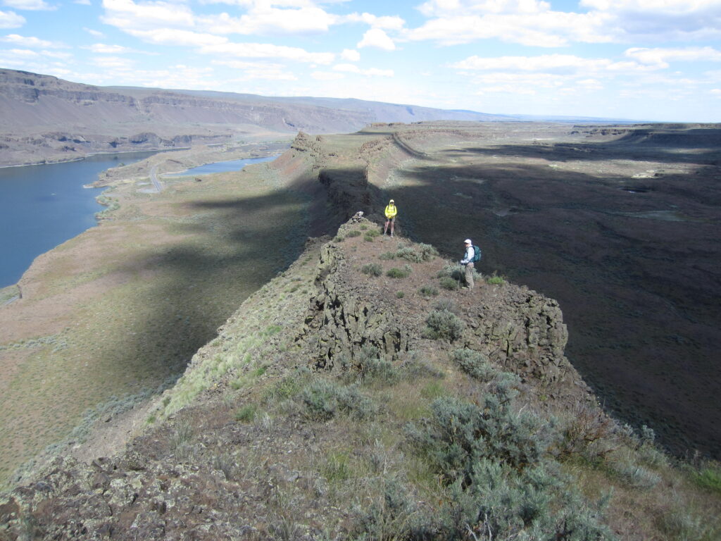
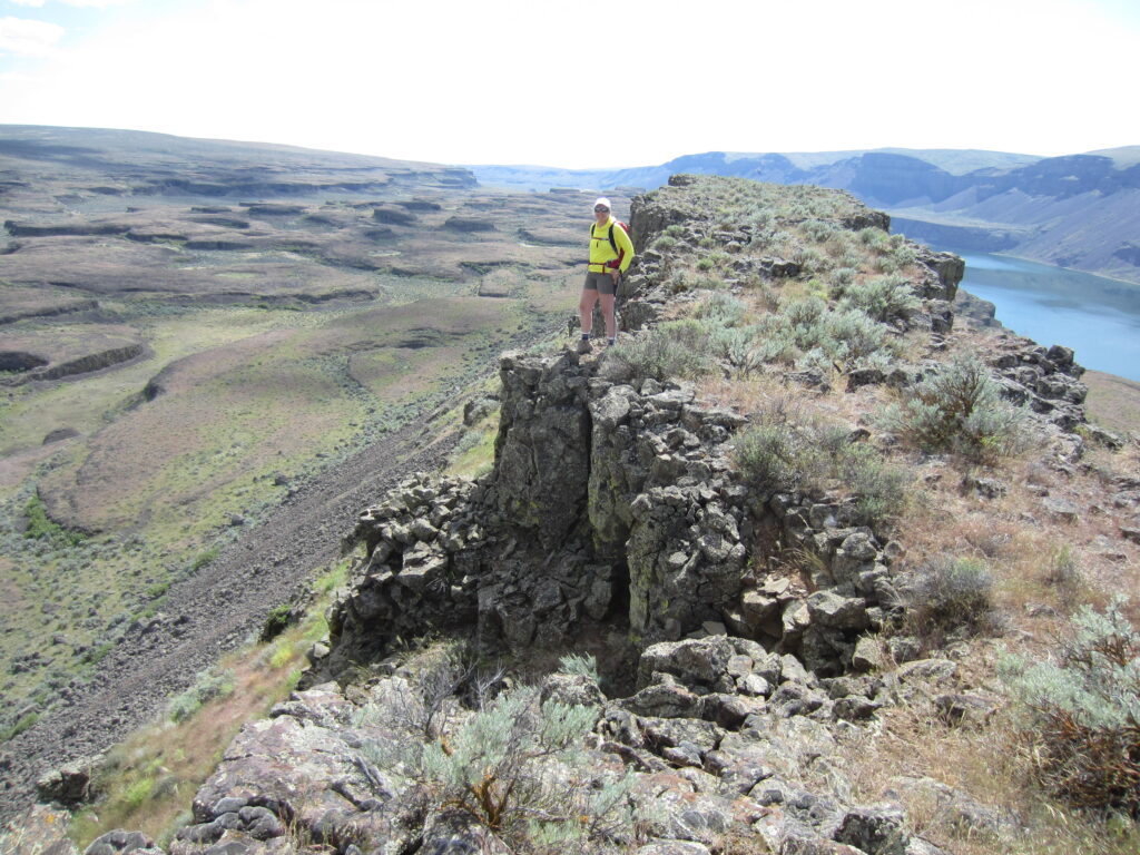
After very carefully down-climbing Bladerunner Crag—and wishing for a panic rope—we continued hiking along The Great Blade. Our next stop was an attractive rocky knob topped with a slightly overhanging boulder, which prompted Fay to dub it “The Mushroom.” From here, we could sight southward along the basalt palisade leading to the impressive crown of Great Blade Peak, located ½ mile away.
.
.
Further hiking along the ridge crest brought us to the South Notch—a notable low point between Bladerunner Crag and Great Blade Peak. From there, a steep, rubbly path led us down to the Western Terrace. We turned northward and hiked across this broad terrace until intersecting our up-track above the Lake Lenore Caves, then we followed established trails down to our starting point (4.8 hours + 2.4 miles + 550 feet for total loop).
.
Daytrip 2: Southern Blade Circumnavigation Hike
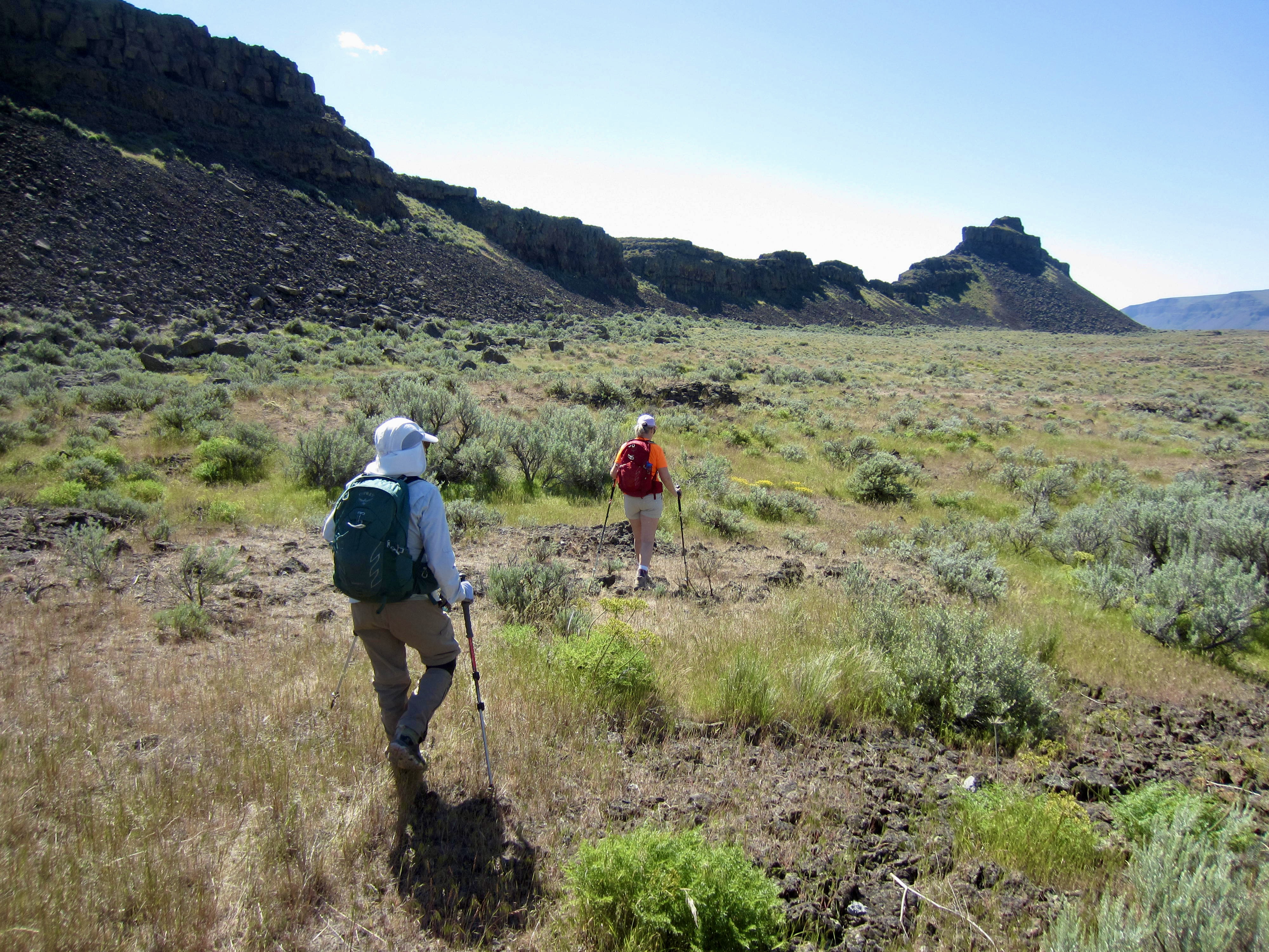
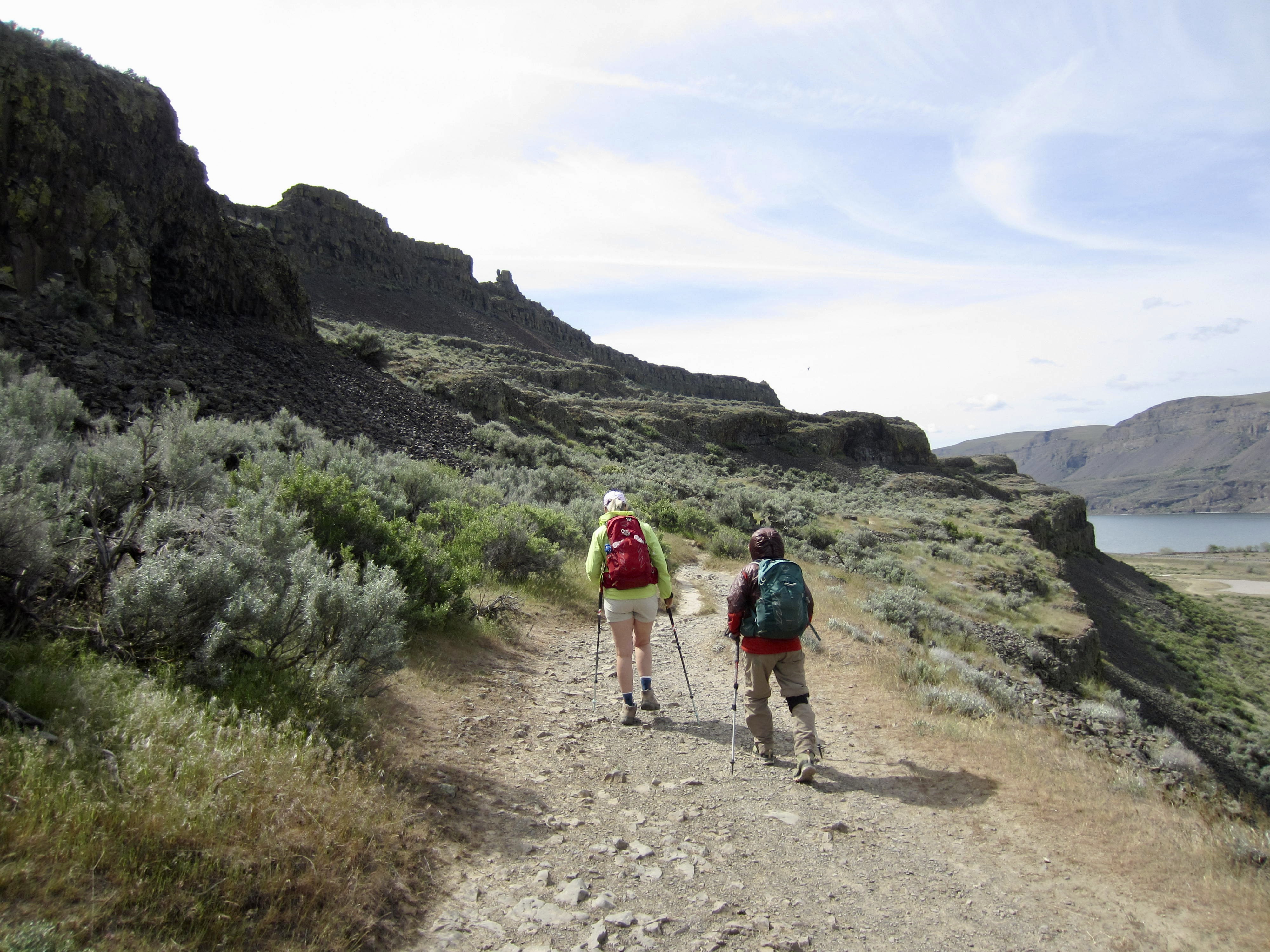
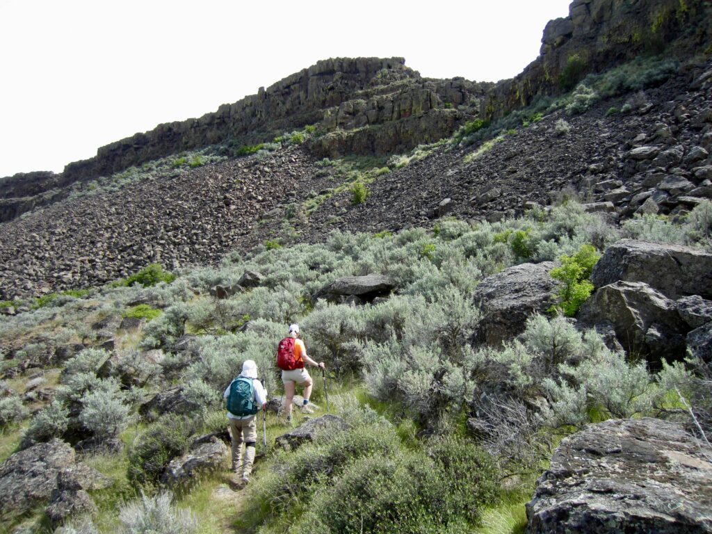
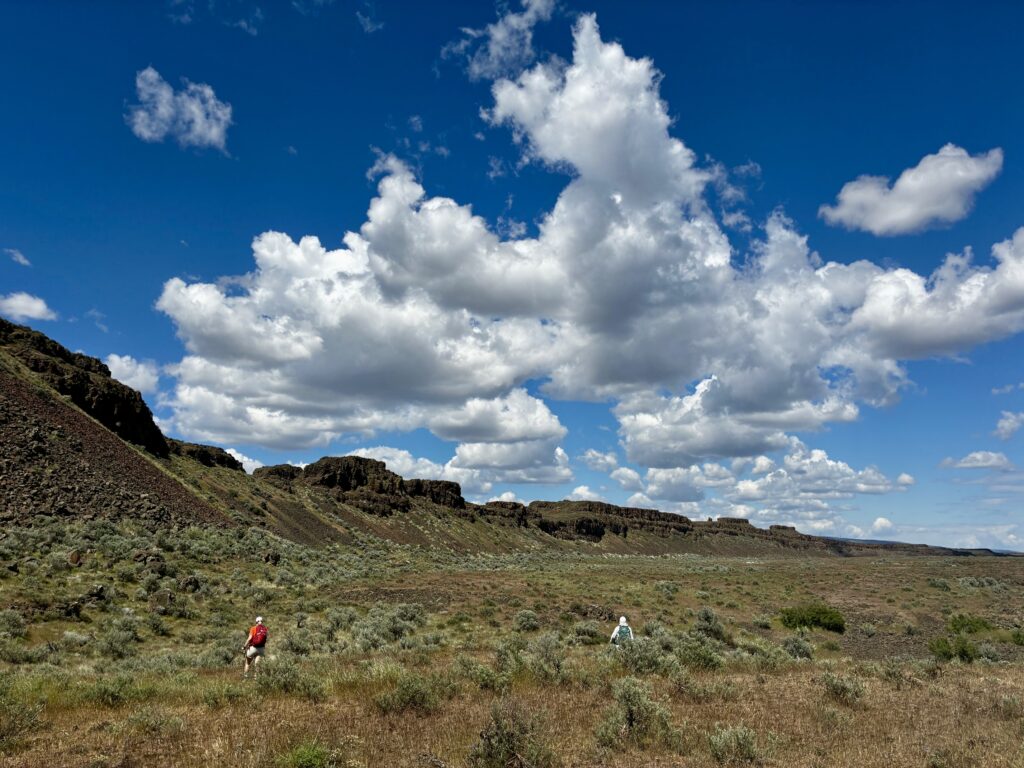
For our second daytrip, we elected to circumnavigate the southern half of The Great Blade, crossing around the southern tip and looping back through the North Notch. We headed out from the Lake Lenore Caves Trailhead on a cool Wednesday morning and followed a maze of trails up to the Western Terrace, then hiked southward along this terrace on a well-defined bootpath.

.
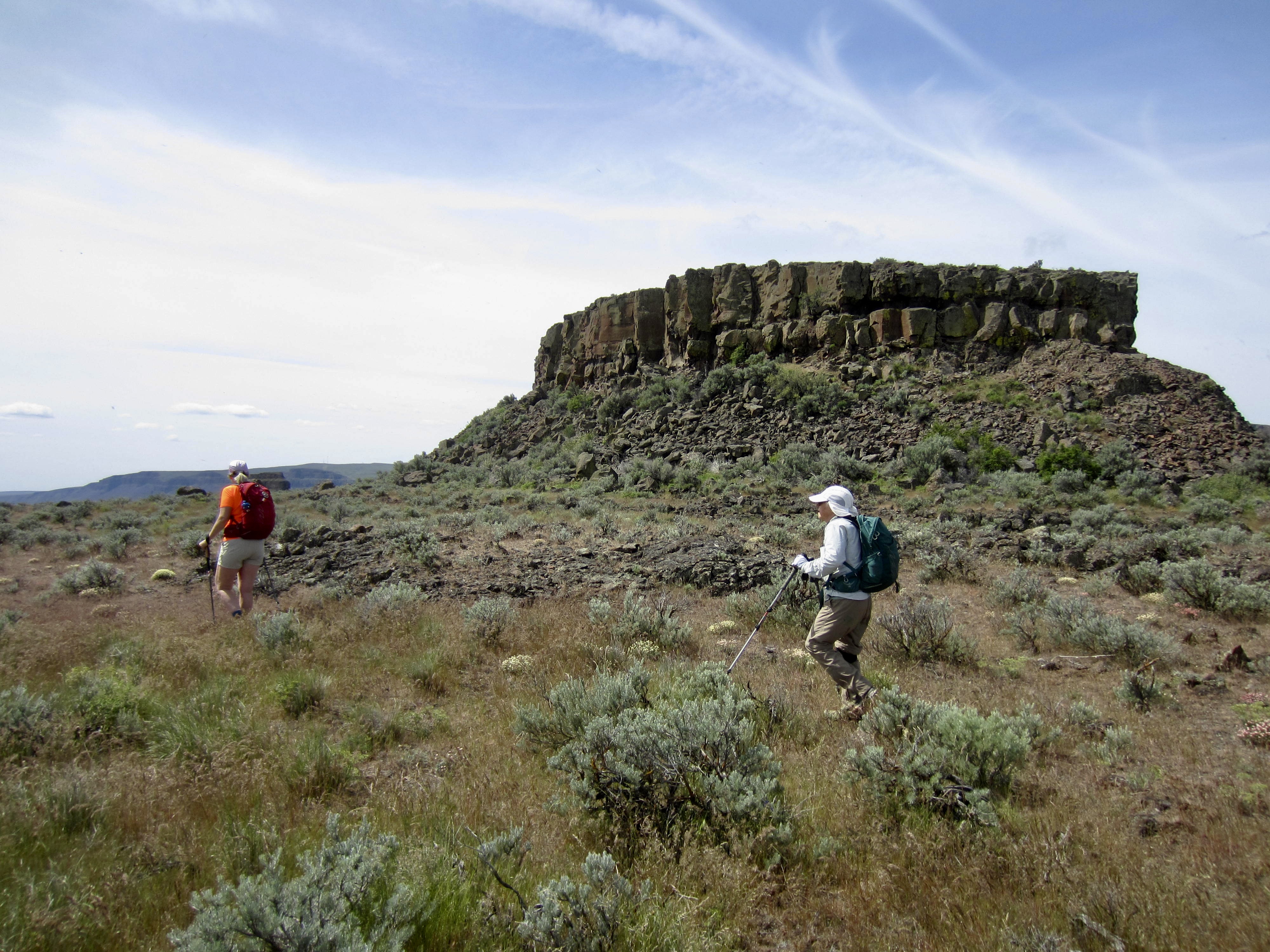
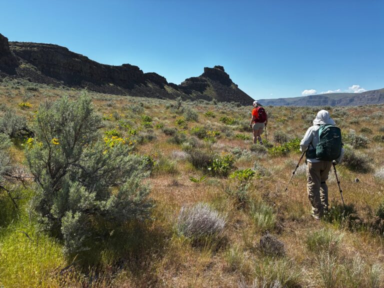
When our bootpath faded out, we continued hiking cross-country across the extraordinarily wide and level terrace. We crossed underneath Bladerunner Crag and The Mushroom while aiming toward Great Blade Peak, which stood out like a beacon in the distance. As we got closer, the peak took on the appearance of a massive stone ship perched atop a giant pile of talus.

.
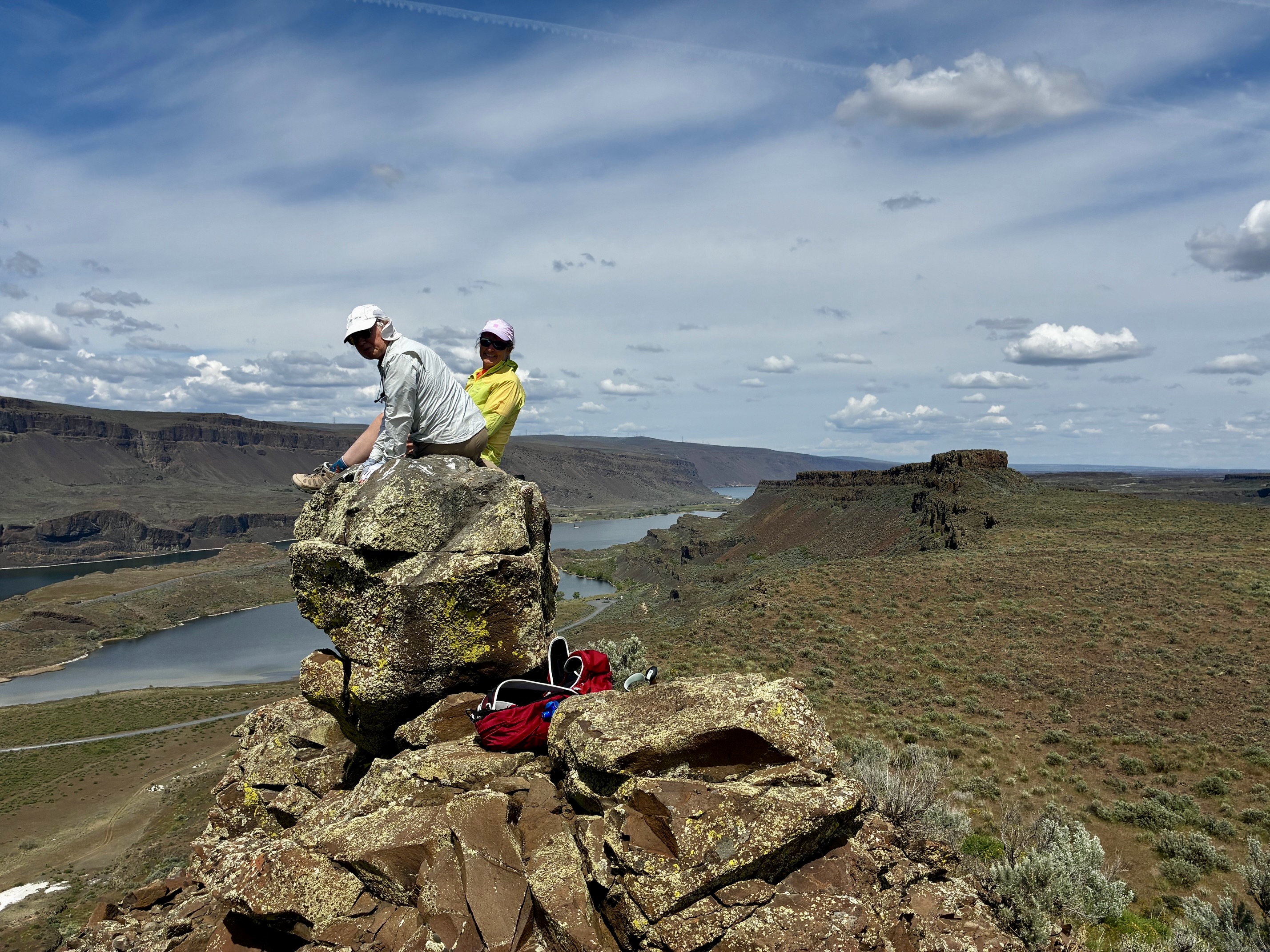
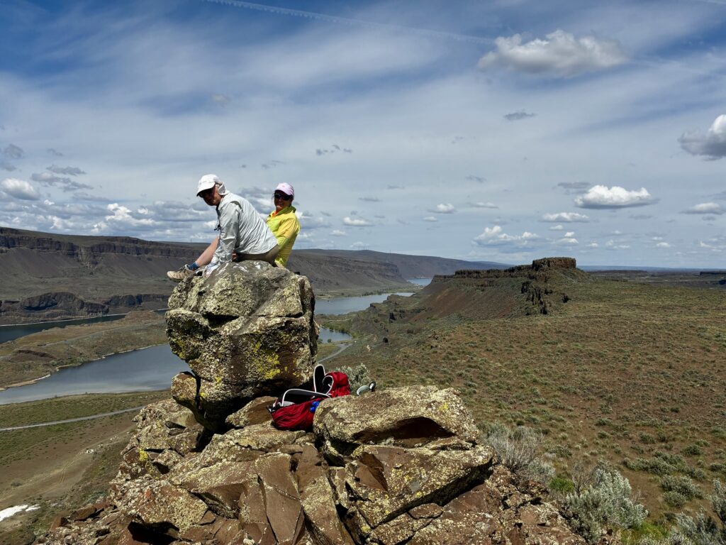
Eventually, we passed under Great Blade Peak and arrived at the southern tip of The Great Blade (1.9 hours + 1.8 miles + 250 feet from starting point). This end of the blade consists of a craggy fin of highly eroded basalt. Because it was now midday, we all scrambled 150 feet up to a rocky knob for lunch with a view.
.
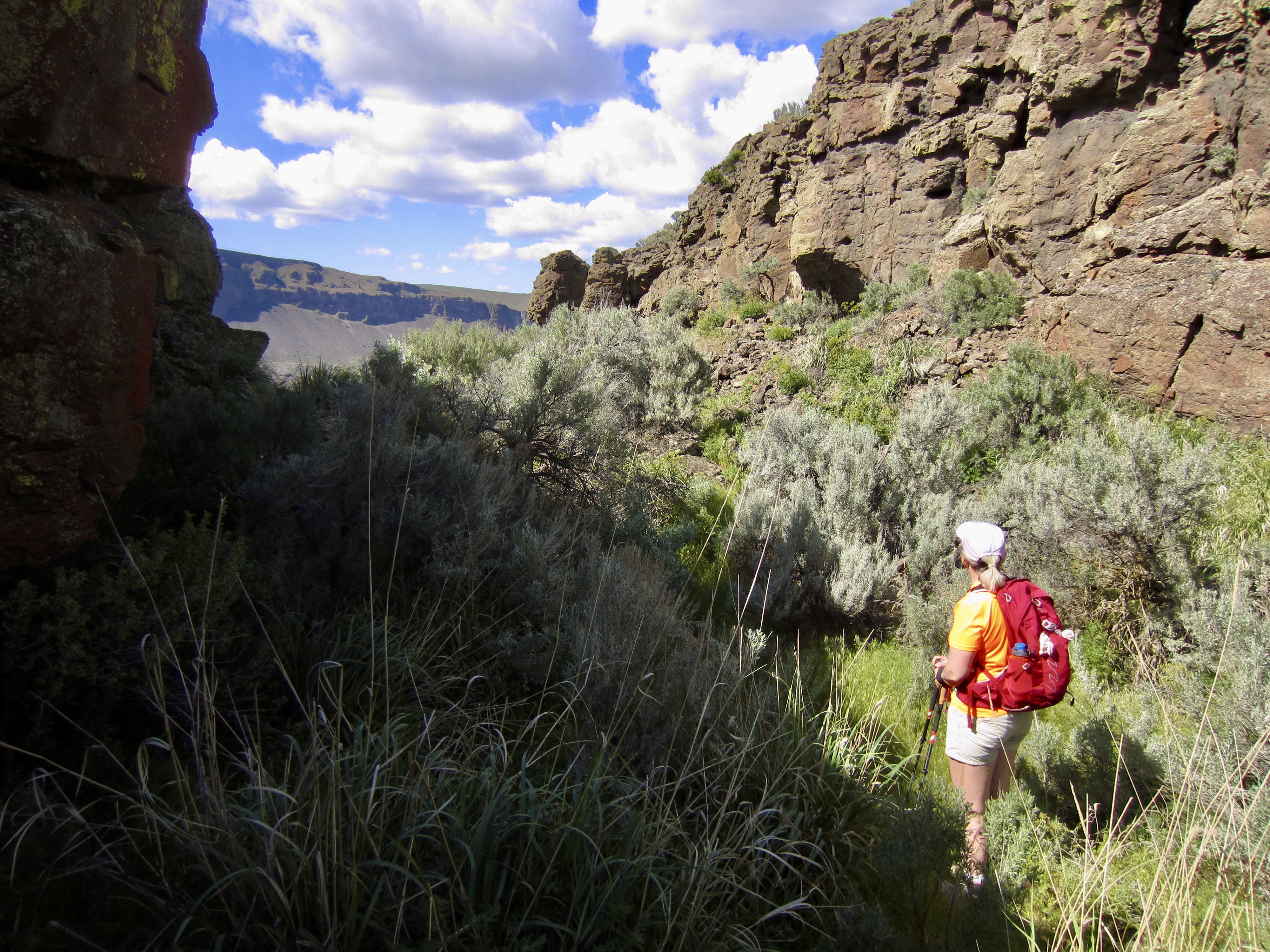
After a leisurely lunch, we scrambled back down and curved around to the eastern side of The Great Blade. This put us into East Lenore Coulee, which geologically corresponds to the Western Terrace; both surfaces represent the top of a continuous erosion-resistant basalt flow. Looking back at Great Blade Peak from here, we could see that it maintained the appearance of a massive stone ship.
.
For the next hour, we wandered through the grass and sagebrush of East Lenore Coulee, working around scattered boulders and potholes. Bladerunner Crag and its adjacent tabletop mesas remained clearly visible to the north, so we always had a defined target. To keep things interesting, a young rattlesnake crossed directly in front of Fay at one point, eliciting a loud a shriek from her!
.
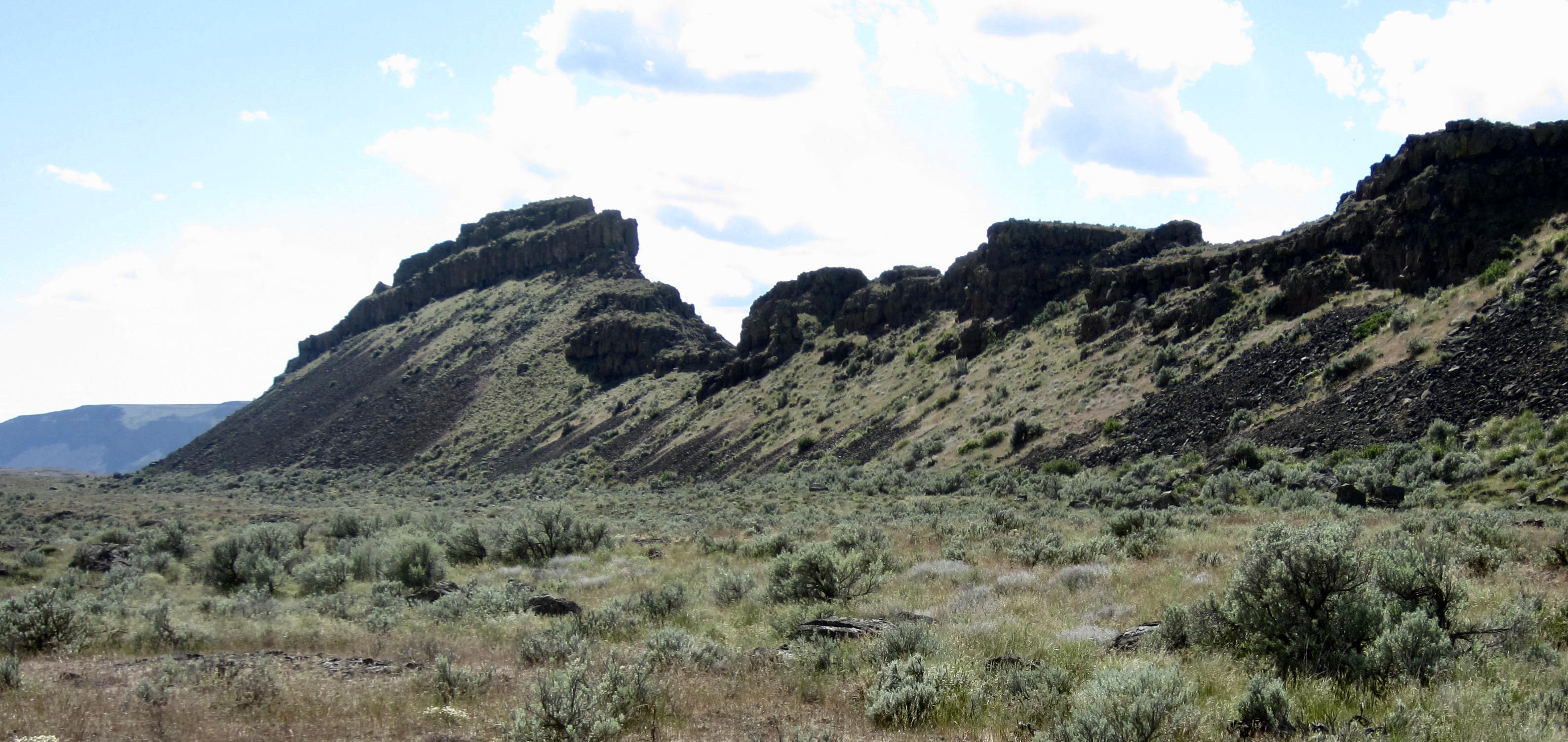
After 1⅓ miles of pleasant strolling, we arrived at the base of a talus chute emanating from the North Notch. This notch, which separates the northern and southern halves of The Great Blade, is framed by tall basalt cliffs that offer a grand gateway. As hoped, a steep bootpath gave us easy access to the notch (4.5 hours + 550 feet from starting point).
.
In contrast to the surrounding terrain, the North Notch features relatively lush vegetation. It feels like a tiny oasis atop The Great Blade. We sat down in the shade for a final break before heading down the western side (on the steep path we’d hiked up yesterday) and then returning to Lake Lenore Caves Trailhead (5.5 hours + 3.8 miles + 550 feet total loop).

.
Daytrip 3: Great Blade Peak Hike & Climb
For our final daytrip, we decided to attempt an ascent of Great Blade Peak. This decision was prompted by the peak’s striking appearance combined with a recent trip report by Paul Klenke. We headed out from the Lake Lenore Caves Trailhead on a warm Thursday morning and retraced yesterday’s hiking route along the Western Terrace, eventually crossing underneath the peak’s summit structure.
.
At a point approximately ¼ mile beyond the summit, we made a sharp left turn and began ascending a brush-covered talus slope. Although the Klenke party had approached Great Blade Peak via a long, low-angle ramp on the blade’s eastern flank, Eileen, Fay, and I wanted to try a short, steep ramp on the western flank. This would provide a more direct route for us if it worked out.
.
Our southwest ramp was steep and rubbly, but it proved to be a straightforward Class 1-2 route through the basaltic cliff bands. We soon gained the crest of the ridge, closely south of the summit structure.
.
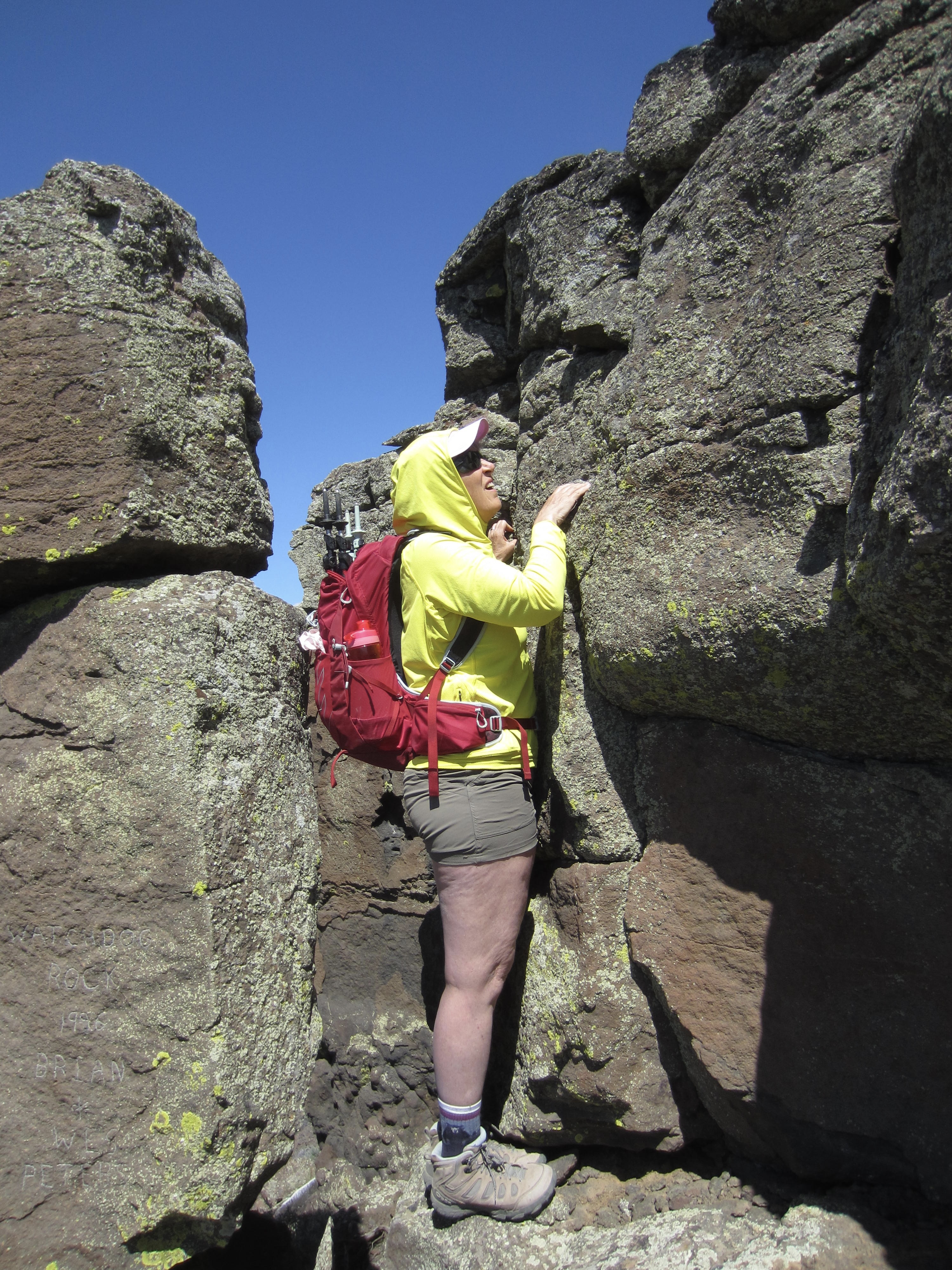
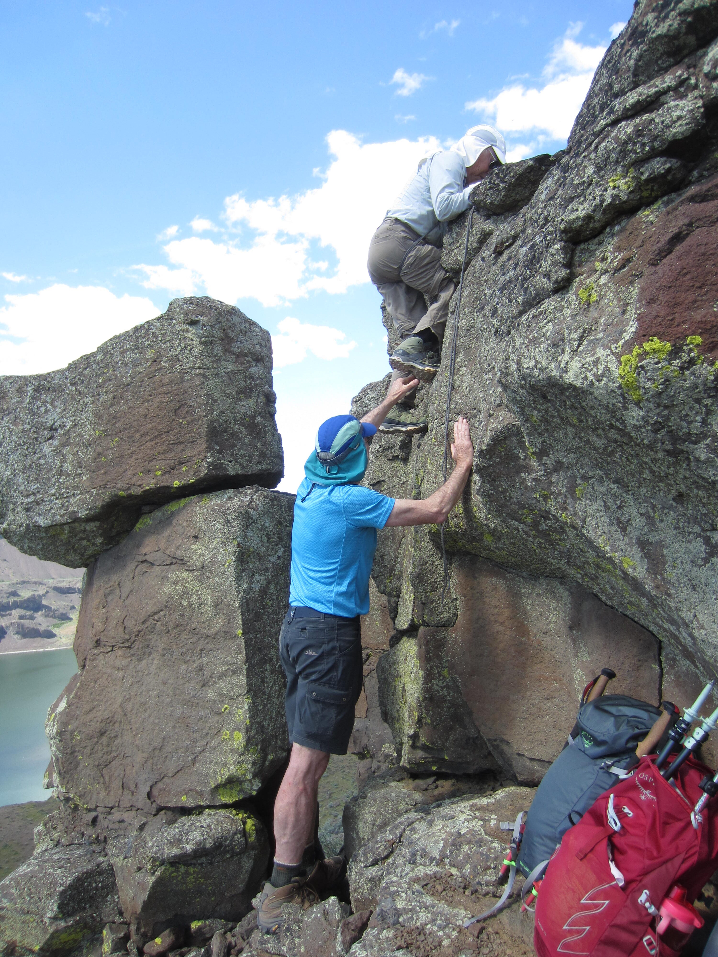
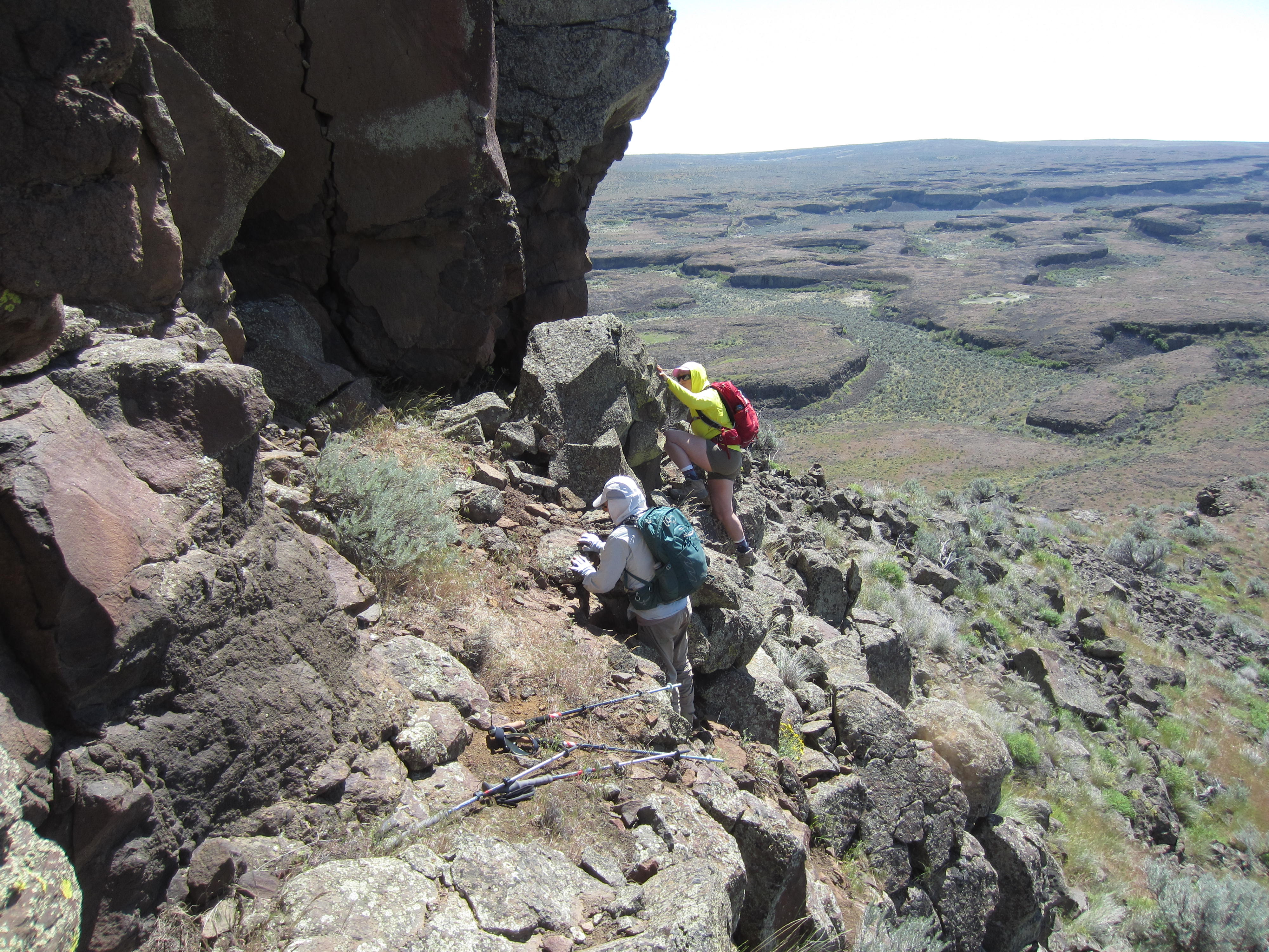
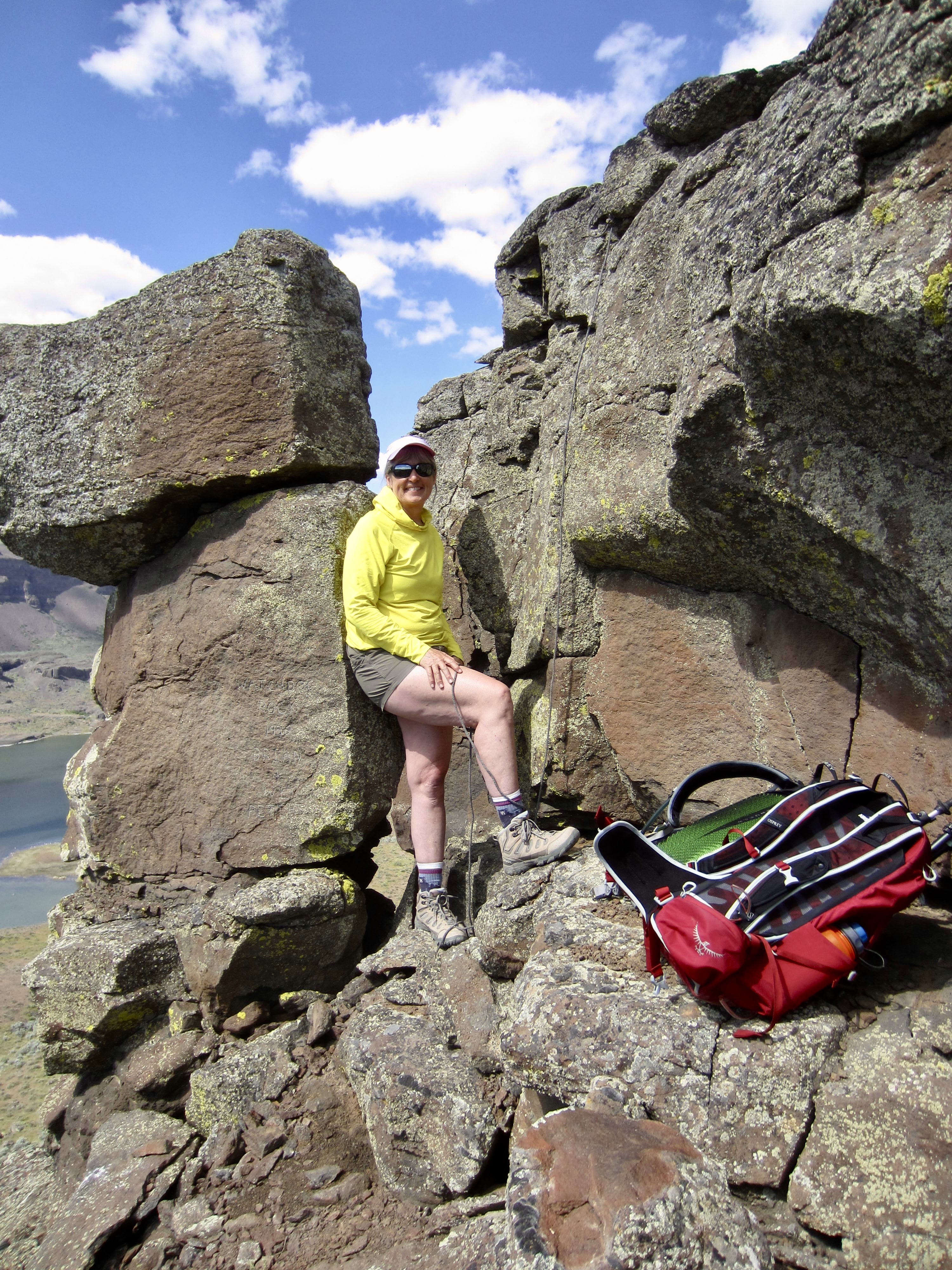
A brief walk along the ridge crest brought us to a short slope capped by an imposing wall of stout basalt columns. This wall, which forms the “stern” of the “stone ship,” is tallest at the right (eastern) side and tapers toward the left. At the extreme left side is a detached pillar that resembles a dog standing on its haunches. No doubt, this was the Watchdog Rock mentioned in the Klenke report—and subsequently confirmed by a carving on the pillar itself.
.
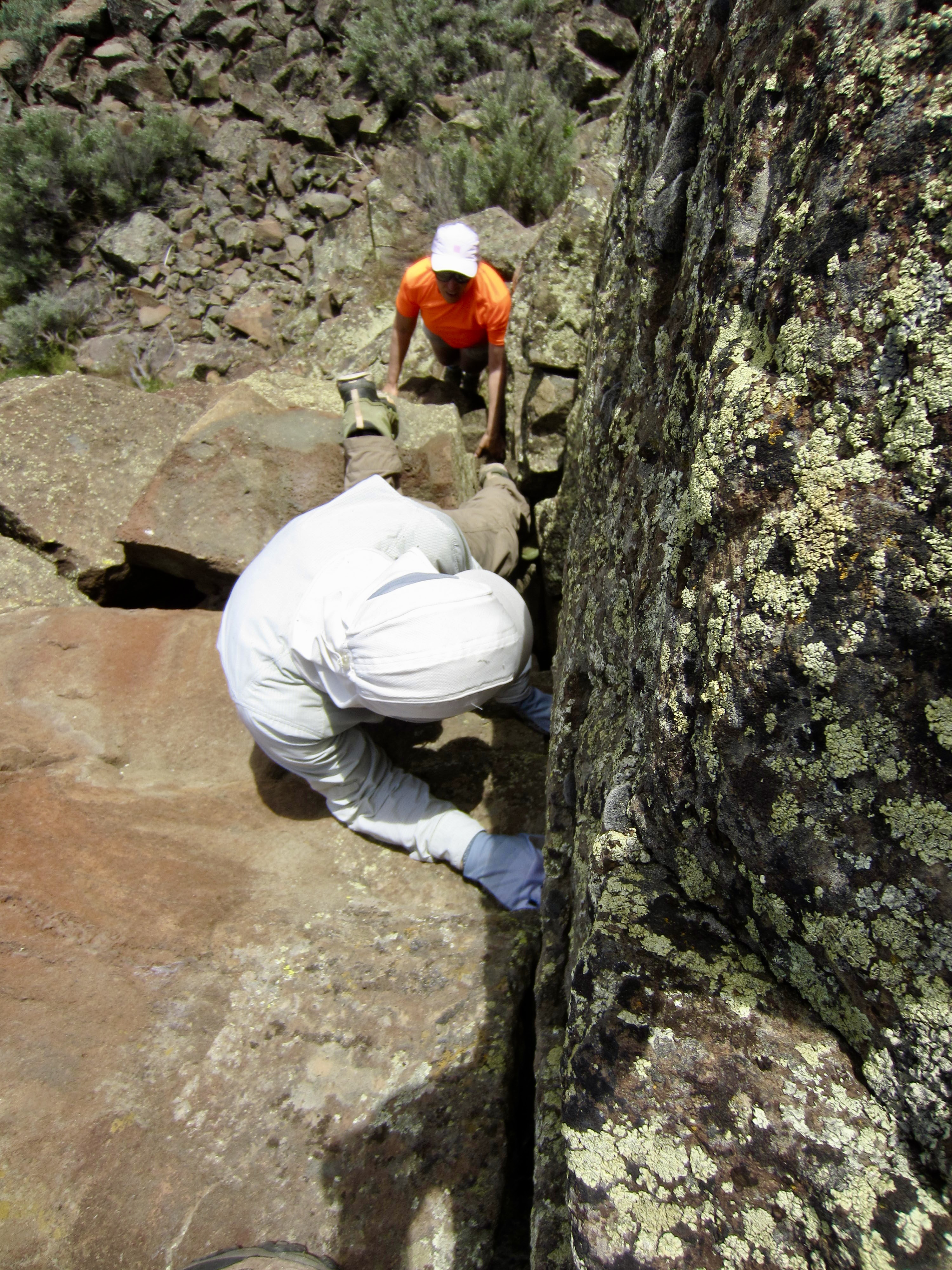
We scrambled up to a rough ledge at the base of the colonnade and traversed over to Watchdog Rock. After checking out several ascent options, we decided that the easiest route was immediately adjacent to the Watchdog, where the colonnade wall reaches a minimum height of about 10 feet. It looked somewhat tricky, so we were glad to have Fay’s lightweight panic rope today.
.
Eileen took the panic rope, and I boosted her up to the first foothold. She climbed farther up and executed a classic “beached whale” move to get over the top, then anchored the rope to a sturdy sage bush. Fay climbed up next, aided by hand loops tied in the panic rope and by some high foot boosts from me. I followed, using stemming moves to get up the lower face and then using the rope to get over the top. This was definitely the crux of the entire ascent; I would rate it as Class 3.5 with a difficult bouldering start.

.
Once past the crux, the rest of our ascent merely involved a 400-yard walk along the narrow ridge crest, which has a short Class 1-2 step along the way. We reached the summit cairn of Great Blade Peak in early afternoon (2.9 hours + 550 feet from trailhead). There was no summit register, but there were lots of summit smiles!
.

.
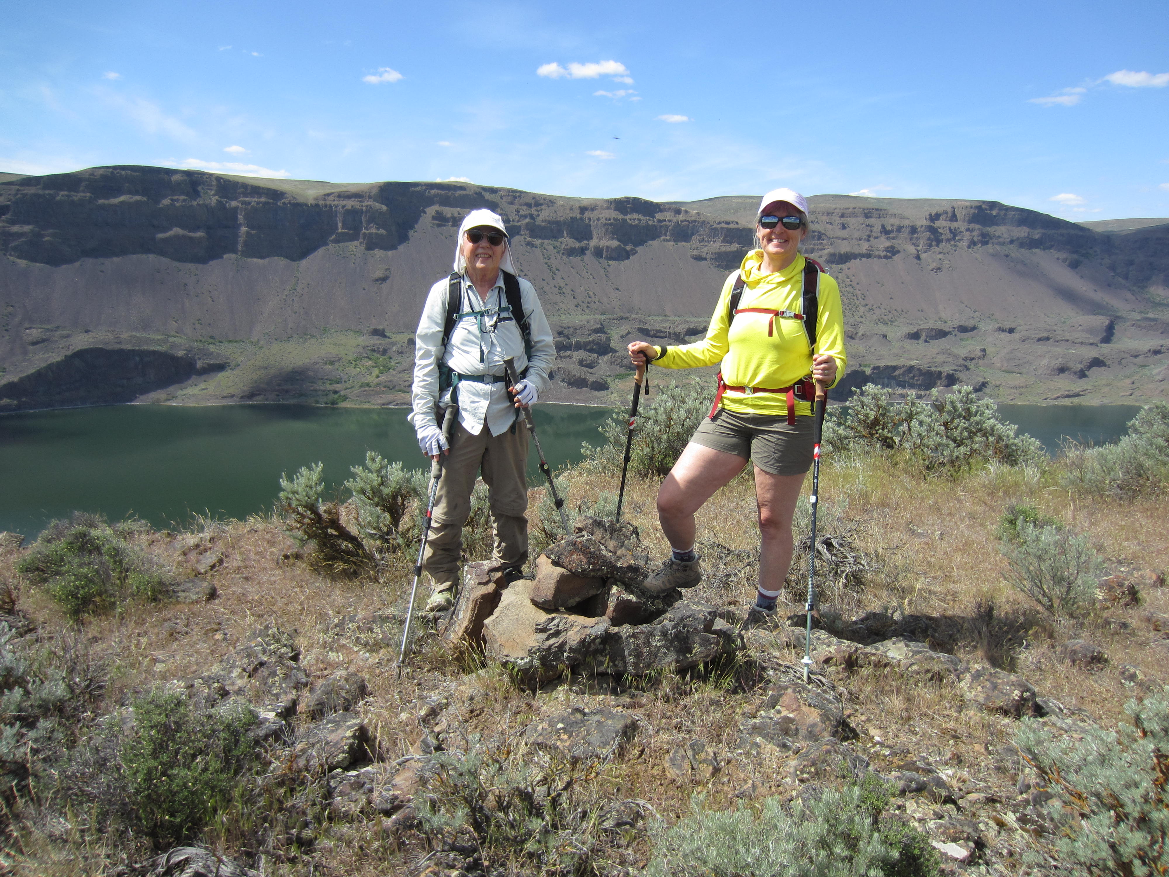
Not surprisingly, this summit provides a marvelous view along the entire 4-mile extent of The Great Blade as it gracefully curves to the northeast. The placid water of Lake Lenore lay to our west, and the channeled surface of East Lenore Coulee sprawled out to our east. We walked out to the northern prow of the summit ridge and took a long lunch break.
.
.
To descend the crux wall, Eileen and I used our fixed handline in conjunction with stemming against Watchdog Rock. Fay instead chose to reconfigure the rope so that she could rappel by means of a dulfersitz technique. Not many 83-year-olds would voluntarily execute a dulfersitz rappel down a vertical face, but then not many people under the age of 83 would even know how to do a dulfersitz!

.
We all managed to get off the summit structure and down to the Western Terrace without incident. In late afternoon heat, we hiked back to the trailhead (1.3 hours + 100 feet from summit) feeling very satisfied with our three-day exploration of The Great Blade.
Route Maps & Profiles
…
…
…
…
…
…
Photo Gallery
Click to enlarge…