• Hike/Climb/Ride
    • Canadian Cascades BC
    • Northwestern WA Cascades
    • Northeastern WA Cascades
    • North-Central WA Cascades
    • Central WA Cascades
    • Southern WA Cascades
    • Olympic Mountains WA
    • Columbia Plateau WA
    • Other USA & Canadian Regions
      • Arizona
      • California
      • Montana
      • Nevada
      • New Mexico
      • Oregon
      • Utah
      • Wyoming
      • Canada (non-Cascades)
    • International (outside USA & Can)
      • France
      • Jordan
      • Italy
      • Mexico
      • New Zealand
      • Patagonia
      • Peru
      • Slovenia
      • Switzerland
      • Tasmania
  • Major Peaks
    • Special Groups
      • The Regal Six
        • Glacier Peak (10,541/10,544 ft)
        • Adams, Mt (12,276/12,273 ft)
        • Baker, Mt (10,781/10,773 ft)
        • Olympus, Mt (7969 ft)
        • Rainier, Mt (14,411/14,400 ft)
        • St Helens, Mt (9677/8365/8321 ft)
      • The Big Ten
        • Bonanza Peak (9511/9503 ft)
        • Jack Mountain (9066/9065 ft)
        • Buckner, Mt (9114/9111 ft)
        • Fernow, Mt (9249/9241 ft)
        • Goode, Mt (9200+/9223 ft)
        • Logan, Mt (9087/9097 ft)
        • Maude, Mt (9082/9077 ft)
        • Shuksan, Mt (9131/9125 ft)
        • Stuart, Mt (9415/9414 ft)
        • Seven-Fingered Jack (9100 ft)
      • The Landmark Twelve
        • Black Peak (8970/8986 ft)
        • Bonanza Peak (9511/9503 ft)
        • Dome Peak (8920/8921 ft)
        • Eldorado Peak (8868/8873 ft)
        • Jack Mountain (9066/9065 ft)
        • Goode, Mt (9200+/9223 ft)
        • Redoubt, Mt (8969/8958 ft)
        • Shuksan, Mt (9131/9125 ft)
        • Stuart, Mt (9415/9414 ft)
        • Silver Star Mountain (8876/8892 ft)
        • Silvertip Mountain (8517 ft)
        • Sloan Peak (7835 ft)
      • The Super Eight
        • Agnes Mountain (8115 ft)
        • American Border Peak (7994 ft)
        • Chimney Rock (7727 ft)
        • Triumph, Mt (7270 ft)
        • Hozomeen Mtn: north peak (8066 ft)
        • Slesse, Mt (8002 ft)
        • Hozomeen Mtn: south peak (8003 ft)
        • Whitehorse Mountain (6852 ft)
      • The Tall Twelve
        • Black Peak (8970/8986 ft)
        • Boston Peak (8894/8883 ft)
        • Copper Peak (8964/8960 ft)
        • Dome Peak (8920/8921 ft)
        • Dragontail Peak (8840+/8836 ft)
        • Eldorado Peak (8868/8873 ft)
        • Forbidden Peak (8815/8839 ft)
        • Gardner Mountain (8898/8897 ft)
        • Redoubt, Mt (8969/8958 ft)
        • Spickard, Mt (8979/8978 ft)
        • Gardner Mtn, North (8956/8958 ft)
        • Silver Star Mountain (8876/8892 ft)
    • Canadian Cascades Majors
      • The Canadian Chilliwack Three
        • Lindeman, Mt (7578 ft)
        • Rexford, Mt (7641 ft)
        • Slesse, Mt (8002 ft)
      • The Cheam Six
        • Baby Munday Peak (7382 ft)
        • Cheam Peak (6929 ft)
        • Foley Peak (7572 ft)
        • Lady Peak (7182 ft)
        • Stewart Peak (7343 ft)
        • Welch Peak (7999 ft)
      • The Coquihalla Seven
        • Coquihalla Mountain (6955+/7077 ft)
        • Gemse Peak (6037+/6201 ft)
        • Ibex Peak (6562+/6690 ft)
        • Needle Peak (6693+/6857 ft)
        • Steinbok Peak (6430+/6601 ft)
        • Vicuna Peak (6880+/6975 ft)
        • Yak Peak (6640+/6690 ft)
      • The Sumallo Three
        • Payne, Mt (8097 ft)
        • Rideout, Mt (8029 ft)
        • Silvertip Mountain (8517 ft)
    • Northwestern Cascades Majors
      • The American Chilliwack Six
        • Bear Mountain (7931 ft)
        • Custer, Mt (8630/8648 ft)
        • Redoubt, Mt (8969/8958 ft)
        • Spickard, Mt (8979/8978 ft)
        • Mox Peak, Easy (8407/8392 ft)
        • Mox Peak, Hard (8504/8501 ft)
      • The Lower Skagit Five
        • Bacon Peak (7061 ft)
        • Blum, Mt (7680 ft)
        • Despair, Mt (7292 ft)
        • Hagan, Mt (7080+ ft)
        • Triumph, Mt (7270 ft)
      • The McAllister Five
        • Austera Peak (8334/8366 ft)
        • Colonial Peak (7771 ft)
        • Klawatti Peak (8485/8500 ft)
        • Primus Peak (8508/8497 ft)
        • Snowfield Peak (8347/8346 ft)
      • The Nooksack Six
        • American Border Peak (7994 ft)
        • Canadian Border Peak (7516 ft)
        • Larrabee, Mt (7861 ft)
        • Sefrit, Mt (7191 ft)
        • Shuksan, Mt (9131/9125 ft)
        • Tomyhoi Peak (7435 ft)
      • The Picket Twelve
        • Crooked Thumb Peak (8124 ft)
        • McMillan Spire, East (7992 ft)
        • Inspiration Peak (7880+ ft)
        • Luna Peak (8311/8286 ft)
        • Challenger, Mt (8207 ft)
        • Degenhardt, Mt (8000+ ft)
        • Fury, Mt: east peak (8288/8322 ft)
        • Fury, Mt: west peak (8292/8298 ft)
        • Terror, Mt (8151 ft)
        • Triumph, Mt (7270 ft)
        • Phantom Peak (8045 ft)
        • Twin Needles: west peak (7936 ft)
      • The Thunder Eight
        • Boston Peak (8894/8883 ft)
        • Eldorado Peak (8868/8873 ft)
        • Forbidden Peak (8815/8839 ft)
        • Buckner, Mt (9114/9111 ft)
        • Goode, Mt (9200+/9223 ft)
        • Logan, Mt (9087/9097 ft)
        • Sahale Peak (8680+ ft)
        • Storm King Mountain (8520+/8560 ft)
      • The Twin Sisters Two
        • Twin Sisters: north peak (6640+ ft)
        • Twin Sisters: south peak (7000+ ft)
    • Northeastern Cascades Majors
      • The Mazama Three
        • Gardner Mountain (8898/8897 ft)
        • Gardner Mtn, North (8956/8958 ft)
        • Silver Star Mountain (8876/8892 ft)
      • The Pasayten Eleven
        • Craggy Peak, Big (8470/8473 ft)
        • Blackcap Mountain (8397/8402 ft)
        • Lake Mountain (8371/8372 ft)
        • Lost Peak (8464/8466 ft)
        • Monument Peak (8592/8610 ft)
        • Carru, Mt (8595/8604 ft)
        • Lago, Mt (8745/8743 ft)
        • Osceola Peak (8587/8579 ft)
        • Ptarmigan Peak (8614 ft)
        • Robinson Mountain (8726/8724 ft)
        • Craggy Peak, West (8366/8367 ft)
      • The Ragged Seven
        • Black Peak (8970/8986 ft)
        • Corteo Peak (8080+ ft)
        • Cosho Peak (8332/8333 ft)
        • Katsuk Peak (8680+/8679 ft)
        • Kimtah Peak (8600+/8644 ft)
        • Mesahchie Peak (8795/8805 ft)
        • Arriva, Mt (8215 ft)
      • The Similkameen Three
        • Cathedral Peak (8601/8599 ft)
        • Grimface Mountain (8645 ft)
        • Remmel Mountain (8685/8683 ft)
      • The Upper Methow Six
        • Azurite Peak (8400+/8440 ft)
        • Cutthroat Peak (8050 ft)
        • Golden Horn (8366/8418 ft)
        • Ballard, Mt (8340/8371 ft)
        • Hardy, Mt (8080+ ft)
        • Tower Mountain (8444/8440 ft)
      • The Upper Skagit Five
        • Castle Peak (8306/8343 ft)
        • Crater Mountain (8128 ft)
        • Jack Mountain (9066/9065 ft)
        • Hozomeen Mtn: north peak (8066 ft)
        • Hozomeen Mtn: south peak (8003 ft)
      • The Washington Pass Three
        • Liberty Bell Mountain (7720+ ft)
        • Early Winters Spire, North (7760+ ft)
        • Early Winters Spire, South (7807 ft)
    • North-Central Cascades Majors
      • The Chelan Four
        • Cardinal Peak (8590/8591 ft)
        • Emerald Peak (8422/8414 ft)
        • Pinnacle Mountain (8402/8395 ft)
        • Saska Peak (8404/8399 ft)
      • The Chiwawa Four
        • Buck Mountain (8528/8534 ft)
        • Chiwawa Mountain (8459/8453 ft)
        • Dumbell Mountain (8421/8411 ft)
        • Fortress Mountain (8760+/8679 ft)
      • The DaKobed Four
        • Chalangin Peak (8320+/8366 ft)
        • Clark Mountain (8602/8582 ft)
        • Luahna Peak (8400+/8445 ft)
        • Tenpeak Mountain (8281 ft)
      • The Entiat Five
        • Copper Peak (8964/8960 ft)
        • Fernow, Mt (9249/9241 ft)
        • Maude, Mt (9082/9077 ft)
        • Seven-Fingered Jack (9100 ft)
        • Spectacle Butte, South (8392/8395 ft)
      • The Monte Cristo Seven
        • Cadet Peak (7186 ft)
        • Columbia Peak (7172 ft)
        • Del Campo Peak (6610 ft)
        • Foggy Peak (6810 ft)
        • Kyes Peak (7280+ ft)
        • Monte Cristo Peak (7136 ft)
        • Gemini Peak, South (6799 ft)
      • The Ptarmigan Pten
        • Agnes Mountain (8115 ft)
        • Dome Peak (8920/8921 ft)
        • Johannesburg Mountain (8200 ft)
        • Gunsight Peak, Main (8198 ft)
        • Formidable, Mt (8325/8353 ft)
        • Old Guard Peak (8240+ ft)
        • Sentinel Peak (8261 ft)
        • Sinister Peak (8440+/8439 ft)
        • Spider Mountain (8300/8312 ft)
        • Spire Point (8264 ft)
      • The Sauk Seven
        • Black Mountain (7262 ft)
        • Pugh, Mt (7201 ft)
        • Sloan Peak (7835 ft)
        • Three Fingers: north peak (6870 ft)
        • Three Fingers: south peak (6854 ft)
        • White Chuck Mountain (6989 ft)
        • Whitehorse Mountain (6852 ft)
      • The Sawtooth Six
        • Martin Peak (8375/8372 ft)
        • Corax Peak (8572/8592 ft)
        • Bigelow, Mt (8440+/8468 ft)
        • Oval Peak (8795 ft)
        • Reynolds Peak (8512 ft)
        • Star Peak (8690/8688 ft)
      • The Skykomish Three
        • Gunn Peak (6240 ft)
        • Baring, Mt (6125 ft)
        • Spire Mountain (6213 ft)
      • The Stehekin Seven
        • Bonanza Peak (9511/9503 ft)
        • Devore Peak (8360+/8378 ft)
        • Flora Mountain (8320/8323 ft)
        • Riddle Peak, Main (8232 ft)
        • Martin Peak (8511/8504 ft)
        • Tupshin Peak (8320+/8343 ft)
        • Wy’East Mountain (8280+ ft)
      • The Suiattle Five
        • Bruseth, Mt (7220 ft)
        • Buckindy, Mt (7320+ ft)
        • Chaval, Mt (7127 ft)
        • Misch, Mt (7435 ft)
        • Snowking Mountain (7433 ft)
    • Central Cascades Majors
      • The Chiwaukum Two
        • Chiwaukum Peak, Big (8081 ft)
        • Snowgrass Mountain (7993 ft)
      • The Icicle Eight
        • Argonaut Peak (8453/8455 ft)
        • Cannon Mountain (8638/8652 ft)
        • Cashmere Mountain (8501/8514 ft)
        • Colchuck Peak (8705/8706 ft)
        • Dragontail Peak (8840+/8836 ft)
        • McClellan Peak (8364/8363 ft)
        • Stuart, Mt (9415/9414 ft)
        • Sherpa Peak (8605/8630 ft)
      • The Snoqualmie Twelve
        • Bears Breast Mountain (7197 ft)
        • Chair Peak (6238 ft)
        • Chikamin Peak (7000+ ft)
        • Chimney Rock (7727 ft)
        • Hibox Peak (6547 ft)
        • Kaleetan Peak (6259 ft)
        • Lemah Mountain (7480+ ft)
        • Daniel, Mt (7986 ft)
        • Hinman, Mt (7492 ft)
        • Thomson, Mt (6554 ft)
        • Summit Chief Mountain (7464 ft)
        • Three Queens Mtn: main peak (6687 ft)
    • Southern Cascades Majors
      • The Goat Rocks Three
        • Ives Peak (7932 ft)
        • Old Snowy Mountain (7930 ft)
        • Curtis Gilbert, Mt (8184 ft)
    • Olympic Mountains Majors
      • The Olympic Thirteen
        • Anderson, Mt: east peak (7321 ft)
        • Anderson, Mt: west peak (7365 ft)
        • Angeles, Mt (6454 ft)
        • Carrie, Mt (6995 ft)
        • Christie, Mt (6177 ft)
        • Constance, Mt: inner peak (7667 ft)
        • Constance, Mt: outer peak (7756 ft)
        • Deception, Mt (7788 ft)
        • Meany, Mt (6695 ft)
        • Mystery, Mt (7639 ft)
        • Stone, Mt (6612 ft)
        • Washington, Mt (6255 ft)
        • Brothers, The: south peak (6842 ft)
    • Wild-Card Groups
      • The Outlier Twelve
        • Big Four Mountain (6160+ ft)
        • Davis Peak (7051 ft)
        • McGregor Mountain (8122 ft)
        • David, Mt (7420 ft)
        • Garfield, Mt (5519 ft)
        • Index, Mt: main peak (5991 ft)
        • Outram, Mt (8000+ ft)
        • Prophet, Mt (7640+ ft)
        • Ingalls Peak: North/Main (7662 ft)
        • Sluiskin Mtn: The Chief (7026 ft)
        • Cradle, The (7467 ft)
        • Whatcom Peak (7574 ft)
      • The Satellite Three
        • Colfax Peak (9443/9440 ft)
        • Lincoln Peak (9096 ft)
        • Little Tahoma Peak (11,138/11,136 ft)
    • Major Alpine Crags
      • Canadian Cascades Crags
        • Nesakwatch Spire, South (7400+ ft)
        • Slesse Peak, South (7700+ ft)
      • Northwestern Cascades Crags
        • Devil’s Tongue (8048 ft)
        • Dorado Needle (8440+/8466 ft)
        • Twin Needles: east peak (7840+ ft)
        • Himmelgeisterhorn (7880+ ft)
        • Nooksack Tower (8285 ft)
        • Paul Bunyan’s Stump (7480+ ft)
        • Sharkfin Tower (8120+ ft)
        • Chopping Block, The (6819 ft)
        • Degenhardt Pyramid, The (7920+ ft)
      • Northeastern Cascades Crags
        • Kangaroo Peak, Big (8326/8318 ft)
        • Methow Needle, Big (8170 ft)
        • Burgundy Spire (8400+ ft)
        • Concord Tower (7560+ ft)
        • Lexington Tower (7560 ft)
      • North-Central Cascades Crags
        • Gunsight Peak, North (8190 ft)
        • White Goat Peak (7800+ ft)
      • Central Cascades Crags
        • Cathedral Rock (6724 ft)
        • Little Big Chief Peak (7225 ft)
        • Index, Mt: middle peak (5493 ft)
        • Index, Mt: north peak (5357 ft)
        • Prusik Peak (8000+ ft)
        • Bull’s Tooth, The (6680+ ft)
        • Citadel, The (7120+ ft)
        • Mole, The (7240+ ft)
        • Enchantment Temple (8292/8290 ft)
      • Southern Cascades Crags
        • Goat Horn, Big (8000+ ft)
        • Fifes Peak, East (6793 ft)
        • Cowlitz Chimney, Main (7605 ft)
      • Olympic Mountains Crags
        • Clark, Mt (7528 ft)
        • Cruiser, Mt (6104 ft)
  • Ski/Snowshoe
    • Snow Tours in British Columbia
    • Snow Tours in Northwestern WA Cascades
    • Snow Tours in Northeastern WA Cascades
    • Snow Tours in North-Central WA Cascades
    • Snow Tours in Central WA Cascades
    • Snow Tours in Southern WA Cascades
    • Snow Tours in Olympic Mountains WA
    • Snow Tours in Oregon
    • Snow Tours in Other Locations
  • Types of Trips
    • Canyoneering
    • Difficult 10 Climbs
    • Family Trips
    • Golden Larch Outings
    • Lookout Sites
    • Marathon Hikes
    • Mid-Summer Outings
    • Mtn & Gravel Biking
    • Rock & Ice Climbing
    • Summit Camps
    • The Early Years
    • Traverses & Loops: Alpine
    • Traverses & Loops: Bike
    • Traverses & Loops: Ski
    • Traverses & Loops: Trail
    • Traverses & Loops: Classics
      • Bacon-Hagan-Blum Trav (WA)
      • Enchantment Traverse (WA)
      • High–Giant Traverse (WA)
      • Inspiration–Isolation Trav (WA)
      • Olympus–Bailey Trav (WA)
      • Picket Traverse (WA)
      • Ptarmigan Traverse (WA)
      • Sneffels Ski Traverse (CO)
      • Grand Canyon Raft Trav (AZ)
      • Huayhuash Circuit (Peru)
      • Overland Trav (Tasmania)
    • Via Ferratas
    • WA Blue Corn Specials
    • Winter Summits
  • Mountain Goodies
    • Mountain Artifacts
      • Fire Lookout Cabins & Towers
      • Backcountry Shelters & Furniture
      • Backcountry Trail & Route Markers
      • Summit Registers & Benchmarks
      • Backcountry Informational Signs
    • Patterns/Textures/Colors
      • Clouds & Fog
      • Light & Shadow
      • Plants & Trees
      • Rocks & Minerals
      • Snow & Ice
      • Sunrise & Sunset
      • Water & Color
    • Equipment Catalogs
    • Mountain News Articles
    • Mountain Route Sketches
    • Handy Information Links
      • Weather & Avalanche Forecasts
      • Mountain Road & Trail Reports
      • Mountain Snowpack Depths
      • Nordic Grooming Reports
  • Reviews/Lists/Tips
    • Reviews of Selected Gear for Summertime & Wintertime Mountain Sports
    • Packing Lists + Gear Comments for Multi-Day Mountain Trips
    • Trailcat Tips: Assorted Gear Modifications, Procedures & Hacks + Trip Suggestions
  • Home
  • Major Peaks Synopsis
  • Major Peaks Map
  • Major Peaks A-Z
  • Recent Posts
  • Trip Archives
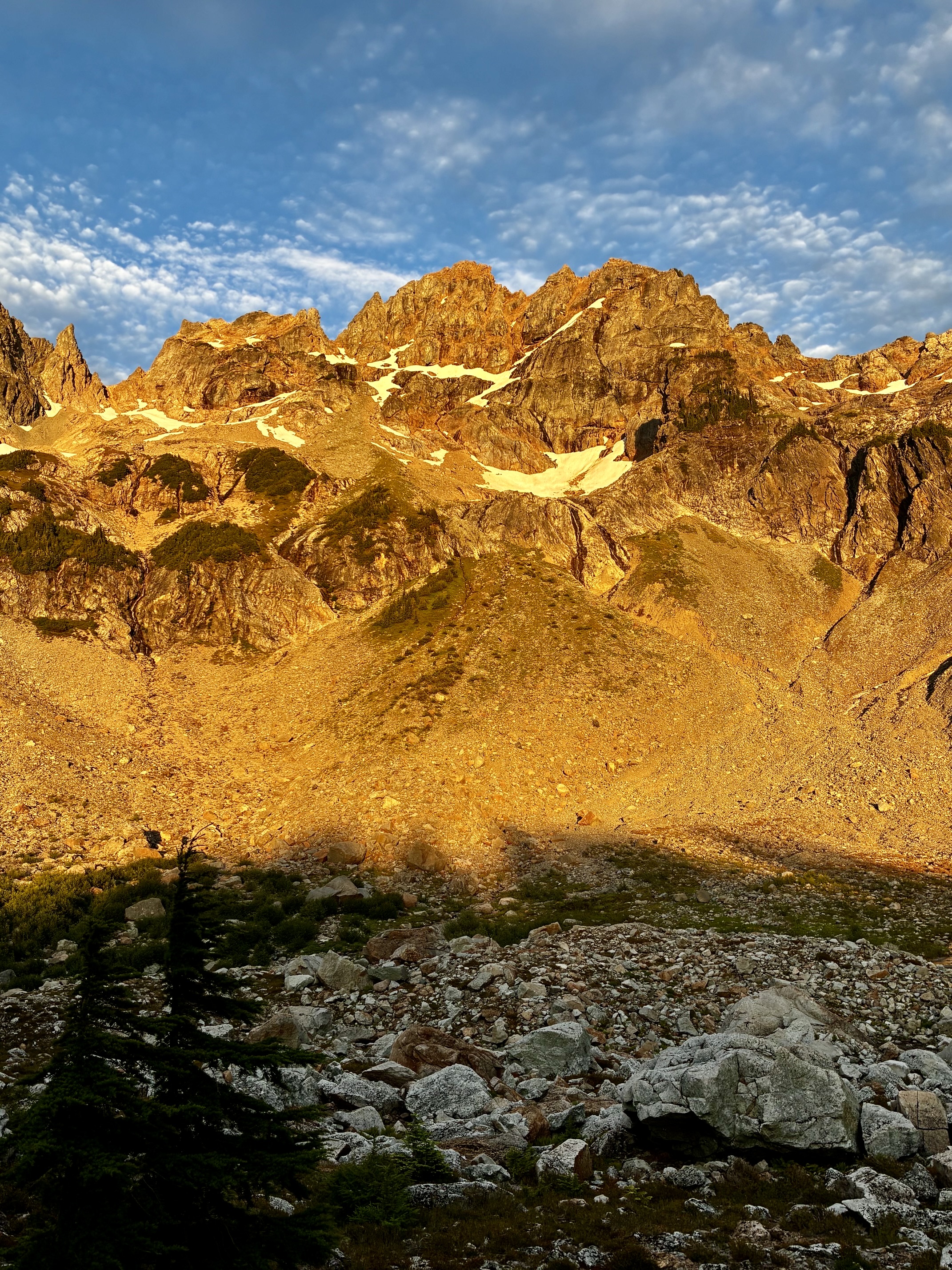
Evening alpenglow on Monte Cristo Peak above Glacier Basin

Glacier Basin Climbing Reconn: Monte Cristo Peak attempt + Cadet Peak attempt (Monte Cristo Mountains, WA)

Jim Brisbine·July 31, 2026
Cadet Peak (7186 ft)Mid-Summer OutingsMonte Cristo MountainsMonte Cristo Peak (7136 ft)North-Central WA CascadesThe Monte Cristo Seven

Trip Date: July 29-31, 2026

MID-SUMMER OUTING NO. 24: MONTE CRISTO MOUNTAINS

Glacier Basin Climbing Reconnaissance

Monte Cristo Townsite
Glacier Basin
Monte Cristo Peak (7136 ft) attempt
Cadet Peak (7186 ft) attempt

What’s in this Post…
show
  • Trip Report Summary
  • Related Posts
  • Full Trip Report
    • Day 1: Barlow Pass to Upper Glacier Basin
    • Day 2: Monte Cristo Peak & Cadet Peak Climbing Attempts
    • Day 3: Upper Glacier Basin to Barlow Pass
  • Route Maps & Profiles
  • Photo Gallery

Trip Report Summary

Region: North-Central Washington Cascades

Sub-Region: Monte Cristo Mountains

Area: Henry M. Jackson Wilderness

Starting & Ending Point: Monte Cristo Trailhead at Barlow Pass on Mountain Loop Highway (Elev. 2350 feet)

Approach Way Points: South Fork Sauk River footlog & South Fork Sauk River vehicle bridge & Upper South Fork Sauk River footbridge & Monte Cristo townsite & Glacier Basin Trail junction & Lower Glacier Basin & Upper Glacier Basin (trail hike & trail scramble & off-trail scramble)

Campsite: Ray’s Knoll in Upper Glacier Basin (Elev. 4650 feet)

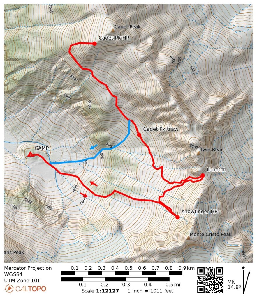
Summit Attempt 1: Monte Cristo Peak (snow climb to 6440 feet via North Snowfinger)

Summit Attempt 2: Monte Cristo Peak (rock scramble to U-notch via Northwest Gully)

Summit Attempt 3: Cadet Peak (off-trail hike & rock scramble to 6900 feet via Southwest Ridge)

Approximate Total Stats (as a group): 11.2 miles traveled; 6300 feet gained & lost.

Related Posts

>>> Monte Cristo Peak via Glacier Basin—North Couloir—East Face – June 1996

>>> Monte Cristo Peak attempt via Glacier Basin—North Couloir—East Face – July 1995

>>> Cadet Peak via Southwest Ridge—West Face + North Peak – September 2002

>>> Cadet Peak via Southwest Ridge—West Face – June 1997

Full Trip Report

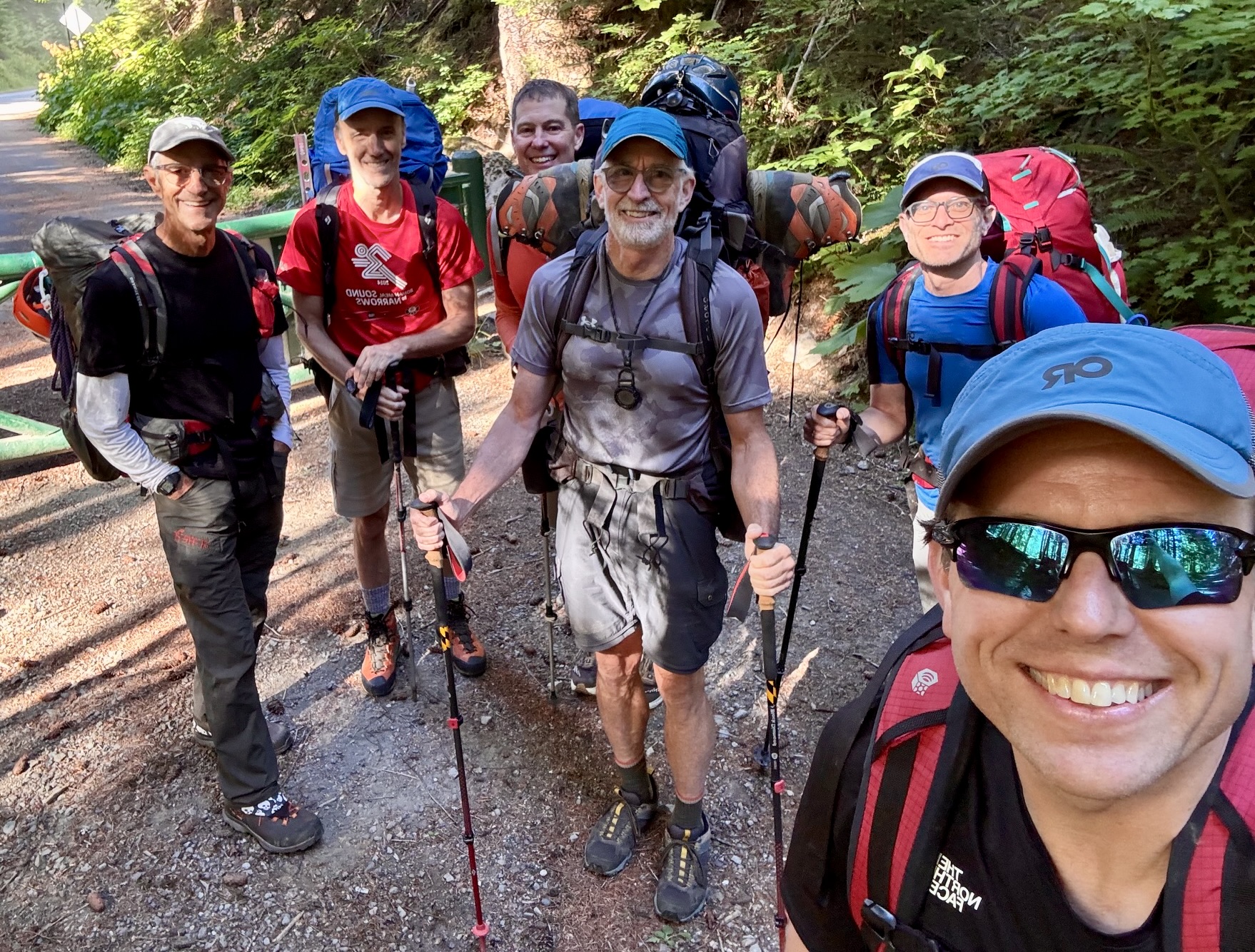
For the 24th installment of our annual Mid-Summer Outing, Jon, Eric, Todd, Adam, Kris, and I headed into the heart of the Monte Cristo Mountains. Our plan was to set up a basecamp in Upper Glacier Basin and then climb as many surrounding peaks as time would allow in a three-day trip. This seemed like a great plan, but the Count of Monte Cristo must have caught wind of it, and he pitched a total shutout. Ouch! It was the first time our mid-summer group had experienced a “summit skunk.” To deflect any potential embarrassment, we quickly put a positive spin on the trip by calling it a reconnaissance—and in that spirit, it was a truly successful trip!
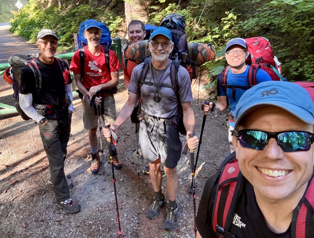
Mid-Summer Group At Barlow Pass (photo by Jon)

.

Day 1: Barlow Pass to Upper Glacier Basin

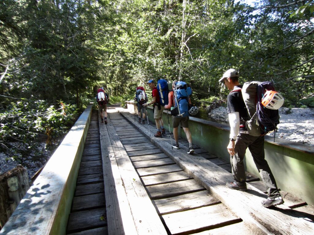
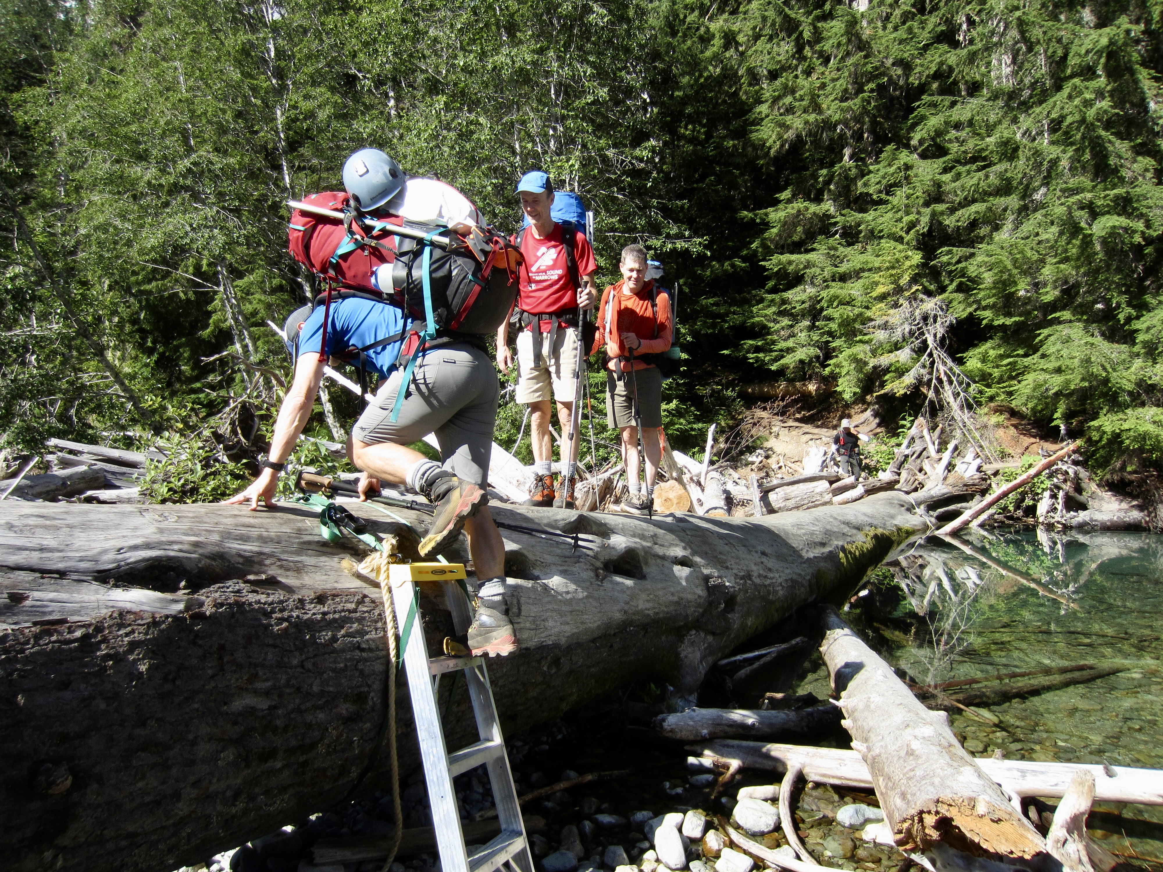
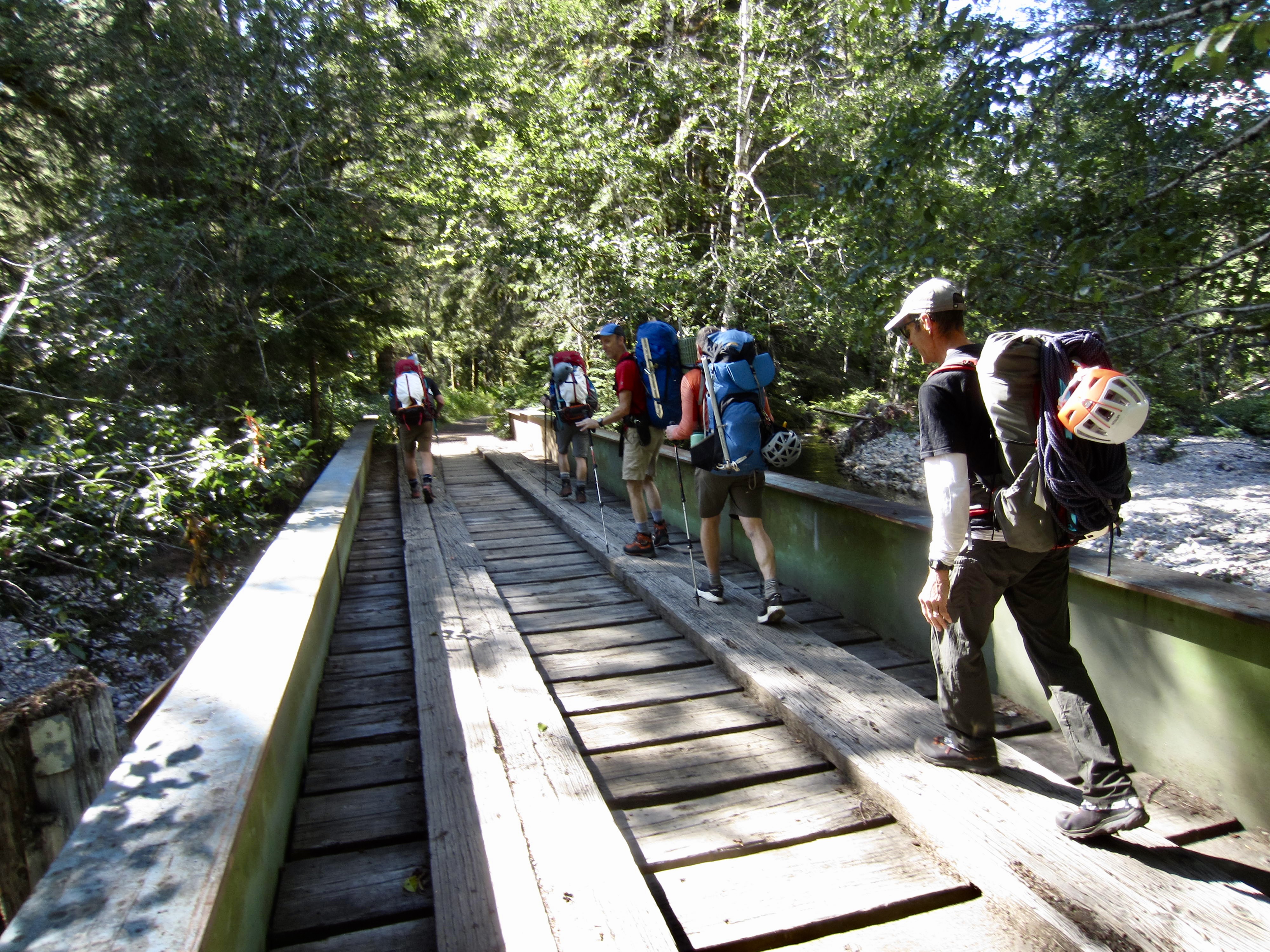
From the Barlow Pass parking lot, which was surprisingly full for a Wednesday morning, we hiked up the old Monte Cristo Road (now just a trail in many places) and quickly left the crowds behind. Both branches of the South Fork Sauk River were easily crossed, first on a large footlog and then on an old vehicular bridge.
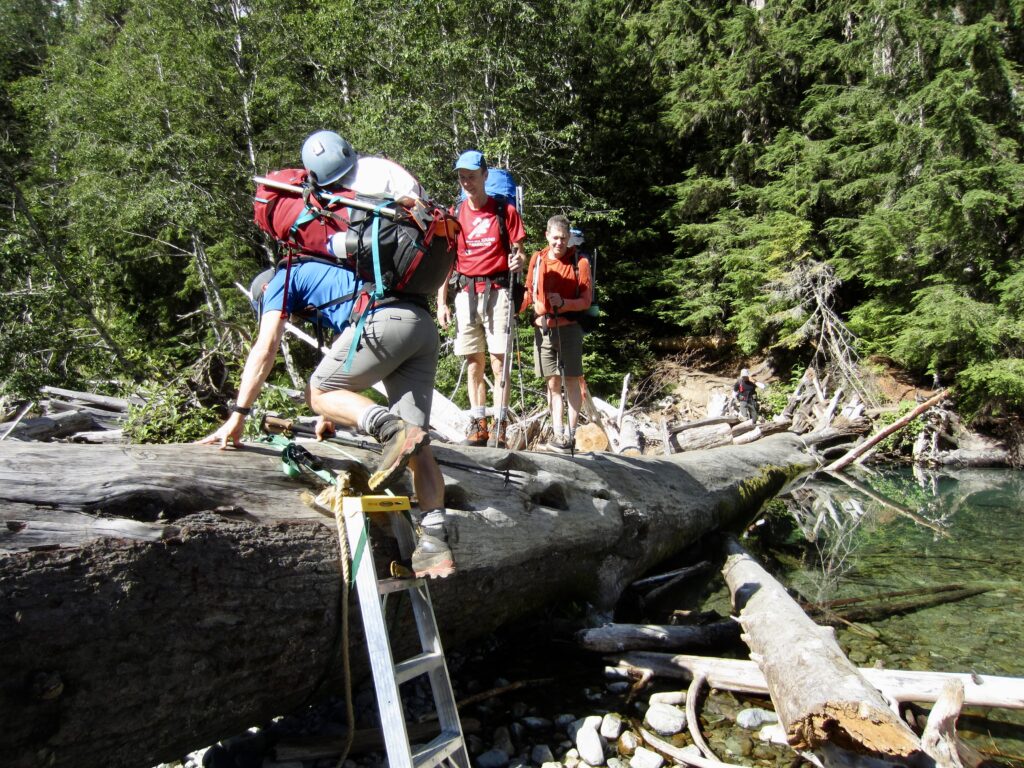
Crossing Footlog Over South Fork Sauk River

.

Crossing Old Vehicular Bridge Over South Fork Sauk River

.

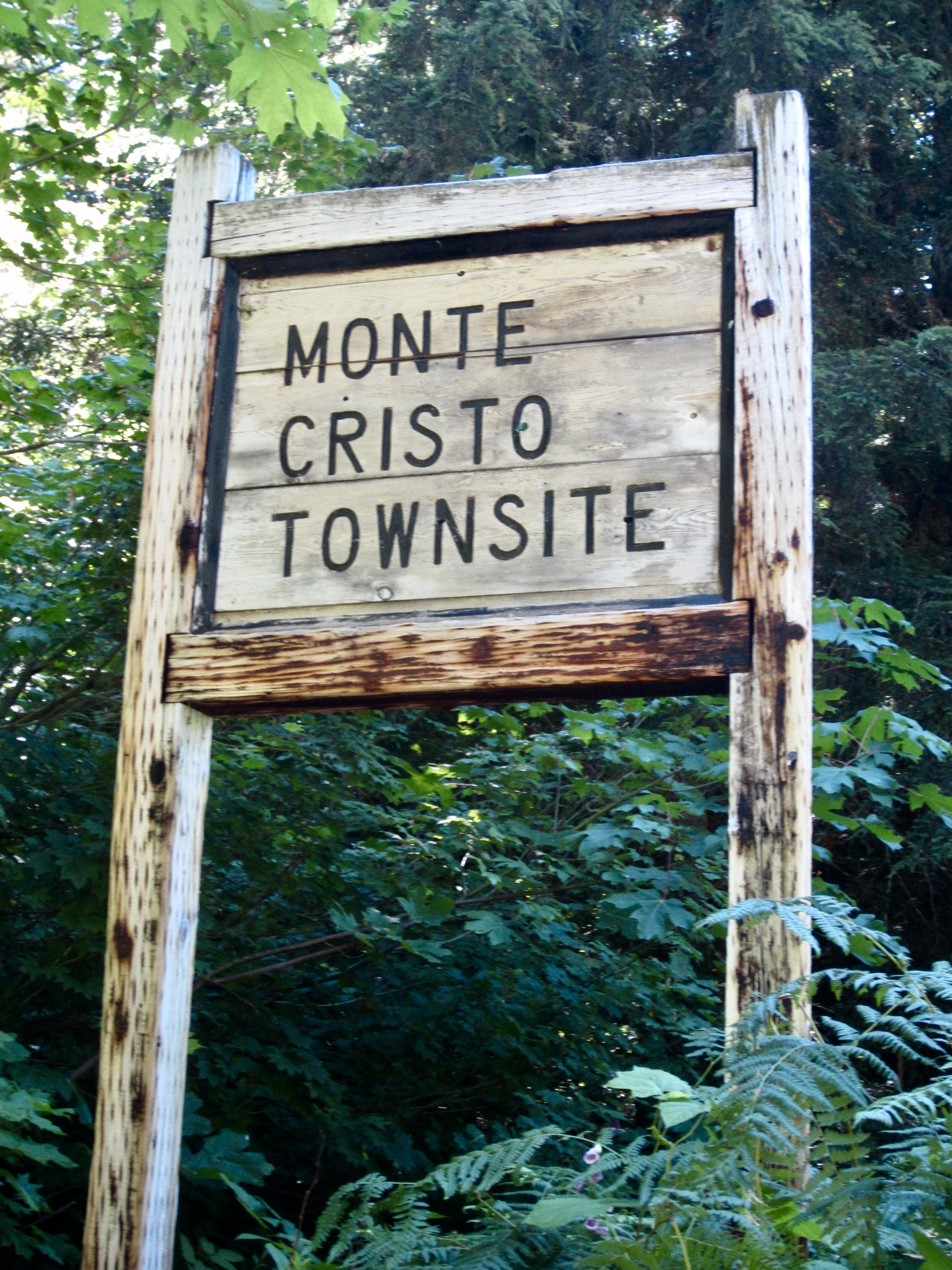
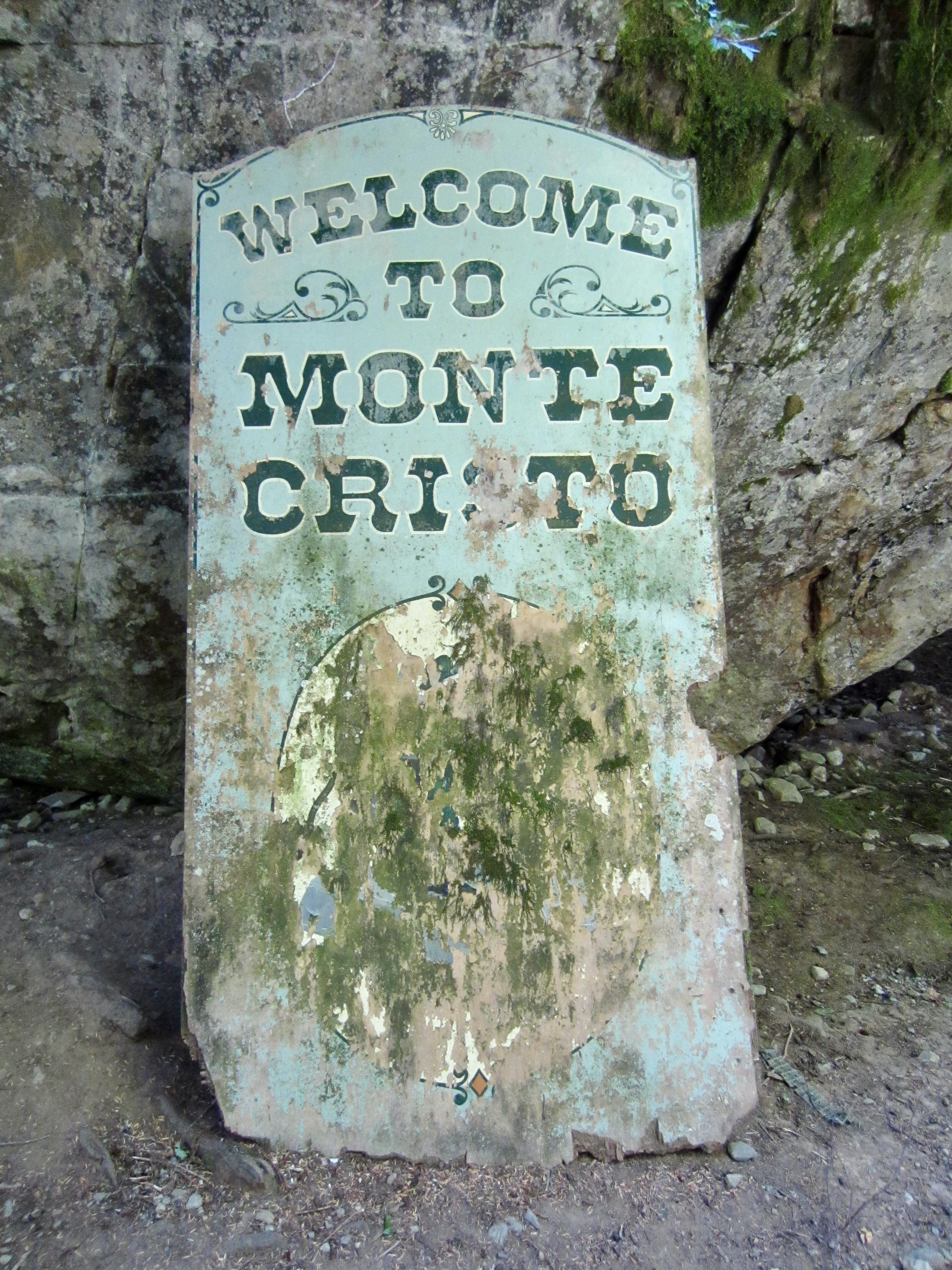
After 4.3 miles of pleasant hiking, we arrived at the historic Monte Cristo Townsite in late morning (1.8 hours + 500 feet from road gate). The numerous mining artifacts and interpretive signs provided some educational entertainment as we continued up the Glacier Basin Trail.
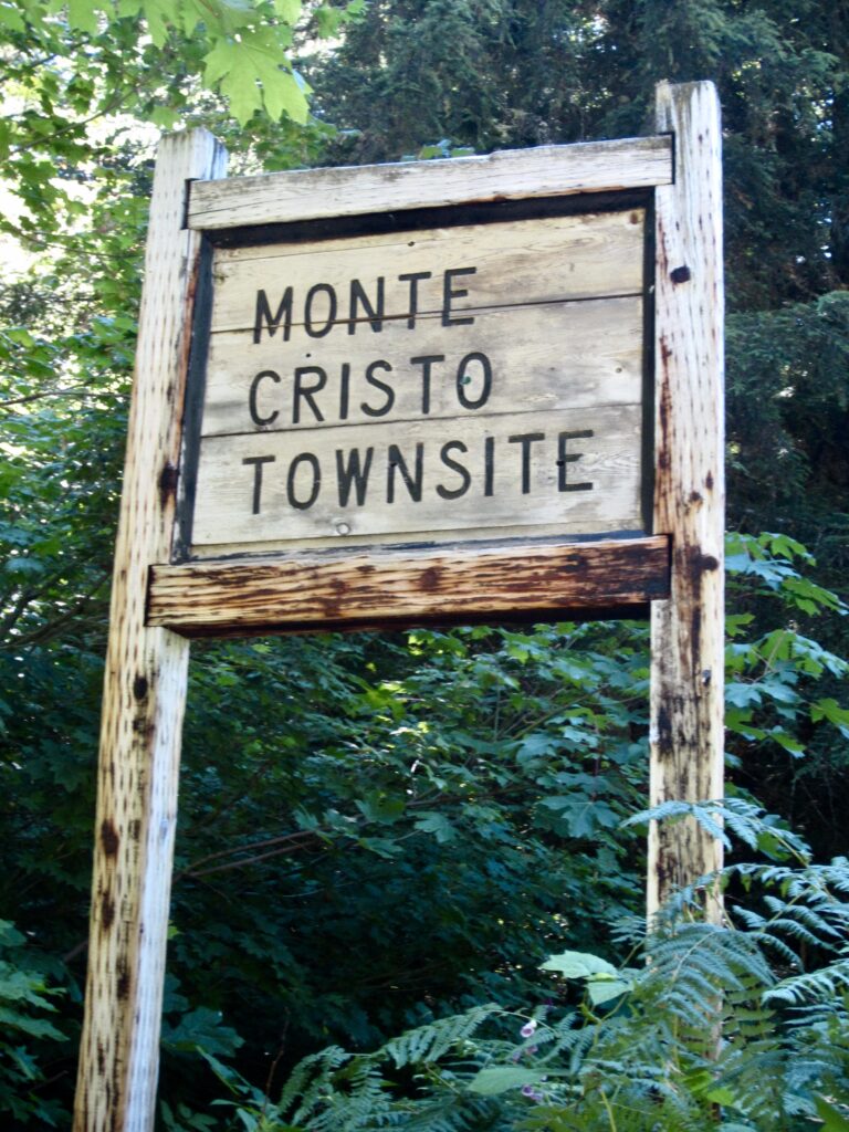
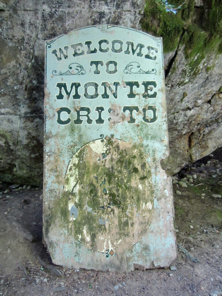
Old Monte Cristo Townsite Sign
Old Monte Cristo Welcome Sign

.

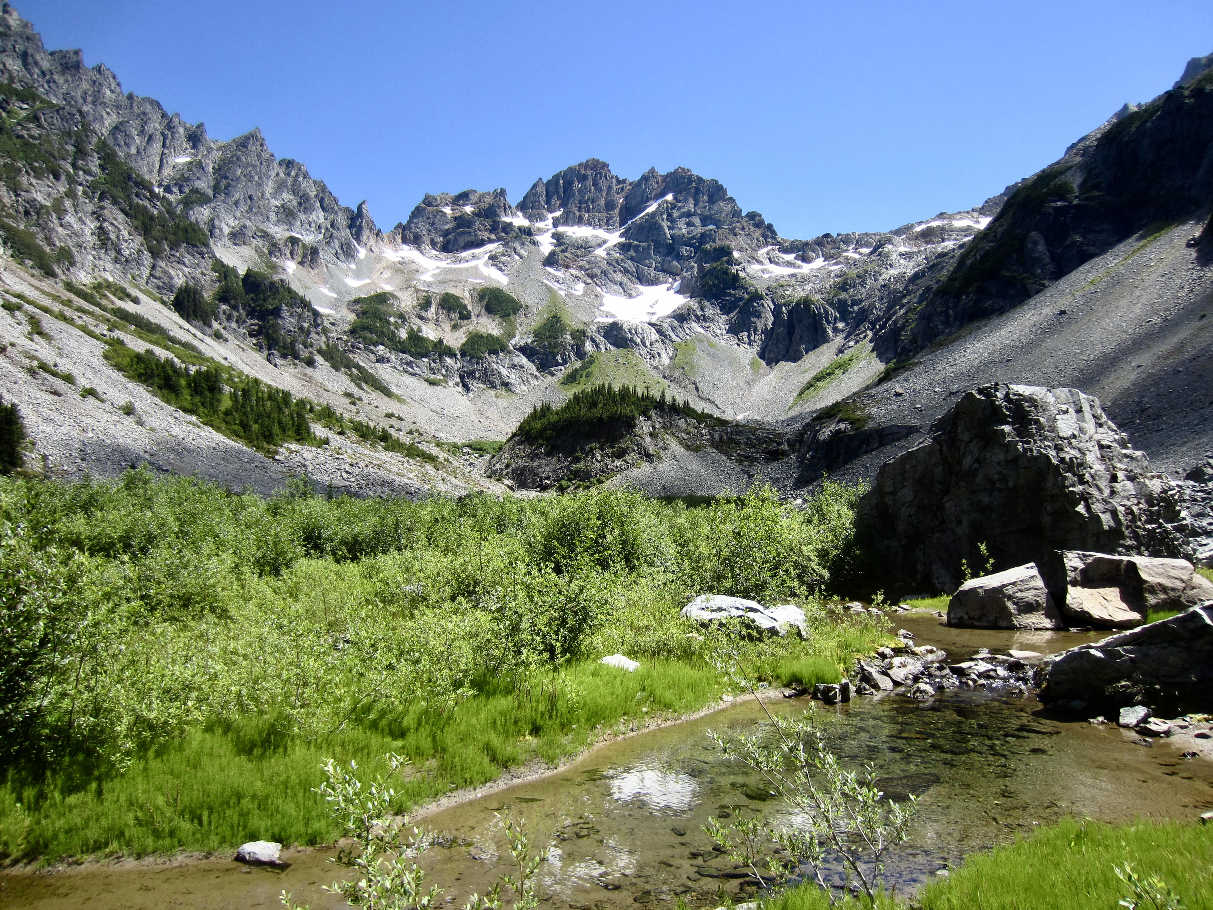
It had been 23 years since I last visited Glacier Basin, so I’d forgotten how steep and rocky this old mining trail is. In my book, it constitutes a trail scramble as much as a trail hike, and it has become badly overgrown due to reduced hiker traffic and lack of maintenance. Our steep, sweaty ascent abruptly ended in the flat terrain of Lower Glacier Basin, with a straight-ahead view of Monte Cristo Peak—our primary objective for this trip.
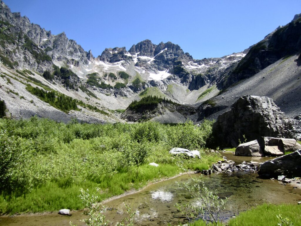
Monte Cristo Peak From Lower Glacier Basin

.

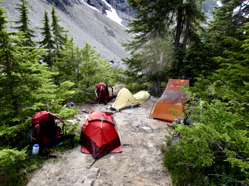
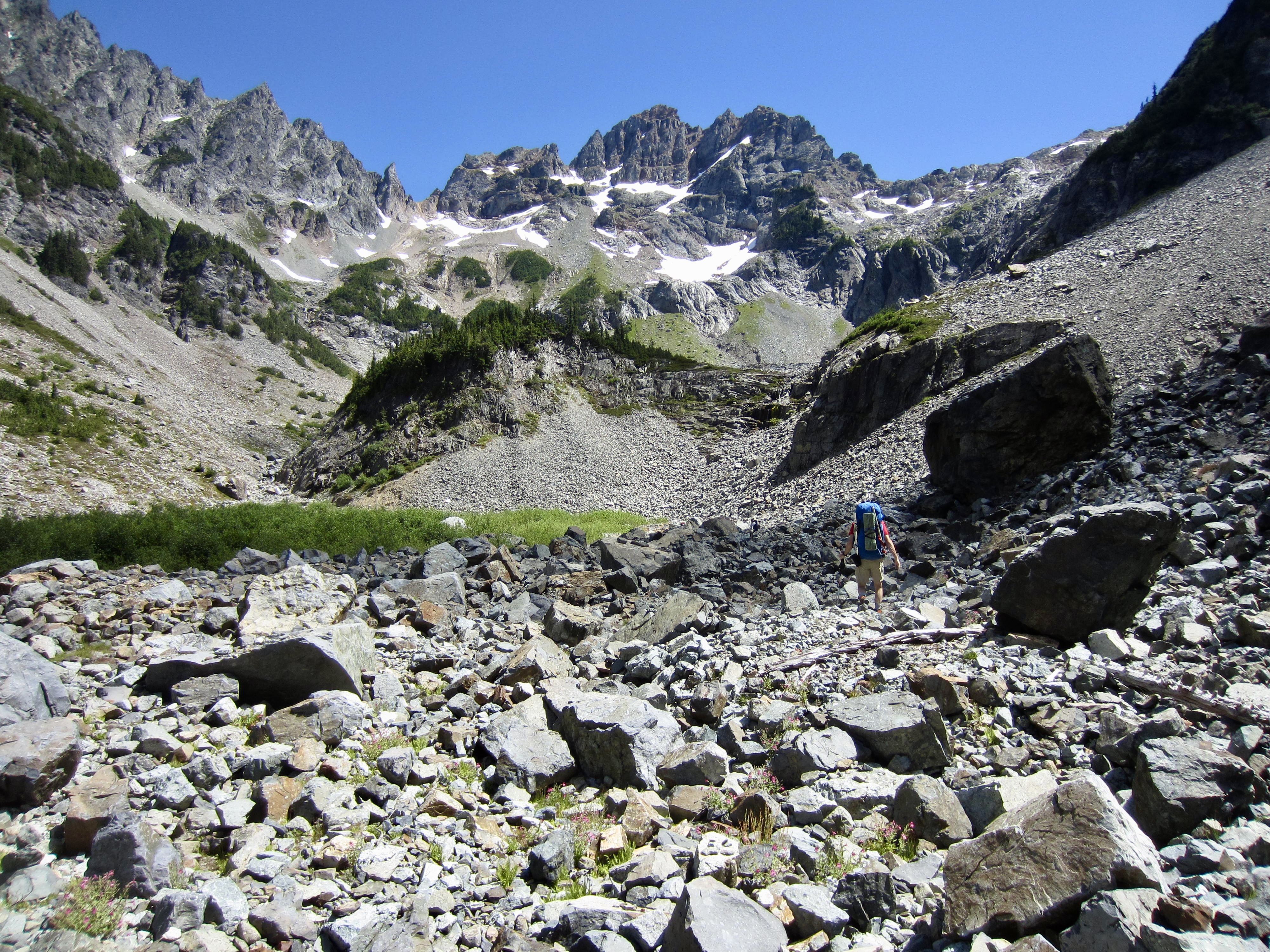
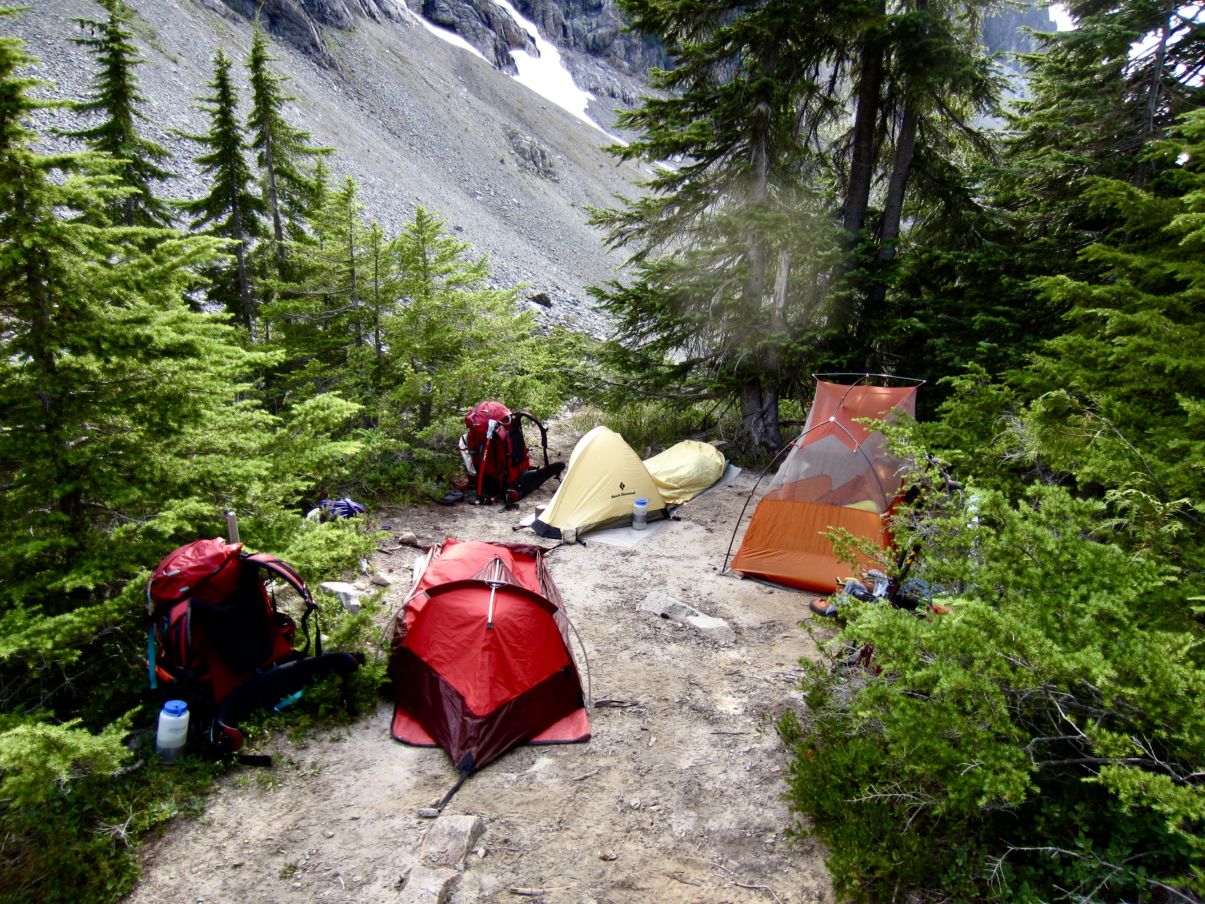
We hiked across the right edge of the basin on a talus field and scrambled up a short headwall that brought us into the rugged cirque of Upper Glacier Basin (5.0 hours + 2300 feet from Barlow Pass). A thorough search of the basin revealed that the only decent campsites are atop Ray’s Knoll—a wooded hump that separates the lower and upper basins (reportedly named after former climber Ray Rill). We unloaded our backpacks and pitched our tents or bivouac sacks at various places on the knoll.
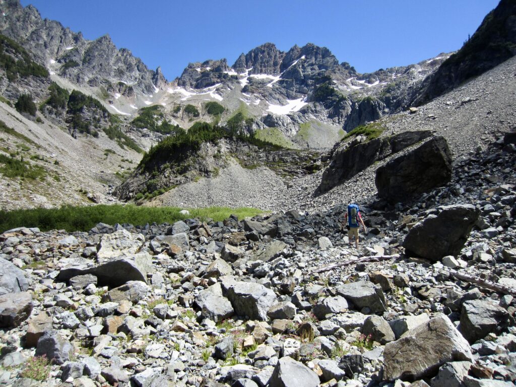
Hiking Across Lower Glacier Basin To Ray’s Knoll

.

Camp On Ray’s Knoll In Upper Glacier Basin

.

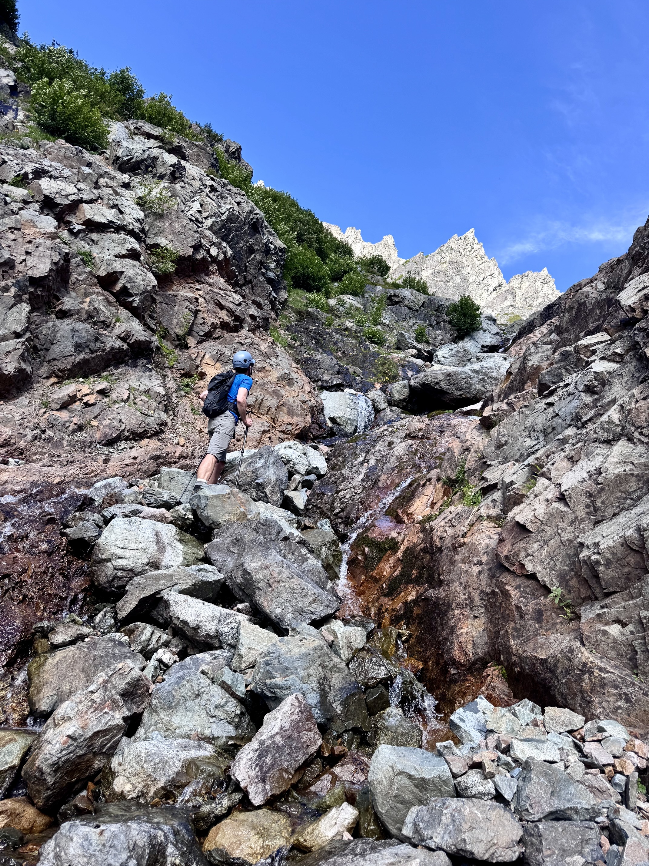
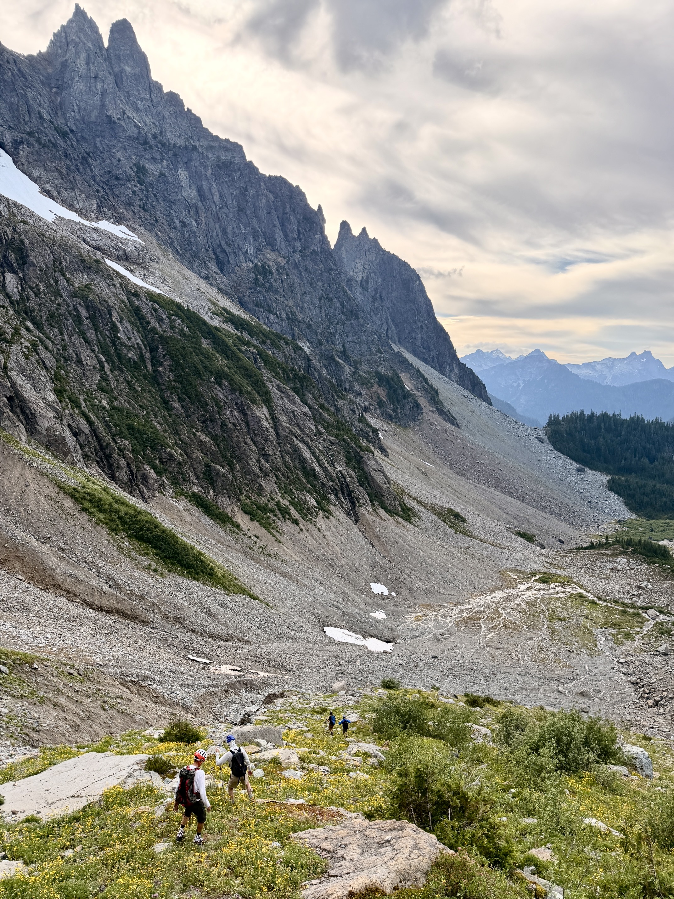
Having a few hours remaining this afternoon, Jon, Eric, Todd, Adam, and Kris decided to reconnoiter two possible routes for surmounting the lower wall of the cirque. They first headed east from camp and scrambled up a waterfall gully (Class 2-3). Next, they traversed southward at an elevation of 5600 to 5700 feet for ¼ mile, going over the top of several tree patches. Then they descended back to camp via a short gully and vegetated alluvial fan. This reconnaissance loop provided valuable intel for tomorrow’s climb.
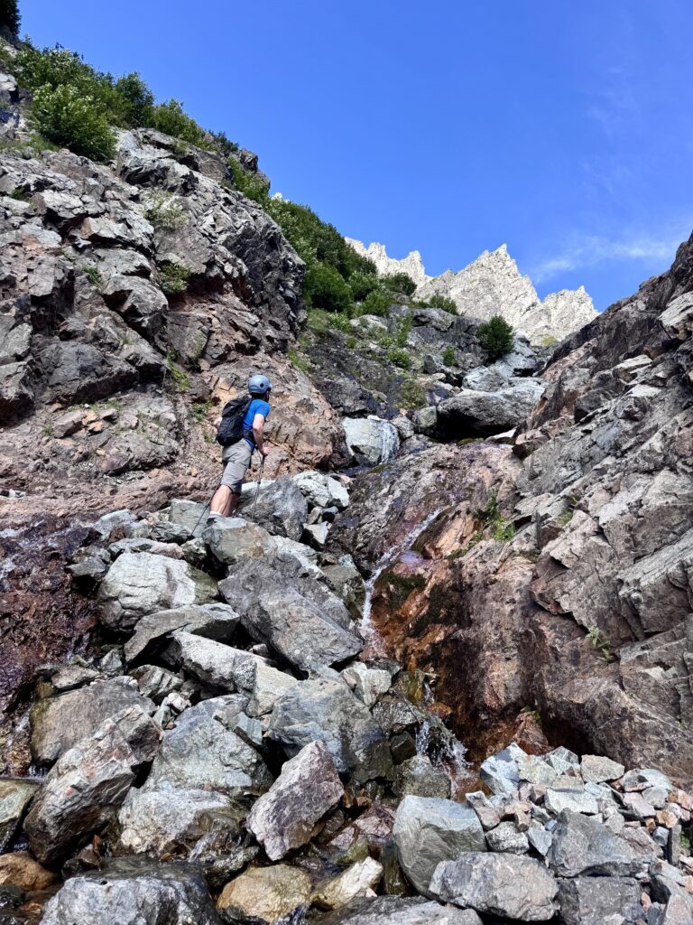
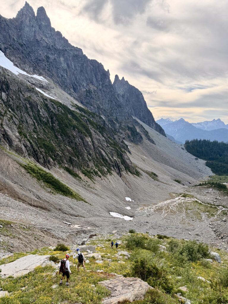
Adam Scrambling Up Waterfall Gully Above Glacier Basin (photo by Jon)
Hiking Down Debris Fan To Glacier Basin (photo by Eric)

.

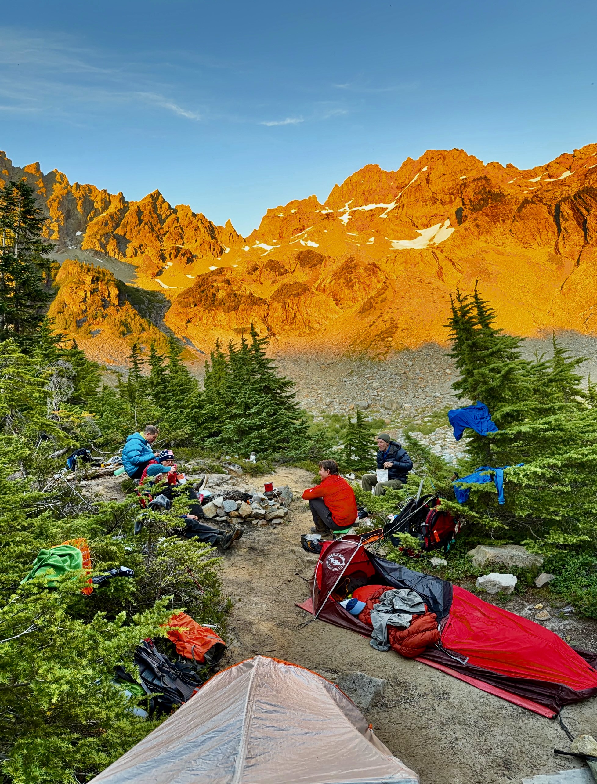
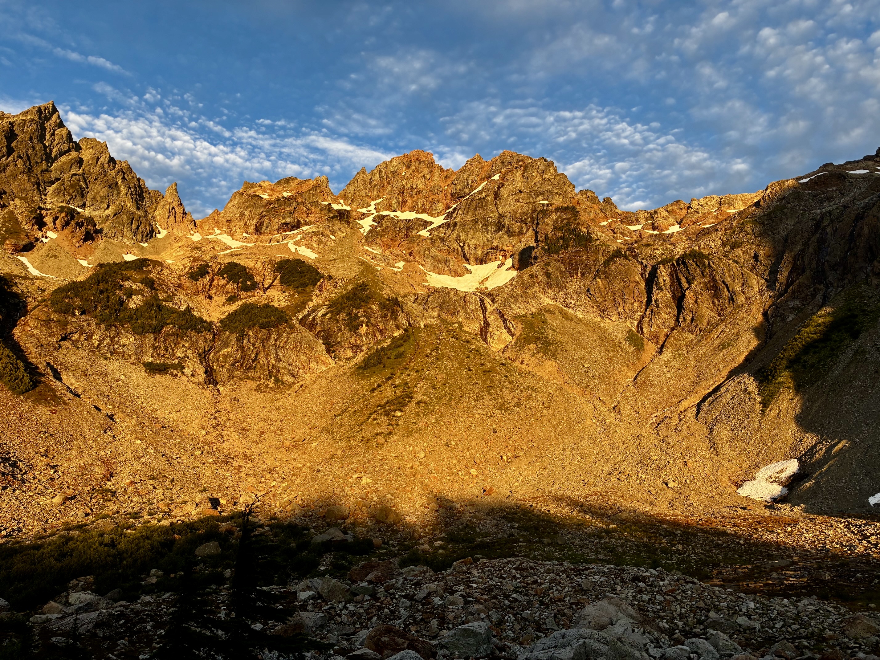
Our dinner on Ray’s Knoll was accompanied by dramatic alpenglow on Monte Cristo Peak. In preparation for tomorrow’s climb of this peak, we scoped out two possible crossover points in the summit ridge: the U-notch and the North Col. What concerned Eric and me, however, was the extremely limited snowcover. We had separately been to one or both of these crossover points in years past with a thick snowpack and found the travel to be relatively straightforward. What would they involve under these nearly bare conditions?
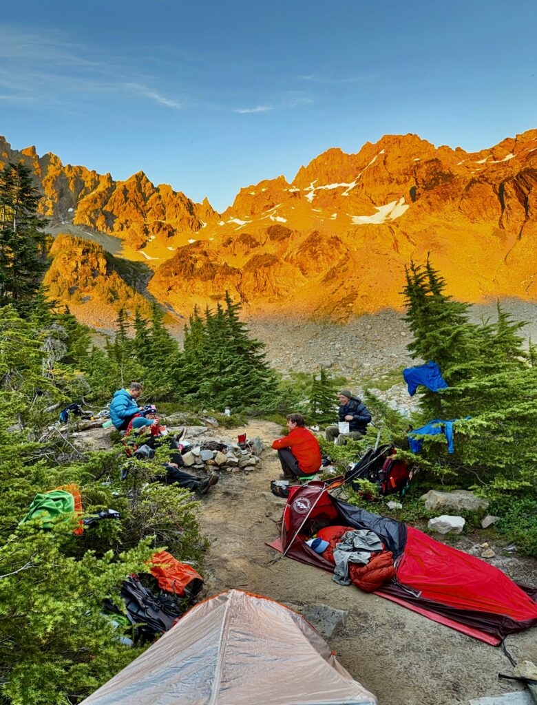
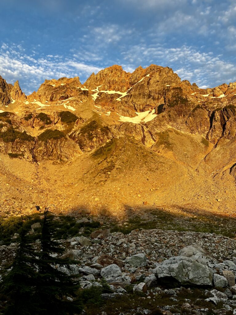
Dinnertime Alpenglow In Upper Glacier Basin (photo by Kris)
Evening Alpenglow On Monte Cristo Peak

.

Day 2: Monte Cristo Peak & Cadet Peak Climbing Attempts

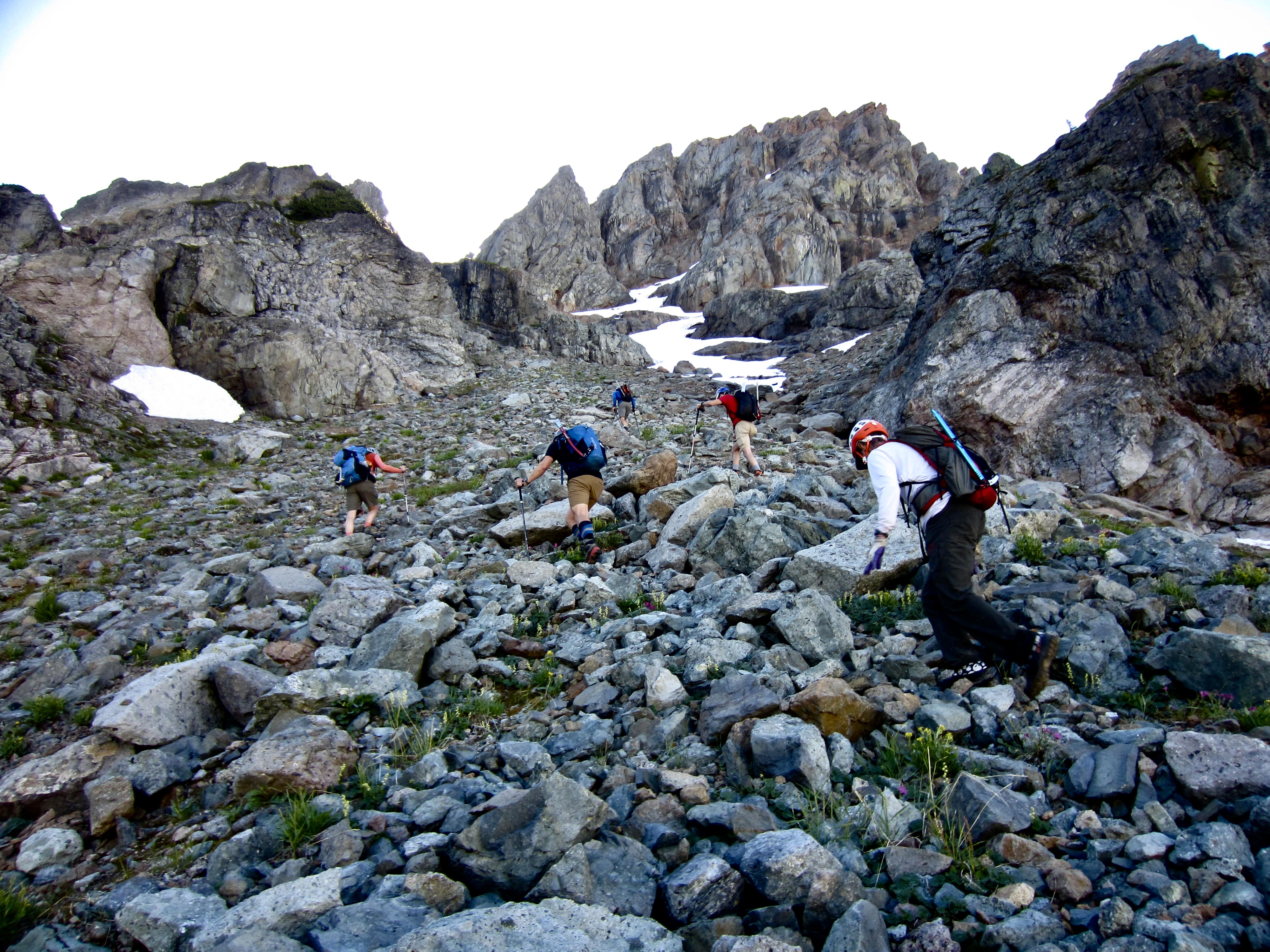
Shortly before 8:30am, the six of us were heading out of camp under clear skies. To get through the lower cirque wall, we ascended the vegetated alluvial fan and short gully, then we continued directly up rocky slopes toward an irregular snowfinger leading to the North Col.
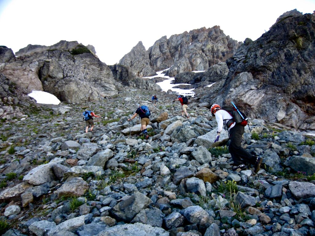
Heading Toward Monte Cristo Peak On Day 2

.

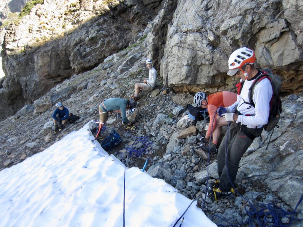
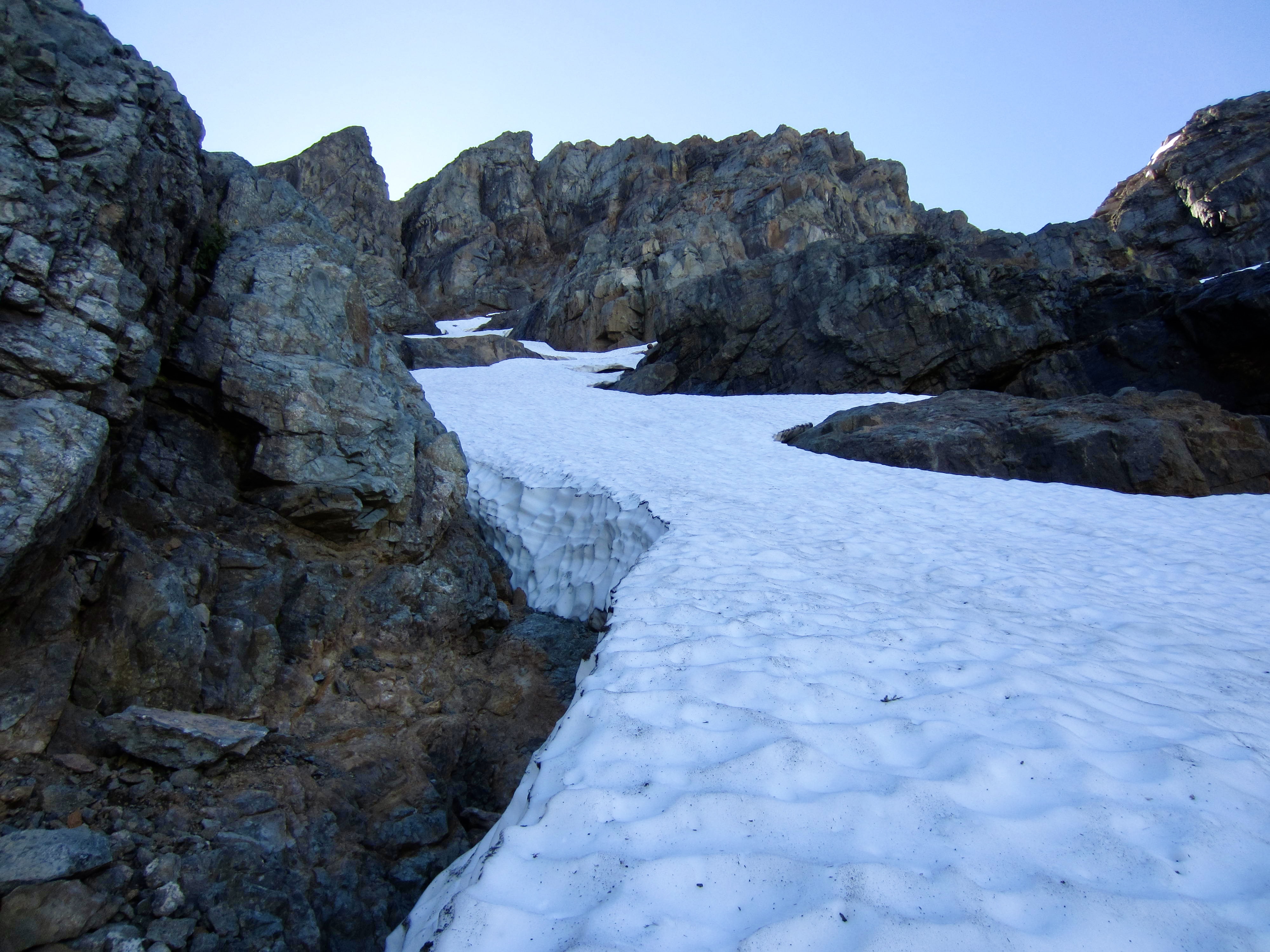
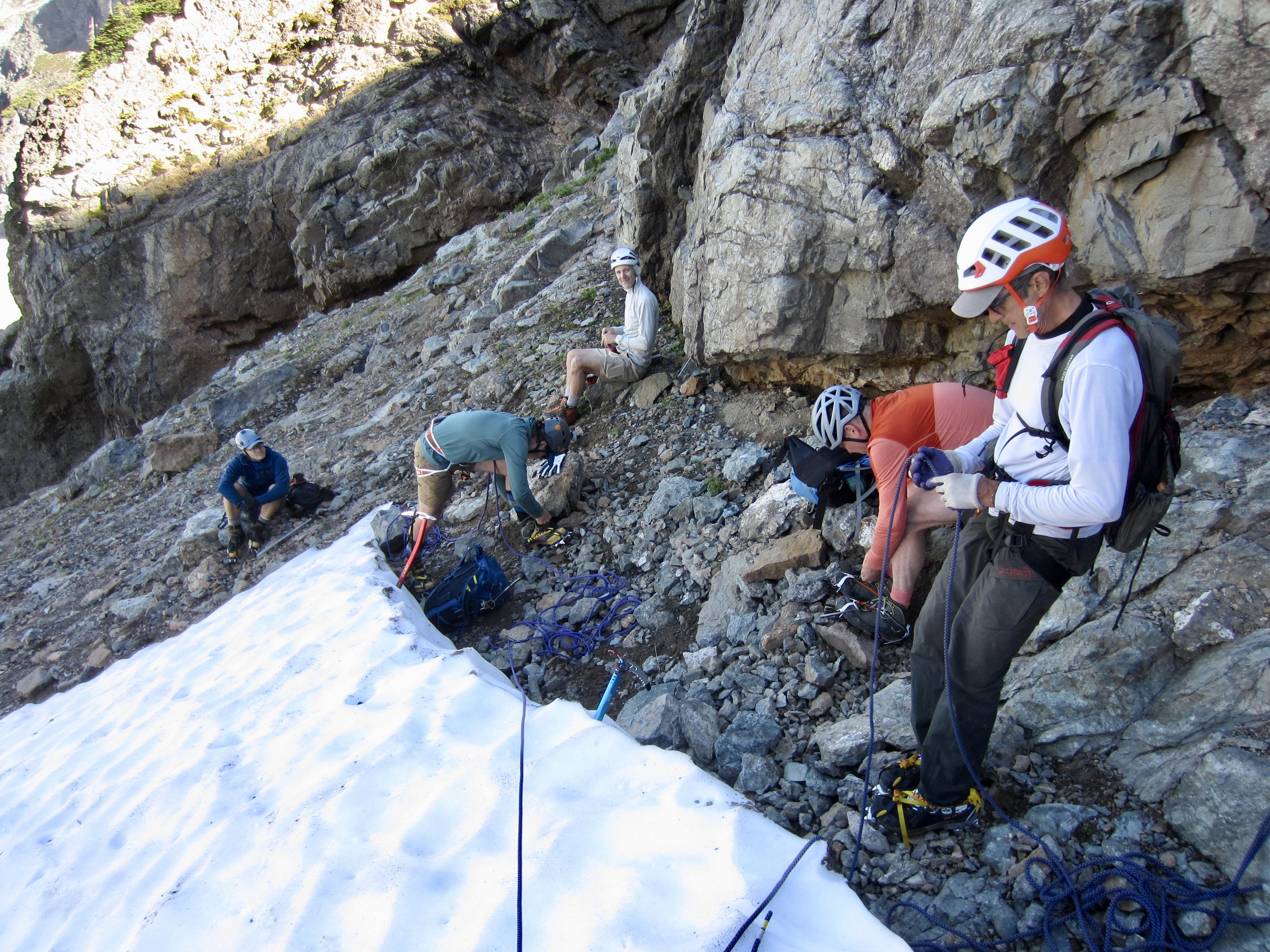
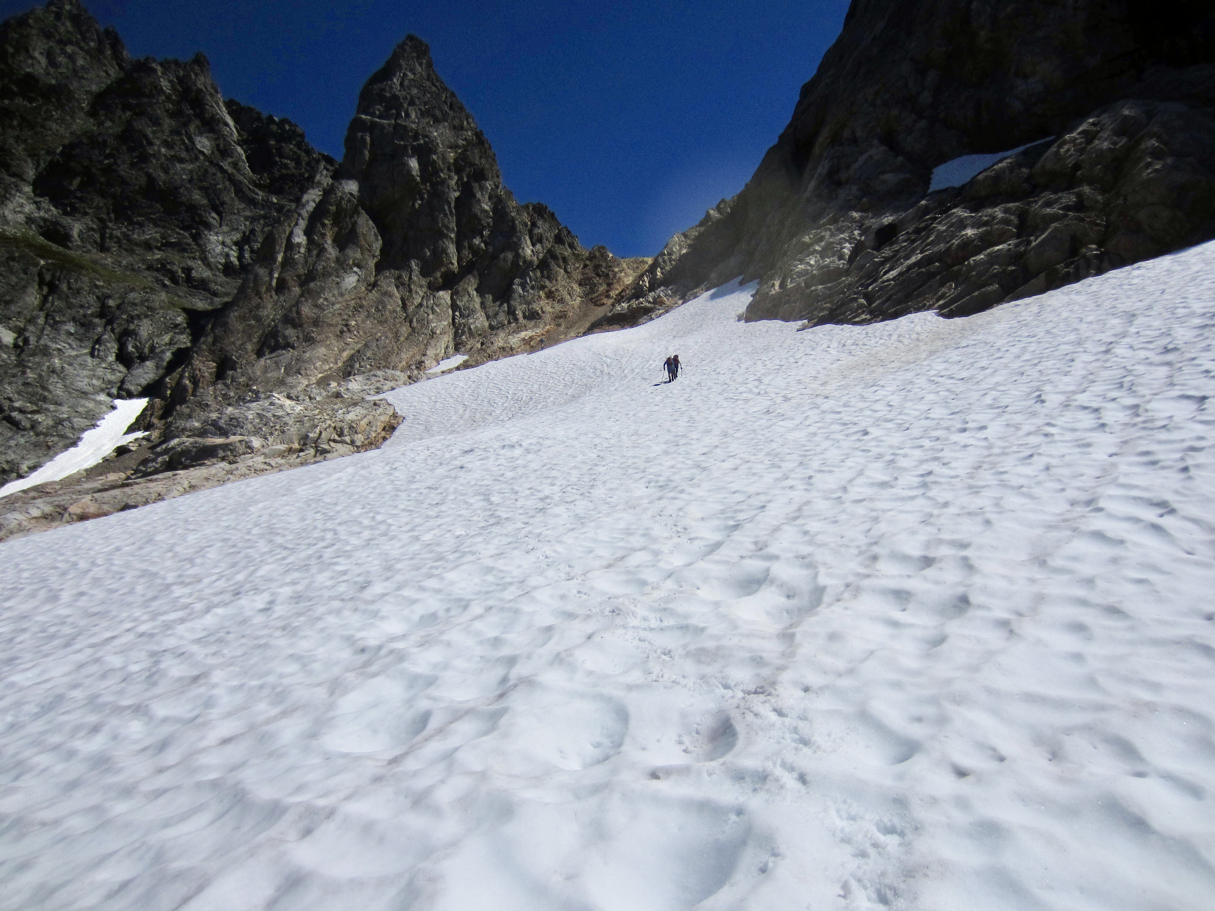
Upon reaching the base of the snowfinger, we discovered that it consisted of steep, rock-hard snow. This was going to be serious business! We could also see a breach partway up, so there was an element of uncertainty. Fortunately, we’d brought ice axes, crampons, two 30-meter ropes, and two pickets just for this situation. Todd must have sensed trouble, though, because he stayed behind while the rest of us roped up and began climbing.
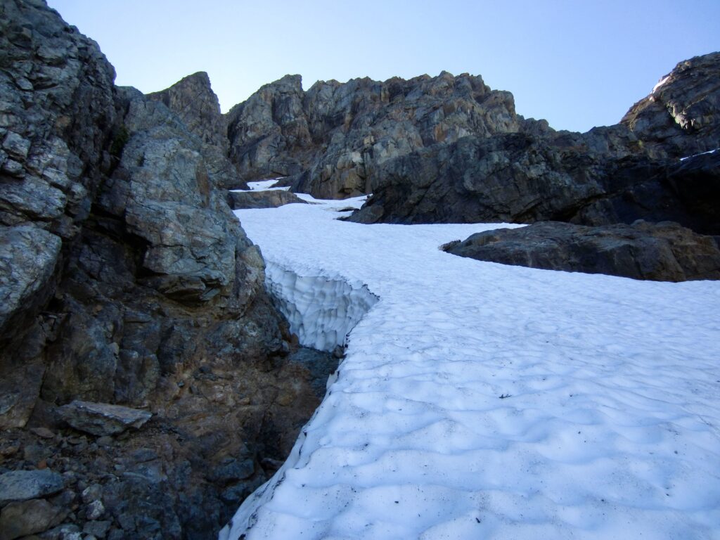
Steep Snowfinger Below North Col On Monte Cristo Peak

.

Roping Up On Monte Cristo Peak

.

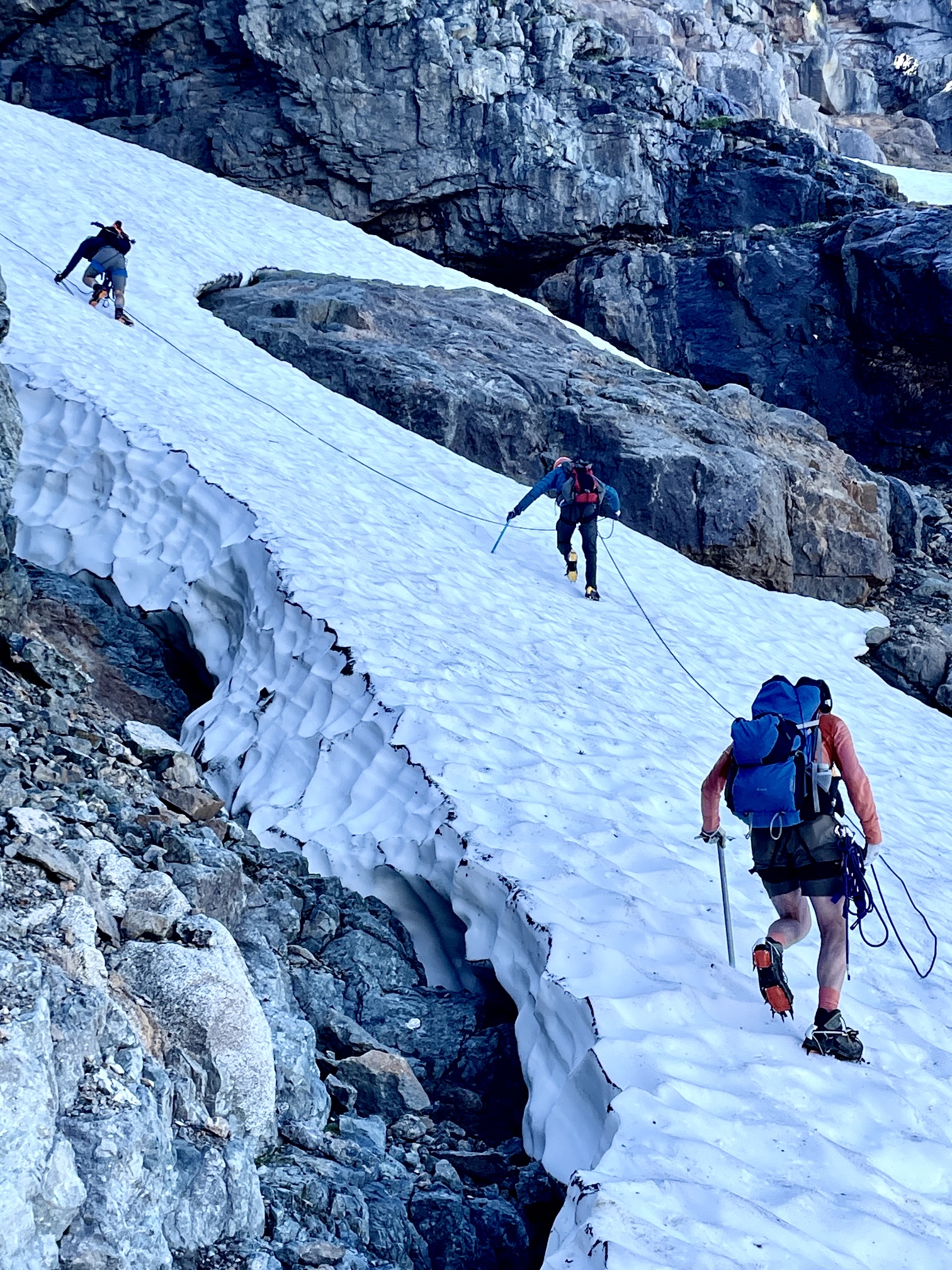
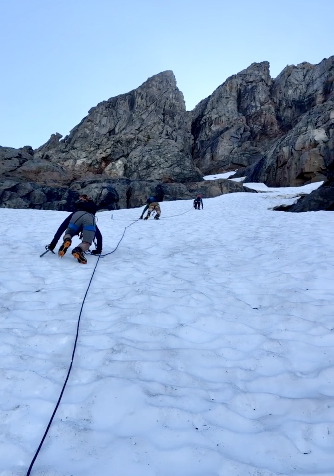
I led out and was immediately distressed at the hardness of the snow. I couldn’t jam in the spike of my ice axe more than ½ inch, nor could I kick in the edges of my crampons. As the slope gradually steepened, I resorted to using my ice axe pick in dagger mode while climbing on crampon front-points. Everyone else adopted a similar technique.     
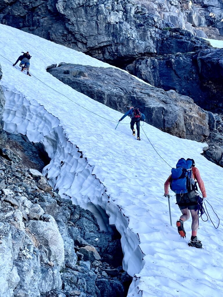
Starting Up Snowfinger Toward North Col (photo by Todd)

.

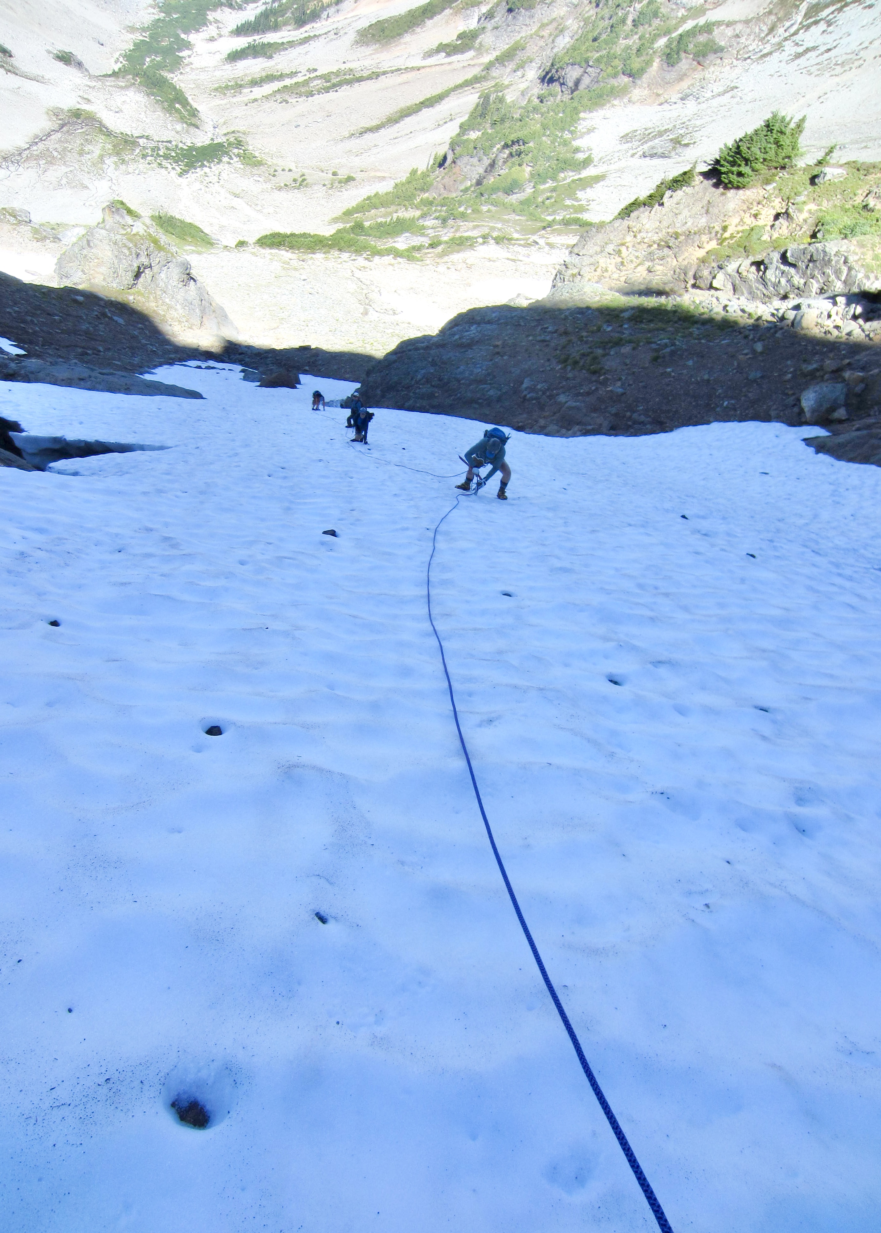
After several hundred feet of climbing, with two pickets in place, I reached the breach. It was frightening! Vertical walls on the downslope and upslope sides were separated by a wet, inclined, rock slab that disappeared into a dark moat. We instantly reversed direction and carefully down-climbed the snowfinger, repeatedly placing our two pickets in a leap-frog fashion for extra protection.
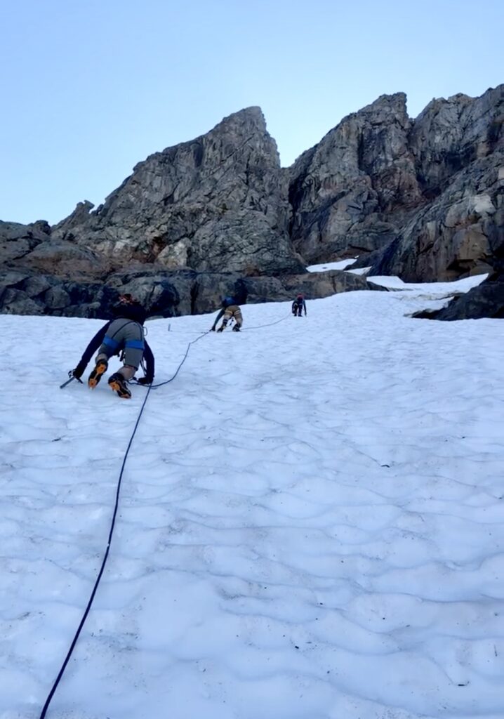
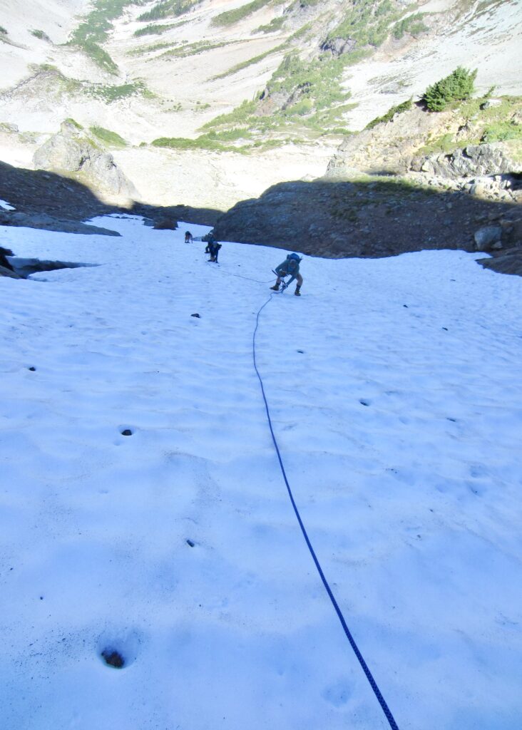
Climbing Snowfinger On Monte Cristo Peak (photo by Kris)
Looking Down Snowfinger On Monte Cristo Peak

.

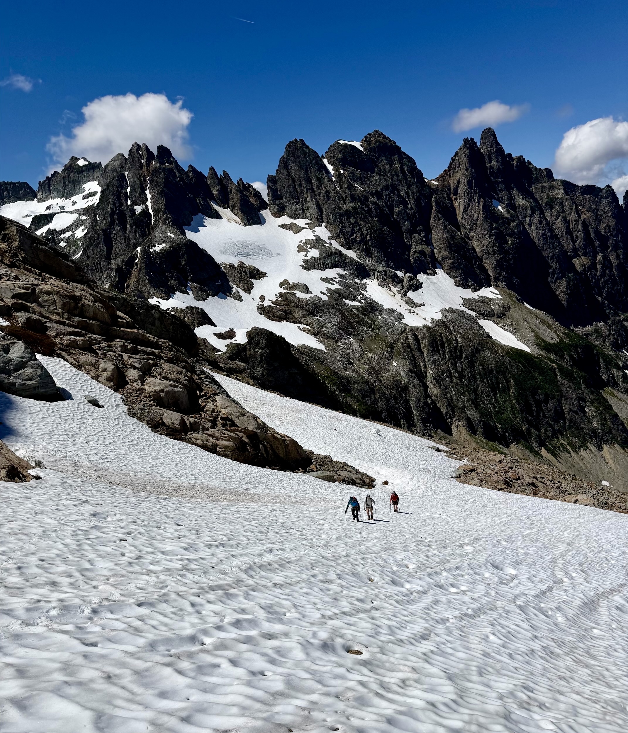
Once off the snowfinger, we all dropped below a rock buttress and then made a rising traverse across a large snowfield toward the U-notch. The North Col route was a no-go, but we hoped the U-notch would get us to the summit of Monte Cristo Peak.
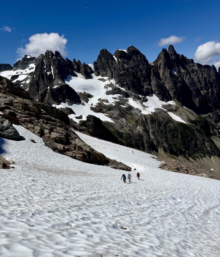
Booting Up Snowfield Toward U-Notch With Wilmans Peaks Behind (photo by Adam)

.

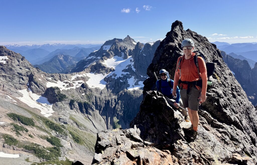
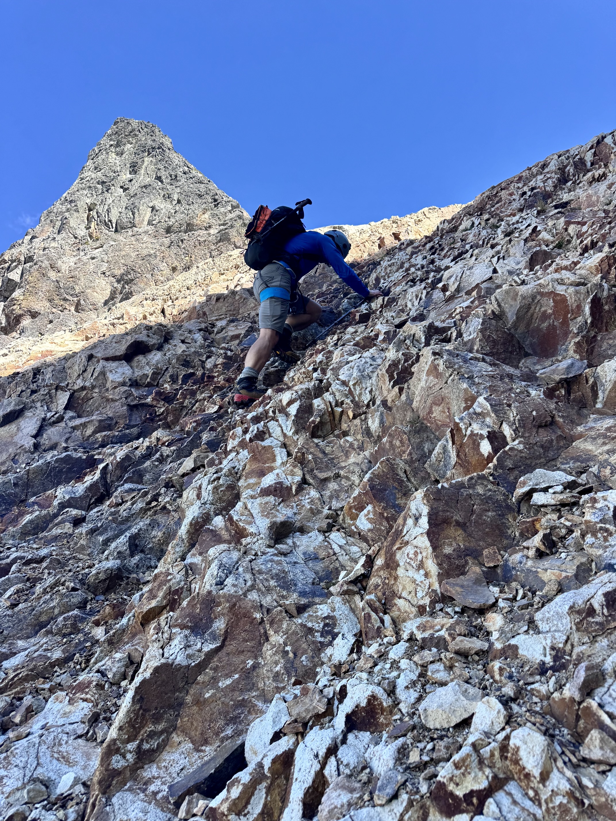
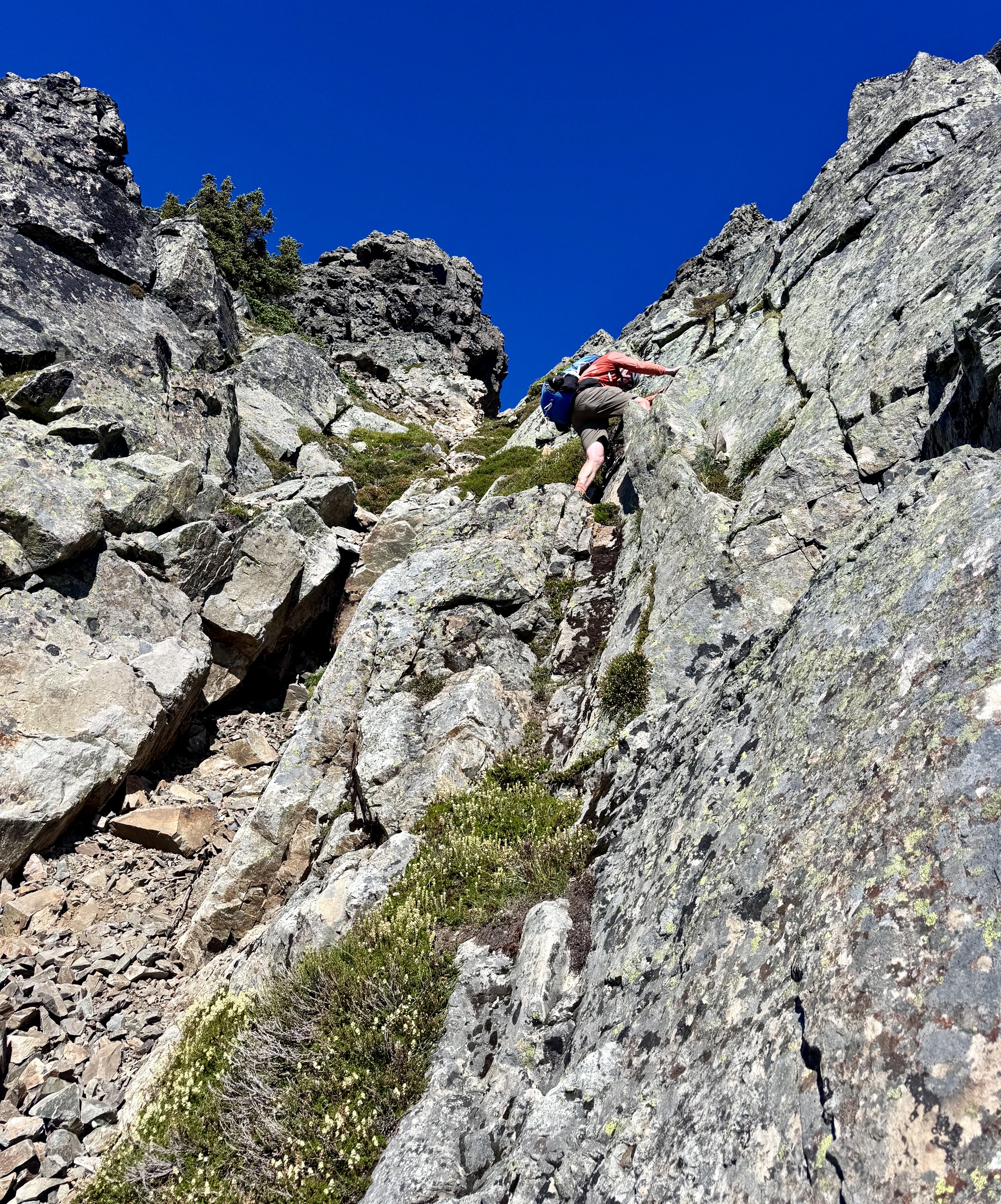
At the top edge of the snowfield, we transitioned to rock scrambling. Adam led the charge up the right side of a rib of crumbly volcanic rock, inadvertently discharging a barrage of loose rocks. Kris chose a route up the left side on equally crumbly rock. After a dicey ascent, they both converged at the U-notch. Meanwhile, the rest of us pulled the plug on this grossly unappealing route and began descending.
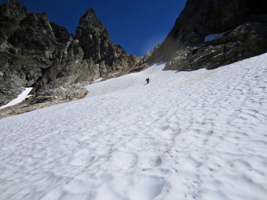
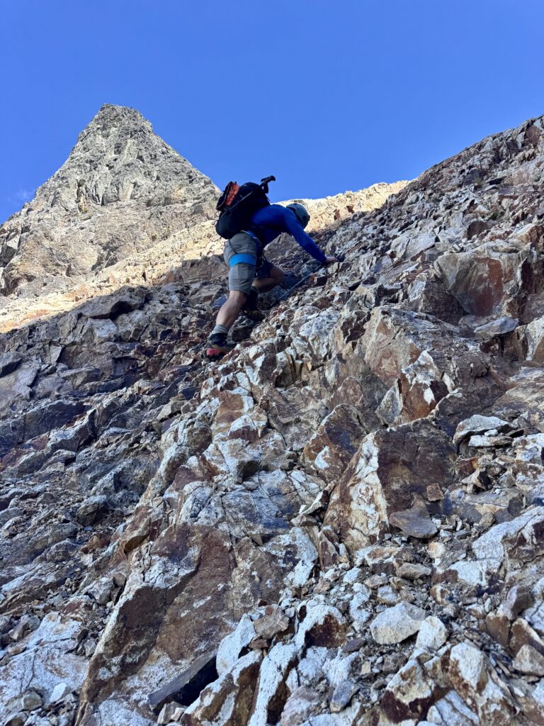
Heading Toward U-Notch On Monte Cristo Peak
Adam Scrambling To U-Notch On Monte Cristo Peak (photo by Jon)

.

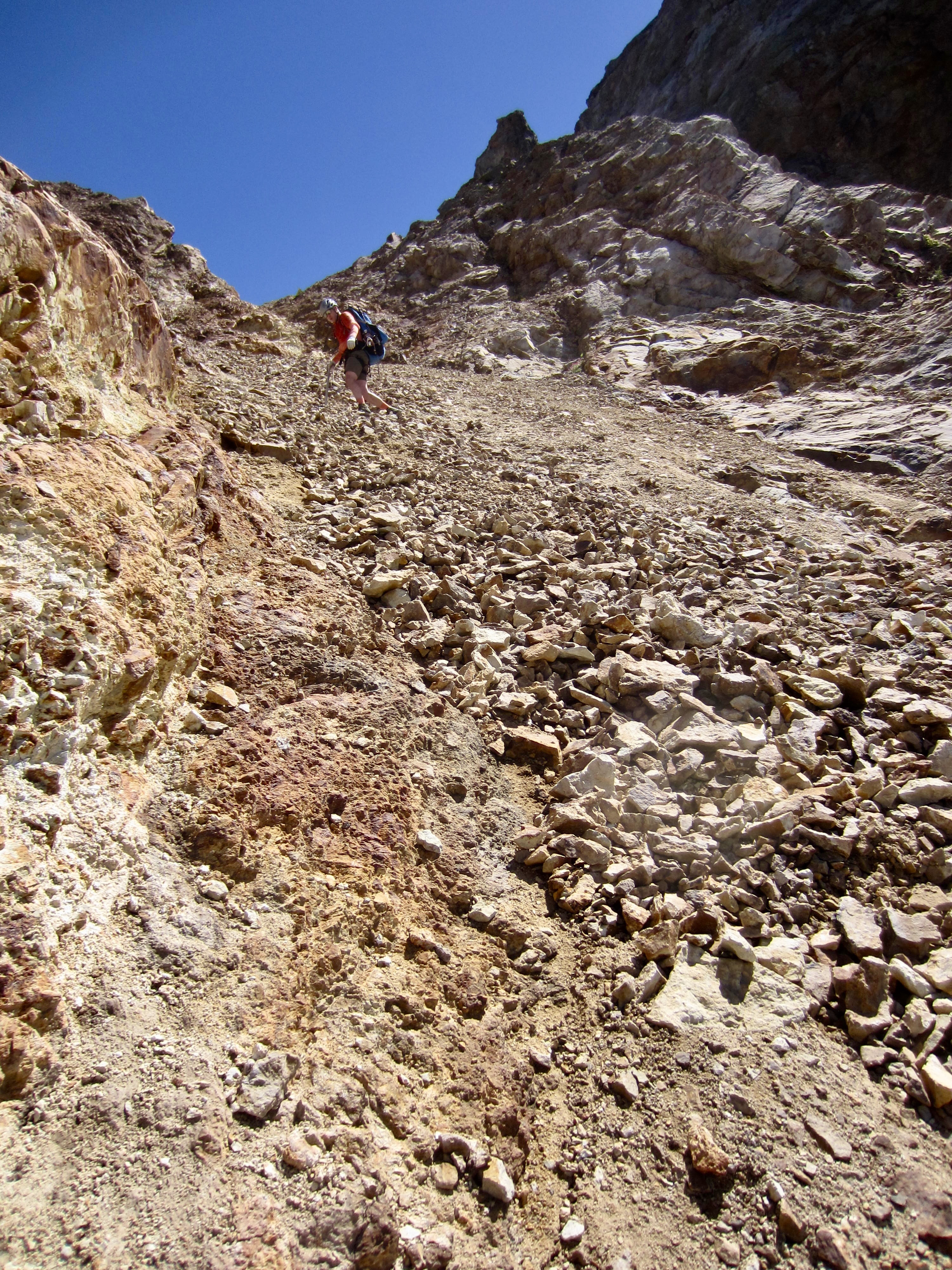
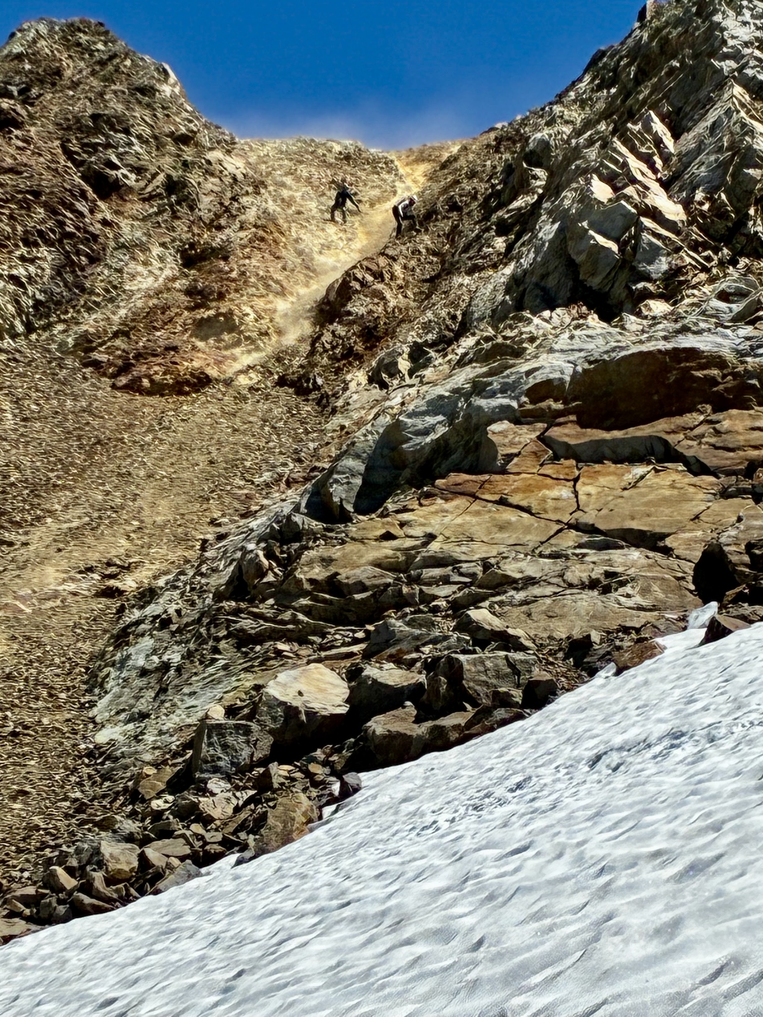
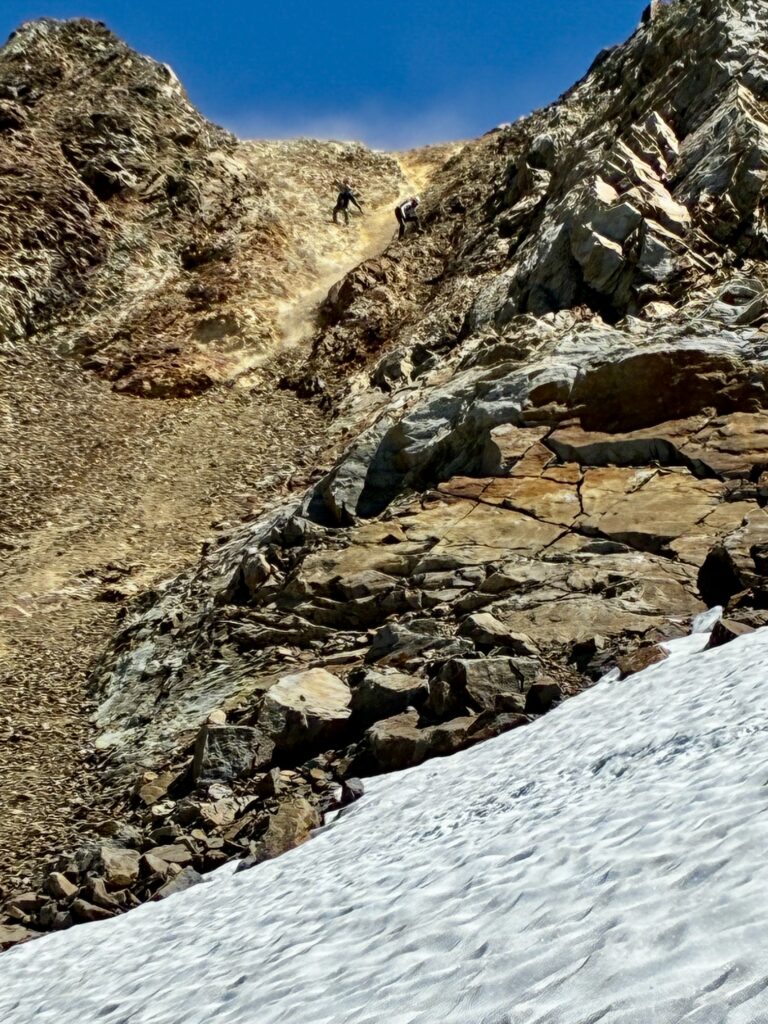
What Adam and Kris saw on the eastern side of the U-notch was a super-steep patch of hard snow—another dead end, in their mind. Ultimately, we all descended the same gully directly below the U-notch. Depending on one’s individual starting position, this involved scrambling down chossy rock, skidding down hard dirt, and/or riding down an avalanche of unstable scree (a “screevalanche”). It was truly horrible.
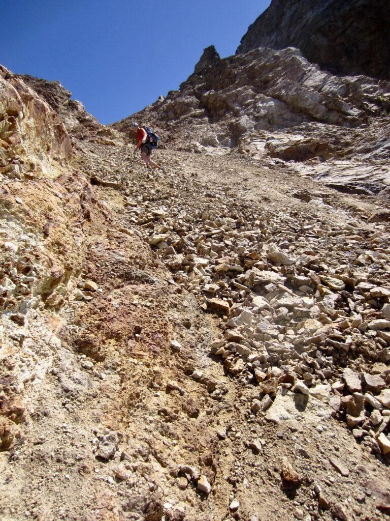
Eric Descending Scree Gully Below U-Notch
Kris & Adam Descending Scree Gully Below U-Notch

.

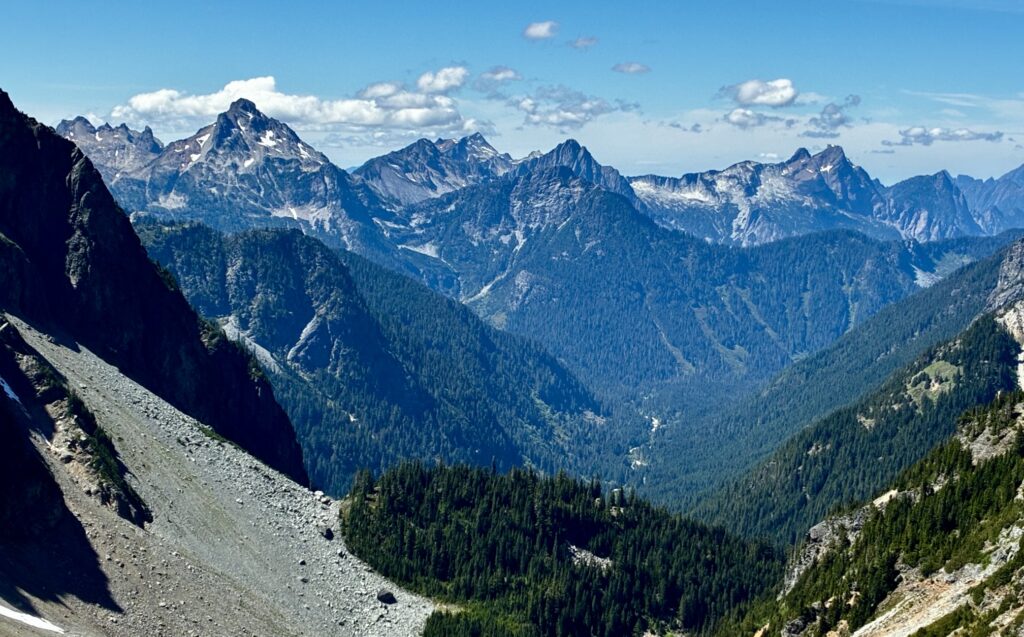
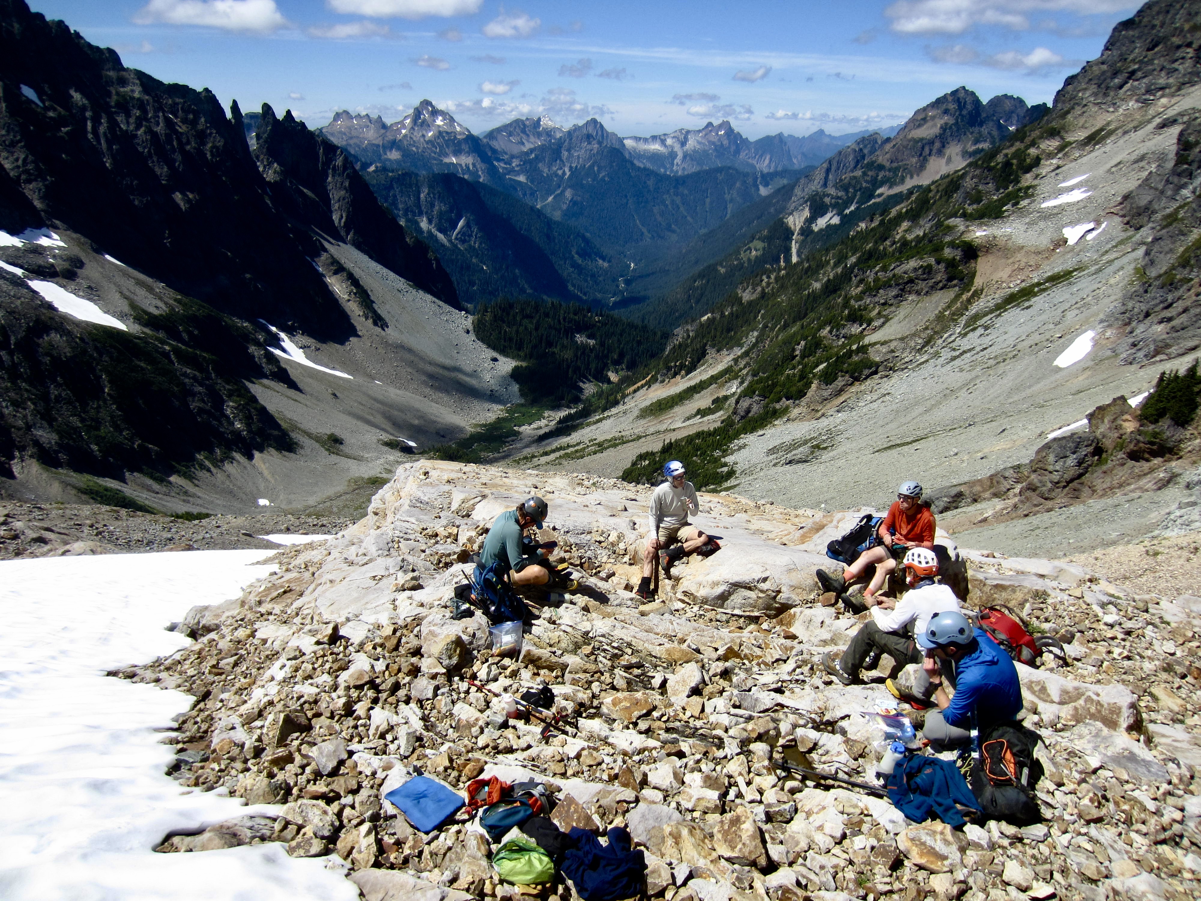
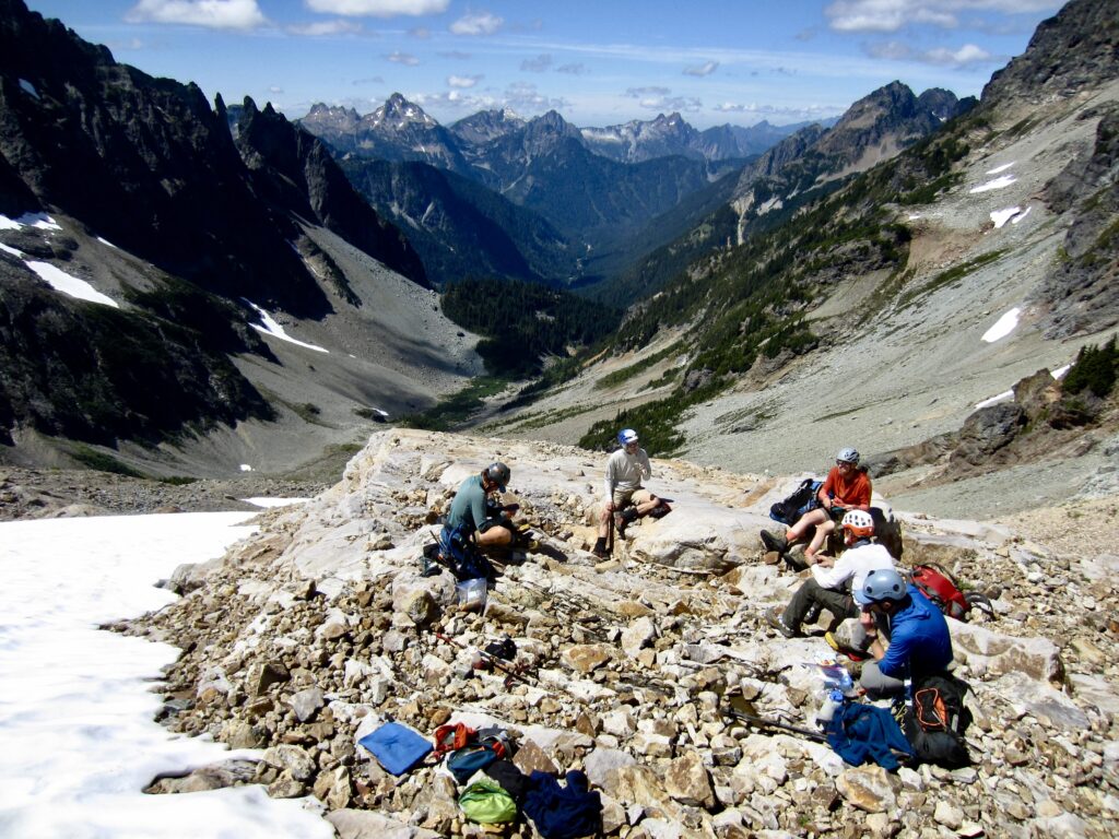
Somehow, we all managed to descend the gully without incident, and it was early afternoon by the time we regrouped on a rock bench overlooking the South Fork Sauk River Valley. While eating lunch, we discussed our options for the rest of the day.
Lunch Break On Monte Cristo Peak Bench

.

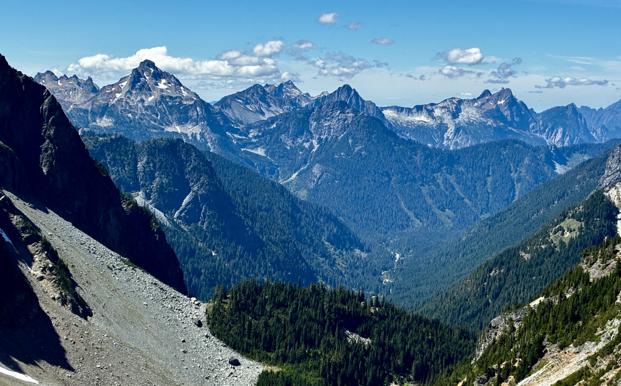
Gothic Peak To Big Four Mtn Pano From Monte Cristo Peak

.

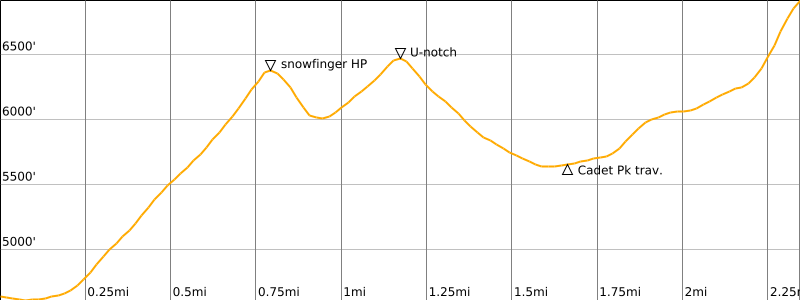
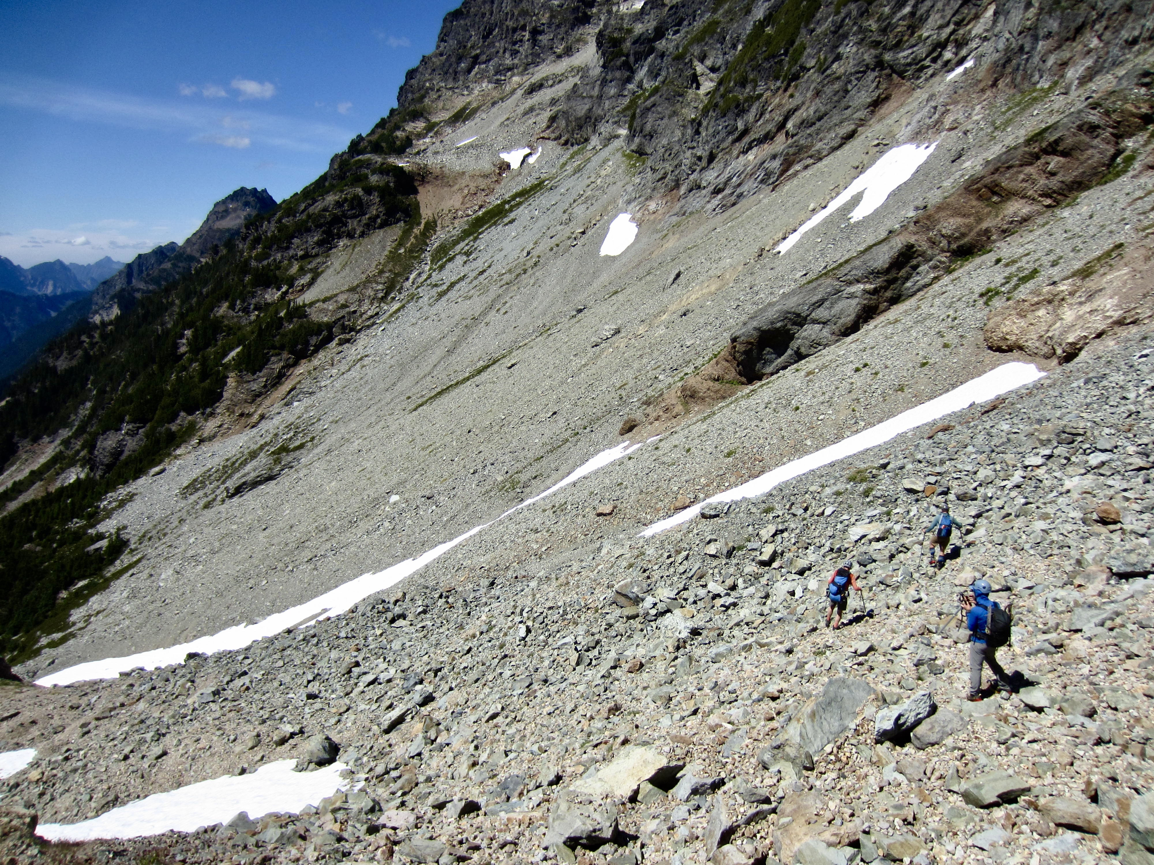
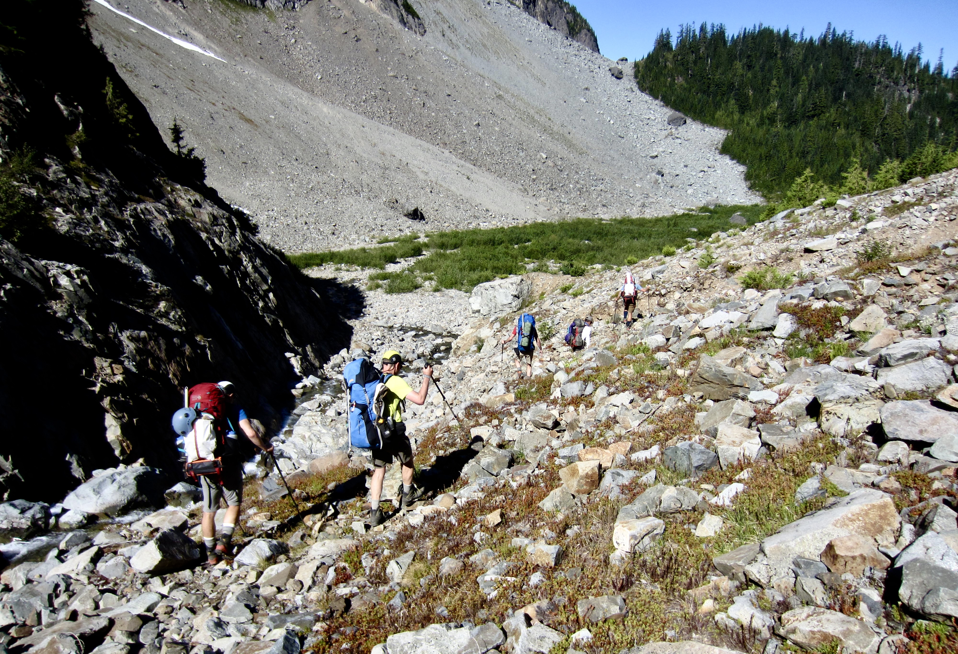
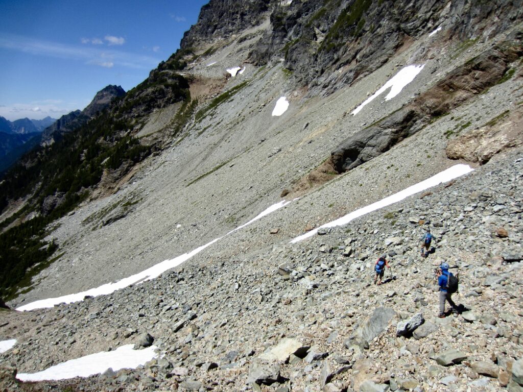
There was collective interest in making an attempt on nearby Cadet Peak, despite the fact that it would require a ¾-mile-long traverse across a very uninviting hillslope of scree and talus. Our traverse route generally linked together the small snow patches shown in the photo below. It proved to be extremely tedious but not entirely awful.
Traversing Talus Slope To Cadet Peak

.

Traversing To Southwest Ridge Of Cadet Peak

.

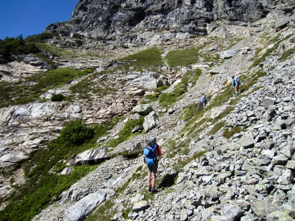
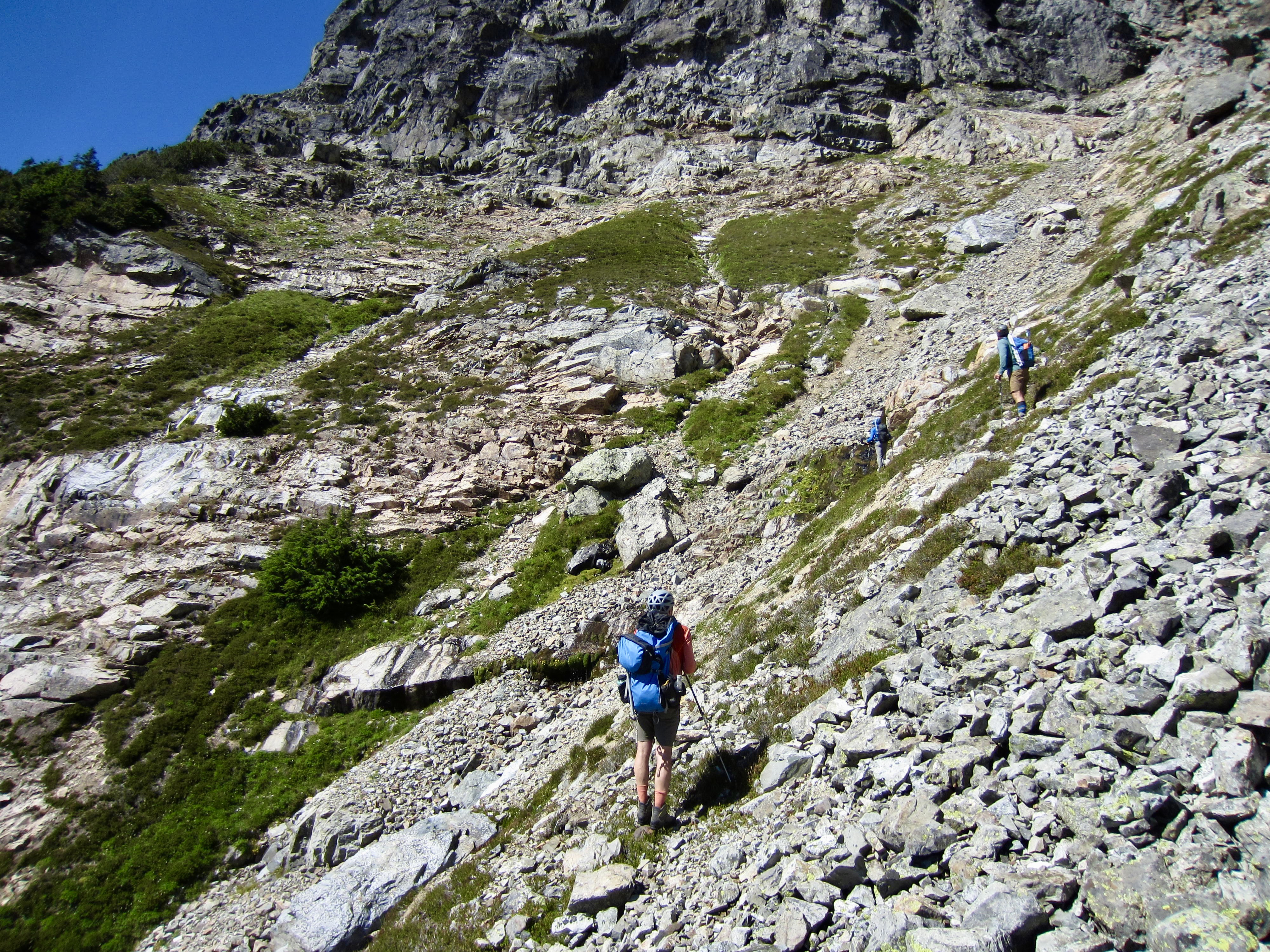
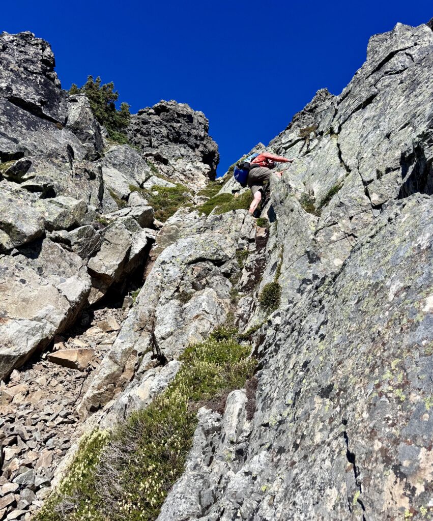
Shortly before 4:00pm, we crossed over a krummholz rib at 6200 feet and could see the peak’s long Southwest Ridge just beyond. Here, at a point 1000 feet below the summit, our group split up. Todd, Kris, and I began heading back across the traverse route, and then Kris took a detour up to a 6800-foot saddle on Cadet’s Southeast Ridge in hopes of finding a reasonable way up the summit block (there wasn’t). Meanwhile, Adam, Jon, and Eric made a run up the Southwest Ridge. They encountered lots of Class 2-3 scrambling, in addition to an encouraging climber’s path, but eventually hit a dead end at 6900 feet. Another summit had eluded our group!
Eric Scrambling Up Southwest Ridge Of Cadet Peak (photo by Jon)

.

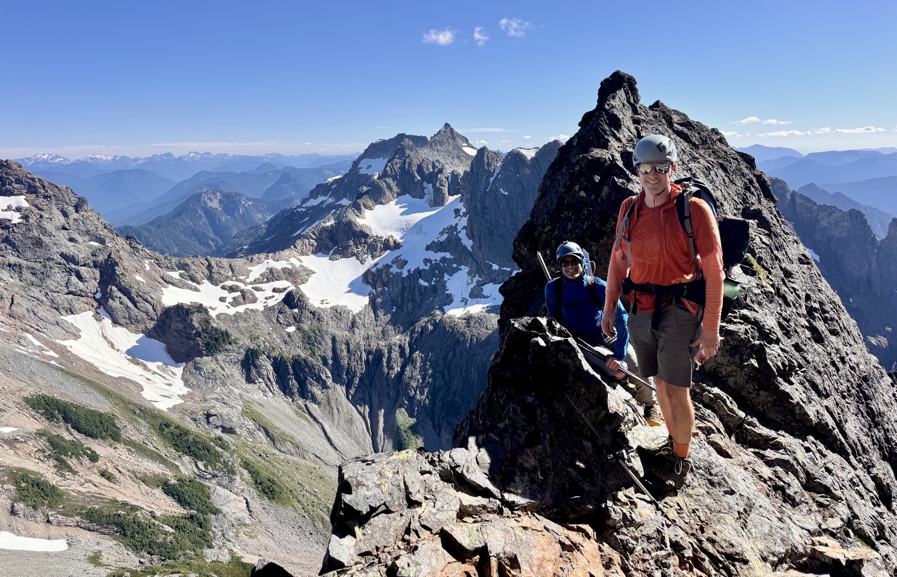
Adam & Eric High On Cadet Peak (photo by Jon)

.

Todd, Kris, and I returned to camp by way of the alluvial fan, whereas Jon, Eric, and Adam descended the waterfall gully. We were all back in Upper Glacier Basin by 7:00pm (10.5 hours for the total excursion). It had been a day that started with grand expectations and ended with disappointment. But that disappointment was greatly overshadowed by the appetizers, wine, dinner, and conversation in camp. After all, today was merely a reconnaissance in preparation for a future summit celebration!

Day 3: Upper Glacier Basin to Barlow Pass

After a leisurely breakfast, we packed up and headed down the northeastern side of Ray’s Knoll. This proved to be a better route than our previous ascent on the southwestern side. We intersected the formal trail on the far side of Lower Glacier Basin and descended to the Monte Cristo Townsite, encountering a few other hikers along the way. An easy march down the old road brought us to Barlow Pass in early afternoon (4.6 hours from camp).
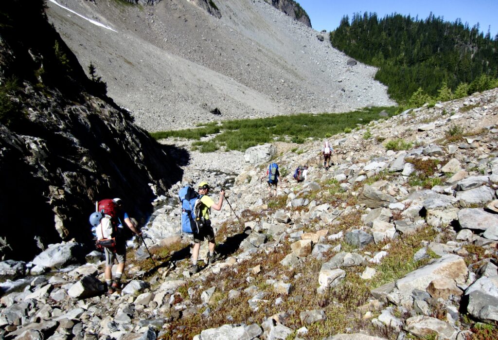
Hiking Down Thru Glacier Basin On Day 3

.

Route Maps & Profiles

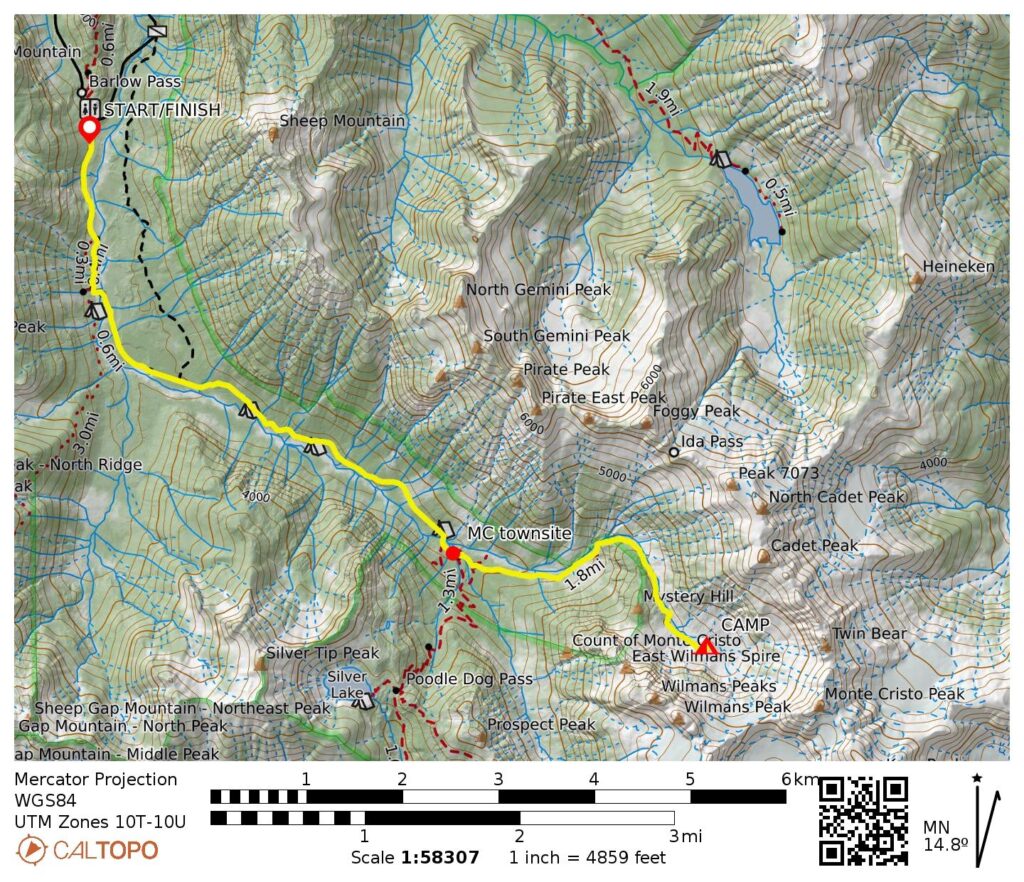
Upper Glacier Basin Approach Route Map (CalTopo)

…

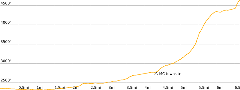
Upper Glacier Basin Approach Route Profile

…

Monte Cristo Peak & Cadet Peak Reconn Route Map (CalTopo)

…

Monte Cristo Peak & Cadet Peak Reconn Route Profile

…

Photo Gallery

Click to enlarge…
Mid-Summer Group At Barlow Pass (photo by Jon)
Crossing Footlog Over South Fork Sauk River
Old Monte Cristo Townsite Sign
Crossing Old Vehicular Bridge Over South Fork Sauk River
Old Monte Cristo Welcome Sign
Monte Cristo Peak From Lower Glacier Basin
Hiking Across Lower Glacier Basin To Ray’s Knoll
Camp On Ray’s Knoll In Upper Glacier Basin
Adam Scrambling Up Waterfall Gully Above Glacier Basin (photo by Jon)
Hiking Down Debris Fan To Glacier Basin (photo by Eric)
Dinnertime Alpenglow In Upper Glacier Basin (photo by Kris)
Evening Alpenglow On Monte Cristo Peak
Evening alpenglow on Monte Cristo Peak above Glacier Basin
Heading Toward Monte Cristo Peak On Day 2
Steep Snowfinger Below North Col On Monte Cristo Peak
Roping Up On Monte Cristo Peak
Starting Up Snowfinger Toward North Col (photo by Todd)
Climbing Snowfinger On Monte Cristo Peak (photo by Kris)
Looking Down Snowfinger On Monte Cristo Peak
Heading Toward U-Notch On Monte Cristo Peak
Booting Up Snowfield Toward U-Notch With Wilmans Peaks Behind (photo by Adam)
Adam Scrambling To U-Notch On Monte Cristo Peak (photo by Jon)
Eric Descending Scree Gully Below U-Notch
Kris & Adam Descending Scree Gully Below U-Notch
Lunch Break On Monte Cristo Peak Bench
Gothic Peak To Big Four Mtn Pano From Monte Cristo Peak
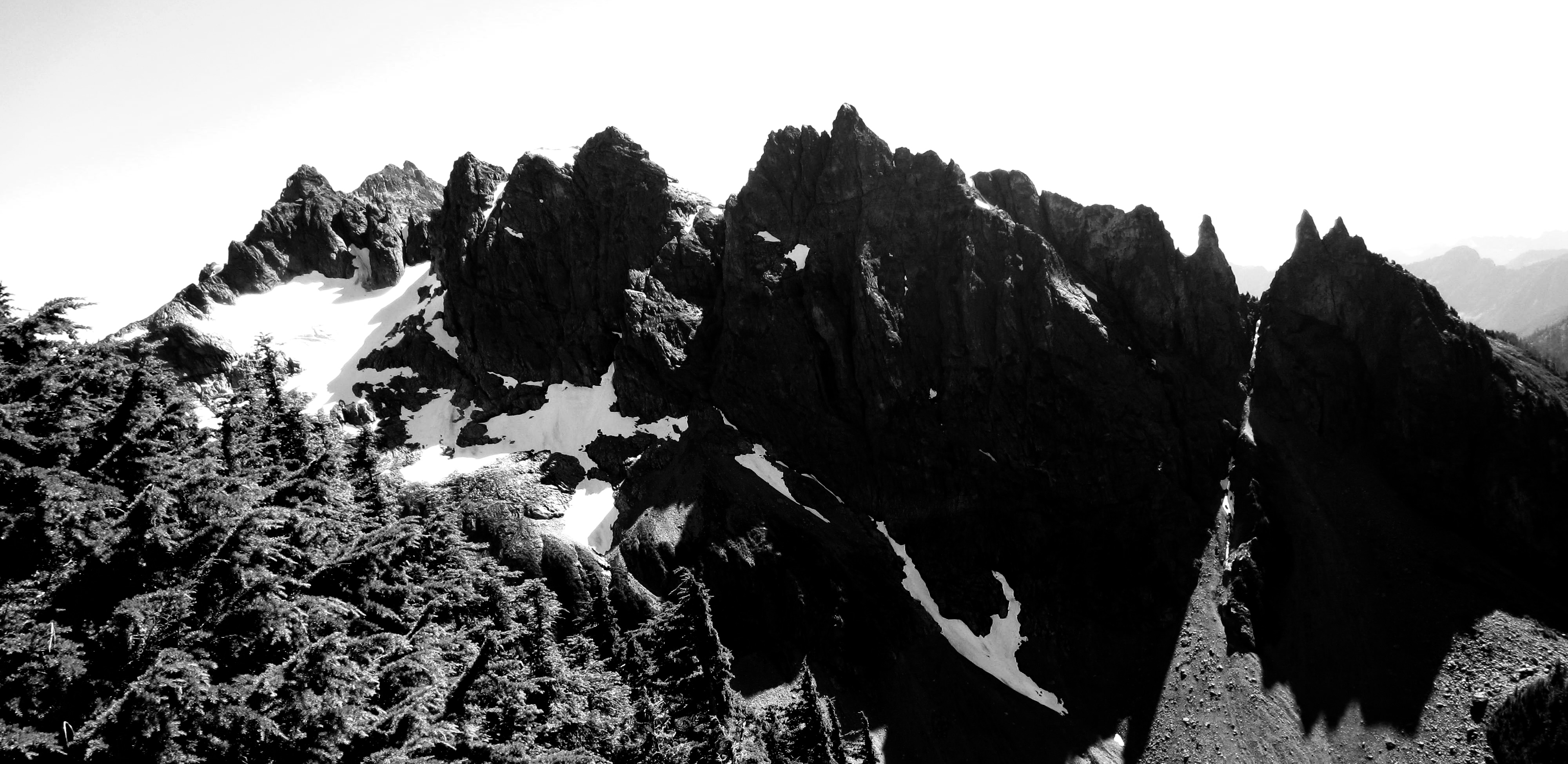
Wilmans Peaks From Near Cadet Peak
Traversing Talus Slope To Cadet Peak
Traversing To Southwest Ridge Of Cadet Peak
Eric Scrambling Up Southwest Ridge Of Cadet Peak (photo by Jon)
Adam & Eric High On Cadet Peak (photo by Jon)
Hiking Down Thru Glacier Basin On Day 3
Previous ArticleAlta Via 4 Trekking Traverse: San Candido / Innichen to Cadore Valley + Torre di Toblin + Monte Paterno (Dolomite Alps, Italy)
No Newer Articles
Jim Brisbine

Jim Brisbine has been climbing Washington peaks for over 50 years, while documenting hundreds of summits and thousands of trail miles in words and pictures. As the creator of "Major Peaks of the Cascades and Olympics --- Fraser/Nicola River to Columbia River," he is an avid outdoorsman and lifelong trailcat who spends his time prowling around the Pacific Northwest and beyond.

Meet TrailCatJim

Jim Brisbine has been climbing Washington peaks for 50+ years, documenting hundreds of summits and thousands of trail miles in words and pictures. As the author of "Major Peaks of the Cascades and Olympics --- Fraser/Nicola River to Columbia River," he is an avid outdoorsman and lifelong trailcat who spends his time prowling around the Pacific Northwest and beyond.
CONTACT TRAILCATJIM

Gear Reviews & Tips & Trips

  • Reviews of Mountain Gear
  • Trailcat Tips & Gear Modifications
  • Ski Tours: I-90 / Snoqualmie Pass
  • Snowshoe Treks: I-90 / Snoqualmie Pass
  • Backcountry Huts: What to Expect

Handy Information Links

  • Weather & Avalanche Forecasts
  • Mountain Road & Trail Reports
  • Mountain Snowpack Depths
  • Nordic Grooming Reports

Packing Lists For Big Trips

  • Alta Via 2, Dolomites, Italy
  • “O” + “W” Circuit, Patagonia, Chile
  • HauyHuash Circuit, Peru
  • Overland Track, Tasmania
  • Three Capes Traverse, Tasmania
  • Mountaineer’s Haute Route, Switzerland
  • Walker’s Haute Route, Switzerland

Most Recent Posts

Glacier Basin Climbing Reconn: Monte Cristo Peak attempt + Cadet Peak attempt (Monte Cristo Mountains, WA)

Alta Via 4 Trekking Traverse: San Candido / Innichen to Cadore Valley + Torre di Toblin + Monte Paterno (Dolomite Alps, Italy)

Cima Cadin NE Attempt + Partial Merlone Via Ferrata / Klettersteig Climb (Dolomite Alps, Italy)

Monte Paterno Via Ferrata / Paternkofel Klettersteig + Camoscio–Laghi–Cengia–Lavaredo Loop (Dolomite Alps, Italy)

Torre di Toblin Via Ferrata / Toblinger Knoten Klettersteig + Sasso di Sesto / Sextner Stein (Dolomite Alps, Italy)

Argonaut Peak via South Gully—Chockstone Dihedral—Upper East Ridge + Ingalls Creek Trail Loop (Icicle Mountains, WA)

Sharkfin Tower via Boston Basin—Quien Sabe Glacier—Southwest Gully—Southeast Ridge (Thunder Mountains, WA)

Red Peak Pass Loop via Illilouette Valley—Ottoway Lakes—Red Devil Basin—Merced Canyon (Yosemite National Park, CA)

The Great Blade Explorations: Bladerunner Crag + Southern Circumnav + Great Blade Peak (Lower Grand Coulee, WA)

Juniper Peak via Juniper Canyon—Southeast Ramp—Upper East Ridge (Spring Mountains, NV)

Three-Trestle Ski Tour / Snowshoe Trek via Homestead Road—Palouse-to-Cascades Trail (Iron Horse Mountains, WA)

Chuckwalla–Pyrite Loop via Turnbuckle Trail—Chuckwalla Trail—Pyrite Trail + Pyrite Summit (White Tank Mountains, AZ)

Goat–Willow Loop via Goat Camp—Ford Canyon—Willow Canyon—Mesquite Canyon Trails (White Tank Mountains, AZ)

Marckworth Forest Bike Rides: Stickerbush Loop + Cherrybush Loop + Cedarbush Loop (Taylor-Tolt Mountains, WA)

Charleston Peak Summit Traverse: Mummy Pass to Griffith Junction (Spring Mountains, NV)

Griffith Peak via South Loop Trail—Echo Overlook—Griffith Junction (Spring Mountains, NV)

Raintree Trail Traverse: Deer Creek Road to Echo Road via Mummy Pass (Spring Mountains, NV)

McAlester Pass Wishbone: Dee Dee Lakes + McAlester Mtn Att + Rainbow Peak (North Stehekin Mountains, WA)

Mujib Canyon Exploration to High Waterfall (Dead Sea Basin, Jordan)

Burdah/Bardeh Mtn Natural Bridge Scramble via North Cleft (Wadi Rum, Jordan)

Non-Major Peaks and Out-of-Area Peaks

Abernathy Peak (2)Abiel Peak (1)Aiguille du Tour (Alps) (1)Alta Mtn (3)Amabilis Mtn (1)Amphitheater Mtn (1)Angels Landing (UT) (2)Apex Mtn (1)Arrowhead Mtn (2)Art's Knoll (1)Atalaya Mtn (NM) (1)Atrium Peak (1)Avalanche Peak (NZ) (1)Axis Peak (1)Bandit Peak (1)Bannock Mtn (1)Banshee Peak (3)Barn Bluff (Tasmania) (1)Barrier Peak (1)Bean Peak (1)Bear Skull Peak (1)Beauty Peak (1)Beaverhead Peak (BC) (1)Bedal Peak (1)Beta Peak (1)Big American Peak (1)Big Beaver Peak (2)Big Chief Mtn (1)Big Jim Mtn (2)Big Lou Mtn (2)Big McWaukum Peak (2)Big Snow Mtn (3)Bills Peak (1)Black Crater (OR) (1)black tower (2)Blackwall Peak (1)Bladerunner Crag (1)blizzard peak (1)Bogachiel Peak (1)Bojo Mtn (1)Bootjack Mtn (1)Boulder Butte (3)bowan mtn (2)Breccia Peak (1)Breithorn West (Alps) (1)Bridge Mtn (NV) (1)Brothers, The: no peak (1)Bryant Peak (1)Buckhorn Mtn (1)Bulls Head (1)Burroughs Mtn (1)Camelback Mtn (AZ) (1)Camp Robber Peak (1)Cape Horn (Chiwaukum) (2)Capitol Butte (AZ) (1)Carne Mtn (3)Castle, The (Tatoosh) (1)Catt Peak (1)Cerro Grande (NM) (1)Challenger 2 Pinnacle (1)Challenger west peak (1)Charleston Peak (NV) (1)Cheops Peak (1)Chilly Peak (1)Chimney Rock: so peak (1)Chinook Peak (1)Choral Peak (1)Chumstick Snag (1)Church Mtn (1)Circle Peak (1)Clouds Rest (CA) (1)Coleman Pinnacle (2)Colquhoun Peak (1)Conical Hill (NZ) (1)Cooney/Switchback Peak (2)Cornice Peak (1)Cougar Mtn (Issy) (1)Courtney Peak (3)Cowlitz Middle Chimney (2)Cowlitz Rocks (2)Cradle Mtn (Tasmania) (1)Crescent Tower (Bugaboo) (1)Cusick Mtn (OR) (1)Daemon Peak (1)Davis Peak (Waptus) (1)Deadhorse Peak (2)Deadwood Peak (1)Denny Mtn (1)Desolation Peak (2)Devils Dome (Skagit) (2)Devils Head (Tean) (1)Devils Peak (Sauk) (1)Devils Smoke Stack (2)Dewey Peak (2)Dirtyface Mtn: NW Peak (1)Dirtyface Mtn: SE Peak (1)Dot Mtn (1)Dungeon Peak (2)Dysprosium Peak (2)Eagle Cap (OR) (1)easy peak (Picket) (3)Echo Rock (Rainier) (1)Elephant Butte (1)Elizabeth Peak (1)Escondido Point (1)Excelsior Point (1)Ferry Peak (Sawtooth) (1)Fifes Peaks (1)Fifth of July Mtn (1)Finney Peak (Sawtooth) (1)Fisher Peak (2)Fortune Mtn (Beckler) (1)Fortune/Headlight Peak (1)Freedom Peak (1)Freezer Peak (2)French Cabin Mtn (1)Frigid Mtn (1)Frisco Mtn (1)Goat Island Mtn (1)Goat Mtn: East Peak (1)Goat Mtn: West Peak (1)Gopher Mountain (1)Gothic Peak (2)Governors Peak (1)Graham Mtn (1)Grand Teton (WY) (1)Granite Mtn (Icicle) (1)Granite Mtn Main (Snoq) (1)Granite Mtn West (Snoq) (2)Gray Peak (1)Graybeard Peak (1)Great Blade Peak (1)Green Mtn (Suiattle) (1)Greyhorn Peak (1)Griffith Peak (NV) (1)Grindstone Mtn (2)Gunn Point (2)Gunnshy Peak (1)hahlakl peak (2)Half Dome (CA) (1)Harding Mtn (1)Hawkins Mtn (3)Hessong Rock (1)Hi-Jack Peak (1)Hidden Lake Peak (1)High Esmerelda Peak (1)High Rock (Nisq) (1)Highchair Mtn (1)Hoch Joch Spitz (1)Horsethief Peak (1)Huckleberry Mtn (Snoq) (1)Huckleberry Mtn (Suiattle) (1)Hurricane Peak (1)hurry-up peak (1)Icebox Peak (1)Icicle Peak (7)Icy SE Peak (1)Ida/Rover Peak (1)Indian Head Peak (1)Ingalls East Peak (2)Ingalls South Peak (2)Iron Cap Mtn (1)Ironview Peak (AZ) (1)Isolation Peak (1)Jackaroo Peak (1)Jim Hill Mtn (3)Jolly Mtn (1)jumbo mtn (1)Juniper Peak (NV) (1)kangaroo temple (1)Keechelus Peak (1)Kendall Peak (2)Kitling Peak (1)Knight Peak (1)Kololo Peak (2)Labyrinth Mtn (3)ladies peak (1)Lake Peak (NM) (1)Lakeview Mtn (1)leconte mtn (1)Lemah Thumb (1)Lembert Dome (CA) (1)Libby Mtn (1)Liberty Cap (Chiwawa) (2)Lichtenberg Mtn (3)Little Giant Peak (1)Longs Peak (1)Lookout Mtn (Teebone) (1)Louis Peak (1)Lundin Peak (2)Lynch Peak (1)Magenta Peak (1)Magic Mtn (1)Malachite Peak (1)Marmolata Spire (Bugaboo) (1)Marys Peak (Tean) (1)Mastodon Peak (CA) (1)Matterhorn (OR) (1)McClellan Butte (1)McCue Peak (1)Merchant Peak (1)Mescalito Peak (NV) (1)Miller Peak (1)Mirror Mtn (1)Monument 83 Hill (2)Morning Star Peak (1)Mountaineer Peak (1)Mt Amos (Tasmania) (1)Mt Berge (1)Mt Catherine (1)Mt Cleator (1)Mt Conness (CA) (1)Mt Dickerman (1)Mt Ellinor (1)Mt Fernow (Beckler) (1)Mt Forgotten (1)Mt Gibbs (1)mt hood (OR) (2)mt howard (2)Mt John (NZ) (1)Mt Jonathan (1)Mt Laura (1)Mt Lena (1)Mt Margaret (1)Mt Mastiff (1)Mt McCausland (2)Mt Oberlin (MT) (1)Mt Ollivier (NZ) (1)Mt Ossa (Tasmania) (1)Mt Persis (2)Mt Pleasant (1)Mt Rolo (1)Mt Ruth (Rainier) (1)Mt Saul (1)Mt Seattle (1)Mt Sinclair (NZ) (1)Mt Skokomish (1)Mt St Piran (AB) (1)Mt Suappoa (AZ) (1)Mt Teneriffe (1)Mt Torment (1)Mt Watson (1)Mt Whitney (CA) (1)Mt Wilson (NV) (1)mt wintrop (1)Napeequa Mtn (1)Navaho Peak (1)Navarre North Peak (1)Navarre South Peak (1)Nimbus Peak (1)Nordic Mtn (Selkirk) (1)Norse Peak (4)Oakes Peak (1)Old Desolate (1)old maid mtn (1)Paddy-Go-North Peak (2)Paddy-Go-South Peak (1)Paintbrush Peak (WY) (1)Painted Mtn (1)Pass Butte (Pasayten) (1)Peak Hill (NZ) (1)Pemmican Peak (1)Perfect Peak (Selkirk) (1)Picketpost Mtn (AZ) (1)Pickhandle Point (1)Pico Perico (MX) (1)Pico Silla N. (MX) (1)Pinnacle Peak (Tatoosh) (1)Pirate Little Peak (1)Plummer Mtn (Suiattle) (1)Plummer Peak (Tatoosh) (1)Poe Mtn (1)Portal Peak (1)Portal Peaks (Baker) (1)Pratt Mtn (2)Purple Peak (1)Pyramid Mtn (Chelan) (3)Pyramid Peak (Greenwater) (2)Quiniscoe Mtn (1)Ragged Peak (1)Rainbow Peak (1)Rainy Peak (1)Rampart Mtn (Entiat) (1)Rampart Peak (Keechelus) (2)Rattlesnake Mtn (Issy) (3)Red Mtn (Kachess) (3)Red Mtn (Ragged) (1)Red Mtn (Snoq) (1)Red Top Mtn (2)Rennie Peak (1)Revolution Peak (1)Rhino Butte (1)rock mtn (Nason) (9)Rooster Finch Tower (1)Round Mtn (Nason) (1)Round Mtn (Stilly) (1)royal peak (2)ruby mtn (1)Ruth Mtn (Nooksack) (2)Ryan Mtn (CA) (1)Salvation Peak (1)Sauk Mtn (2)Seymour Peak (1)Sherpani Peak (1)Siligo Peak (CA) (1)Silver King Peak (1)Silver Peak (Snoq) (3)Silvertip Peak (Monte Cristo) (1)Sitting Bull Mtn (1)Skykomish Peak (1)Skyscraper Mtn (1)Sluiskin Mtn: The Squaw (1)Snoqualmie Mtn (2)Snoqualmie Tooth (2)Sobieski Mtn (1)Sourdough Mtn (1)spectacle north butte (1)Sperry Peak (1)Squak Mtn (Issy) (1)Squaretop Mtn (1)St'auk Mtn (1)Steamboat Rock (1)Stetattle Buttes (1)Stillaguamish Peak (1)Stone City Mtn (2)Stormy Mtn (2)Stroud Peak (WY) (1)Sulphur Mtn (1)Sun Top (2)Superstition Peak (AZ) (2)Tailgunner Peak (2)Tamanos Mtn (1)Teanaway Butte (1)thea foss peak (1)Thompson Point (2)Thor Peak (1)Thornton Peak (1)Thorp Mtn (1)Three Brothers Mtn (2)Three Queens: middle peak (1)Three Queens: west peak (1)Thunder Mtn (Icicle) (1)Tiffany Mtn (1)Tiger Mtn East (1)Tinkham Peak (1)Tolmie Peak (1)Tourmaline Peak (1)Trappers Peak (Skagit) (1)Trico Mtn (1)Tricouni Peak (1)Tronsen Head (7)Tumalo Mtn (OR) (1)Tumble Mtn (1)Tuolumne Peak (CA) (1)Turtlehead Peak (NV) (1)Twentymile No Peak (1)unicorn peak (1)Uno Peak (1)Verrado Peak (AZ) (1)Vesper Peak (2)Volcanic Neck (Tean) (1)Warren Peak (CA) (1)Wheeler Peak (NM) (1)white mtn (sauk) (2)White Rock Peak (NV) (1)White Rock Spring Peak (NV) (1)Whittier Peak (1)Wild Goat Peak (1)Windy Joe Mtn (2)Wing Peak (Sky) (1)Wolframite Mtn (1)Yakima Peak (1)Yellow Hill (Tean) (1)Yellow Rock (UT) (1)Zorro Point (Snoq) (1)
  • Home
  • Most Recent Posts
  • Major Peaks A-Z
  • Major Peaks Map
  • Major Peaks Synopsis
  • Hike/Climb/Ride
    • Canadian Cascades BC
    • Northwestern WA Cascades
    • Northeastern WA Cascades
    • North-Central WA Cascades
    • Central WA Cascades
    • Southern WA Cascades
    • Olympic Mountains WA
    • Columbia Plateau WA
    • Other USA & Canadian Regions
    • International (outside USA & Can)
  • Ski/Snowshoe
    • Snow Tours in British Columbia
    • Snow Tours in Northwestern WA Cascades
    • Snow Tours in Northeastern WA Cascades
    • Snow Tours in North-Central WA Cascades
    • Snow Tours in Central WA Cascades
    • Snow Tours in Southern WA Cascades
    • Snow Tours in Olympic Mountains WA
    • Snow Tours in Oregon
    • Snow Tours in Other Locations
  • Types of Trips
    • Canyoneering
    • Difficult 10 Climbs
    • Family Trips
    • Golden Larch Outings
    • Lookout Sites
    • Marathon Hikes
    • Mid-Summer Outings
    • Mtn & Gravel Biking
    • Rock & Ice Climbing
    • Summit Camps
    • Winter Summits
    • The Early Years
    • Traverses & Loops (Alpine)
    • Traverses & Loops (Ski)
    • Traverses & Loops (Trail)
    • Traverses & Loops (Classics)
      • Bacon-Hagan-Blum Trav (WA)
      • Enchantment Traverse (WA)
      • High–Giant Traverse (WA)
      • Olympus–Bailey Trav (WA)
      • Picket Traverse (WA)
      • Ptarmigan Traverse (WA)
      • Grand Canyon Raft Trav (AZ)
      • Huayhuash Circuit (Peru)
      • Inspiration–Isolation Trav (WA)
      • Overland Trav (Tasmania)
    • Via Ferratas
    • WA Blue Corn Specials
    • Winter Summits
  • Reviews / Lists / Tips
  • Mountain Goodies
  • Contact TrailCatJim
Type to search or hit ESC to close
See all results