Trip Date: June 4-9, 2026
Red Peak Pass Loop: Illilouette Valley to Merced Canyon
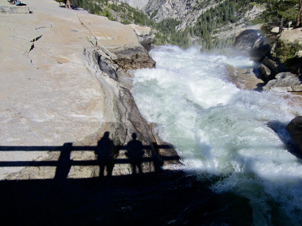
Illilouette Fall
Merced Pass Lakes
Ottoway Lakes
Red Peak Pass
Red Devil Basin
Triple Peak Fork Falls
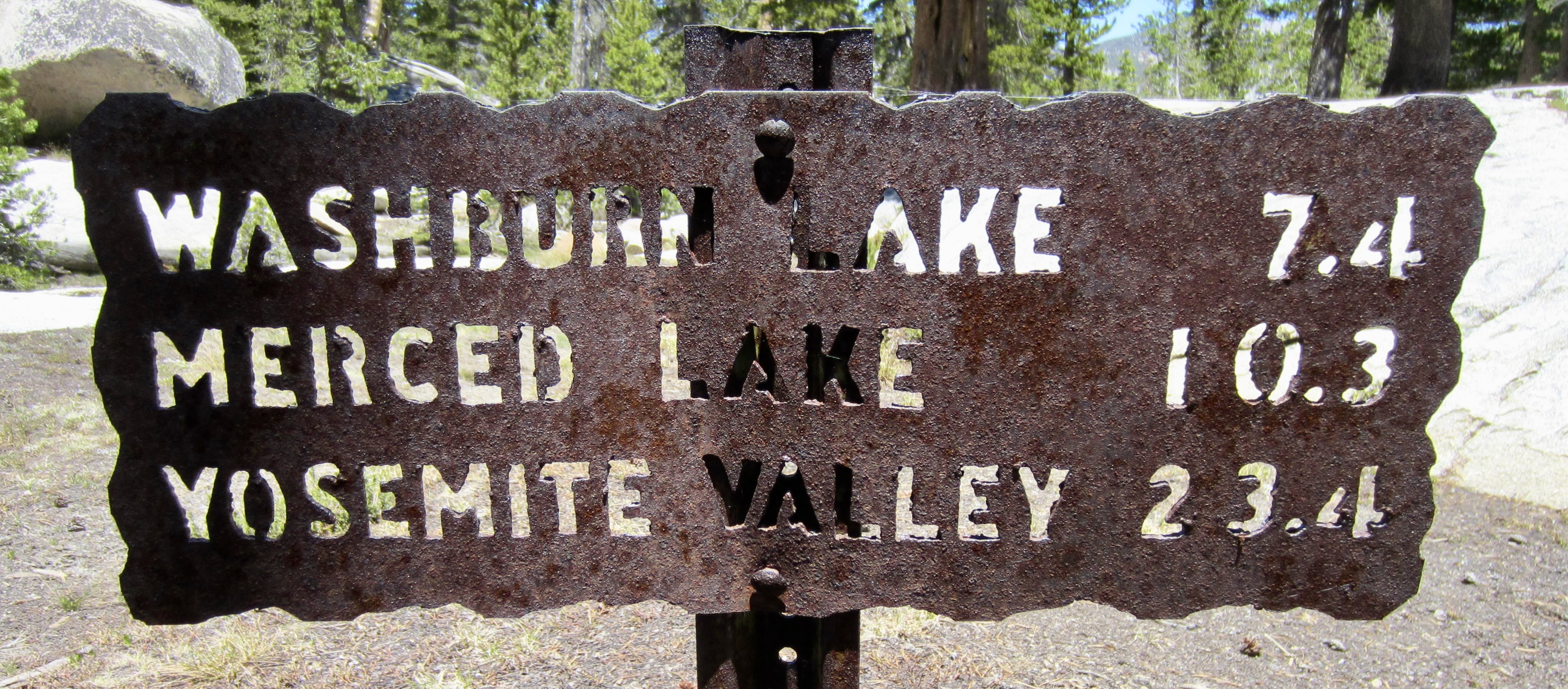
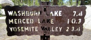
Washburn Lake
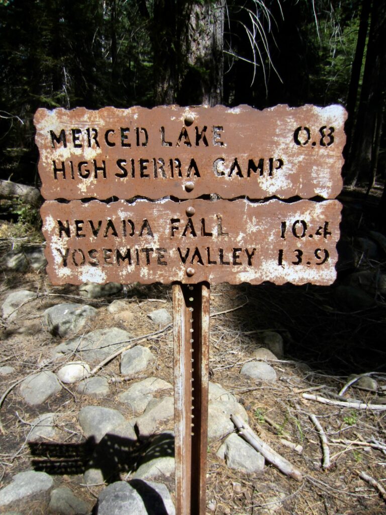
Merced Lake
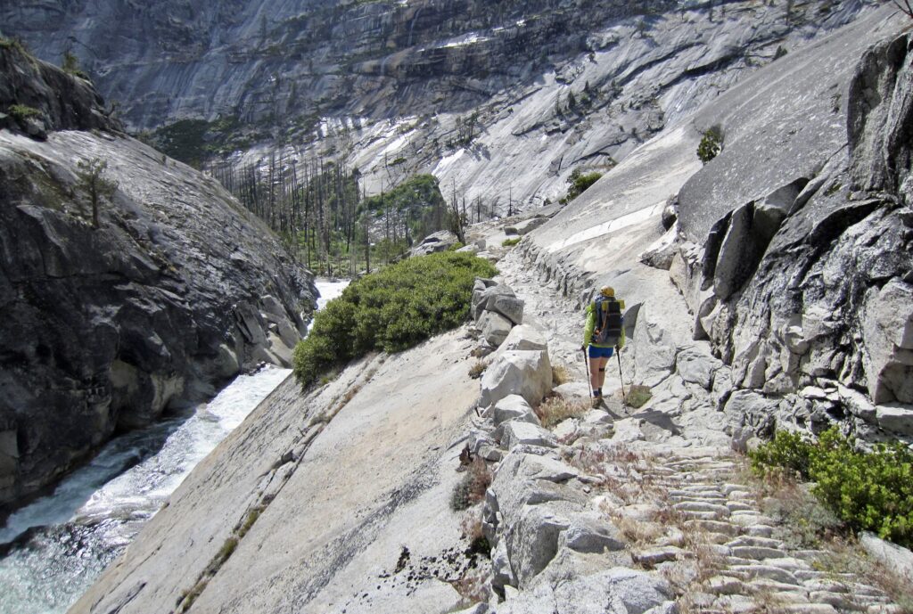
Merced Canyon
Little Yosemite Valley
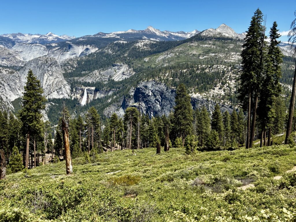
Nevada Fall
- Trip Report Summary
- Related Posts
- Trip Overview
- Full Trip Report
- Day 1: Glacier Point to Illilouette Fall Bridge
- Day 2: Illilouette Fall Bridge to Lower Merced Pass Lake
- Day 3: Lower Merced Pass Lake to Red Devil Basin
- Day 4: Red Devil Basin to Washburn Lake
- Day 5: Washburn Lake to Little Yosemite Valley
- Day 6: Little Yosemite Valley to Glacier Point
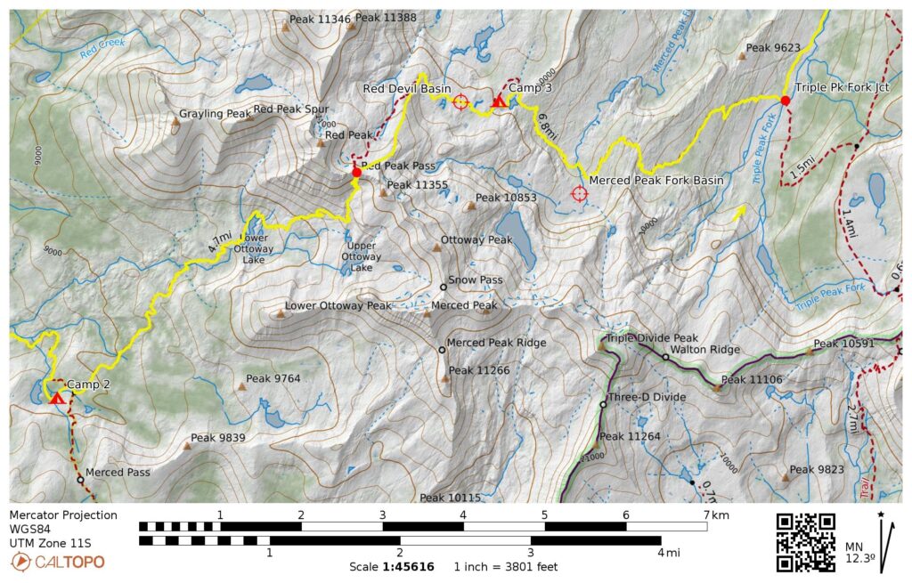
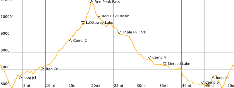
- Route Maps & Profile
- Photo Gallery
Trip Report Summary
Region: California
Sub-Region: Sierra Nevada Range
Sub-Sub-Region: Clark Range
Area: Yosemite National Park
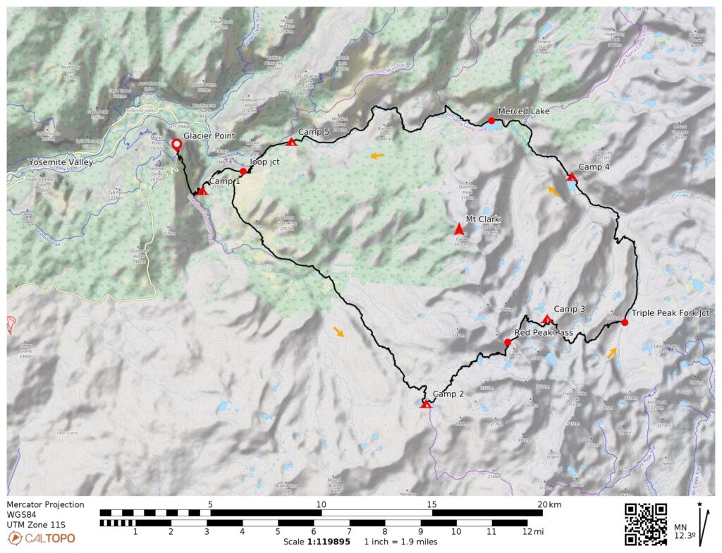
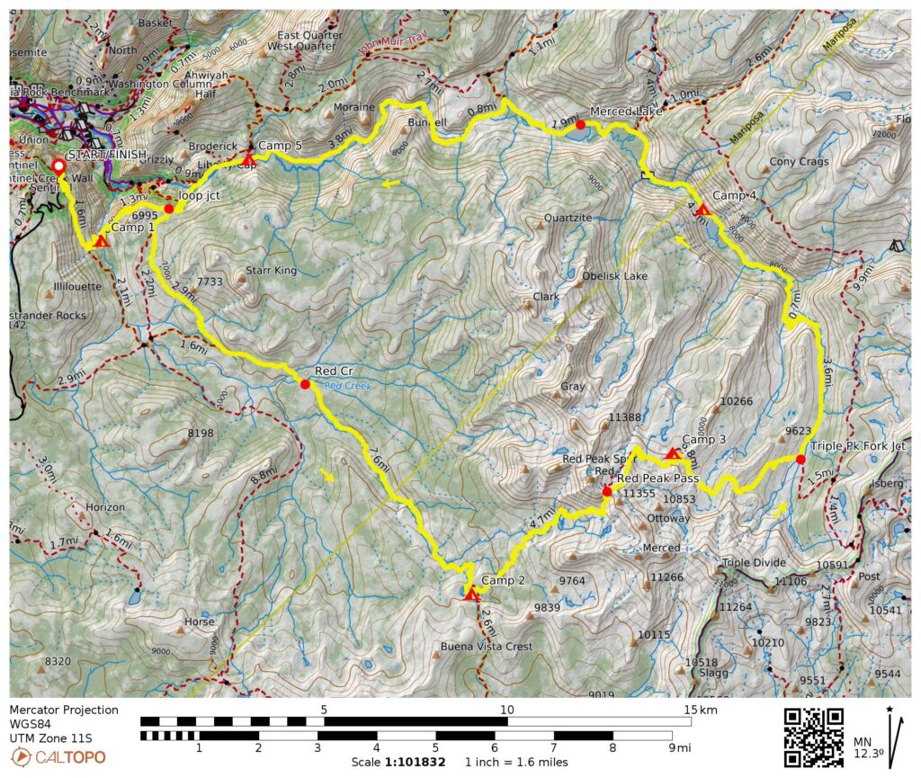
Starting & Ending Point: Panorama Trailhead at end of Glacier Point Road (Elev. 7200 feet)
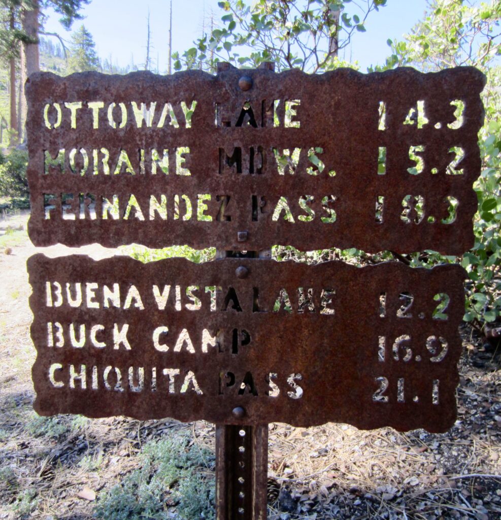
Way Points: Illilouette Fall Bridge & Merced Pass Trail junction & Clark Fork crossing & Red Creek crossing & Illilouette Creek crossing & Lower Merced Pass Lake & Ottoway Creek crossing & Lower Ottoway Lake & Upper Ottoway Lakes overlook & Red Peak Pass & Red Devil Basin & Upper Merced Peak Fork crossing & Triple Peak Fork Junction & Triple Peak Fork Falls & Lower Merced Peak Fork Bridge & Upper Merced River crossing & Washburn Lake & Merced Lake Ranger Station & Merced Lake & Echo Creek Bridge & Upper Merced Canyon Bridge & Lower Merced Canyon Bridge & Bunnell Cascade & Little Yosemite Valley Campground & Nevada Fall Bridge & Merced Pass Trail junction & Illilouette Fall Bridge & Glacier Point (trail hike & snow hike)
Low Point: Illilouette Fall Bridge (Elev. 5900 feet)
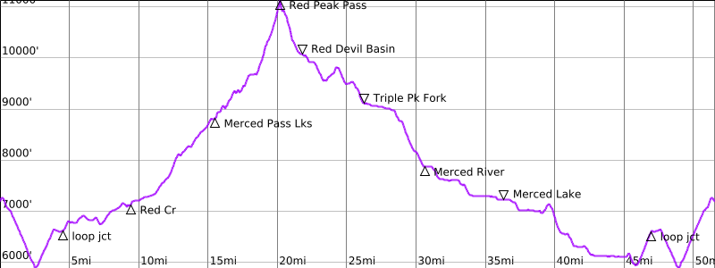
High Point: Red Peak Pass (Elev. 11,150 feet)
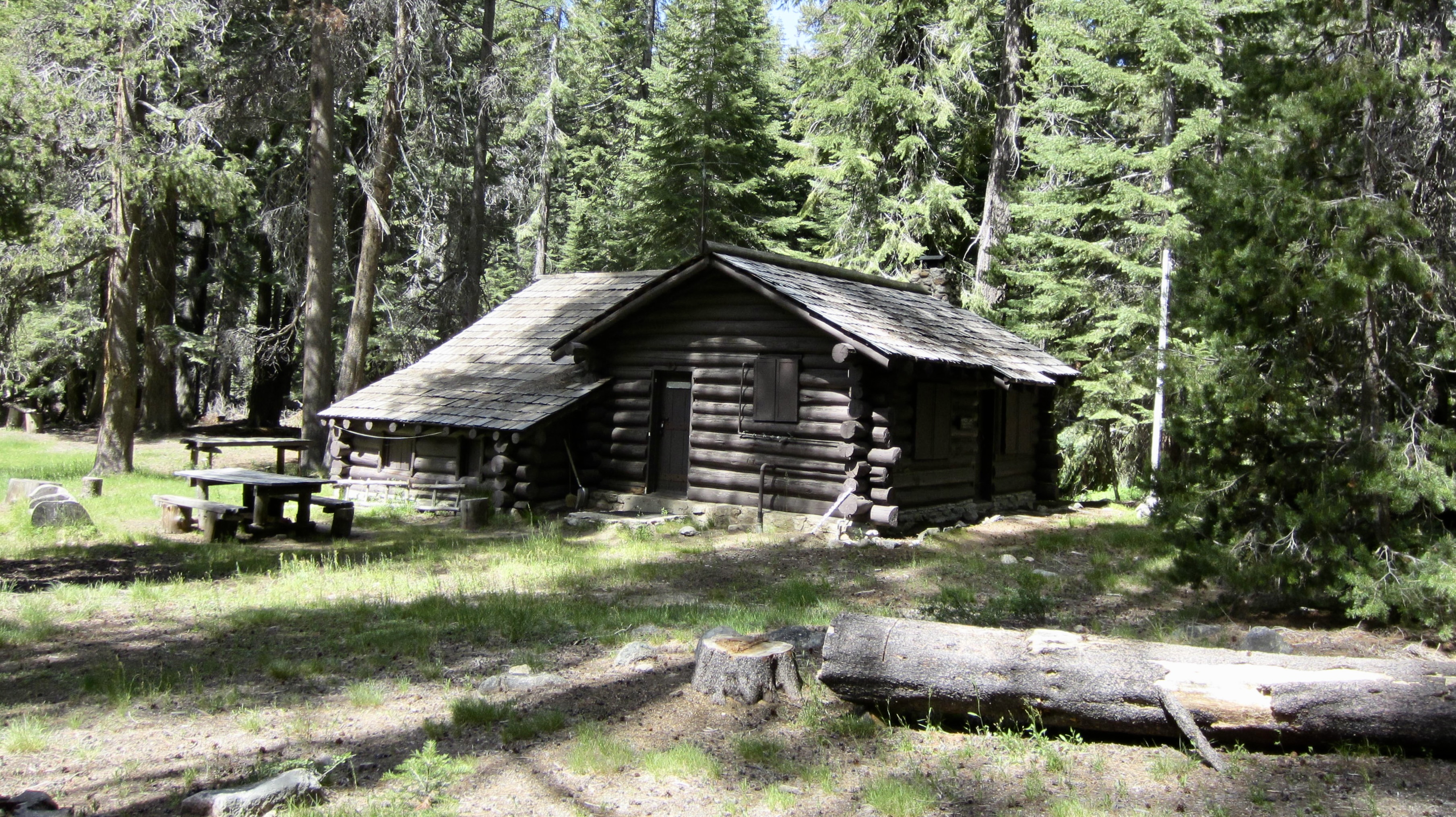
Campsites: Illilouette Fall Bridge & Lower Merced Pass Lake bowl & Red Devil Basin & Washburn Lake & Little Yosemite Valley Campground
Approximate Stats: 51.6 miles traveled; 8700 feet gained & lost.
Related Posts
>>> Merced Peak Fork Basin via Merced Lake—Triple Peak Fork + Cloud’s Rest – May 2021
>>> Half Dome via Little Yosemite Valley—Cable Route – May 2018
Trip Overview
The Red Peak Pass Loop is an excellent 52-mile backpacking trek in the southern part of Yosemite National Park. It follows a series of trails that travel through the Clark Range and reach a maximum elevation exceeding 11,000 feet. Along the route, trekkers are treated to some of Yosemite’s major highlights, including Illilouette Fall, Ottoway Lakes, Red Devil Basin, Triple Peak Fork Falls, Merced Canyon, and Nevada Fall. In addition, peak-baggers would find Red Peak to be a worthwhile sidetrip.
Eileen and I attempted the Red Peak Pass Loop twice during mid-May in recent years—once in a counter-clockwise direction and once in a clockwise direction—but were thwarted both times due to a thick snowpack and high creek levels. After these unsuccessful attempts, Eileen was more determined than ever, as this had become a “bucket-list” trek for her. We decided that our next try would be during June in a low-snowpack year. Conditions aligned for us this year, and we were able to complete the loop, albeit with a few complications. We traveled in a counter-clockwise direction due to permitting issues, but it could reasonably be done in either direction.
Our first problem arose on Day 2, when we discovered that the trail through Illilouette Creek Valley has not been maintained in several years or more; it was heavily overgrown in places and was obstructed by approximately 50 downed trees. Also, because it was early season, some other trails had not yet received their annual maintenance. Other prevailing early-season problems throughout Yosemite are that creek levels are still fairly high—many crossings require log-walking or fording—and that snow still covers most high-country trails.
A more significant complication for us was a washed-out bridge across the upper Merced River. We learned about this recent damage from the ranger who issued our permit in Yosemite Valley. As such, we weren’t caught by surprise on Day 4, and she did provide some helpful advice about fording the river, but this crossing proved to be a serious affair nonetheless.
…
…
For the benefit of future backpackers doing any trek in Yosemite, I should mention that Ursacks (kevlar food-storage bags) are no longer acceptable within the park. On previous trips, Eileen and I were able to hang our food in Ursacks, but rigid food-storage canisters are now required. Because we did not discover this rule change until picking up our permit, we had to rent canisters ($5 each) at the ranger station and then do some major repacking at the trailhead.
Another item worth mentioning is that Yosemite often instructs backcountry trekkers to pick up their permits at a location staffed by rangers who are most familiar with the specific route or destination. In our case, we were directed to the main Wilderness Center in Yosemite Valley, even though we were driving right past the Wawona Ranger Station en route to Glacier Point. We later talked to a ranger in Wawona and learned that we could indeed have picked up our permit there. This unnecessary detour added about 2 hours to our drive and impacted our schedule for the next three days.
Full Trip Report
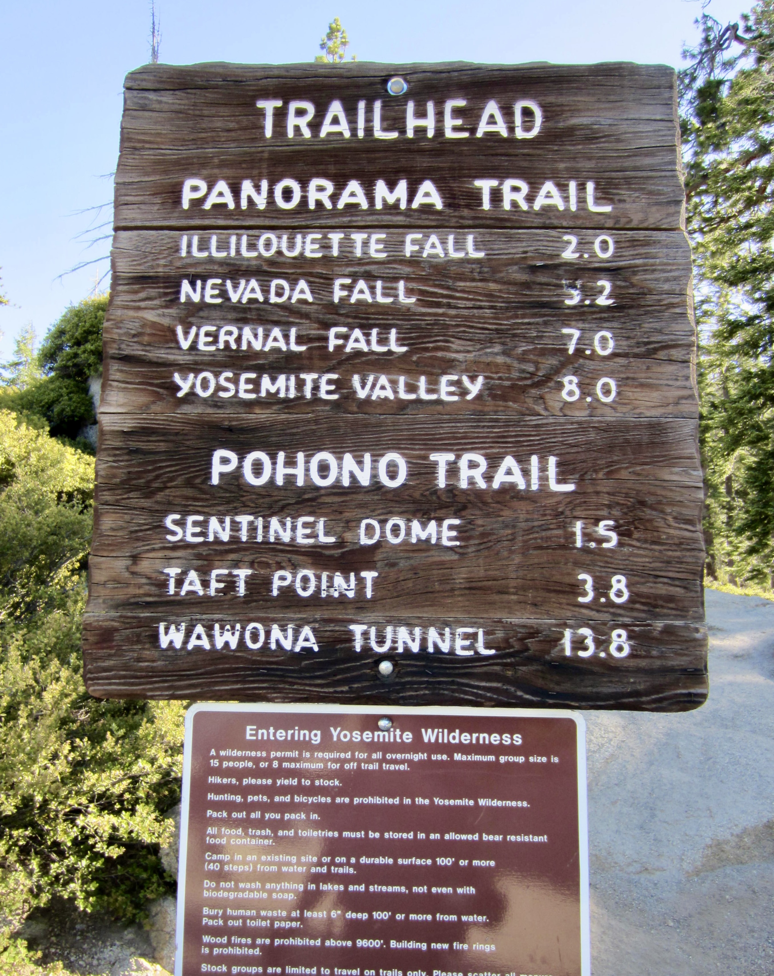
Day 1: Glacier Point to Illilouette Fall Bridge
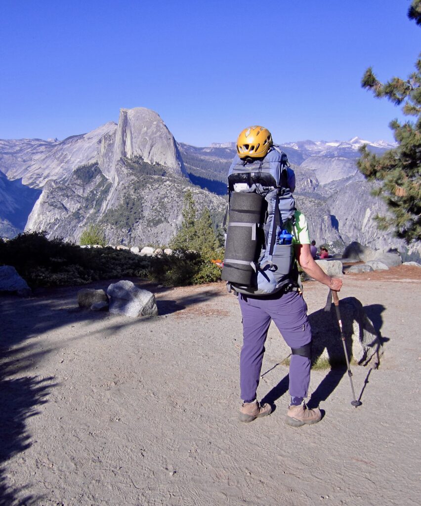
Due to flight delays on both takeoff and landing, a slow drive from Fresno to Yosemite in a rental car with failing brakes, and the “need” to pick up our permit at the Yosemite Valley Wilderness Center, it was past 6:00pm when we finally headed down the Panorama Trail from Glacier Point. On the positive side, though, our entire trail was comfortably shady, and evening sun lit up the mountains to our east.

.
.
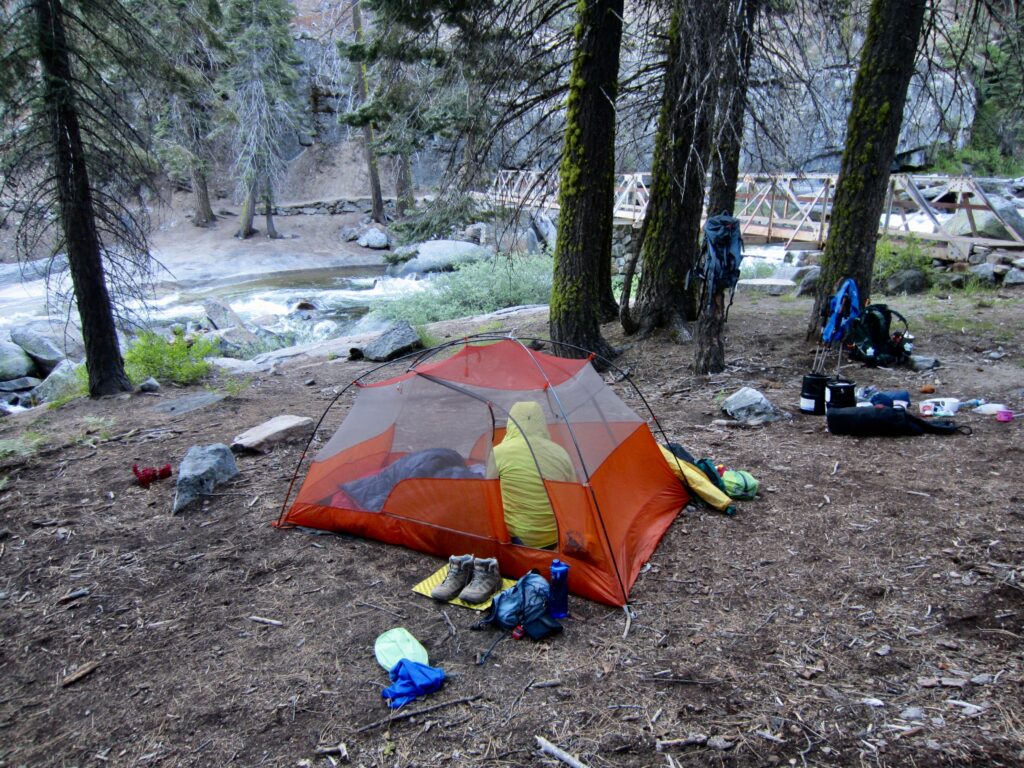
We arrived at Illilouette Fall Bridge shortly after 7:30pm and stopped to camp at an adjacent tent site (1.6 hours + 012.4 miles + 50 feet – 1350 feet from TH). Although this site officially lies within a day-use-only area, the ranger had mentioned that the intent is to keep it available for day-hikers. Considering that all day-hikers were long gone by now, we felt that we were meeting the spirit of the rule. Besides, the next available campsite on our route (our originally planned campsite) was more than 2 hours away.
.
Day 2: Illilouette Fall Bridge to Lower Merced Pass Lake
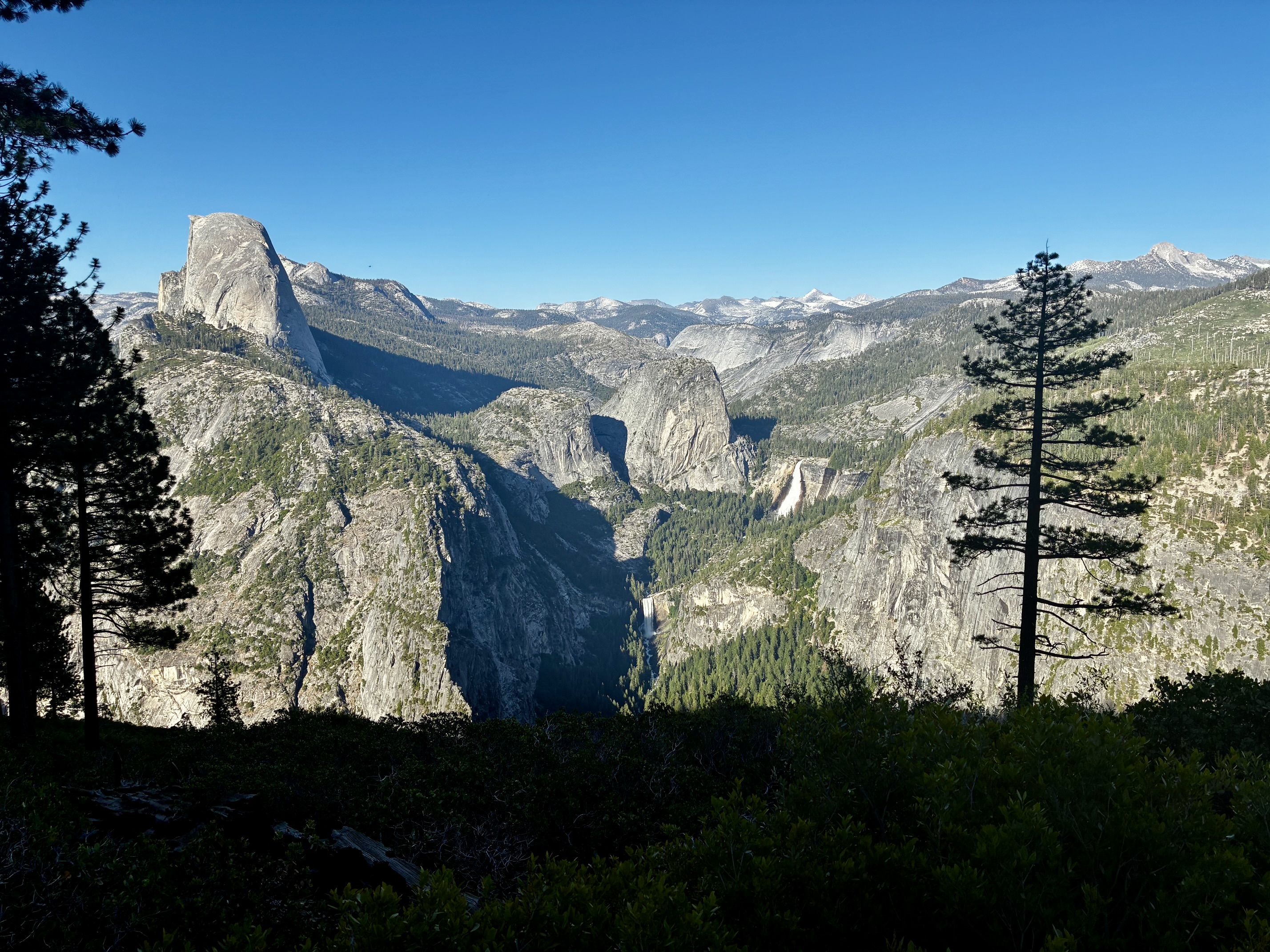
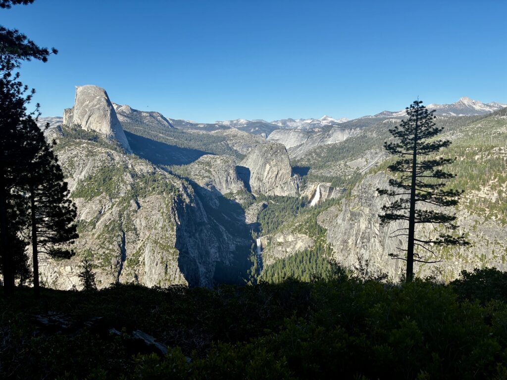
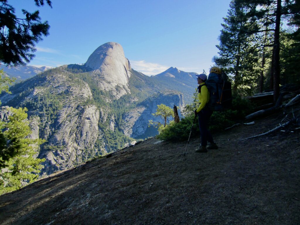
Eileen and I were packed and underway before any day-hikers came through camp in the morning. We continued hiking along the Panorama Trail as it climbed over a large cliff band. The air was pleasantly cool, and morning sun illuminated Half Dome and Liberty Cap directly across Little Yosemite Valley.

.
.
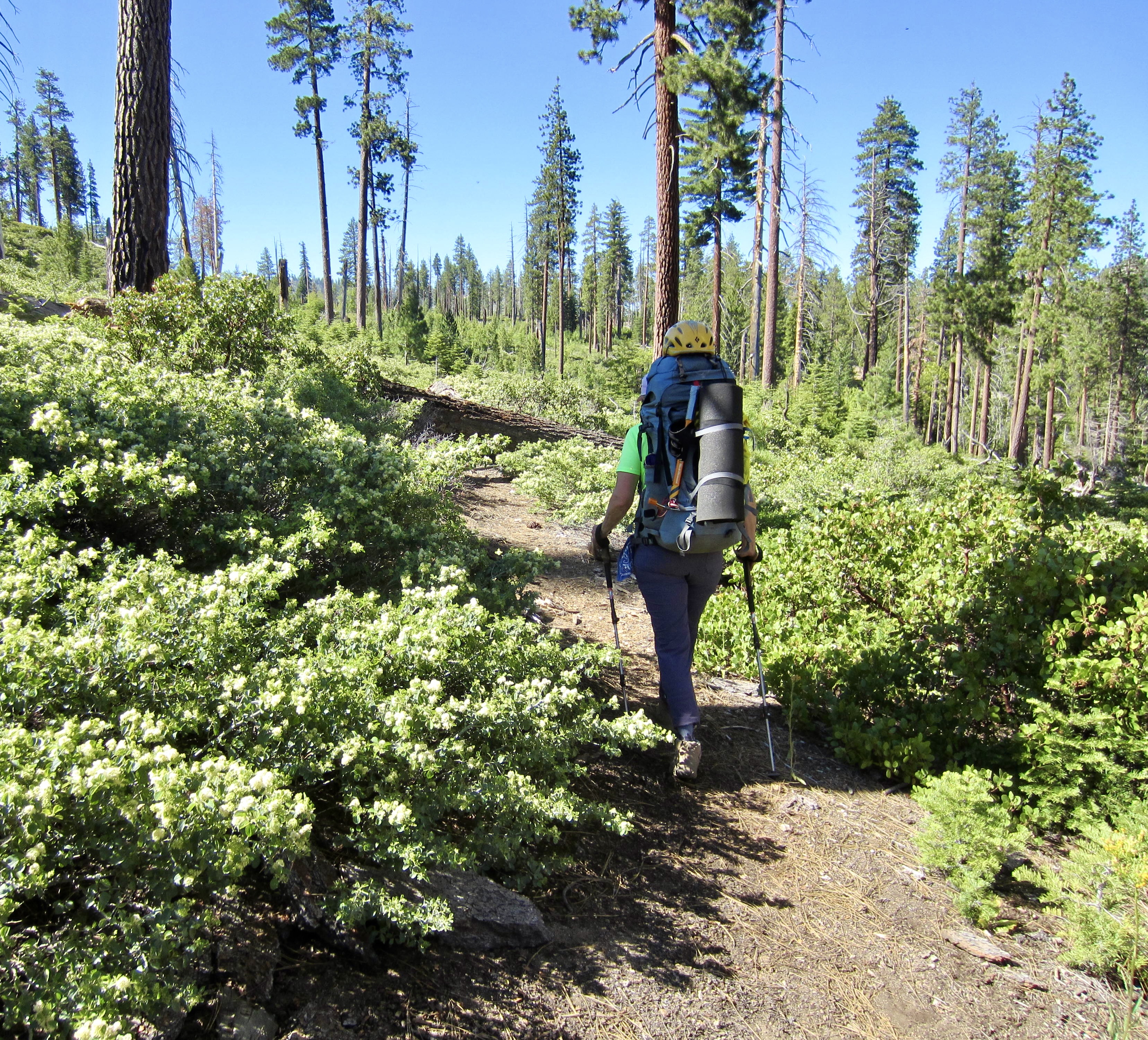
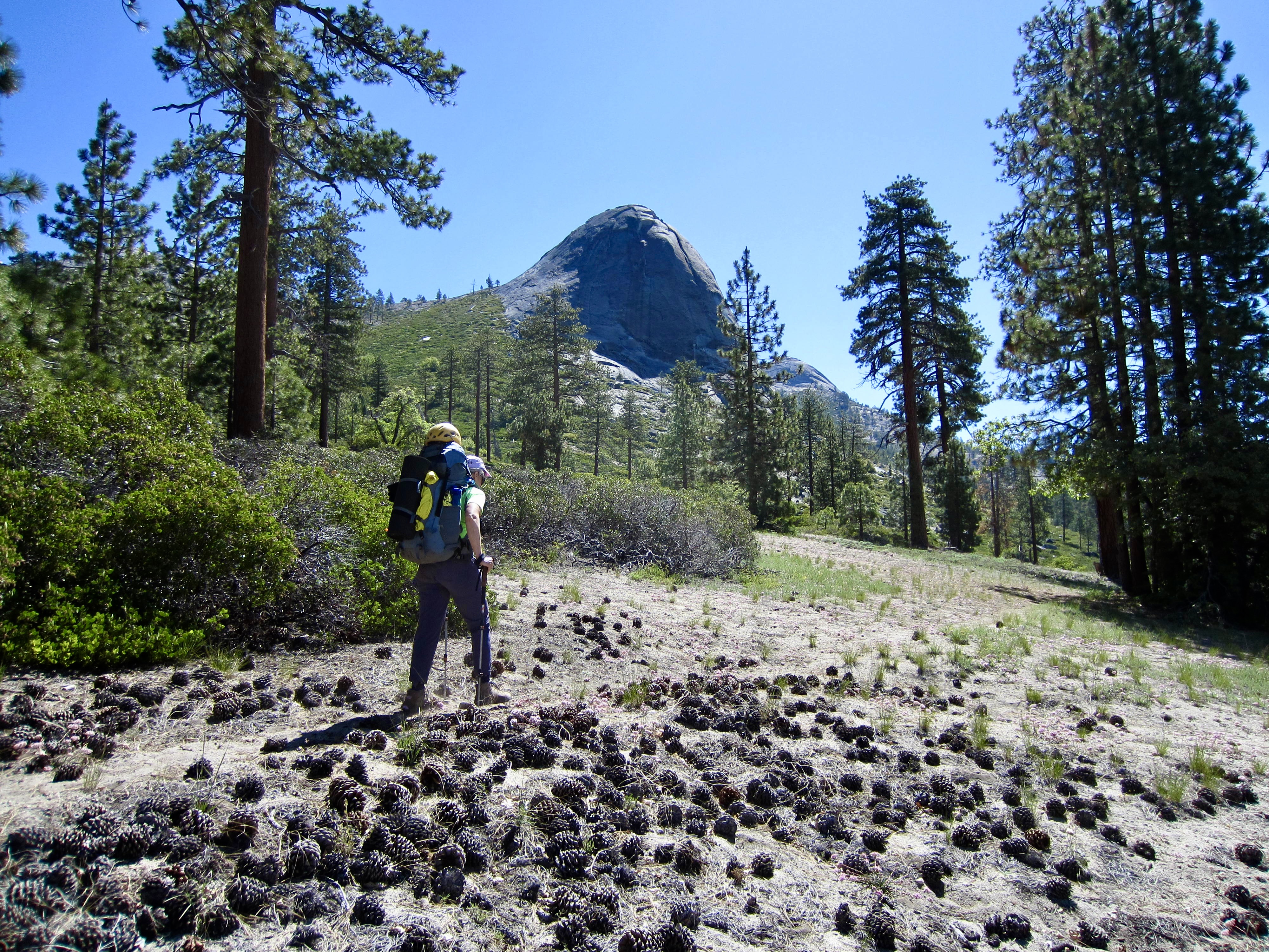
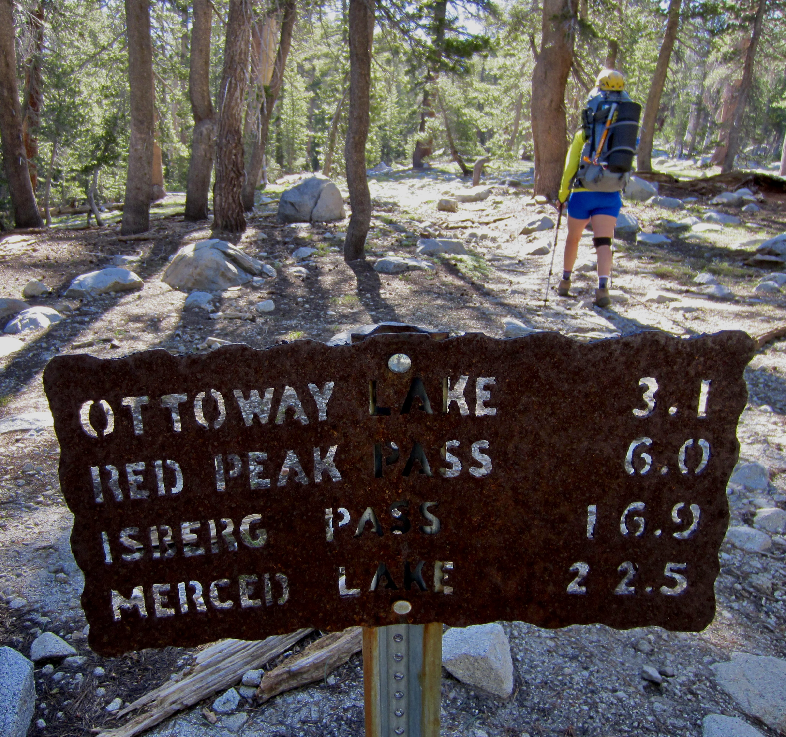
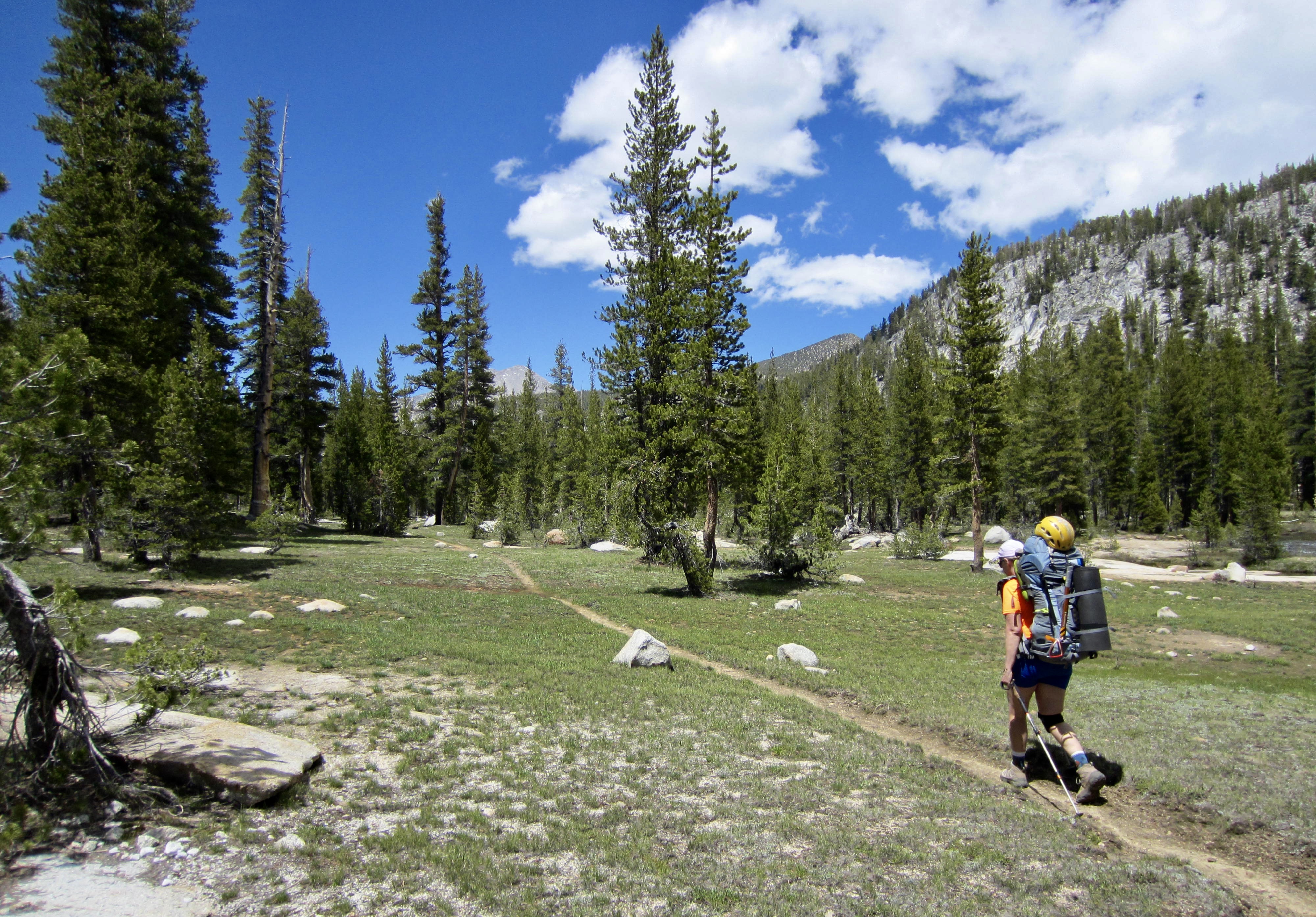
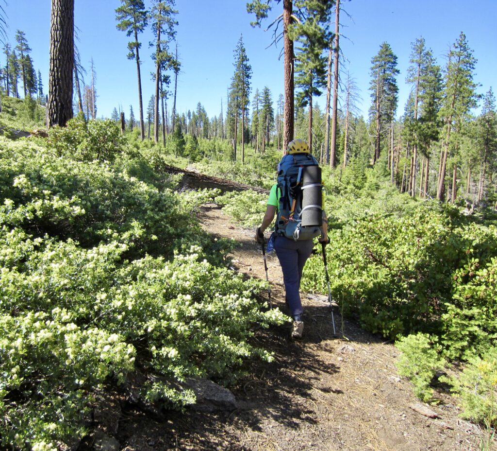
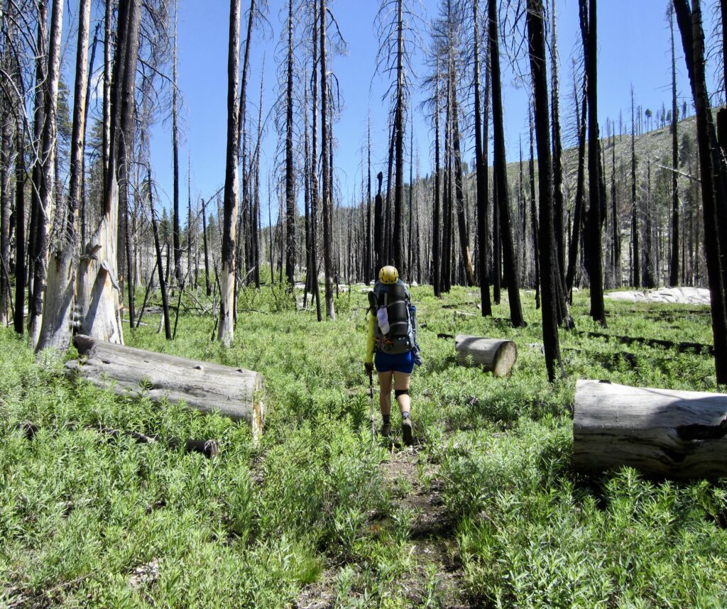
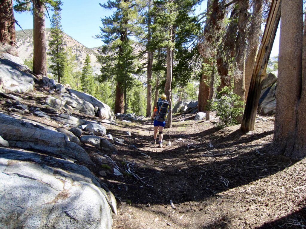
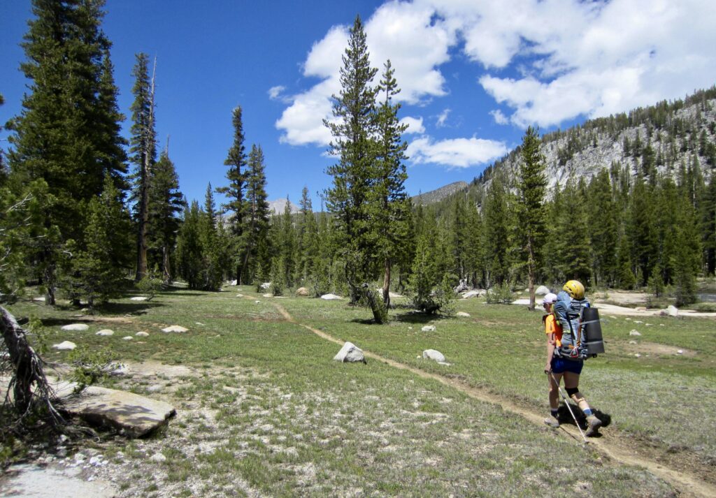
After 2 miles, we came to a junction with the Merced Pass Trail and turned south on this much-less-used trail as it curled around Mt. Starr King and proceeded far into the Illilouette Creek Valley. This trail passes through an old burn and is overgrown in many places with post-fire bushes.
.

.
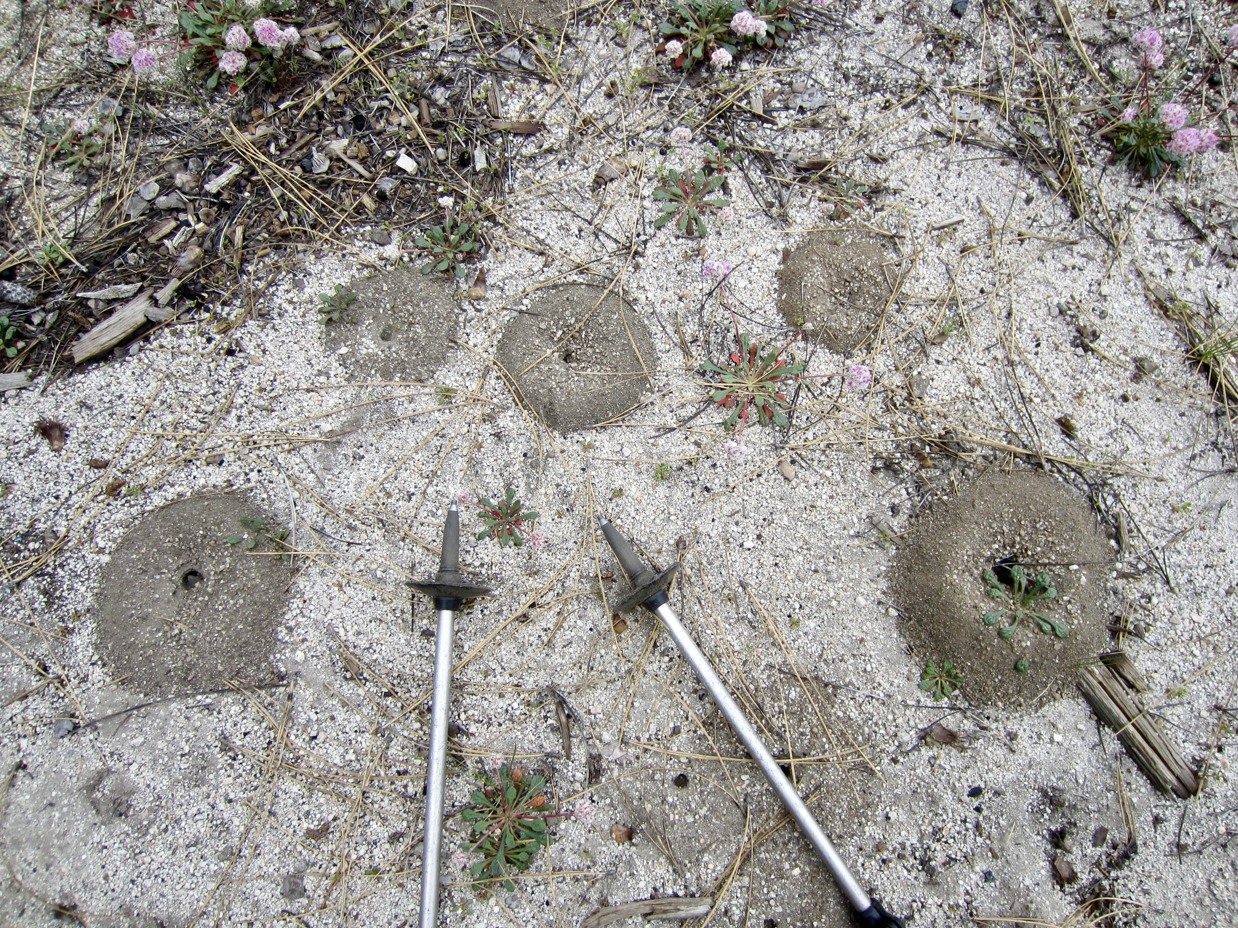
Interestingly, the sandy soil along the trail was decorated with thousands of ant burrows consisting of donut-shaped mounds ranging from 2 to 5 inches wide. My subsequent research indicated that these are California harvester ants, which can deliver a painful sting if threatened. Over the next several days, some of our campsite options were dictated by the presence or absence of these ant burrows.

.
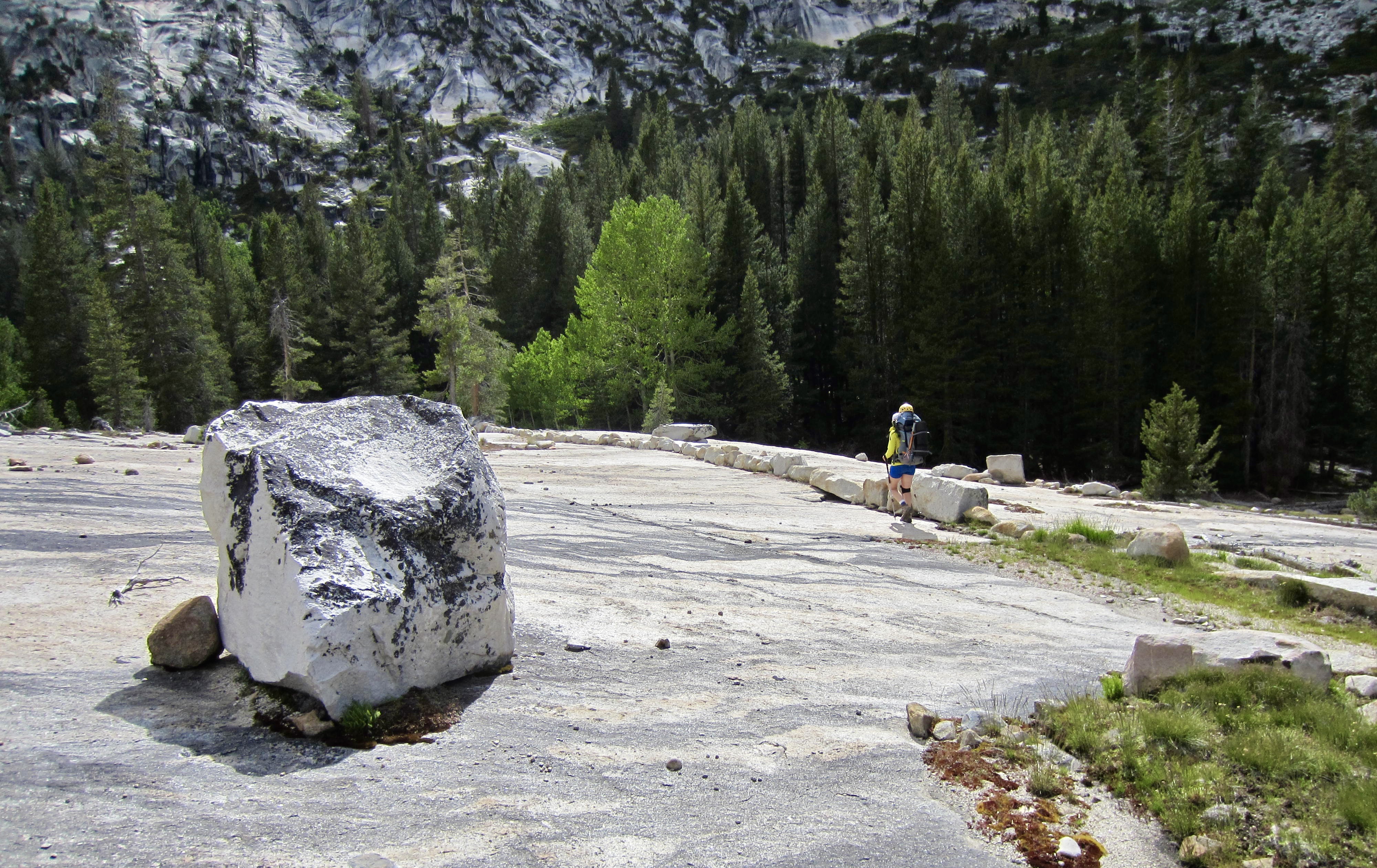
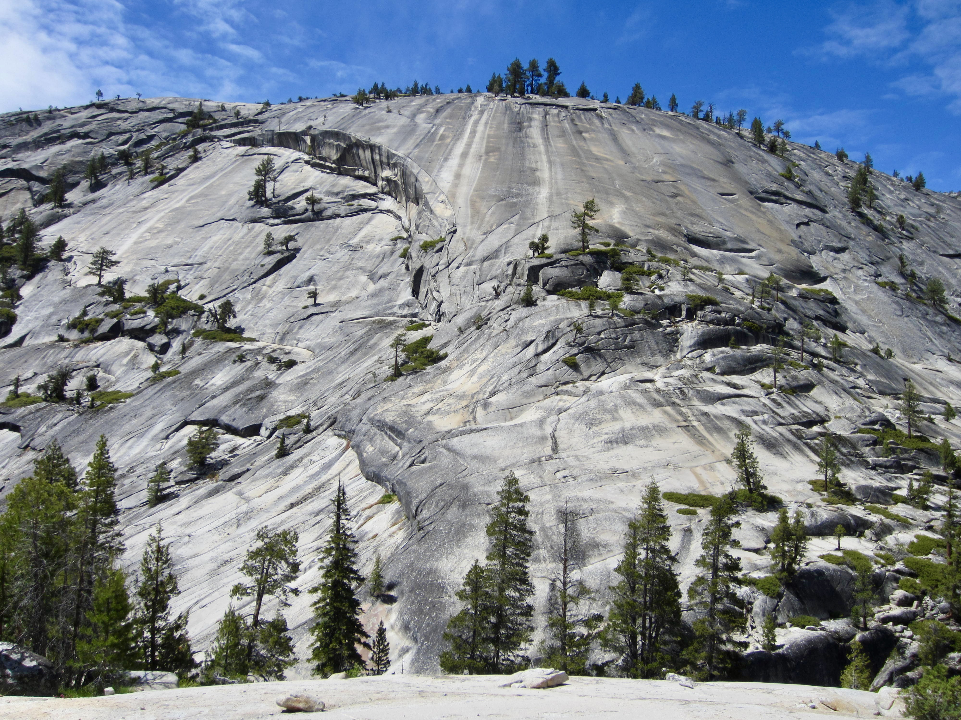
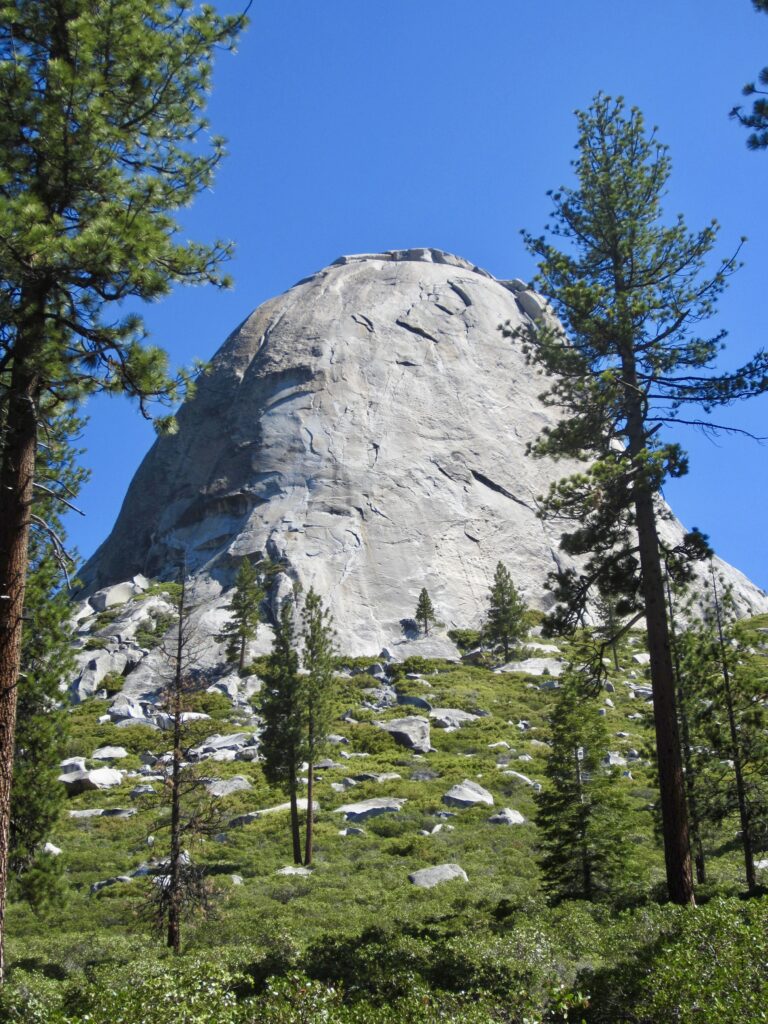
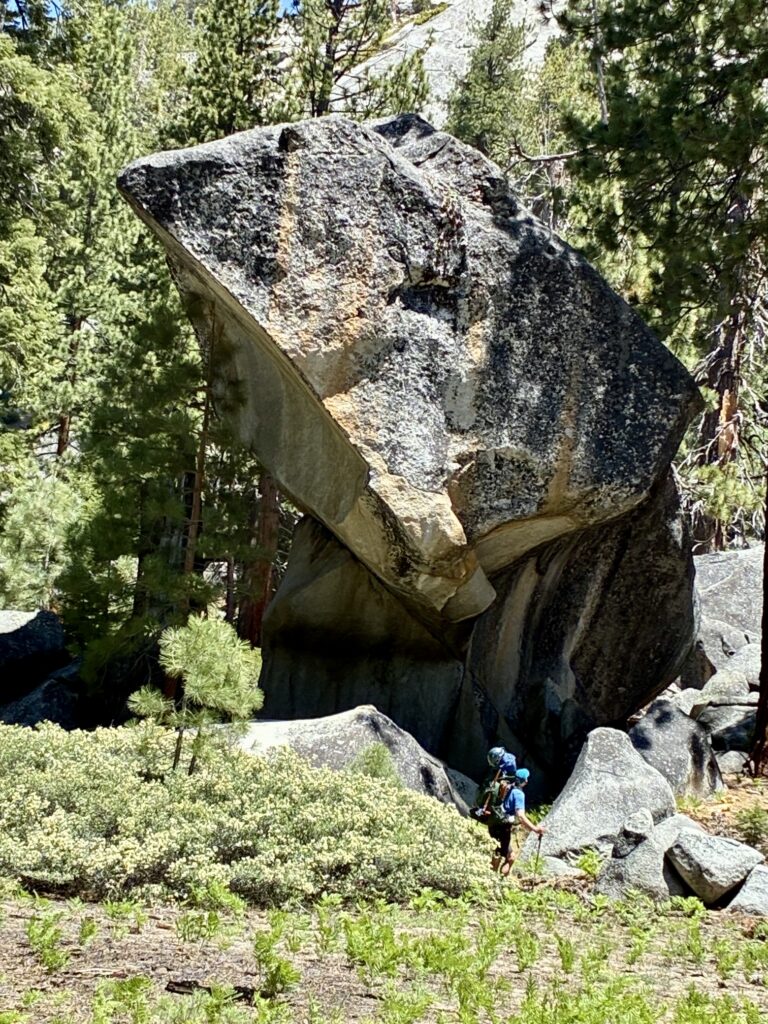
We eventually left the burn zone and entered green forest below the flanks of Mt. Starr King. Along the way, we passed some textbook examples of exfoliation domes, which shed their layers of granite like an onion being slowly peeled. There was also a gigantic boulder that appeared to be perched on its edge. Could this survive the next earthquake?
.

.
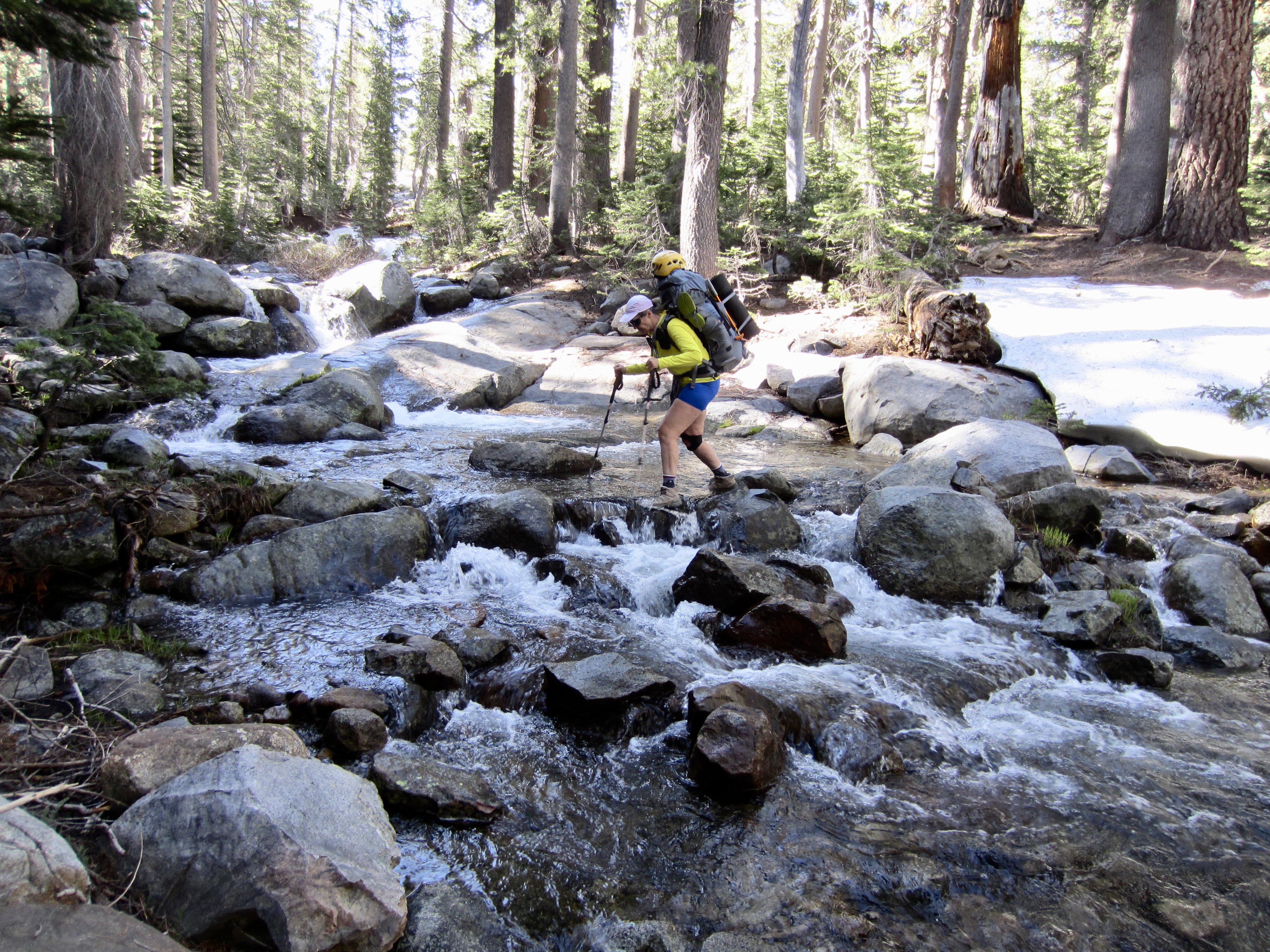
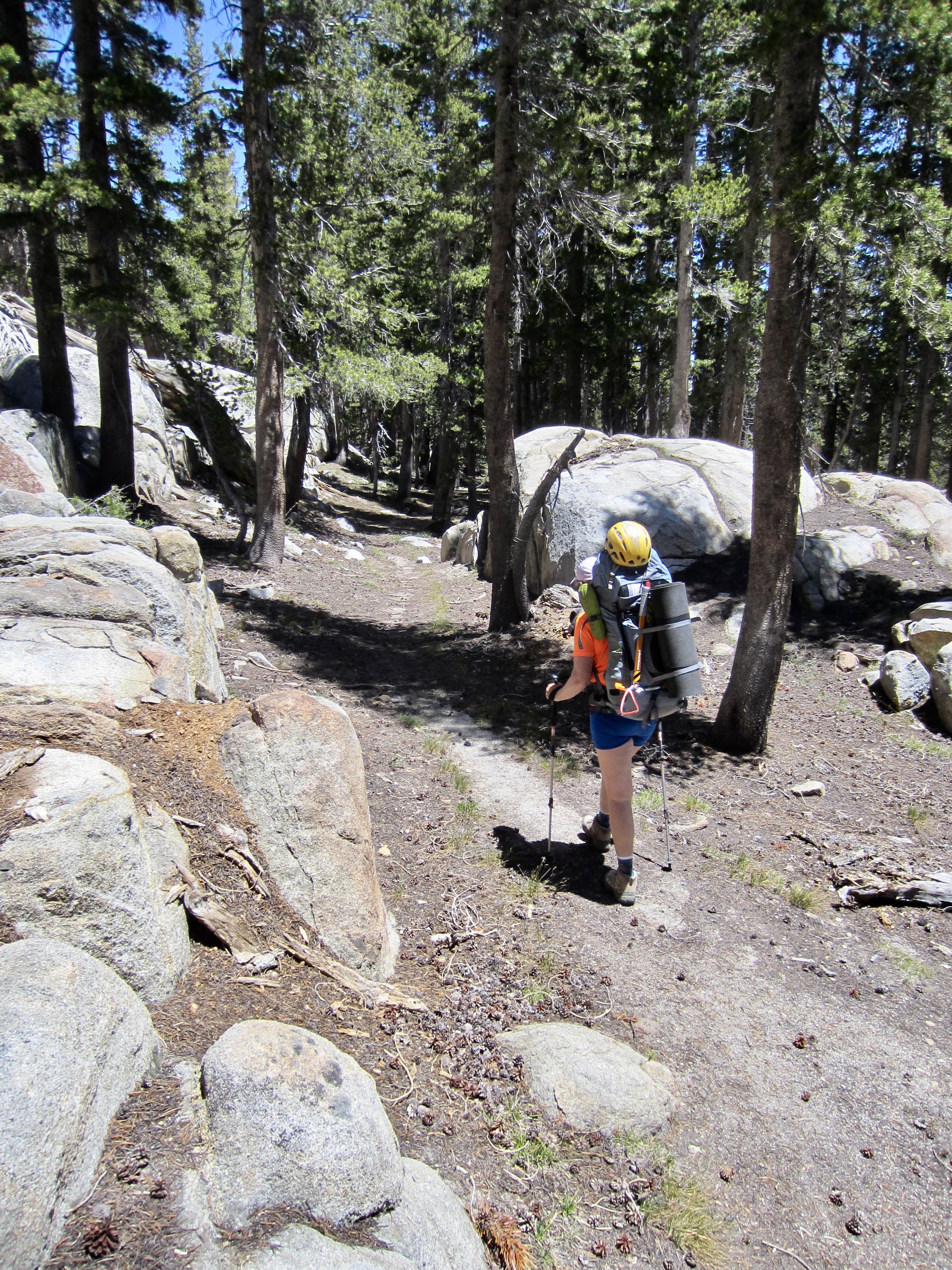
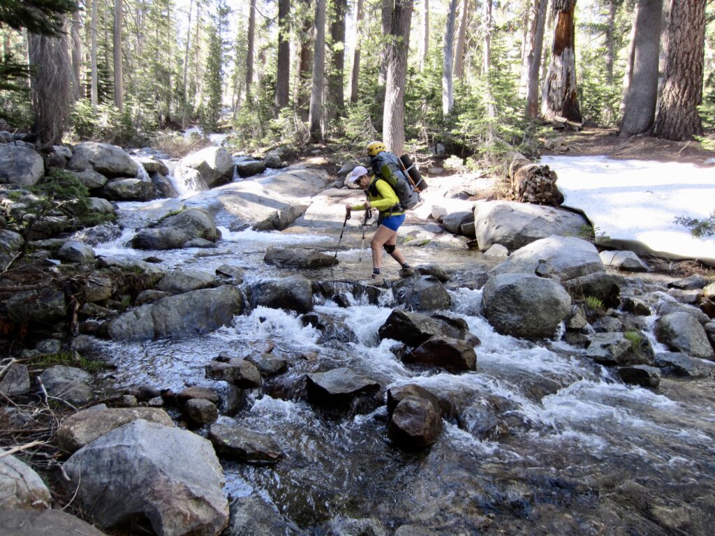
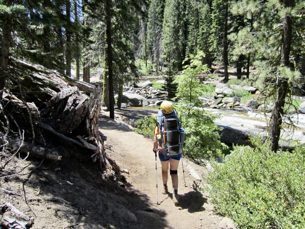
Our travel through the burned and unburned forests was hindered by the prevalence of fallen trees. I estimated that we had to crawl over or work around about 50 logs today! It became obvious that this trail had not been maintained in many years. Furthermore, we had to log-walk, rock-hop, or ford a half-dozen creeks. Worse yet were the voracious mosquitoes that plagued us all afternoon.
.
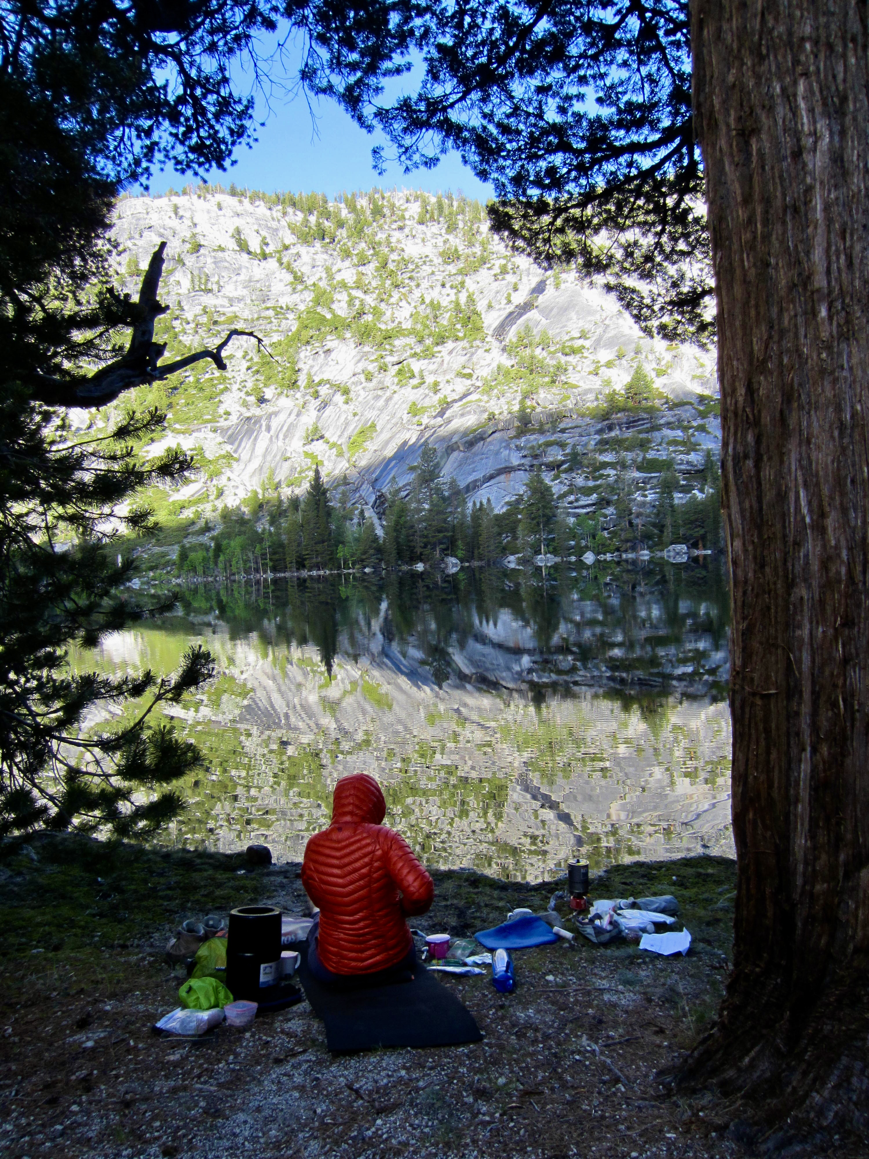
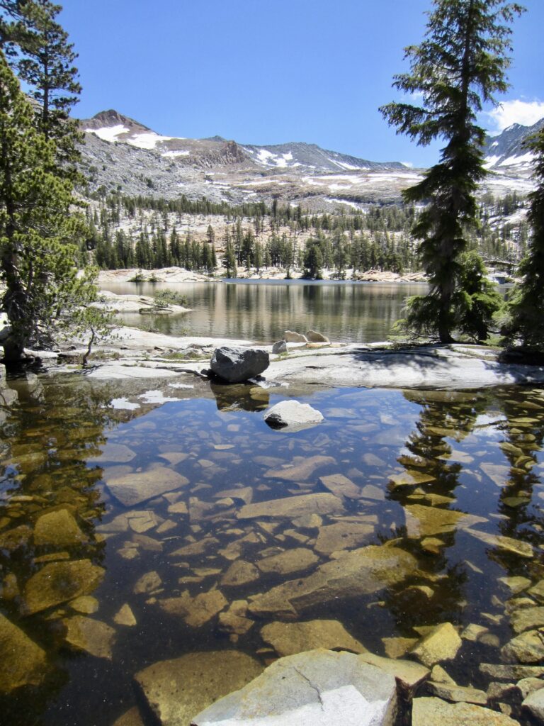
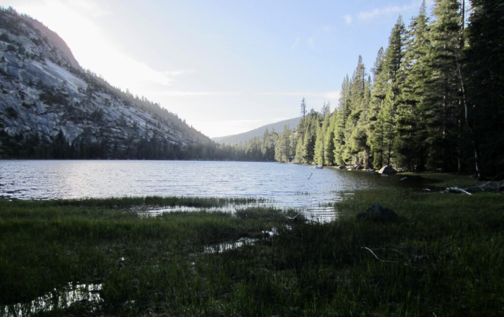
Around 6:00pm, we reached the flat bowl of Lower Merced Pass Lake at 8800 feet (10.5 hours + 13.1 miles + 3200 feet from Camp 1). Our original plan was to reach Lower Ottoway Lake today, but yesterday’s delays made this our revised campsite. However, the entire outlet area is guarded by a maze of small creeks, ponds, and marshy ground. After wandering around for ½ hour, we could never get closer than 50 feet from the shore! Thoroughly frustrated, we gave up and started looking for a campsite on the adjacent rock slabs. Eileen found a dandy little sand pad tucked into a sloping slab. Who needs the lake, anyway?
.
Day 3: Lower Merced Pass Lake to Red Devil Basin
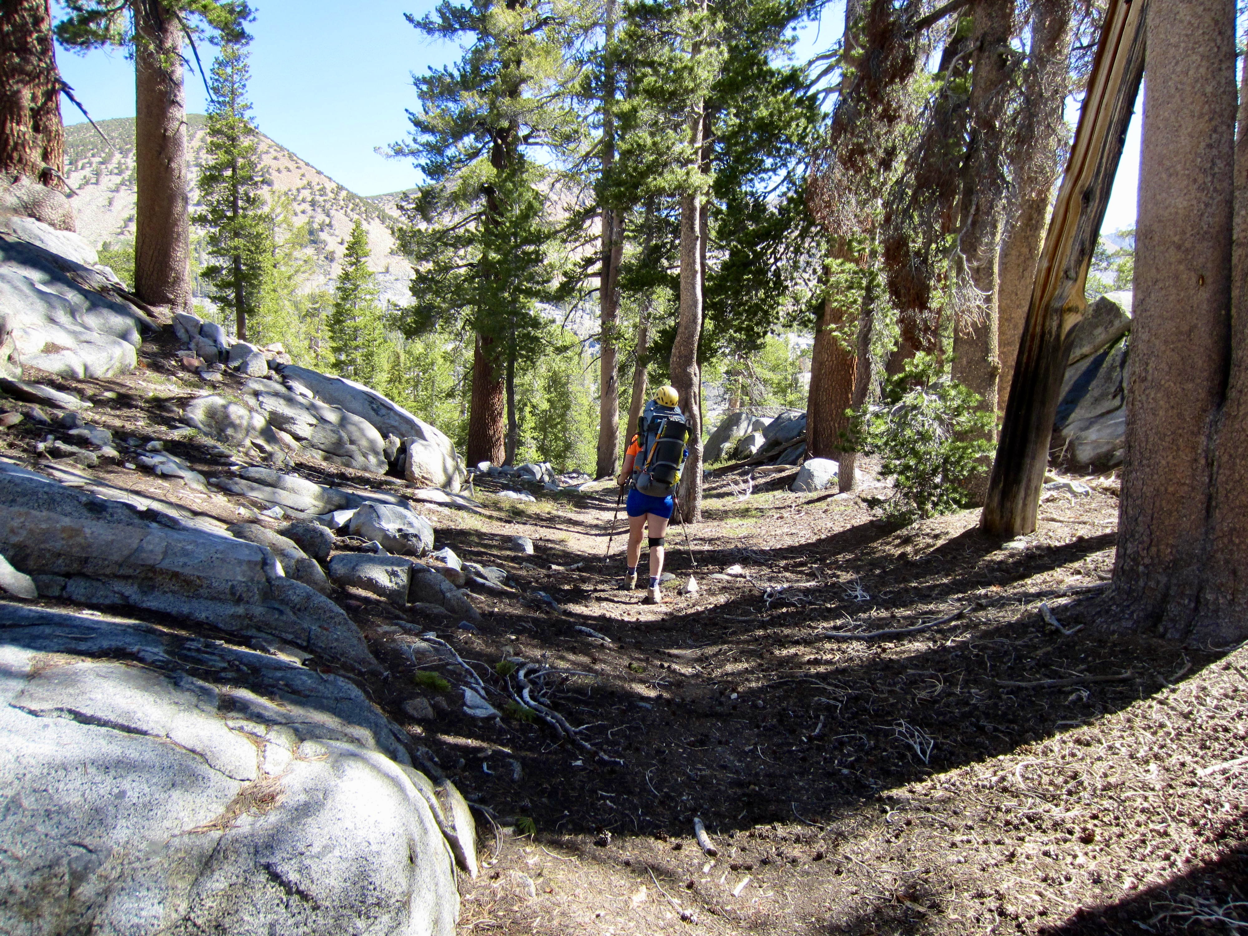
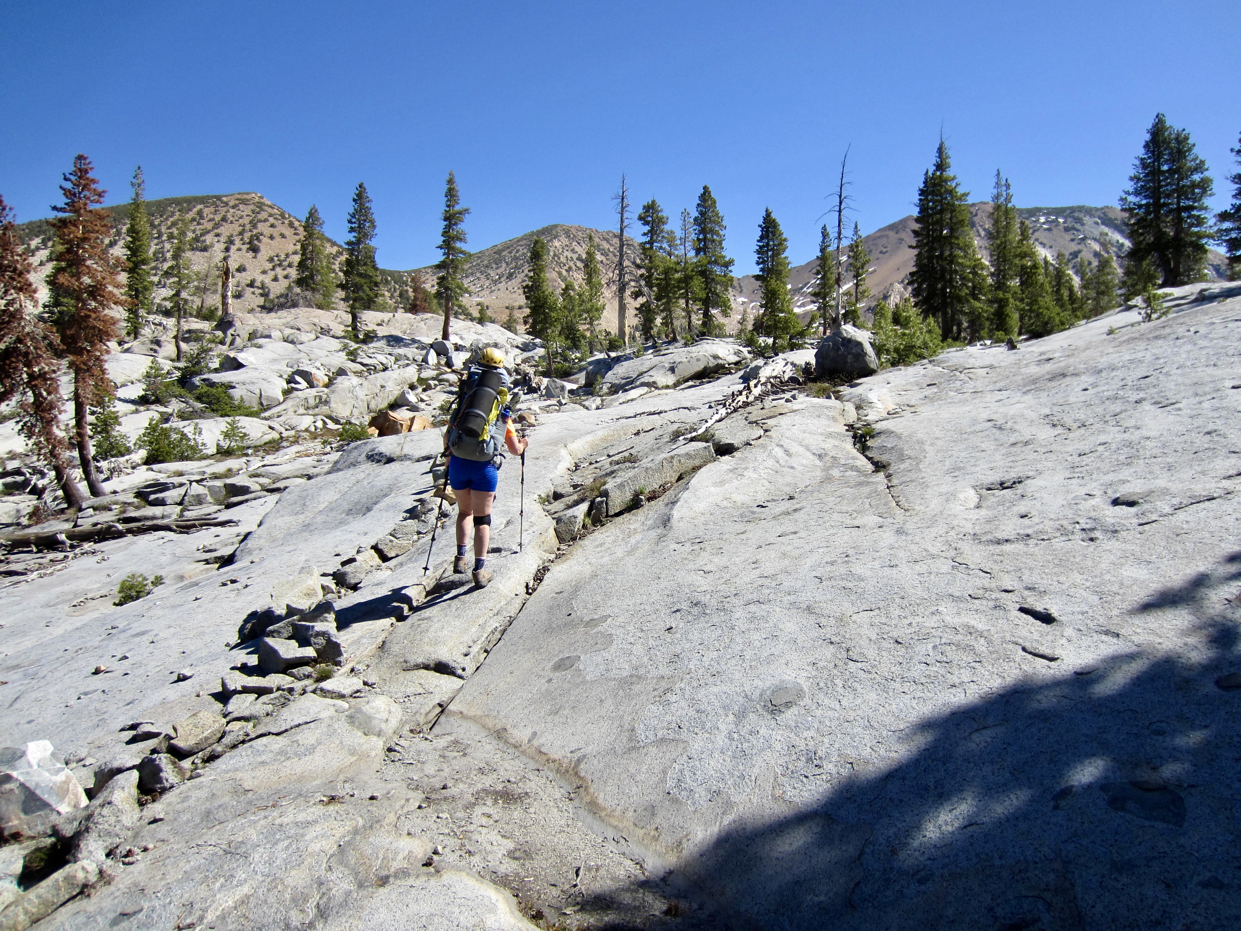
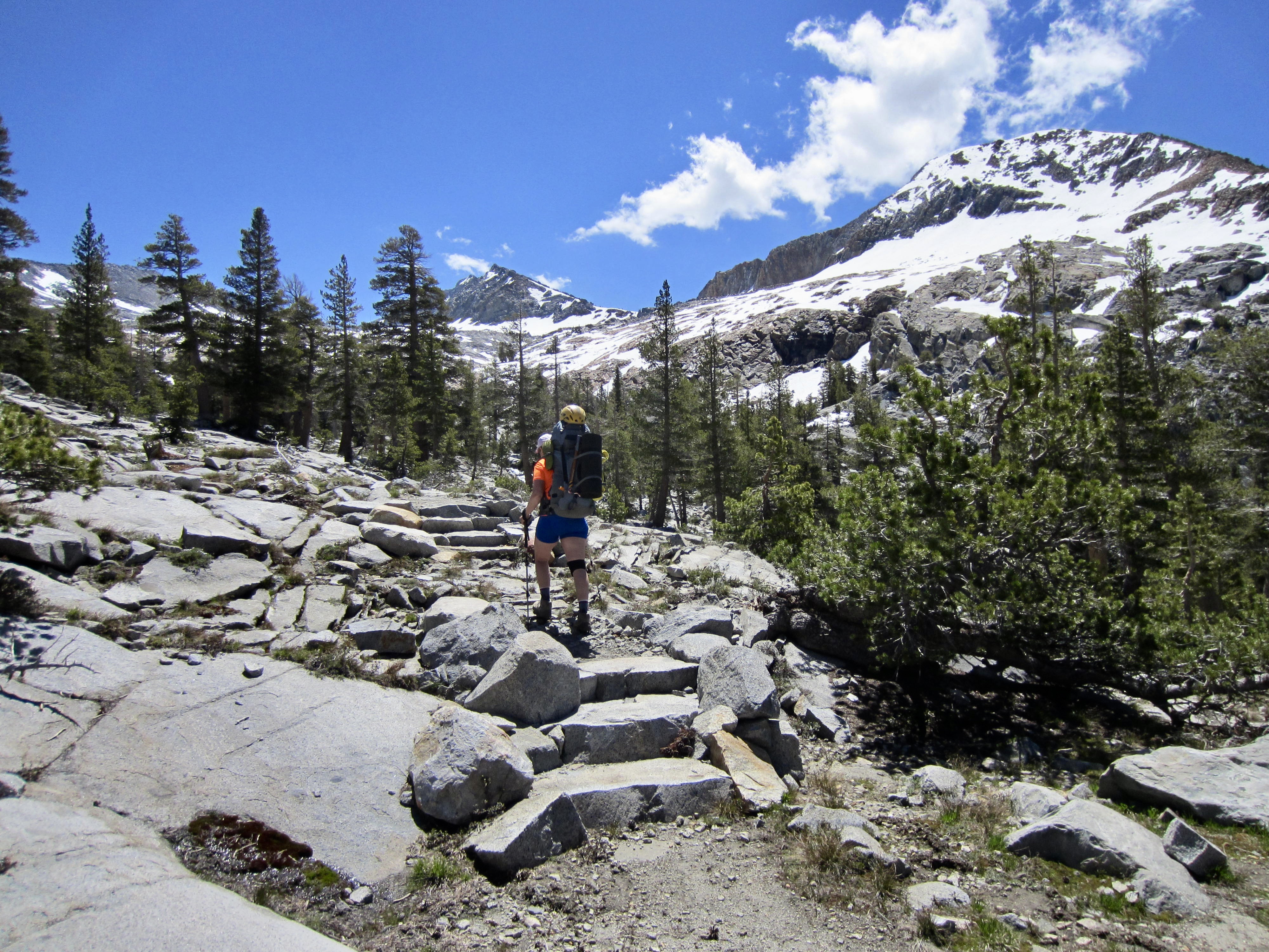
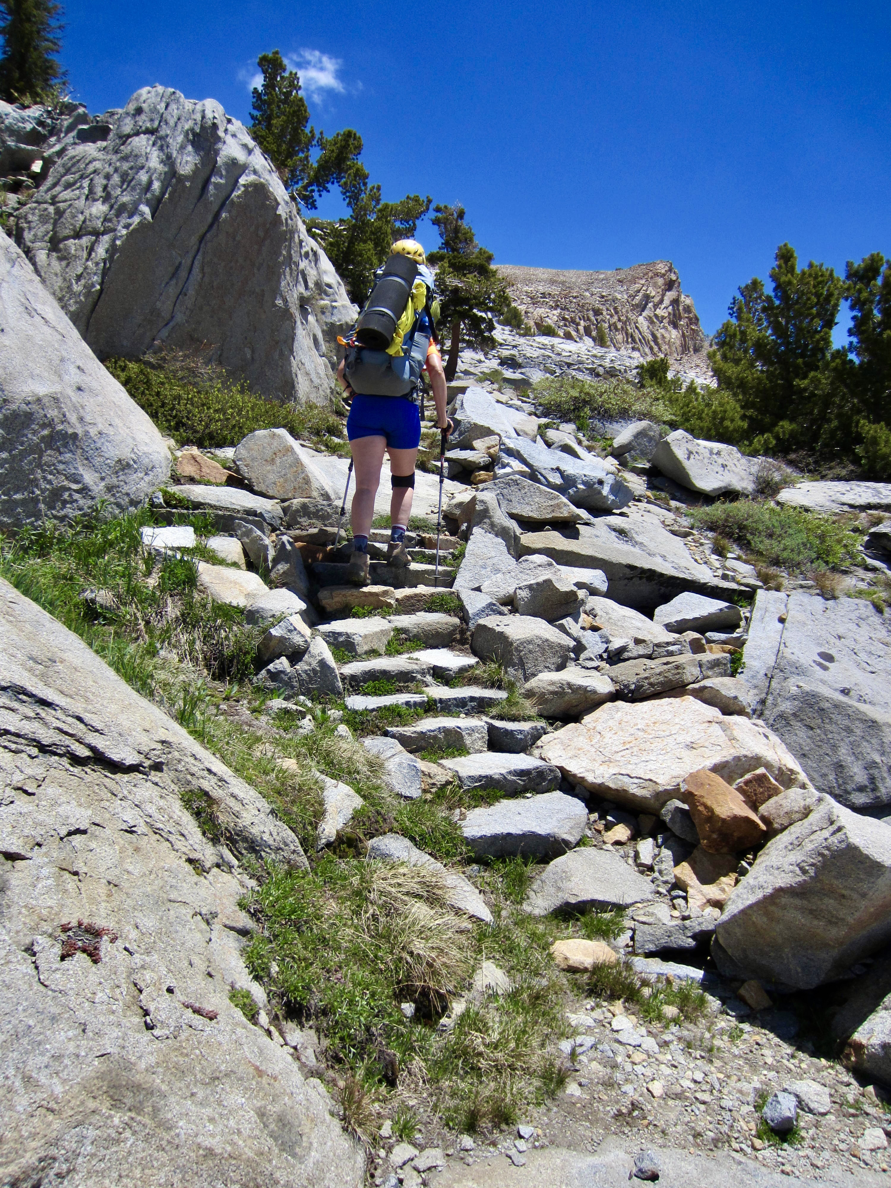
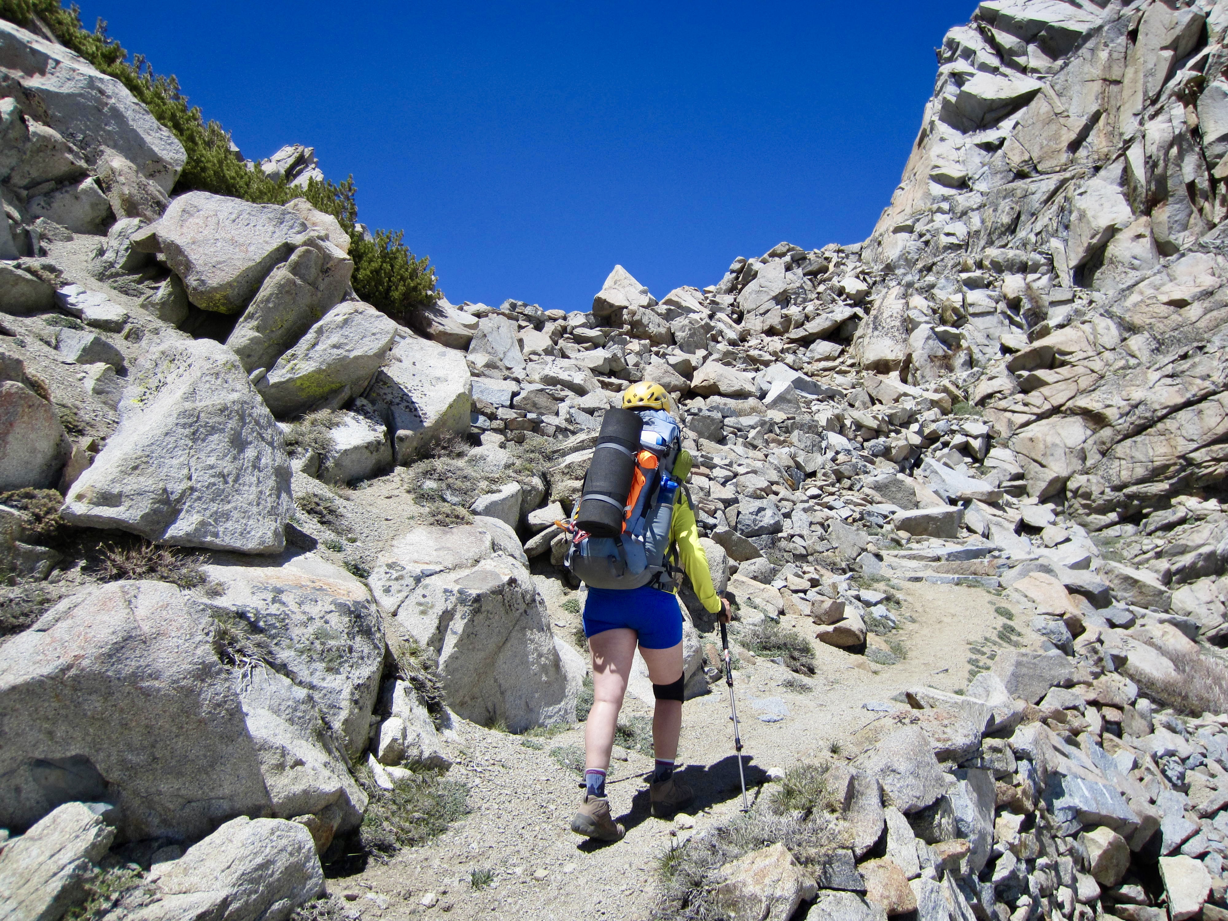
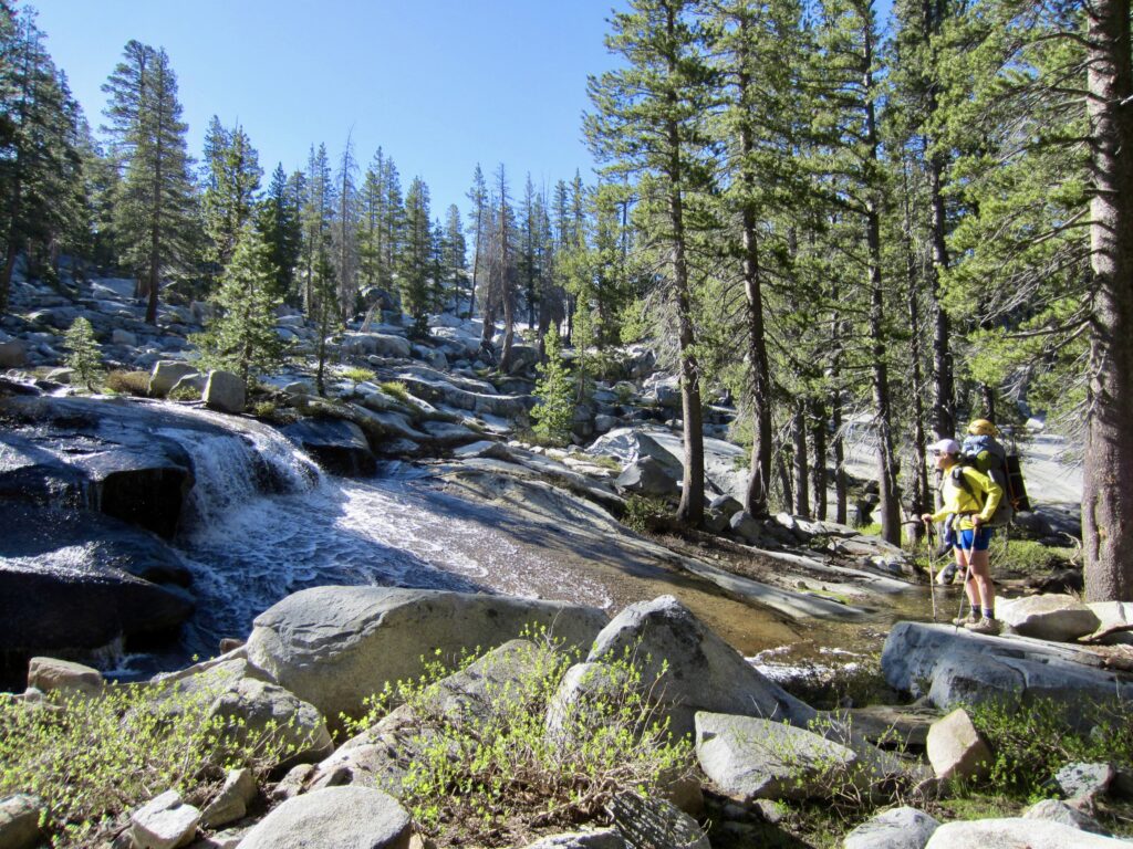
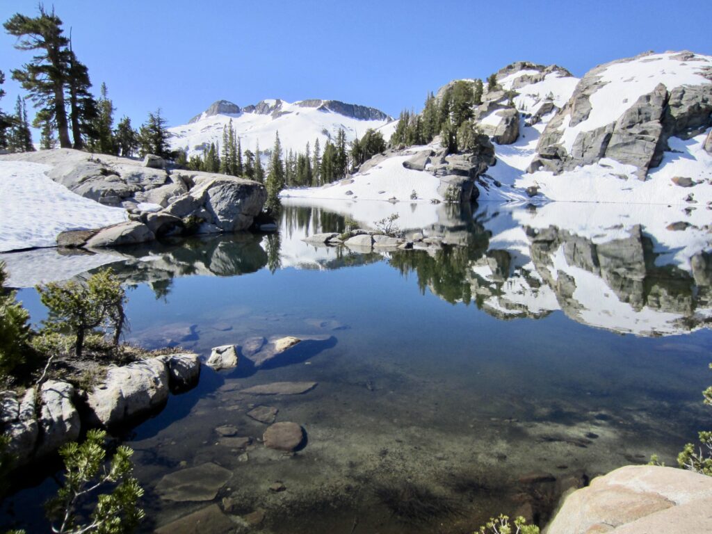
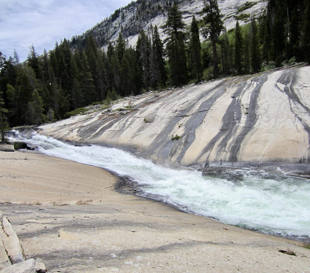
Soon after leaving camp in the morning, we came to a junction. Here, we departed from the Merced Pass Trail and headed northeast on the Red Peak Pass Trail. This delightful trail leads upward through an open forest of pine and fir trees. The entire forest is blanketed by granite slabs and boulders, and the forest ambiance is enhanced by the sound of waterfalls and waterslides.
.
.
.
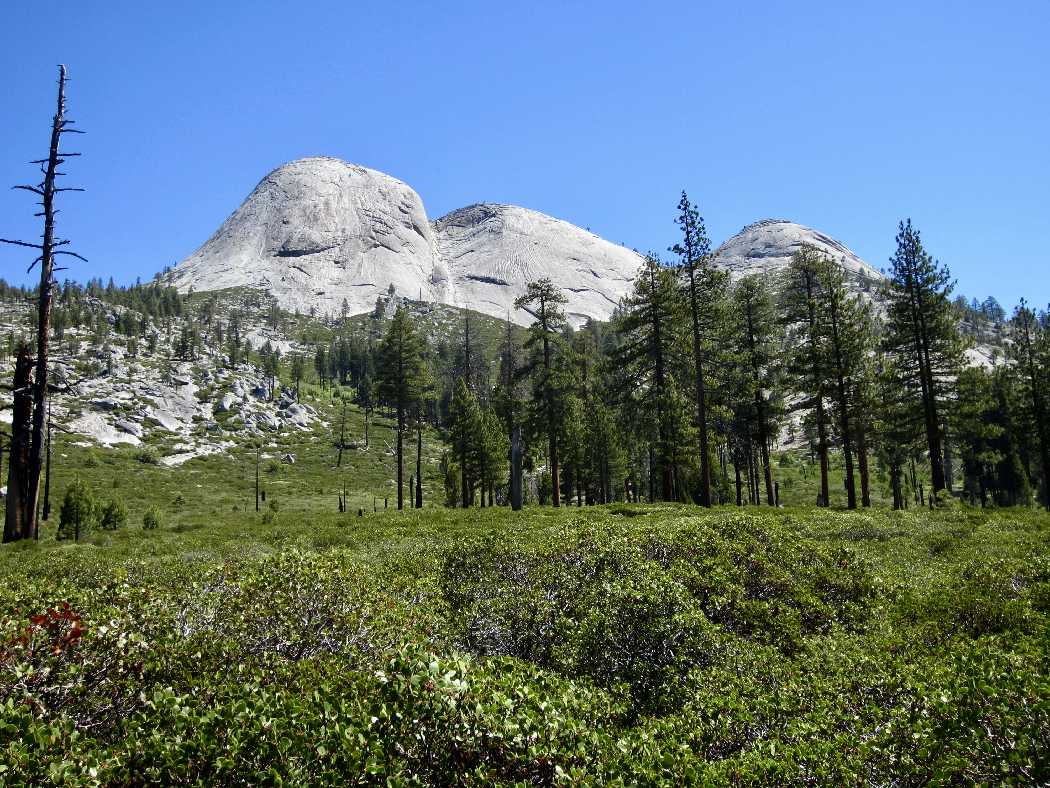
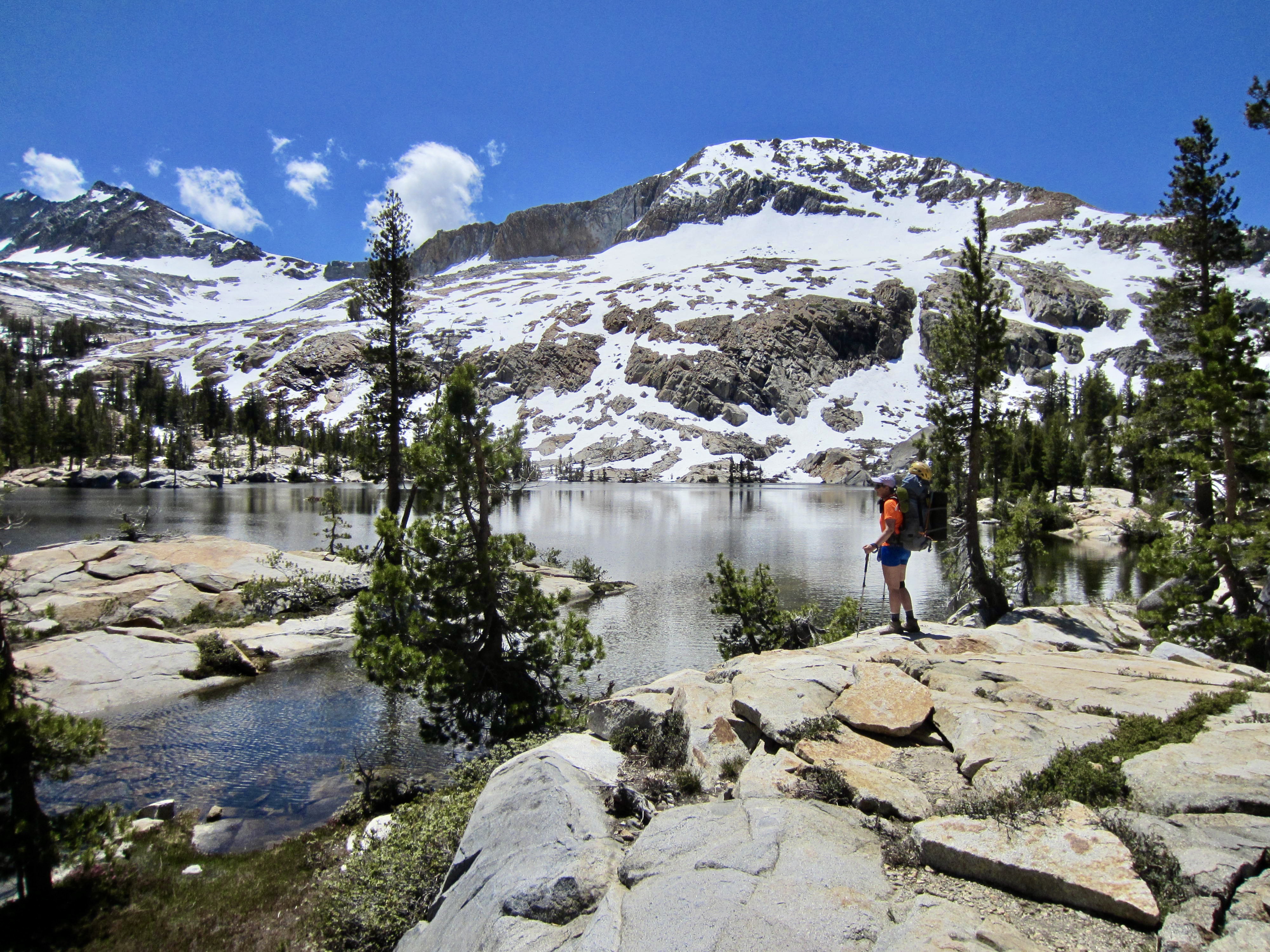
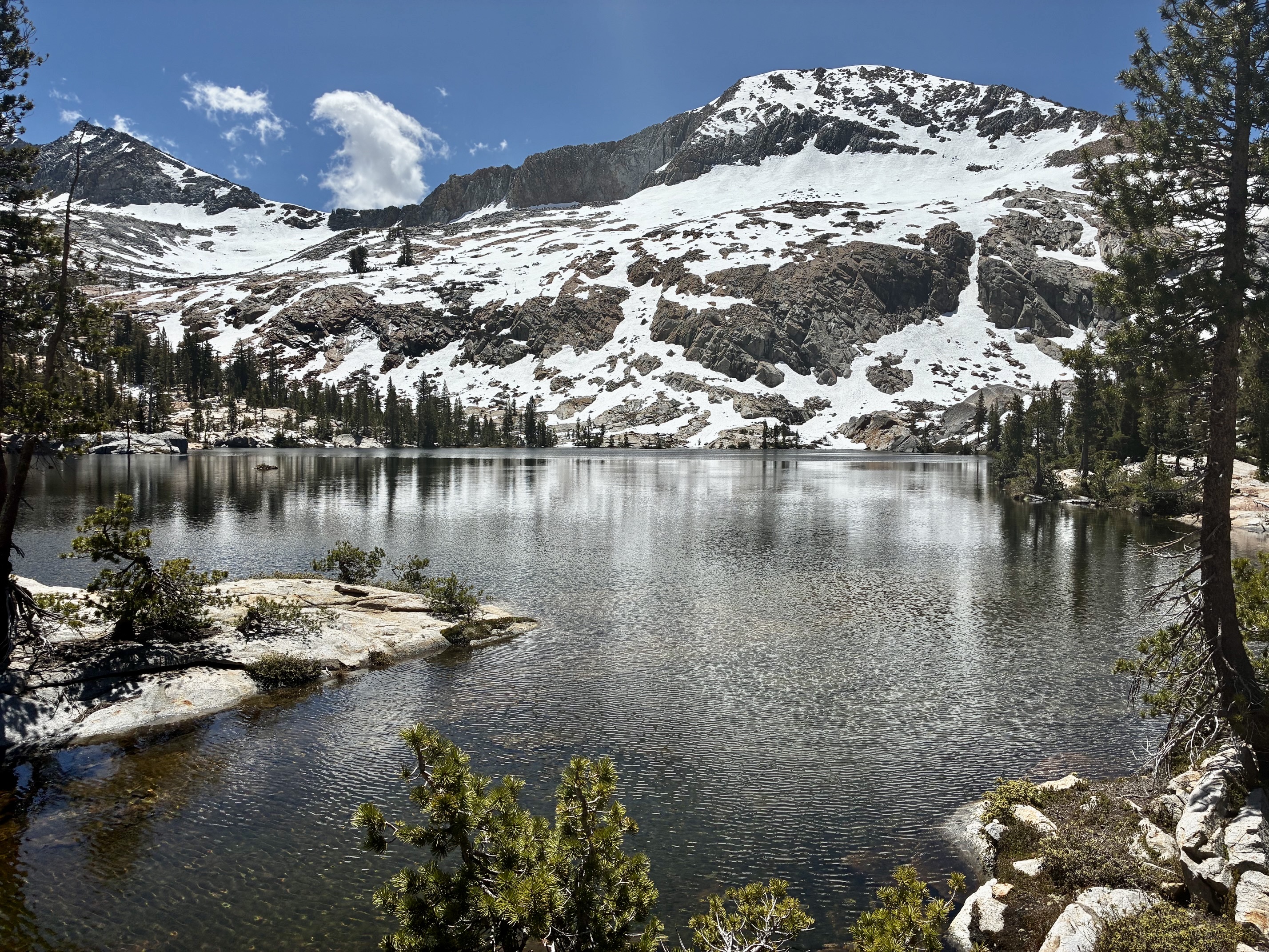
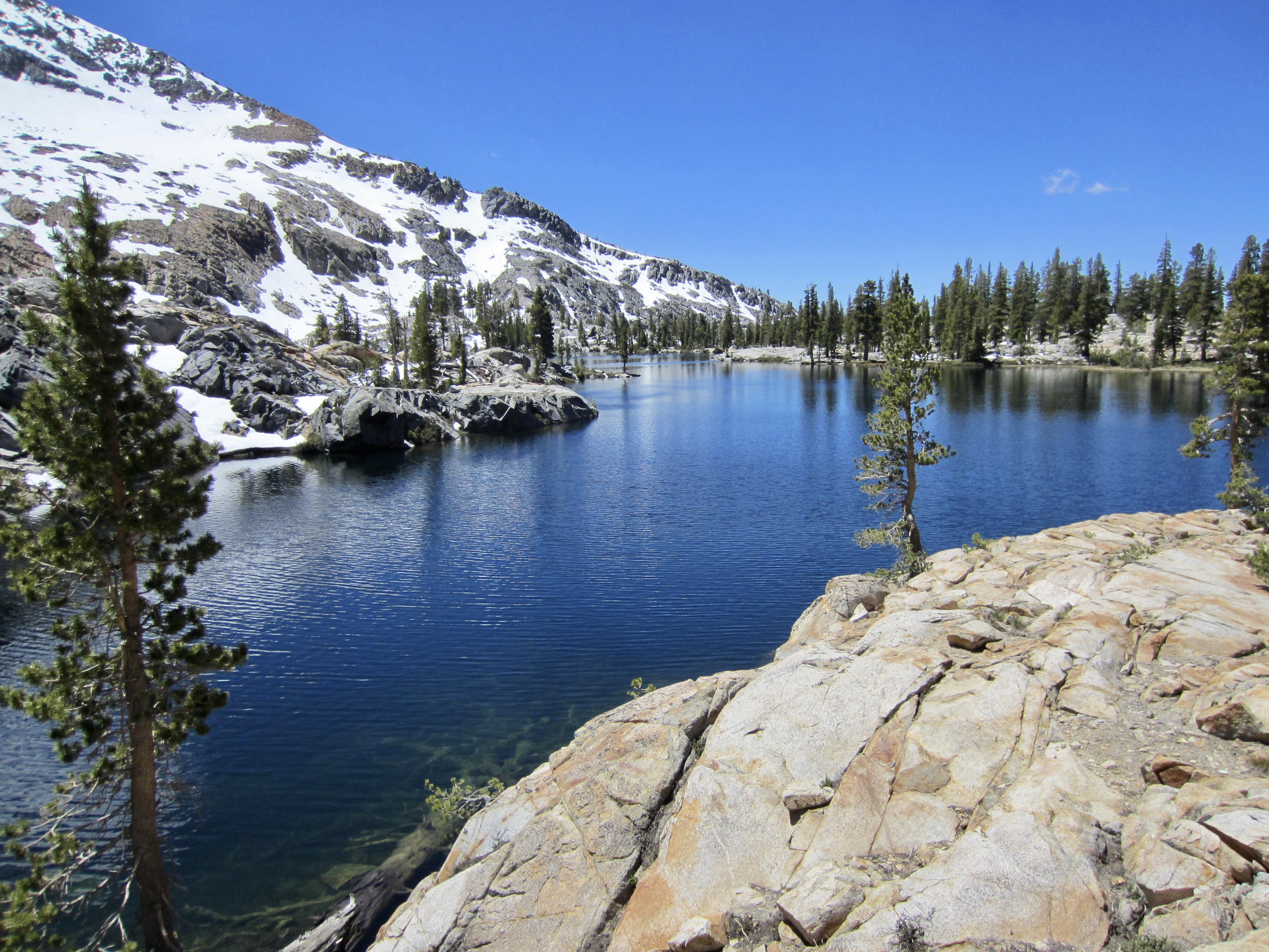
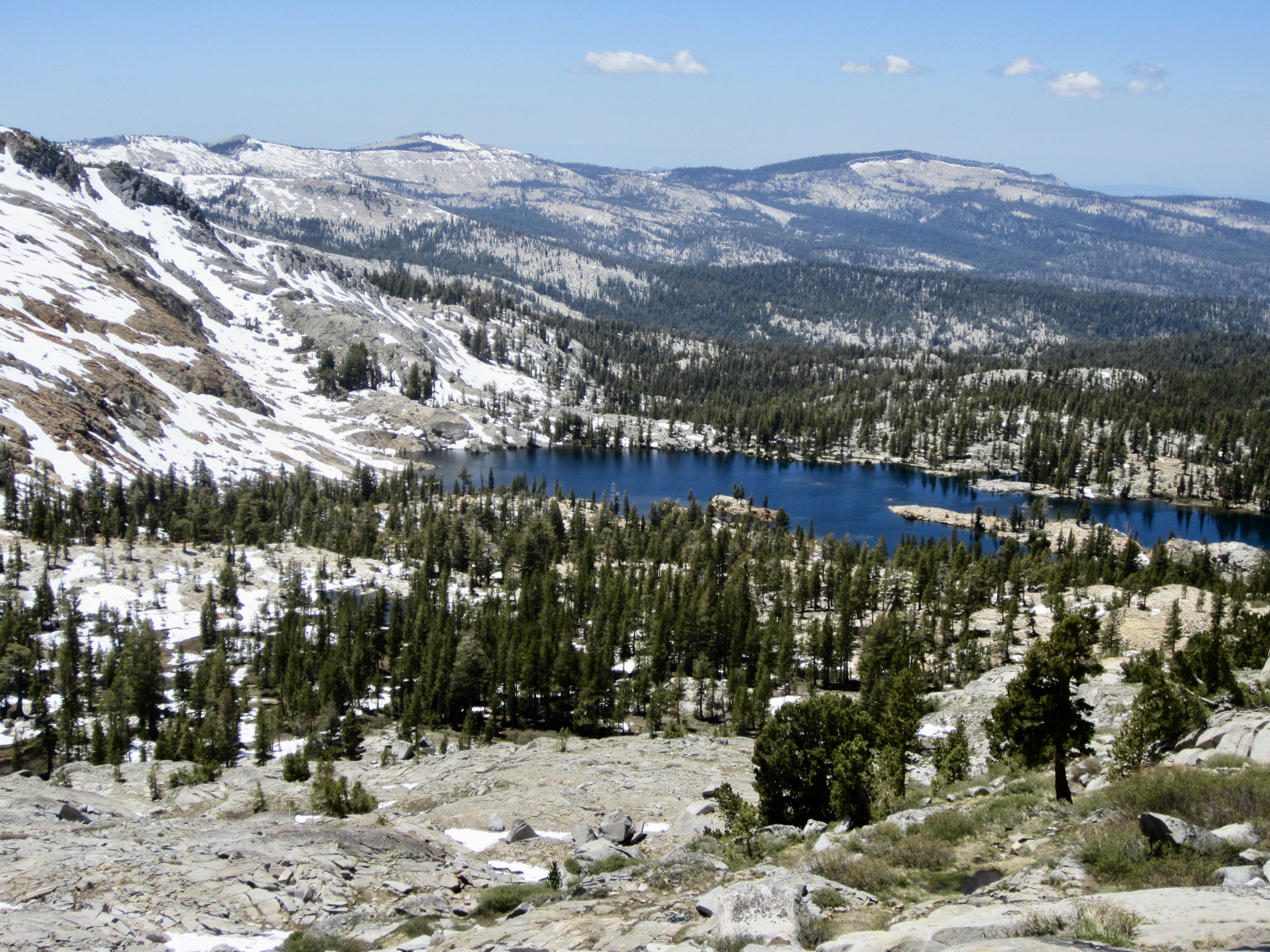
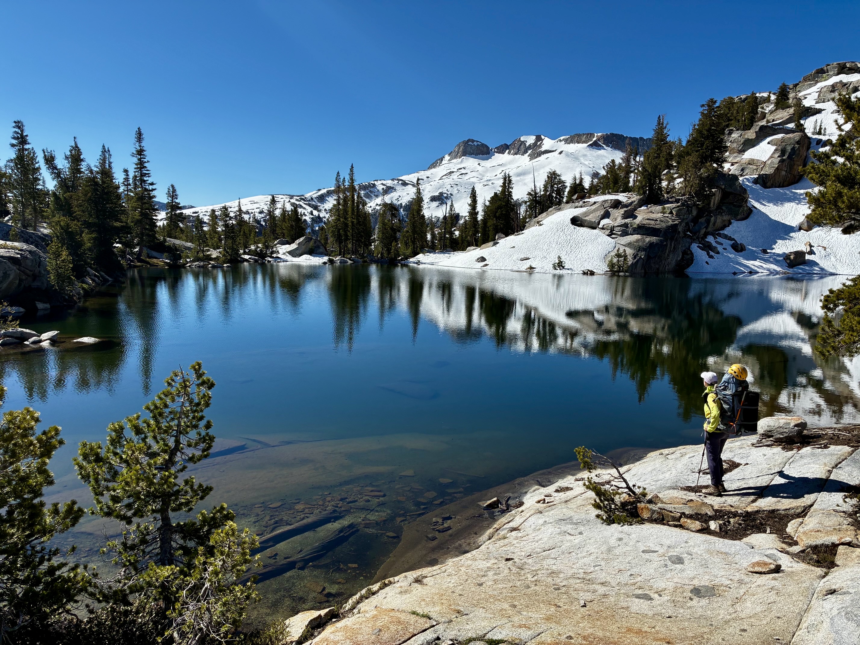
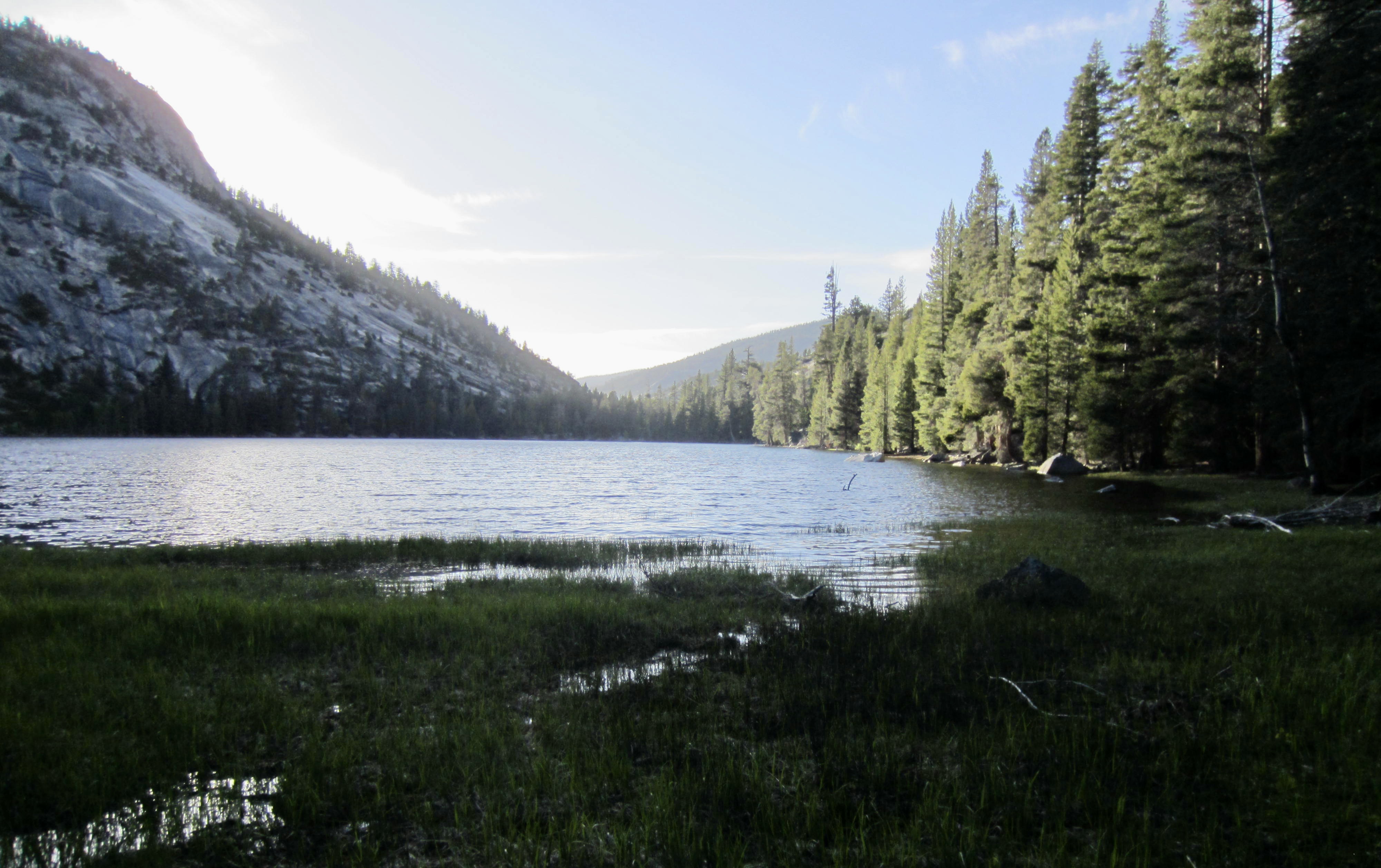
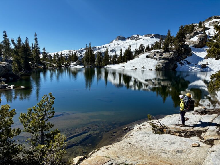
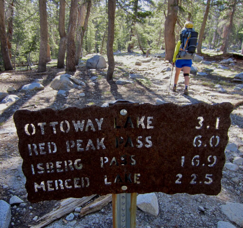
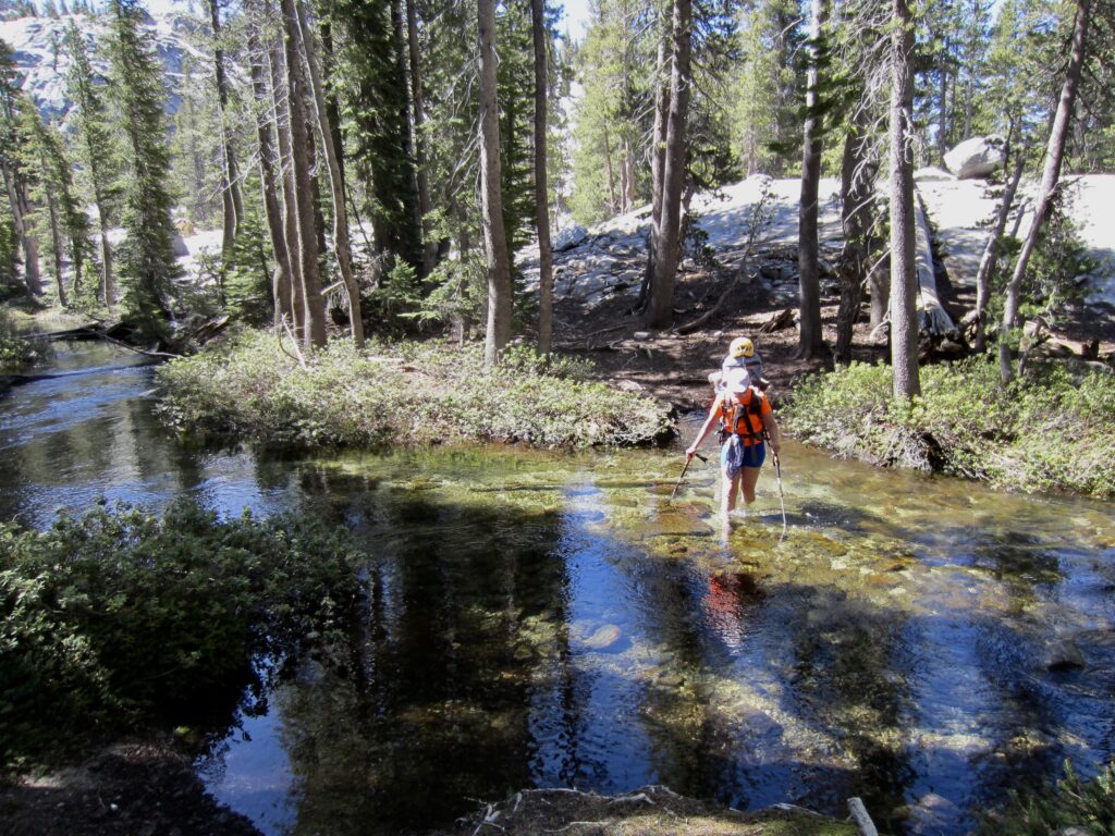
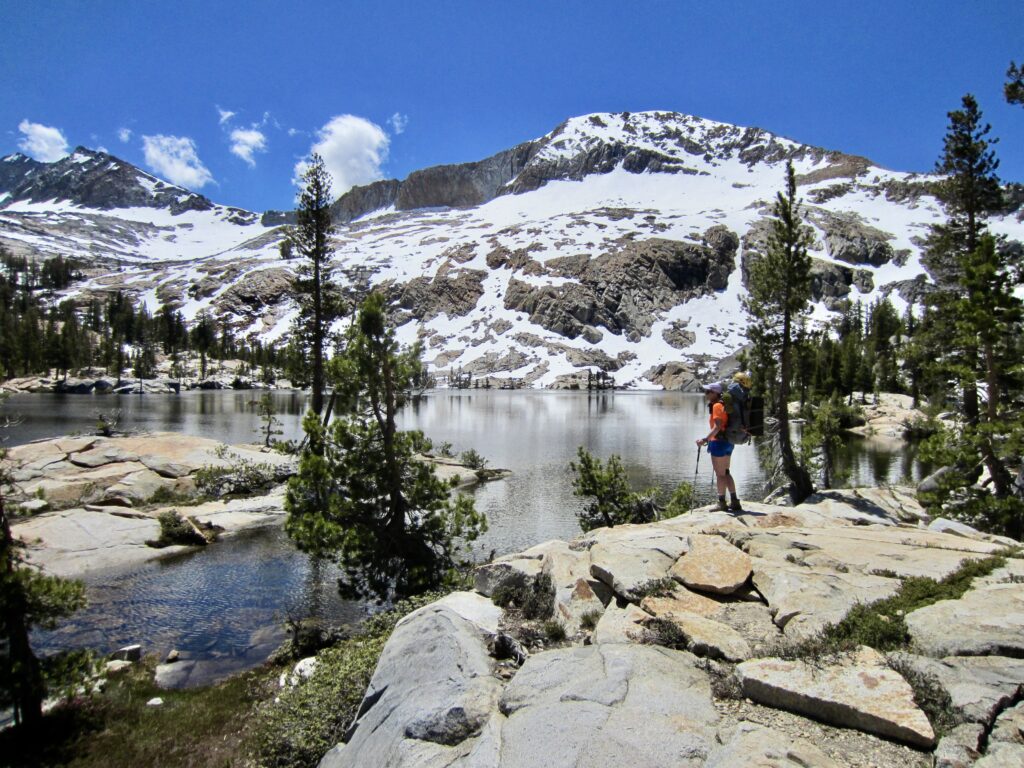
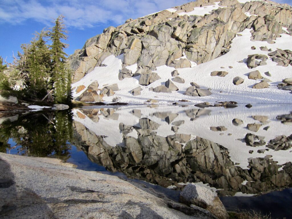
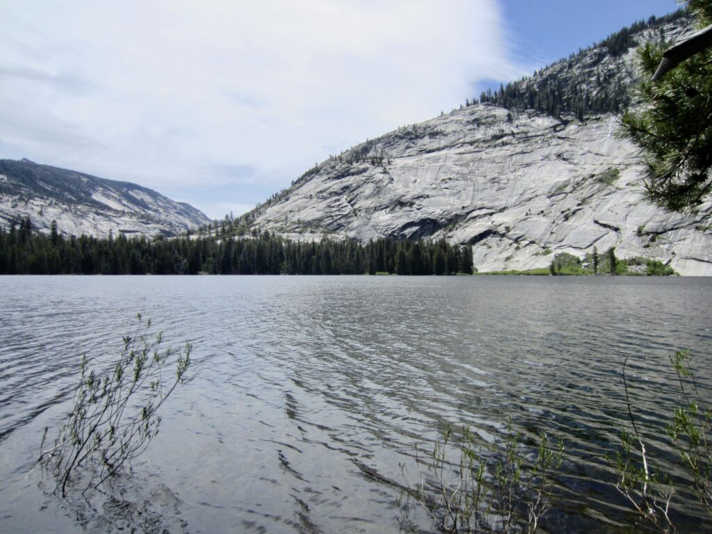
A refreshing ford of Ottoway Creek and a final ½ mile of rocky trail brought us to 9650-foot Lower Ottoway Lake (3:00 hours + 950 feet from Camp 2). Eileen and I were totally enthralled by this gorgeous alpine lake, with its numerous granite peninsulas, Islands, and inlets. Without a doubt, it was one of the most visually stunning alpine lakes we’ve ever seen!


.
.
.
.

.
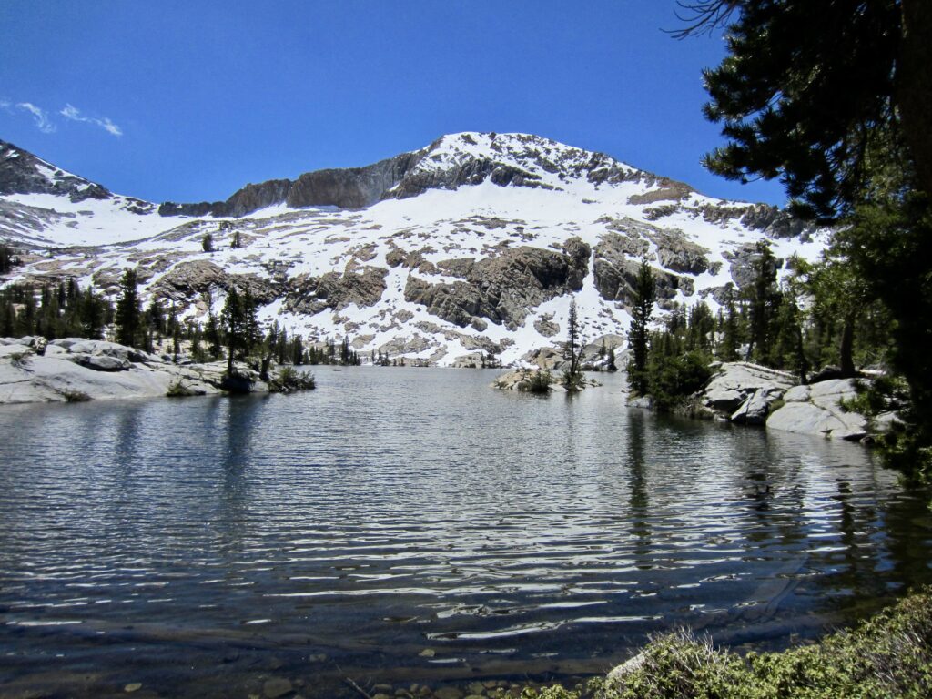
Reluctantly tearing ourselves away from the lake, we continued hiking up a steep hillslope until stopping for lunch atop a rocky knob overlooking Upper Ottoway Lakes. These two lakes reside at 10,400 feet and were still covered with snow and ice. I found the overall scene to be reminiscent of Wiley and Eiley Lakes in the Picket Range.
.


.
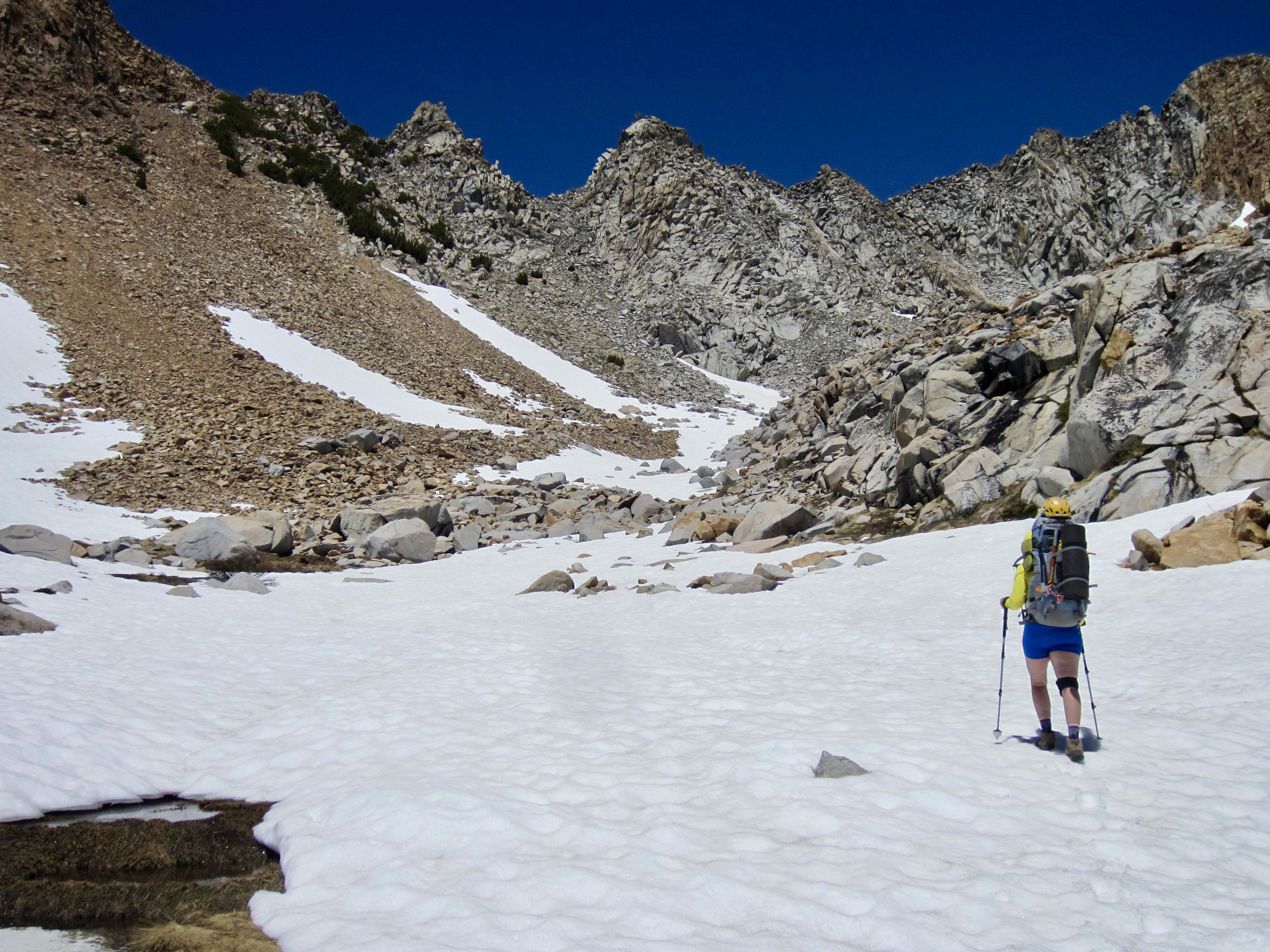
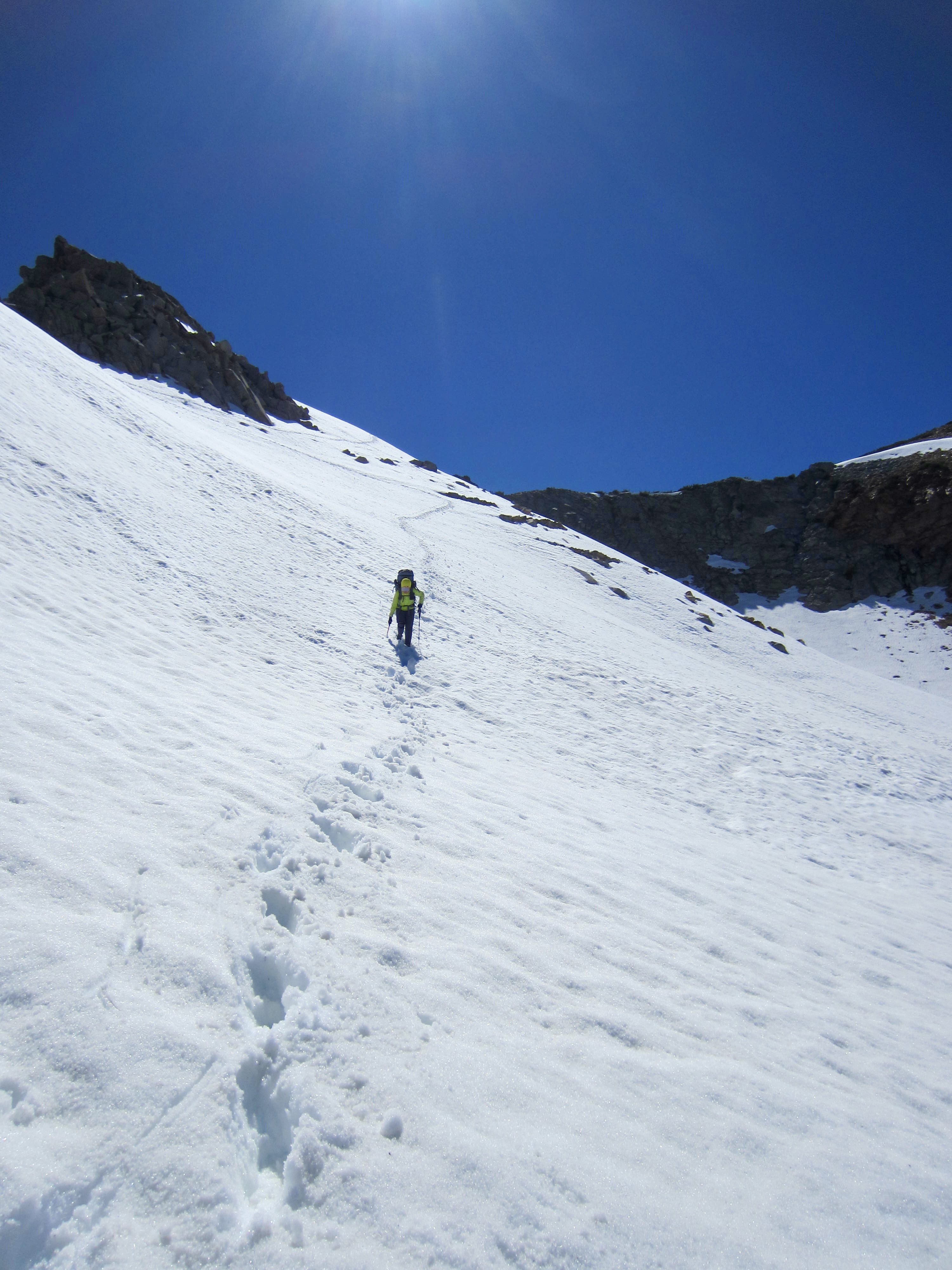
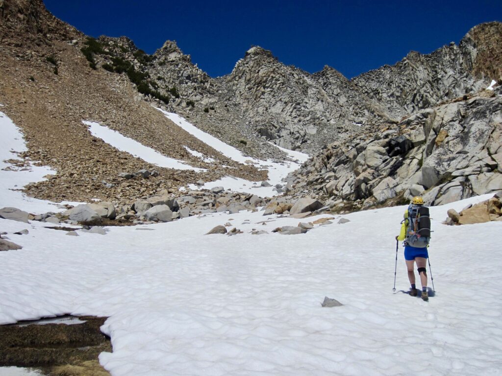
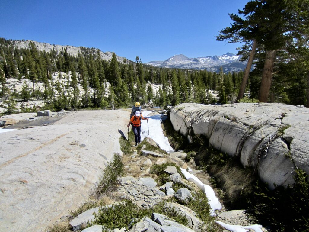
At Upper Ottoway Lakes, the trail abruptly turns left and sets a northerly course for Red Peak Pass, which can be seen as a distinct U-shaped notch in the craggy ridge crest above. We booted up a snow-filled box canyon until regaining bare trail in the scree and talus slopes below the pass.
.
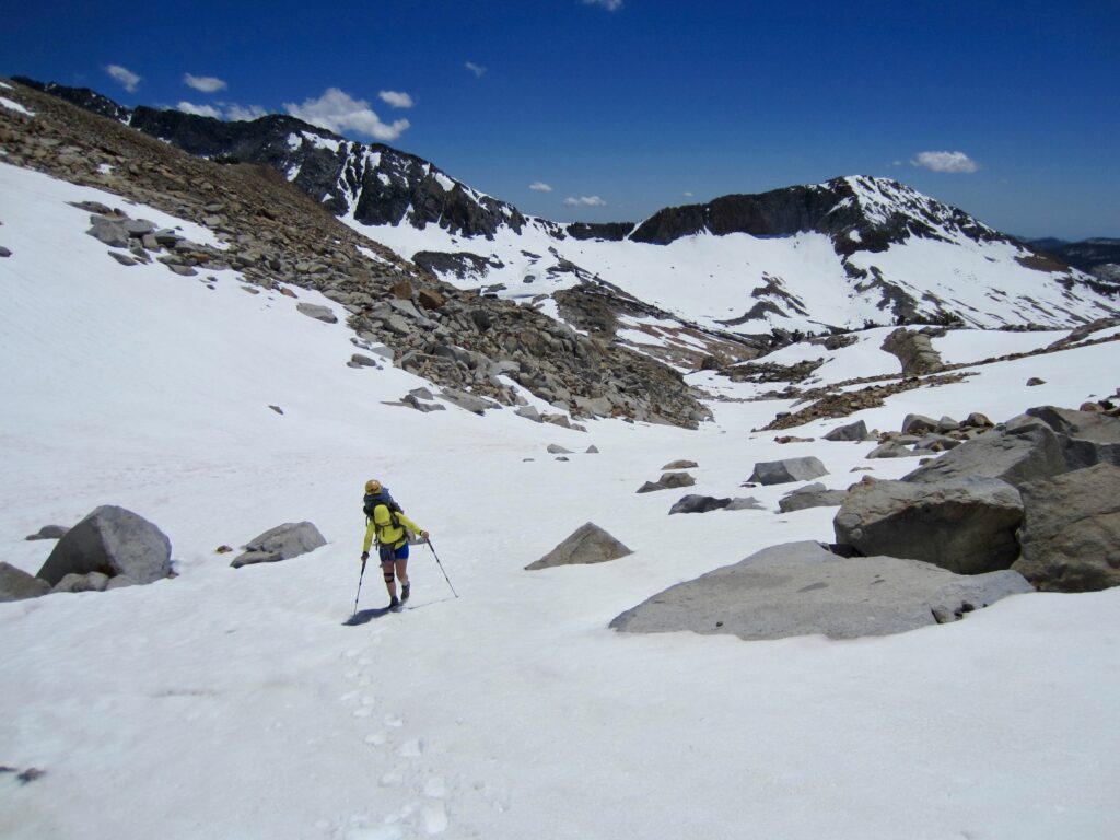

.
At 2:30pm, we stepped atop Red Peak Pass (5.9 hours + 2400 feet from Camp 2). This 11,150-foot notch in the Clark Range represented not only the high point of our loop but also the culmination of a goal that spanned seven years and three attempts. It felt so good to finally get here!
.

.
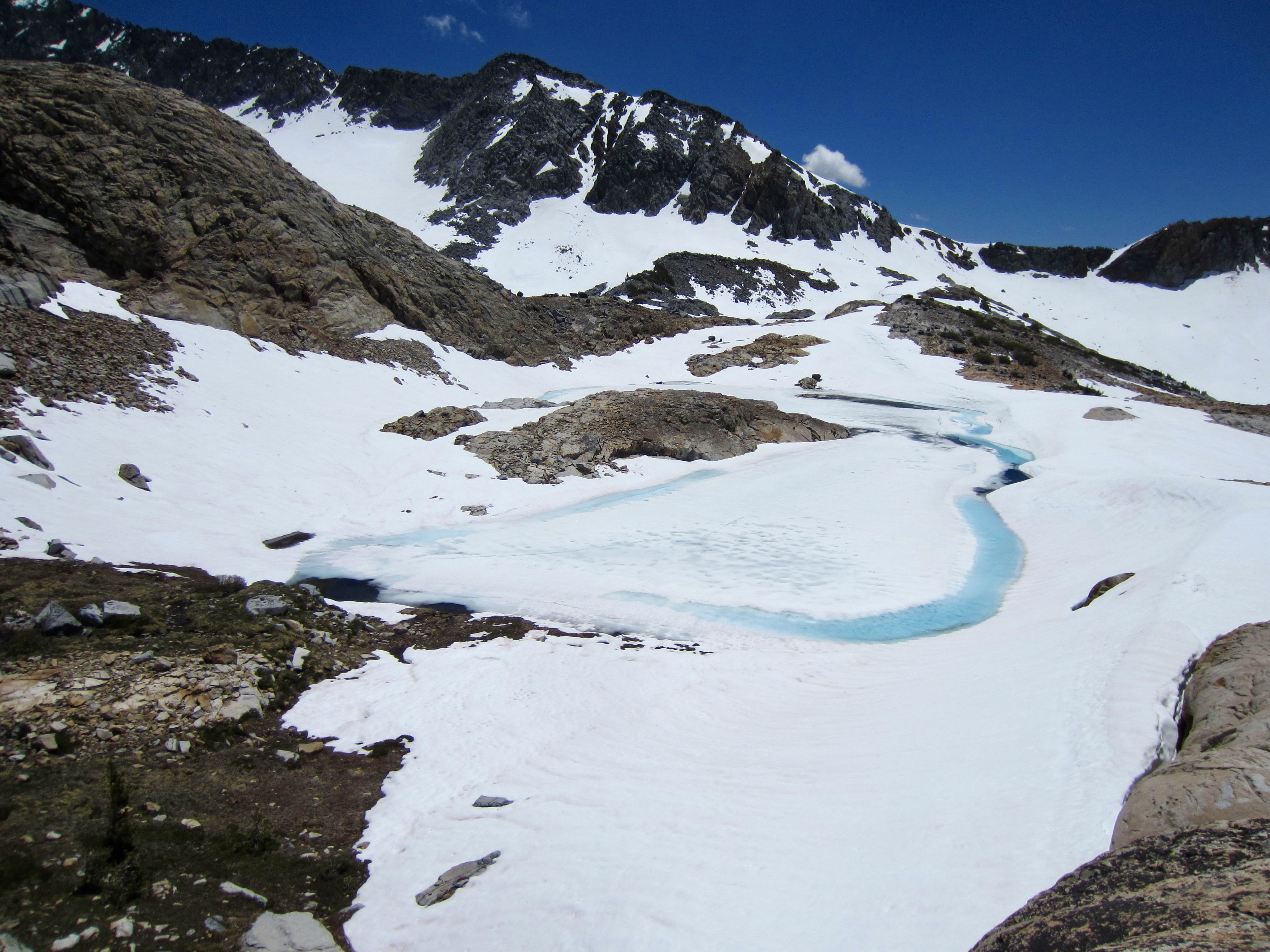
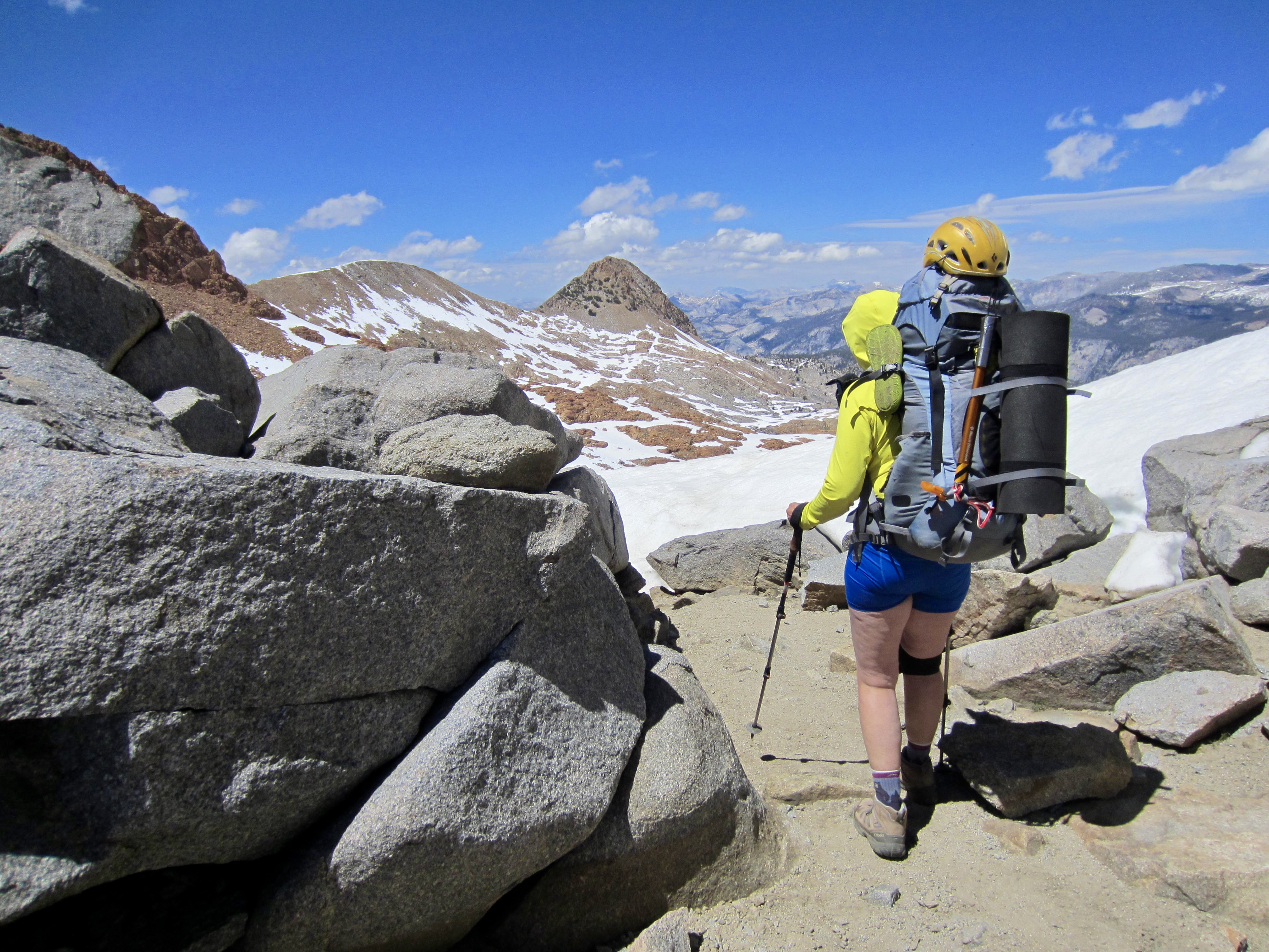
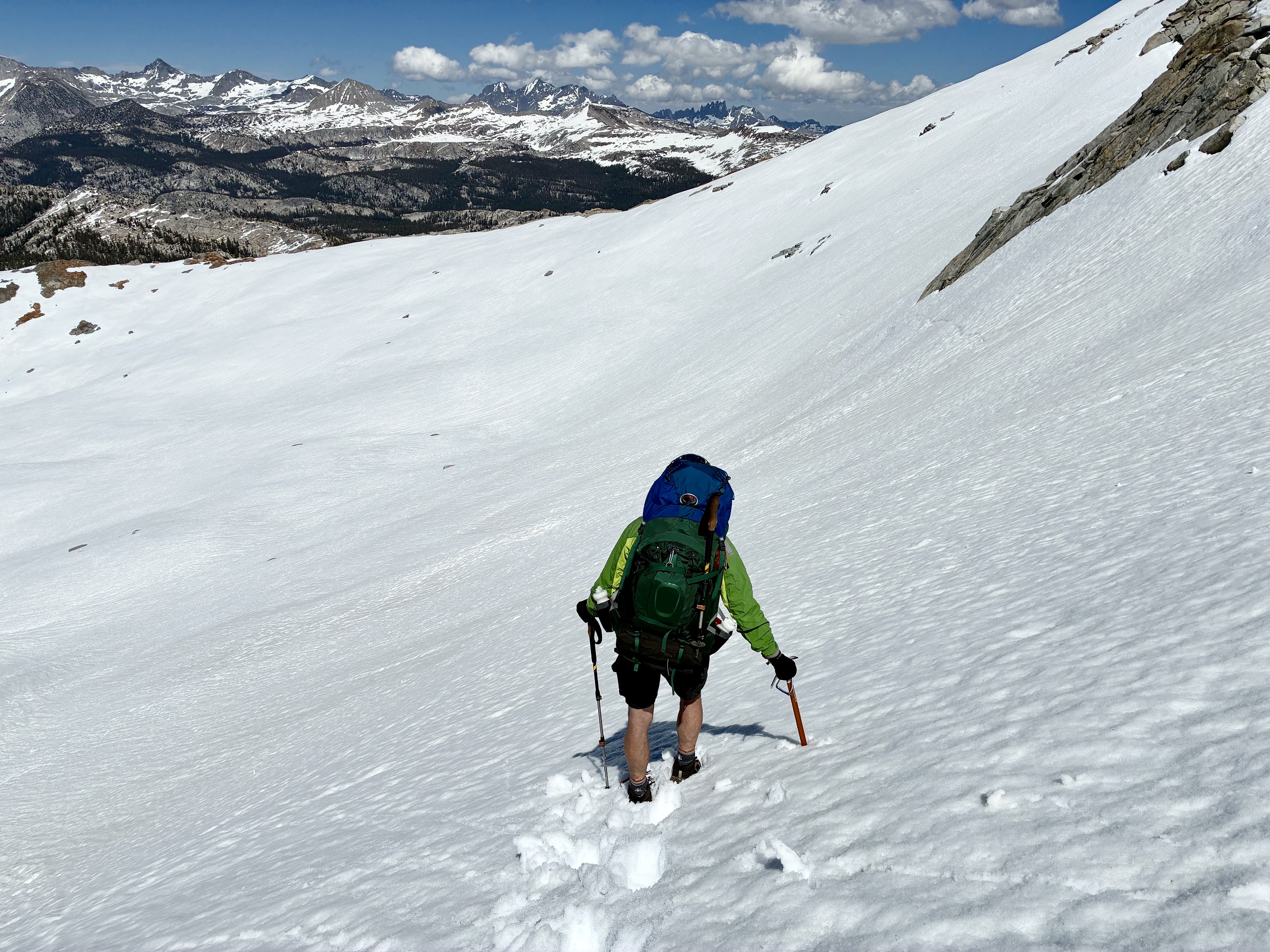
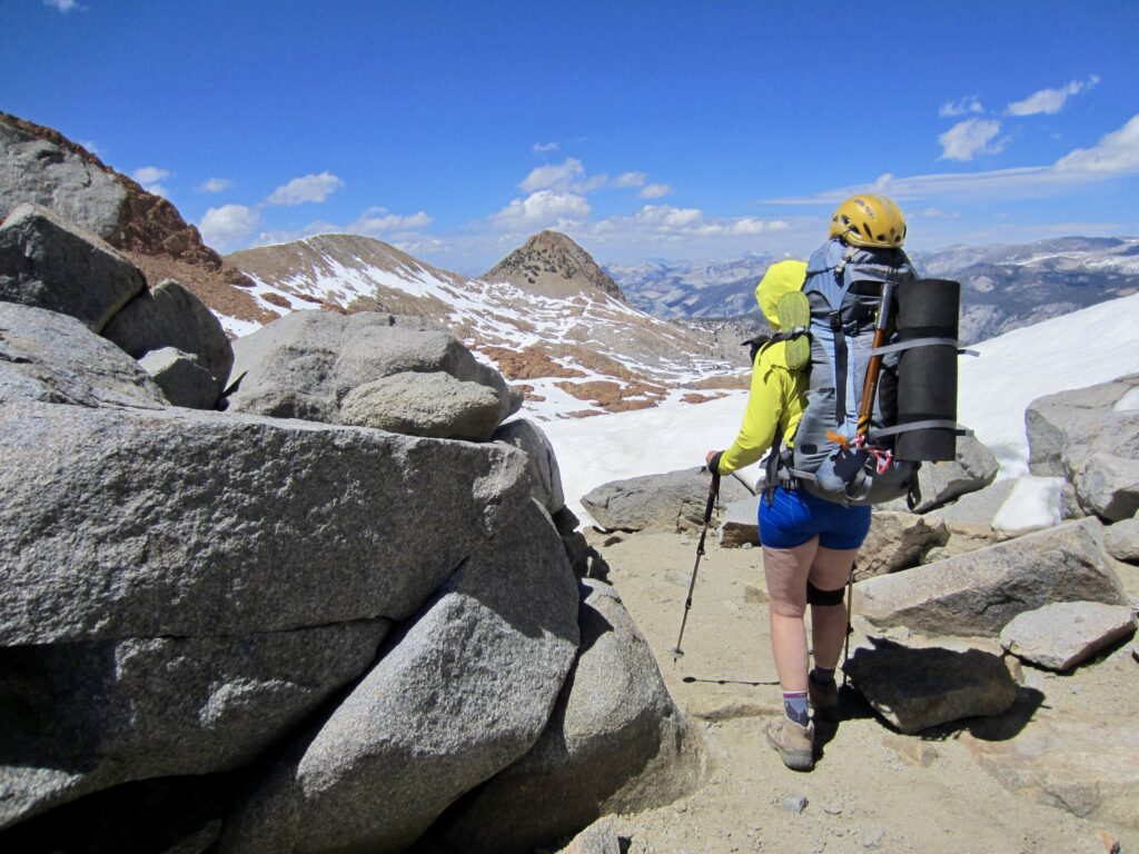
We had always planned to scramble up nearby Red Peak from the pass, but a quick reconnaissance revealed that it would probably require more time than we had available. Today was our chance to get back on schedule. We pulled out ice axes and crampons, then began our snowy descent into the Merced River headwaters.


.
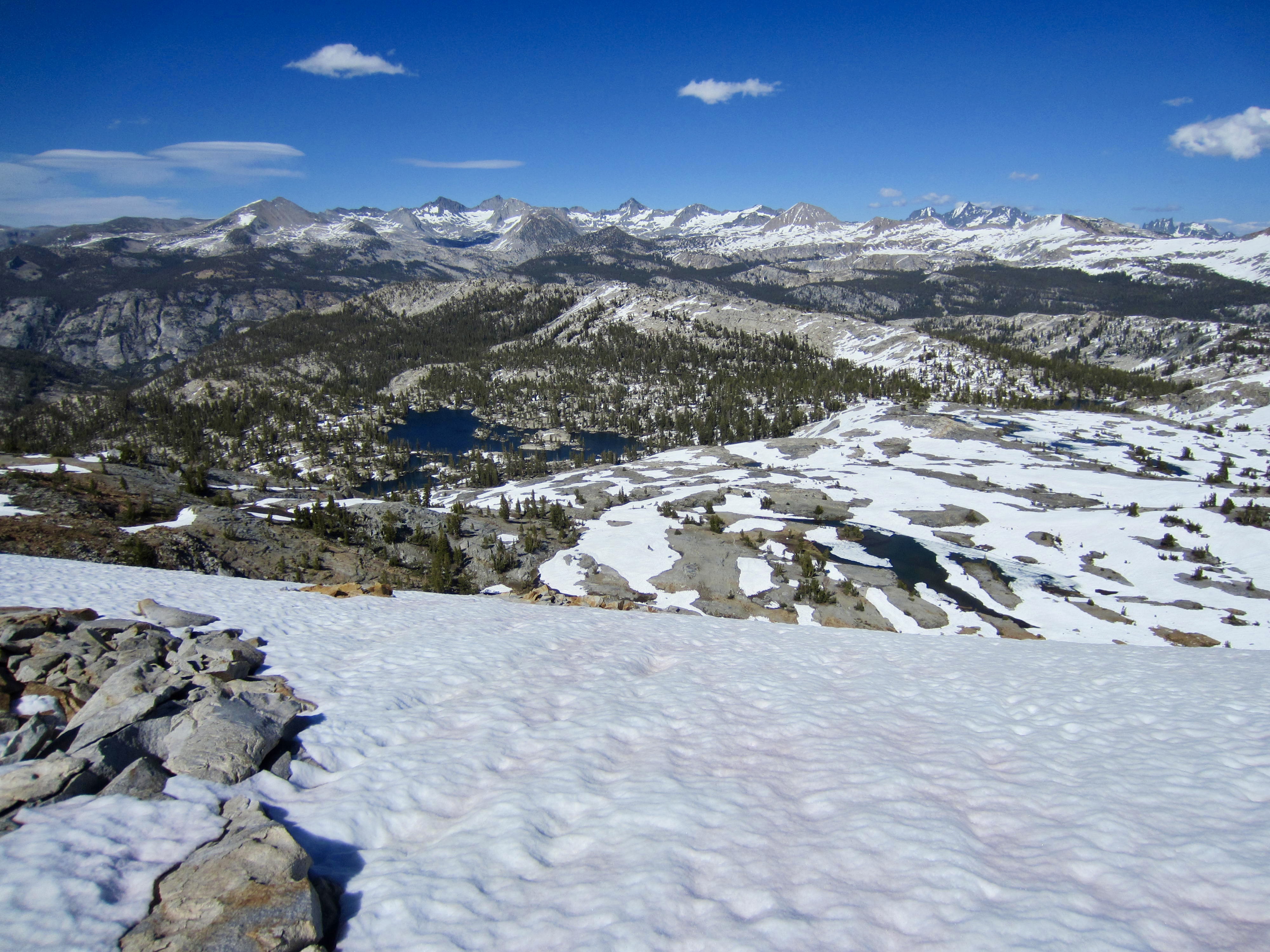
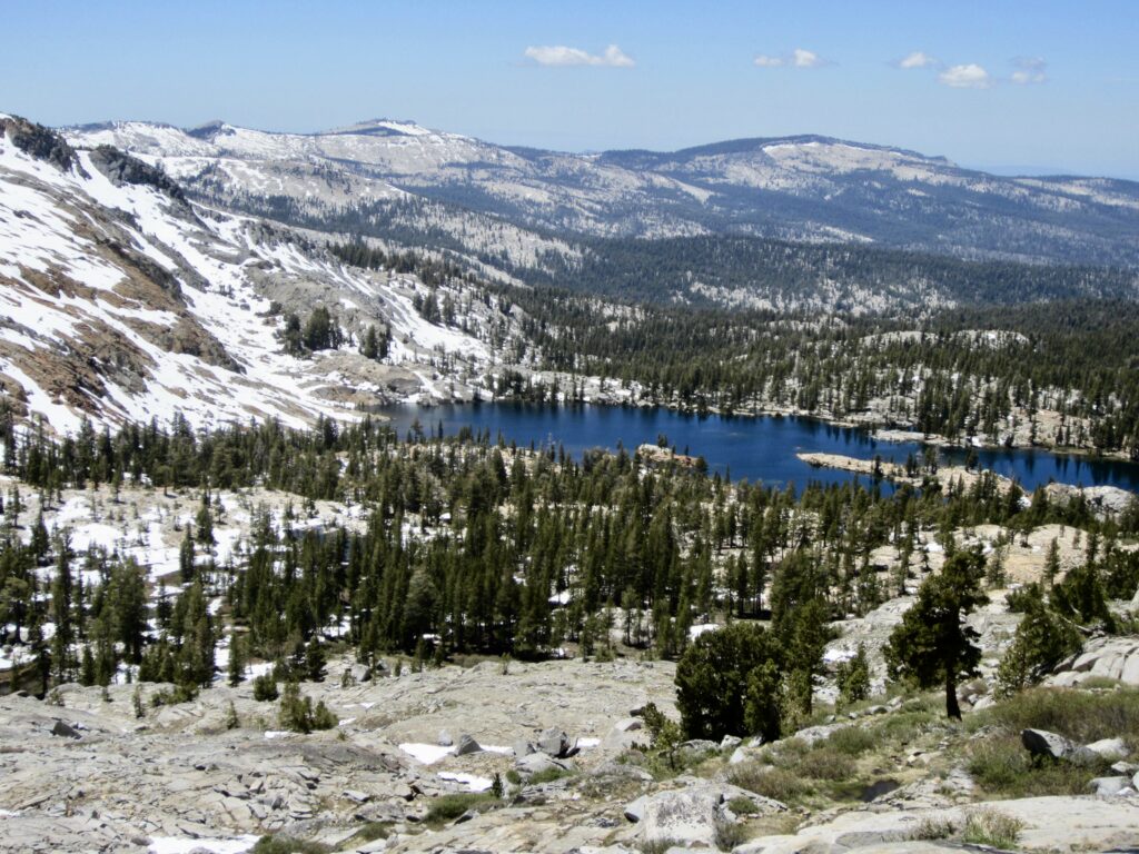
The Merced River is fed by numerous branch creeks that emanate from this area, including Gray Peak Fork, Red Peak Fork, Merced Peak Fork, Triple Peak Fork, and Lyell Fork. Sitting in a convoluted granite bowl amidst these river forks is one of Yosemite’s hidden gems: Red Devil Lake. From our high vantage, it appeared to rival Lower Ottoway Lake for alpine beauty, but it is far less accessible.
.
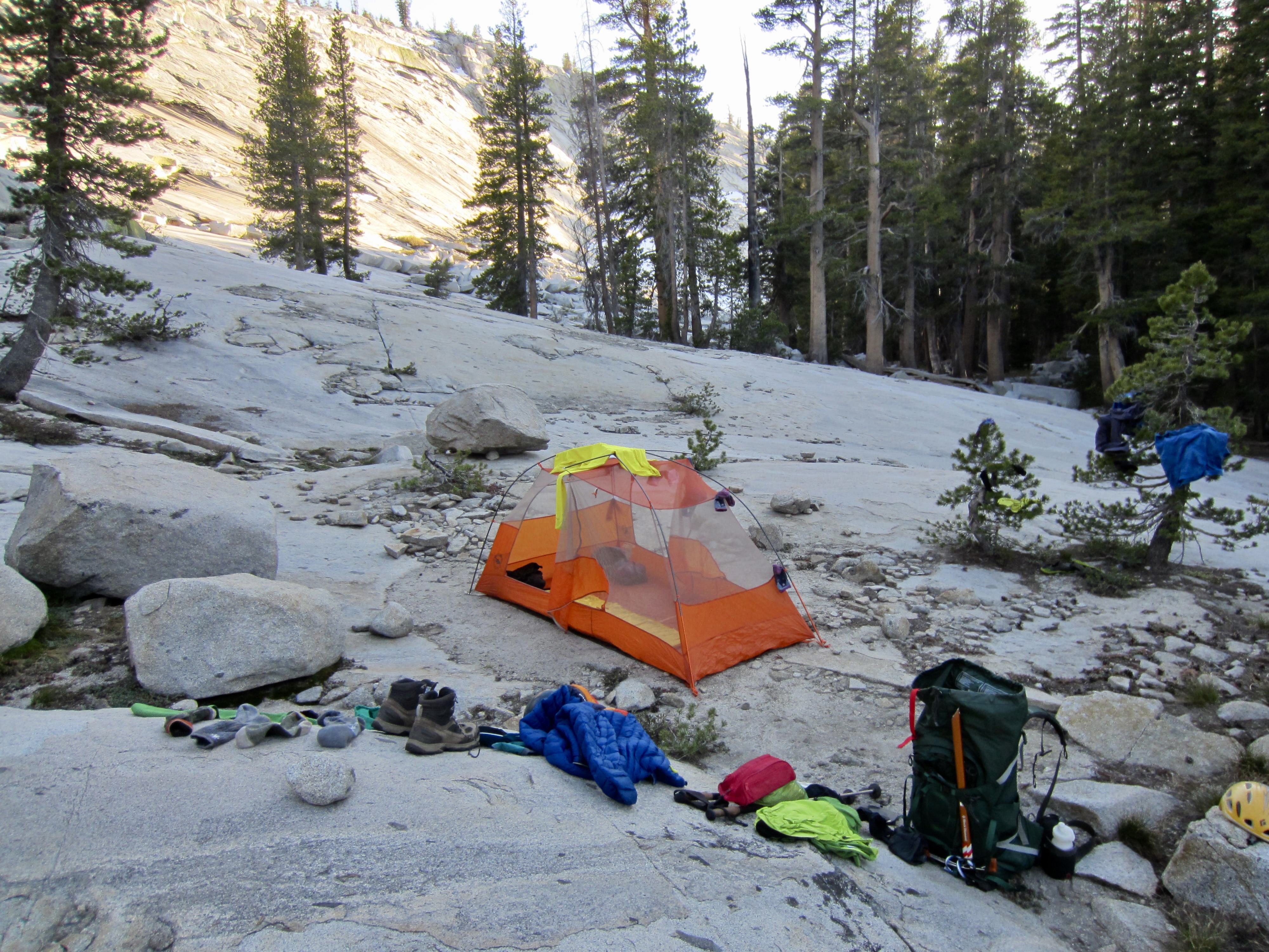
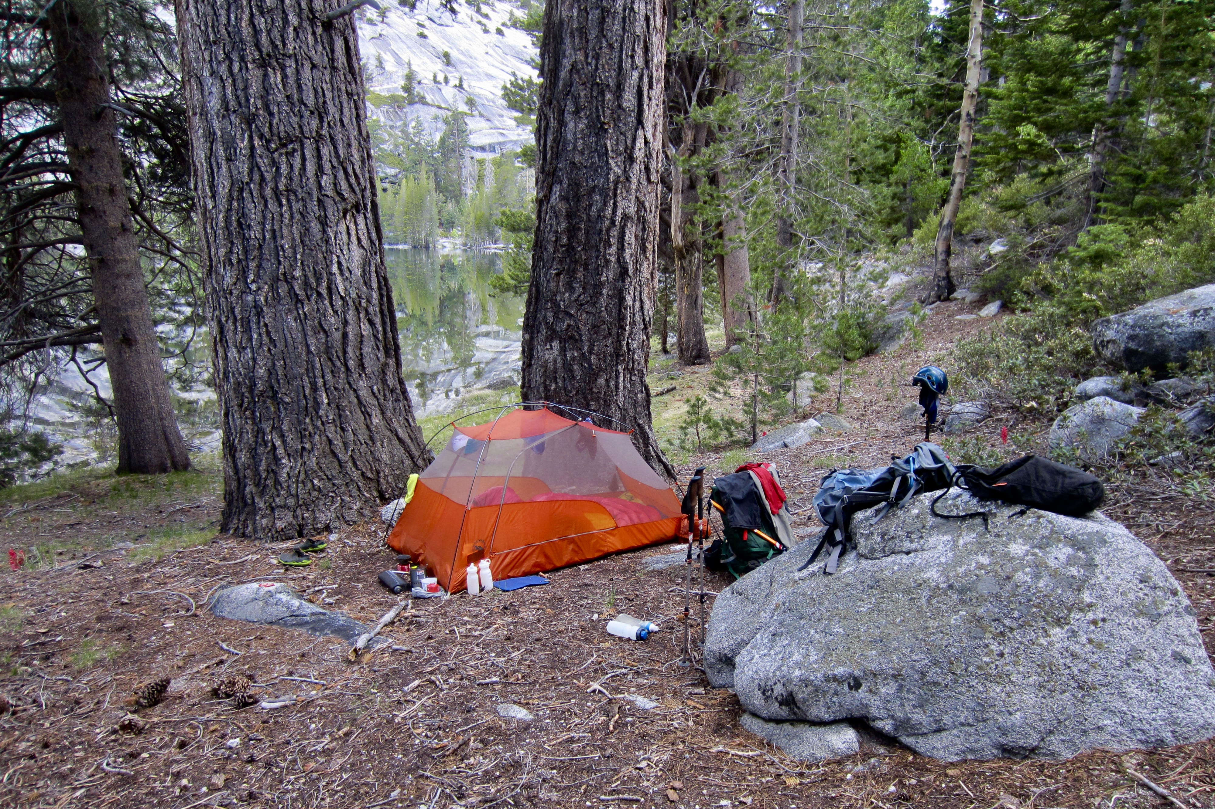
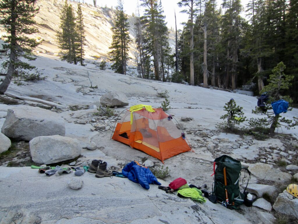
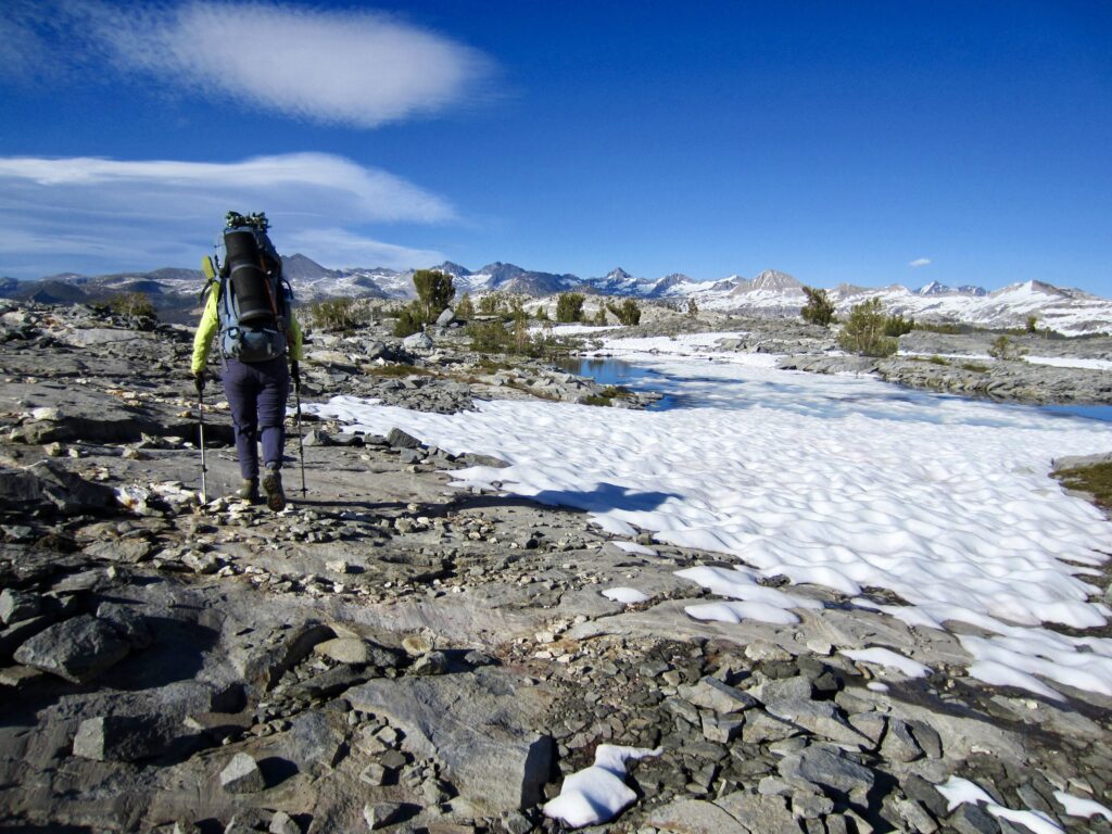
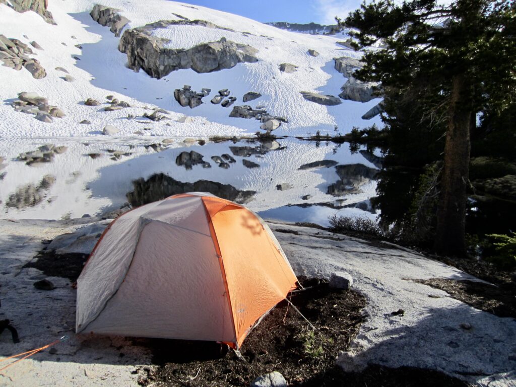
Solid snow gradually gave way to patchy snow, and we were able to pick up sections of bare trail leading through Red Devil Basin, which comprises a large expanse of granite slabs and enchanting tarns situated 300 feet above Red Devil Lake. In late afternoon, we stopped for the day beside a small, snow-free tarn at 9900 feet (9.5 hours + 7.2 miles + 2600 feet – 1550 feet from Camp 2).
.
.
.
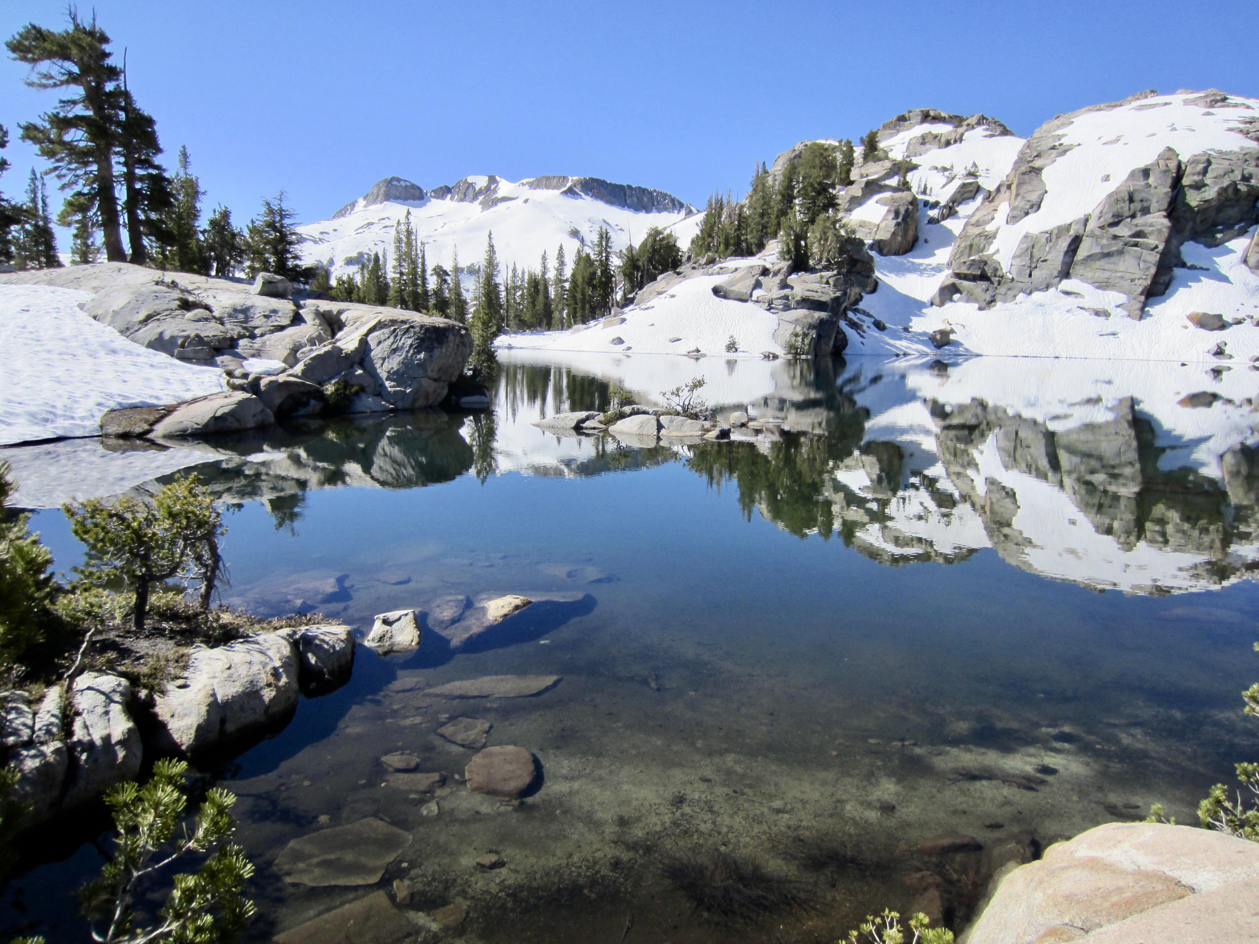
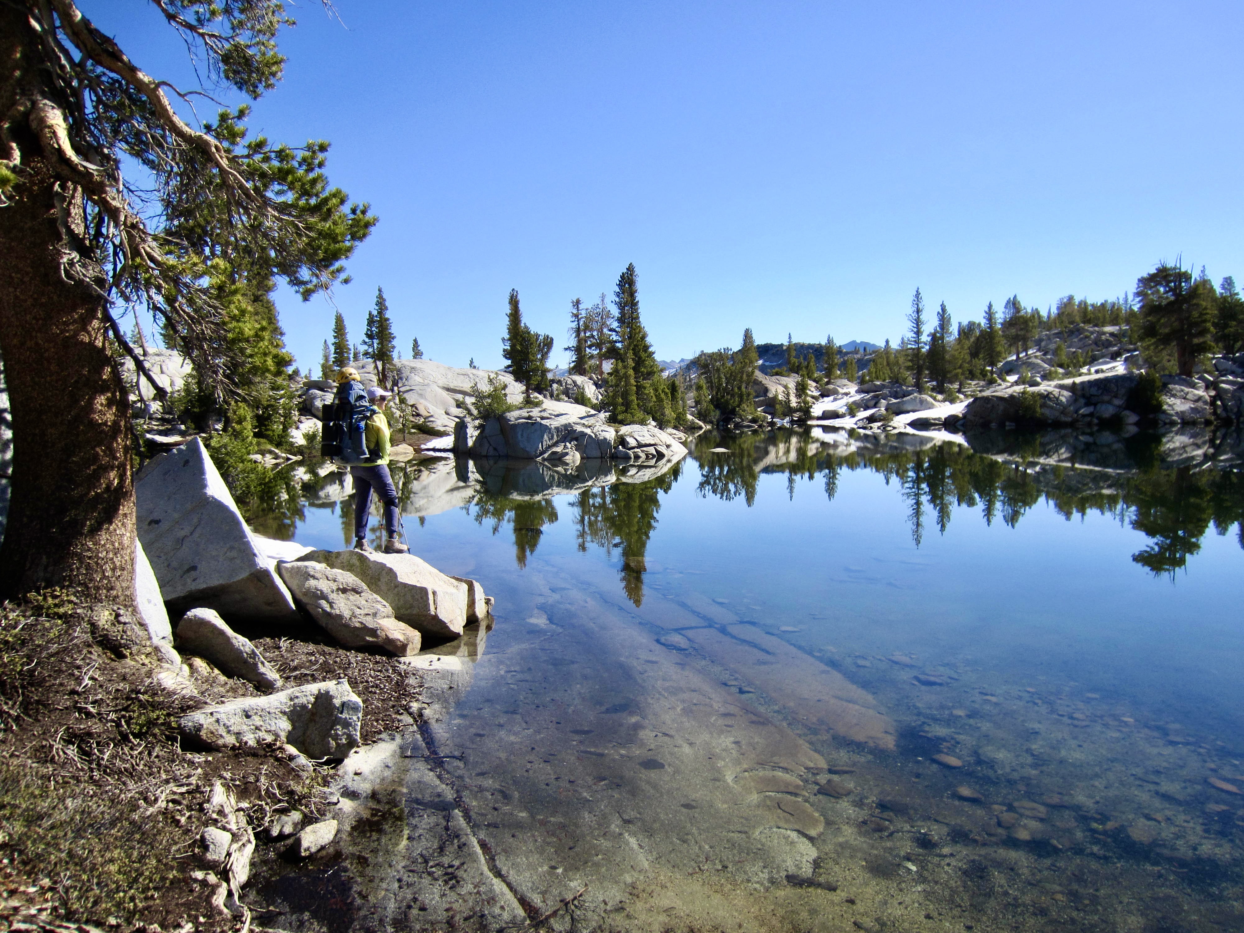
Day 4: Red Devil Basin to Washburn Lake
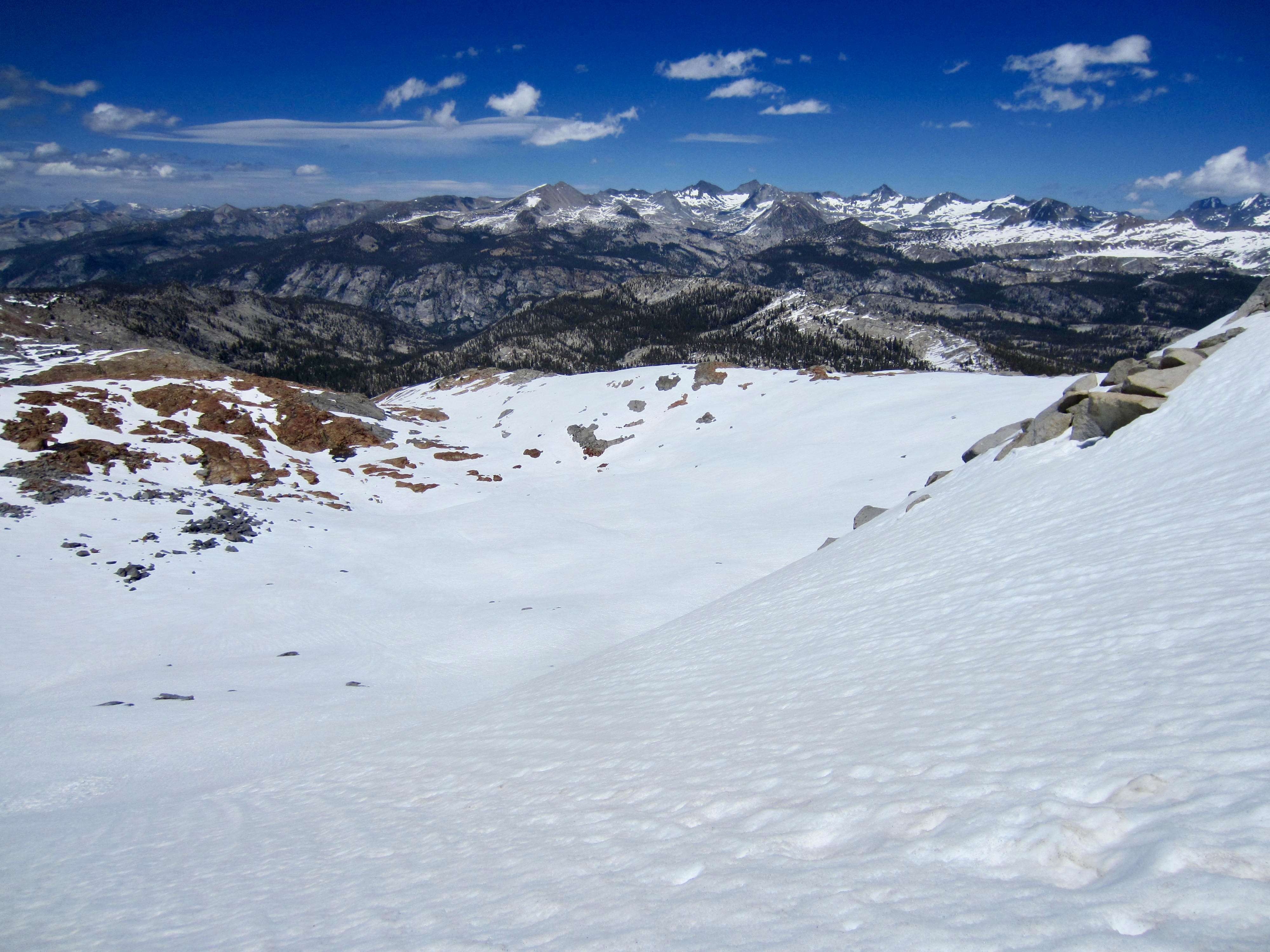
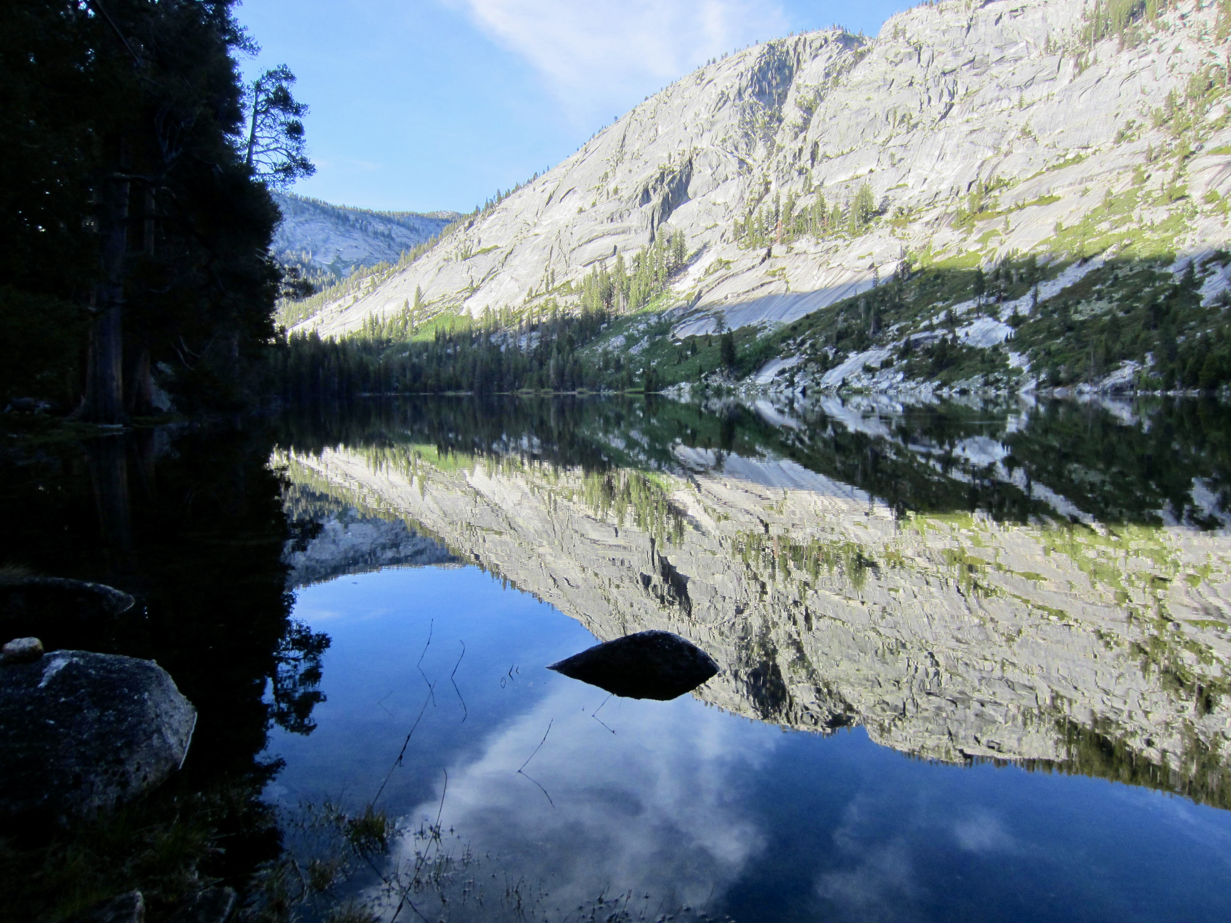
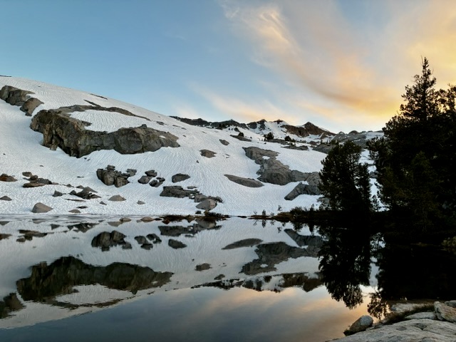
After a clear, cold night, Eileen and I awoke to a veneer of ice on our tarn. We packed up and slowly worked around the shore of a large adjacent tarn. This was one of the scenic highlights of our entire loop, so we felt no need to hurry through.

.
.
Once past the large tarn, we began dropping into Merced Peak Fork Basin on a partially snow-covered trail. In the basin floor, we forded the icy creek and began ascending a low ridge on the opposite side. This basin had been the turnaround point for our clockwise attempt in 2021, and it looked much different then versus now.
.
Upon crossing over the low ridge, we left all snow behind and descended a bare trail into the Triple Peak Fork Valley. It was early afternoon when we arrived at Triple Peak Fork Junction (4.0 hours from Camp 3), so we stopped for lunch and took a soak in the tranquil river.

.
.
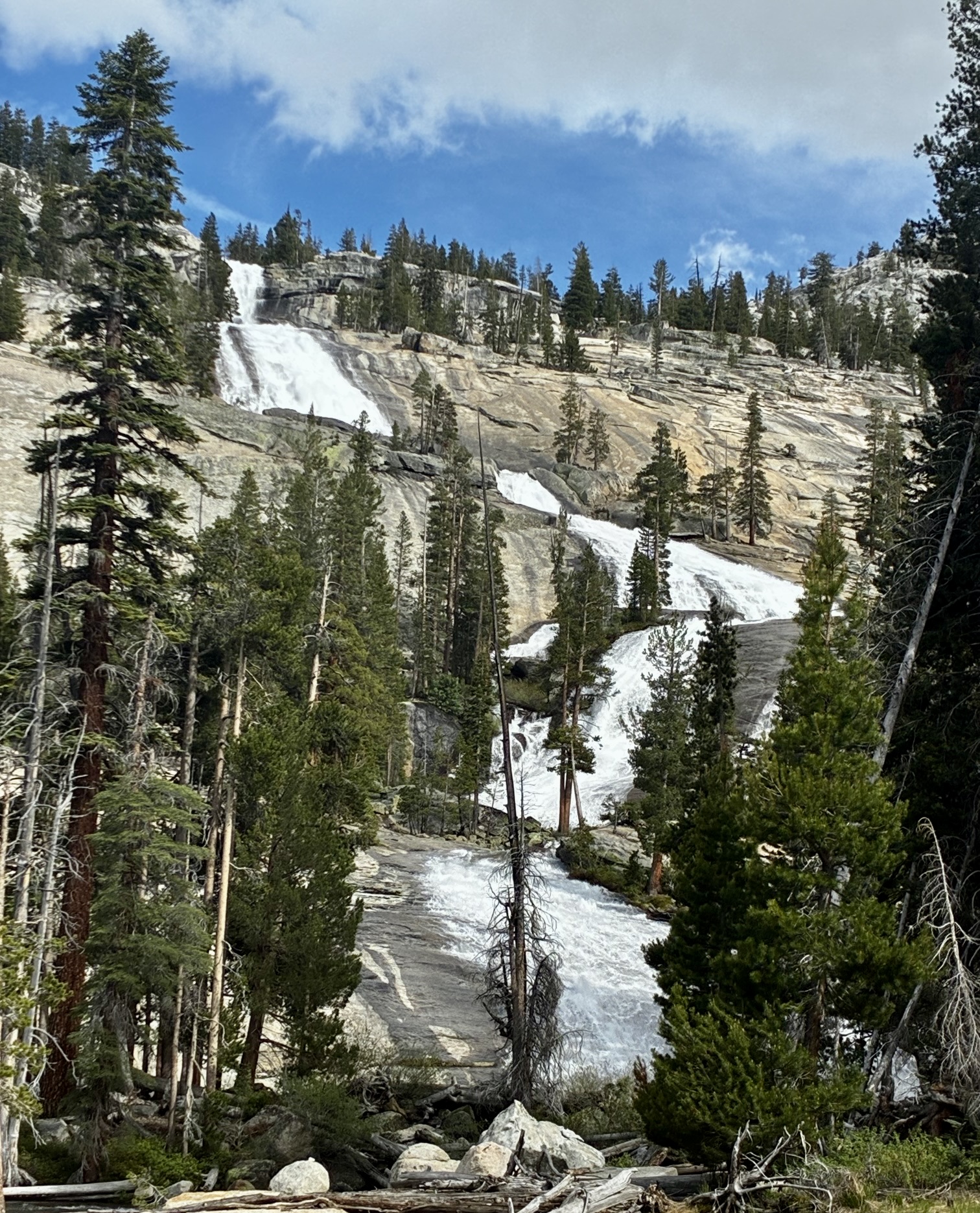
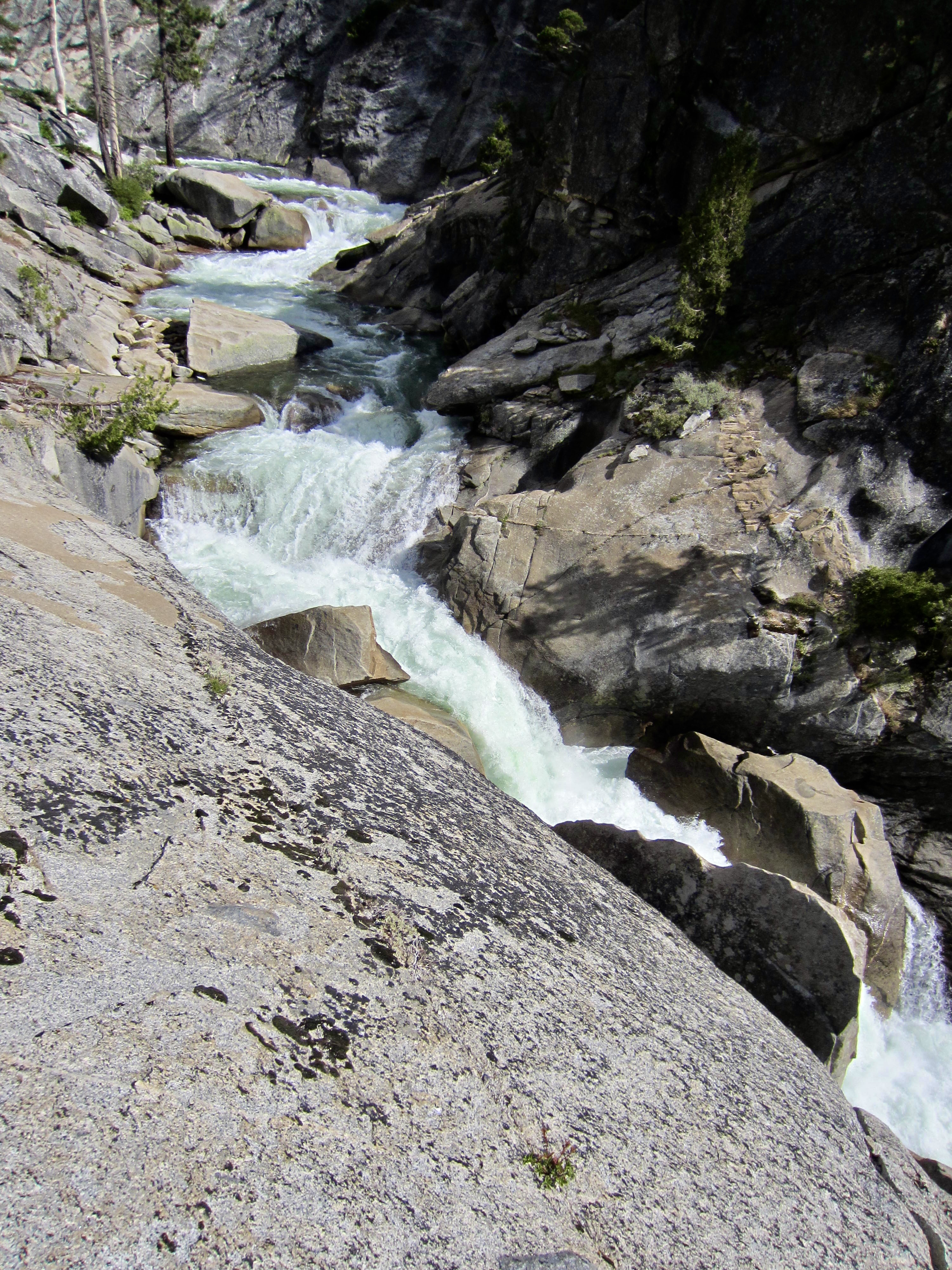
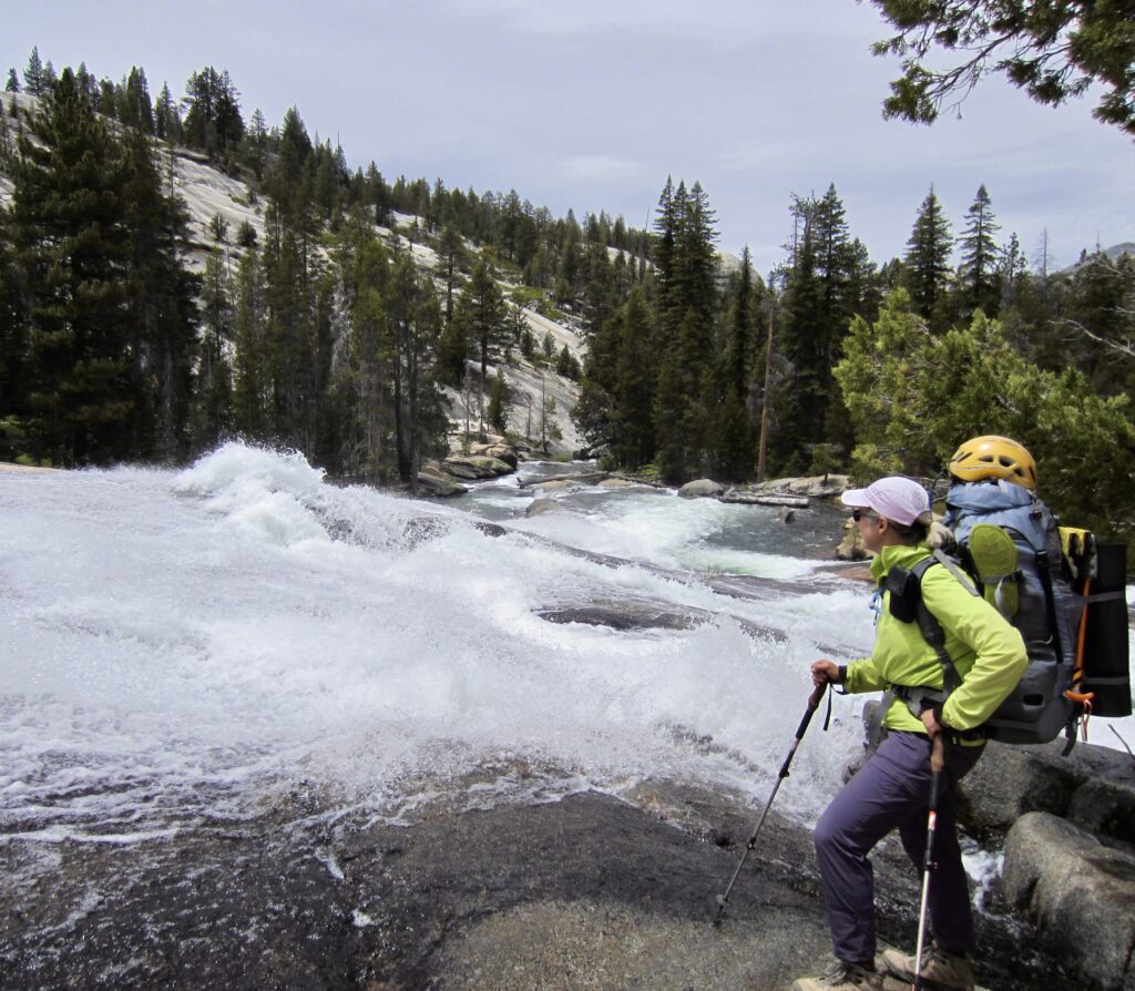
Our afternoon involved a pleasant hike through the picturesque hanging valley, followed by a switchbacking descent of the rocky headwall. Triple Peak Fork Falls tumble down this headwall in a visually dramatic series of waterfalls and waterslides that would excite any waterfall lover.

.

.
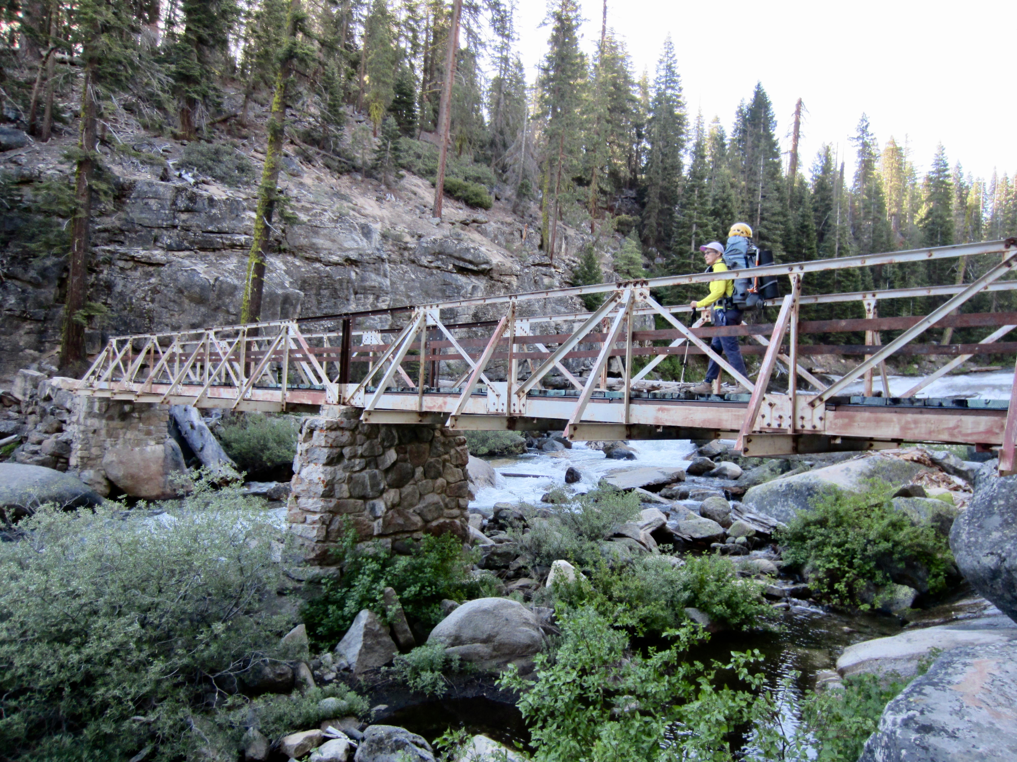
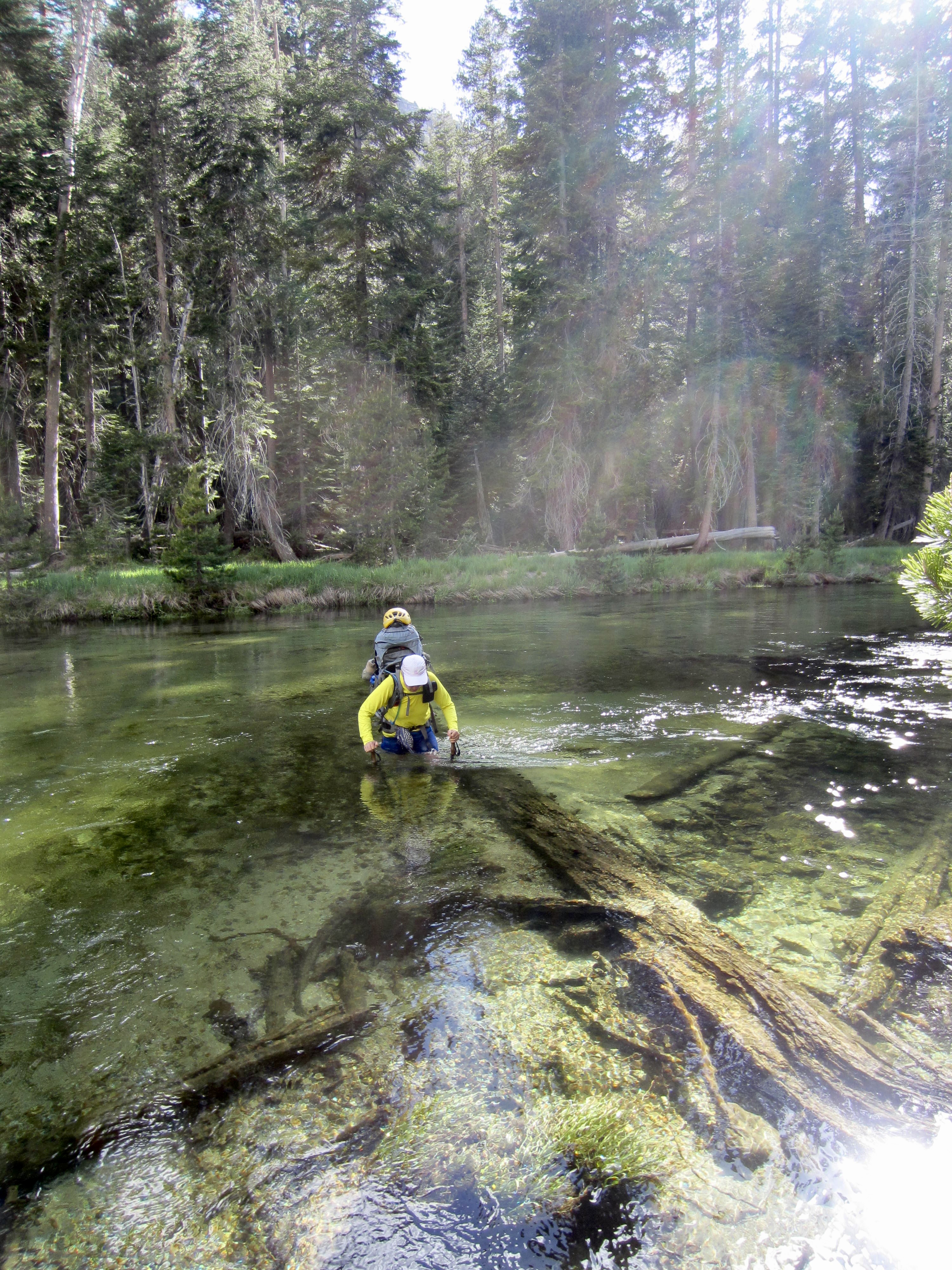
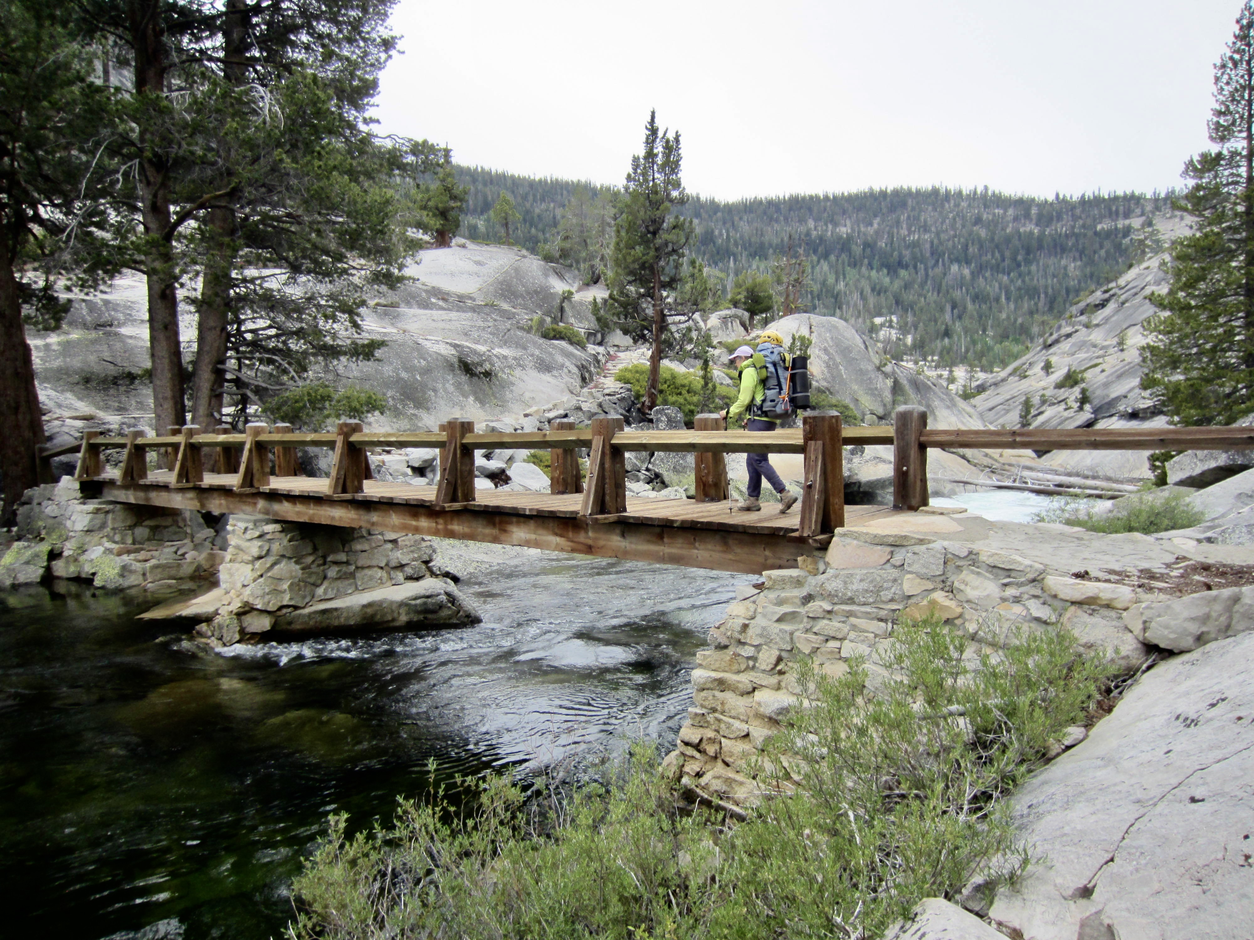
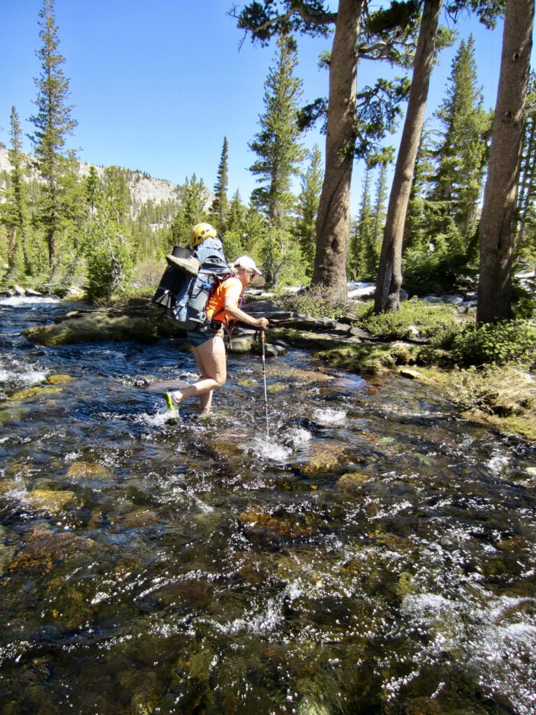
At the bottom of the switchbacks, we crossed Merced Peak Fork on a sturdy bridge and then continued downstream for another ⅓ mile to a crossing of the Merced River proper. The park ranger who issued our permit had warned us that the bridge here was damaged in a recent storm…and indeed it was. Half of the span across this fairly wide river was completely missing!
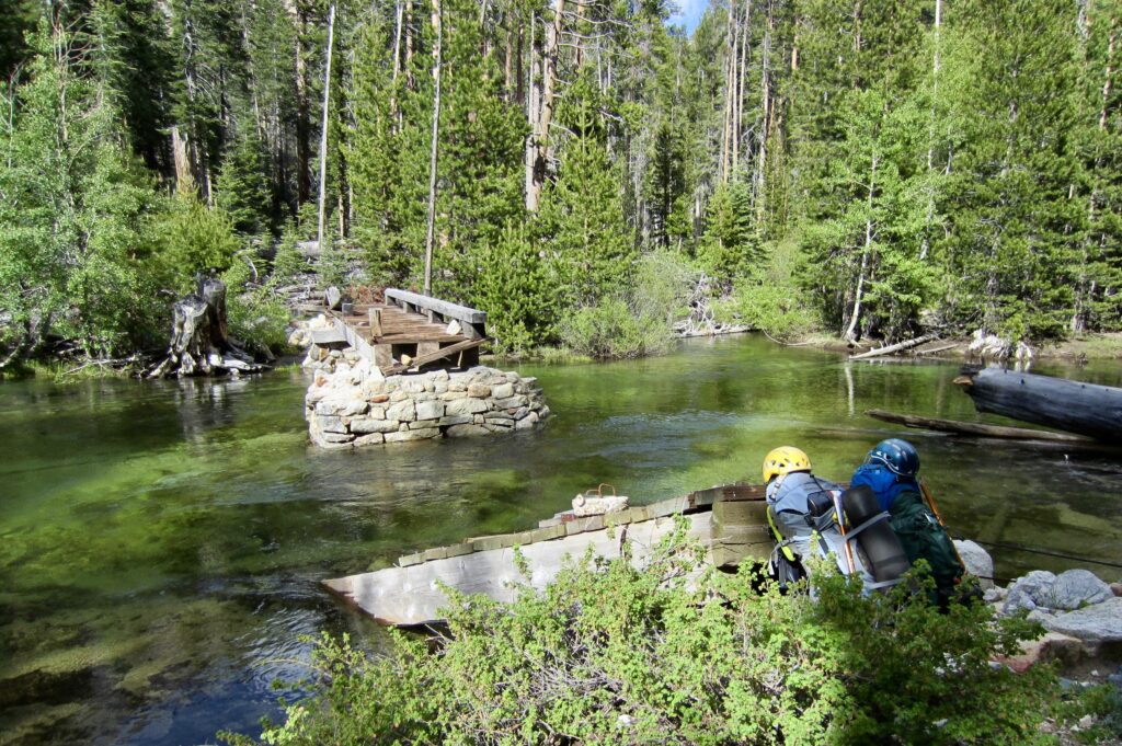
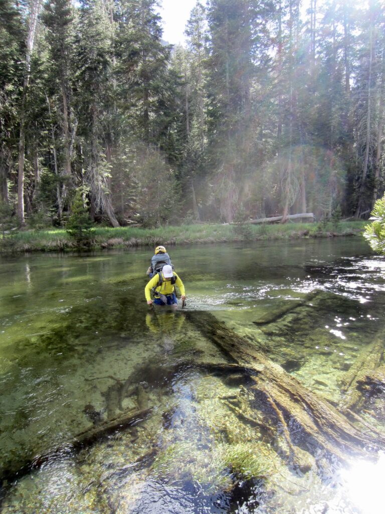
.
Knowing that the river ford was going to be tricky, Eileen and I hung our boots and shorts high on our packs before donning water sandals. I waded in and slowly walked across the sandy bottom, as the water gradually became deeper. First it was up to my knees, then crotch, then hips, then rib cage, and I see that my next few steps would put me in neck-deep water—at which point the current would surely push me over. I took two steps backwards and surveyed the river bottom. About 10 feet to my left was a submerged log that appeared to have collected more sand. Perhaps this was our only hope. I angled over to the log and was happy to find a raised sand bar that extended to the opposite shore. Moments later, I stepped onto the grassy bank and gave a shout of success! Eileen followed my route across the river and soon joined me on the bank. We were both very relieved to have this final hurdle behind us!

.
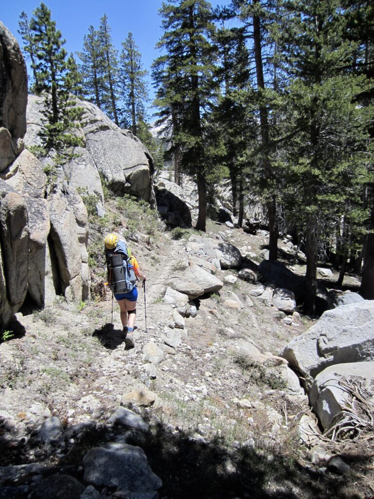
Our day ended with a fast march down the riverside trail while constantly swatting hungry mosquitoes. We arrived at Washburn Lake in early evening and made camp under some big pine trees (9.3 hours + 10.1 miles + 400 feet – 2700 feet from Camp 3).
.

.
Day 5: Washburn Lake to Little Yosemite Valley
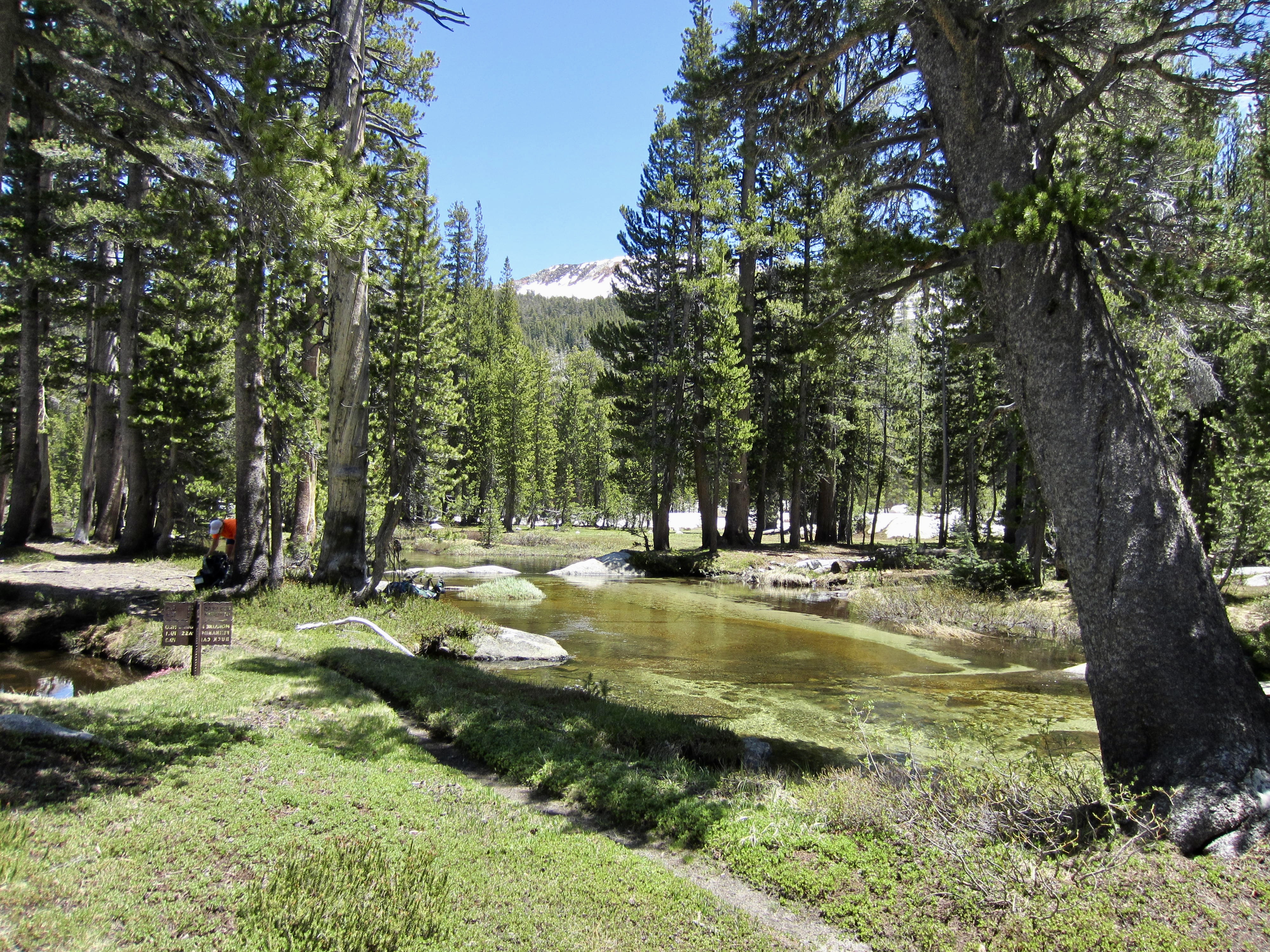
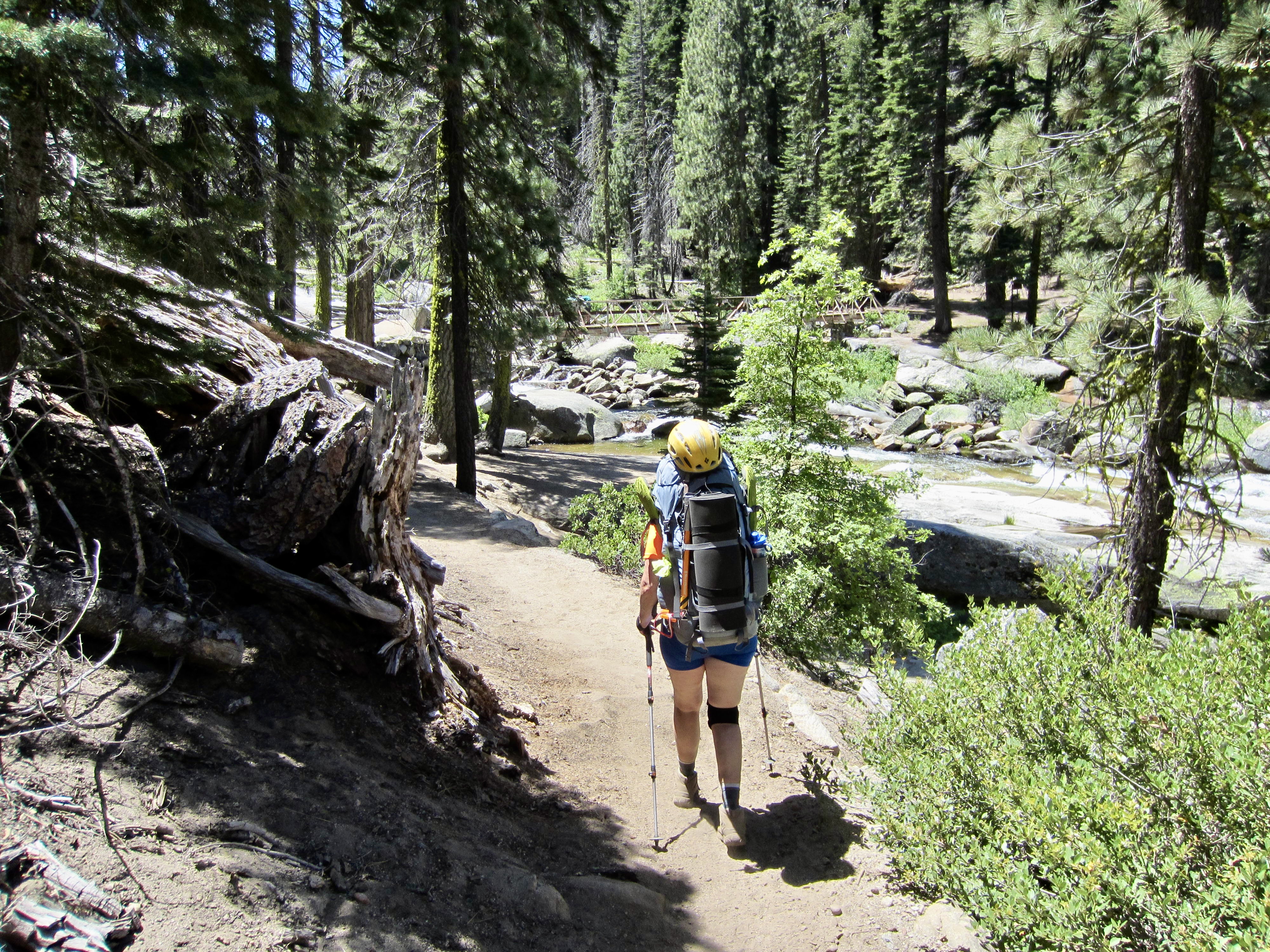
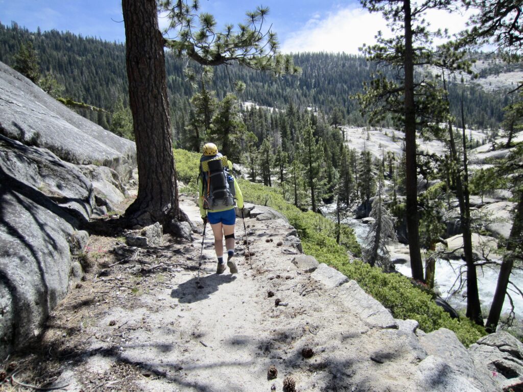
Eileen and I awoke to a cool, calm morning and a glassy surface on Washburn Lake. After breakfast at water’s edge, we headed down-valley on a nice trail that stayed close to the Merced River.


.
.
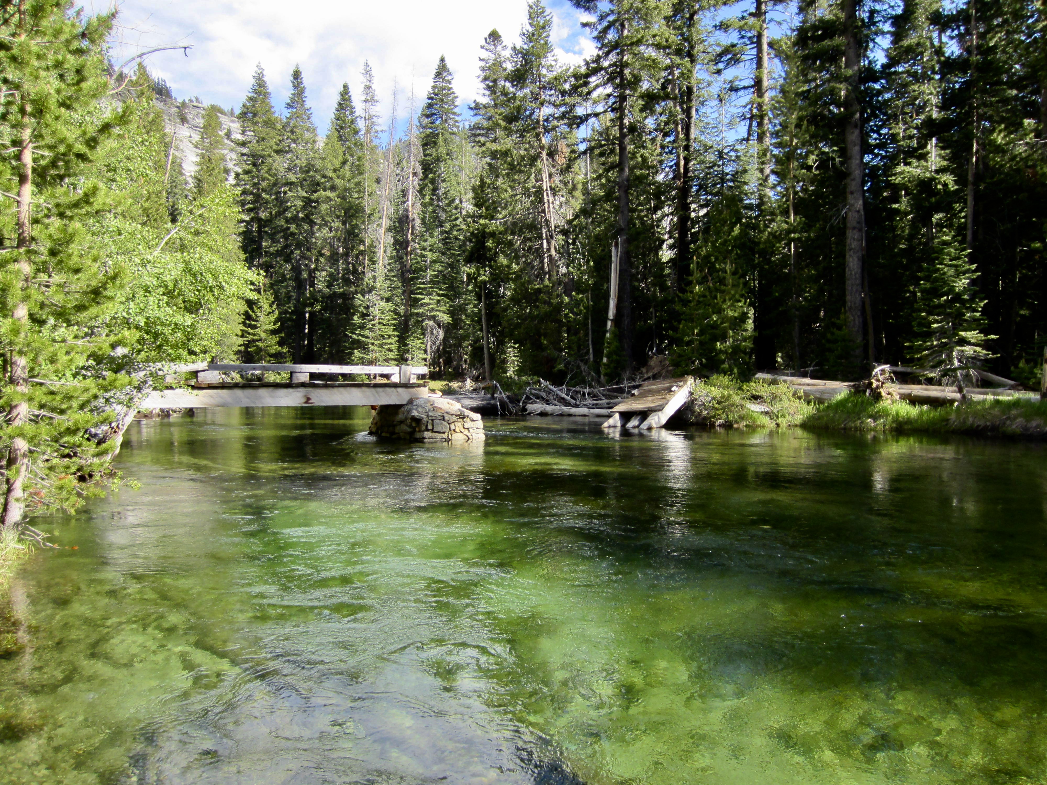
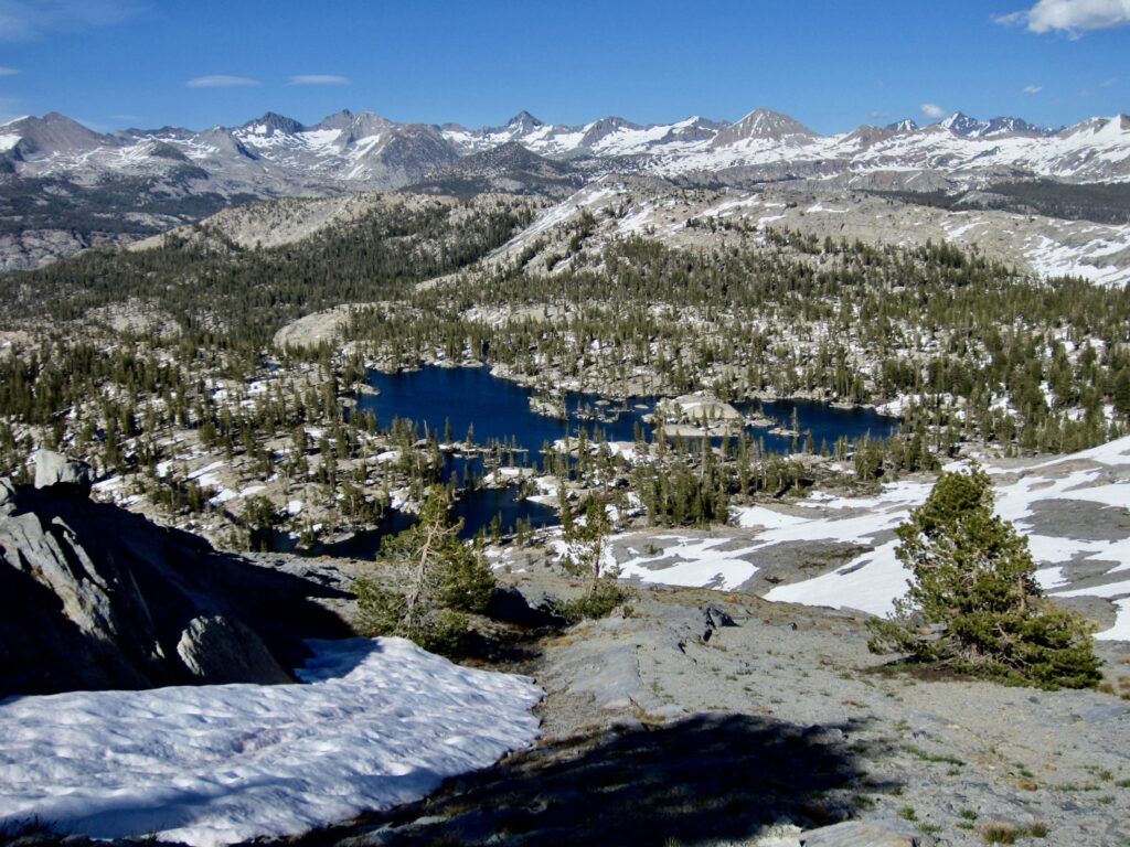
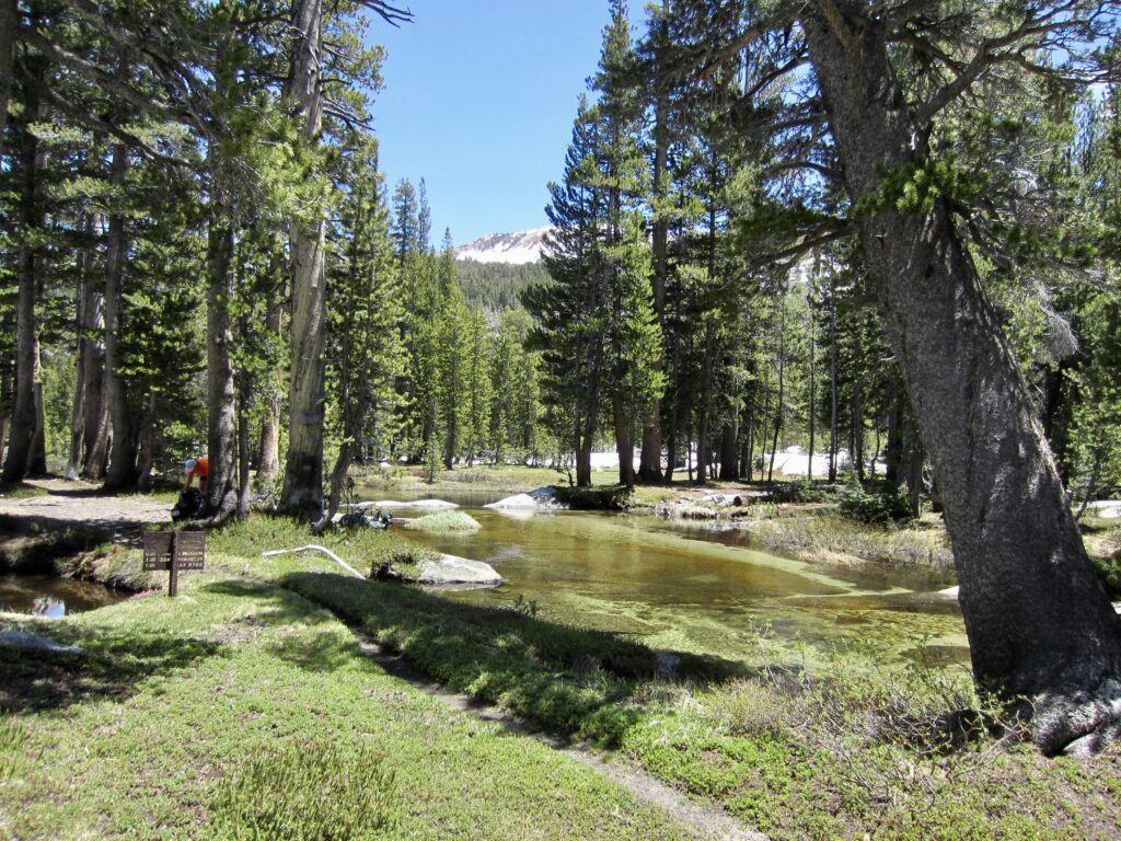
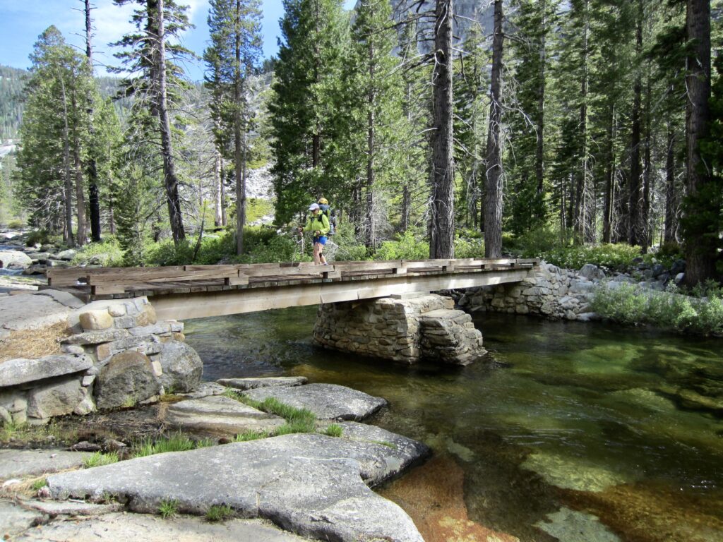
We passed the Merced Lake Ranger Station and High Sierra Horse Camp, neither of which was yet open for the summer, and then stopped for a snack at Merced Lake. The entire area was strangely deserted and quiet. Below Merced Lake, we hiked through Echo Valley and started our descent toward the upper end of Merced Canyon, which is effectively marked by a handsome two-span bridge.
.
.

.
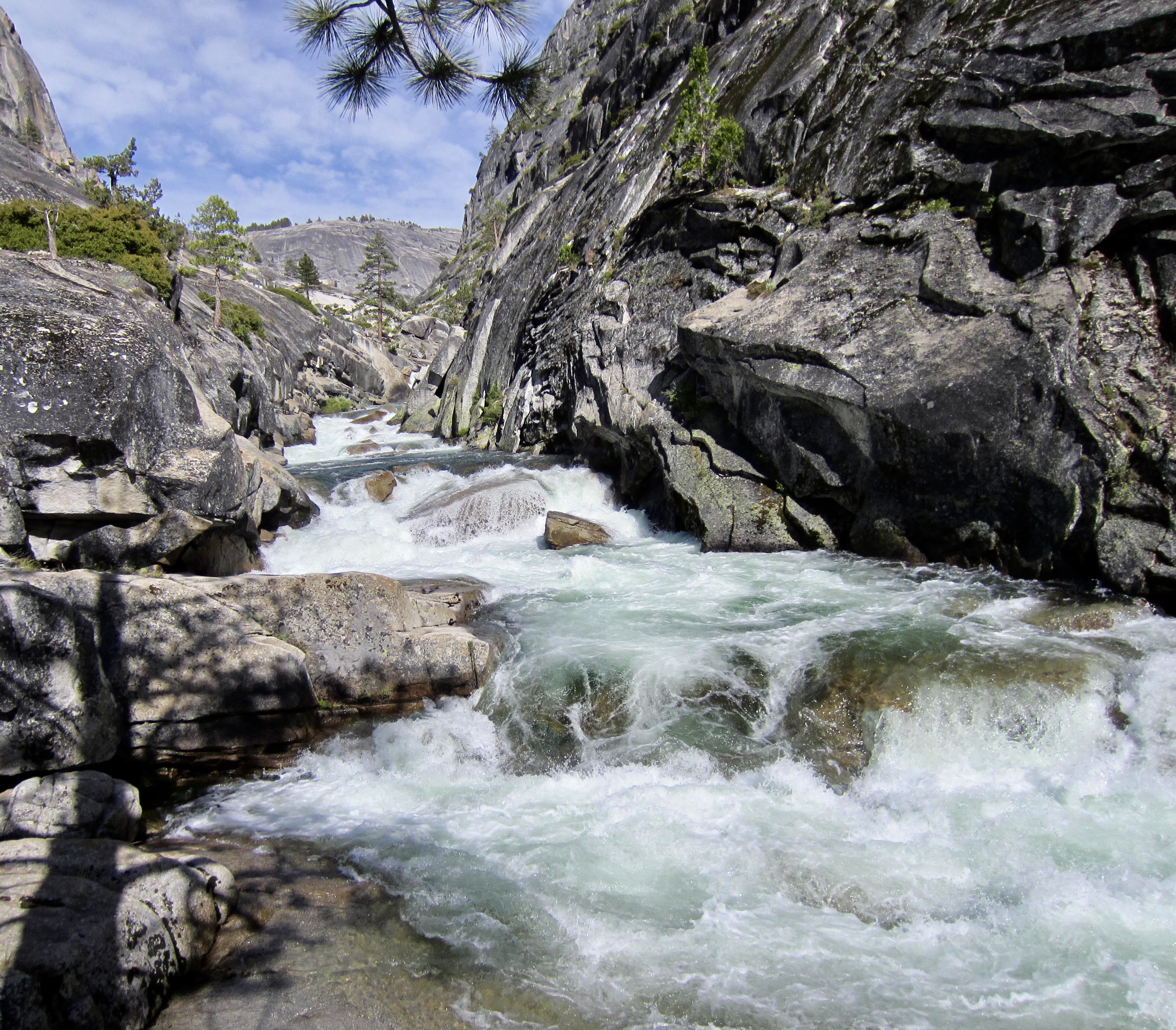
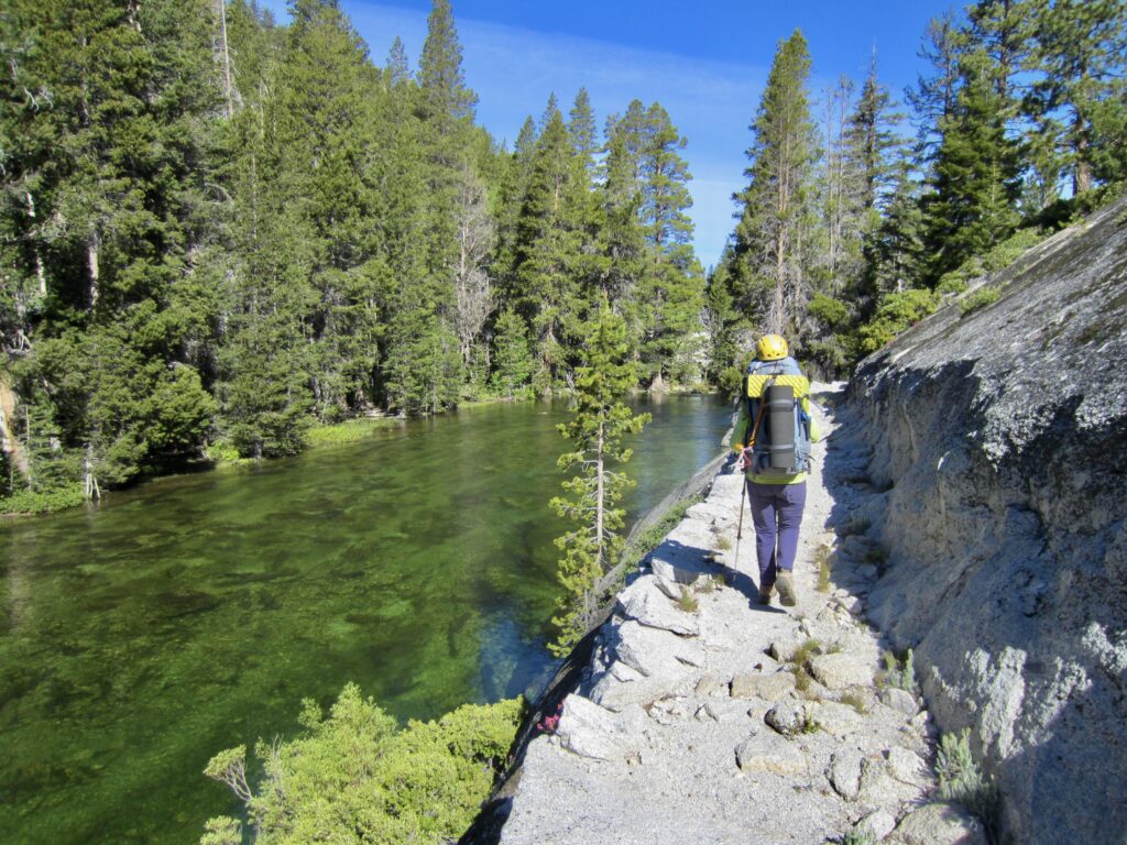
Merced Canyon showcases the astounding granitic riches in Yosemite’s backcountry, with massive slabs and domes rising up on both sides. Meanwhile, the Merced River rushes through the invert in isolated segments, as though hurrying to get from one quiet pool to the next. The canyon trail itself displays a remarkable level of construction moxie and craftsmanship, having been carved into the bedrock by drilling and blasting.
.

.
.
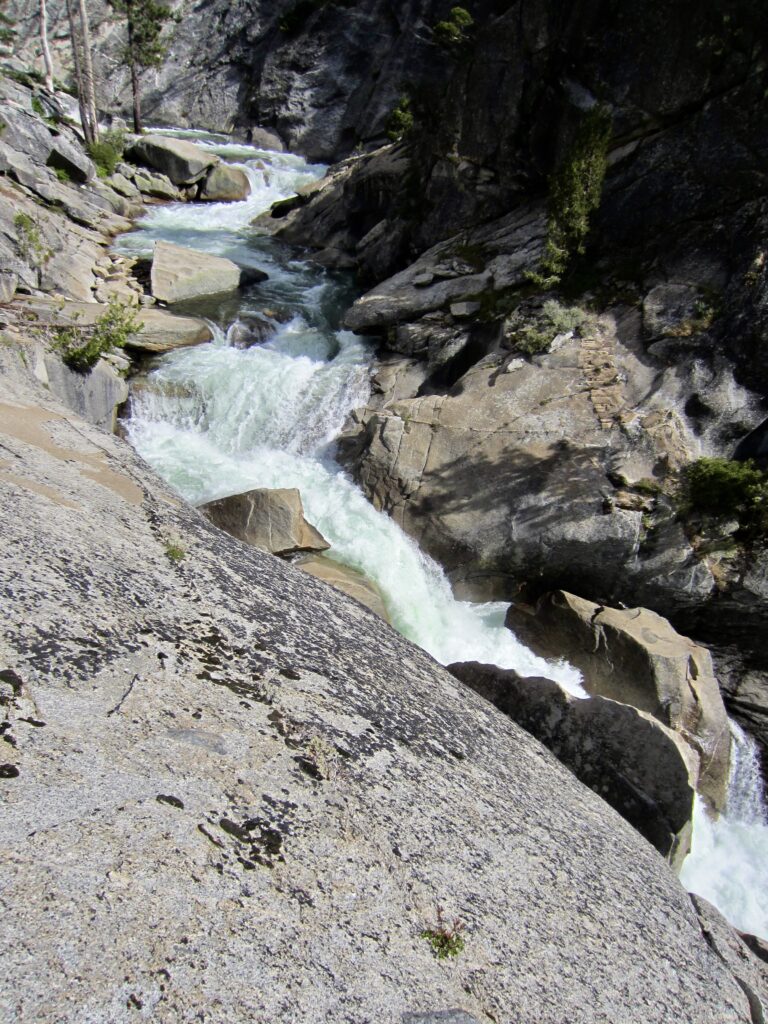
The river’s climax occurs near the lower end of the canyon, where Bunnell Cascade twists and drops through a narrow slot before spilling into Lost Valley. In this vicinity, Eileen and I encountered the first other humans we’d seen since the morning of Day 2. Whenever asked whether the Yosemite backcountry is crowded, our response is a resounding “No! Not in May or June, anyway.”

.
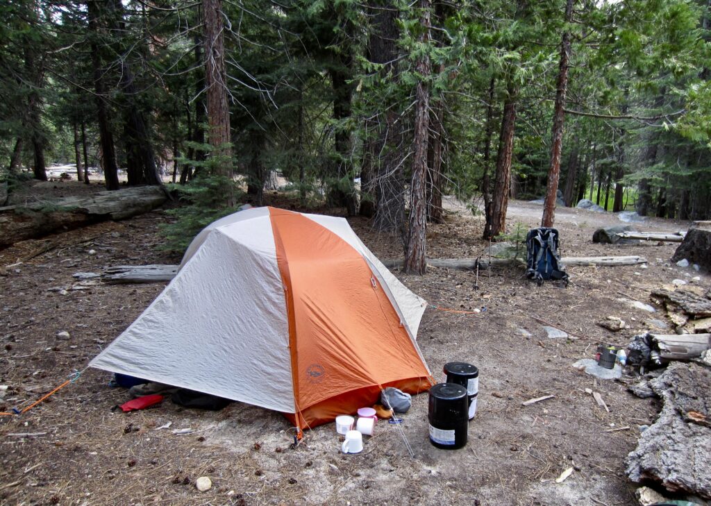
We arrived in Little Yosemite Valley Campground at 6:30pm and pitched our tent in an open site (9.3 hours + 12.2 miles + 350 feet – 1850 feet from Camp 4). After four nights of camping completely alone, the bustling campground here felt a bit strange. But the fancy composting toilets were much appreciated!
.
Day 6: Little Yosemite Valley to Glacier Point
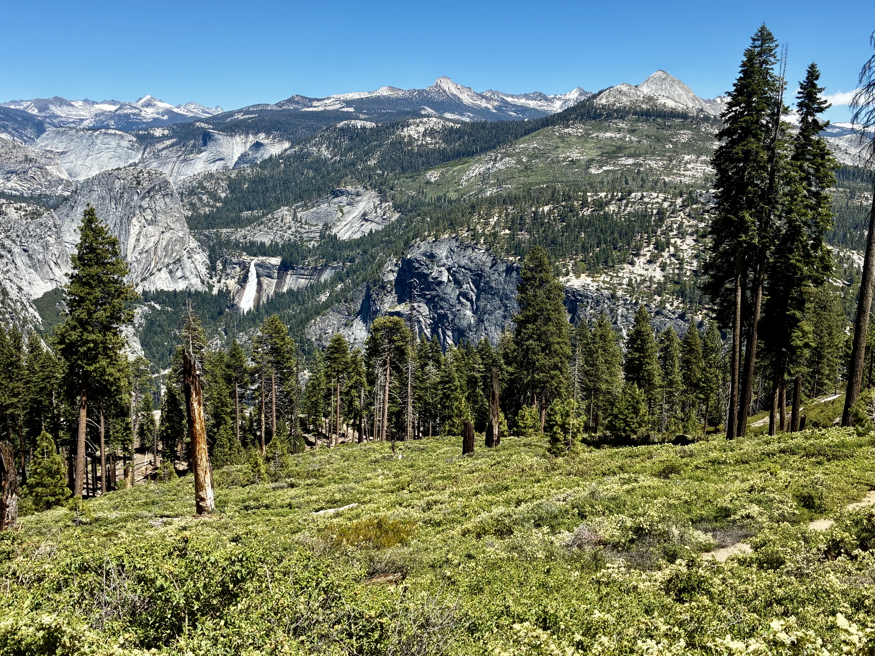
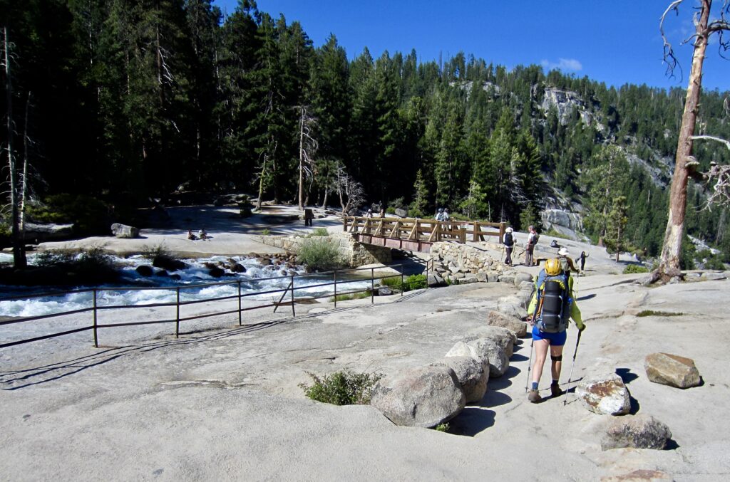
After a warm night, we enjoyed our final breakfast of the trek and then headed out with backpacks that seemed almost light in contrast to our Day 1 gorillas. We made a brief stop at Nevada Fall before hiking up the busy Panorama Trail and closing our loop at the Merced Pass Trail junction. From there, we descended to Illilouette Fall Bridge and stopped to fill water bottles for one last time.
.
.
.
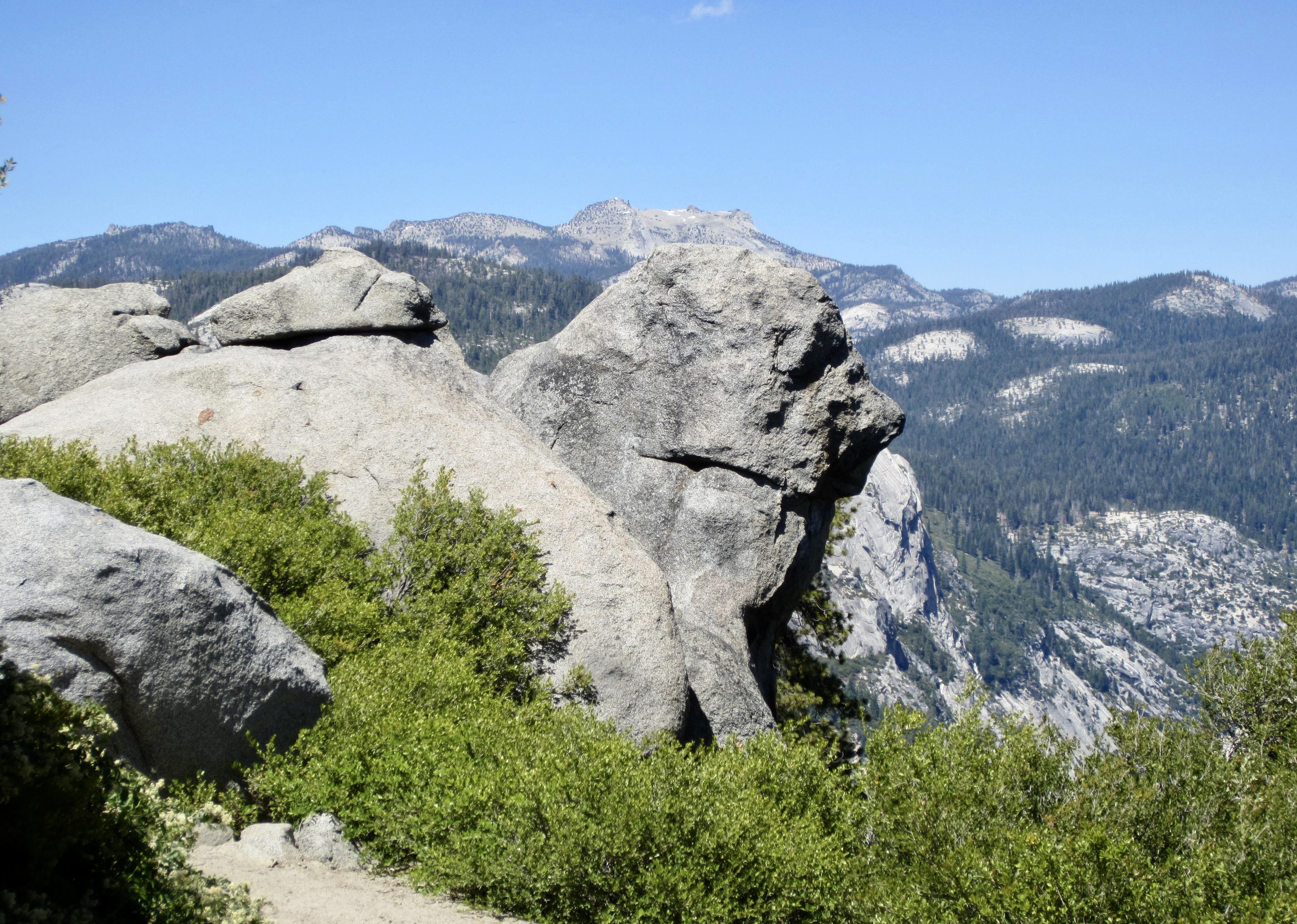
A hot hike out of Illilouette Creek Valley gave us views far back into the Clark Range. Some of the distant peaks that we’d traversed beneath several days ago now looked familiar, and a few peaks represented tantalizing objectives for future Yosemite trips. Beside the trail, I noticed a stone lion that seemed to be transfixed on those same peaks. Perhaps he was also contemplating future objectives.
.

.
We reached the hot and crowded parking lot at Glacier Point at 2:30pm (6.0 hours + 7.0 miles + 2000 feet – 1000 feet from Camp 5). It had been a marvelous trek, with lots of highs and lows, along with plenty of delights and frustrations. Most of all, it was very satisfying to tuck this in after seven years of dreaming!
Route Maps & Profile
…
…
…
Photo Gallery
Click to enlarge…