Trip Date: May 13-17, 2021
Clouds Rest Scramble & Merced Lake Trail Loop
Vernal Fall
Little Yosemite Valley
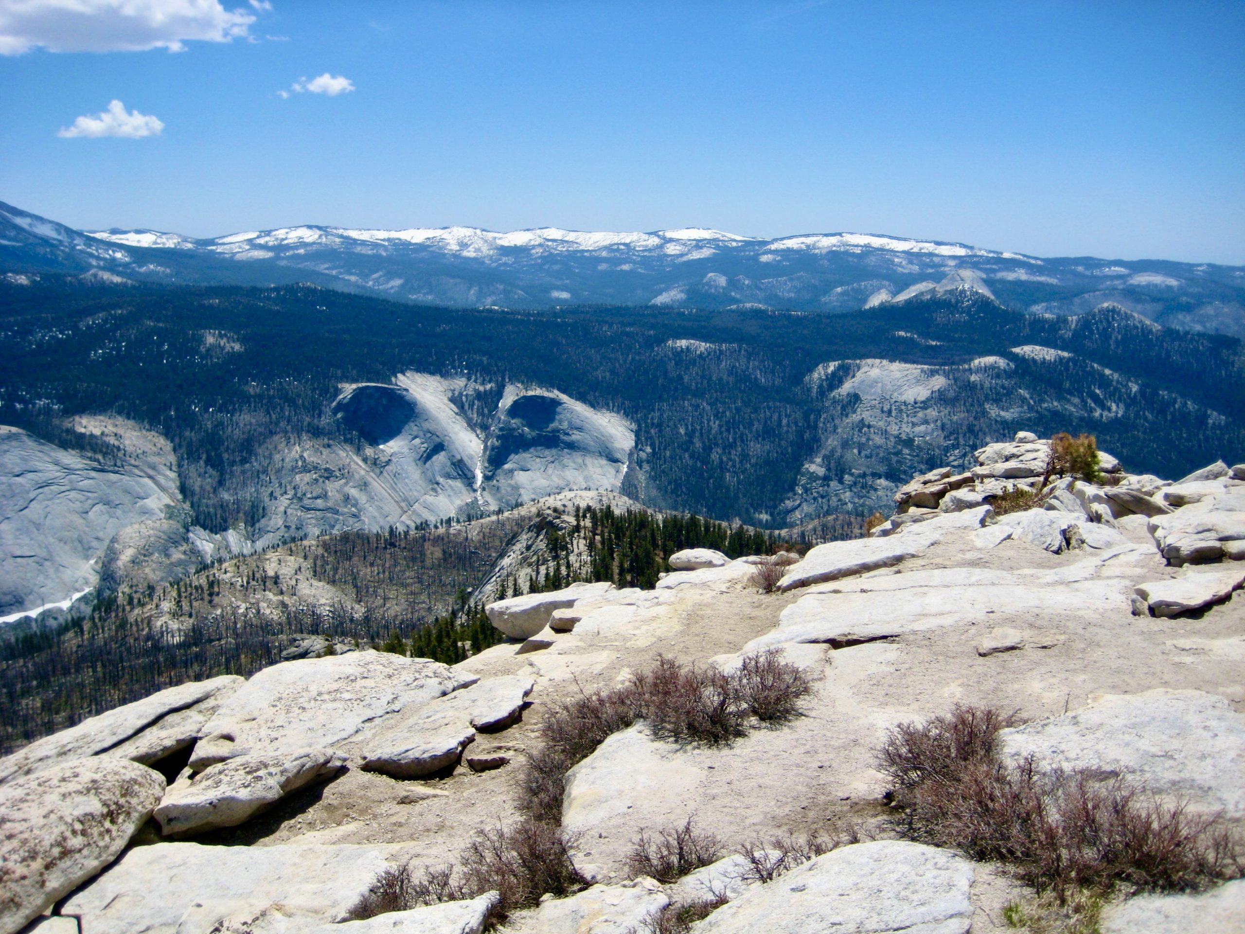
Clouds Rest (9926 ft)
Merced Lake
Washburn Lake
Triple Peak Fork Falls
Merced Peak Fork Basin
Point 9860 aka Triple-Merced Point
Merced Canyon
Bunnell Cascade
Nevada Fall
- Trip Report Summary
- Full Trip Report
- Day 1: Happy Isles Parking Lot to Sunrise Creek Flats
- Day 2: Sunrise Creek Flats to Merced Lake + Clouds Rest Sidetrip
- Day 3: Merced Lake to Merced Peak Fork Basin
- Day 4: Merced Peak Fork Basin to Merced Lake
- Day 5: Merced Lake to Happy Isles Parking Lot
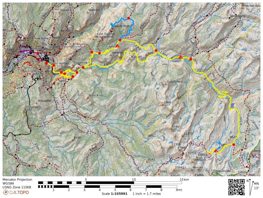
- Route Maps
- Photo Gallery
Trip Report Summary
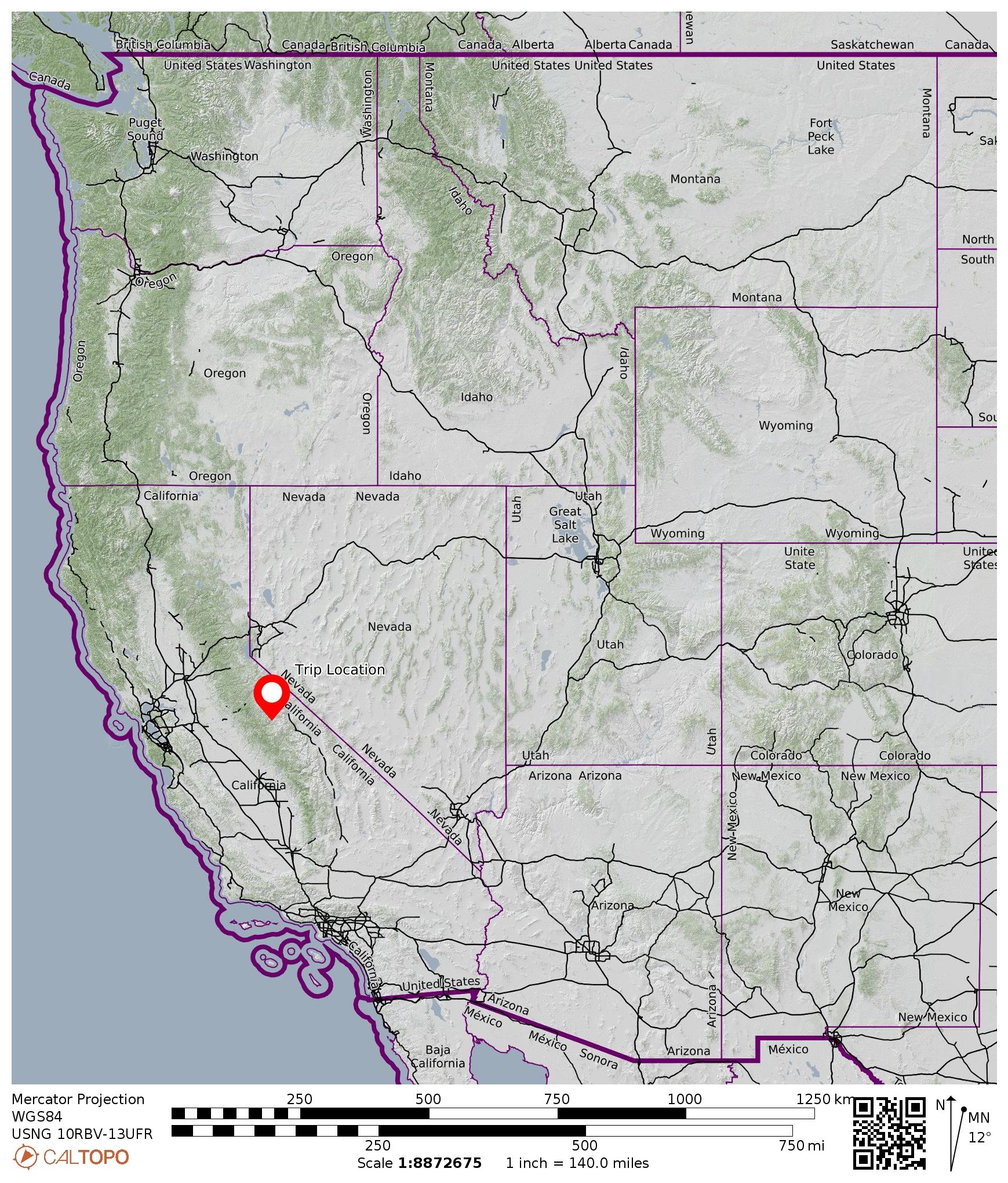
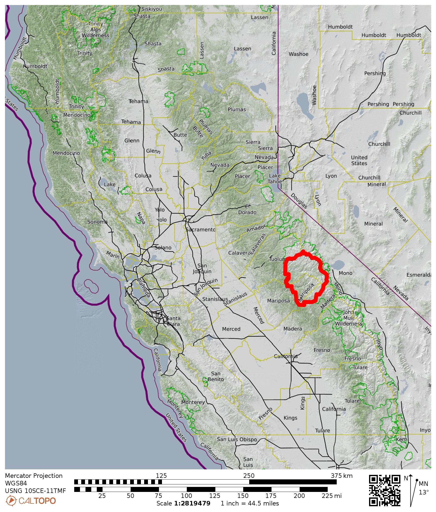
Region: California
Sub-Region: Sierra Nevada Range
Sub-Sub-Region: Clark Range
Area: Yosemite National Park
Starting & Ending Point: Happy Isles Parking Lot (Elev. 4000 feet)
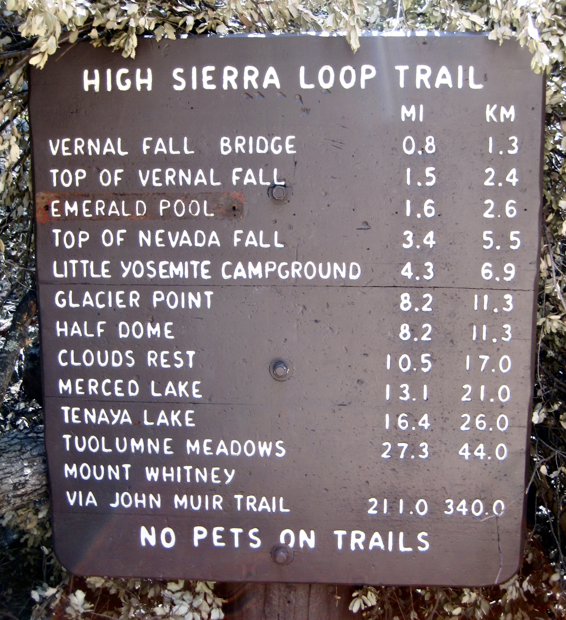
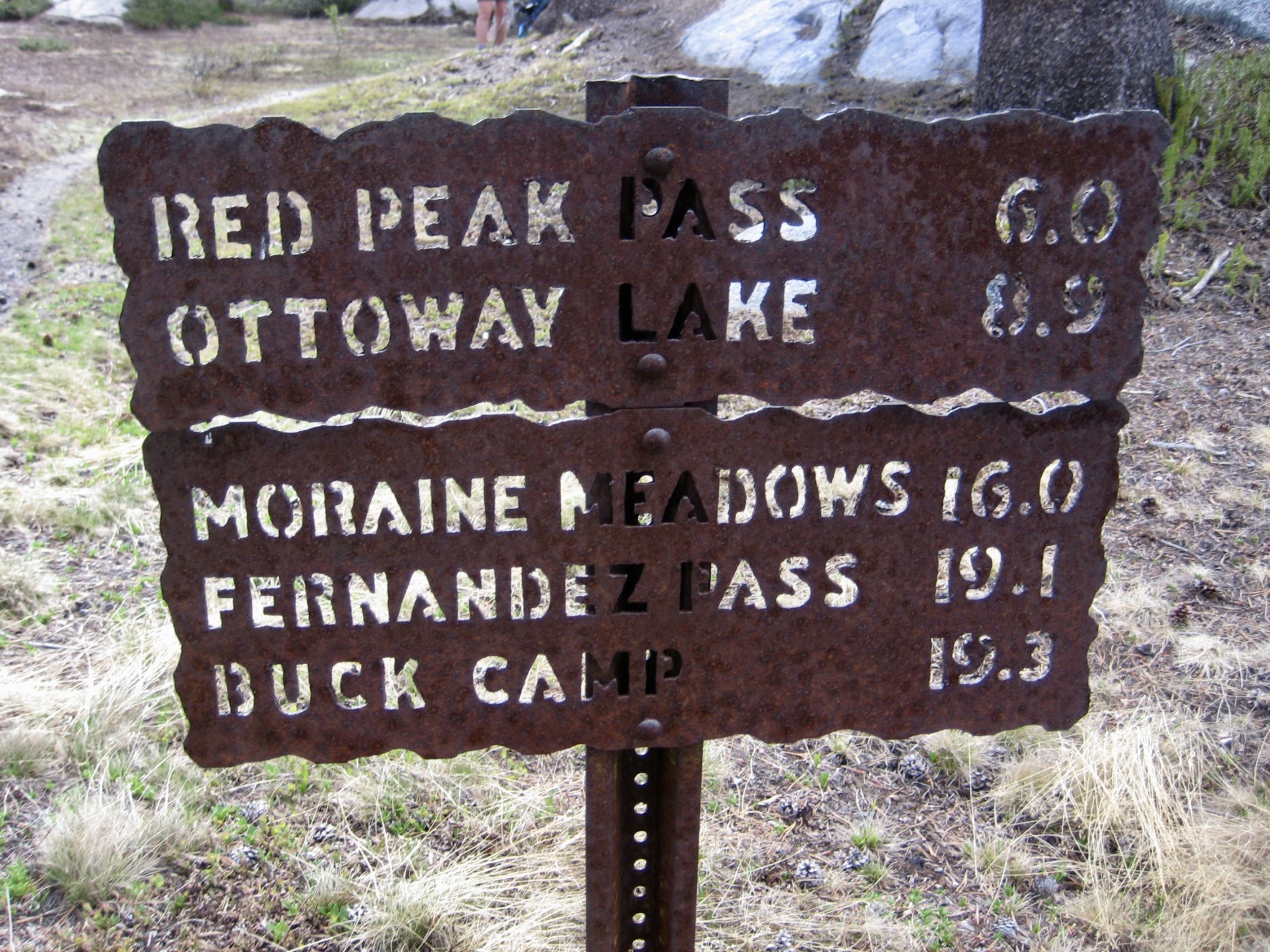
Way Points: Happy Isles Bridge & Mist Trailhead & Merced River & Lower Vernal Bridge & Vernal Fall & Silver Apron & Emerald Pool & Upper Vernal Bridge & Nevada Junction & Little Yosemite Valley & Sunrise Creek & Sunrise Creek Flats & Sunrise Junction & Echo Valley Junction & Echo Creek Bridge & Echo Valley & Merced Lake & Merced Lake Camp & Lewis Creek Bridge & Merced Lake Ranger Station & Washburn Lake & Merced Peak Fork Bridge & Triple Peak Fork Falls & Triple Peak Fork Valley & Triple–Merced Rib & Merced Peak Fork Basin (trail hike & snow hike); return via Washburn Lake & Merced Lake & Echo Valley Junction & Merced River Canyon & Bunnell Cascade & Lost Valley & Little Yosemite Valley & Nevada Junction & Nevada Fall Bridge & Clark Point & Lower Vernal Bridge (trail hike)
Campsites: Sunrise Creek Flats & Merced Lake Camp & Triple–Merced Rib & Merced Lake Camp
Sidetrip: Sunrise – Clouds Rest Saddle & Clouds Rest summit (trail hike & trail scramble)
Summit: Clouds Rest (trail hike & trail scramble via Northeast Ridge)
Sidetrip: Triple-Merced Point (off-trail hike & rock scramble)
Approximate Stats: 59 miles traveled; 12,600 feet gained & lost.
…
Full Trip Report
Eileen and I did a springtime backpacking trip in Yosemite National Park, hoping that the Sierras would serve up a generous dose of warm, sunny weather and snow-free trails. Operating under this premise, Eileen laid out a grand, five-day, 60-mile loop through the Clark Range. We ultimately came up a bit short on sunny weather and snow-free trails, which stymied our loop trip, but it was a fine Yosemite adventure nonetheless.
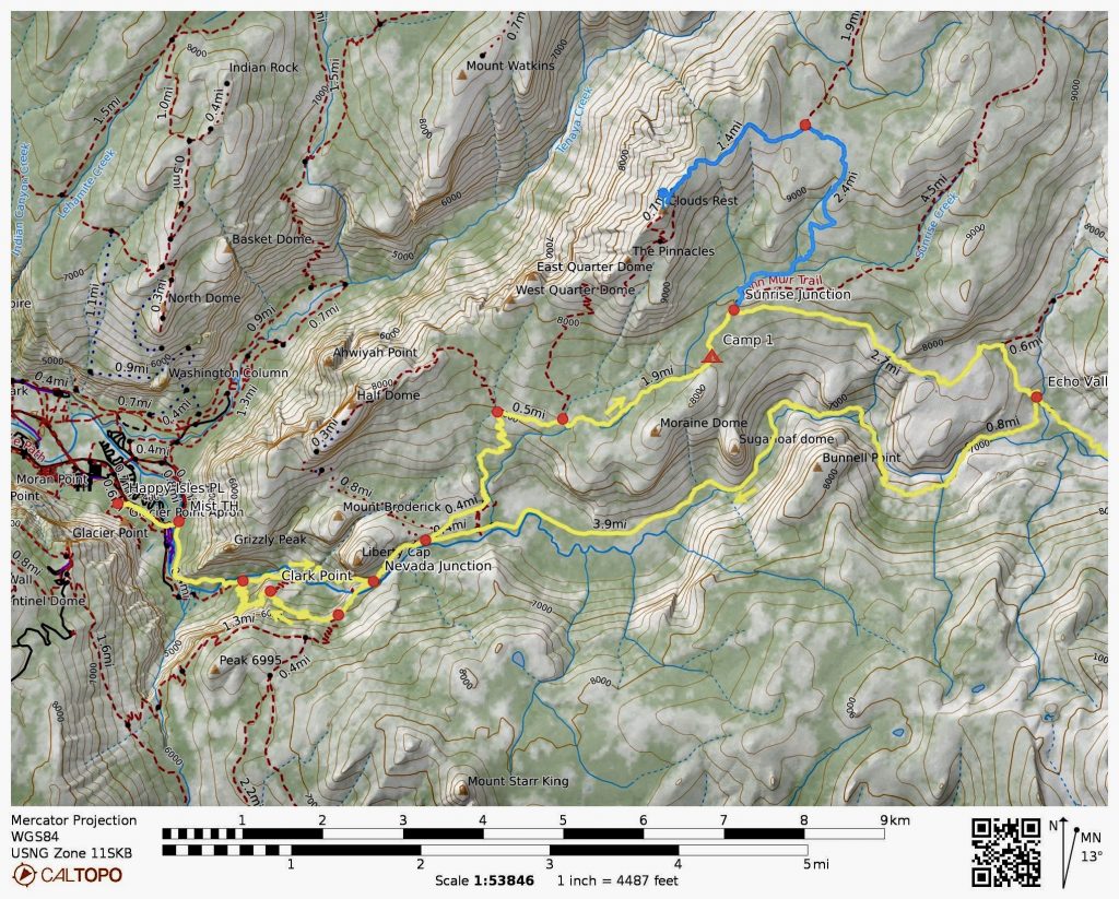
Day 1: Happy Isles Parking Lot to Sunrise Creek Flats
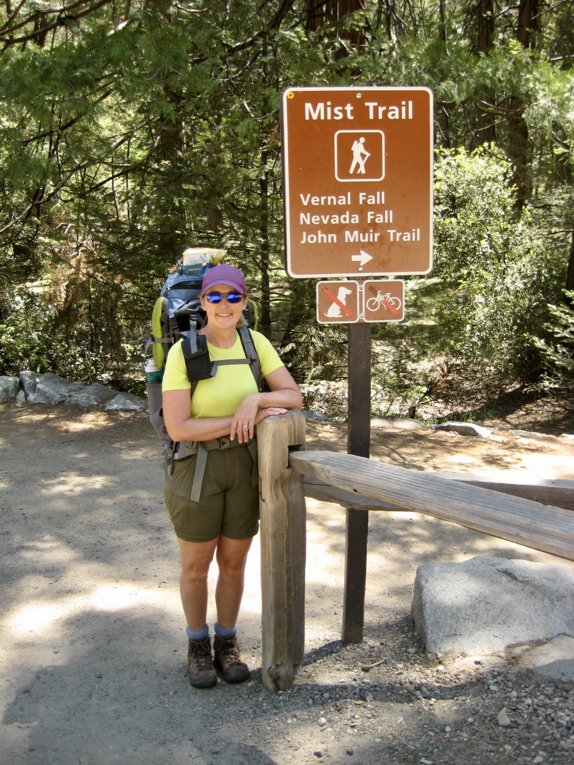
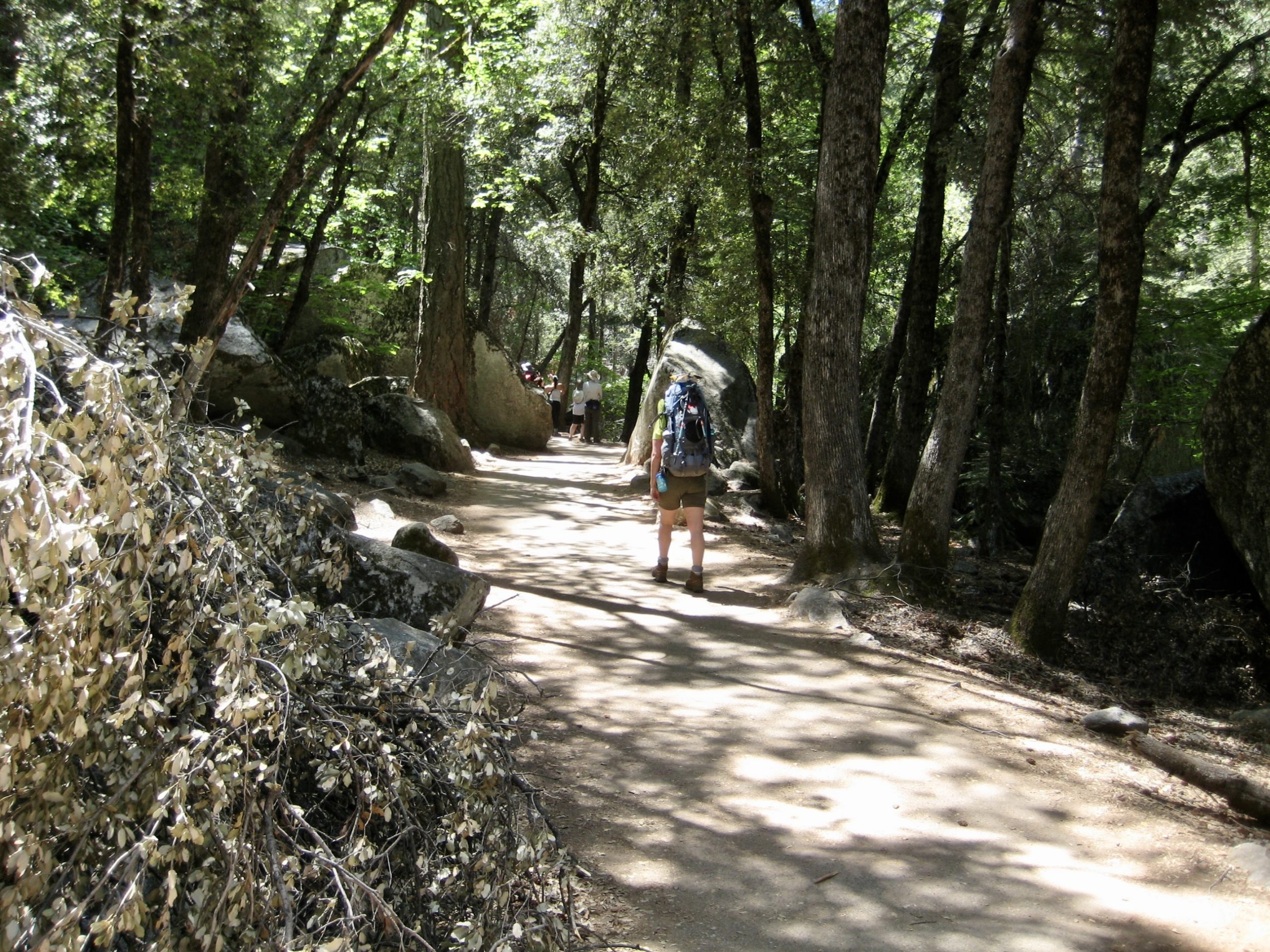
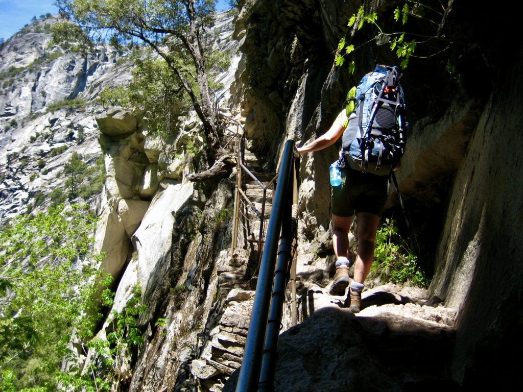
Our trip began quite auspiciously when we scored the very last parking space in the huge Happy Isles parking lot near the head of Yosemite Valley. From there, we walked ¼ mile up to the Mist Trailhead and started hiking up the ultra-popular trail, along with hoards of day-trippers and a few backpackers. The midday weather was warm and sunny, just as hoped.
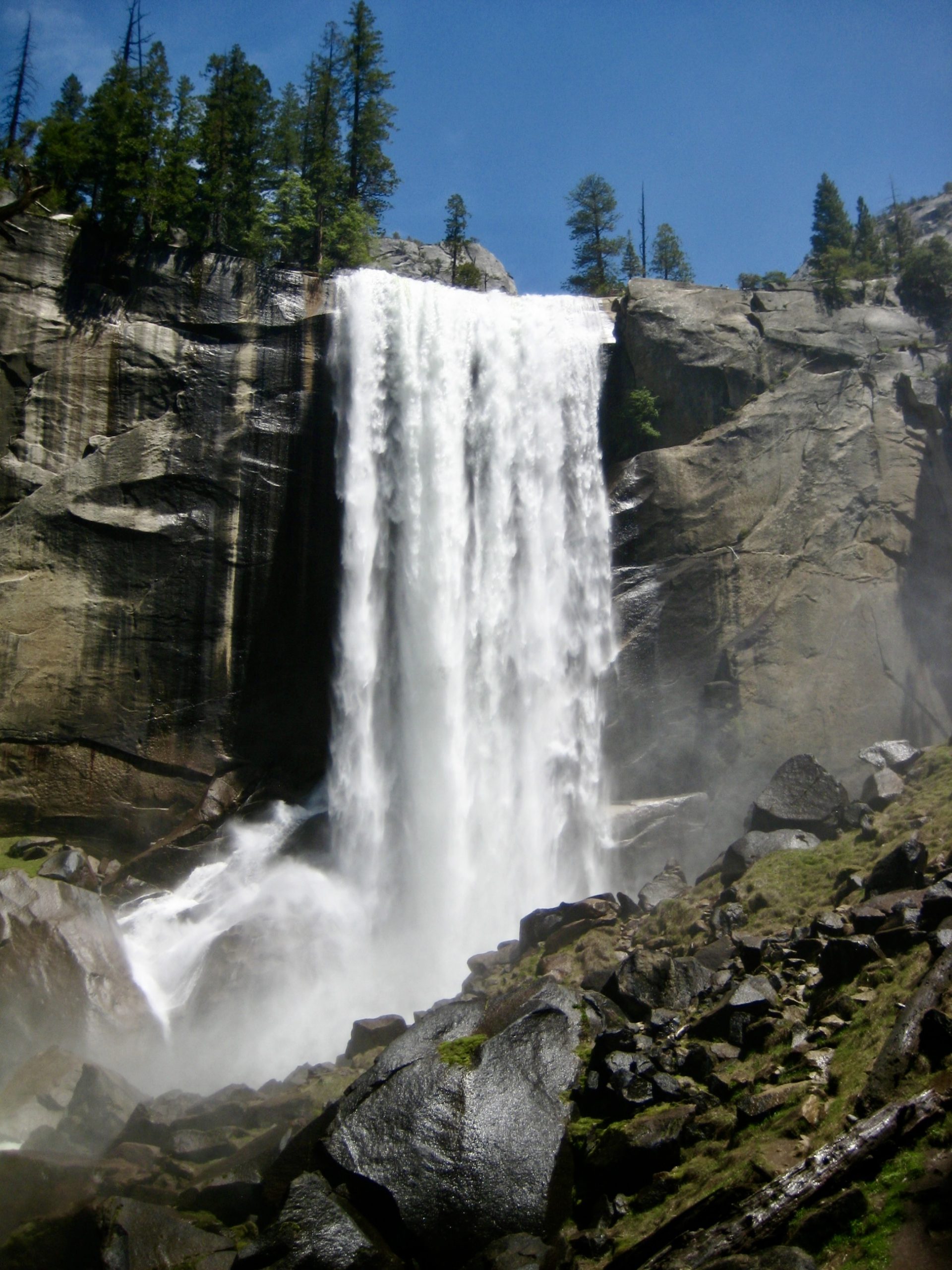
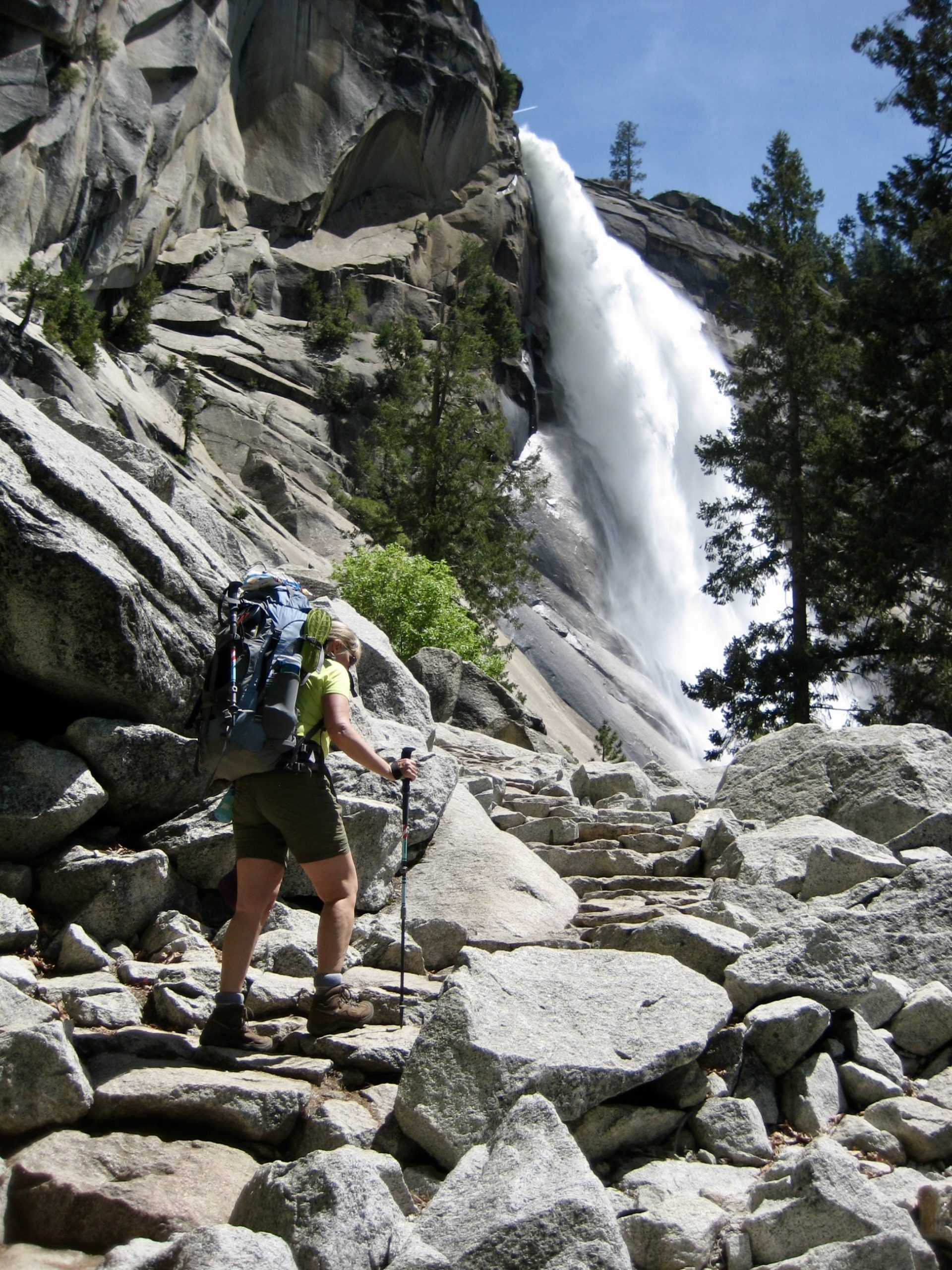
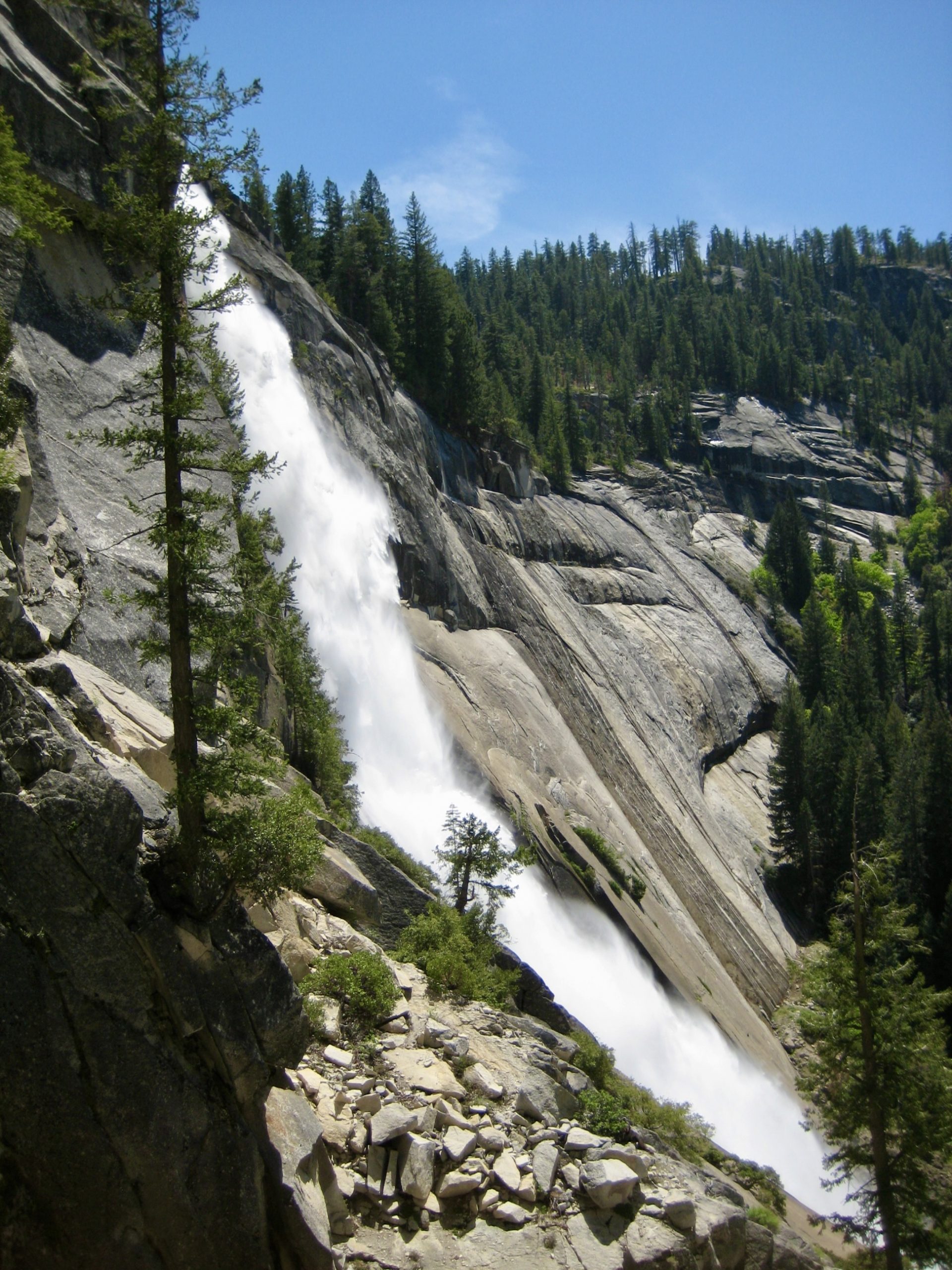
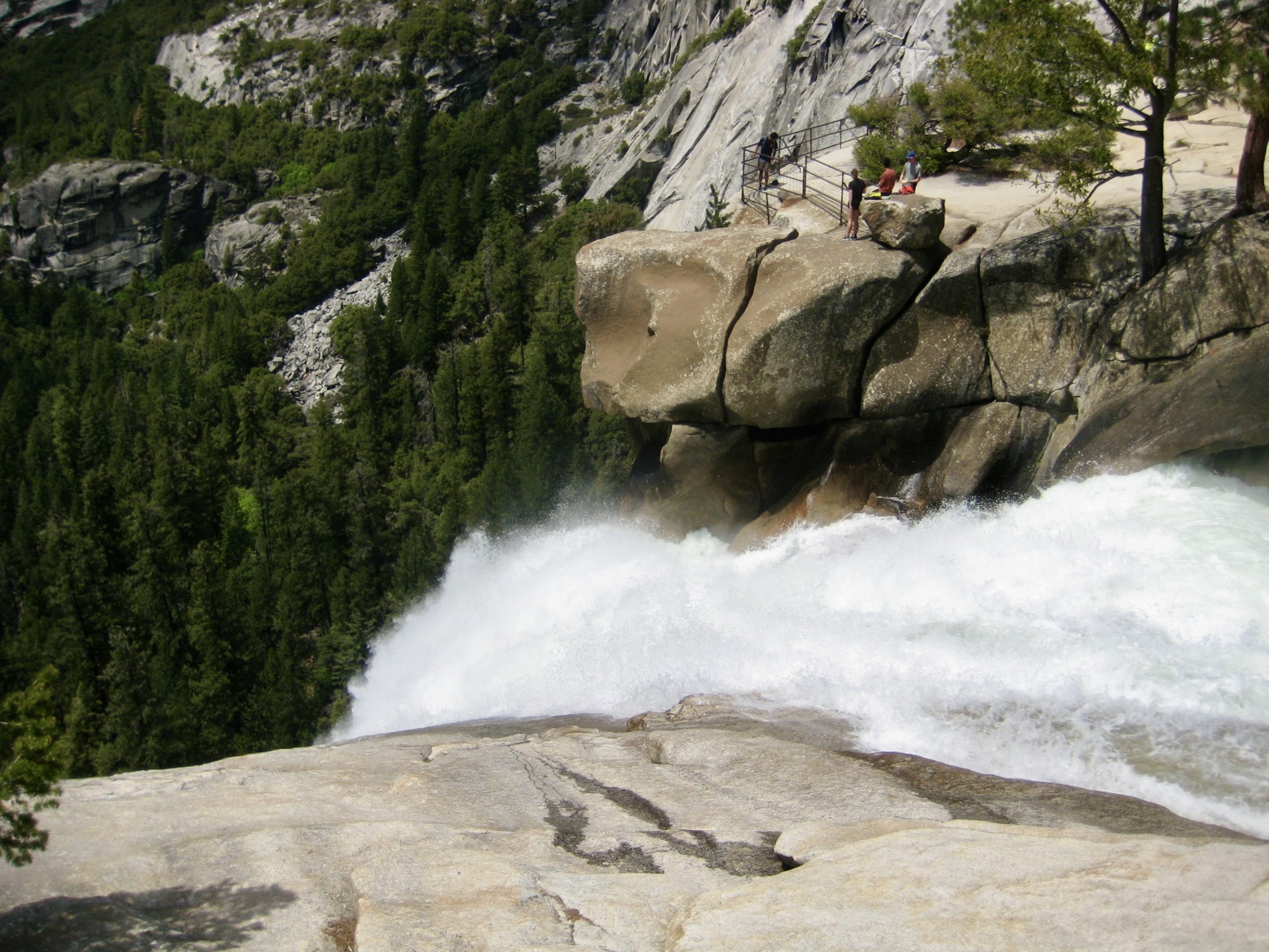
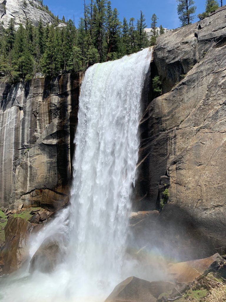
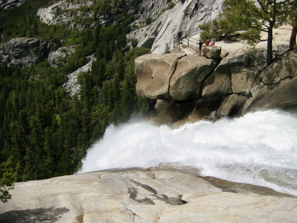
Gentle trail transitioned to steep trail and then to very steep stairways, all leading to the spectacular plunges of Vernal Fall and Nevada Fall. The Merced River was in full spate during this period of springtime runoff, and both waterfalls were absolutely gushing.

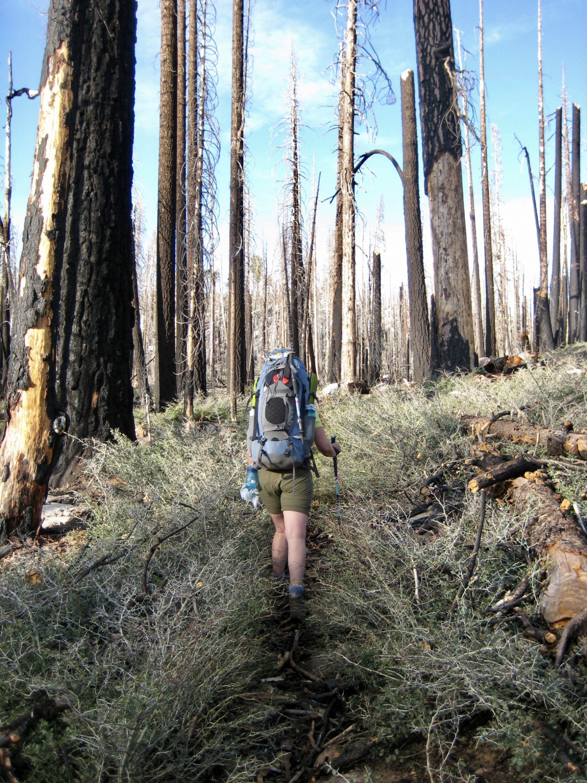
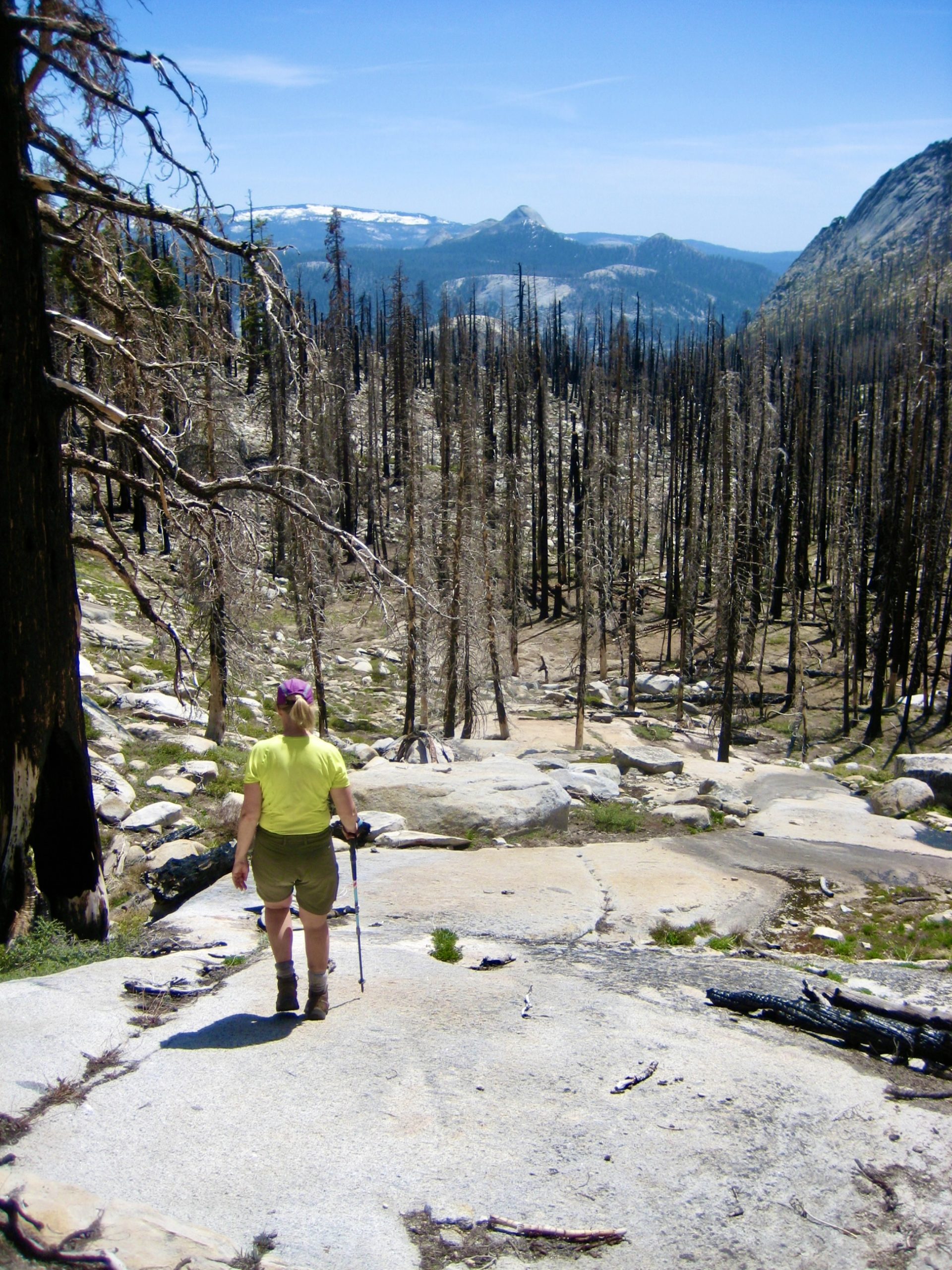
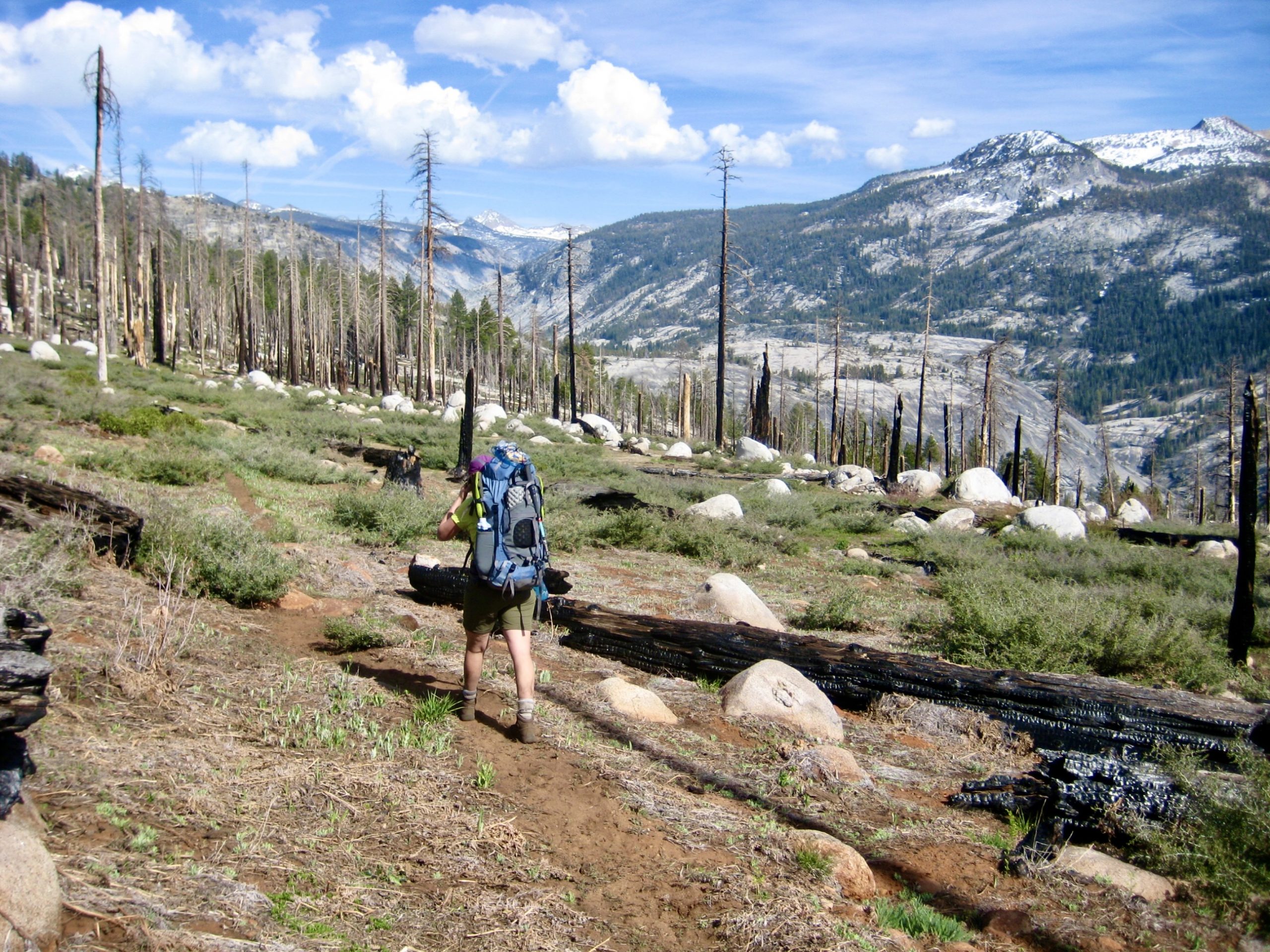
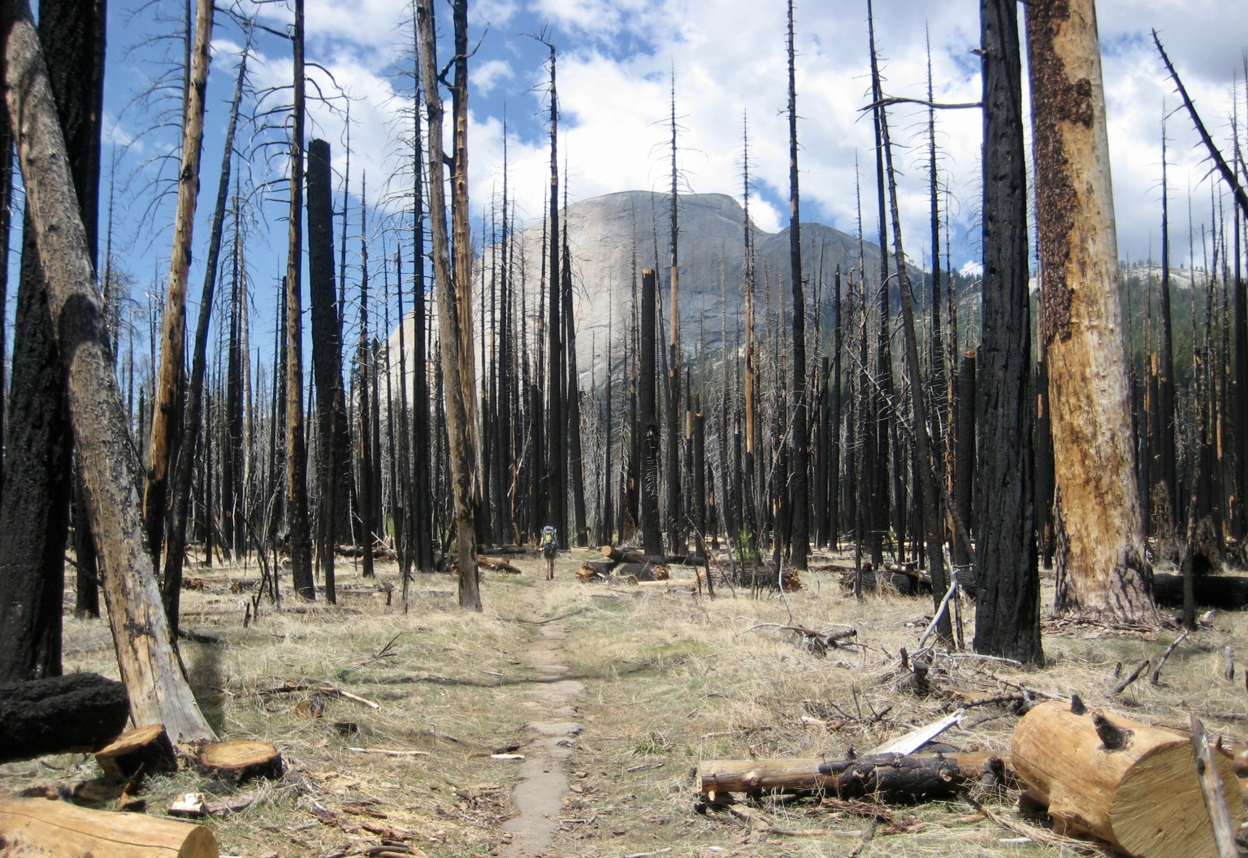
Upon reaching Nevada Junction at the top of Nevada Fall (3.3 hours + 2100 feet from parking lot), the trail abruptly flattened out and proceeded eastward into Little Yosemite Valley. We passed by Little Yosemite Valley Camp around mid-afternoon and turned uphill on the John Muir Trail (JMT), which soon entered a large area of burned forest—presumably resulting from the devastating 2018 wildfire.
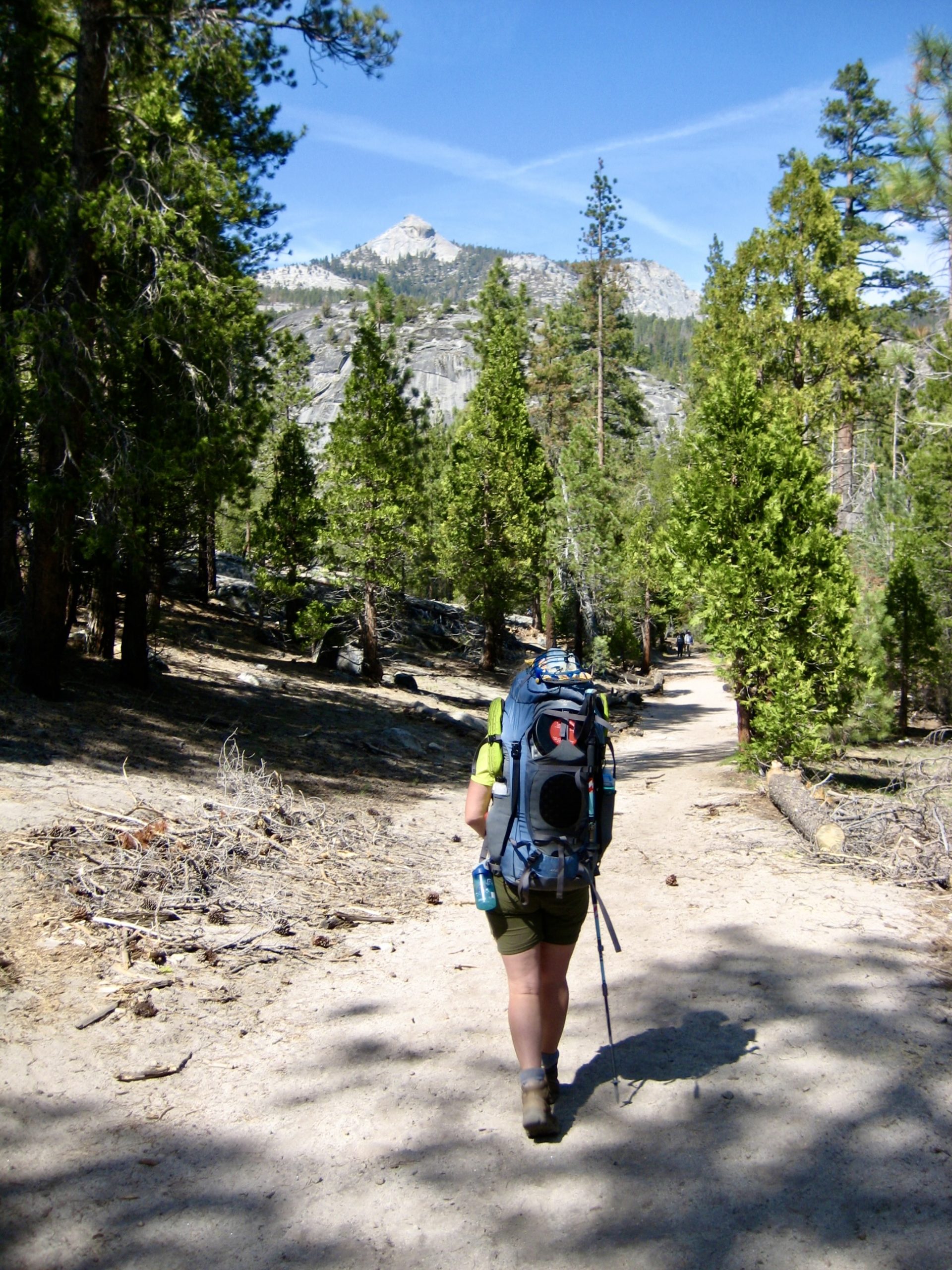
The JMT led us upward along Sunrise Creek, past the Half Dome Trail Junction. Considering that the Half Dome climbing cables had not yet been installed for the summer season (they were installed a couple days later), we were surprised to see many people coming down from Half Dome. Several climbers reported that the Cable Route is doable but much more difficult under these pre-season conditions. Having previously done it with the cables in place, we both thought “No thanks!”
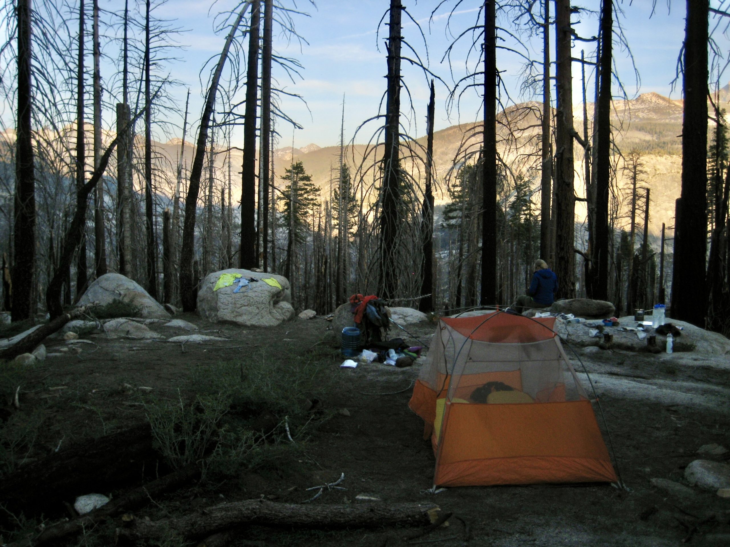
Eileen and I continued up Sunrise Creek until reaching a grassy flat at 7800 feet (7.4 hours + 7.5 miles + 4300 feet from parking lot). We pitched our tent on a sandy bench with a view of Quartzite Peak across Merced Canyon. Despite being in the middle of a charred forest, our camp was comfortable and functional.

Day 2: Sunrise Creek Flats to Merced Lake + Clouds Rest Sidetrip
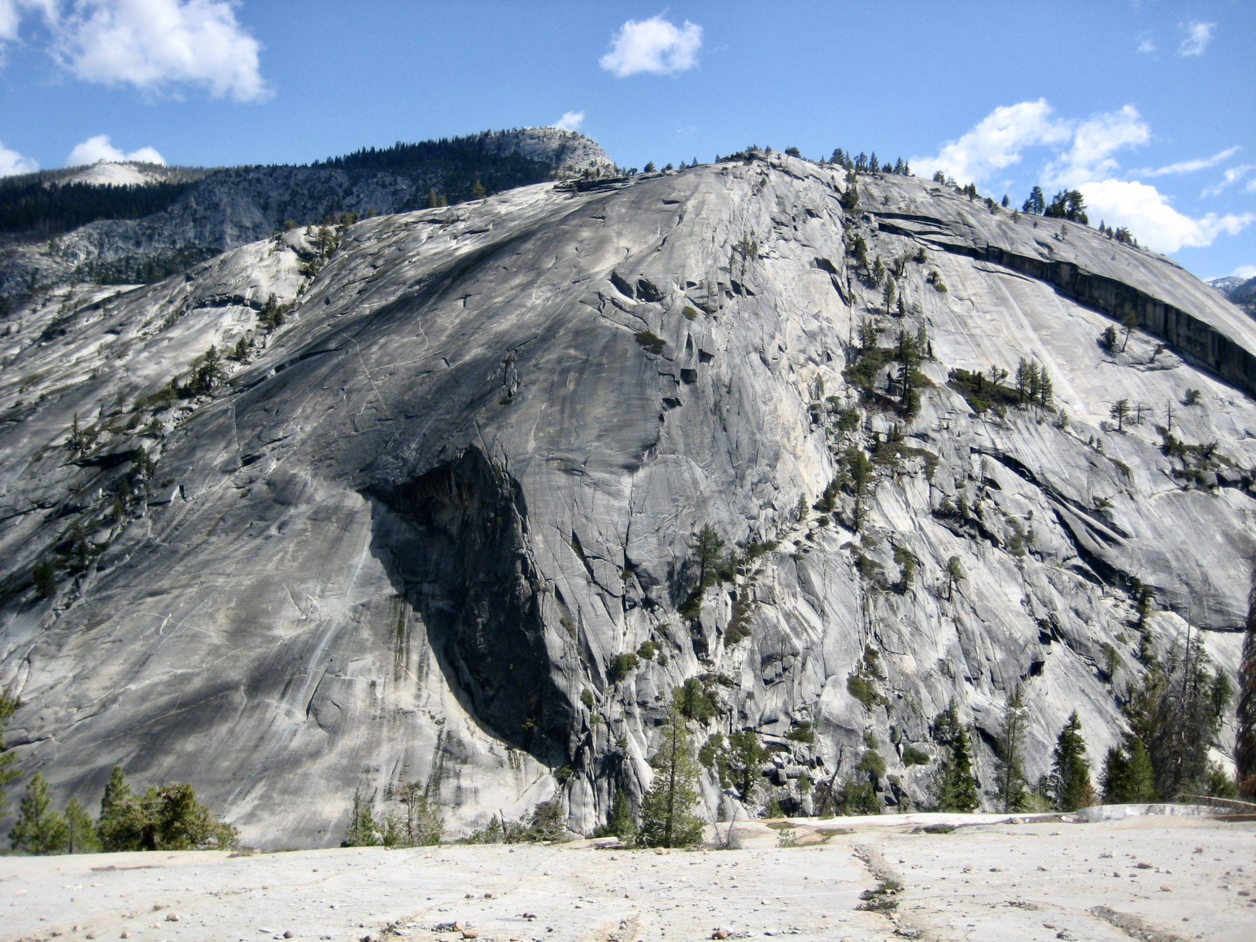
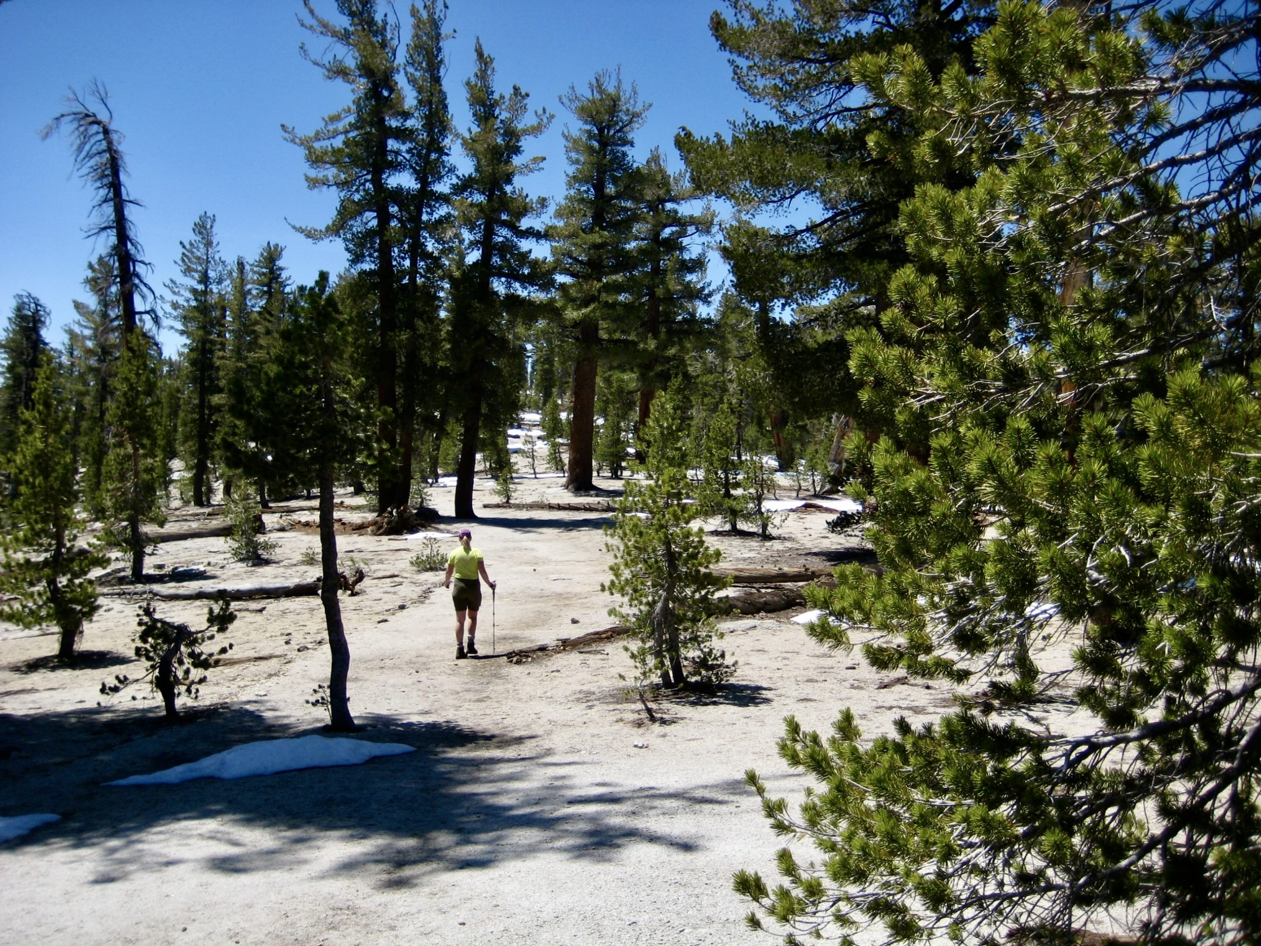
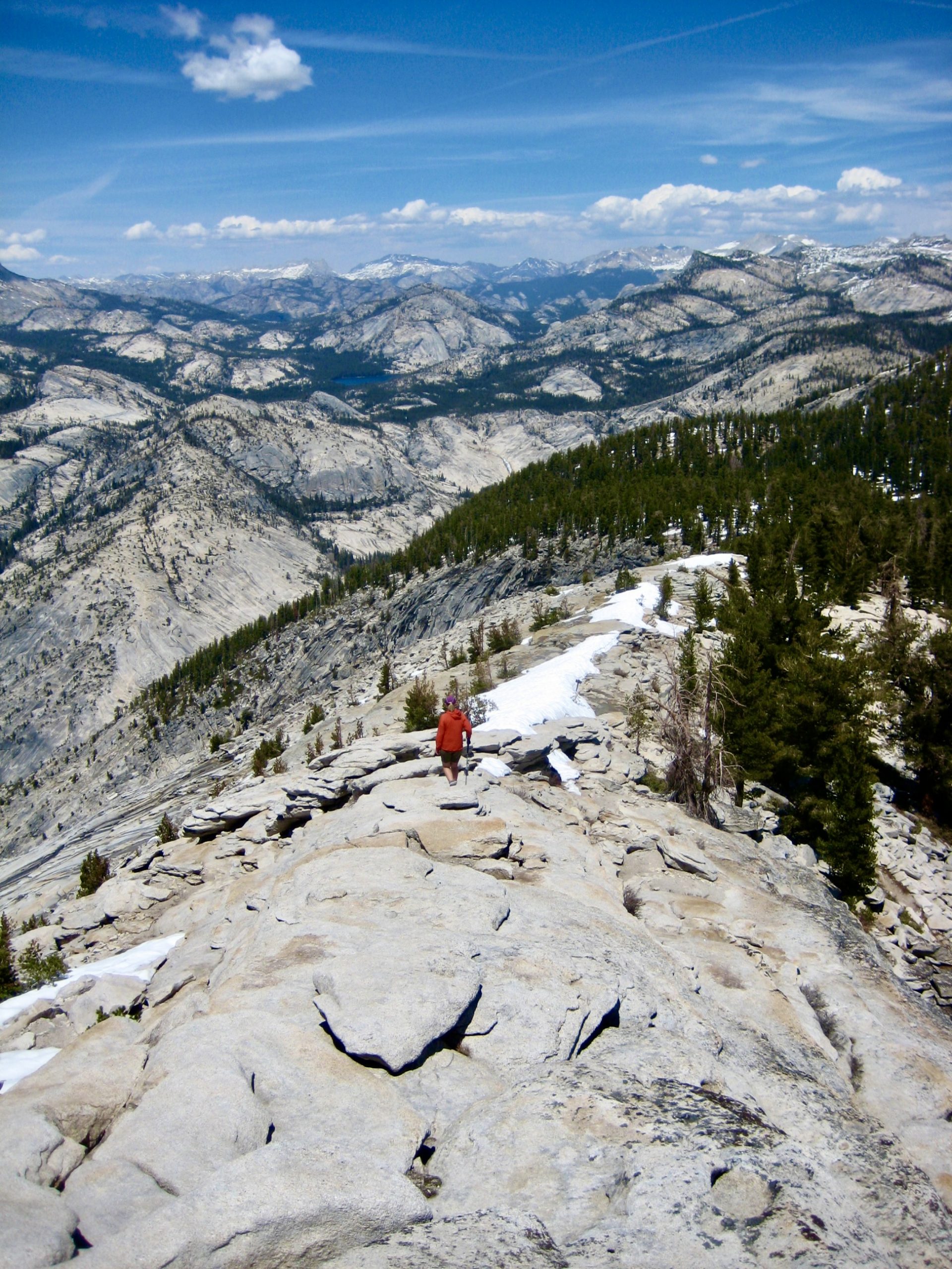
We awoke to another warm, sunny morning and were back on the trail at 9:00am. In a short ½ mile, we arrived at Sunrise Junction, where two other trails branch off the JMT in the shape of a trident. After stashing backpacks here, Eileen and I headed up the left-hand (northernmost) branch toward Clouds Rest—one of the most popular summits in Yosemite. Our trail took us to a broad saddle between Sunrise Mountain and Clouds Rest, then back along the northeast ridge of the latter peak.
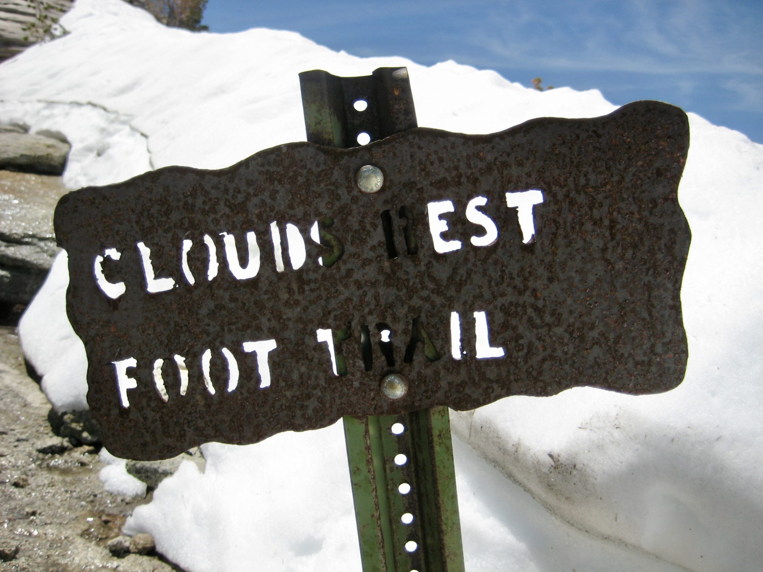
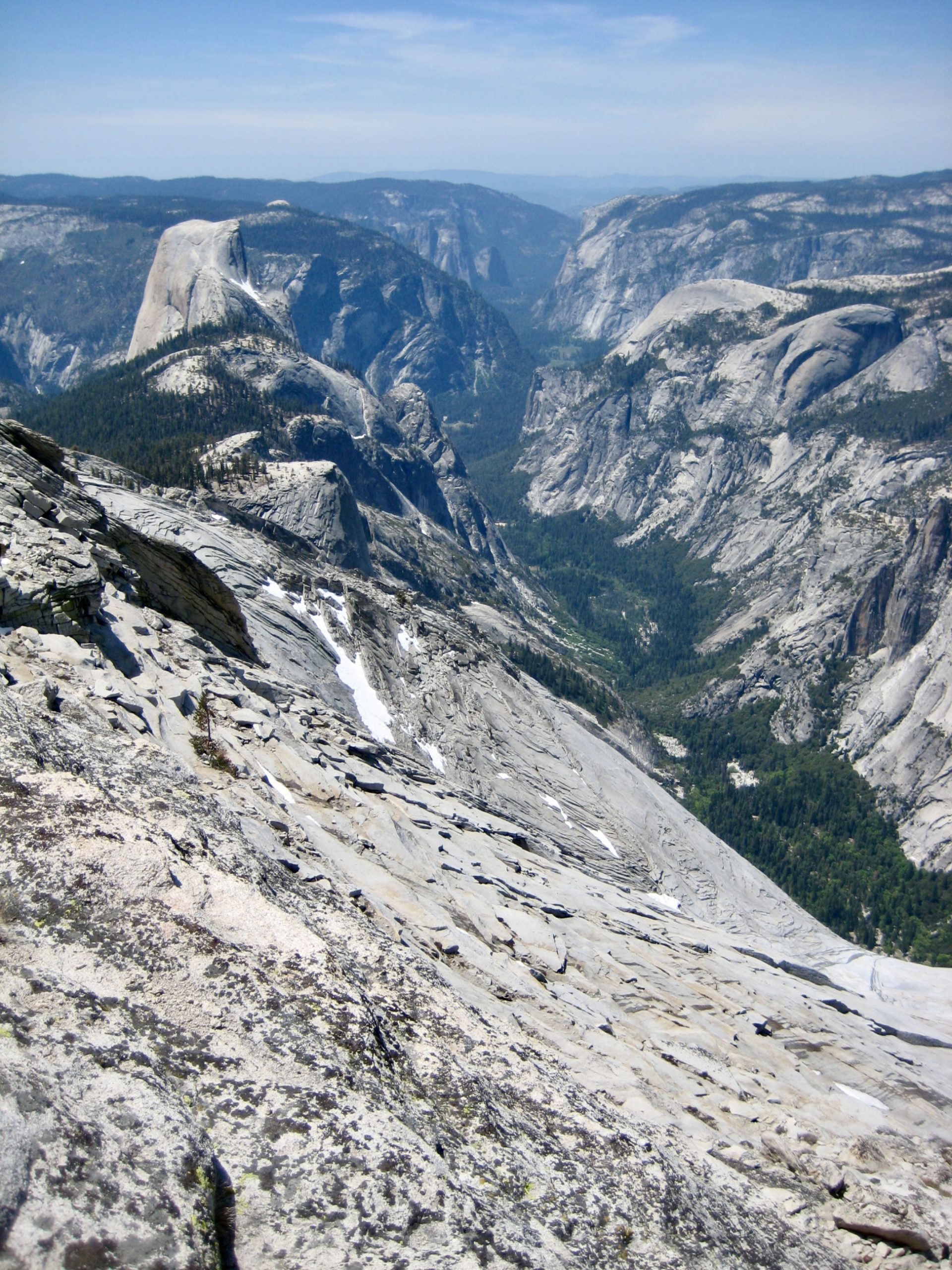
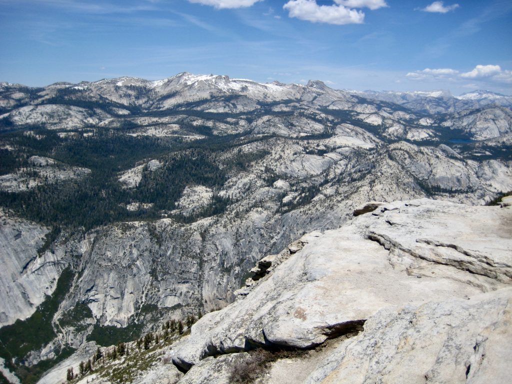
High on the ridge, our route transitioned to a delightful Class 1-2 scramble on a grippy granite sidewalk. We gained the roomy summit in early afternoon (3.6 hours + 2200 feet from Camp 1), along with a dozen other scramblers who had come up the more-direct southwest ridge.

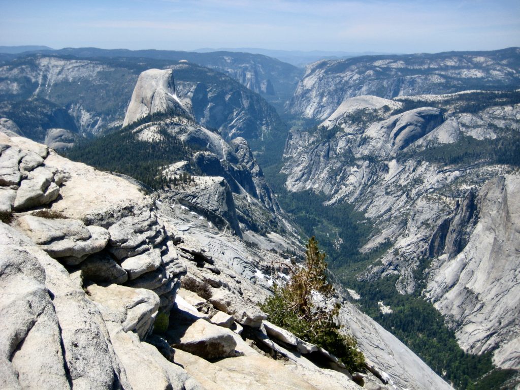
It immediately became obvious why Clouds Rest is such a popular summit: This centrally located peak is an outstanding viewpoint for the entirety of Yosemite National Park. We spent nearly an hour trying to identify the many surrounding mountains, although with only limited success.

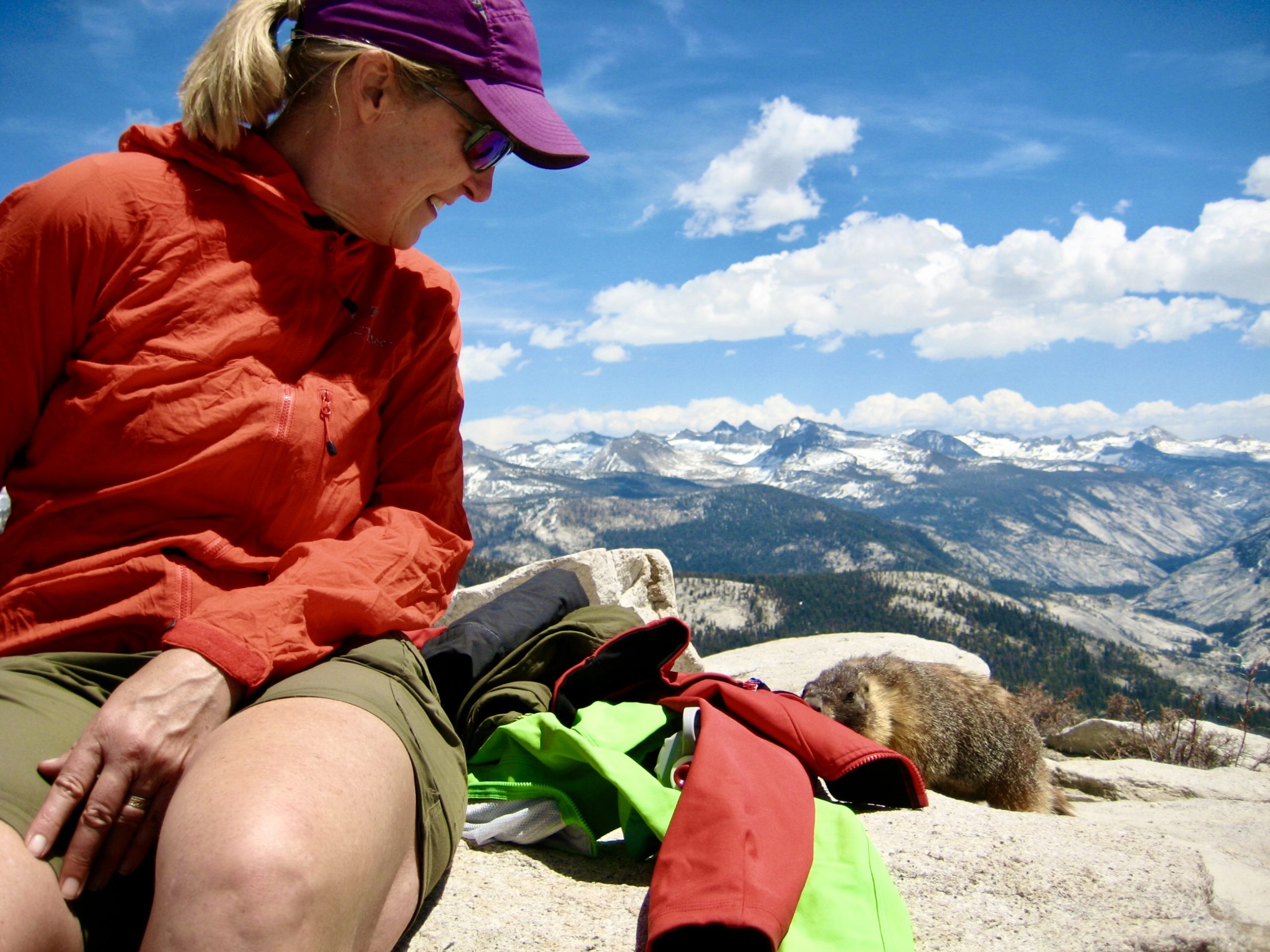
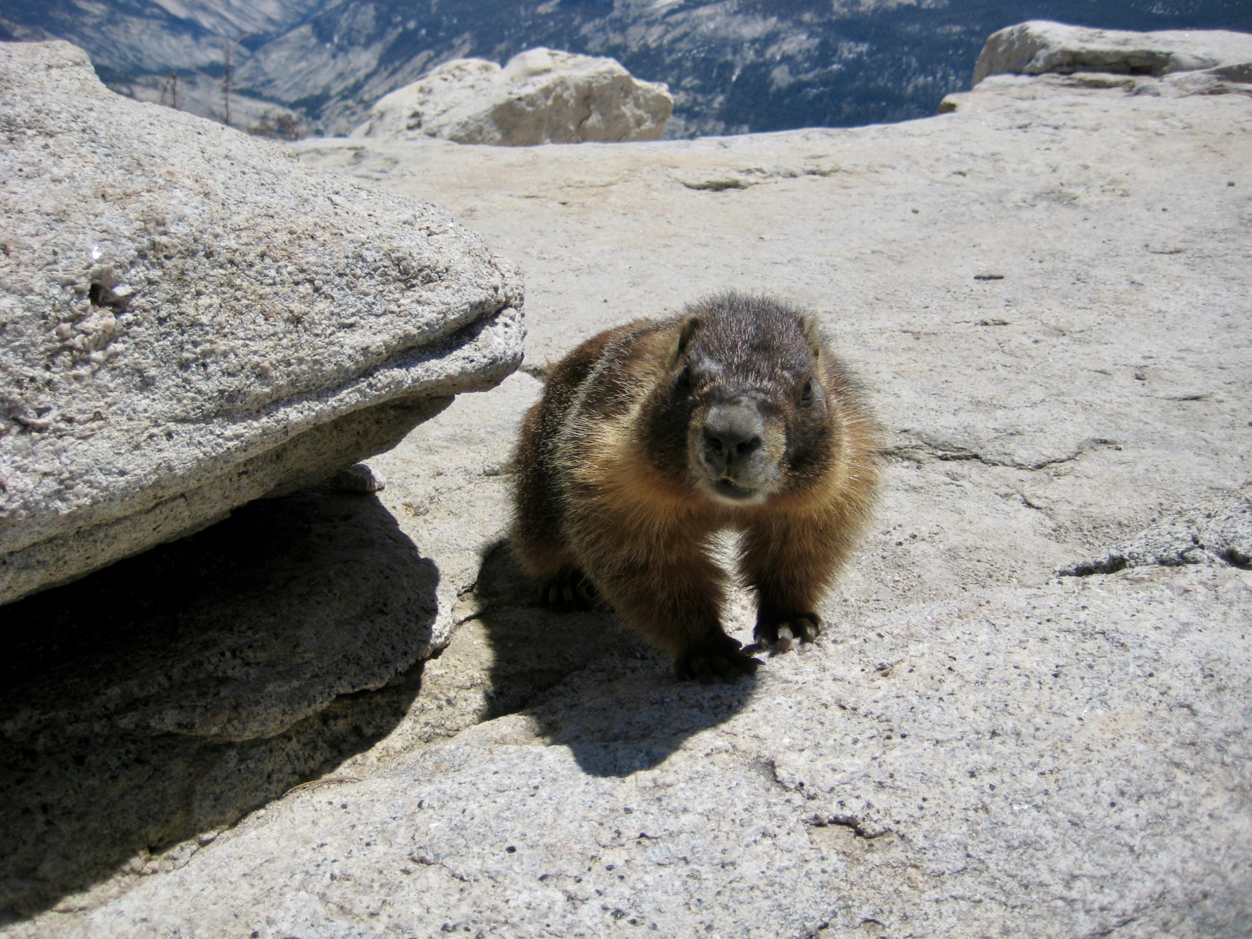
As a testament to the regular parade of summit visitors, a brazen marmot scurried around the summit, trying to steal food from unattended rucksacks. According to some of the other scramblers, this little thief is named “Steve,” and he has a criminal RAP sheet as long as his fuzzy nose.
Upon departing, we retraced our up-route down to the broad saddle and then descended directly through open forest to intersect the approach trail. We were back to our packs at Sunrise Junction by mid-afternoon (1.9 hours from summit).
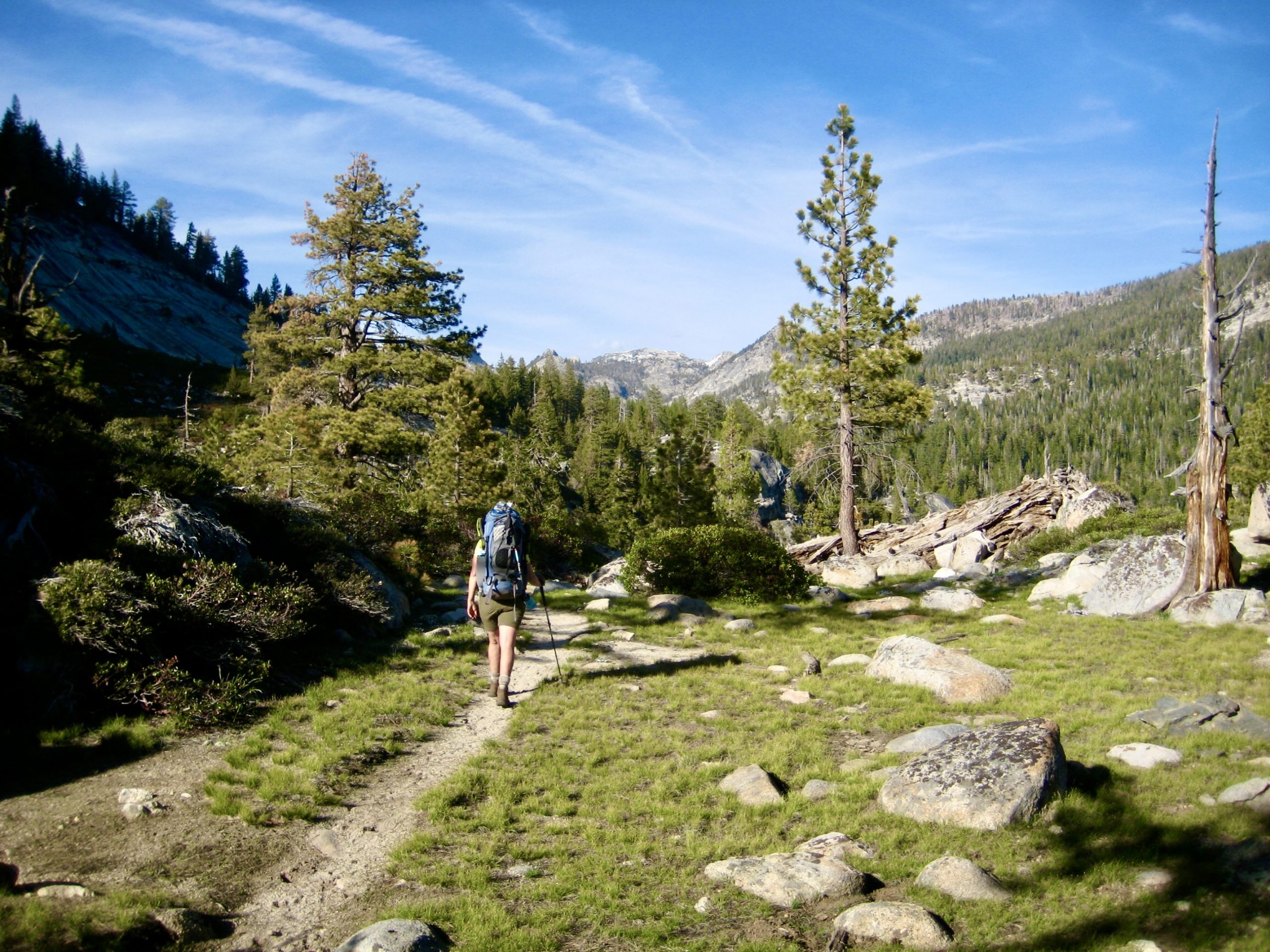
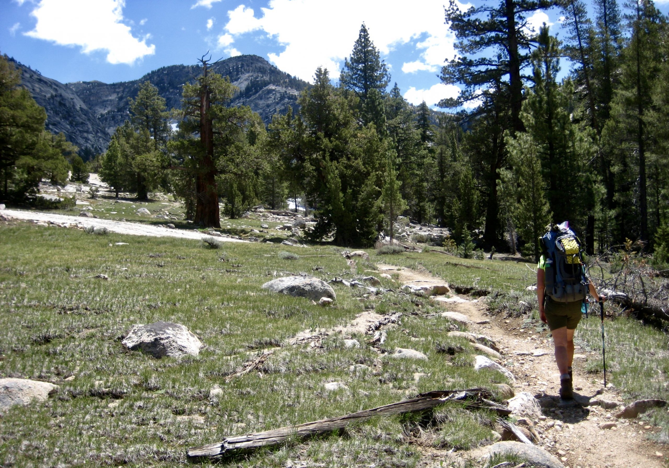
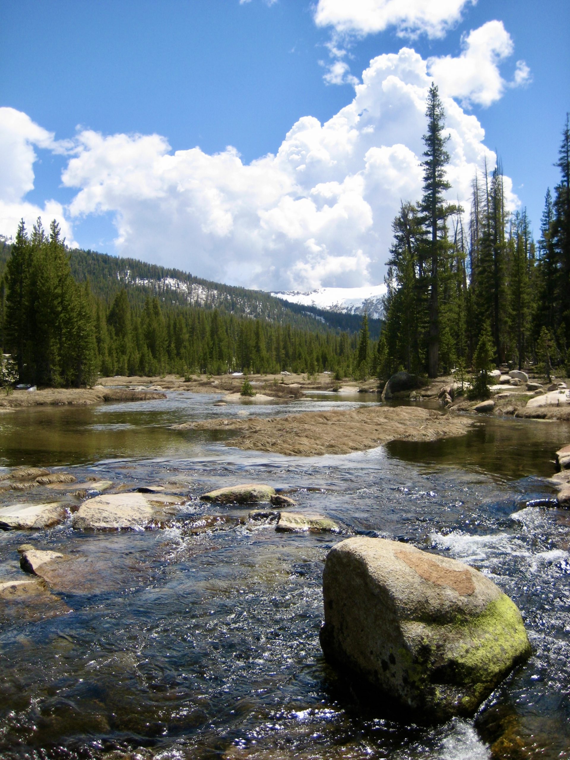
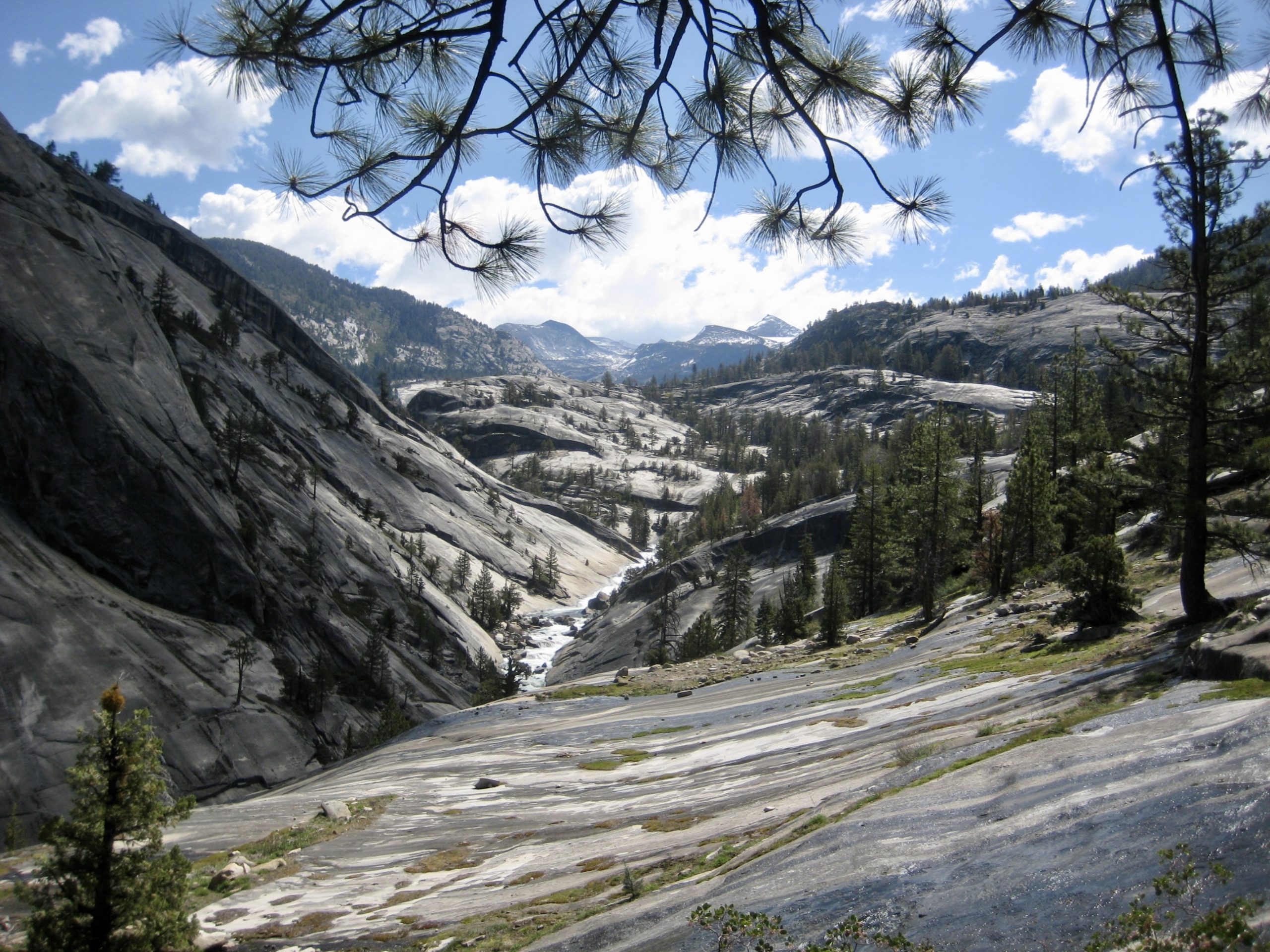
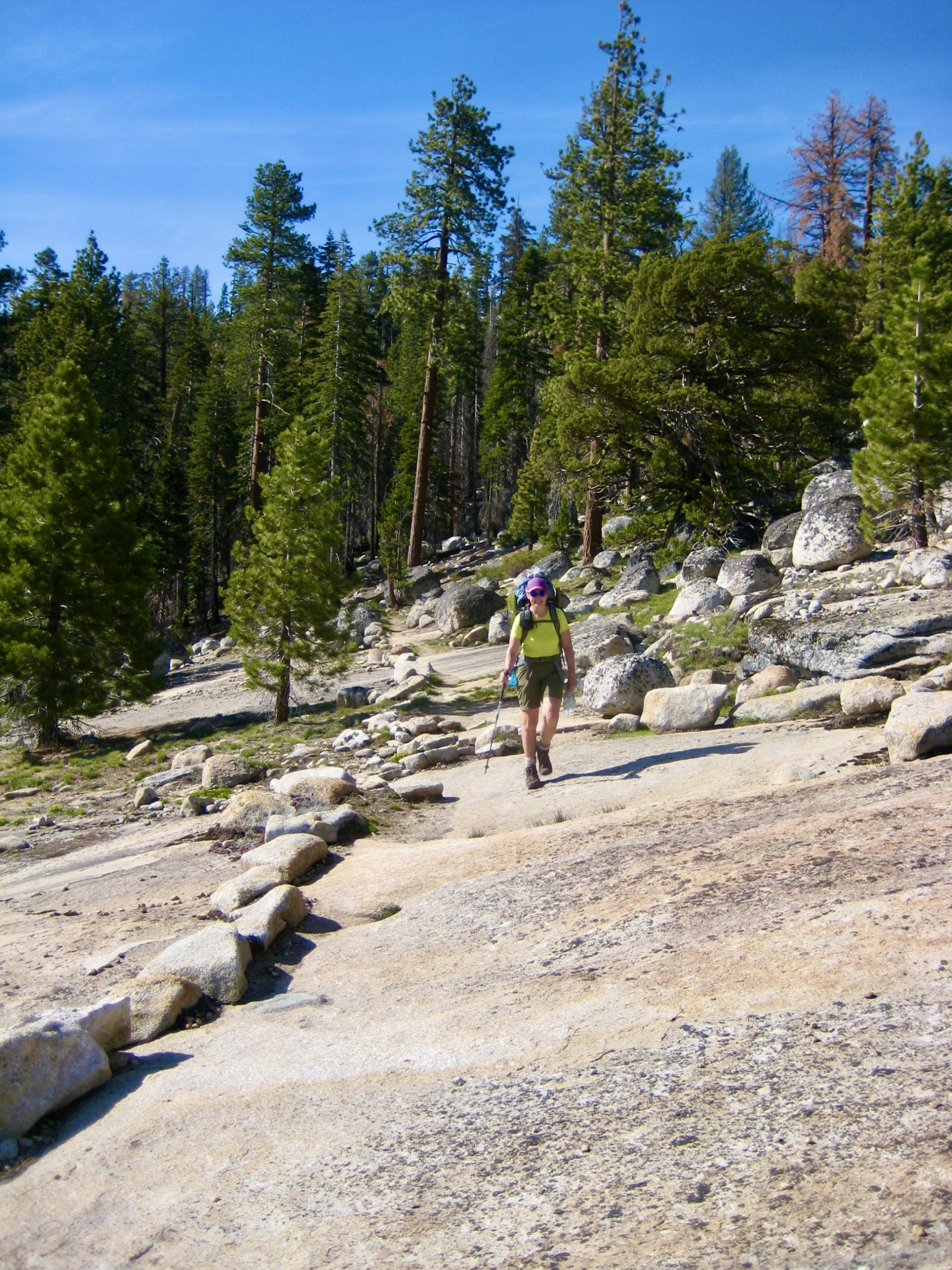
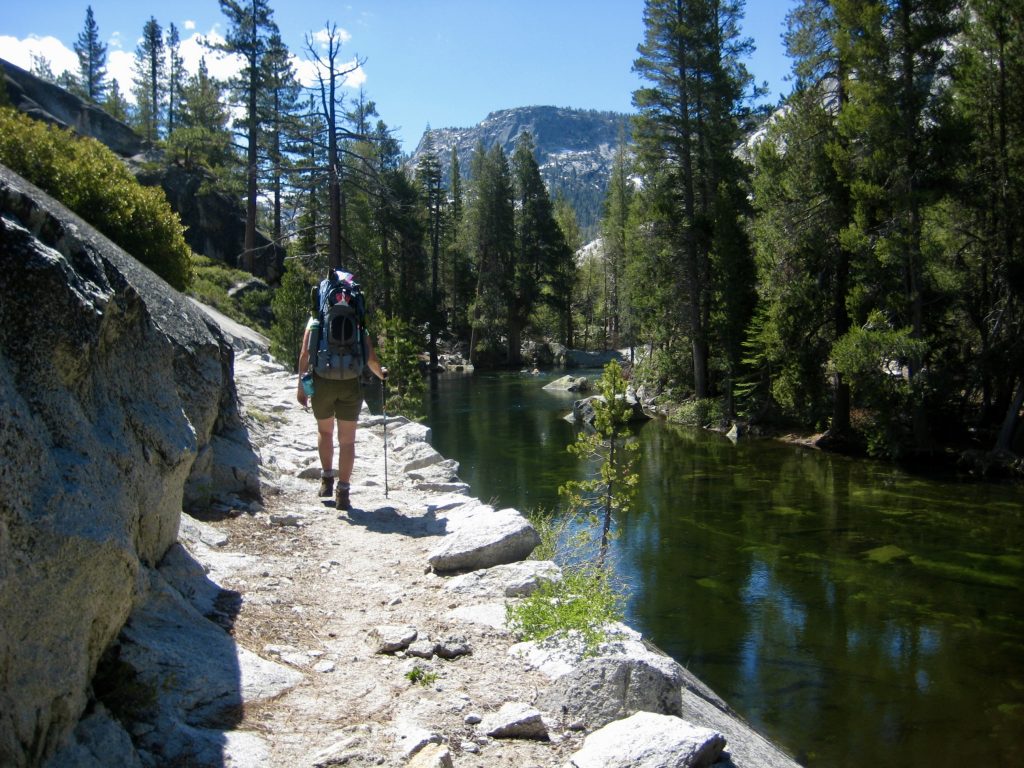
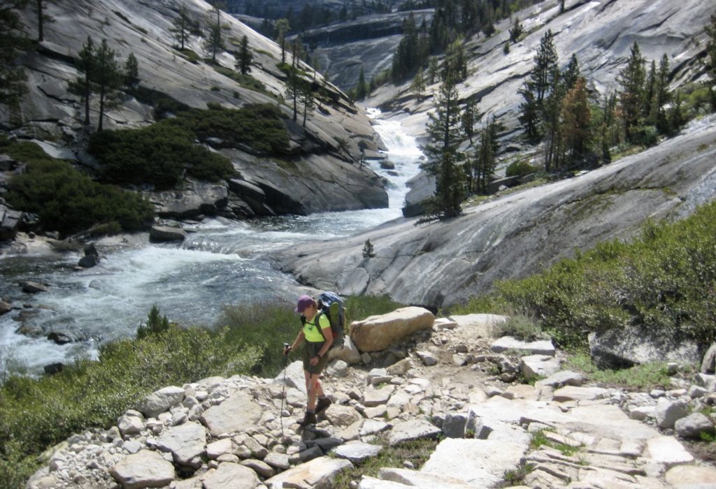
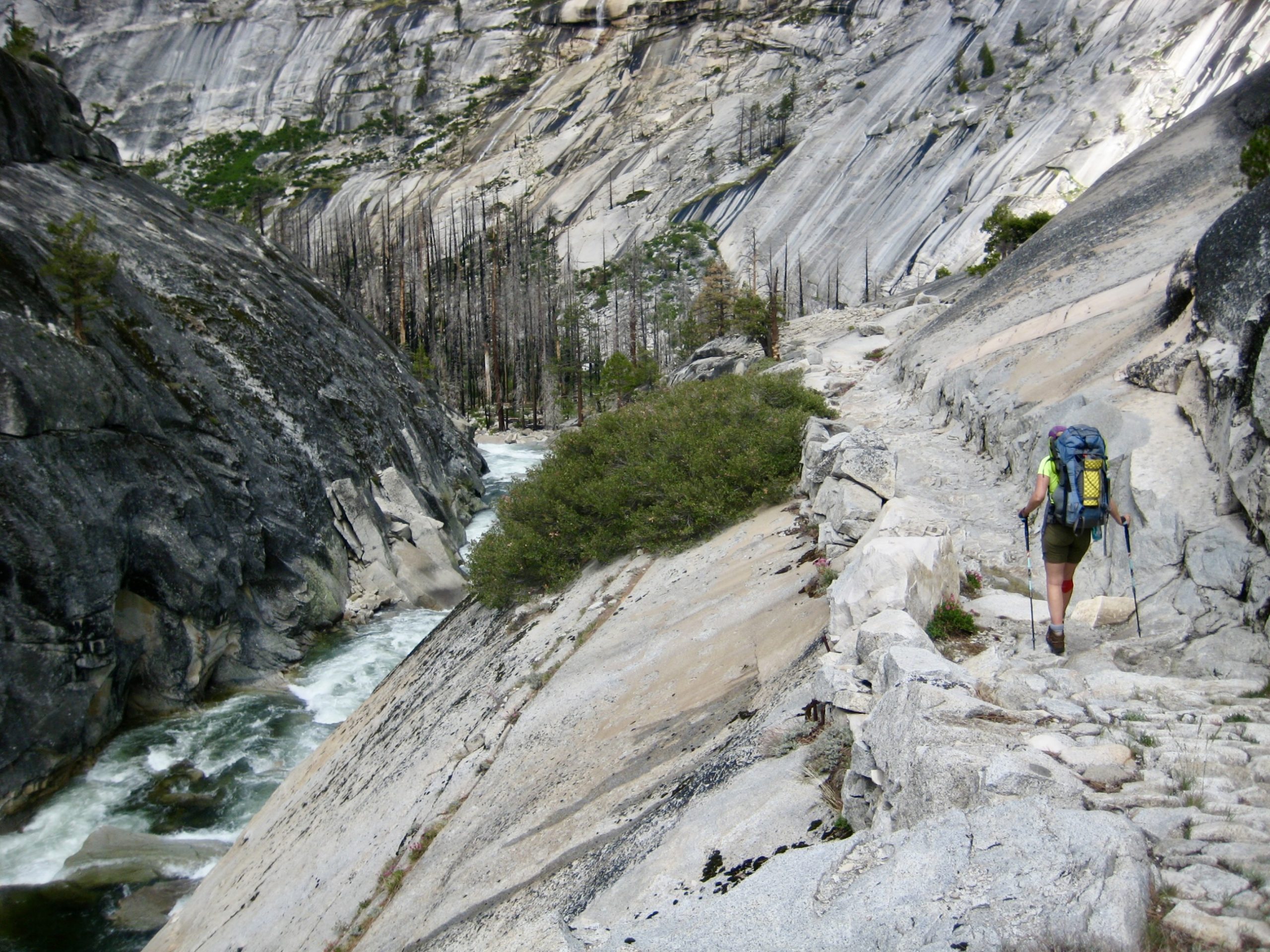
From Sunrise Junction, we shouldered our packs and struck off along the right-hand (southernmost) branch trail, which contours the hillside high above Merced Canyon. This high trail took us on a splendid tour of Sequoia forests and granite slabs, with down-canyon views, before dropping to Echo Creek Junction in Echo Valley.
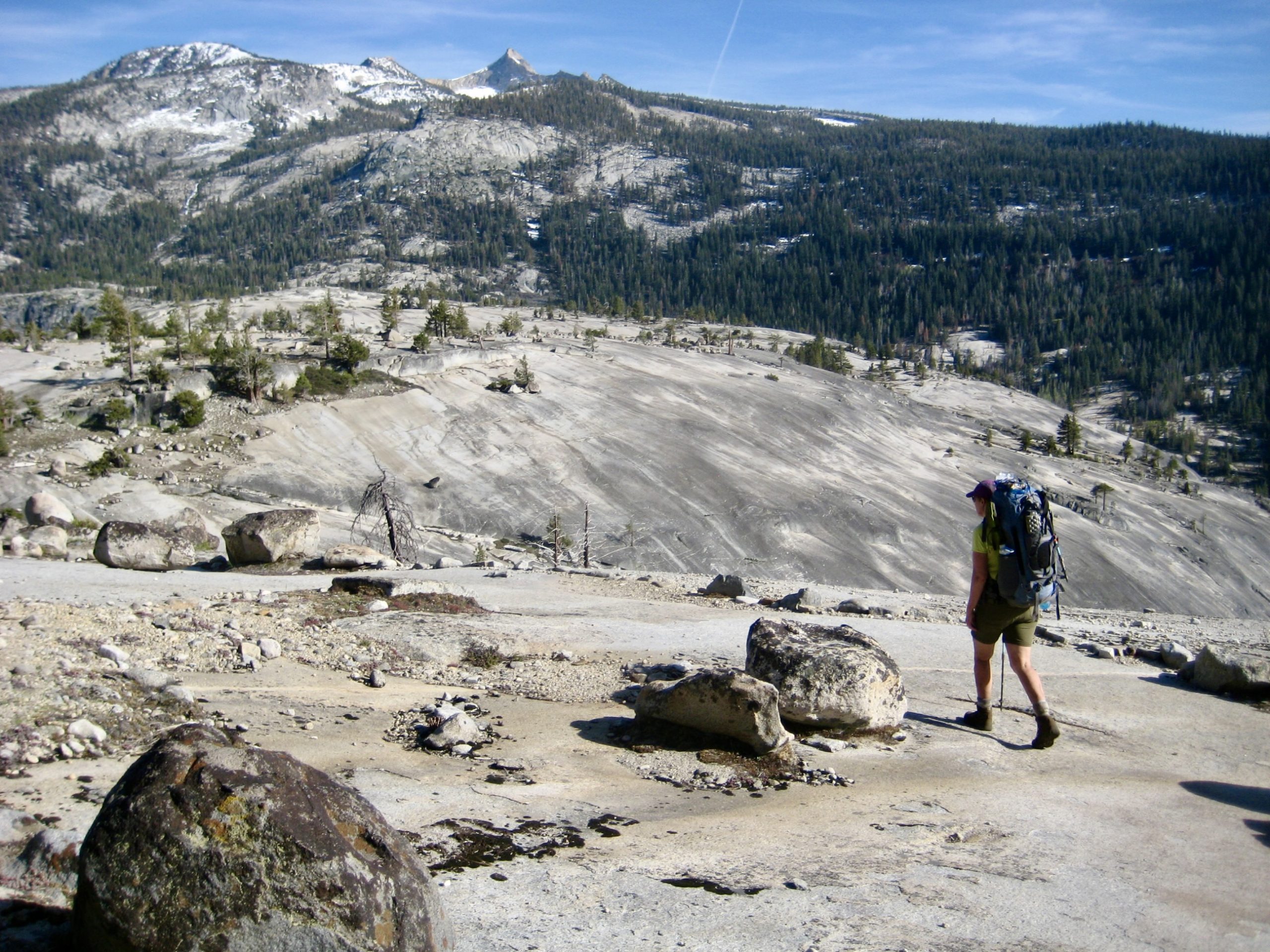

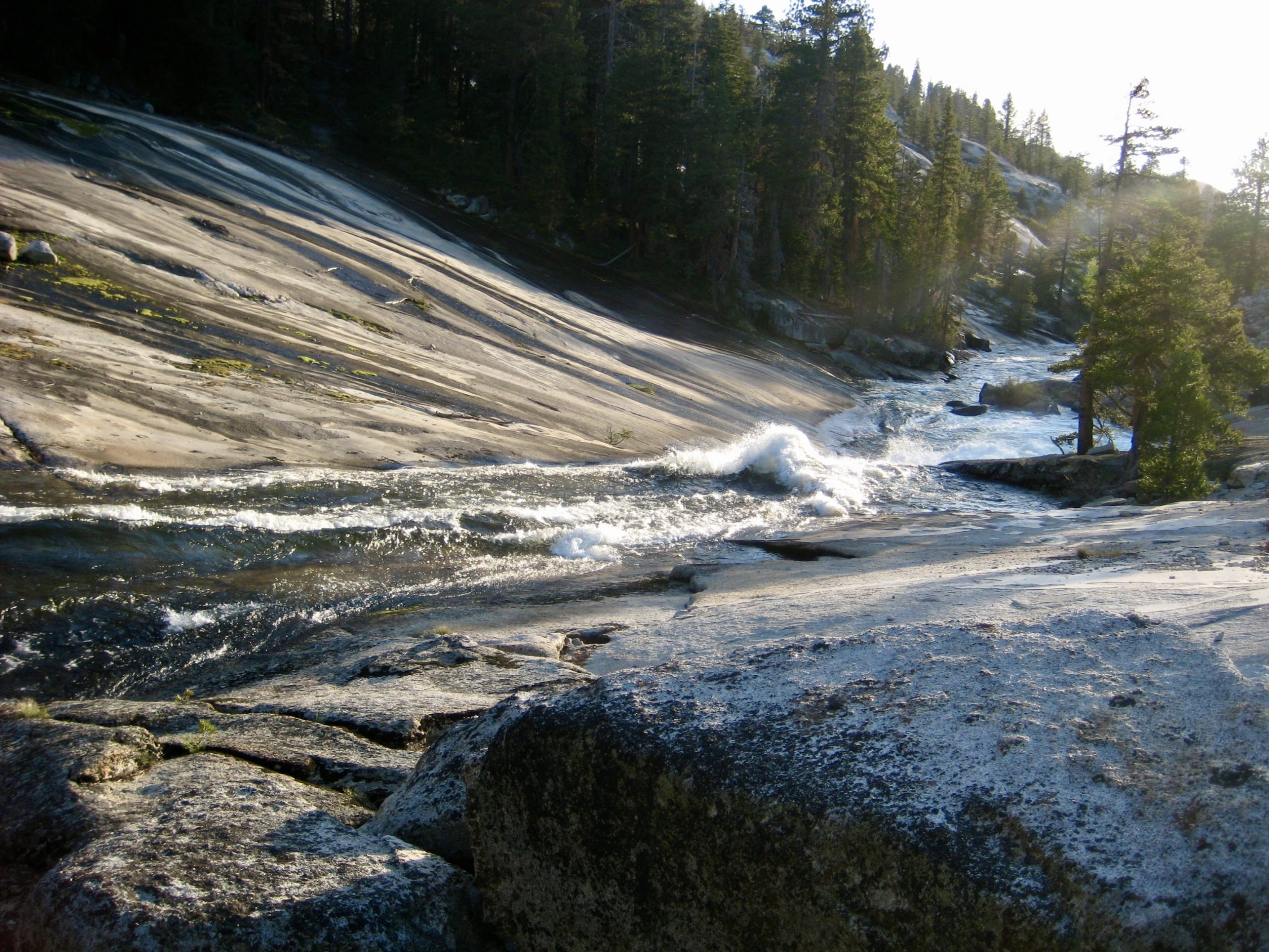
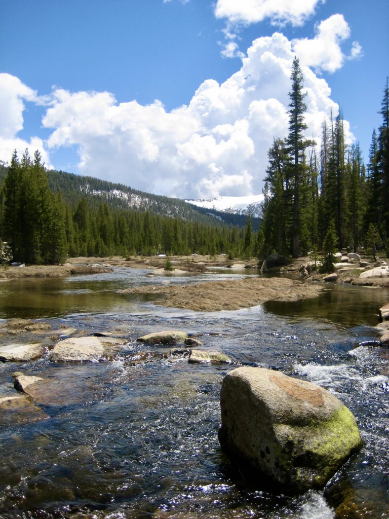
A final mile of trail led us alongside the fast-flowing Merced River as it sluiced down a long granite trough en-route to Merced Canyon. On a hotter day, it would have been tempting to take a ride down this giant “slip & slide.”
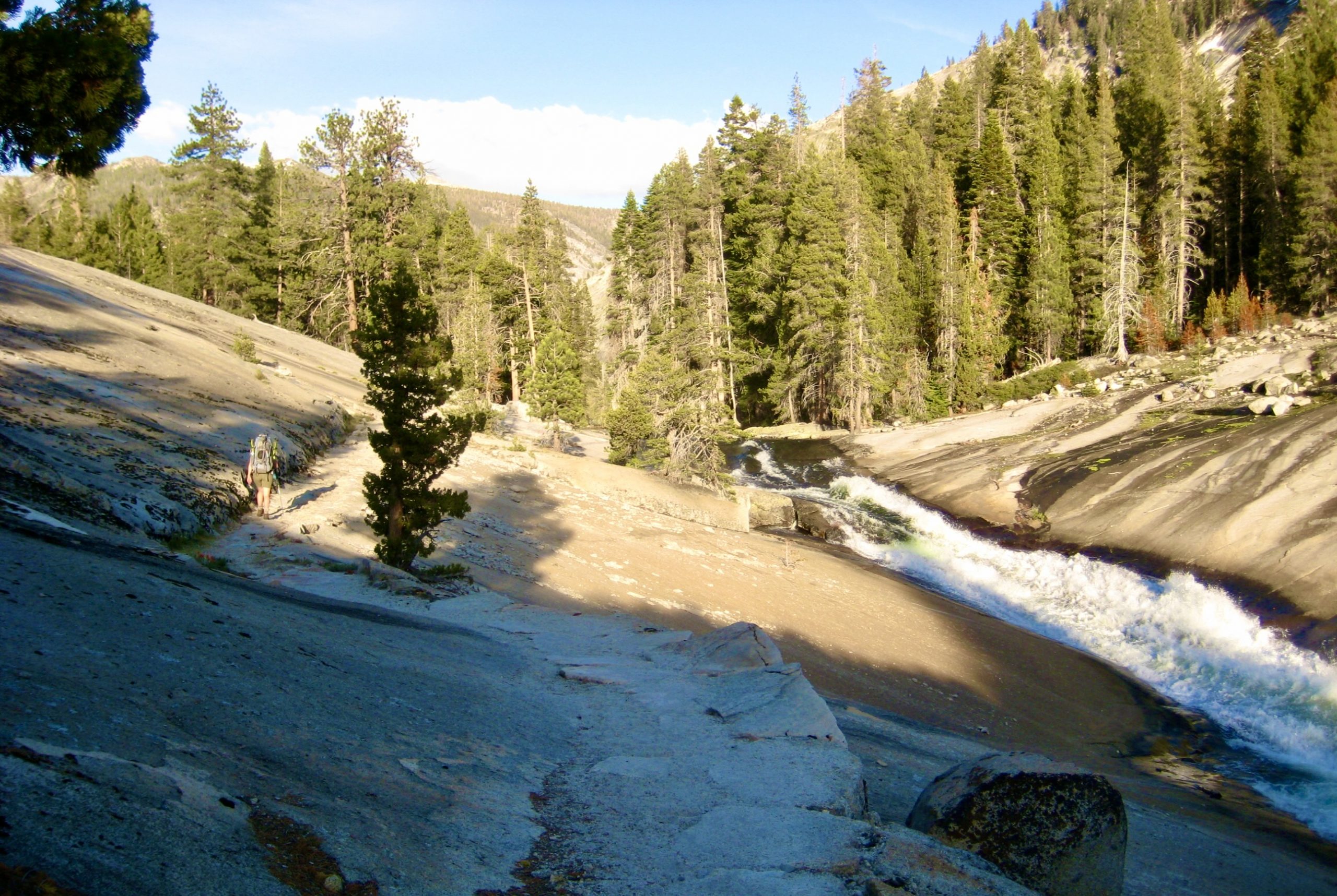
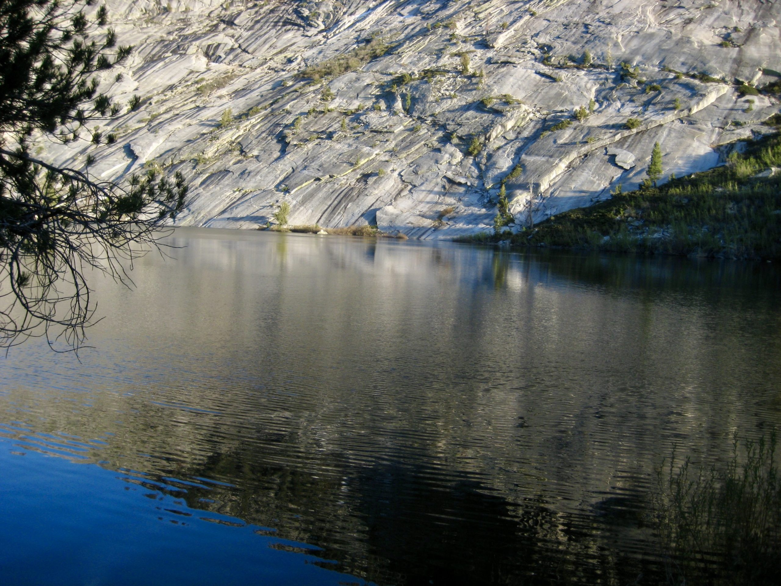
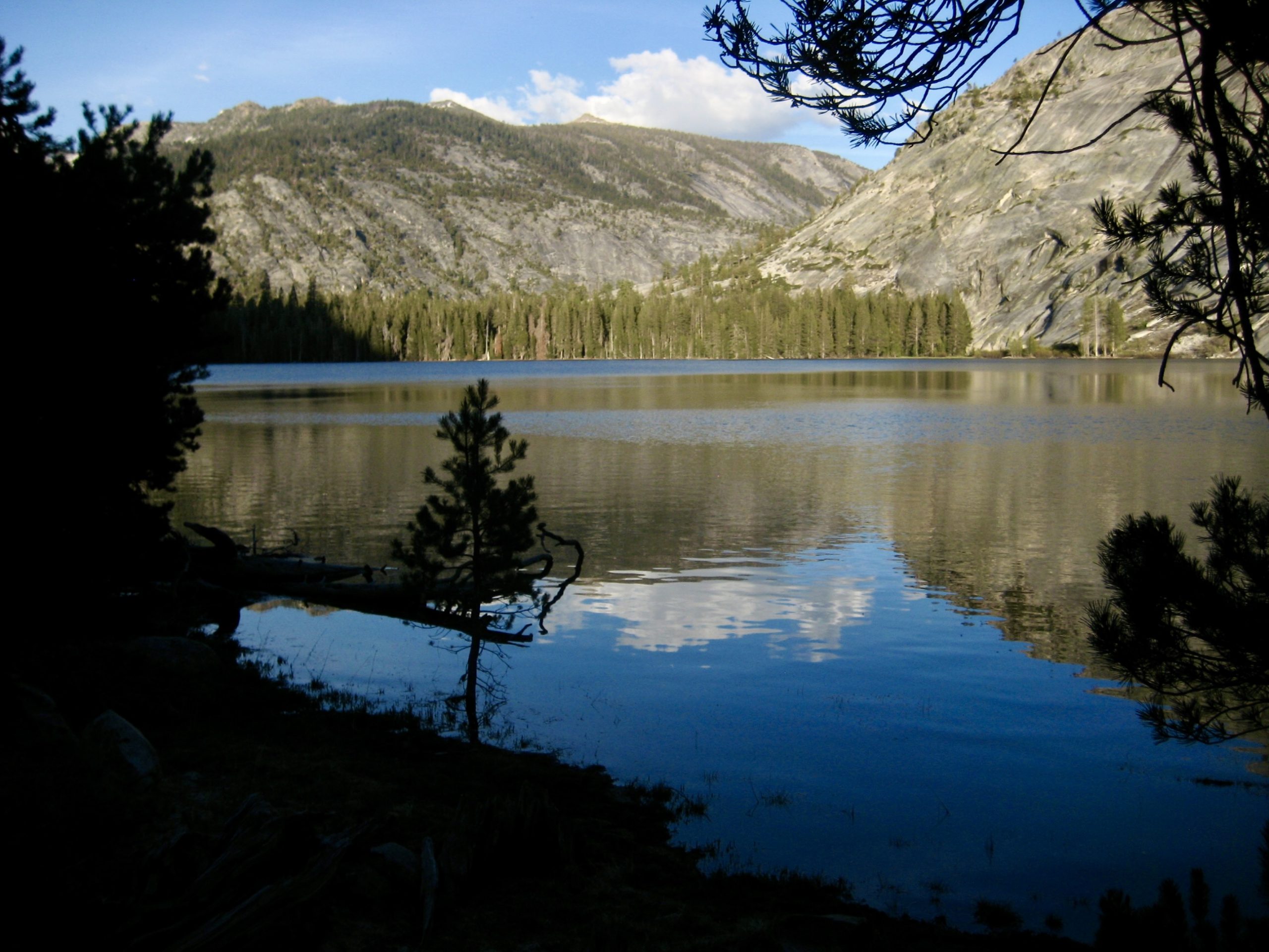
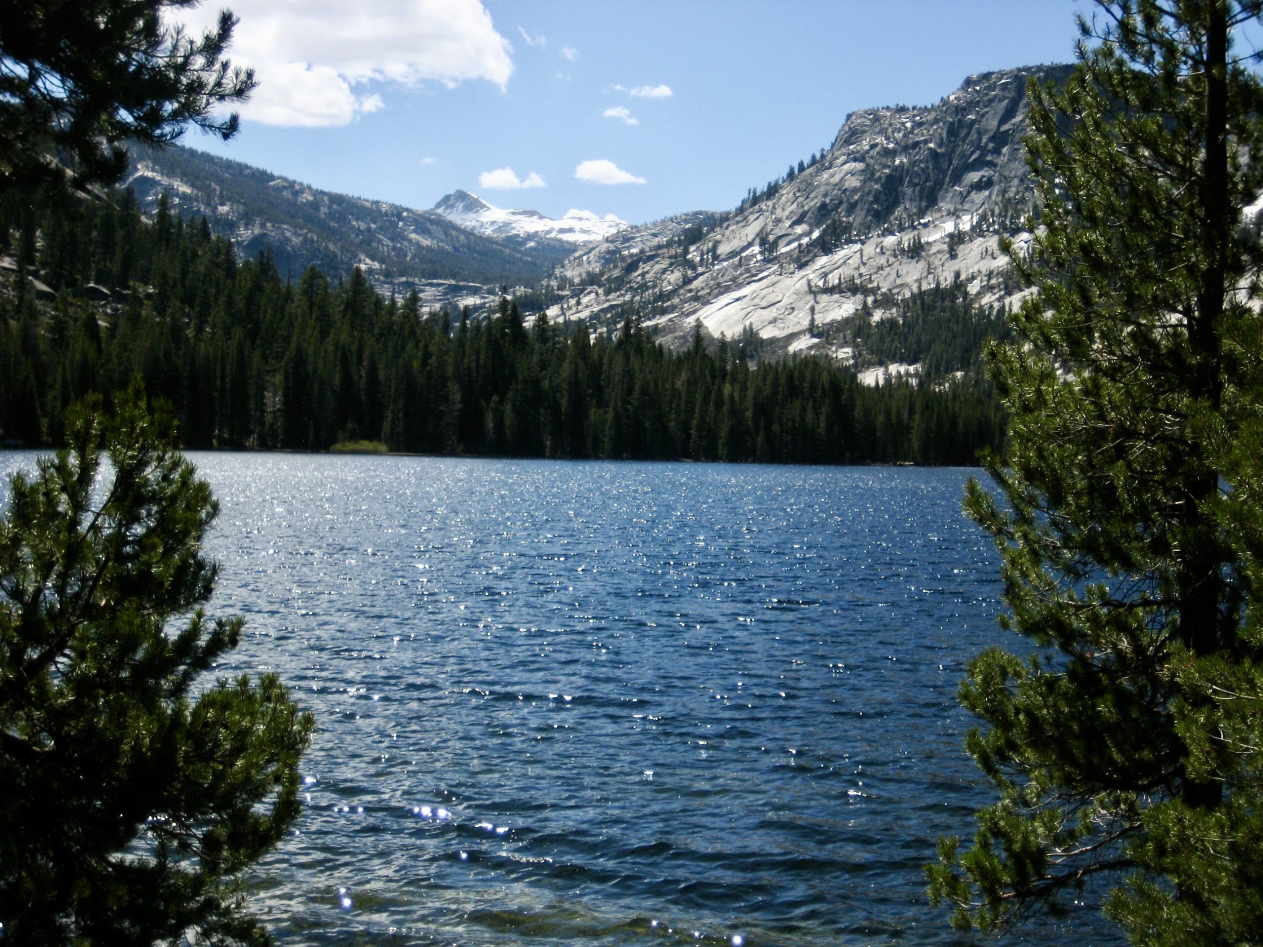
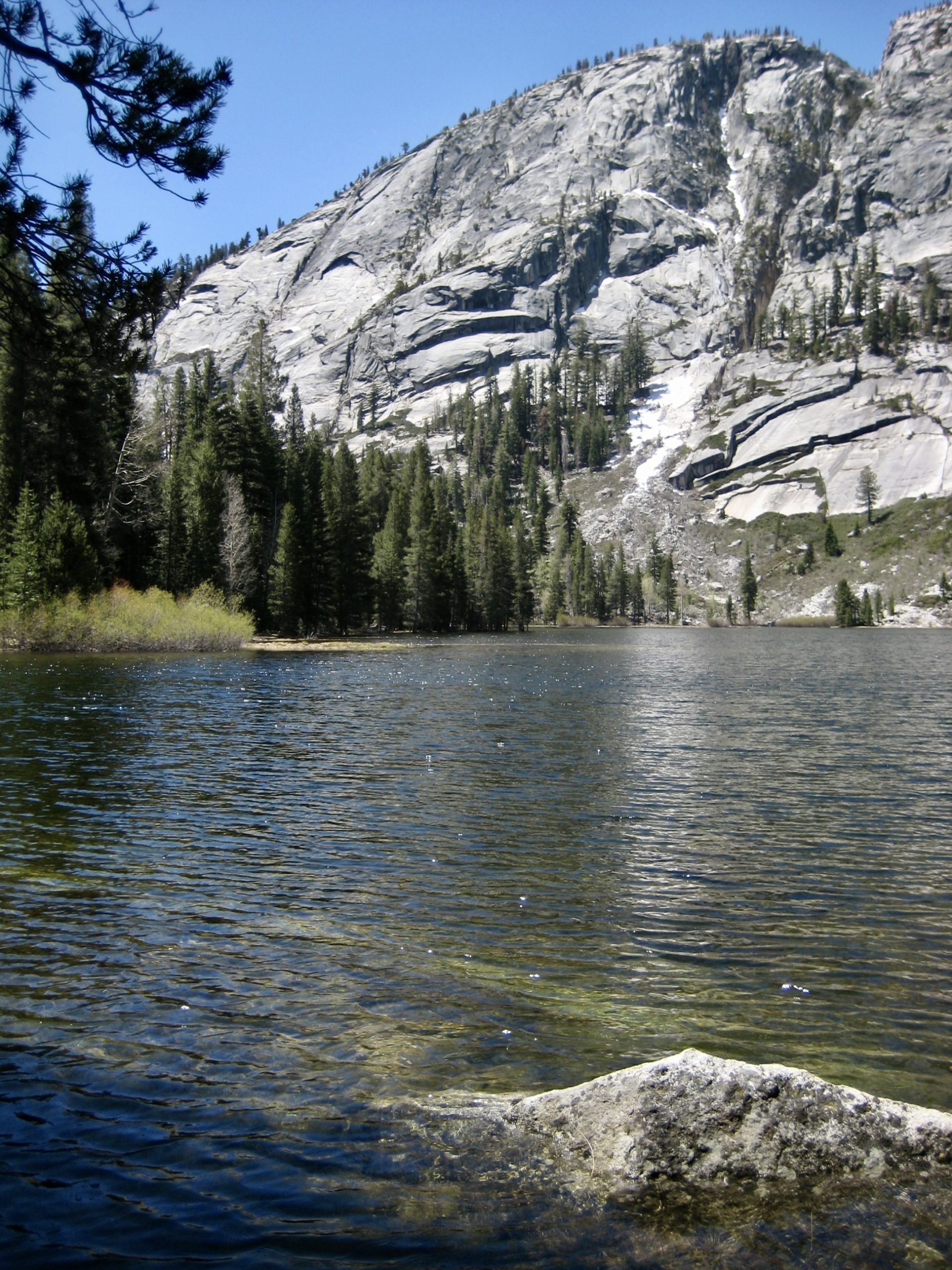
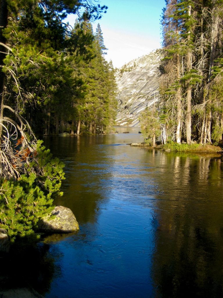
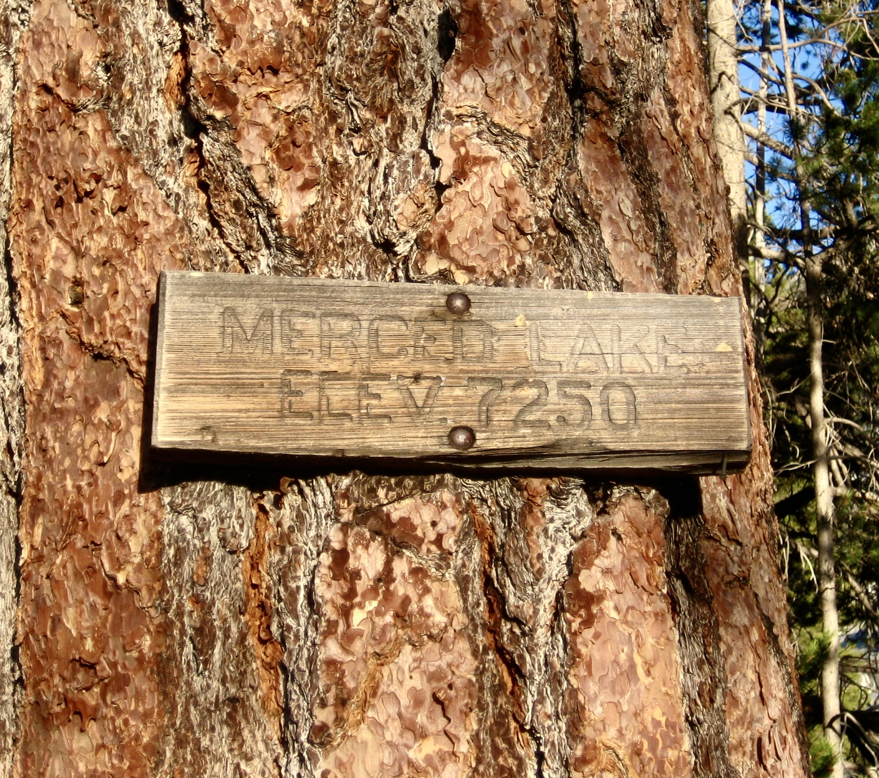
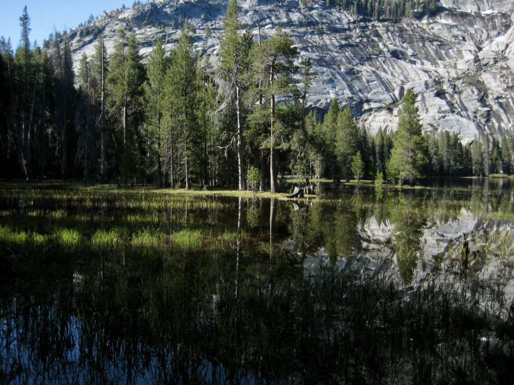
Tranquil river water signaled our arrival at 7250-foot Merced Lake, one of Yosemite’s top backpacking destinations. As we curved around the forested north shore, looking at long granite slabs on the opposite shore, it was easy to understand the attraction.

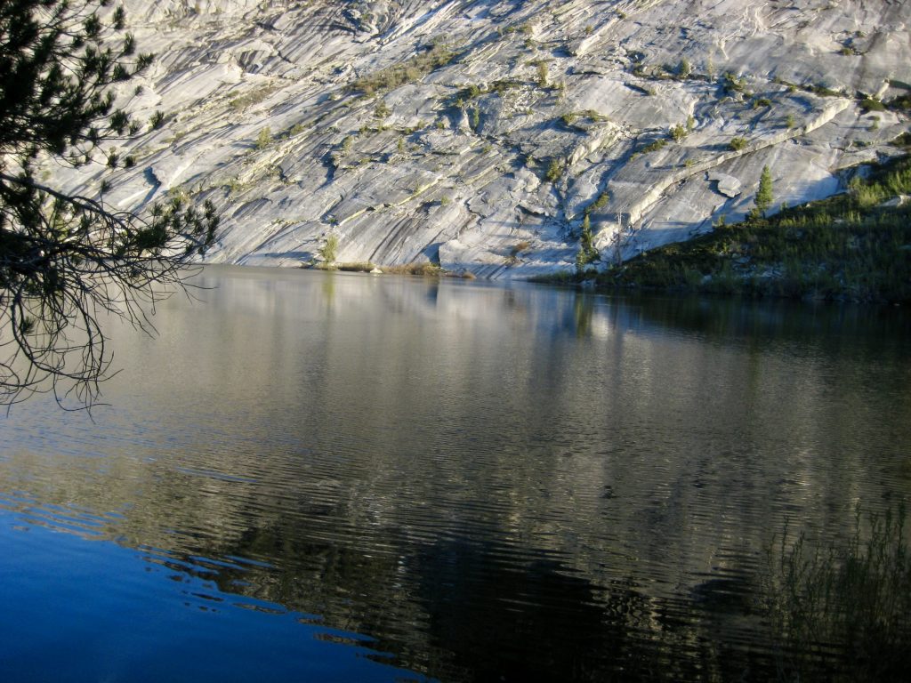
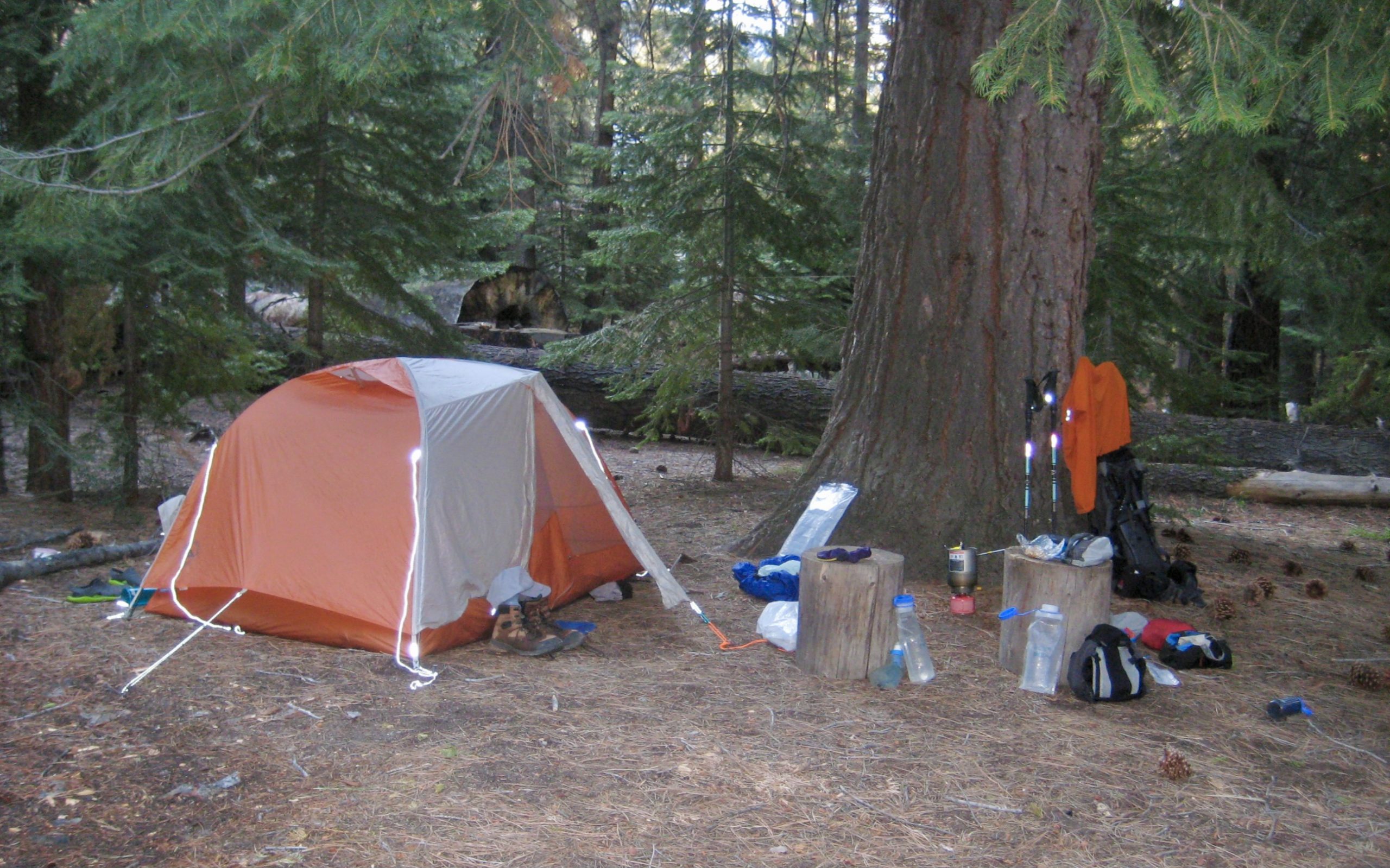
In early evening, we reached an established campground at the head of the lake (10.3 hours + 13.0 miles + 2900 feet from Camp 1, including sidetrip). Merced Lake Camp is situated among a grove of stately fir and pine trees, and its amenities include numerous bear-proof food lockers and a masonry outhouse (although not yet open for the season). Surprisingly, there was only one other person in camp—a young woman on a three-day backpacking trip.

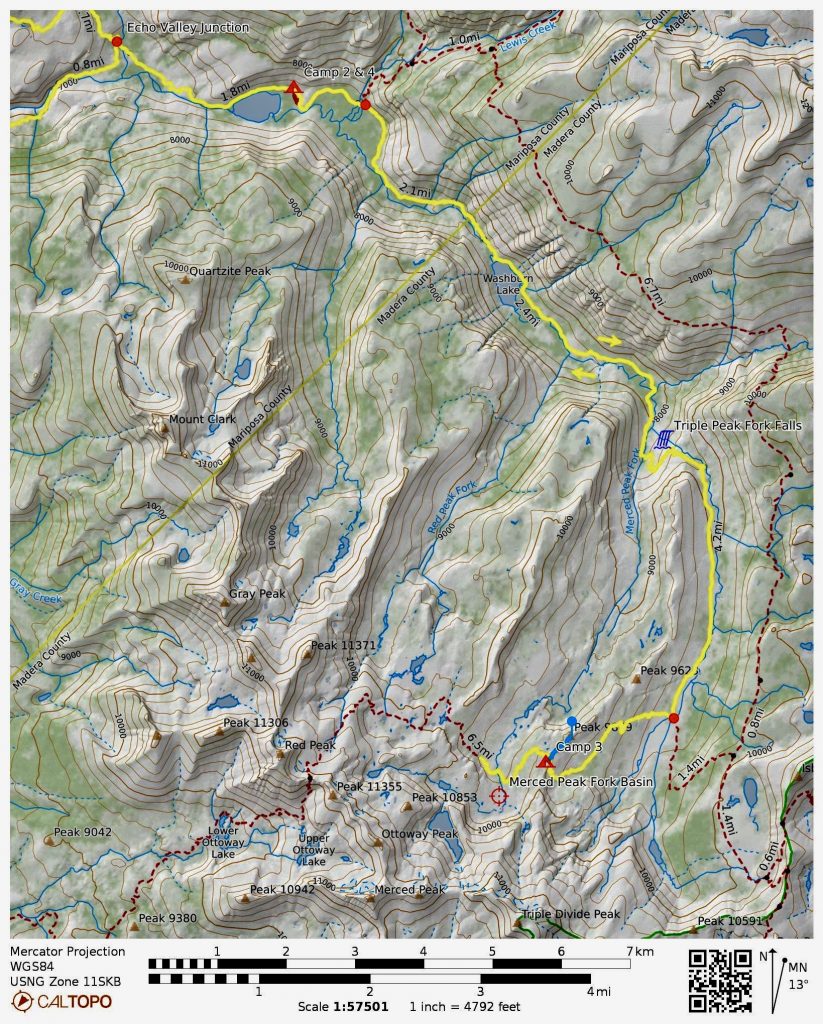
Day 3: Merced Lake to Merced Peak Fork Basin
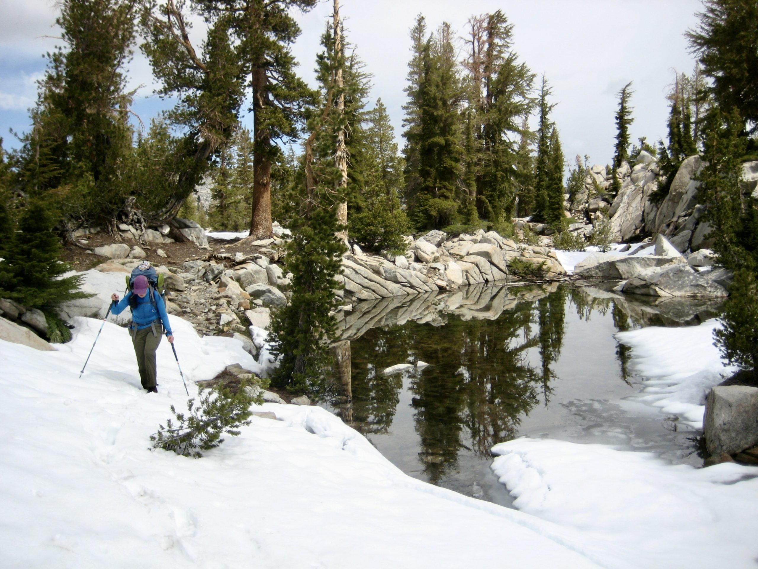
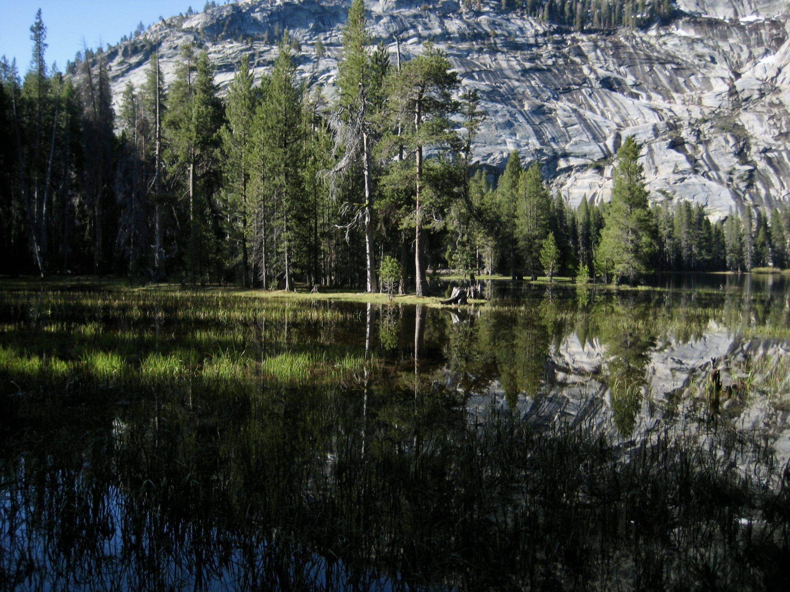
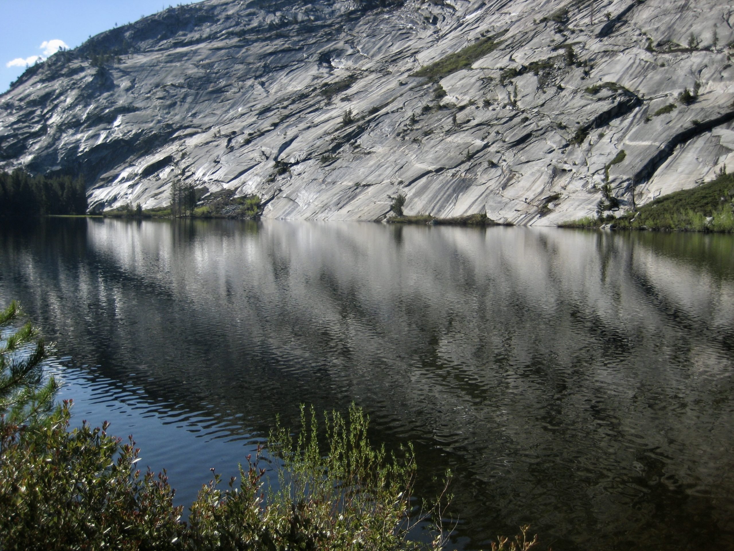
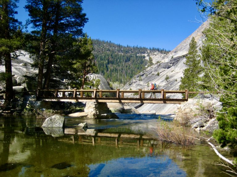
Our day began with sunny weather but with a threat of afternoon rain or snow showers. We broke camp and continued hiking up the Merced River, passing by an abandoned ranger station before arriving at Washburn Lake.

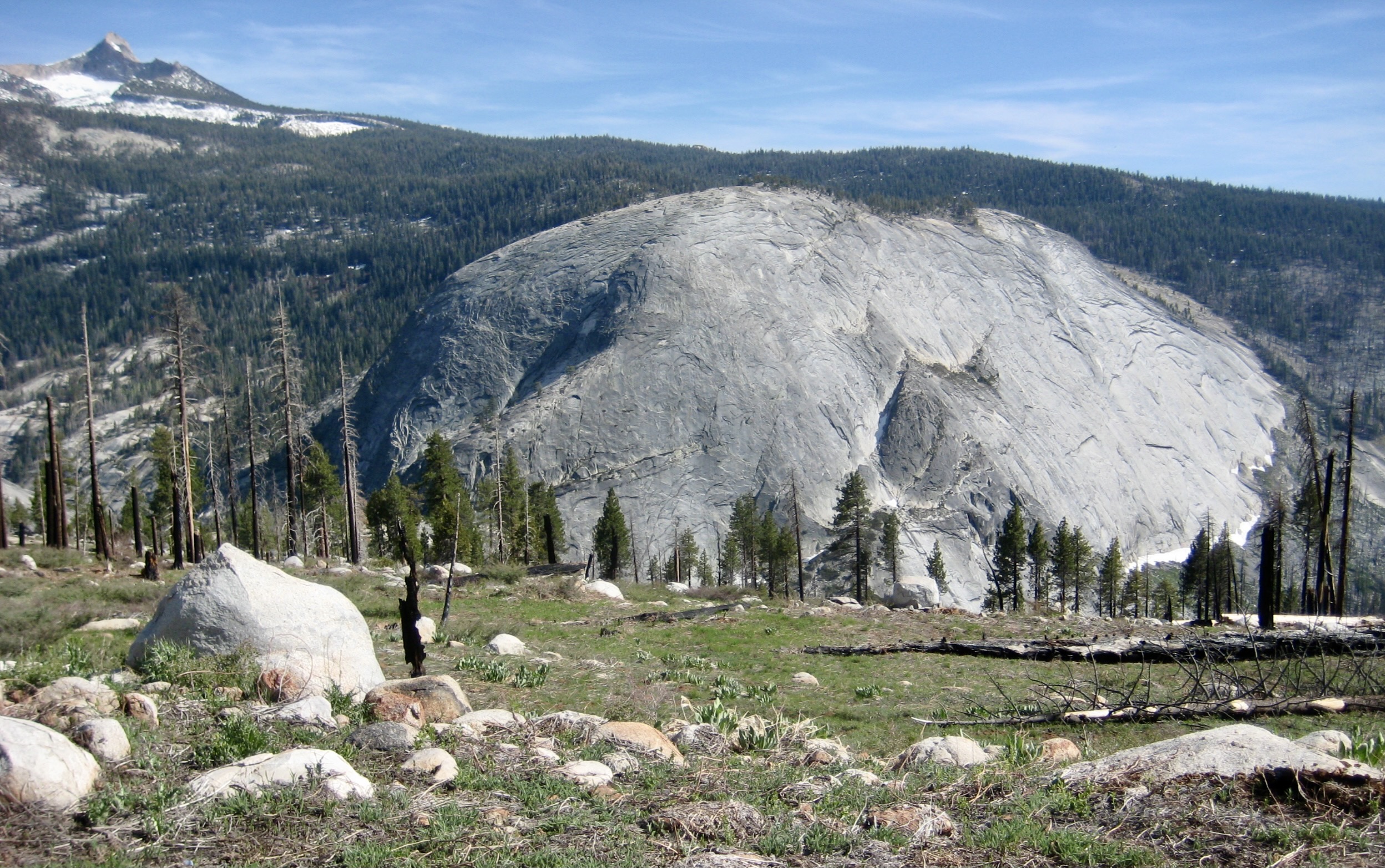
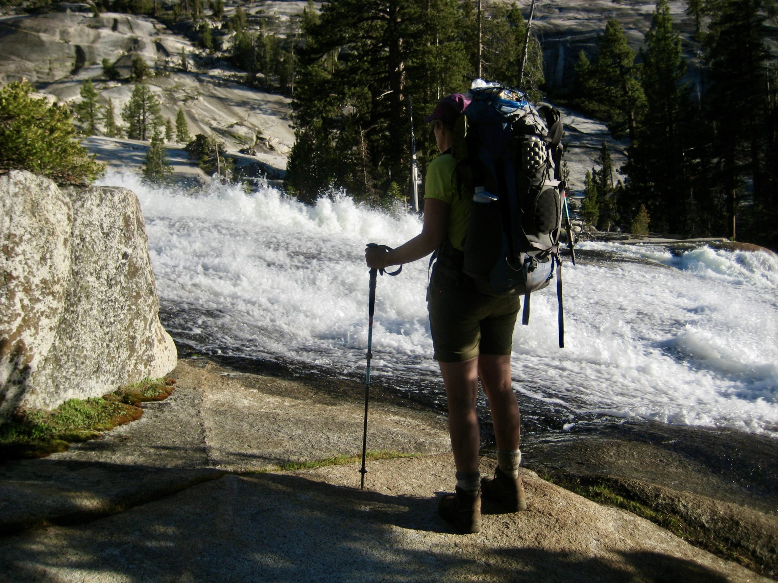
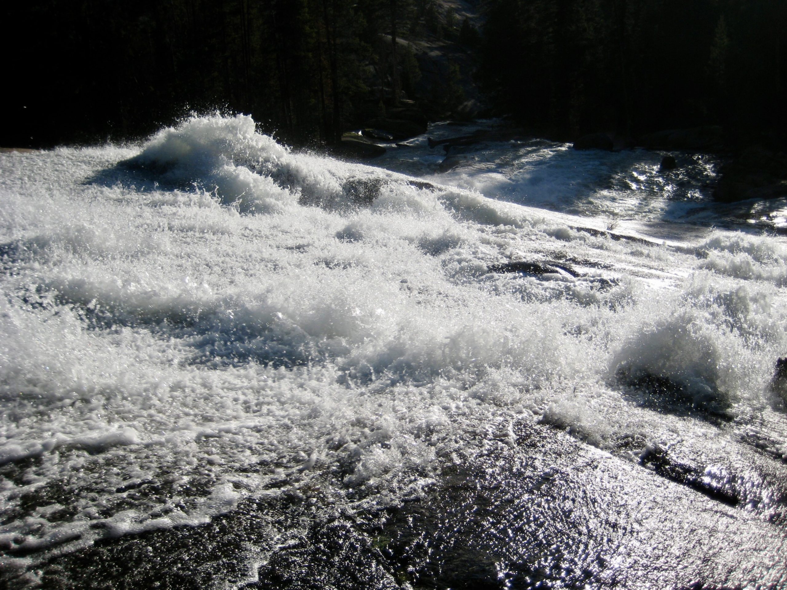
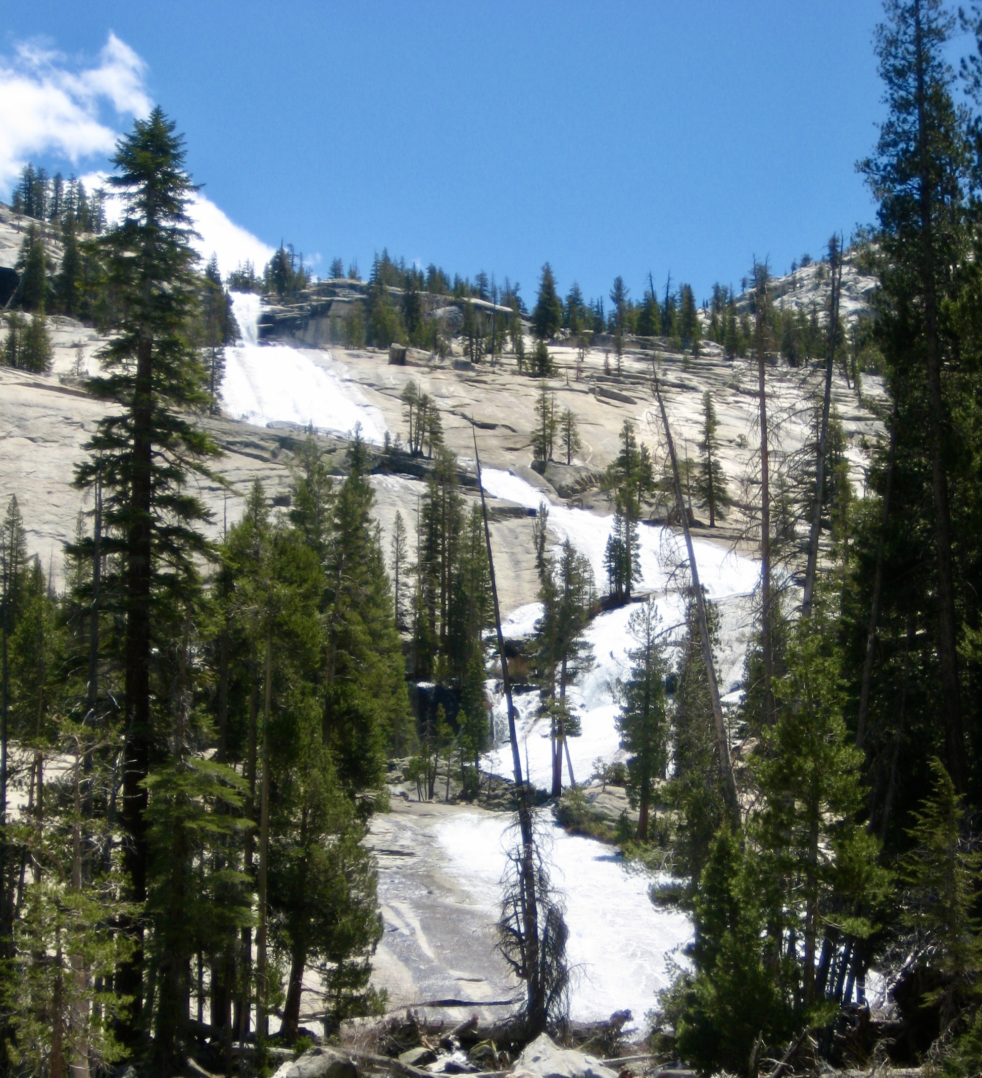
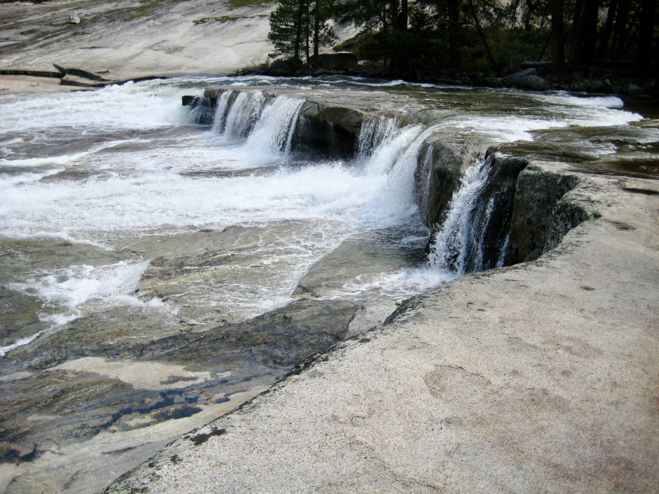
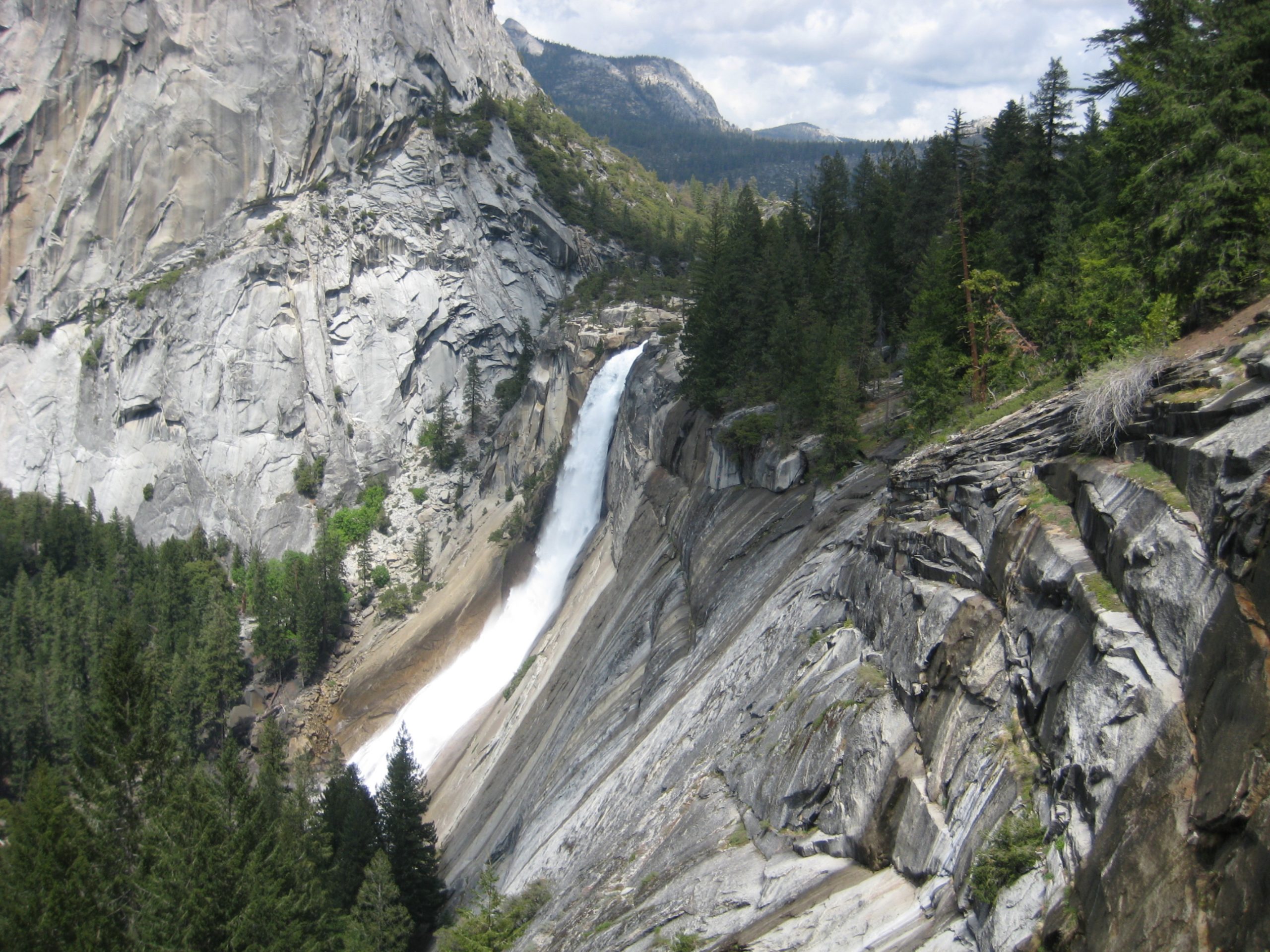
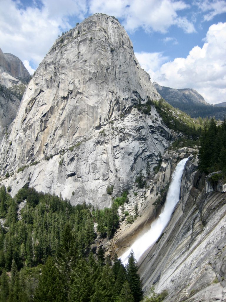
Beyond Washburn Lake, the trail took us through grassy, open forest and across the Merced River. Another of our trip highlights—Triple Peak Fork Falls—soon came into view. These falls occur where the Triple Peak Fork of the Merced River tumbles over a 500-foot slab in a series of short plunges and curving waterslides. Although not well-known by most backpackers, this feature is highly coveted by waterfall connoisseurs.


Improbably, our trail crossed the river and began switch-backing up the waterfall slabs. At the top of these slabs, the trail flattened out and entered the hanging valley of Triple Peak Fork. We wandered through grassy meadows alongside the meandering creek, in a scene reminiscent of Sierra Designs and North Face catalogs from the 1970s.


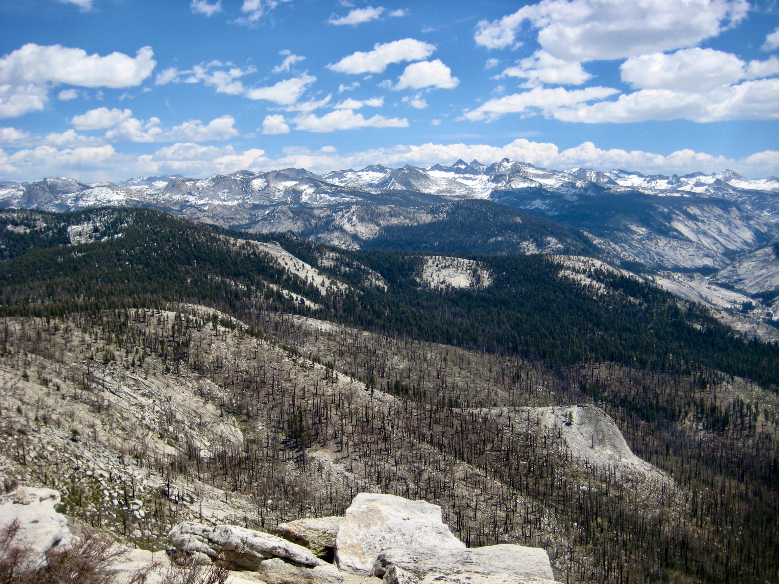
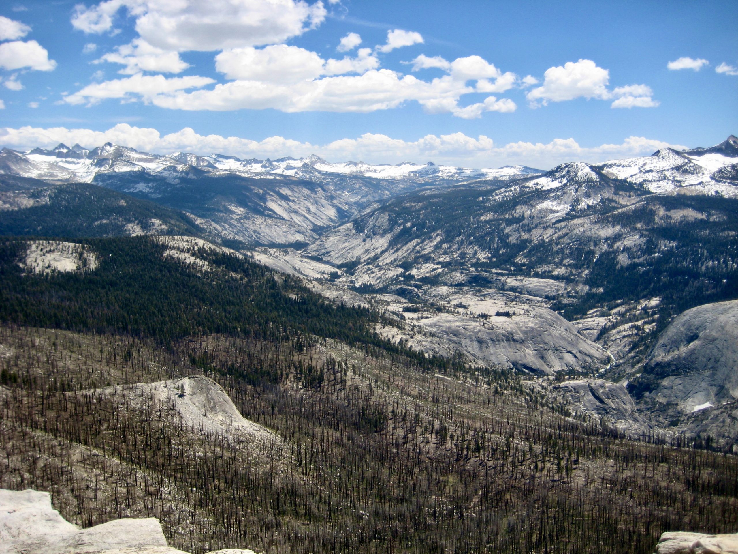
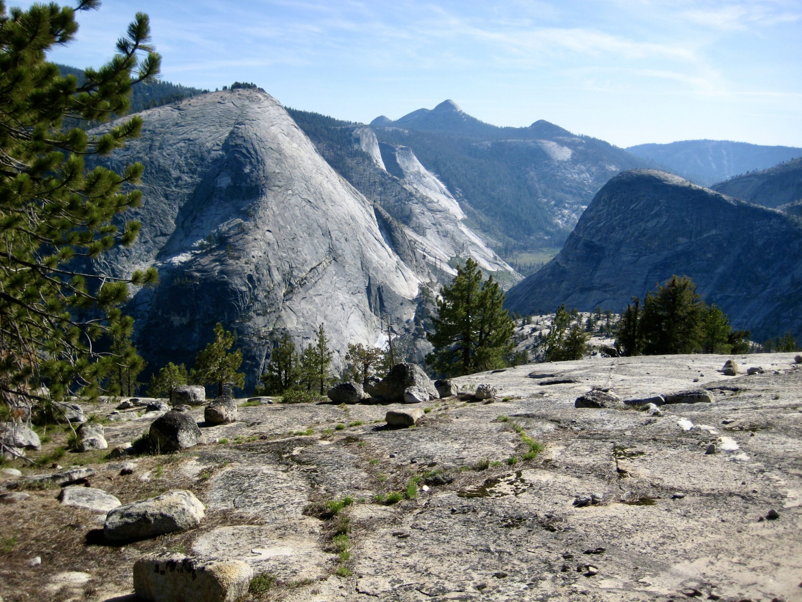
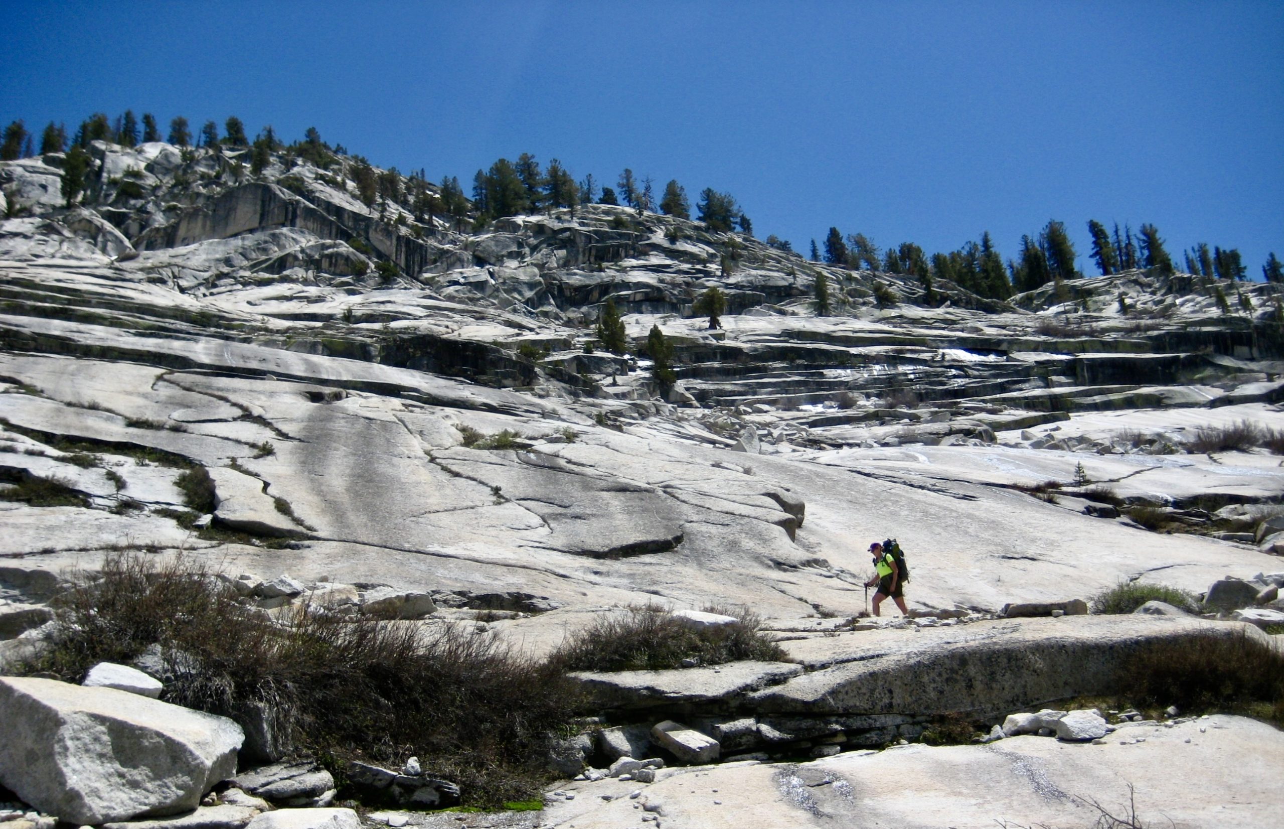
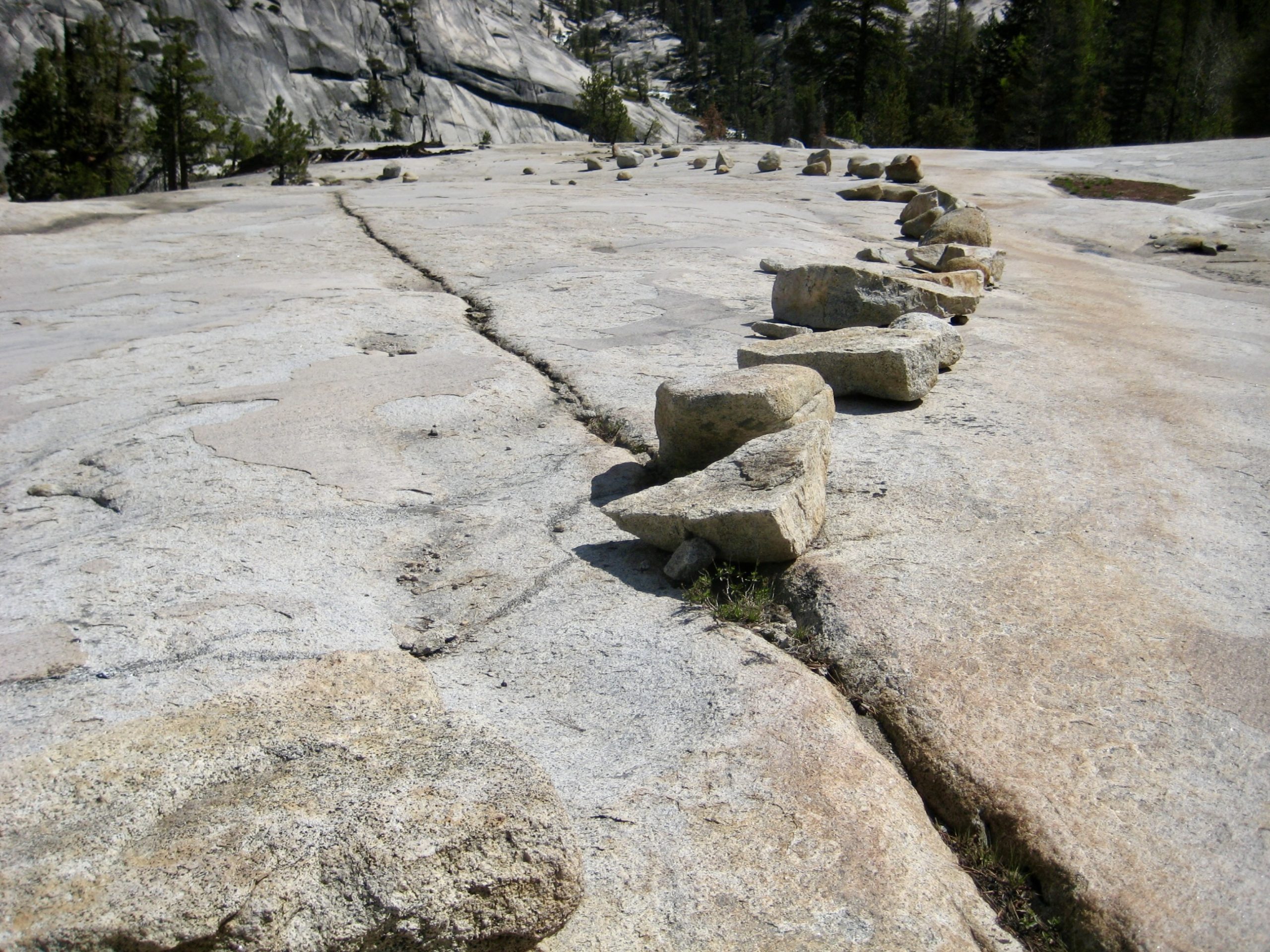
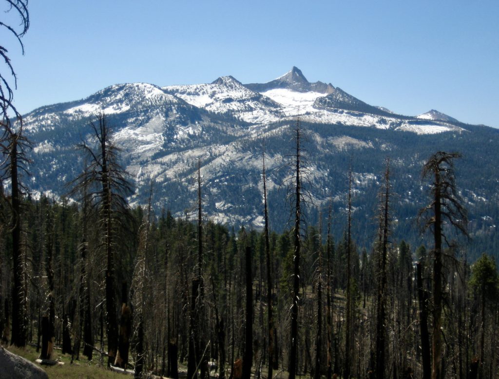
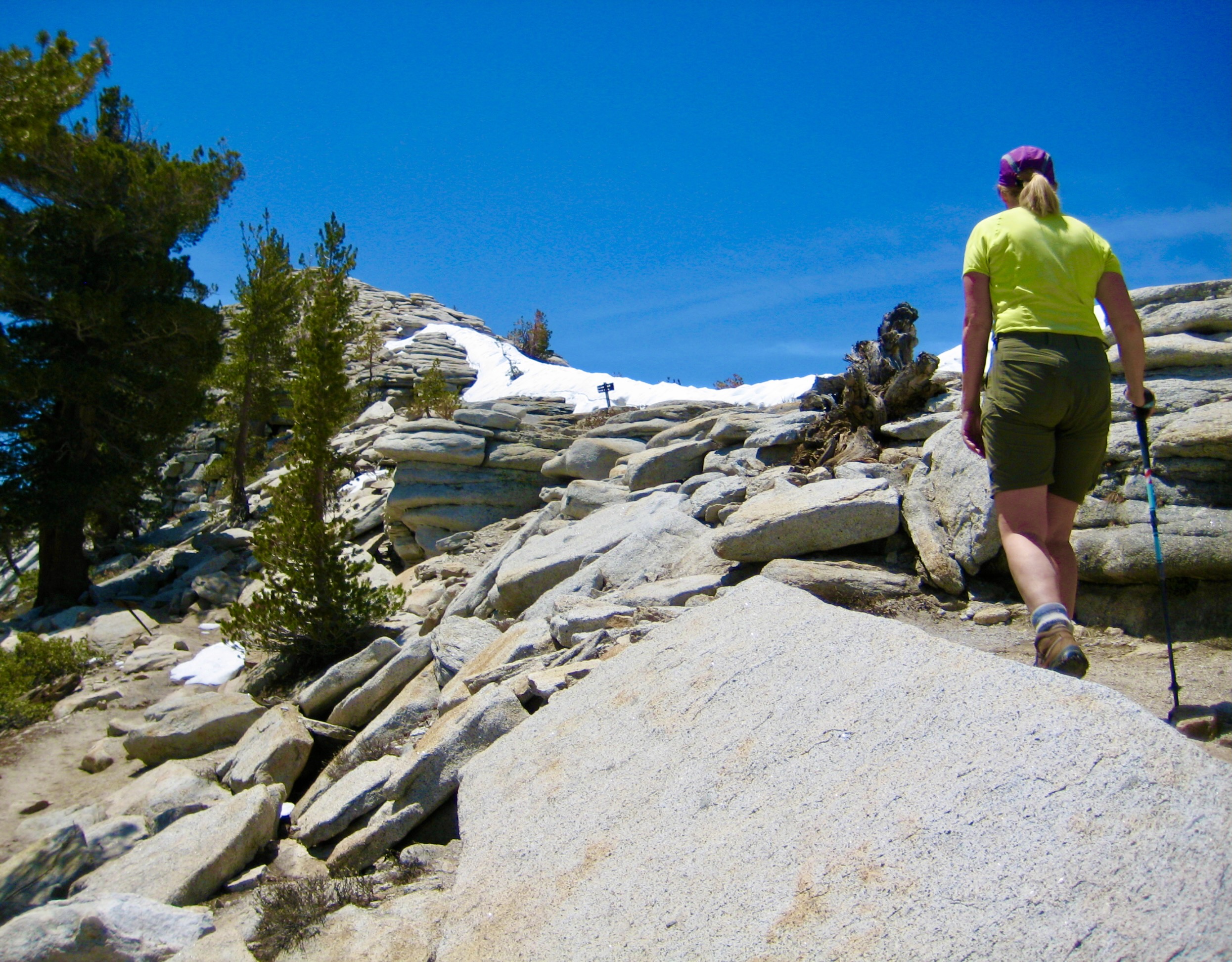
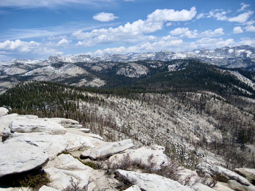
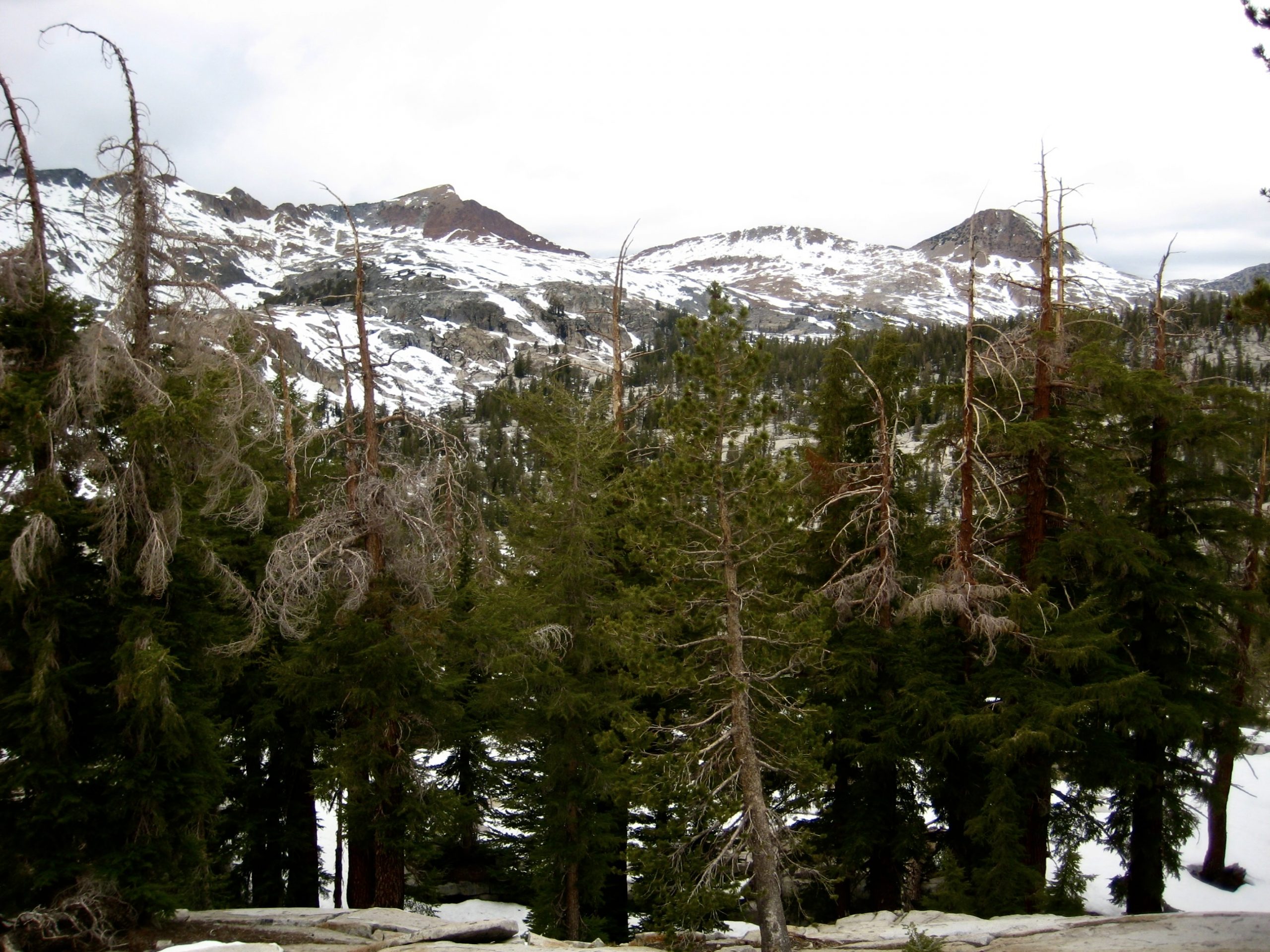
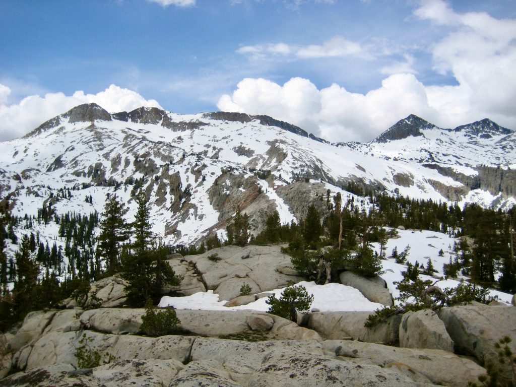
Upon reaching a trail junction near the head of Triple Peak Fork Valley, we turned right (west) and ascended more switchbacks leading up a rocky hillslope. We were now above an elevation of 9000 feet, and random patches of snow began appearing on the trail. After an ascent of 700 feet, the trail reached the top of a rocky rib that separates the Triple Peak Fork and Merced Peak Fork. Red Peak Pass, the high point of our planned loop, was visible to the west.
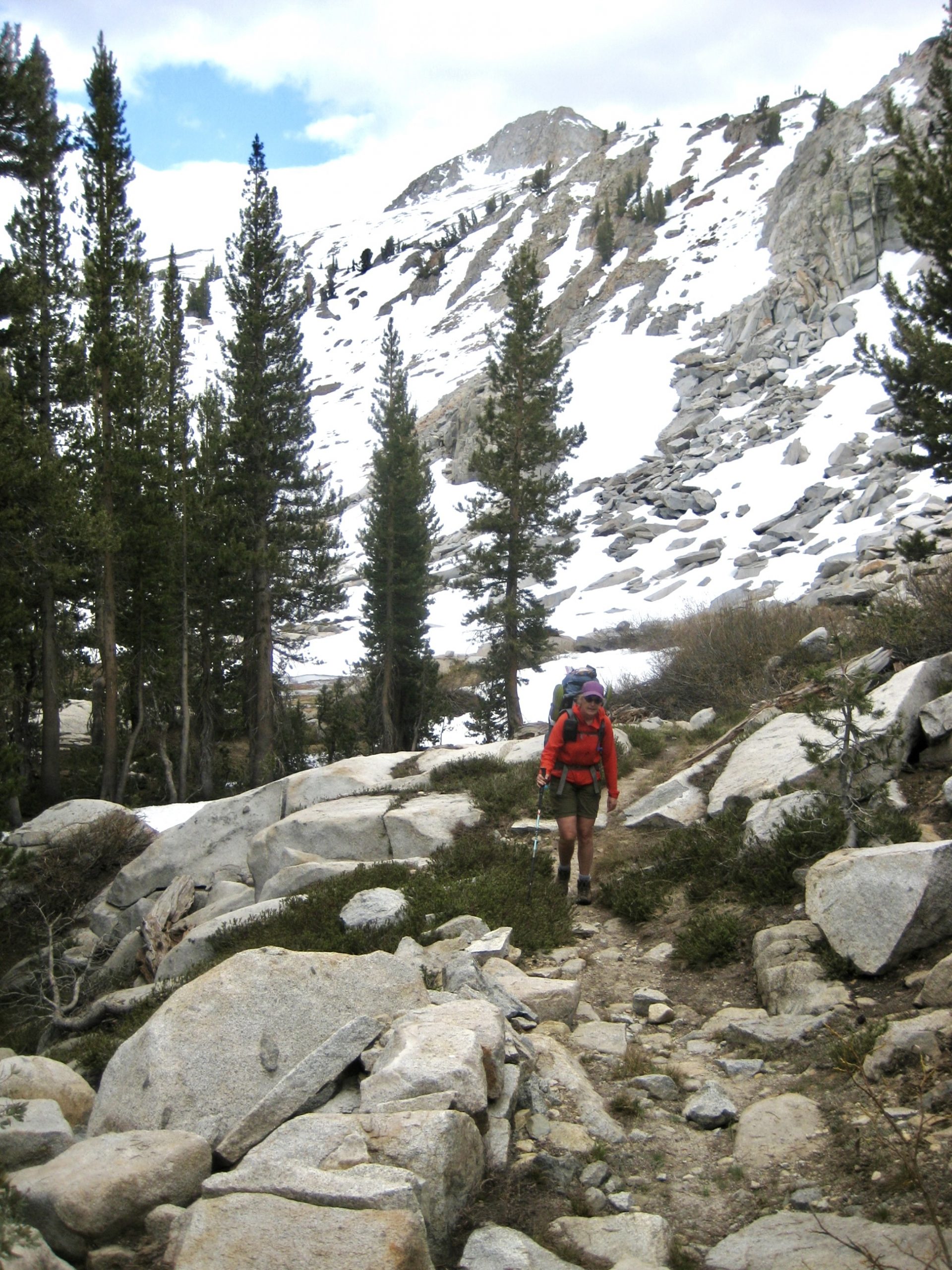
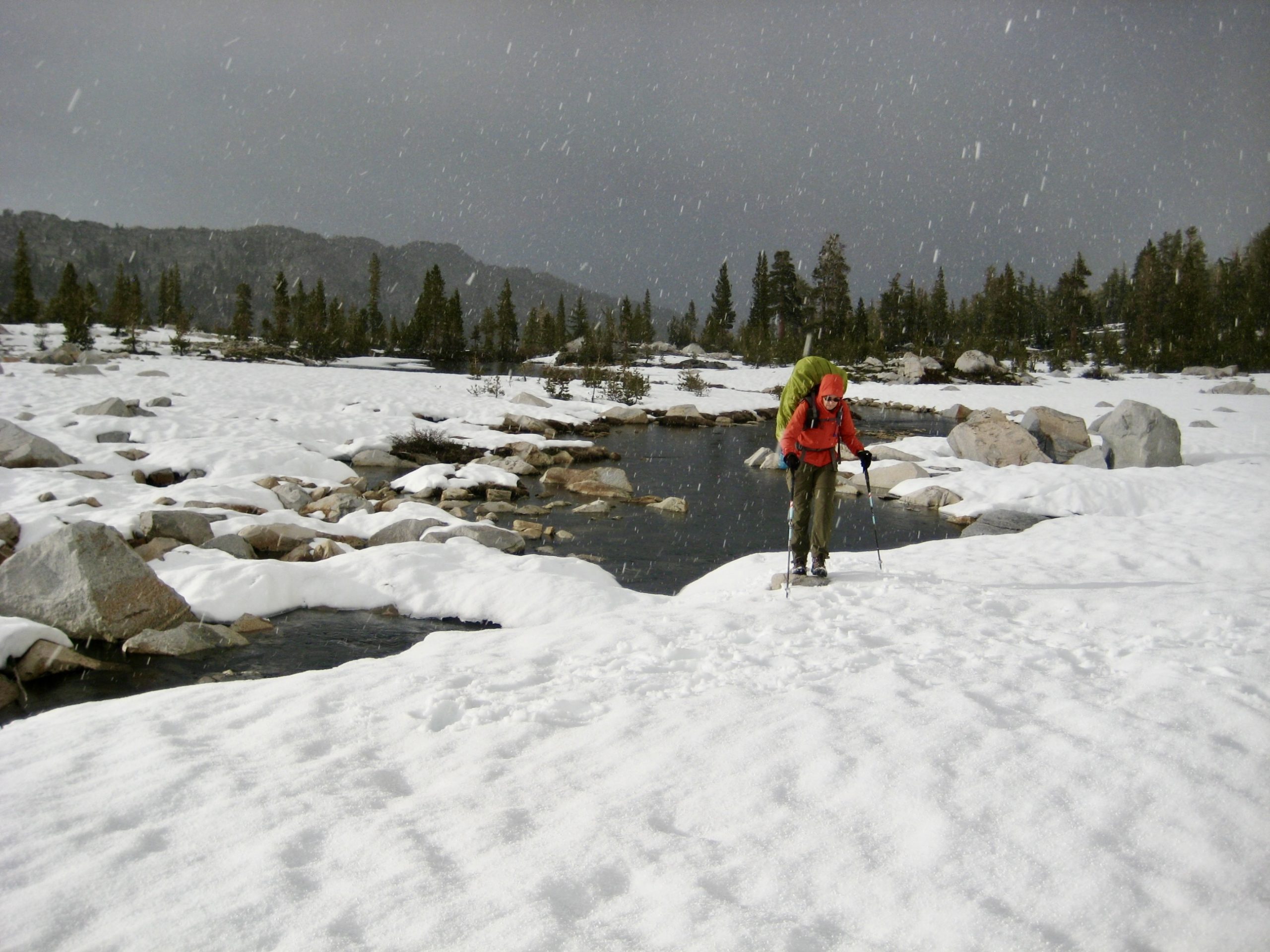
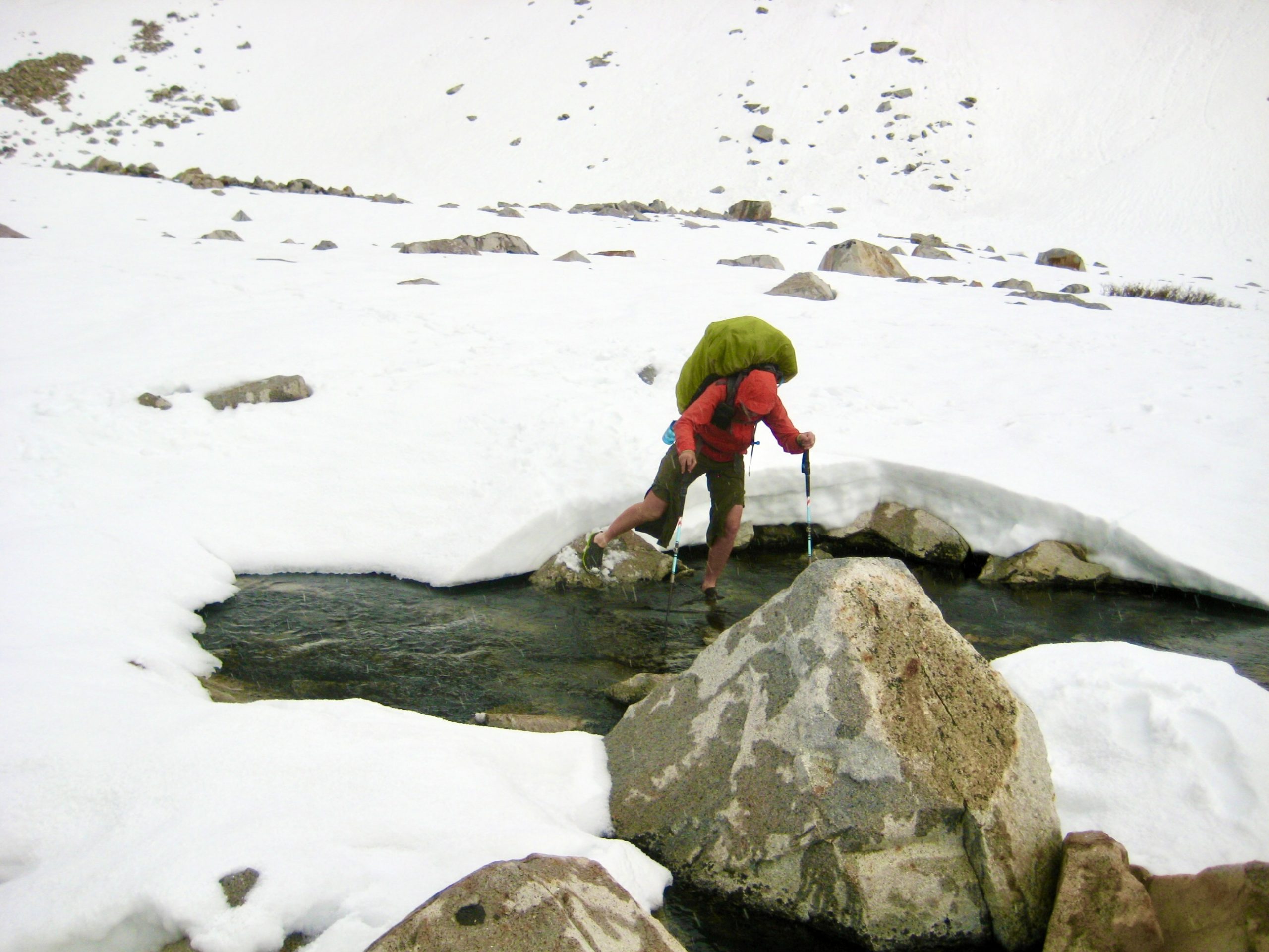
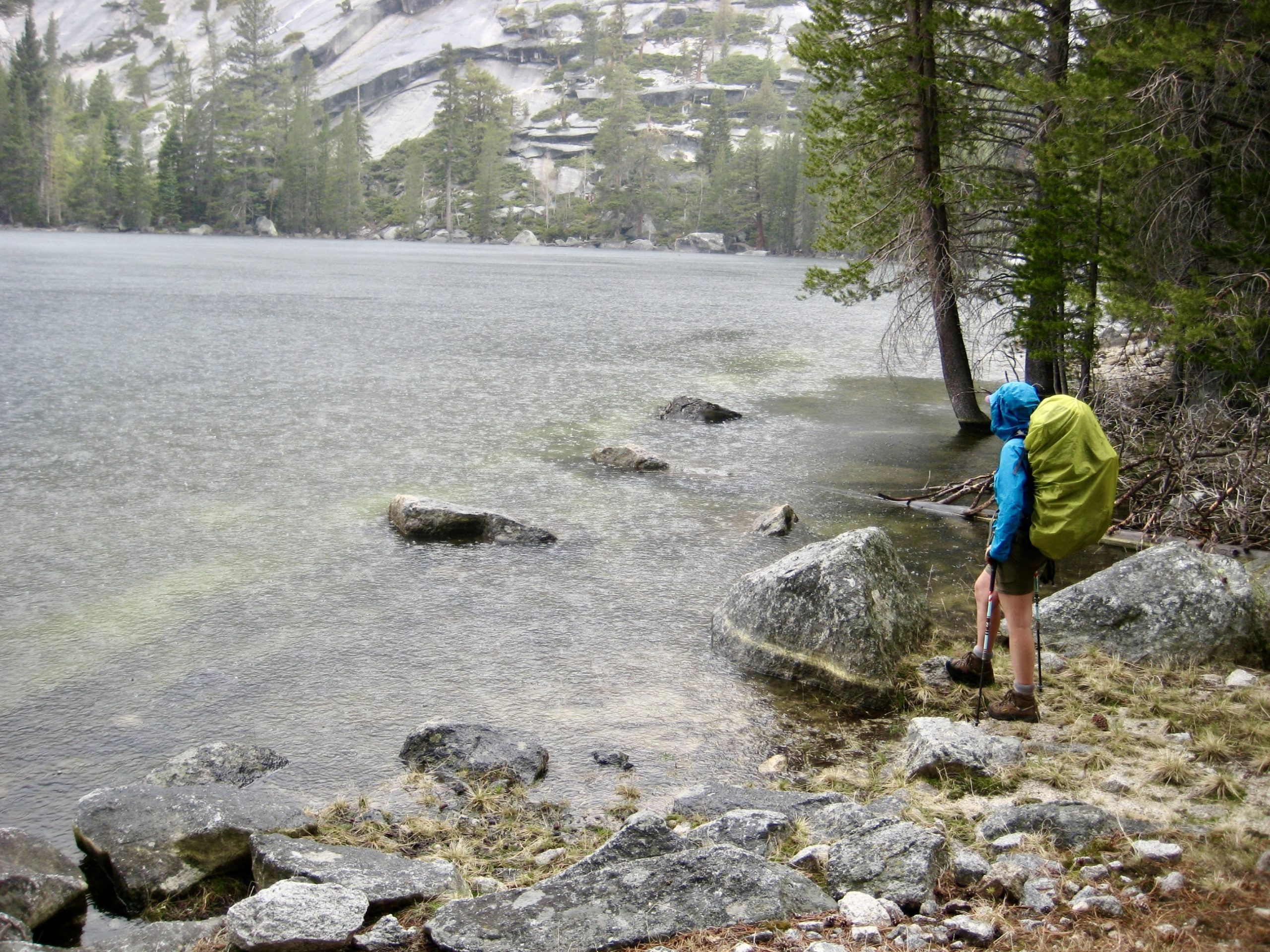
As we crossed over Triple–Merced Rib, the snow patches became much larger, and before long we found ourselves in a broad, flat, snow-filled basin. This wouldn’t have been a problem except for the fact that the snow was underlain by boulders and water. Our feet repeatedly broke through the crust, dropping us between boulders or leaving us to dangle in ice-water. It was a veritable minefield! Naturally, a graupel squall kicked up at this time.
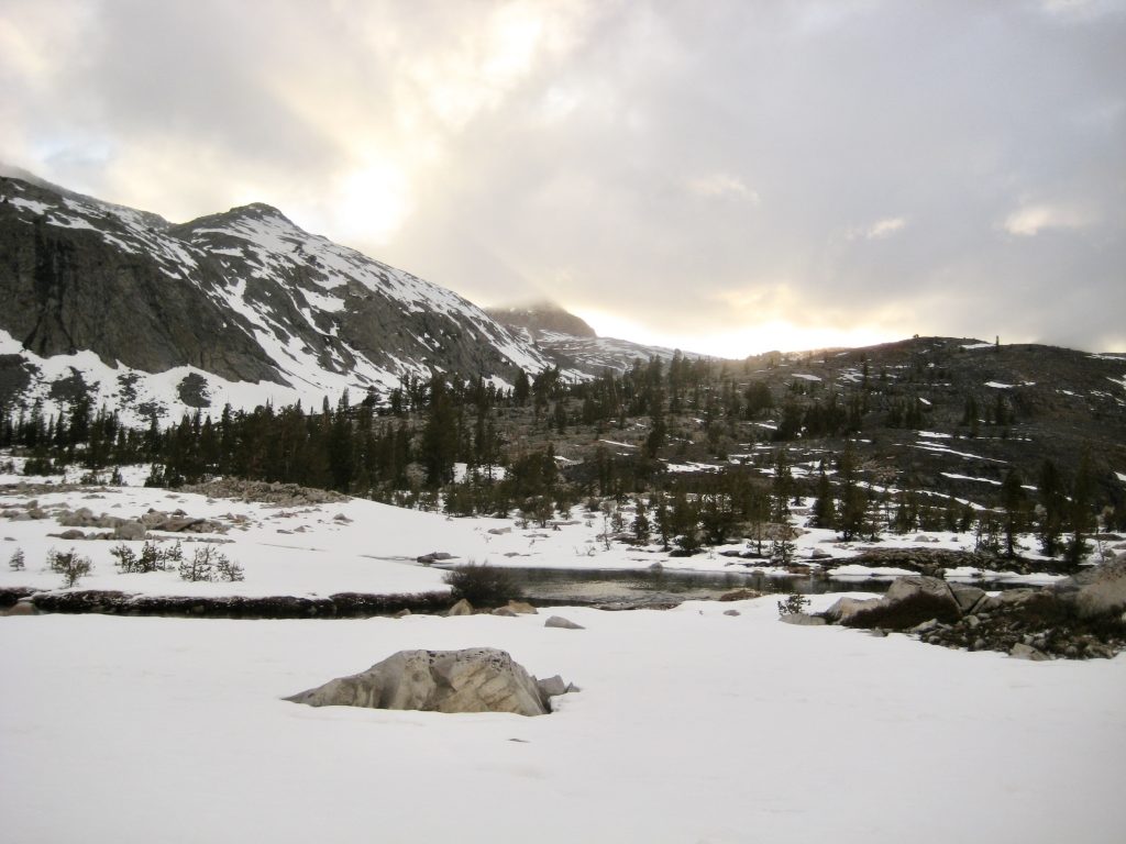
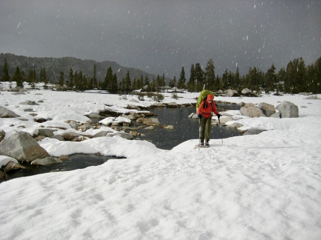
Our slow progress through the basin was further hampered by the need to cross an outlet stream. We changed into wading shoes and rock-hopped over the stream without falling in but were immediately confronted by another stream—and the likelihood of even more beyond that. Standing in the graupel squall with numb feet and fading light, we made the tough decision to turn around.

We retraced our footsteps back to Triple–Merced Rib and located a suitable campsite scant minutes before dark (11.4 hours + 13.0 miles + 3500 feet from Camp 2). It had been a long and, ultimately, frustrating day.
Day 4: Merced Peak Fork Basin to Merced Lake
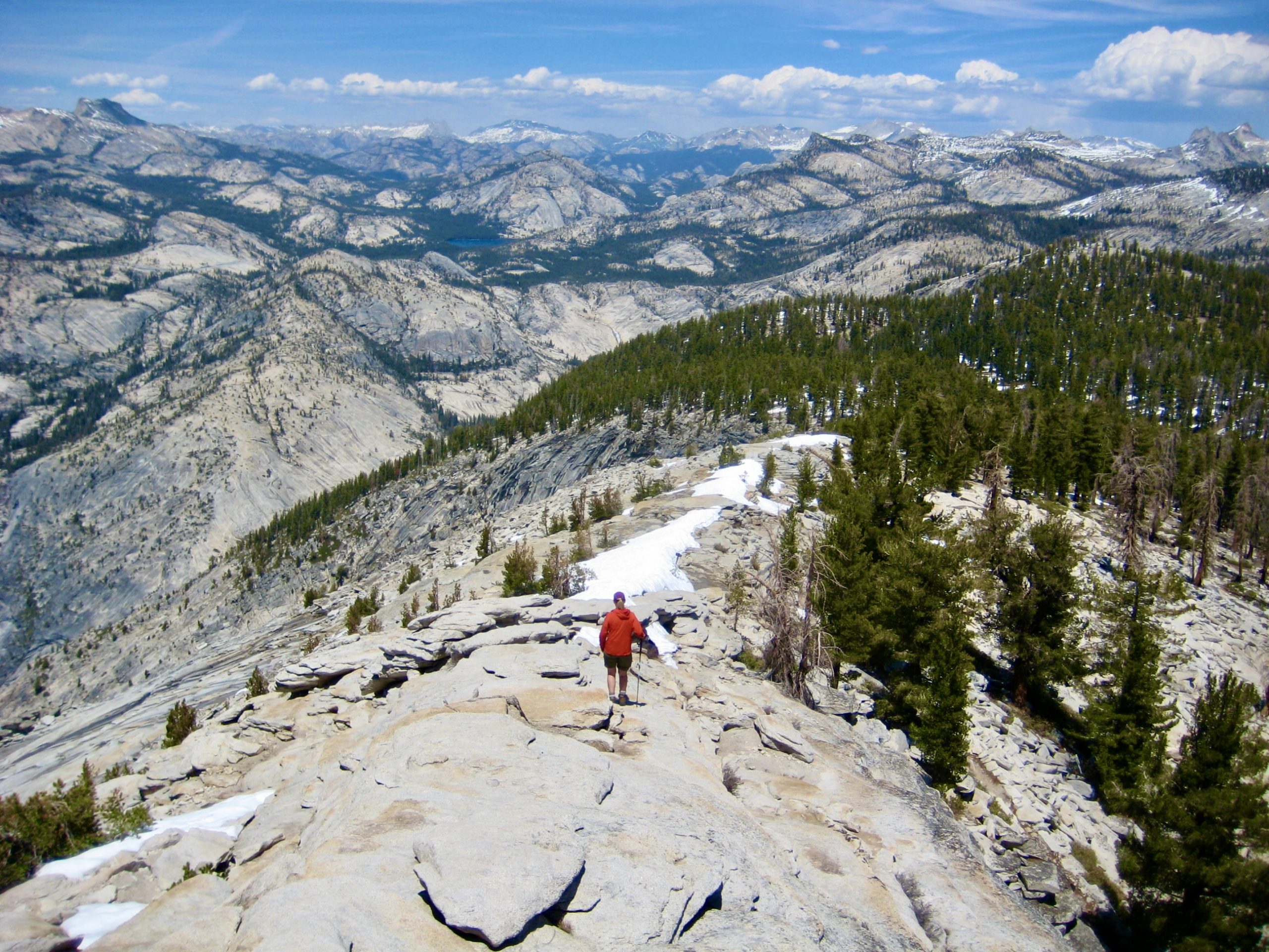
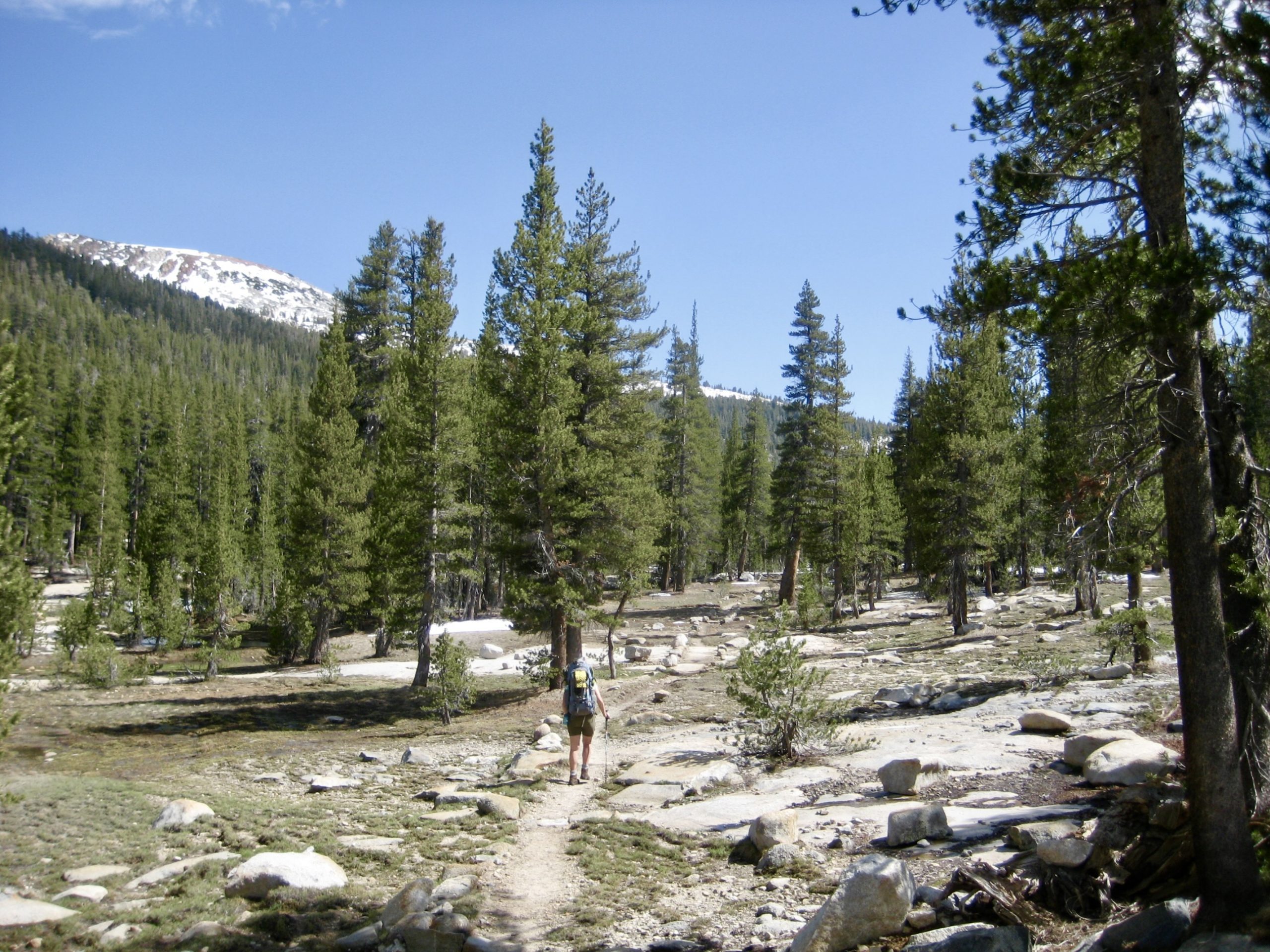
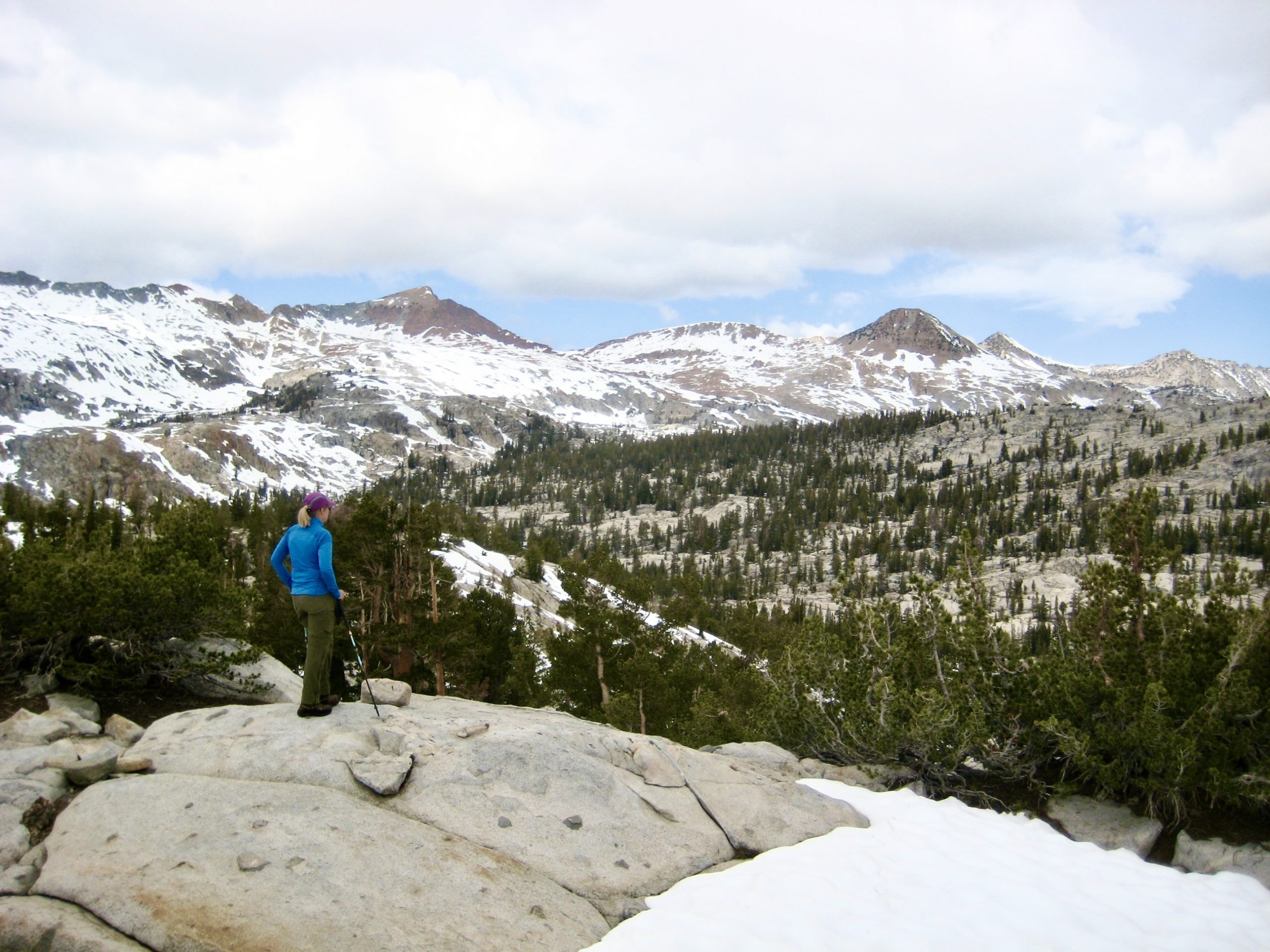
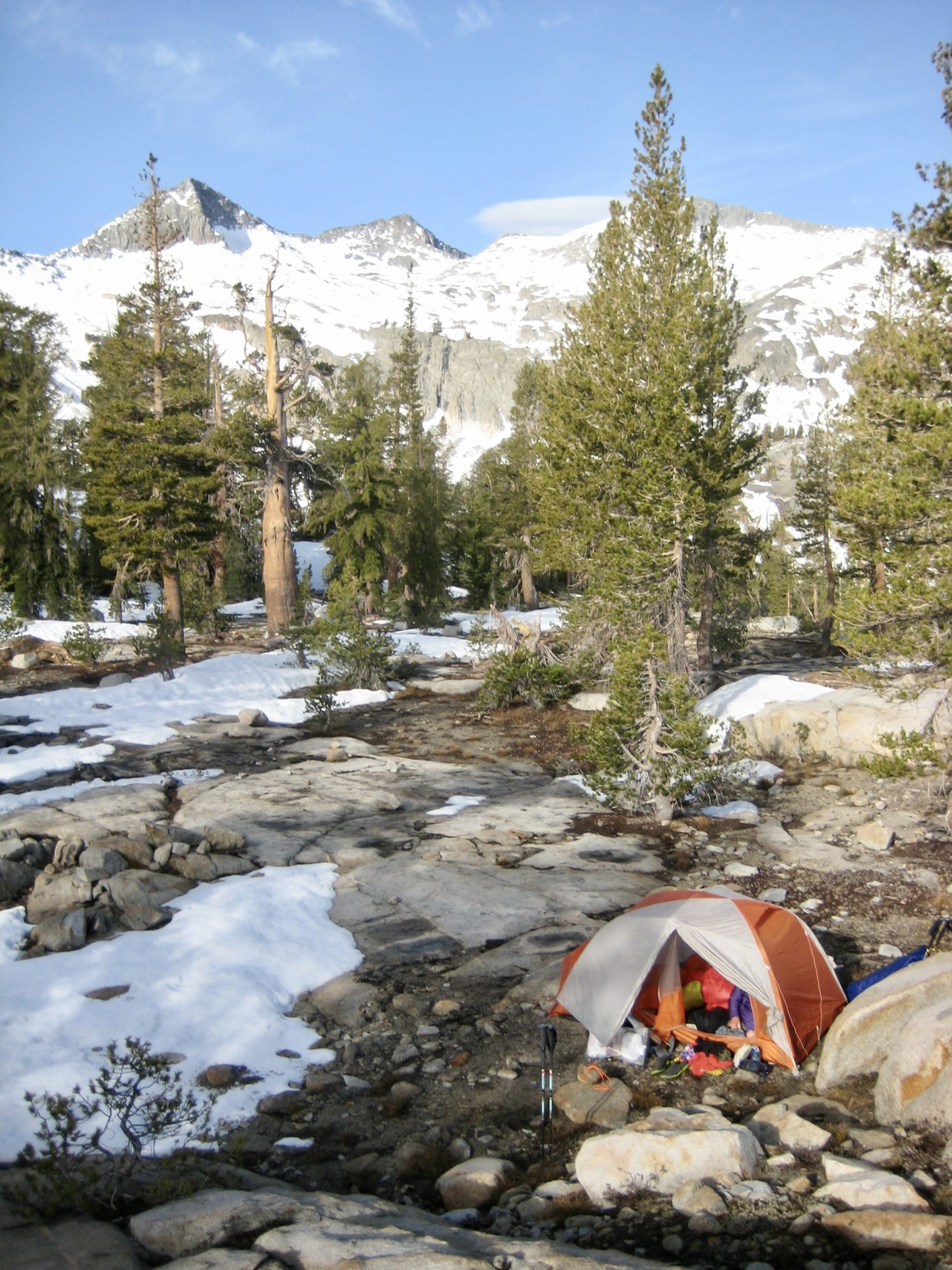
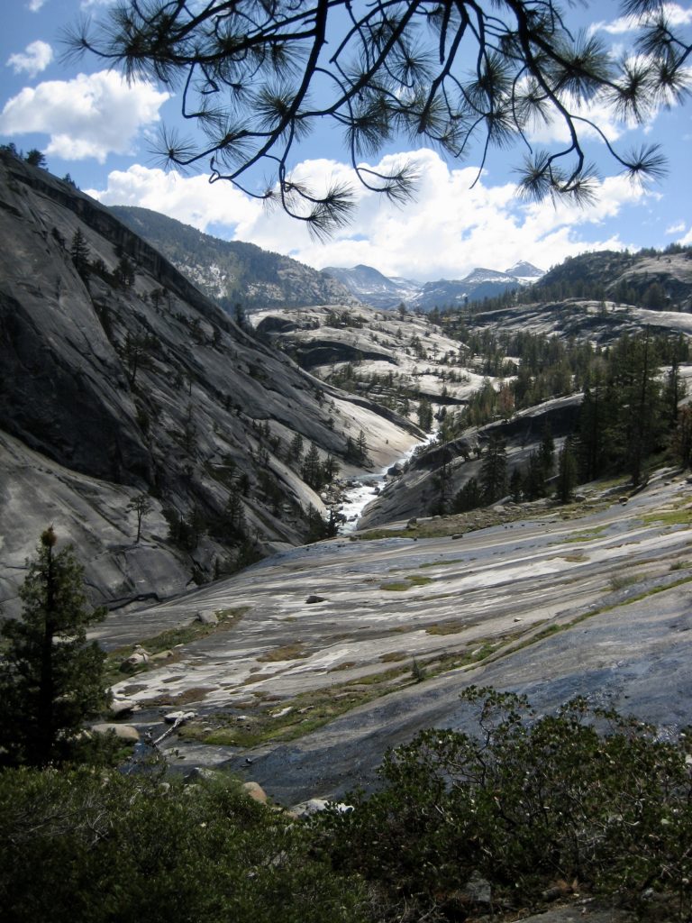
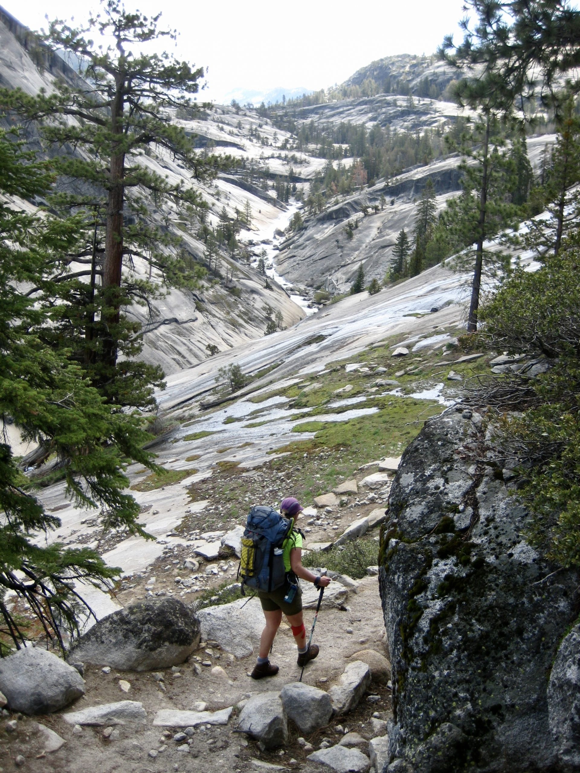
Following a cold but calm night, we awoke to a clearing sky and icy water bottles. A leisurely breakfast atop a granite outcrop allowed us to enjoy our position within Yosemite’s craggy Clark Range.
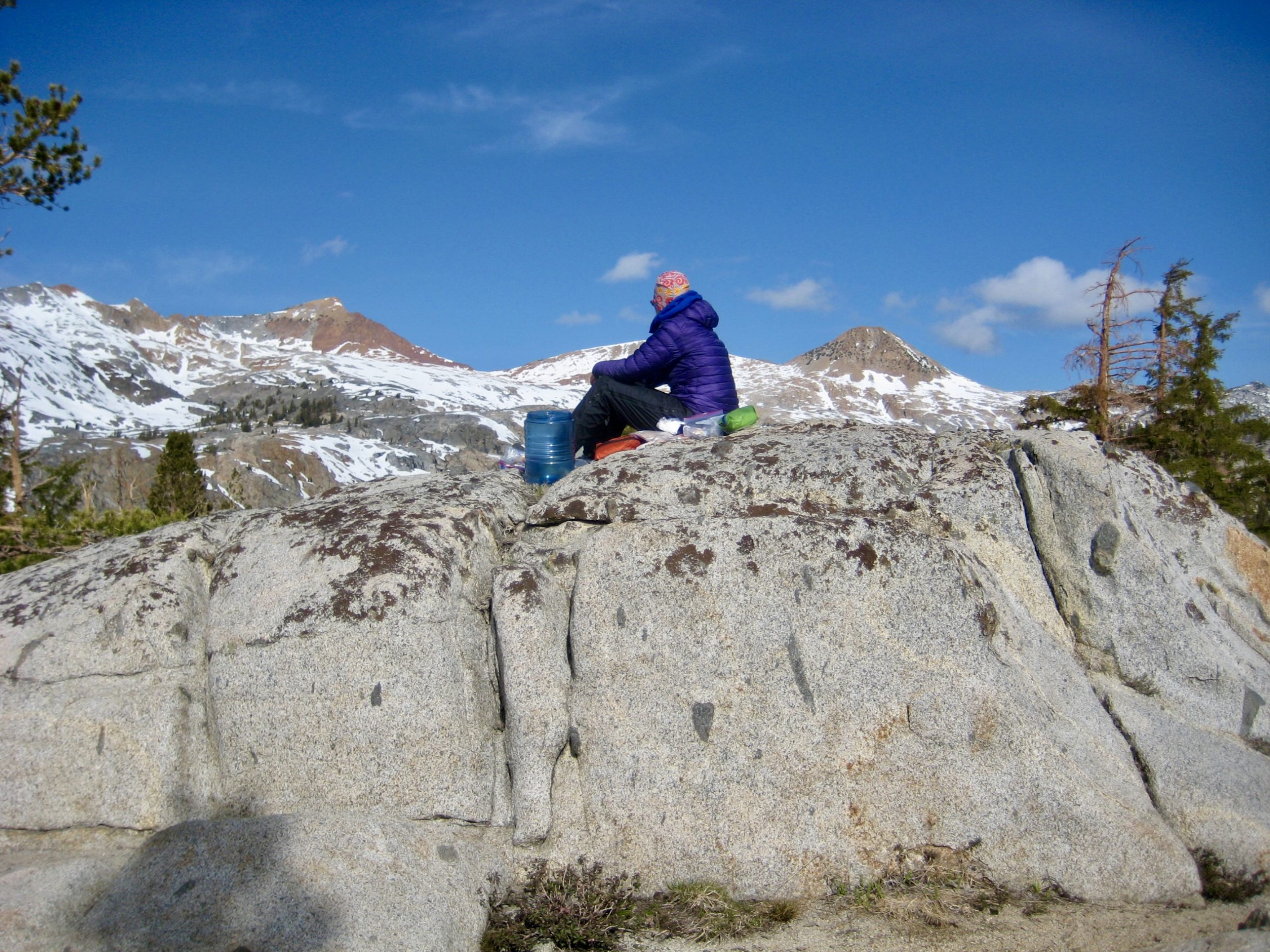
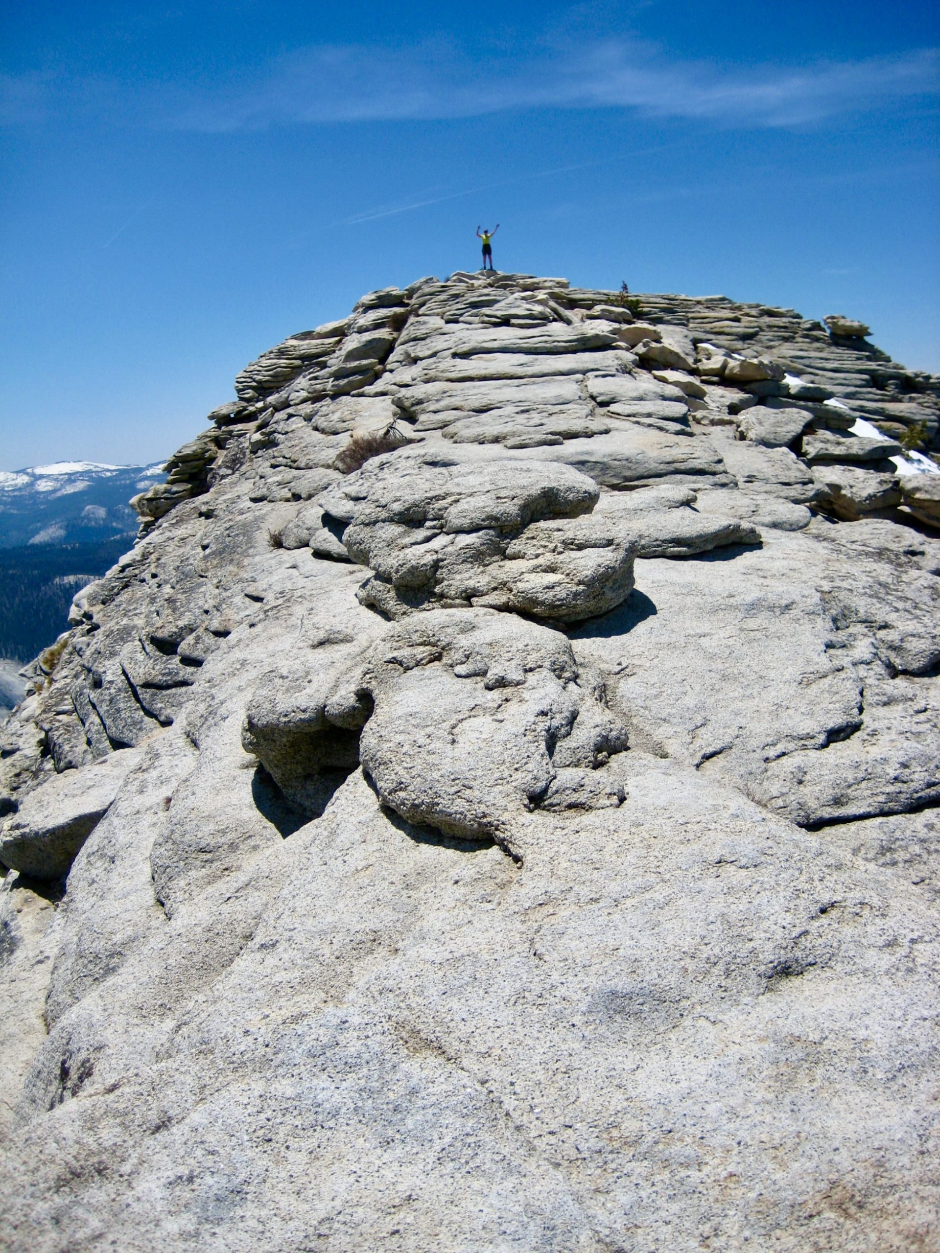
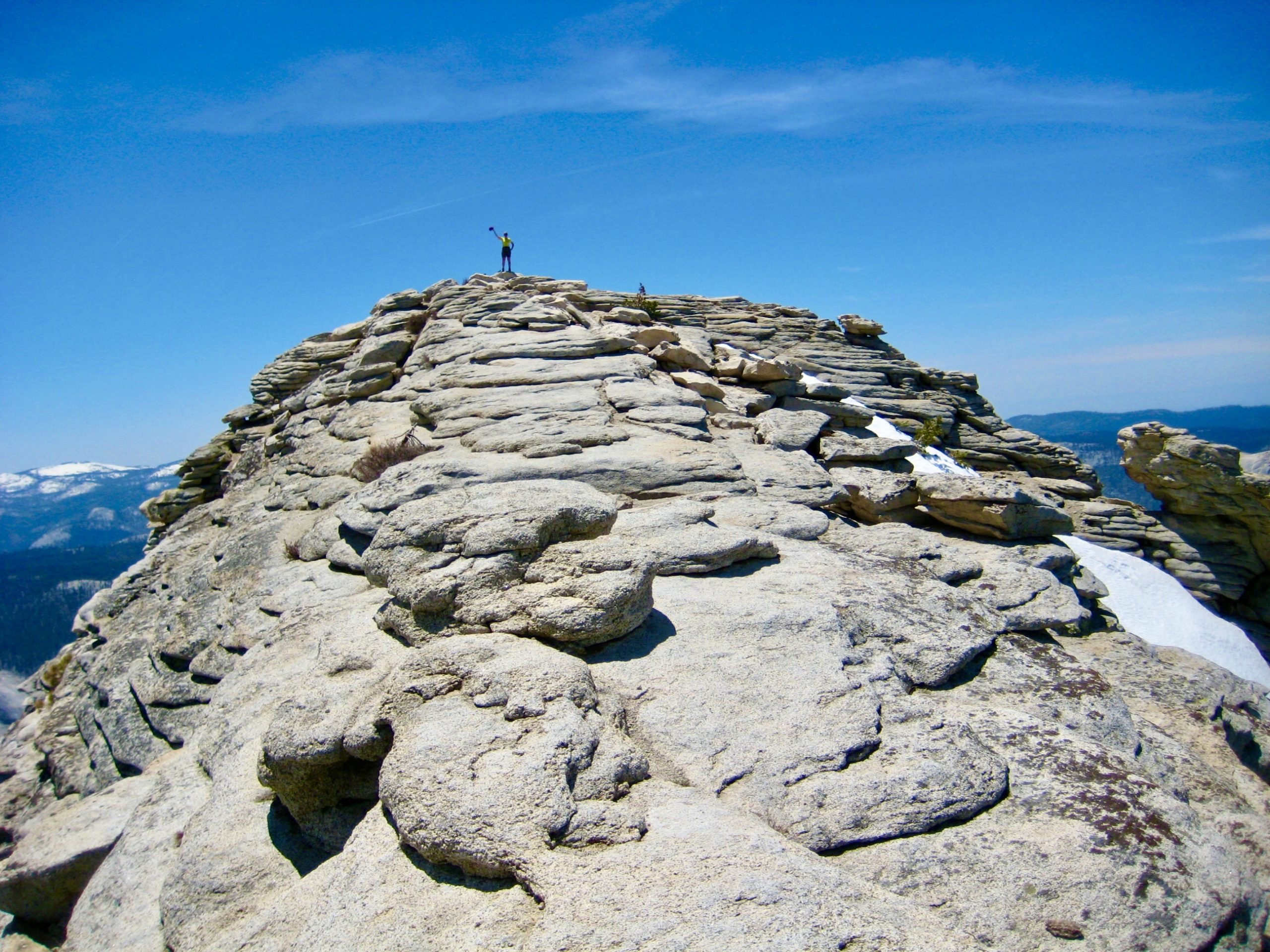
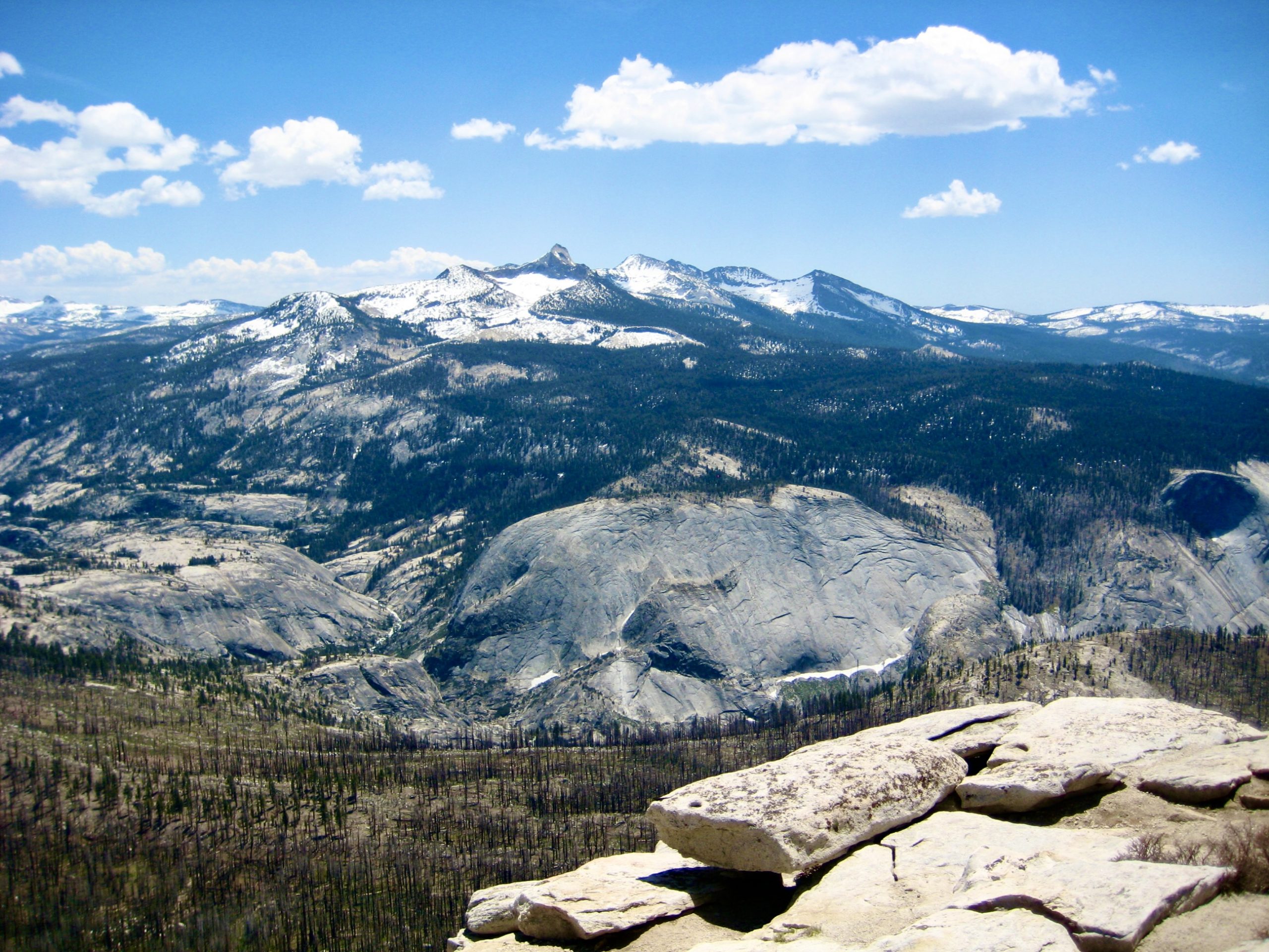
Once packed up, we made a 1-hour sidetrip over to Point 9860 (“Triple–Merced Point”), which offered even better views of our surroundings. Triple Divide Peak, Merced Peak, Red Peak, and Gray Peak—all exceeding 11,000 feet—were clearly visible from here.

The remainder of our day was spent hiking back down Triple Peak Fork and the Merced River. Clouds gradually built in the sky, and rain caught us shortly before we reached Washburn Lake. One consolation, though, was that our raingear kept the annoying mosquitoes at bay.
At 6:50pm, we rolled into now-deserted Merced Lake Camp (7.2 hours + 11.5 miles + 600 feet from Camp 3). The overhanging branches of a large pine tree provided dry ground for our tent and dining room.
Day 5: Merced Lake to Happy Isles Parking Lot
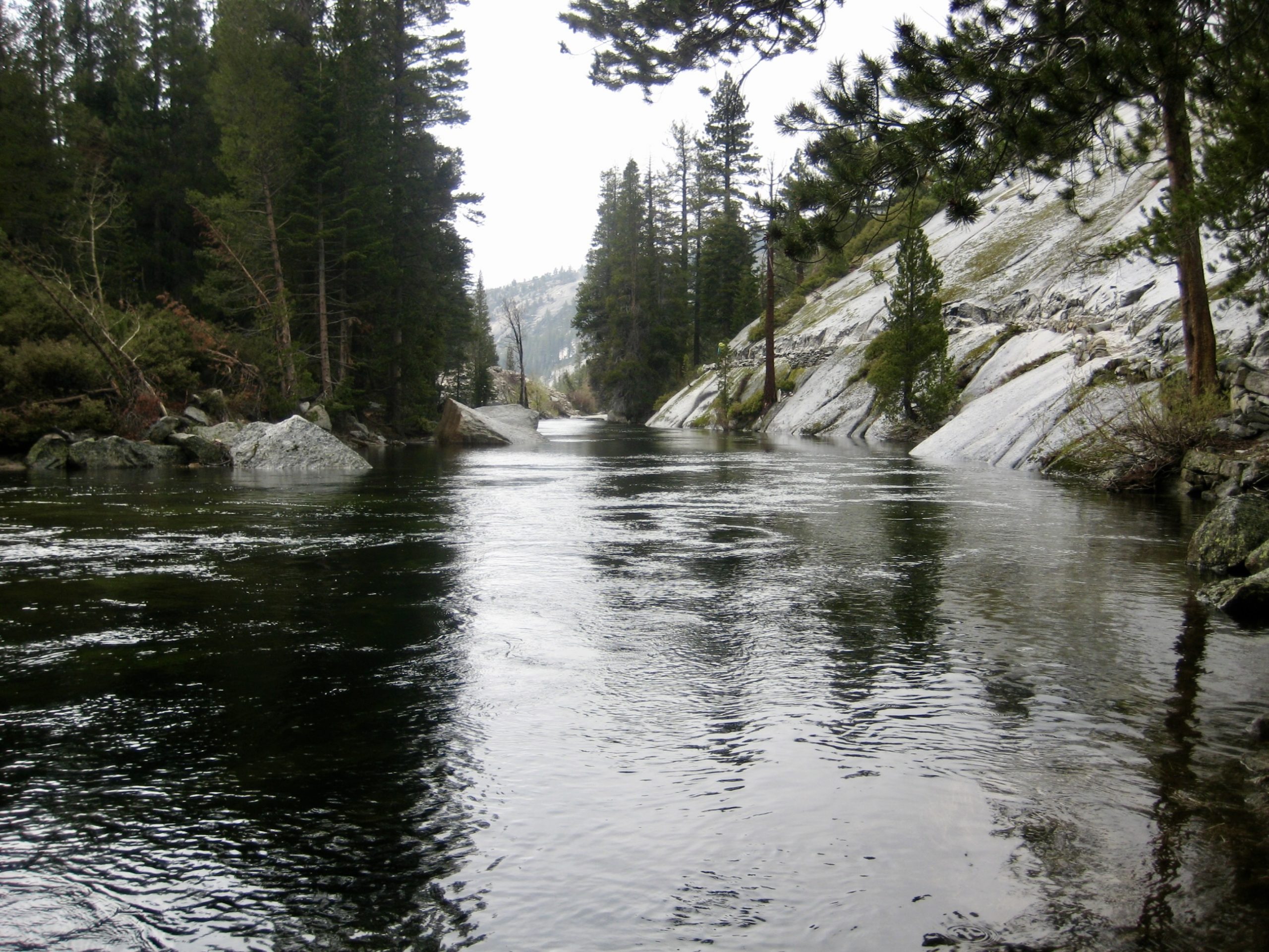
The weather cleared up overnight, such that we had a sunny exit hike from Merced Lake. Upon reaching Echo Valley Junction, we elected to follow the “low trail” down Merced Canyon rather than backtracking along Sunrise Creek on the “high trail.” This proved to be a good choice because Merced Canyon is fabulous!

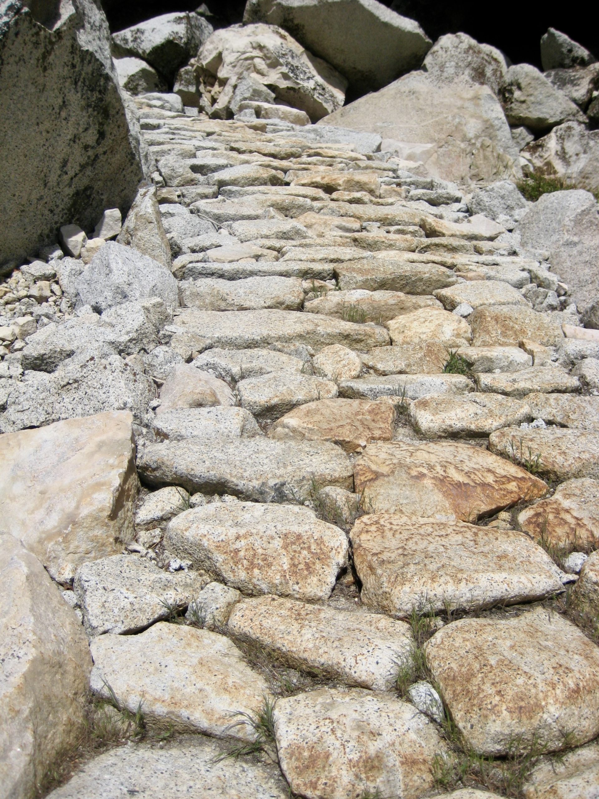
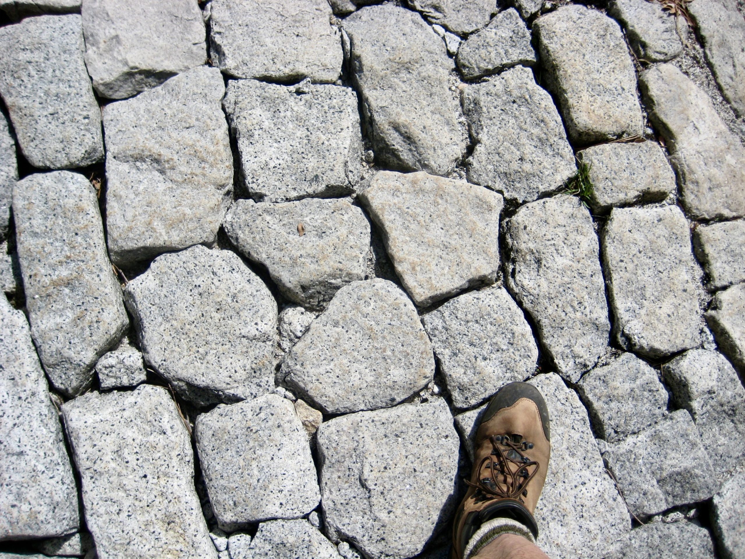
On the rare occasions when our views were limited, we needed only to look down at the hiking trail, which exhibited an admirable level of workmanship. Apparently, this is what happens in a century-old national park that possesses an infinite supply of granite rocks.
The Merced Canyon Trail passed by Bunnell Cascade, sliced through a burnt forest in Lost Valley, and eventually rejoined our entry trail in Little Yosemite Valley.
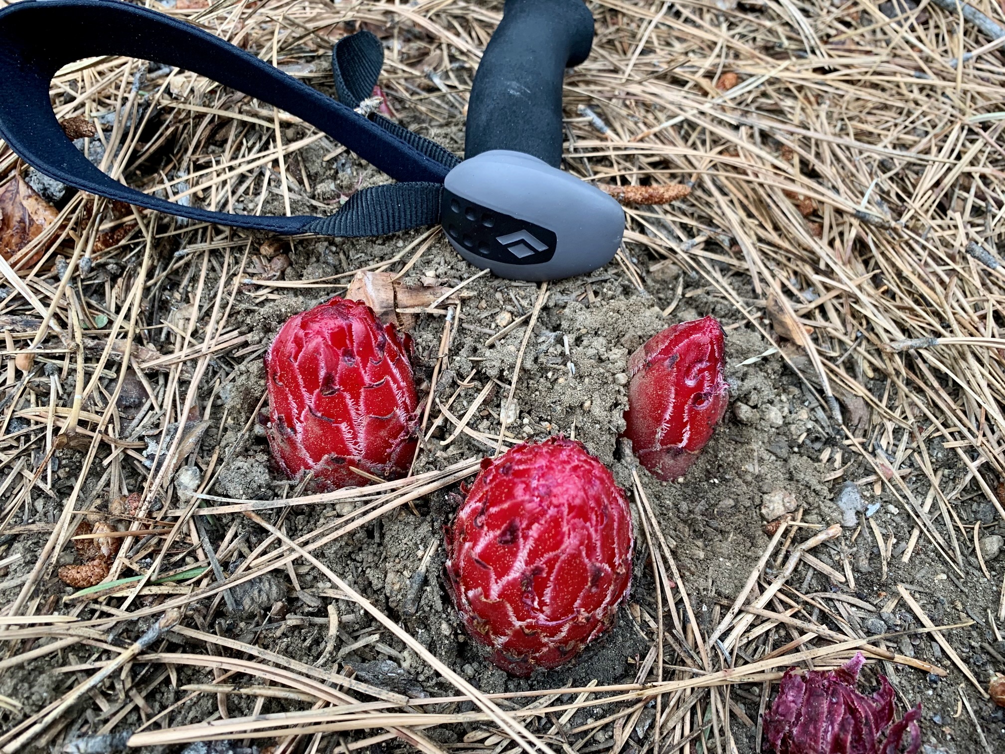
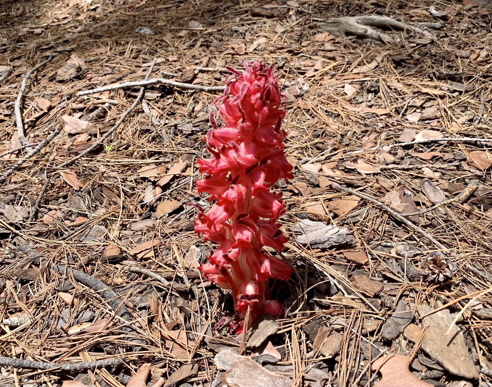
Another fascinating ground-level feature was visible alongside the valley trail. At higher elevations, Eileen and I had observed some peculiar, red, bullet-shaped plants emerging from the soil. Now at lower elevations, we could see them in a state of bloom. I later learned that these little curiosities are snow plants, which grow from the fungi of tree roots.
At Nevada Junction, we again departed from our entry route on the Mist Trail by taking the JMT over to Nevada Fall Bridge. Approximately 100 other hikers were milling about on the bridge and adjacent rock slabs here. The sight and sound of the Merced River flowing under this bridge and suddenly plunging over a 600-foot vertical cliff is truly awesome!
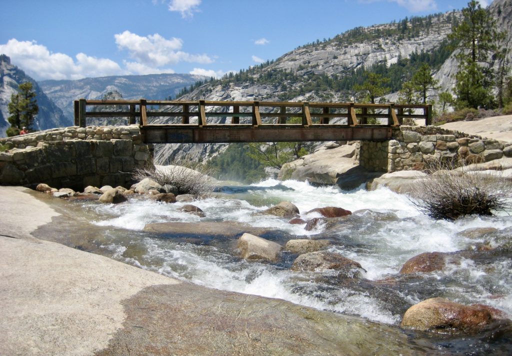
From Nevada Fall Bridge, we followed the JMT down through steep cliffs, with views back to Nevada Fall and Liberty Cap. Farther down, our trail joined the Mist Trail for a final descent to Happy Isles Bridge in Yosemite Valley.
At 4:30pm, we reached our car in the Happy Isles parking lot (8.3 hours + 13.0 miles + 1200 feet from Camp 4). Our trip had not played out as originally planned, but the incredible scenery that we experienced over the past five days overshadowed any disappointment. Besides, we’ll be back soon for another try.
Route Maps
…
…
…
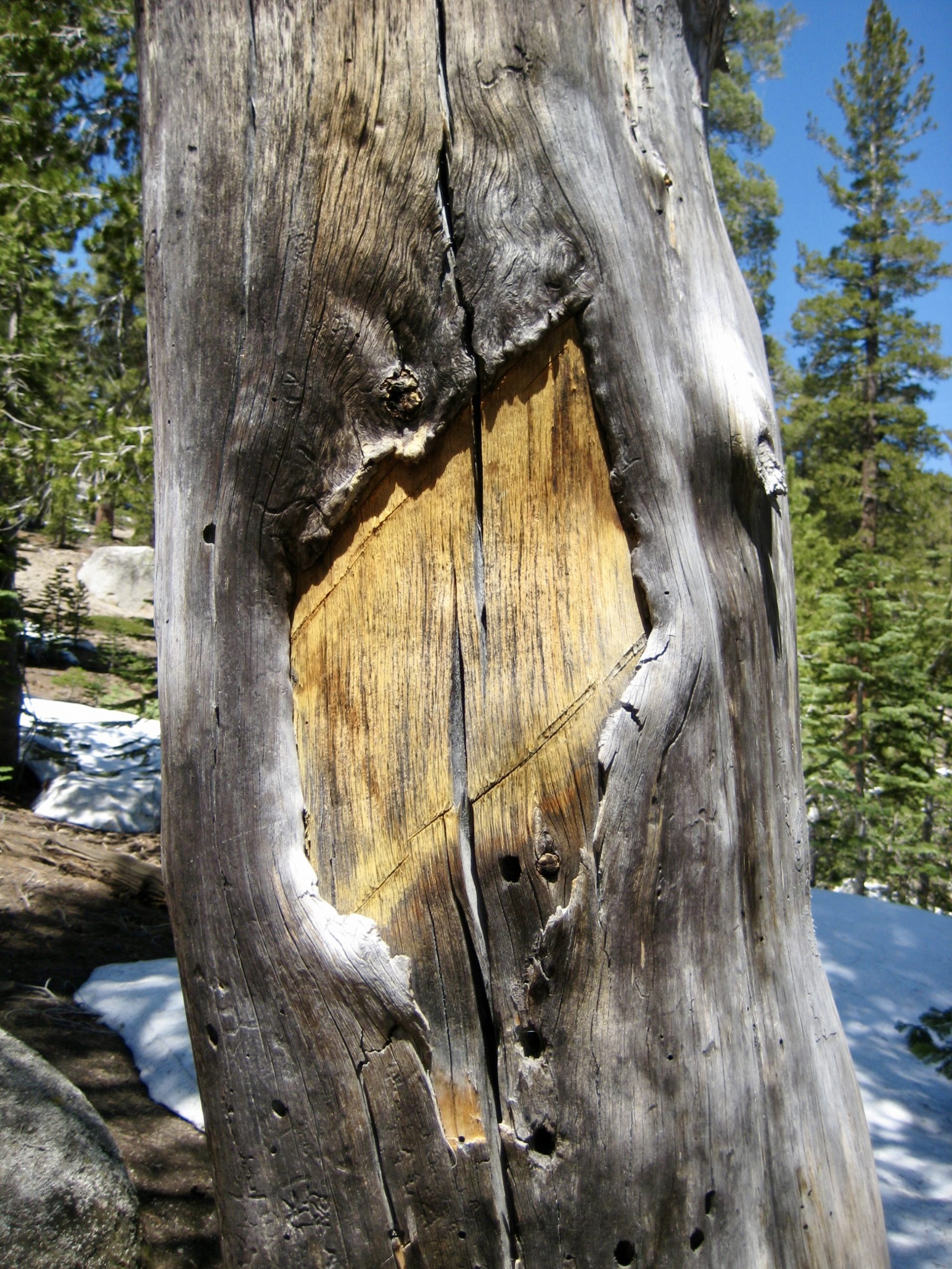
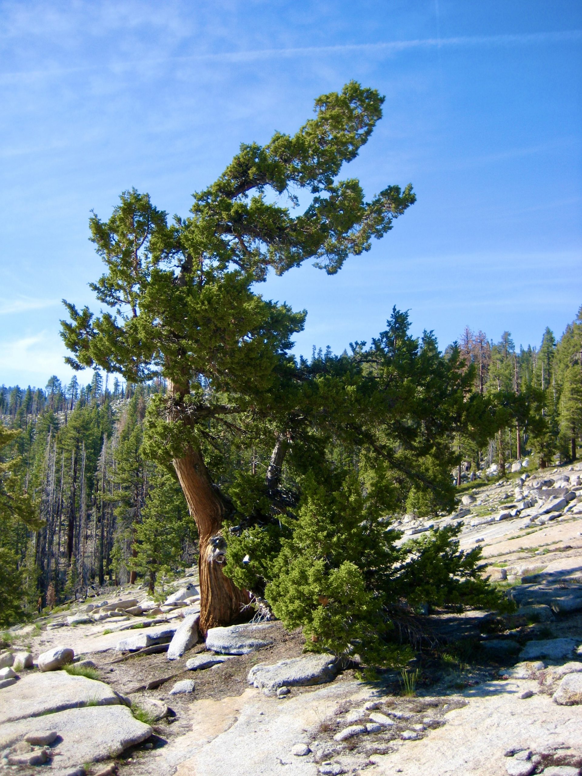
Photo Gallery
Click to enlarge…