Trip Date: March 28, 2026
2026 RED ROCKS ADVENTURE VACATION
Juniper Peak Day Climb
Arnight Trail
Juniper Canyon
The Cannonhole
Juniper Peak (6109 ft)
Trip Report Summary
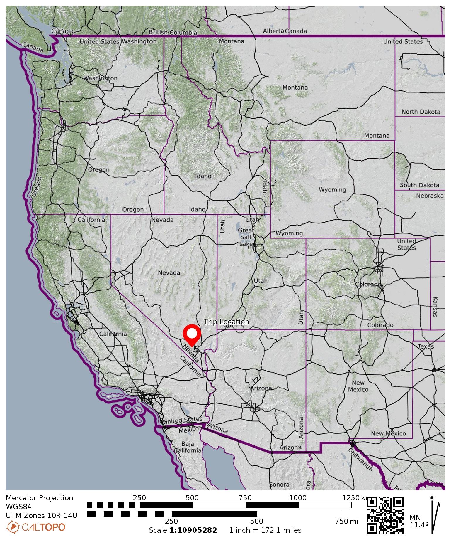
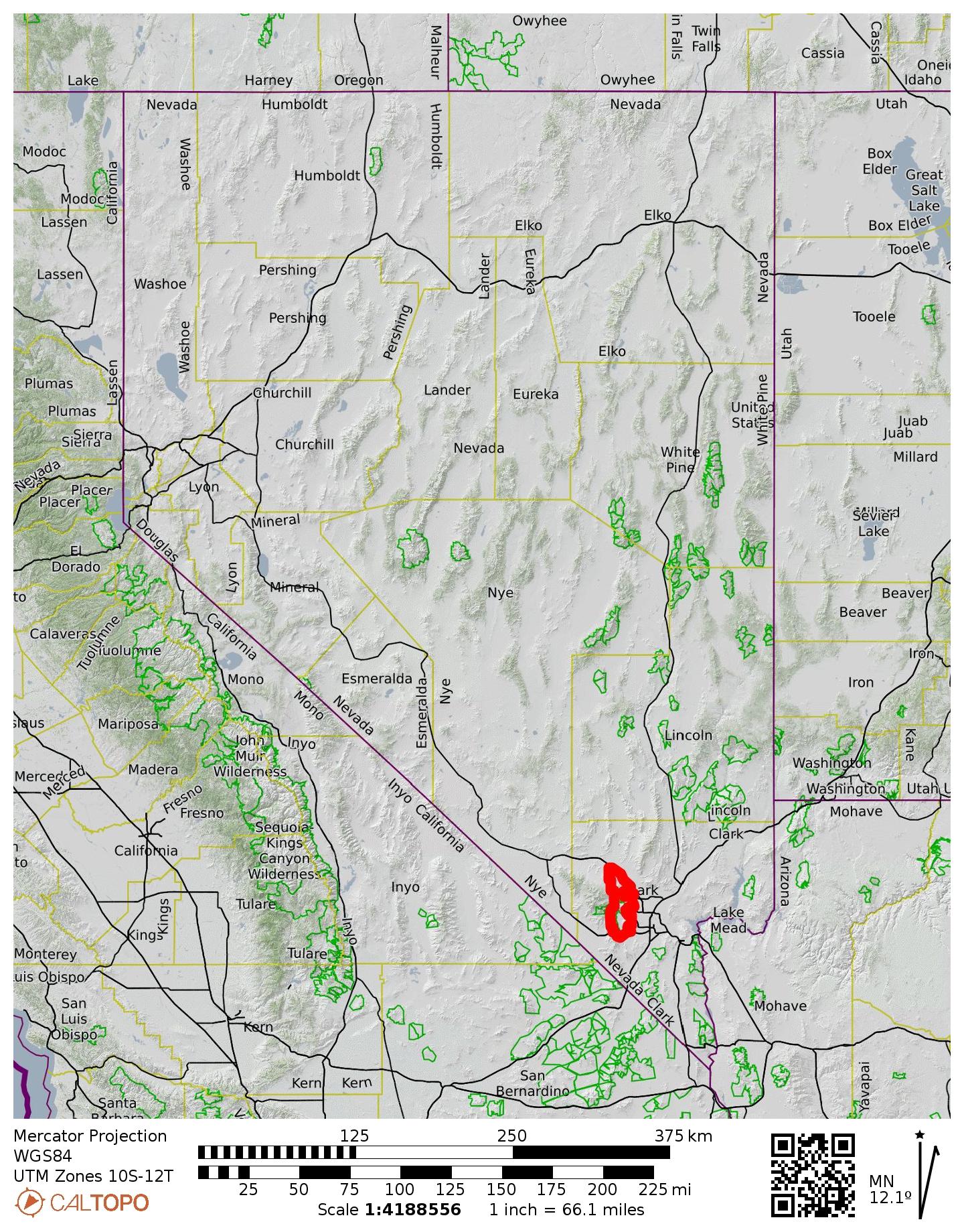
Region: Nevada
Sub-Region: Spring Mountains
Sub-Sub-Region: Sandstone Bluffs
Areas: Red Rock Canyon National Conservation Area & Rainbow Mountain Wilderness
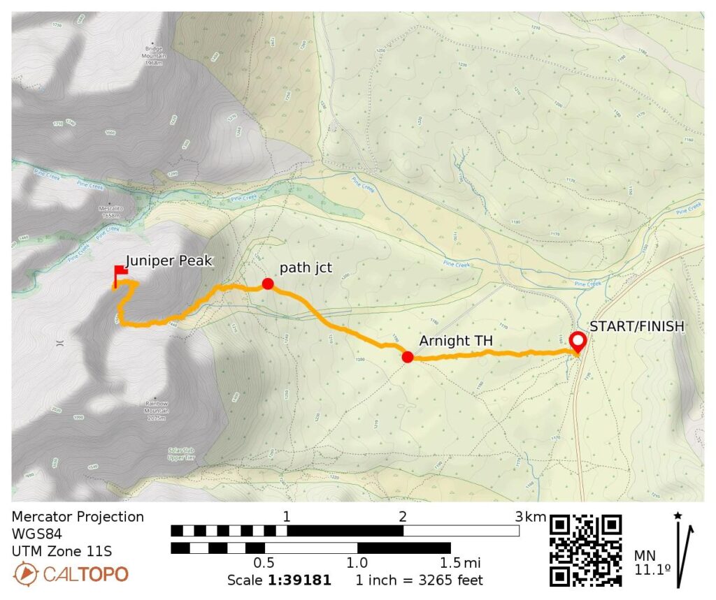
Starting & Ending Point: unmarked parking lot beside Highway 159 adjacent to Scenic Drive exit gate (Elev. 3800 feet)
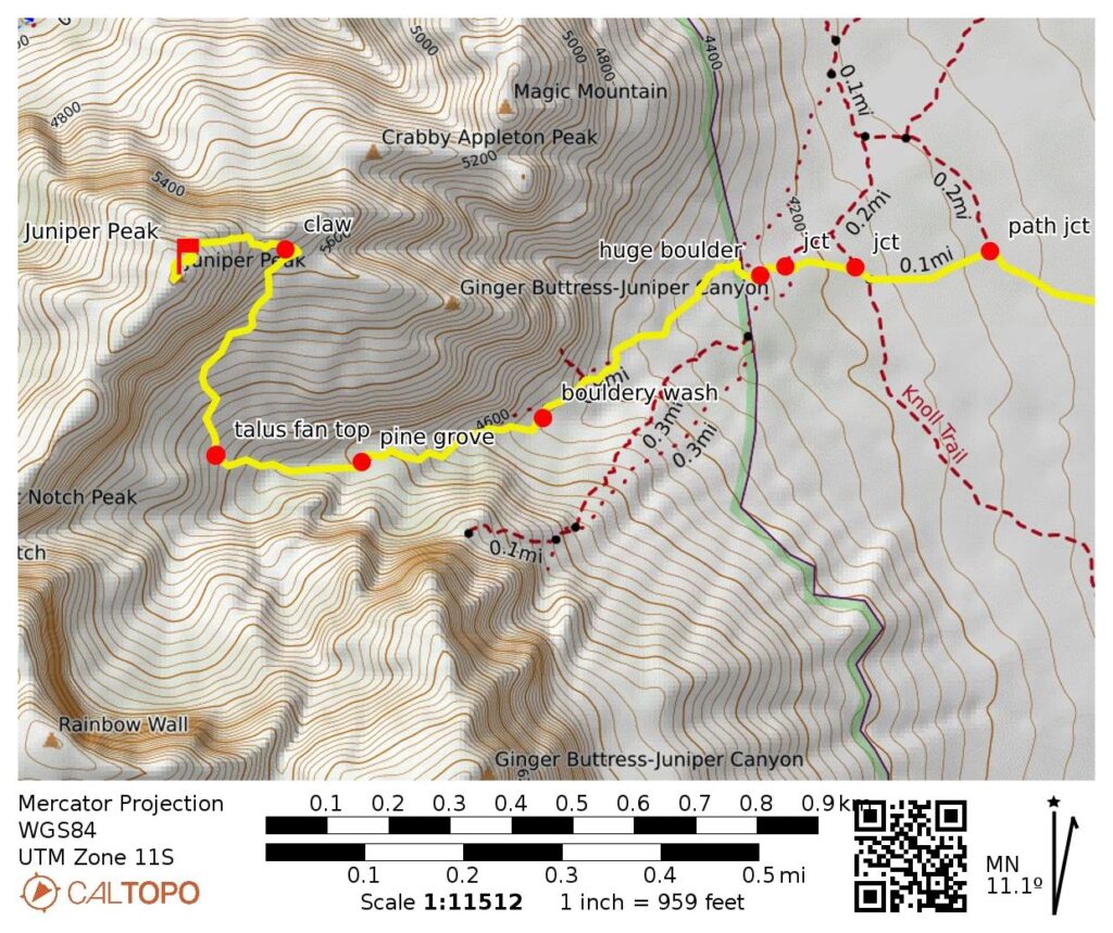
Way Points: Oak Creek Canyon parking lot / Arnight Trailhead & Juniper Canyon path junction & huge boulder & Juniper Canyon & pine grove & talus fan & southeast ramp & The Lobster Claw & East Juniper Ridge crest & The Cannonhole & Juniper Peak summit (trail hike & off-trail hike & rock scramble)
Summit: Juniper Peak (off-trail hike & rock scramble via Southeast Ramp—East Gully—Upper East Ridge)
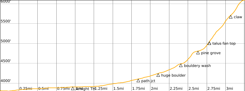
Approximate Stats: 6.5 miles traveled; 2100 feet gained & lost; 6.0 hours up; 3.6 hours down.
…
Related Posts
>>> Mescalito Peak via South Fork Pine Creek—West Ridge—Upper South Face – March 31, 2025
>>> Mt. Wilson via First Creek Canyon—Southwest Ridge – March 27, 2024
>>> Bridge Mountain via Rocky Gap Road—West Ridge—Northwest Face – October 25, 2022
Trip Overview
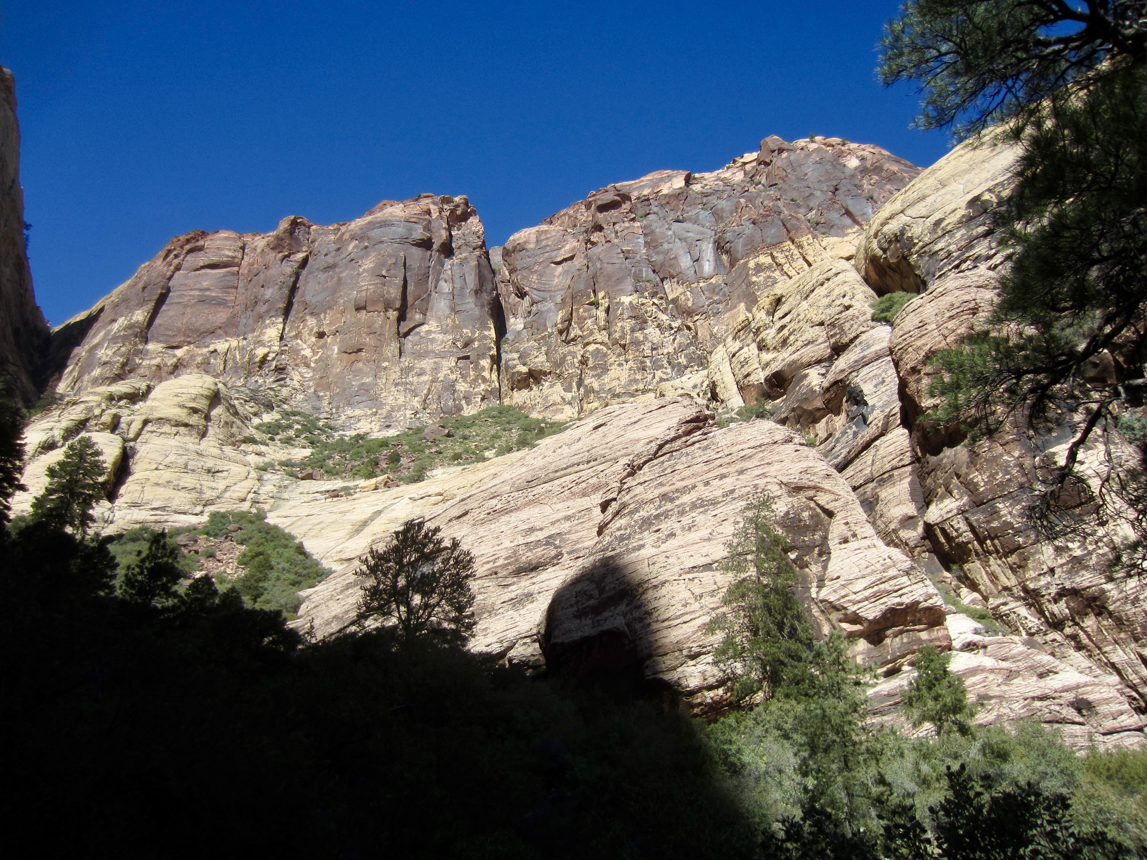
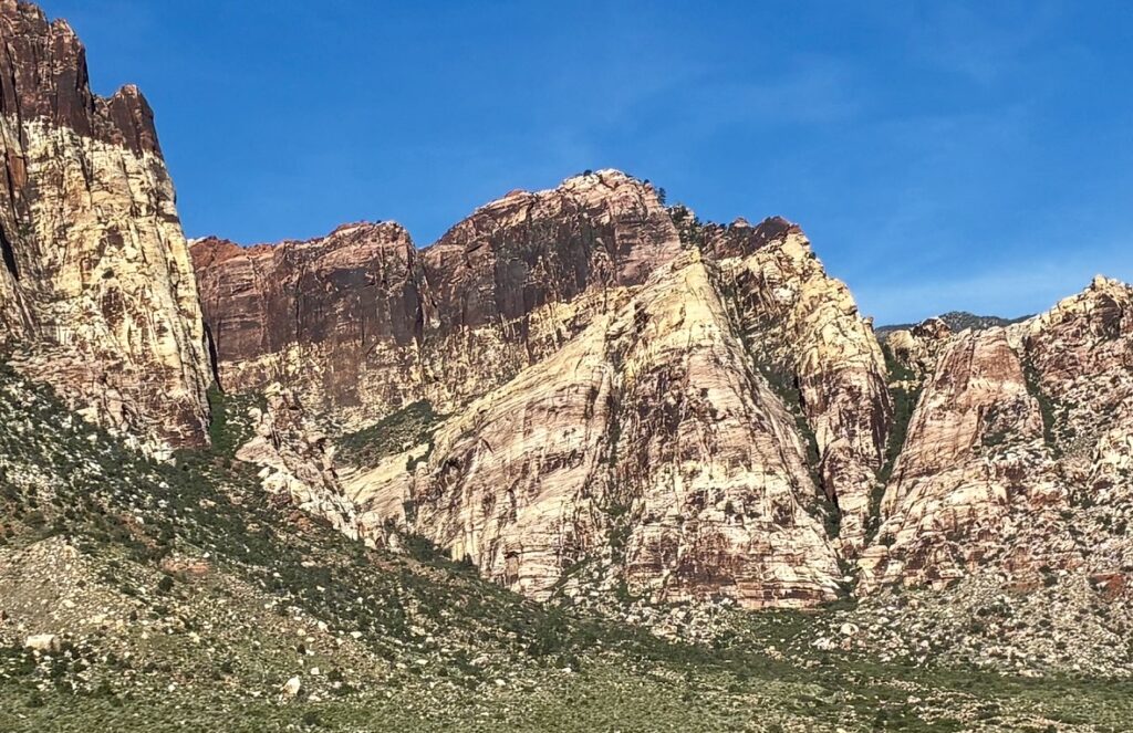
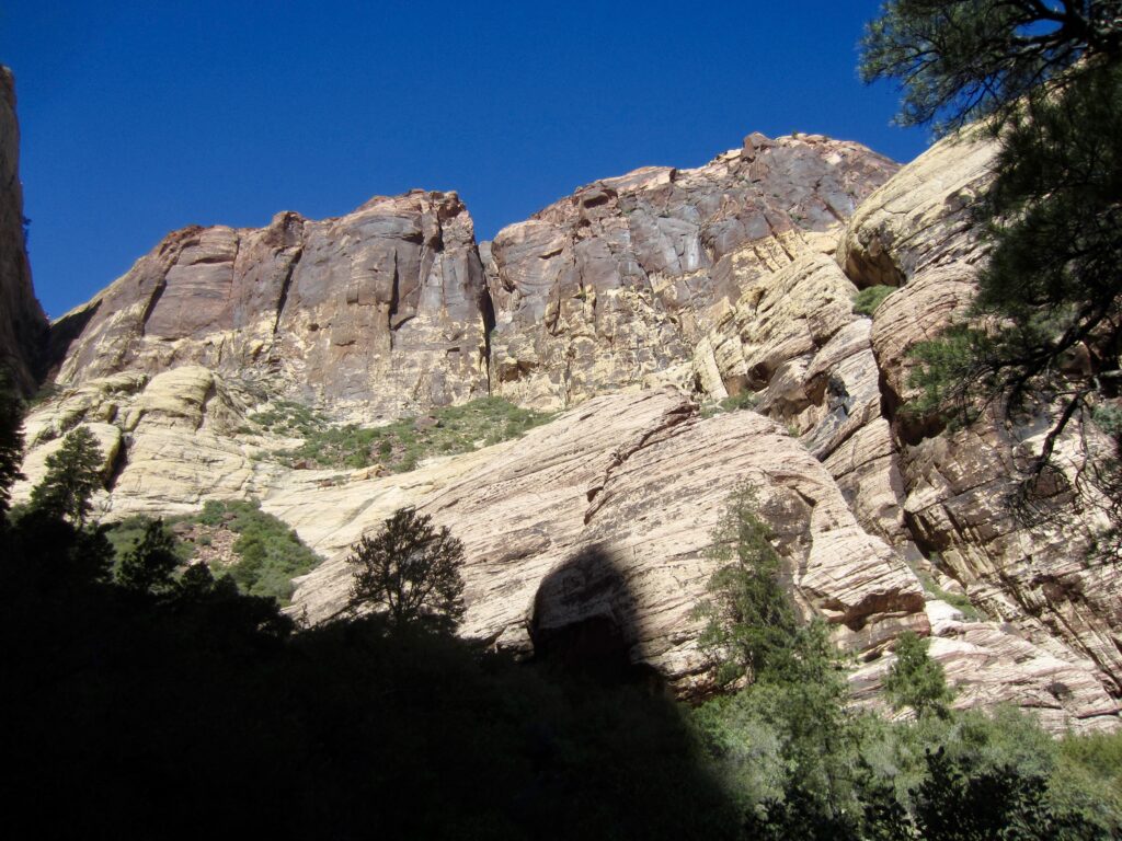
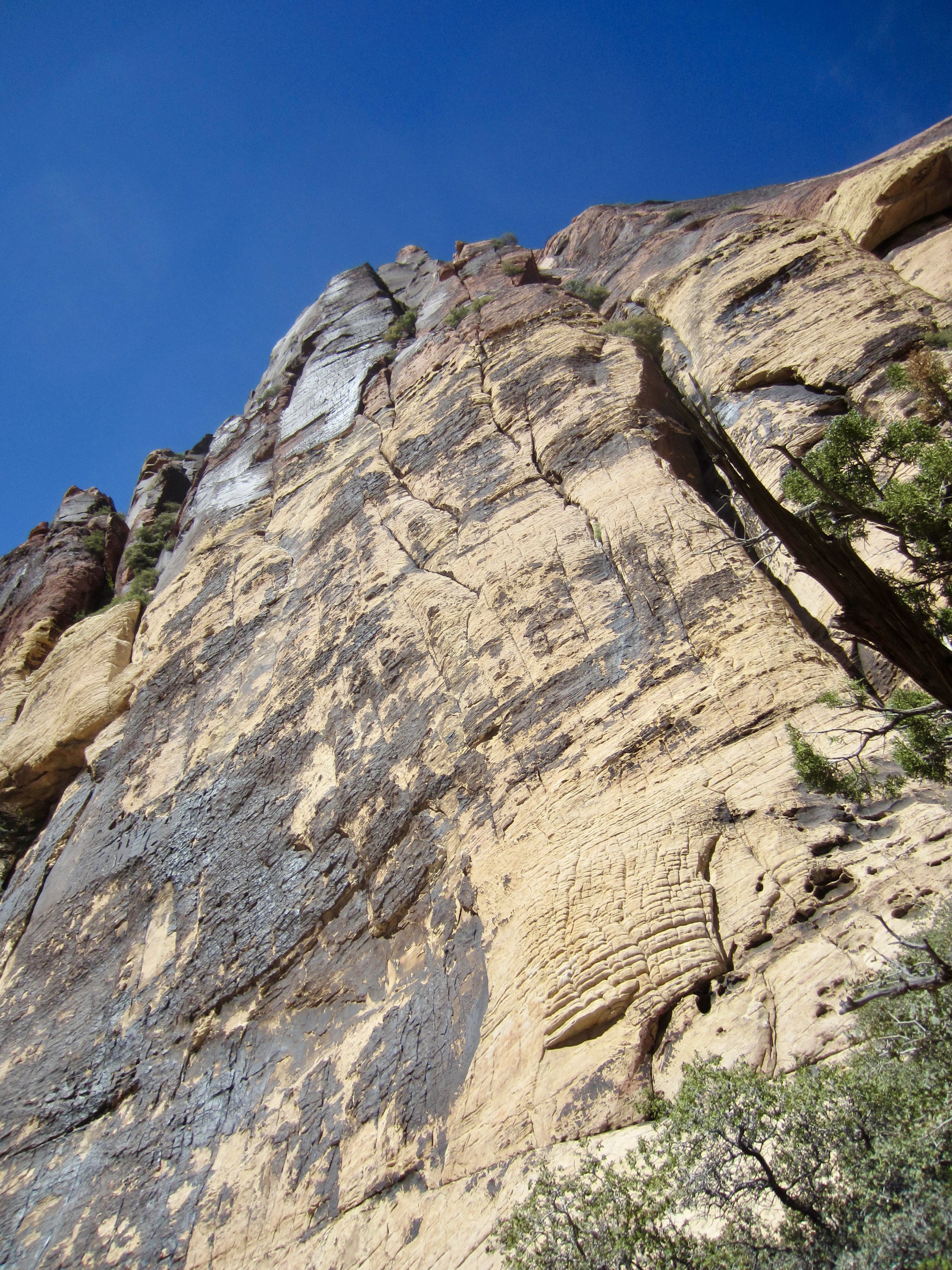
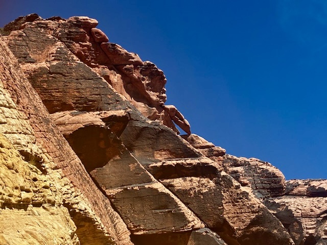
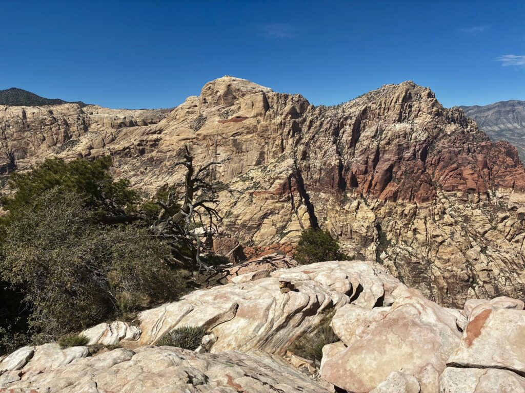
Juniper Peak is a secondary summit within the Sandstone Bluffs of Red Rock Canyon National Conservation Area (“Red Rocks”) near Las Vegas. It is often overlooked by casual observers due to a modest elevation compared to the neighboring summits of Rainbow Mountain and Bridge Mountain, and due to a rather amorphous shape compared to, say, adjacent Mescalito Peak. For sure, Juniper’s most distinctive feature is Brownstone Wall—a giant swath of chocolate-colored desert varnish that covers the upper southeastern facade. Eileen and I became intrigued by this peak after recently tucking in several other summits within the Sandstone Bluffs.
.
The standard scrambling route up Juniper Peak starts in Juniper Canyon on the southern side, ascends a major ramp on the southeastern face, and finishes on the upper east ridge. Juniper Canyon can be approached from any of three different starting points:
- 1. Pine Creek Canyon Trailhead, located adjacent to Scenic Drive;
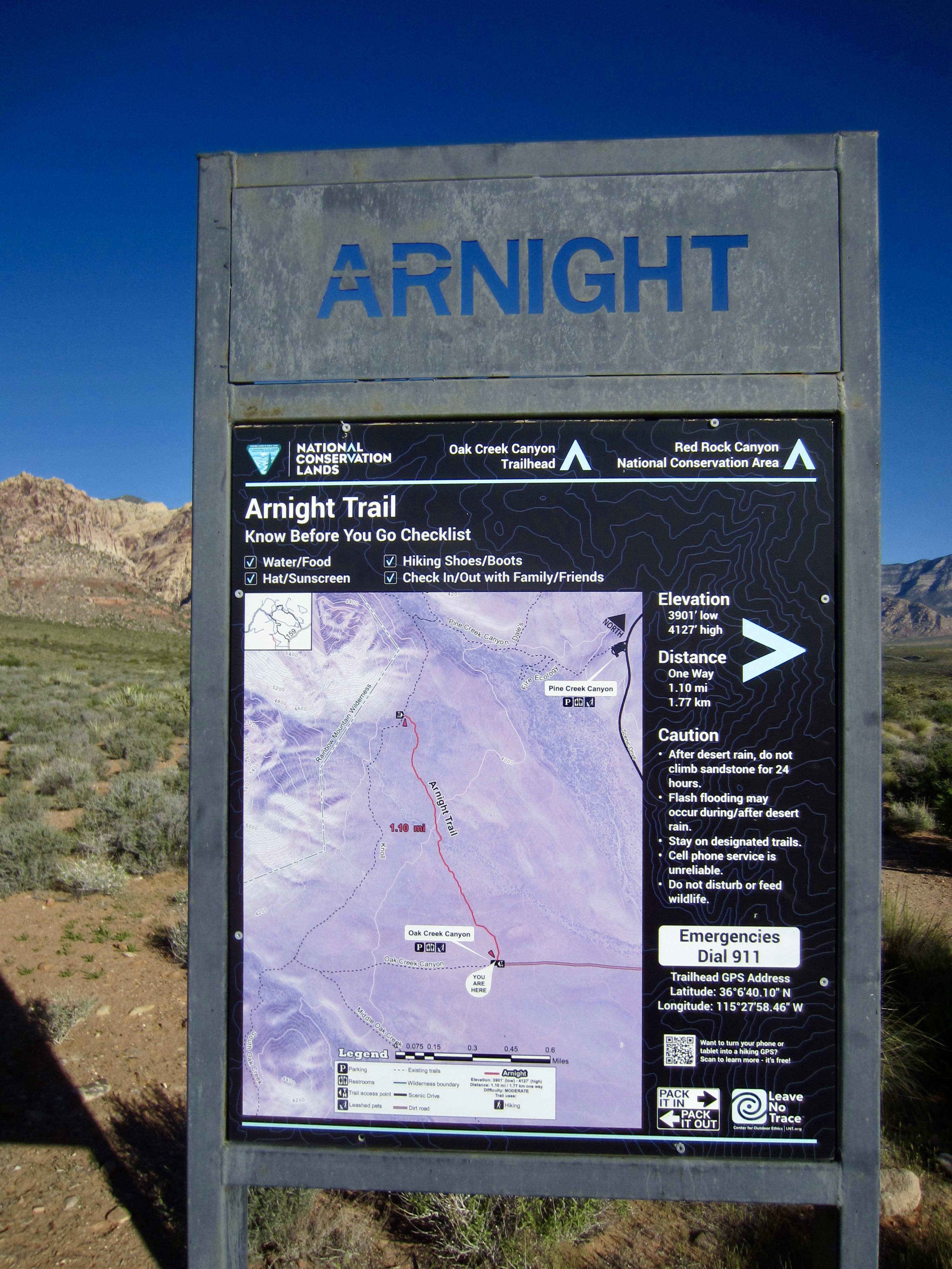
- 2. Arnight Trailhead, located at the end of a gravel road that extends 1 mile from Scenic Drive;
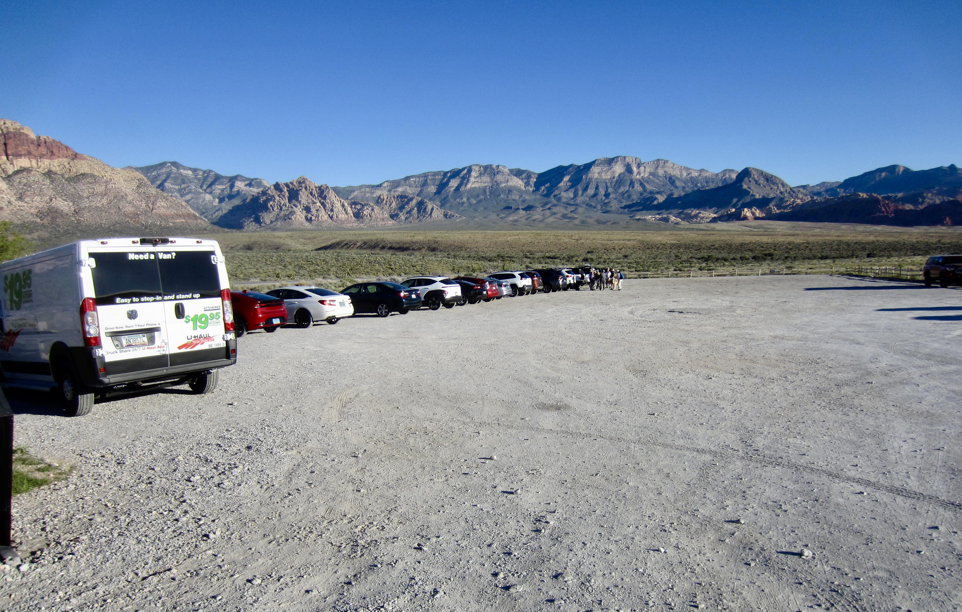
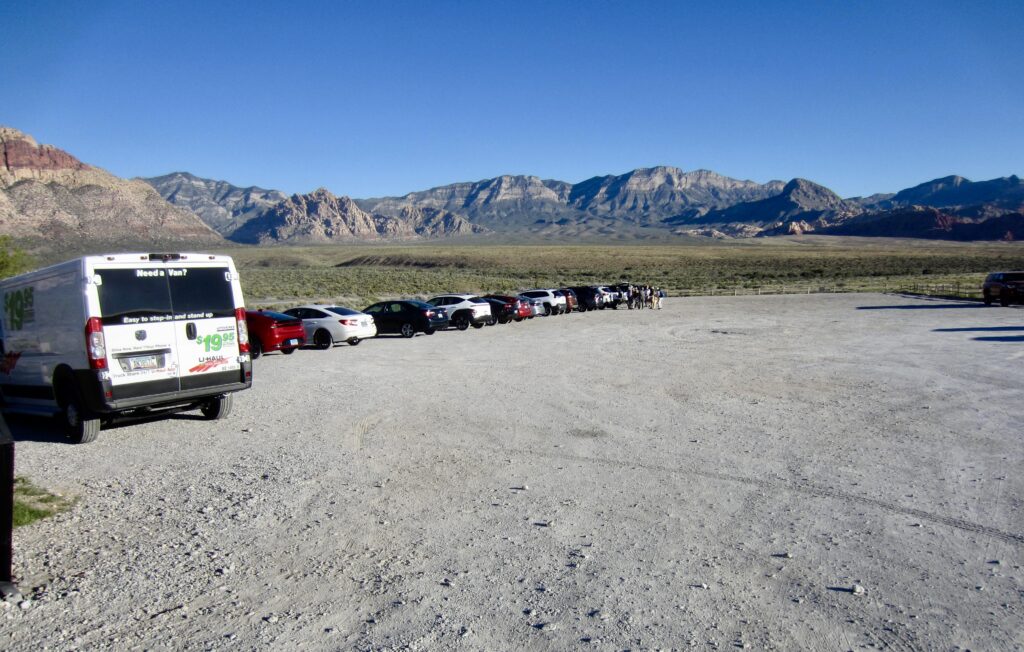
- 3. A large, unmarked parking lot located beside Highway 159, adjacent to the Scenic Drive exit gate.
Options 1 and 2 both involve a shorter hike but require that you first enter the National Conservation Area and then drive about 12 to 13 miles around the Scenic Drive loop. Option 3, on the other hand, adds 1 mile (each way) to the hike but does not require that you drive around the loop. Eileen and I chose this option simply to reduce our driving time and distance. Strangely, the Option 3 parking lot accommodates several hundred vehicles but currently has no formal name and no signage.
.
For our ascent of Juniper Peak, Eileen and I tried to follow the detailed directions given in Branch Whitney’s comprehensive Hiking Las Vegas guidebook. These directions were very helpful in some locations, but we found them confusing or outdated in many other locations. Much of the micro-routefinding was best handled by simply looking for stone ducks, cairns, and boot tread.
Full Trip Report
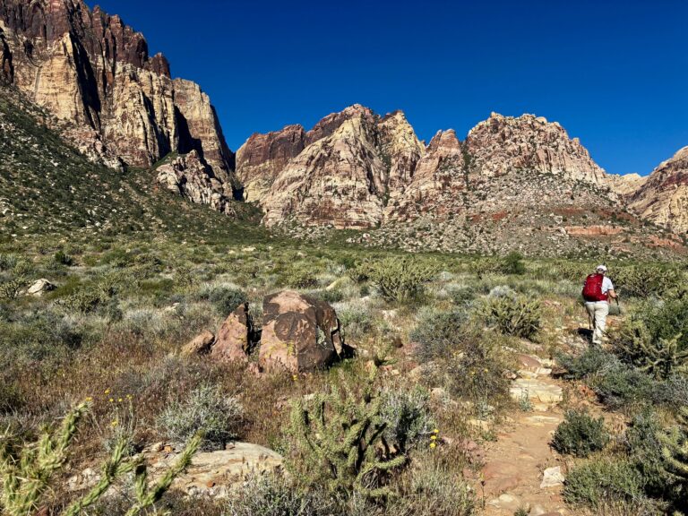
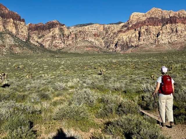
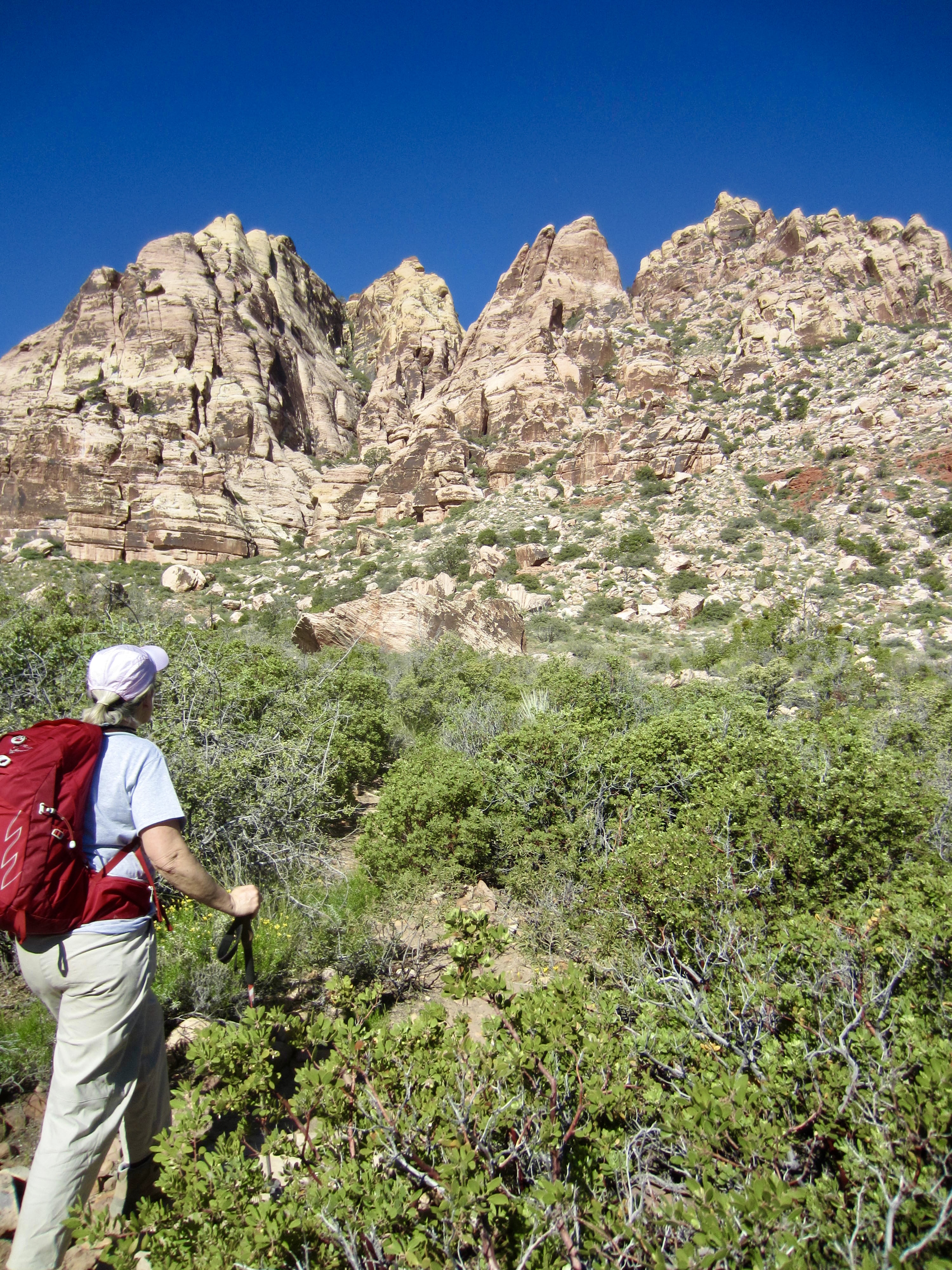
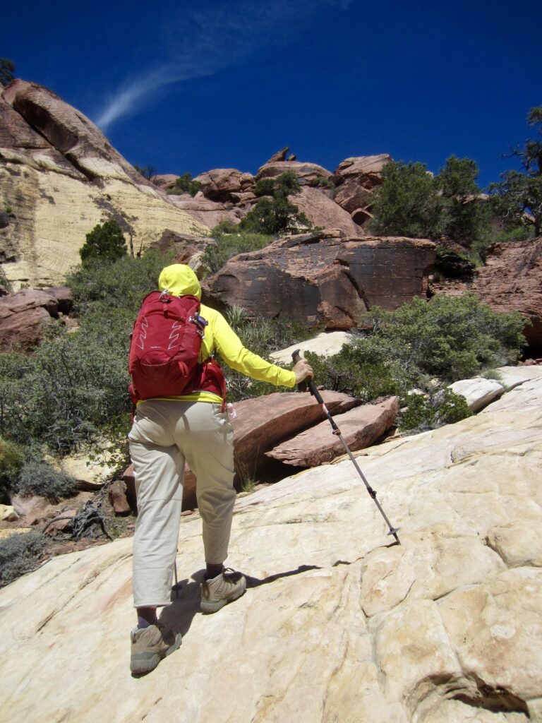
We headed out from the exit gate parking lot on a warm Saturday morning, walked across Scenic Drive, and scoped out the various unmarked paths fanning out from the roadway shoulder. Of the four or five available, we chose the right-most path because it aimed most directly toward Juniper Peak. This well-trodden path led us on a due-west bearing across the desert plain.
.
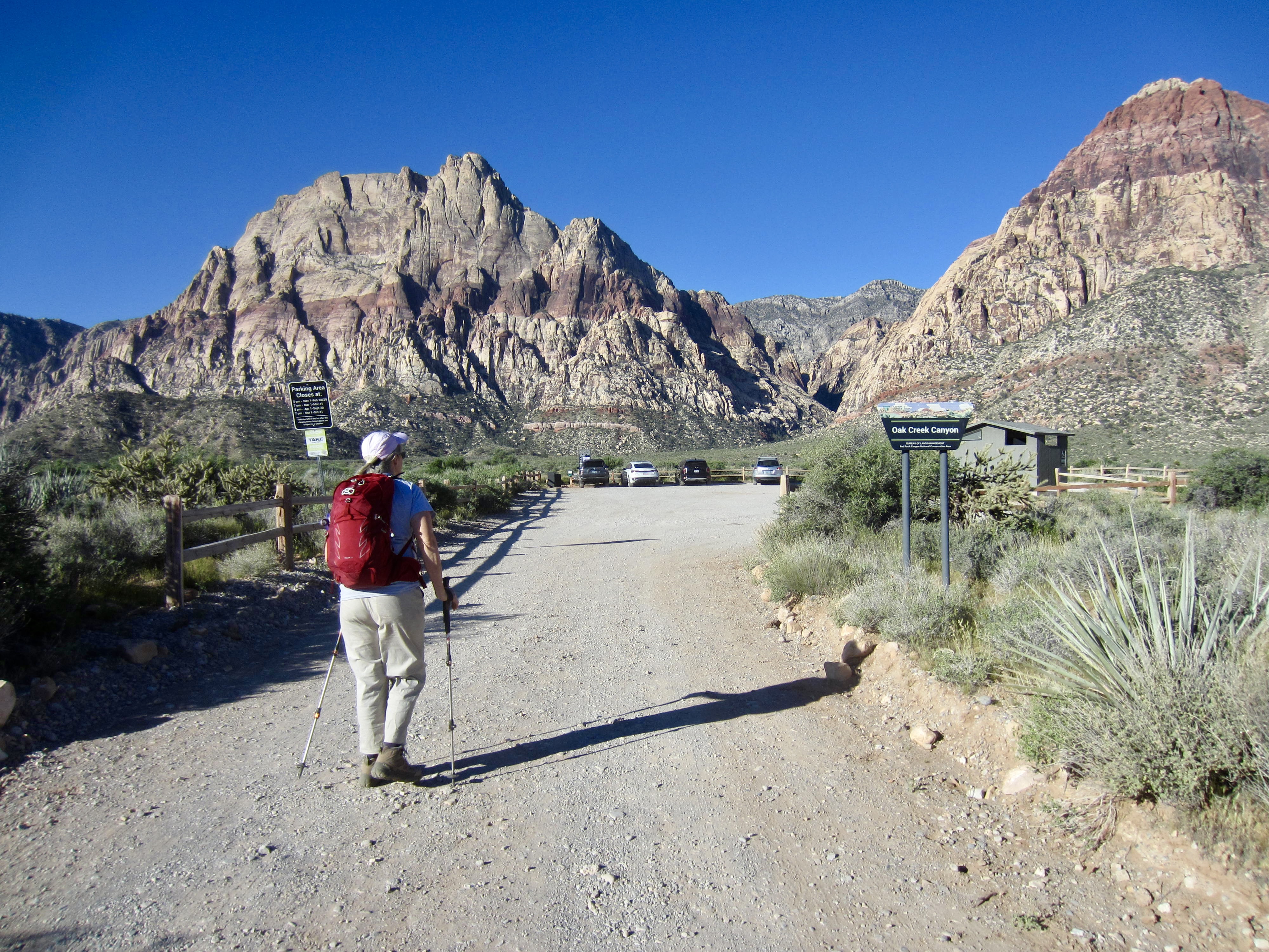
In an easy mile, we came to the Oak Creek Canyon parking lot, which serves two different trailheads. The Oak Creek Canyon Trailhead is located in the southern corner of the lot, and the Arnight Trailhead is located in the northern corner. We got on the Arnight Trail and followed it in a northwesterly direction across the desert.
.
After a short mile on the Arnight Trail, we came to an unmarked junction and turned left on an obvious path that steered us toward the mouth of Juniper Canyon. Our path soon crossed over the Knoll Trail and then continued past several other unmarked junctions.
.
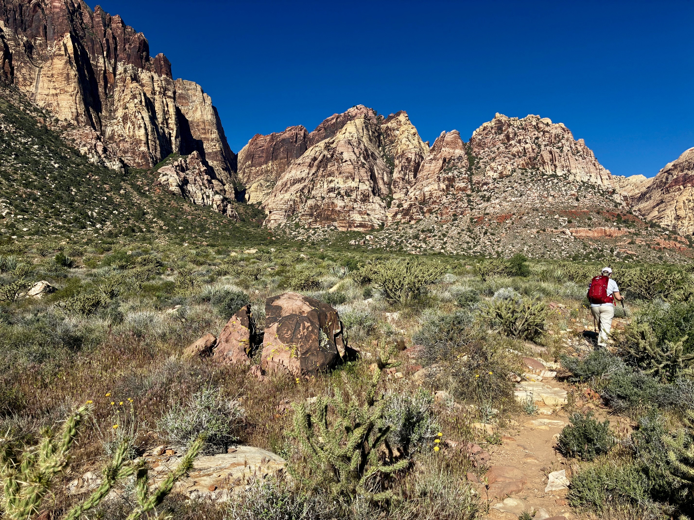
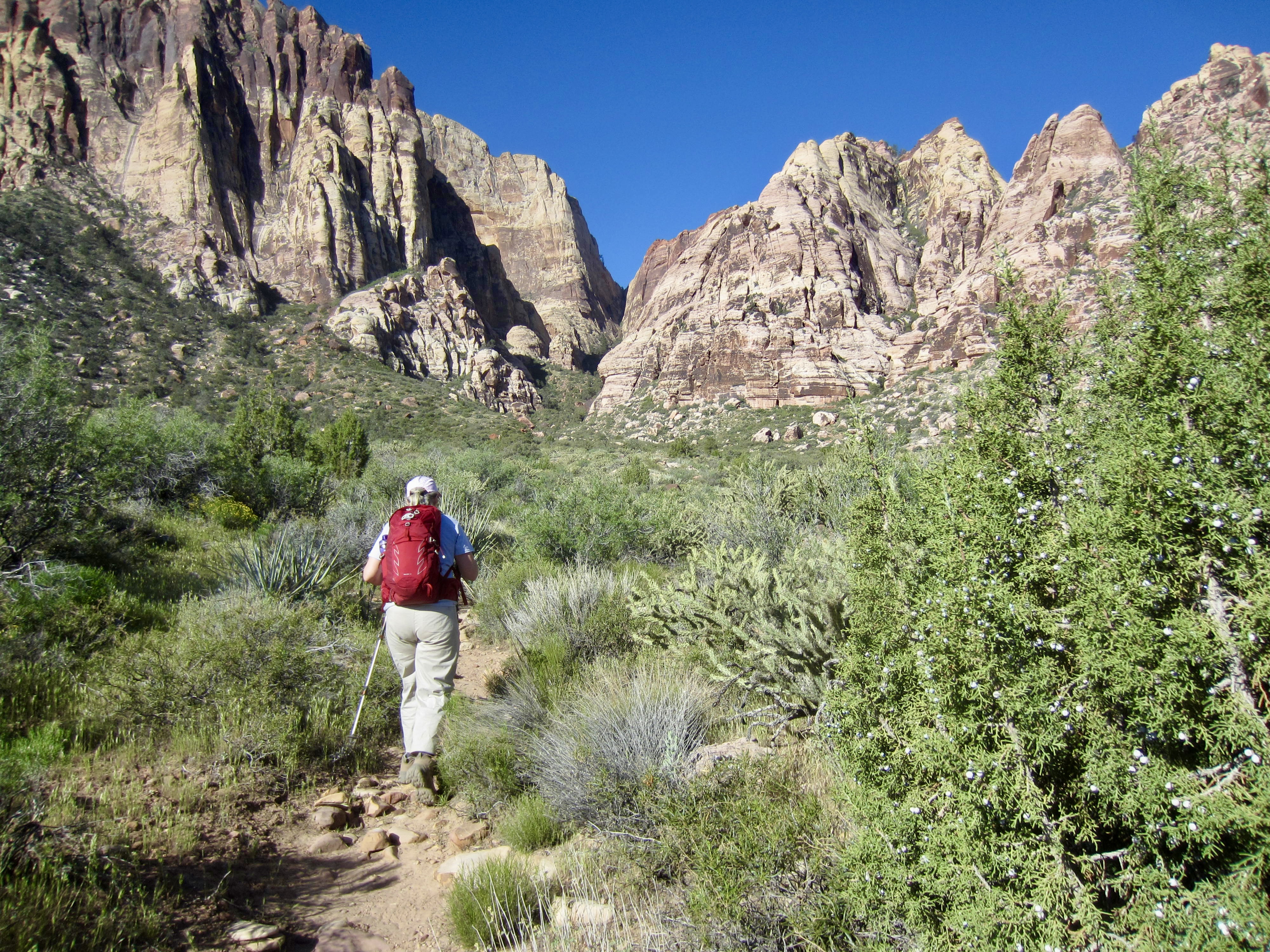
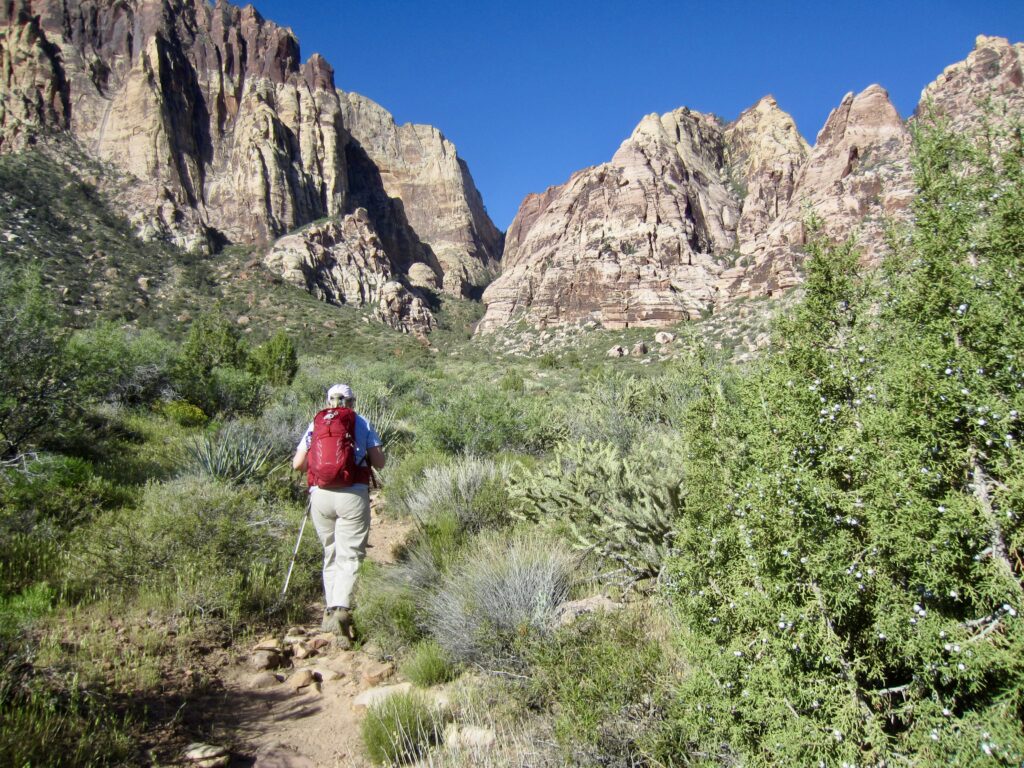
Per Branch Whitney’s directions, an important landmark within this maze of trails and paths is a huge, striped boulder sitting on the right (north) side of the canyon mouth. On the uphill side of this boulder, we intersected a well-traveled path that led us into the canyon, always staying on the right side of the invert.
.
.
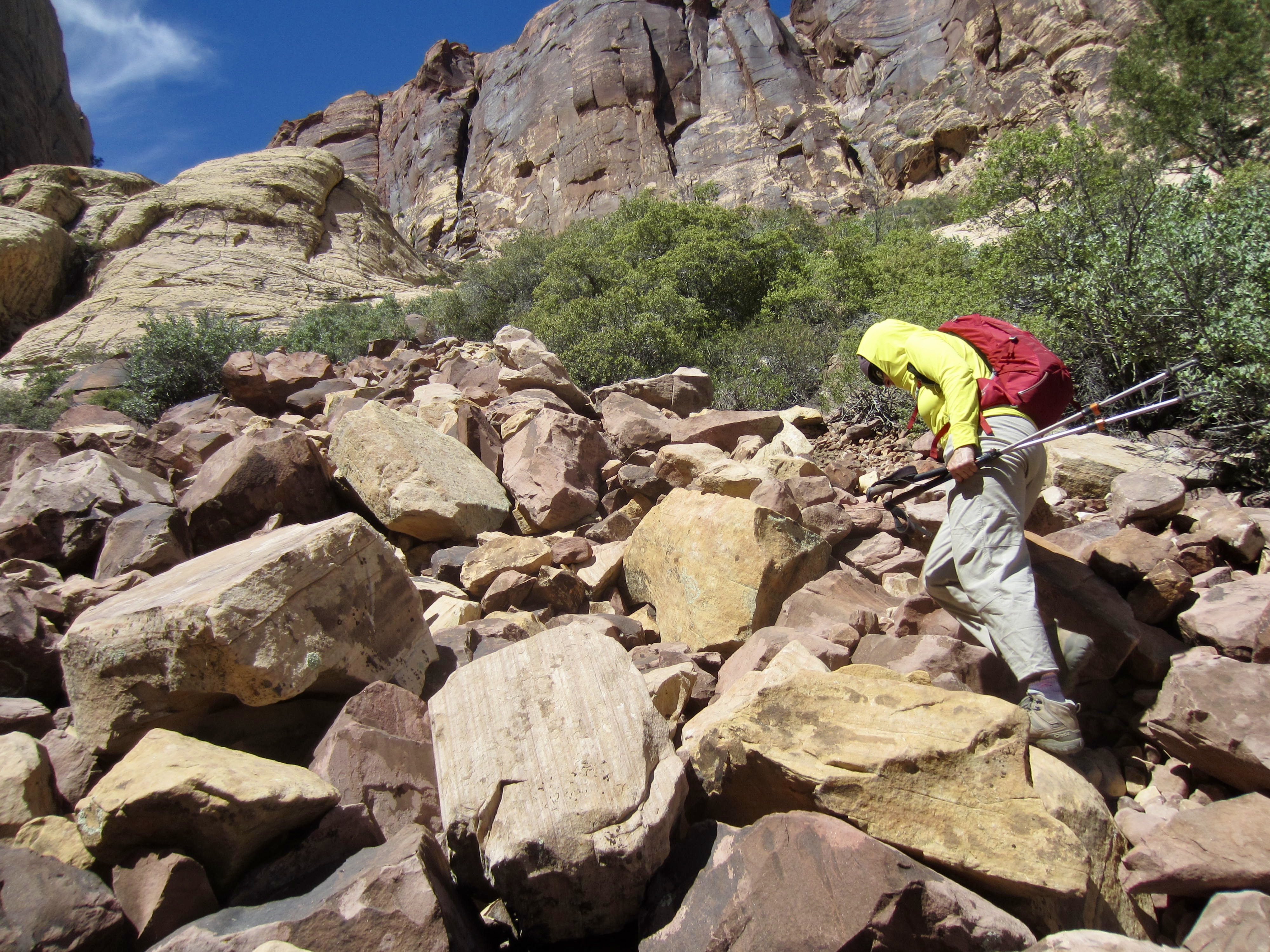
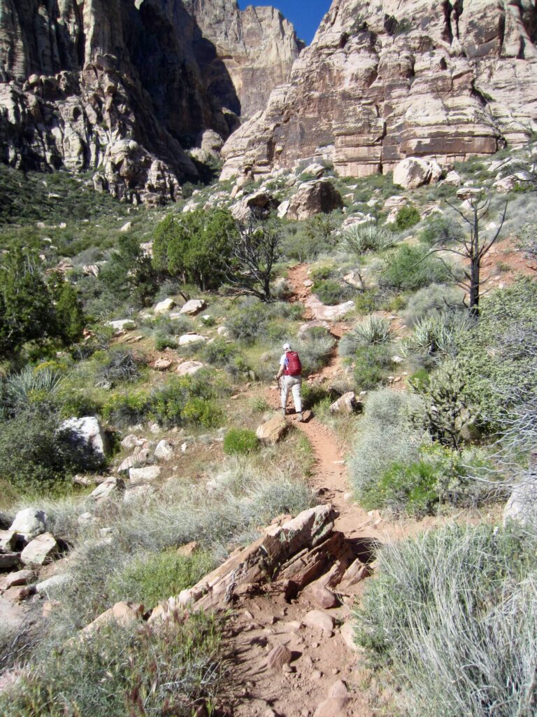
Our path eventually descended into the canyon invert, where we scrambled upward, going over and around boulders of all sizes for approximately 200 yards. Numerous stone ducks helped to guide us through the sandstone jumble. We eventually left the boulders behind and gained a rough path that switchbacked up a steep dirt headwall.

.
.
At the top of the dirt headwall, our path descended slightly into a shady pine grove beneath the massive Brownstone Wall (3.2 hours + 850 feet from starting point). This little grove of ponderosa and pinion trees provided a welcome respite from the late-morning sun and heat.
.
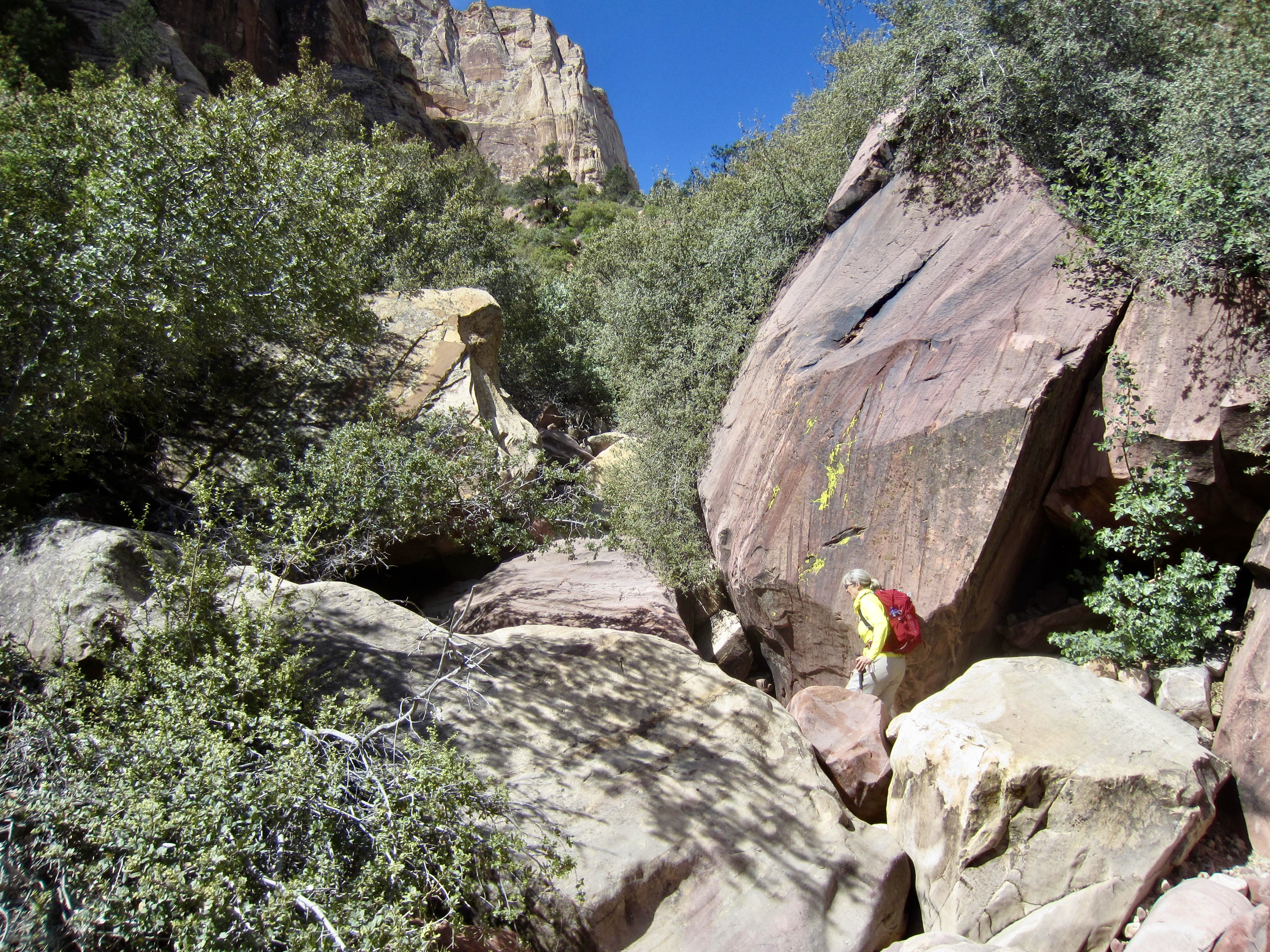
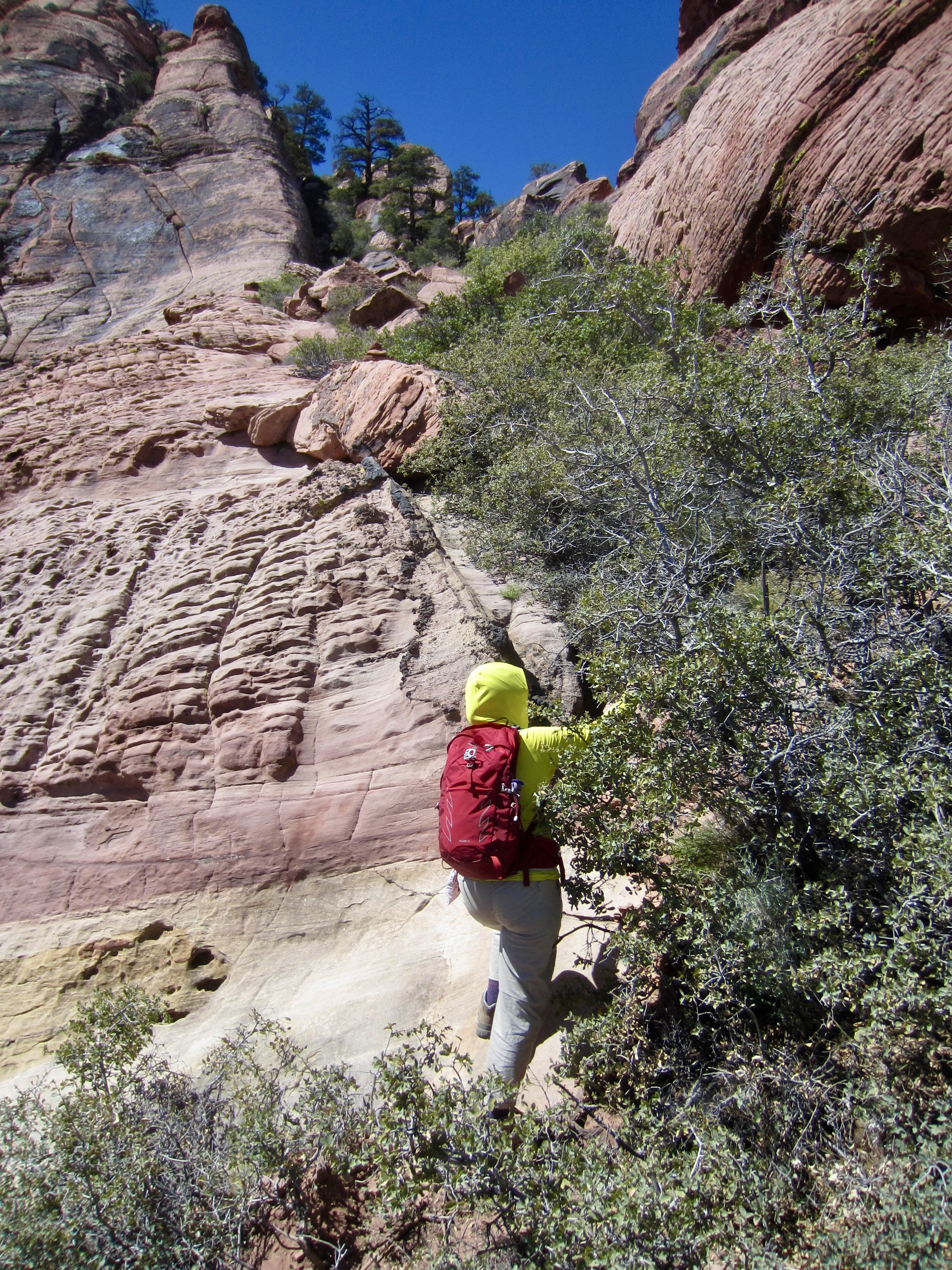
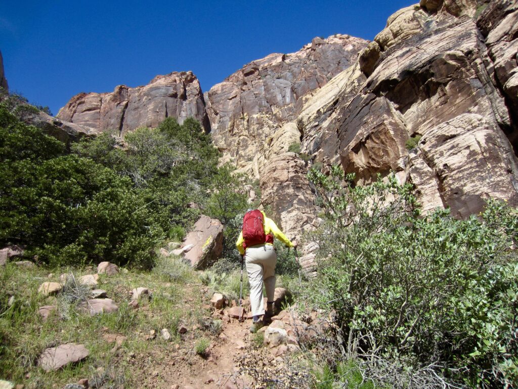
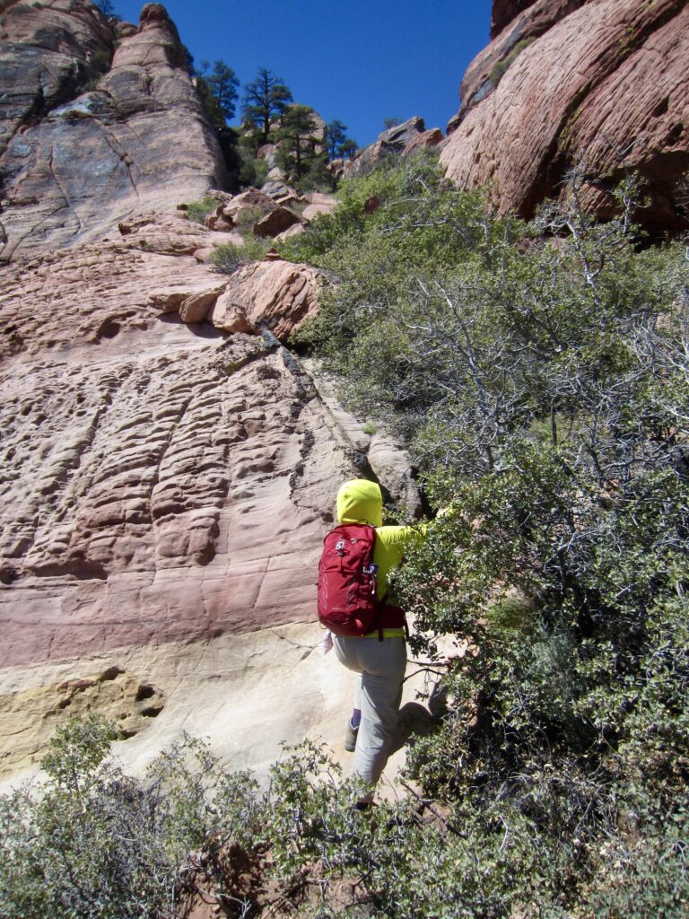
Following a long break in the pine grove, we followed the path down into a rocky wash and then up the opposite side, through a narrow corridor that has been hacked into the dense brush. This corridor opened onto a fan-shaped talus field that initially looked loose and treacherous but turned out to be surprisingly straightforward.

.
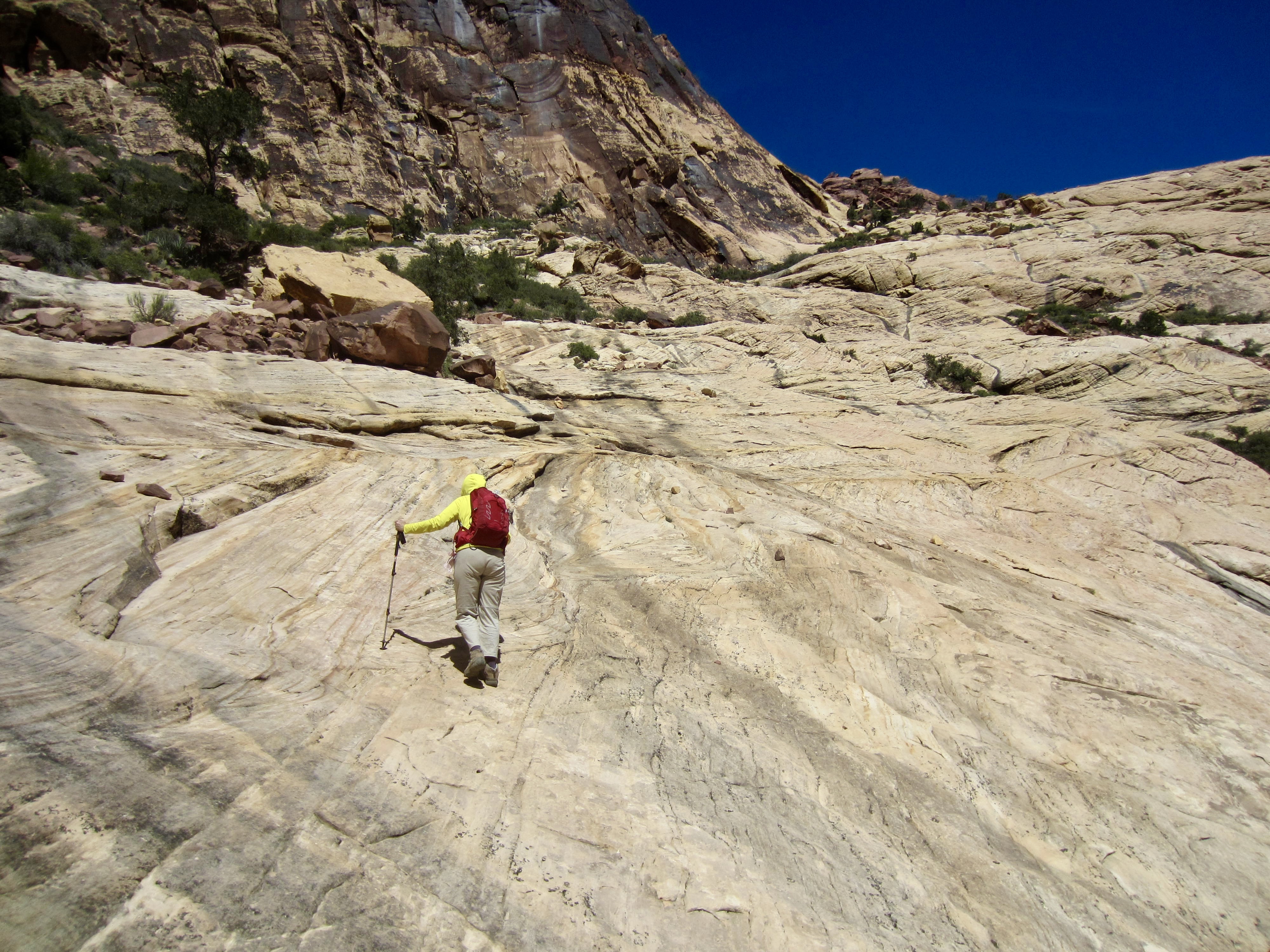
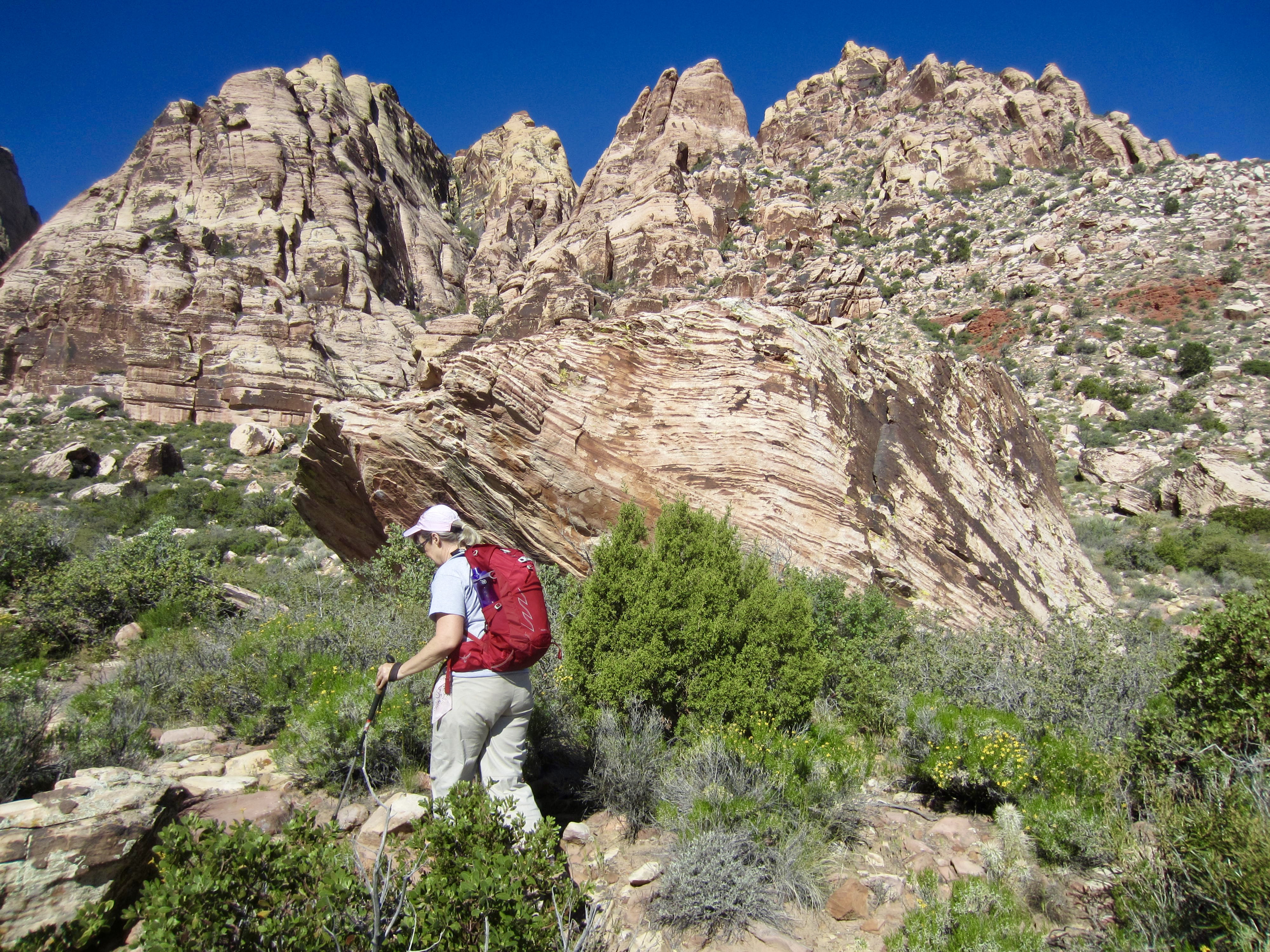
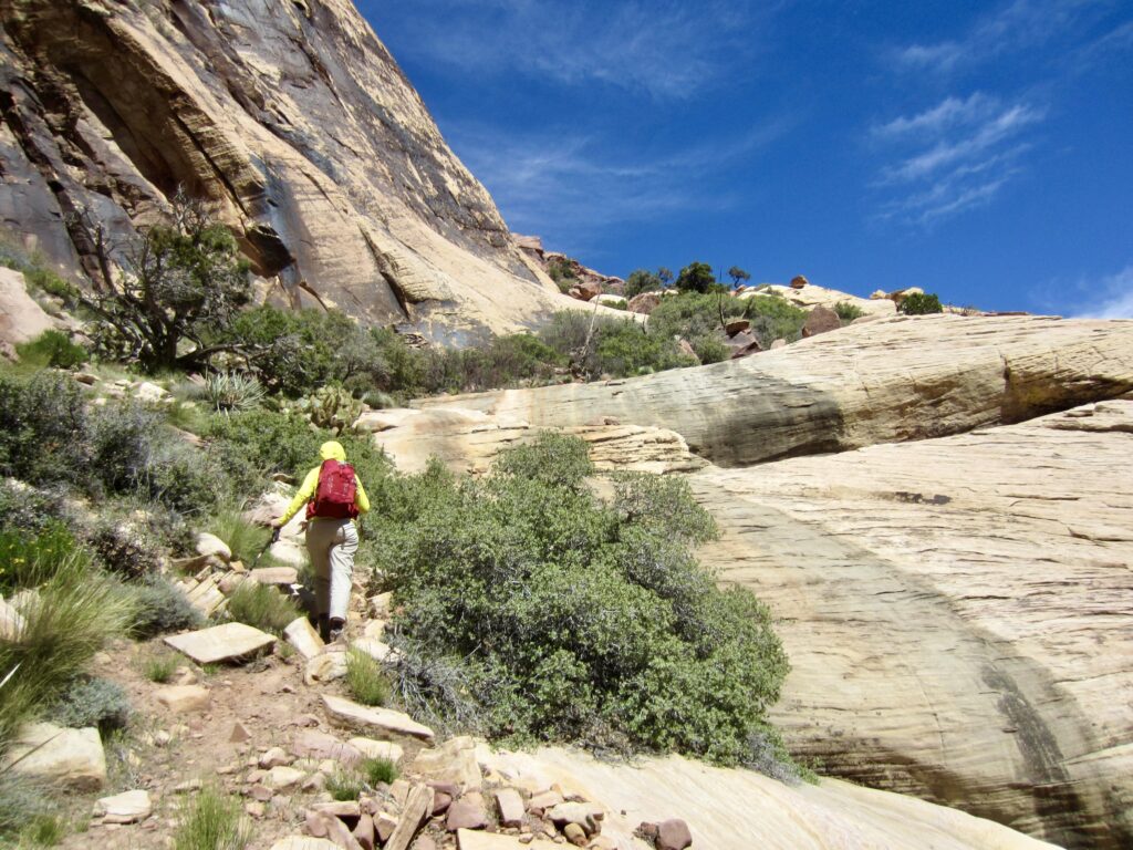
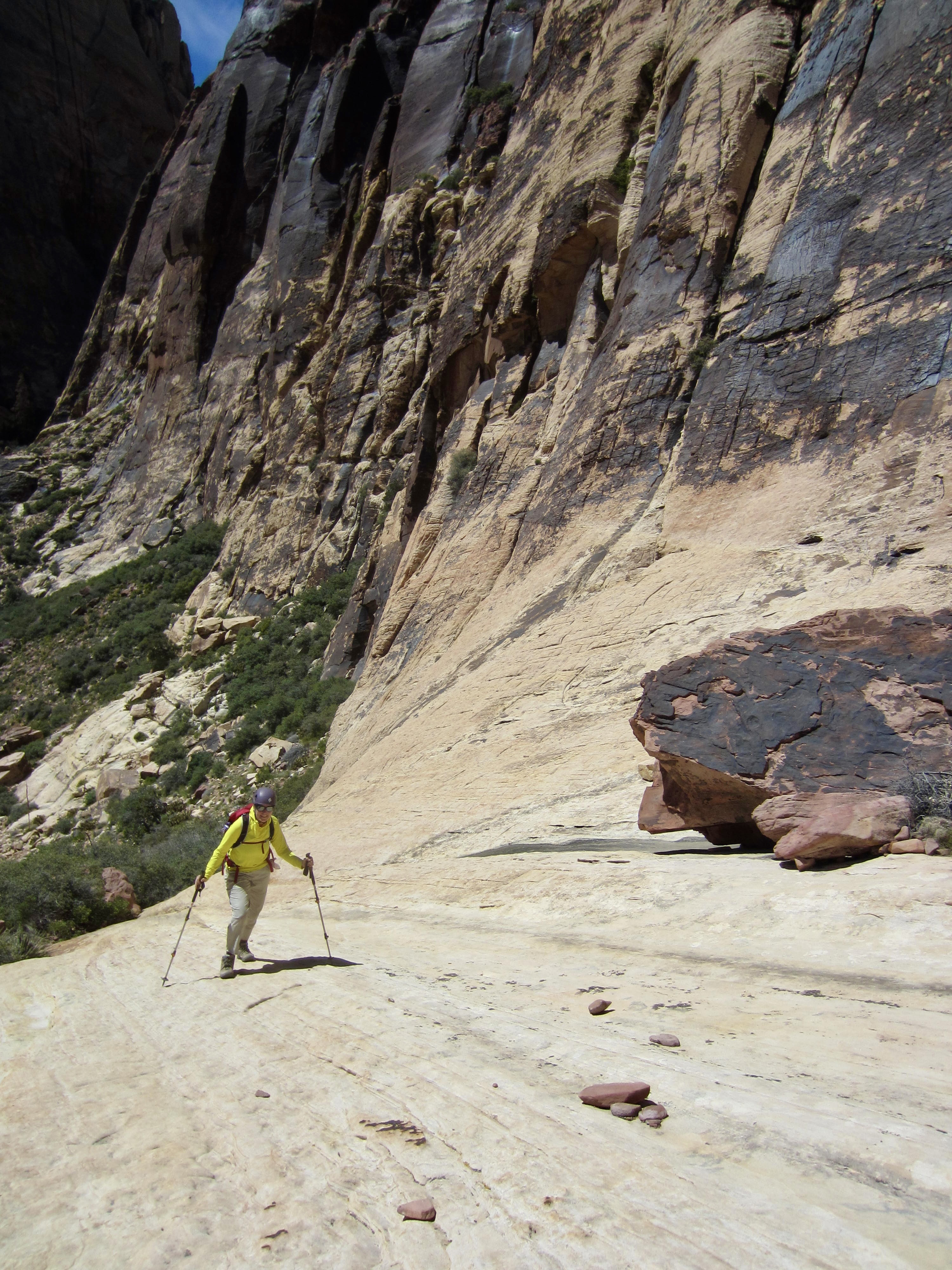
The talus fan ends at a broad ramp of white and yellow sandstone that lies at the base of Brownstone Wall. On Juniper Peak, this ramp comprises a major geologic feature as well as a key part of the scrambling route.

.
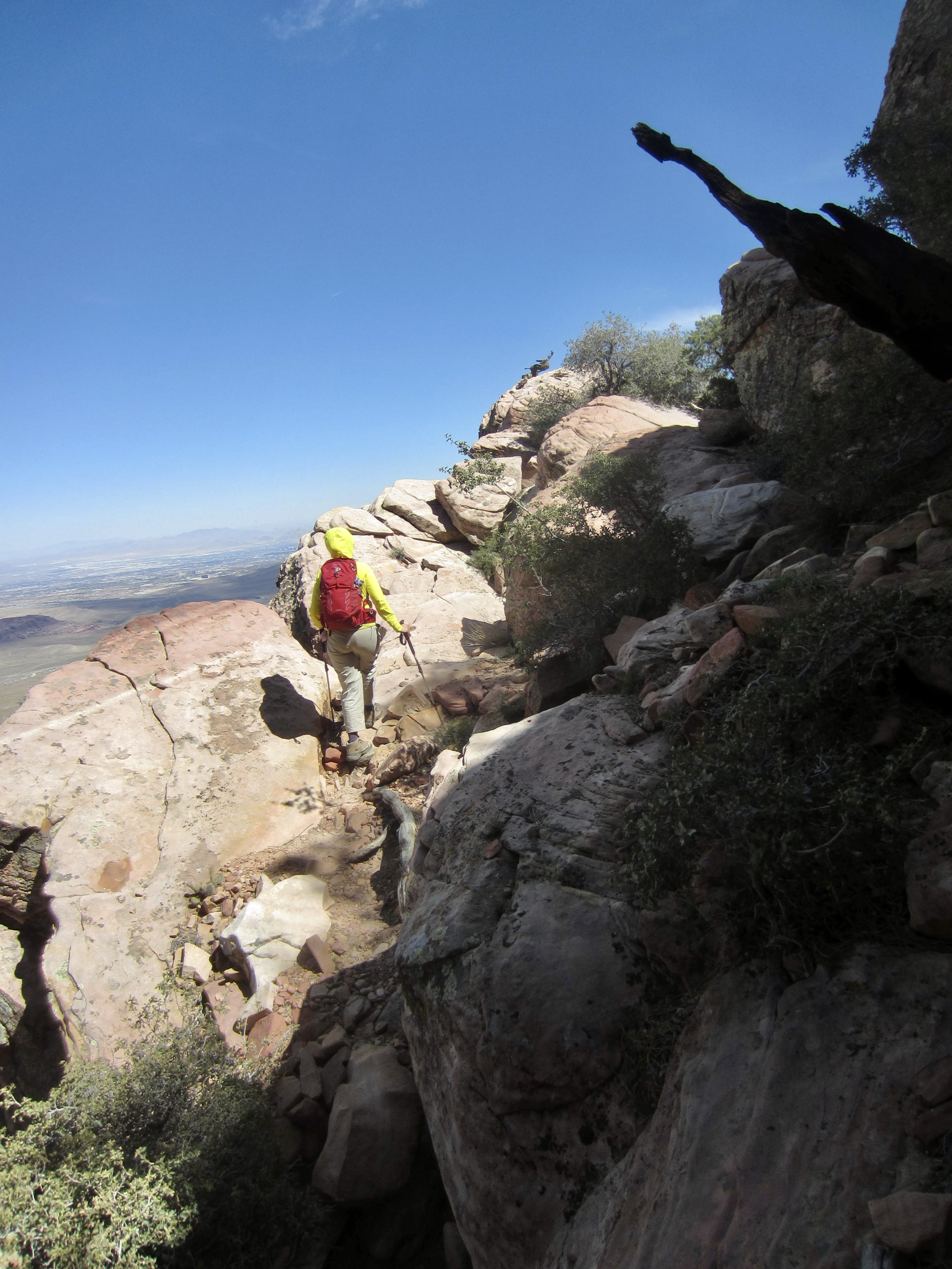
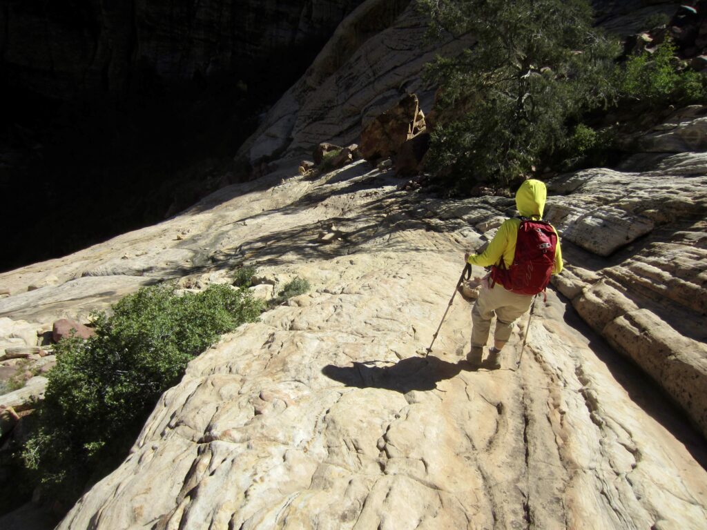
We steadily worked our way up the broad ramp, sometimes walking up the sandstone slabs and other times following bits of bootpath on the sides. There were ample stone ducks and cairns to mark the best route.
.
.
As we got higher and farther along the ramp, two turtle-shaped rocks came into view on the ridge crest above. These “turtle rocks” serve as a useful navigational landmark because the route eventually crosses closely below them.
.
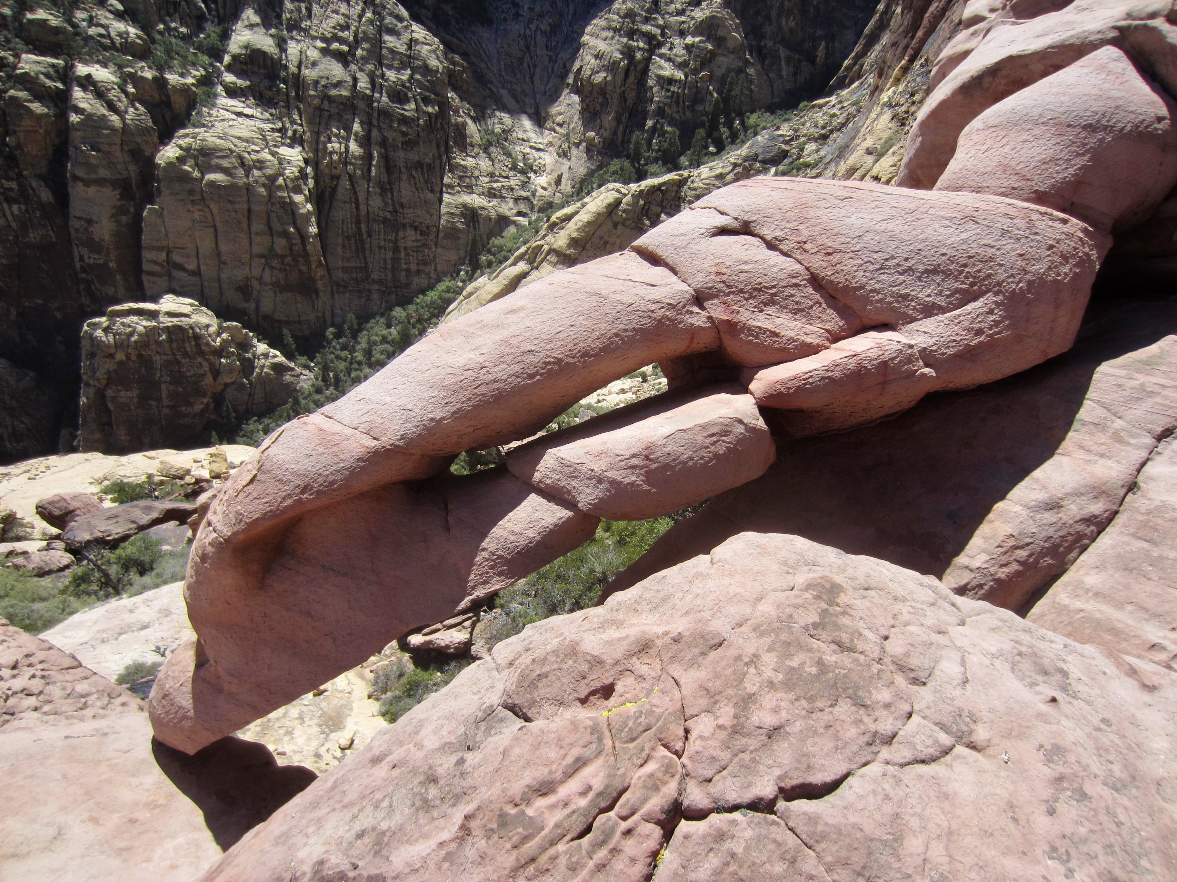
Another useful navigational landmark is a small but unusual sandstone formation that looks remarkably like a lobster claw sticking out of the cliff! We passed underneath this feature and continued traversing along the ramp until almost reaching its far end.
.

.
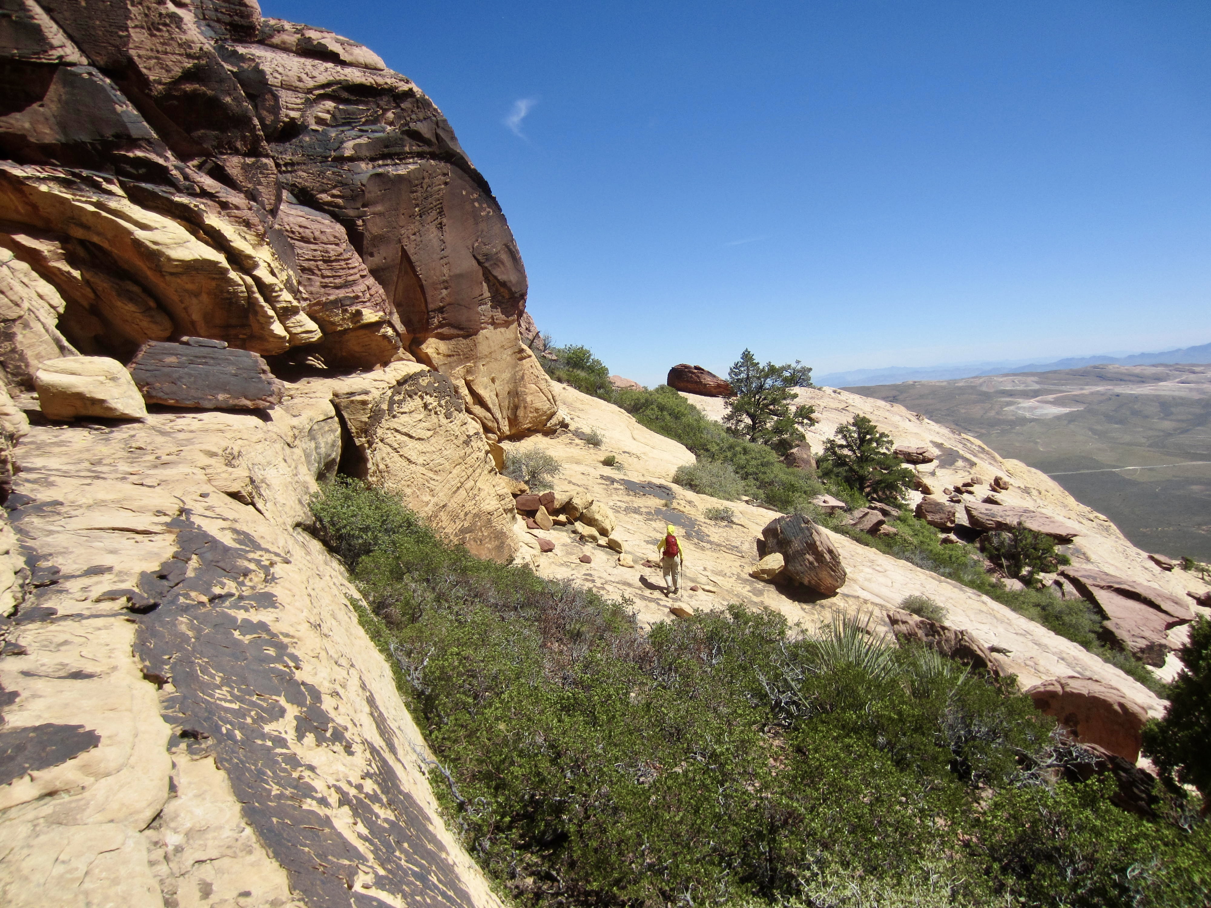
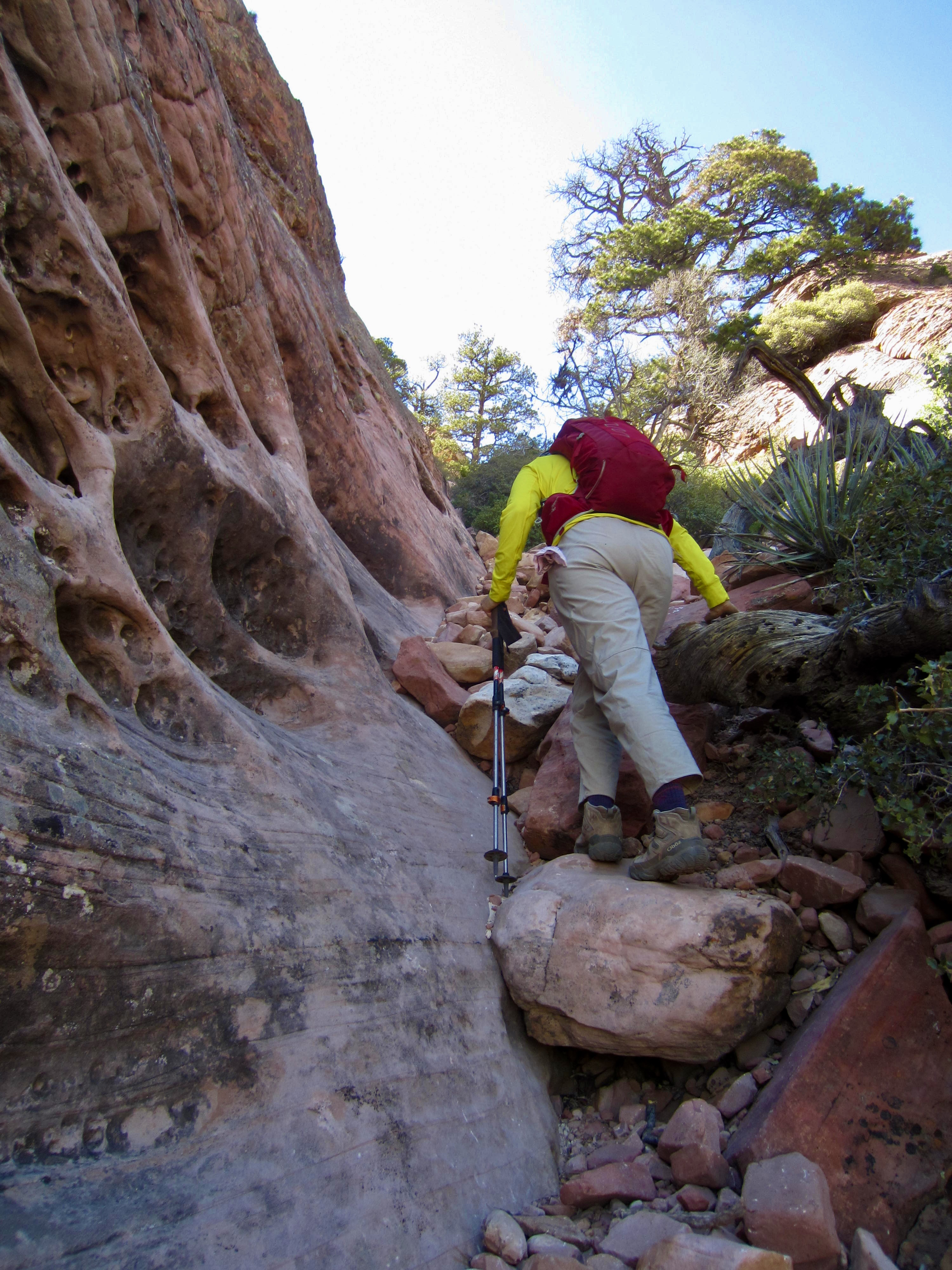
Just before reaching the end of the ramp, we angled sharply back to the left into a brushy gully. A vague path leads up through this gully, wandering from side to side and occasionally going up the sandstone face.
.
At one point, we crossed over a ledge and found ourselves immediately above The Lobster Claw. It looks just a strange close-up as it does from a distance!

.
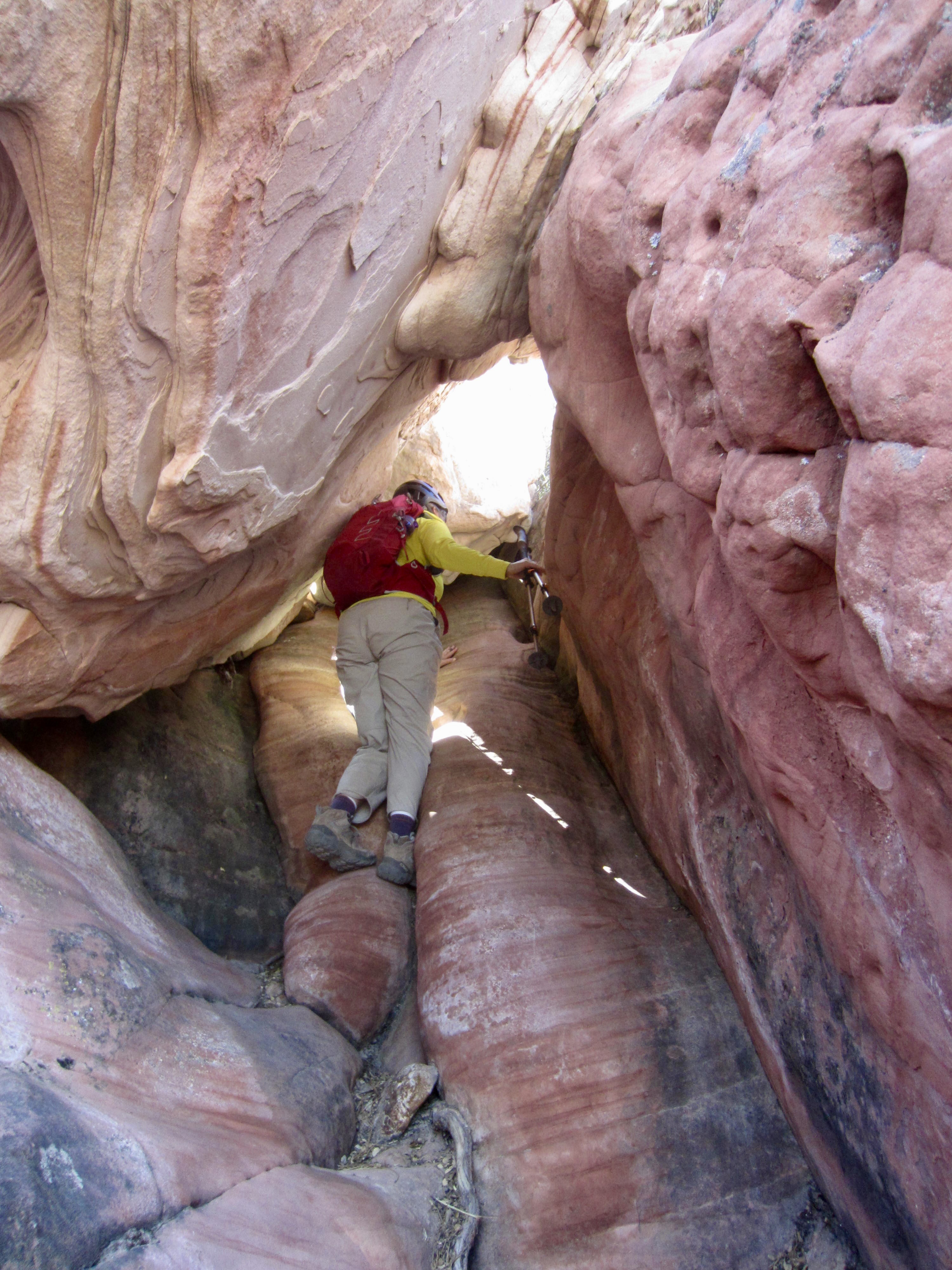
Continuing upward, the path funneled us into a narrow, rubbly verge—barely 3 feet wide in places—hemmed between a pock-marked cliff on the left and dense brush on the right. This rubbly verge extends upward for 100 vertical feet and ends on the peak’s eastern ridge crest, which has three ponderosa pine trees growing in a row. We hiked up to the middle tree and then cut back to the left on a steep ledge.
.
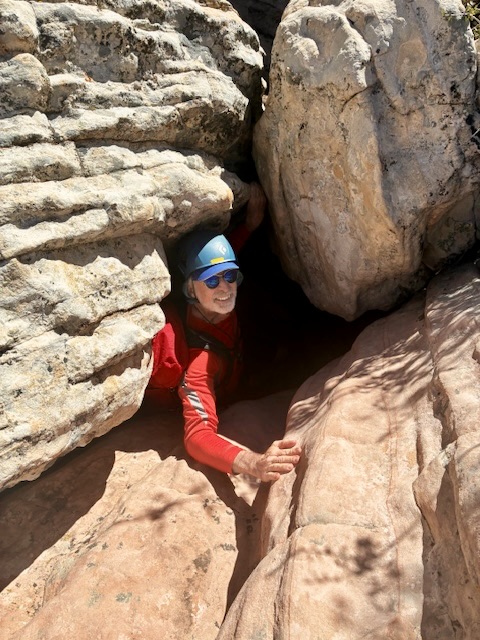
At the end of the steep ledge, we slithered down a short face, then immediately turned right and were confronted with our next obstacle: The Cannonhole—a natural hole in the ridge! This feature constitutes both the scrambling highlight and crux of the entire route. Getting through The Cannonhole requires some awkward Class 3 squirming and emphatic grunting.
.
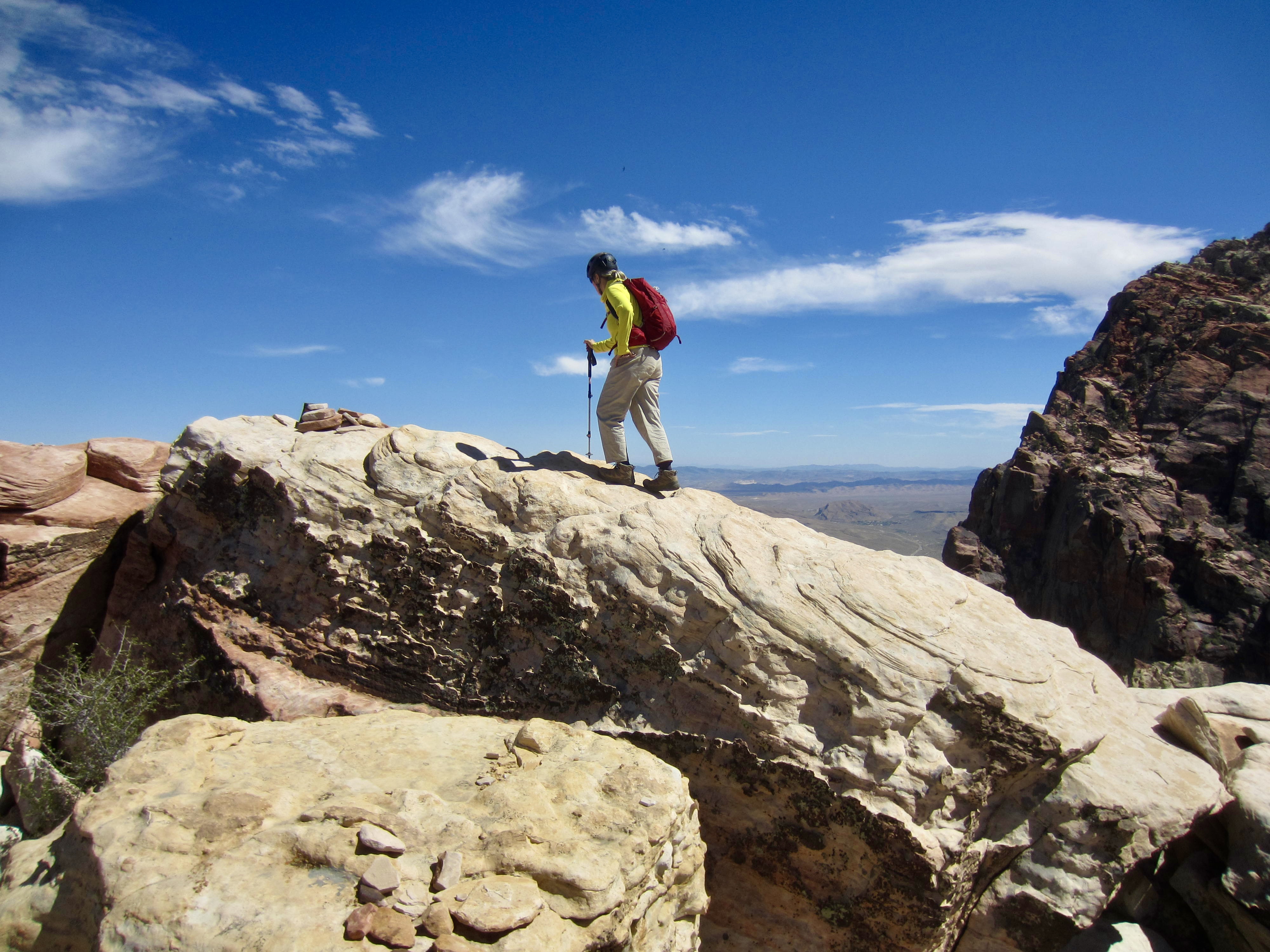
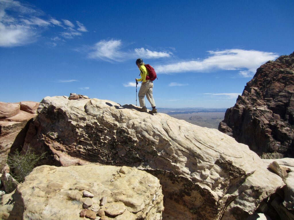
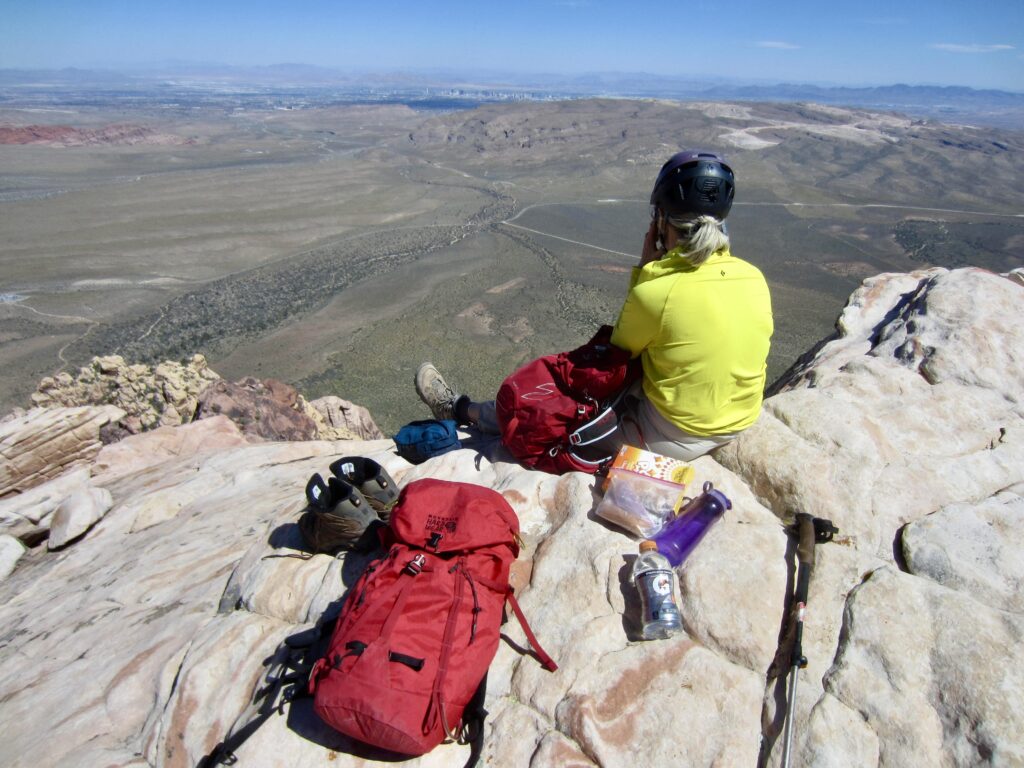
From The Cannonhole, a short hike brought us to the lumpy summit of Juniper Peak (6.0 hours + 2100 feet from starting point). The summit register indicated that this peak gets a few ascents per week, by scramblers like us and by technical climbers coming up multi-pitch Class 5 routes on the face.
.
.
Due to its position within the Sandstone Bluffs, Juniper Peak provides terrific views of Bridge Mountain to the north and Rainbow Mountain to the south. Red Rock Basin sprawls out to the east, and Las Vegas can be seen 10 miles beyond.
.
To descend, we retraced our up-track as best we could and arrived back at our starting point in early evening (3.6 hours from summit). Ultimately, Juniper Peak proved to be an excellent scrambling destination for us. Eileen was recovering from a variety of injuries, and this served as a big milestone. We weren’t fast, but we got it done!
.
Route Maps & Profile
…
…
…
Photo Gallery
Click to enlarge…