Trip Date: November 7, 2021
2021 DESERT SOUTHWEST ADVENTURE VACATION
Cottonwood Cove Viewpoint Day Hike
Coyote Buttes South
Cottonwood Cove Viewpoint
Trip Report Summary
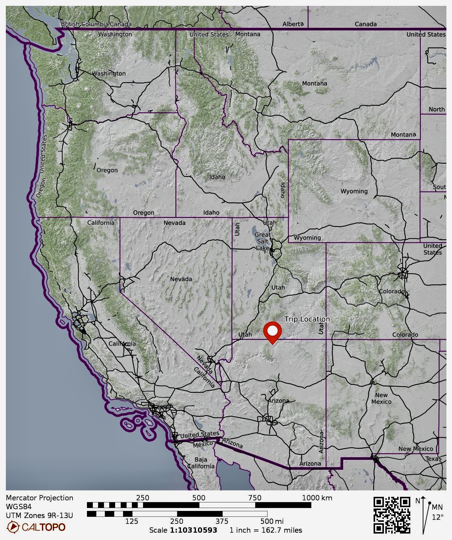
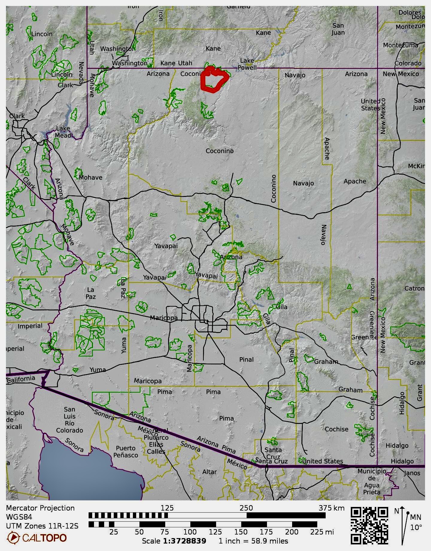
Region: Arizona
Sub-Region: Northern Arizona
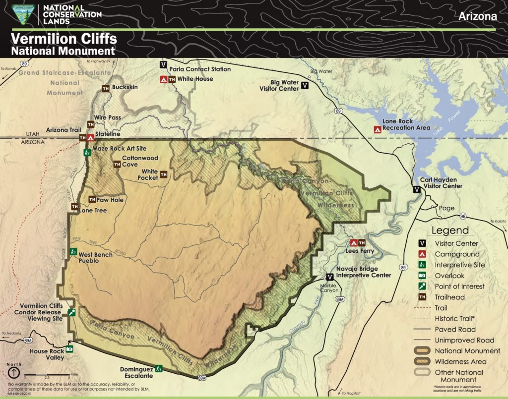
Areas: Vermilion Cliffs National Monument & Paria Canyon – Vermilion Cliffs Wilderness
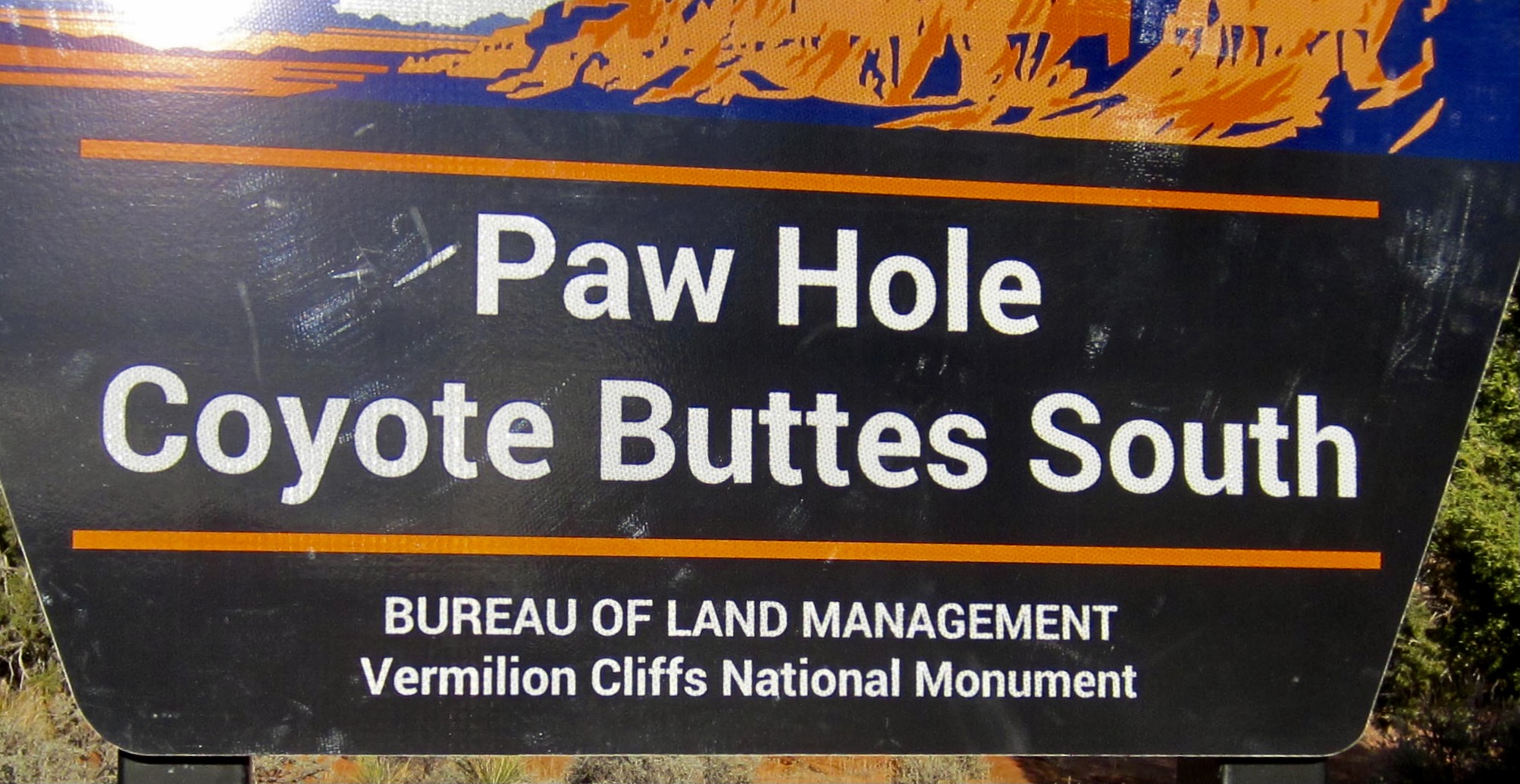
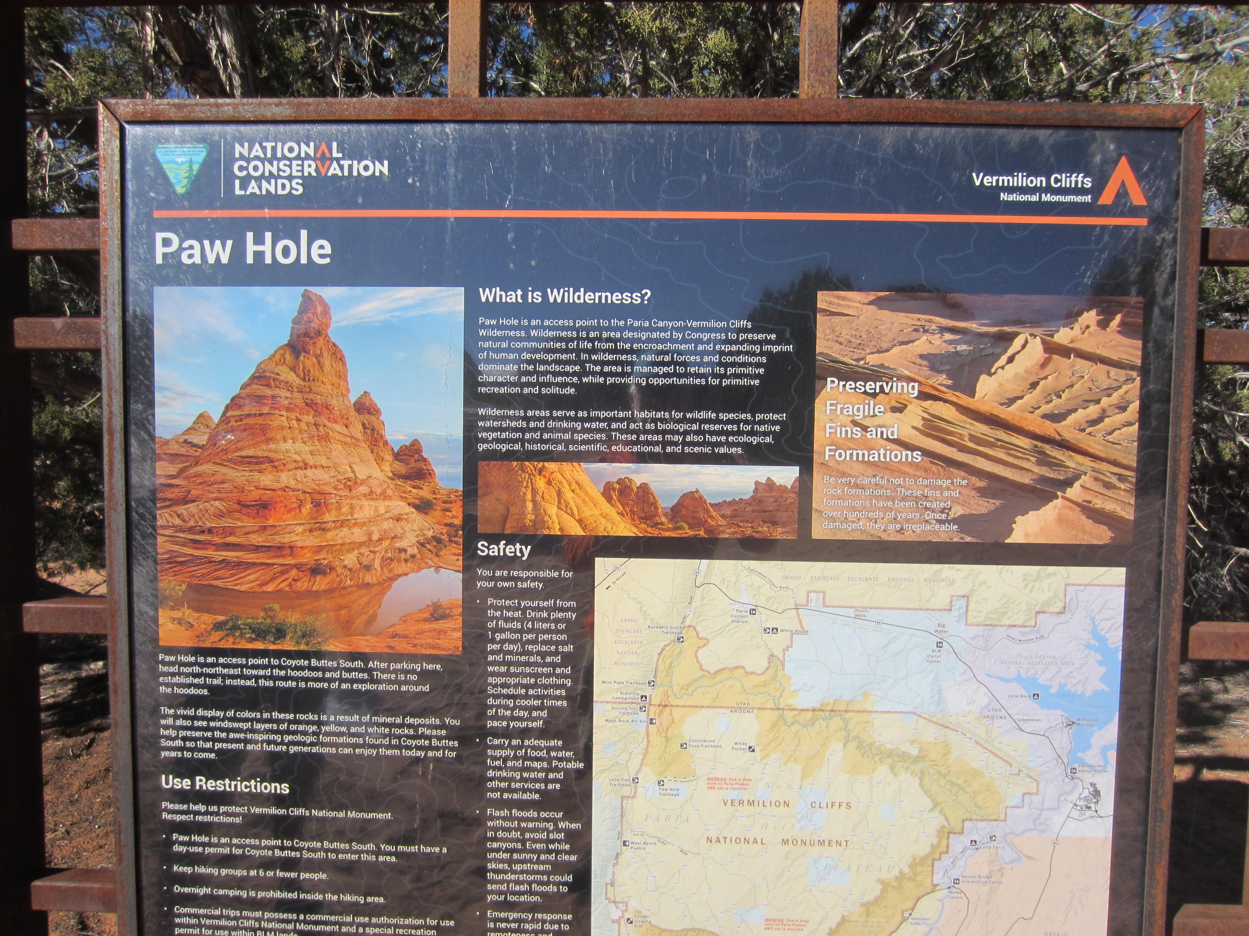
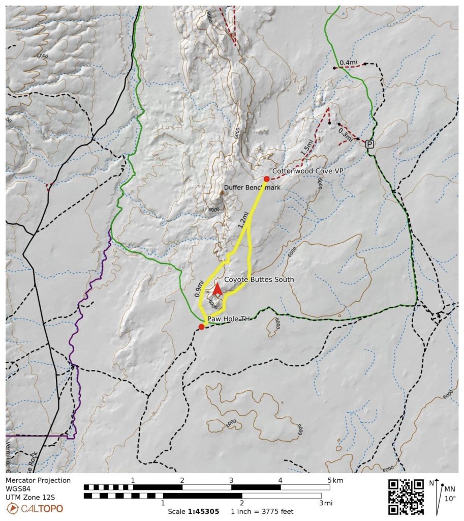
Starting & Ending Point: Paw Hole Trailhead on BLM Road #1079
Way Points: Coyote Buttes South & Paria Plateau & Cottonwood Cove Viewpoint (trail hike & off-trail hike & rock scramble)
Approximate Stats: 5.0 miles traveled; 1000 feet gained & lost; 5.5 hours elapsed.
…
Full Trip Report
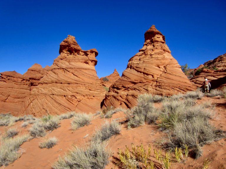
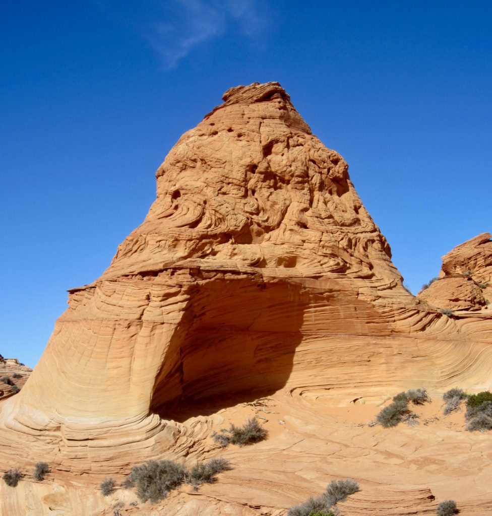
Coyote Buttes are a striking cluster of sandstone outcrops located within the Paria Canyon – Vermilion Cliffs Wilderness, a sickle-shaped area of protected scrubland that straddles the Utah/Arizona Border. Many of these outcrops have eroded into variously sized cones locally known as “teepees.” The buttes have become such a popular tourist attraction that the Bureau of Land Management has established a permit system to limit human impacts on the delicate rock formations. Eileen, Steve, Deb, and I were able to obtain a permit to visit Coyote Buttes South from the Paw Hole Trailhead.

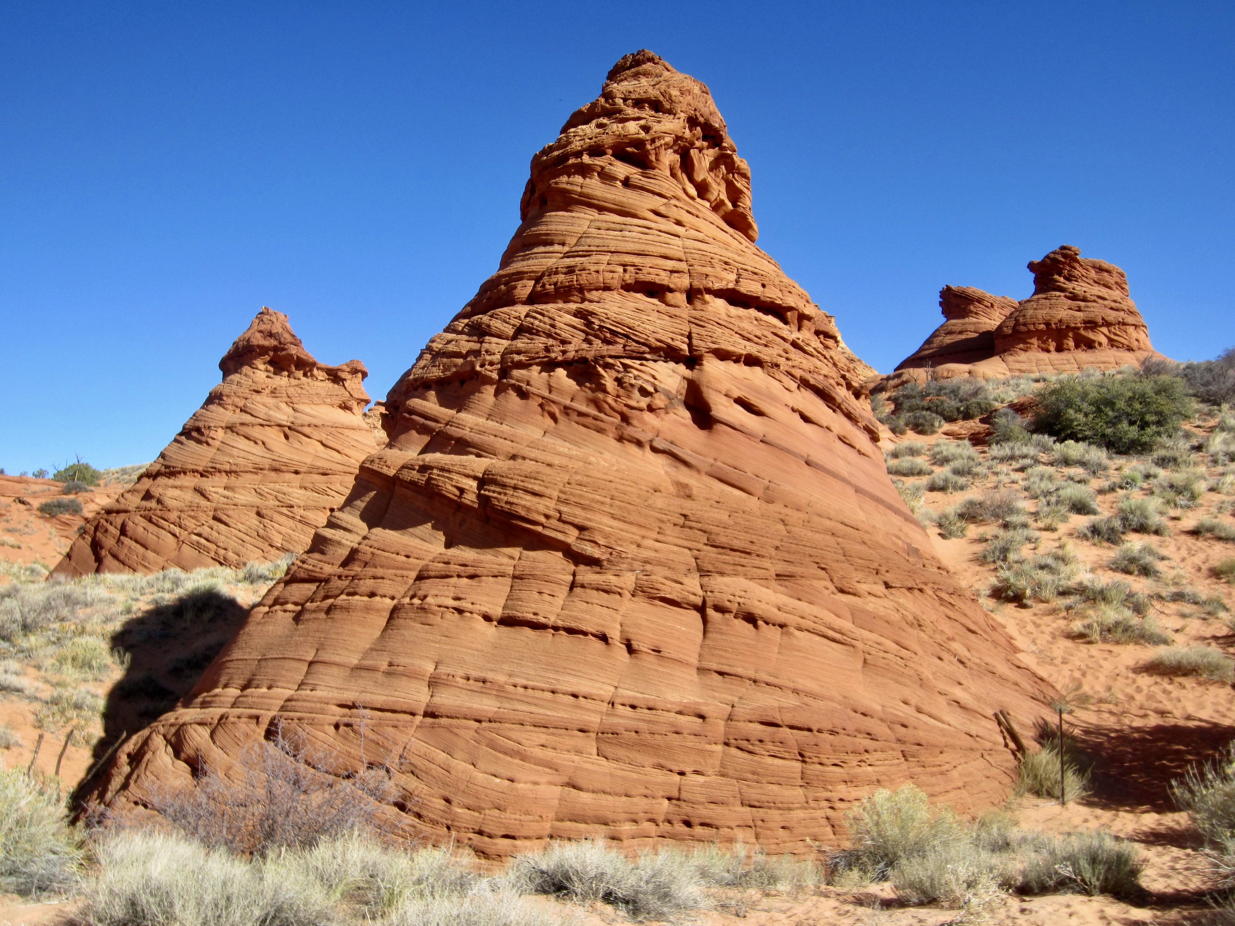
Using Steve and Deb’s four-wheel-drive truck to negotiate the soft sands of BLM Road #1079, we drove to Paw Hole on a cloudless morning. The southernmost teepees are clearly visible from this trailhead, a mere 100 yards away, so there is no need for a long hike to experience the remarkable geology here.
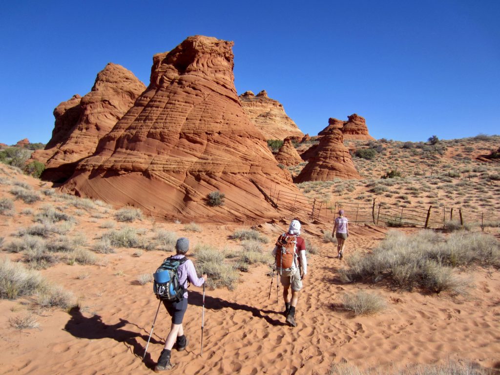
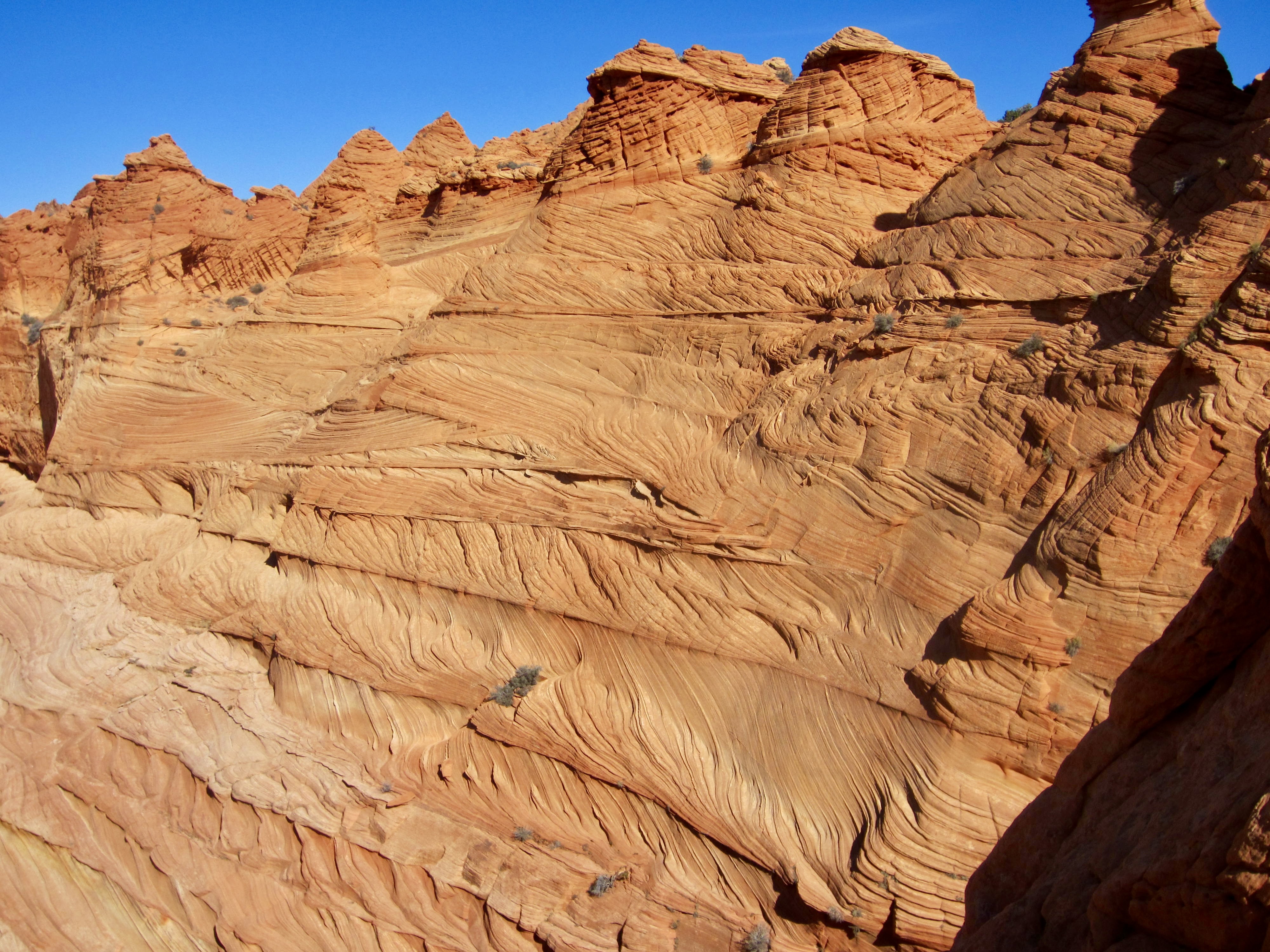
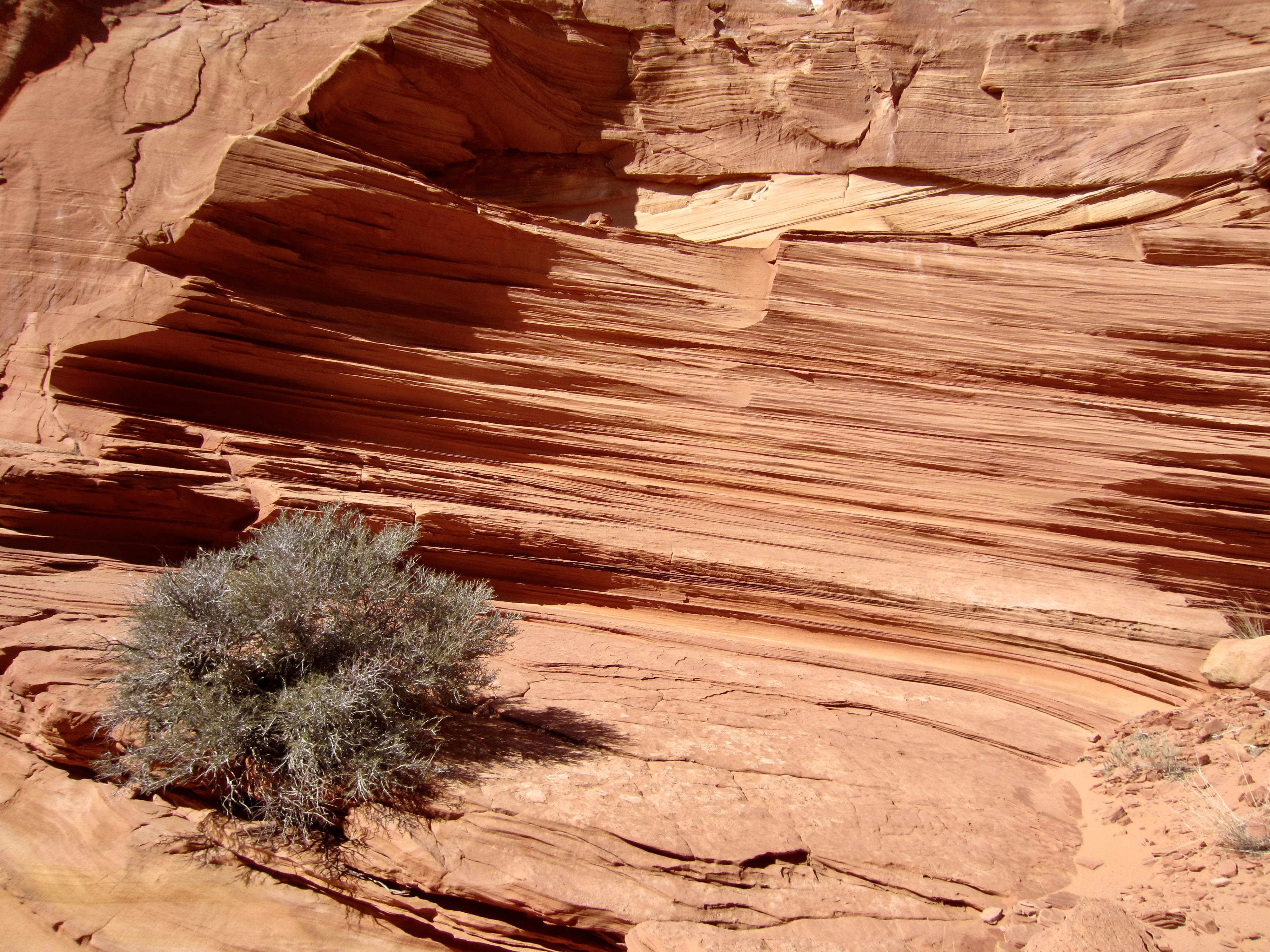
We spent our first two hours wandering around the red teepees and marveling at the diversity of shapes and textures. These teepees display splendid examples of cross-bedding and disconformities, likely resulting from repetitive episodes of sand dune creation and water truncation.
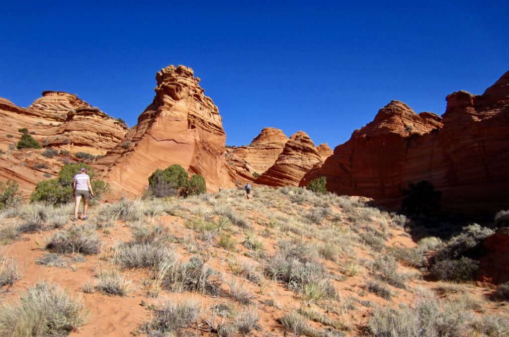

There are also many examples of micro-stratification in which thin layers became hardened, or indurated, to varying degrees. Differential weathering of these layers has created millions of delicate “fins,” many measuring less than ¼ thick.
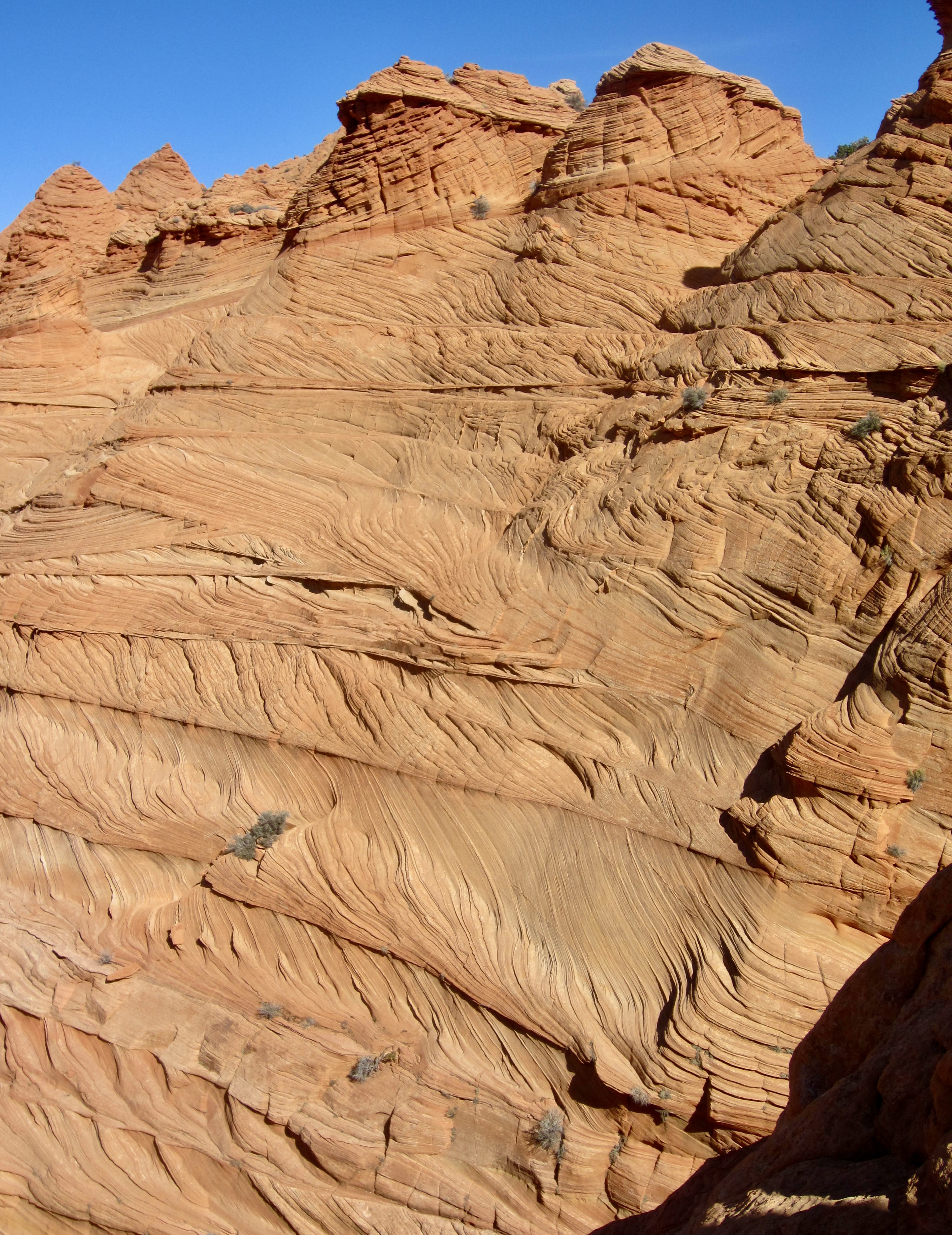
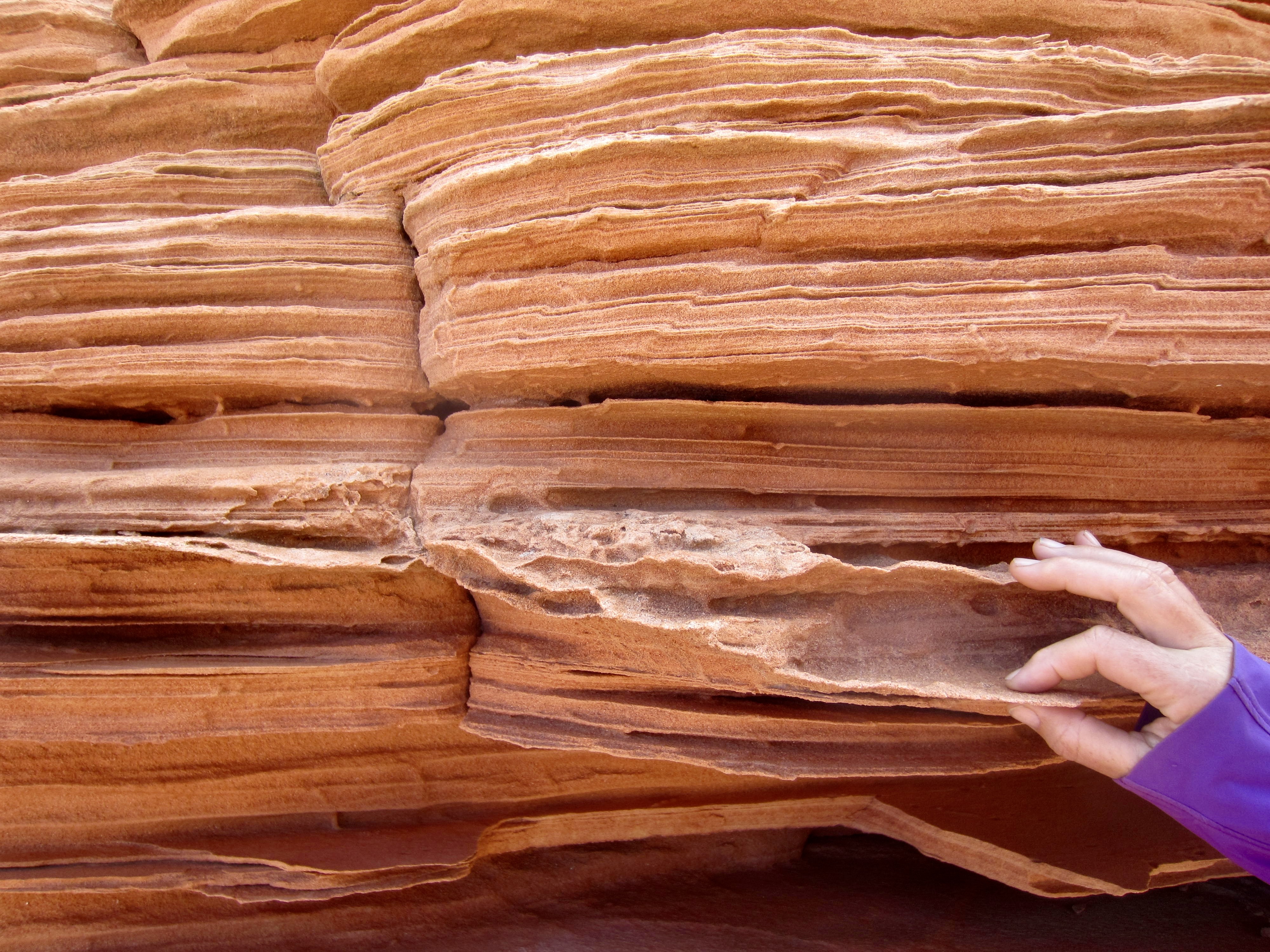
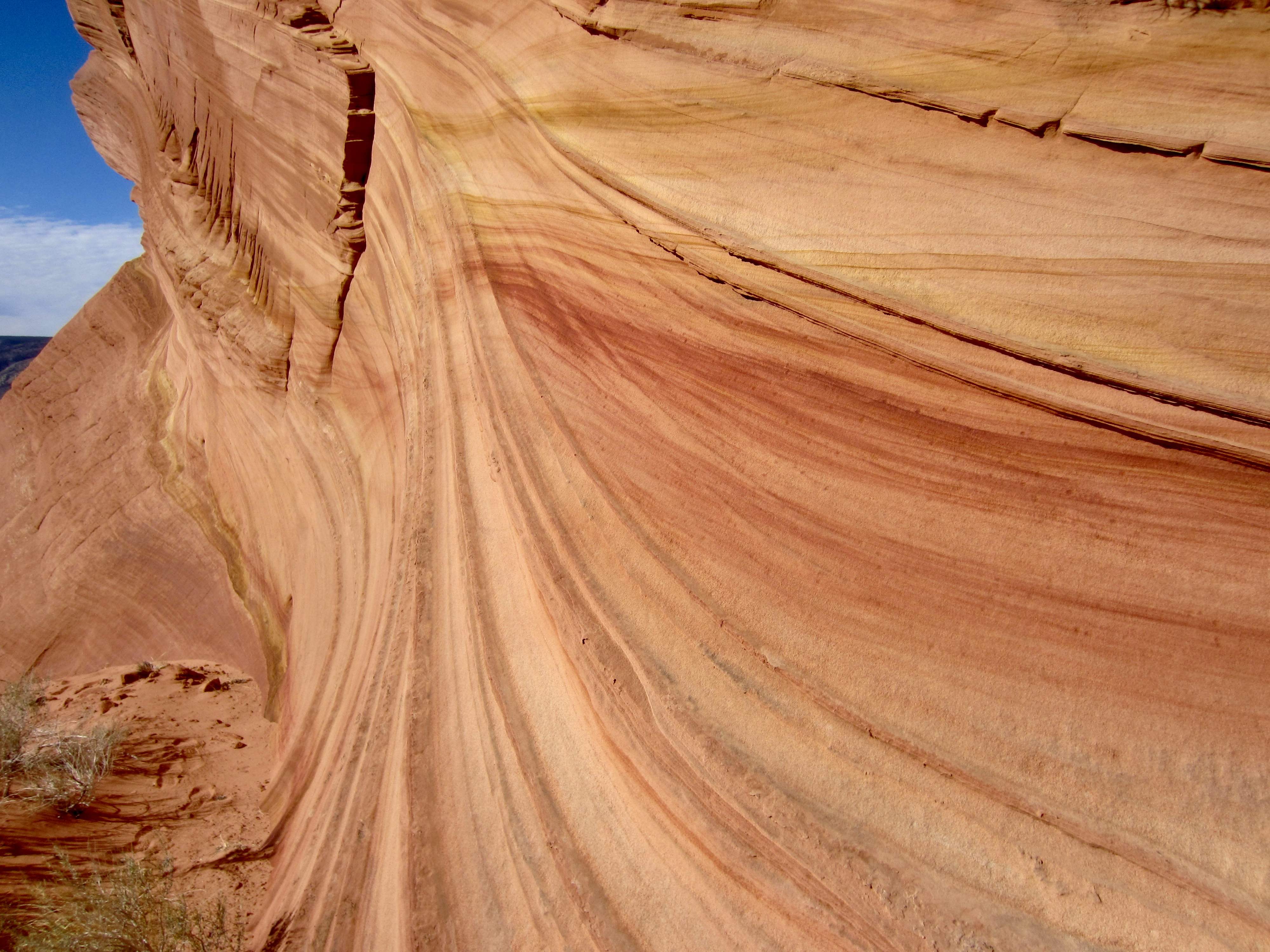
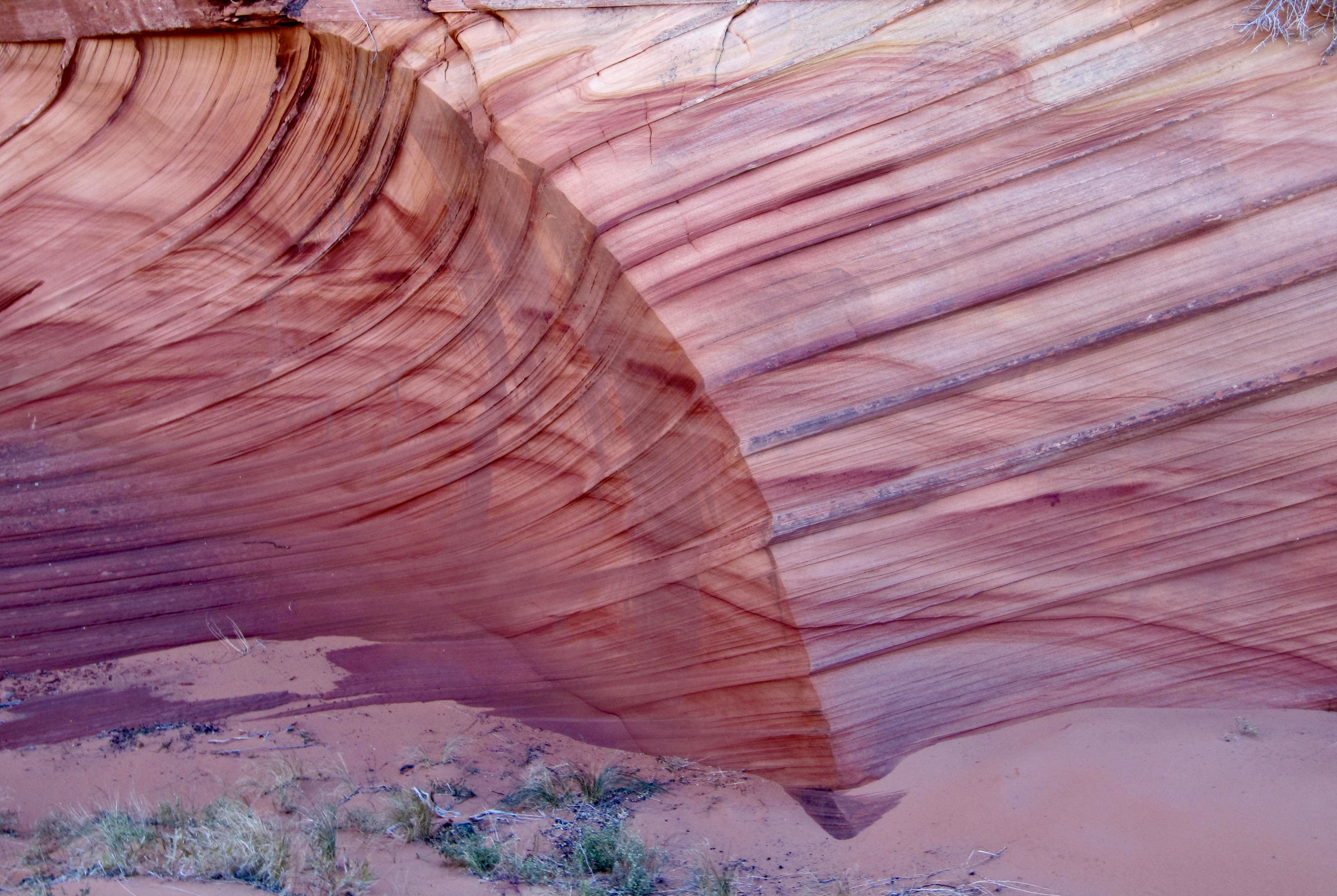
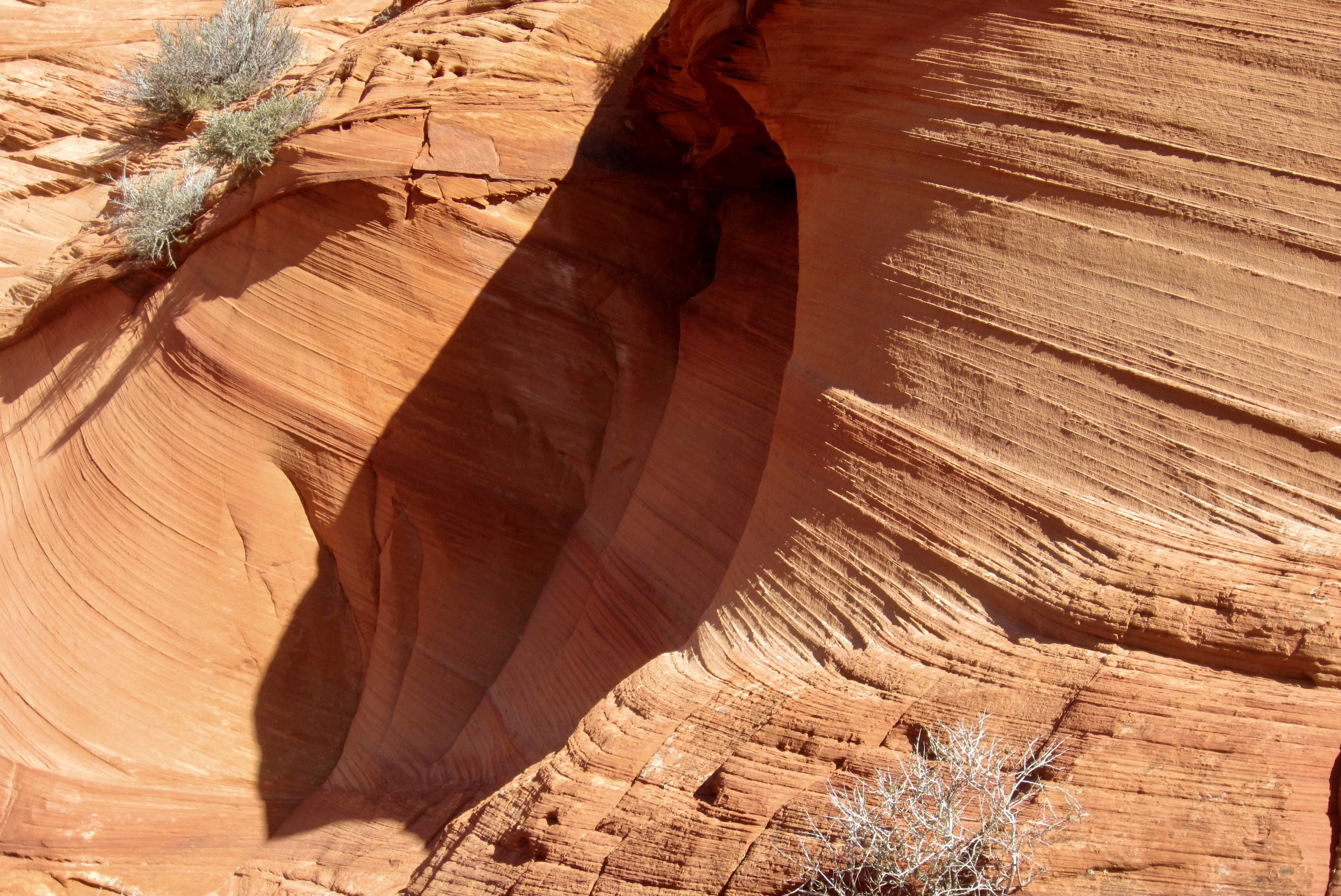
The most astounding features here are the teepees with thick deposits of wildly contorted sandstone situated between conventional horizontal layers. These deposits have the appearance of petrified taffy that has been squeezed onto a plate! Multiple theories have been put forth by geologists to explain the origin of such rock; most involve a process called soft-sediment deformation in which sand dunes collapse into a lake, or liquefied sand squeezes up through overlying horizontal layers. I’m sure there will be more theories in the future.
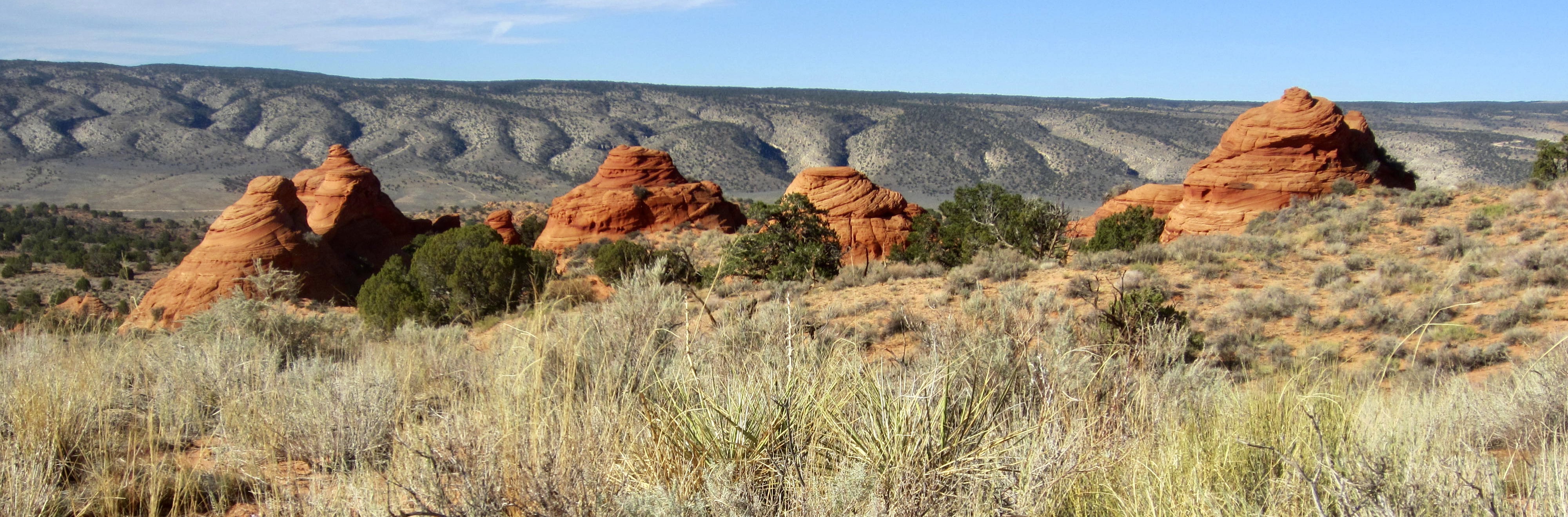
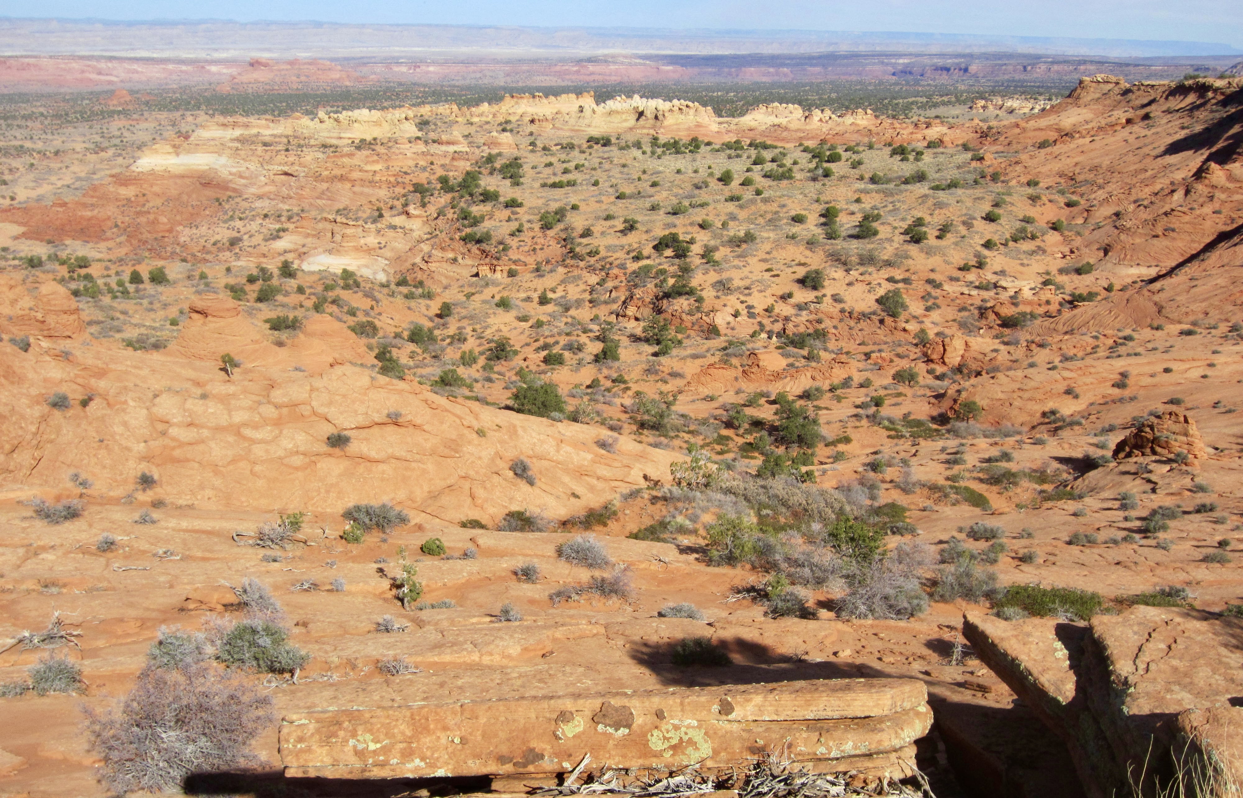
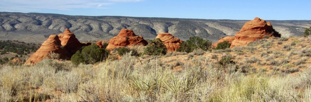
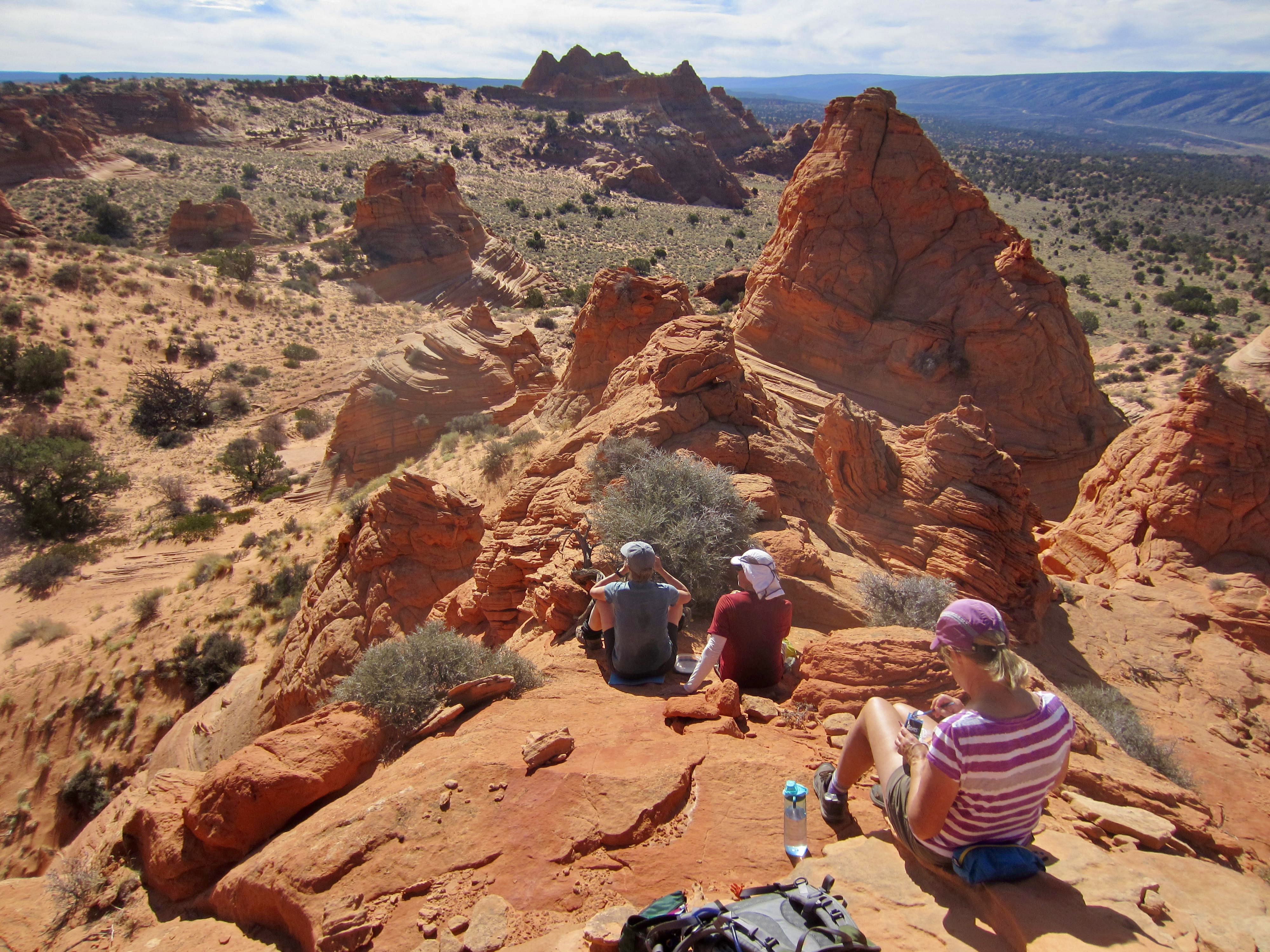
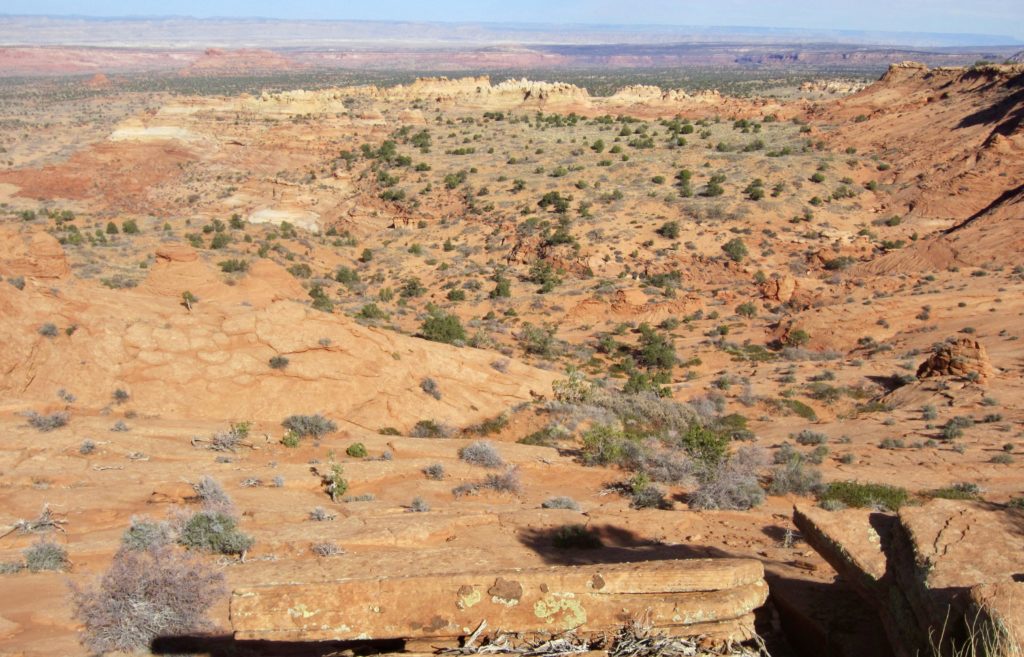
After exploring the teepee area, we hiked northward across the plateau for 1½ miles to reach a viewpoint overlooking Cottonwood Cove. Multiple rows of teepees—some composed of red sandstone, others of white sandstone—could be seen stretching into the distance, and the trace of Buckskin Gulch was barely visible farther away.
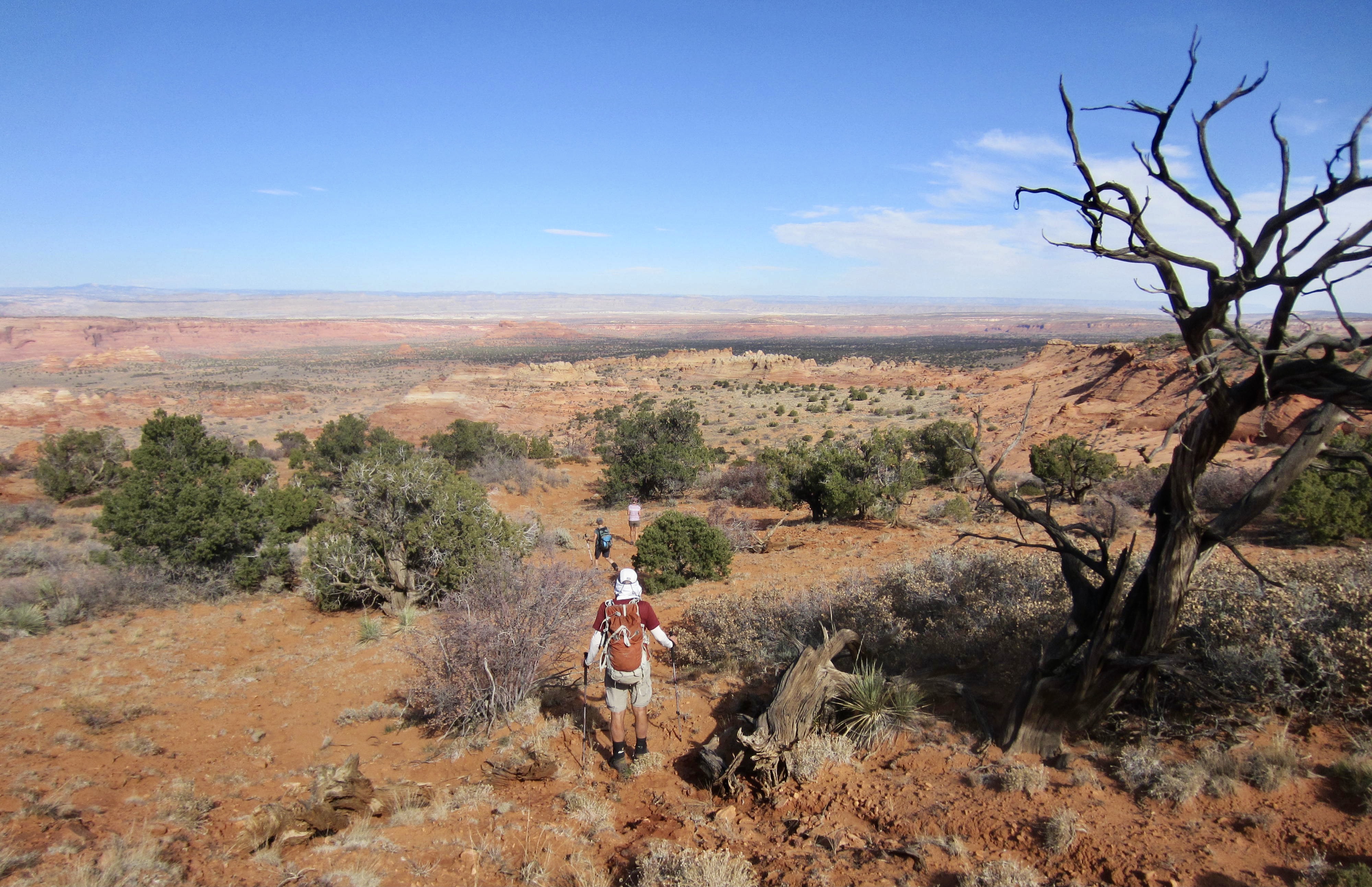
We had recently seen sandstone “hoodoos,” “goblins,” and “toadstools”; it was fun to now add “teepees” to our list. But we knew that the Desert Southwest still had more surprises for us!
…
Route Map & Area Map
…
…
Photo Gallery
Click to enlarge…