Trip Date: November 8, 2021
2021 DESERT SOUTHWEST ADVENTURE VACATION
White Pocket Day Hiking & Scrambling Exploration
White Pocket Outcrops
Trip Report Summary
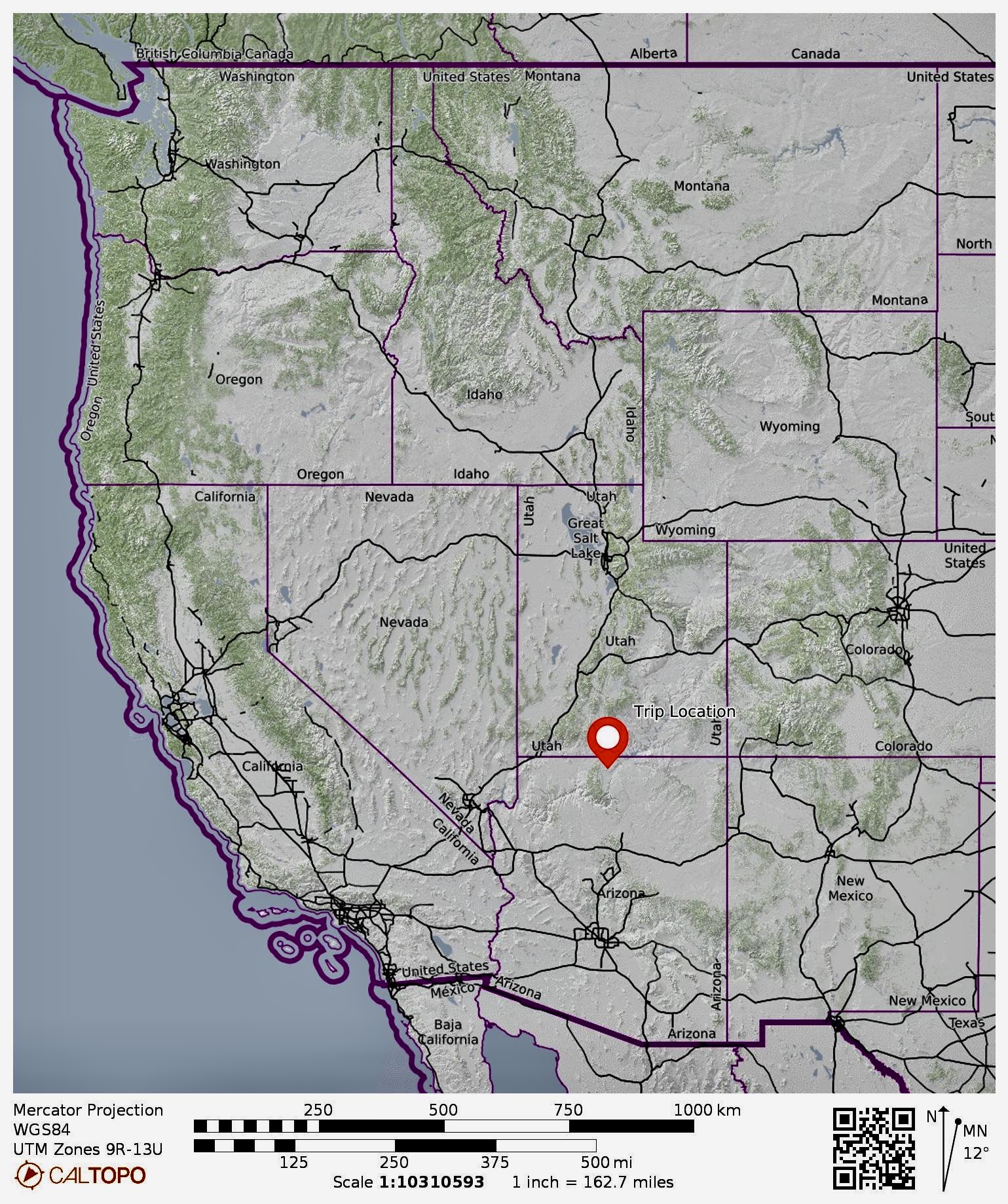
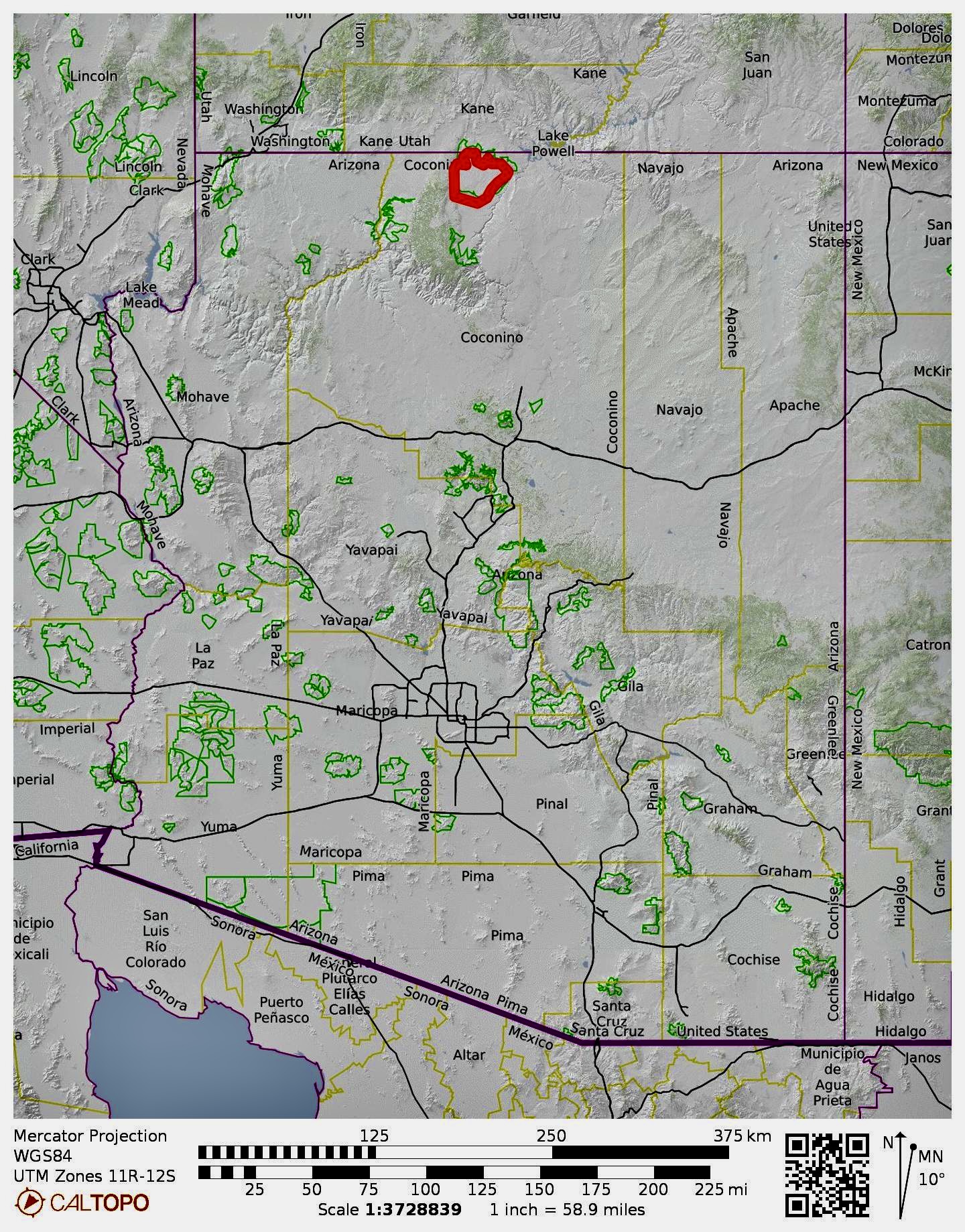
Region: Arizone
Sub-Region: Northern Arizona
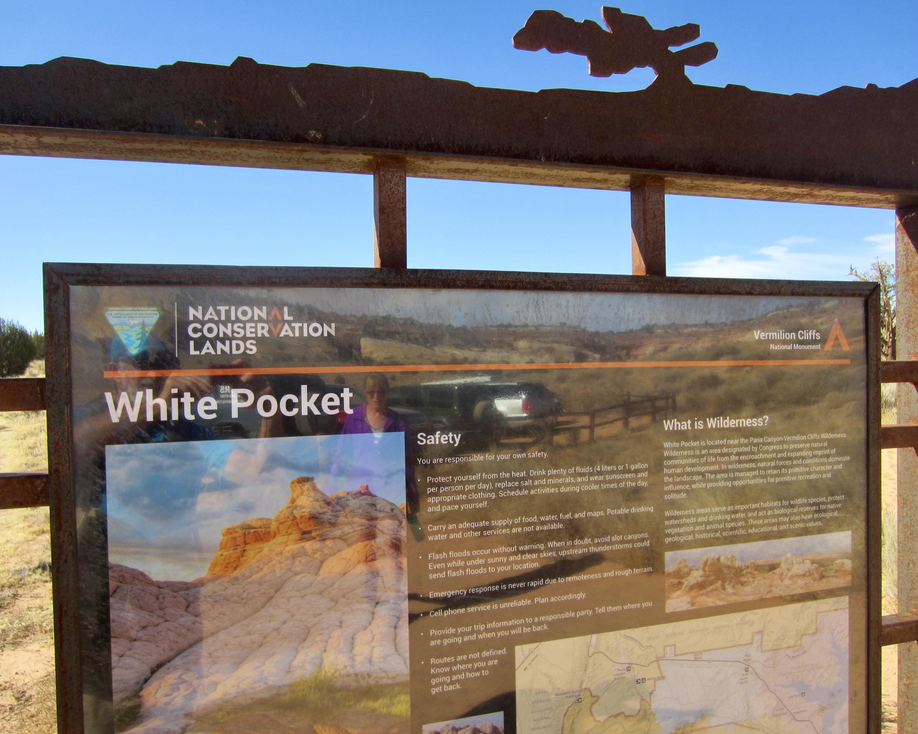
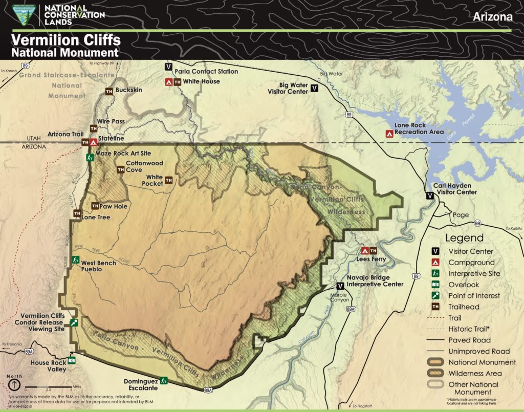
Area: Vermilion Cliffs National Monument
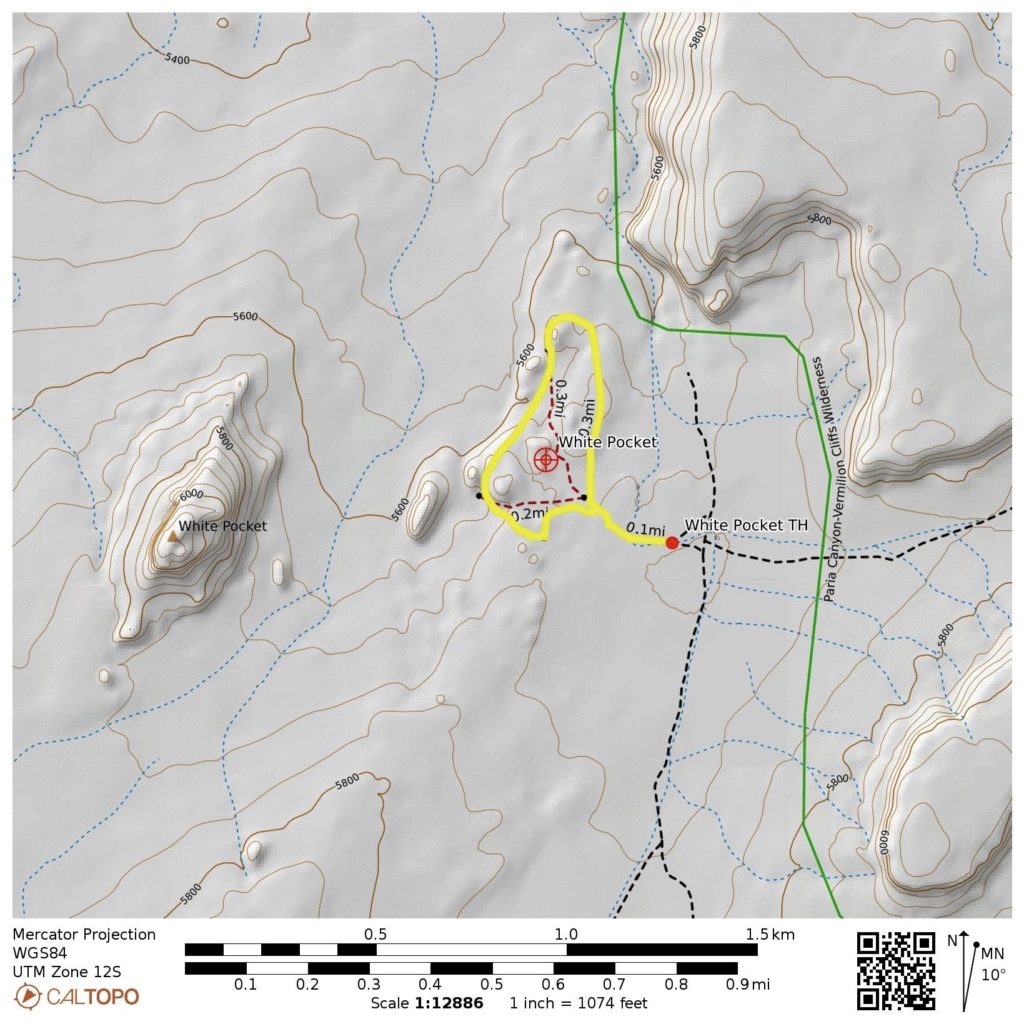
Starting & Ending Point: White Pocket Trailhead on BLM Road #1086
Destination: White Pocket outcrops (sand hike & rock scramble)
Approximate Stats: 1.0 miles traveled; 350 feet gained & lost; 3.5 hours elapsed.
…
Full Trip Report
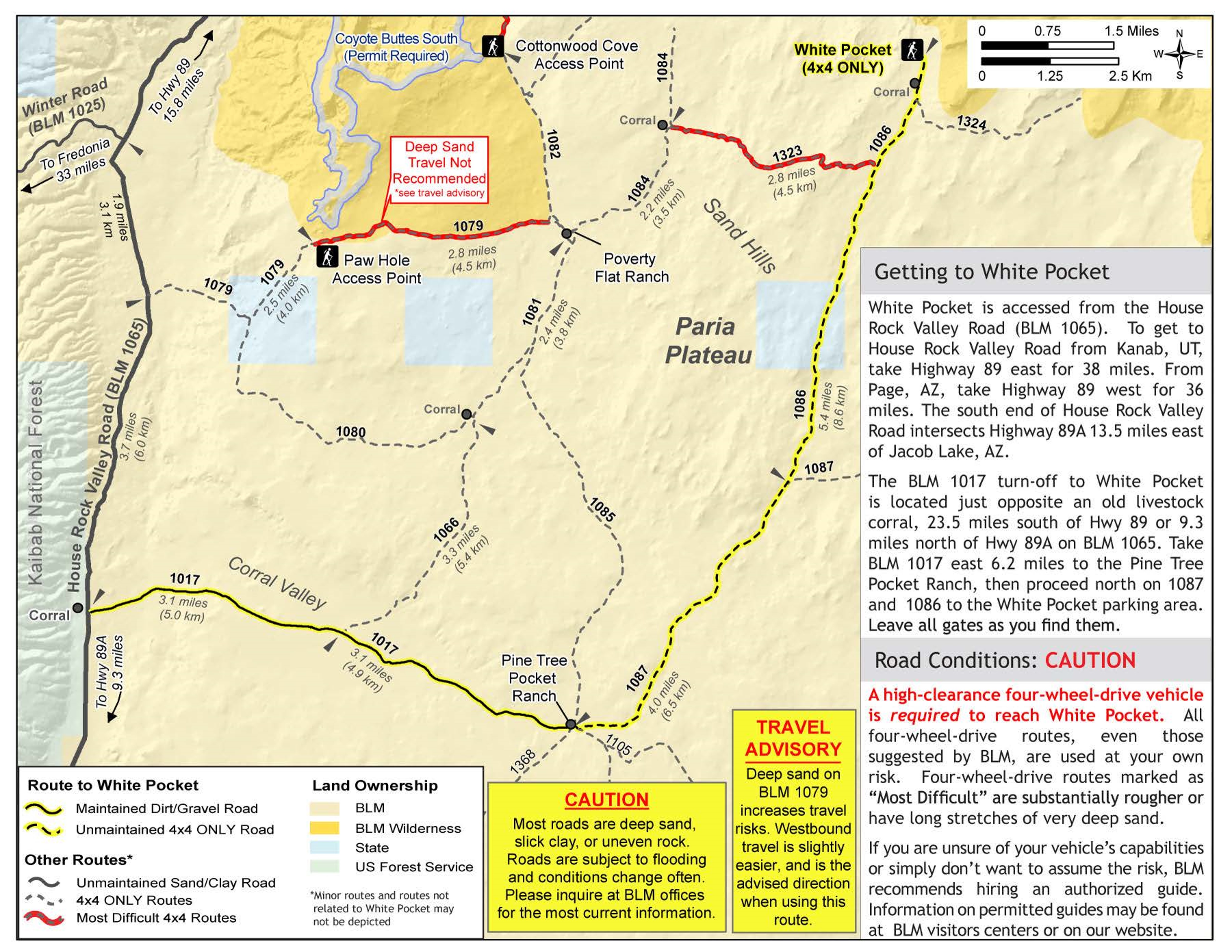
Tucked away in the northwestern part of Vermilion Cliffs National Monument is a little cluster of sandstone outcrops called White Pocket. Covering an area of barely 40 acres and bearing an innocuous name, this demure “pocket” contains a greater concentration of astonishing geomorphology than anywhere else I’ve visited in the Desert Southwest. The fact that no permits are needed to visit White Pocket would be surprising if not for the difficult road access, which effectively bars entry to all but those driving a four-wheel-drive vehicle with high clearance and big tires.
White Pocket Trailhead can be reached from House Rock Valley Road by several different BLM road routes. The shortest but roughest route follows Road #1079 to Poverty Flat, then Roads #1084 and #1086 to the trailhead. A longer but easier route follows Road #1017 through Corral Valley, then Roads #1087 and #1086 to the trailhead. Eileen and I piled into Steve and Deb’s four-wheel-drive truck at our campsite in Corral Valley, and the four of us took the longer route. This route is easier only in a relative sense; it has plenty of rock humps and sand traps that tested the truck’s capabilities.
.
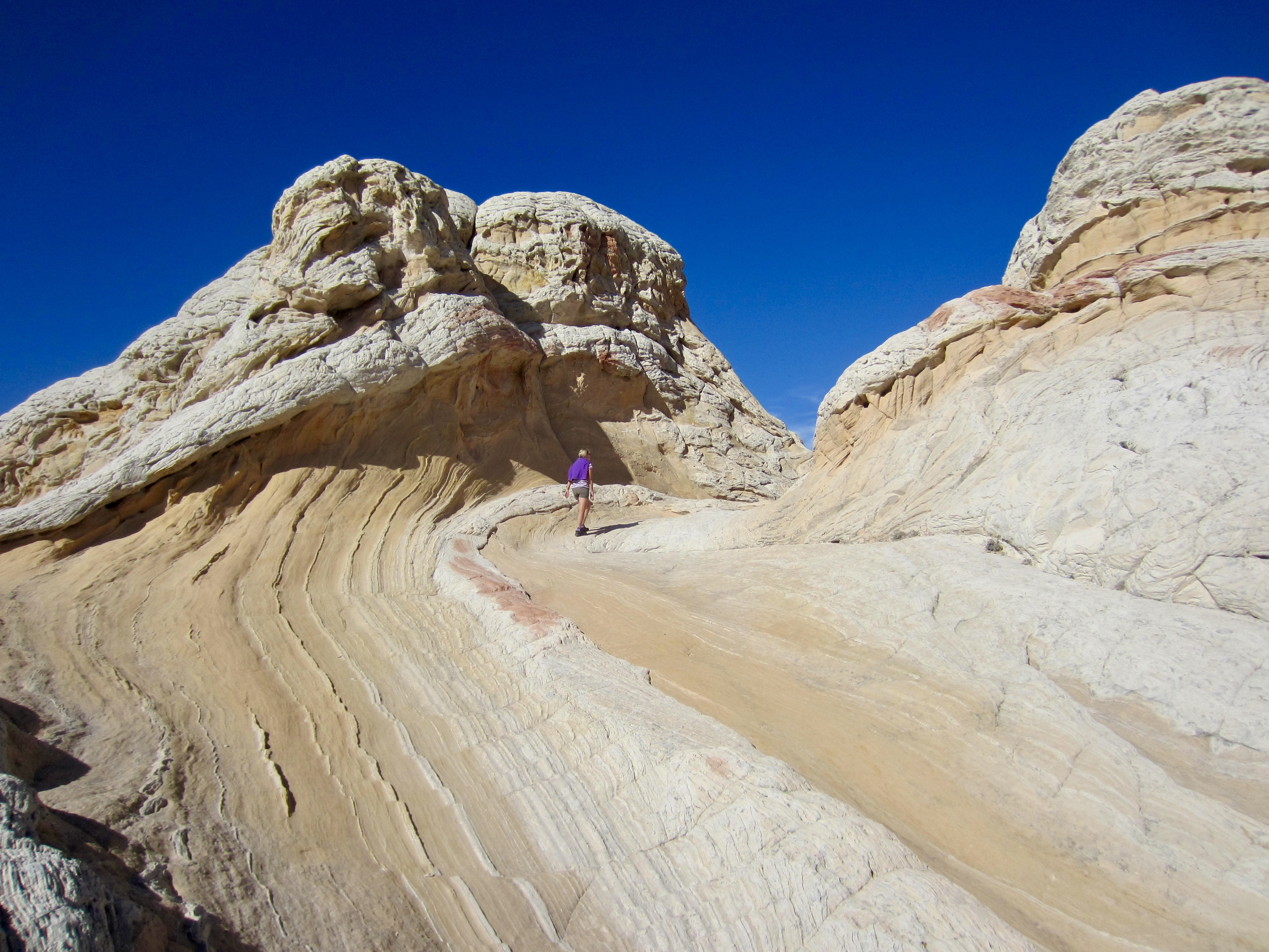
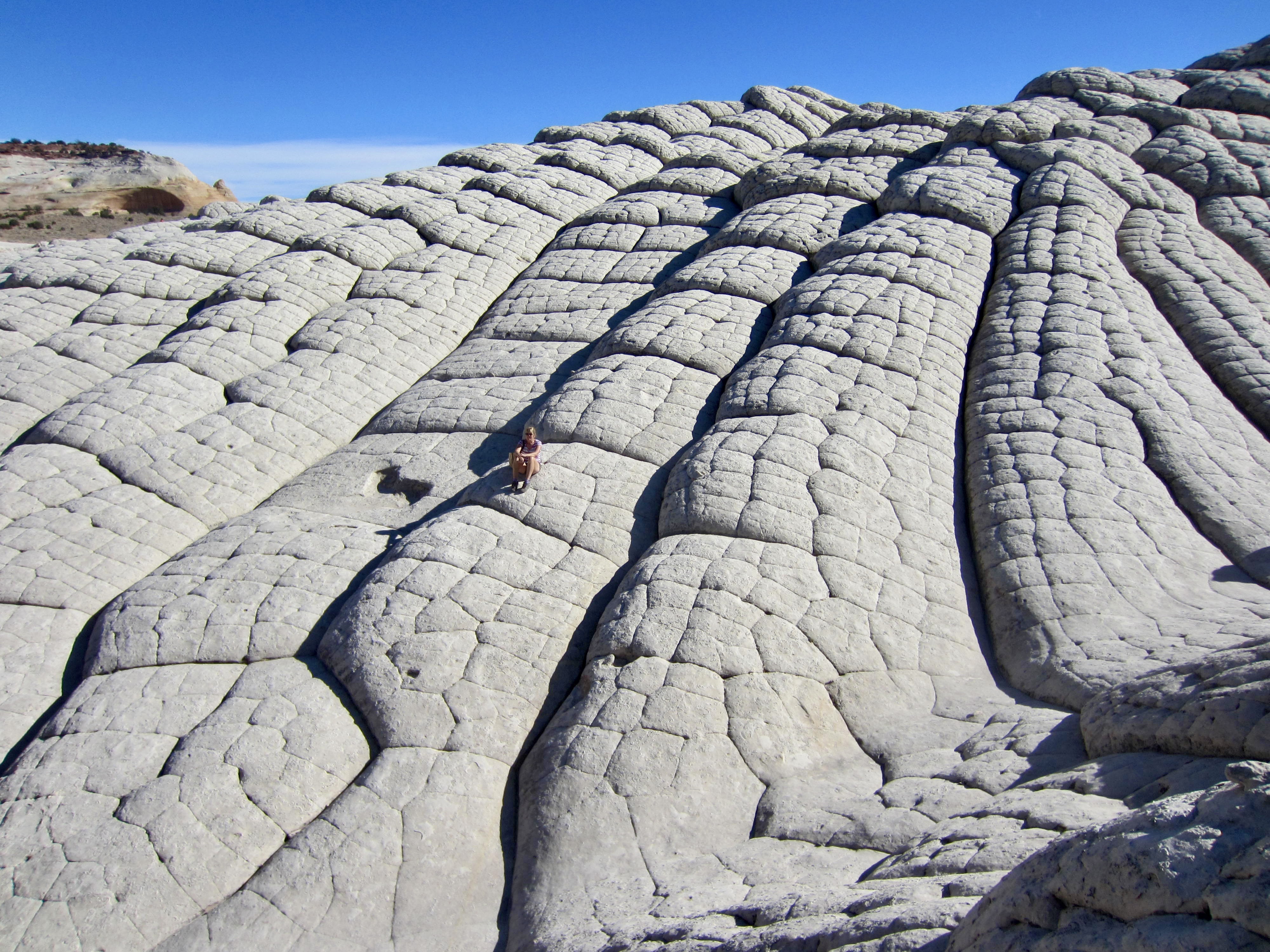
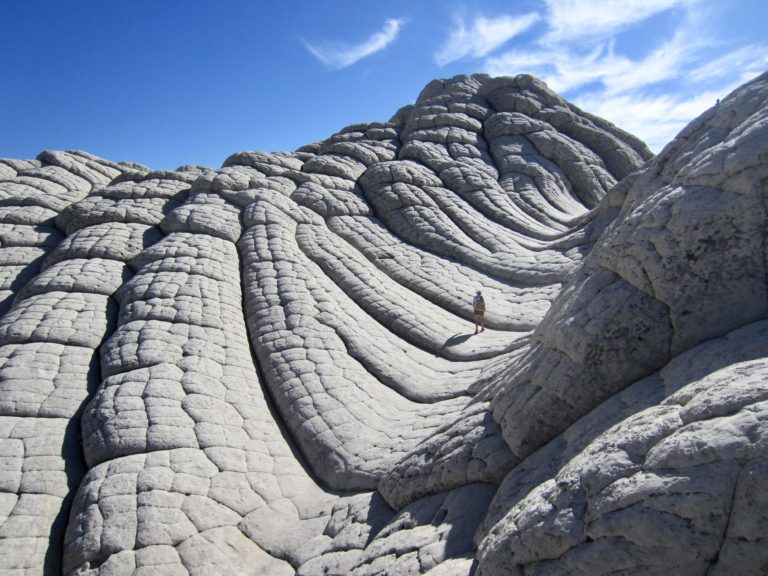
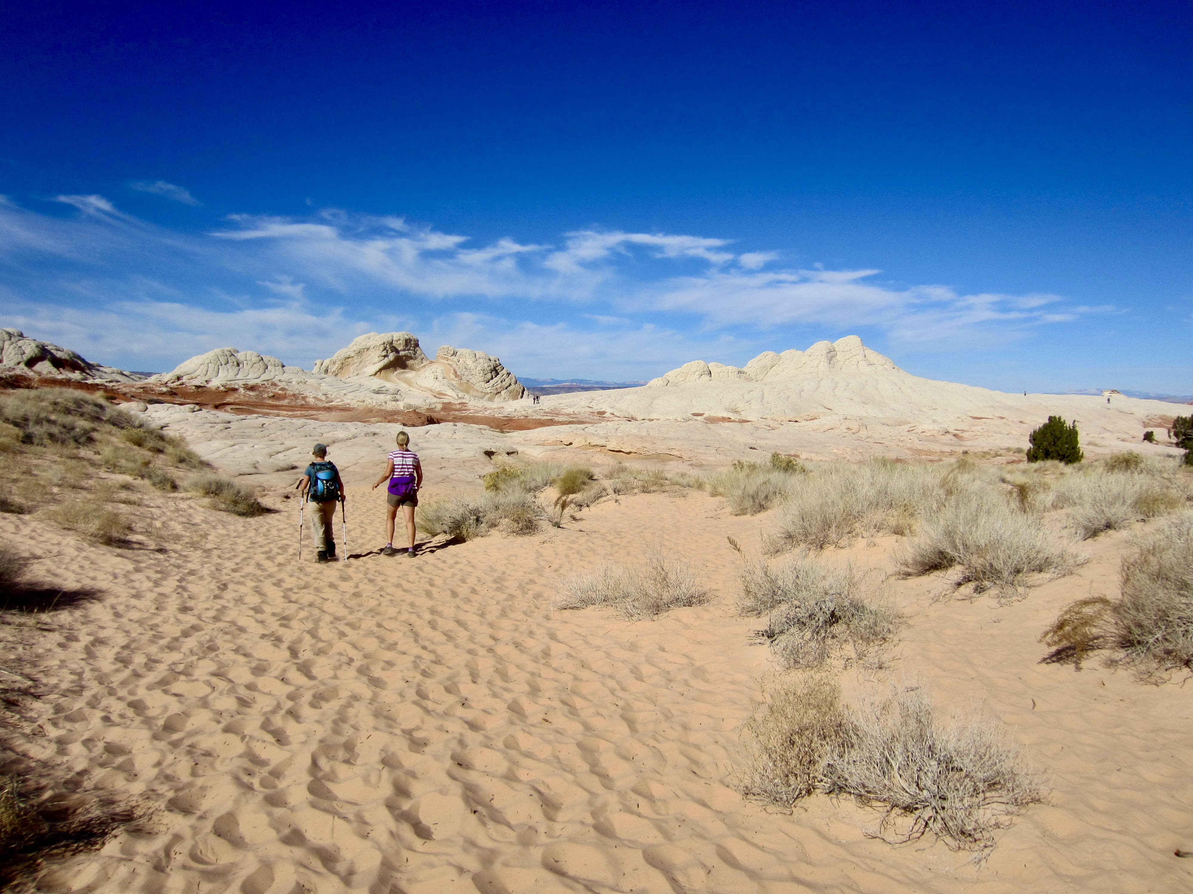
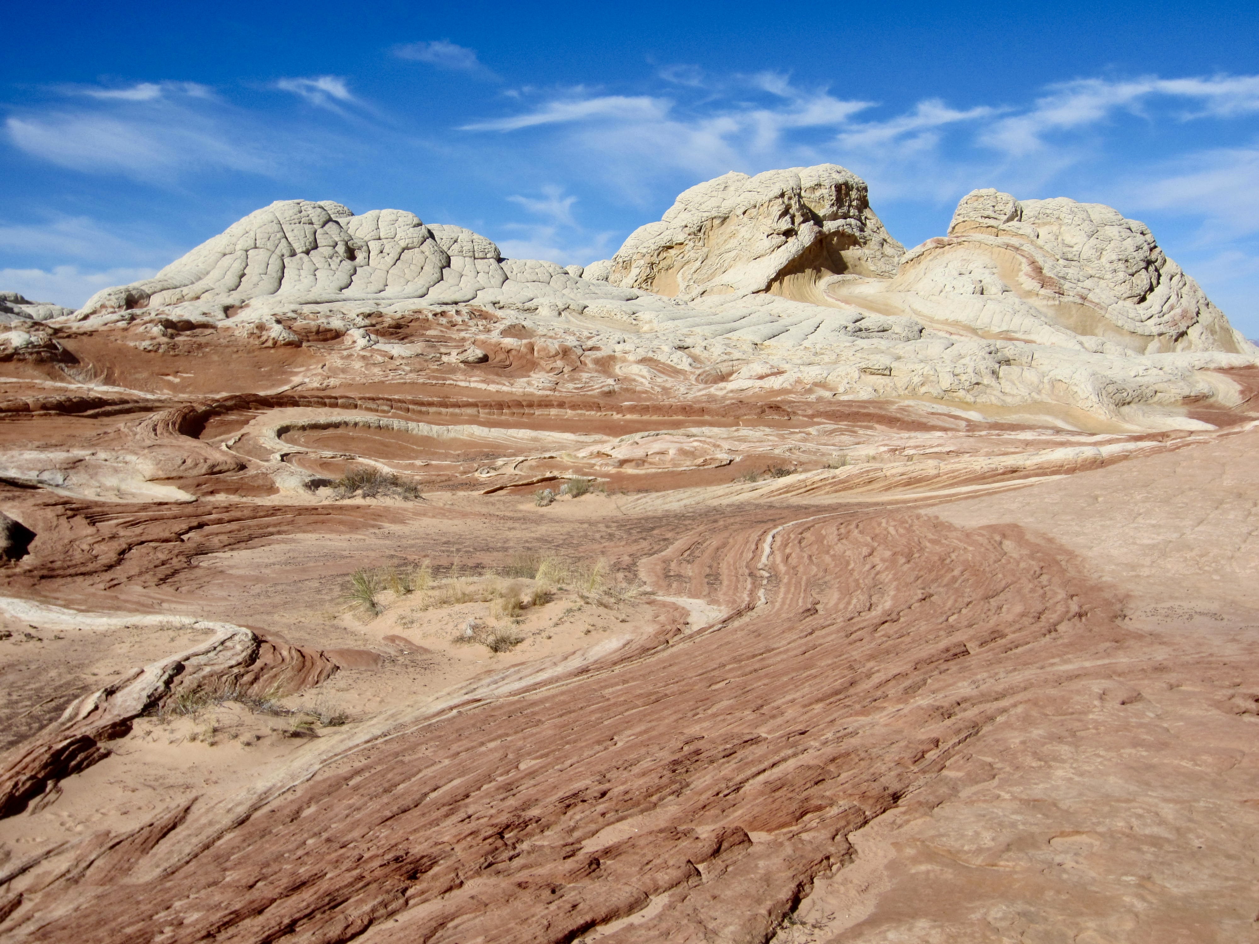
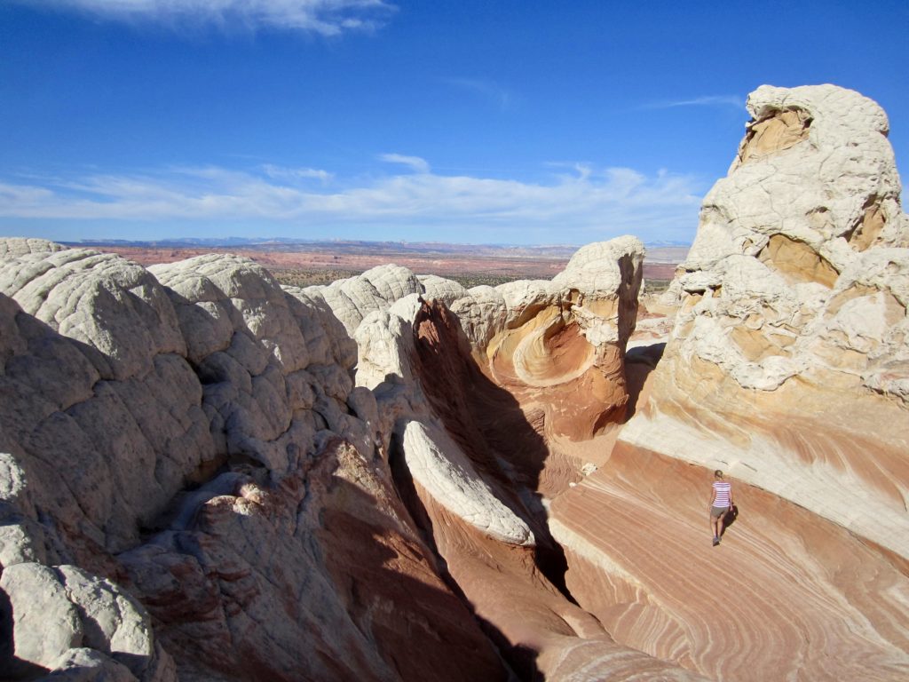
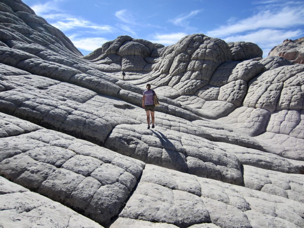
From the large trailhead parking lot, we walked 200 yards up a sandy wash and stepped onto a broad sandstone apron. It became immediately obvious that we were in store for a day of geological wonderment. Huge serpentine “ropes” of red and tan rock swept upward to convoluted blobs of white and pink rock. Even though we’d all spent more than a week visiting numerous incredible geological locales throughout southern Utah and northern Arizona, this one truly defied comprehension!

.
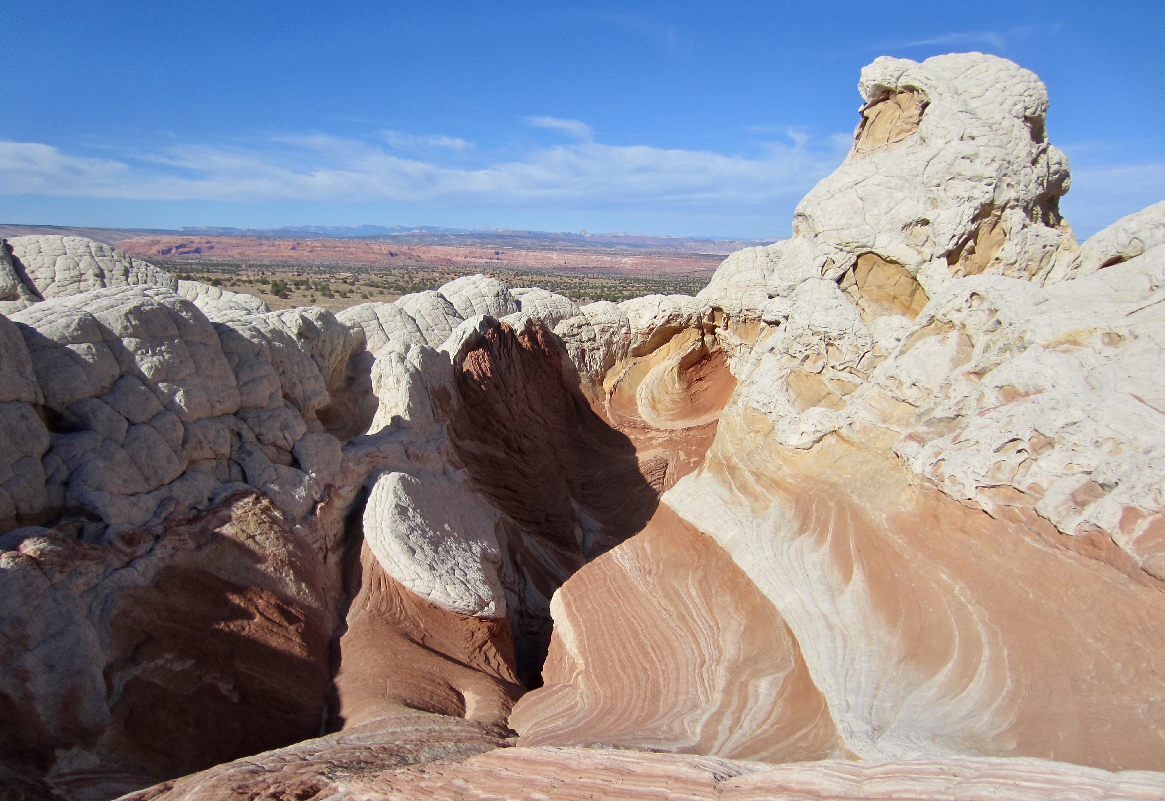
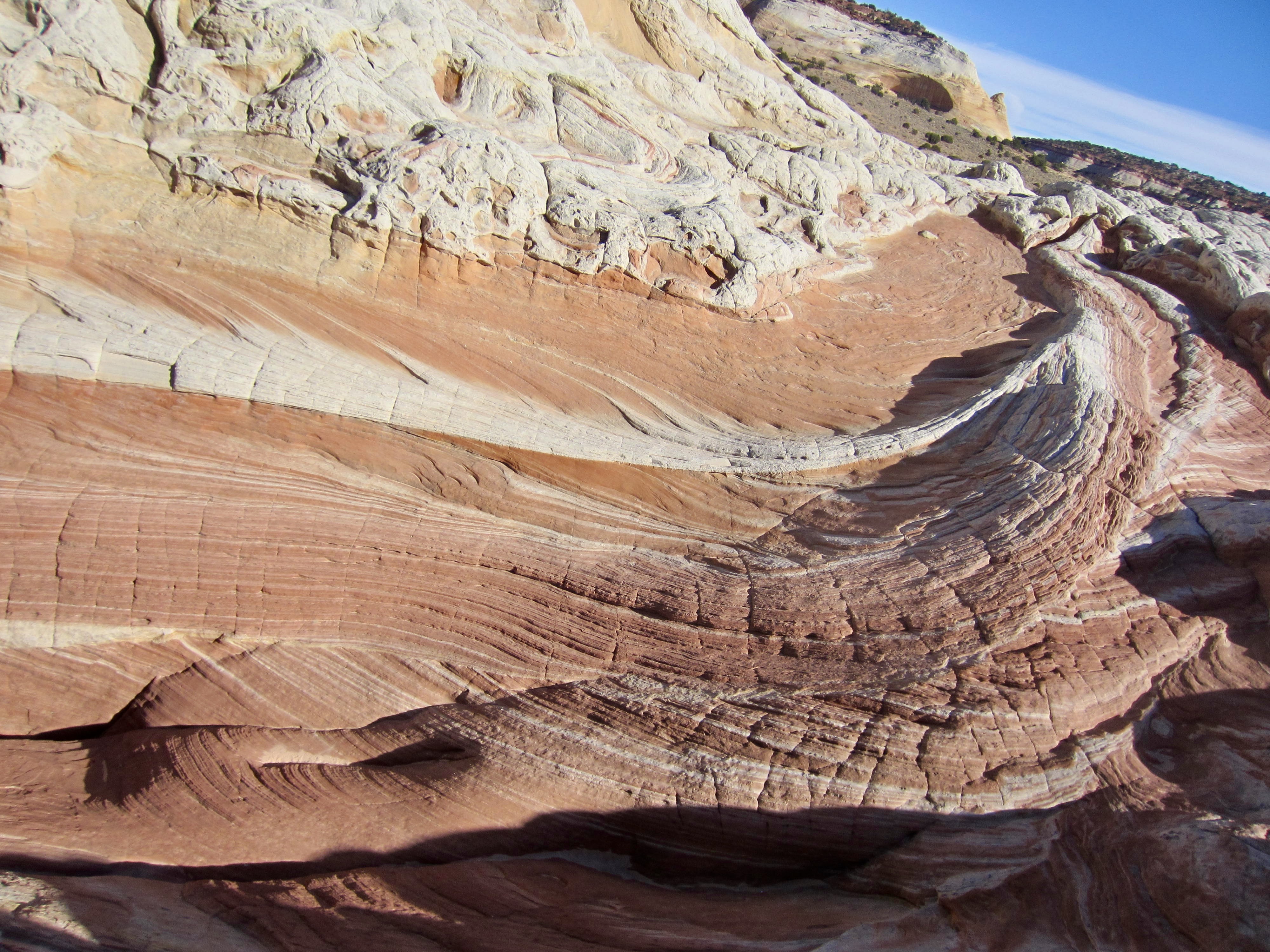
Much of the rock at White Pocket consists of twisty, laminated, colored sandstone capped by amorphous white sandstone. Thoughts of soft-serve ice cream with marshmallow topping came to mind. The various colors are known to be caused by oxidation of iron-rich mineral constituents, such as hematite and goethite, but the origin of such geomorphology is not well understood. Most theories involve a process called soft-sediment deformation, wherein Jurassic sand dunes slumped into shallow lakes, or underlying layers of liquefied sand erupted in mini-volcanos. These contorted deposits subsequently became hardened, or indurated, and then exposed by erosion.
.

.
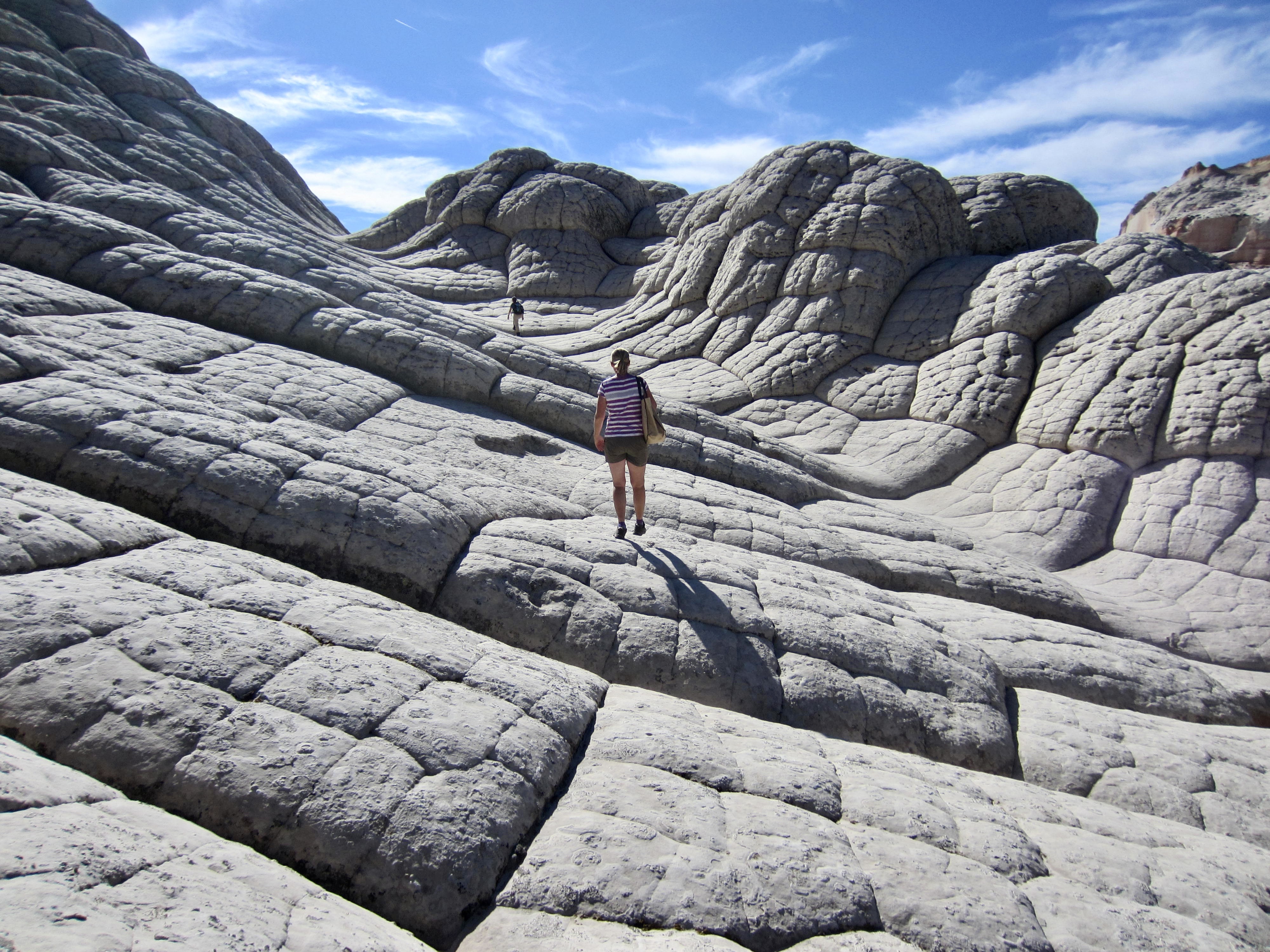
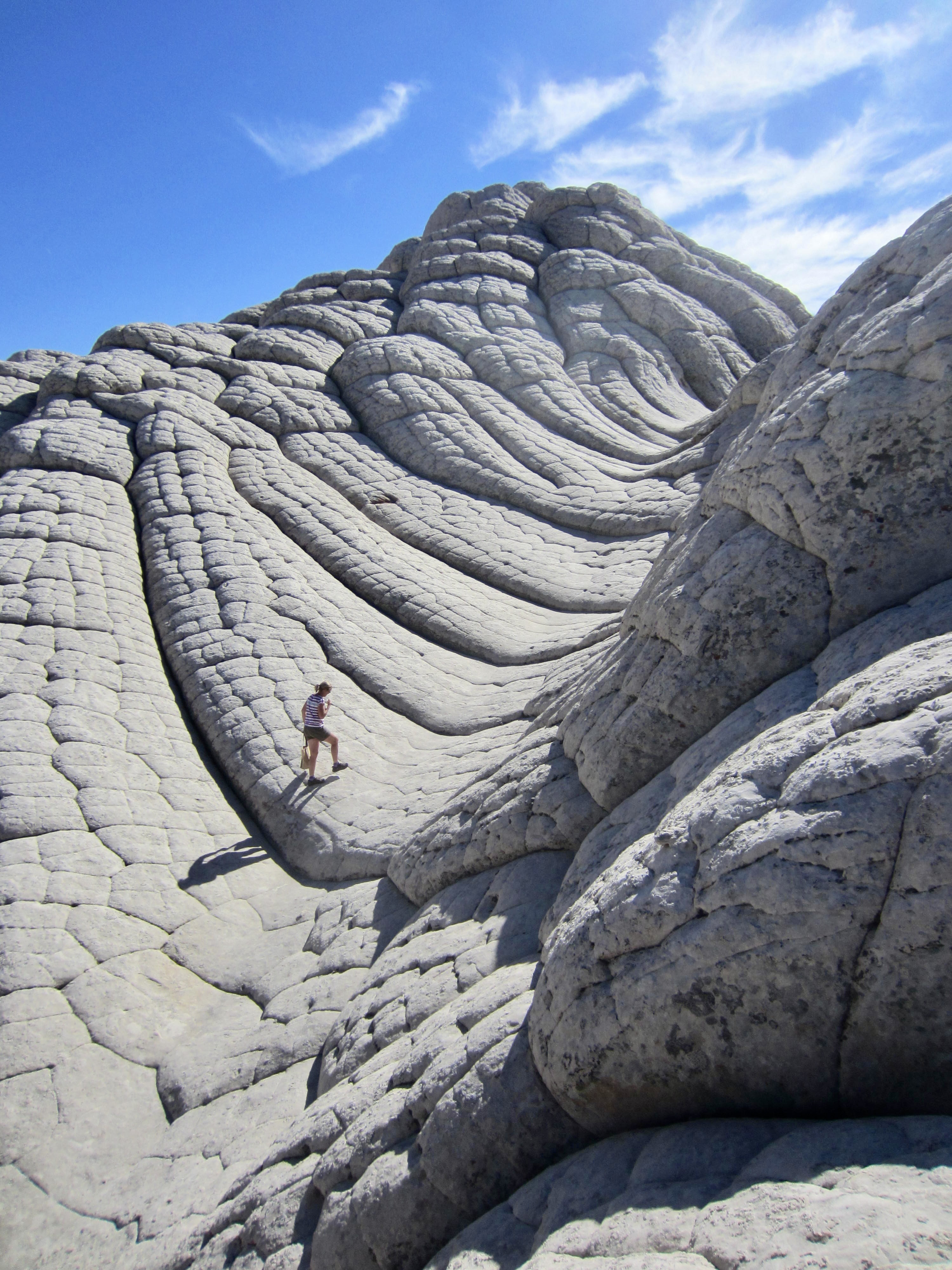
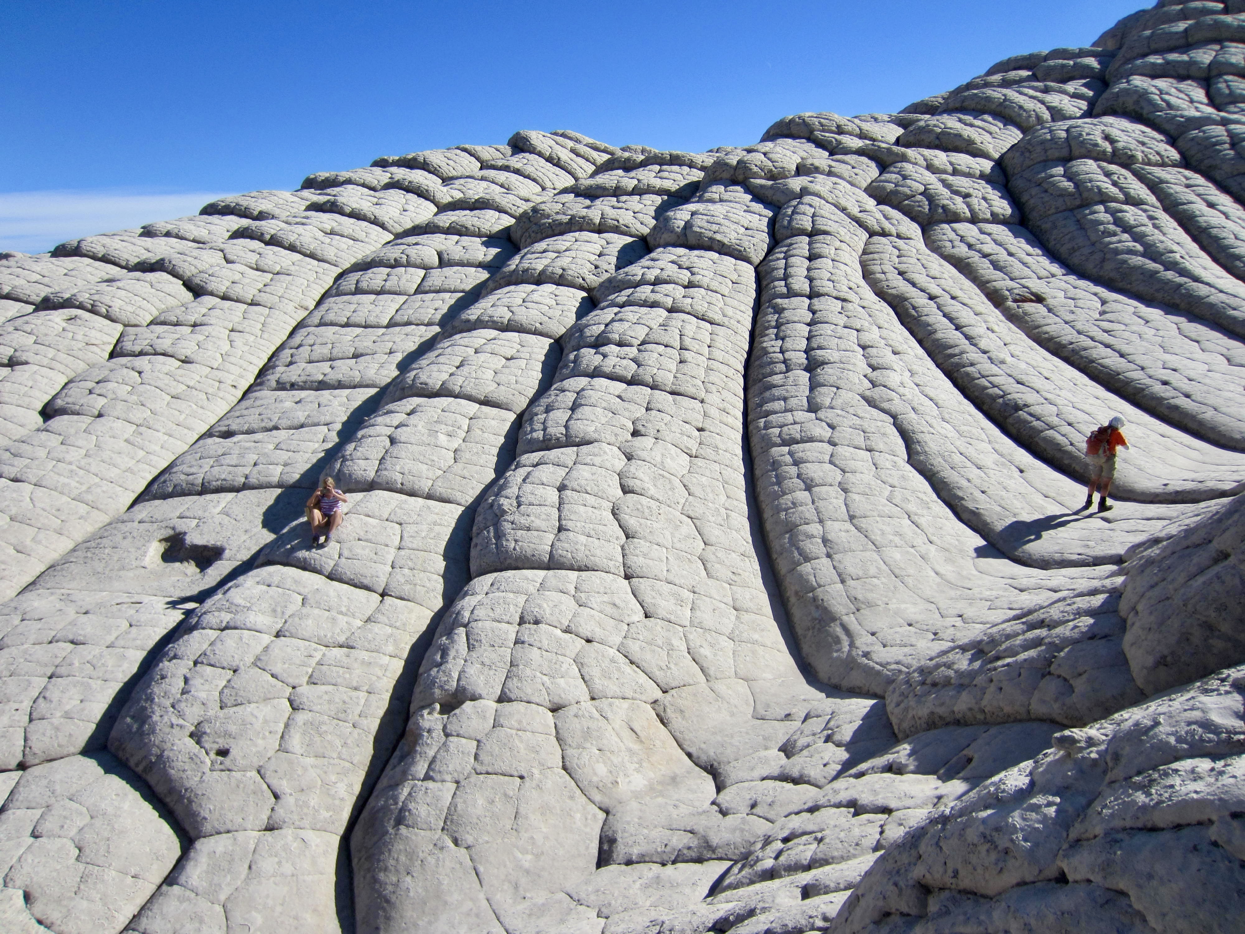
The other dominant geomorphology at White Pocket comprises wavy slabs of tessellated and furrowed white sandstone. These slabs display polygonal mosaics arranged into long, curving, parallel bands. Although commonly referred to as “cauliflower rock,” it also has the appearance of bread buns stuffed into elongated baking pans. I would interpret the polygons to be caused by stress cracking, and the furrows by water erosion. The white surface has been described as bleached sandstone, but the prevalence of exposed seashell casts makes me think it could be a calcareous veneer.

.
.
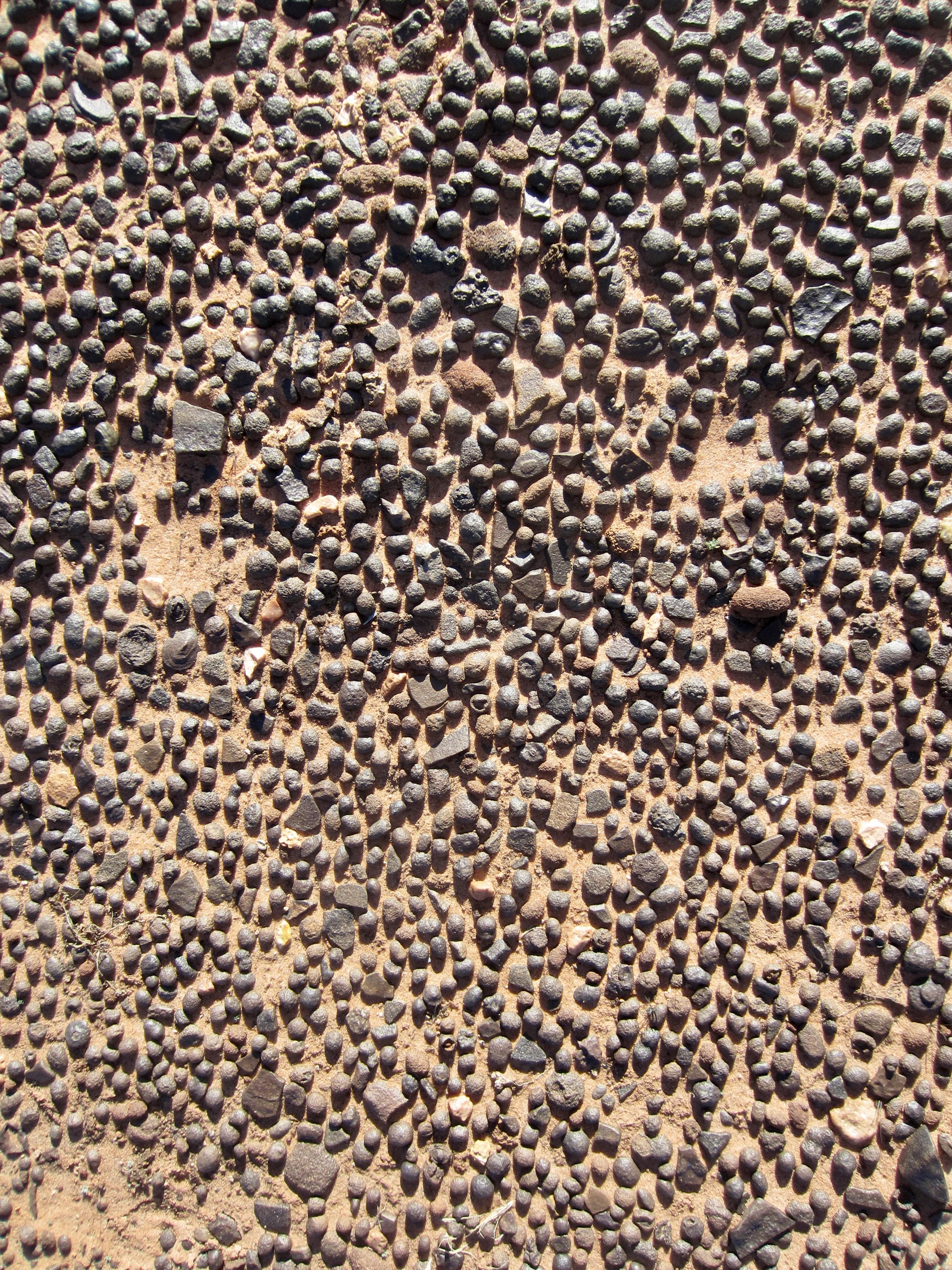
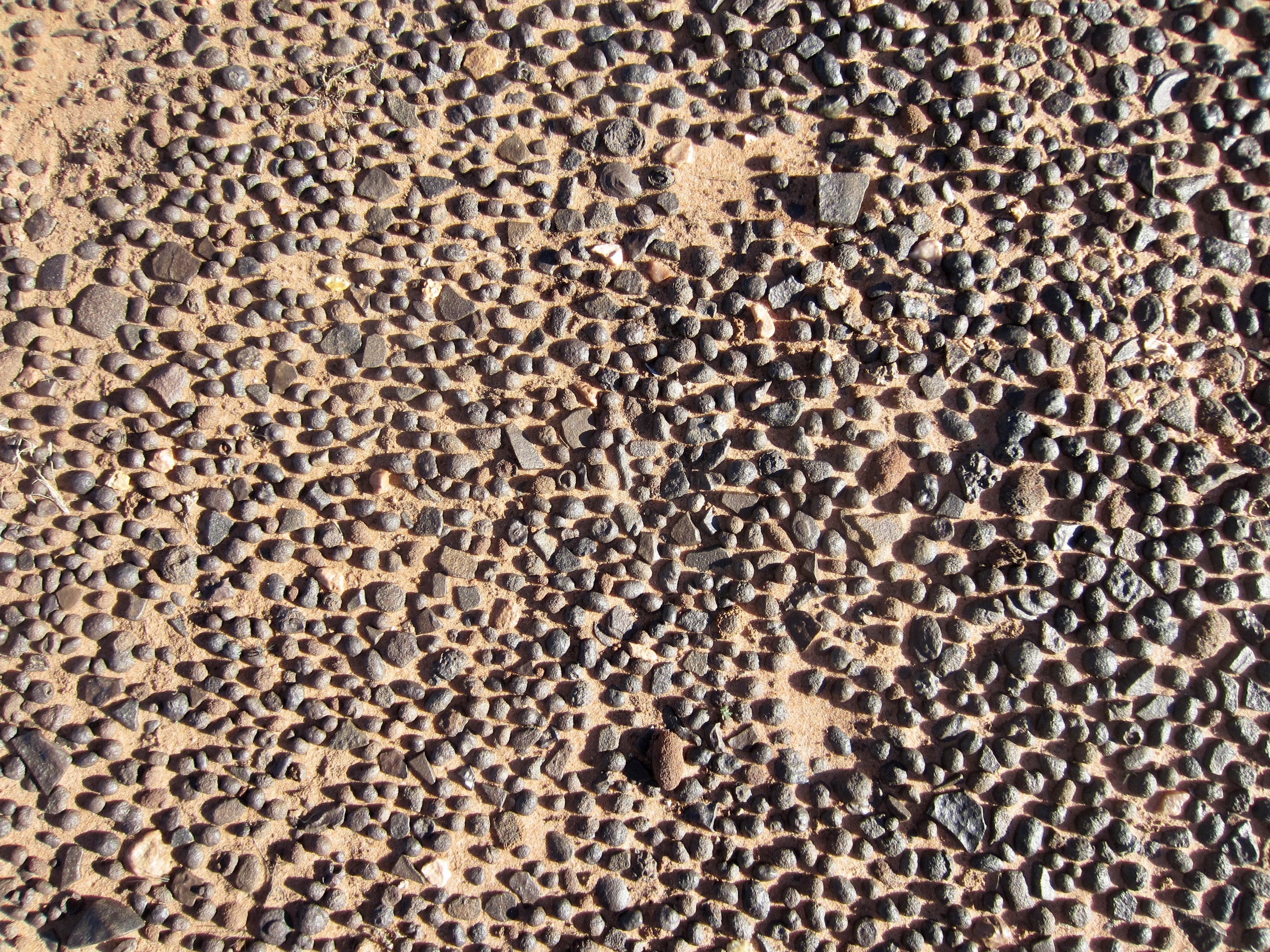
Another interesting feature of White Pocket is the ubiquitous black and brown pebbles filling every depression. These metallic-looking pebbles, formally known as iron concretions, consist of iron oxide and sandstone. Rock-hounds and gem collectors often refer to them by names such as Moqui marbles, Moki balls, Hopi marbles, Navajo cherries, Navajo berries, Kayenta berries, Entrada berries, and Shaman stones. We facetiously called them “deer pellets.”
.
On this vacation, we weren’t lucky enough to win a permit for The Wave, the famous and ultra-popular sandstone formation in nearby Coyotes Butte North, but we came away believing that White Pocket was more than acceptable as a consolation prize!
…
Area Map & Route Map
…
…
Photo Gallery
Click to enlarge…