Trip Date: November 6, 2021
2021 DESERT SOUTHWEST ADVENTURE VACATION
Buckskin Gulch Day Hike & Canyon Exploration
Wire Pass Narrows
Buckskin Gulch
Trip Report Summary
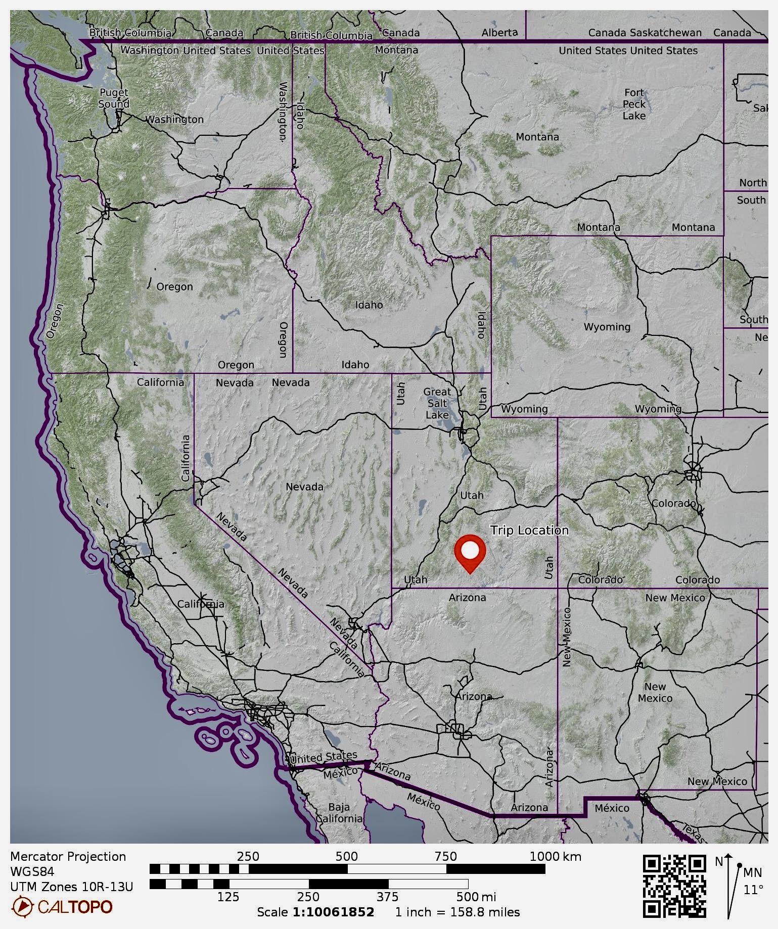
Region: Utah
Sub-Region: Southwestern Utah
Area: Paria Canyon – Vermilion Cliffs Wilderness
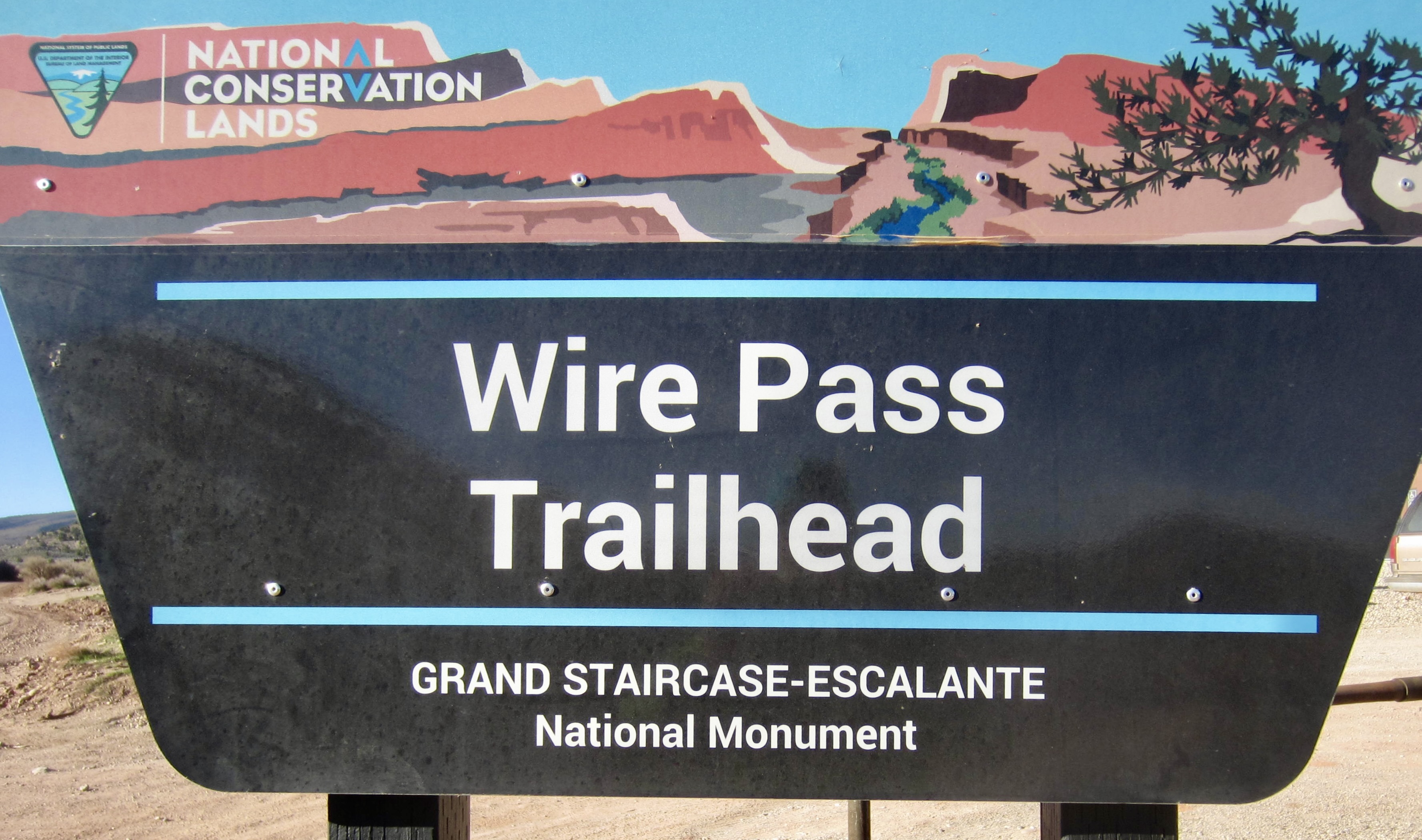
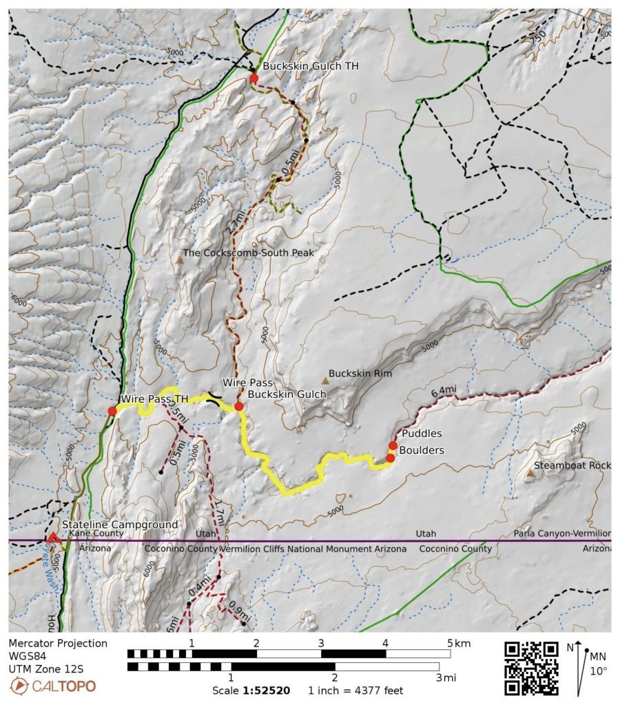
Starting & Ending Point: Wire Pass Trailhead on House Rock Valley Road
Way Points: Coyote Wash & Wire Pass Narrows & Buckskin Gulch confluence & Buckskin Gulch boulders (trail hike & sand hike & rock scramble)
Invert: Wire Pass Narrows (down & back traverse of full length)
Invert: Buckskin Gulch (down & back traverse of middle segment)
Approximate Stats: 8.8 miles traveled; 250 feet gained & lost; 6.2 hours elapsed.
…
Full Trip Report
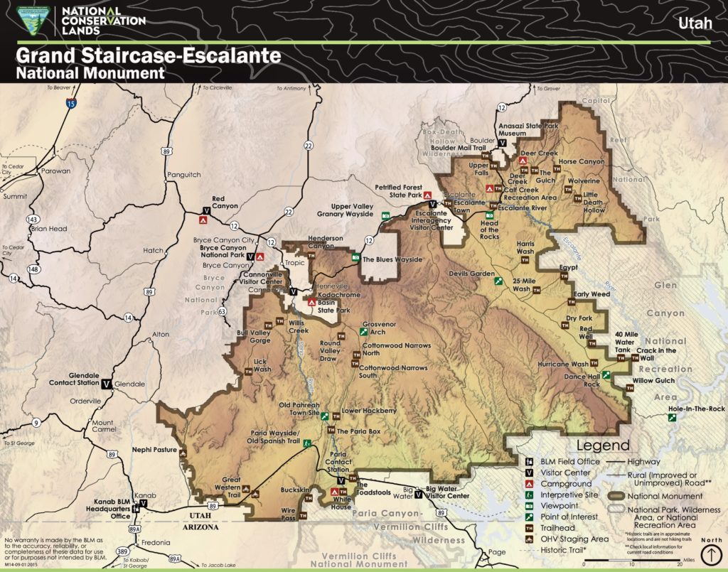
Buckskin Gulch is a popular canyoneering destination in the Paria Canyon – Vermilion Cliffs Wilderness, which lies between Utah’s Grand Staircase – Escalante National Monument and Arizona’s Vermilion Cliffs National Monument. This fabulous gulch extends for nearly 20 miles from House Rock Valley Road to the Paria River. Given the considerable length, it affords opportunities for canyoneering treks ranging from a few hours to a few days, and it can be combined with treks in uber-famous Paria Canyon.
While spending several days car-camping in Coyote Valley on the Utah/Arizona border, Eileen, Steve, Deb, and I did a one-day down-and-back exploration of Buckskin Gulch. We started at the Wire Pass Trailhead on House Rock Valley Road, because it provides the most direct access. The large parking lot here attests to the great popularity of this trek.

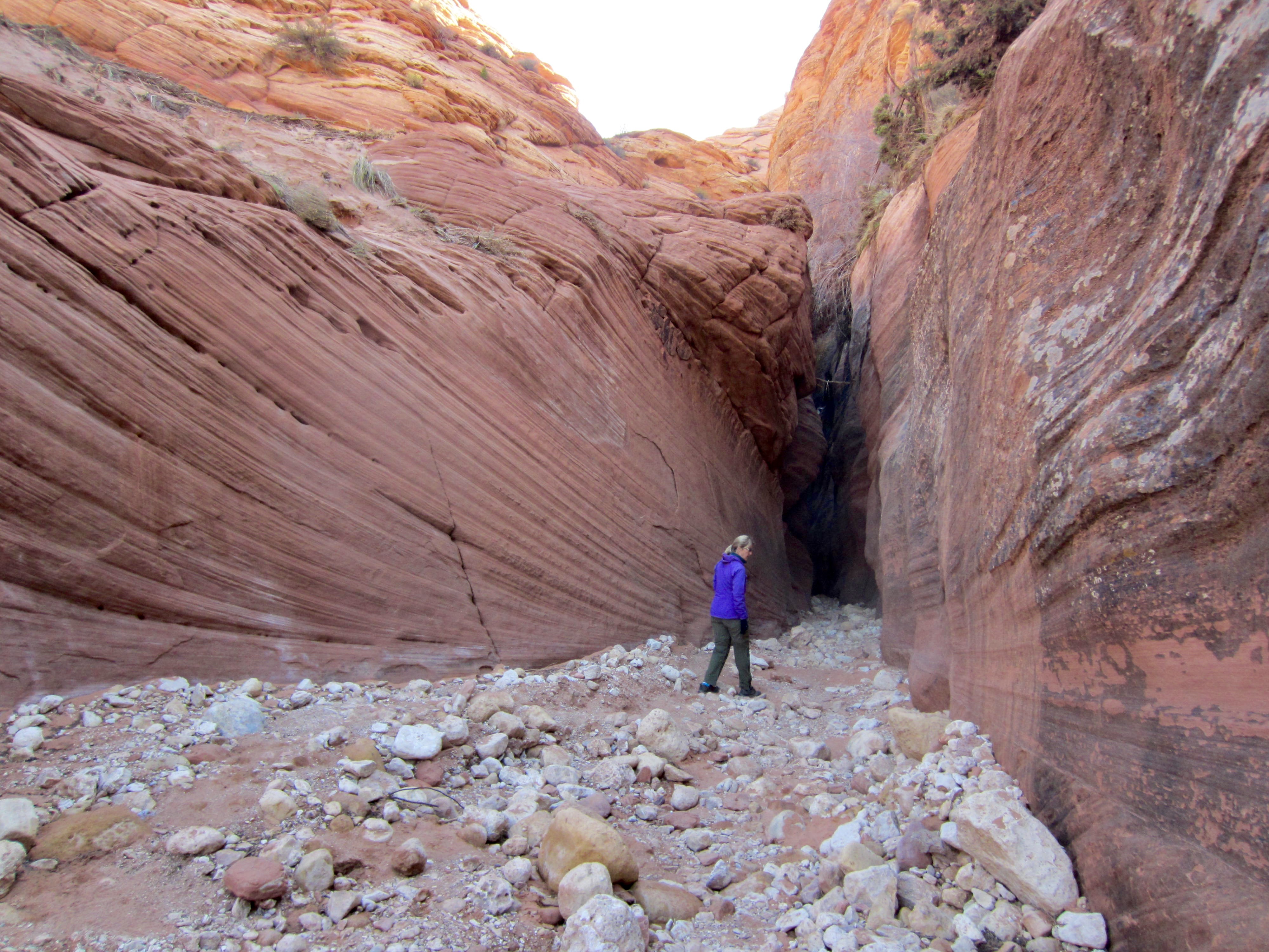
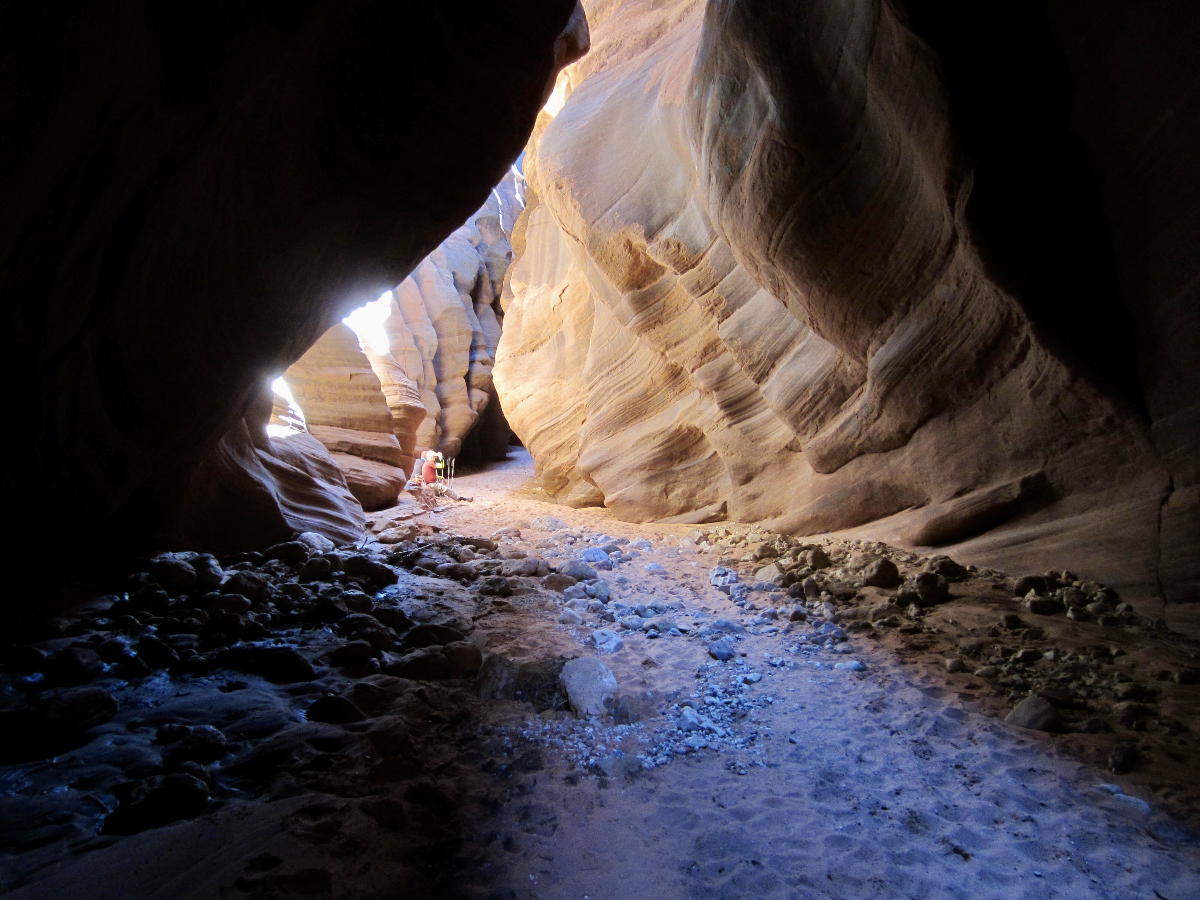
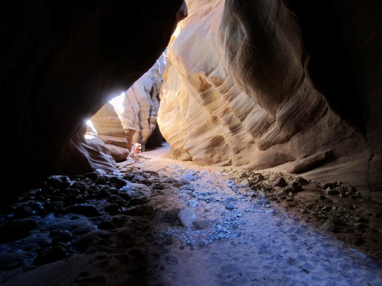
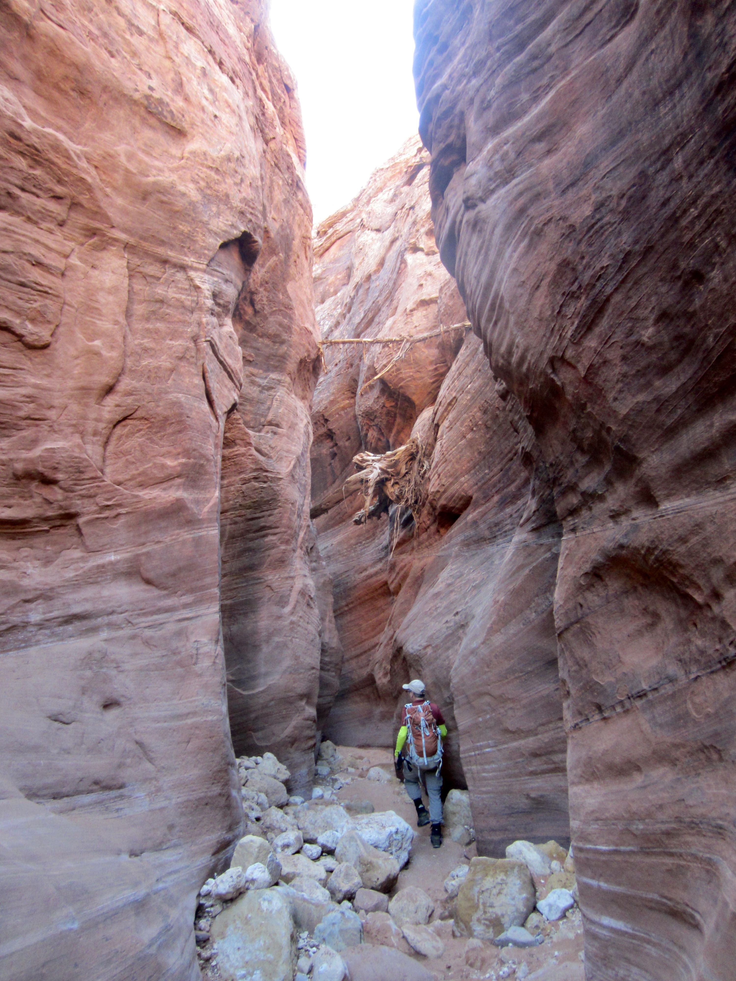
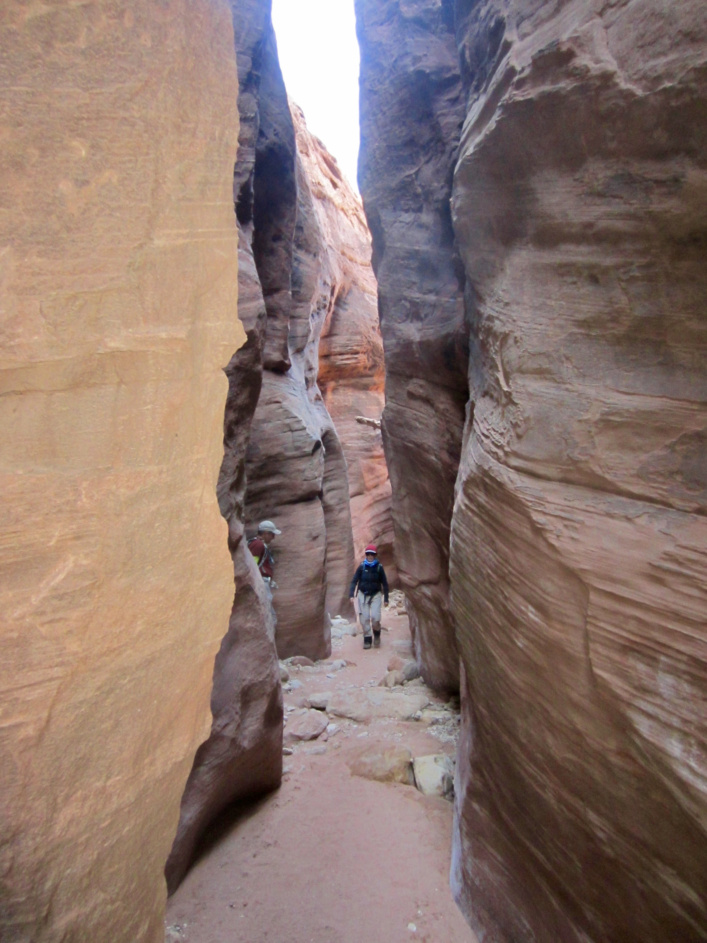
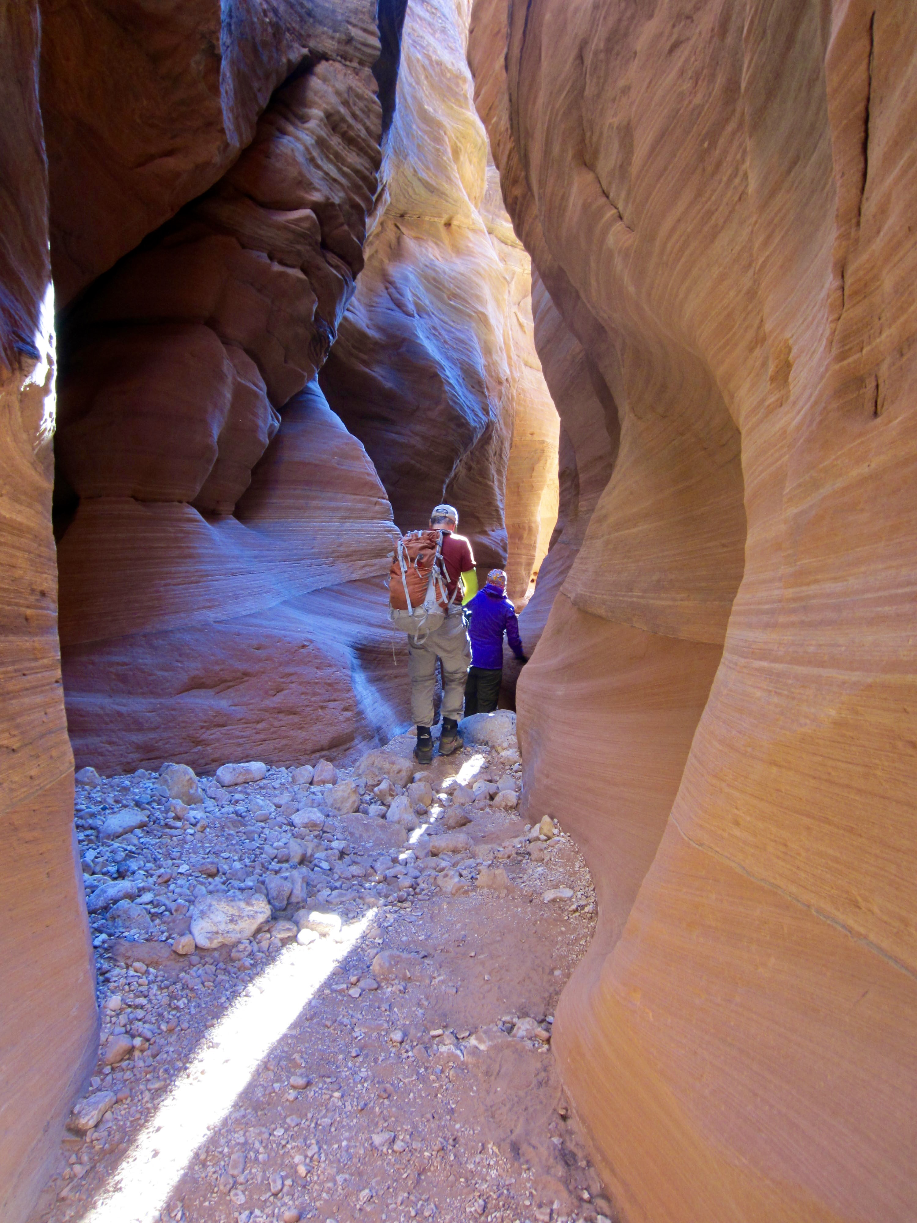
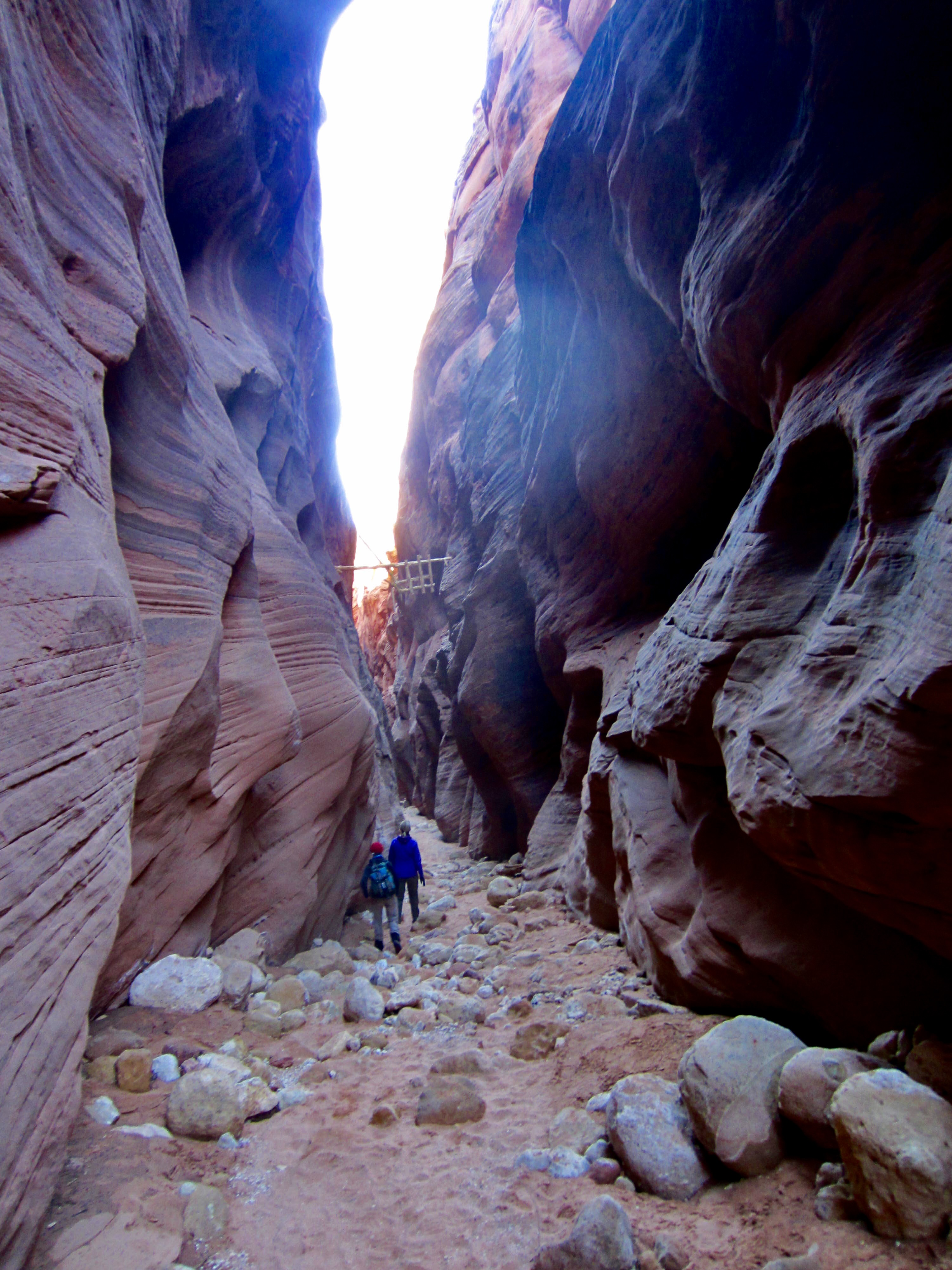
From the trailhead, we dropped into Coyote Wash, then turned left (northeast) and hiked down the wash. After about 1 mile, we entered Wire Pass (more appropriately called “Wire Passage”), a fascinating slot canyon that slices through a rocky ridge and serves as a shortcut to Buckskin Gulch.
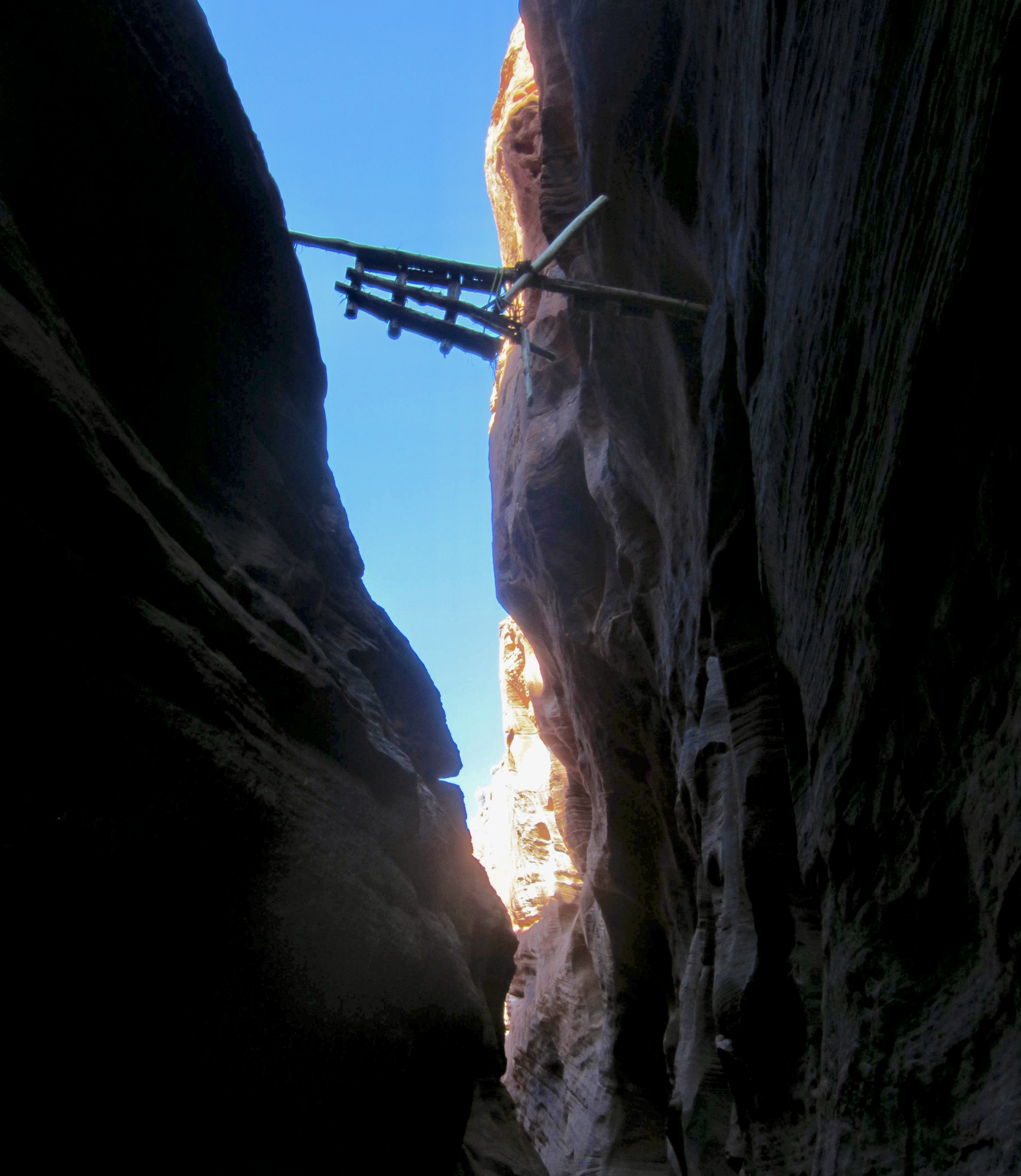
Very soon, we came to a well-documented step-down created by a plug of boulders wedged between the canyon walls. This 8-foot step-down was reported to have had a ladder in place two months ago, but there was now some doubt about the ladder’s existence. We immediately saw that the ladder was gone; however, someone had installed a small tree trunk that functions as a ladder pole. It was crude but effective.
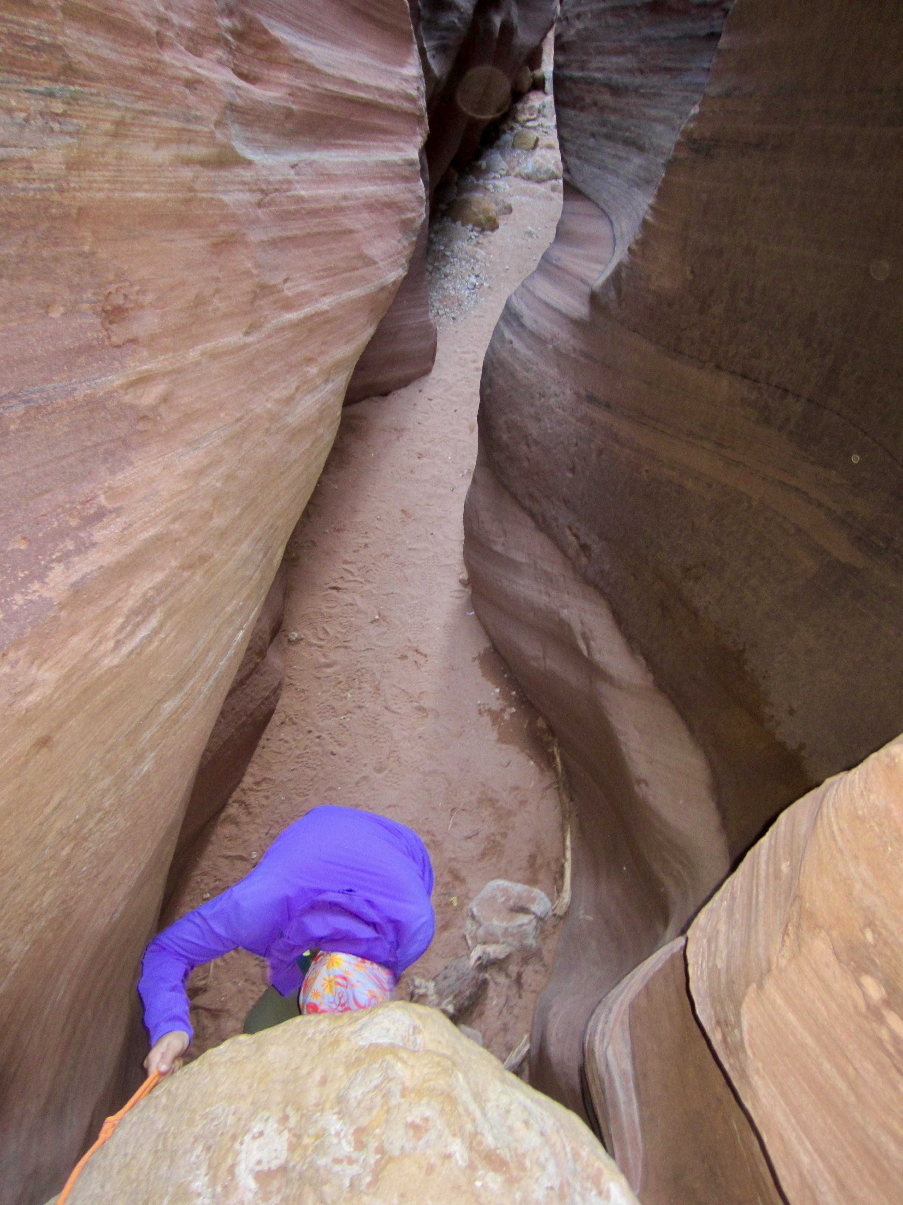

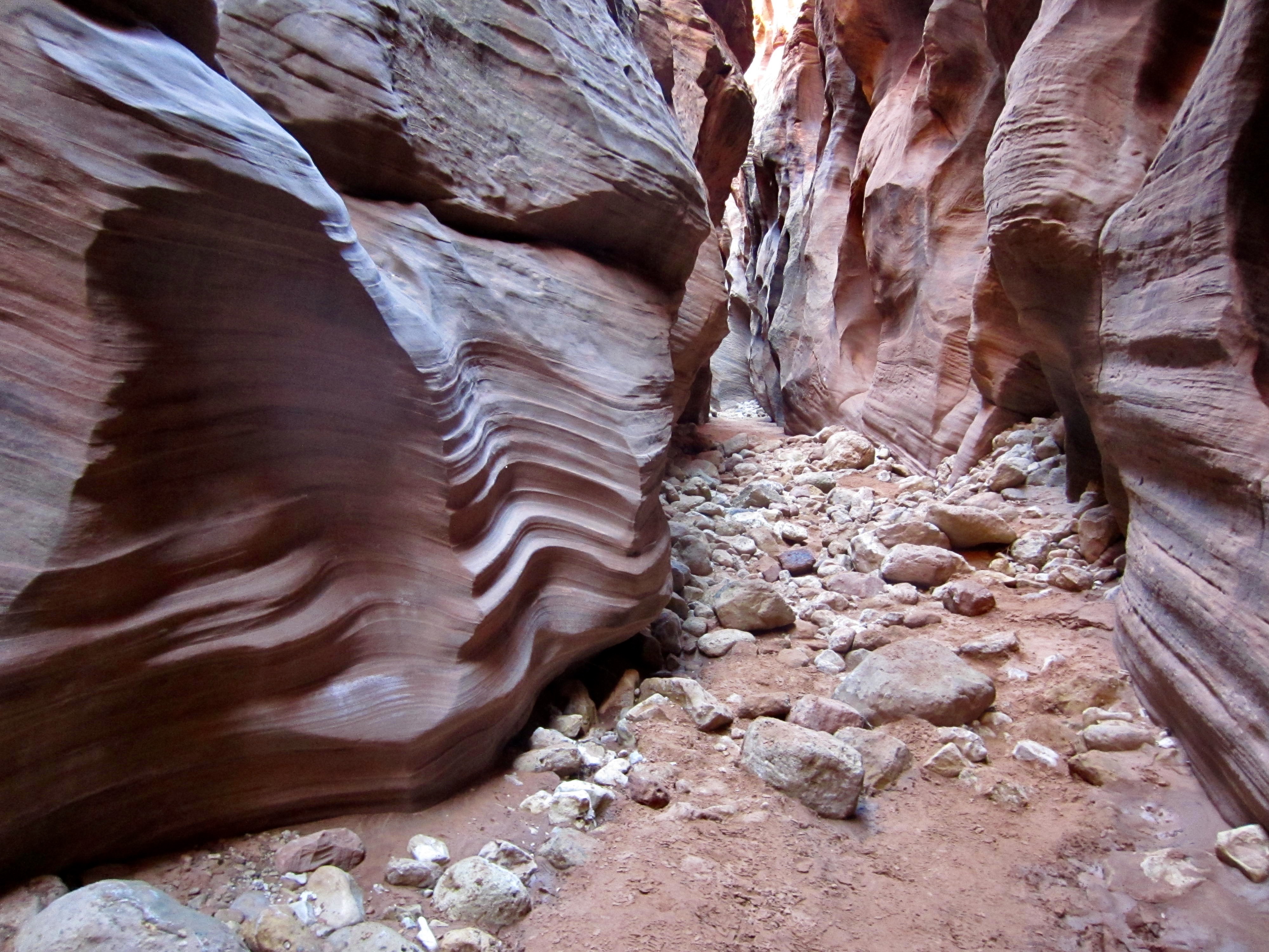
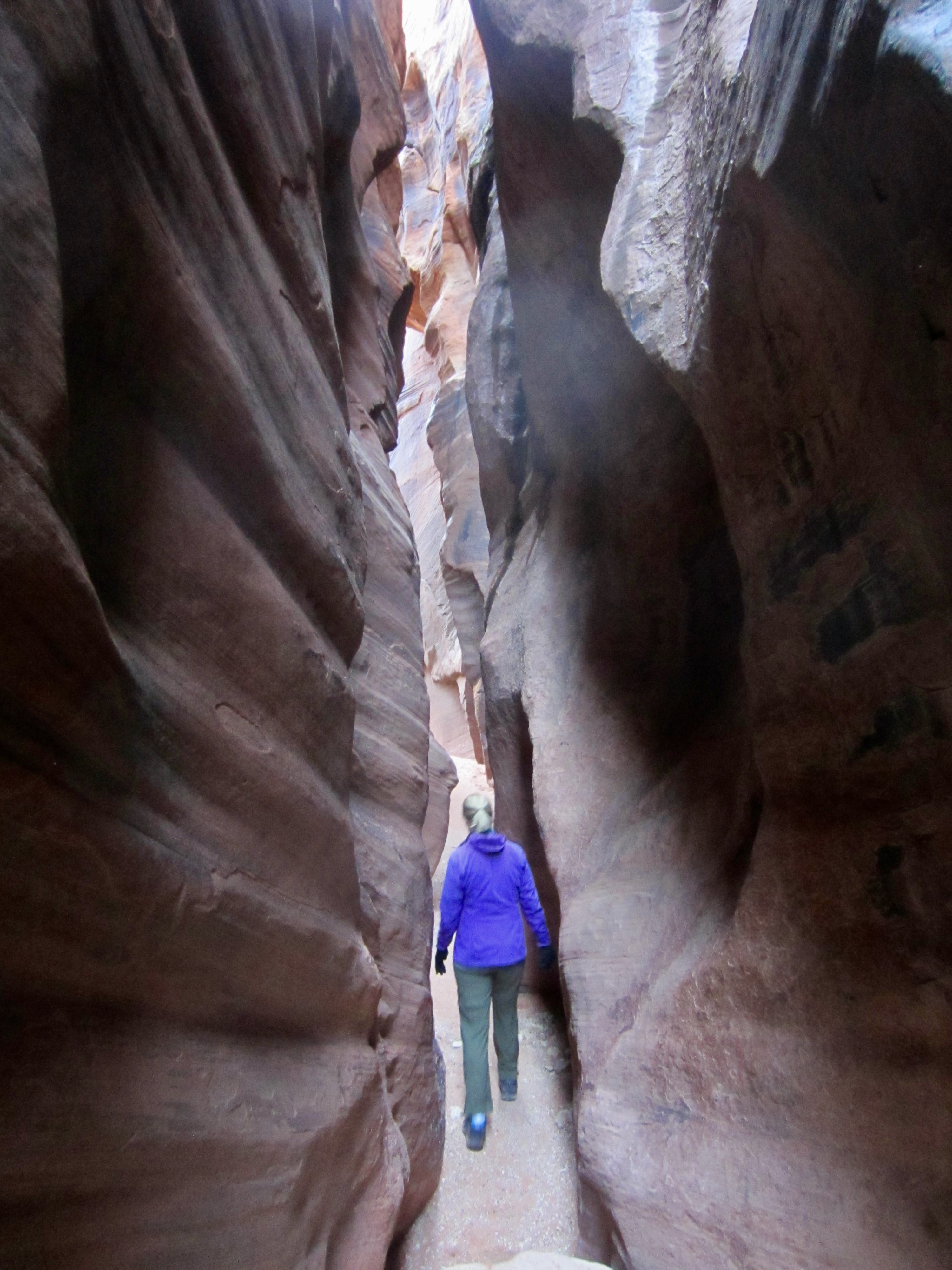
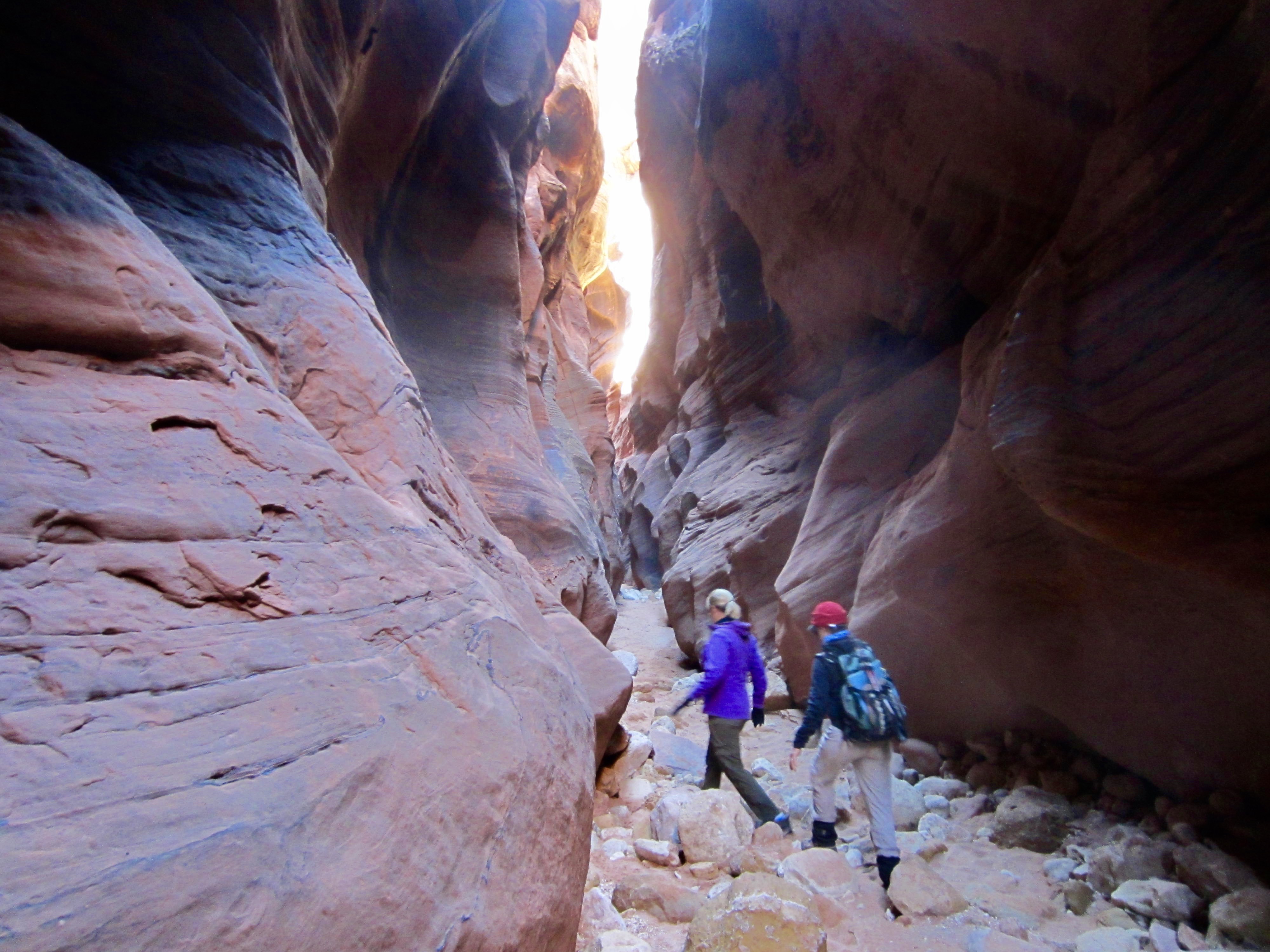
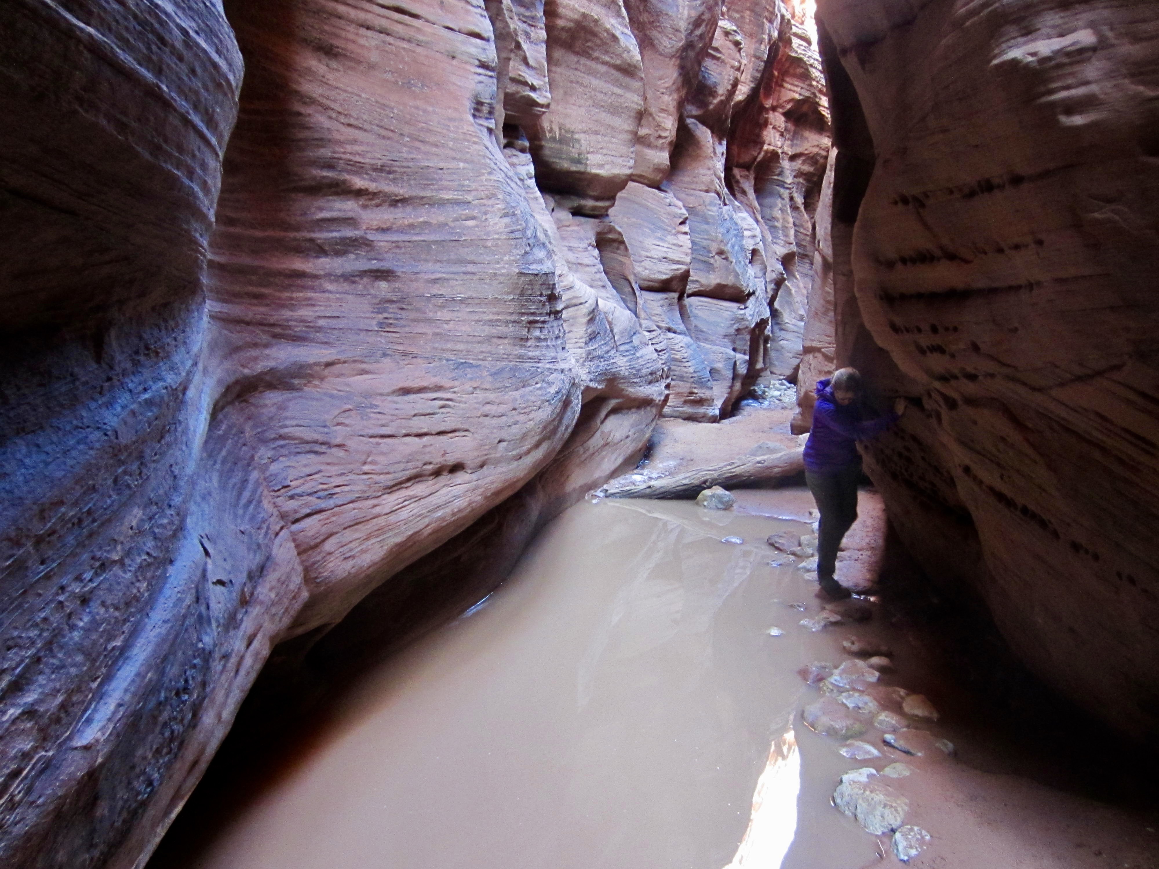
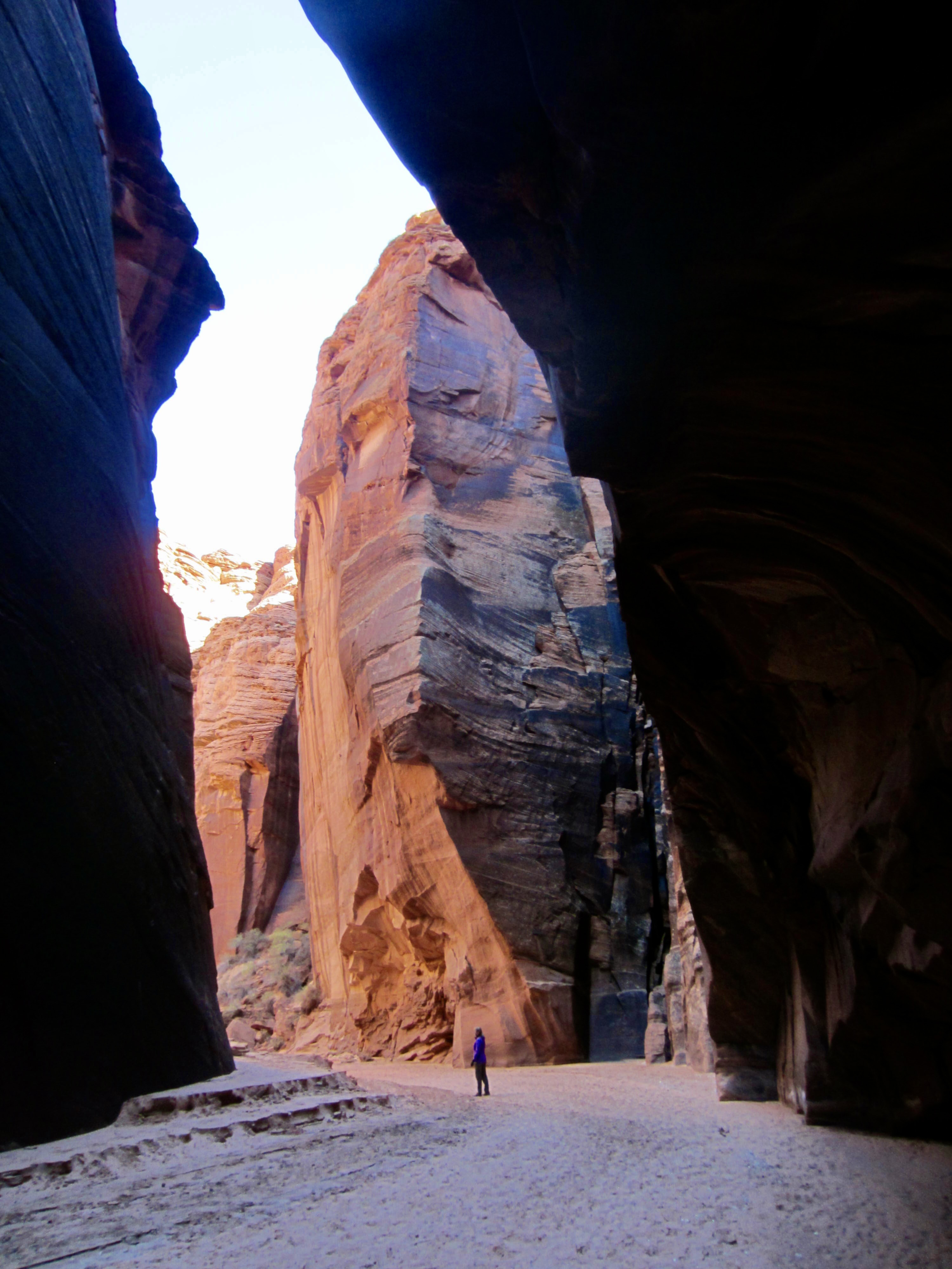
We continued hiking through the slot canyon, which gradually becomes taller, narrower, and more interesting. At its narrowest point, the walls are only about 2 feet apart, but the flat, sandy bottom makes for easy travel.
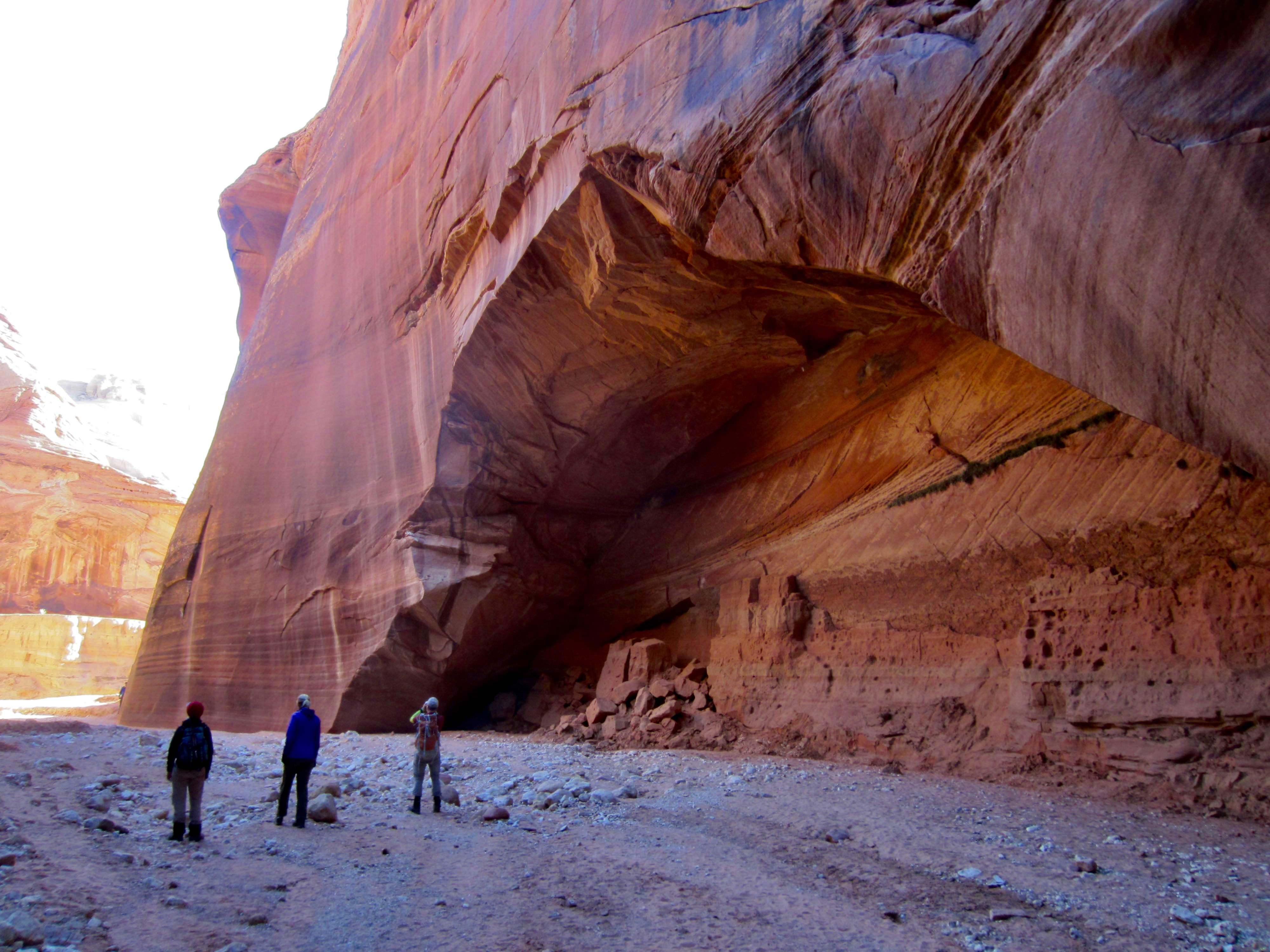
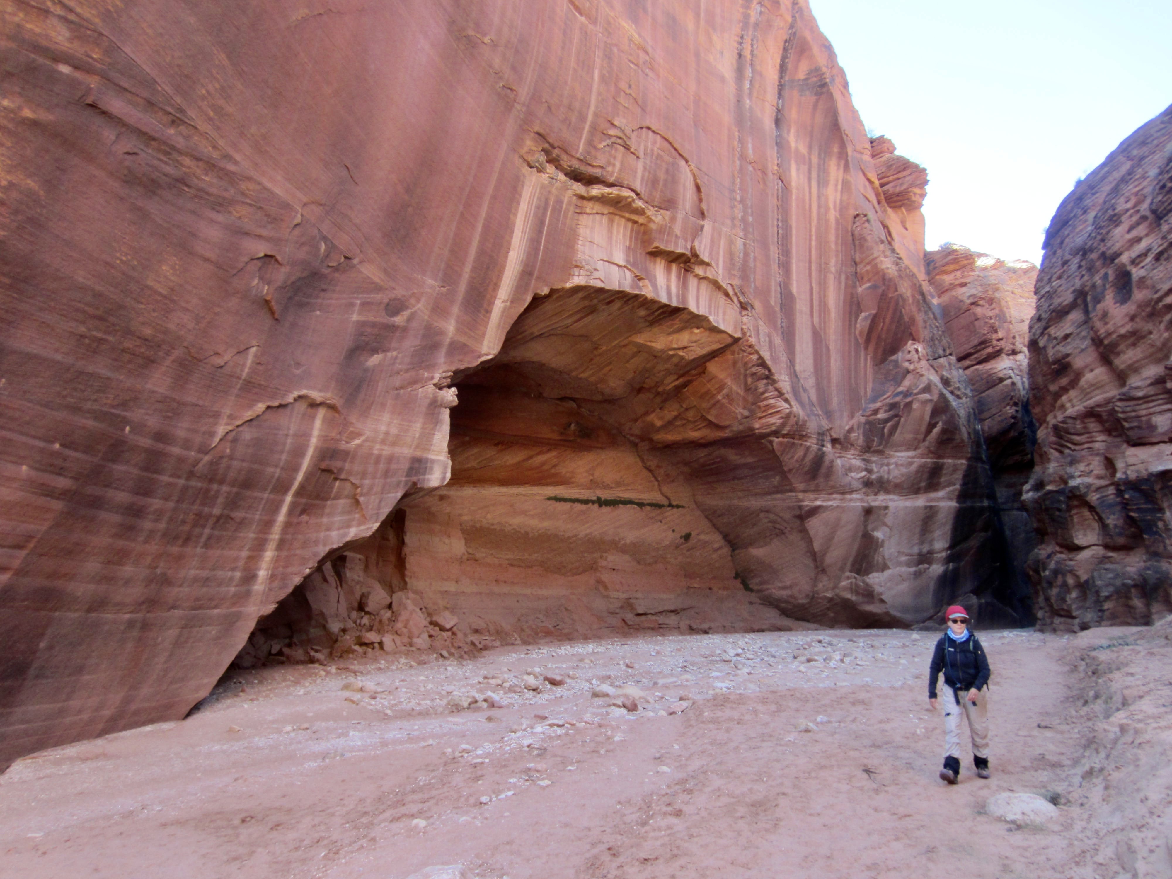
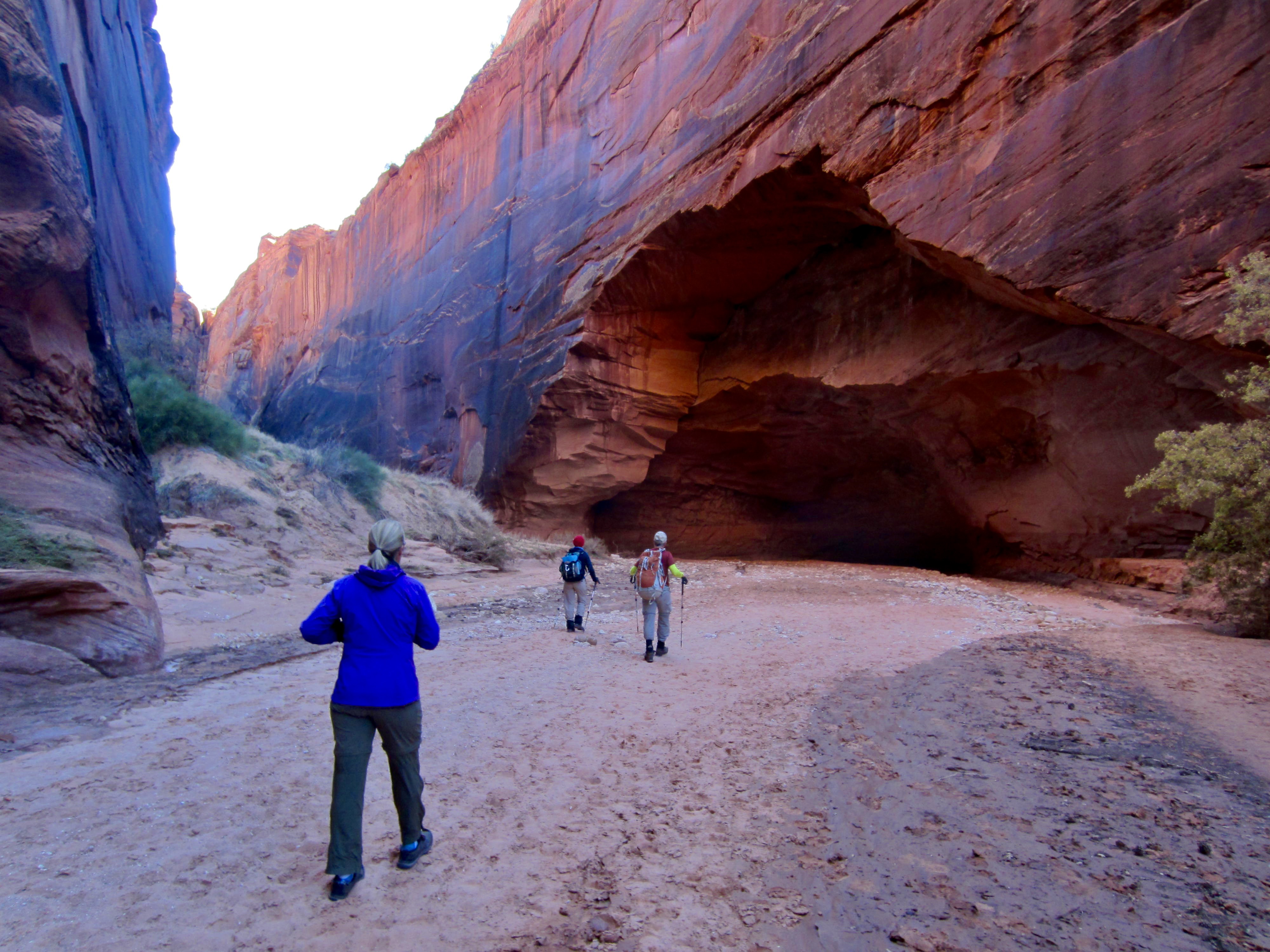
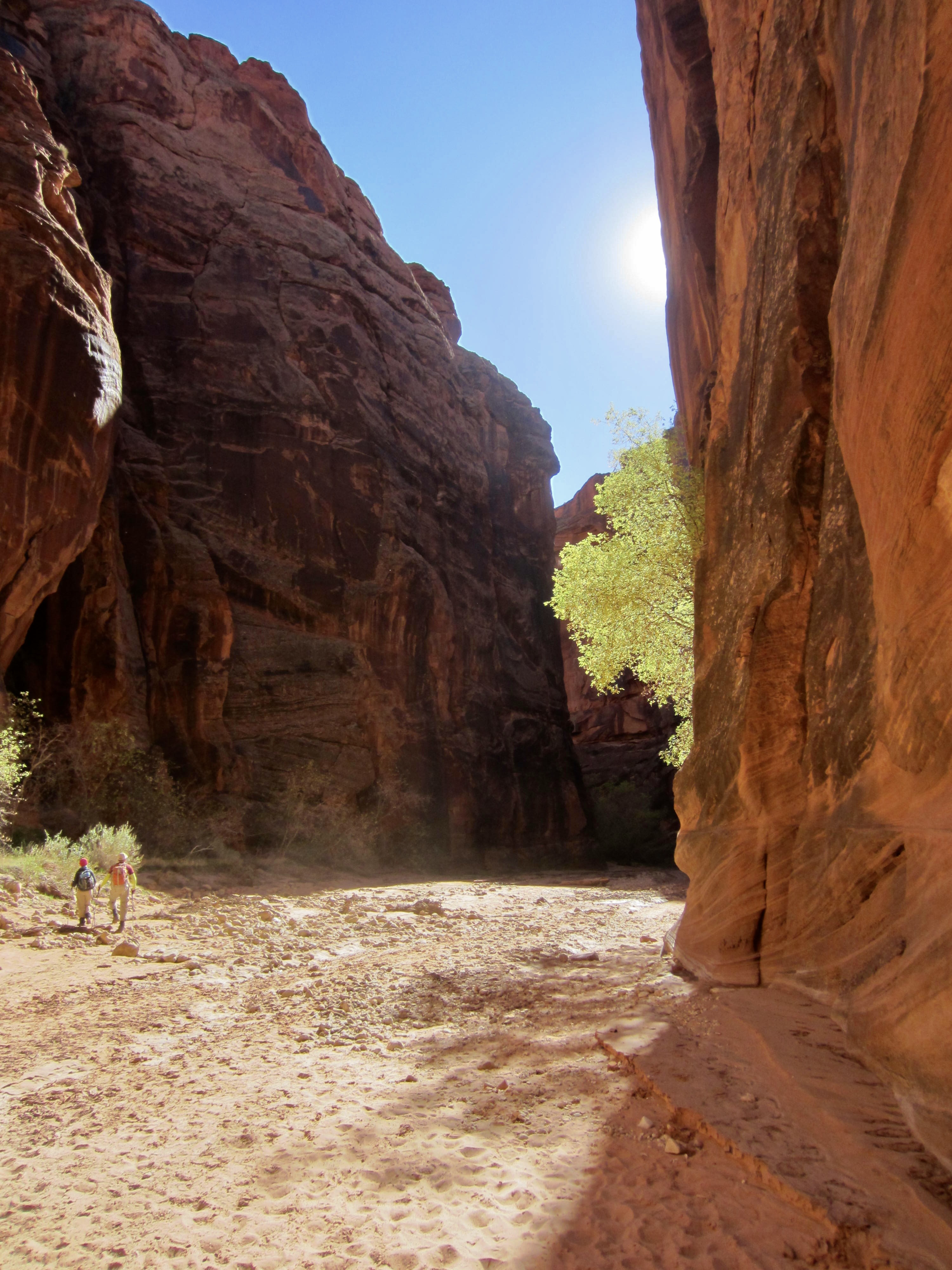
Very abruptly, the canyon walls opened up and we found ourselves in a wide wash bounded by tall, sheer walls, with a huge alcove arch on one side. A few hundred yards beyond was the confluence with Buckskin Gulch (1.7 + 0.9 hours from TH). This would make a worthy destination for people wanting a half-day trek.

At the confluence, we turned right (south) and proceeded down Buckskin Gulch. Within 100 yards, we witnessed something that was both humorous and sobering: the old ladder from Wire Pass was lodged between the canyon walls 40 feet above our heads. Obviously, this ladder represented the water depth here during some recent flash flood!
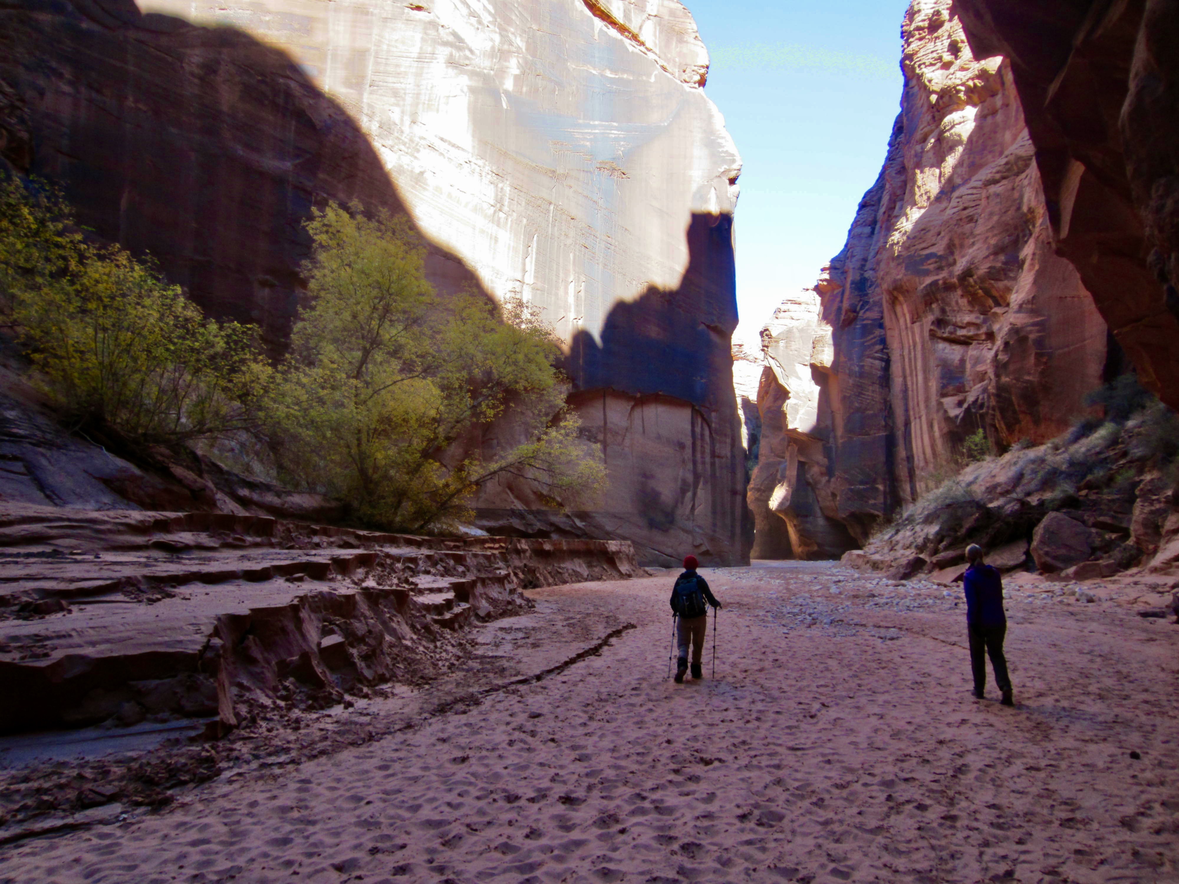
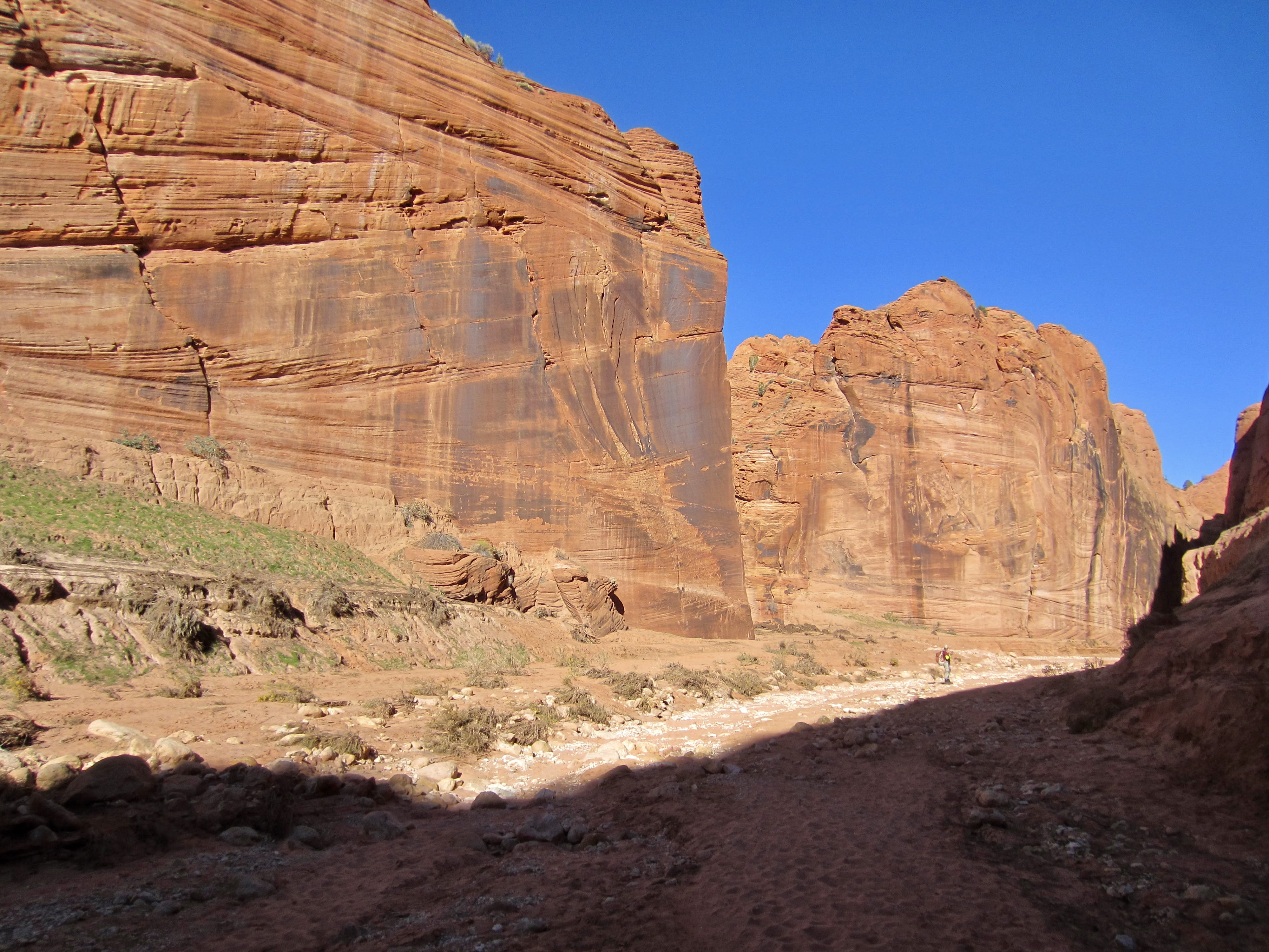
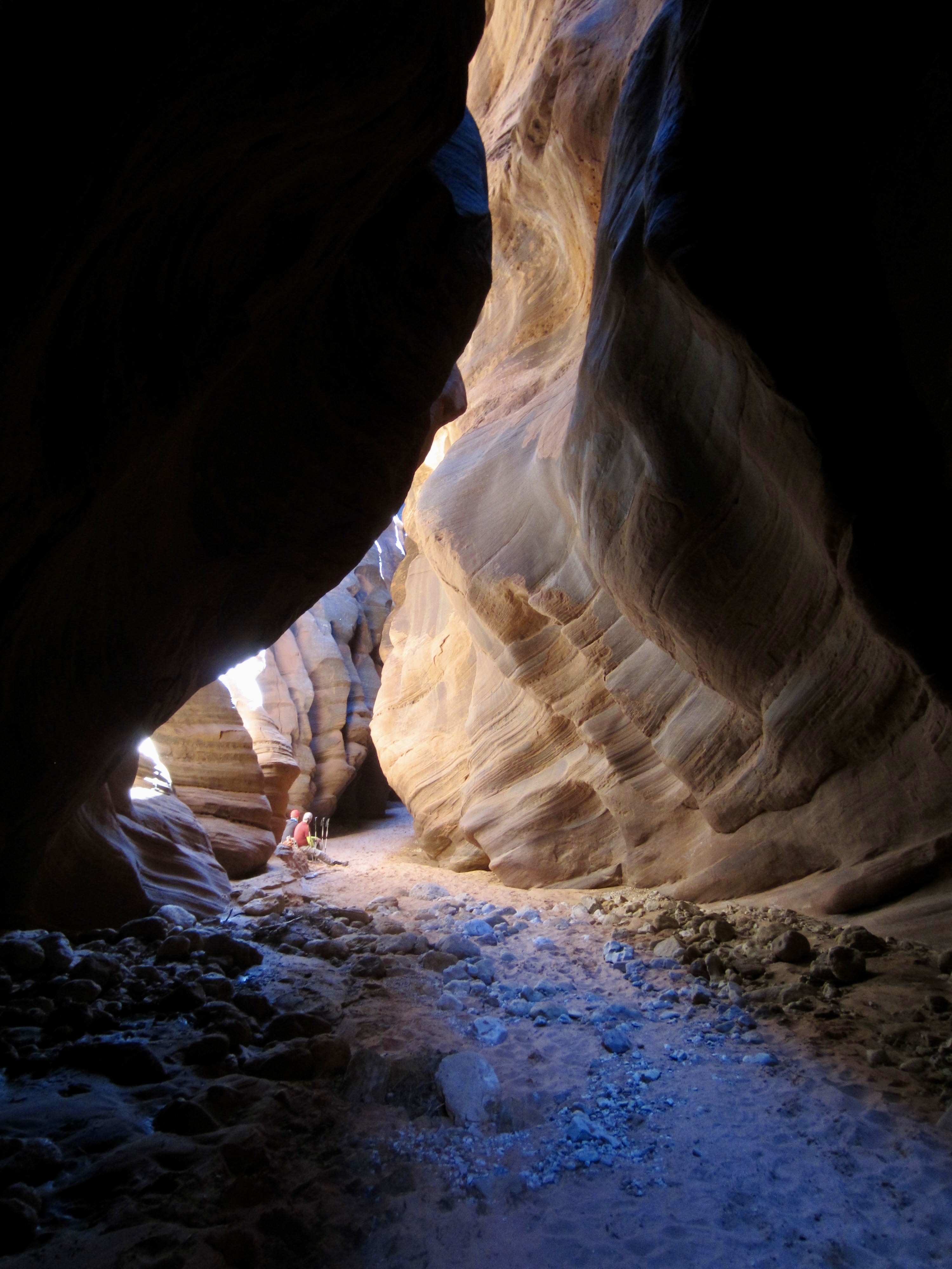
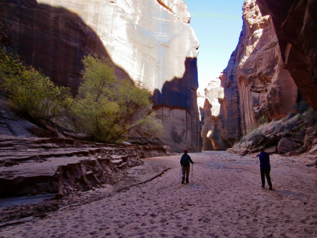
We continued down the canyon, all the while marveling at the wall heights and wavy textures. It was occasionally necessary to skirt around water puddles or work through cobbley zones, but nothing was difficult. A rare beam of sunlight at one point prompted us to stop for lunch.

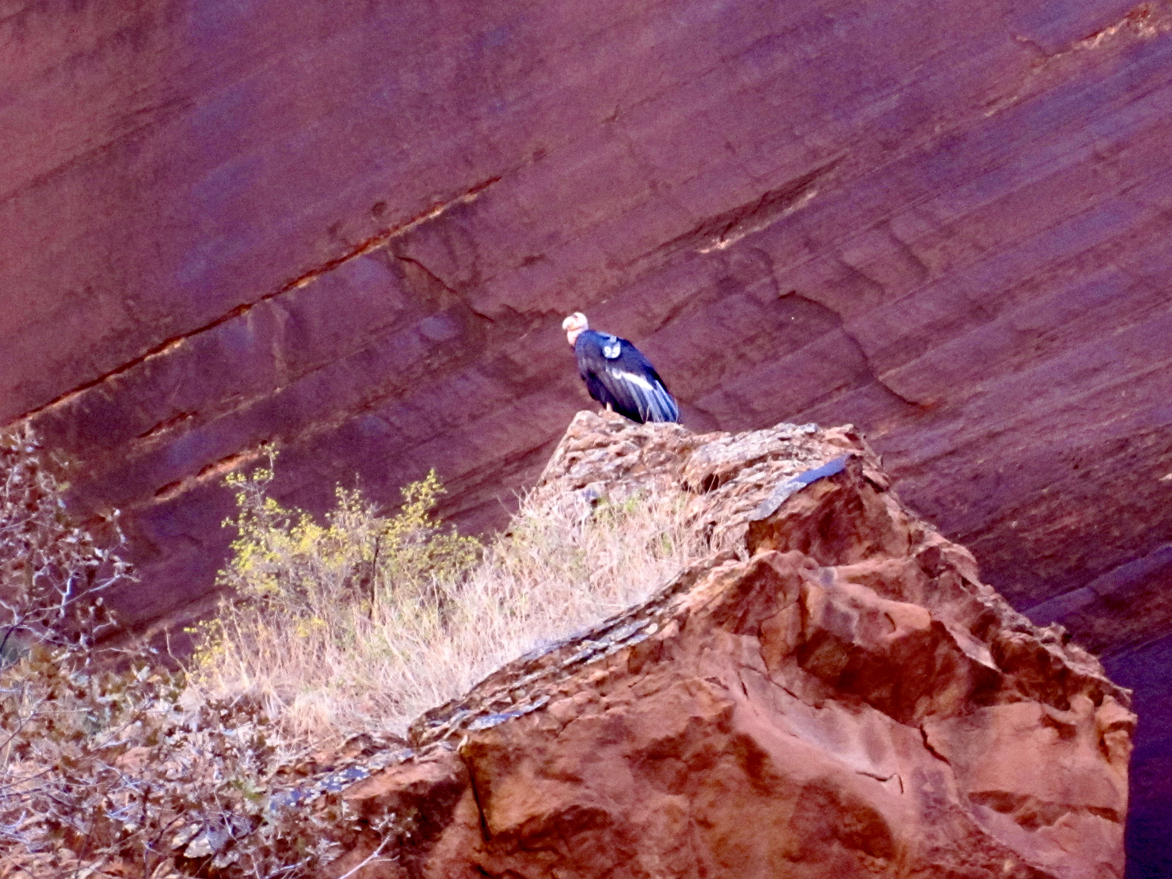
Beyond our lunch spot, the canyon gradually opened up and let in more sunlight. We strolled along a wide, sandy wash, passing small clusters of trees and grass. At one point, we were even treated to a condor sighting! The large bird was perched atop a rock, no doubt looking for something to eat.
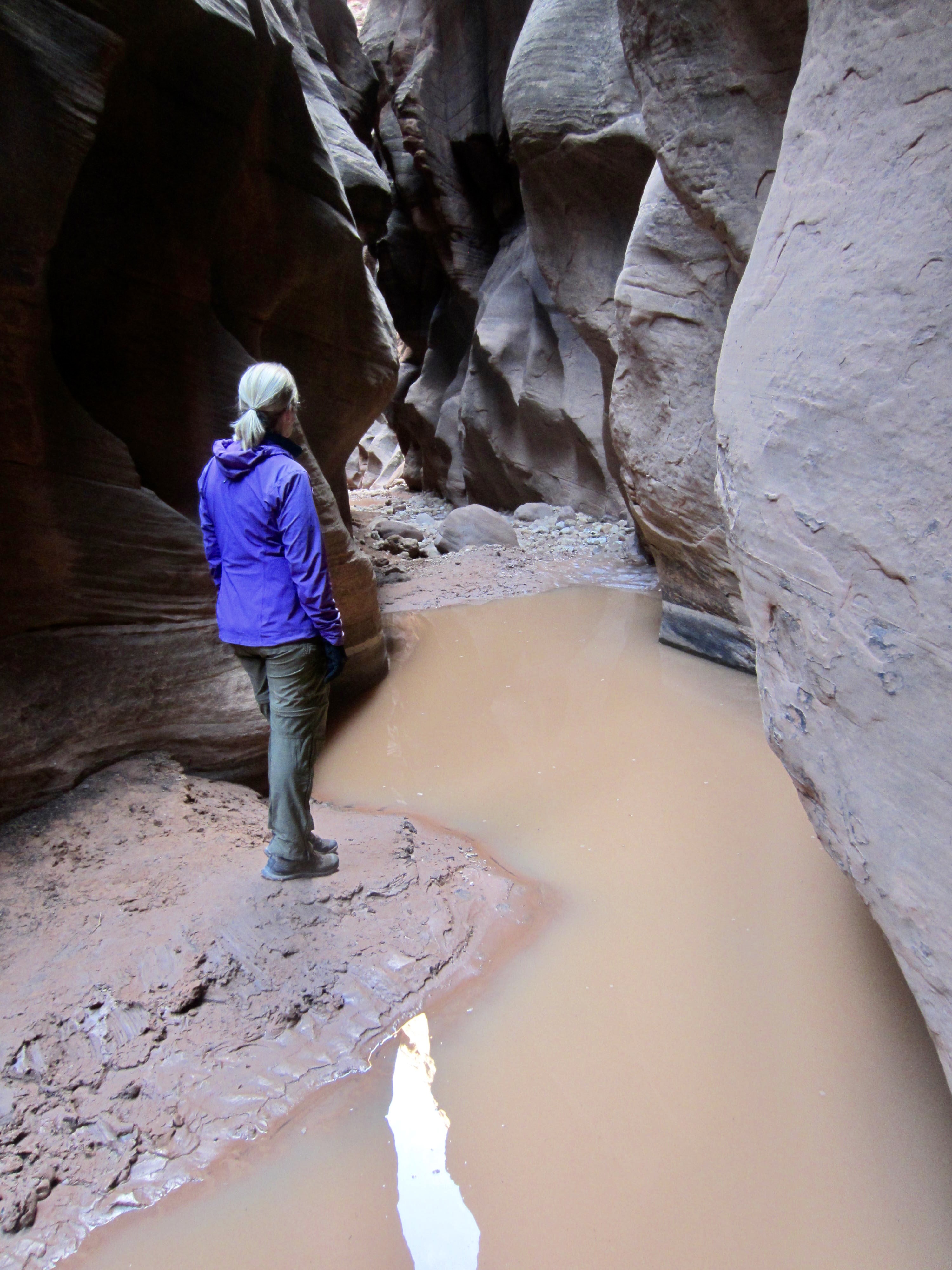
It was now early afternoon, and we were passing numerous day-trippers coming back out of the canyon. One party warned us that we would eventually encounter a cluster of large boulders, followed by a series of water puddles that required wading. They had waded through the first two puddles, which were knee deep, but then turned around at a third puddle that turned out to be waist-deep.
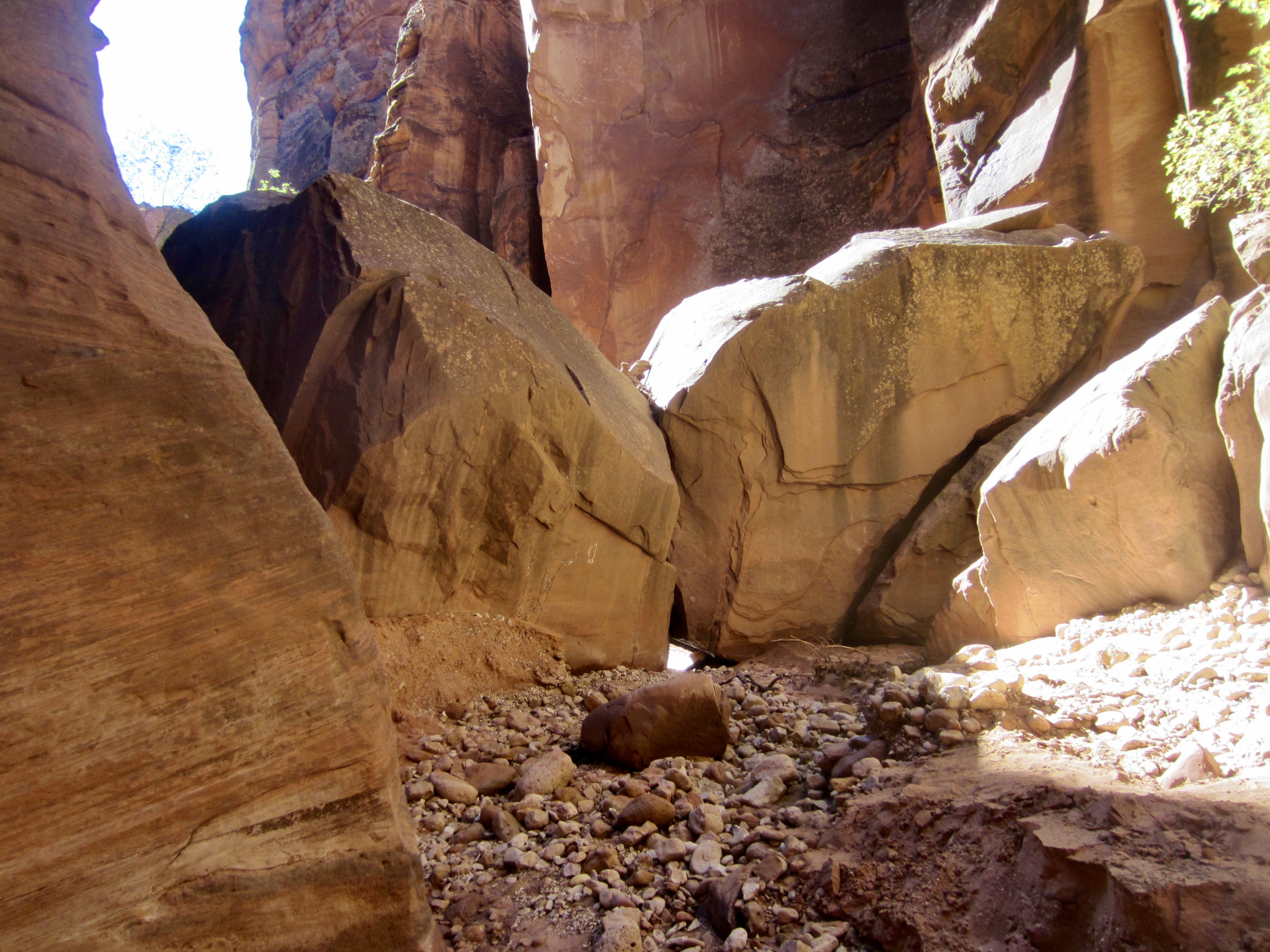
Armed with this valuable information, we continued onward and, within another mile, came to the boulder zone. We teased out a scrambling route over and around these boulders without too much difficulty, then very quickly arrived at the first water puddle (4.4 miles + 3.6 hours from TH). This seemed like a good turnaround point, since none of us was interested in wading.
Our return hike was pretty uneventful, and we were back at the Wire Pass Trailhead by mid-afternoon (2.6 hours + 250 feet from turnaround point). All the while, there was a steady stream of explorers heading into the chilly canyon, dressed in all manner of garb.
…
Route Map & Area Map
…
…
Photo Gallery
Click to enlarge…