• Hike/Climb/Ride
    • Canadian Cascades BC
    • Northwestern WA Cascades
    • Northeastern WA Cascades
    • North-Central WA Cascades
    • Central WA Cascades
    • Southern WA Cascades
    • Olympic Mountains WA
    • Columbia Plateau WA
    • Other USA & Canadian Regions
      • Arizona
      • California
      • Montana
      • Nevada
      • New Mexico
      • Oregon
      • Utah
      • Wyoming
      • Canada (non-Cascades)
    • International (outside USA & Can)
      • France
      • Jordan
      • Italy
      • Mexico
      • New Zealand
      • Patagonia
      • Peru
      • Slovenia
      • Switzerland
      • Tasmania
  • Major Peaks
    • Special Groups
      • The Regal Six
        • Glacier Peak (10,541/10,544 ft)
        • Adams, Mt (12,276/12,273 ft)
        • Baker, Mt (10,781/10,773 ft)
        • Olympus, Mt (7969 ft)
        • Rainier, Mt (14,411/14,400 ft)
        • St Helens, Mt (9677/8365/8321 ft)
      • The Big Ten
        • Bonanza Peak (9511/9503 ft)
        • Jack Mountain (9066/9065 ft)
        • Buckner, Mt (9114/9111 ft)
        • Fernow, Mt (9249/9241 ft)
        • Goode, Mt (9200+/9223 ft)
        • Logan, Mt (9087/9097 ft)
        • Maude, Mt (9082/9077 ft)
        • Shuksan, Mt (9131/9125 ft)
        • Stuart, Mt (9415/9414 ft)
        • Seven-Fingered Jack (9100 ft)
      • The Landmark Twelve
        • Black Peak (8970/8986 ft)
        • Bonanza Peak (9511/9503 ft)
        • Dome Peak (8920/8921 ft)
        • Eldorado Peak (8868/8873 ft)
        • Jack Mountain (9066/9065 ft)
        • Goode, Mt (9200+/9223 ft)
        • Redoubt, Mt (8969/8958 ft)
        • Shuksan, Mt (9131/9125 ft)
        • Stuart, Mt (9415/9414 ft)
        • Silver Star Mountain (8876/8892 ft)
        • Silvertip Mountain (8517 ft)
        • Sloan Peak (7835 ft)
      • The Super Eight
        • Agnes Mountain (8115 ft)
        • American Border Peak (7994 ft)
        • Chimney Rock (7727 ft)
        • Triumph, Mt (7270 ft)
        • Hozomeen Mtn: north peak (8066 ft)
        • Slesse, Mt (8002 ft)
        • Hozomeen Mtn: south peak (8003 ft)
        • Whitehorse Mountain (6852 ft)
      • The Tall Twelve
        • Black Peak (8970/8986 ft)
        • Boston Peak (8894/8883 ft)
        • Copper Peak (8964/8960 ft)
        • Dome Peak (8920/8921 ft)
        • Dragontail Peak (8840+/8836 ft)
        • Eldorado Peak (8868/8873 ft)
        • Forbidden Peak (8815/8839 ft)
        • Gardner Mountain (8898/8897 ft)
        • Redoubt, Mt (8969/8958 ft)
        • Spickard, Mt (8979/8978 ft)
        • Gardner Mtn, North (8956/8958 ft)
        • Silver Star Mountain (8876/8892 ft)
    • Canadian Cascades Majors
      • The Canadian Chilliwack Three
        • Lindeman, Mt (7578 ft)
        • Rexford, Mt (7641 ft)
        • Slesse, Mt (8002 ft)
      • The Cheam Six
        • Baby Munday Peak (7382 ft)
        • Cheam Peak (6929 ft)
        • Foley Peak (7572 ft)
        • Lady Peak (7182 ft)
        • Stewart Peak (7343 ft)
        • Welch Peak (7999 ft)
      • The Coquihalla Seven
        • Coquihalla Mountain (6955+/7077 ft)
        • Gemse Peak (6037+/6201 ft)
        • Ibex Peak (6562+/6690 ft)
        • Needle Peak (6693+/6857 ft)
        • Steinbok Peak (6430+/6601 ft)
        • Vicuna Peak (6880+/6975 ft)
        • Yak Peak (6640+/6690 ft)
      • The Sumallo Three
        • Payne, Mt (8097 ft)
        • Rideout, Mt (8029 ft)
        • Silvertip Mountain (8517 ft)
    • Northwestern Cascades Majors
      • The American Chilliwack Six
        • Bear Mountain (7931 ft)
        • Custer, Mt (8630/8648 ft)
        • Redoubt, Mt (8969/8958 ft)
        • Spickard, Mt (8979/8978 ft)
        • Mox Peak, Easy (8407/8392 ft)
        • Mox Peak, Hard (8504/8501 ft)
      • The Lower Skagit Five
        • Bacon Peak (7061 ft)
        • Blum, Mt (7680 ft)
        • Despair, Mt (7292 ft)
        • Hagan, Mt (7080+ ft)
        • Triumph, Mt (7270 ft)
      • The McAllister Five
        • Austera Peak (8334/8366 ft)
        • Colonial Peak (7771 ft)
        • Klawatti Peak (8485/8500 ft)
        • Primus Peak (8508/8497 ft)
        • Snowfield Peak (8347/8346 ft)
      • The Nooksack Six
        • American Border Peak (7994 ft)
        • Canadian Border Peak (7516 ft)
        • Larrabee, Mt (7861 ft)
        • Sefrit, Mt (7191 ft)
        • Shuksan, Mt (9131/9125 ft)
        • Tomyhoi Peak (7435 ft)
      • The Picket Twelve
        • Crooked Thumb Peak (8124 ft)
        • McMillan Spire, East (7992 ft)
        • Inspiration Peak (7880+ ft)
        • Luna Peak (8311/8286 ft)
        • Challenger, Mt (8207 ft)
        • Degenhardt, Mt (8000+ ft)
        • Fury, Mt: east peak (8288/8322 ft)
        • Fury, Mt: west peak (8292/8298 ft)
        • Terror, Mt (8151 ft)
        • Triumph, Mt (7270 ft)
        • Phantom Peak (8045 ft)
        • Twin Needles: west peak (7936 ft)
      • The Thunder Eight
        • Boston Peak (8894/8883 ft)
        • Eldorado Peak (8868/8873 ft)
        • Forbidden Peak (8815/8839 ft)
        • Buckner, Mt (9114/9111 ft)
        • Goode, Mt (9200+/9223 ft)
        • Logan, Mt (9087/9097 ft)
        • Sahale Peak (8680+ ft)
        • Storm King Mountain (8520+/8560 ft)
      • The Twin Sisters Two
        • Twin Sisters: north peak (6640+ ft)
        • Twin Sisters: south peak (7000+ ft)
    • Northeastern Cascades Majors
      • The Mazama Three
        • Gardner Mountain (8898/8897 ft)
        • Gardner Mtn, North (8956/8958 ft)
        • Silver Star Mountain (8876/8892 ft)
      • The Pasayten Eleven
        • Craggy Peak, Big (8470/8473 ft)
        • Blackcap Mountain (8397/8402 ft)
        • Lake Mountain (8371/8372 ft)
        • Lost Peak (8464/8466 ft)
        • Monument Peak (8592/8610 ft)
        • Carru, Mt (8595/8604 ft)
        • Lago, Mt (8745/8743 ft)
        • Osceola Peak (8587/8579 ft)
        • Ptarmigan Peak (8614 ft)
        • Robinson Mountain (8726/8724 ft)
        • Craggy Peak, West (8366/8367 ft)
      • The Ragged Seven
        • Black Peak (8970/8986 ft)
        • Corteo Peak (8080+ ft)
        • Cosho Peak (8332/8333 ft)
        • Katsuk Peak (8680+/8679 ft)
        • Kimtah Peak (8600+/8644 ft)
        • Mesahchie Peak (8795/8805 ft)
        • Arriva, Mt (8215 ft)
      • The Similkameen Three
        • Cathedral Peak (8601/8599 ft)
        • Grimface Mountain (8645 ft)
        • Remmel Mountain (8685/8683 ft)
      • The Upper Methow Six
        • Azurite Peak (8400+/8440 ft)
        • Cutthroat Peak (8050 ft)
        • Golden Horn (8366/8418 ft)
        • Ballard, Mt (8340/8371 ft)
        • Hardy, Mt (8080+ ft)
        • Tower Mountain (8444/8440 ft)
      • The Upper Skagit Five
        • Castle Peak (8306/8343 ft)
        • Crater Mountain (8128 ft)
        • Jack Mountain (9066/9065 ft)
        • Hozomeen Mtn: north peak (8066 ft)
        • Hozomeen Mtn: south peak (8003 ft)
      • The Washington Pass Three
        • Liberty Bell Mountain (7720+ ft)
        • Early Winters Spire, North (7760+ ft)
        • Early Winters Spire, South (7807 ft)
    • North-Central Cascades Majors
      • The Chelan Four
        • Cardinal Peak (8590/8591 ft)
        • Emerald Peak (8422/8414 ft)
        • Pinnacle Mountain (8402/8395 ft)
        • Saska Peak (8404/8399 ft)
      • The Chiwawa Four
        • Buck Mountain (8528/8534 ft)
        • Chiwawa Mountain (8459/8453 ft)
        • Dumbell Mountain (8421/8411 ft)
        • Fortress Mountain (8760+/8679 ft)
      • The DaKobed Four
        • Chalangin Peak (8320+/8366 ft)
        • Clark Mountain (8602/8582 ft)
        • Luahna Peak (8400+/8445 ft)
        • Tenpeak Mountain (8281 ft)
      • The Entiat Five
        • Copper Peak (8964/8960 ft)
        • Fernow, Mt (9249/9241 ft)
        • Maude, Mt (9082/9077 ft)
        • Seven-Fingered Jack (9100 ft)
        • Spectacle Butte, South (8392/8395 ft)
      • The Monte Cristo Seven
        • Cadet Peak (7186 ft)
        • Columbia Peak (7172 ft)
        • Del Campo Peak (6610 ft)
        • Foggy Peak (6810 ft)
        • Kyes Peak (7280+ ft)
        • Monte Cristo Peak (7136 ft)
        • Gemini Peak, South (6799 ft)
      • The Ptarmigan Pten
        • Agnes Mountain (8115 ft)
        • Dome Peak (8920/8921 ft)
        • Johannesburg Mountain (8200 ft)
        • Gunsight Peak, Main (8198 ft)
        • Formidable, Mt (8325/8353 ft)
        • Old Guard Peak (8240+ ft)
        • Sentinel Peak (8261 ft)
        • Sinister Peak (8440+/8439 ft)
        • Spider Mountain (8300/8312 ft)
        • Spire Point (8264 ft)
      • The Sauk Seven
        • Black Mountain (7262 ft)
        • Pugh, Mt (7201 ft)
        • Sloan Peak (7835 ft)
        • Three Fingers: north peak (6870 ft)
        • Three Fingers: south peak (6854 ft)
        • White Chuck Mountain (6989 ft)
        • Whitehorse Mountain (6852 ft)
      • The Sawtooth Six
        • Martin Peak (8375/8372 ft)
        • Corax Peak (8572/8592 ft)
        • Bigelow, Mt (8440+/8468 ft)
        • Oval Peak (8795 ft)
        • Reynolds Peak (8512 ft)
        • Star Peak (8690/8688 ft)
      • The Skykomish Three
        • Gunn Peak (6240 ft)
        • Baring, Mt (6125 ft)
        • Spire Mountain (6213 ft)
      • The Stehekin Seven
        • Bonanza Peak (9511/9503 ft)
        • Devore Peak (8360+/8378 ft)
        • Flora Mountain (8320/8323 ft)
        • Riddle Peak, Main (8232 ft)
        • Martin Peak (8511/8504 ft)
        • Tupshin Peak (8320+/8343 ft)
        • Wy’East Mountain (8280+ ft)
      • The Suiattle Five
        • Bruseth, Mt (7220 ft)
        • Buckindy, Mt (7320+ ft)
        • Chaval, Mt (7127 ft)
        • Misch, Mt (7435 ft)
        • Snowking Mountain (7433 ft)
    • Central Cascades Majors
      • The Chiwaukum Two
        • Chiwaukum Peak, Big (8081 ft)
        • Snowgrass Mountain (7993 ft)
      • The Icicle Eight
        • Argonaut Peak (8453/8455 ft)
        • Cannon Mountain (8638/8652 ft)
        • Cashmere Mountain (8501/8514 ft)
        • Colchuck Peak (8705/8706 ft)
        • Dragontail Peak (8840+/8836 ft)
        • McClellan Peak (8364/8363 ft)
        • Stuart, Mt (9415/9414 ft)
        • Sherpa Peak (8605/8630 ft)
      • The Snoqualmie Twelve
        • Bears Breast Mountain (7197 ft)
        • Chair Peak (6238 ft)
        • Chikamin Peak (7000+ ft)
        • Chimney Rock (7727 ft)
        • Hibox Peak (6547 ft)
        • Kaleetan Peak (6259 ft)
        • Lemah Mountain (7480+ ft)
        • Daniel, Mt (7986 ft)
        • Hinman, Mt (7492 ft)
        • Thomson, Mt (6554 ft)
        • Summit Chief Mountain (7464 ft)
        • Three Queens Mtn: main peak (6687 ft)
    • Southern Cascades Majors
      • The Goat Rocks Three
        • Ives Peak (7932 ft)
        • Old Snowy Mountain (7930 ft)
        • Curtis Gilbert, Mt (8184 ft)
    • Olympic Mountains Majors
      • The Olympic Thirteen
        • Anderson, Mt: east peak (7321 ft)
        • Anderson, Mt: west peak (7365 ft)
        • Angeles, Mt (6454 ft)
        • Carrie, Mt (6995 ft)
        • Christie, Mt (6177 ft)
        • Constance, Mt: inner peak (7667 ft)
        • Constance, Mt: outer peak (7756 ft)
        • Deception, Mt (7788 ft)
        • Meany, Mt (6695 ft)
        • Mystery, Mt (7639 ft)
        • Stone, Mt (6612 ft)
        • Washington, Mt (6255 ft)
        • Brothers, The: south peak (6842 ft)
    • Wild-Card Groups
      • The Outlier Twelve
        • Big Four Mountain (6160+ ft)
        • Davis Peak (7051 ft)
        • McGregor Mountain (8122 ft)
        • David, Mt (7420 ft)
        • Garfield, Mt (5519 ft)
        • Index, Mt: main peak (5991 ft)
        • Outram, Mt (8000+ ft)
        • Prophet, Mt (7640+ ft)
        • Ingalls Peak: North/Main (7662 ft)
        • Sluiskin Mtn: The Chief (7026 ft)
        • Cradle, The (7467 ft)
        • Whatcom Peak (7574 ft)
      • The Satellite Three
        • Colfax Peak (9443/9440 ft)
        • Lincoln Peak (9096 ft)
        • Little Tahoma Peak (11,138/11,136 ft)
    • Major Alpine Crags
      • Canadian Cascades Crags
        • Nesakwatch Spire, South (7400+ ft)
        • Slesse Peak, South (7700+ ft)
      • Northwestern Cascades Crags
        • Devil’s Tongue (8048 ft)
        • Dorado Needle (8440+/8466 ft)
        • Twin Needles: east peak (7840+ ft)
        • Himmelgeisterhorn (7880+ ft)
        • Nooksack Tower (8285 ft)
        • Paul Bunyan’s Stump (7480+ ft)
        • Sharkfin Tower (8120+ ft)
        • Chopping Block, The (6819 ft)
        • Degenhardt Pyramid, The (7920+ ft)
      • Northeastern Cascades Crags
        • Kangaroo Peak, Big (8326/8318 ft)
        • Methow Needle, Big (8170 ft)
        • Burgundy Spire (8400+ ft)
        • Concord Tower (7560+ ft)
        • Lexington Tower (7560 ft)
      • North-Central Cascades Crags
        • Gunsight Peak, North (8190 ft)
        • White Goat Peak (7800+ ft)
      • Central Cascades Crags
        • Cathedral Rock (6724 ft)
        • Little Big Chief Peak (7225 ft)
        • Index, Mt: middle peak (5493 ft)
        • Index, Mt: north peak (5357 ft)
        • Prusik Peak (8000+ ft)
        • Bull’s Tooth, The (6680+ ft)
        • Citadel, The (7120+ ft)
        • Mole, The (7240+ ft)
        • Enchantment Temple (8292/8290 ft)
      • Southern Cascades Crags
        • Goat Horn, Big (8000+ ft)
        • Fifes Peak, East (6793 ft)
        • Cowlitz Chimney, Main (7605 ft)
      • Olympic Mountains Crags
        • Clark, Mt (7528 ft)
        • Cruiser, Mt (6104 ft)
  • Ski/Snowshoe
    • Snow Tours in British Columbia
    • Snow Tours in Northwestern WA Cascades
    • Snow Tours in Northeastern WA Cascades
    • Snow Tours in North-Central WA Cascades
    • Snow Tours in Central WA Cascades
    • Snow Tours in Southern WA Cascades
    • Snow Tours in Olympic Mountains WA
    • Snow Tours in Oregon
    • Snow Tours in Other Locations
  • Types of Trips
    • Canyoneering
    • Difficult 10 Climbs
    • Family Trips
    • Golden Larch Outings
    • Lookout Sites
    • Marathon Hikes
    • Mid-Summer Outings
    • Mtn & Gravel Biking
    • Rock & Ice Climbing
    • Summit Camps
    • The Early Years
    • Traverses & Loops: Alpine
    • Traverses & Loops: Bike
    • Traverses & Loops: Ski
    • Traverses & Loops: Trail
    • Traverses & Loops: Classics
      • Bacon-Hagan-Blum Trav (WA)
      • Enchantment Traverse (WA)
      • High–Giant Traverse (WA)
      • Inspiration–Isolation Trav (WA)
      • Olympus–Bailey Trav (WA)
      • Picket Traverse (WA)
      • Ptarmigan Traverse (WA)
      • Sneffels Ski Traverse (CO)
      • Grand Canyon Raft Trav (AZ)
      • Huayhuash Circuit (Peru)
      • Overland Trav (Tasmania)
    • Via Ferratas
    • WA Blue Corn Specials
    • Winter Summits
  • Mountain Goodies
    • Mountain Artifacts
      • Fire Lookout Cabins & Towers
      • Backcountry Shelters & Furniture
      • Backcountry Trail & Route Markers
      • Summit Registers & Benchmarks
      • Backcountry Informational Signs
    • Patterns/Textures/Colors
      • Clouds & Fog
      • Light & Shadow
      • Plants & Trees
      • Rocks & Minerals
      • Snow & Ice
      • Sunrise & Sunset
      • Water & Color
    • Equipment Catalogs
    • Mountain News Articles
    • Mountain Route Sketches
    • Handy Information Links
      • Weather & Avalanche Forecasts
      • Mountain Road & Trail Reports
      • Wildfire Reports & Smoke Forecasts
      • Mountain Snowpack Depths
      • Nordic Grooming Reports
  • Reviews/Lists/Tips
    • Reviews of Selected Gear for Summertime & Wintertime Mountain Sports
    • Packing Lists + Gear Comments for Multi-Day Mountain Trips
    • Trailcat Tips: Assorted Gear Modifications, Procedures & Hacks + Trip Suggestions
  • Home
  • Major Peaks Synopsis
  • Major Peaks Map
  • Major Peaks A-Z
  • Recent Posts
  • Trip Archives
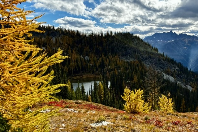
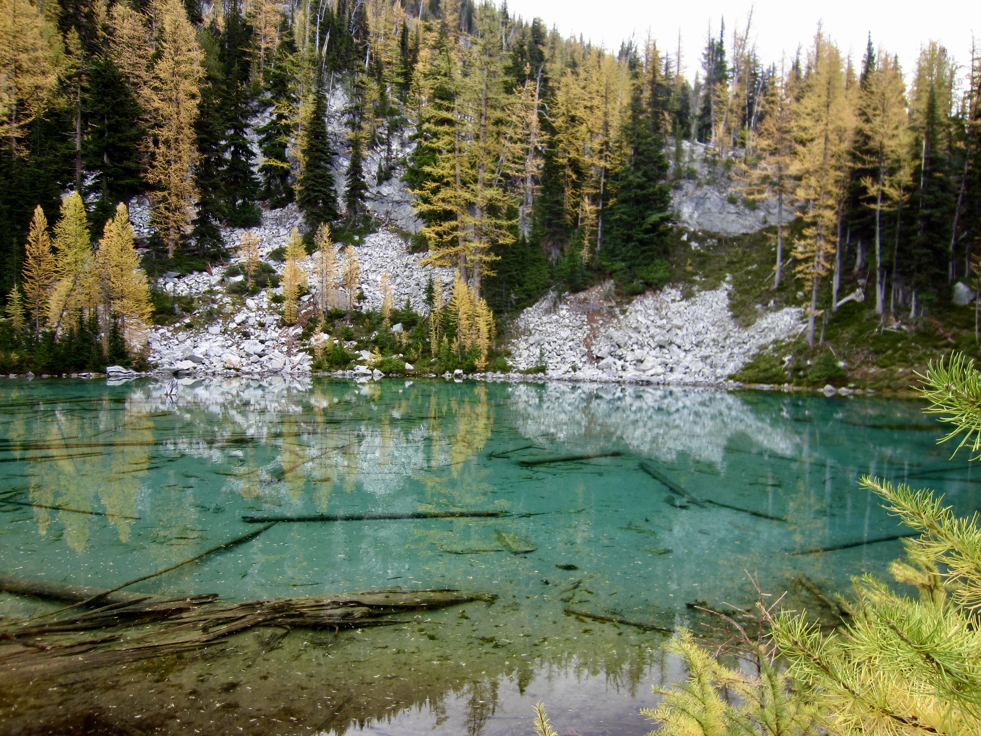
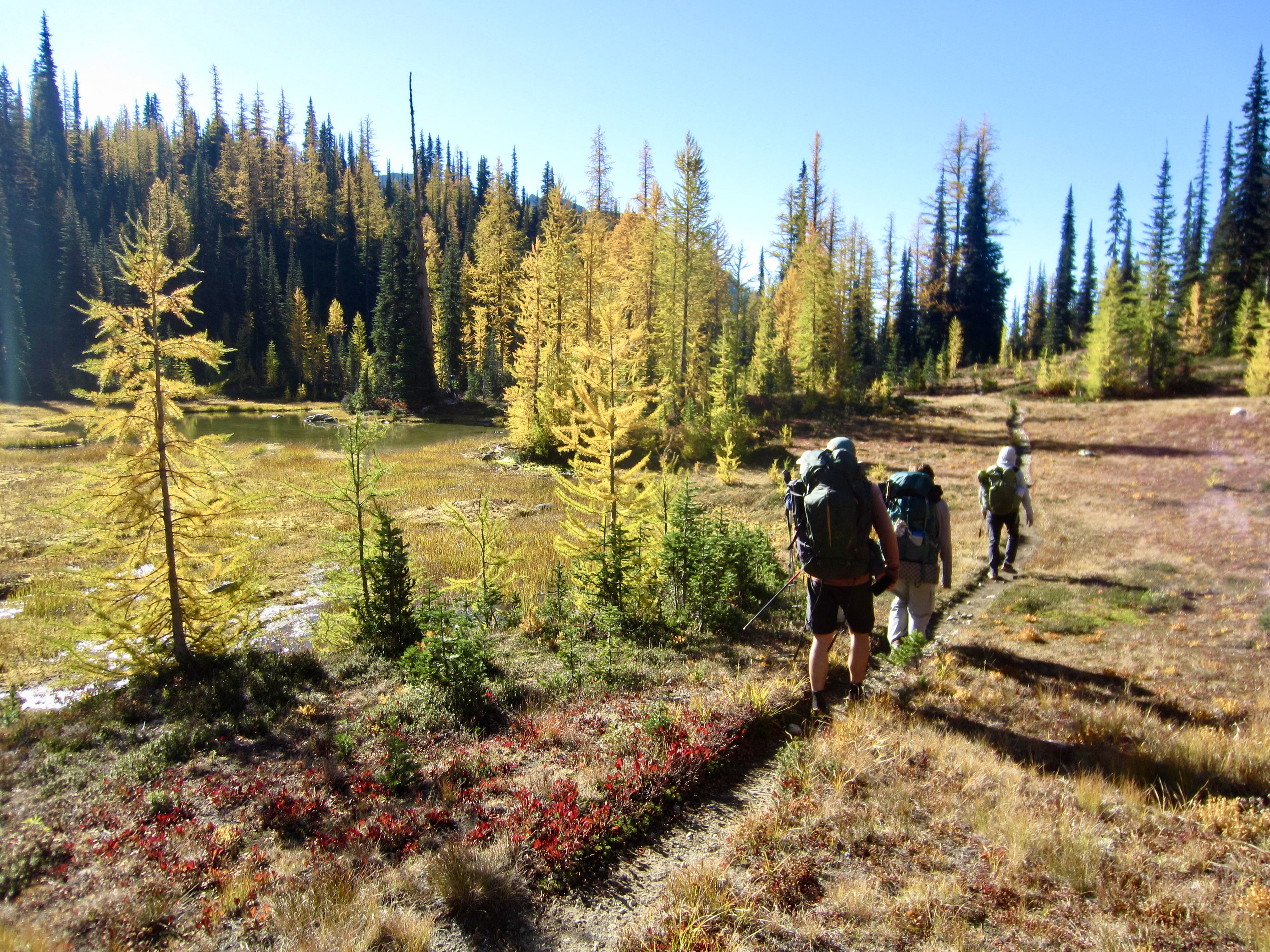
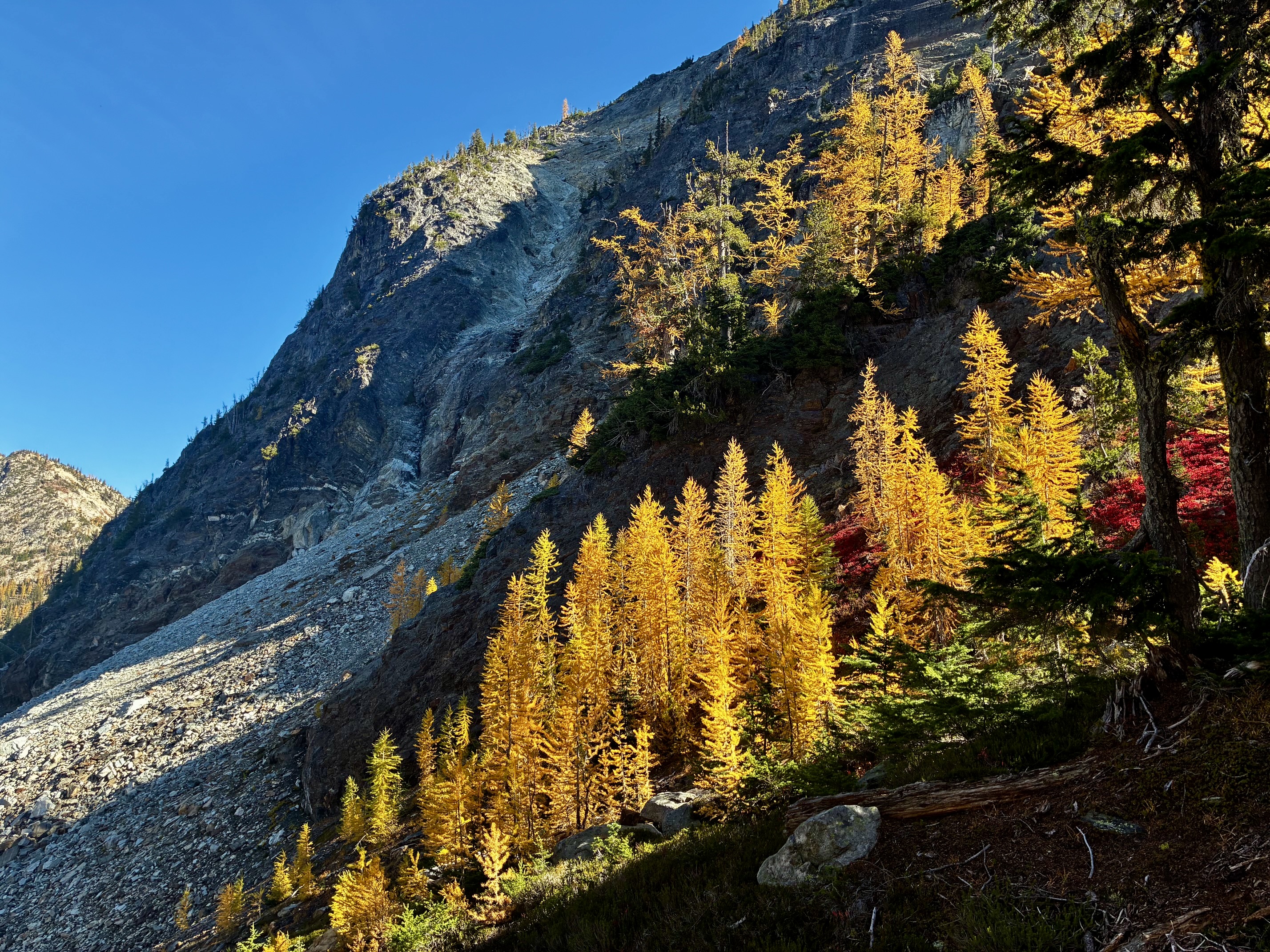
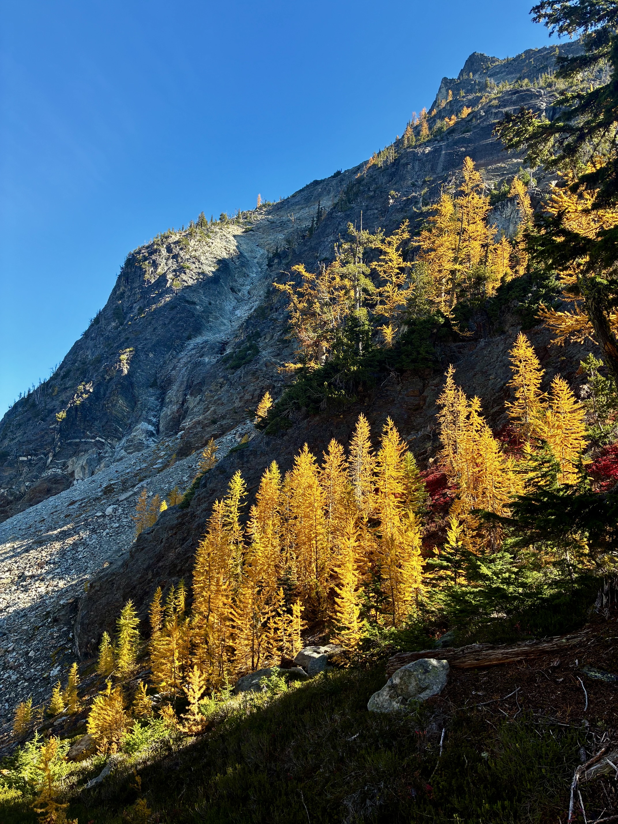
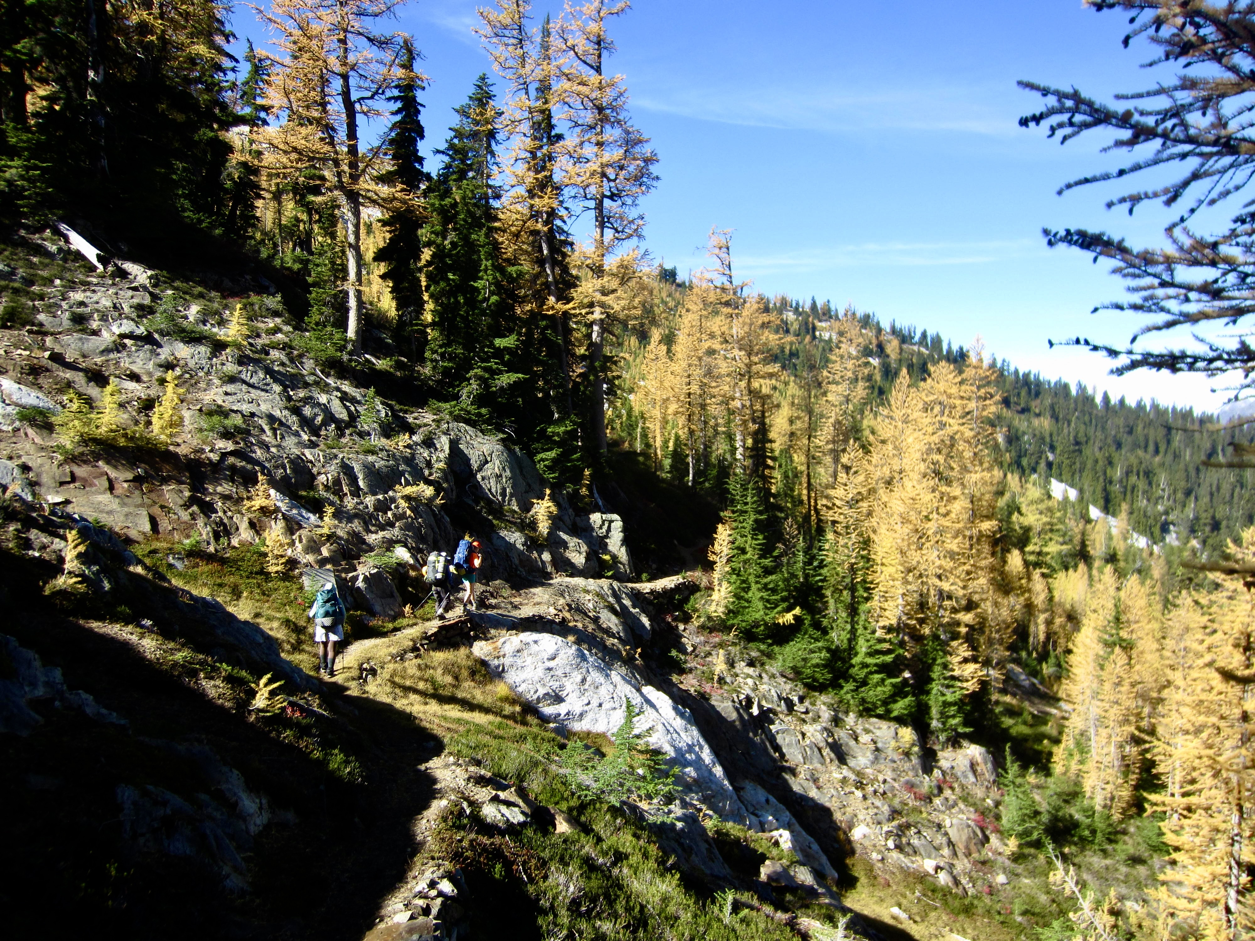
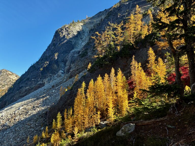
Golden larches below Bowan Mtn at Rainbow Pass during Rainbow-Bridge Loop

McAlester–Rainbow Loop via McAlester Pass—Rainbow Creek—Rainbow Pass—Bridge Creek + McAlester Mtn Loop (North Stehekin Mountains, WA)

Jim Brisbine·October 5, 2026
Golden Larch OutingsNorth Stehekin MountainsNorth-Central WA CascadesTraverses & Loops (Alpine)Traverses & Loops (Trail)McAlester Mtn

Trip Date: October 1-5, 2026

GOLDEN LARCH OUTING: NORTH STEHEKIN MOUNTAINS

McAlester–Rainbow Loop Hiking & Scrambling Trip

McAlester Creek Valley
McAlester Lake
McAlester Pass
South Pass
Dee Dee Lakes
McAlester Mountain (7928 ft)
Rainbow Creek Valley
Rainbow Lake
Rainbow Pass
South Fork Bridge Creek Valley

What’s in this Post…
show
  • Trip Report Summary
  • Related Posts
  • Trip Overview
  • Full Trip Report
    • Day 1: Trailhead to McAlester Lake
    • Day 2: Sidetrip to Dee Dee Lakes & McAlester Mtn
    • Day 3: McAlester Lake to Rainbow Meadows
    • Day 4: Rainbow Meadows to Hideaway Camp
    • Day 5: Hideaway Camp to Trailhead
  • Route Maps & Profiles
  • Photo Gallery

Trip Report Summary

Region: North-Central Washington Cascades

Sub-Region: North Stehekin Mountains

Areas: North Cascades National Park & Lake Chelan National Recreation Area

Starting & Ending Point: Bridge Creek Trailhead on Highway 20 (Elev. 4550 feet)

Loop Way Points: Stiletto Spur Trail junction & Fireweed Camp / McAlester Creek Trail junction & park/rec boundary & McAlester Lake Camp & McAlester Pass / South Pass Trail junction / Rainbow Creek Trail junction & Rainbow Ridge Trail junction & Bowan Camp & Bench Creek Camp / Rainbow Lake Trail junction & Rainbow Creek Bridge & Rainbow Meadows Camp & Rainbow Lake & Rainbow Pass & Dan’s Camp & Bridge Creek footlog & South Fork Camp & Pacific Crest Trail junction & Hideaway Camp & Fireweed Camp & Bridge Creek Trailhead (trail hike)

Loop Low Point: Bridge Creek footlog near South Fork Camp (Elev. 3200 feet)

Loop High Point: Rainbow Pass (Elev. 6200 feet)

Campsites: McAlester Lake Stock Camp (2 nights) & Rainbow Meadows Group Camp & Hideaway Camp

Sidetrip Summit Loop Way Points: McAlester Pass / South Pass Trail junction & South Pass & Lower Dee Dee Lake & Upper Dee Dee Lake & Notch 6800 & Step 6900 & McAlester Mountain summit & Lake 6230 & Rainbow Creek Trail intersection & Bowan Camp & McAlester Pass & McAlester Lake (trail hike & off-trail hike & boulder hop & rock scramble & bushwhack)

Summit: McAlester Mountain (off-trail hike & rock scramble via Upper Southwest Slope—South Face; descent via South Face—Lower Southwest Slope)

Approximate Stats (excluding sidetrip): 29.4 miles traveled; 6700 feet gained & lost.

Approximate Stats (including sidetrip): 40.6 miles traveled; 11,200 feet gained & lost.

Related Posts

>>> McAlester Pass Wishbone: Dee Dee Lakes + McAlester Mtn Attempt + Rainbow Peak – October 2025

>>> McGregor Mtn Summit Traverse: Rainbow Pass to Heaton Basin via Sandalee Glacier – July 2024

>>> Bowan Mtn via Rainbow Lake—East Ridge + McGregor Mtn Attempt via Sandalee Glacier – July 2016

>>> Rainbow Ridge Loop via Rainbow Lake—Bowan Pass—Lake 6111 + Bowan Mtn – September 2013

Trip Overview

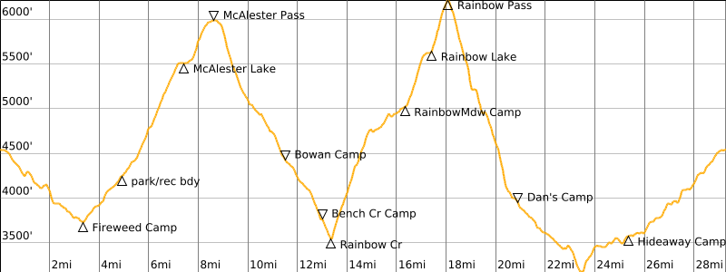
The McAlester–Rainbow Loop is a popular trekking route in the North Stehekin Mountains between Highway 20 and Lake Chelan. It lies partially within North Cascades National Park and partially within the Lake Chelan National Recreation Area. The 23-mile core of this trek follows a series of trails that cross over two high passes—6000-foot McAlester Pass and 6200-foot Rainbow Pass—and dip into the low valleys of Bridge Creek and Rainbow Creek. These trails also provide an opportunity to visit famed Rainbow Lake and demure McAlester Lake.

The core loop trails are usually accessed either from the north via Highway 20 and Bridge Creek or from the south via Stehekin Valley Road and Rainbow Creek, thereby adding about 7 or 10 miles, respectively. As such, the total trekking distance approaches 30 or 33 miles, depending on access option. Given the relatively short access trails (or “handles”) in relation to the large core loop, I regard the overall trek to be a “skillet loop,” in contrast to a long-handled “lollipop loop.”

Although the southern access option is more adventurous, Eileen and I chose the logistically simpler northern access option for our 2026 Golden Larch Outing. We also elected to complete the loop in a clockwise direction because this worked out better in regard to available campsites. Our five-day schedule allowed for a sidetrip to Dee Dee Lakes (Eileen’s main goal) and a climb of McAlester Mountain (my main goal).
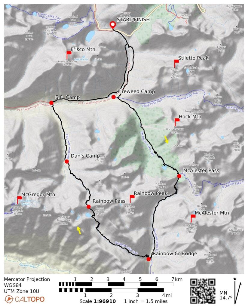
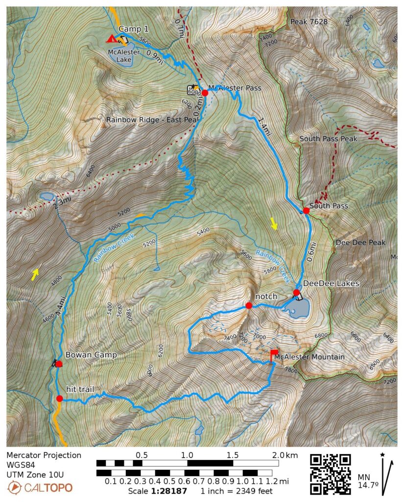
McAlester-Rainbow Loop Overview Map (TFO)

…

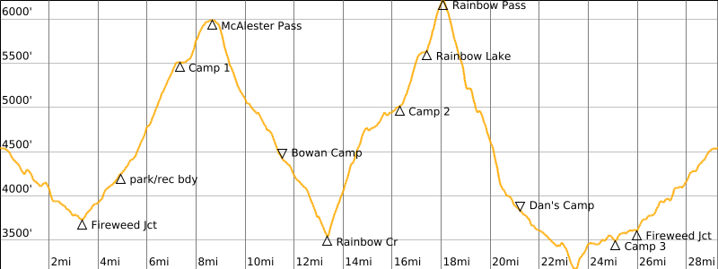
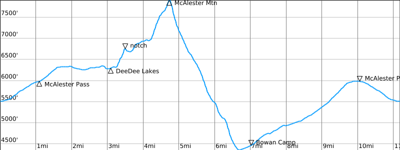
McAlester-Rainbow Loop Overview Profile

…

Full Trip Report

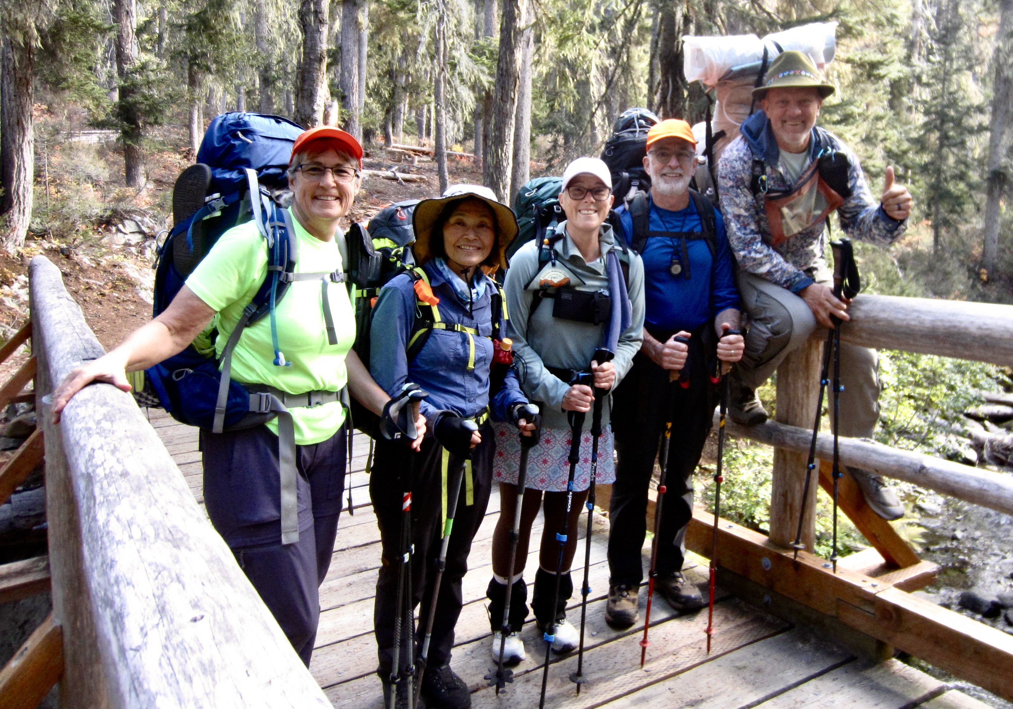
Yoko, Kevin, and Maria accompanied Eileen and me for the full five days of our McAlester–Rainbow Loop, whereas Blaine and Joyce joined us on a compressed three-day schedule. Also, Andrew hitched on for the more-difficult Rainbow Ridge Loop variation in three days, with a climb of Bowan Mountain along the way. All of us benefited from the fact that every trail was thoroughly logged out and mostly brushed out. We also had plenty of autumn color throughout.
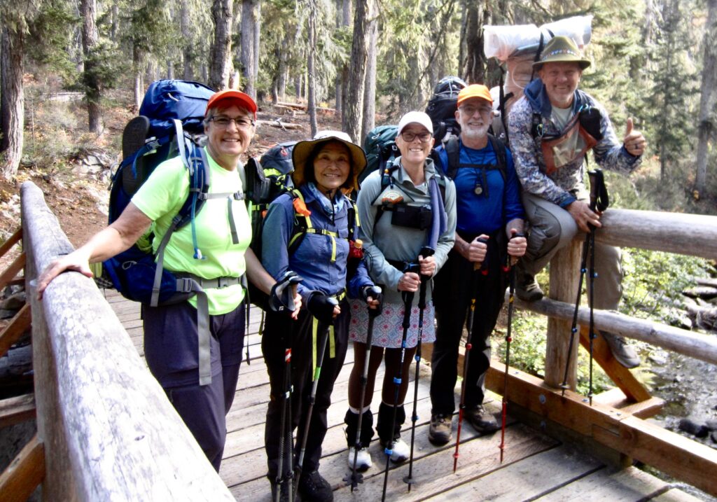
Eileen & Yoko & Maria & Jim & Kevin At Bridge Creek

.

Day 1: Trailhead to McAlester Lake

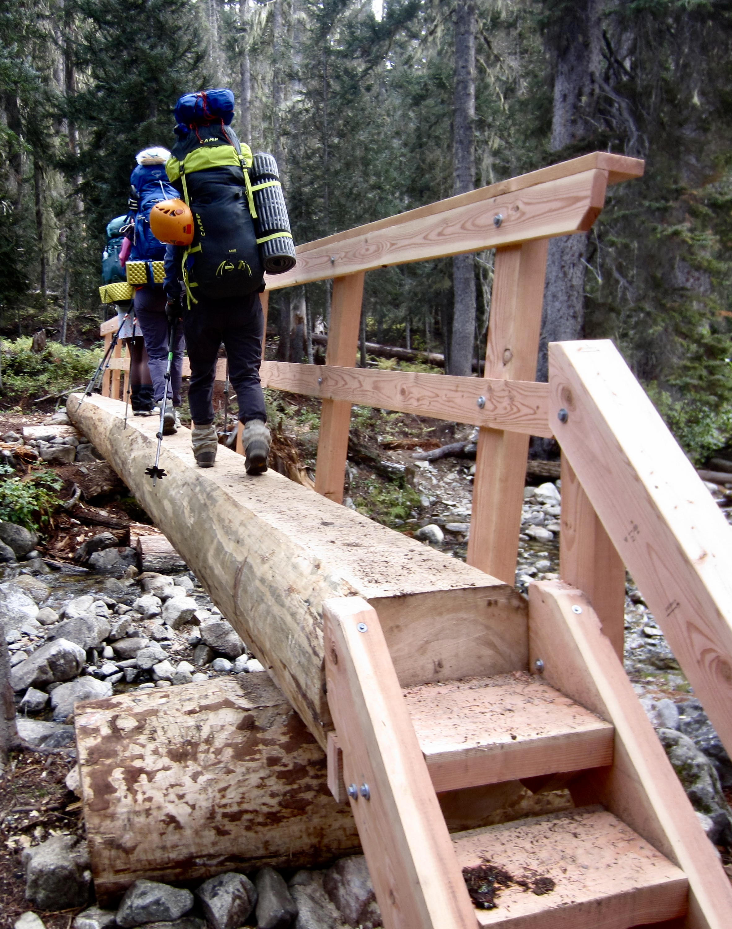
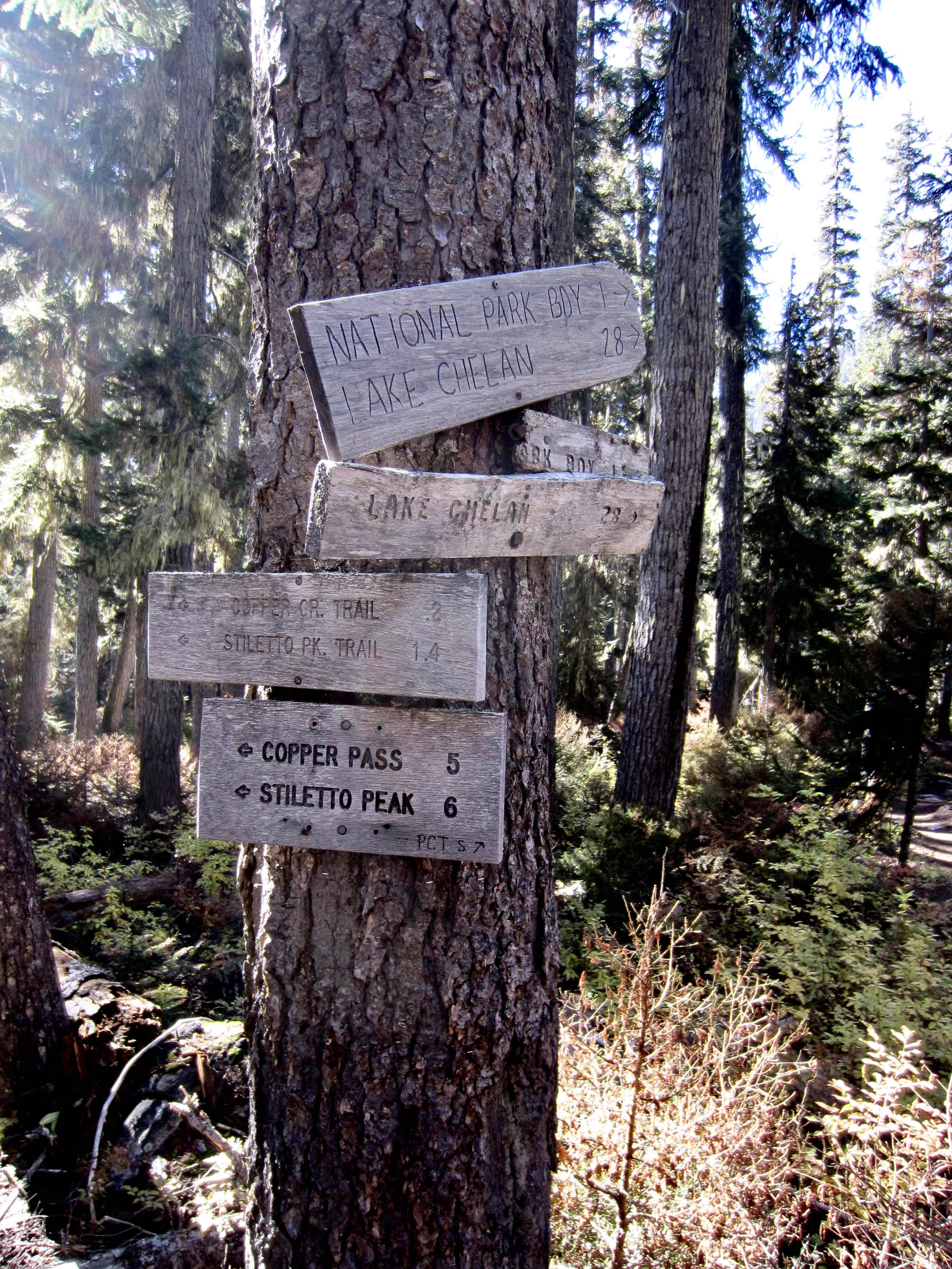
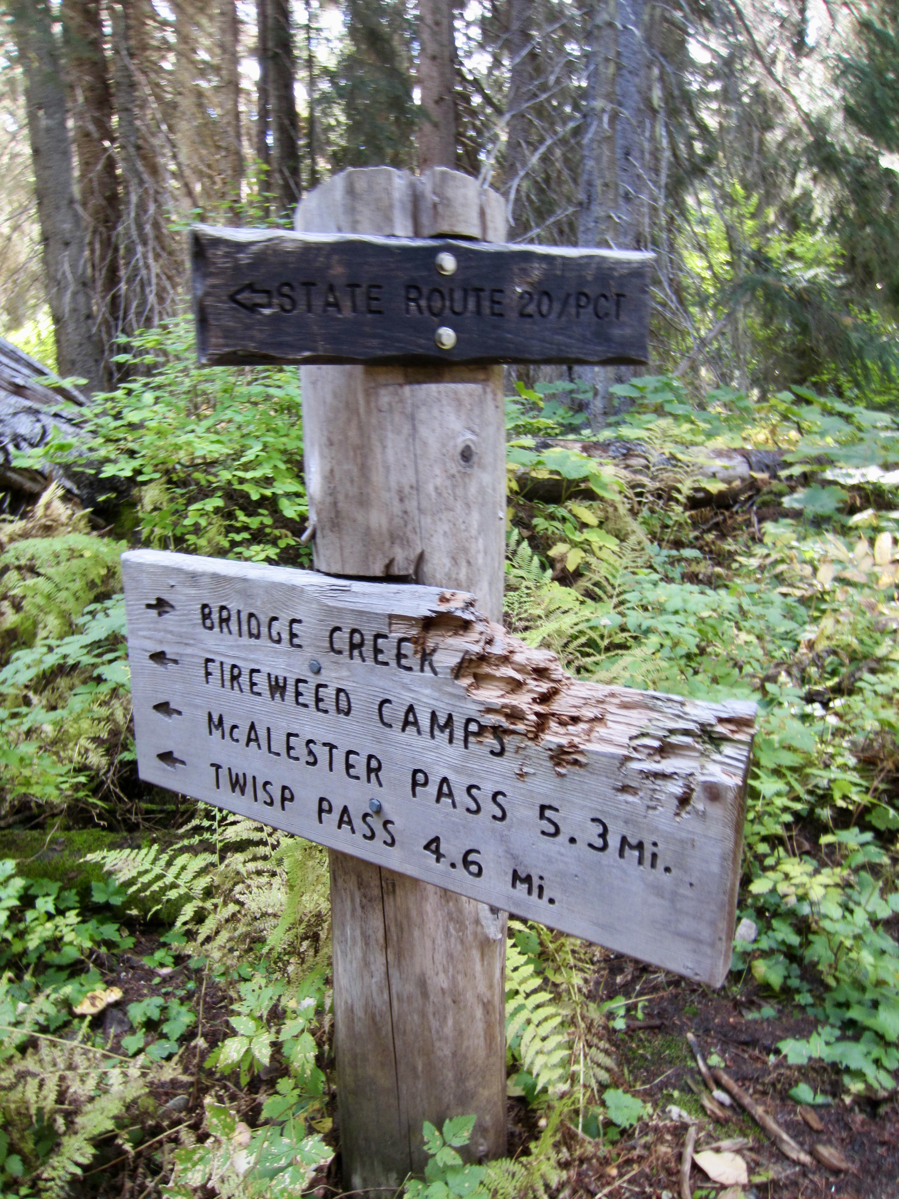
Eileen, Yoko, Kevin, Maria, and I headed out from the Bridge Creek Trailhead parking lot shortly before noon on a mild, overcast Thursday. We hiked downstream, soon crossing Bridge Creek on a spiffy new footlog and then coming to a major fork. Here, we veered left onto the Stiletto Spur Trail and continued down to Fireweed Junction, then began ascending the McAlester Lake Trail.
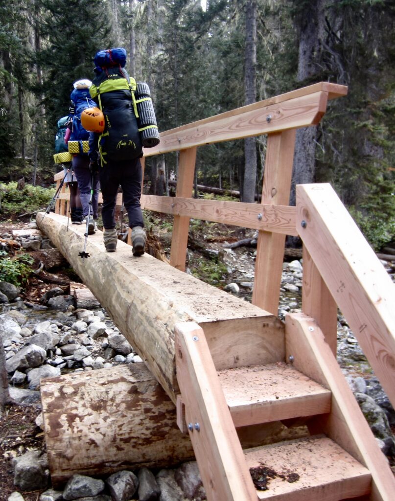
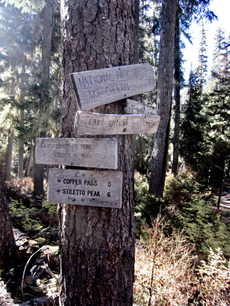
Crossing New Footlog Over Bridge Creek
Many Junction Signs On Bridge Creek Trail

.

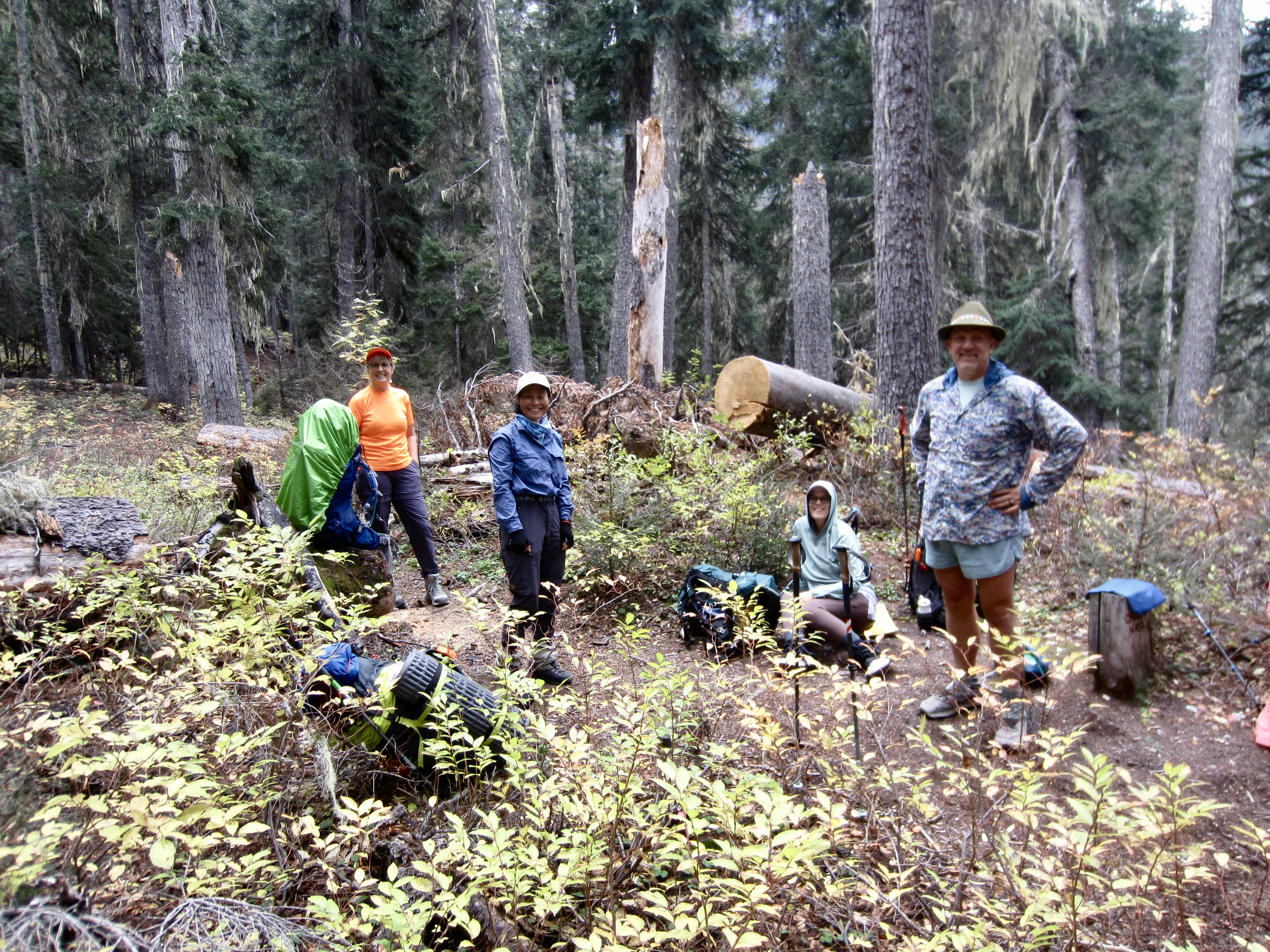
Rest Stop On McAlester Lake Trail

.

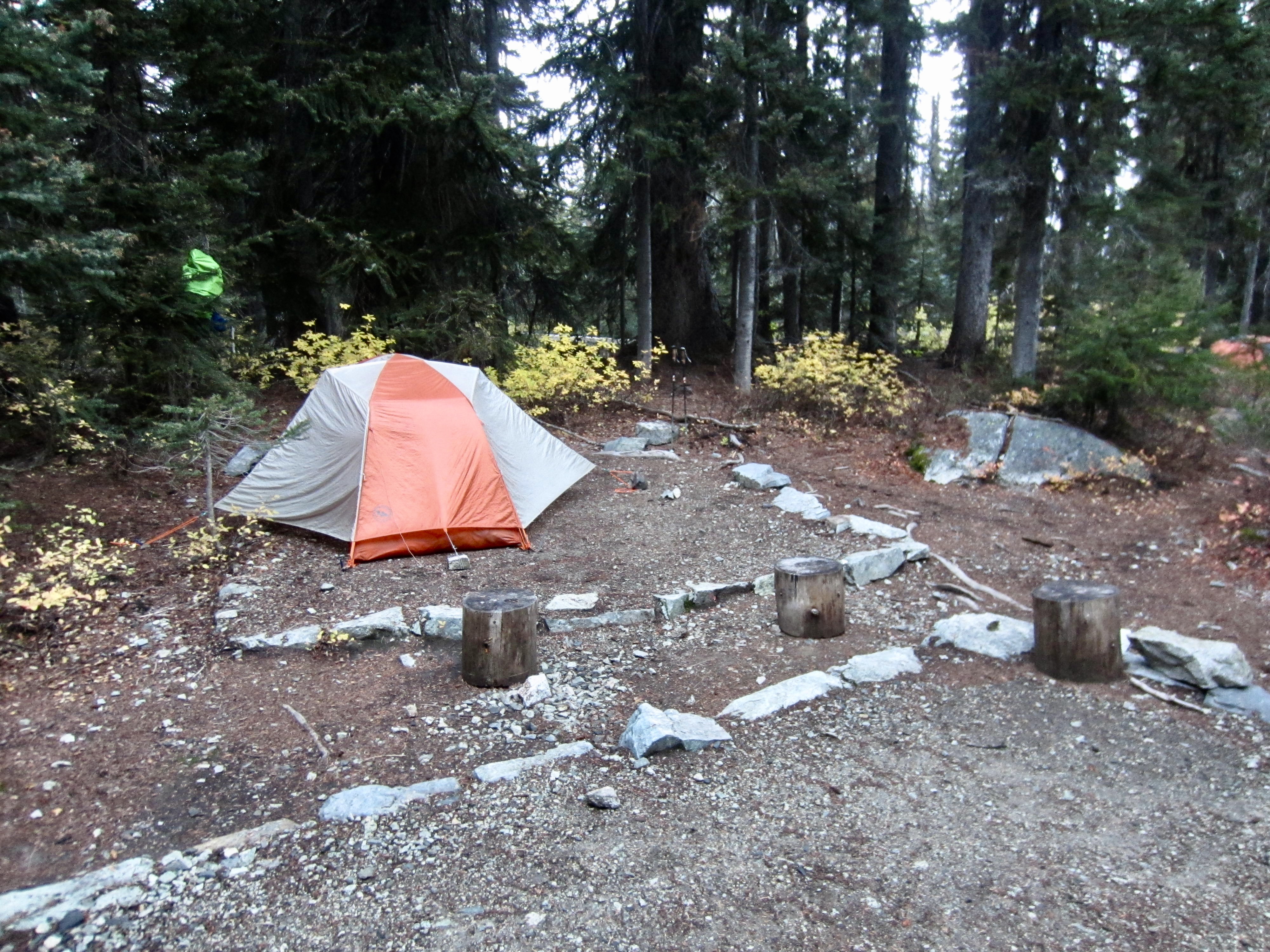
In late afternoon, we arrived at McAlester Lake and set ourselves up for two nights in the roomy stock camp (5.5 hours + 7.3 miles + 1850 feet – 900 feet from TH). Because the adjacent group camp had been reserved for the following night, park rangers put us in the stock camp. Aside from a colony of brazen mice, it was clean and comfortable.

.
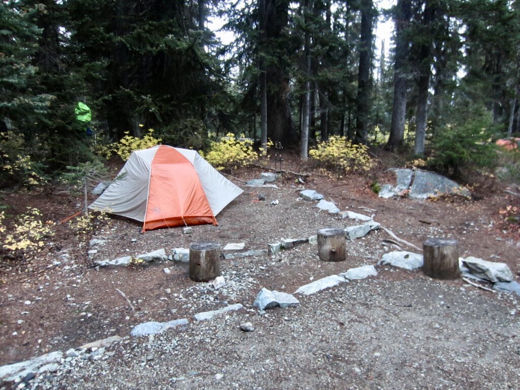
Camp 1 At McAlester Lake Stock Camp

.

Still Water At McAlester Lake

.

Day 2: Sidetrip to Dee Dee Lakes & McAlester Mtn

Under a gray sky, Yoko, Kevin, and I left camp with summit packs at 8:45am. We hiked up to 6000-foot McAlester Pass, then up to 6300-foot South Pass, then over to Dee Dee Lakes (1.7 hours + 3.1 miles + 1000 feet from Camp 1).
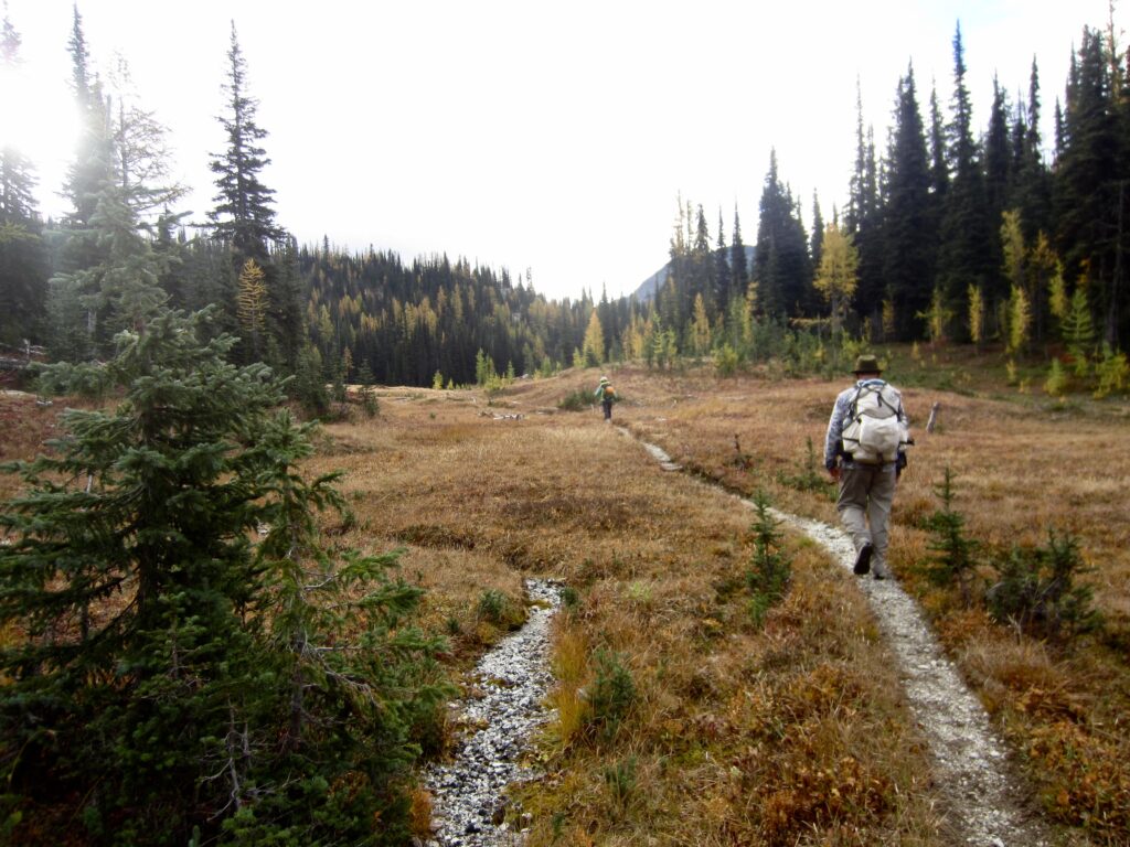
Hiking To McAlester Pass On Day 2

.

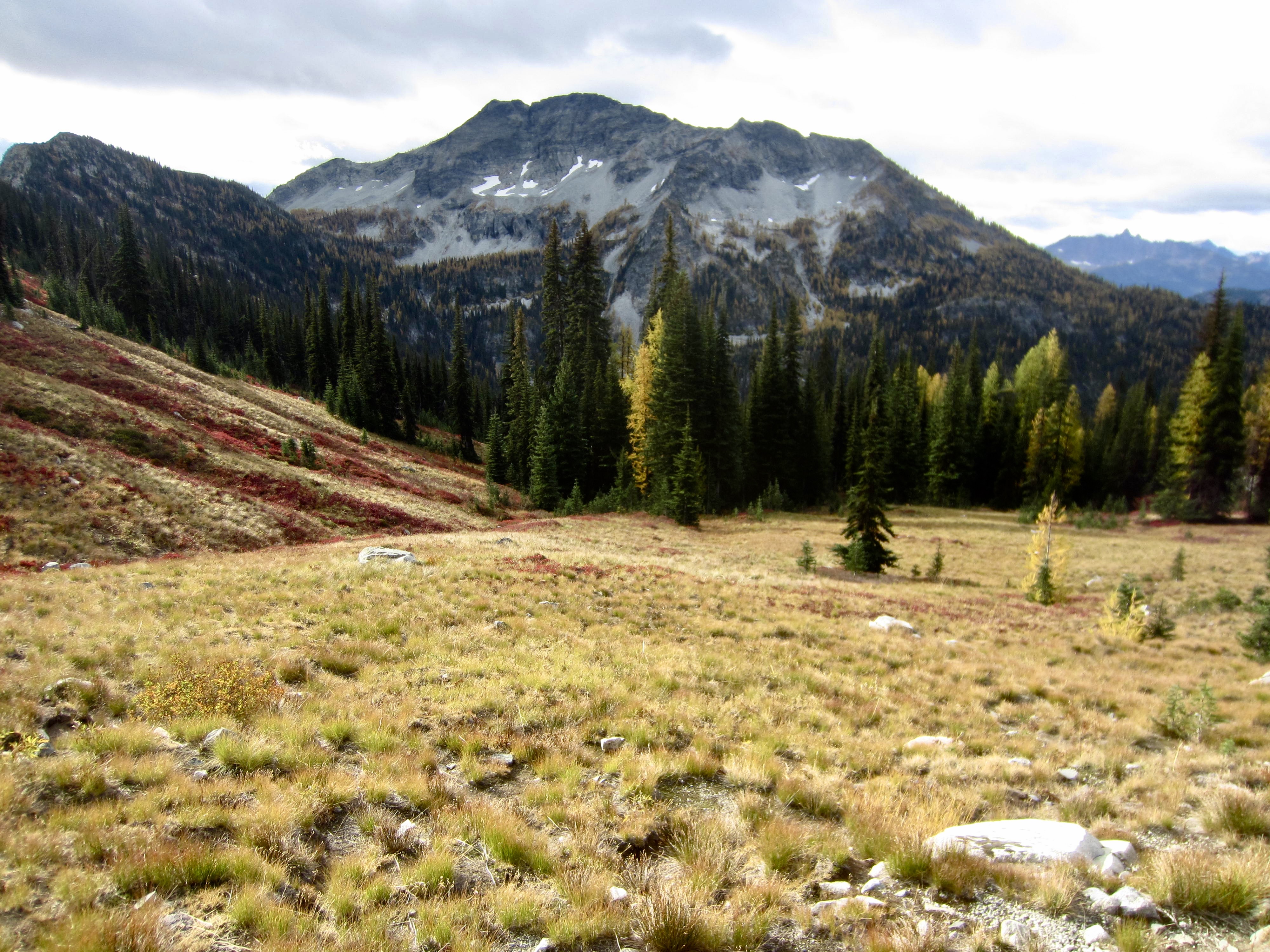
McAlester Mtn Above McAlester Park

.

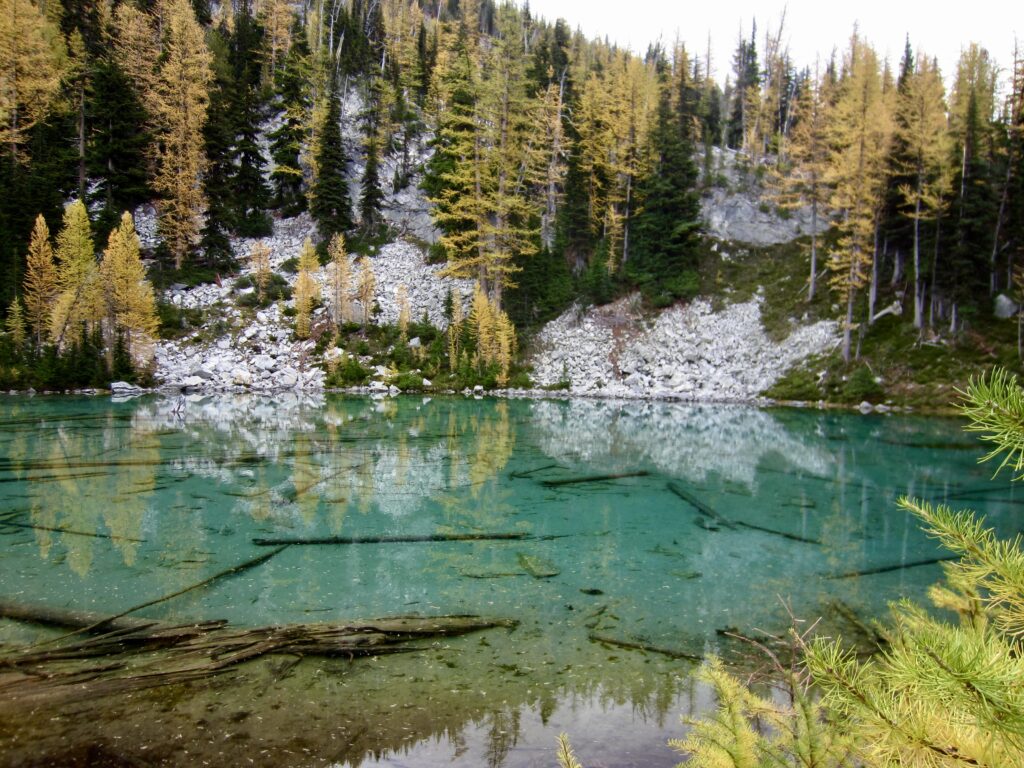
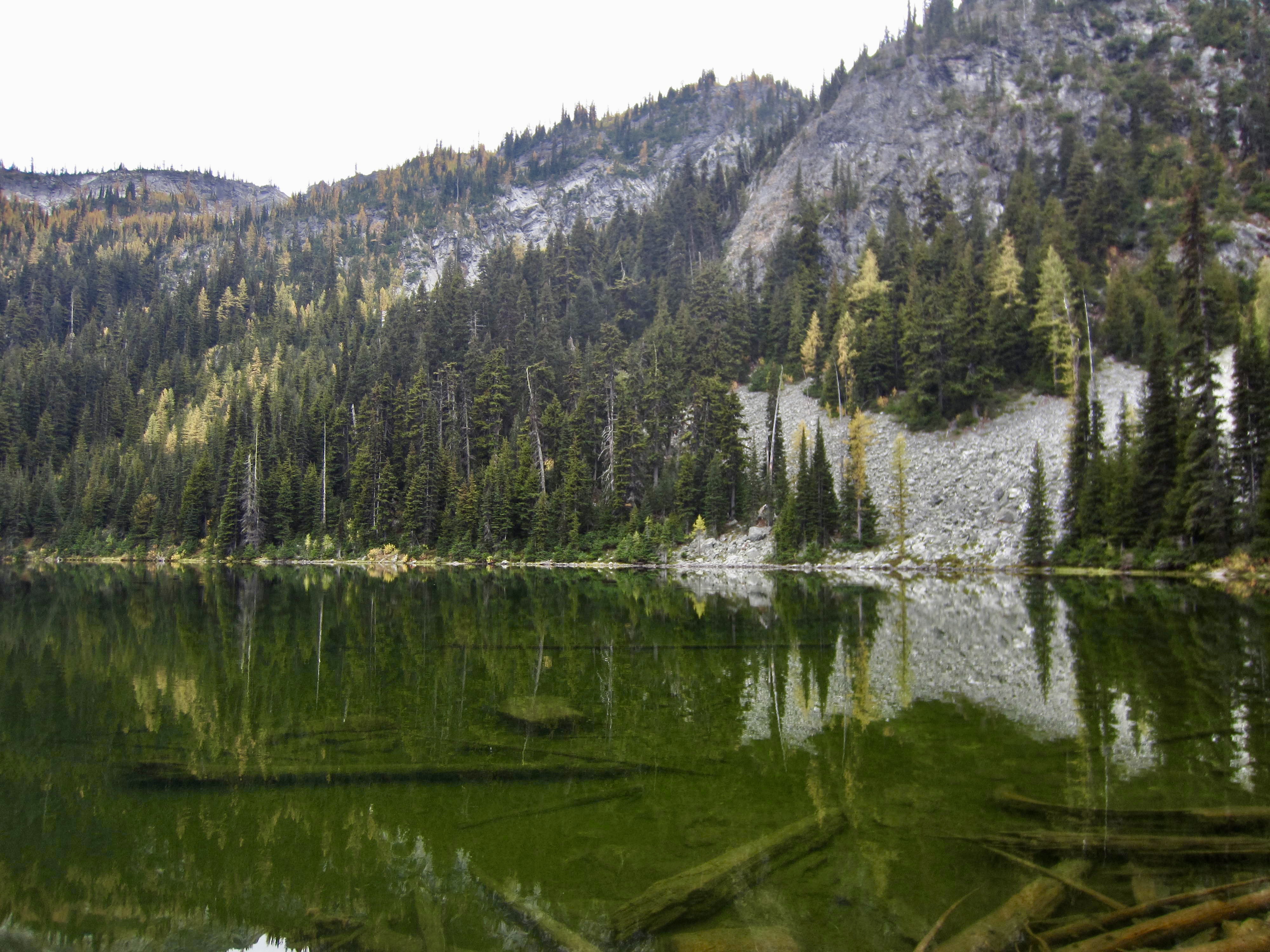
Green & Gold At Lower Dee Dee Lake

.

McAlester Mountain, today’s objective, was visible high above Dee Dee Lakes. Yoko and I had attempted to climb the mountain on last year’s Golden Larch Outing but were thwarted by fresh snow. Today, we were encouraged by dry conditions.
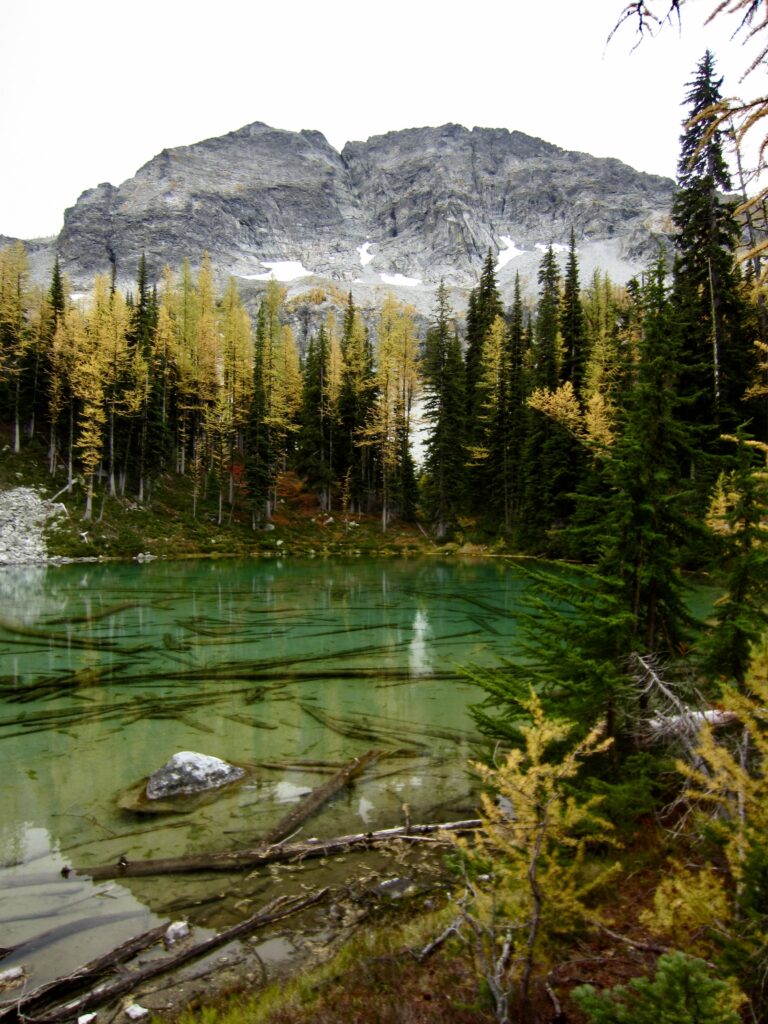
McAlester Mtn Above Lower Dee Dee Lake

.

We skirted around the shore of Upper Dee Dee Lake and then ascended a talus slope leading to a 6800-foot notch in the ridge directly west of the lake. From this ridge notch, we dropped into a large talus bowl and traversed over to a 6900-foot step in another ridge farther to the west.
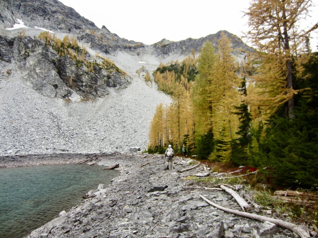
Skirting Around Upper Dee Dee Lake

.

Talus Slope Above Upper Dee Dee Lake

.

Looking Across Talus Bowl On McAlester Mtn

.

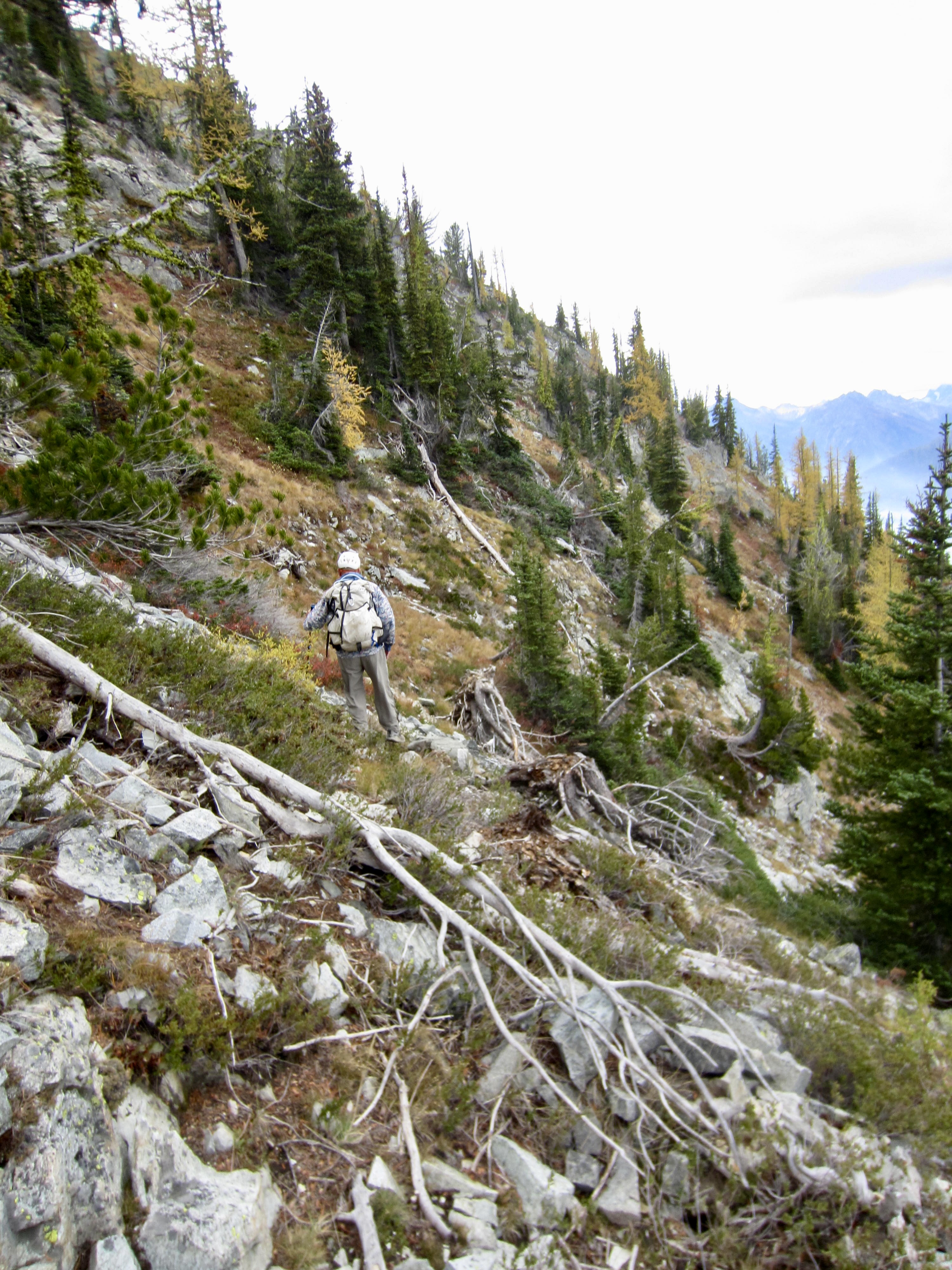
Upon gaining the ridge step, we began contouring around the western arm of McAlester Mountain, staying at an elevation between 6800 and 7000 feet. The terrain here consists of steep heather slopes with scattered outcrops of loose rock. Last year, this had been very sketchy due to fresh snow; now, it was only slightly less sketchy.
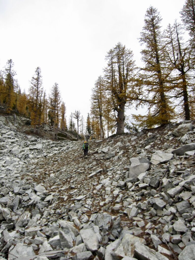
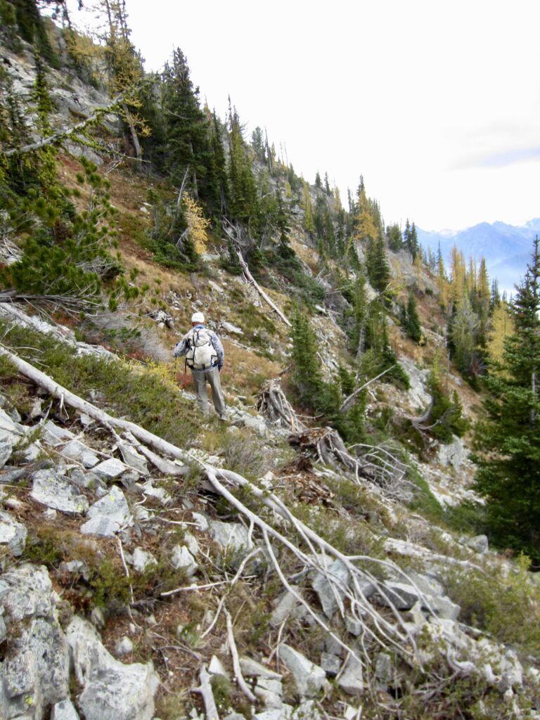
Approaching Ridge Step On McAlester Mtn
Traversing Heather Slope On McAlester Mtn

.

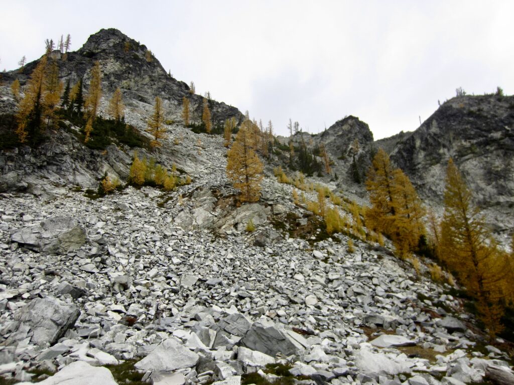
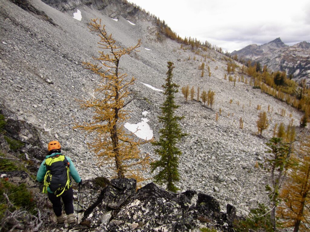
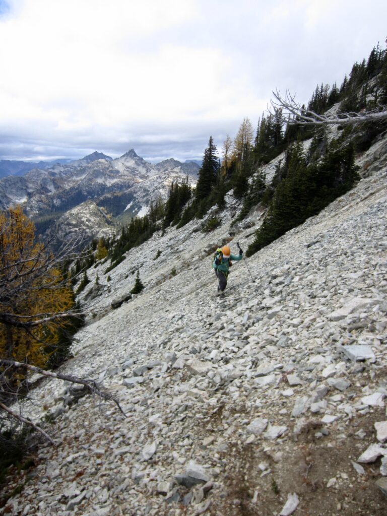
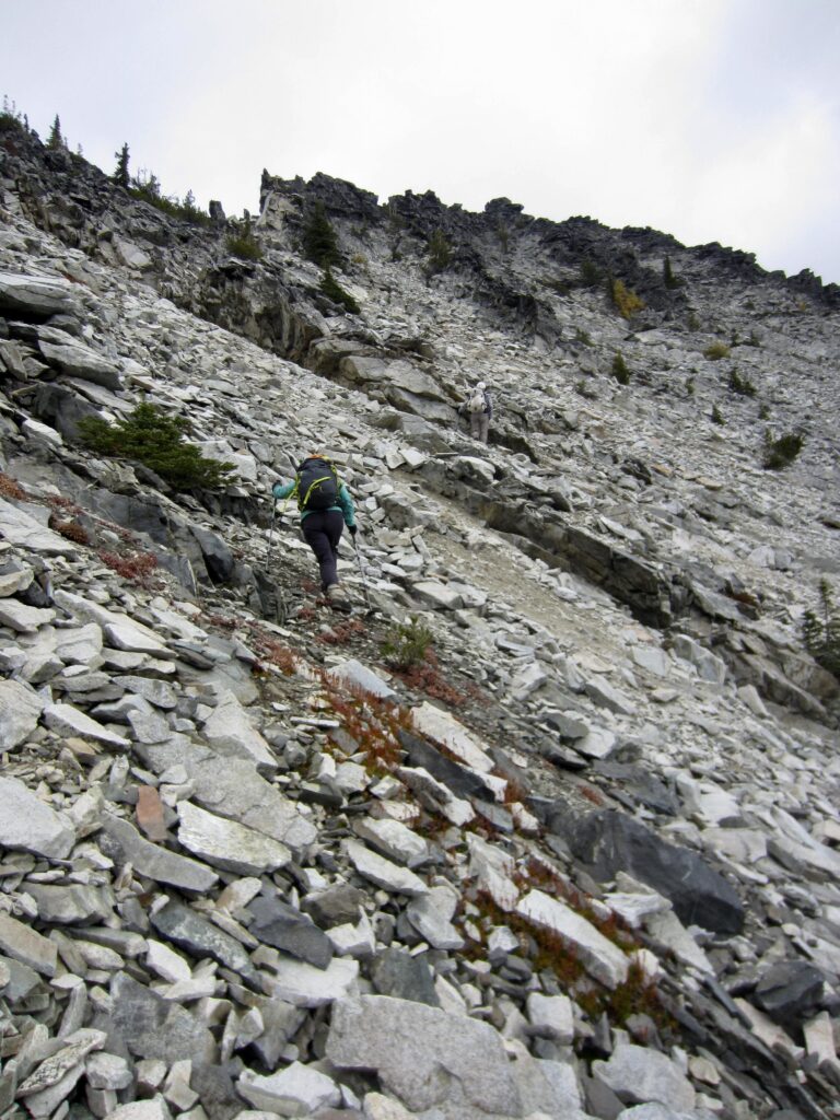
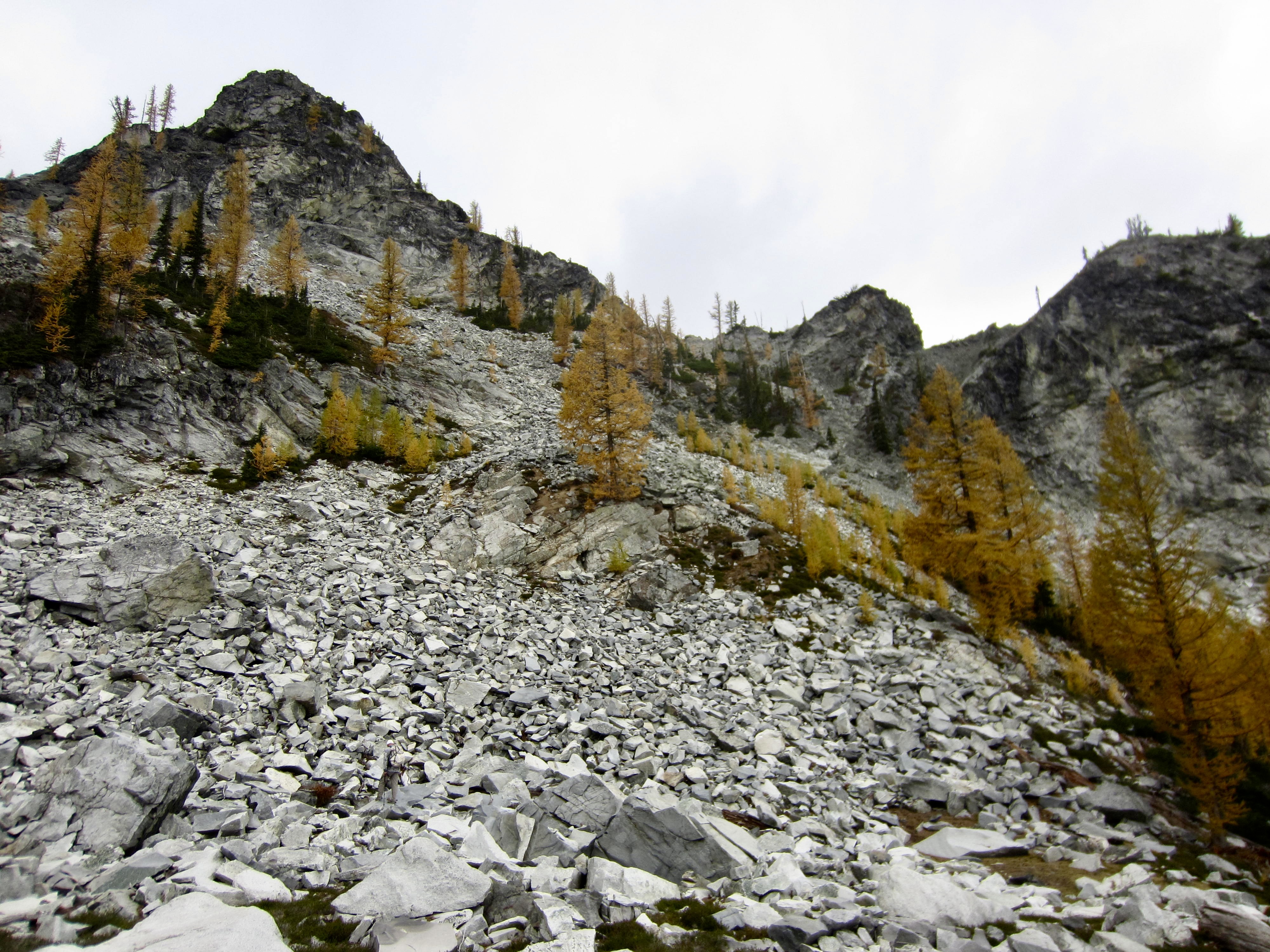
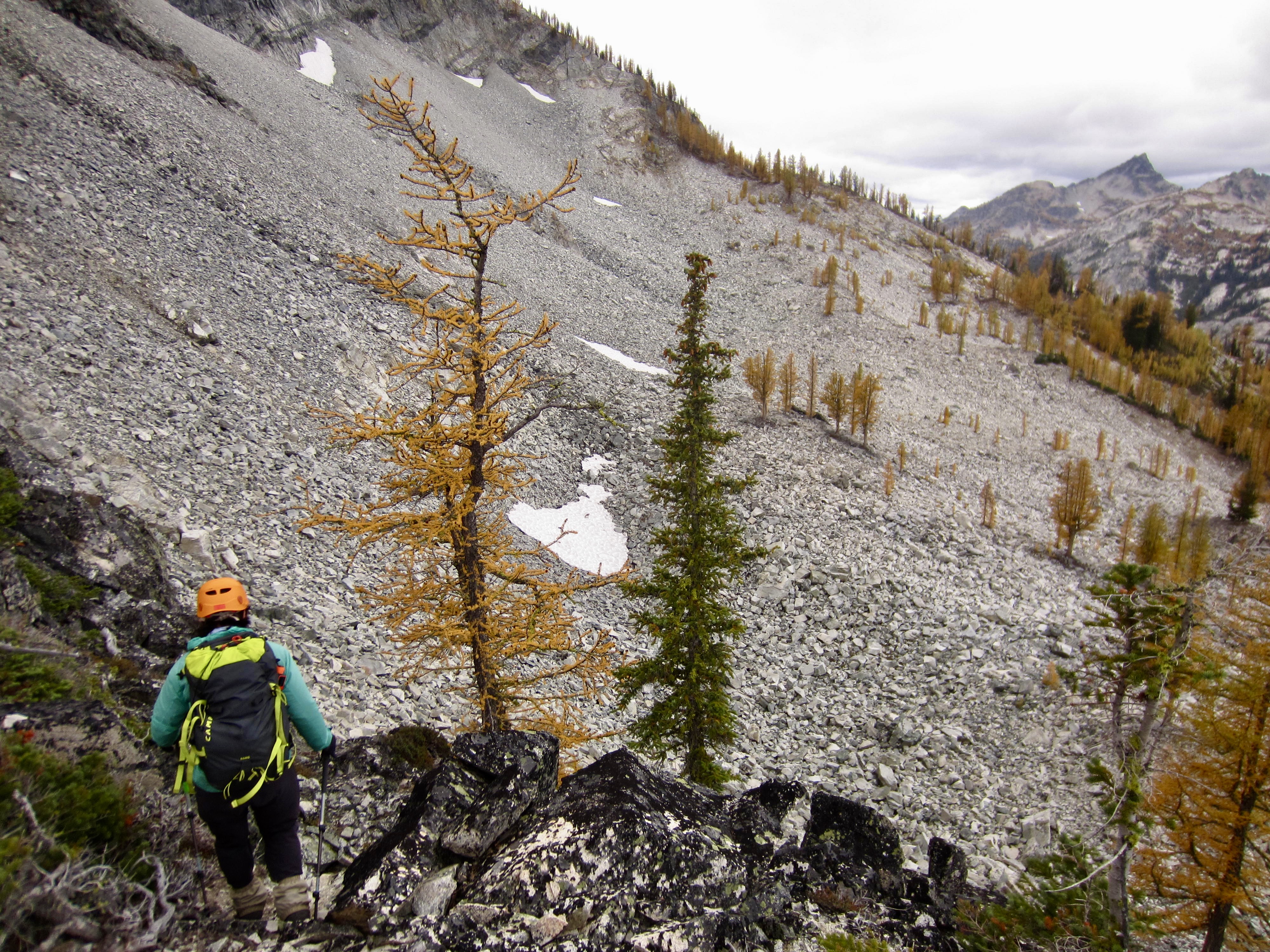
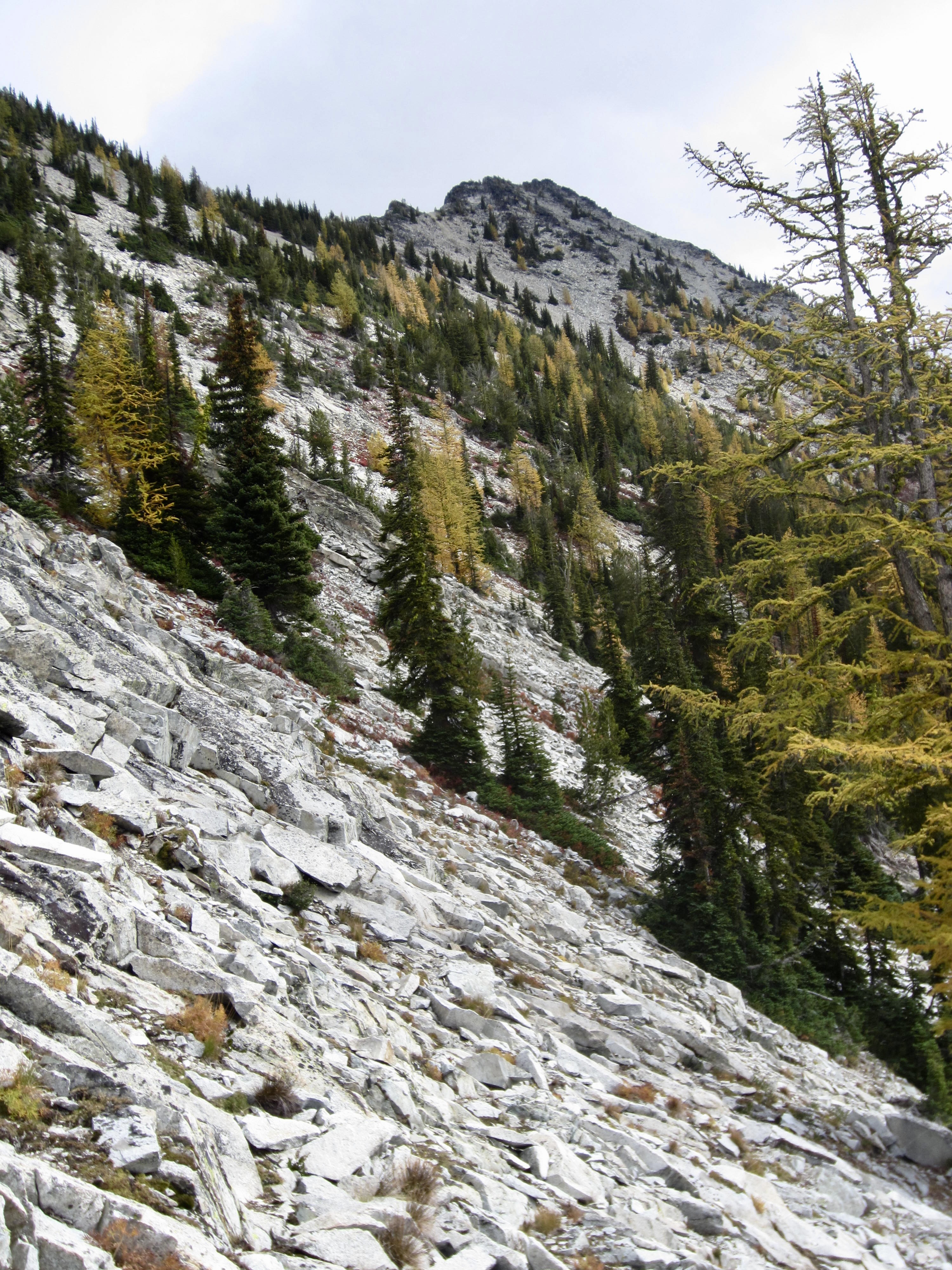
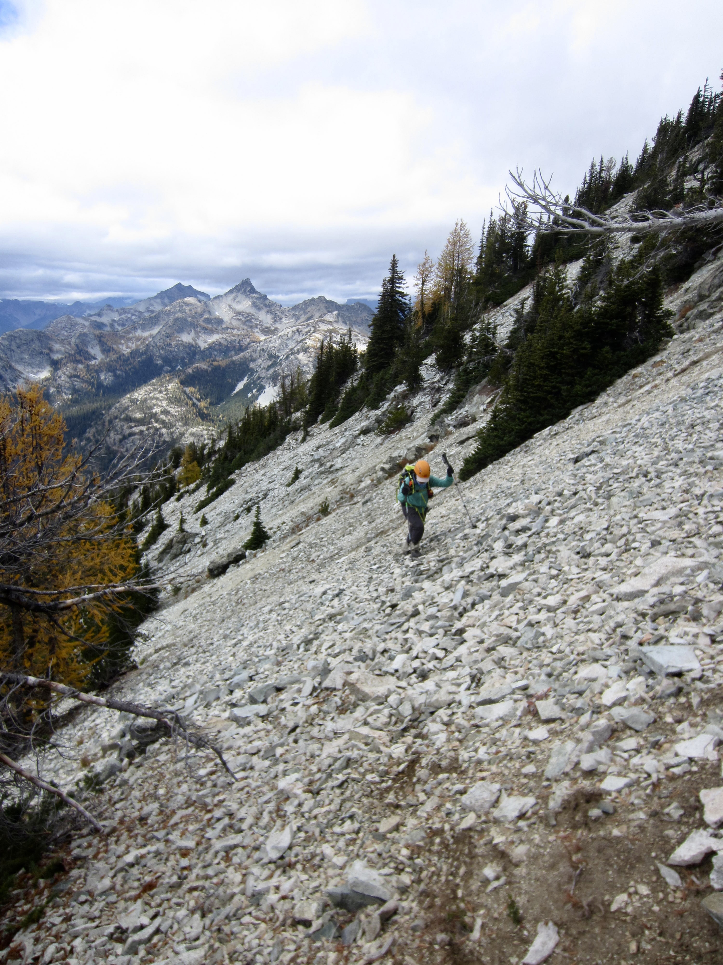
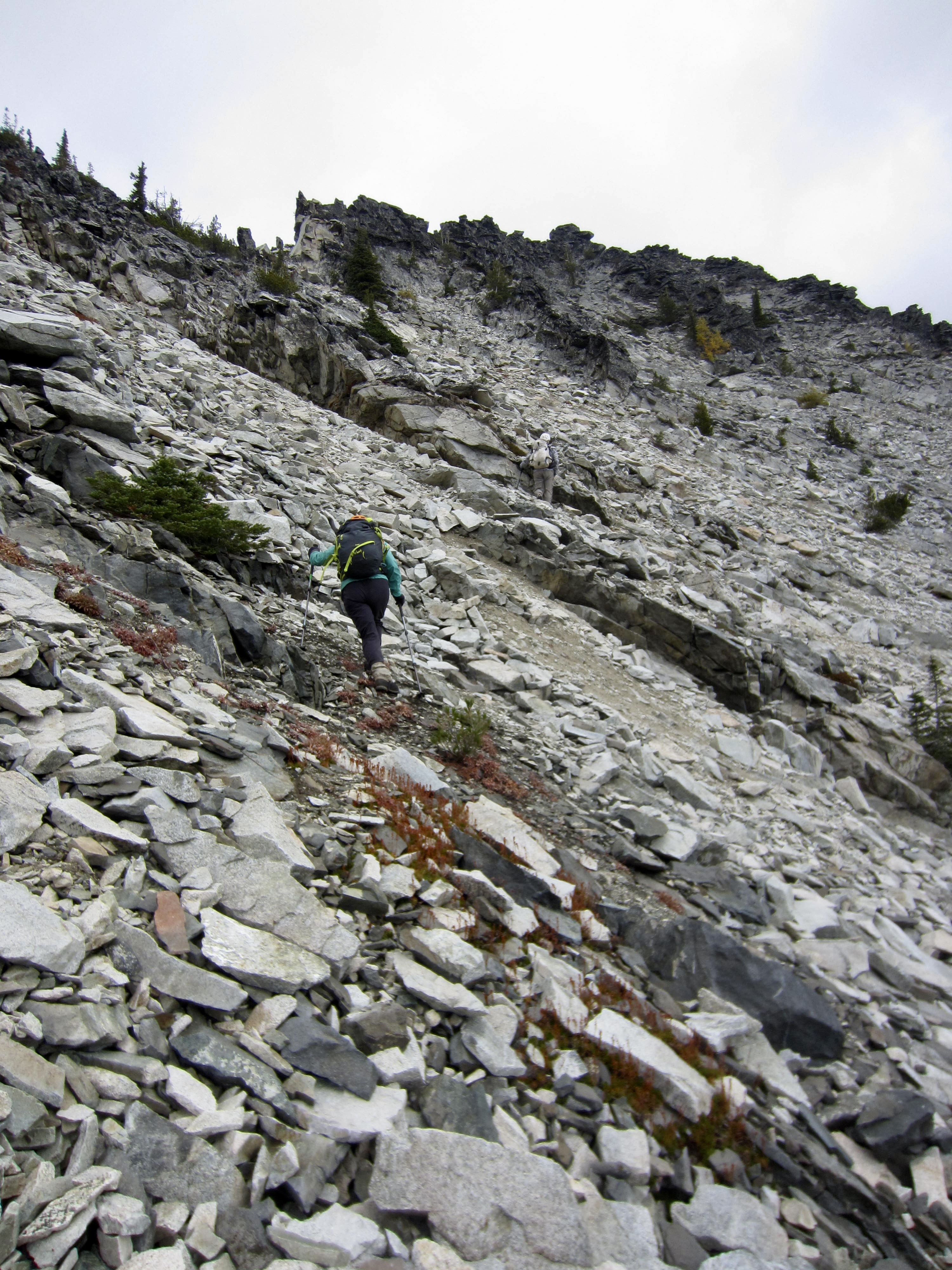
We eventually worked around a rib that put us onto the mountain’s broad, upper southwestern slope, with the summit block visible ½ mile to the east. Our traverse across this slope took us over a seemingly endless expanse of unstable talus and broken slabs. It was slow, treacherous, and very stressful!
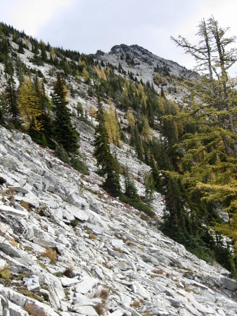
Looking Across Upper Southwest Slope Of McAlester Mtn

.

Traversing Upper Southwest Slope Of McAlester Mtn
Traversing Toward Summit Of McAlester Mtn

.

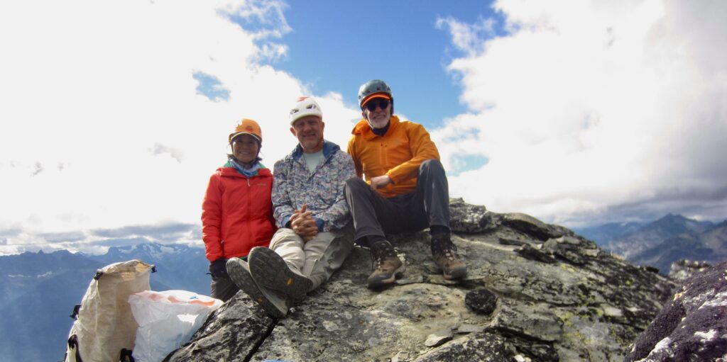
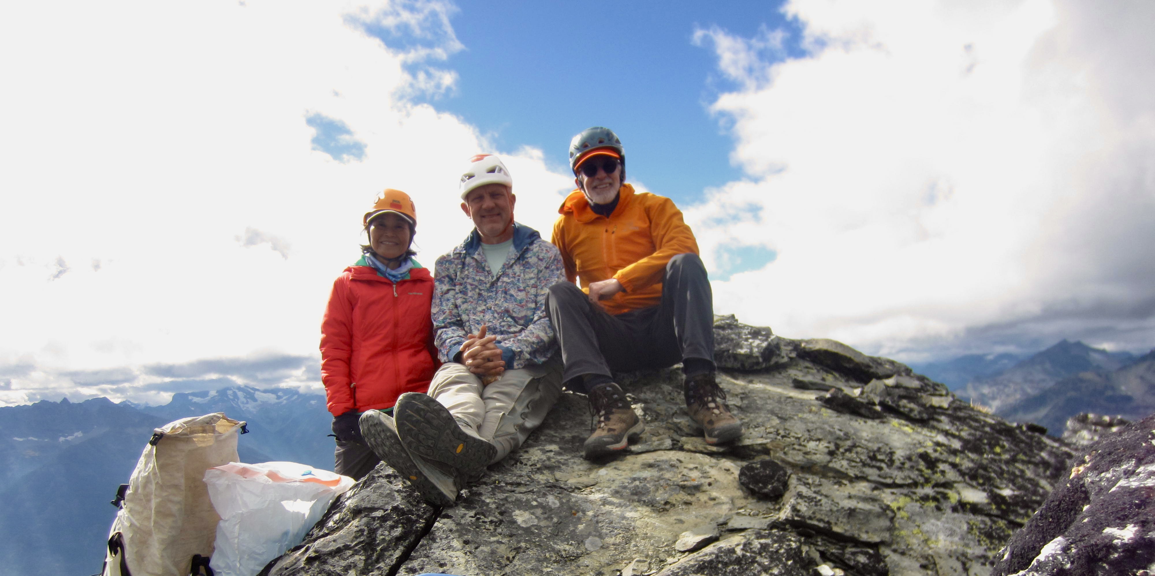
We finally traversed into a position beneath the south face of the craggy summit block and were faced with the challenge of determining which crag is the actual summit. After several false starts, we identified it as the easternmost crag. A short Class 2-3 scramble put us atop McAlester Mountain at 1:50pm (5.0 hours + 4.7 miles + 2850 feet – 400 feet from Camp 1).
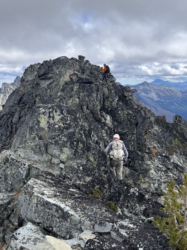
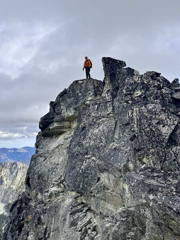
Topping Out On McAlester Mtn Summit (photo by Yoko)
Jim On McAlester Mtn Summit (photo by Yoko)

.

Yoko & Kevin & Jim On McAlester Mtn Summit

.

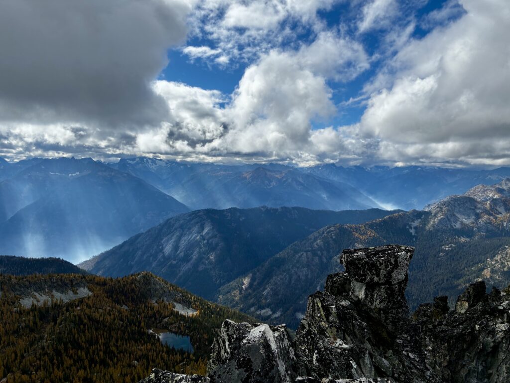
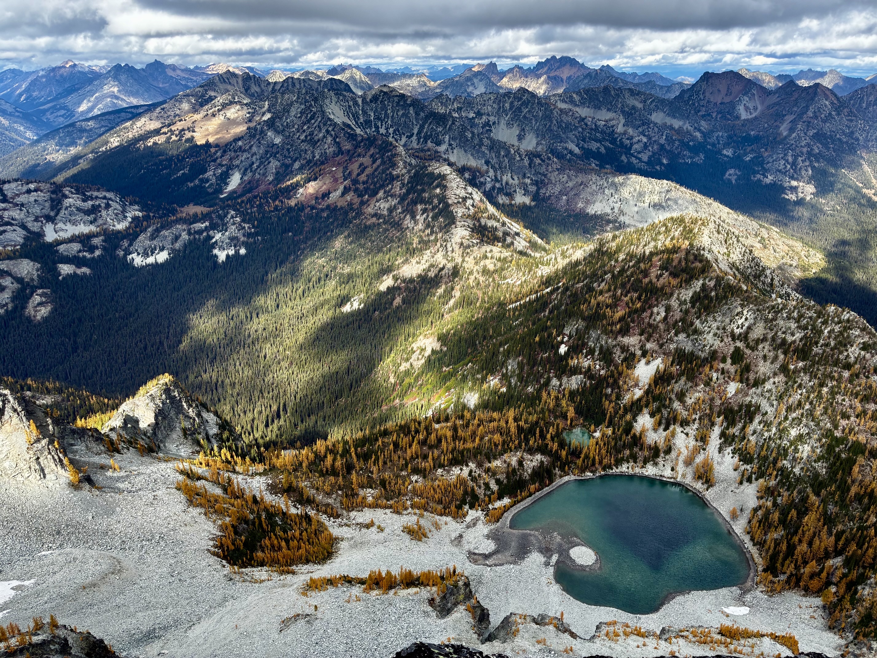
From the summit, we could look directly down at Upper Dee Dee Lake, which was Eileen’s and Maria’s objective for today. Our hollers and war-whoops were returned with shouts from the lake. We couldn’t see them, but we could hear them—1600 vertical feet below!
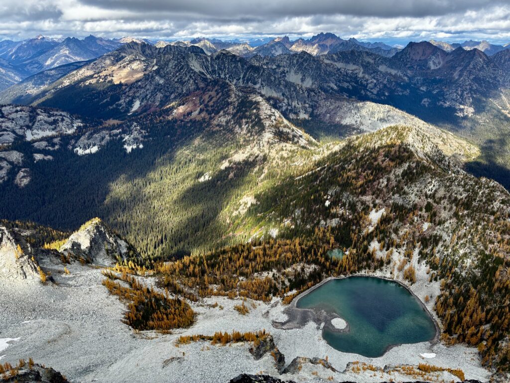
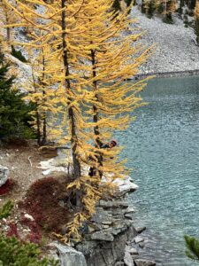
Dee Dee Lakes From McAlester Mtn Summit
Eileen At Upper Dee Dee Lake (photo by Maria)

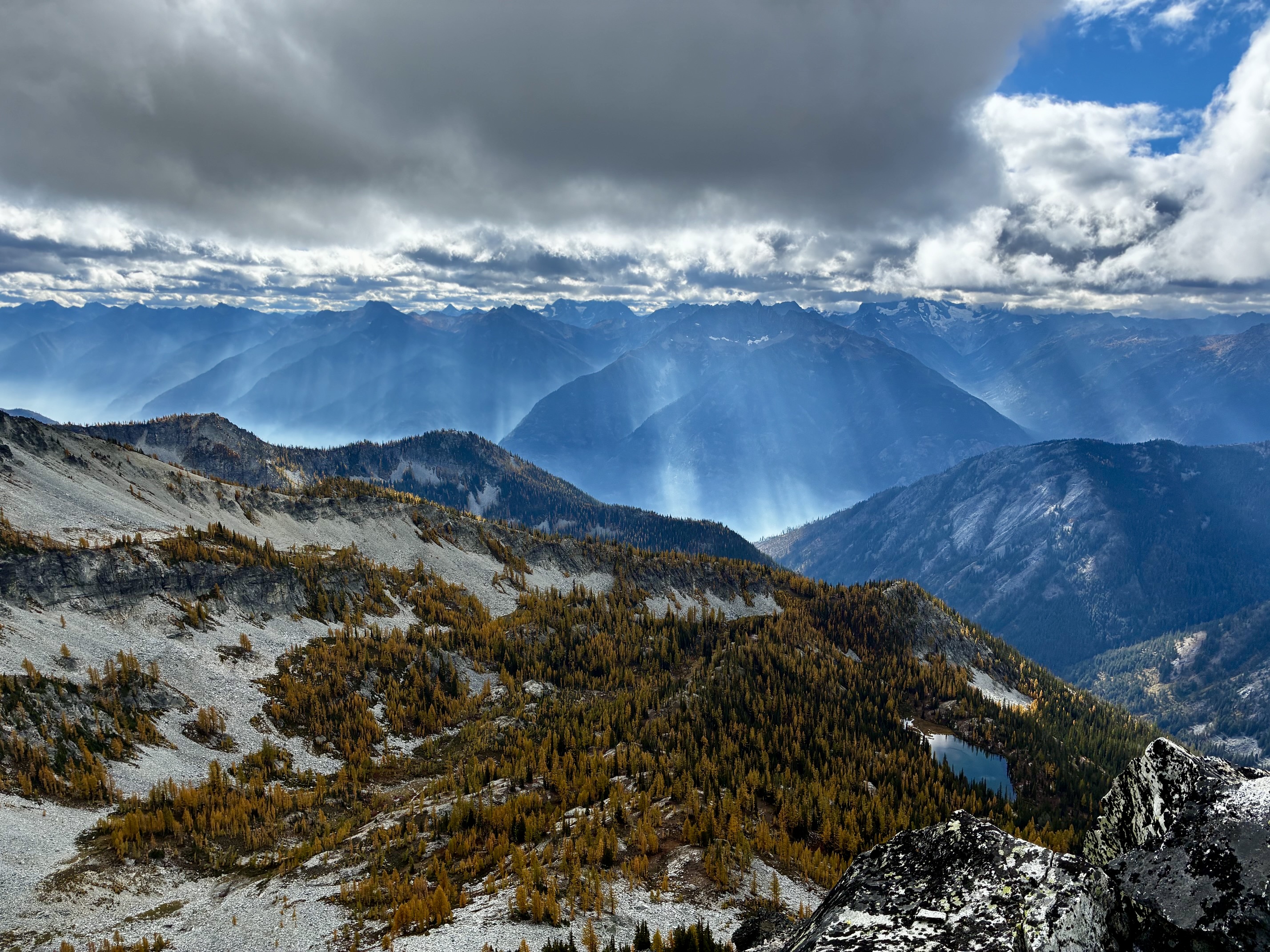
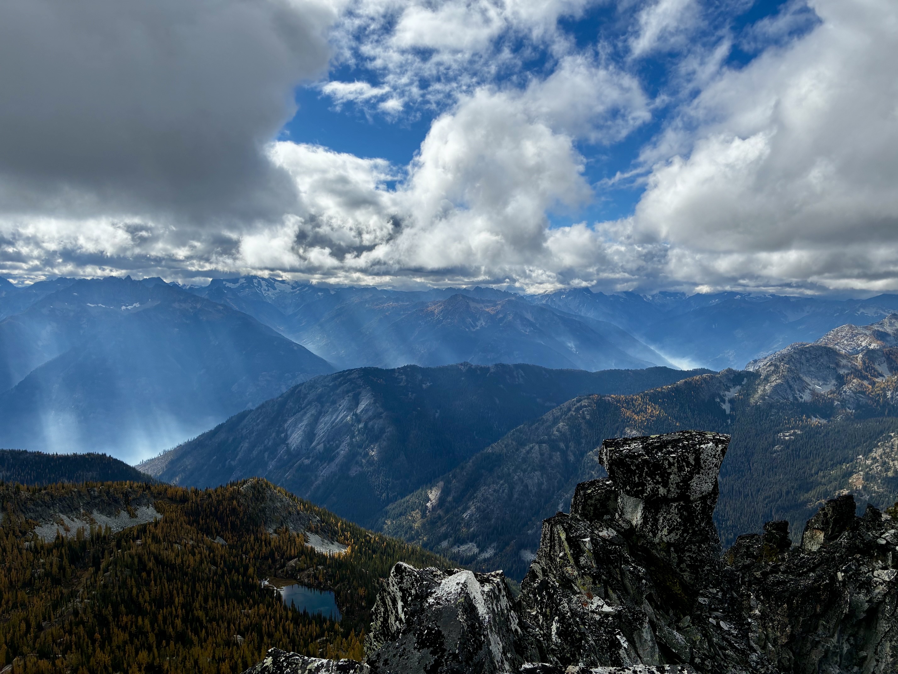
Although our views to the west were truncated by low clouds, random sunbeams engaged with wildfire smoke in the Lake Chelan trough to create ethereal bands of light. It looked like an alien invasion taking place!
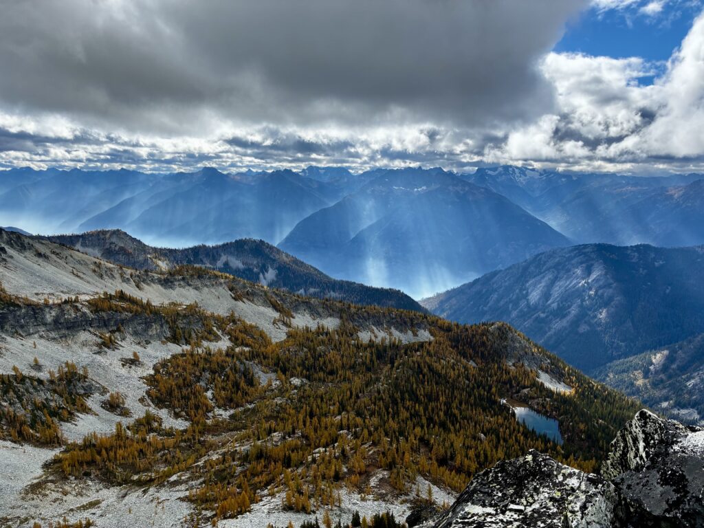
Looking Southwest From McAlester Mtn Summit

.

Looking West From McAlester Mtn Summit

.

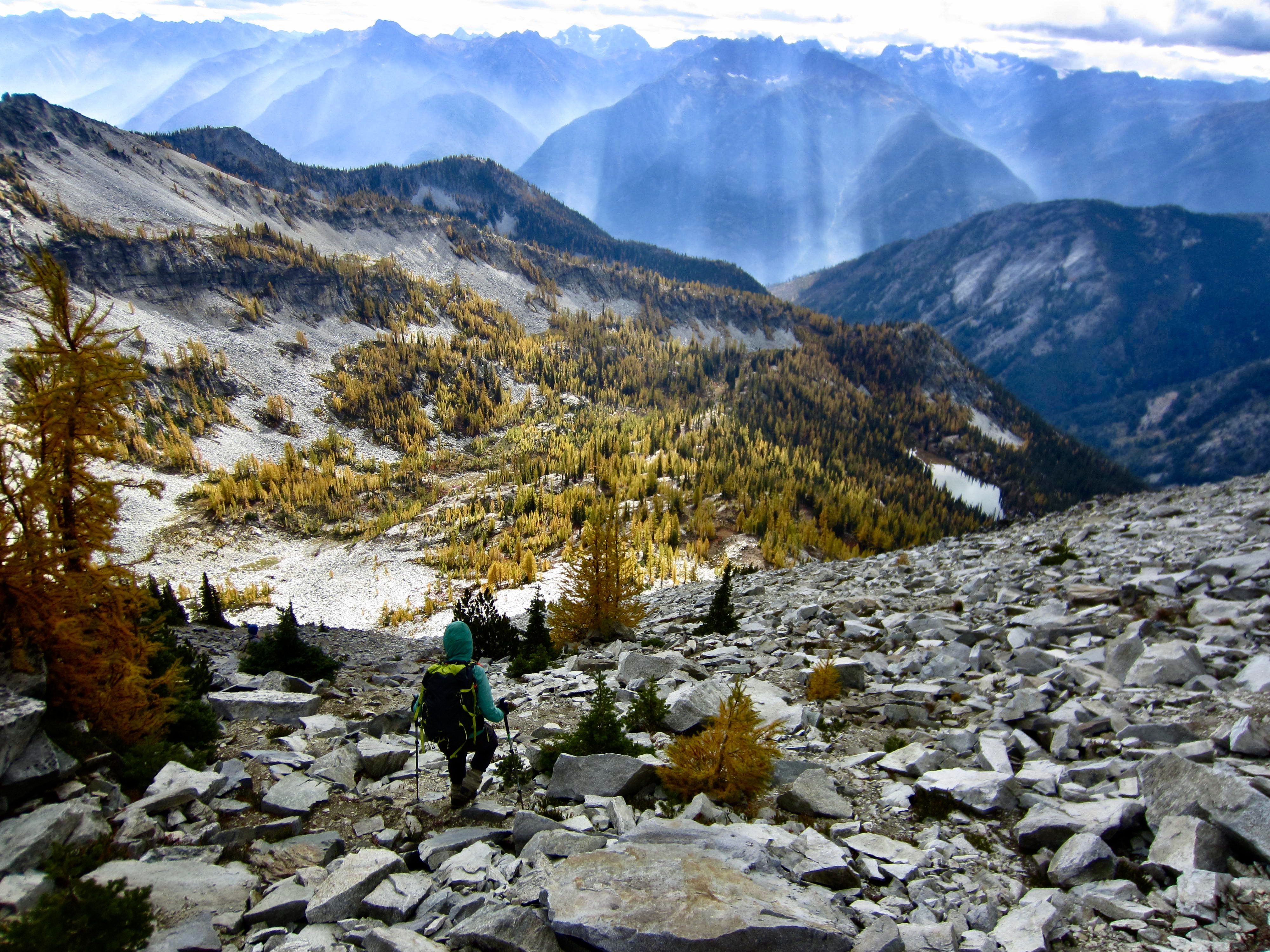
Because none of us were eager to make the long traverse back across the mountain’s treacherous southwestern slope, we decided to make a direct descent into the Rainbow Creek Valley. We initially headed down the steep south face, then angled rightward down the more-moderate lower southwestern slope.
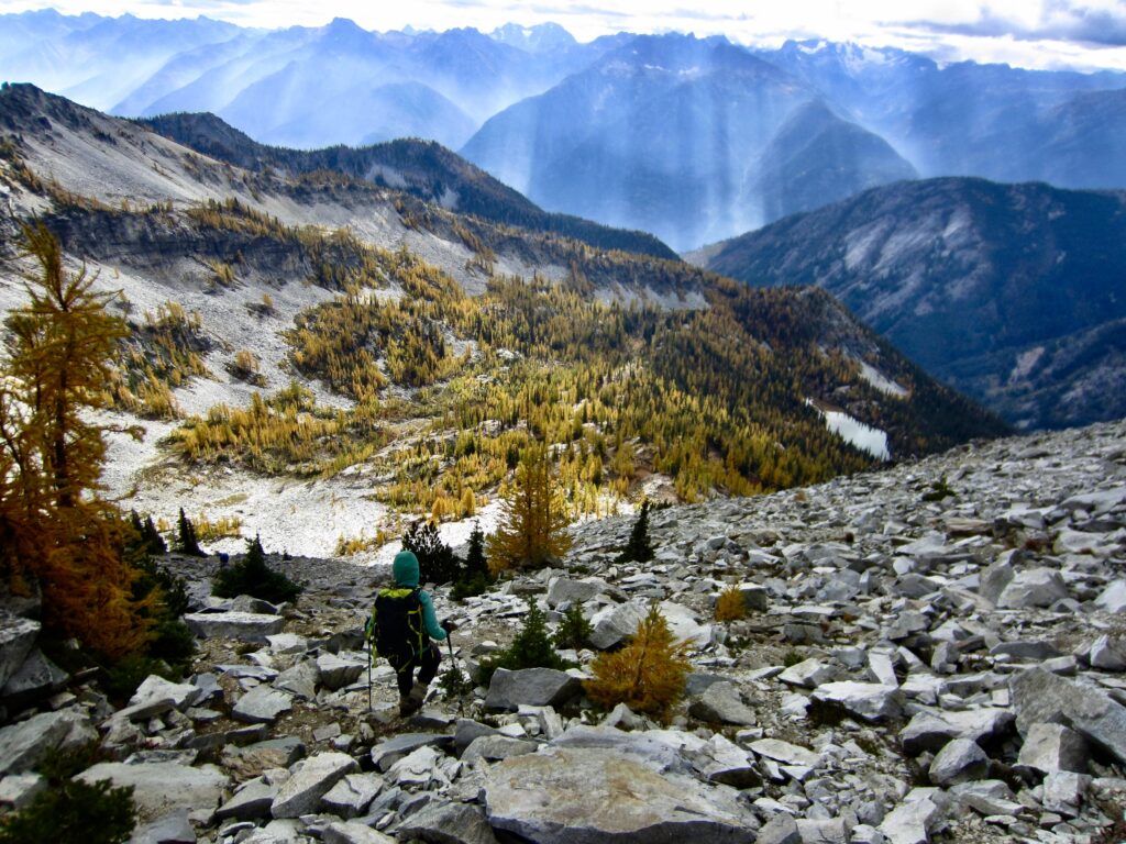
Descending Southwest Slope Of McAlester Mtn

.

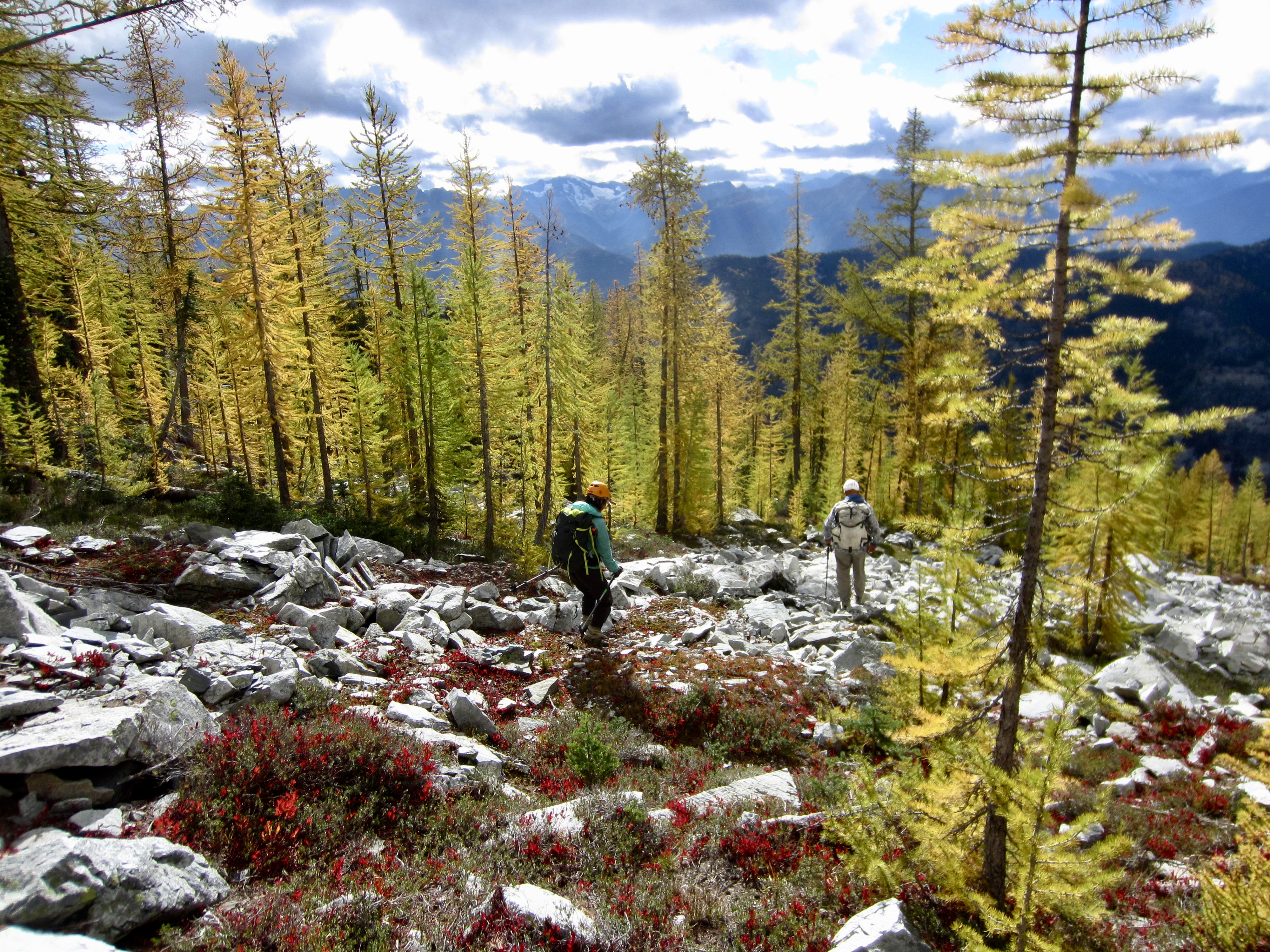
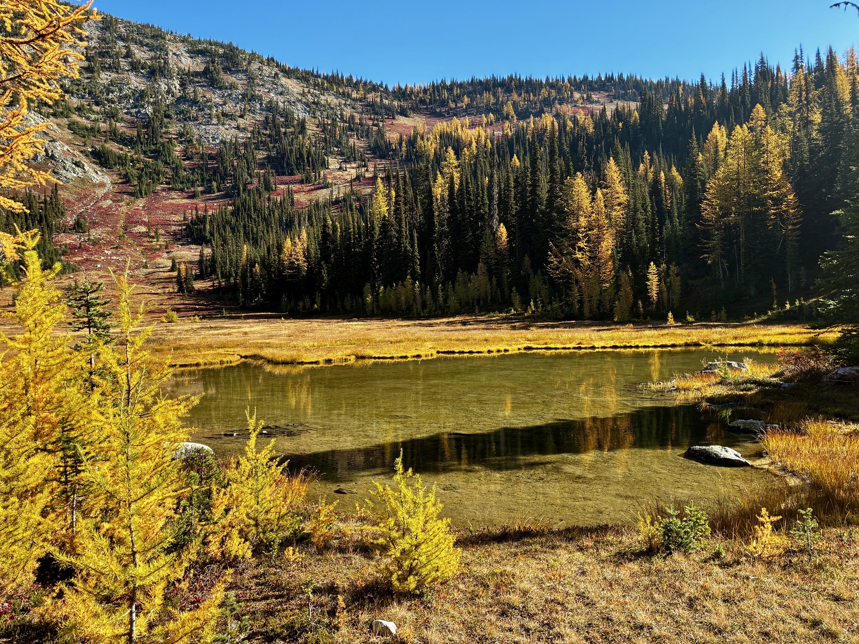
Our descent took us through larch groves and down a heather rib closely north of Lake 6230. This pristine lake would offer a splendid destination or base camp for anyone willing to make the cross-country ascent from the Rainbow Creek Valley.
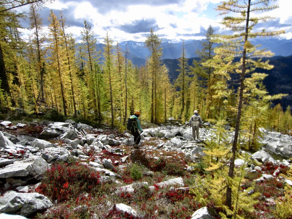
Descending Larch Grove On McAlester Mtn

.

Lake 6230 On McAlester Mtn

.

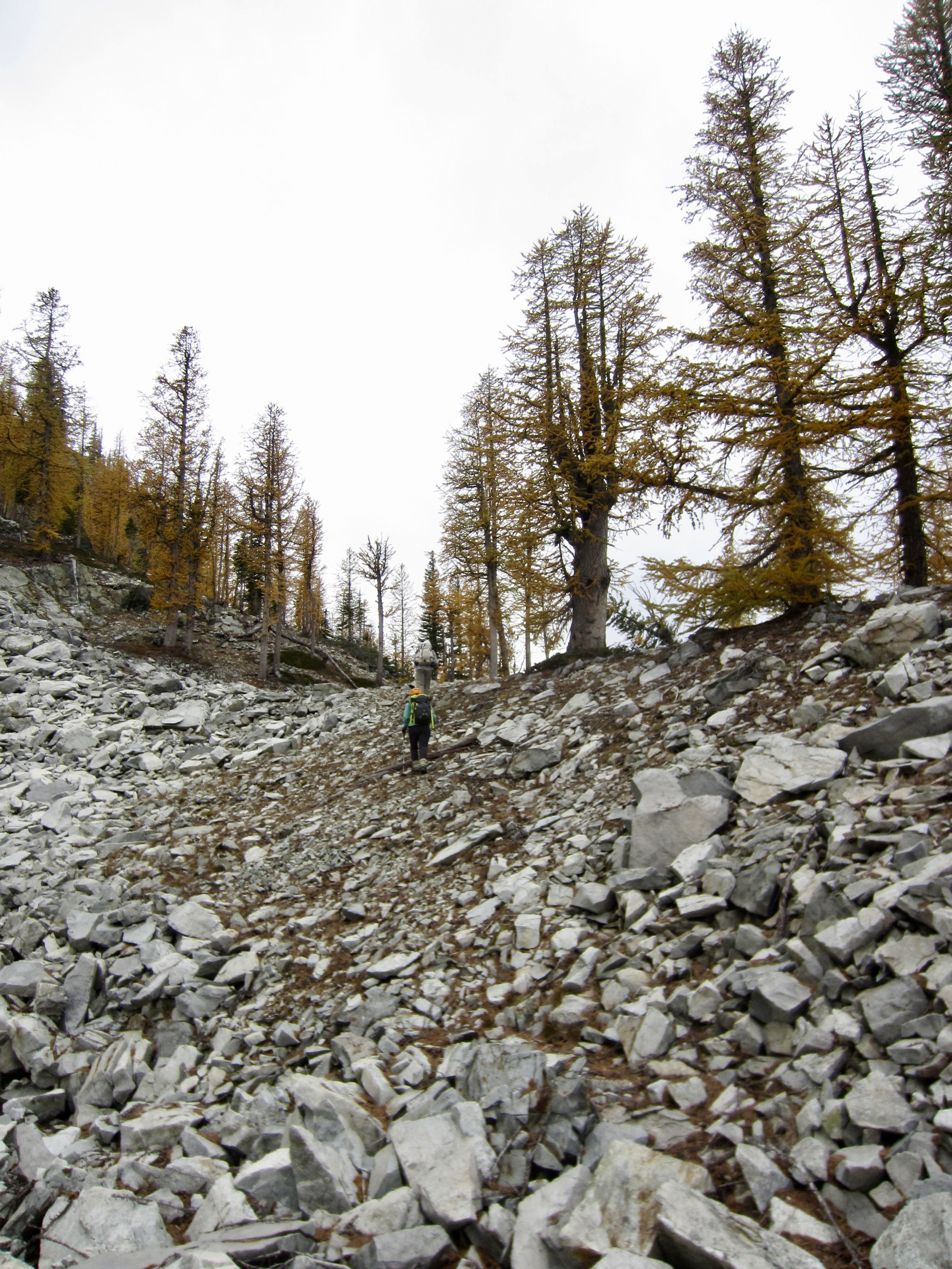
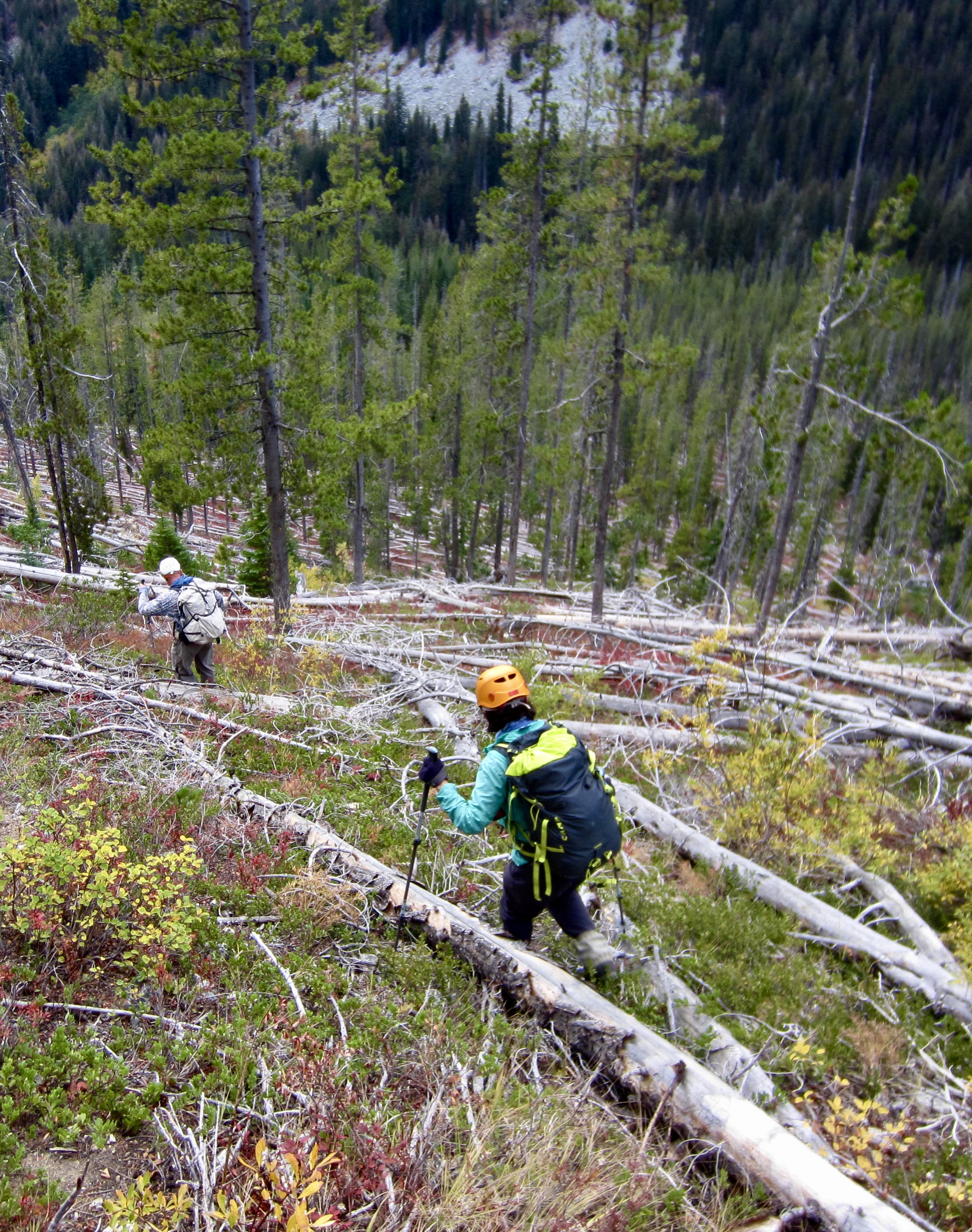
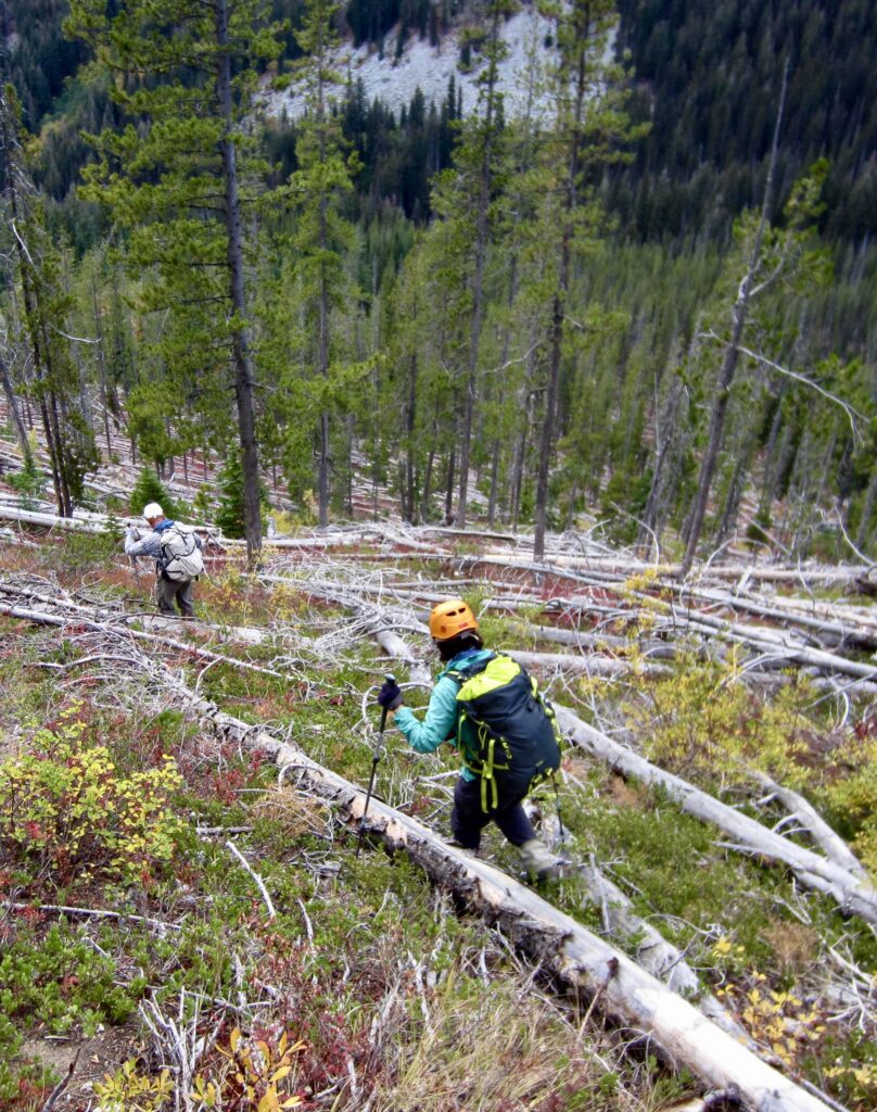
Everything went quite nicely until we reached an elevation of 5400 feet. We then had to skid down steep forest, battle through impenetrable slide alder, hop across loose boulders, navigate through cliffy outcrops, and wend through jackstraw trees. It was a great relief to intersect the Rainbow Creek Trail in late afternoon (2.1 hours – 3600 feet from summit). We hit this trail at an elevation of 4350 feet, about ¼ mile down-valley from Bowan Camp and 3 miles from McAlester Pass. Although our direct descent route hadn’t really saved any time or misery, it did feel much safer than retracing our up-route. All in all, the combined ascent and descent seemed like a Whitman Sampler of unsavory mountain terrain!
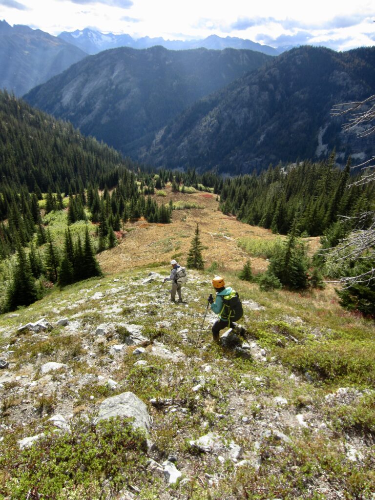
Descending Grassy Rib On McAlester Mtn
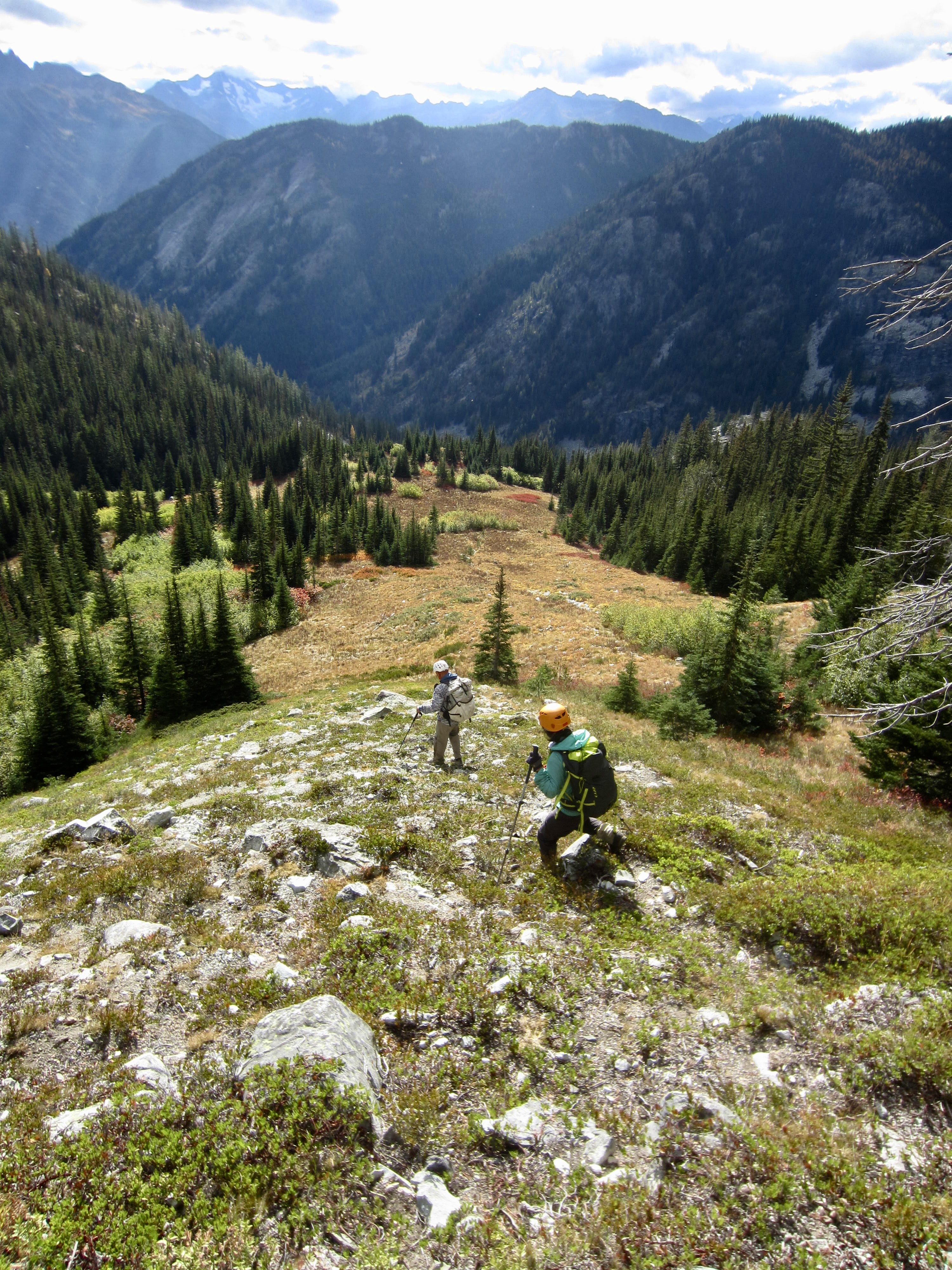
Hiking Thru Jackstraw Trees Below McAlester Mtn

.

We hiked back up to McAlester Pass In the pleasant coolness of twilight, and then hiked down to McAlester Lake Camp. Kevin arrived shortly before dark, whereas Yoko and I arrived by headlamp at 7:30pm (5.3 hours + 6.5 miles + 1650 feet – 4100 feet from summit). Andrew, Blaine, and Joyce had arrived from the Bridge Creek Trailhead earlier in the day.

Day 3: McAlester Lake to Rainbow Meadows

We awoke to find a completely blue sky that was truly fitting for a Golden Larch Outing! The seven of us left camp in various stages and made the 1-mile hike up to McAlester Pass, where we all reconvened at 10:15am.
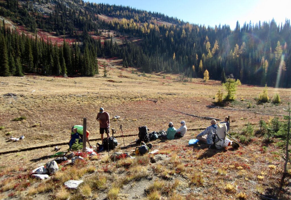
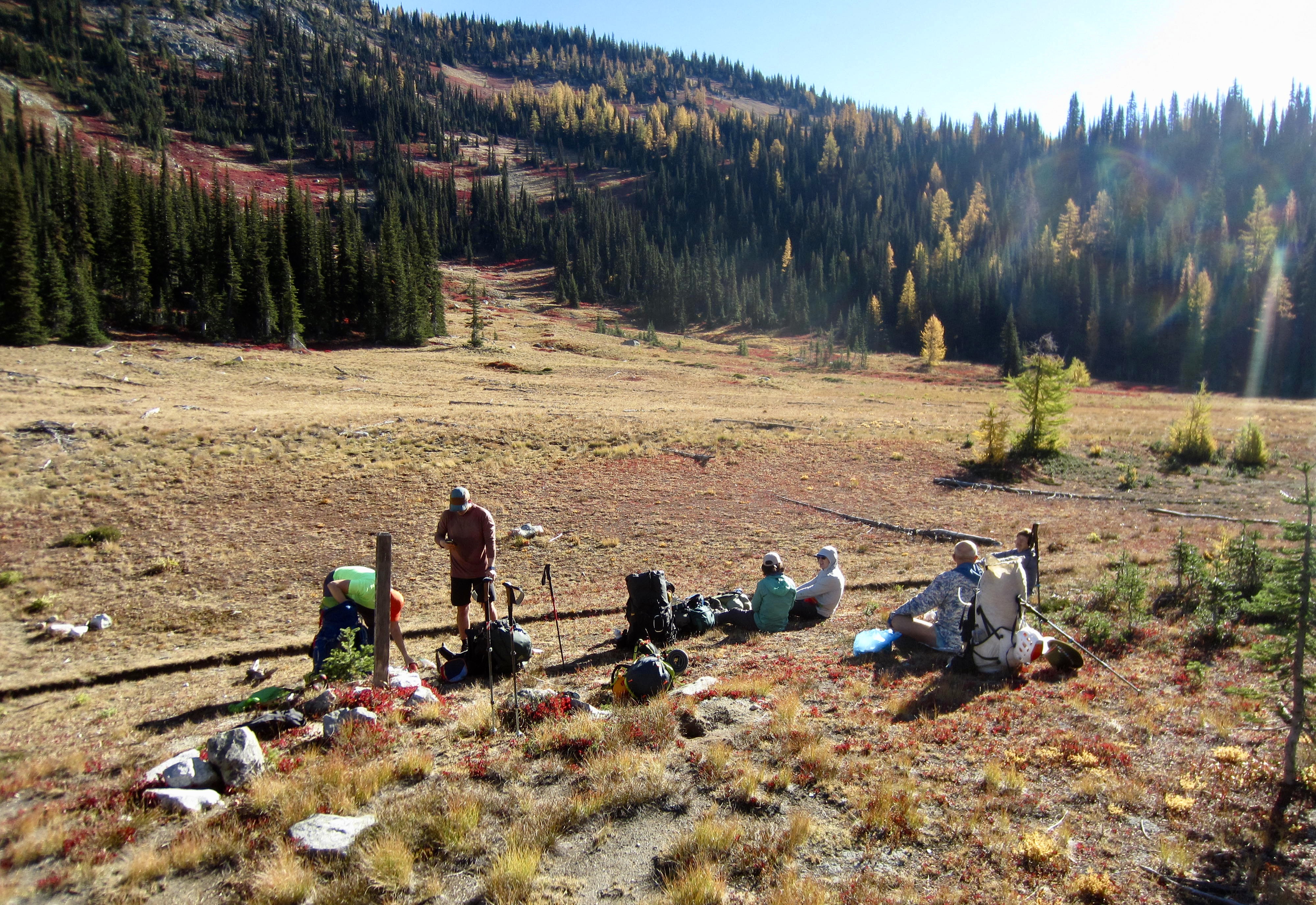
Rest Stop At McAlester Pass On Day 3
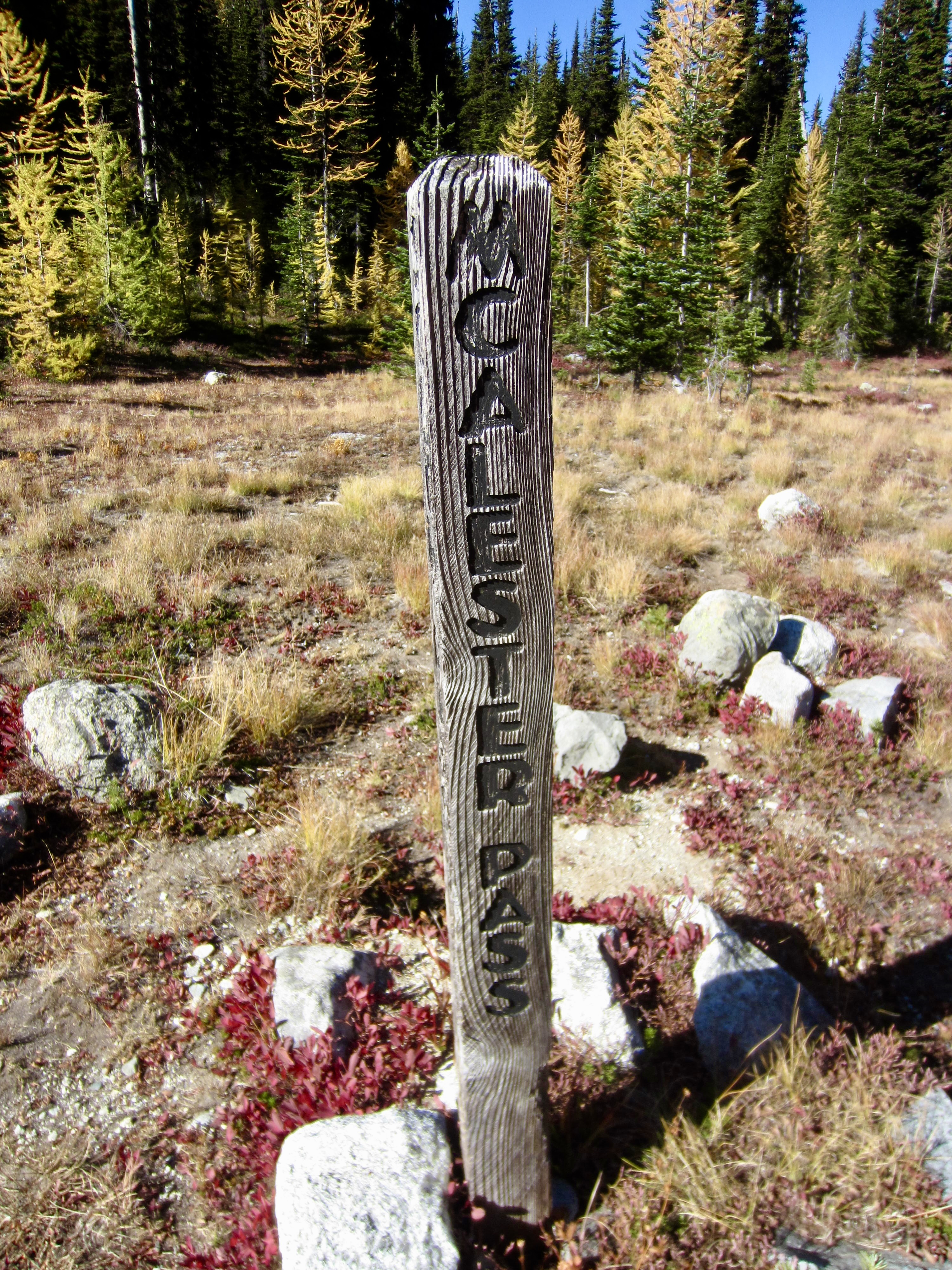
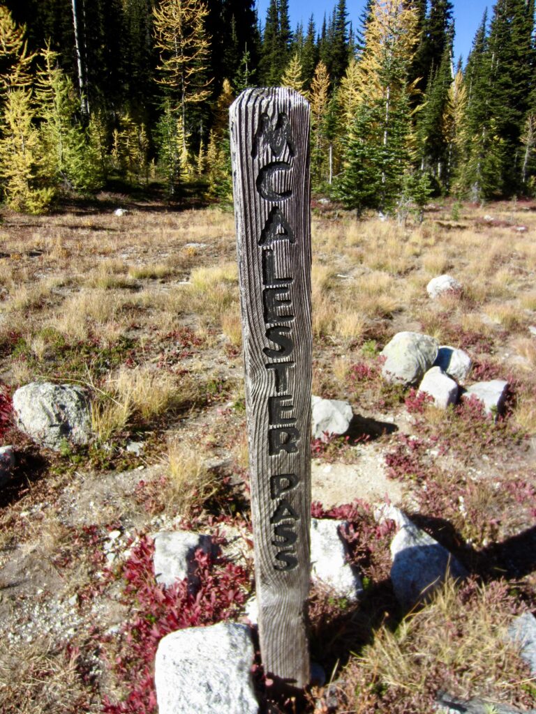
McAlester Pass Trail Signpost

.

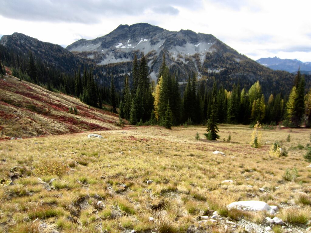
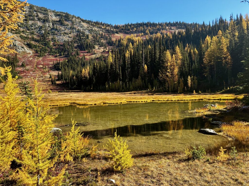
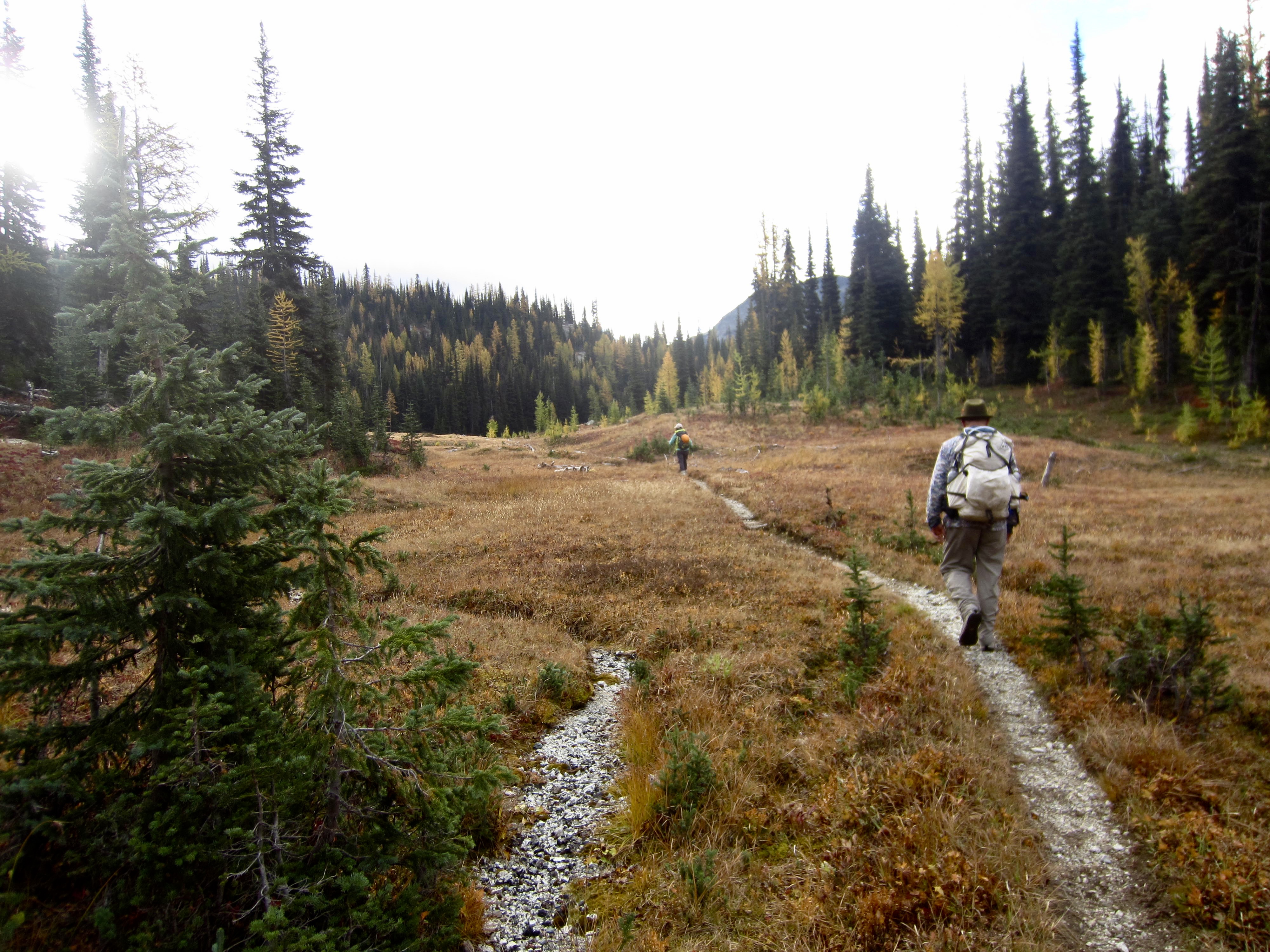
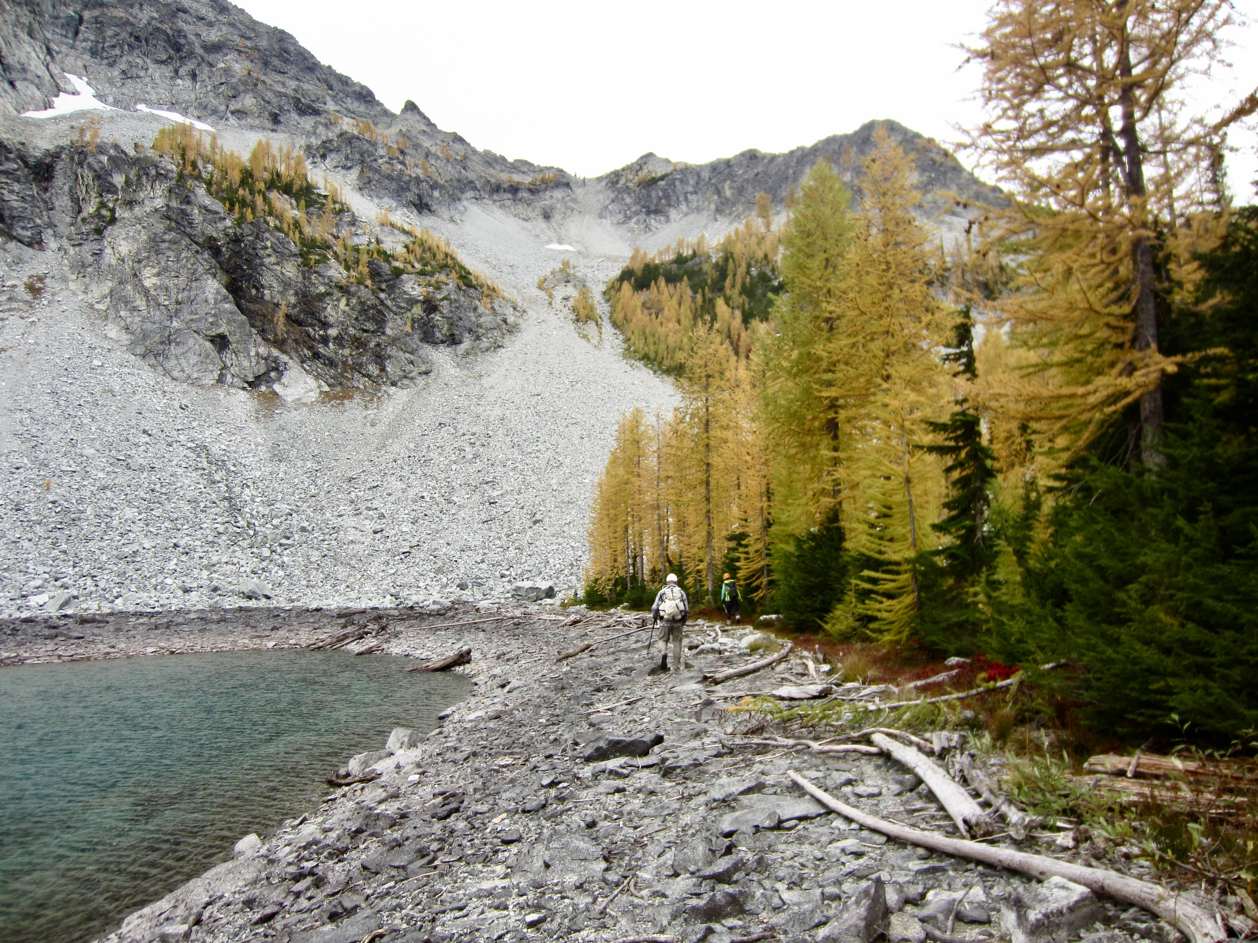
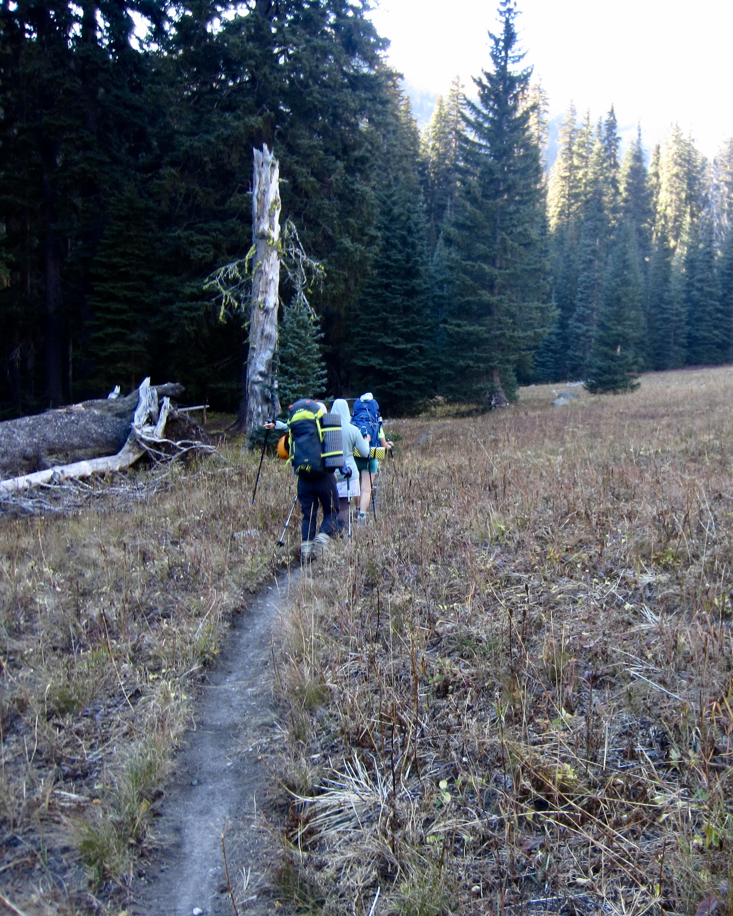
From the pass, we strolled through McAlester Park and marveled at the autumn livery displayed by trees and grasses. Andrew soon veered off to the right on the inconspicuous Rainbow Ridge Trail, while our six-person peloton continued down the Rainbow Creek Trail.
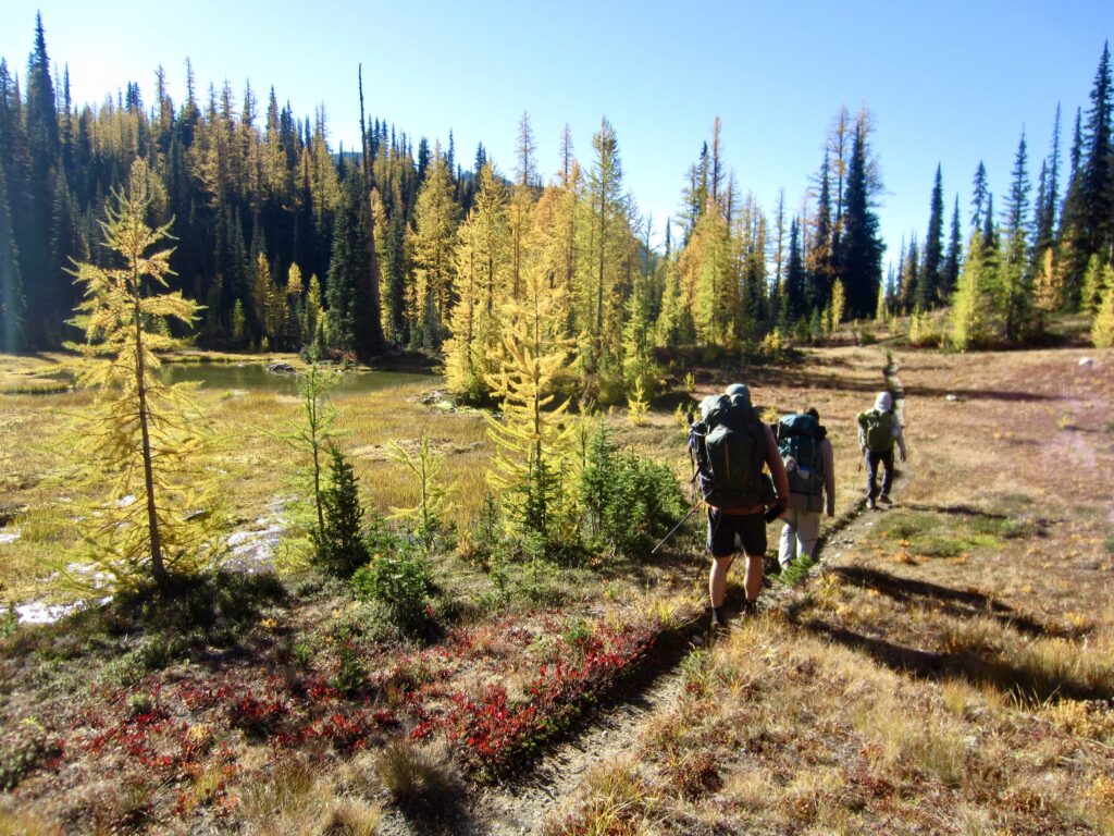
Hiking Thru McAlester Park

.

Shallow Pond In McAlester Park

.

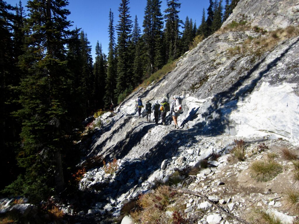
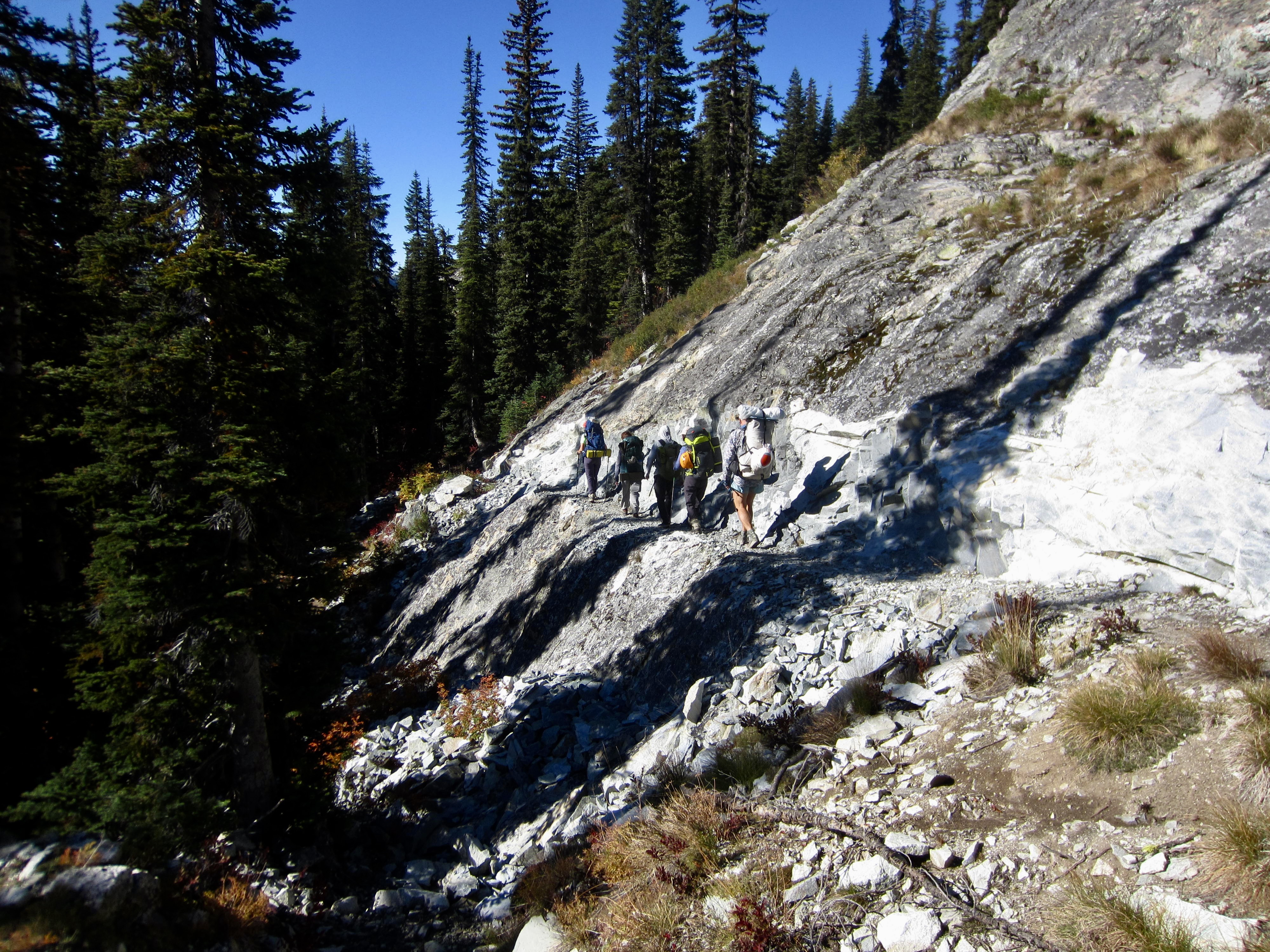
Hiking Across Cliff On Rainbow Creek Trail

.

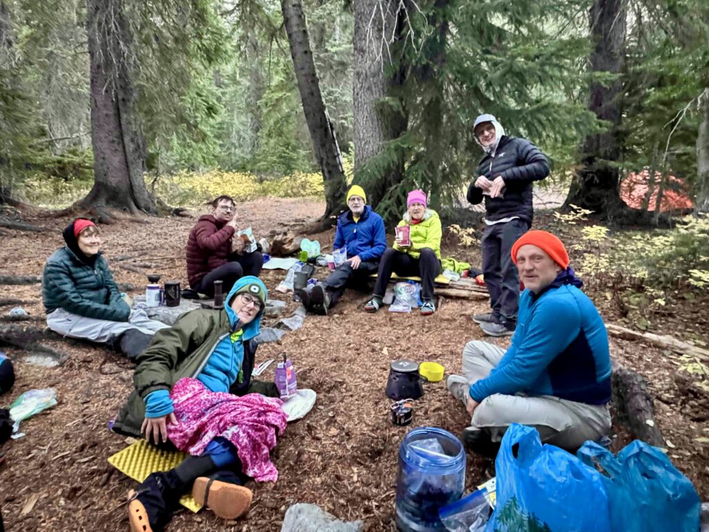
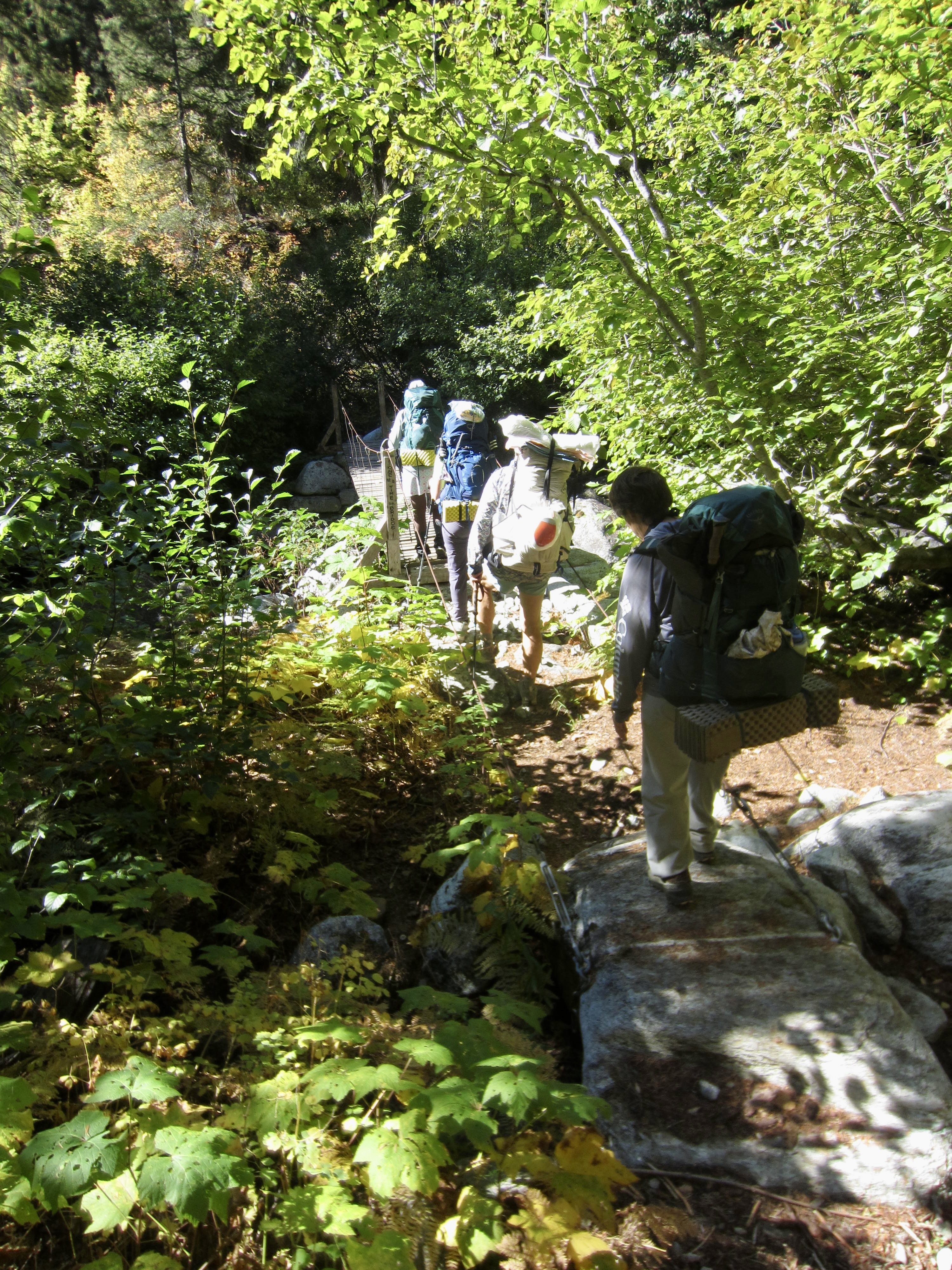
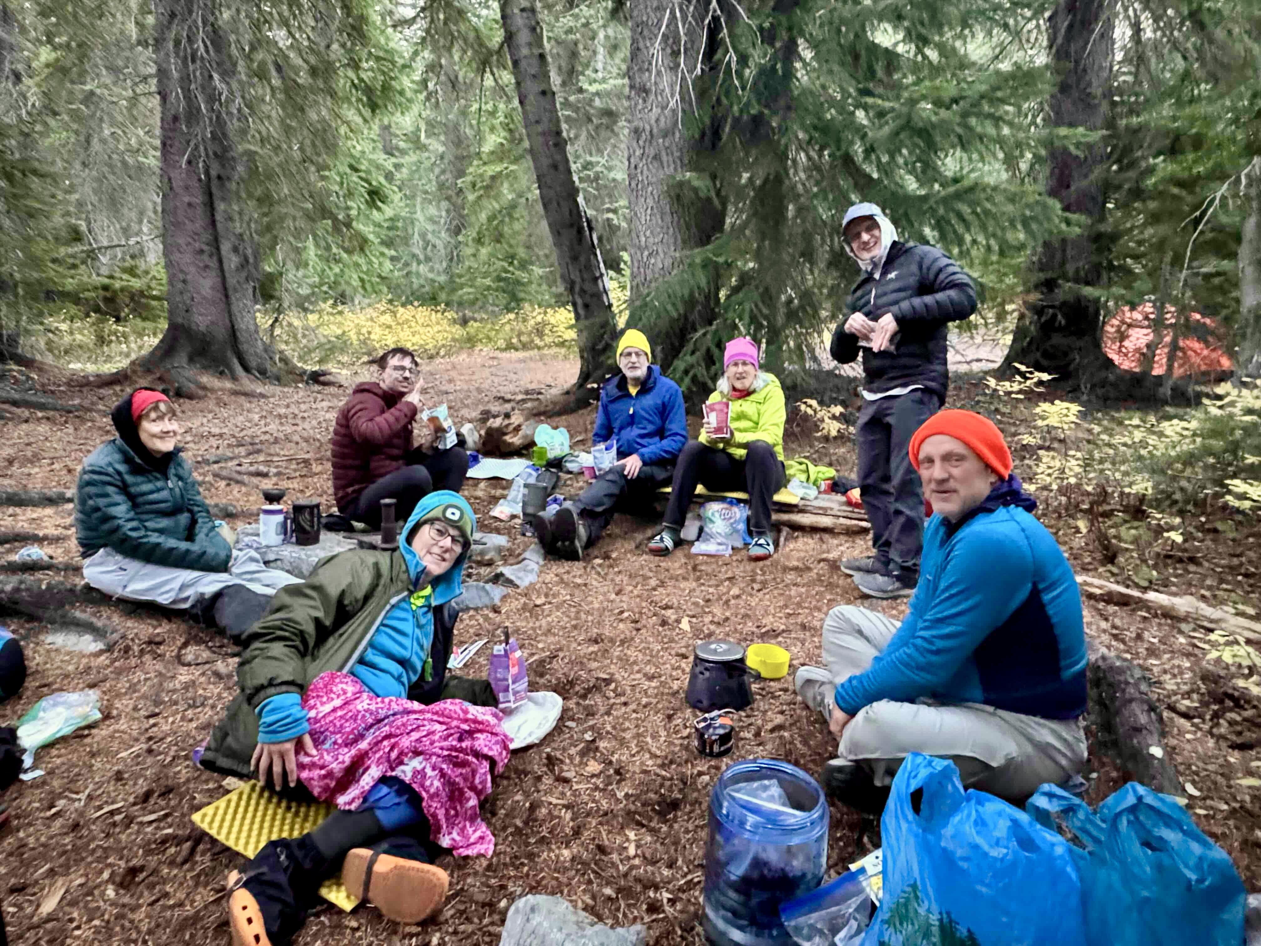
Our peloton passed Bowan Camp and Bench Creek Camp before turning downhill on the Rainbow Lake Trail. We crossed Rainbow Creek on a small suspension bridge and stopped for lunch, then headed up-valley. By late afternoon, all six of us were assembled in the Rainbow Meadows Group Camp (7.2 hours + 9.1 miles + 2050 feet – 2550 feet from Camp 1). Andrew arrived during dinnertime, having tucked in Bowan Mountain and descended from Bowan Pass.
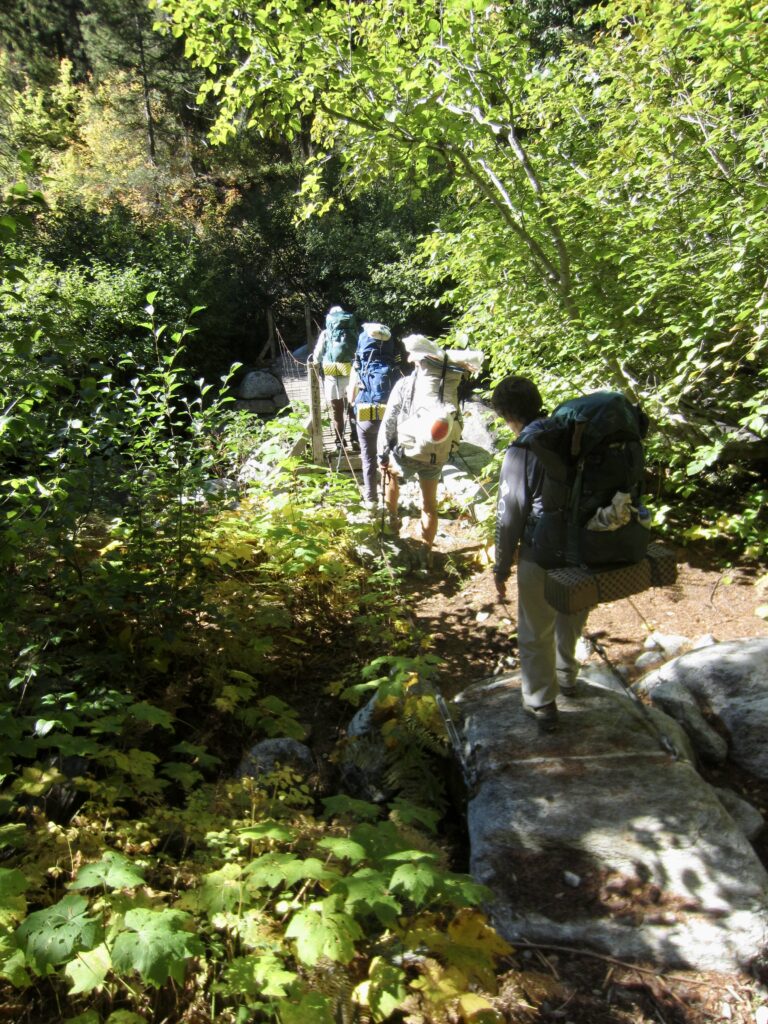
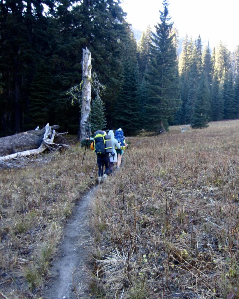
Crossing Suspension Bridge Over Rainbow Creek
Hiking Into Rainbow Meadows

.

Group At Rainbow Meadows Camp (photo by Yoko)

.

Day 4: Rainbow Meadows to Hideaway Camp

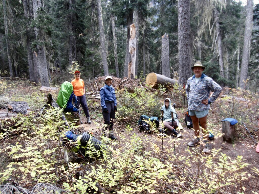
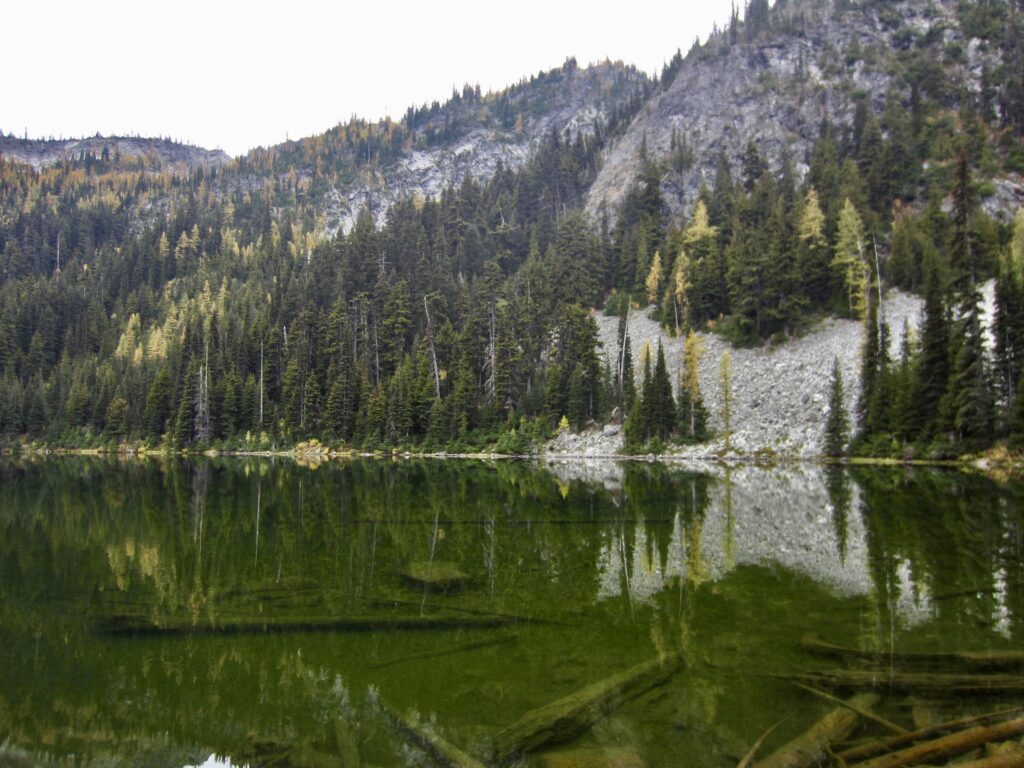
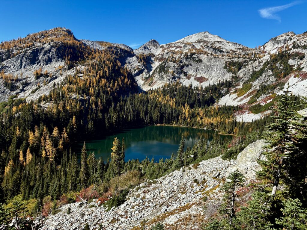
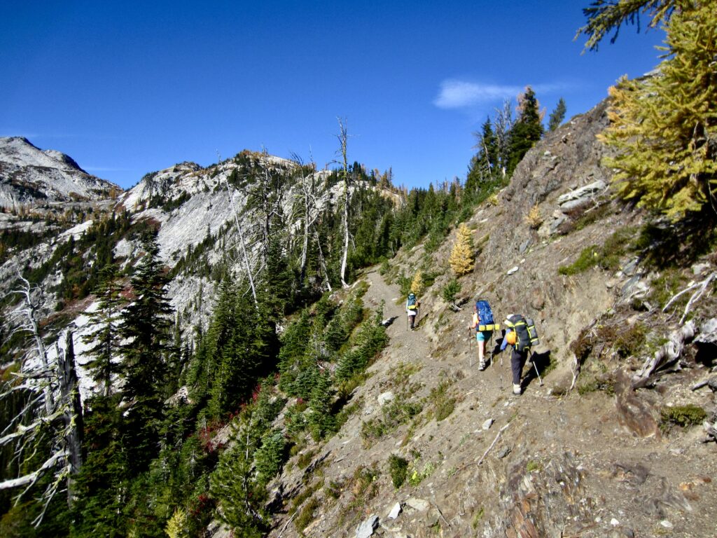
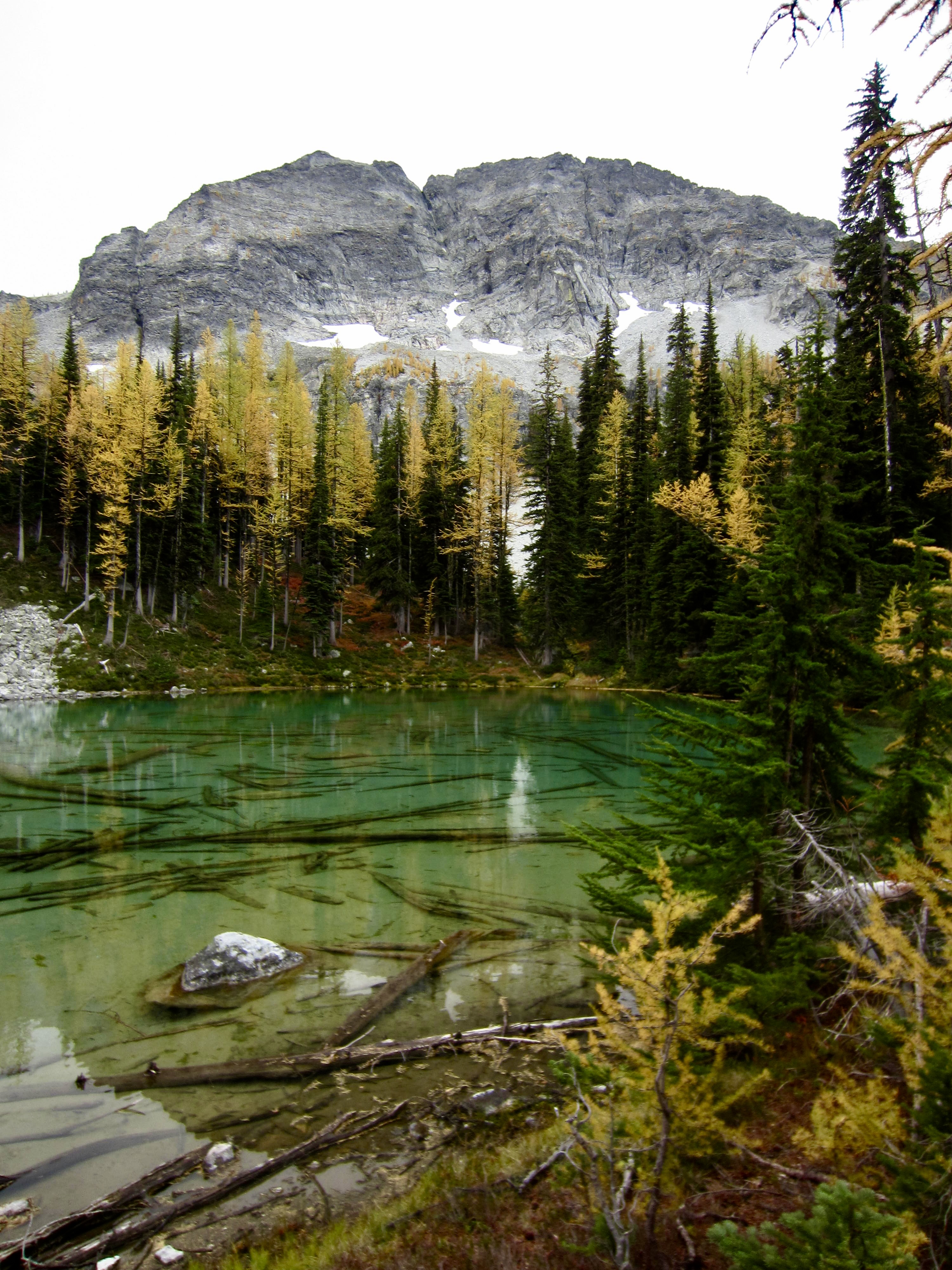
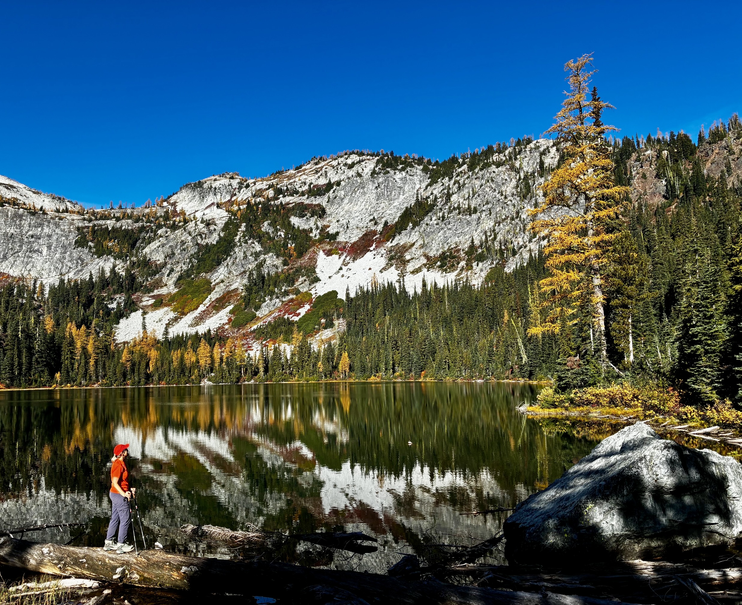
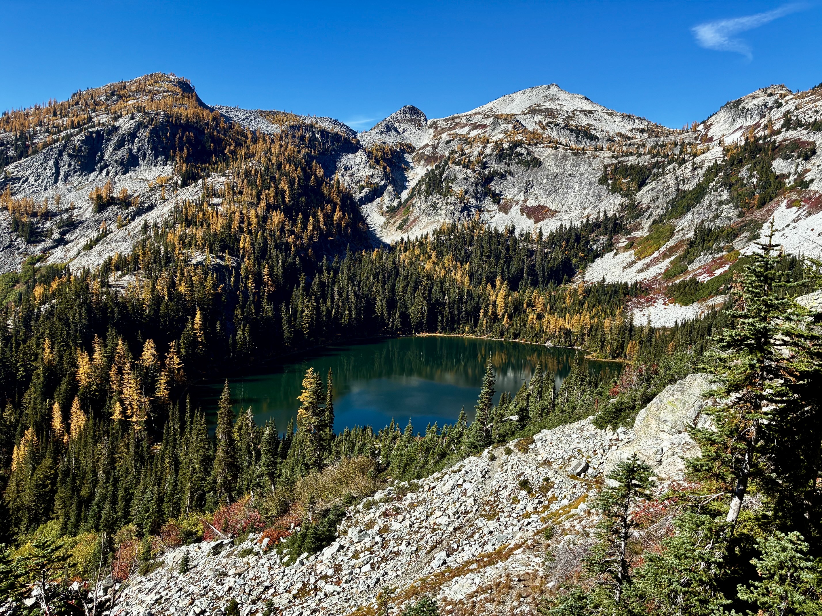
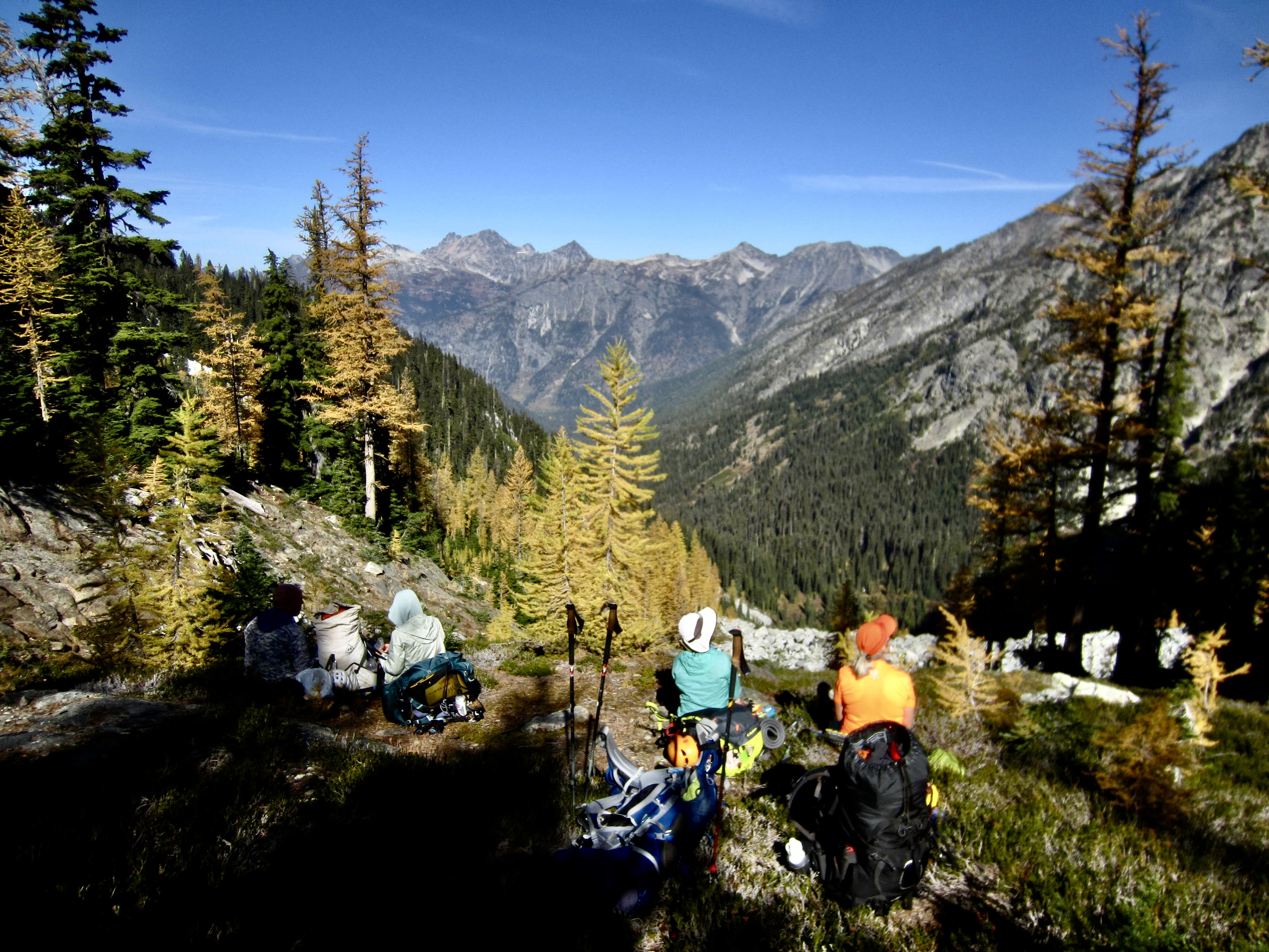
Following a cold night, we awoke to another glorious bluebird day. Blaine, Joyce, and Andrew blazed out of camp in order to complete their 13-mile exit hike today, whereas Kevin, Maria, Yoko, Eileen, and I took a slower pace up numerous switchbacks to Rainbow Lake. The calm water reflected yellow bushes, golden larches, and granitic faces in a spectacular autumn scene.
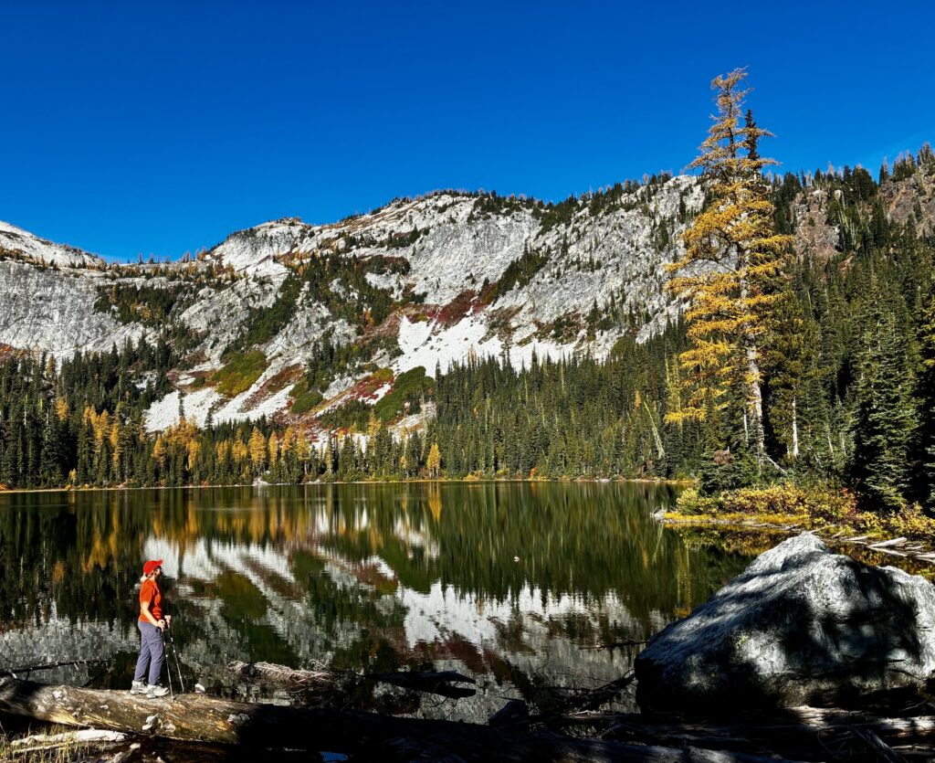
Eileen At Rainbow Lake

.

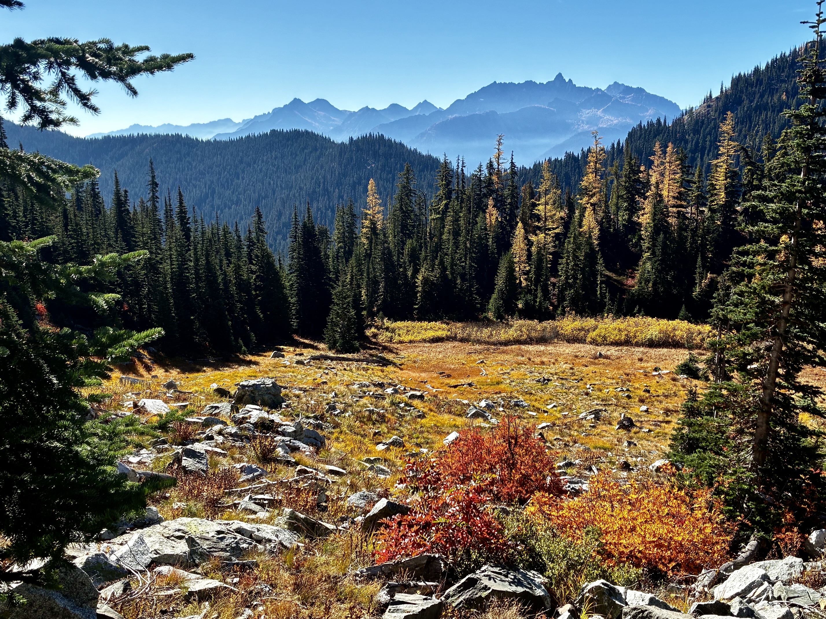
From the lake, we ascended more switchbacks through colorful meadows and rocky slopes, with ever-increasing views to the west and south. The geologic setting abruptly changes from gray granite to brown volcanic rock along this trail.
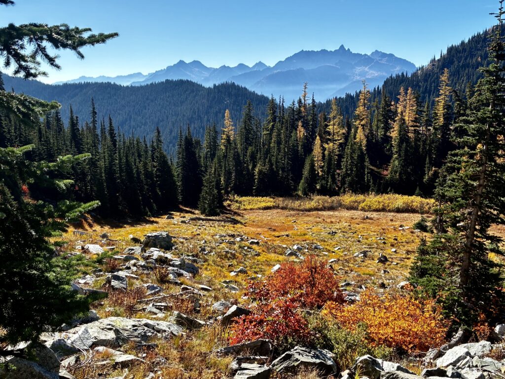
Autumnal Meadow Near Rainbow Lake

.

East McGregor Peak Above Rainbow Lake

.

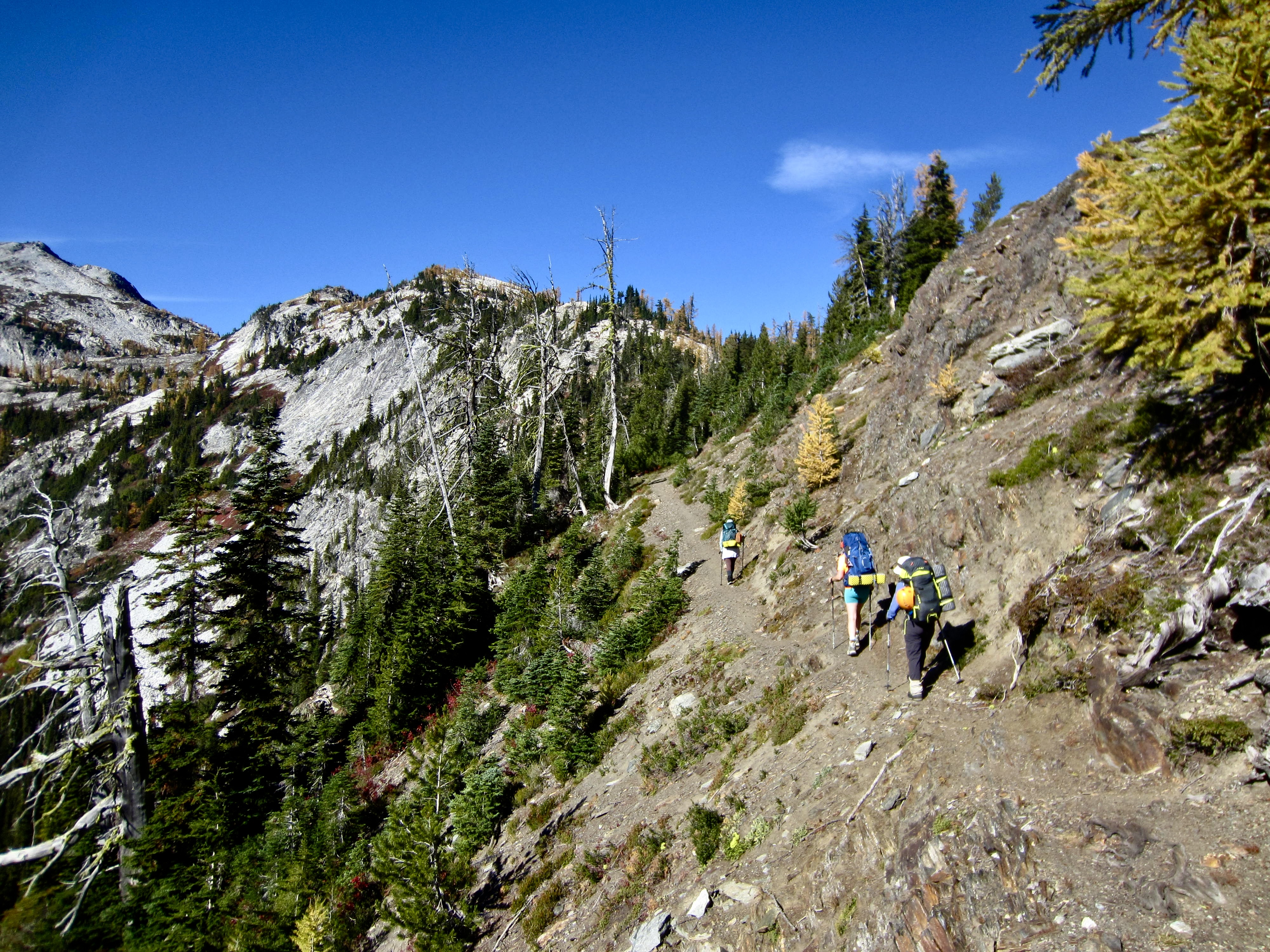
Hiking Toward Rainbow Pass On Volcanic Rock

.

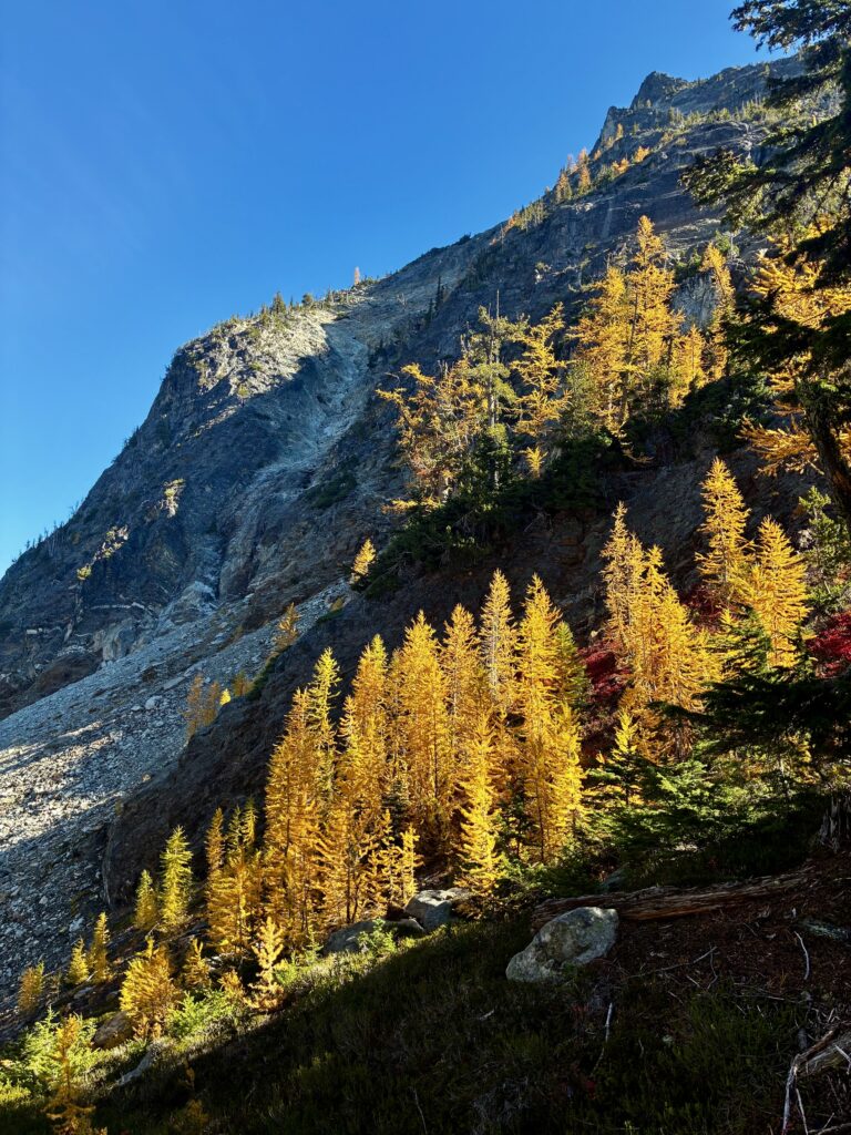
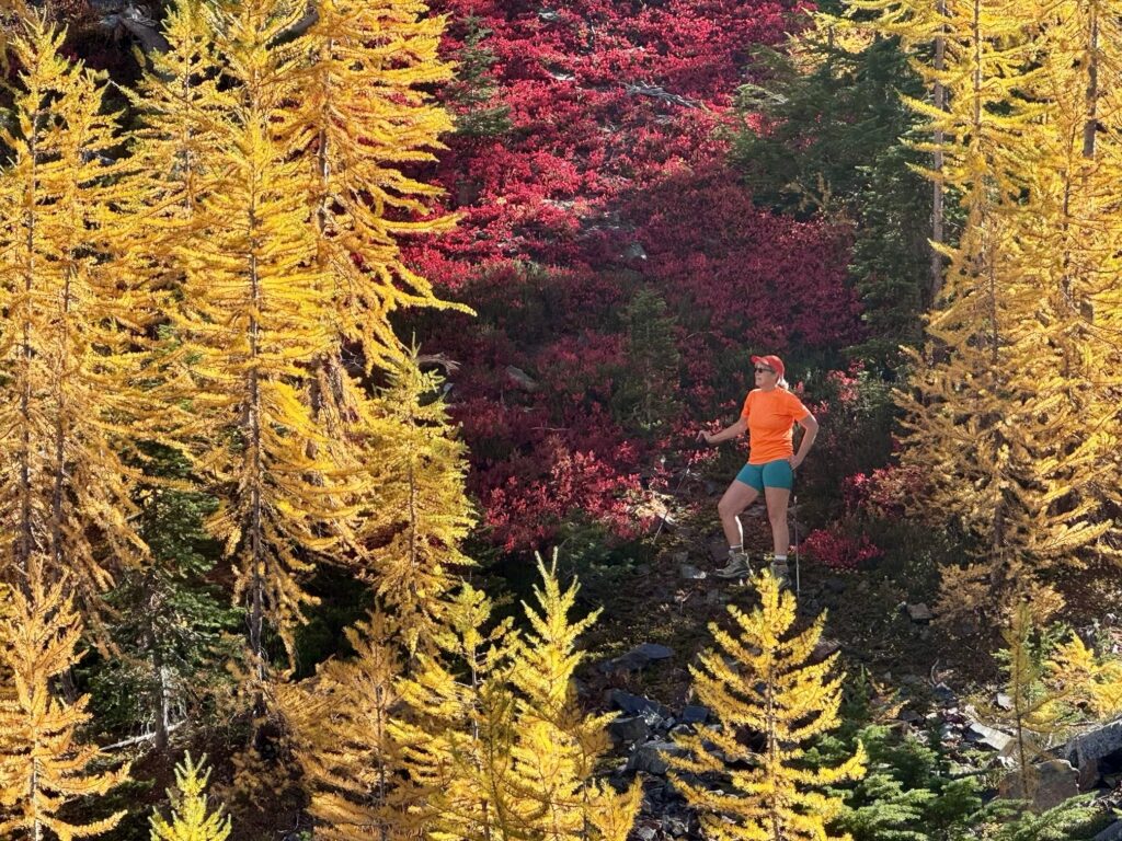
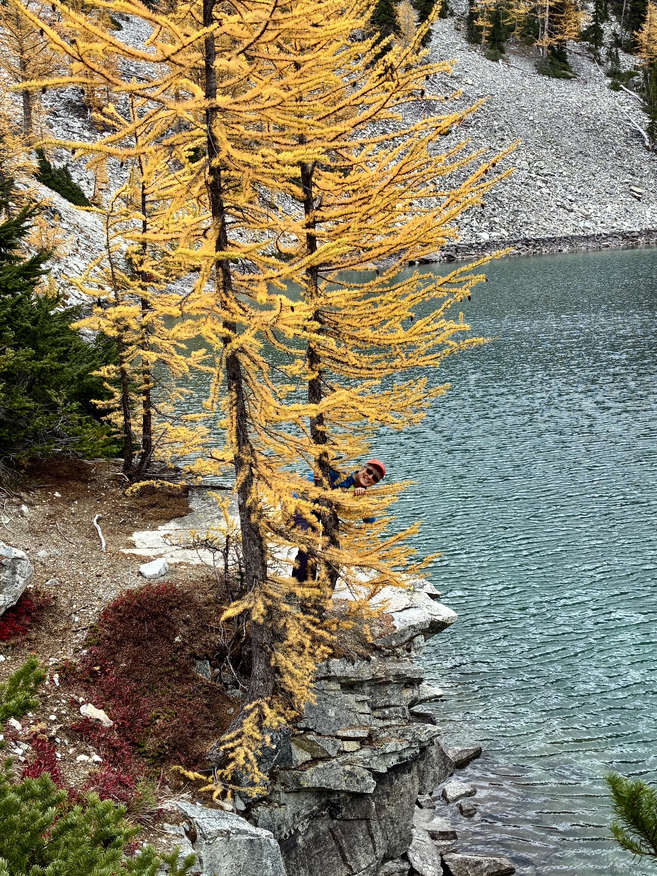
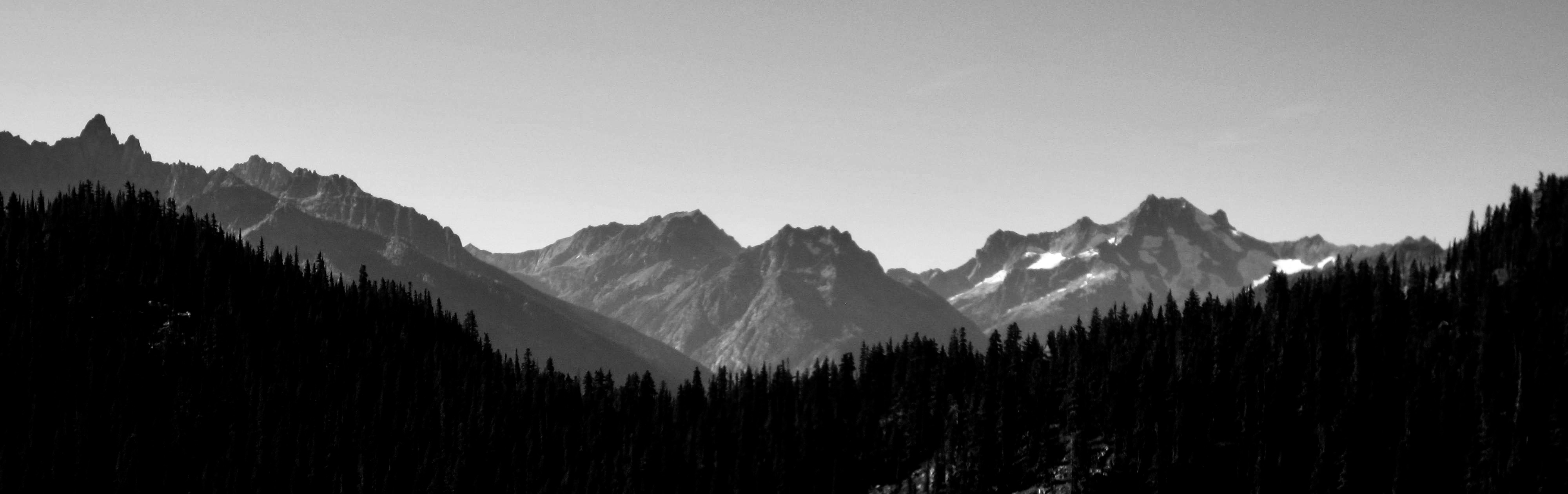
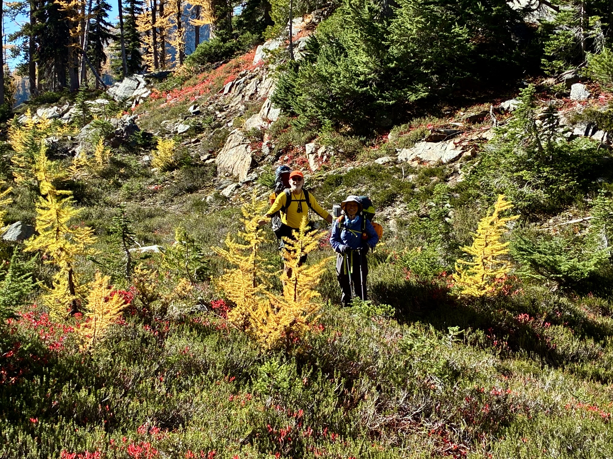
Upon reaching 6200-foot Rainbow Pass—the high point of our entire trail loop—we were greeted with mountain views to the north and flaming larch trees in all directions. The steep cliffs of Bowen Mountain towered overhead.
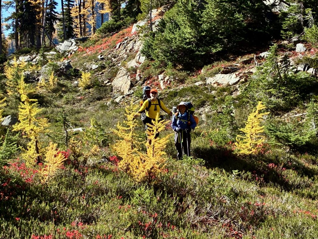
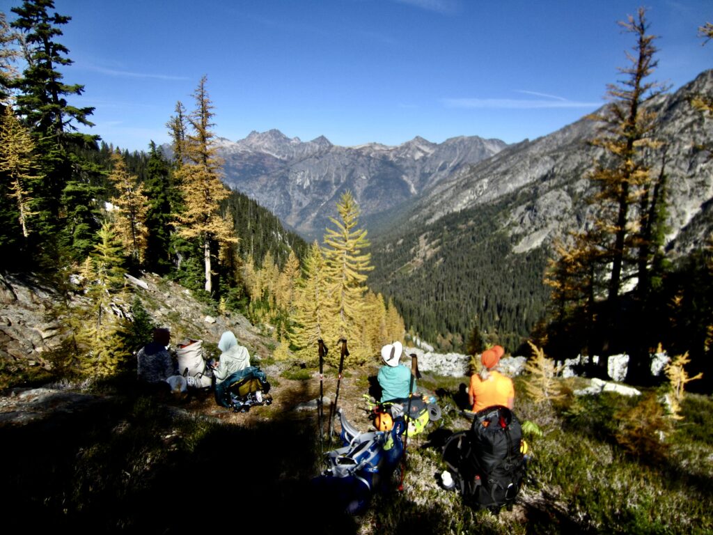
Jim & Yoko At Rainbow Pass (photo by Eileen)
Looking North From Rainbow Pass

.

Golden Larch Trees On Bowan Mtn

.

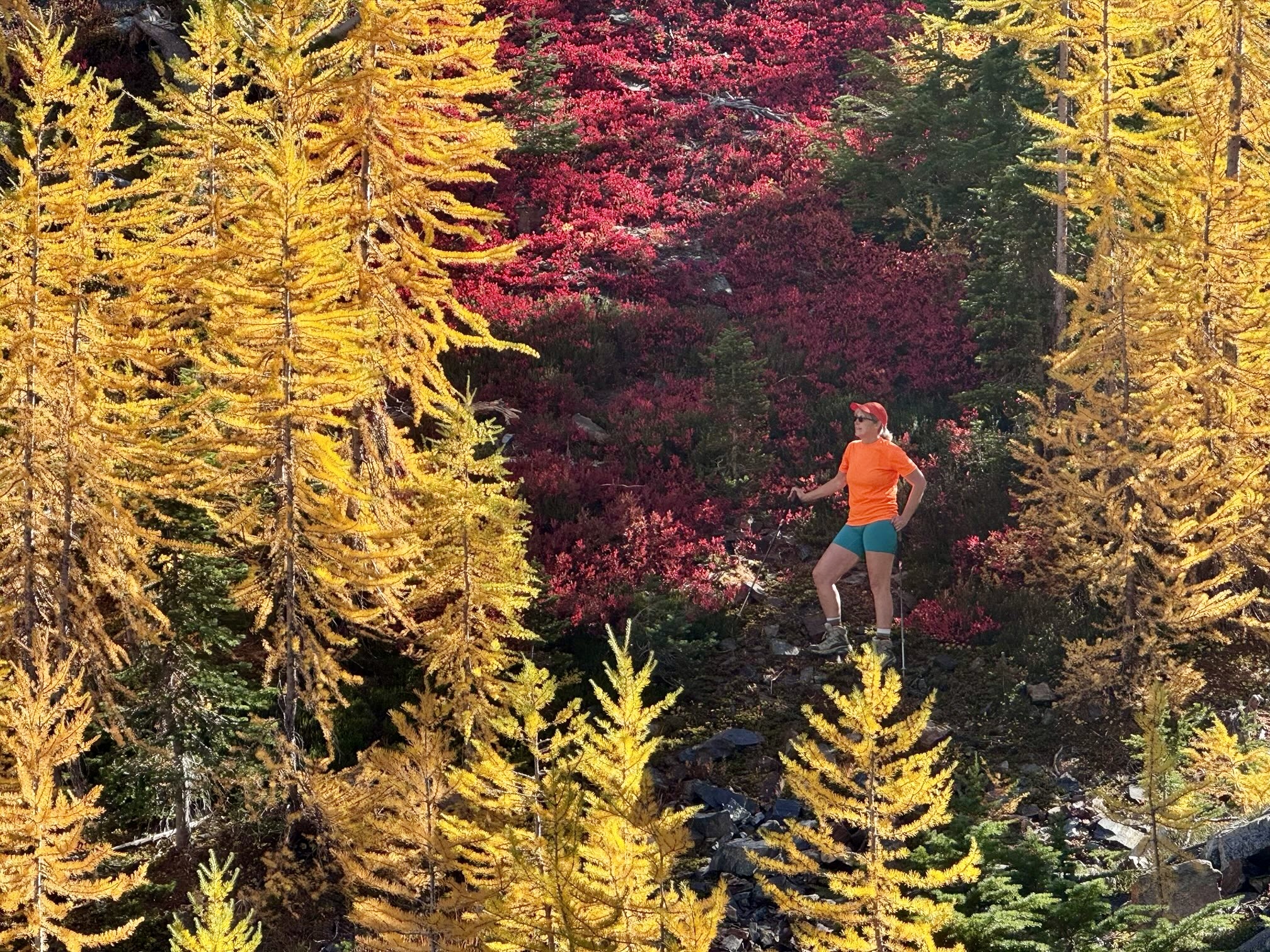
Eileen & Golden Larches At Rainbow Pass (photo by Yoko)

.

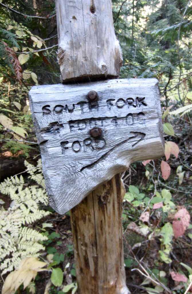
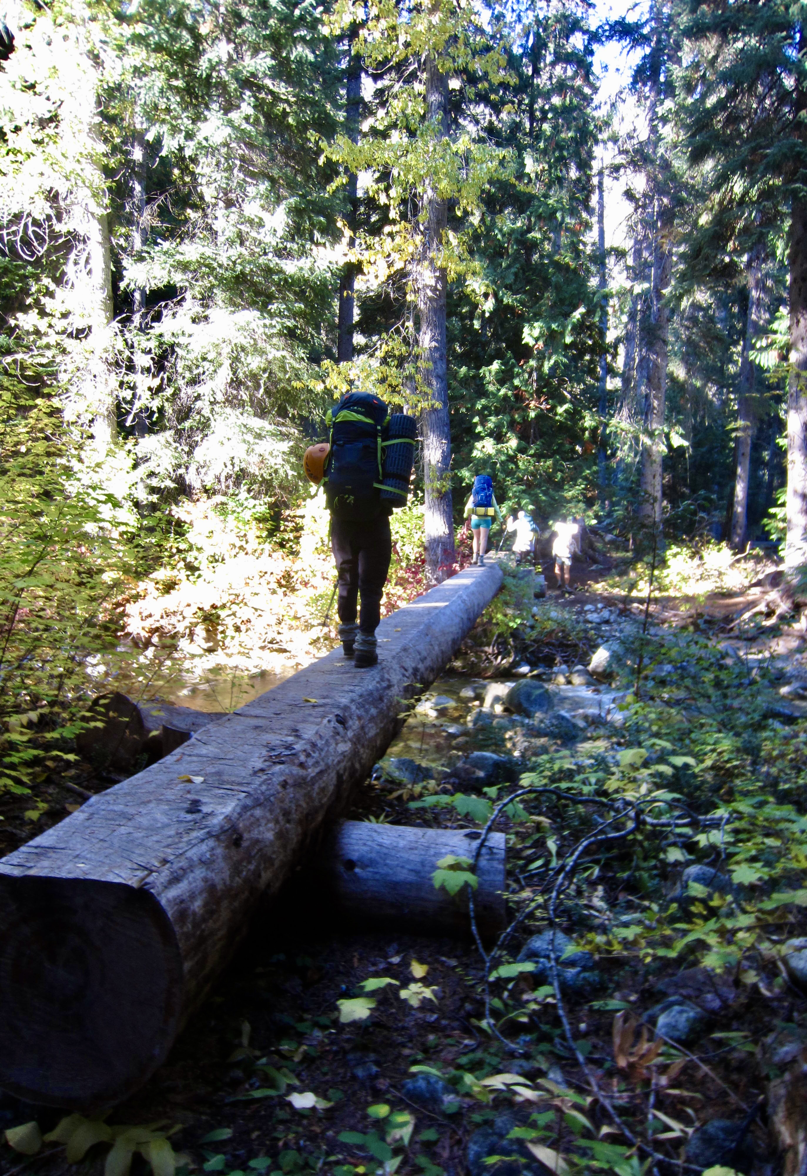
From Rainbow Pass, we made a 3000-foot descent into the South Fork Bridge Creek Valley, hiking past Dan’s Camp before crossing Bridge Creek on a footlog. This 3200-foot footlog represents the low point of the entire McAlester–Rainbow Loop. Just beyond is the large, well-appointed South Fork Camp.
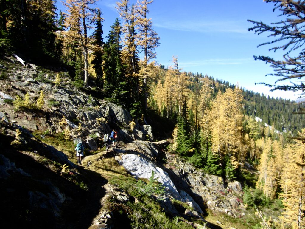
Hiking Down North Side Of Rainbow Pass

.

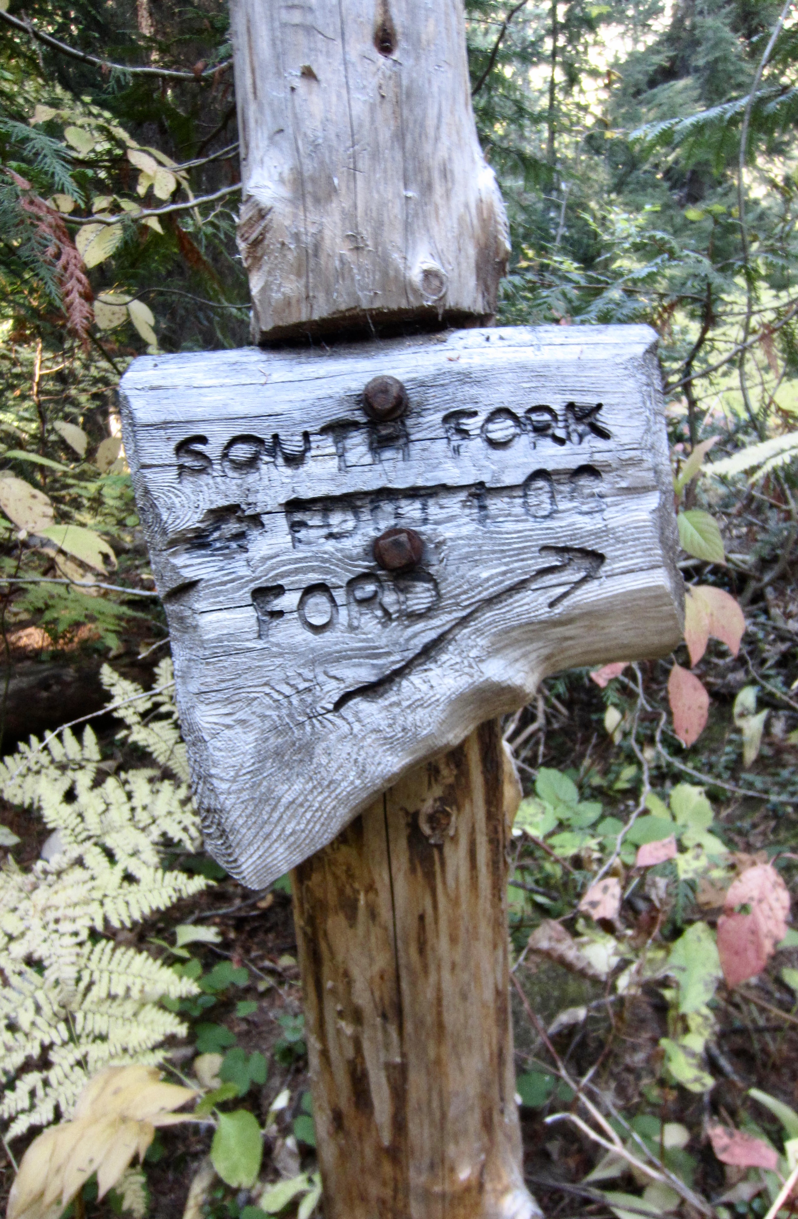
Trail Sign At South Fork Bridge Creek
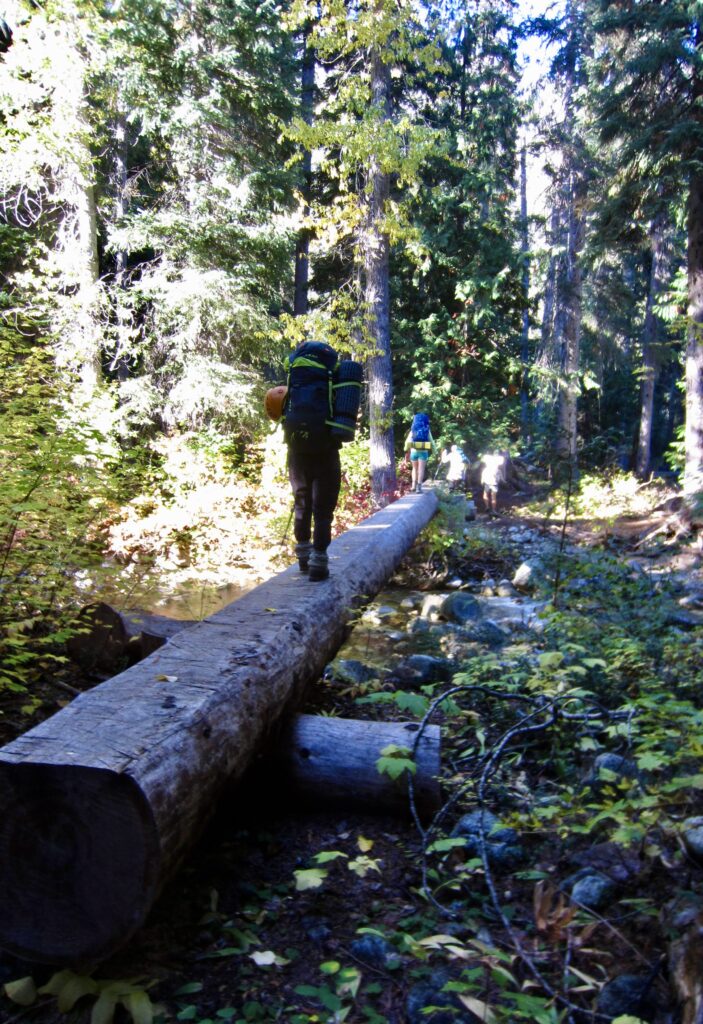
Crossing Old Footlog Over Bridge Creek

.

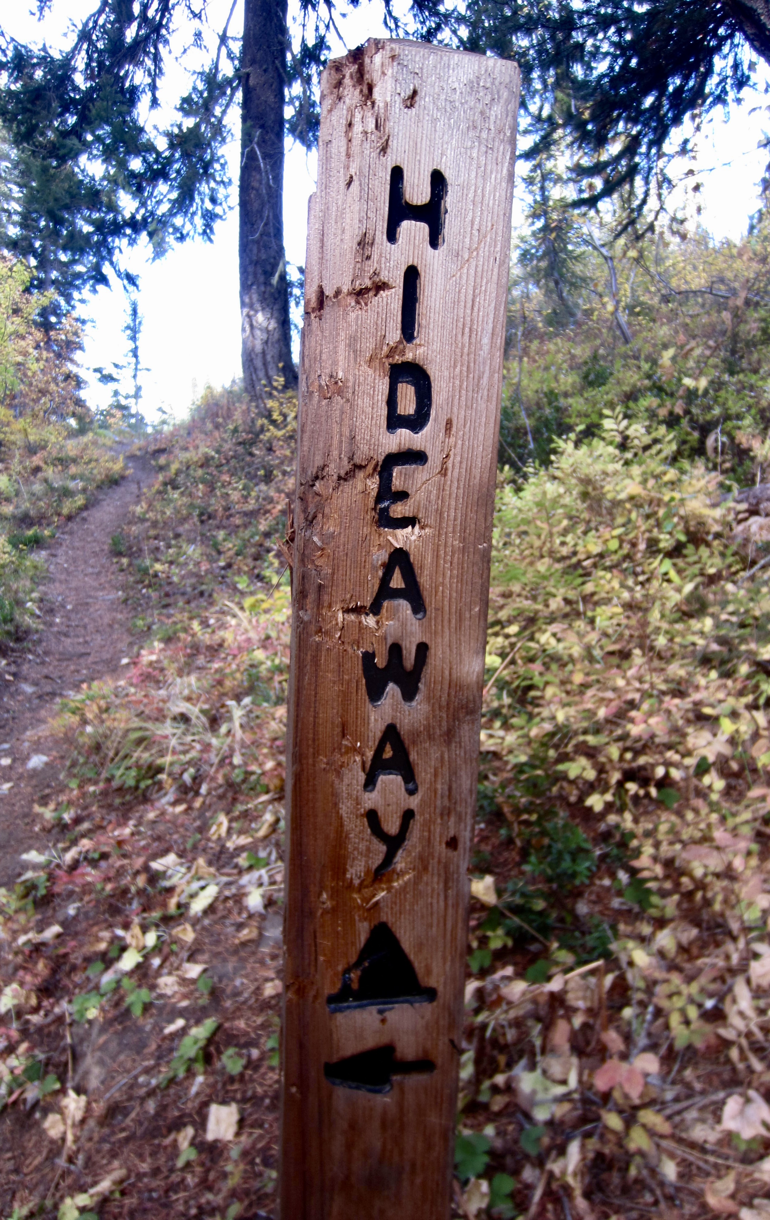
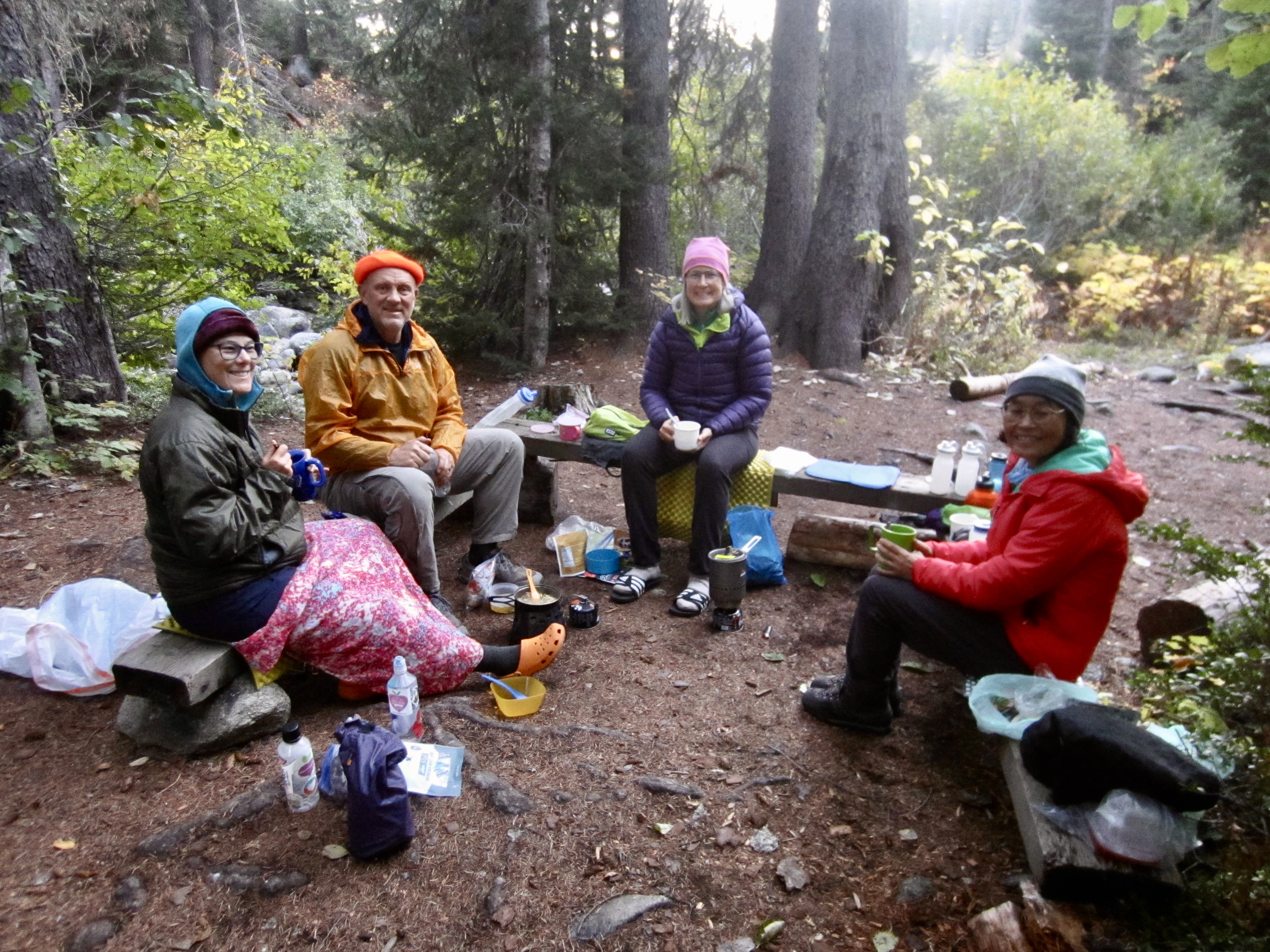
A 2-mile eastward hike on the Pacific Crest Trail brought us to Hideaway Camp in late afternoon (8.1 hours + 8.9 miles + 1650 feet – 3200 feet from Camp 2). At this small campsite, we were surrounded by vine maples, serenaded by the babbling creek, and treated to comfortable benches. It was a perfect location for our last night!
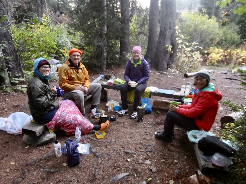
Maria & Kevin & Eileen & Yoko At Hideaway Camp

Day 5: Hideaway Camp to Trailhead

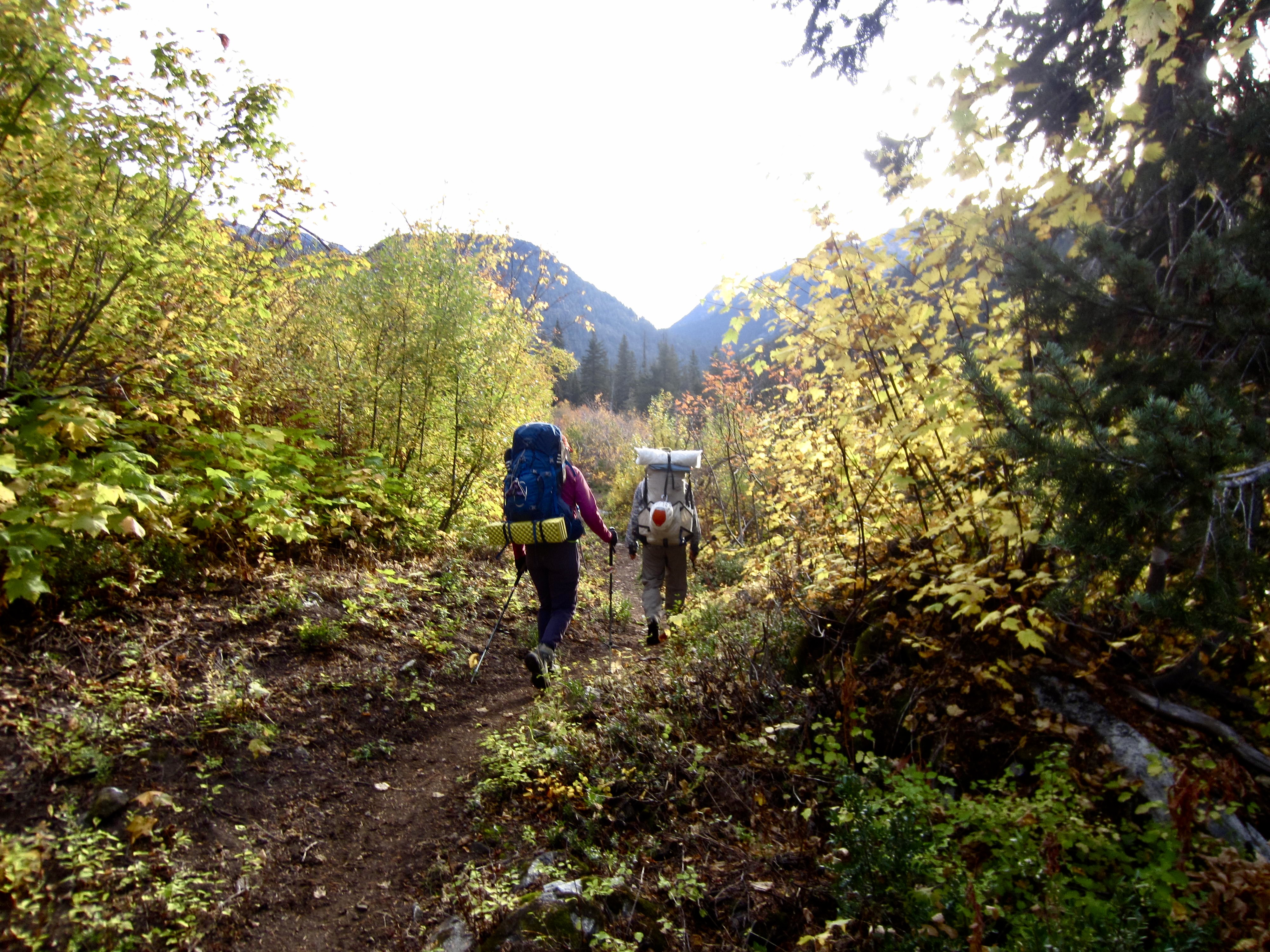
Cirrus clouds filtered the morning sun as we continued our hike up through Bridge Creek Valley on the Pacific Crest Trail. In quick succession, we passed Fireweed Junction, crossed over the park boundary, and closed our loop at the Stiletto Spur Trail junction.
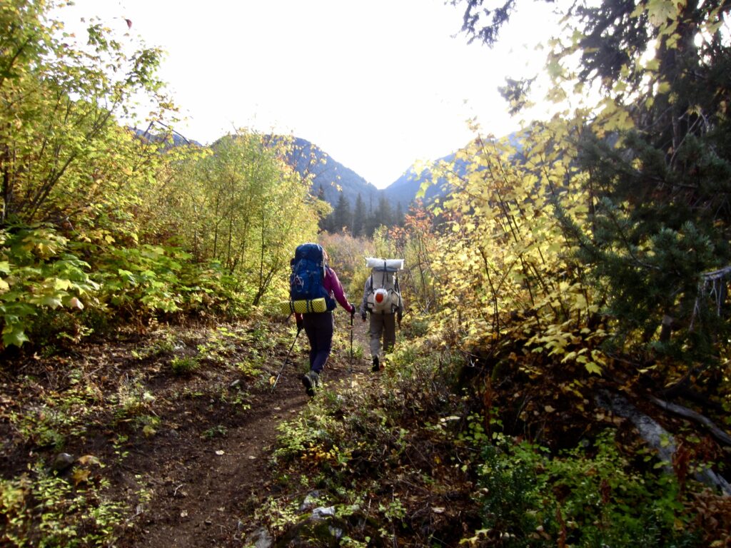
Leaving Hideaway Camp On Day 5

.

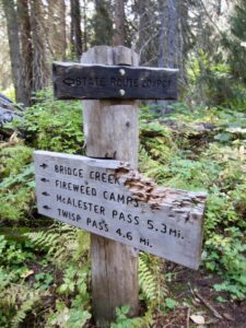
Trail Signs At Fireweed Junction Near Bridge Creek

In late morning, we arrived at the Bridge Creek Trailhead to end our trek (2.5 hours + 4.1 miles + 1150 feet from Camp 3). The McAlester–Rainbow Loop had delivered a wonderfully scenic and social Golden Larch Outing. The only sour note was the wily mice that had snuck into all of our vehicles and chewed on everything in sight!

Route Maps & Profiles
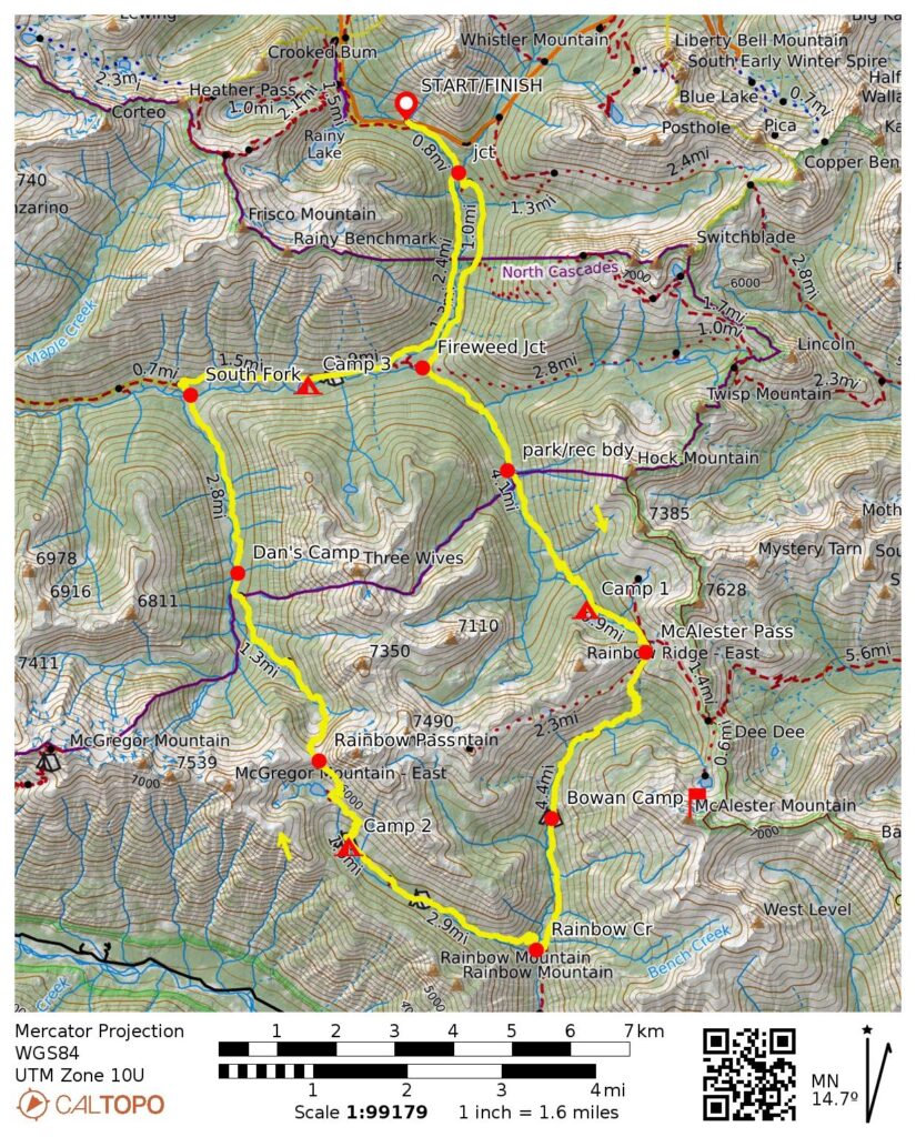
McAlester-Rainbow Loop Route Map (CalTopo)

…

McAlester-Rainbow Loop Route Profile

…

McAlester Mtn Summit Loop Route Map (CalTopo)

…

McAlester Mtn Summit Loop Route Profile

…

Photo Gallery

Click to enlarge…
Crossing New Footlog Over Bridge Creek
Many Junction Signs On Bridge Creek Trail
Rest Stop On McAlester Lake Trail
Still Water At McAlester Lake
Camp 1 At McAlester Lake Stock Camp
Hiking To McAlester Pass On Day 2
McAlester Mtn Above McAlester Park
McAlester Mtn Above Lower Dee Dee Lake
Green & Gold At Lower Dee Dee Lake
Skirting Around Upper Dee Dee Lake
Talus Slope Above Upper Dee Dee Lake
Looking Across Talus Bowl On McAlester Mtn
Approaching Ridge Step On McAlester Mtn
Traversing Heather Slope On McAlester Mtn
Looking Across Upper Southwest Slope Of McAlester Mtn
Traversing Upper Southwest Slope Of McAlester Mtn
Traversing Toward Summit Of McAlester Mtn
Topping Out On McAlester Mtn Summit (photo by Yoko)
Jim On McAlester Mtn Summit (photo by Yoko)
Yoko & Kevin & Jim On McAlester Mtn Summit
Dee Dee Lakes From McAlester Mtn Summit
Eileen At Upper Dee Dee Lake (photo by Maria)
Looking Southwest From McAlester Mtn Summit
Looking West From McAlester Mtn Summit
Descending Southwest Slope Of McAlester Mtn
Descending Larch Grove On McAlester Mtn
Lake 6230 On McAlester Mtn
Descending Grassy Rib On McAlester Mtn
Hiking Thru Jackstraw Trees Below McAlester Mtn
Rest Stop At McAlester Pass On Day 3
McAlester Pass Trail Signpost
Hiking Thru McAlester Park
Shallow Pond In McAlester Park
Hiking Across Cliff On Rainbow Creek Trail
Crossing Suspension Bridge Over Rainbow Creek
Hiking Into Rainbow Meadows
Group At Rainbow Meadows Camp (photo by Yoko)
Tupshin Peak & Bonanza Peak From Near Rainbow Lake
Eileen At Rainbow Lake
Autumnal Meadow Near Rainbow Lake
East McGregor Peak Above Rainbow Lake
Hiking Toward Rainbow Pass On Volcanic Rock
Jim & Yoko At Rainbow Pass (photo by Eileen)
Looking North From Rainbow Pass
Golden larches below Bowan Mtn at Rainbow Pass during Rainbow-Bridge Loop
Golden Larch Trees On Bowan Mtn
Eileen & Golden Larches At Rainbow Pass (photo by Yoko)
Hiking Down North Side Of Rainbow Pass
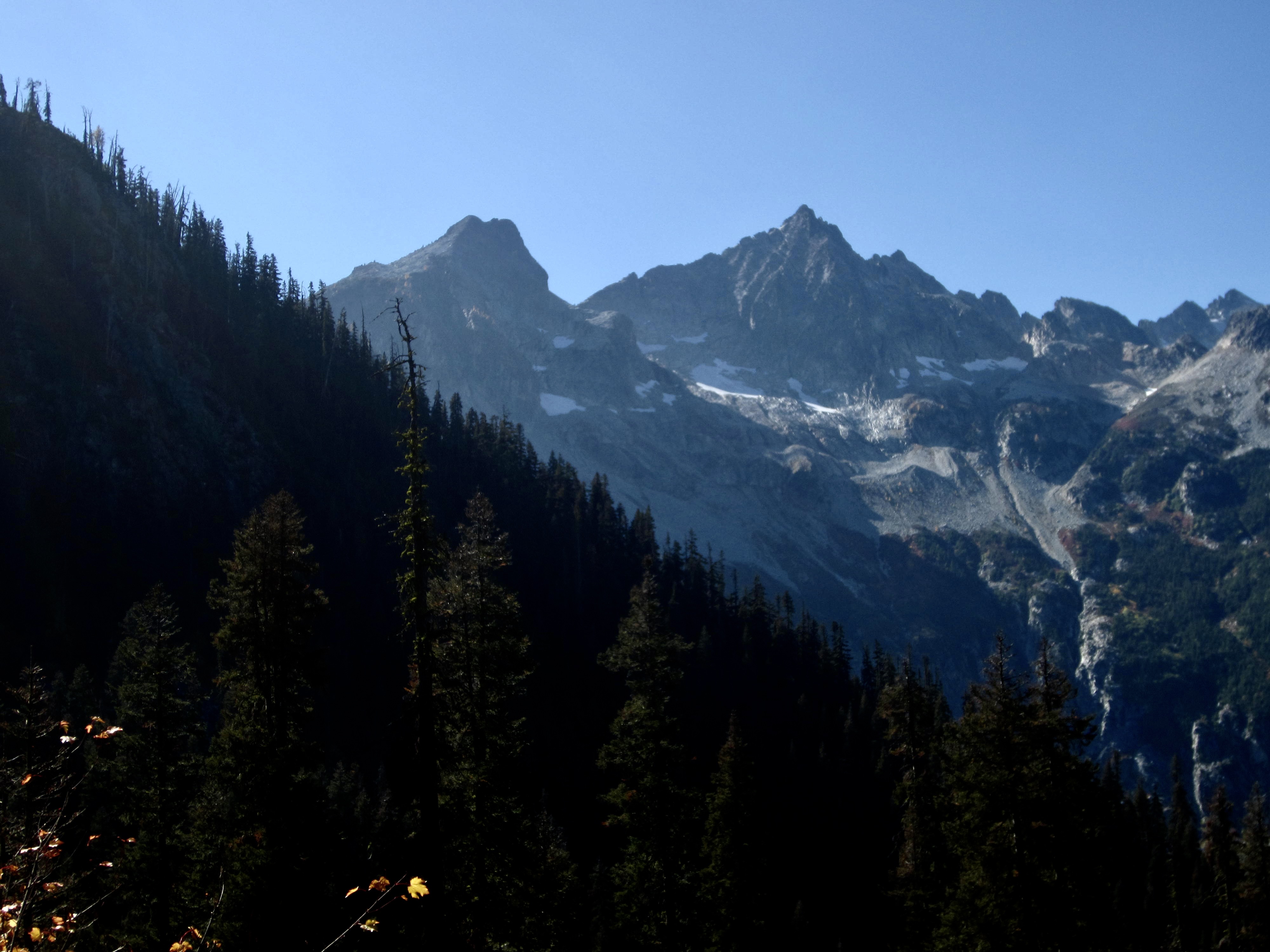
McGregor Mtn From Rainbow Pass Trail
Trail Sign At South Fork Bridge Creek
Crossing Old Footlog Over Bridge Creek
Hideaway Camp Signpost On Bridge Creek Trail
Maria & Kevin & Eileen & Yoko At Hideaway Camp
Leaving Hideaway Camp On Day 5
Trail Signs At Fireweed Junction Near Bridge Creek
Eileen & Yoko & Maria & Jim & Kevin At Bridge Creek
Previous ArticleHoodoo Pass Loop via Horsehead Pass—Libby-Crater Saddle + Mt Bigelow + Crater Peak (Sawtooth Mountains, WA)
No Newer Articles
Jim Brisbine

Jim Brisbine has been climbing Washington peaks for over 50 years, while documenting hundreds of summits and thousands of trail miles in words and pictures. As the creator of "Major Peaks of the Cascades and Olympics --- Fraser/Nicola River to Columbia River," he is an avid outdoorsman and lifelong trailcat who spends his time prowling around the Pacific Northwest and beyond.

Meet TrailCatJim

Jim Brisbine has been climbing Washington peaks for 50+ years, documenting hundreds of summits and thousands of trail miles in words and pictures. As the author of "Major Peaks of the Cascades and Olympics --- Fraser/Nicola River to Columbia River," he is an avid outdoorsman and lifelong trailcat who spends his time prowling around the Pacific Northwest and beyond.
CONTACT TRAILCATJIM

Gear Reviews & Tips & Trips

  • Reviews of Mountain Gear
  • Trailcat Tips & Gear Modifications
  • Ski Tours: I-90 / Snoqualmie Pass
  • Snowshoe Treks: I-90 / Snoqualmie Pass
  • Backcountry Huts: What to Expect

Handy Information Links

  • Weather & Avalanche Forecasts
  • Mountain Road & Trail Reports
  • Wildfire Reports & Smoke Forecasts
  • Mountain Snowpack Depths
  • Nordic Grooming Reports

Packing Lists For Big Trips

  • Alta Via 2 & 4, Dolomites, Italy
  • “O” + “W” Circuit, Patagonia, Chile
  • HauyHuash Circuit, Peru
  • Overland Track, Tasmania
  • Three Capes Traverse, Tasmania
  • Mountaineer’s Haute Route, Switzerland
  • Walker’s Haute Route, Switzerland

Most Recent Posts

McAlester–Rainbow Loop via McAlester Pass—Rainbow Creek—Rainbow Pass—Bridge Creek + McAlester Mtn Loop (North Stehekin Mountains, WA)

Hoodoo Pass Loop via Horsehead Pass—Libby-Crater Saddle + Mt Bigelow + Crater Peak (Sawtooth Mountains, WA)

Amabilis Mtn Bike Loop via Amabilis Beacon + Amabilis Peak (Keechelus Mountains, WA)

Three Fingers Mtn: South Peak / Lookout Via Meadow Mtn—Goat Flats—Tin Can Gap—Southwest Side (West Sauk Mountains, WA)

Defiance Trail Traverse: Thompson Pass to Hemlock Pass via Mason Pass—Pratt Pass + Mt Defiance (Lower Snoqualmie Range, WA)

LaCrosse Pass Loop via Enchanted Valley—O’Neil Pass—Duckabush River—Dosewallips River—Anderson Pass (Olympic Mountains, WA)

Granite Mtn via Hyas Lake—Tuck Lake—Robin Lakes—Northwest Ridge (Upper Icicle Mountains, WA)

Glacier Basin Climbing Reconn: Monte Cristo Peak attempt + Cadet Peak attempt (Monte Cristo Mountains, WA)

Alta Via 4 Trekking Traverse: San Candido / Innichen to Cadore Valley + Torre di Toblin + Monte Paterno (Dolomite Alps, Italy)

Cima Cadin NE Attempt + Partial Merlone Via Ferrata / Klettersteig Climb (Dolomite Alps, Italy)

Monte Paterno Via Ferrata / Paternkofel Klettersteig + Camoscio–Laghi–Cengia–Lavaredo Loop (Dolomite Alps, Italy)

Torre di Toblin Via Ferrata / Toblinger Knoten Klettersteig + Sasso di Sesto / Sextner Stein (Dolomite Alps, Italy)

Argonaut Peak via South Gully—Chockstone Dihedral—Upper East Ridge + Ingalls Creek Trail Loop (Icicle Mountains, WA)

Sharkfin Tower via Boston Basin—Quien Sabe Glacier—Southwest Gully—Southeast Ridge (Thunder Mountains, WA)

Red Peak Pass Loop via Illilouette Valley—Ottoway Lakes—Red Devil Basin—Merced Canyon (Yosemite National Park, CA)

The Great Blade Explorations: Bladerunner Crag + Southern Circumnav + Great Blade Peak (Lower Grand Coulee, WA)

Juniper Peak via Juniper Canyon—Southeast Ramp—Upper East Ridge (Spring Mountains, NV)

Three-Trestle Ski Tour / Snowshoe Trek via Homestead Road—Palouse-to-Cascades Trail (Iron Horse Mountains, WA)

Chuckwalla–Pyrite Loop via Turnbuckle Trail—Chuckwalla Trail—Pyrite Trail + Pyrite Summit (White Tank Mountains, AZ)

Goat–Willow Loop via Goat Camp—Ford Canyon—Willow Canyon—Mesquite Canyon Trails (White Tank Mountains, AZ)

Non-Major Peaks and Out-of-Area Peaks

Abernathy Peak (2)Abiel Peak (1)Aiguille du Tour (Alps) (1)Alta Mtn (3)Amabilis Mtn (2)Amphitheater Mtn (1)Angels Landing (UT) (2)Apex Mtn (1)Arrowhead Mtn (2)Art's Knoll (1)Atalaya Mtn (NM) (1)Atrium Peak (1)Avalanche Peak (NZ) (1)Axis Peak (1)Bandit Peak (1)Bannock Mtn (1)Banshee Peak (3)Barn Bluff (Tasmania) (1)Barrier Peak (1)Bean Peak (1)Bear Skull Peak (1)Beauty Peak (1)Beaverhead Peak (BC) (1)Bedal Peak (1)Beta Peak (1)Big American Peak (1)Big Beaver Peak (2)Big Chief Mtn (1)Big Jim Mtn (2)Big Lou Mtn (2)Big McWaukum Peak (2)Big Snow Mtn (3)Bills Peak (1)Black Crater (OR) (1)black tower (2)Blackwall Peak (1)Bladerunner Crag (1)blizzard peak (1)Bogachiel Peak (1)Bojo Mtn (1)Bootjack Mtn (1)Boulder Butte (3)bowan mtn (2)Breccia Peak (1)Breithorn West (Alps) (1)Bridge Mtn (NV) (1)Brothers, The: no peak (1)Bryant Peak (1)Buckhorn Mtn (1)Bulls Head (1)Burroughs Mtn (1)Camelback Mtn (AZ) (1)Camp Robber Peak (1)Cape Horn (Chiwaukum) (2)Capitol Butte (AZ) (1)Carne Mtn (3)Castle, The (Tatoosh) (1)Catt Peak (1)Cerro Grande (NM) (1)Challenger 2 Pinnacle (1)Challenger west peak (1)Charleston Peak (NV) (1)Cheops Peak (1)Chilly Peak (1)Chimney Rock: so peak (1)Chinook Peak (1)Choral Peak (1)Chumstick Snag (1)Church Mtn (1)Circle Peak (1)Clouds Rest (CA) (1)Coleman Pinnacle (2)Colquhoun Peak (1)Conical Hill (NZ) (1)Cooney/Switchback Peak (2)Cornice Peak (1)Cougar Mtn (Issy) (1)Courtney Peak (3)Cowlitz Middle Chimney (2)Cowlitz Rocks (2)Cradle Mtn (Tasmania) (1)Crater Peak (1)Crescent Tower (Bugaboo) (1)Cusick Mtn (OR) (1)Daemon Peak (1)Davis Peak (Waptus) (1)Deadhorse Peak (2)Deadwood Peak (1)Denny Mtn (1)Desolation Peak (2)Devils Dome (Skagit) (2)Devils Head (Tean) (1)Devils Peak (Sauk) (1)Devils Smoke Stack (2)Dewey Peak (2)Dirtyface Mtn: NW Peak (1)Dirtyface Mtn: SE Peak (1)Dot Mtn (1)Dungeon Peak (2)Dysprosium Peak (2)Eagle Cap (OR) (1)easy peak (Picket) (3)Echo Rock (Rainier) (1)Elephant Butte (1)Elizabeth Peak (1)Escondido Point (1)Excelsior Point (1)Ferry Peak (Sawtooth) (1)Fifes Peaks (1)Fifth of July Mtn (1)Finney Peak (Sawtooth) (1)Fisher Peak (2)Fortune Mtn (Beckler) (1)Fortune/Headlight Peak (1)Freedom Peak (1)Freezer Peak (2)French Cabin Mtn (1)Frigid Mtn (1)Frisco Mtn (1)Goat Island Mtn (1)Goat Mtn: East Peak (1)Goat Mtn: West Peak (1)Gopher Mountain (1)Gothic Peak (2)Governors Peak (1)Graham Mtn (1)Grand Teton (WY) (1)Granite Mtn (Icicle) (2)Granite Mtn Main (Snoq) (1)Granite Mtn West (Snoq) (2)Gray Peak (1)Graybeard Peak (1)Great Blade Peak (1)Green Mtn (Suiattle) (1)Greyhorn Peak (1)Griffith Peak (NV) (1)Grindstone Mtn (2)Gunn Point (2)Gunnshy Peak (1)hahlakl peak (2)Half Dome (CA) (1)Harding Mtn (1)Hawkins Mtn (3)Hessong Rock (1)Hi-Jack Peak (1)Hidden Lake Peak (1)High Esmerelda Peak (1)High Rock (Nisq) (1)Highchair Mtn (1)Hoch Joch Spitz (1)Horsethief Peak (1)Huckleberry Mtn (Snoq) (1)Huckleberry Mtn (Suiattle) (1)Hurricane Peak (1)hurry-up peak (1)Icebox Peak (1)Icicle Peak (7)Icy SE Peak (1)Ida/Rover Peak (1)Indian Head Peak (1)Ingalls East Peak (2)Ingalls South Peak (2)Iron Cap Mtn (1)Ironview Peak (AZ) (1)Isolation Peak (1)Jackaroo Peak (1)Jim Hill Mtn (3)Jolly Mtn (1)jumbo mtn (1)Juniper Peak (NV) (1)kangaroo temple (1)Keechelus Peak (1)Kendall Peak (2)Kitling Peak (1)Knight Peak (1)Kololo Peak (2)Labyrinth Mtn (3)ladies peak (1)Lake Peak (NM) (1)Lakeview Mtn (1)leconte mtn (1)Lemah Thumb (1)Lembert Dome (CA) (1)Libby Mtn (1)Liberty Cap (Chiwawa) (2)Lichtenberg Mtn (3)Little Giant Peak (1)Longs Peak (1)Lookout Mtn (Teebone) (1)Louis Peak (1)Lundin Peak (2)Lynch Peak (1)Magenta Peak (1)Magic Mtn (1)Malachite Peak (1)Marmolata Spire (Bugaboo) (1)Marys Peak (Tean) (1)Mastodon Peak (CA) (1)Matterhorn (OR) (1)McAlester Mtn (1)McClellan Butte (1)McCue Peak (1)Merchant Peak (1)Mescalito Peak (NV) (1)Miller Peak (1)Mirror Mtn (1)Monument 83 Hill (2)Morning Star Peak (1)Mountaineer Peak (1)Mt Amos (Tasmania) (1)Mt Berge (1)Mt Catherine (1)Mt Cleator (1)Mt Conness (CA) (1)Mt Dickerman (1)Mt Ellinor (1)Mt Fernow (Beckler) (1)Mt Forgotten (1)Mt Gibbs (1)mt hood (OR) (2)mt howard (2)Mt John (NZ) (1)Mt Jonathan (1)Mt Laura (1)Mt Lena (1)Mt Margaret (1)Mt Mastiff (1)Mt McCausland (2)Mt Oberlin (MT) (1)Mt Ollivier (NZ) (1)Mt Ossa (Tasmania) (1)Mt Persis (2)Mt Pleasant (1)Mt Rolo (1)Mt Ruth (Rainier) (1)Mt Saul (1)Mt Seattle (1)Mt Sinclair (NZ) (1)Mt Skokomish (1)Mt St Piran (AB) (1)Mt Suappoa (AZ) (1)Mt Teneriffe (1)Mt Torment (1)Mt Watson (1)Mt Whitney (CA) (1)Mt Wilson (NV) (1)mt wintrop (1)Napeequa Mtn (1)Navaho Peak (1)Navarre North Peak (1)Navarre South Peak (1)Nimbus Peak (1)Nordic Mtn (Selkirk) (1)Norse Peak (4)Oakes Peak (1)Old Desolate (1)old maid mtn (1)Paddy-Go-North Peak (2)Paddy-Go-South Peak (1)Paintbrush Peak (WY) (1)Painted Mtn (1)Pass Butte (Pasayten) (1)Peak Hill (NZ) (1)Pemmican Peak (1)Perfect Peak (Selkirk) (1)Picketpost Mtn (AZ) (1)Pickhandle Point (1)Pico Perico (MX) (1)Pico Silla N. (MX) (1)Pinnacle Peak (Tatoosh) (1)Pirate Little Peak (1)Plummer Mtn (Suiattle) (1)Plummer Peak (Tatoosh) (1)Poe Mtn (1)Portal Peak (1)Portal Peaks (Baker) (1)Pratt Mtn (2)Purple Peak (1)Pyramid Mtn (Chelan) (3)Pyramid Peak (Greenwater) (2)Quiniscoe Mtn (1)Ragged Peak (1)Rainbow Peak (1)Rainy Peak (1)Rampart Mtn (Entiat) (1)Rampart Peak (Keechelus) (2)Rattlesnake Mtn (Issy) (3)Red Mtn (Kachess) (3)Red Mtn (Ragged) (1)Red Mtn (Snoq) (1)Red Top Mtn (2)Rennie Peak (1)Revolution Peak (1)Rhino Butte (1)rock mtn (Nason) (9)Rooster Finch Tower (1)Round Mtn (Nason) (1)Round Mtn (Stilly) (1)royal peak (2)ruby mtn (1)Ruth Mtn (Nooksack) (2)Ryan Mtn (CA) (1)Salvation Peak (1)Sauk Mtn (2)Seymour Peak (1)Sherpani Peak (1)Siligo Peak (CA) (1)Silver King Peak (1)Silver Peak (Snoq) (3)Silvertip Peak (Monte Cristo) (1)Sitting Bull Mtn (1)Skykomish Peak (1)Skyscraper Mtn (1)Sluiskin Mtn: The Squaw (1)Snoqualmie Mtn (2)Snoqualmie Tooth (2)Sobieski Mtn (1)Sourdough Mtn (1)spectacle north butte (1)Sperry Peak (1)Squak Mtn (Issy) (1)Squaretop Mtn (1)St'auk Mtn (1)Steamboat Rock (1)Stetattle Buttes (1)Stillaguamish Peak (1)Stone City Mtn (2)Stormy Mtn (2)Stroud Peak (WY) (1)Sulphur Mtn (1)Sun Top (2)Superstition Peak (AZ) (2)Tailgunner Peak (2)Tamanos Mtn (1)Teanaway Butte (1)thea foss peak (1)Thompson Point (2)Thor Peak (1)Thornton Peak (1)Thorp Mtn (1)Three Brothers Mtn (2)Three Queens: middle peak (1)Three Queens: west peak (1)Thunder Mtn (Icicle) (1)Tiffany Mtn (1)Tiger Mtn East (1)Tinkham Peak (1)Tolmie Peak (1)Tourmaline Peak (1)Trappers Peak (Skagit) (1)Trico Mtn (1)Tricouni Peak (1)Tronsen Head (7)Tumalo Mtn (OR) (1)Tumble Mtn (1)Tuolumne Peak (CA) (1)Turtlehead Peak (NV) (1)Twentymile No Peak (1)unicorn peak (1)Uno Peak (1)Verrado Peak (AZ) (1)Vesper Peak (2)Volcanic Neck (Tean) (1)Warren Peak (CA) (1)Wheeler Peak (NM) (1)white mtn (sauk) (2)White Rock Peak (NV) (1)White Rock Spring Peak (NV) (1)Whittier Peak (1)Wild Goat Peak (1)Windy Joe Mtn (2)Wing Peak (Sky) (1)Wolframite Mtn (1)Yakima Peak (1)Yellow Hill (Tean) (1)Yellow Rock (UT) (1)Zorro Point (Snoq) (1)
  • Home
  • Most Recent Posts
  • Major Peaks A-Z
  • Major Peaks Map
  • Major Peaks Synopsis
  • Hike/Climb/Ride
    • Canadian Cascades BC
    • Northwestern WA Cascades
    • Northeastern WA Cascades
    • North-Central WA Cascades
    • Central WA Cascades
    • Southern WA Cascades
    • Olympic Mountains WA
    • Columbia Plateau WA
    • Other USA & Canadian Regions
    • International (outside USA & Can)
  • Ski/Snowshoe
    • Snow Tours in British Columbia
    • Snow Tours in Northwestern WA Cascades
    • Snow Tours in Northeastern WA Cascades
    • Snow Tours in North-Central WA Cascades
    • Snow Tours in Central WA Cascades
    • Snow Tours in Southern WA Cascades
    • Snow Tours in Olympic Mountains WA
    • Snow Tours in Oregon
    • Snow Tours in Other Locations
  • Types of Trips
    • Canyoneering
    • Difficult 10 Climbs
    • Family Trips
    • Golden Larch Outings
    • Lookout Sites
    • Marathon Hikes
    • Mid-Summer Outings
    • Mtn & Gravel Biking
    • Rock & Ice Climbing
    • Summit Camps
    • Winter Summits
    • The Early Years
    • Traverses & Loops (Alpine)
    • Traverses & Loops (Ski)
    • Traverses & Loops (Trail)
    • Traverses & Loops (Classics)
      • Bacon-Hagan-Blum Trav (WA)
      • Enchantment Traverse (WA)
      • High–Giant Traverse (WA)
      • Olympus–Bailey Trav (WA)
      • Picket Traverse (WA)
      • Ptarmigan Traverse (WA)
      • Grand Canyon Raft Trav (AZ)
      • Huayhuash Circuit (Peru)
      • Inspiration–Isolation Trav (WA)
      • Overland Trav (Tasmania)
    • Via Ferratas
    • WA Blue Corn Specials
    • Winter Summits
  • Reviews / Lists / Tips
  • Mountain Goodies
  • Contact TrailCatJim
Type to search or hit ESC to close
See all results