Trip Date: April 28, 2023
2023 RED ROCK ADVENTURE VACATION
White Rock Peak Day Climb
White Rock Spring
White Rock Saddle
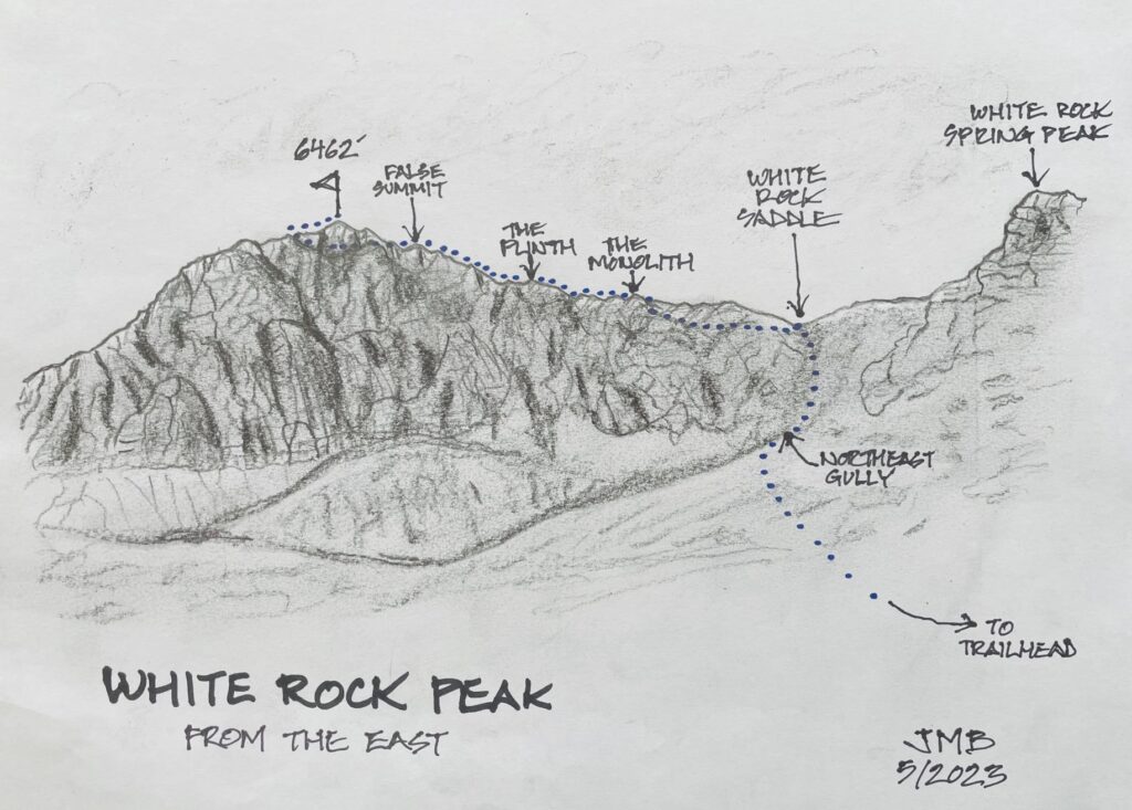
The Monolith
The Plinth
White Rock Mountain: true summit aka White Rock Peak (6462 ft)
Trip Report Summary
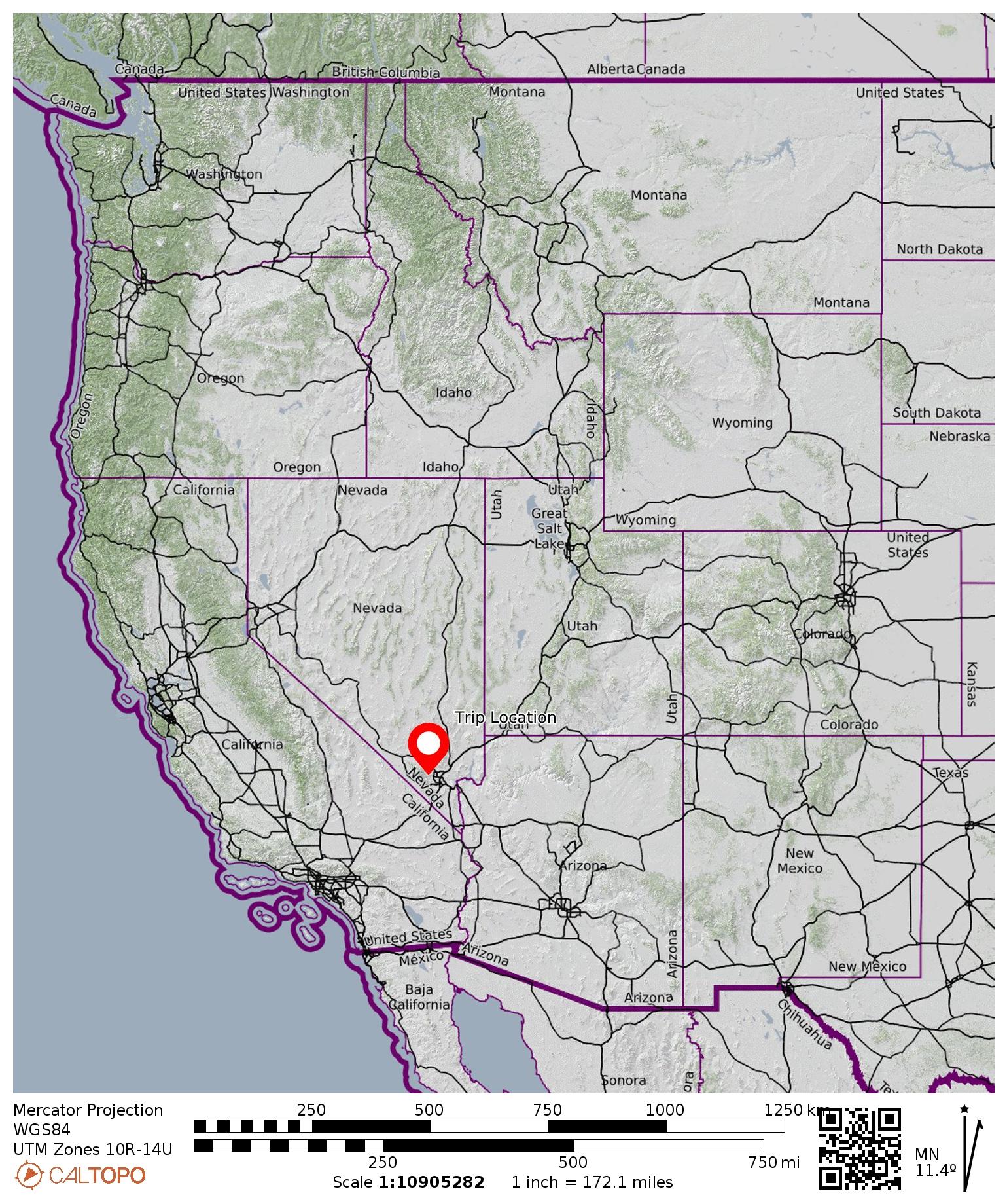
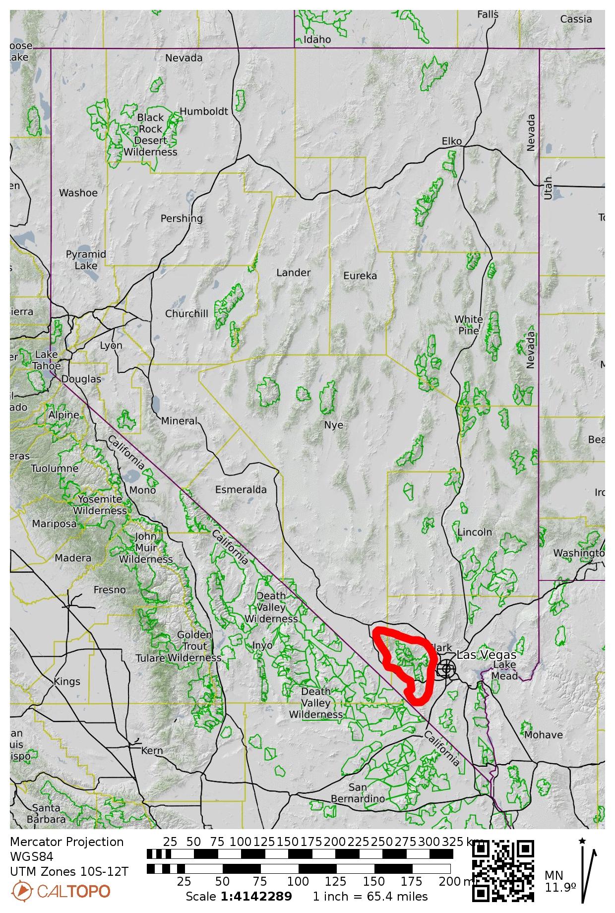
Region: Nevada
Sub-Region: Spring Mountains
Sub-Sub-Region: White Rock Hills
Areas: Red Rock Canyon National Conservation Area & La Madre Mountain Wilderness
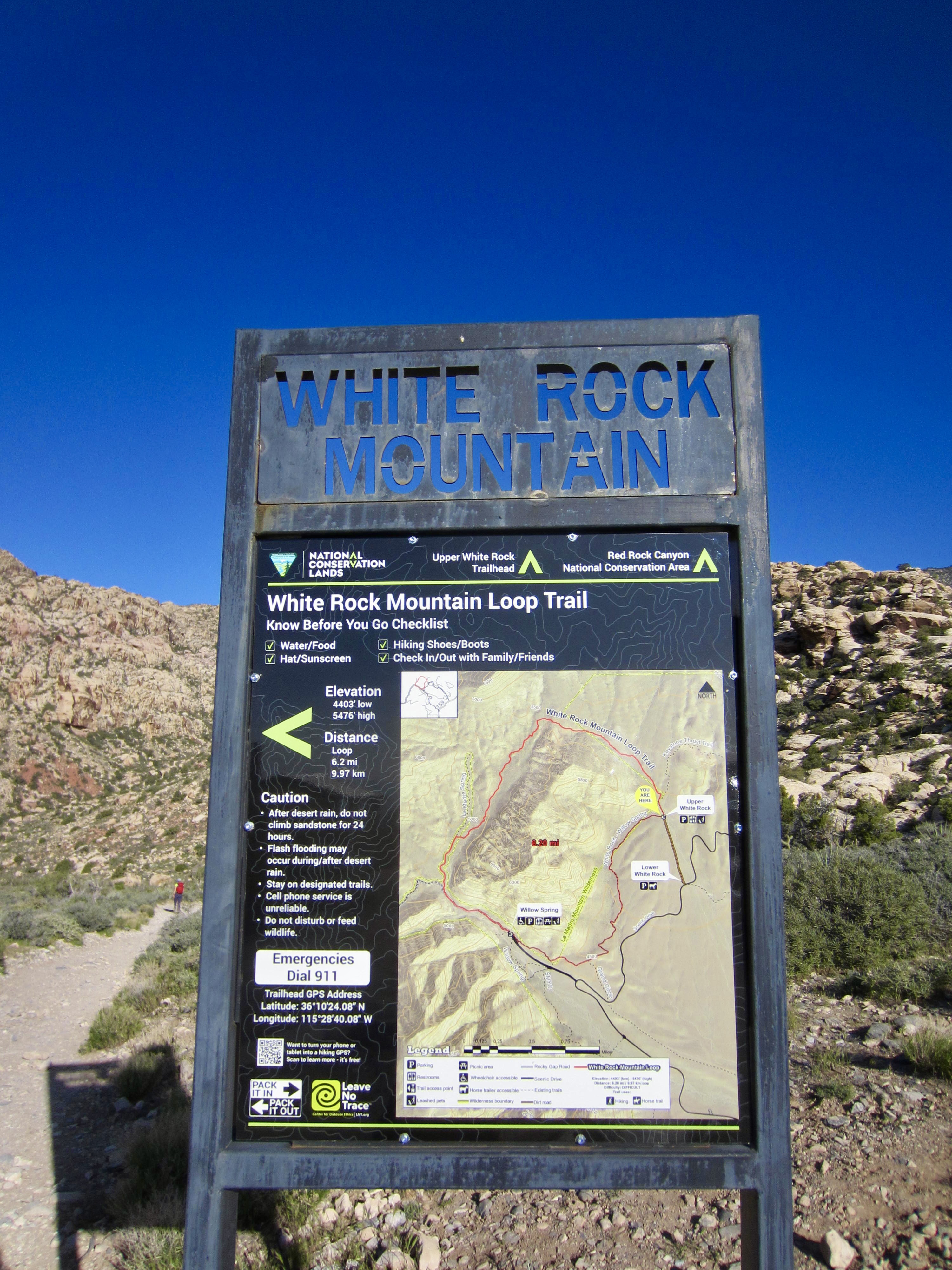
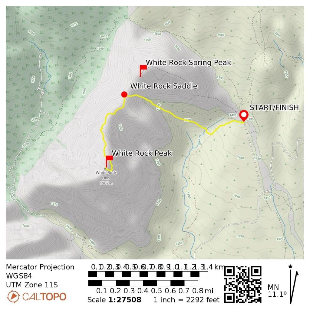
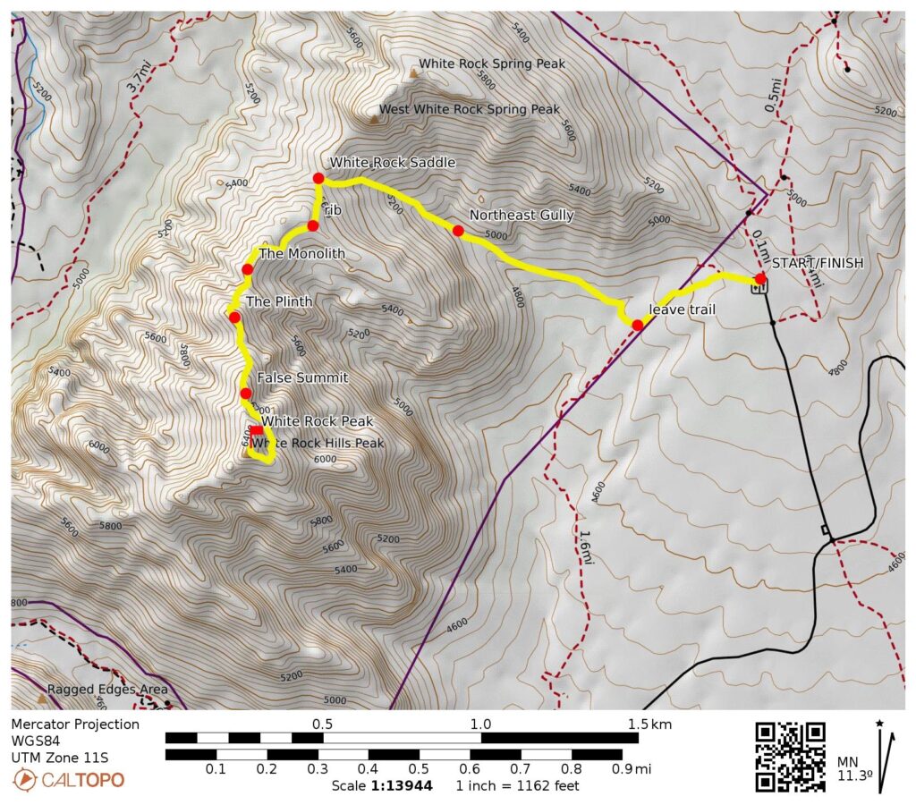
Starting & Ending Point: Upper White Rock Mountain Trailhead at end of White Rock Spring Road (Elev. 4870 feet)
Way Points: White Rock Spring wash & White Rock Saddle & The Monolith & The Plinth & false summit & White Rock Peak summit (trail hike & off-trail hike & rock scramble)
Summit: White Rock Peak (rock scramble via North Ridge—Upper Southeast Ridge)
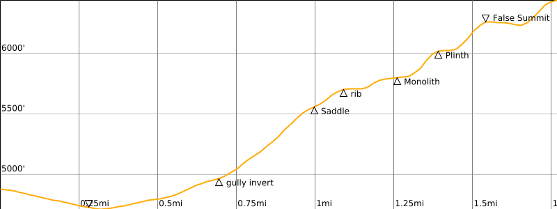
Approximate Stats: 3.6 miles traveled; 1900 feet gained & lost; 4.8 hours up; 4.2 hours down.
…
Related Post
>>> White Rock Spring Peak Summit Loop via East Ridge—West Slope—East Gully – October 24, 2022
Trip Overview
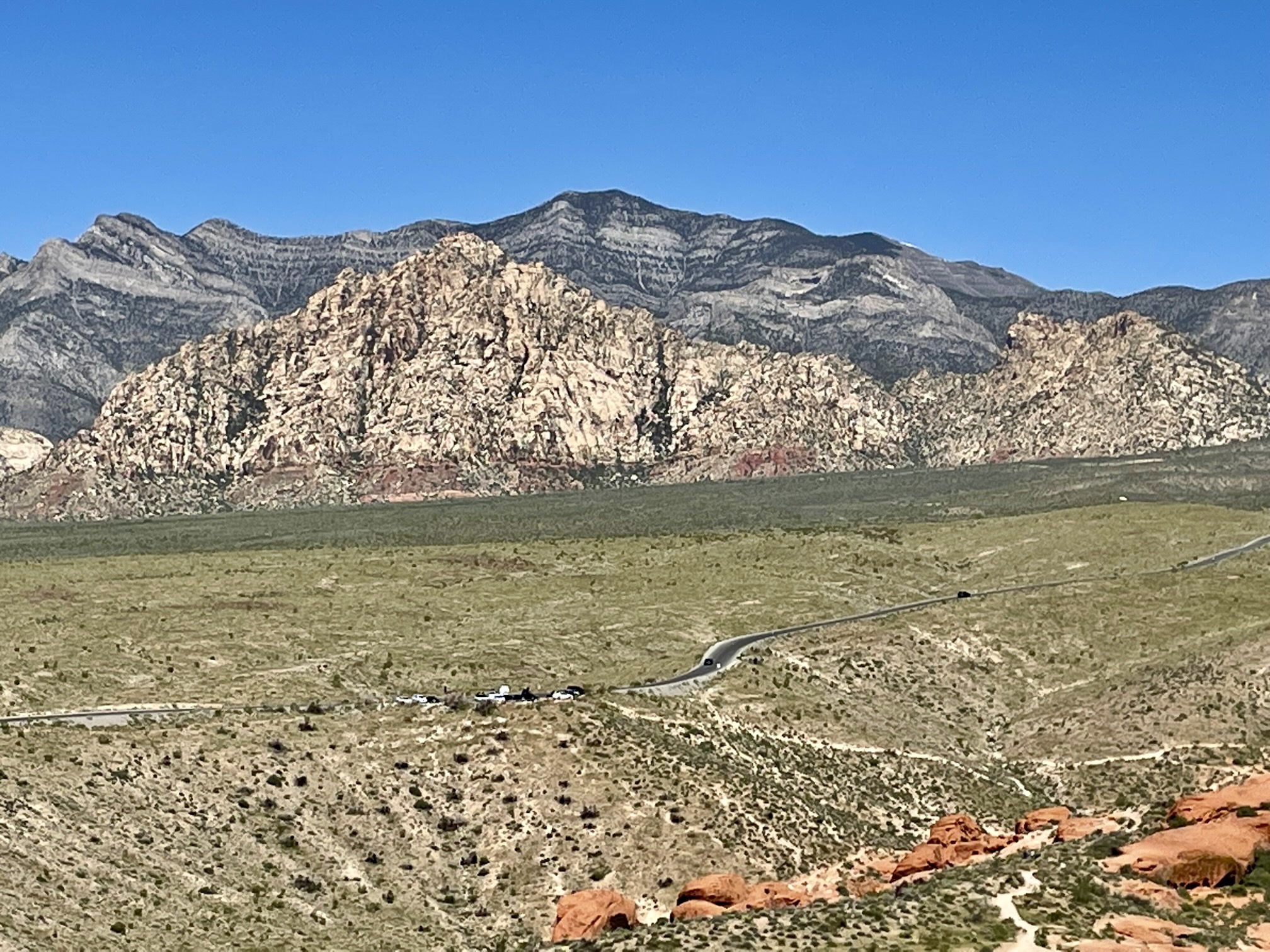
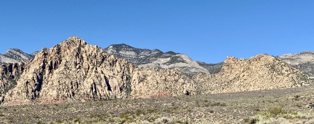
The highest point in the White Rock Hills of Red Rock Canyon National Conservation Area bears several different informal names, including White Rock Mountain, White Rock Peak, and White Rock Hills Peak. Regardless of what moniker you prefer—I like the concise name White Rock Peak—this 6462-foot summit makes a very attractive scrambling destination due to its white-colored sandstone, challenging terrain, considerable prominence, and extremely visible location at the head of Red Rock Basin. It has gained additional popularity in recent years by virtue of being on Branch Whitney’s 52 Peak Club summit list.
.
Eileen and I first attempted to climb White Rock Peak via the long north ridge route last year by going over the top of its junior sibling (White Rock Spring Peak) and then descending to White Rock Saddle, which separates the two peaks. After getting partway up the north ridge, we ran out of time and ended up descending via the big northeast gully (more of a couloir, really). For our current attempt, we elected to gain the north ridge by ascending the northeast gully directly to White Rock Saddle. Our revised strategy ultimately saved us more than an hour and spared us much unpleasantness.
Aside from the north ridge, there are several other routes up White Rock Peak. Some of these are non-technical scrambling ascents, such as the southwest slope route from Willow Springs. Others are Class 5 climbs, such as the Tunnel Vision route on the northeast face. Interestingly, on the day that Eileen and I climbed the north ridge, other parties summited via these two other routes.
Full Trip Report
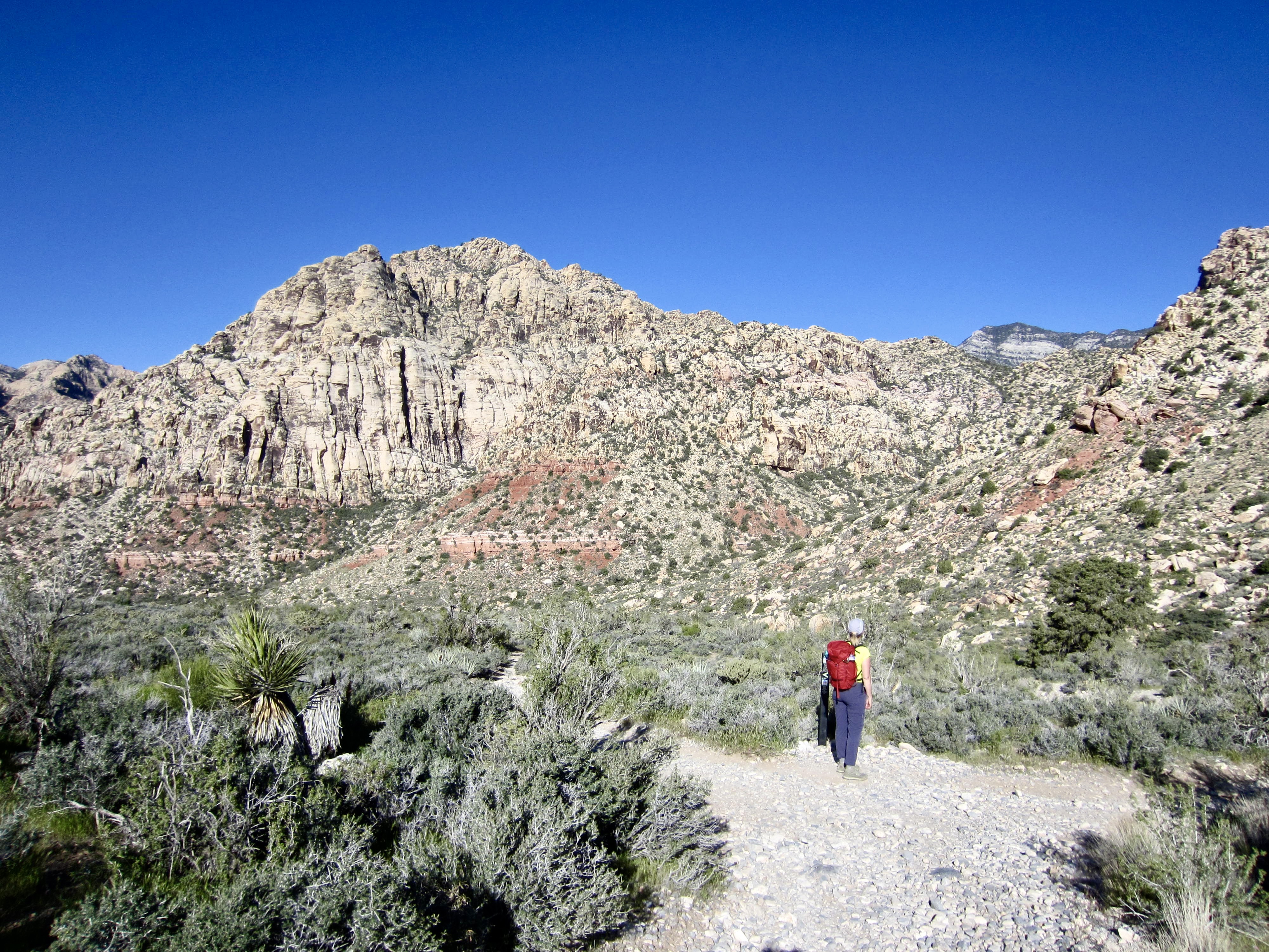
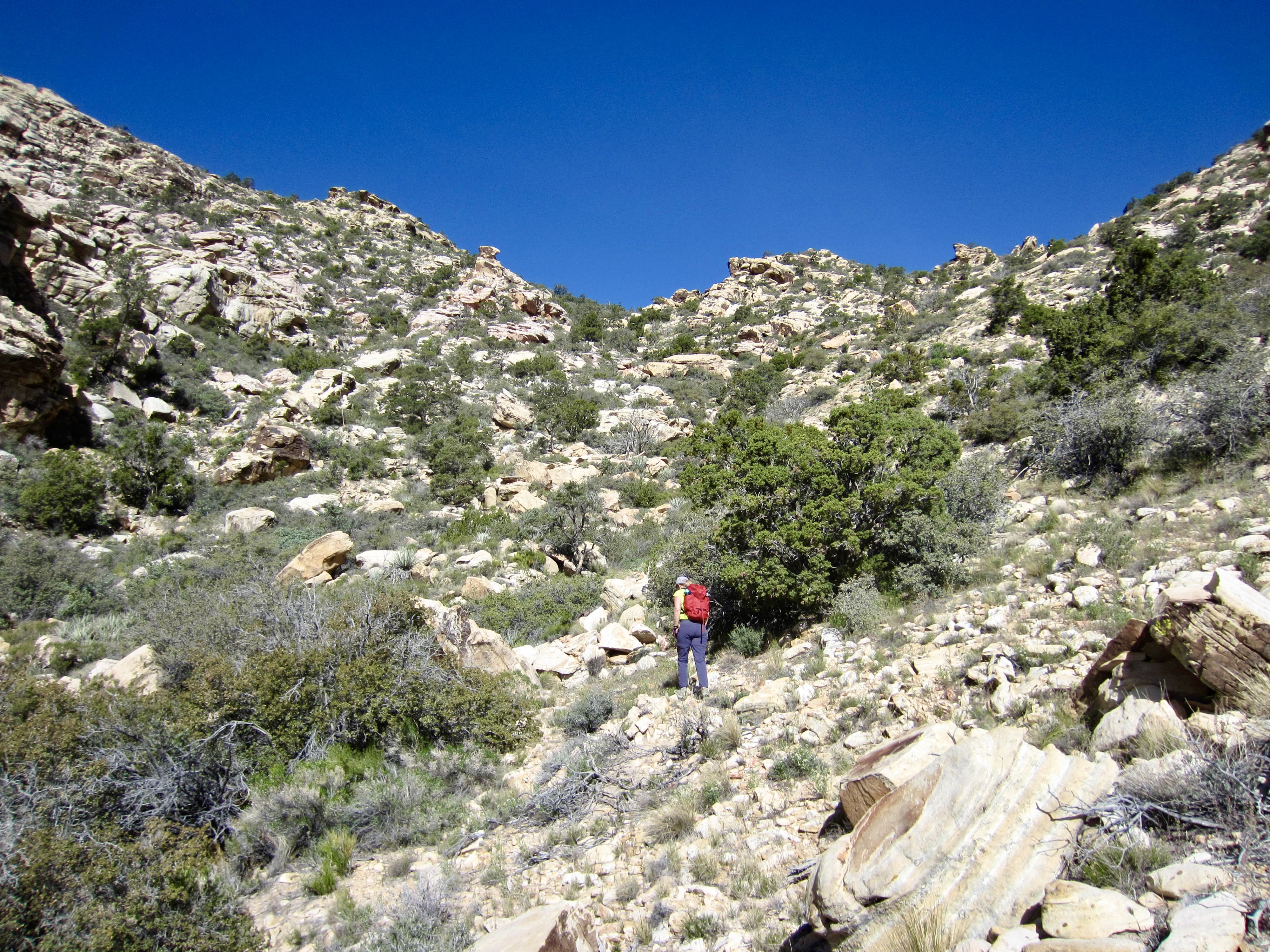
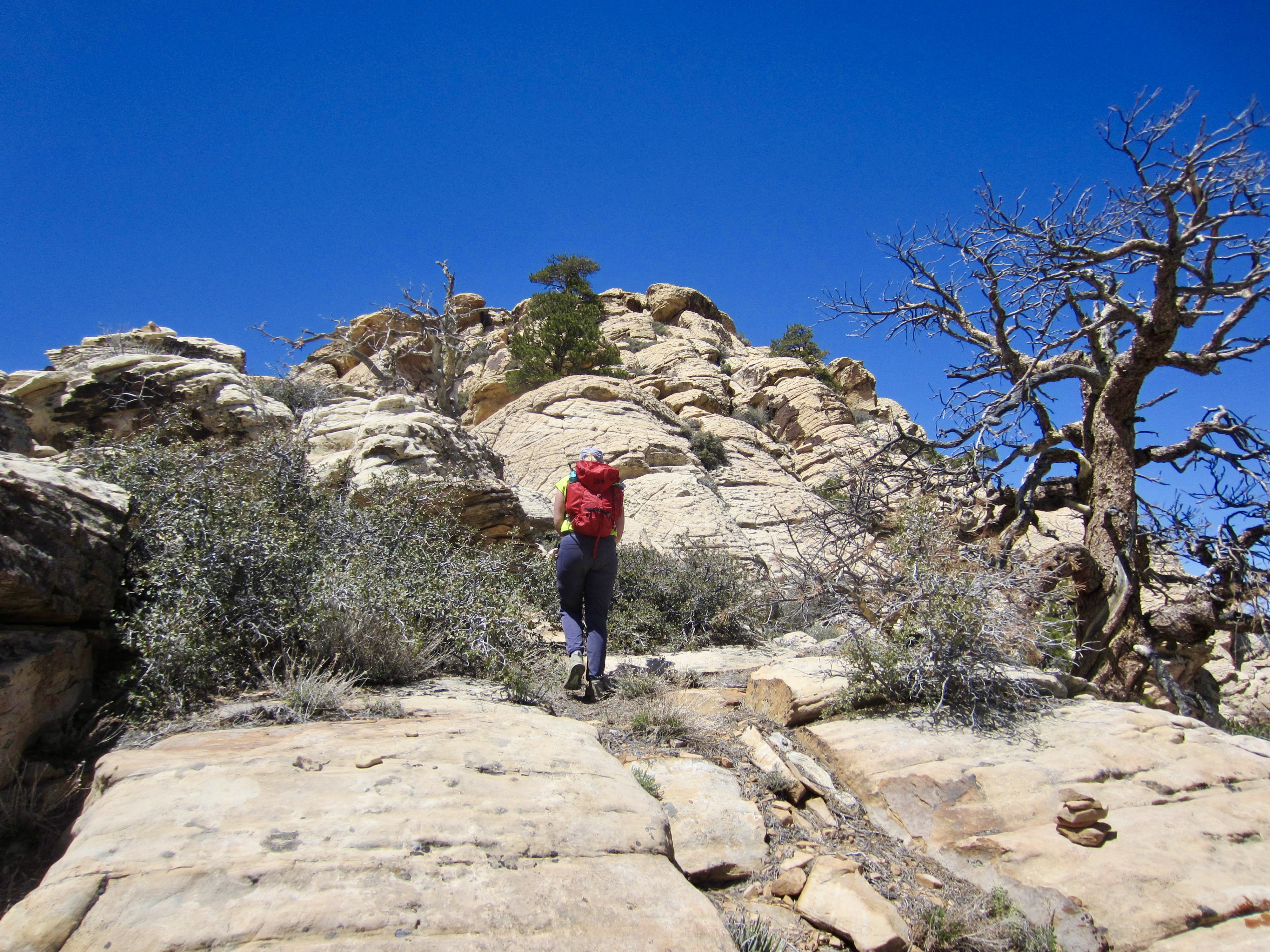
Eileen and I left the Upper White Rock Mountain Trailhead on a warm, sunny Friday morning and headed southwesterly down the trail toward Willow Spring. Our objective peak was visible straight in front of us, along with the full extent of the long north ridge. After hiking for about ¼ mile, we veered off the trail and dropped into a deep wash (this is the drainage channel for White Rock Spring).
.
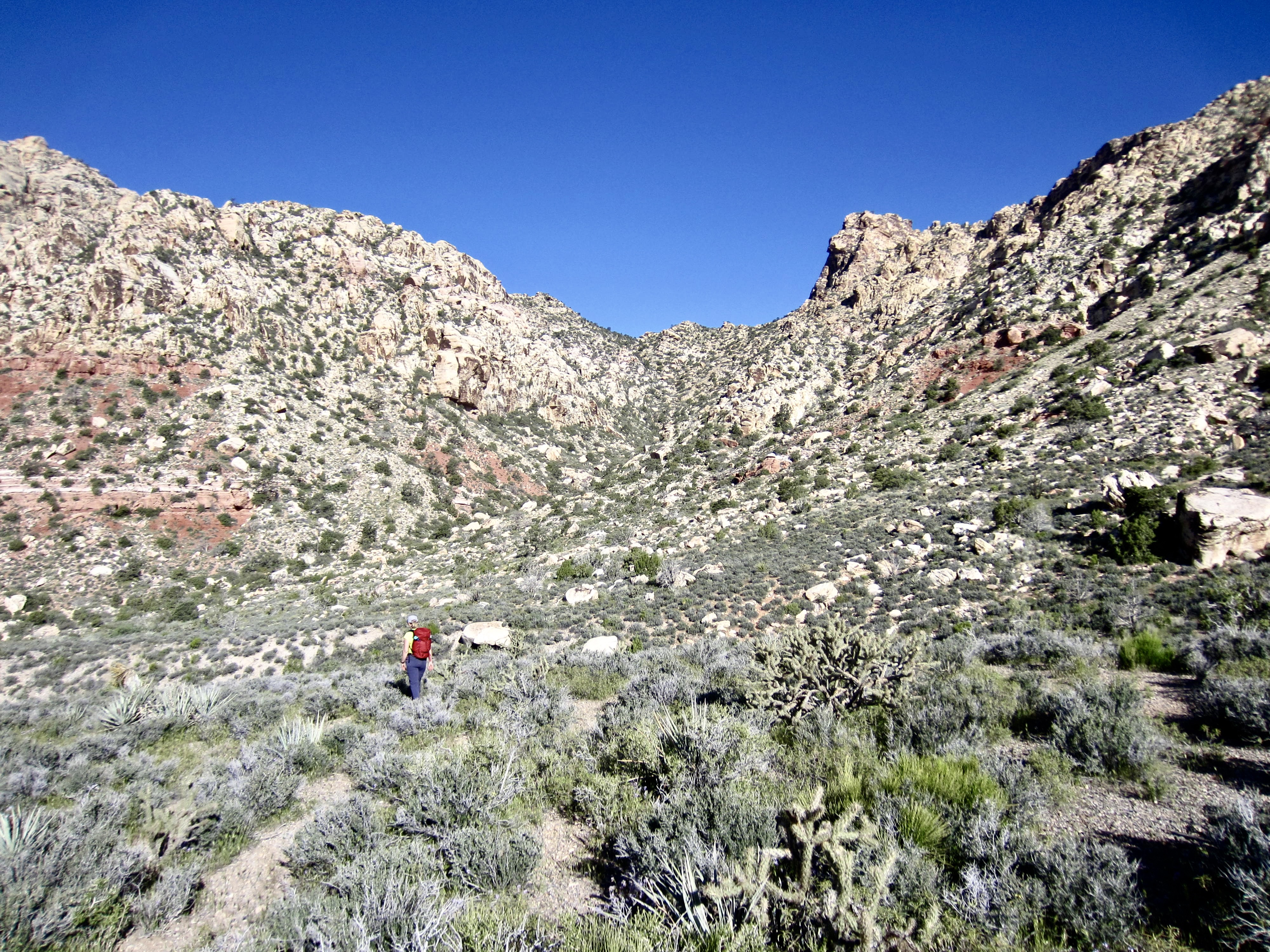
We crossed over the wash and began a rising northwesterly traverse across sandy slopes covered with scrub plants, cacti, and scattered boulders. White Rock Saddle could be clearly seen as the deep sag in the ridge crest ahead.
.
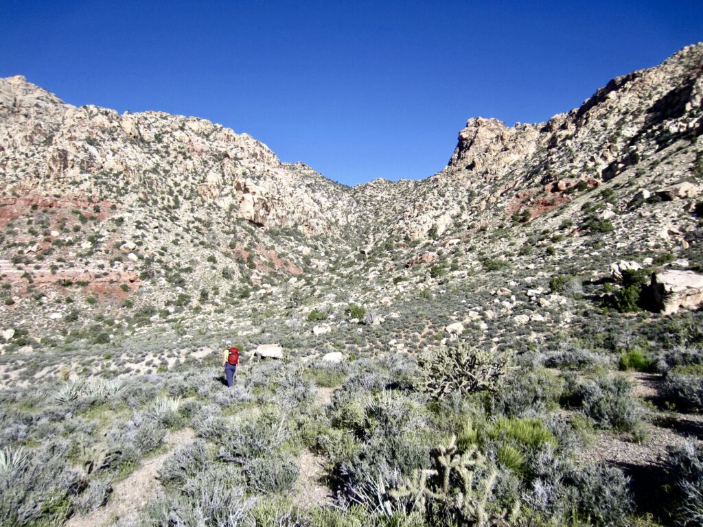
Our traverse gradually led us into the large northeast gully below White Rock Saddle. I chose a low route that took me up the gully invert, whereas Eileen chose a slightly higher route that stayed above the invert; neither option seemed to offer any particular advantage. When the gully became choked with brush farther up, we both zigzagged through relatively open patches on the right side of the invert. Overall, we found the travel to be moderately unsavory but not as bad as other people have reported. I think the key is to get out of the invert before the brush closes in.
.
We eventually gained 5550-foot White Rock Saddle at the head of the gully (1.6 hours + 800 feet from TH). Closely to the northeast, the imposing face of White Rock Spring Peak stands guard over the saddle. During our previous attempt, Eileen and I descended a steep, loose slope on the left (west) side of this peak and then traversed into White Rock Saddle. Today’s route to the saddle was not only faster but also safer and easier.

.
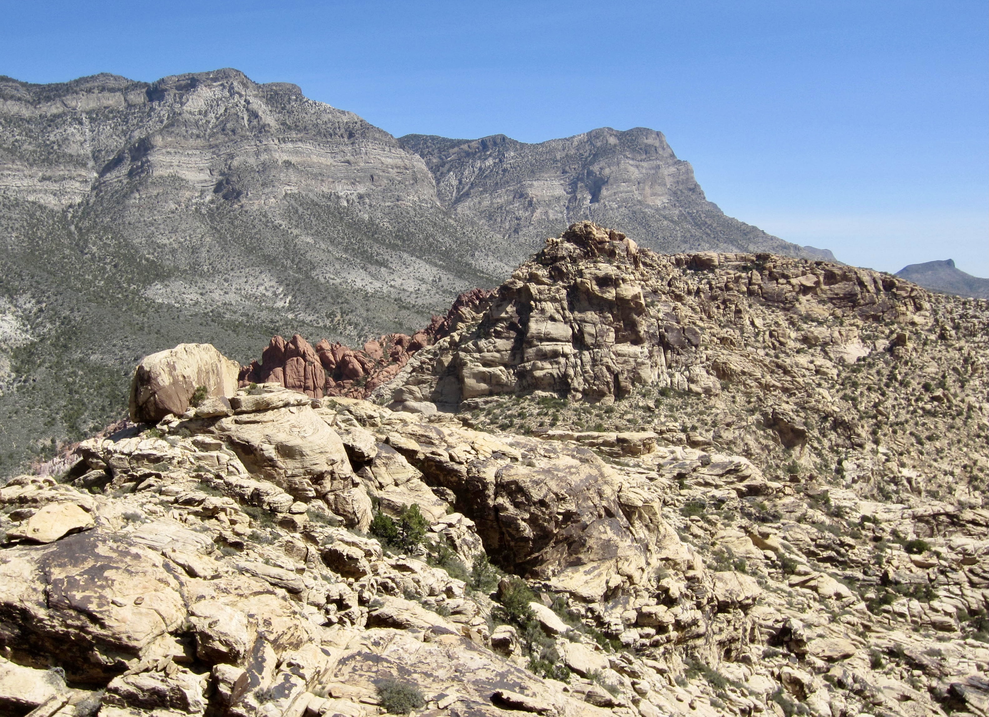
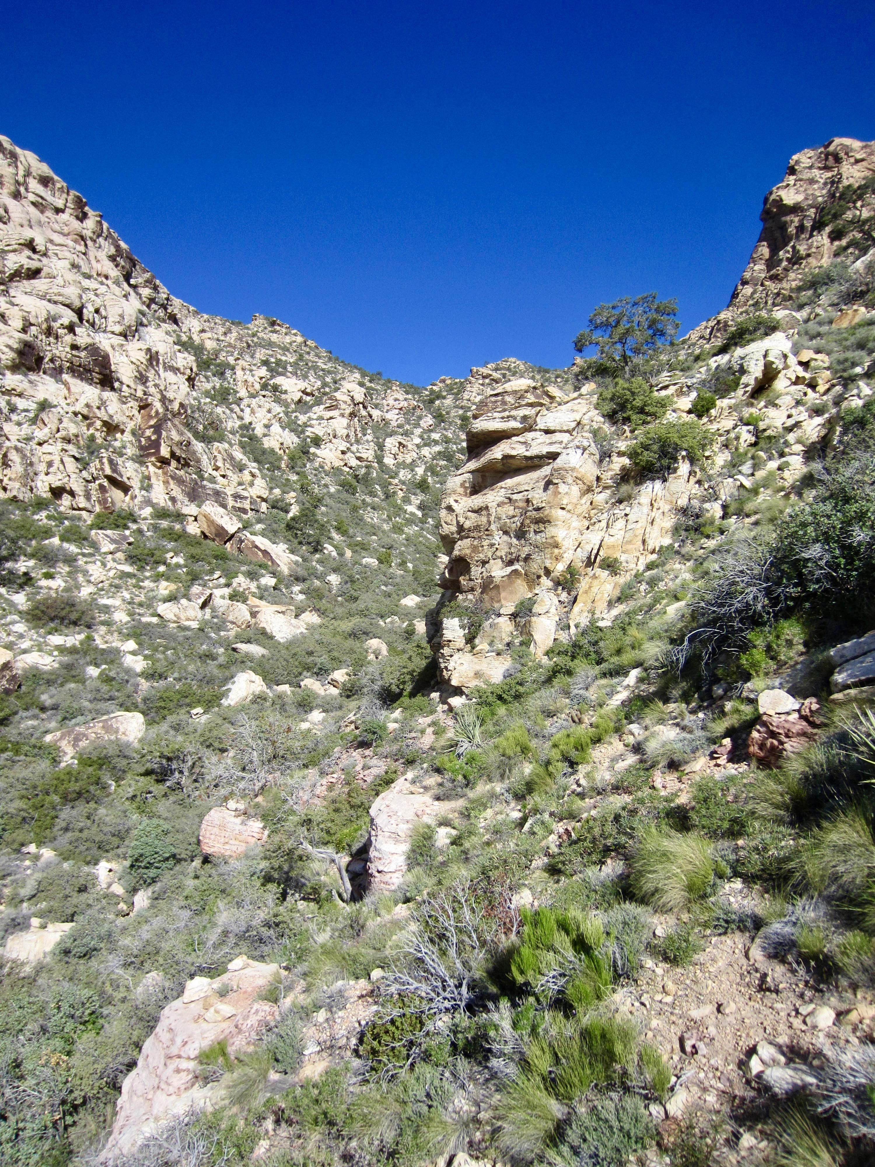
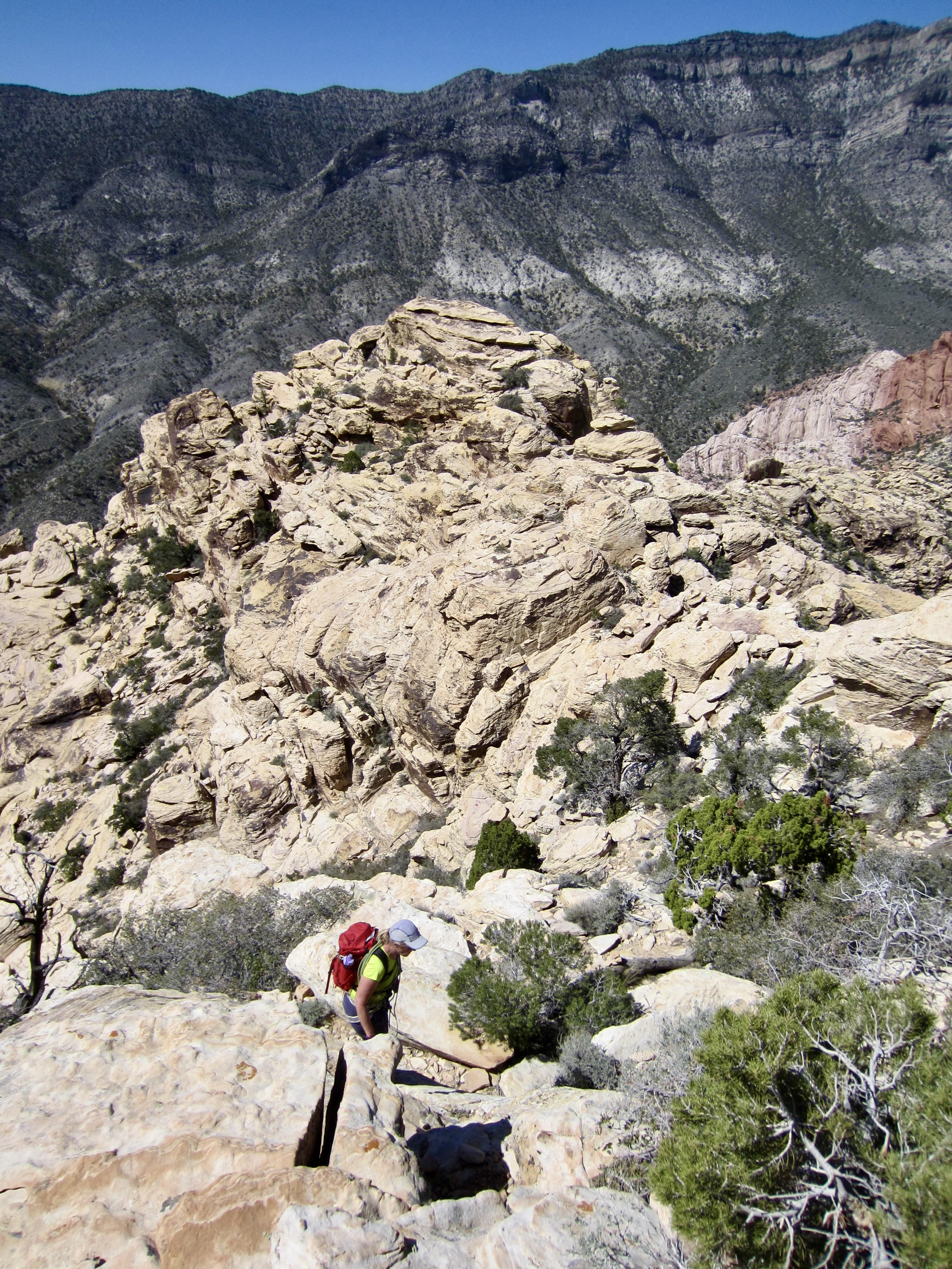
From the saddle, we turned southward and picked our way across sandy slopes and up rock outcrops, aided by numerous stone ducks and cairns marking the route. We soon crossed over a rocky rib on a wide ledge that provides a good view of White Rock Peak’s big northeast face.
.
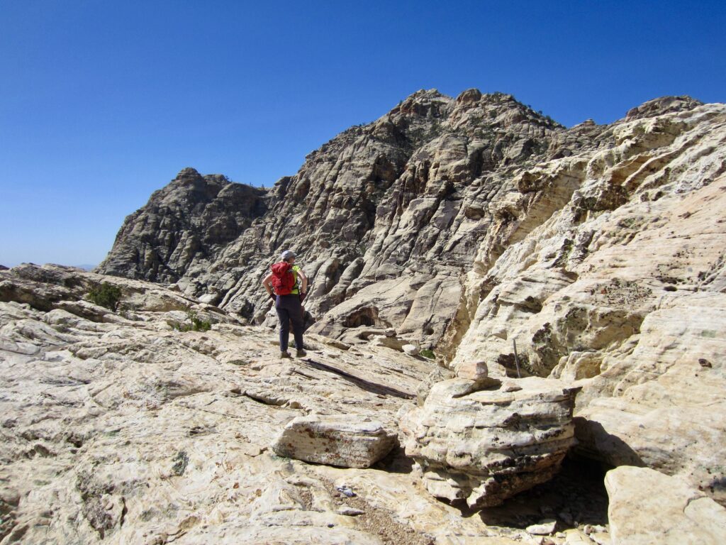
.
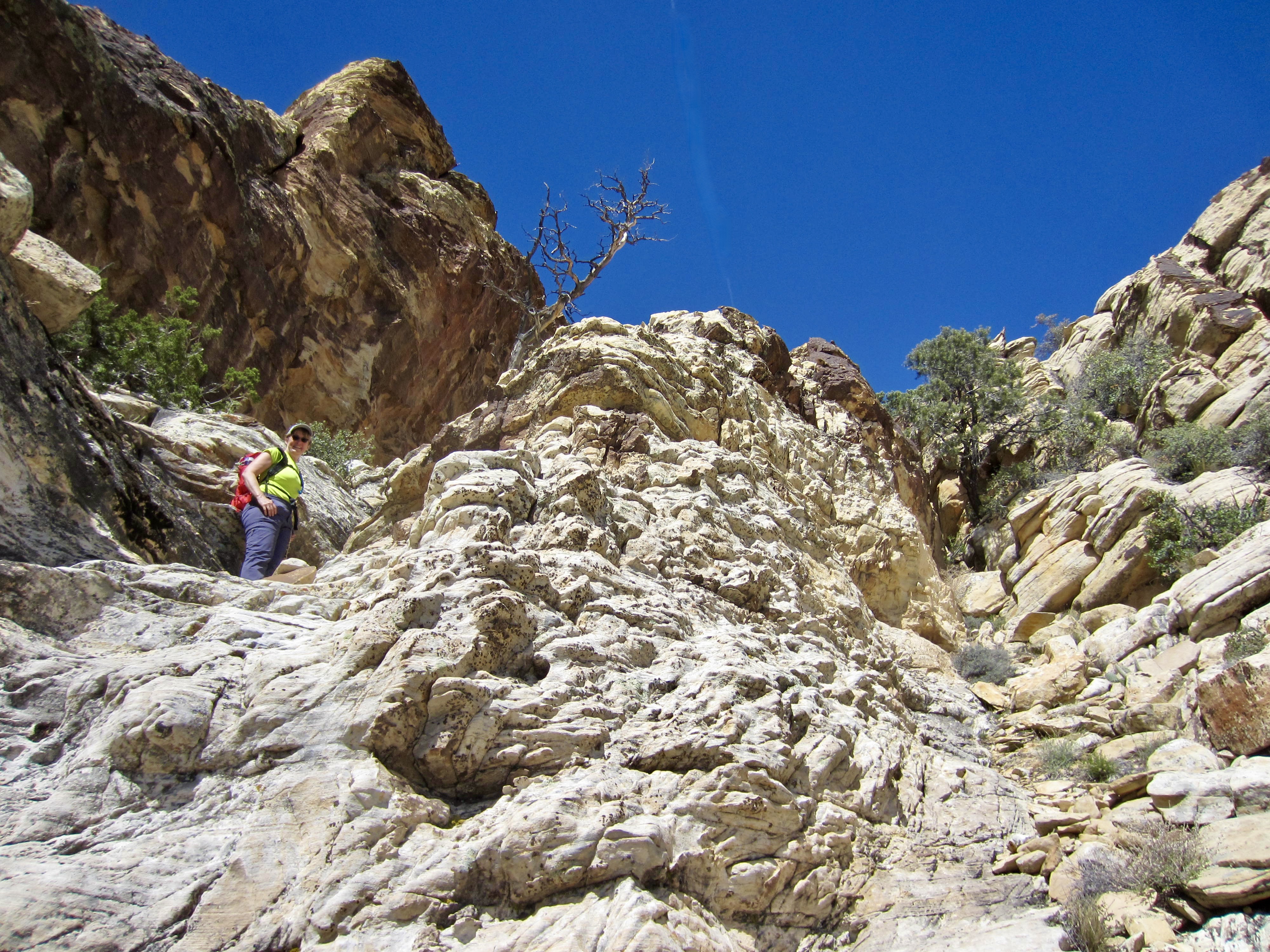
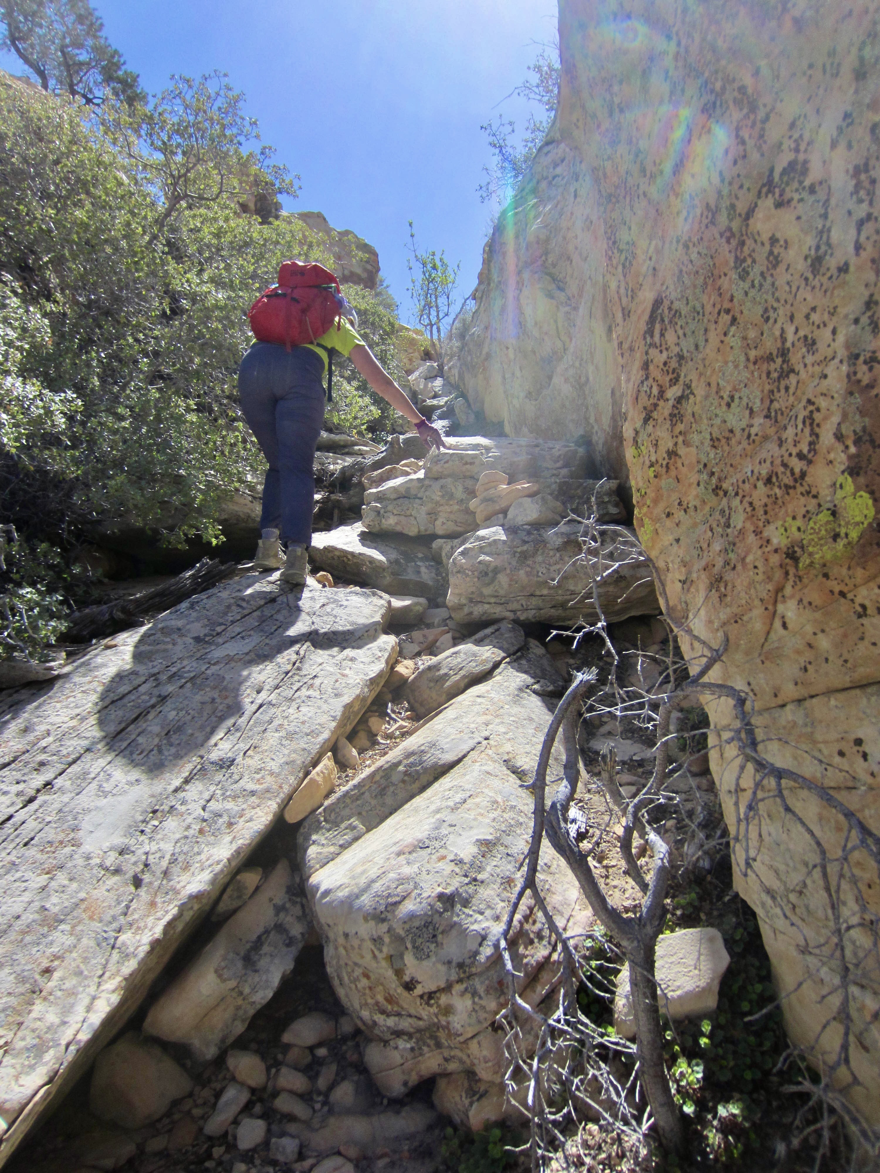
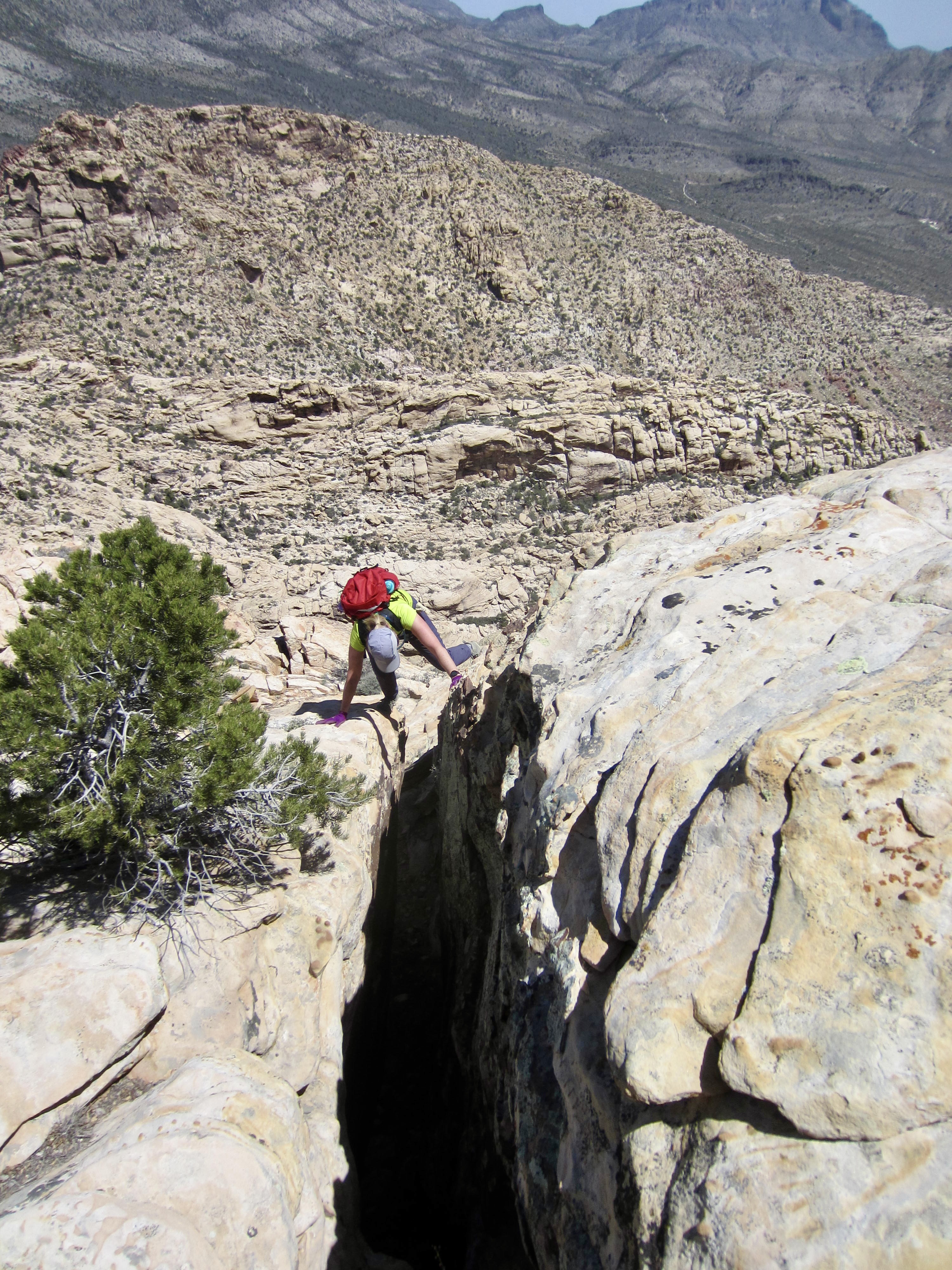
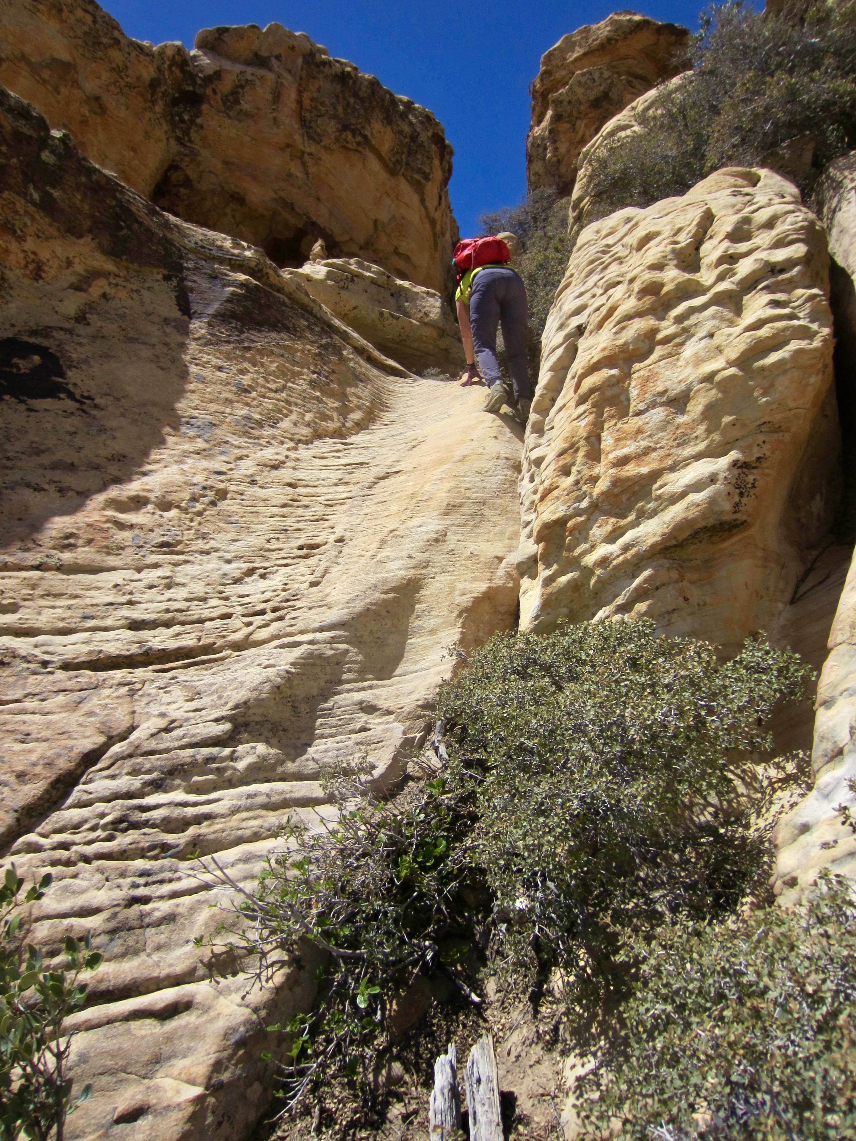
Beyond the wide ledge, we contoured 100 yards across a concave slope to the base of a cliffy area. Two parallel slots cut through this cliff on the right, giving access to the ridge crest above. We explored both options and can report that the left-hand slot involves a few exposed Class 3 moves, whereas the right-hand slot involves a squeeze chimney. Take your pick.

.
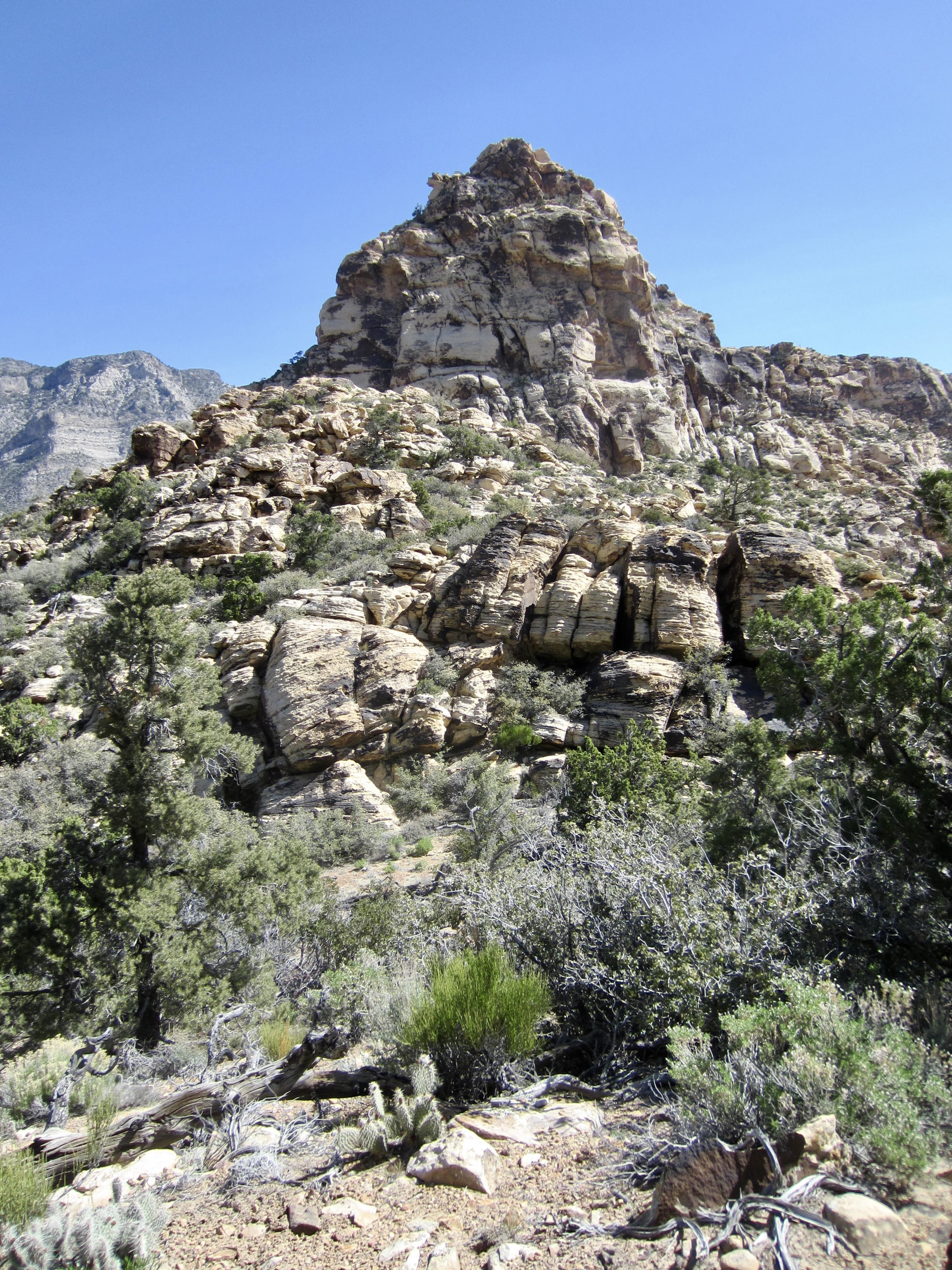
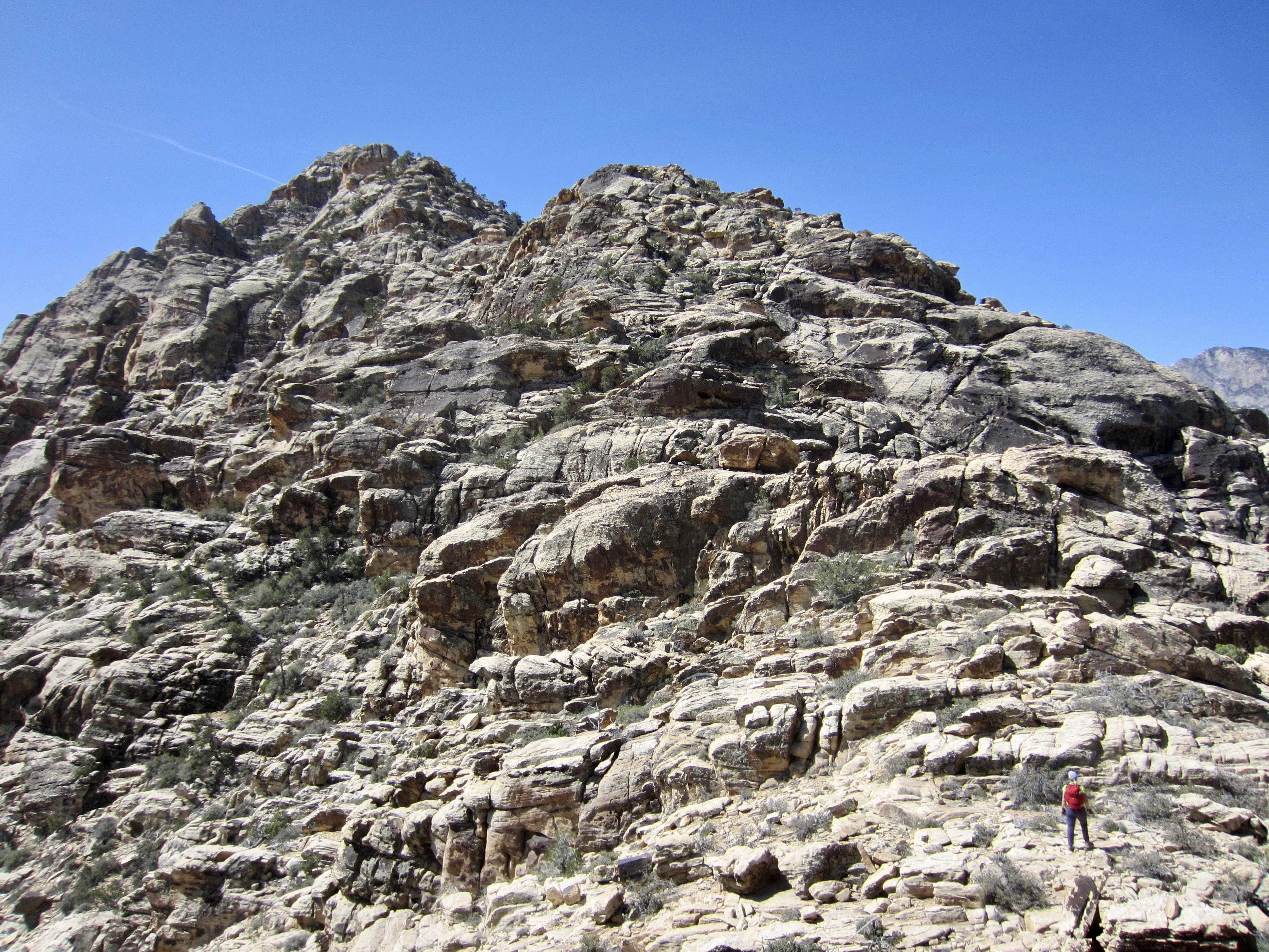
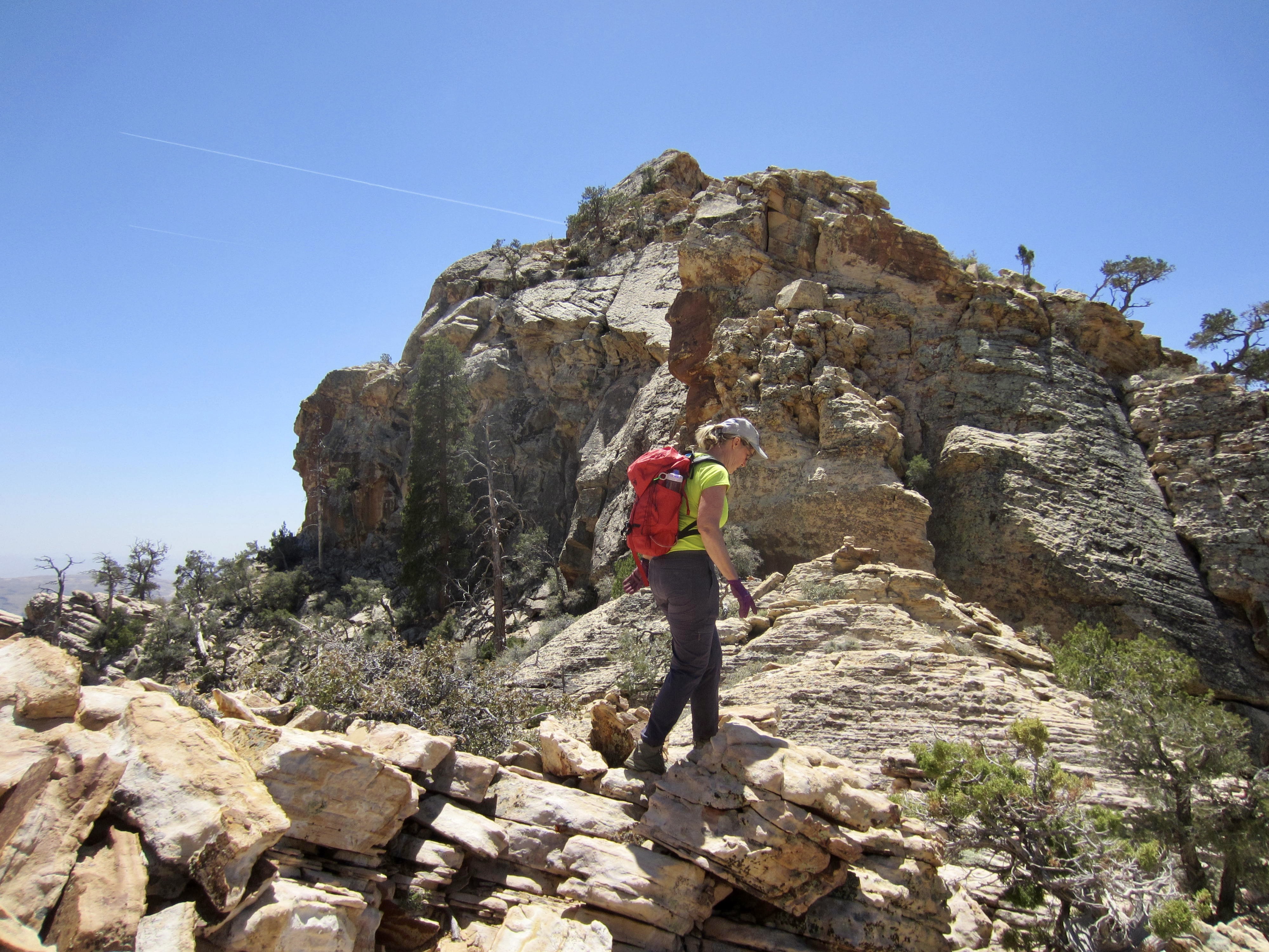
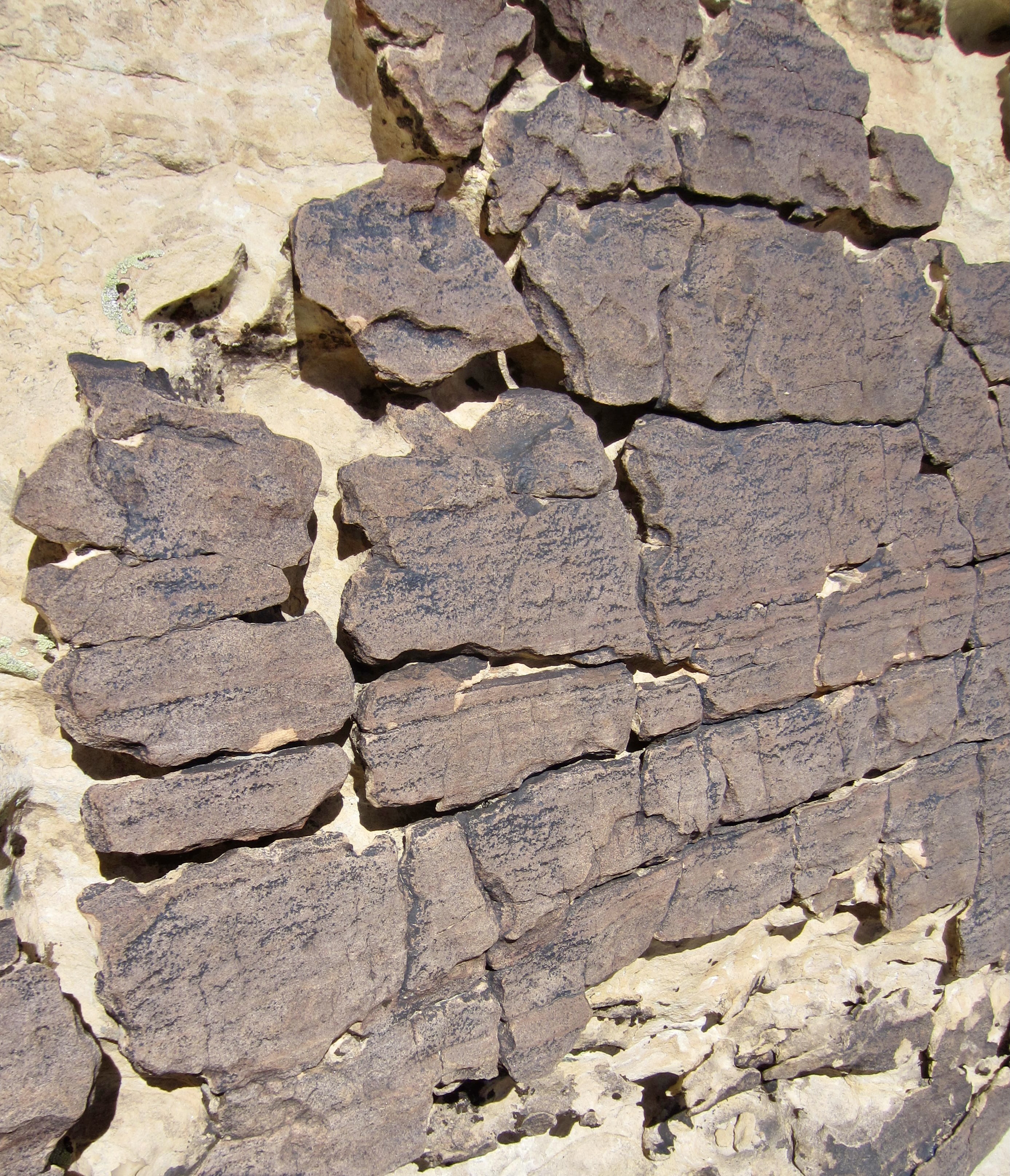
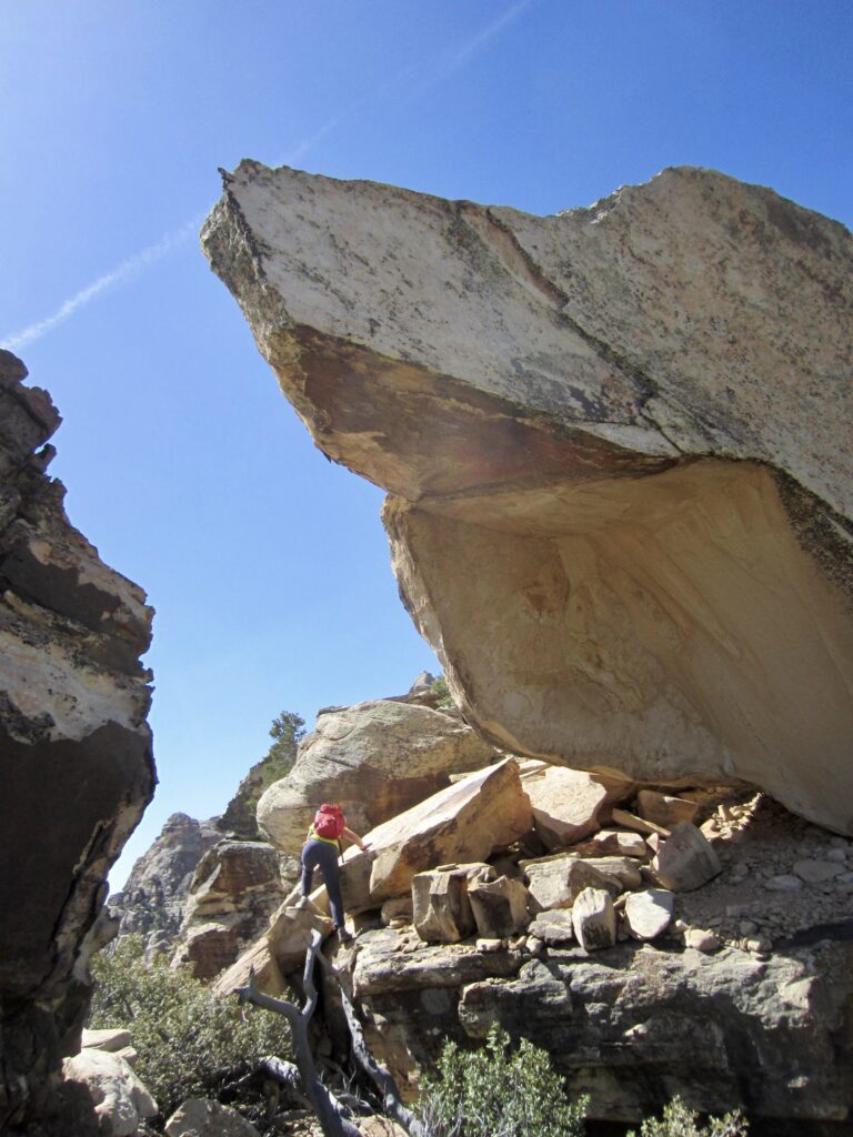
At the top of the slots, we curled around the right (west) side of a horn and immediately encountered The Monolith—a huge, overhanging boulder perched on the ridge crest. This is the first of three notable rock features along the north ridge route.
.
A tricky move over a dead tree took us up to the base of The Monolith and a gave us a view of the ridge ahead. It appears that the summit is visible as a high, rounded point at the top of the ridge, but this is actually just a false summit. The lower point to the right is The Plinth—another notable ridge feature.

.
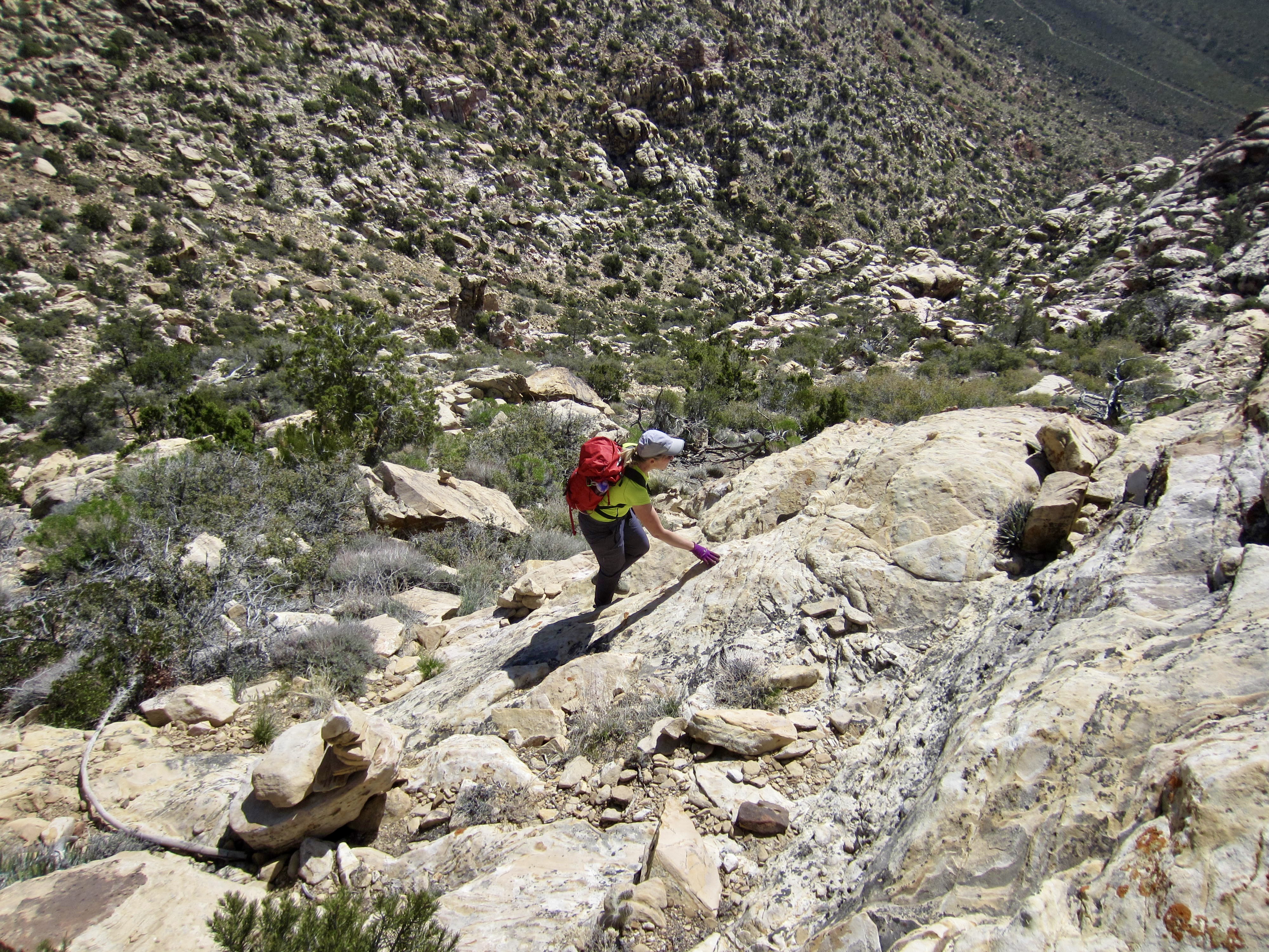
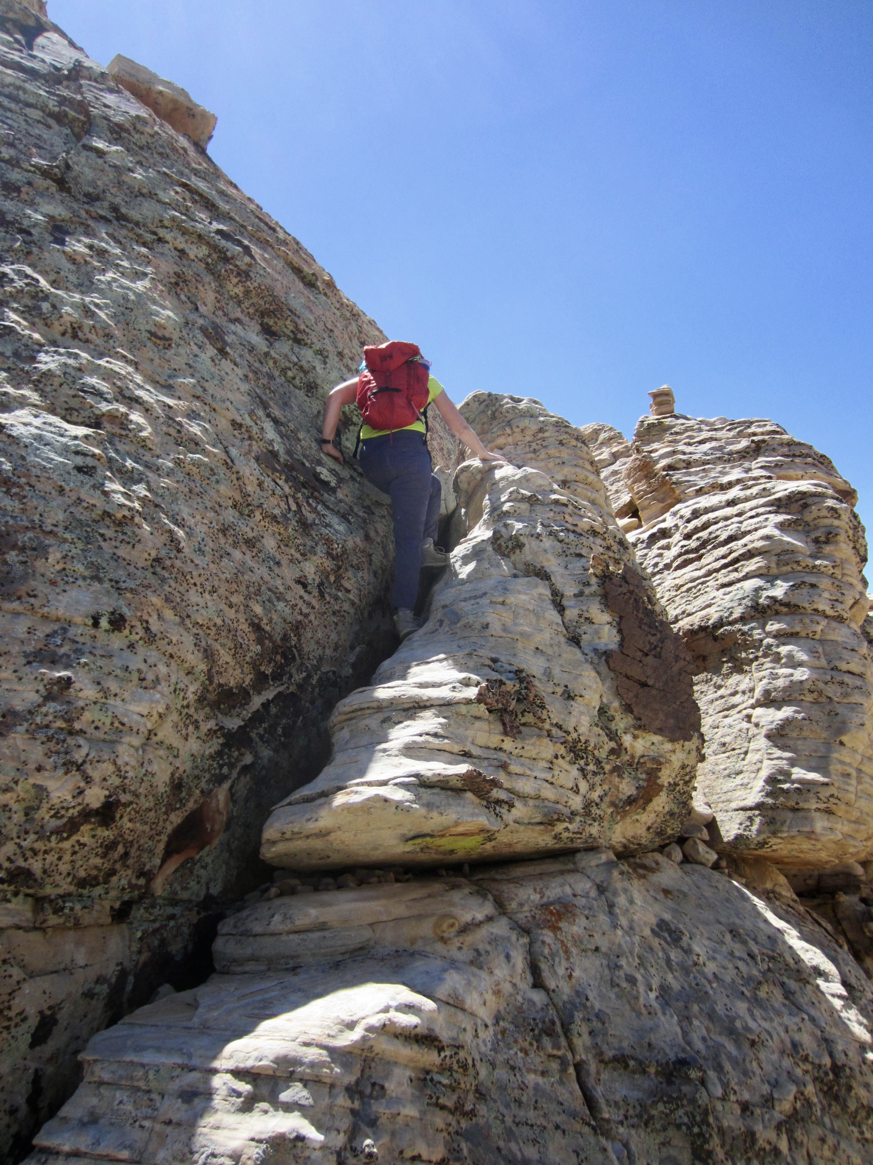
We proceeded up the ridge, following hundreds of marker ducks and cairns on a convoluted route that winds back and forth across the crest. The scrambling is mostly Class 2 with some Class 3 moves sprinkled in, but the route is seldom obvious, so keep a sharp lookout for markers. If you travel more than a dozen yards without seeing a duck or cairn, you are probably off route.
.
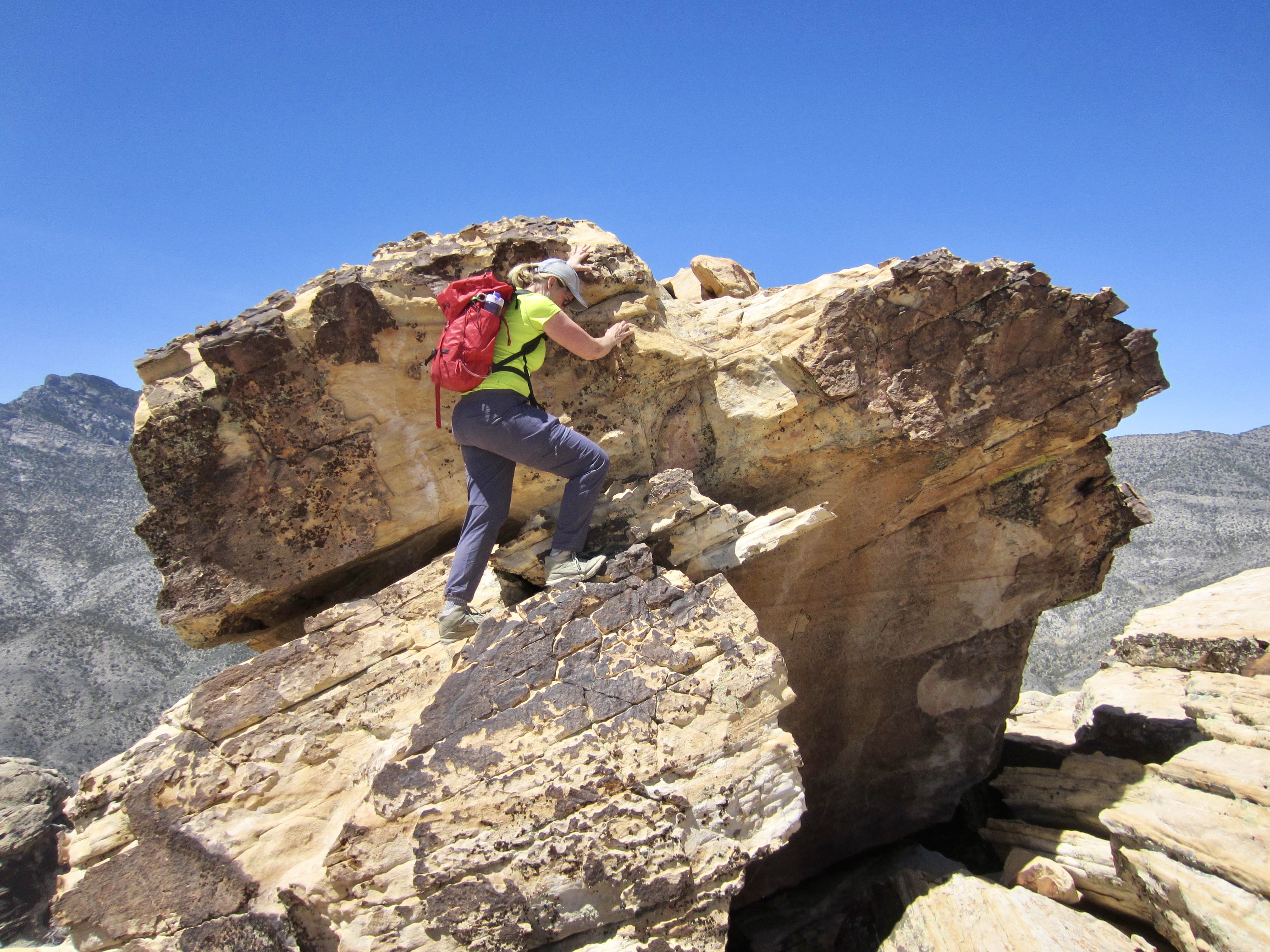
We eventually stepped atop The Plinth—a broad, flat sandstone platform at 6040 feet on the ridge crest. (I like to imagine that The Monolith once sat here but was blown off during one of those infamous Red Rock windstorms.) Although the false summit is now much closer, the route is no more obvious. We continued upward, still following markers back and forth along the bouldery crest.

.
.
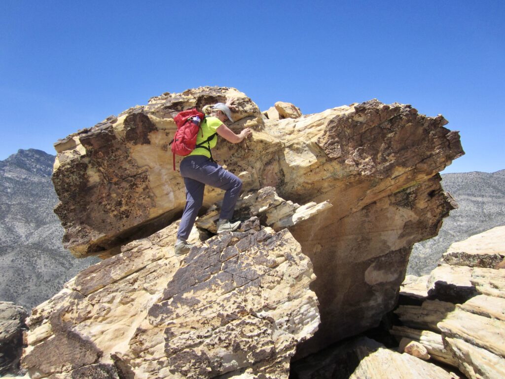
As we approached the false summit, the rock got steeper and the scrambling got more interesting. First, there was a smooth dome split by a deep cleft, quickly followed by a very exposed ramp/crack system. This turned out to be the crux of the entire climb; it’s not a particularly difficult series of moves, but the exposure makes it Class 3+ or 3.5 in my way of thinking.
.
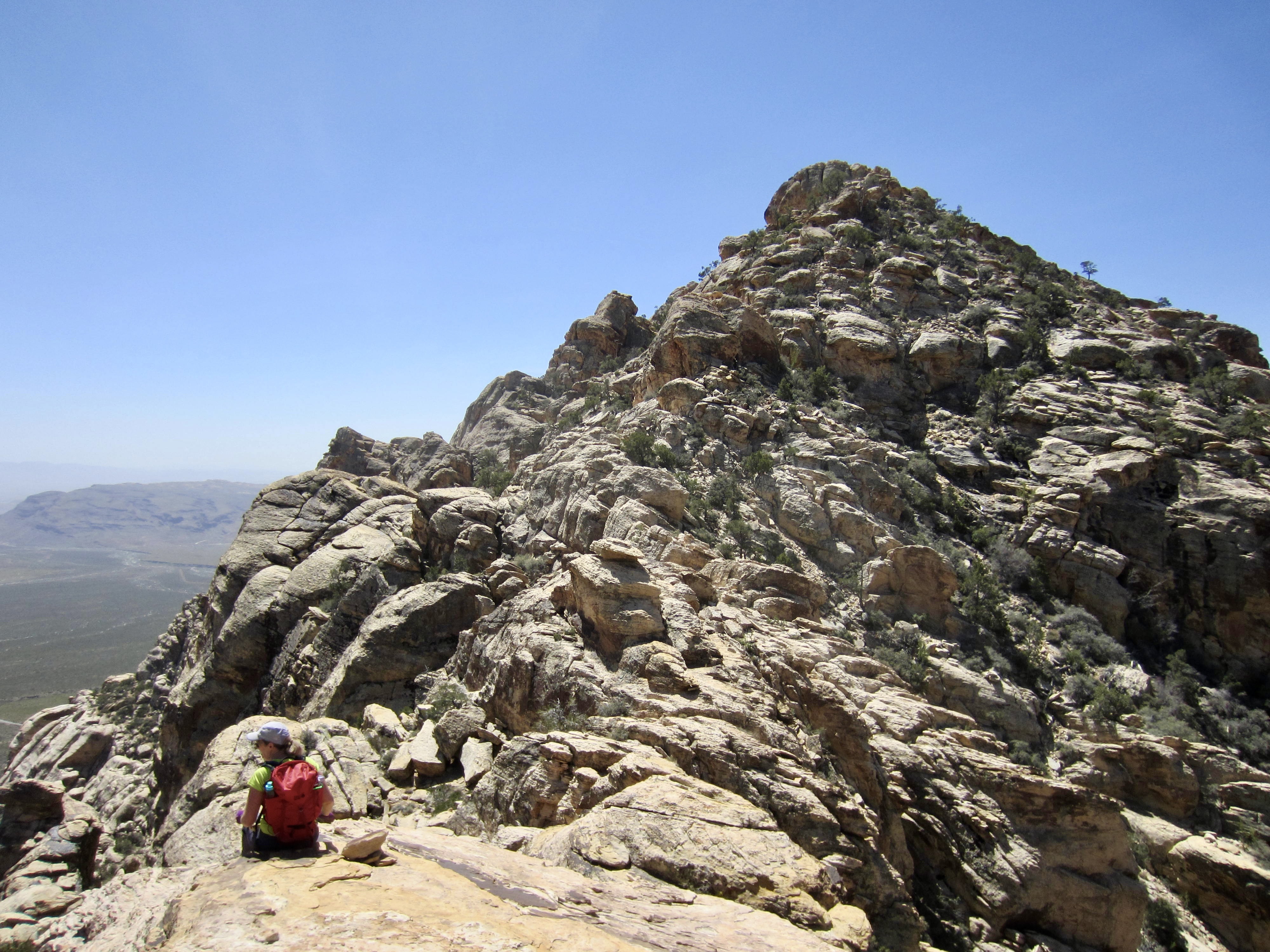
After crossing over the false summit—the third notable ridge feature—we got a close-up view of the summit block. It looks pretty intimidating, with steep or even overhanging cliffs on all visible aspects. How do we get up that? Here’s how: The route makes a sharp turn to the left and begins an undulating southeasterly traverse beneath these cliffs.

.
.
After traversing across a rubbly hillslope for about 200 yards, we angled up to the crest of the upper southeast ridge. A final 100 vertical feet of enjoyable Class 2 and 3 scrambling on solid sandstone delivered us to the summit of White Rock Peak in early afternoon (4.8 hours + 1600 feet from TH).
.
.
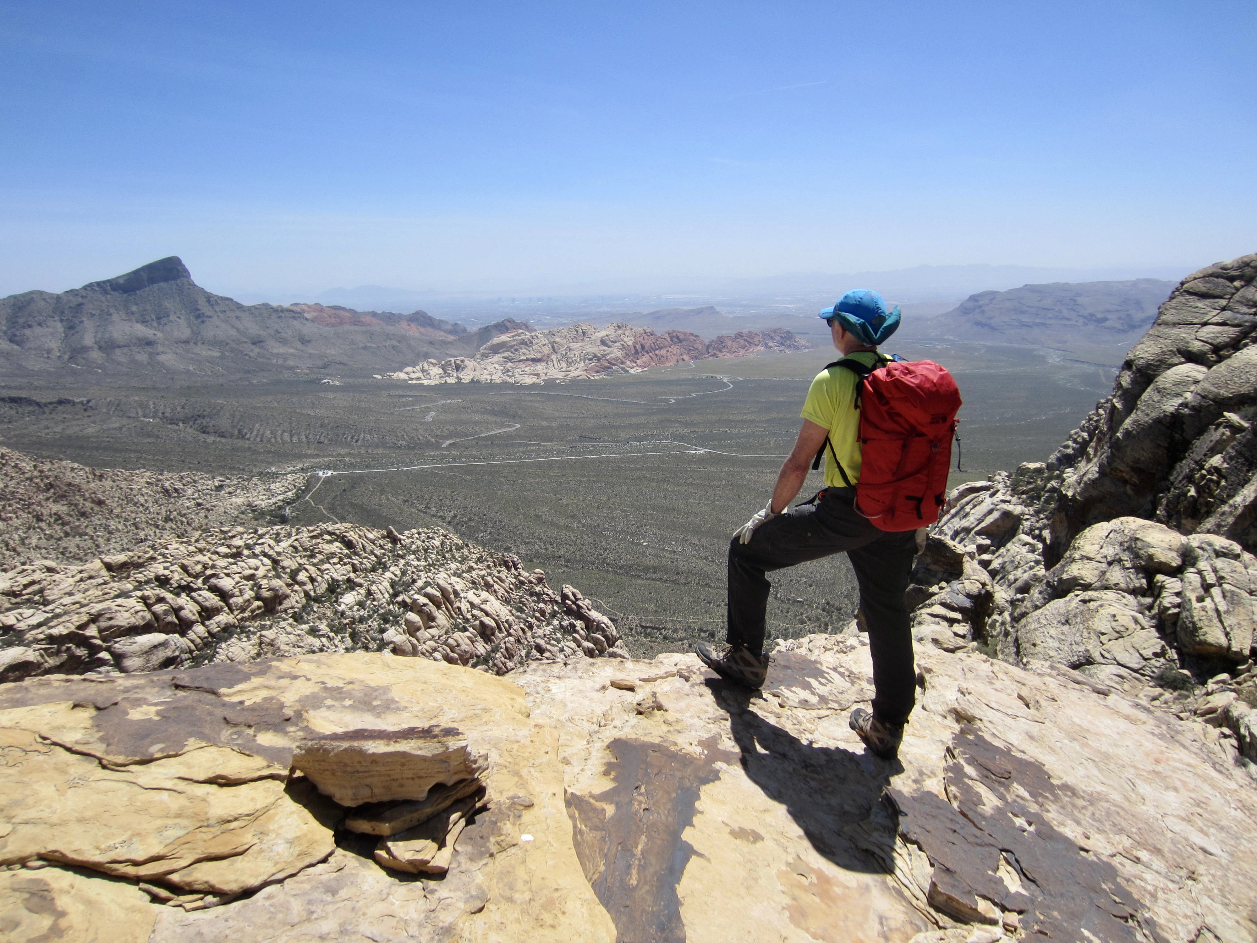
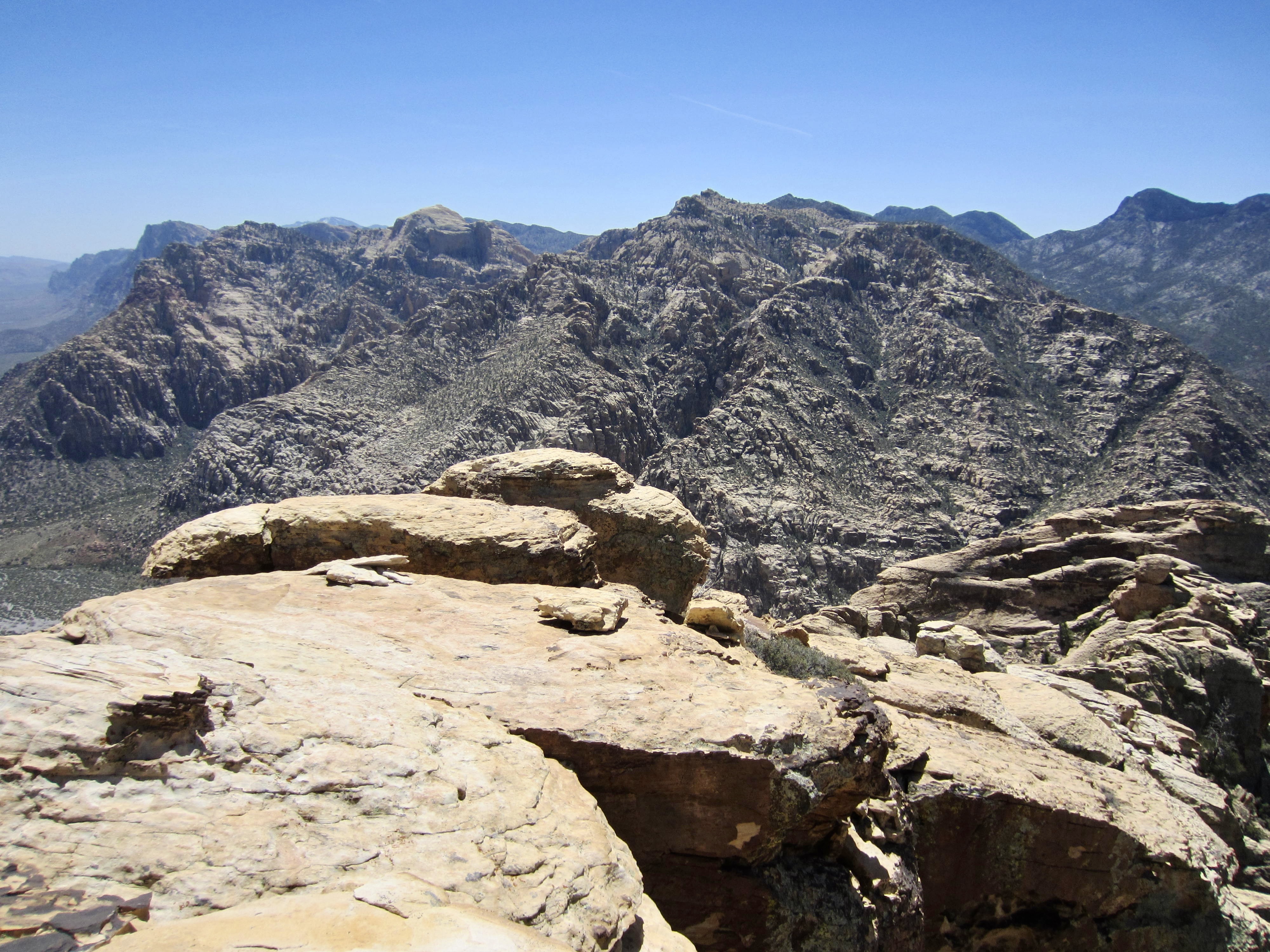
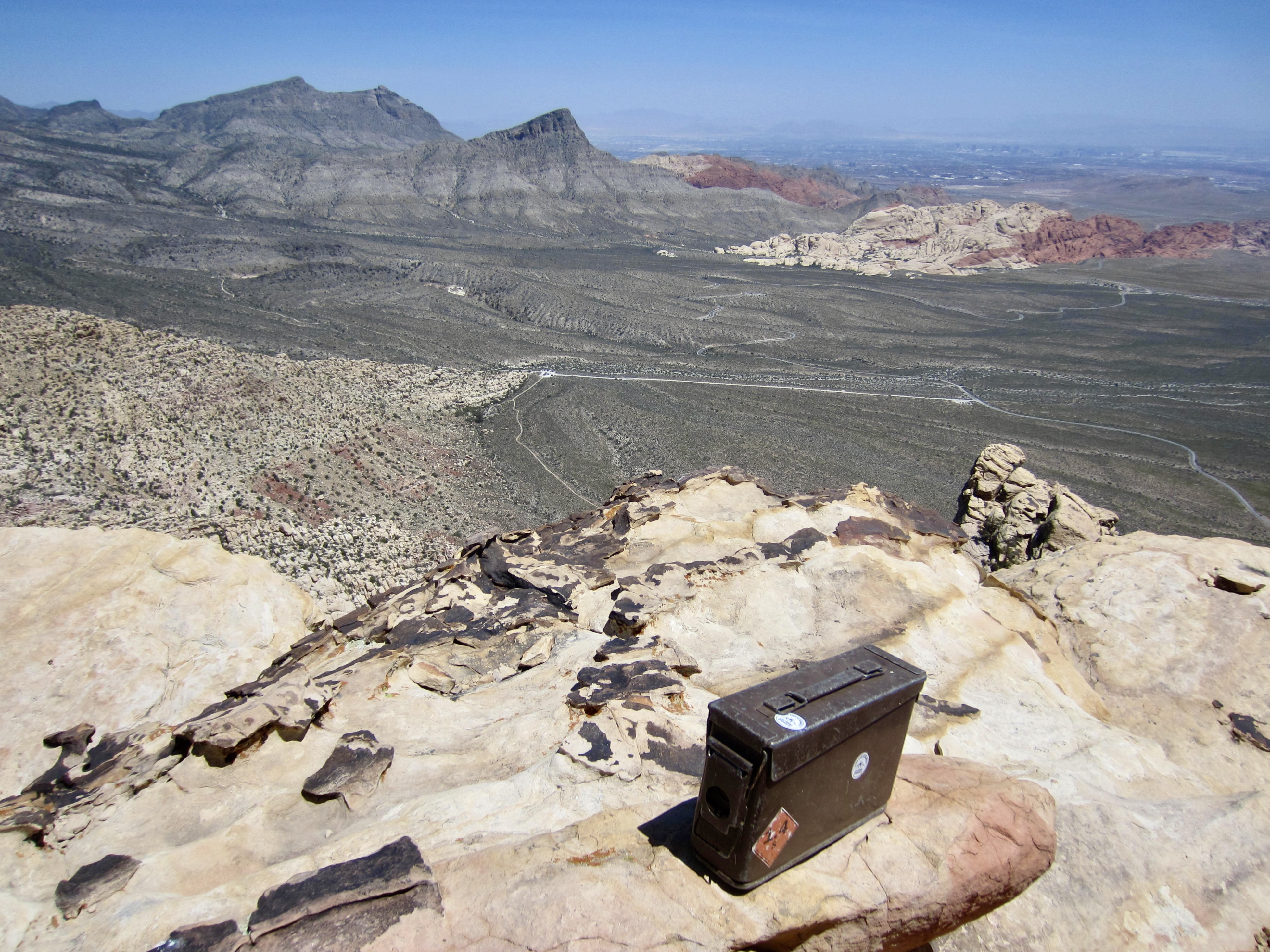
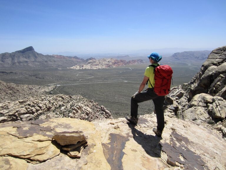
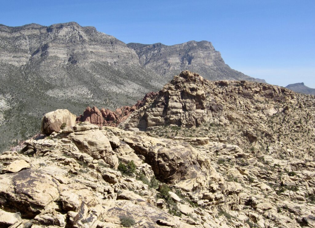
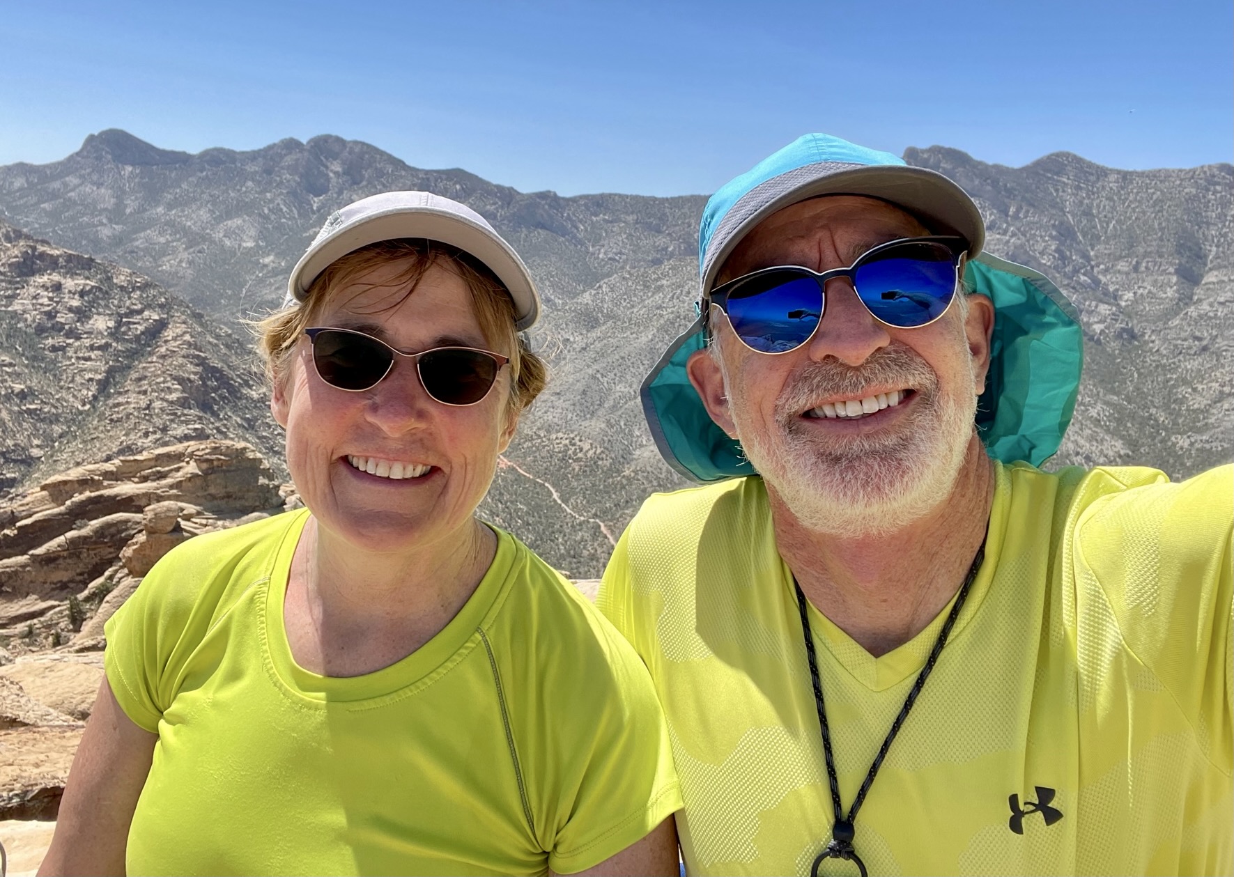
Not surprisingly, this summit offers an unobstructed view of the entire Red Rock Basin and all of the surrounding landforms, ranging from Calico Hills and Turtlehead Peak on the left to Bridge Mountain and North Peak on the right. There was an old ammunition can tucked into the rocks (does every summit at Red Rocks have an ammo can register?) but only a single scrap of paper inside.

.

.
For our descent, we carefully retraced our up-route down the north ridge. Having brought a 10-meter “panic rope” with us, we deployed it at the exposed crux ramp/crack below the false summit. Otherwise, everything was readily scrambled back to White Rock Saddle.
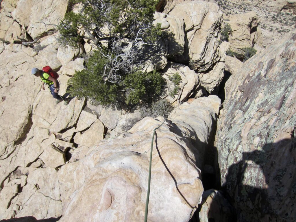
.
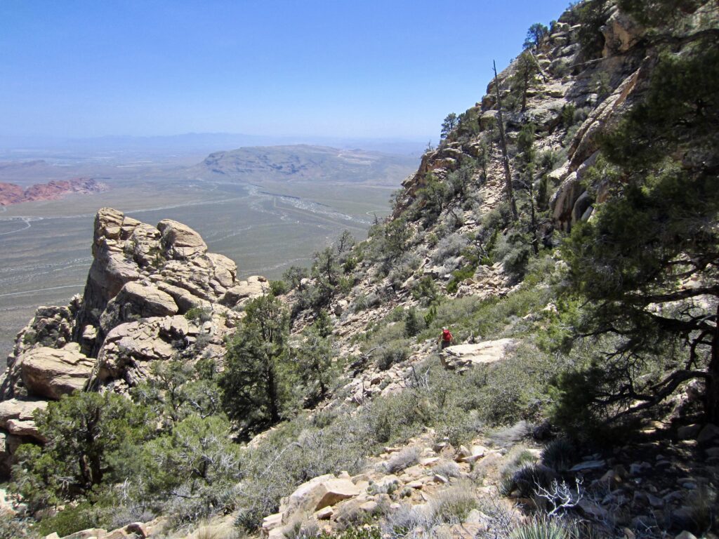
Our hike down the northeast gully was not exactly fun or carefree; rather, it was more of a “glad we never have to do that again!” experience. However, it got us back to the trailhead by late afternoon (4.2 hours + 300 feet from summit) to end a very satisfying day.
Route Sketch & Maps & Profile
…
…
…
…
Photo Gallery
Click to enlarge…