Trip Date: March 25-27, 2023
2023 PATAGONIA ADVENTURE VACATION
Fitz Roy Trail Loop: Salto Creek to Fitz Roy River
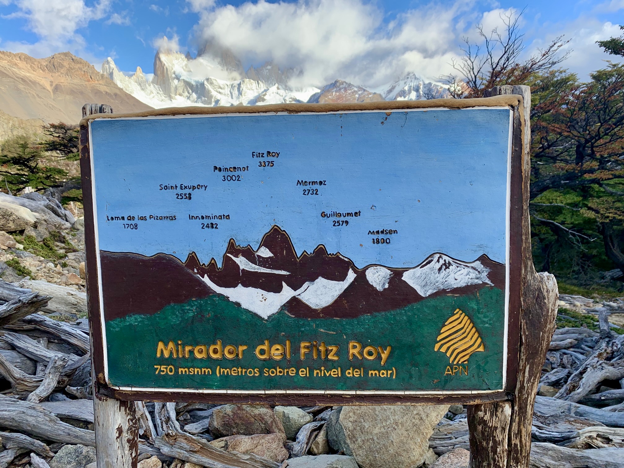
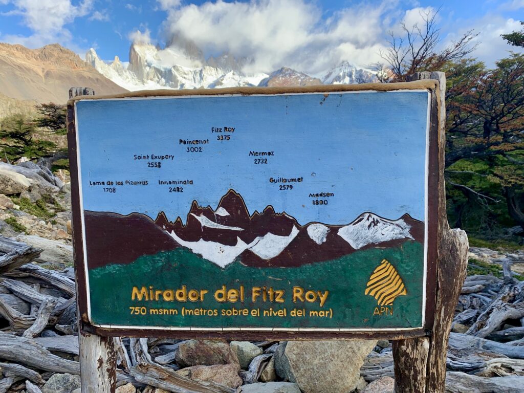
Mirador del Fitz Roy aka Fitz Roy Viewpoint
Poincenot Camp
Lago de Los Tres aka Lake de Los Tres
Lagunas Madre e Hija aka Lakes Madre & Hija
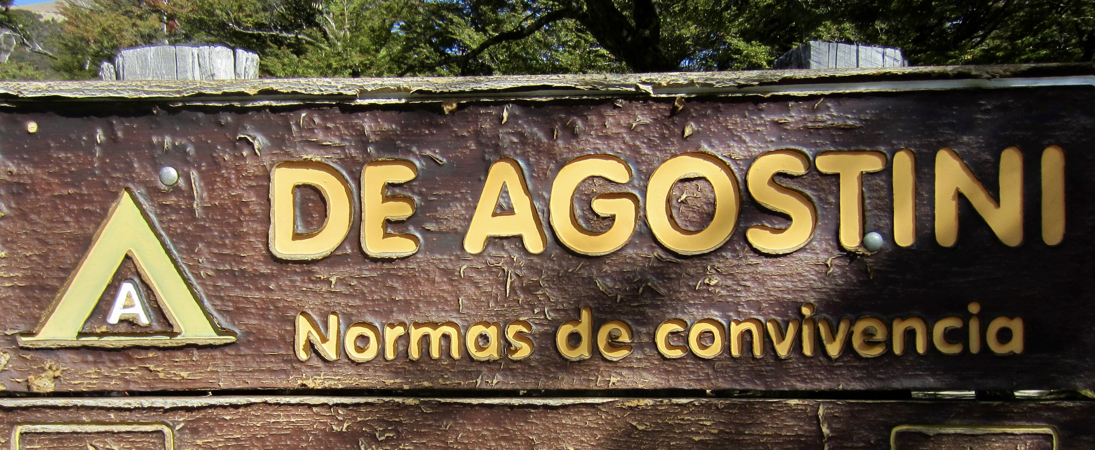
DeAgostini Camp
Laguna Torre aka Lake Torre
Trip Report Summary
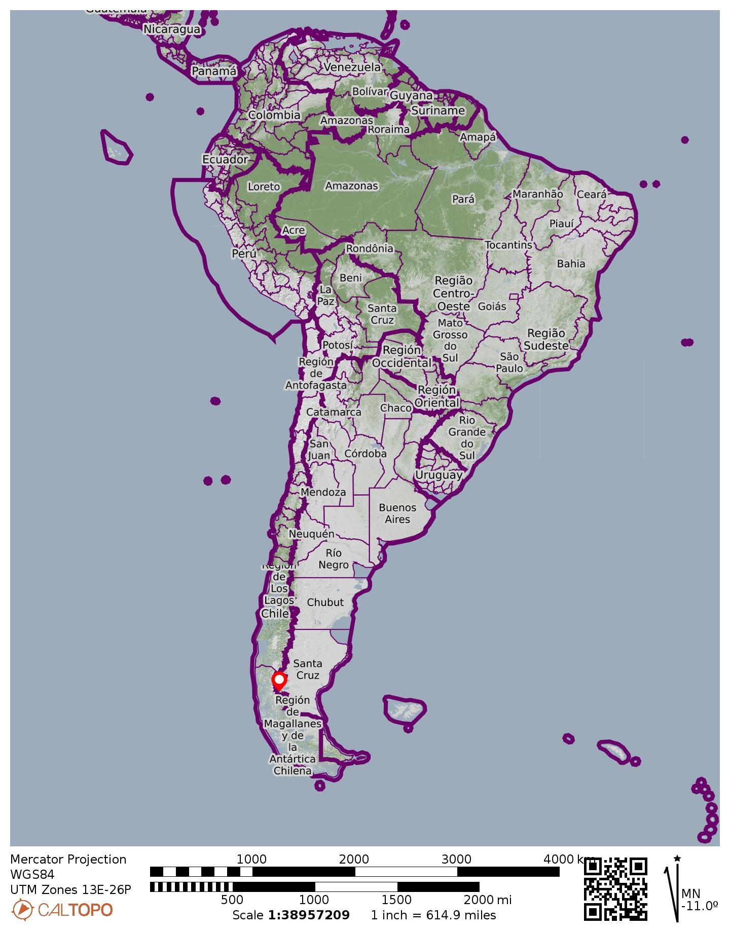
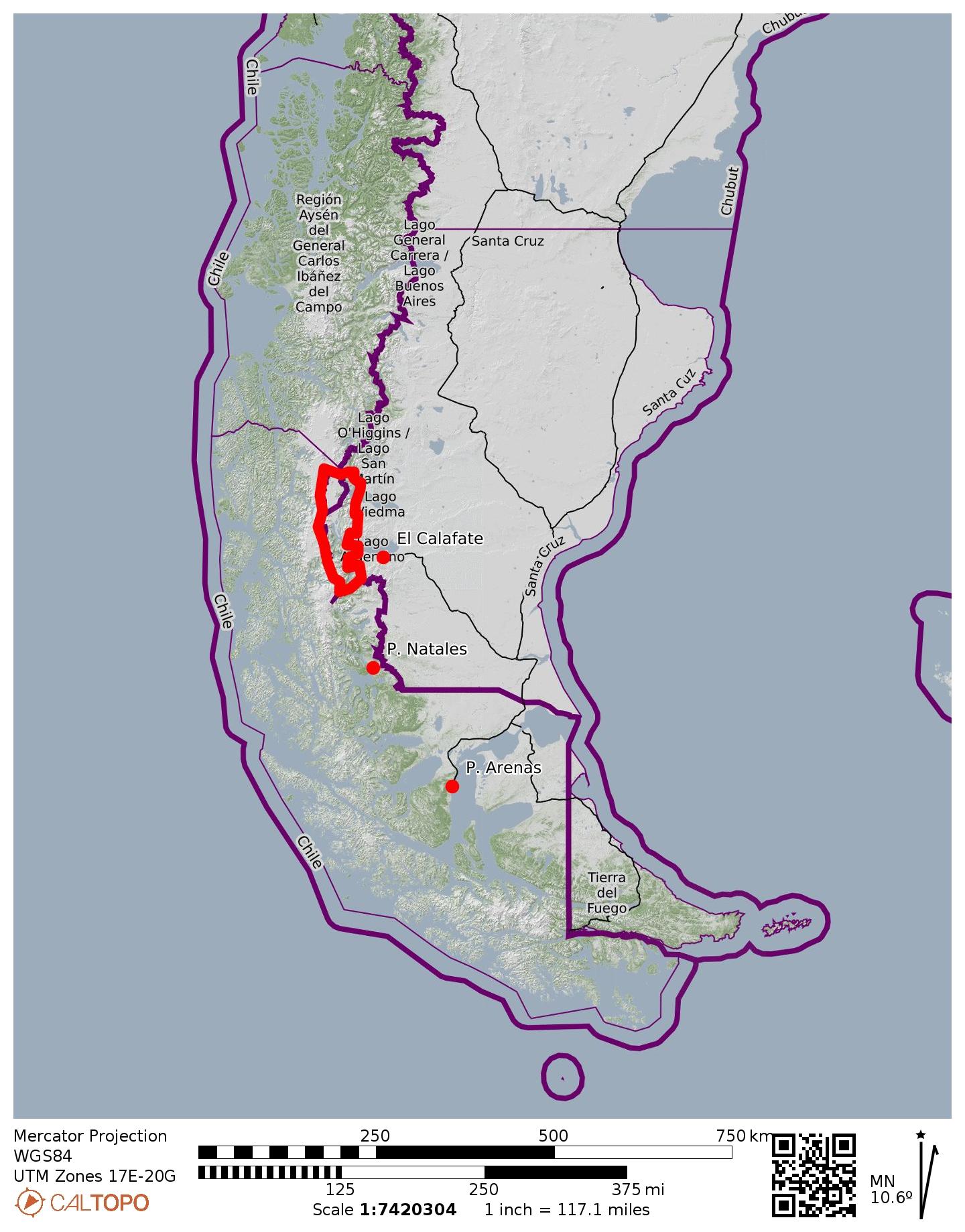
Region: Argentinian Patagonia
Sub-Region: Monte Fitz Roy Massif
Area: Los Glaciares National Park
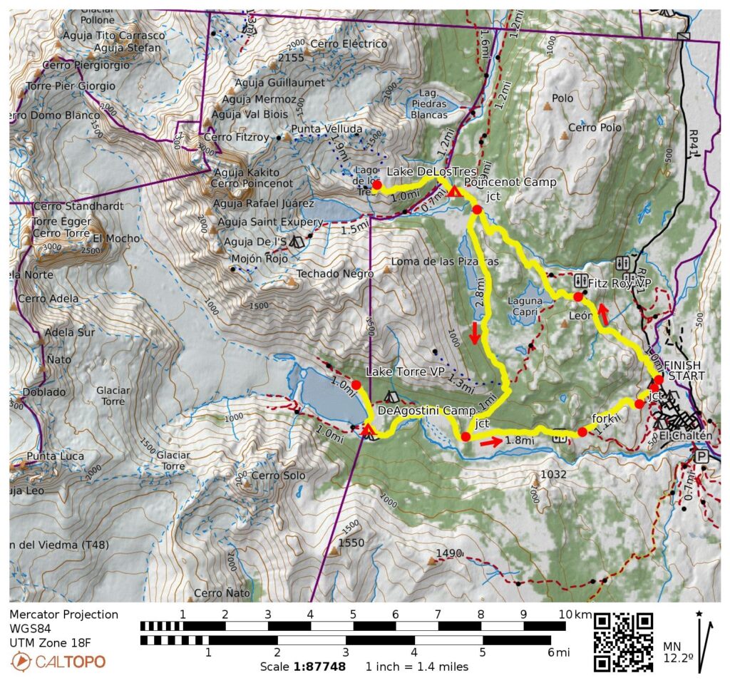
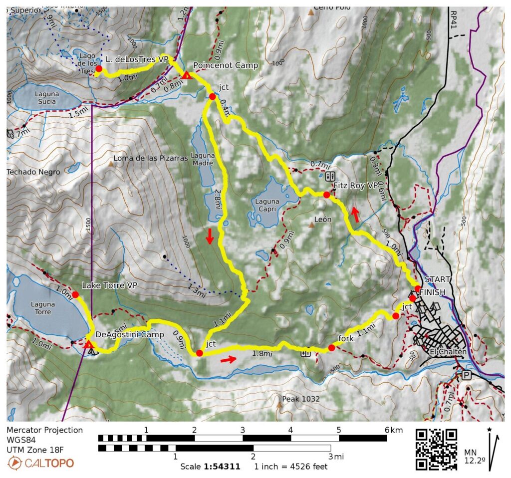
Starting Point: Fitz Roy Trailhead at north end of Road RP-23 (Elev. 1300 feet / 400 meters)
Loop Way Points: Fitz Roy Viewpoint & Lake Capri & Salto Ponds & Lake Madre Trail junction & Poincenot Camp & Lake Madre Trail junction & Lake Madre & Lake Hija & Lake Nieta & Lake Torre Trail junction & Fitz Roy River & DeAgostini Camp & Fitz Roy River & Lake Madre Trail junction & Lake Torre Trail fork & Las Loicas Street (trail hike)
Ending Point: Lake Torre North Trailhead on Las Loicas Street (Elev. 1340 feet / 410 meters)
Loop High Point: Lake Madre bowl (Elev. 2550 feet / 780 meters)
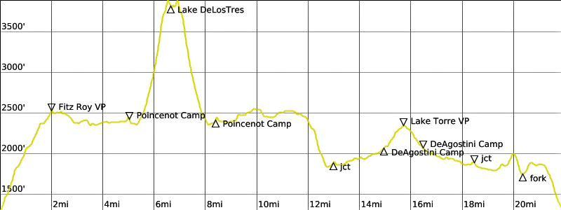
Trek High Point: Lake de Los Tres moraine (Elev. 3900 feet / 1190 meters)
Campsites: Poincenot Camp & DeAgostini Camp
Sidetrip 1: Blanco River crossing & Lake de Los Tres moraine & Lake de Los Tres (trail hike & trail scramble)
Sidetrip 2: Lake Torre & Lake Torre Viewpoint (trail hike)
Approximate Stats (basic loop only): 17.0 miles / 27.4 kilometers traveled; 2000 feet / 610 meters gained; 1960 feet / 600 meters lost.
Approximate Stats (including all sidetrips): 21.9 miles / 35.2 kilometers traveled; 4000 feet / 1220 meters gained; 3960 feet / 1210 meters lost.
…
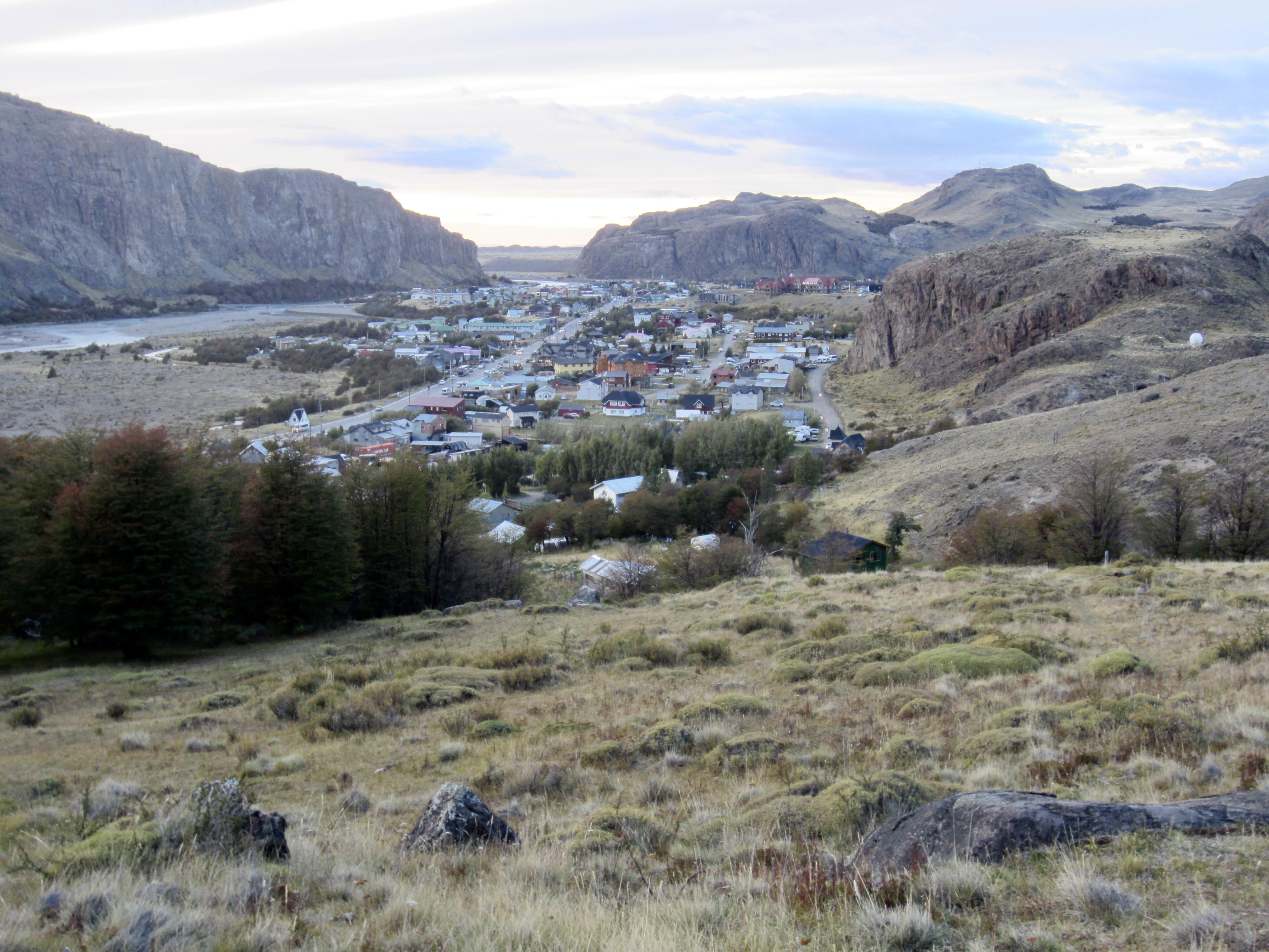
Full Trip Report
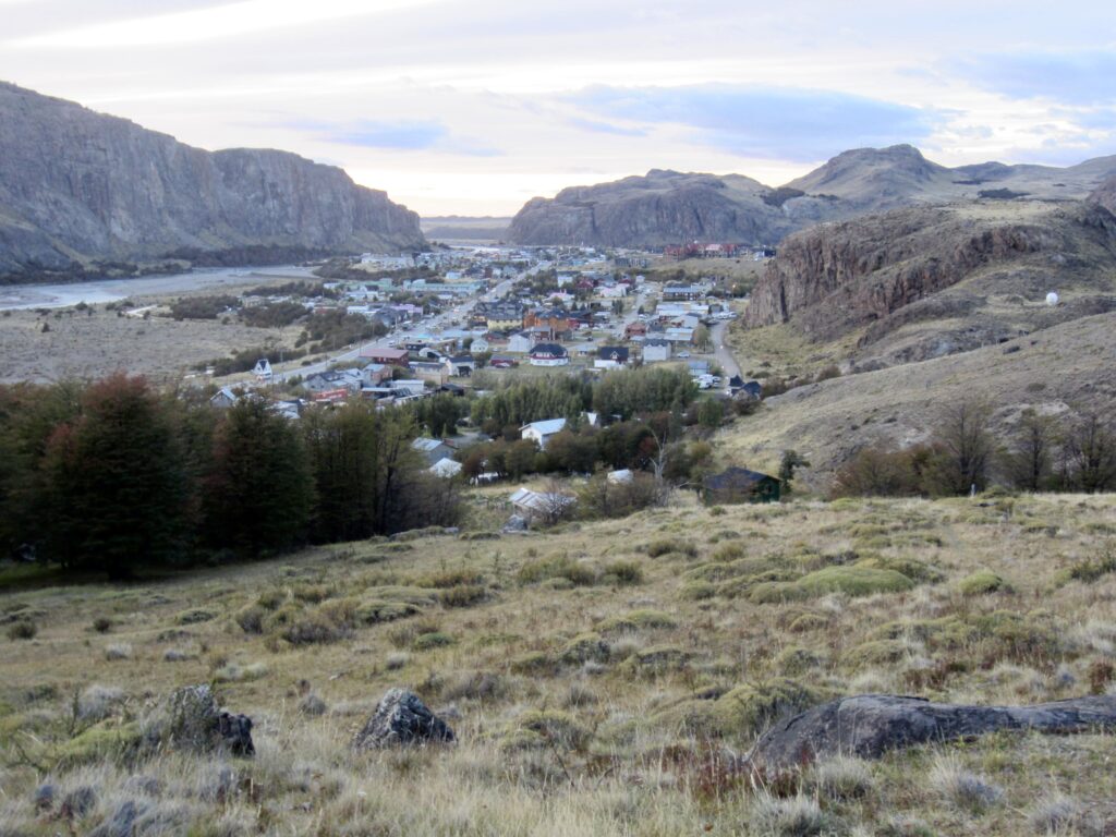
During a short stay in Argentina’s small but booming mountain town of El Chalten—the “little Chamonix” of Patagonia—Eileen, Brooke, Josh, and I backpacked the popular Fitz Roy Trail Loop. The basic loop is a 17-mile / 27-kilometer triangular route through upland prairie and forest, but there are two must-do alpine sidetrips that add another 5 miles / 8 kilometers or so to this total.
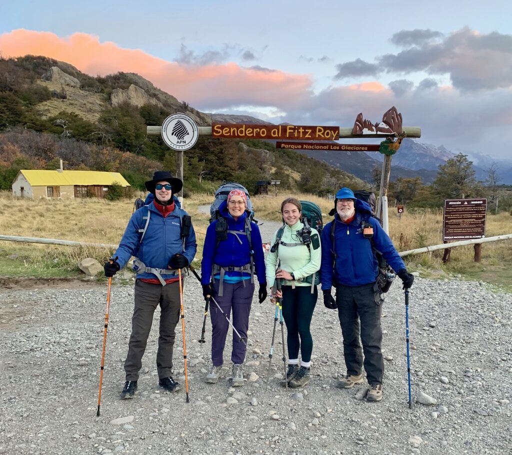
Day 1 (AM): Fitz Roy Trailhead to Poincenot Camp
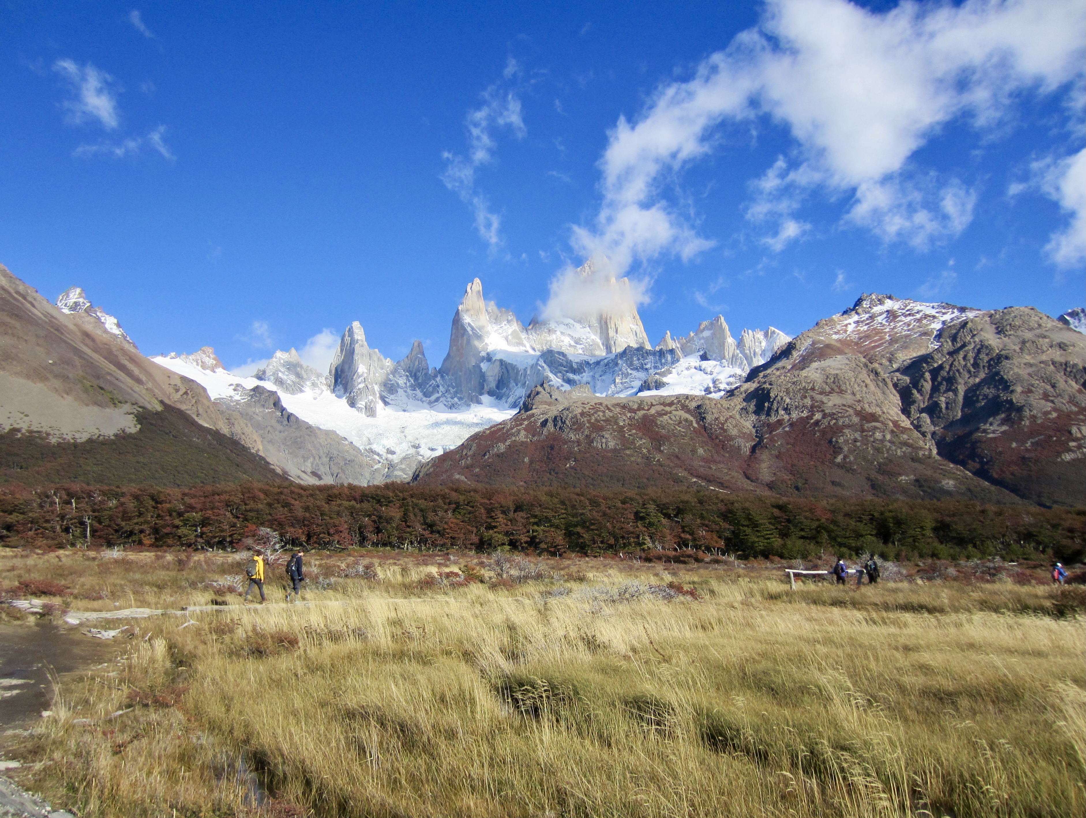
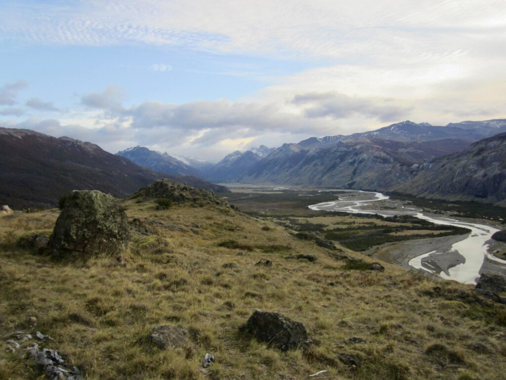
On a chilly and windy Saturday morning, we headed out from the Fitz Roy Trailhead at the northern end of town. The large parking lot here was our first hint that this is a very popular hike and that we would have plenty of company. A well-graded trail took us into the grassy foothills overlooking El Chalten and the Las Vueltas River Valley.
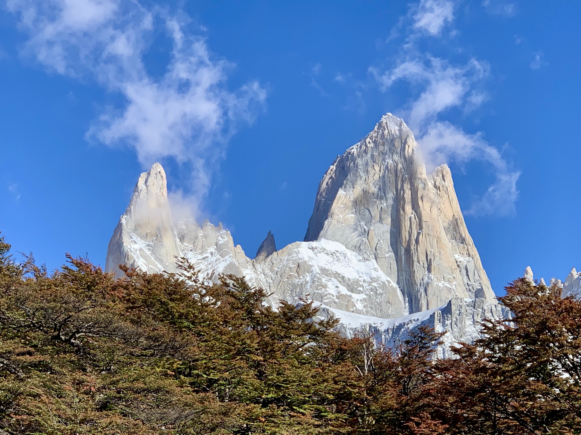
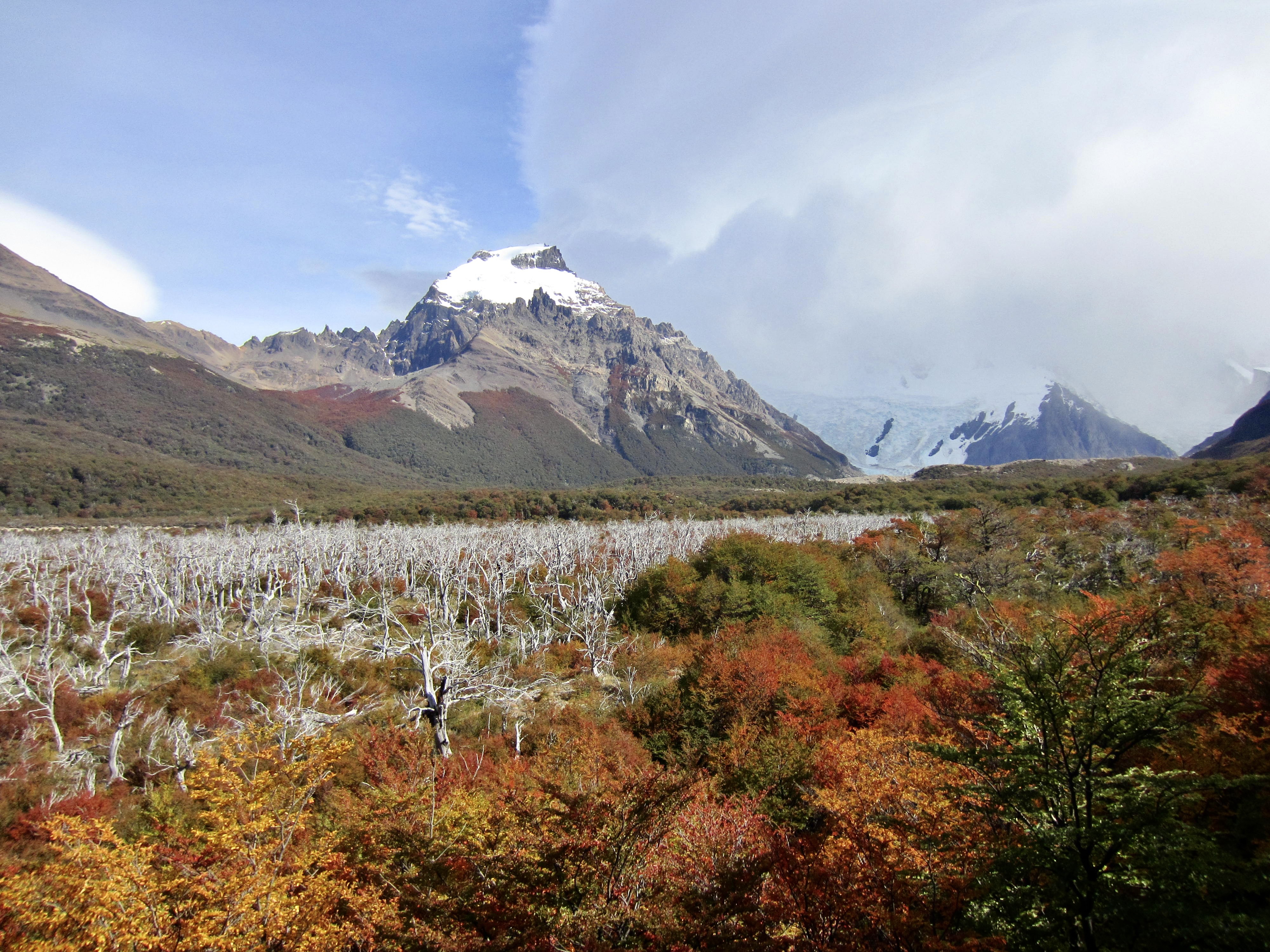
After an hour of hiking, we came to a formal viewpoint atop a ridge and obtained an initial look at 11,171-foot / 3405-meter Monte Fitz Roy—the centerpiece of Los Glaciares National Park. There were clouds hovering around the whole massif, but a big blue sky above offered hope for afternoon clearing.

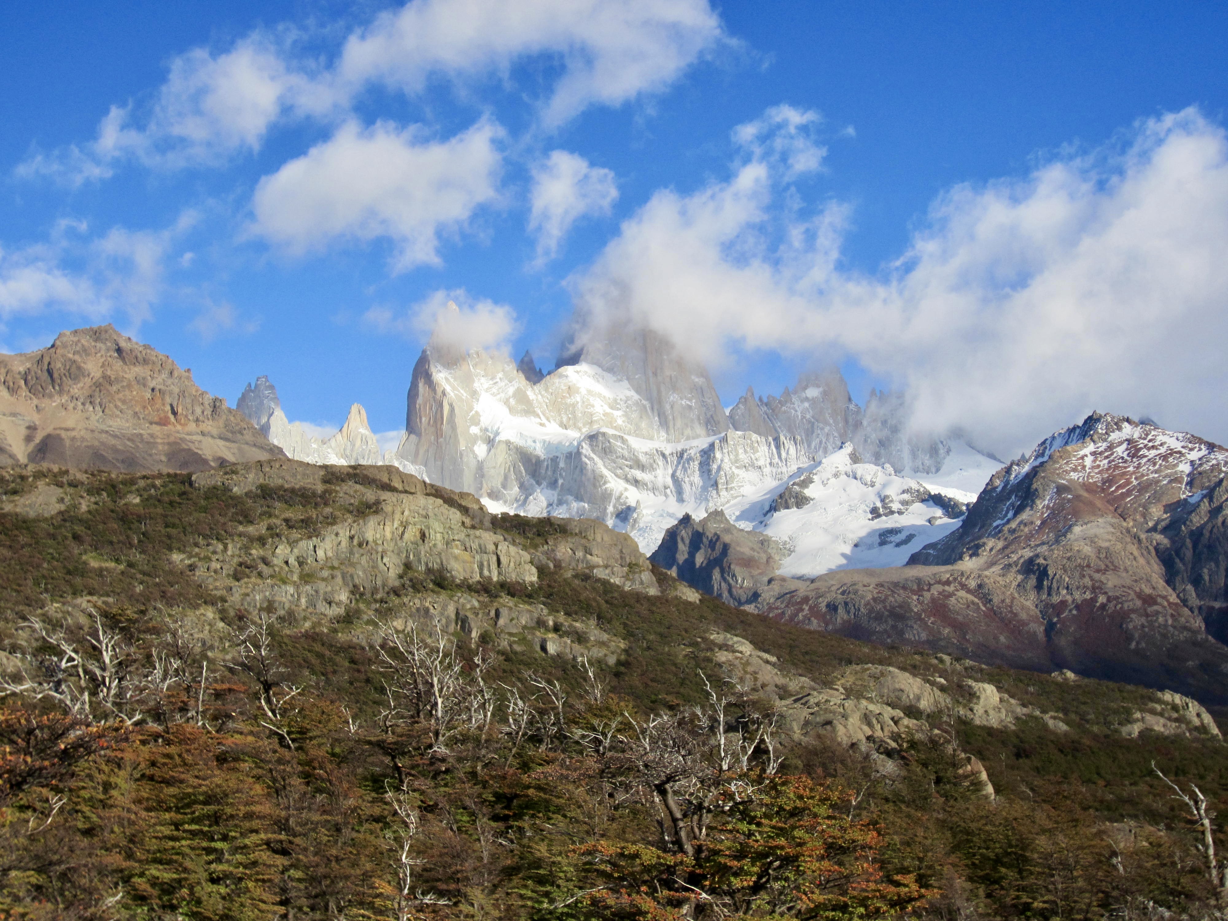
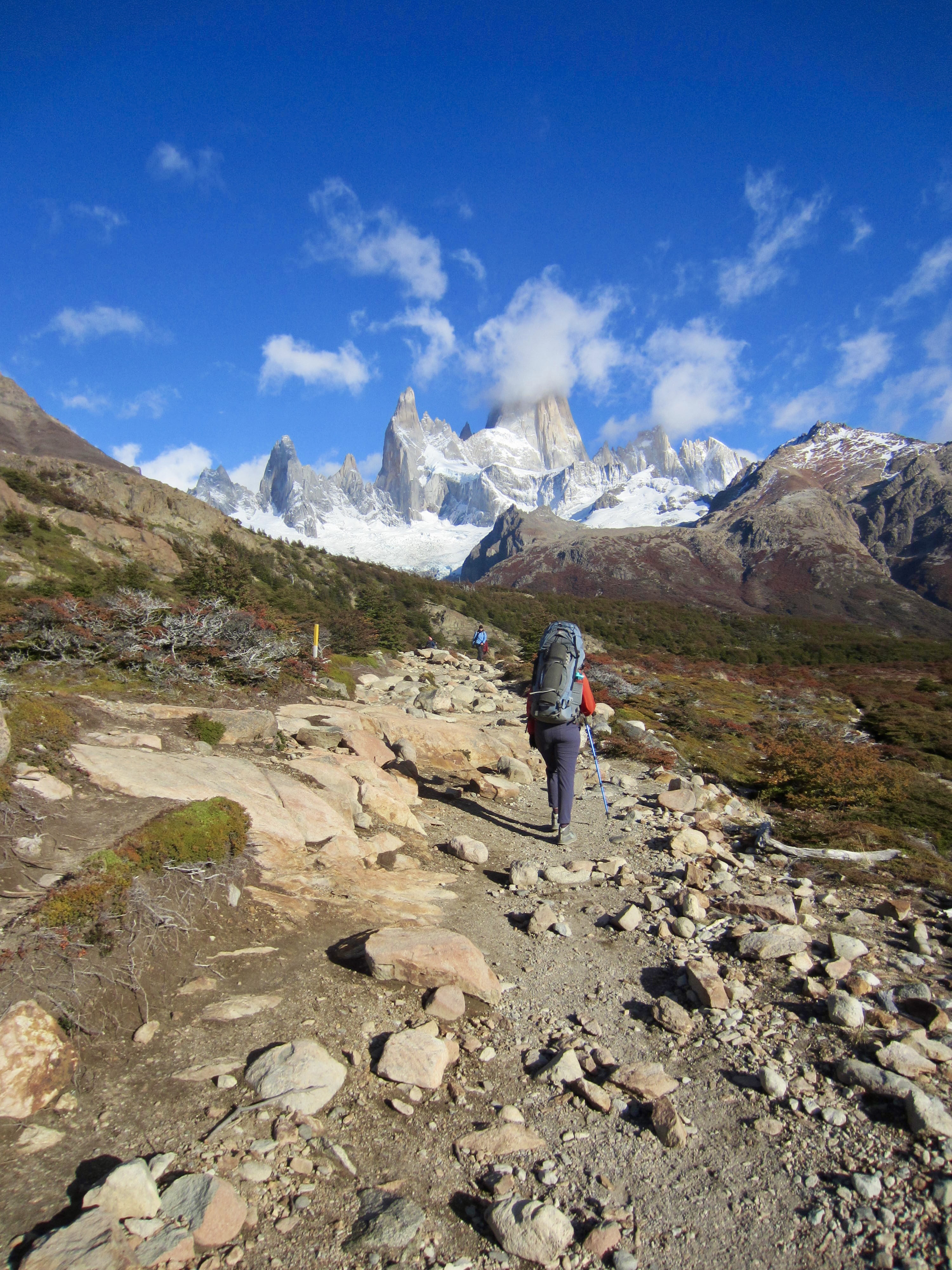
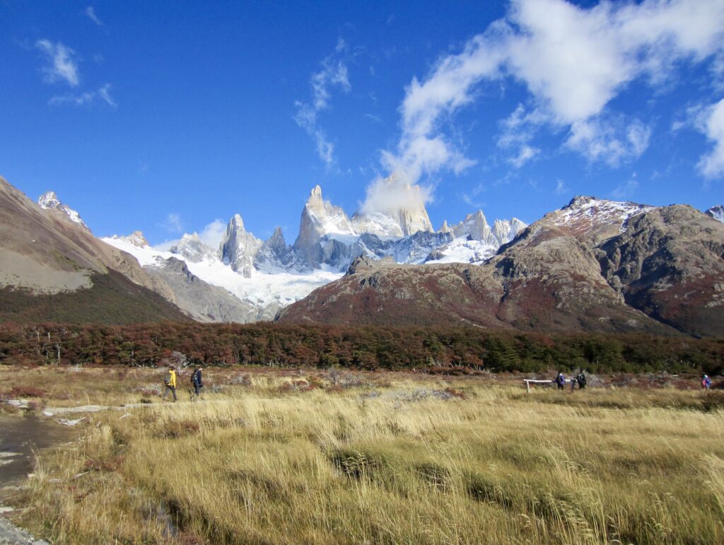
From the viewpoint, the trail dropped into a high, picturesque meadow and passed Lake Capri. More of the Fitz Roy Massif was becoming visible as the clouds gradually dissipated, and within minutes we got an unobstructed look at the monstrous granitic fang of Monte Fitz Roy (or Cerro Fitz Roy, if you prefer) and the adjacent granitic needle of Aguja Poincenot.


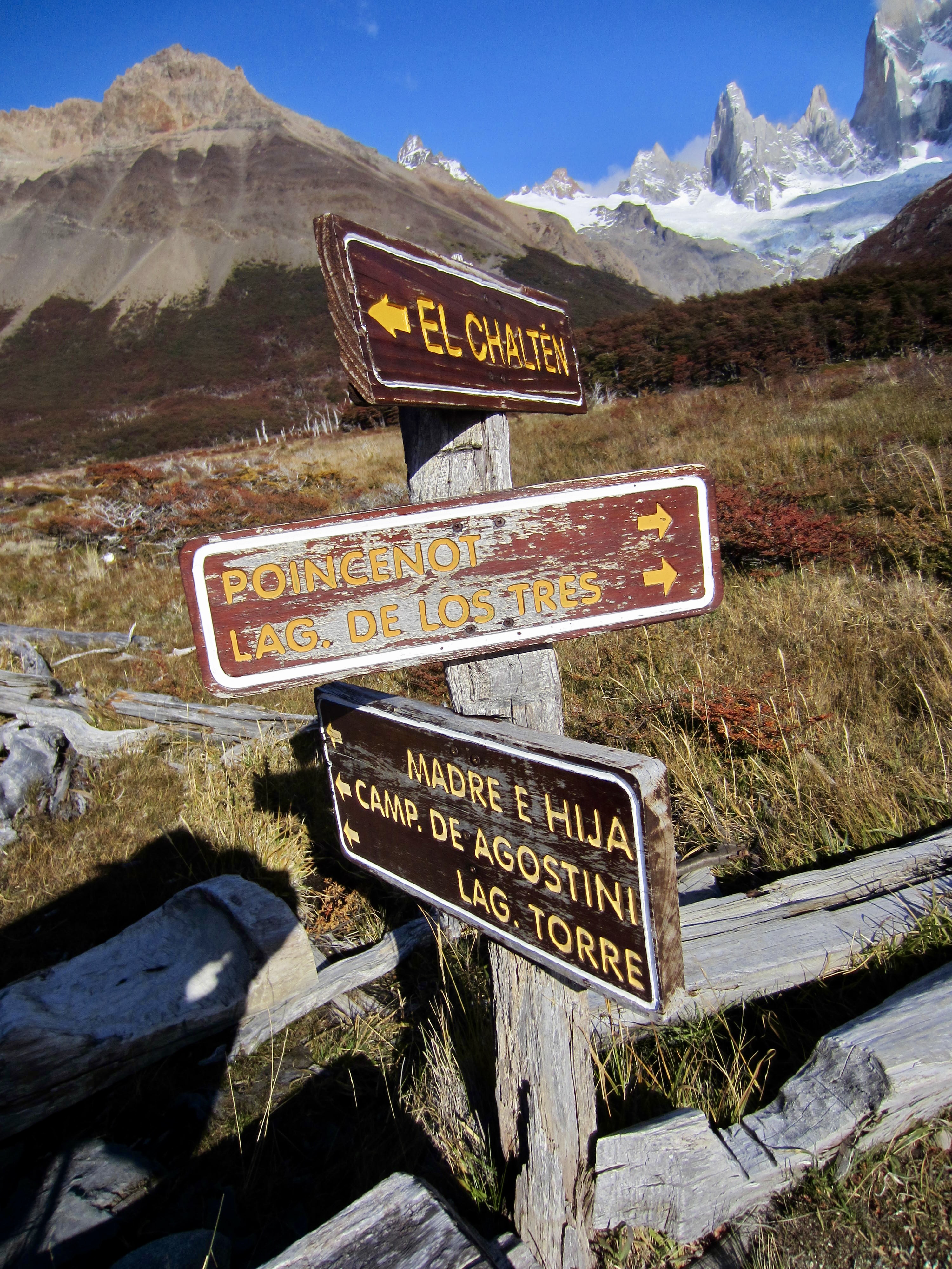
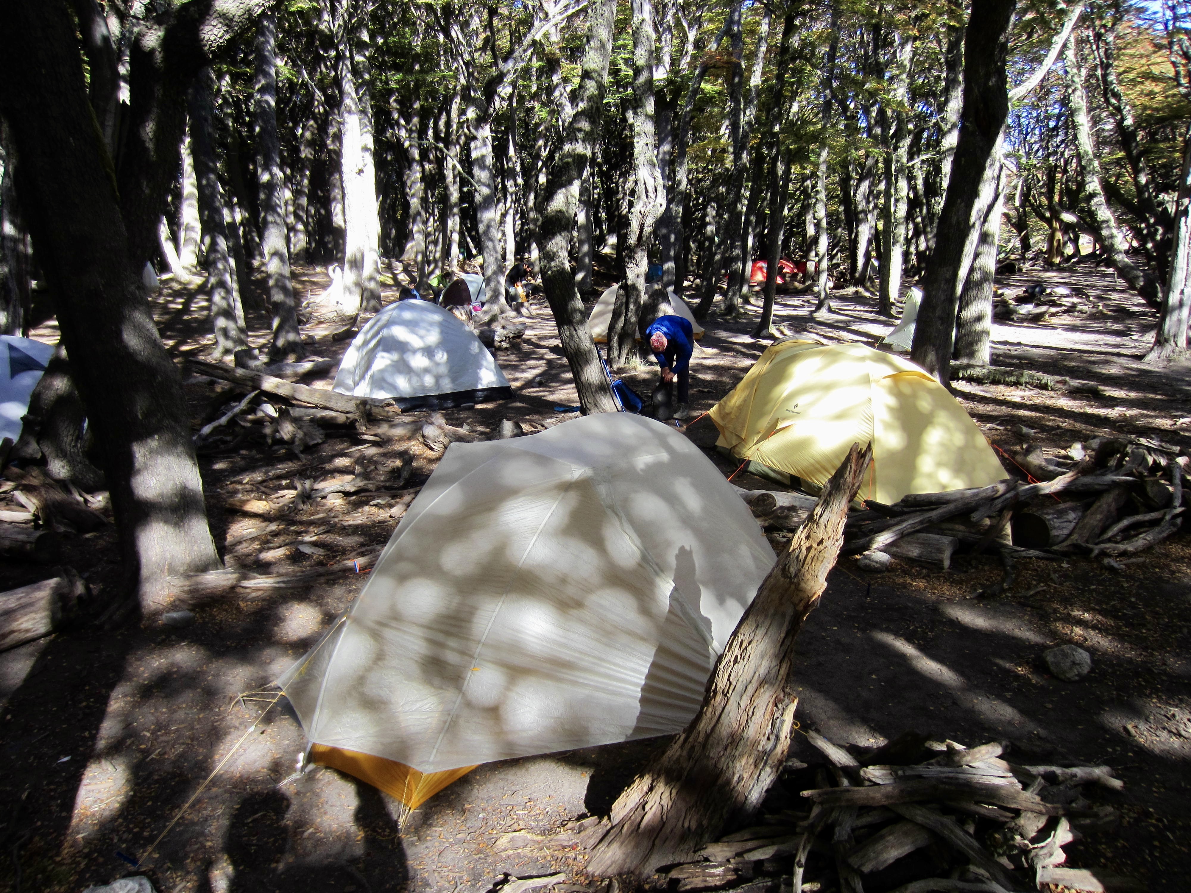
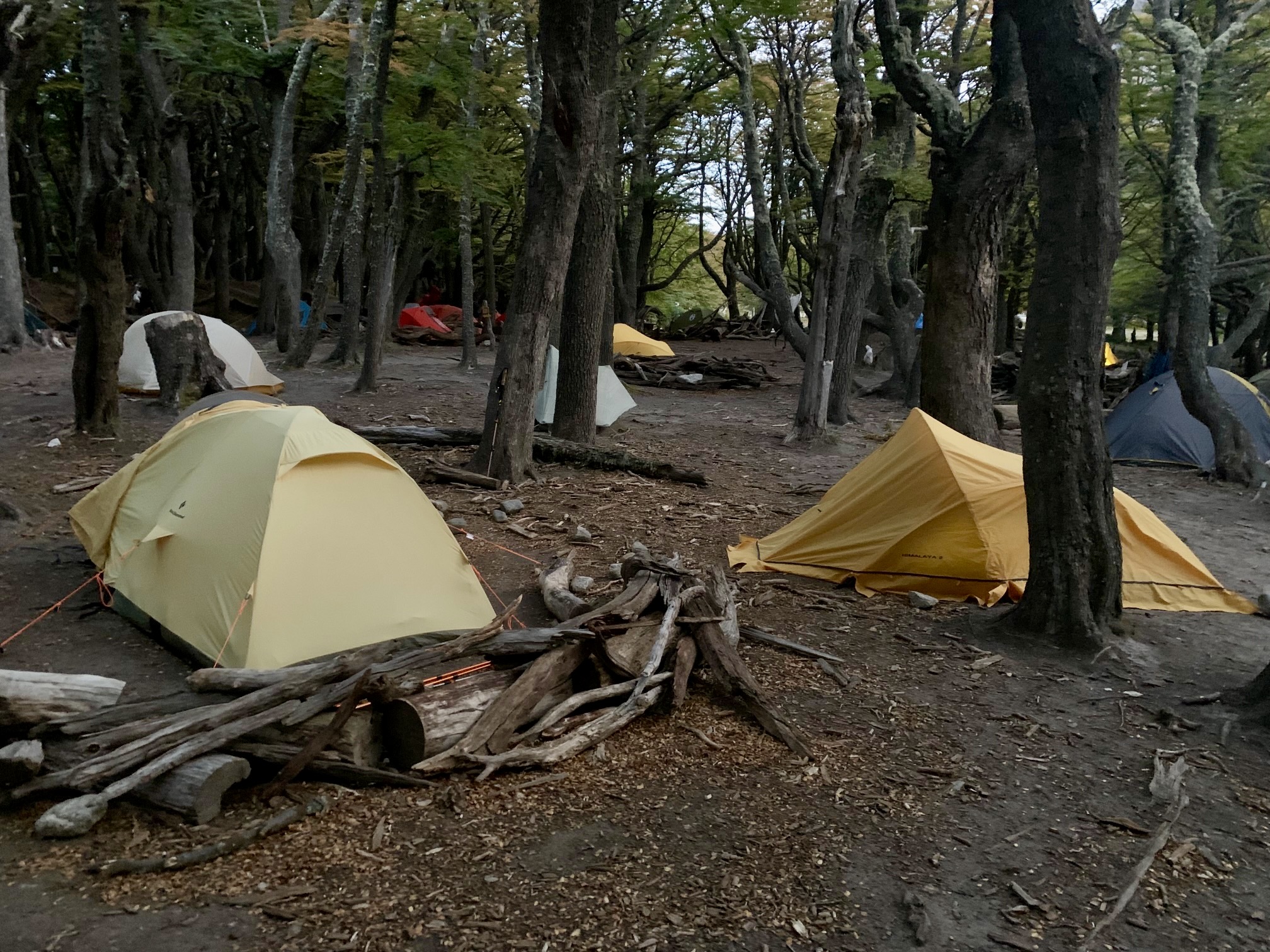
Within the sprawling meadow, we came to a signed junction that marks the northwestern corner of the triangular loop. Here, we continued straight ahead and soon arrived at Poincenot Camp (3.1 hours from TH). This is a roomy and appealing campsite tucked among mature beech trees. Eileen and I pitched our tent and headed out toward Lake de Los Tres with summit packs at noon. Brooke and Josh had been delayed by irresistible photo opportunities in the meadow, so they arrived in camp a bit later and came behind us.
Day 1 (PM): Lake de Los Tres Sidetrip
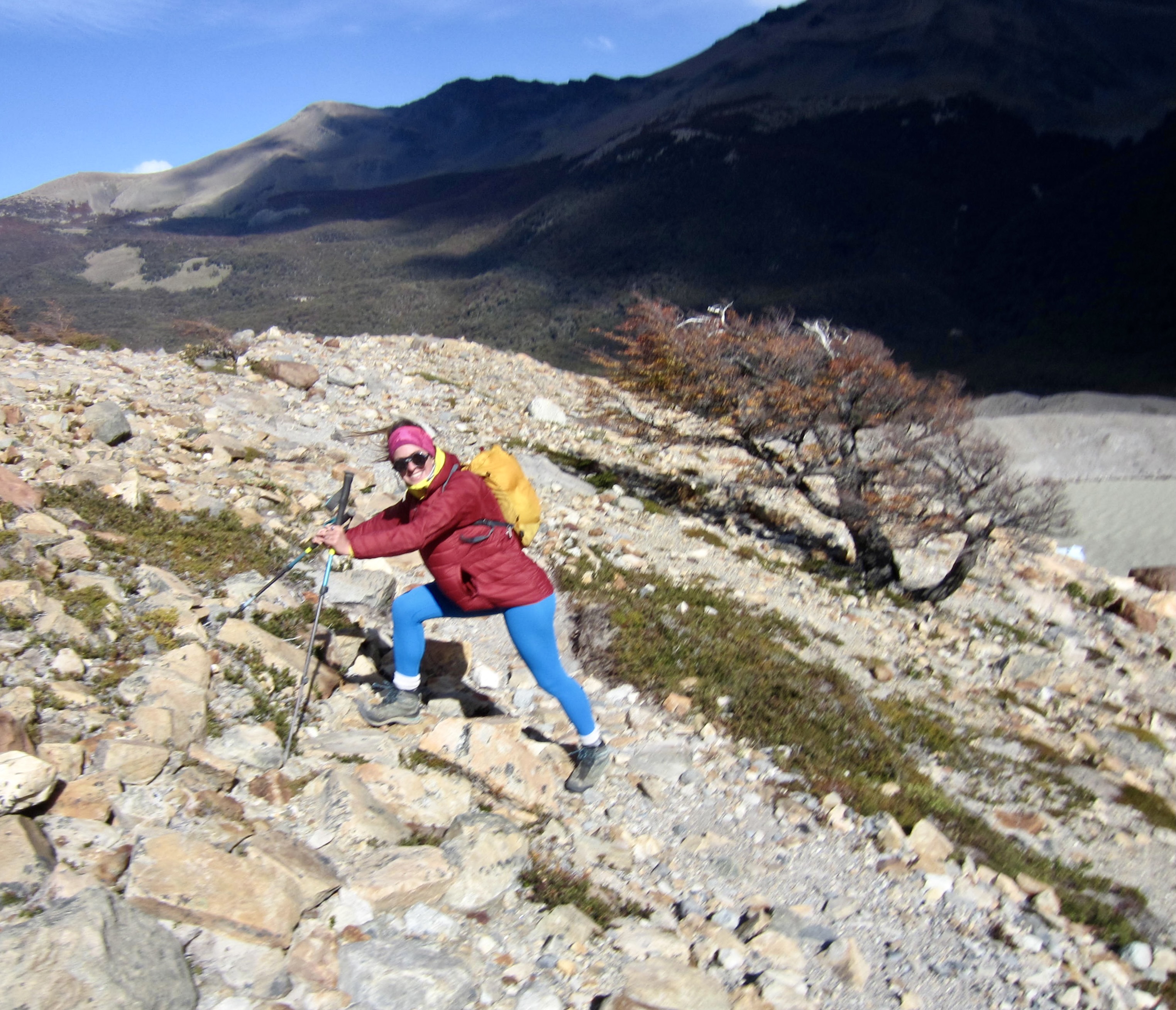
From Poincenot Camp, the 1.6-mile / 2.6-kilometer extension trail to Lake de Los Tres dips down to the Blanco River and then makes a steady westward ascent. This trail, unlike the well-constructed Fitz Roy Trail that we’d just been on, is merely a primitive, boot-beaten path going more or less straight up the hillside. It consists of a wide, braided swath in some places and a deep, eroded, rocky trough in other places. Before long, we found ourselves in a long line of uphill hikers negotiating our way through downhill traffic. If any destination in Patagonia needs a well-built, two-way trail, it must surely be this one.
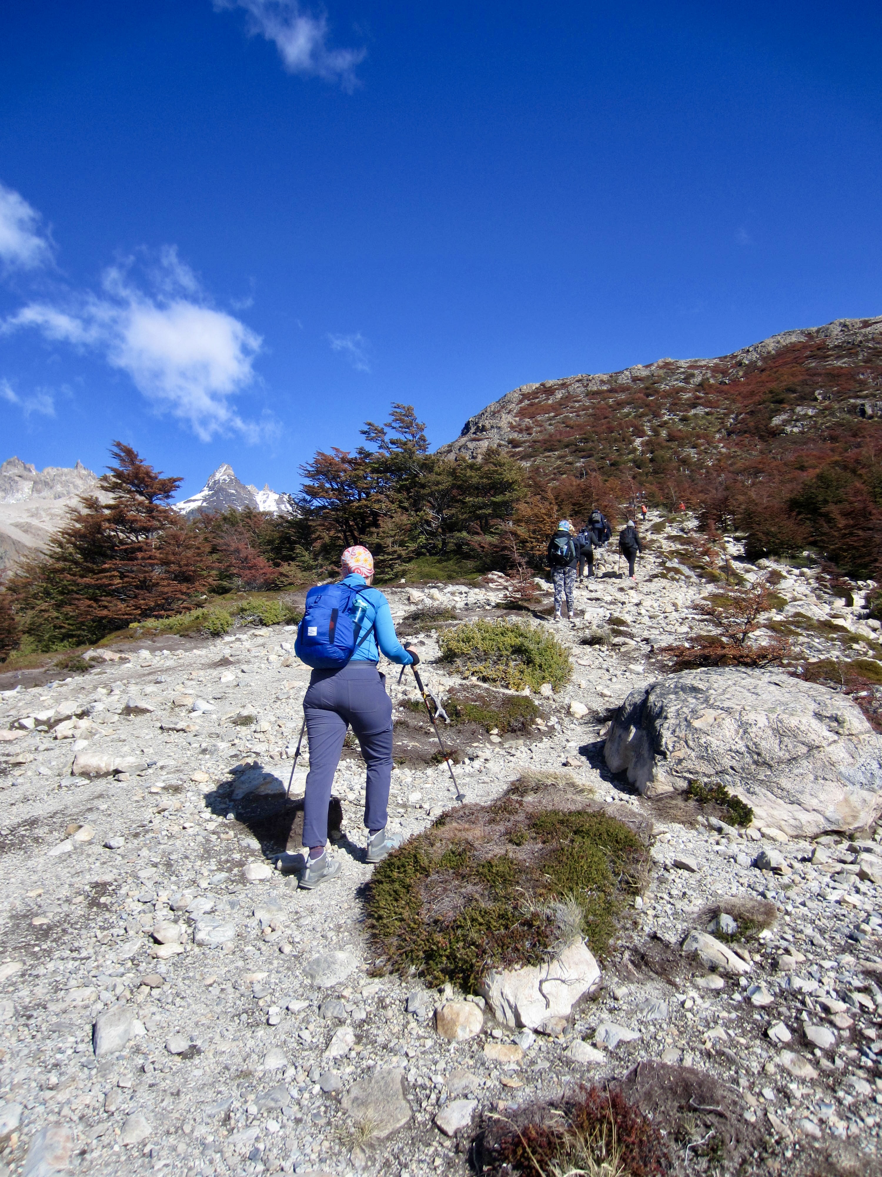
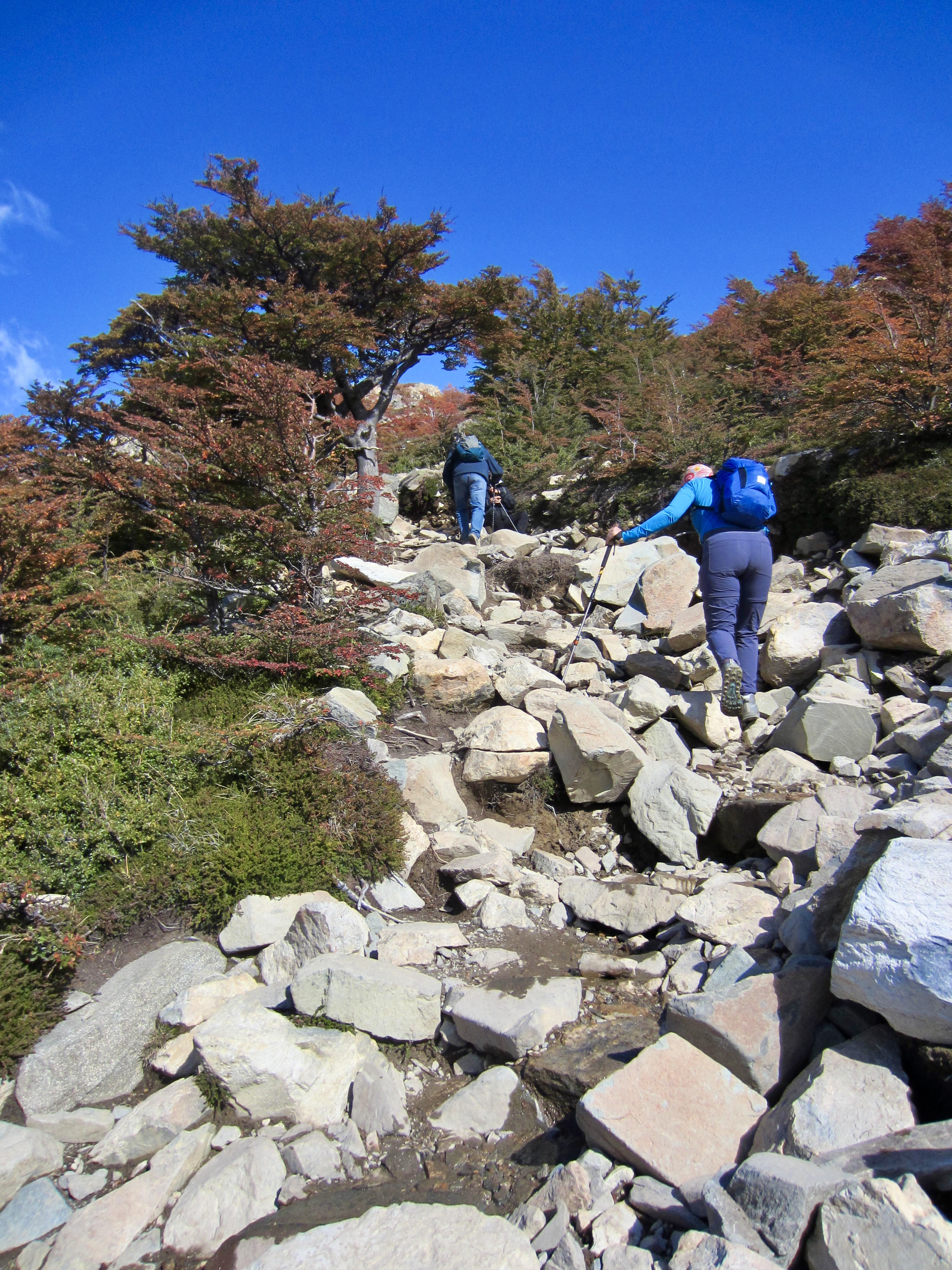
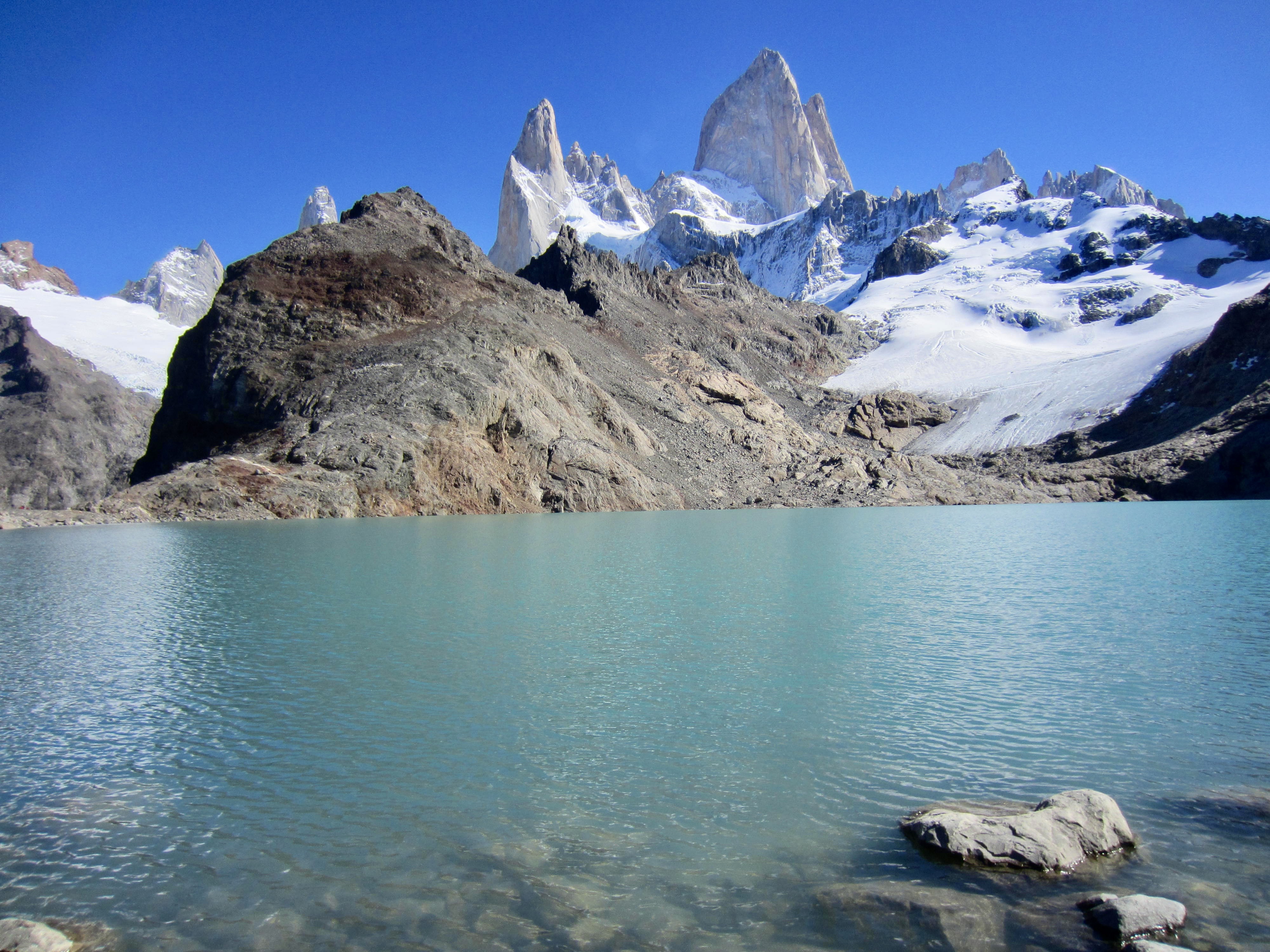
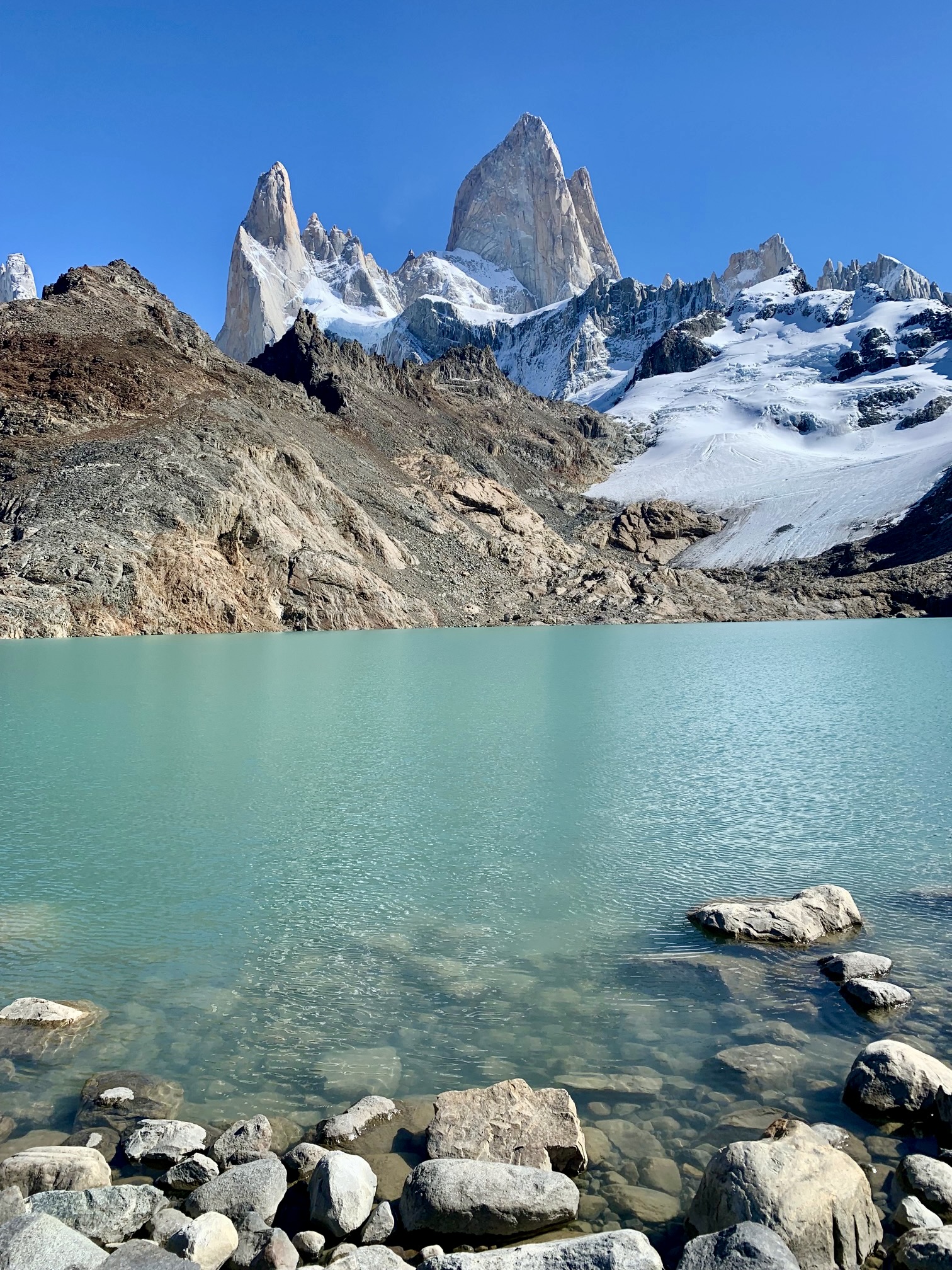
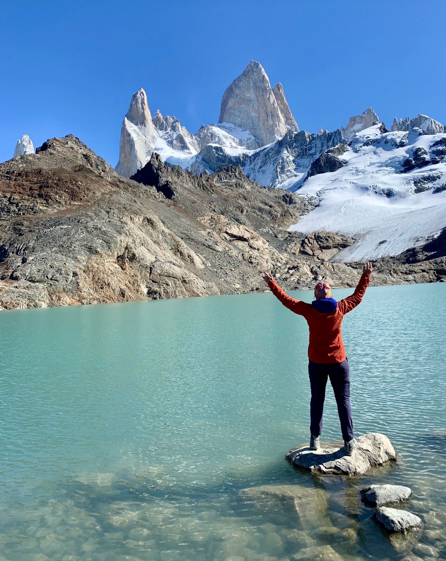
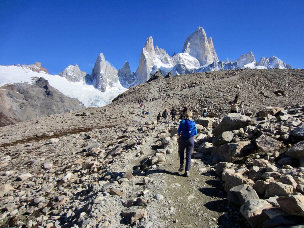
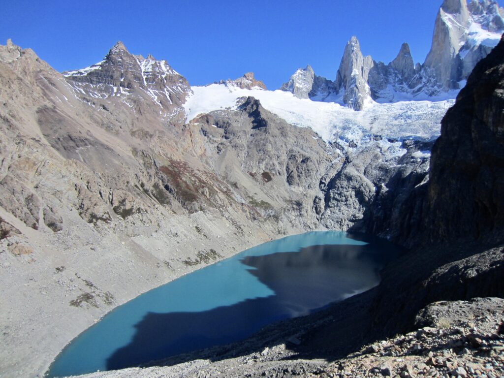
The trail eventually climbed above treeline and made a final traverse up to the crest of a bouldery moraine (1.3 hours + 1500 feet / 460 meters from camp). We were immediately halted by the stunning view of Monte Fitz Roy and its entourage of smaller spires jutting into a cloudless sky behind the jade-green water of Lake de Los Tres. This is one of the most iconic views in Argentina for good reason!
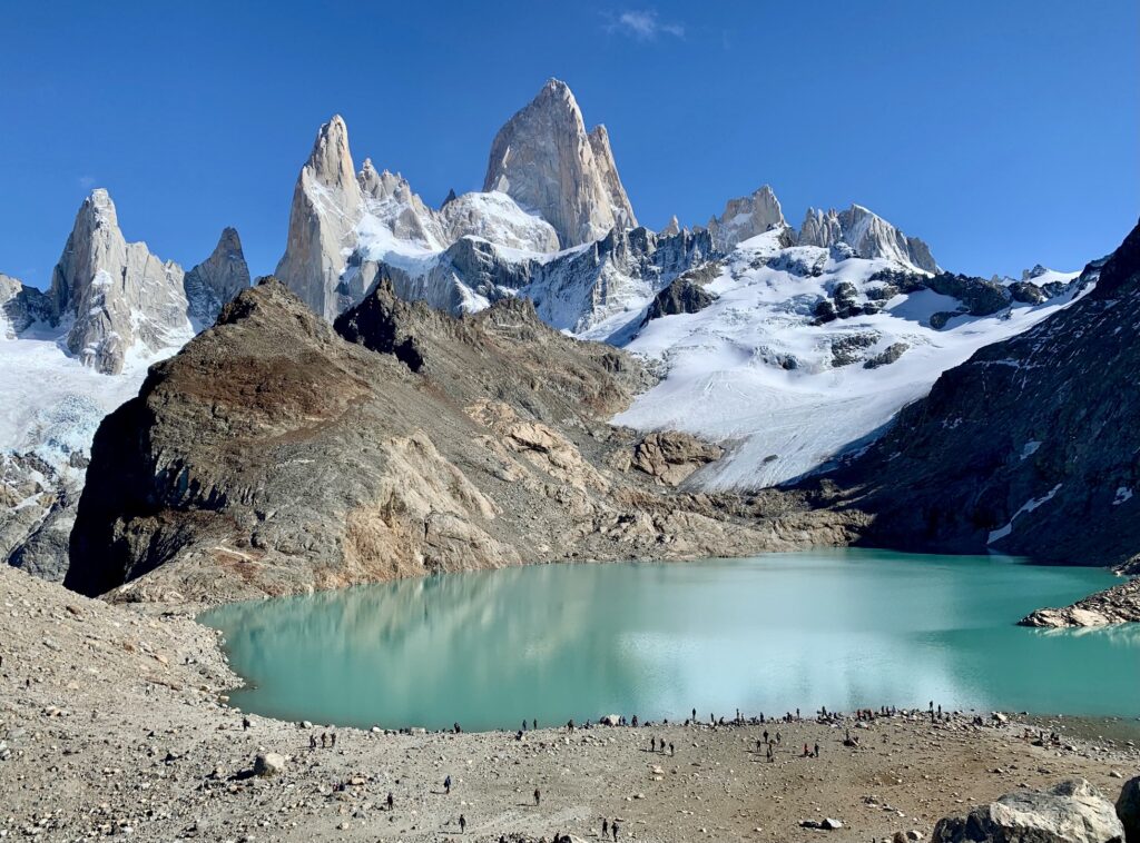
Eileen and I spent two full hours prowling around the lake bowl, marveling not only at the alpine scenery but also at the mass of humanity present on this bluebird Saturday afternoon. A few hundred people were visible at any given moment, and there was a constant flow of people arriving and departing. I would estimate that Lake de Los Tres received a thousand visitors today!
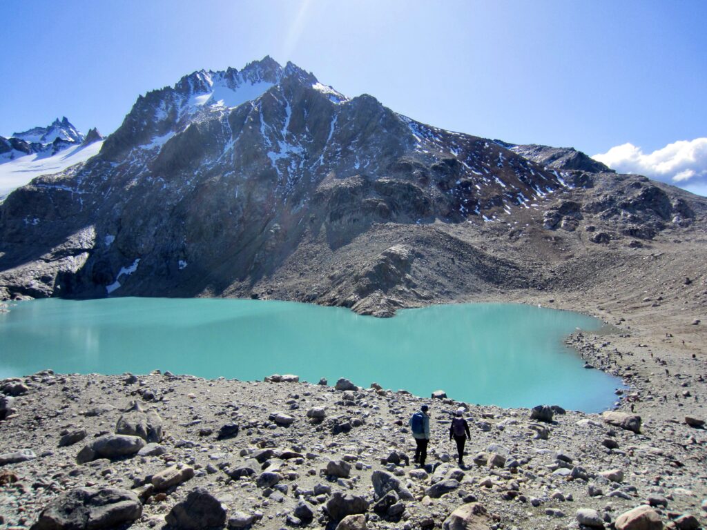

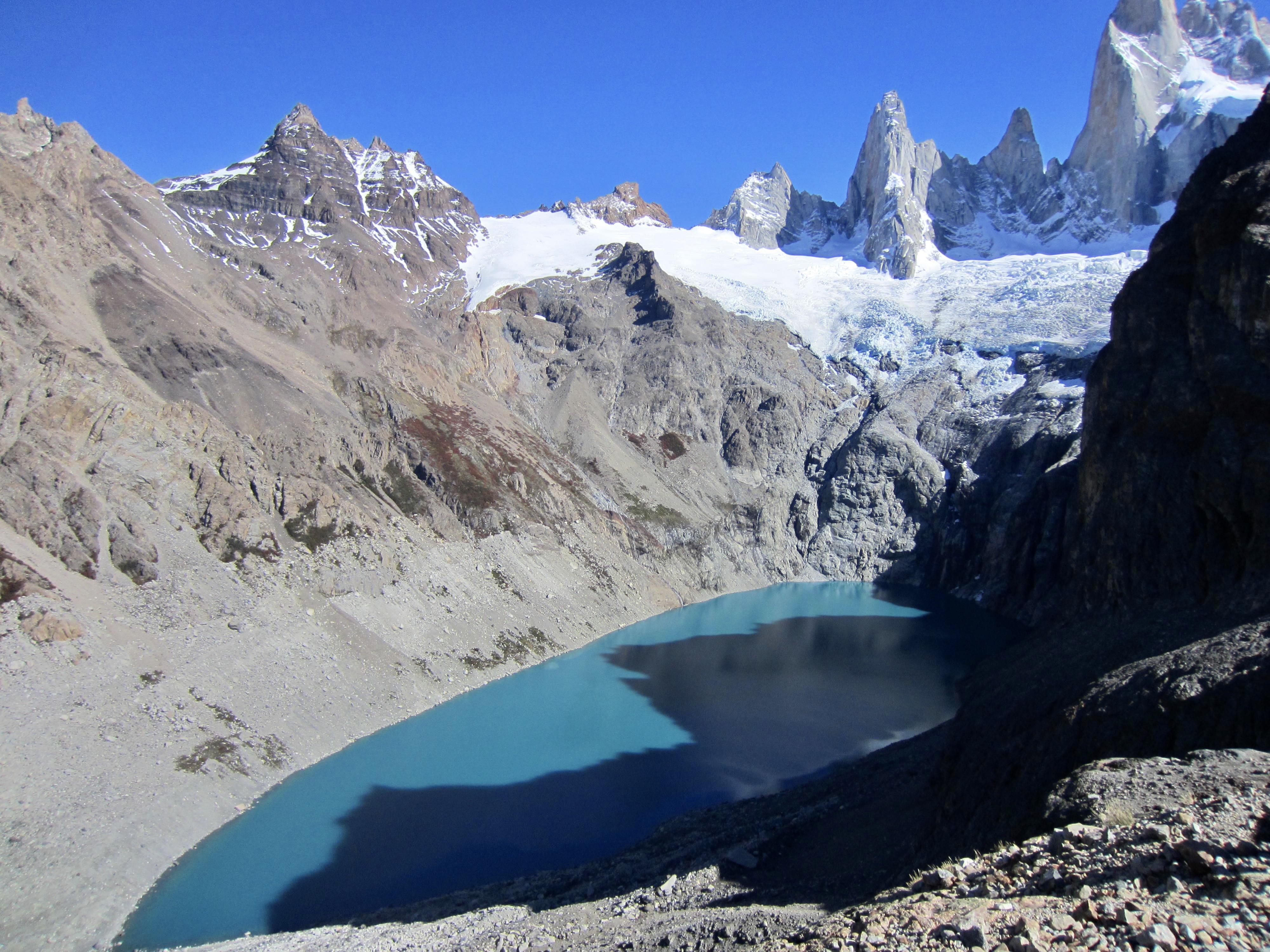
From a rocky hump on the left edge of the bowl, we could look down on nearby Lake Sucia, which translates to “Dirty Lake.” It was puzzling how this lake earned such a name, considering that it actually has a prettier teal color than Lake de Los Tres. I would discover a possible answer to this question tomorrow.
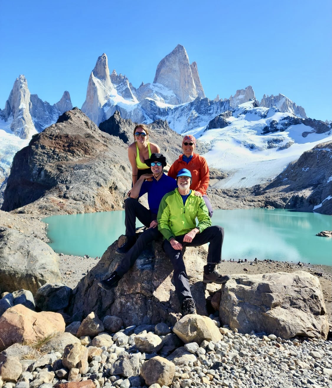
After exploring the area, Eileen and I hiked back up to the moraine crest, where we found Brooke and Josh engaged in a photo shoot. The fabulous weather and mountain backdrop demanded a family portrait before leaving.

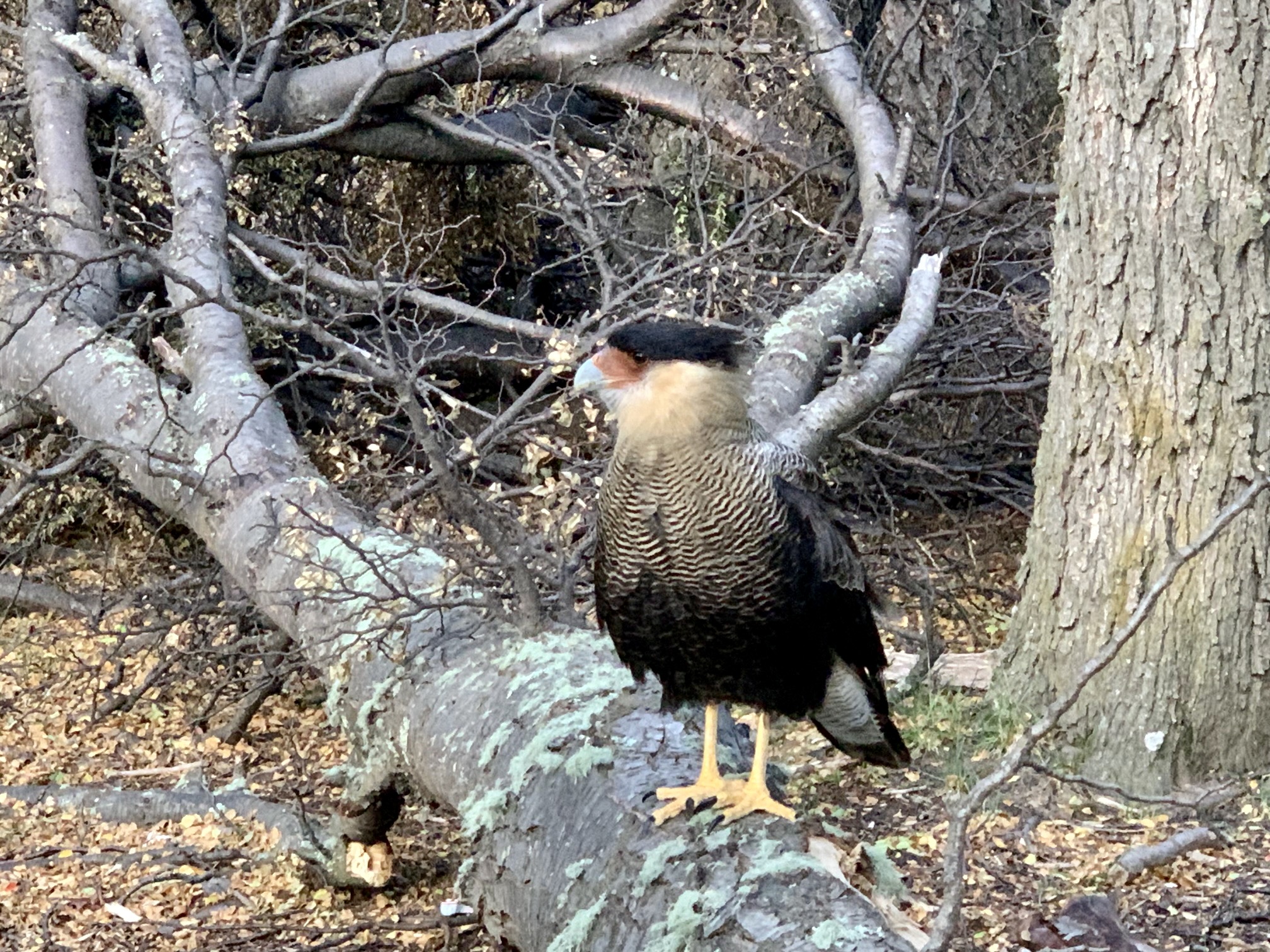
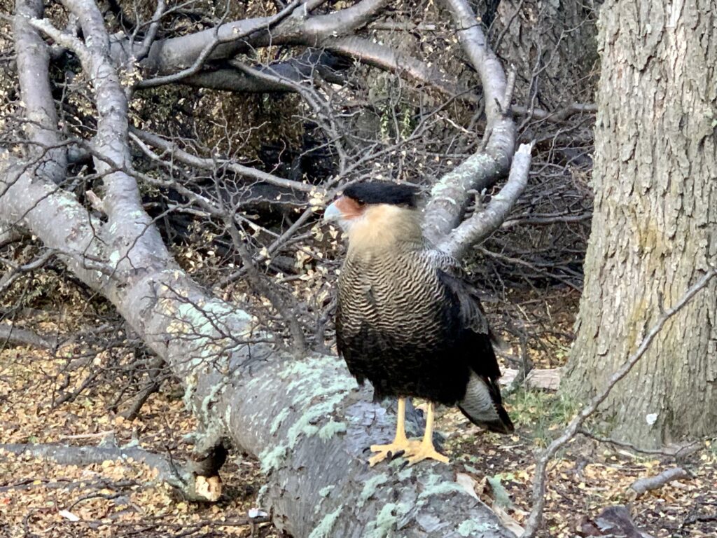
Shortly before 6:00pm, all four of us were back at Poincenot Camp and ready for dinner. While eating outside, we became intrigued by two unusual birds who strutted around us in a rather nonchalant manner. These birds had the overall shape of a chicken but with a distinctively patterned plumage and a headdress that looked like a bad toupee—somewhat reminiscent of Ted Koppel. Later research revealed that these were Southern Crested Caracaras.
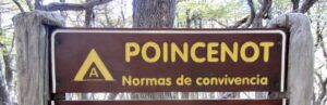
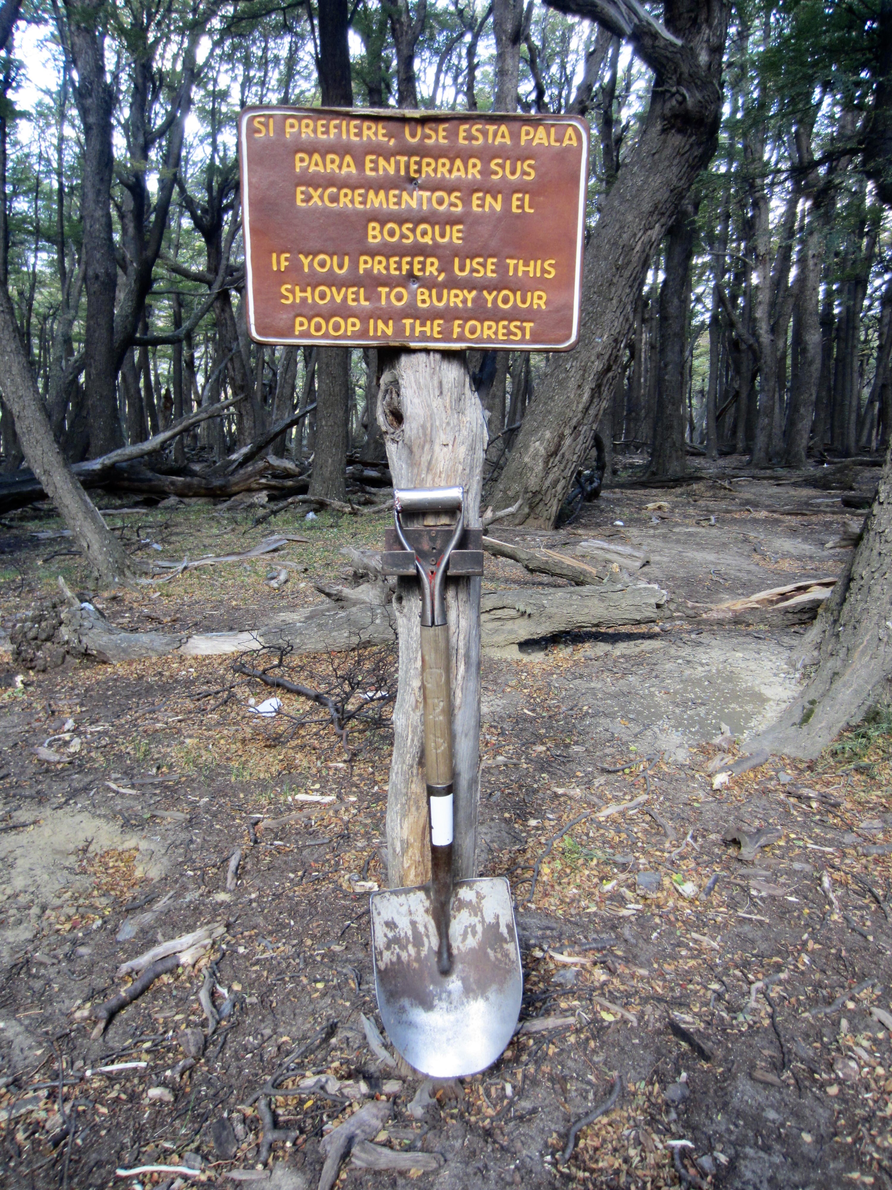
Poincenot Camp has a reputation for being inhabited by hungry mice, so we put all of our food in rodent-proof sacks for the night. Another notable feature of this camp is “The Shovel,” which hangs on a post next to the outhouse. I think the accompanying sign gives an adequate explanation.
…
Day 2: Poincenot Camp to DeAgostini Camp + Lake Torre Viewpoint
I was awakened by the roar of wind at 1:30am, and for the rest of the night our campsite was pounded by strong gusts approaching 60 miles per hour / 100 kilometers per hour. Eileen and I ventured out several times to reset tent stakes and tighten guylines. Come morning, we were all happy to see that our tents had survived but not so happy to find them filled with windblown silt. Three-season tents never perform well in dusty and windy conditions.
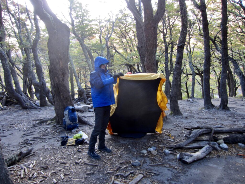
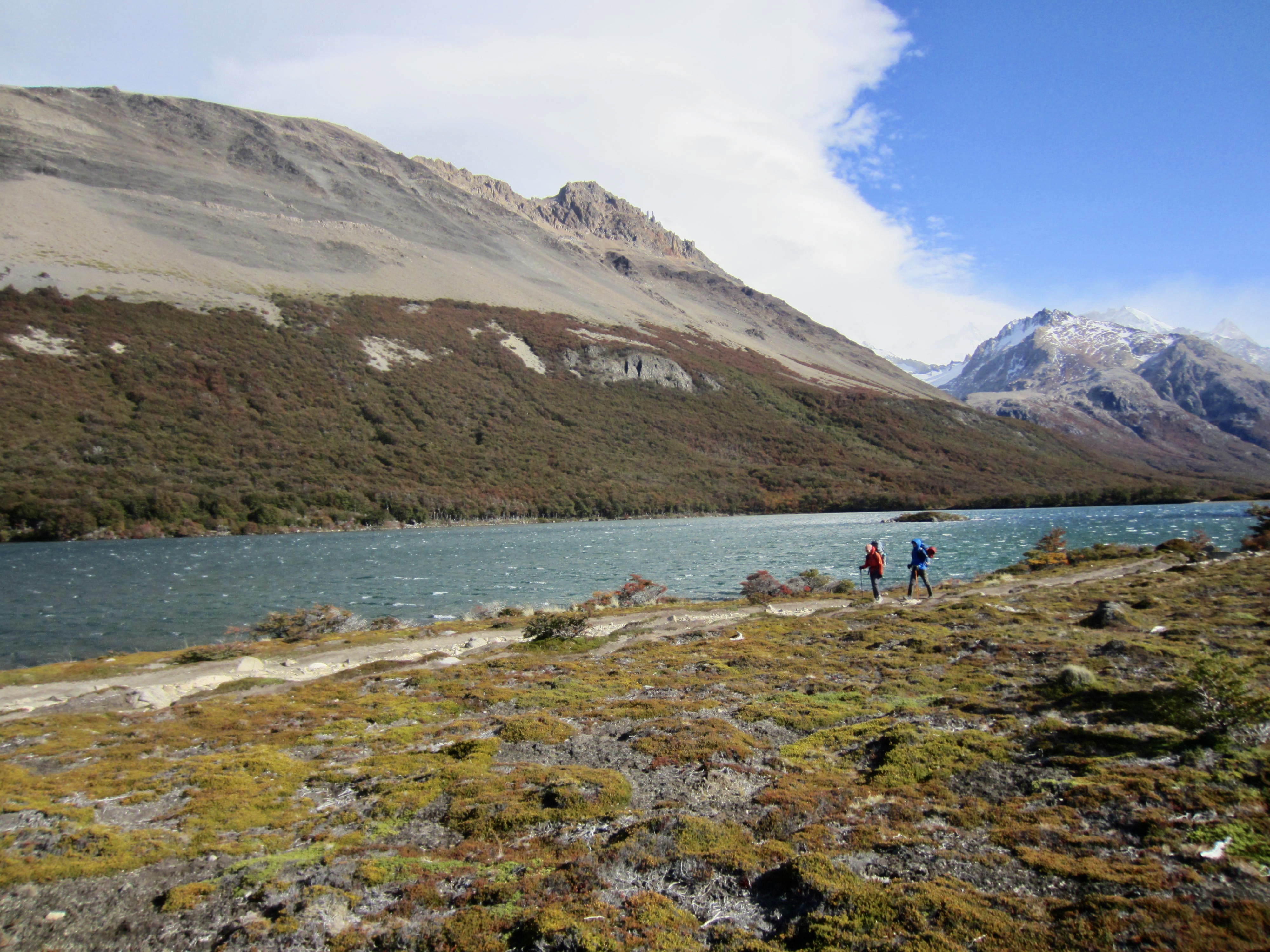
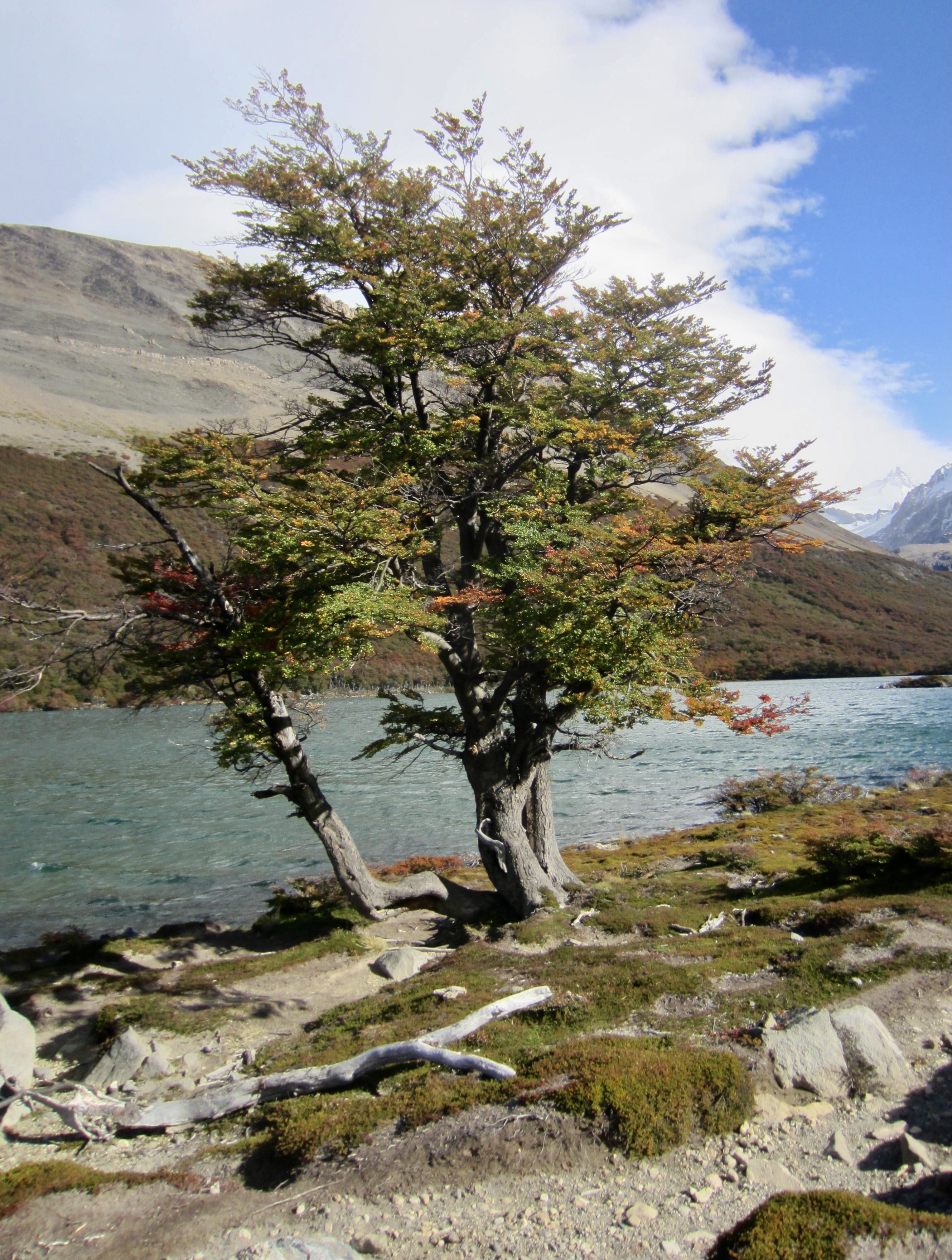
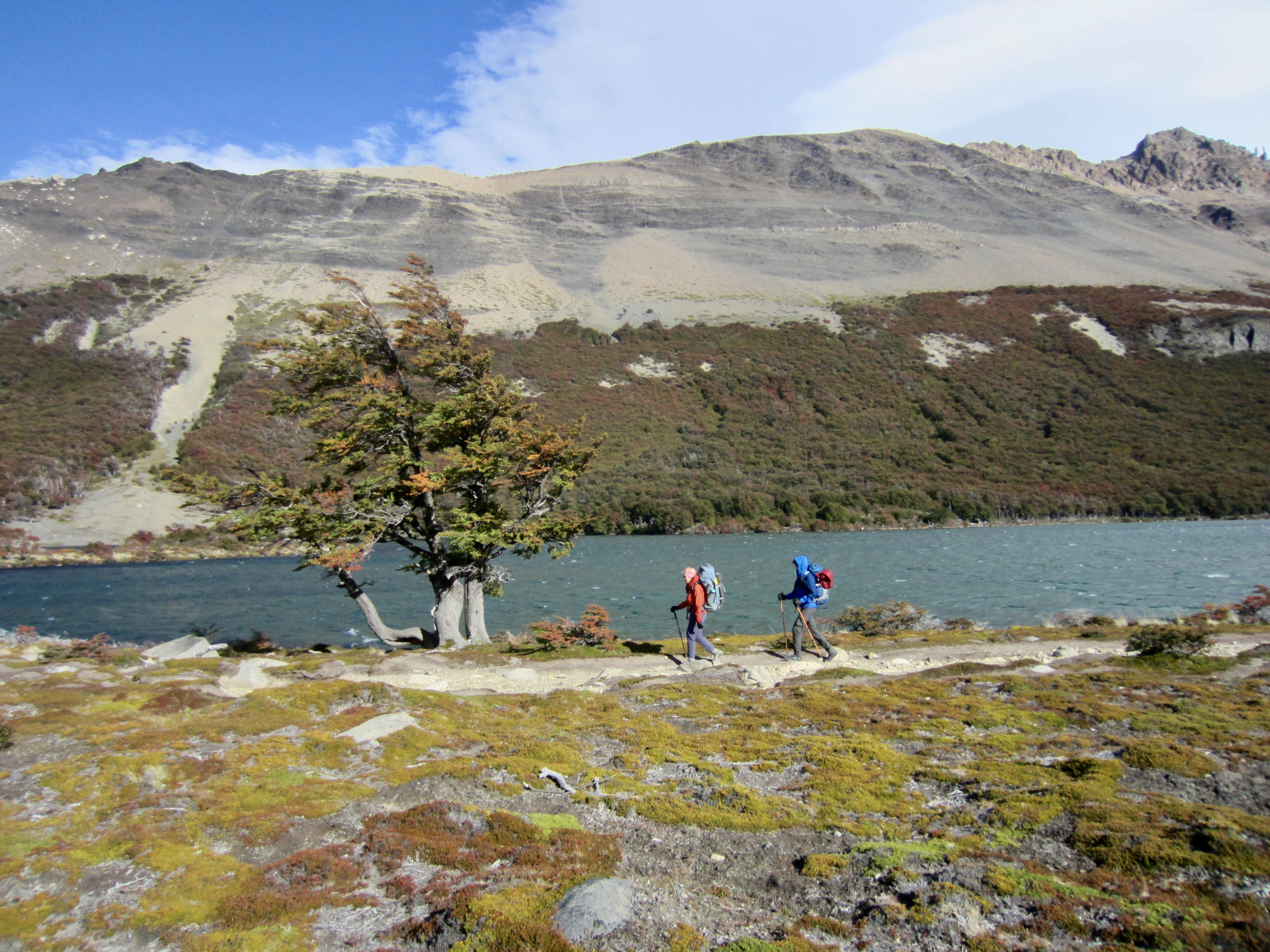
Brooke had also enjoyed the company of a mouse in her tent for most of the night. It provided first-hand evidence that the camp’s reputation is well-earned, but she didn’t find this to be as humorous as the rest of us did. Anyway, we shook off our gear as best we could, packed up, and were on the move by 10:00am. We followed our incoming trail back to the meadow junction, then turned onto the southbound leg of the triangle, which took us past Lakes Madre, Hija, and Nieta—the “mother, daughter, and granddaughter” lakes.


Beyond the lakes, the trail entered dense forest and descended into the Fitz Roy River Valley. Along the way, we were overtaken by a few trail runners, then a few more, then a lot more. Unbeknownst to us at the time, there was an officially sanctioned trail run being held on the Fitz Roy Loop! I tried to get into the race spirit by offering the runners encouraging cheers of “looking good!” in broken Spanish—something that Josh soon regretted teaching to me.

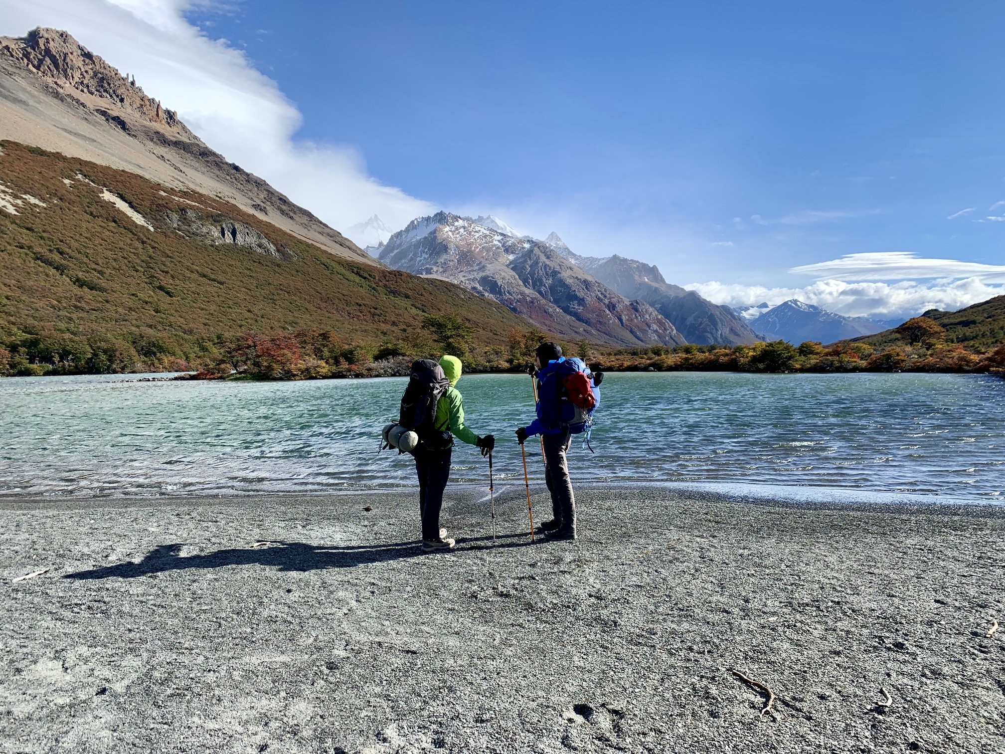
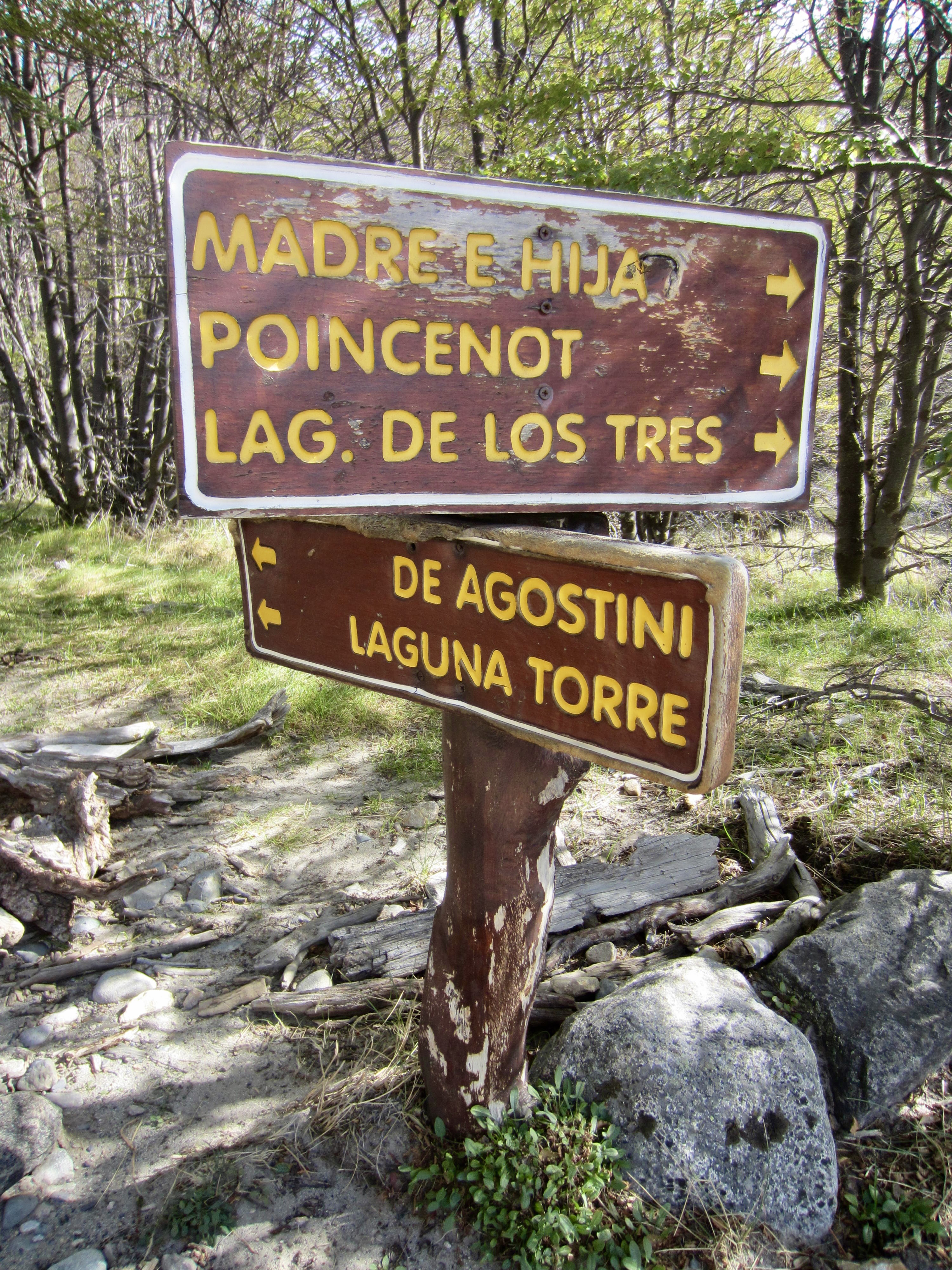
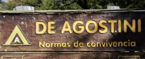
In the valley bottom, we came to a junction with the Lake Torre Trail, marking the southwestern corner of the triangle. We turned west and hiked 2 miles / 3 kilometers up the broad valley to DeAgostini Camp, a small, woodsy campsite alongside the silty Fitz Roy River (4.4 hours from Poincenot Camp).
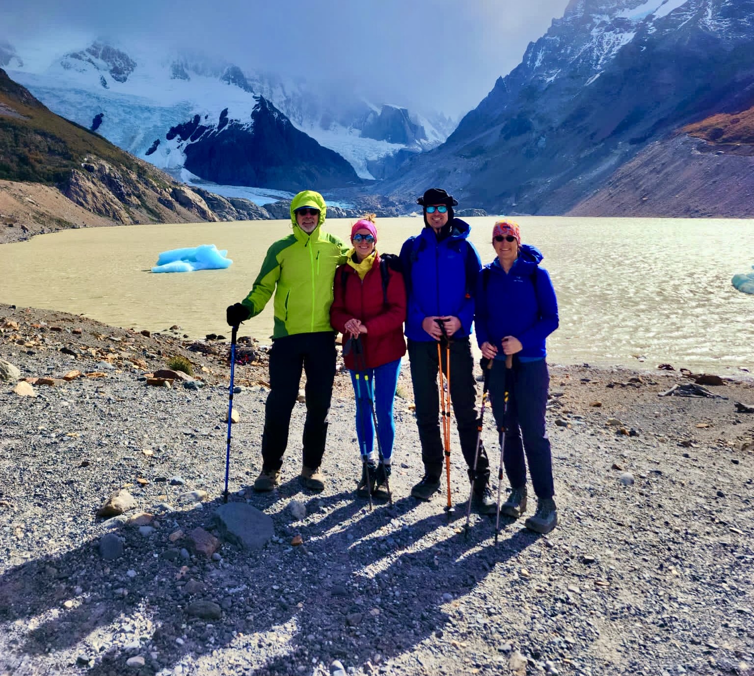
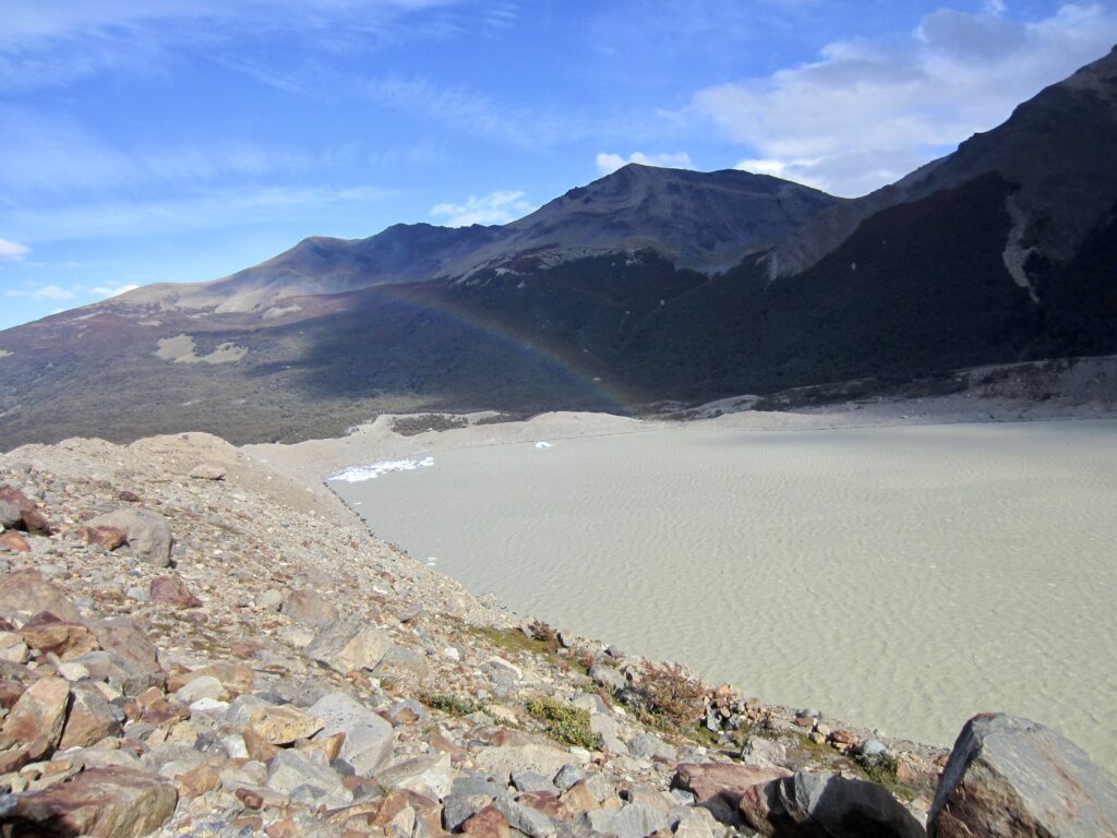
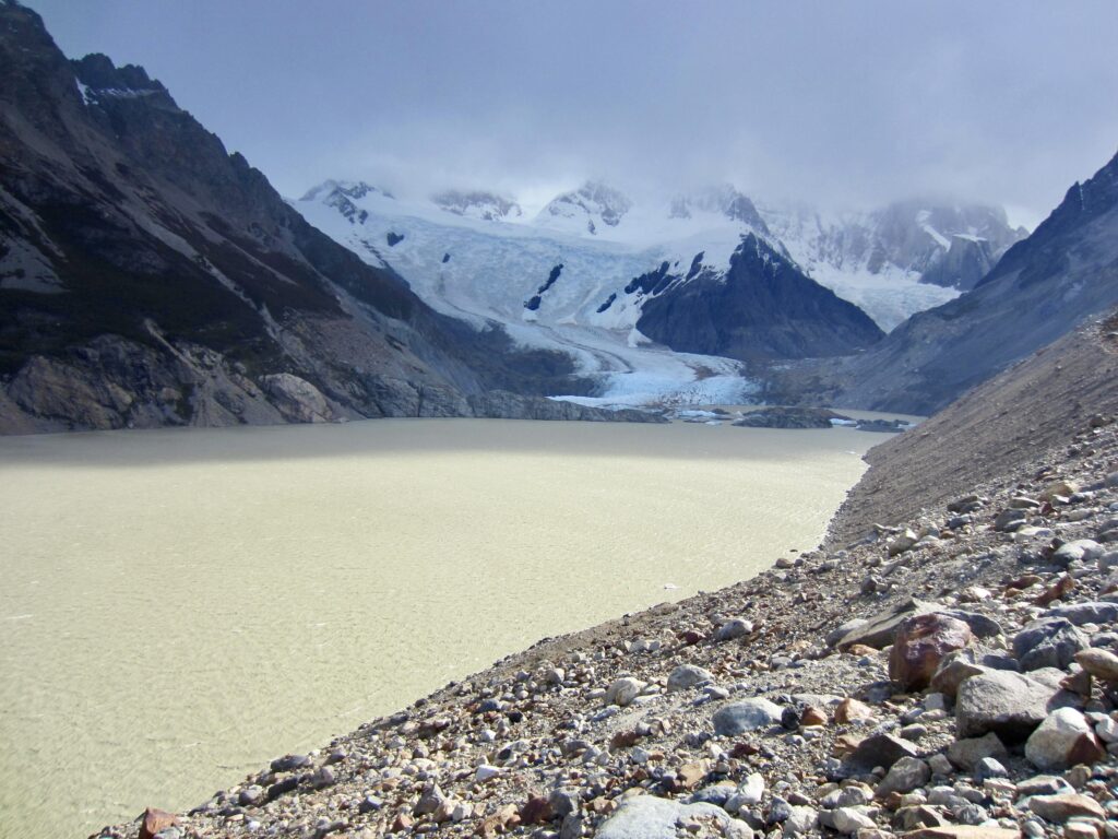
We dropped our backpacks in the campsite and took a short hike up to Lake Torre. Although not nearly as famous and attractive as Lake de Los Tres, Lake Torre is on the standard approach route to world-renowned Cerro Torre—a spike of golden granite crowned with a mushroom of pure white rime ice. Unfortunately, the peak remained hidden in storm clouds all day.
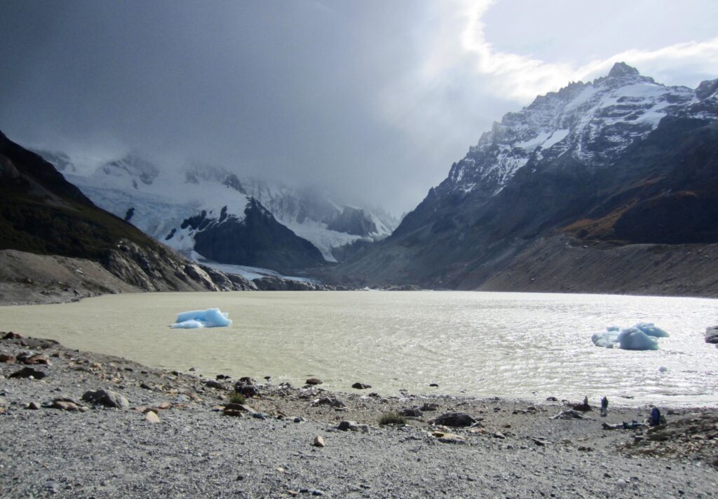

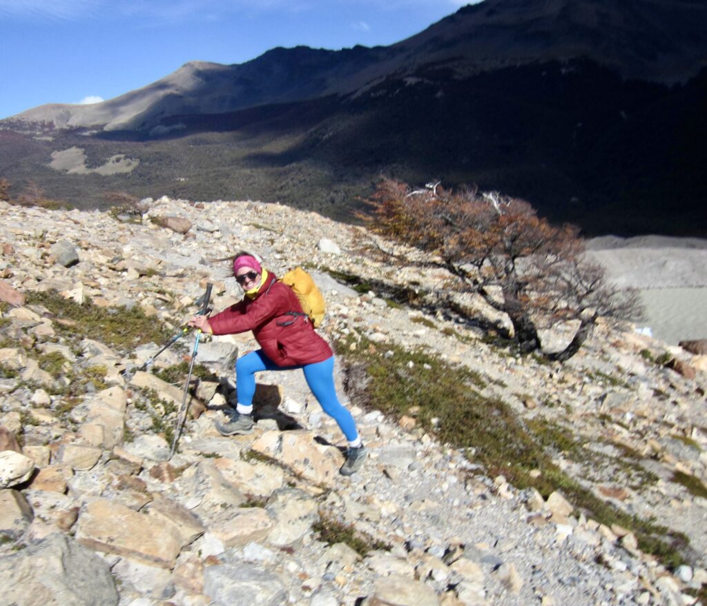
For a little afternoon entertainment, Brooke and I decided to walk out to a viewpoint on the northern side of the lake. We followed a crude path along the crest of a moraine that was completely exposed to winds coming down the Torre Glacier. A powerful gale battered us relentlessly, and the strongest gusts caused us to stop and brace ourselves. After a half-hour of slow progress, we ducked behind a large boulder in surrender. This was feeling like the real “Patagonia Experience”!
Our semi-sheltered perch on the moraine gave us a good view of Lake Torre, whose water has been turned into the color of chocolate milk by a heavy load of glacial silt. It occurred to me that this truly deserves to be named Lake Sucia (“Dirty Lake”) rather than the pretty teal lake adjacent to Lake de Los Tres. I suspect that a cartographer mislocated the name on a map at some point in the past.
Brooke and I fought our way back across the moraine and descended to DeAgostini Camp. Eileen and Josh appeared a while later, having gone down-trail to fetch clean water. We had a group discussion about whether to spend the night here or to hike out tonight. Brooke and Josh decided that the forecast of rain and the prospect of mice was sufficient reason to hike out, so off they went to our hotel in El Chalten. Eileen and I decided to spend the night here, as we weren’t too concerned about rain or mice. How bad could it be?
Scant minutes after Brooke and Josh left camp at 5:00pm, Eileen and I heard the first raindrops hitting our tent. By midnight, it had been raining steadily for six hours, and water was seeping through the fabric of our tent. That hotel room was starting to sound pretty good!
Day 3: DeAgostini Camp to Lake Torre North Trailhead
Moderate rainfall and wind continued unabated throughout the early morning hours. Eileen and I spent the whole time catching brief periods of sleep, wiping up ponded water from our tent floor, and trying to ignore the water that was dripping onto our faces. We started packing up at 5:00am and, after breakfast in the tent, were hiking by headlamp at 6:30am.
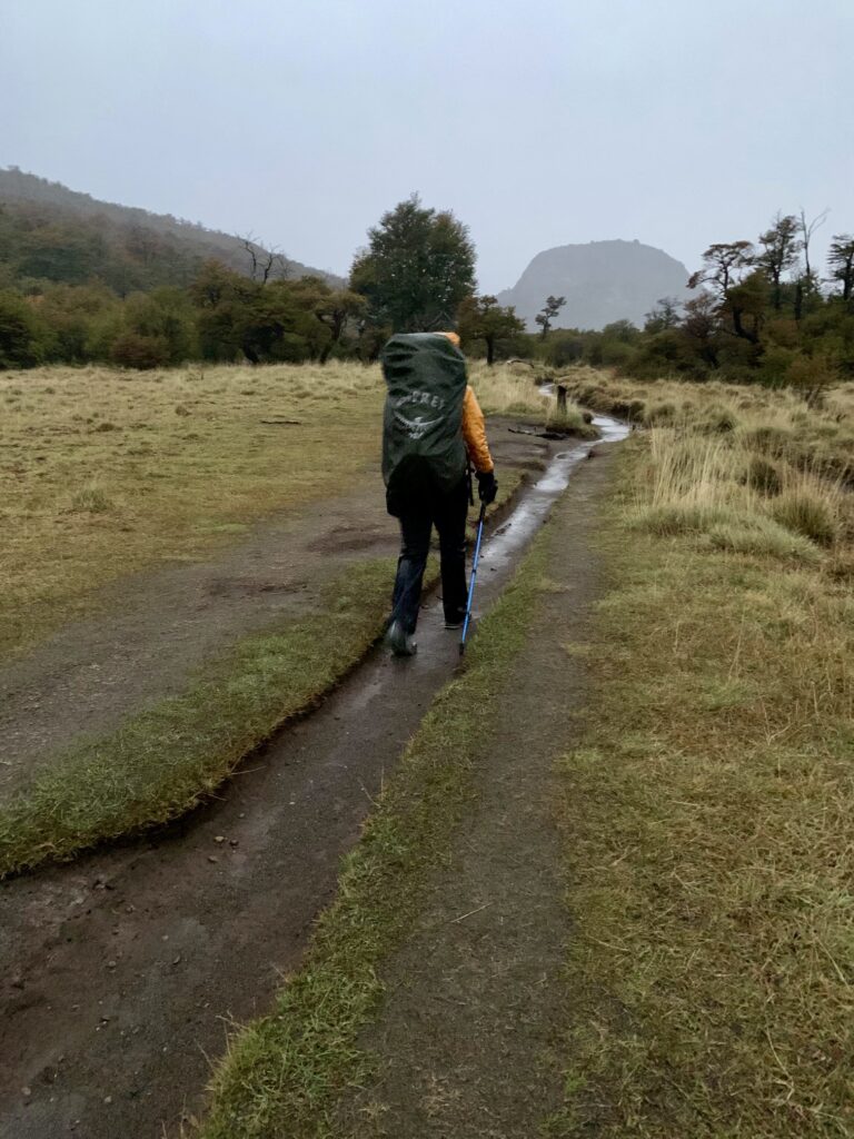
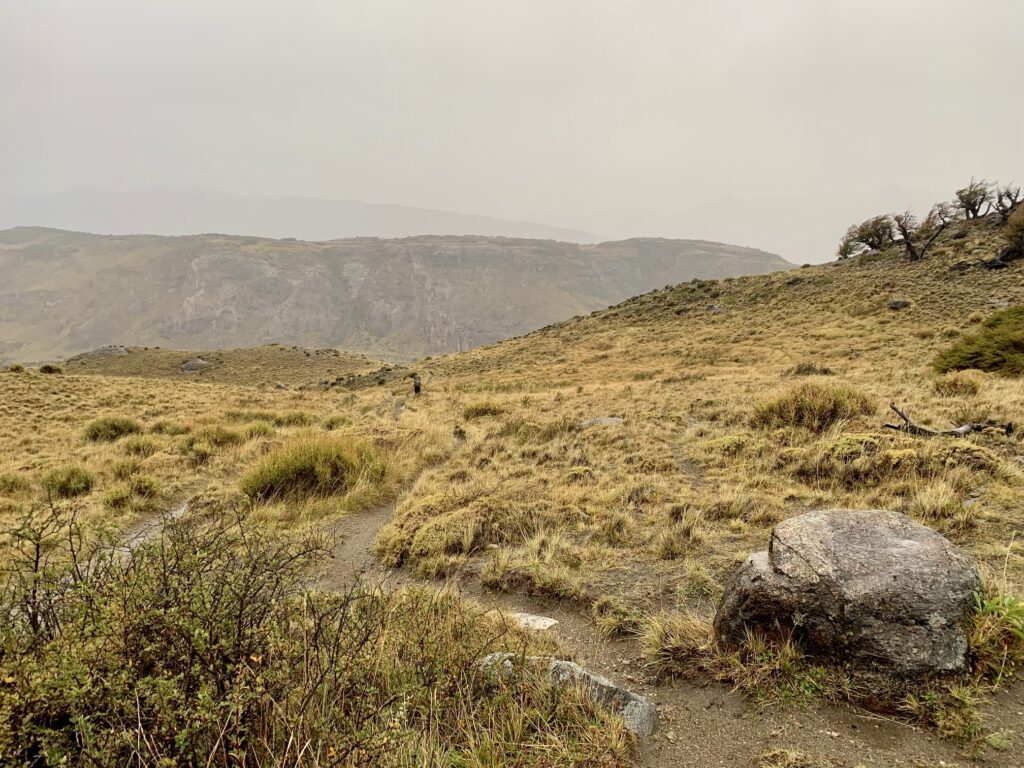
For two hours, we slogged through the dark and dusk and rain, dodging puddles on the inundated trail until coming to a fork. The right fork was marked with an “El Chalten” sign, but we took the unmarked left fork, which would get us closer to the northern end of town. This trail turned out to be quite nice, and it led us past several impressive rock-climbing boulders scattered around grassy fields.
The weather worsened considerably during our descent into the valley. As we leaned into the wind-driven rain, getting soaked to the core, it seemed that we were finally getting the complete “Patagonia Experience”!
At 9:30am (3.0 hours from camp), we popped out at an unmarked trailhead on Las Loicas Street in the northwestern part of El Chalten. This was very close to our starting trailhead and a short walk to our hotel, where Brooke and Josh had spent the night. If success is measured by hours slept, they definitely made the better decision, but if success is measured in misery experienced, Eileen and I looked brilliant!
Route Maps & Profile
…
…
…
Photo Gallery
Click to enlarge…