Trip Date: February 15, 2023
Superstition Peak Day Climb
Carney Spring
Carney Pass
Superstition Ridge Saddle
Superstition Peak aka Superstition Benchmark (5057 ft)
Trip Report Summary
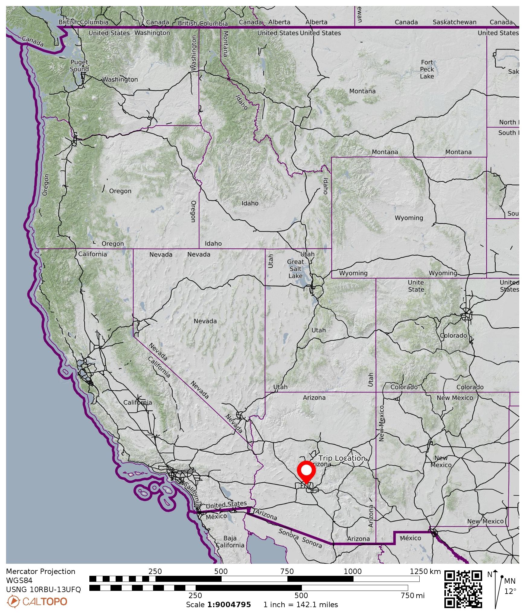
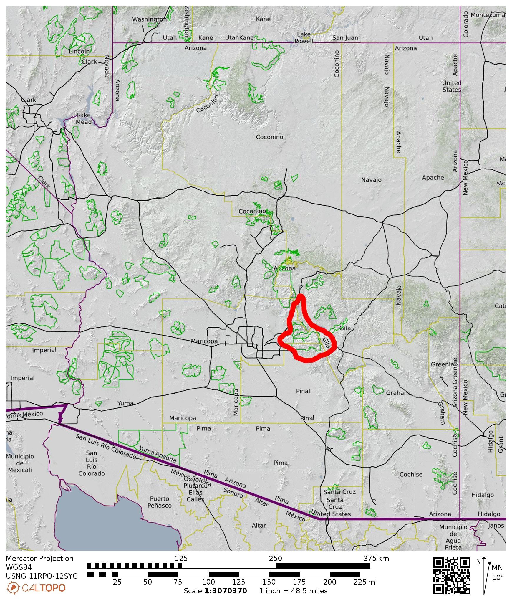
Region: Arizona
Sub-Region: Central Arizona
Sub-Sub-Region: Superstition Mountains
Area: Superstition Wilderness
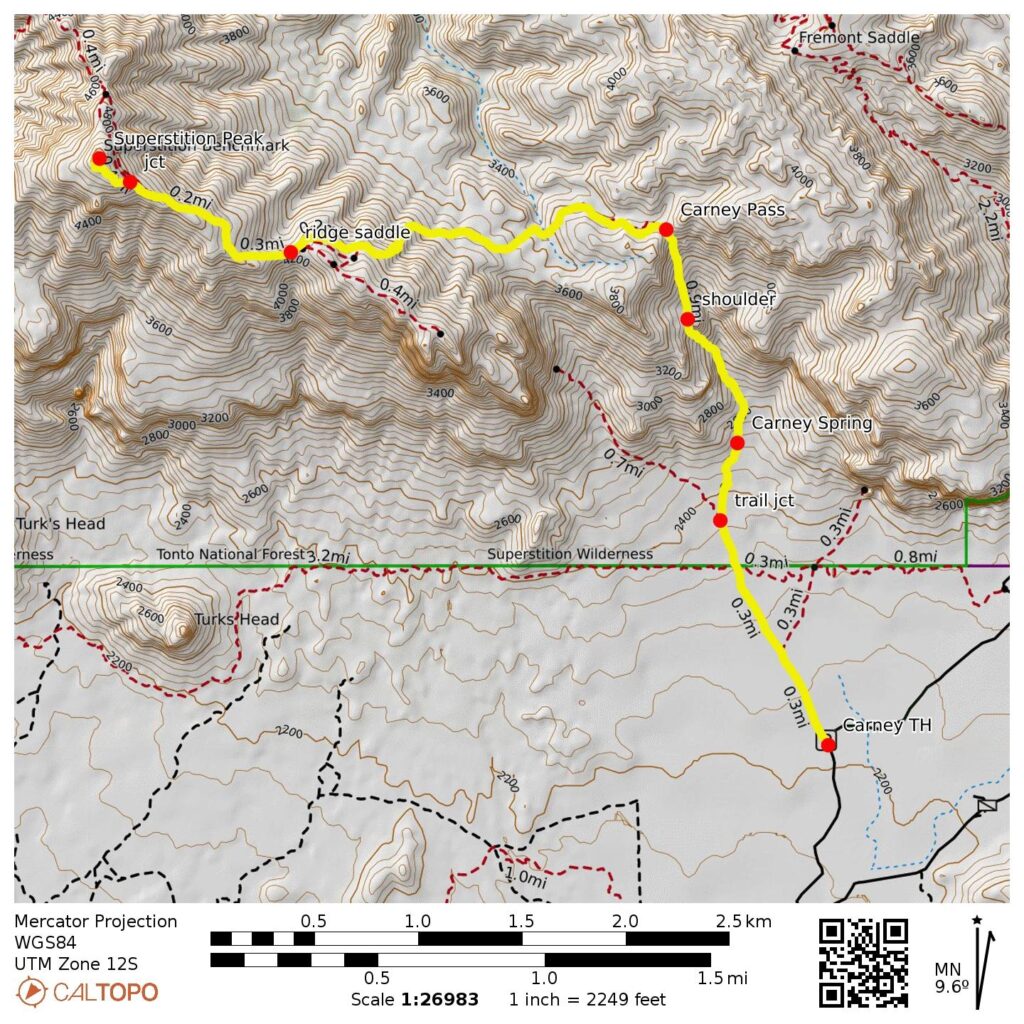
Starting & Ending Point: Carney Trailhead on East Peralta Road (Elev. 2200 feet)
Way Points: Superstition Wilderness boundary fence & Wind Cave Trail junction & Carney Spring & Carney Gulch shoulder & Carney Pass & Superstition Ridge saddle & Superstition Peak summit (trail hike & trail scramble & off-trail scramble)
Summit: Superstition Peak (ascent & descent via Southeast Ridge—West Face)
Approximate Stats: 7.8 miles traveled; 3400 feet gained & lost; 6.1 hours elapsed.
…
Related Posts
>>> Superstition Ridge Full Traverse + Superstition Peak – February 23, 2024
>>> West Superstition Ridge Traverse: Siphon Draw to Hieroglyphic Canyon – January 22, 2020
>>> Ironview Peak + The Flatiron via Siphon Draw – March 14, 2019
Full Trip Report
Ever since doing a traverse of Superstition Ridge from Siphon Draw to Hieroglyphic Canyon three years ago, Eileen and I had wanted to climb Superstition Peak—the 5057-foot high-point of the entire ridge and the namesake summit of the Superstition Mountains (fondly known as the “Supes”). We got an opportunity during a February trip to Phoenix, but our outing was hampered by a spell of unusually wintry weather.
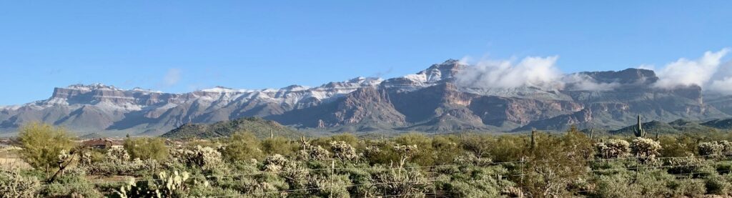
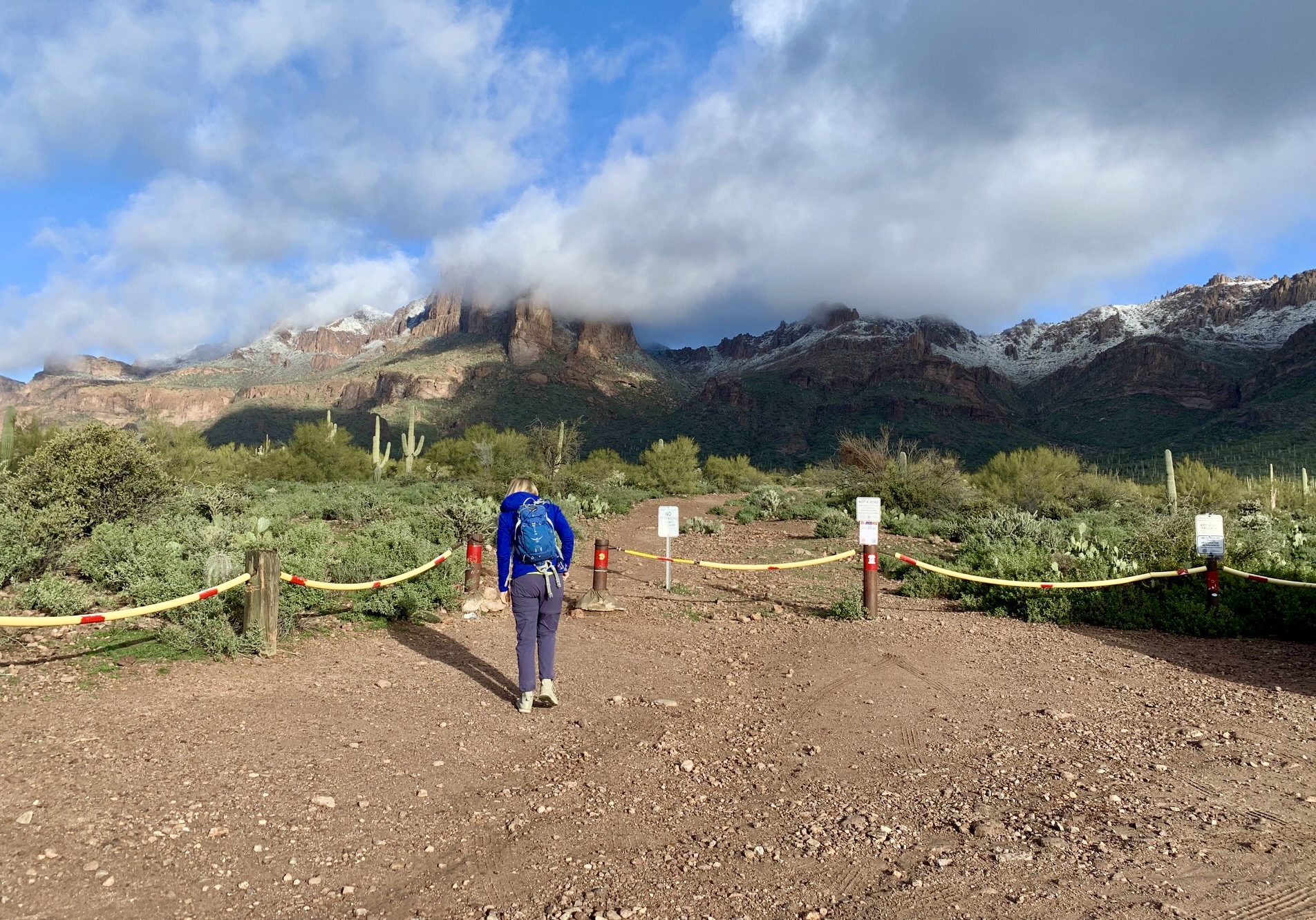
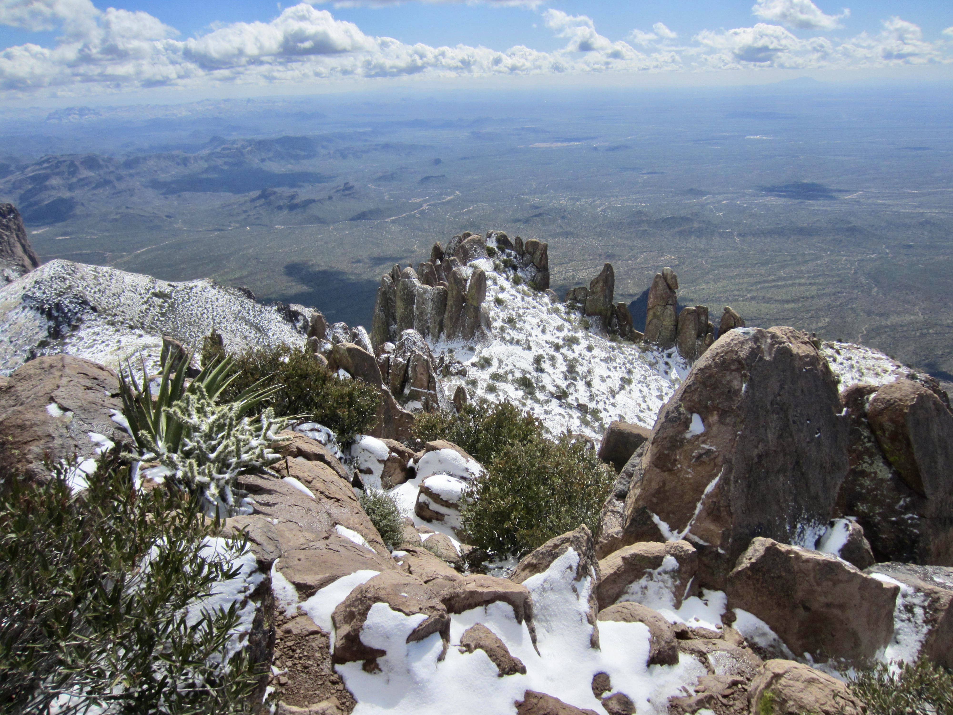
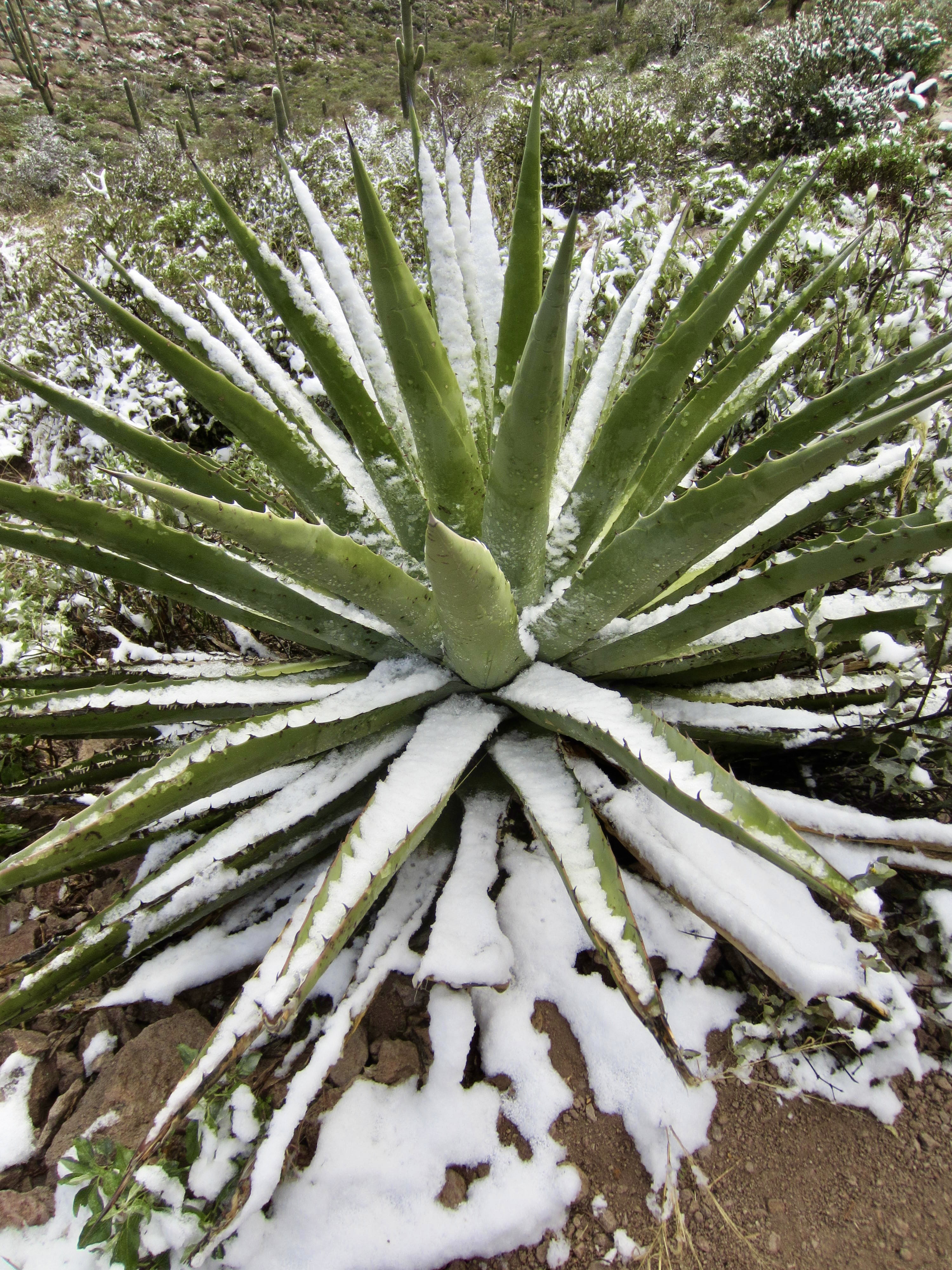
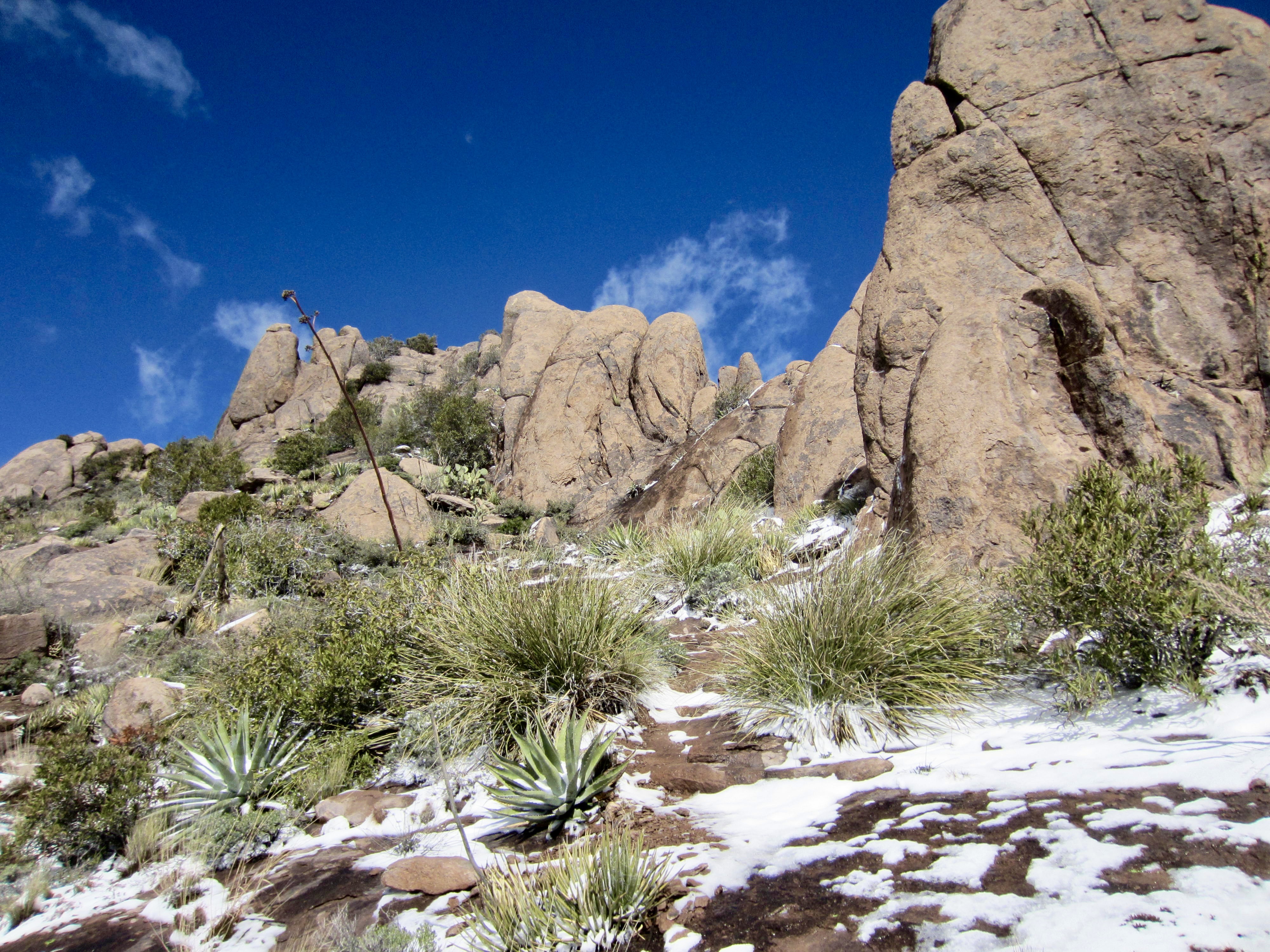
We left the Carney Trailhead on a sunny but very cold Wednesday morning. The temperature was 37°F and the Superstition Mountains were dusted with fresh snow. No doubt, this would be an interesting day, especially where the route involved rock scrambling.
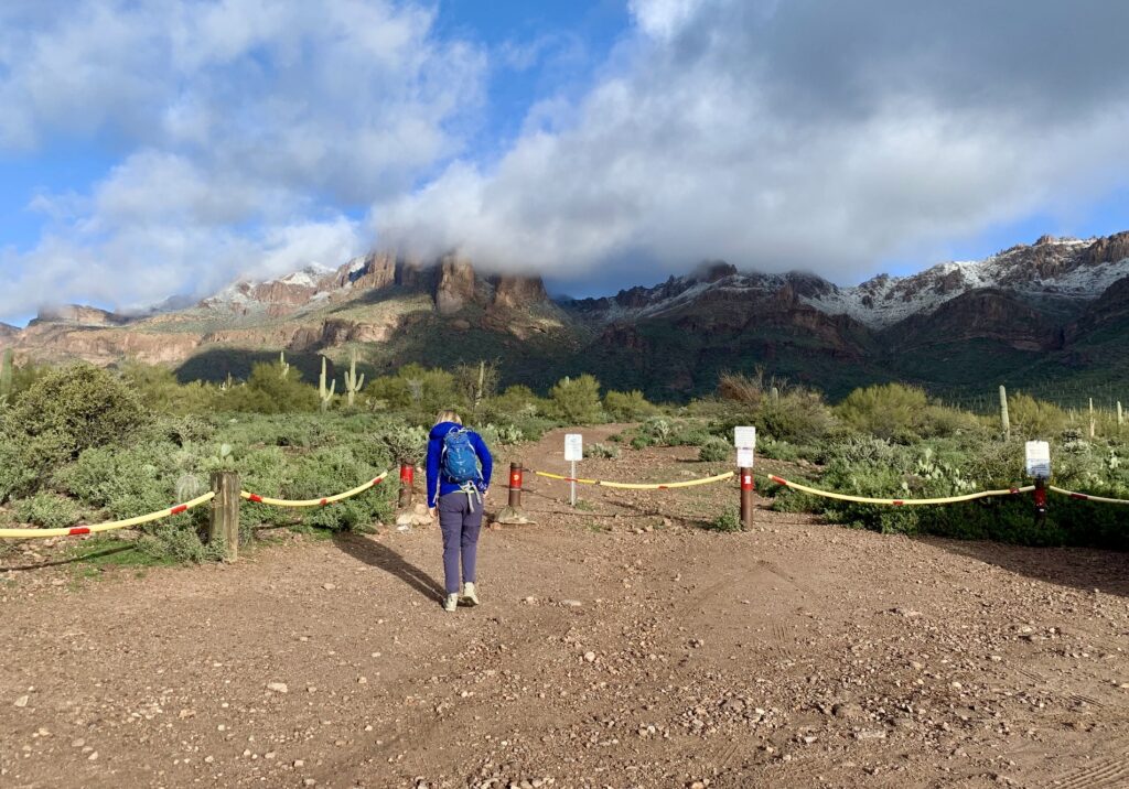
Our hike started on the abandoned Carney Springs Road, which now looks like nothing more than a flat, sandy wash. We crossed into the Superstition Wilderness at a crude barbed-wire stile and continued ahead on a rough single-track trail. At a point ¾ mile from the trailhead, we came to a trail fork marked with a jumbled cairn. The left fork veers off to the very popular Wind Cave, whereas the right fork continues northward to Carney Pass.

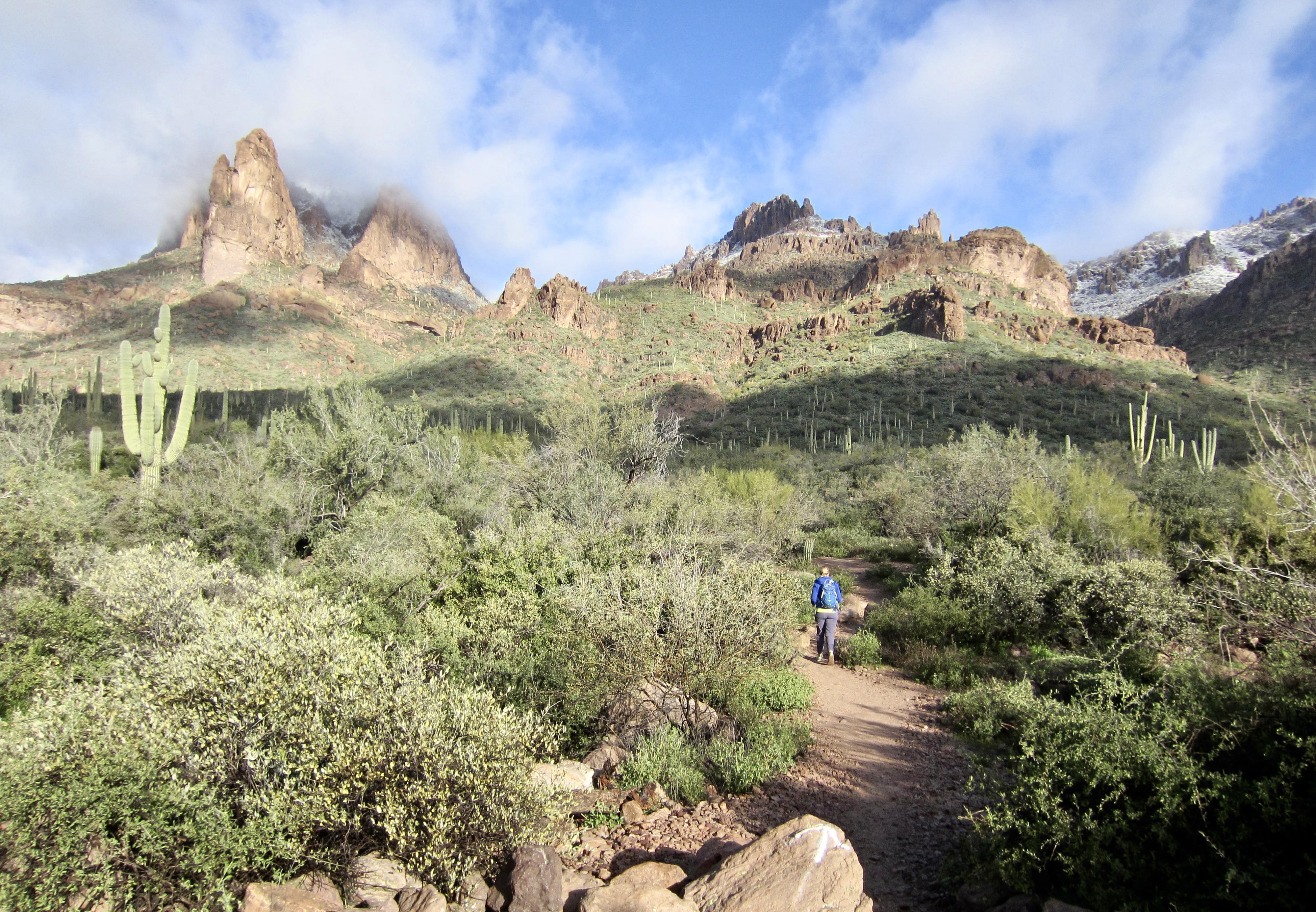
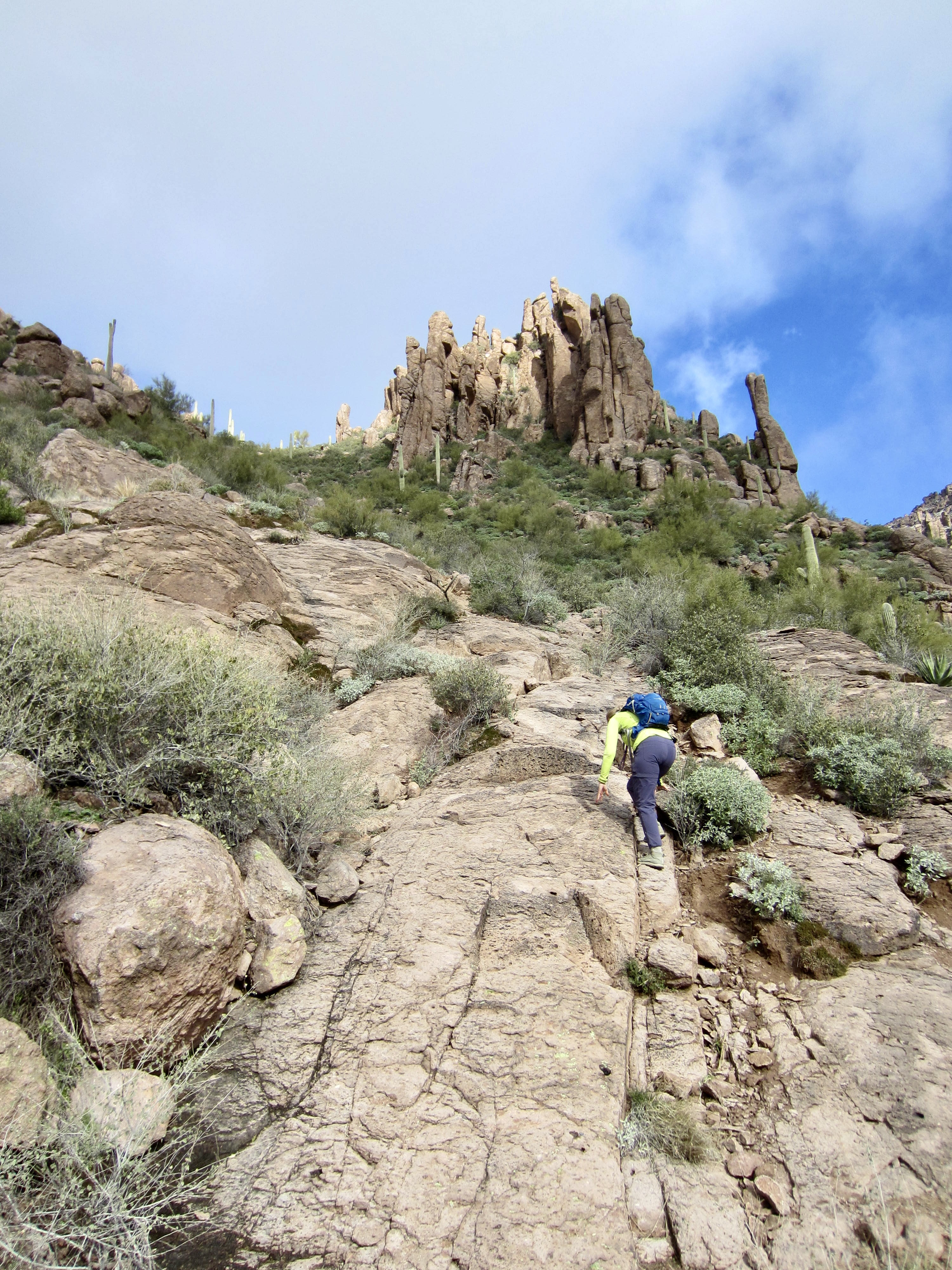
Taking the right fork, we soon passed Carney Spring and entered Carney Gulch. The trail becomes increasingly steeper and rougher in the gulch, with many scrambly sections but no real difficulties. Just after a particularly steep section, we gained a flat shoulder and got a close-up view of Carney Pass—a low saddle in the craggy ridge above.
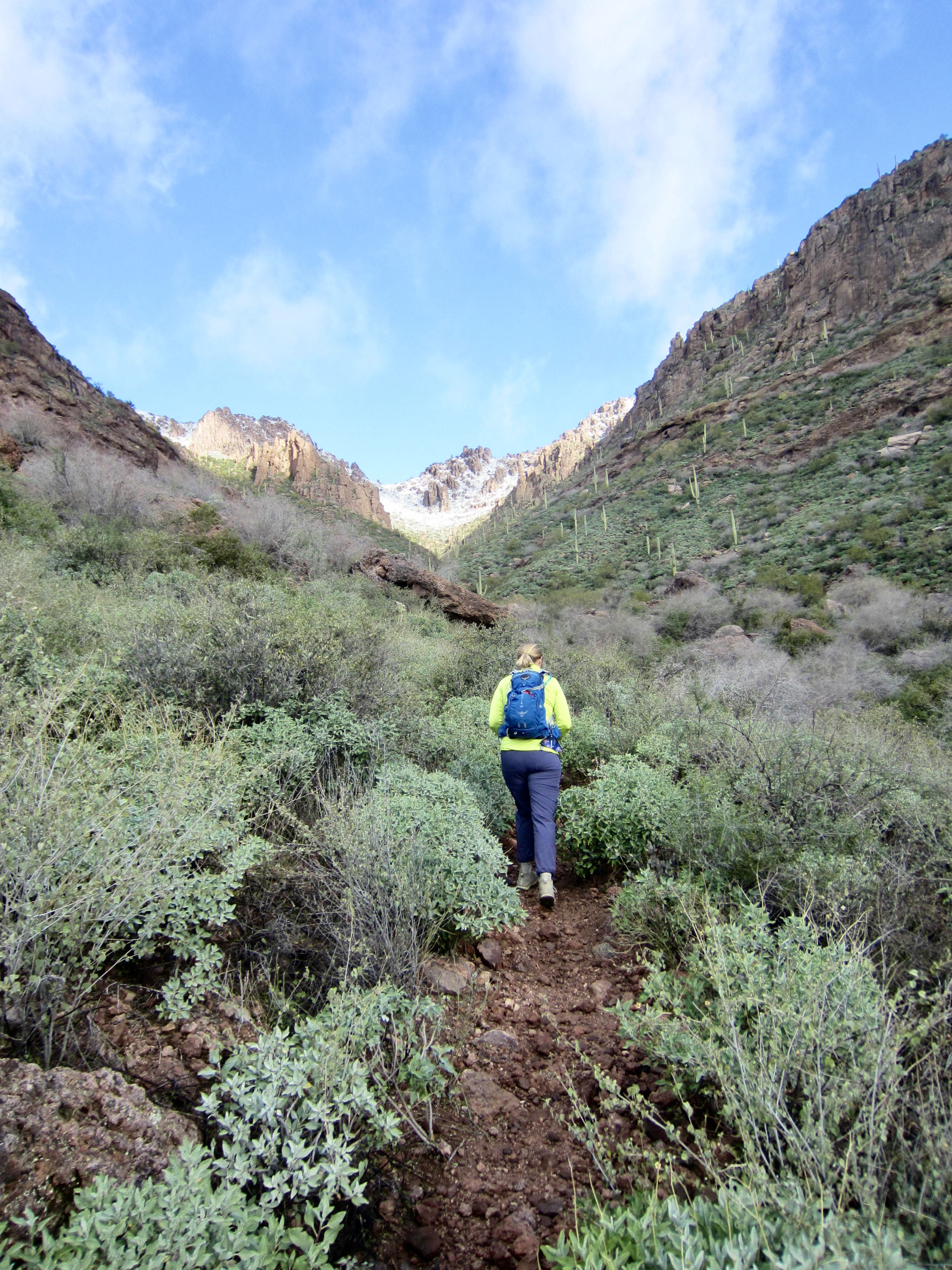
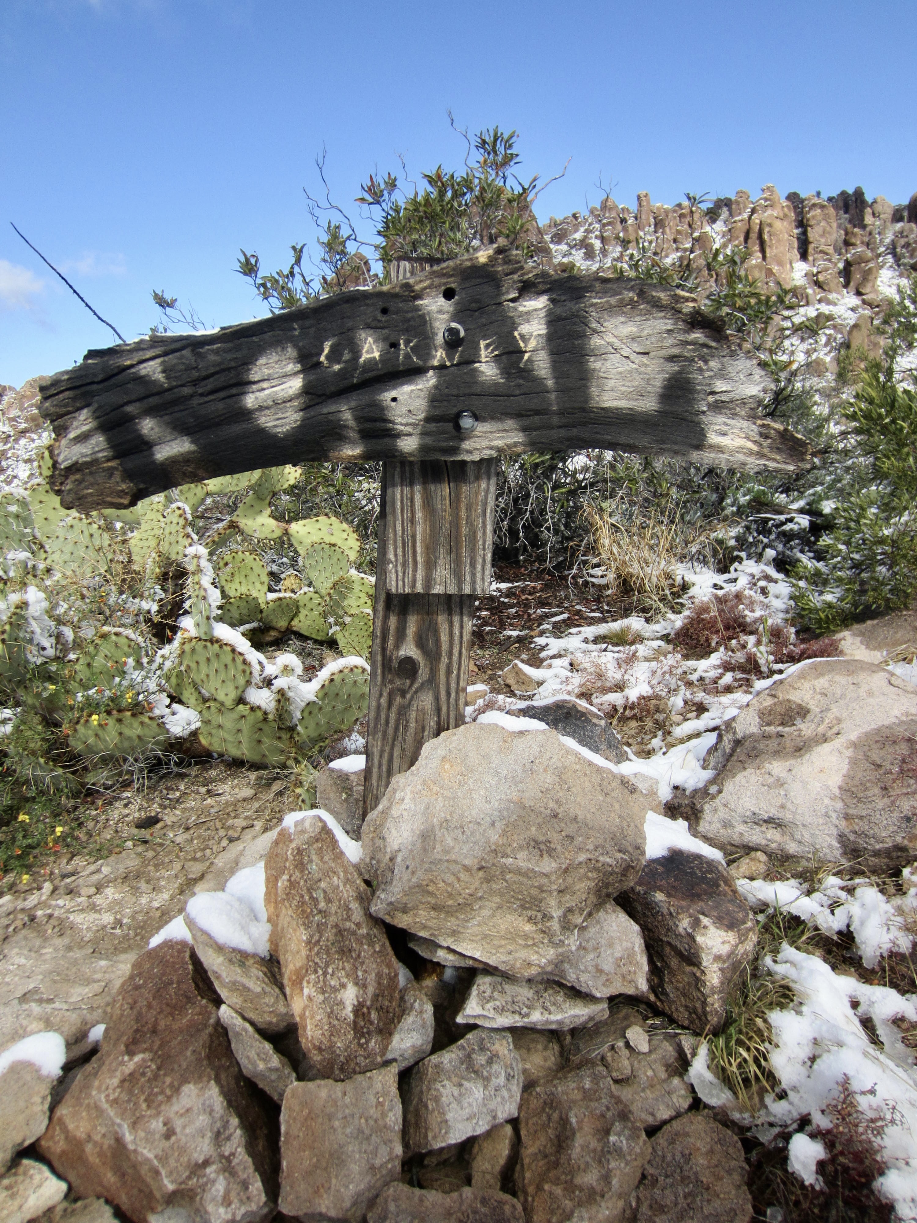
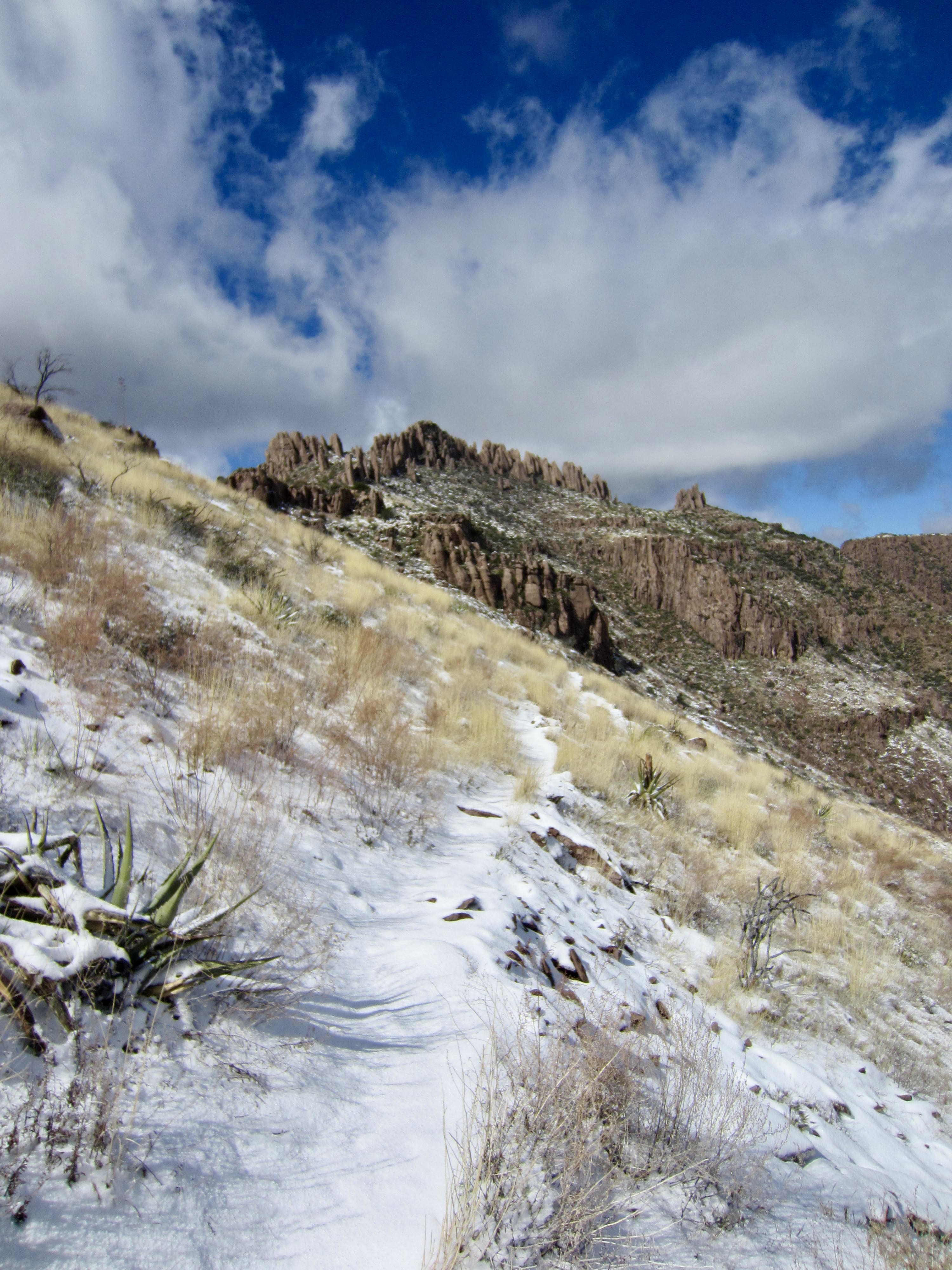
Above the flat shoulder, we started to encounter patches of fresh snow on the hillslope, but the trail was still mostly bare. More hiking and scrambling took us up to 3700-foot Carney Pass (1.7 hours + 1500 feet from TH). A crude wooden sign here marks a junction with the Superstition Ridge Trail and West Boulder Canyon Trail, both of which are merely boot-beaten paths.
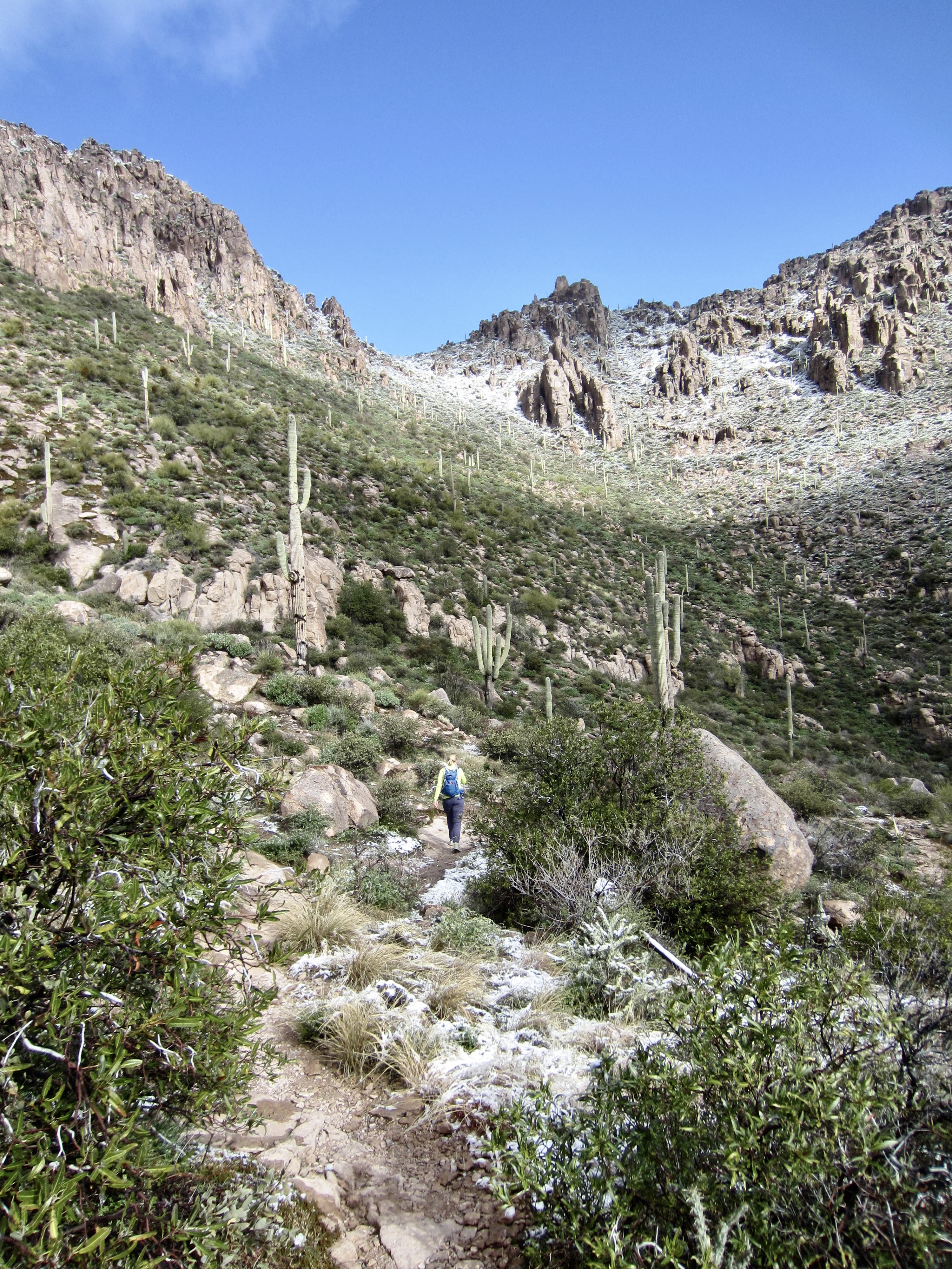
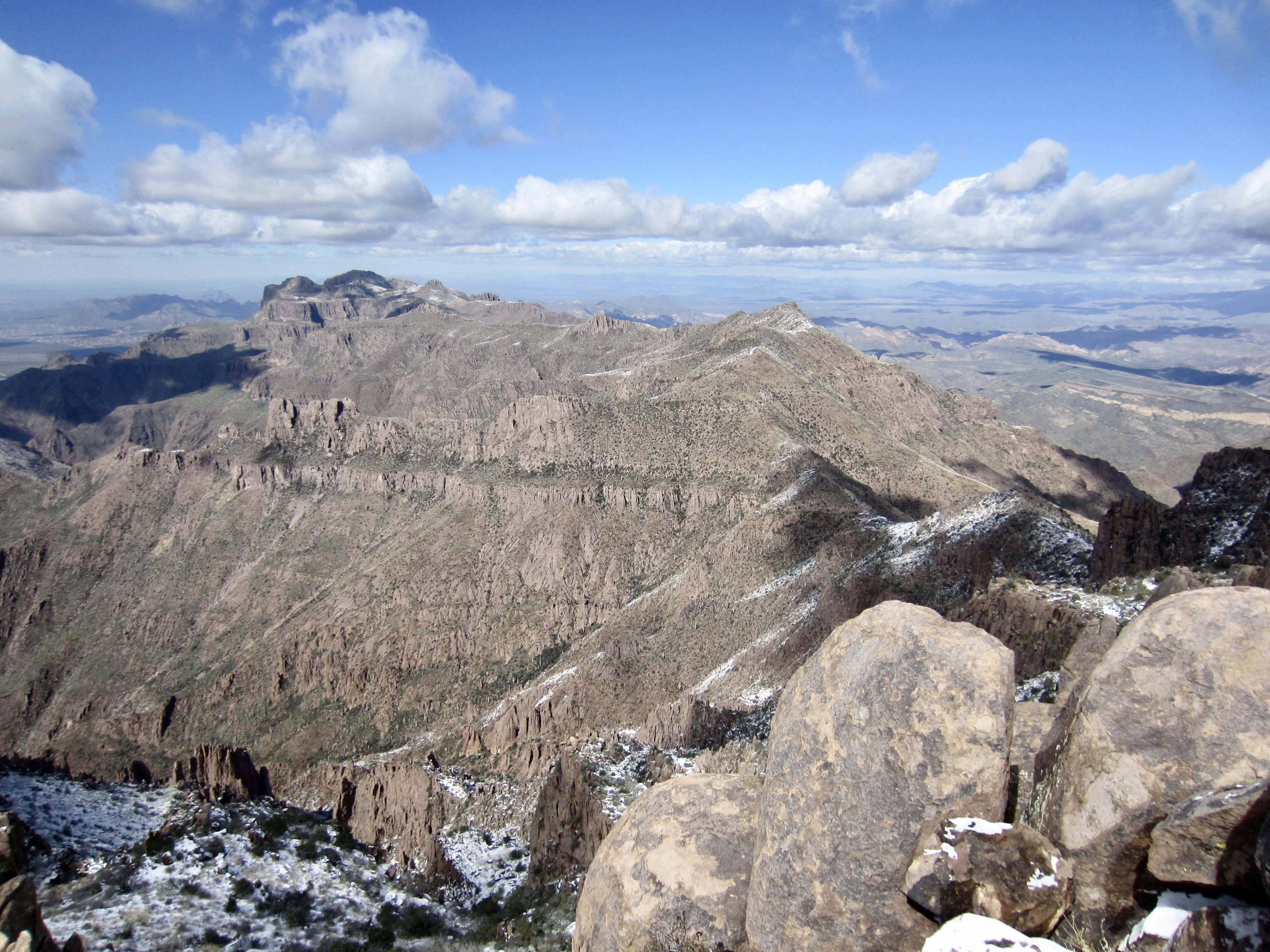
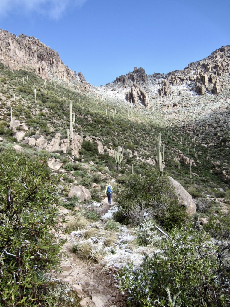
We turned left (west) on the Superstition Ridge Trail and headed toward Superstition Peak. The summit—a handsome, crenelated pyramid—was visible in the distance. It was a full 2 miles away but looked twice that! Worse yet, we were now on the northern side of the ridge, and there was a 2-inch coating of fresh snow on the entire hillside. After 15 minutes of discouragingly slow progress on the slippery trail, Eileen decided to call it quits, since we had a late-afternoon appointment back in town. She waved me on toward the peak but gave me a firm turnaround deadline of high noon.
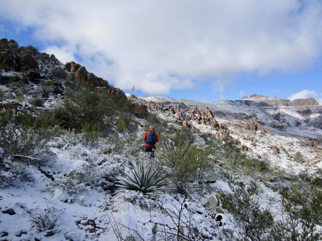
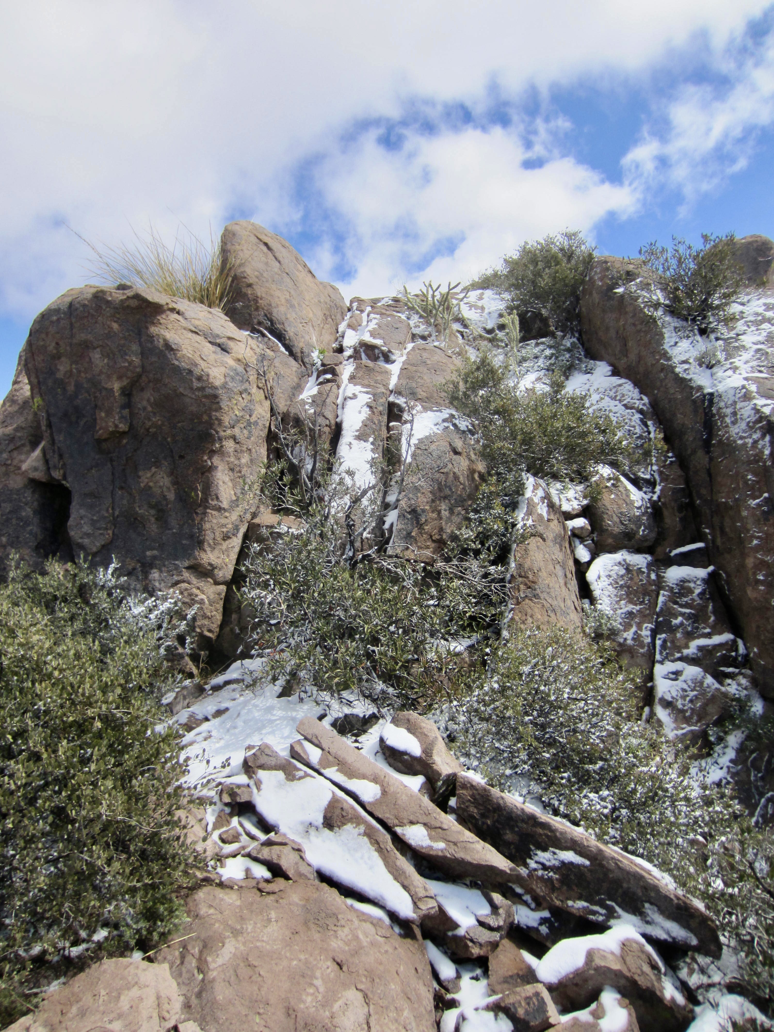
I hurried on alone, moving as quickly as I could despite repeatedly losing the trail over rock slabs or under snow. For a long time, Superstition Peak never seemed to get any closer, but the scenery throughout was beautifully amplified by the fresh snow and moody clouds.

Eventually, the trail attained a gentle saddle on the ridge crest, offering views out to the south. Superstition Peak now looked much closer, and the trail was much easier to follow on the broad crest. Before long, I found myself directly beneath the summit pinnacles. Now what?
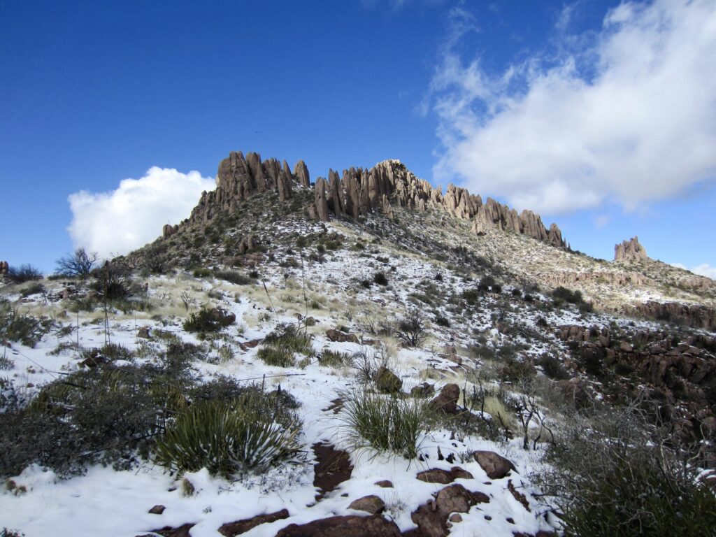
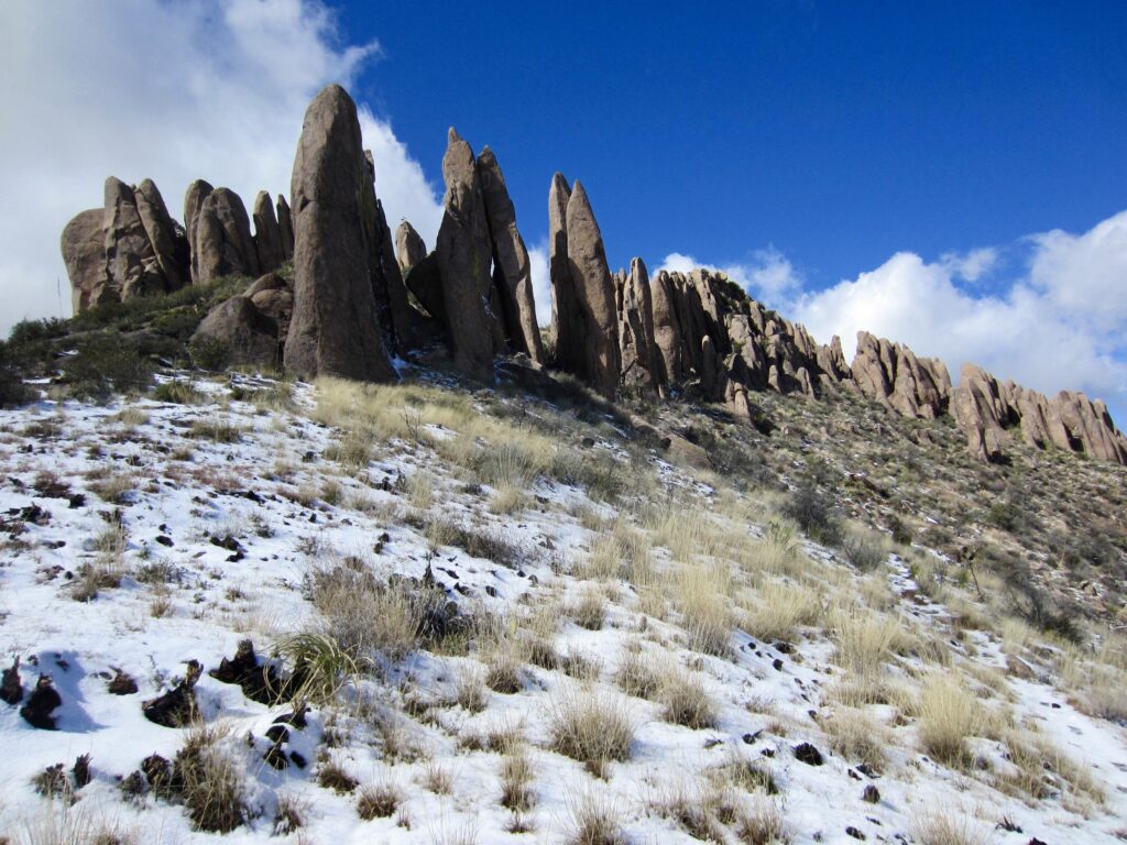
With time running out and no clear path to the summit, I groveled up a steep, slippery slope to the peak’s southern shoulder. A few marker ducks and traces of boot tread then led me on a short traverse across the west face to the base of a short, ice-filled crack. There was no obvious alternative, so I stuck my arms and legs into the crack and hauled myself upward. In dry conditions, this would be an easy Class 2-3 move, but the ice gave it a more serious feeling.
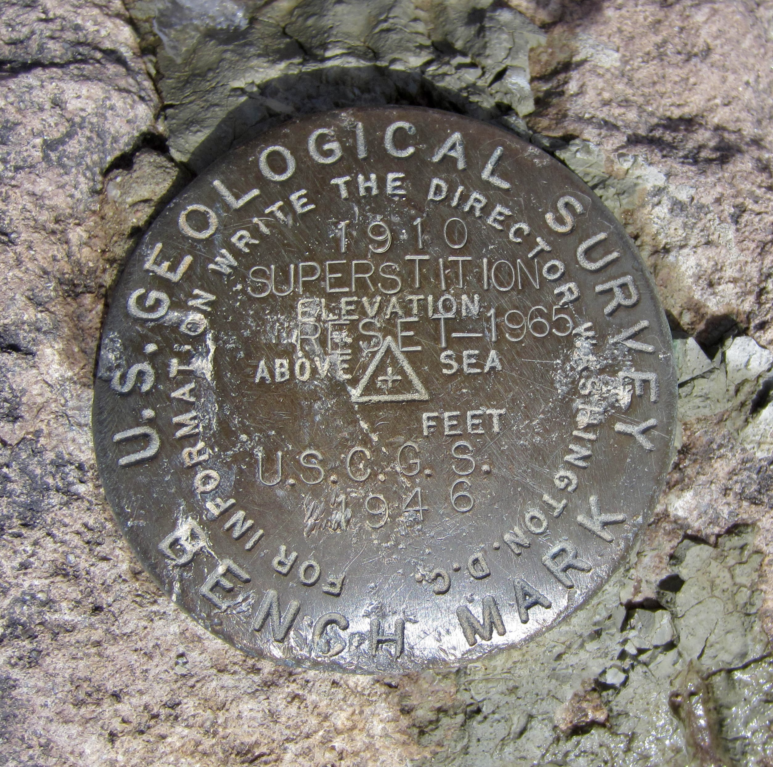
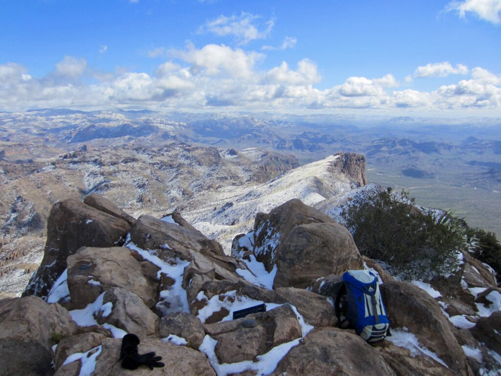
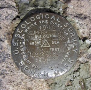
Once past the crack, another short scramble delivered me to the summit at 12:10pm (3.3 hours + 3150 feet from TH). This was technically past my turnaround deadline but well within the margin of error for any dedicated peak-bagger. I took a few photos and peeked at the summit register, which consisted of loose papers stuffed into a Jack Daniels whiskey tin. The sign-in dates indicated that Superstition Peak gets ascents all year round.
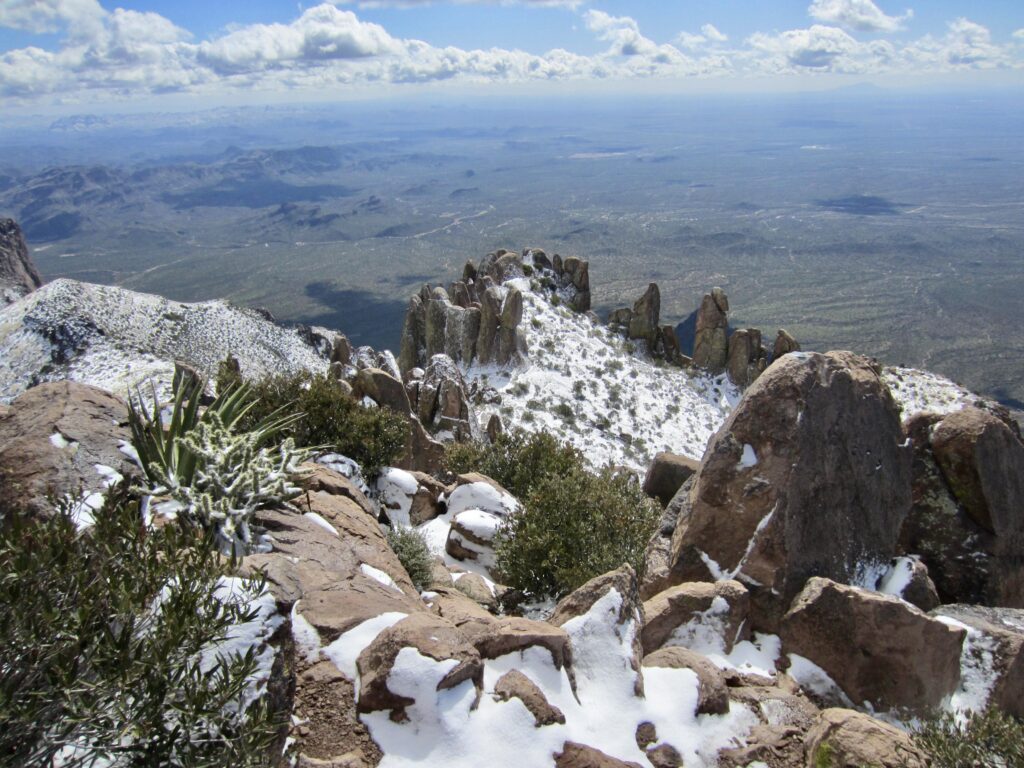
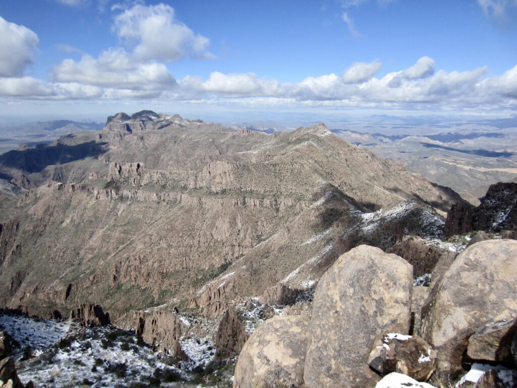
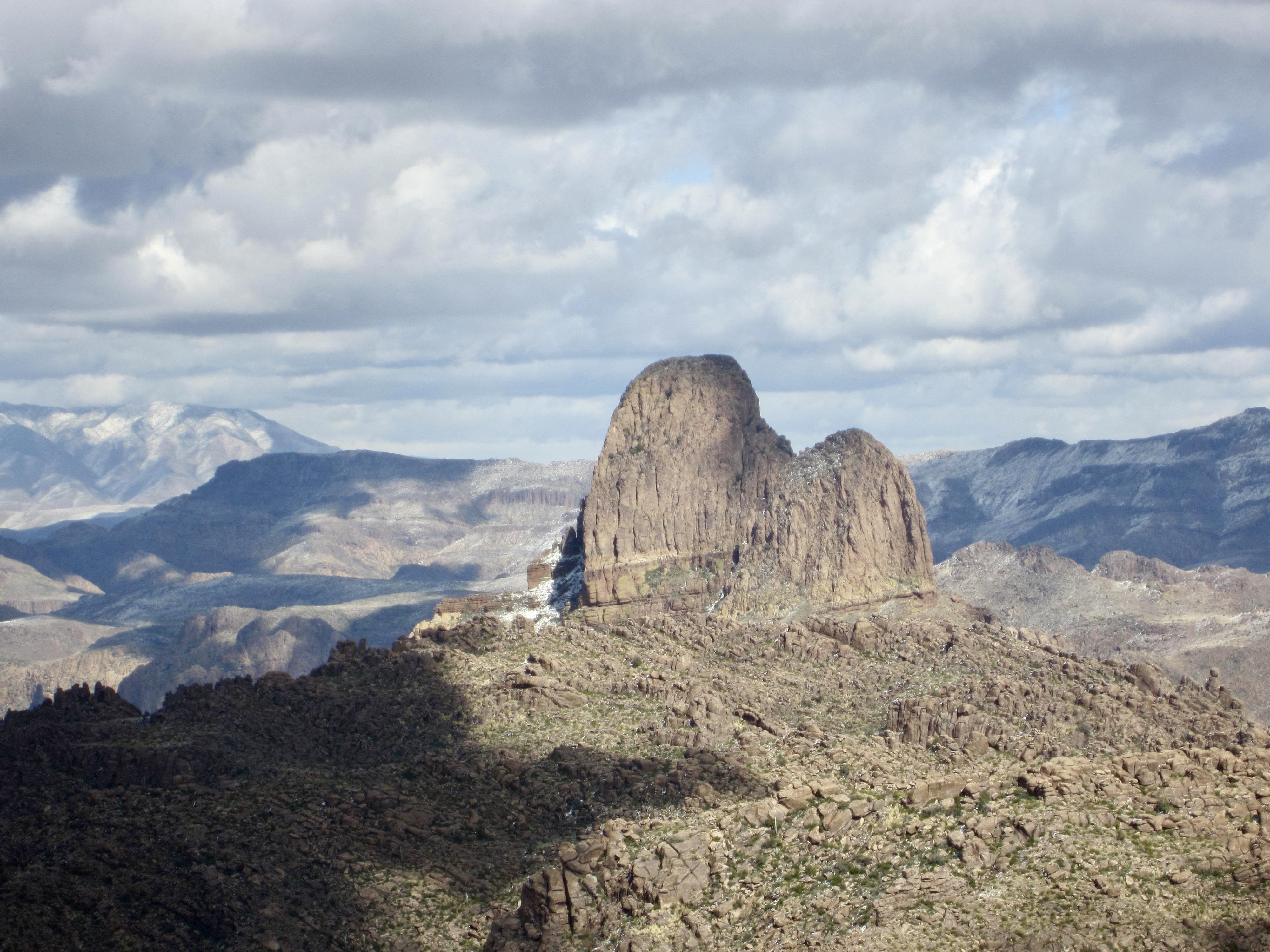
For my descent, I carefully climbed down the summit rocks and curled back around the southern shoulder until intersecting the ridge trail. From there, I was able to follow my tracks back to Carney Pass (1.4 hours + 250 feet from summit). The weather had now cleared up enough to reveal the impressive Slesse-esque facade of Weavers Needle off to the northeast.

From Carney Pass, the descent of Carney Gulch is not only steep and loose but also a bit confusing in places due to multiple braided trails. It was a relief to finally reach the Wind Cave Trail junction and have a flat trail leading back to the parking lot, where Eileen was waiting when I arrived at 3:00pm (2.5 hours + 250 feet from summit). She was a little disappointed to have missed out on a nice summit today, but I knew this wouldn’t be our last trip in the super Supes!
…
Route Map & Profile
…
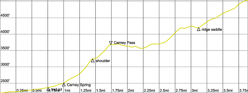
Photo Gallery
Click to enlarge…