Trip Date: January 22, 2020
2020 CALIFORNIA & ARIZONA ADVENTURE VACATION
West Superstition Ridge Traverse: Siphon Draw to Hieroglyphic Canyon
Siphon Draw
The Flatiron
Siphon Pass
West Superstition Gap
Point 4642 aka Superstition Knob
Point 4869 aka Hog Hill
Hieroglyphic Gap
Hieroglyphic Canyon
Trip Report Summary
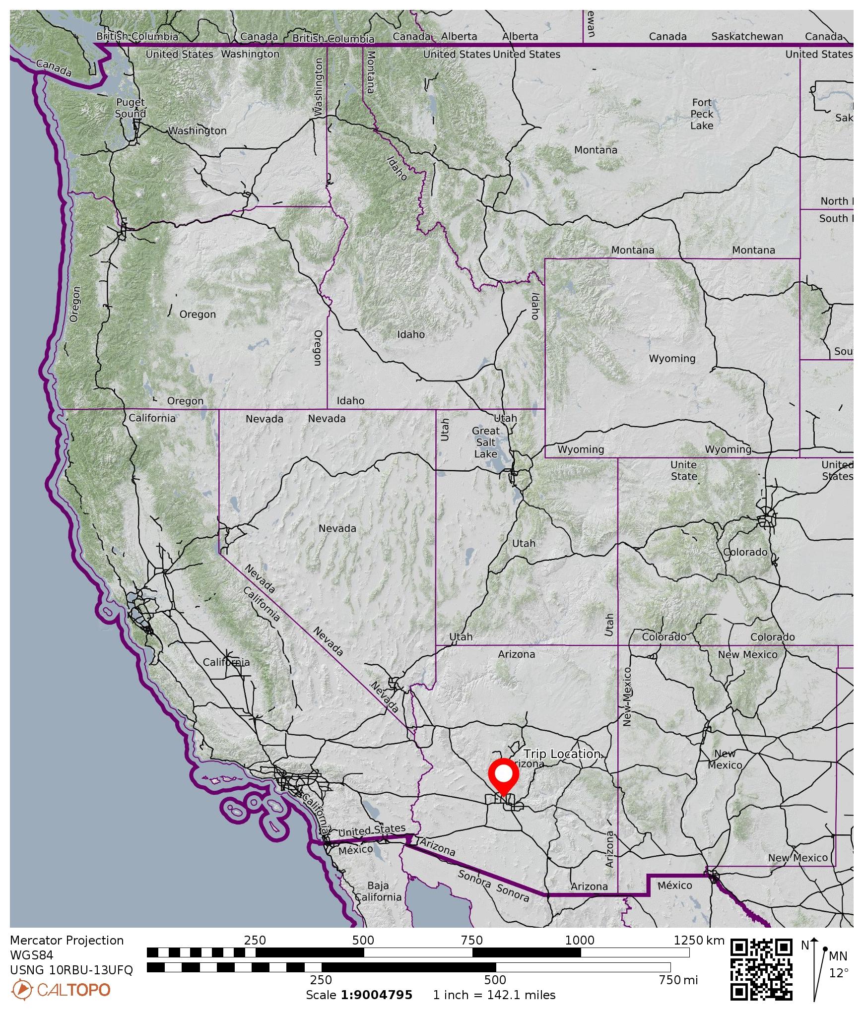
Region: Arizona
Sub-Region: Central Arizona
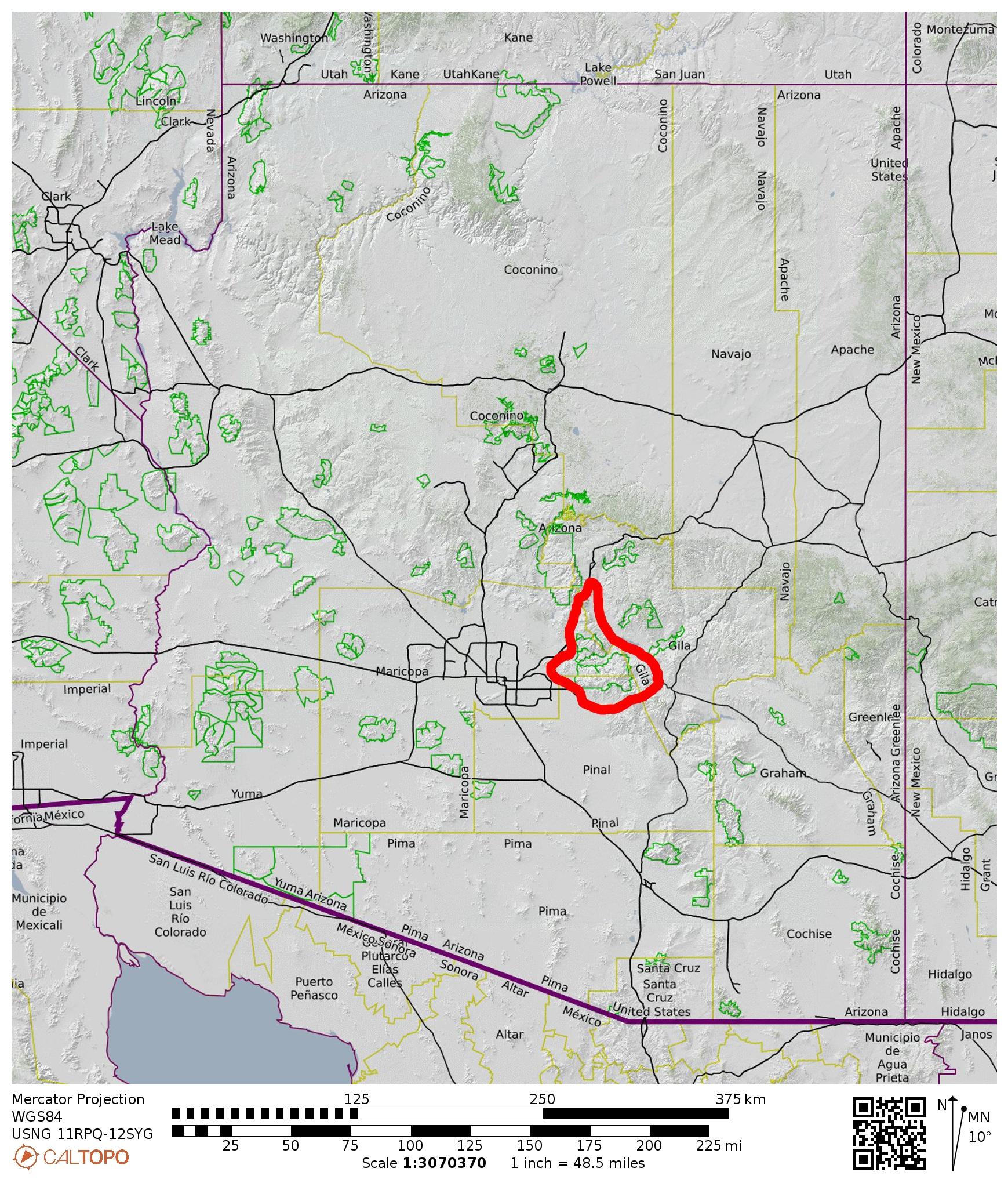
Sub-Sub-Region: Superstition Mountains
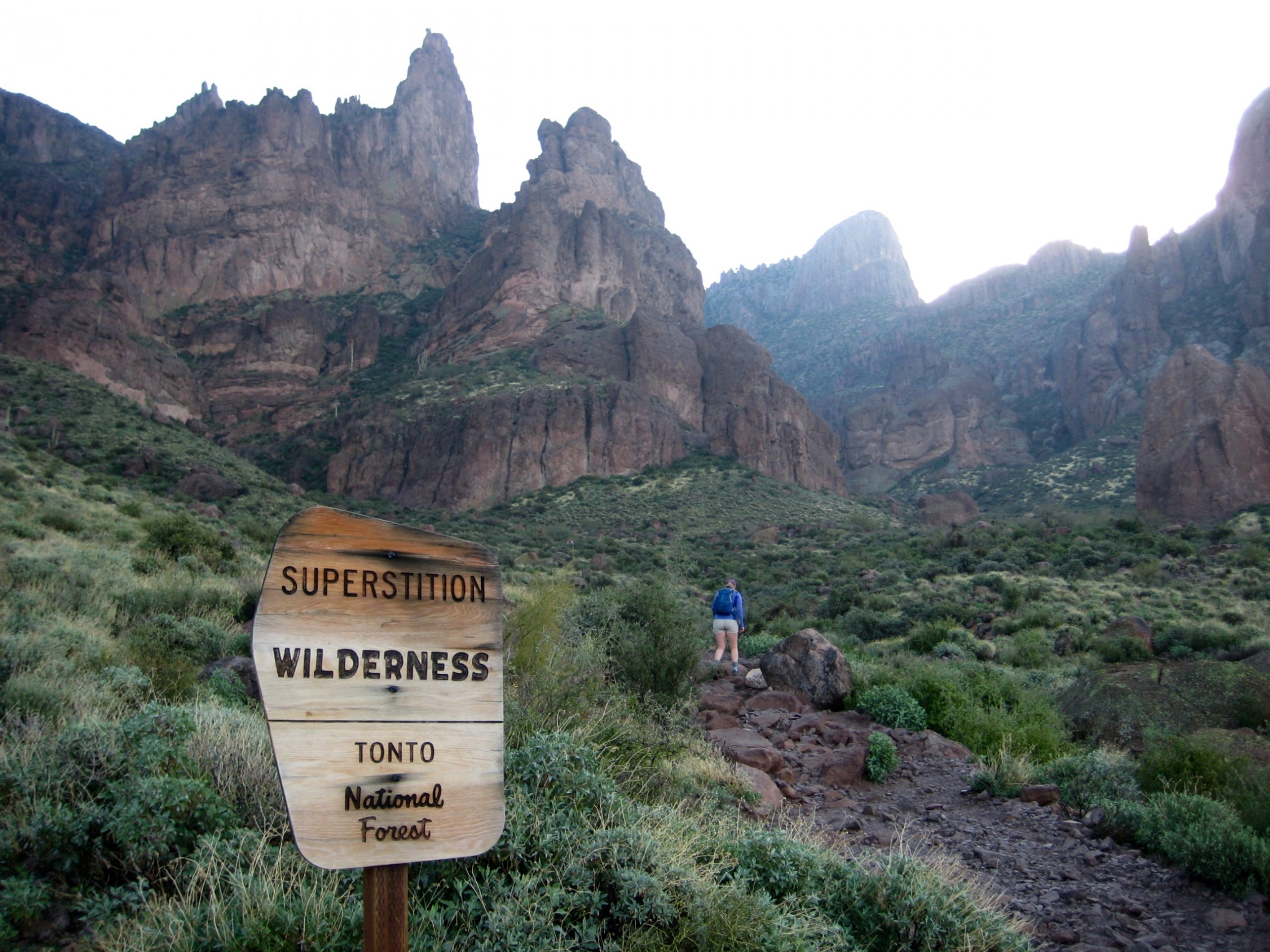
Areas: Lost Dutchman State Park & Superstition Wilderness
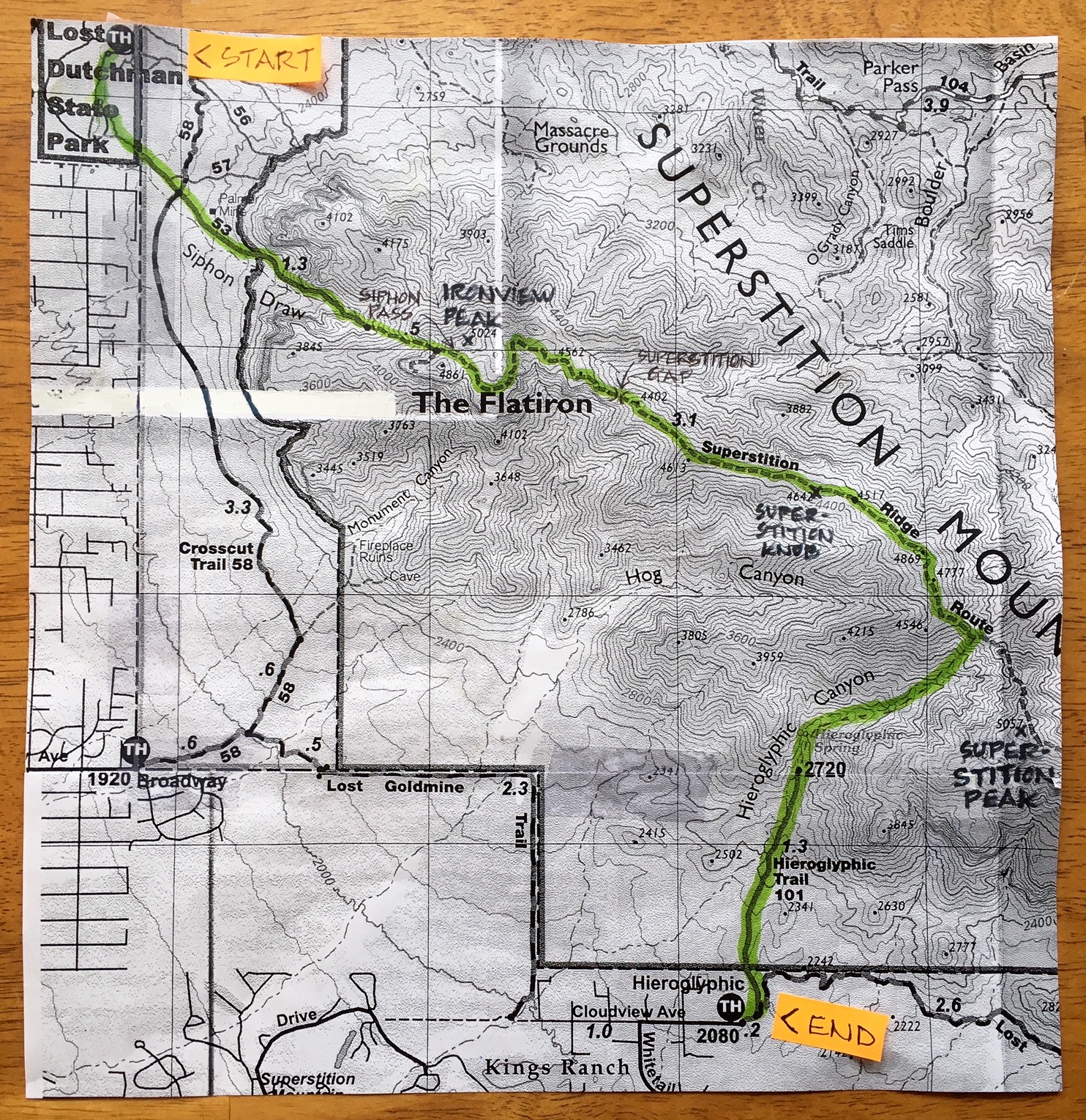
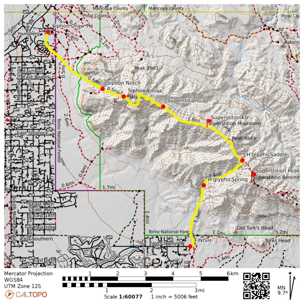
Starting Point: Siphon Draw Trailhead at Lost Dutchman State Park on North Apache Trail (Elev. 2100 feet)
Way Points: Siphon Draw Basin & Siphon Draw Notch & Siphon Pass & West Superstition Gap & Point 4402 & Saddle 4453 & Saddle 4517 & Point 4869 & Point 4777 & Hieroglyphic Gap & Hieroglyphic Canyon & Hieroglyphic Spring (trail hike & trail scramble)
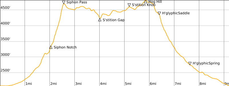
High Point: Hog Hill (Elev. 4869 feet)
Ending Point: Hieroglyphic / Lost Goldmine Trailhead at end of East Cloudview Avenue (Elev. 2100 feet)
Sidetrip: The Flatiron (trail hike & off-trail hike)
Sidetrip: Superstition Knob (rock scramble)
Approximate Stats (including sidetrips): 9.4 miles traveled; 3700 feet gained; 3700 feet lost; 9.5 hours elapsed.
…
Related Posts
>>> Superstition Ridge Full Traverse + Superstition Peak – February 23, 2024
>>> Superstition Peak via Carney Gulch–Southeast Ridge – February 15, 2023
>>> Ironview Peak & The Flatiron via Siphon Draw – March 14, 2019
Trip Overview
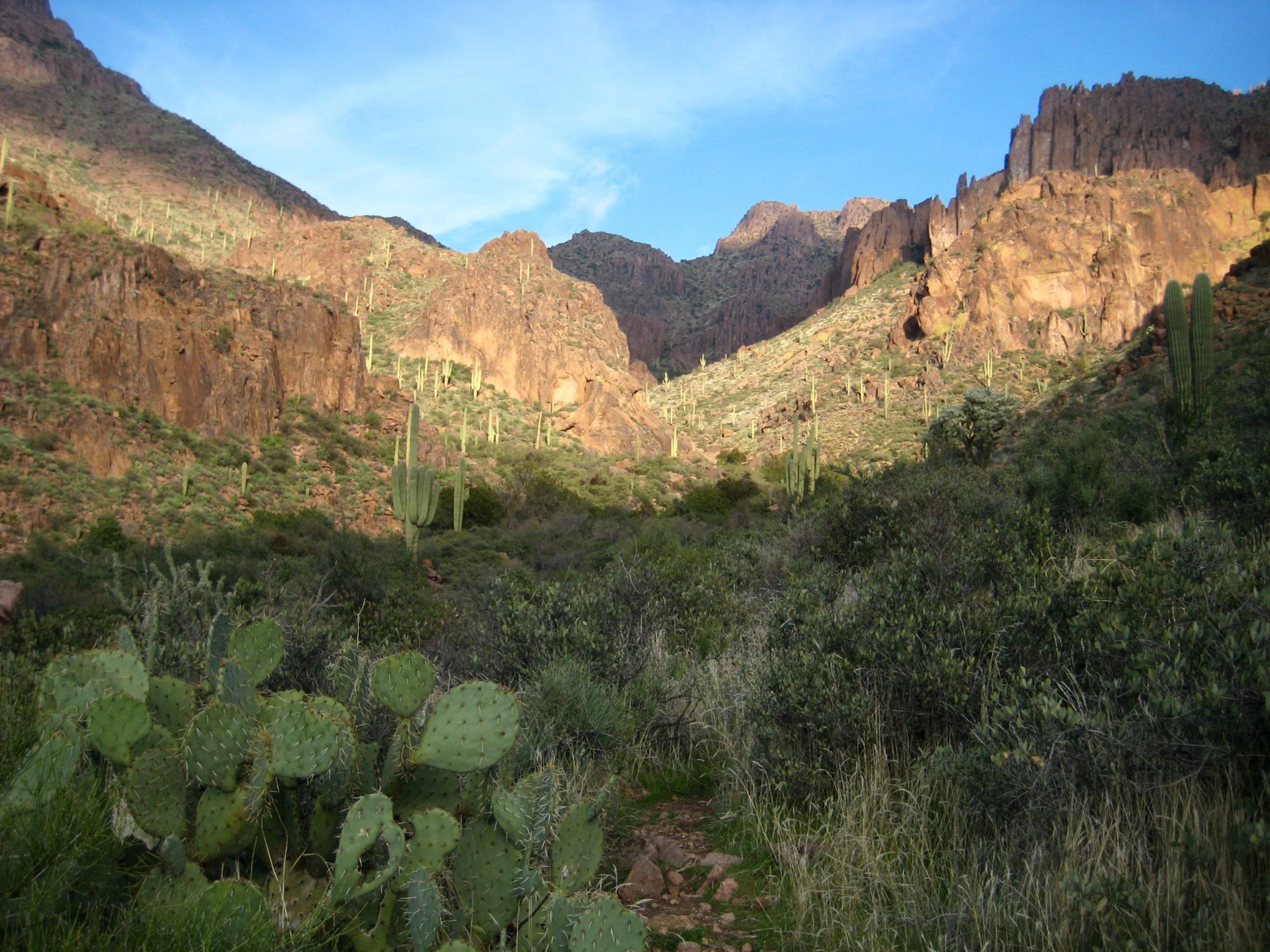
The Superstition Mountains are probably the most revered mountain range in Arizona, due to their very rugged topography, gold mining history, and ancient legends. Much of their fame stems from the volcanic rock that forms the range. Thick layers of rhyo-andesite rock were pushed up 2000 feet above the surrounding desert plain, and subsequent erosion by water and wind have created impressive columns, pinnacles, and hoodoos that terminate in a jagged skyline.
…
All of this geomorphology, combined with a really evocative name, make the “Supes” a major hiking attraction. For Eileen and me, the day-hiking plum of the range is the 11-mile traverse of Superstition Ridge from Siphon Draw to Carney Gulch. Unfortunately, we weren’t able to arrange a car-shuttle that would facilitate this classic traverse, so we had to settle for an abbreviated 9-mile traverse from Siphon Draw to Hieroglyphic Canyon. It was not a bad consolation.
Green Trails avoids calling this a trail because it is truly a desert high route. Although the footpath is well-defined for much of the ridge-run, it is frequently interrupted by rock outcrops that require scrambling up, down, or around. Fortunately, the entire route is well-marked with ducks and cairns, so route-finding is not difficult. Overall, I would say it is analogous to an “alpine high route” such as Skyline Ridge in the Olympics or Aasgard Pass in the Cascades.
…
Full Trip Report
Our traverse began at the Siphon Draw Trailhead in Lost Dutchman State Park. This trailhead sits in the morning shadow of Ironview Peak and The Flatiron, which together form a visually awesome rampart above the park. We headed up the trail and soon entered Siphon Draw.

- Starting Up Siphon Draw
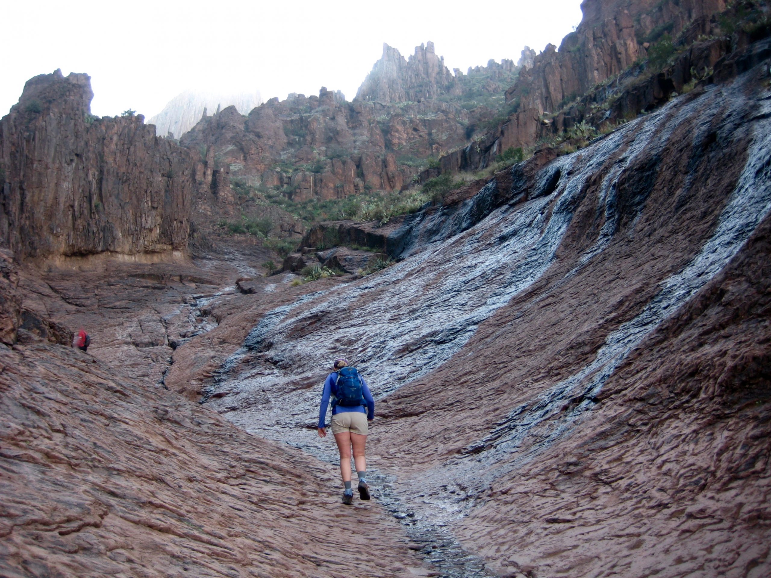
The key feature of Siphon Draw is an astounding basin that has been scooped out of solid volcanic rock. Due to heavy rainfall over the past two days, the rock surface was covered by a micro-thin veneer of wet silt, which made footing insecure and unnerving.
- Hiking Up Siphon Draw Rock Basin
After much delicate friction scrambling, we reached the top of the rock basin and popped through a small notch (Siphon Notch) in a rock rib. This got us into the upper half of Siphon Draw, which consists of a steep canyon. A well-traveled footpath interspersed with rocky steps leads up through the canyon invert.
- Looking Back At Siphon Notch

- Hiking Thru Upper Siphon Draw
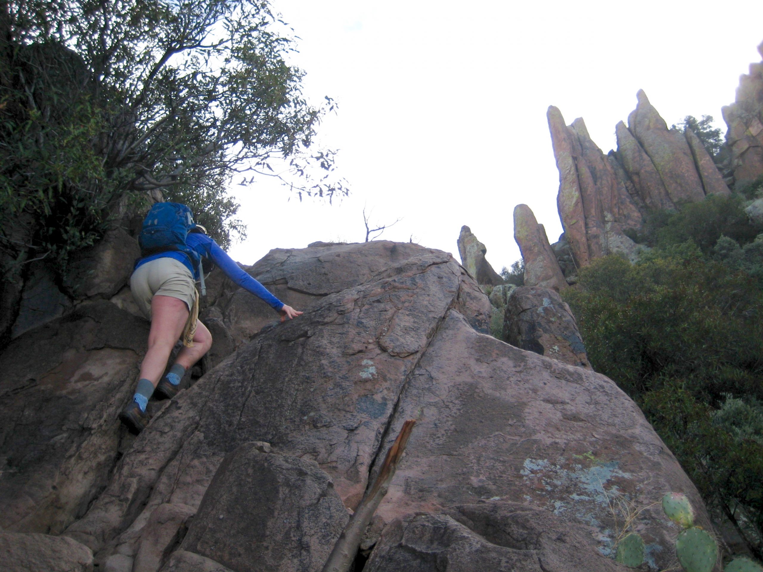
A short section of Class 3 rock must be surmounted at the top of the draw, and then a good trail is encountered along the rim. This rim trail led us rightward over to the top of The Flatiron (3.0 hours + 2600 feet from TH).
- Scrambling Over Lip Of Siphon Draw
- Traversing Over To The Flatiron
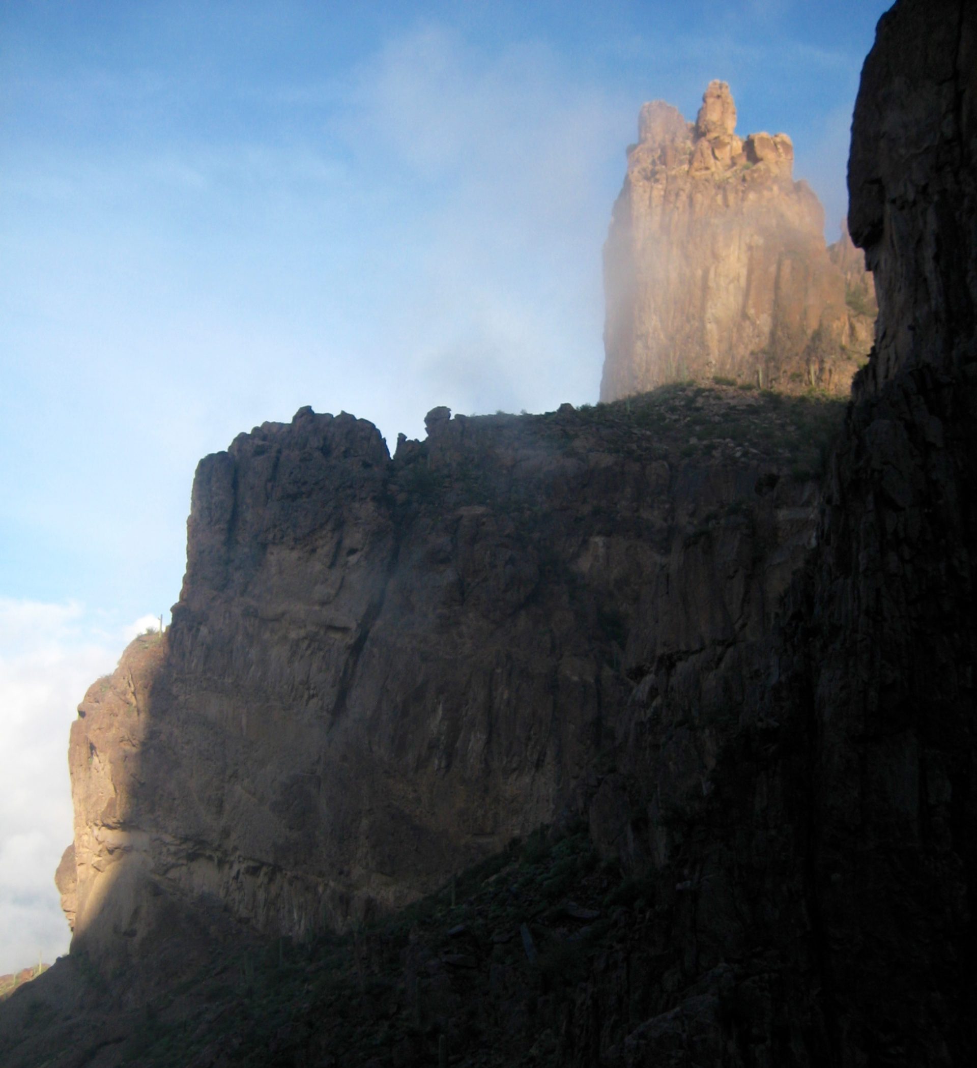
Thick clouds shrouded the horizon all around us, and we hoped that they would dissipate before we got into the heart of our traverse route.
- Eileen & Jim On The Flatiron
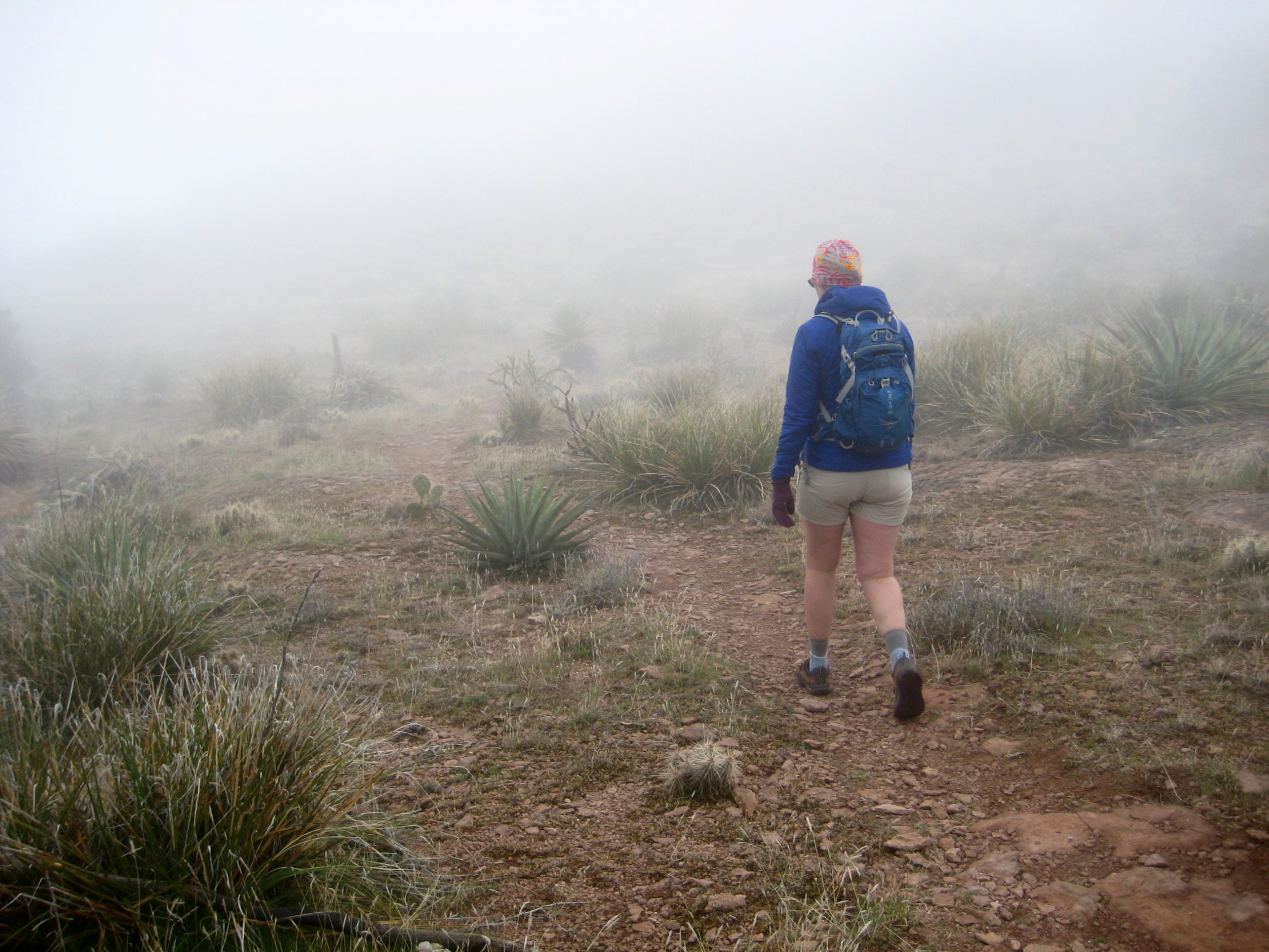
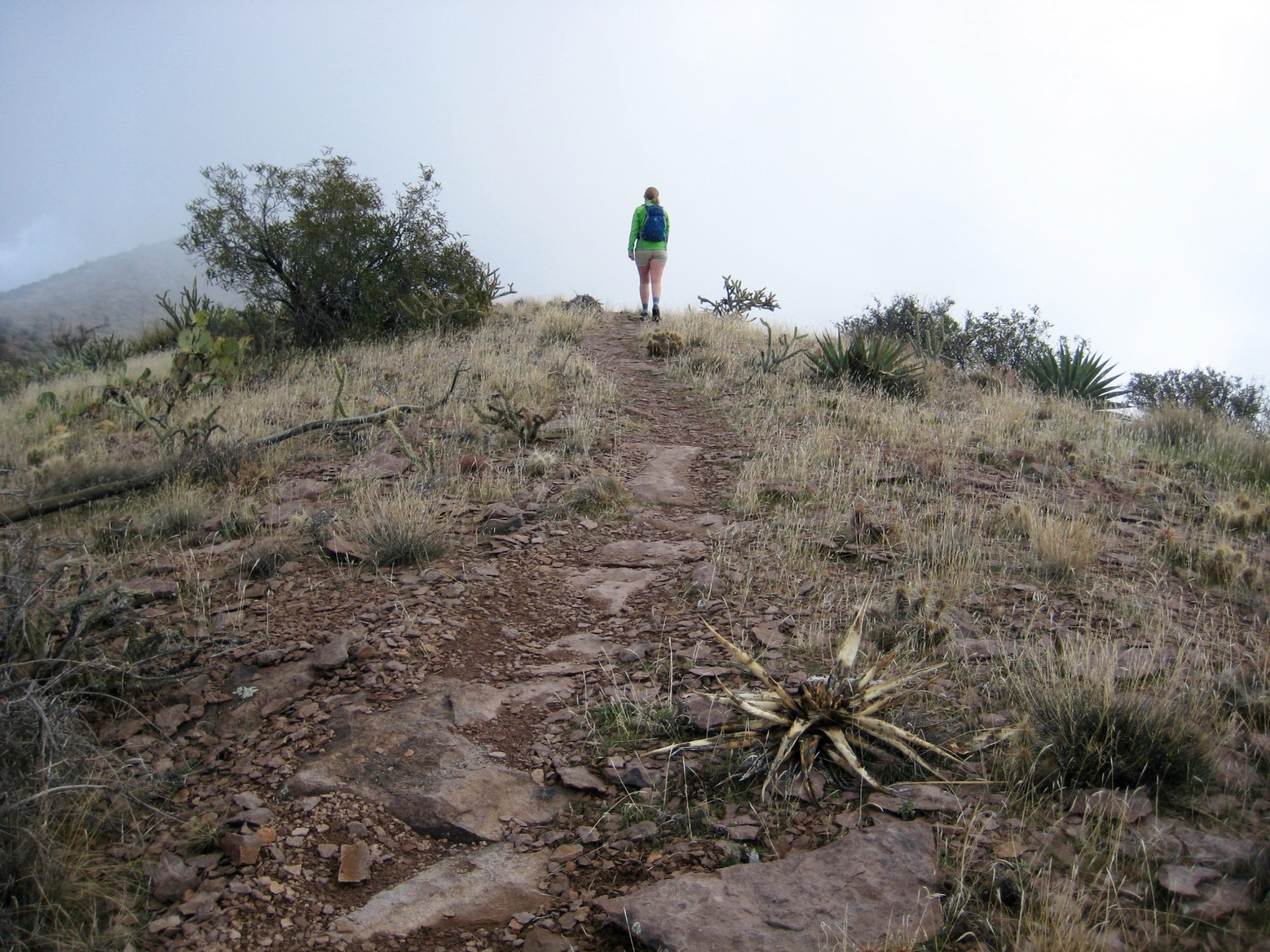
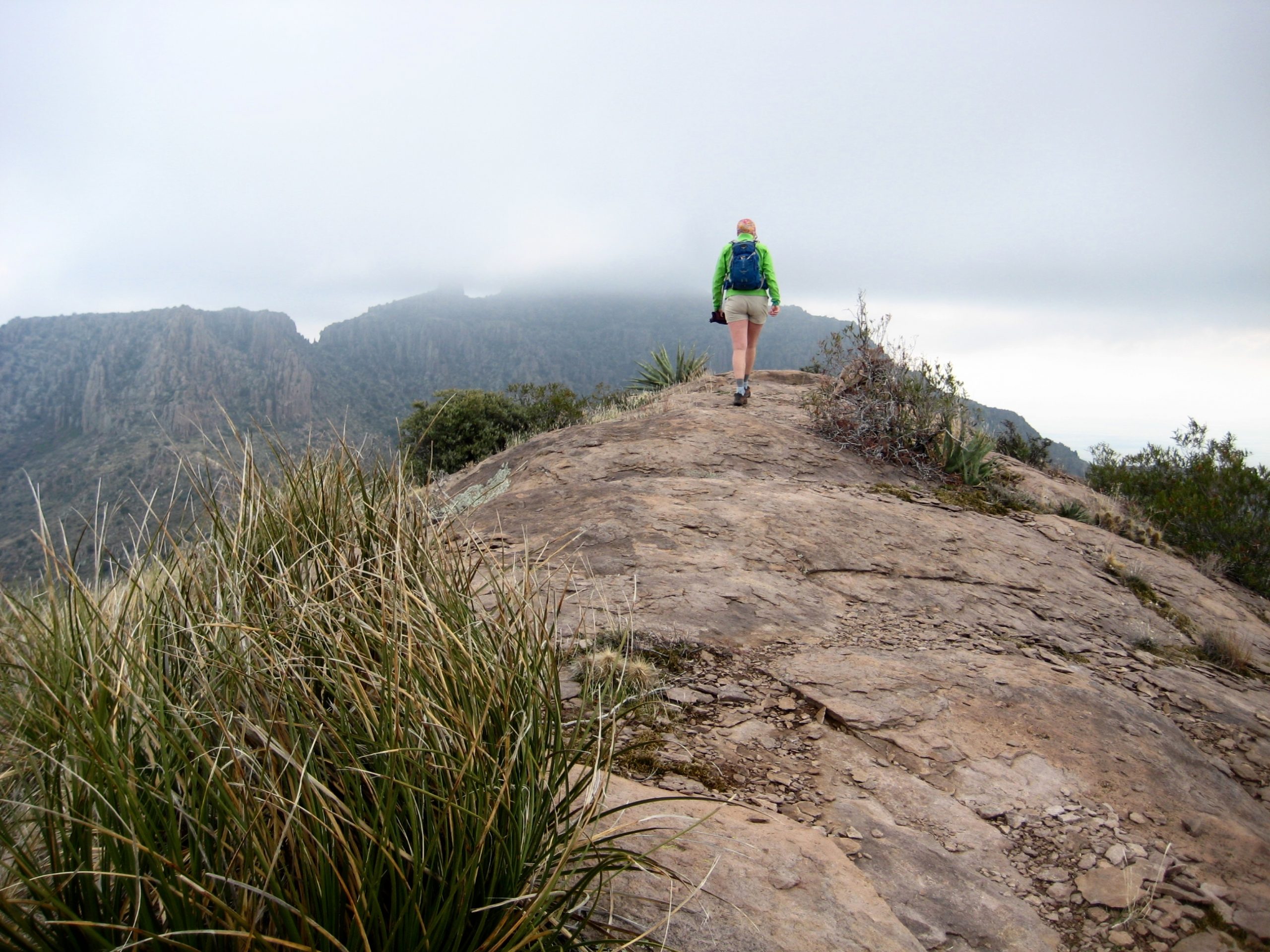
Following a snack break atop The Flatiron, we hiked back across the rim trail and up to 4700-foot Siphon Pass. This pass marks the start of the Superstition Ridge Route as shown on Green Trails maps. Soon after dropping over the other side of the pass, we entered a dense fog. Was this Arizona or Washington?

…
- Heavy Fog Near Siphon Pass
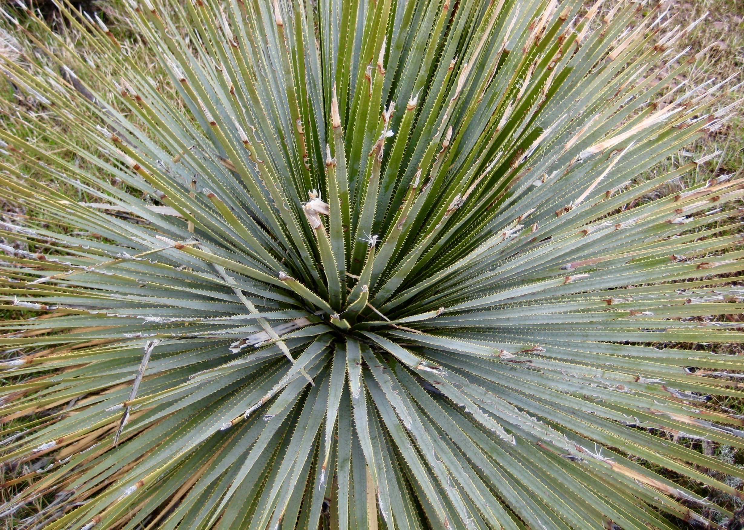
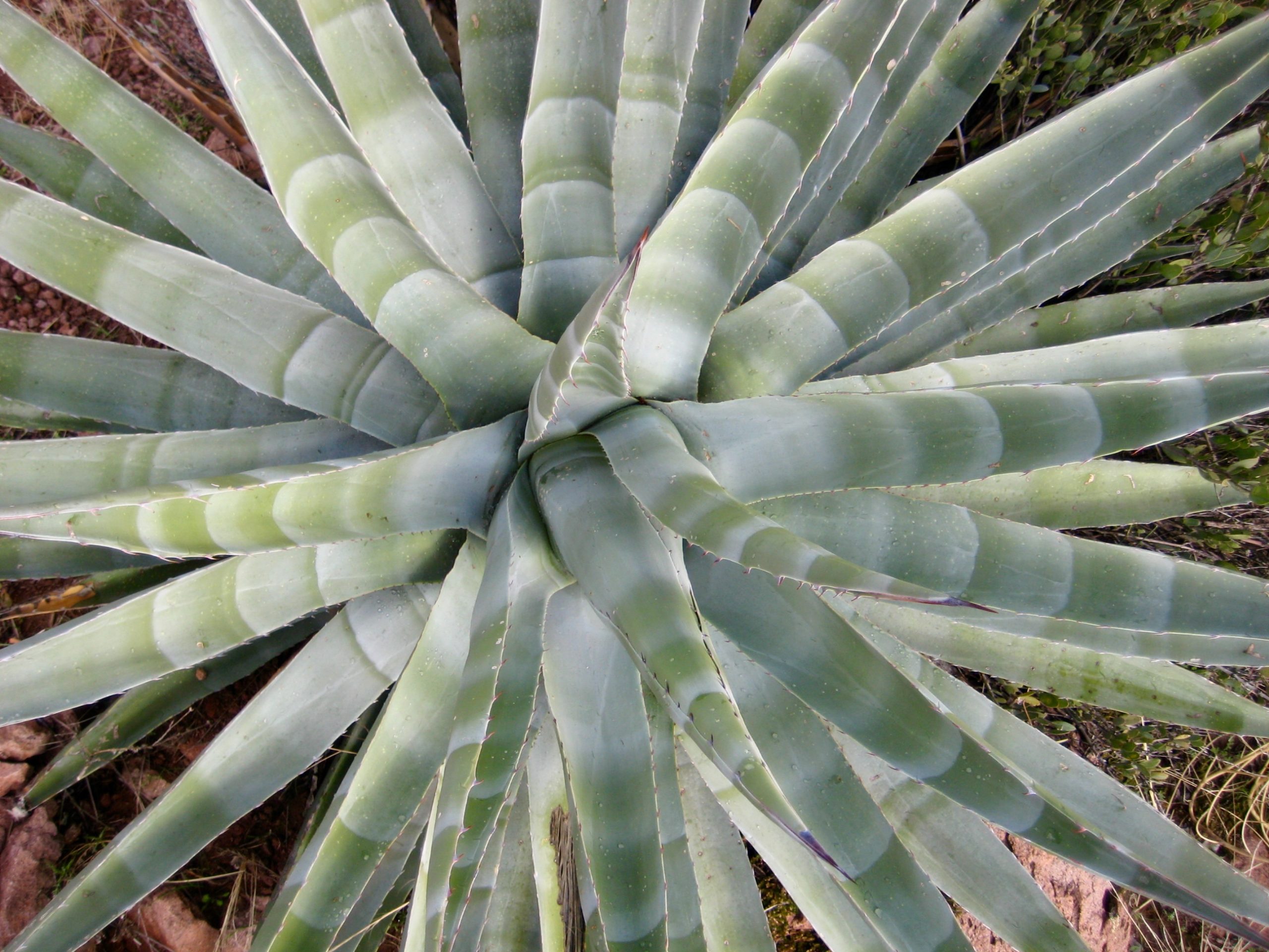
Thankfully, the fog was short-lived, but low clouds still surrounded us and limited our visibility. At least we could enjoy the local botany and geology.
- Hiking East From Siphon Pass
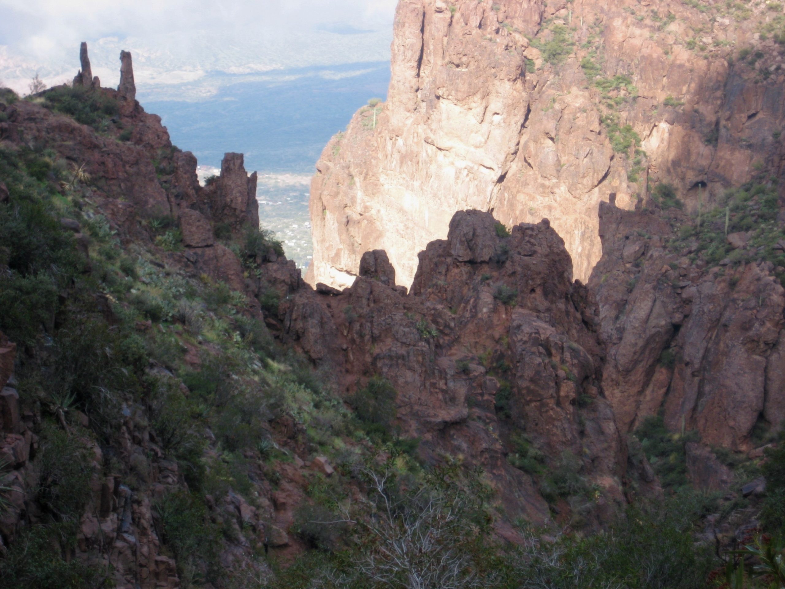
After a mile of contouring hillslopes, the trail descends into 4200-foot West Superstition Gap (4.7 hours + 2800 feet from TH). This gap represents the lowest point on the ridge portion of our traverse route.
- Starting Descent Into Superstition Gap

- Descending Into Superstition Gap
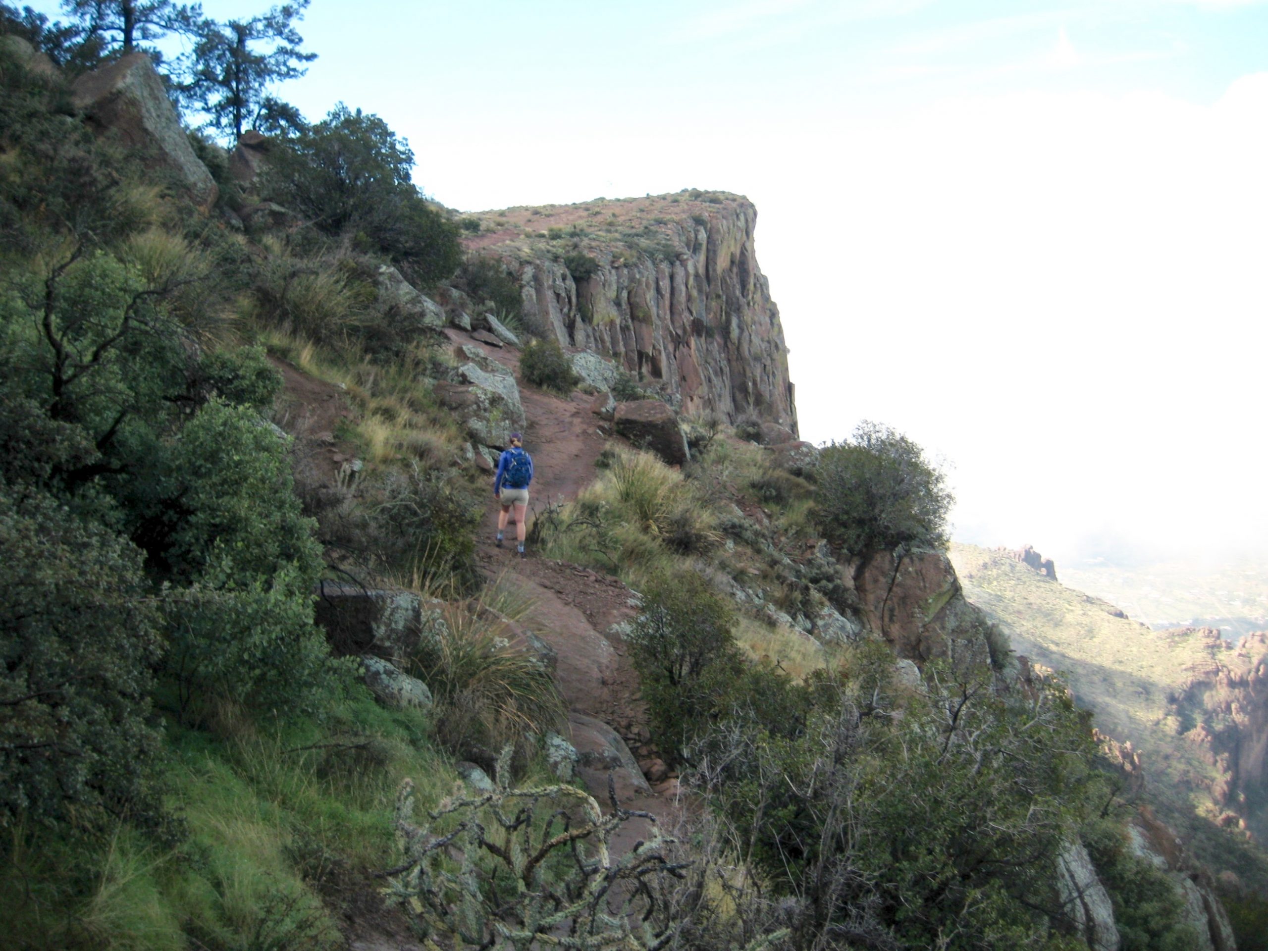
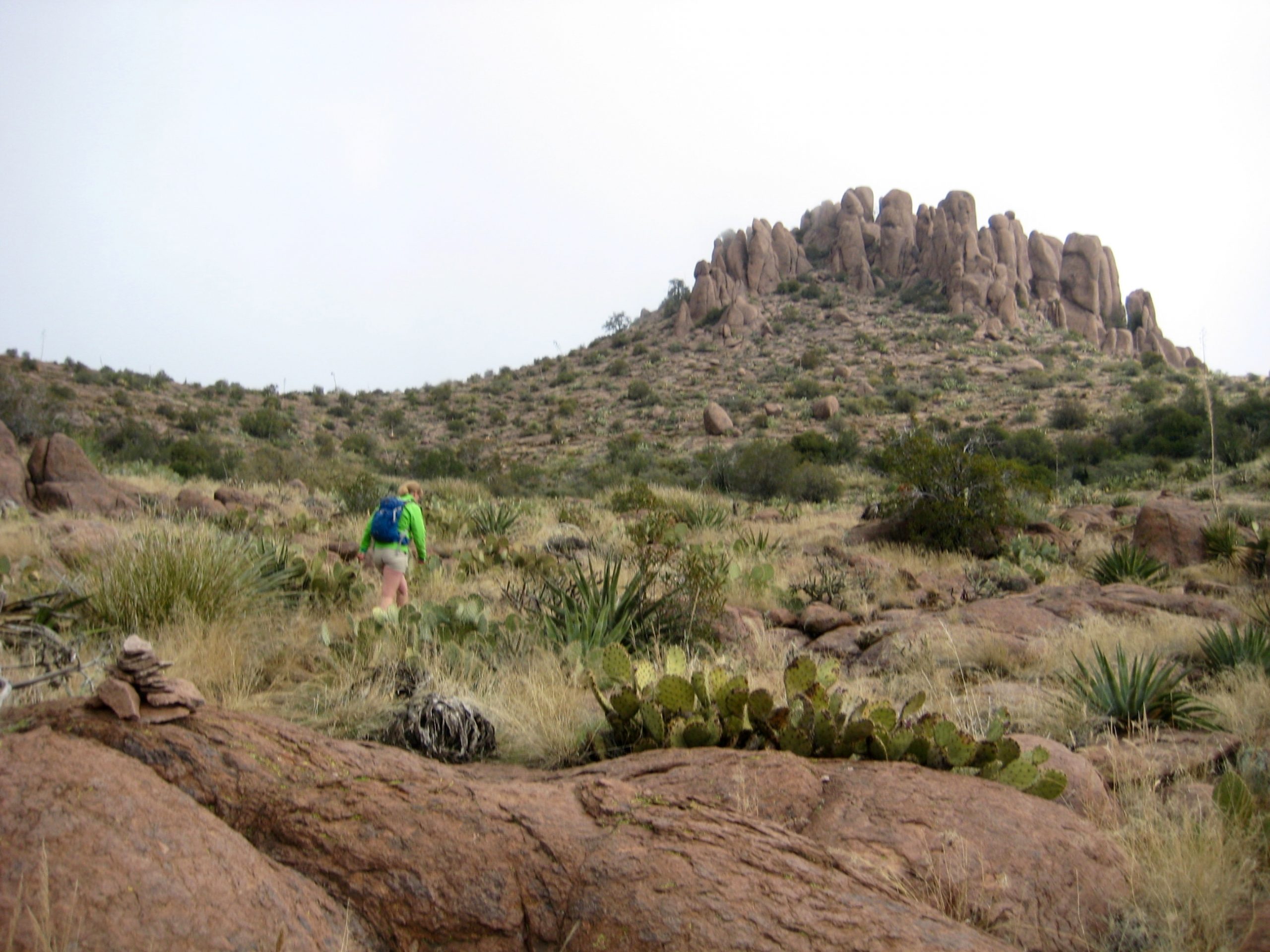
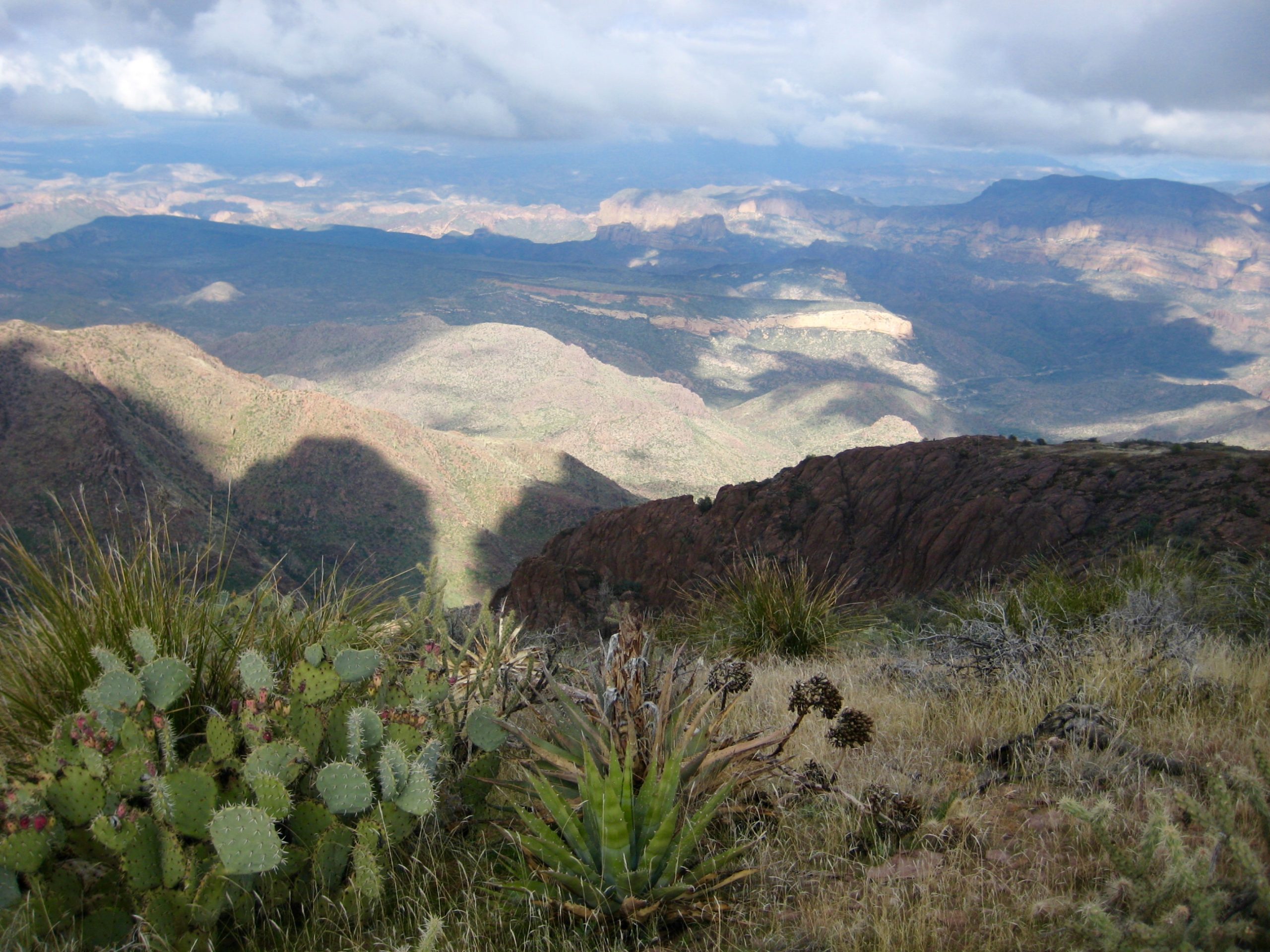
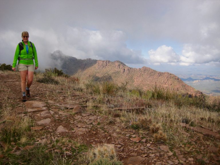
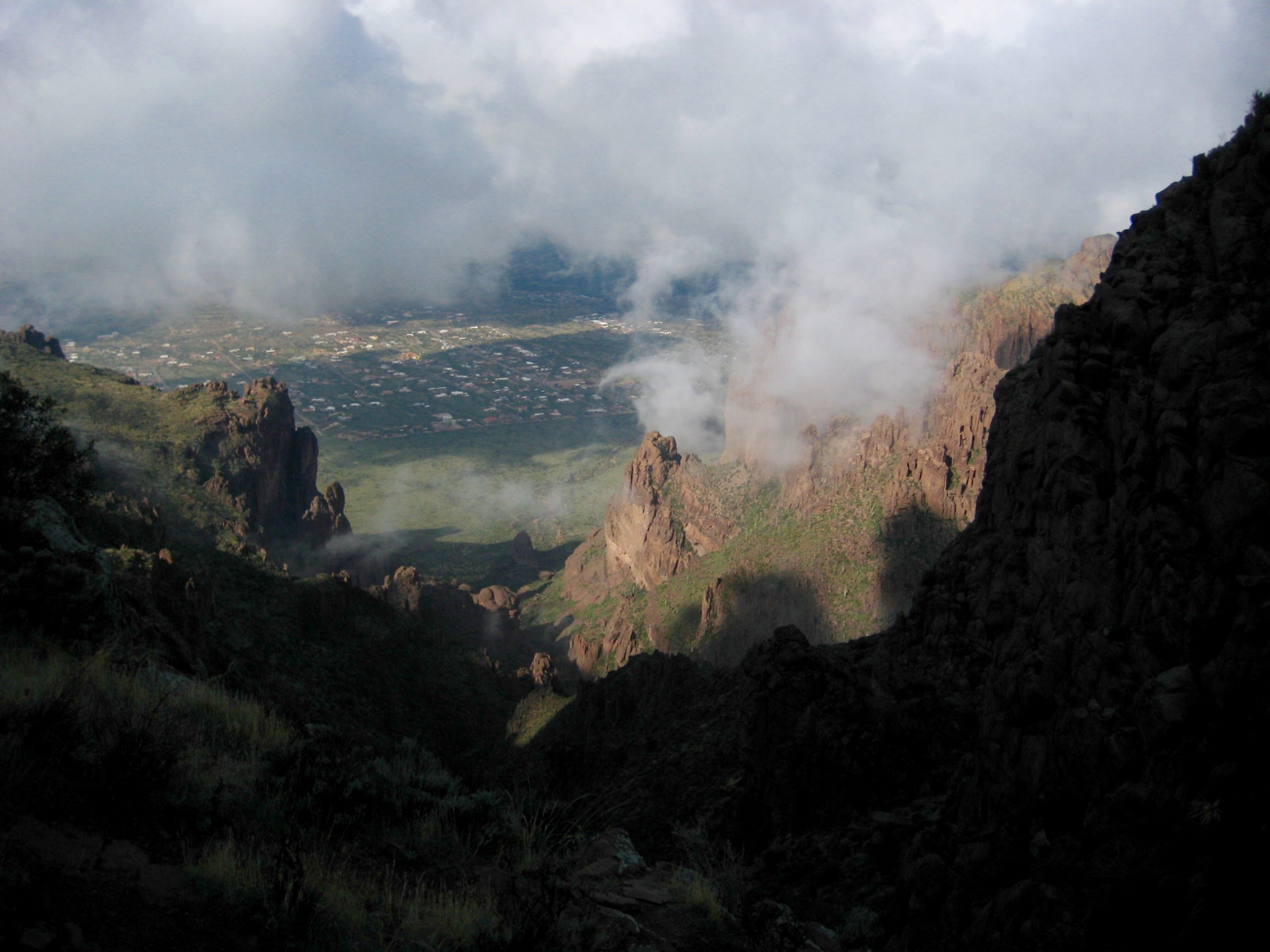
Beyond West Superstition Gap, the trail stays mostly on the ridge crest. We were happy to see sunlight poking through the cloud layer and spotlighting other ridges to the east.
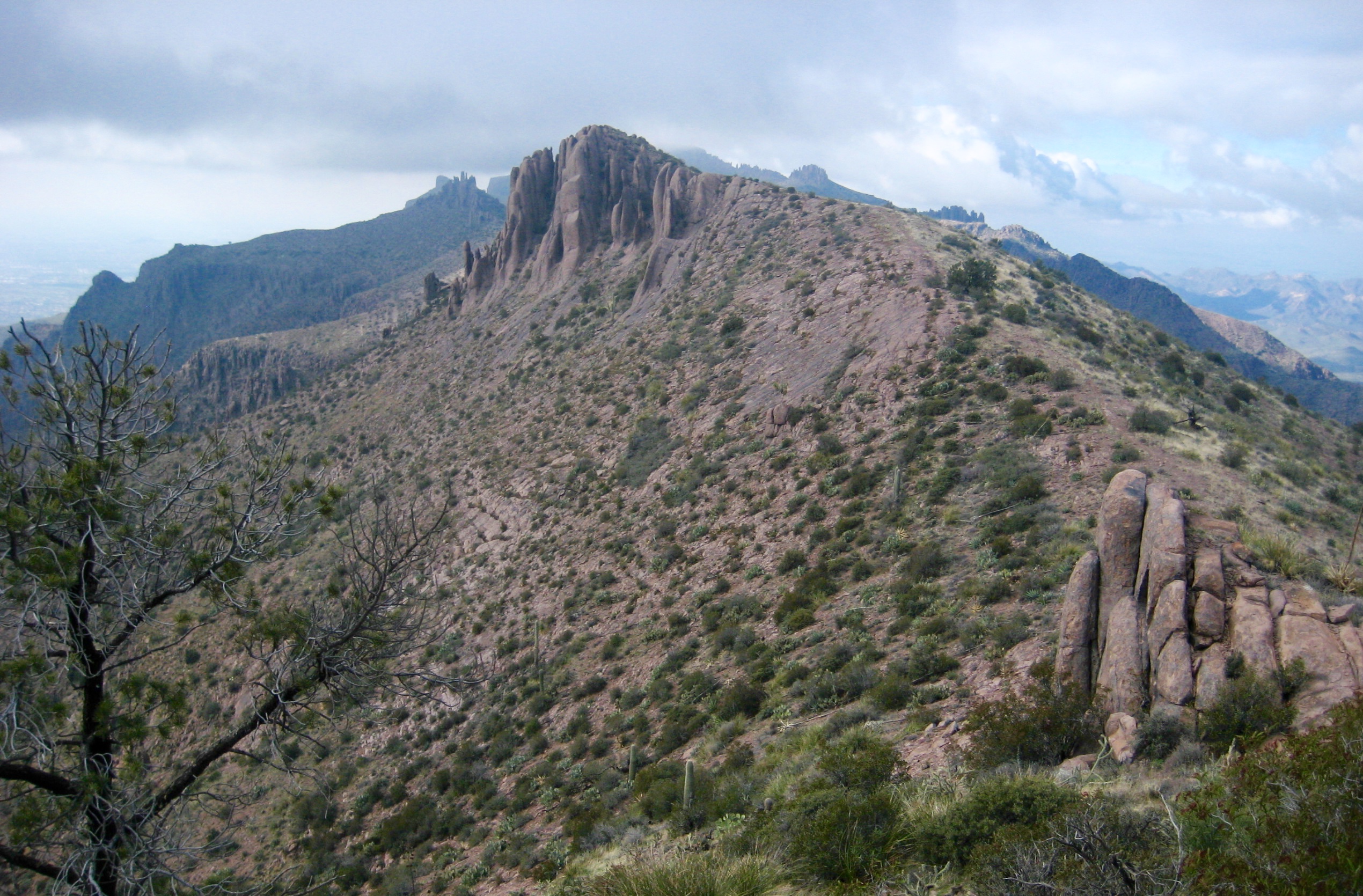
- Hiking Along Superstition Ridge Crest
- View East From Superstition Ridge
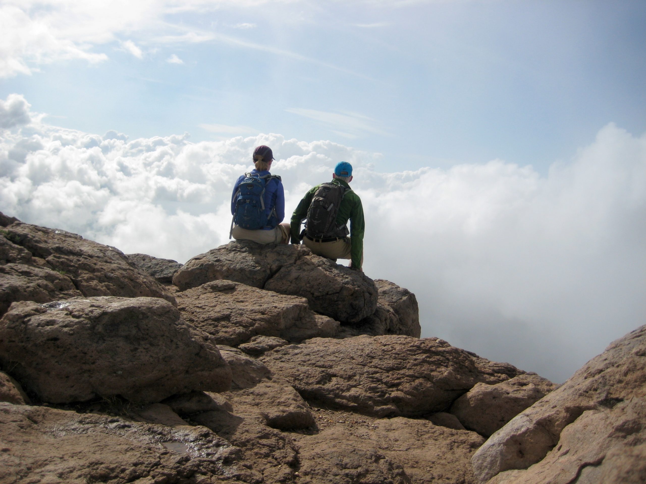
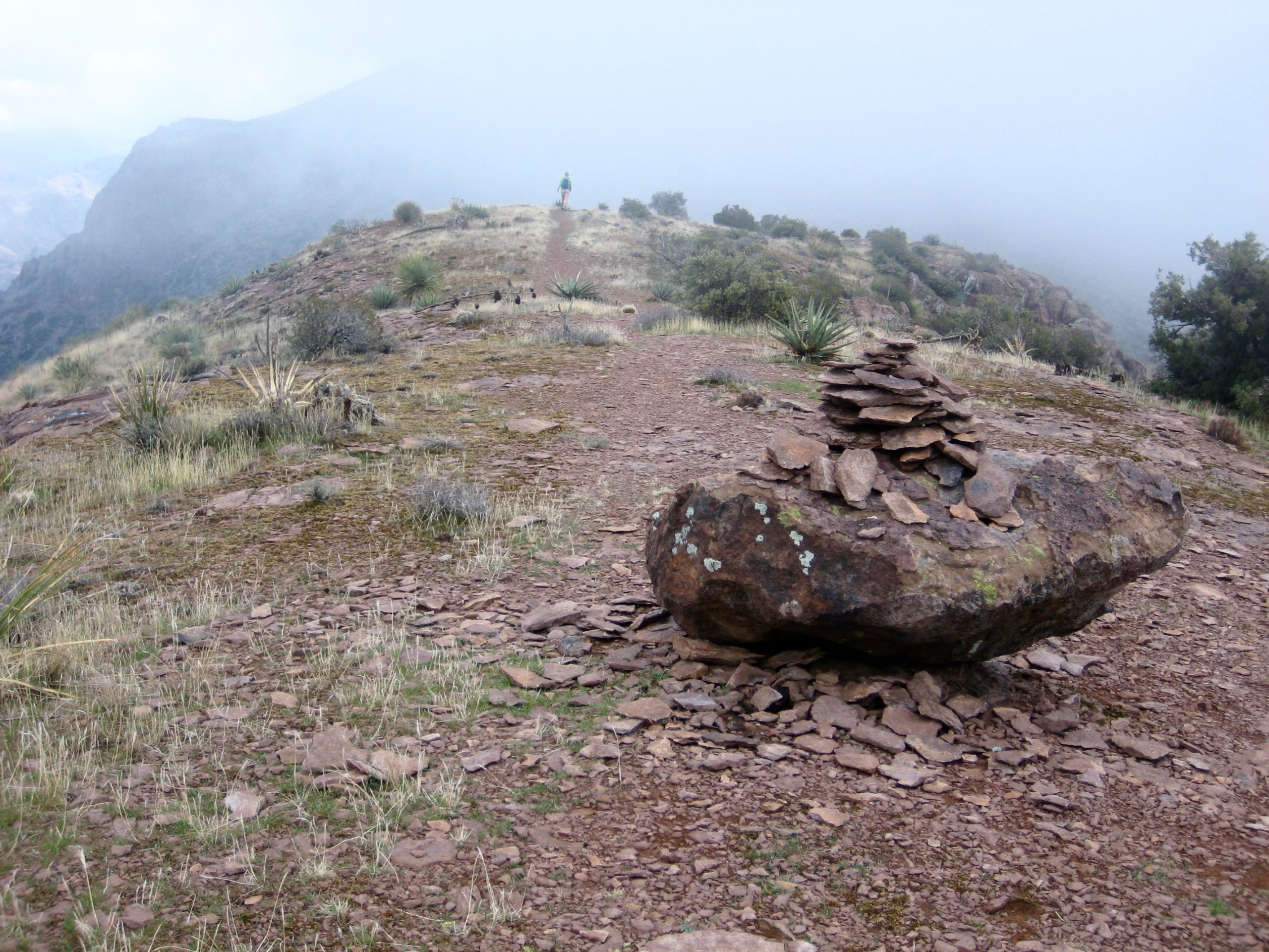
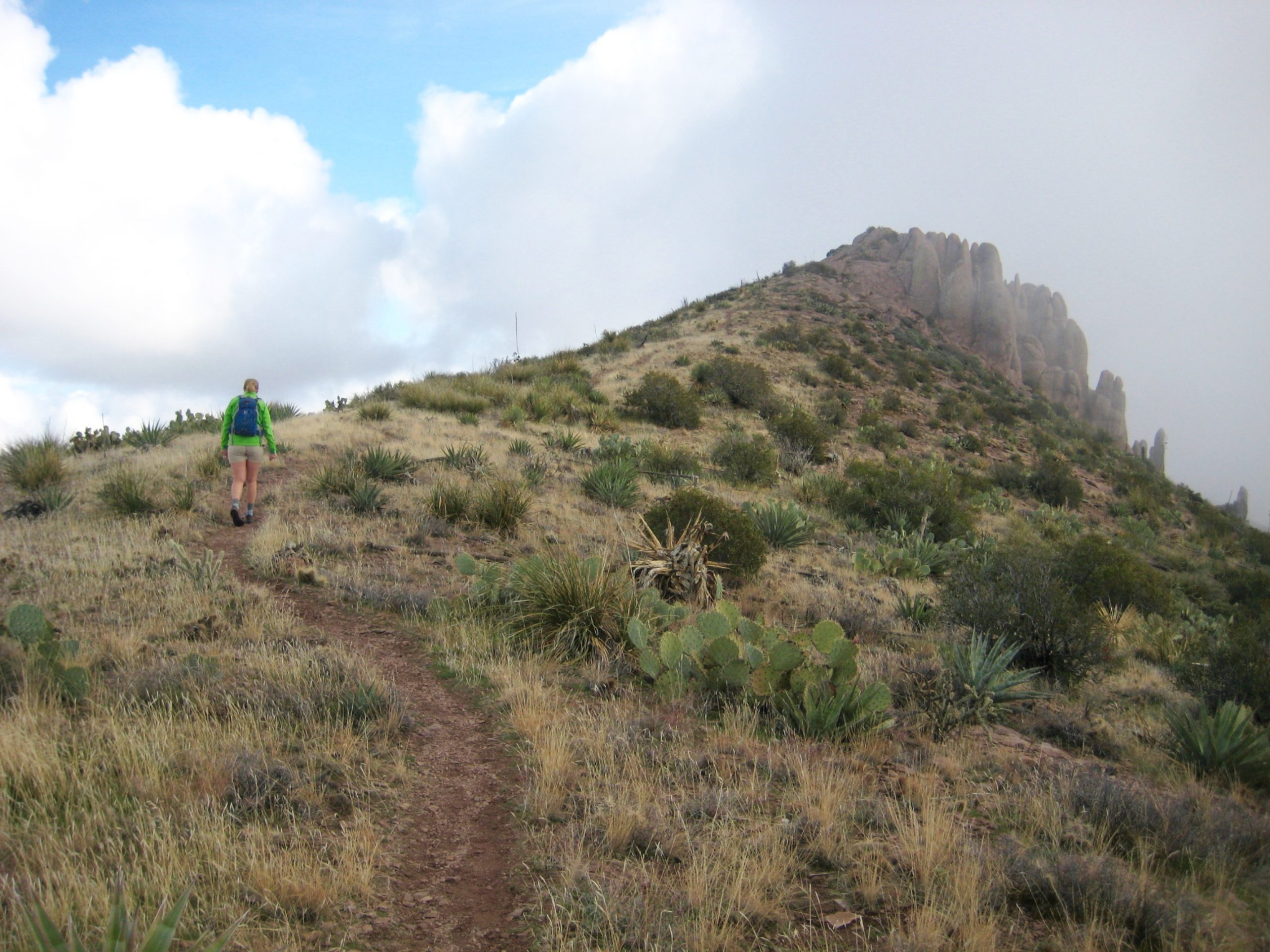
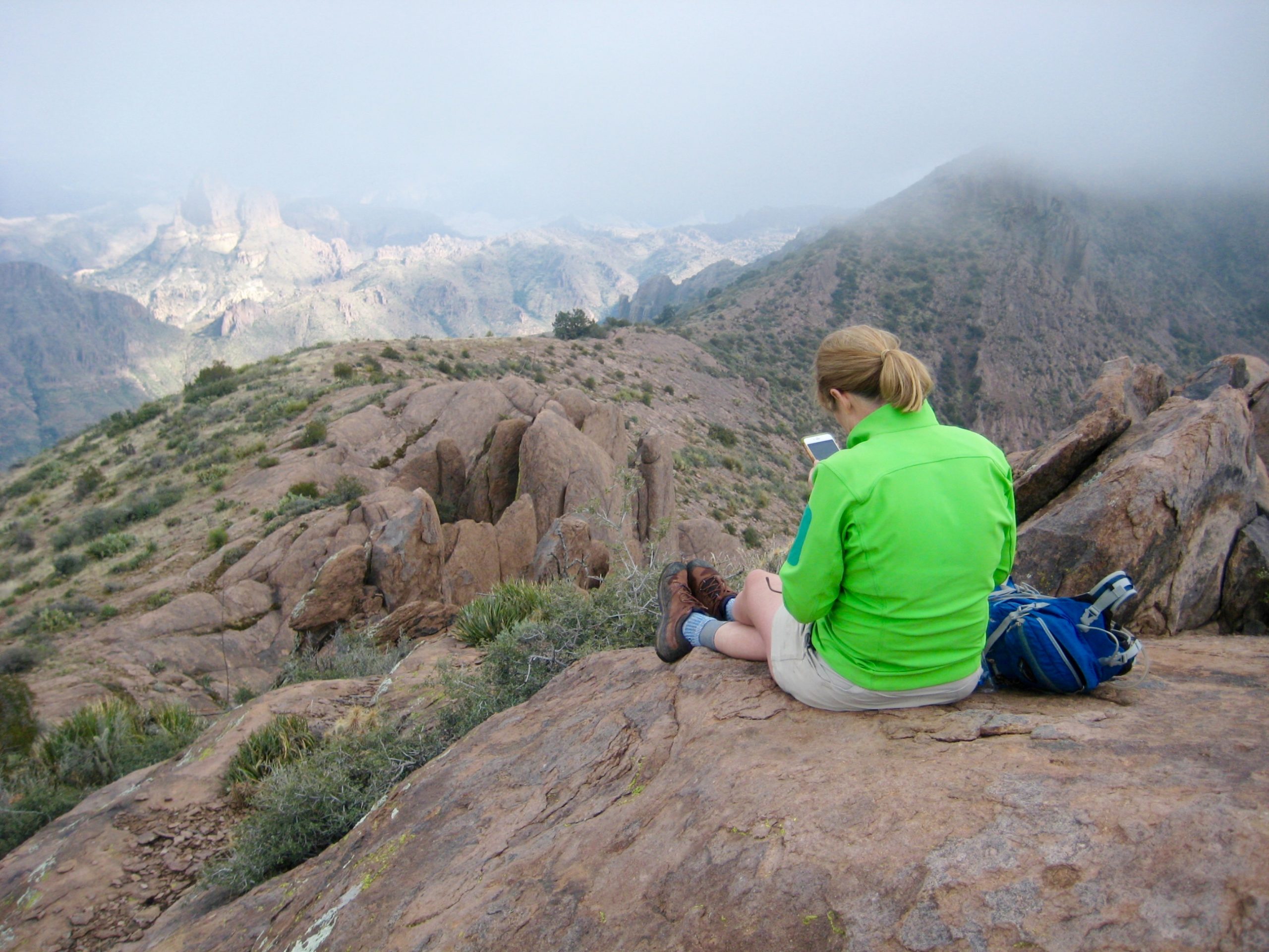
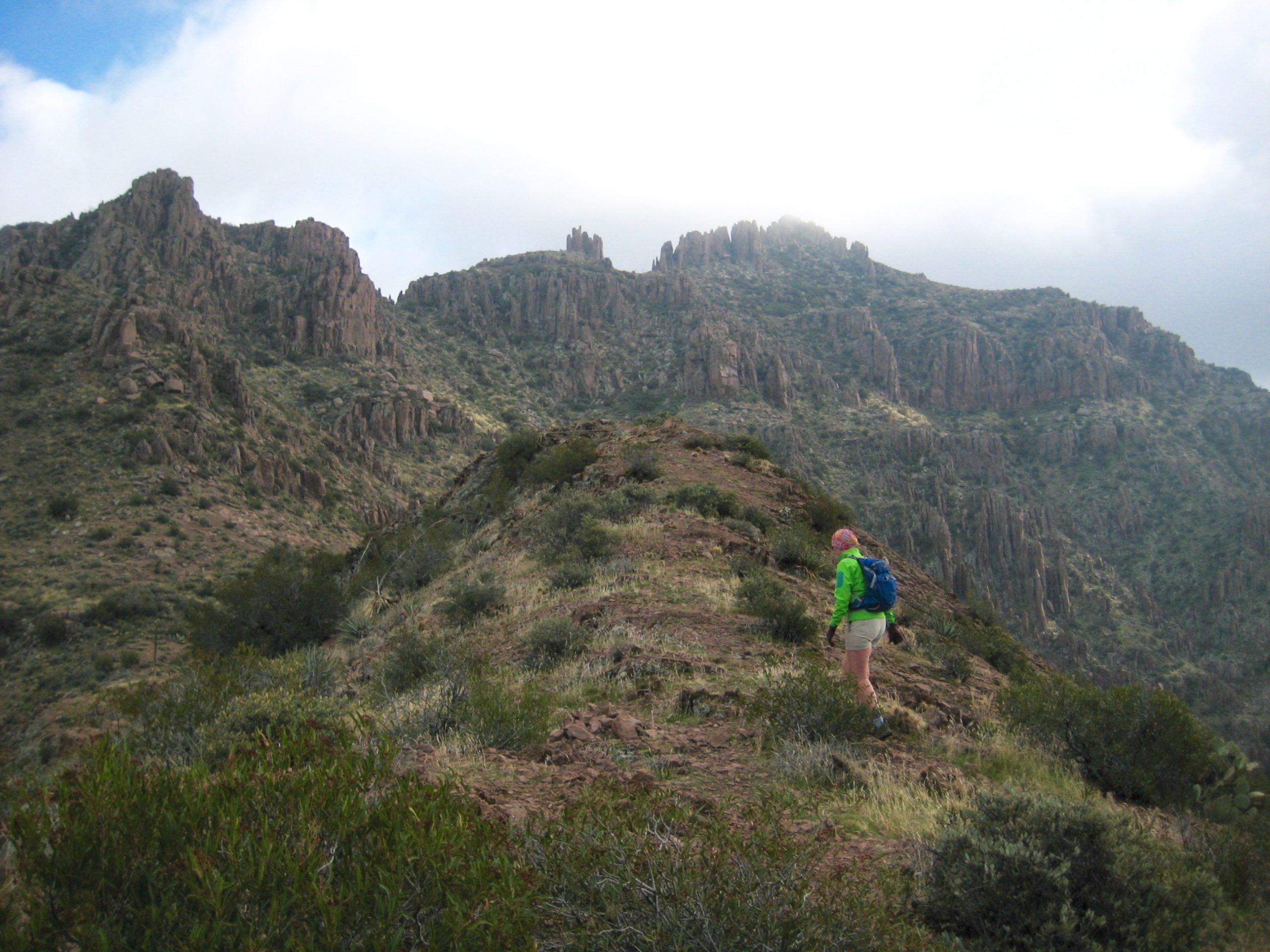
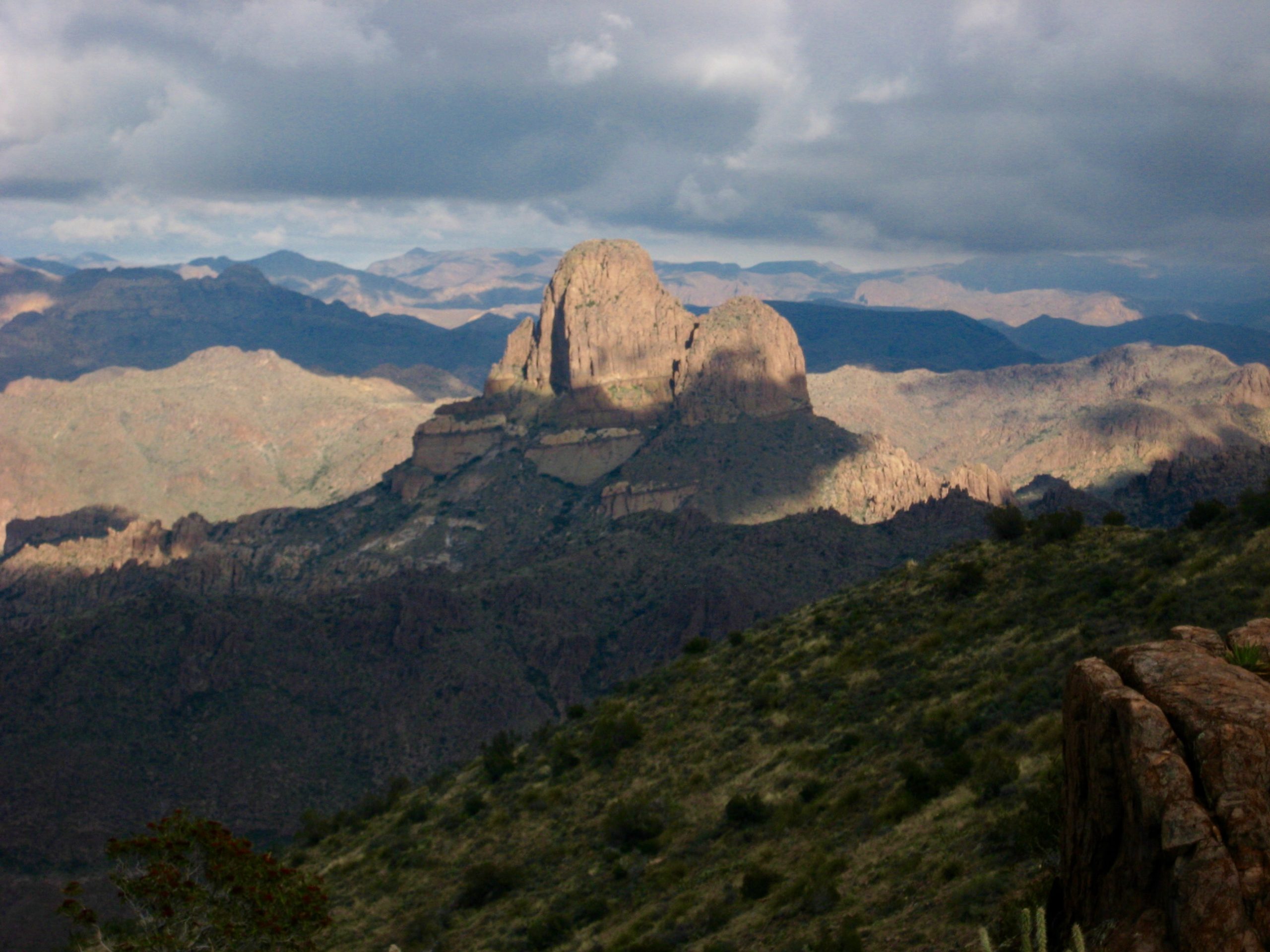
A notable feature near the middle of the traverse is Point 4642, or “Superstition Knob.” The trail does not go over this attractive rocky knob, but Eileen and I made a short scramble to the top and took another break (5.6 hours + 3400 feet from TH).
- Hiking Toward Superstition Knob
- Eileen Checking Map On Superstition Knob
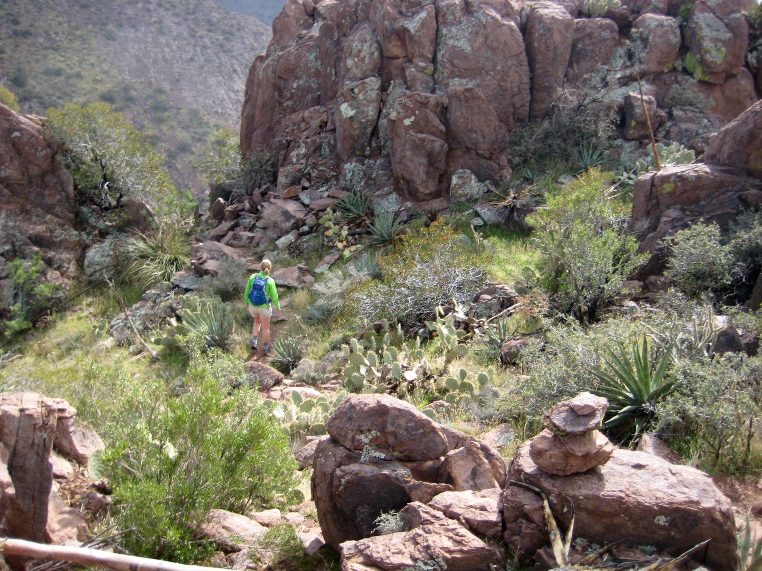
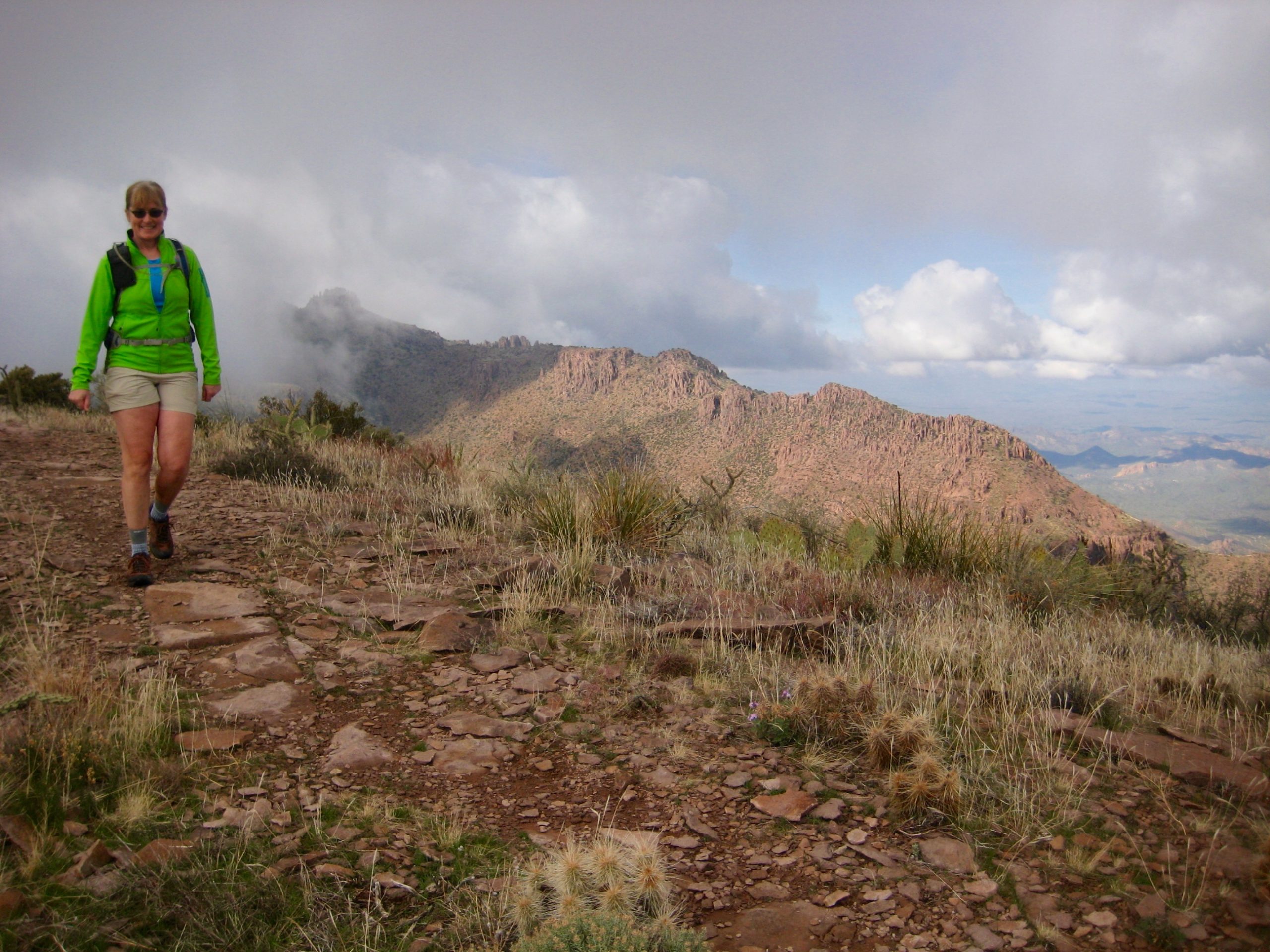
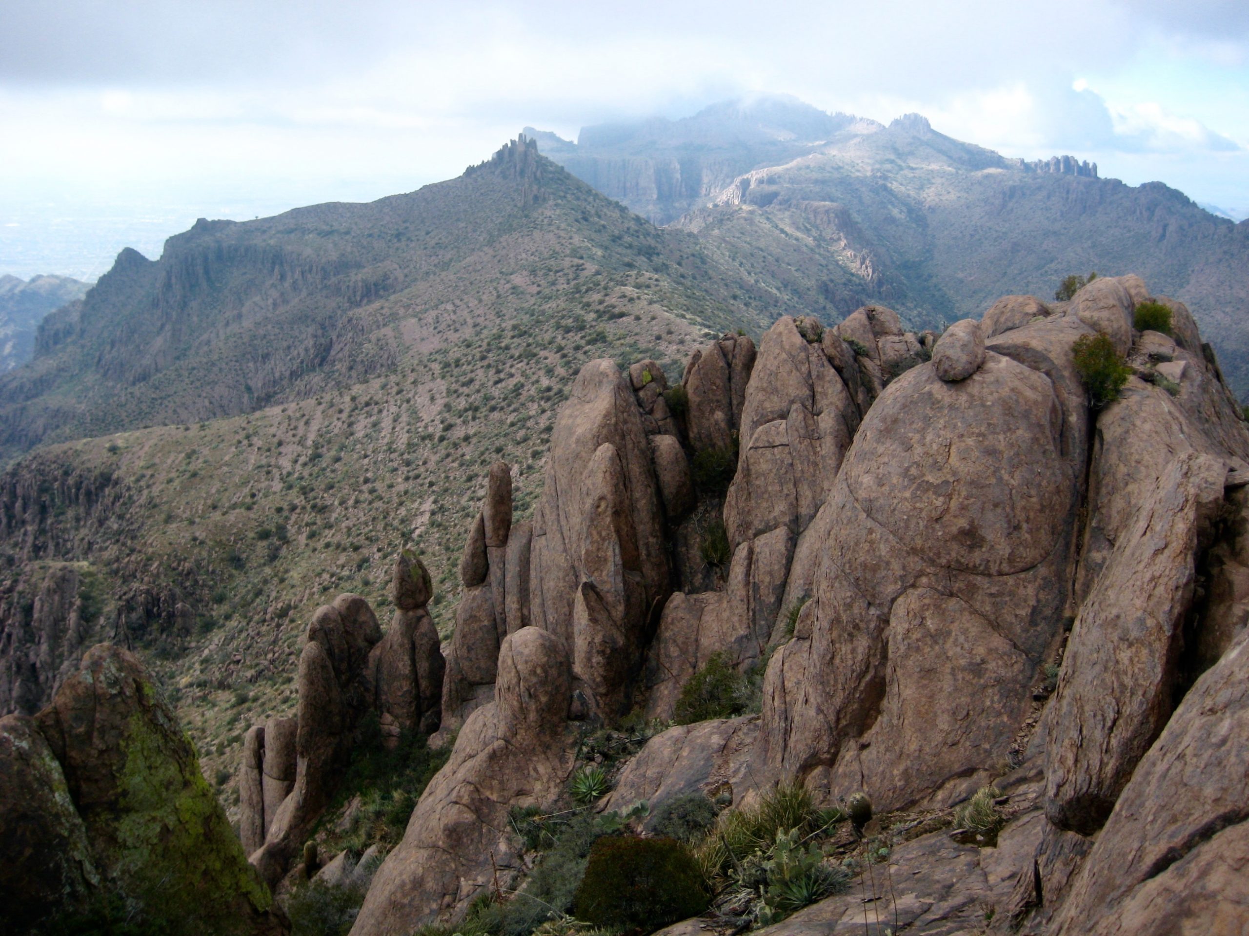
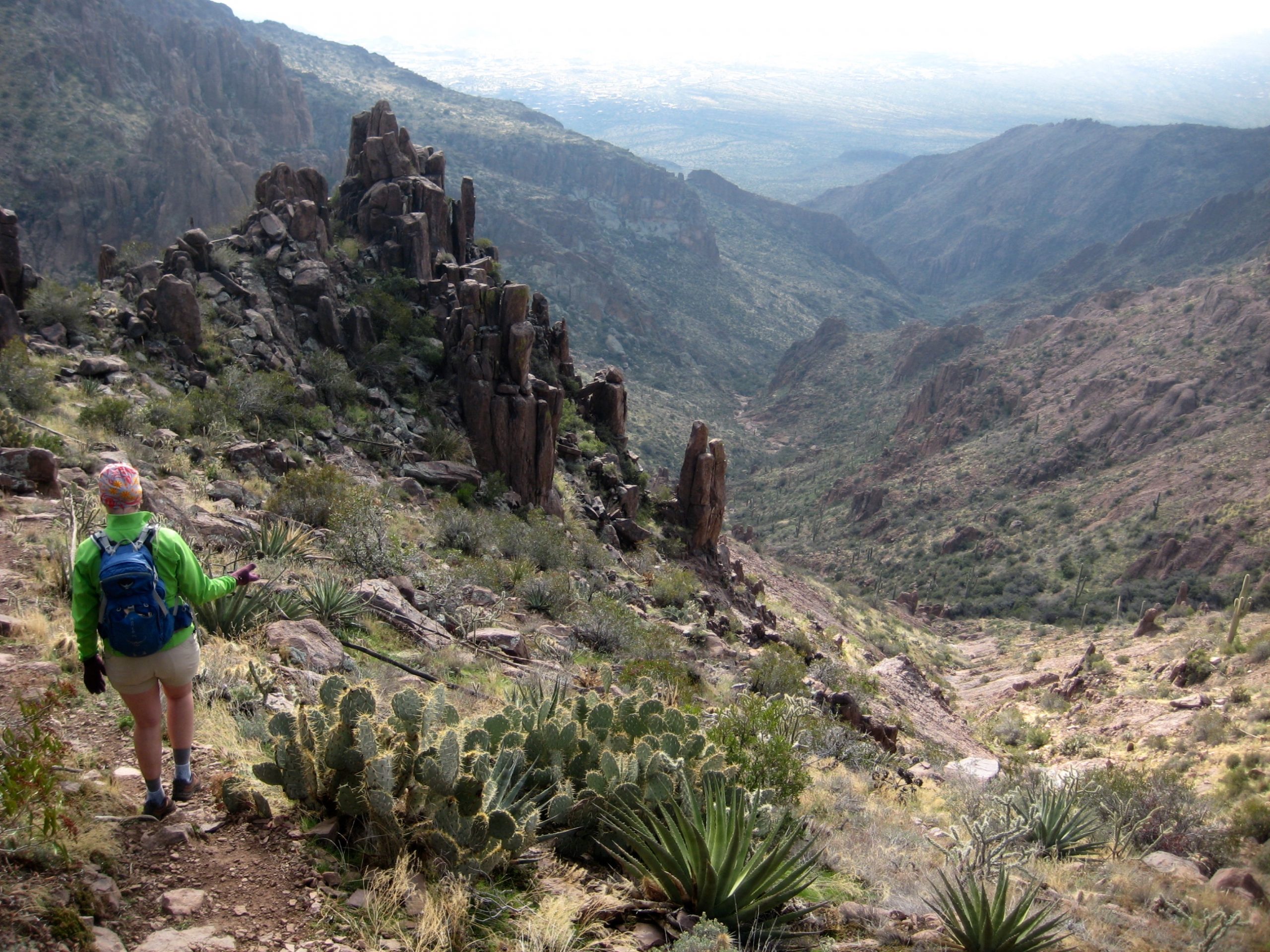
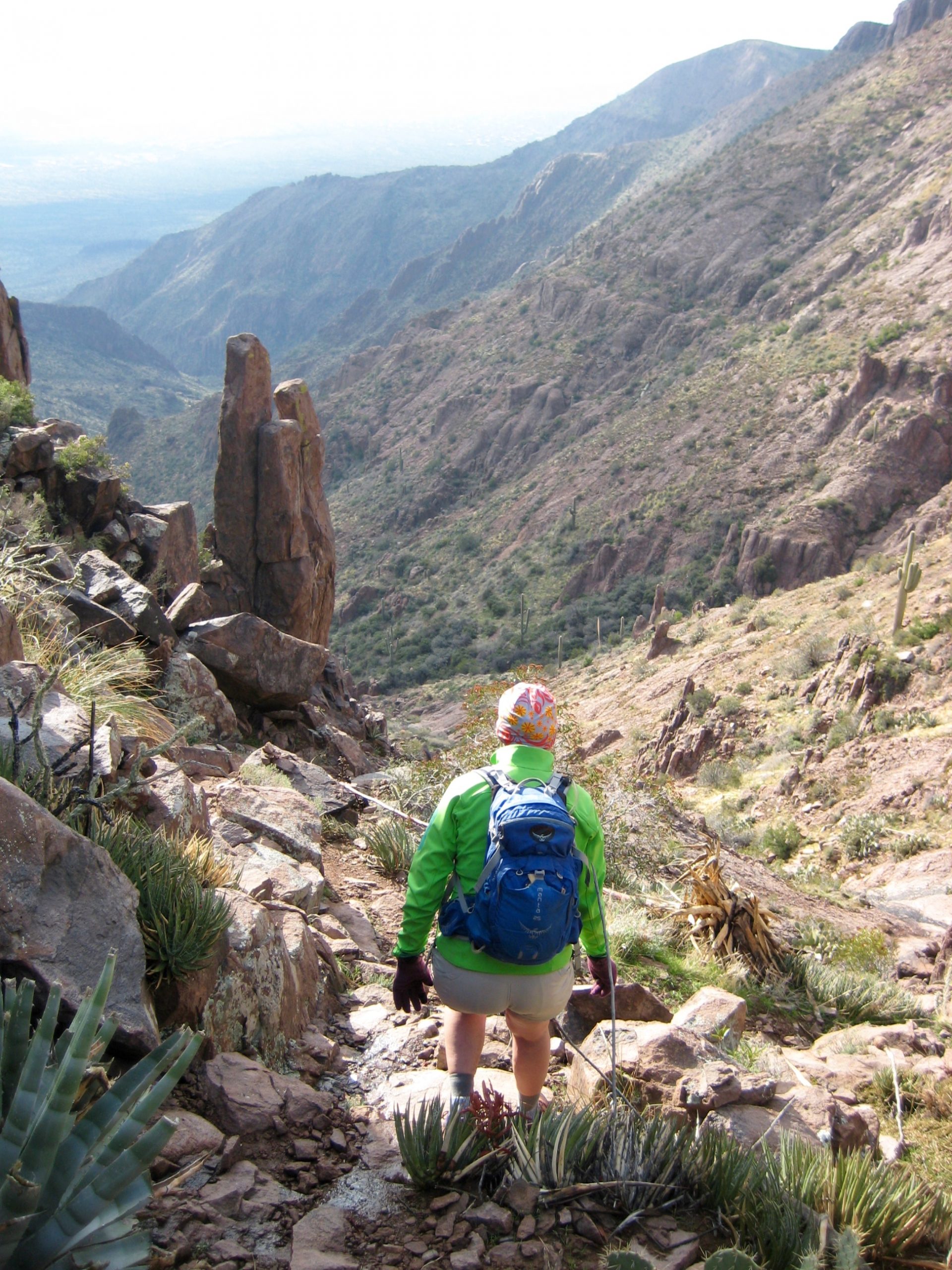
Continuing onward, the trail stays almost entirely on the ridge crest, and our visibility steadily improved. This portion of the traverse is pure high-desert delight. As a bonus, Superstition Peak, the craggy 5057-foot culmination of Superstition Ridge, finally emerged from its foggy veil in front of us.
- Rocky Crest On Superstition Ridge

- Looking Back At Superstition Knob
- Looking Ahead at Superstition Peak
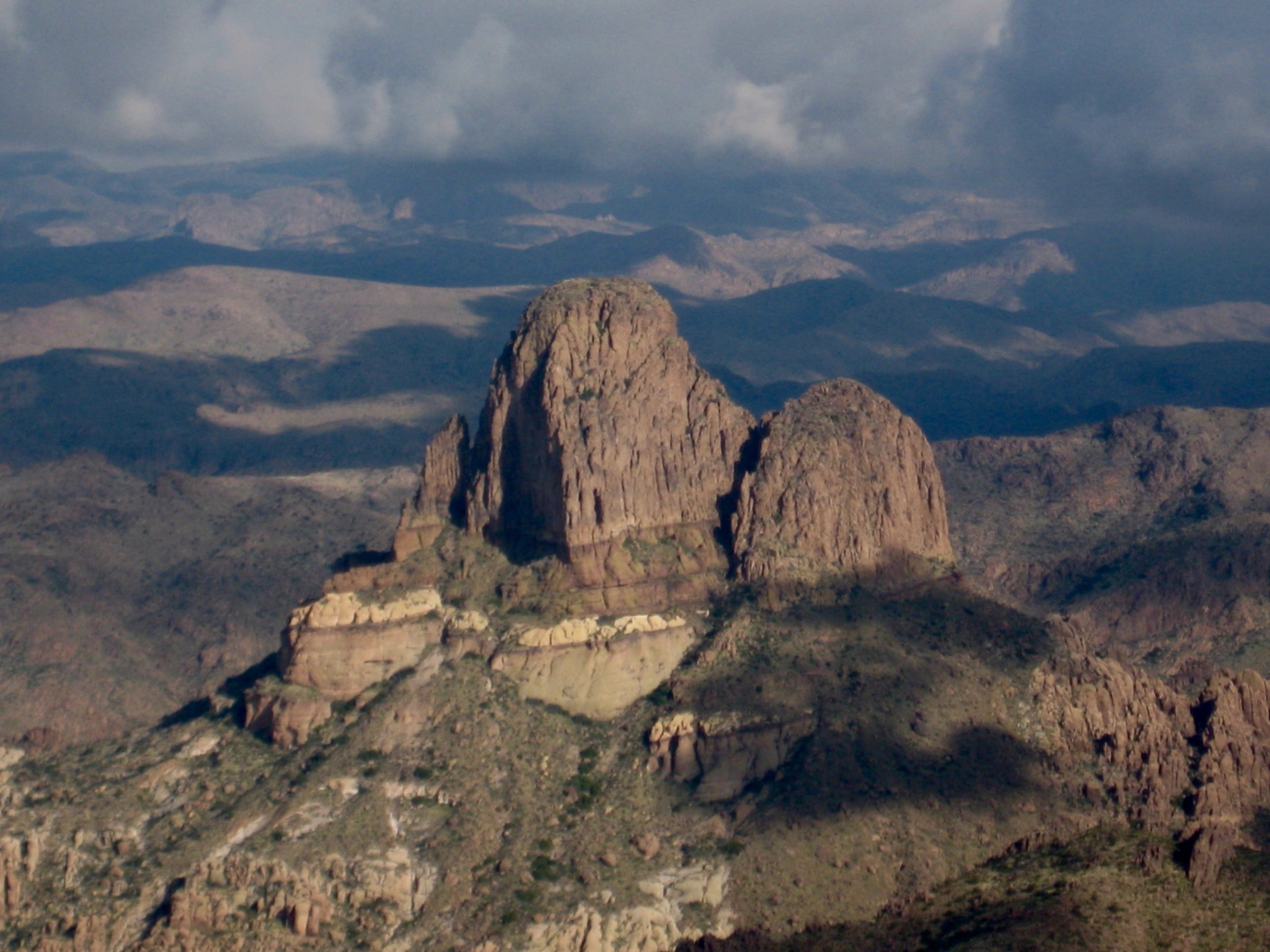
A mile beyond Superstition Knob, after crossing over Point 4869 (aka “Hog Hill” given its location at the head of Hog Canyon) and Point 4777, we dropped into 4350-foot Hieroglyphic Gap (7.0 hours + 3650 feet from TH) and took our last break. Weavers Needle jutted up to our east, looking very much like a small version of Mt. Slesse.
- Weavers Needle From Hieroglyphic Saddle
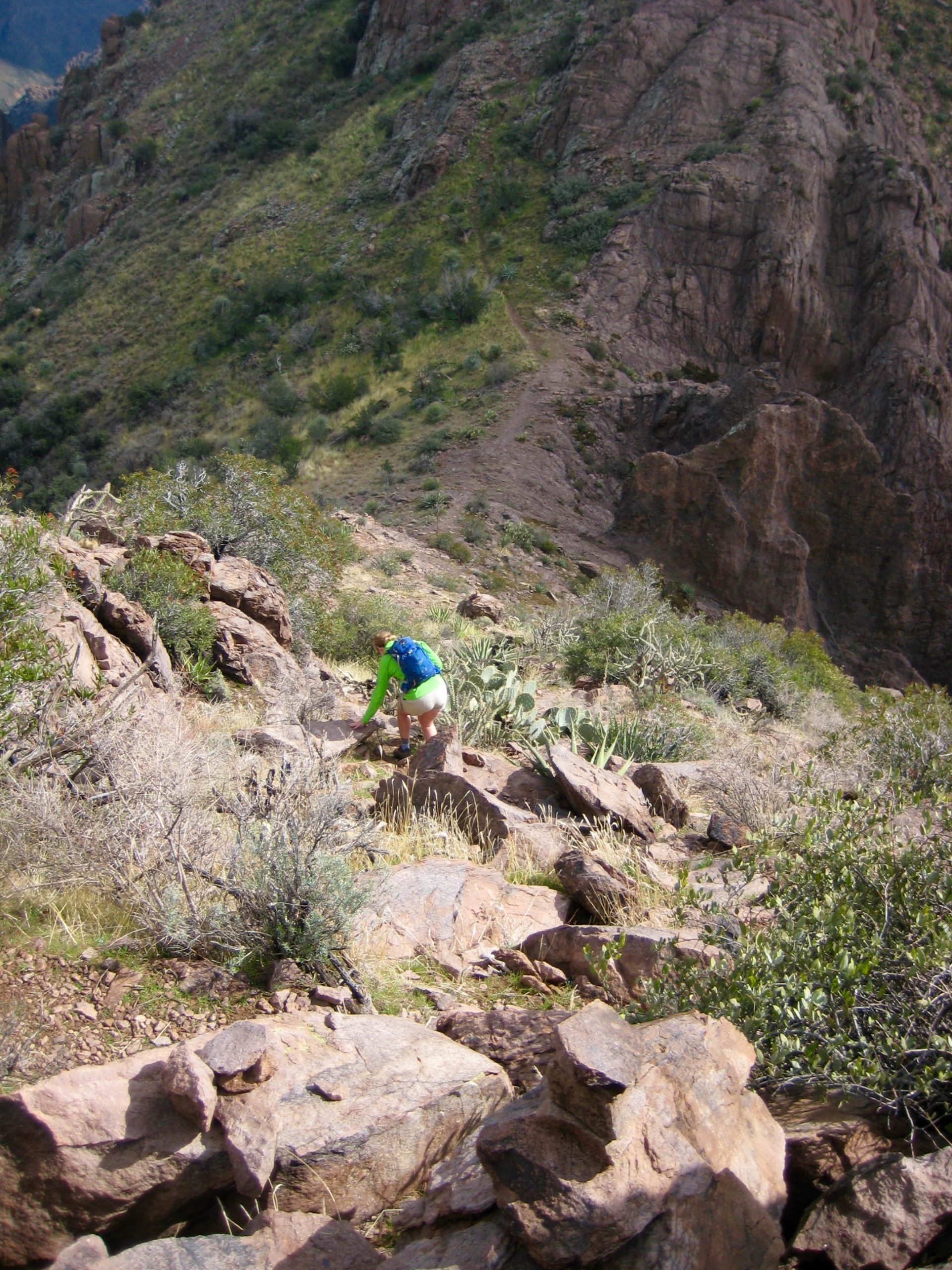
At the low point of the gap, several cairns mark the junction with a crude trail coming up Hieroglyphic Canyon. Eileen and I had little information regarding this trail, but we had planned on exiting our traverse here. So, down we went.
- Starting Descent Into Hieroglyphic Canyon
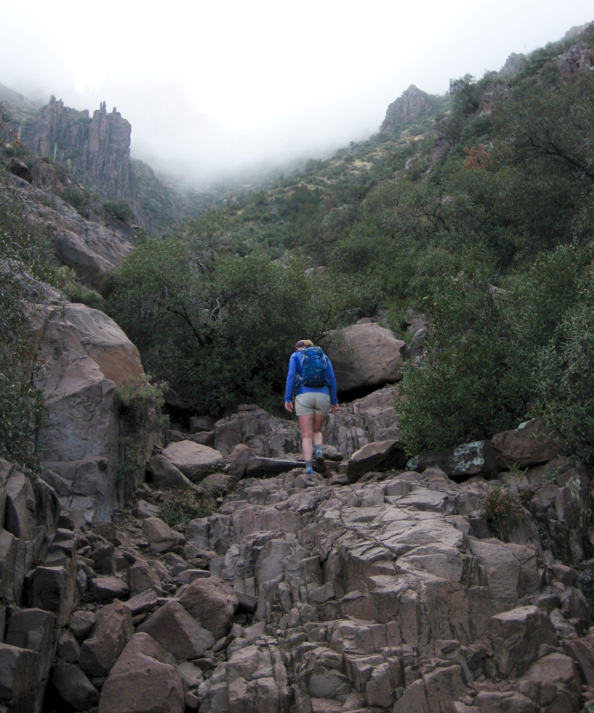
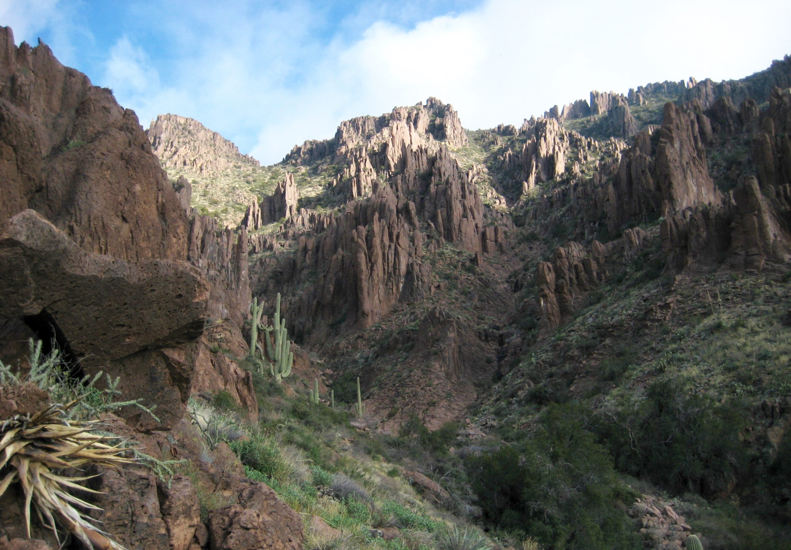
The upper part of Hieroglyphic Canyon is steep, loose, and unpleasant, with many scramble sections. Farther down, the slope gradient eases back, and we found ourselves weaving through a picturesque streambed.
- Following Stream Thru Middle Hieroglyphic Canyon
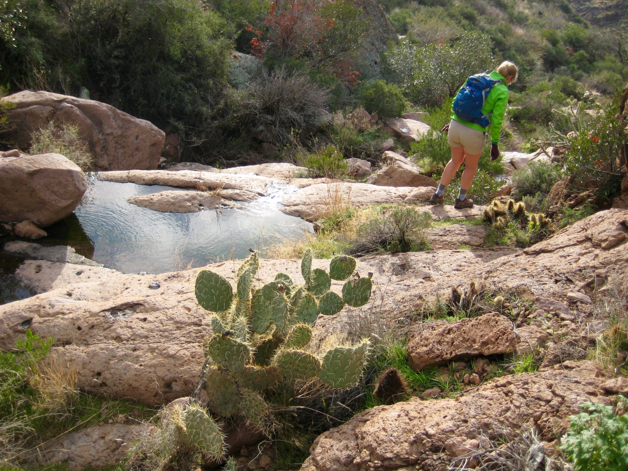
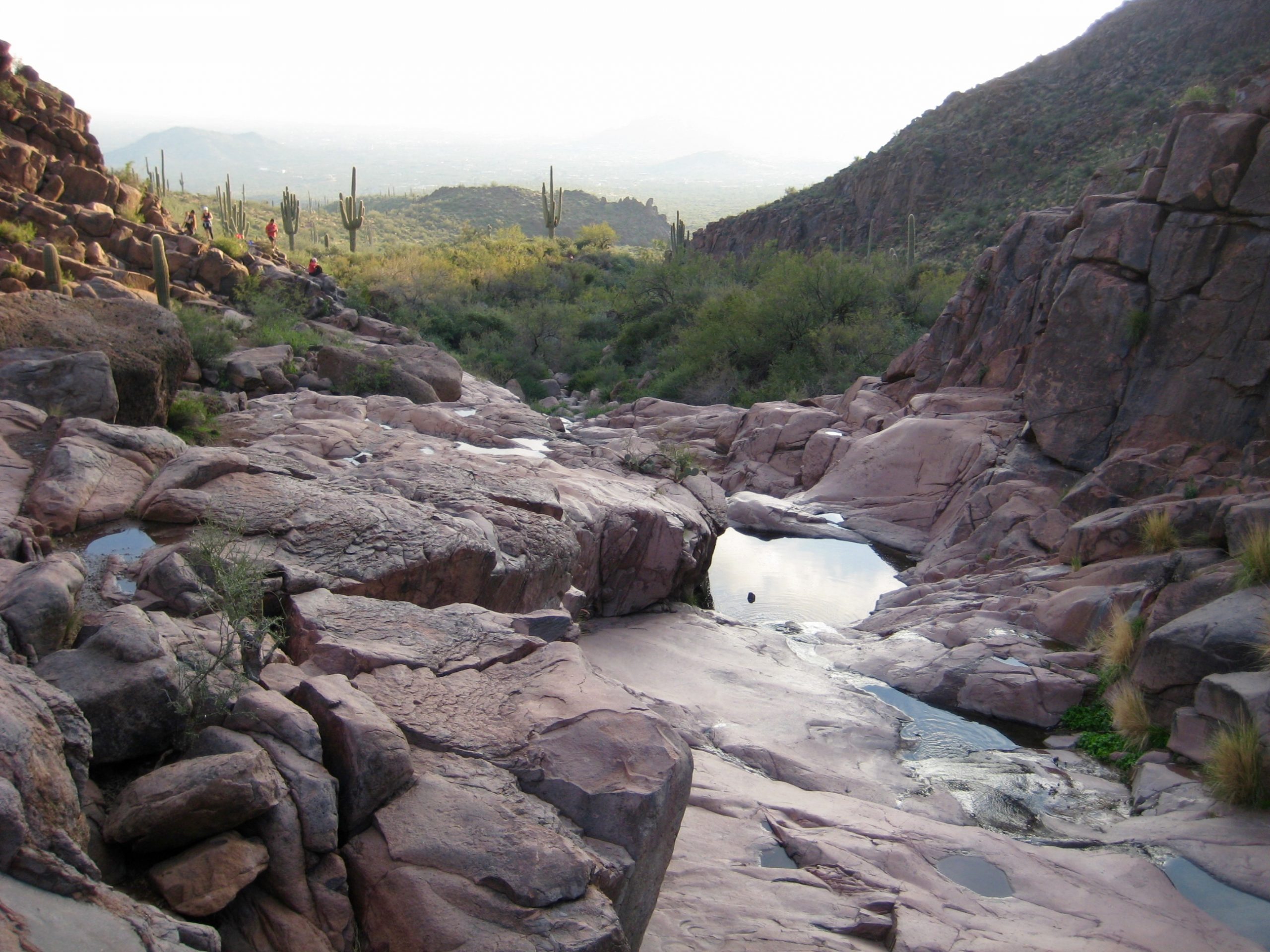
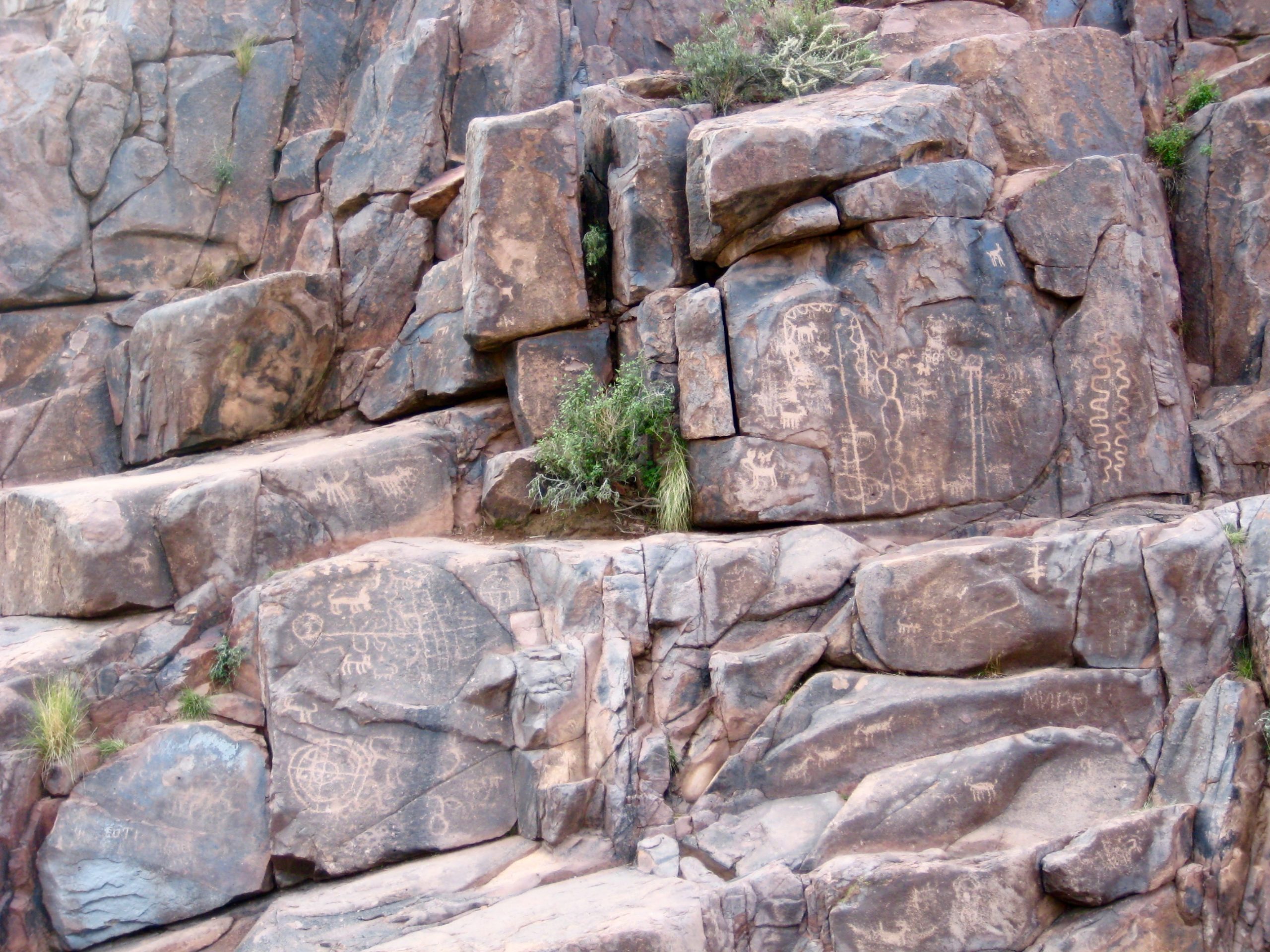
After a rough descent of 1600 feet, the trail makes a left turn and levels out among the white rock slabs and tranquil water pools of Hieroglyphic Spring (8.8 hours + 3650 feet from TH). True to its name, there are hieroglyphic symbols carved into the adjacent rock walls (hence, petroglyphs).
- Slabs & Pools At Hieroglyphic Spring
- Petroglyphs At Hieroglyphic Spring
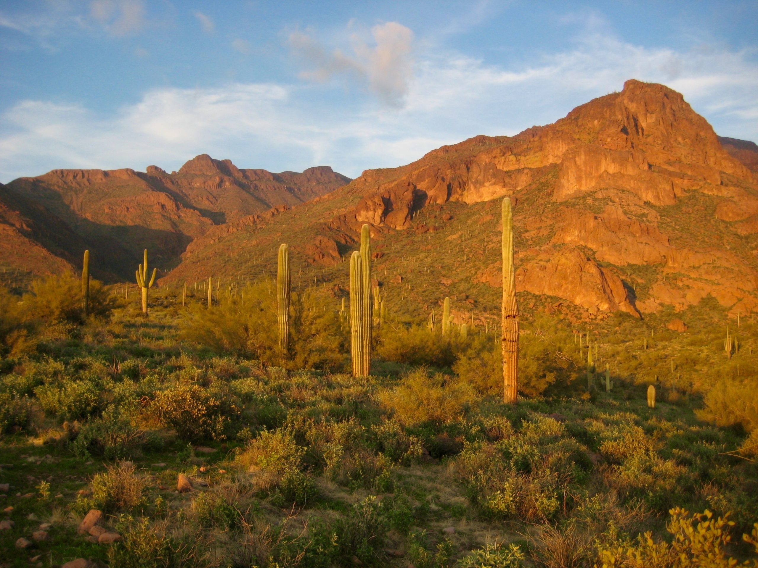
Because Hieroglyphic Spring is one of the most popular hiking destinations in the Superstition Mountains, it was no surprise to see other people here—the first people we’d seen since leaving Siphon Pass. It was also no surprise that the trail improves dramatically beyond this point. We quickly dispatched the final 1.5 miles of our hike as the setting sun painted the landscape a vibrant orange.
- Looking Up Hieroglyphic Canyon At Sunset
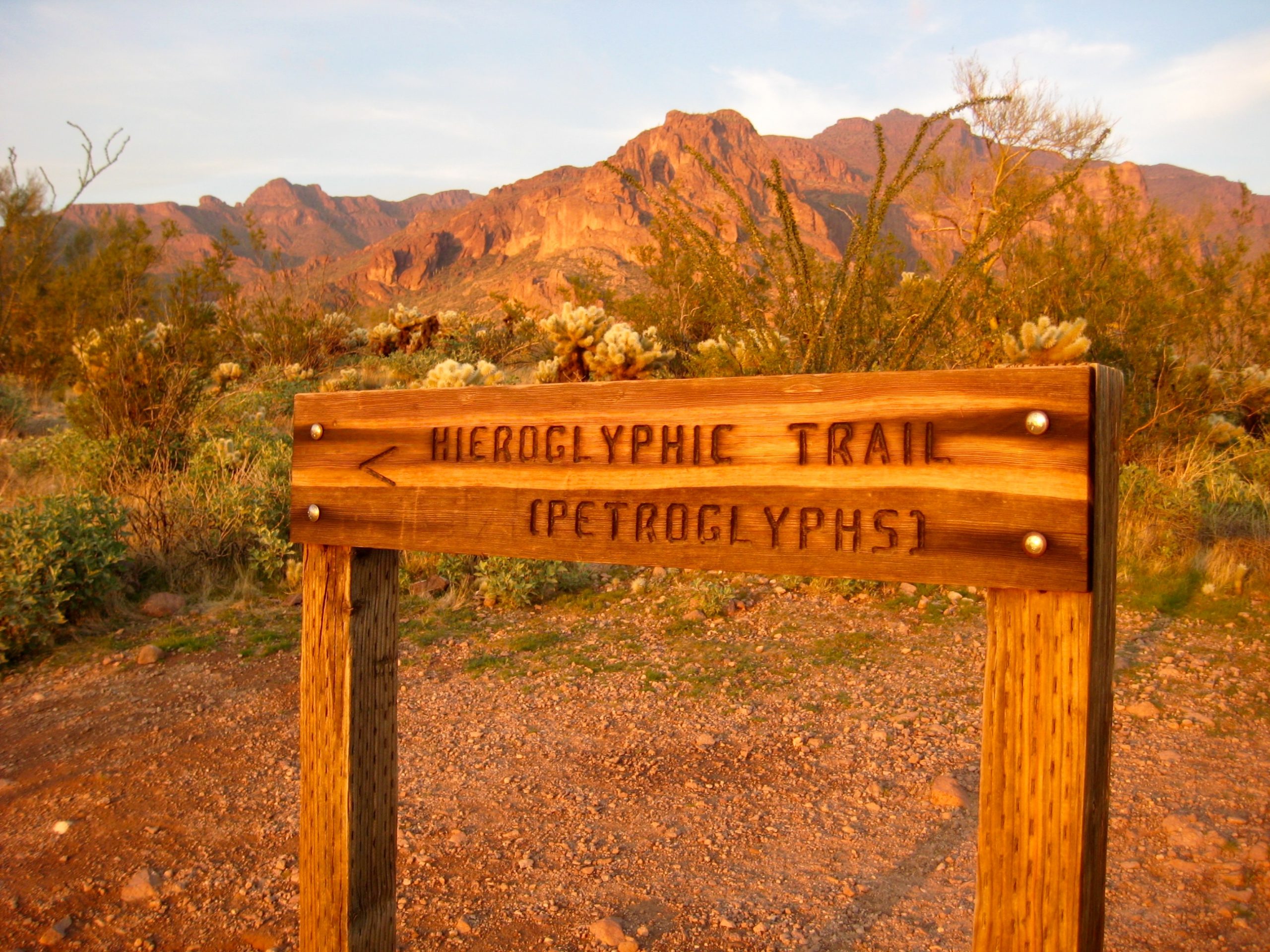
We reached the Hieroglyphic / Lost Goldmine Trailhead just before dark (9.5 hours + 3700 feet from starting TH), but our adventure was not quite over yet; we still needed to get back to our car at Lost Dutchman State Park.
- Hieroglyphic Trailhead Sign
Eileen immediately talked another hiker into giving us a ride down to Apache Junction, and from there we summoned an Uber taxi to drive us up to the park. Within an hour, we were loading our car and toasting a marvelous day in the Supes!
Route Maps & Profile
…
…
…
Photo Gallery
Click to enlarge…