Trip Date: February 23, 2024
2024 ARIZONA ADVENTURE VACATION
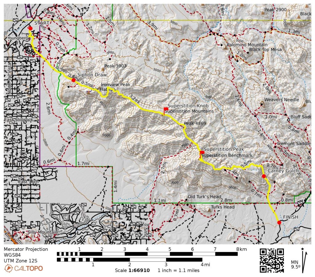
Superstition Ridge Full Traverse: Siphon Pass to Carney Pass
Siphon Draw
Siphon Pass
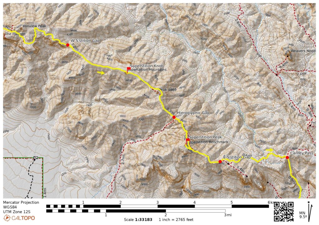
West Superstition Gap
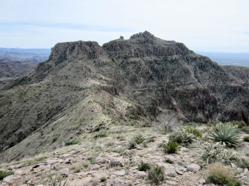
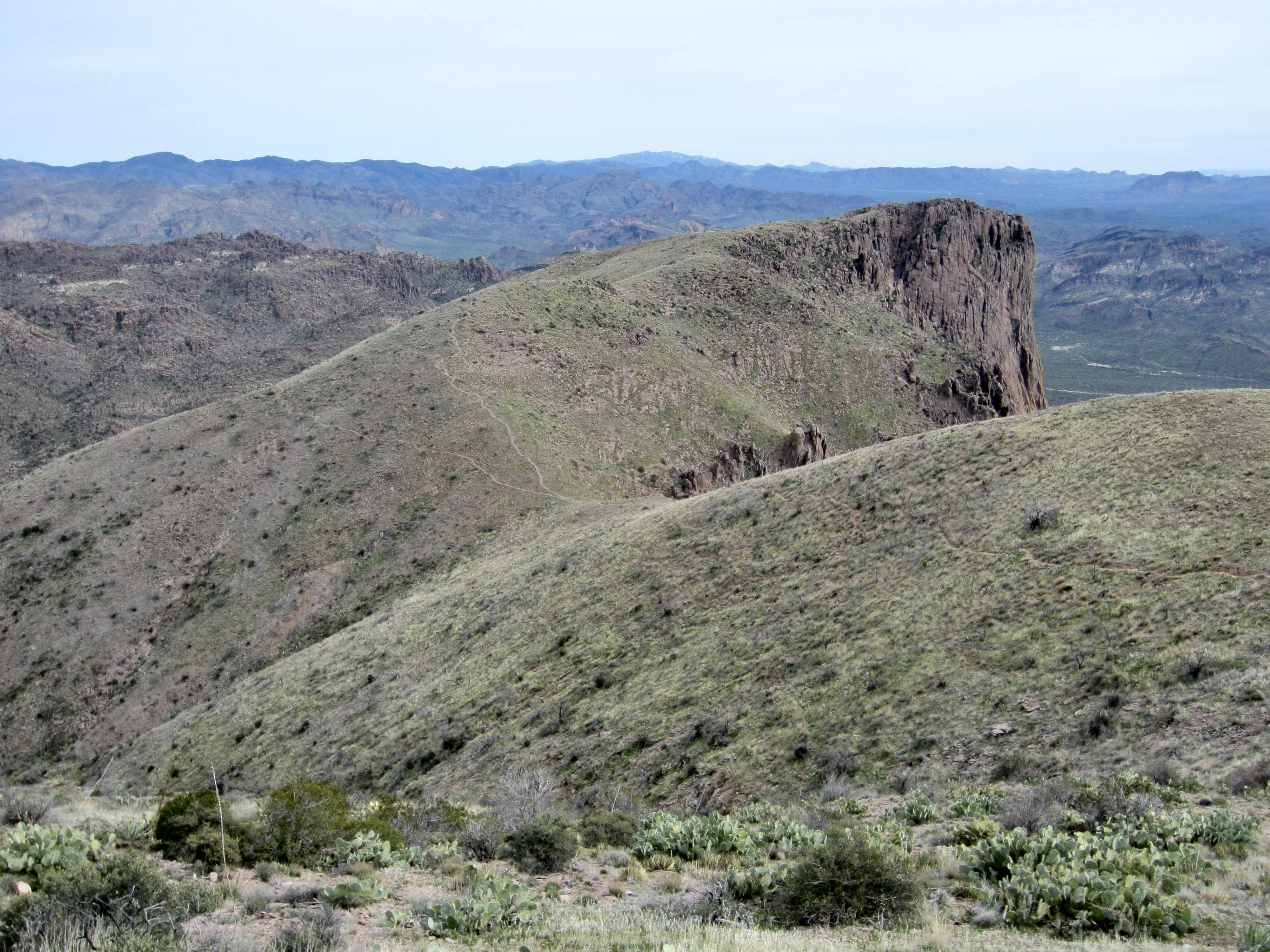
Point 4642 aka Superstition Knob
Hieroglyphic Gap
Superstition Peak (5057 ft)
East Superstition Gap
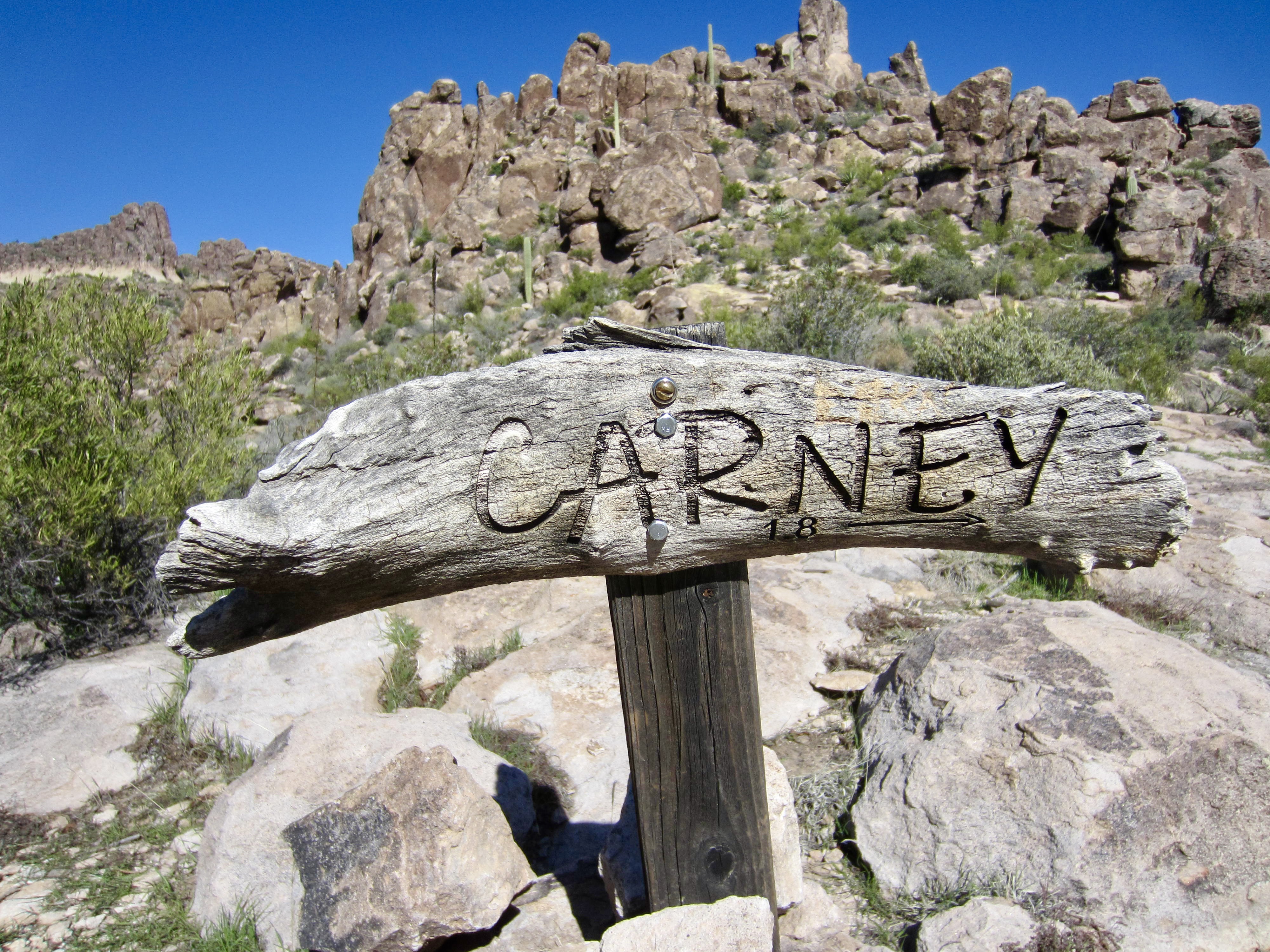
Carney Pass
Carney Gulch
Trip Report Summary
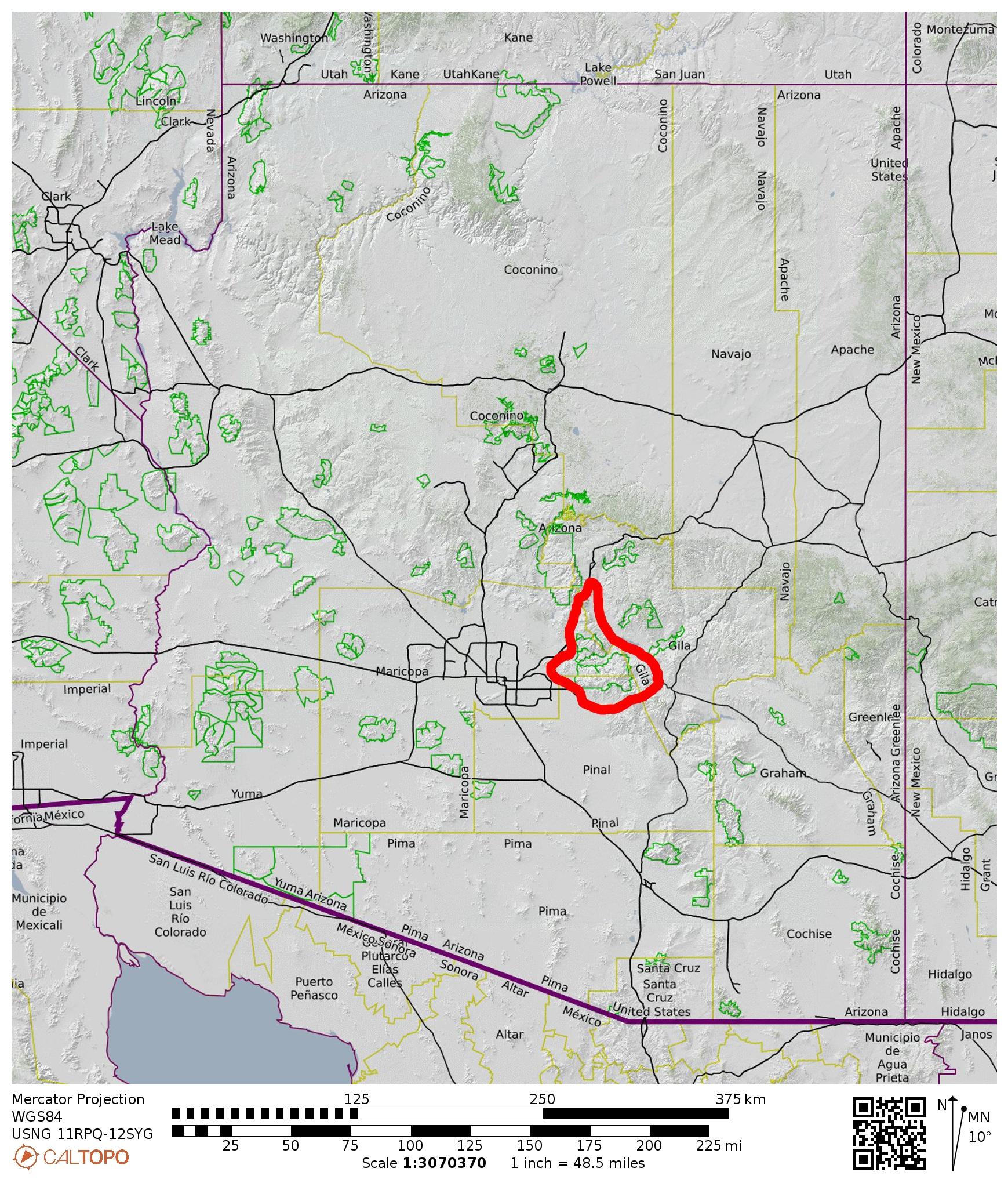
Region: Arizona
Sub-Region: Central Arizona
Sub-Sub-Region: Superstition Mountains
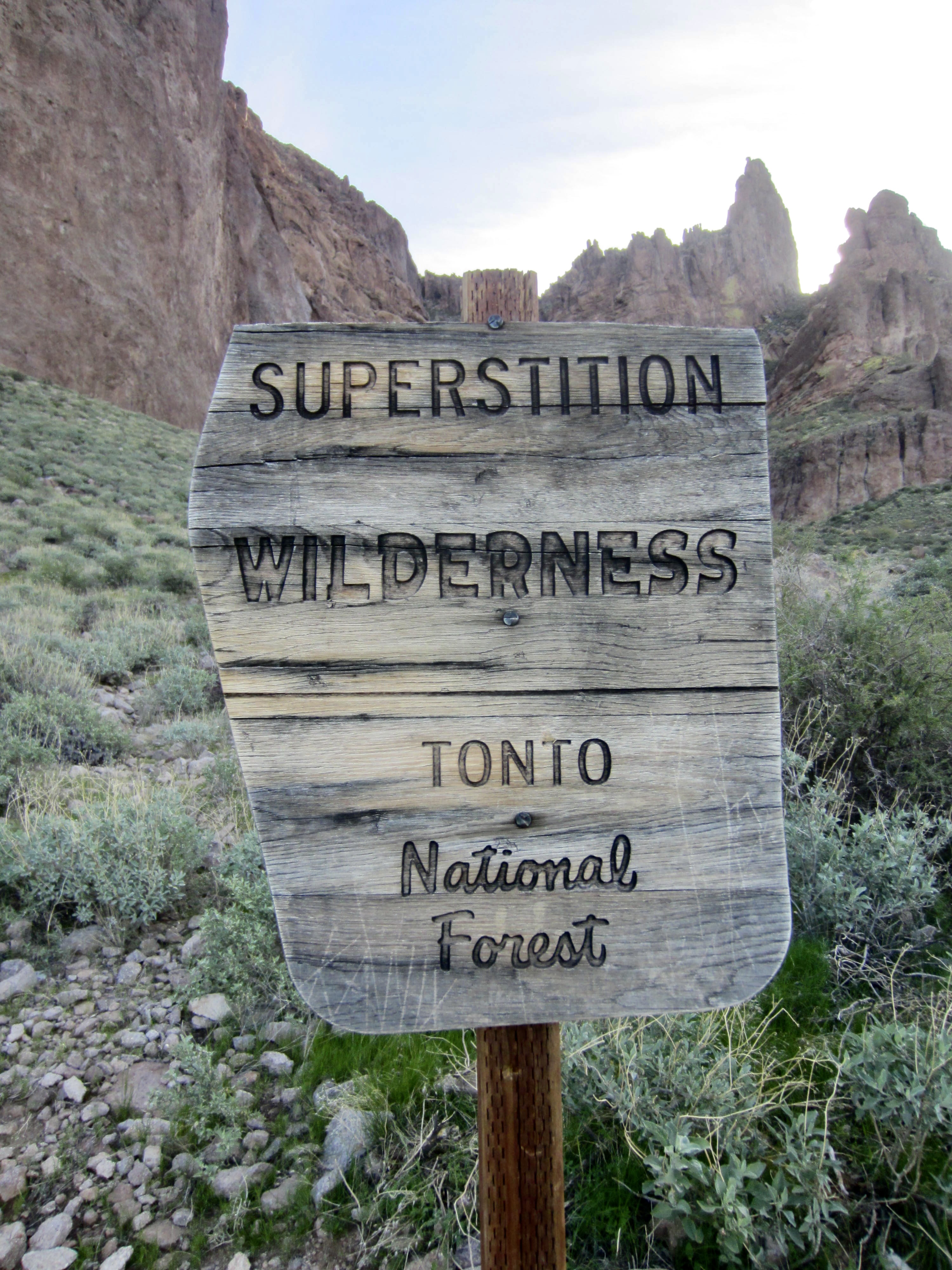
Areas: Lost Dutchman State Park & Superstition Wilderness
Starting Point: Lost Dutchman State Park entrance ranger station off Highway 88 (Elev. 2050 feet)
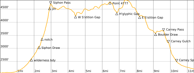
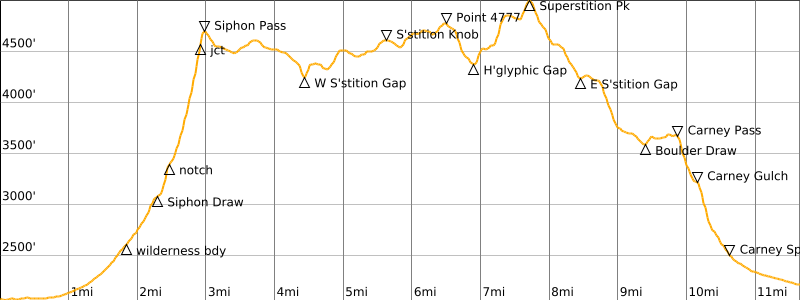
Way Points: Siphon Draw Trailhead & Superstition Wilderness boundary & Siphon Draw Basin & Siphon Notch & Siphon Rim & Siphon Pass & West Superstition Gap & Point 4402 & Saddle 4453 & Saddle 4517 & Point 4869 & Point 4777 & Hieroglyphic Gap & Superstition Peak shoulder & Summit Trail junction & East Superstition Gap & Boulder Draw & Carney Pass & Carney Gulch shoulder & Carney Spring & Superstition Wilderness boundary & Carney Springs Trailhead (trail hike & trail scramble)
High Point: Eastern flank of Superstition Peak (Elev. 4900 feet)
Ending Point: Carney Springs Trailhead on East Peralta Road (Elev. 2200 feet)
Sidetrip: Superstition Knob (off-trail hike)
Summit: Superstition Peak (trail hike & rock scramble via Southeast Ridge–West Face)
Approximate Stats (excluding sidetrips): 11.4 miles traveled + 4300 feet gained + 4150 feet lost.
Approximate Stats (including sidetrips): 11.7 miles traveled + 4600 feet gained + 4450 feet lost.
…
Related Posts
>>> Superstition Peak via Carney Gulch–Southeast Ridge – February 15, 2023
>>> West Superstition Ridge Traverse: Siphon Draw to Hieroglyphic Canyon – January 22, 2020
>>> Ironview Peak & The Flatiron via Siphon Draw – March 14, 2019
Trip Overview
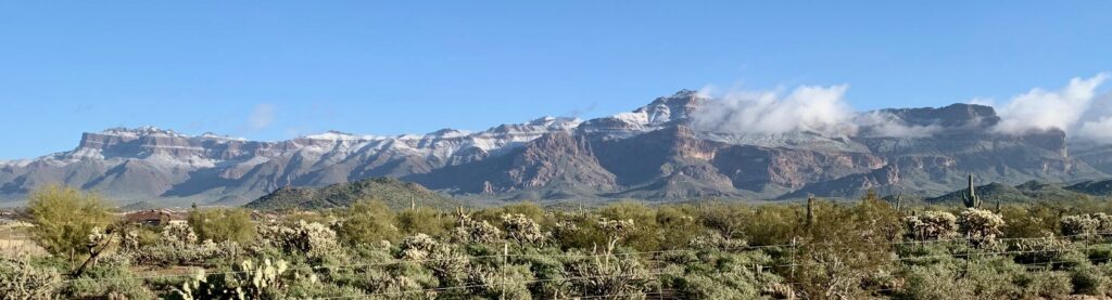
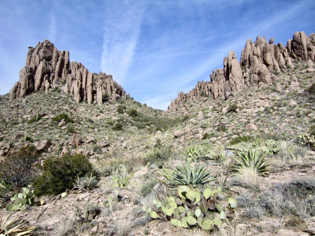
The Superstition Mountains are probably the most revered mountain range in Arizona, due to their very rugged topography, gold mining history, and ancient legends. Much of their fame stems from the volcanic rock that forms the range. A resurgent dome of rhyolite and andesite rock was pushed up 2000 feet above the surrounding desert plain millions of years ago, then subsequent erosion by water and wind bent to the task of creating impressive columns, pinnacles, and hoodoos that terminate in a jagged skyline. Numerous side streams have also carved deep canyons into the flanks of the range.
All of these geomorphic features, combined with a really evocative name, make the Superstition Mountains a major hiking attraction. Without question, the day-hiking “plum” of the range is the 11-mile traverse of Superstition Ridge from Siphon Draw to Carney Gulch. Eileen and I completed a marvelous 9-mile traverse through the western portion of the ridge, from Siphon Draw to Hieroglyphic Canyon, in 2020. Ever since then, I became determined to do the full traverse.
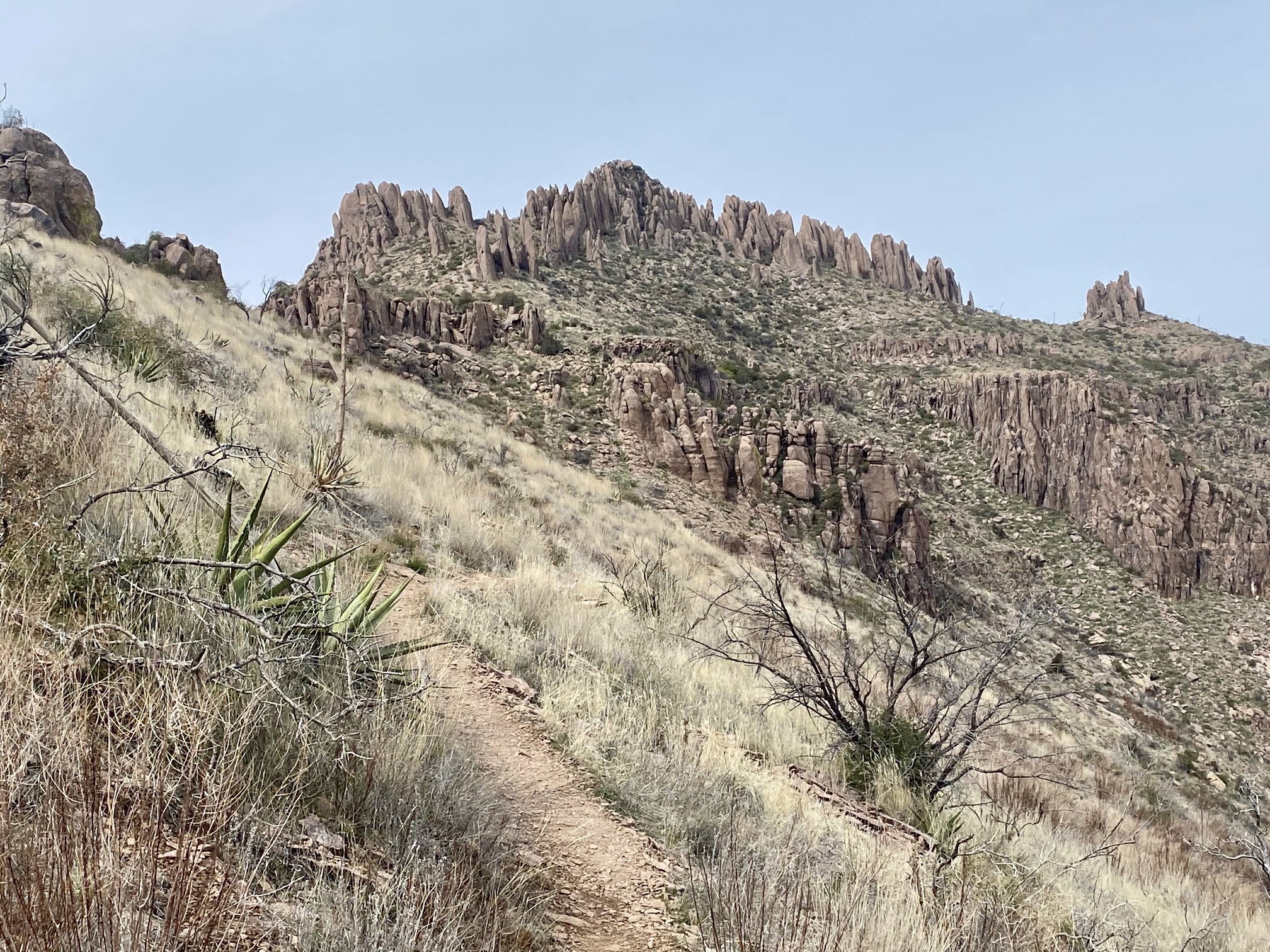
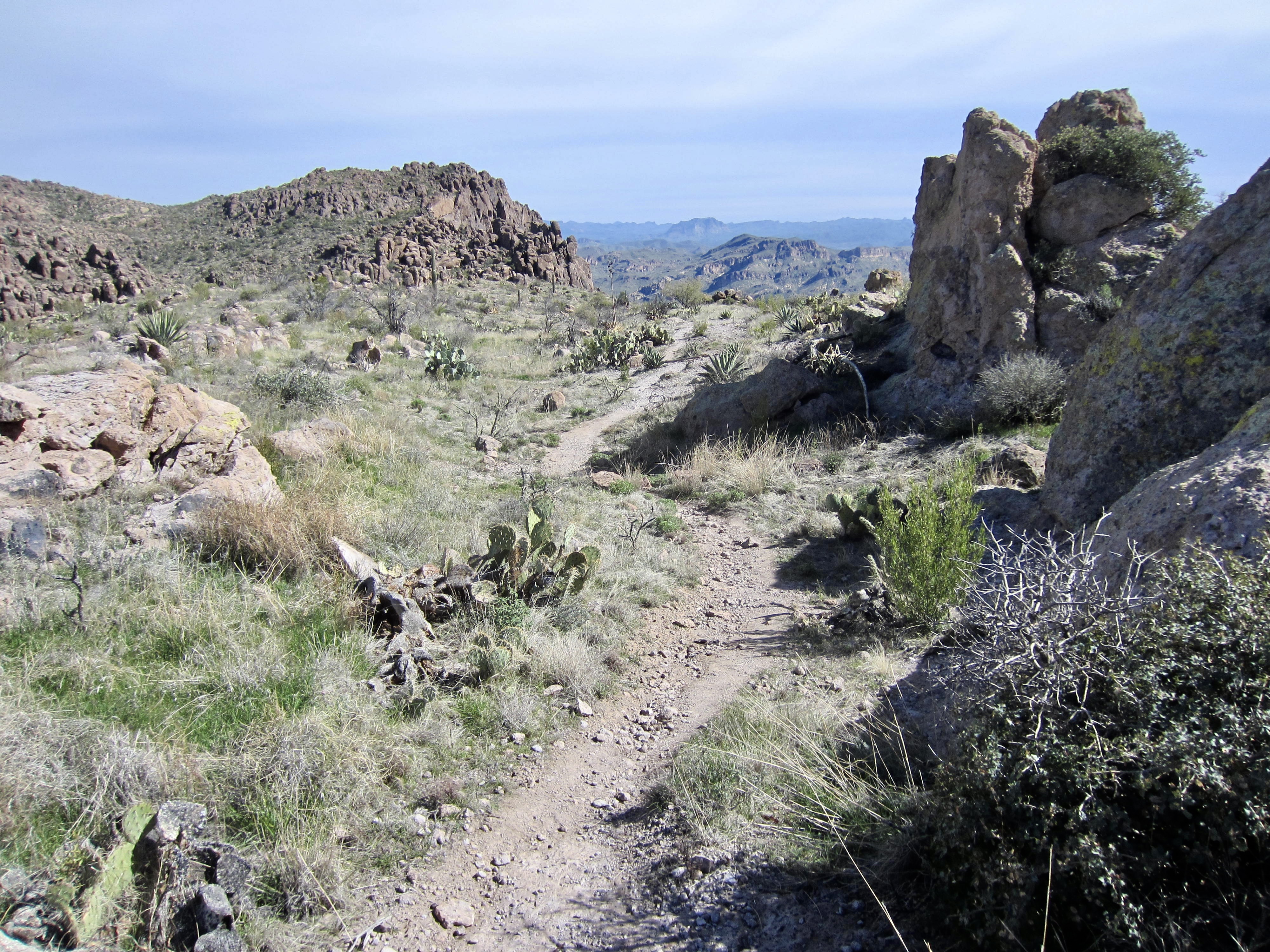
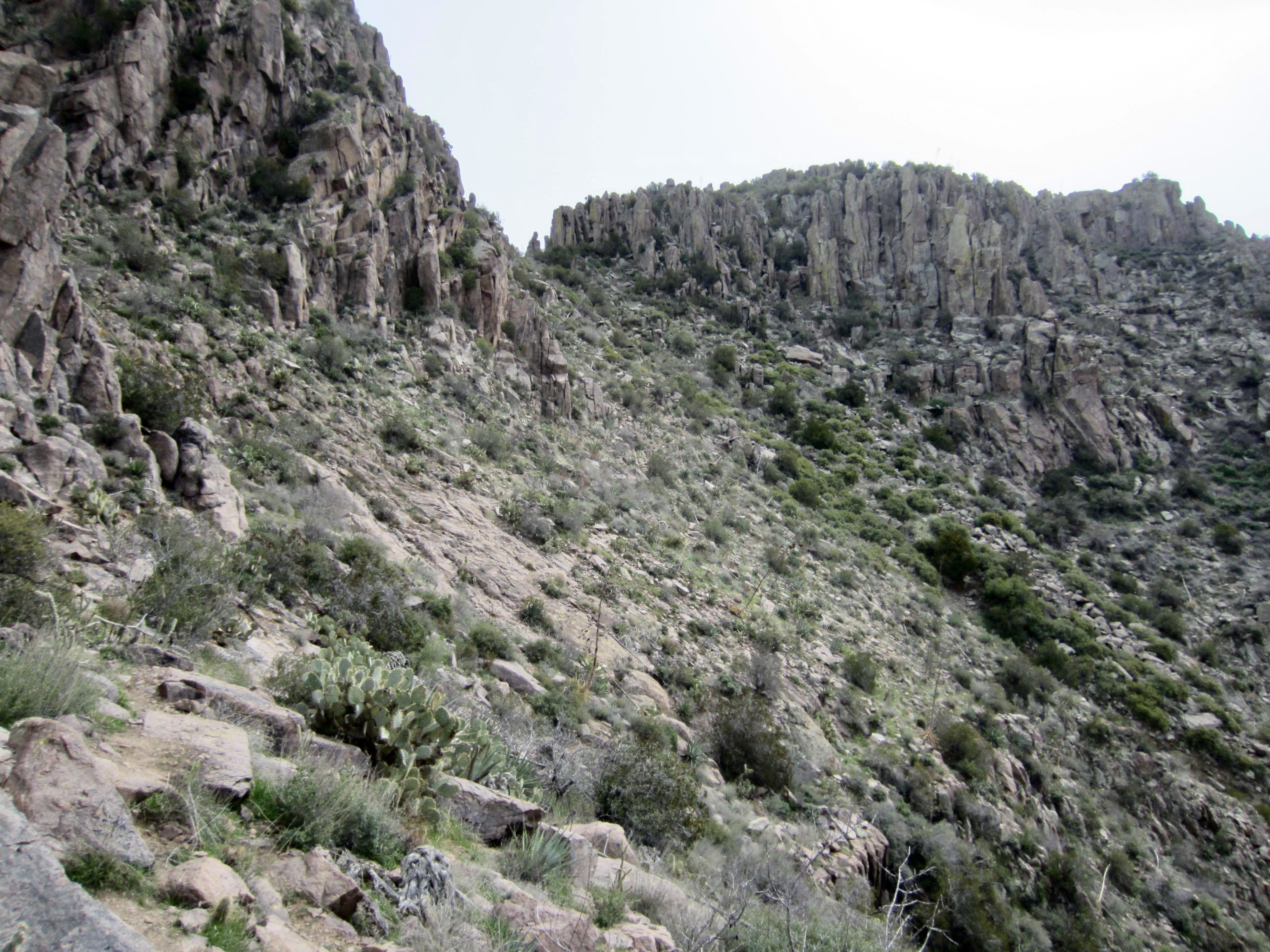
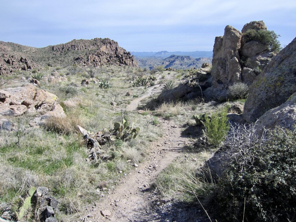
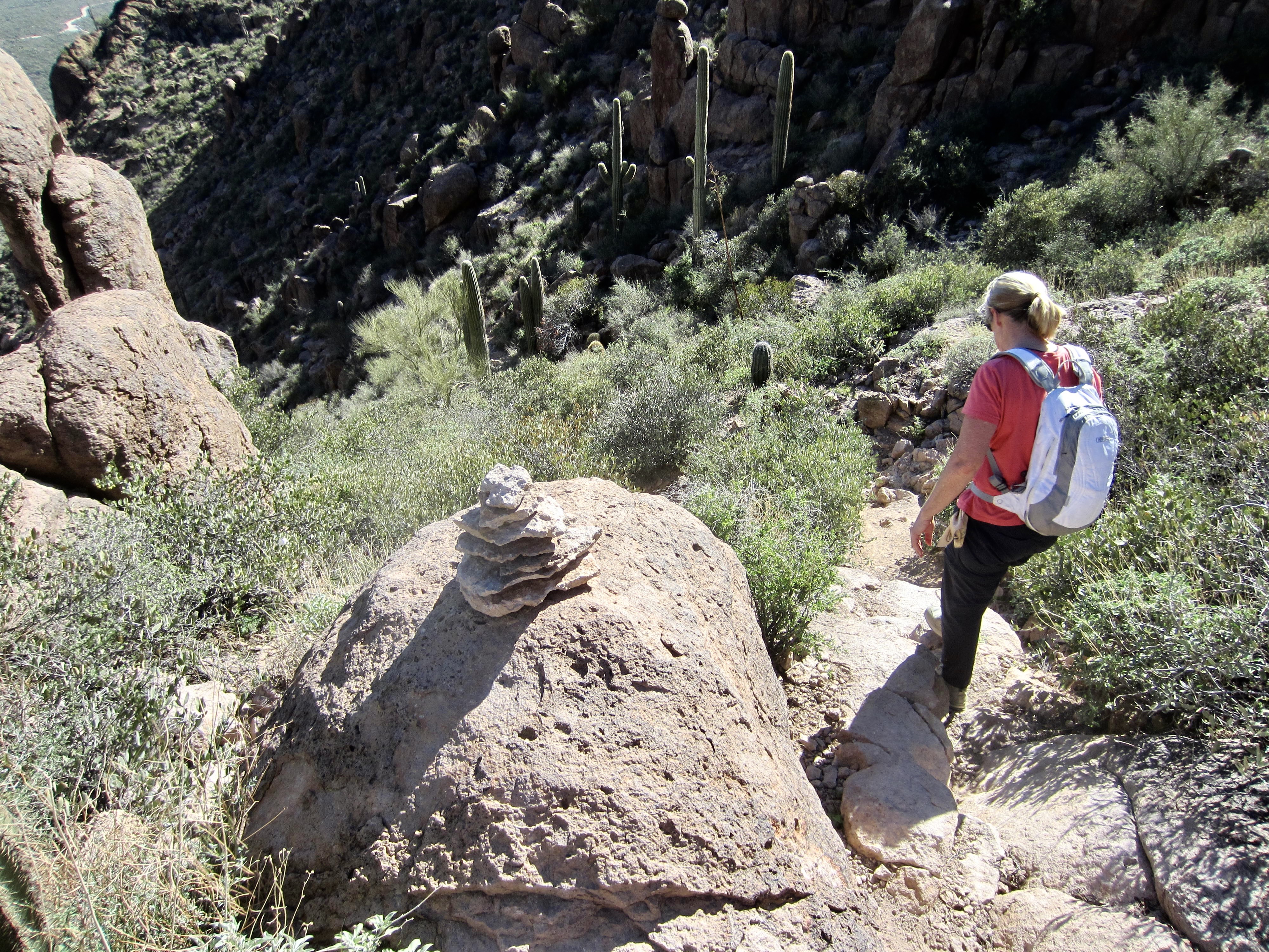
The primitive Superstition Ridge Trail runs along the entire ridge, wandering back and forth along the crest, going around deep canyons, climbing over rock outcrops, and dipping into low saddles. But don’t be misled by the word trail, because it is more of a desert high route. There are enough sketchy areas, side paths, and scrambly sections to keep you on your toes. Fortunately, most of the route is well-marked with ducks, cairns, and painted arrows, so route-finding is generally not too difficult. Nonetheless, a brief moment of inattention could quickly send you wayward. Even when carefully staying on trail, there are countless chollas and yuccas reaching out for your legs, so full-length canvas trousers would not be your worst garment choice.
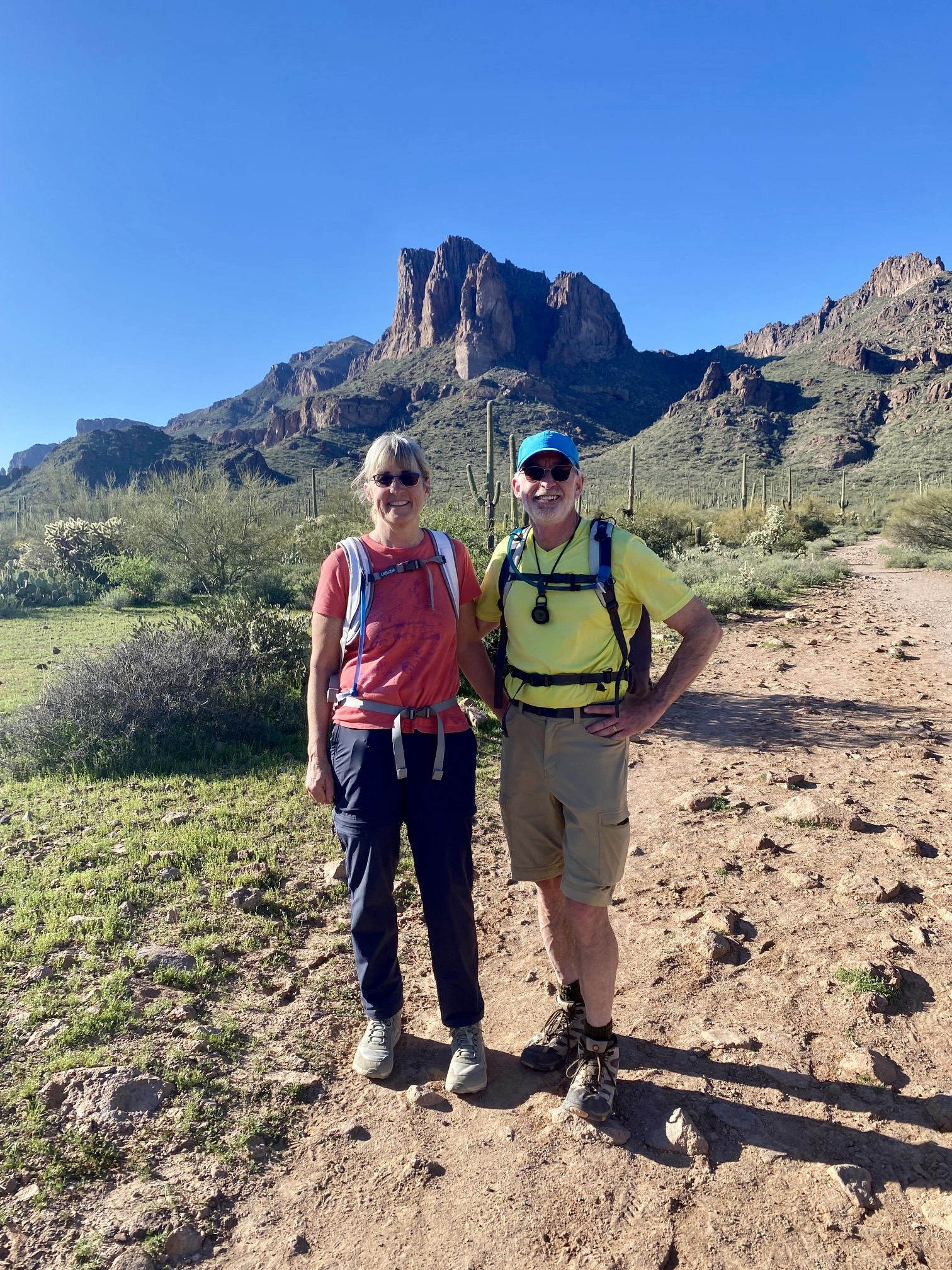
While Eileen and I were visiting her parents in Phoenix during the winter hiking season, we made plans for another trip to the “Supes.” Eileen graciously offered to drop me off at Lost Dutchman State Park—near the western end of Superstition Ridge—then drive around to Carney Springs and hike up to meet me somewhere near the eastern end of the ridge. This would not only allow me to complete the full ridge traverse but would facilitate her primary goal, which was to climb Superstition Peak. It was a good plan.
.
Full Trip Report
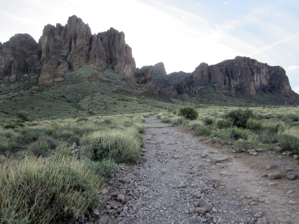
Eileen and I pulled up to the entrance ranger station at Lost Dutchman State Park on a cool, overcast Friday morning. We explained to the gate ranger that I was just being dropped off—not staying or leaving a car. He stated that we had two options: (1) For a $10 fee, Eileen could drive me up to the Siphon Draw Trailhead and drop me off, or (2) for a $3 fee, I could start hiking from right there, which would add ½ mile to my hike. I chose the second option, although it seemed a bit odd that they would charge anything for an entrance drop-off!
Fee paid, Eileen drove off to Carney Springs Trailhead while I began hiking through the campground. I passed the Siphon Draw Trailhead 20 minutes later and headed up the wide, rocky trail. The air was pleasantly cool on this shady side of the mountains.

.
The dauntingly steep and deeply creviced ramparts of the Superstition Mountains rose up directly in front of me. Various geomorphic features, including The Praying Hands, Thumb Rock, and—most famous of all—The Flatiron, were visible from the trail.
.
.
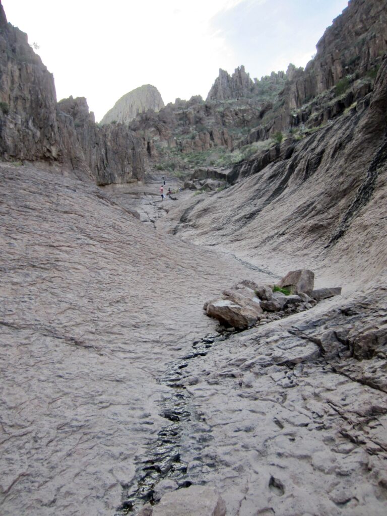
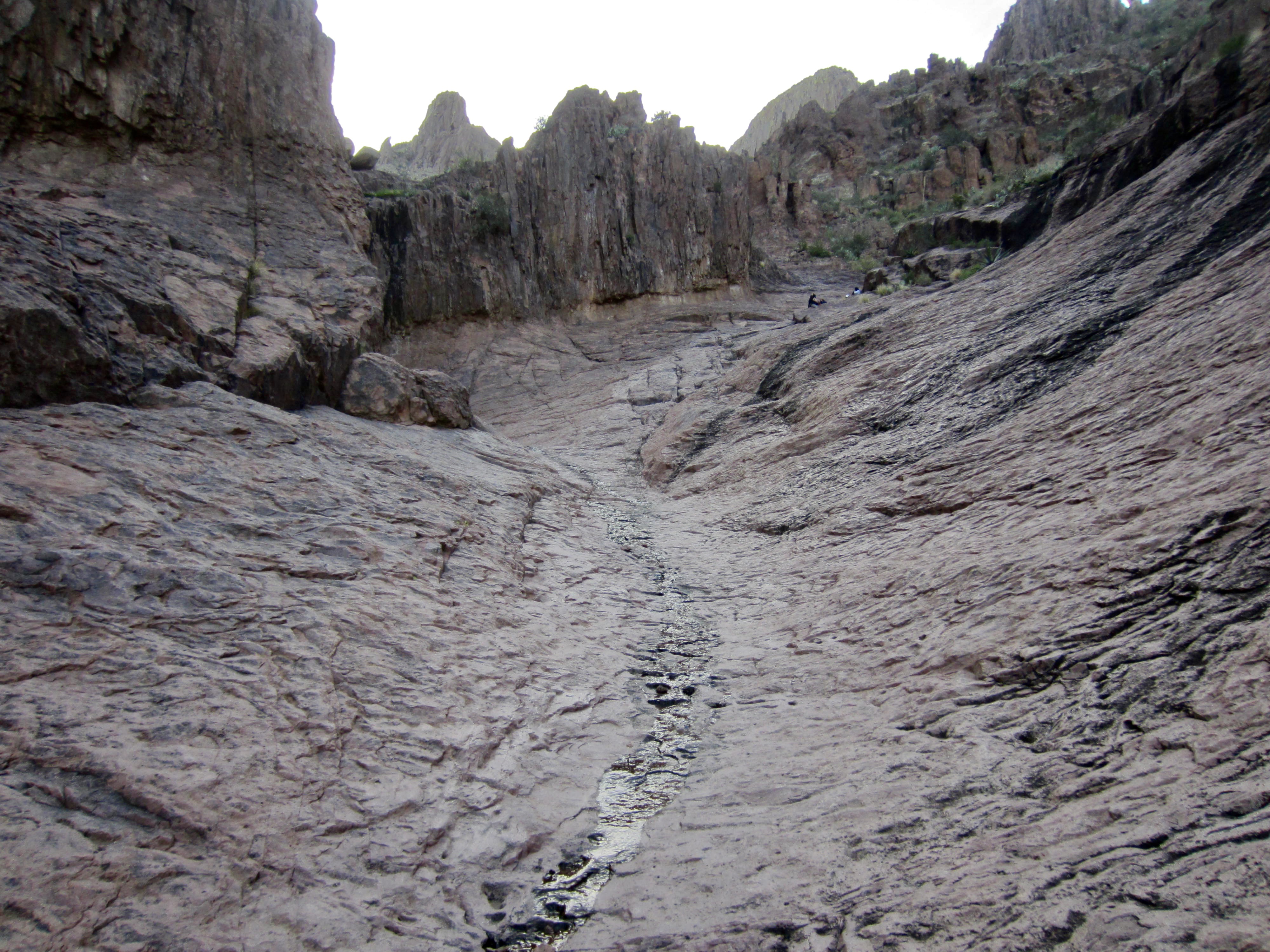
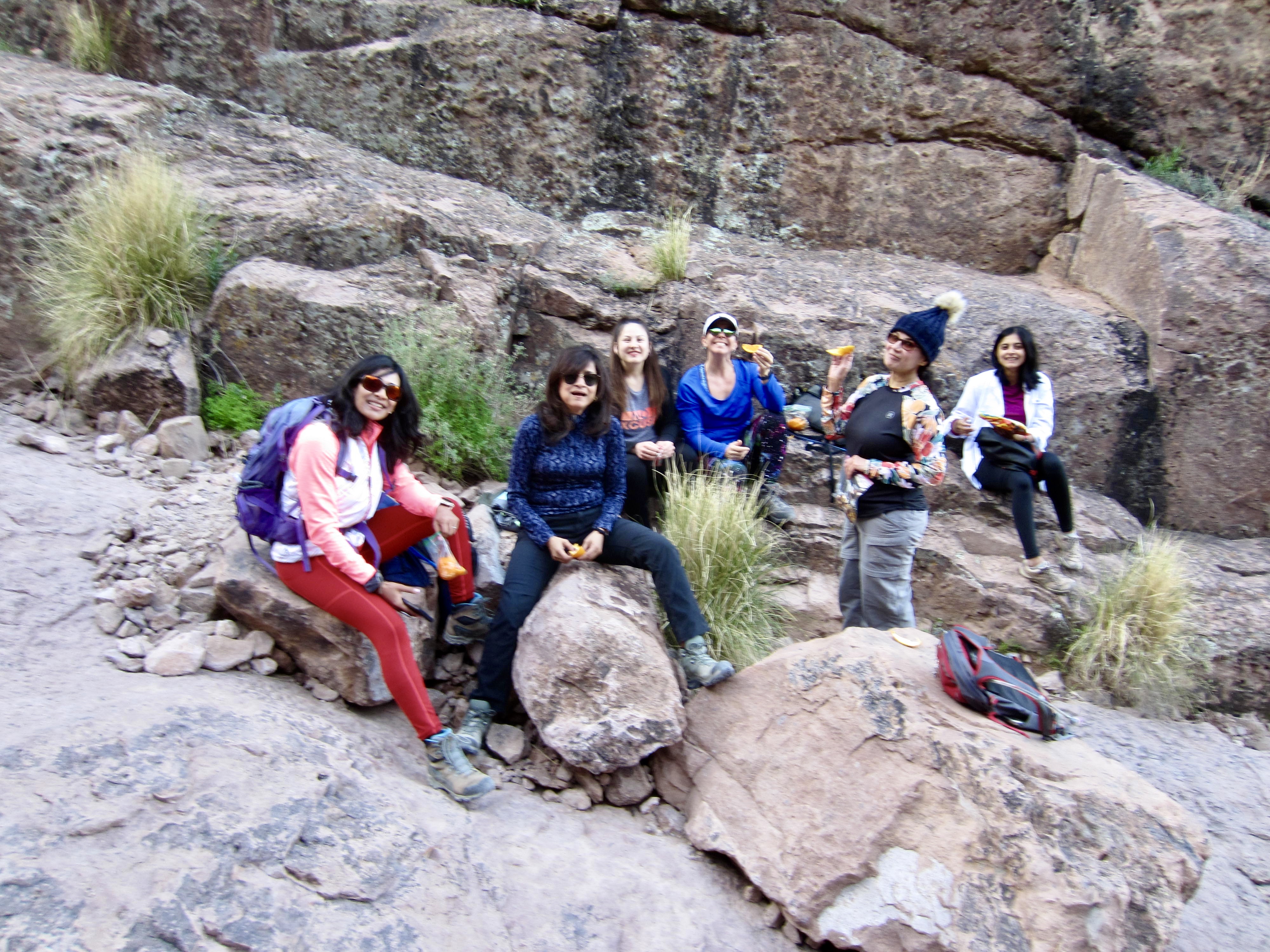
Within an hour, I entered Siphon Draw and its remarkable U-shaped basin, which has been carved into solid bedrock by millions of years of water erosion. I soon overtook a group of six young women who, judging by their jovial chatter and laughter, were having more fun than anyone else in the Superstition Mountains today. I believe that I was closely behind them on the enjoyment scale.
.
.
Above the rock basin, Siphon Draw transitions to a rough drainage gully with multiple branches. The route-finding gets more difficult, and despite having been through here on two previous trips, I still managed to get off track in several places. I also encountered numerous other hikers who were searching for the correct path. A key feature is Siphon Notch—a tiny notch in a rock rib on the right-hand side of the gully. I crossed through the notch and made a short Class 2-3 down-climb to reach a path leading into the gully invert.
Once in the gully, there seems to be a natural tendency to get pulled back uphill to the right on one of the many side paths and then find yourself mired in desert brush. The best route actually stays in the gully invert, which involves lots of boulder scrambling but is brush-free. Generally aim for the right side of a large rock horn at the head of the gully, always staying left of The Flatiron, which appears as a giant rock prow.
.
After an elevation gain of 1200 feet, make a short Class 2-3 scramble to get over the rim of the gully. A lateral trail above the gully’s rim leads rightward (westward) over to The Flatiron, which serves as the destination for nearly everyone ascending Siphon Draw. I took a diagonal trail leading leftward up to Siphon Pass, closely below Ironview Peak (2.3 hours + 3.0 miles + 2600 feet from starting point). I had now entered the quiet part of my traverse and didn’t see another hiker for the next 3 hours.
.
.
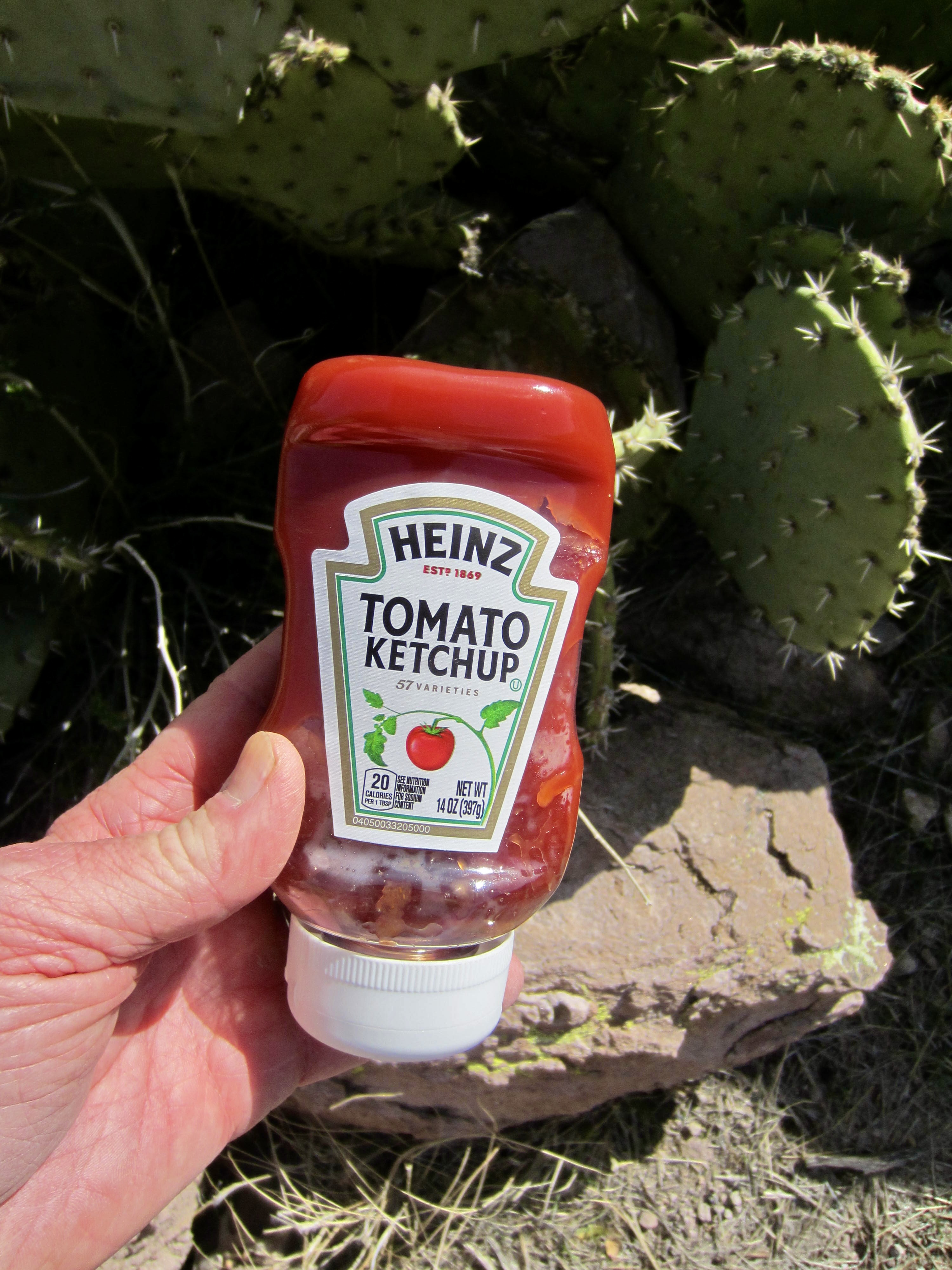
While taking a snack break at Siphon Pass, I discovered that I was the victim of a vicious prank by Eileen’s parents. Knowing of my tremendous dislike for ketchup, they had secretly slipped a bottle into my rucksack, and now I was stuck carrying it for the whole day! Uhggg!! Well played, Ferd and Judy. Well played.
.
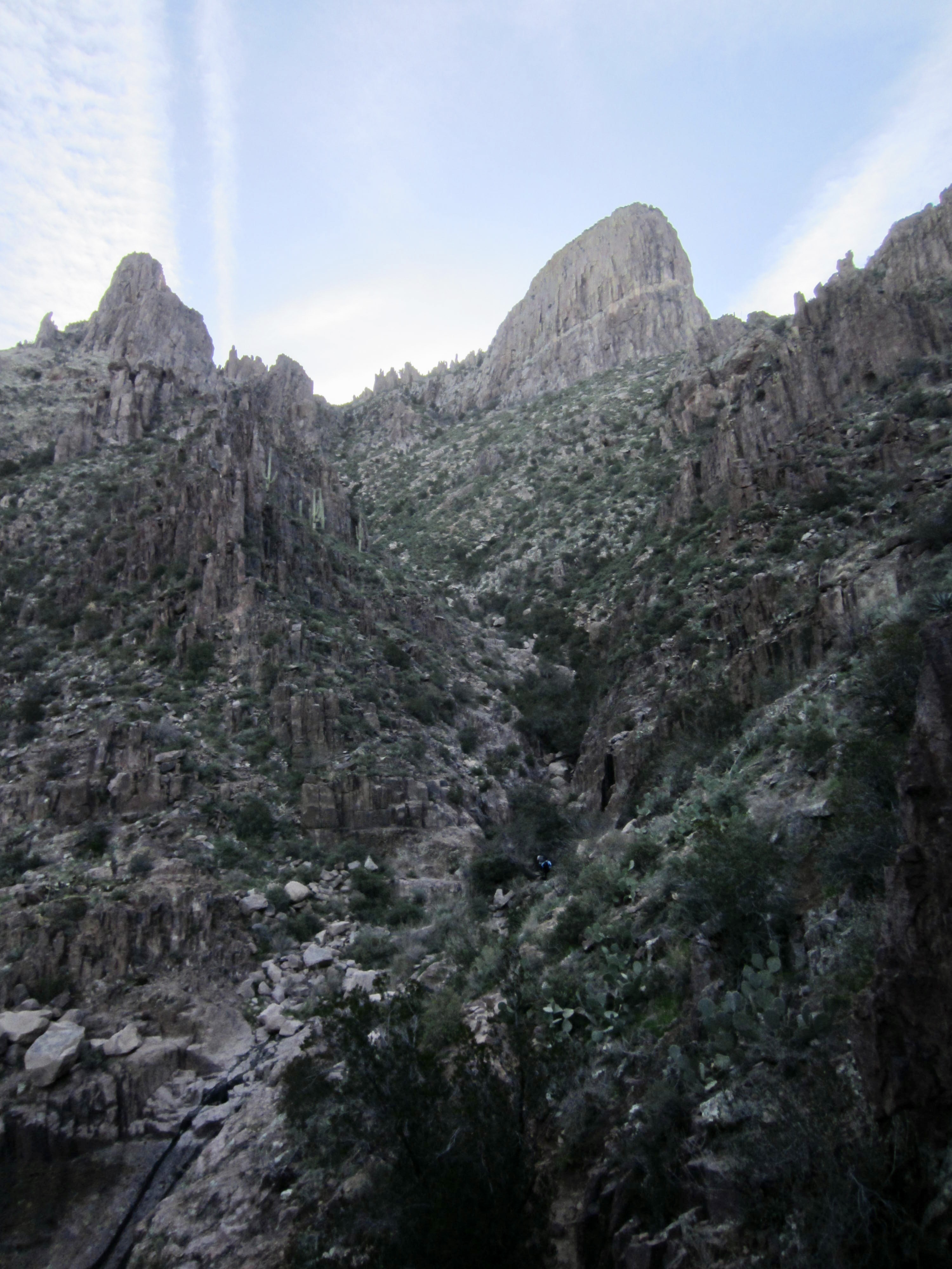
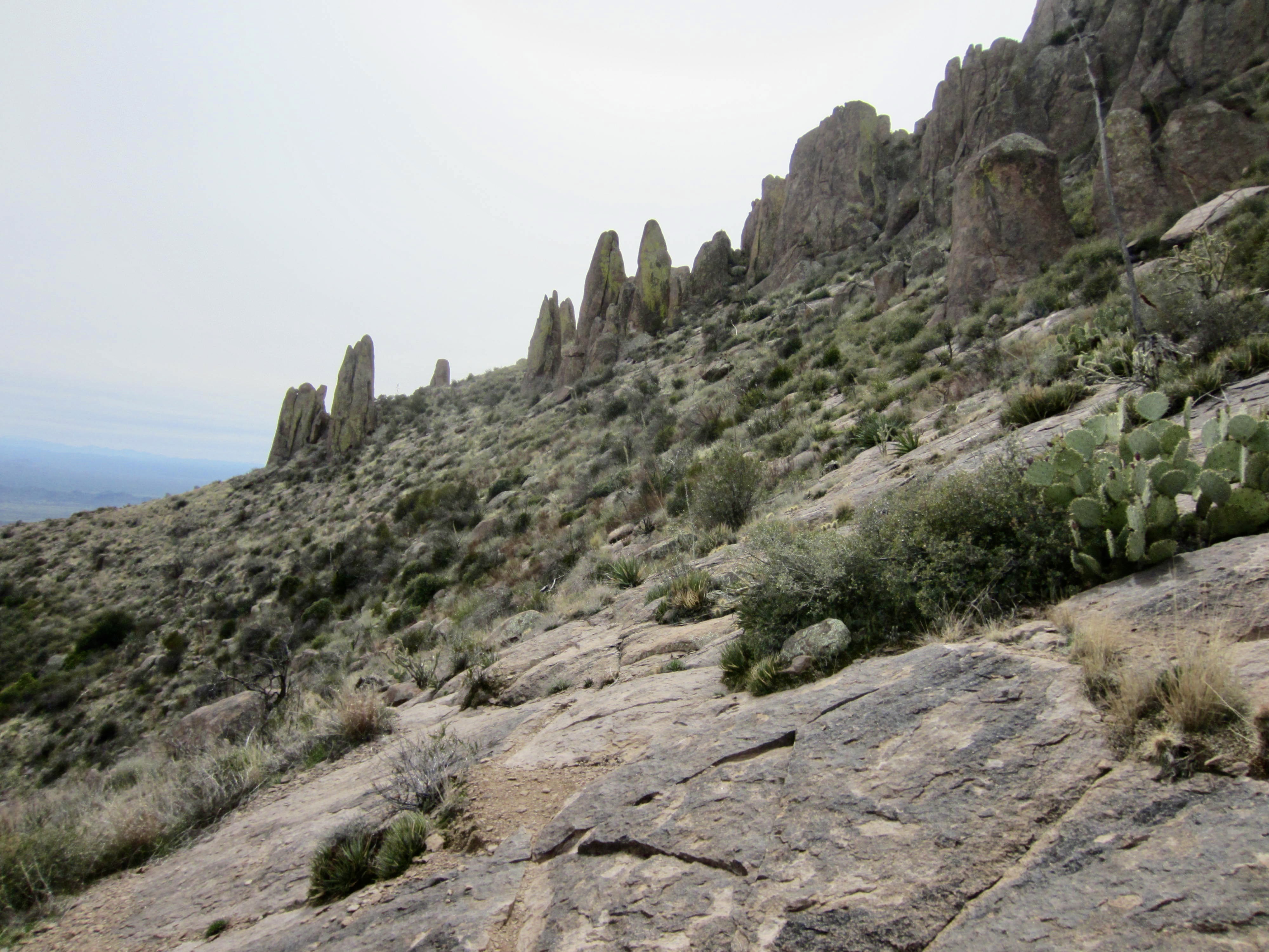
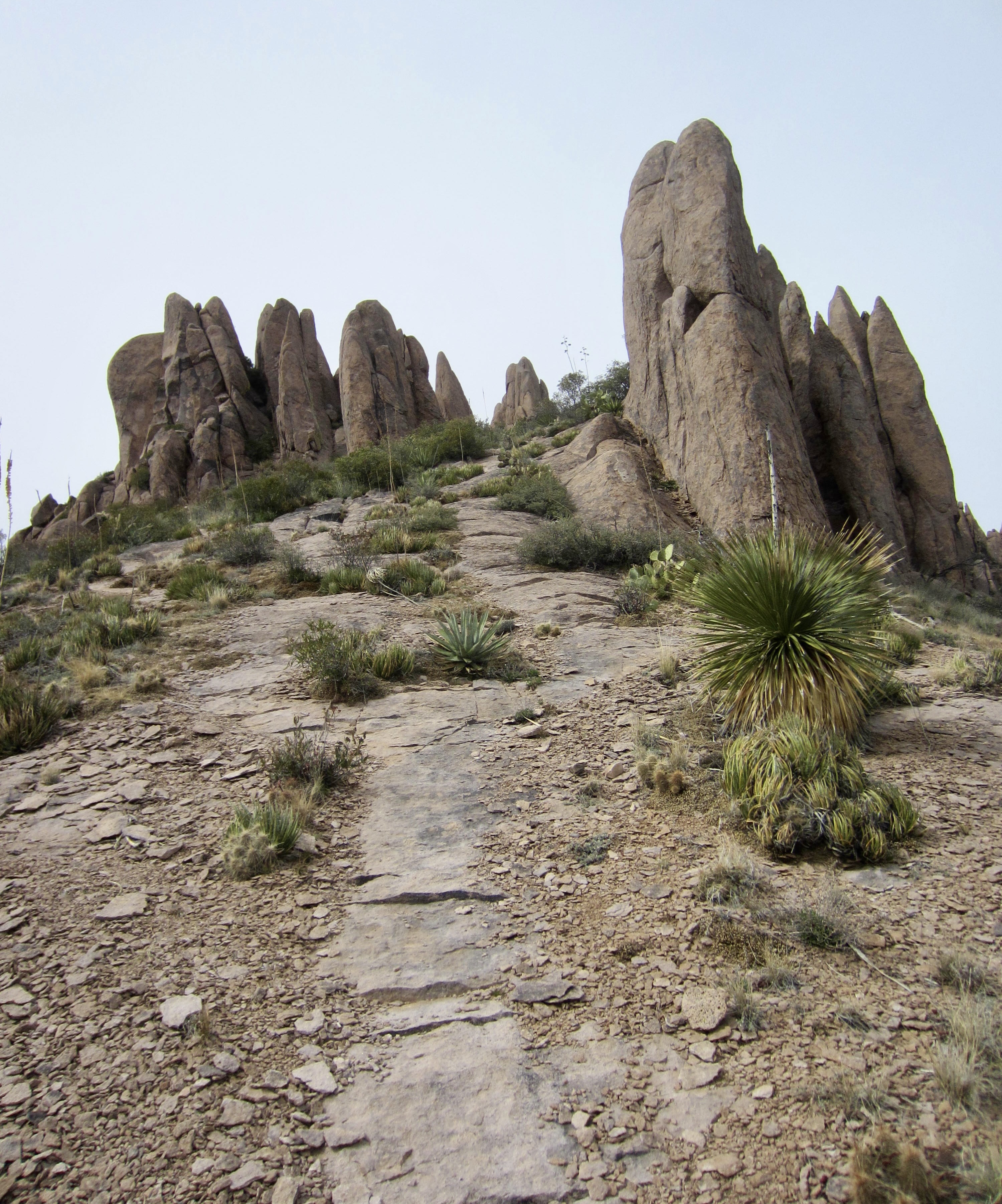
As I headed southeast from Siphon Pass, I was treated to a variety of geologic delights. The weather was very foggy when Eileen and I did this part of the traverse four years ago, but today’s clear weather allowed me to see what we’d missed. There were hundreds of stone hoodoos above the trail, and dramatic canyons below it. Best of all was the view of Superstition Peak, acting like a beacon at the southeastern end of the ridge.
.

.
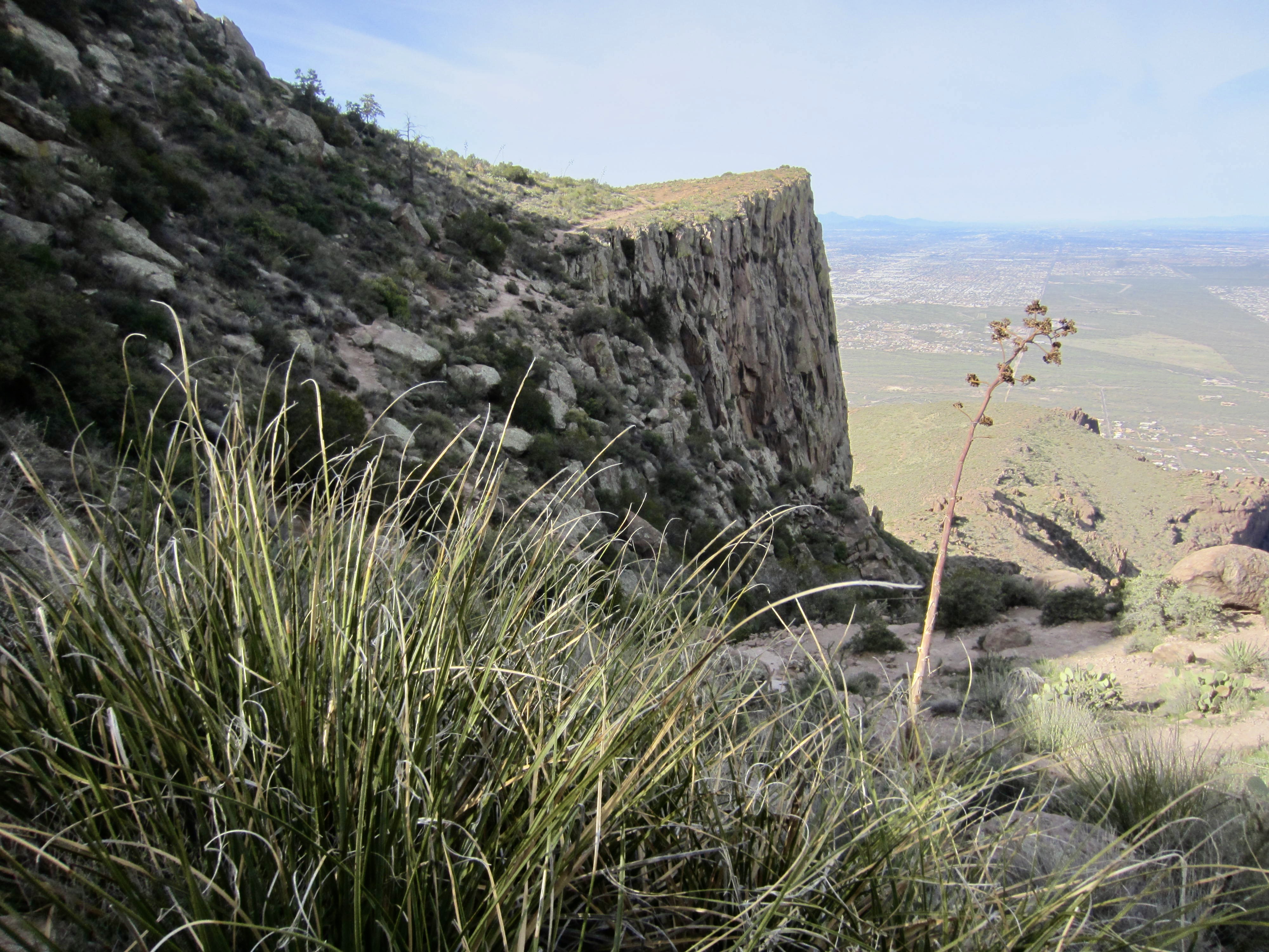
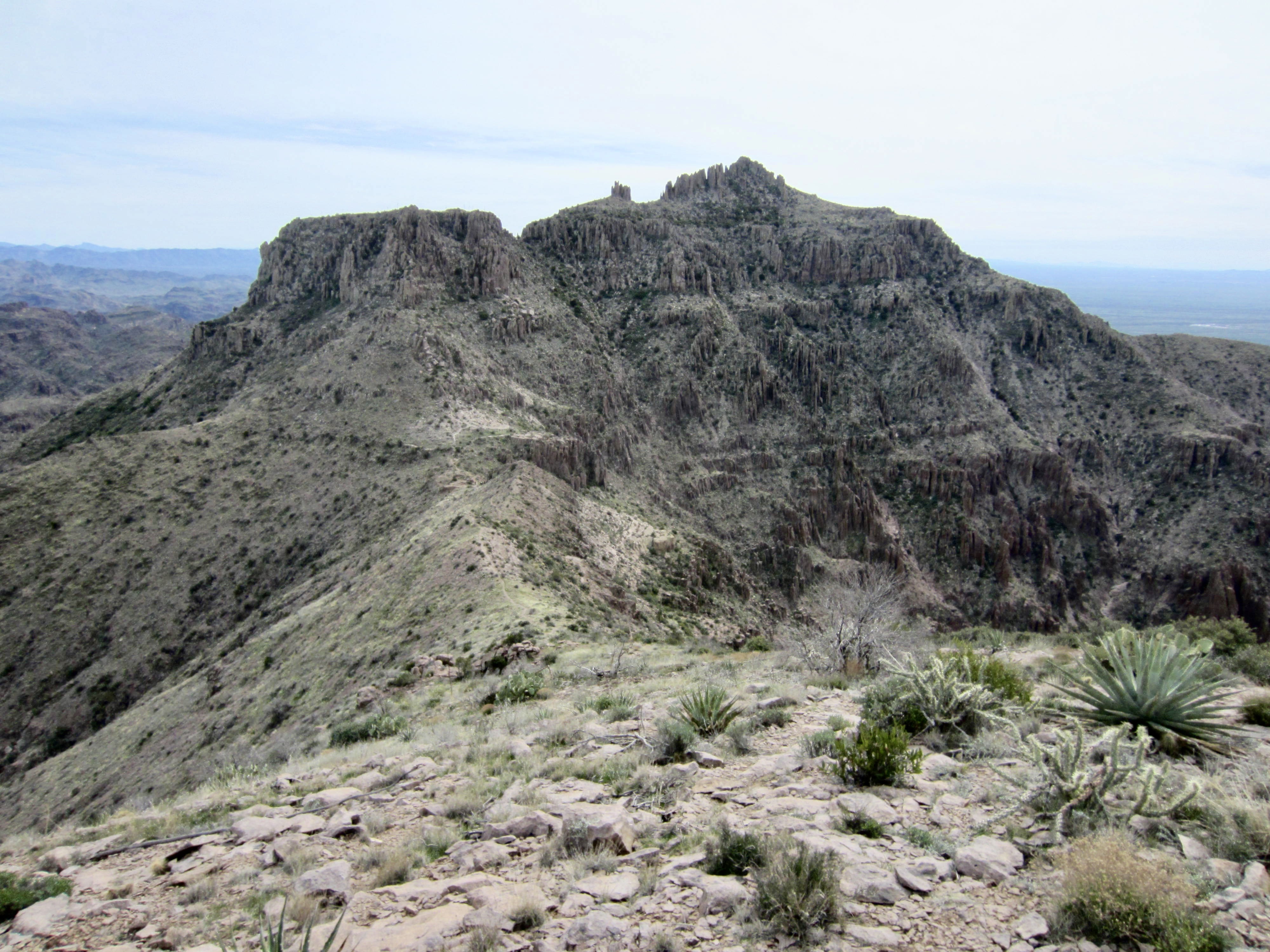
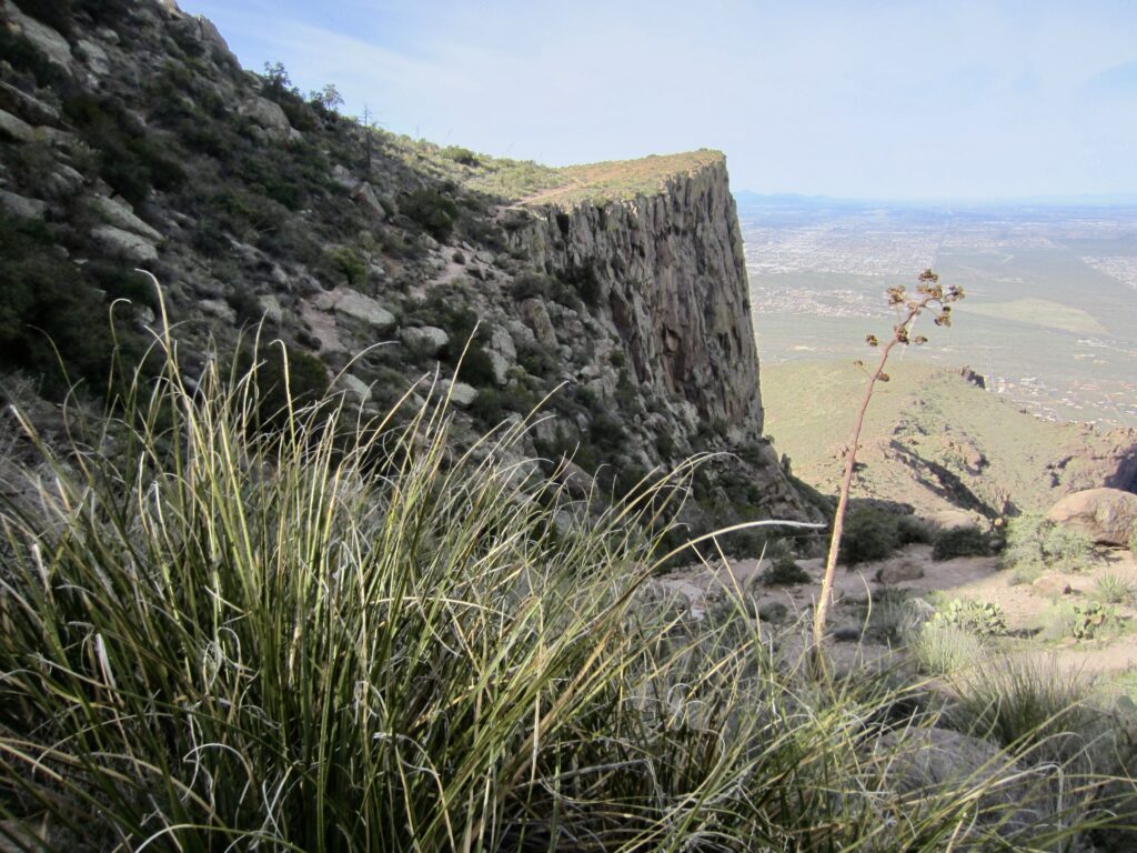
After making a wide swing around the head of a deep canyon, I dropped into West Superstition Gap. This 4200-foot saddle is one of several notable low points in the ridge crest, and it roughly marks the one-third point in the full traverse. As you descend into the gap and back up the other side, there are several rocky outcrops that require a bit of Class 2 scrambling.

.
.
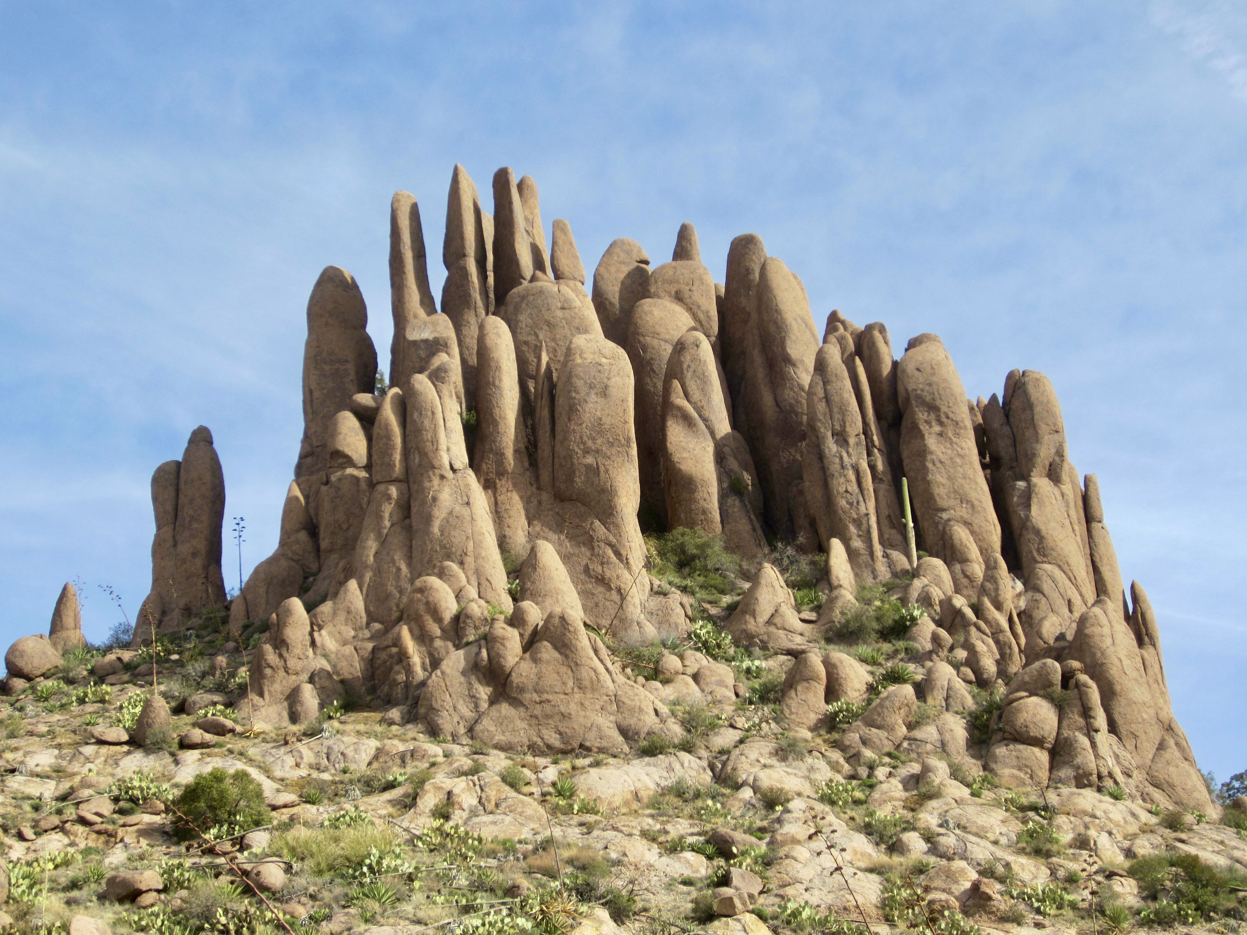
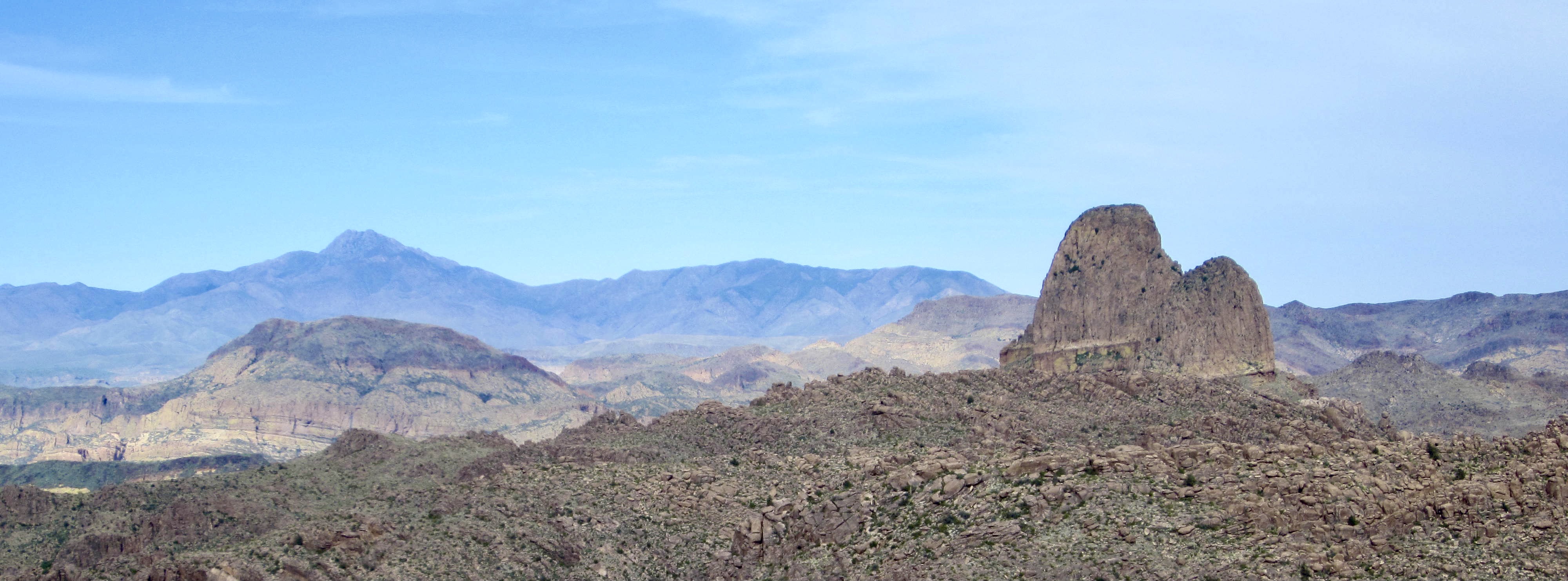
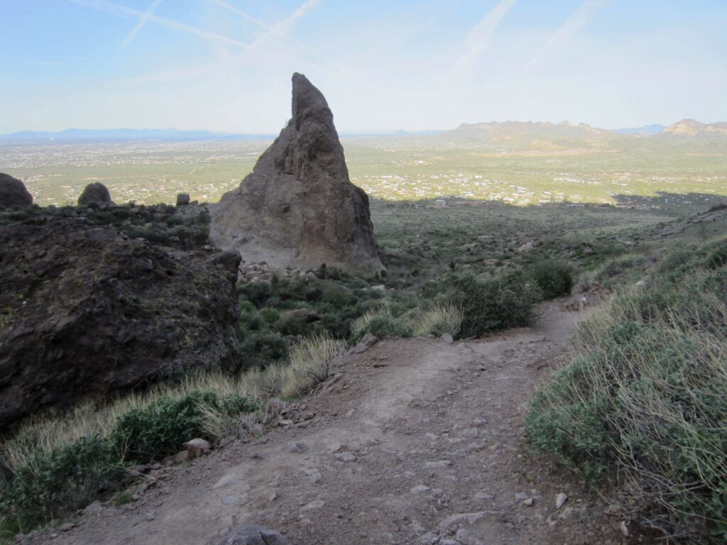
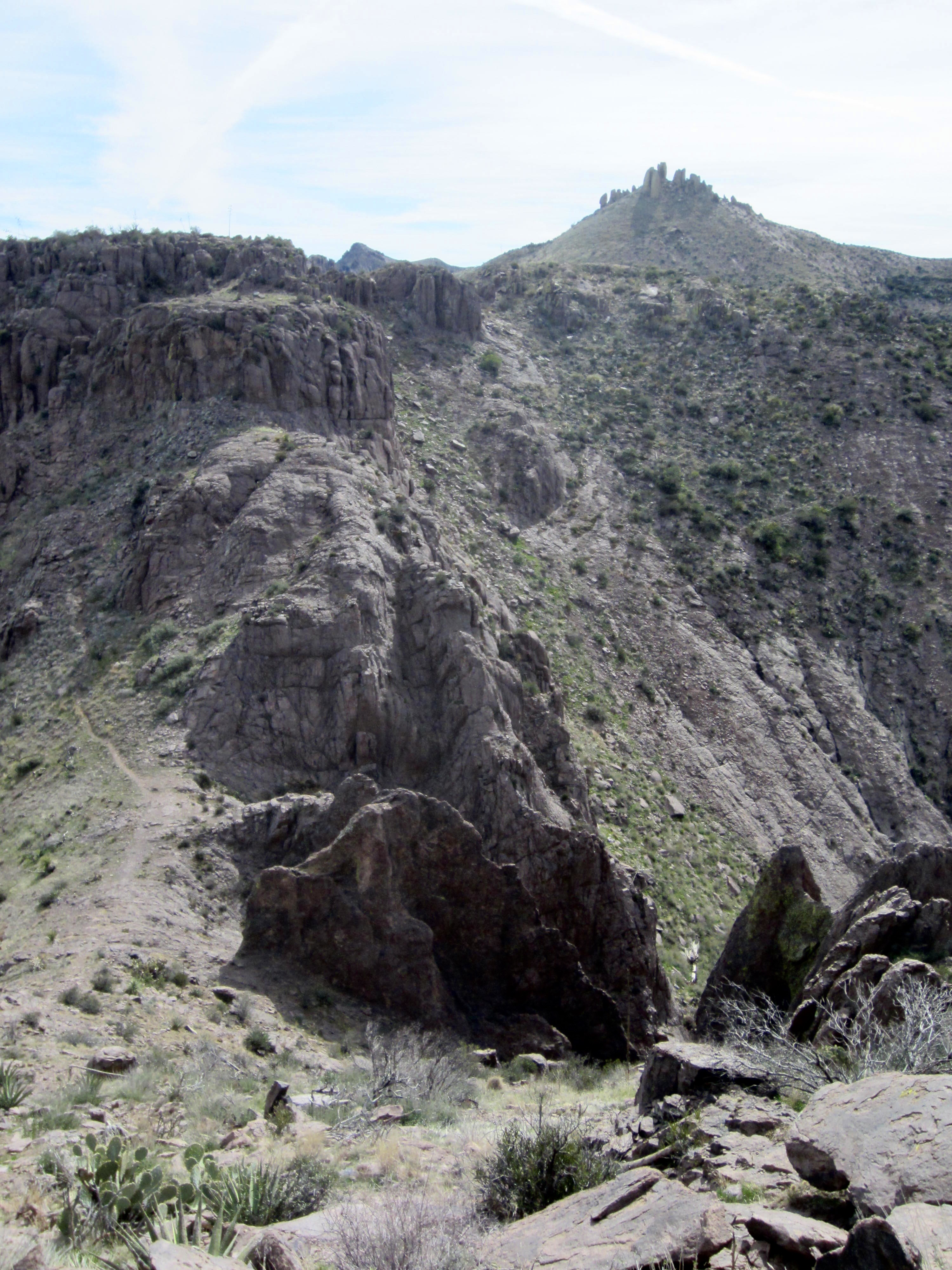
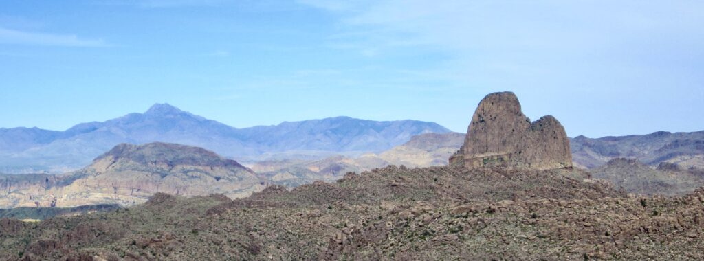
I took my second snack break atop Superstition Knob (Point 4642), which is near the midpoint of the traverse and a mere 2-minute sidetrip off the trail. It was 11:30am (3.8 hours + 5.6 miles + 3300 feet from starting point), and I was able to make cell-text contact with Eileen. She had already crossed over Carney Pass and was enroute to Superstition Peak. From my vantage, I could clearly see her objective: a strikingly handsome pyramid of rock with a colonnade of tall hoodoos on each side.
.
Moving on, I followed the trail around the side of Hog Hill (Point 4869), which sits at the head of Hog Canyon, and then made a descent into Hieroglyphic Gap at the head of Hieroglyphic Canyon. This 4350-foot saddle is the second notable low point in the traverse. While here, I got a text message from Eileen; she was on the summit of Superstition Peak and starting to head back down.
.
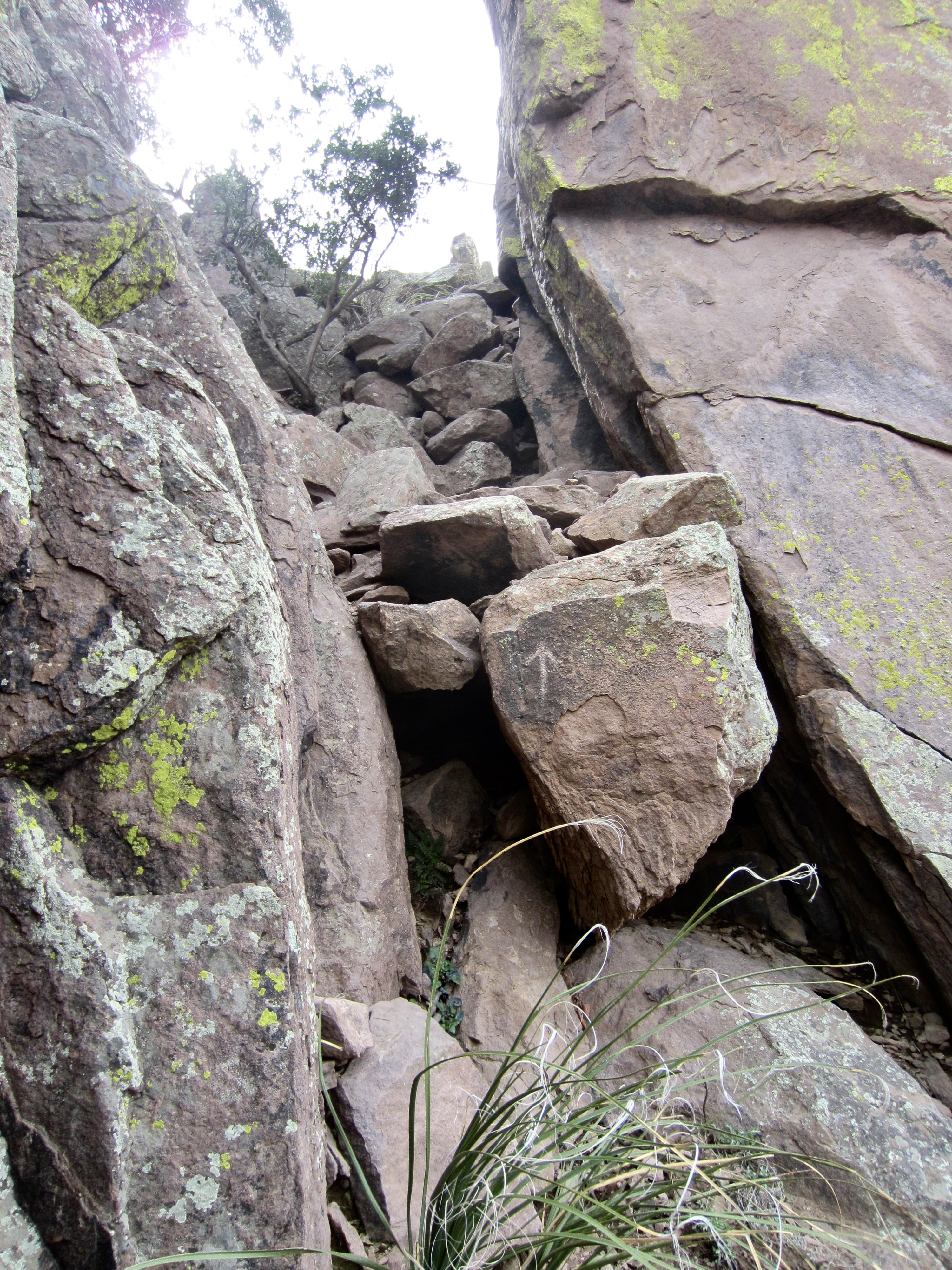
There are three trails leading out of Hieroglyphic Gap, in addition to the one that drops straight down the canyon. I chose the middle trail, which heads directly up the ridge crest and then veers rightward around the southwestern side of Point 4790. This trail becomes very hard to follow in some places as it traverses the hillside, but it ultimately leads to a 4700-foot saddle between Point 4790 and Superstition Peak. Upon arriving at the saddle, I mistakenly crossed over to the other side but quickly encountered vertical cliffs. I backtracked to the saddle and discovered that the correct route ascends a narrow, bouldery slot. It initially looked like a Class 4 climb, but the presence of excellent handholds make it a straightforward Class 3 scramble.
.
Above the Class 3 slot, a good trail leads up the rounded crest and over a broad shoulder on Superstition Peak’s north ridge. This trail ducks through a high notch and then traverses around the eastern face of the peak. Before long, I arrived at junction on the peak’s southeast ridge (5.4 hours + 7.6 miles + 4100 feet from starting point).
.
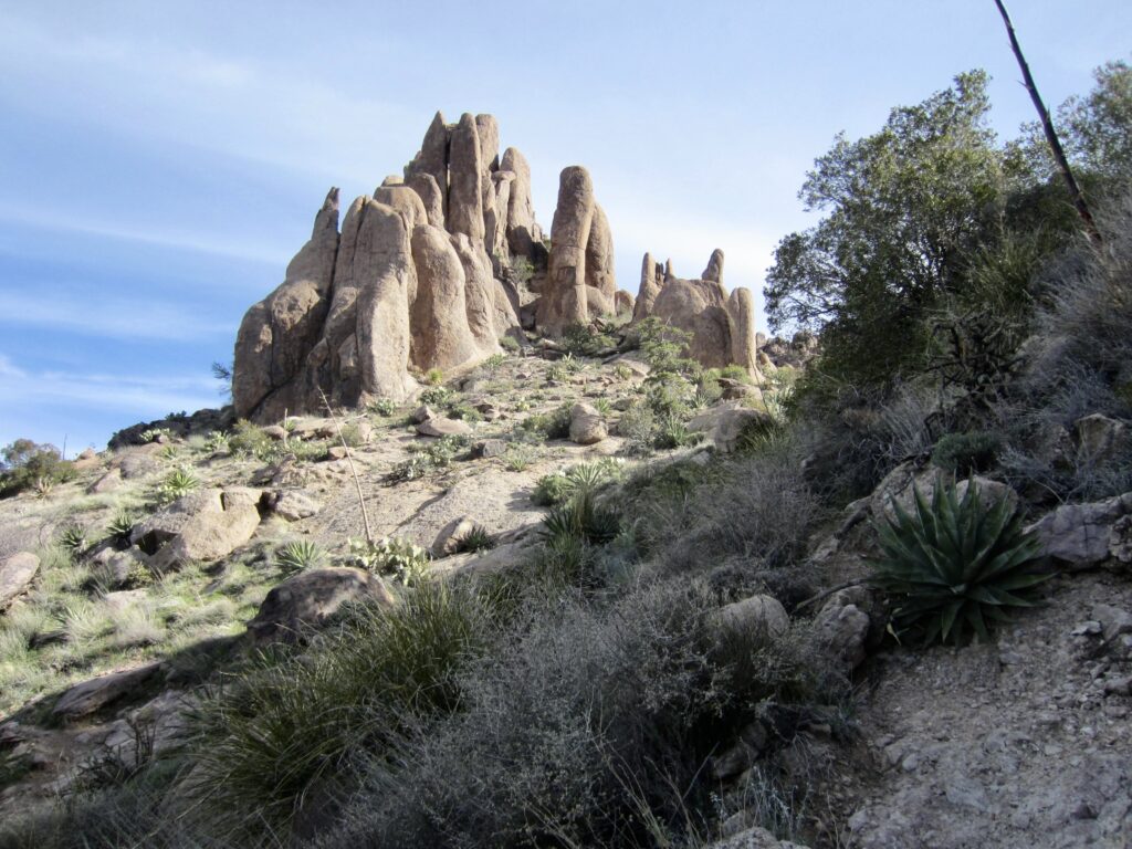
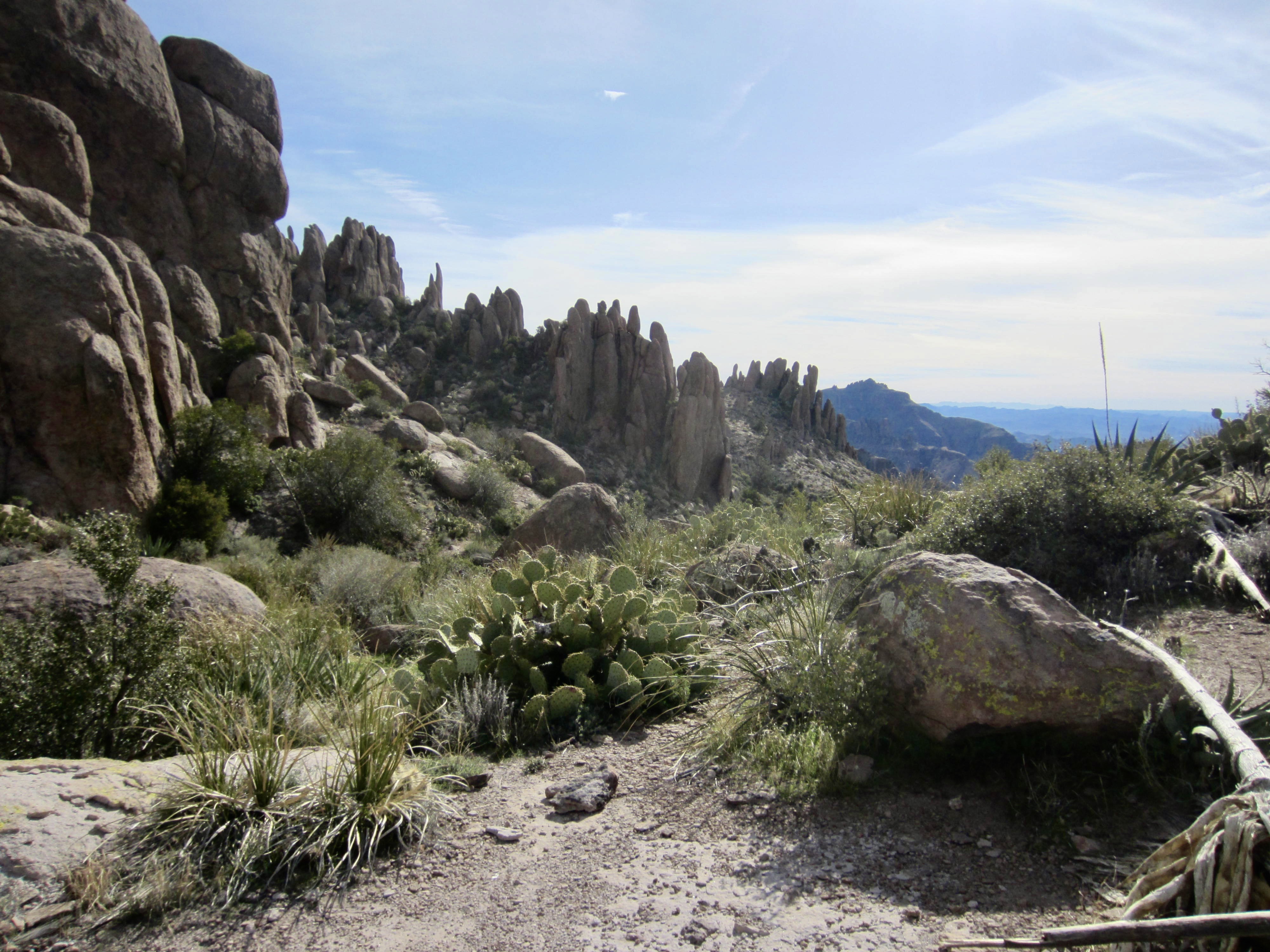
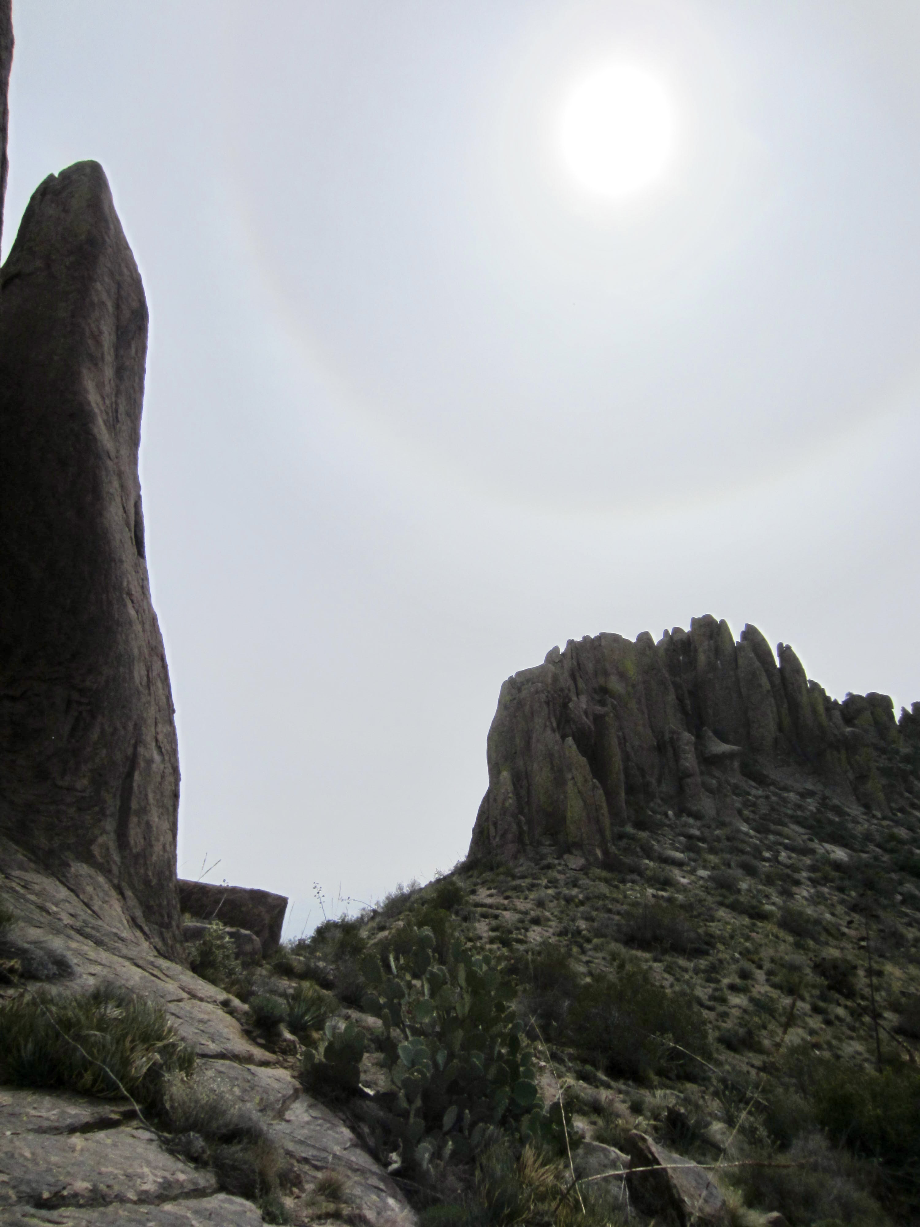
Wanting to tuck in Superstition Peak while being so close, I turned right at the trail junction and ascended a stone walkway up the ridge crest, passing between numerous hoodoos. Three other hikers were just coming down from the summit and let me know that they had spoken to Eileen a bit earlier. I crossed over to the western side of the ridge and made a rising traverse on slabby rock, aiming for the left-hand skyline. A short Class 2-3 crack put me on the summit in short order.

.
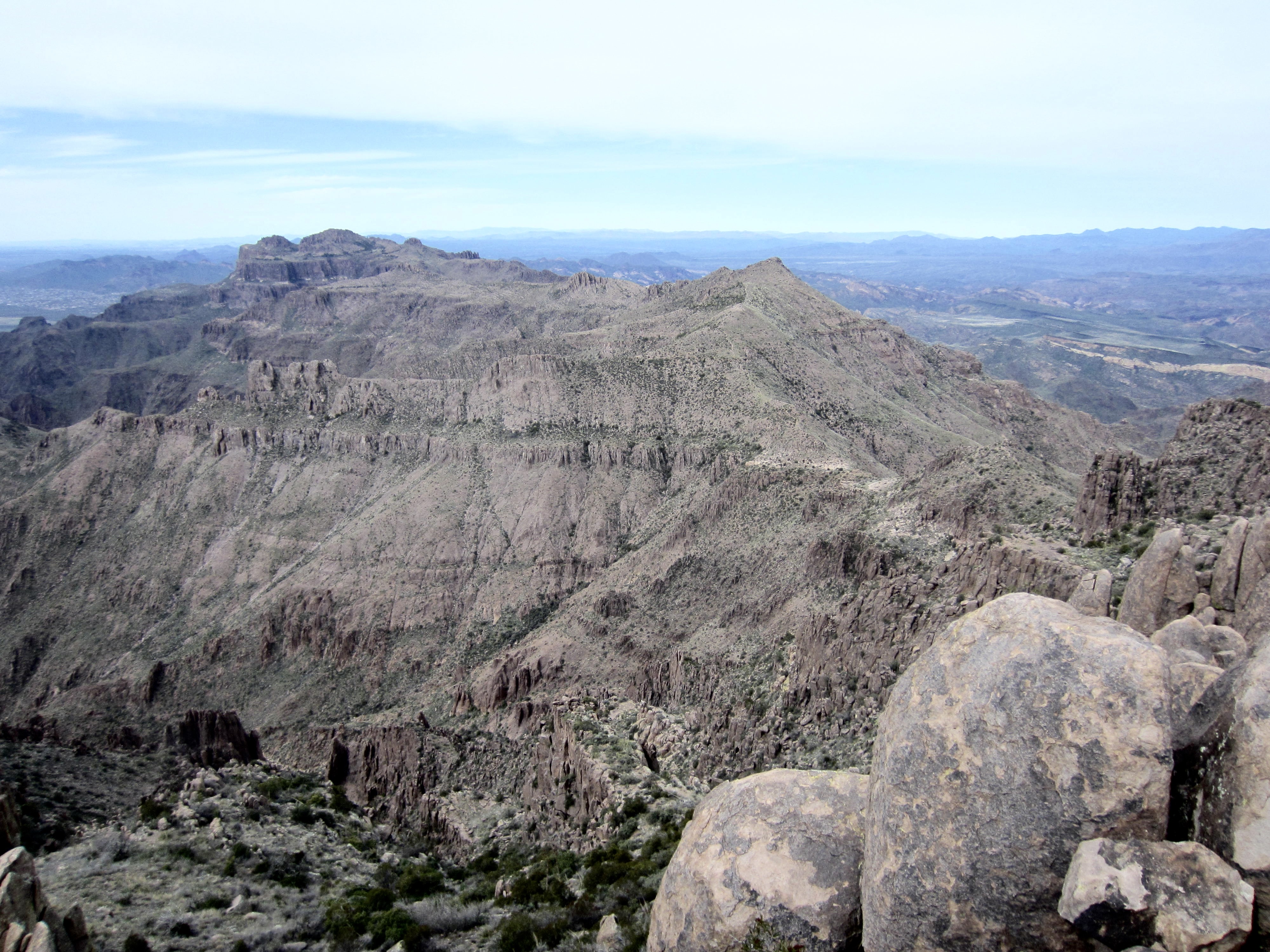
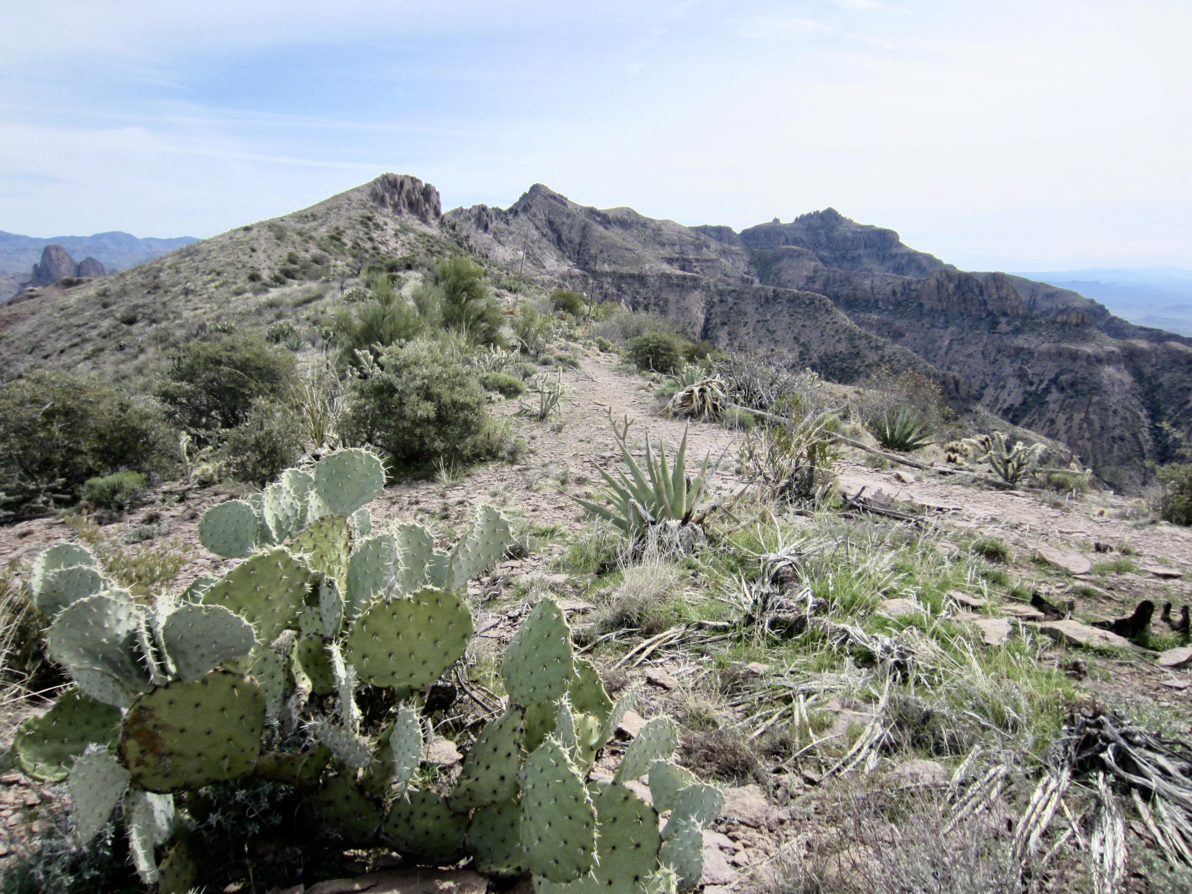
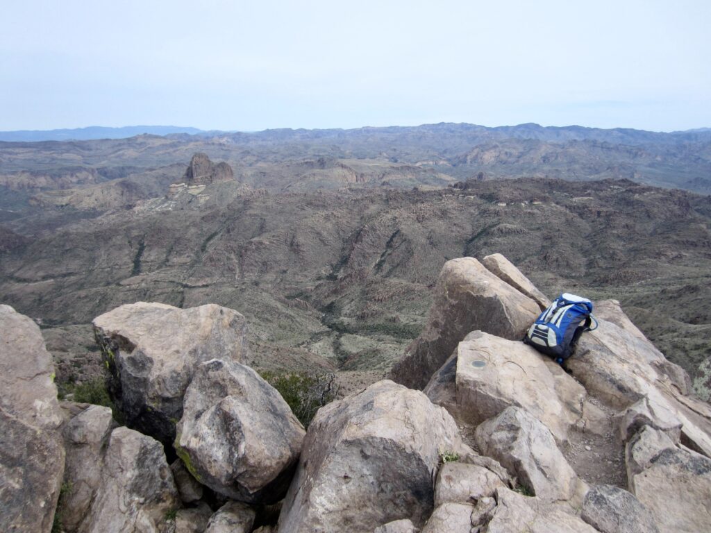
The hazy sky diluted any long-range views, but at least I could appreciate the local views. It was interesting to look back along Superstition Ridge and see Siphon Pass and Ironview Peak, 3½ miles to the northwest. I had come a long ways thus far. In a southeasterly direction, I could see the remainder of my route to Carney Pass.

.
.
.
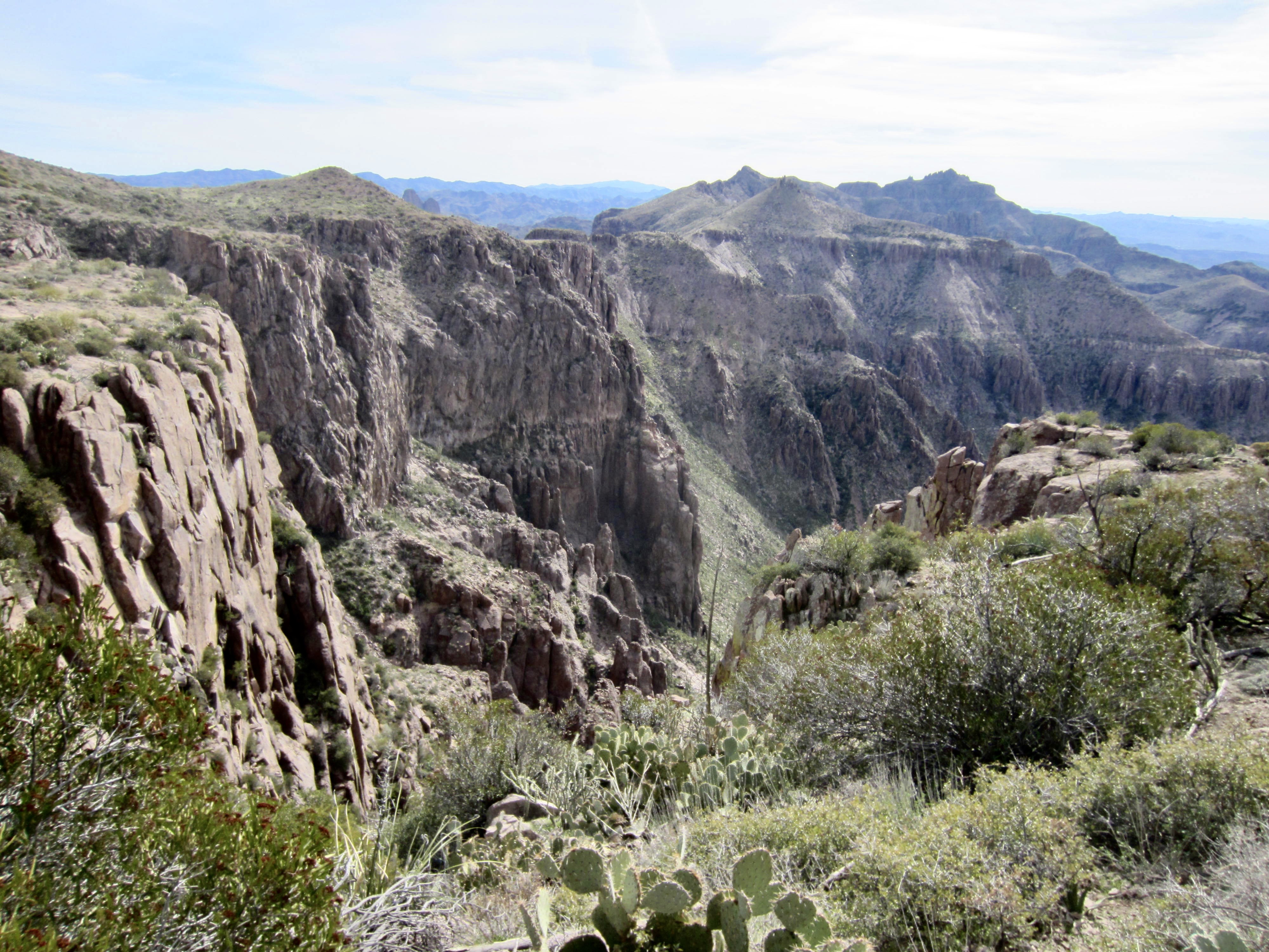
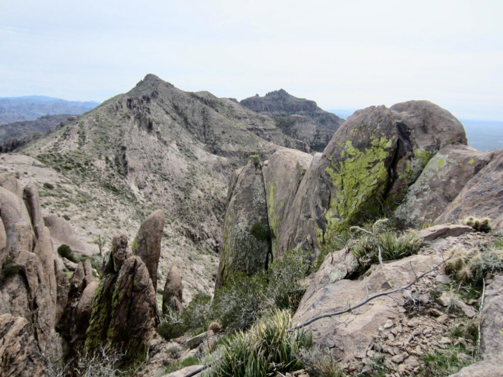
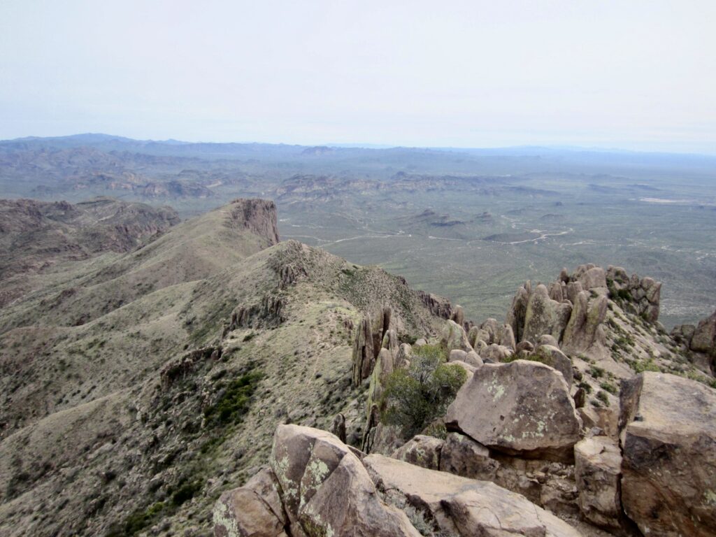
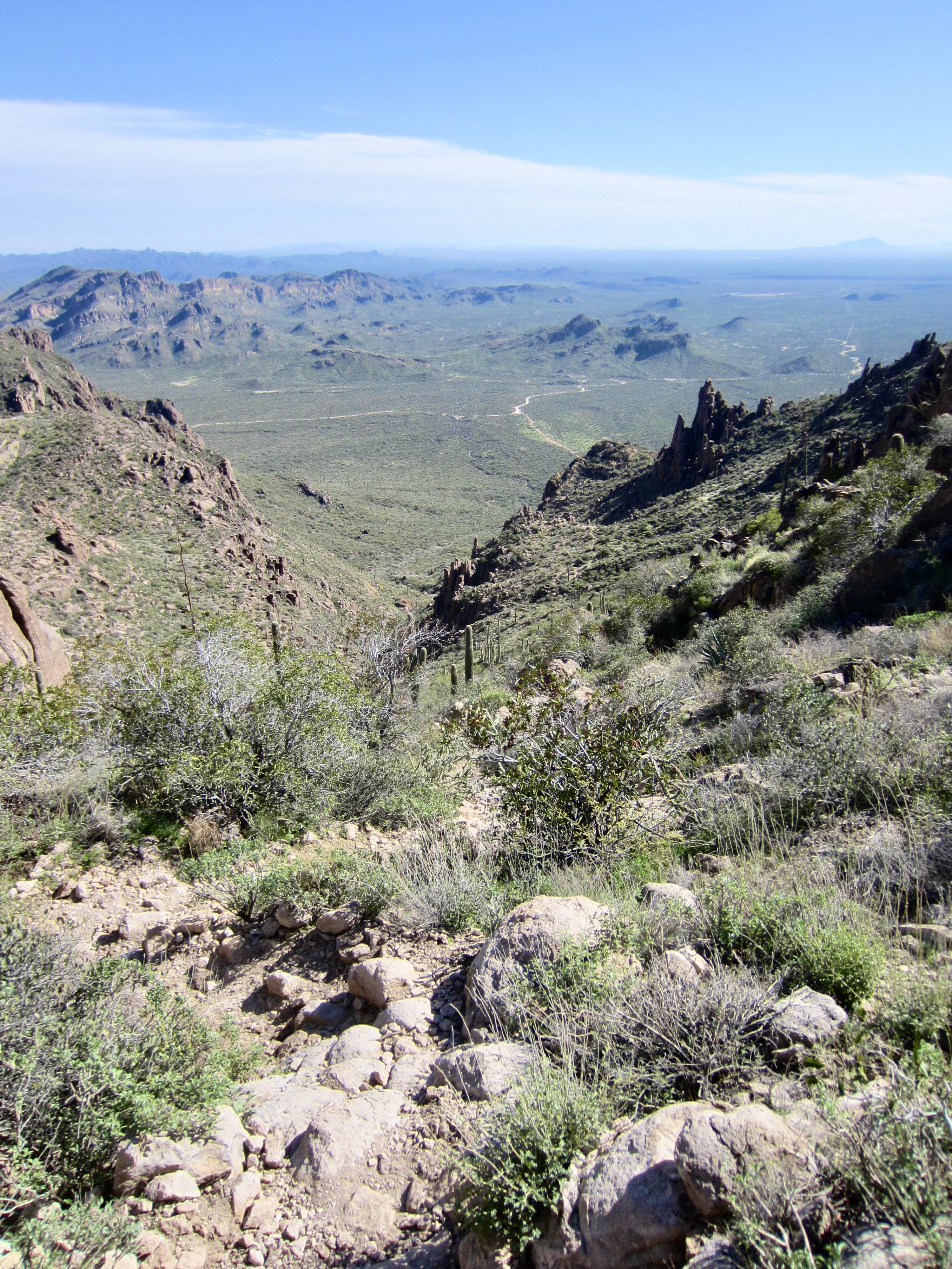
I quickly retraced my route back to the trail junction, completing a 30-minute round trip to the summit, and then continued hiking down the ridge. Following good trail, I dropped into East Superstition Gap, a broad 4200-foot saddle that roughly marks the two-thirds point of the full traverse. The backward view of Superstition Peak is particularly striking from this part of the trail. The northerly view is dominated by Weavers Needle and Four Peaks Mountain.

.
.
.
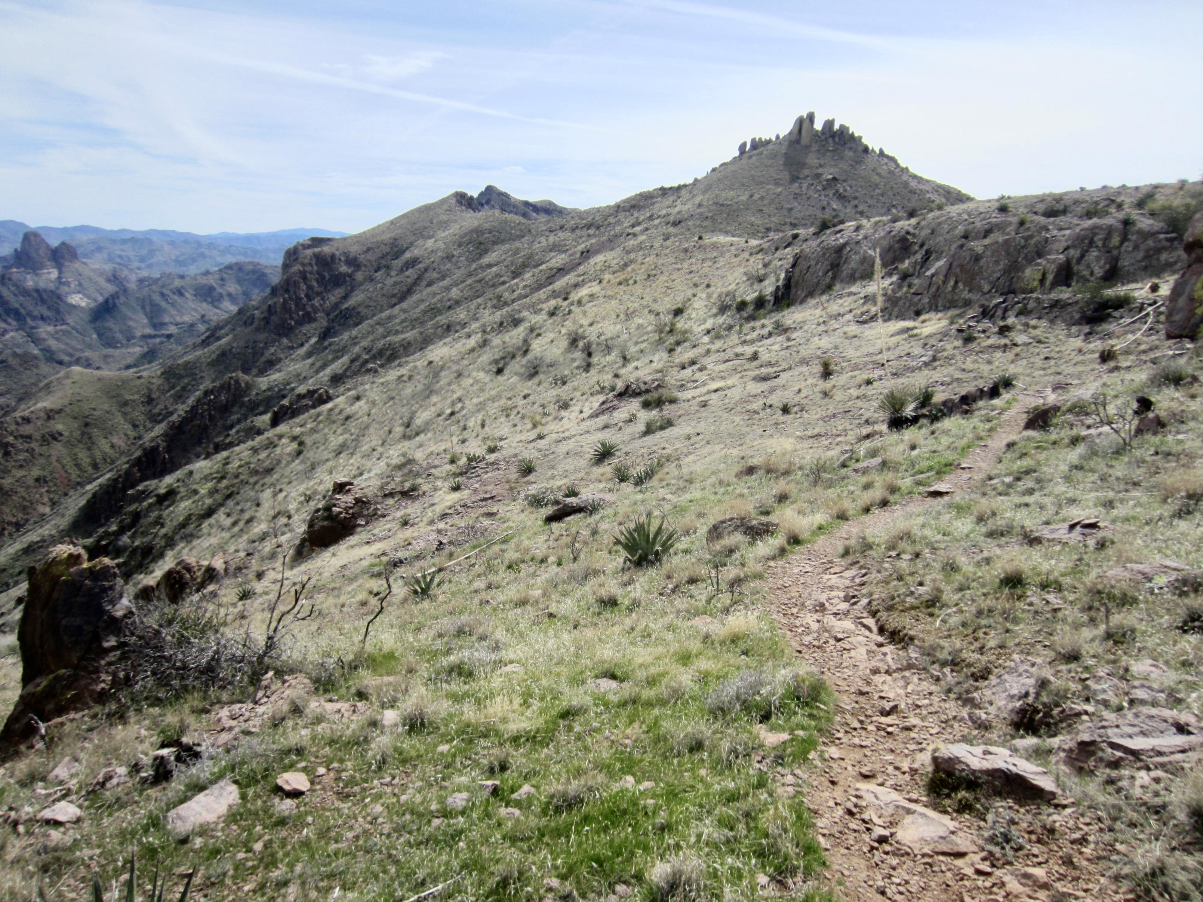
Beyond East Superstition Gap, the trail contours around a hillslope and then abruptly plunges 400 feet down a steep rib. This is followed by a pleasant traverse and gradual descent to Boulder Draw, a linear depression filled with small ponds that flow into West Boulder Canyon. Much as I wanted to believe that this low point was Carney Pass, it wasn’t. Carney Pass is ⅓ mile to the east and 100 feet higher.
.
The route from Boulder Draw to Carney Pass is one of the sketchiest parts of the entire ridge trail. It begins by wandering up some low-angle slabs, then makes an undulating traverse through rock outcrops and dense vegetation. I frequently had to stop and check my map and then hunt for the vague footpath. I was greatly relieved to finally gain 3700-foot Carney Pass in mid-afternoon (7.2 hours + 9.8 miles + 4550 feet from starting point), knowing that it was now all downhill on better trail.
.
A text from Eileen indicated that she was now only a few minutes ahead of me. We made audio contact by means of war-whoops and soon were able to reconnect at a point 500 vertical feet down the trail. Farther along, as if on cue, the high overcast had completely dissipated, leaving a bright blue sky. We finished our descent of Carney Gulch together and arrived at the Carney Springs Trailhead shortly after 4:00pm (8.6 hours + 11.7 miles + 4600 feet from starting point, including sidetrips). It had been an immensely satisfying and successful day in the fabulous Supes for both of us!
.
Route Maps & Profiles
…
…
…
…
Photo Gallery
Click to enlarge…