Trip Dates: July 15, 2025 & May 28, 2026
Spouse Wall Sport-Climbs
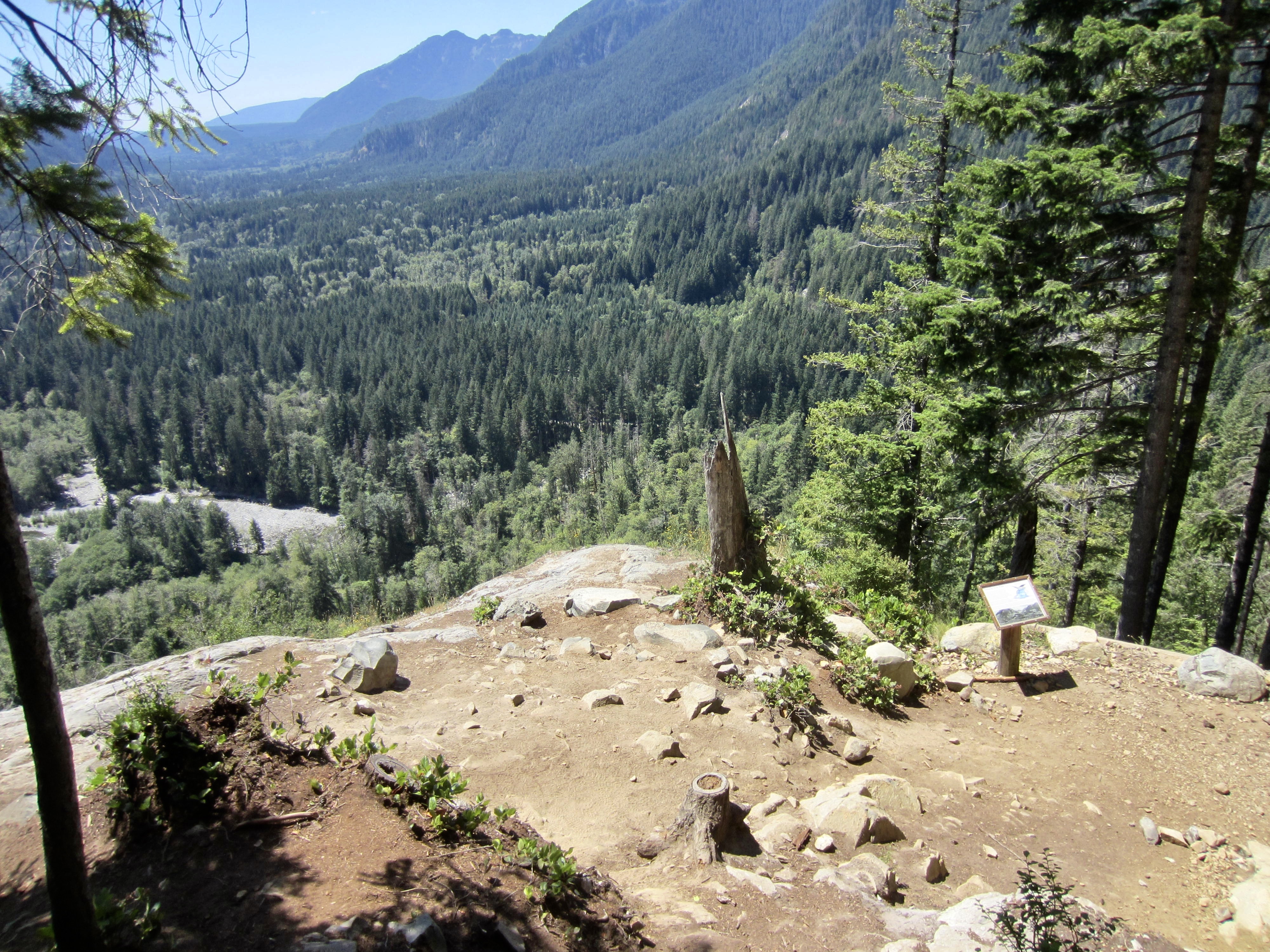
Middle Fork Snoqualmie River Valley
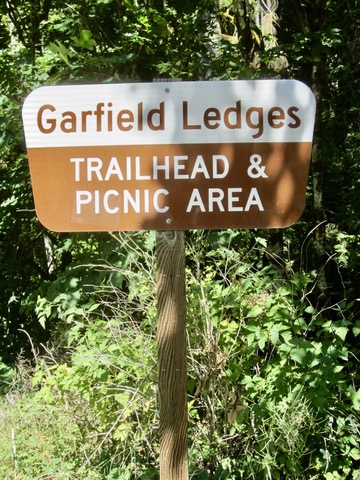
Garfield Ledges
Fusarium Route (Class 5.7 – 5.8)
Aspergillus Route (Class 5.8 – 5.9)
Right Mid Wall Route (Class 5.5 – 5.6)
Route Summary
Region: Central Washington Cascades
Sub-Region: Miller-Foss Mountains
Locale: North Bend, WA
Setting: Middle Fork Snoqualmie River Valley
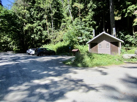
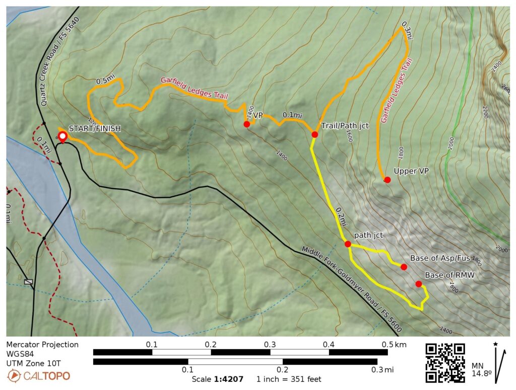
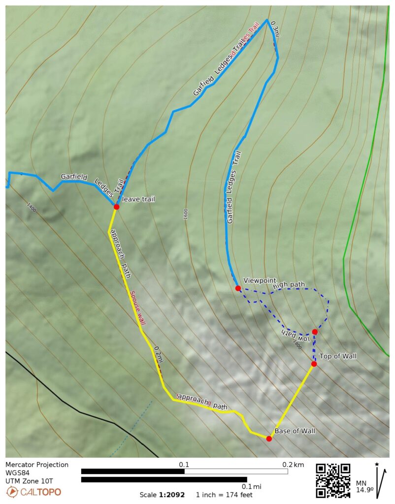
Approach Starting & Ending Point: Garfield Ledges Trailhead at junction of Middle Fork Snoqualmie River Road #5620 & Taylor River Road #5640 (Elev. 1100 feet)
Approach Way Points: Lower viewpoint & Spouse Wall climber’s path junction & Spouse Wall base (trail hike)
Feature: Spouse Wall (Base Elev. 1480 feet)
Route 1: Fusarium (5 pitches of sport climbing)
Route 2: Aspergillus (5 pitches of sport climbing)
Route 3: Right Mid Wall (4 pitches of sport climbing)
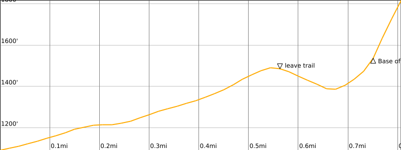
Approximate Stats for Approach (one-way): 0.75 miles traveled; 550 feet gained; 100 feet lost.
Approximate Stats for Climb: 320 feet gained.
Related Posts
>>> Golden Hour Wall Sport-Climb via Solar Storm Route — May 2025
>>> Otter Falls Slab Sport-Climb via Poppy’s Peril Route – June 2024
Full Route Description
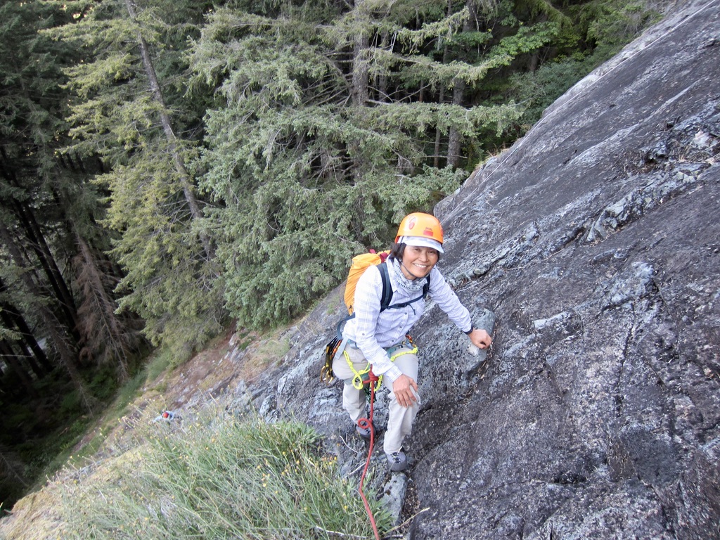
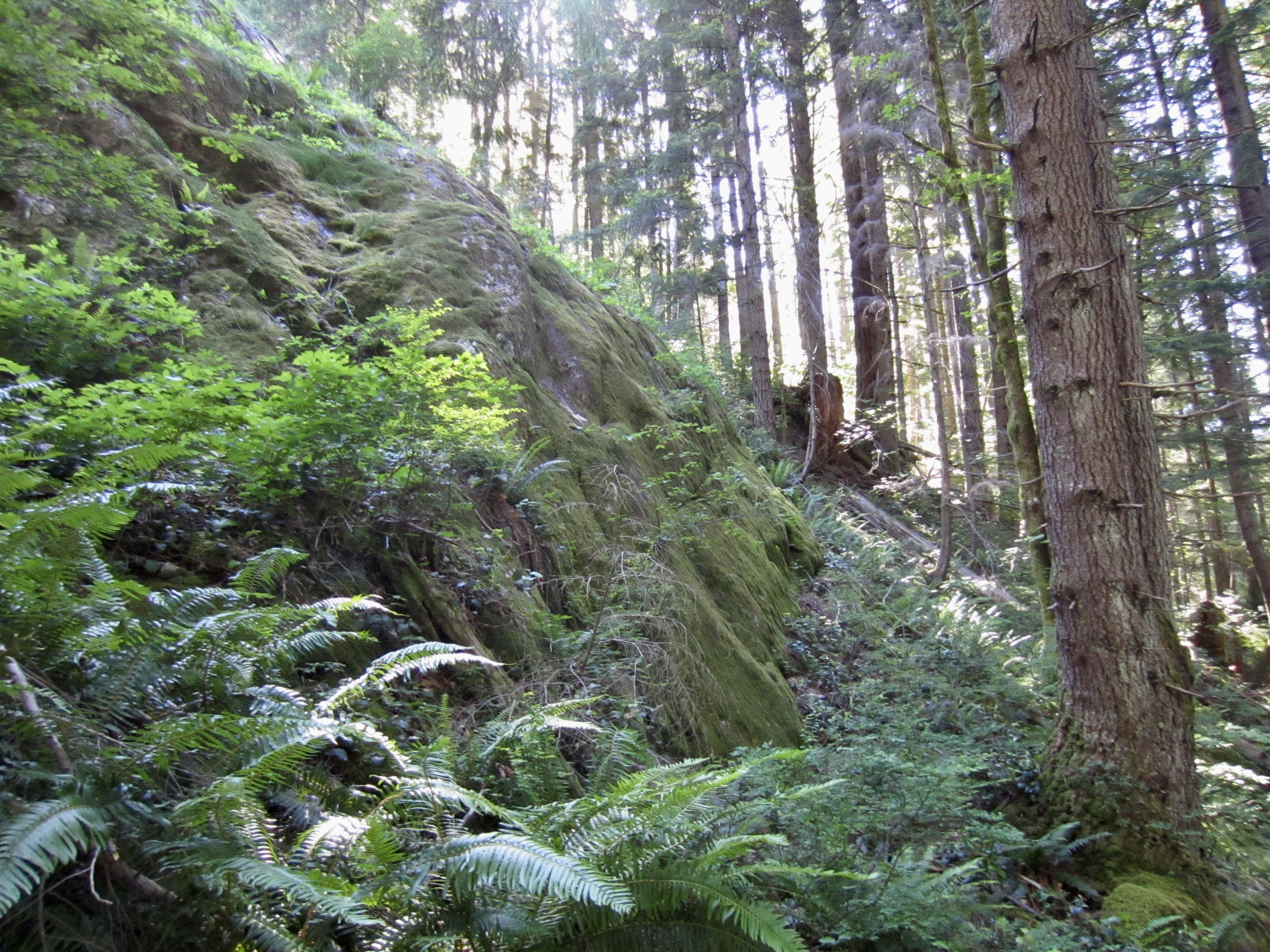
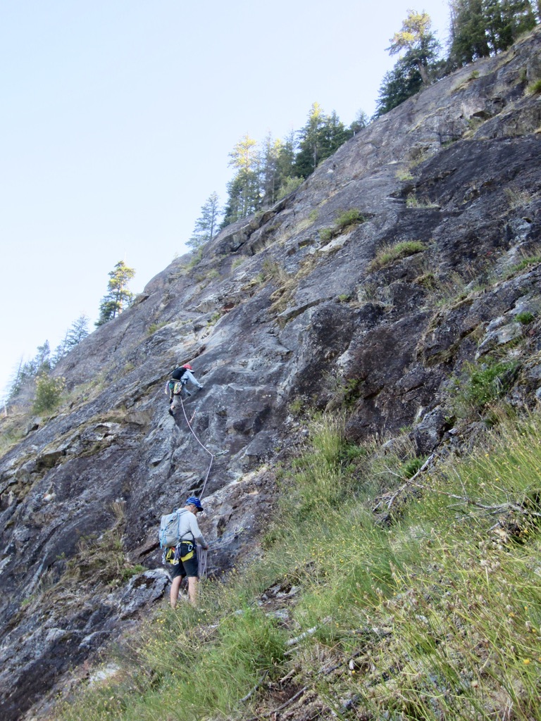
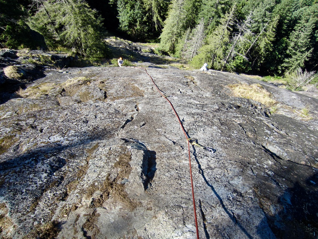
Spouse Wall is sloping rock face located on the lower flank of Mt. Garfield in the Middle Fork Snoqualmie River Valley northeast of North Bend. It can be reached from the Garfield Ledges Trailhead parking lot by a ¾-mile hike on a combination of formal trail and rough climber’s path. The rock consists of a solid, grippy, well-textured, volcanic material—probably a lightly metamorphosed andesite.
I had never heard of Spouse Wall until my friend Blaine invited me on a visit to the crag in 2025. According to Mountain Project, five multi-pitch sport routes were established here between 2021 and 2026. What caught our interest was two adjacent five-pitch sport routes named after a fungus and mold: Fusarium and Aspergillus. Both are rated at Class 5.8 on Mountain Project, but these ratings might eventually be altered by a greater consensus of climbers. A four-pitch sport route, provisionally called Right Mid Wall, was added later; it is rated at Class 5.6.
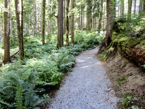
The Approach
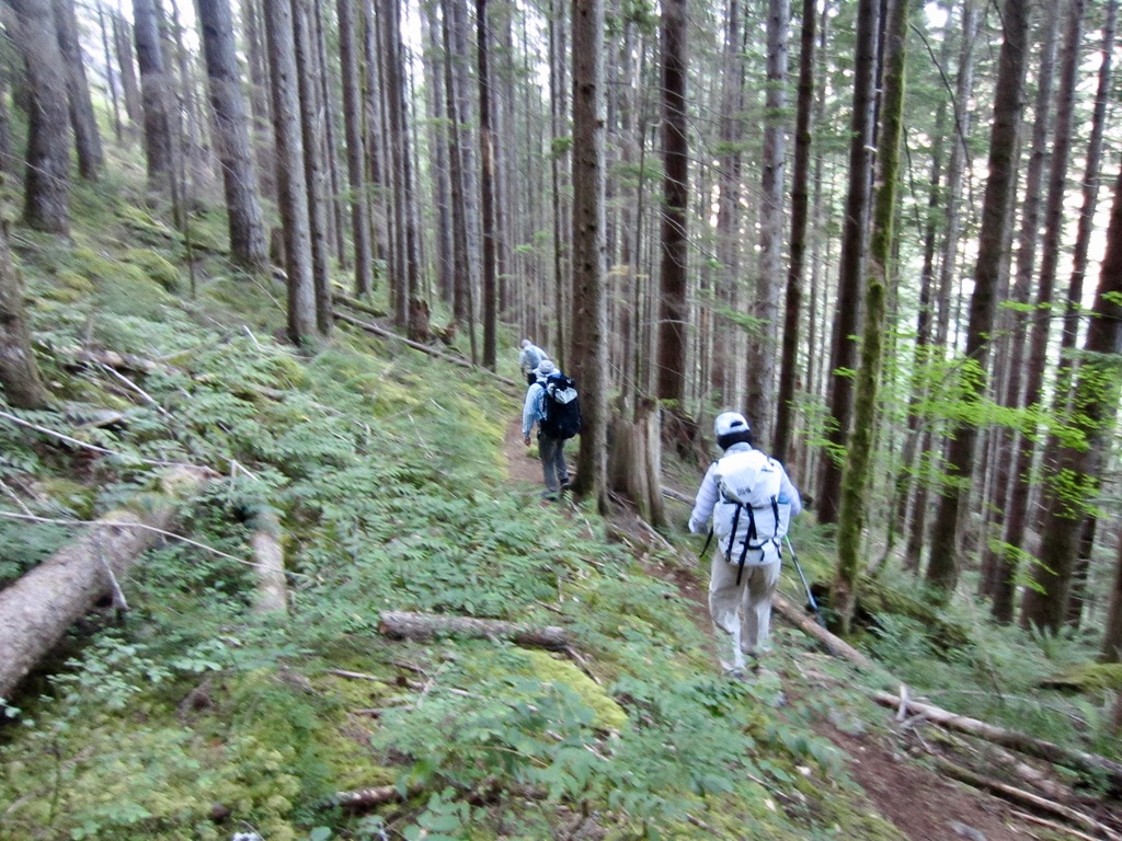
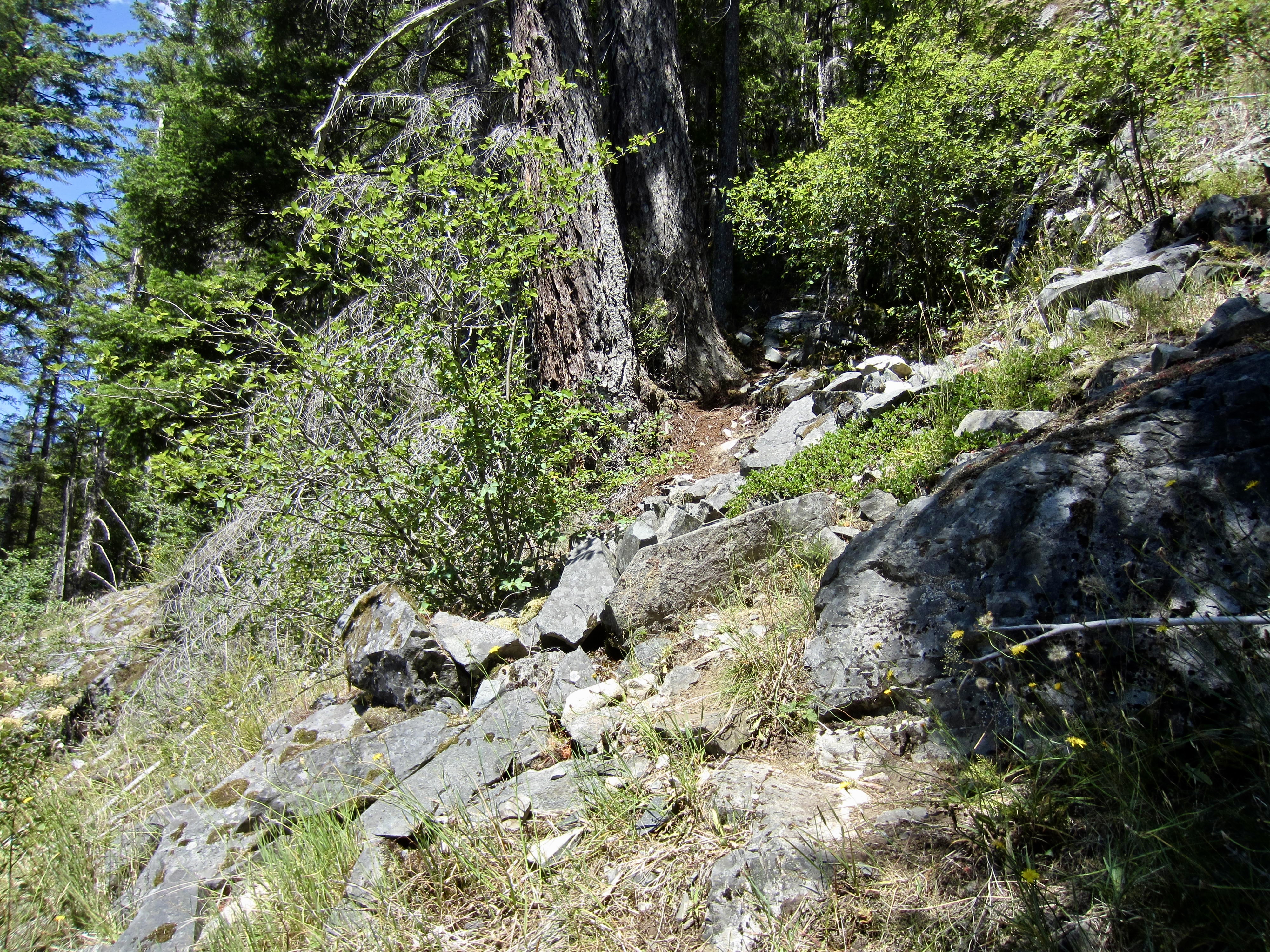
Starting at the Garfield Ledges Trailhead alongside Middle Fork Snoqualmie River Road, hike up the nicely graded trail. According to Washington Trails Association, this trail is relatively new, having been completed in 2019. It winds upward through pleasant second-growth forest with a lush understory of ferns and moss.
.
.
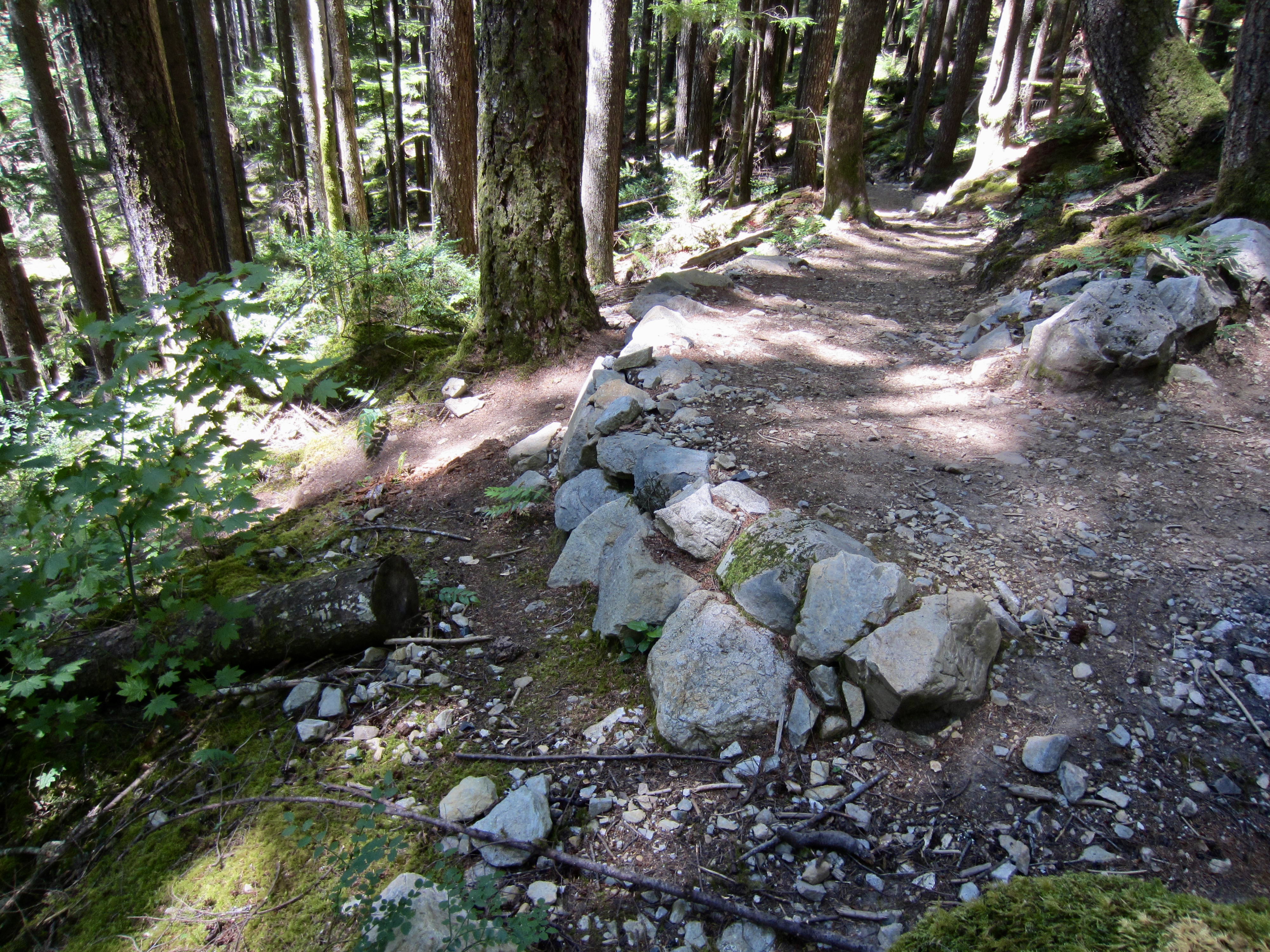
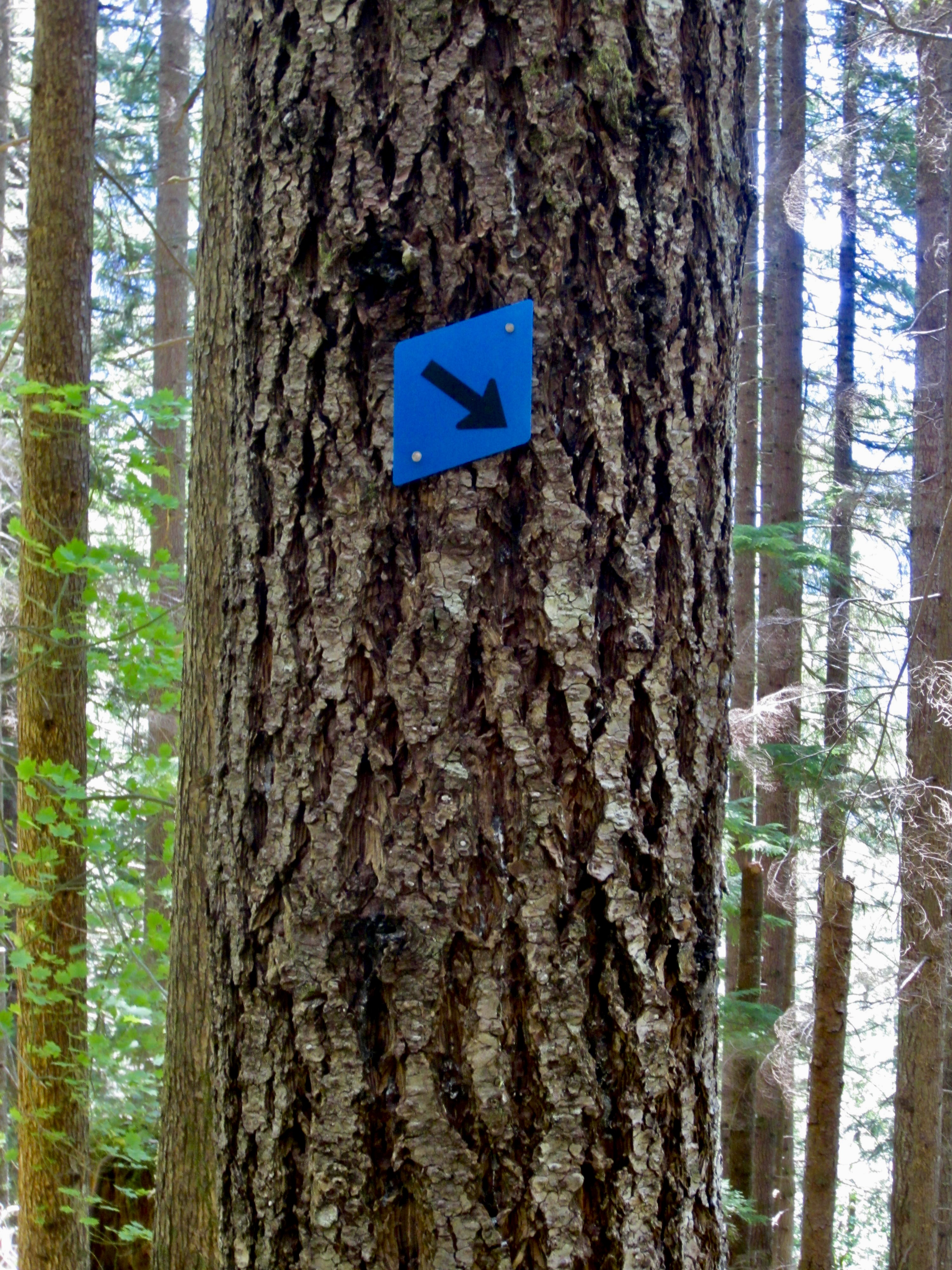
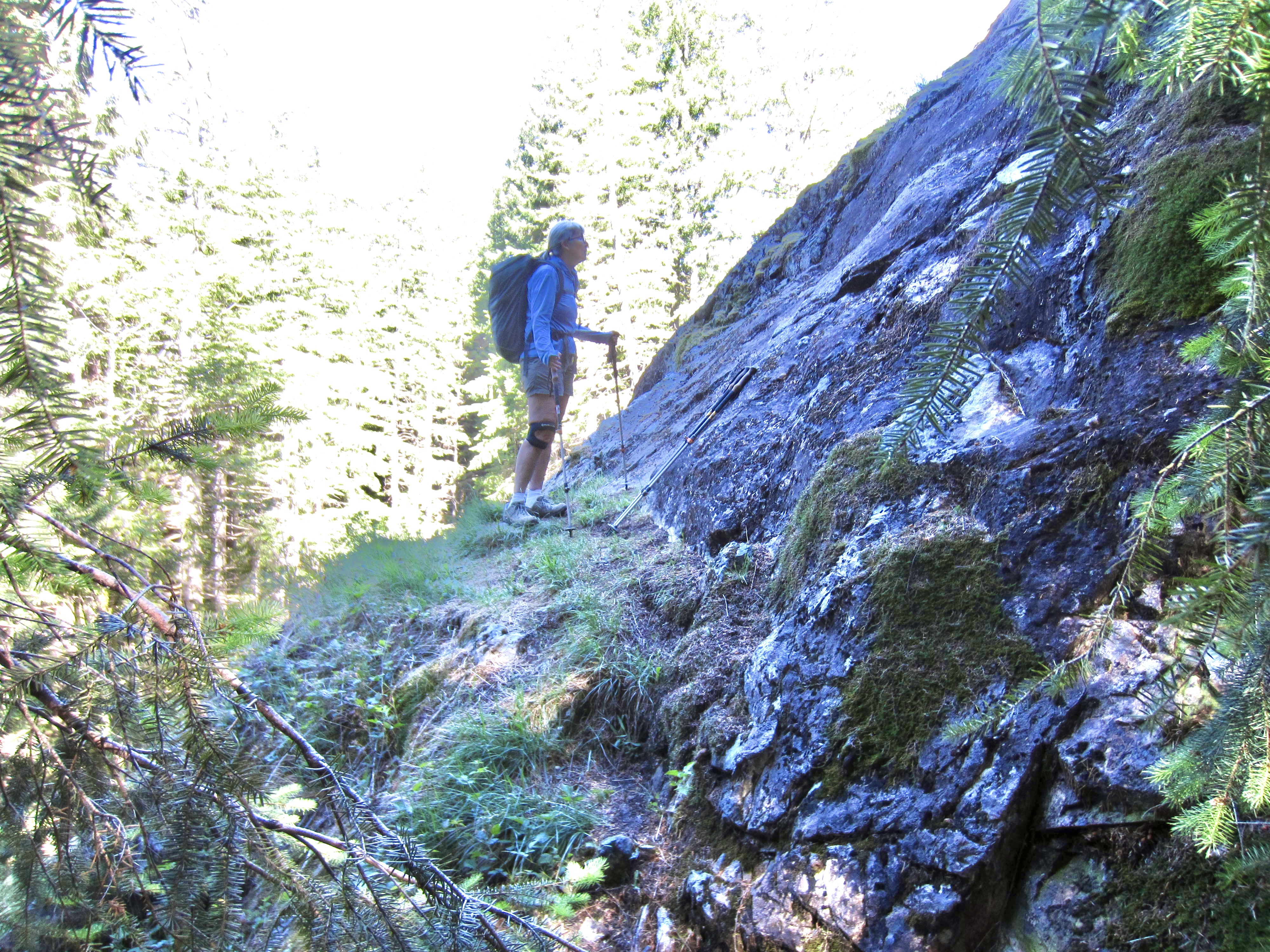
About 15 minutes of hiking will take you past two minor viewpoints and up several sets of wooden stairs. Approximately 100 yards beyond the second viewpoint, the trail makes a sharp switchback to the left (0.55 miles + 400 feet from TH). This is where the Spouse Wall approach path branches off from the main trail. Look for a blue diamond on a tree, and a crude path angling downhill on the other side of two fallen logs. The crude path makes a descending traverse through sparse forest for 100 vertical feet until reaching an inconspicuous junction. To this point, it is well-trodden and easy to follow, with only a few downed logs
.
.
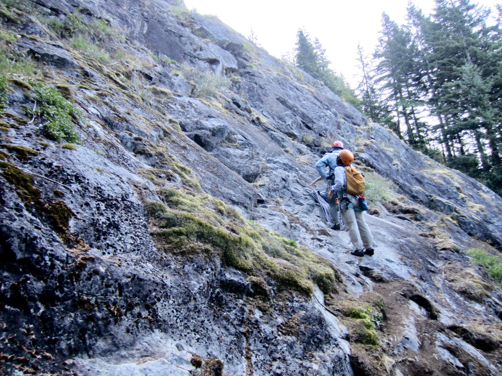
To reach Fusarium and Aspergillus, follow the left branch steeply uphill for 100 vertical feet, then make a final short traverse. You will emerge from the forest and arrive at the edge of a 45-degree rock slope (0.75 miles + 550 feet from TH). The Aspergillus and Fusarium routes begin on a sloping ledge about 10 and 15 yards, respectively, beyond the forest.
.
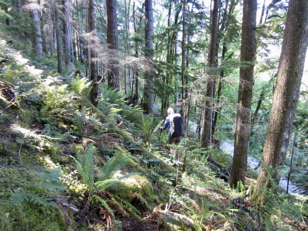
To reach Right Mid Wall, take the right branch downhill for 30 vertical feet, then make a slightly rising traverse for 150 yards. This path is currently pretty vague and a little difficult to follow. Throughout the traverse, you will see the gravel-surfaced Middle Fork Road about 60 feet down the slope. Near the end of the traverse, you will pass closely below a mossy rock apron. Beyond this apron, look for the path to turn sharply uphill and climb steeply for 75 vertical feet, then turn left and make a short traverse over to a narrow, grassy ledge. The Right Mid Wall route begins on this ledge.
.
.
The Climbs
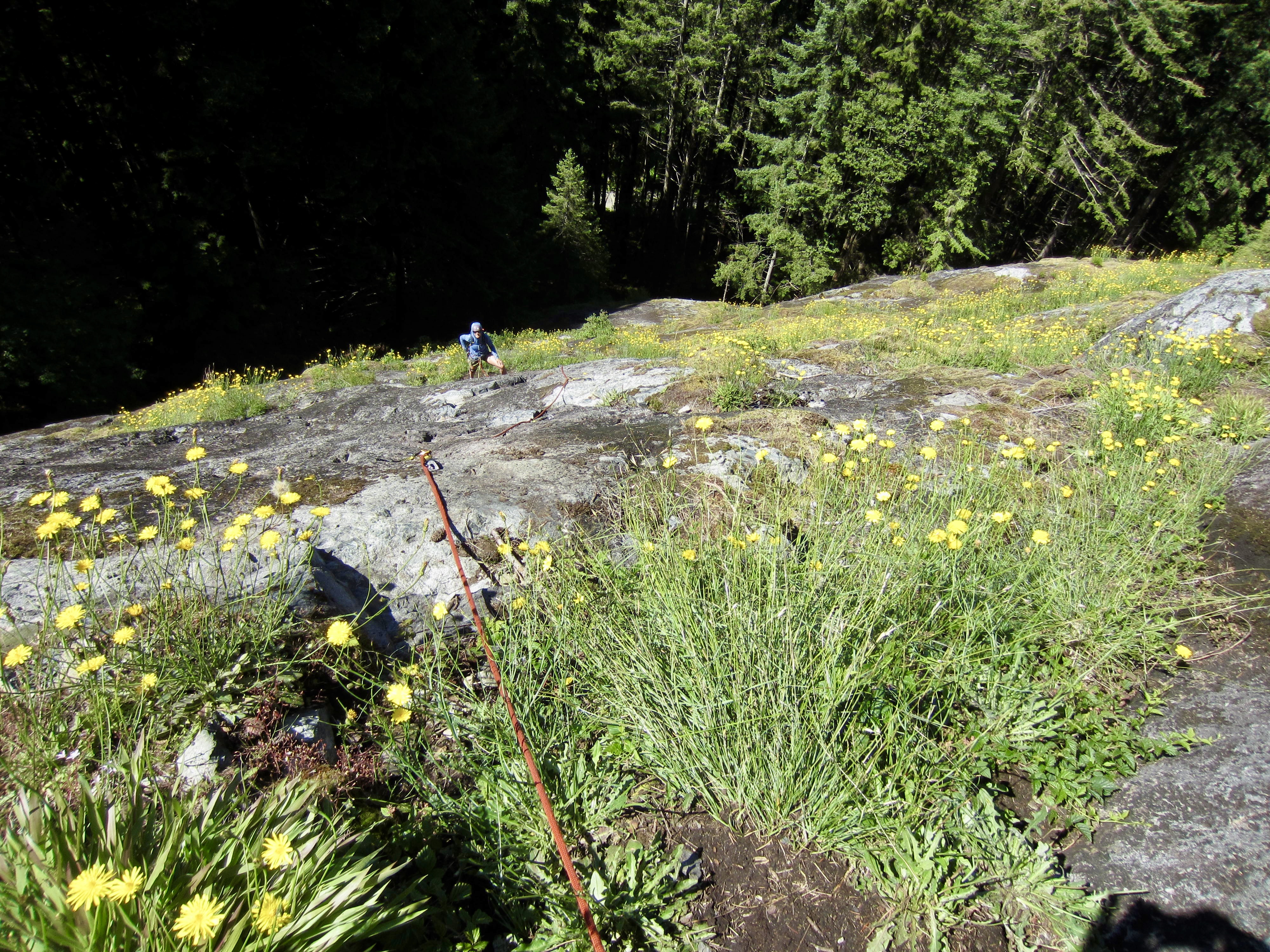
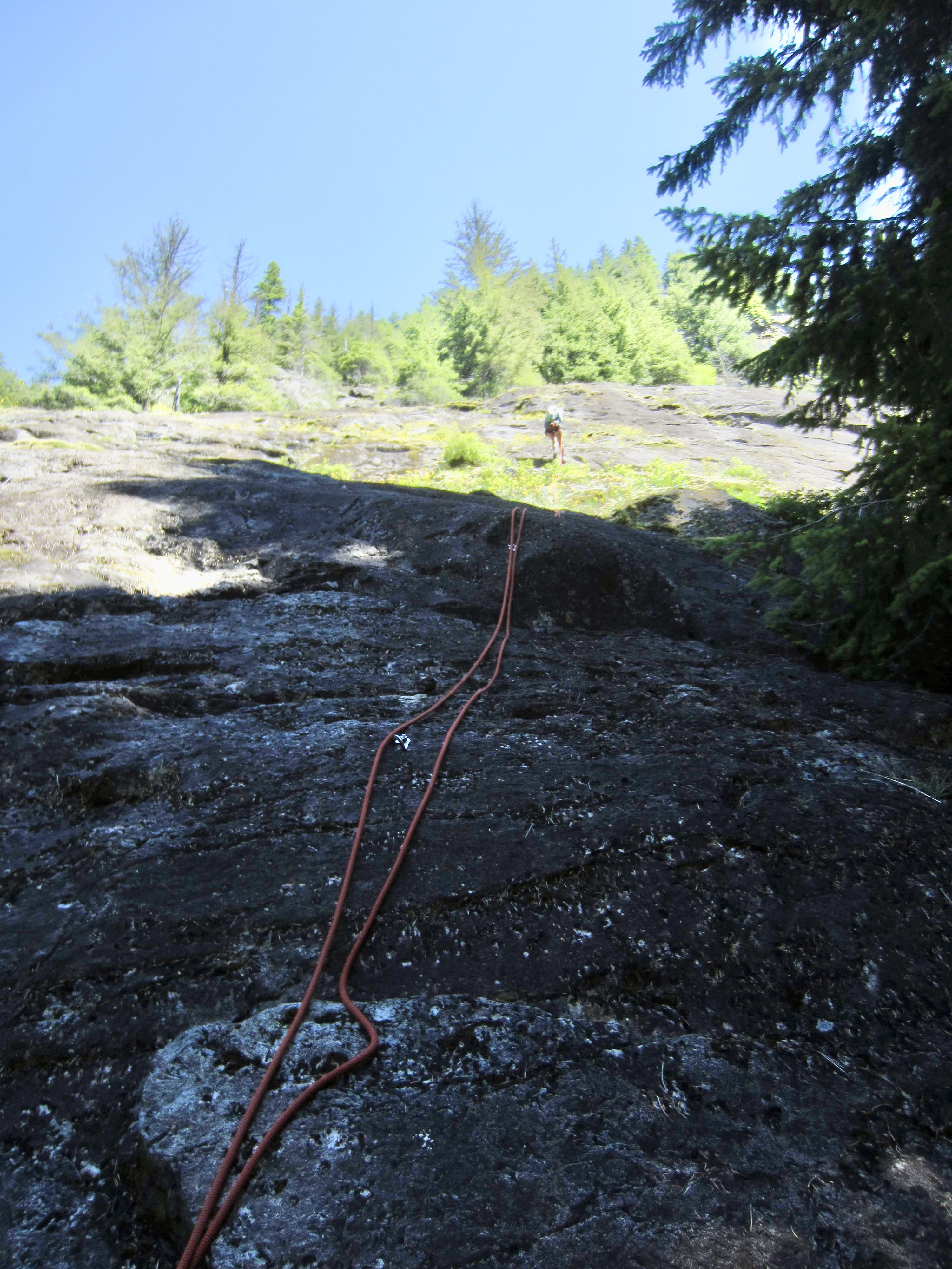
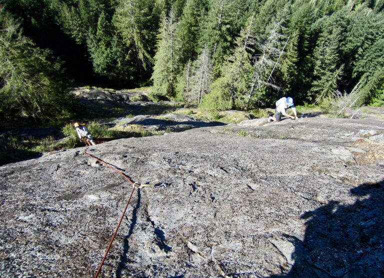
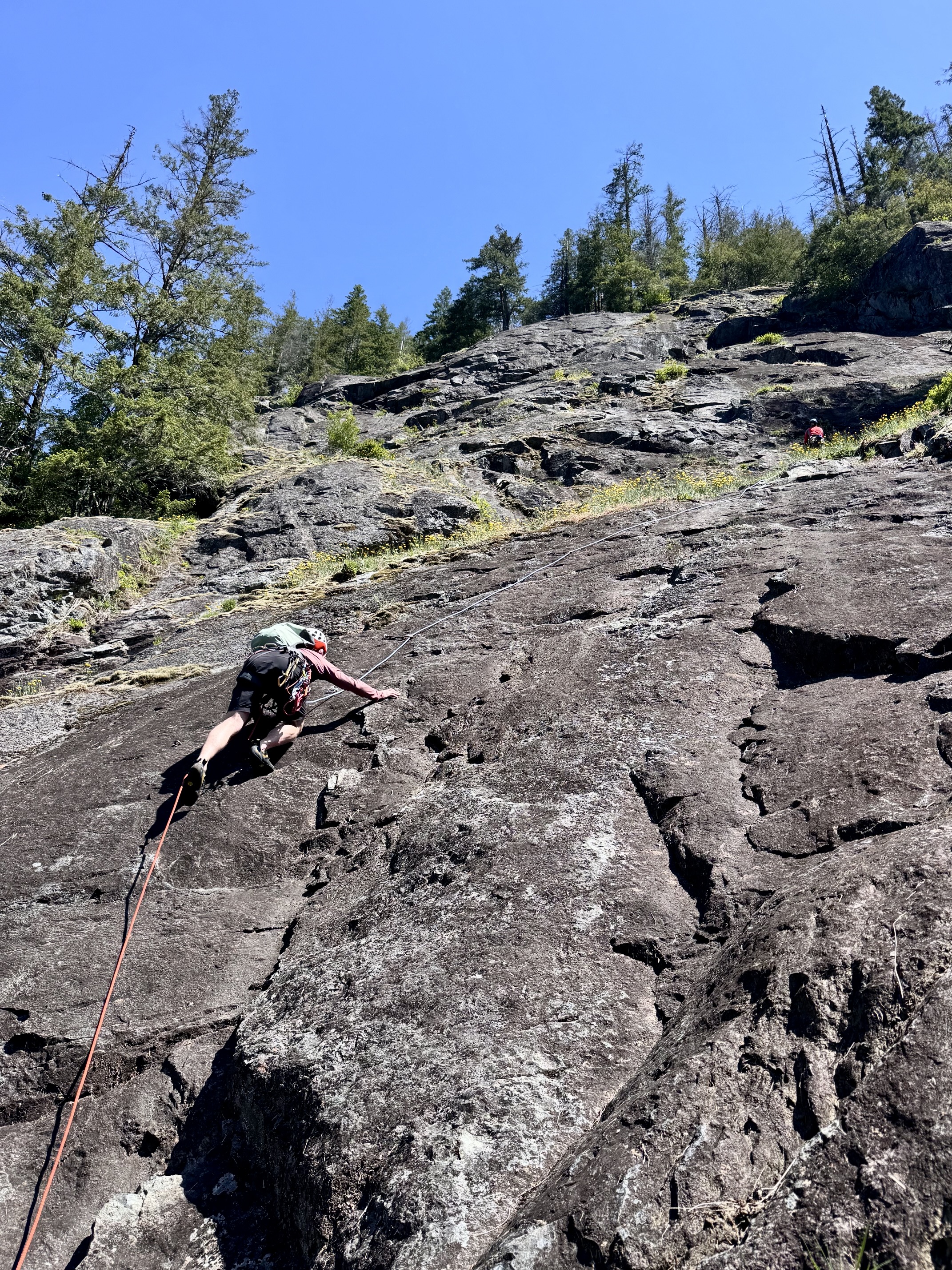
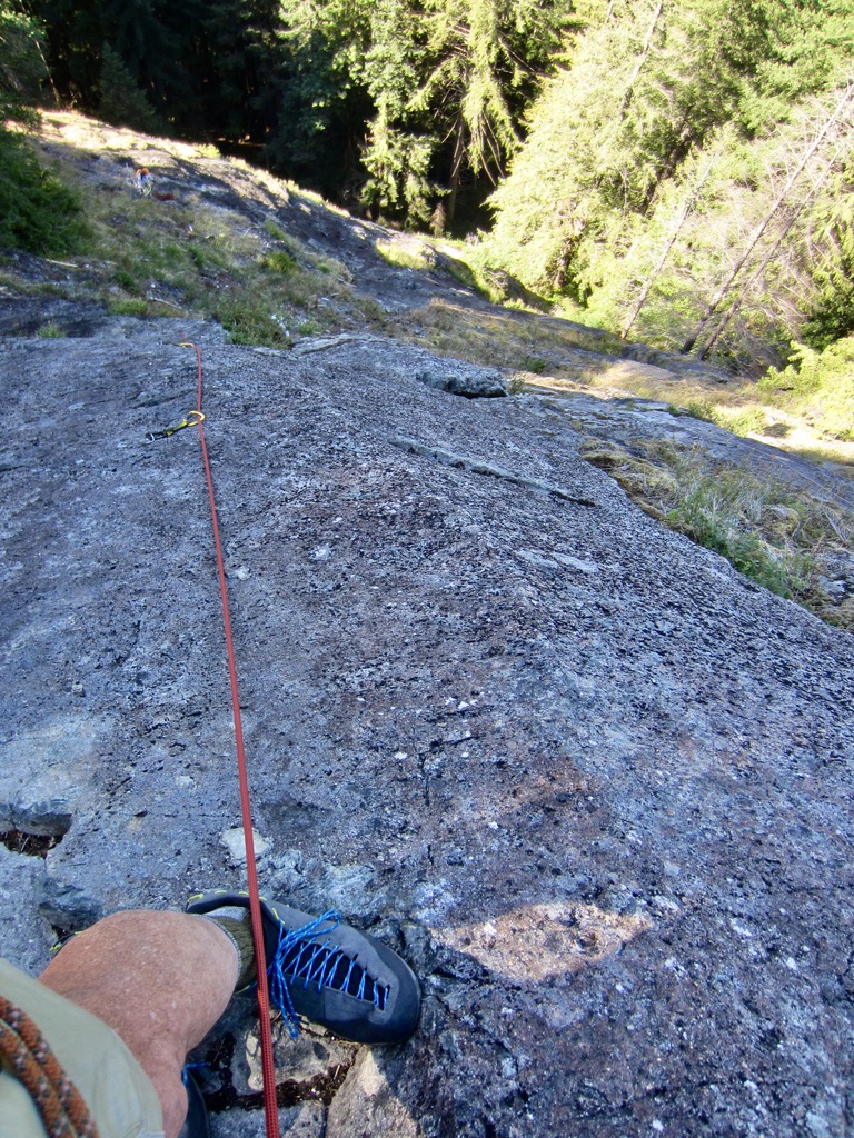
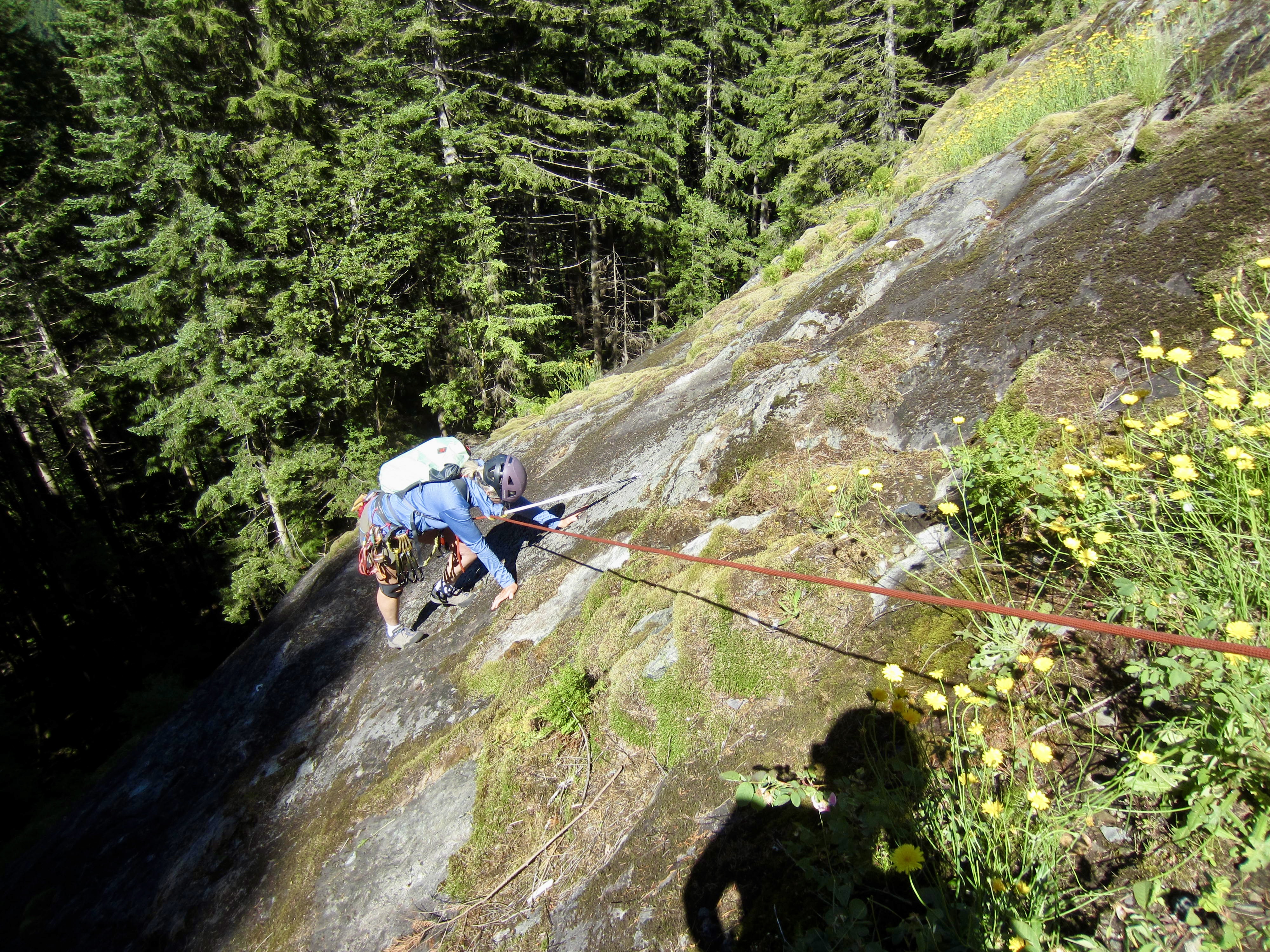
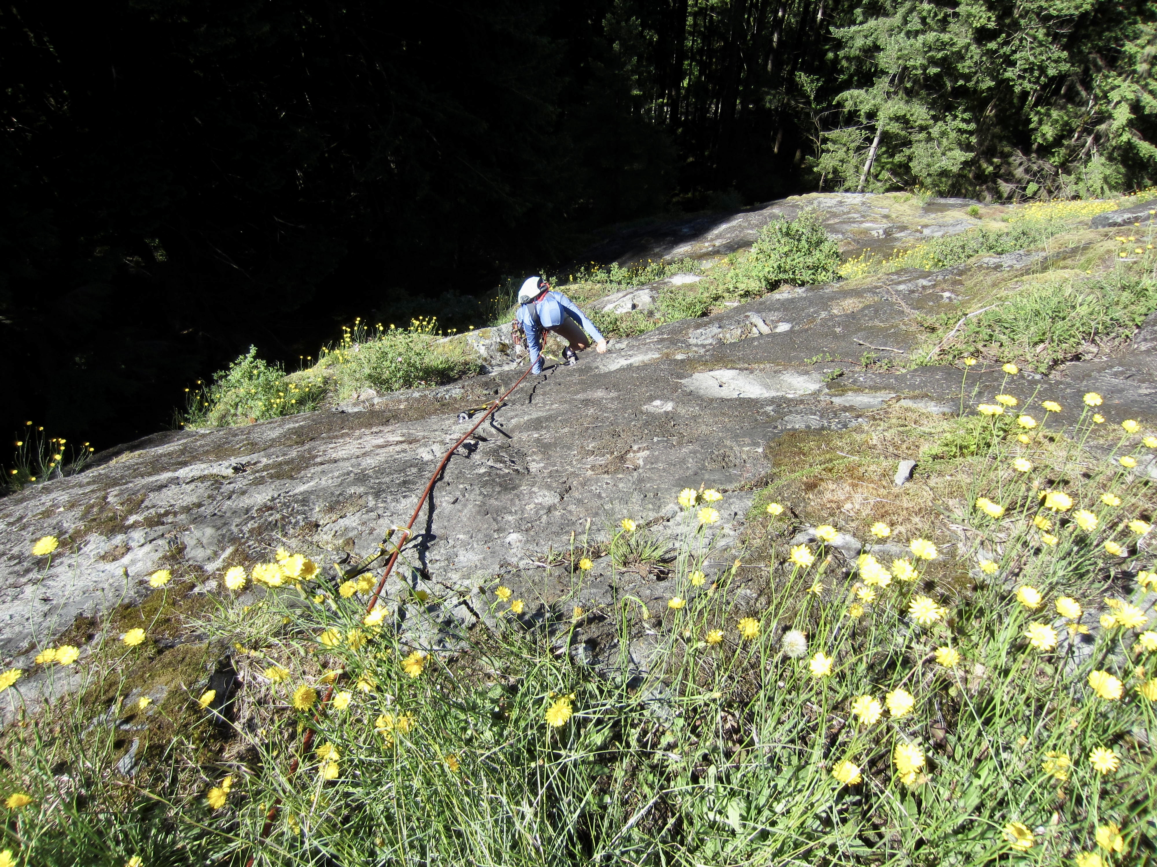
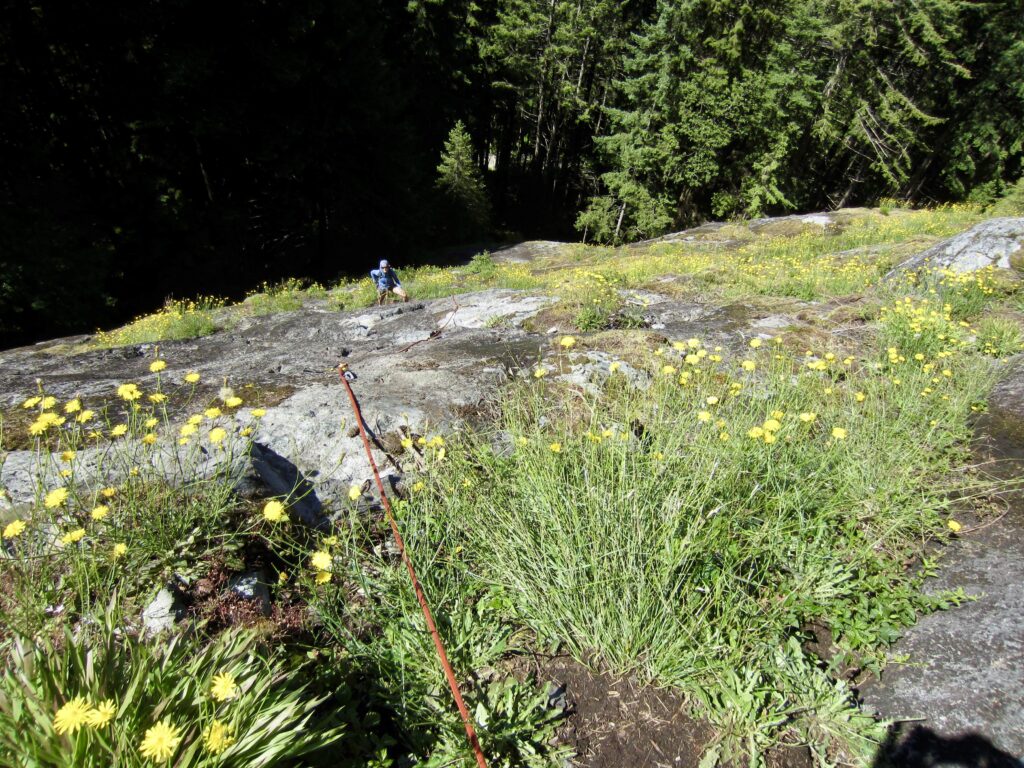
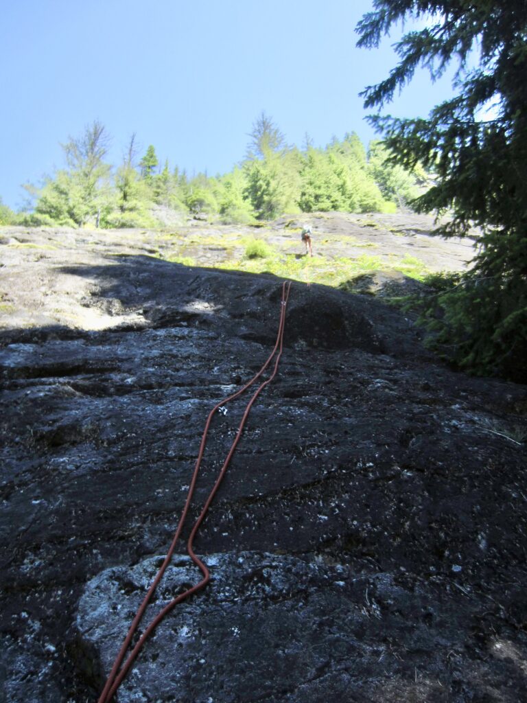
The first two pitches of Aspergillus and Fusarium involve straightforward (5.4 to 5.5) slab climbing on lichen-covered rock, with scattered ledges of dirt, grass, and moss. To me, it felt a bit like an alpine climb. These pitches are well-protected with ample bolts and end at two-bolt belay anchors. For protection, you will need about ten quickdraws for both routes. An extended sling is handy to reduce rope drag on the traversing portion of Pitch 3.
.
Pitch 2 of Aspergillus ends at a belay anchor located near the left edge of a grassy slope below a steep face. Pitch 2 of Fusarium passes a rappel anchor to the right and then angles leftward across this grassy slope to arrive at the same belay anchor. To avoid congestion at this belay anchor, you might chose to belay from the Fusarium rappel anchor and then begin Pitch 3 with the slope traverse. Such a strategy creates some rope drag but works well otherwise.
.
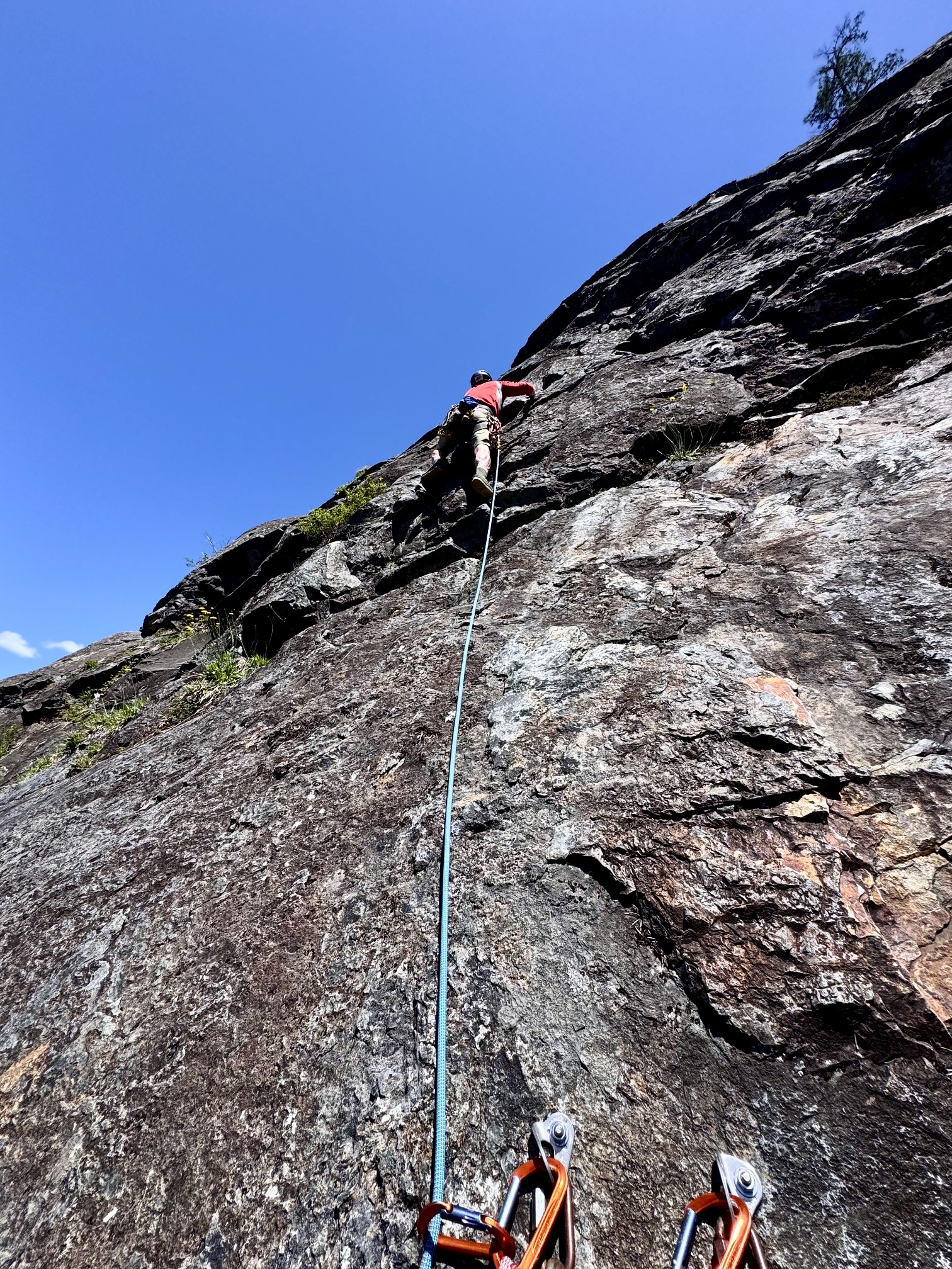
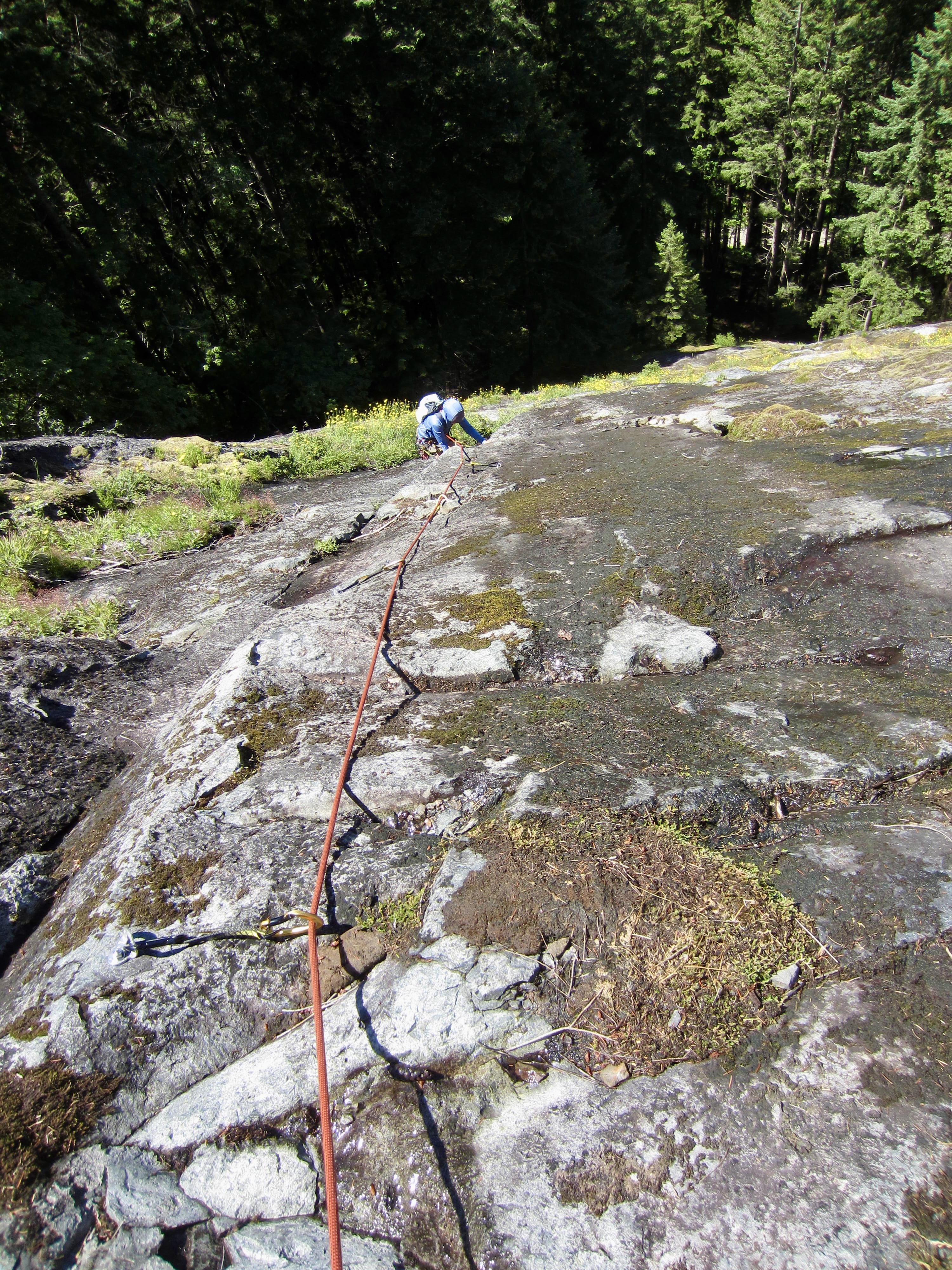
Pitch 3 of each route gets a little steeper and more difficult (5.6 to 5.7), but the rock is cleaner and the holds are solid. In fact, the rock quality is surprisingly good, with a gritty texture and a combination of chiseled and hueco-type handholds. Overall, Aspergillus is a bit more pure through here, whereas Fusarium maintains more of an “alpine” ambiance.
.
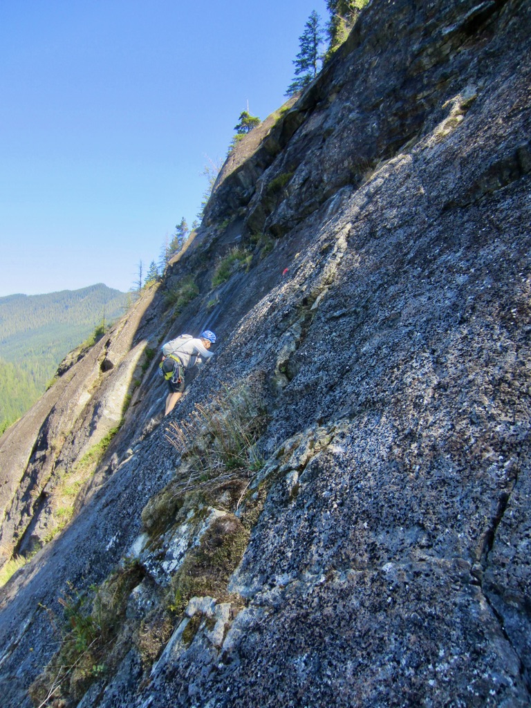
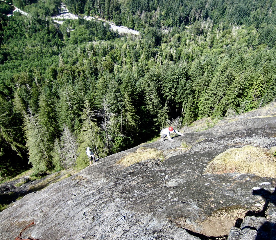
Things get more interesting on Pitches 4 and 5 of each route. On Fusarium, these two pitches involve some tricky face moves and delicate friction climbing. Although they are rated as high as 5.8, I would say that they felt more like 5.7 or 5.7+. The final two pitches of Aspergillus are also rated at 5.8, but many other climbers (including me and my partners) would rate Pitch 4 as 5.9, and Pitch 5 as 5.8+. I would describe the bolt spacing on these upper pitches as “adequate” but not “generous.”

.
.
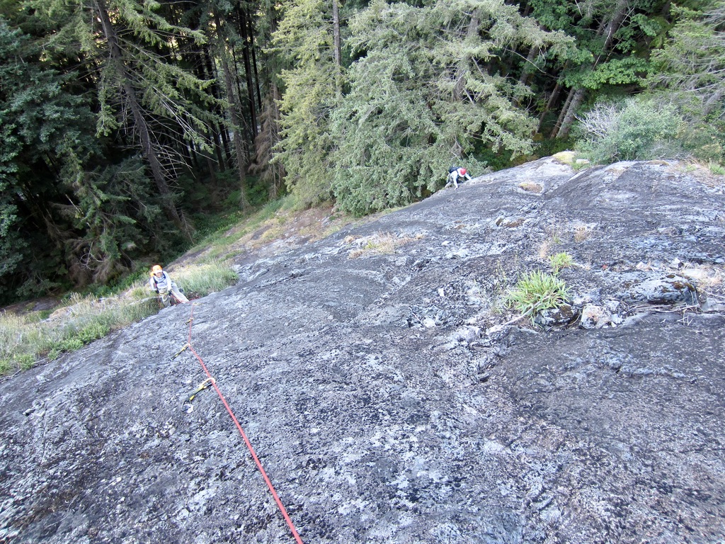
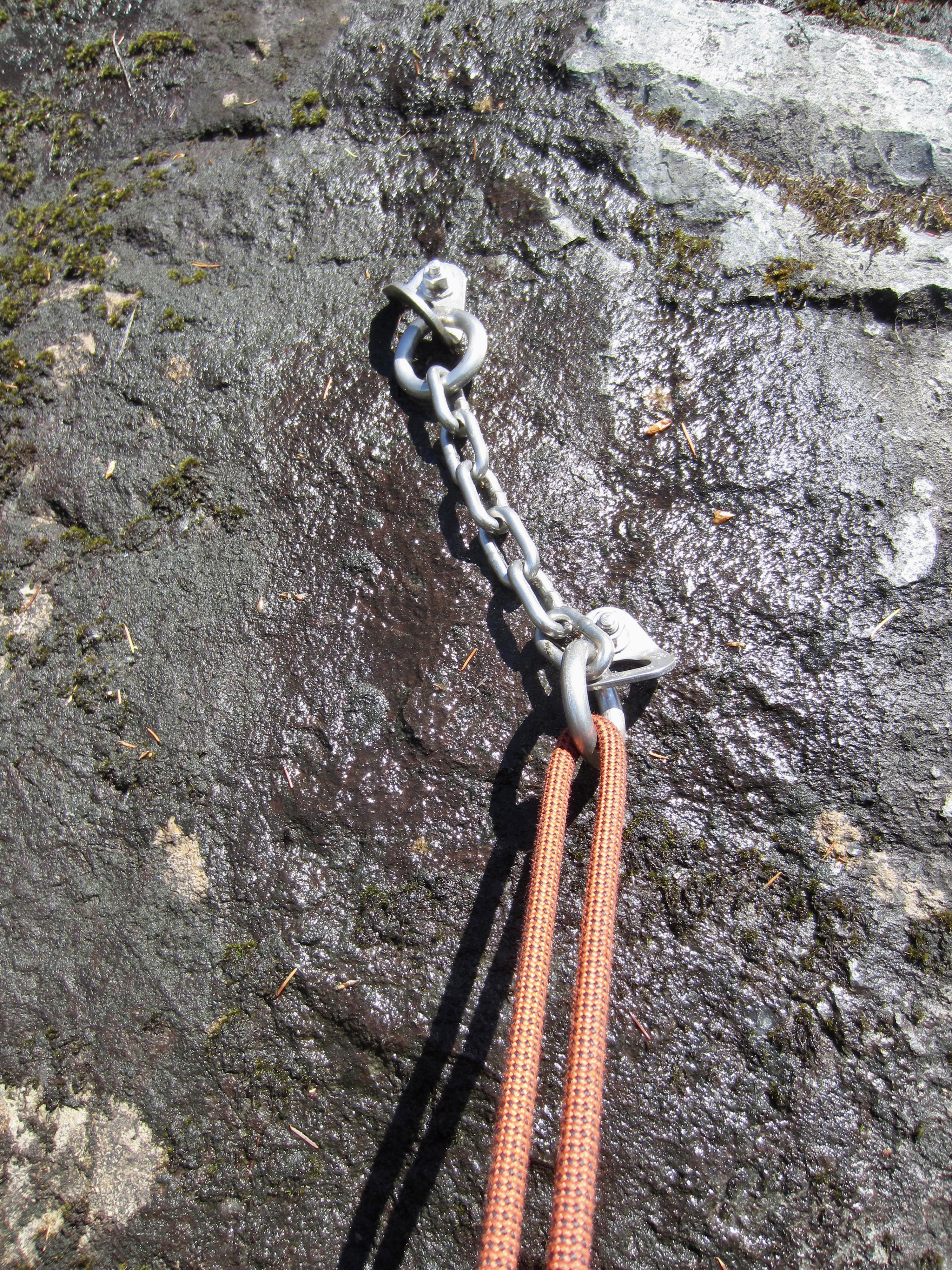
Pitch 5 of each route ends at a two-bolt belay/rappel anchor a few yards below the edge of the forest. From here, you get a nice view of the Middle Fork Valley stretching out to the southwest.
.
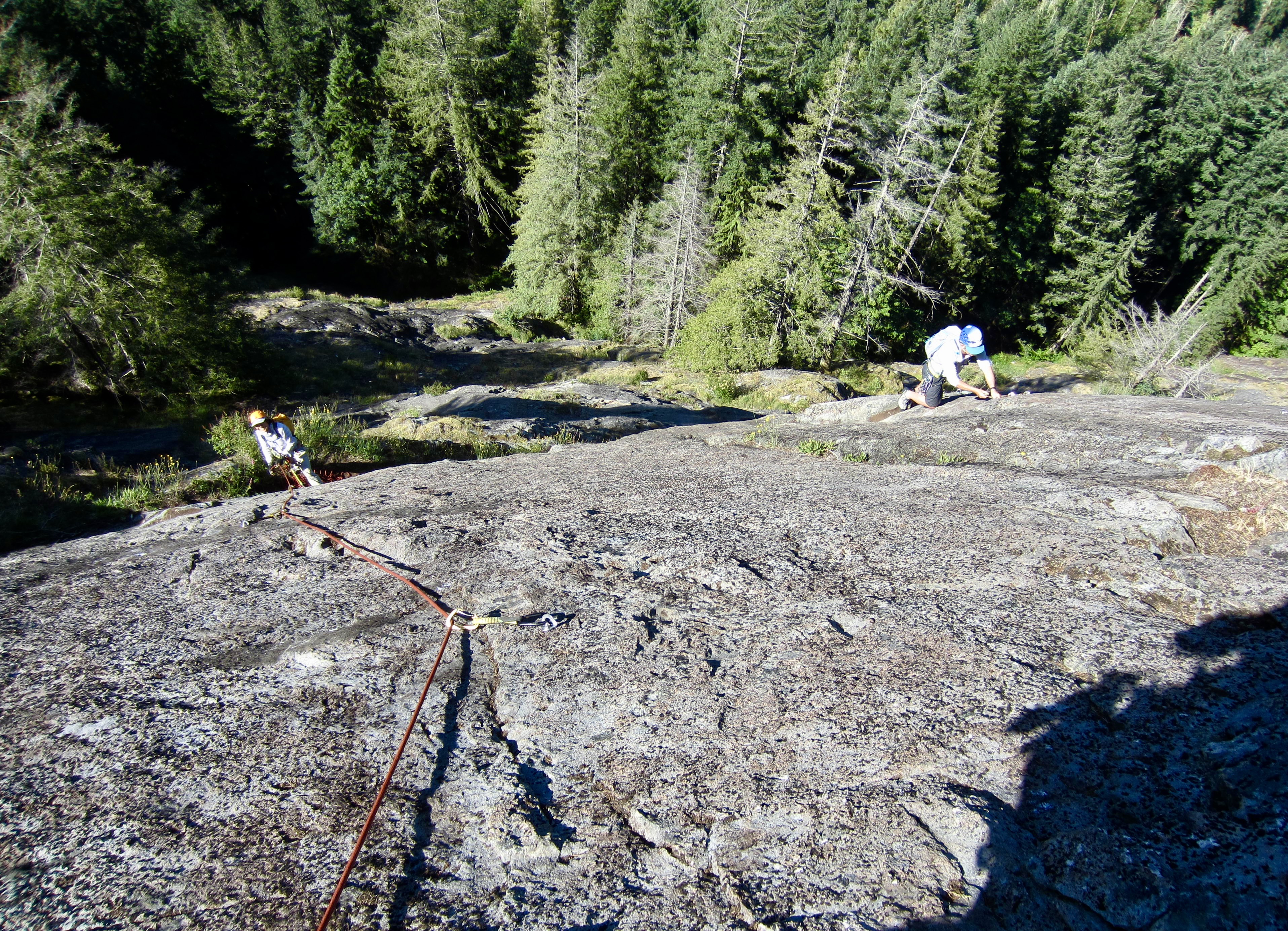
The first three pitches of Right Mid Wall involve relatively easy (5.3 to 5.4) slab climbing on nicely textured rock with a considerable amount of lichen. Obviously, the rock will become much cleaner with increased traffic. These pitches are well-protected with ample bolts and end on small dirt ledges with two-bolt belay anchors. Like the previously described routes, this feels much like an alpine climb.
.
.
Pitch 4 gets a bit steeper and starts in a shallow dihedral, then finishes on a face. It is rated at Class 5.6 on Mountain Project, but Class 5.5 seems more appropriate to me. This pitch ends at a very small ledge with a two-bolt anchor mounted inconveniently high on a face that stays wet through much of the season due to groundwater seepage.
.
Although Right Mid Wall is described as a five-pitch route, the fifth pitch is really just a poorly protected exit traverse up to the forest. If you plan to make a walk-off descent, this traverse will get you up to the exit path. If you plan to make a rappel descent back to the starting ledge, I recommend starting your rappels from the Pitch 4 anchor.
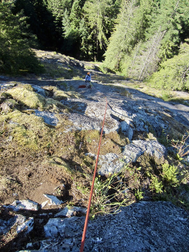
The Descent
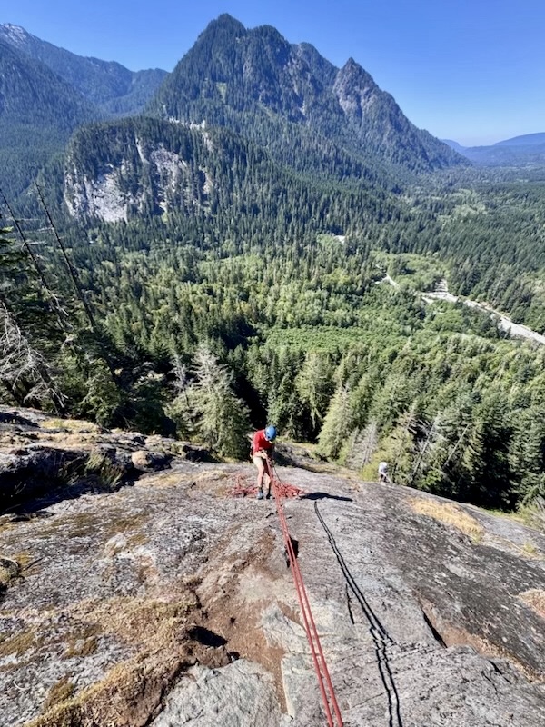
Upon topping out, climbers have two descent options: rappelling back down or walking off the top. Each option has pros and cons; both are reasonable but neither is ideal. On my first visit, Yoko and I elected to rappel down, while Blaine and Mike elected to walk off. Surprisingly, we all arrived back at the crag base at the same time. Here is what I’ve discovered on my three visits to Spouse Wall.
The Rappel Option: My first descent of Fusarium got off to a bad start because I mistakenly thought that Yoko and I could combine Pitches 5 and 4 into a single long rappel. Our 70-meter rope did not reach the Pitch 3 anchor on Fusarium, so we had to do a short down-climb to reach the Pitch 3 anchor on Aspergillus. From there, we made a long rappel down to the grassy slope, then walked over to the Pitch 2 anchor on Fusarium. Two more rappels got us down to the base ledge. Following a subsequent ascent of Aspergillus, my group made a series of five single-rope rappels with a 70-meter rope. My take-aways from these experiences are as follows:
- Don’t try rappelling down Fusarium or Aspergillus unless you have a 70-meter (or longer) rope.
- Don’t try to combine pitches; just do five pitch-by-pitch rappels.
.
in contrast, Right Mid Wall can be descending by means of four pitch-by-pitch rappels using a 60-meter rope. If you have a 70-meter rope, it is possible to combine the first two rappels, and combine the last two rappels.
.
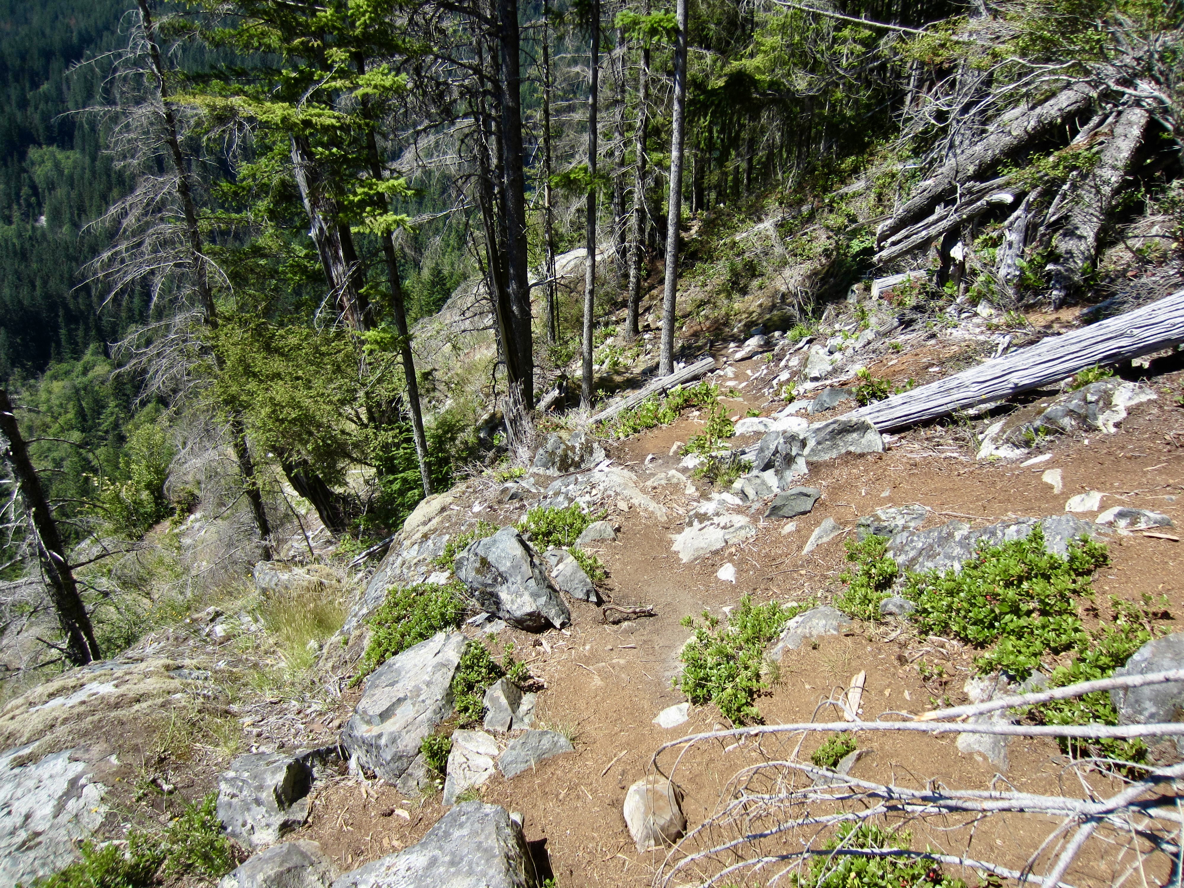
The Walk-Off Option: There are two different exit paths—a high path and a low path. Here is a summary of the walk-off routes:
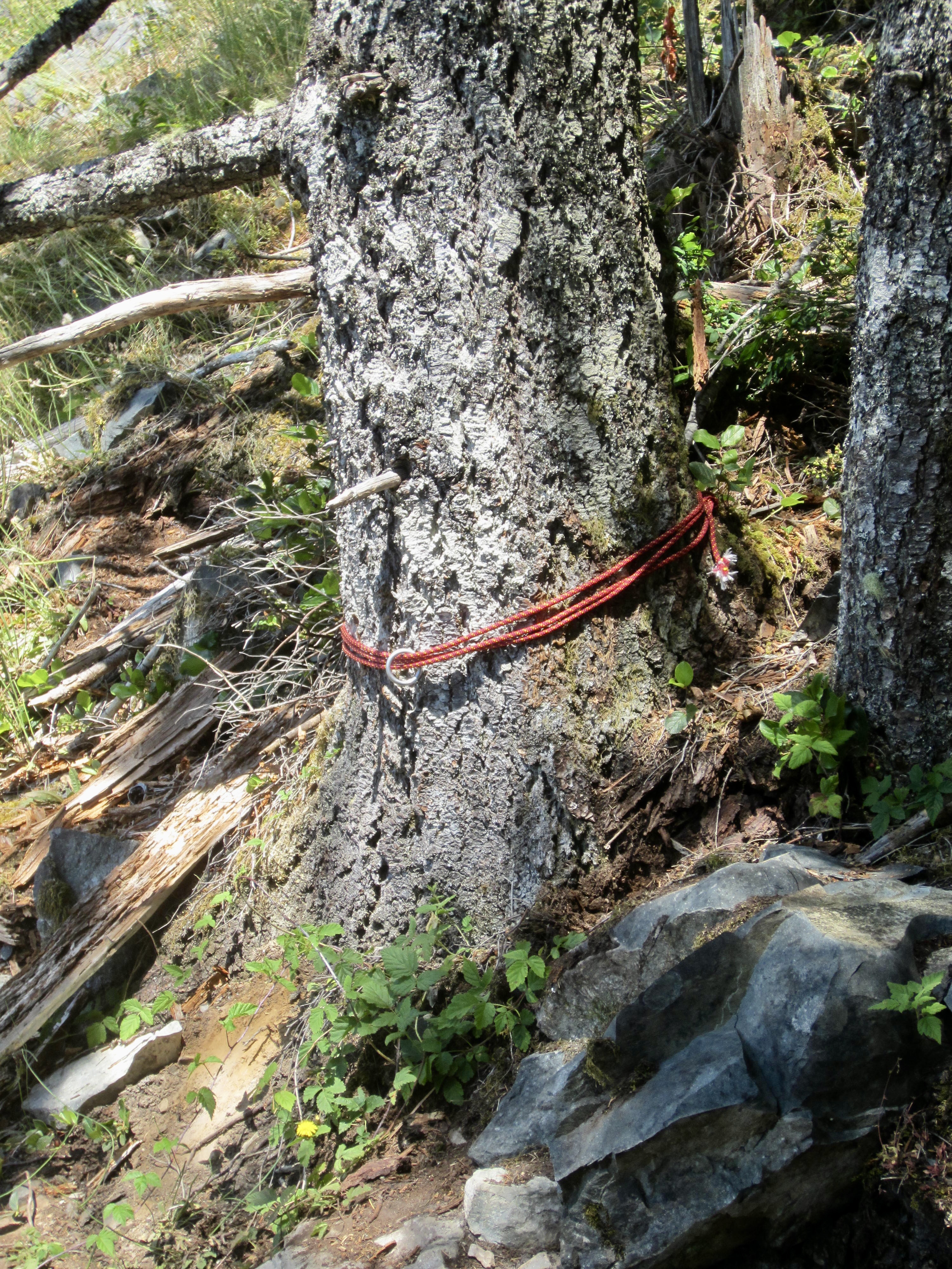
- After topping out on either route, look for a cordelette anchor tied around a large tree. The exit path begins here.
- Head upward to the left through the sparse forest. The path is vague but continuous, so keep a sharp eye.
- After a few dozen yards, you will come to an indistinct junction. From here, the right fork heads uphill, and the left fork heads downhill.
- The right fork angles steeply uphill for about 50 vertical feet, crosses over a hump, and then descends steeply for 200 feet to Garfield Ledge Viewpoint.
- The left fork makes a slightly descending traverse across the top of the cliff and arrives at Garfield Ledge Viewpoint in about 100 yards. There are a couple short Class 3 down-climbs along the way.
- After arriving at Garfield Ledge Viewpoint, hike 0.3 miles down the main trail to reach the previously described junction with the approach path.
.

.

.
Route Maps & Profile
…
…
…
Photo Gallery
Click to enlarge…