Trip Date: June 12, 2021
Mt. Ruth Day Climb & Glacier Basin Loop: Inter Fork to Emmons Glacier Moraine
Glacier Basin
Mount Ruth (8690′)
Emmons Glacier Moraine
Trip Report Summary
Region: Southern Washington Cascades
Sub-Region: Mt. Rainier Massif
Area: Mt. Rainier National Park
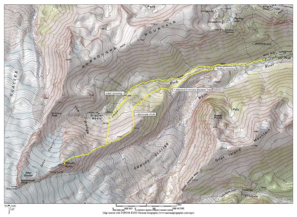
Starting & Ending Point: Glacier Basin Trailhead at White River Campground (Elev. 4350 feet)
Way Points: Emmons Moraine Trail junction & Inter Fork of White River crossing & Glacier Basin & Ruth Ridge & Mt. Ruth summit & Point 6735 & Point 6723 & Emmons Moraine Trail & Inter Fork footlog & Glacier Basin Trail junction (trail hike & snow hike & snow climb & off-trail hike)
Summit: Mt. Ruth (ascent & descent via East Ridge)
Approximate Stats: 7.5 miles traveled; 4500 feet gained & lost; 5.6 hours up; 3.3 hours down.
Full Trip Report
Eileen and I saw a little opening in the weather on Saturday, so we headed down to Mt. Rainier National Park for a climb of Mt. Ruth. Although this is a small peak with very little prominence, it occupies a marvelous position on the northeastern flank of Mt. Rainier. Moreover, it offers an excellent early-season snow climb.
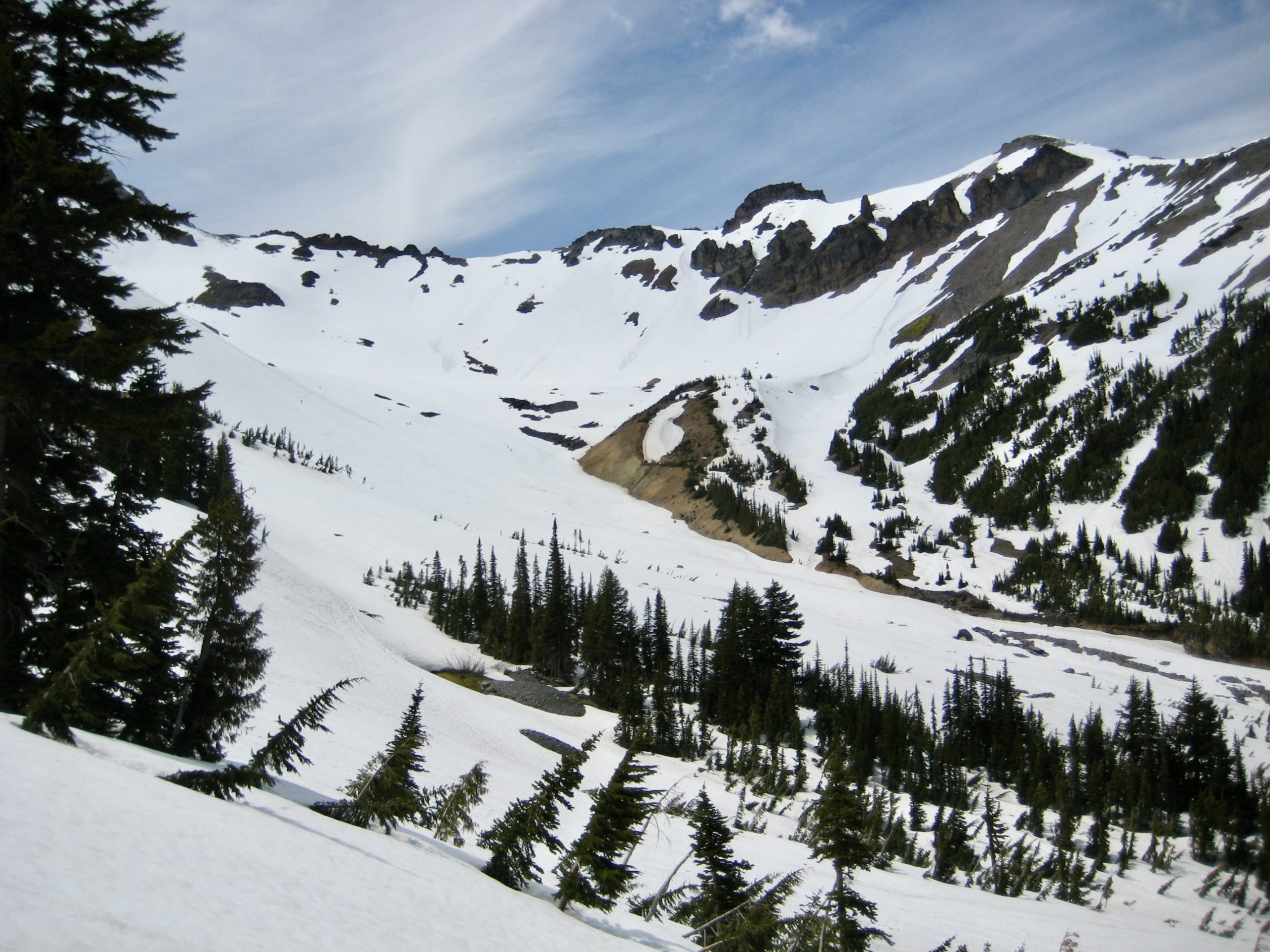
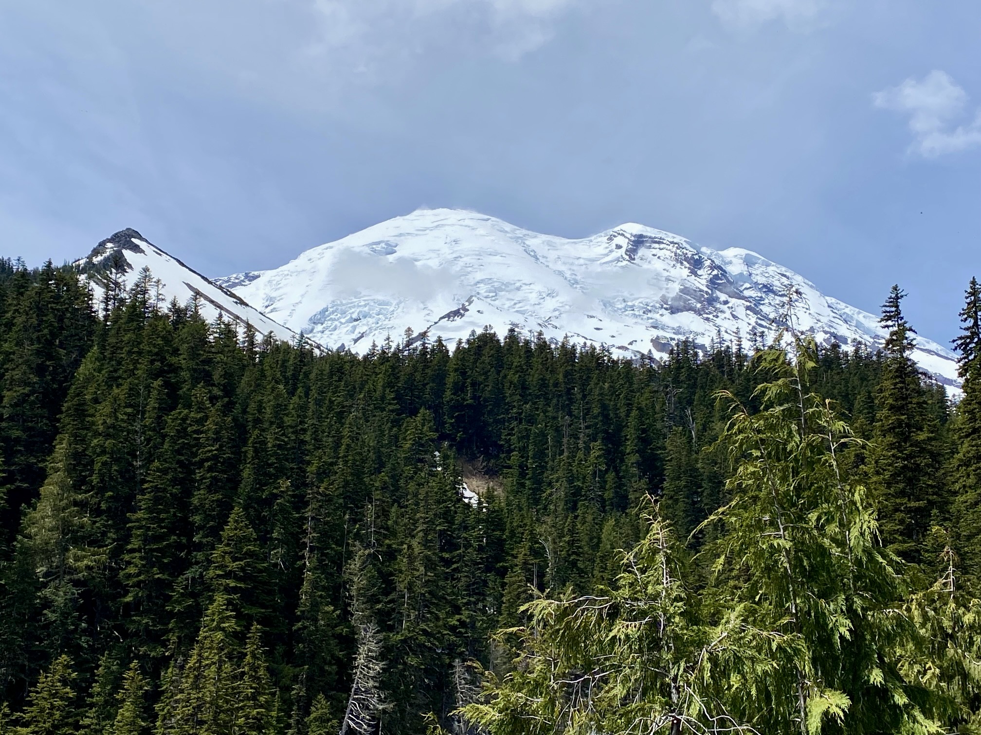
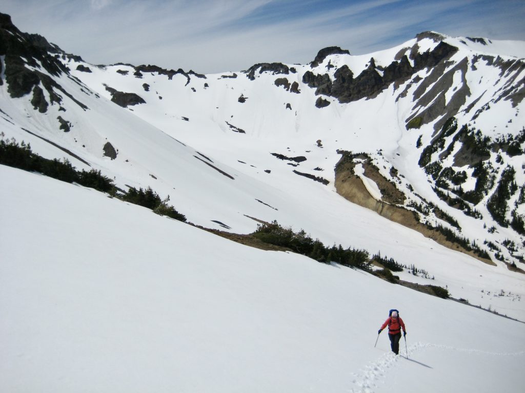
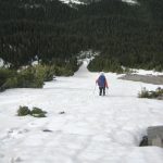
We left White River Campground in mid-morning under mostly clear skies and started hiking up the Glacier Basin Trail. Occasional views of Mt. Rainier’s white dome lured us onward with the promise of a sunny summit. Patchy snow appeared on the trail after about 1½ miles, and after another mile, we made a rock-hop crossing of the Inter Fork from one snowy shore to the other. Before long, we entered the beautiful expanse of Glacier Basin (2.0 hours from TH).
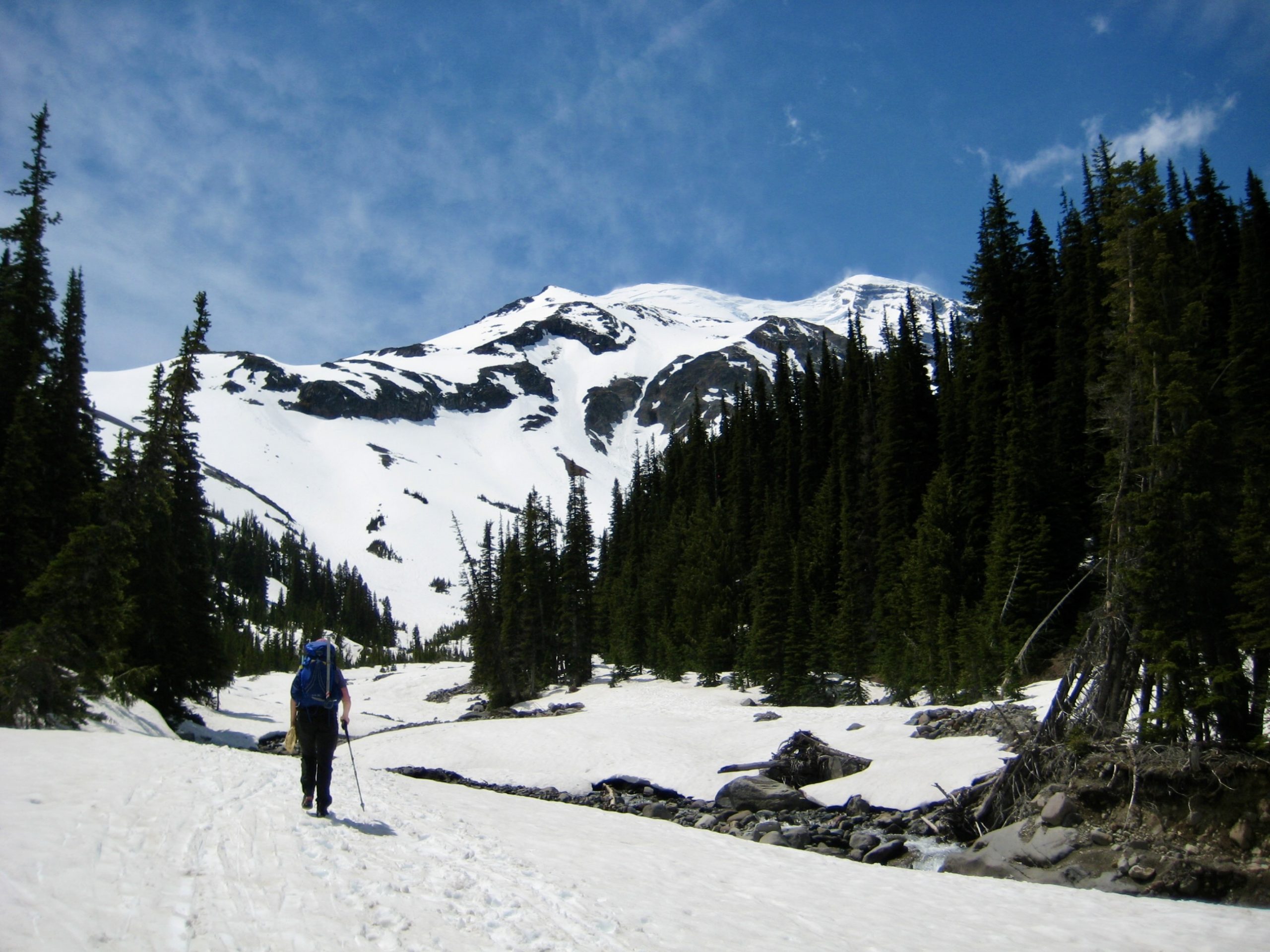
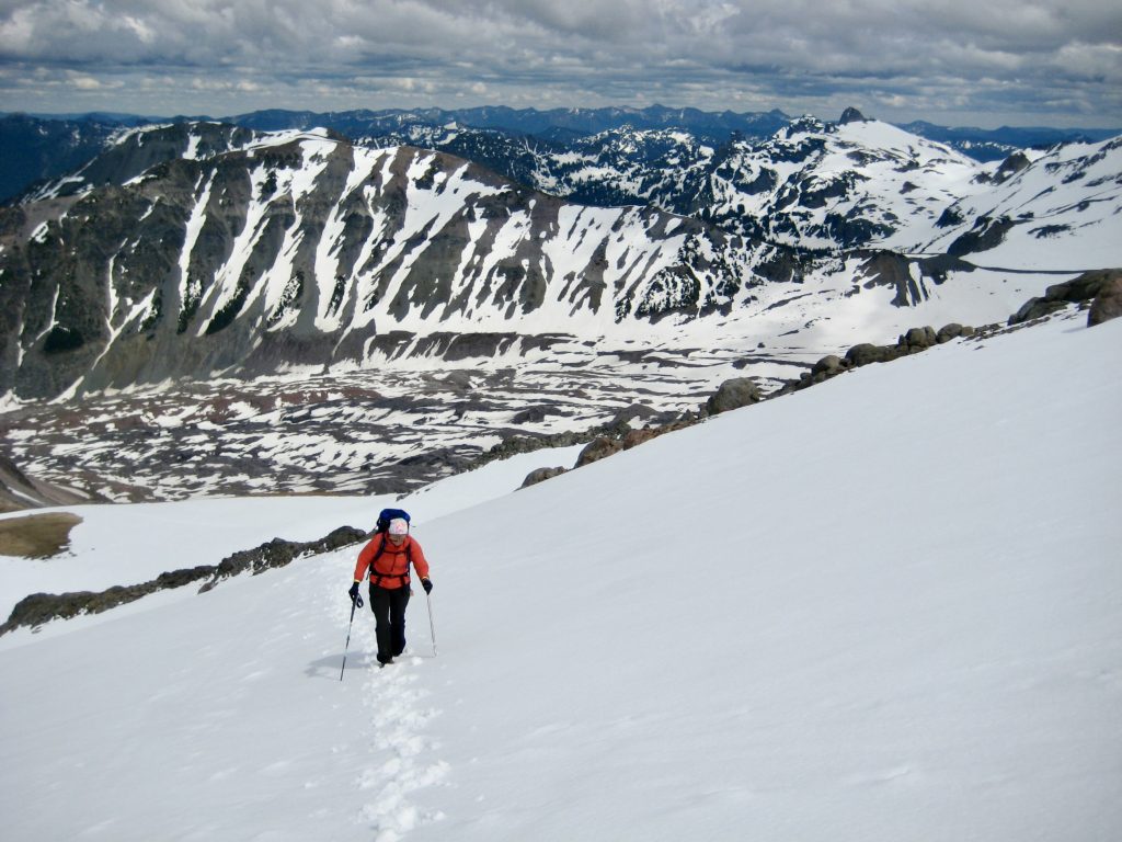
From Glacier Basin, we veered to the left and booted up moderate snow slopes toward the southern arm of The Wedge—one of Rainier’s many intriguing geomorphic features. Several inches of fresh snow covered the older crust and exhibited a propensity for sliding off. This was confirmed by the numerous loose-snow avalanches visible above Glacier Basin.

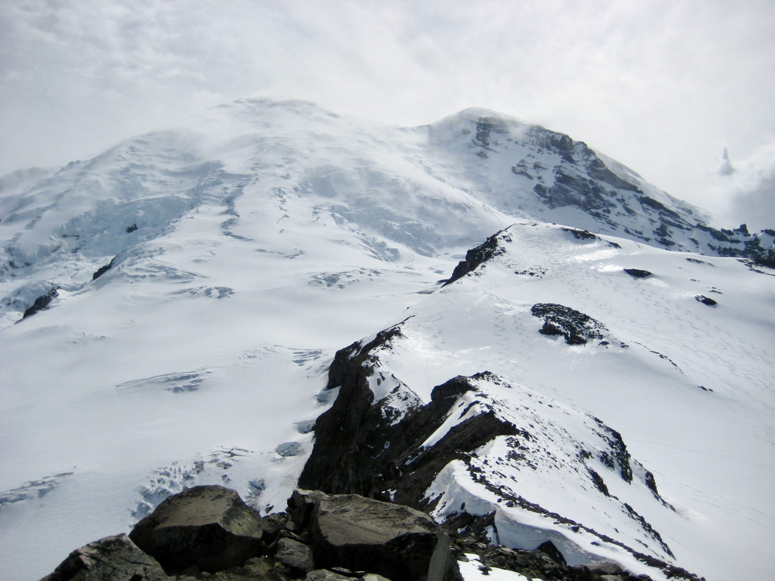
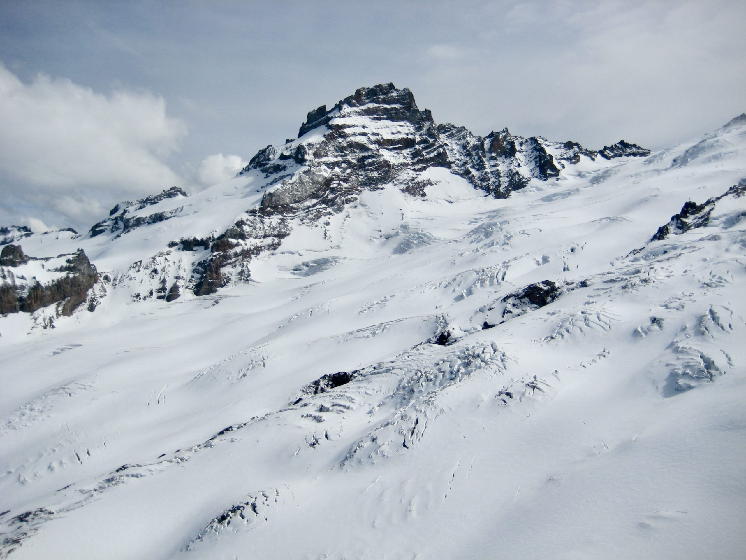
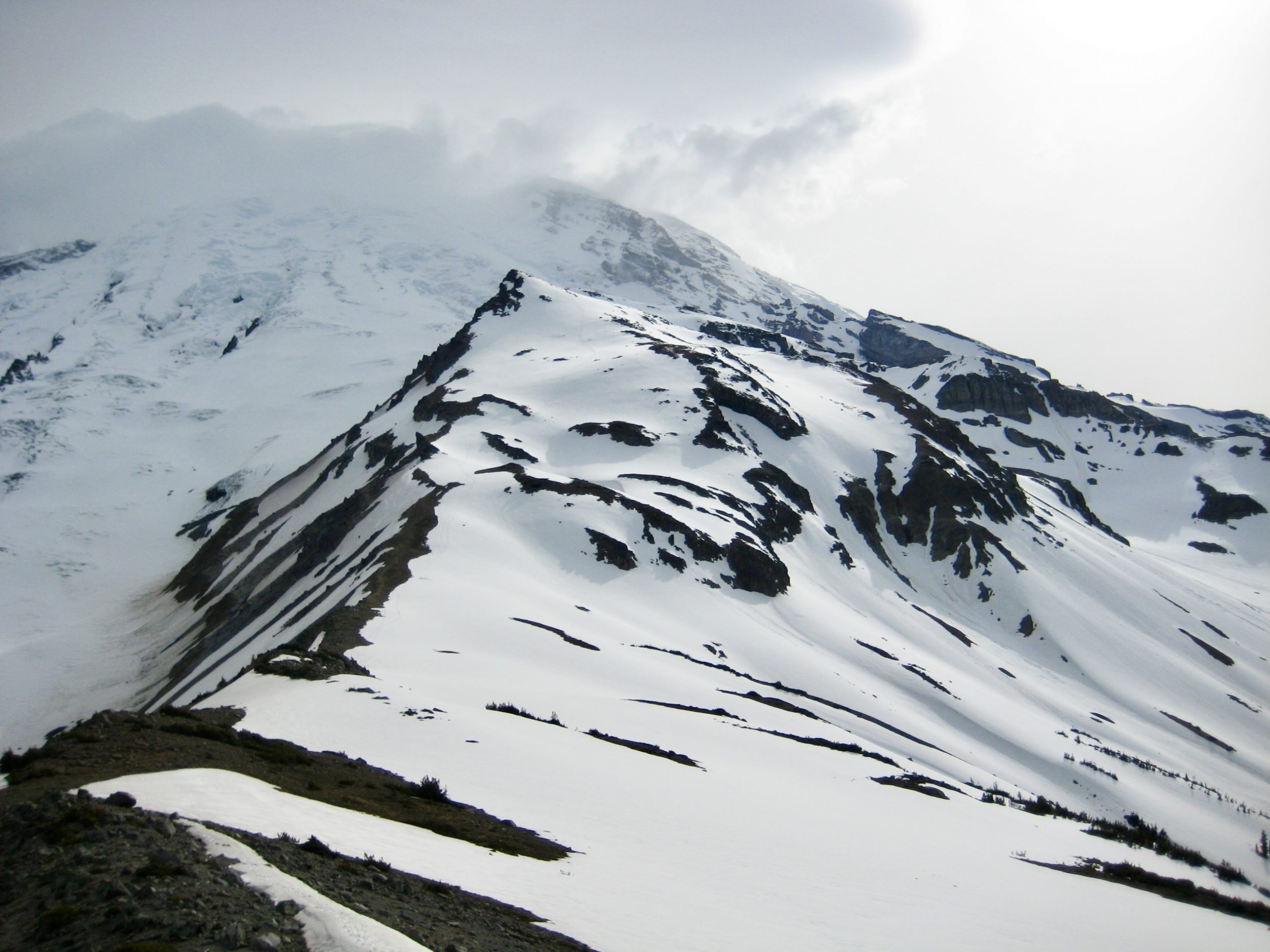
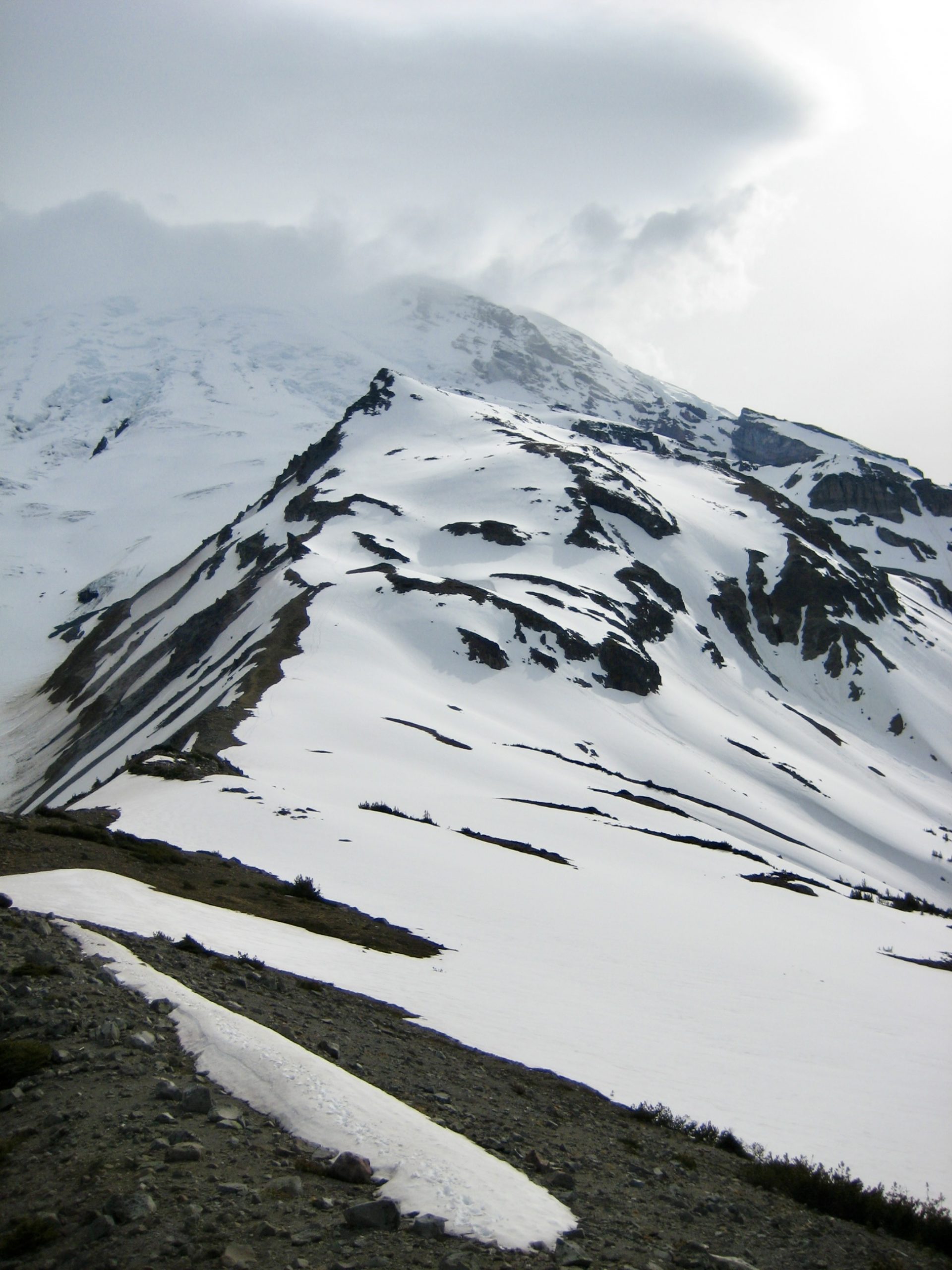
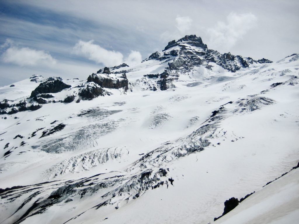
Upon reaching the ridge crest, we were struck by an amazing view of Little Tahoma Peak and the Emmons Glacier straight ahead. A huge ablation plain stretched out below the glacier, as a visible reminder of its healthier youth.
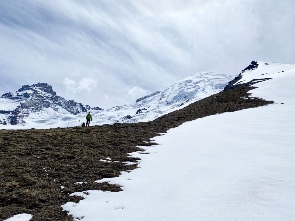
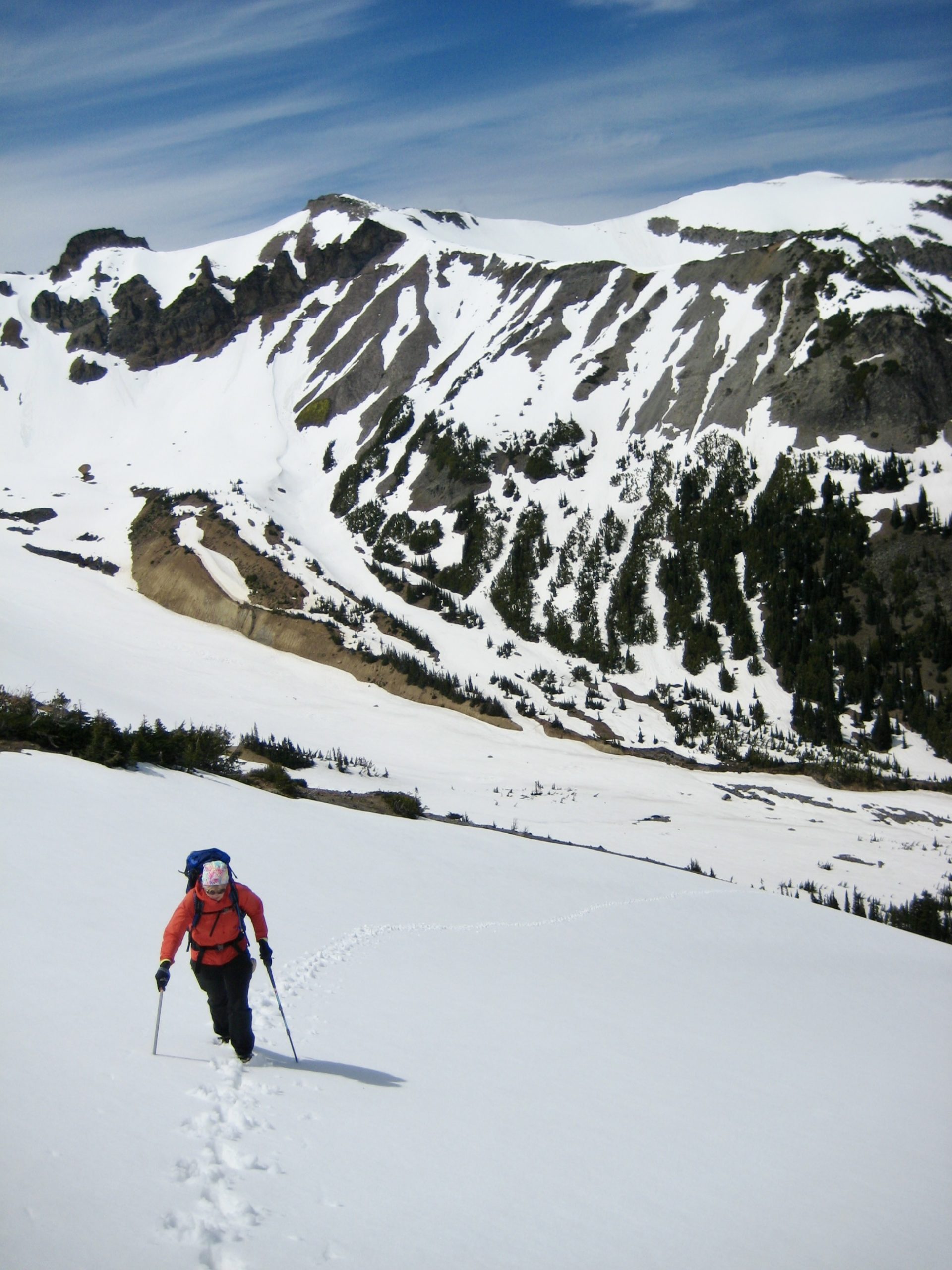
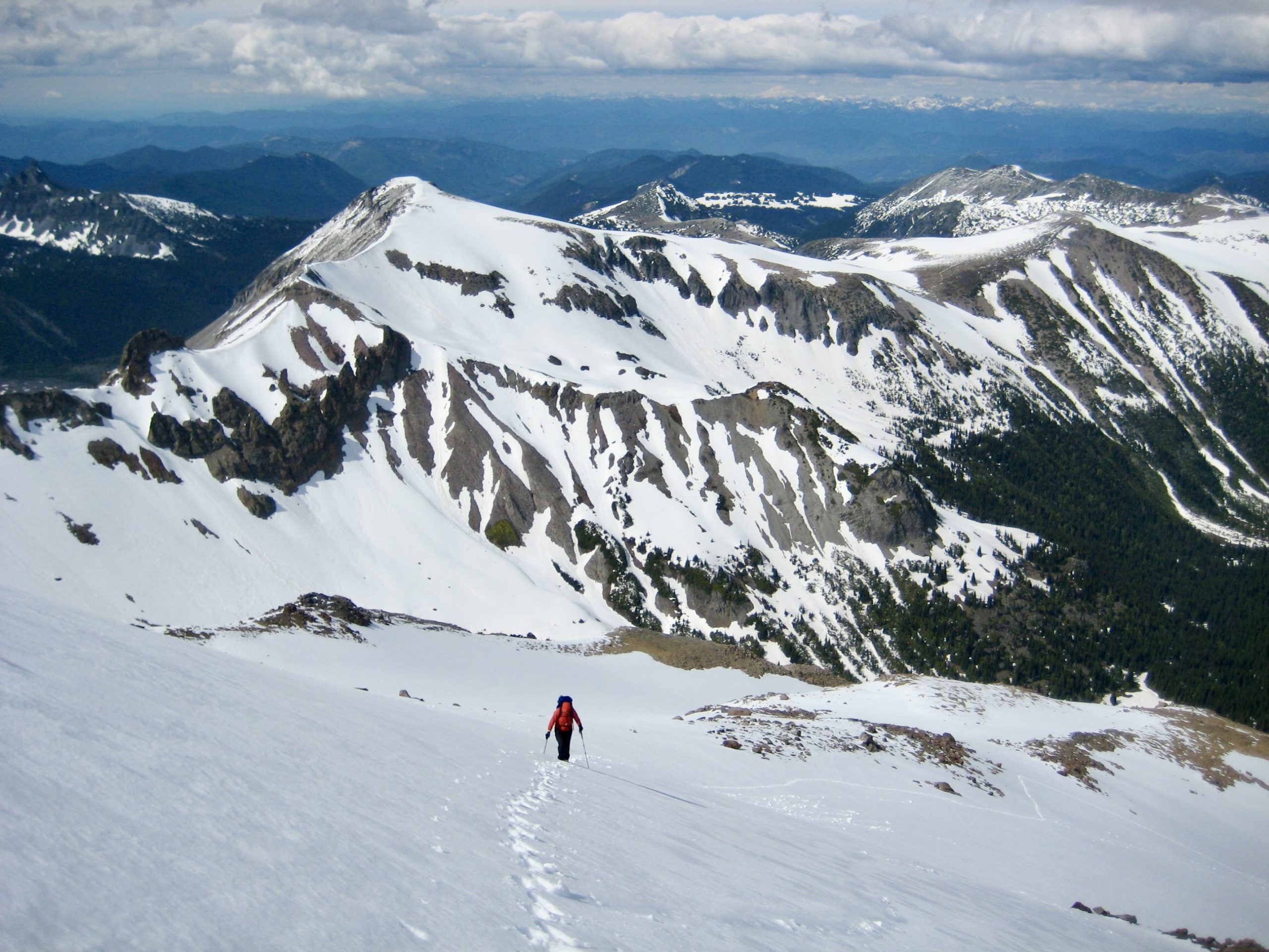
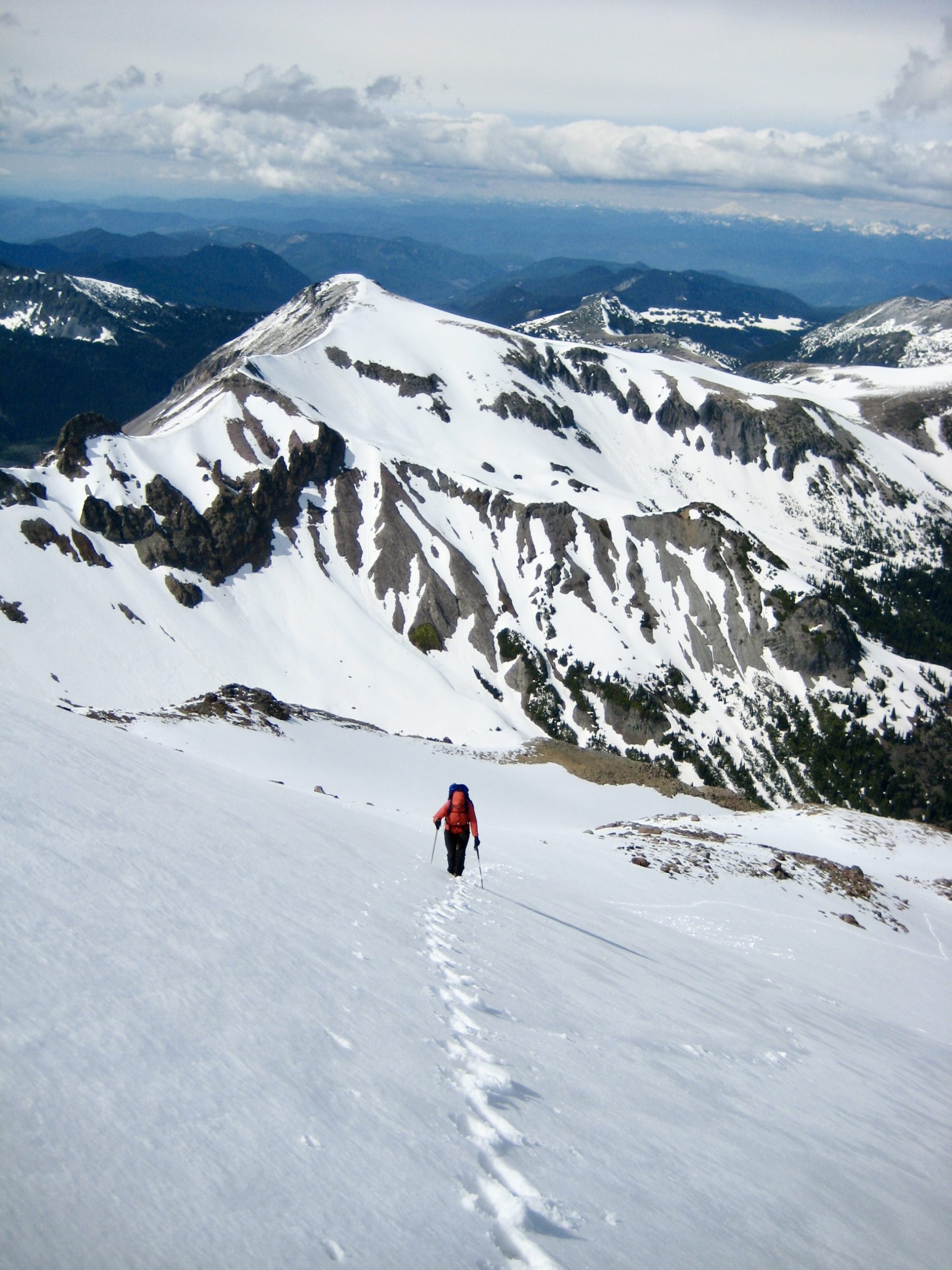
The glistening summit of Mt. Ruth could now be seen to our right, standing at the end of a broad, white ridge. We started climbing up the ridge on a variety of snow surfaces, ranging from firm to mushy. Although the summit initially looked pretty close, the ridge seemed to go forever; as with most things on Rainier, distances are quite deceptive.
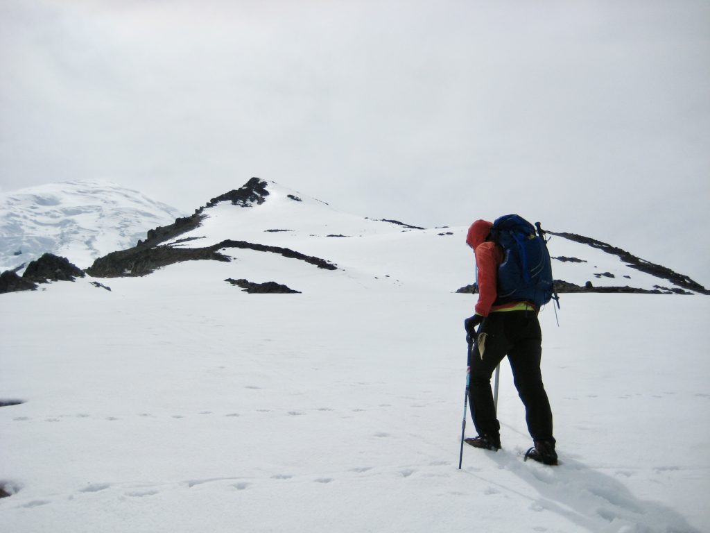
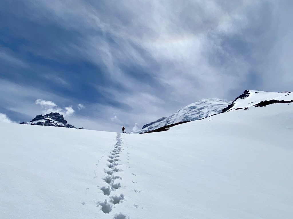

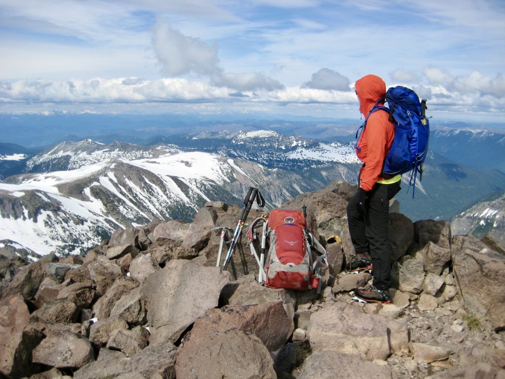
We gained the summit in late afternoon (5.6 hours + 4400 feet from TH) and marveled at our surroundings. For such a modest peak with a relatively straightforward and safe ascent route, Mt. Ruth truly feels like a much more substantial climbing objective. The prevalence of ski tracks on the adjacent Inter Glacier attested to its own popularity as a backcountry ski objective.
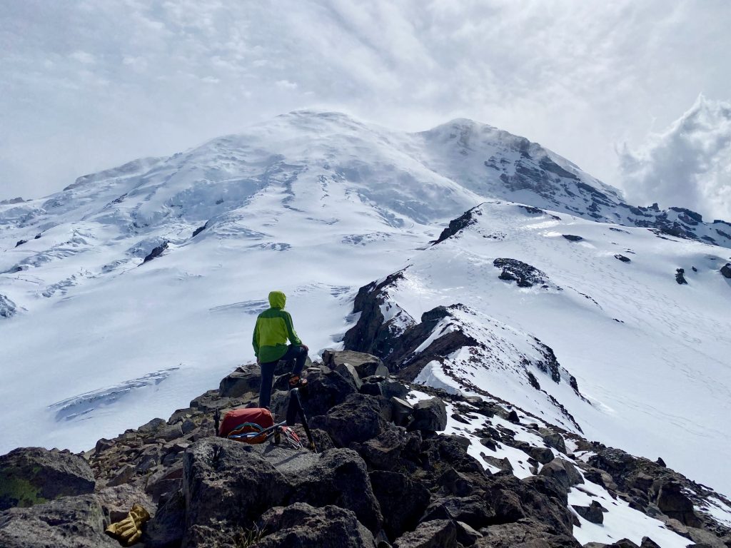
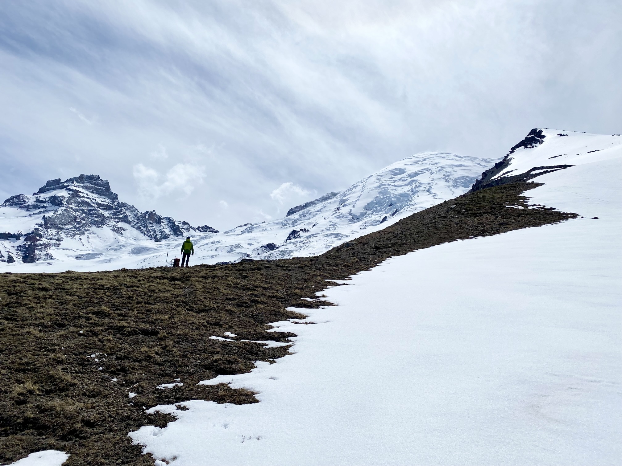
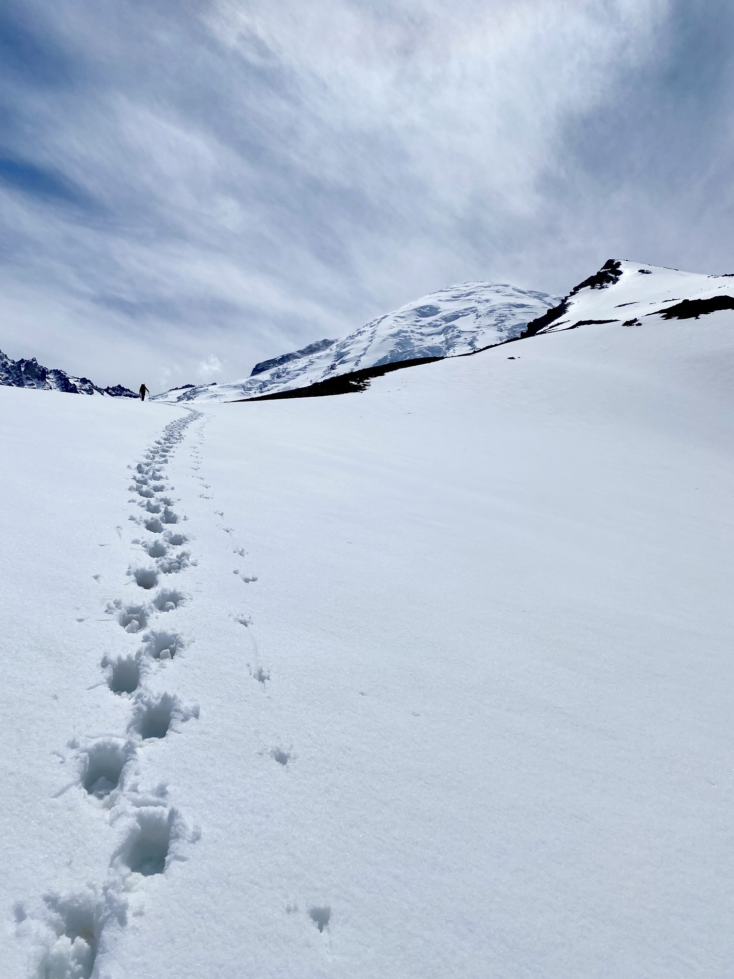
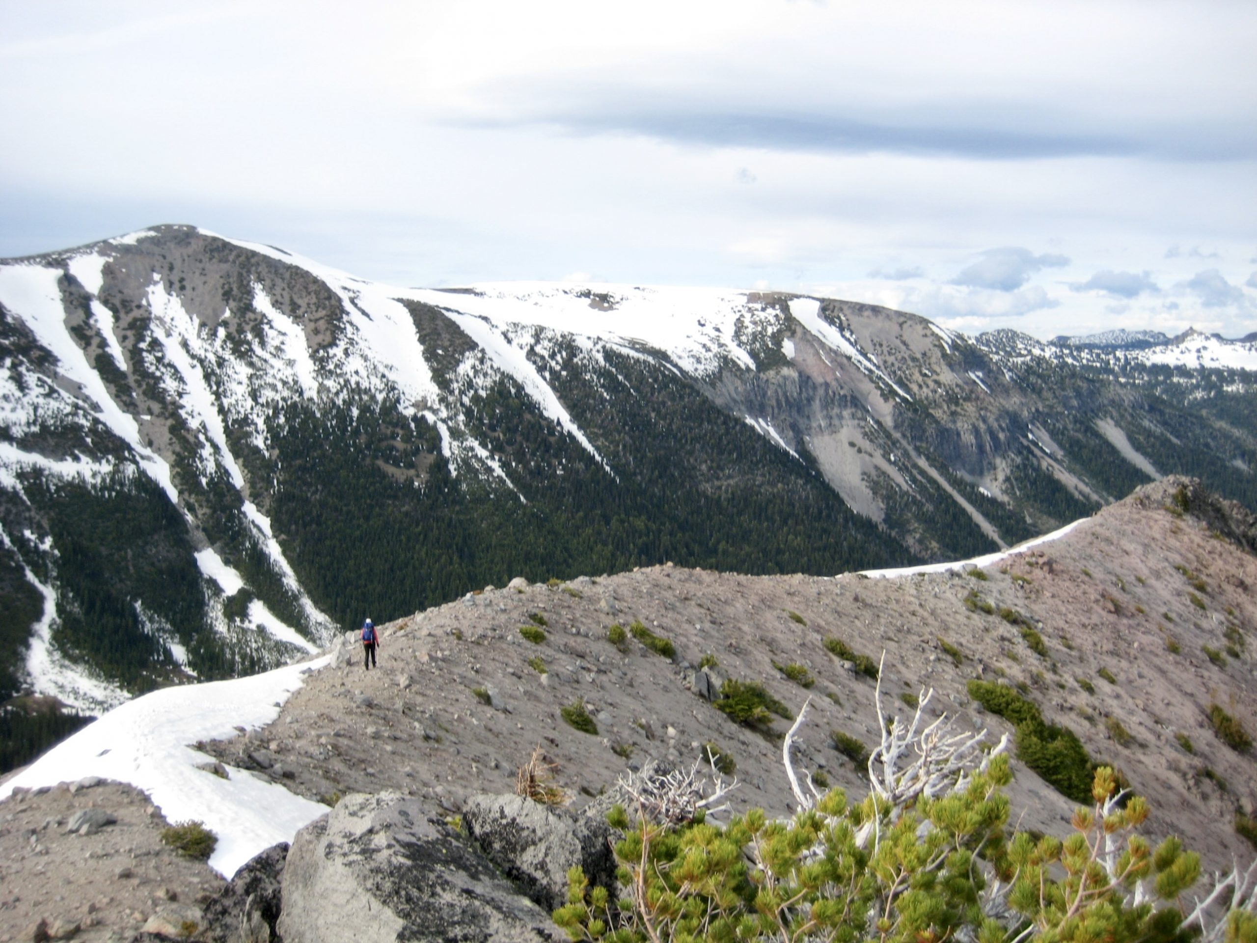
To descend, we retraced our up-route back down the ridge crest, but rather than following our tracks directly down to Glacier Basin, we continued farther along the crest, past Point 6735 and Point 6723. We were hoping that it would be feasible to descend the nose of this ridge in order to intersect the Emmons Moraine Trail at 5200 feet.

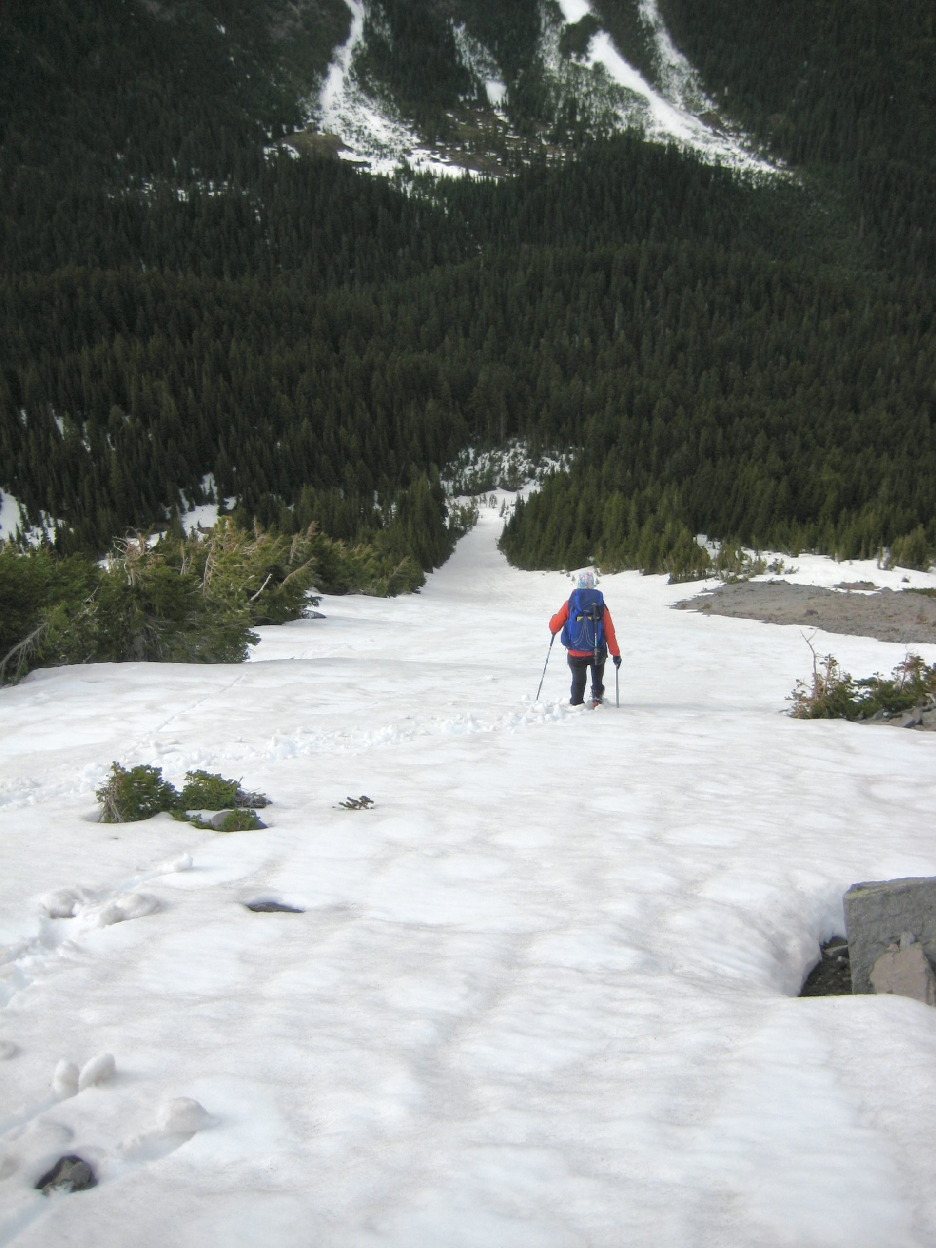
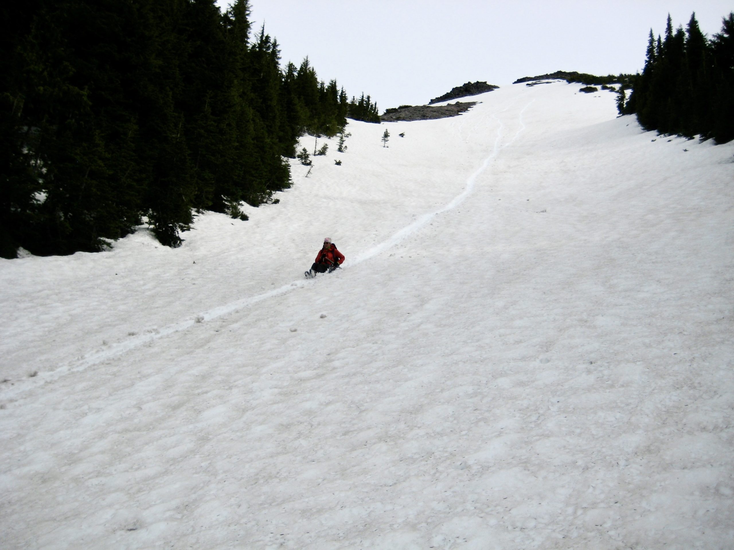
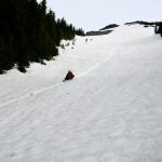
We reached the end of the ridge and took one look down the northeast-plunging nose. Nope; it was steep, bouldery, and totally unappealing as a descent route. However, what we did find was a remarkably long, straight snow chute heading down to the north. We booted down a short distance to clear some exposed rocks, then jumped in and enjoyed a 900-foot glissade into the valley. Woo-hoo!
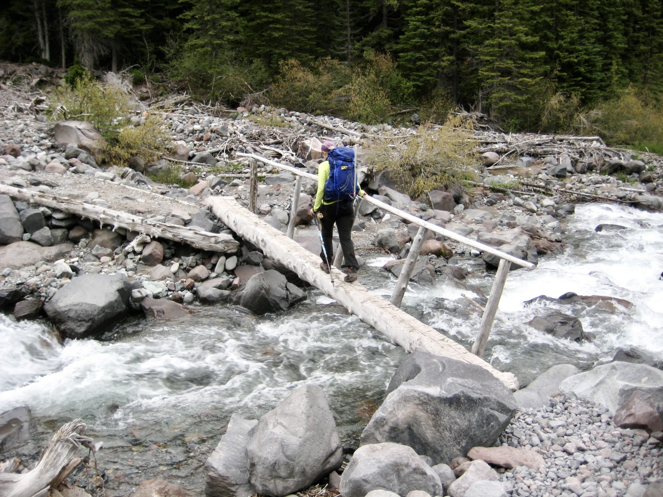
At the bottom of our glissade, we made an easterly trudge through forest and meadow until intersecting the Emmons Moraine Trail near its terminus. We followed this trail along the moraine and across the Inter Fork on a footlog, then finished our very satisfying day with a 1-mile hike back to the Glacier Basin Trailhead (3.3 hours + 100 feet from summit)

…
Route Map
…
Photo Gallery
Click to enlarge…