Trip Date: June 23-28, 2021
Mt. Whitney Climbing Trip & KJC Traverse: Kearsarge Pass to Junction Pass to Cottonwood Pass
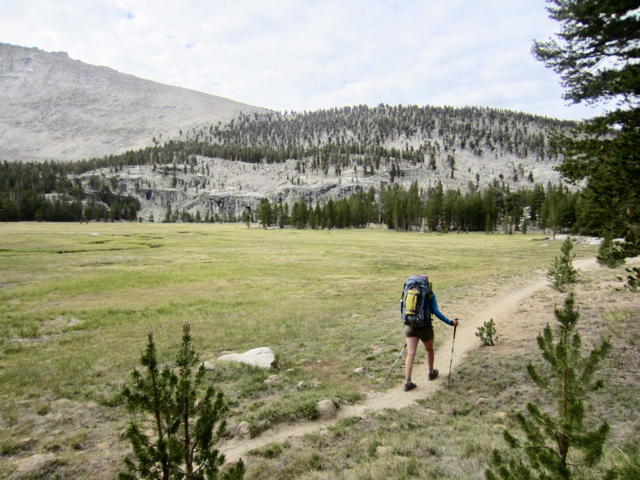
Kearsarge Pass
Bullfrog Lake
Center Basin / Golden Bear Lake
Junction Pass
Shepherd Pass
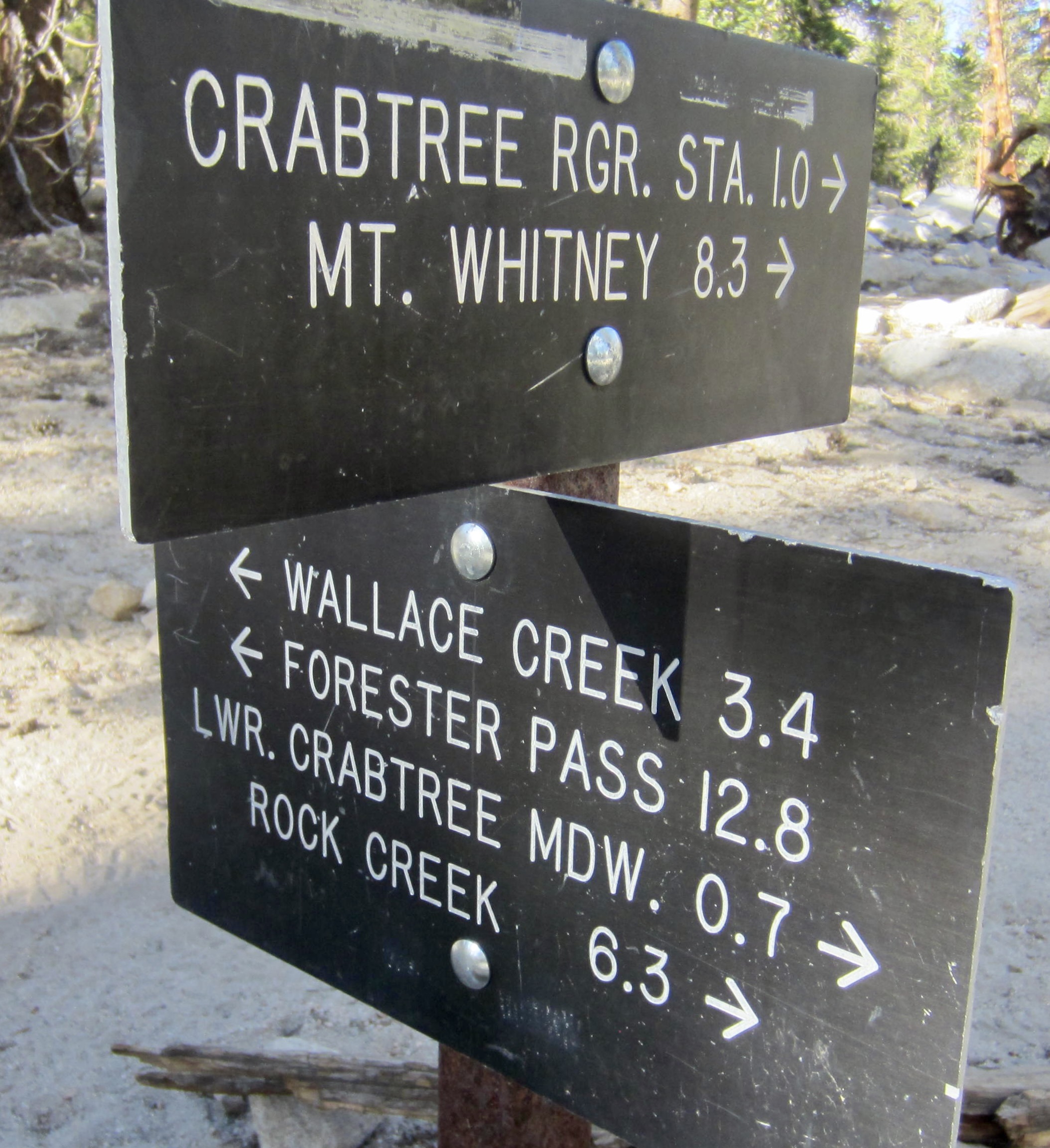
Crabtree Meadows
Mount Whitney (14,505 ft)
Guyot Pass
Siberian Outpost
Chicken Spring Lake
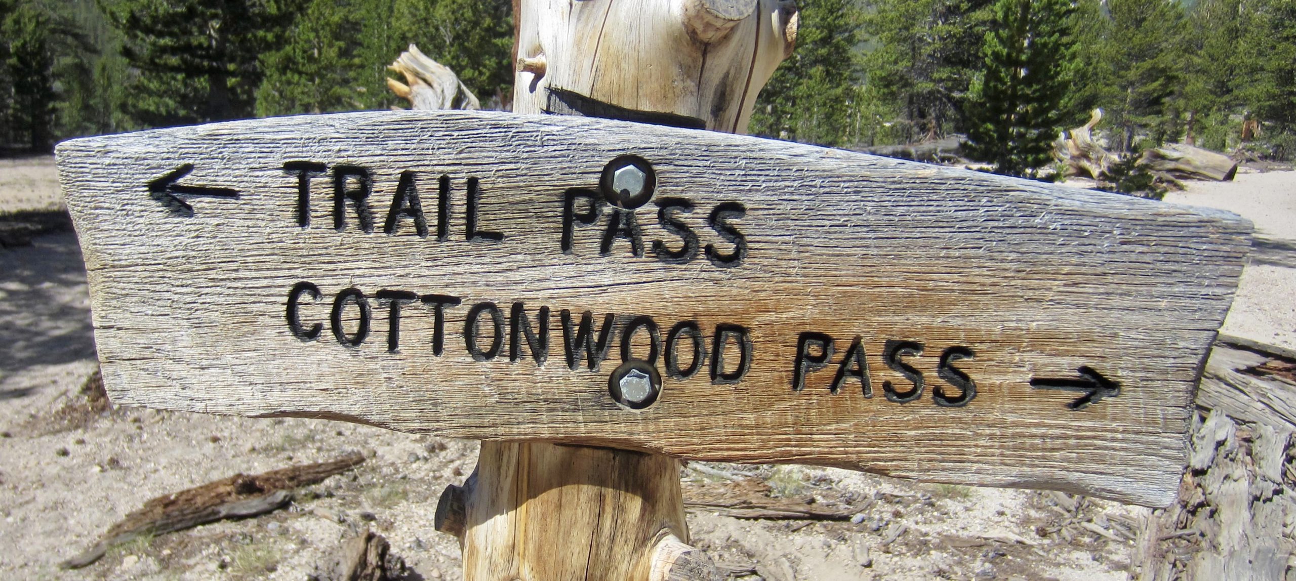
Cottonwood Pass
- Trip Report Summary
- Trip Overview
- Full Trip Report
- Day 1: Onion Valley Trailhead to Lower Bubbs Creek Camp
- Day 2: Lower Bubbs Creek Camp to Upper Shepherd Meadow
- Day 3: Upper Shepherd Meadow to Upper Whitney Creek Meadow
- Day 4: Mt. Whitney Summit Climb
- Day 5: Upper Whitney Creek Meadow to Chicken Spring Lake
- Day 6: Chicken Spring Lake to Horseshoe Meadow Trailhead
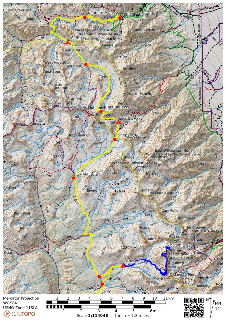
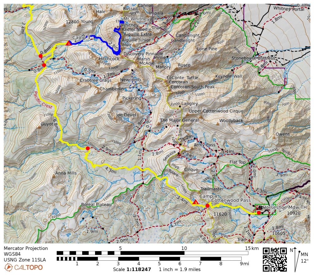
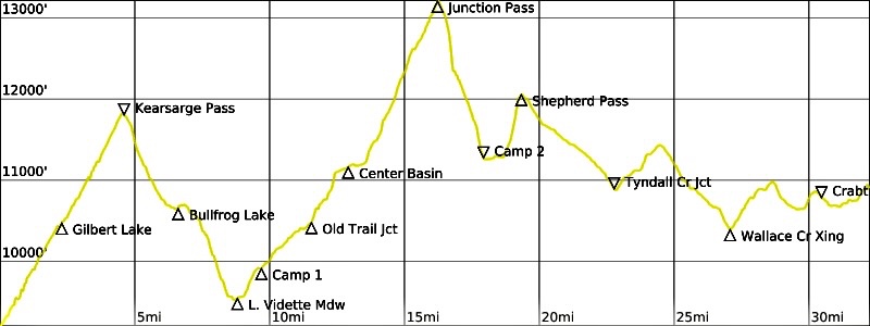
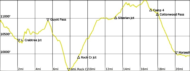
- Route Maps & Profiles
- Photo Gallery
Trip Report Summary
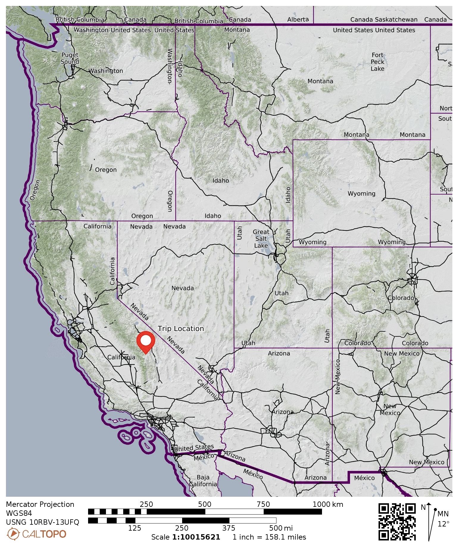
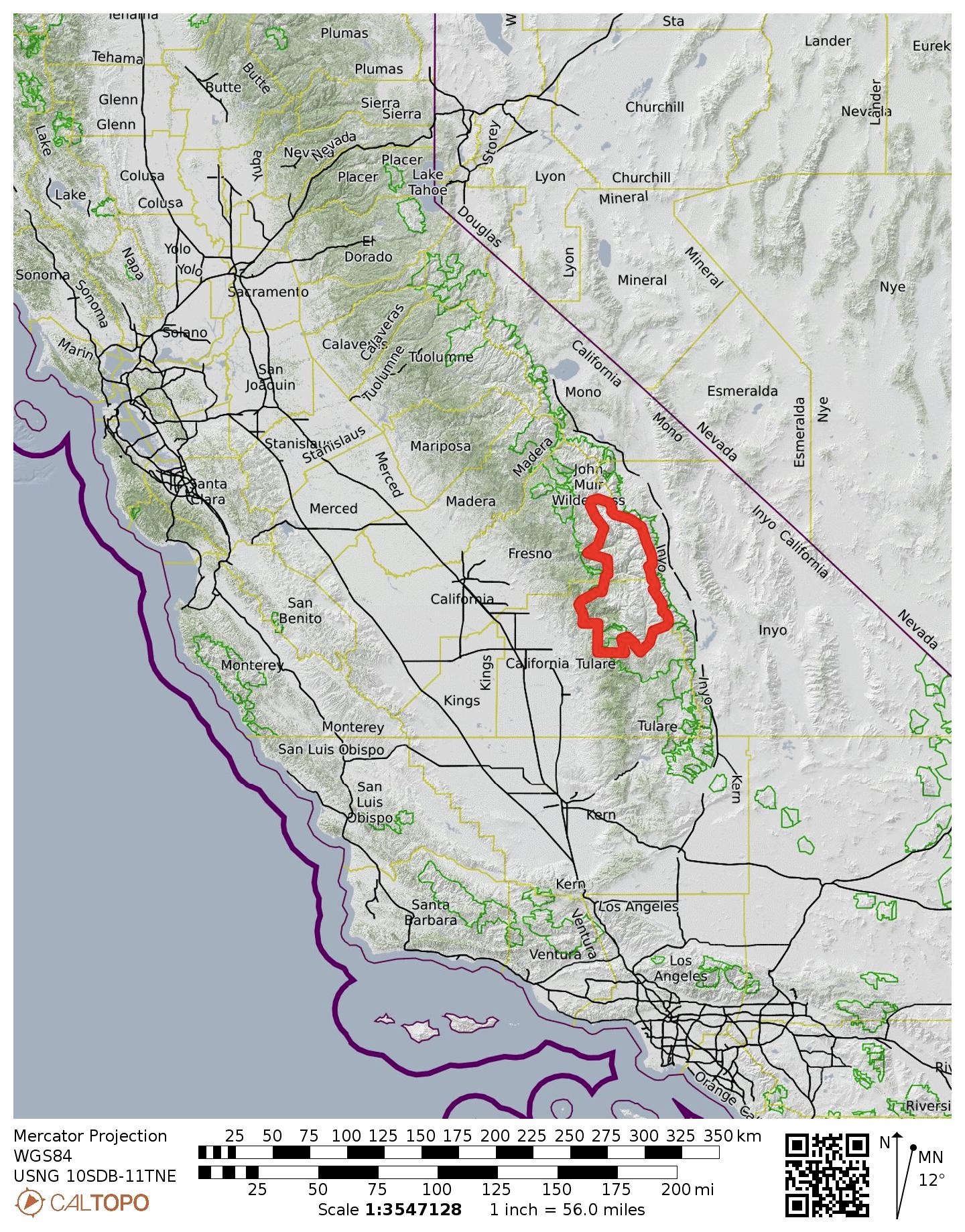
Region: Sierra Nevada Range (California)
Sub-Region: Whitney Crest
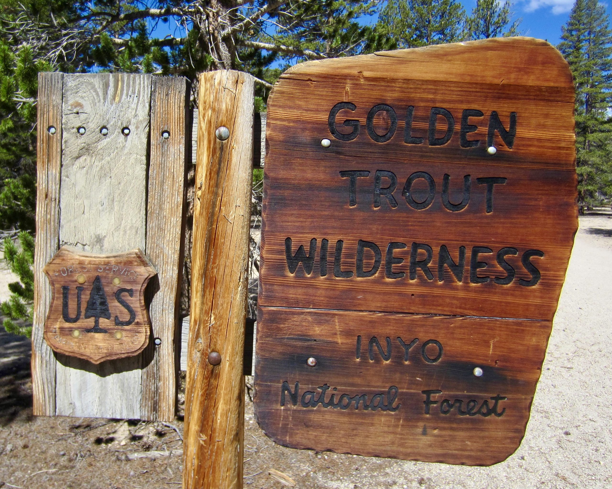
Areas: John Muir Wilderness & Kings Canyon National Park & Sequoia National Park & Golden Trout Wilderness
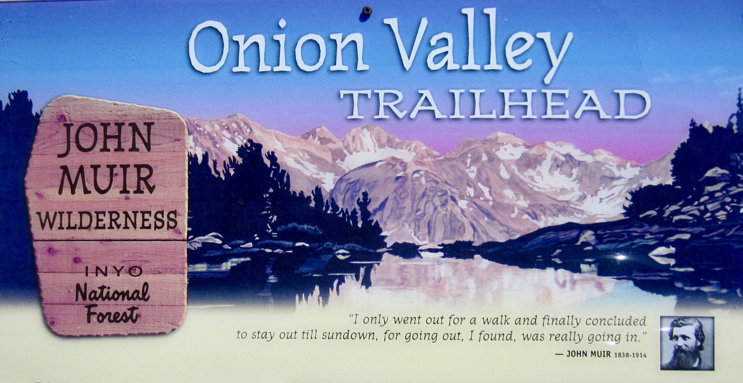
Starting Point: Onion Valley / Kearsarge Pass Trailhead at end of Onion Valley Road (Elev. 9200 feet)
Waypoints: Gilbert Lake & Kearsarge Pass & Bullfrog Lake & PCT/JMT junction & Lower Vidette Meadow & Upper Vidette Meadow & Bubbs Creek & Junction Pass Trail junction & Center Basin & Golden Bear Lake & Junction Pass & Upper Shepherd Meadow & Shepherd Pass & Tyndall Creek Meadows & Tyndall Creek (PCT/JMT) Junction & Wright Creek crossing & Wallace Creek crossing & Upper Crabtree Junction & Upper Whitney Creek Meadow & Upper Crabtree Meadow & Lower Crabtree Meadow & Lower Crabtree (PCT) Junction & Guyot Flat & Guyot Pass & Guyot Creek crossing & Rock Creek crossing Siberian Outpost & Chicken Spring Lake & Cottonwood Pass & Horseshoe Meadow (trail hike & off-trail hike & rock scramble)
High Point: Junction Pass (Elev. 13,200 feet)
Ending Point: Horseshoe Meadow / Cottonwood Pass Trailhead at end of Horseshoe Meadows Road (Elev. 9950 feet)
Campsites: Lower Bubbs Creek Camp & Upper Shepherd Meadow & Upper Whitney Creek Meadow & Chicken Spring Lake
Sidetrip Waypoints: Timberline Lake & Guitar Lake & High Junction & Mt. Whitney summit (trail hike)
Summit: Mt. Whitney (trail hike via South Ridge—West Shoulder)
Approximate Stats (excluding summit sidetrip): 54 miles traveled; 13,300 feet gained; 12,550 feet lost.
Approximate Stats (including summit sidetrip): 67 miles traveled; 17,700 feet gained; 16,950 feet lost.
…
Trip Overview
Near the end of a hot, dry June, Eileen and I teamed up with our friend George for a backpacking trip in the southern Sierras of California. Our primary goal was to climb Mt. Whitney, the highest summit within the conterminous United States, but we also wanted to do it as part of a longer Sierra trek rather than as a quick in-and-out hike. Eileen had spent a great deal of time researching the possibilities and devising a traverse route from Onion Valley to Whitney Portal, thereby putting us in good position for a summit sidetrip. It was a rock-solid plan…right up until Whitney Portal became shut down due to a wildfire several days before our start date. Buggers!
A team phone conversation one day prior to our scheduled take-off settled the matter: we would go anyway, in hopes that the portal would reopen by the time we were ready to exit. Besides, we had airline tickets, shuttle reservations, hotel bookings, and backcountry permits in hand, so there was a great sense of commitment. When “hope” later failed us as a strategy, our trek became a fluid adventure that morphed several times between the starting and ending points.
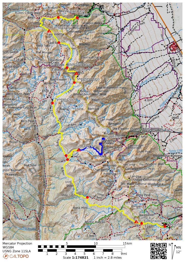
Ultimately, we completed a six-day, north-to-south traverse from Onion Valley to Horseshoe Meadow along the Whitney Crest. Our traverse mostly followed established trails but also included segments of abandoned trail and non-existent trail, along with a sidetrip up Mt. Whitney. Because our route crossed over three key mountain passes—Kearsarge, Junction, and Cottonwood—I dubbed it the “KJC Traverse.”
Full Trip Report
Day 1: Onion Valley Trailhead to Lower Bubbs Creek Camp
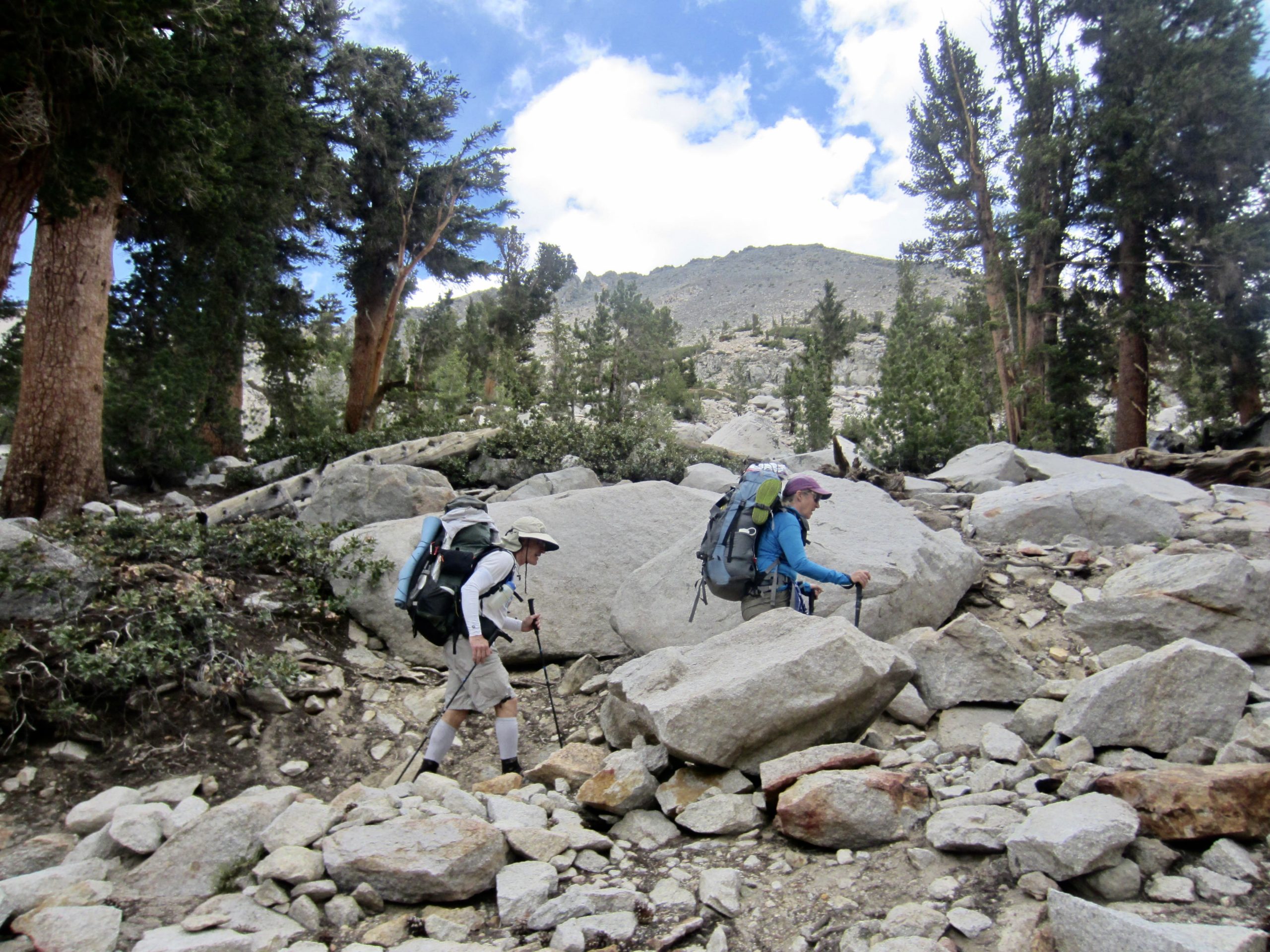
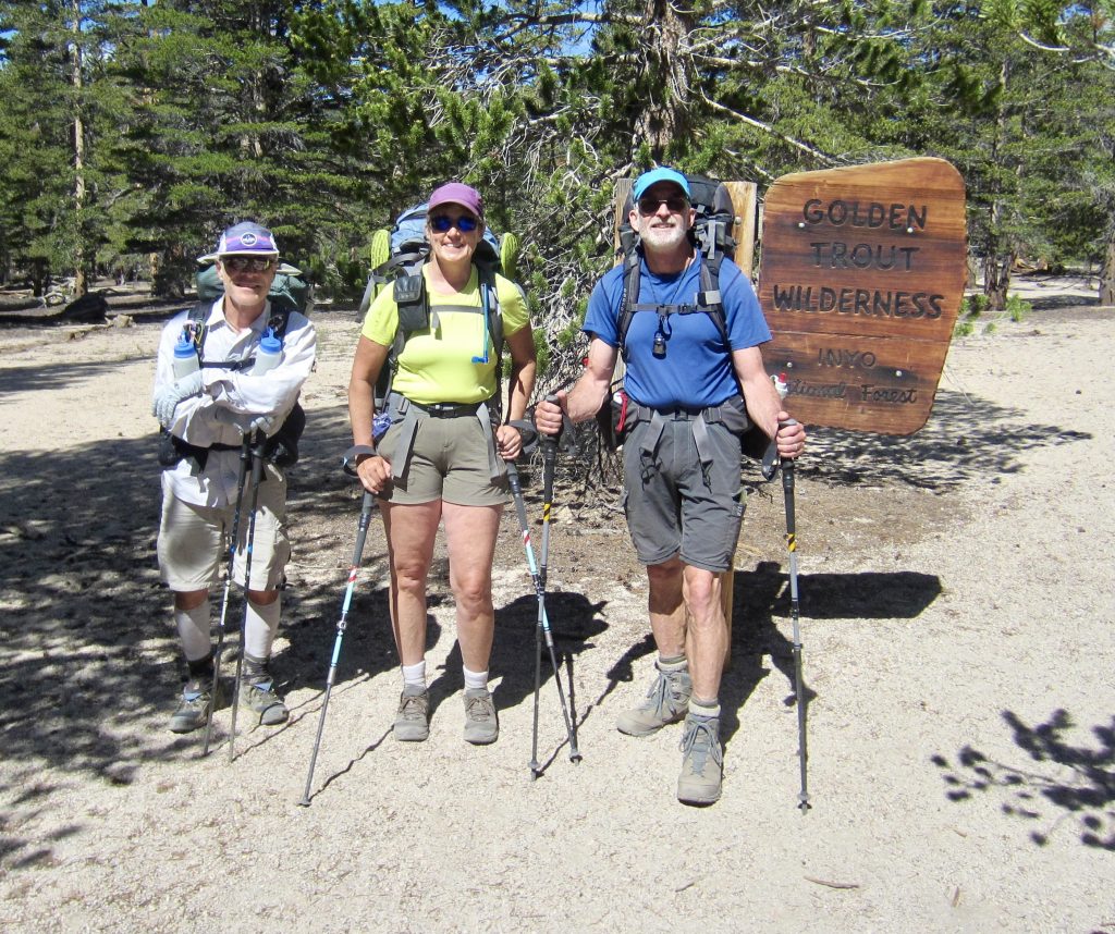
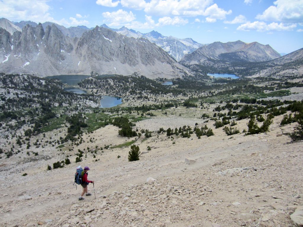
We parked our rental car at Onion Valley Trailhead on a warm, partly cloudy Wednesday morning and headed up the Kearsarge Pass Trail. This trail is a standard entry/exit connector for both the Pacific Crest Trail (PCT) and John Muir Trail (JMT), so there were numerous thru-hikers going up and down. George, who had previously completed over 200 miles of the JMT and over 1000 miles of the PCT, explained to Eileen and me how to distinguish between the two different thru-hiker groups on the basis of their attire. It’s a subtle distinction, mind you.
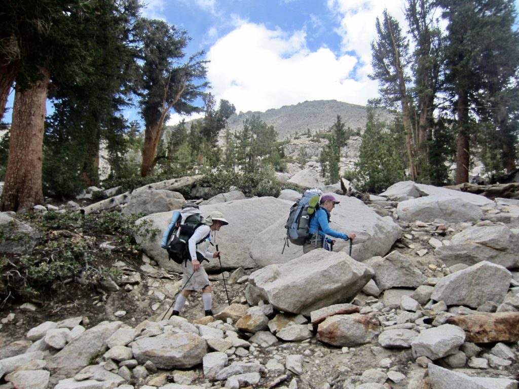
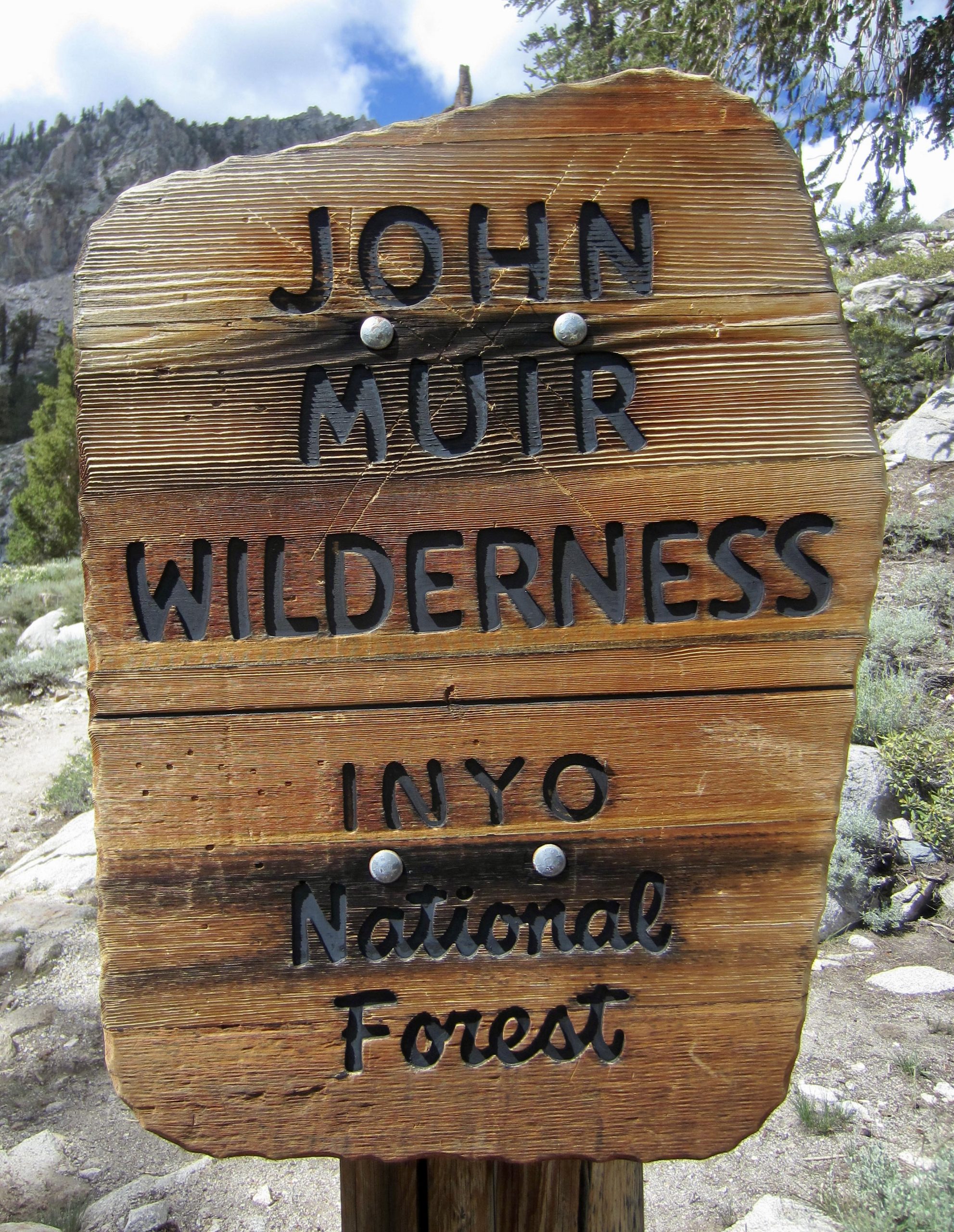
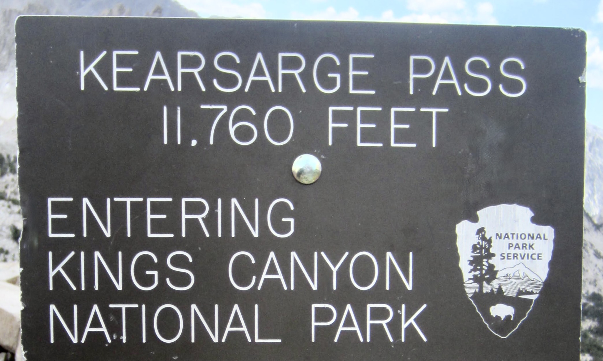
Over the course of several miles, we passed through the John Muir Wilderness, crossed above Big Pothole Lake, and entered Kings Canyon National Park at 11,760-foot Kearsarge Pass (3.8 hours + 2500 feet from TH). Our fears about excessively hot weather proved to be unfounded; it was cool and breezy at the pass.


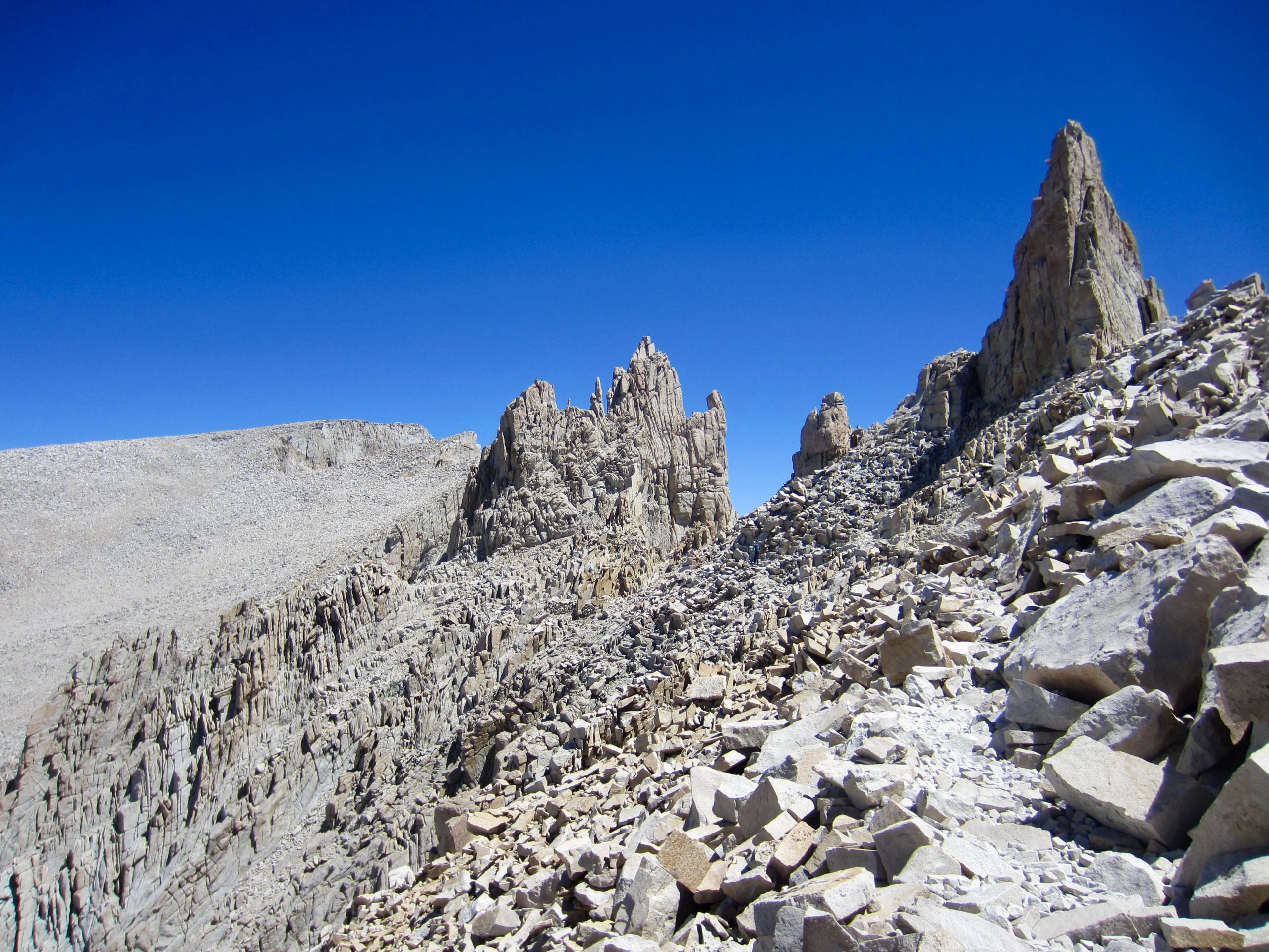
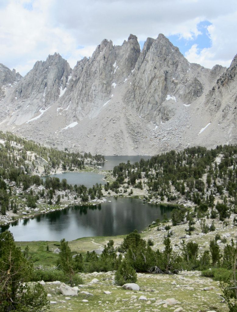
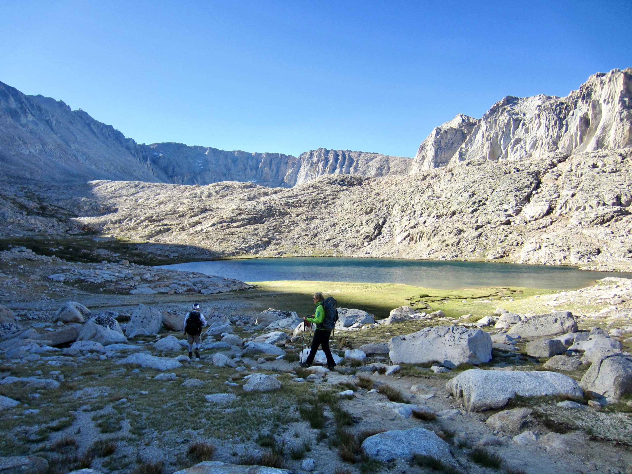
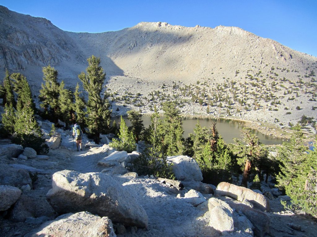
From the pass, we descended to Bullfrog Lake and Bullfrog Tarn, 1000 feet below. Kearsarge Lakes and Kearsarge Pinnacles presented an attractive image closely to the south.
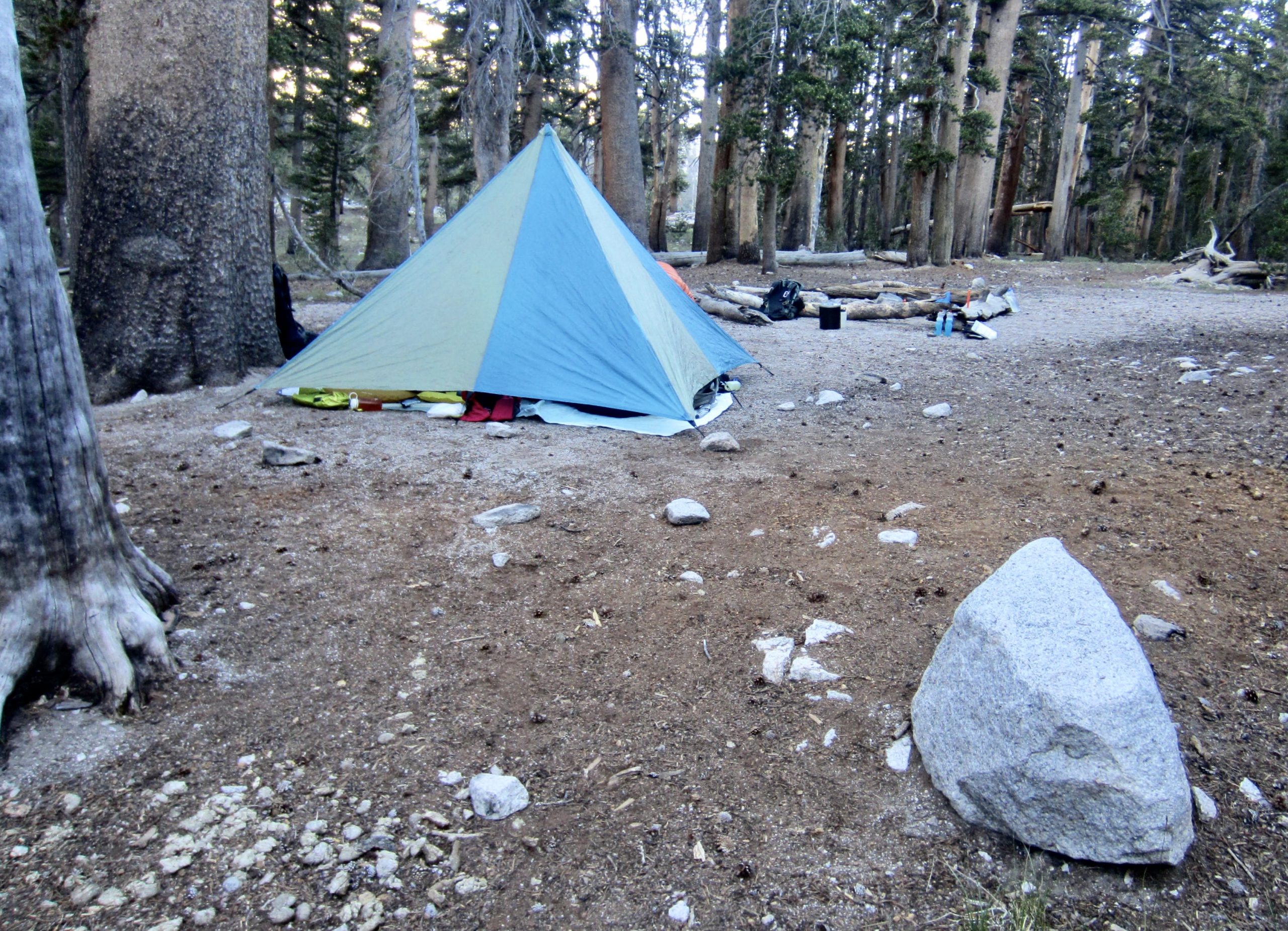
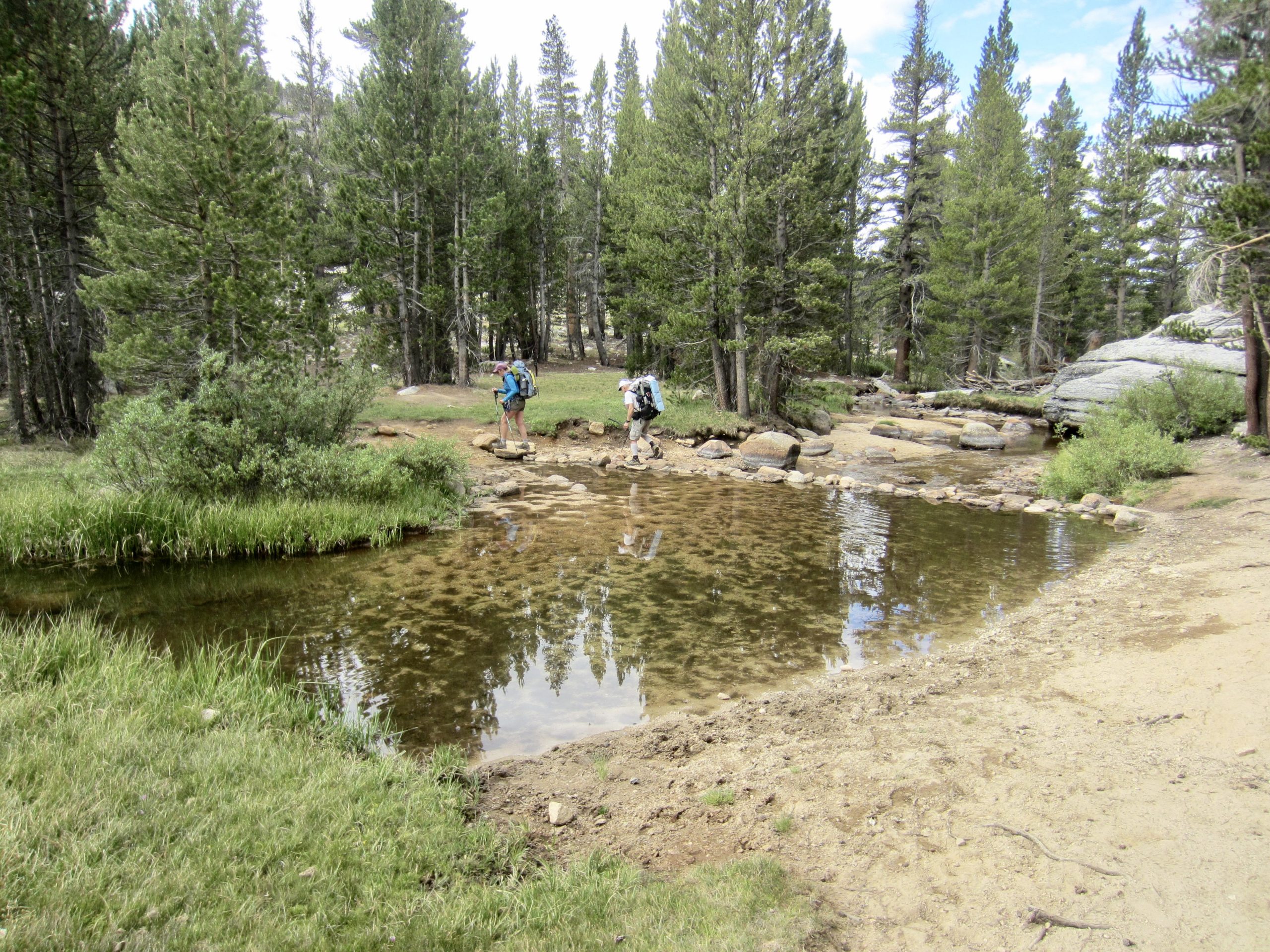
We continued down to Vidette Meadow, where our connector trail intersected the PCT and JMT. Along the way, we encountered a park ranger who warned us about the presence of a mother bear and two cubs roaming the area; she highly recommended that we camp only at sites with bear lockers. No argument there! Arriving at Lower Bubbs Creek Camp later in the day (8.1 hours + 9.6 miles + 3000 feet from TH), we were happy to find flat ground, running water, and—yes!—a bear locker.
Day 2: Lower Bubbs Creek Camp to Upper Shepherd Meadow
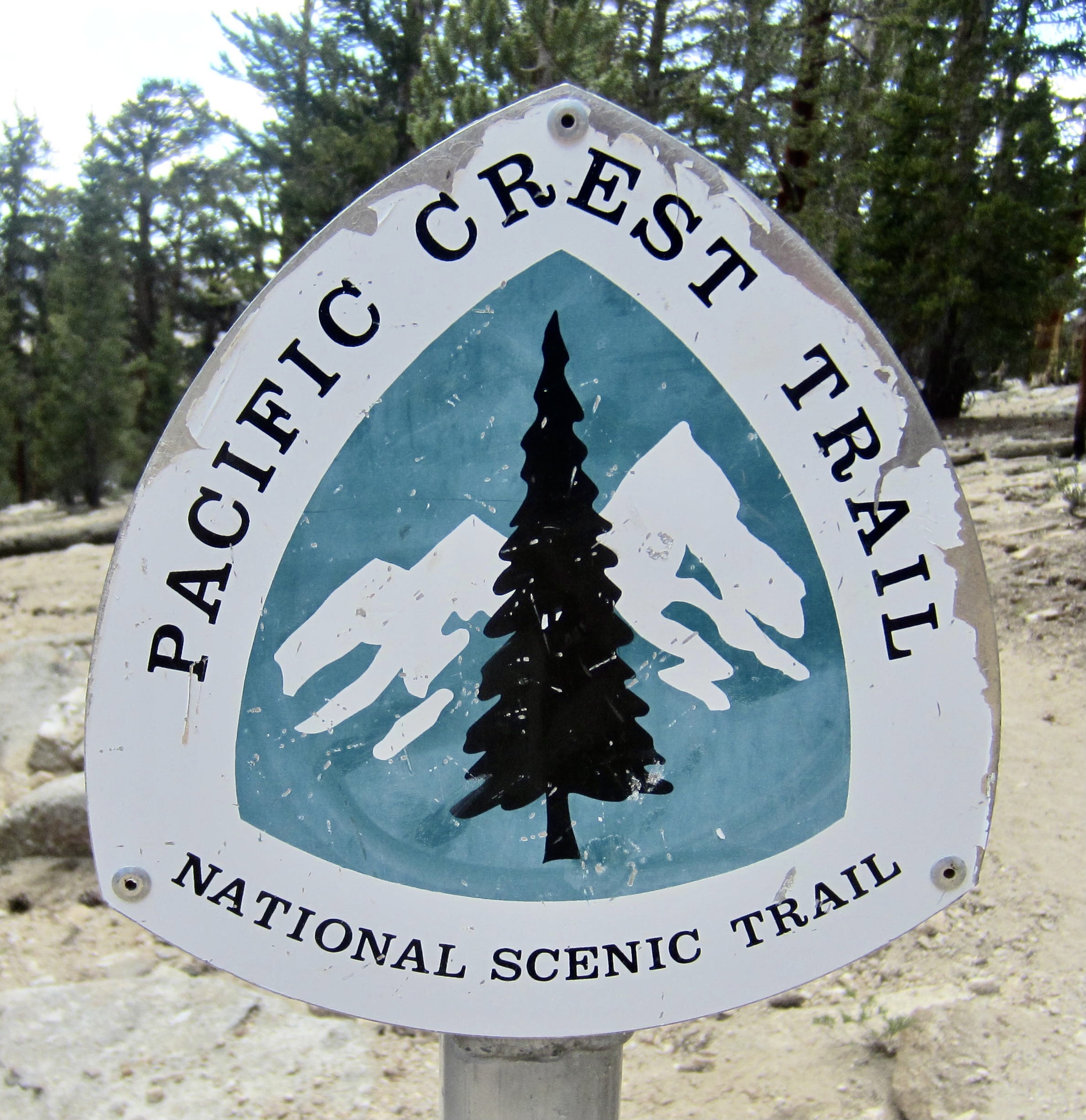
Under clear morning skies, we continued hiking up Bubbs Creek on the PCT/JMT, across rocky flats and grassy meadows. Both of these trails extend over 13,150-foot Forester Pass, which is famous for being the highest point on the entire PCT and JMT.
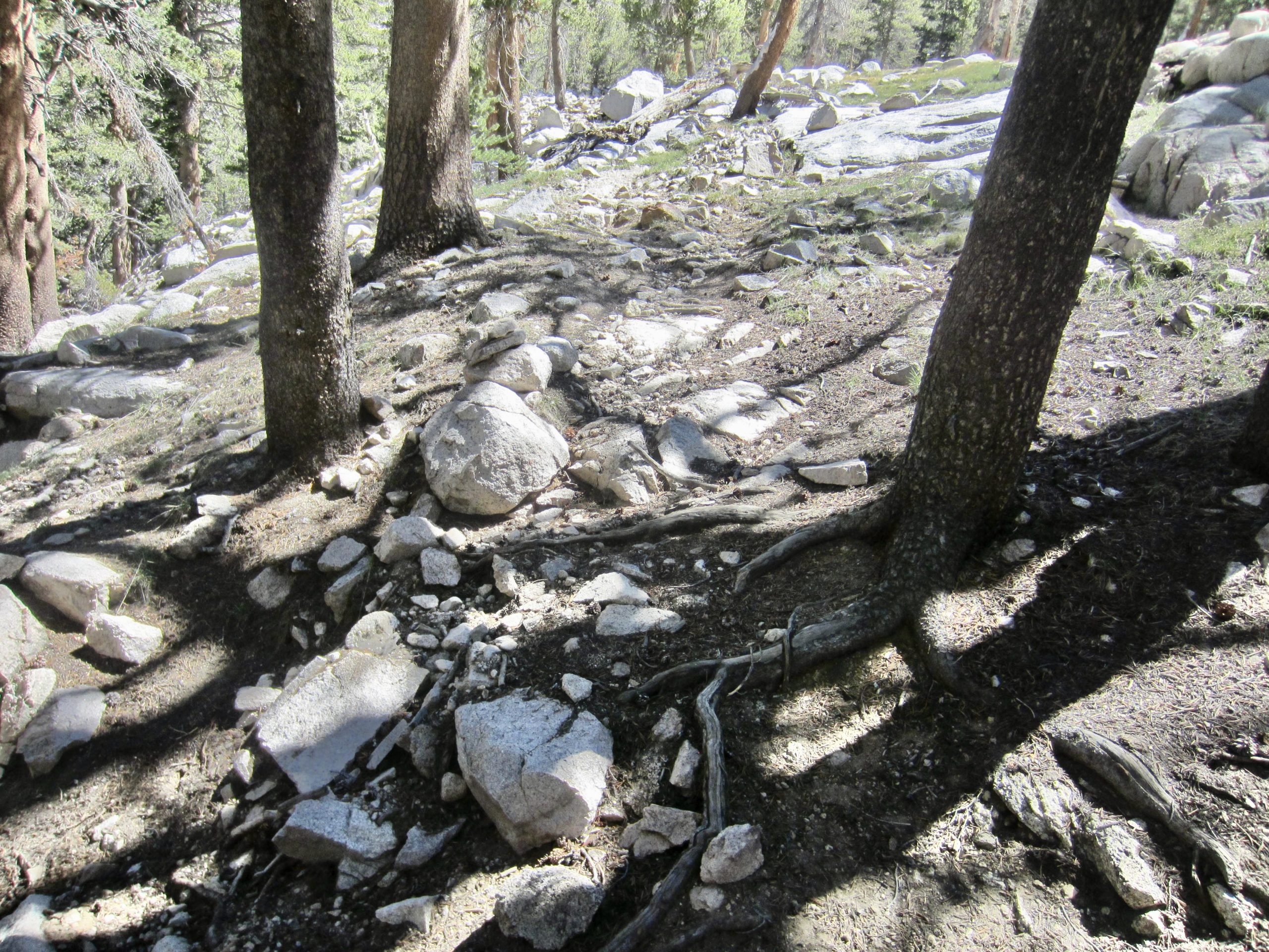
Rather than following the PCT/JMT up and over Forester Pass (thereby executing a “KFC Traverse”), we made a spur-of-the-moment decision to take an abandoned parallel trail over Junction Pass (hence, a “KJC Traverse”). This abandoned trail leaves the PCT/JMT around an elevation of 10,500 feet at a discreet junction marked only with a small stone duck. The junction was shown incorrectly on our maps, so it required some searching to locate.
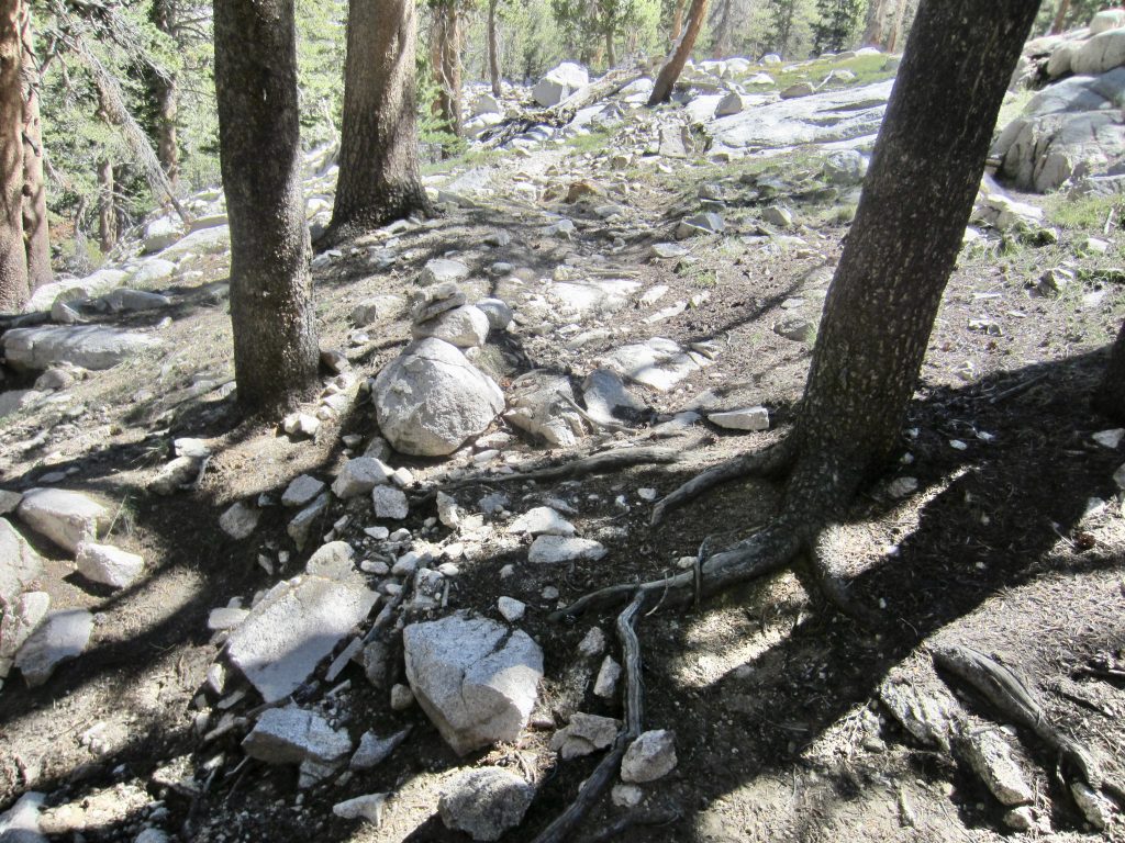
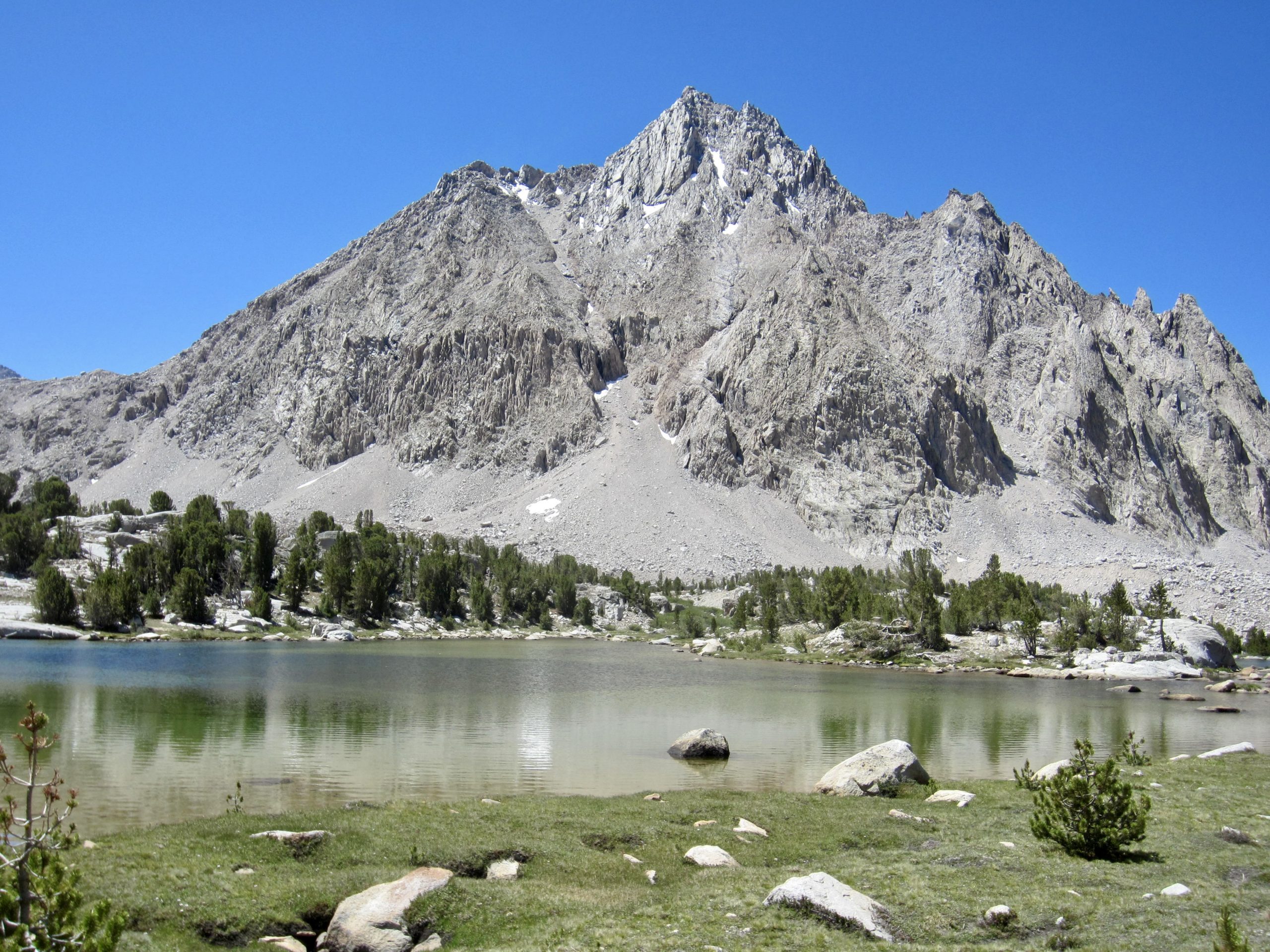
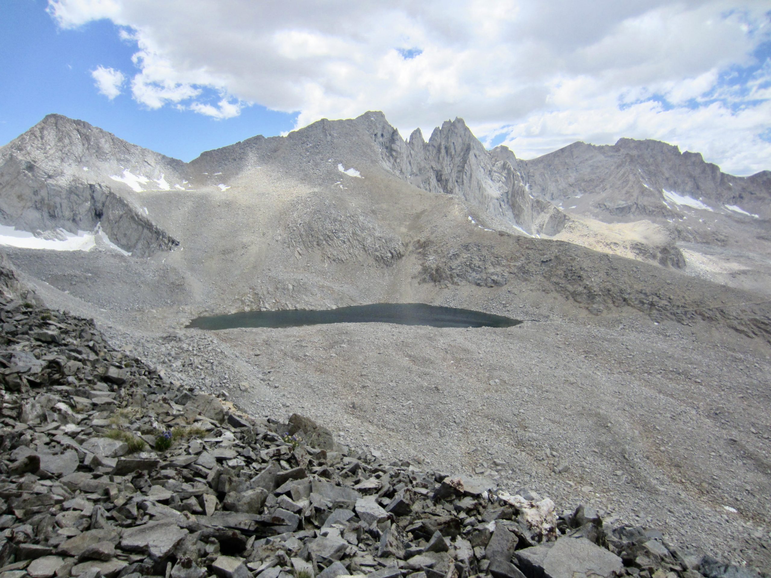
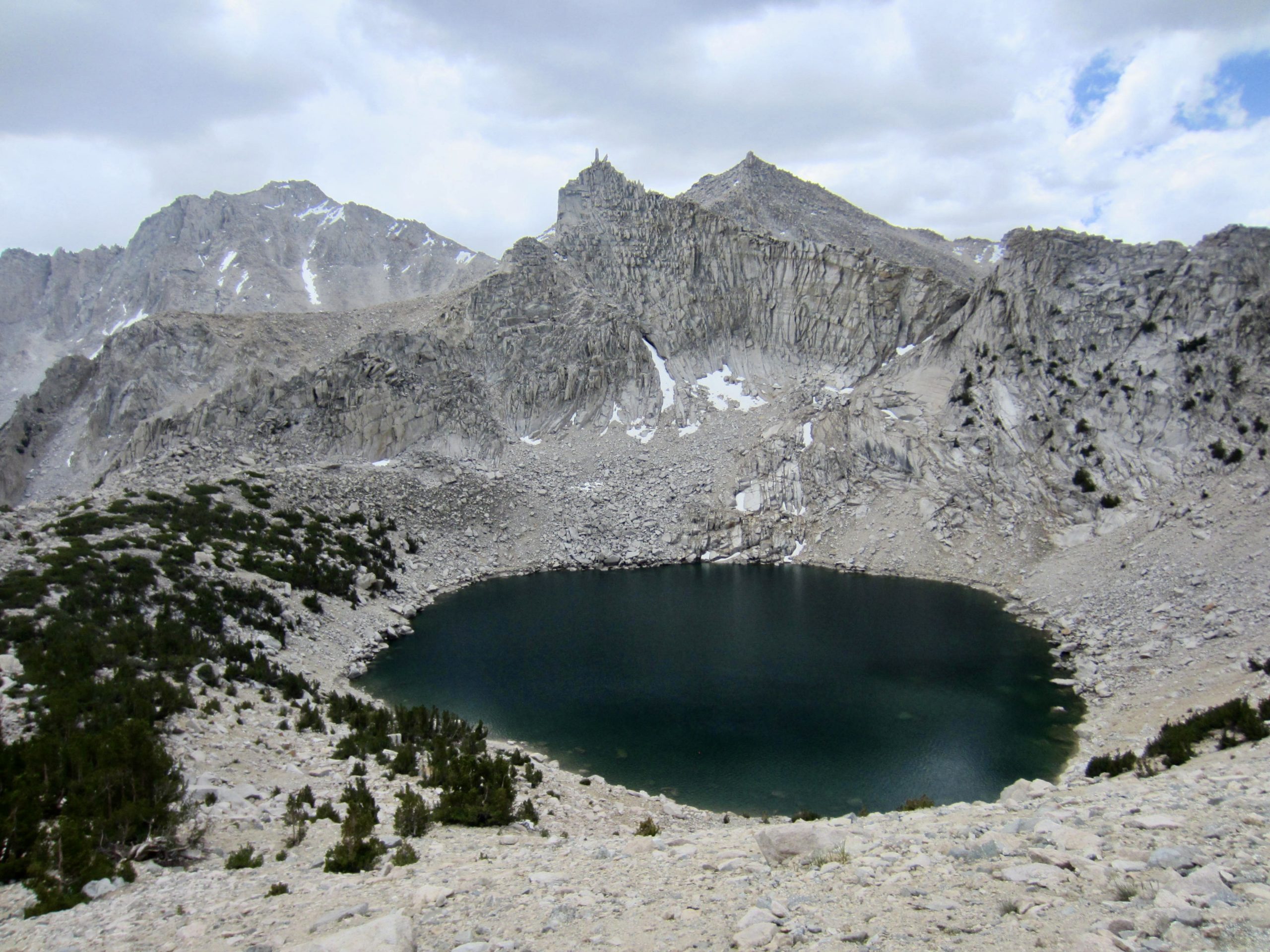
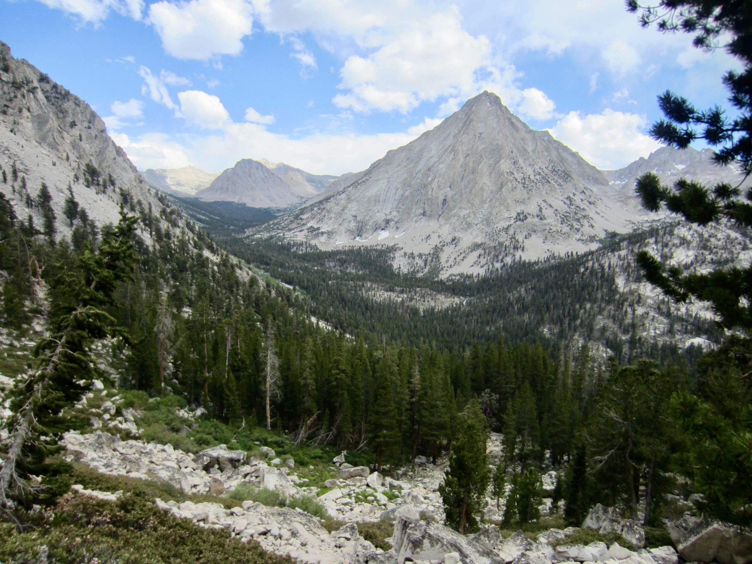
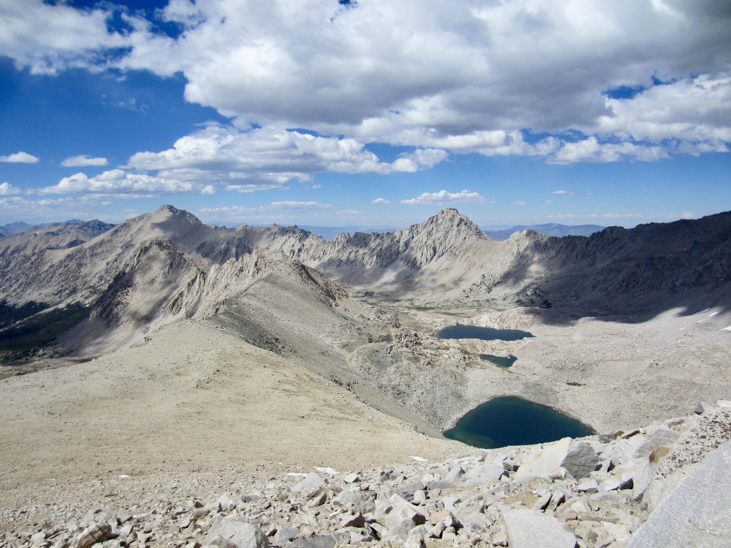
The abandoned but easy-to-follow Junction Pass Trail took us up through a mile of forest before entering beautiful Center Basin. This seldom-visited basin cradles Golden Bear Lake and a cluster of tarns between high granite ridges.

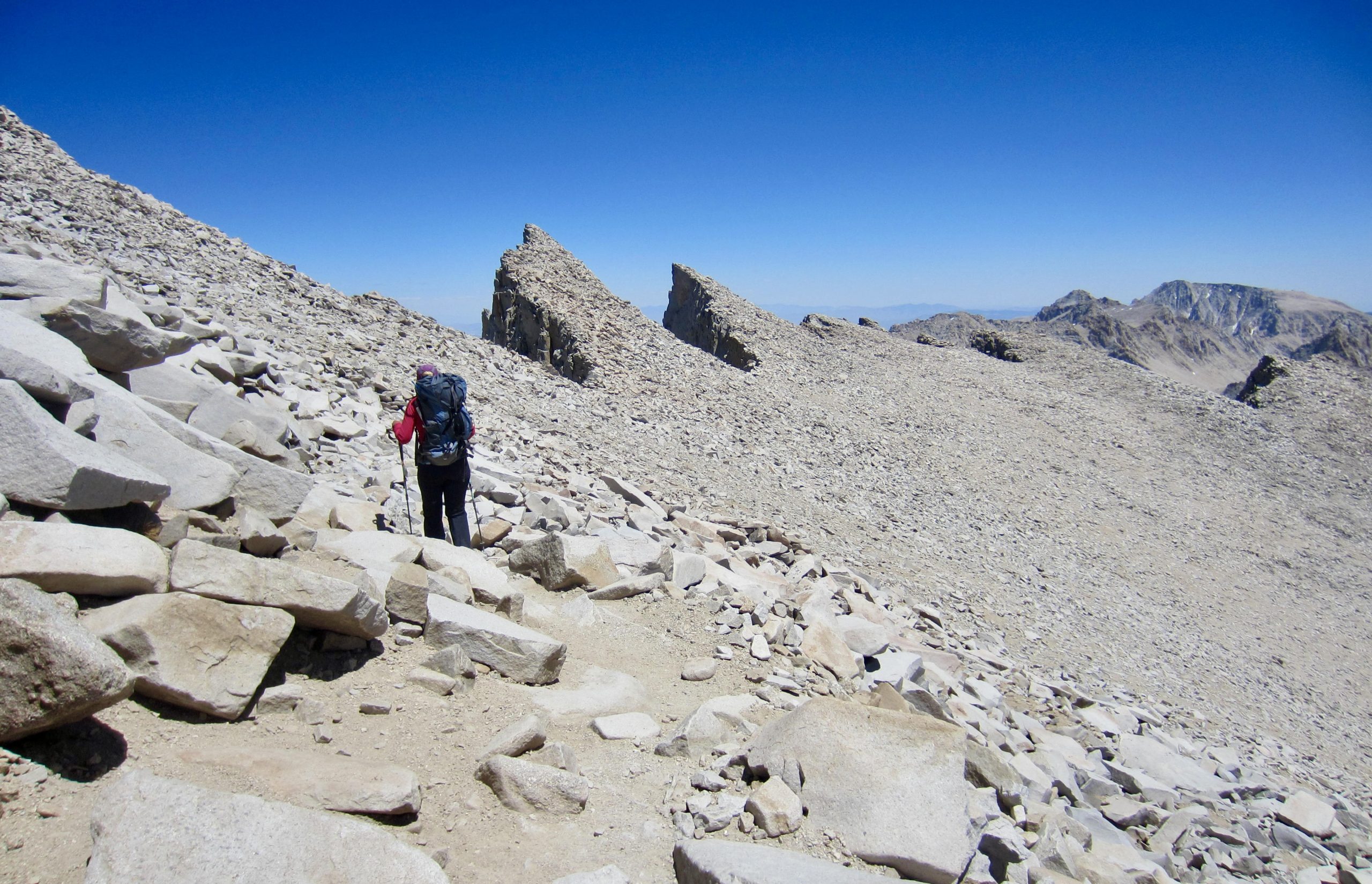
Proceeding up-valley, we passed two more lakes as the abandoned trail led us to the north ridge of Junction Peak. The PCT/JMT could be clearly seen in the adjacent valley, with Forester Pass visible at the valley head.
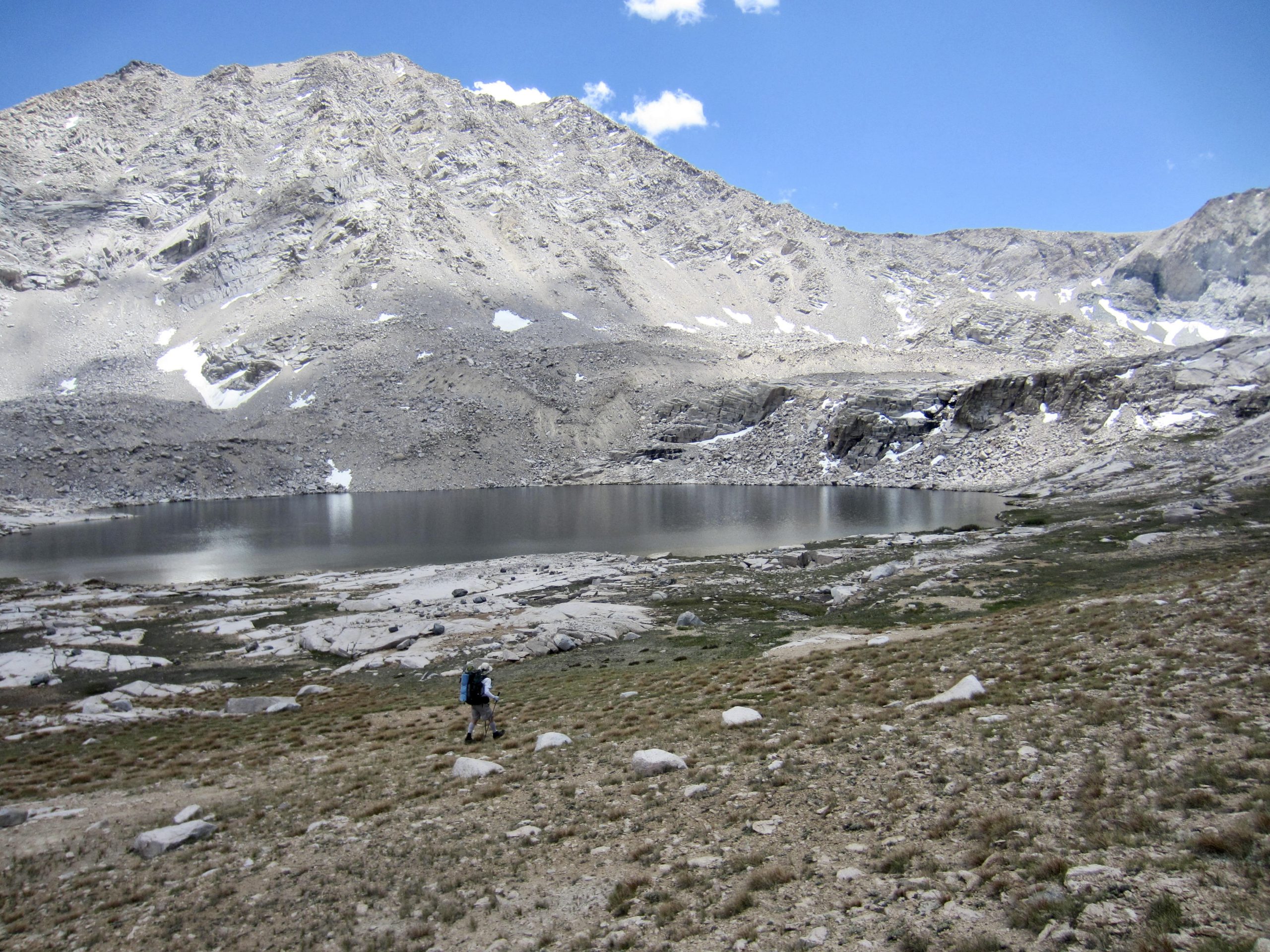

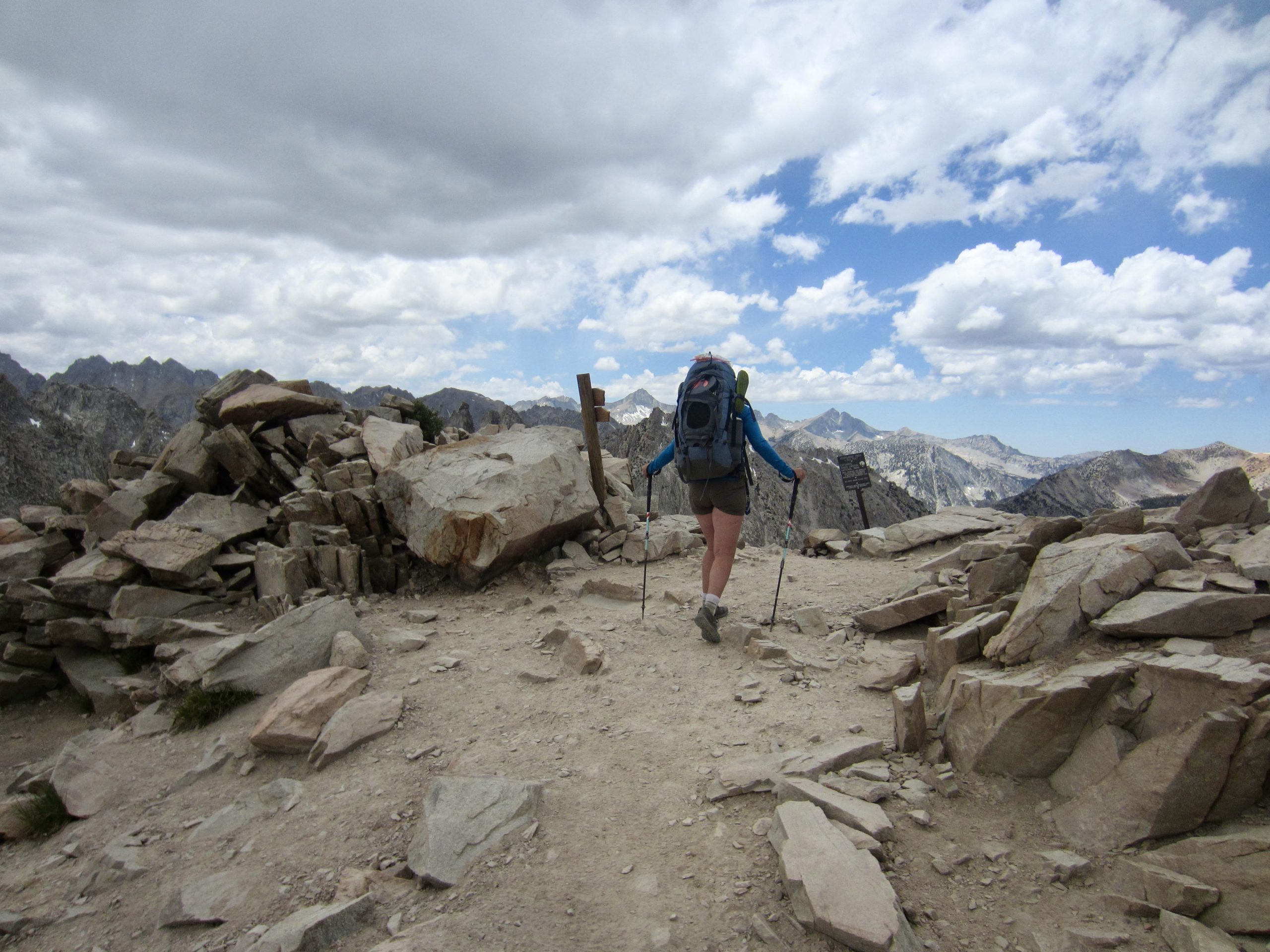
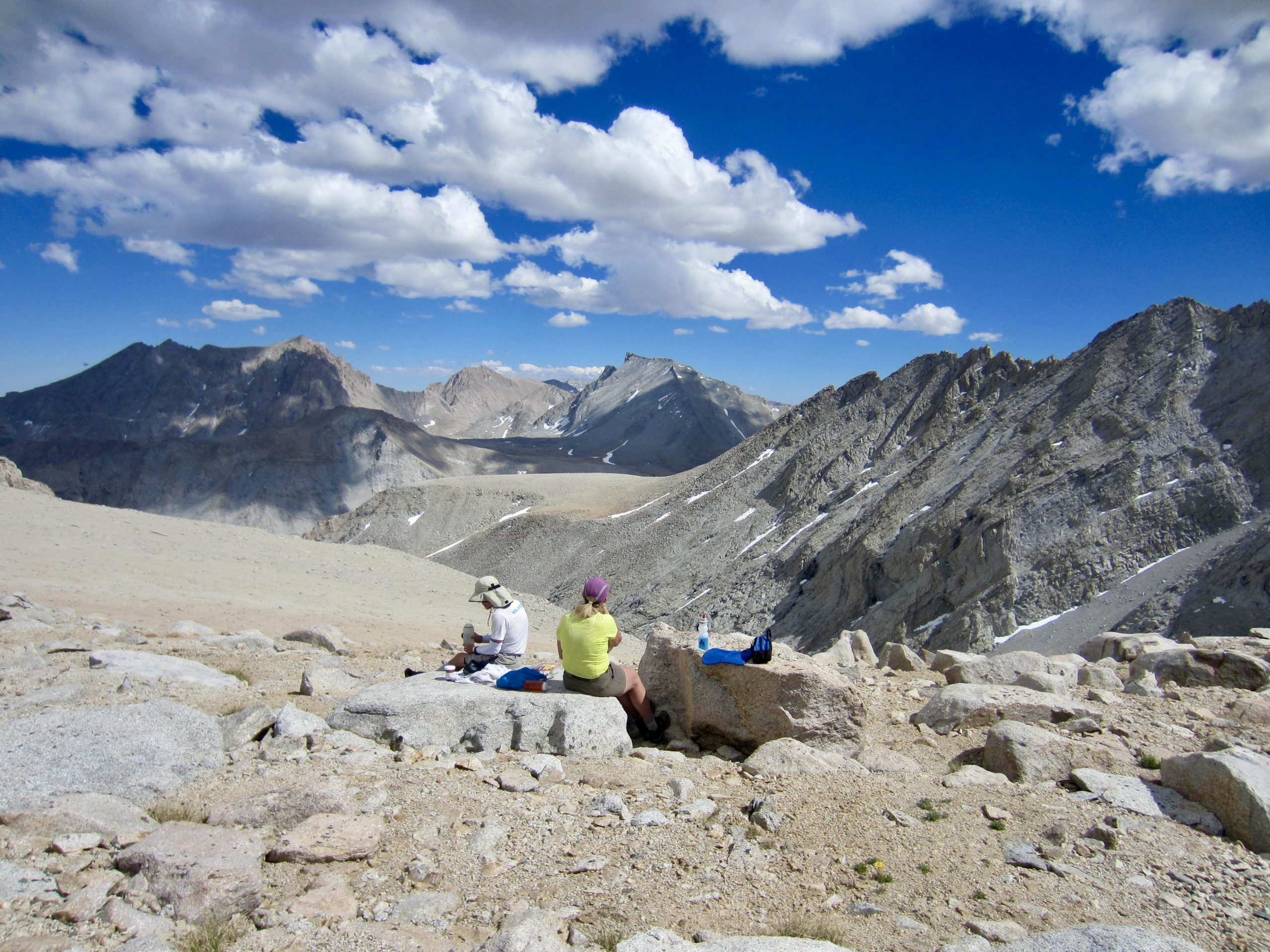
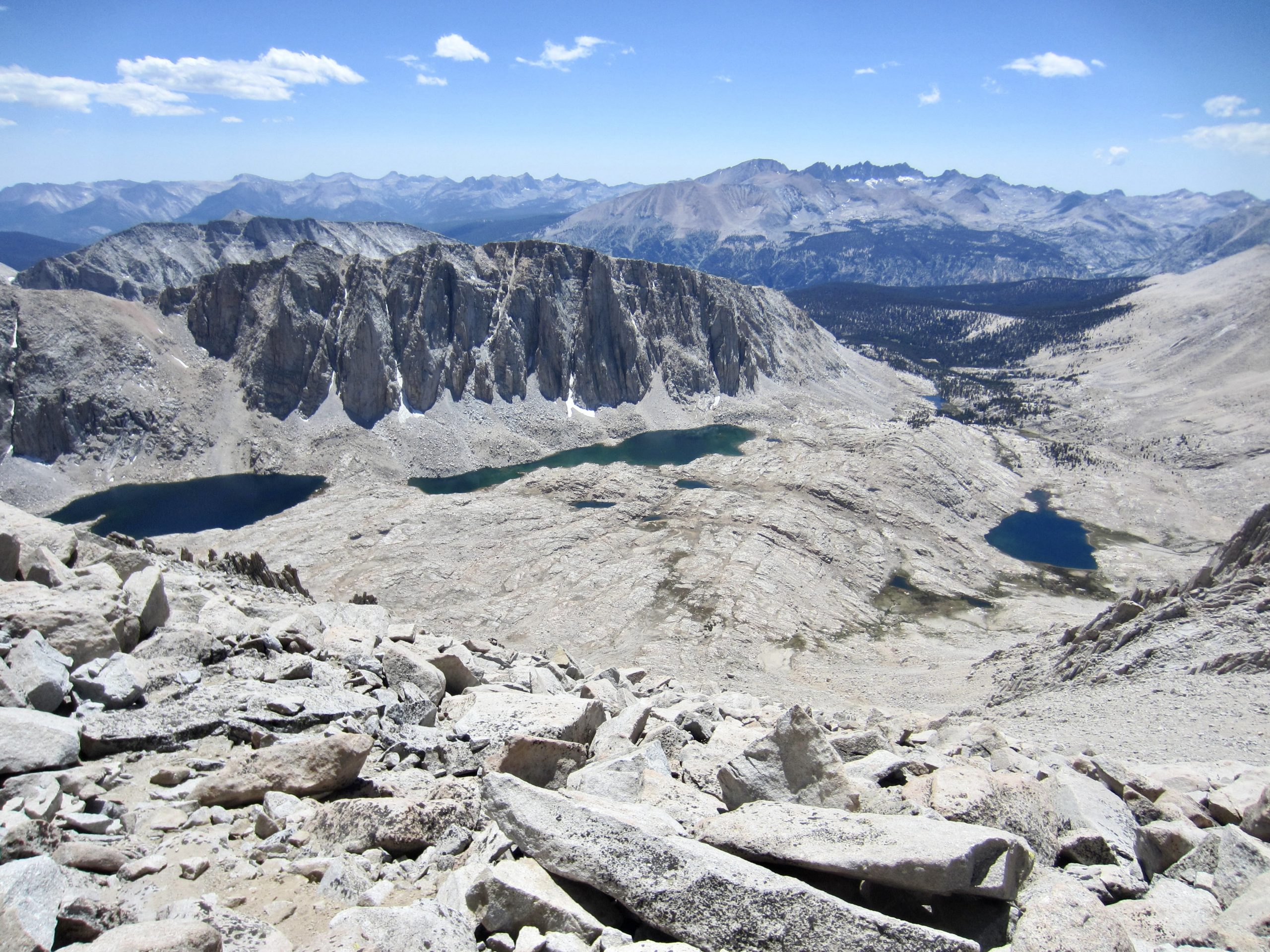
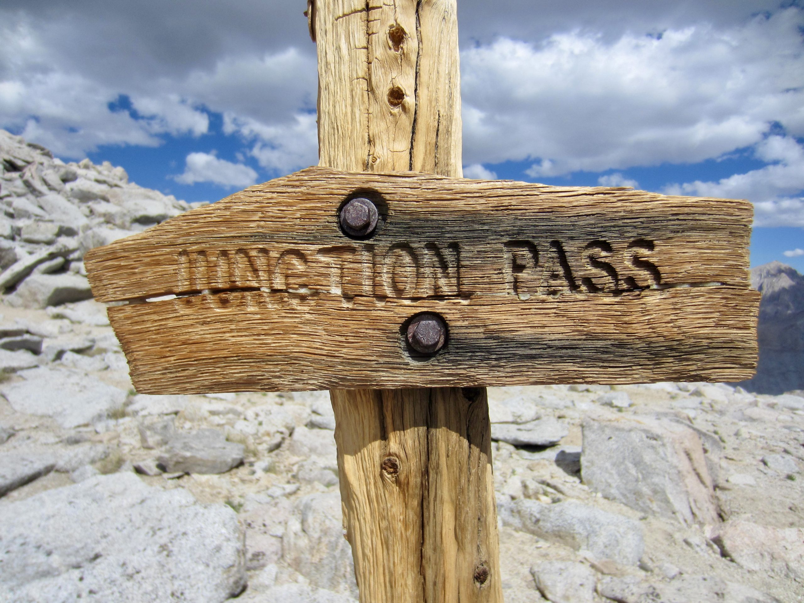
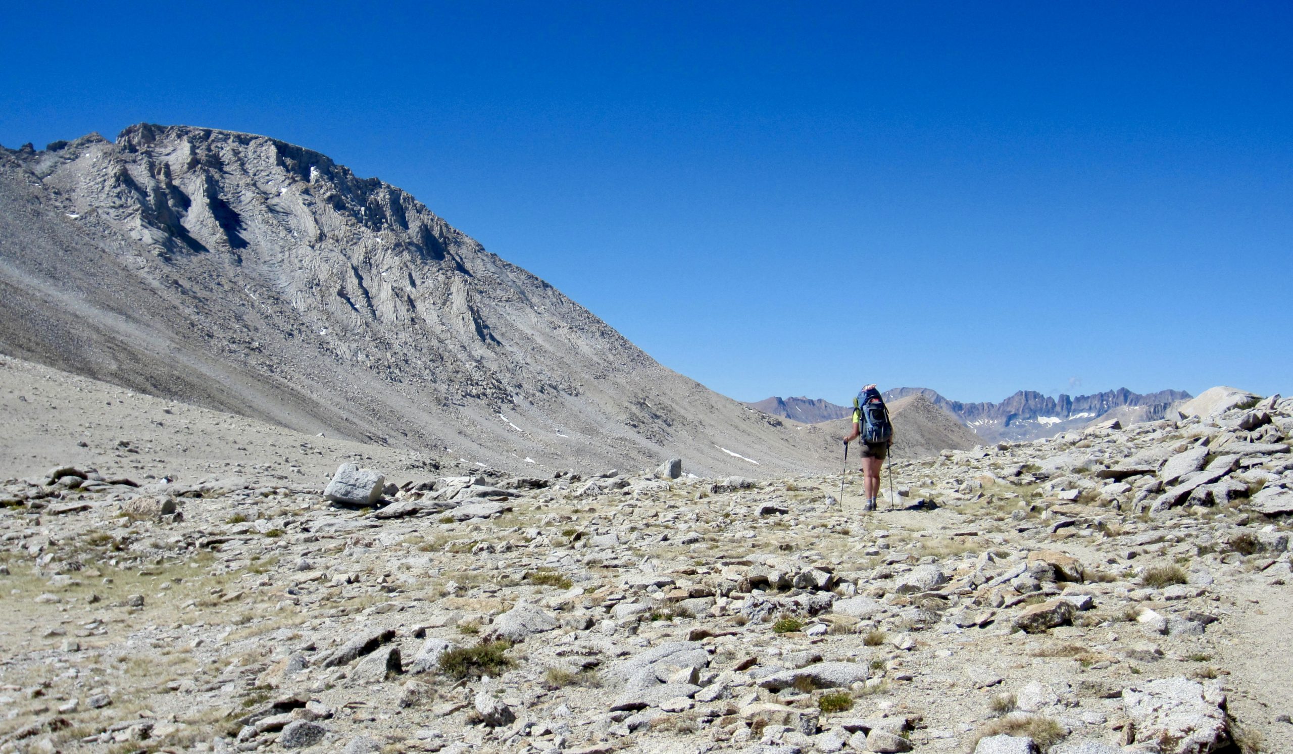
We turned left on the ridge crest and continued up to 13,200-foot Junction Pass (7.5 hours + 3400 feet from Camp 1). Both Junction Pass and neighboring Forester Pass provide crossing points over a high transverse (east-west) divide in the Whitney Crest, thereby offering good views of the southern Sierra peaks.
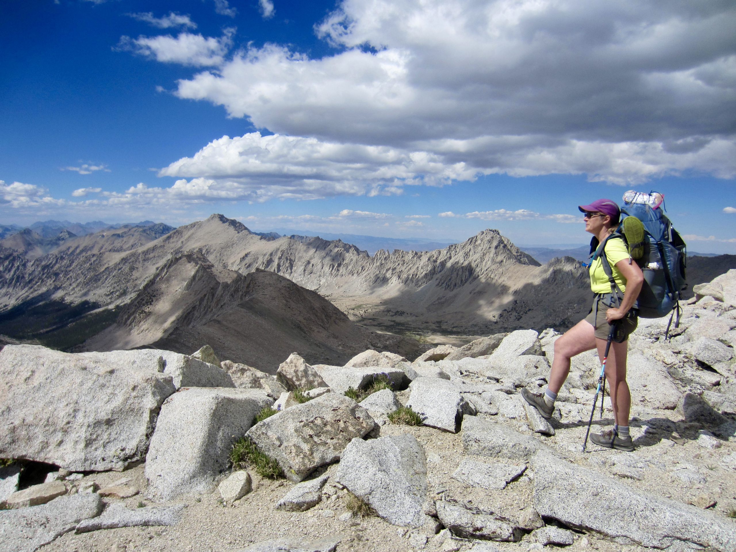

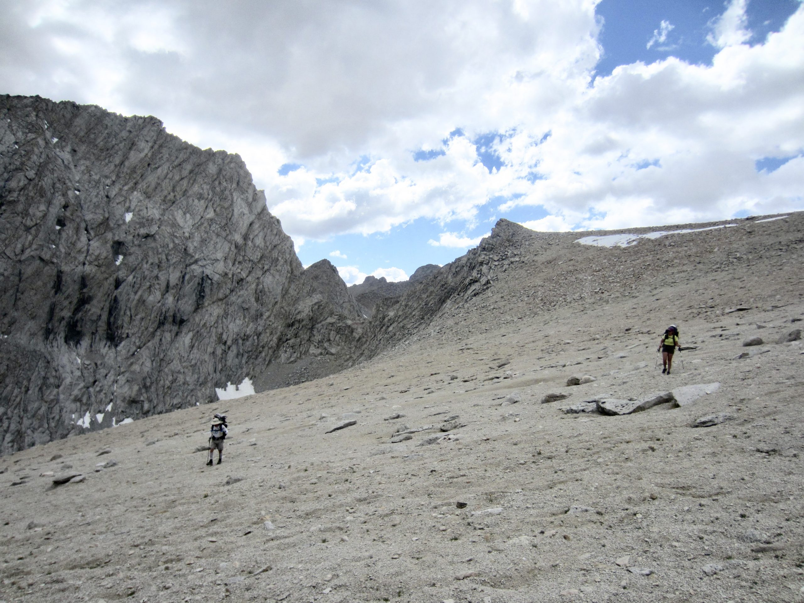
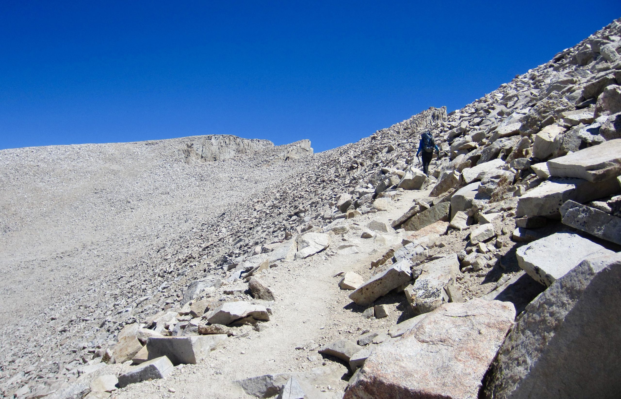
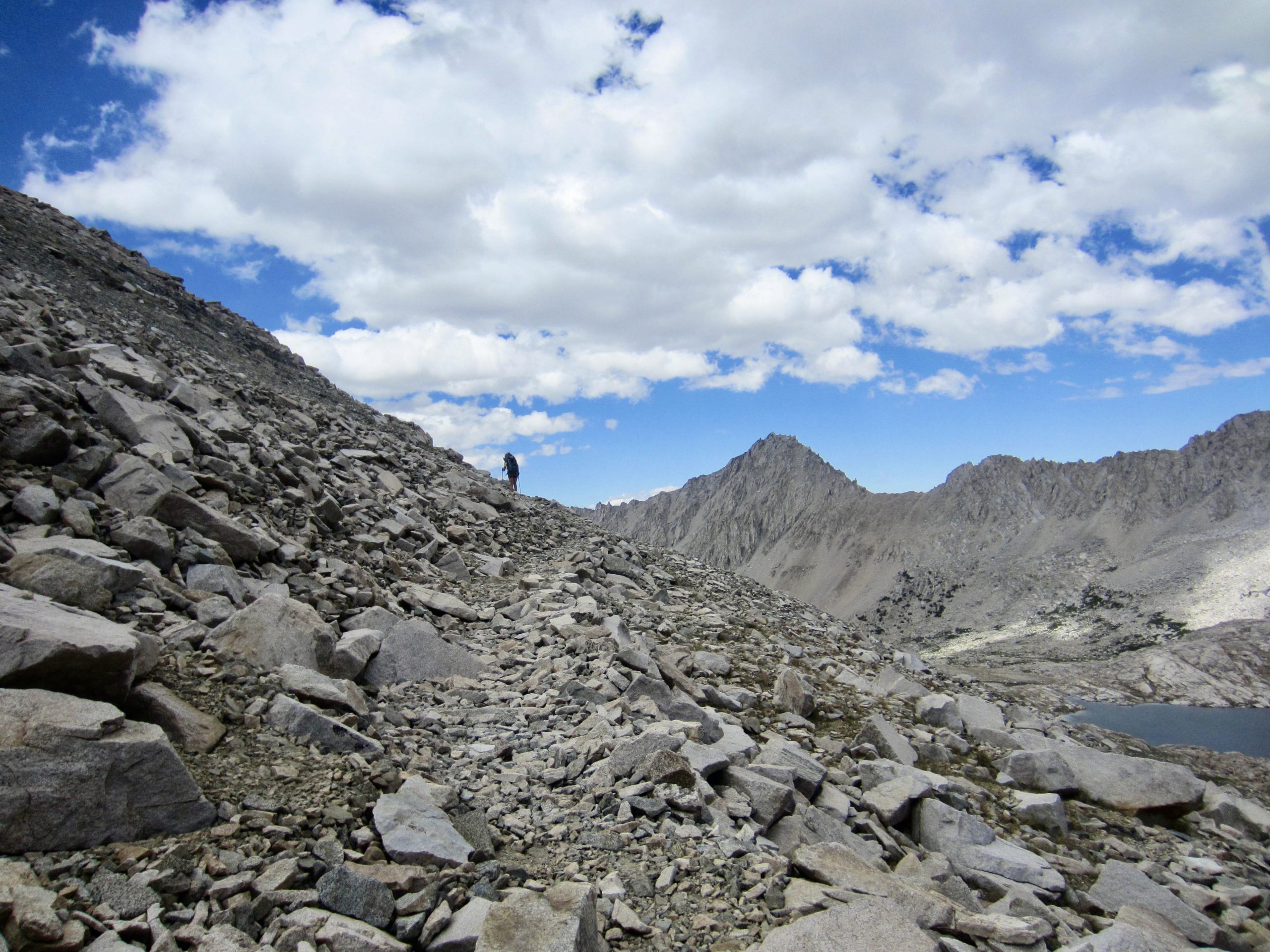
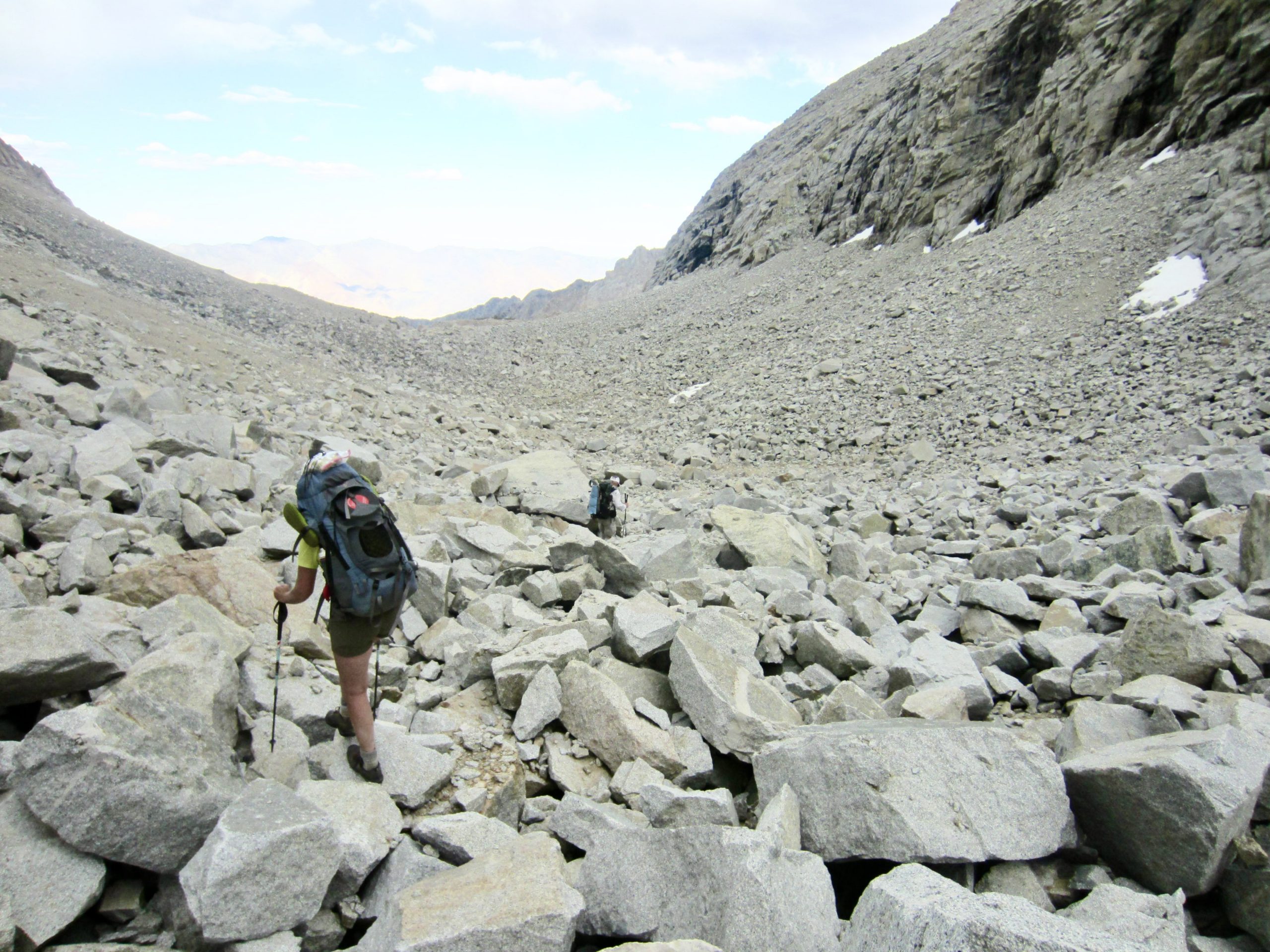
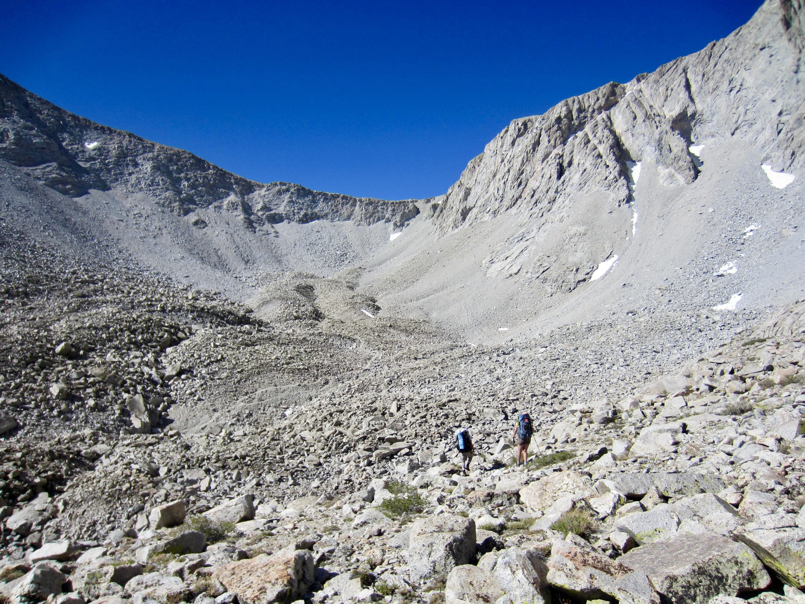
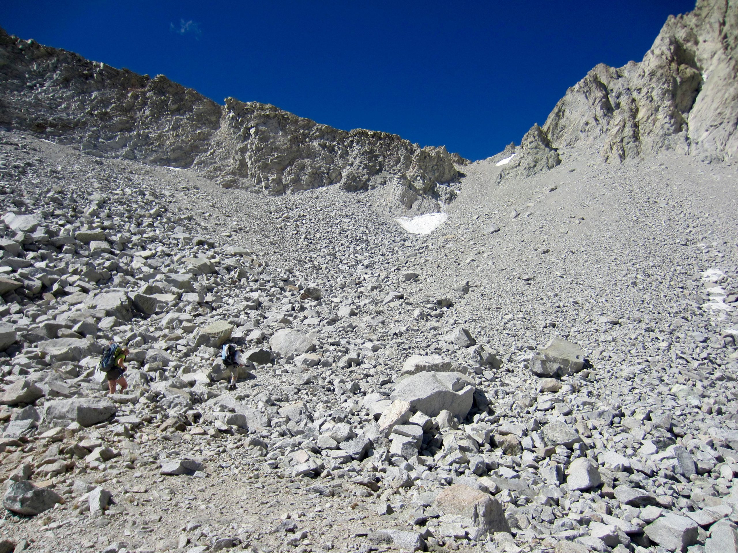
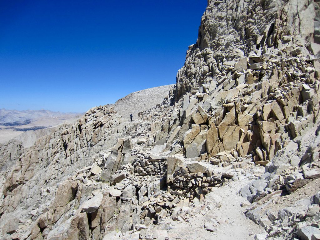
The abandoned trail disappeared on the southern side of Junction Pass, leaving us to pick our own route down. We started by descending a broad, gentle, sandy slope, which soon transitioned to a steep, loose, unpleasant rubble slope.

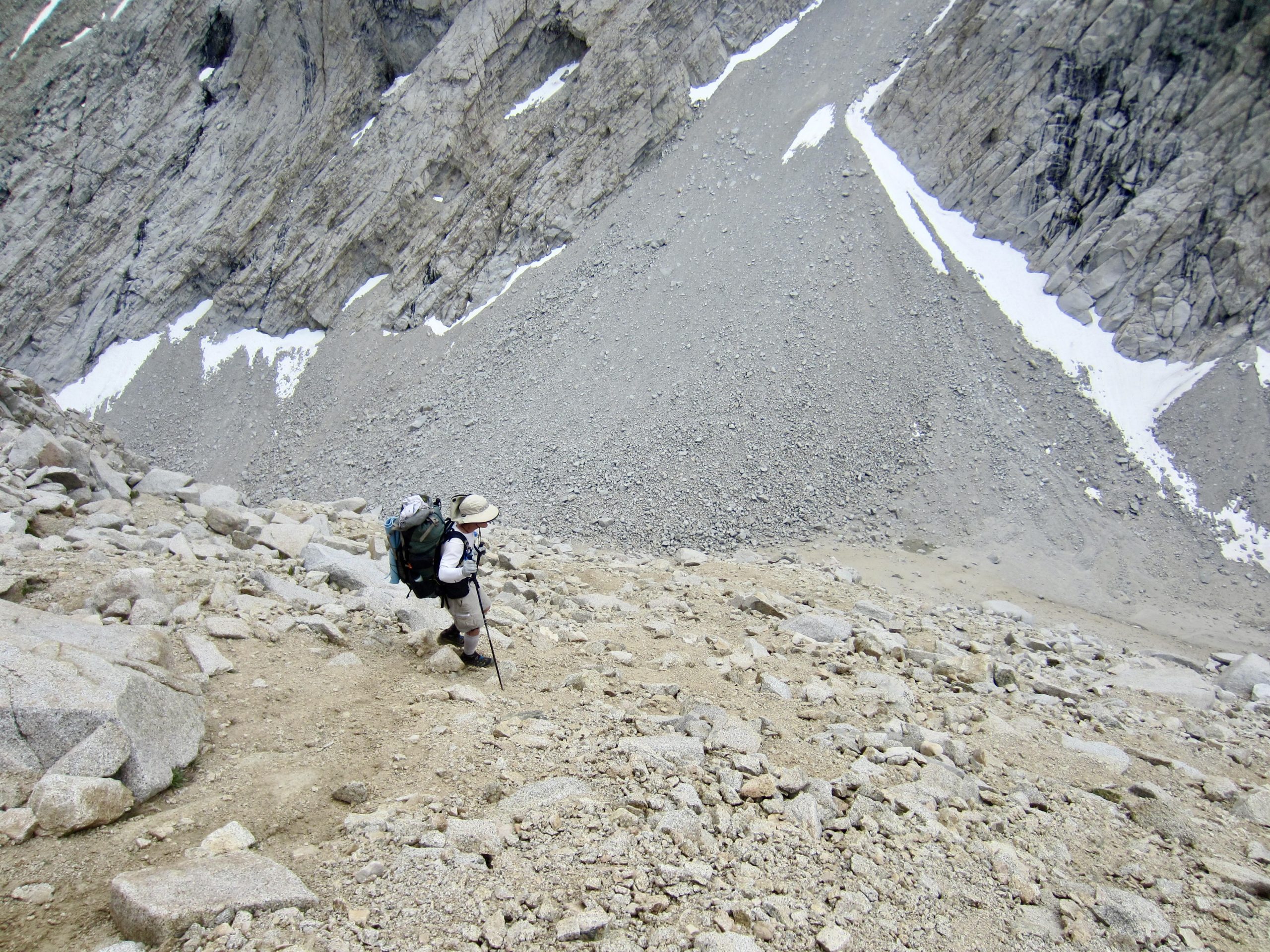
The steep rubble slope ended in a narrow talus gulch, and we spent a tedious hour working our way through a mile of large boulders in this gulch. The talus eventually gave way to sandy ground, where we regained the abandoned trail as it descended into Shepherd Creek Valley. Camp 2 was established in a large meadow above the creek (10.6 hours + 8.5 miles + 3500 feet from Camp 1).
Day 3: Upper Shepherd Meadow to Upper Whitney Creek Meadow
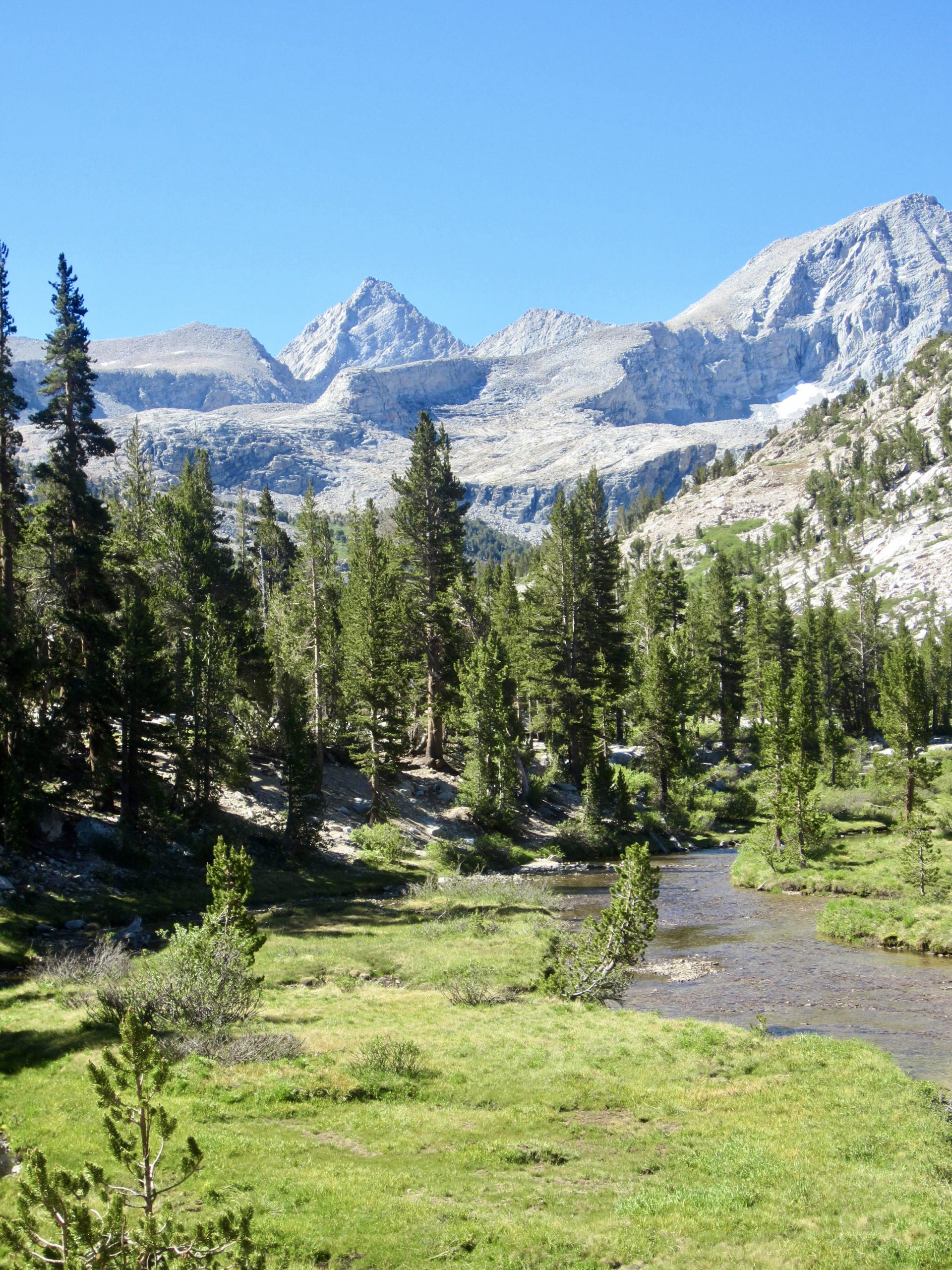
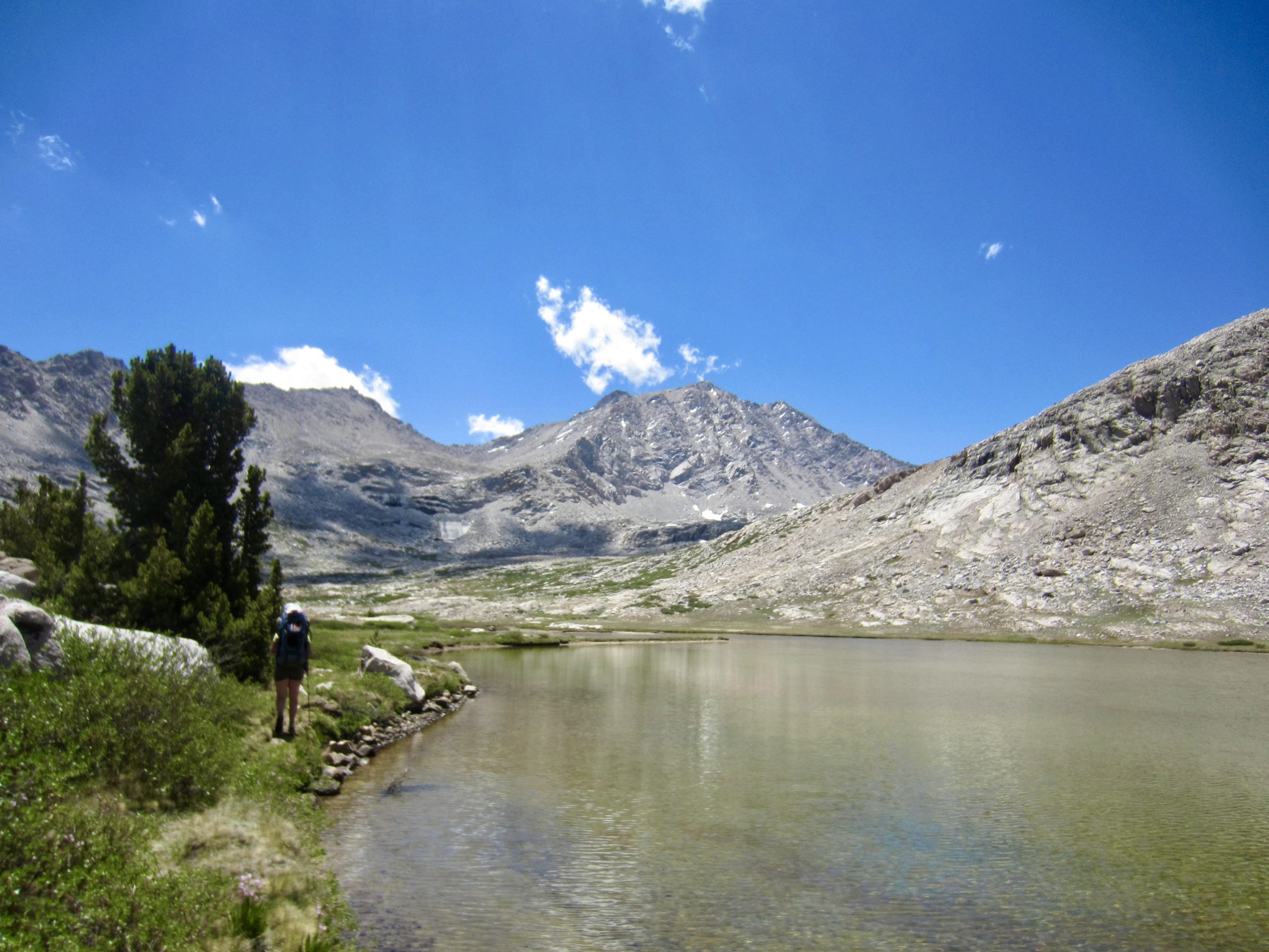
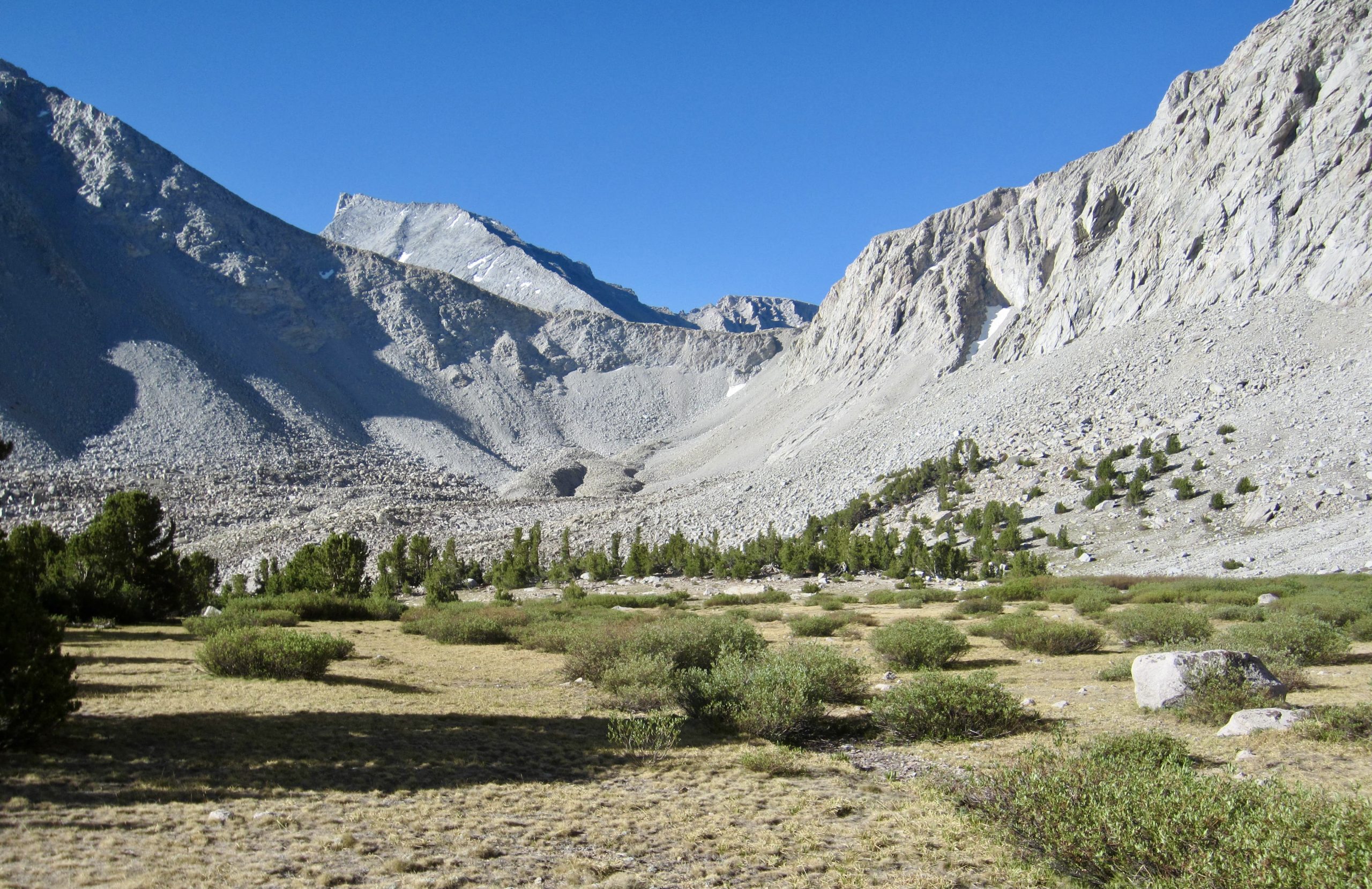
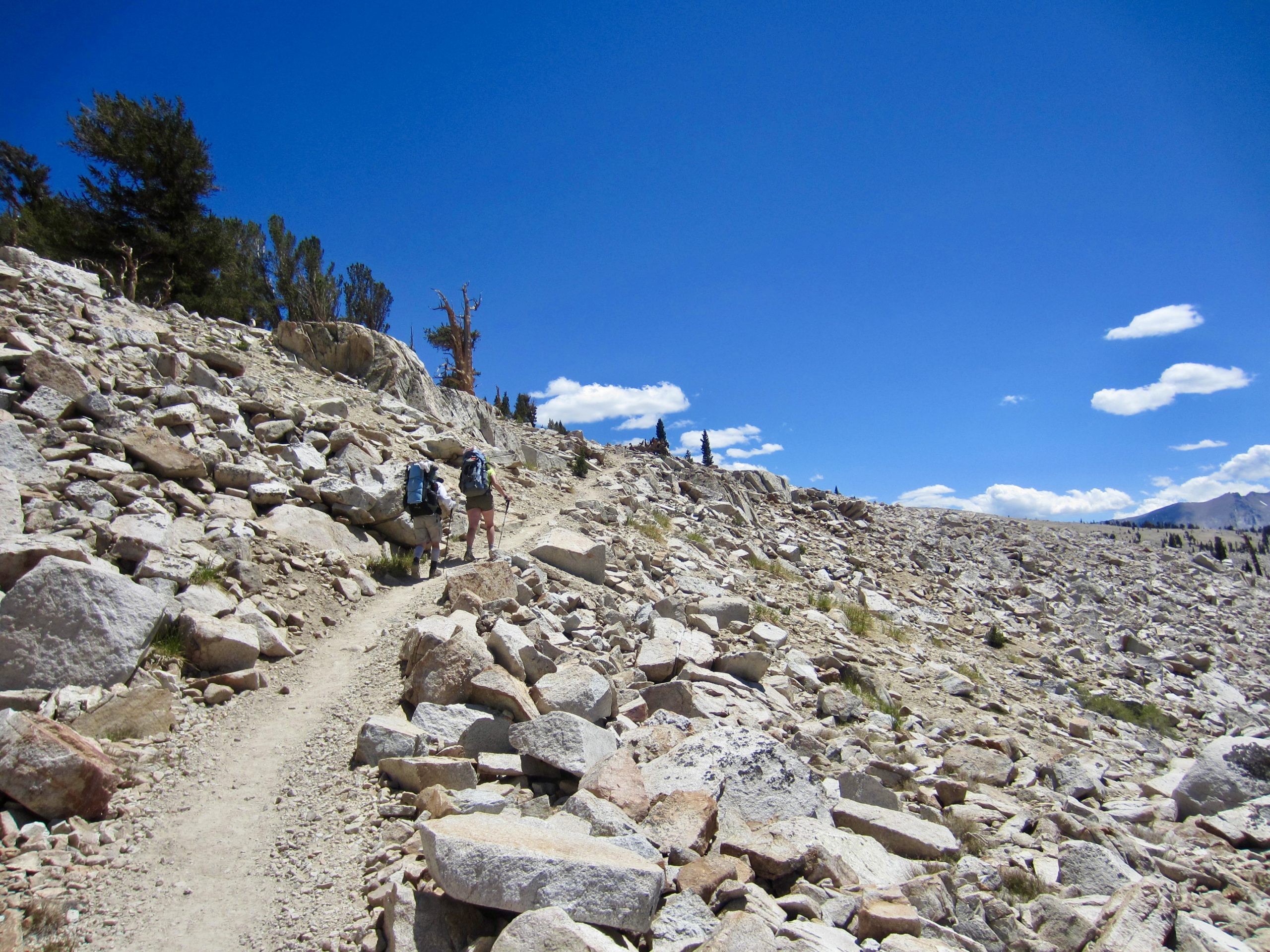
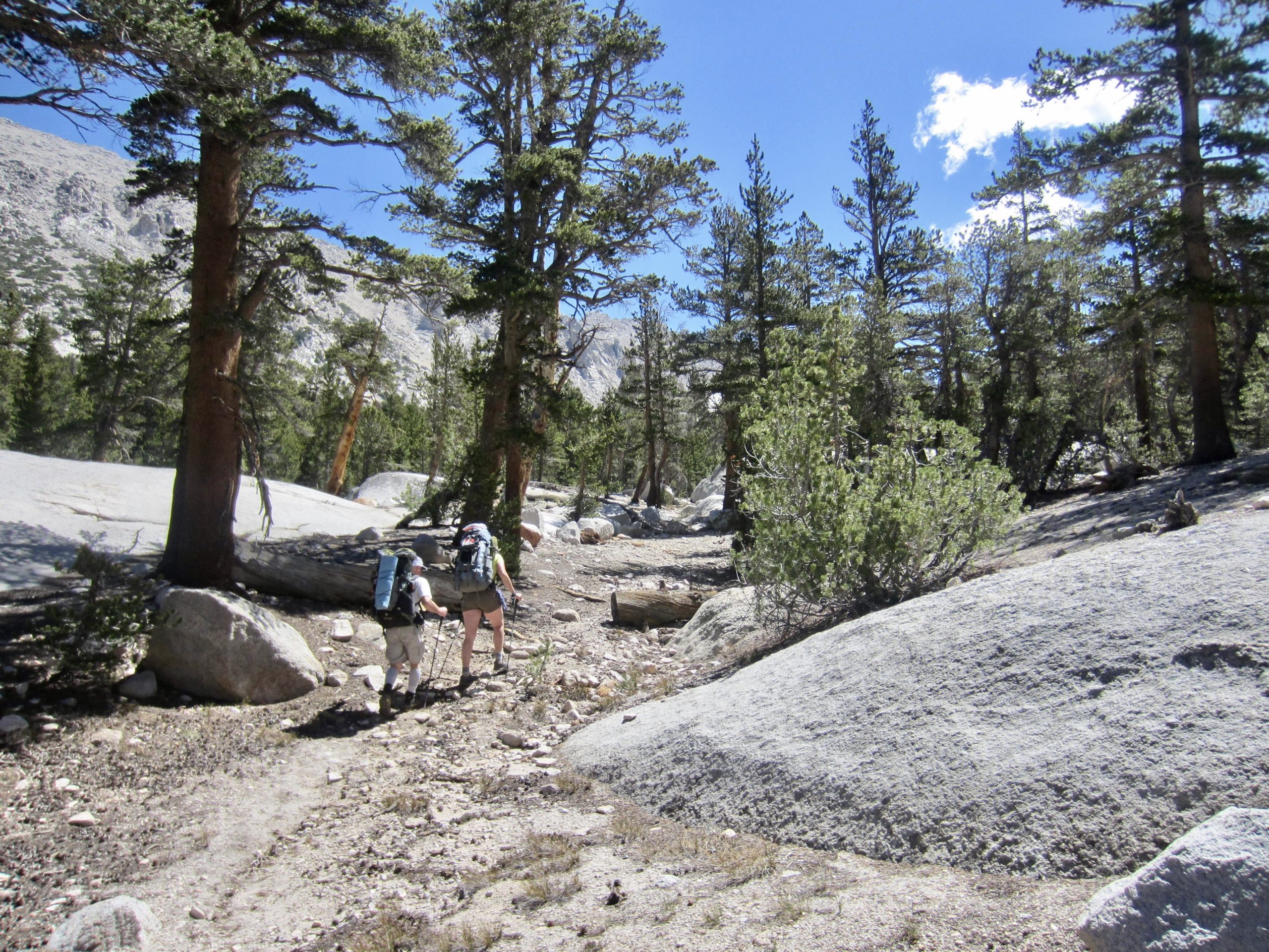
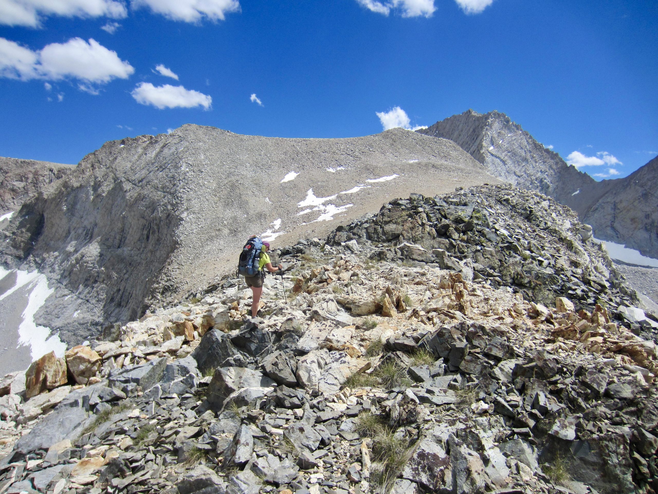
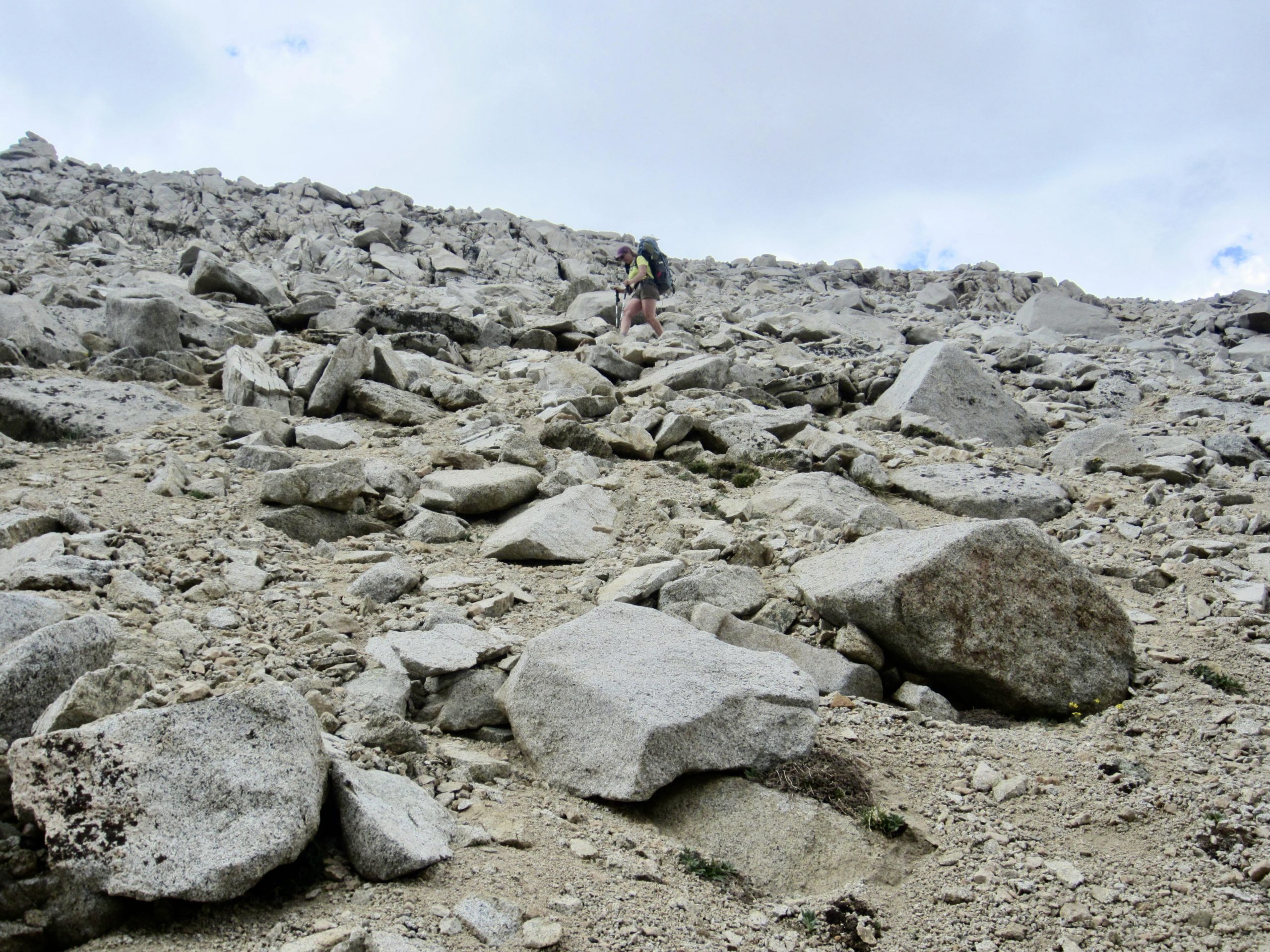
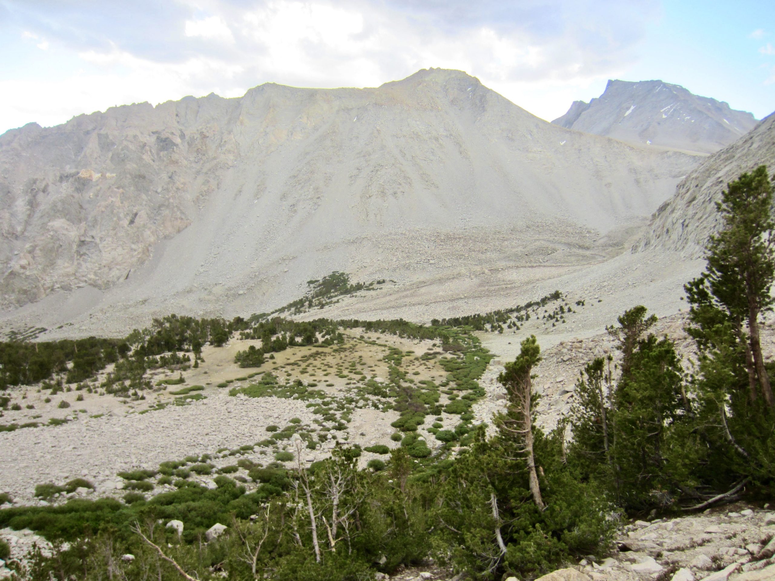
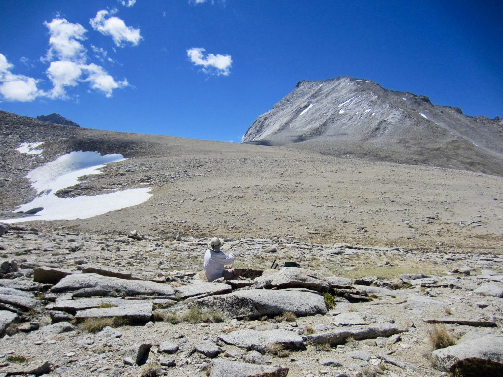
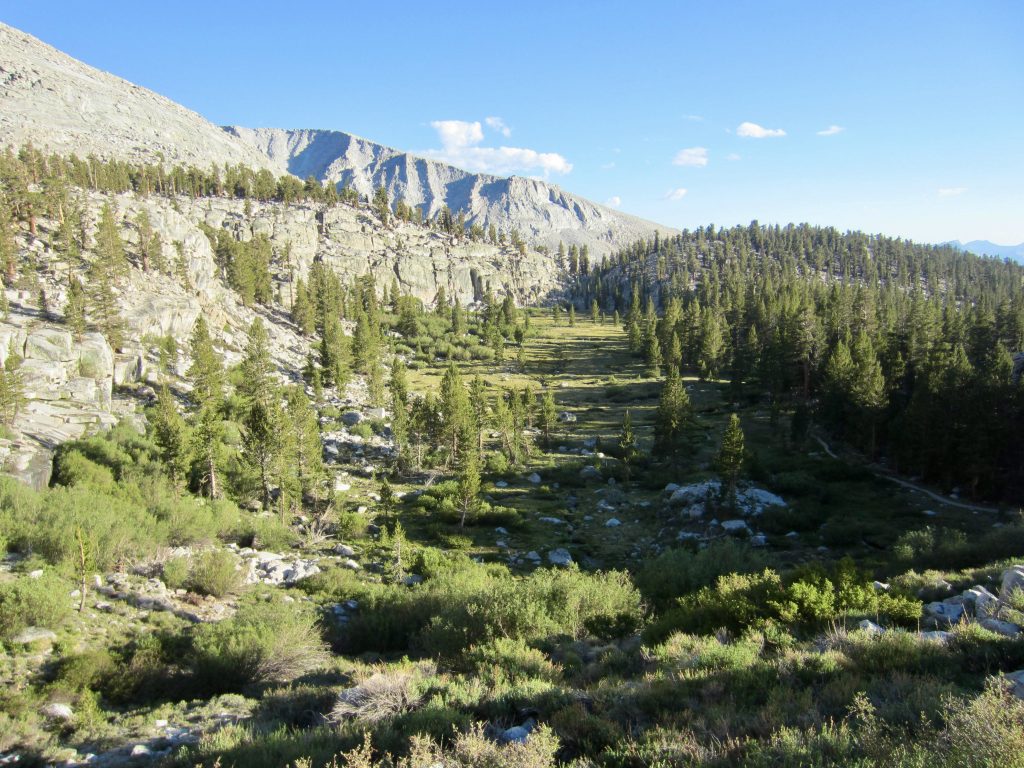
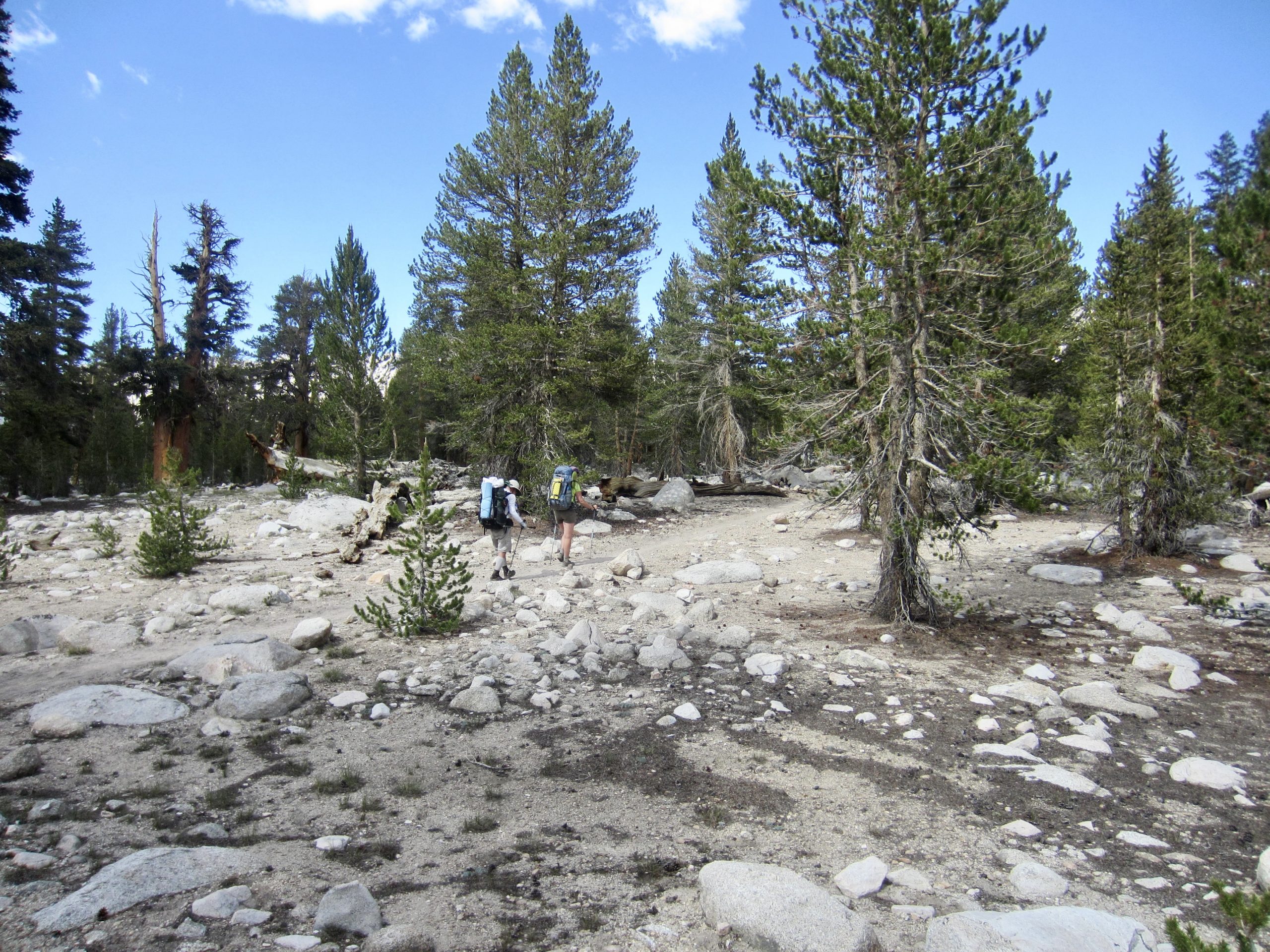
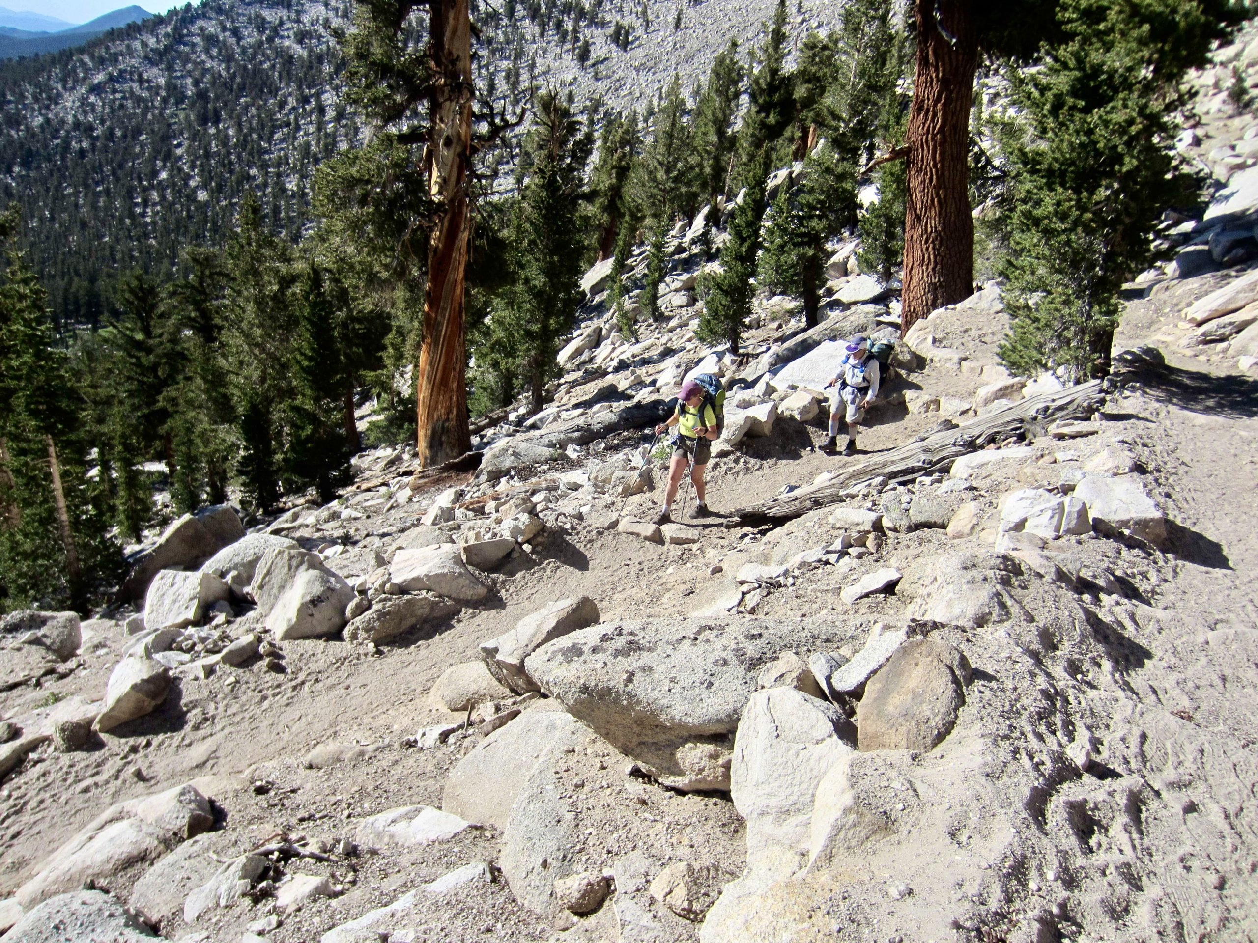
Our day began by contouring ½ mile across a bouldery slope to intersect the Shepherd Pass Trail just above a large depression called The Pothole. We then followed this quasi-maintained trail up through a post-glacial wasteland of sand, scree, and talus, wandering between old lateral moraines and switch-backing up a steep chute.

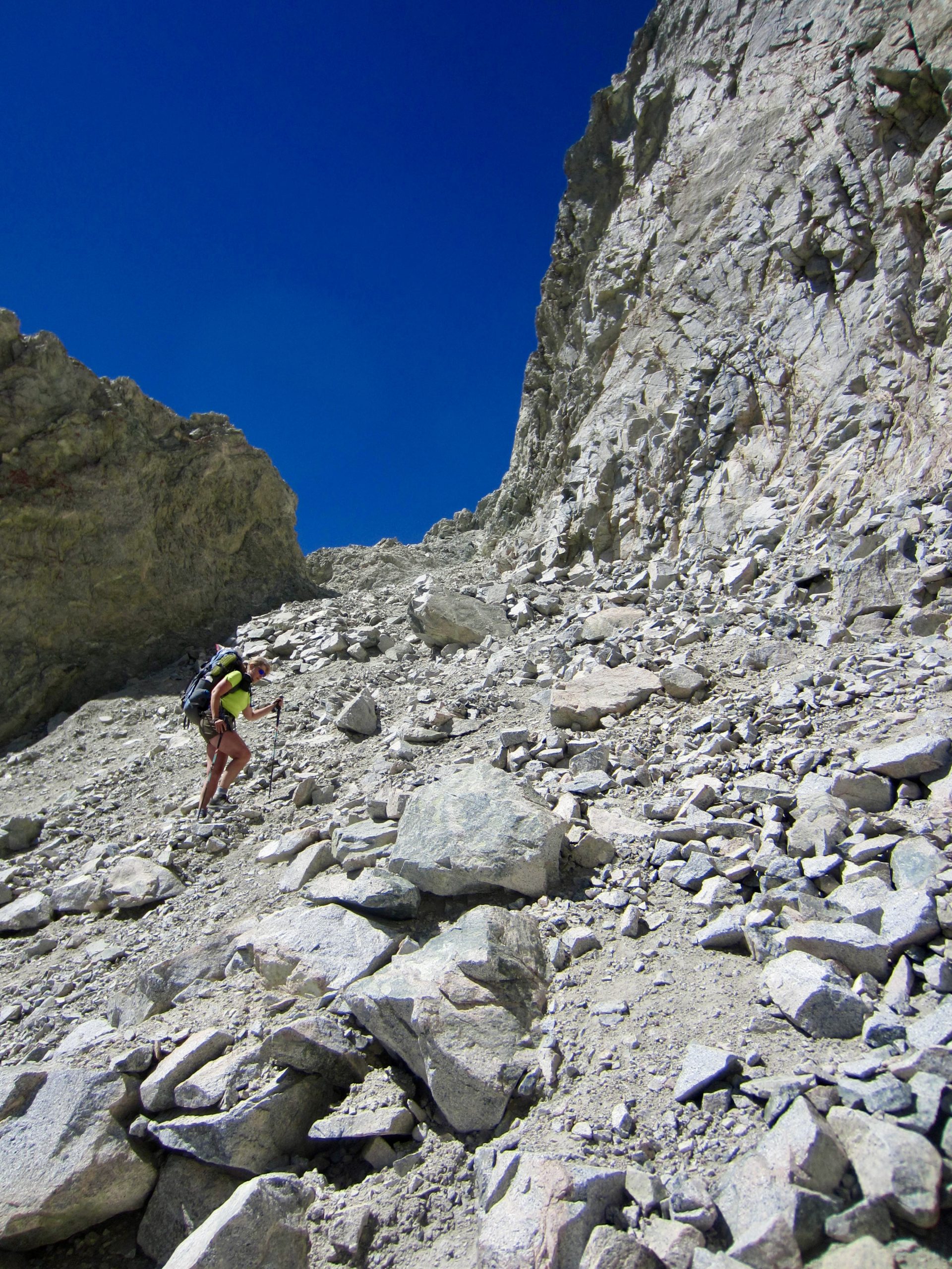
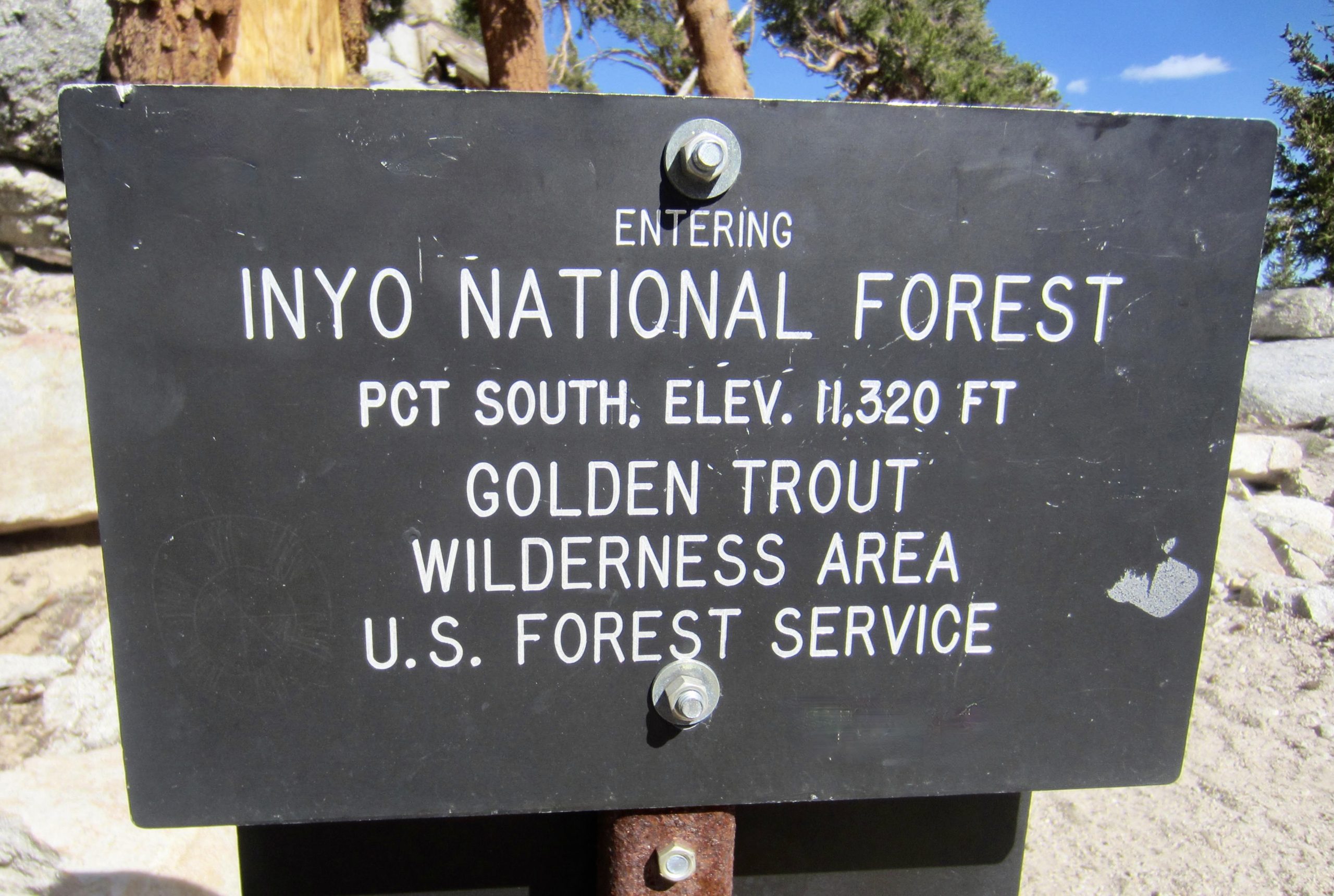
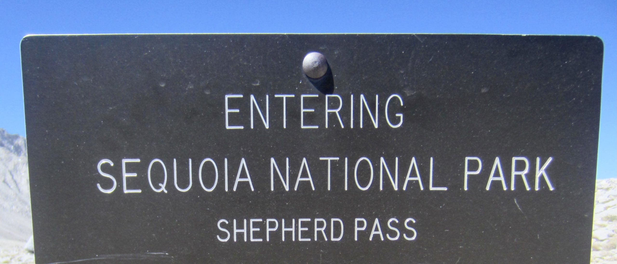
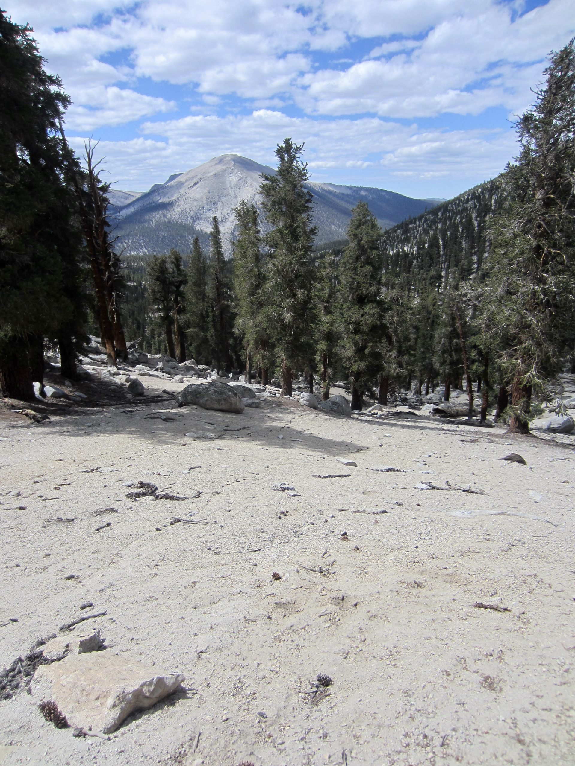
We crossed over 12,000-foot Shepherd Pass in mid morning (2.0 hours + 900 feet from Camp 2) and entered Sequoia National Park. From here, Mt. Tyndall and other peaks were visible to the south and west, with the sprawling meadowland of the Tyndall Creek drainage below. None of us regretted having taken our alternative route over Junction Pass and Shepherd Pass, rather than the conventional route over Forester Pass; however, I wouldn’t recommend it to anyone who objects to lots of loose rock and boulder hopping.
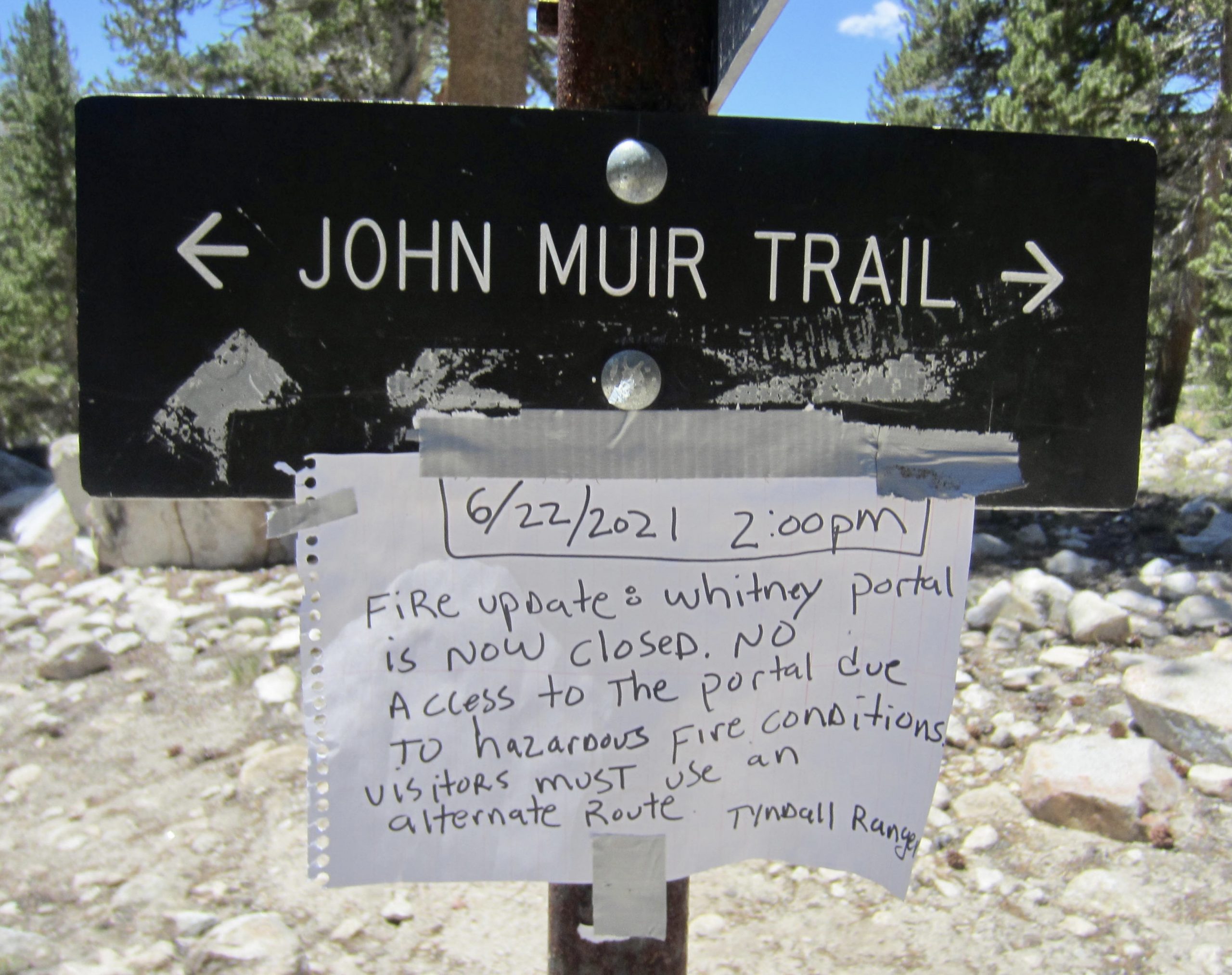
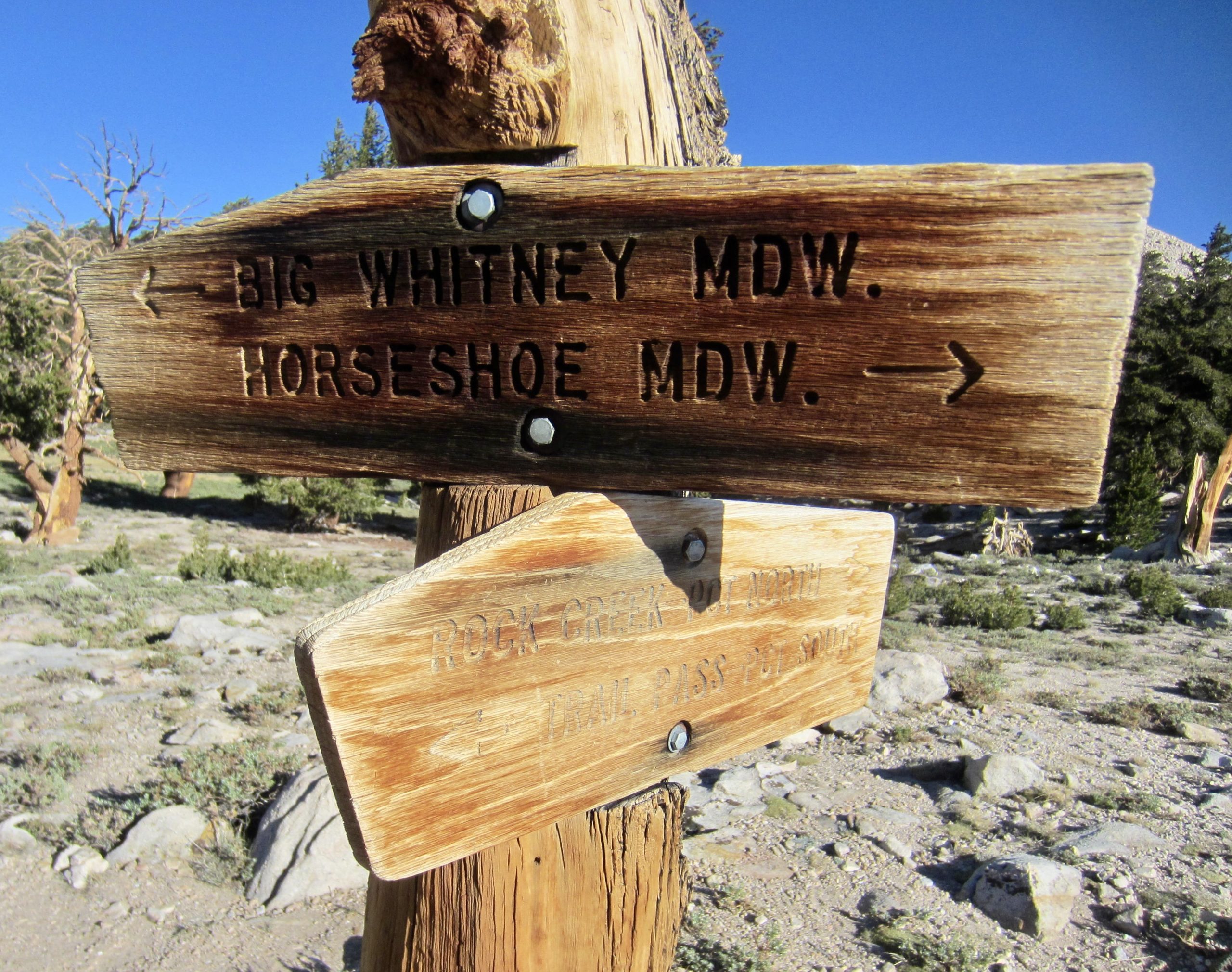
From Shepherd Pass, we hiked 3 miles down through Tyndall Creek Meadows, encountering a park ranger along the way—the first person we’d seen since yesterday morning. He broke the unwanted news that Whitney Portal was still closed and was not likely to reopen anytime soon; as such, he recommended that we exit at Horseshoe Meadow Trailhead by going over New Army Pass or Cottonwood Pass. Our “Plan B” in the event that Whitney Portal remained shut down had been to backtrack over Shepard Pass and exit at Shepard Creek Valley. We now pivoted to “Plan C,” which would involve following the ranger’s recommendation.
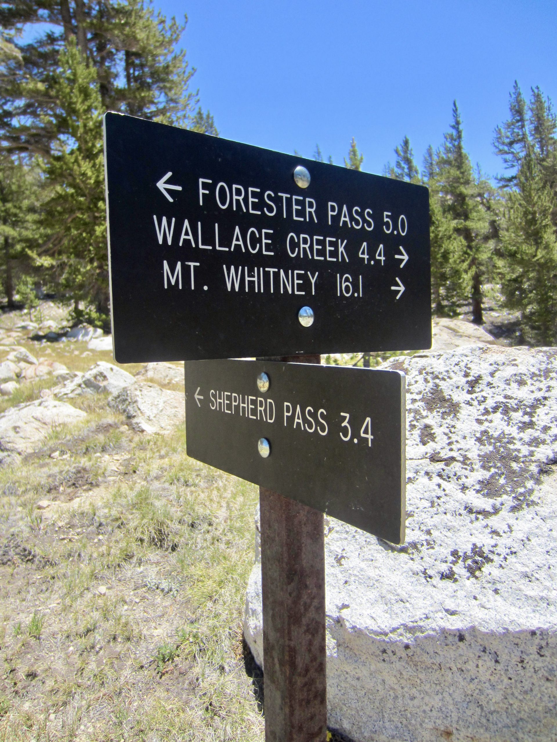
Near the bottom of the meadows, we reconnected with the PCT/JMT at Tyndall Creek Junction. A hand-written note here warned hikers that Whitney Portal was closed, and it specifically advised using Cottonwood Pass as an alternative exit. This was merely the first of many such notes we would see over the next few days, so it was difficult for anyone to claim ignorance about the Portal closure.
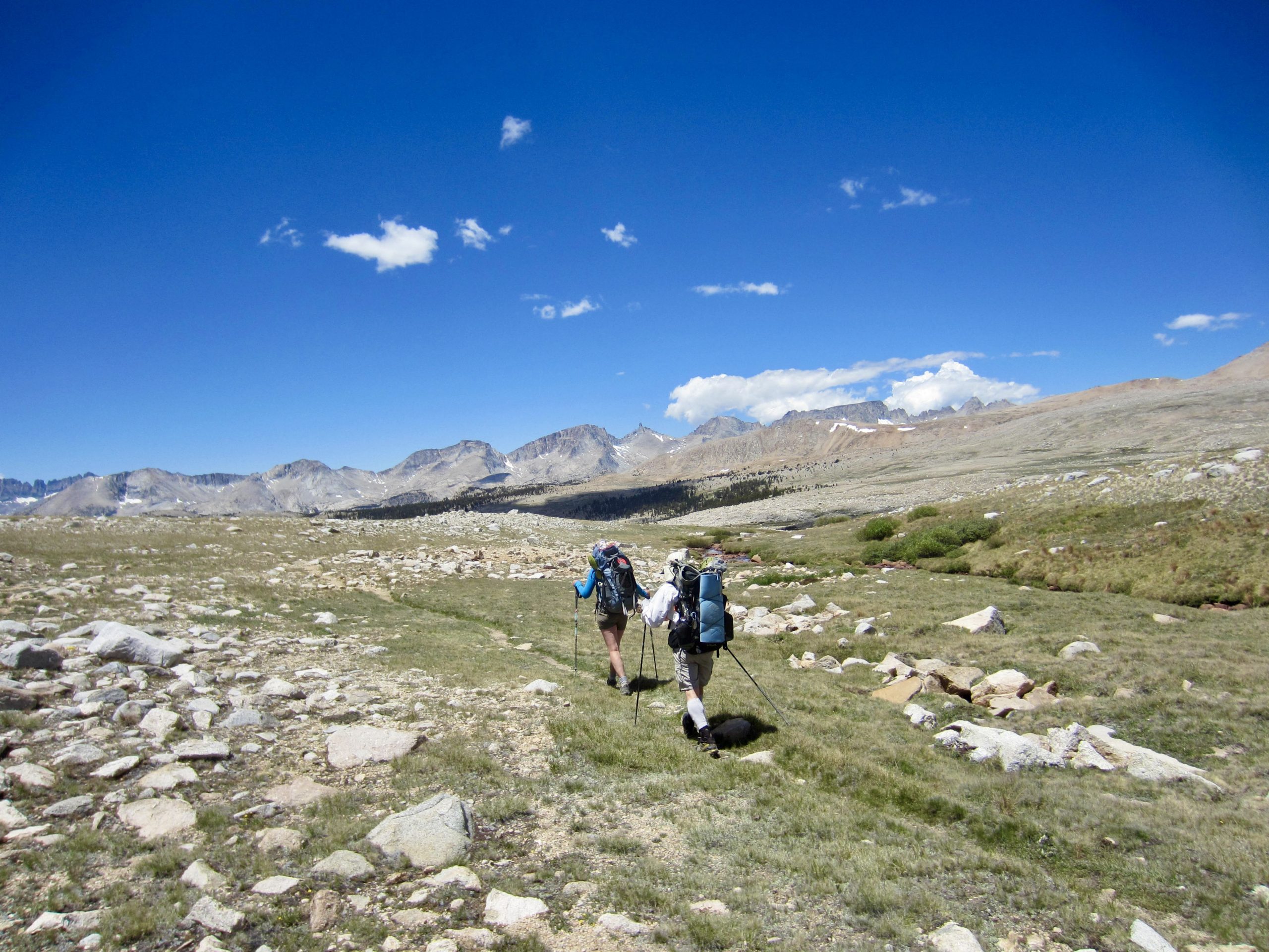
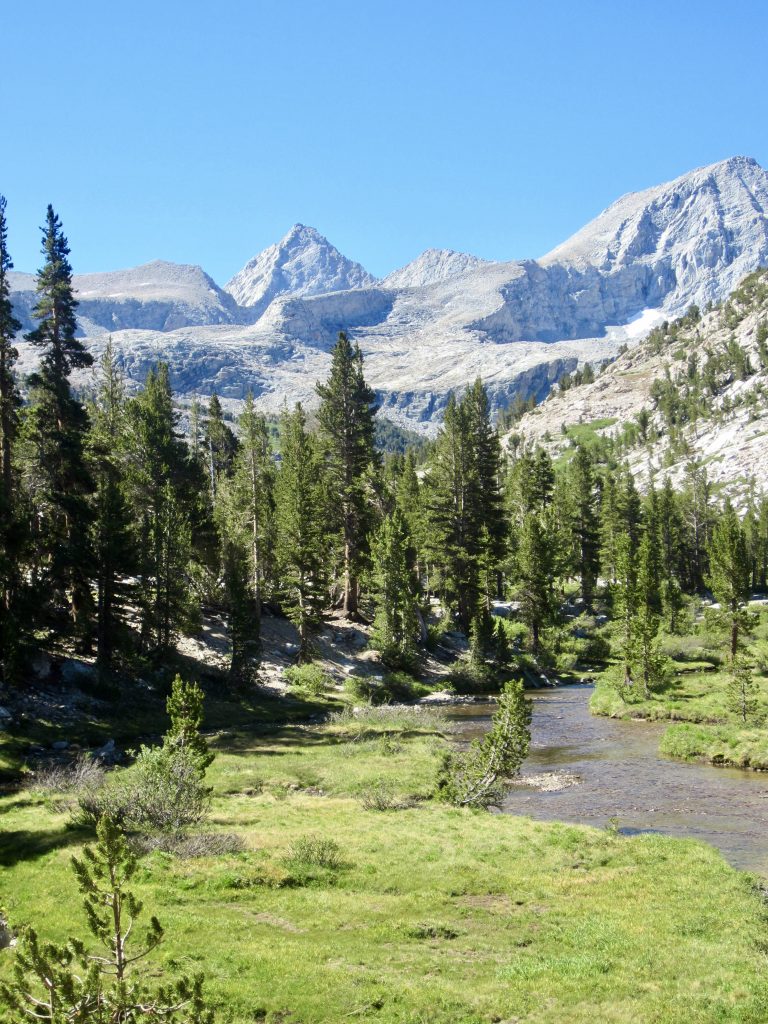
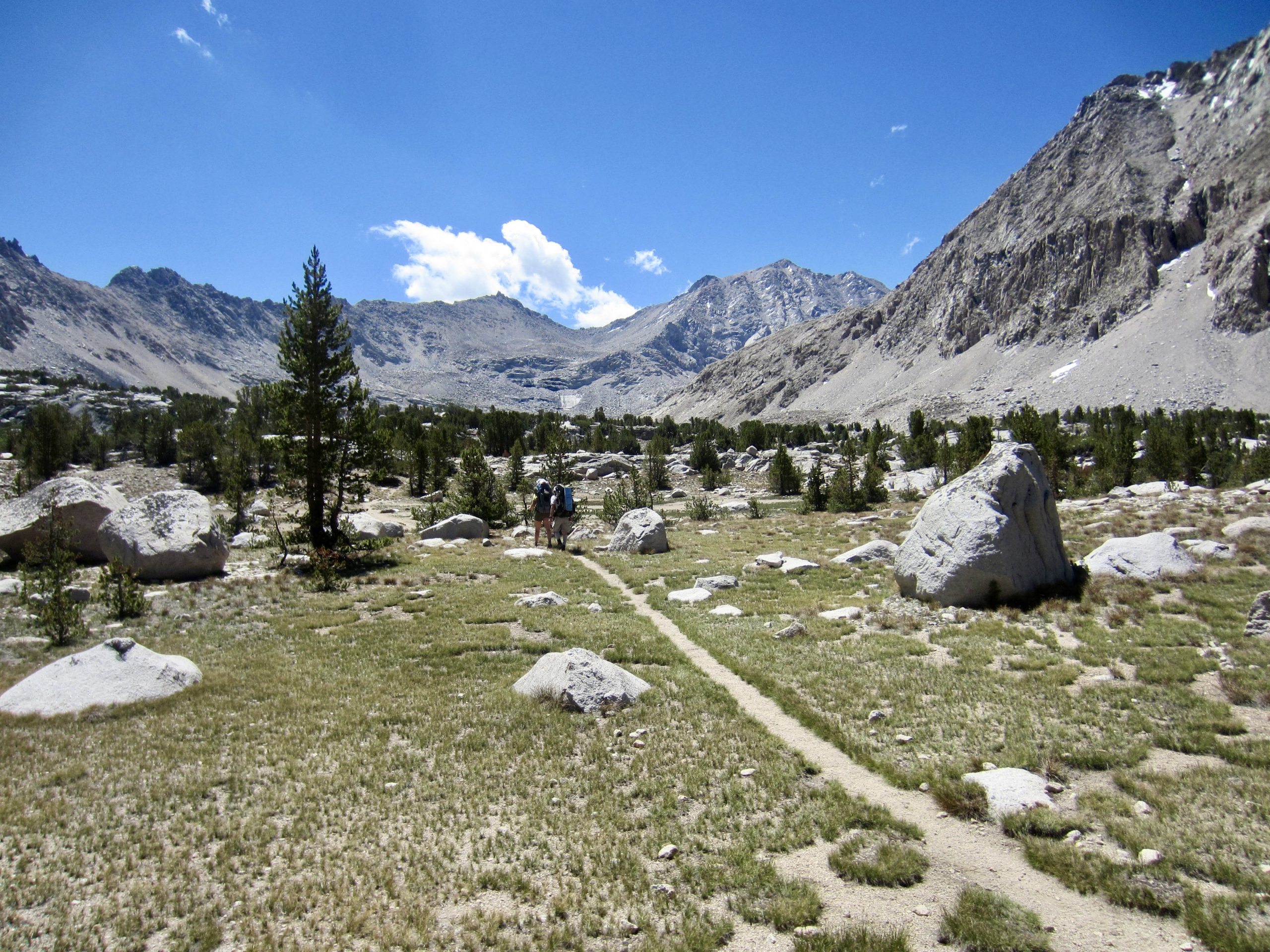
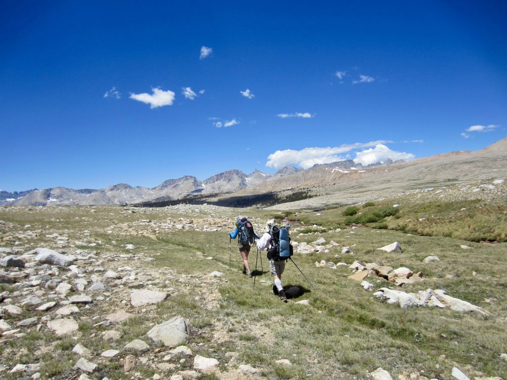
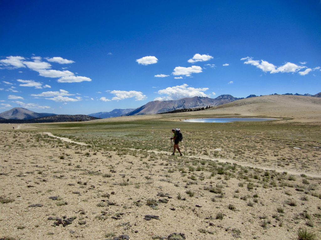
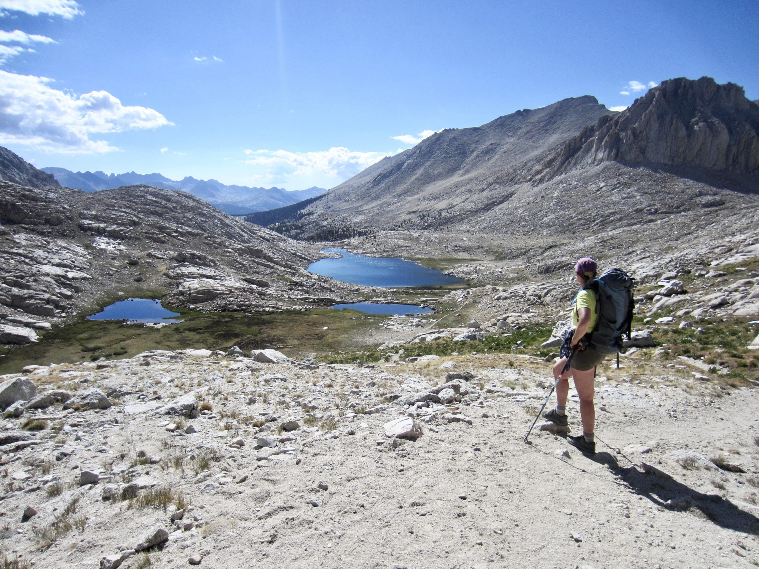
We turned left on the PCT/JMT and proceeded southward across the expansive Big Horn Plateau. Despite lying at a high elevation of 11,400 feet, this scenic plateau has the appearance of a lowland pasture.
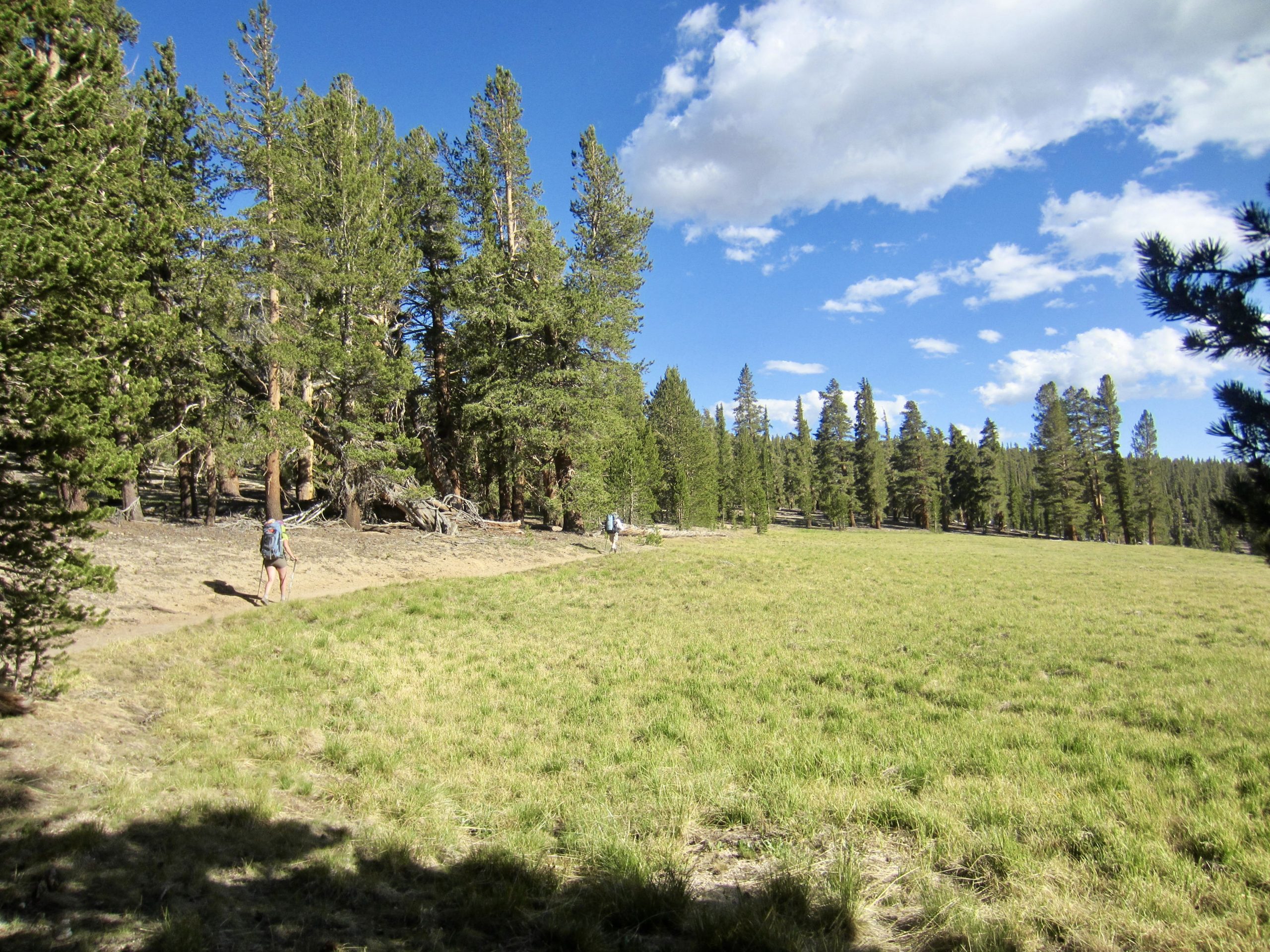
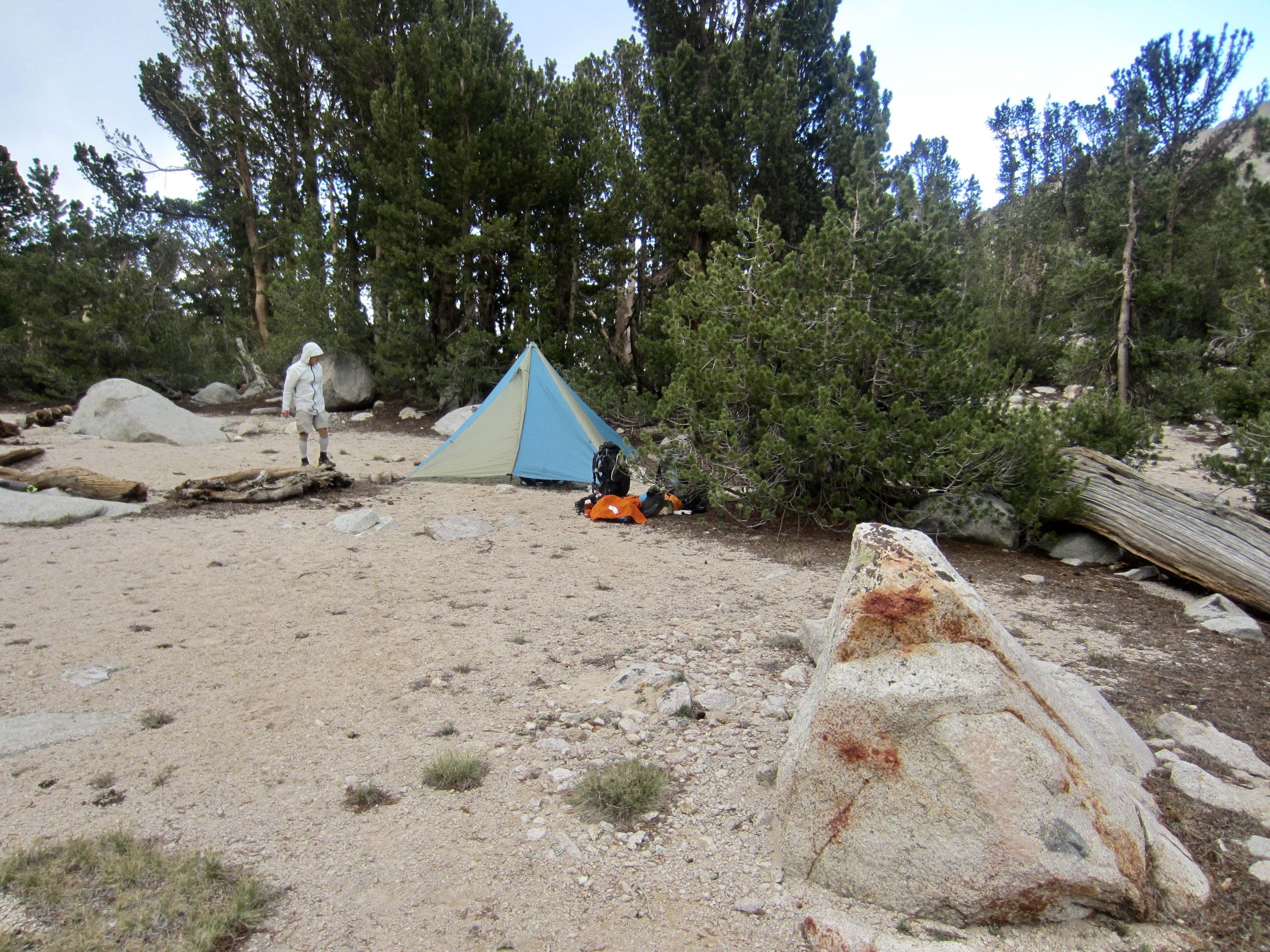
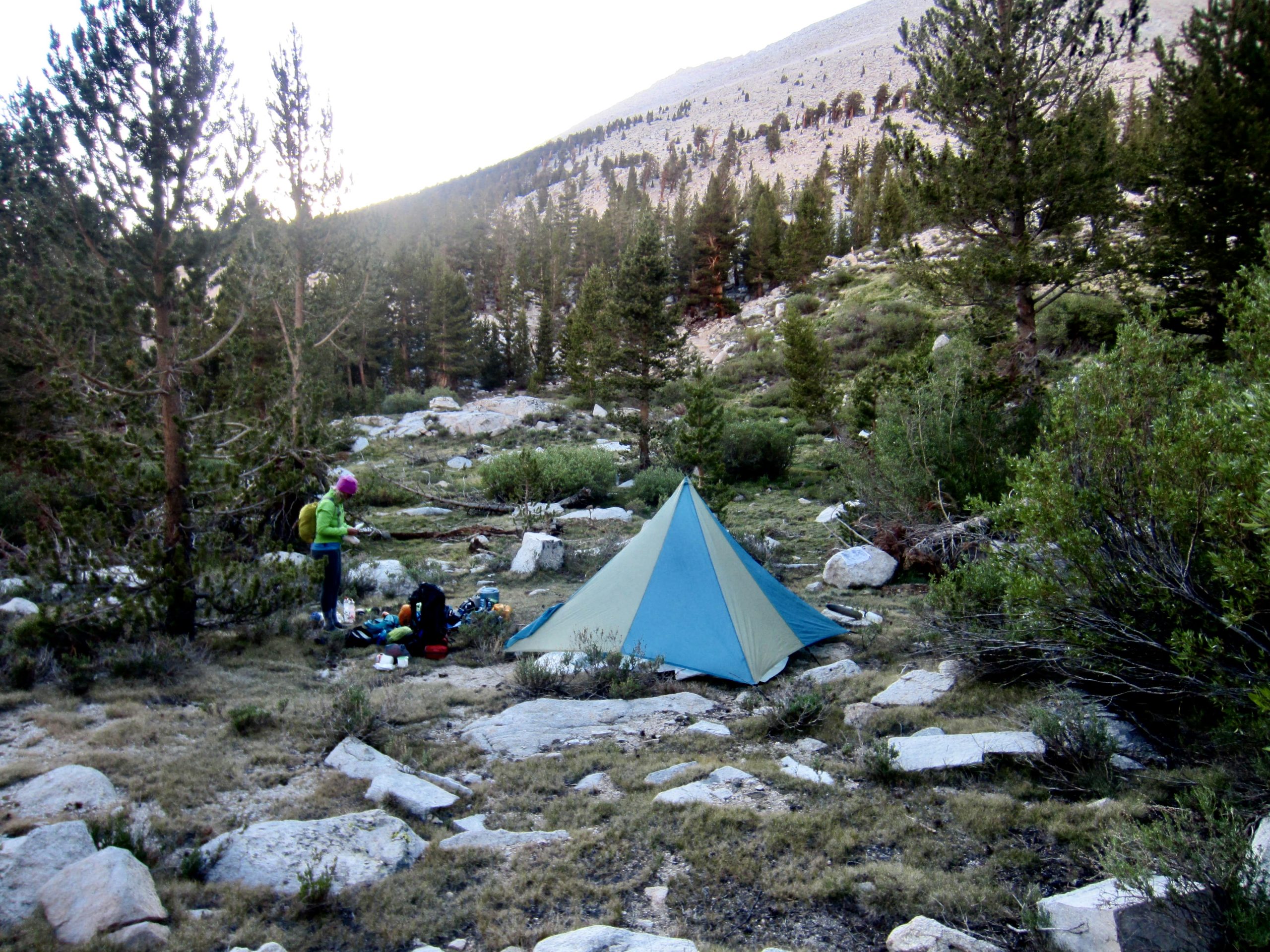
After crossing Wright Creek and Wallace Creek south of the plateau, we reached a trail junction overlooking Lower Crabtree Meadow. Here, the PCT continued southward to Cottonwood Pass, whereas the JMT turned eastward and headed up Whitney Creek. We followed the JMT for 1½ miles, past Upper Crabtree Meadow, and established Camp 3 in the uppermost meadow of Whitney Creek (10.2 hours + 14.2 miles + 2600 feet from Camp 2). Based on our recent decision to exit over Cottonwood Pass, Eileen used a satellite texter to contact East Side Sierra Shuttle regarding our revised pick-up place and time.
Day 4: Mt. Whitney Summit Climb
Our camp in Upper Whitney Creek Meadow was 6½ miles and 4000 vertical feet away from the summit of Mt. Whitney. It soon became apparent that there are two different groups of climbers launching their summit bid from this vicinity each day: the “dark-thirty group” leaves camp shortly after midnight, with a goal of watching sunrise from the summit; in contrast, the “crack-of-dawn group” leaves camp shortly after sunrise, with a goal of having lunch on the summit. George, Eileen, and I headed out with the second group.

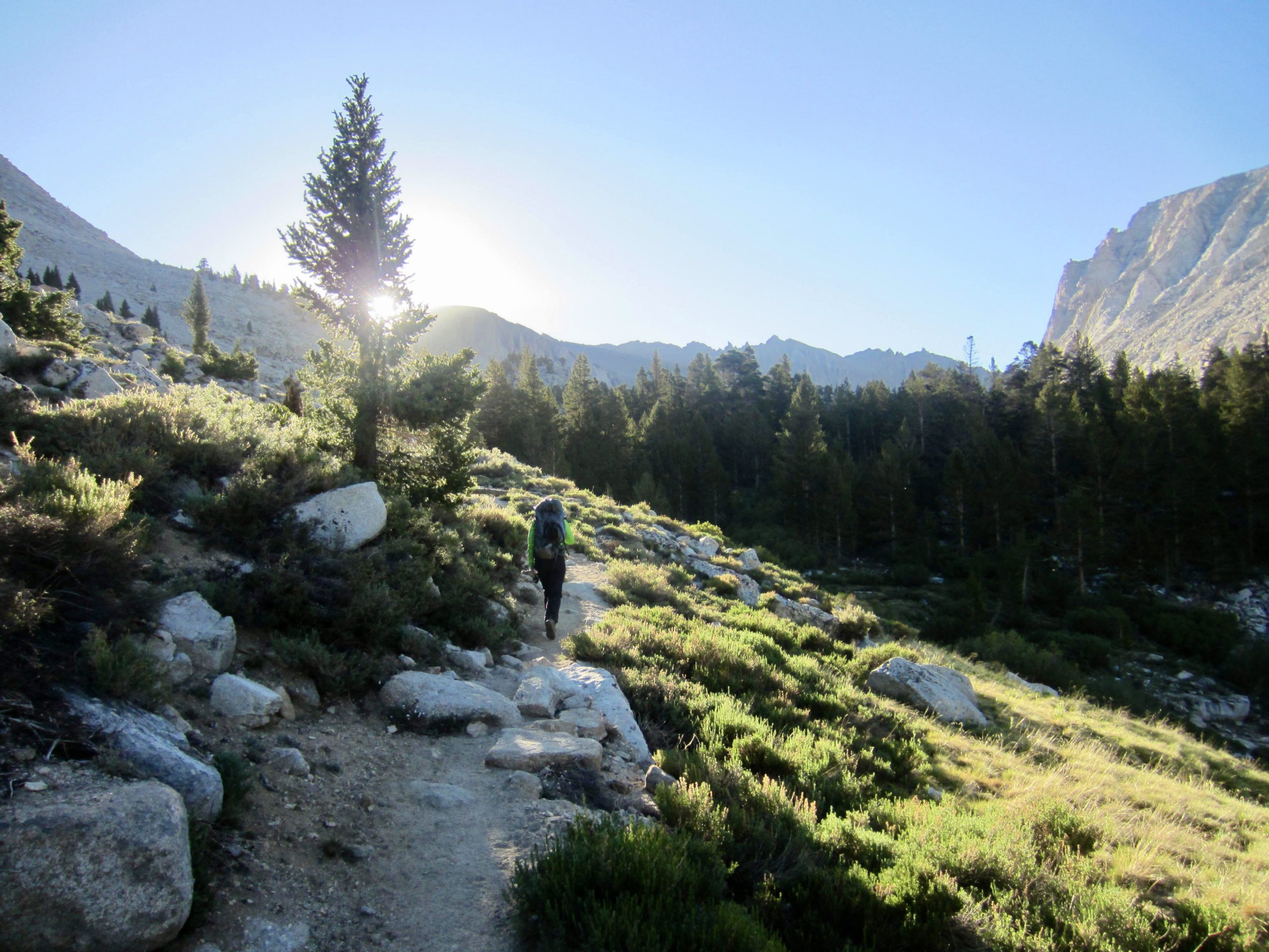
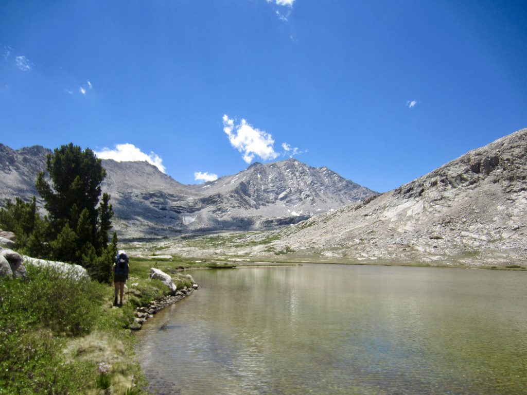
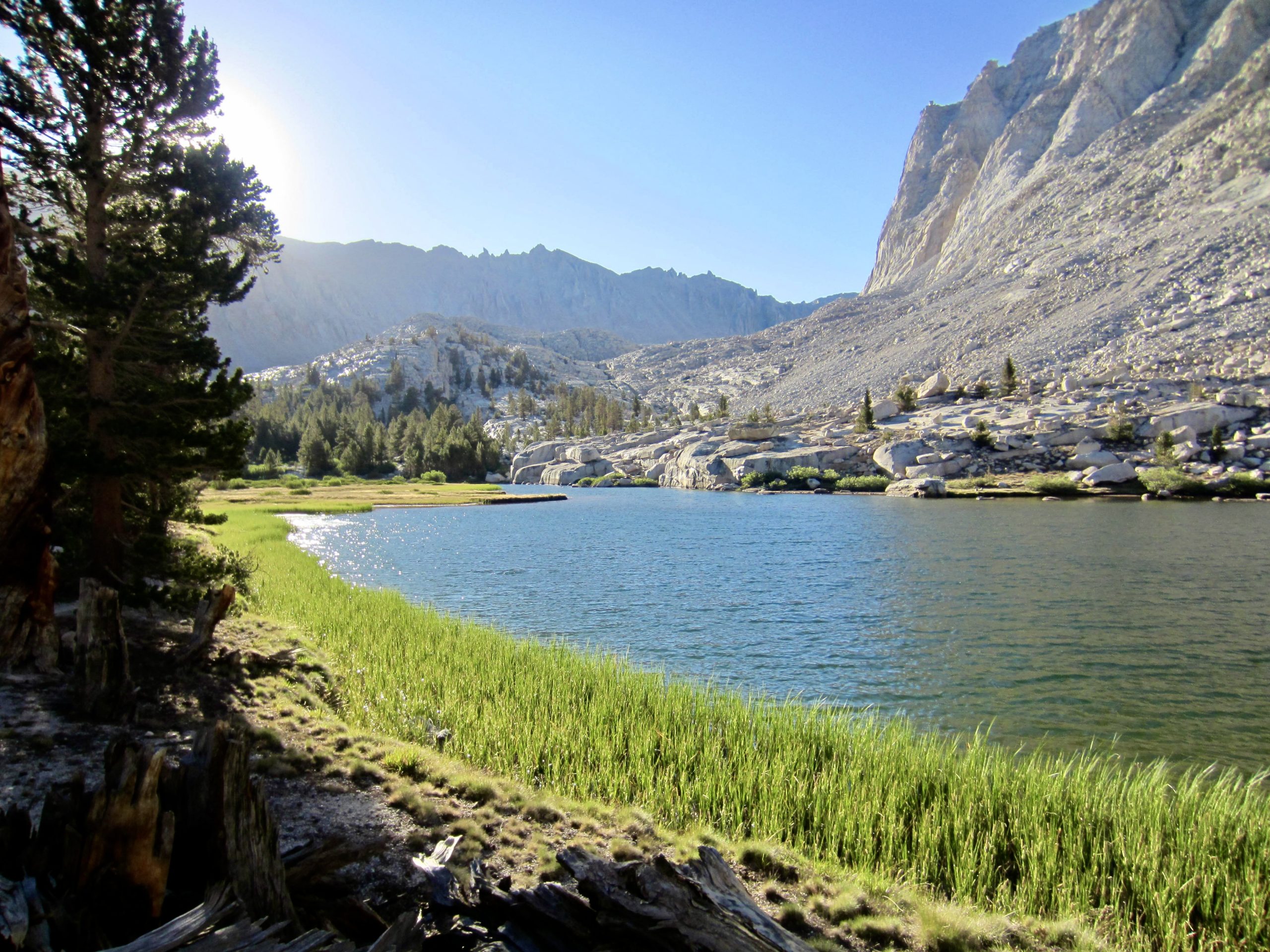
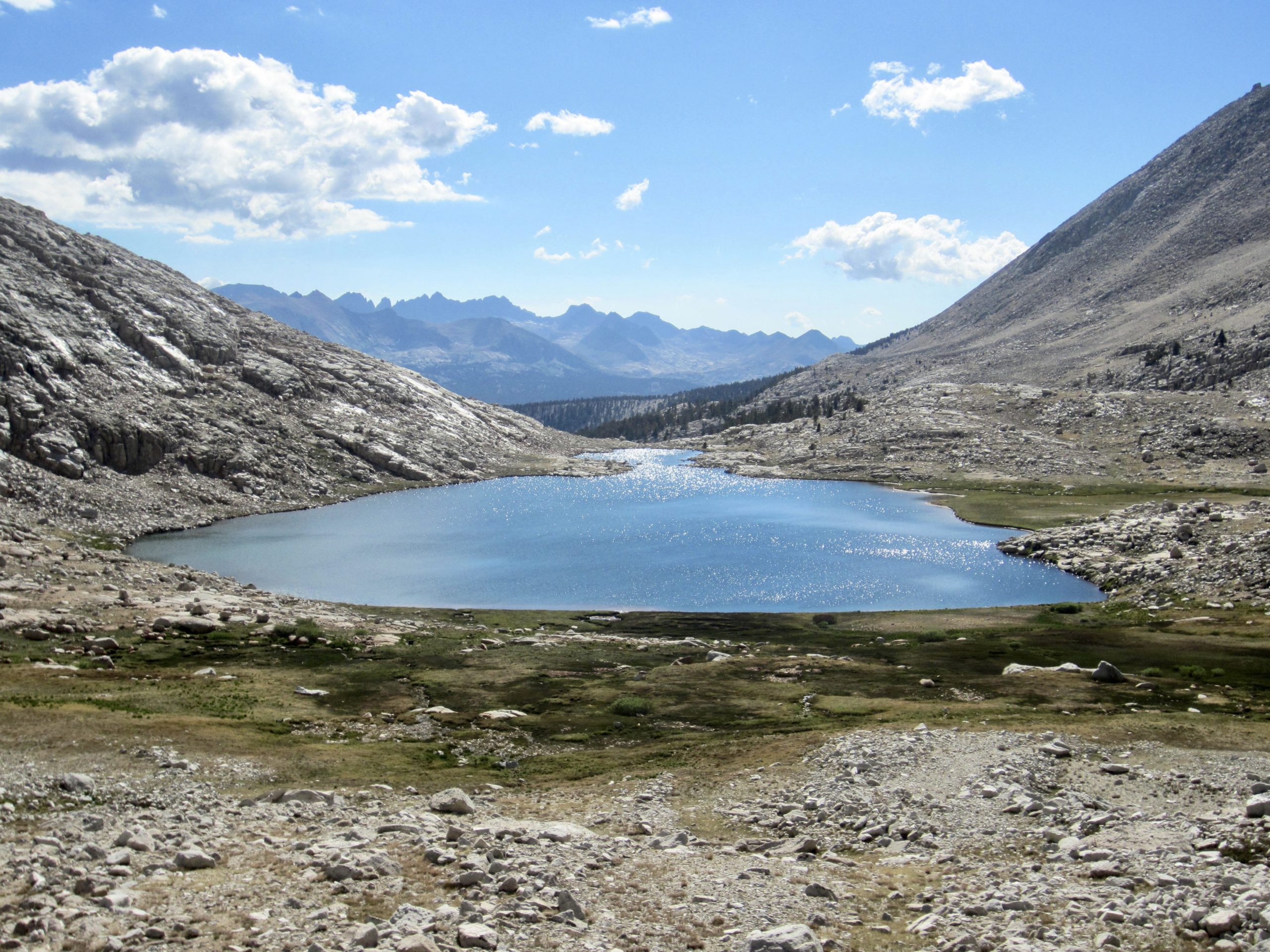
From camp, we hiked up-valley on the JMT in cool morning air, passing Timberline Lake and skirting around Guitar Lake. The inlet stream at Guitar Lake provided our last convenient and reliable water source for the climb.
Beyond Guitar Lake, the JMT began a long ascent across barren slopes on the southwestern flank of Mt. Whitney. Because George had not yet been vaccinated for “SummitFever-21,” he blazed ahead while Eileen and I proceeded at a slower pace.
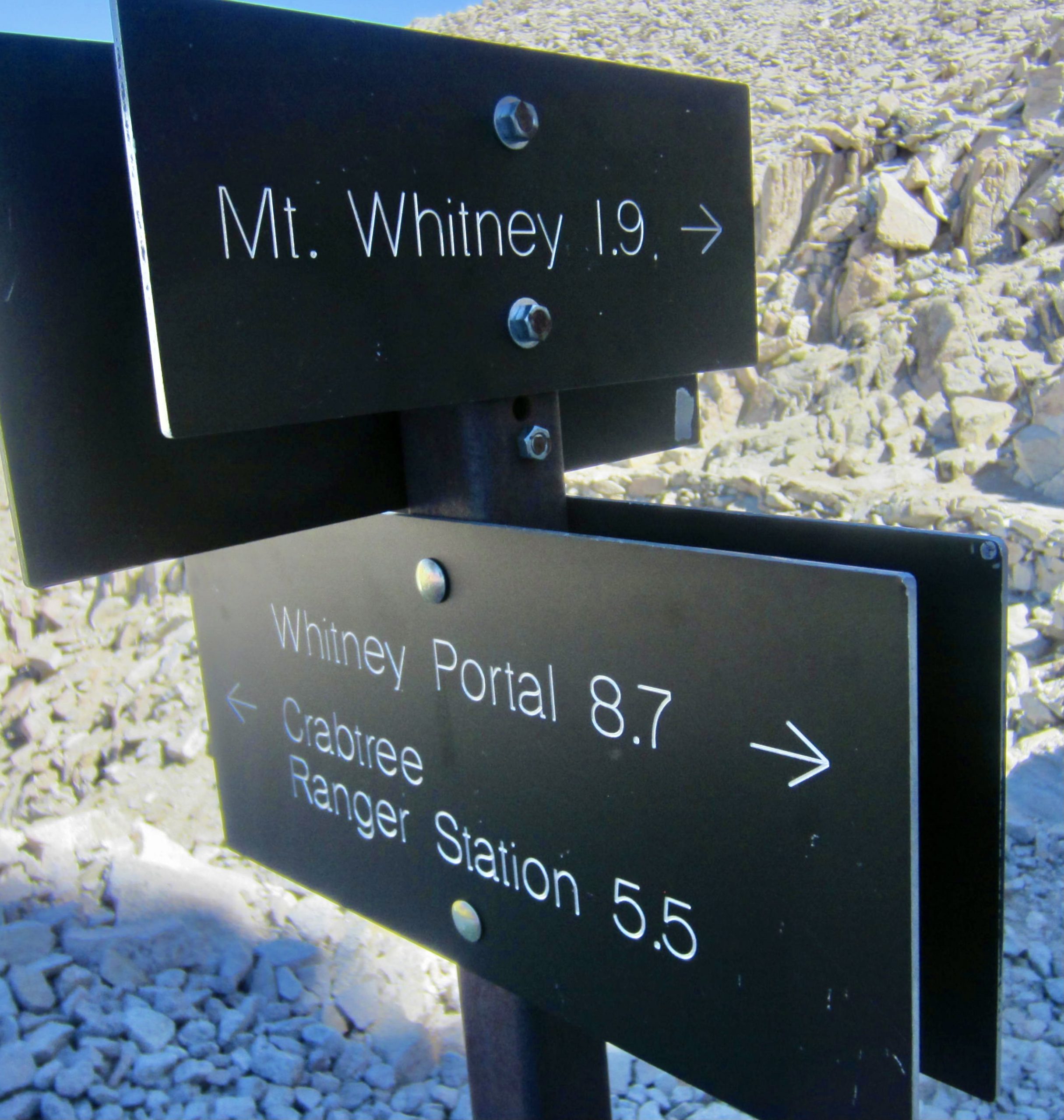
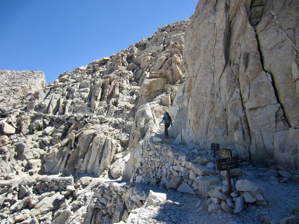
After zigzagging up a seemingly endless series of switchbacks, we spotted the silhouette of hikers gathered on a rock step ahead. This rock step turned out to be the location of a high junction, where the JMT splits into two branches. The left branch continues up to the summit of Mt. Whitney, whereas the right branch crosses over Trail Crest and descends to Whitney Portal. Although the Portal was officially closed due to fire danger, several hikers could be overheard declaring that they were heading down anyway. (We later learned that some descending hikers were turned around by the sheriff and sent back over Trail Crest.)
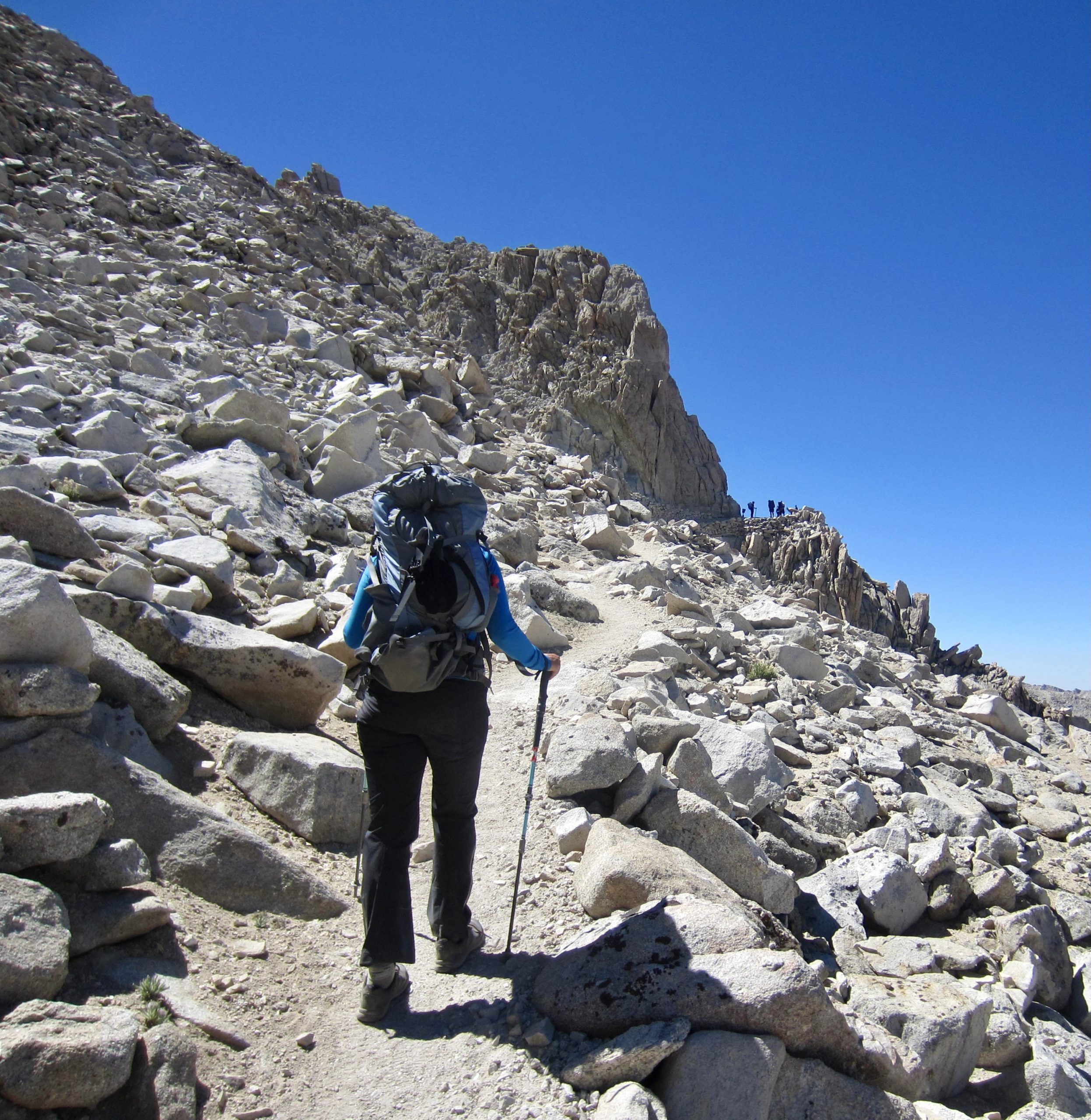
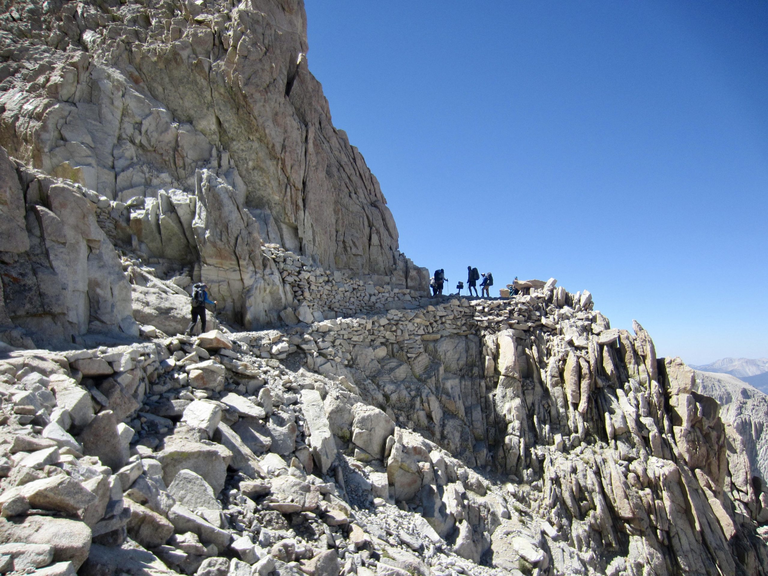
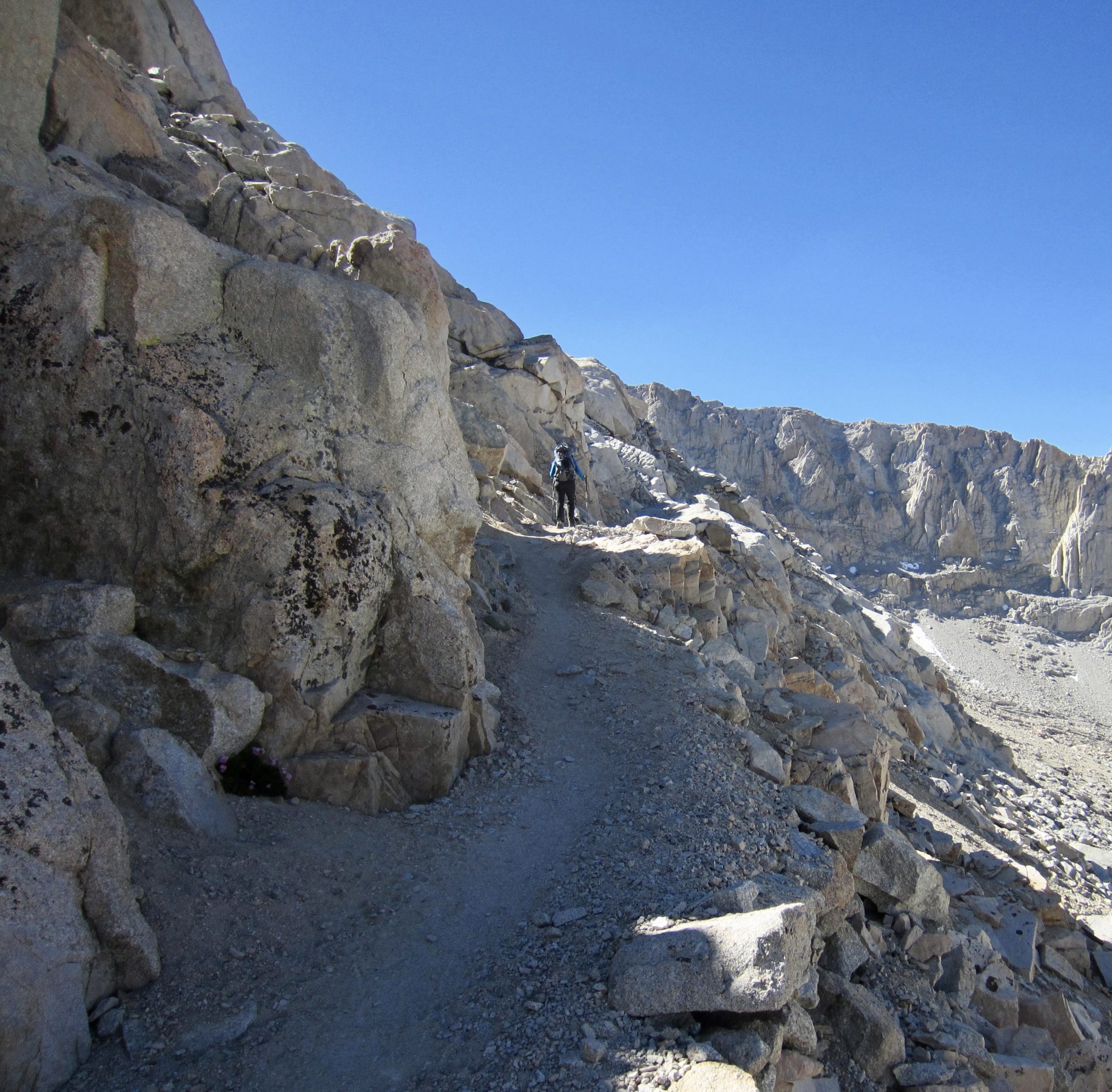
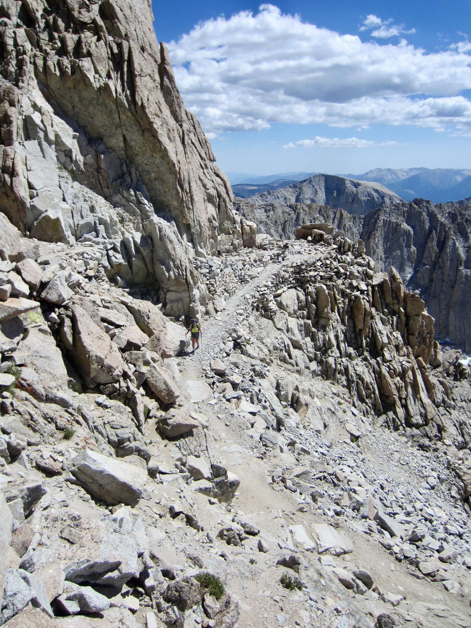
Following a snack stop at High Junction, Eileen and I started the final leg of our ascent via the 2-mile-long summit trail. The first mile of this summit trail displays an impressive level of construction, having been blasted into solid granite cliffs and hacked into loose rock slopes. There are numerous rockery walls tenuously supporting the trail bed across unstable gullies.
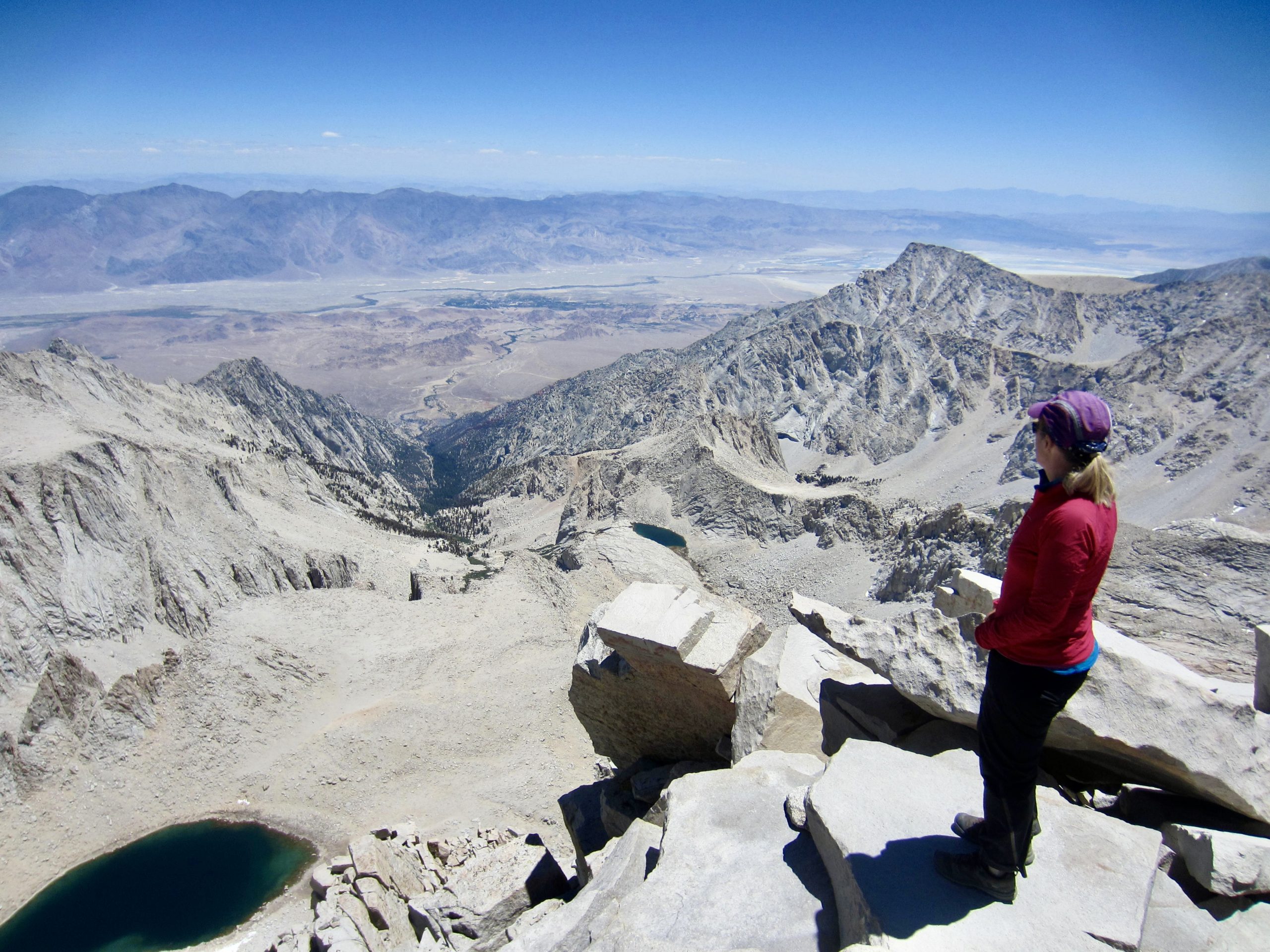
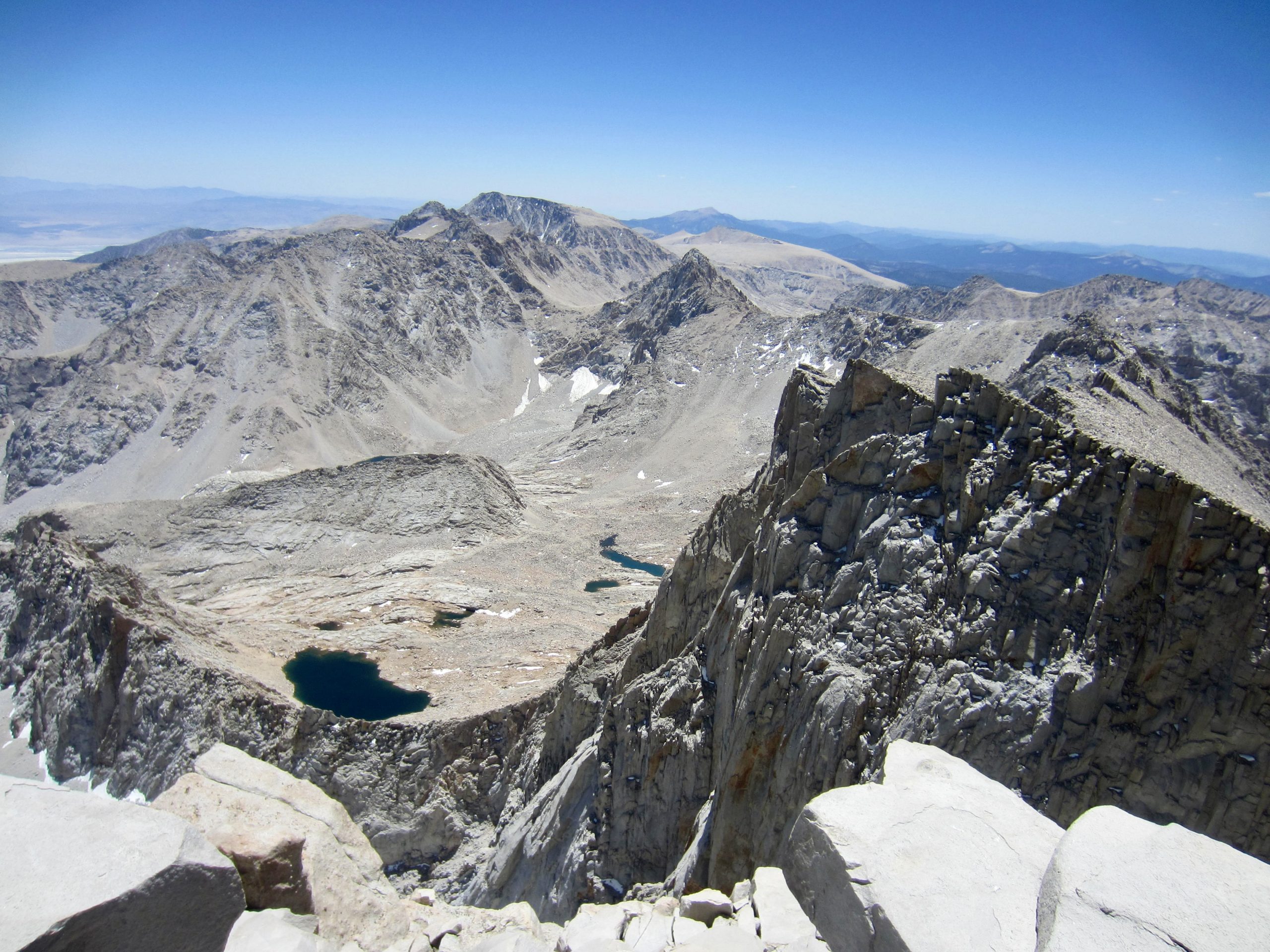
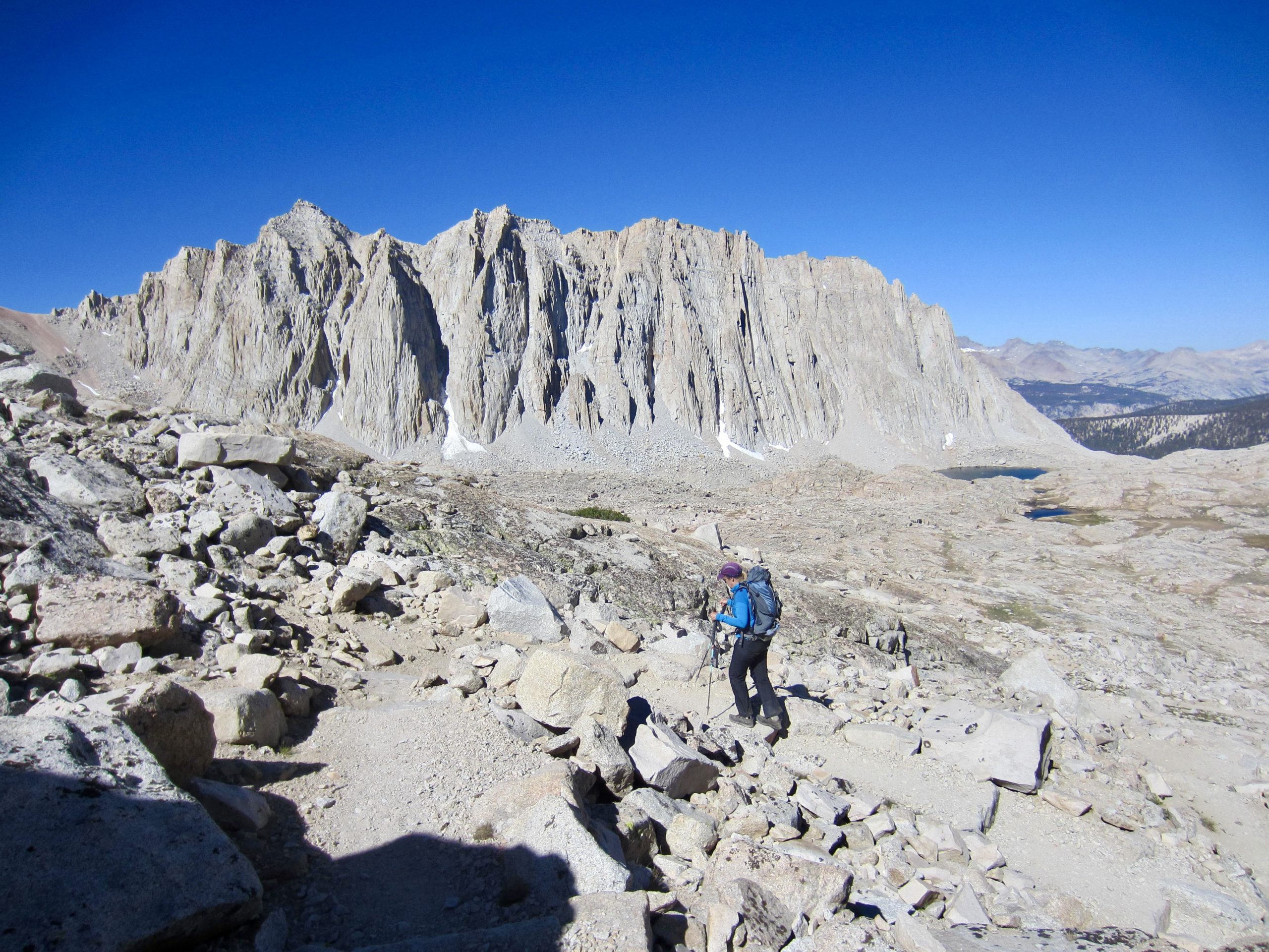
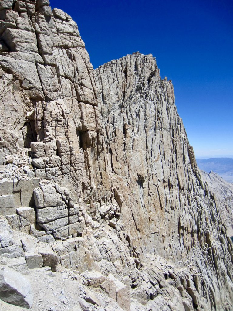
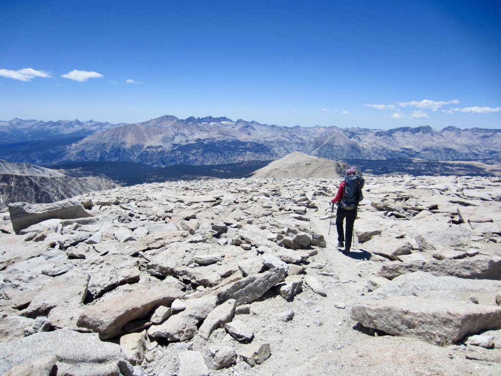
Mt. Whitney’s summit soon came into view over a mile to the north. Frank Sinatra was famous for having a “good side” and a “bad side,” and this is doubly true of Mt. Whitney; its eastern side is a spectacularly tall, vertical wall of granite, culminating in a sharp horn, whereas its western side is an unimpressive slope of scree and talus. At several locations, our west-side summit trail went past ridge notches that allowed brief peeks of the heavily fissured eastern face.

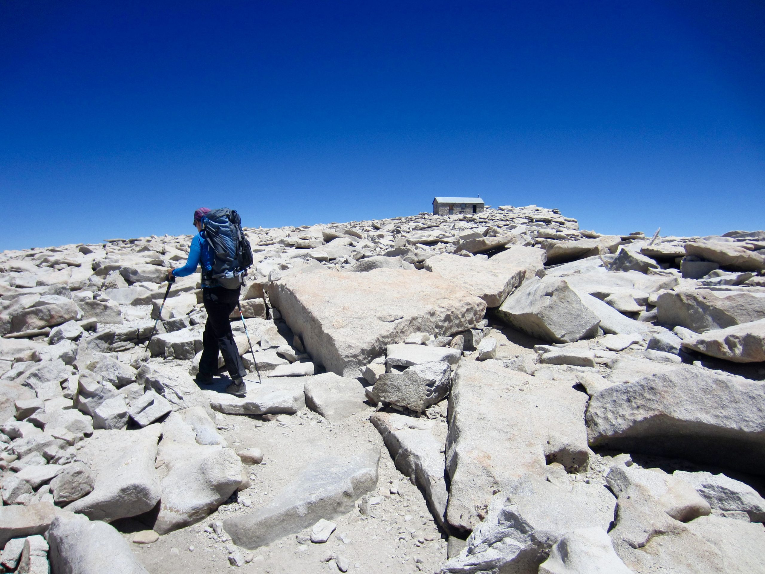
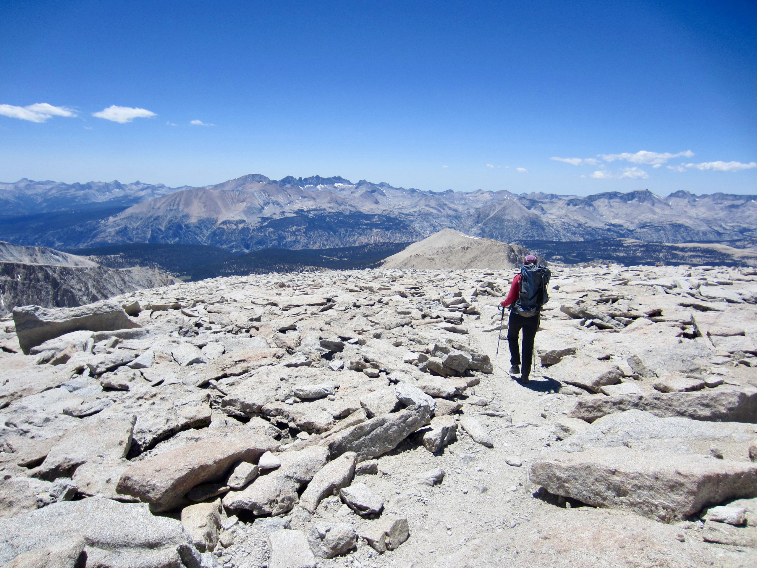
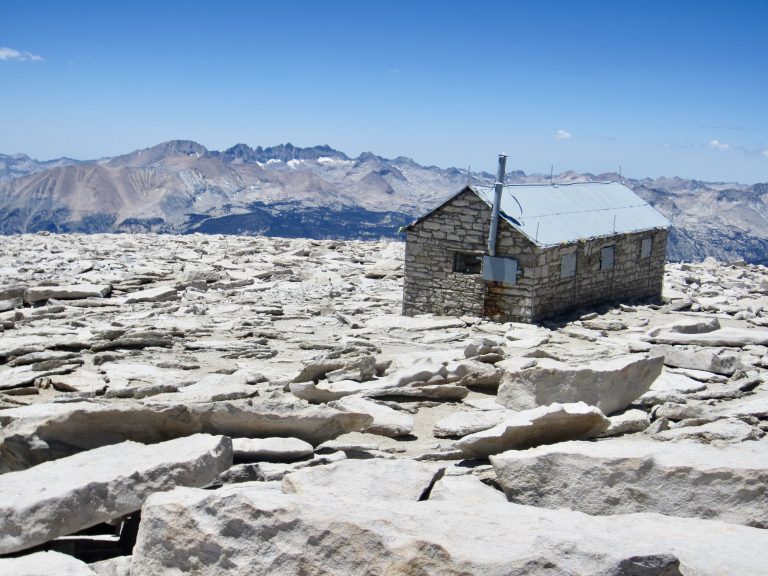
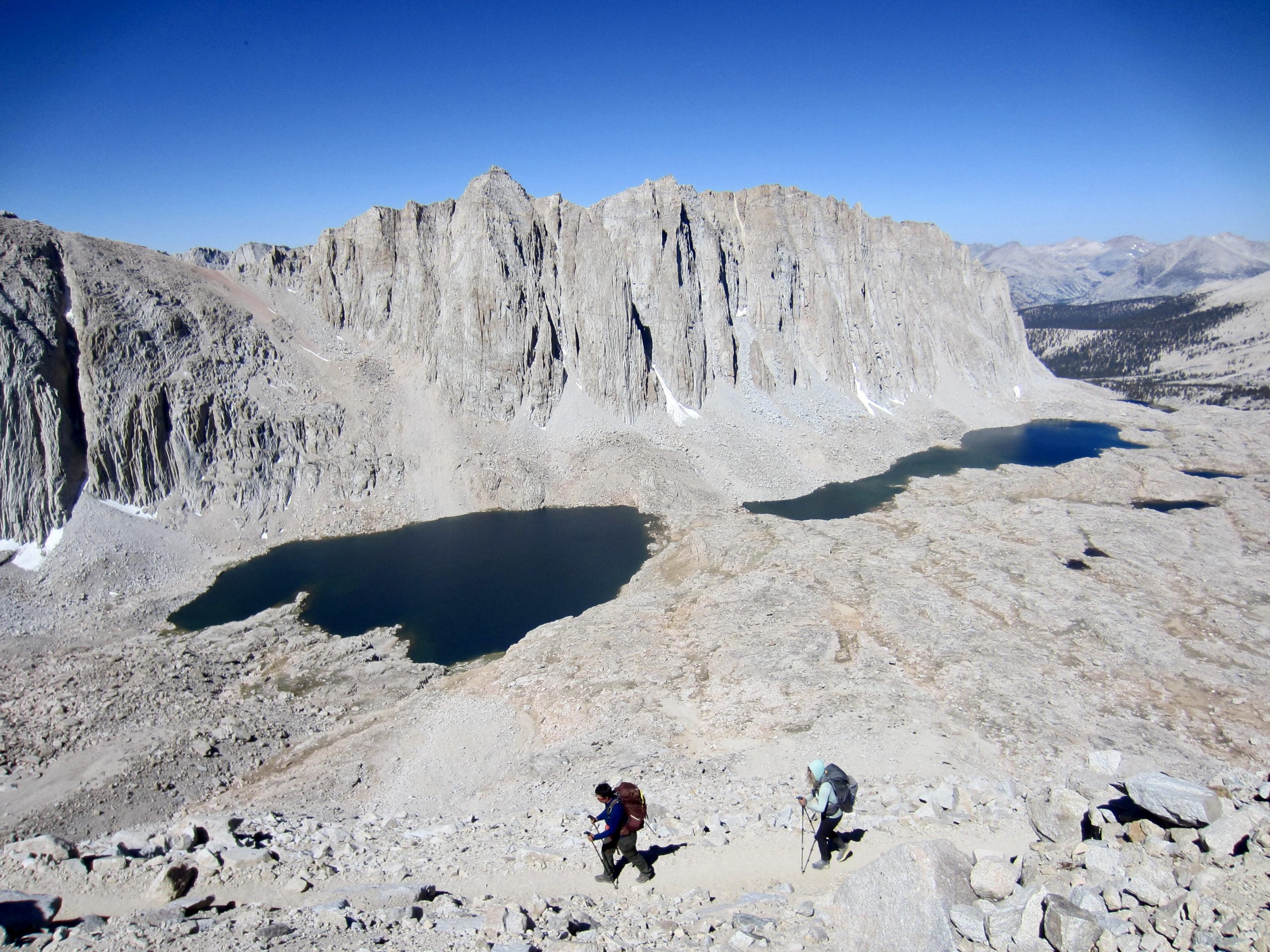
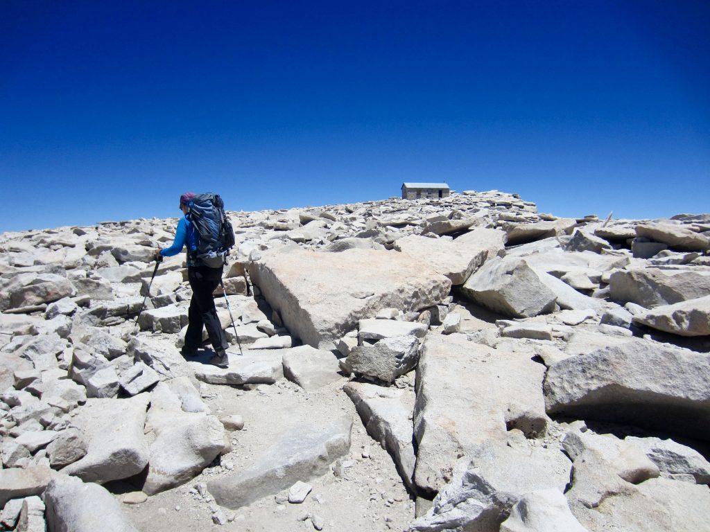
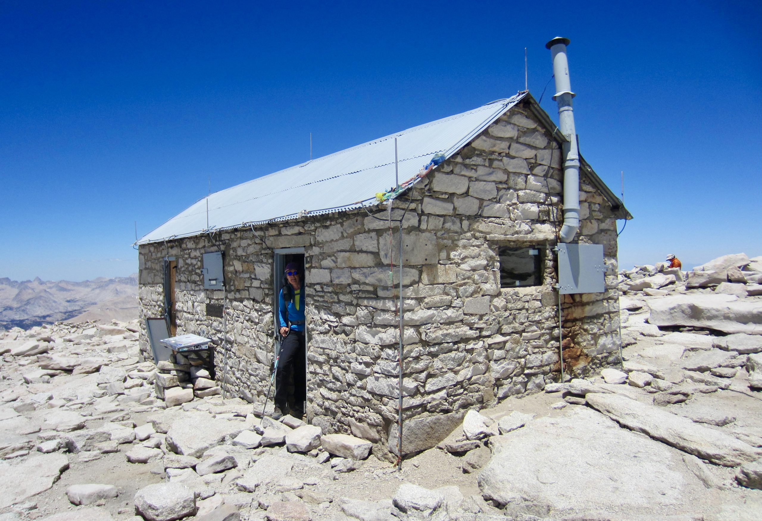
The second mile of the summit trail involves a low-angle traverse across talus slopes to reach the broad western shoulder, followed by a curvy hike up the gently inclined shoulder. We were now over 14,000 feet high and feeling the altitude, but then, very suddenly, the stone summit shelter popped into view just a few hundred yards away. What a welcome sight!

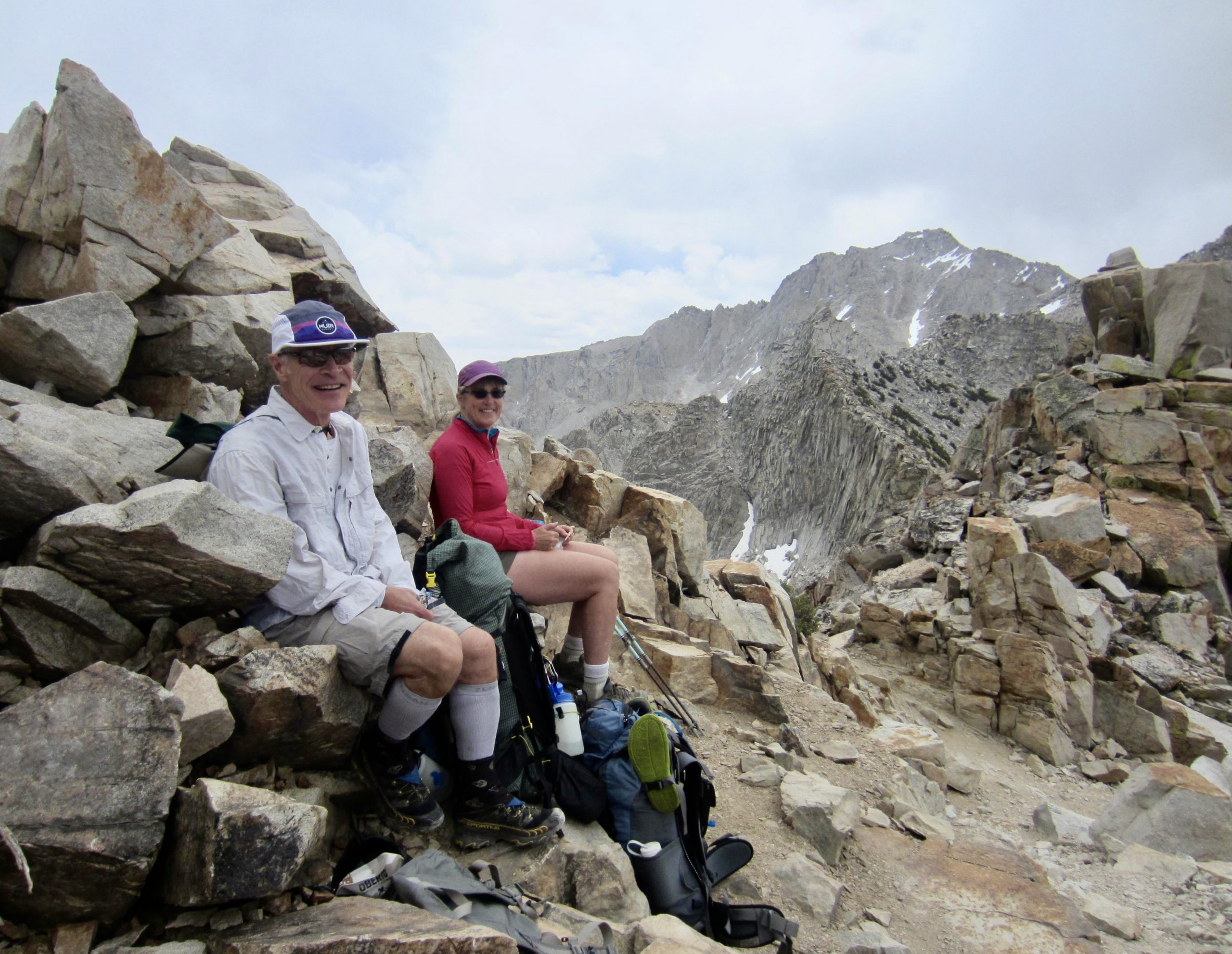
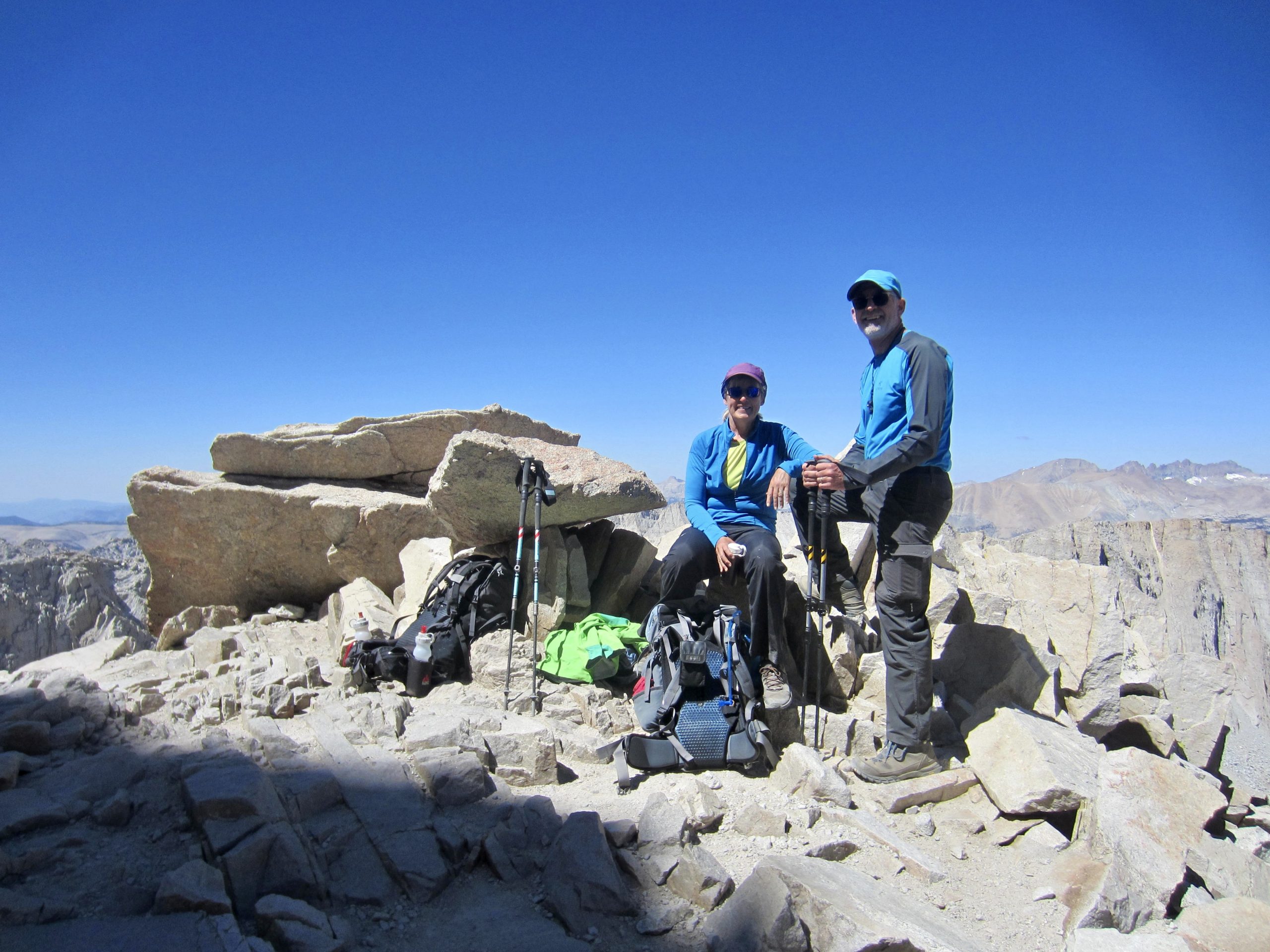
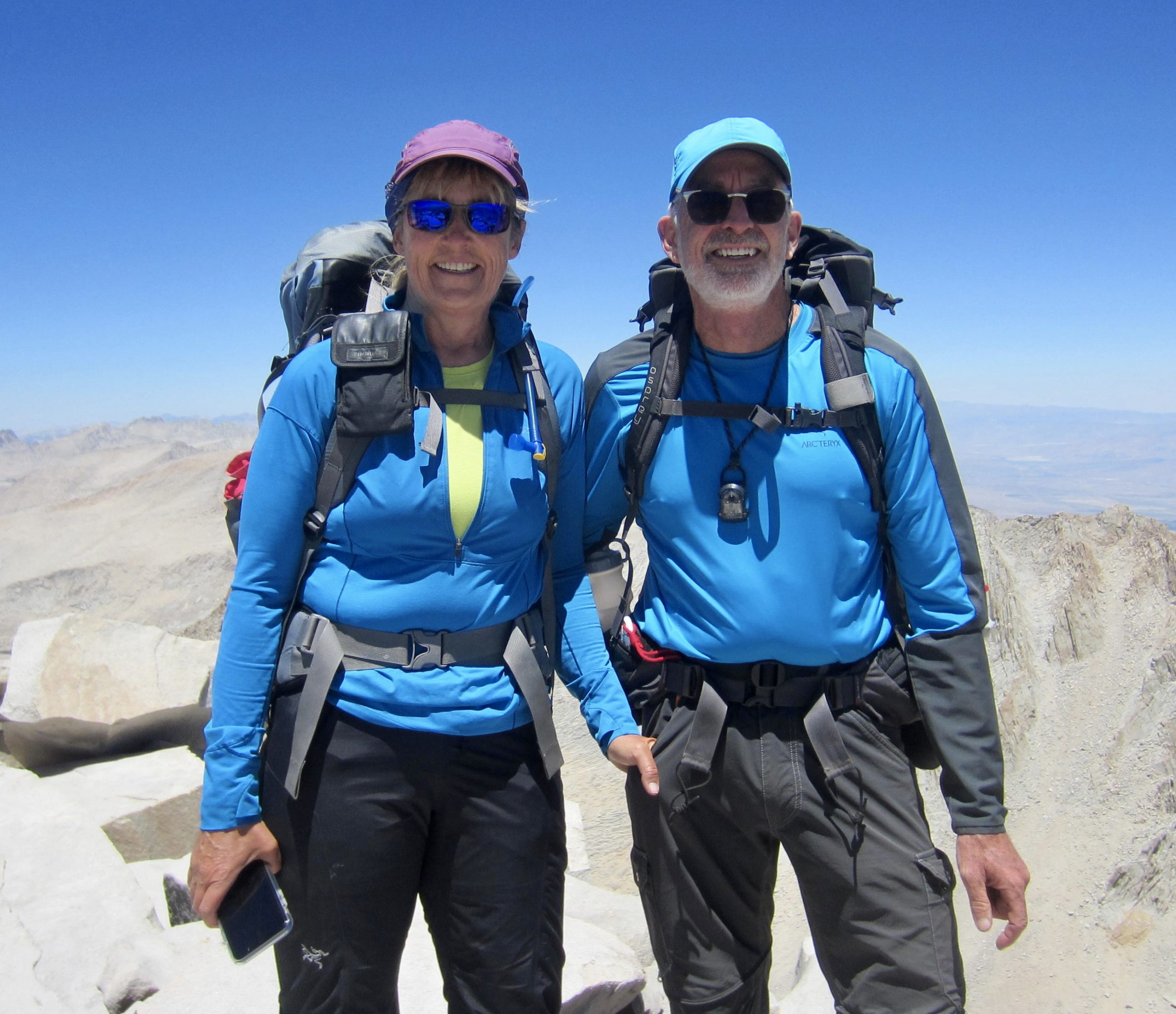
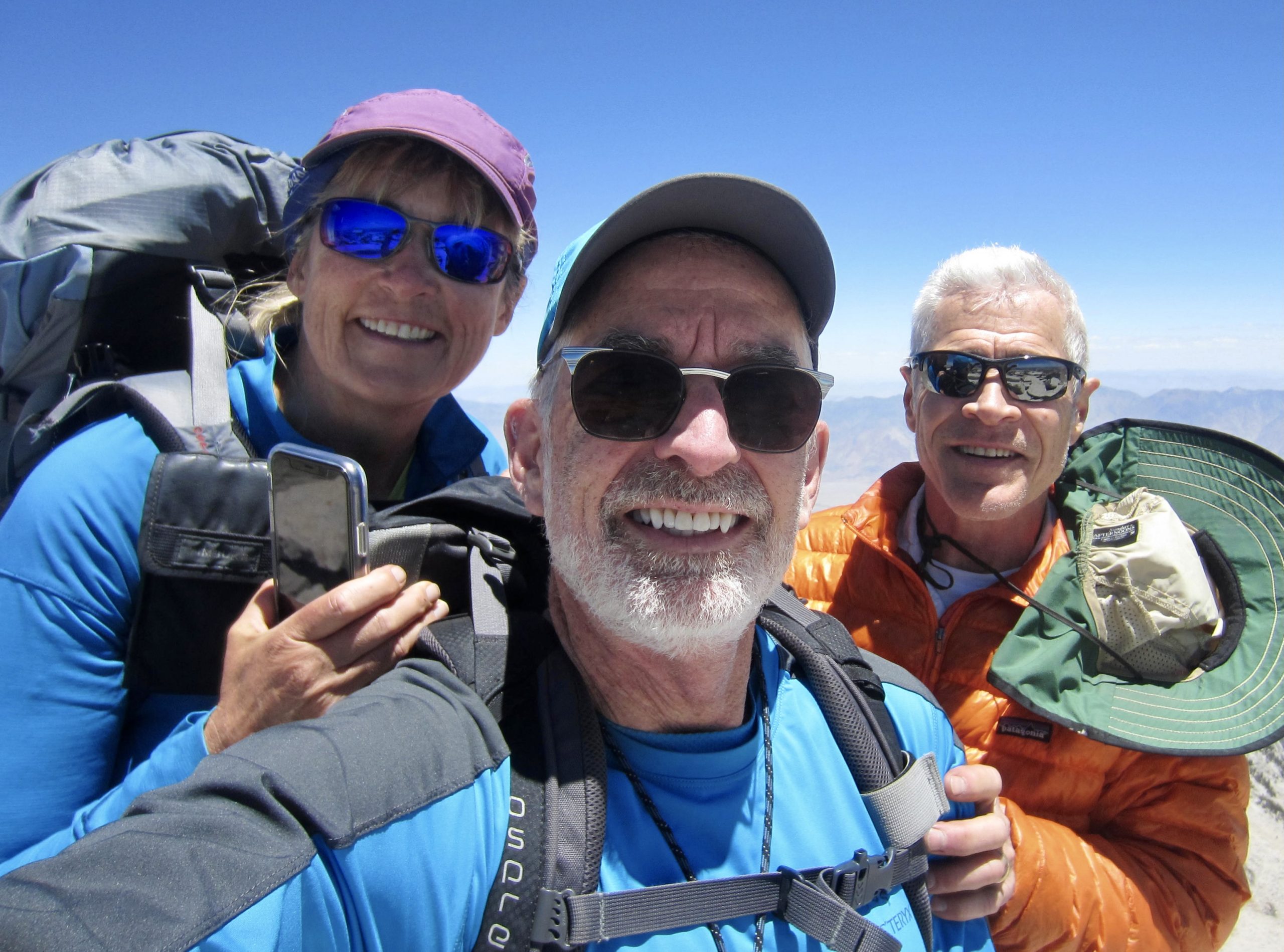
We stepped onto the summit boulders at 12:45pm (5.7 hours + 4000 feet from Camp 3) and found George relaxing behind a windbreak (he had arrived about 45 minutes earlier). By now, the morning chill and wind had abated, allowing us to enjoy a warm, calm summit sojourn. The clear air also provided long-range views in all directions.

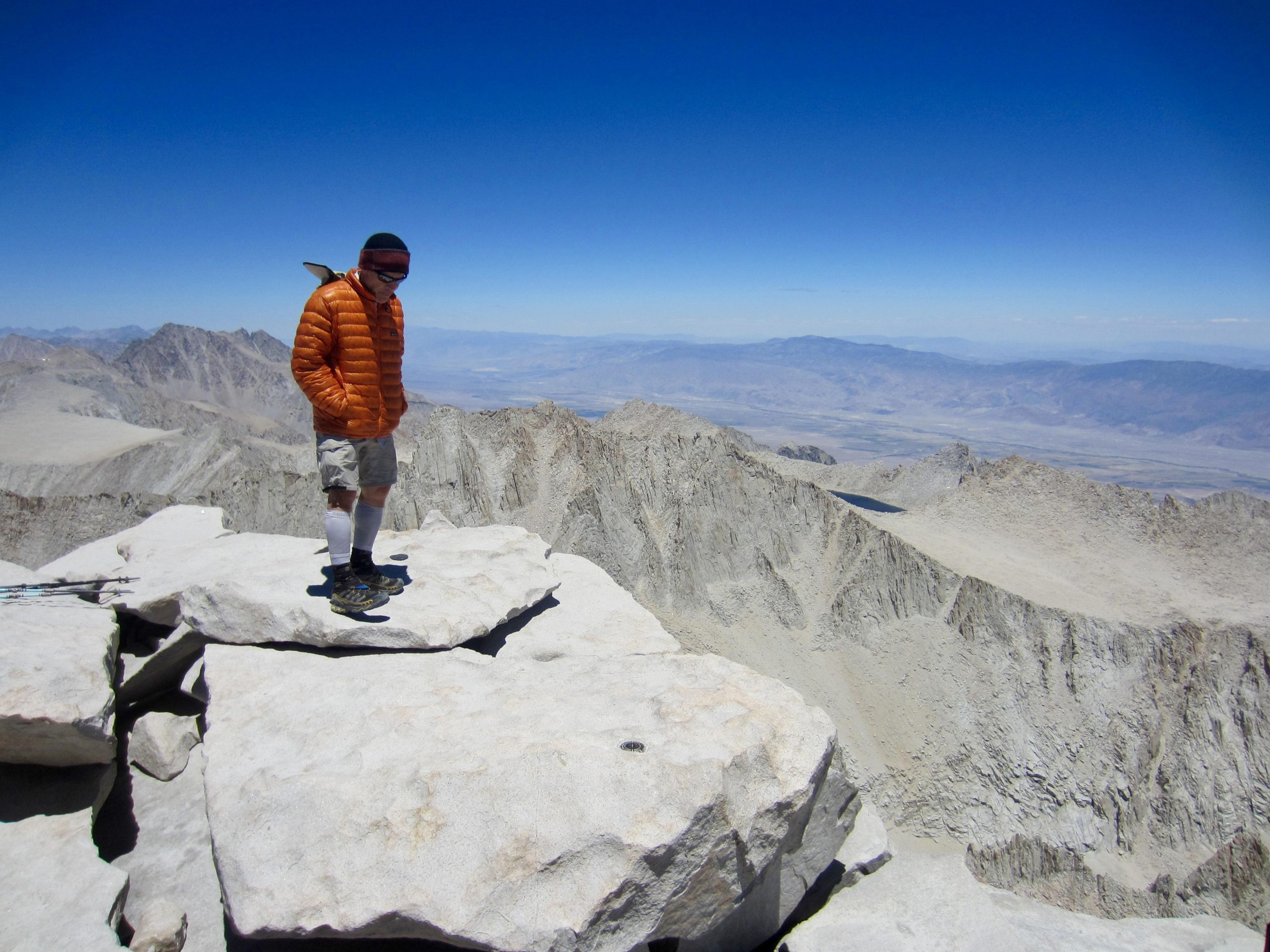

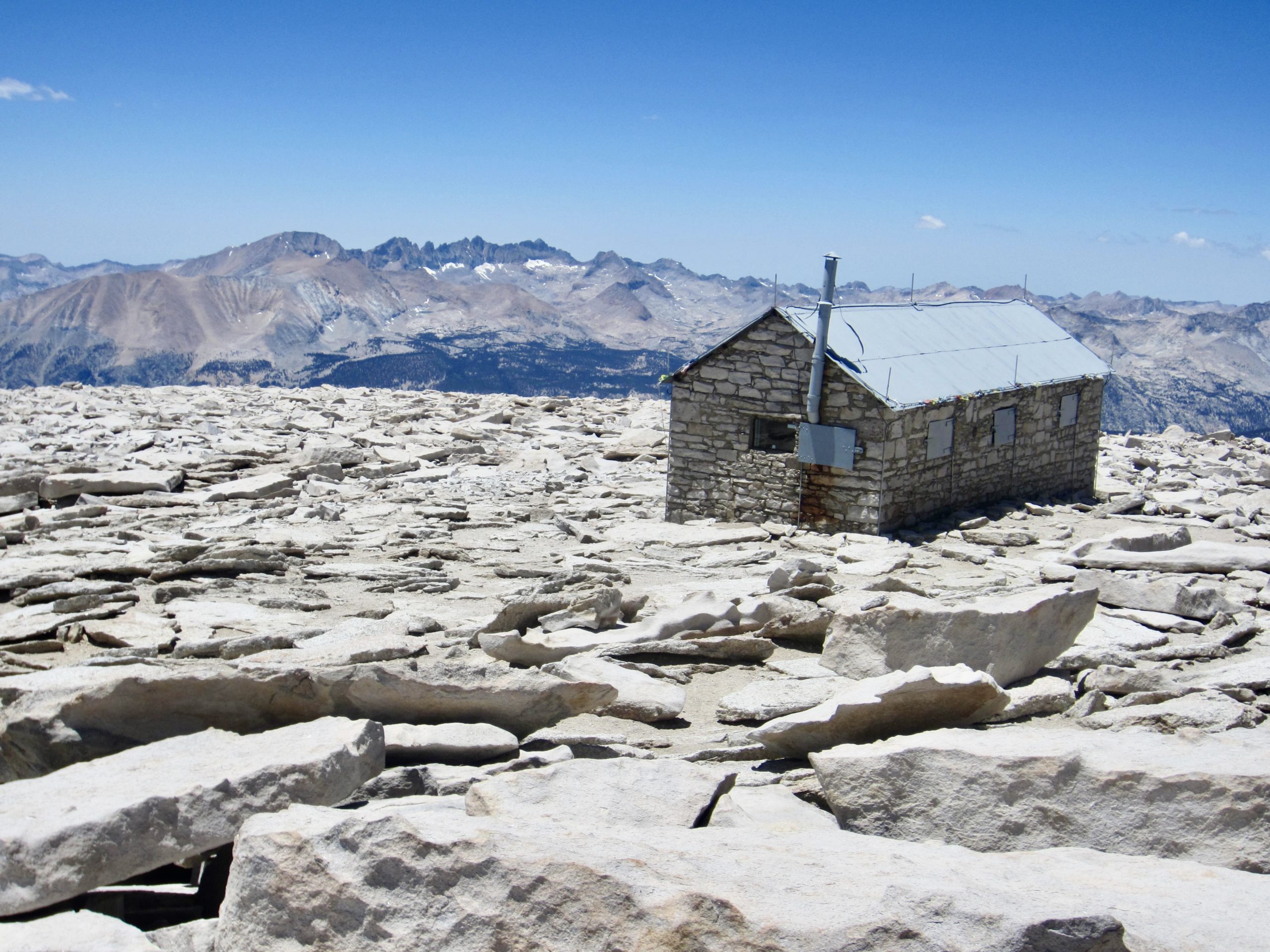
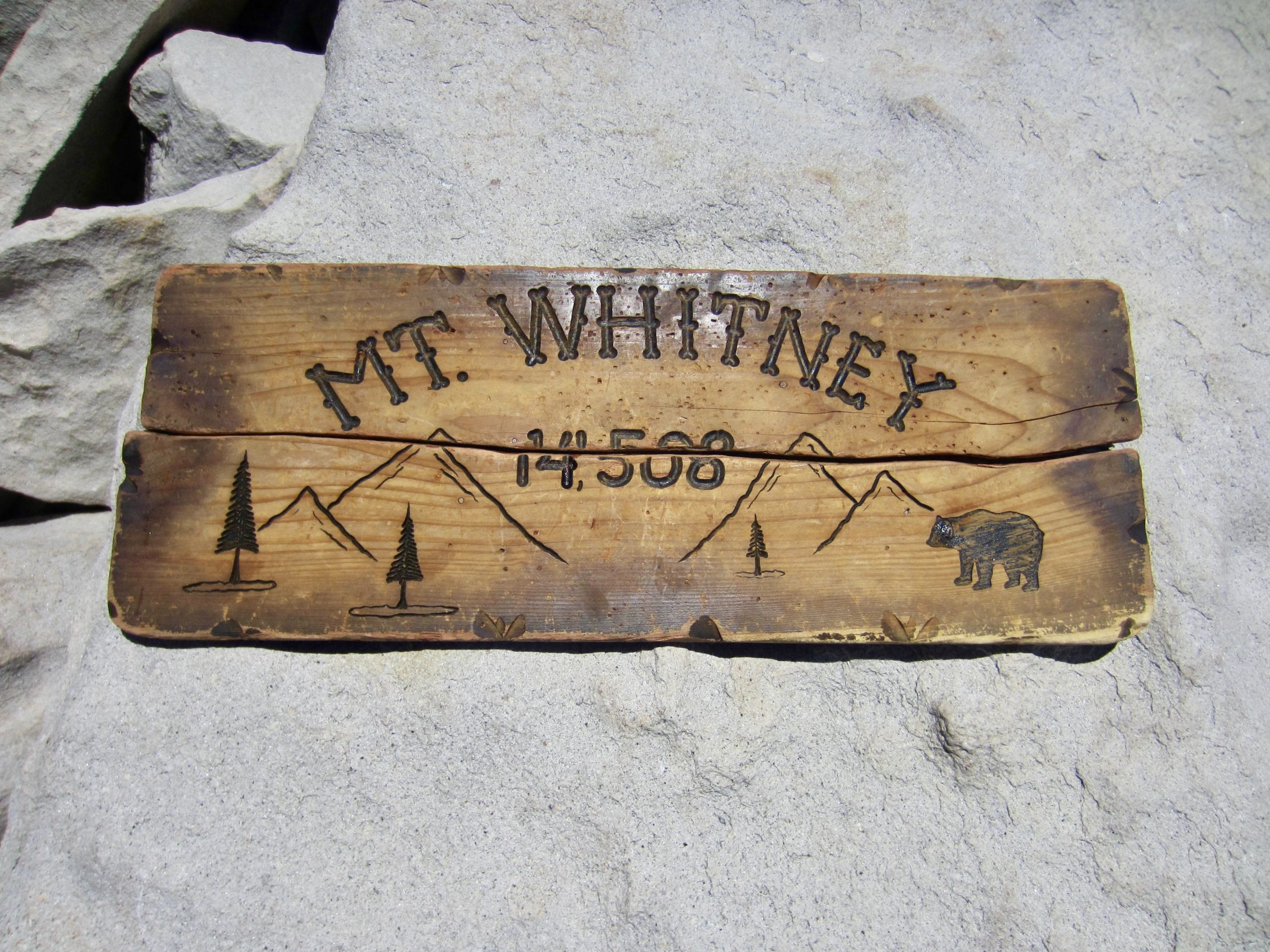
The summit features various adornments, including two commemorative plaques and several survey benchmarks. The register is a large metal box stuffed with official sign-in sheets and donated trinkets.
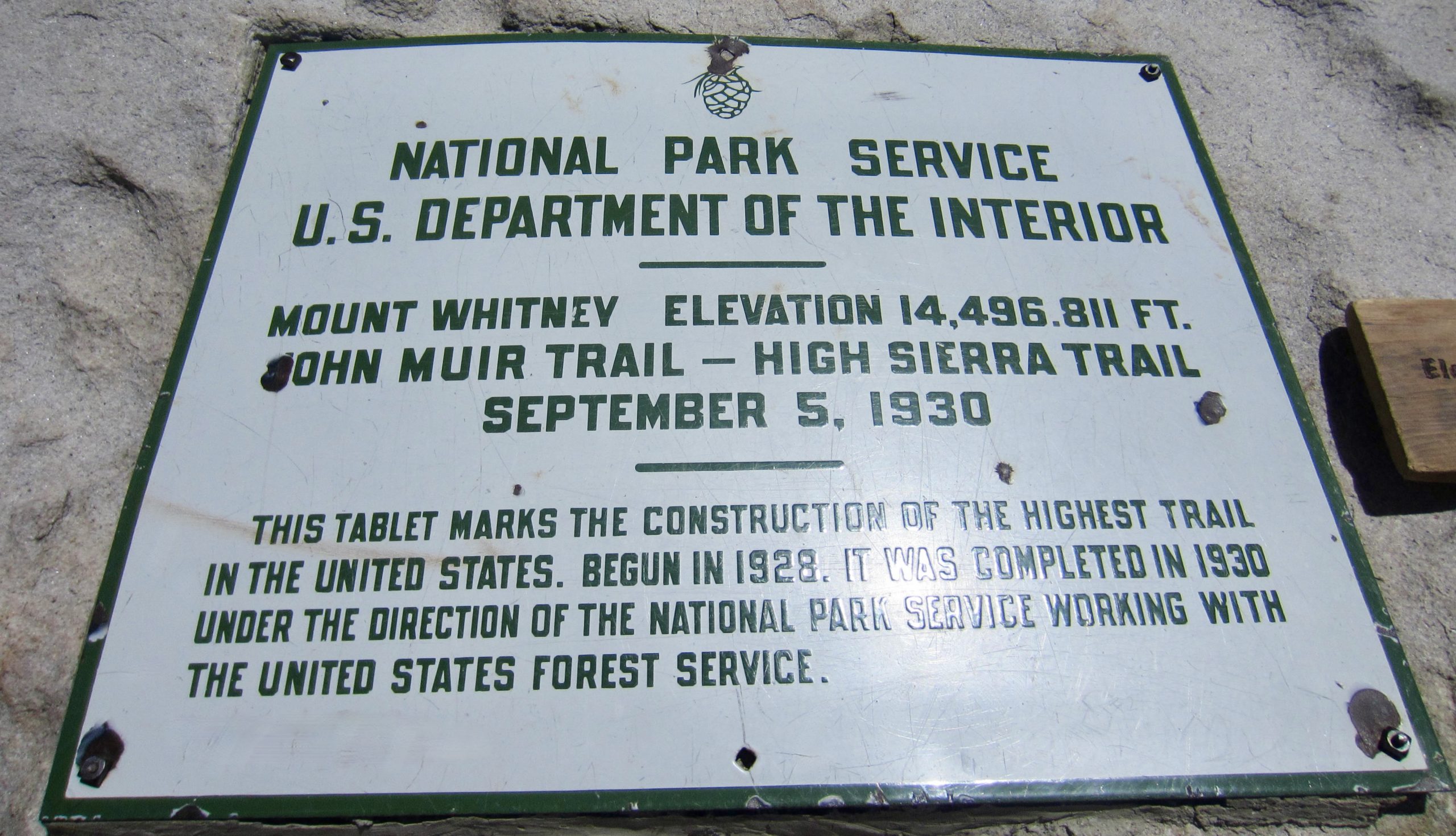
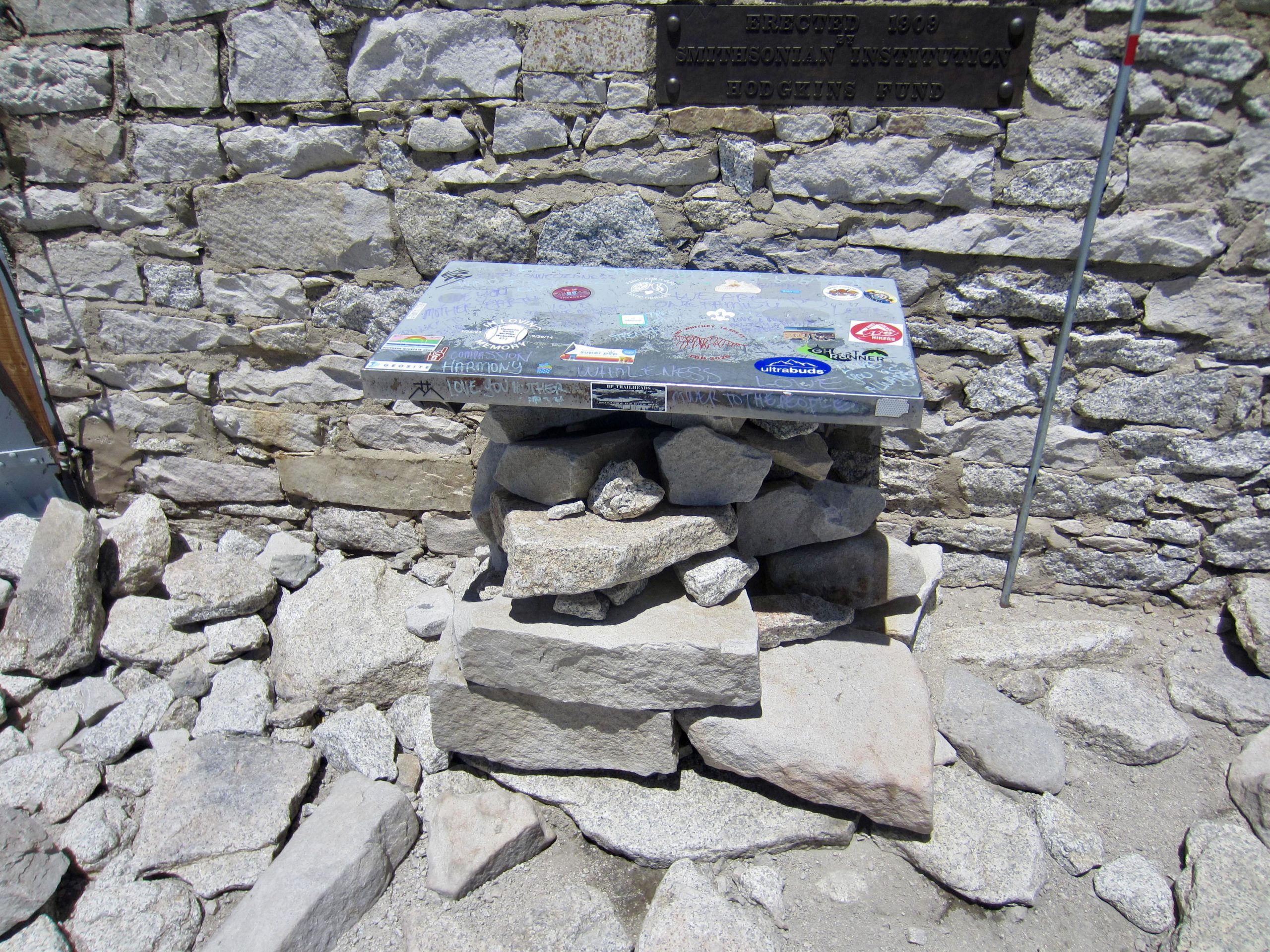
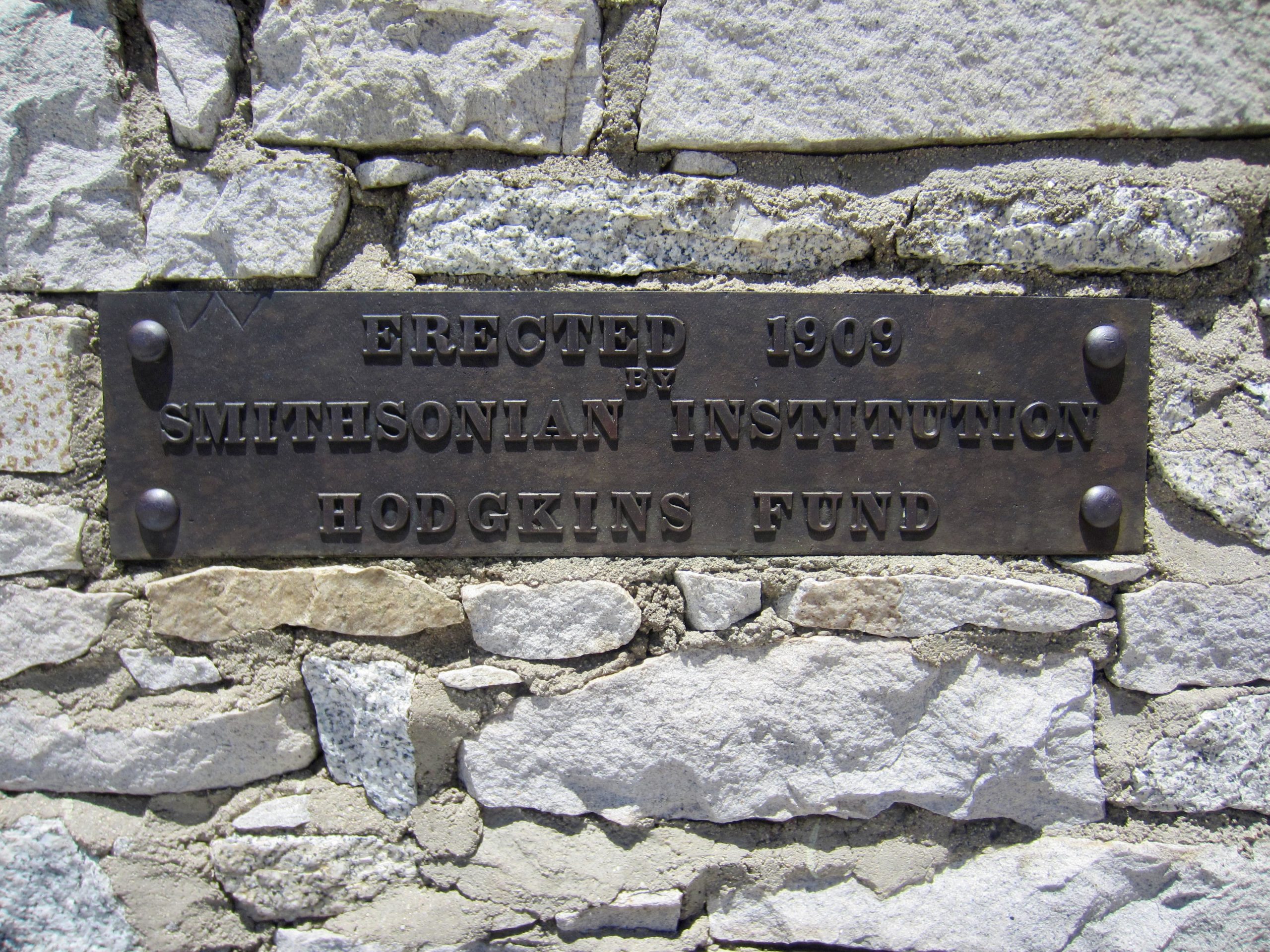
I was particularly intrigued by the historical summit shelter, which was constructed by the Smithsonian Institution in 1909. The southern part of the shelter was open to hikers, but the dreary interior would be uninviting for anything but emergency use.
George headed back to camp at 1:30pm; Eileen and I followed about 20 or 30 minutes later. During our descent, we passed several hikers coming up for an afternoon visit.
By the time Eileen and I reached Guitar Lake, we were being broiled by afternoon sun reflecting off the west-facing slopes. A refreshing dip in the chilly water was required before finishing our descent.
By early evening, we rejoined George in camp (5.2 hours + 400 feet from summit; 12.8 miles + 4400 feet for total day) and spent the remaining light comparing notes about our day’s marvelous trek.
Day 5: Upper Whitney Creek Meadow to Chicken Spring Lake
We awoke to a partly cloudy morning and were back on the trail by 7:30am, knowing that today would be long and hot. Taking a left turn at Upper Crabtree Meadow, we hiked through the large campground, skirted around Lower Crabtree Meadow, crossed Whitney Creek, and came to a junction with the PCT.
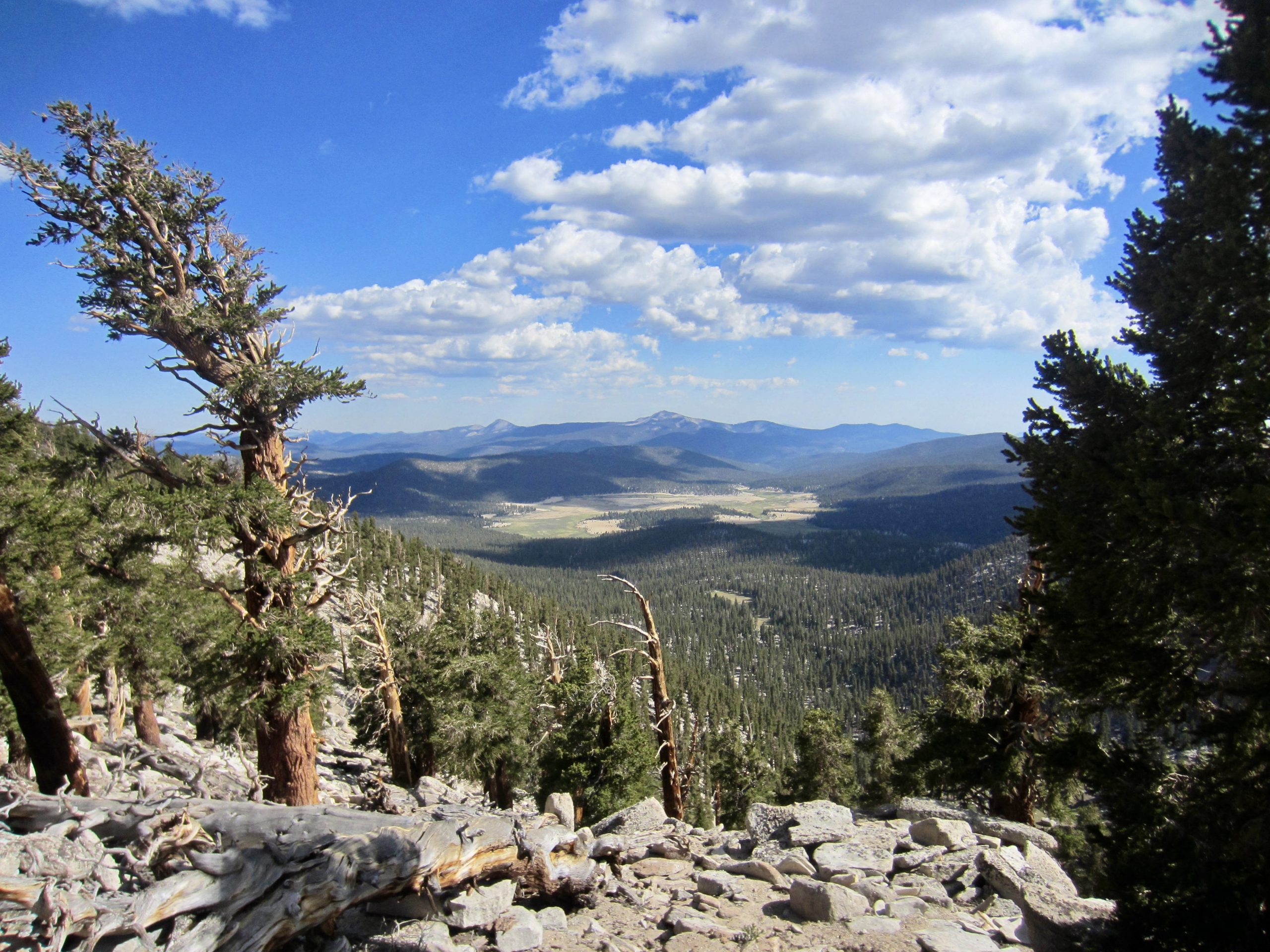
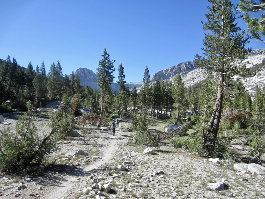
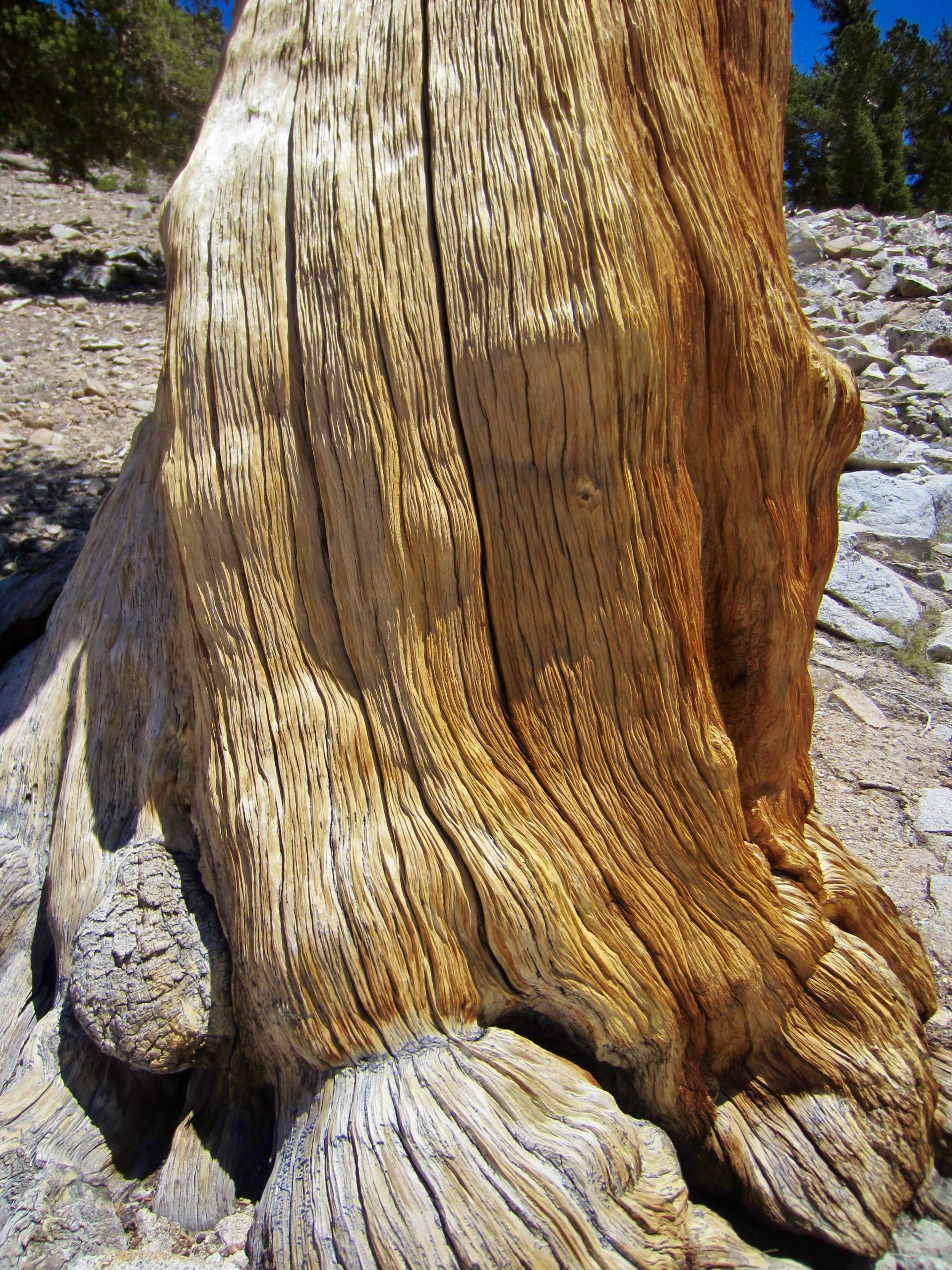
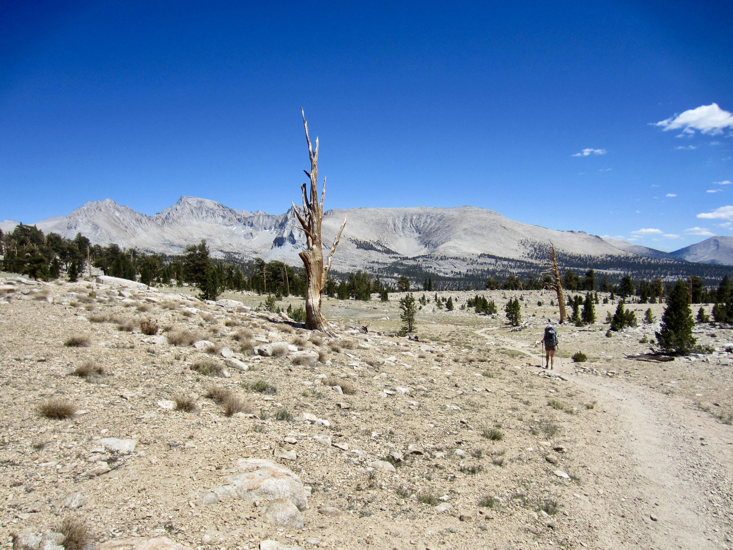
The rest of our day was spent hiking southward on the PCT, which took us over Guyot Pass and down to Rock Creek (reliable water here), then up to a vast plateau called Siberian Outpost. Although such a name might evoke images of a frigid, windswept tundra, the Outpost was actually a hot, sunny forest of foxtail (bristlecone) pine trees. These trees possess a remarkable ability to grow in severely infertile environments—much like Siberia, perhaps?
Eventually leaving Siberian Outpost behind, we crossed over several high ridges with views down to Big Whitney Meadow and out to the southern foothills of the Sierra range. We left Sequoia National Park and entered the Golden Trout Wilderness shortly before a final ridge crossing took us into the rocky bowl of Chicken Spring Lake.

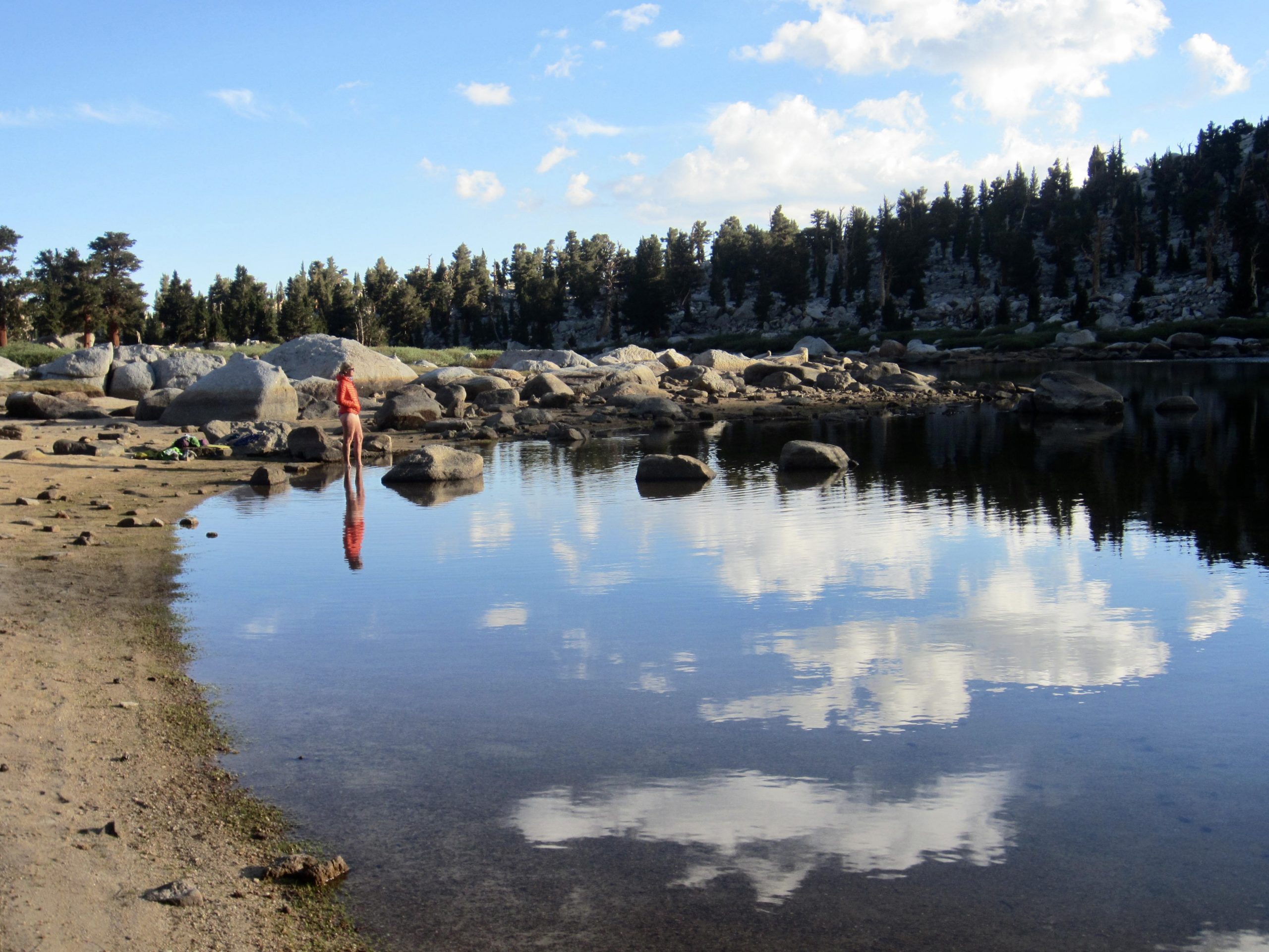
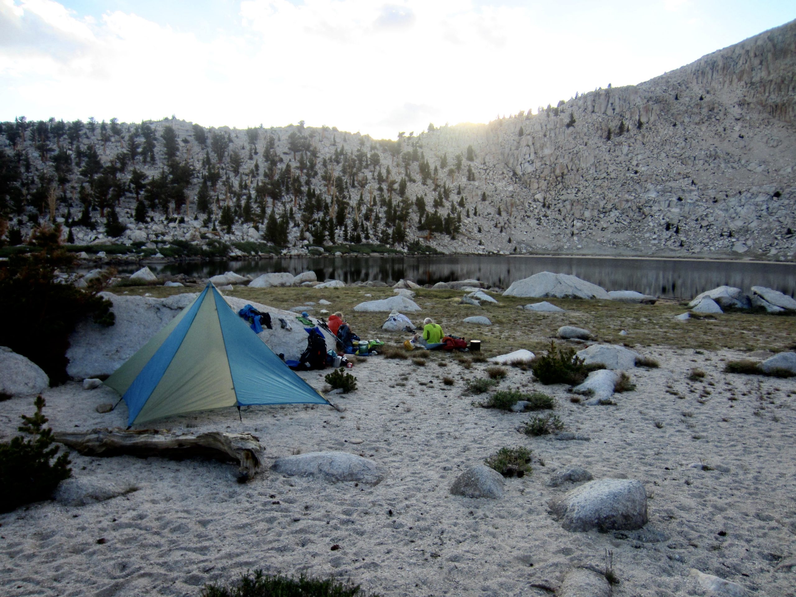
We dropped into the lake bowl and made camp on a sandy bench above the shore at 6:00pm (10.9 hours + 17.2 miles + 3000 feet from Camp 3). It had been a long, hot day, so we all took a dip in the tranquil lake.

Day 6: Chicken Spring Lake to Horseshoe Meadow Trailhead
We were scheduled for a shuttle pick-up at Horseshoe Meadow Trailhead between 11:00am and 12:00nn, so there was no rush getting out of camp this morning. A short hike on the PCT took us over to 11,150-foot Cottonwood Pass, at which point we veered off and descended eastward to the trailhead (2.5 hours + 4.5 miles + 100 feet from Camp 4).
While waiting for our shuttle driver, we were entertained by a steady stream of day-hikers, backpackers, and thru-hikers getting organized at the trailhead. Nina from East Side Sierra Shuttle arrived at 11:30am and whisked us back over to Onion Valley Trailhead at 1:00pm. This shuttle service had been extremely helpful and accommodating throughout the various iterations of our trip itinerary, and they played a key role in our wonderful adventure.
Route Maps & Profiles
…
…
…
…
…
Photo Gallery
Click to enlarge…