Trip Date: July 26-29, 2022
Mt. Logan Climbing Attempt
Easy Pass
Lower Douglas Creek Basin
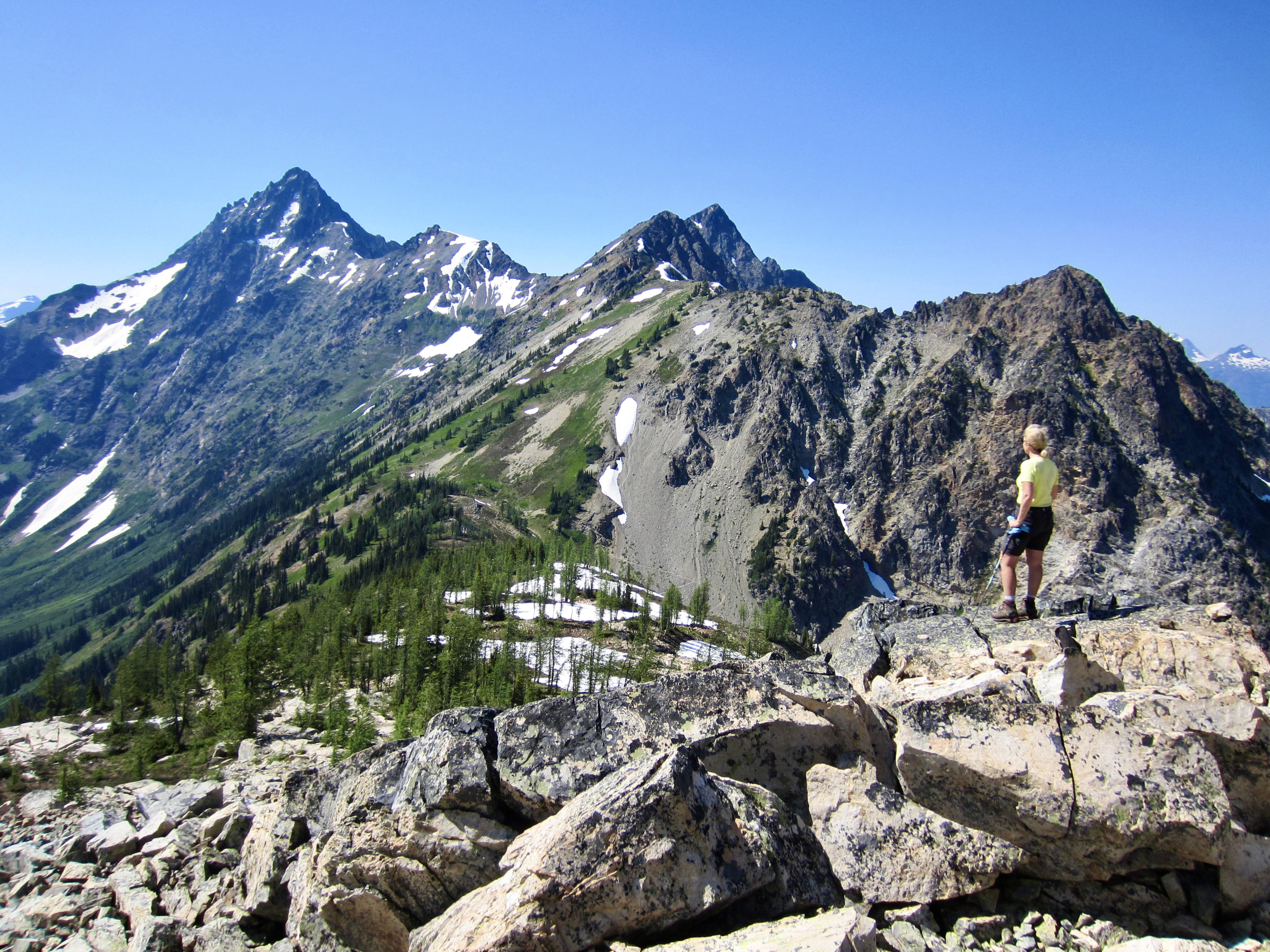
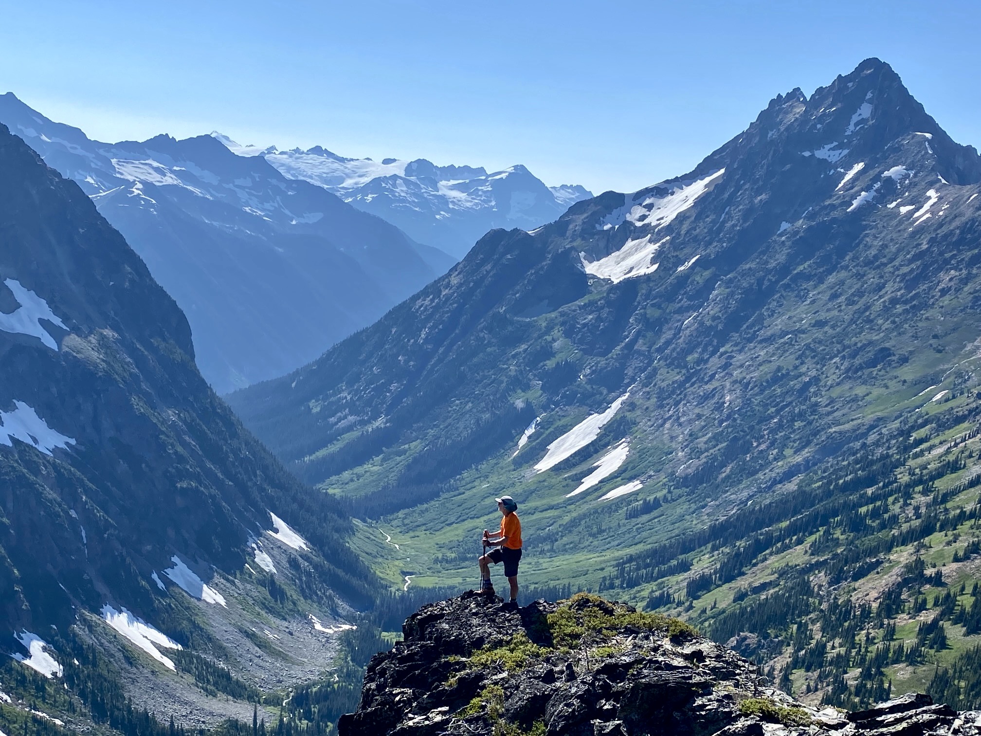
Graybeard Peak false summit
Trip Report Summary
Region: Northwestern Washington Cascades
Sub-Region: Thunder Mountains
Area: North Cascades National Park
Starting & Ending Point: Easy Pass Trailhead on Highway 20 (Elev. 3700 feet)
Way Points: Easy Pass Creek & Easy Pass & Fisher Creek Valley & Fisher Camp & Fisher Creek crossing & Douglas Creek Valley & Lower Douglas Creek Basin & Fisher Creek crossing & Cosho Camp & Easy Pass & Easy Pass bench (trail hike & off-trail hike & bushwhack)
High Point: Easy Pass bench (Elev. 6800 feet)
Campsites: Fisher Camp & Cosho Camp & Easy Pass bench
Summit Attempt: Mt. Logan (bushwhack to 4200-foot basin via Douglas Creek)
Sidetrip: Graybeard Peak false summit (rock scramble)
Approximate Stats: 24 miles traveled; 6800 feet gained & lost.
Related Posts
Mt. Logan via Park Creek Pass—Fremont Glacier – July 2018
Mt. Logan via Park Creek Pass—Fremont Glacier – September 2000
Full Trip Report
During a week of extremely hot weather, Eileen and I teamed up with George and Bob to climb Mt. Logan via the Douglas Glacier route. We hoped that the weather wouldn’t be too much of a factor, but it was. We also hoped that this year’s heavy snowpack would provide us with easy snow travel up Douglas creek, but it didn’t. Perhaps we should have realized that our climb might be doomed from the beginning, but we didn’t. It certainly never would have seemed possible to have a fun trip under such adverse circumstances, but we did.
Day 1: Trailhead to Fisher Camp
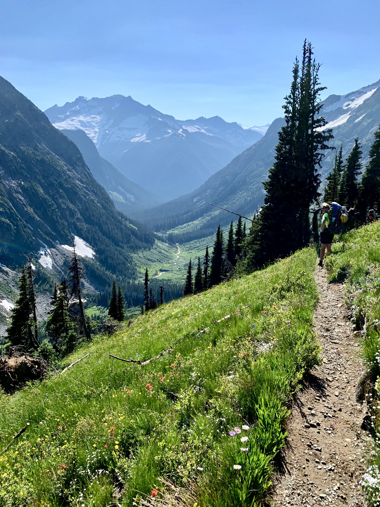
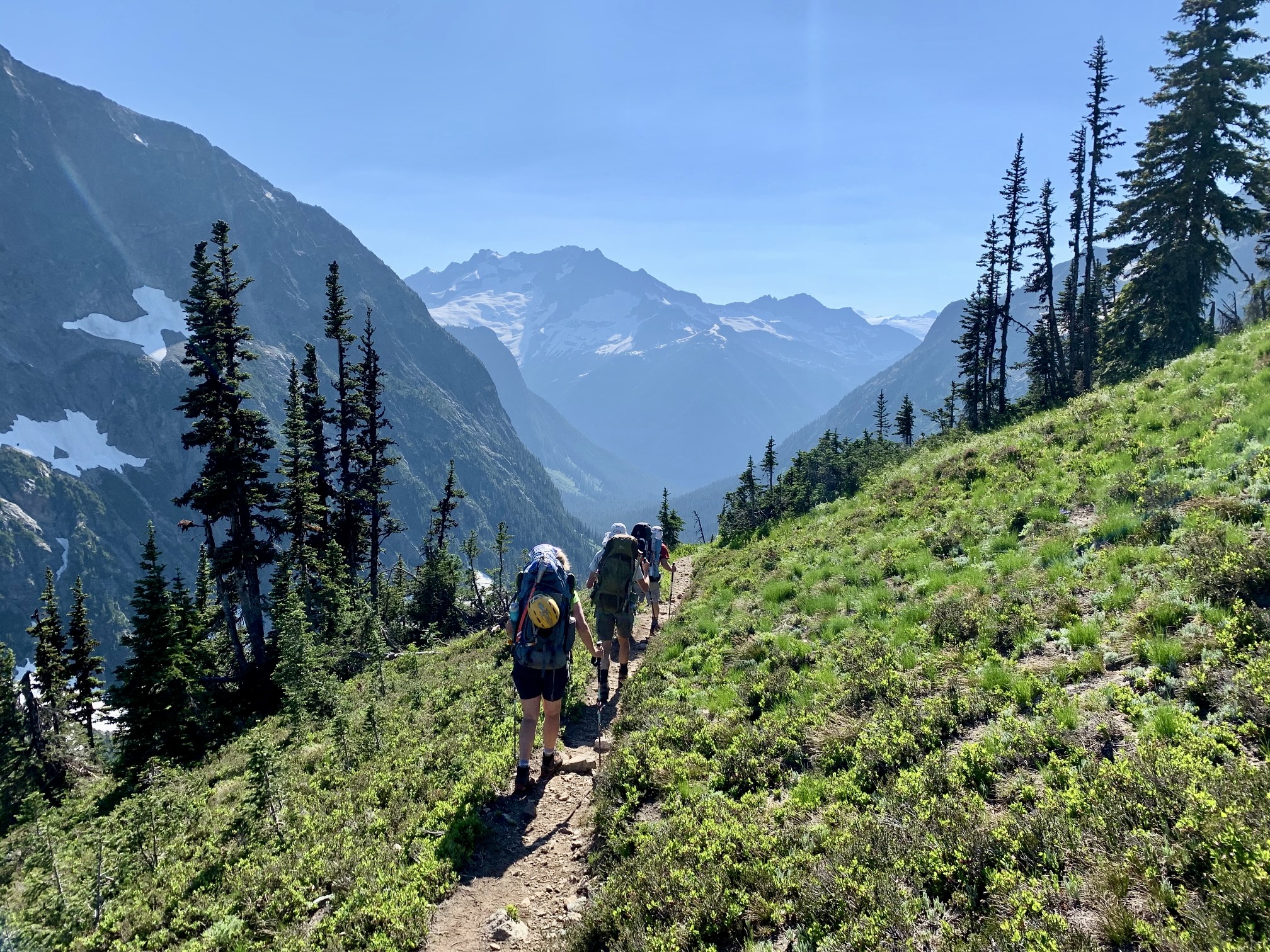
We left the Easy Pass Trailhead at noon, with temps already in the 80s. Because today’s goal was only to reach Fisher Camp, we felt no urgency in getting over Easy Pass and then dropping down to camp by early evening. Our campsite was pretty mediocre, but at least we were right on schedule.
Day 2: Fisher Camp to Lower Douglas Basin to Cosho Camp
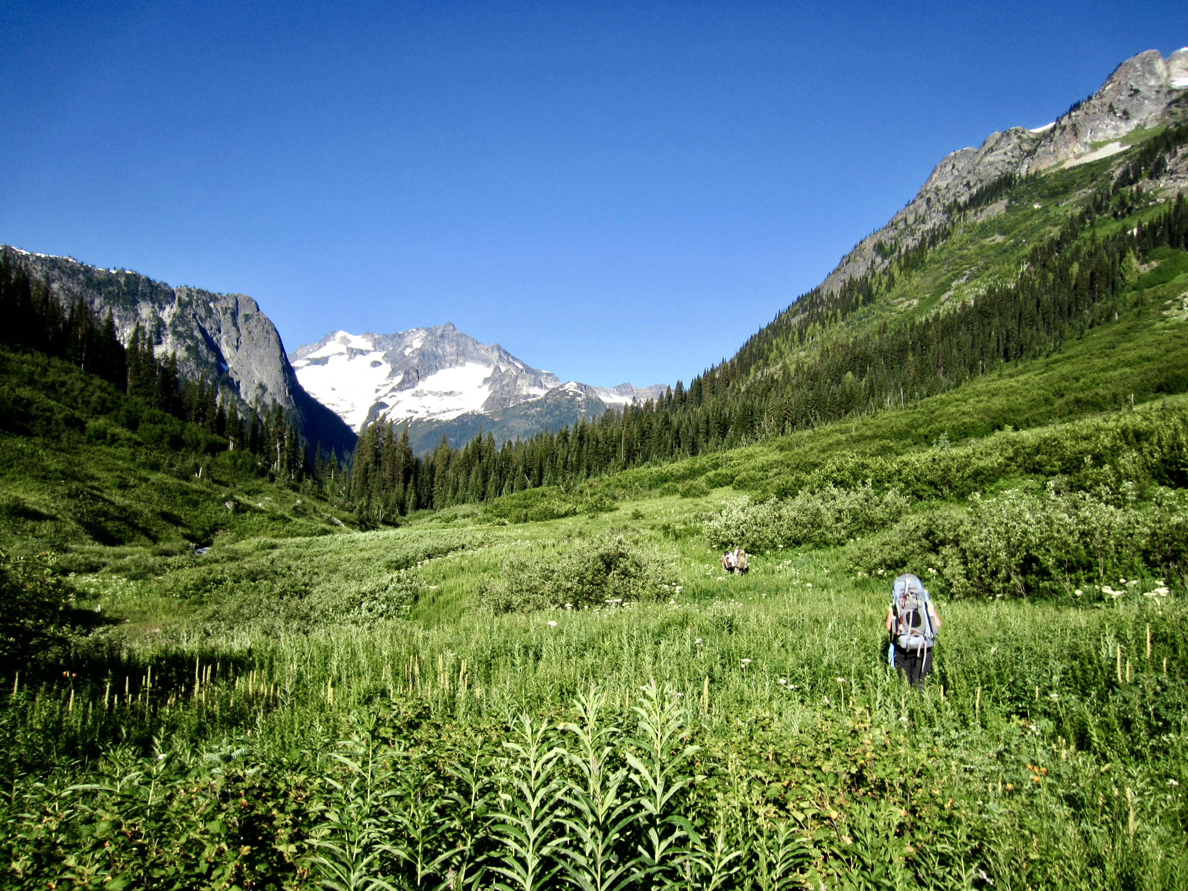
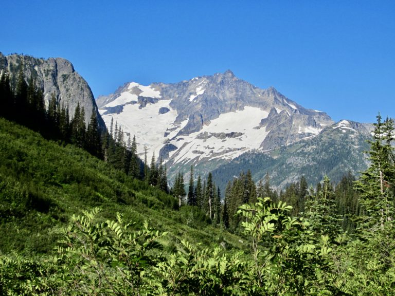
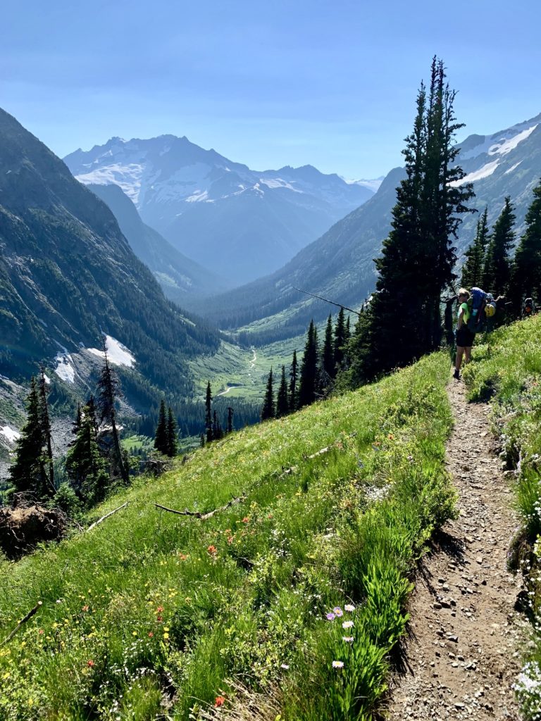
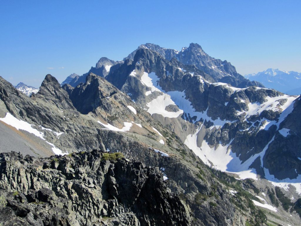
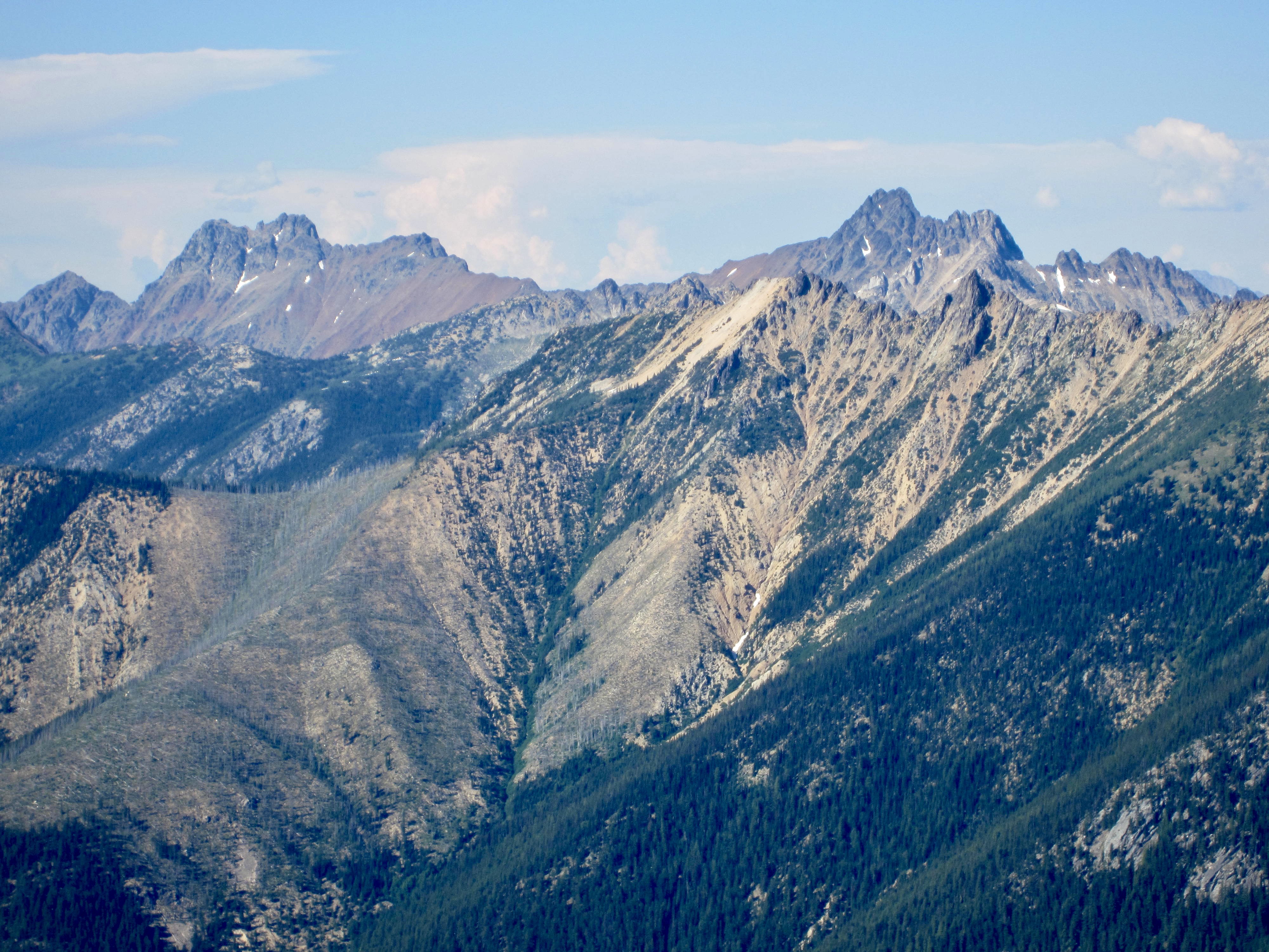
Shortly after 8:00am, we were packed up and hiking down Fischer Creek Trail. Mt. Logan was clearly visible in the distance, basking in morning sun under a cloudless blue sky.
After 2½ miles, we stopped on the trail at a point where Douglas Creek Valley converges with Fisher Creek Valley. USGS maps erroneously mark this as the location of Cosho Camp, but the camp is actually located 1 mile down-valley. We walked down to Fisher Creek and easily crossed it on a big log.
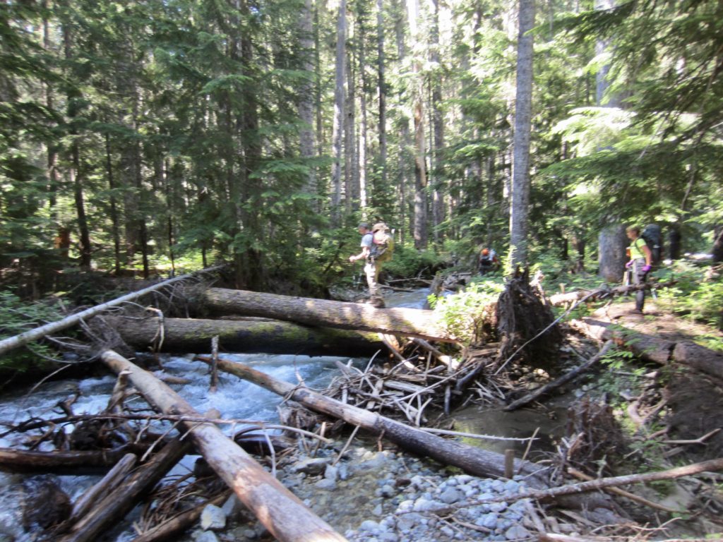
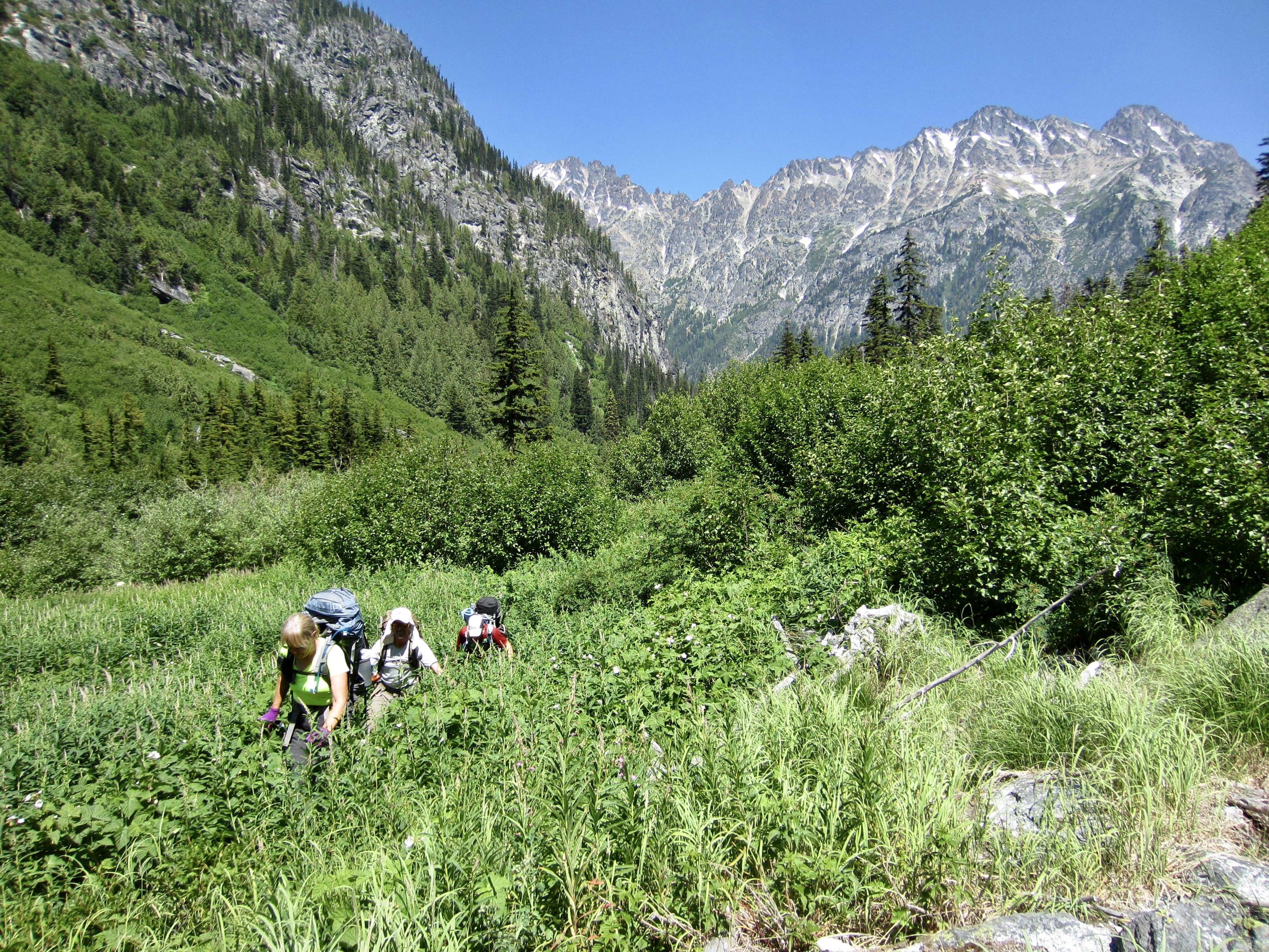
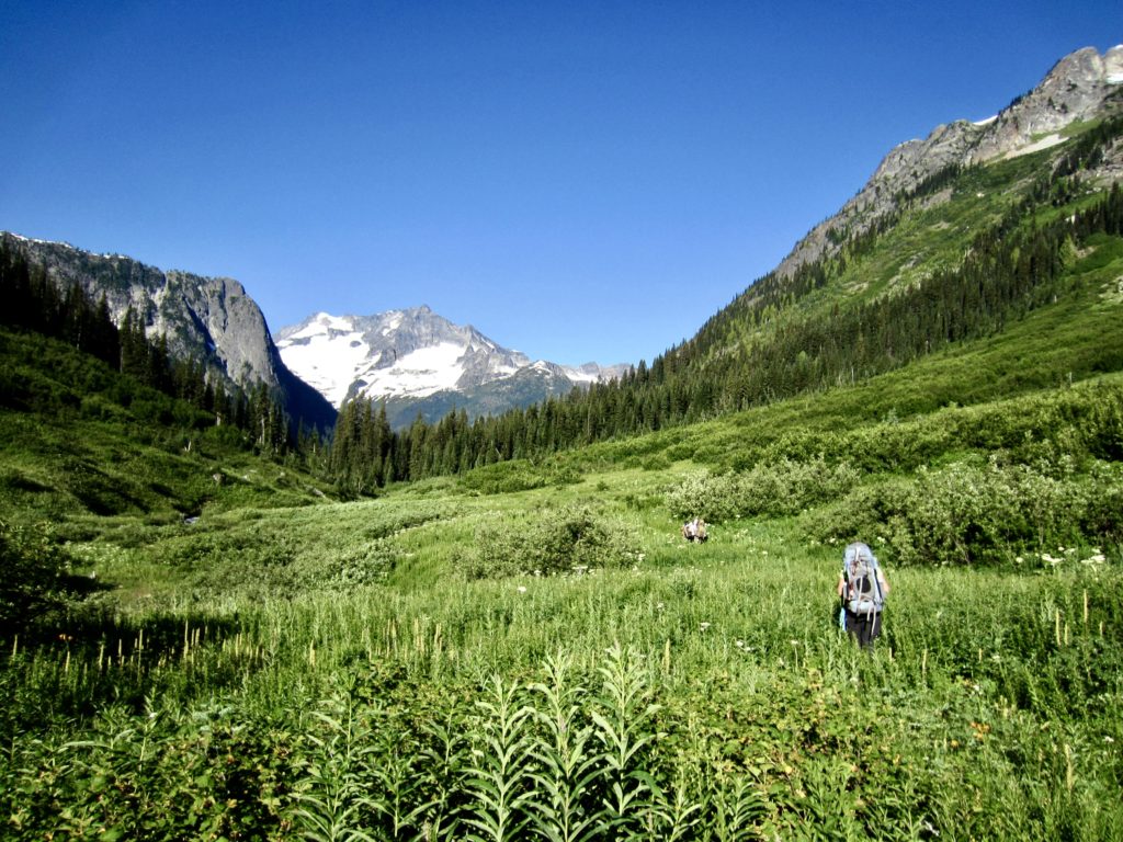
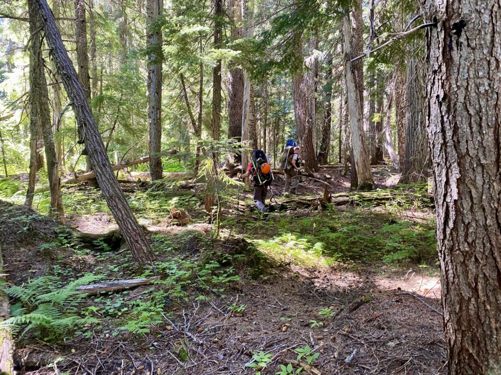
Once across Fisher Creek, we hiked through open forest and swampy ground on the left (eastern) side of Douglas Creek. There were occasional downed logs and patches of brush, but travel was pretty easy overall. We were averaging a respectable ½ mile per hour. However, the mosquitoes and black flies were very annoying.
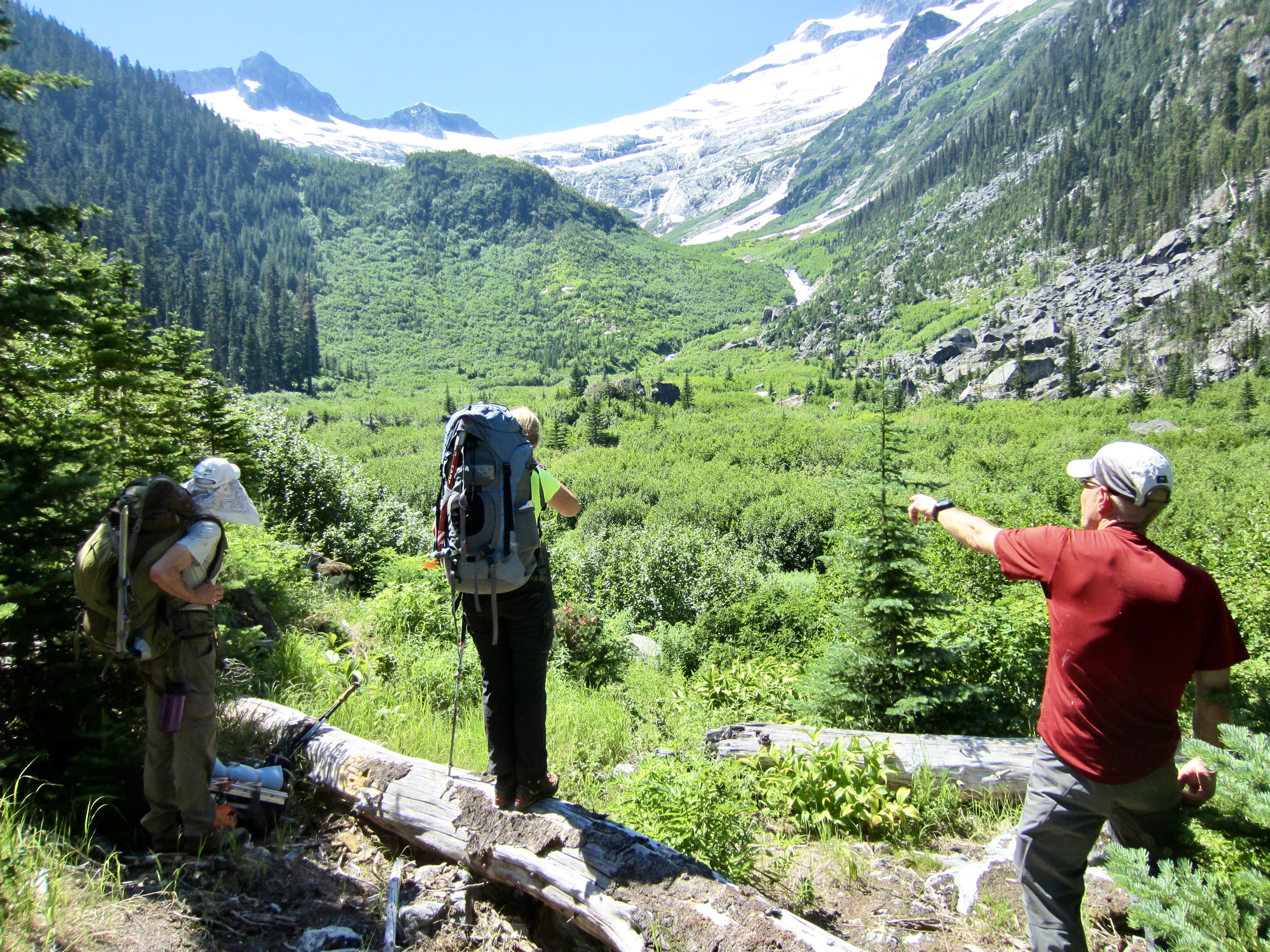
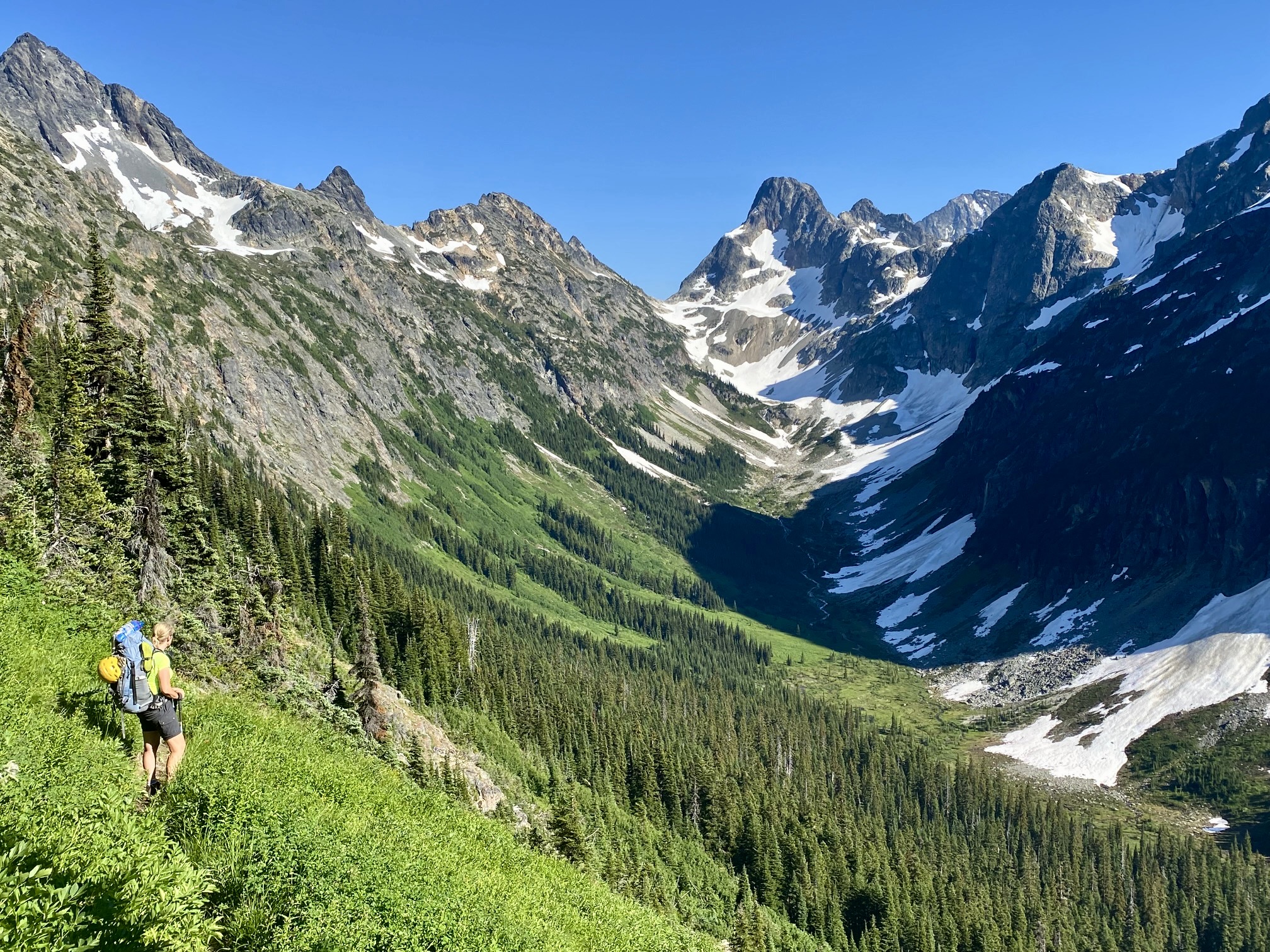
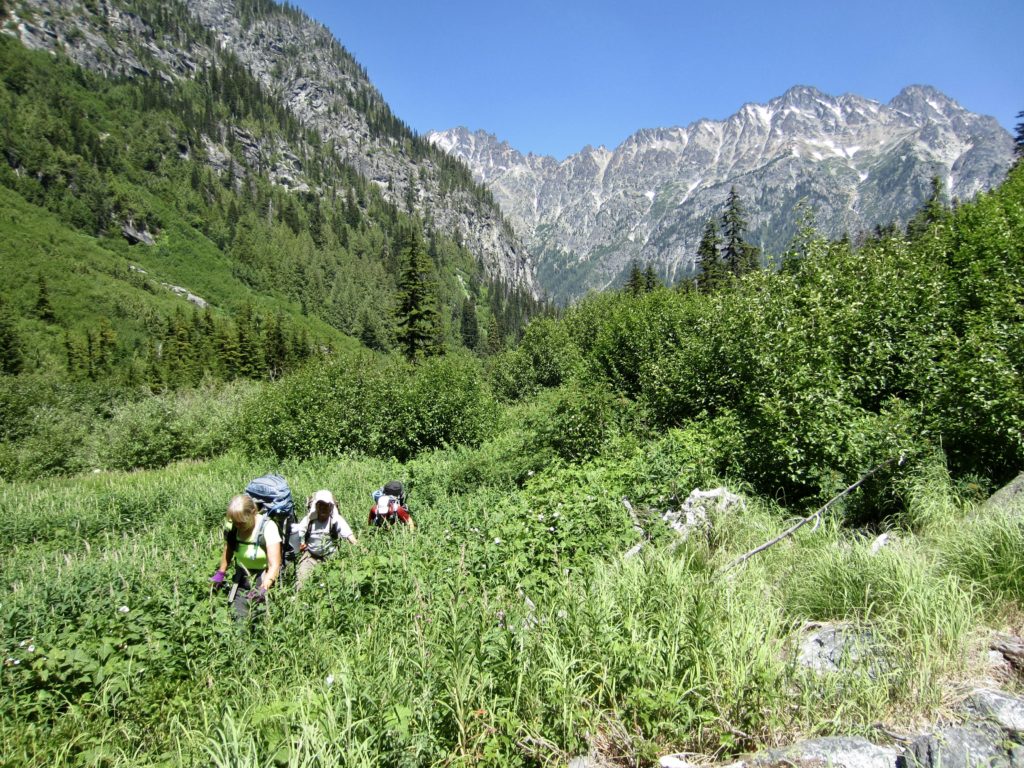
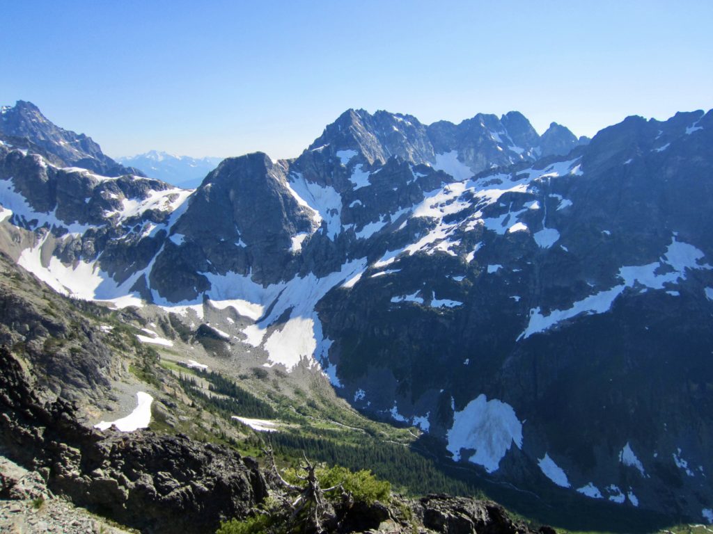
Just before noon, we came to the edge of the forest and looked out on a vast field of slide alder and other brush. Our goal for today was to reach the upper basin of Douglas Creek, which sits behind Point 4805—a large wooded knob known as “The Pillbox.” We could clearly see The Pillbox at the head of the lower basin, but it was separated from us by an abominable thicket. Reportedly, a huge avalanche wiped out the forest here about 15 years ago, now leaving a green purgatory in its place.

Not seeing any obvious weakness in the thicket, we had no choice but to simply dive in. Unfounded optimism led us to believe that it wouldn’t be that bad. In actuality, it was far worse than expected; the slide alder was 10 feet high and virtually impenetrable in every direction. Furthermore, the ground surface was crisscrossed by small but deep, rocky stream channels. Our progress was reduced to a matter of inches per minute. And the bugs were terrible!
After 2 hours of torturously hot and slow bushwhacking, we had managed to move 600 yards over to the edge of a forest slope on our left, at Elev. 4200 feet. All of our hopes had been hung on the assumption that this forest slope would provide easy, brush-free travel. There was indeed less brush, but the forest was littered with large, fallen logs and rock outcrops. The harsh reality set in: Ever since crossing Fisher Creek 4 hours ago, we had progressed only 1.3 miles and gained only 200 vertical feet, and it would undoubtedly take another 2 or 3 laborious hours to reach the upper basin. Then, upon reaching the basin, we would be faced with the revolting prospect of later having to retrace our entire route back down to Fisher Creek and adding an unplanned day to our schedule. We therefore made the painful decision to pull the plug here.
For our retreat route, we stayed higher on the sideslope rather than dropping back into the thicket. The sideslope was much less brushy, but the logs and rocks made for extremely tedious and treacherous travel. Ultimately, we saved a little time and frustration compared to the thicket, but it was still very unpleasant. Once back in the dense forest, we were able to speed up and reach Fisher Creek in about 3 hours from our turnaround point. What a relief to finally step onto the Fisher Creek Trail after 7 hours of off-trail thrashing!
It was now late afternoon, so we elected to hike 1 mile down-valley to Cosho Camp rather than hike 2½ miles back up to Fisher Camp. This turned out to be a good decision, as Cosho Camp is much bigger and nicer than Fisher Camp. We all took the opportunity to wash off our day’s sweat and grime in Fisher Creek.
Day 3: Cosho Camp to Easy Pass Bench
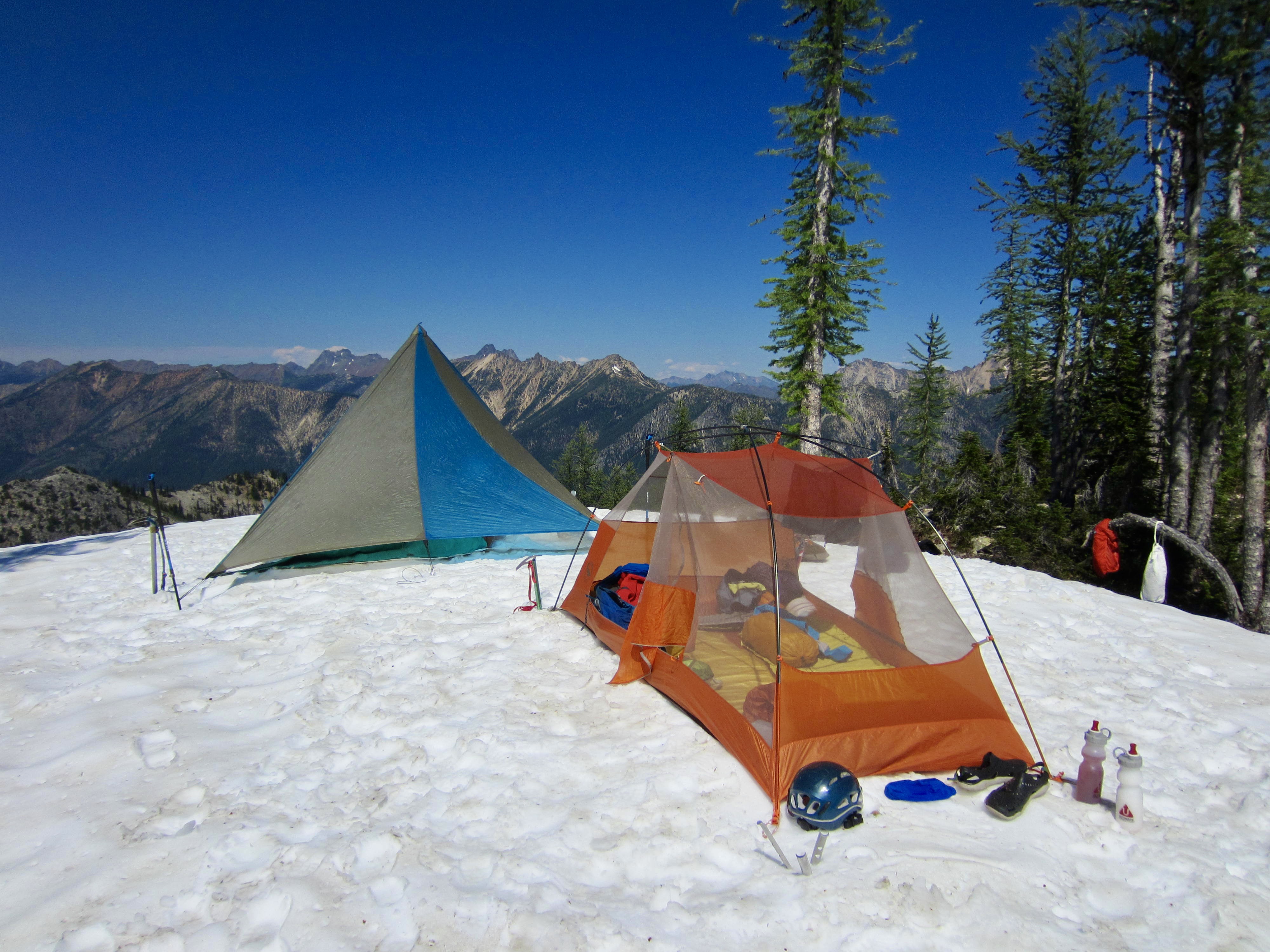
Having surrendered our goal of climbing Mt. Logan, our group switched into “fun backpacking mode.” We hiked back up to Easy Pass, then continued up the ridge toward Graybeard Peak. A snowy bench at 6800 feet provided a comfortable campsite for our last night.
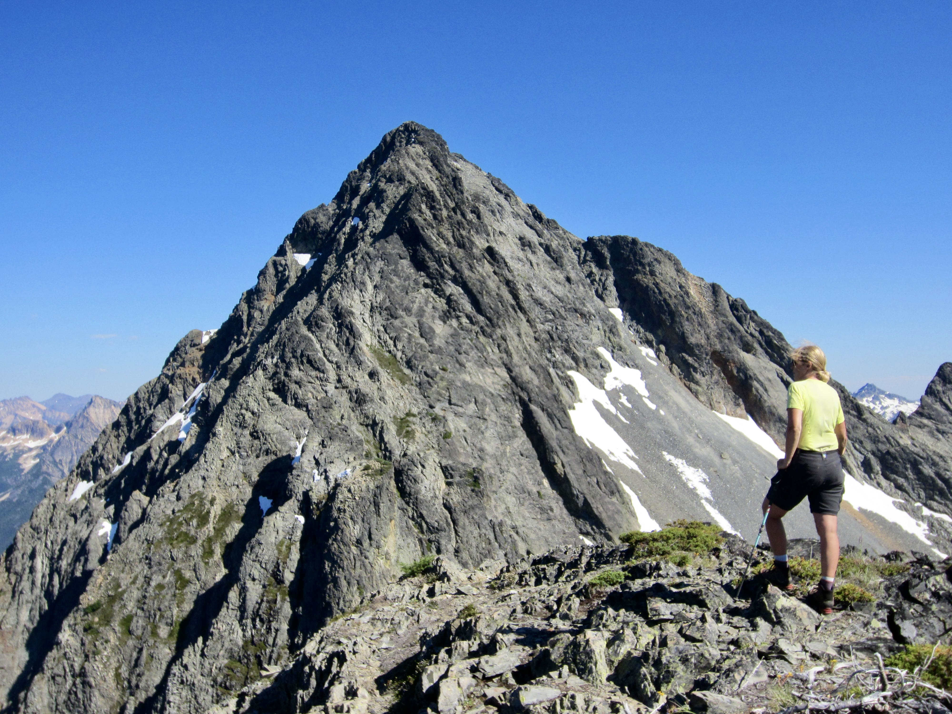
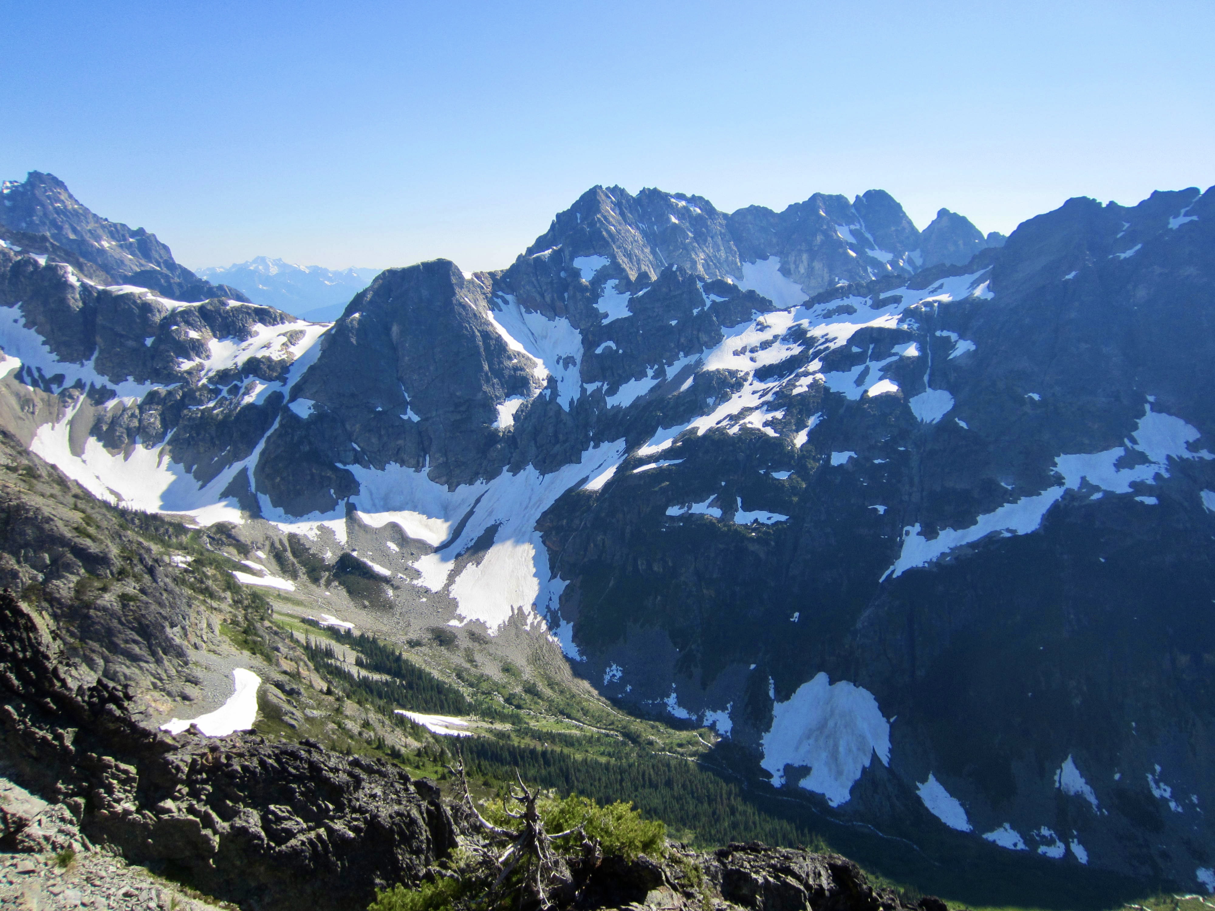
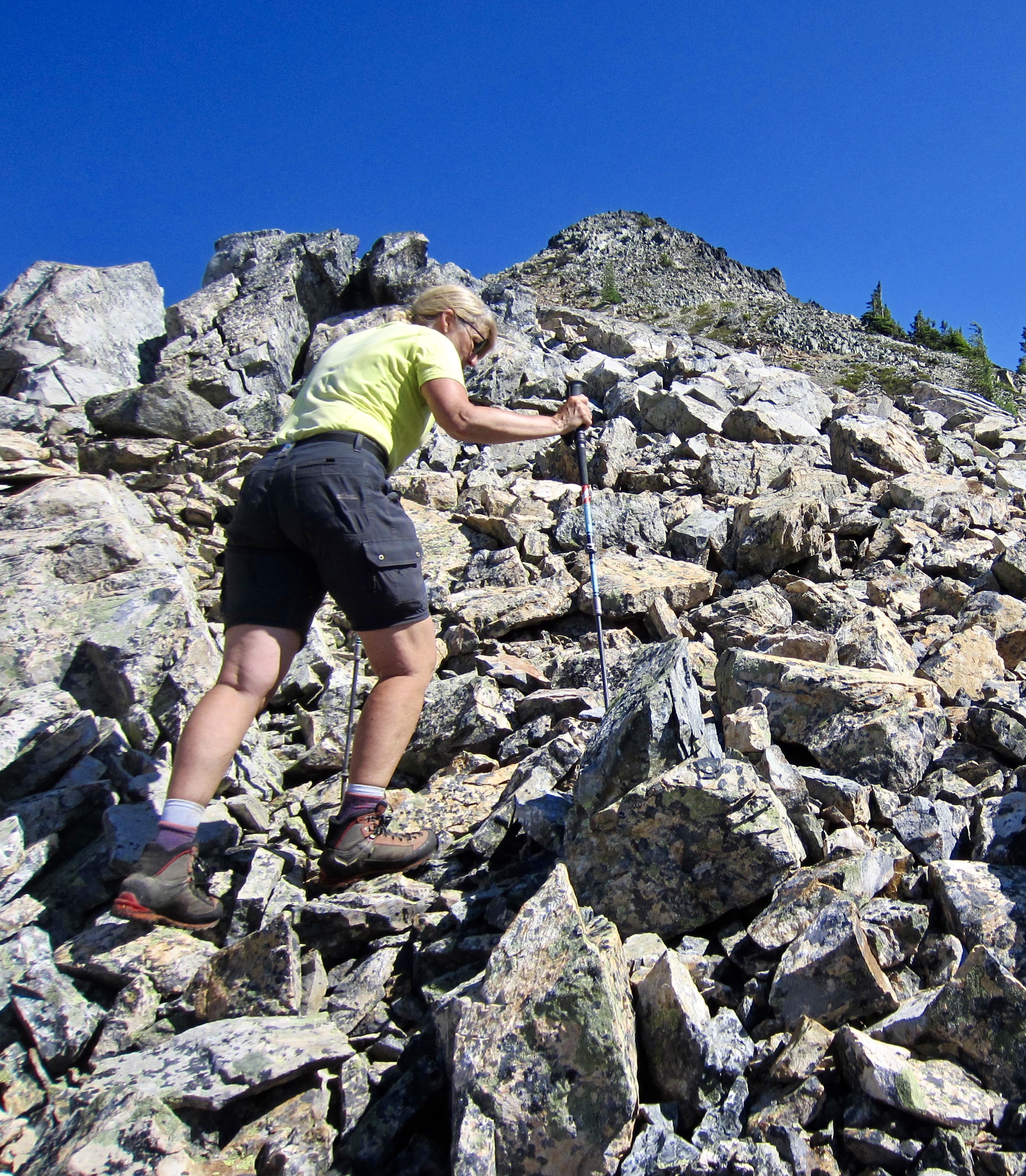
Eileen and I entertained ourselves in the afternoon with a hike and scramble up to the 7360-foot false summit of Graybeard Peak. We had wondered whether Graybeard could be climbed from this false summit, but we discovered that it would be difficult at best. At least the views were really good!

…
Day 4: Easy Pass Bench to Trailhead
Our last day—the hottest day yet—involved only a straightforward hike back down to the Easy Pass Trailhead. Along the way, we met several different parties who were intending to reach the Douglas Glacier today, either as part of a Mt. Logan climb or as a day hike. Trying not to sound too pessimistic, we warned each party that they were in store for an arduous day. Clearly, our group was not the only one who mistakenly thought that Douglas Creek would offer an easy route to the mountain!
Route Map
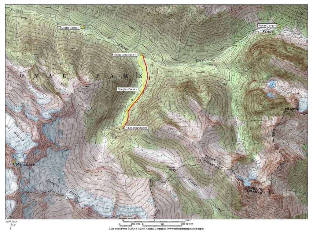
Photo Gallery
Click to enlarge…