Trip Date: August 8-11, 2023
Cathedral Lakes Hiking & Climbing Trip
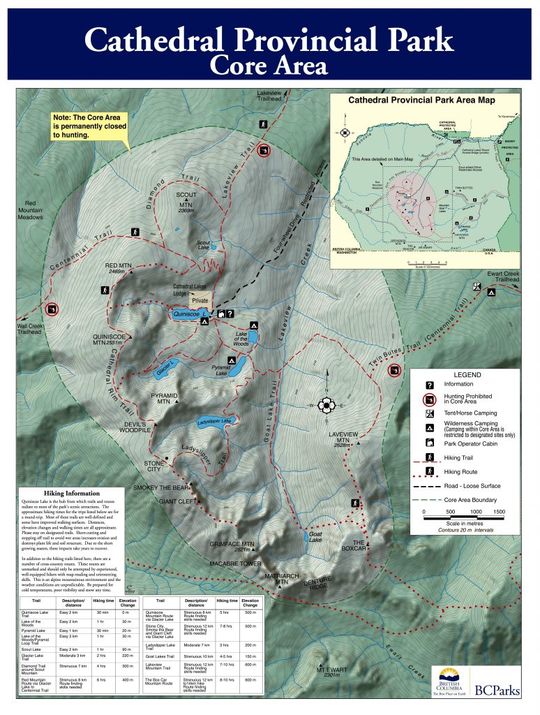
Quiniscoe Lake
Scout Mountain (7720’+)
Scout Lake
Glacier Lake
Devil’s Woodpile
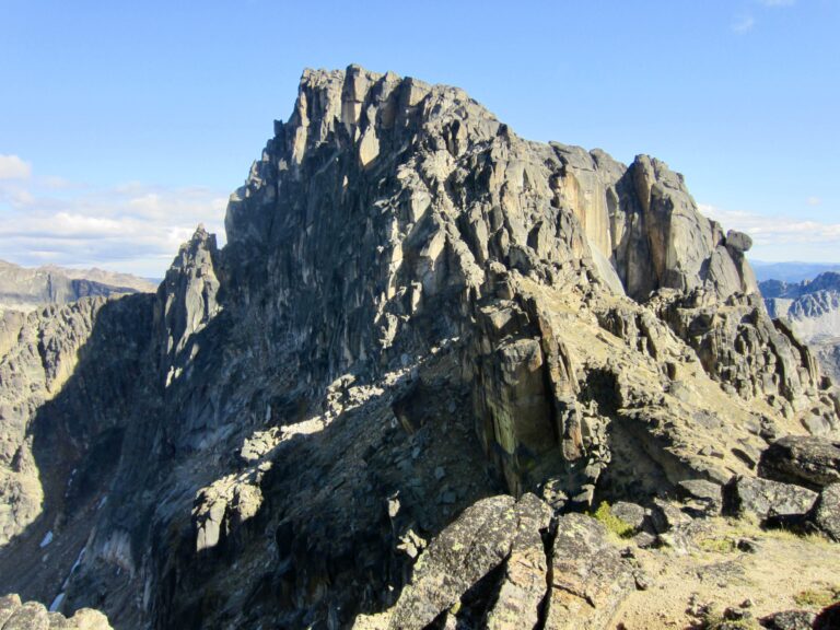
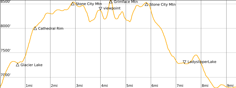
Stone City Mountain (8570′)
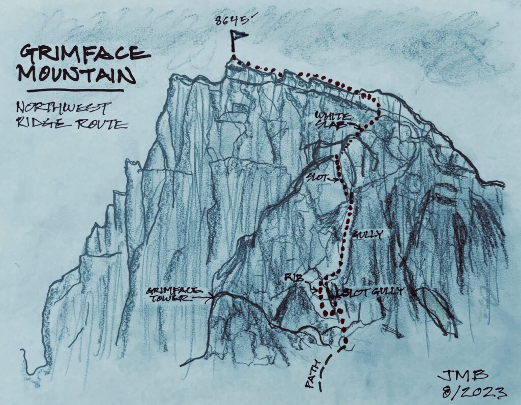
Grimface Mountain aka Mt. Grimface (8645′)
Ladyslipper Lake
Trip Report Summary
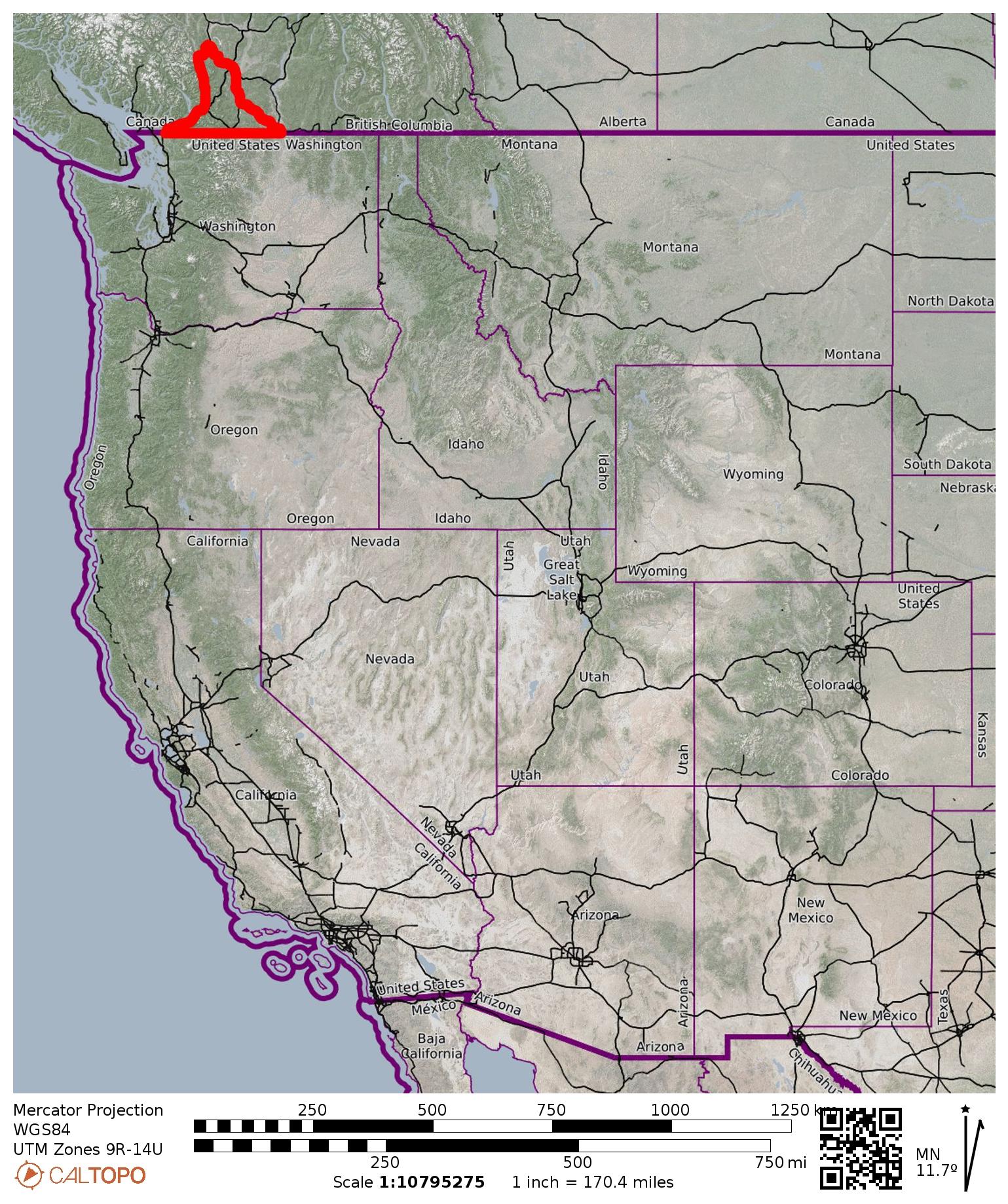
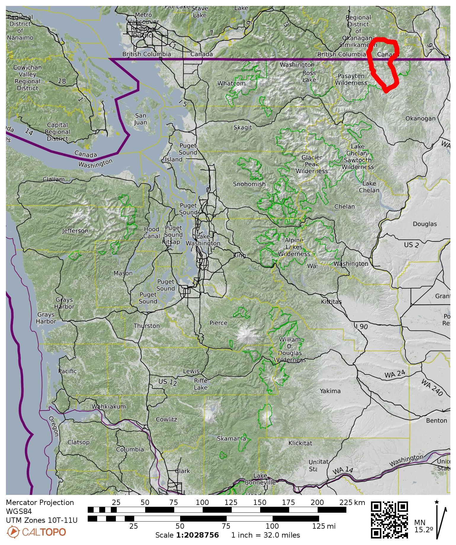
Region: Canadian Cascades (British Columbia)
Sub-Region: Similkameen Mountains
Area: Cathedral Provincial Park
Staging Point: Cathedral Lakes Lodge lower parking lot on Ashnola River Road (Elev. 2700 feet)
Campsite: Quiniscoe Lake Campground (vehicle entry & exit)
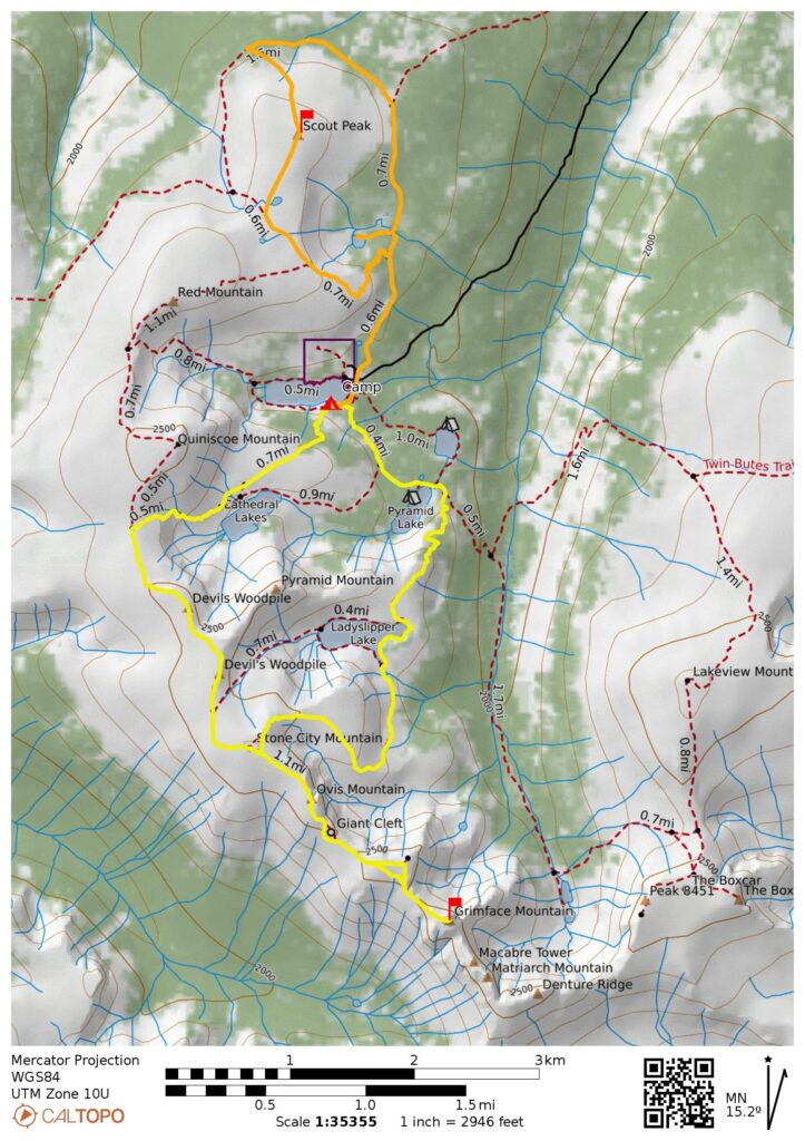
Daytrip 1: Scout Mountain Summit Loop
Starting & Ending Point: Lakeview Trailhead at Quiniscoe Lake Campground (Elev. 6750 feet)
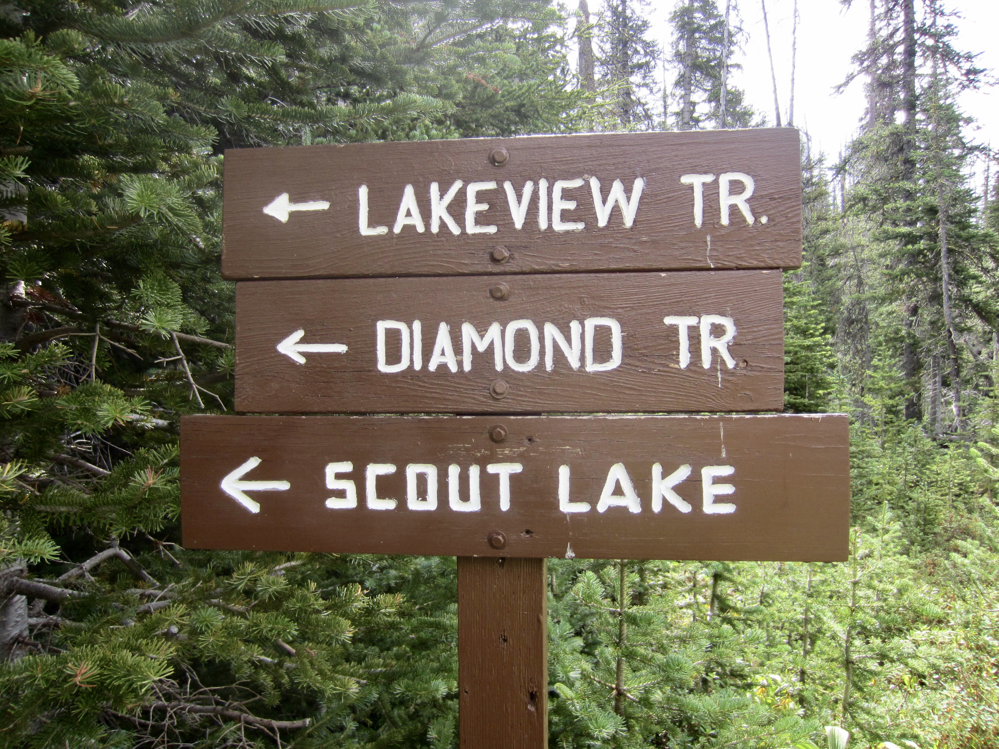
Loop Waypoints: Centennial Trail junction & Diamond Trail junction & Scout Saddle & Scout Mountain summit & Diamond Trail & Scout Lake Trail junction & Scout Lake & Lakeview Trail junction & Quiniscoe Lake (trail hike & off-trail hike)
Summit: Scout Mountain (ascent via South Slope; descent via North Slope)
Approximate Daytrip Stats: 6.0 miles traveled; 1200 feet gained & lost; 7.4 hours elapsed.
Daytrip 2: Stone City Mountain Summit Loop & Grimface Mountain Climb
Starting Point: Glacier Lake Trailhead at Quiniscoe Lake Campground (Elev. 6750 feet)
Loop Waypoints: Glacier Lake & Cathedral Rim & Devils Woodpile & Stone City Mountain summit & Stone City Arm & Ladyslipper Lake & Pyramid Arm & Pyramid Lake & Quiniscoe Lake (trail hike & rock scramble)
Ending Point: Centennial Trailhead at Quiniscoe Lake Campground (Elev. 6750 feet)
Sidetrip: Smokey the Bear viewpoint & Grimface Mountain viewpoint & Grimface Tower notch (trail hike & rock scramble)
Summit: Stone City Mountain (trail hike via Northwest Slope; descent via Northeast Ridge)
Summit: Grimface Mountain (rock scramble via Northwest Ridge)
Approximate Daytrip Stats: 10.0 miles traveled; 3700 feet gained & lost; 13.0 hours elapsed.
Approximate Total Stats: 16.0 miles traveled; 4900 feet gained & lost.
…
Related Post
Cathedral Lakes + Lakeview Mtn + Quiniscoe Mtn + Stone City Mtn – October 2018
Trip Overview
Five years after our early-autumn visit to Cathedral Provincial Park, Fay, Eileen, and I made a mid-summer return trip. This park is situated in the Similkameen Mountains immediately north of the Washington / British Columbia border, between the Cascade Crest and the Okanogan Highlands. It features a half-dozen beautiful sub-alpine and alpine lakes—collectively called Cathedral Lakes—as well as numerous peaks and ridges above 8000 feet.
Access to the park’s lakeside campgrounds can be made either by a 10-mile and 4000-foot trail hike or (for about US$125 per person) by a 1-hour shuttle ride. Because all three of us were fighting through or recovering from some sort of health issue, the shuttle ride was extremely appealing; it meant that we could launch our hikes and climbs from a starting elevation of nearly 6800 feet. During our two full days in the high country, we completed two nice loop hikes and climbed Grimface Mountain—the topographic climax of Cathedral Provincial Park and a major peak in the Similkameen sub-range.
…
Full Trip Report
Day 1: Staging Area to Quiniscoe Lake
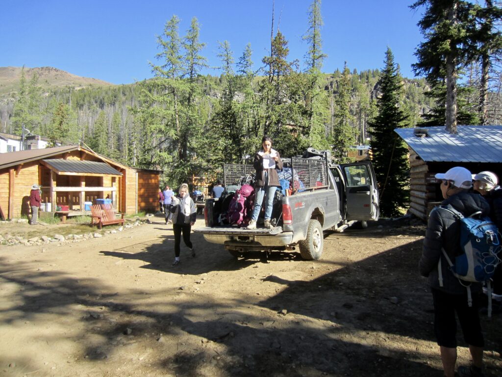
We pulled into the Cathedral Lakes Lodge staging area alongside the Ashnola River Road at 2:00pm on a sunny Tuesday. From Seattle, this is approximately a 6-hour drive (excluding stops) via either Sumas or Wenatchee. The large parking lot was cram-packed with cars, and there were many people waiting to be transported uphill. All people and gear were loaded into the fleet of Chevy Suburban vehicles and driven 10 steep, rough miles up to the busy resort area at Quiniscoe Lake, which sits at 6750 feet.

.

.
Upon unloading, we were met by Tony, a friendly ranger for B.C. Parks (the resort is privately owned, whereas the campgrounds are managed by the provincial parks department). Because we hadn’t paid our camping fee (CDN$10 per person per night) in advance and hadn’t brought any Canadian money with us, Tony escorted me over to his office and allowed me to pay on-line using his laptop computer, which had a satellite-based internet connection.
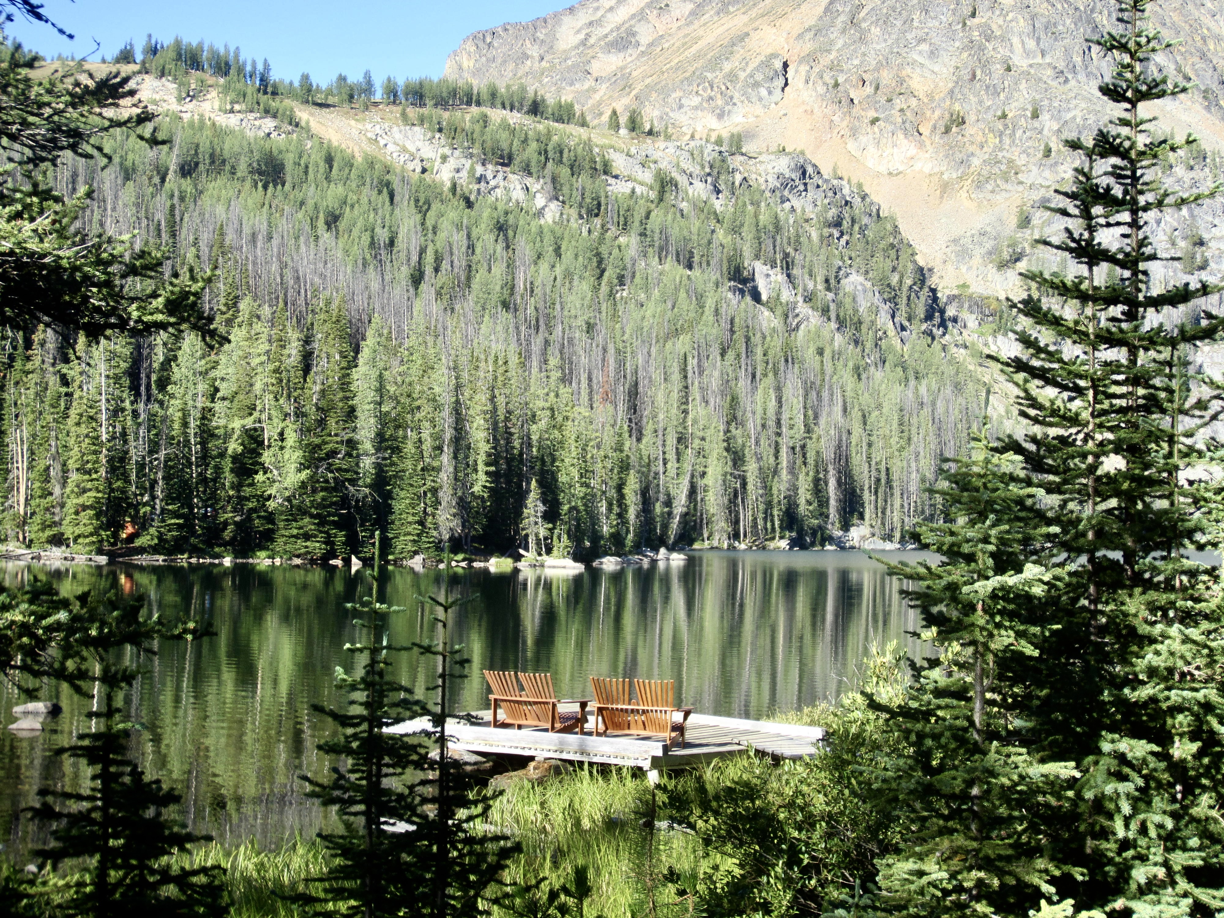
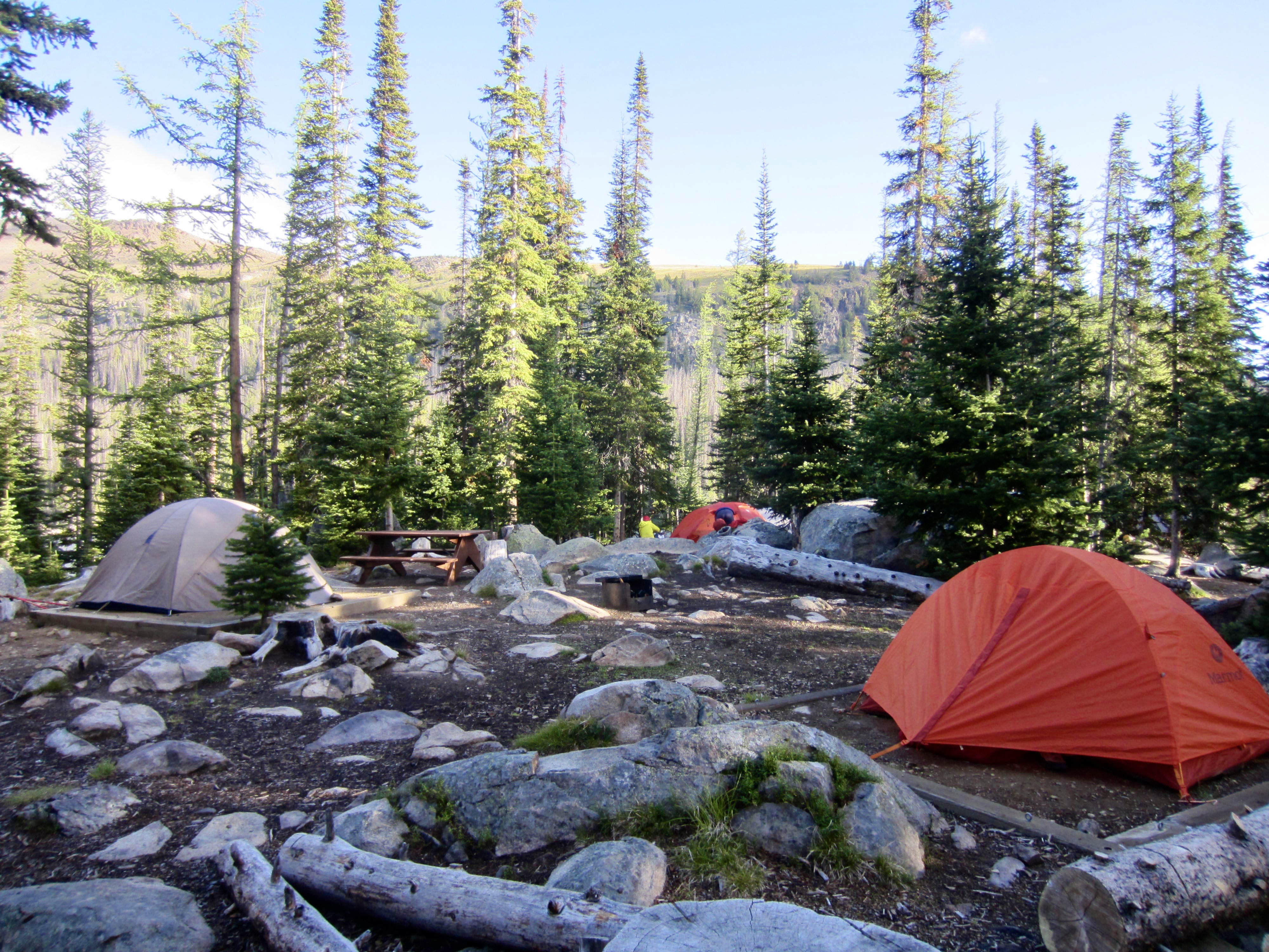
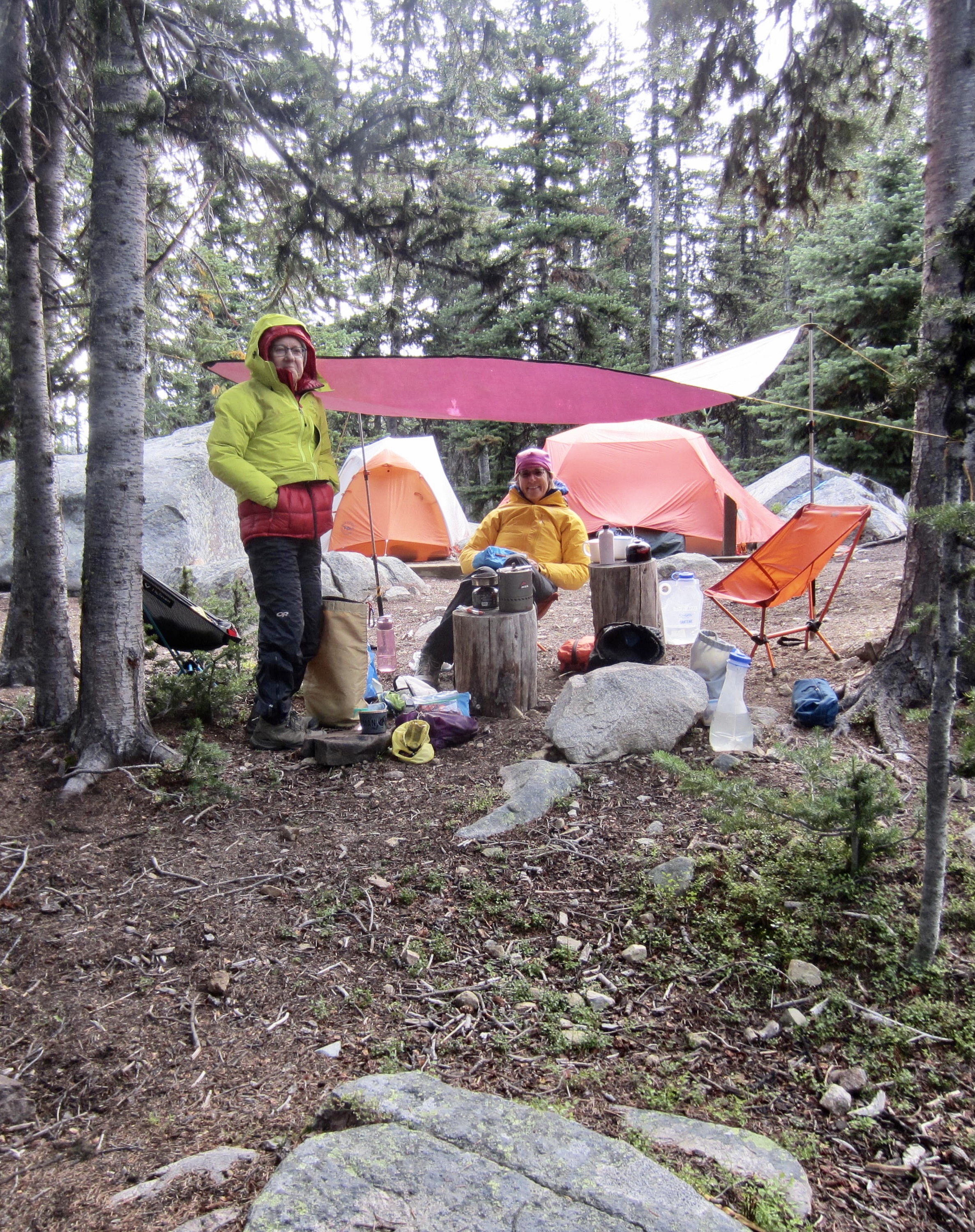
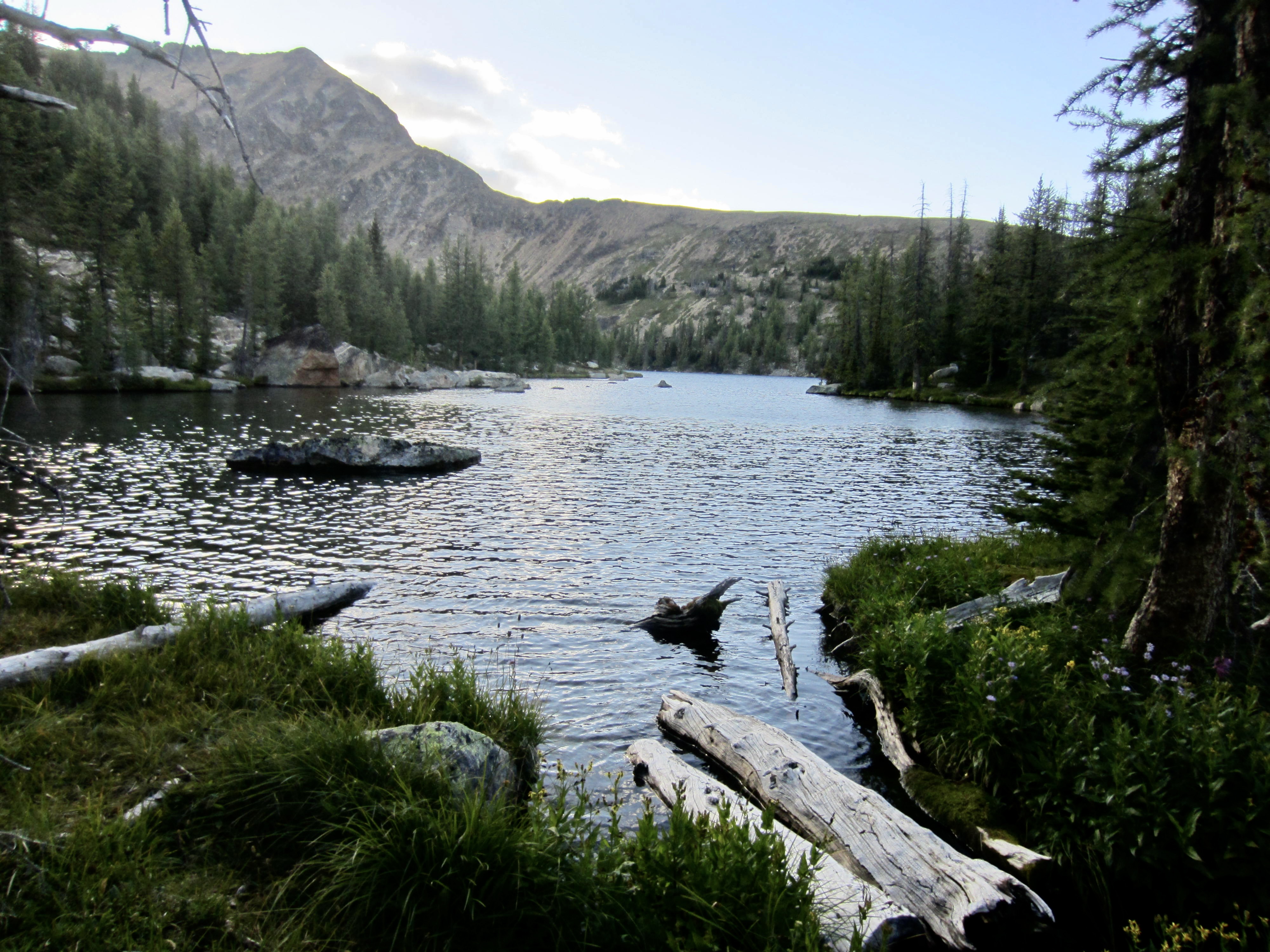
Meanwhile, Eileen scoped out the campground and found us a site closely above the shore of Quiniscoe Lake. We pitched our tents on one of the available platforms, unfolded our camp chairs, and settled in for the next three nights. The weather was unseasonably cold and unsettled during our stay, with some rain in the forecast, so this prompted us to string up a tarp above our dining area.
…
Day 2: Scout Mountain Summit Loop
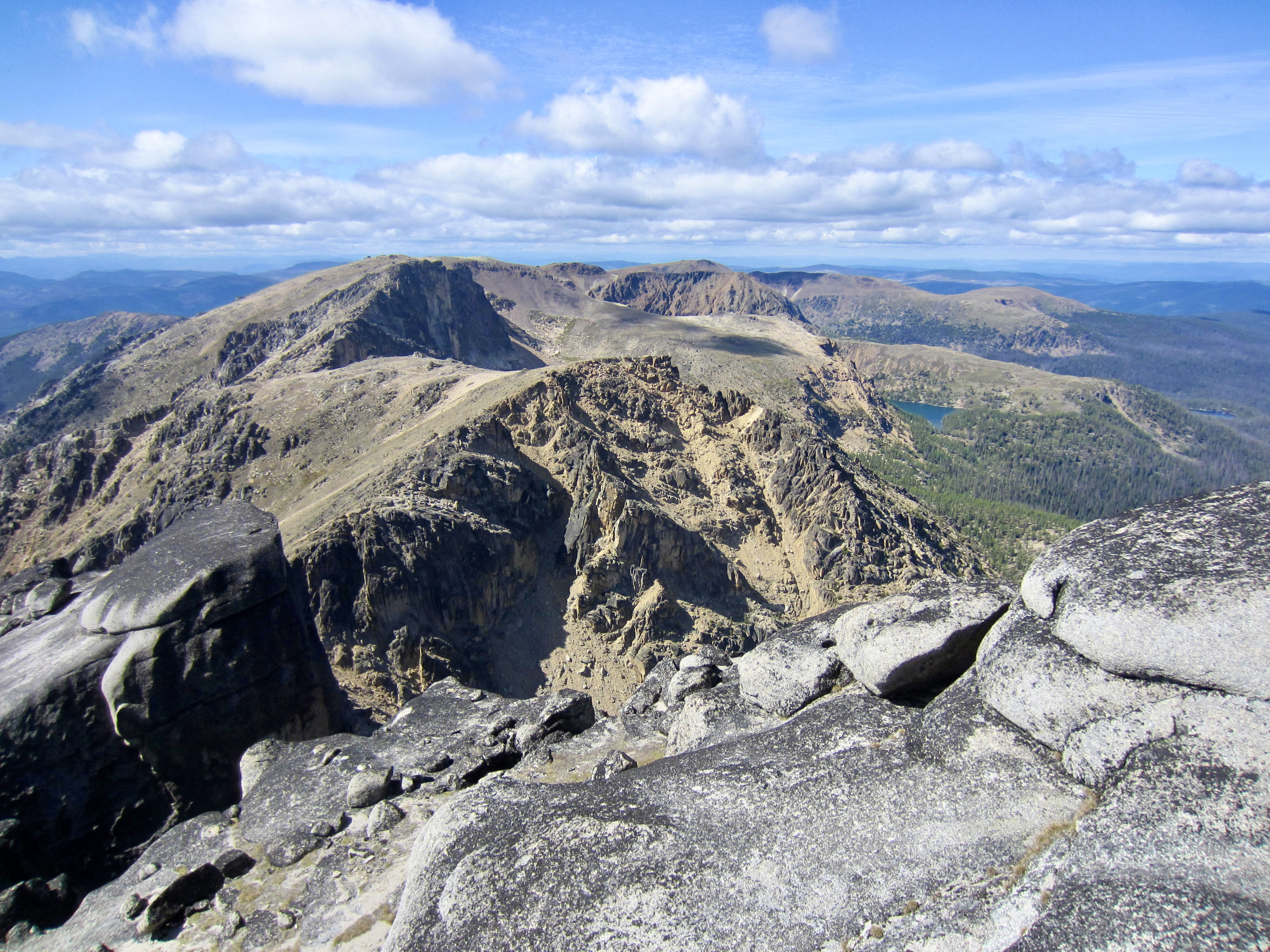
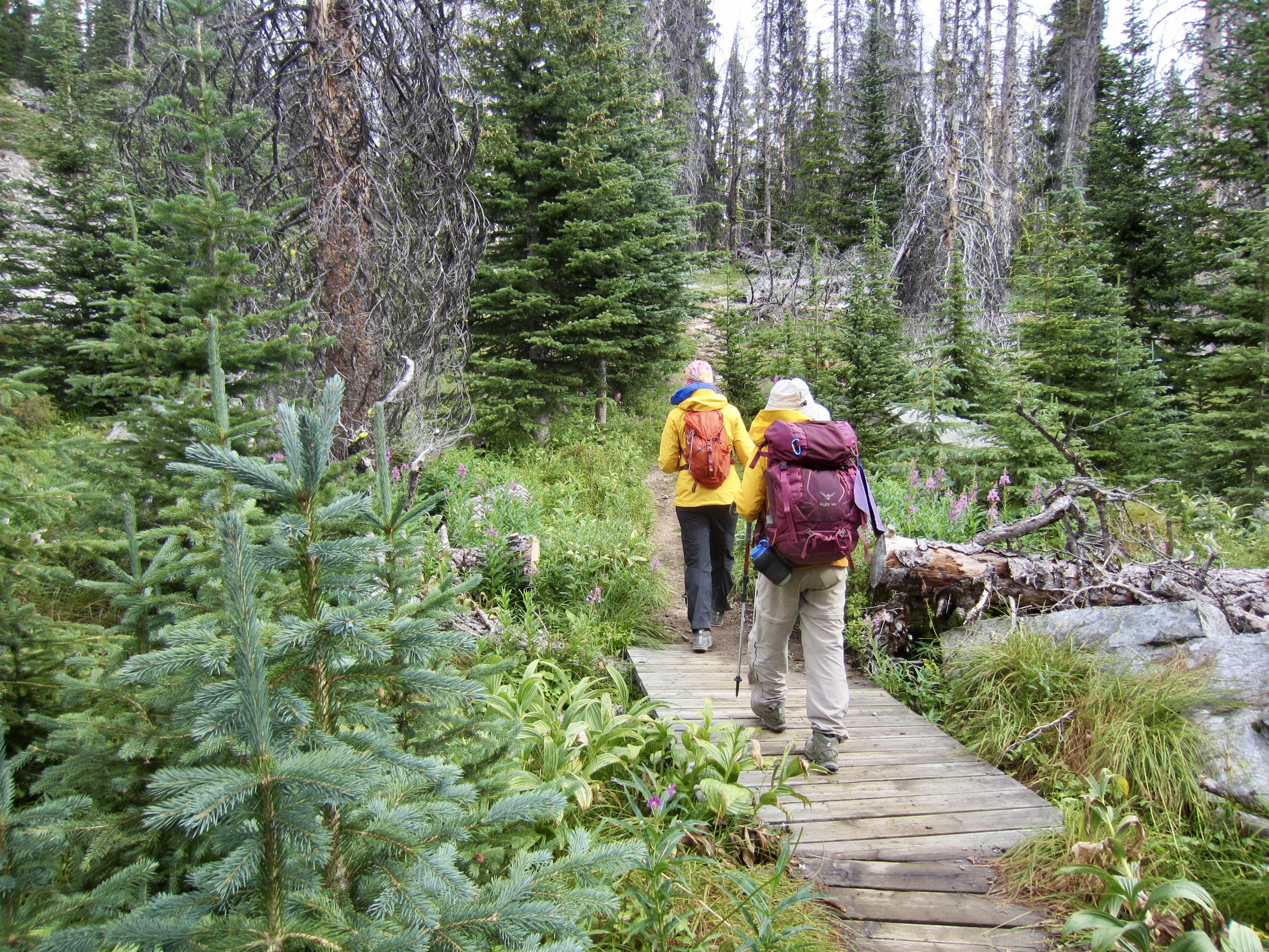
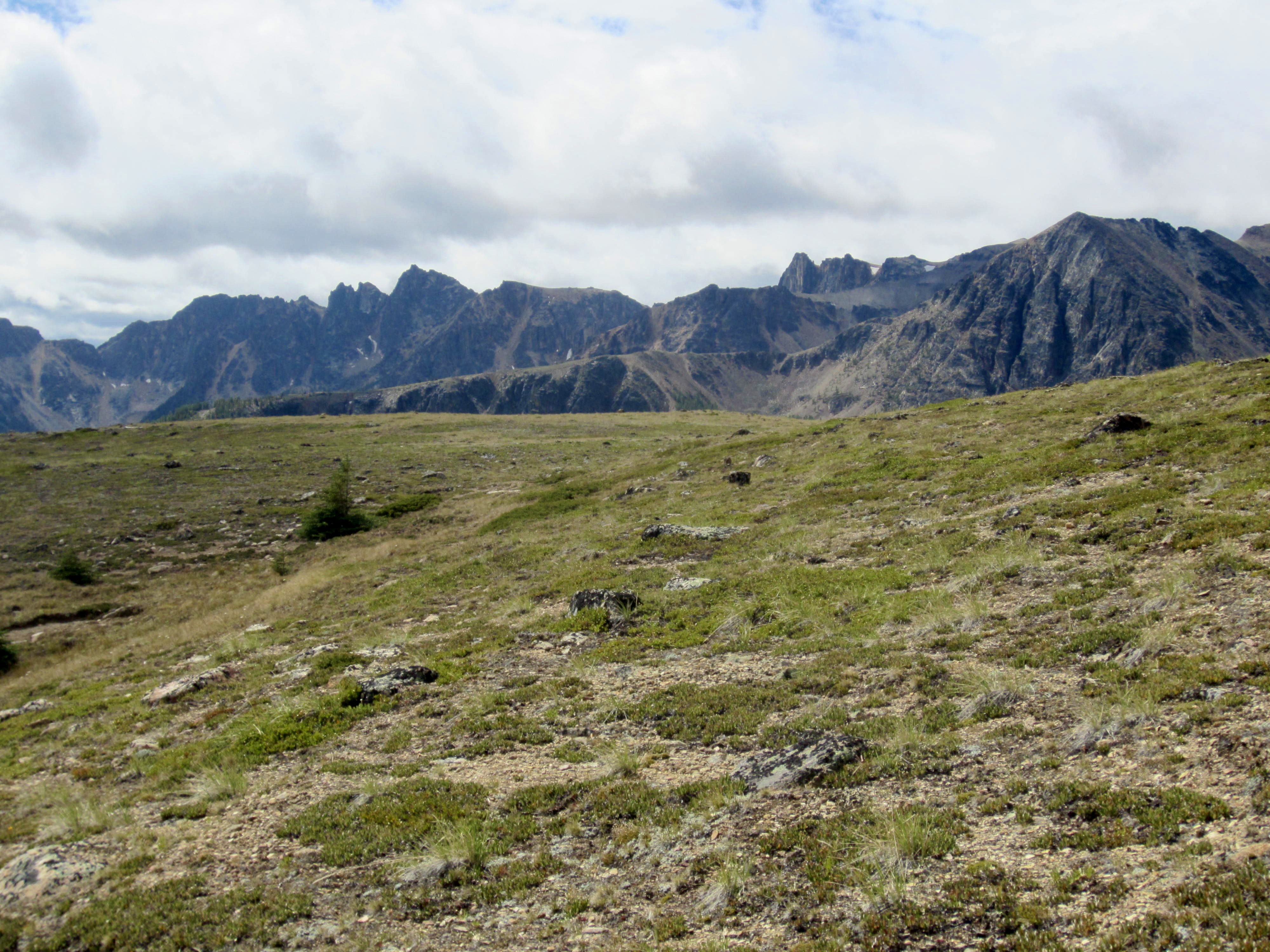
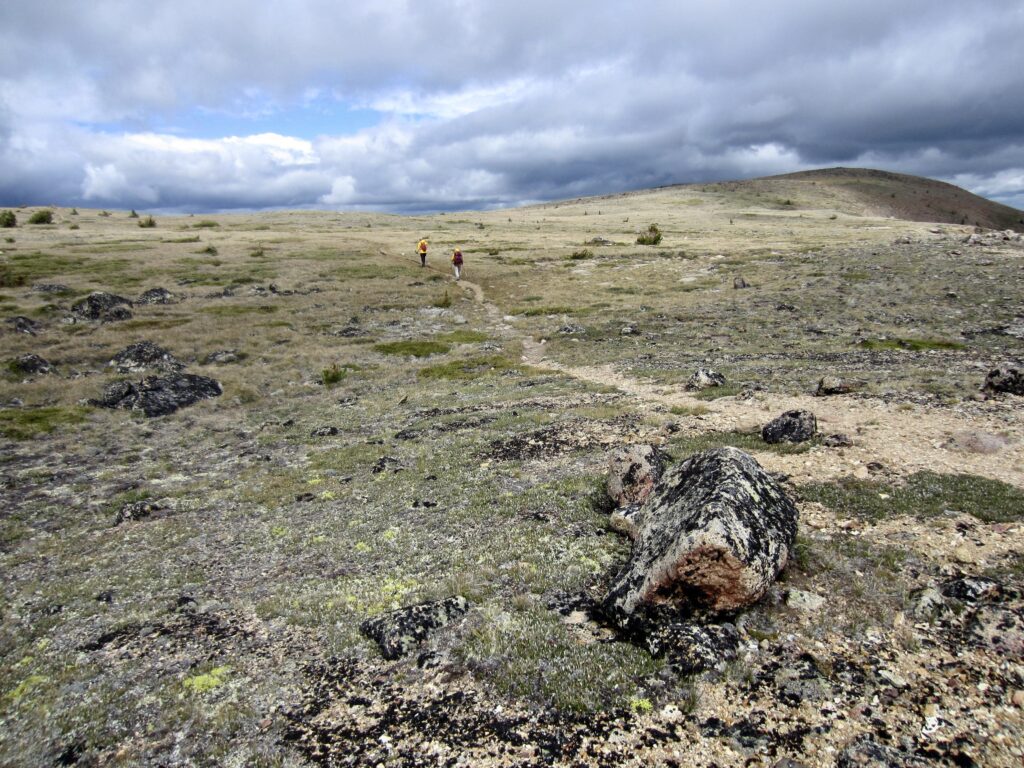
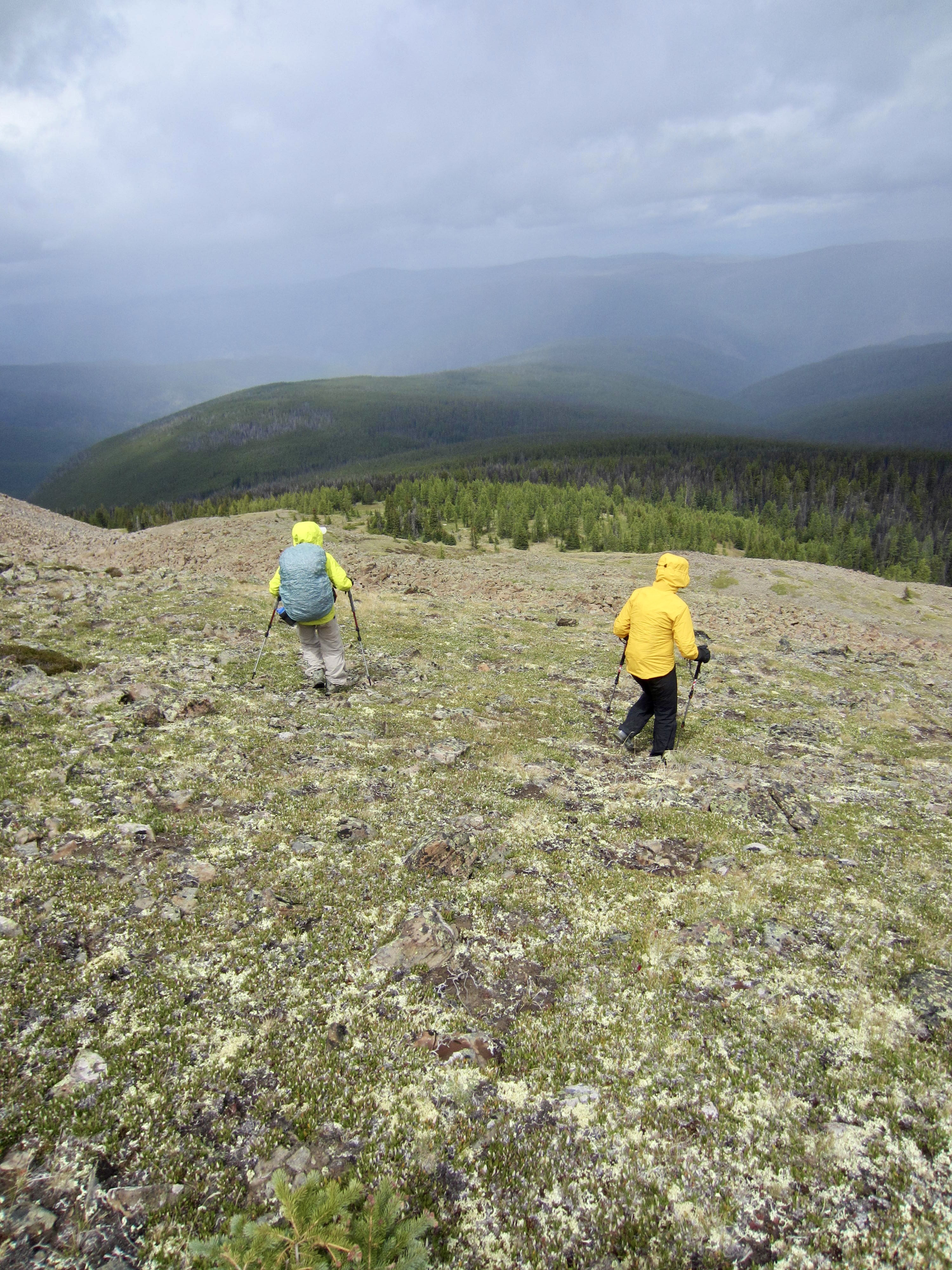
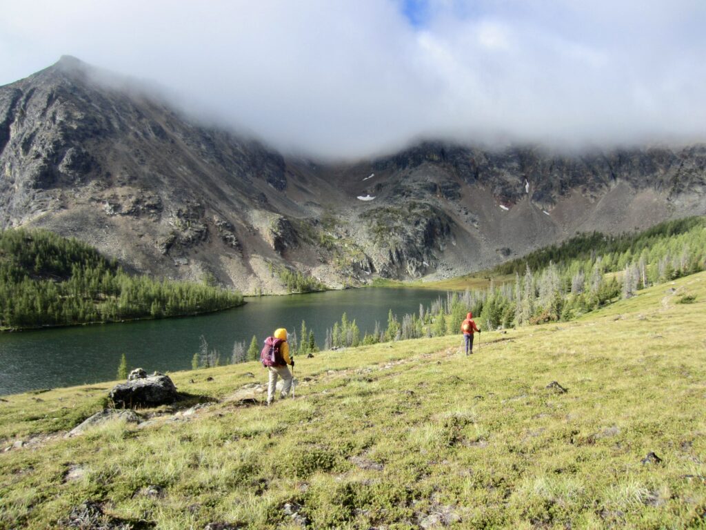
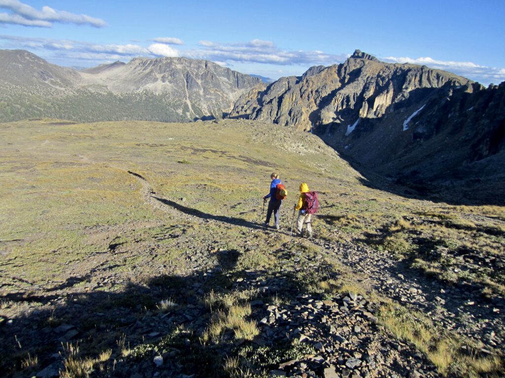
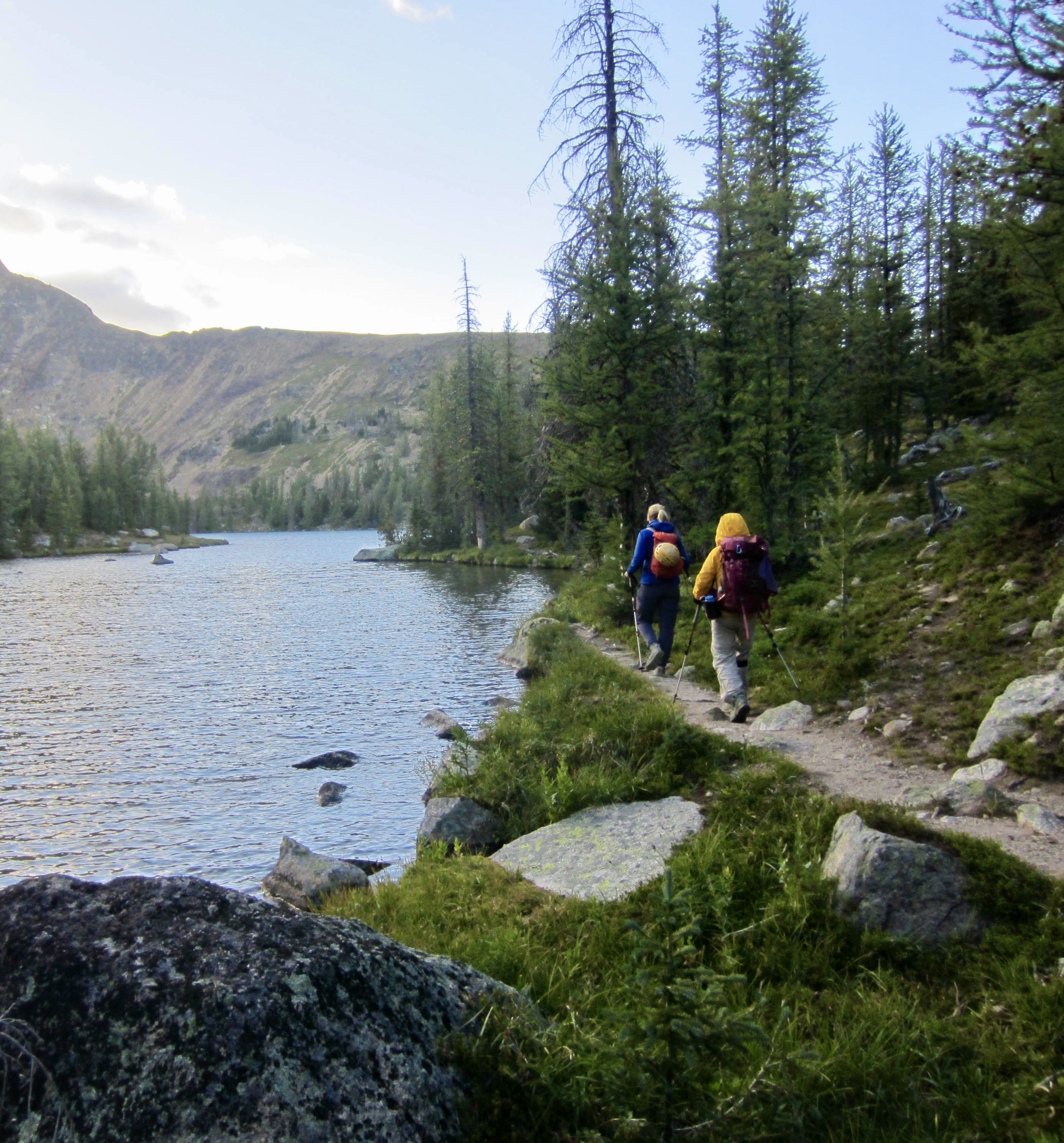
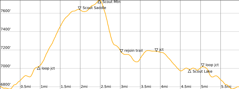
Because today was predicted to be somewhat rainy, we chose to do a relatively easy hike over the summit of Scout Mountain. Our route initially followed the Lakeview Trail out of camp, then turned uphill on the Centennial Trail, passing through a larch forest before emerging onto a vast alpine tundra. The rugged Cathedral Rim was visible toward the south and west of us.
.
Farther up the tundra slopes, we veered onto the Diamond Trail, which led us to Scout Saddle. From there, it was merely a cross-country stroll to the summit of Scout Mountain (2.1 hours + 1000 feet from camp). We took shelter from the cold wind by ducking behind the summit tor.
.
.
To continue our loop, we hiked down the mountain’s northern flank and rejoined the Diamond Trail in a meadow, then followed it clockwise around to the Lakeview Trail. Scout Lake provided a short sidetrip on our way back to Quiniscoe Lake, thereby completing our very unhurried 6-mile loop (7.4 hours + 1200 feet total). Fortunately, the dark clouds that had hung over our heads all day never generated anything more than intermittent spitting rain.
…
Day 3: Stone City Mtn Summit Loop & Grimface Mtn Climb
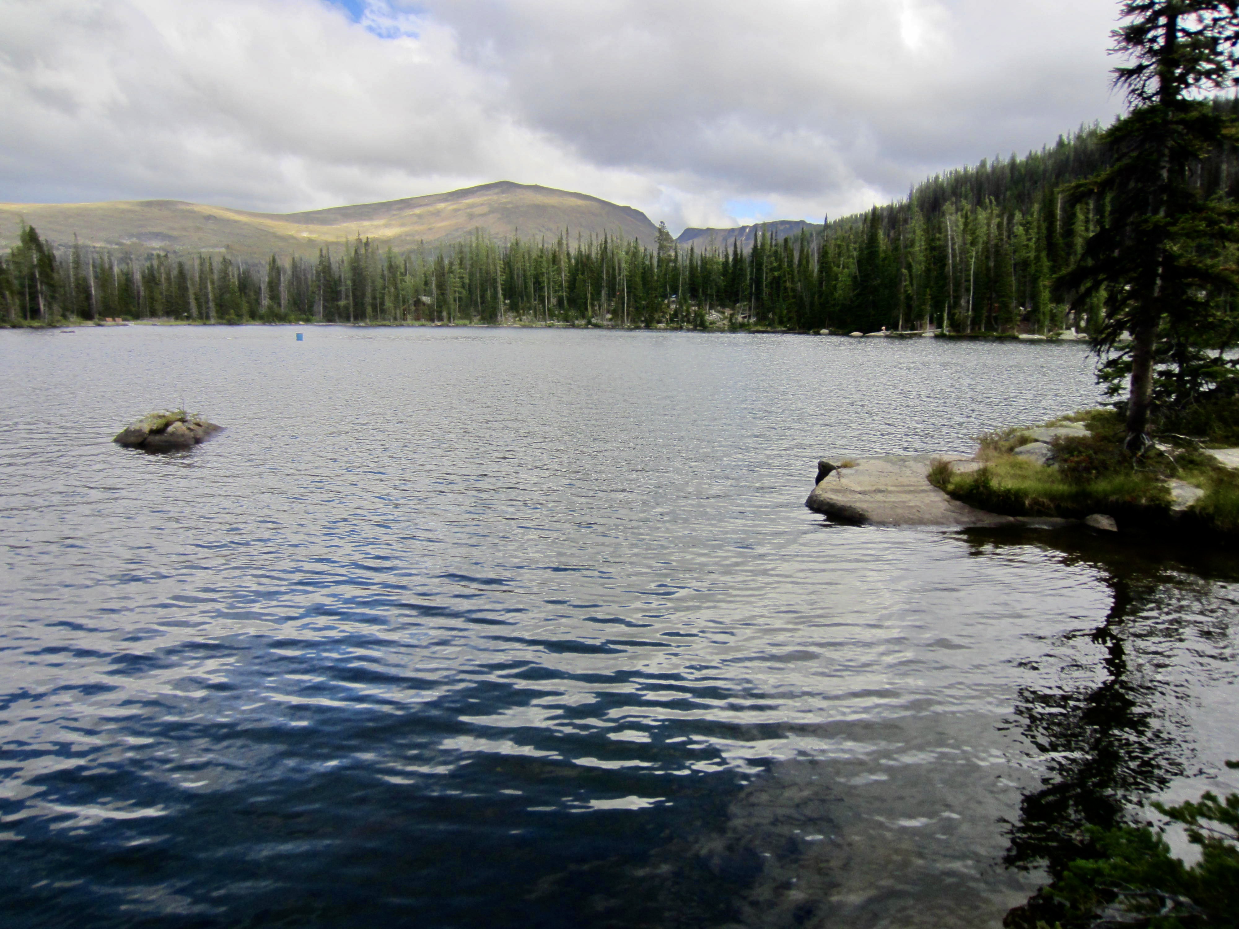
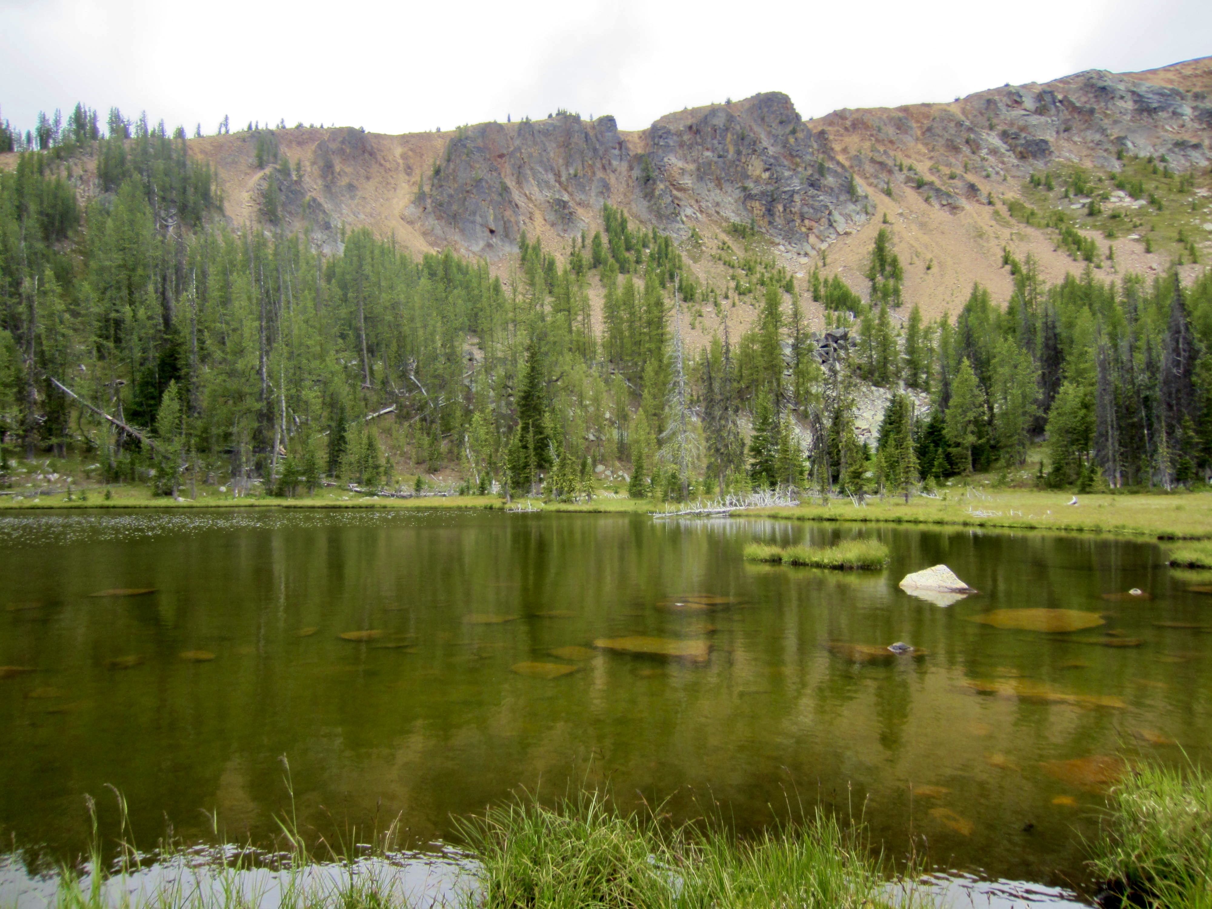
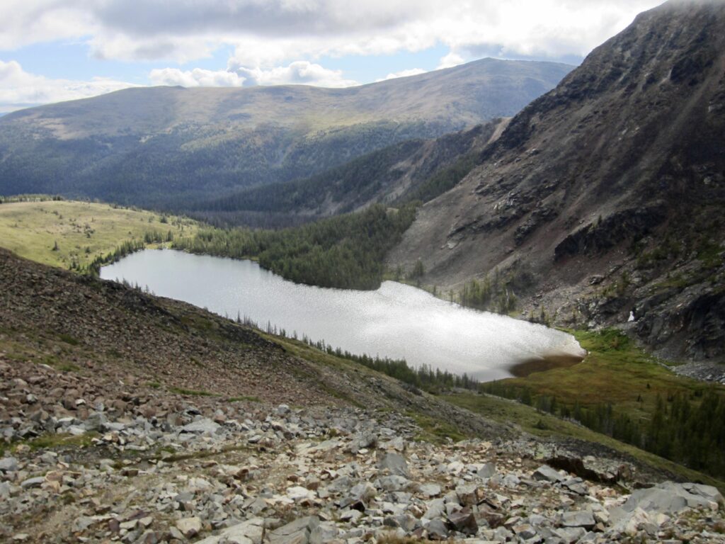
Today was forecasted to be mostly sunny, but we awoke to a low cloud ceiling that obscured all of the surrounding peaks and ridges. Our goal was to climb Grimface Mountain, so we adopted a leisurely approach to our morning in hopes of giving the clouds some time to burn off. In this spirit, we didn’t leave camp until nearly 8:00am. Our route began on the Glacier Lake Trail, which traverses above the beautiful lake on grassy slopes.
.
.
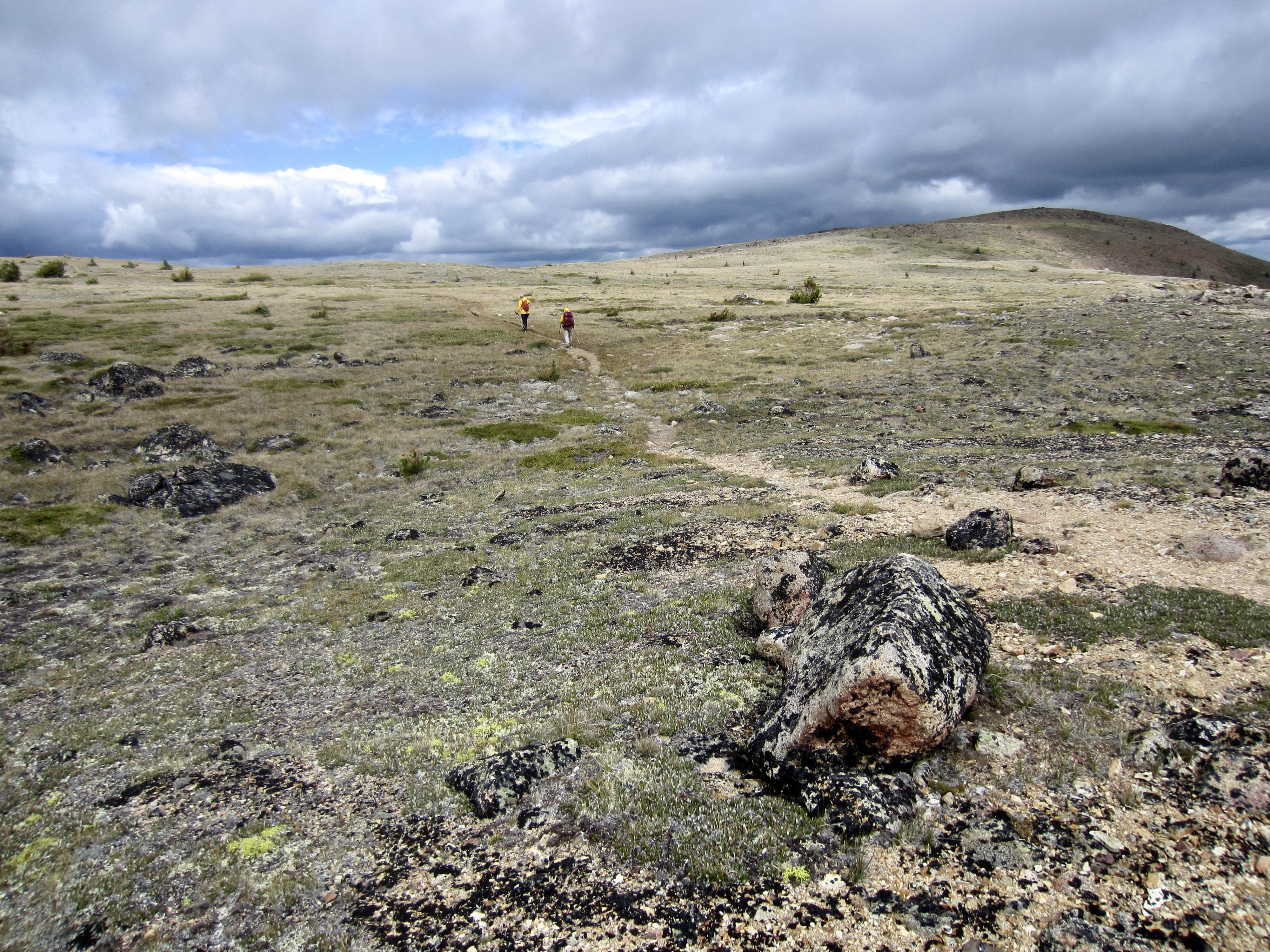
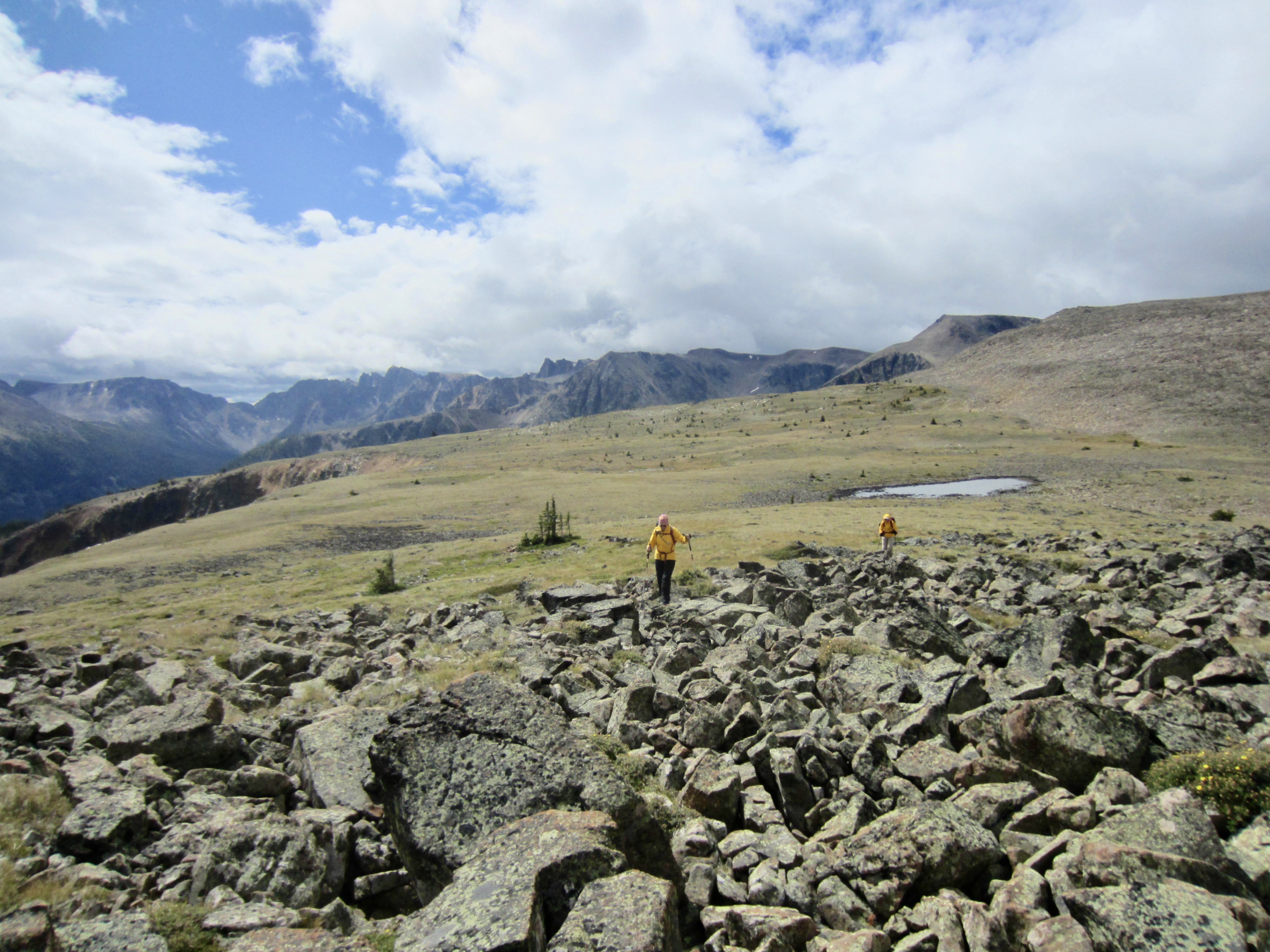
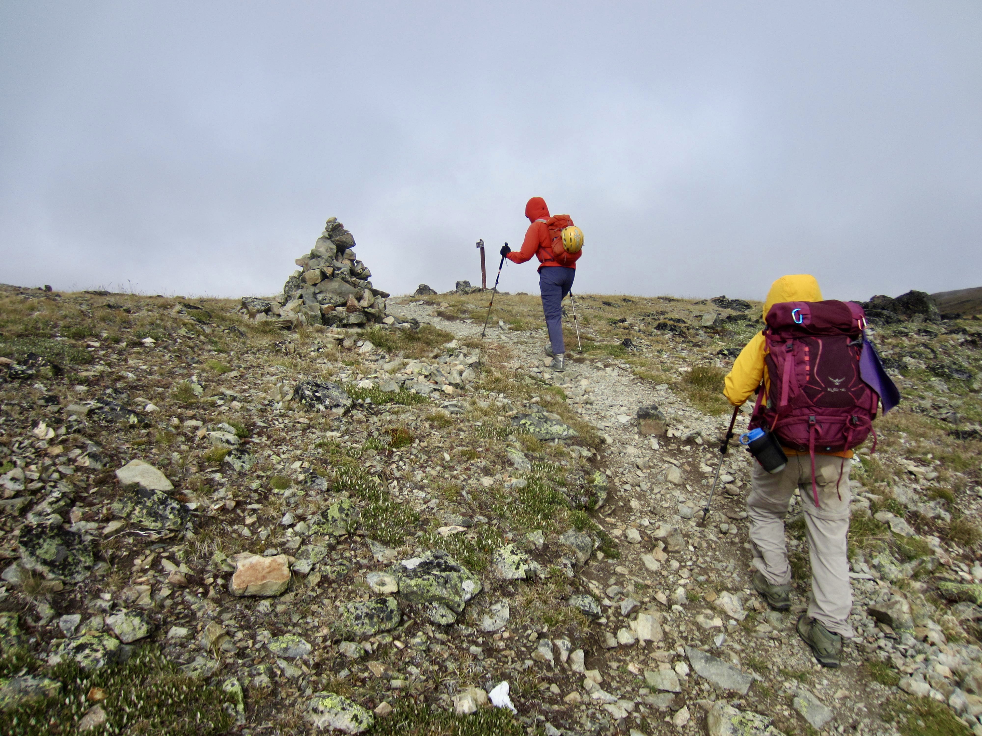
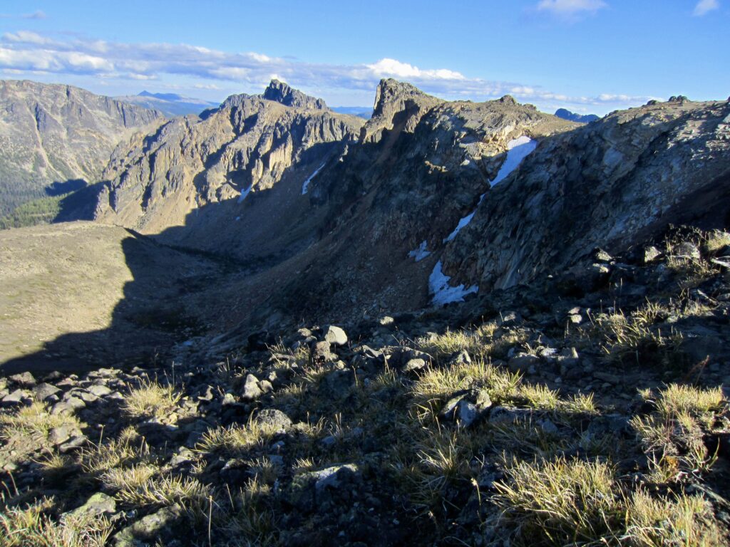
After passing Glacier Lake, the trail becomes a rough path that climbs steeply to Cathedral Rim. We gained the rim crest at an 8000-foot saddle in mid-morning (1.9 hours + 1500 feet from camp) and immediately turned left (south) on the Rim Trail. The crest was cold, windy, and foggy, with no opportunity for shelter.
.
.
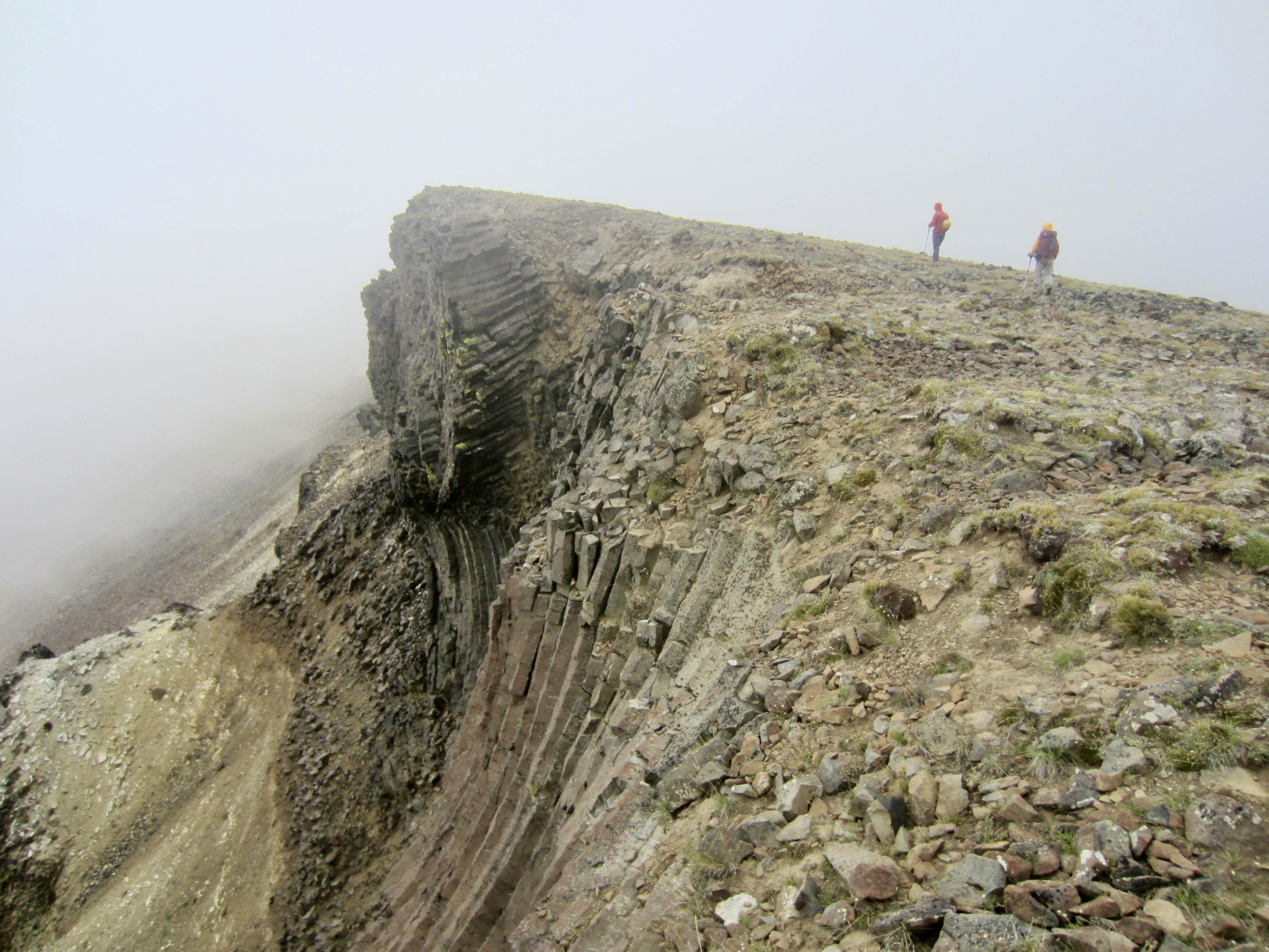
We soon came to one of the most fascinating geologic features in the park: The Devil’s Woodpile. Clearly exposed in the eroded cliff face are hundreds of hexagonal basalt columns arranged in various orientations ranging from vertical to horizontal. The “woodpile” itself is a cluster of short, horizontal columns that truly does resemble a stack of cut logs.
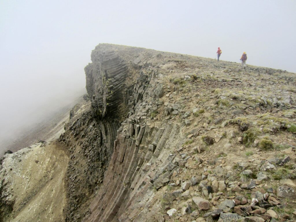
.
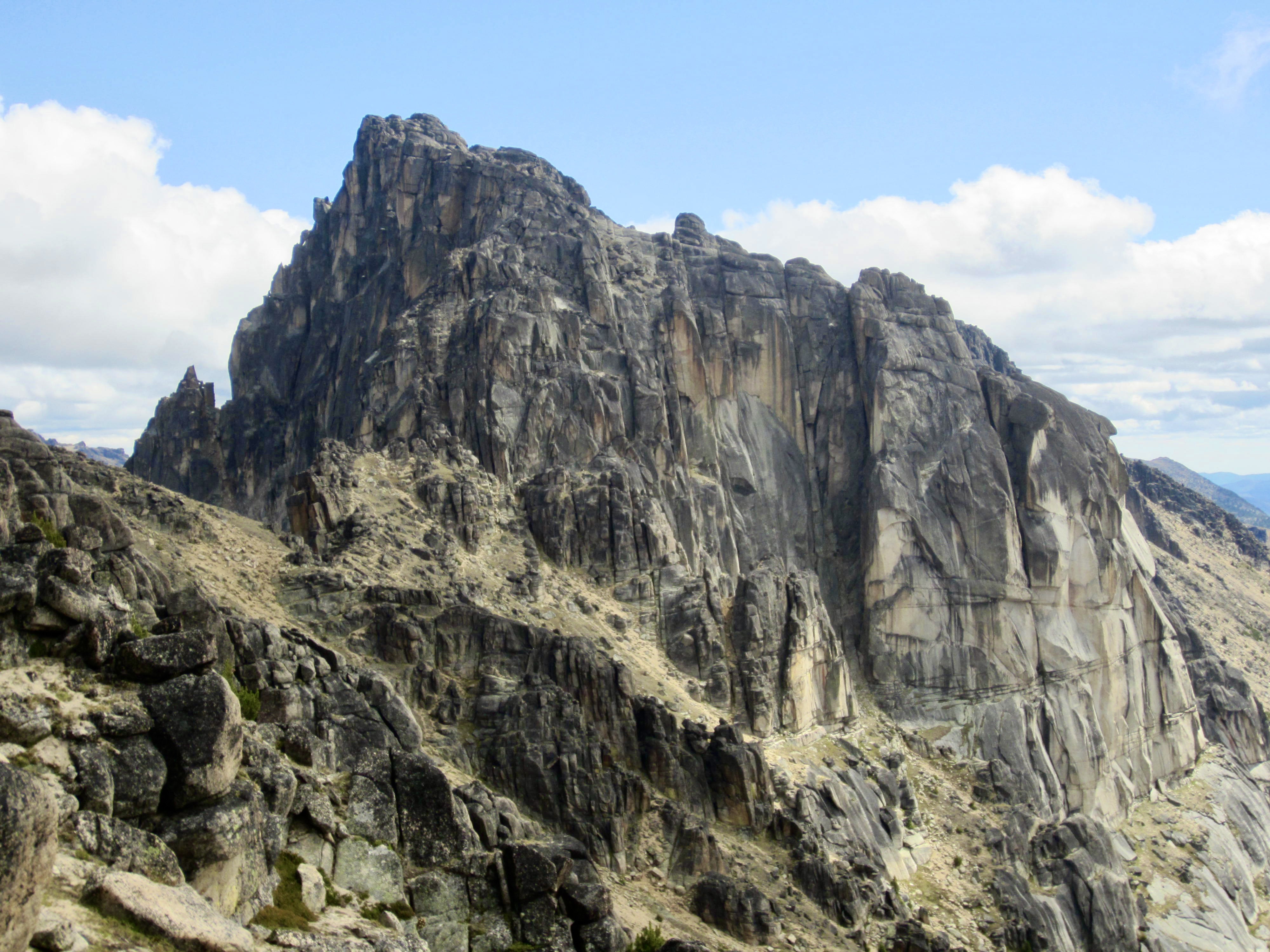
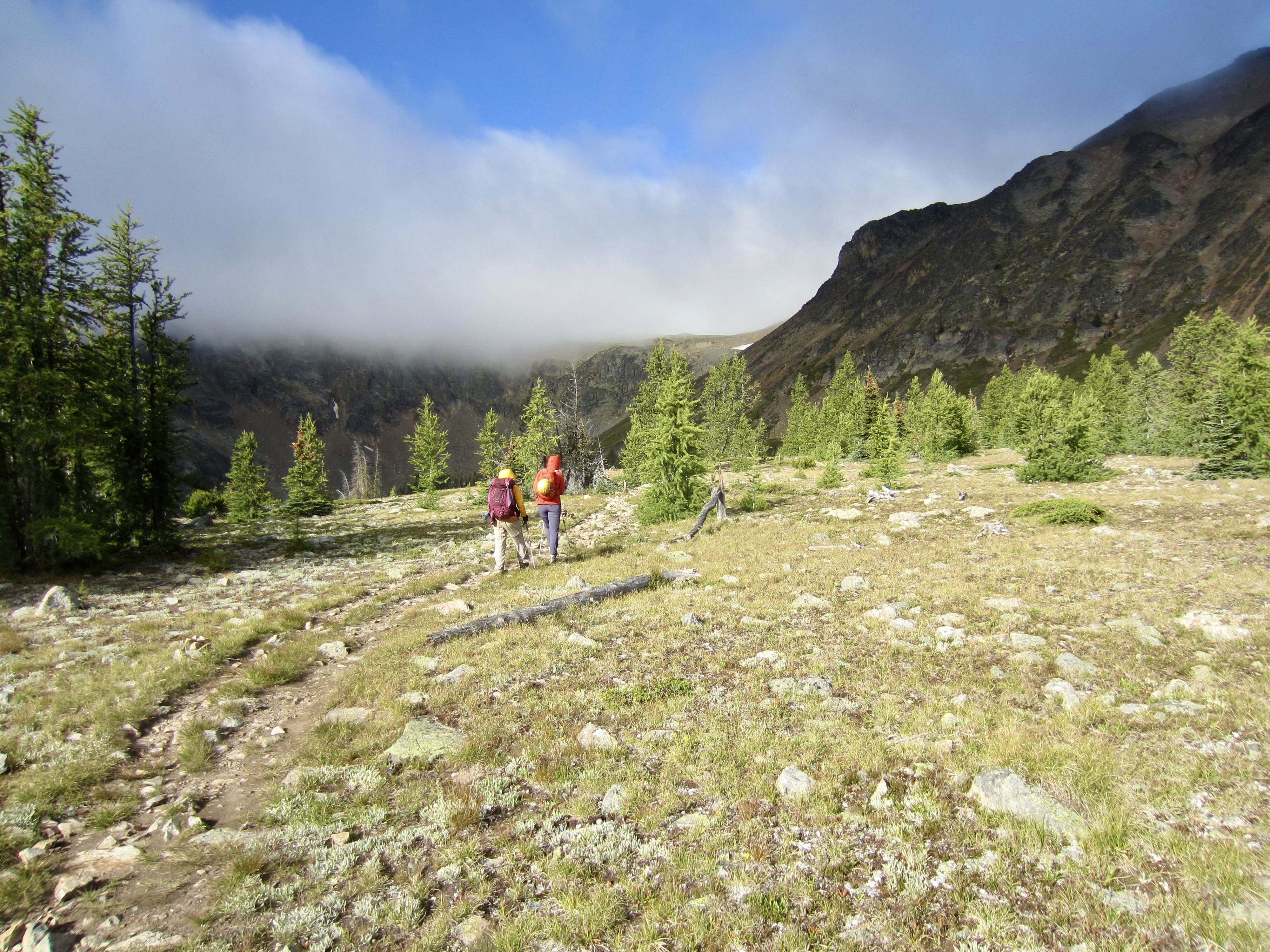
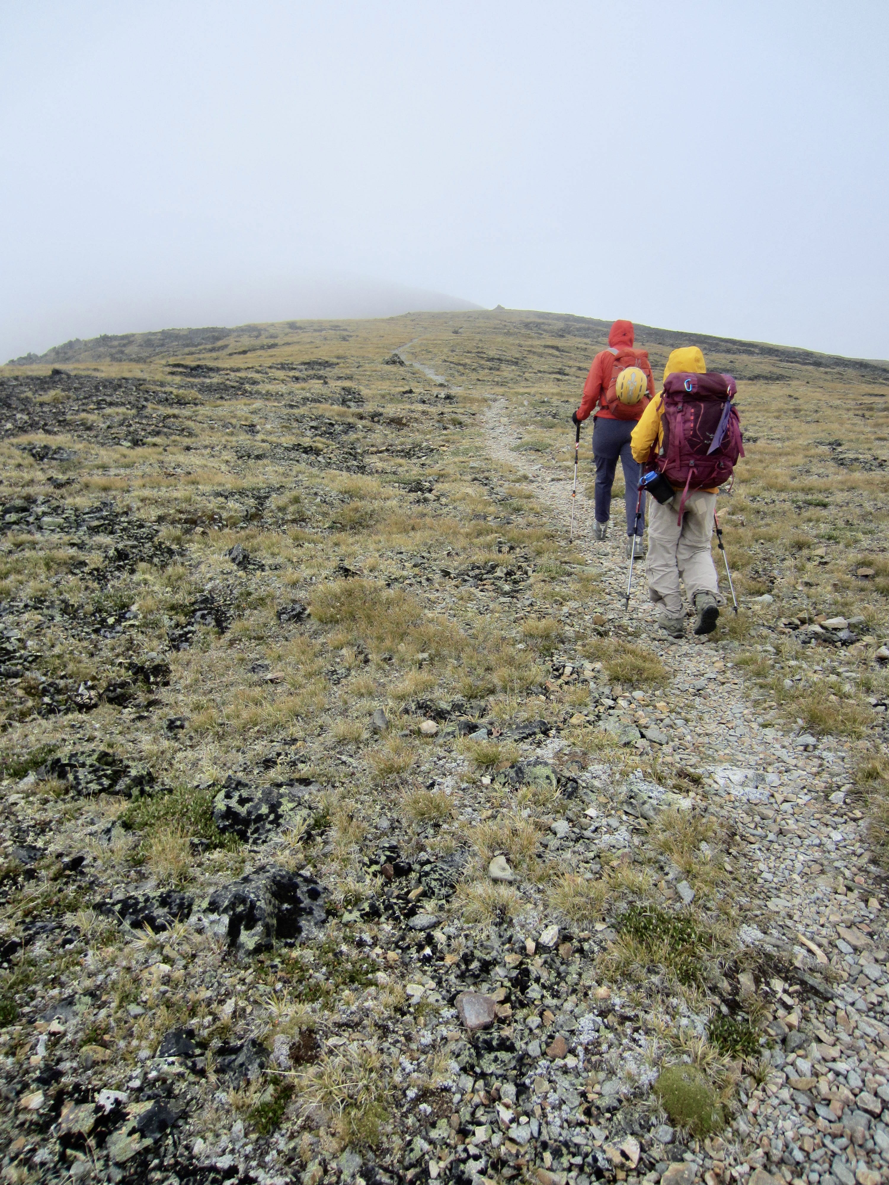
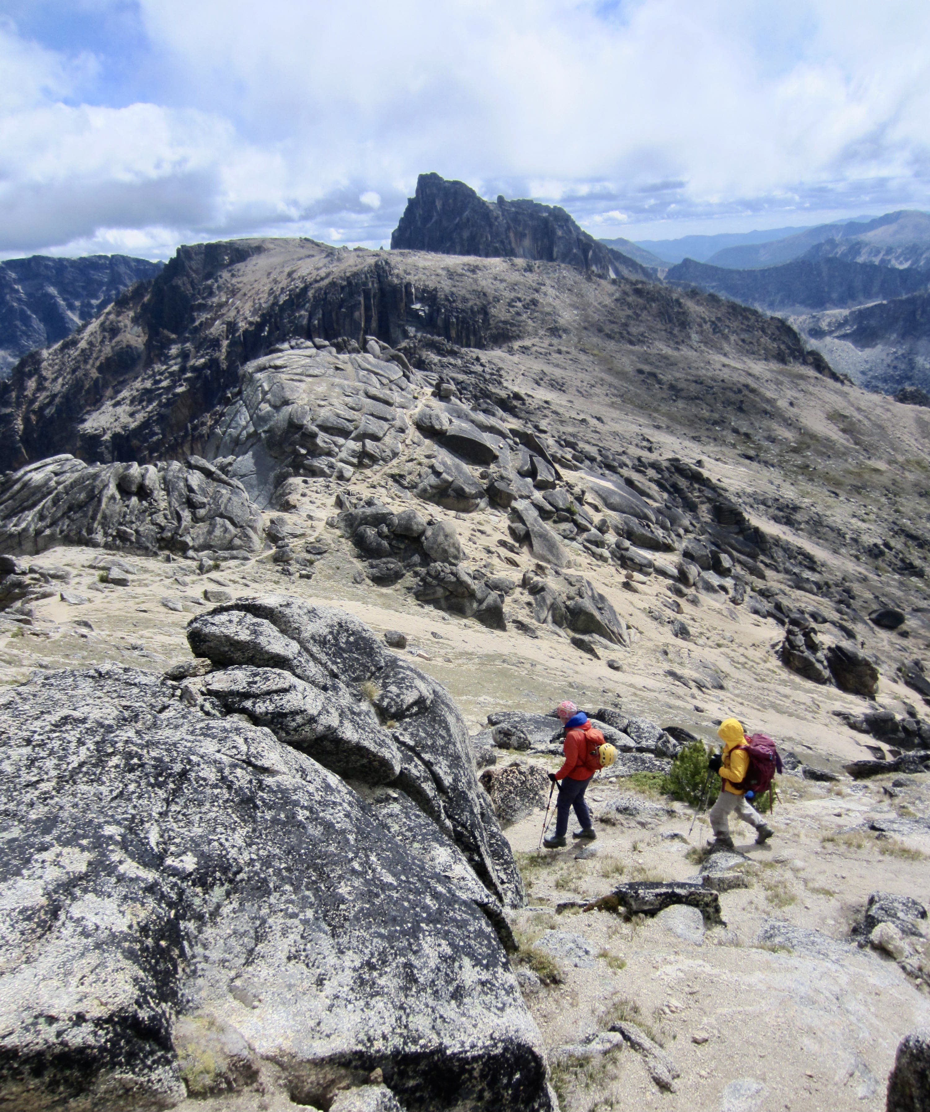
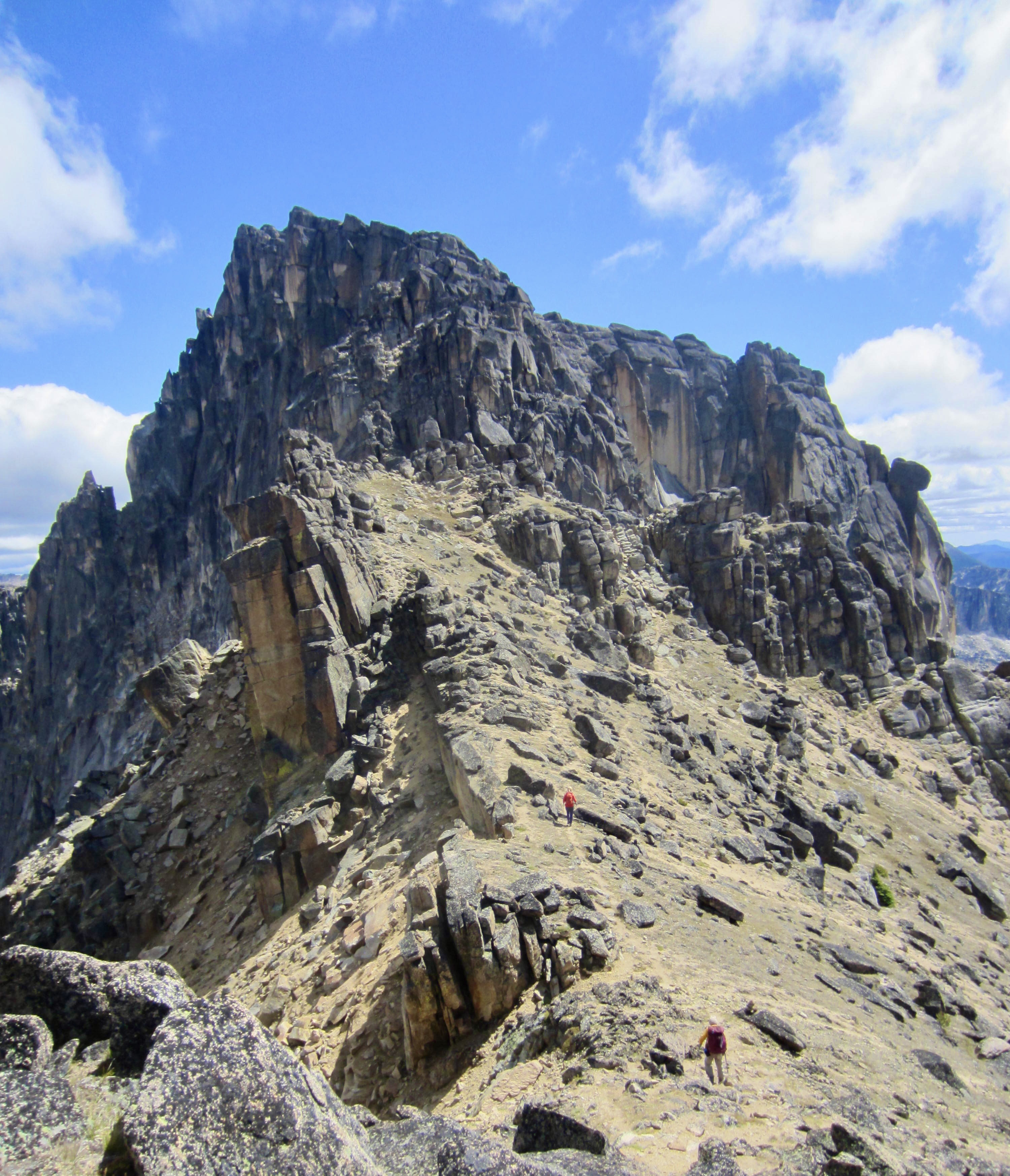
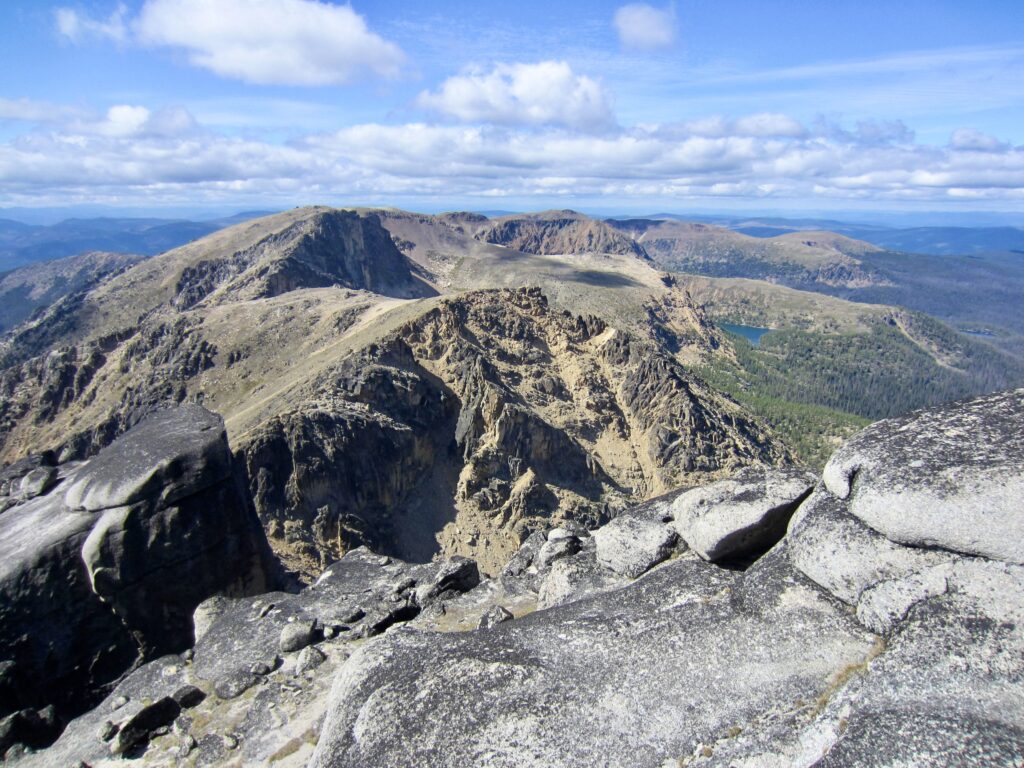
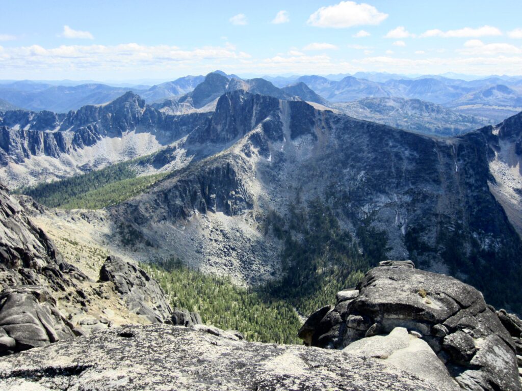
As we continued hiking along the Rim Trail, the clouds steadily dissipated and our visibility improved. The geology also changed from volcanic rock (basalt and andesite) to plutonic rock (granodiorite and monzonite). By the time we reached Stone City Mountain, the dark horn of Grimface Mountain could be seen straight ahead, along with Cathedral Peak and Remmel Mountain several miles to the south. We headed toward our objective peak with renewed enthusiasm, passing below other notable geologic attractions such as Smokey the Bear and the Giant Cleft.
.
From Stone City Mountain, the Rim Trail descends 400 feet on sandy slopes and granitic outcrops to a low saddle, then it ascends 200 feet to a viewpoint plateau. Grimface Mountain was finally looking close, although its steep northwestern façade did not look very climbable!
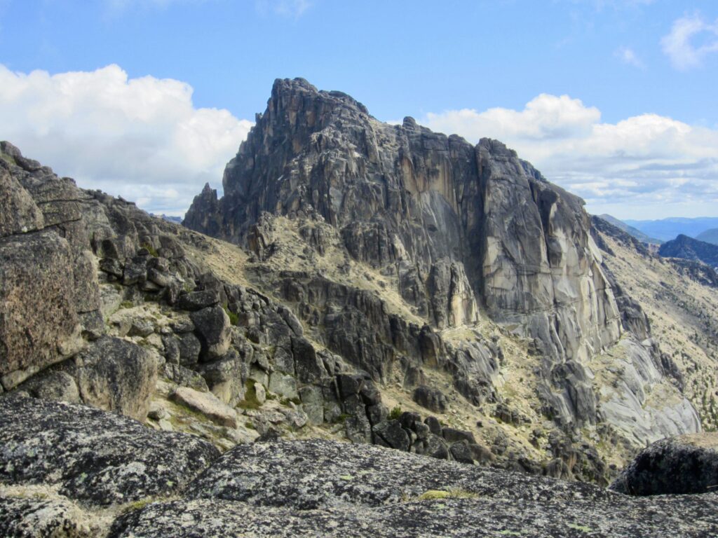
.
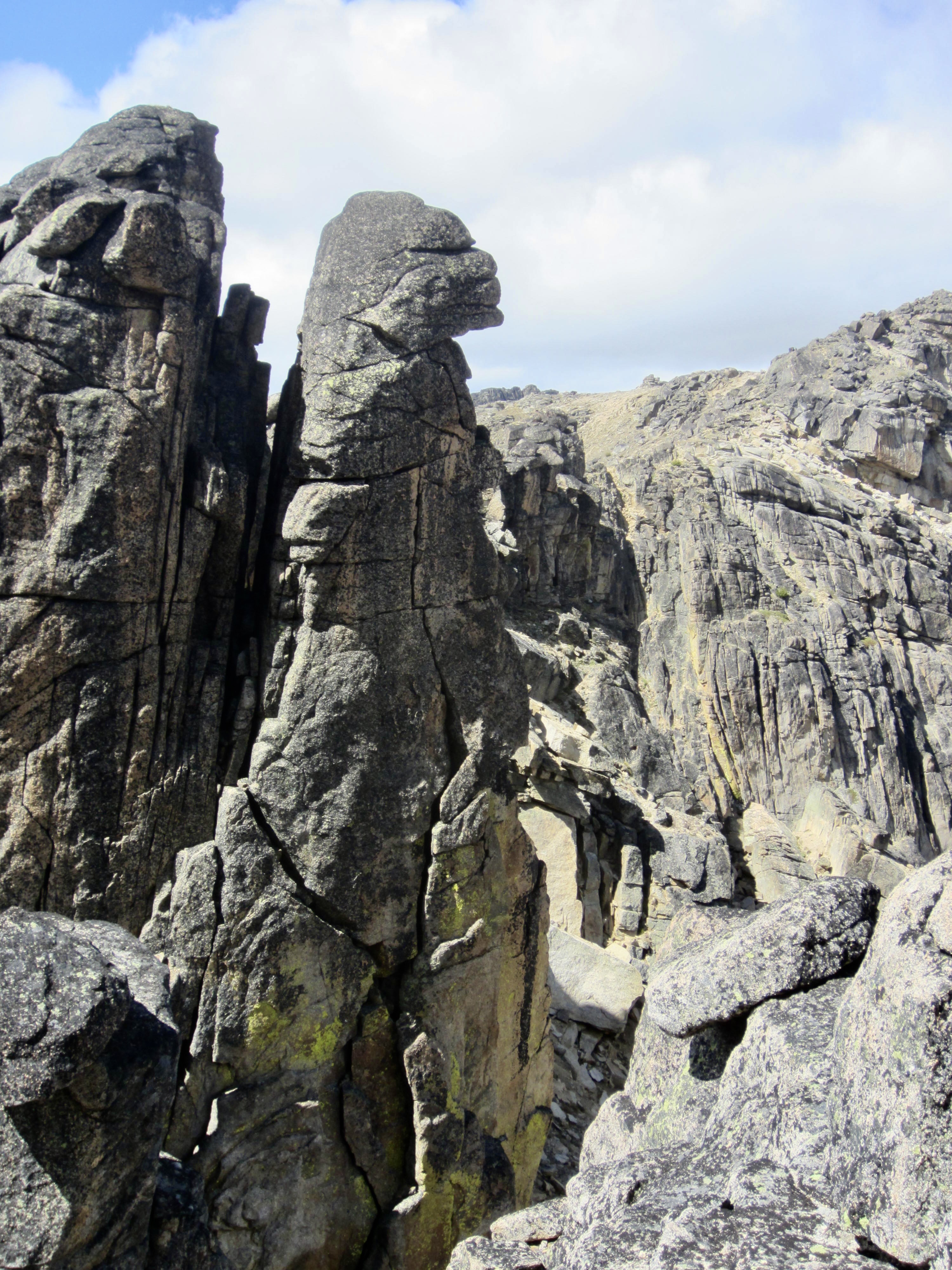
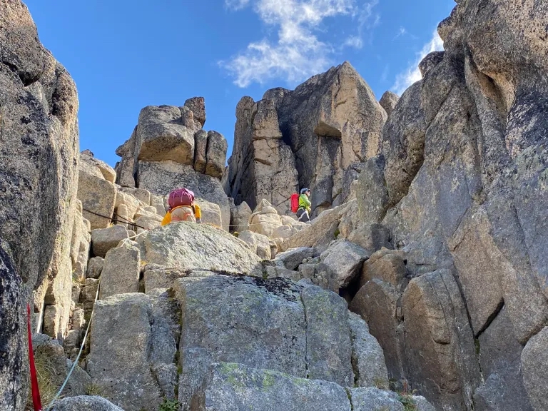
We made another short descent and traverse to reach a small notch at the base of the mountain’s northwest ridge. While putting on our climbing harnesses in this notch, Fay let out a squeal of excitement and pointed at a rock pinnacle directly behind us. The pinnacle exhibited a profile of a stern, simian face. Ah ha…this is the grim-looking countenance for which Grimface Mountain was named!
.
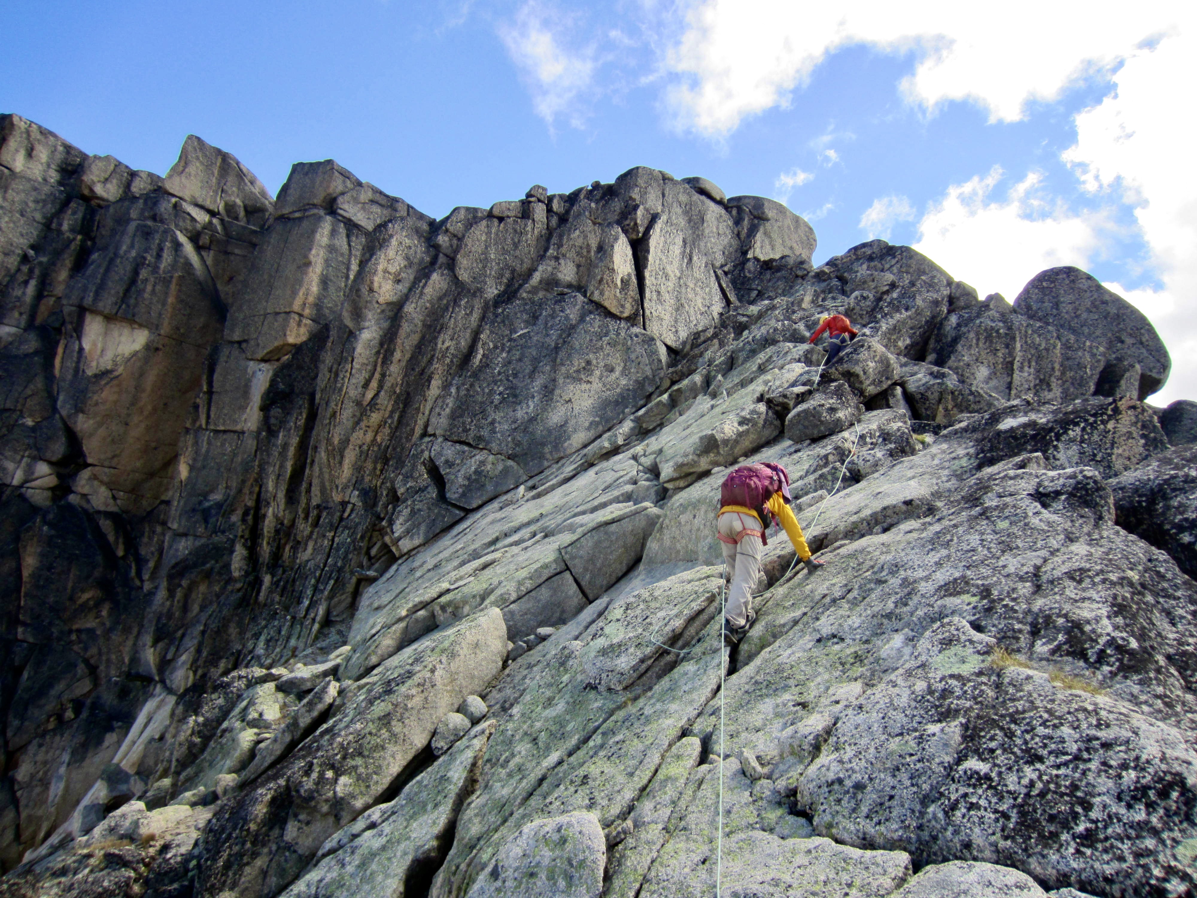
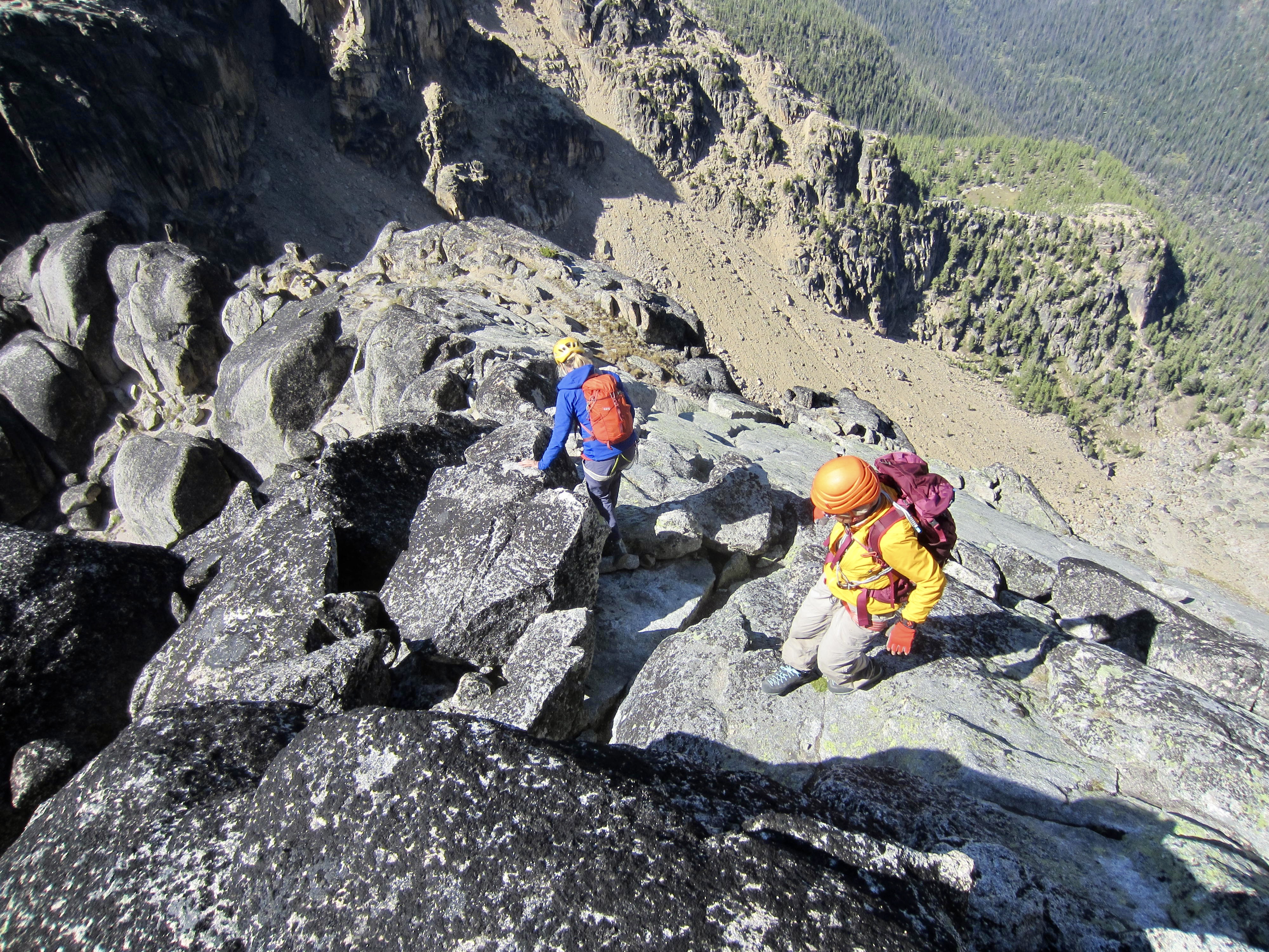
From the notch, we scrambled up an obvious slot gully for a short distance, making a tricky bouldering move over a large chockstone near the start. This slot gully abruptly ends at a steep headwall with a chimney cutting through it. Eileen tried climbing up the chimney but found it difficult while wearing a rucksack. I traversed out to a rock rib on the left side and found agreeable terrain, with one bolt and plenty of cracks for protection. Cascade Alpine Guide describes this option as being exposed Class 4, so we pulled out our scramble rope and did a running belay up the rib and then up a higher segment of the same slot gully.
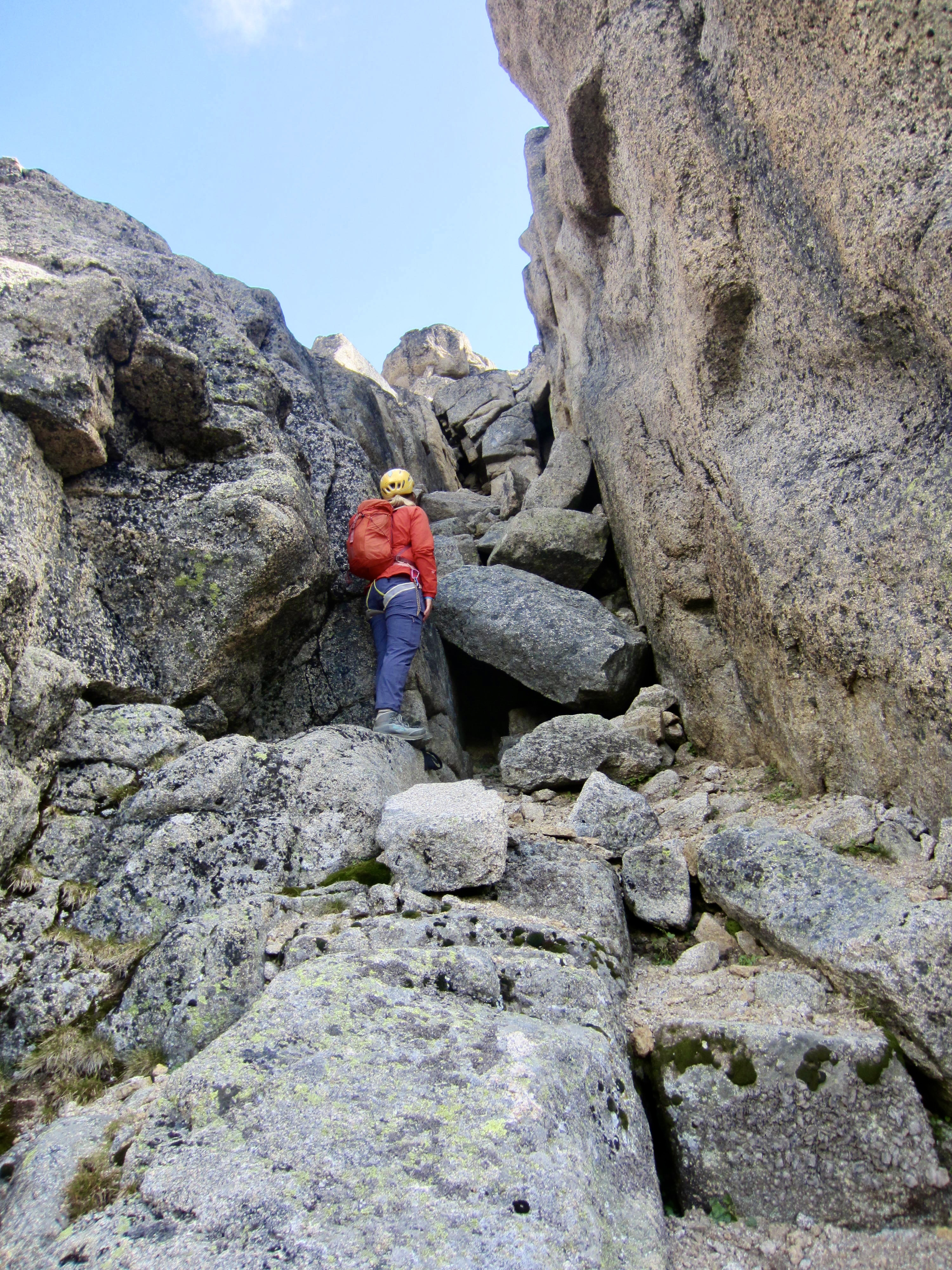
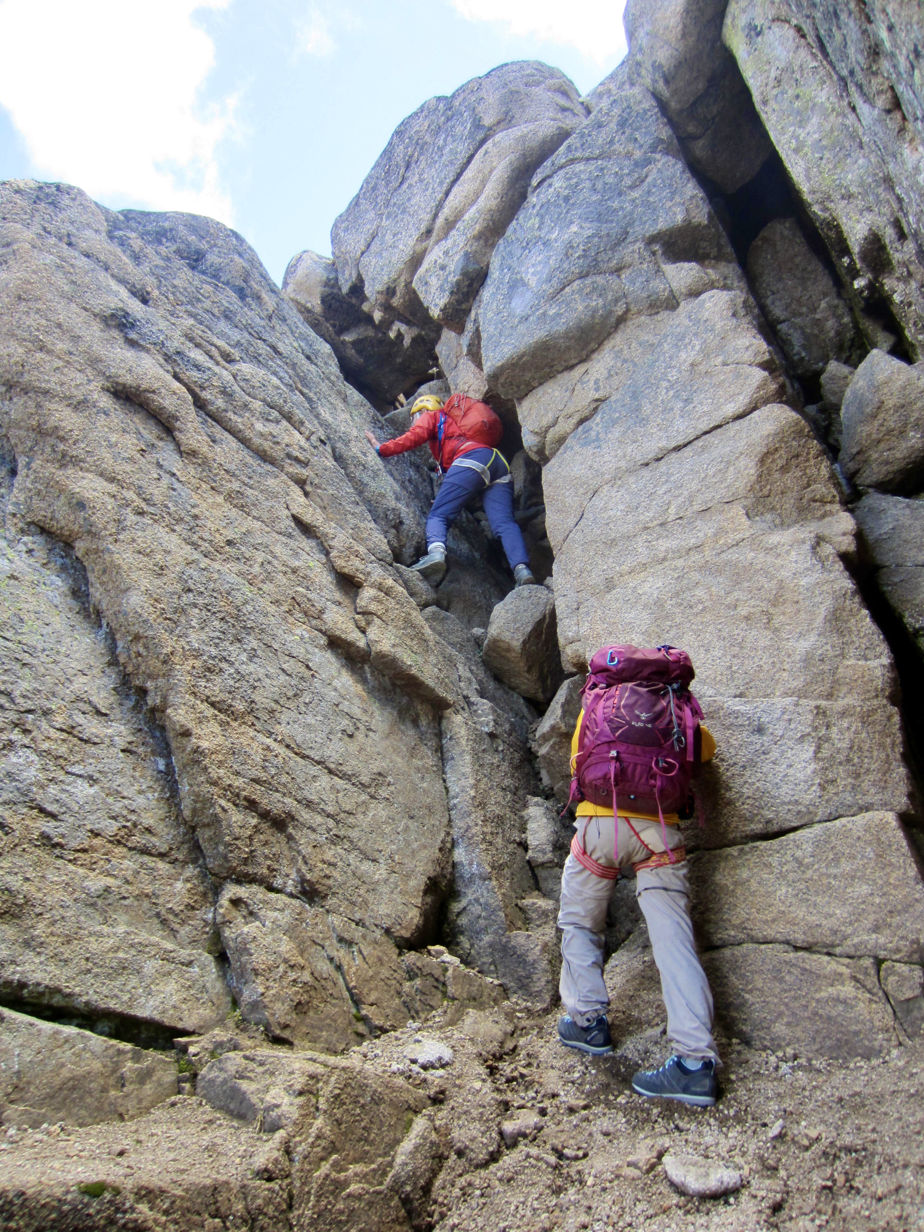
.
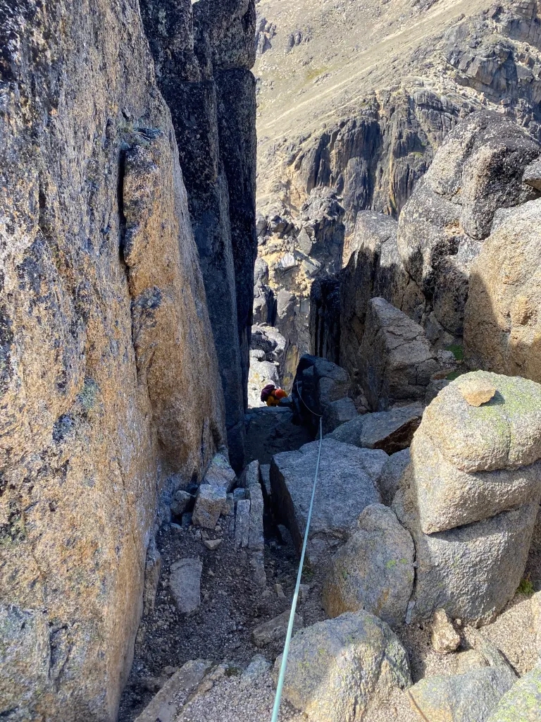
.
The upper slot gully ended at a triangular white slab on the crest of the northwest ridge. We continued upward with running belays, placing a few slings over horns for protection. Although this slab is fairly exposed, the rock is excellent and the scrambling is easy Class 2-3.
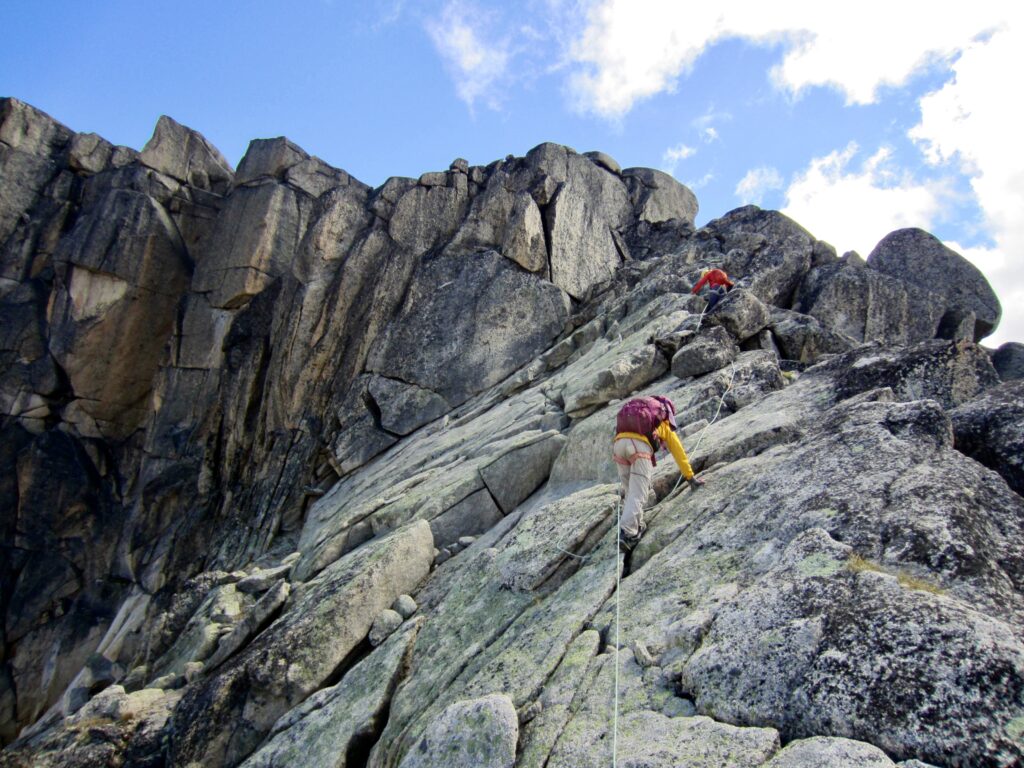
.
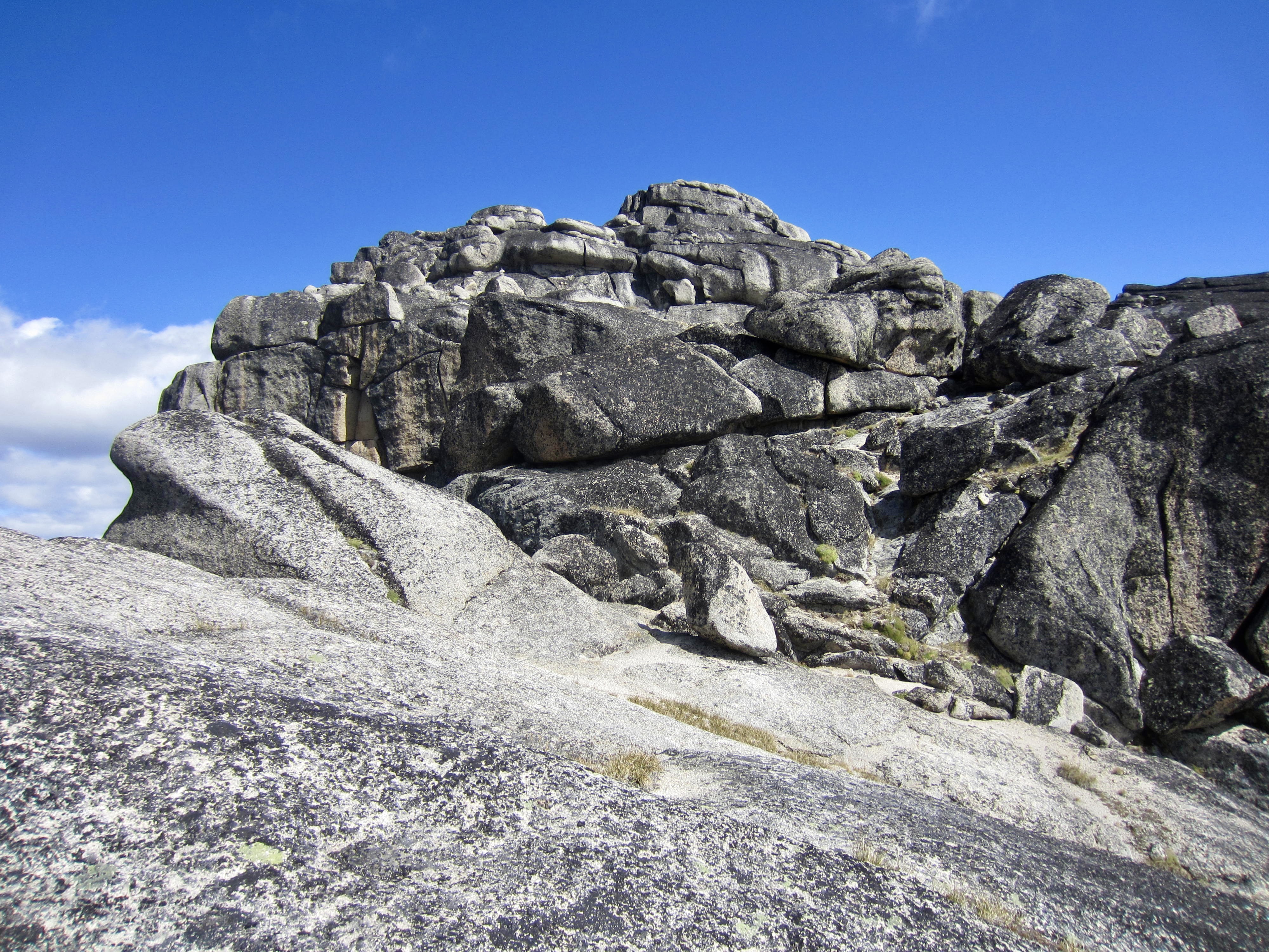
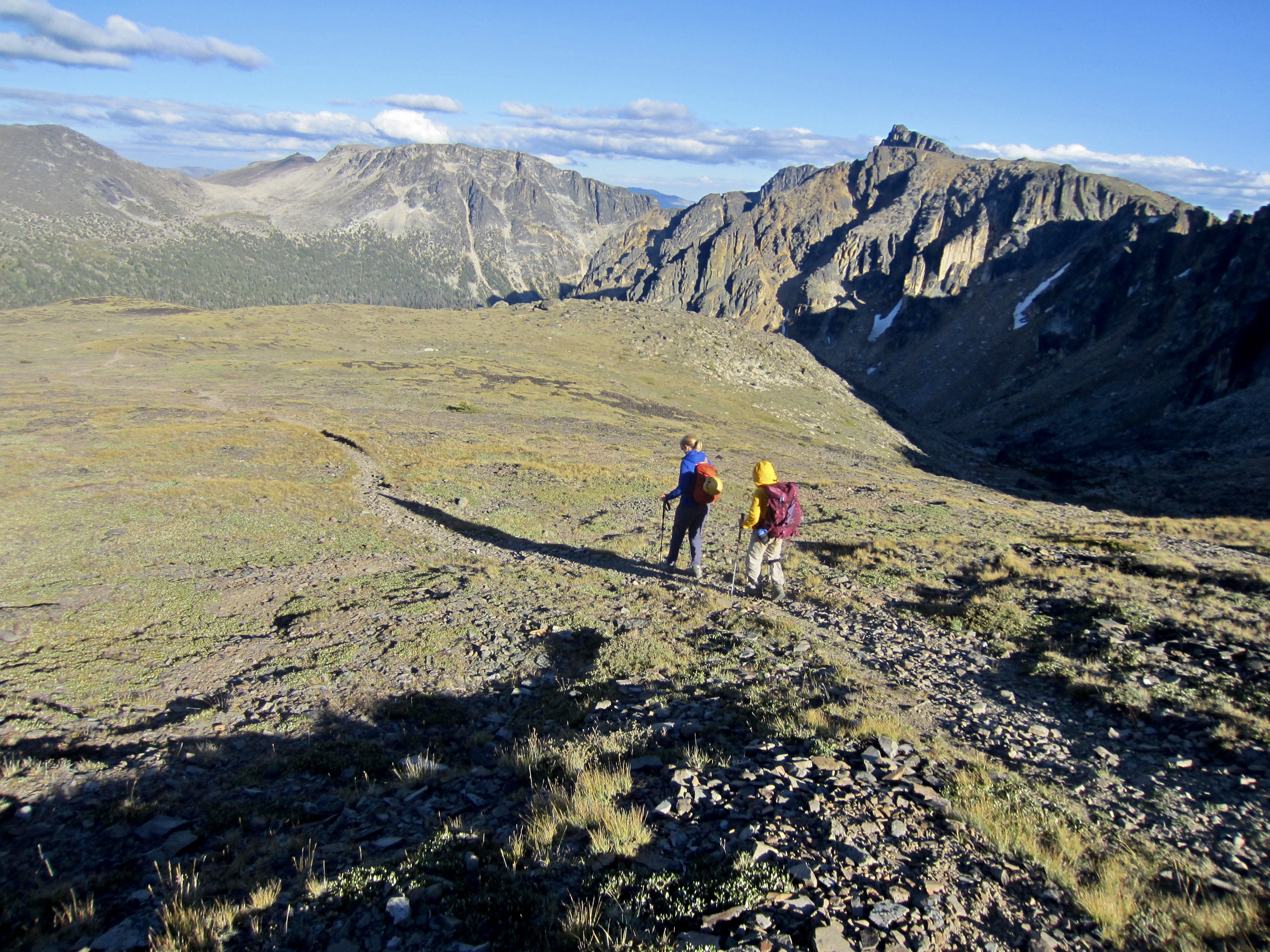
Above the white slab, the ridge curves to the left and becomes very wide. We followed scattered marker ducks upward over enjoyable terrain ranging from Class 1 to Class 3. The summit dome soon came into view straight ahead.
.

.
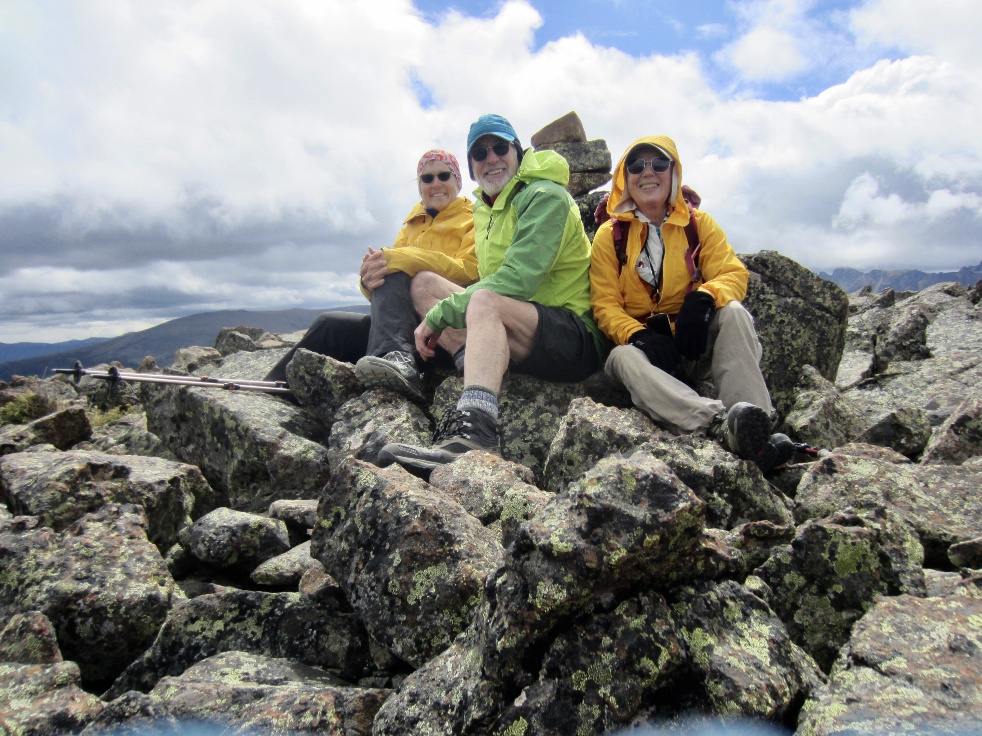
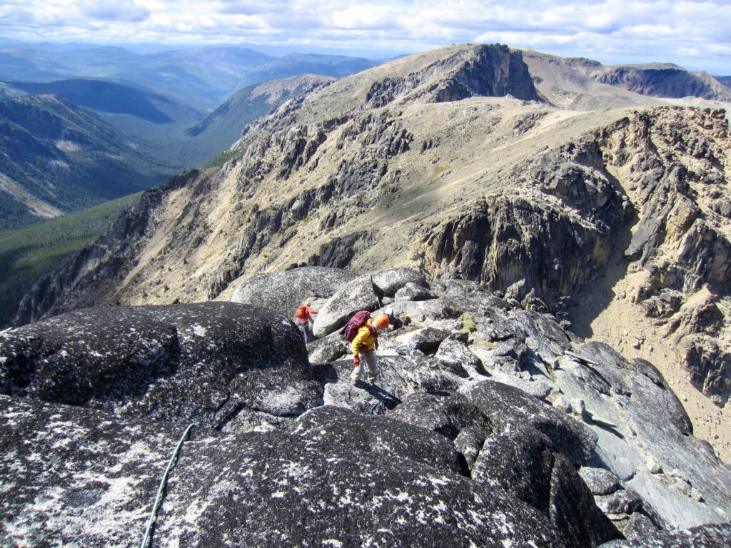
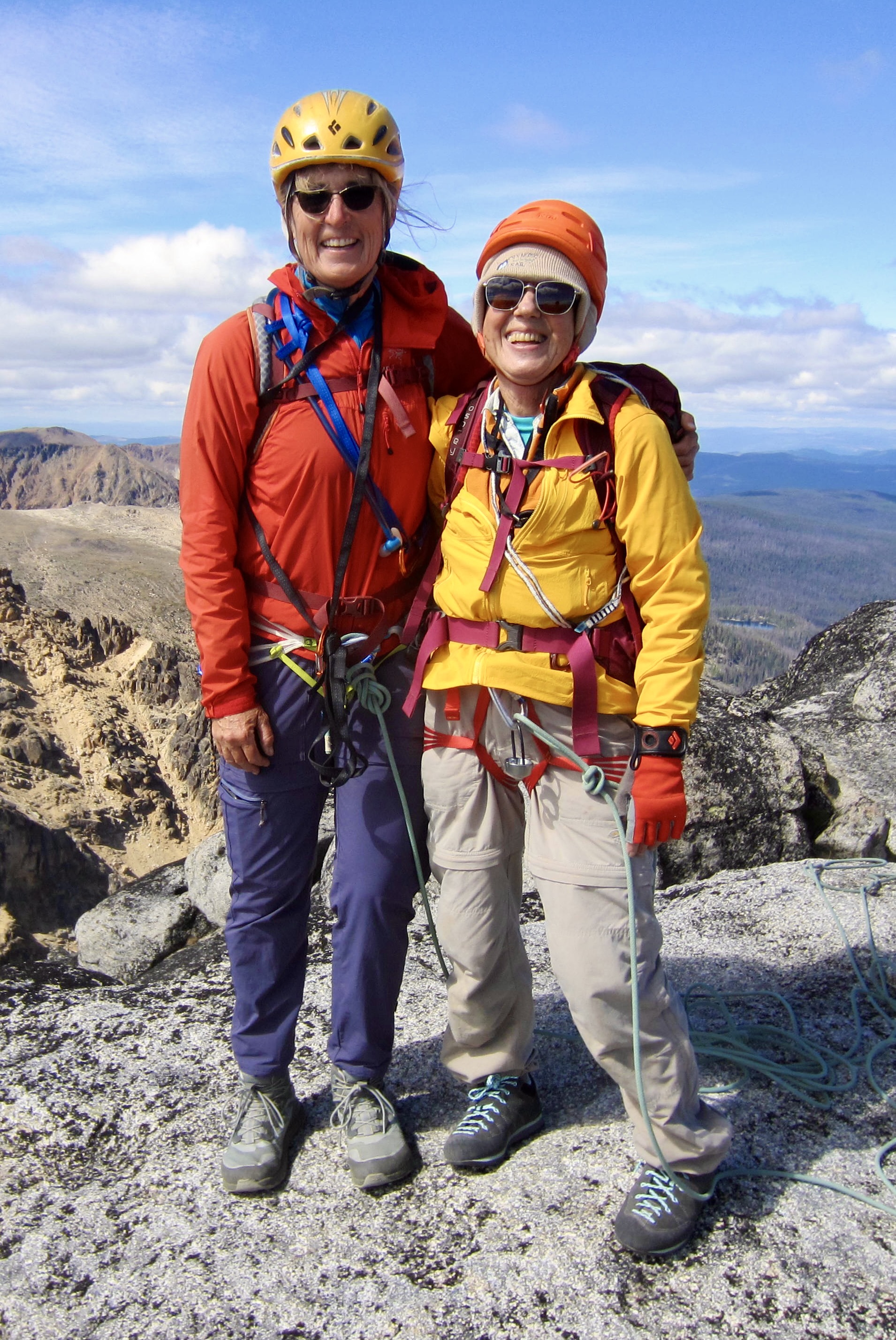
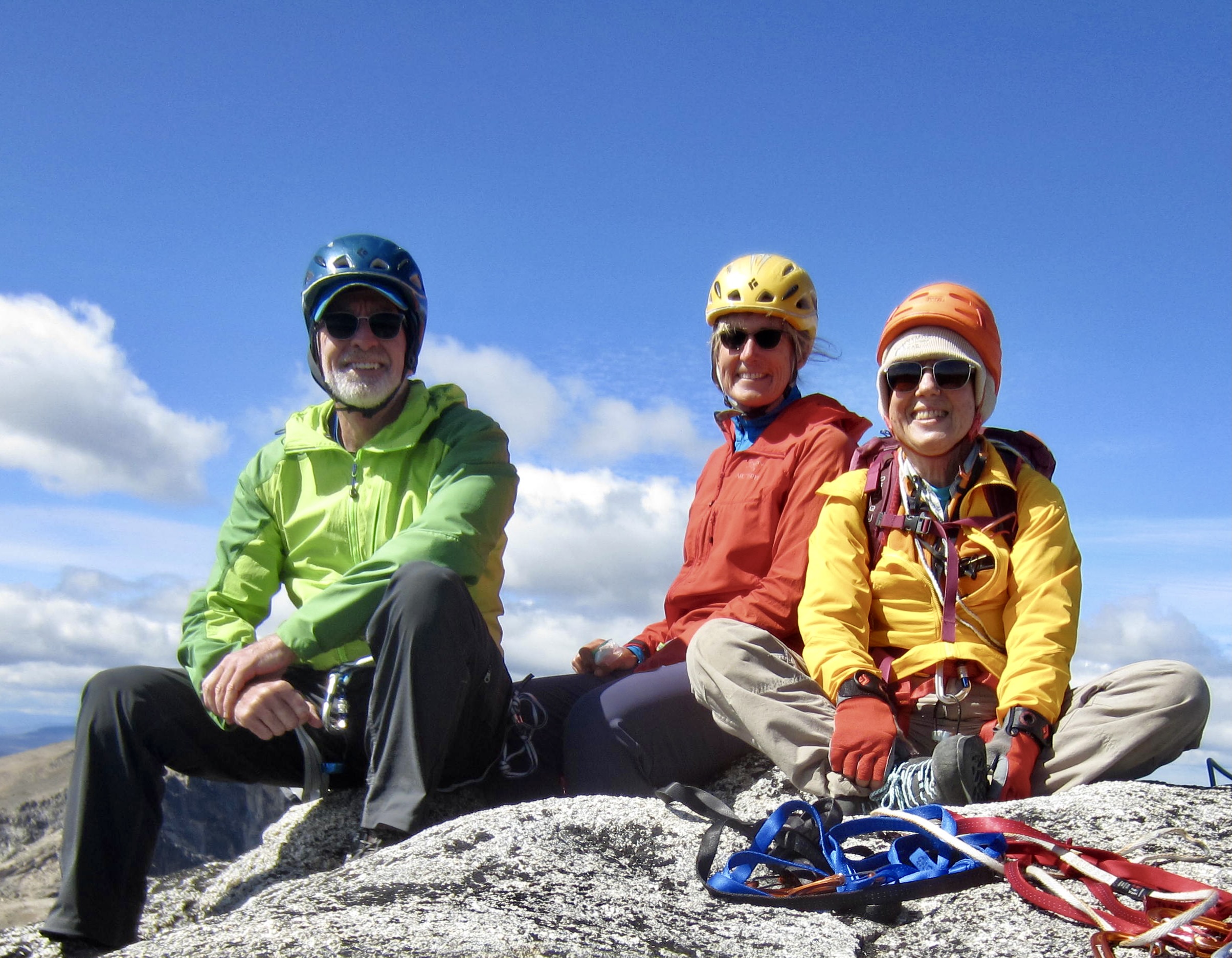
A few final scrambling moves put us on the summit in mid-afternoon (7.0 hours + 2500 feet from camp). We were curious to find out how often this mountain is climbed, but there was no register in sight. Nonetheless, Fay was beaming with joy, as this was her first alpine summit since last year and her first semi-technical climb in several years—at the age of 80, no less!
.
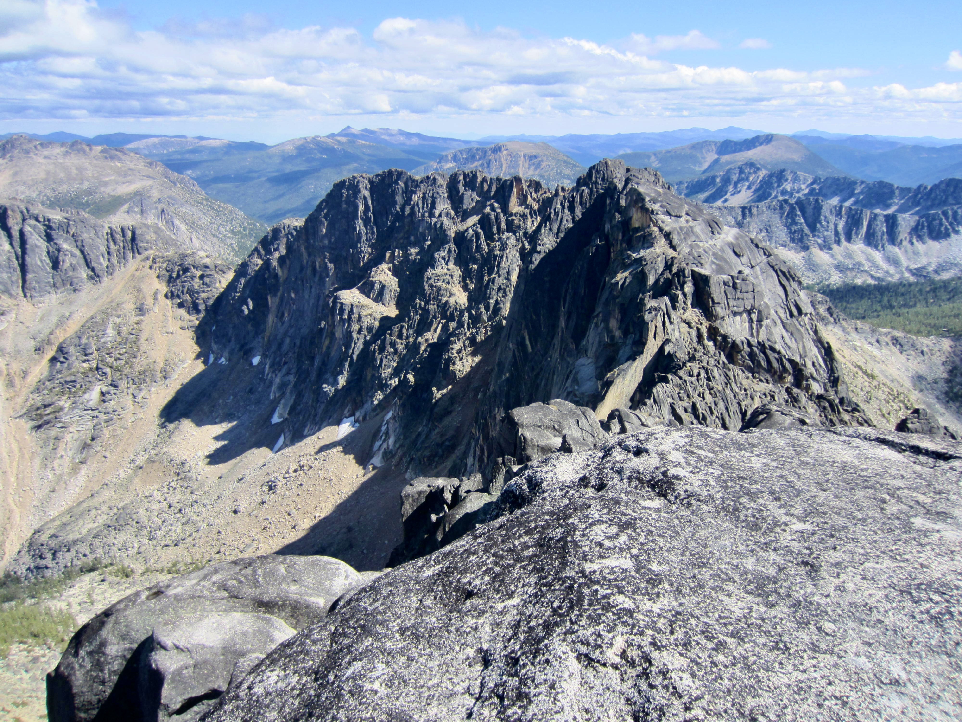
Visibility had improved to the point that we could see many miles in all directions. Closer at hand, it was interesting to observe the reddish volcanic rock comprising the northern portion of Cathedral Provincial Park contrasted with the gray intrusive rock comprising the southern portion.
.
.
Now having completed the ascent route, we all agreed that there was nothing harder than Class 3 and that the exposure was never more than moderate. As such, we felt comfortable making the entire descent unroped, which got us back to the base notch in only 35 minutes.

.
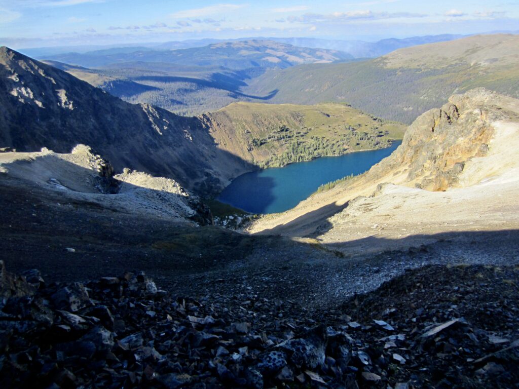
From the base notch, we retraced our route back up to Stone City Mountain (2.1 hours from summit). Then, to fulfill our goal of doing a loop hike, we left the Rim Trail and hiked down Stone City Arm. This alternative route offered splendid views of Cathedral Rim’s east-facing escarpment, highlighted by the low-angle rays of the evening sun.
.
.
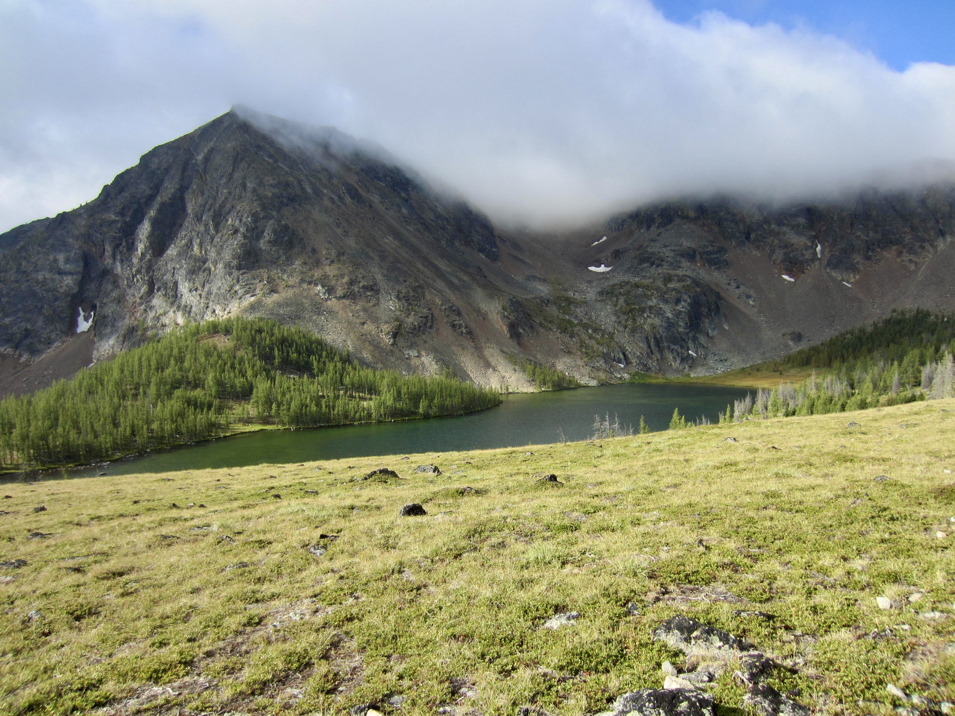
.
We passed scenic Ladyslipper Lake as alpenglow illuminated the surrounding ridges, then we dropped to Pyramid Lake and arrived back at camp shortly before dark (5.2 hours + 1200 feet from summit). For our gimpy group, hobbled by a collection of injuries and ailments, it had been a fabulously successful day in the mountains!
…
Day 4: Quiniscoe Lake to Staging Area
Following a clear and calm night, we awoke to a cloudless blue sky. This would have been a marvelous day to explore more of the park, but we had reservations on the 9:00am shuttle. Bags were loaded onto a pickup truck and bodies were stuffed into Suburbans for the downhill trip. By special request, Eileen, Fay, and I were assigned to “Suzie,” the smoothest of all Suburbans in the fleet. We were back at the staging area by 10:00am and heading home shortly afterwards.
…
Route Map & Profiles & Sketch
…
…
…
…
Photo Gallery
Click to enlarge…