Trip Date: August 15-17, 2023
Mt. Cruiser Legacy Climb
North Fork Skokomish River
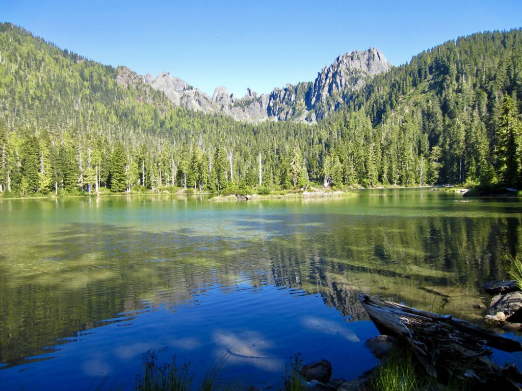
Flapjack Lakes
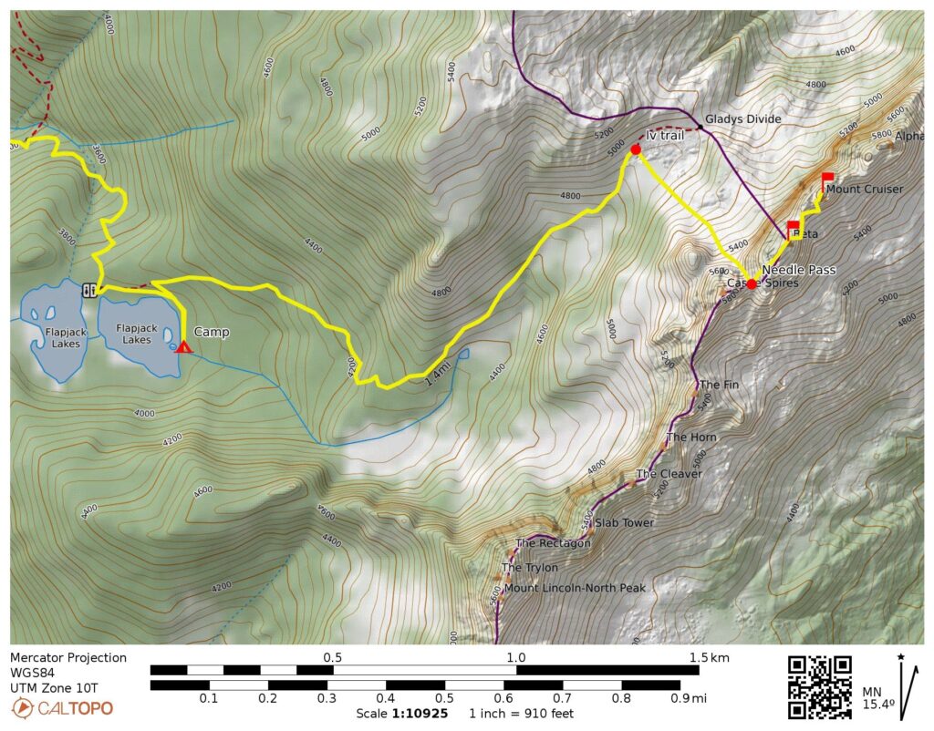
Needle Pass
Beta Peak (5960’+)
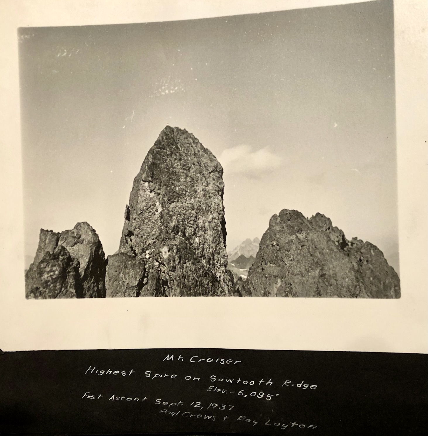
Mount Cruiser (6104′)
Trip Report Summary
Region: Olympic Mountains (Washington)
Sub-Region: Skokomish – Duckabush Group
Areas: Olympic National Park & Mt. Skokomish Wilderness
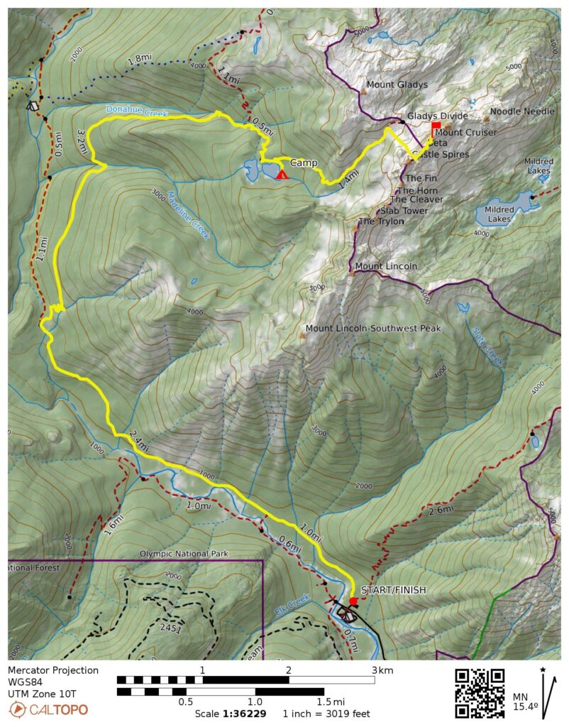
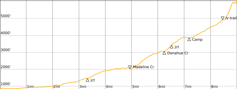
Starting & Ending Point: North Fork Skokomish River Trailhead near Staircase Ranger Station at end of Lake Cushman Road (Elev. 850 feet)
Way Points: Gladys Divide Trail junction & Madeline Creek & Donahue Creek & Flapjack Lakes (trail hike)
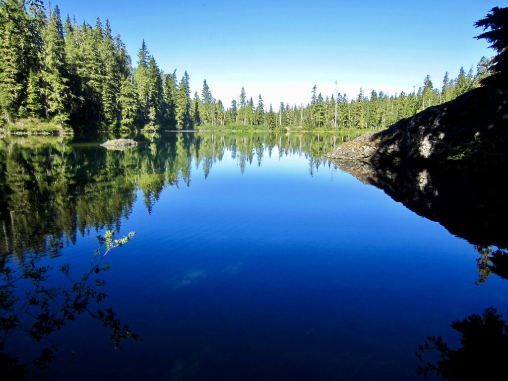
Campsite: East Flapjack Lake (Elev. 3850 feet)
Sidetrip: Gladys Divide basin & Needle Pass (trail hike & off-trail hike & rock scramble)
Summit: Beta Peak (rock scramble via Southwest Ridge)
Summit: Mt. Cruiser (rock scramble & rock climb via Southeast Slope—Southwest Notch—Cannonhole—South Corner [Route 1] )
Approximate Stats: 18.0 miles traveled; 5700 feet gained & lost.
Related Posts
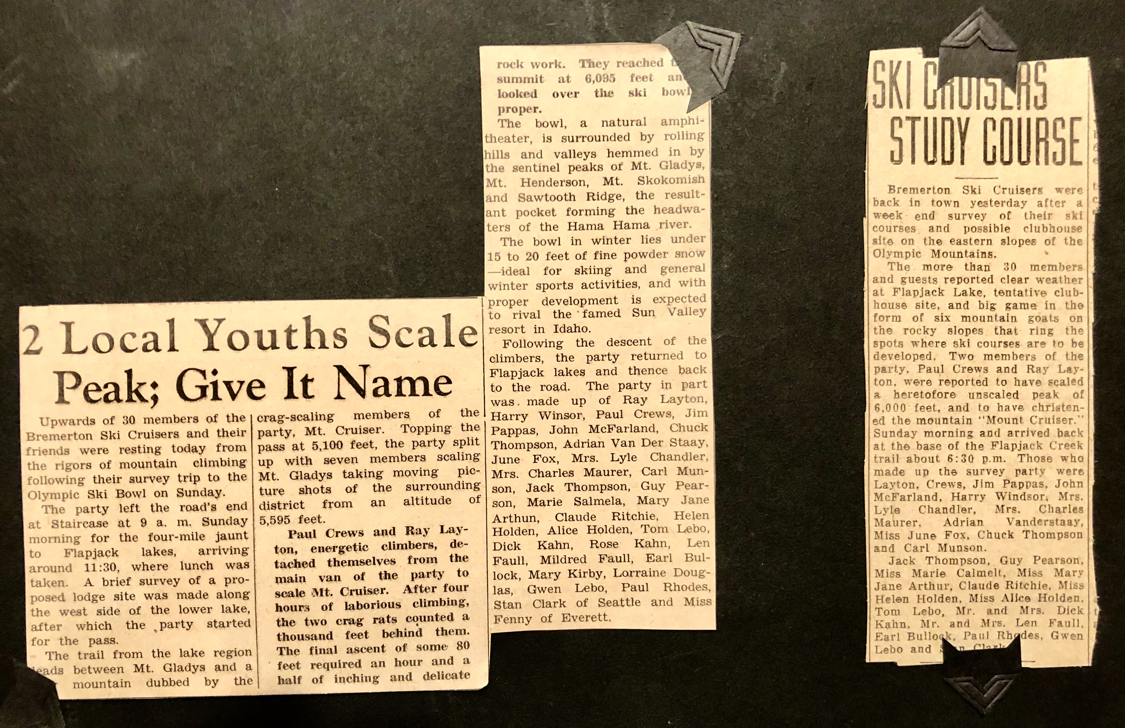
Historical Articles & Photos for Mt. Cruiser First Ascent – September 1937
Mt Cruiser via Flapjack Lakes–Needle Pass–South Corner – July 2000
Trip Overview
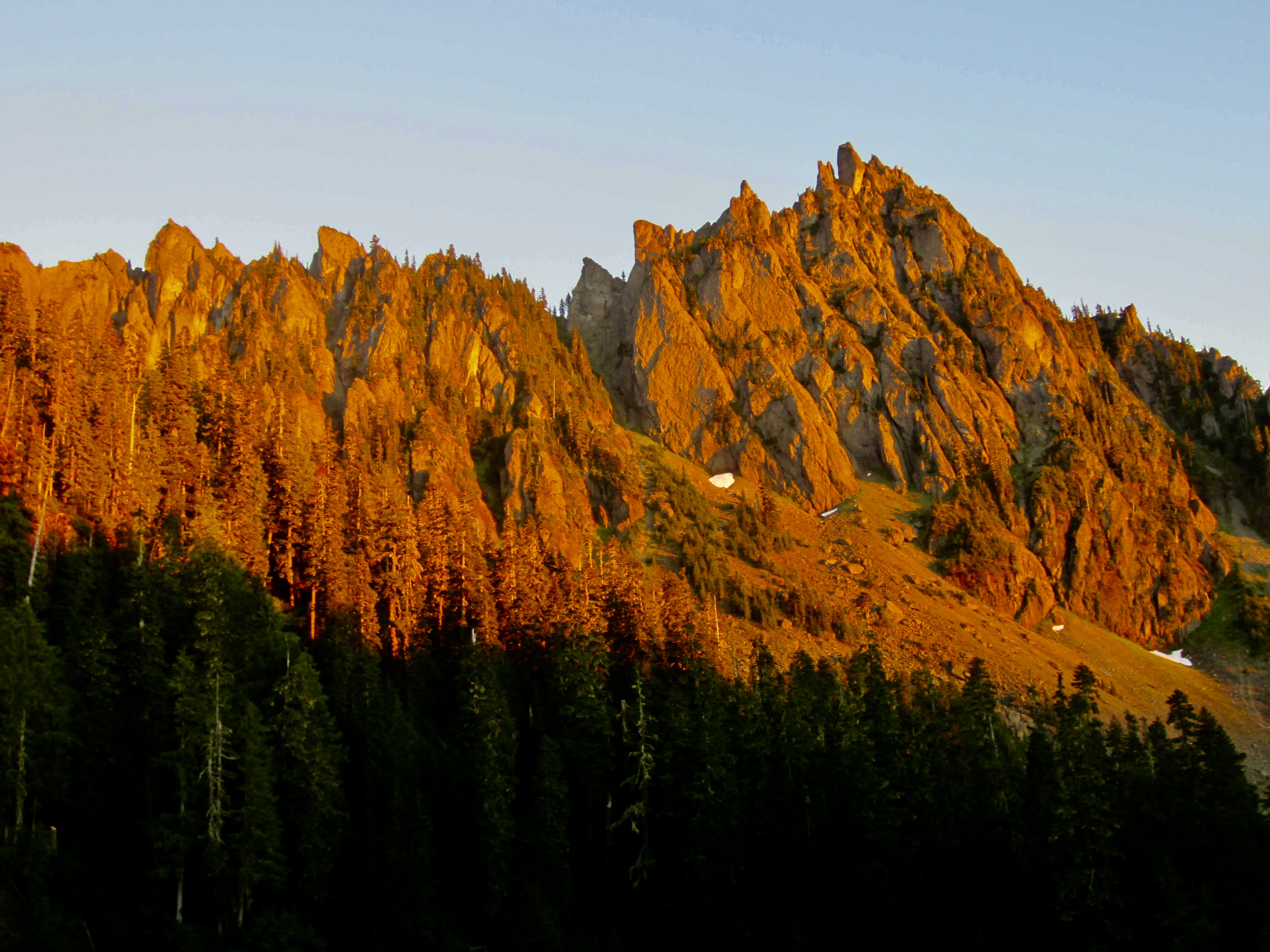
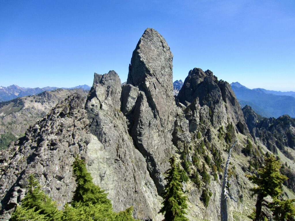
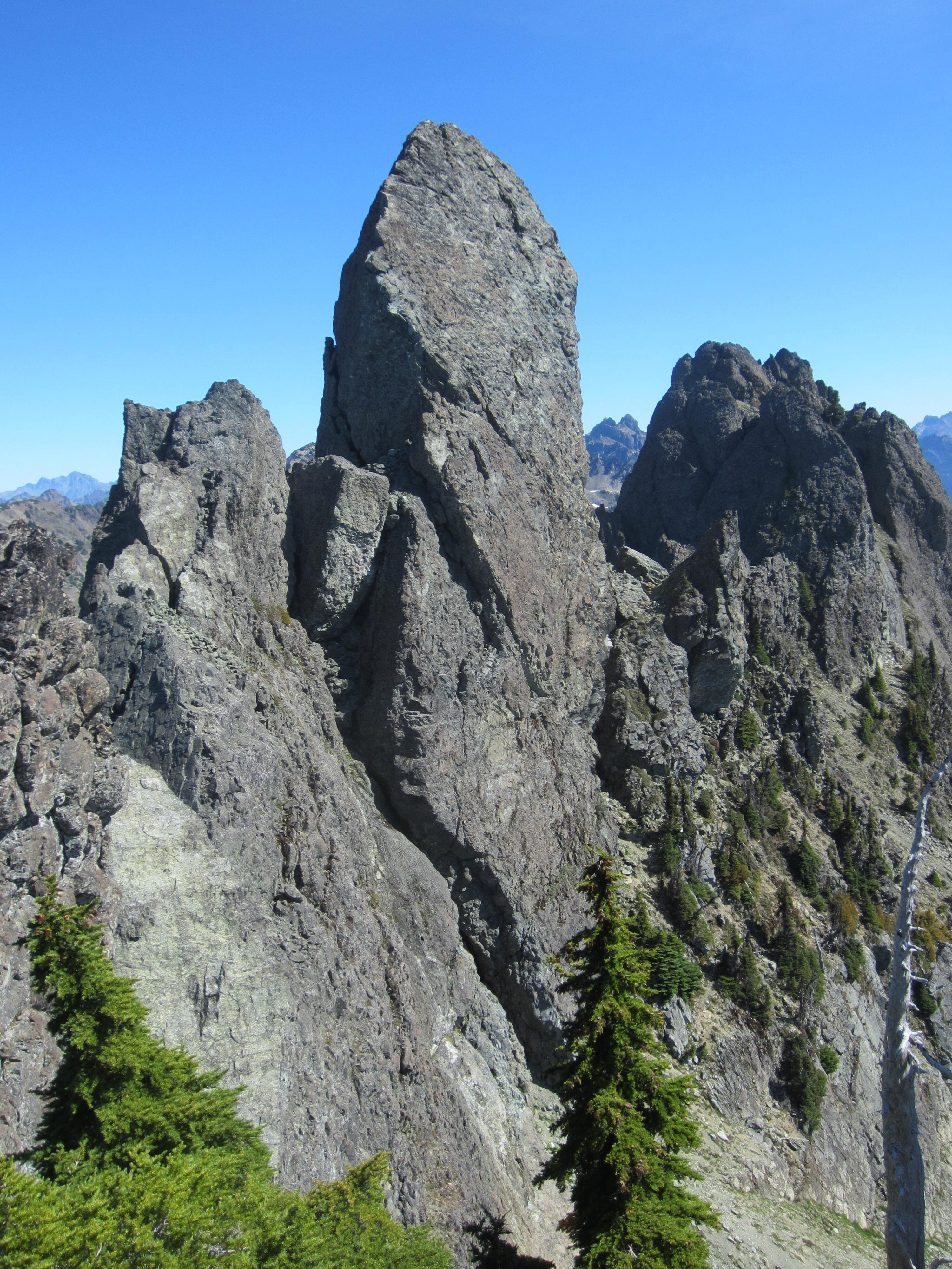
Despite having a modest elevation barely over 6100 feet, Mt. Cruiser is not only one of the most famous summits in the Olympic Mountains but also, to my way of thinking, Washington’s most quintessential “alpine crag.” This stunning pinnacle of solid marine basalt rises above Sawtooth Ridge like a chiseled spearhead. For good reason, it earned a showcase spot on the cover of the original Climber’s Guide to the Olympic Mountains.
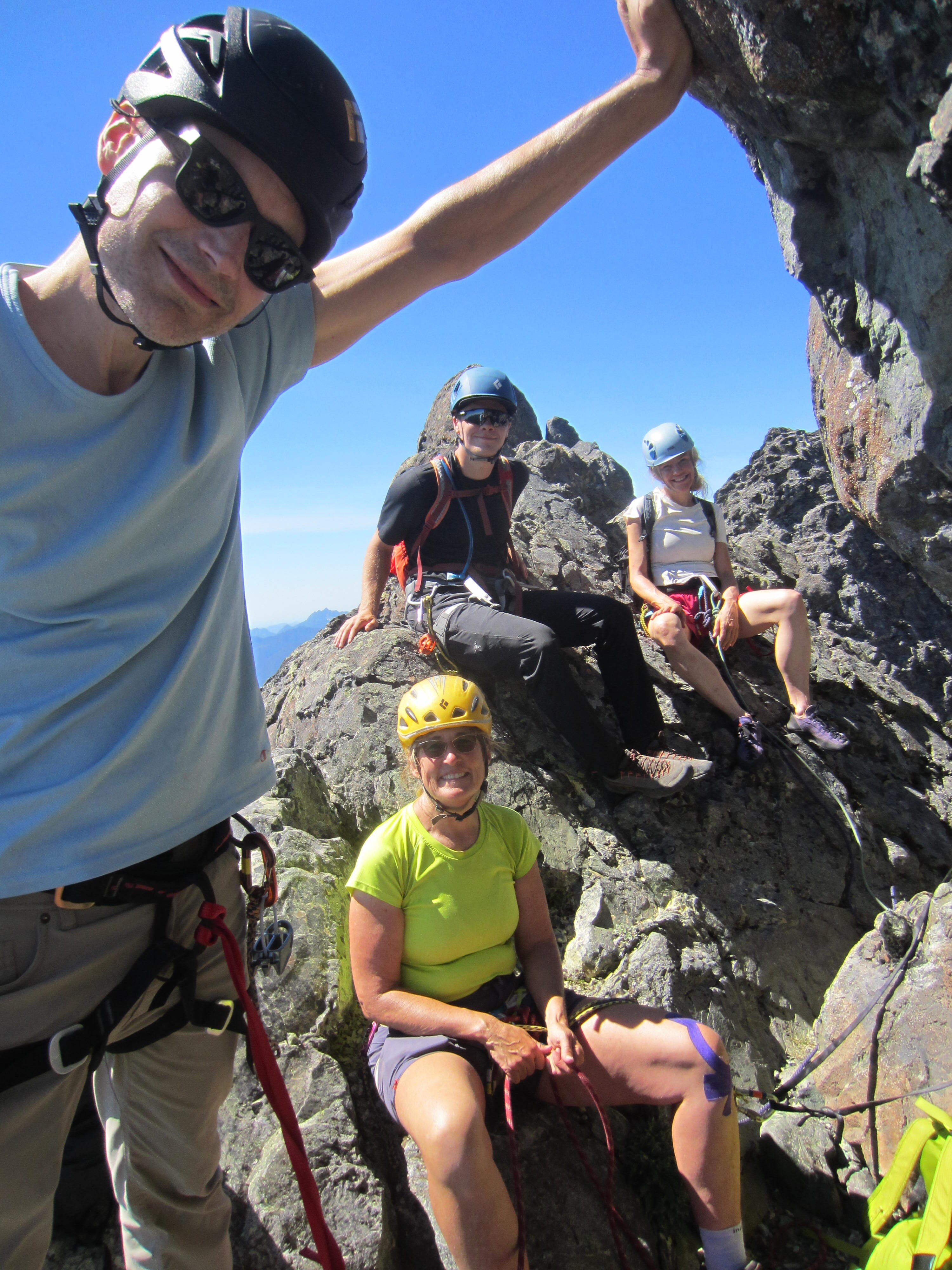
Although both Eileen and I have separately climbed Mt. Cruiser in years past, we were delighted to do a repeat attempt with our friends Kerry and Mike and their son Cody. However, this wasn’t just a normal alpine climbing trip for them, because Kerry’s grandfather and Cody’s great-grandfather is the late Ray Layton, who teamed up with Paul Crews to complete the first ascent of Mt. Cruiser in 1937. If successful, it would be a two-generation legacy climb!
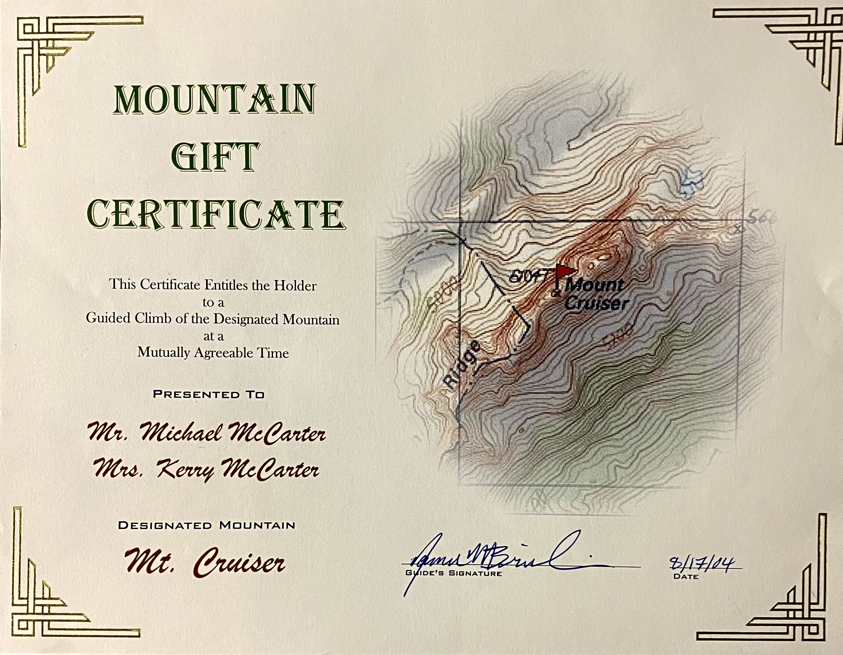
The actual plan for our legacy climb came together much like a slow-growing kale bush. A seed was planted in 2001, when I first met Kerry and learned that she had a great interest in climbing Mt. Cruiser. The young bush was fertilized in 2004, when I gave Kerry and Mike a gift certificate for a “guided” ascent of the peak. (To be clear, I have no qualifications to be a guide, so this was purely informal.) Over the next two decades, any attempts to harvest the kale were delayed by various factors, such as child-rearing demands, work obligations, and COVID restrictions.
Our climb finally came to fruition when Kerry contacted me back in April 2023. A mid-August date was selected, and camping permits were obtained. However, as the date grew closer, I became concerned about snow conditions—or, more specifically, lack of snow—in the big couloir leading up to Needle Pass. By all accounts, this couloir turns into a miserable and dangerous grunge-fest after the snow melts out. Eileen emailed the Olympic park rangers, hoping for favorable news, but received a discouraging report: Due to the dry winter and warm summer, expect September-like conditions in the couloir. Yuck!
Given the likelihood of having very poor route conditions, I pessimistically gave us only a 10% chance of success for climbing Mt. Cruiser. Kerry, Mike, and Cody, nonetheless, elected to plunge ahead with unbridled enthusiasm. Without realizing it, they were forcing me to honor my own long-term climbing philosophy: Don’t make a go/no-go decision until you’ve touched the mountain. Dang it!
…
Full Trip Report
Day 1: Trailhead to Flapjack Lakes
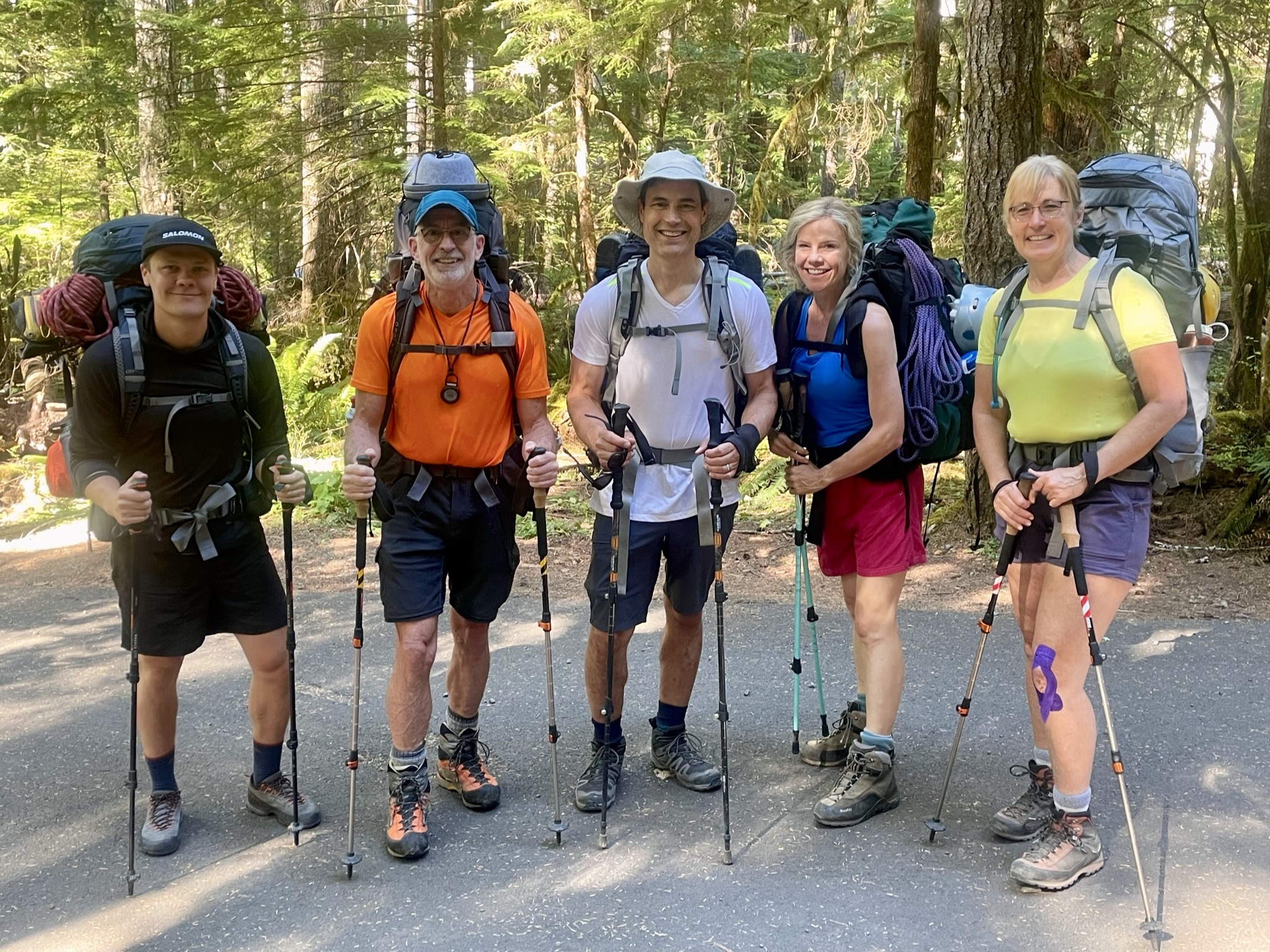
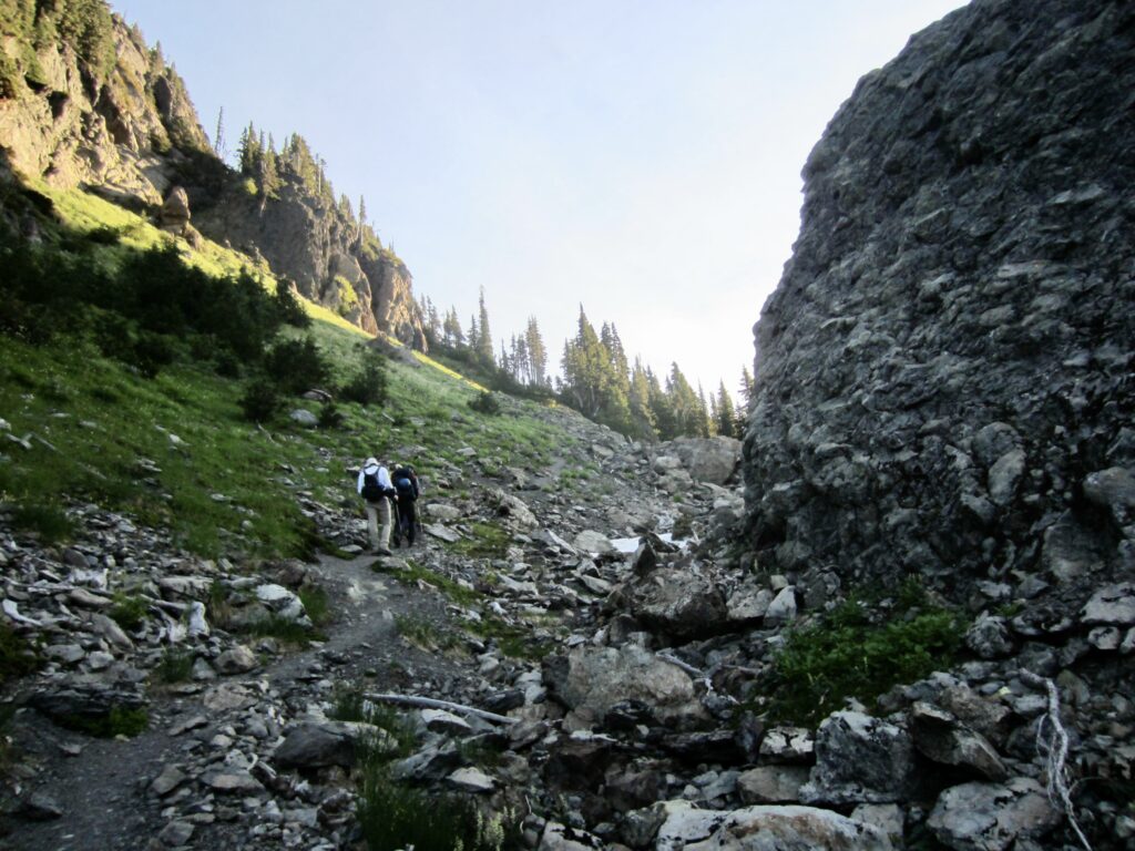
We all met at the Staircase parking lot (North Fork Skokomish River Trailhead) on a hot Tuesday morning. It seemed like more bad luck that our approach hike coincided with a statewide heat warning. Our strategy for handling the heat was to hike slowly and stop for water often. This, combined with steady conversation, actually made the whole approach hike quite enjoyable.

.
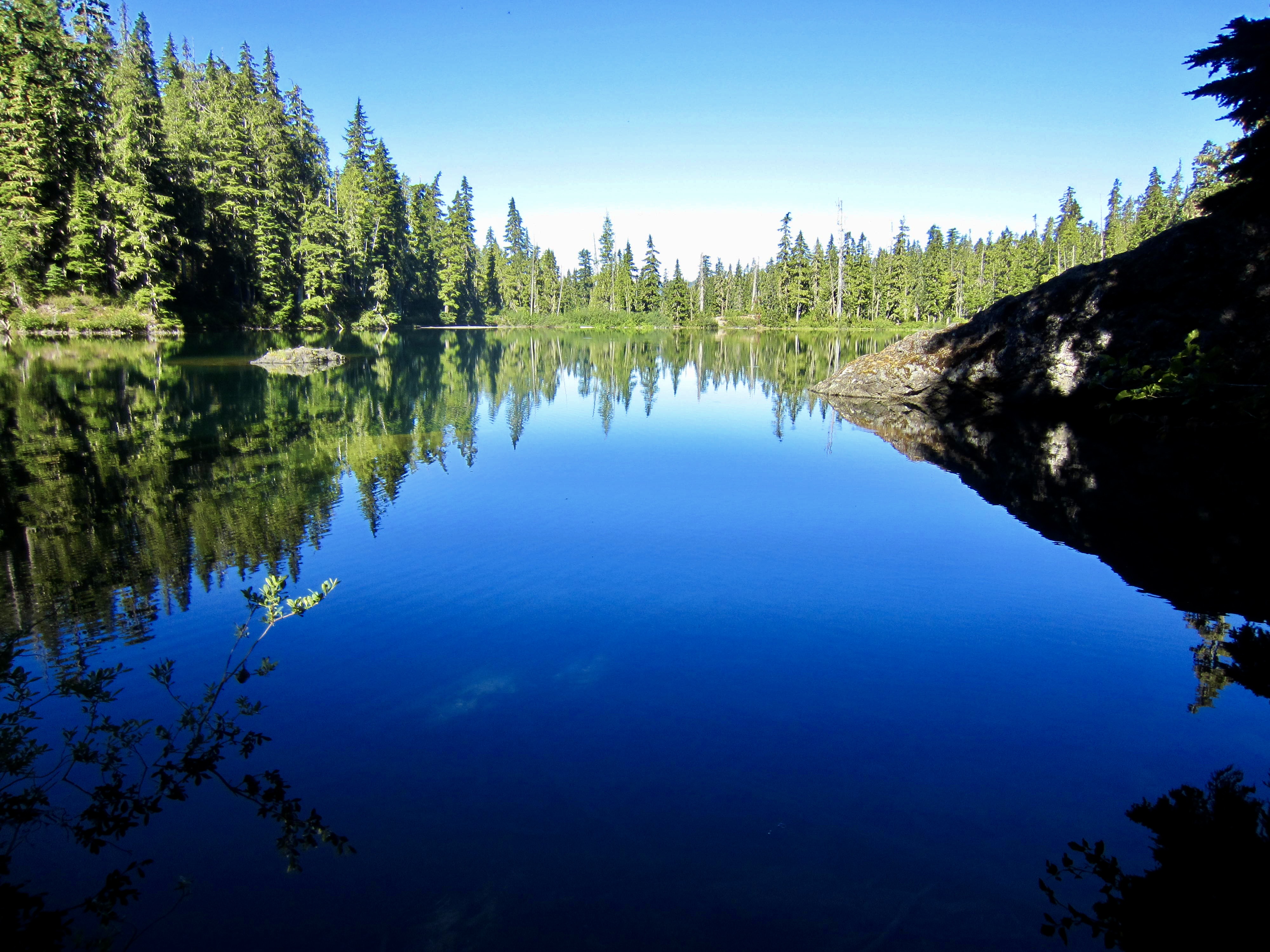
We arrived at Flapjack Lakes in late afternoon (6.3 hours + 7.2 miles + 3100 feet from TH) and immediately began looking for an acceptable campsite. Our first selection turned out to be the summer home for a hive of yellowjackets, and although they seemed to be fairly innocuous, we thought it prudent to keep looking. Kerry, Cody, and I then made a complete circuit around the twin lakes and found a dandy campsite adjacent to the inlet stream of the eastern lake.
.
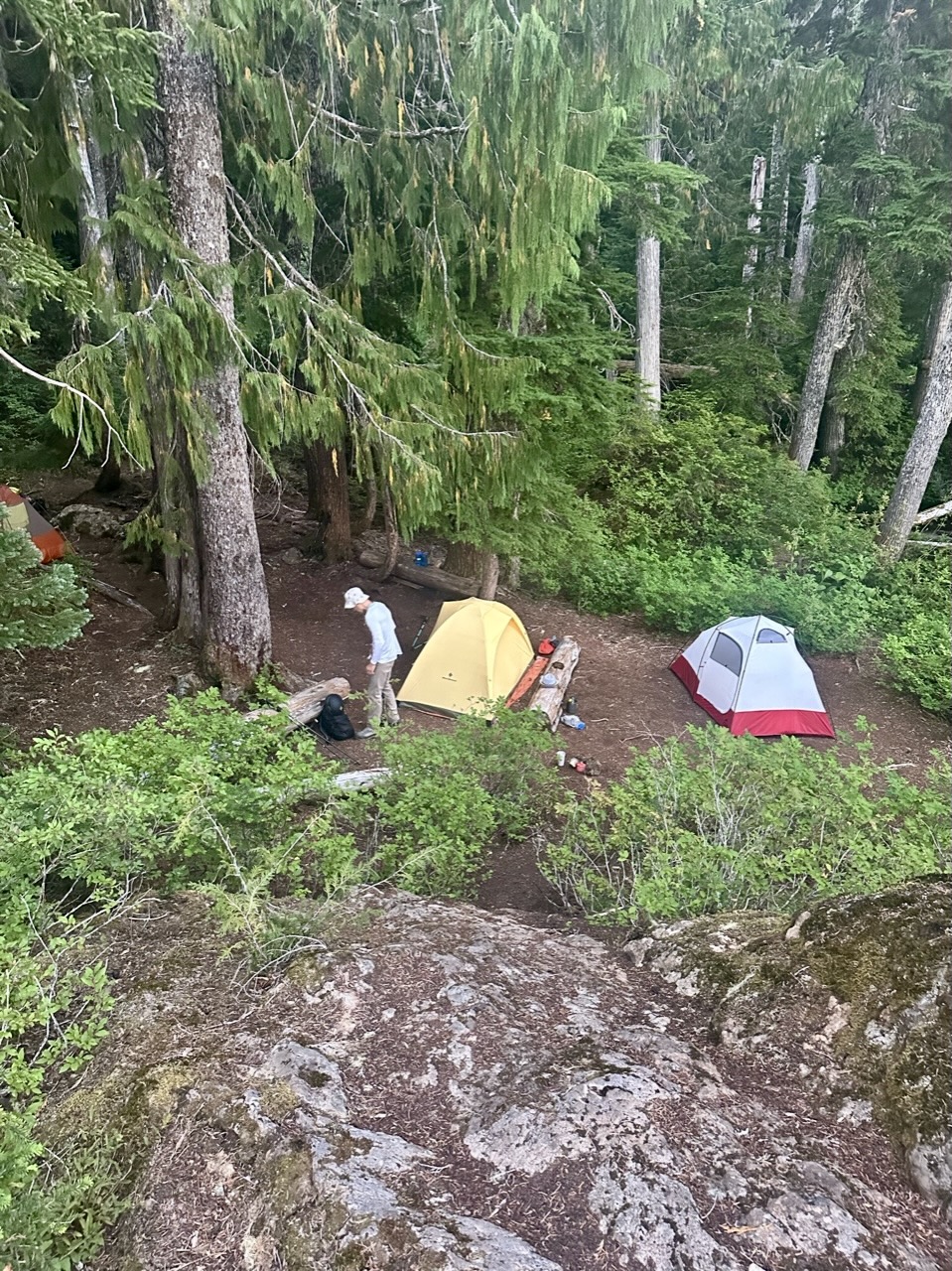
.
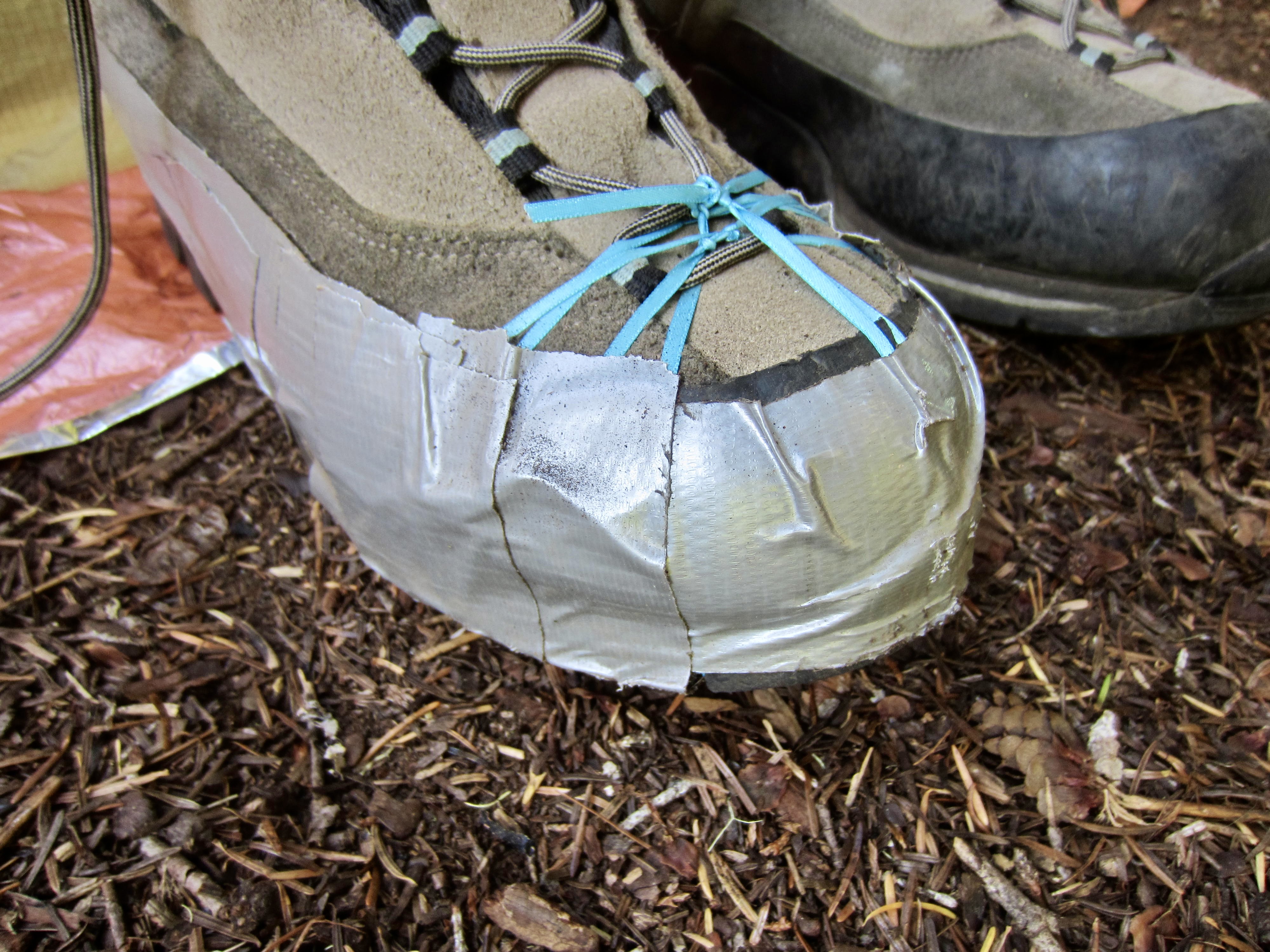
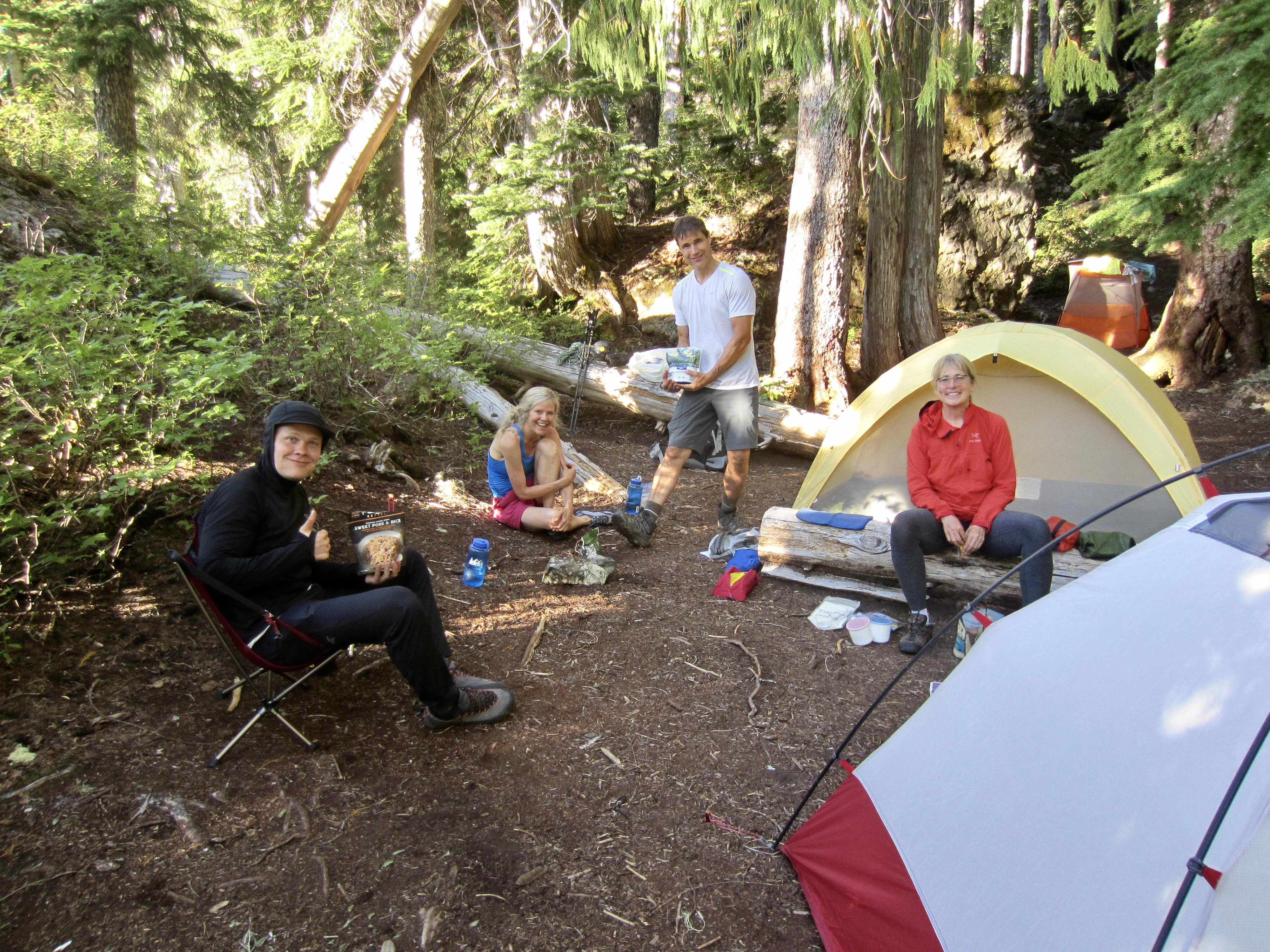
During our hike around the lakes, Kerry discovered that one of her boot soles was coming delaminated. This presented a serious problem for tomorrow’s climb—or whatever we might end up doing. However, Mike sprung into action and executed an impressive repair by using Kerry’s collection of “power ribbons” and a small roll of duct tape. Crisis averted!

Day 2: Mt. Cruiser Summit Climb
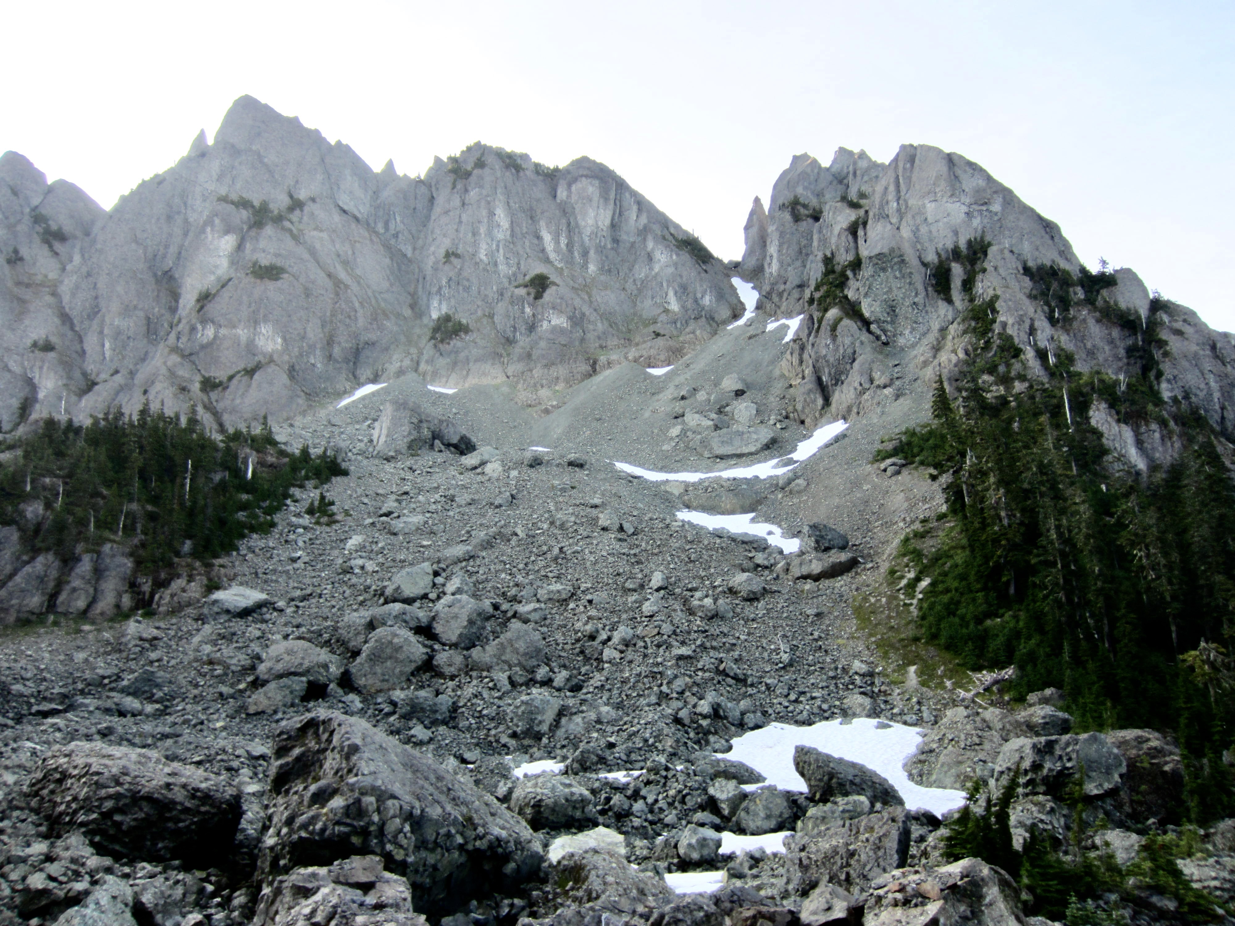
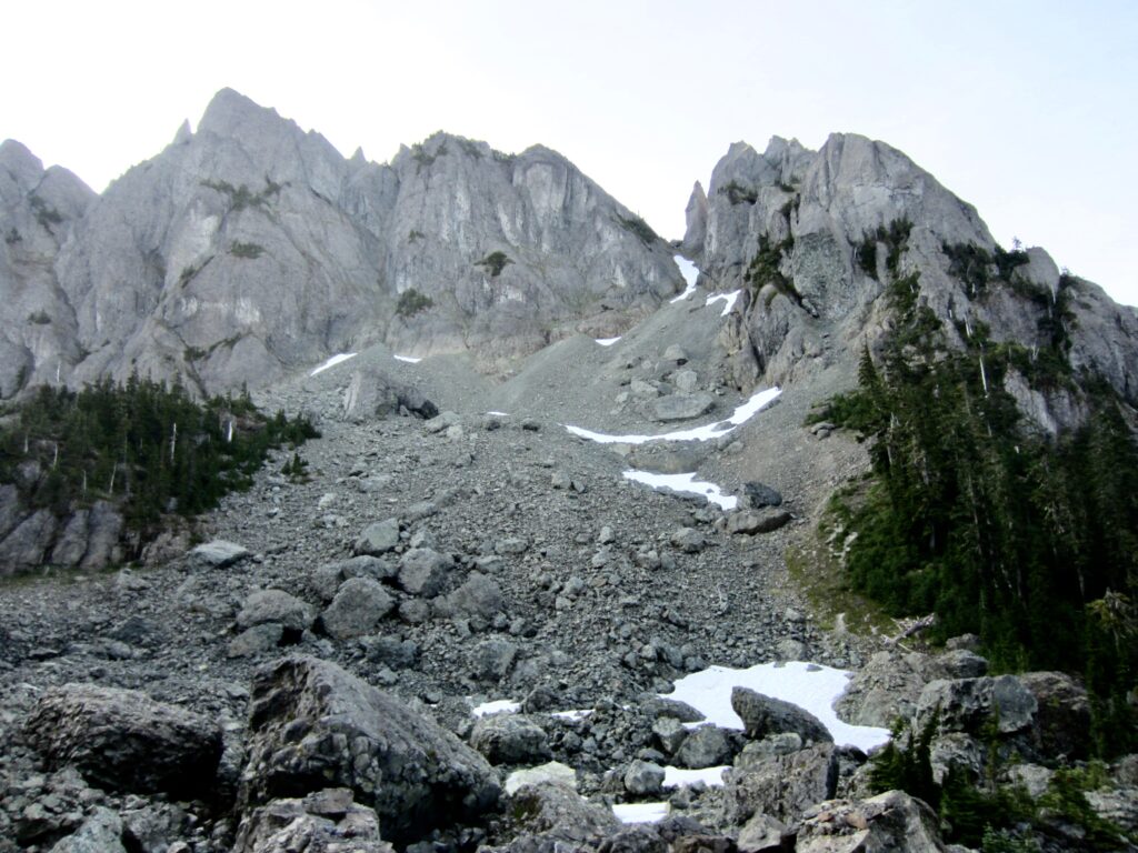
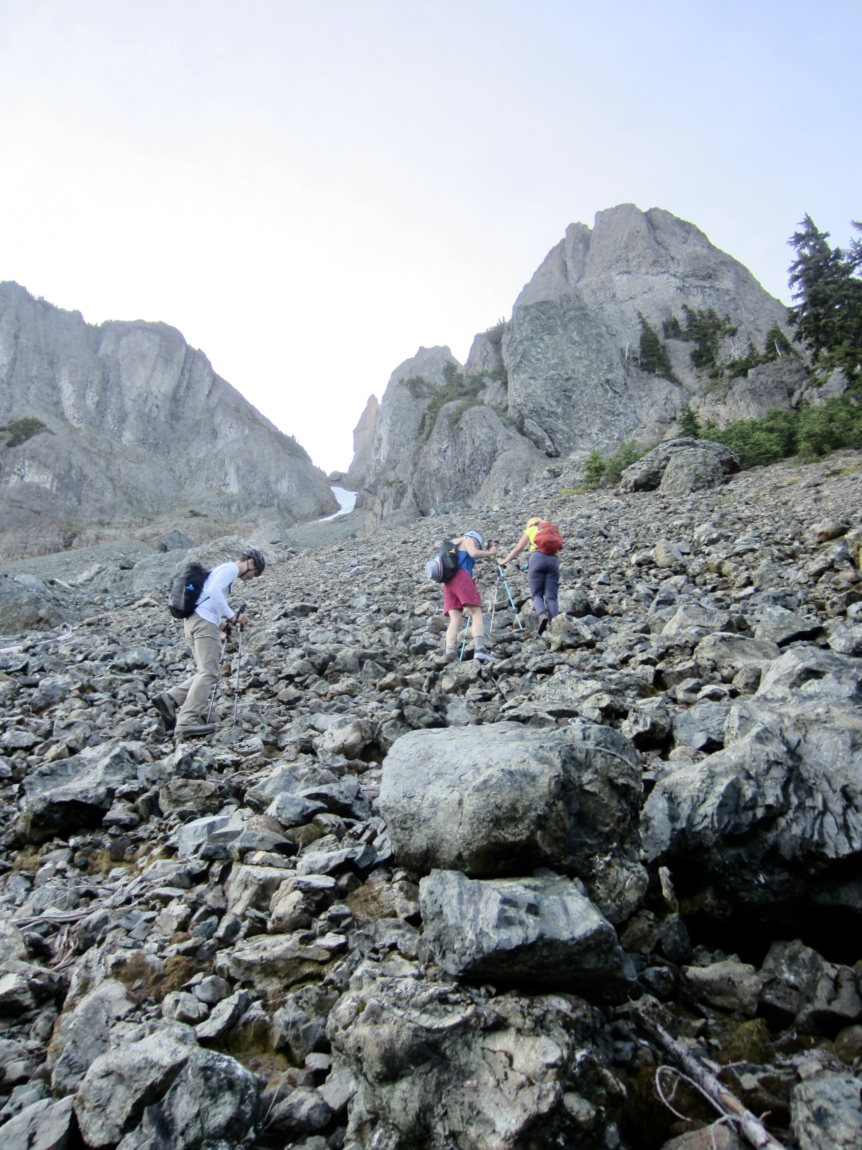
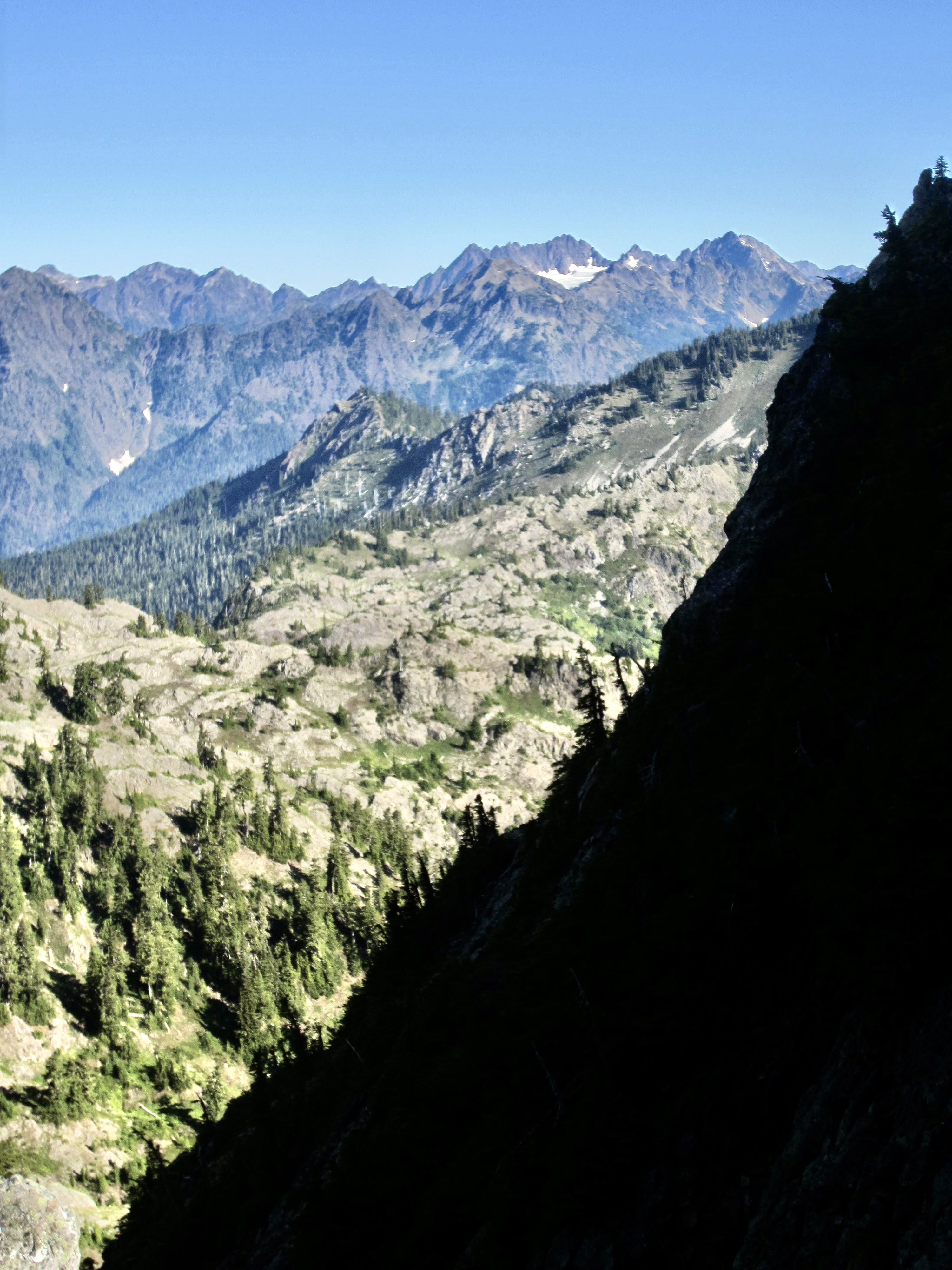
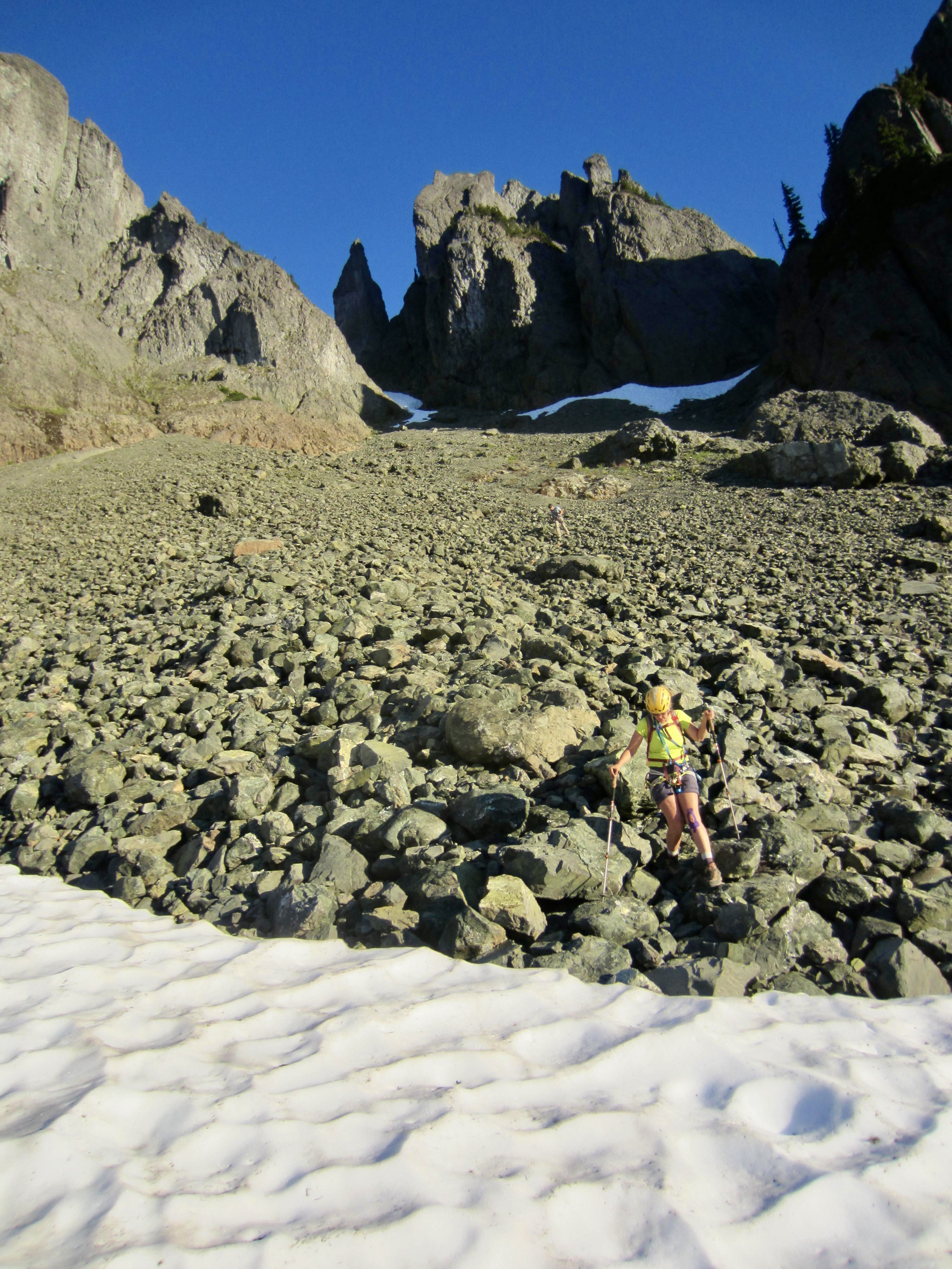
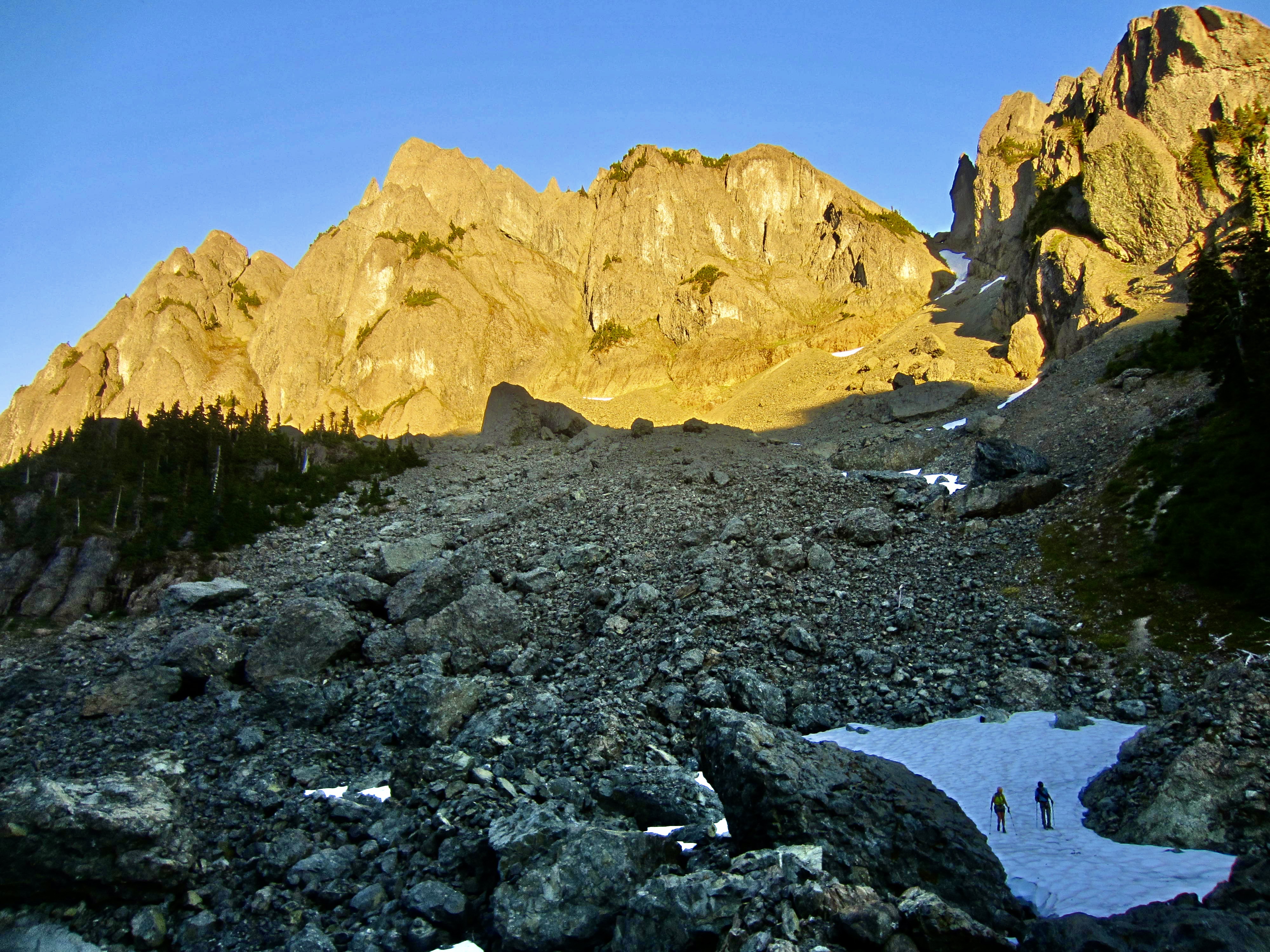
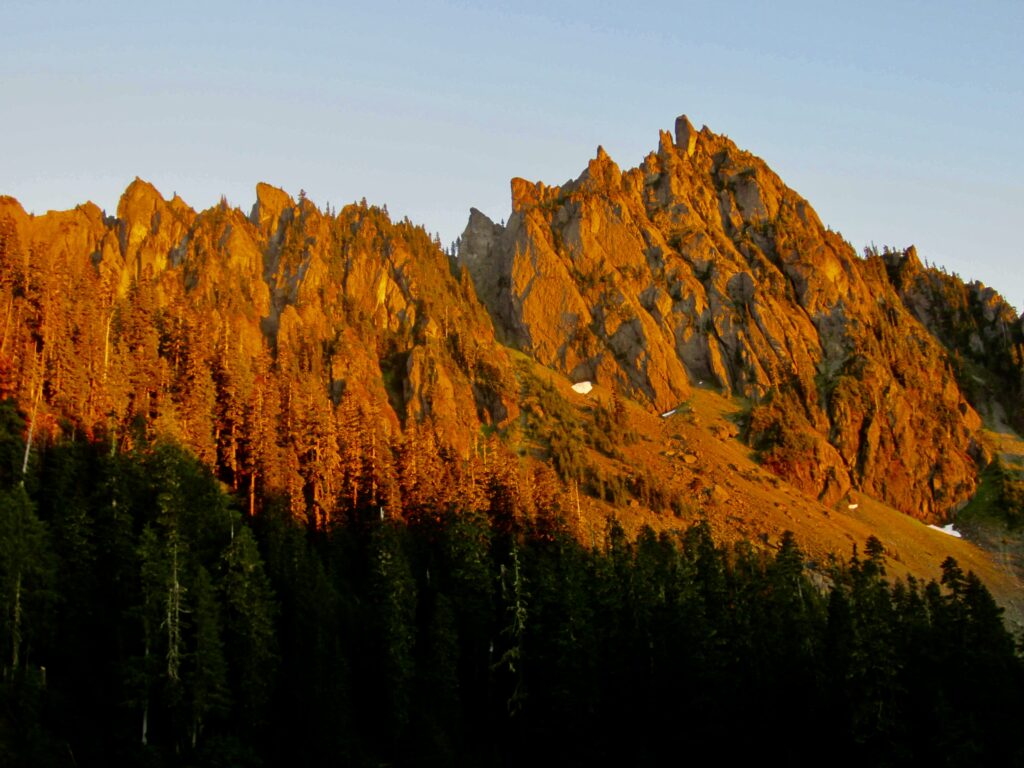
We were all on the trail to Gladys Divide by 6:20am, hiking under clear skies. The air was quite warm even at this early hour, so there was no doubt that it was going to be a hot day. In the basin just below Gladys Divide, we got our first look at the couloir leading up to Needle Pass, and it was not a pretty sight: There were only a few small patches of remnant snow, leaving us with 800 vertical feet of unstable mountain rubble. I now thought that my 10%-chance-of-success estimate was overly optimistic!
.
.
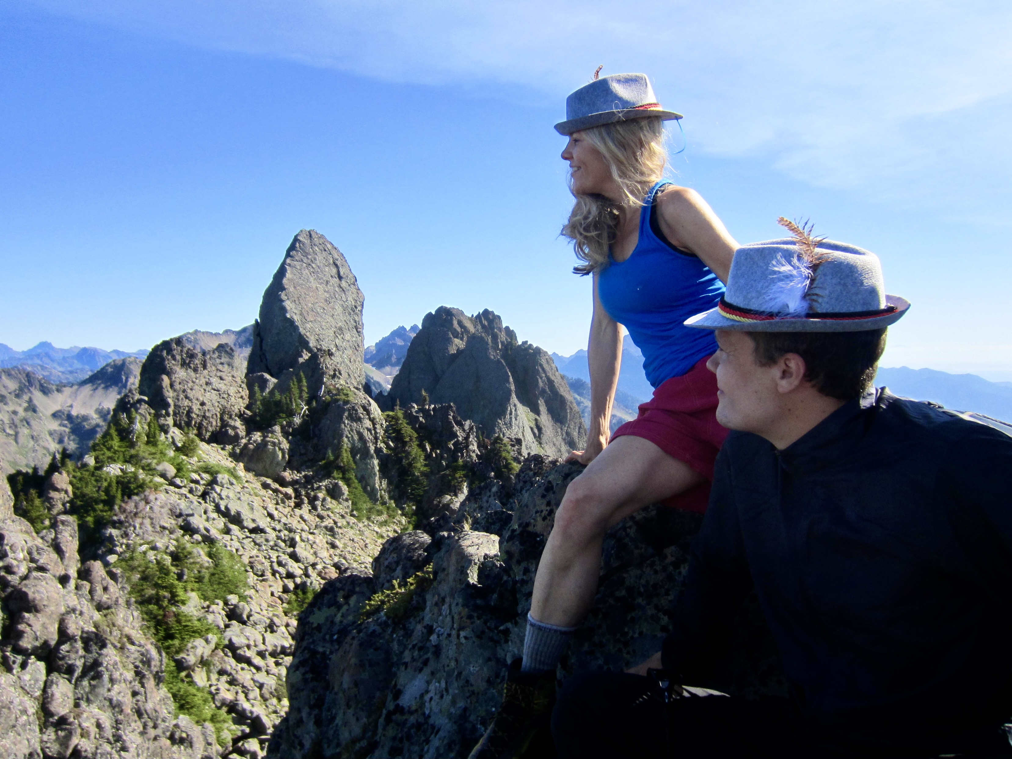
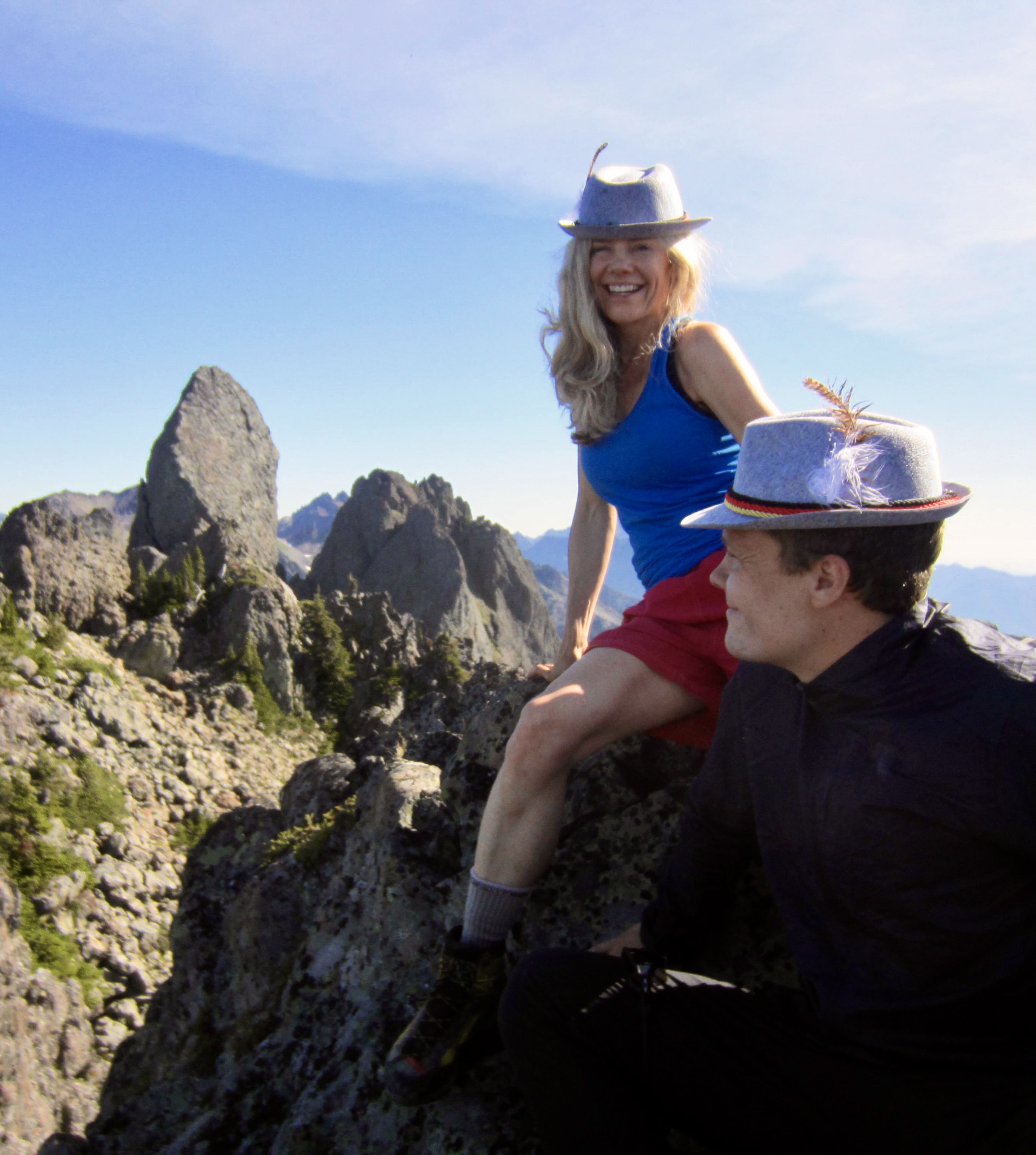
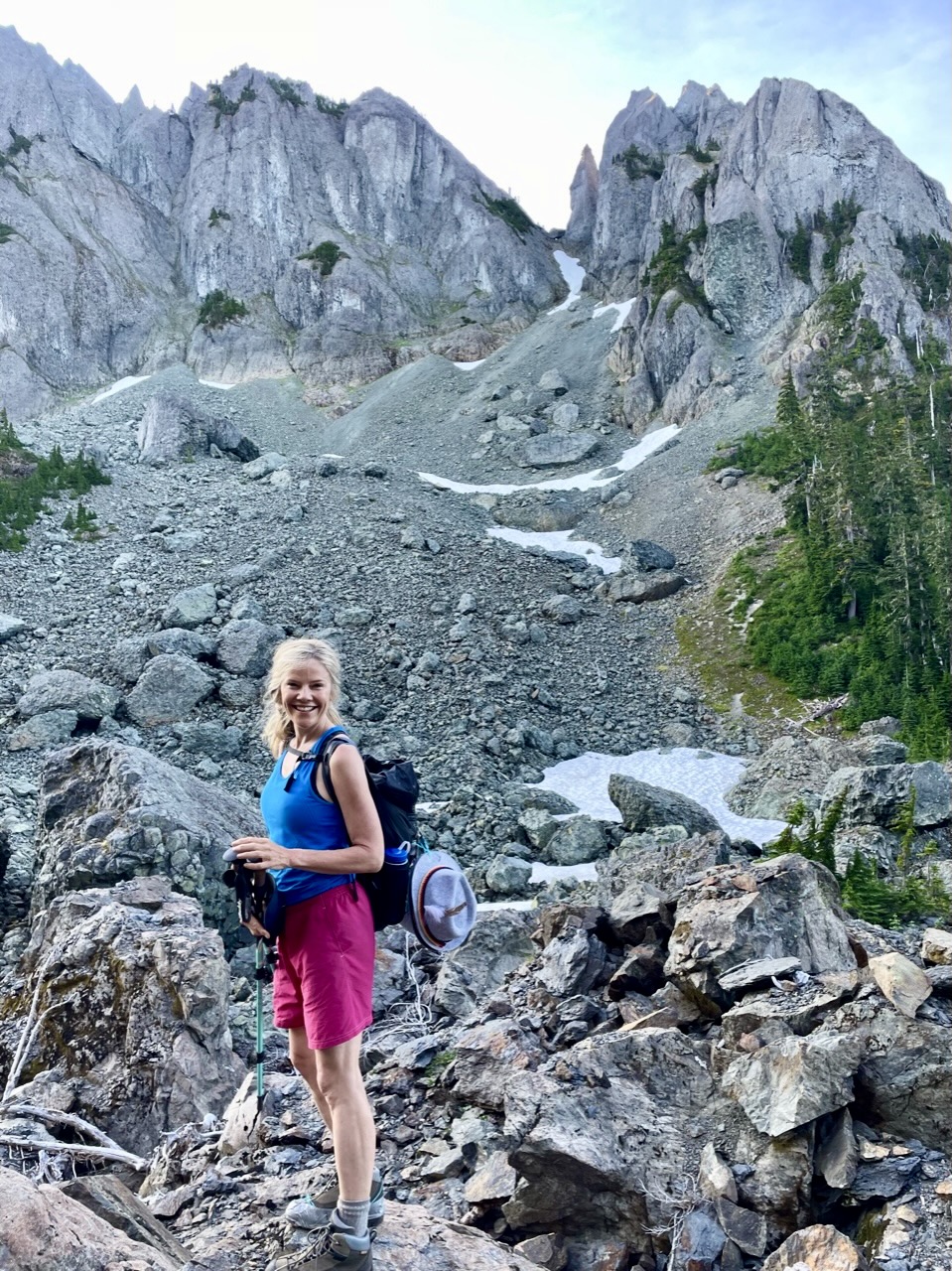
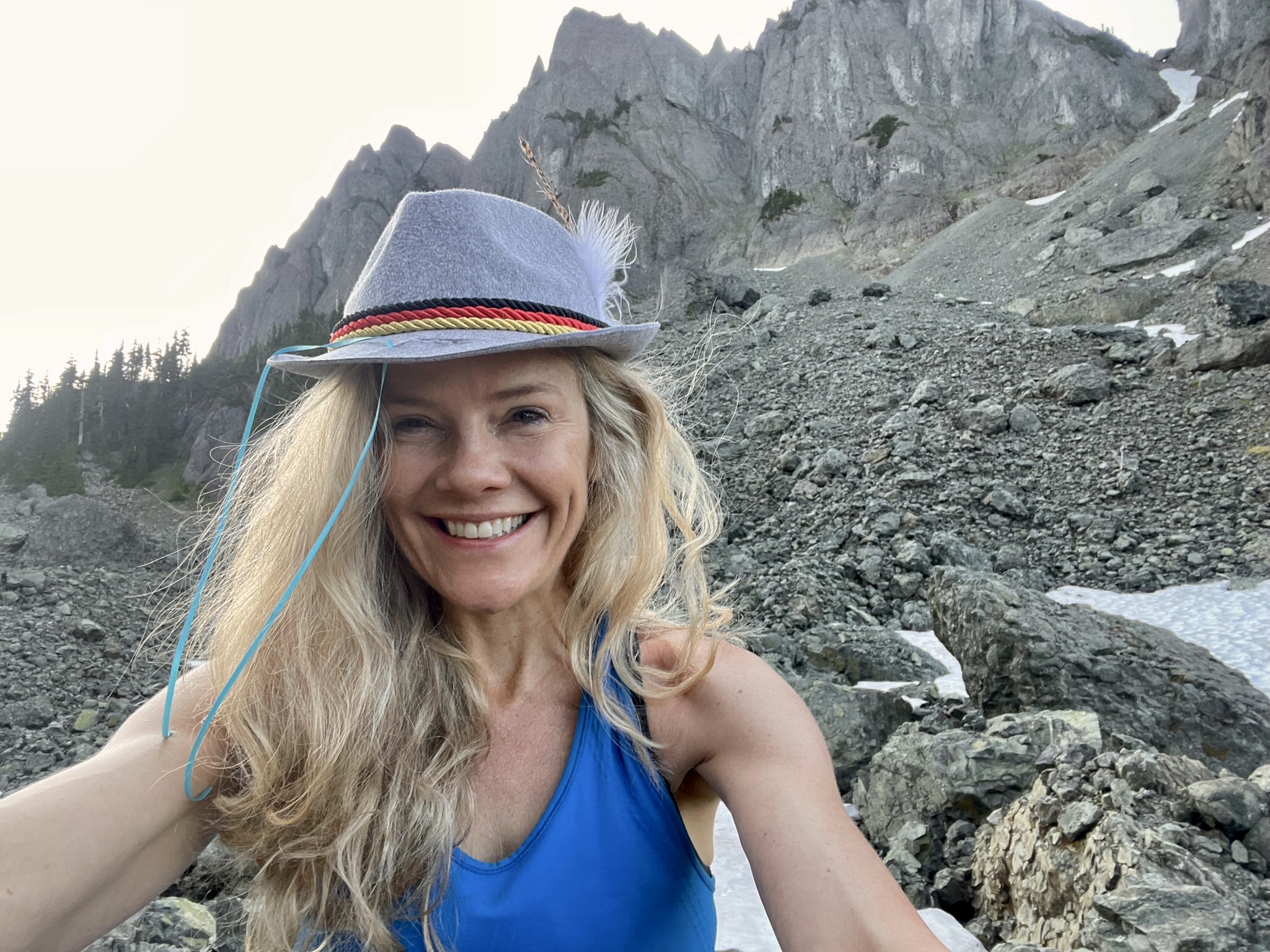
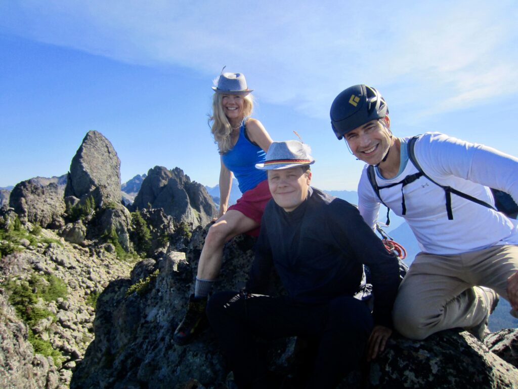
Perhaps because they didn’t know what “bad couloir conditions” meant, Kerry, Mike, and Cody remained undaunted. In fact, Kerry took this as a golden opportunity to pose with one of the Tyrolean-style hats that she had bought after seeing photos of her grandfather wearing such a chapeau during his 1930s climbs. I think Grandpa Ray would approve of her fashion sense.
.
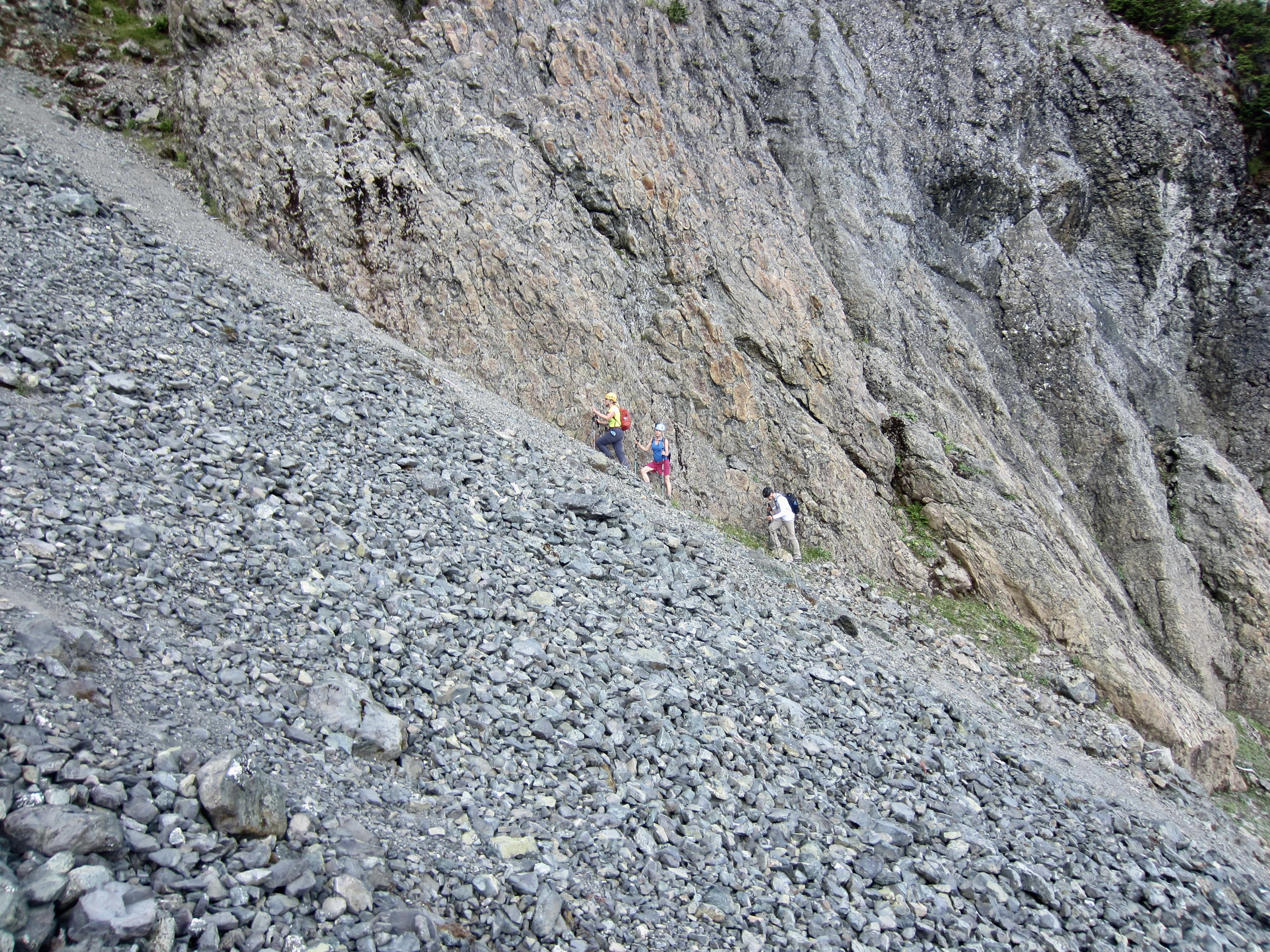
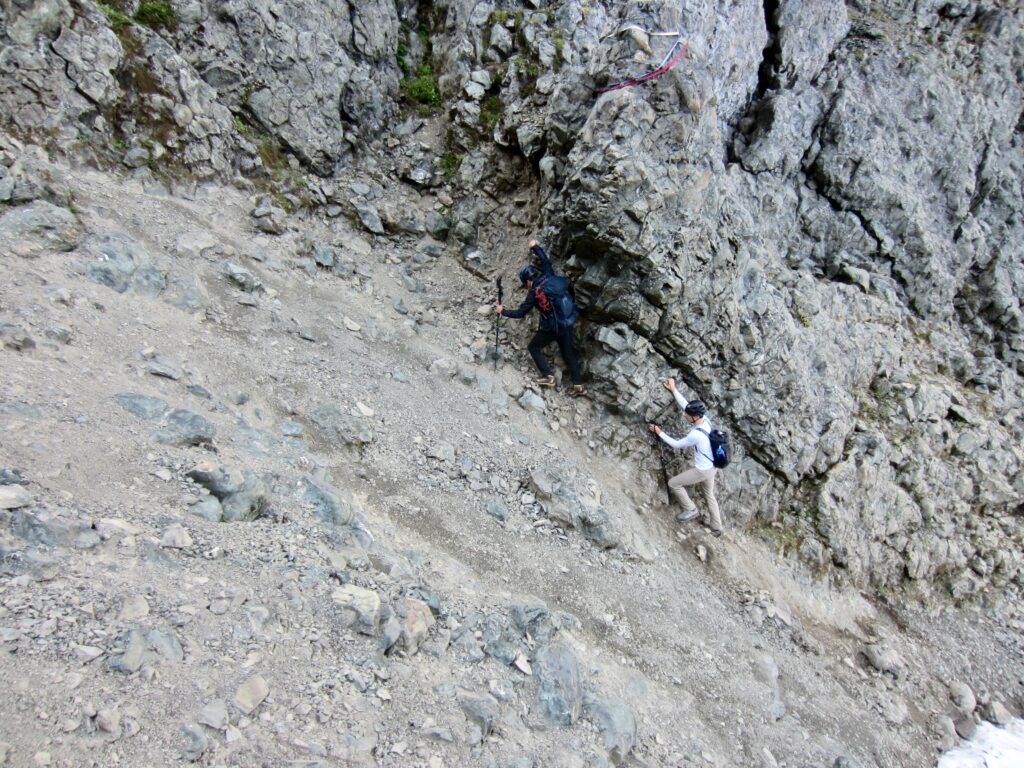
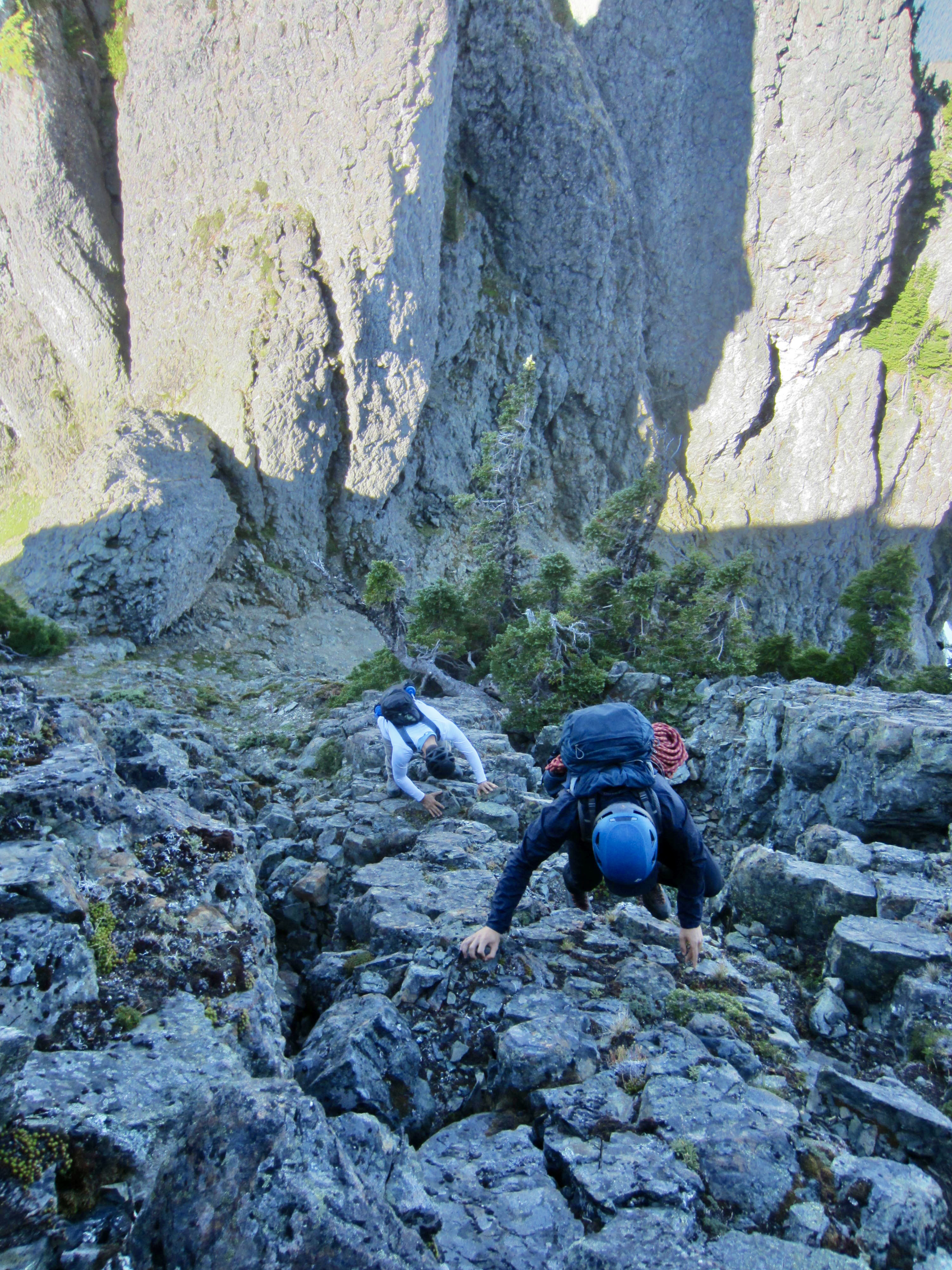
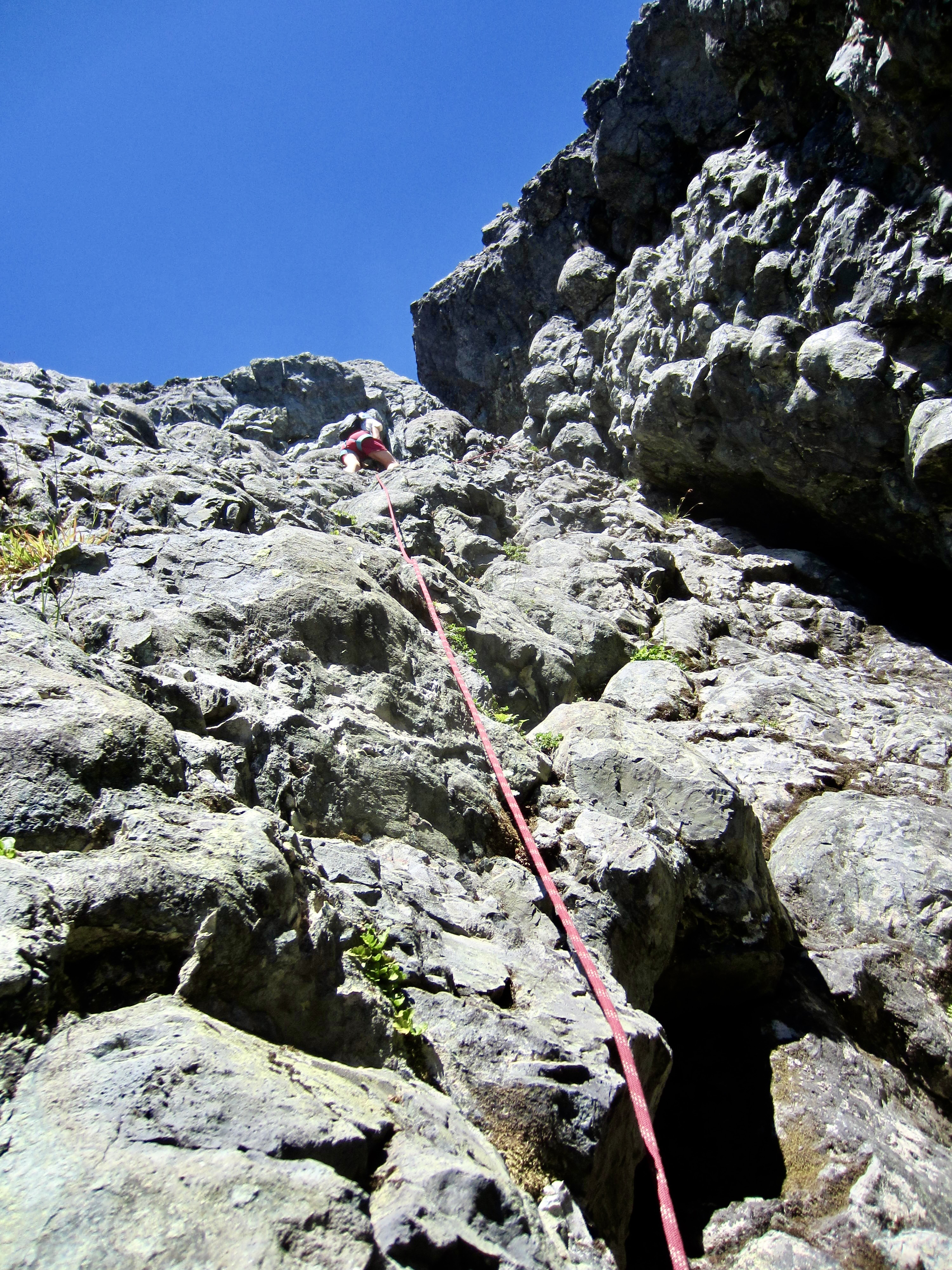
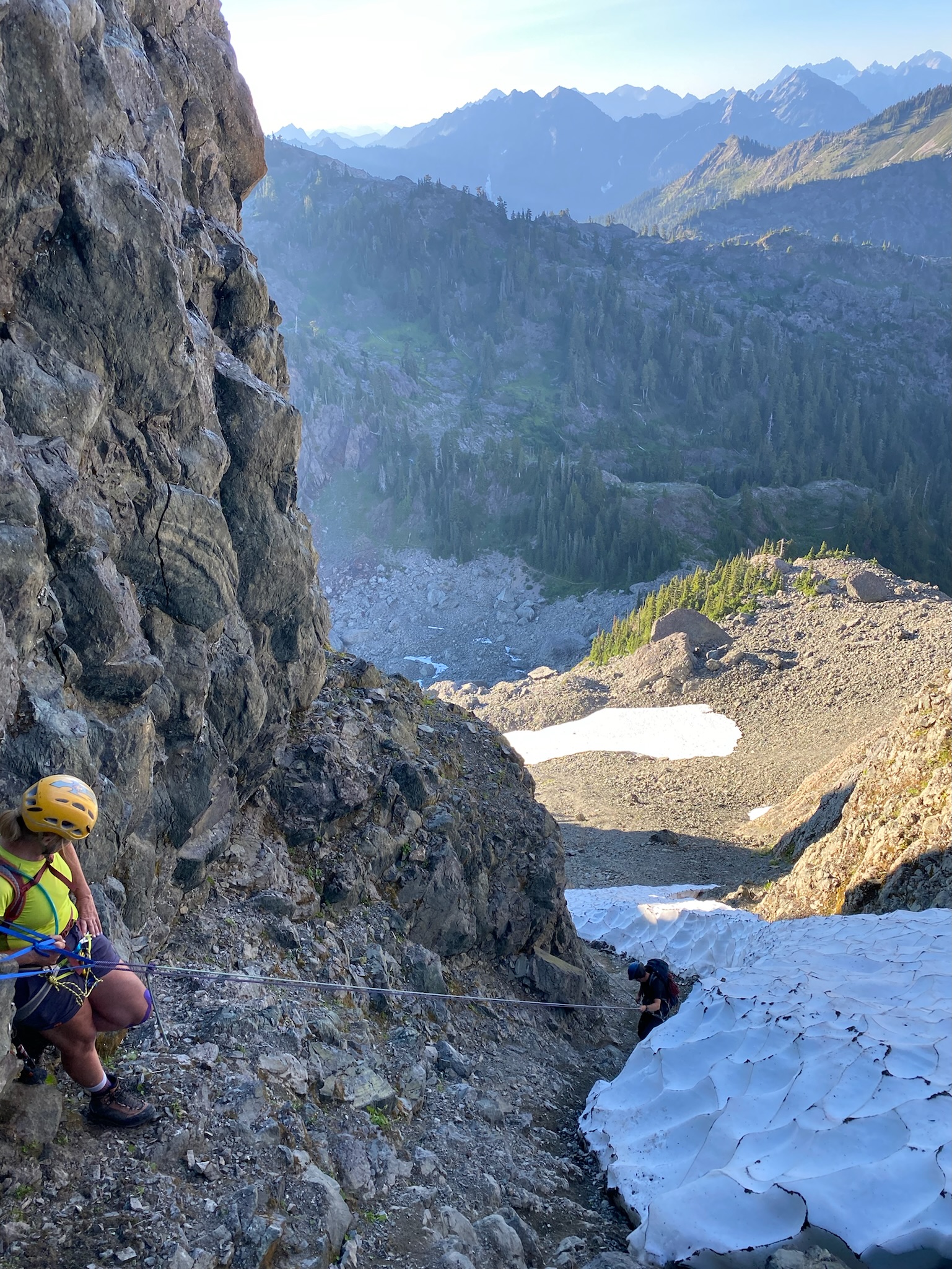
Setting fashion aside, we all donned helmets and began working our way up the Needle Couloir. The first 500 feet wasn’t too bad—just a typical 30-degree slope of loose talus and scree, with plenty of room to spread out laterally. Upon reaching the final band of snow, however, the angle increased considerably and we were forced into the narrow moat. Here, we moved up slowly in singles or pairs to minimize rockfall hazards while desperately clinging to the sidewall and kicking our boots into the hard dirt. This was new territory for Kerry, Mike, and Cody, but they handled it with aplomb.
.
.
.
Despite all of my earlier doubts, we managed to gain 5720-foot Needle Pass without incident by mid-morning (3.0 hours + 1850 feet from camp). We took a break on top of the giant boulder and stashed trekking poles. Miraculously, Mike’s repair job on Kerry’s lame boot had held up to the rugged ascent, but it seemed wise to not push the limit, so she changed into Cody’s mountain boots and Cody changed into his approach shoes. This was a fortuitous case of mother and son having a similar foot size.
.
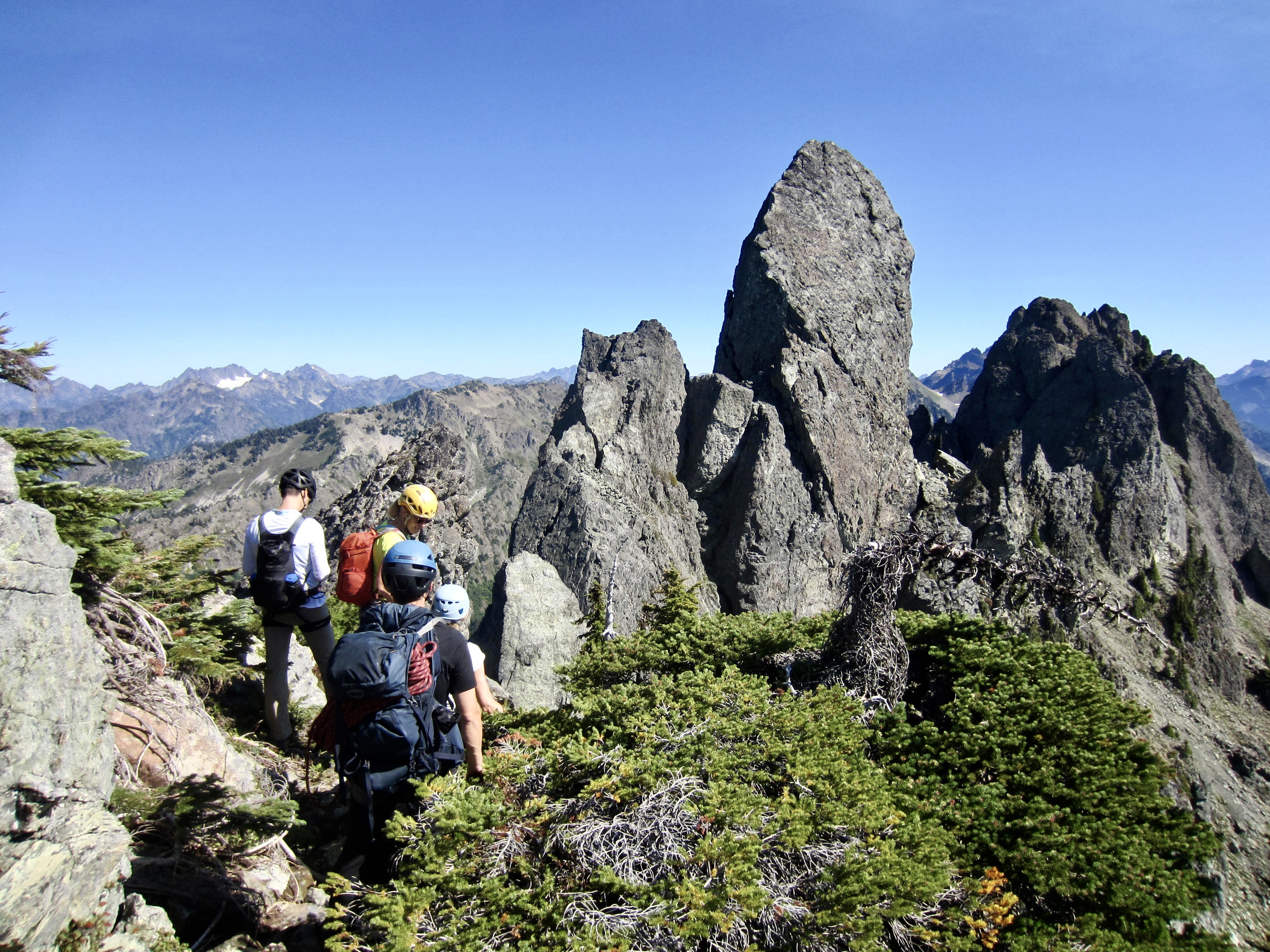
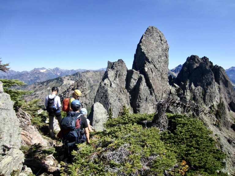
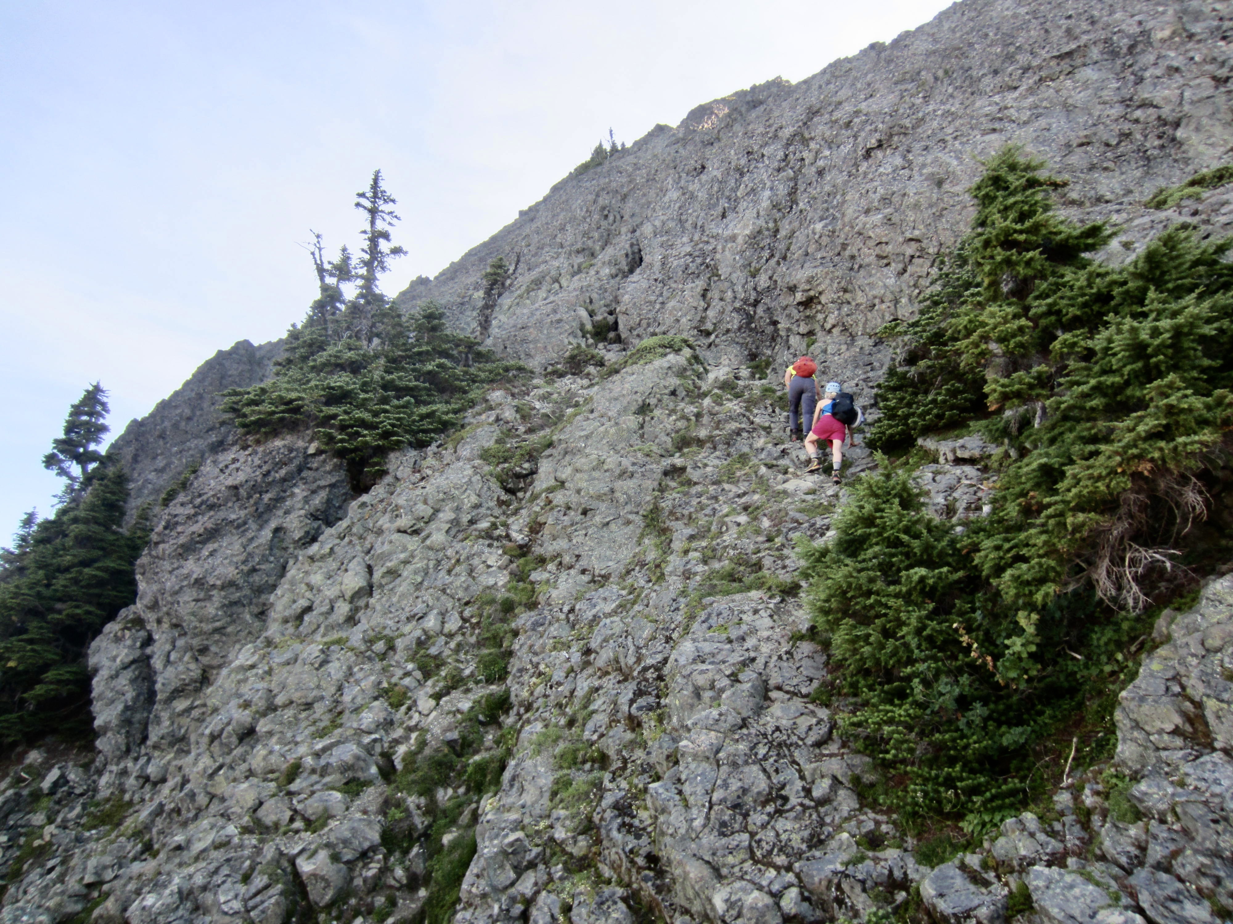
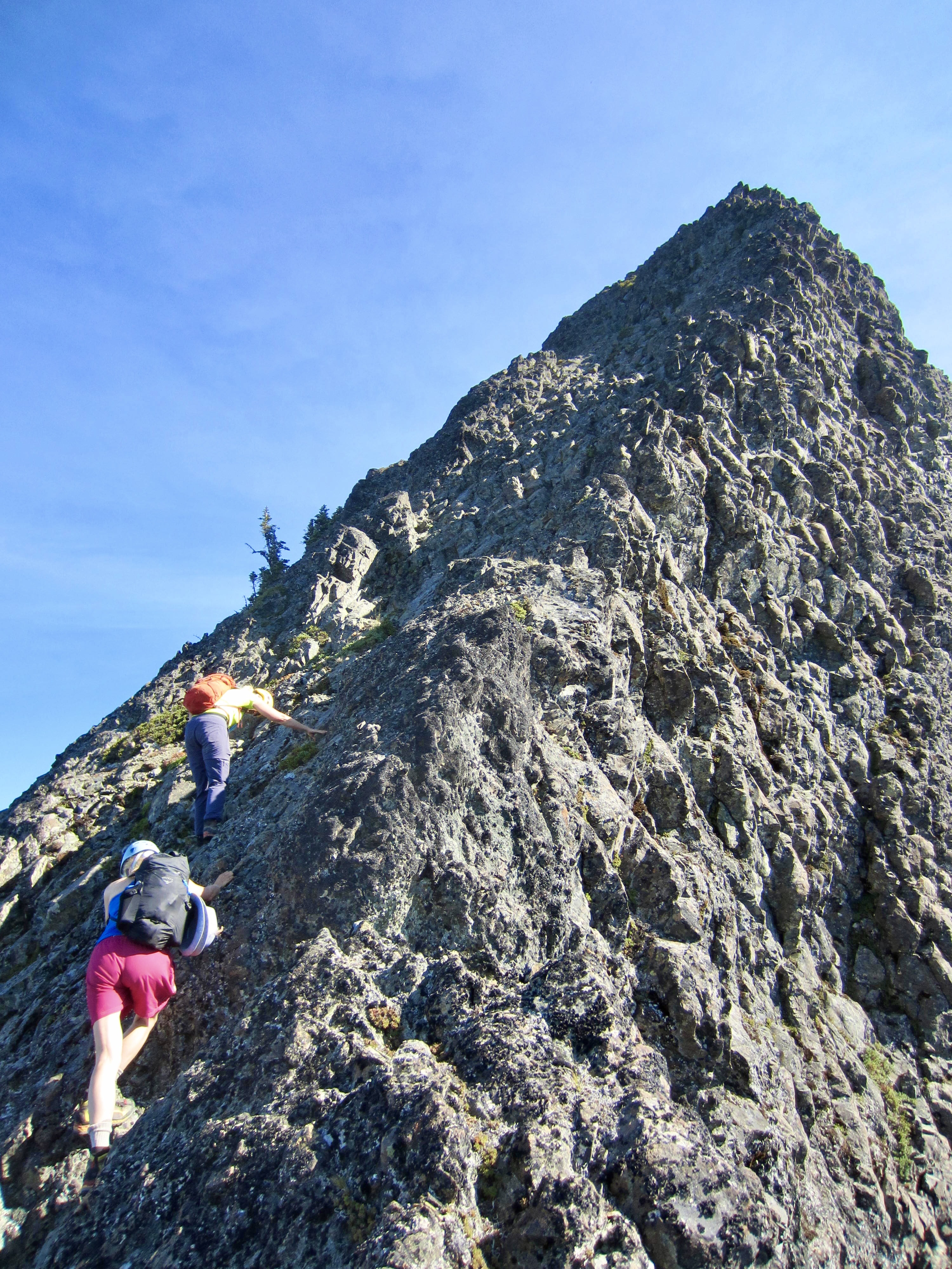
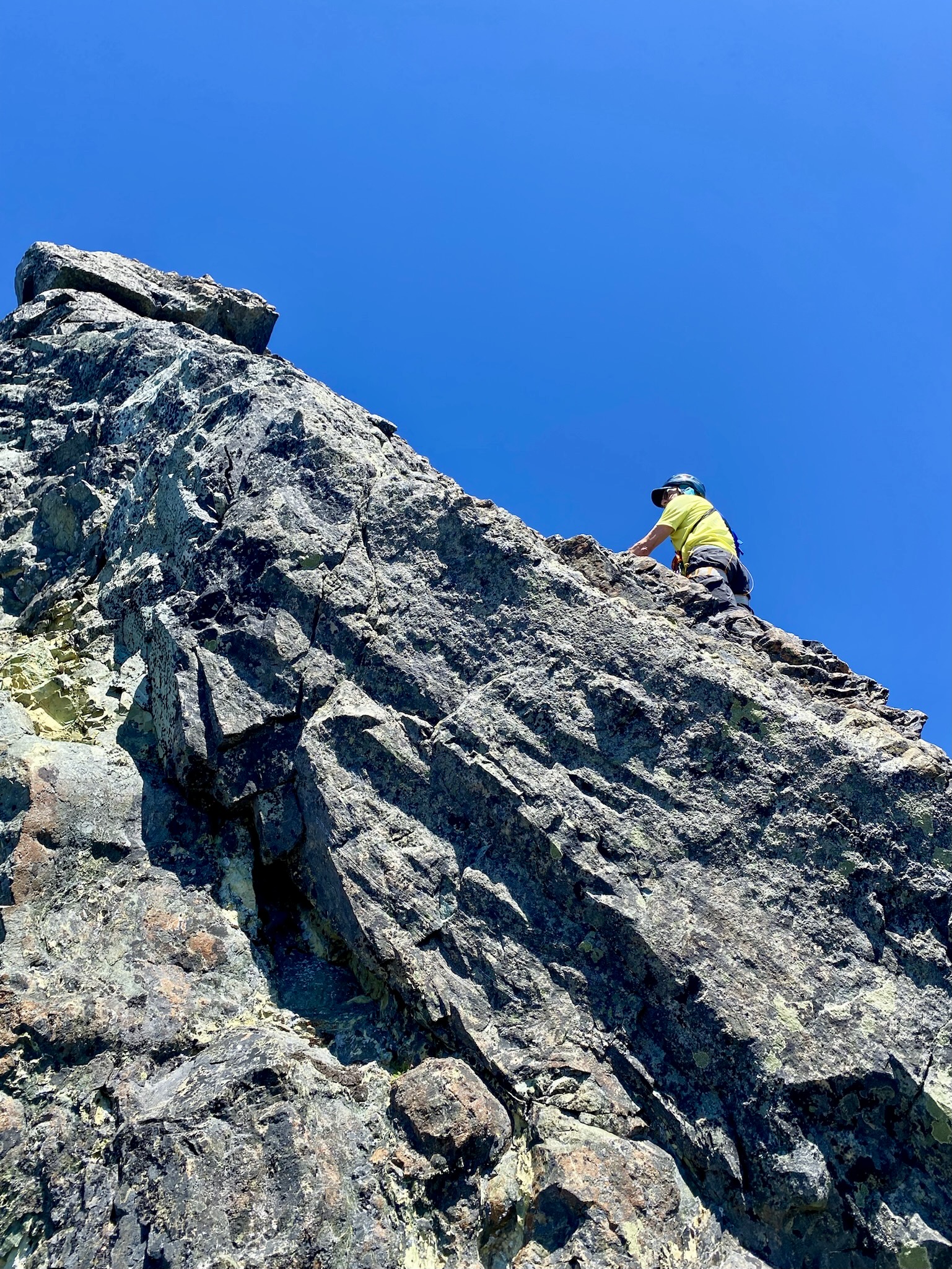
From Needle Pass, we angled upward to the northeast on an obvious ledge, then scrambled straight up exposed Class 3 rock toward the summit of Beta Peak. Eileen had been here most recently, so she took the lead, and Kerry—powered by free-range kale—followed closely behind her. Soon, we were all gathered on Beta’s 5960-foot summit.
.
.
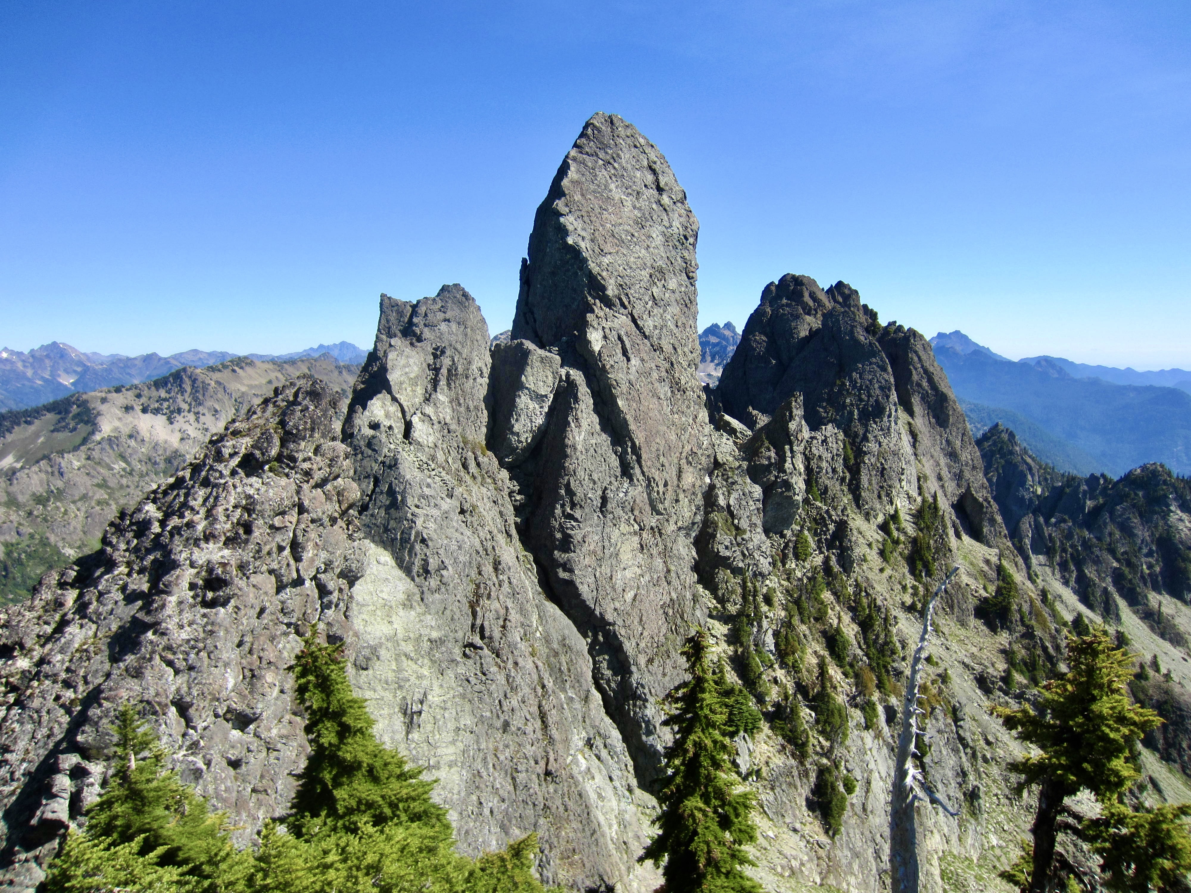
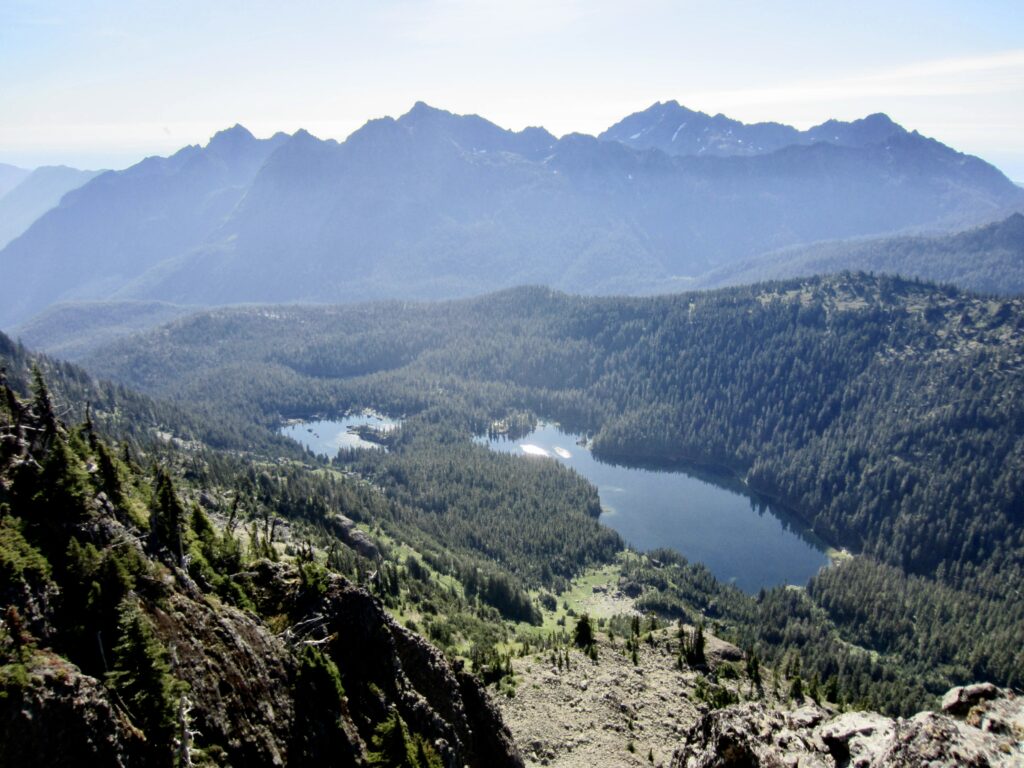
To our southeast were Mildred Lakes and Mt. Washington, and to our northeast was the intimidating fang of Mt. Cruiser. Once again, the Tyrolean hats came out for a photo shoot.
.
.
.
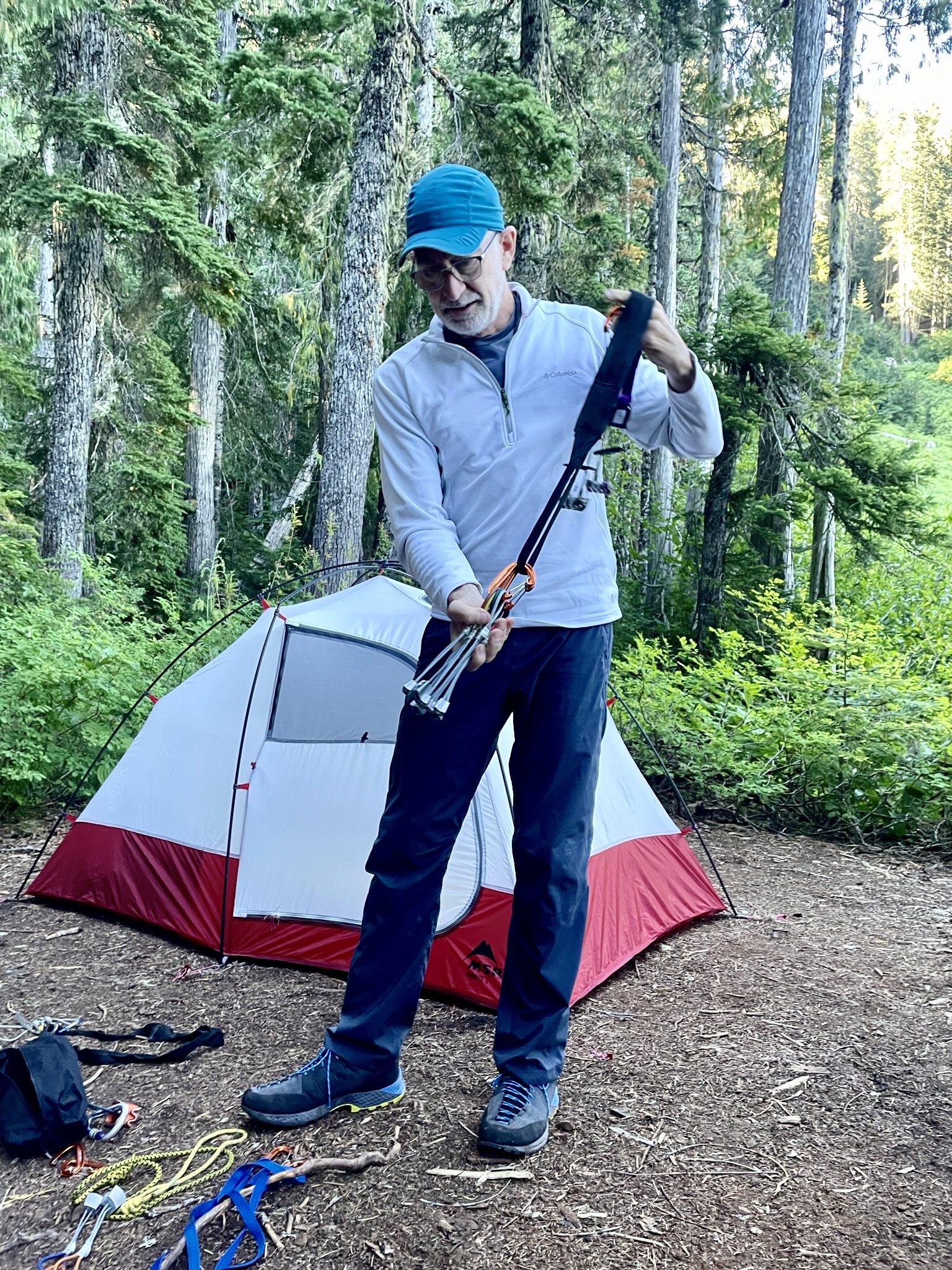
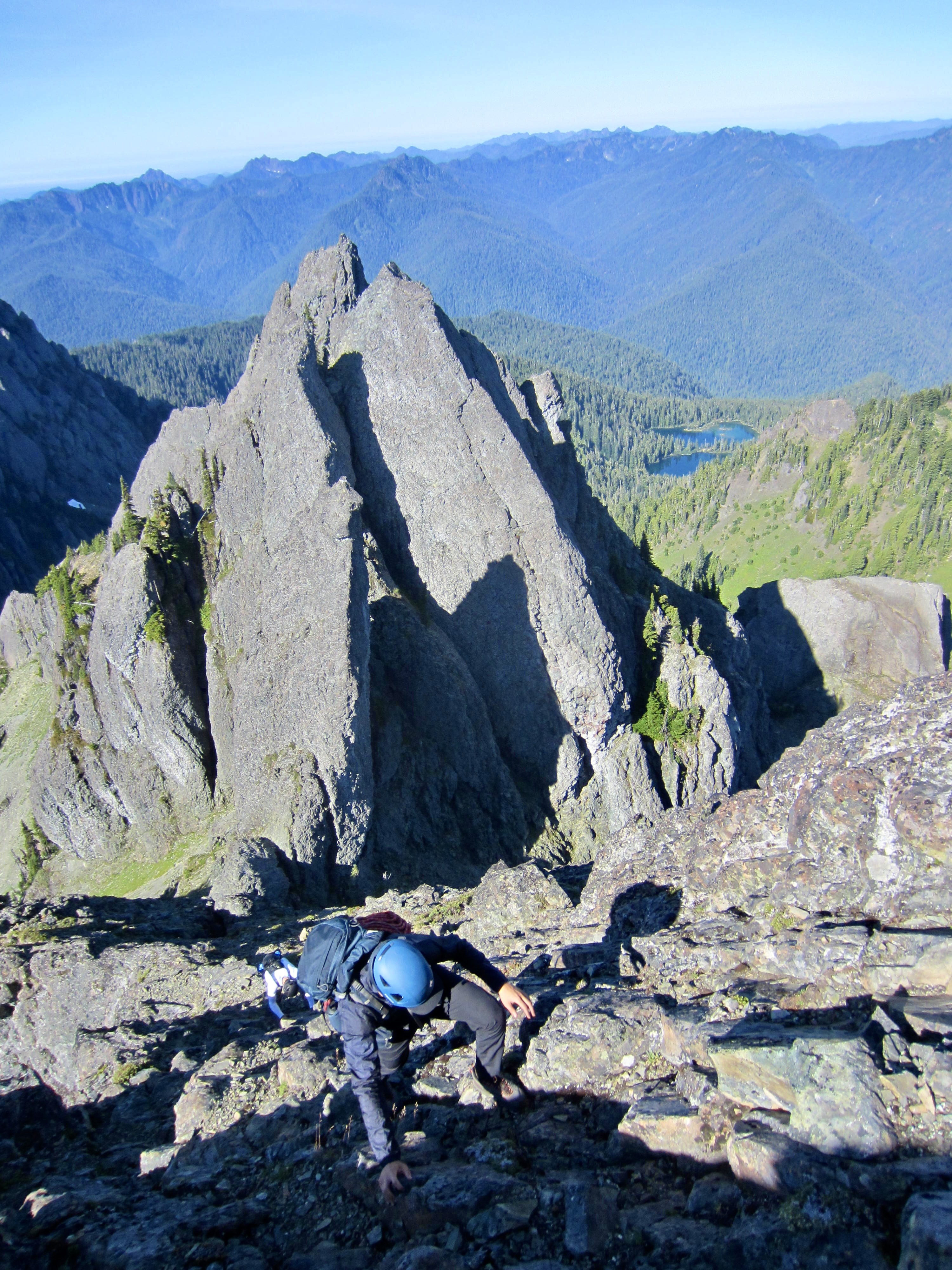
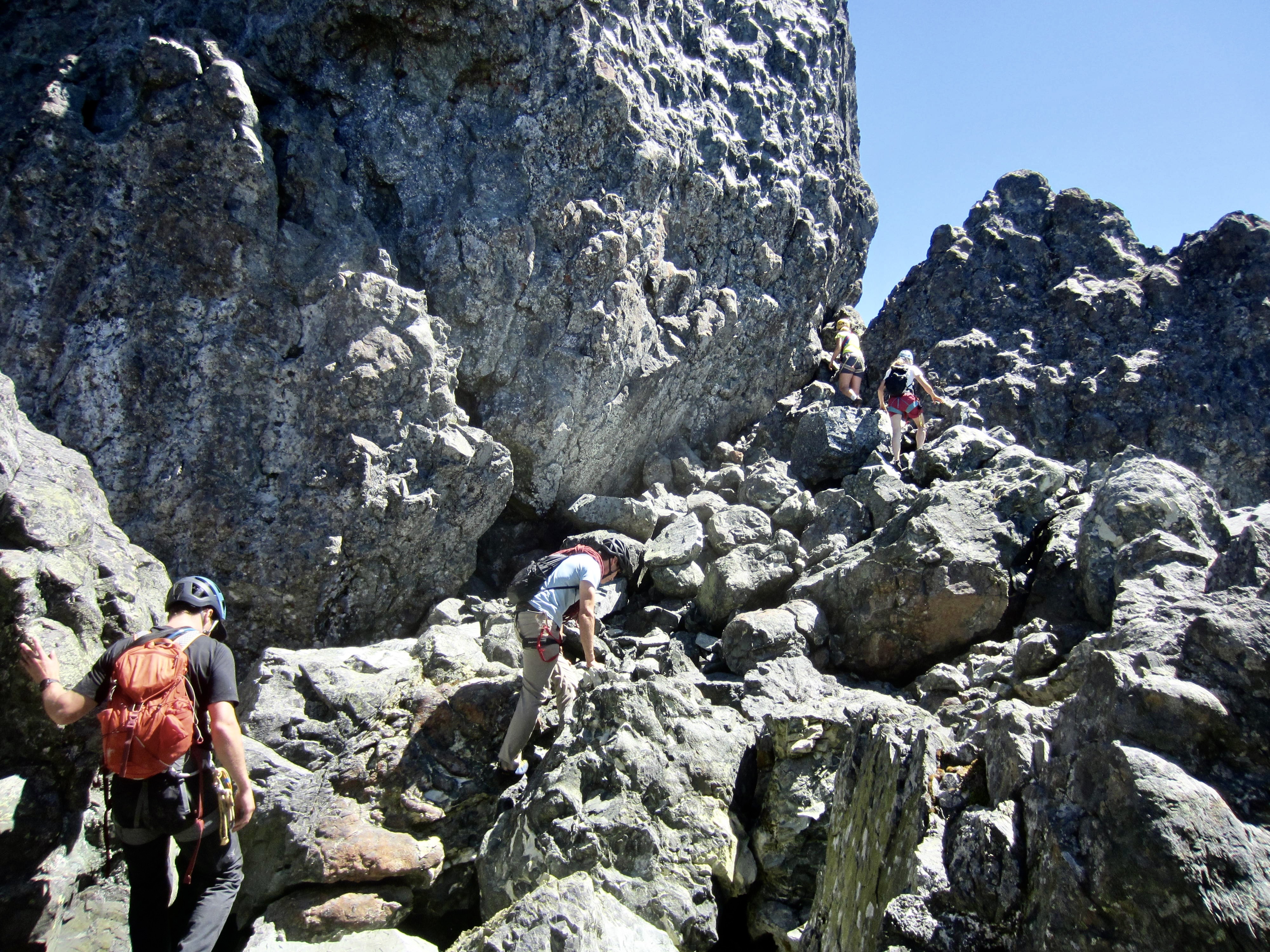
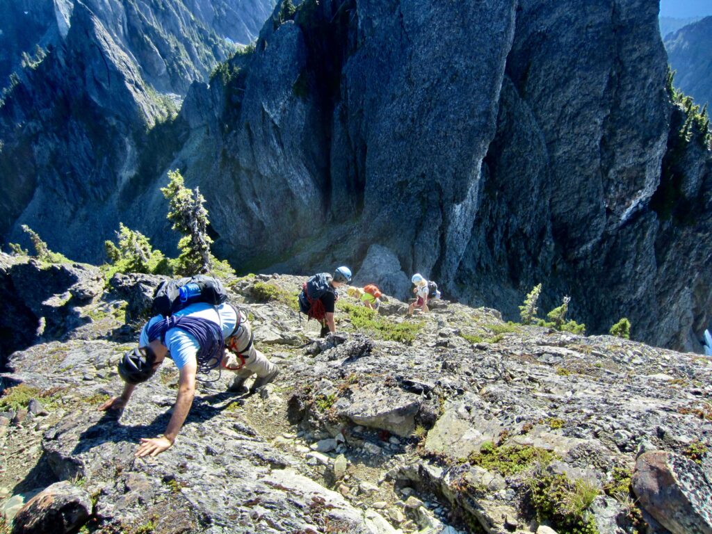
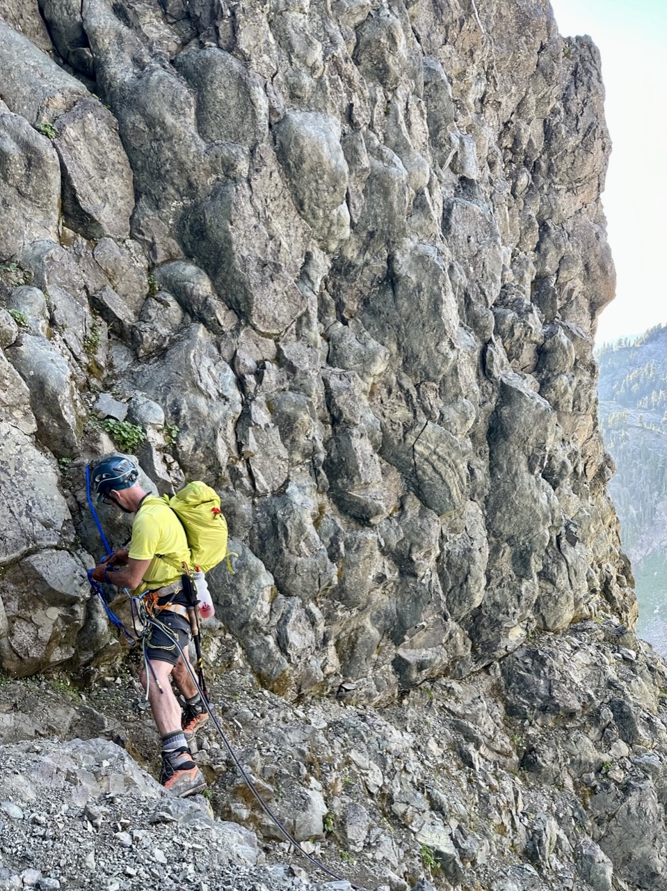
To get off Beta Peak, we rappelled or down-climbed a short gully on the northeastern side of the summit horn, then we made a scrambling traverse northward over a shoulder, followed by a down-climb of another short gully. This all went quite smoothly, and we reached the base of the dihedral gully below Mt. Cruiser at 11:00am (4.7 hours from camp). Here, we pulled out ropes and harnesses, changed into rock shoes, and stashed unneeded gear.
.
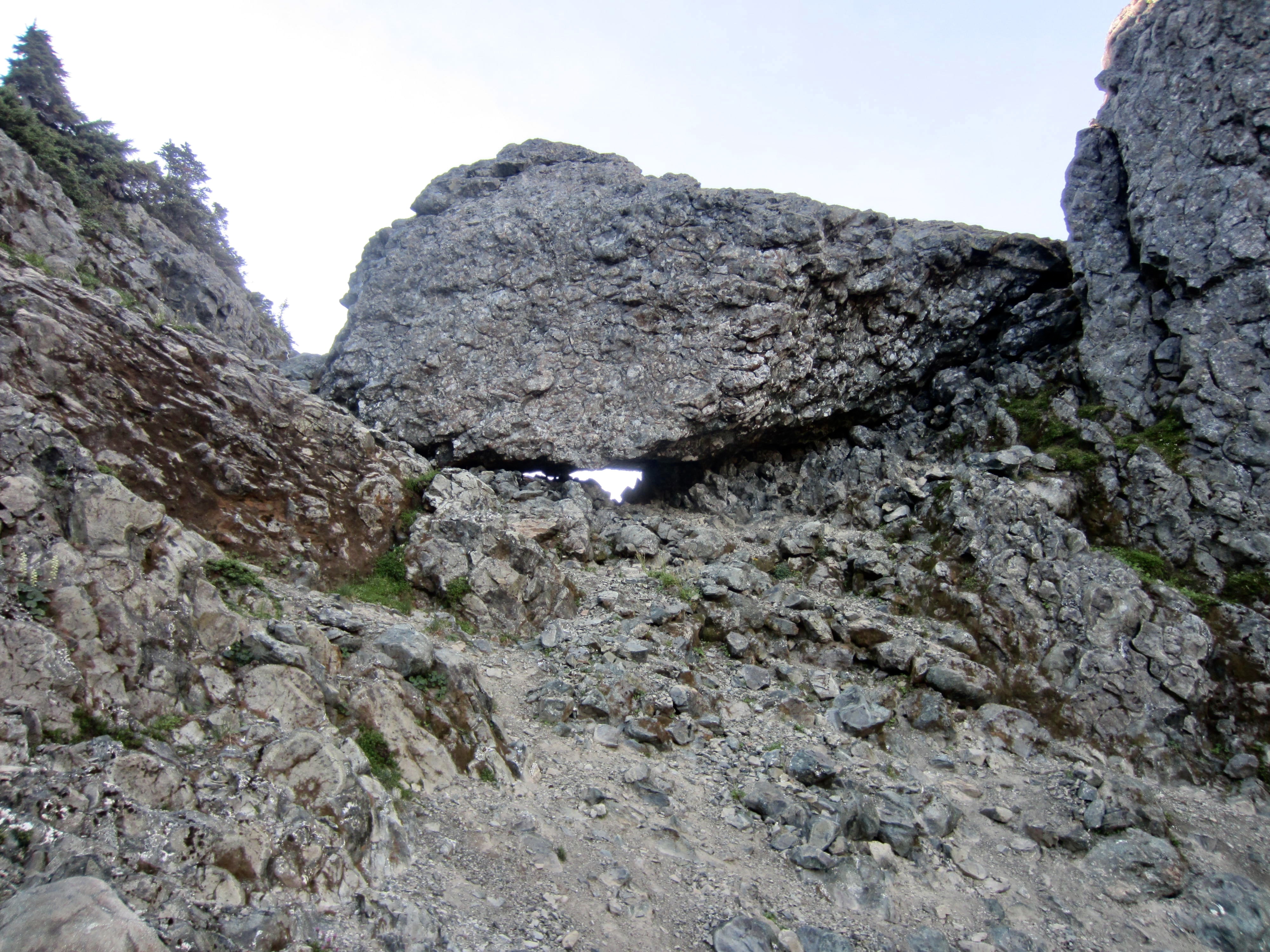
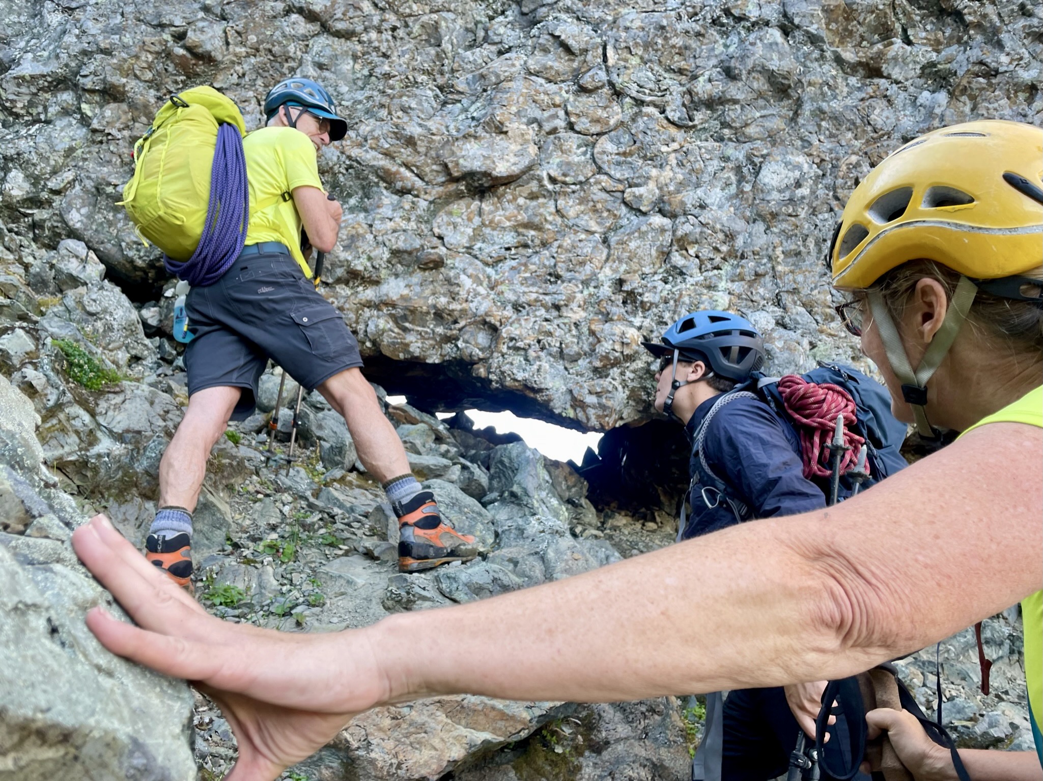
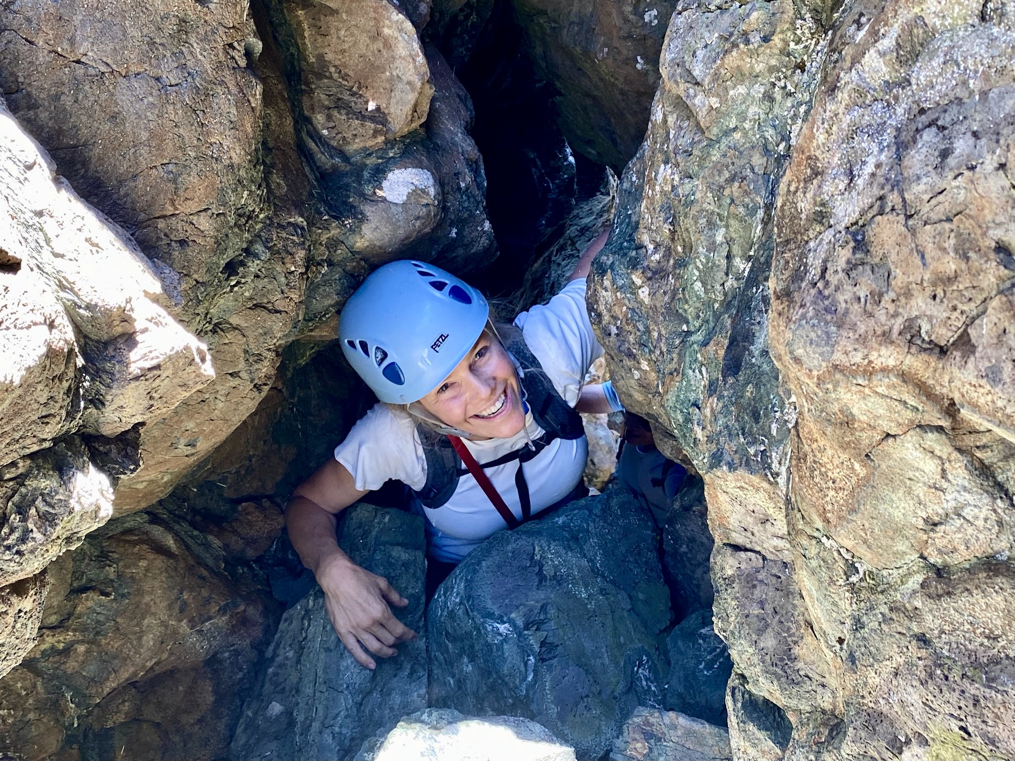
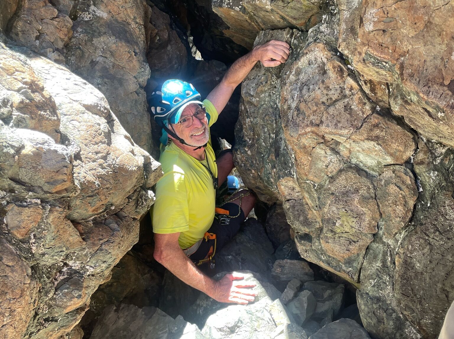
Eileen tied in and climbed up the Class 4 dihedral gully, placing several slings and pieces of pro along the way. Just below the top, she anchored the rope so that the rest of us could climb up on prusik self-belays. We were then left with a short Class 3 scramble up a narrow chimney that ends at the famous cannonhole. This comically awkward squeeze move always elicits much laughter from both the doers and the watchers!
.
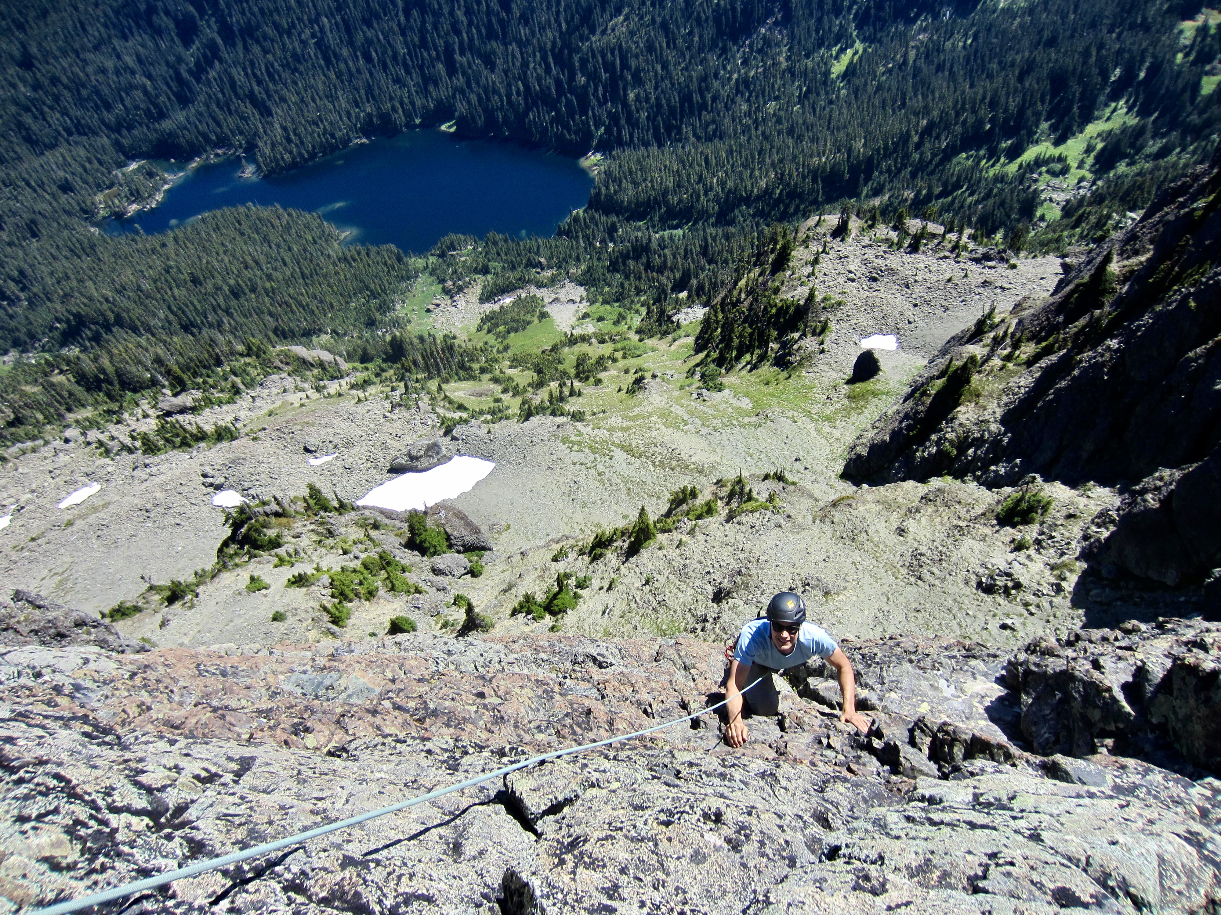
From the cannonhole, a short Class 2 scramble took us over to a high platform at the base of Cruiser’s ultimate pinnacle. The exposure and steepness of the final climb are quite sobering at this location. Mildred Lakes lie more than 2000 feet below, and the rock face above appears to be almost vertical.
.
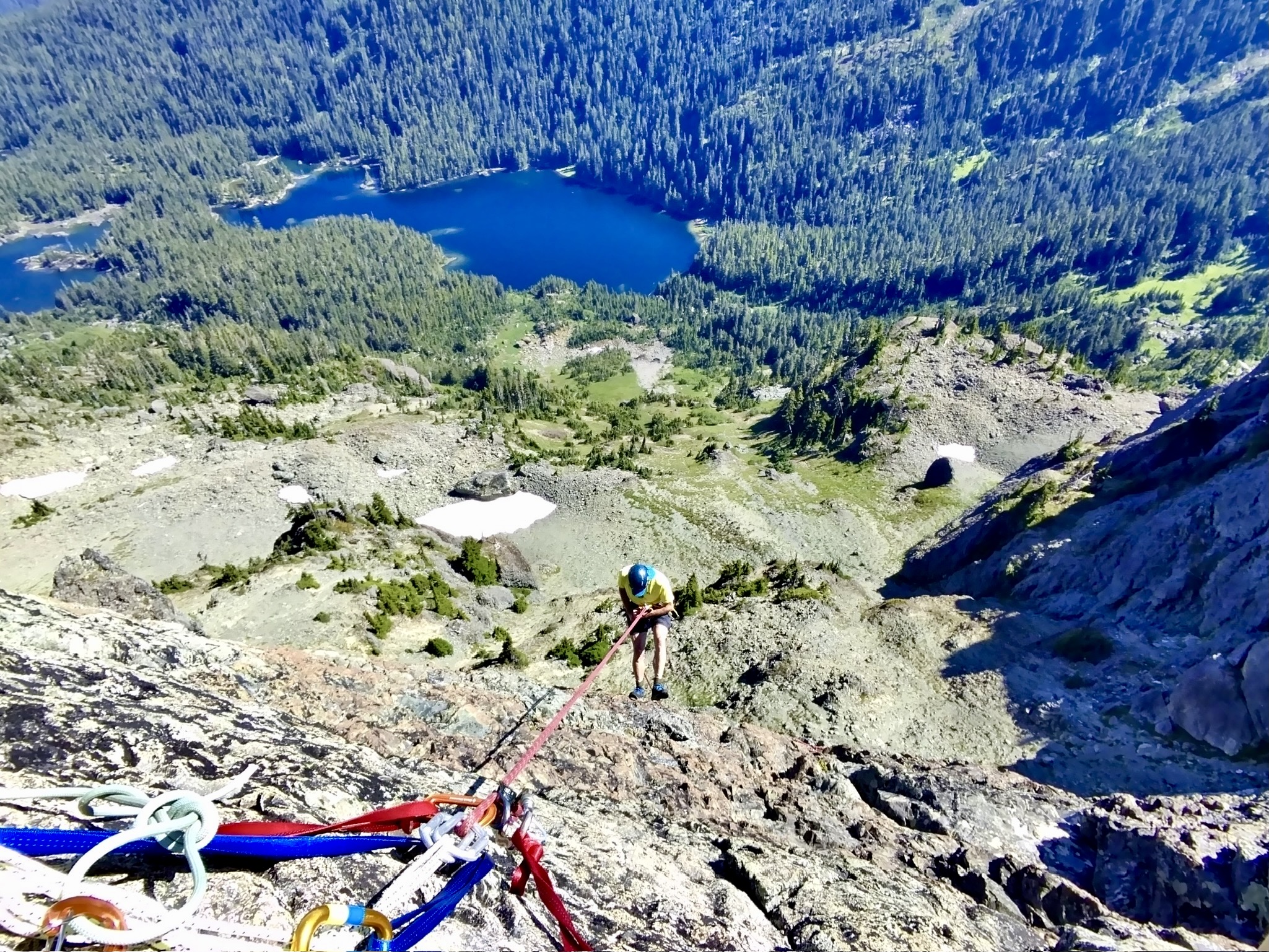
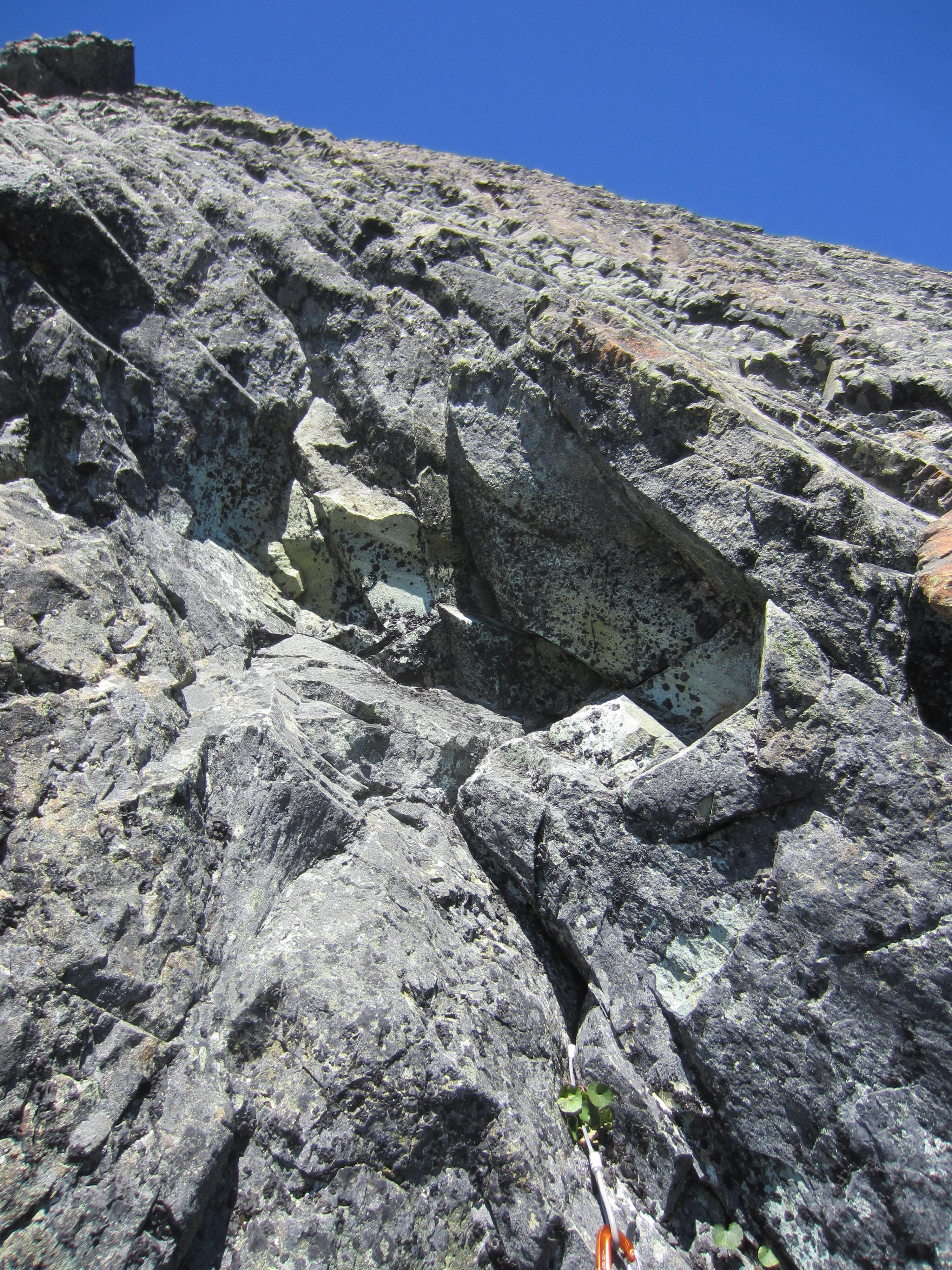
Eileen put me on belay and I gingerly headed up. The first move off the platform goes over a tricky bulge (probably Class 5.5 or 5.6), and although the remainder of the 23-meter pitch is only Class 5.0, protection feels a bit sparse. There is one bolt near mid-pitch, and I was able to place one cam, two slings, and a few stoppers before arriving at the double-bolt anchor station on the summit arête.
.
.
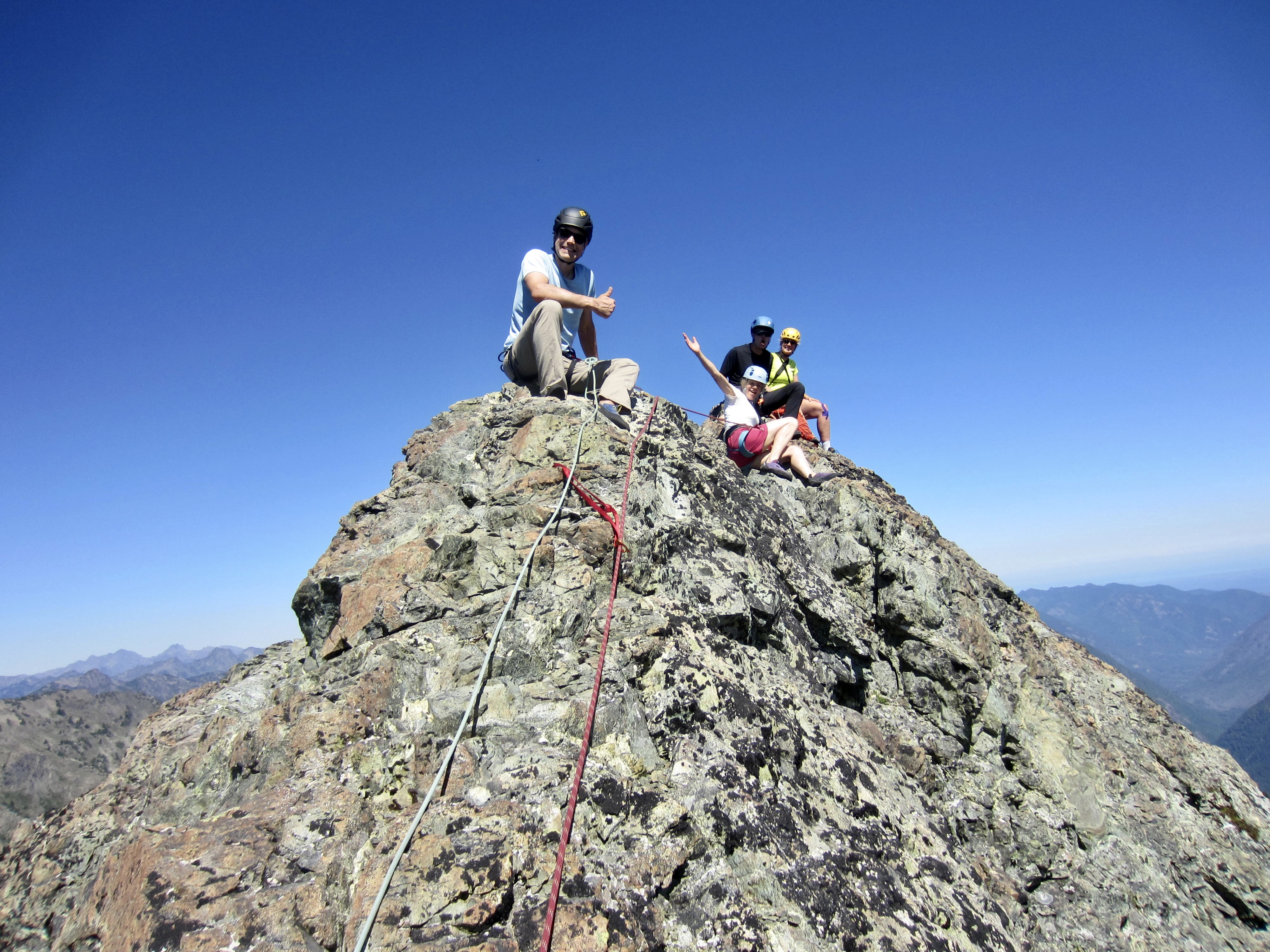
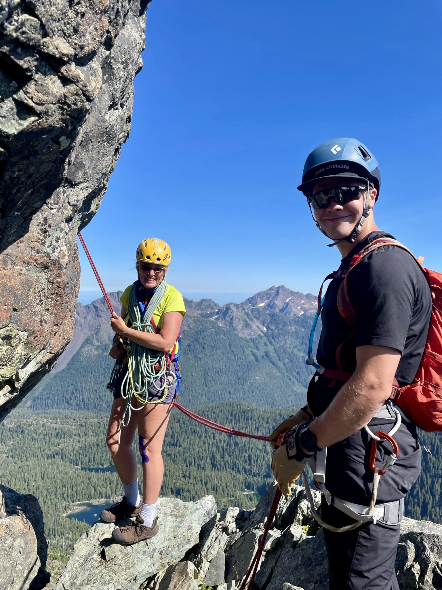
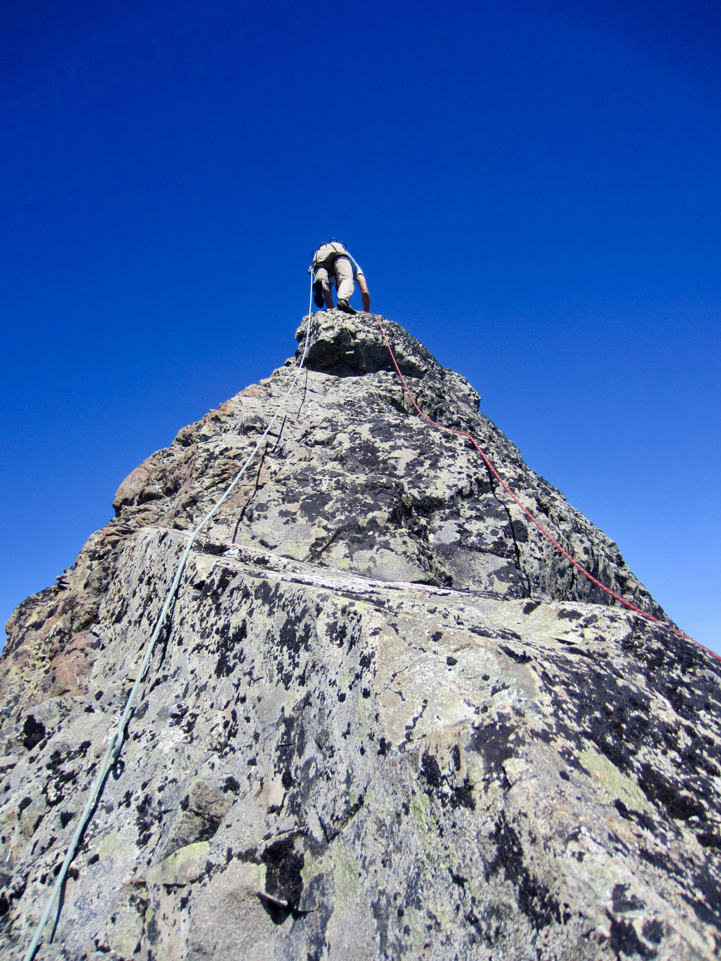
Having five climbers on Mt. Cruiser requires some thoughtful ropework. First, I belayed Cody and Eileen up to my station on our 50-meter rope, then Eileen made a 25-meter lead up the dramatically exposed Class 3-4 arete, clipping one bolt and slinging a couple horns along the way before anchoring her rope on the summit. Cody headed up to the summit on prusik self-belay while I belayed Kerry and Mike up to my station on two separate short ropes. They immediately continued upward to the summit on the fixed rope, and I came up last.
.
Our quintet was gathered on top by 2:20pm (8.0 hours + 2300 feet from camp), exchanging big smiles and high-fives all around. For Kerry, it was the culmination of a 20-year goal to follow her ancestral footsteps!

.
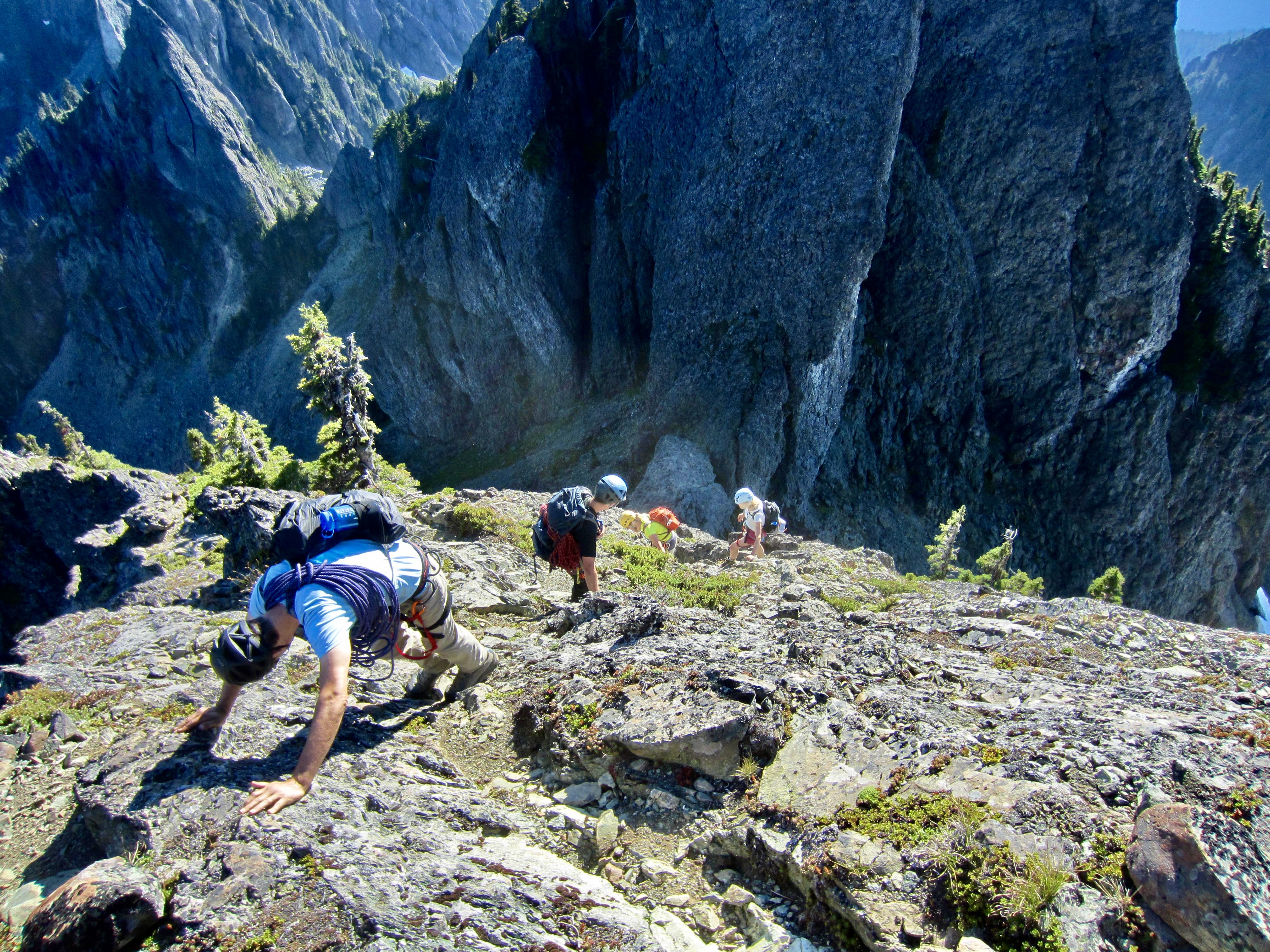
To descend, Mike and I scrambled down to the anchor and rappelled off first. Cody, Kerry, and Eileen came down in the second wave. We all then scrambled back to the cannonhole, down-climbed the upper chimney, and made one 30-meter rappel down the dihedral gully. From there, it was simply a matter of carefully retracing our inbound route up and over Beta Peak. We reached Needle Pass shortly before 6:00pm (3.4 hours from summit).

.
.
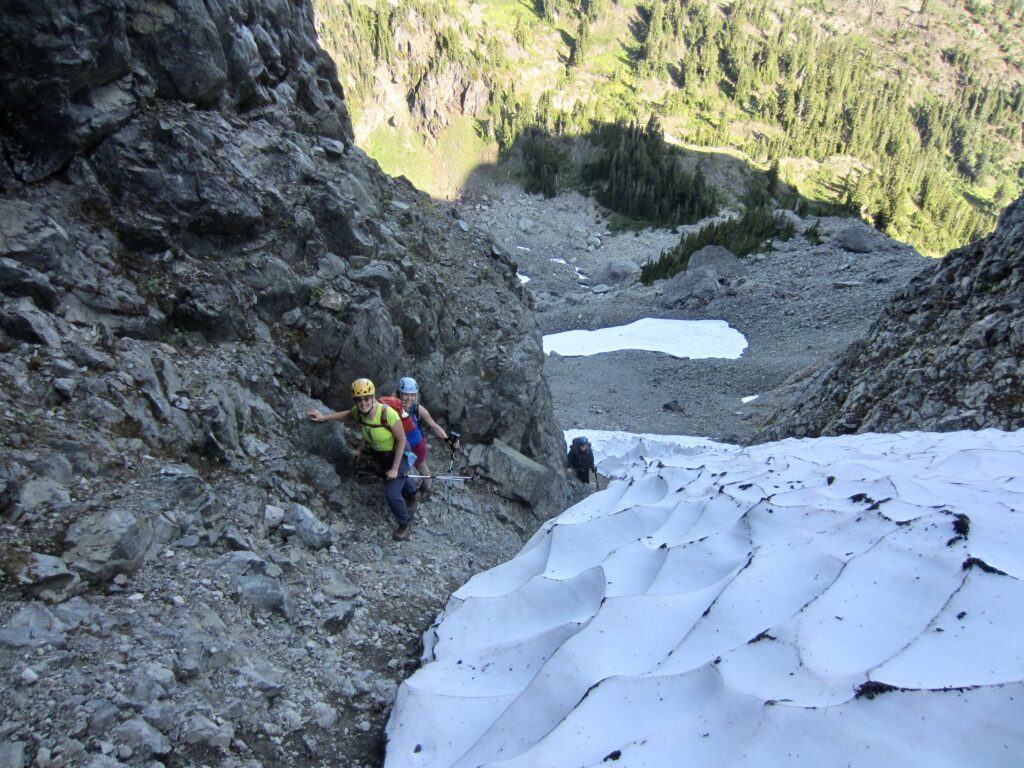
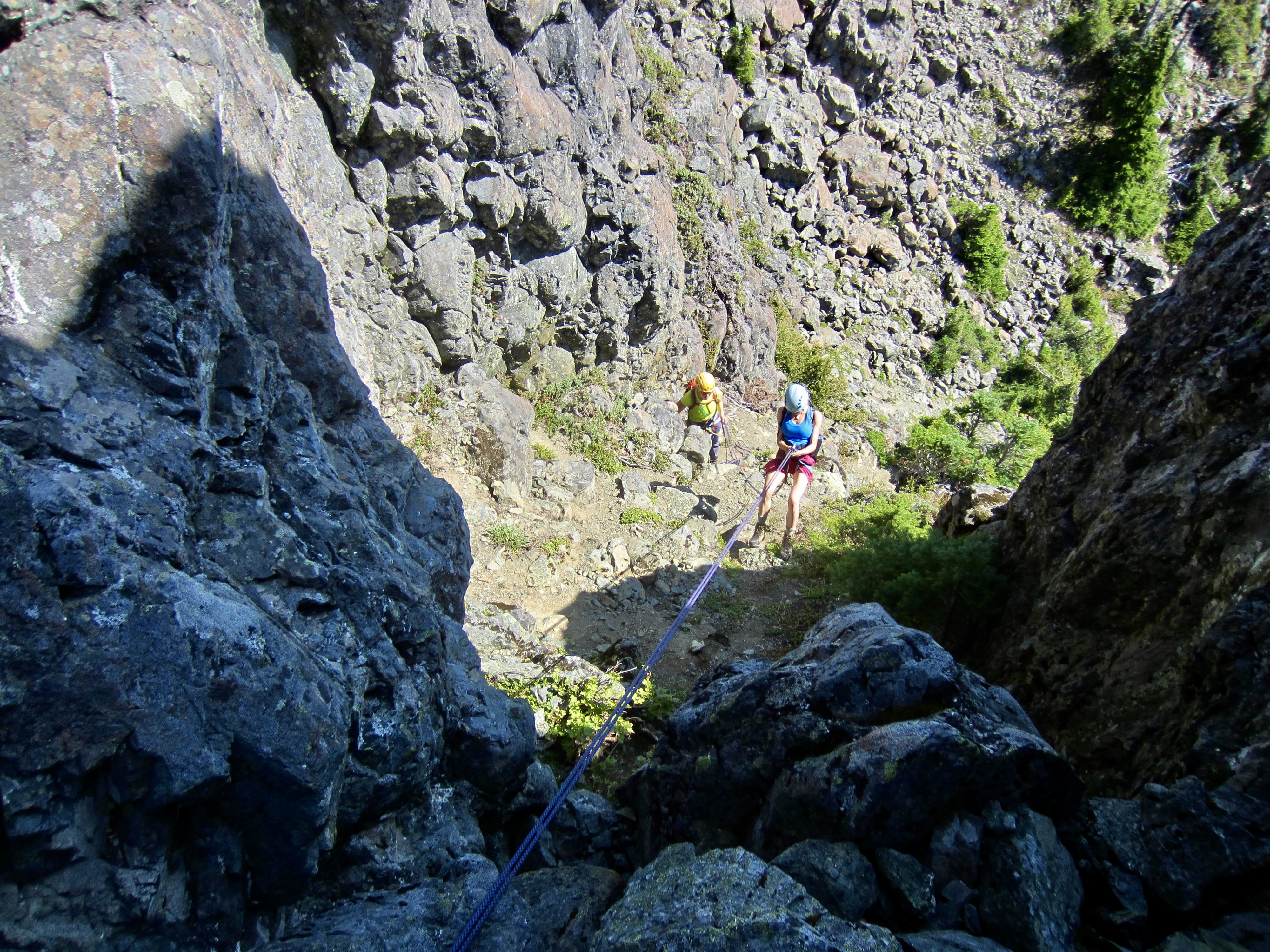
Descending the Needle Couloir is what we all had dreaded most, and I’m sorry to say that it did not disappoint. For this, we again moved slowly in singles or pairs and somehow managed to avoid dislodging any big rocks. At the steepest part of the moat, we made one 30-meter rappel, which left us with only a long, tedious hike down the broad talus slope.
.
It was a massive relief to finally step onto the Gladys Divide Trail and have all of the difficult terrain behind us. Alpenglow was lighting up the hillsides as we hurried down the trail, buoyed by a successful climb under our belts. Camp was reached just at nightfall (6.3 hours + 200 feet from summit) and a celebratory dinner—complete with freeze-dried kale—was enjoyed by headlamp.
.
…
Day 3: Flapjack Lakes to Trailhead
We awoke to another warm and sunny morning with a glassy surface on Flapjack Lakes. Feeling no particular hurry to leave, we had a long, leisurely breakfast while recounting yesterday’s adventure, sorting gear, and breaking camp. Steady conversation ensued until we strode across the parking lot in the sweltering heat of mid-afternoon (4.8 hours + 100 feet from camp). Kerry, Mike, and Cody were still walking on clouds and dreaming about their next climb!
…
Gear Comments
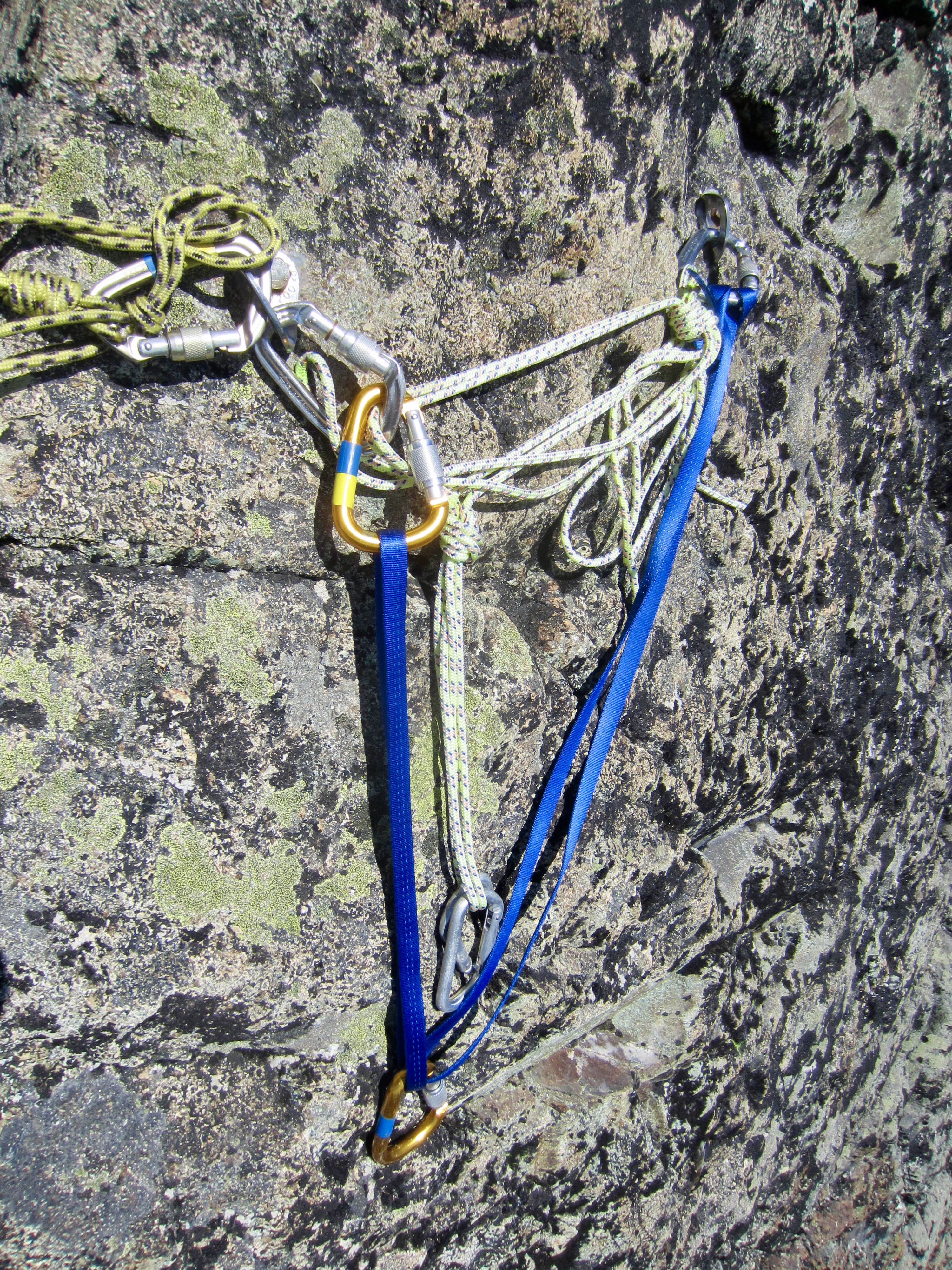
For a party of two or three climbers, one 50-meter rope is adequate for the rock pitches on Mt. Cruiser. Our party of five took two additional 30-meter ropes for use on the summit pitches. However, two 50-meter ropes probably would have been ideal for purposes of climbing and rappelling.
I found that a small alpine rack with a selection of stoppers and two small (0.5 and 0.75) cams, along with several single-length and double-length slings, was sufficient for rock protection. We all used either approach shoes or rock shoes for the roped pitches, but mountain boots would be ok in a pinch.
This late in the season, we needed no snow protection. Earlier in the season, ice axes, crampons, and a few pickets would have been needed in the Needle Couloir.
Route Maps & Profile
…
…
…
Photo Gallery
Click to enlarge…