Trip Date: June 9-14, 2022
Tuolumne Canyon – Ten Lakes Trail Loop: White Wolf to Glen Aulin to Ten Lakes Pass to White Wolf
Pate Valley
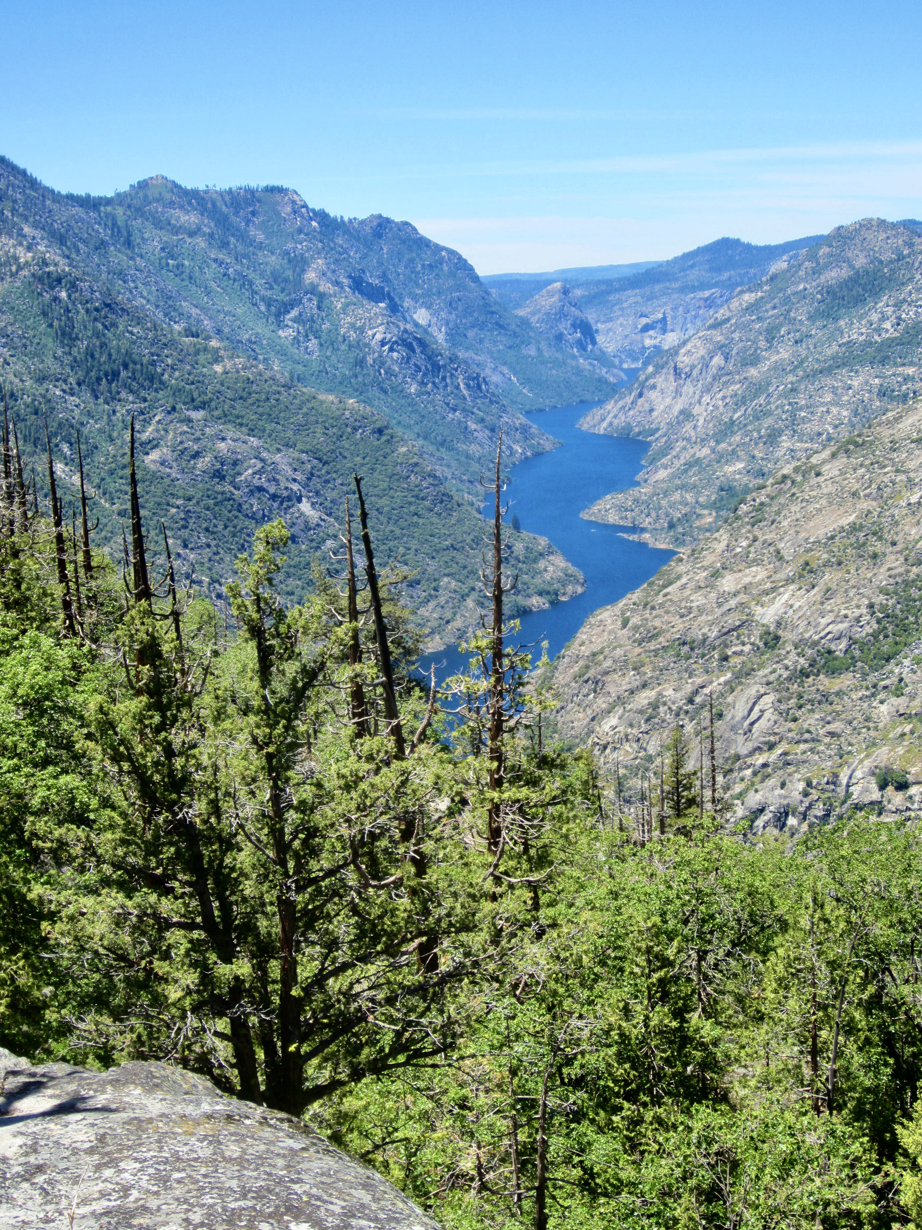
Grand Canyon of the Tuolumne River
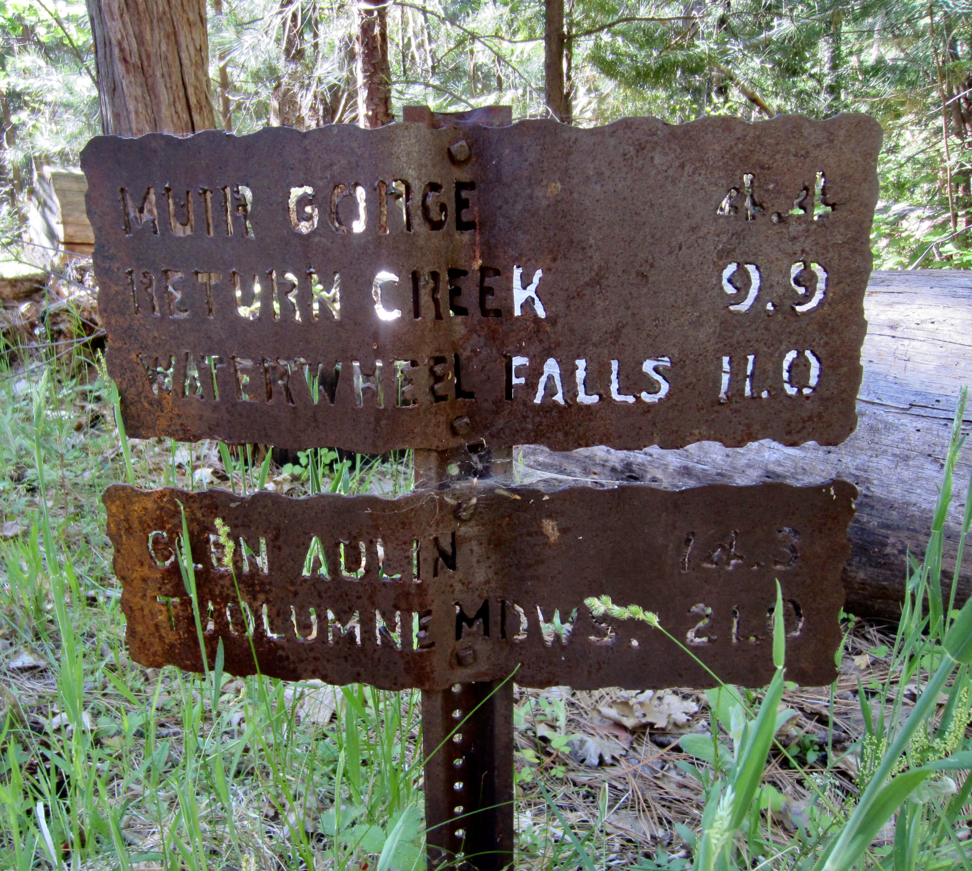
Waterwheel Falls
LeConte Falls
California Falls
Glen Aulin
White Cascade
Tuolumne Peak (10,845 ft)
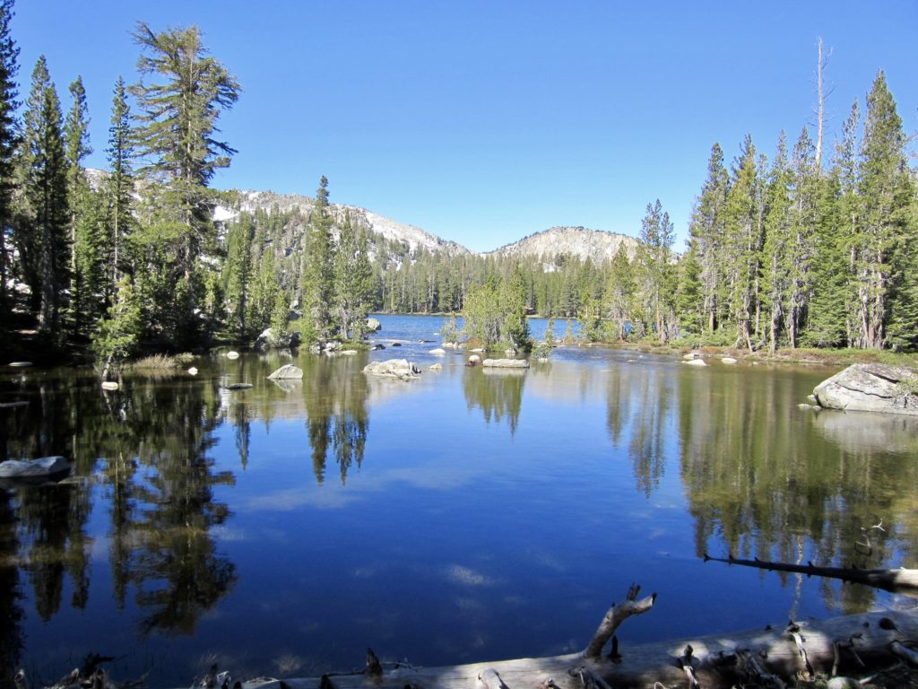
Ten Lakes
Ten Lakes Pass
Point 10,183 aka Ten Lakes Overlook
- Trip Report Summary
- Trip Overview
- Full Trip Report
- Day 1: White Wolf Trailhead to Pate Valley
- Day 2: Pate Valley to Return Creek
- Day 3: Return Creek to Tuolumne Peak Ridge
- Day 4: Tuolumne Peak Ridge to Ten Lakes Saddle + Tuolumne Peak
- Day 5: Ten Lakes Saddle to Ten Lakes Pass + Ten Lakes Overlook
- Day 6: Ten Lakes Pass to White Wolf Trailhead
- Access Comments
- Equipment Comments
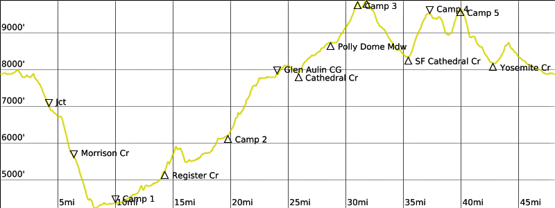
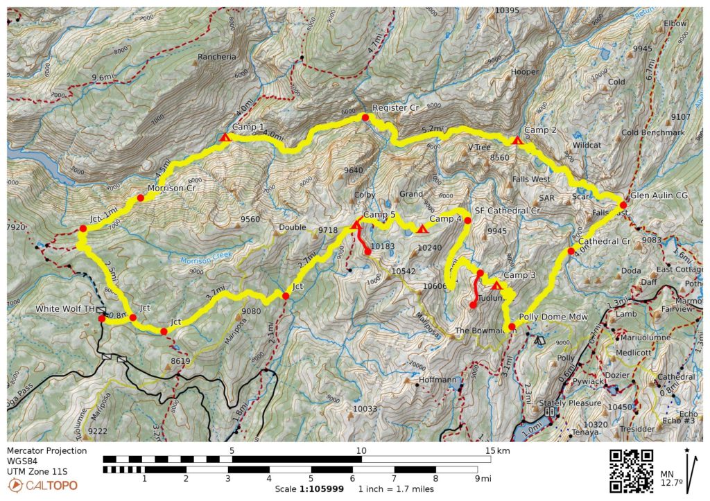
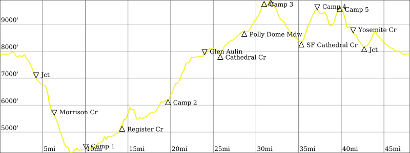
- Route Map & Profiles
- Photo Gallery
Trip Report Summary
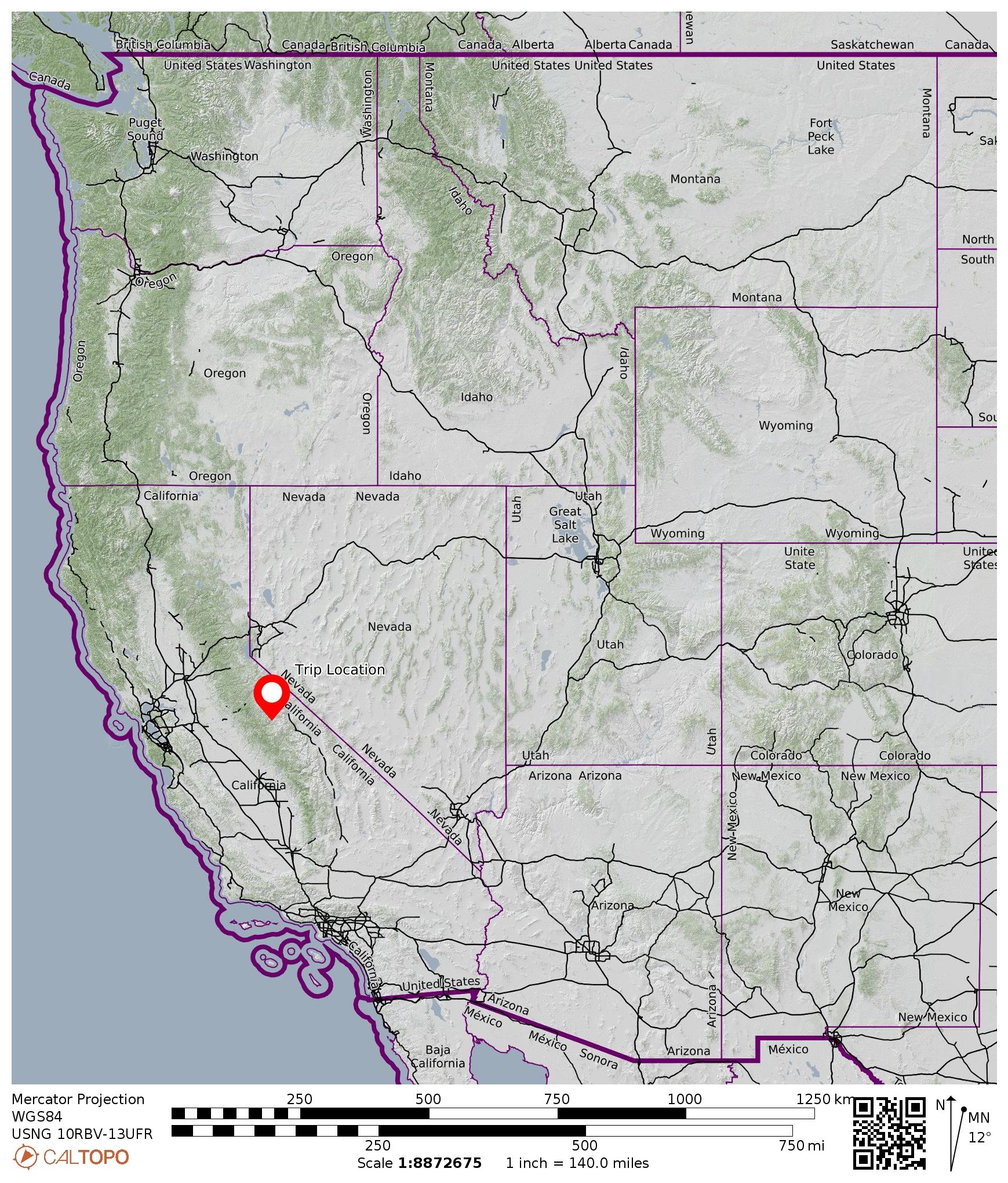
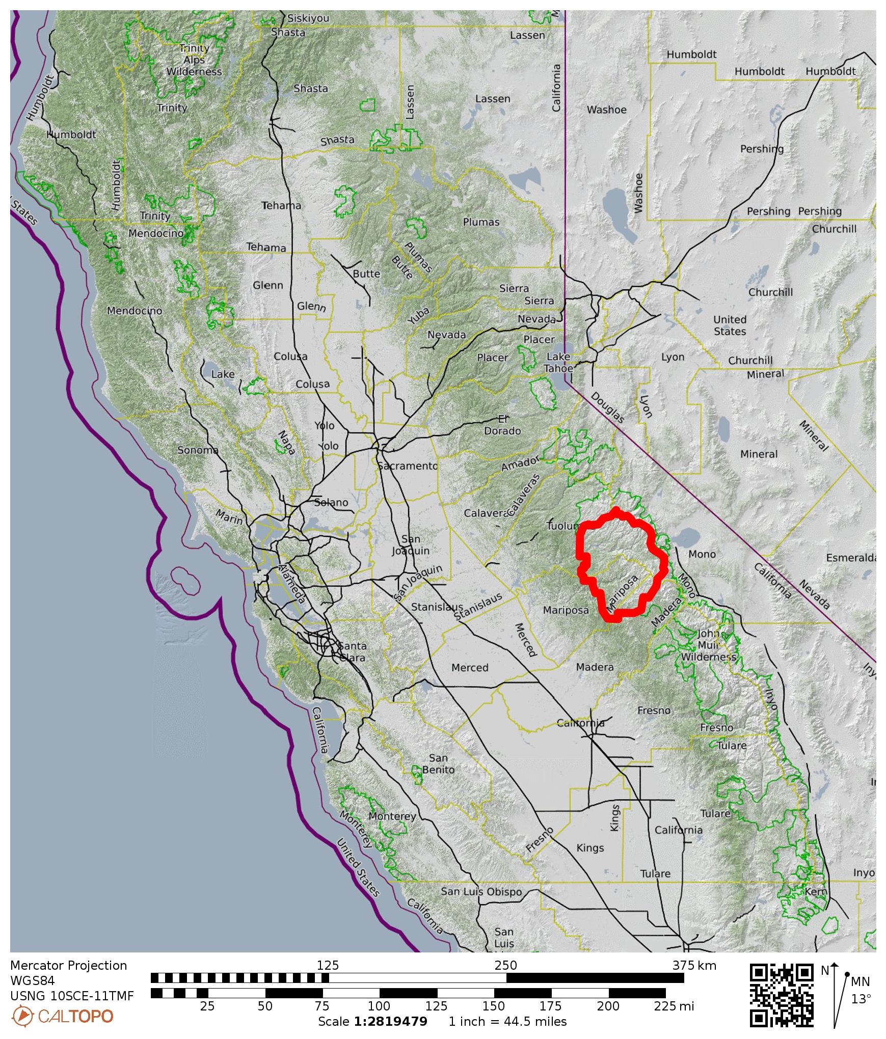
Region: California
Sub-Region: Sierra Nevada Range
Sub-Sub-Region: Tuolumne Mountains
Area: Yosemite National Park
Starting & Ending Point: White Wolf Trailhead & Campground near end of White Wolf Road (Elev. 7900 feet)
Way Points: White Wolf Junction & Morrison Creek & Tuolumne River Bridges & Pate Valley & Grand Canyon of the Tuolumne River & Rodgers Creek & Register Creek & Return Creek & Waterwheel Falls & LeConte Falls & California Falls & Glen Aulin & Glen Aulin Campground & White Cascade & McGee Lake & Cathedral Creek & Polly Dome Meadows & Tuolumne Peak Ridge & South Fork Cathedral Creek & Ten Lakes Saddle & Ten Lakes Basin & Ten Lakes Pass & Halfmoon Meadow & Yosemite Creek & Middle Tuolumne River & White Wolf Junction (trail hike)
High Point: Trail saddle on north ridge of Tuolumne Peak (Elev. 9900 feet)
Campsites: Pate Valley & Return Creek & Tuolumne Peak Ridge & Ten Lakes Saddle & Ten Lakes Pass
Summit: Tuolumne Peak (off-trail hike & rock scramble via North Ridge—North Slope)
Summit: Ten Lakes Overlook (off-trail hike & rock scramble via North Ridge—Northwest Slope)
Sidetrip: Ten Lakes Viewpoint (trail hike)
Approximate Stats (excluding sidetrips): 48 miles traveled; 10,600 feet gained & lost.
Approximate Stats (including sidetrips): 52 miles traveled; 12,400 feet gained & lost.
…
Trip Overview
Judging by a boot consensus, two of the most popular backpacking traverses in Yosemite National Park are (1) a trek through the Grand Canyon of the Tuolumne River and (2) a trek through Ten Lakes Basin. Each traverse usually takes anywhere from two to four days, depending on a party’s starting point, ending point, hiking pace, and optional sidetrips. Eileen and I combined both of these classic traverses into a six-day, 48-mile loop, which optimized our time and eliminated the need for a vehicle shuttle. Along the way, we were able to tuck in Tuolumne Peak and two other nice sidetrips.
…
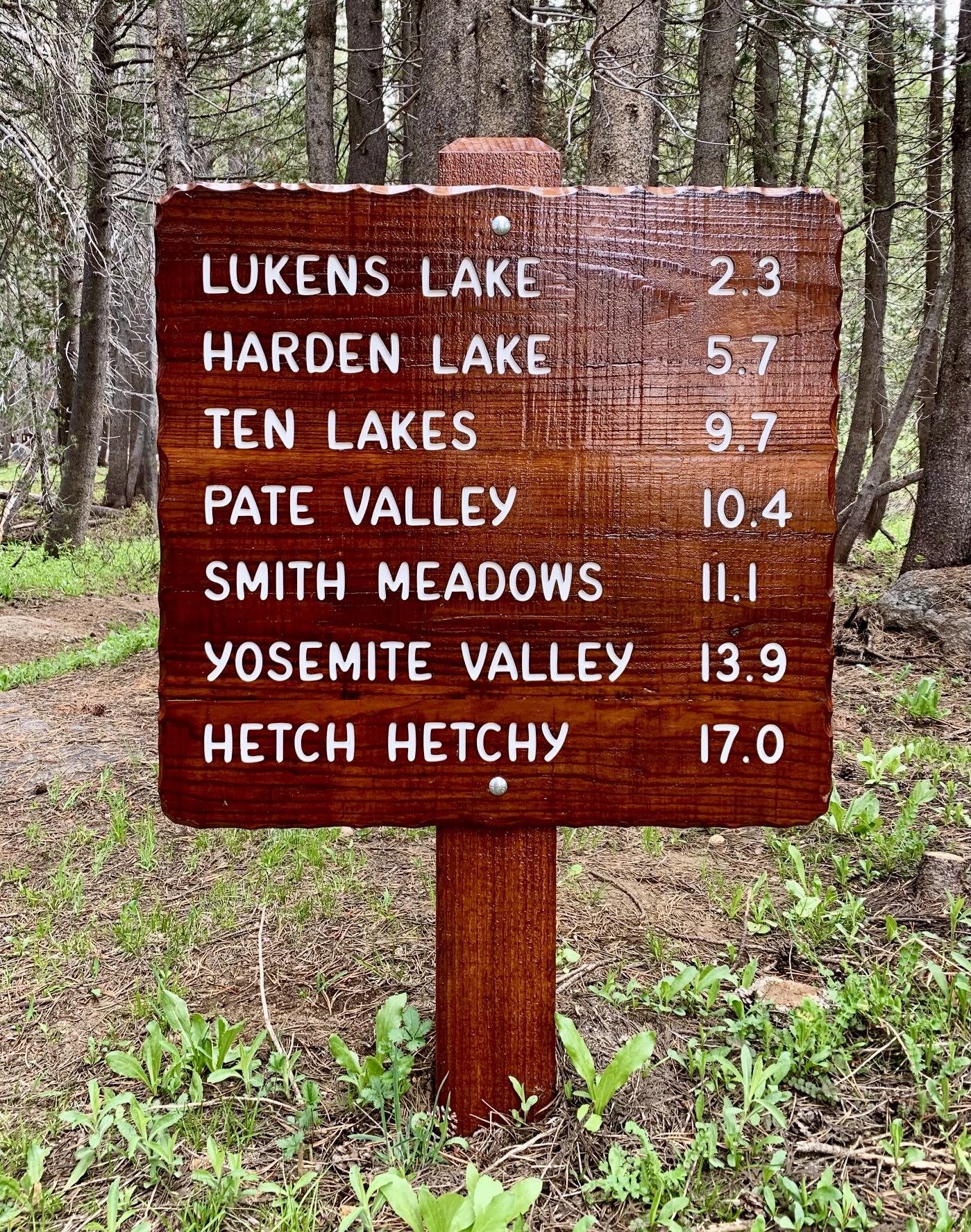
The Tuolumne Canyon – Ten Lakes Loop can be started and ended at any of several trailheads located along Tioga Road. From east to west, these trailheads include Tuolumne Meadows, Murphy Creek, May Lake, Upper Yosemite Creek, Lukens Lake, and White Wolf. We chose the White Wolf Trailhead because it offers the shortest connector trail, and it meshed well with our preference of completing a bottom-up traverse through Tuolumne Canyon, although most trekkers seem to prefer a top-down traverse.
Scheduling the Tuolumne Canyon – Ten Lakes Loop is a bit tricky. Ideally, the Tuolumne Canyon part would be done in late spring or early summer, when the river and waterfalls are in full spate, whereas the Ten Lakes part would be done in late summer or early autumn, when the high-country lakes are melted out. Eileen and I were fortunate that our trip landed during a June with an unusually low snowpack, giving us early-season river conditions as well as mid-season lake conditions. Under more normal snowpack levels, July would likely provide a better compromise.
…
Full Trip Report
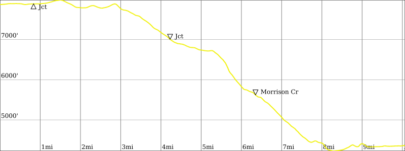
Day 1: White Wolf Trailhead to Pate Valley
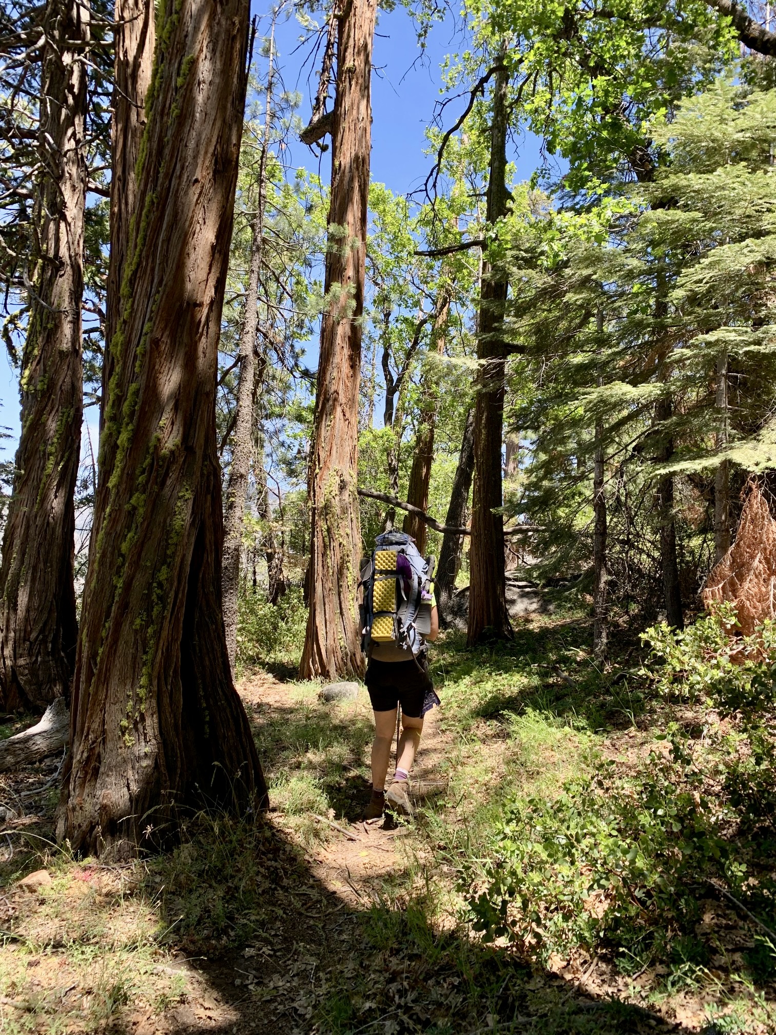
Eileen and I left the White Wolf Trailhead on a warm, sunny Thursday morning. We hiked ¾ mile out to a trail junction, then turned northward and began a long descent toward the Tuolumne River. Because this was still early in the season, no maintenance crews had been through to clear out the trail; there were dozens of fallen logs to step over or go around. Trail conditions improved after the first few miles, and we soon began to get views of Hetch Hetchy Reservoir to the west and Pate Valley to the east.
We crossed Morrison Creek in early afternoon and refilled our water bottles, then continued descending through evergreen and deciduous forest that provided much welcome shade from the hot sun. The trail was covered by thick, alternating blankets of pine needles and oak leaves. Several other hiking parties passed by us as they slowly made their way up toward White Wolf in afternoon heat—something Eileen and I chose to avoid by going upstream through Tuolumne Canyon rather than downstream.

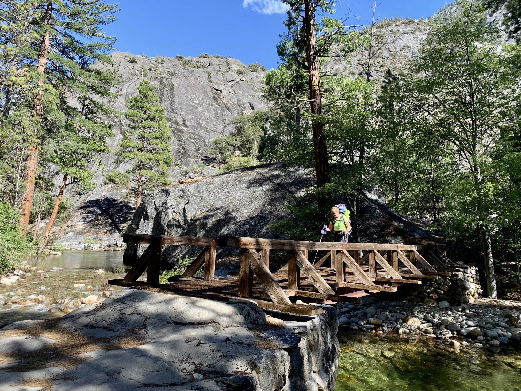
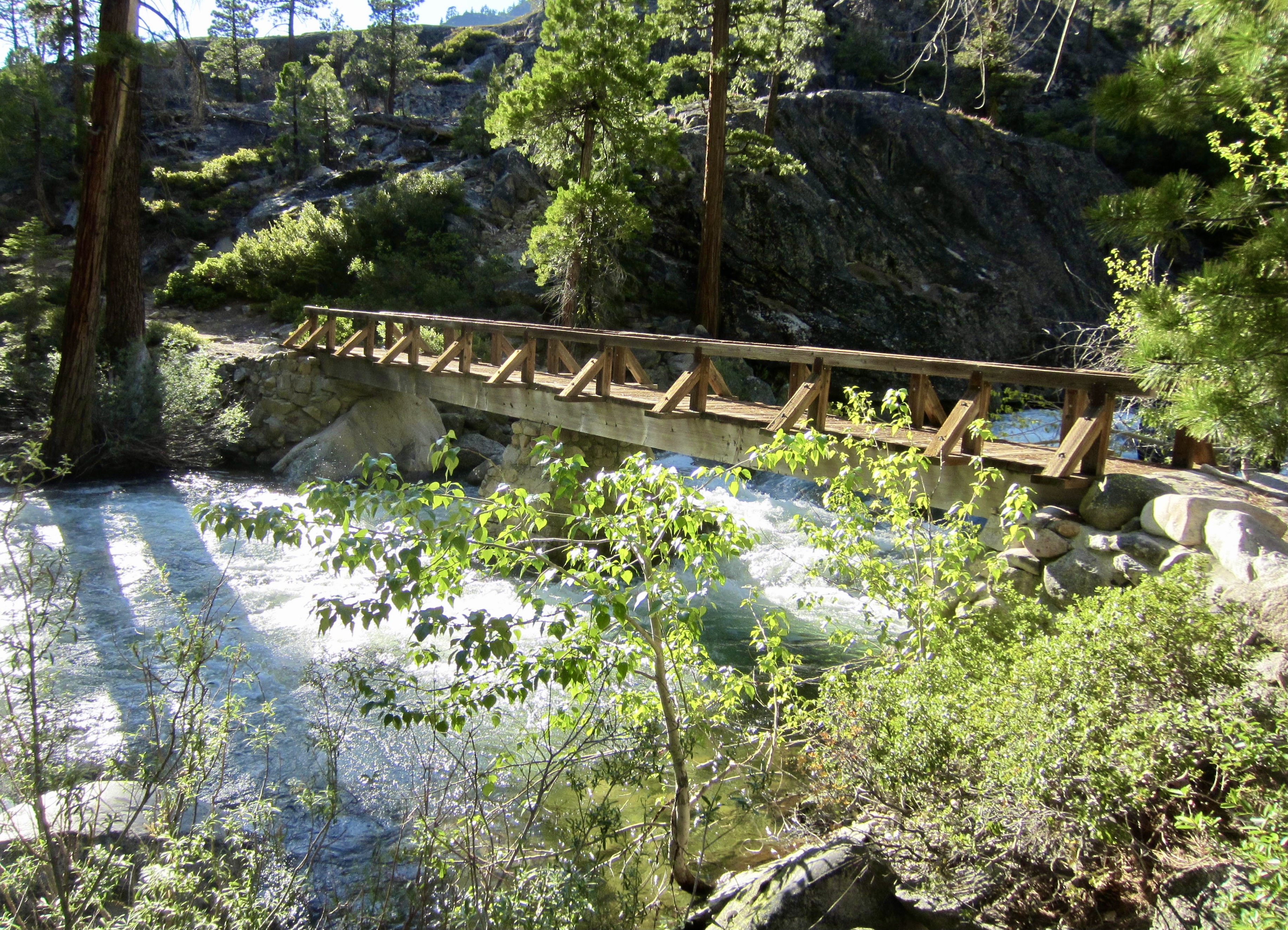
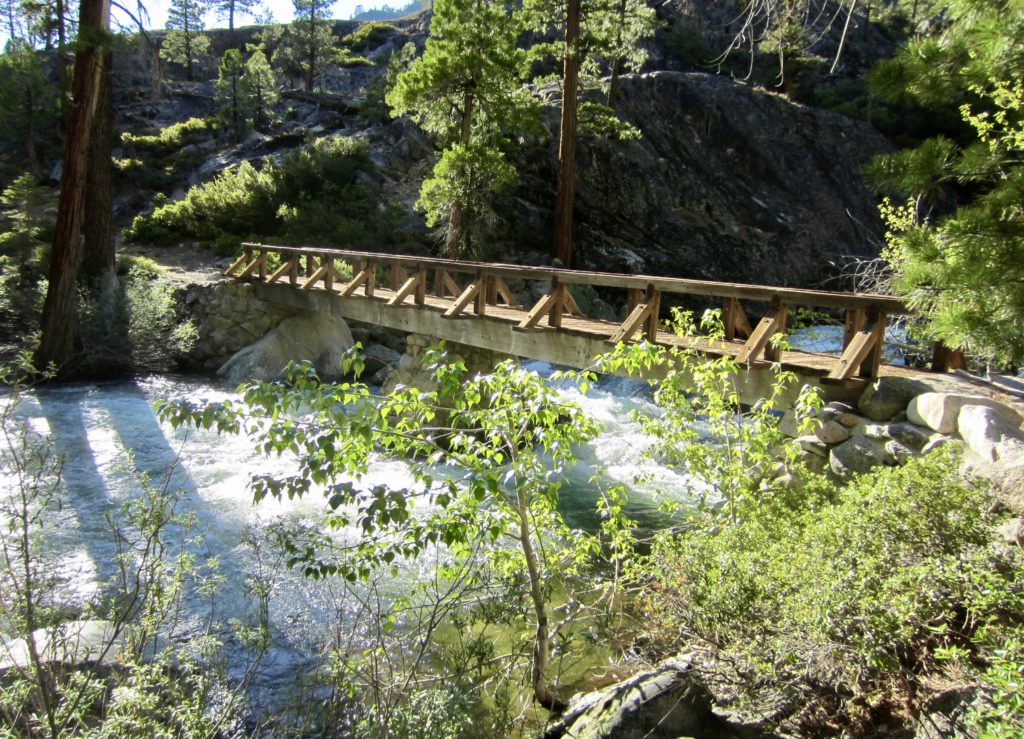
At 6:00pm, we crossed the Tuolumne River on tandem bridges and strode into a quiet riverside campsite in 4400-foot Pate Valley (7.3 hours + 10.1 miles + 400 feet – 3750 feet from TH). The easy-flowing river demanded a long, refreshing soak before dinner.


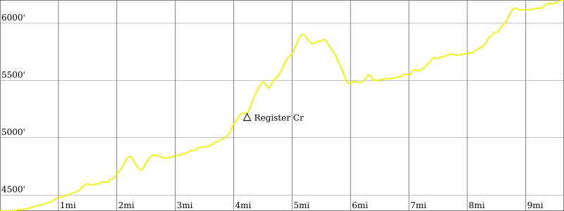
Day 2: Pate Valley to Return Creek
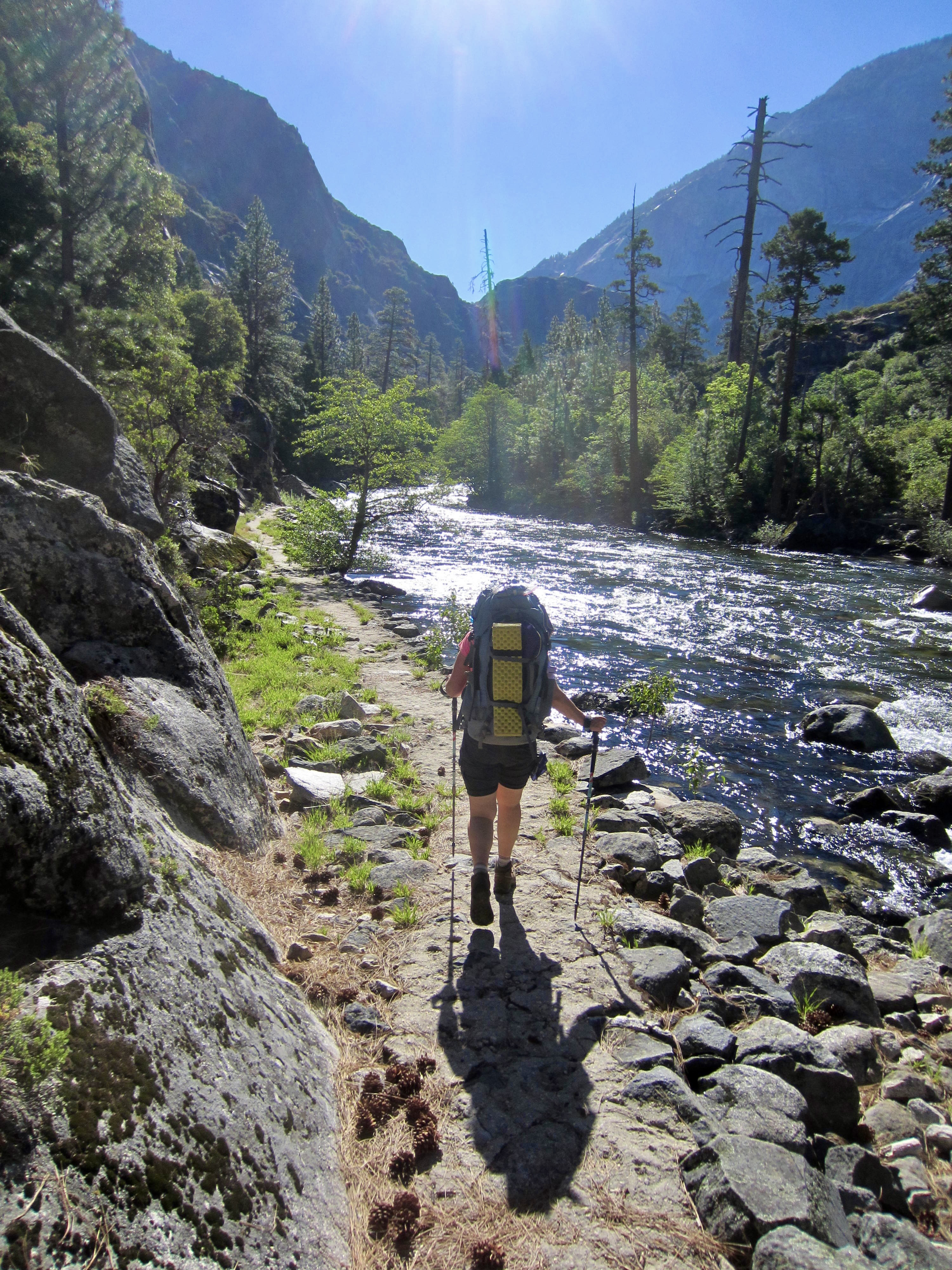
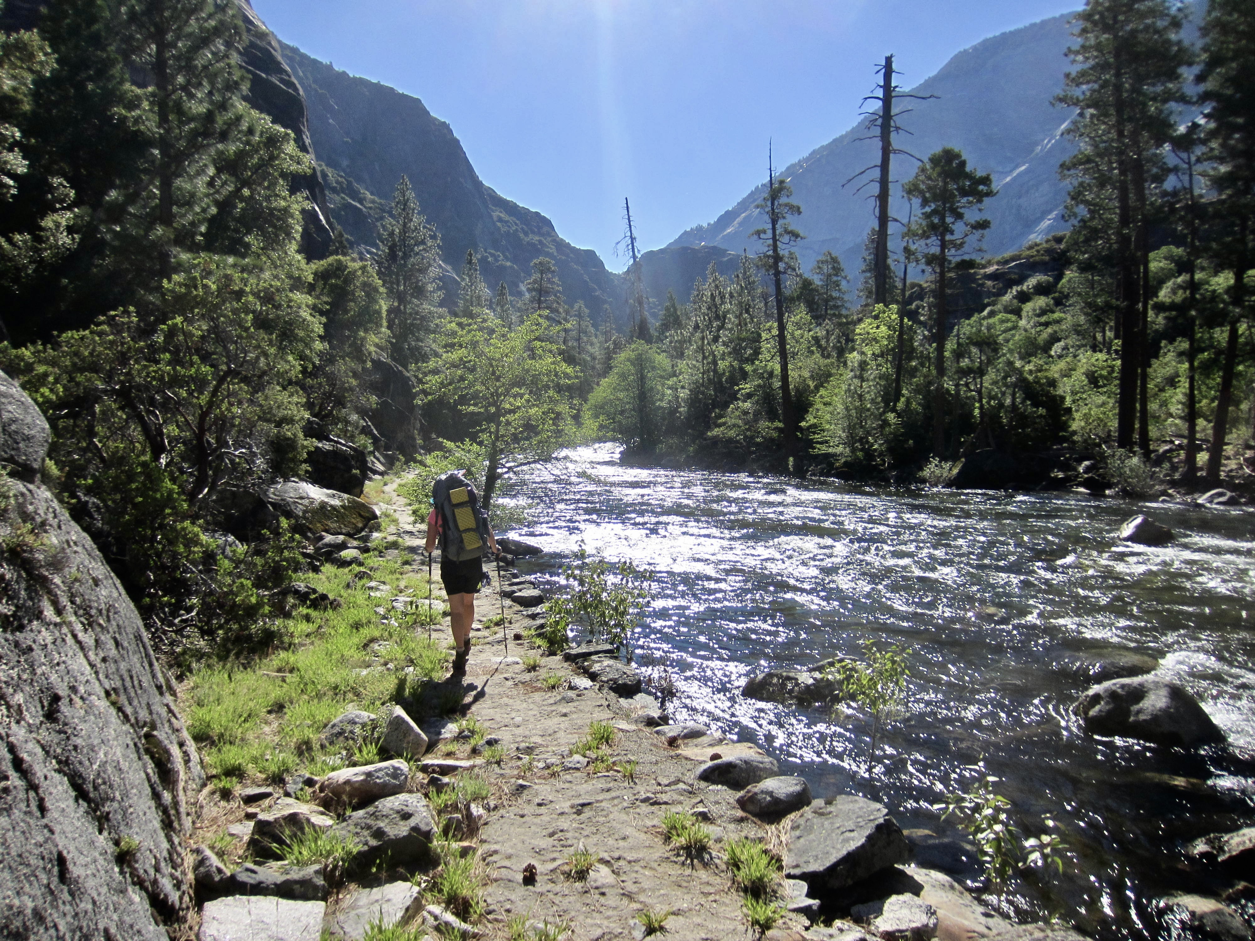
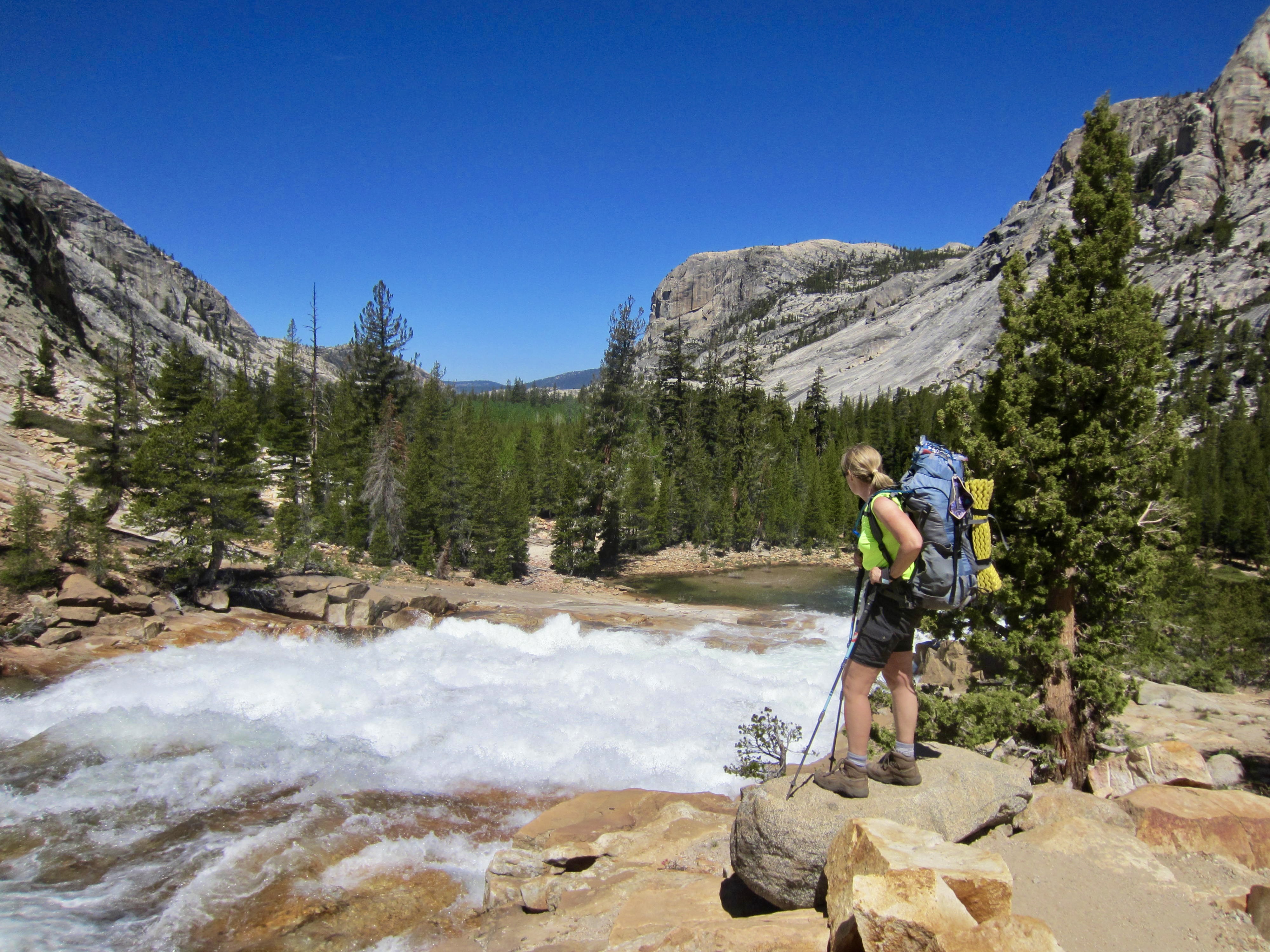
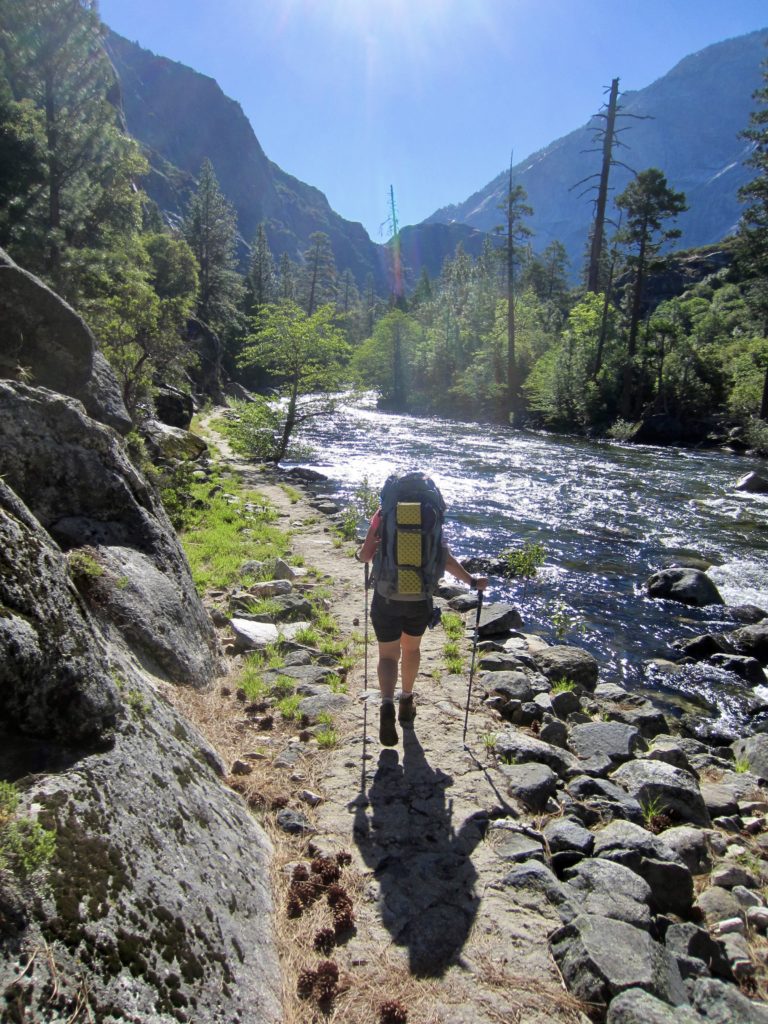
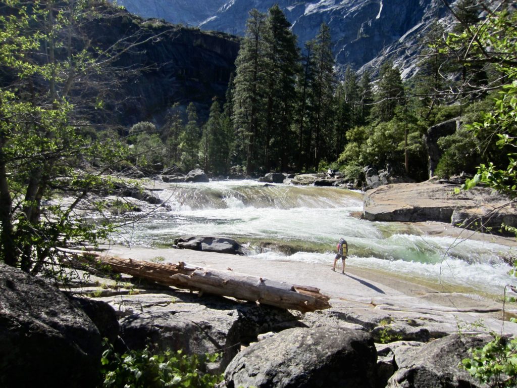
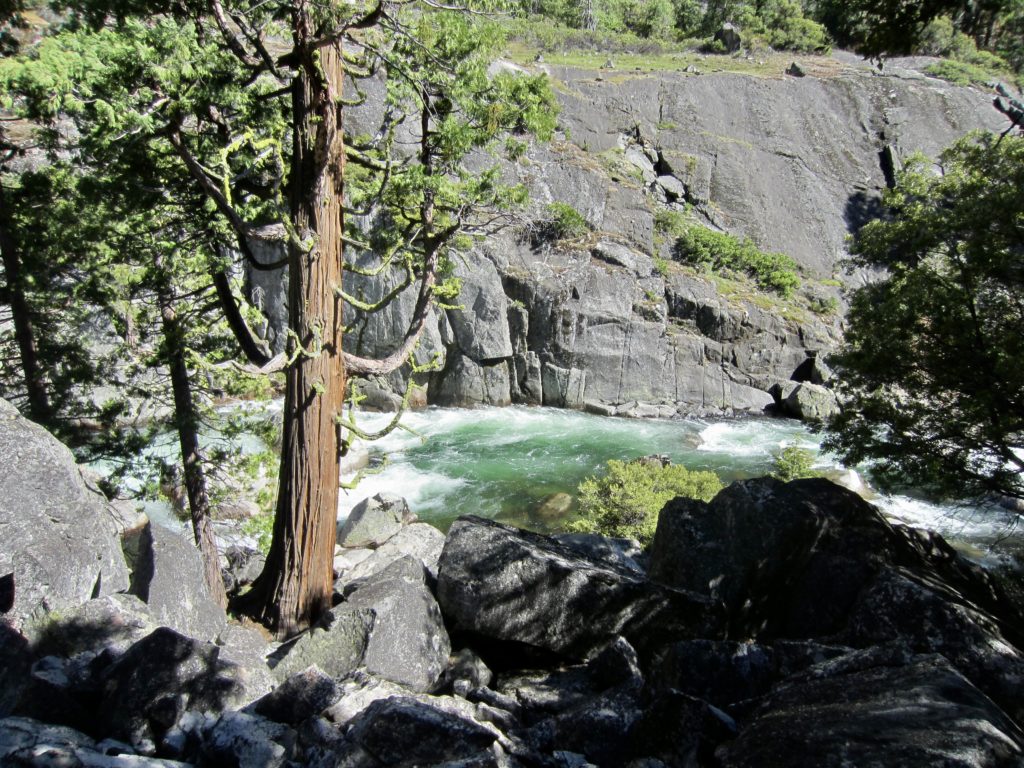
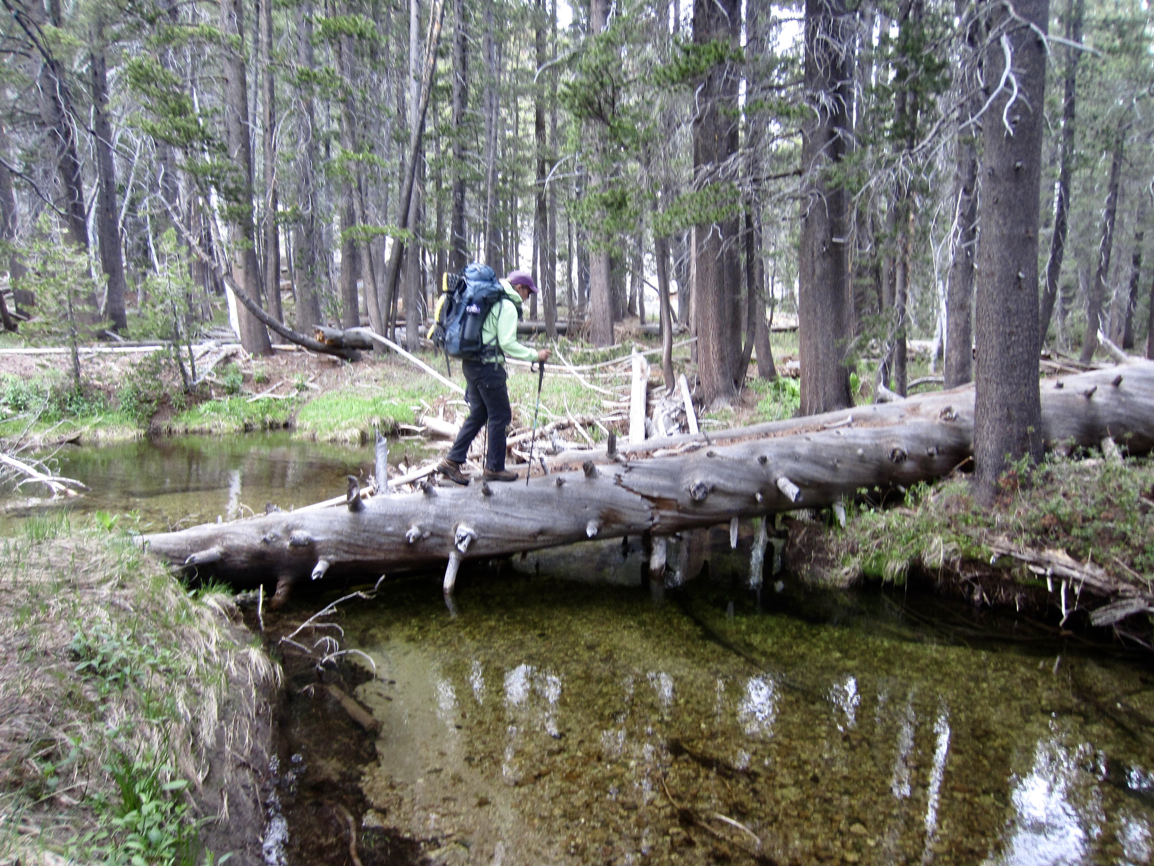
From Pate Valley—the low point of our entire loop—an inviting trail led us easterly through the Grand Canyon of the Tuolumne River. The trail rarely strayed more than a few dozen yards from the river and, at times, was no more than a few dozen inches away. Given the full river flow, we were treated to its full spectrum of flatwater and whitewater, rapids and eddies, waterslides and waterfalls.
The ranger who issued our camping permit yesterday warned us that rattlesnakes were particularly active in the canyon right now. Sure enough, we soon encountered a small rattler warming itself beside the trail. Eileen, in front, jumped backwards with a loud shriek and nearly knocked me over! Fortunately, there was an easy detour around this irascible little gatekeeper, but we had now been put on guard for the rest of our day.
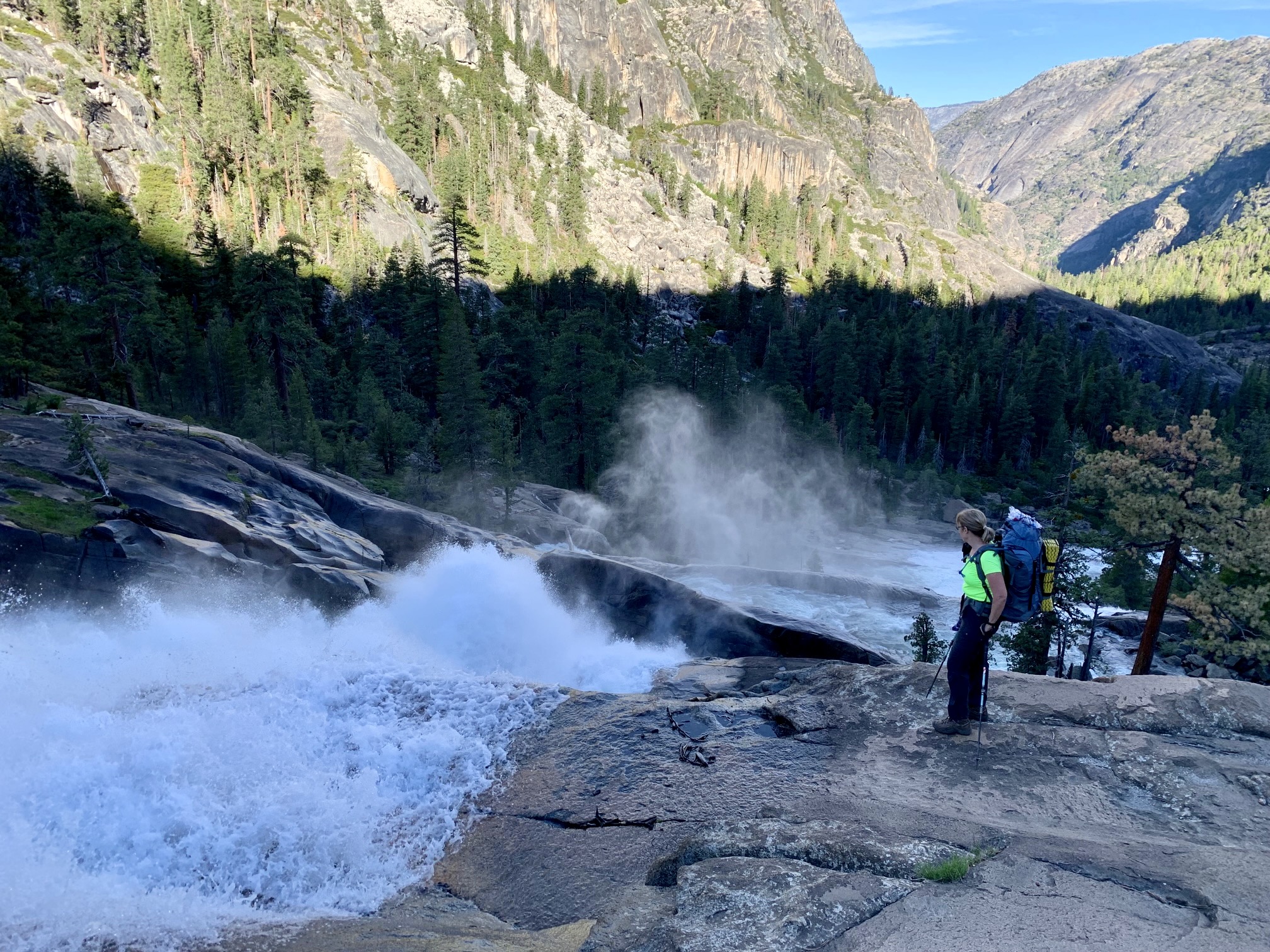
After several miles, we crossed Rodgers Creek and Register Creek in quick succession. The latter creek features a most delightful waterfall immediately above the trail. Given the midday heat, we didn’t hesitate to splash off in the creek and spend an hour in the cooling mist. This was the highlight of Day 2 by far!

Just past Register Creek, the canyon narrows down to create a feature called Muir Gorge. The trail climbs 700 vertical feet and crosses above this gorge on granite slabs before dropping back down 400 feet. Our canyon views were grand, but the heat was punishing—at least for us Northwesterners who have been overly conditioned to cool, cloudy June weather.


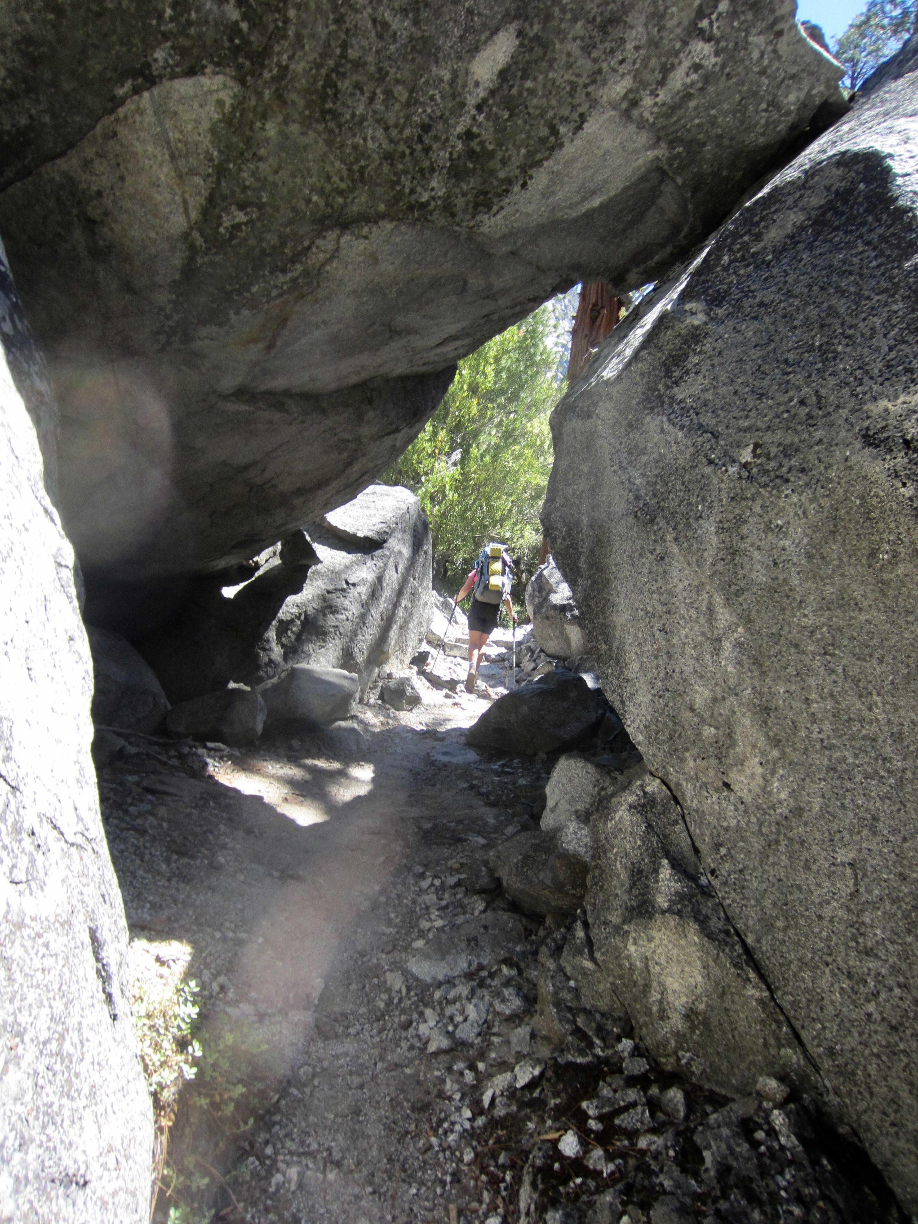
A few more miles of pleasant riverside trail weaved past enormous boulders and through scattered tree groves. This was a relatively carefree part of our hike until we met a family who warned us that they had just seen a rattlesnake 100 yards up the trail! To make matters worse, the next ½ mile of trail went through a brushy burn that offered perfect hiding spots for avenging serpents, but we thankfully had no adverse encounters. More than ever, I appreciated the 20 or so other hikers we had passed on their way downstream today; I figured that these people had done a good job of shooing most snakes off our trail.
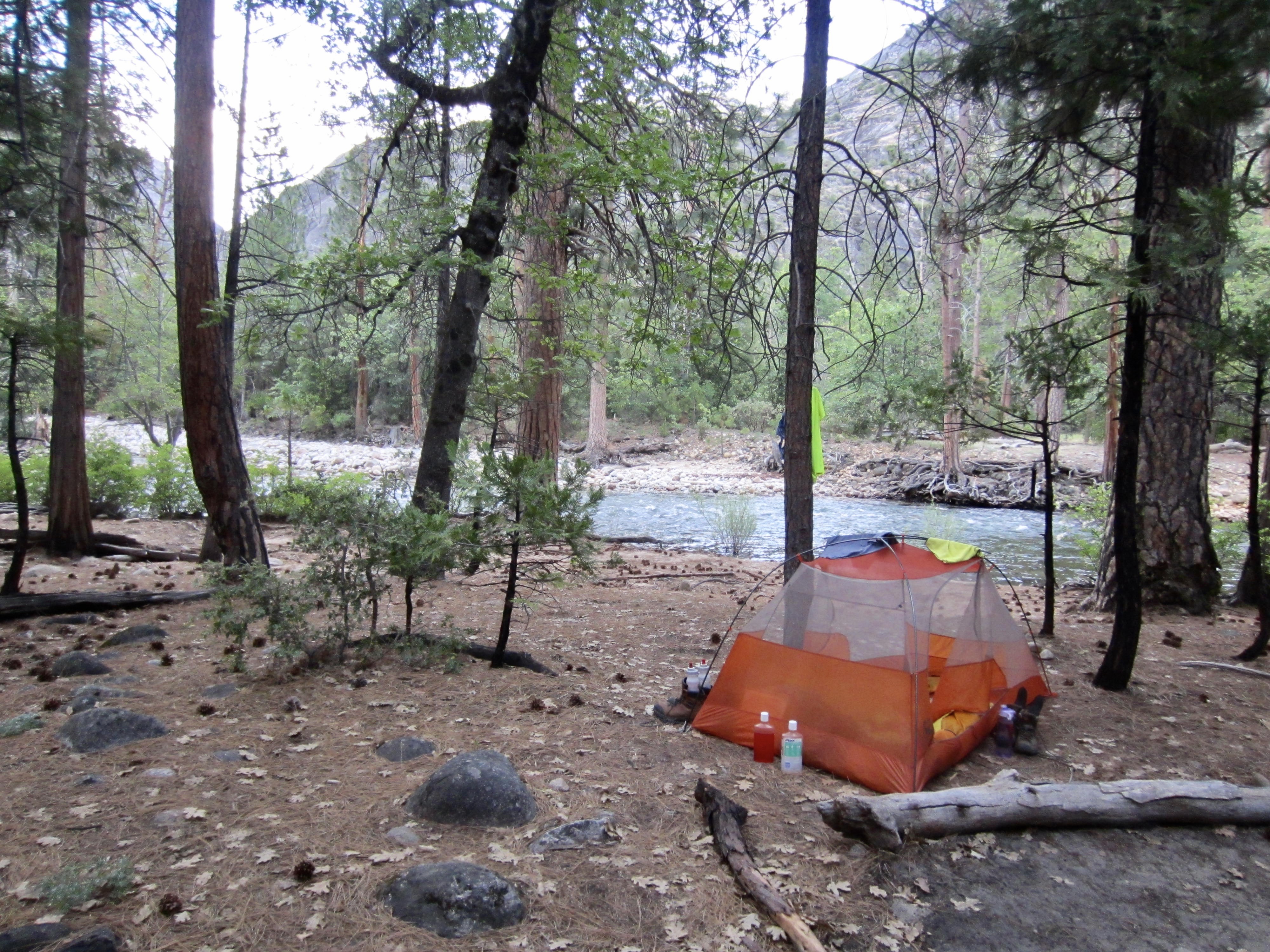
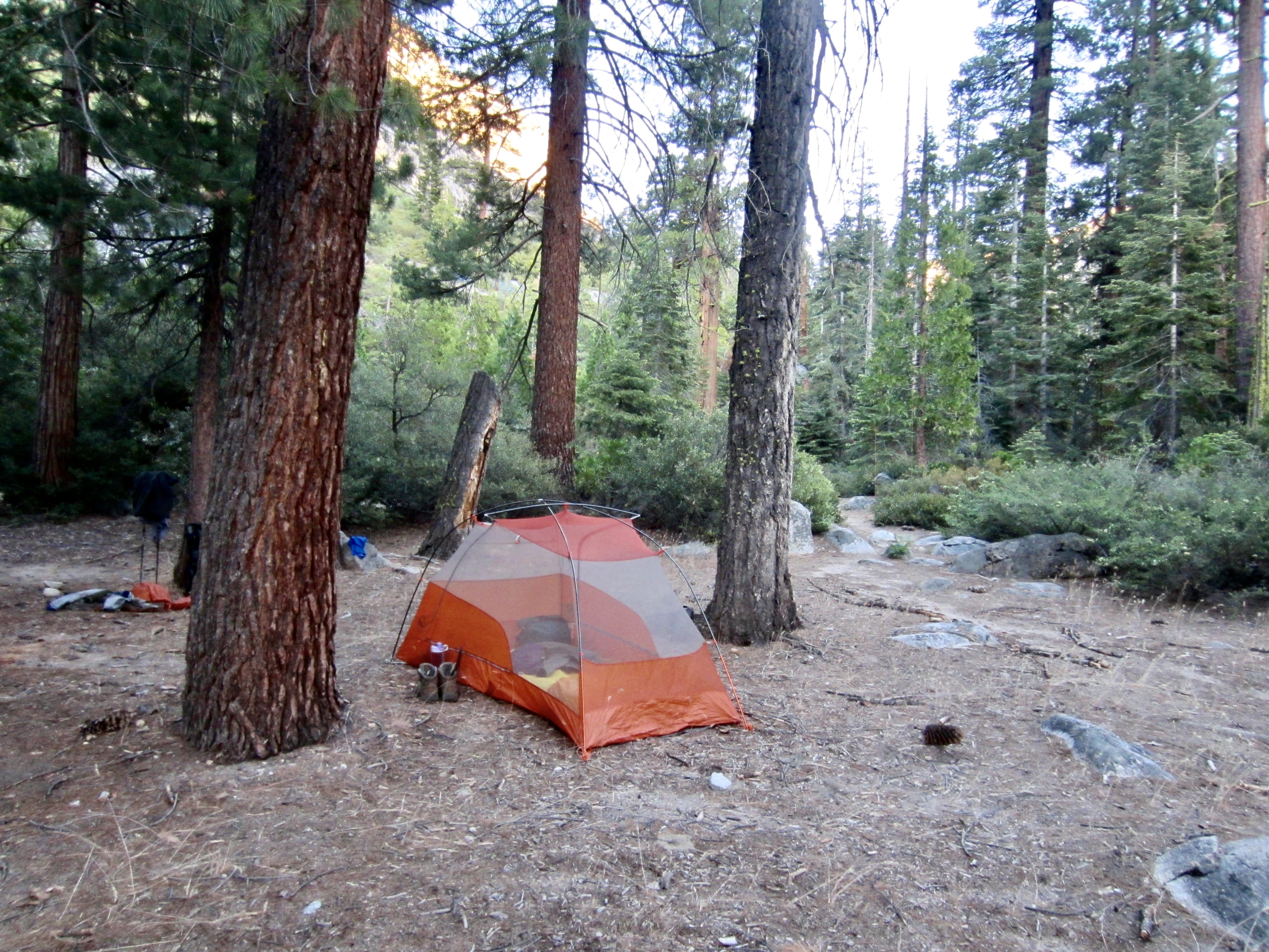
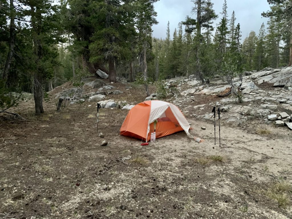
In early evening, we arrived at a nice campsite adjacent to Return Creek (9.6 hours + 9.7 miles + 2350 feet – 700 feet from Camp 1). It had been a hot and buggy day with beautiful scenery but the stress of rattlesnake encounters. We pitched our tent, washed off in the creek, ate dinner, and went to bed.

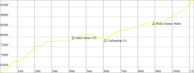
Day 3: Return Creek to Tuolumne Peak Ridge
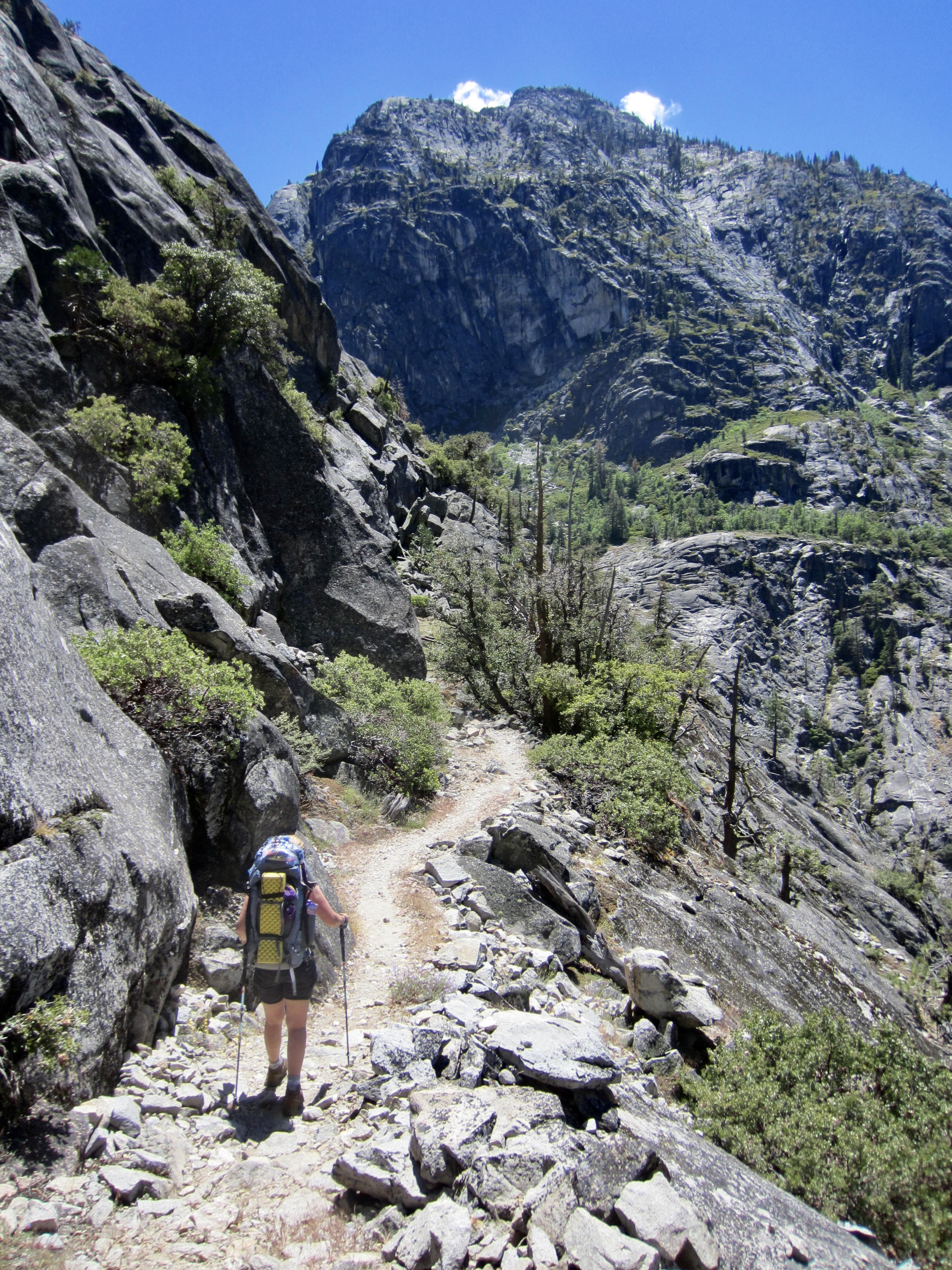
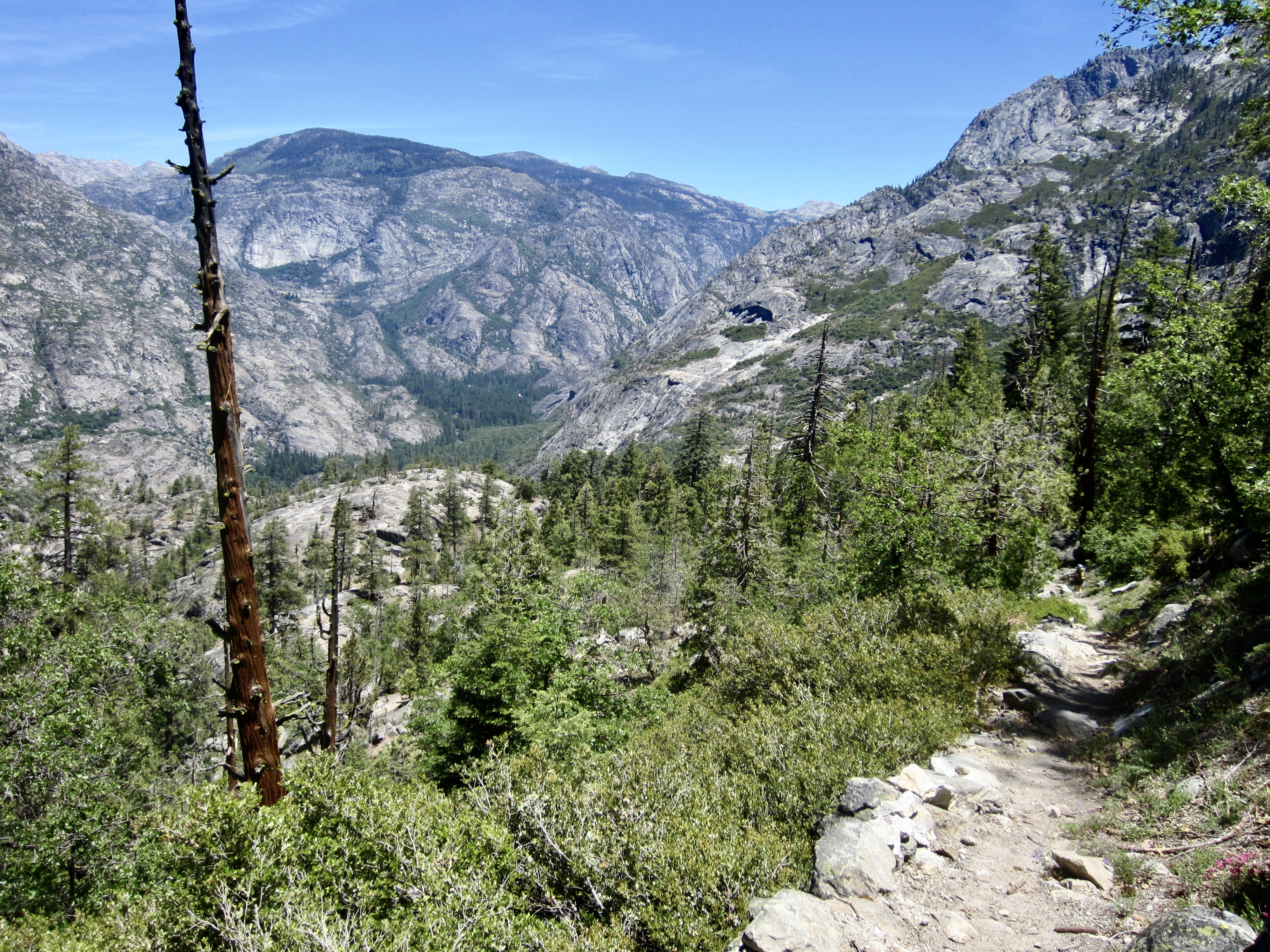
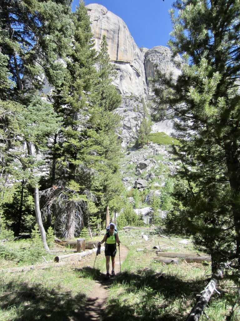
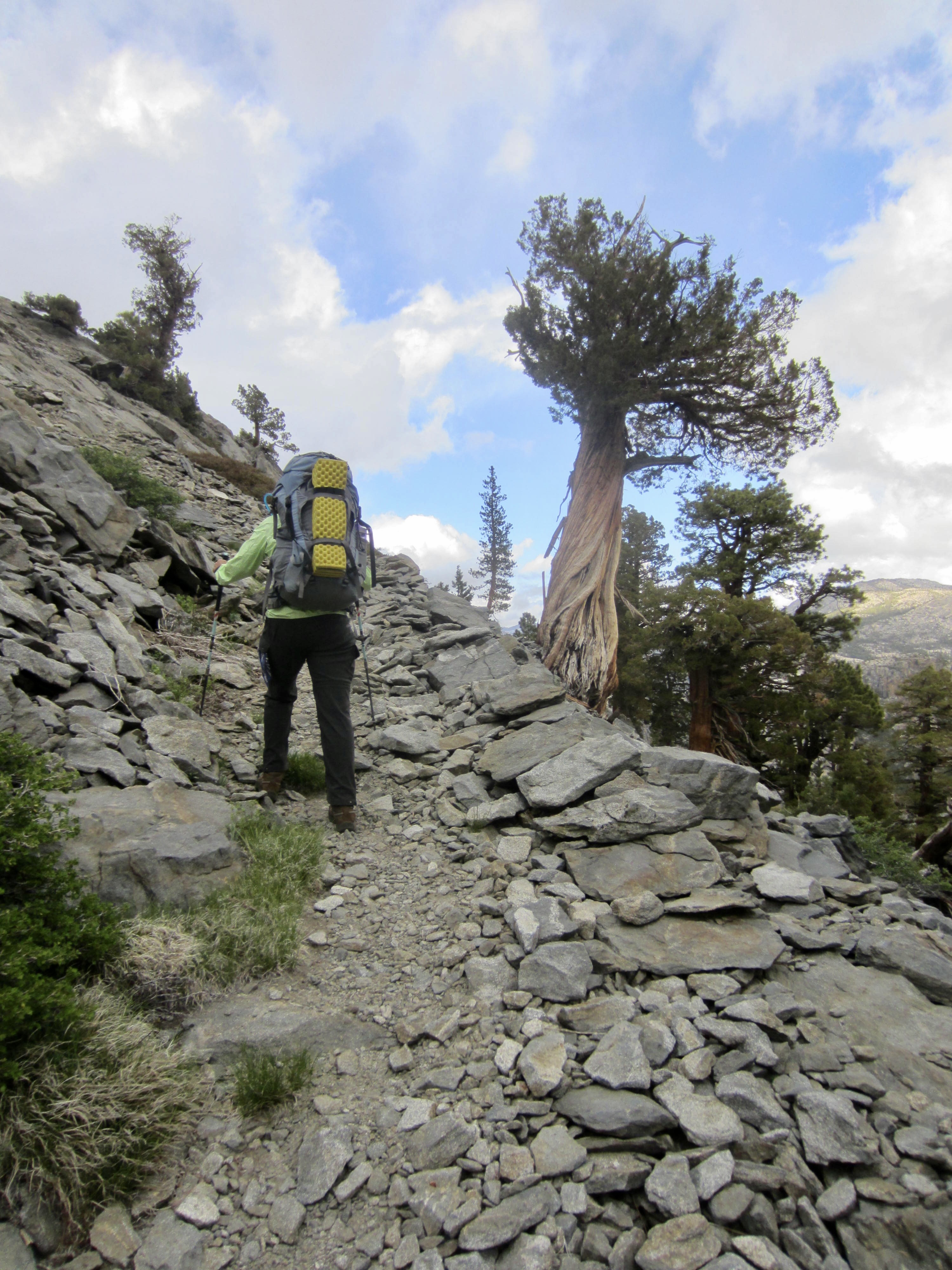
Whereas our entire previous day involved a long traverse through the Grand Canyon of the Tuolumne River, today began with a steep climb out of the canyon. The trail switchbacks improbably up a series of granite domes, following ledges, clefts, and other natural features that remain hidden from view until the last moment.
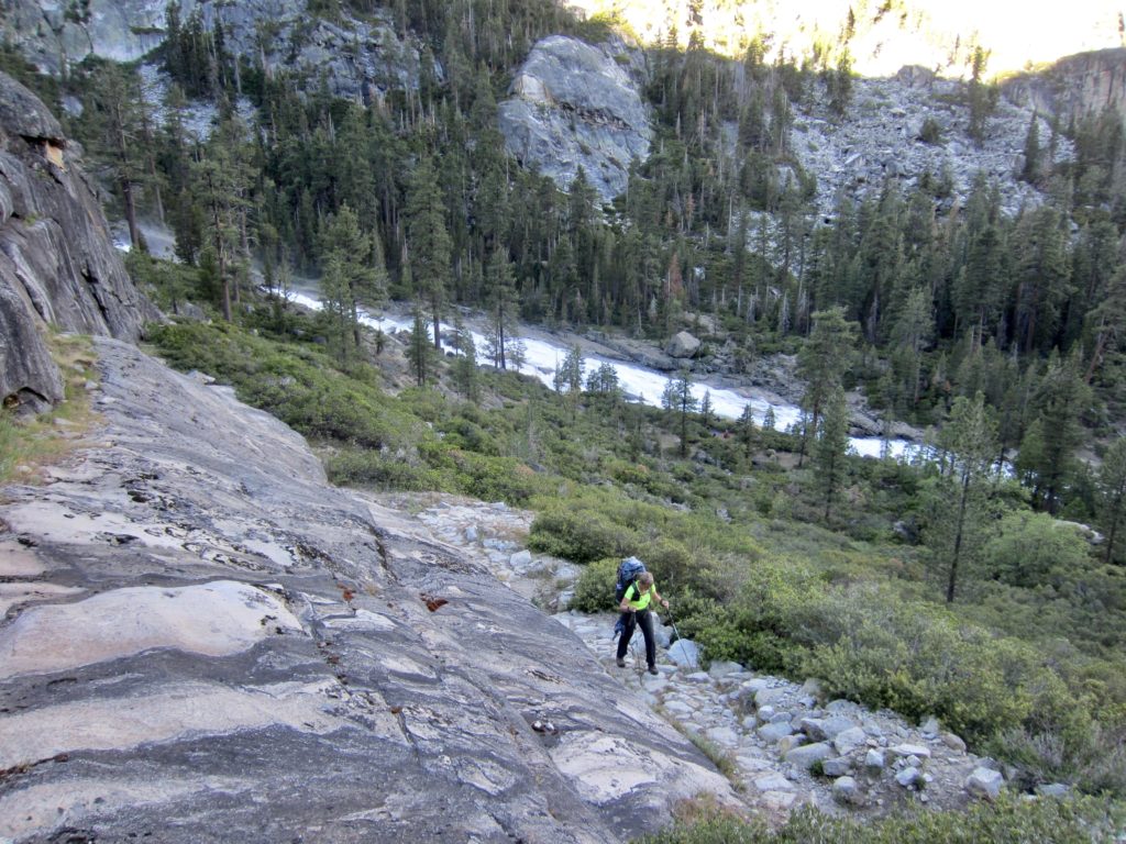
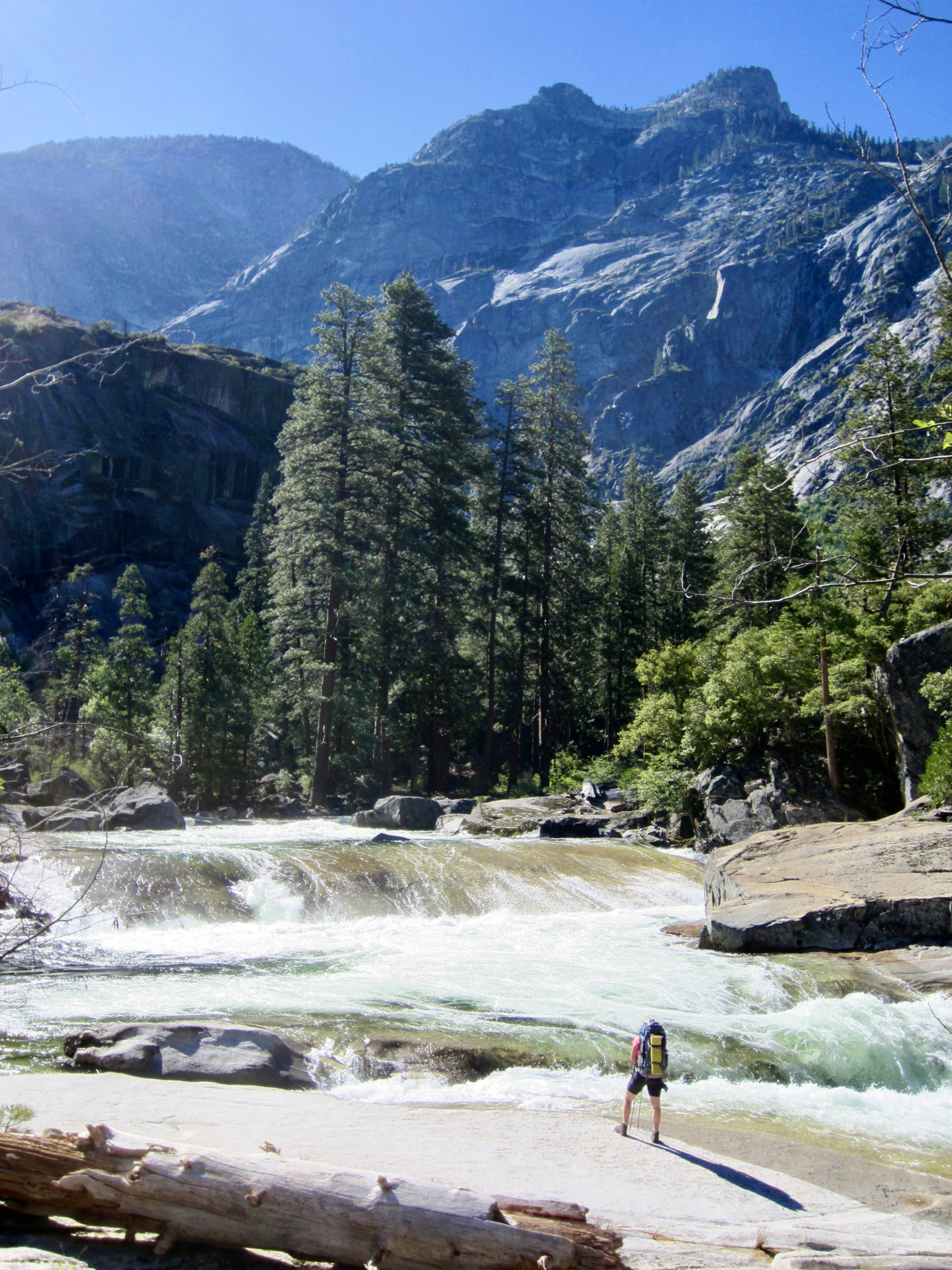
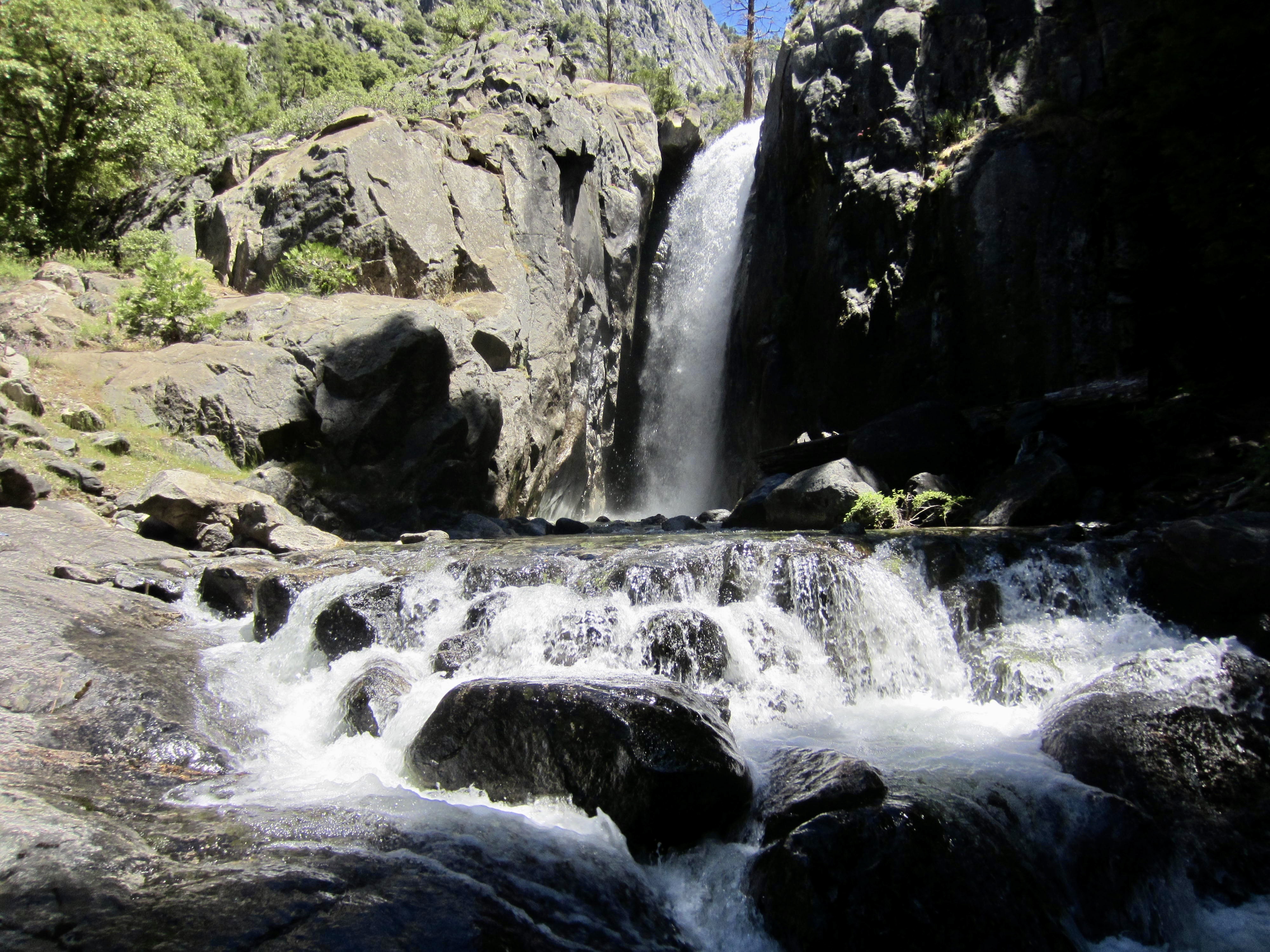
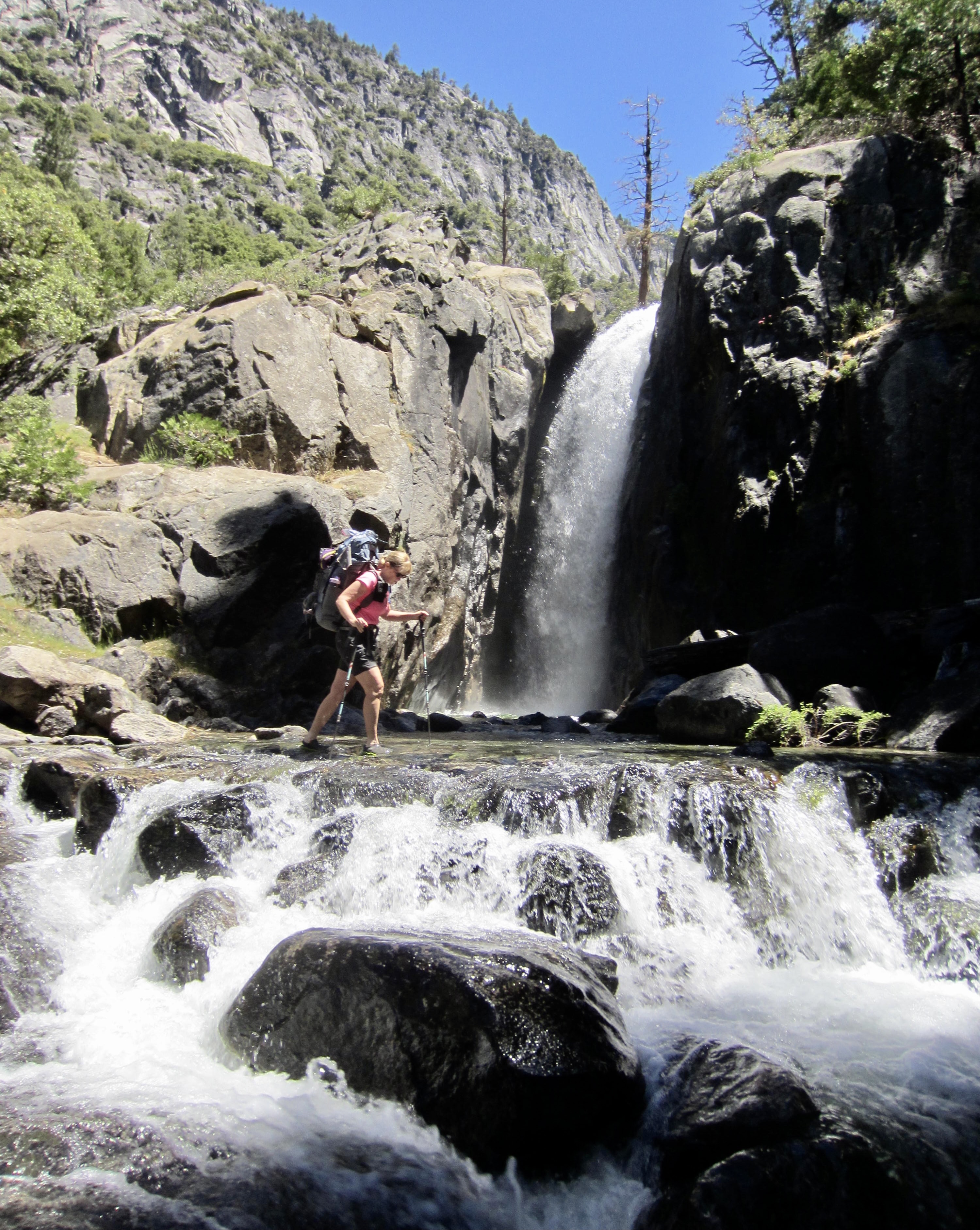
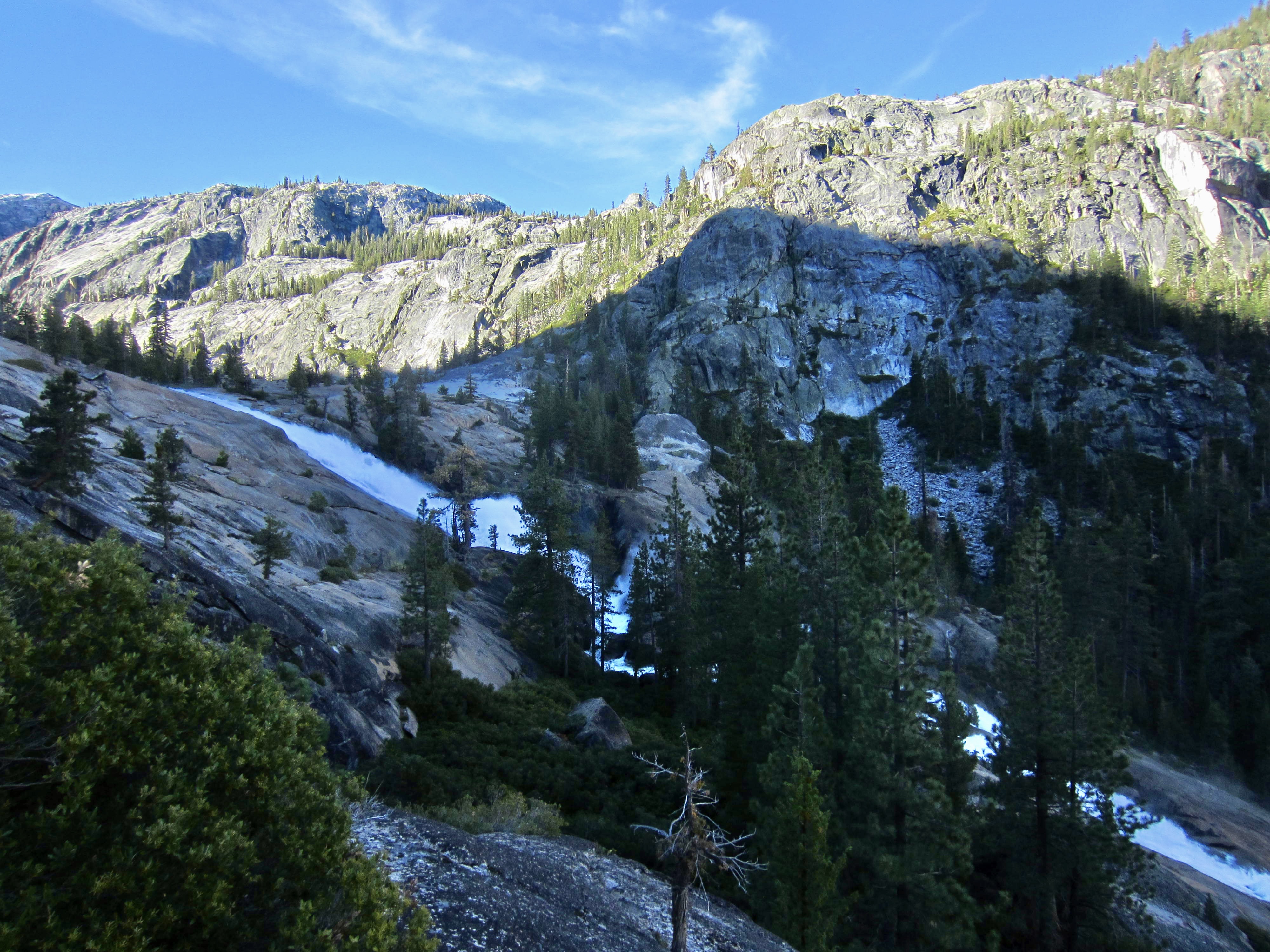
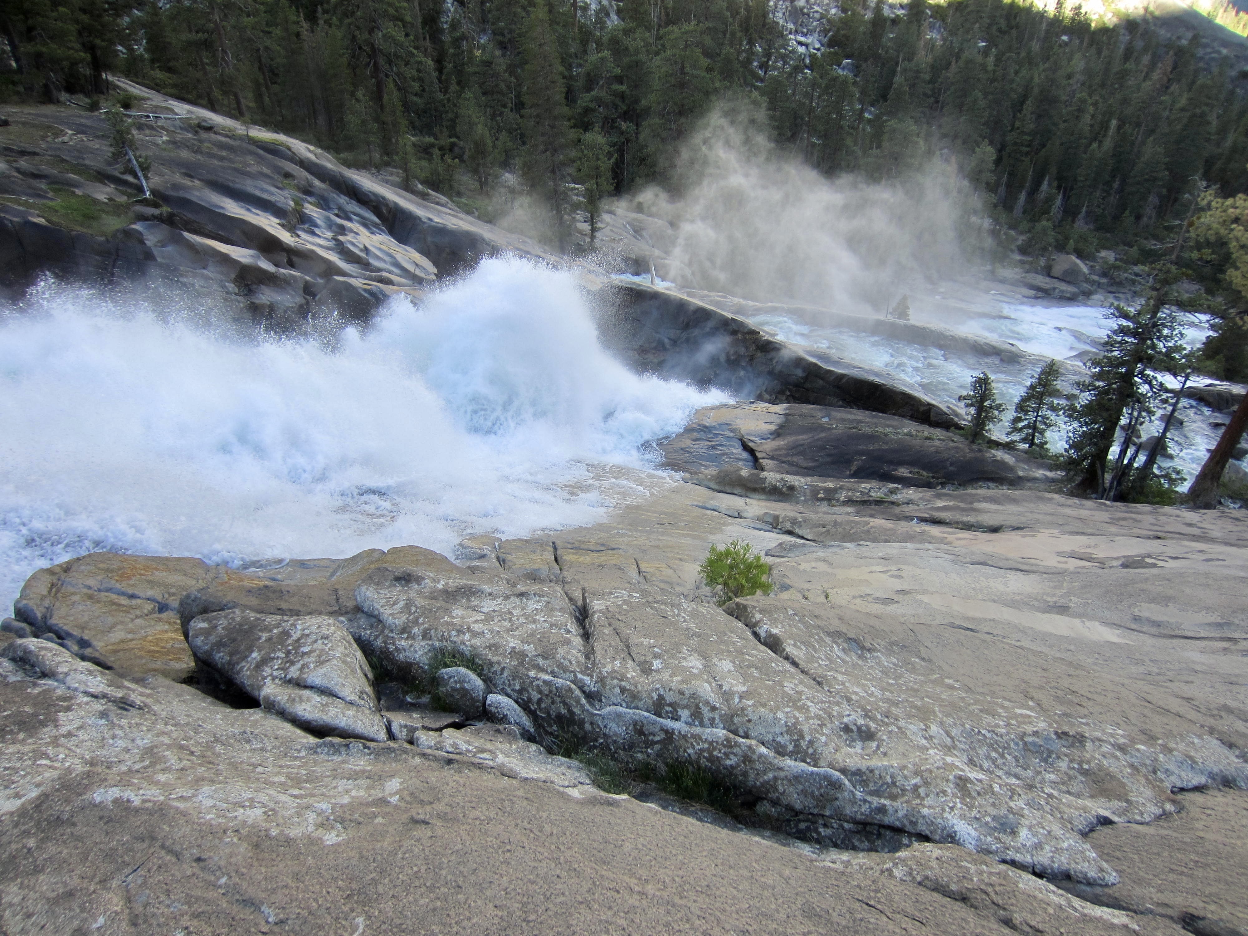
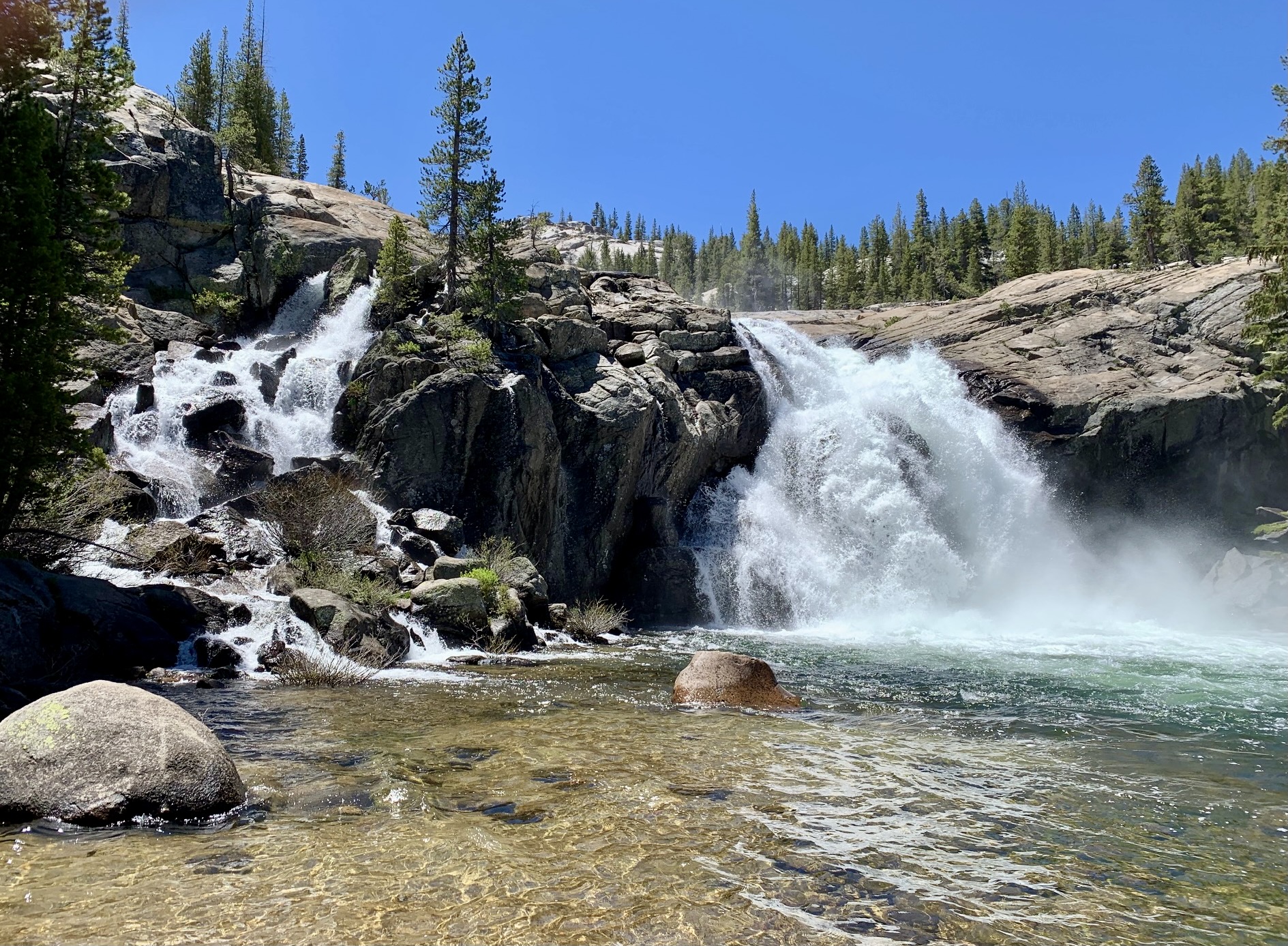
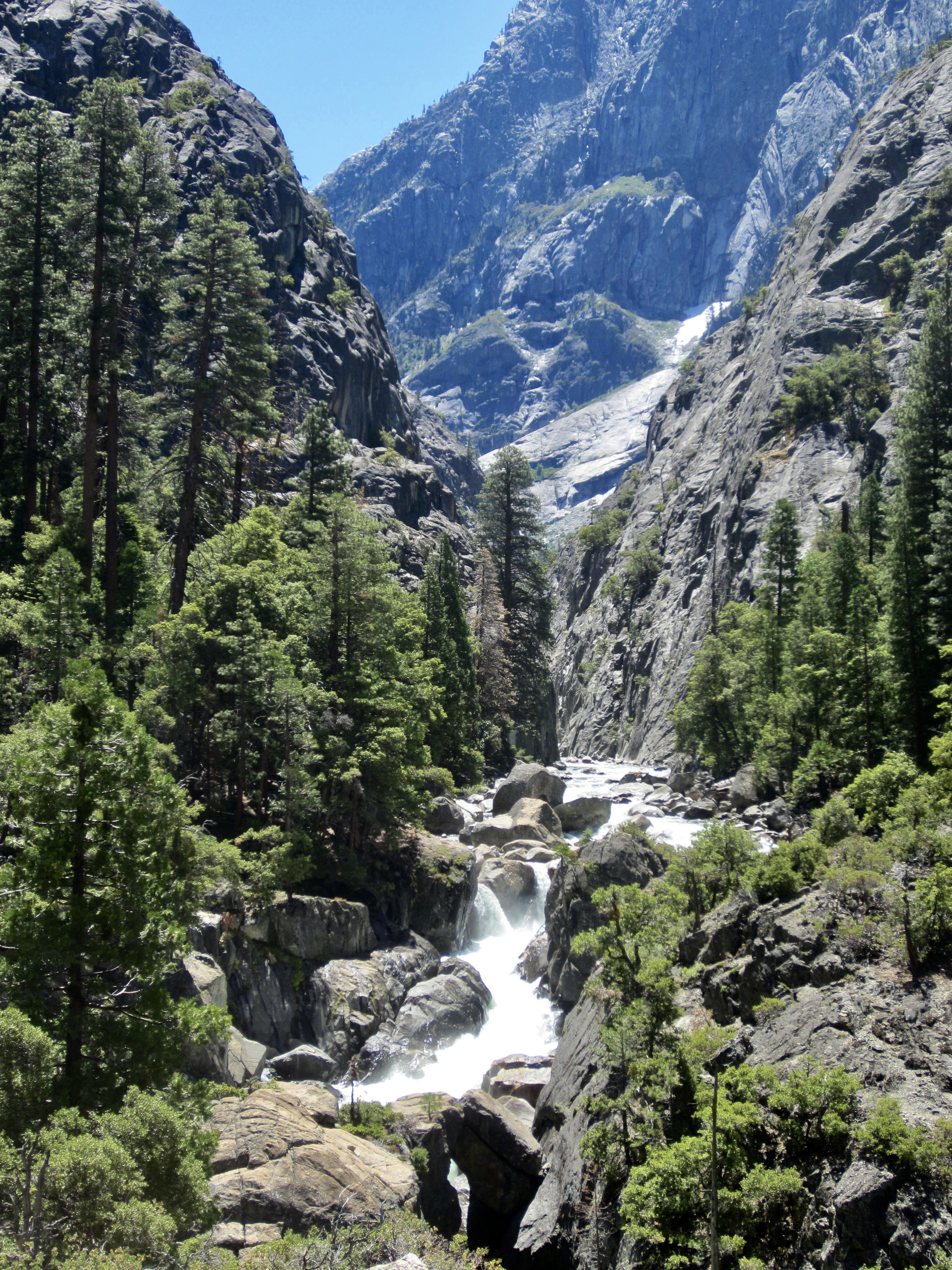
This part of the trail roughly parallels the three largest waterslides in Tuolumne Canyon: Waterwheel Falls, LeConte Falls, and California Falls. In some places, these waterslides are seen as long, silky, white streaks cutting through the green vegetation a hundred yards away; in other places, the trail comes right up to the raging froth.

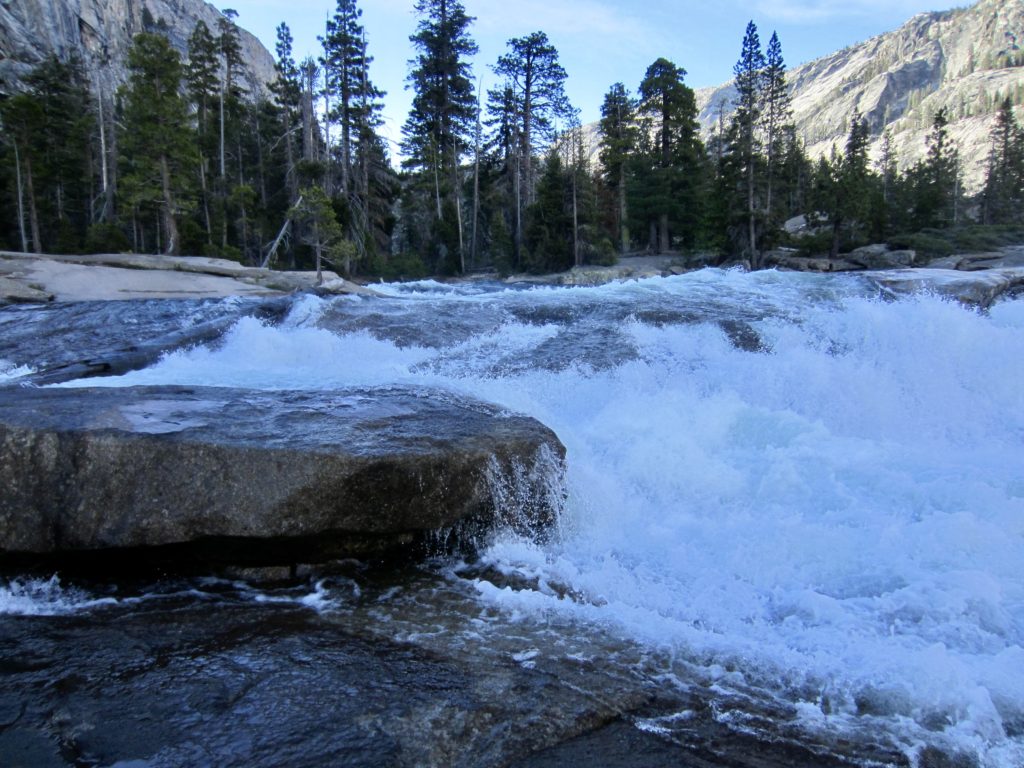
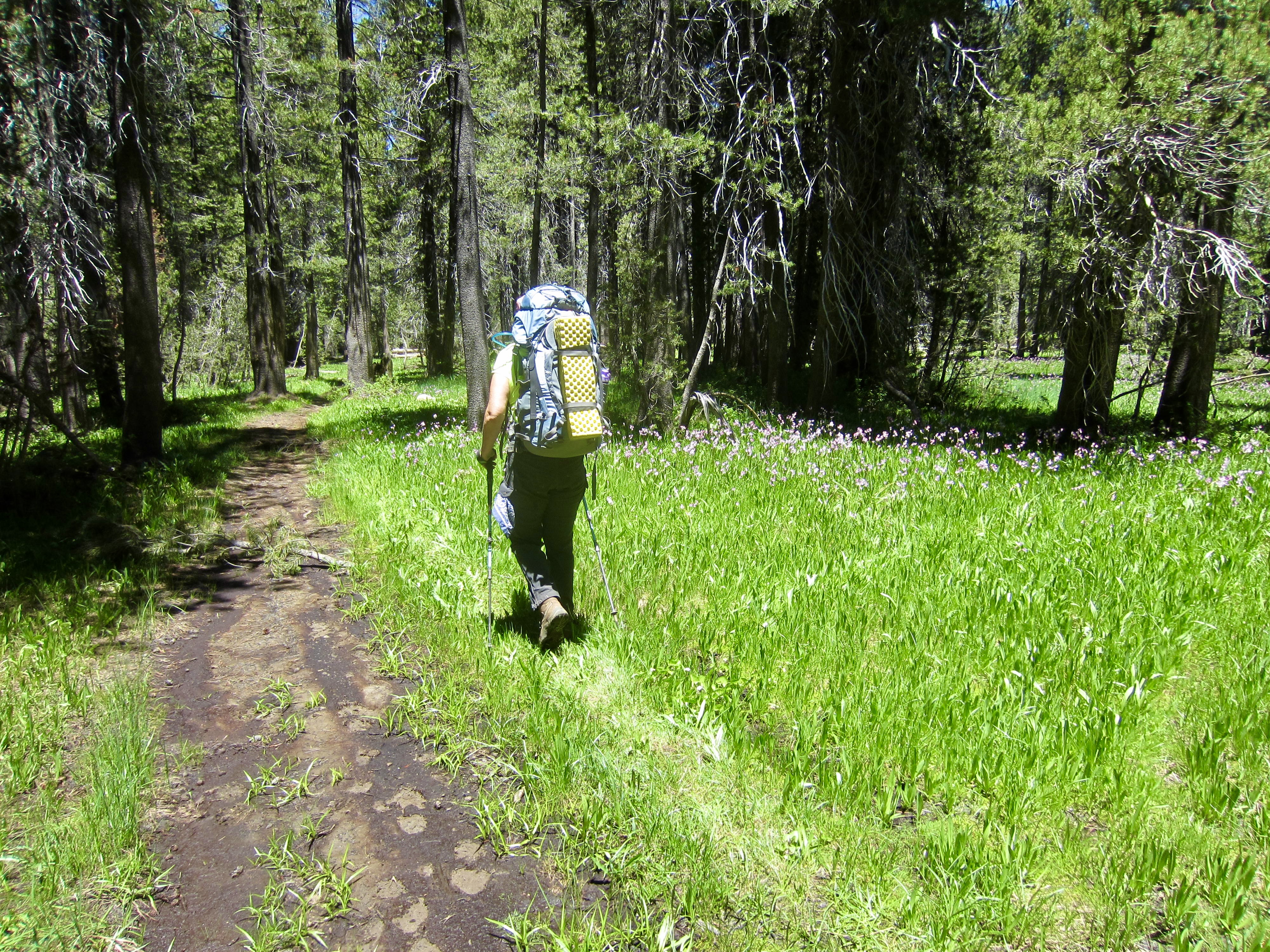
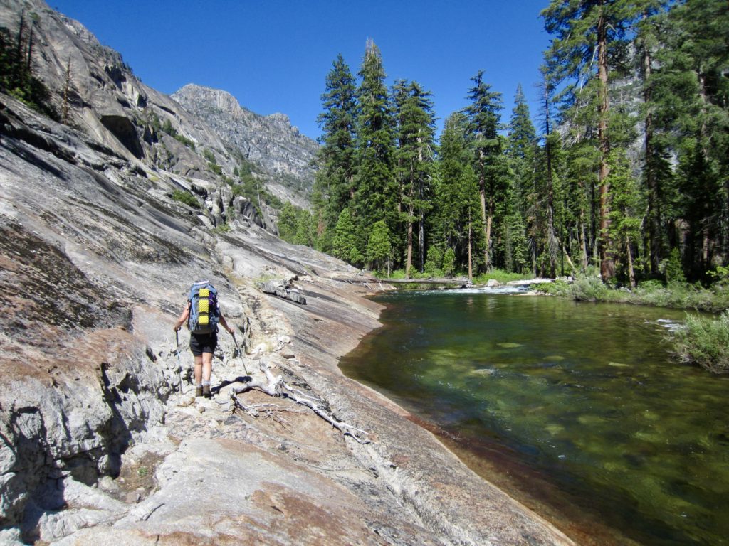
At the top of California Falls, the river abruptly changes from tumultuous to tranquil, creating a serene infinity pool. This marked our entrance into Glen Aulin, which sounds like a person’s name but is actually a Gaelic term for “beautiful valley.” Being here in early season, however, Eileen and I found that the lower portion of Glen Aulin was a bug-infested swamp. We carefully worked our way around and over large mud puddles for several hundred yards, generally following the tracks of numerous other hikers who were coming down-valley to visit the waterslides. Fortunately, the remaining 2 miles of glen trail was drier and less buggy.
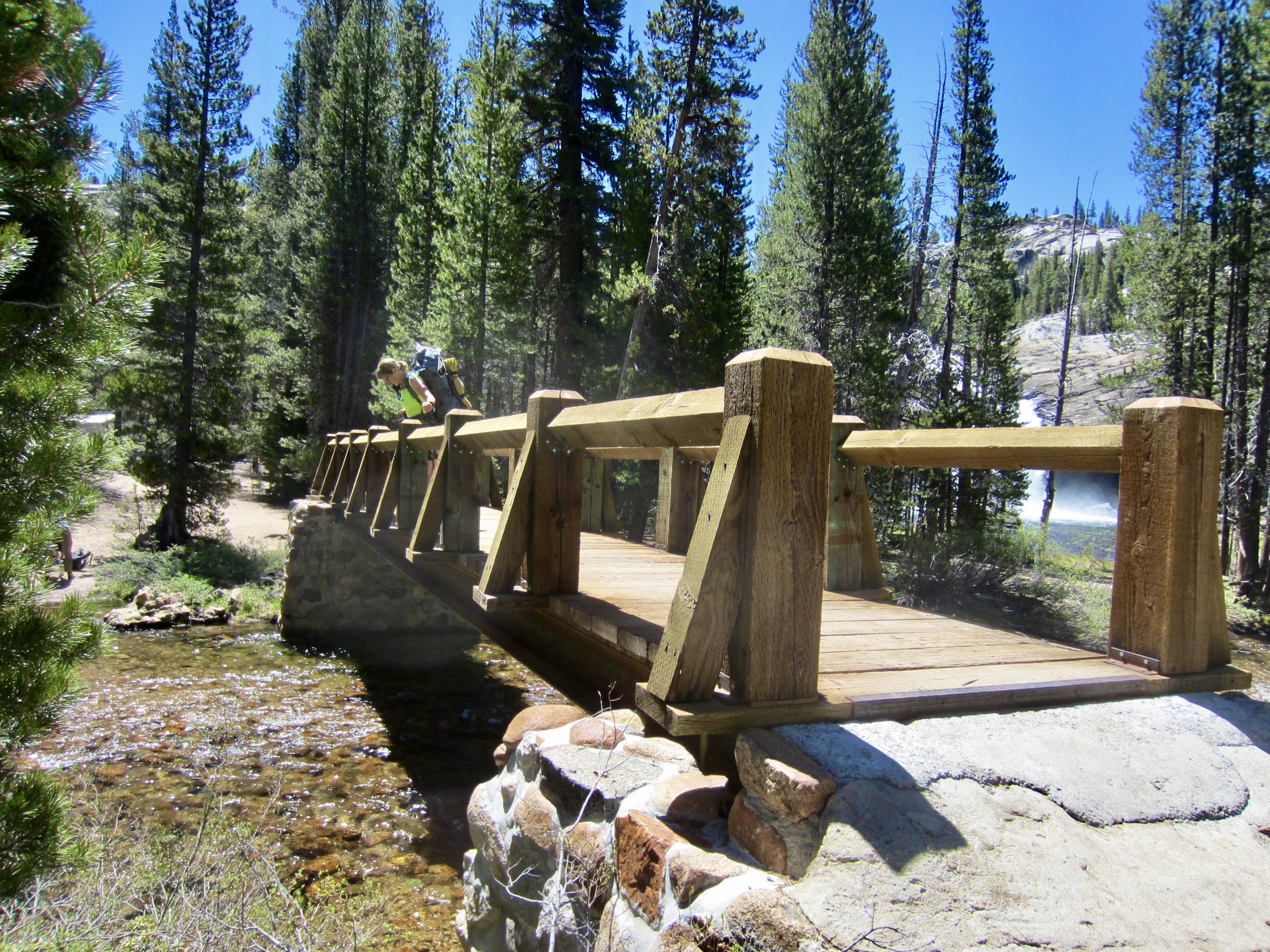
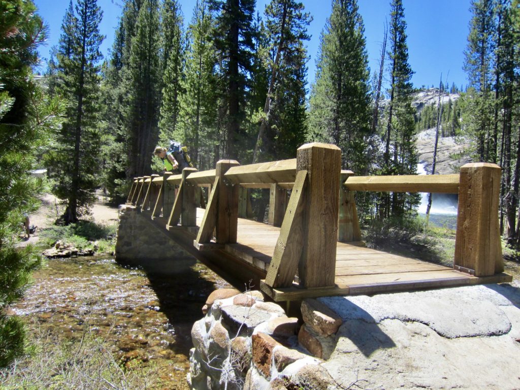
It was late morning when we crossed a bridge over Conness Creek and arrived at the expansive Glen Aulin Campground, which represented the halfway point of our 48-mile loop. The scenic highlight of this campground is a picturesque waterfall called White Cascade.

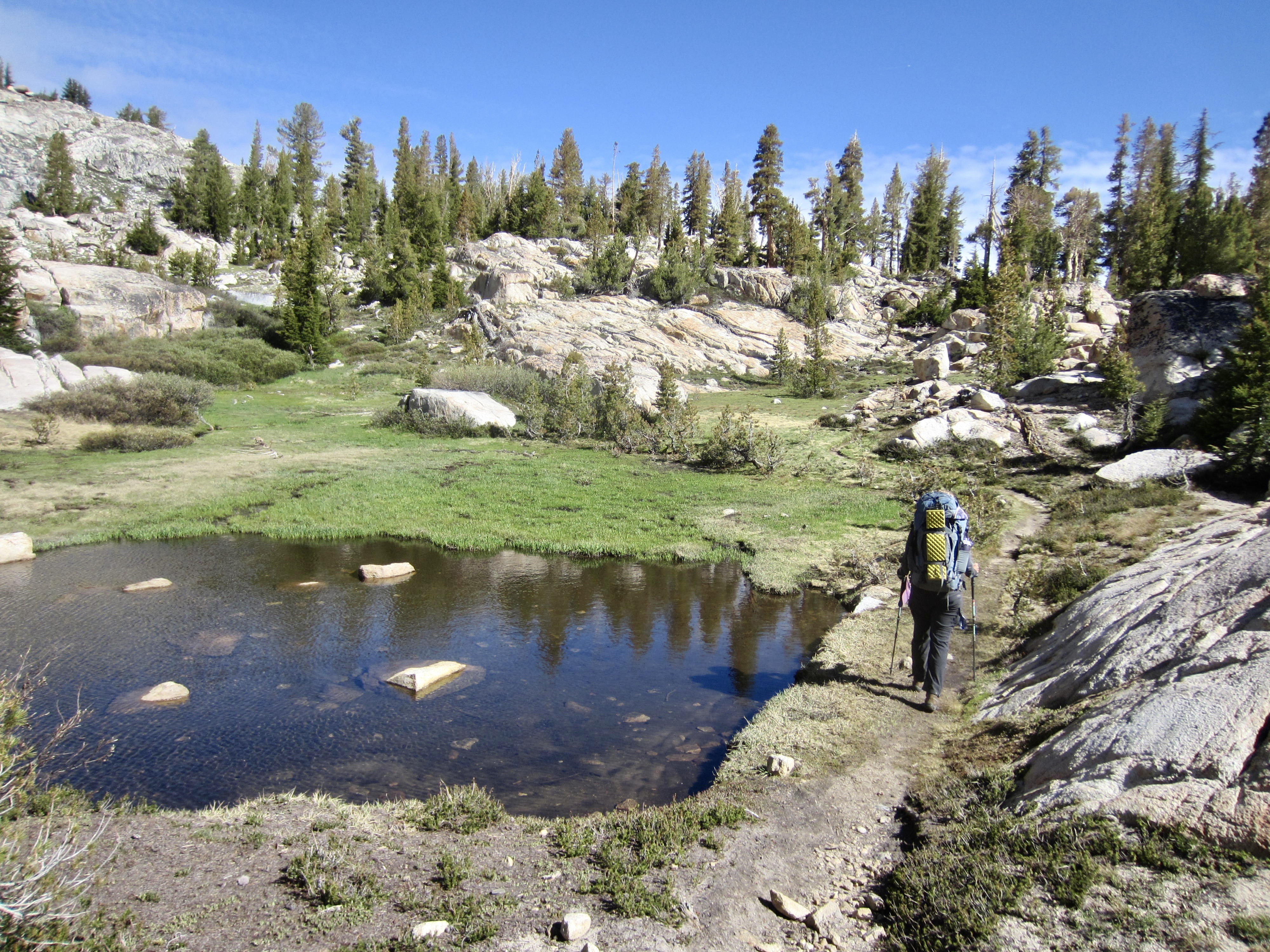
From Glen Aulin Campground, we went southward past pretty McGee Lake and across Cathedral Creek to Polly Dome Meadows, then headed westward into the high country. Hiker traffic decreased markedly on these trails; we’d seen more than 50 other people in the morning but only 13 people since then.

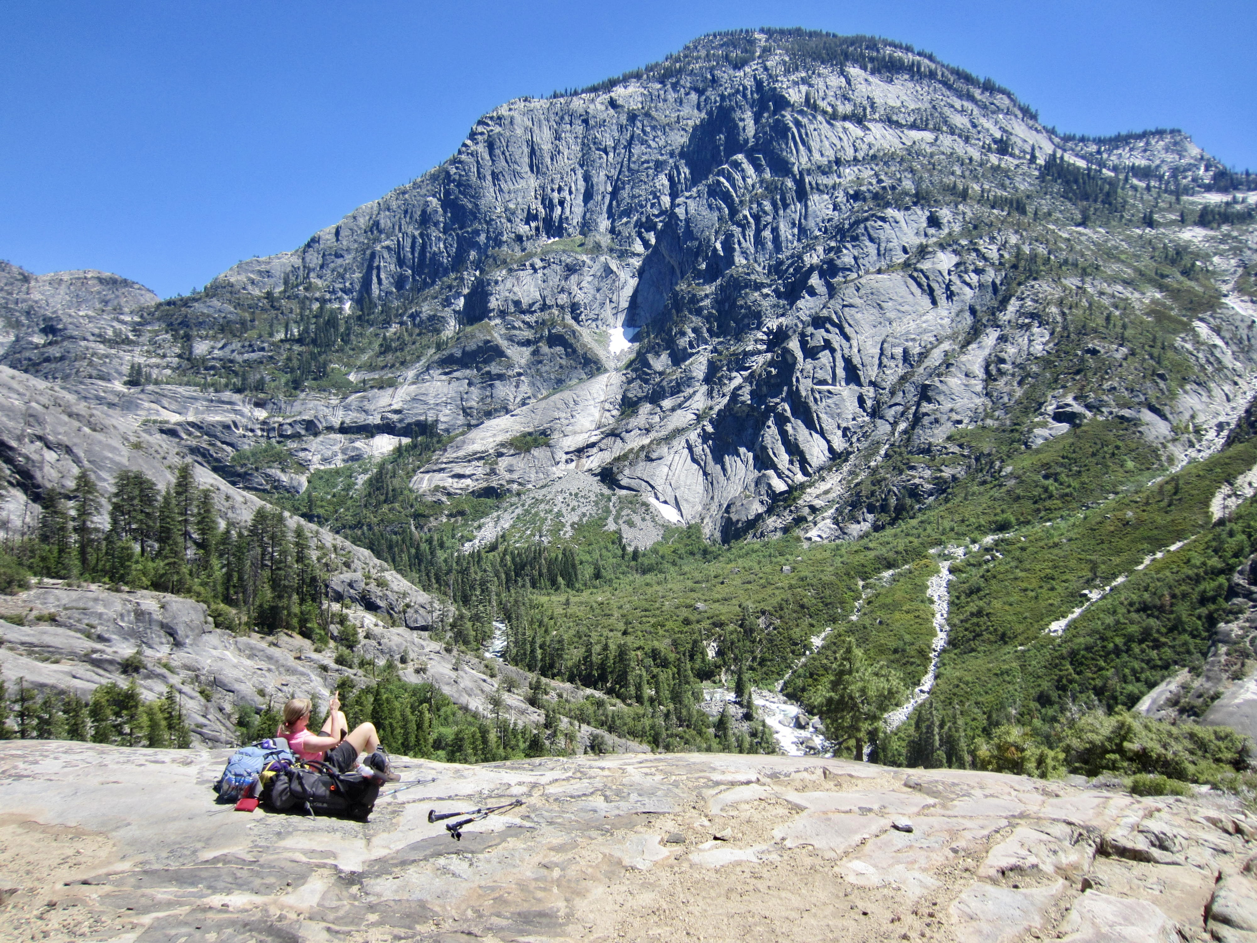
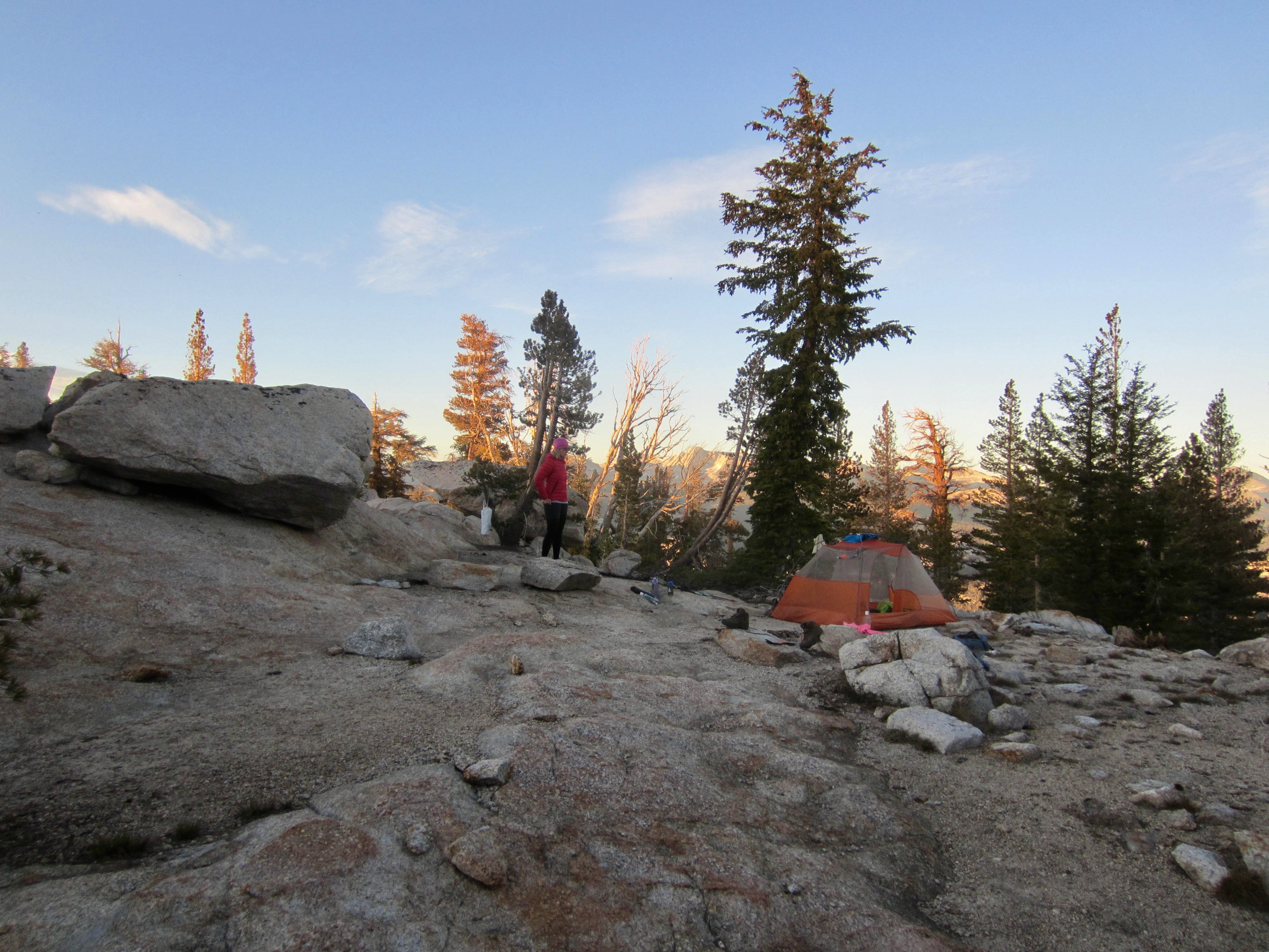
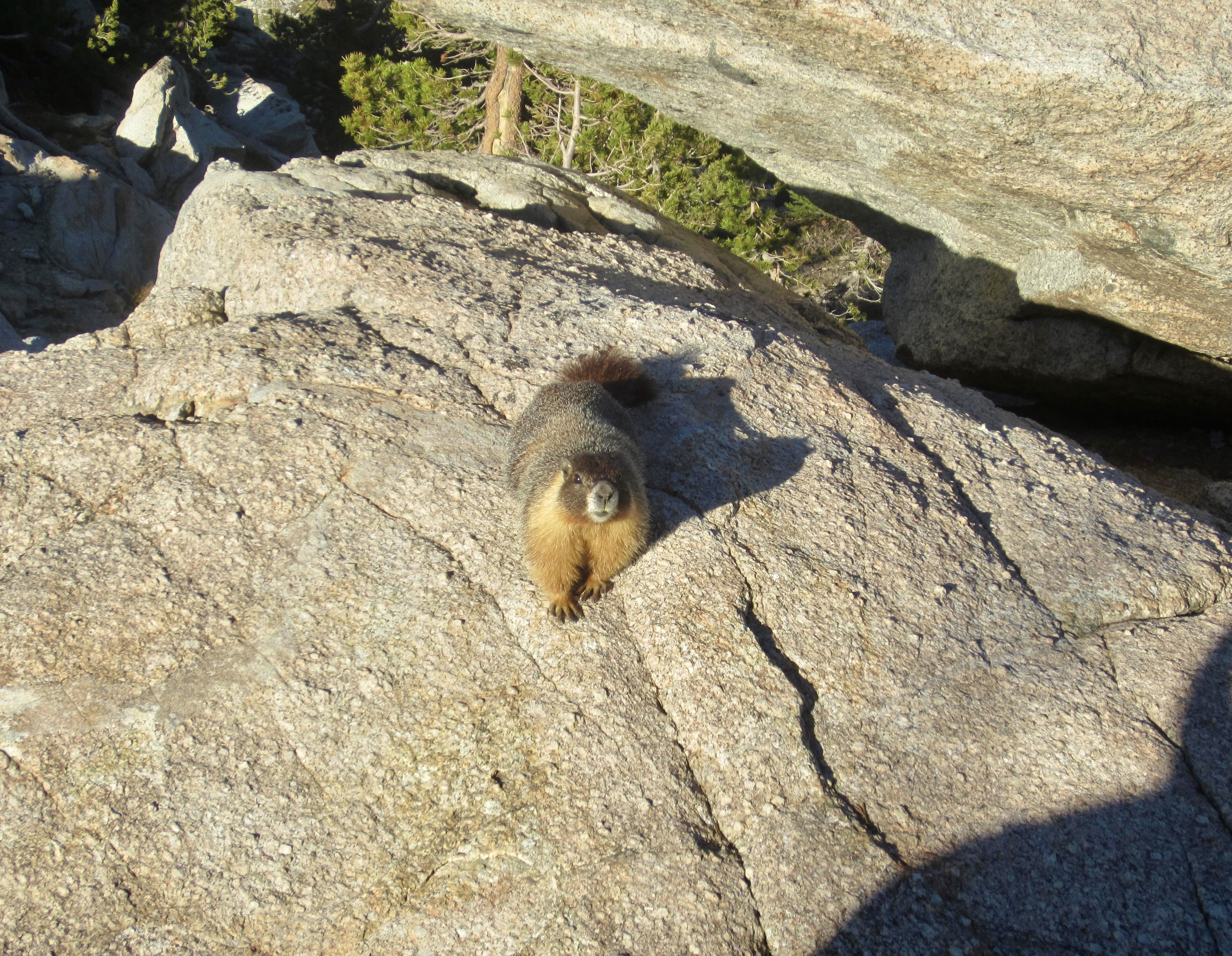
In late afternoon, we crested the northeastern ridge of Tuolumne Peak at 9800 feet and set up Camp 3 on a gravel pad (10.7 hours + 11.3 miles + 3700 feet from Camp 2). It felt good to leave behind the heat and insects of Tuolumne Canyon in exchange for cool air and mountain breezes. A curious marmot named Walter joined us for dinner atop a granite outcrop with a sweeping view dominated by Mt. Conness and Cathedral Peak.
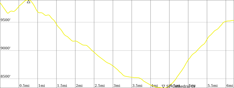
Day 4: Tuolumne Peak Ridge to Ten Lakes Saddle + Tuolumne Peak
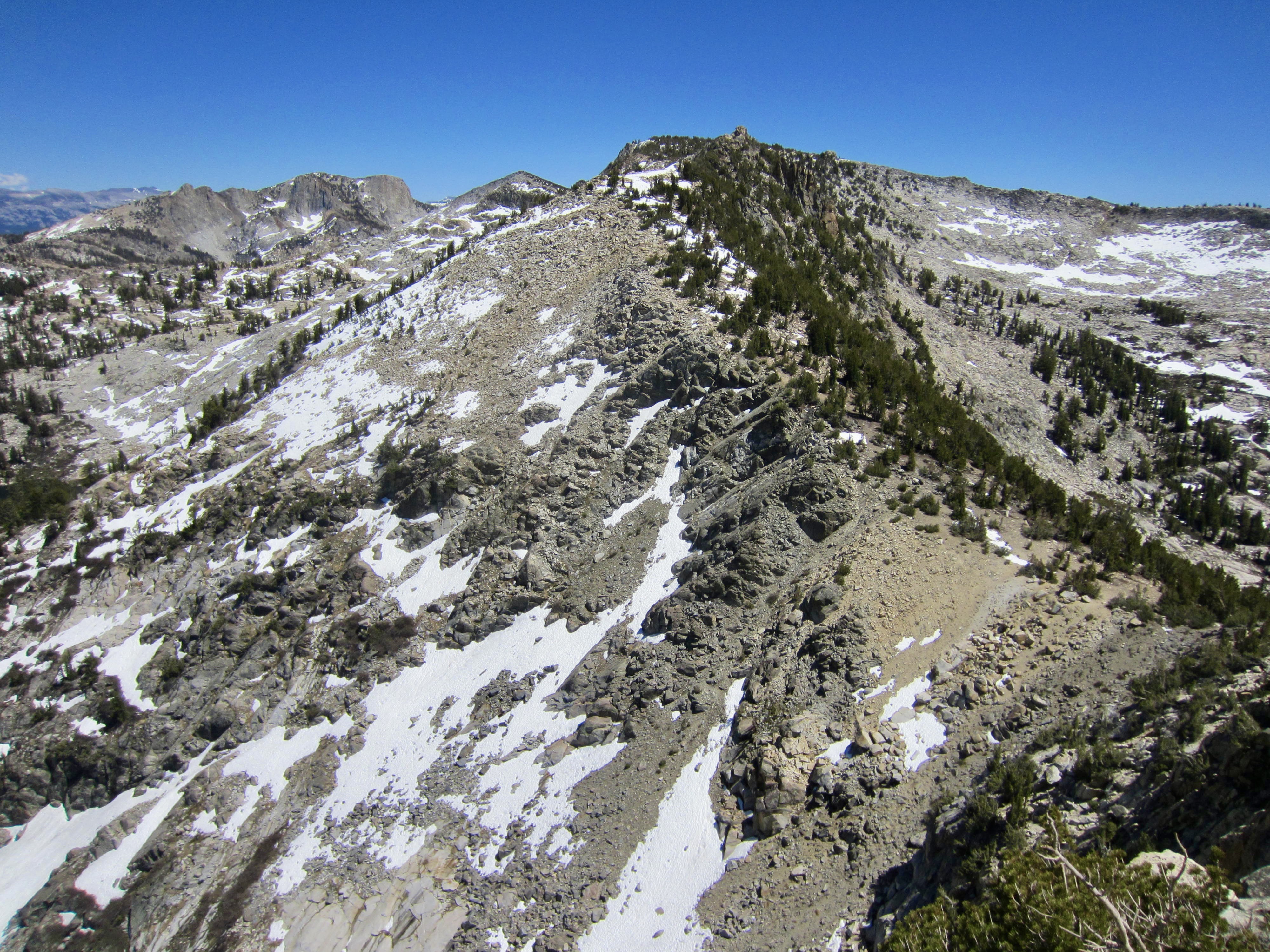
From Camp 3, we dropped into a meadowy basin and re-ascended to a 9900-foot bench located at the base of Tuolumne Peak’s north ridge. This bench, located 5500 vertical feet above Pate Valley, marked the high point of our entire trail loop. We stashed our backpacks here and headed up the peak.
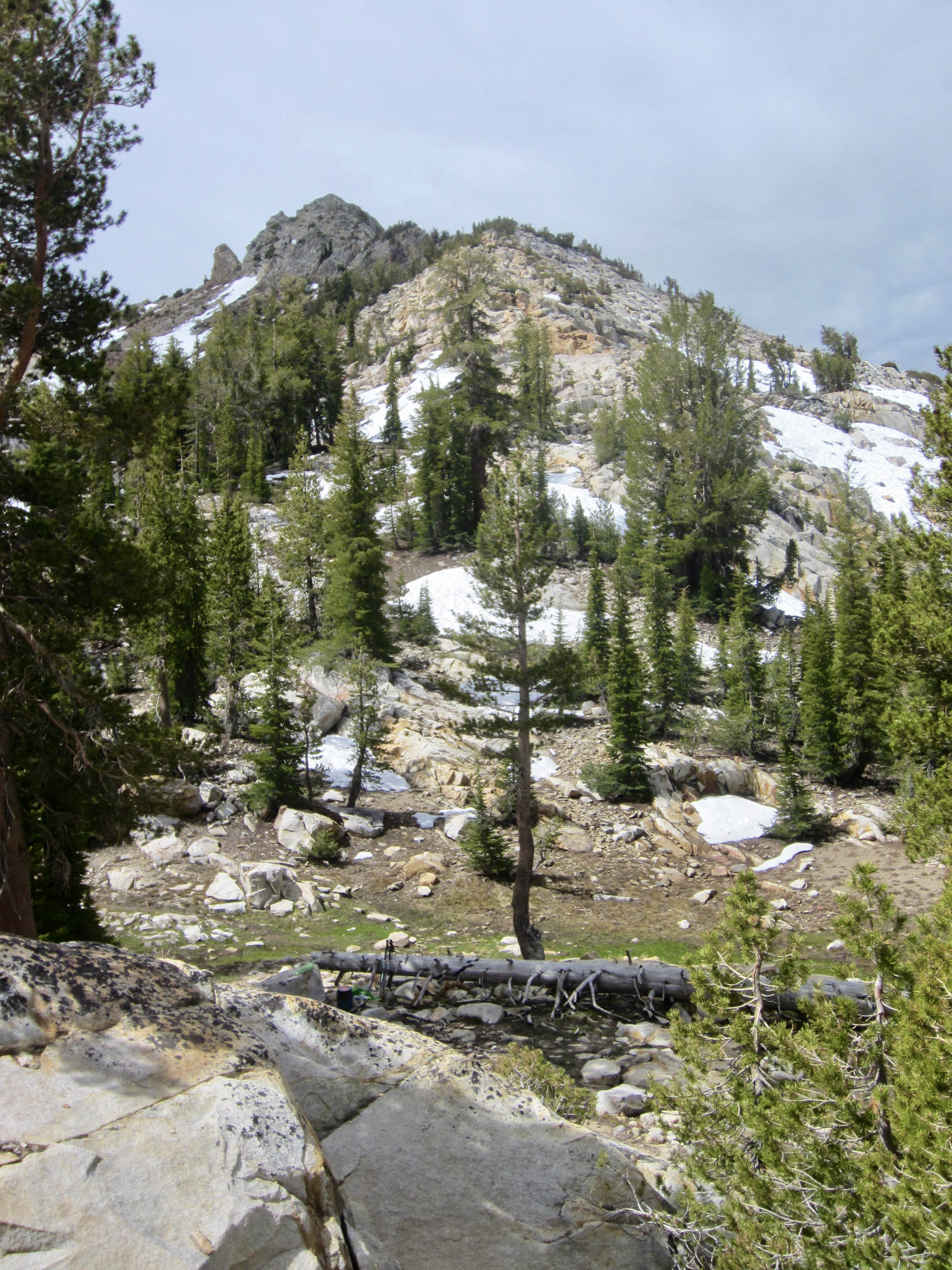
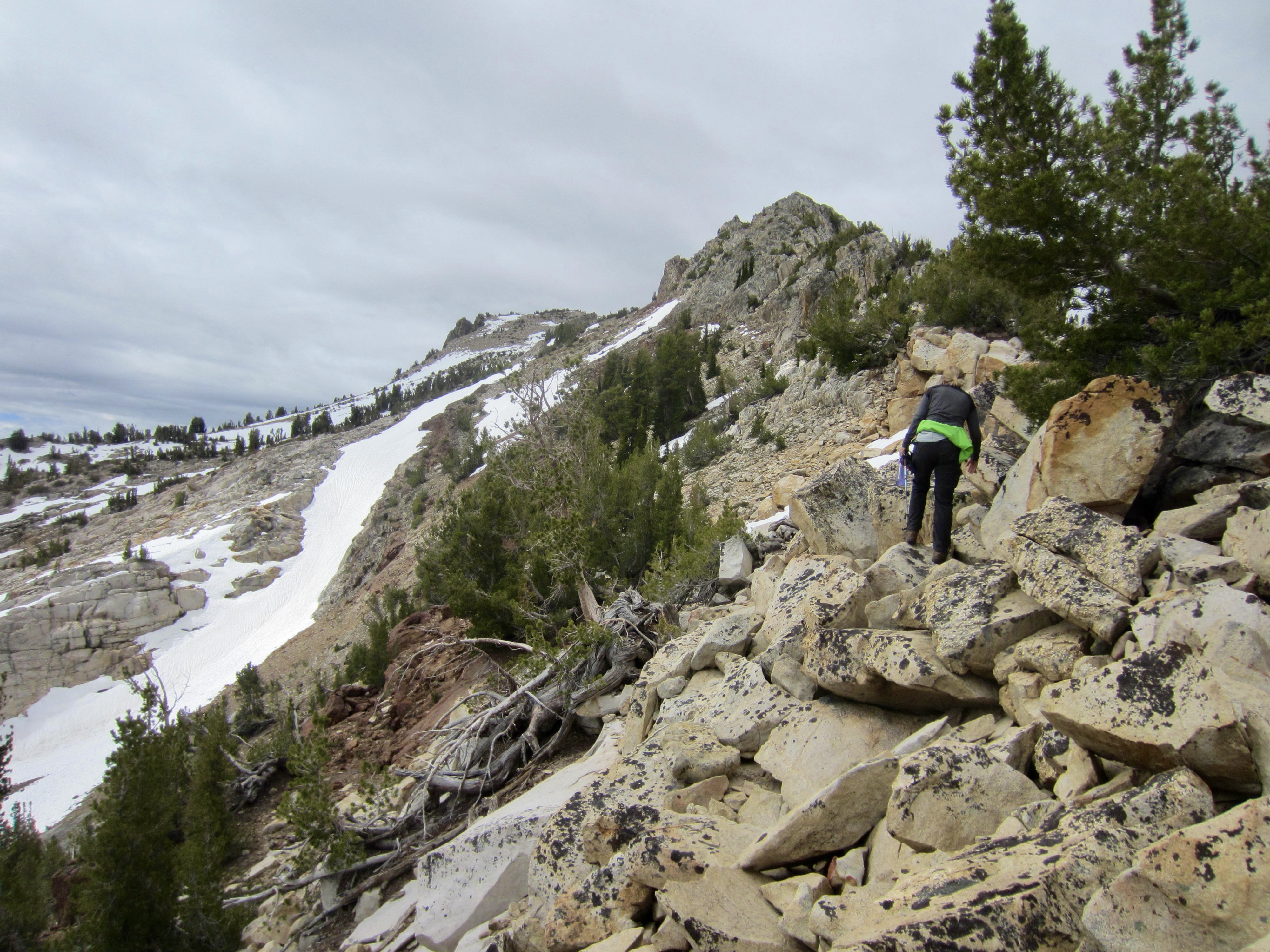
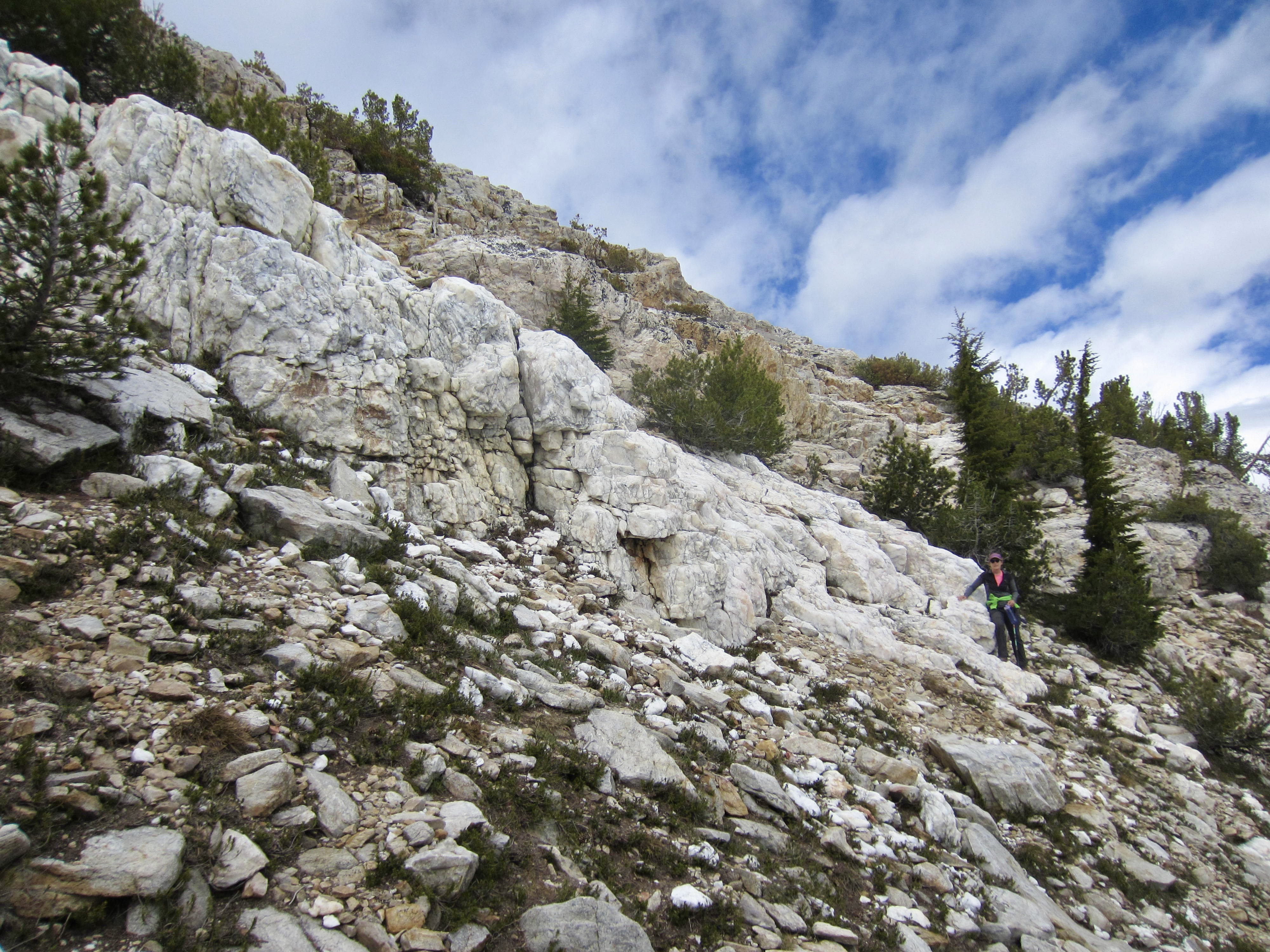
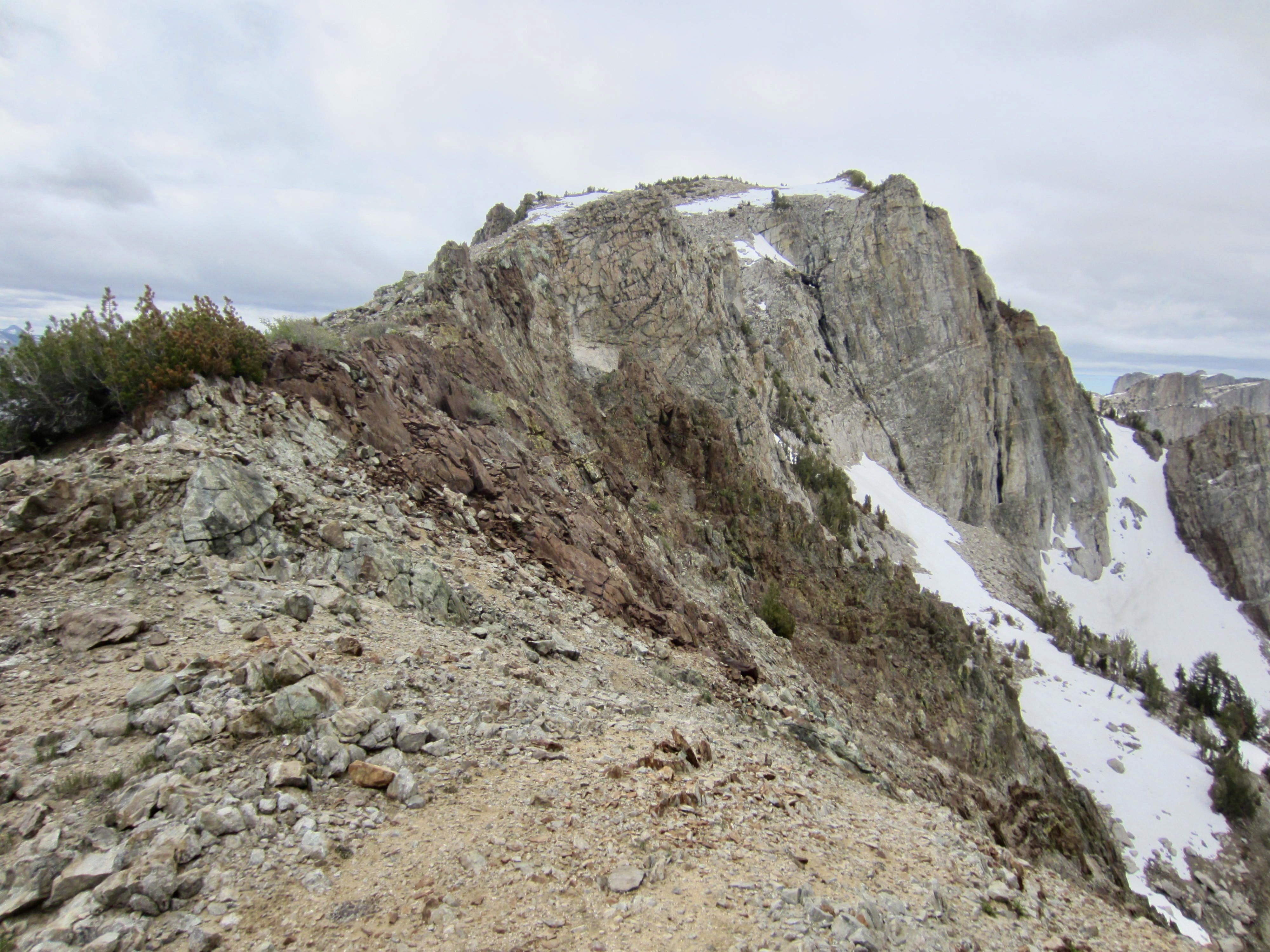
Our climb of Tuolumne Peak began with a fun Class 2-3 scramble up the blocky ridge crest, then transitioned to a Class 1-2 traverse on the left (east) side. Along the way, we crossed over two geologic contacts, with the rock changing from granite to metamorphic and then back to granite. There was also an unusually large outcrop of pure milky quartz!


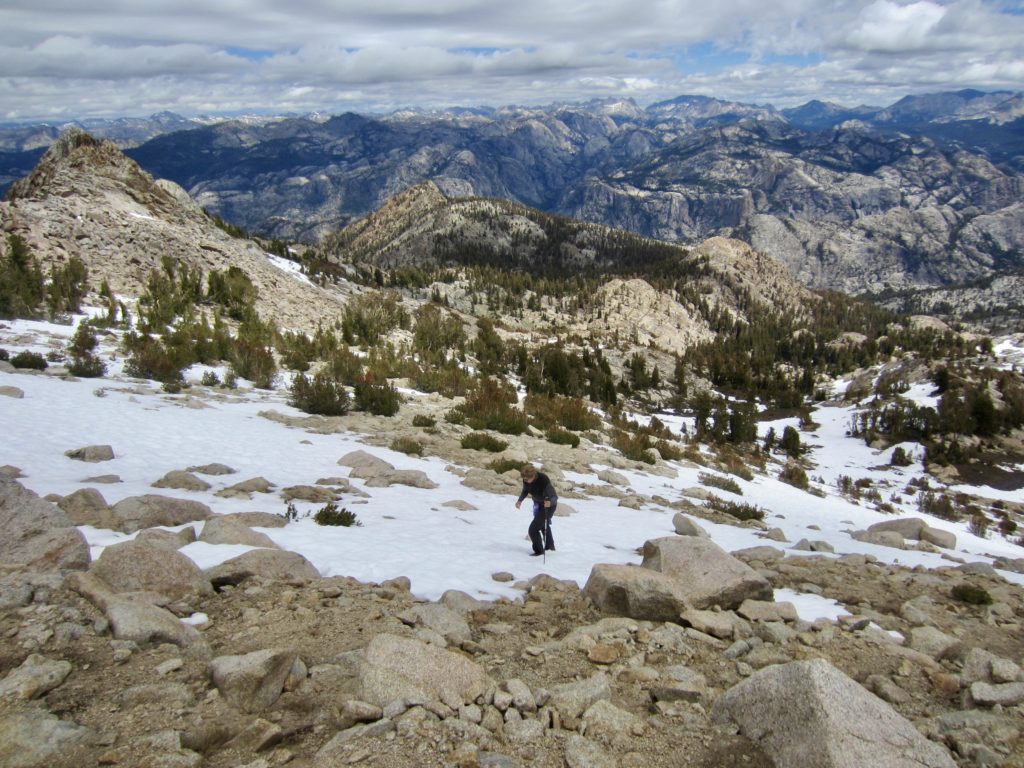
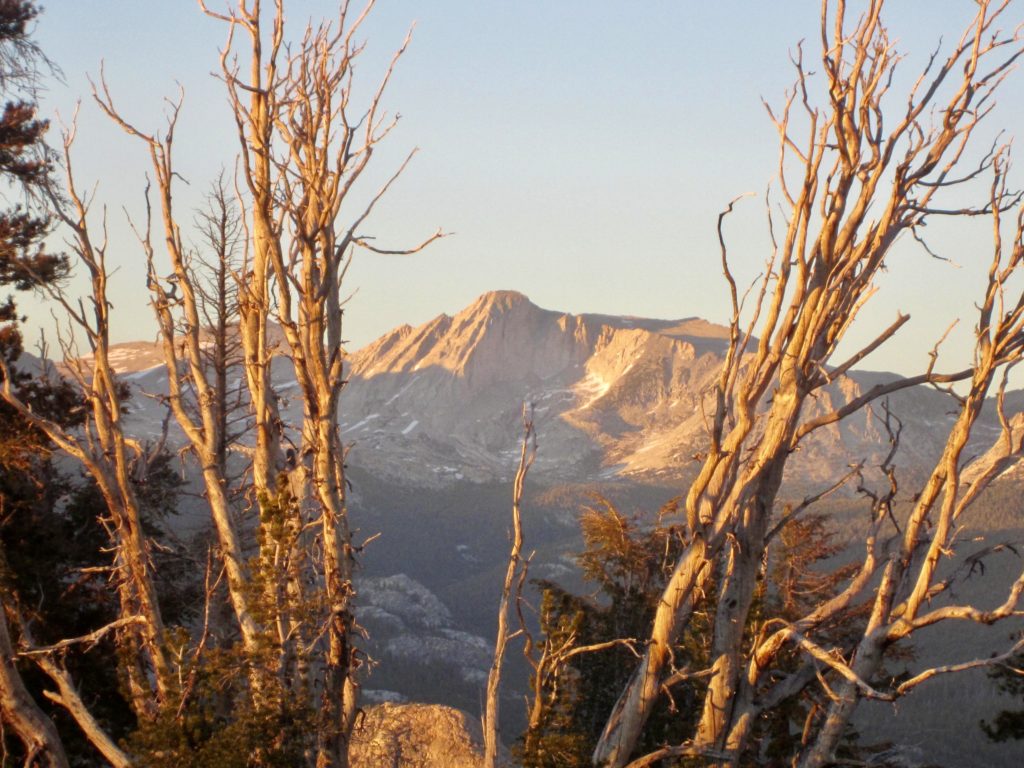
The sky had grown cloudier all morning, and a dark ceiling hung over Tuolumne Peak by the time we gained the summit shortly before noon. Most surrounding peaks remained visible below the cloud layer, but the top of Mt. Conness was socked in. Long bands of virga above the Tioga Crest indicated that rain was coming.

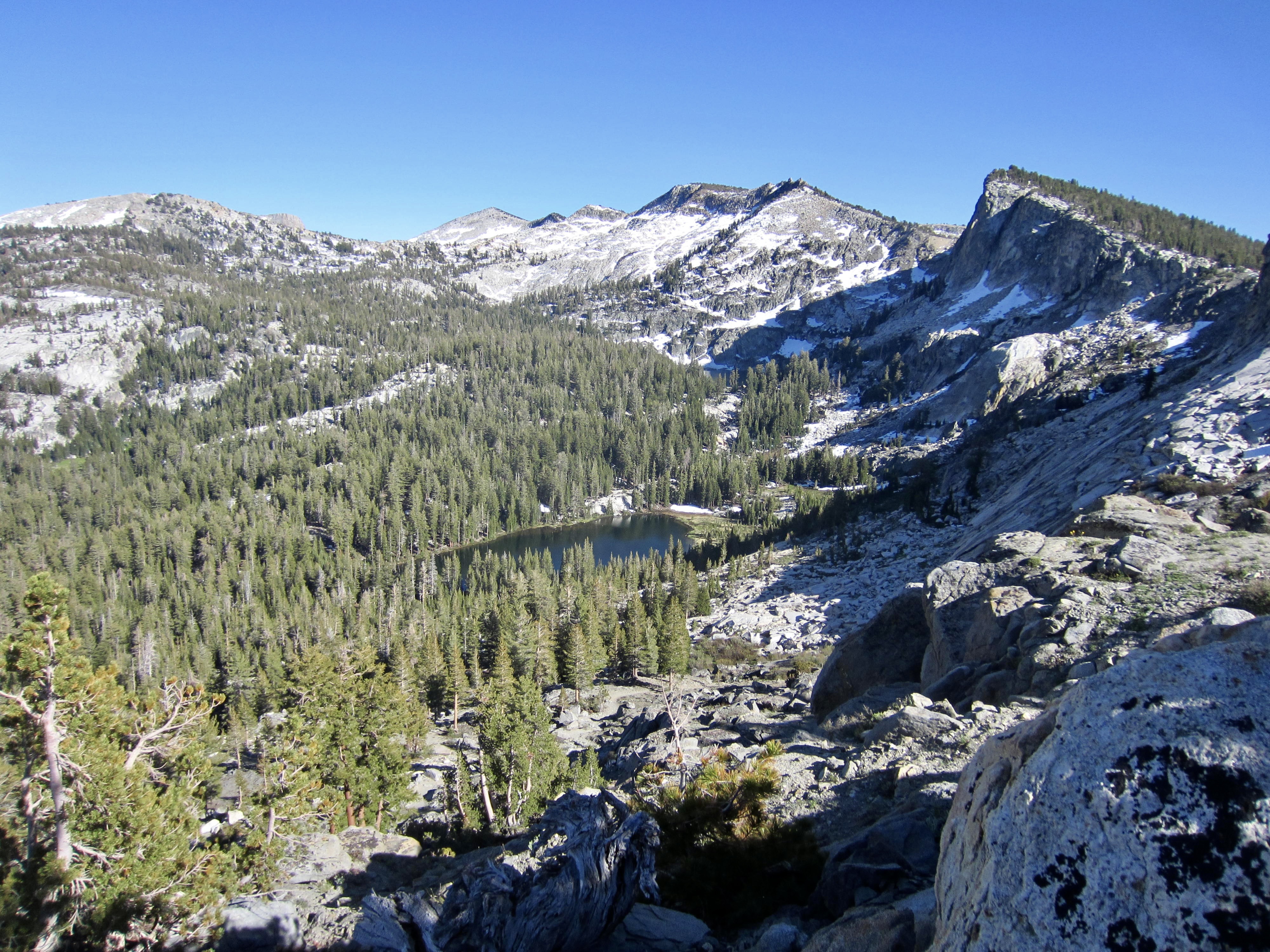
We hustled back down the north ridge and reached our backpack stash just as a light rainfall started (3.5 hours + 1000 feet RT), but this didn’t amount to anything more than some intermittent rain showers. The remainder of our afternoon was occupied by a long descent to South Fork Cathedral Creek (no bridge here, but we found a big log) and then a steep ascent toward Ten Lakes Basin.
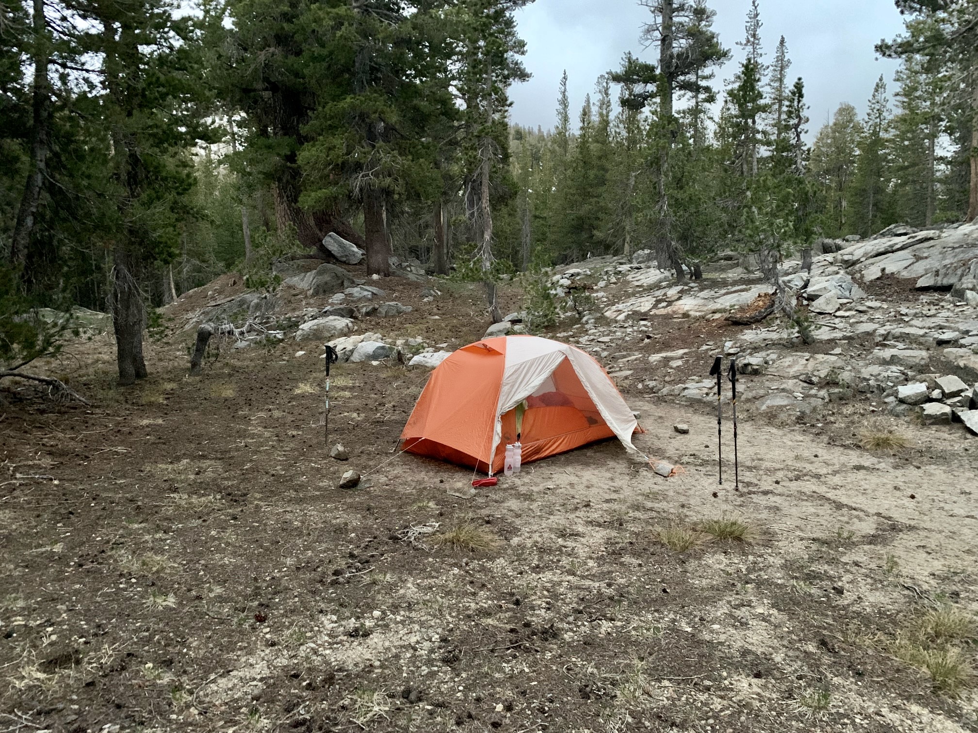
In early evening, we reached a 9600-foot saddle on the eastern rim of Ten Lakes Basin (6.1 hours + 6.2 miles + 1500 feet – 1800 feet from Camp 3, excluding sidetrip). Camp 4 was established on a sandy pad with running water nearby.
Day 5: Ten Lakes Saddle to Ten Lakes Pass + Ten Lakes Overlook
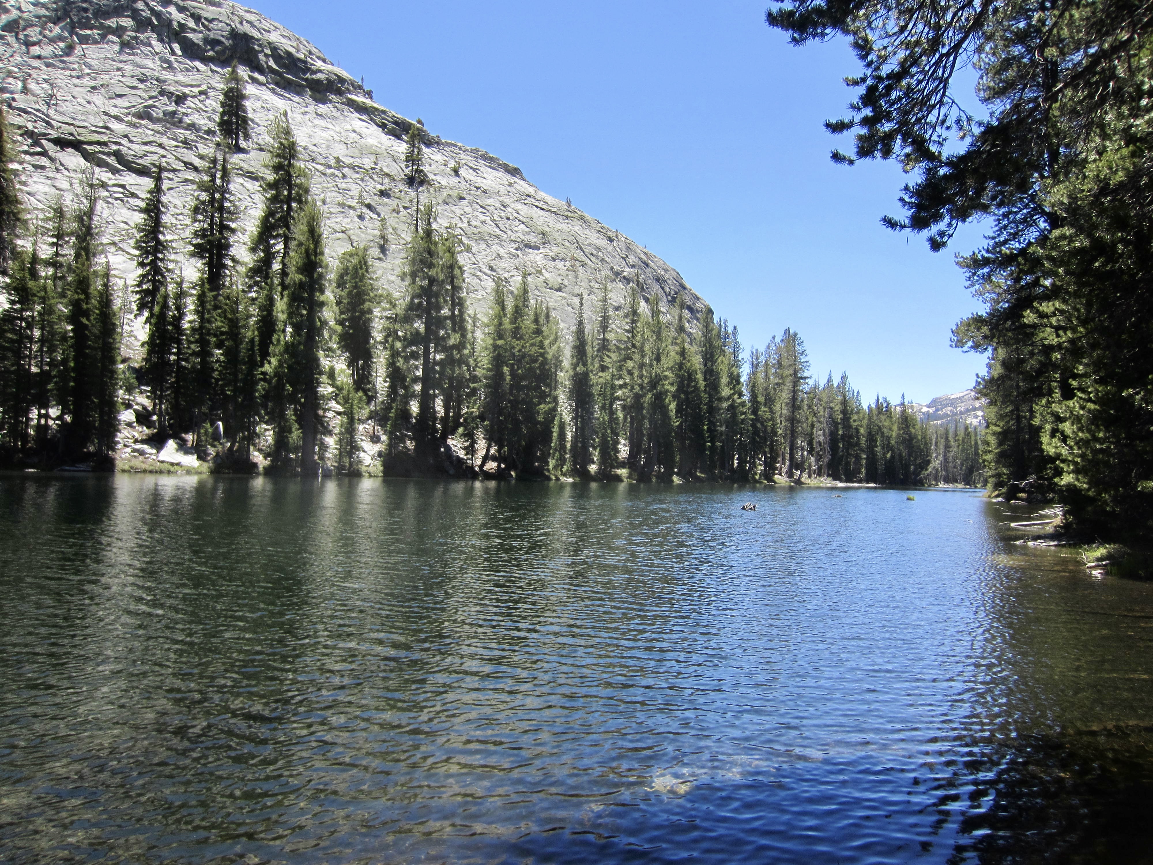
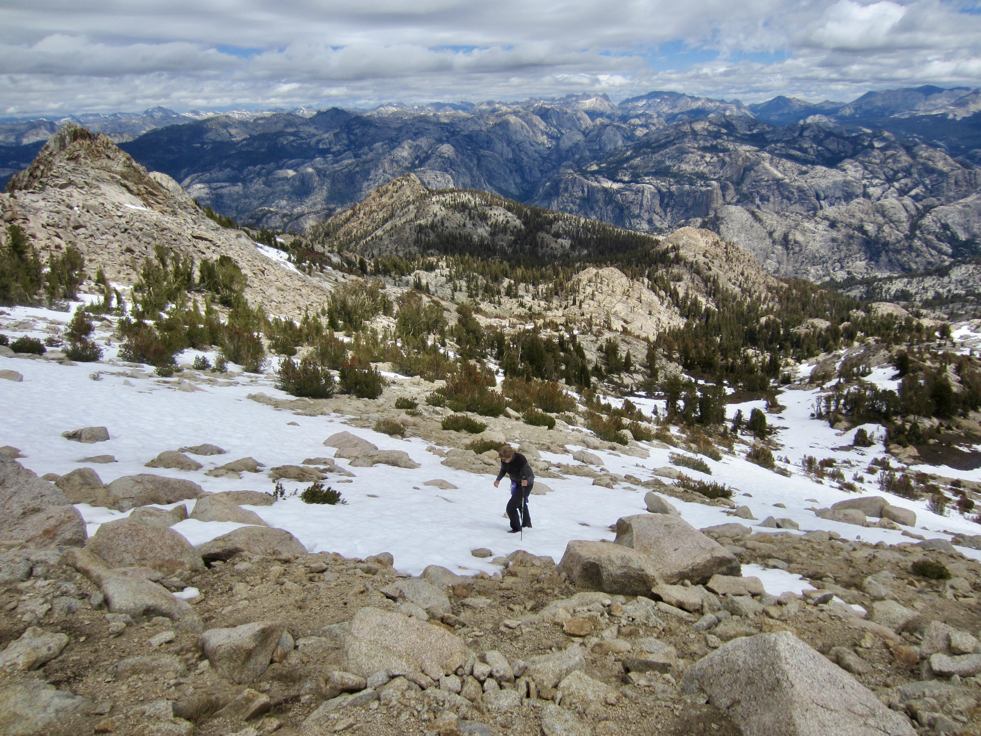
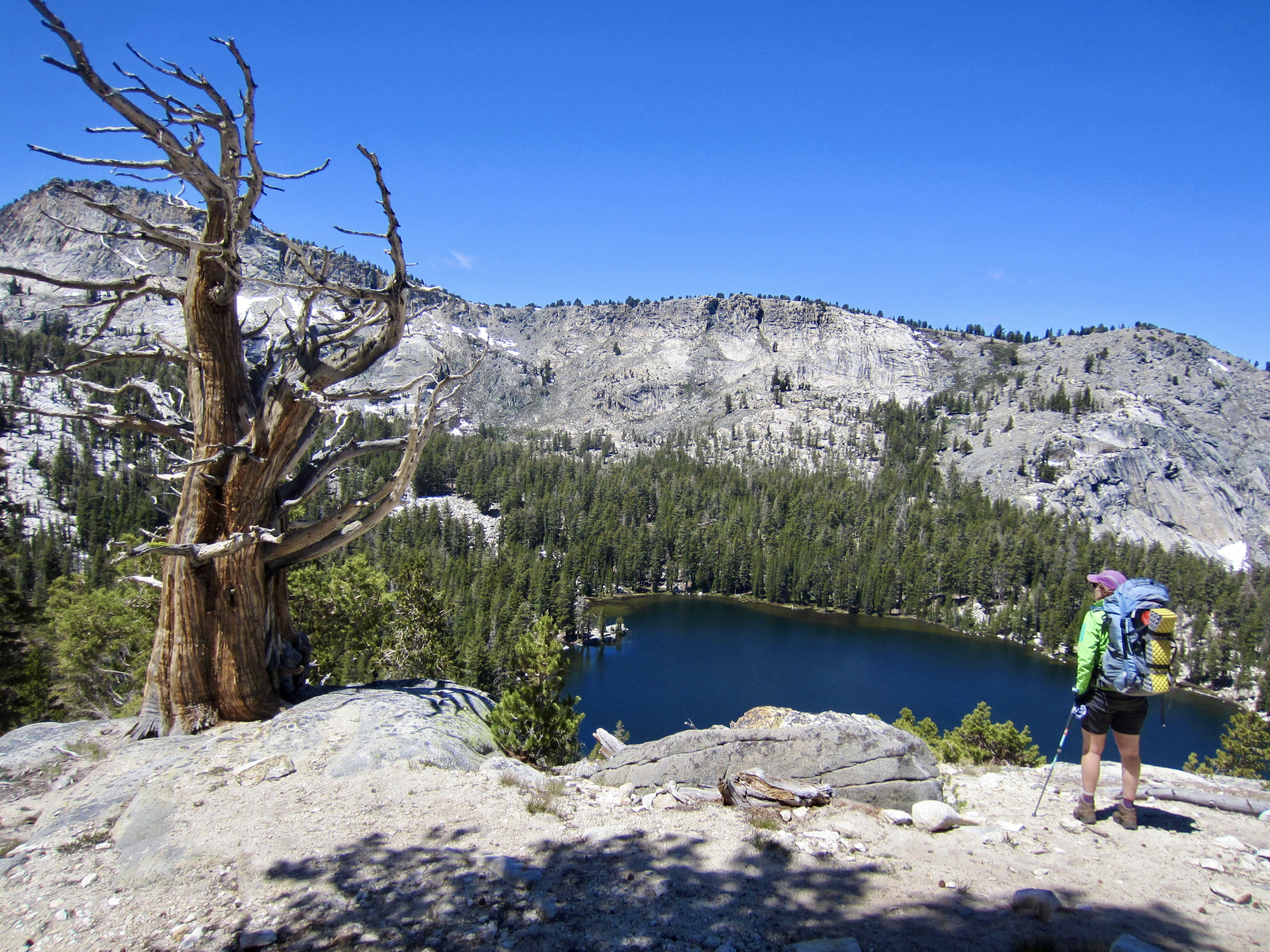
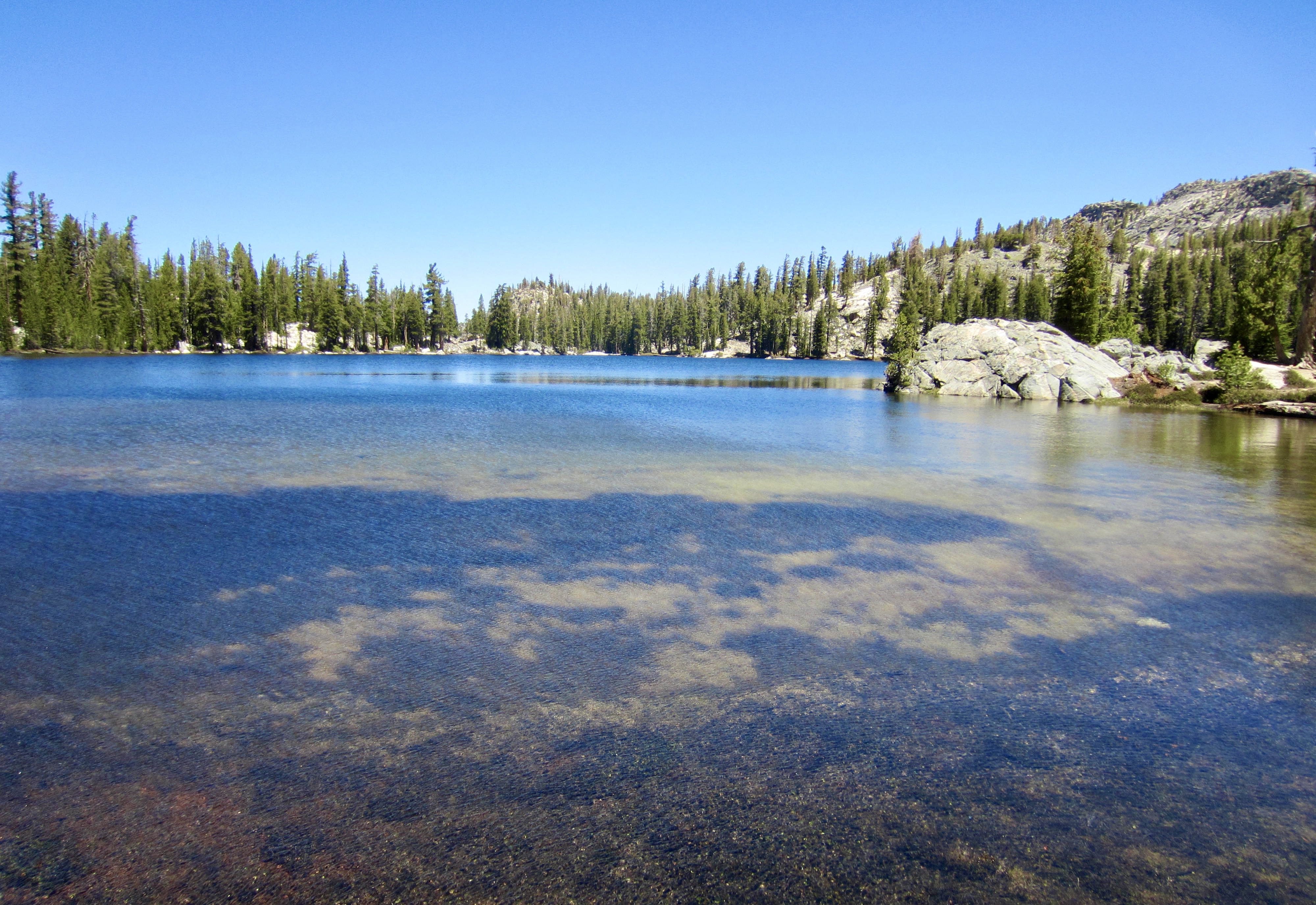
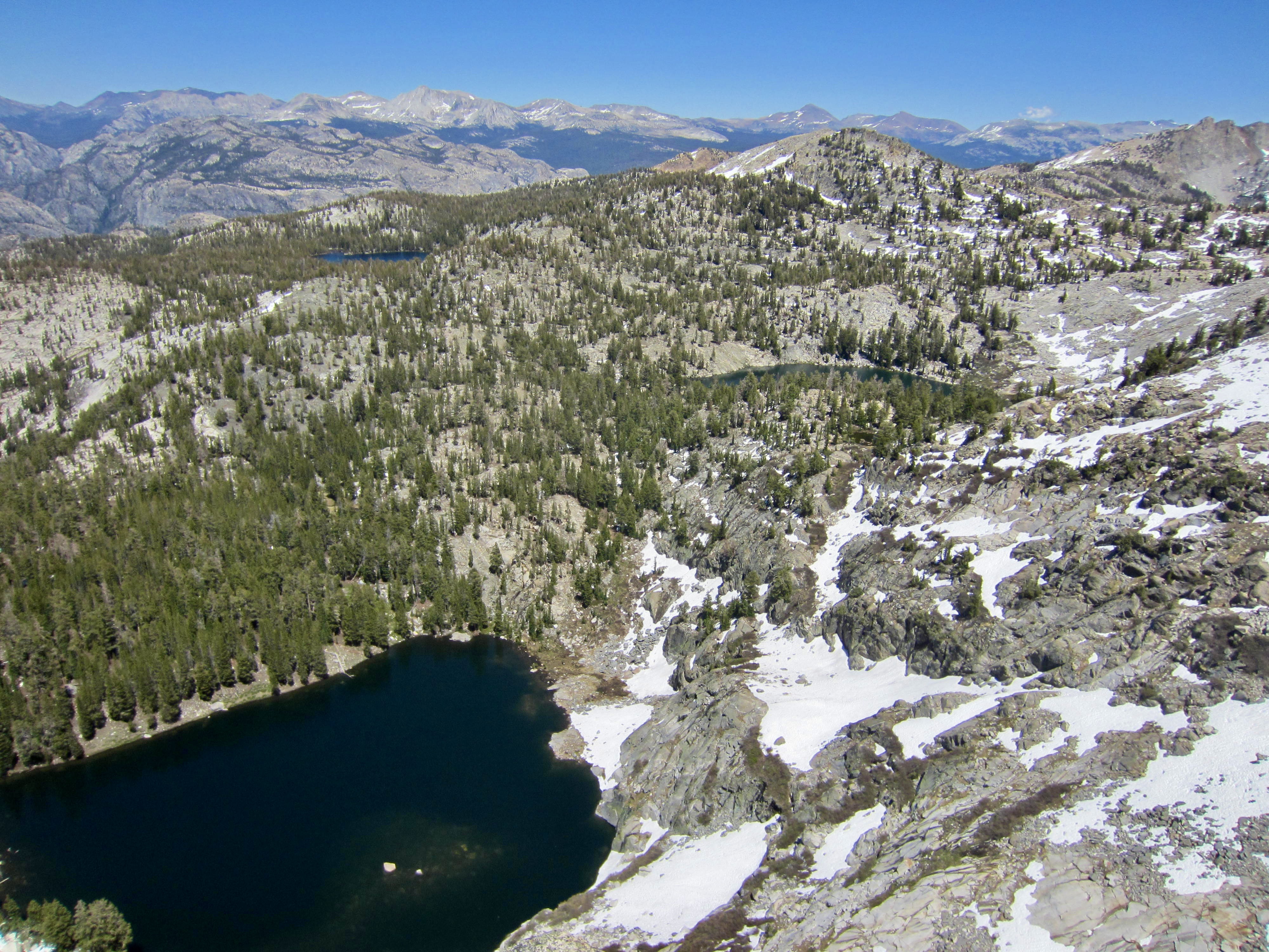
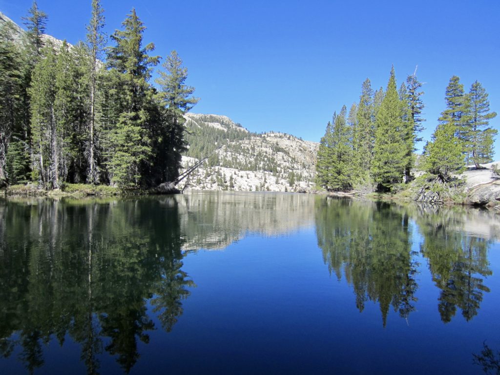
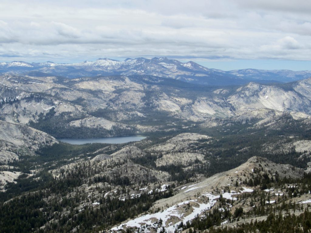
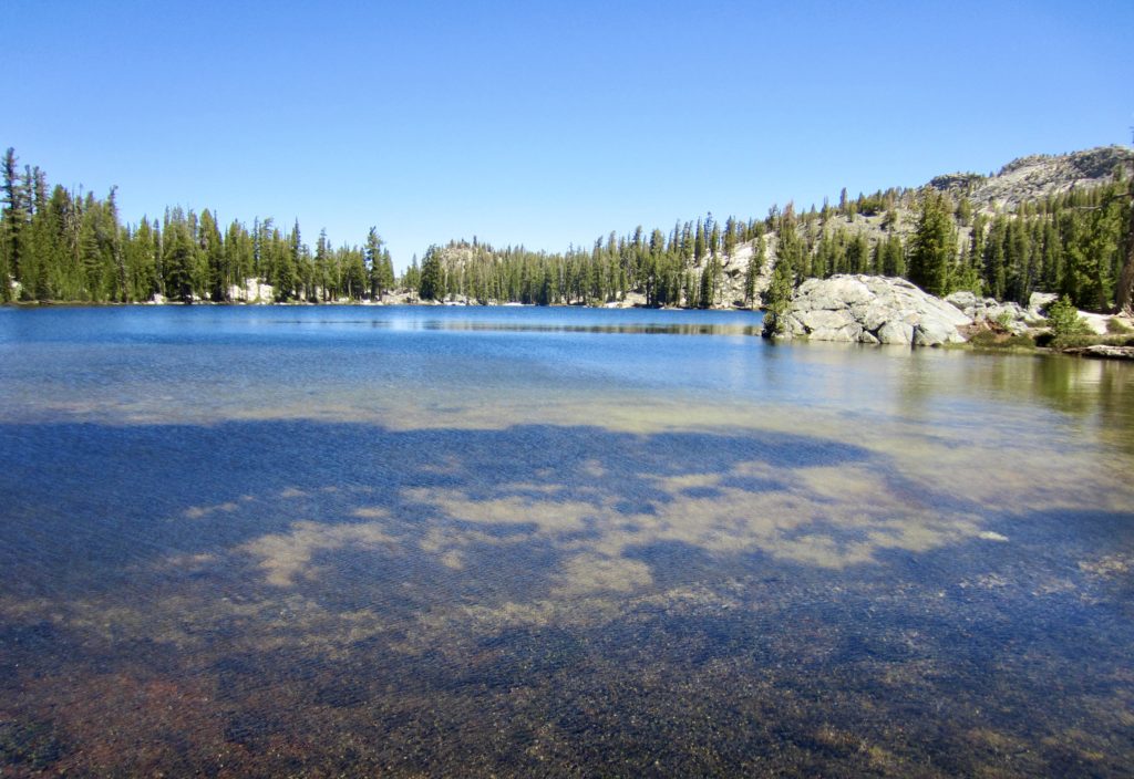
Yesterday’s clouds were completely gone by morning, such that Eileen and I awoke to a vivid blue sky. We leisurely packed up camp and made a short hike down to the first—and largest—of the Ten Lakes.
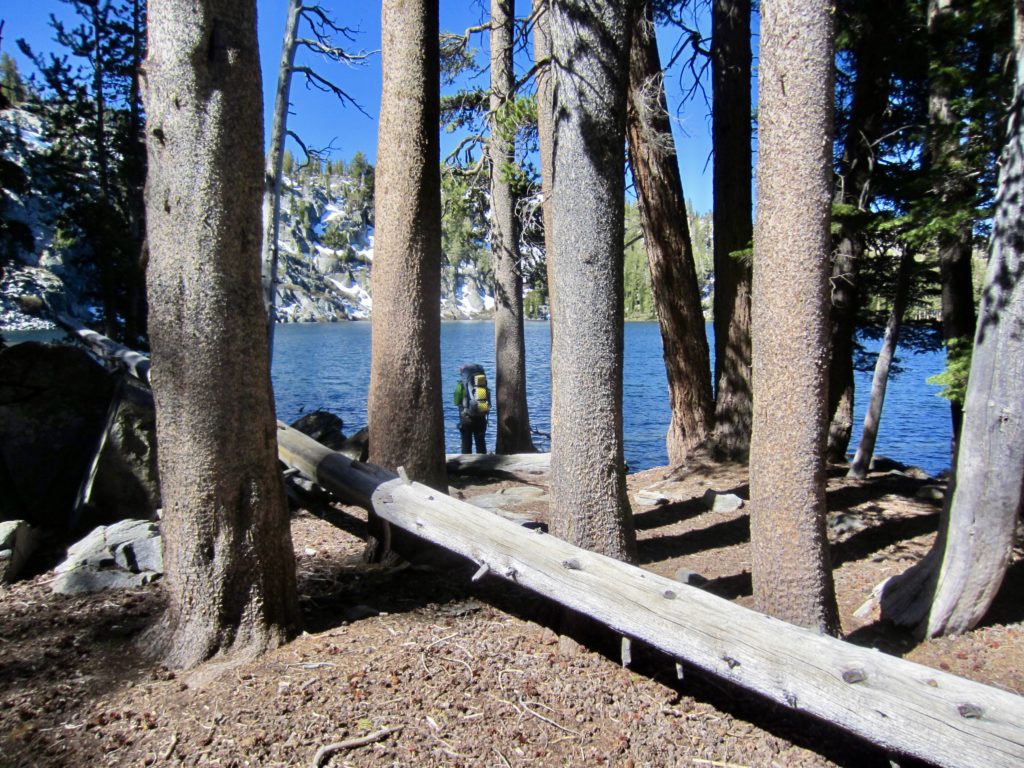
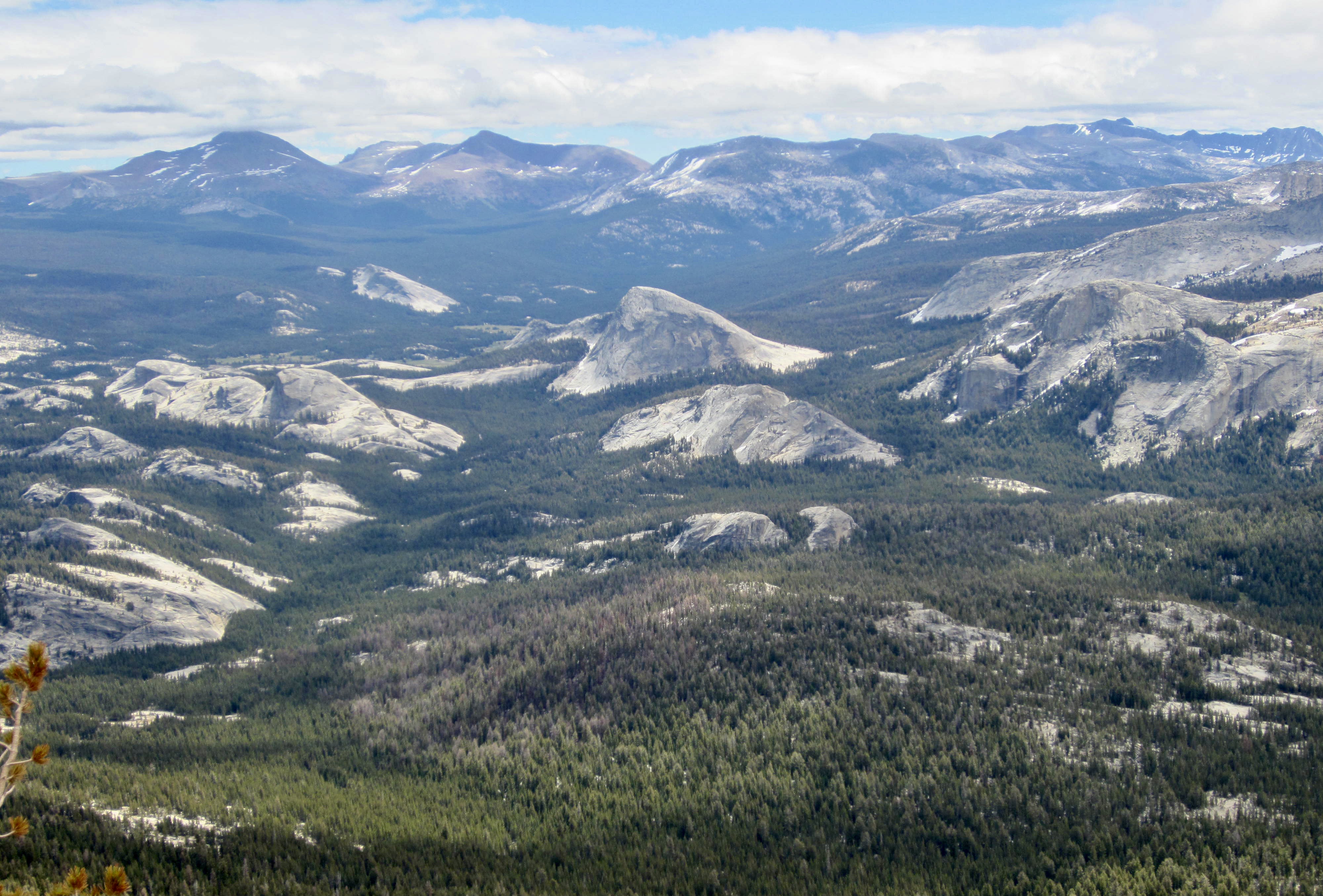
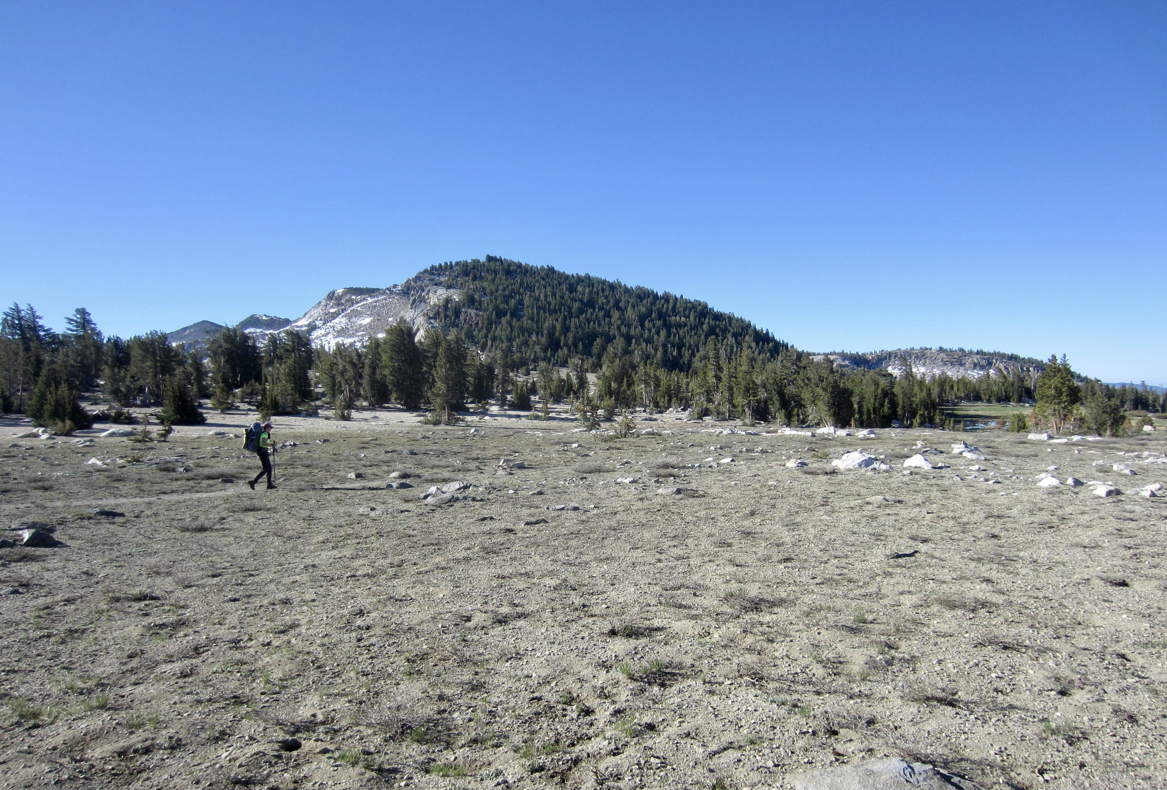
Based on my own map review, Ten Lakes Basin comprises eight lakes of significant size, along with a handful of smaller lakes and tarns; other people might derive a different number. Any way you count them, though, the basin holds a wonderful collection of alpine lakes, babbling creeks, and granite slabs—a visual delight for hikers, fishermen, and explorers. We spent our morning just wandering around and chatting with other backpackers.
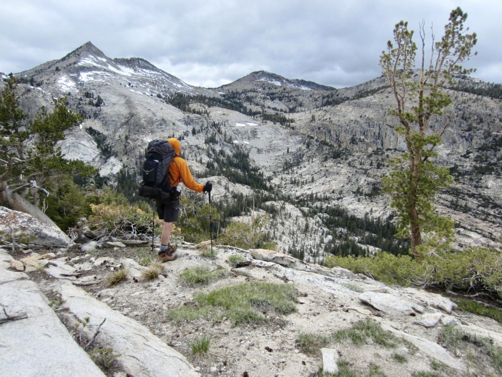
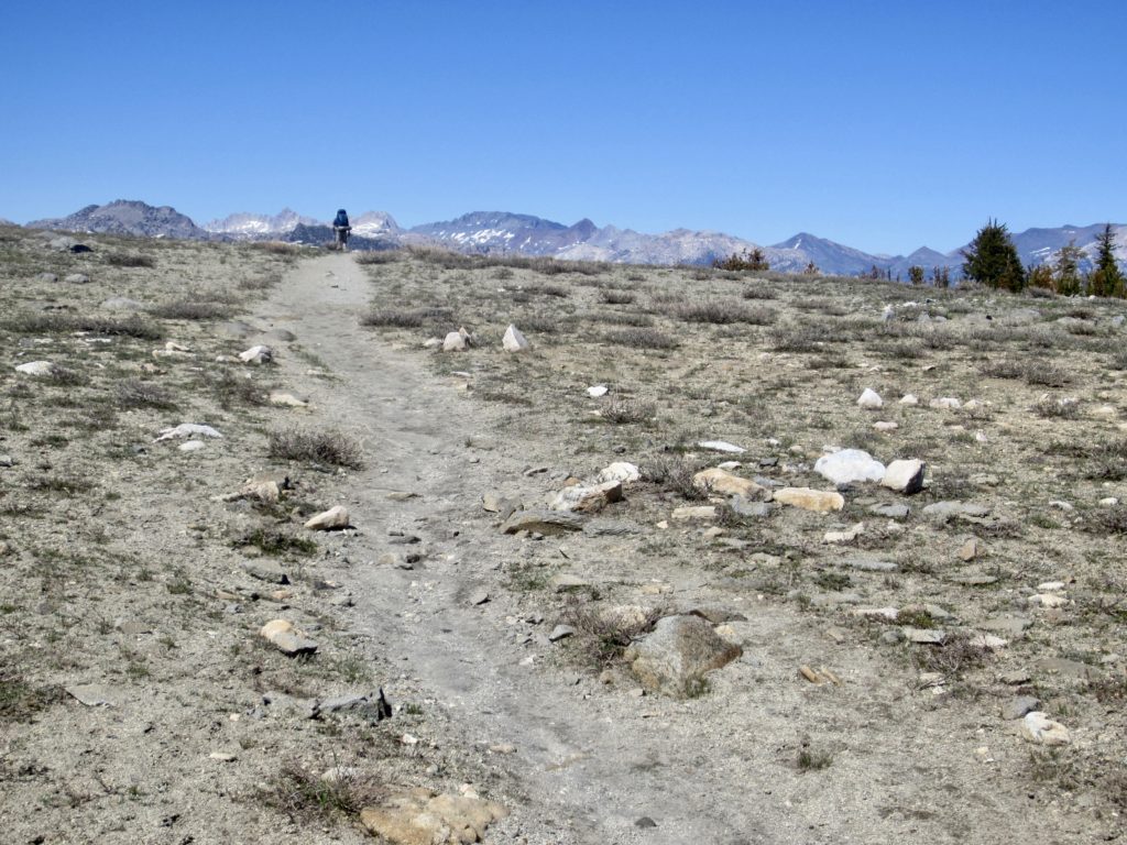
A circuitous trail took us through the basin and up to 9650-foot Ten Lakes Pass, a broad, rounded saddle on the basin’s western rim (4.3 hours + 2.6 miles + 750 feet from Camp 4). It was now early afternoon, and we encountered a steady parade of day-hikers and backpackers marching over the pass in both directions.
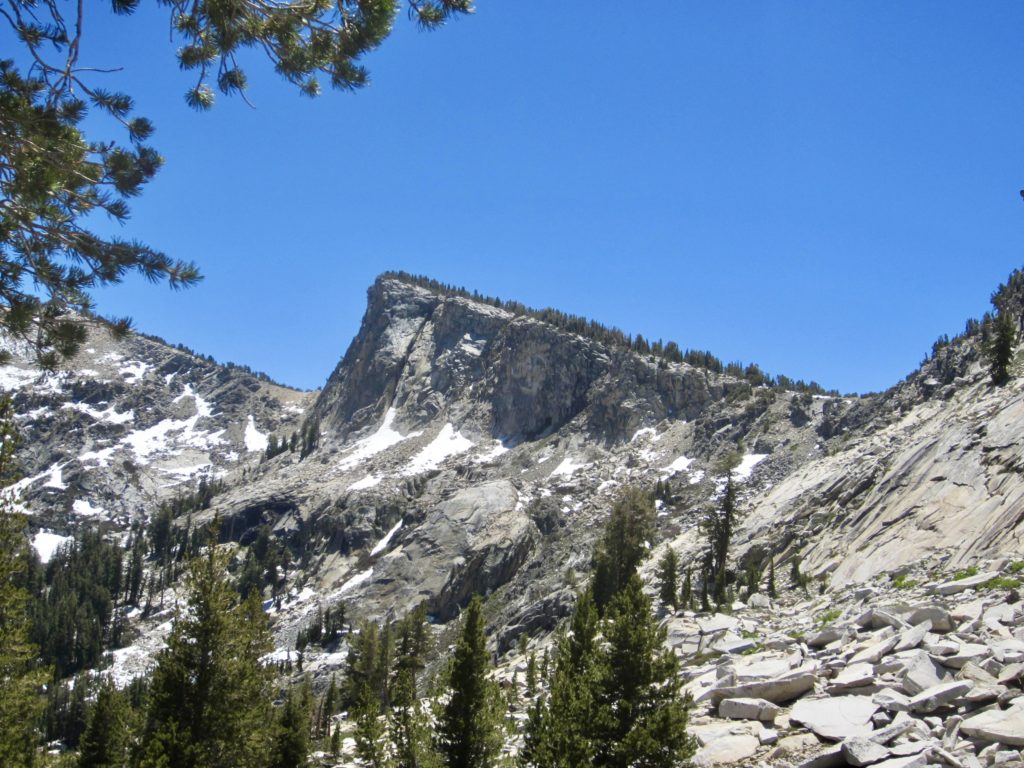
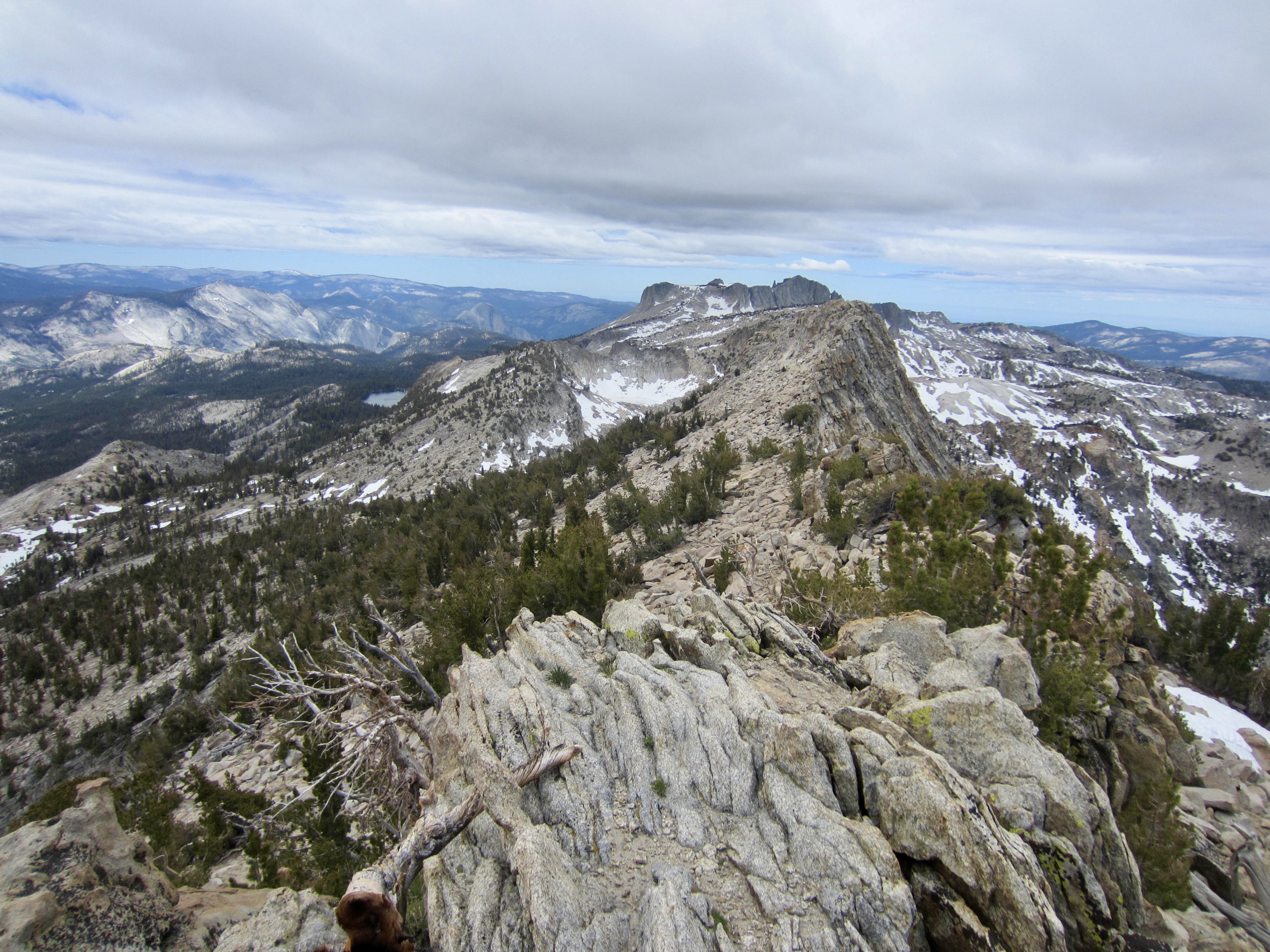
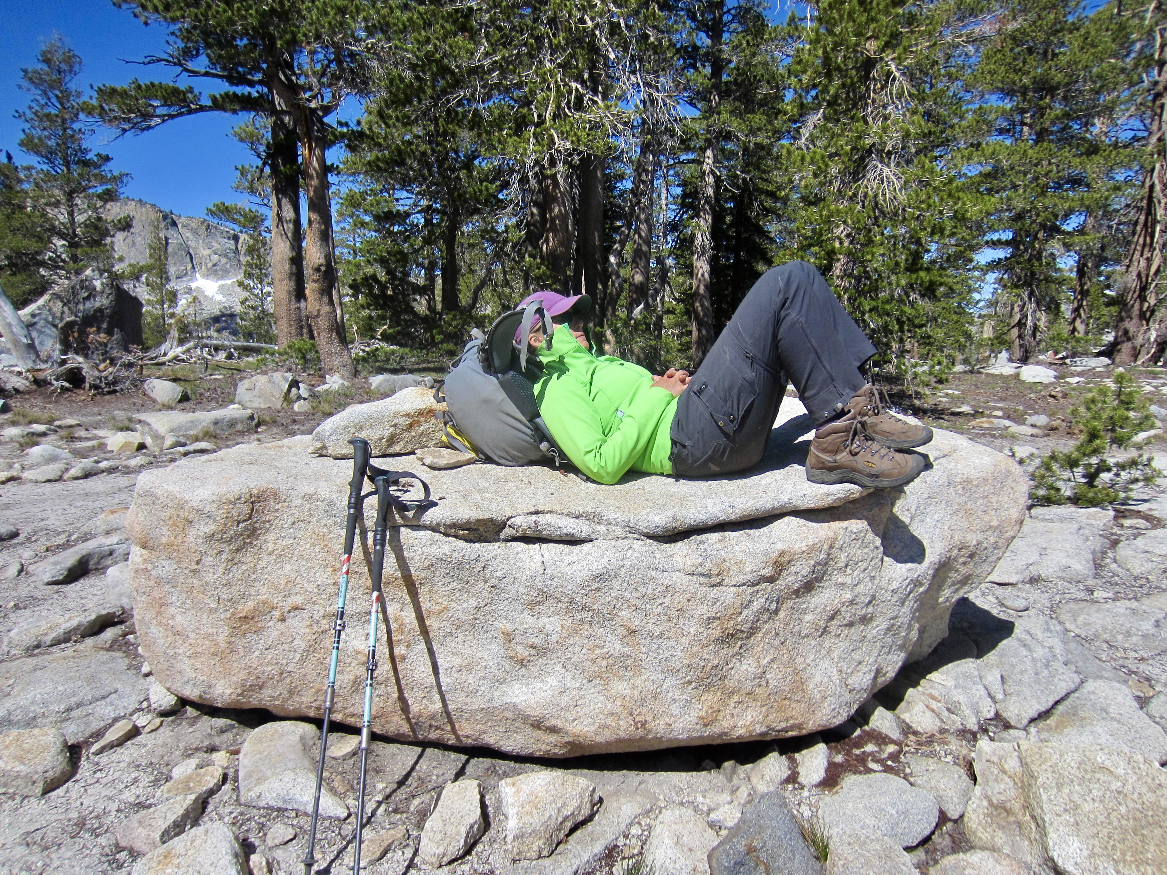
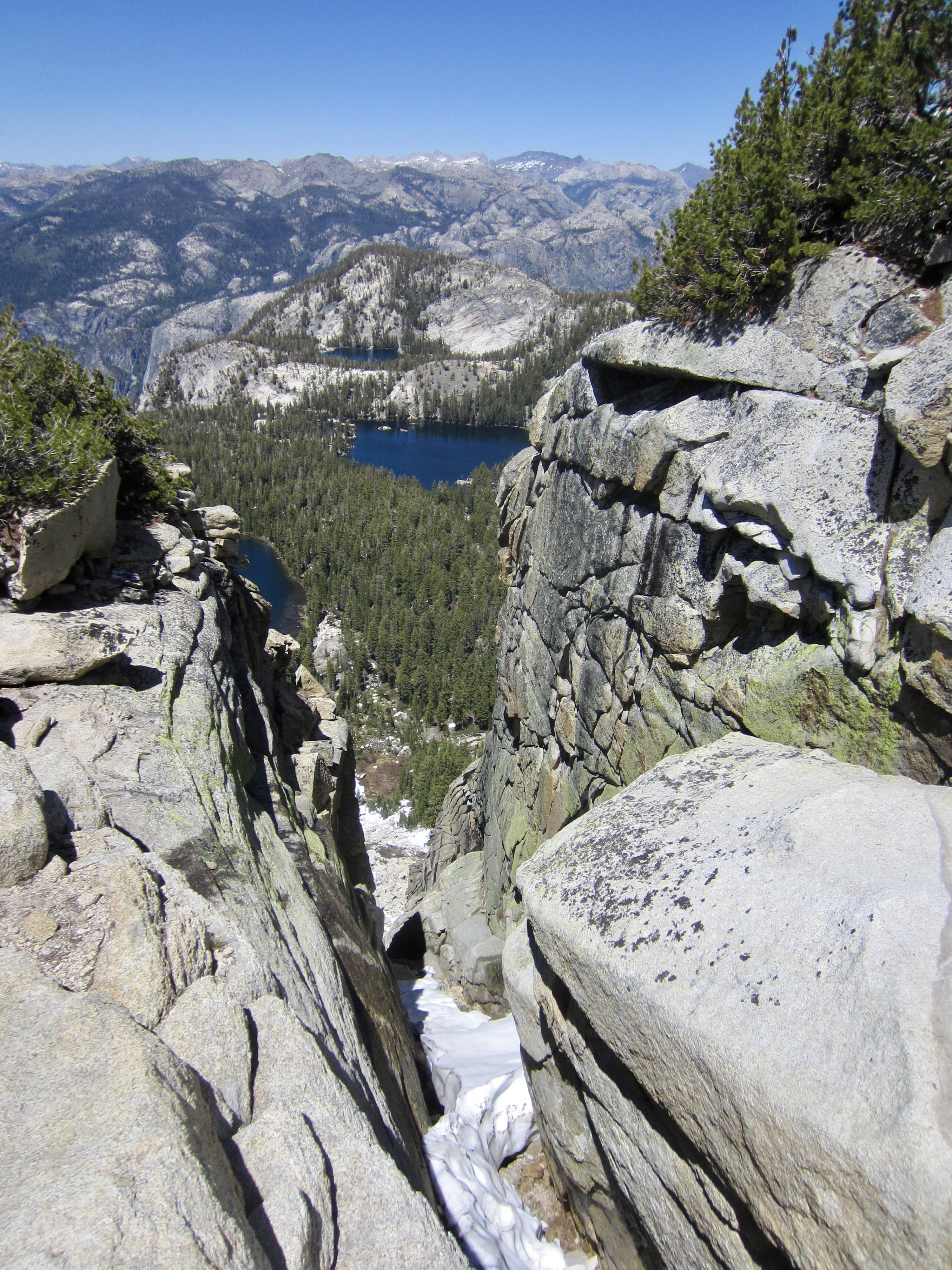
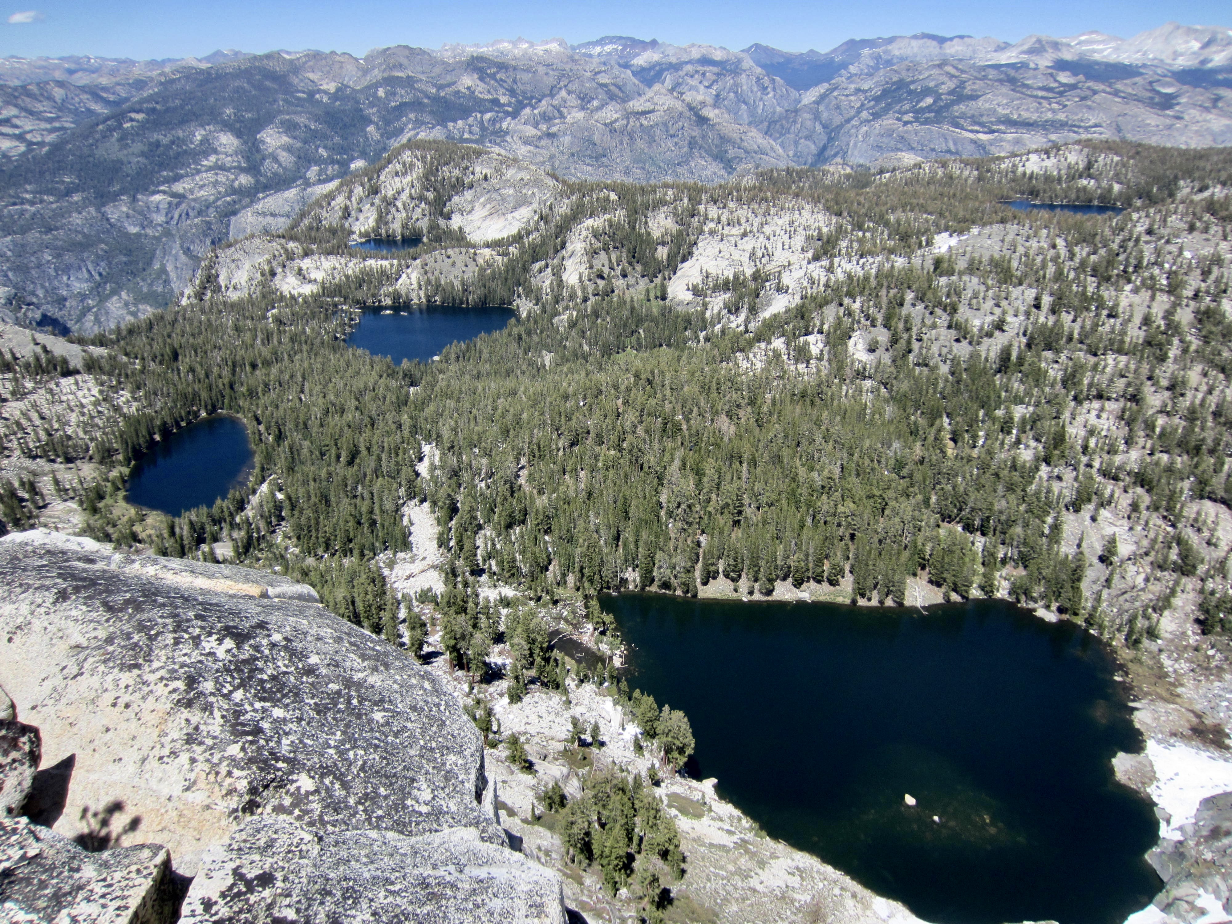
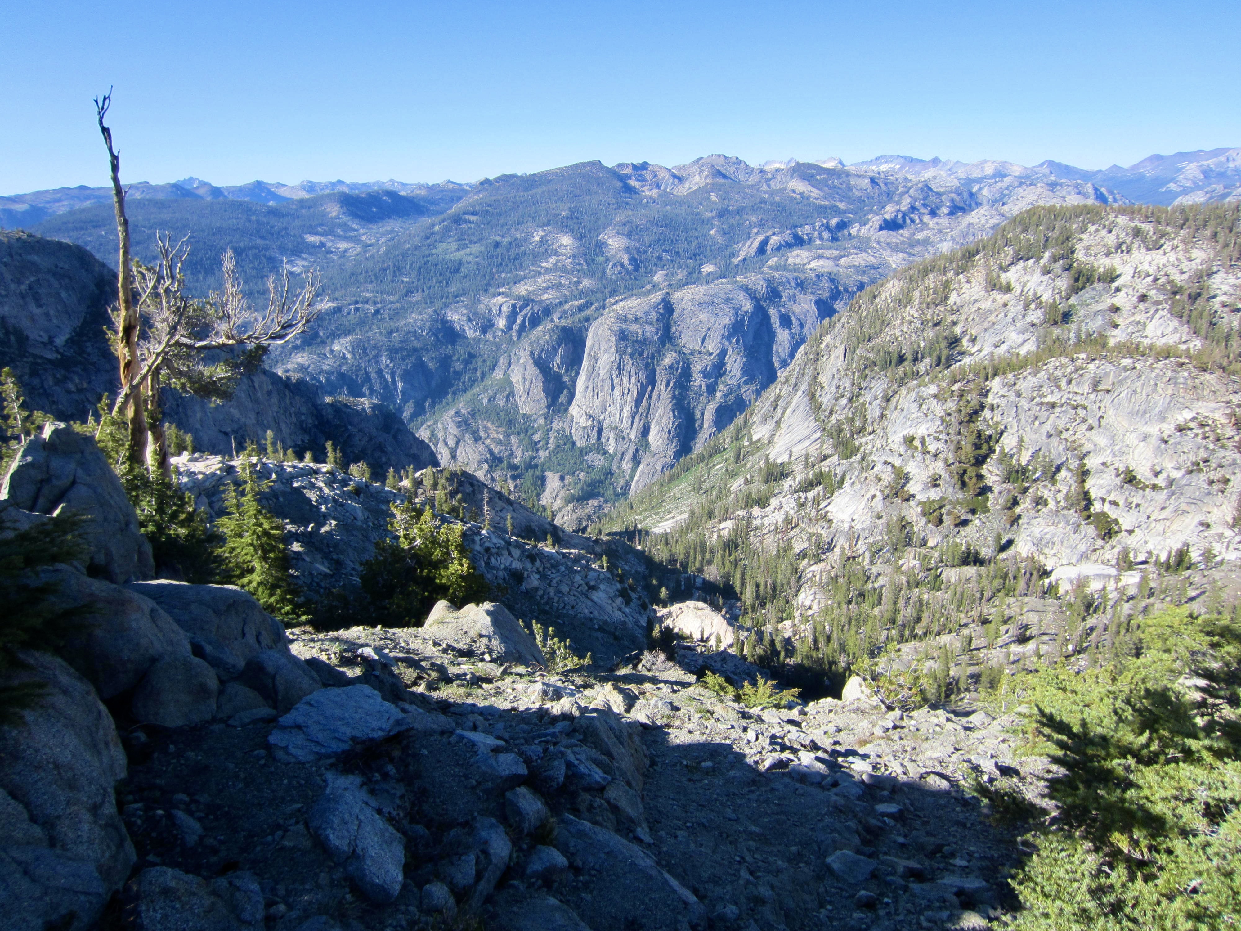
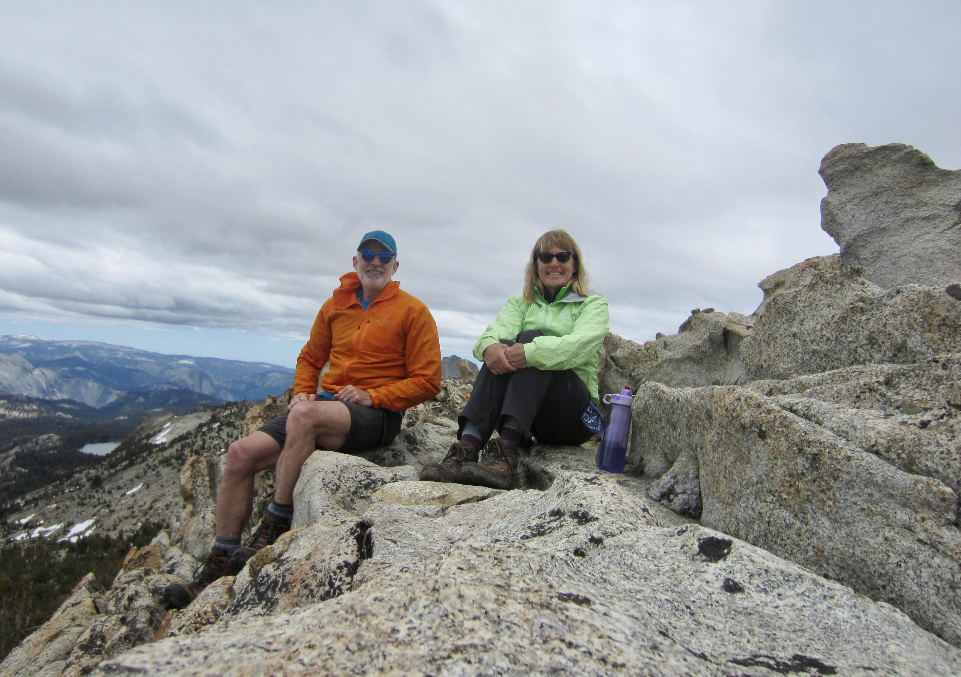
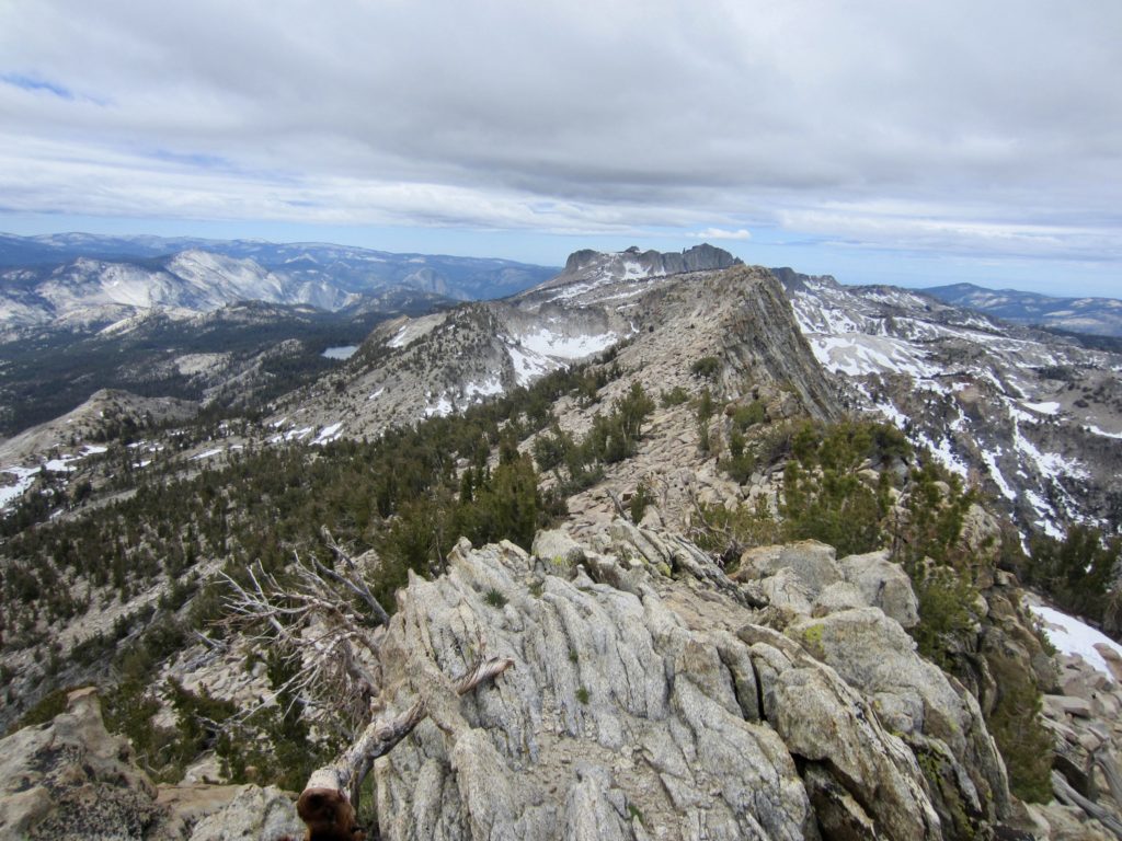
Eileen was feeling a bit unwell, so she elected to spend her afternoon relaxing at the pass. I took this time to hike up Ten Lakes Overlook, a 10,183-foot rock horn that towers above Ten Lakes Basin. A pleasant stroll up the north ridge led me to the summit for a fabulous view of the entire region.

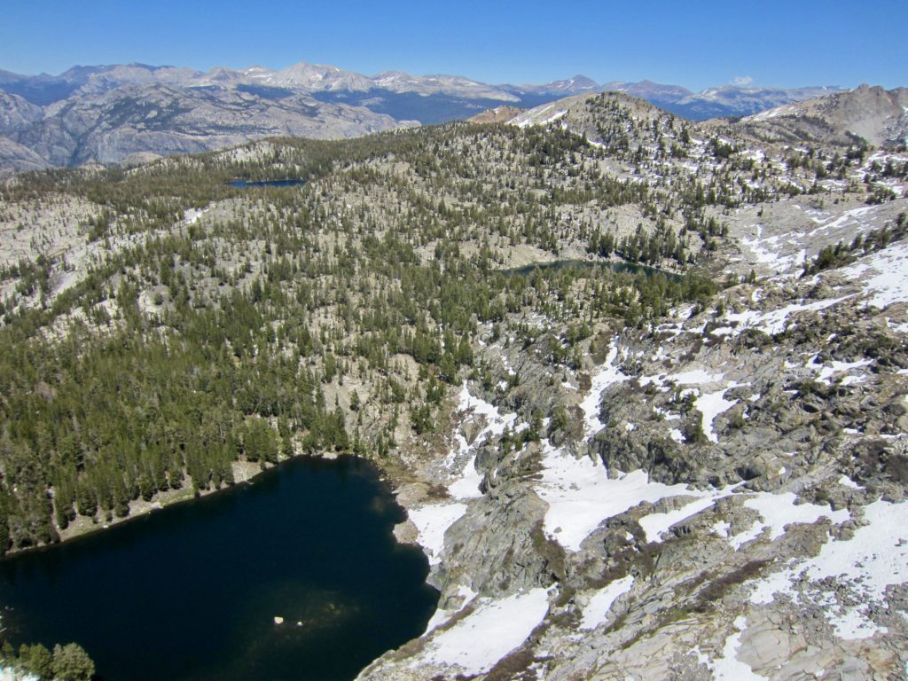
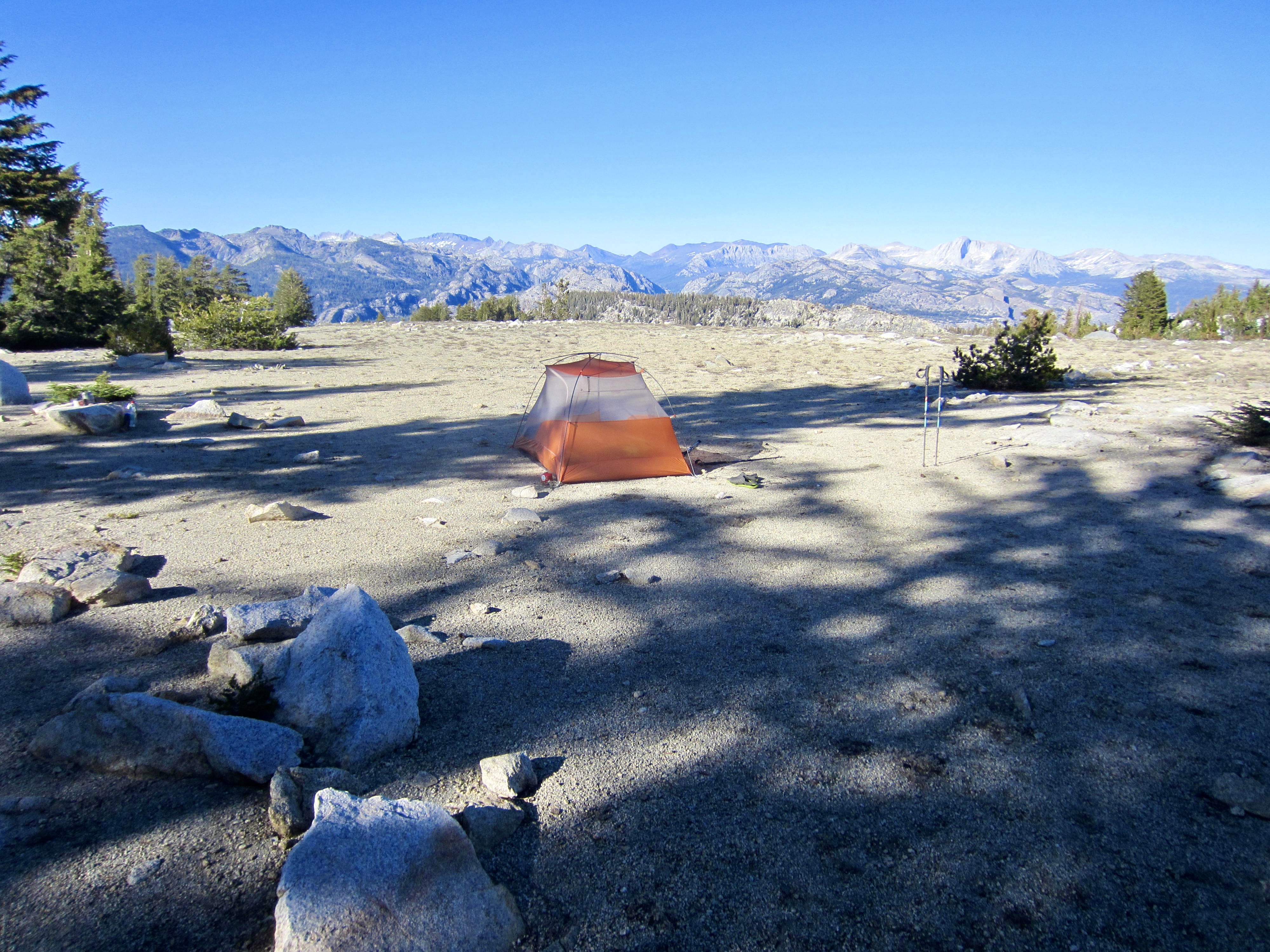
After I rejoined Eileen back at Ten Lakes Pass (1.3 hours + 550 feet RT), we set up our last camp on a sandy bench 50 yards off the trail. She was feeling better now, so we made a short hike over to a nearby viewpoint from which we could look eastward across the basin and northward across Muir Gorge.


Day 6: Ten Lakes Pass to White Wolf Trailhead
The night had been surprisingly calm but cold, and we awoke to a cloudless morning. The final day of our loop involved an undulating descent to the headwaters of Yosemite Creek, a short ascent of a ridge, and then a gradual descent to White Wolf Plateau. We passed numerous hikers approaching from Upper Yosemite Creek and Lukens Lake, but the White Wolf Trailhead was strangely quiet when we arrived in early afternoon (4.9 hours + 8.2 miles + 600 feet – 2500 feet from Camp 5). All in all, this excellent trek through low canyons and high mountains seemed to epitomize Yosemite backpacking!


…
Access Comments
A puzzling component of our trip was the status of the White Wolf Trailhead. When Eileen and I entered the park, we spoke to two different rangers who issued us two separate permits: one for parking at the trailhead, and the other for hiking from the trailhead. Neither ranger mentioned any access issues, nor did the ranger station information board indicate any closures. However, when we arrived at the White Wolf Road turnoff, there were temporary signs stating that the road was closed, and a lot of passenger vehicles were parked on the Tioga Road shoulder. We drove a mile down to the trailhead and found no activity except for several rangers who were unloading hay. They paid us no heed. Feeling justified by having two permits in hand, we ended up parking there for all six days with no problems, but the informational disconnect was very frustrating.
Equipment Comments
No specialized equipment was needed for the Tuolumne Canyon – Ten Lakes Loop. However, we did find that water shoes were handy for crossing Register Creek, which has no bridge. These would be even more useful earlier in the season or anytime when the various bridge-less creeks are running higher. Another item that we really appreciated was our ultralight down-filled sleeping quilt from Enlightened Equipment. This quilt readily accommodated the wide swings in nighttime temperature encountered between the low country and high country; our sleeping bags would have been far less convenient.
…
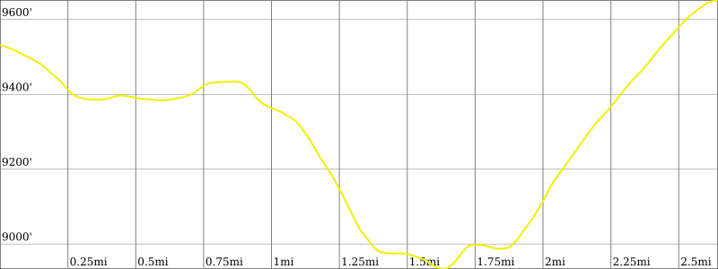
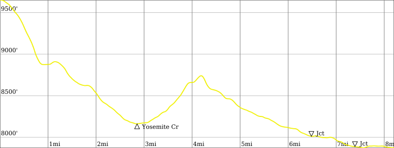
Route Map & Profiles
…
…
…
…
…
…
…
…
Photo Gallery
Click to enlarge…