Trip Date: May 26-29, 2018
Robinson Mountain & Beauty Peak Climbing Trip
Beauty Creek
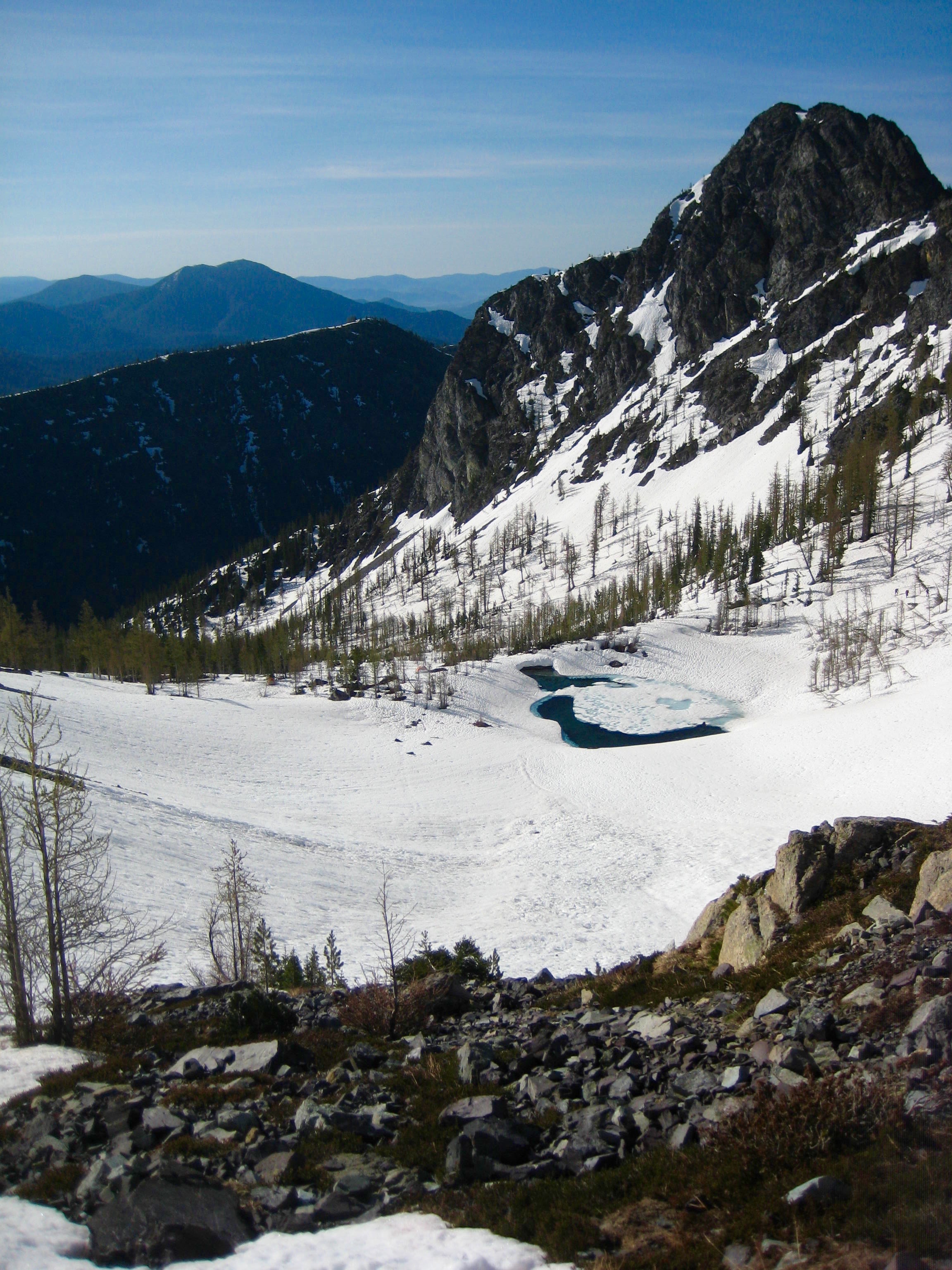
Southeast Robinson Tarn
Robinson Mountain (8726′)
Beauty Peak (7935′)
- Trip Report Summary
- Related Post
- Full Trip Report
- Day 1: Trailhead to Southeast Robinson Tarn
- Day 2 (AM): Robinson Mountain Summit Climb
- Day 2 (PM): Southeast Robinson Tarn to Beauty Creek Valley
- Day 3: Beauty Peak Summit Climb
- Evening 3: Beauty Creek Valley to Robinson Creek Bridge
- Day 4: Robinson Creek Bridge to Trailhead
- Photo Gallery
Trip Report Summary
Region: Northeastern Washington Cascades
Sub-Region: Pasayten Mountains
Area: Pasayten Wilderness
Starting & Ending Point: Robinson Creek Trailhead on Lost River Road (Elev. 2550 feet)
Way Points: Robinson Creek Bridge & Beauty Creek Bridge & West Fork Beauty Creek & Southeast Robinson Tarn & West Fork Beauty Creek & Beauty Creek Valley (trail hike & off-trail hike & rock scramble & snow hike)
Campsites: Southeast Robinson Tarn & Beauty Creek Valley & Robinson Creek Bridge
Summit: Robinson Mountain (snow climb & rock scramble via Southeast Cirque—Southeast Ridge)
Sidetrip: Beauty Creek Basin (snow hike)
Summit: Beauty Peak (snow climb & rock scramble via Southwest Chute—Southeast Ridge; descent via Southwest Slope—Southwest Chute)
Approximate Stats: 18 miles traveled; 9000 feet gained & lost.
Related Post
Robinson Mountain via Southeast Ridge – May 2005
Full Trip Report
Over Memorial Day Weekend, Eileen and I teamed up with Lisa, Kevin L, Kevin K, Tony, Colin, and Steven for a climb of Robinson Mountain. We subsequently teamed up with Fay for a climb of nearby Beauty Peak. This combination has been called “The R&B Tour” and “Beauty and the Beast” in the past. We found that the two peaks paired nicely but presented distinctly different climbing conditions.
Day 1: Trailhead to Southeast Robinson Tarn
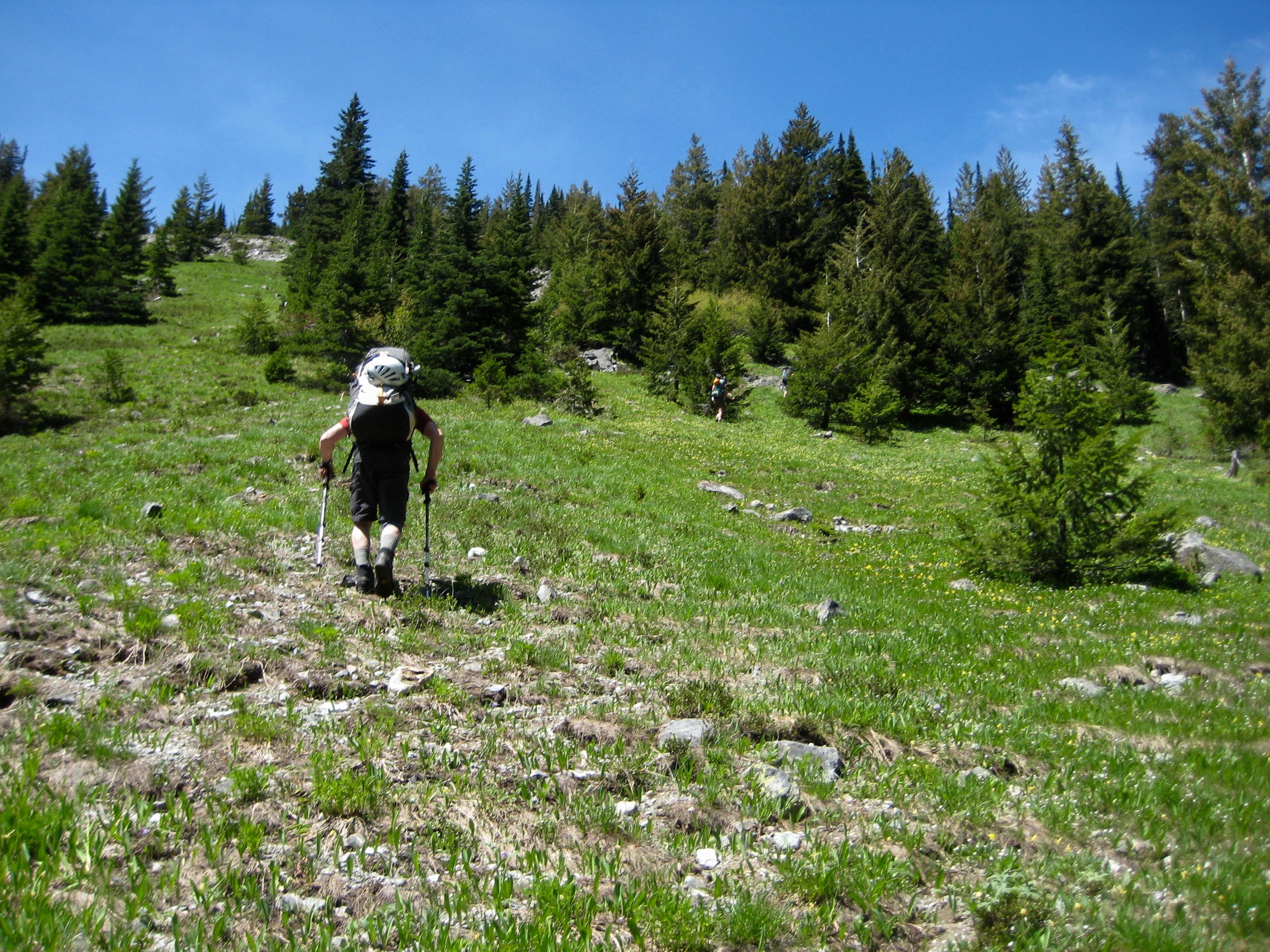
We hiked several miles up the well-maintained Robinson Creek Trail on a mild, sunny morning, first crossing Robinson Creek and then Beauty Creek on sturdy bridges. Both creeks were raging due to the spring runoff. Shortly beyond the latter bridge, we turned uphill on the abandoned (but lightly maintained) Beauty Creek Trail. At 5200 feet, we crossed West Fork Beauty Creek, which emanates from a tarn on Robinson Mountain’s southeastern flank. A wide open grassy slope on the other side led us up easily to the 6800-foot tarn (6.1 hours from TH).

- Ascending To High Camp
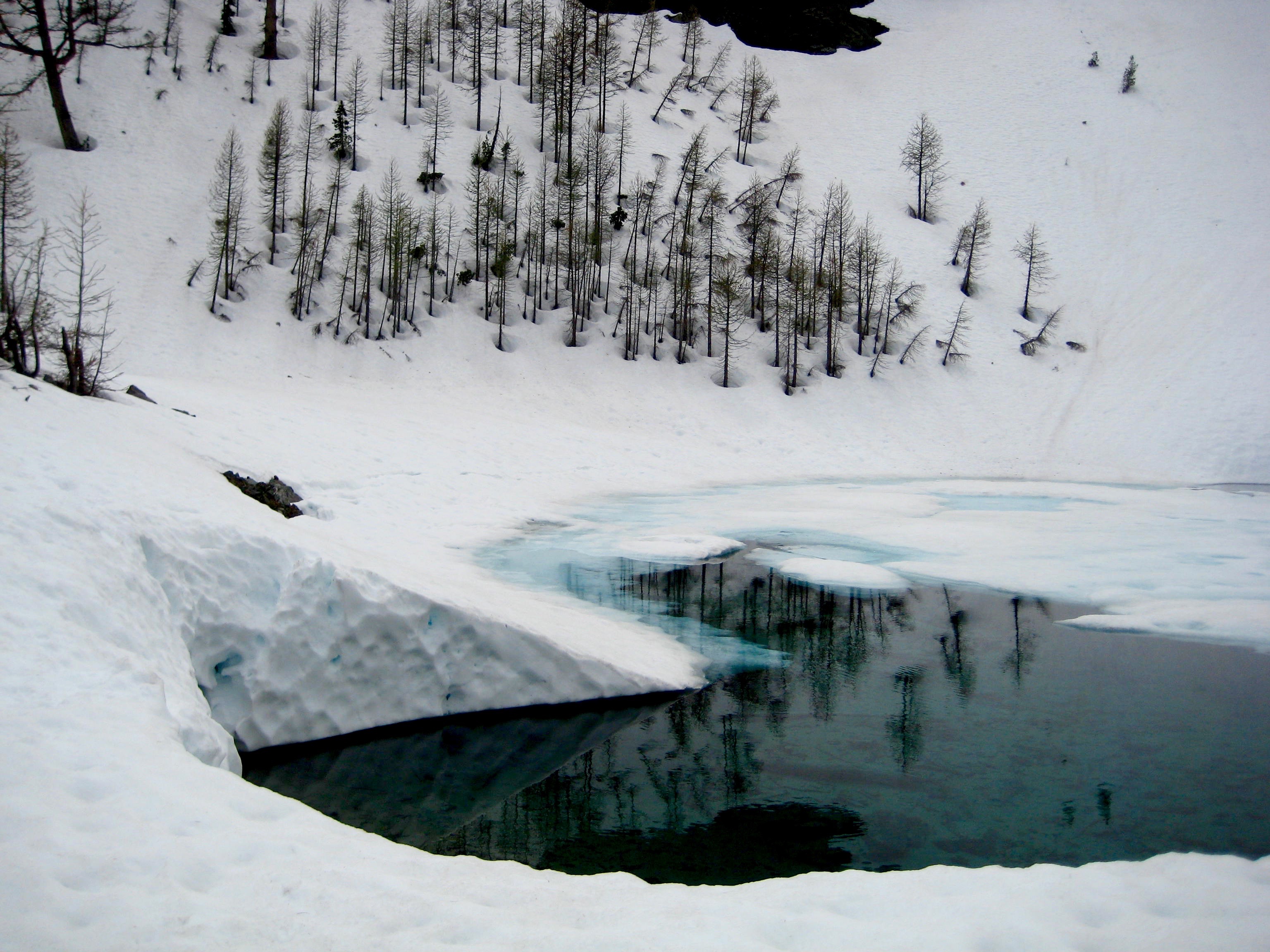
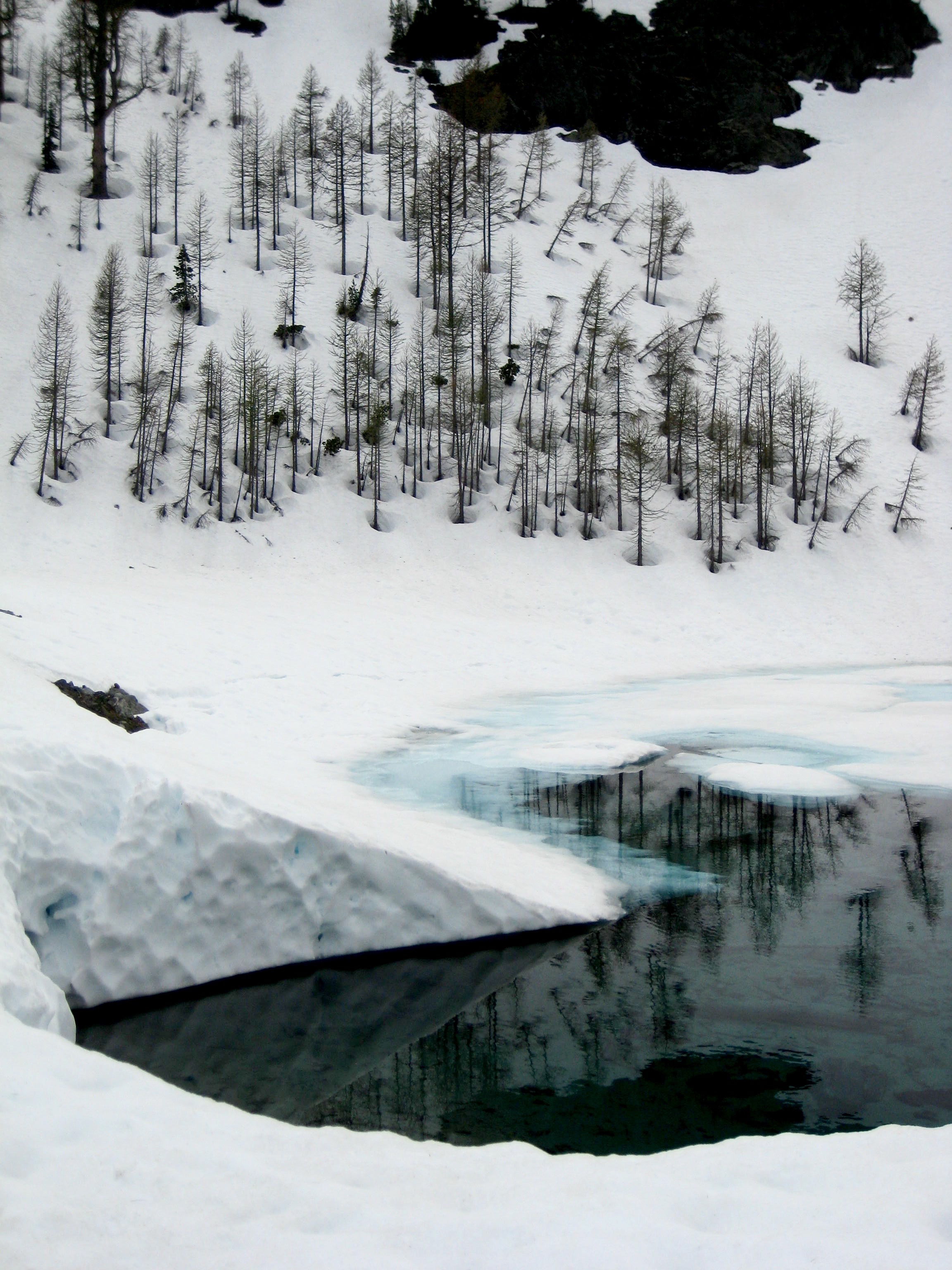
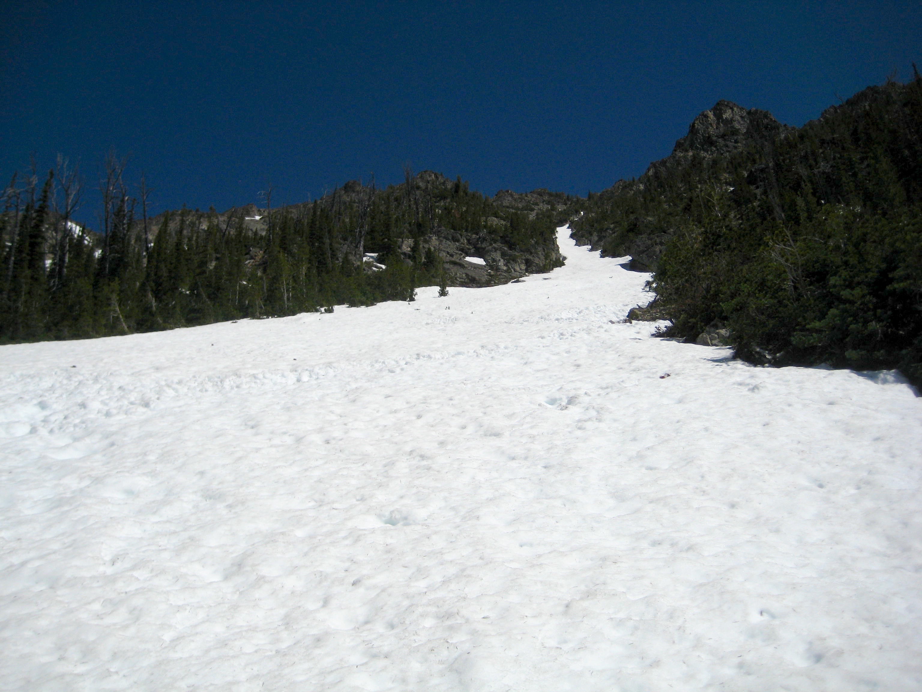
We set up camp on a snow knoll next to the tarn. From here, an easy route to the ridge crest above could be seen.

- Snow Basin Above Camp
Day 2 (AM): Robinson Mountain Summit Climb
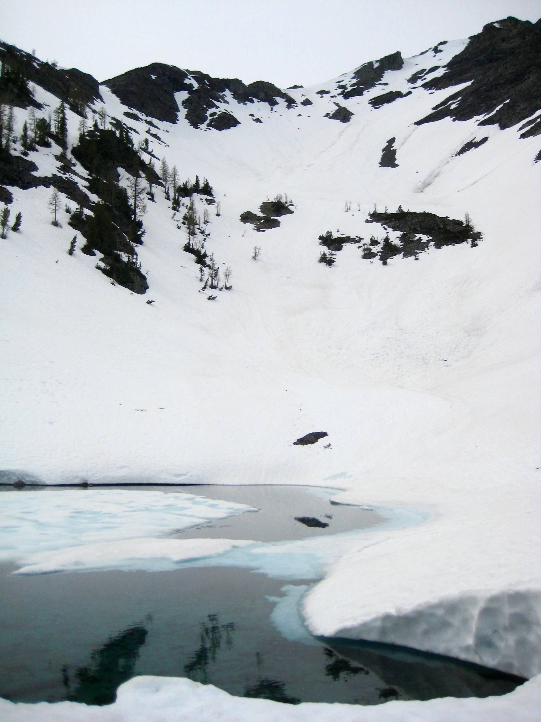
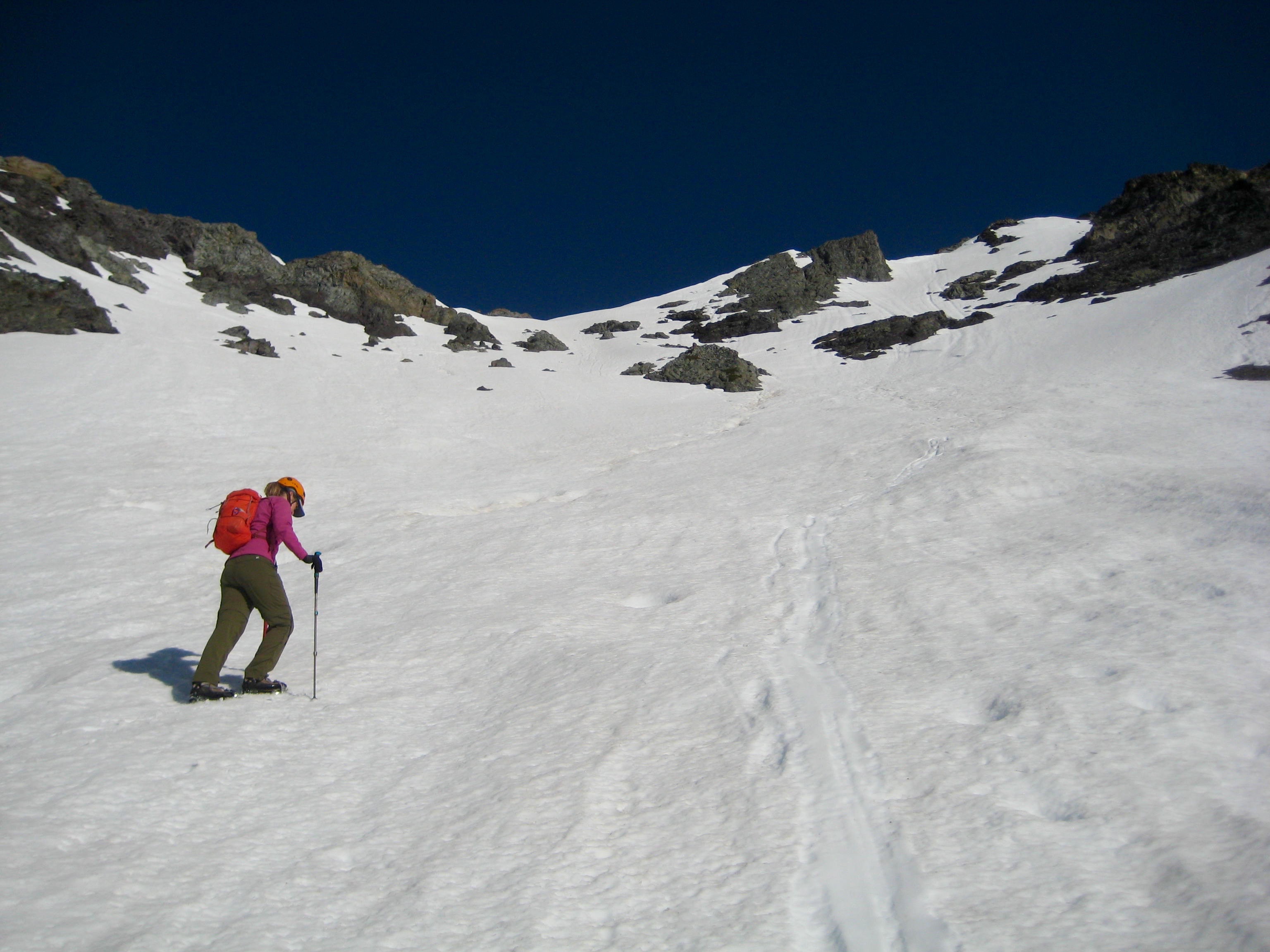
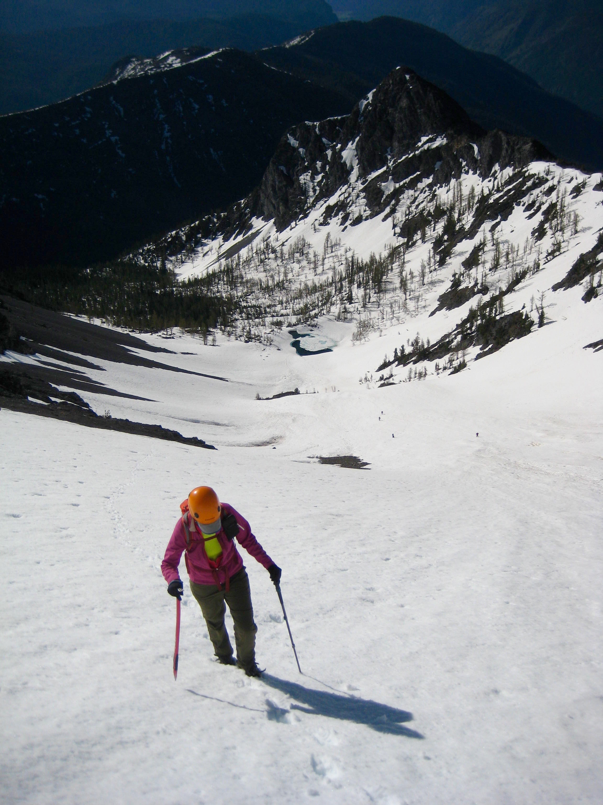
After being blasted by cold mountain winds at sunset and again at sunrise, we awoke to a fairly calm and mild morning. Snow conditions were very good as we climbed up through the cirque slopes. Crampons were helpful but not essential.
- Climbing Up Snow Basin
As we climbed higher, more and more peaks and ridges came into view.
- Nearing Top Of Snow Basin
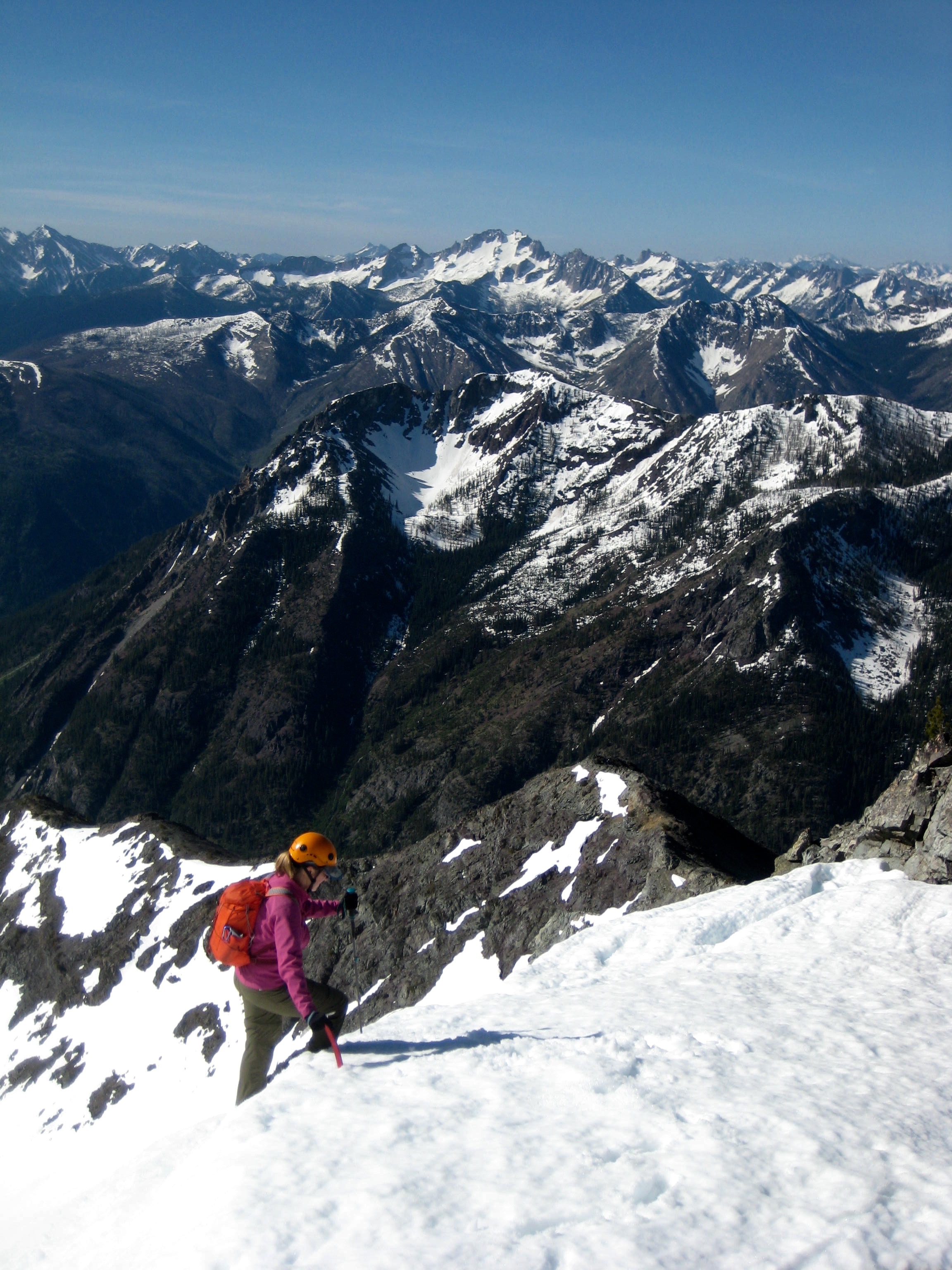
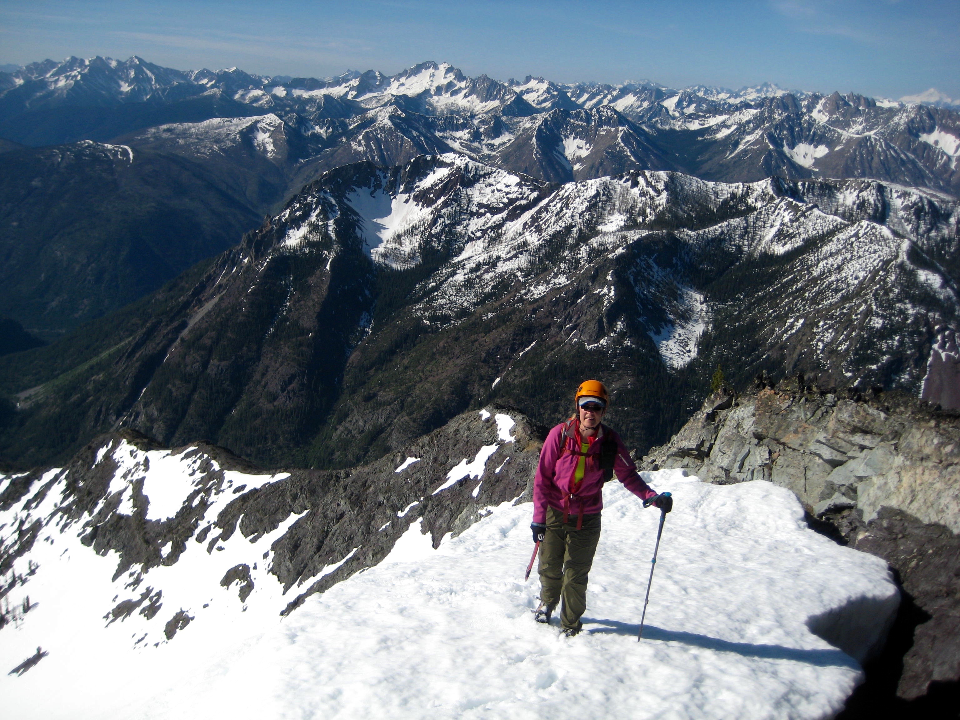
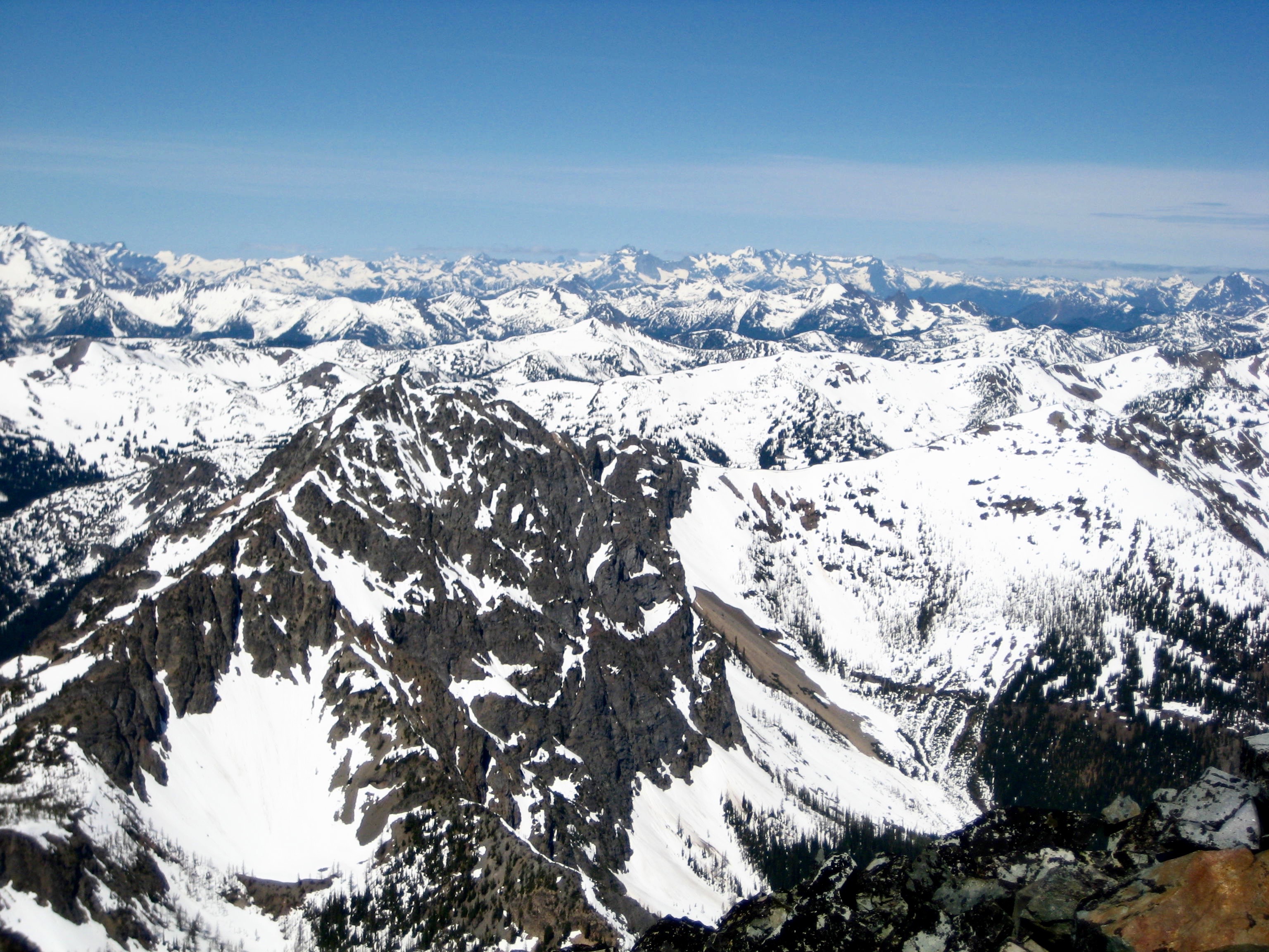
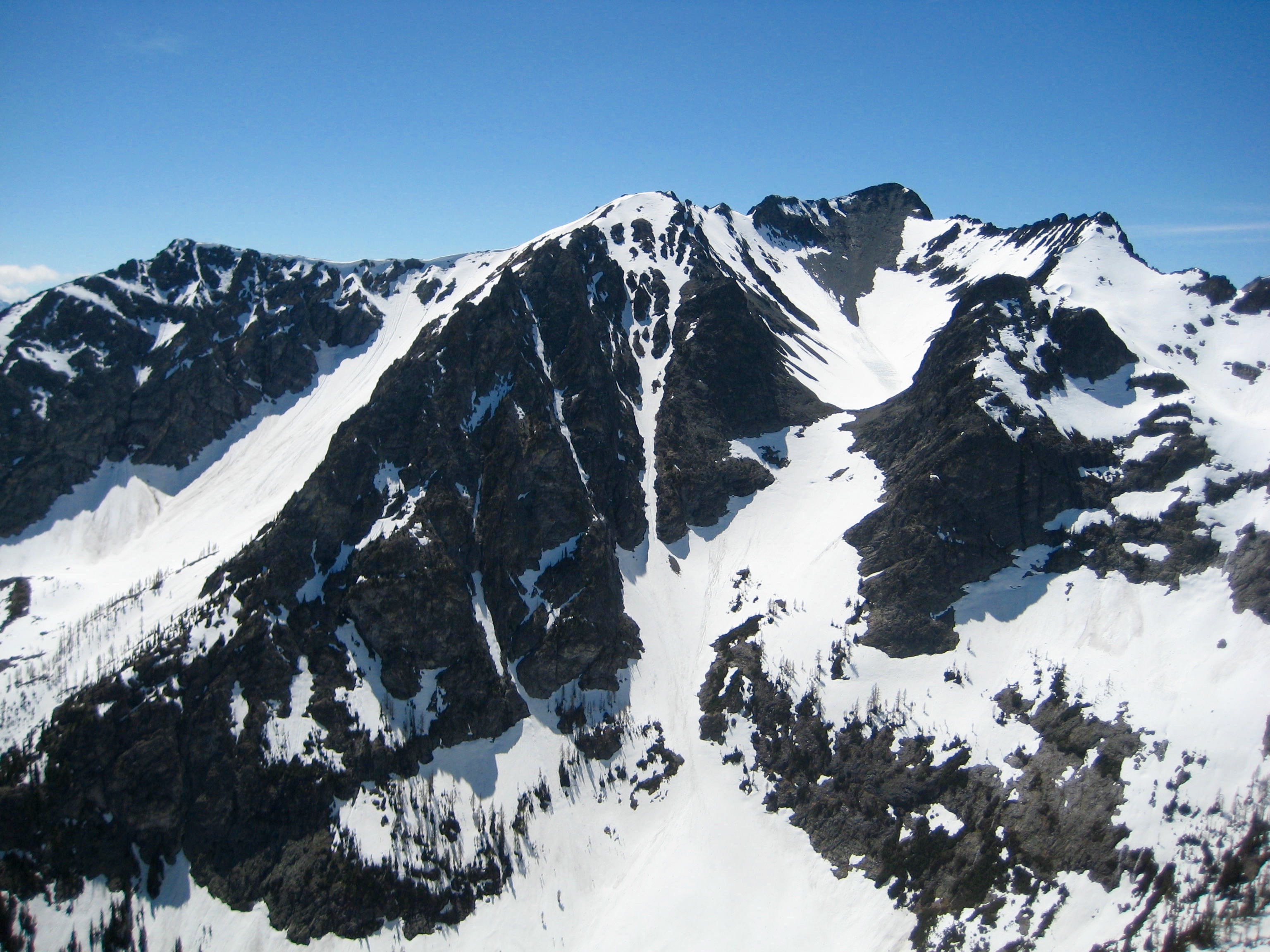
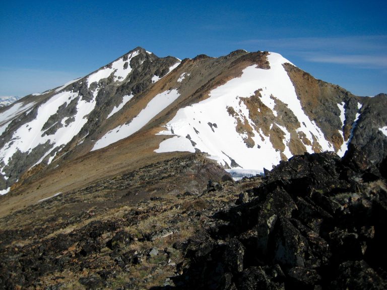
Upon reaching the top of the cirque, we could see an inviting—and mostly snowfree—ridgeline leading up to Robinson’s summit a full mile away.
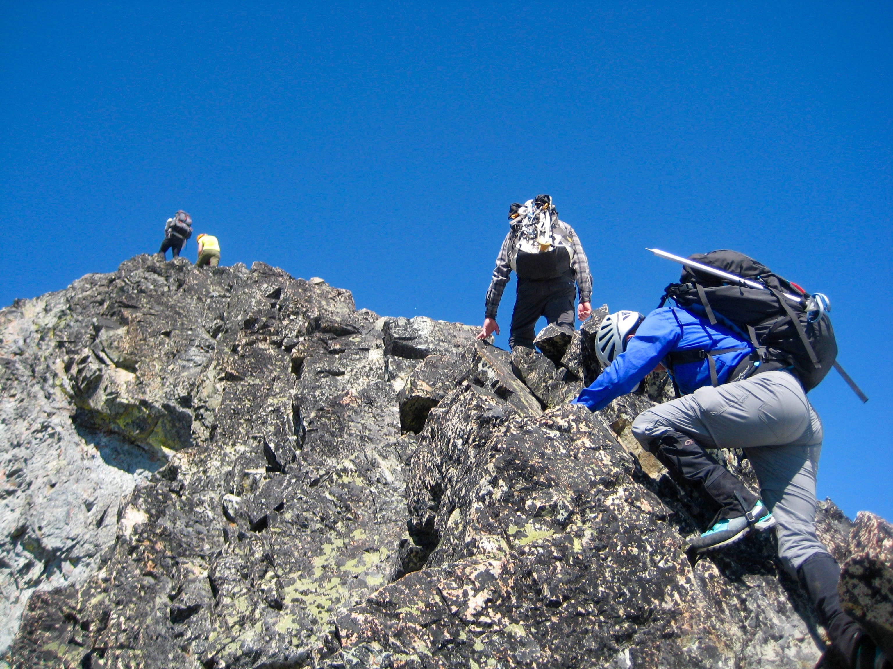
- Summit Ridge Of Robinson Mountain
The crux of the ridge route is a pleasant Class 3 scramble over a steep horn.
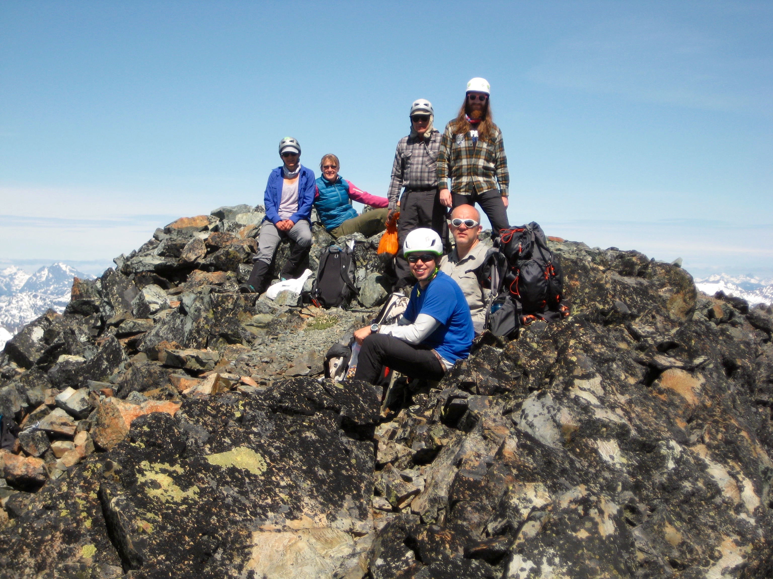
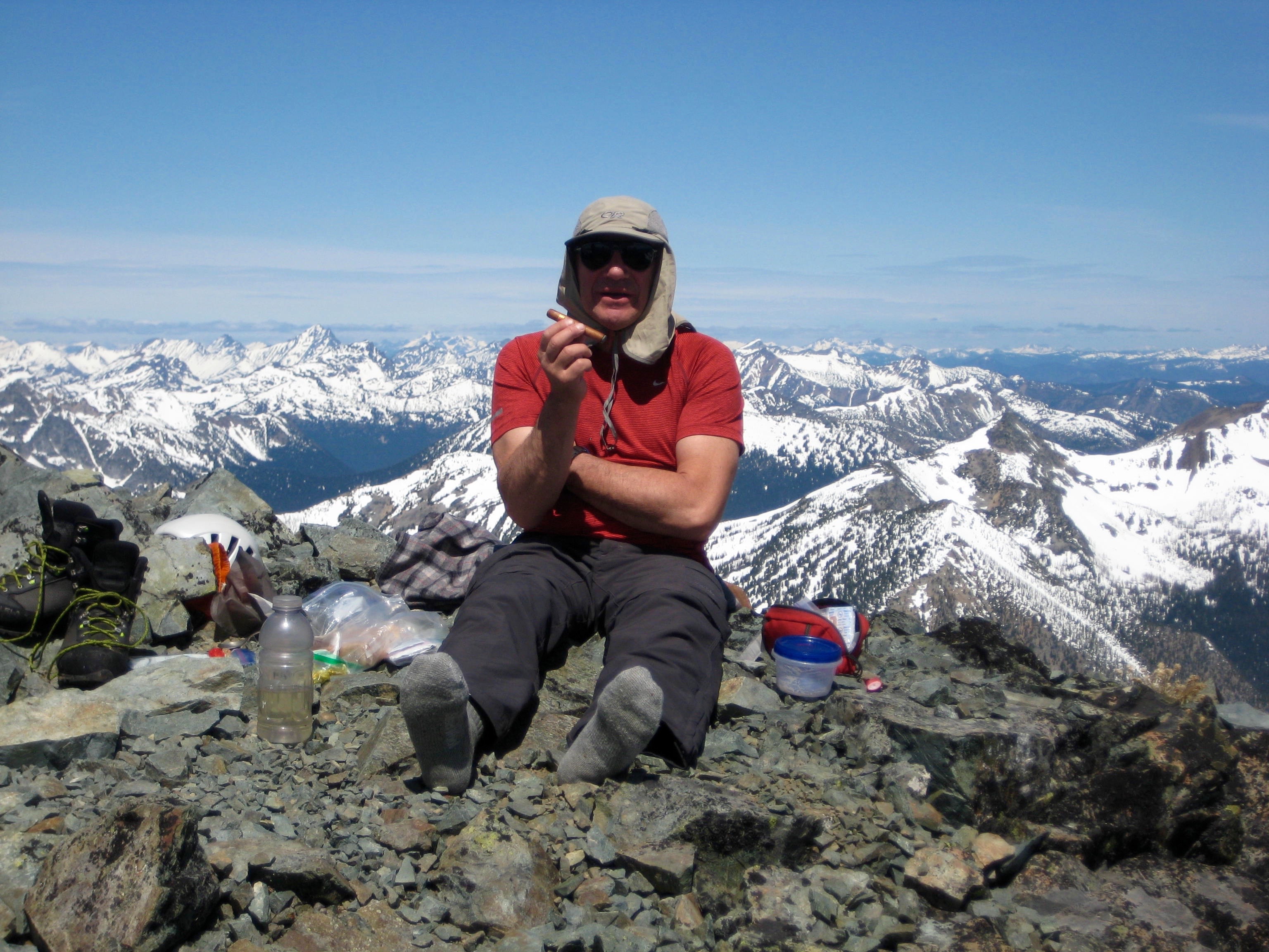
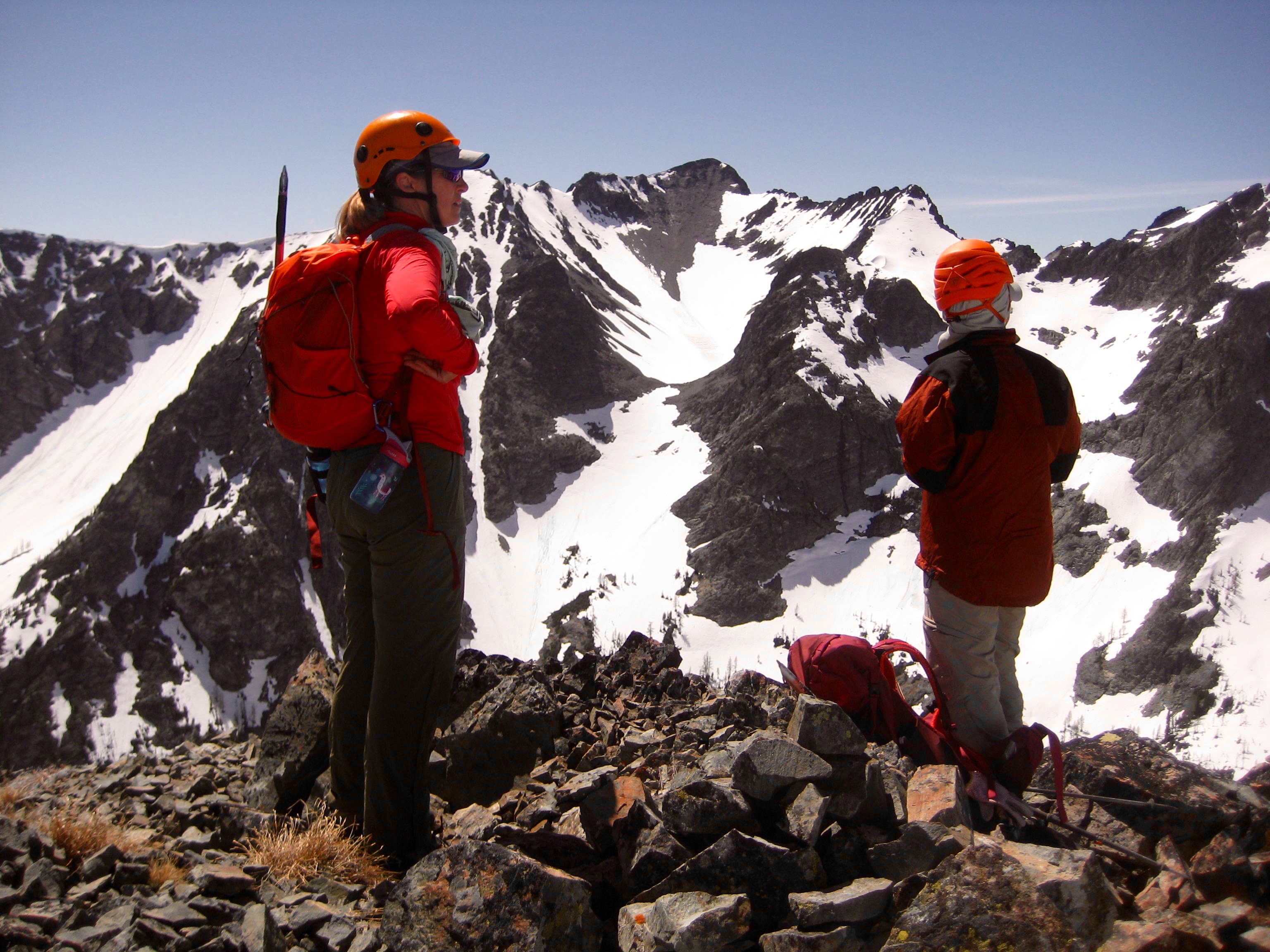
We reached the summit around 11:00am (3.3 hours from camp) and parked ourselves on the sunny rocks for 90 minutes.
- Group On Summit Of Robinson Mountain
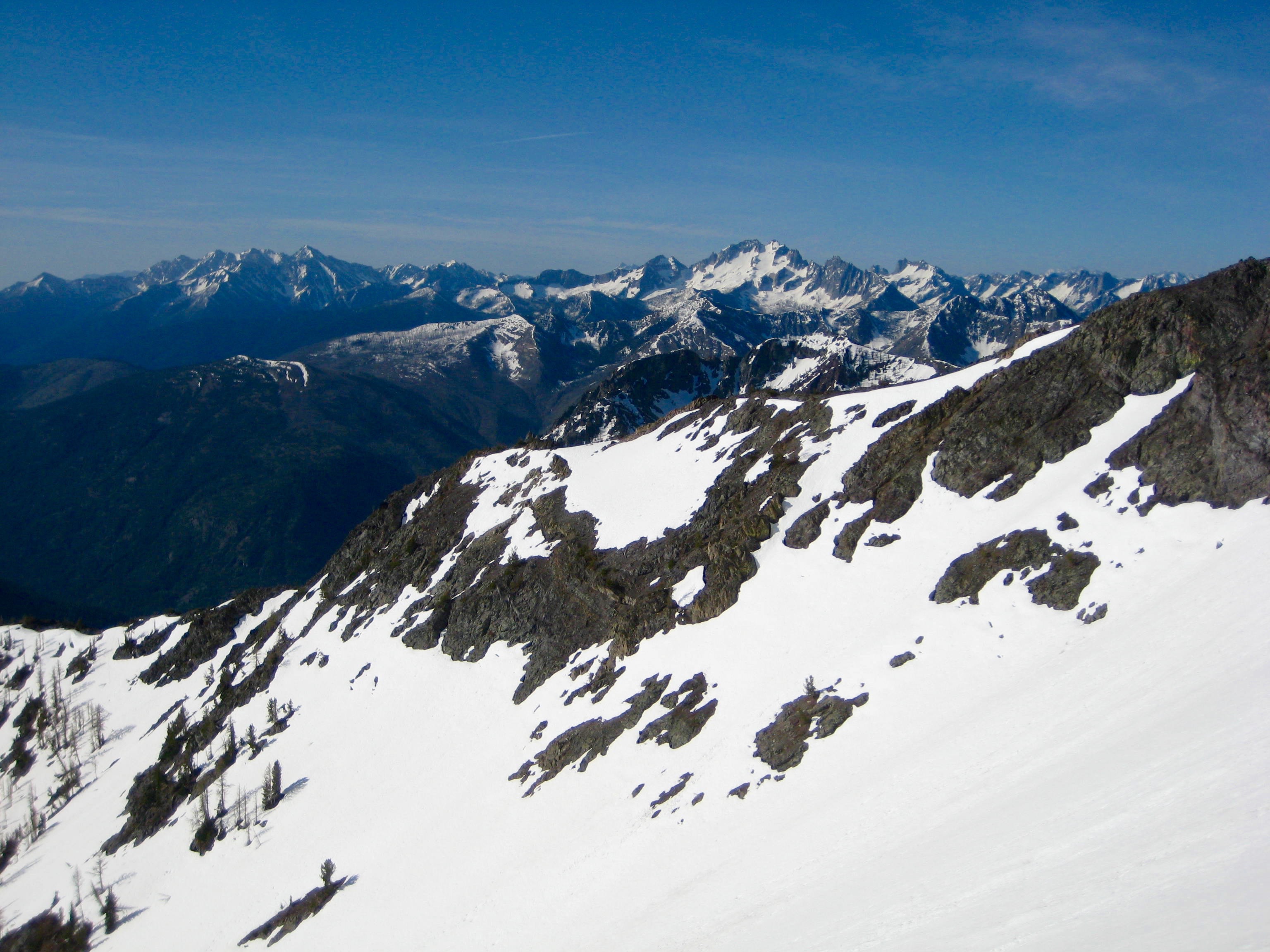
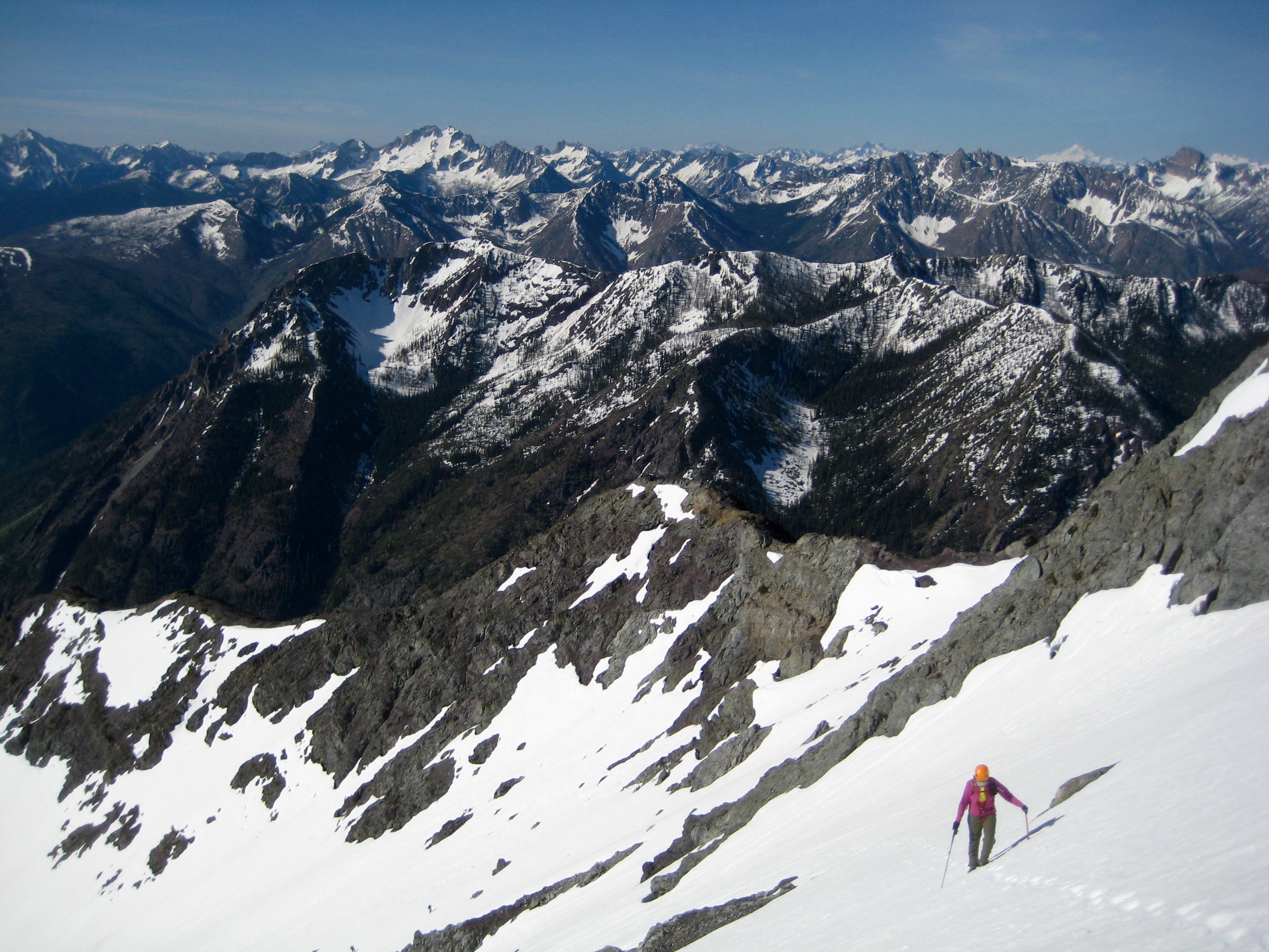
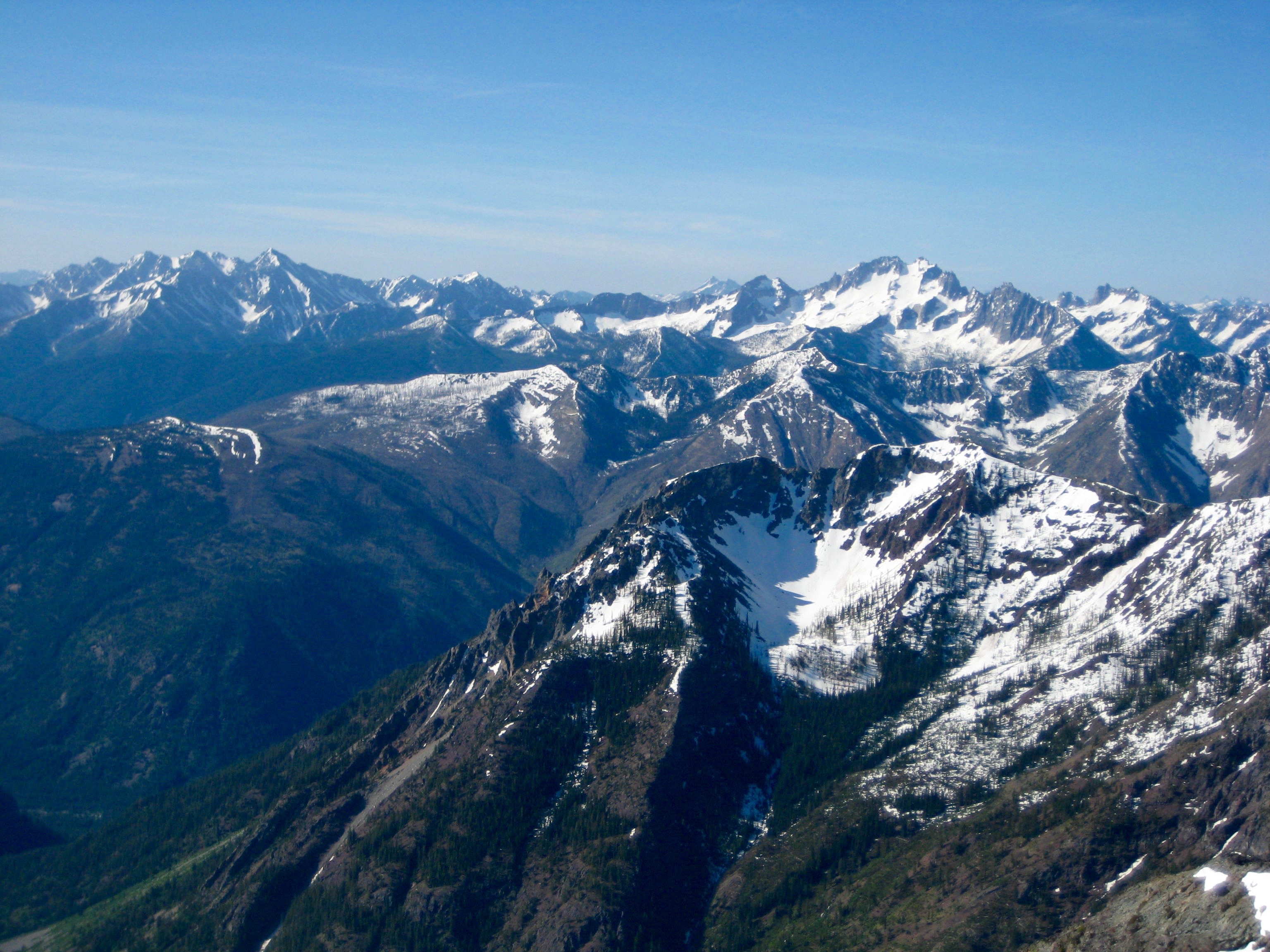
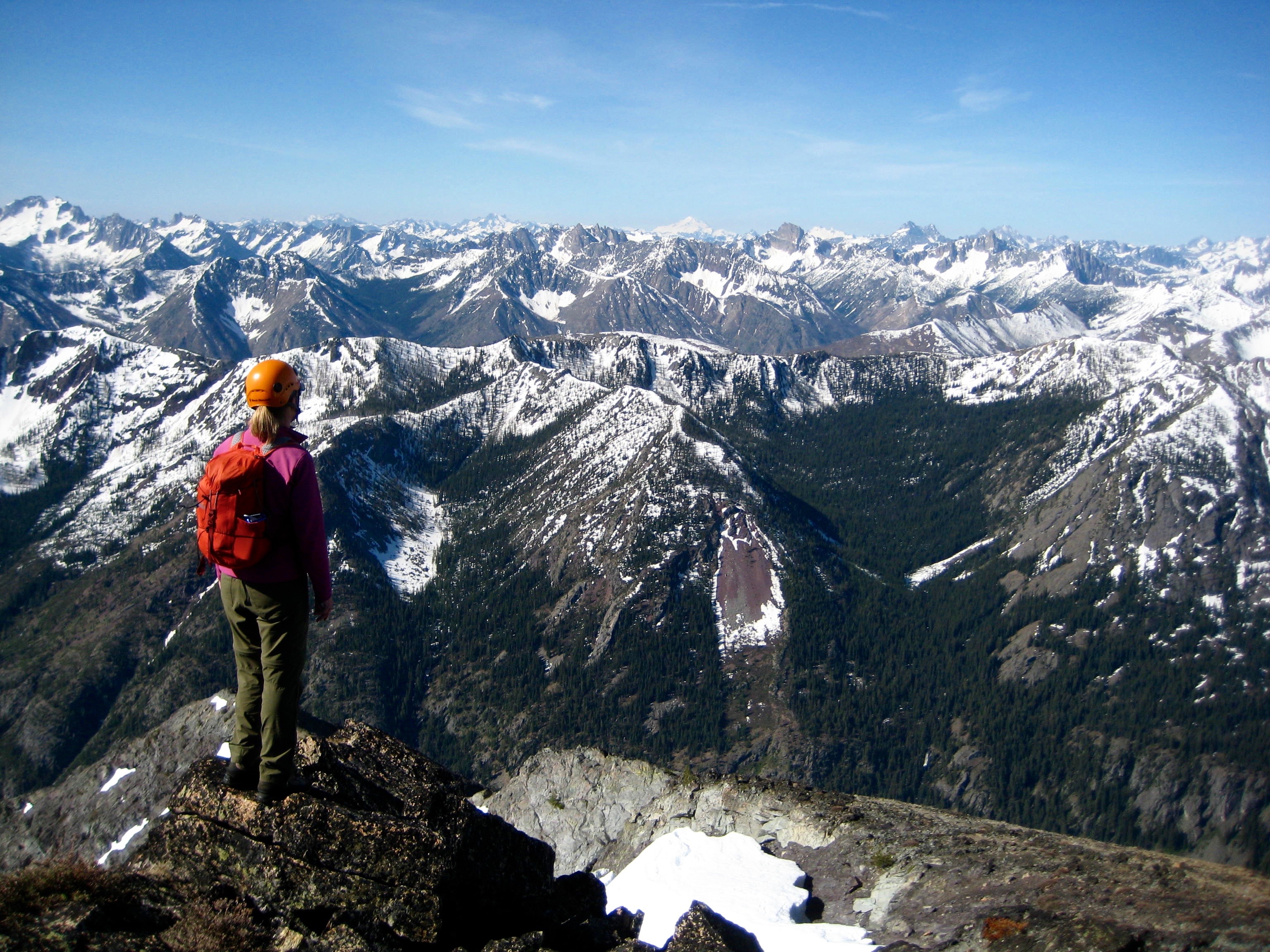
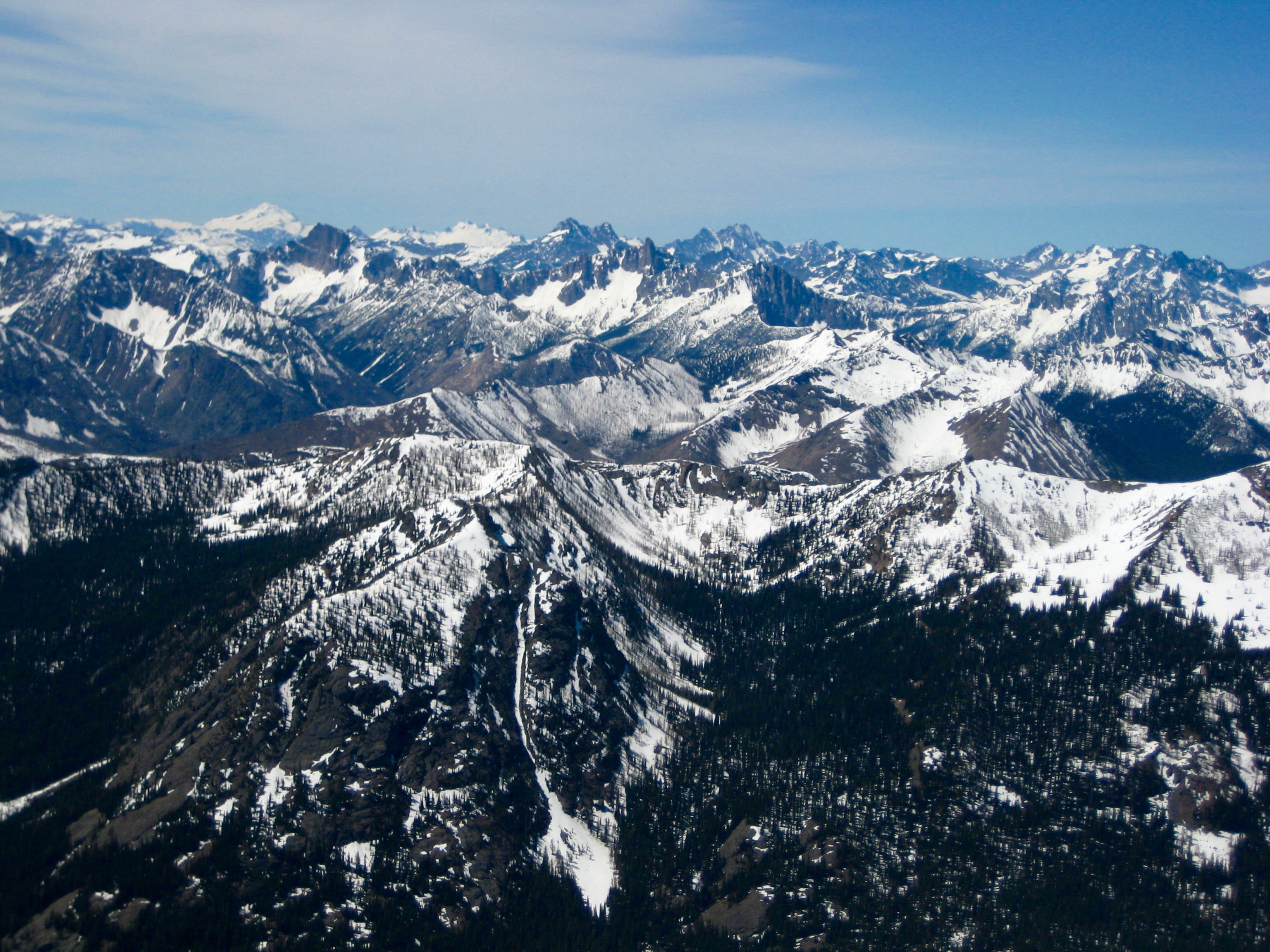
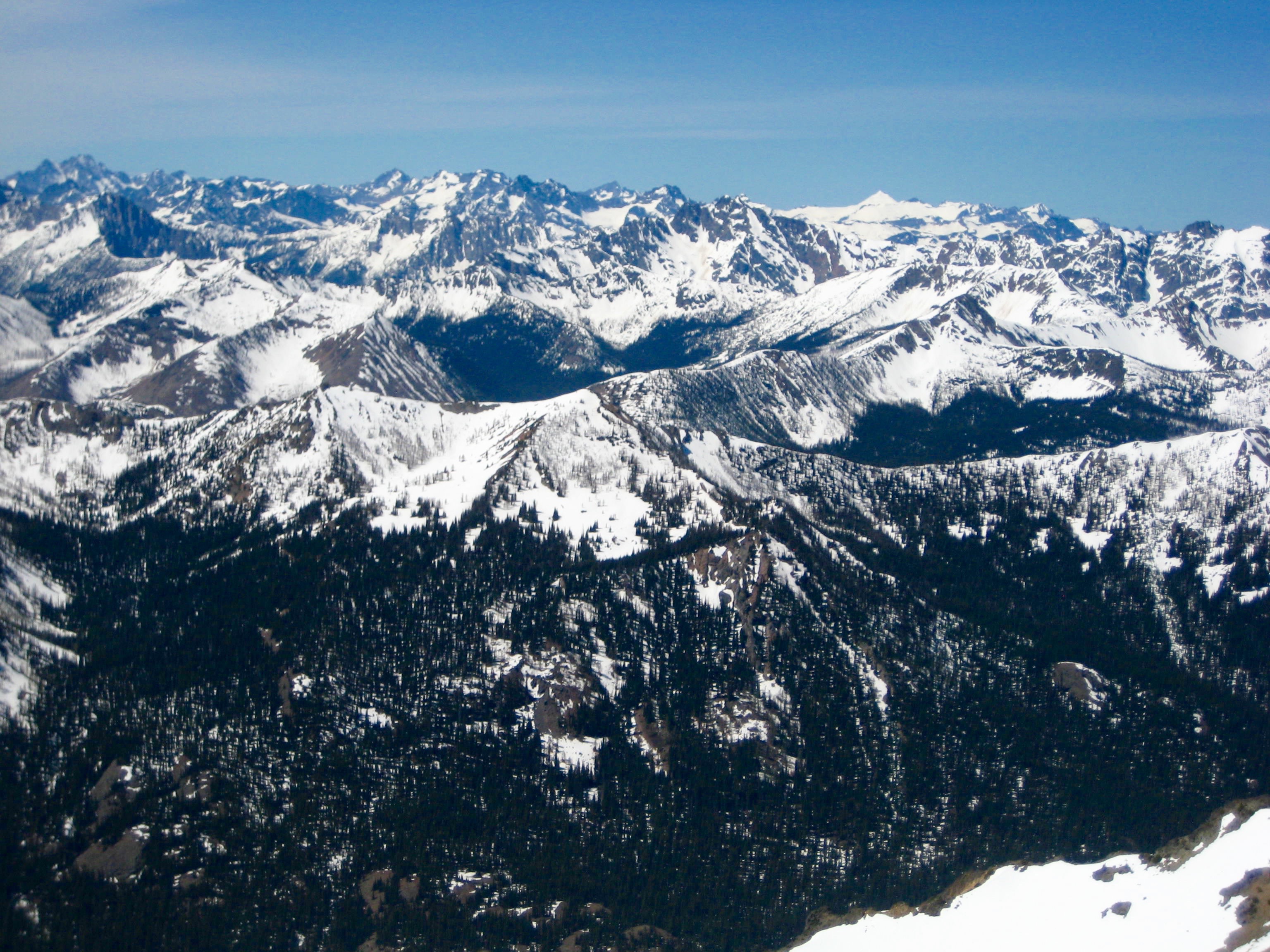
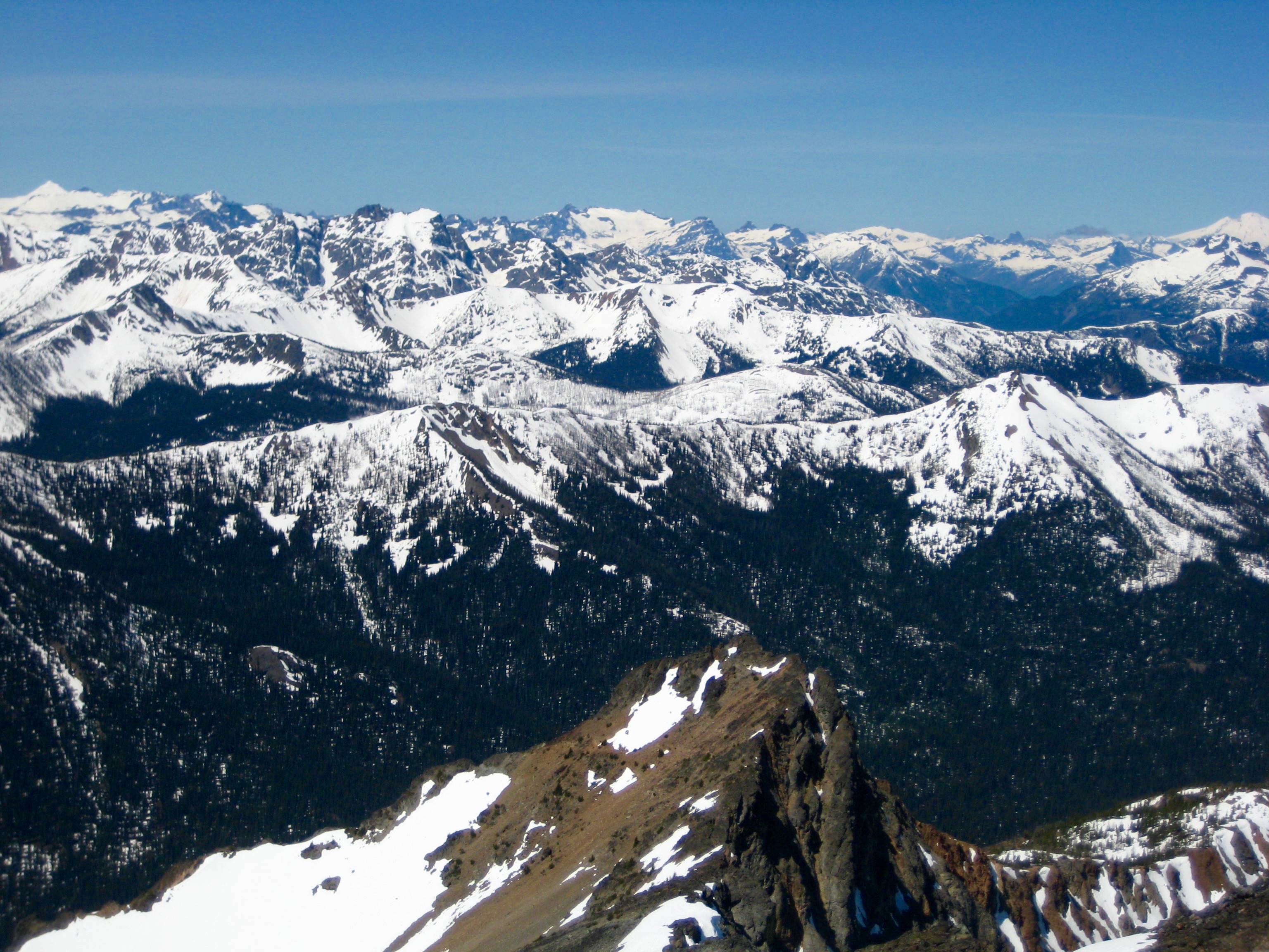
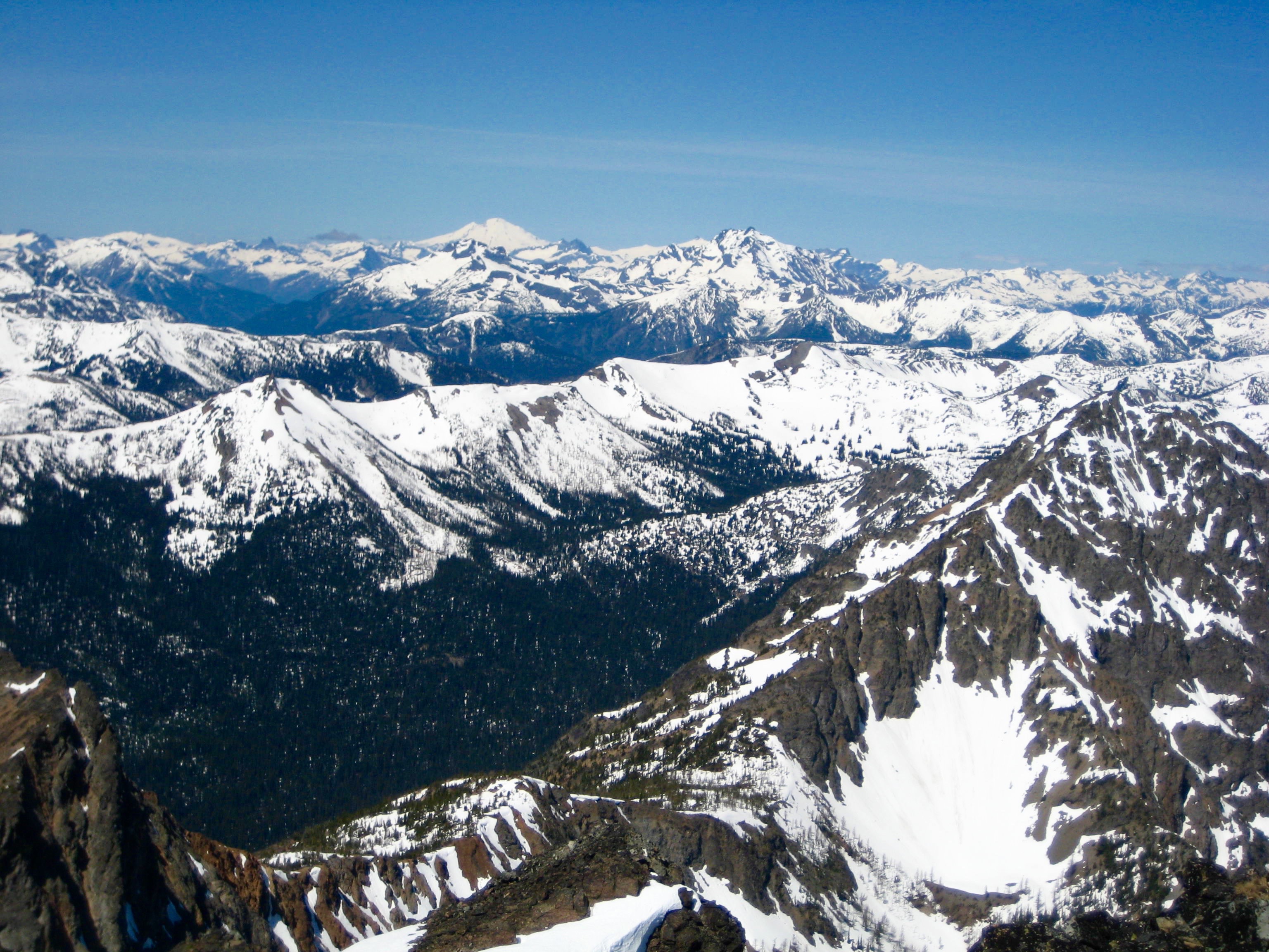
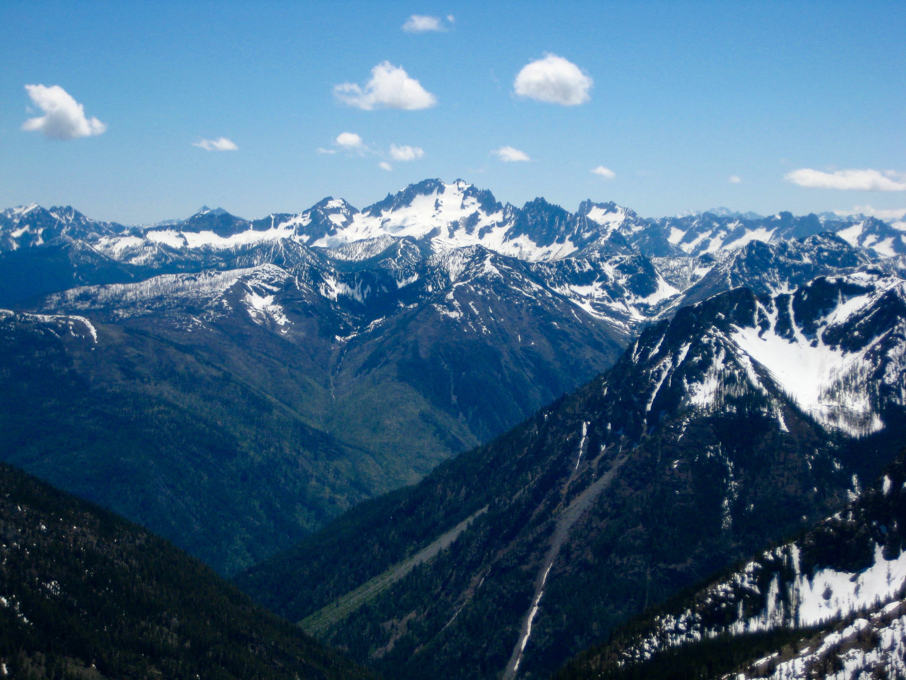
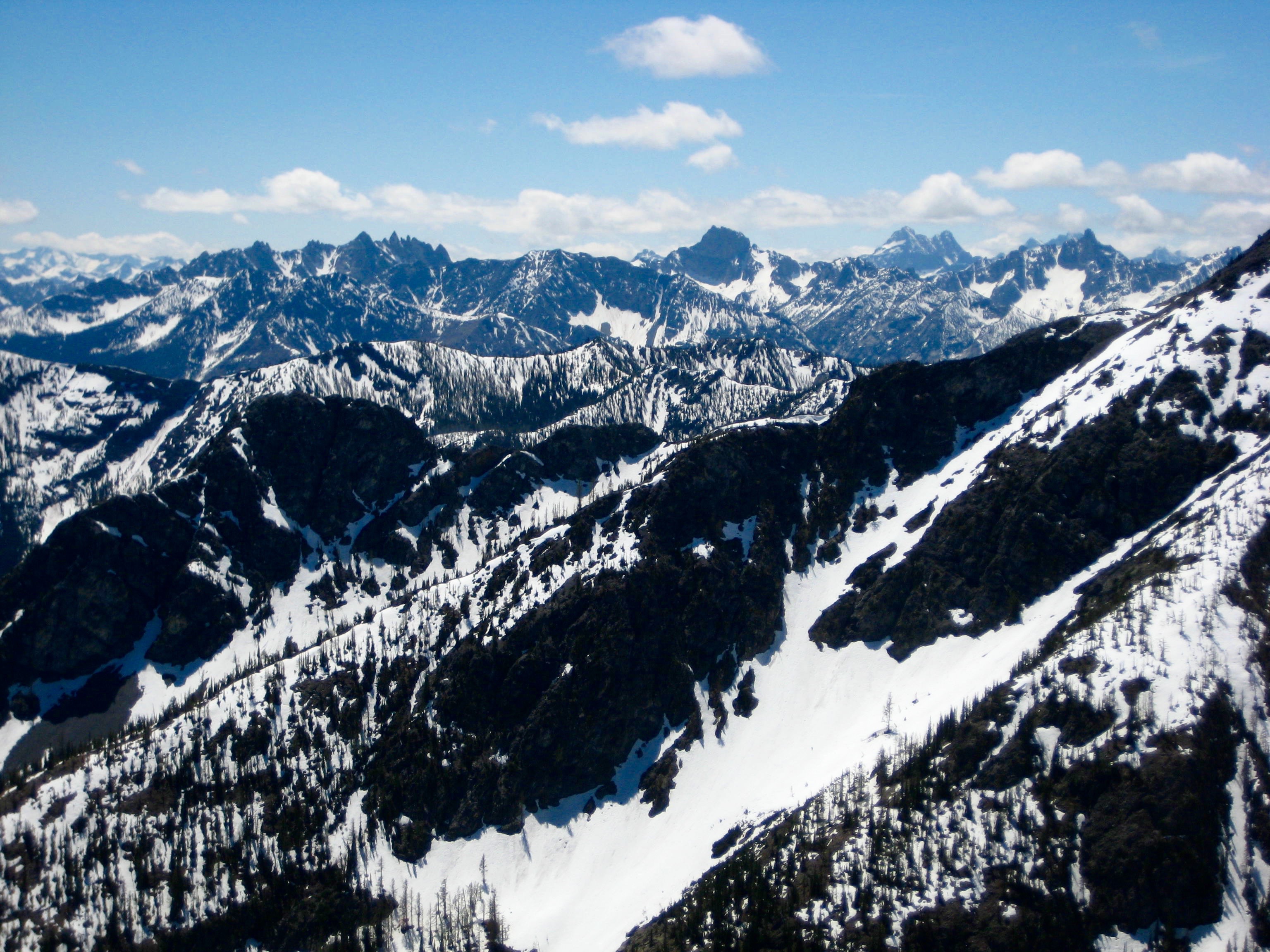
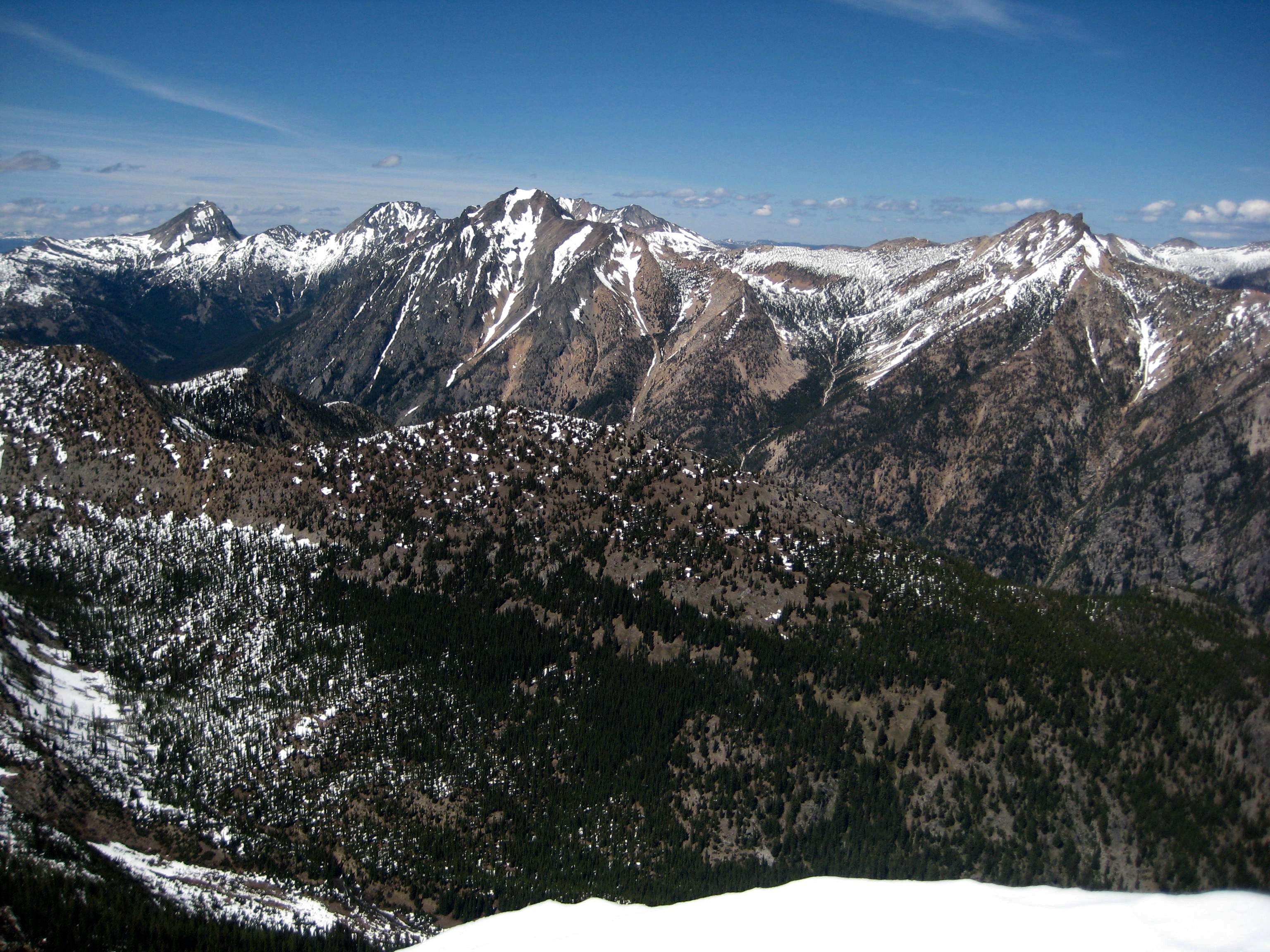
Robinson’s geographic position gives fabulous views of the northeastern faces of a hundred or more North Cascade peaks.
- Glacier Peak To Mt Logan Pano
When summit views and weather conditions are this good, Tony likes to sit back and light up a fine cigar. Fortunately, he’d packed up a Cubano just for this purpose.
- Tony On Summit Of Robinson Mountain
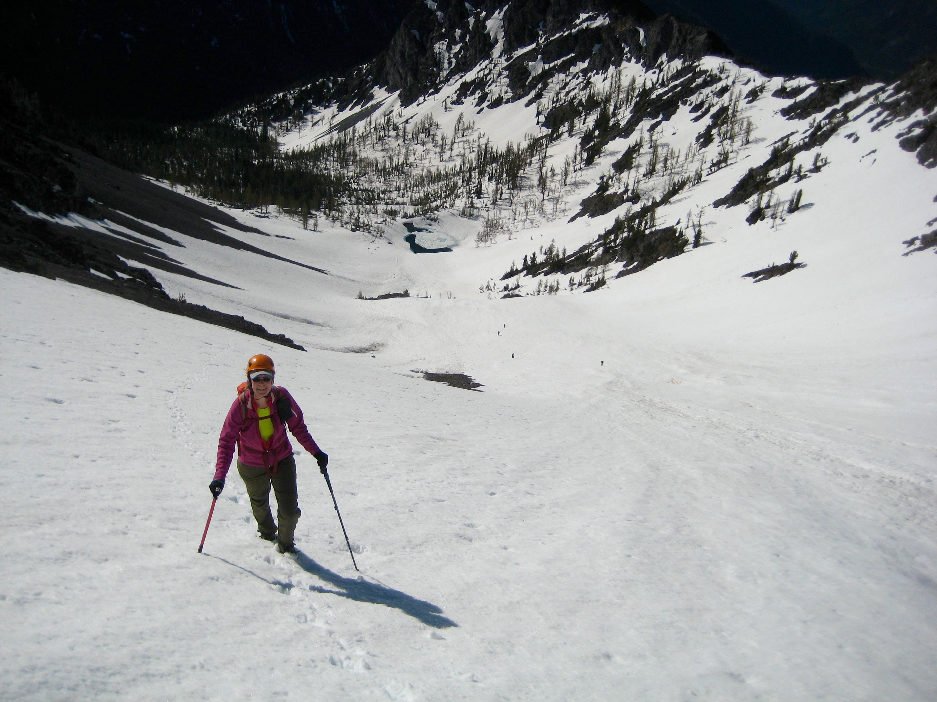
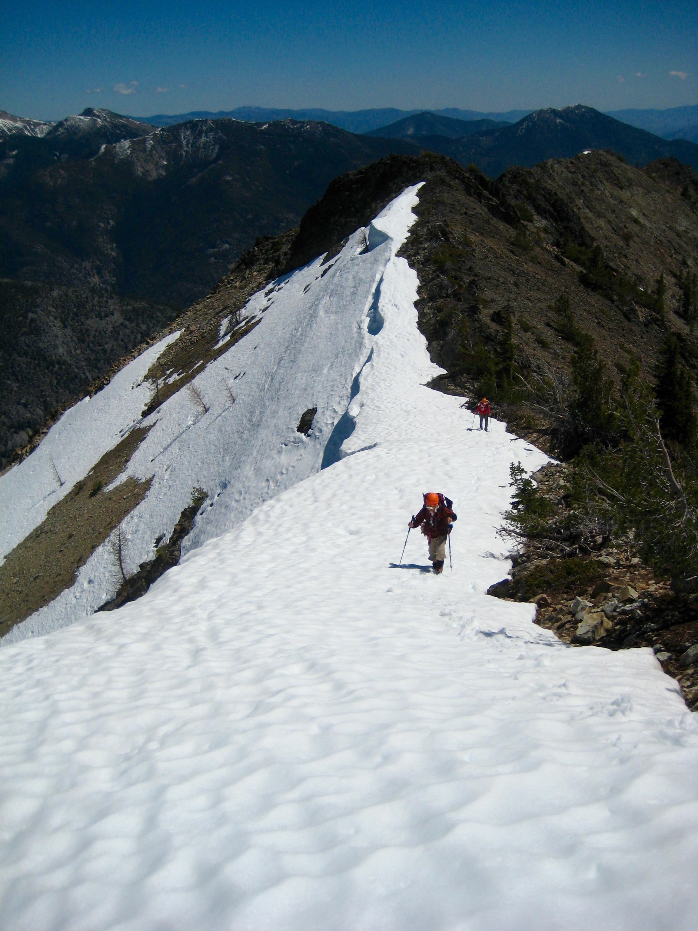
It was early afternoon when we left the summit. Kevin K. and Steven headed off to attempt Devils Peak, which turned out unsuccessfully, whereas the rest of us returned to camp. The snow cirque was in perfect condition for a long glissade down to the tarn (1.7 hours from summit).
- Descending Snow Basin
Day 2 (PM): Southeast Robinson Tarn to Beauty Creek Valley
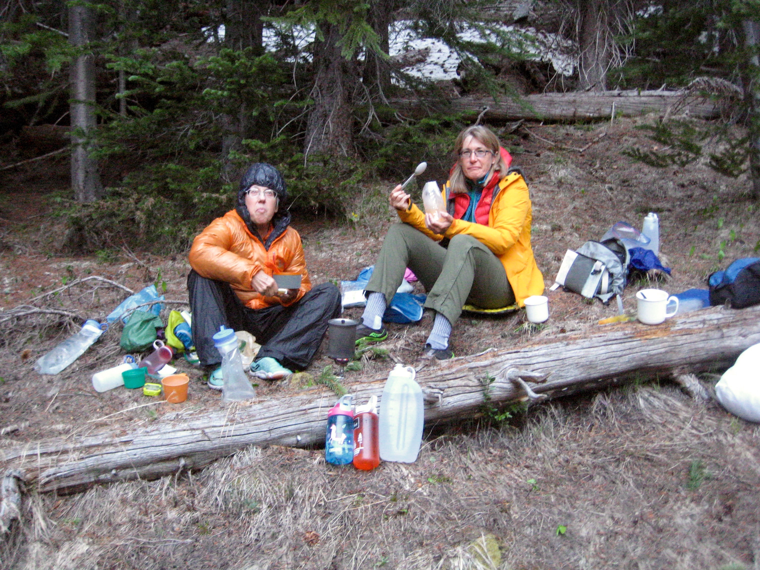
Once back at camp, Eileen, Lisa, Kevin L, and I packed up and descended to Beauty Creek for a pre-arranged meeting with Fay. She was waiting for us at the meeting spot, with a report that there were no good campsites in the Beauty Creek Valley. Lisa and Kevin L took that as a prompt to continue on out to the trailhead. Fay and Eileen and I, on the other hand, spent the night at a meager and very uninspiring campsite in the forest.
- Fay and Eileen At Beauty Creek Valley Camp
Day 3: Beauty Peak Summit Climb
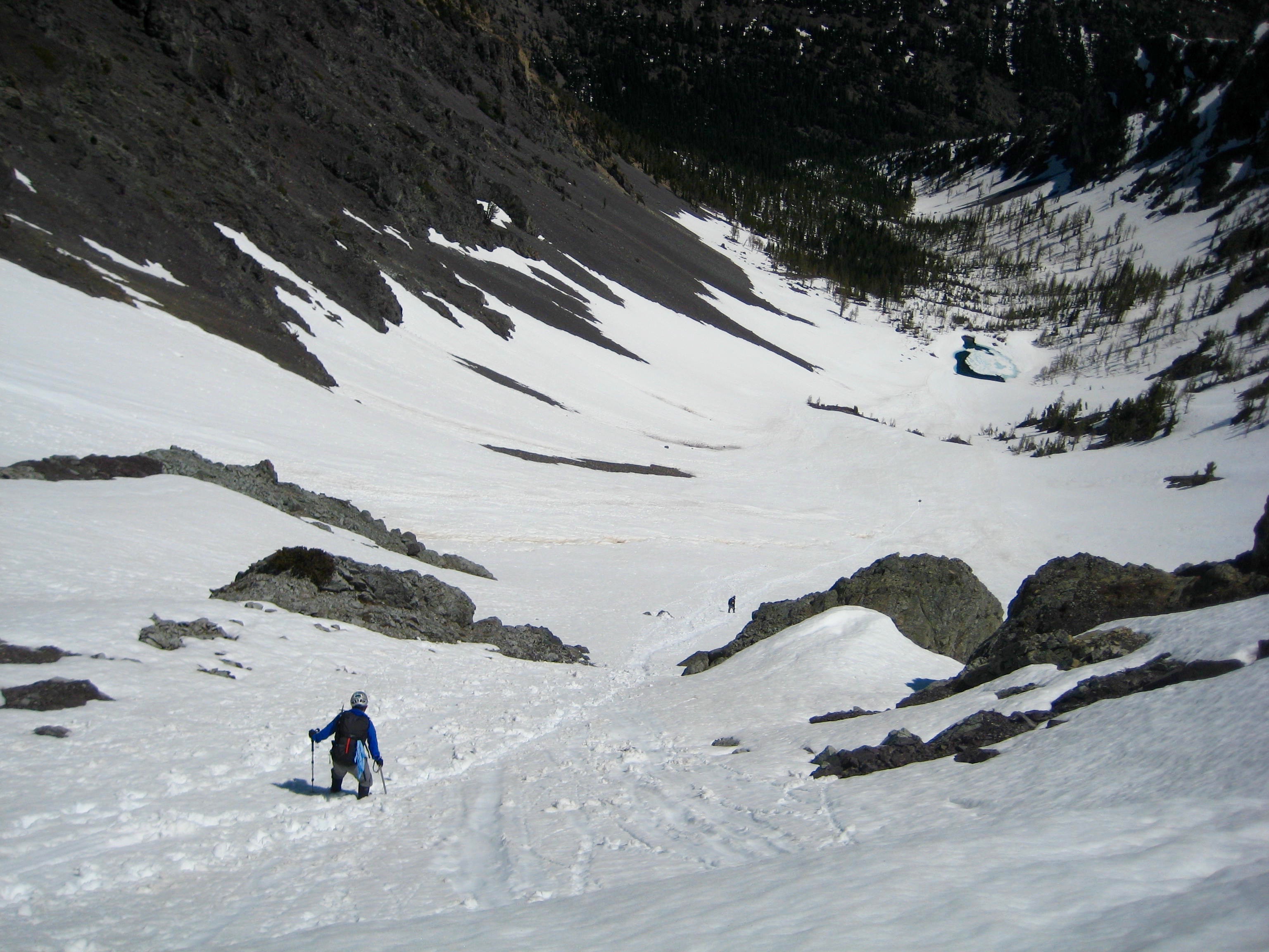
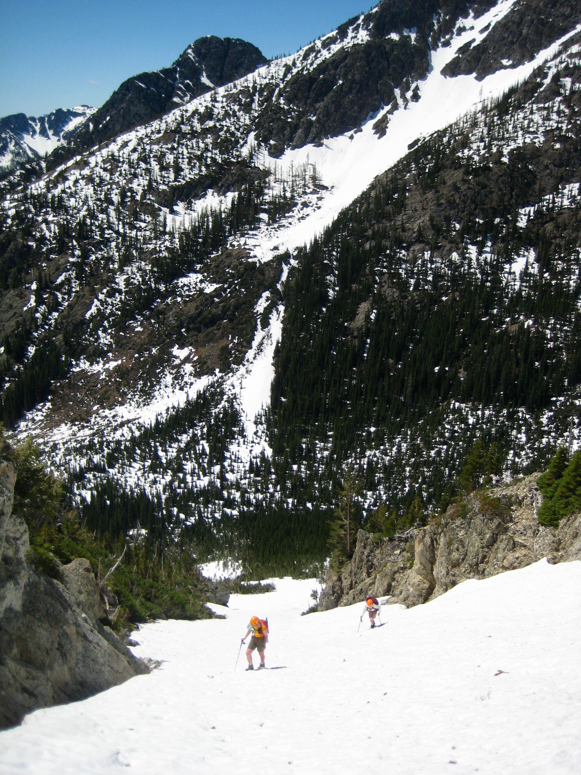
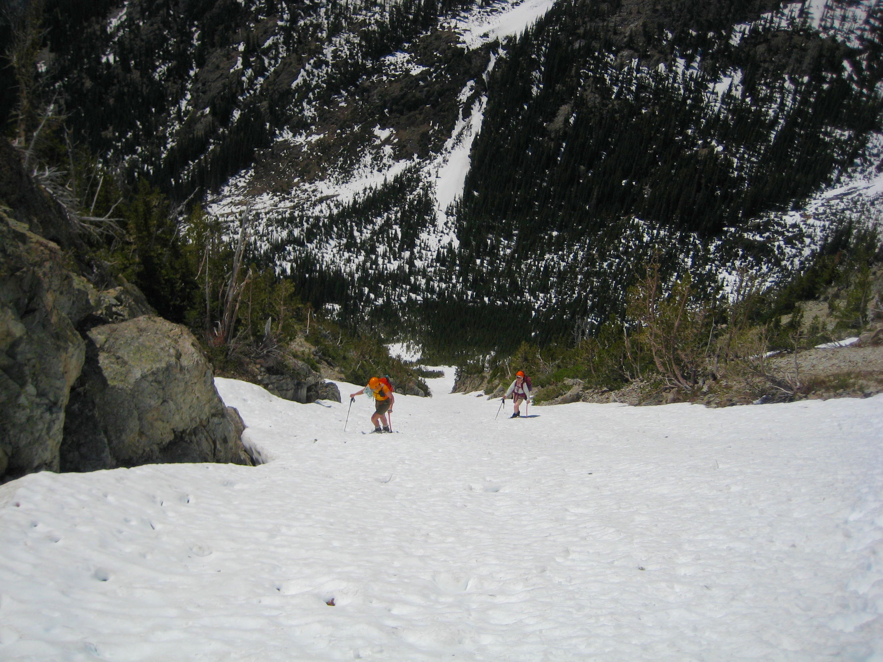
It had been a cold night in the valley bottom, but things warmed up quickly as we worked our way up toward Beauty Peak. The snow-covered forest floor presented a “mine field” of fallen logs draped with a thin, breakable crust—very annoying! We crossed Beauty Creek at a 5800-foot log jam, then ascended a long snow chute on the peak’s southwestern flank.
- Climbing Snow Chute On Beauty Peak
The magnificent countenance of Silver Star Mountain came into view as we climbed out of the valley.
- Silver Star Mountain From Beauty Peak Ridge
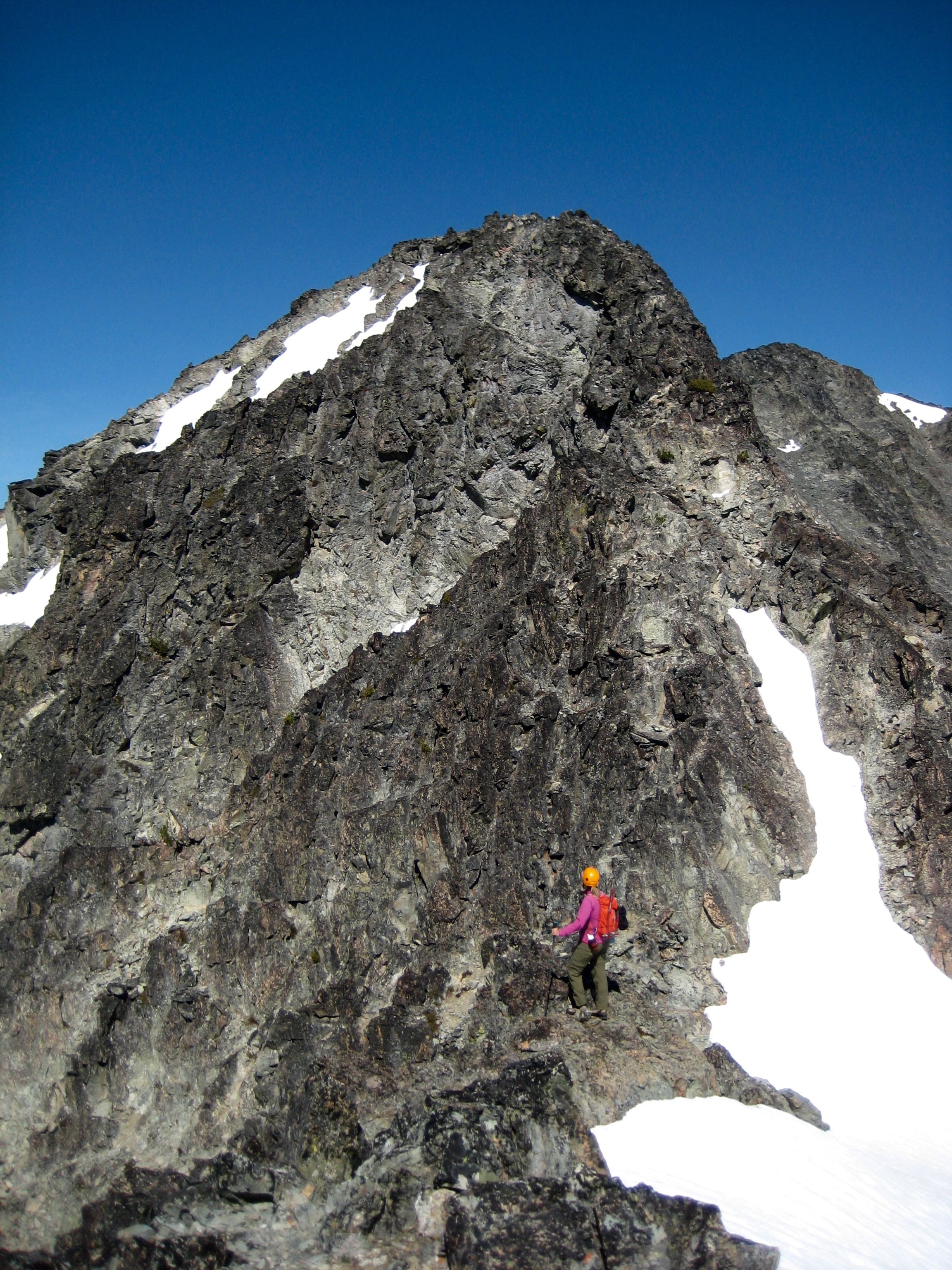
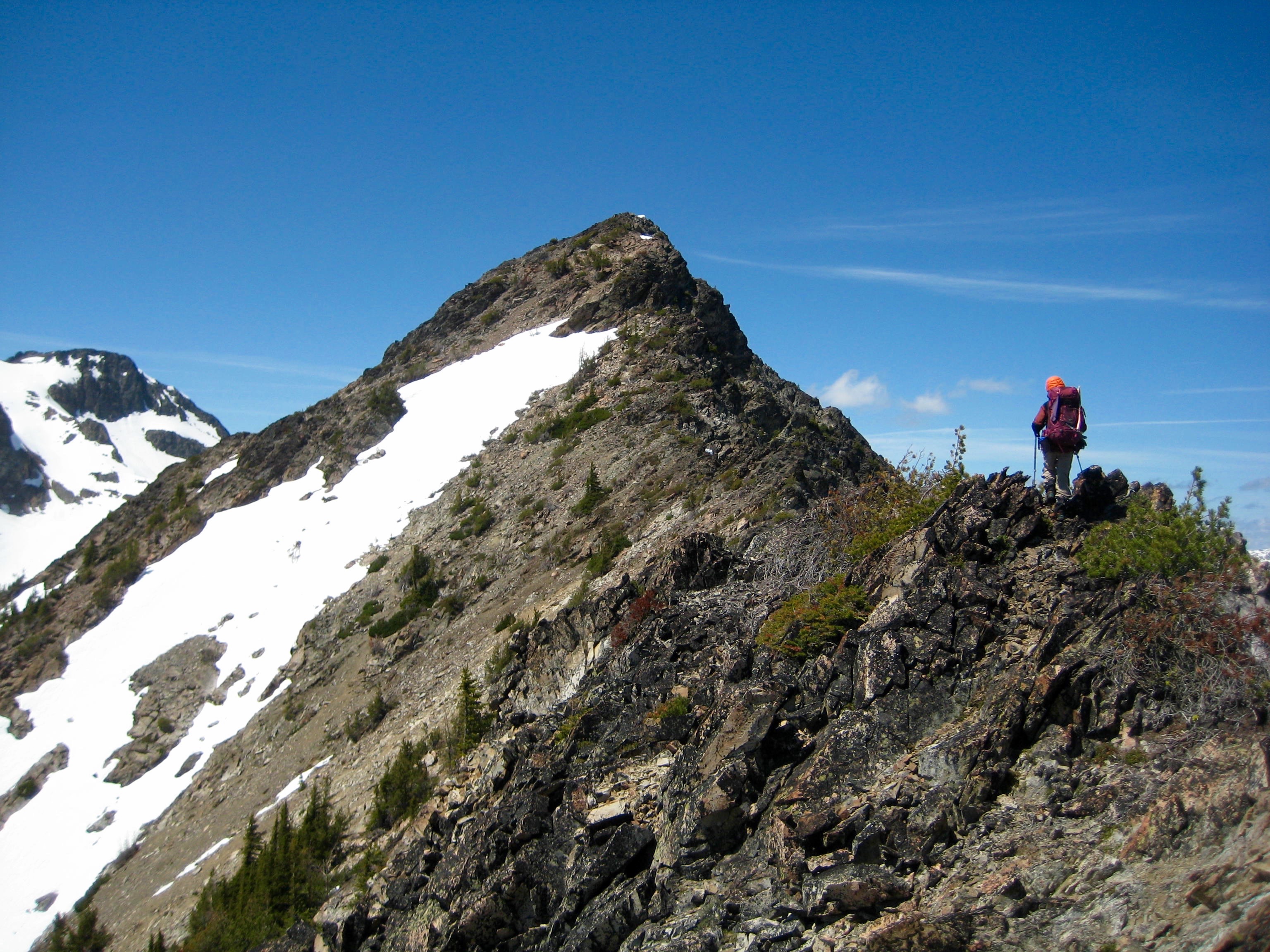
Our long snow chute deposited us on Beauty Peak’s ridge crest at a point 1500 feet above the creek and 1/4 mile south of the summit. From here, “Beauty” does not seem a befitting name for this peak; I judged it to be a face that only a mother could love.
- Summit Ridge Of Beauty Peak
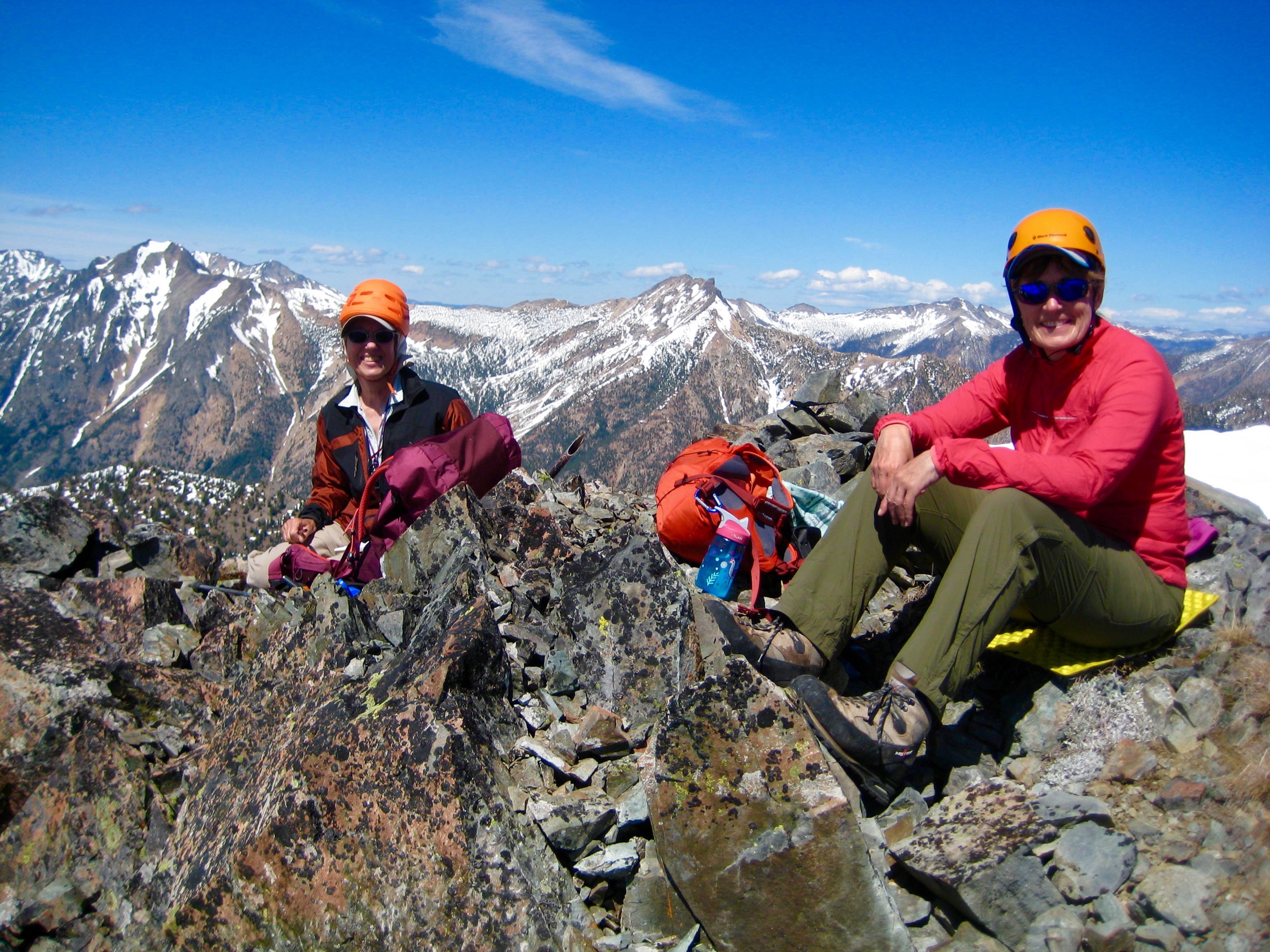
After an hour of scrambling on or closely below the ridge crest, we arrived at the small summit (5.4 hours from camp).
- Fay and Eileen On Beauty Peak Summit
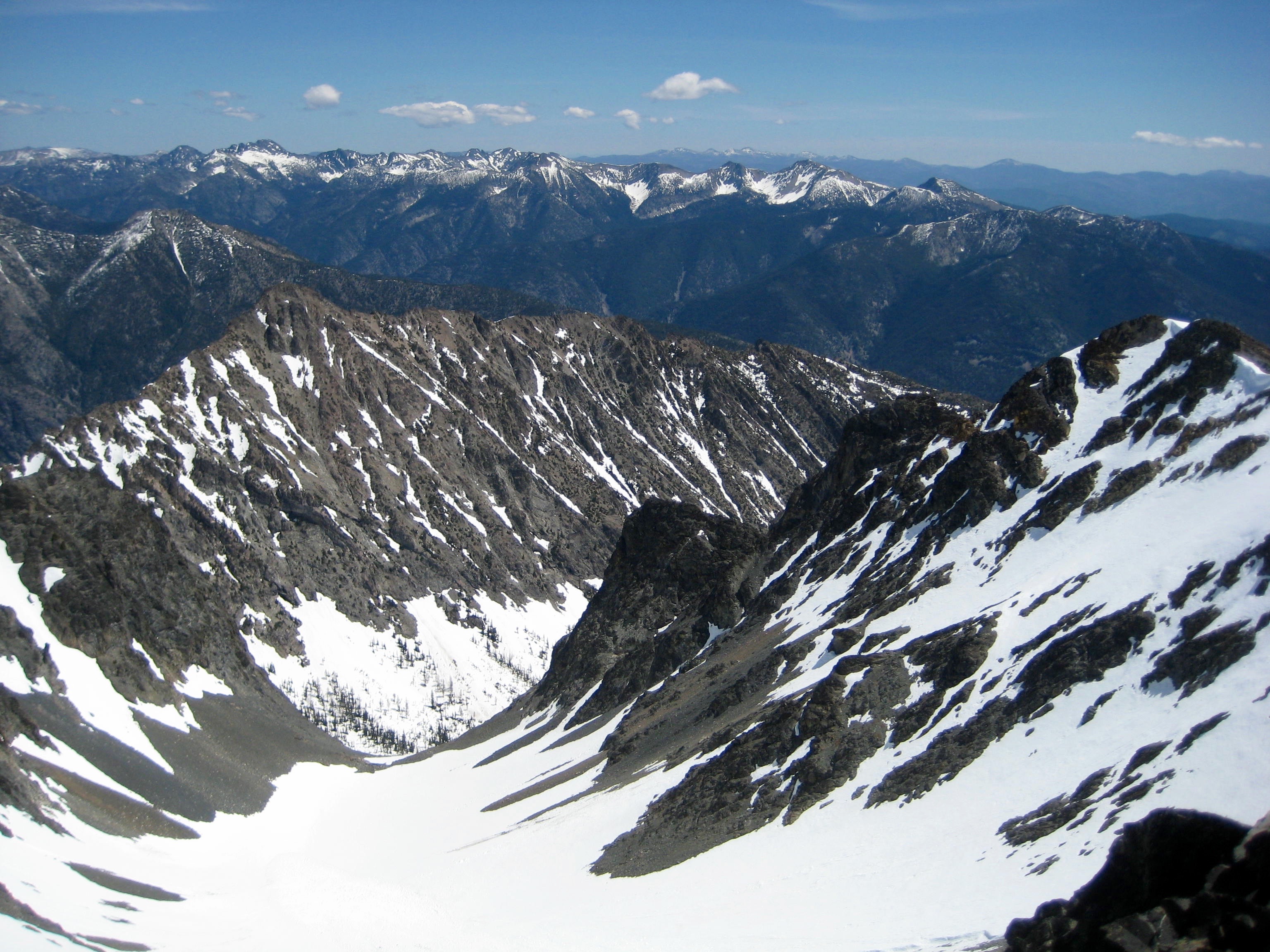
Summit views to the west are obstructed by the sprawling mass of Robinson Mountain. We spent 30 minutes on top, then headed down via a different route. Our descent turned out to be more difficult than expected, but we eventually reached the valley floor and trudged back to camp (3.4 hours from summit).
- Robinson Mountain From Beauty Peak
Evening 3: Beauty Creek Valley to Robinson Creek Bridge
After having dinner with Fay in the uninspiring valley, Eileen and I elected to pack up and move our camp down to Robinson Creek, whereas Fay preferred to spend another night in the same location. It was 10:30pm when Eileen and I stumbled into a roomy campsite adjacent to the Robinson Creek bridge.
Day 4: Robinson Creek Bridge to Trailhead
Our last day of the trip merely involved a pleasant mile of hiking down to the trailhead.
Photo Gallery
Click to enlarge…