Trip Date: February 21, 2024
2024 ARIZONA ADVENTURE VACATION
Picketpost Mountain Day Climb
Arizona Trail
Picketpost Mountain (4375 ft)
Trip Report Summary
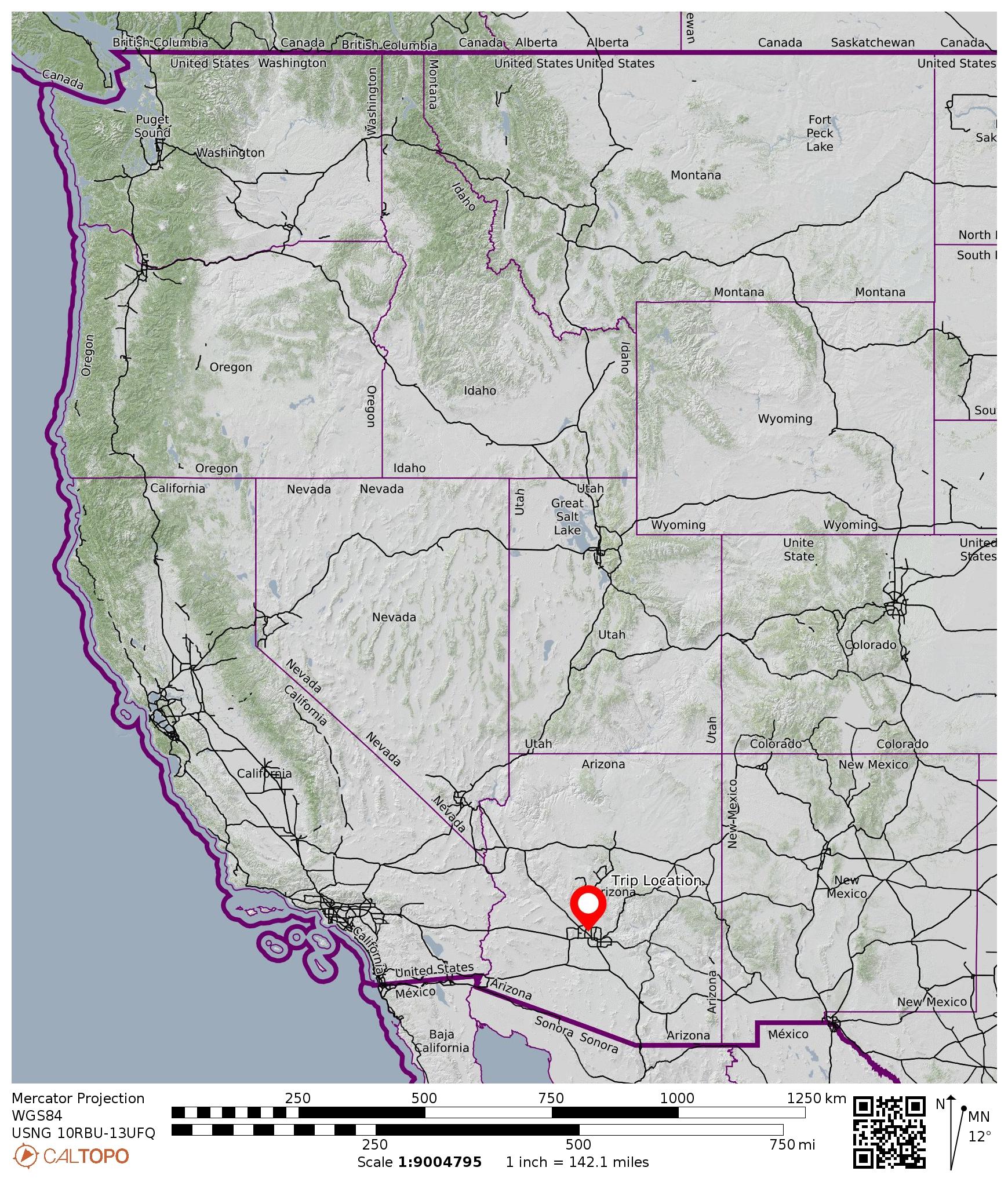
Region: Arizona
Sub-Region: Central Arizona
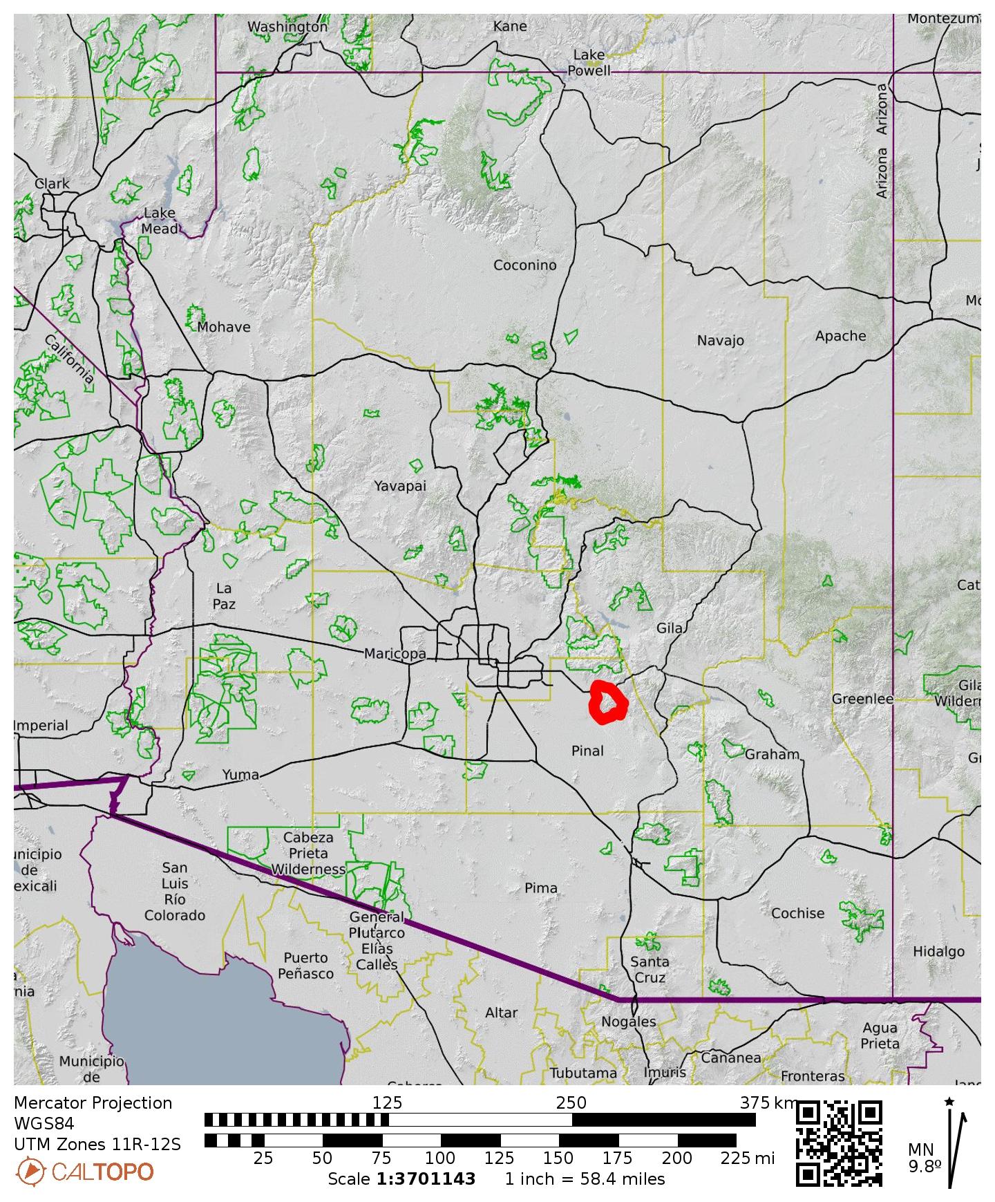
Sub-Sub-Region: Gonzales Mountains
Area: Tonto National Forest
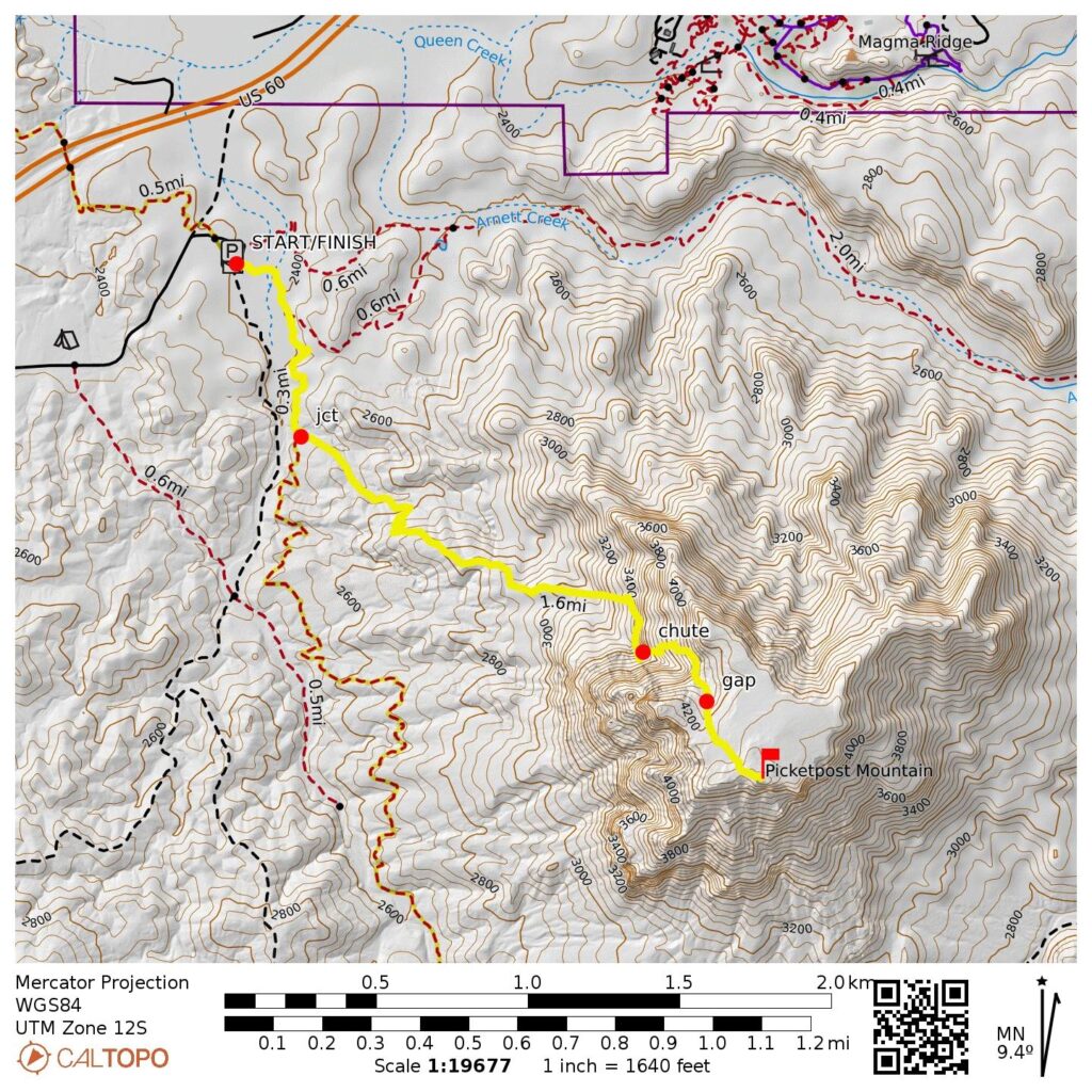
Starting & Ending Point: Picketpost Trailhead at end of East Saddleridge Trail (Elev. 2400 feet)
Way Points: Alamo Wash & Arizona Trail / Picketpost Mountain Trail junction & slabby chute & mesa gap & Picklepost Mountain summit (trail hike & trail scramble)
Summit: Picketpost Mountain (hike & scramble via Northwest Slope–Northwest Gully)
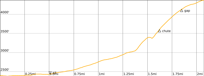
Approximate Stats: 4.2 miles traveled; 2050 feet gained & lost; 1.7 hours up; 1.7 hours down.
…
Full Trip Report
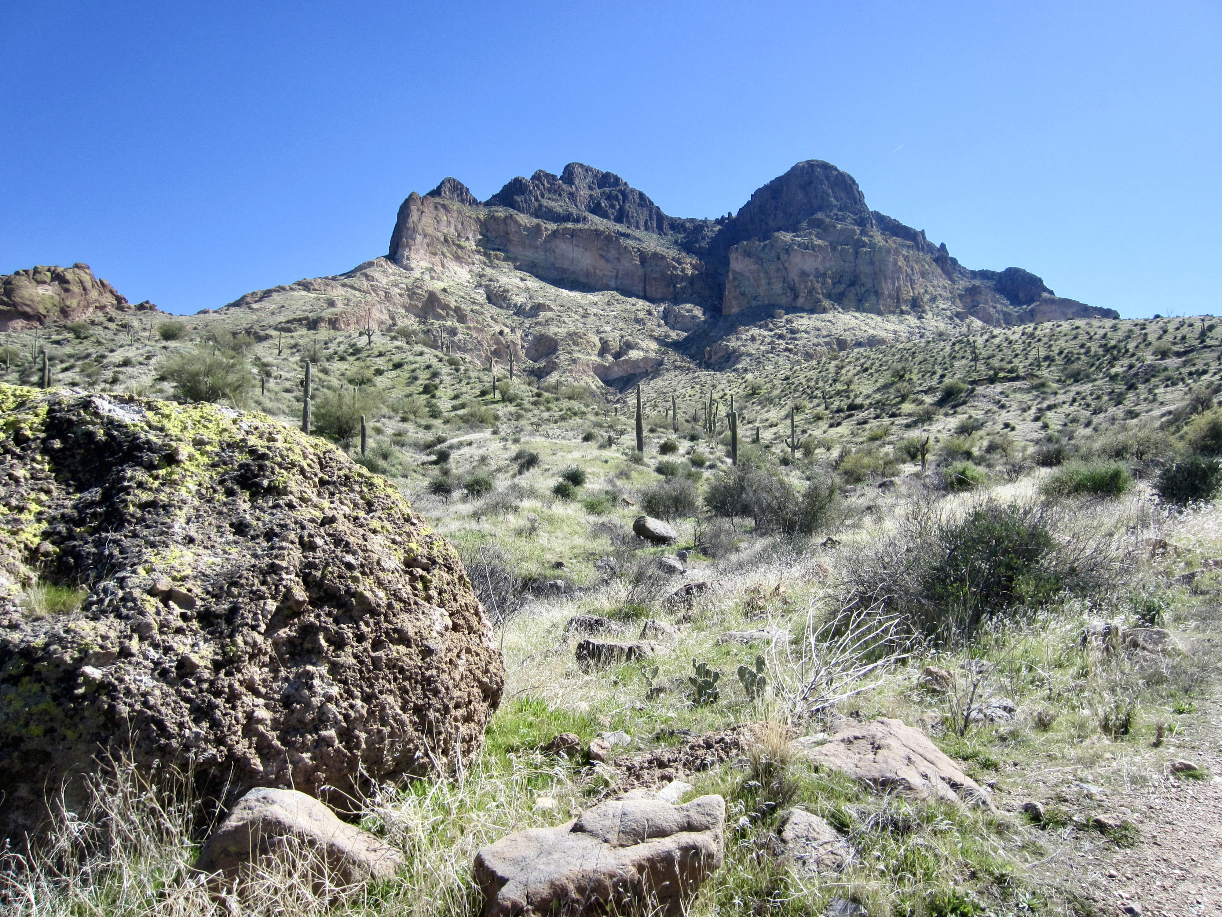
Picketpost Mountain is a rugged volcanic landform in central Arizona’s Tonto National Forest between Gonzales Pass and the town of Superior. Its isolation from other mountain ranges gives it a healthy prominence and a dramatic projection above the surrounding desert plains. These topographical attributes—combined with an imposing façade and whimsical-sounding name—make Picketpost Mountain a very popular summit in the greater Phoenix area.
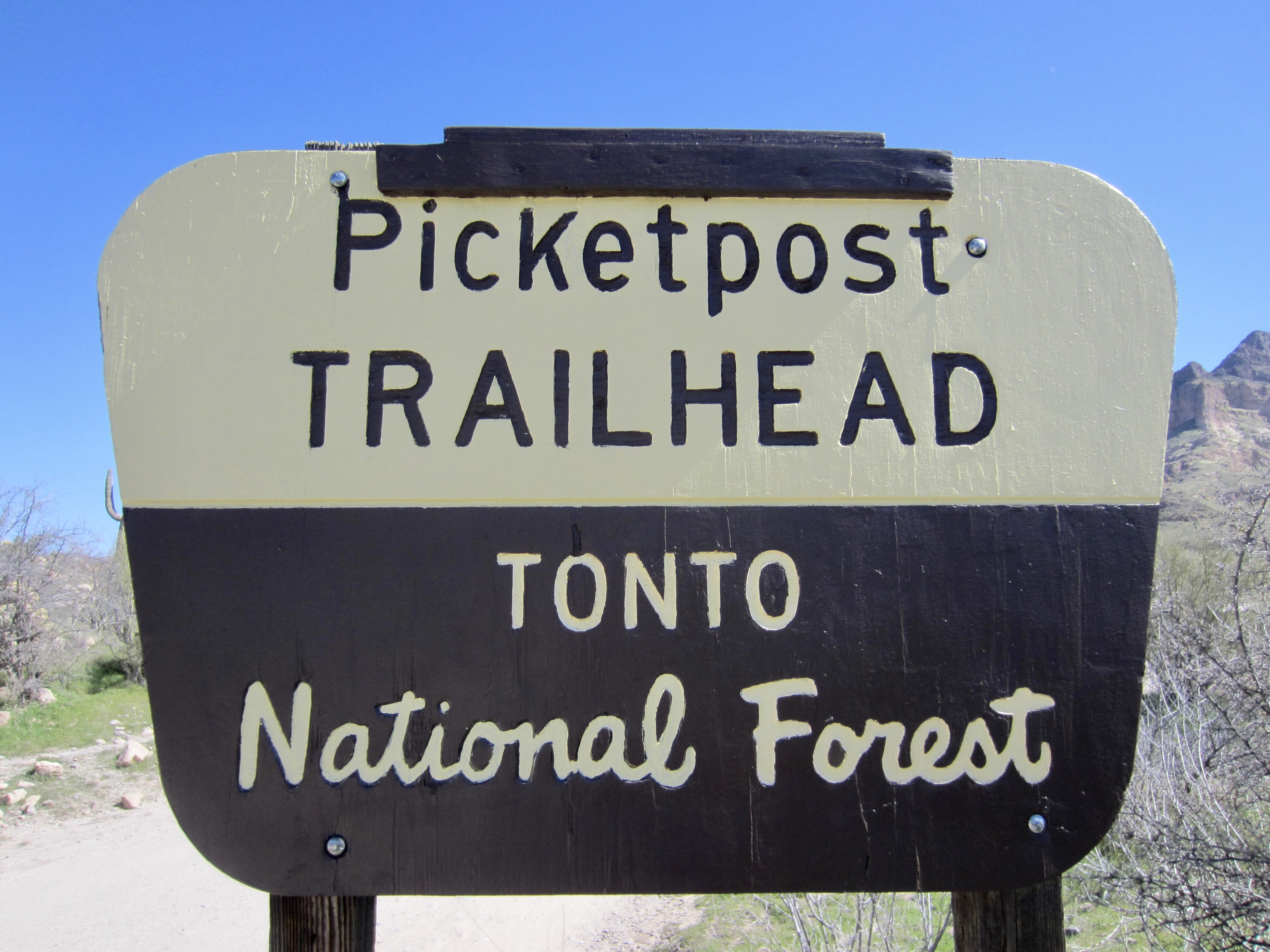
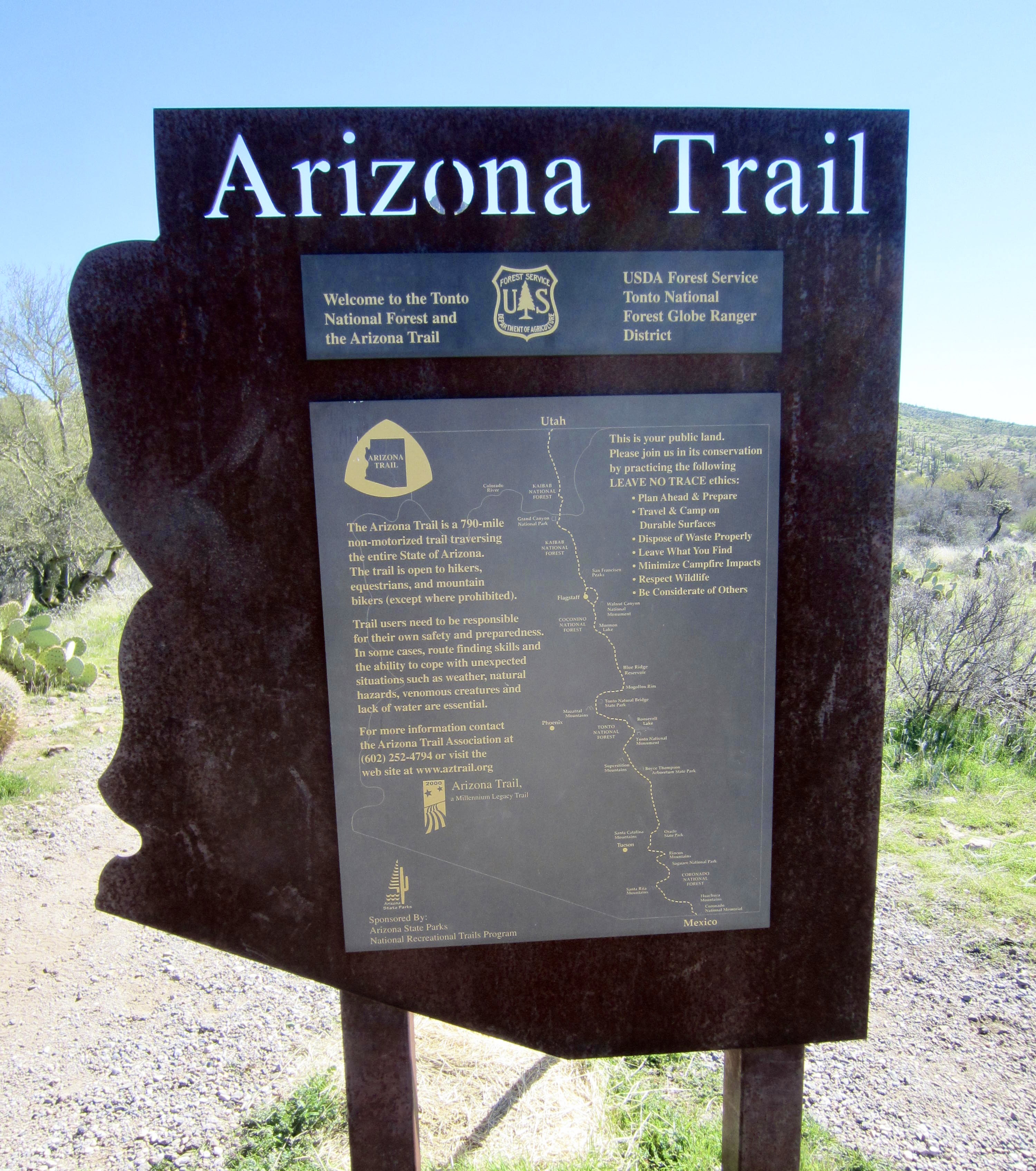
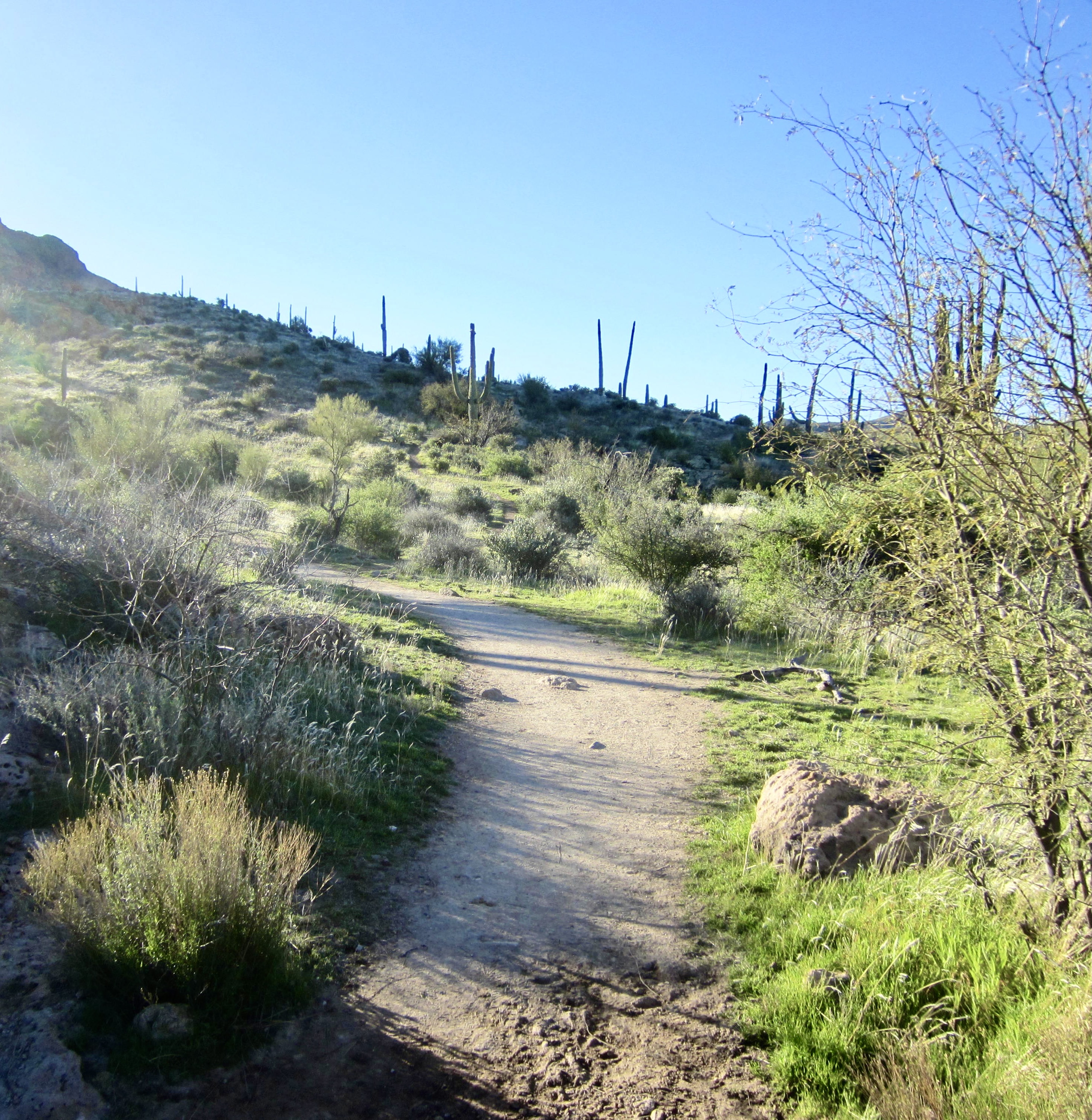
I started at the Picketpost Trailhead near US Highway 60 on a sunny but cool Wednesday morning. The objective peak stands 2000 feet above this trailhead, closely to the southeast, and the summit route begins on the well-graded Arizona Trail.
.
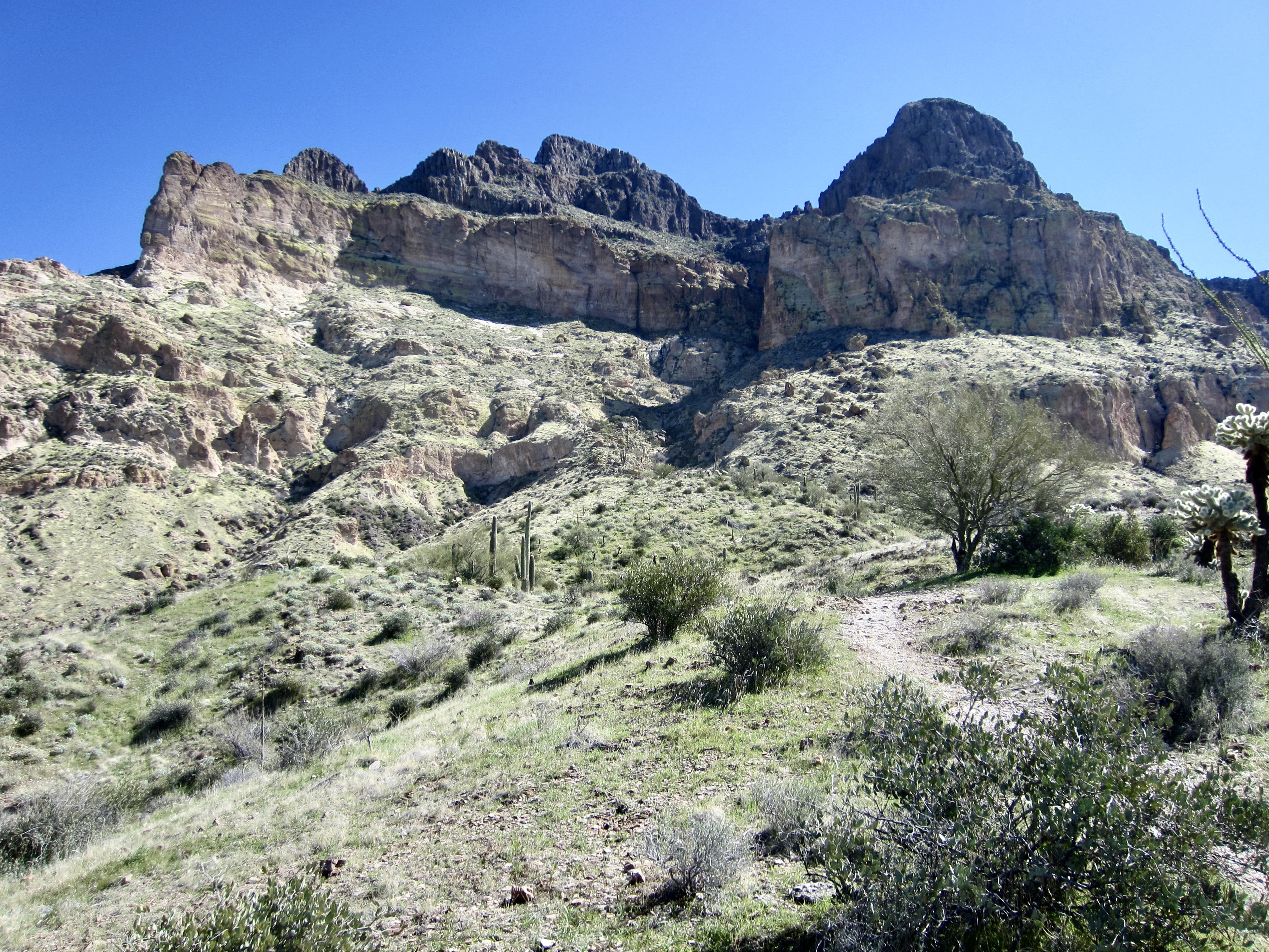
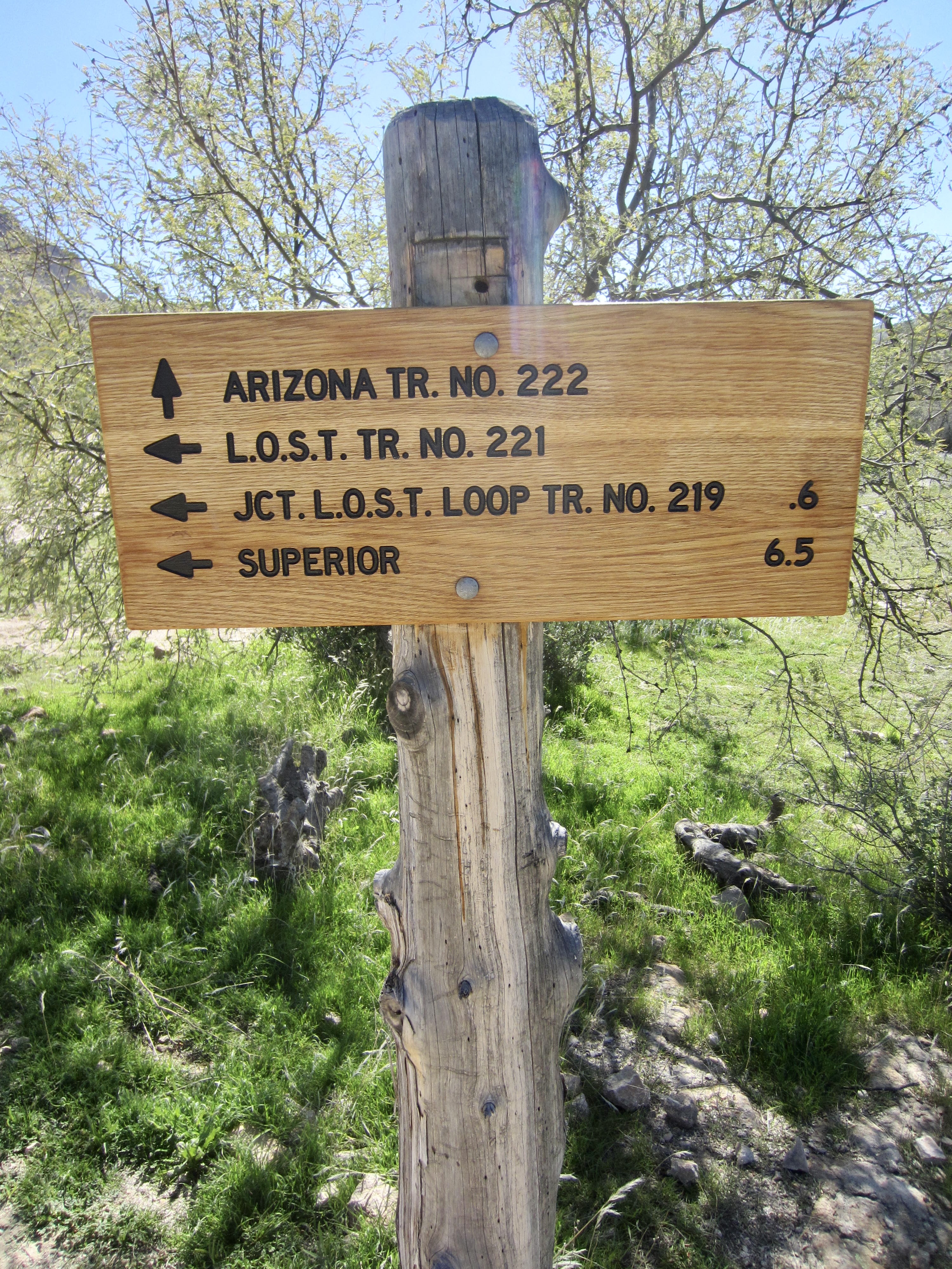
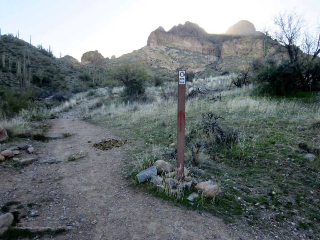
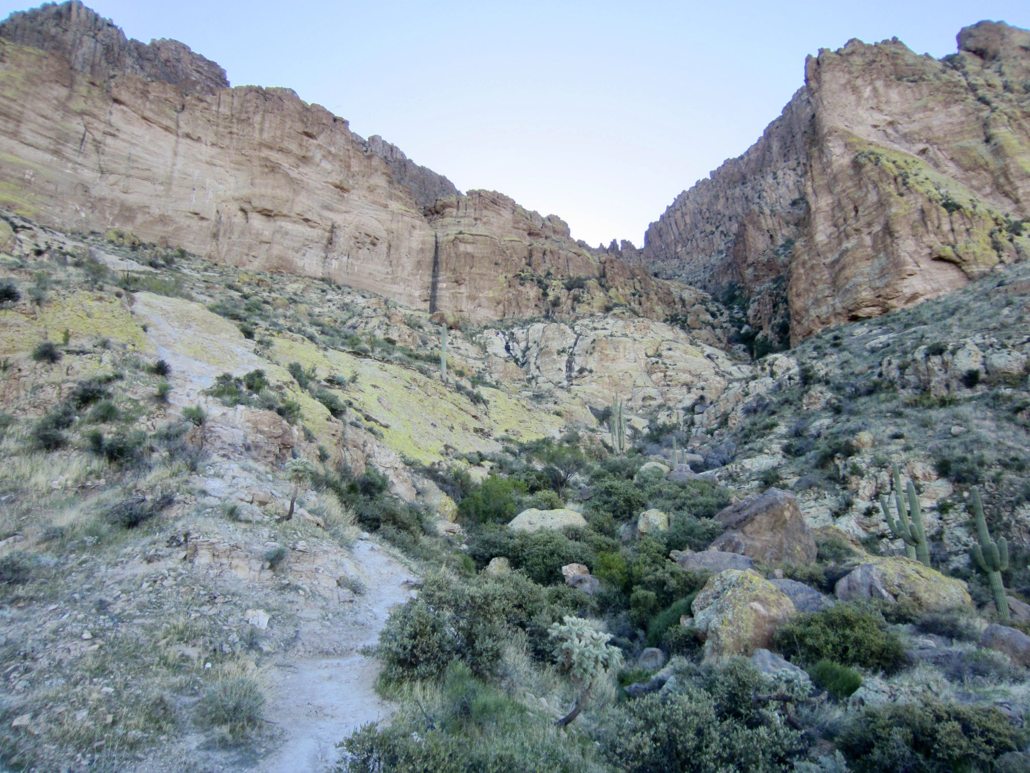
The southbound Arizona Trail immediately crosses Alamo Wash and comes to a junction with the Legends of Superior Trail (LOST). Staying to the right, I continued on the Arizona Trail for another ⅓ mile until reaching a junction marked only with a flexible post embedded in a small cairn. Here, I turned left and followed the well-defined Picketpost Mountain Trail uphill, heading directly toward the mountain’s ochre-colored cliffs of volcanic tuff.
.
.
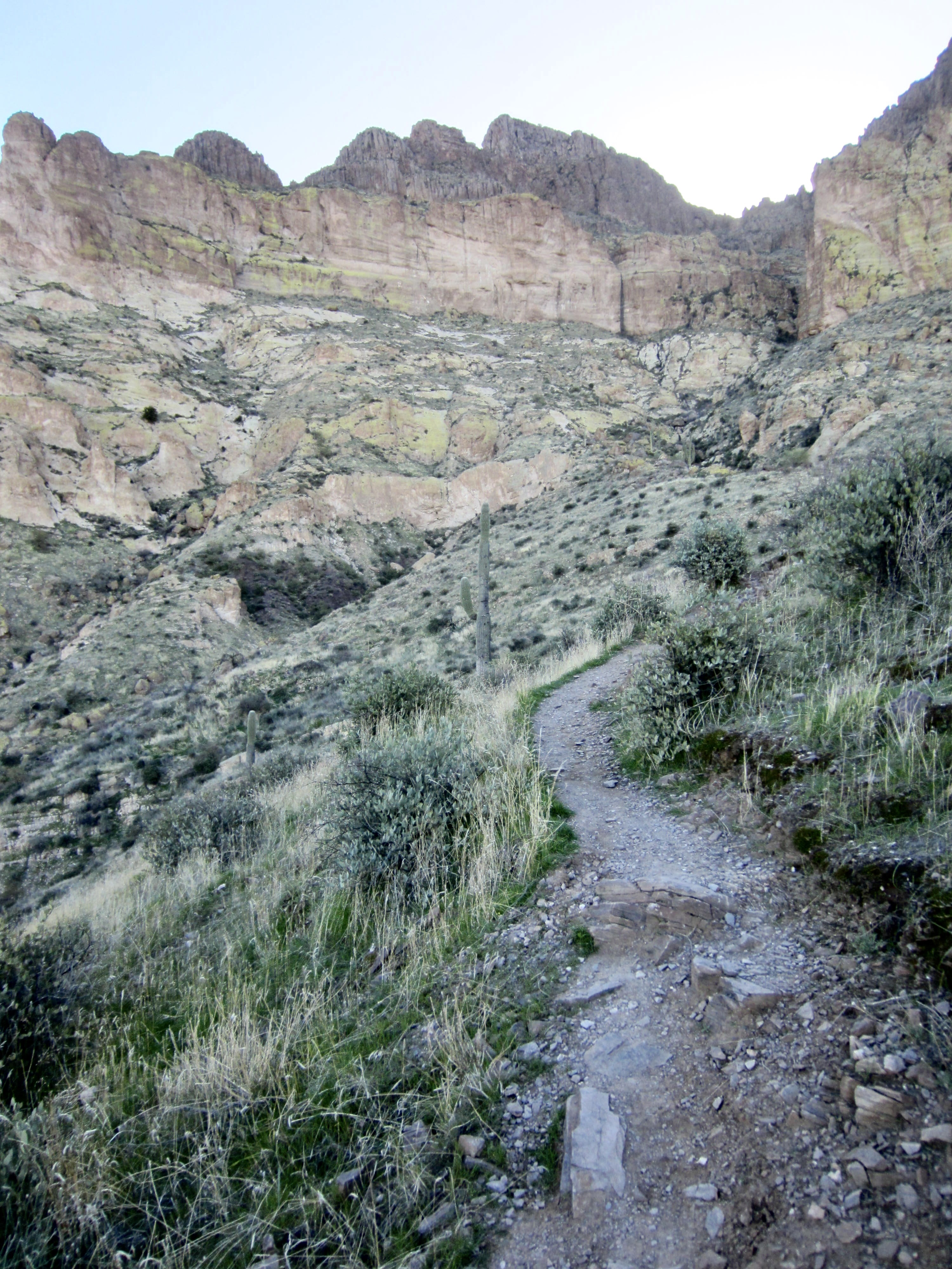
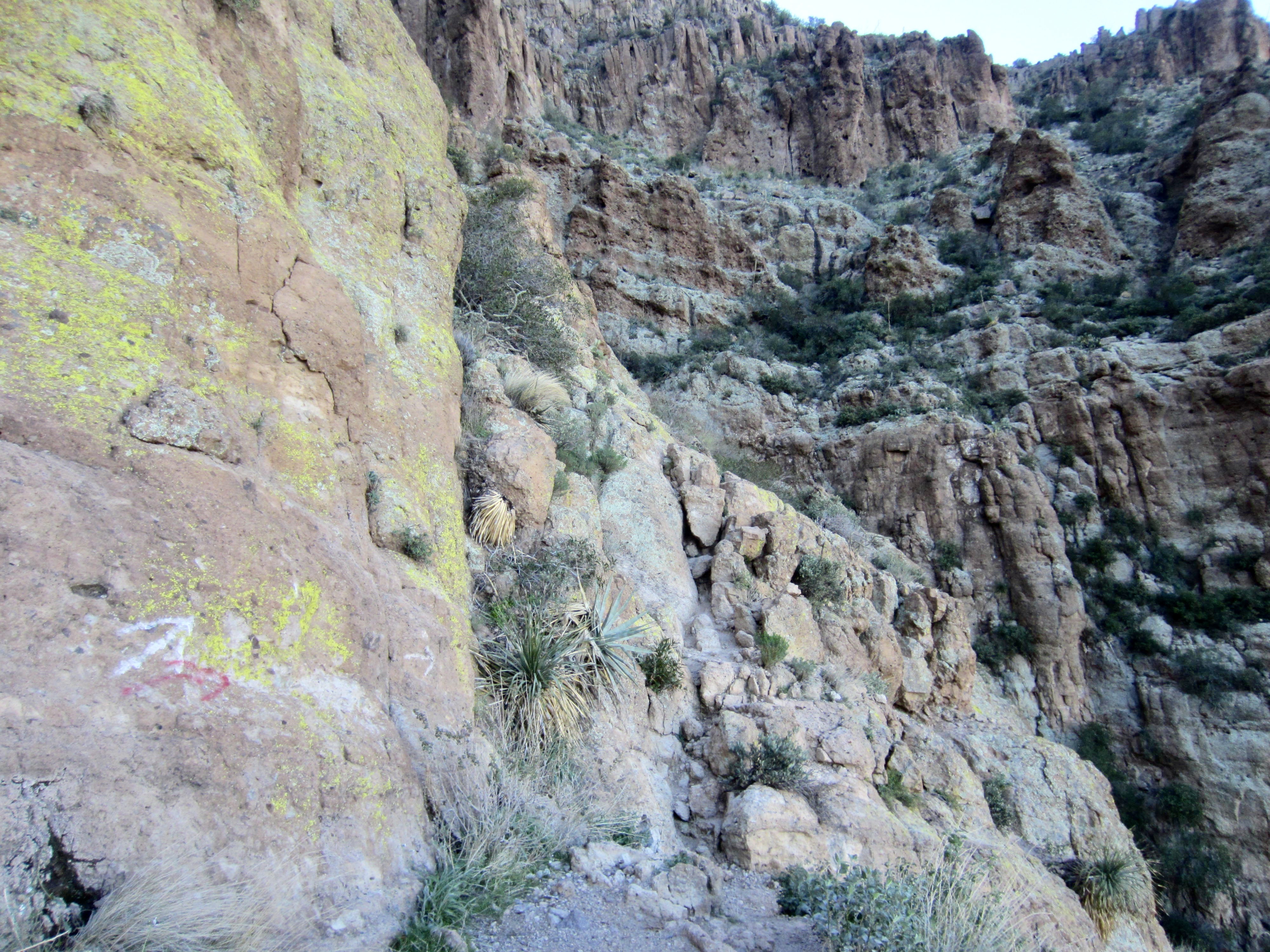
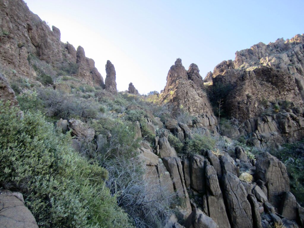
The Picketpost Mountain Trail gains 1000 feet before abruptly making a rightward traverse across a sloping ledge that runs horizontally between two cliff bands. Navigation gets a bit more difficult through here due to multiple branching paths and small Class 2-3 rock steps. However, there are numerous white arrows, marker ducks, and small cairns to show the way.
.
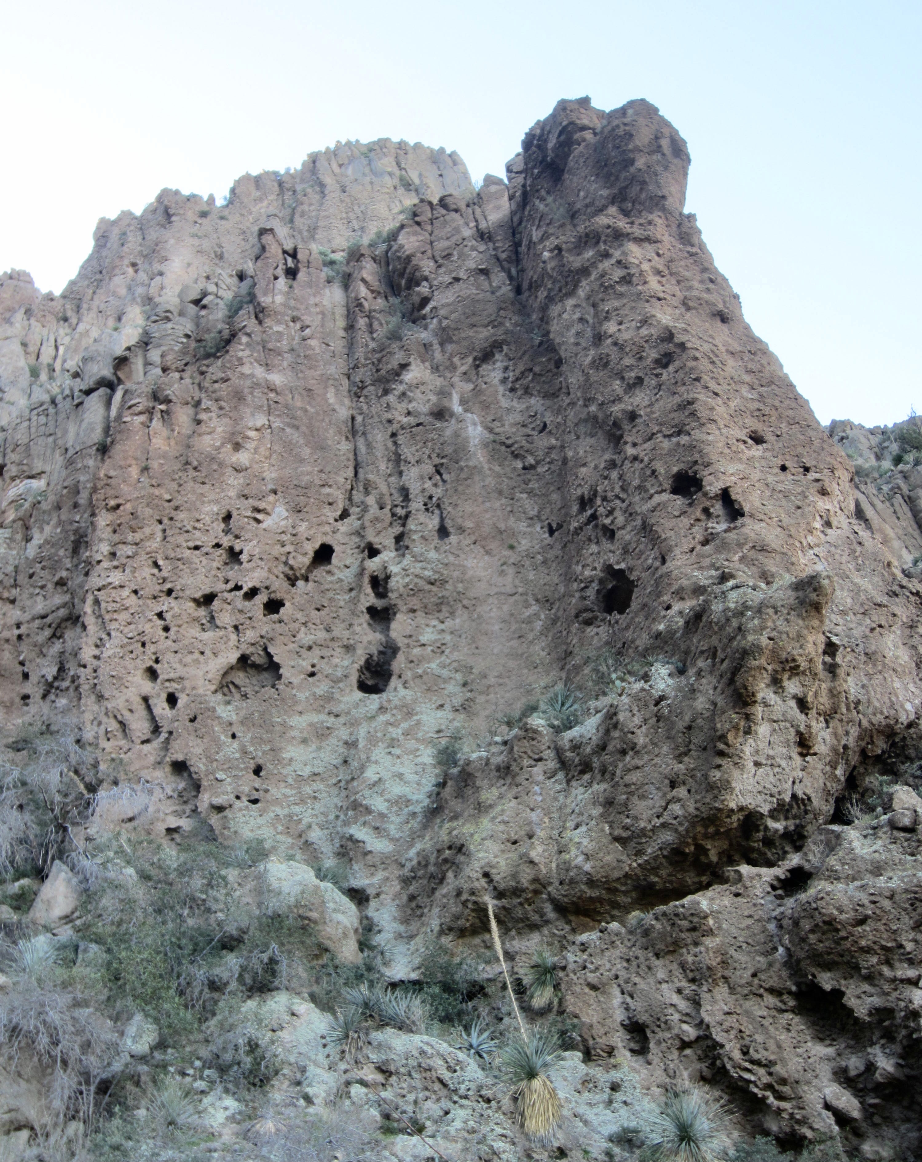
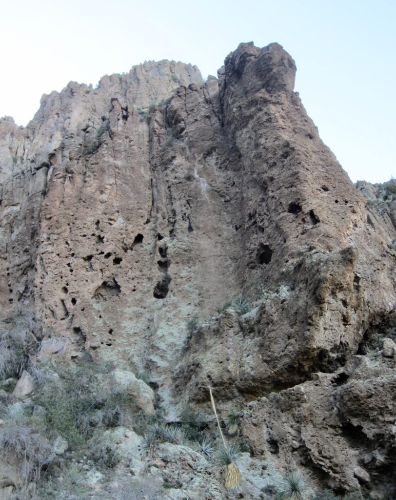
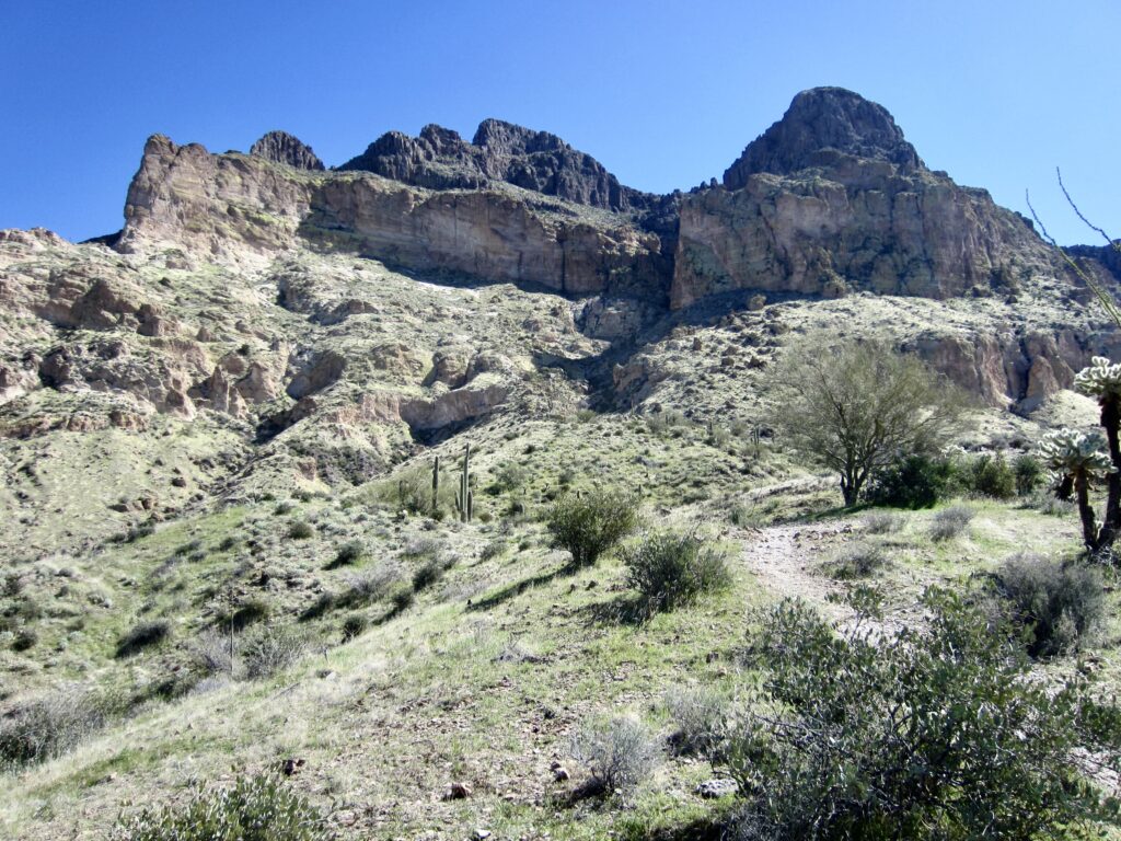
The rightward traverse led me into a major gully that slices vertically through the entire mountain. Directly ahead was a reddish cliff consisting of volcanic tuff riddled with erosion cavities. This distinctive cliff serves as a good navigational landmark on both the ascent and descent.
.
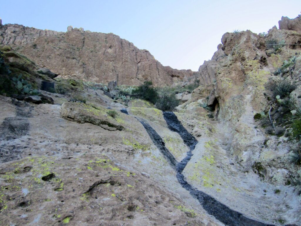
I then began hiking and scrambling upward through the gully, always staying in or left of the invert. The most difficult part is a slabby rock chute that requires some delicate Class 3 friction moves with moderate exposure. Thankfully, the volcanic tuff is generally very solid and grippy. If you find yourself in exposed Class 4 terrain, you are off route; go back and look for an easier route.
.
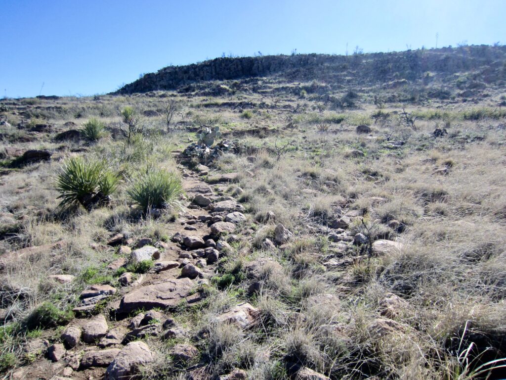
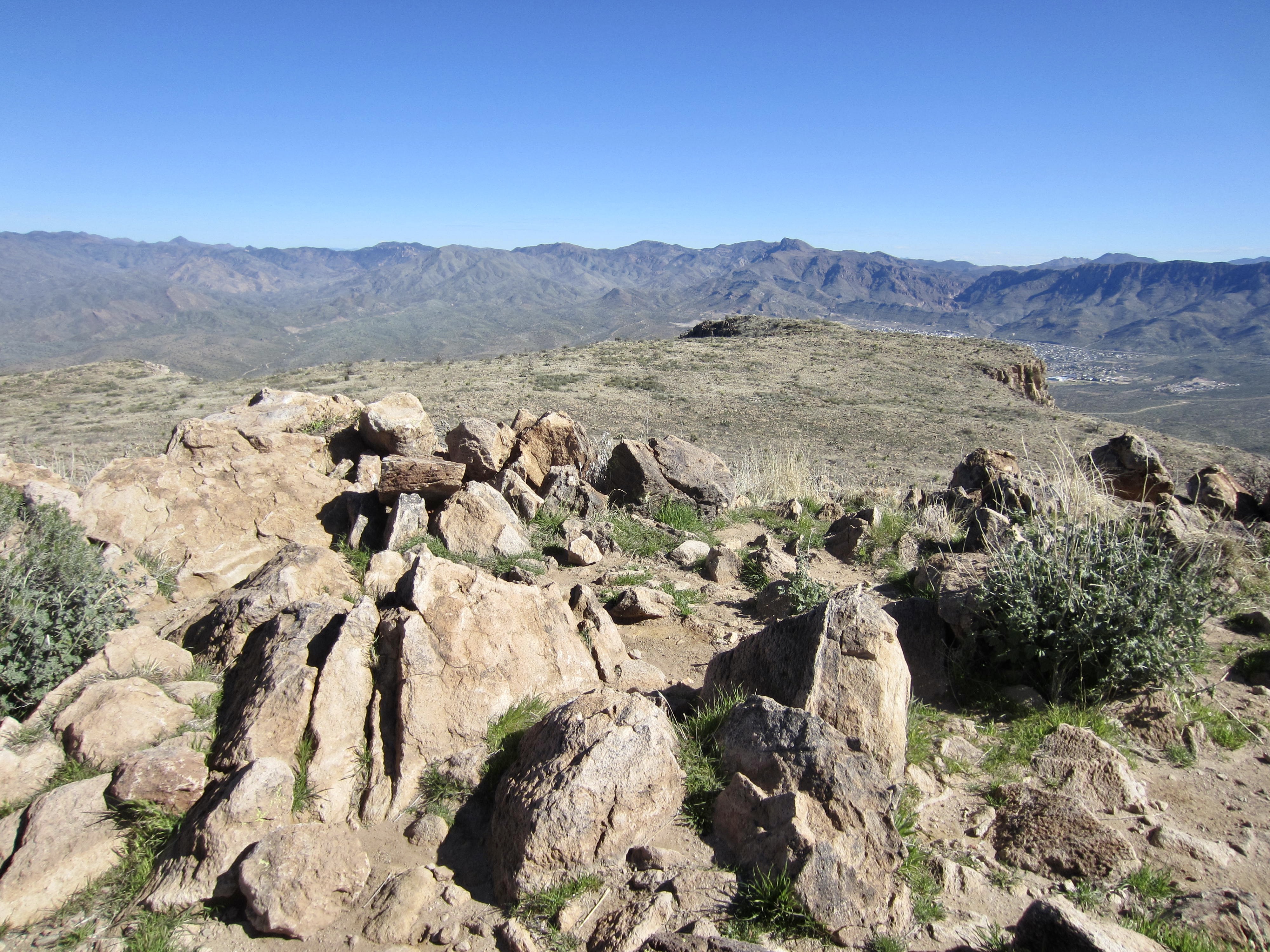
After gaining 500 feet, the steep trail angles rightward and goes through an obvious gap at the head of the gully. This gap opens onto a sloping mesa with a rubble-strewn but well-traveled trail. The final 200 feet of ascent is an easy stroll up the mesa toward the broad summit mound.
.
.
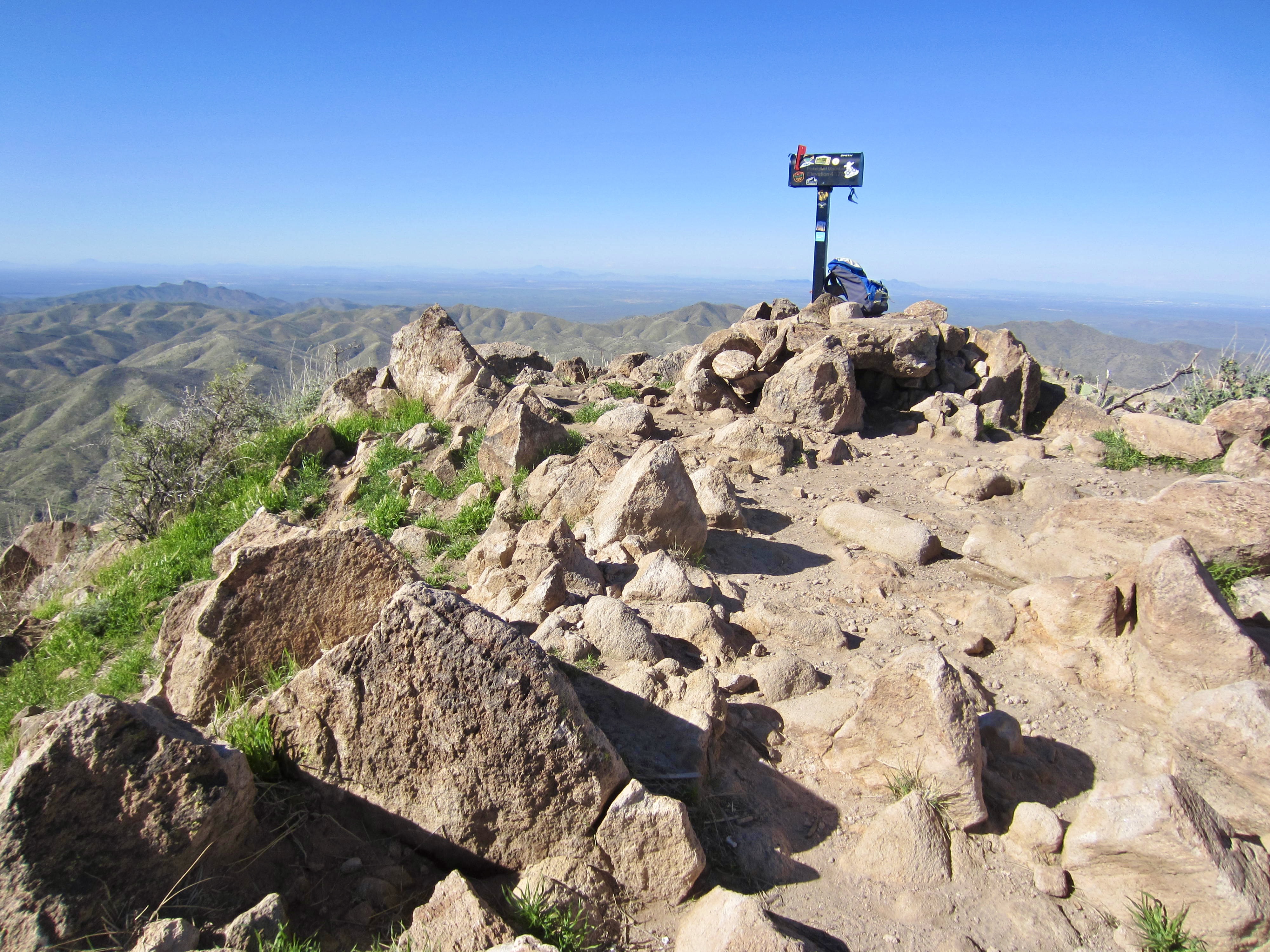
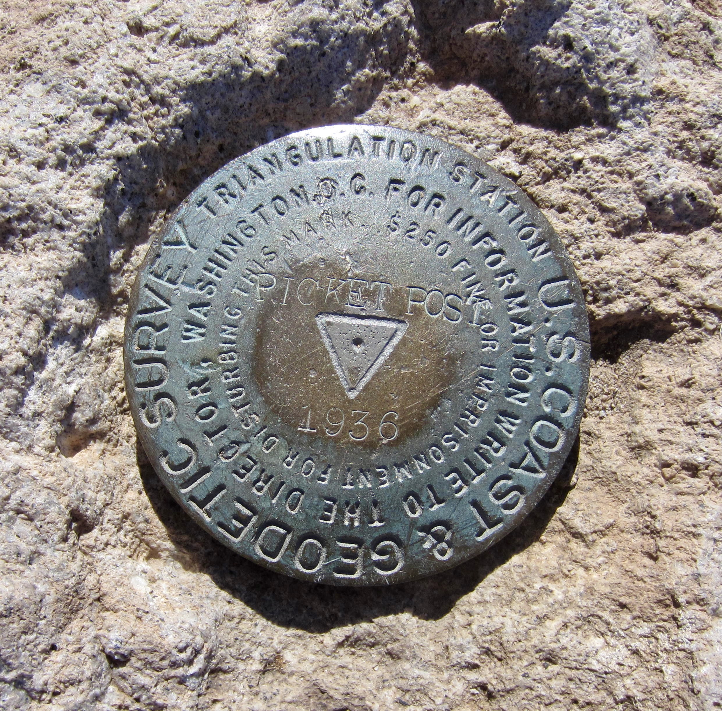
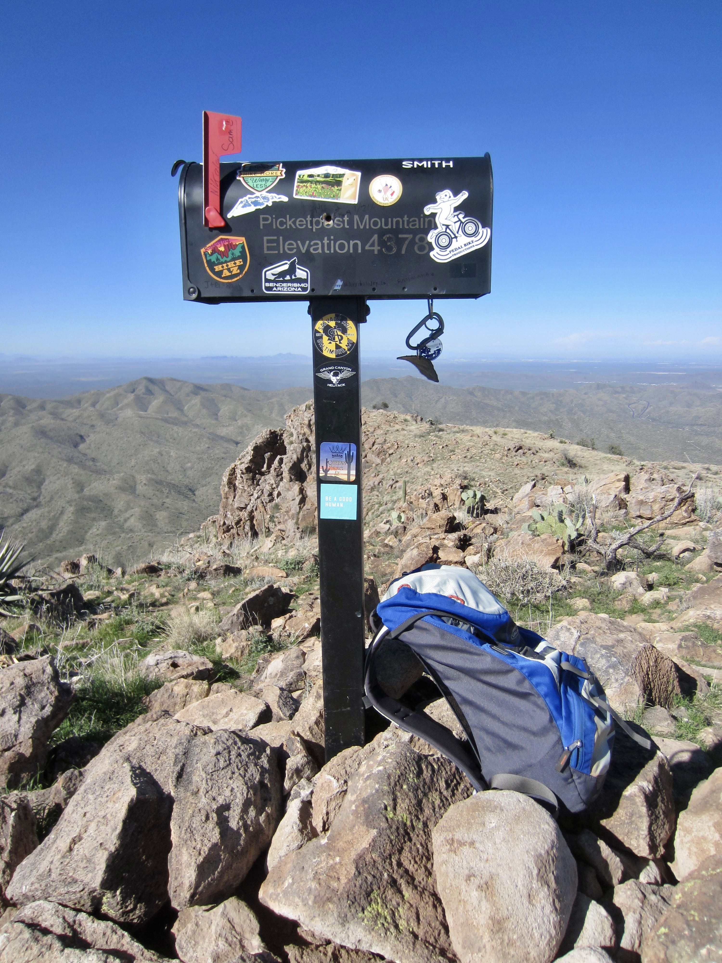
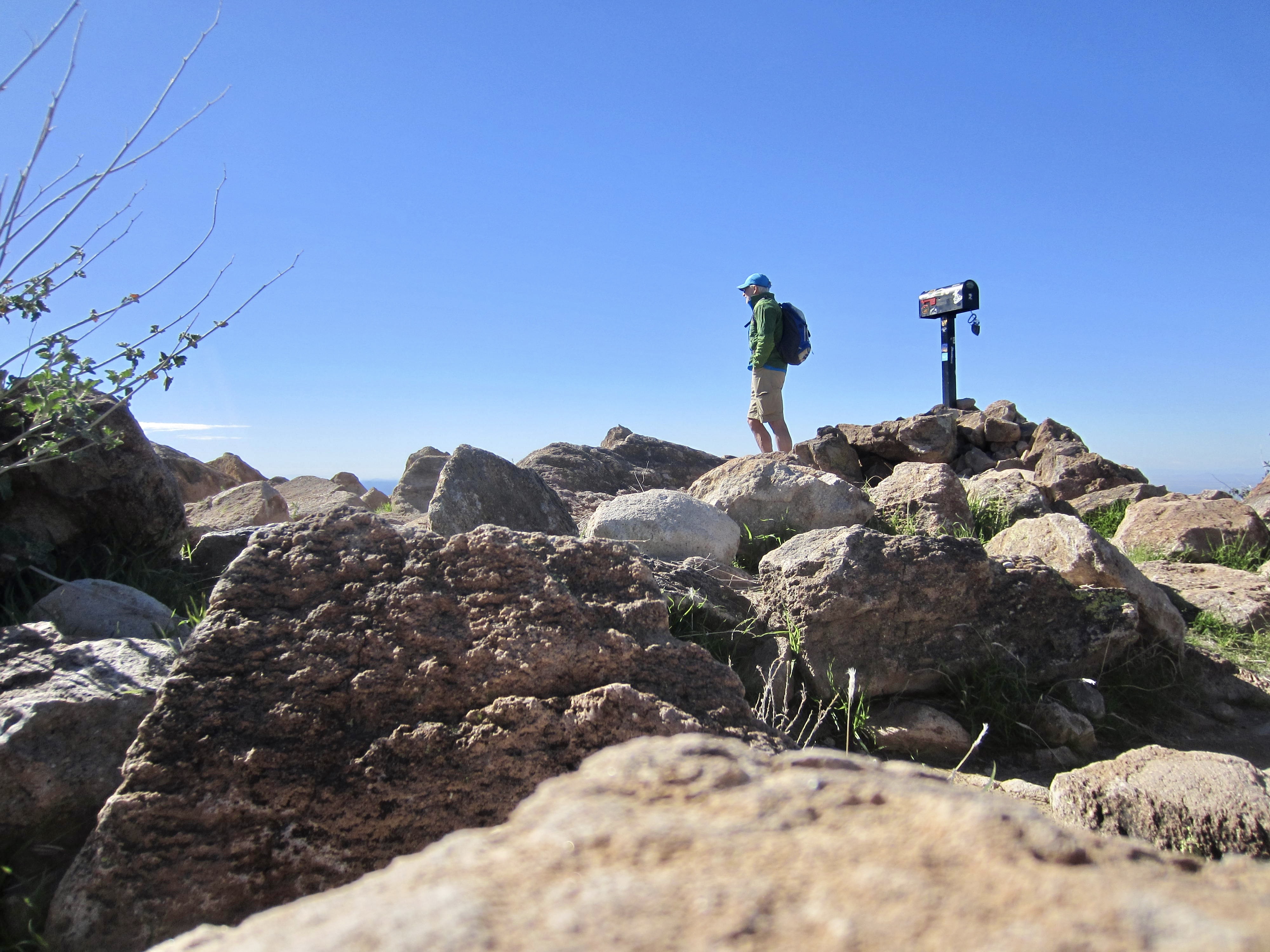
I stepped onto the bouldery summit in late morning (1.7 hours + 2000 feet from TH). Picketpost Mountain is famously equipped with a summit mailbox containing registers and various trinkets—a tradition that dates back many decades. The original mailbox eventually rusted out and was replaced by a local hiking group a few years ago.

.
.
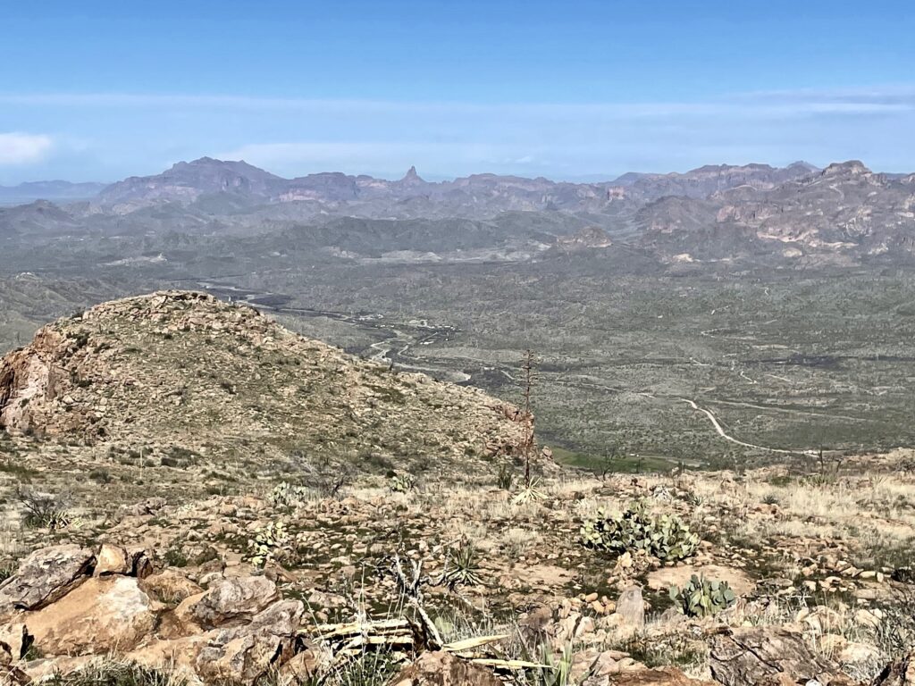
Because of this peak’s isolated position, nearby mountain views are fairly limited. However, the Superstition Mountains were visible 17 miles to the northwest, and a variety of other sub-ranges could be seen farther away in all directions.
.
.
For my descent, I retraced my up-route as best I could but still managed to get into unfamiliar terrain several times. Fortunately, all roads led to Rome, and I was back at the trailhead by early afternoon (1.7 hours from summit). I would give this mountain an enthusiastic recommendation to anyone looking for a moderately strenuous day hike that involves some interesting navigation and scrambling.
.
Route Map & Profile
…
…
Photo Gallery
Click to enlarge…