Trip Date: October 6, 2023
2023 BRITISH COLUMBIA & ALBERTA ADVENTURE VACATION
Needle Peak Day Climb
Needle/Flatiron Junction
Needle Peak (6857 ft)
Trip Report Summary
Region: Canadian Cascades (British Columbia)
Sub-Region: Coquihalla Range
Area: Coquihalla Summit Recreation Area
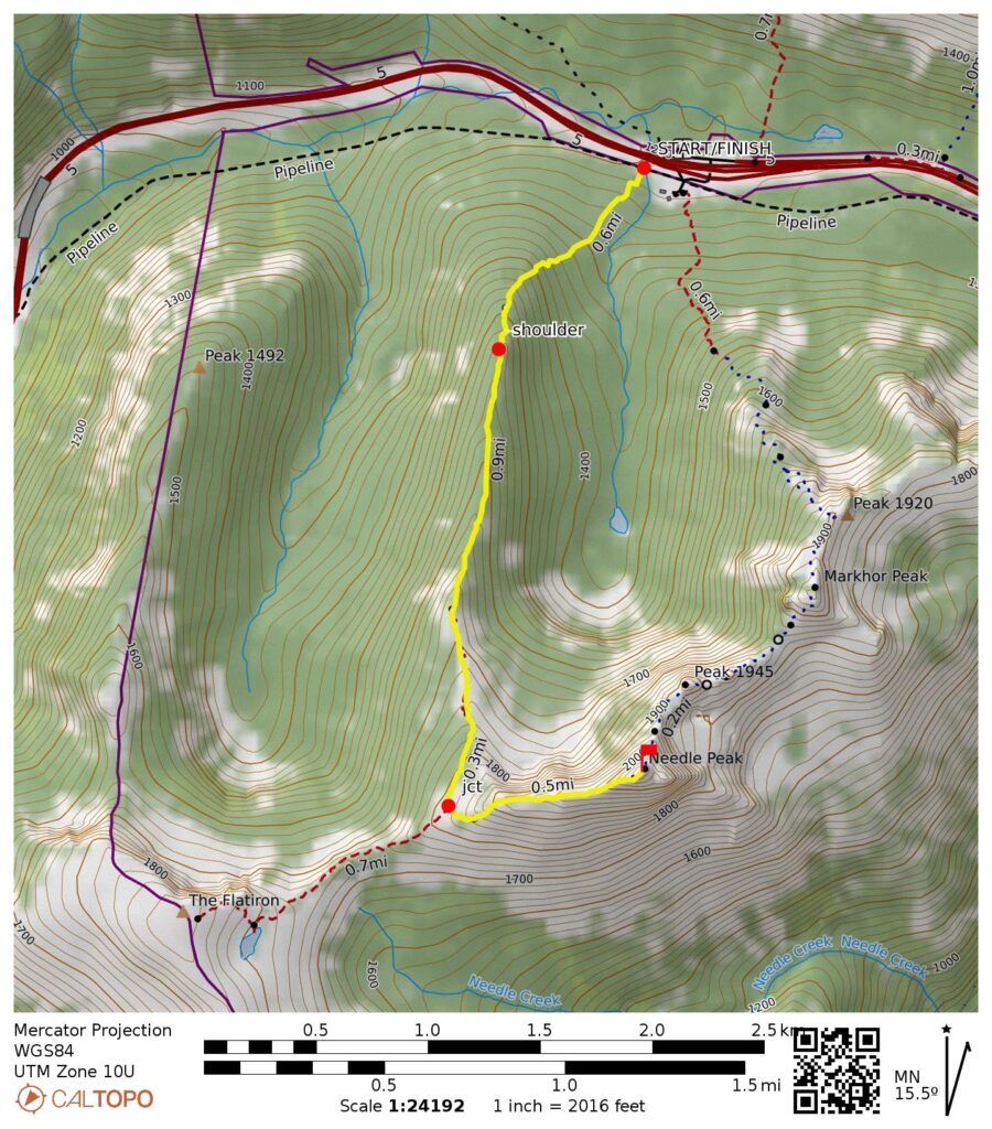
Starting & Ending Point: Needle Peak / Flatiron Peak Trailhead off Coquihalla Highway at Exit 217 (Elev. 3950 feet)
Way Points: Northwest Arm shoulder & Needle/Flatiron Junction & West Ridge nose & Needle Peak summit (trail hike & rock scramble)
Summit: Needle Peak (trail hike & rock scramble via West Ridge)
Approximate Stats: 5.4 miles traveled; 2950 feet gained & lost; 4.0 hours up; 2.5 hours down.
Full Trip Report
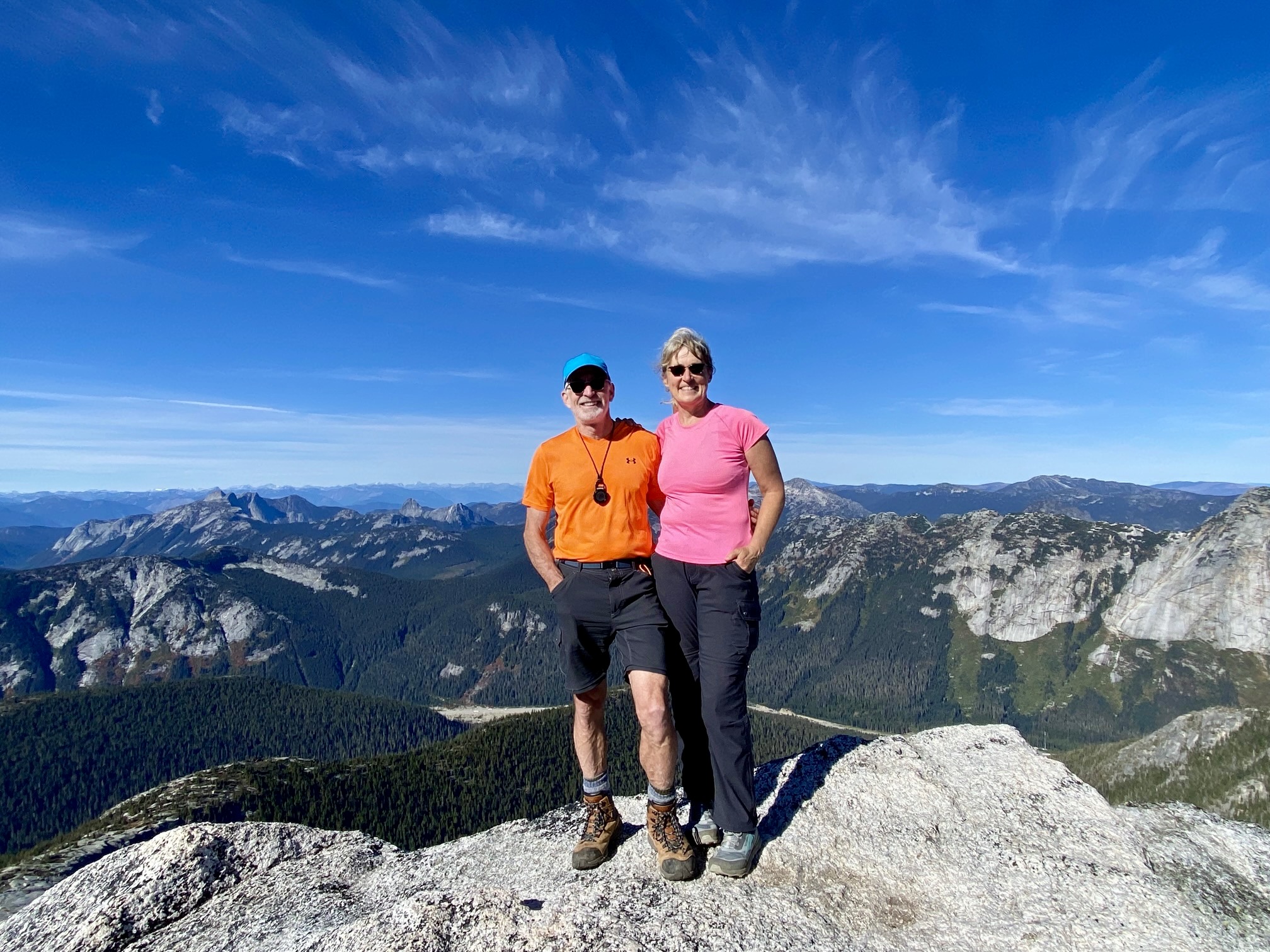
For our first climbing foray into the Coquihalla Range, Eileen and I did an ascent of Needle Peak. This popular summit sits closely south of Coquihalla Pass and is typically reached via either the west ridge or the northeast ridge. Both routes begin on Pipeline Road near Exit 217 on the southern side of Highway 5. We chose the former route because it is easier, faster, and more straightforward.
It was a crisp, sunny Friday morning when we pulled off Highway 5. There is currently a major pipeline construction project underway in the highway corridor, but the temporary parking area and trailhead on Pipeline Road are clearly marked with large signs.
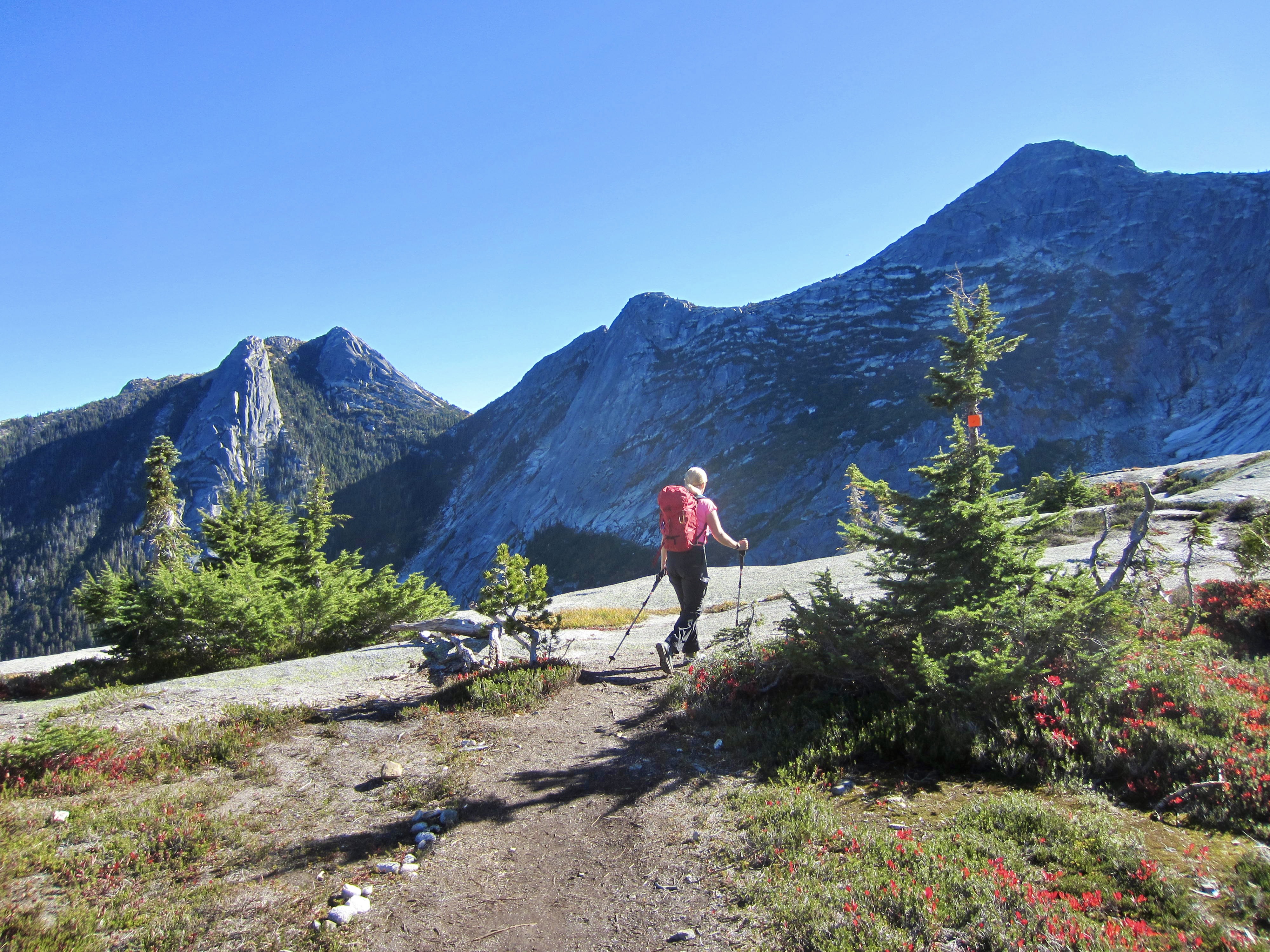
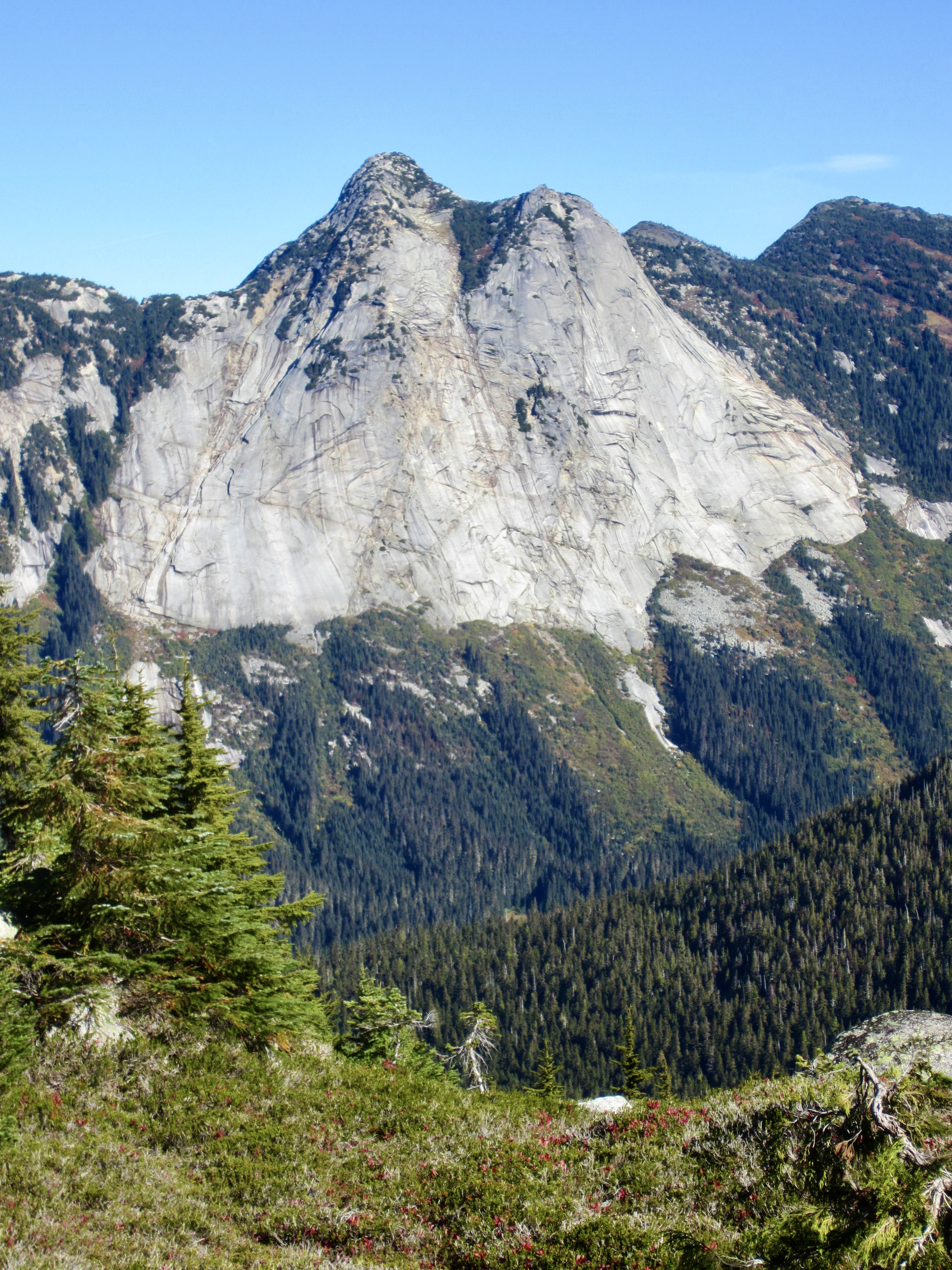
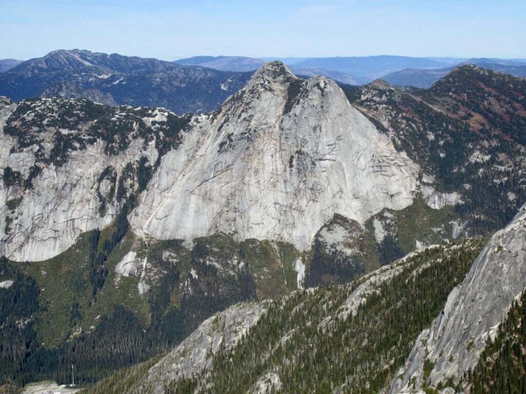
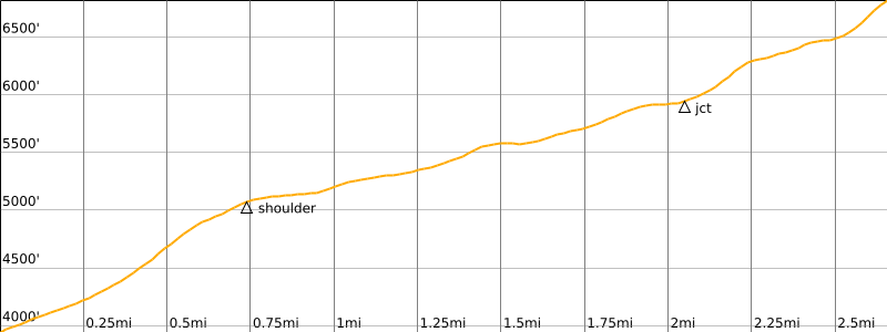
We hiked up the well-traveled trail through the construction zone and then up a steep, muddy forest slope, eventually gaining the shoulder of Needle Peak’s northwest arm. Yak Peak, with its sweeping granite apron, is particularly impressive from this vantage.
.
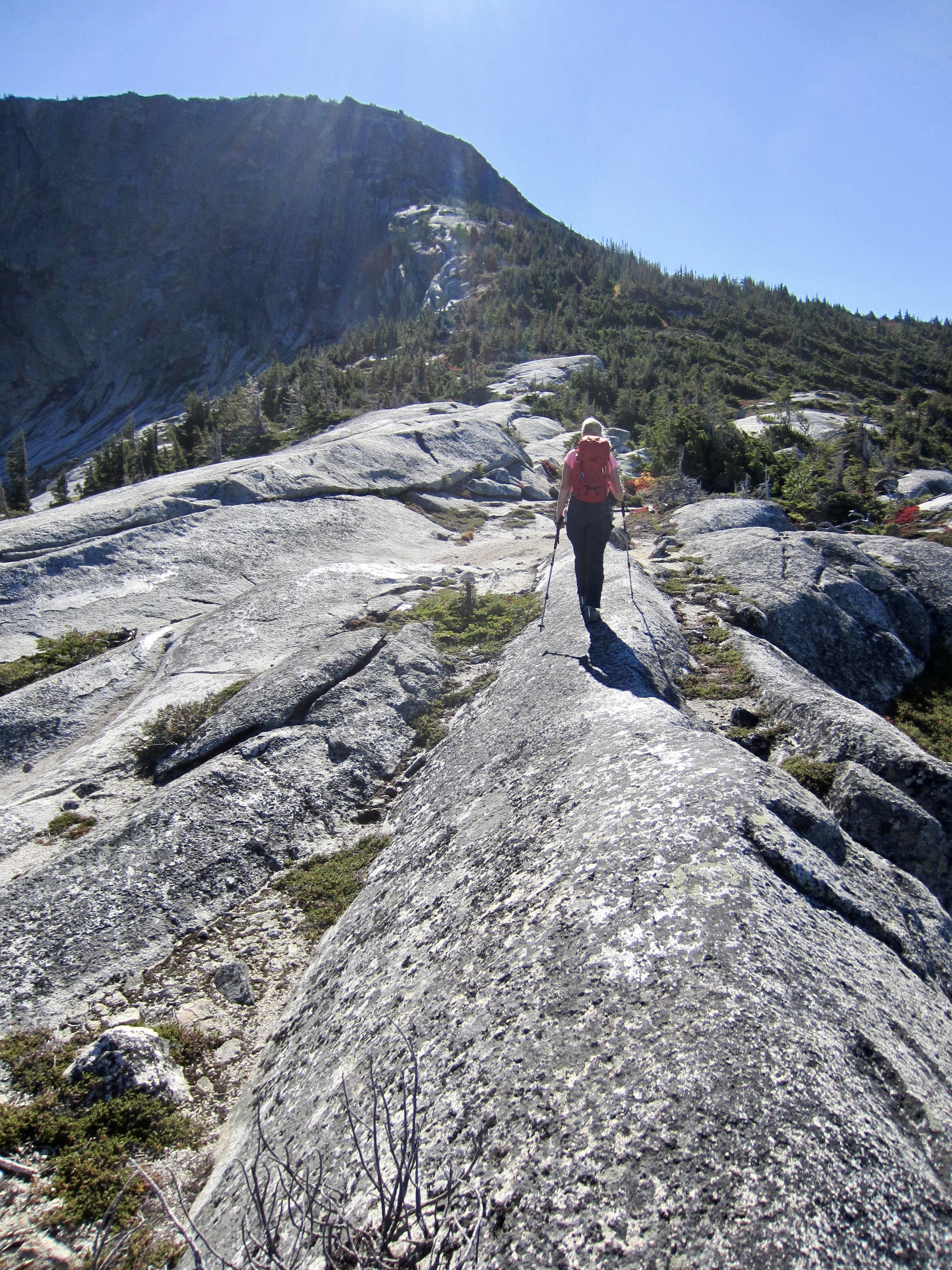
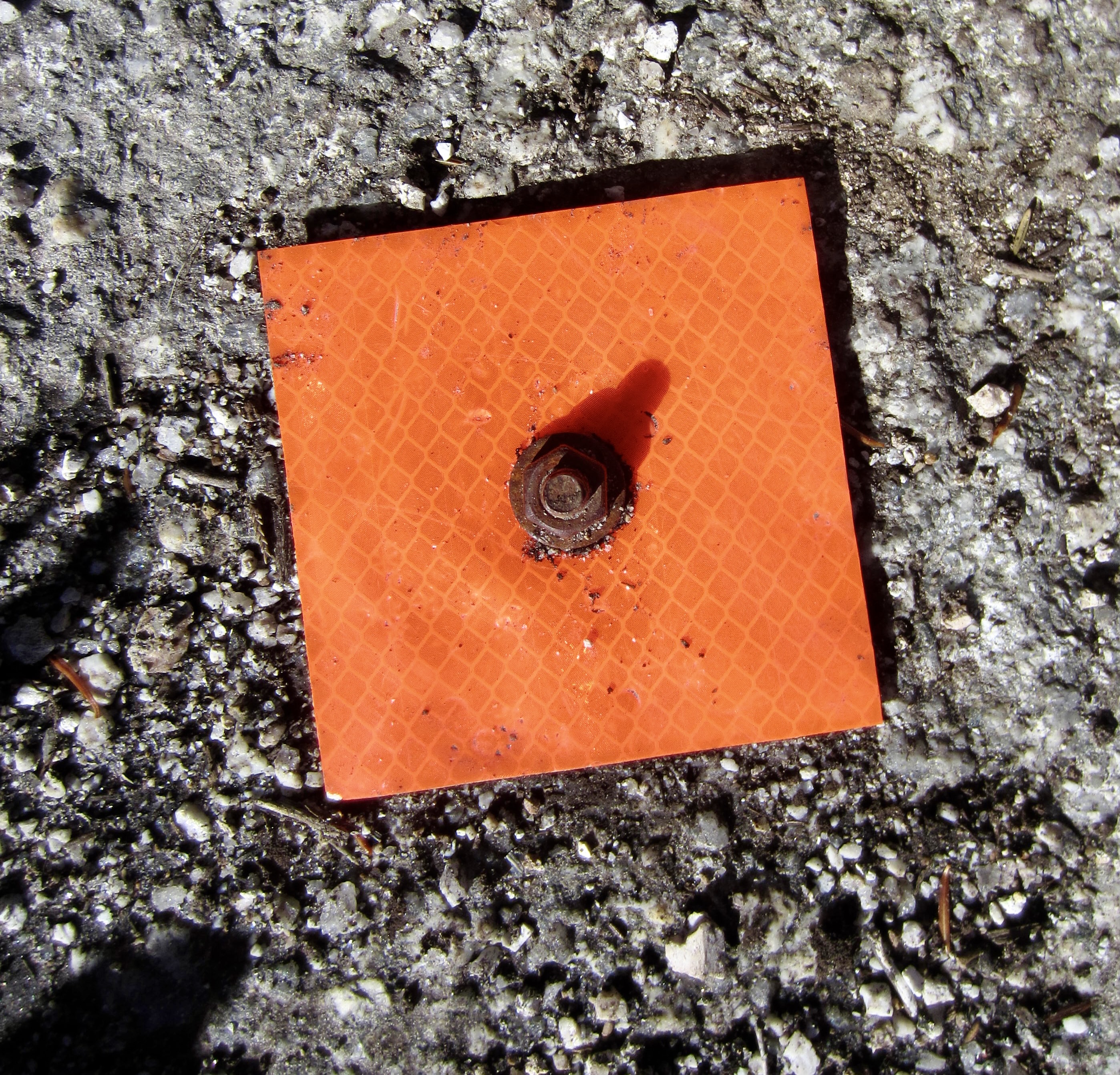
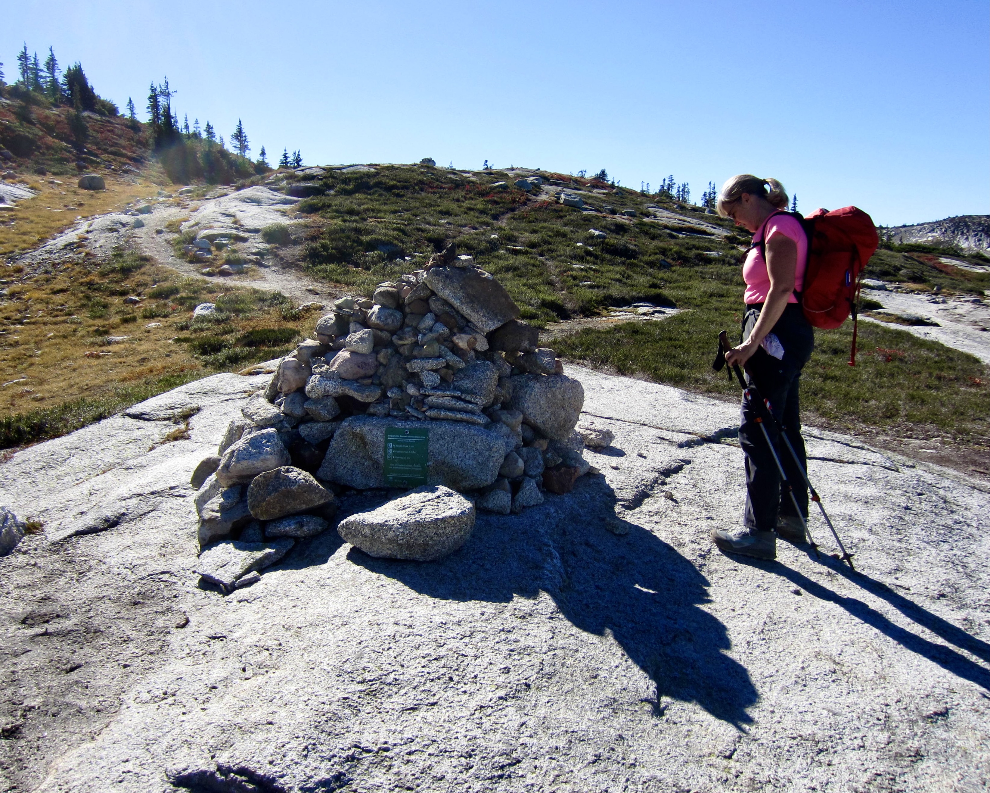
The trail temporarily fades away as it traverses granite slabs and whalebacks, but orange squares bolted to the bedrock clearly identify the correct route. At 6000 feet, we came to a trail junction adorned with a large cairn. The right fork leads over to Flatiron Peak, whereas the left fork heads up Needle Peak’s west ridge. We took the latter fork.
.
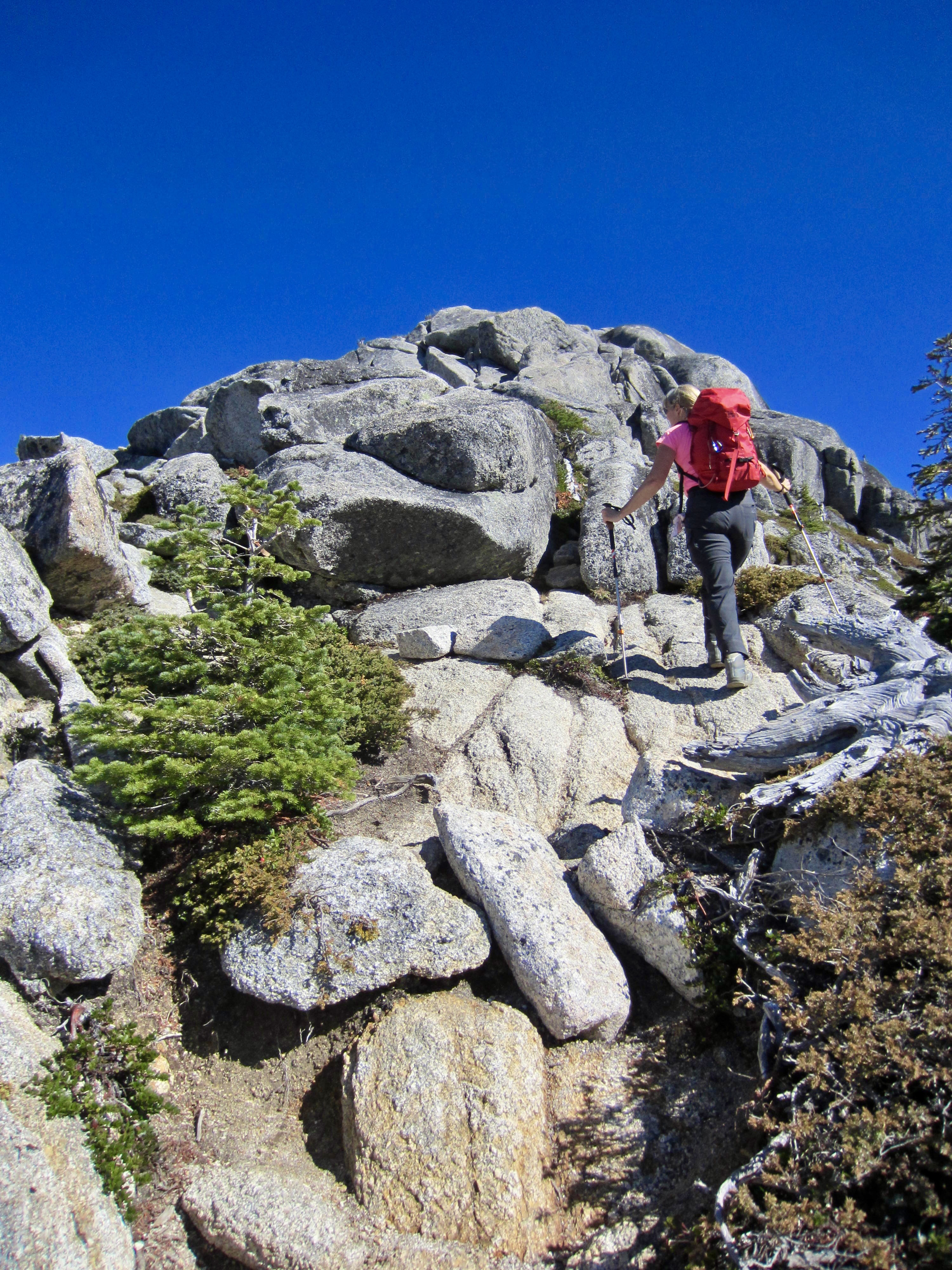
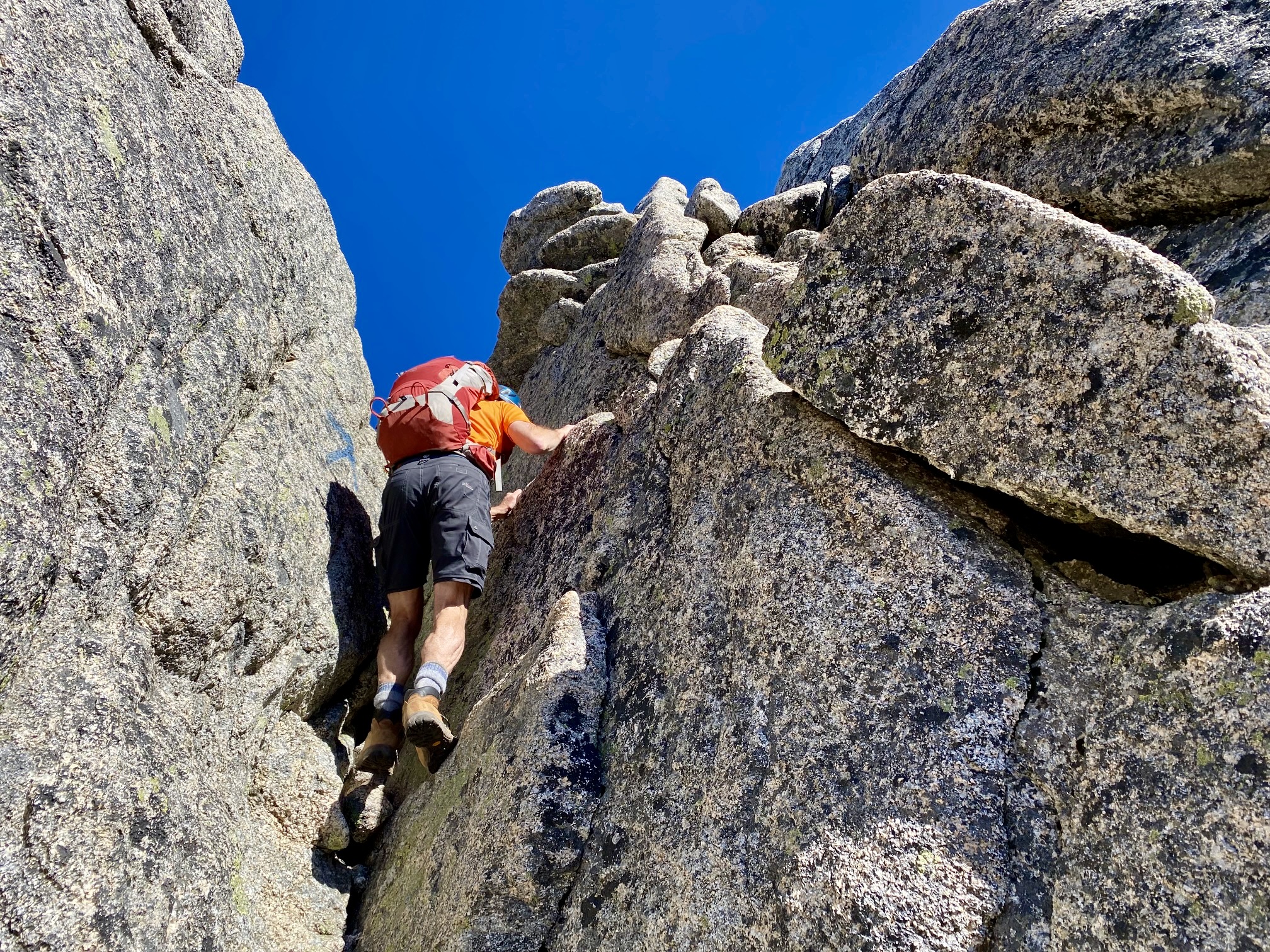
Shortly beyond the junction, our trail became a rough climber’s path that ends at a rocky nose. Scrambling up this nose, we quickly found ourselves on moderately exposed Class 4 terrain that prompted the use of a handline. (It was later discovered that we were slightly off route; there is a reasonable Class 3 crack/ramp just left of our up-route.)
.
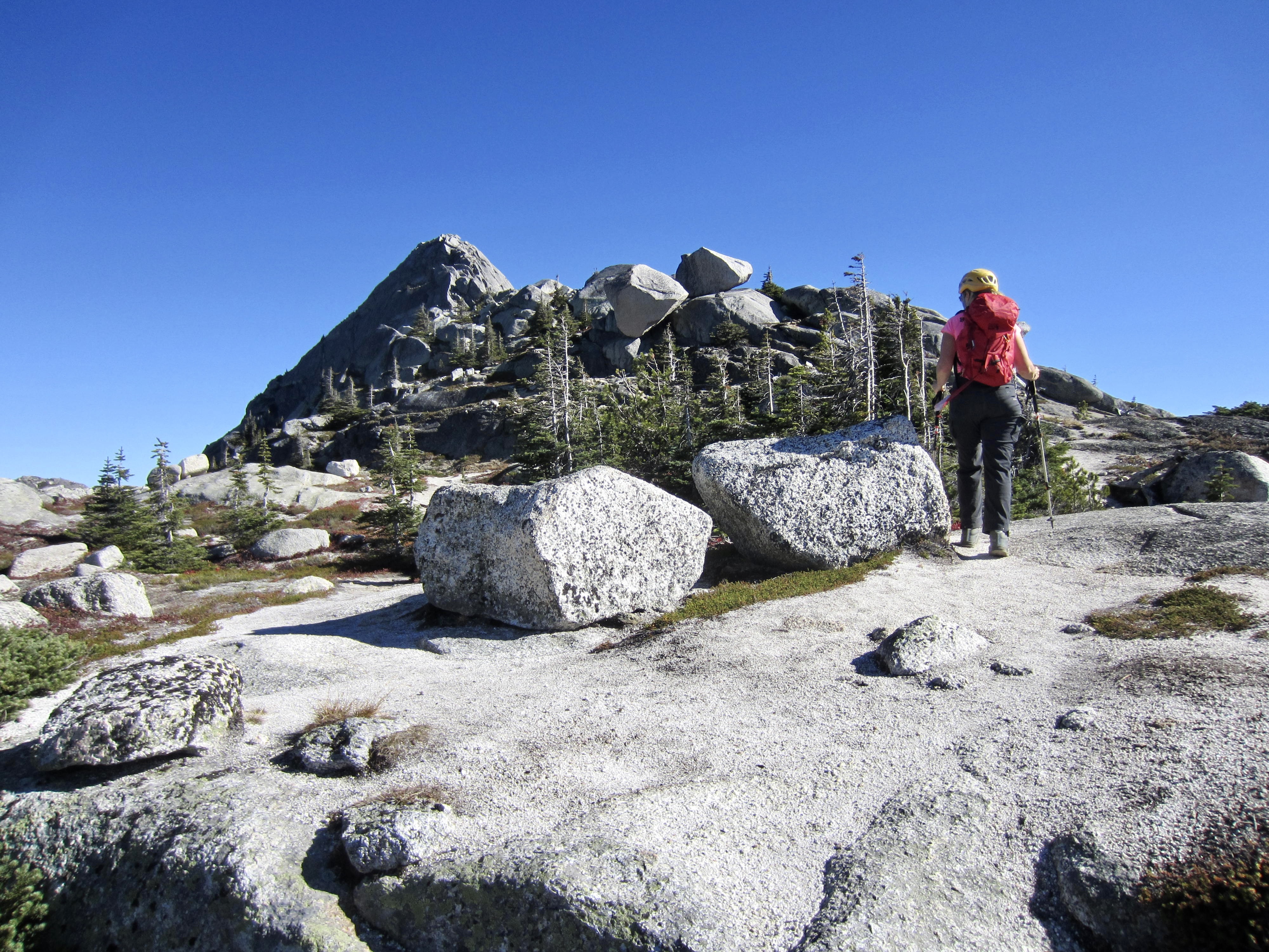
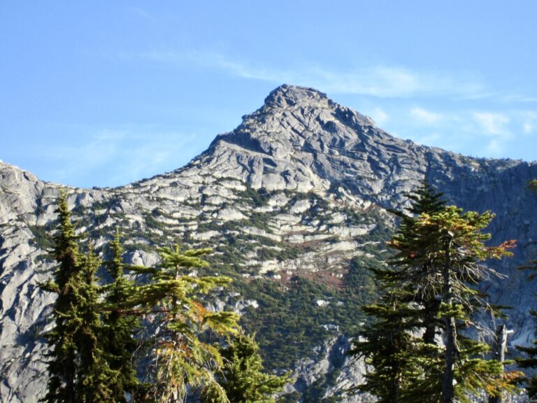
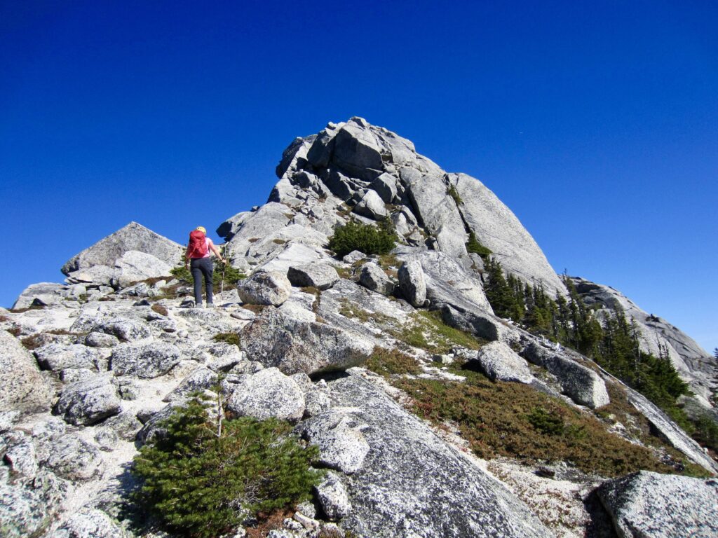
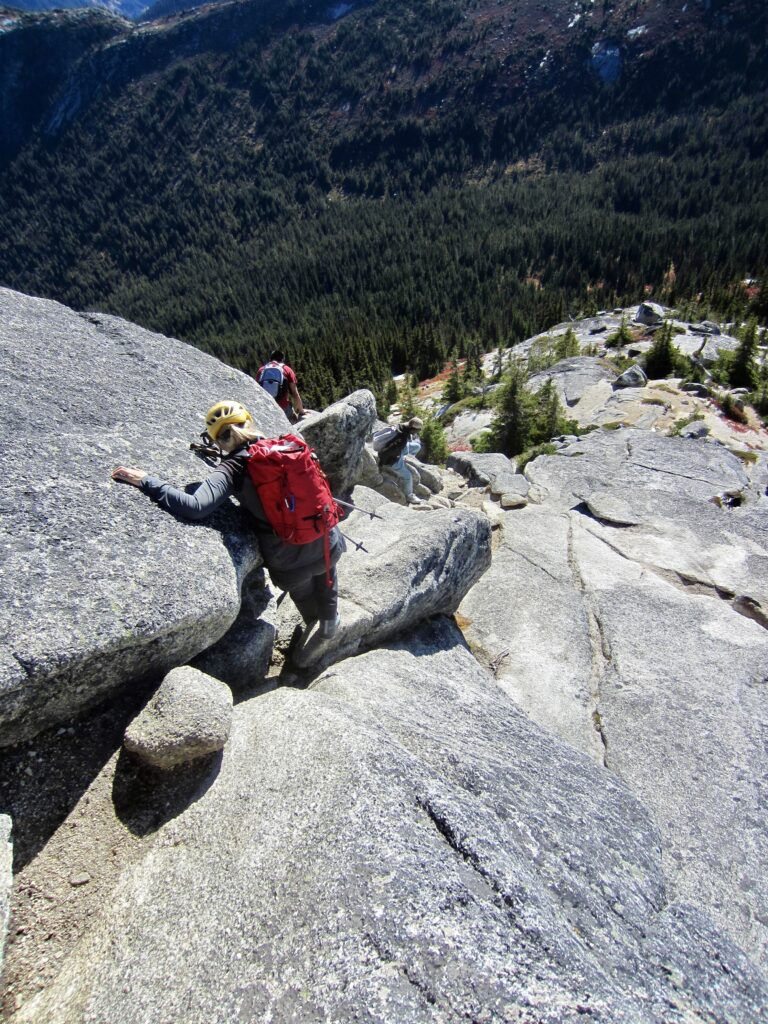
More pleasant hiking and easy scrambling took us along the ridge crest, weaving around granite outcrops and across grassy benches. We soon arrived at the base of the summit block. There was no obvious route ahead, so we tried scrambling directly up the west face but got stymied by a steep wall. Fortunately, a faster pair of hikers overtook us at this time, and one of them knew from a previous ascent that the easiest route is farther around to the right (south).

.
.
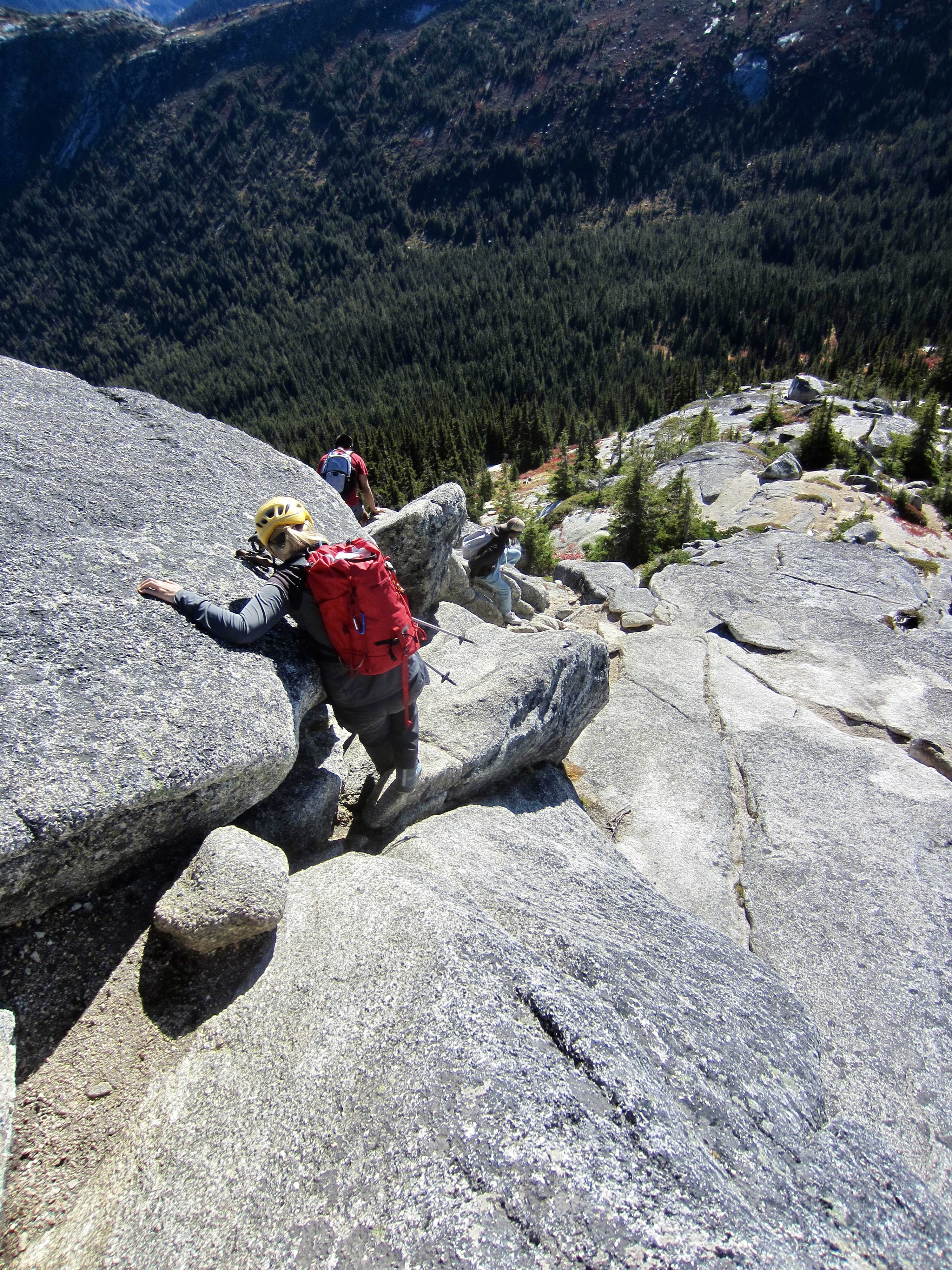
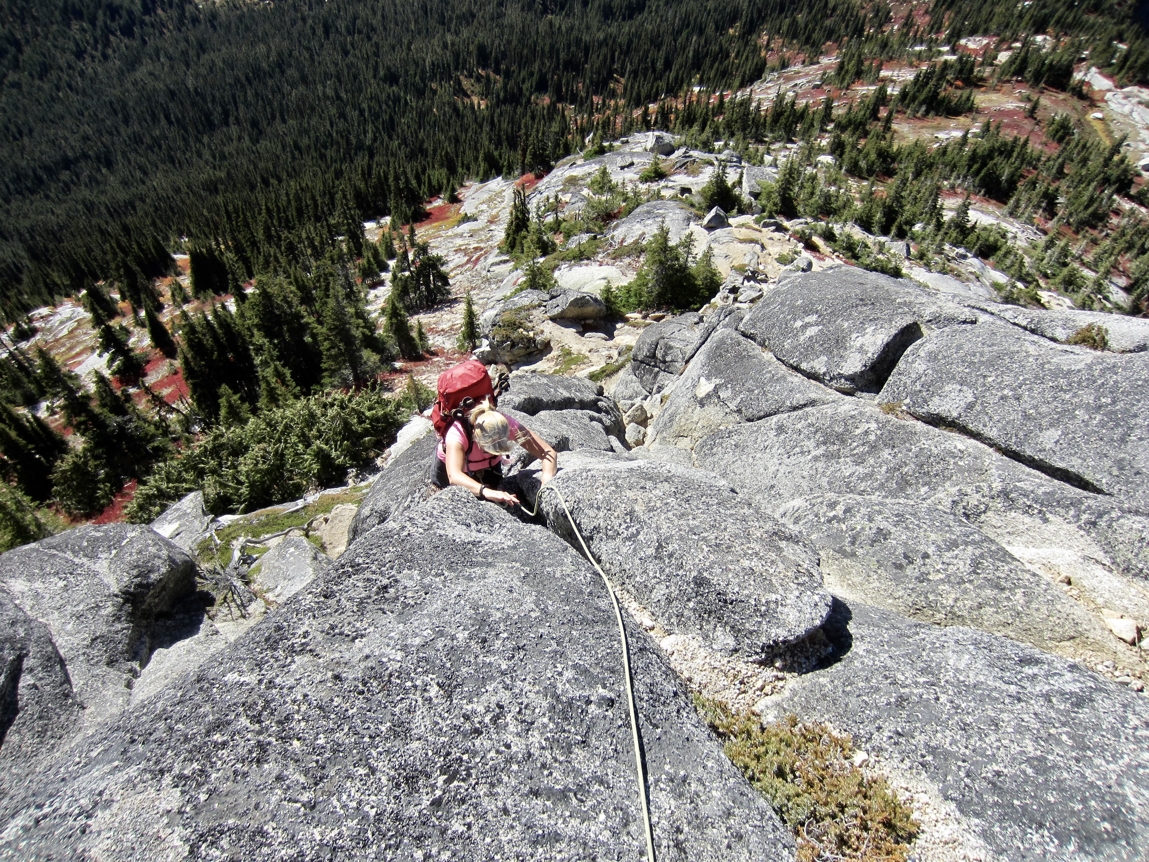
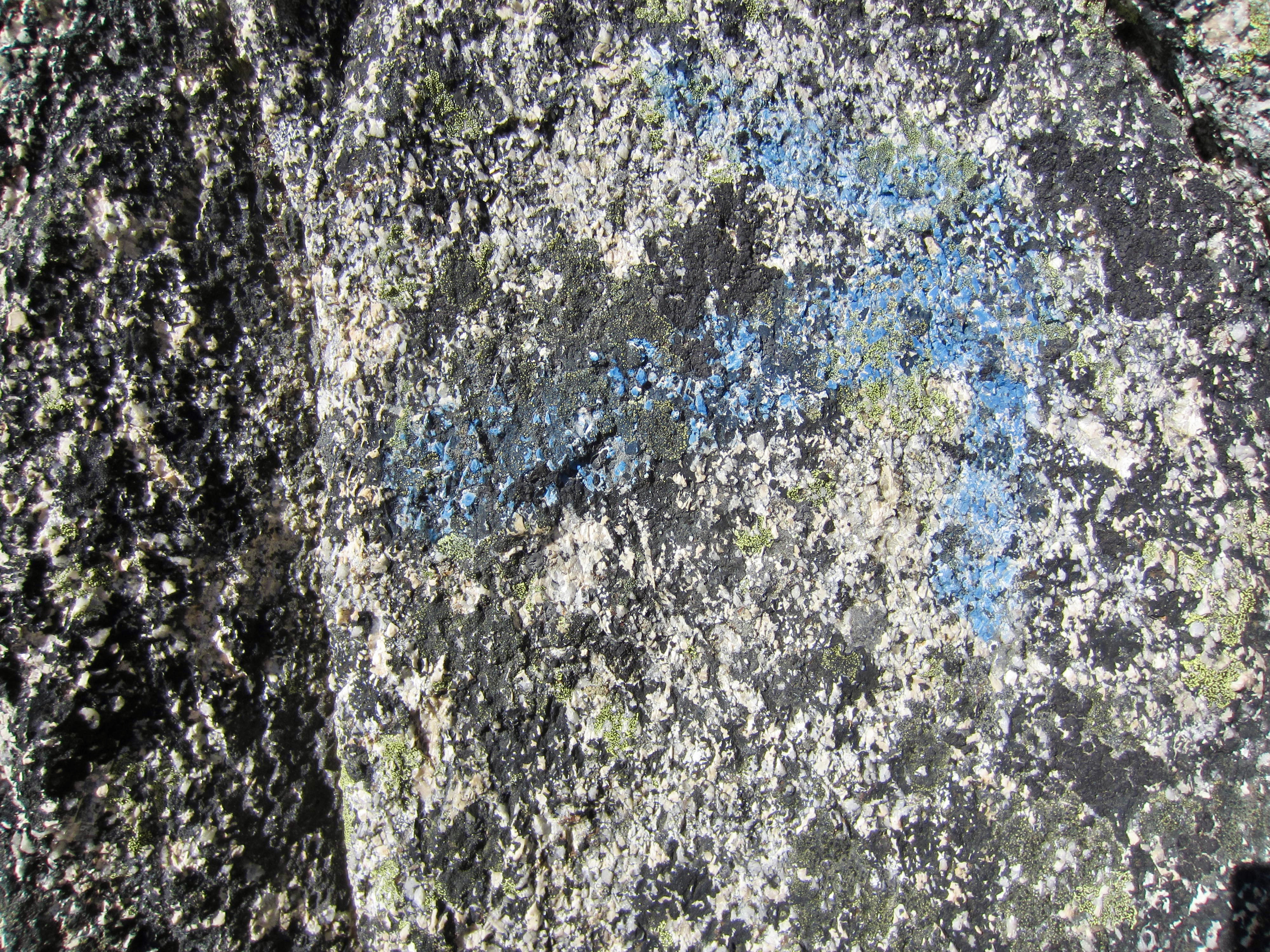
We followed the other pair up a narrow dihedral and then over several blocky steps. The coarsely crystalline rock was solid and grippy, the scrambling was easy and fun, and the exposure was never too serious. Along the way, I noticed numerous blue arrows painted on the rock, presumably marking the easiest route. Now greatly faded with age, these arrows require a watchful eye.
.
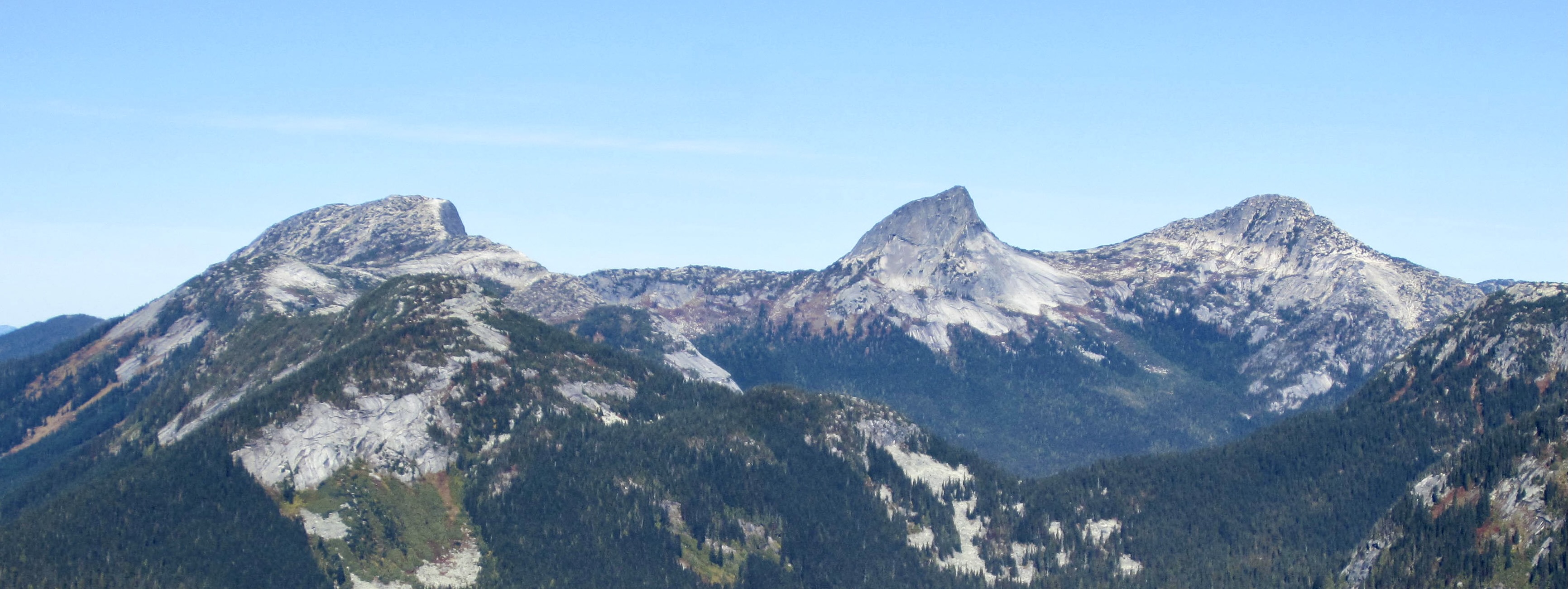
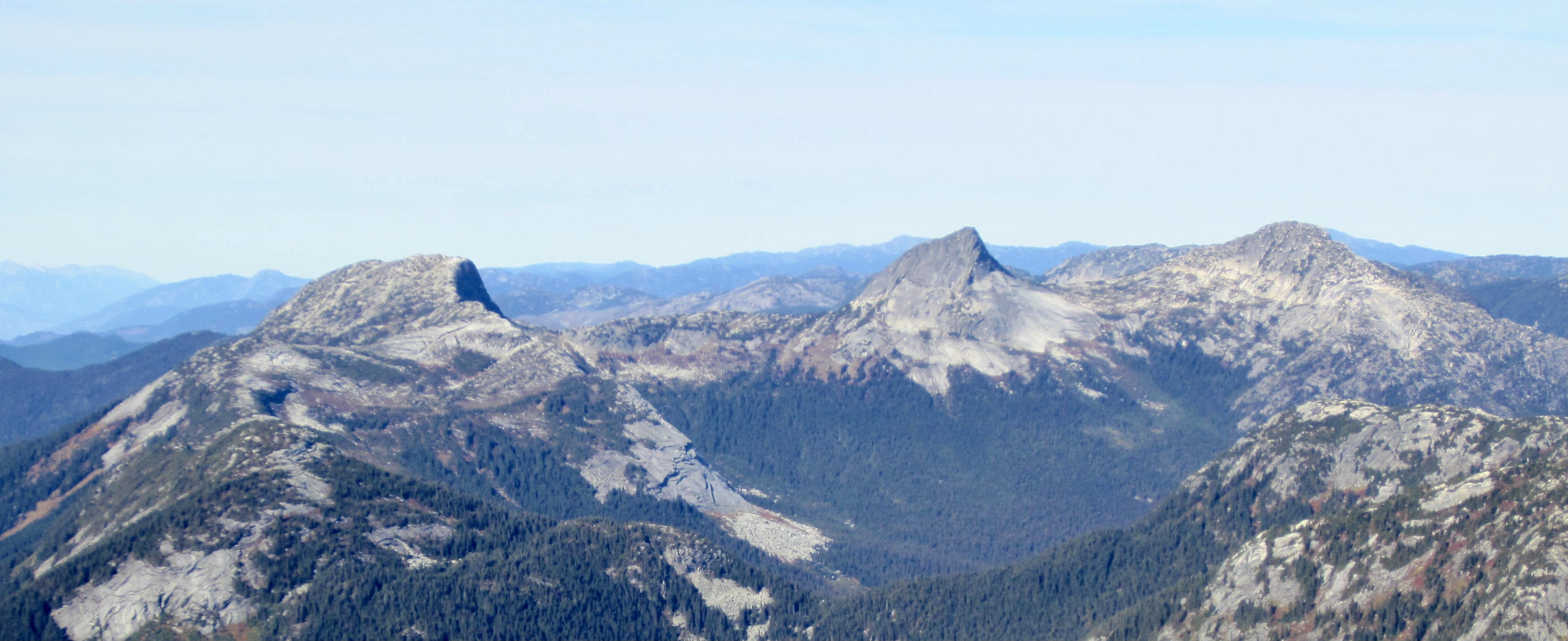
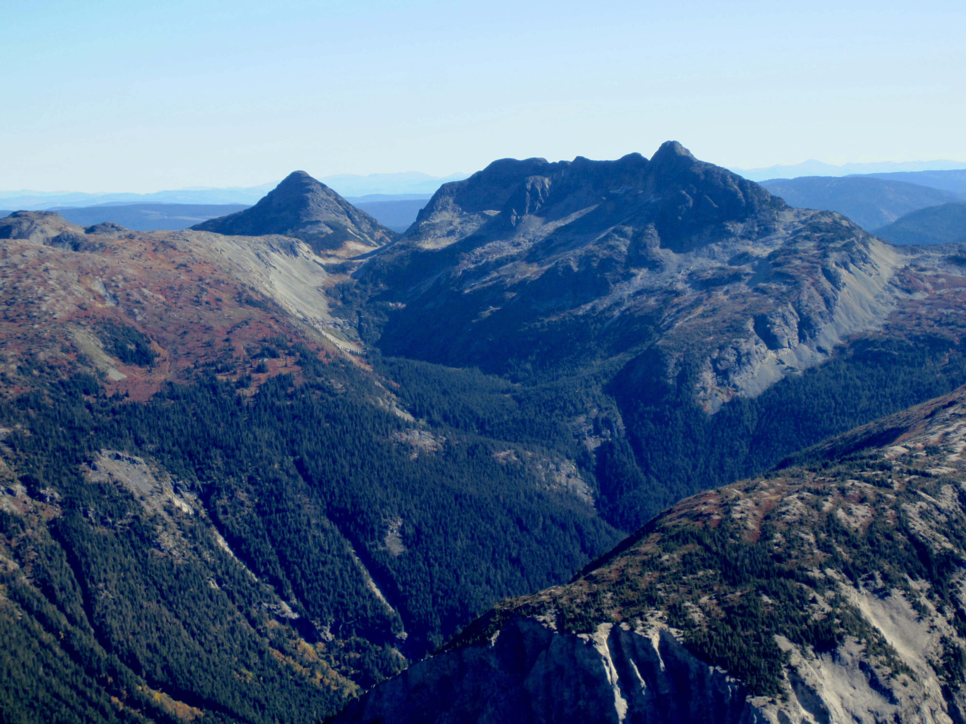
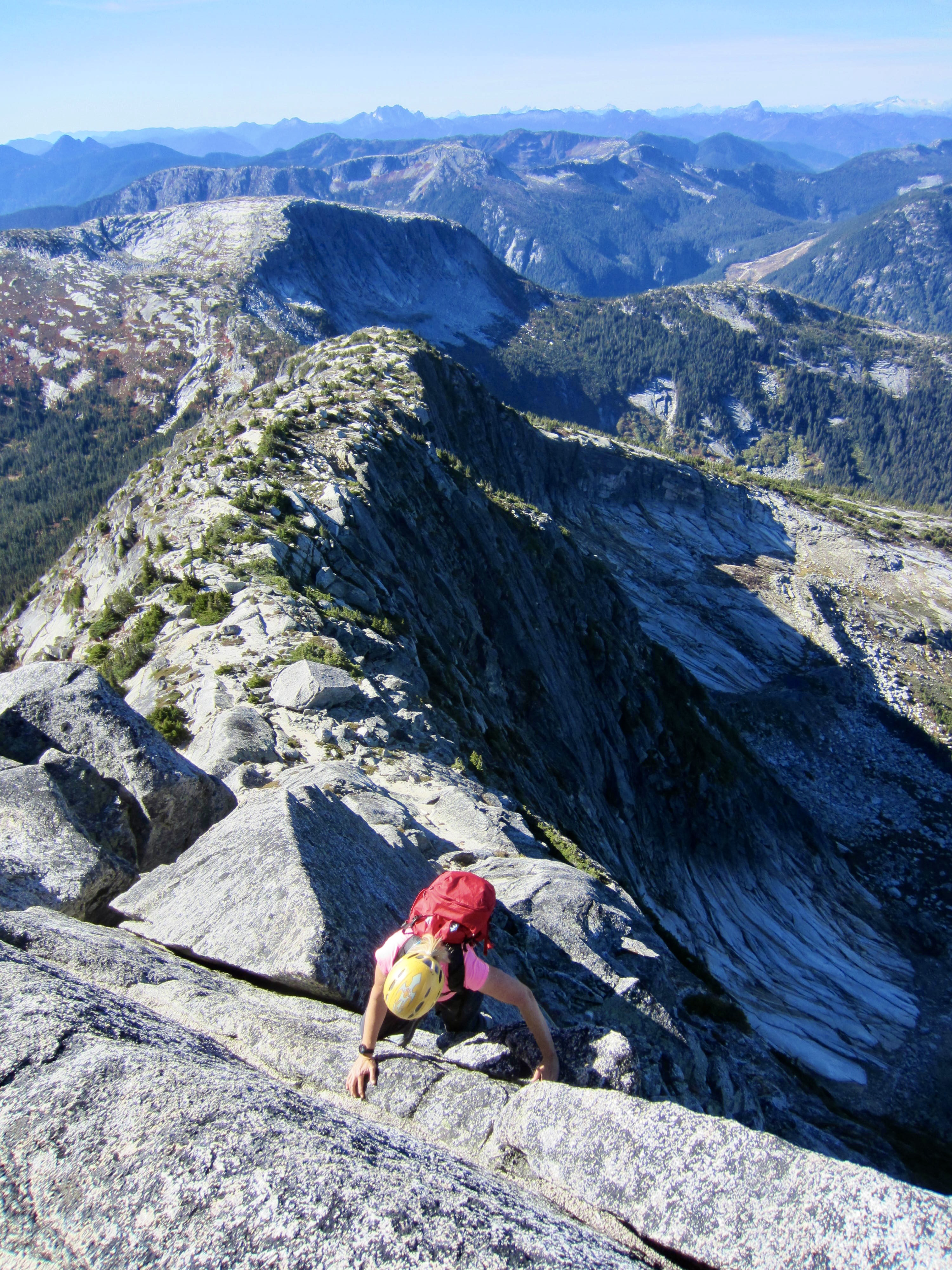
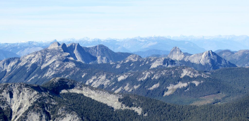
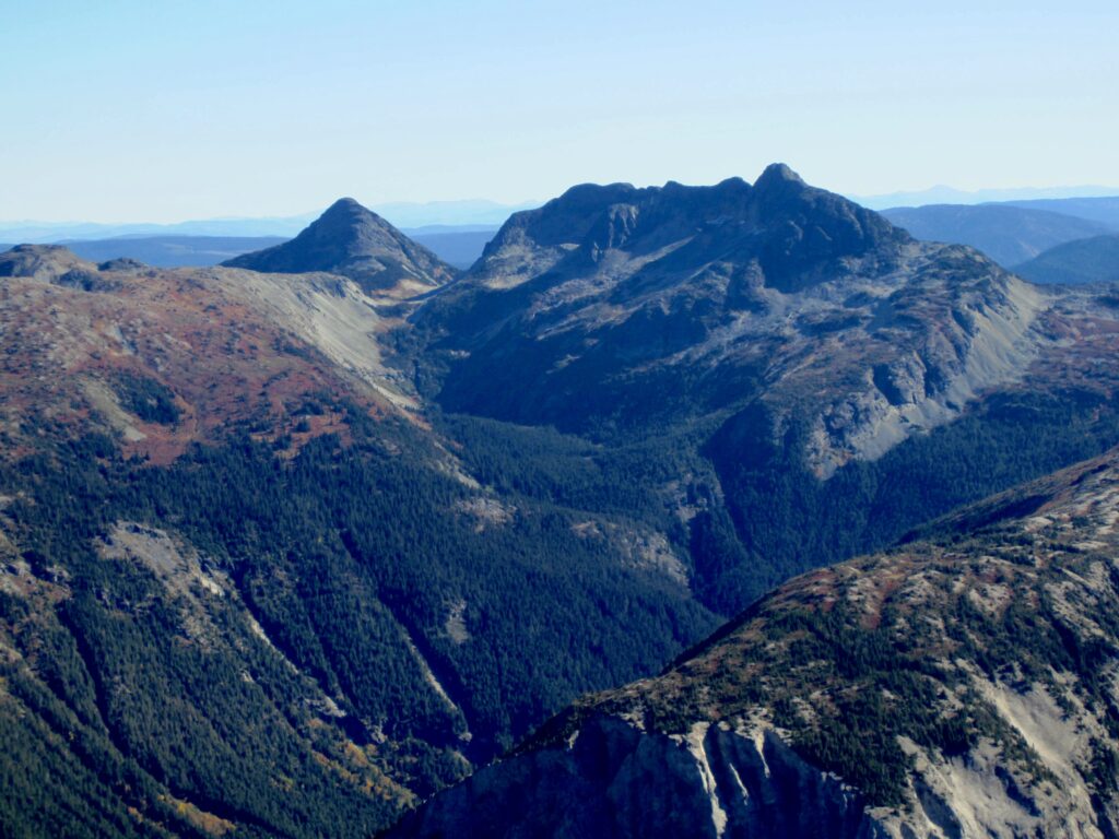
Eileen and I stepped onto the summit at 2:00pm (4.0 hours + 2900 feet from TH), closely behind the other climbers. We spent some time studying our surroundings and trying to identify the other Coquihalla peaks—all of which were familiar to us in name only. Farther to the south were the very familiar peaks located near Chilliwack and the international border.
.

.
.
.
During our descent, we paid more attention to the blue arrows and did a better job of staying on the easiest route. The other climbers also showed us the Class 3 crack/ramp that we’d previously missed while coming up the ridge nose.
.
Once back at the trail junction, it was simply a matter of hiking down the ridge and trying to stay upright on the steep, muddy sections. We reached the trailhead in late afternoon (2.5 hours from summit), feeling that our first climb in the Coquihalla Range had been both successful and informative.
Route Map & Profile
.
.
Photo Gallery
Click to enlarge…