Trip Date: October 7, 2023
Beaverhead Peak Day Climb
Mount 7 Launching Knoll
Beaverhead Peak aka Mount 7 (8250′)
Trip Report Summary
Region: Canadian Rockies (British Columbia)
Sub-Region: Kootenay Ranges
Sub-Sub-Region: Beaverfoot Range
Area: Mount 7 North Ridge Recreation Site
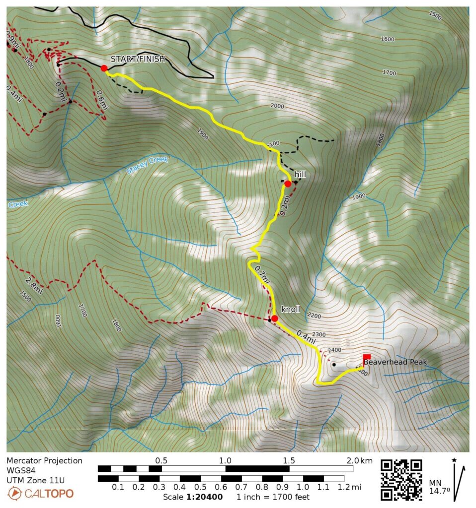
Starting & Ending Point: Spur road junction on Mount 7 Road (Elev. 6360 feet)
Way Points: Stacey Creek Hill & Mount 7 launching knoll & Beaverhead Peak summit (trail hike & rock scramble)
Summit: Beaverhead Peak (rock scramble via Southwest Face)
Approximate Stats: 5.4 miles traveled; 2650 feet gained & lost; 2.7 hours up; 2.1 hours down.
Full Trip Report
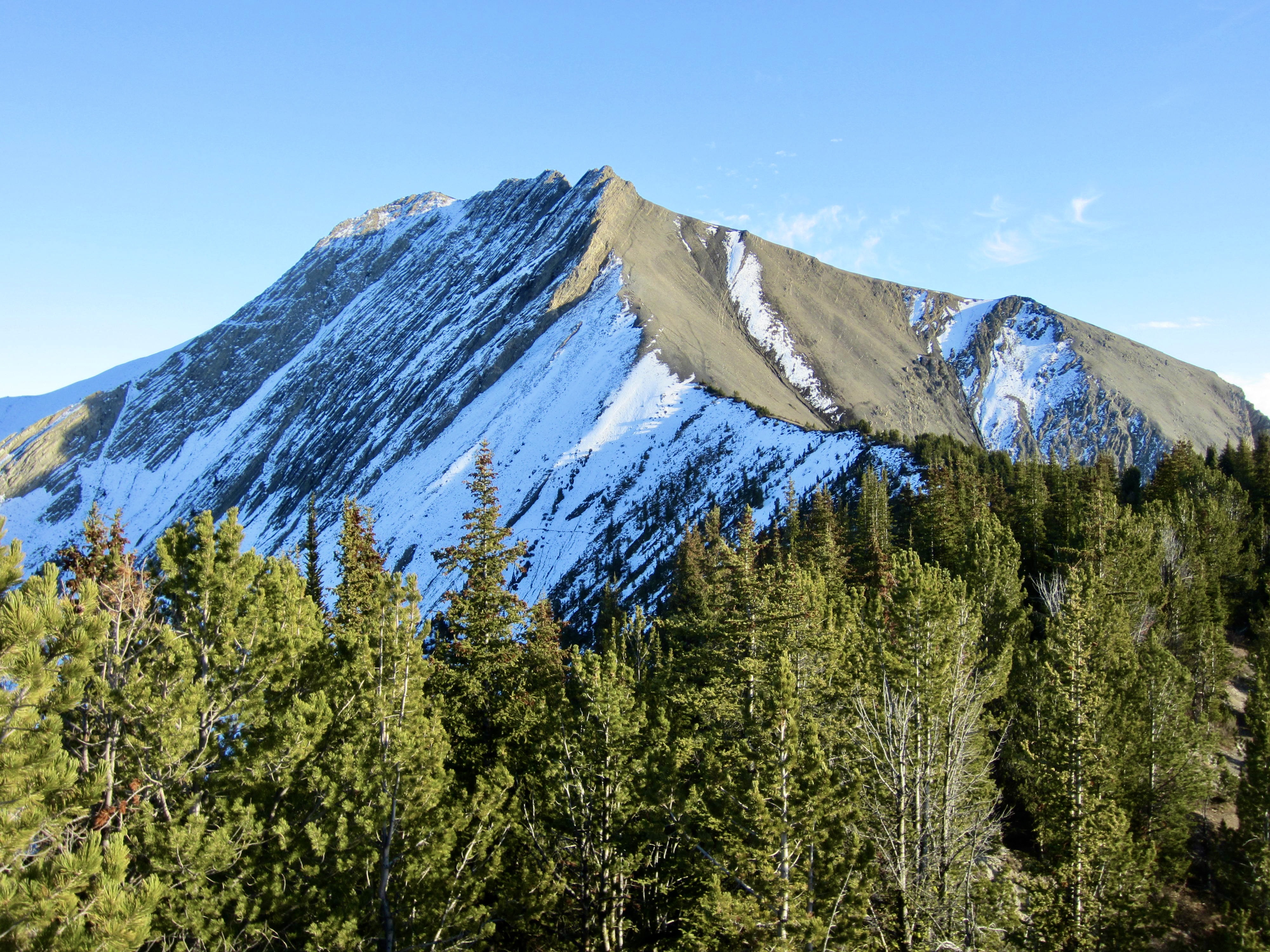
During our drive from British Columbia to Alberta, Eileen and I had half a day to spend in the small mountain town of Golden. We selected Beaverhead Peak (known as “Mount 7” by the locals) as a summit objective. This 8250-foot peak anchors the northwestern end of the Beaverfoot Range, which occupies the acute “V” formed by the Columbia River and Kicking Horse River confluence.
It was sunny but cool when we left our car beside Mount 7 Road on a Saturday at noon. The route to Beaverhead Peak is not marked; it begins on an inconspicuous spur road that begins ¼ mile from the end of Mount 7 Road and heads uphill in an east-by-southeast direction. This spur road is extremely steep and rutted in many places, making it passable only by serious 4×4 vehicles. There are several forks in the road, and we stayed to the right at each one.
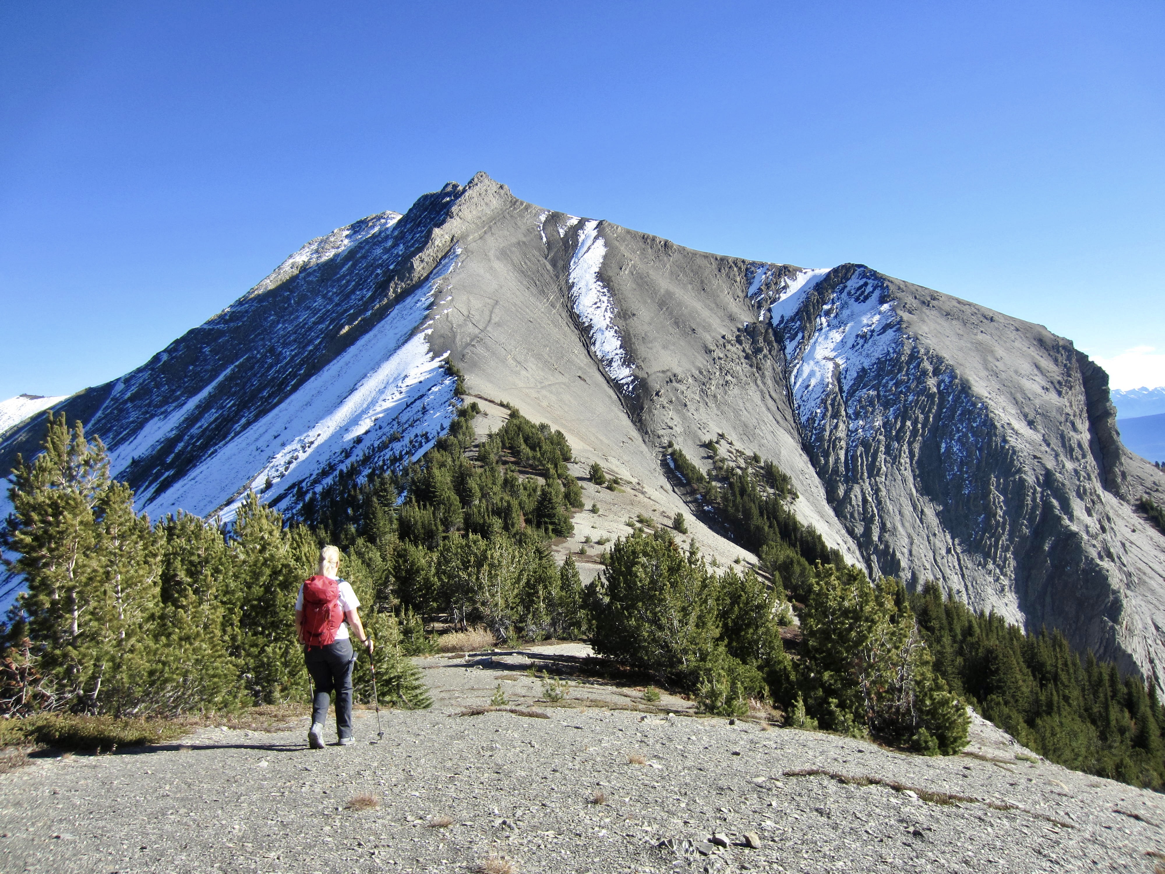
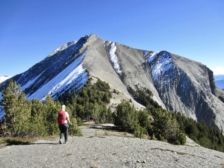
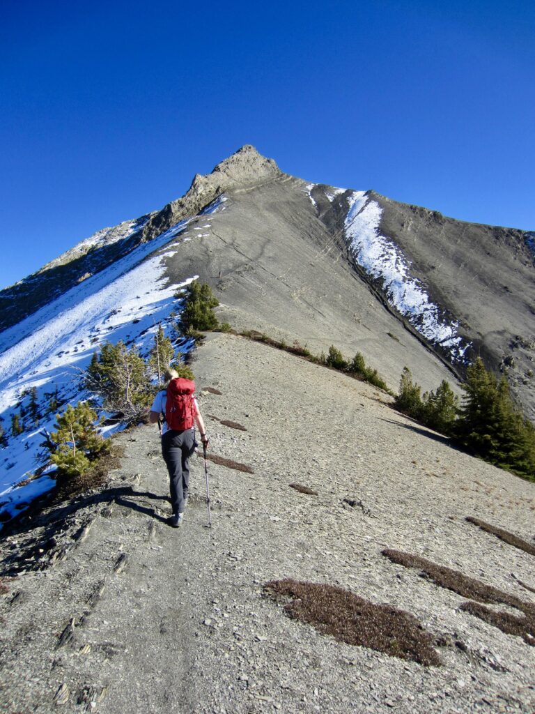
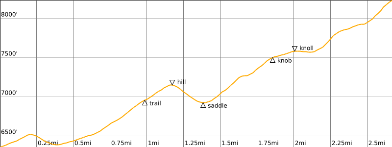
After a long mile of walking and dodging water holes, we came to a clearing where the road ended and a primitive trail began. We followed the trail over a forested hill, then down 300 feet to a saddle, then up the nose of a ridge to a small, rocky knob. Here we got our first view of Beaverhead Peak. Continuing along the ridge for another 200 yards, we reached a partially bald knoll overlooking the Columbia Valley. For reasons that immediately became obvious to us, this knoll serves as a popular launching point for hang gliders and paragliders. (In fact, Mount 7 is regarded as one of the premier launching points in the entire world!)

.
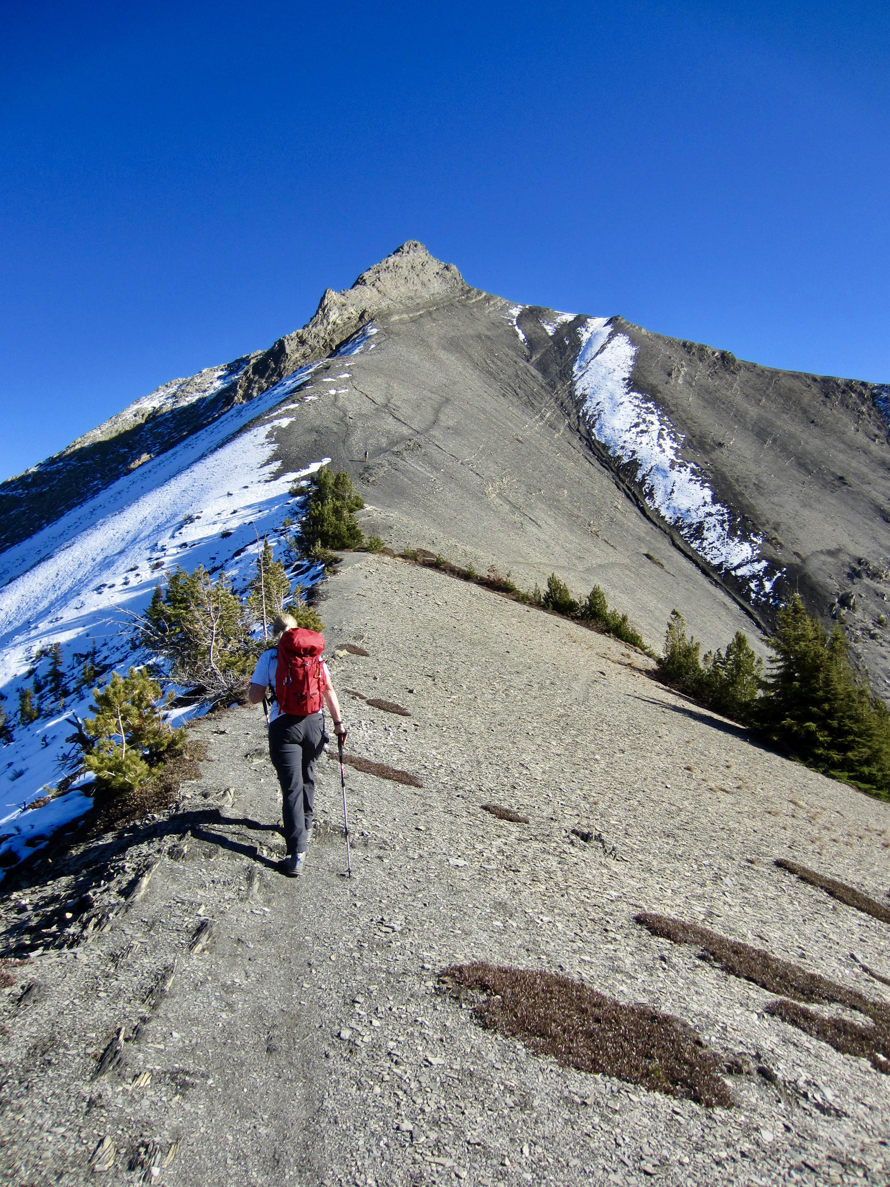
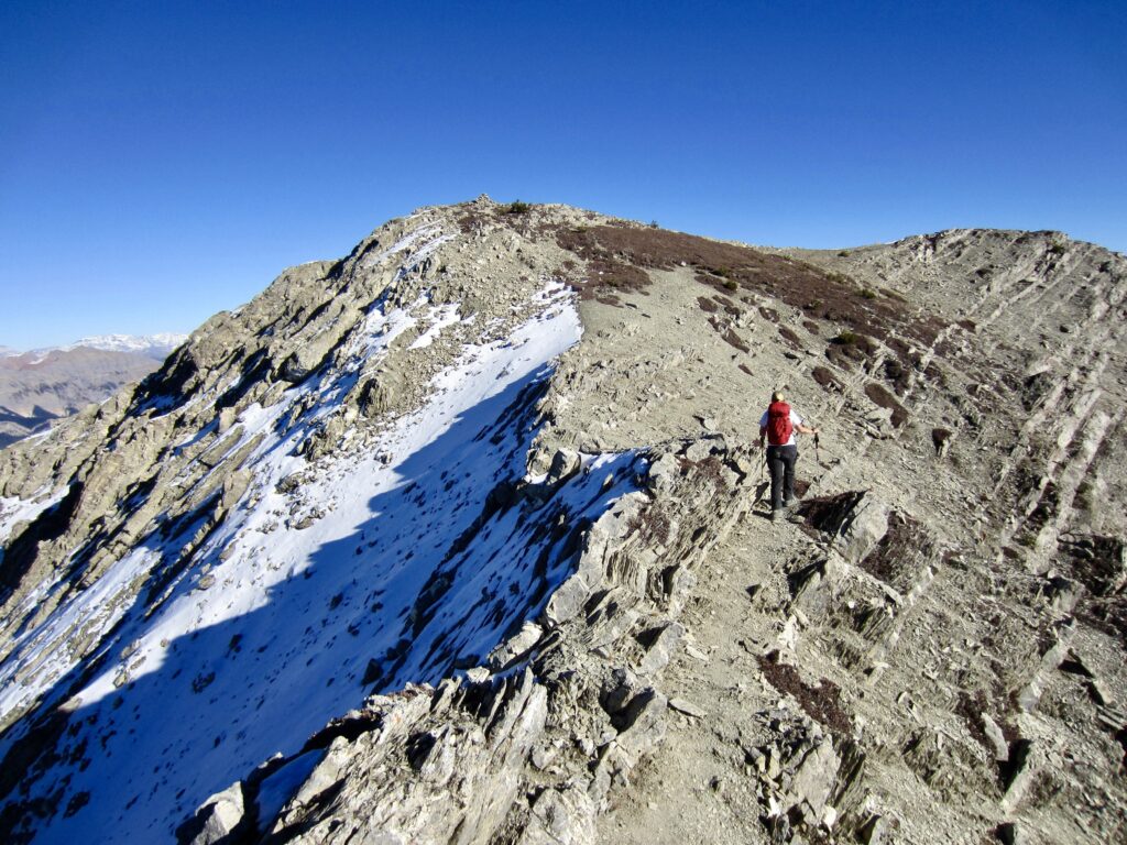
The knoll gave us a clear view of the route ahead. Multiple paths could be seen going up the northwest ridge, traversing rightward under the summit block, and disappearing around the southwest ridge. We headed up the highest path, which was little more than a boottrack stomped into the soft slope composed of disintegrated shale.
.

.
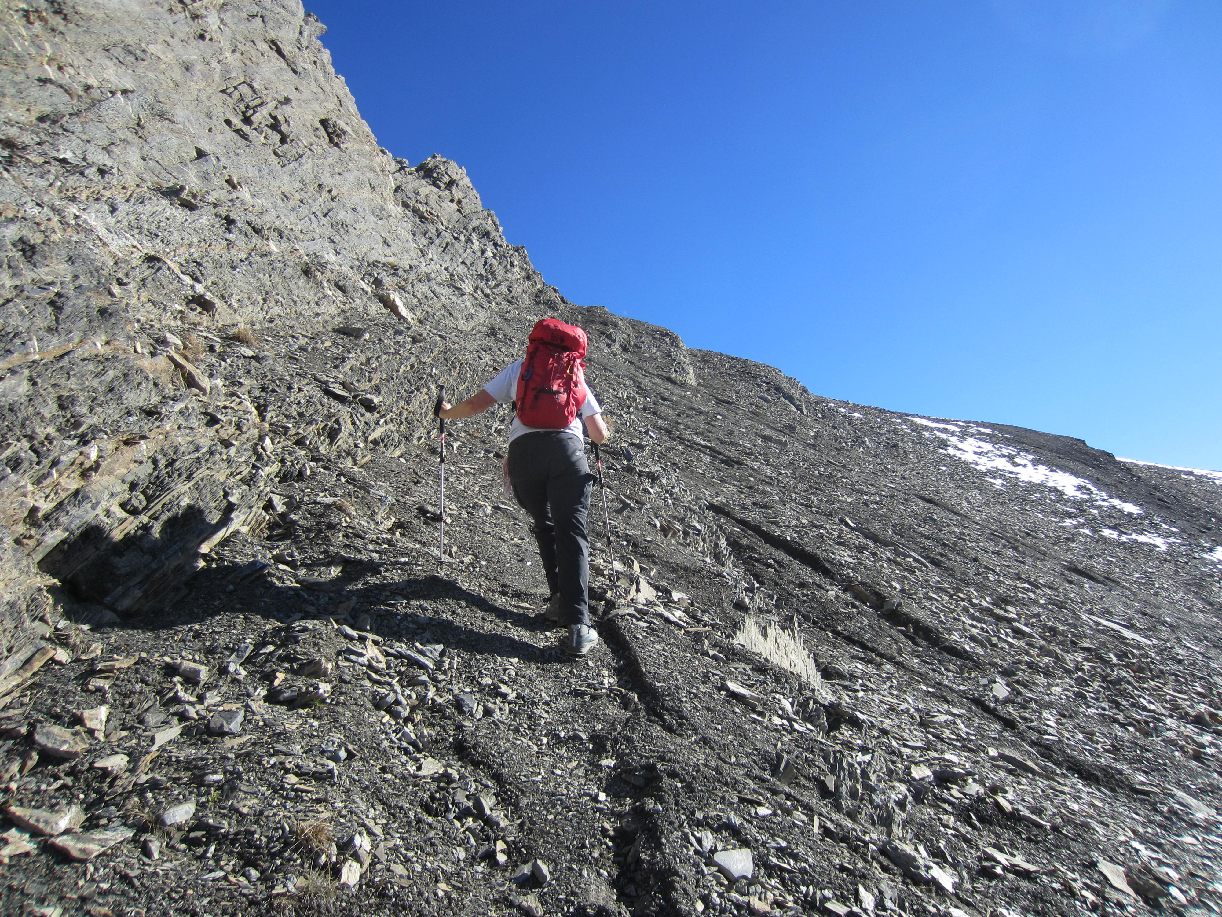
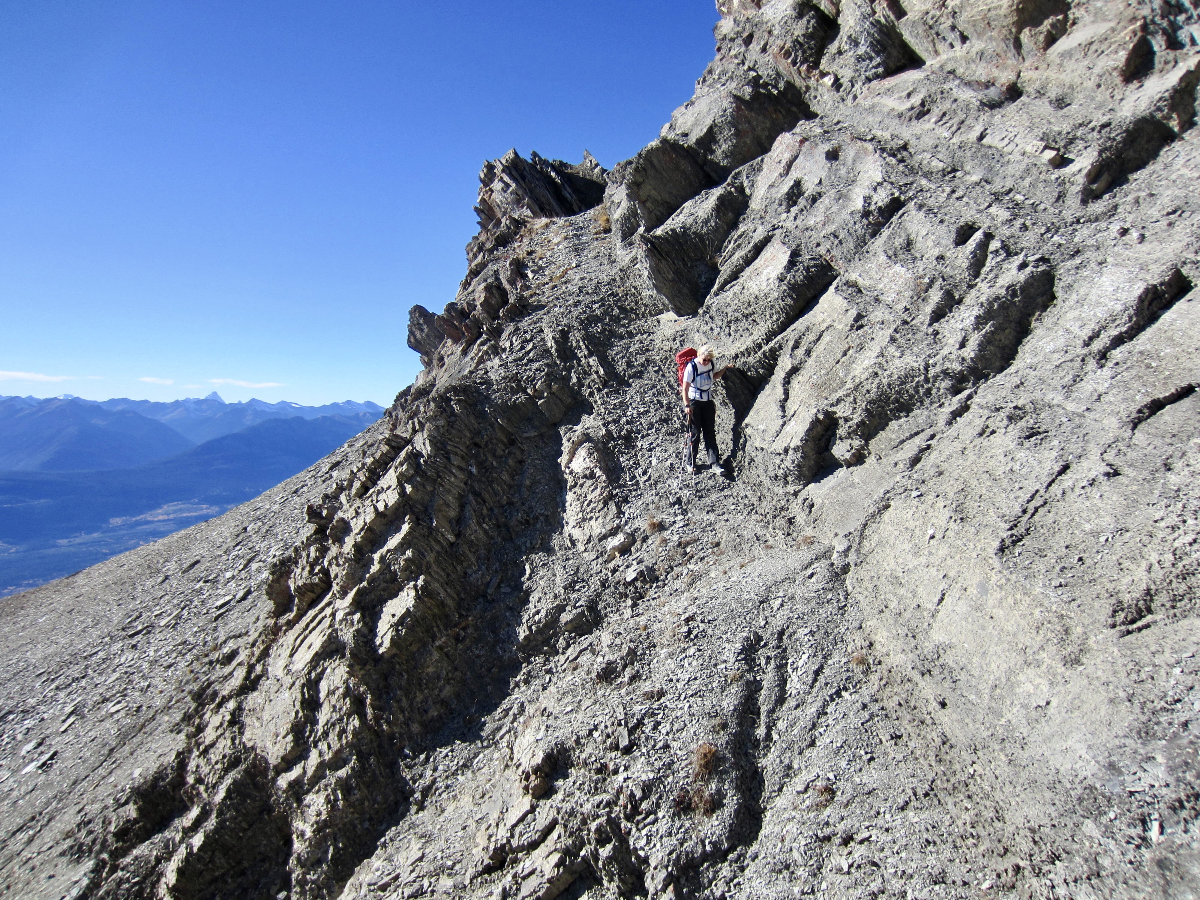
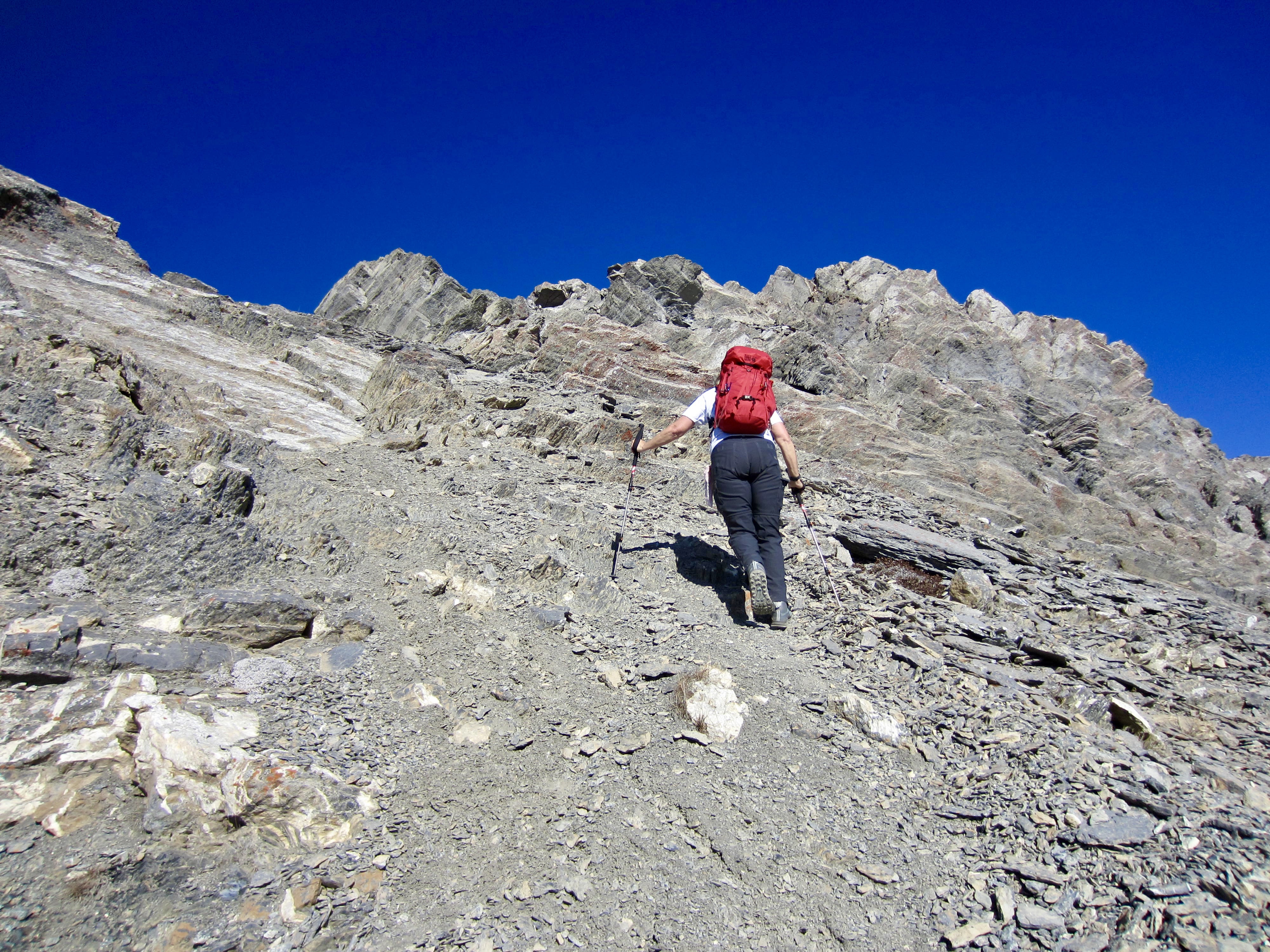
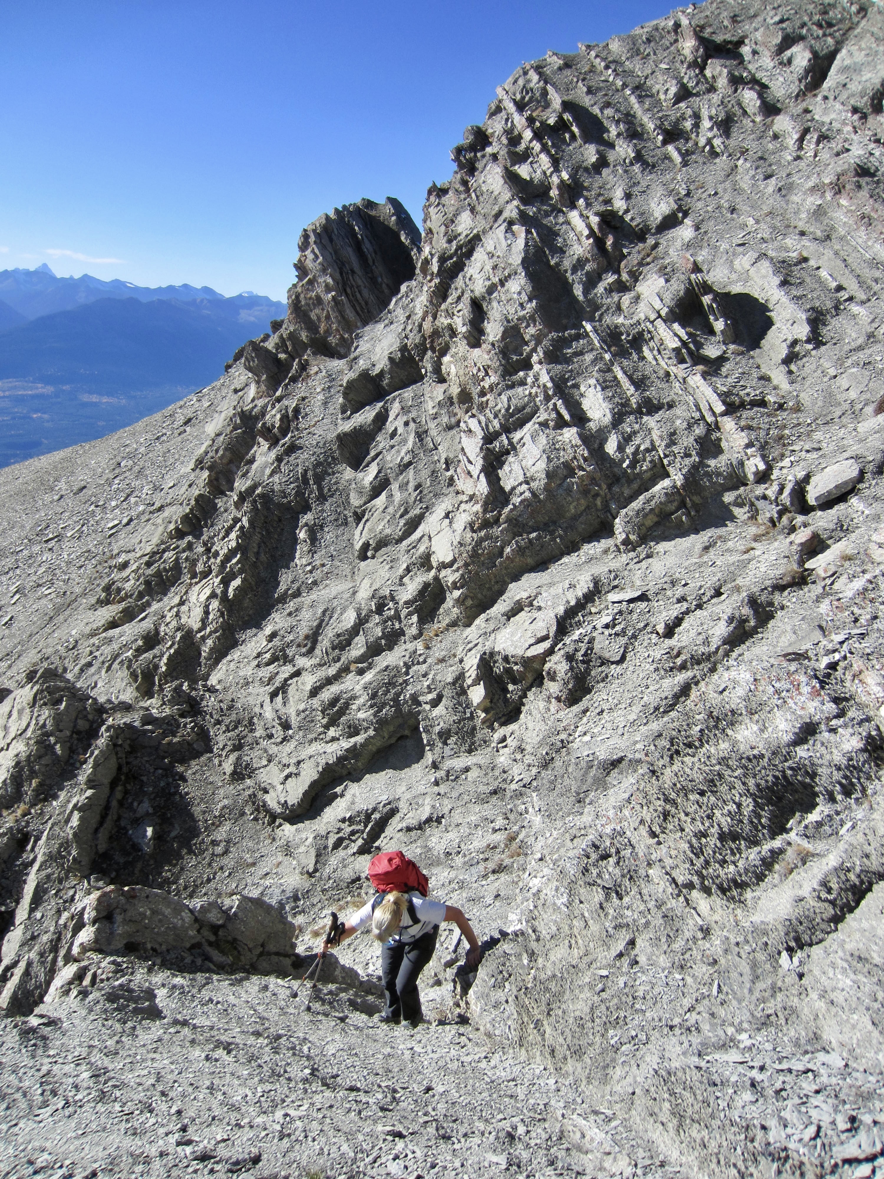
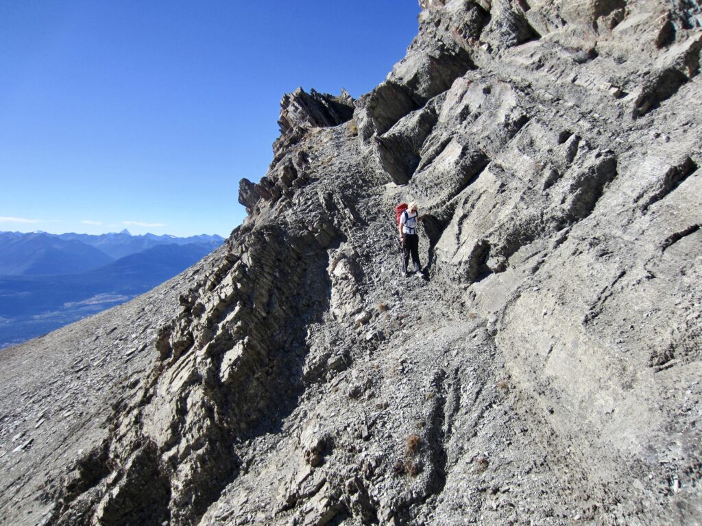
Upon reaching the upper-right corner of the west slope, we crossed over to the southern side of the peak’s southwest ridge. The summit block stood over us, presenting several possible scramble routes. We took an undulating rightward traverse that crossed over numerous rock ribs and gullies by means of ramps, slots, and ledges, . We could never see past the next rib, but there was always a reasonable Class 2 or 3 scrambling route ahead.
.
.
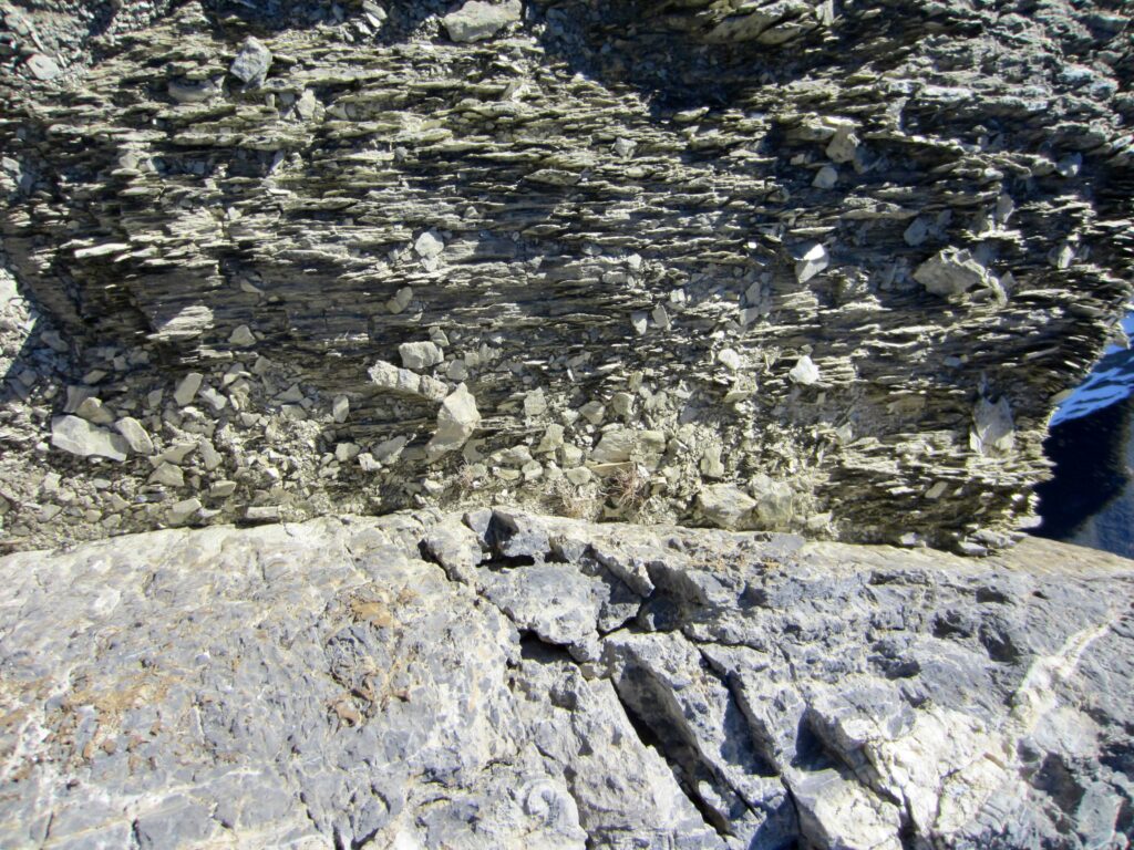
The summit block of Beaverhead Peak consists of steeply dipping, interlayered shale and limestone, which results in highly convoluted terrain. Because the limestone is relatively resistant to erosion, it forms pronounced ledges, fins, and parapets. The shale, in contrast, is very erodible and forms narrow gullies and slots between the limestone.
.
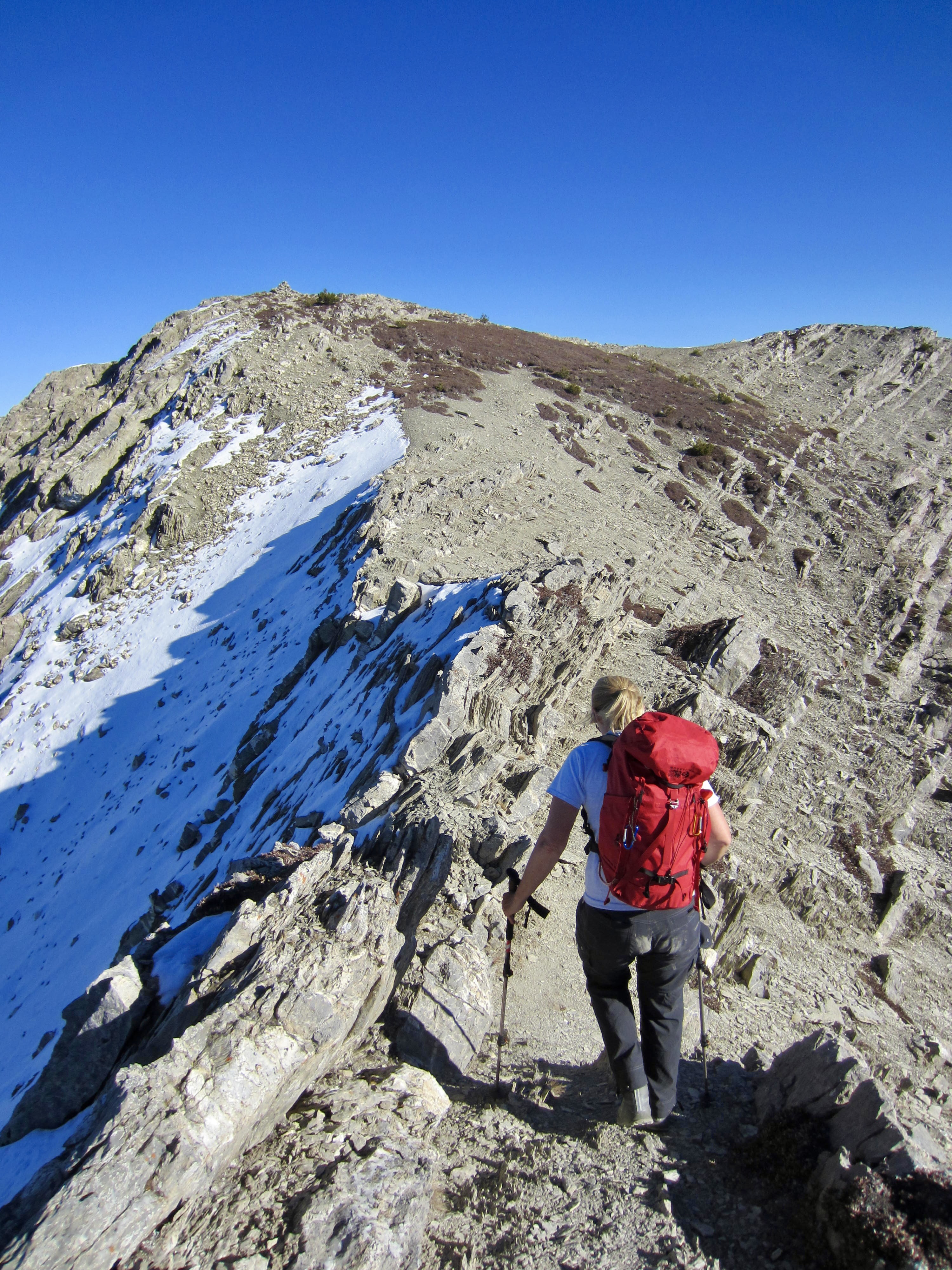
By steadily working up and right (east), we eventually gained the summit ridge and made an easy walk over to the broad high point (2.7 hours + 2350 feet from TH).
.

.
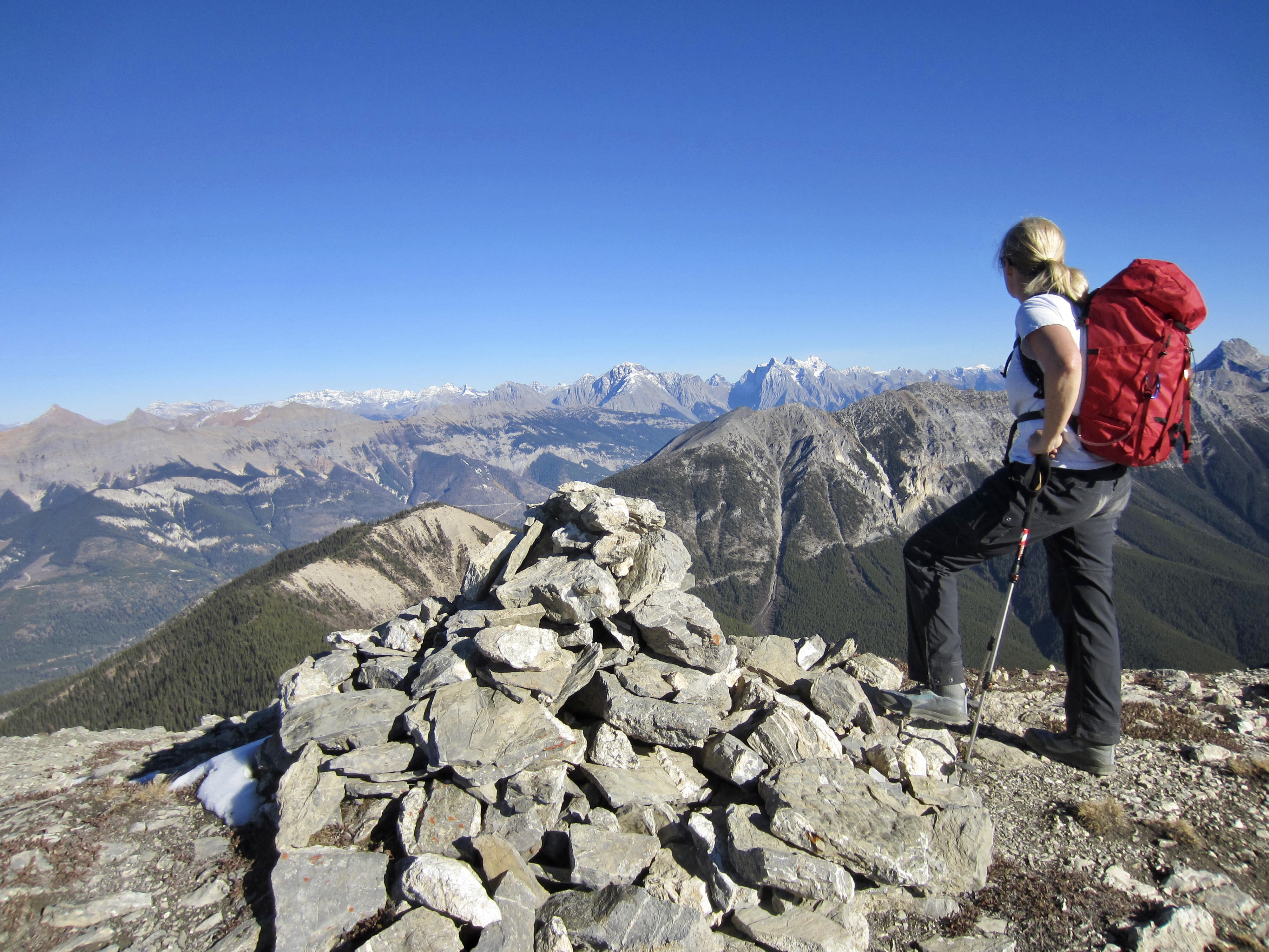
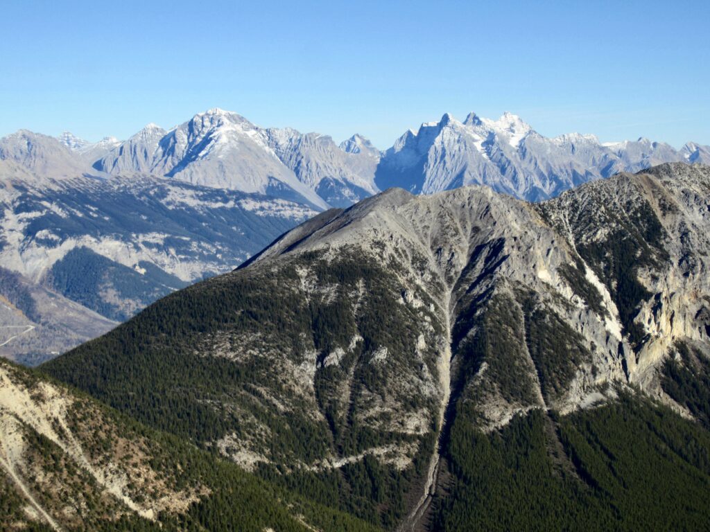
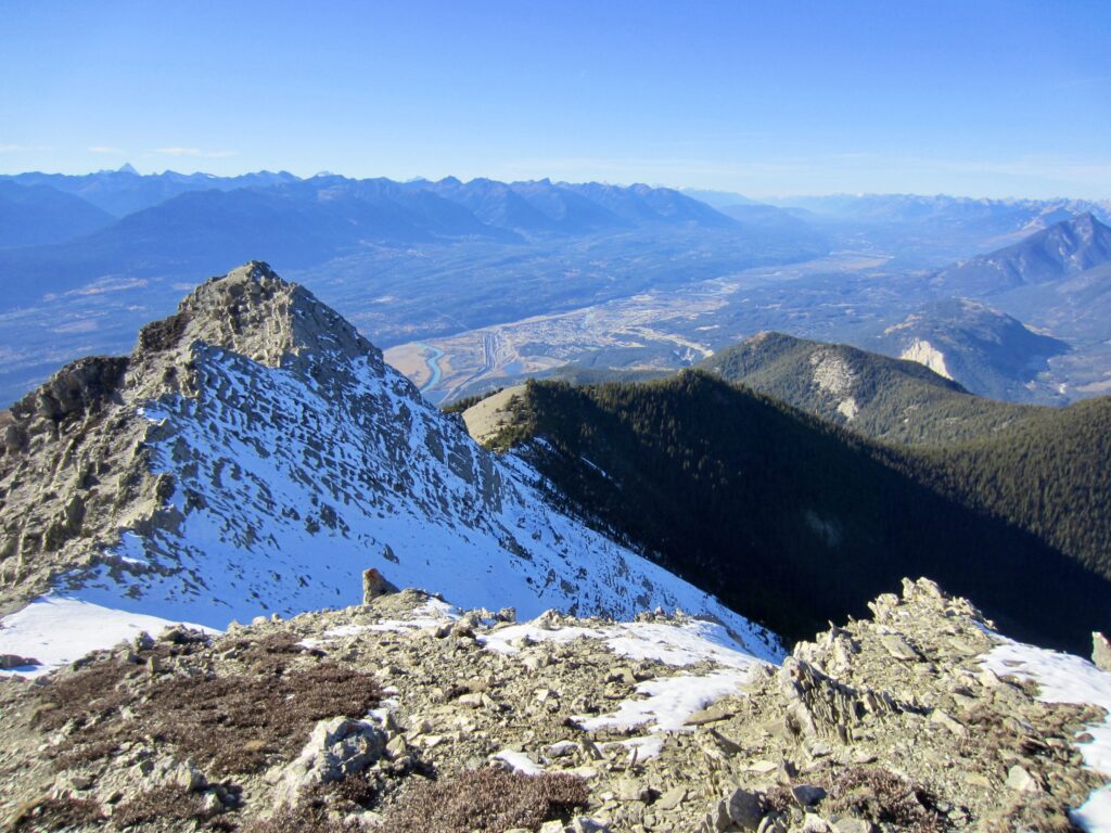
Views to our west, across the Columbia River valley, included the Purcell and Selkirk Mountains. To our east were the Kootenay Ranges, a part of the Canadian Rockies. Directly below was the town of Golden.
.
.
For our descent, we started by retracing our up-route but later took a lower traverse under the summit block and down the big scree slope to reach the launching knoll. From there, we followed the trail down to the saddle and then followed an alternative trail that goes around the forested hill rather than going over it. A march back along the rough spur road brought us to our car shortly before dark (2.1 hours + 300 feet from summit).
Route Map & Profile
.
.
Photo Gallery
Click to enlarge…