Trip Date: September 20-21, 2023
Mt. Outram Hiking Trip
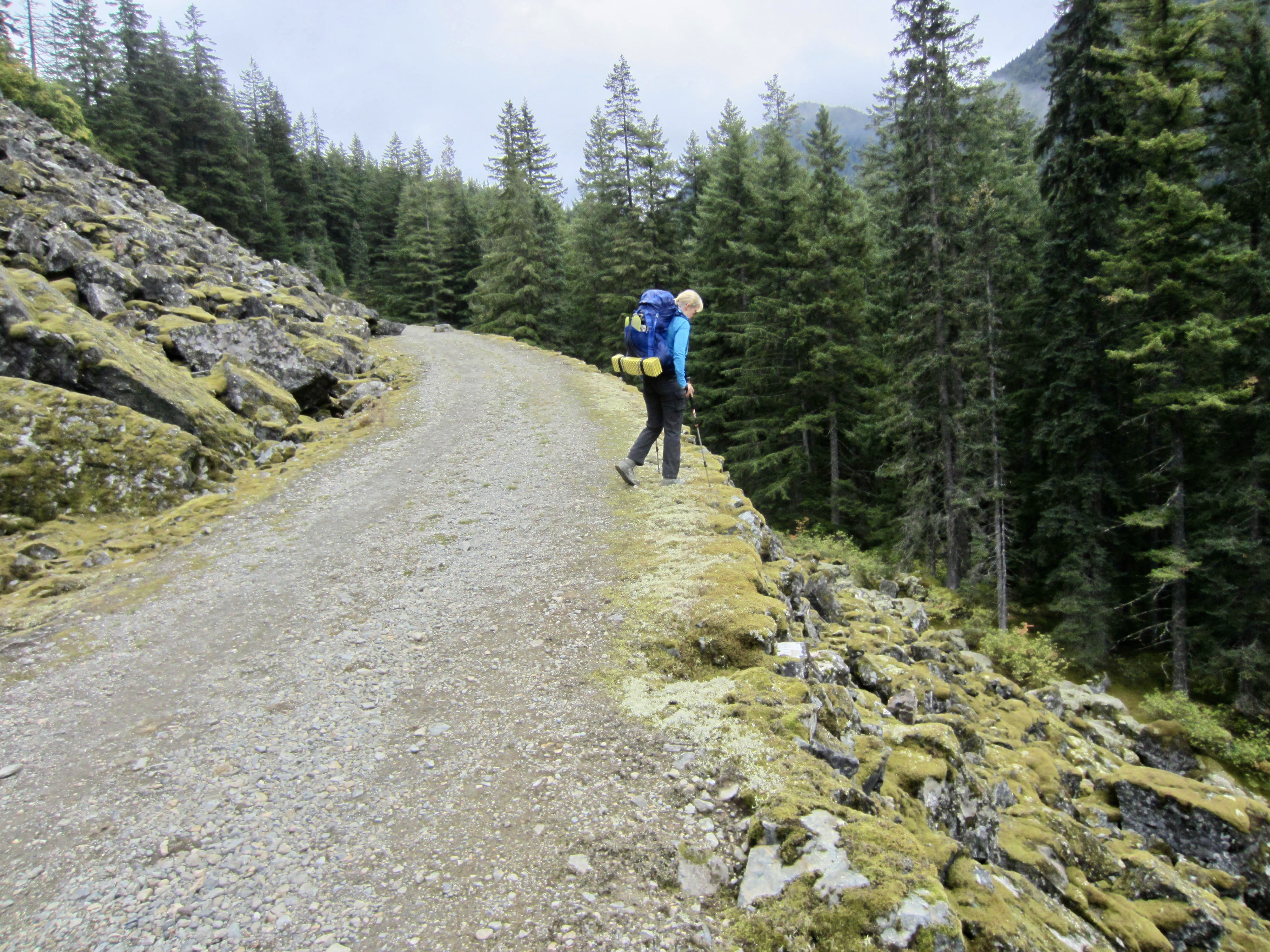
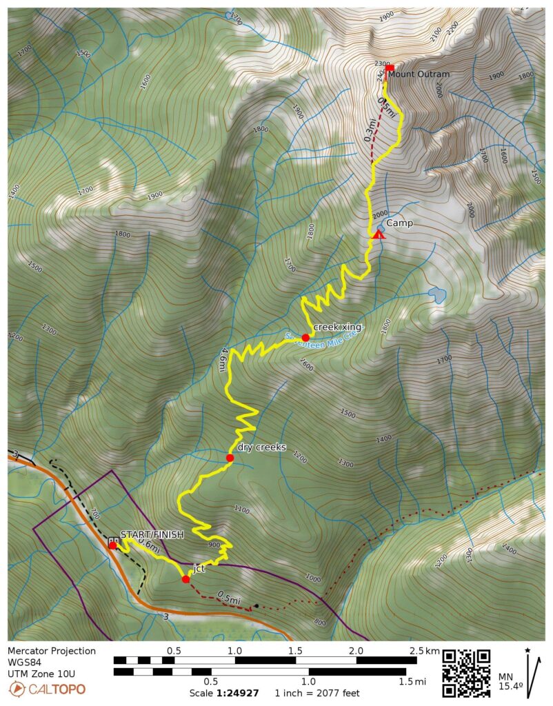
Royal Engineer’s Road
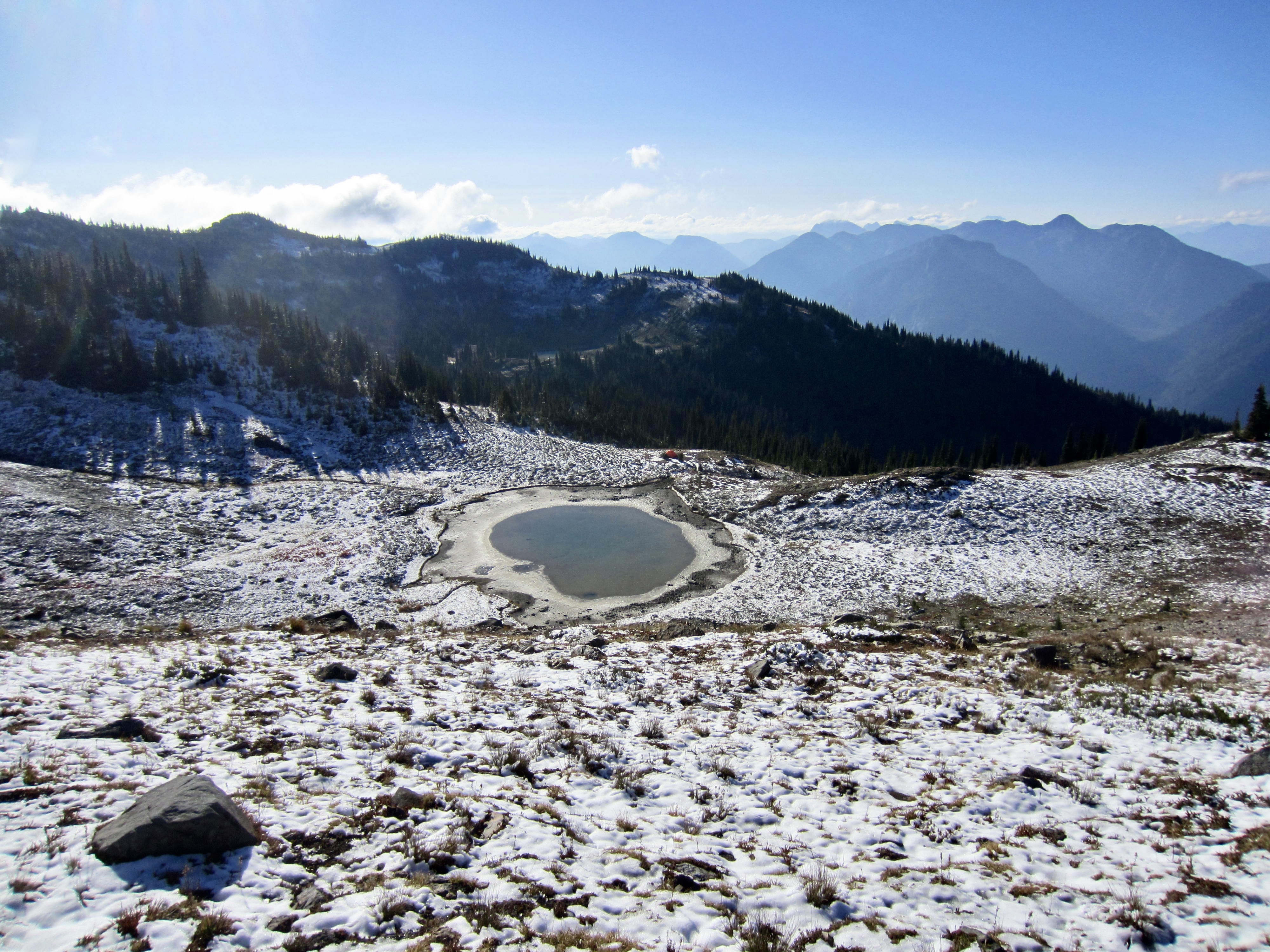
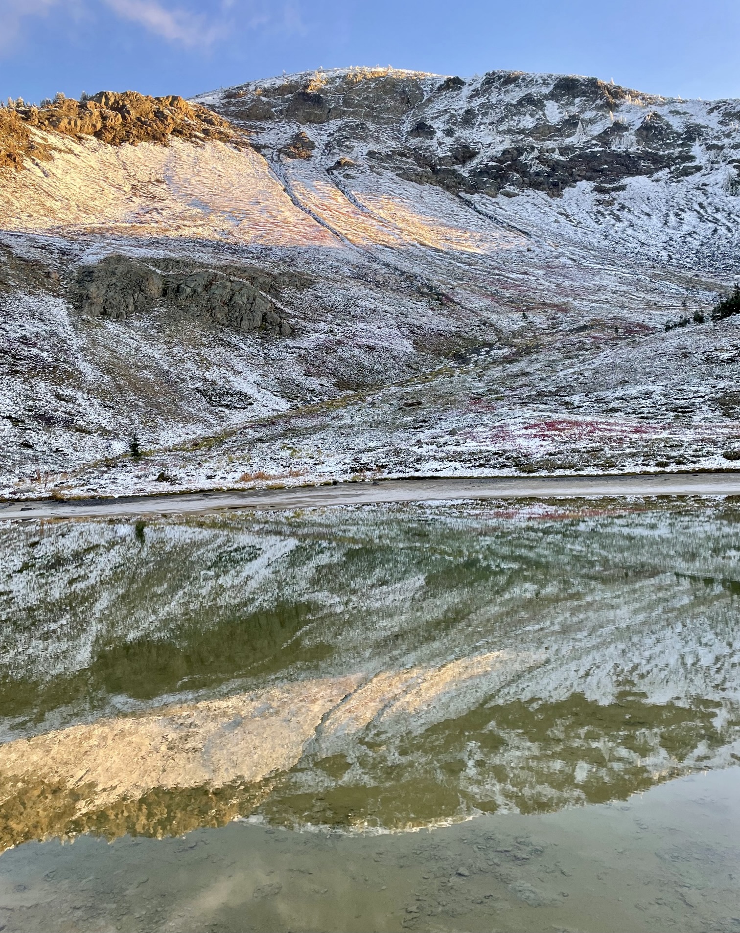
Outram Pond
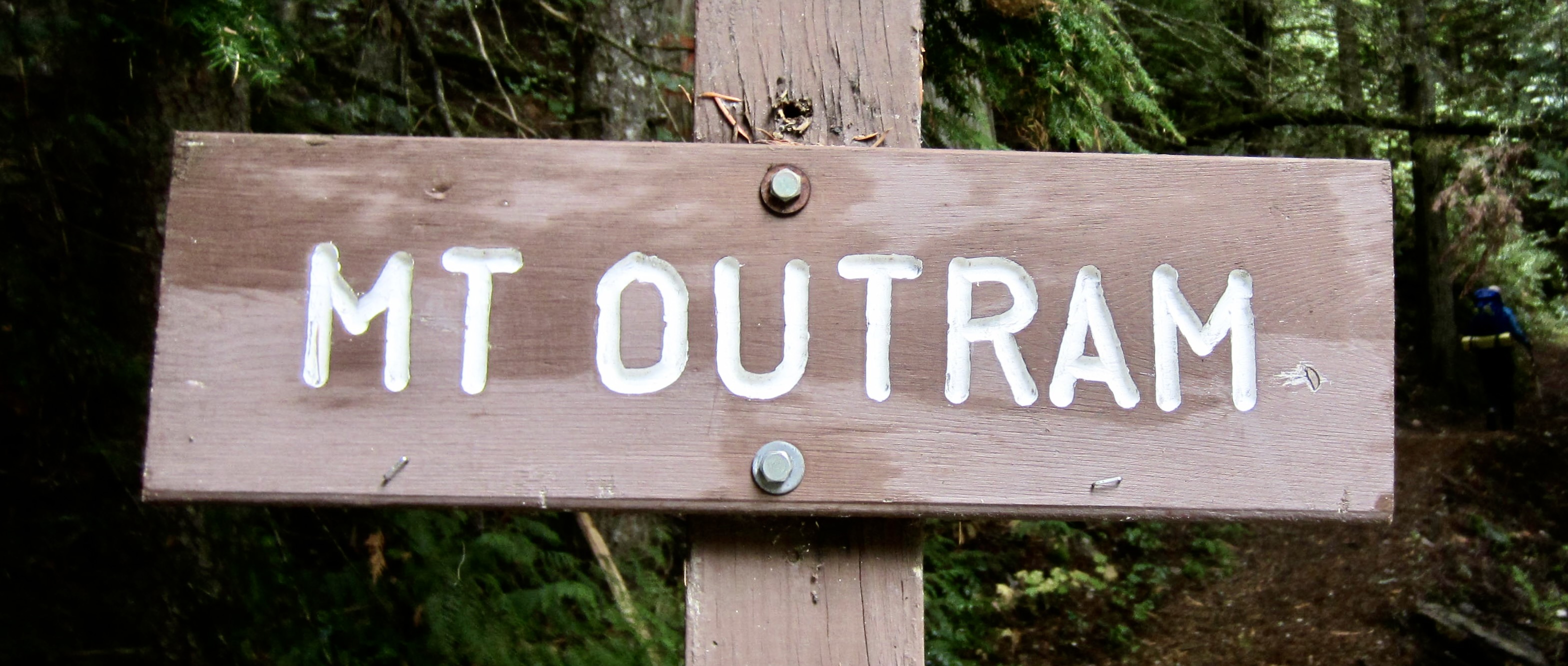
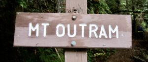
Mount Outram (8000+ ft)
Trip Report Summary
Region: Canadian Cascades (British Columbia)
Sub-Region: Nicolum Mountains
Areas: Manning Provincial Park & Yale Land District
Starting & Ending Point: Mt. Outram Trailhead at Manning Park West Gate on Highway 3 (Elev. 2200 feet)
Way Points: Engineer’s Road junction & Seventeen Mile Creek crossing & Outram Pond (trail hike)
Campsite: Outram Pond (Elev. 6450 feet)
Summit: Mt. Outram (trail hike & off-trail hike & rock scramble via South Slope–South Ridge)
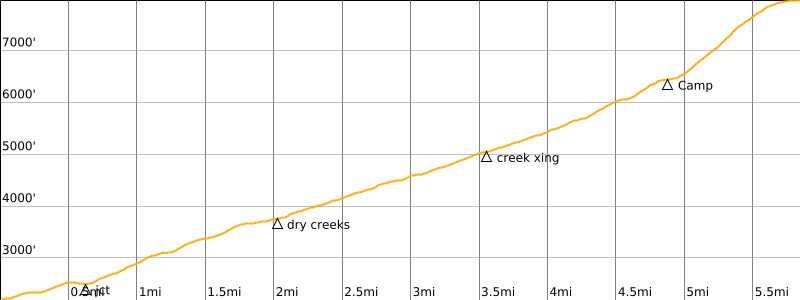
Approximate Stats: 11.7 miles traveled; 5900 feet gained & lost.
Full Trip Report
Eileen and I saw a short window of dry weather between September rains, so we hurried back into the Canadian Cascades to tuck in Mt. Outram. This tall, isolated peak—the only 8000-footer in the area—sits on the western fringe of Manning Provincial Park and has a trail leading to the summit. Although it is typically done as a day-hike by locals, the long drive made an overnight trip more appealing to us. Things didn’t play out quite the way we planned, but we did ultimately have a successful ascent.
Day 1: Trailhead to Outram Pond
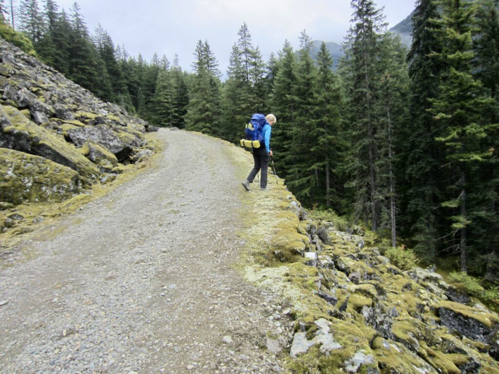
Starting at the West Gate / Mt. Outram Trailhead beside Highway 3, we began hiking in mid-afternoon on a cloudy Wednesday. Very soon, we found ourselves on the historic Royal Engineer’s Road (more commonly called just Engineer’s Road), which was constructed by members of Britain’s Royal Engineers circa 1860 to support mining and trading efforts in western Canada. The rockery walls supporting this road are still intact after 160 years!
.
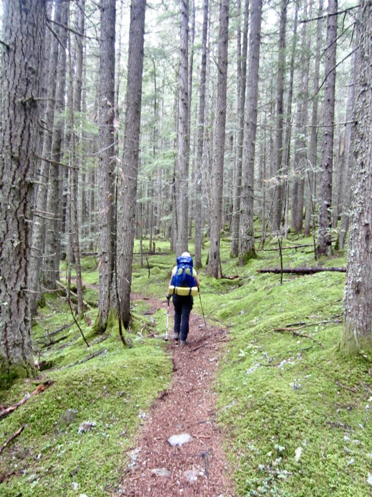
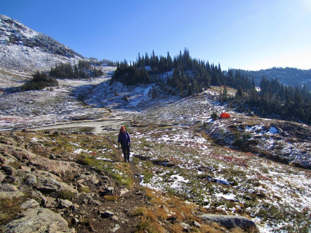
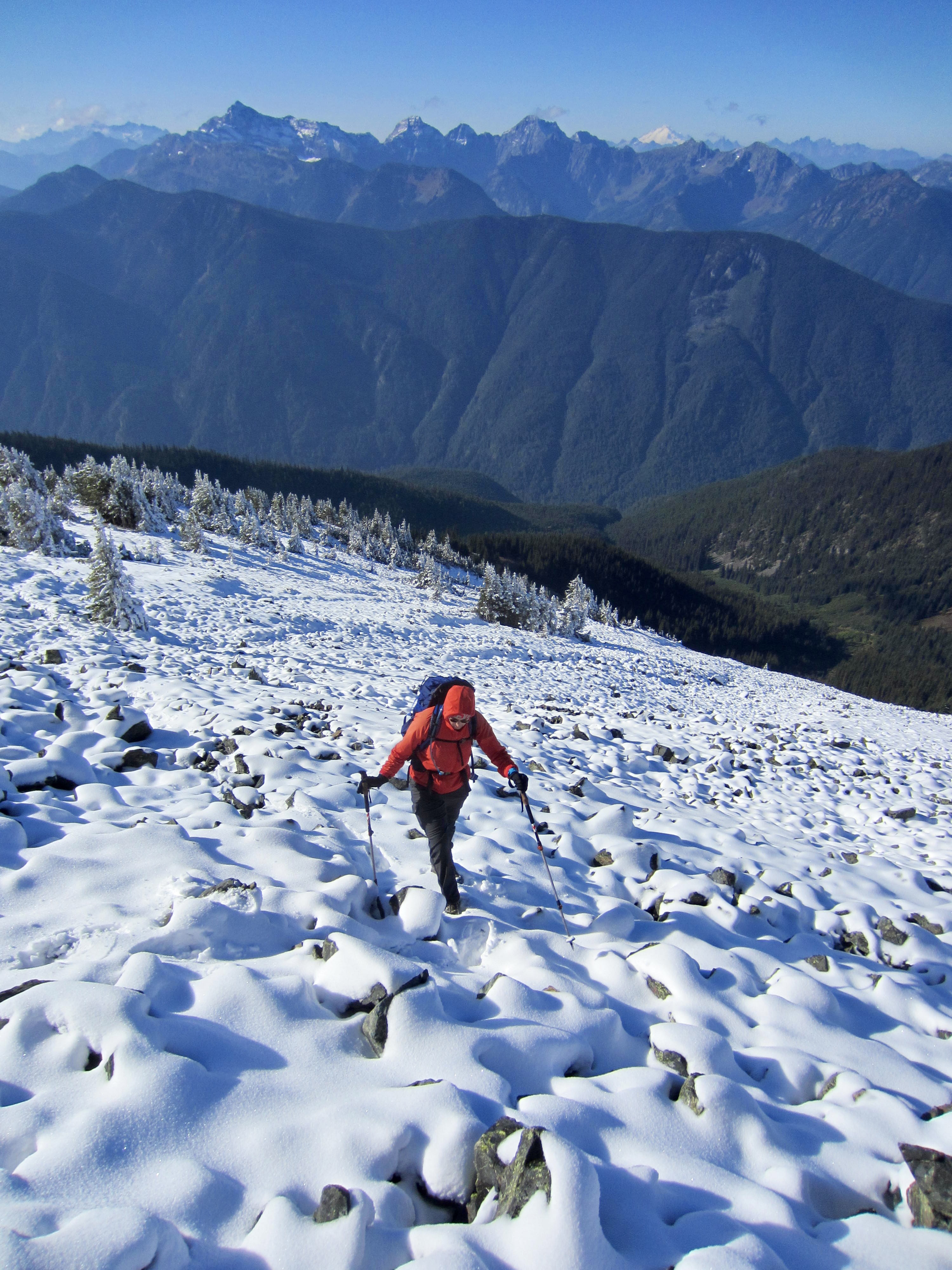
After following the Engineer’s Road for ½ mile, the Mt. Outram Trail heads off to the left and begins a steady ascent of the southwest-facing hillside. This is a well-maintained and well-graded trail that switch-backs through delightfully mossy forest.
.
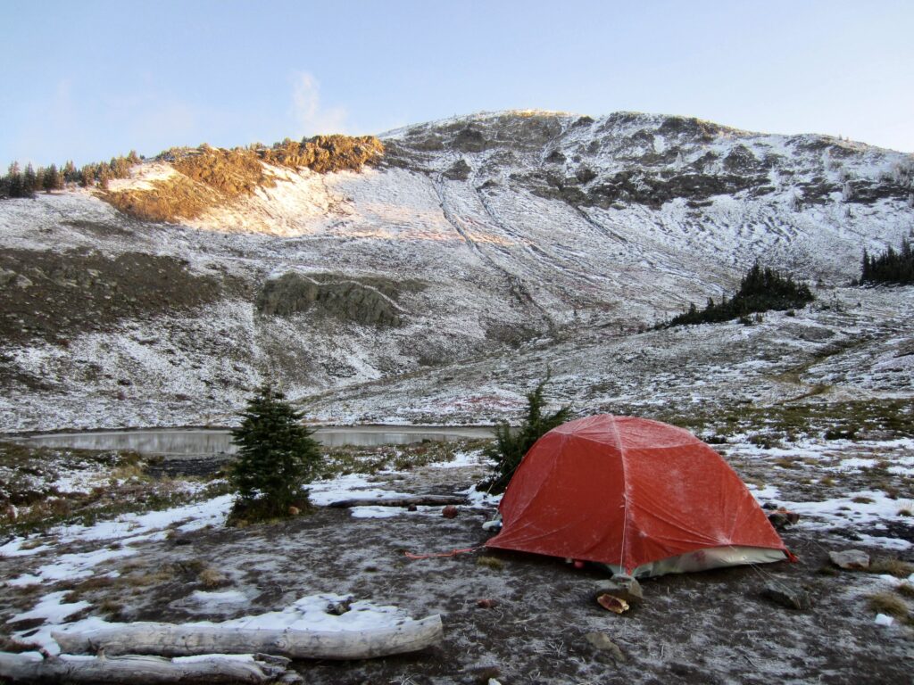
We had intentionally gotten a late start today with the intention of hiking only a couple hours and then camping in the forest. Cascade Alpine Guide indicates that there are campsites available at 5500 feet, where the trail crosses Seventeen Mile Creek. As it turns out, however, there isn’t any flat ground there or anywhere else within striking distance of the creek. Frustrated, we had no choice but to continue upward. It was well after dark when we arrived at 6450-foot Outram Pond (4.4 hours + 4300 feet from TH) and pitched our tent in the windswept basin.
Day 2: Mt Outram Summit Hike + Exit
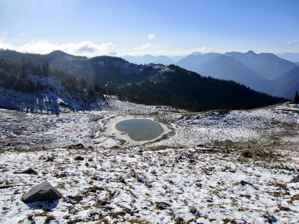
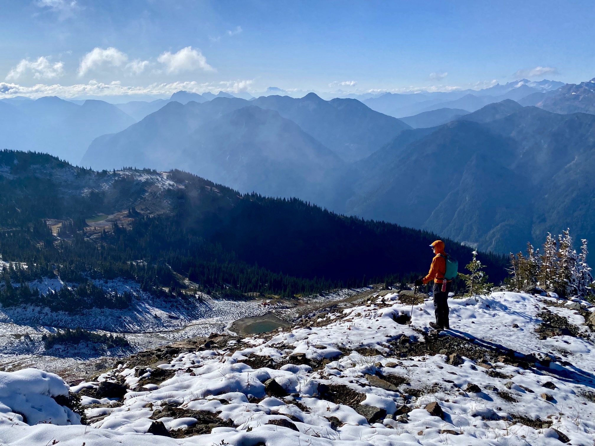
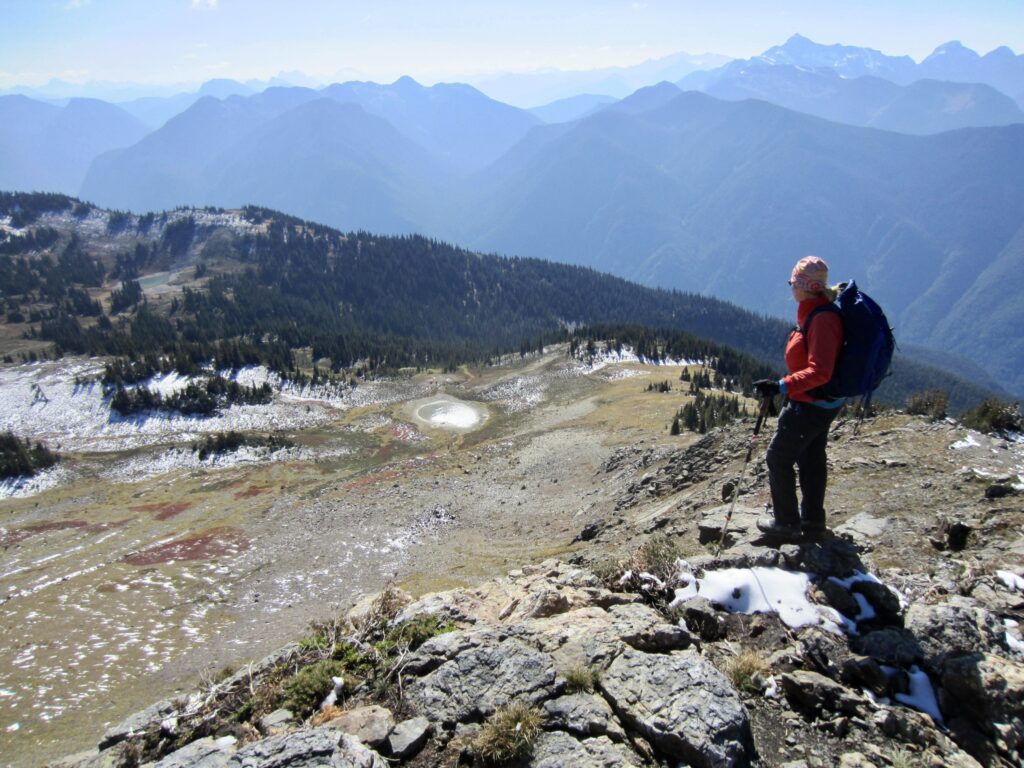
After a cold, gusty night, we awoke to a clear sky and a heavy frost. The slopes of Mt. Outram were dusted with fresh snow from a storm two days before, giving the scene an austere appearance. Being so late in the season, Outram Pond was shrunken and stagnant, but I was able to dip out surprisingly clean water for cooking and drinking.
.
.
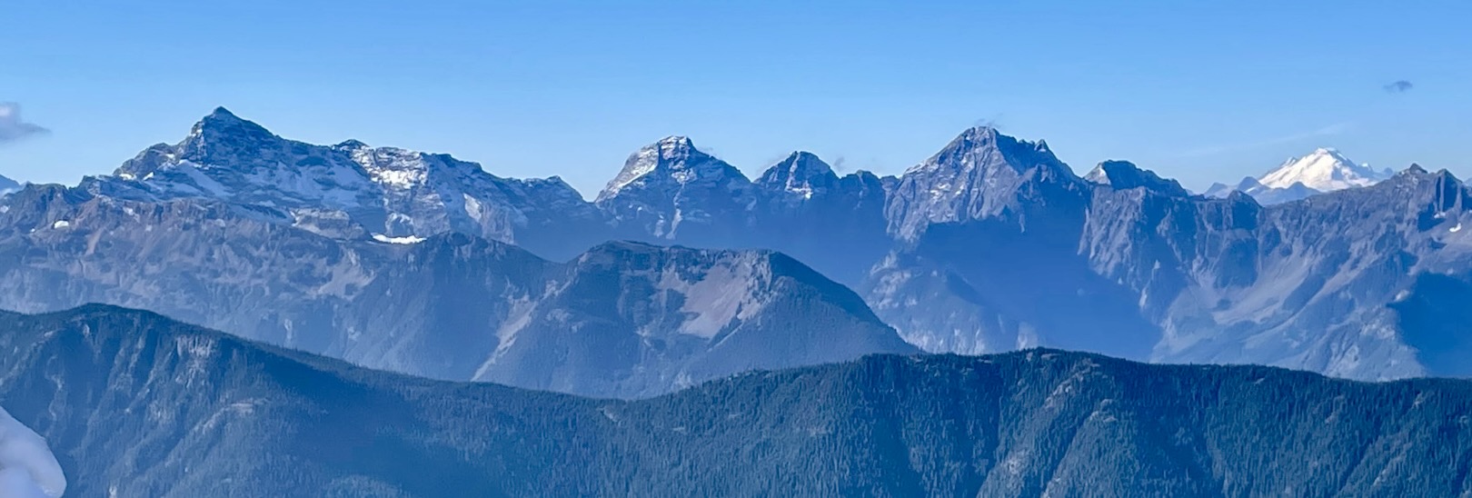
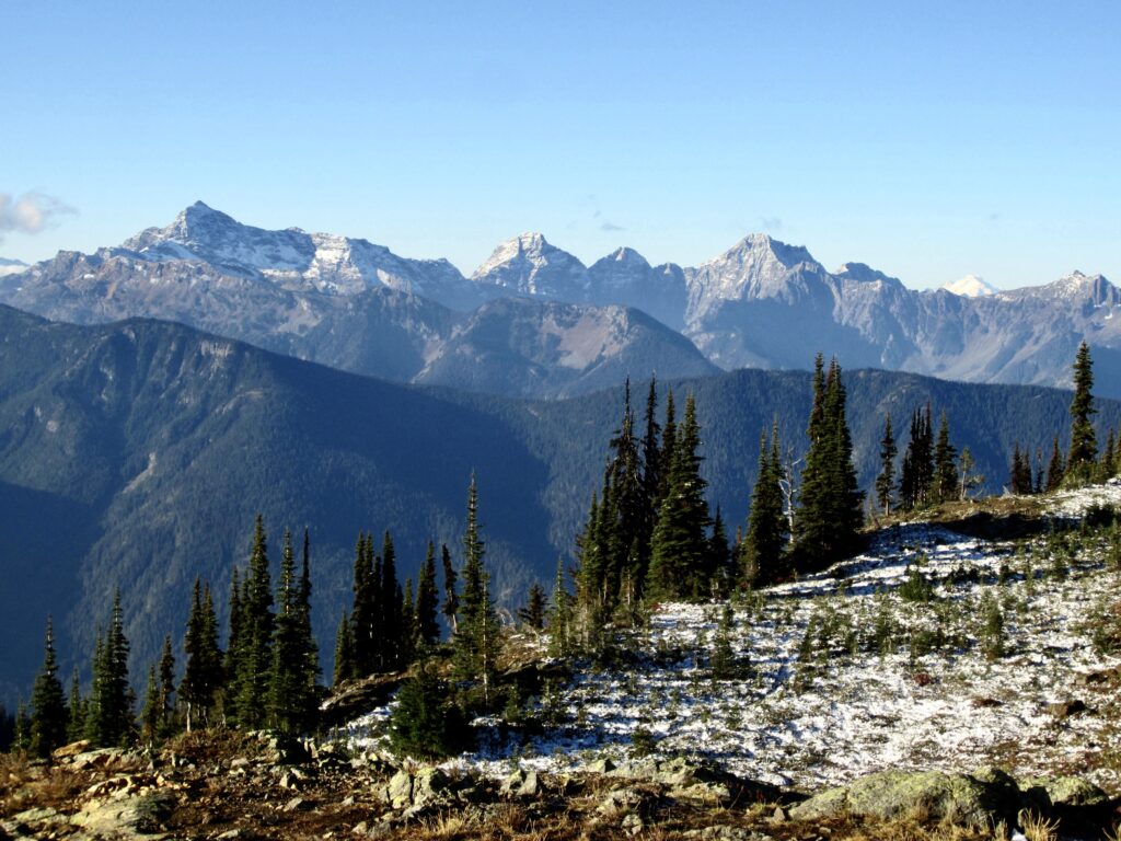
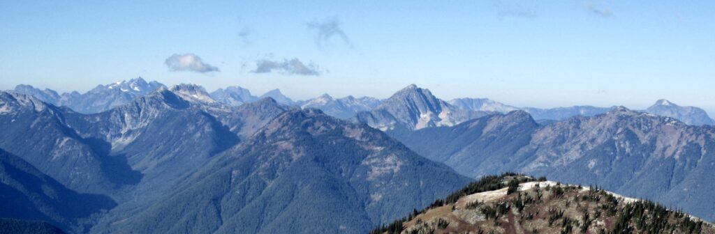
Closely to our south, the major Sumallo peaks—Silvertip, Rideout, and Payne—were lit up by morning sun. Mt. Baker and the Cheam Range could be seen farther to the west.
.
.
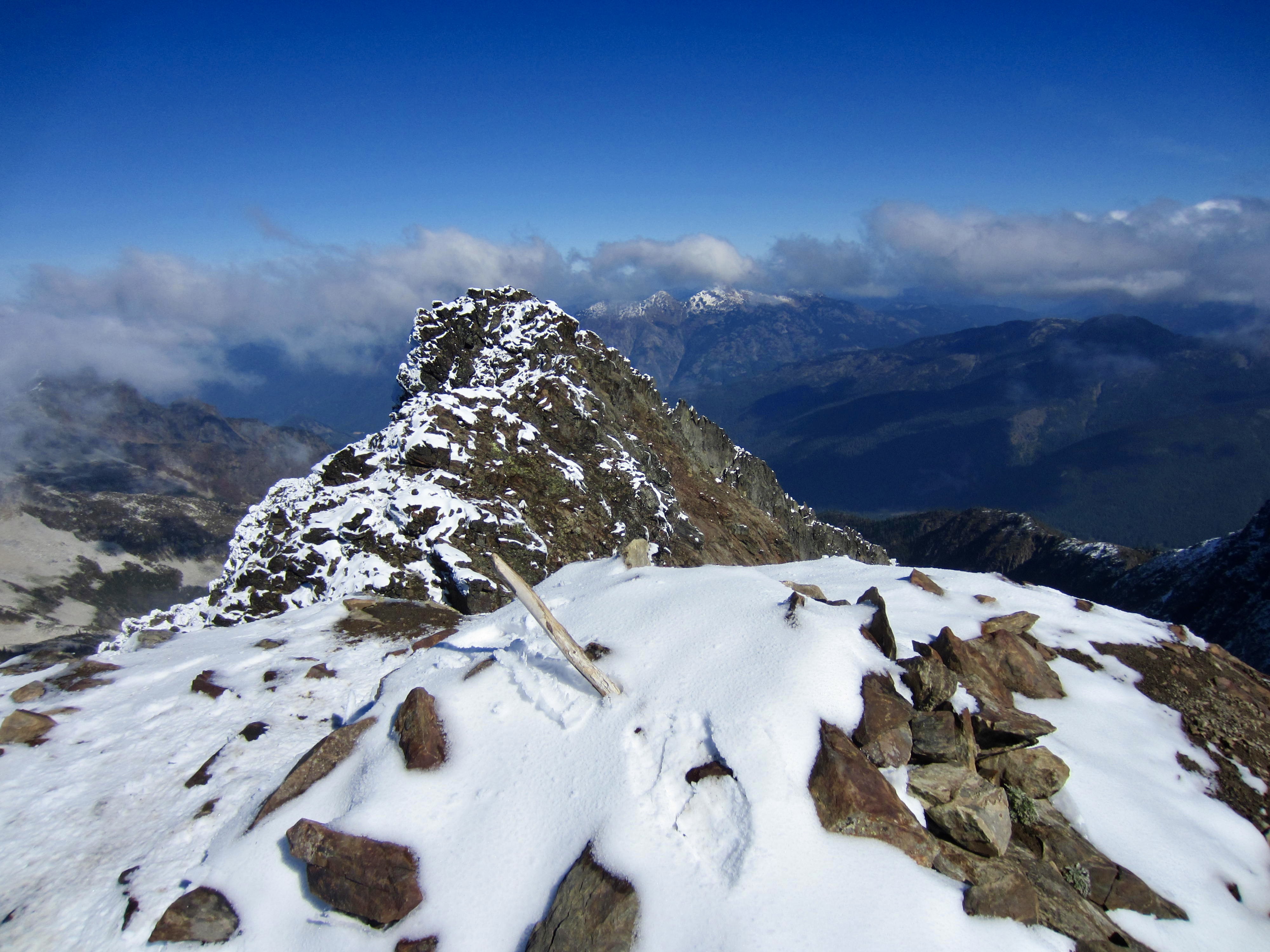
Feeling no urgency, Eileen and I didn’t leave camp until 9:00am. We headed up the southern ridge of Mt. Outram, following a trail that was now steeper and more primitive than yesterday’s fine approach trail. From this upper trail, it was fun to see that Outram Pond bears an uncanny resemblance to an apple!
.
.
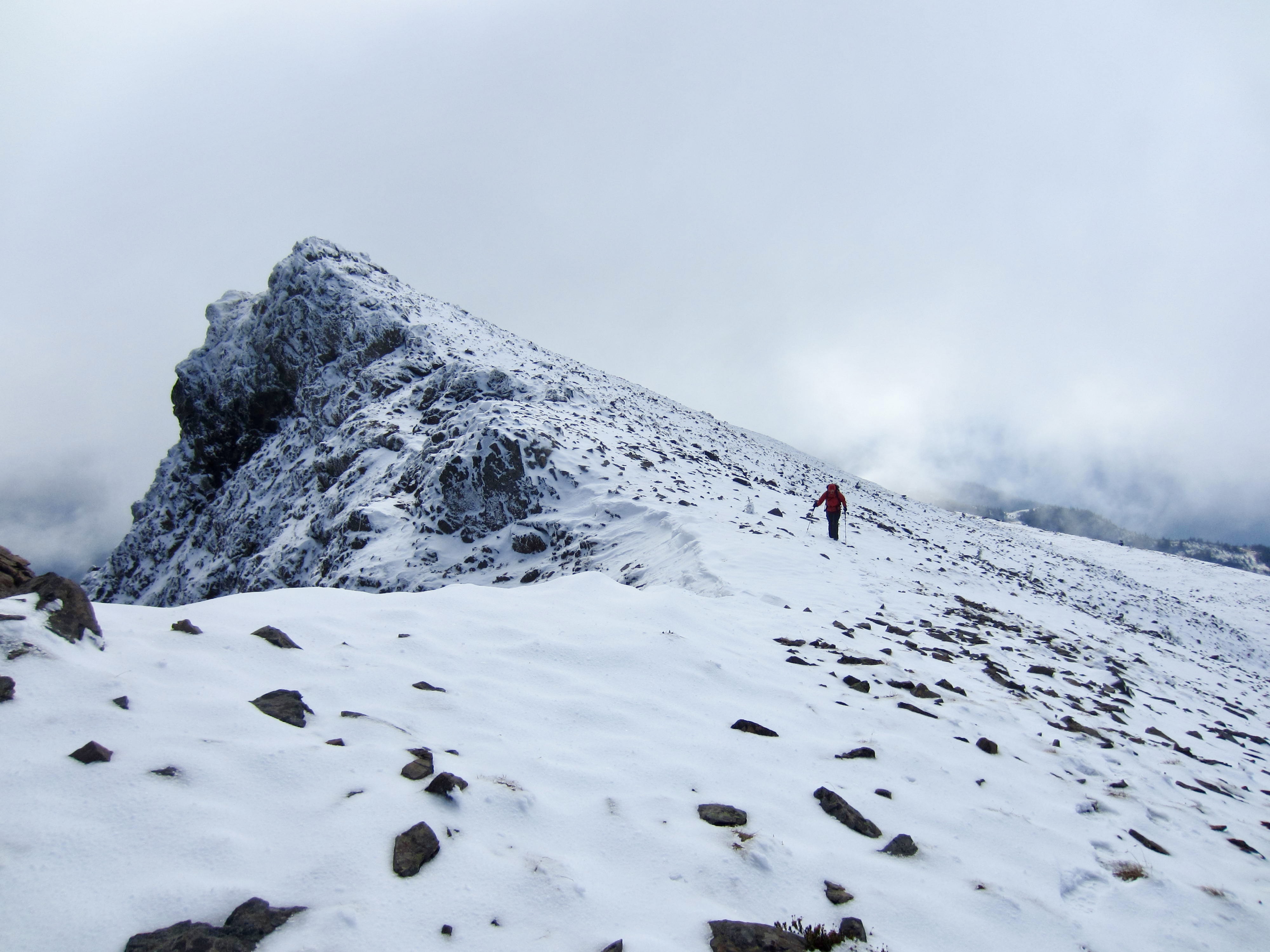
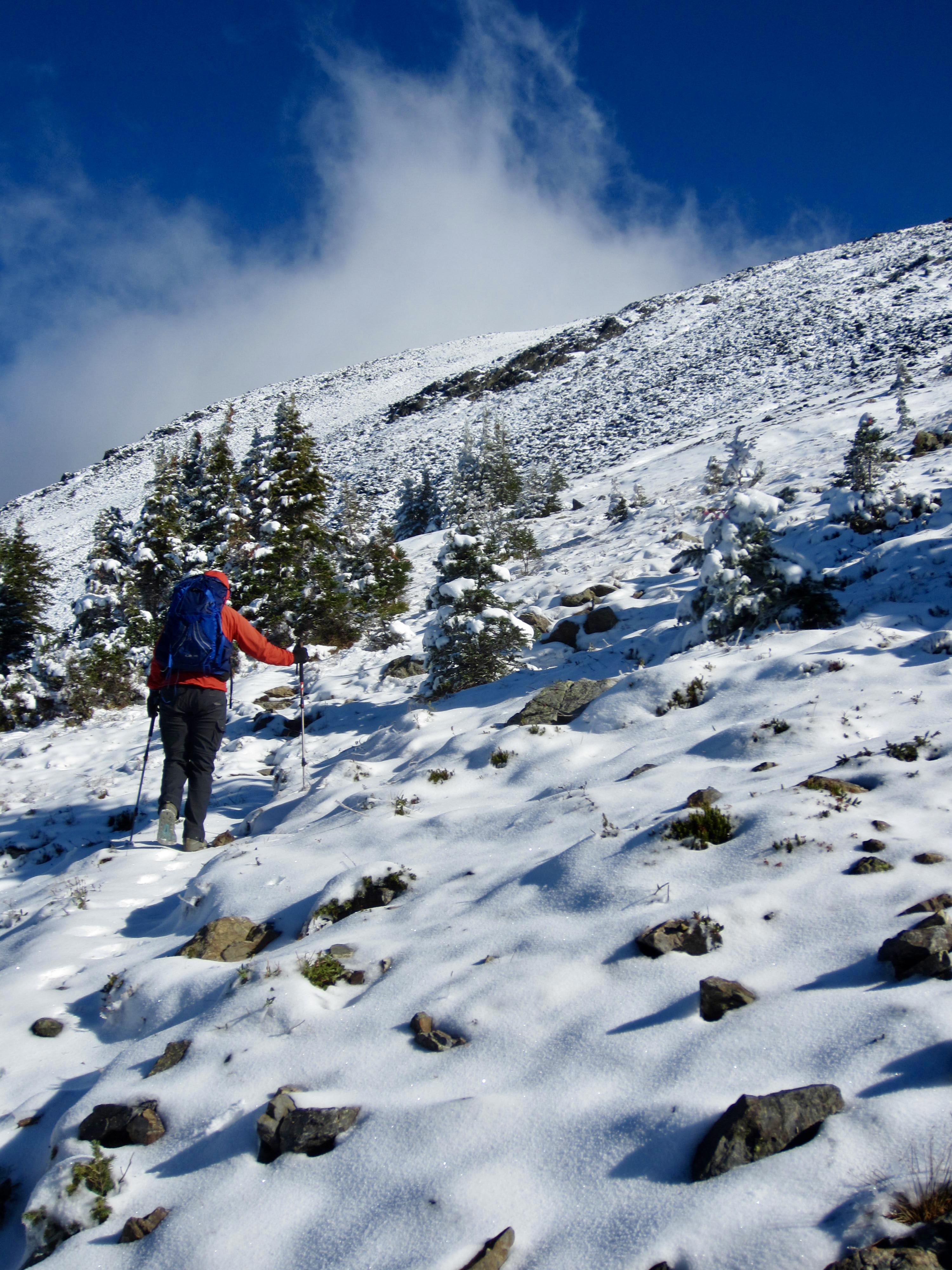
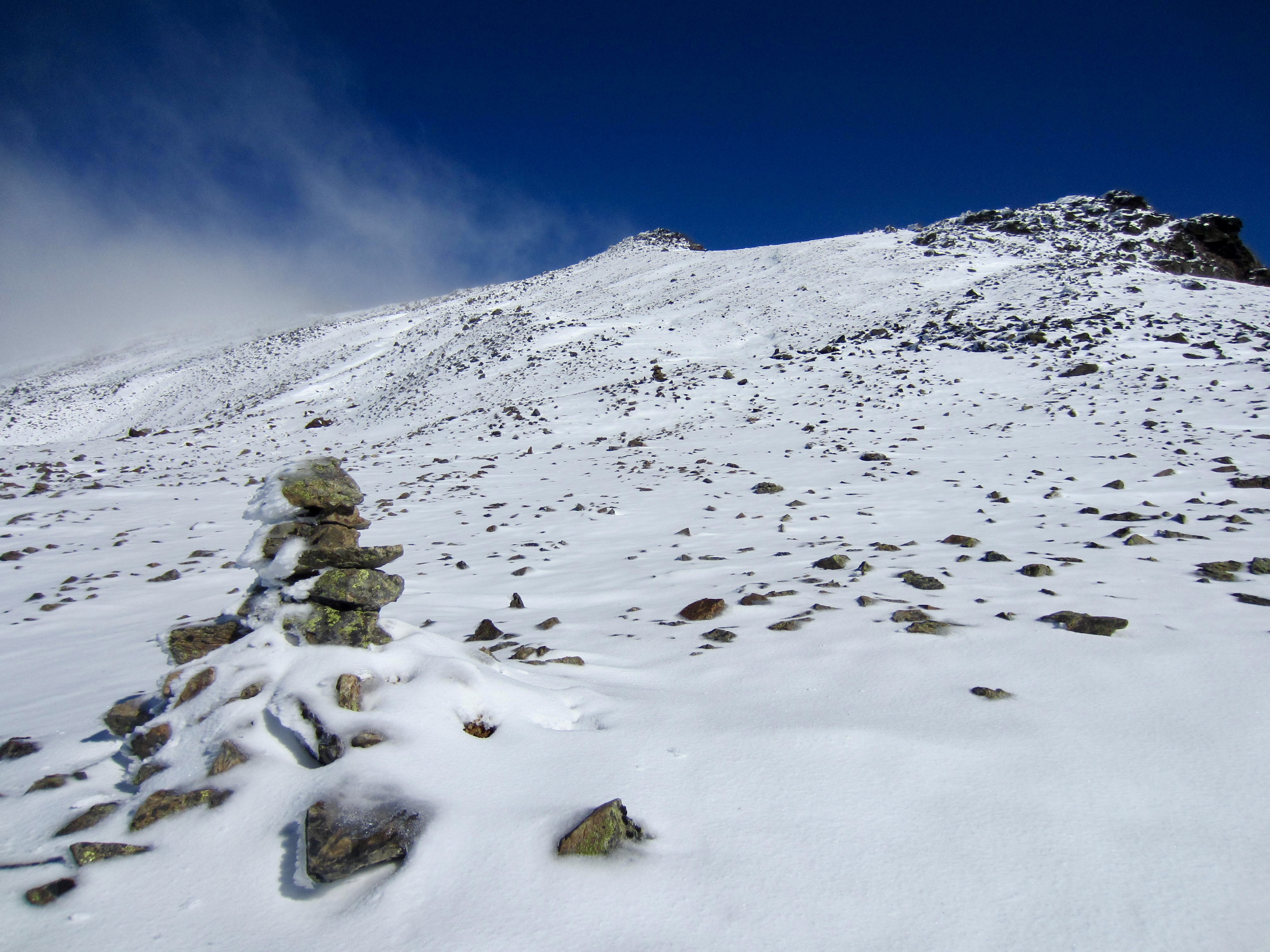
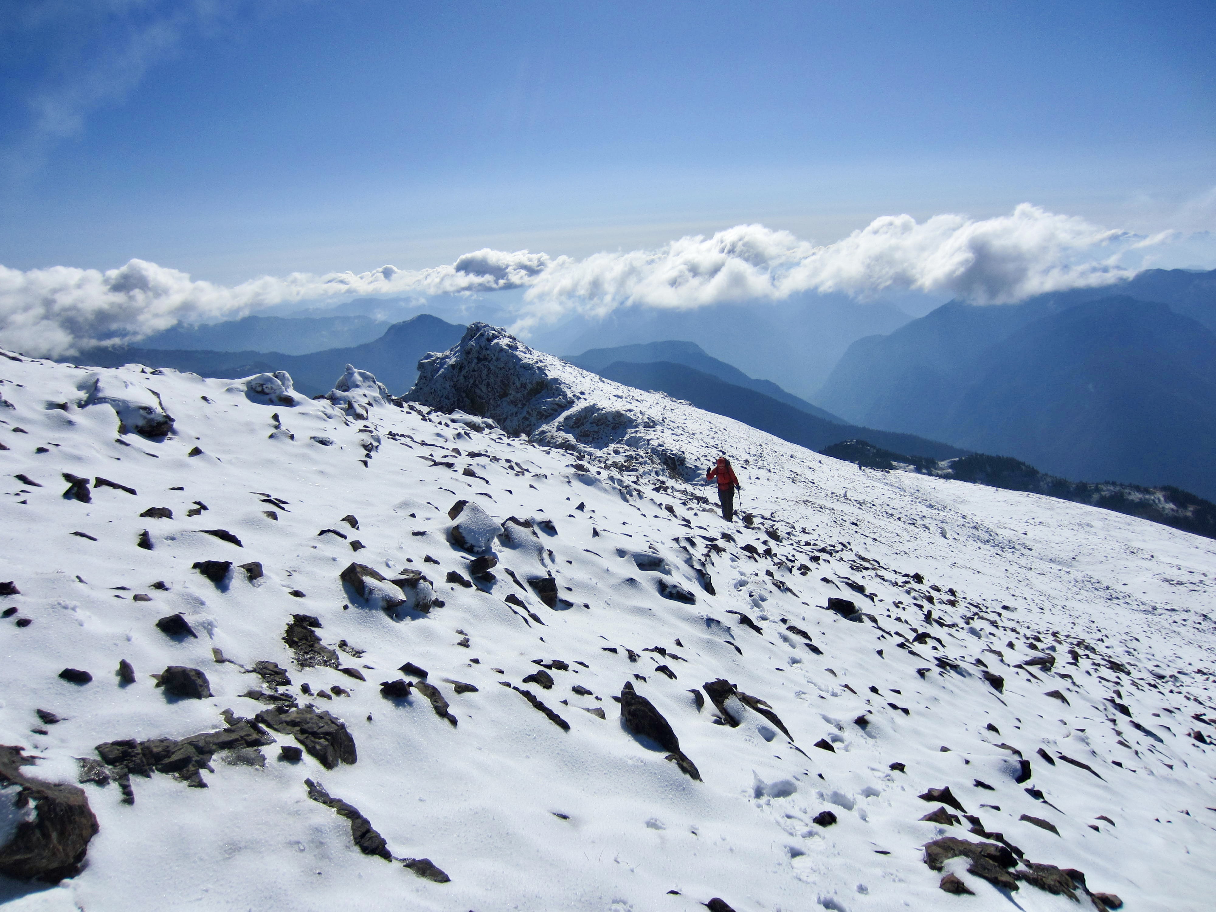
After gaining about 700 feet from the pond basin, the trail largely disappears in a broad felsenmeer—a sea of talus and boulders. We slowly continued working our way up the snowy slope, following marker ducks and cairns.
.
.
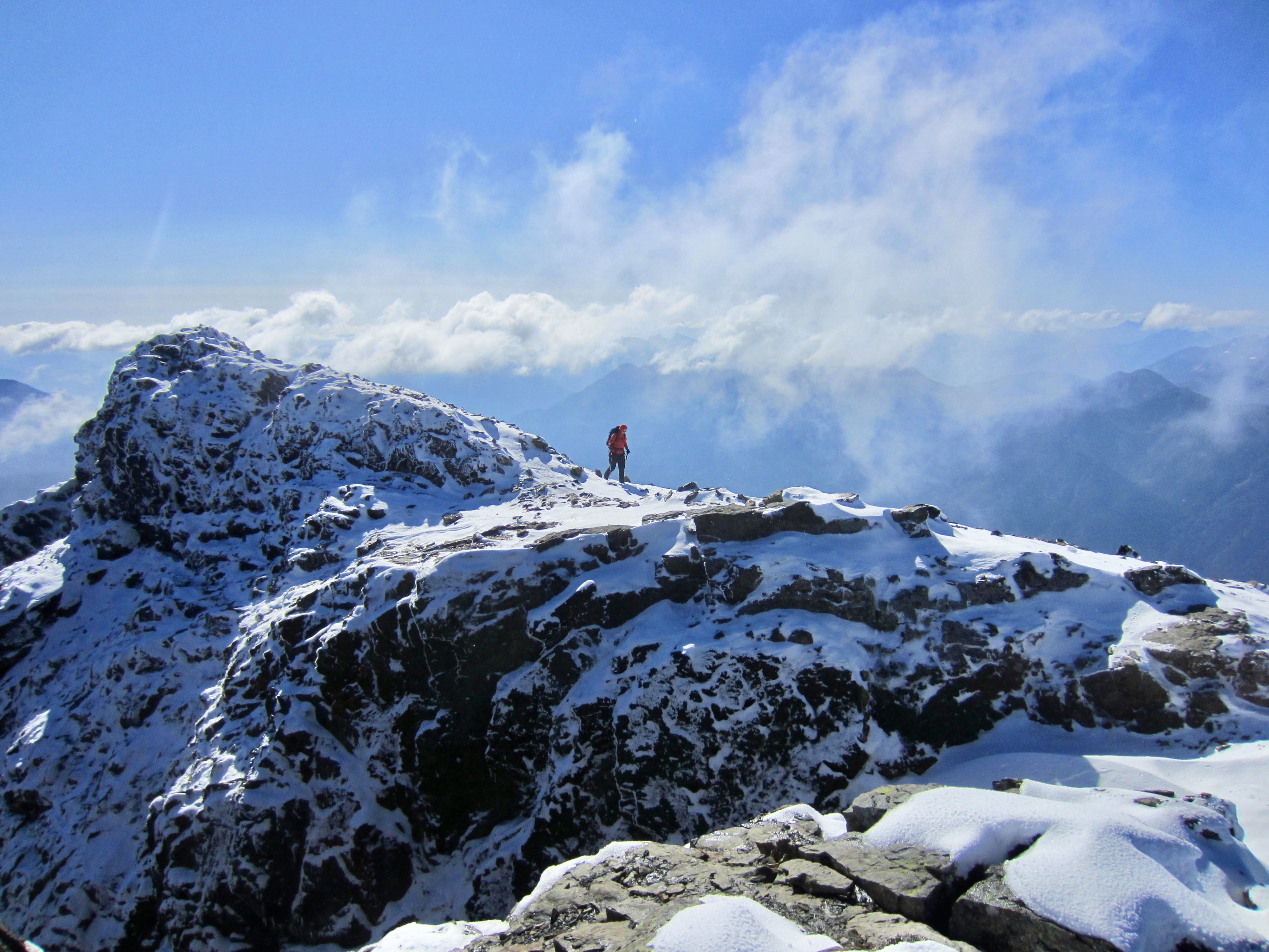
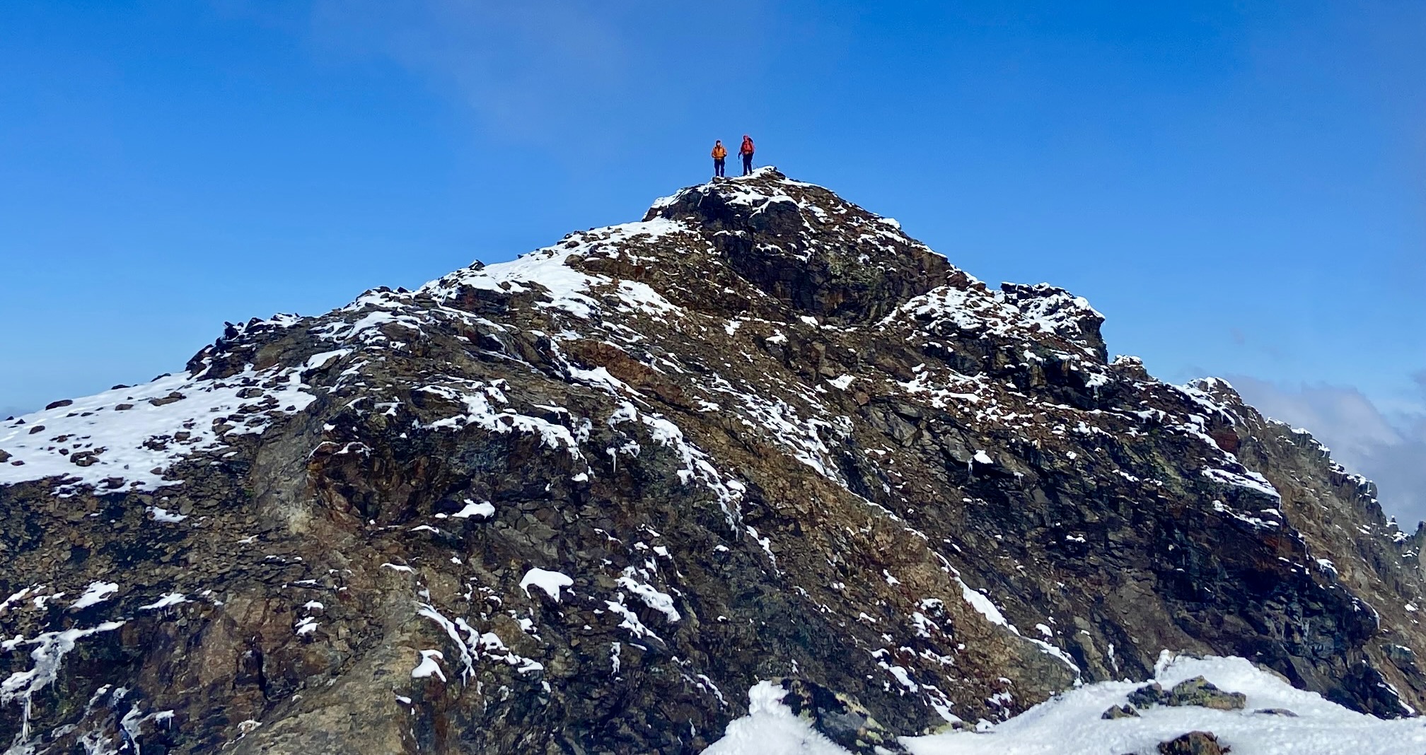
Upon gaining the summit ridge, we veered to the north and easily hiked along the crest. It was a surprise to discover two other hikers coming up behind us. Eileen and I reached the summit shortly before 11:00am (1.9 hours + 1550 feet from camp), and the other two hikers (Ralph and Greg) arrived soon after us. We learned that they are Chilliwack residents who have ascended Mt. Outram multiple times—often at a similarly rapid pace.

.

.
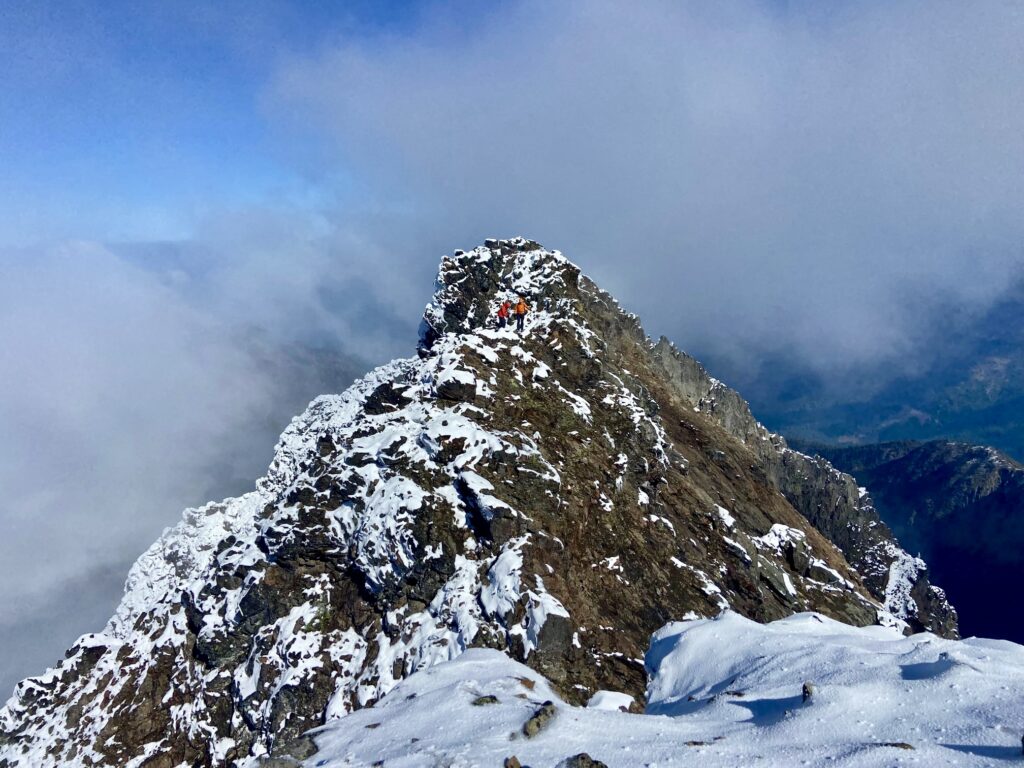
Mt. Outram has two summits of nearly equal height. The south summit marks the terminus of the hiking trail; the north summit, which is reportedly about 3 feet higher, can be reached by a moderately exposed Class 3 scramble. Eileen and I attempted to scramble over to the north summit but turned around after getting two-thirds of the way across. Way too dangerous in these snowy conditions!

.
.
After visiting with us and sharing some photos, Ralph and Greg began their descent. Eileen and I had a snack in a sunny, sheltered spot before heading down. We reached camp in early afternoon (1.8 hours from summit) and noticed how much snow had melted over the past few hours. These September snows never seem to last more than a couple days.
.
Eileen took a nap in camp while I struck down the tent and collected more water. It was pleasantly warm by the time we made our exit hike down the trail, arriving back at the trailhead at 6:00pm (3.3 hours from camp). On this, our fourth trip into the Canadian Cascades during the past two months, we felt that the peaks were finally becoming somewhat familiar.
Route Map & Profile
.
.
Photo Gallery
Click to enlarge…