Trip Date: September 14-15, 2023
Lady Peak Day Hike & Scramble
Cheam Peak Day Hike
Spoon Lake
Lady Peak (7182 ft)
Lady–Cheam Saddle
Cheam Peak aka Mt. Cheam (6929 ft)
Trip Report Summary
Region: Canadian Cascades (British Columbia)
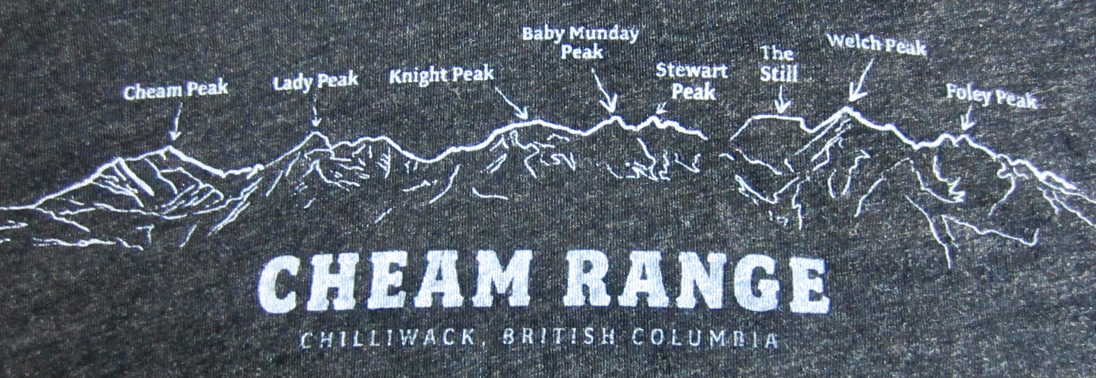
Sub-Region: Cheam Range
Area: Yale Land District
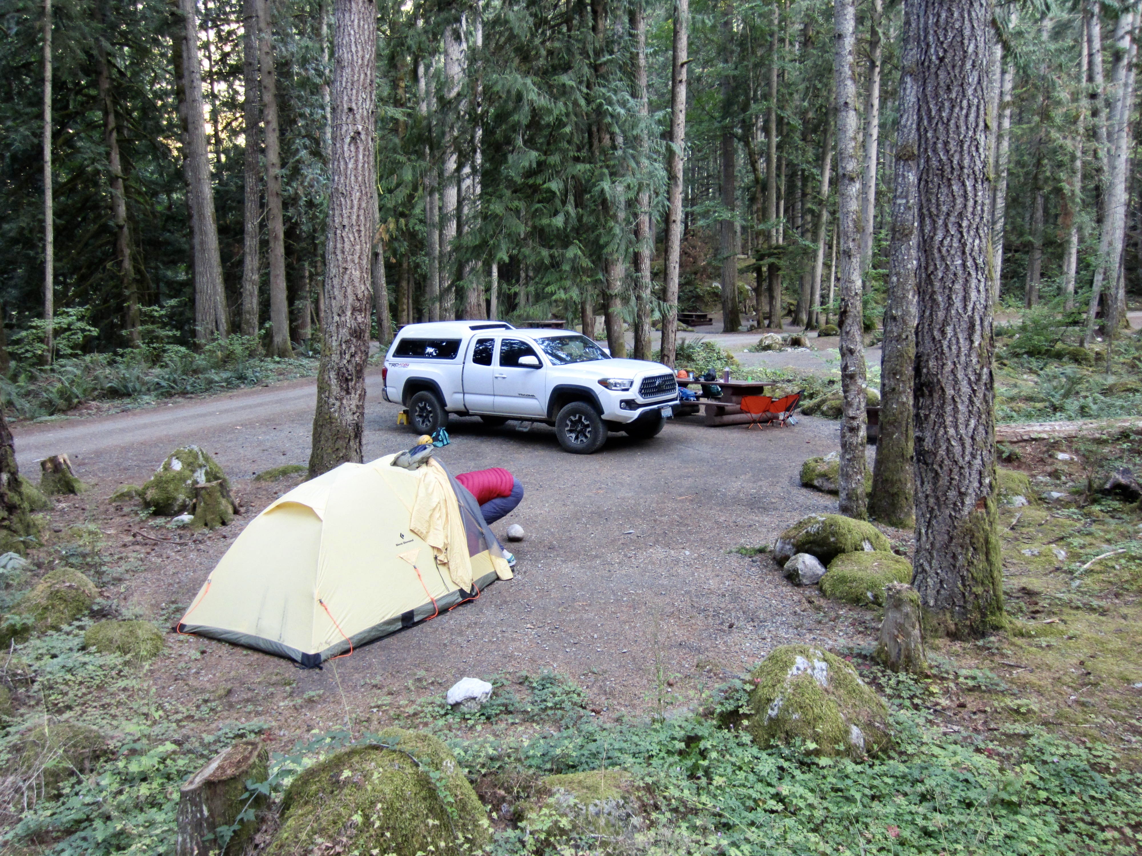
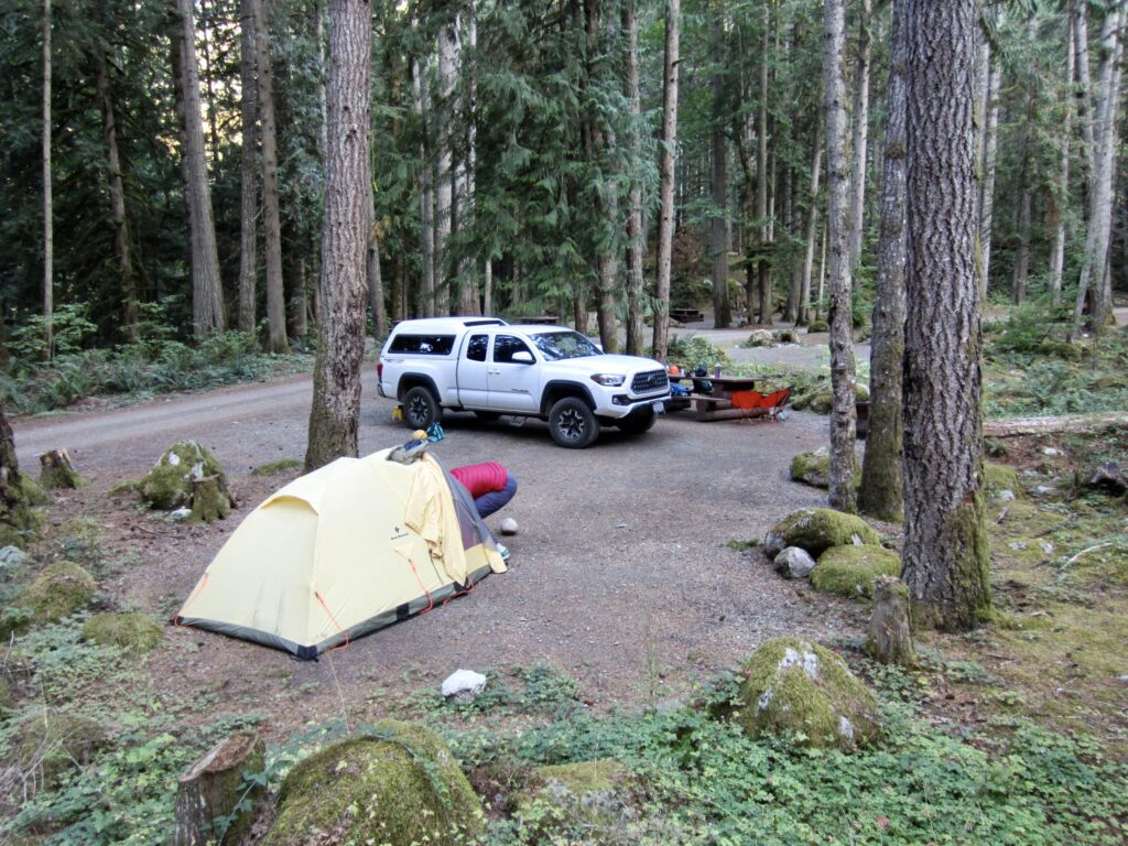
Campsite: Chilliwack Peninsula Campground on Chilliwack Bench Road
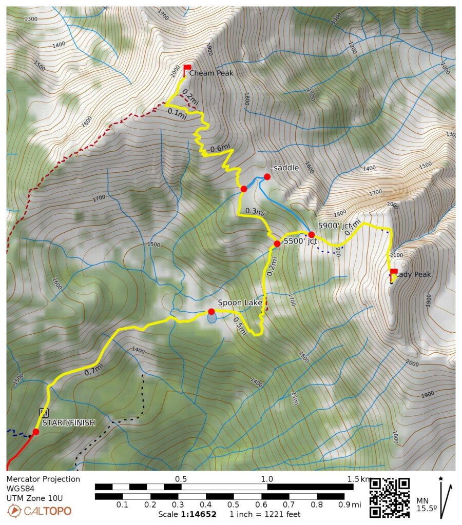
Daytrip 1: Lady Peak Summit Climb
Starting & Ending Point: Mt. Cheam Trailhead at end of Chipmunk Creek Road (Elev. 4700 feet)
Way Points: Spoon Lake Basin & Lady Peak Path junction & Lady Peak Ridge crest & Lady Peak summit (trail hike & rock scramble); return via Lady–Cheam Saddle (trail hike)
Summit: Lady Peak (trail scramble & rock scramble via South Slope—North Ridge)
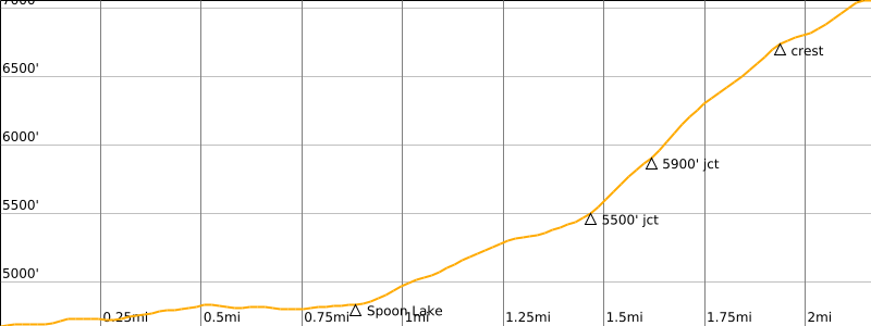
Approximate Daytrip Stats: 4.7 miles traveled; 2550 feet gained & lost; 3.5 hours up; 3.1 hours down.
Daytrip 2: Cheam Peak Summit Hike
Starting & Ending Point: Mt. Cheam Trailhead at end of Chipmunk Creek Road (Elev. 4700 feet)
Way Points: Spoon Lake Basin & Lady Peak Path junction & Lady–Cheam Basin & Cheam Peak Ridge crest & Cheam Peak summit (trail hike)
Summit: Cheam Peak (trail hike via Southeast Slope)
Approximate Daytrip Stats: 5.0 miles traveled; 2250 feet gained & lost; 3.0 hours up; 1.8 hours down.
Approximate Total Trip Stats: 9.7 miles traveled; 4700 feet gained & lost.
Related Posts
Baby Munday Peak + Stewart Peak + Knight Peak – August 2018
Welch Peak via Lower Southeast Face—South Ridge – August 2015
Foley Peak via Southeast Face—East Ridge + Welch Peak Attempt – July 2014
Trip Overview
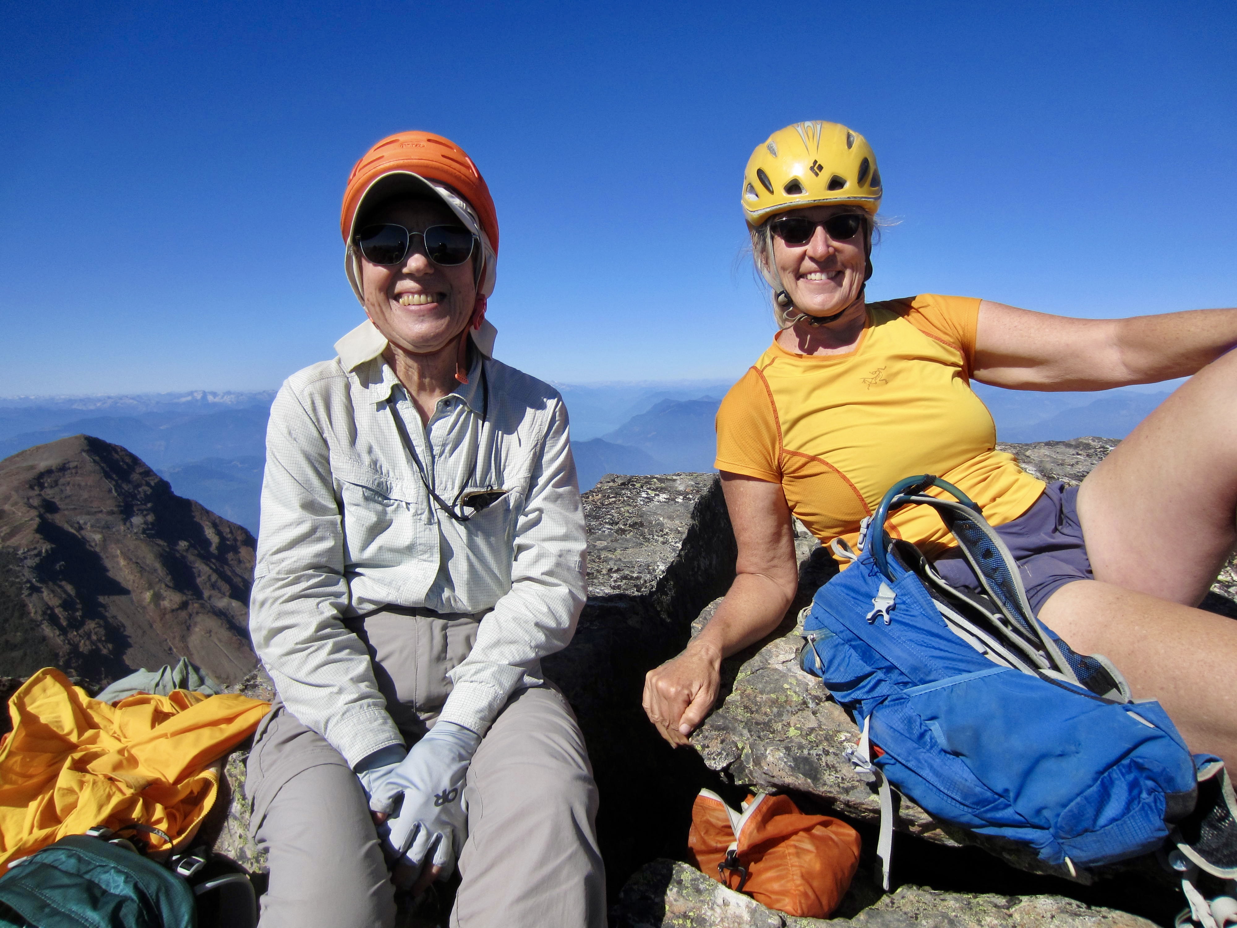
When Eileen, Fay, and I expanded our mountaineering purlieu into the Canadian Cascades, we started with explorations of the Cheam Range. This compact chain of rugged peaks is best known for its proximity to the town of Chilliwack, its great topographic relief above the Fraser River Valley, its short but steep approaches, and its generally poor rock quality. How could we resist? Over the span of a decade, we slowly attempted to tuck in all notable summits, arbitrarily working in an east-to-west direction. Now, nine years later, we found ourselves with only Lady Peak and Cheam Peak left to do.
Considering that these two westernmost summits are perhaps the easiest to reach, it seemed fitting that we would save them for last. Their ascent involves either a straightforward trail hike or a straightforward rock scramble. However, nothing in the Cheam Range is actually easy. In the case of both peaks, the most difficult part is the approach road, which is notoriously steep and rough. Our strategy for navigating this road relied on Fay’s trusty little Toyota Tacoma 4×4 pickup. It was a tight squeeze for the three of us but it did work.
In order to give ourselves plenty of time for driving, hiking, and climbing, we planned to attempt each peak as a separate daytrip. For this purpose, we spent three nights at Chilliwack Peninsula Campground, which is located a short distance off the trailhead approach road. The comfortable accommodations there turned out to be one of the most pleasant surprises of our trip. Having to drive the horrible approach road twice, though, was definitely NOT pleasant!
.
Aside from our summit objectives, I spent some time trying to answer a simple question: How is the name Cheam pronounced? Based on a combination of written and verbal information sources, I found several different pronunciations that appear to be acceptable. BC Parks reports it as “CHEE-om”; Wikipedia offers both “SHEE-am” and “SHEM”; and Chilliwack locals seem to prefer “SHEM” or “SHAM.” Take your pick, I guess…or sidestep the whole issue by going with the indigenous name Lhílheqey.
Full Trip Report
Driving Directions & Road Conditions
Drive eastward on Chilliwack Lake Road to the Camp Foley Recreation Site, turn left (north) on Foley Creek Road, and go 1.3 miles to a “T” intersection. Turn left on Chipmunk Creek Road and proceed 1.1 miles to a junction with Chilliwack Bench Road. Keep to the right, staying on Chipmunk Creek Road as it climbs northwesterly up the valley. In 2.6 miles from the last junction, you will come to a fork. Up to this point, the road is a bit rough but doable in a vehicle with normal clearance.
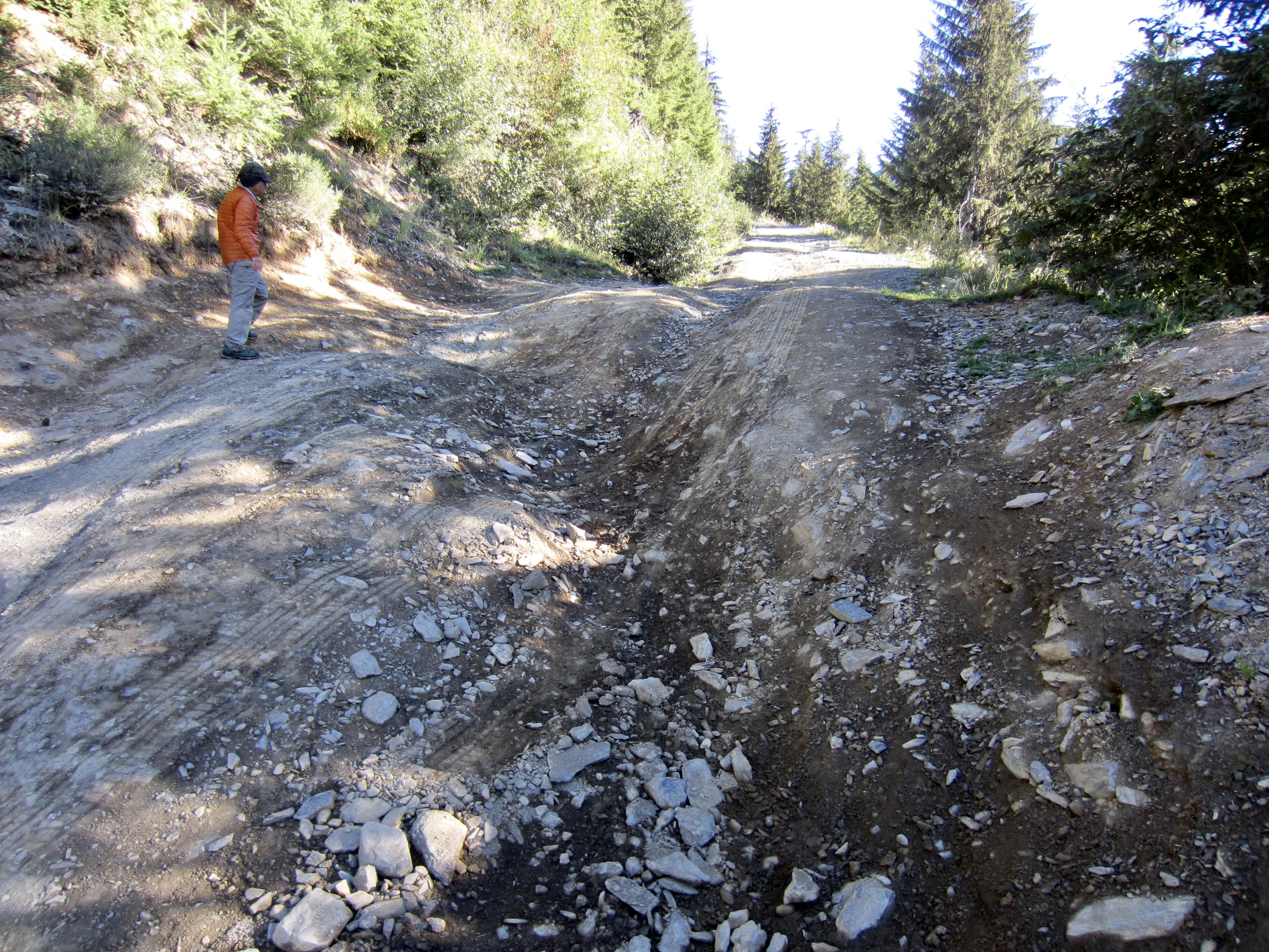
At the aforementioned fork, continue straight ahead in a northwesterly direction on a decommissioned road. This road begins with a fairly level gradient, but the surface quality is dramatically worse. For the next mile, you will cross over approximately 15 deep drainage ditches and several hundred potholes, some of which could be described as small craters! A high-clearance vehicle is required to navigate this road segment, such that normal-clearance vehicles will likely need to park at the fork.
After battling the mile of ditches and potholes, you will cross Chipmunk Creek on a sturdy bridge. From here, the trailhead is only 3 miles away, and the remainder of the road has very few potholes. Sorry to say, however, that it does become much steeper and rockier. Furthermore, you will cross approximately 55 additional drainage ditches (yes, I counted them)!
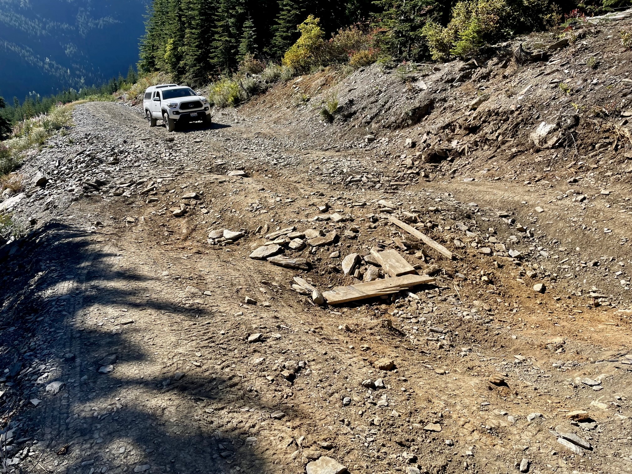
As if the rocks and ditches aren’t annoying enough, you will encounter two locations that are especially steep and deeply rutted. The first bad spot is located 1.3 miles from the bridge, and the second is located a mile beyond the first. Thanks to Fay’s skillful driving and very capable 4×4 rig (a Toyota Tacoma pickup), we were able to negotiate both bad spots—but just barely. People driving a less-capable rig will probably want to park below the first bad spot and walk the final 1.8 miles of road. Admittedly, though, a fearless attitude, a heavy accelerator foot, and good car insurance might suffice for some folks.
.
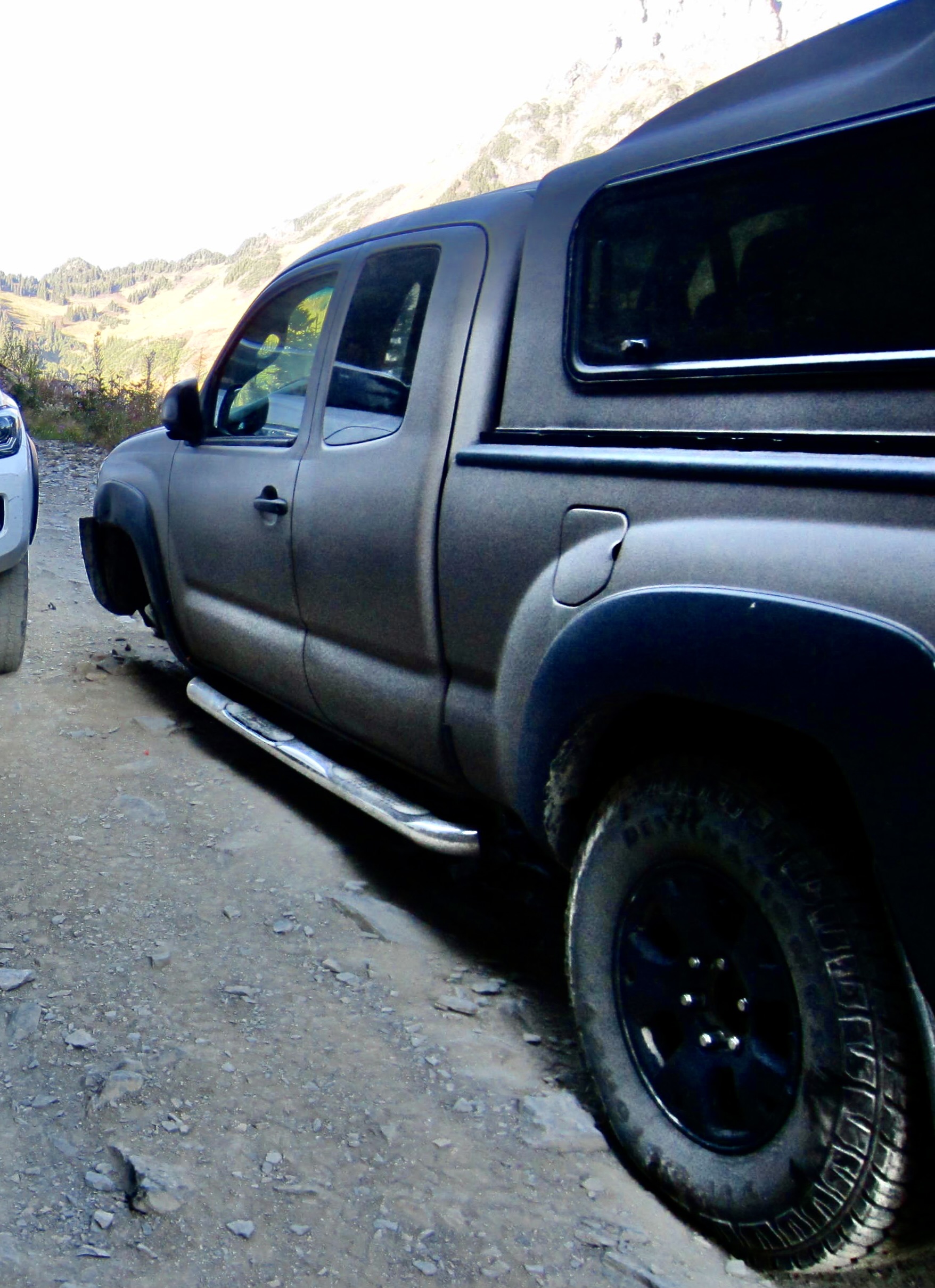
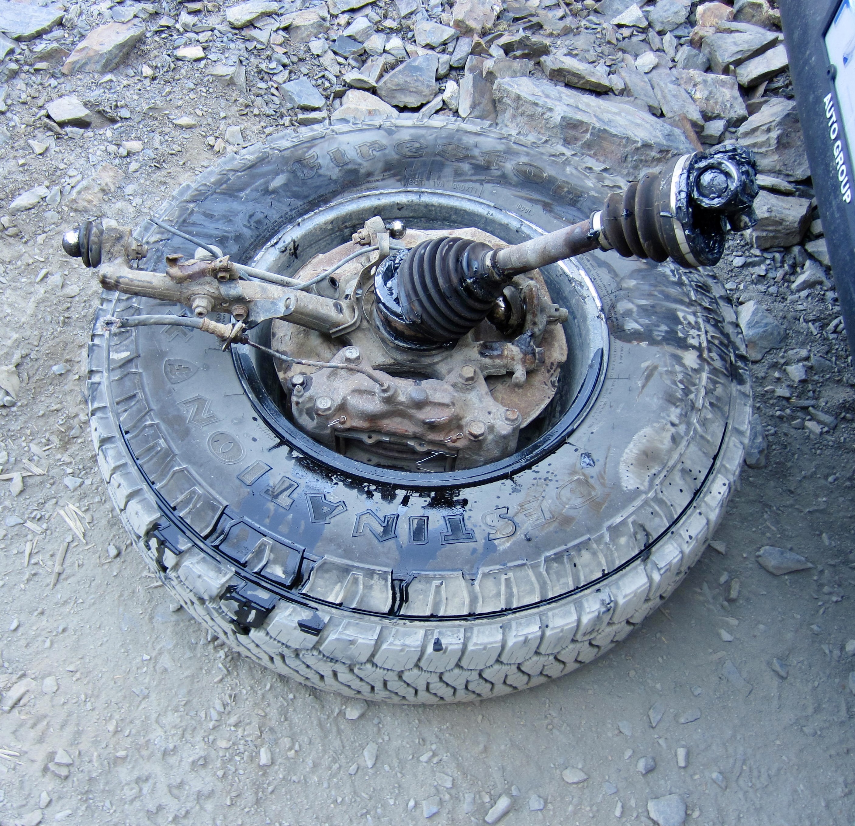
If you and your vehicle survive all of the roadway challenges, you will end up at the 4700-foot parking lot, which has room for about two dozen cars. Hopefully, you will have more success than this unfortunate Tacoma truck that suffered a broken axle during the ascent. Talk about having a bad day!
…
Daytrip 1: Lady Peak Summit Climb
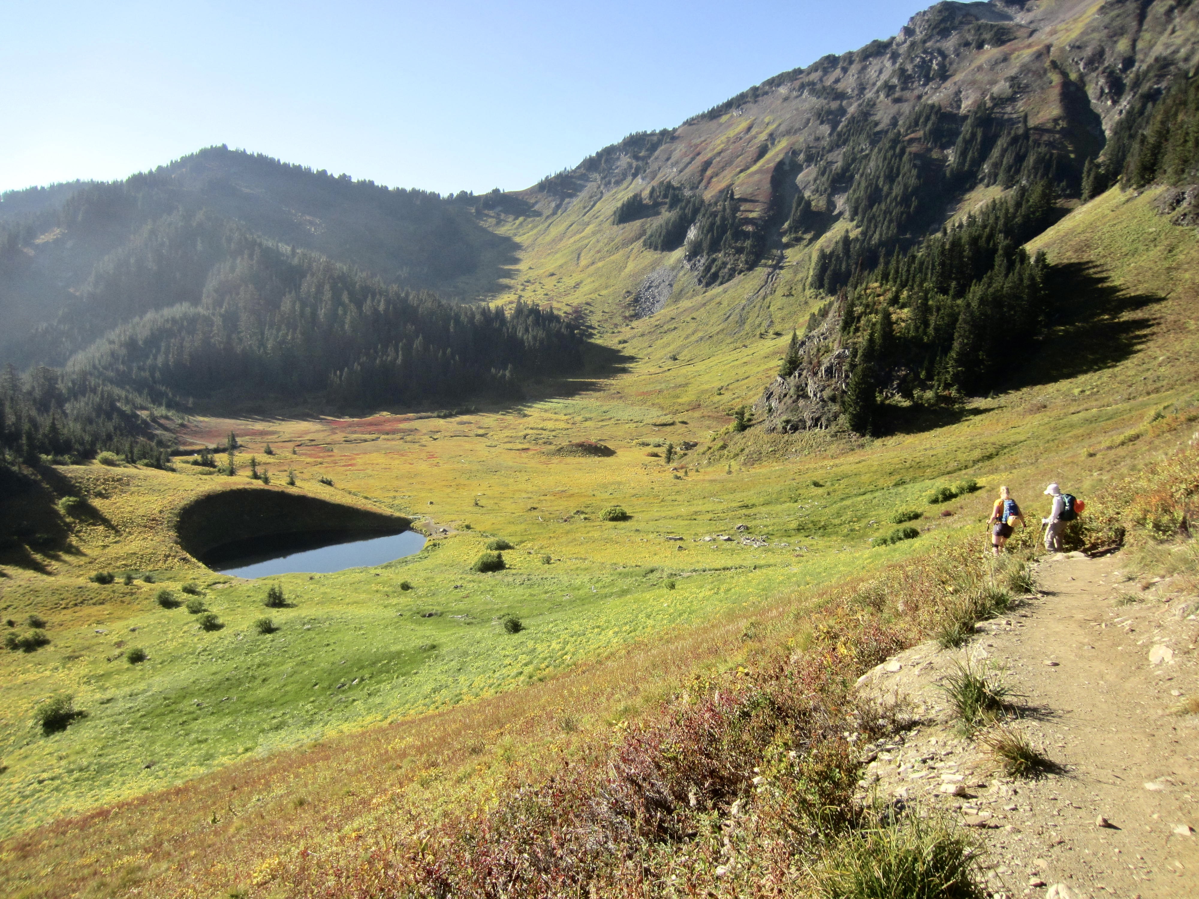
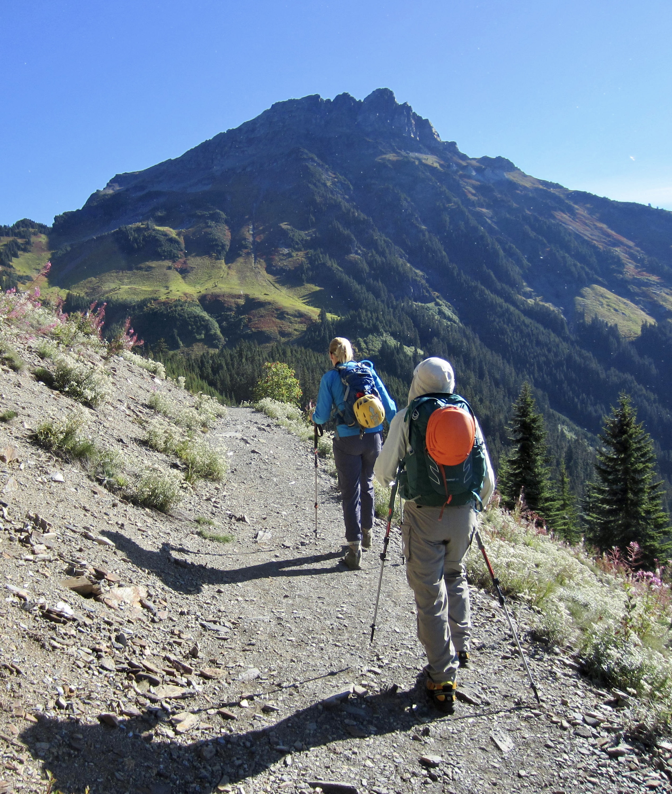
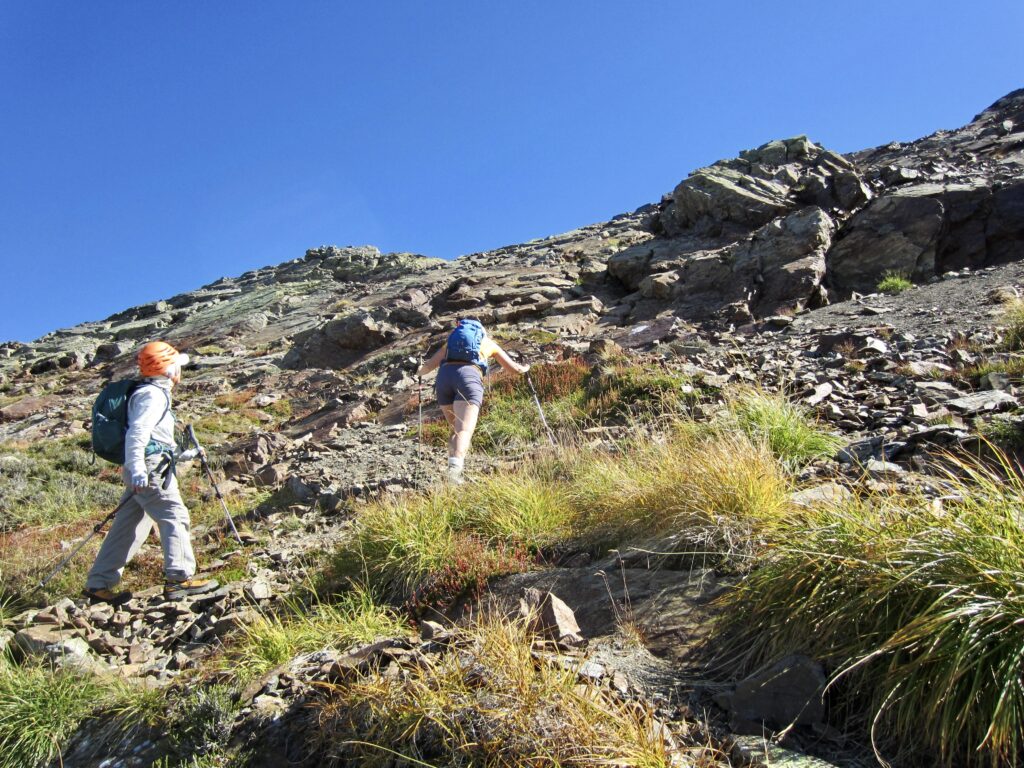
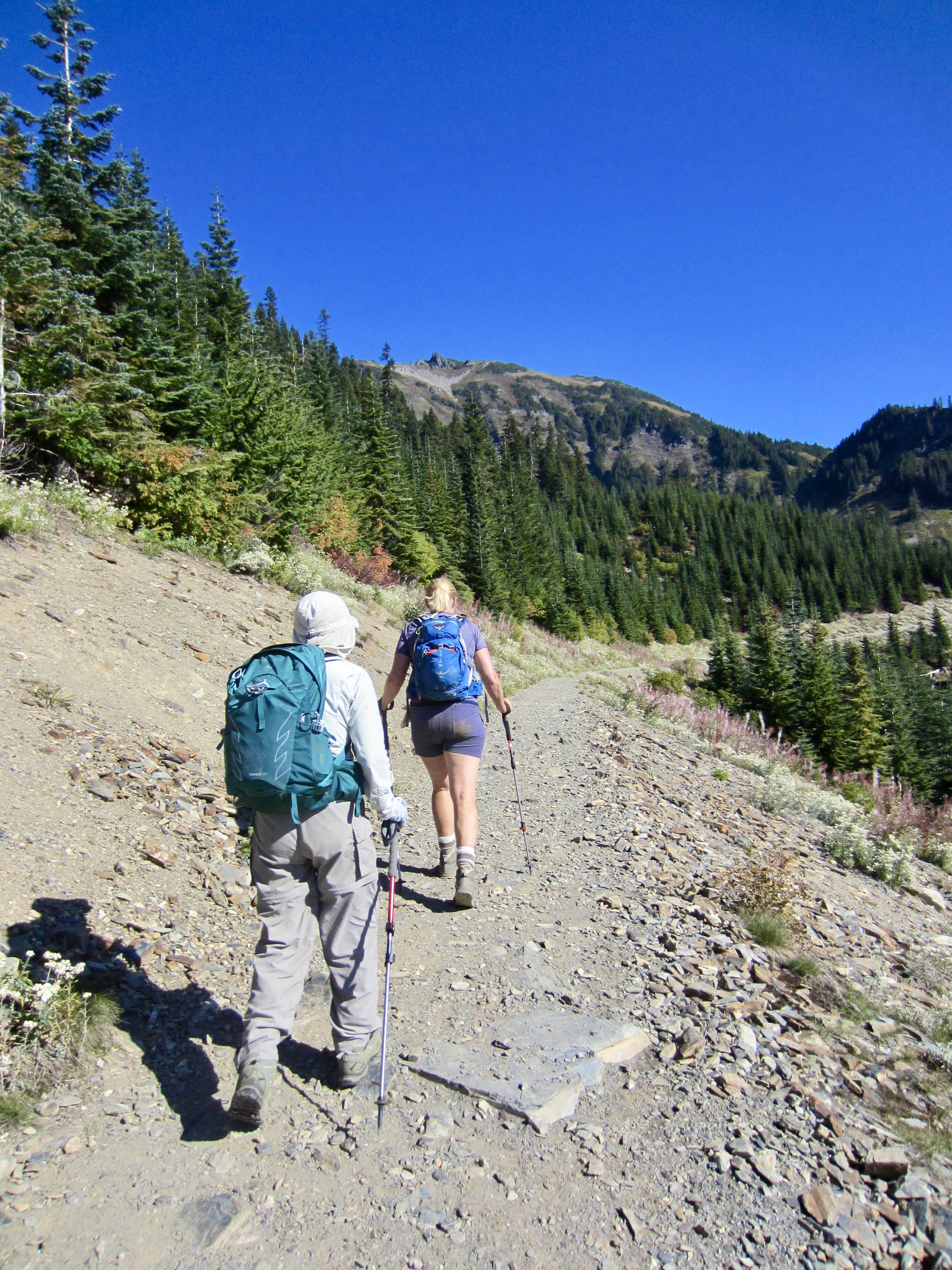
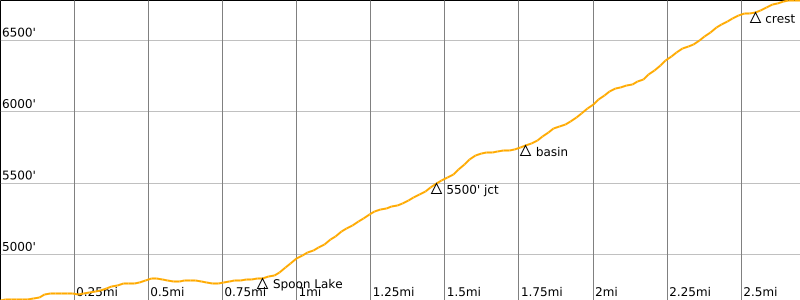
Fay, Eileen, and I left the Mt. Cheam Trailhead on a sunny Thursday morning and hiked up the old logging road, which curves around a barren hillside and drops into Spoon Lake Basin. The craggy profile of Lady Peak was tantalizingly visible straight ahead of us.
.
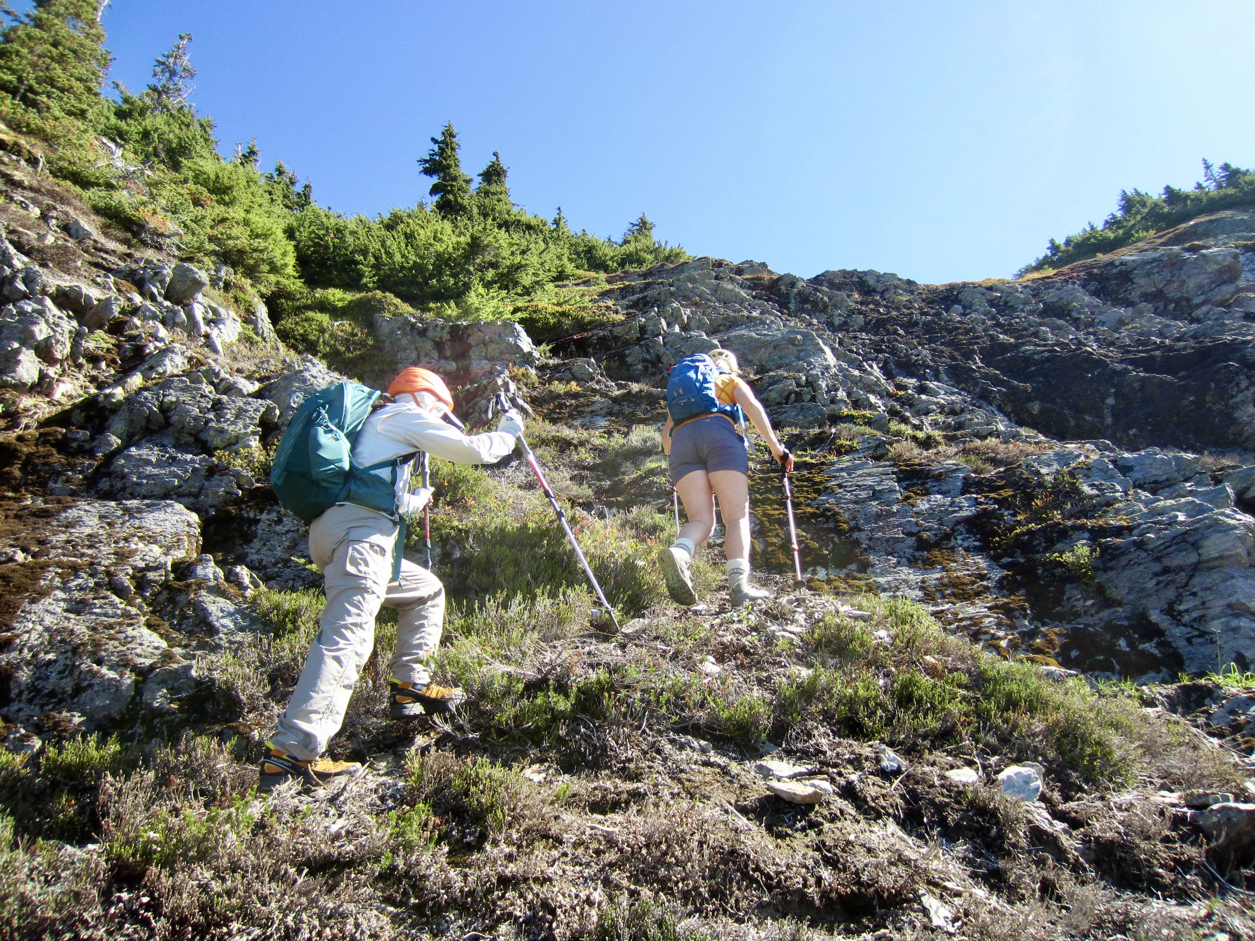
Just past tiny Spoon Lake, the trail switch-backs up a wooded headwall and then makes a long, low-angle, northerly traverse across a grassy hillside. At an elevation of 5500 feet, we came to a junction with a vague climber’s path that heads uphill to the right (east). We followed this path up a grassy draw, over a rock band, and through a super-steep clump of trees.
.
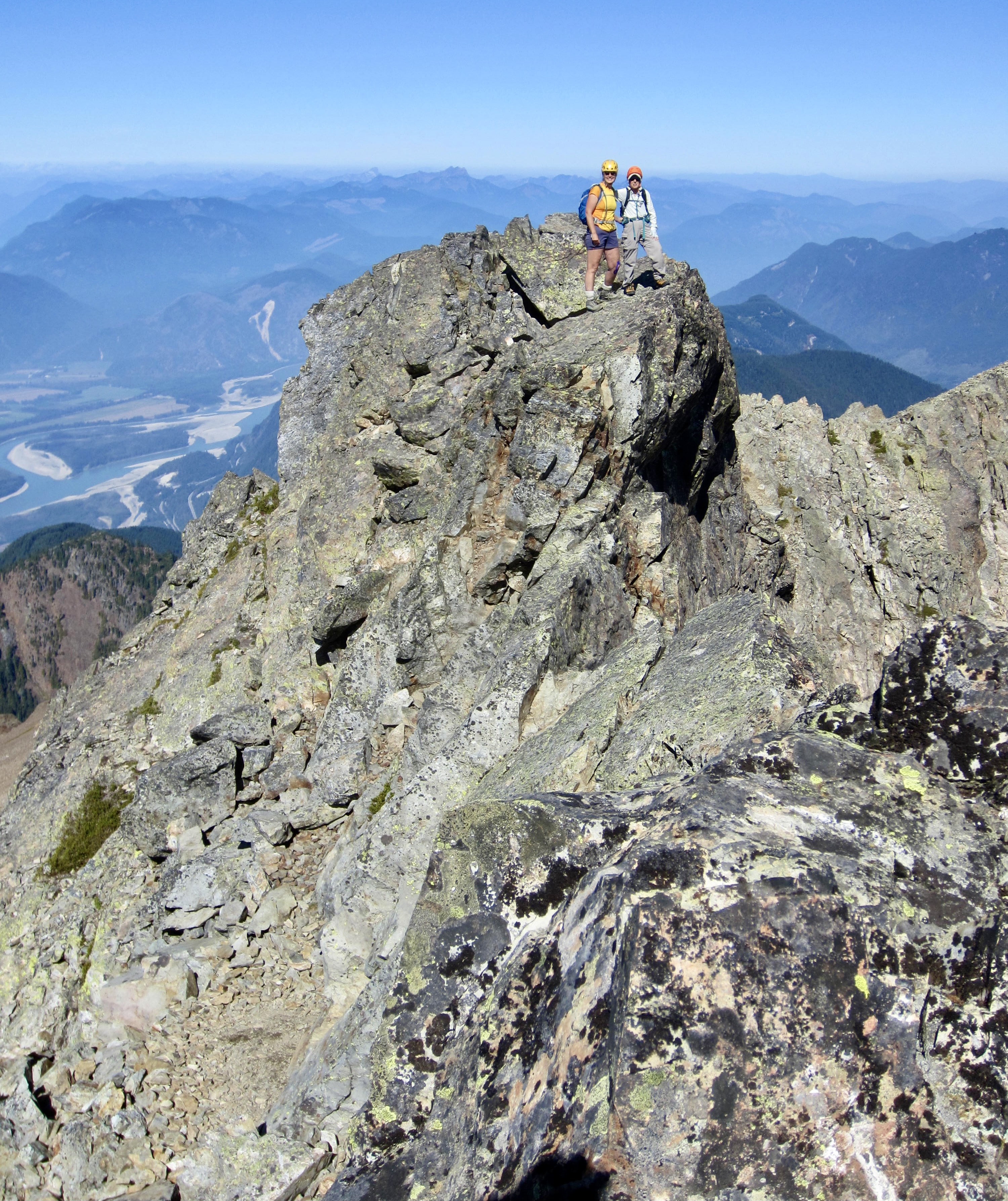
The climber’s path ended at the base of a slabby cliff closely below the north ridge of Lady Peak. After evaluating several options, we scrambled up an easy crack system to the left, and this put us on the ridge crest at a 6800-foot step. (During our later descent, we discovered that going right would have also been ok.)
.
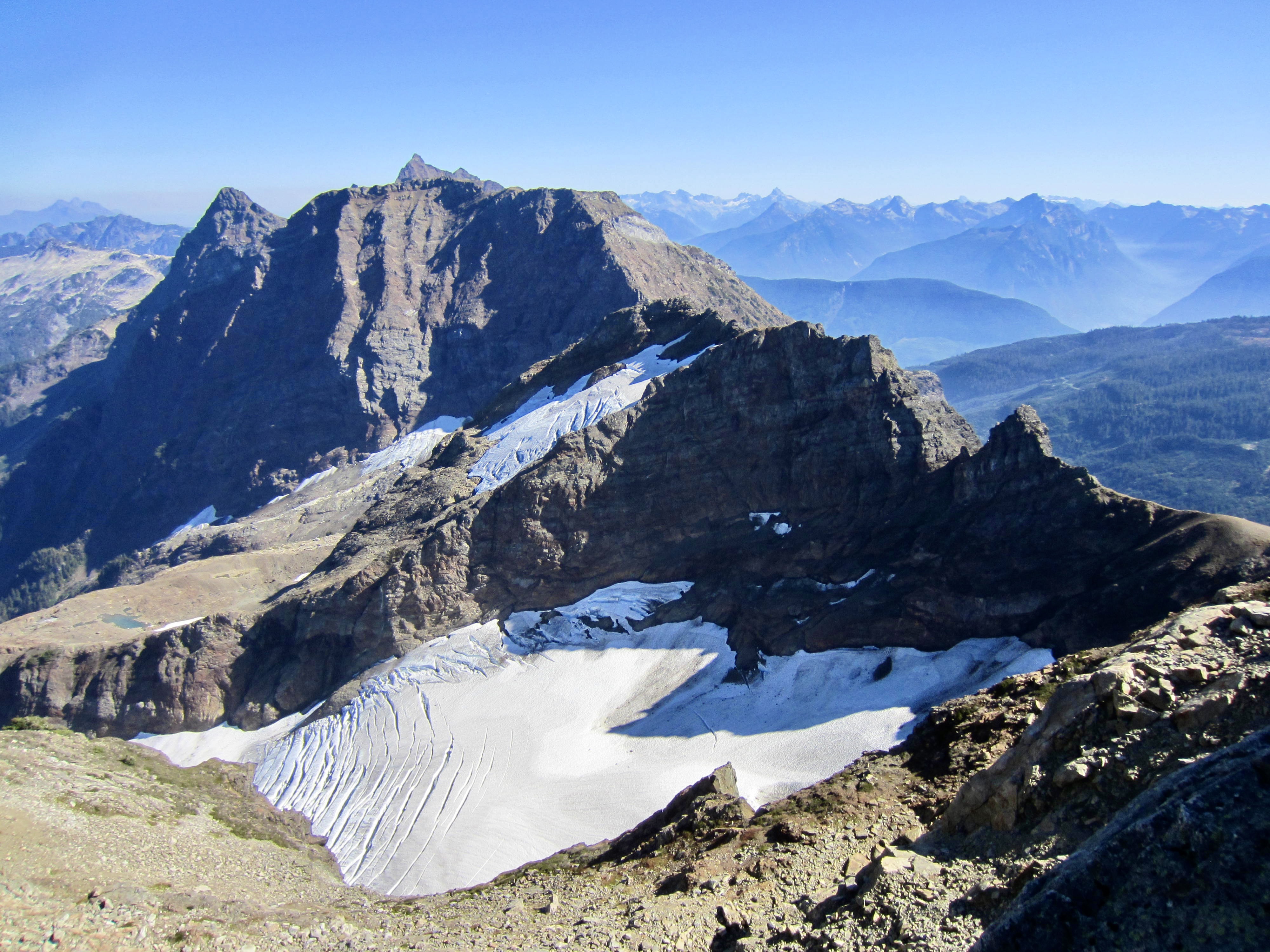
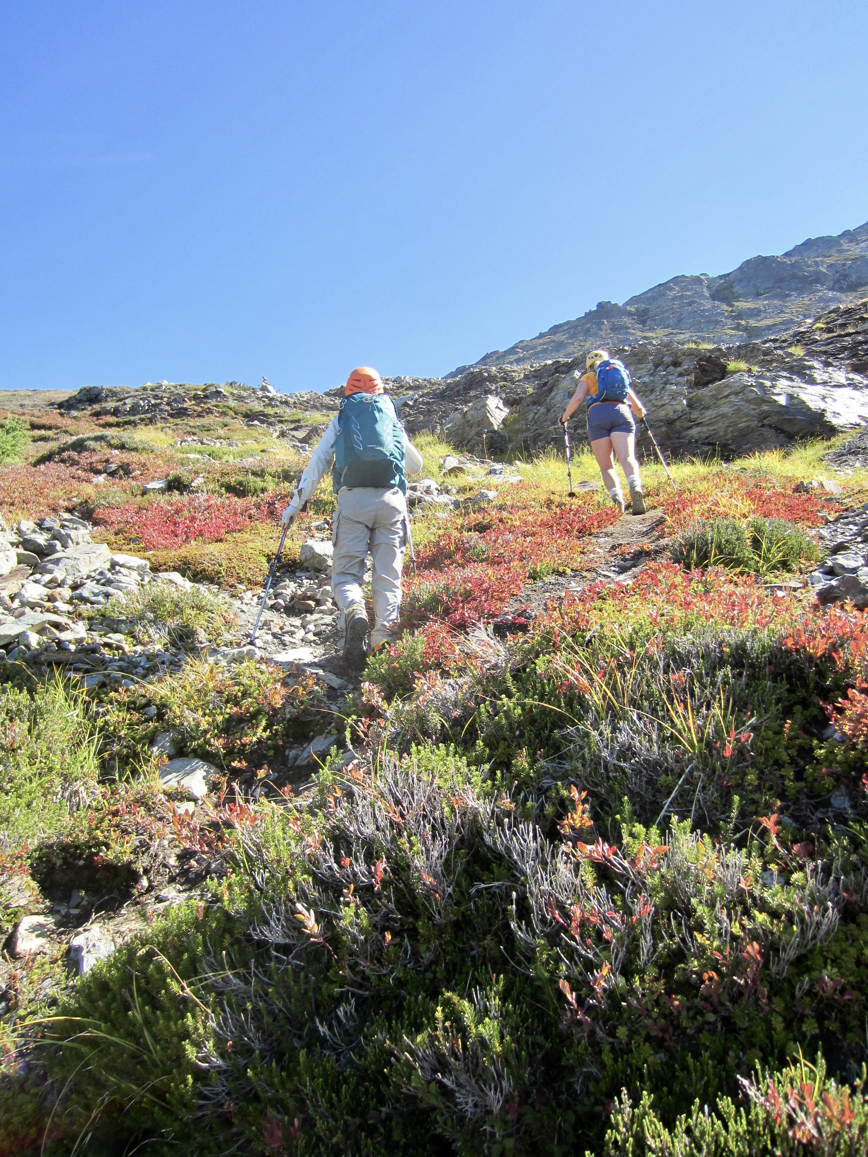
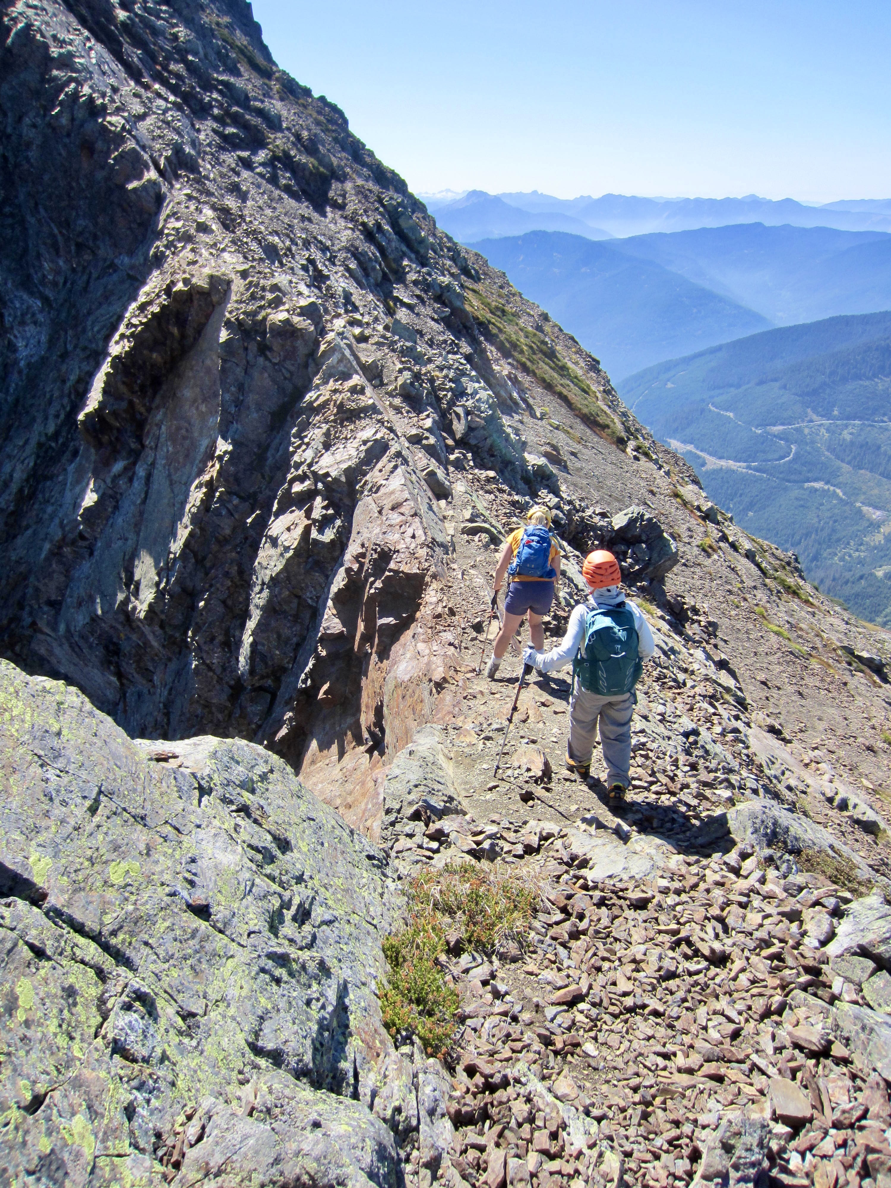
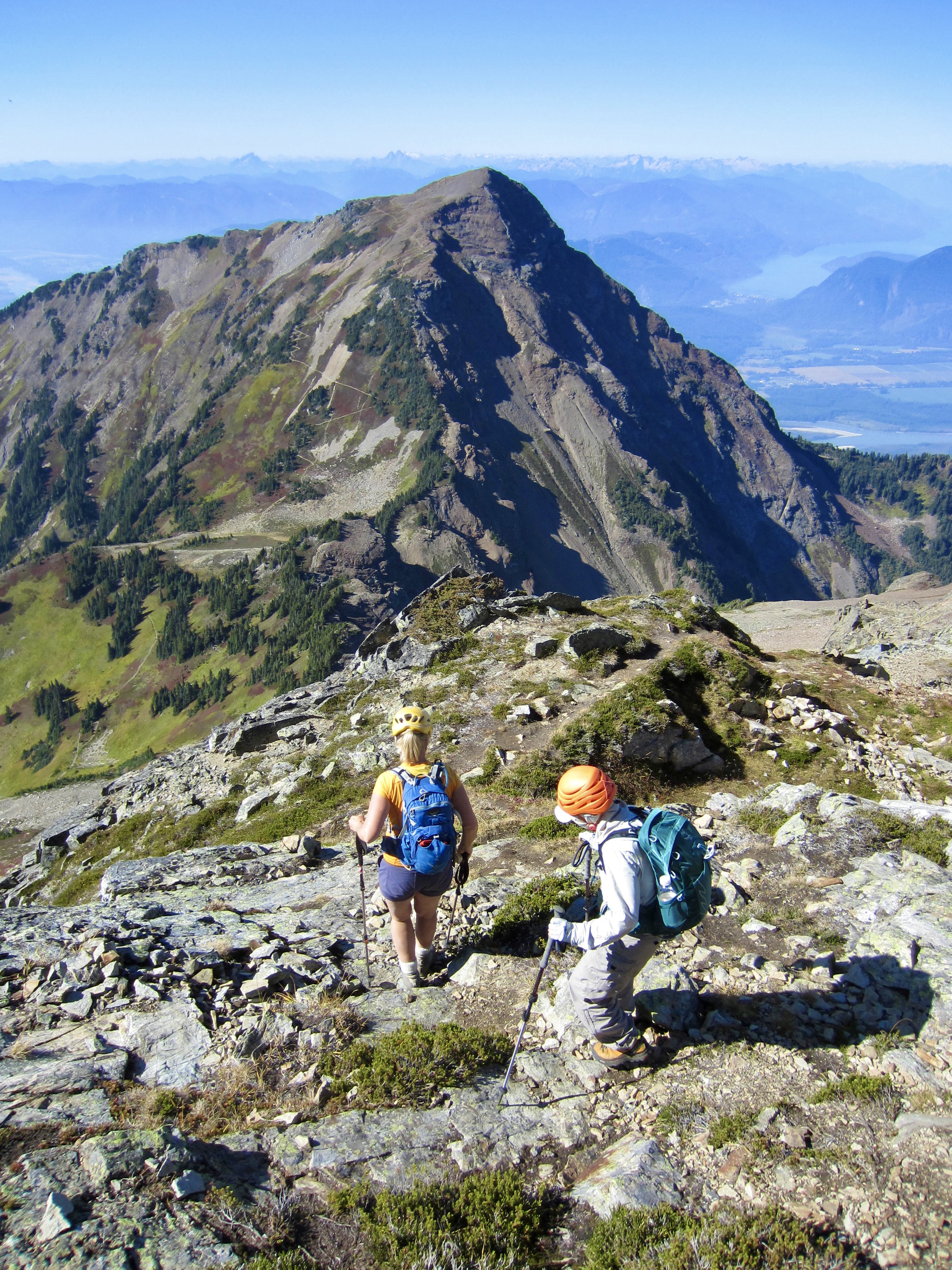
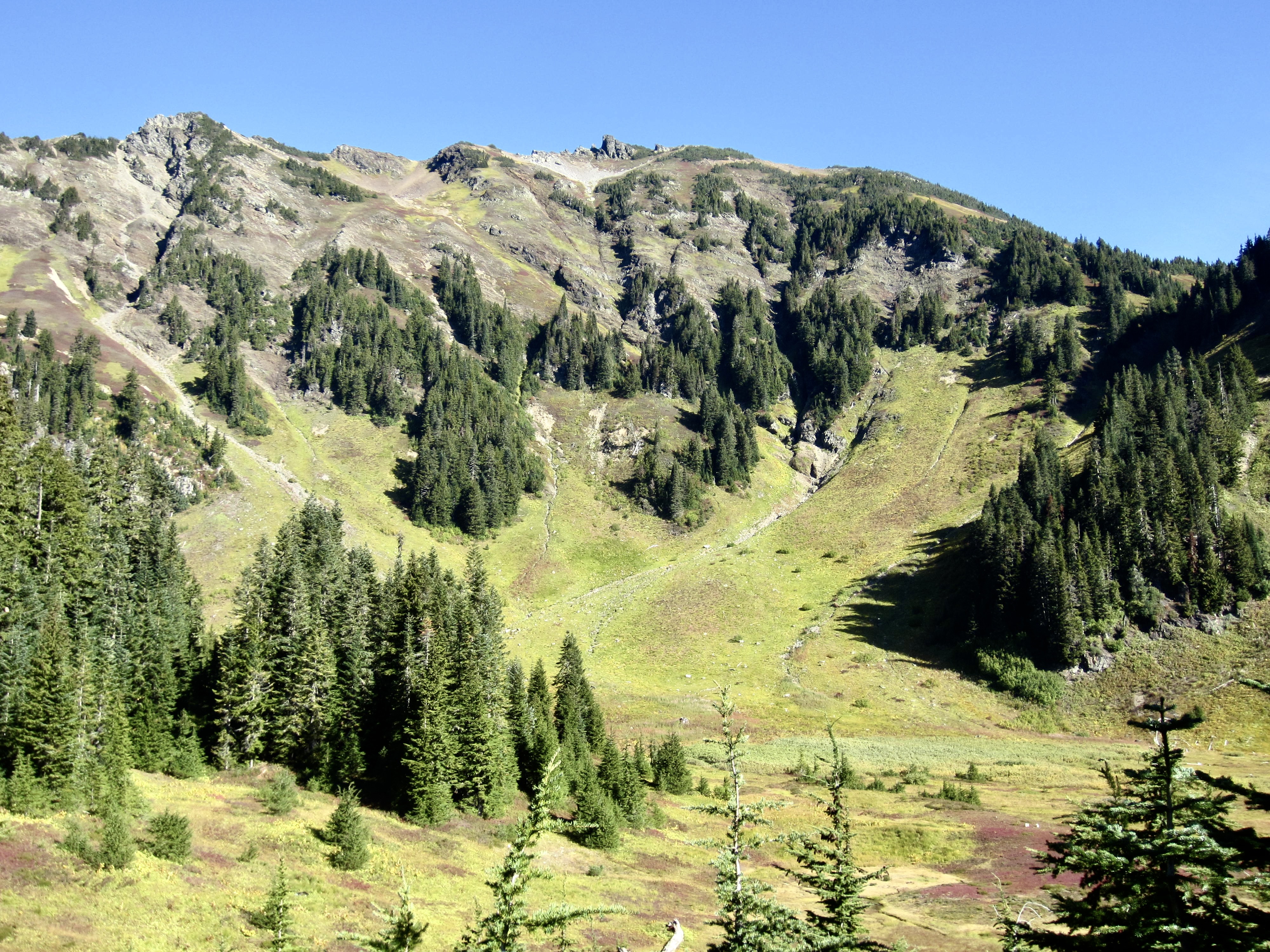
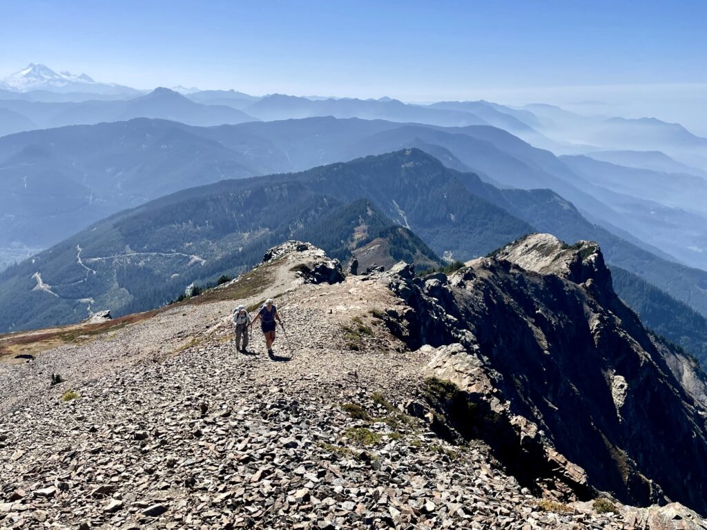
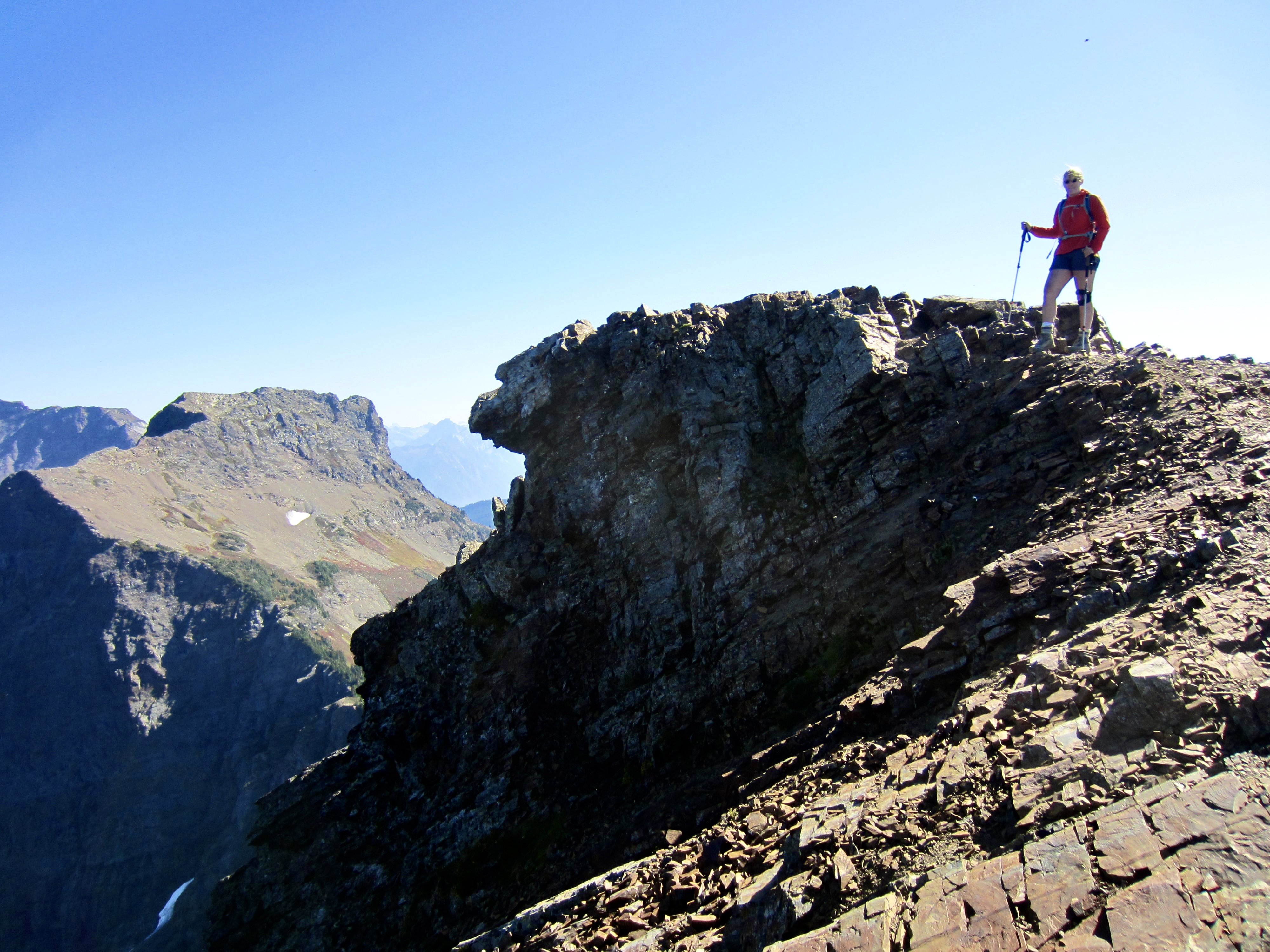
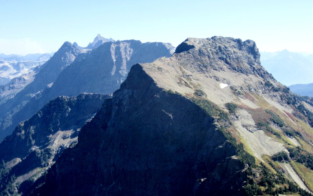
Turning right (south), we hiked and scrambled along the narrow ridge by following ledges and bootpaths on or closely right of the crest. This ridge is composed of blocky volcanic rock with a natural bedding that dips to the west, creating many down-sloping slabs and faces on the western side. In contrast, the eastern side descends near-vertically into a deep cirque.
.
Lady Peak’s north ridge is relatively level at first but then sweeps steeply up toward the summit. We continued zigzagging upward on Class 2 ledges until arriving at a small notch immediately north of the summit block. Although the final ascent looked difficult and exposed, it turned out to be a fun Class 3 scramble on solid rock. We topped out in mid-afternoon (3.5 hours + 2450 feet from TH).
.
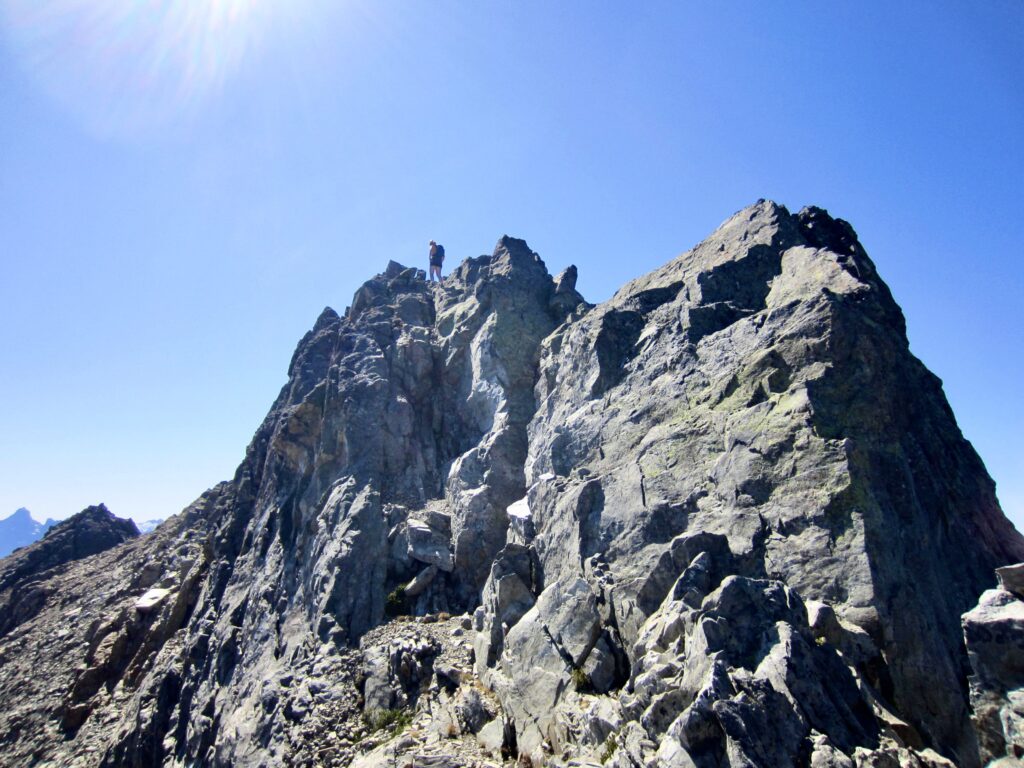
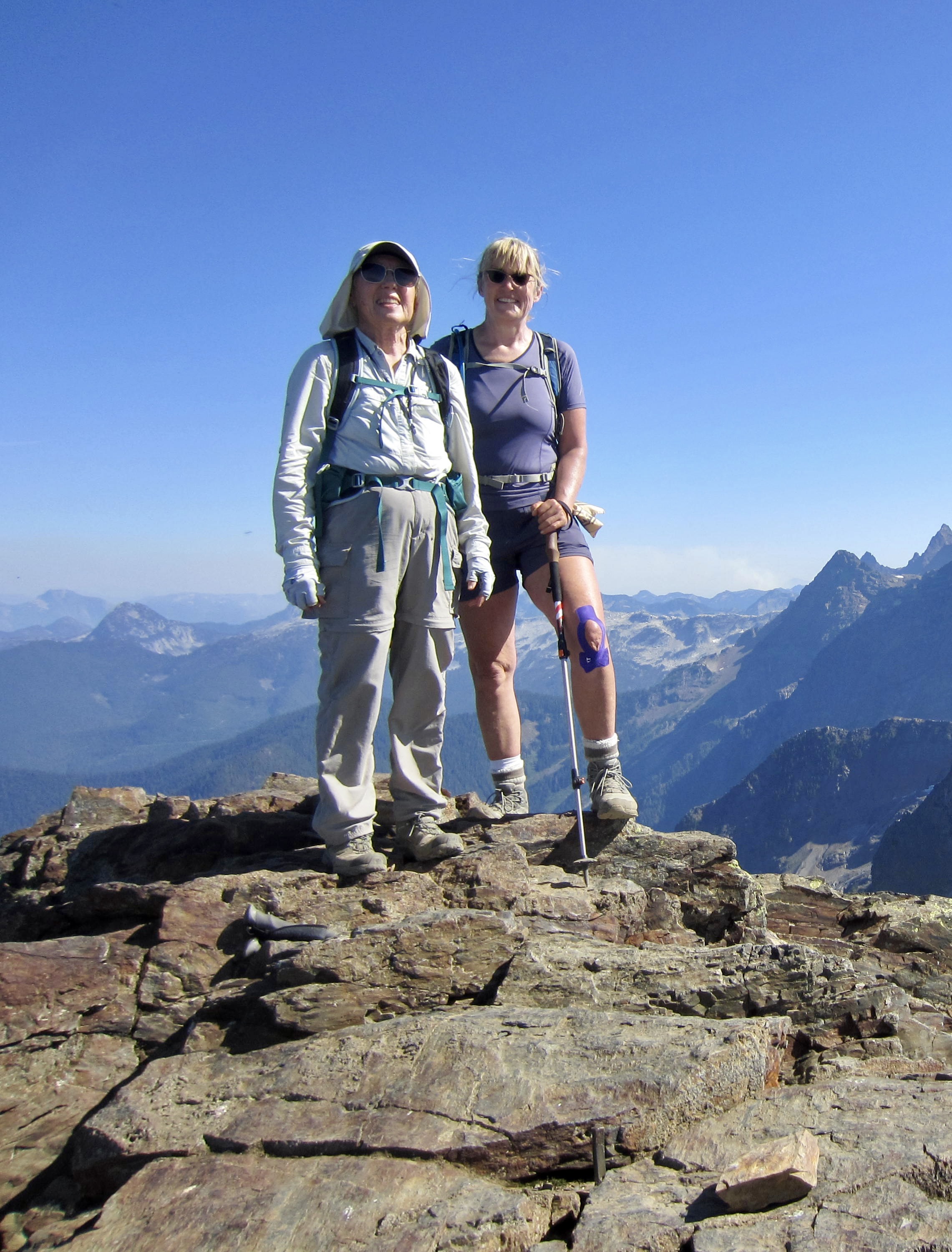
Lady Peak’s summit area has two separate high knobs that appear to be very close in elevation. We climbed both of them and concluded that they are essentially of equal height.
.
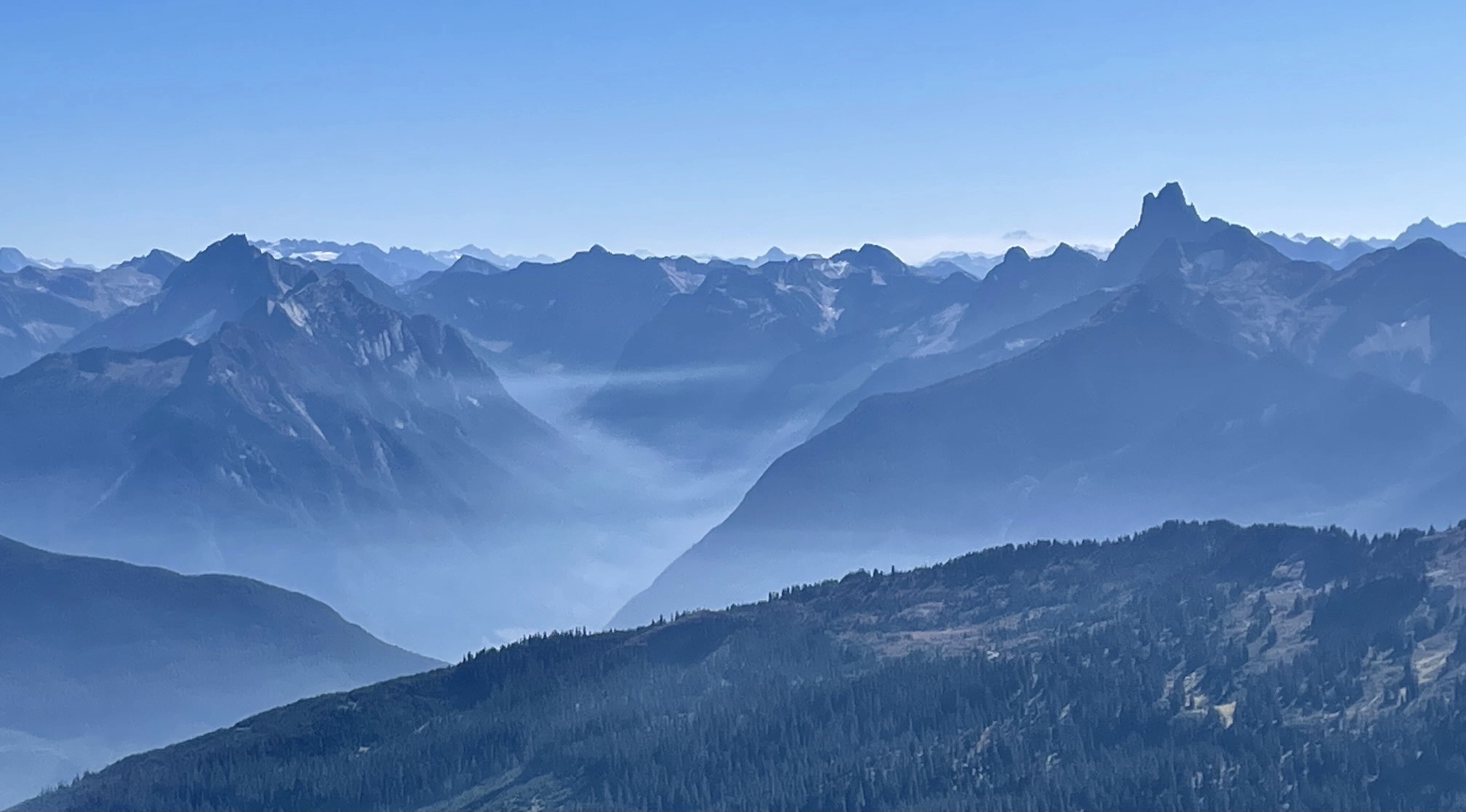
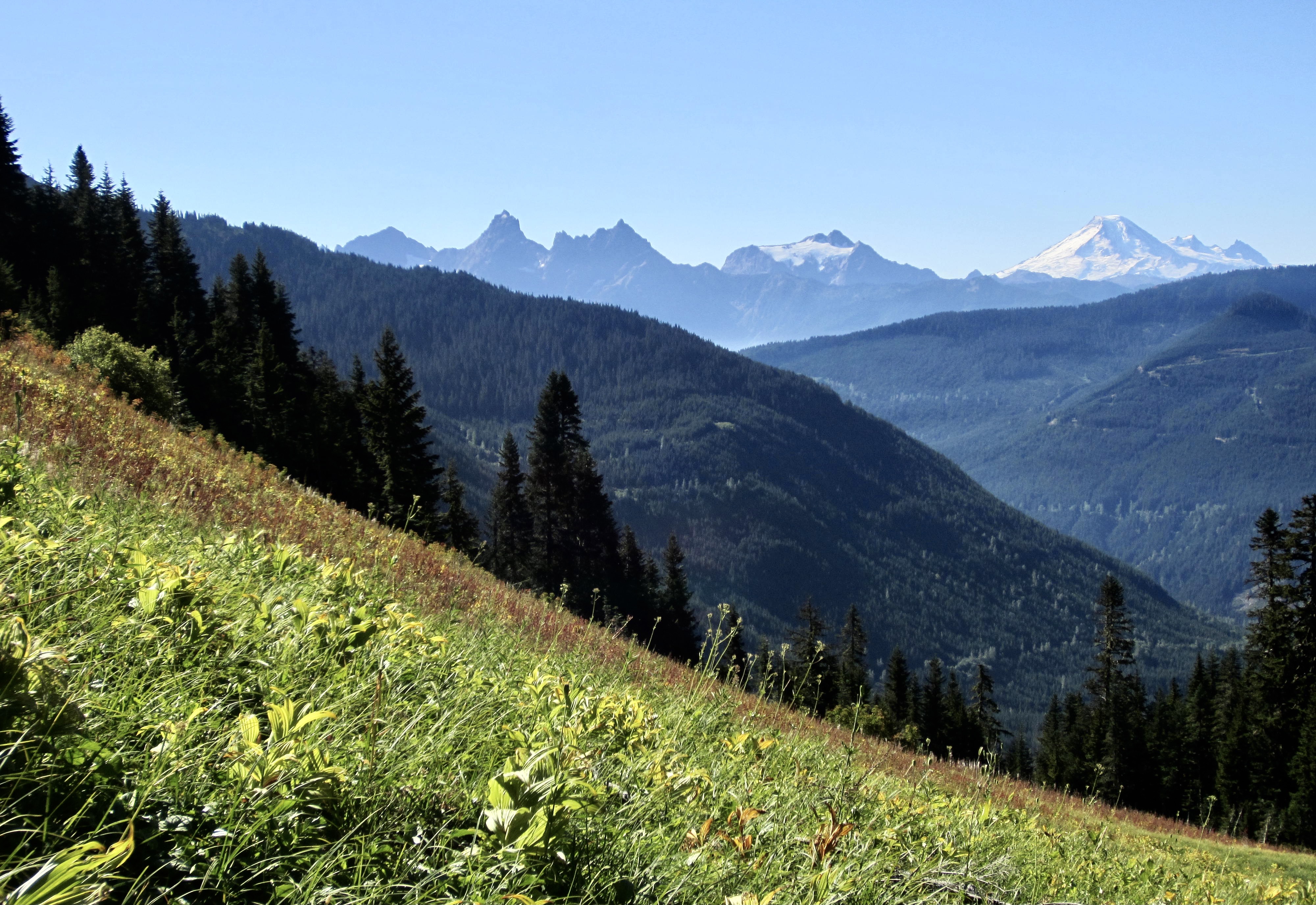
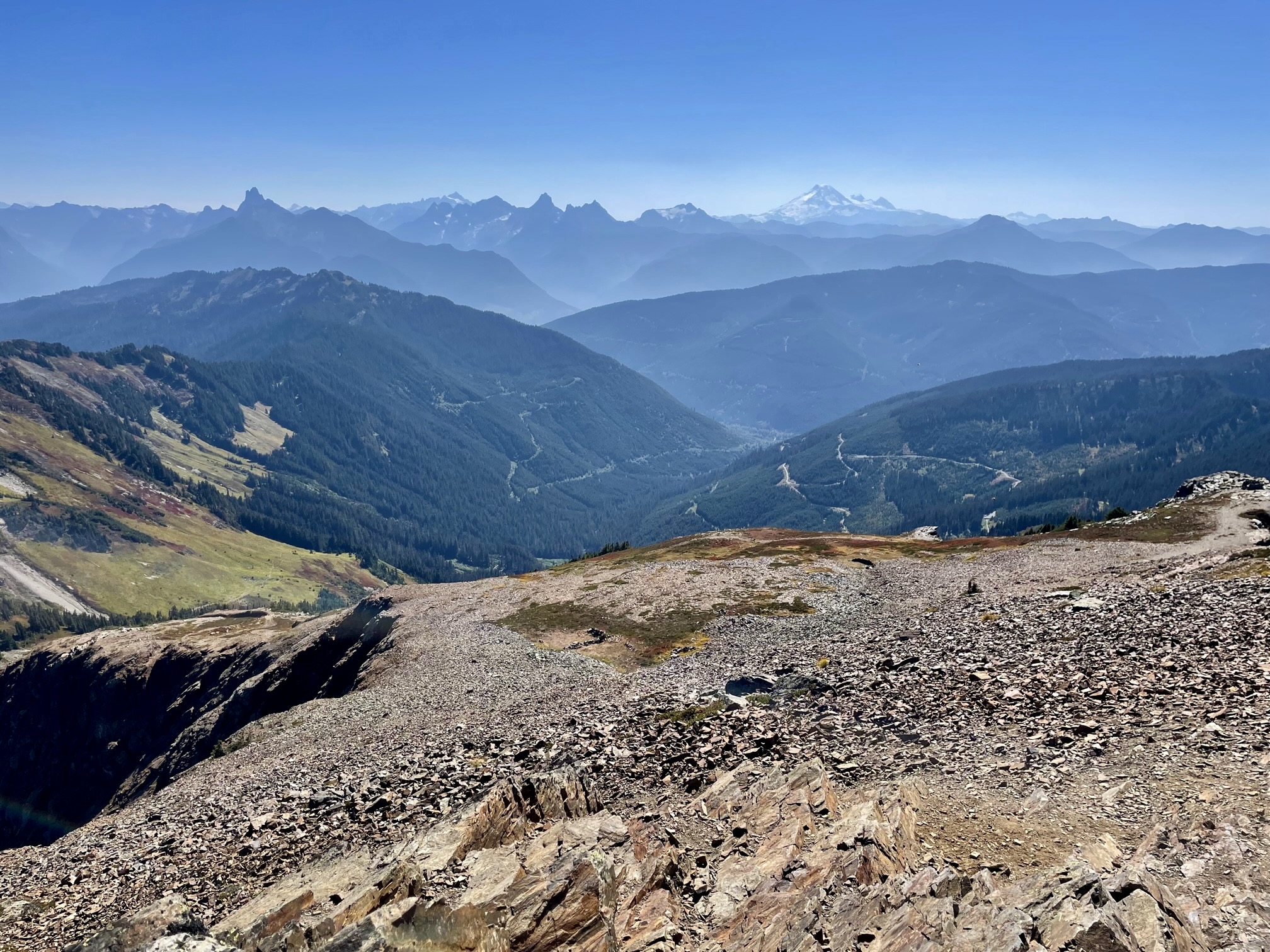
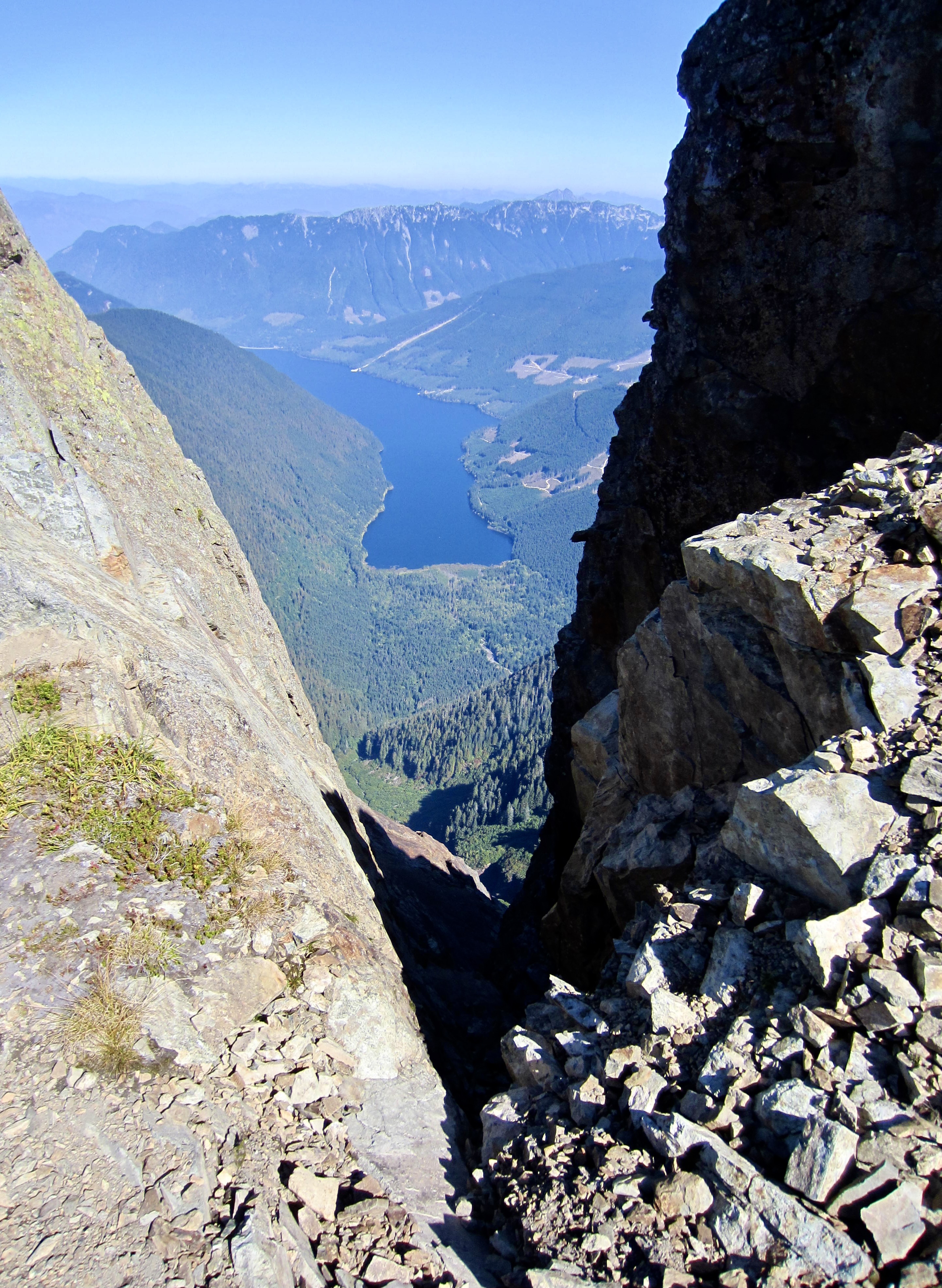
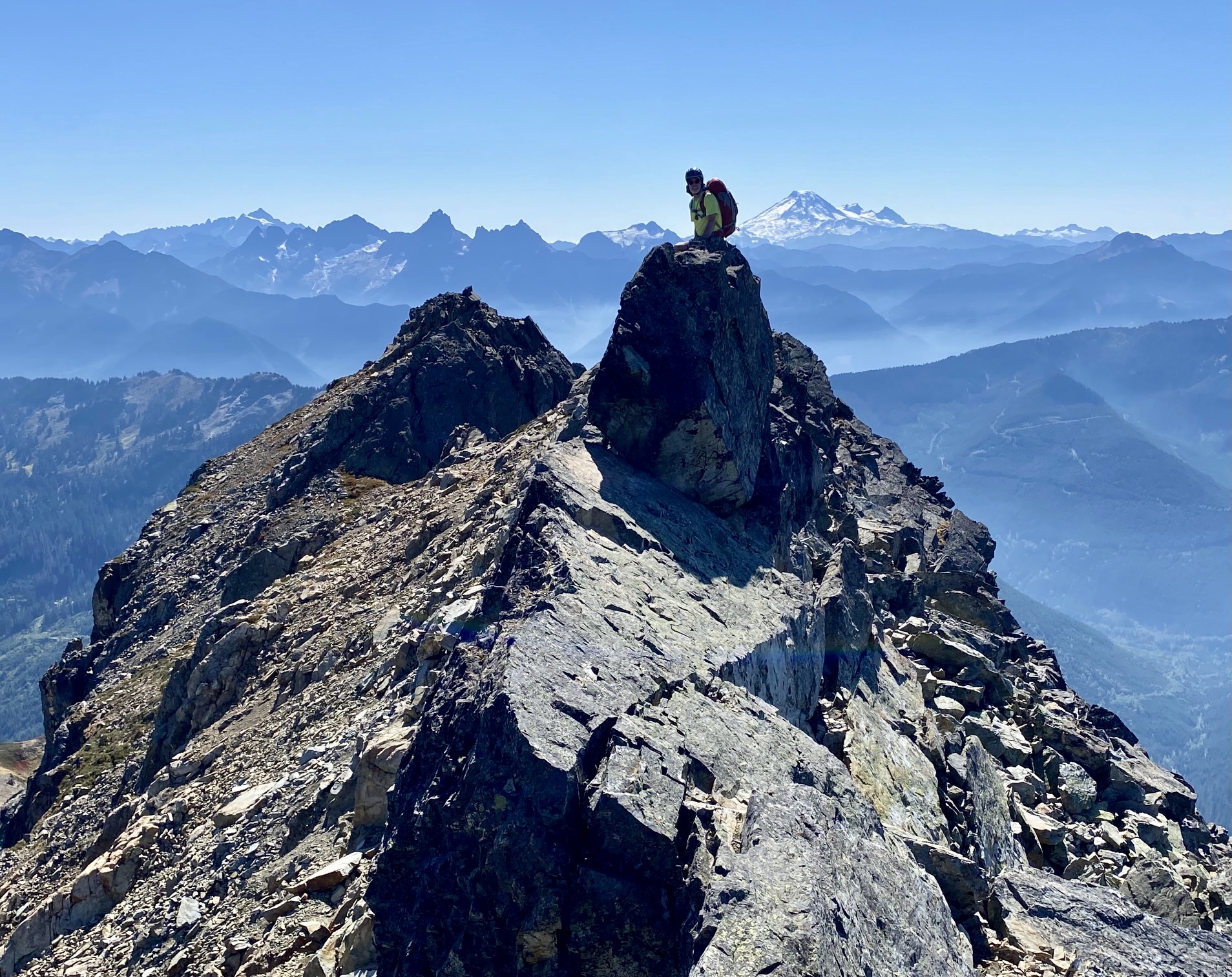
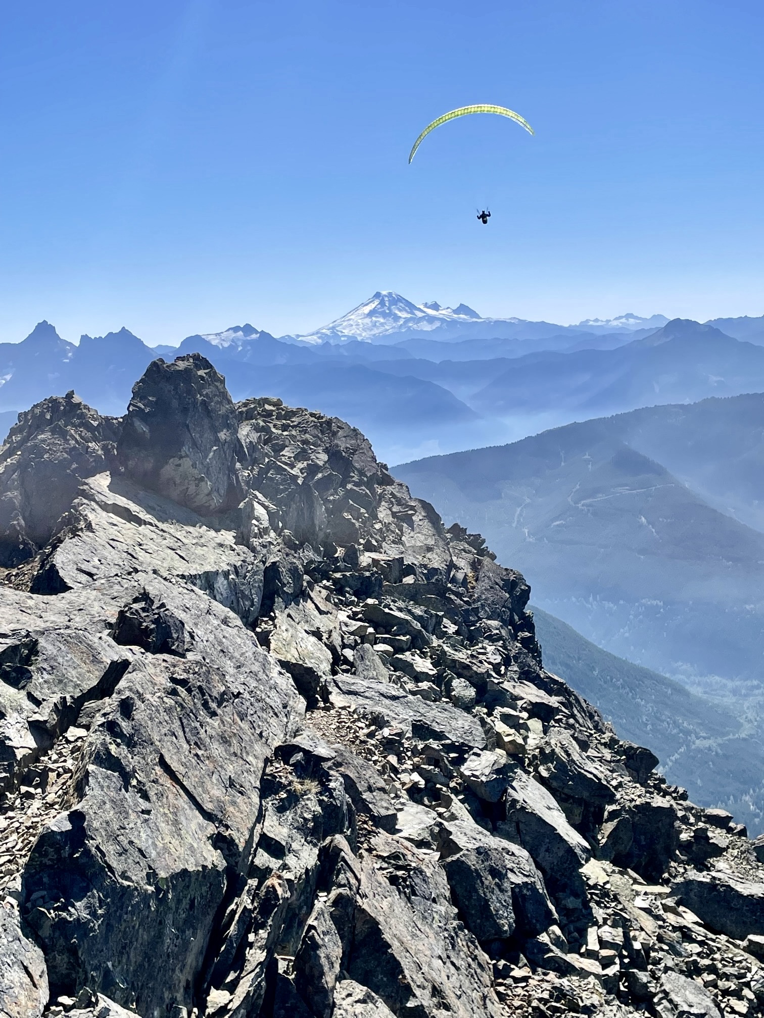
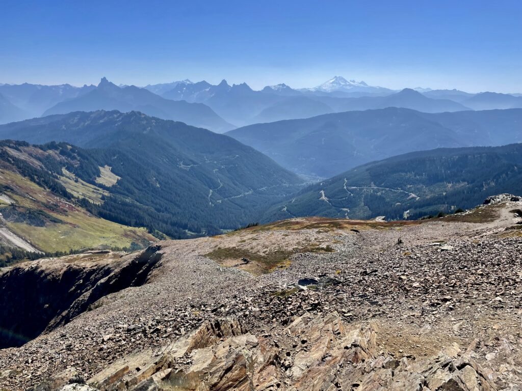
The surrounding valleys were filled with wildfire smoke, but the atmosphere was clear enough to see for about 30 miles. To our south were the distinctive horns of Mt. Redoubt, Mt. Rexford, Mt. Slesse, and American Border Peak. Closely to our east, the pointed summit of Baby Munday Peak could be seen over the flat summit of Knight Peak.

.

.
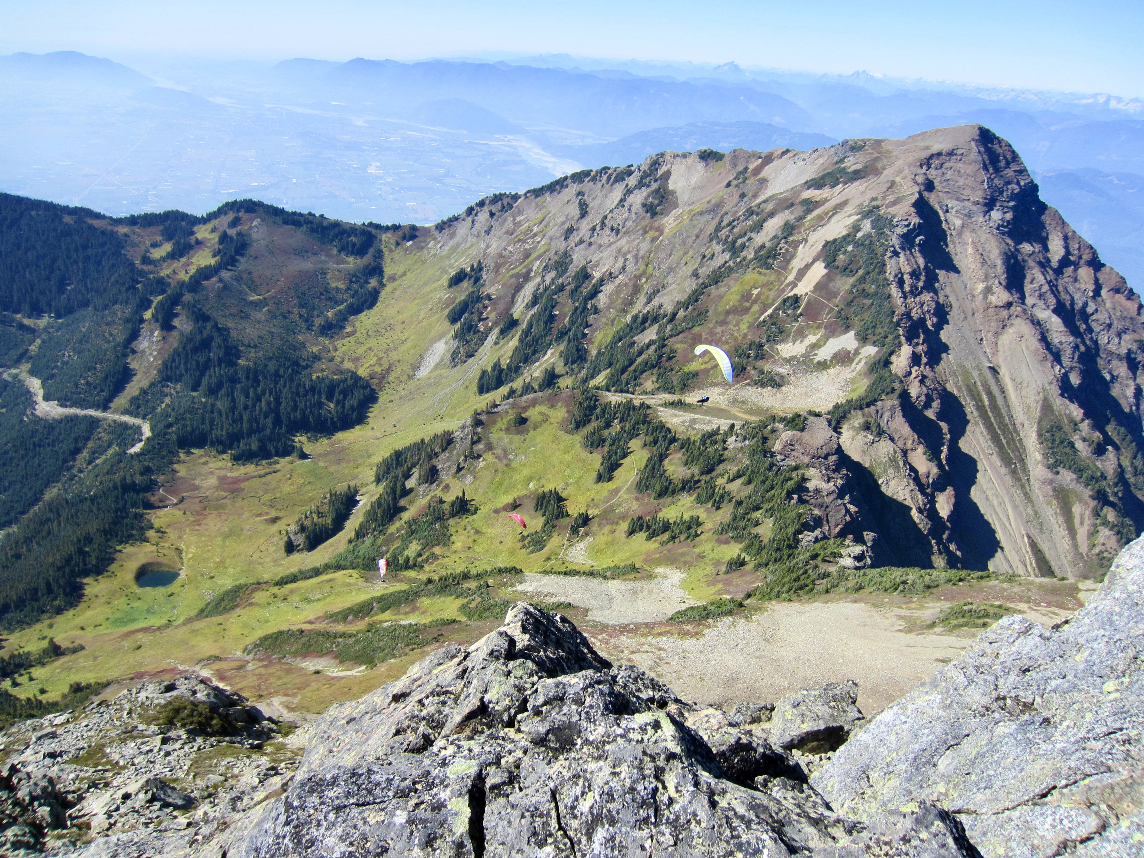
During our approach hike, we encountered three people heading up nearby Cheam Peak laden with paraglider packs. Now, we watched them circling around the basin below us and then rising over our summit.
.
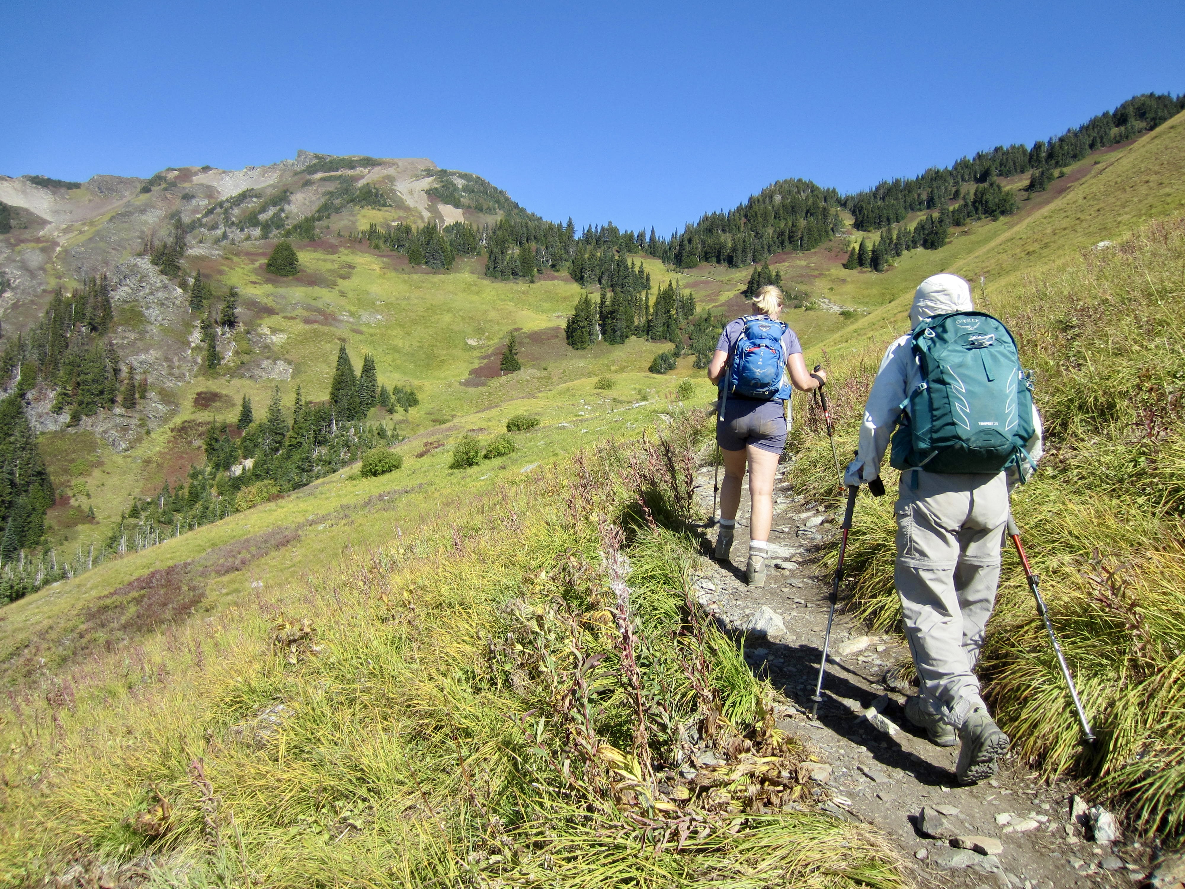
To descend, we retraced our up-route back along the north ridge and then down the west slope. At an elevation of 5900 feet, we deviated off to the right and followed a well-defined cutoff trail over to the Lady–Cheam Saddle. This cutoff trail would be very convenient if planning to ascend both Lady Peak and Cheam Peak on the same day.
.

.
From the Lady–Cheam Saddle, we simply hiked down the Mt. Cheam Trail and arrived back at the trailhead in early evening (3.1 hours from summit), with enough time to get down the horrible road before dark.
.
Daytrip 2: Cheam Peak Summit Hike
On a sunny Friday morning, less than 24 hours after our previous daytrip, Eileen, Fay, and I again headed out on the abandoned logging road. Today’s goal was Cheam Peak, which has a trail leading all the way to the summit. Being so visible from the town of Chilliwack and elsewhere throughout the Fraser River Valley, this summit has become a rite of passage for many local residents.
.
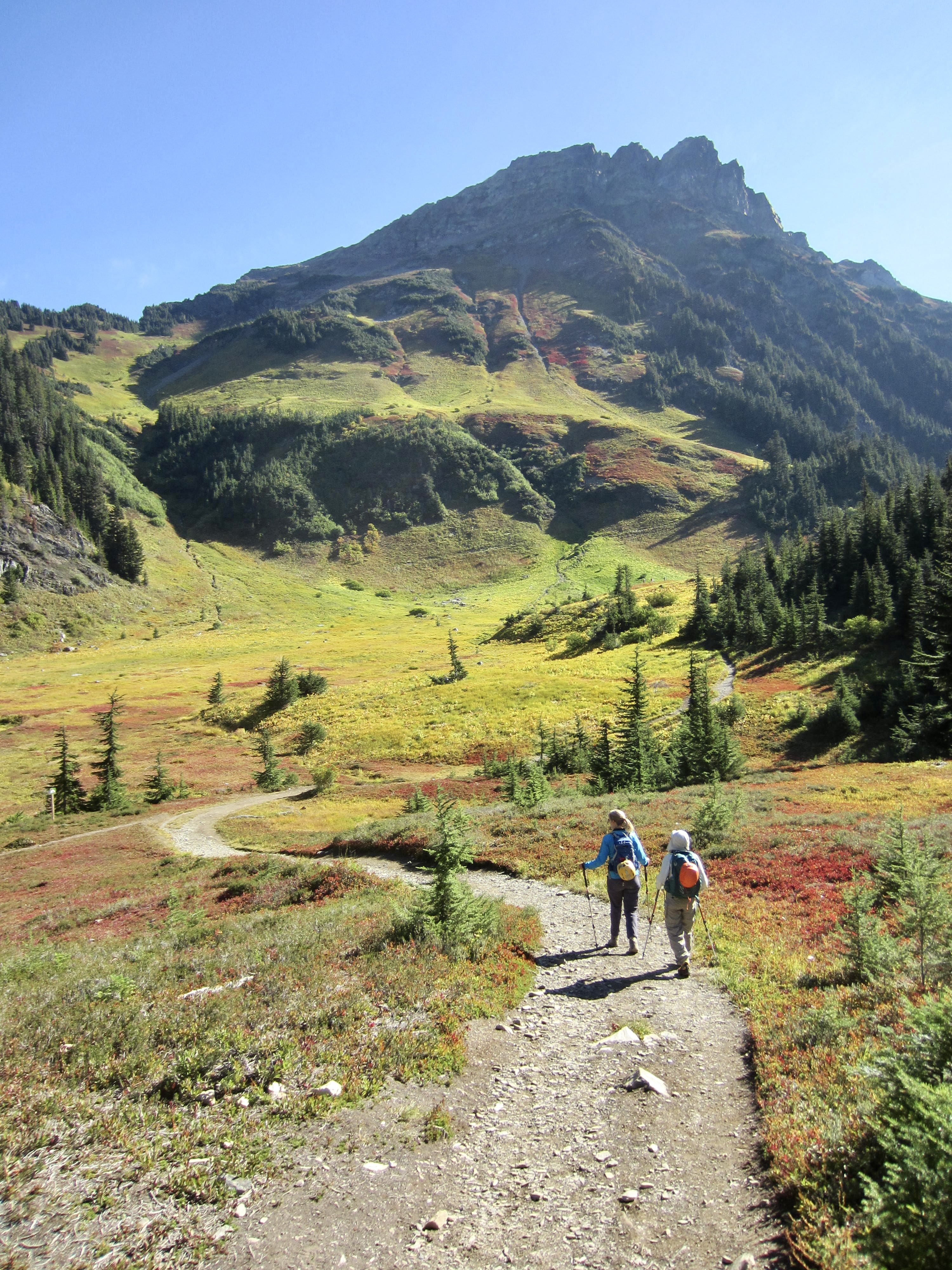
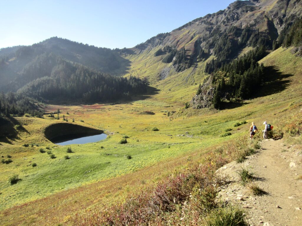
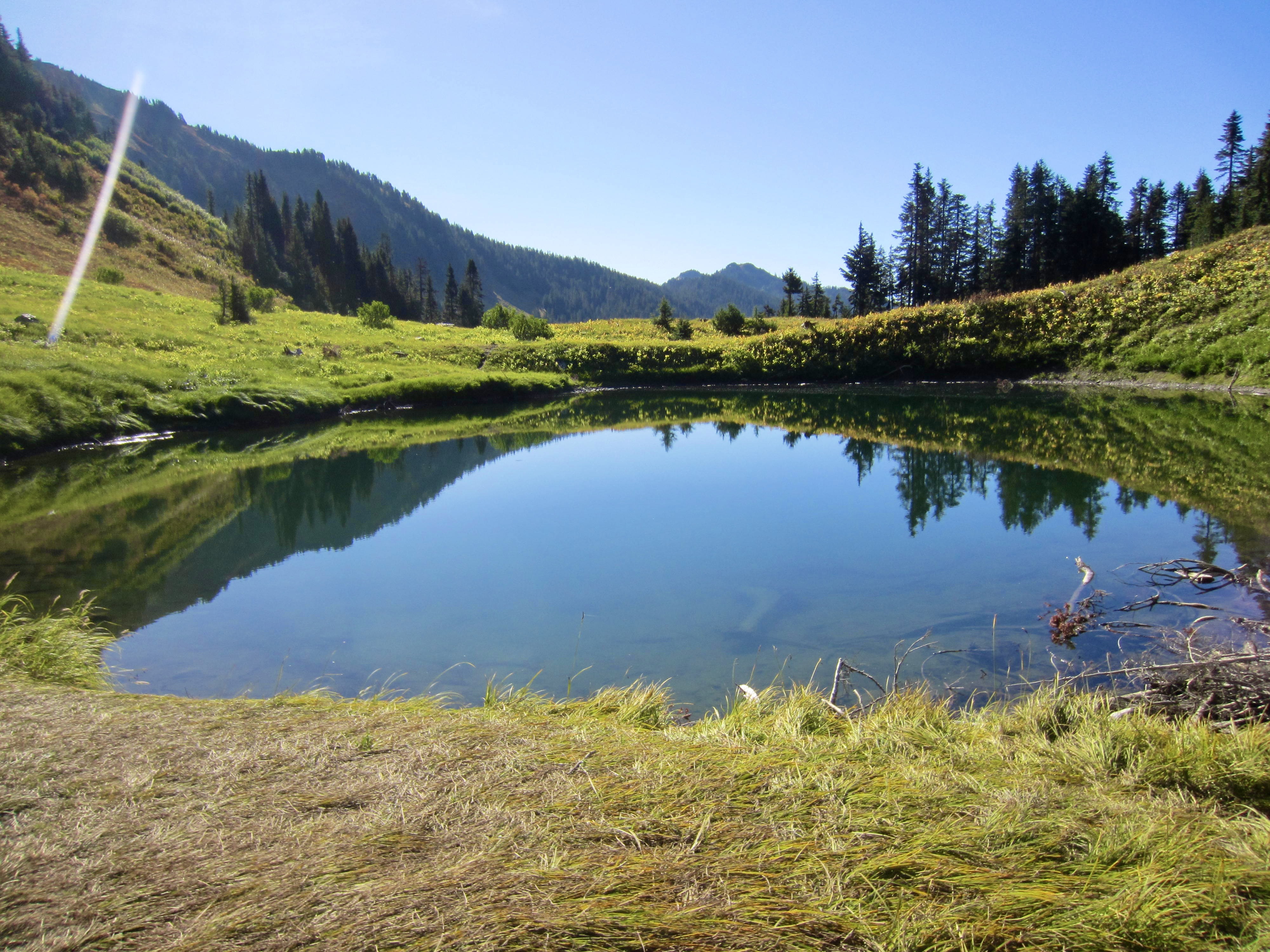
The abandoned road leads to cute little Spoon Lake, which is really no more than a pond. The unnatural shape of this lake bowl indicates that it was excavated by humans. Most likely, it served as a gravel pit for use in logging road construction many decades ago.
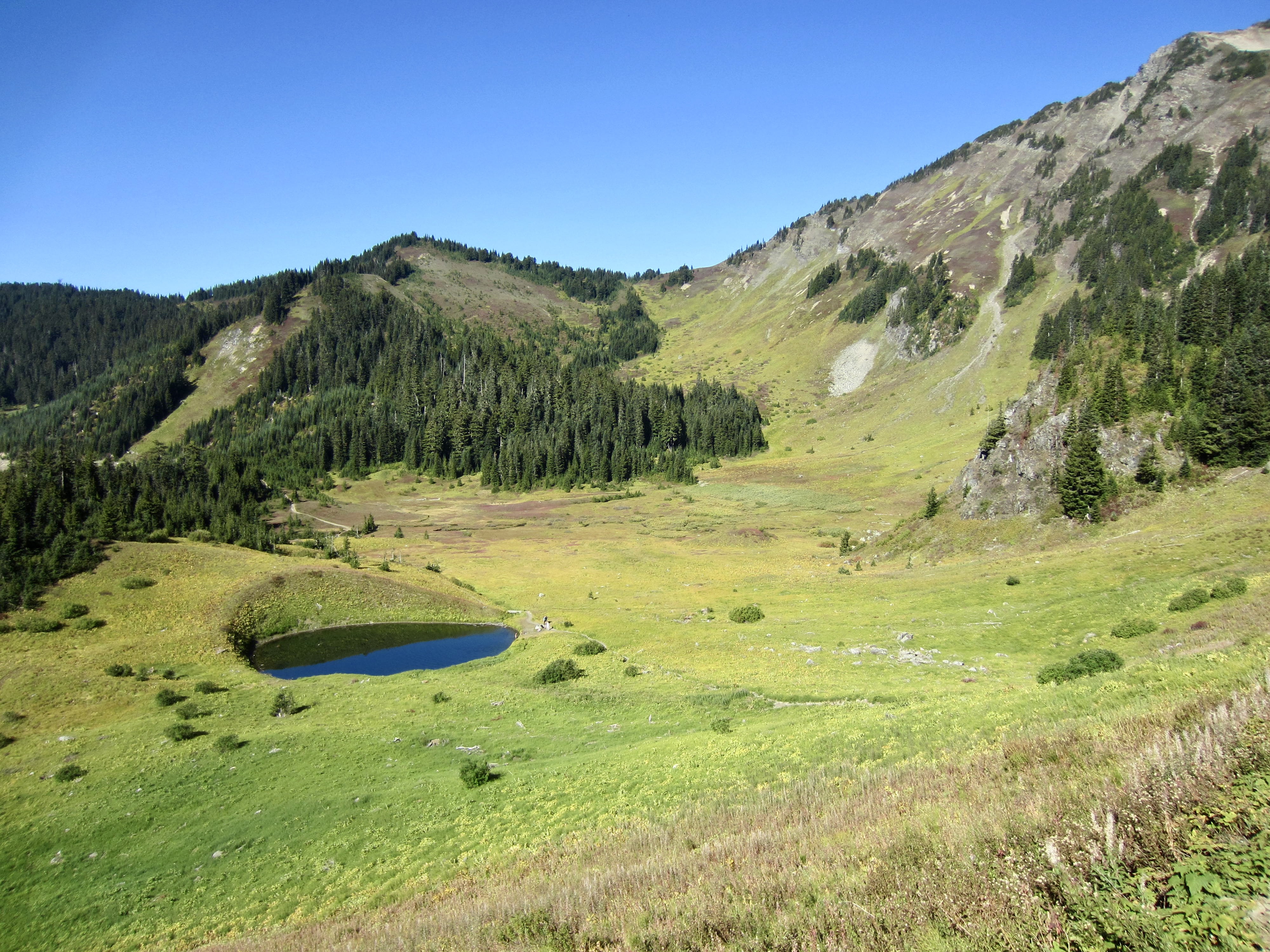
.
Beyond Spoon Lake, a single-track trail climbs through a wooded headwall, with mountain views opening up to the south. Visible peaks included Mt. Larrabee, American Border Peak, Canadian Border Peak, Tomyhoi Peak, and Mt. Baker.

.
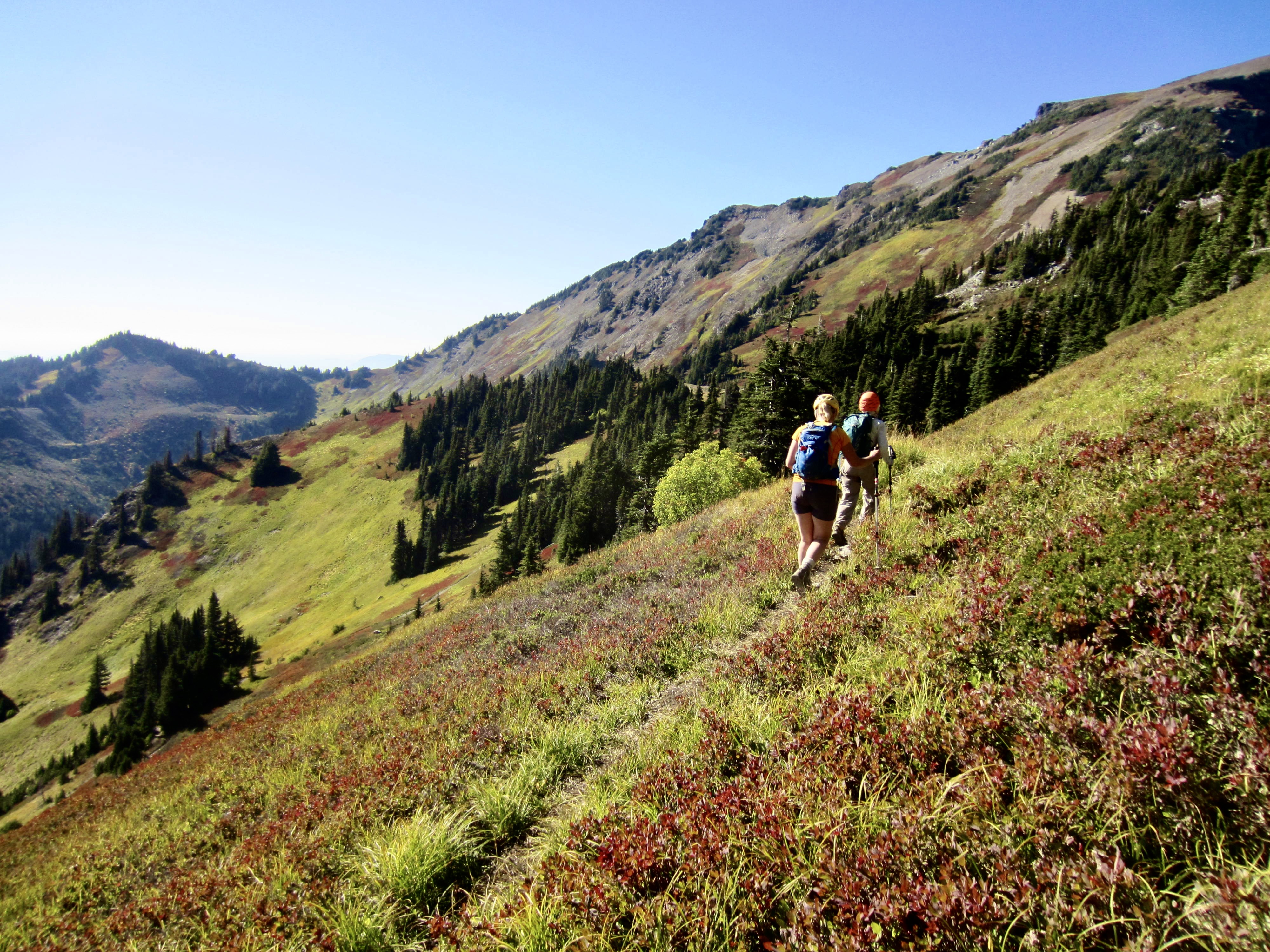
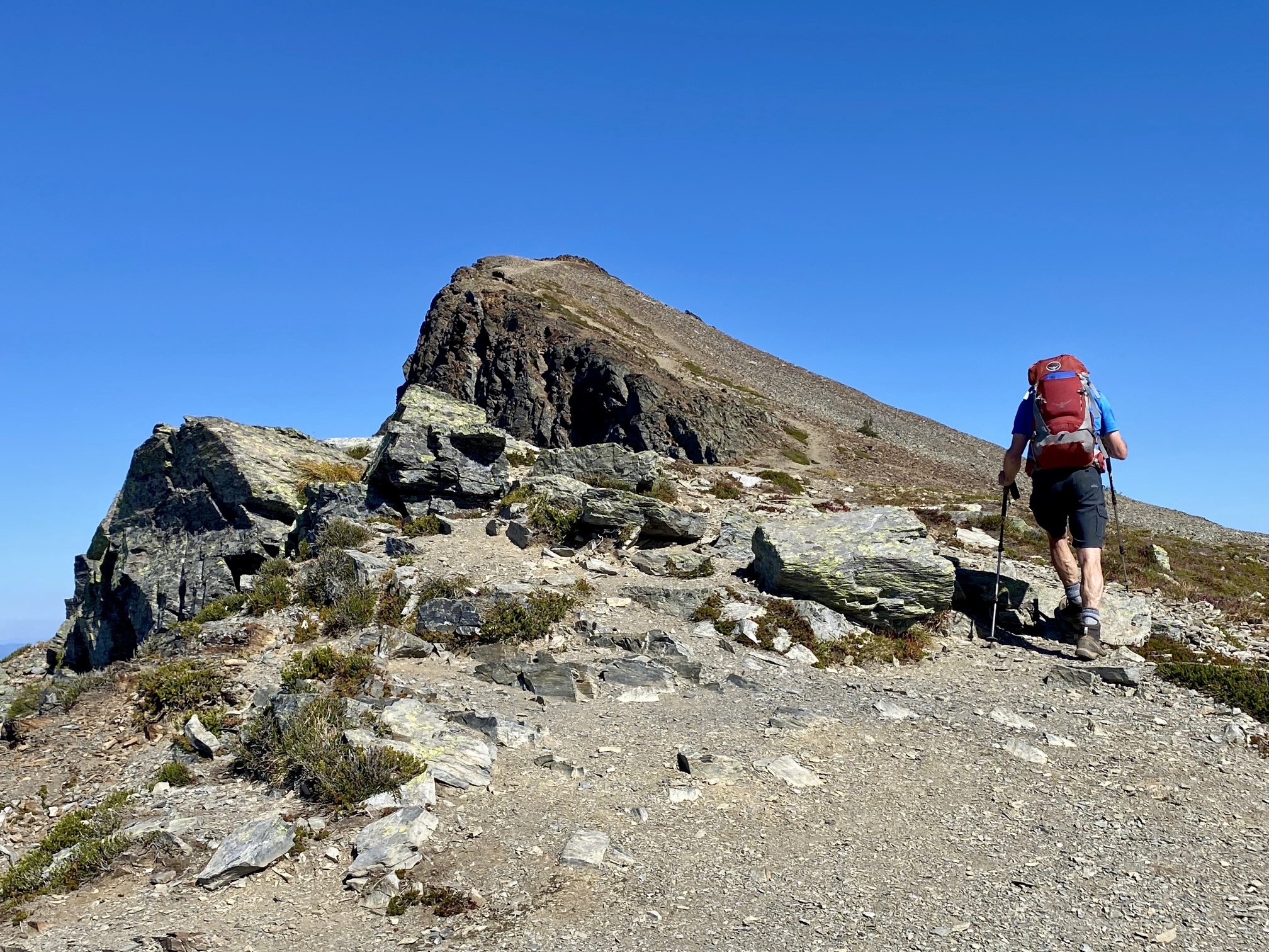
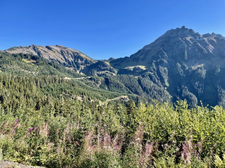
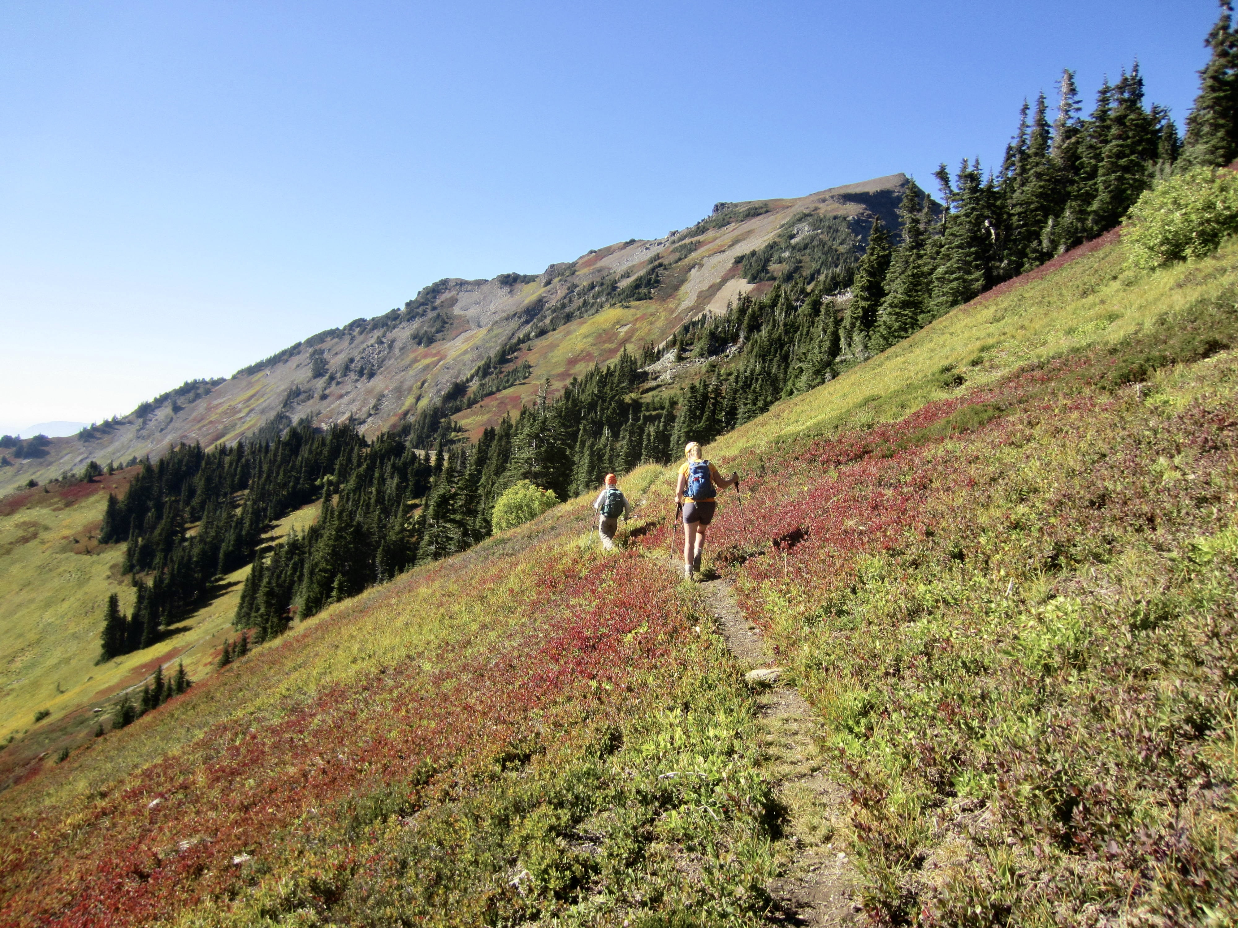
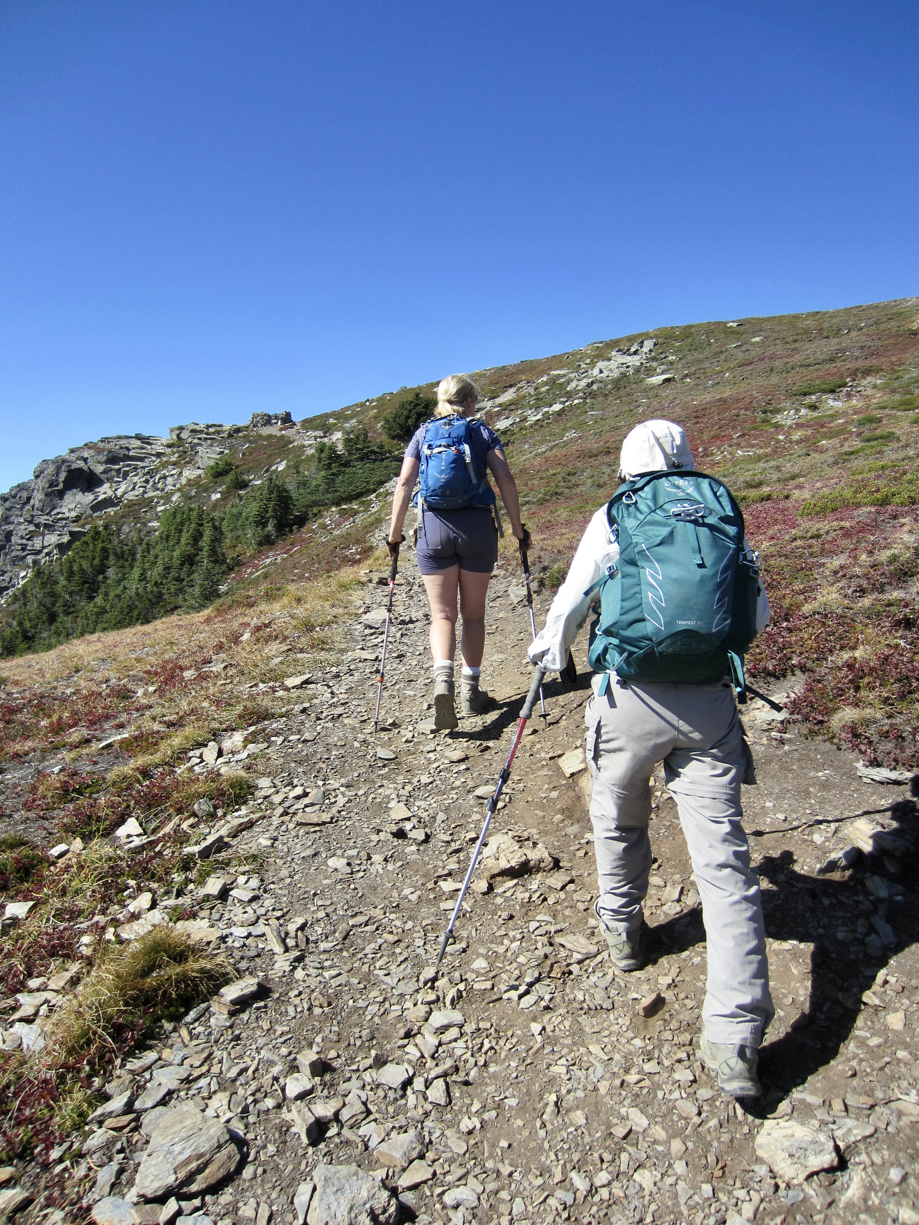
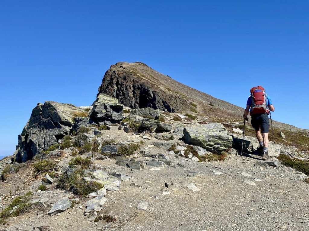
After traversing across a grassy hillside below Lady Peak and passing through Lady–Cheam Basin, the trail begins switch-backing up the broad southeastern slope of Cheam Peak. This trail segment is fairly steep and rocky, with good viewpoints along the way.

.
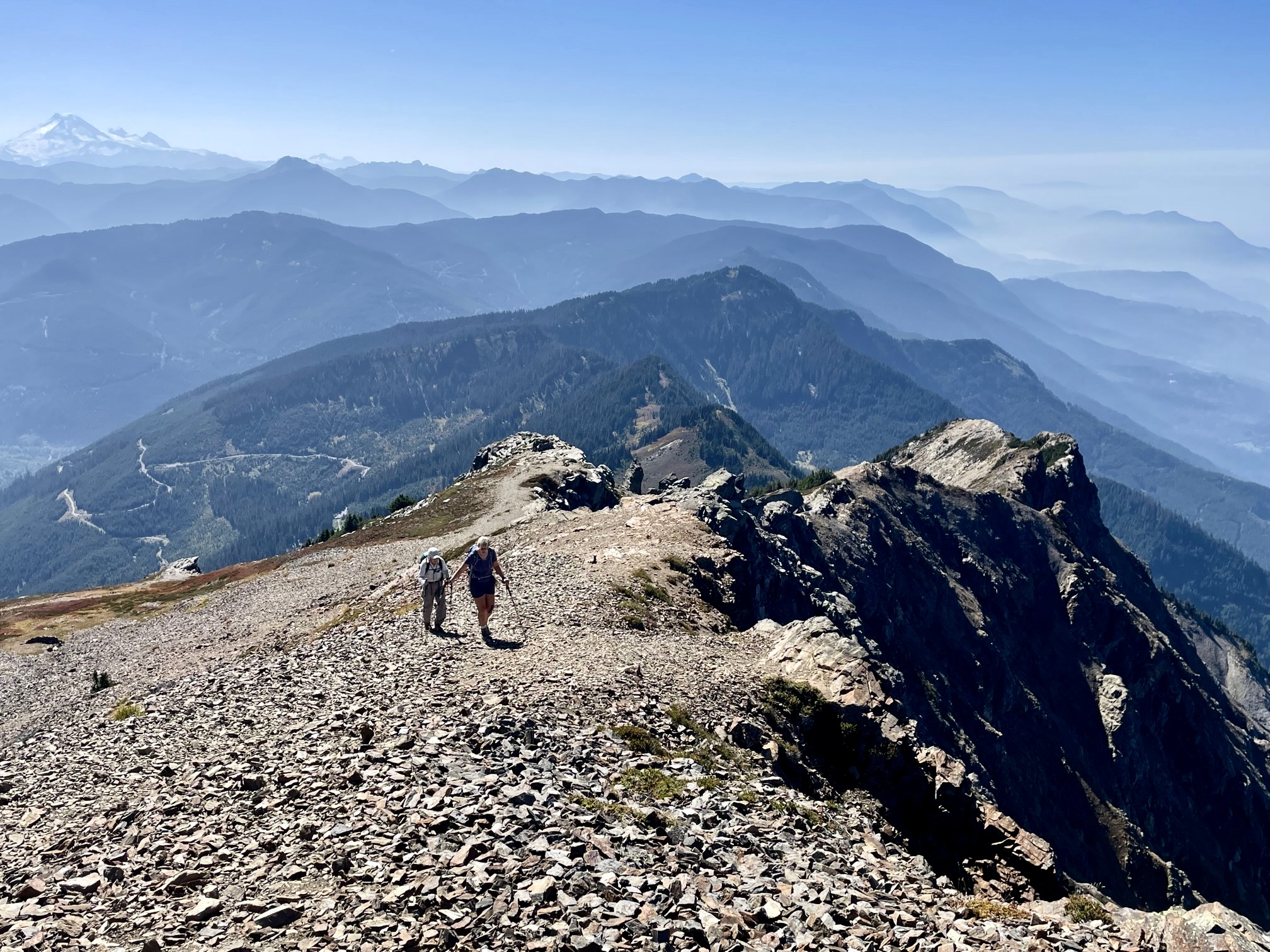
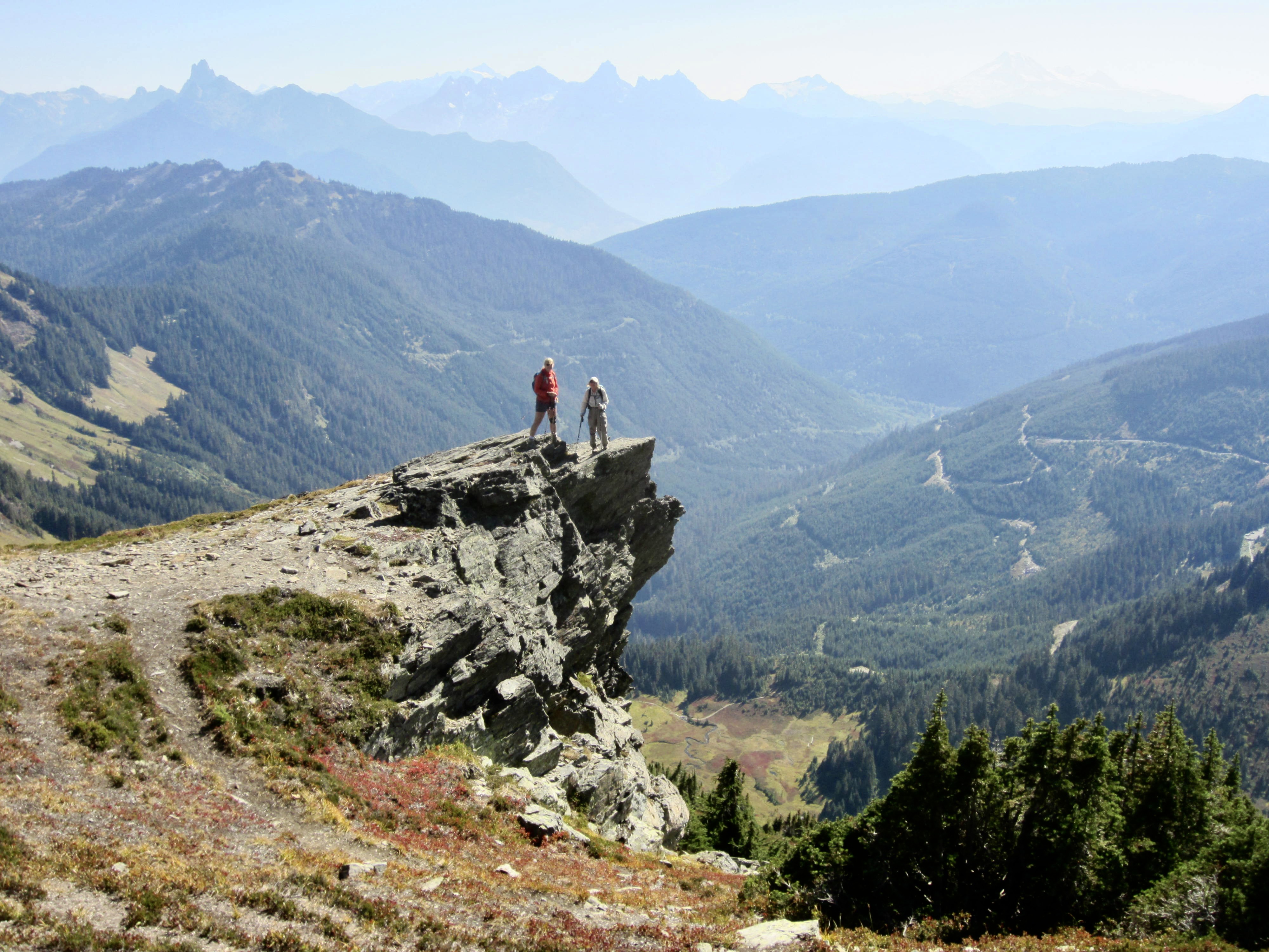
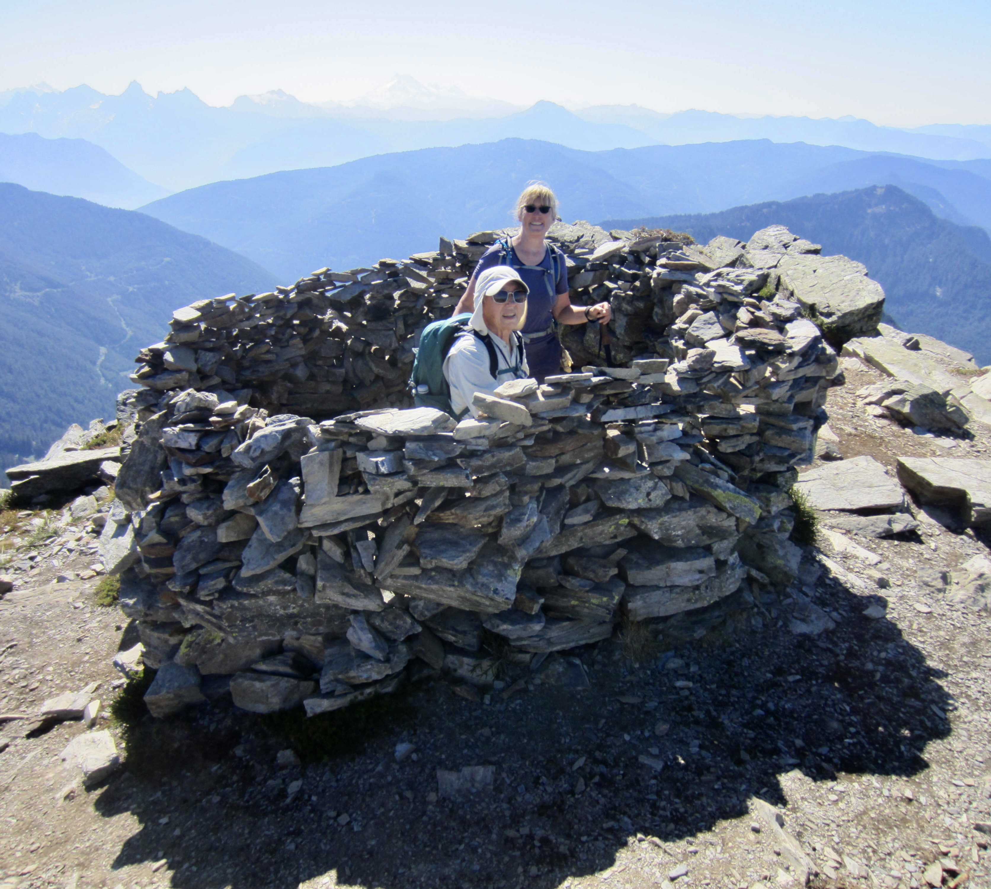
Eventually, the trail makes a long westerly traverse to gain the peak’s summit ridge at a high shoulder. This ridge shoulder provides a great view of Chilliwack and offers an interesting rock refuge from cold winds.
.
We finished our ascent with a hike up the open crest, which slopes gently down to the southeast but drops steeply down the northwest. This precipitous northwest face towers over the Fraser River Valley and makes such a dramatic impression on Highway-1 motorists.
.
.
We stepped onto the 6929-foot summit in early afternoon (3.0 hours + 2200 feet from TH). Considering that it was a sunny Friday in mid-September, we were actually surprised to be here alone.
.
Normally, the views from this summit would be excellent, but more wildfire had moved in since yesterday and limited our visibility in all directions except the south. Mt. Slesse, American Border Peak, and Mt. Baker dominated the southern horizon. Closely to our east, several other Cheam Range peaks—including Lady, Knight, and Baby Munday—formed a tight row.
.
.
Upon hiking back down the trail, we encountered numerous summit-seekers heading up. They probably represented the tip of the weekend surge, and some were no doubt locals embarking on their personal rite of passage. Fay, Eileen, and I strolled into the parking lot in late afternoon (1.8 hours from summit), feeling very satisfied to finally accomplish our own Cheam Range goals.
Route Map & Profiles
.
.
.
Photo Gallery
Click to enlarge…