Trip Date: September 6-8, 2018
Mt. Hardy Climbing Trip
Cutthroat Pass
Granite Pass
Snowy Lakes
Methow Pass
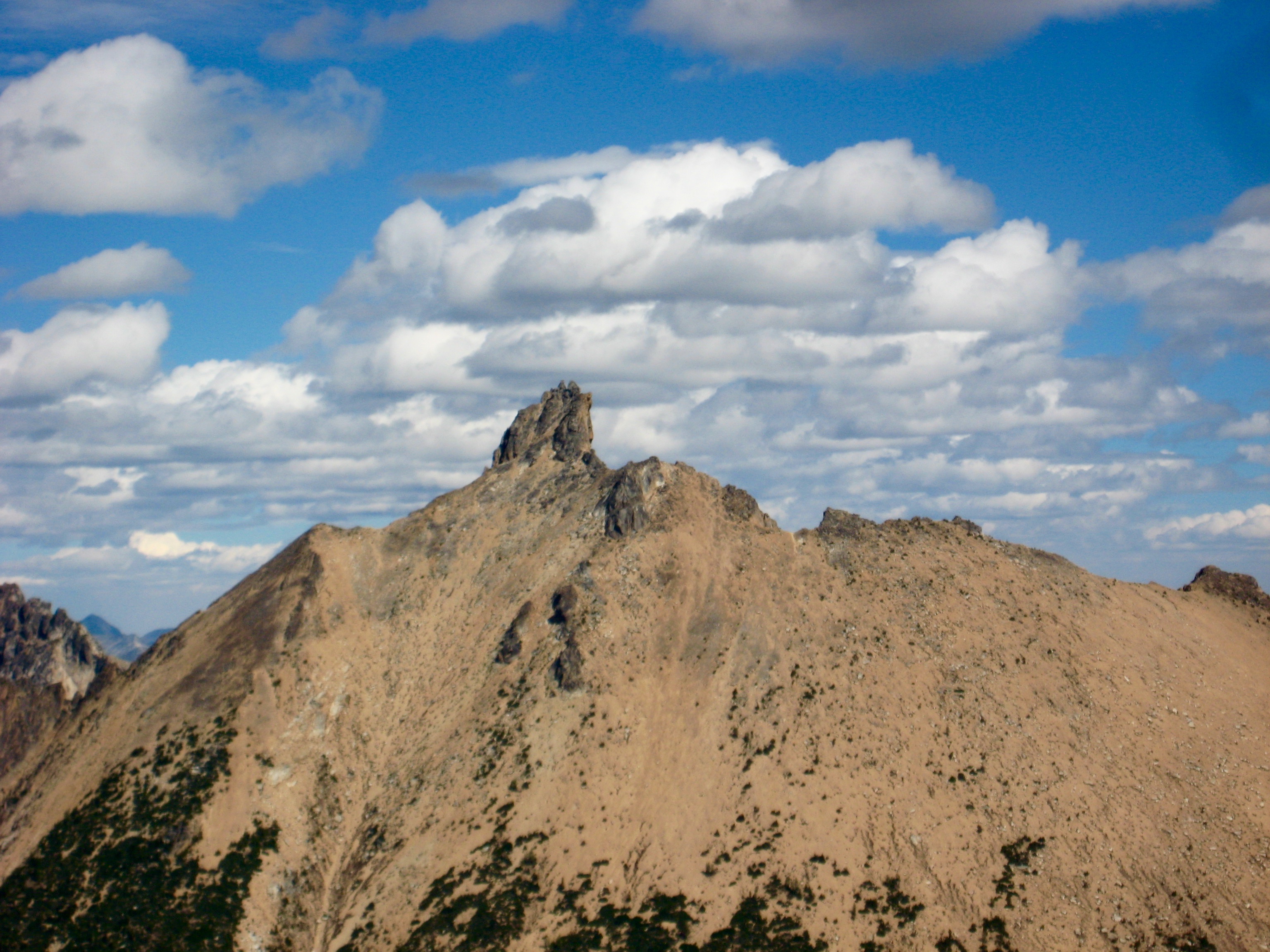
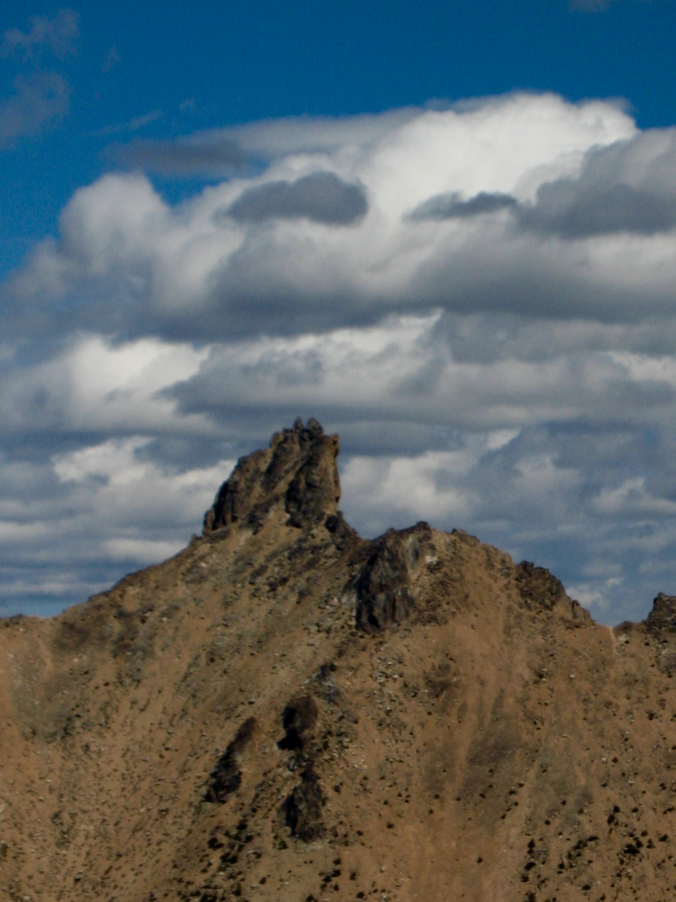
Mount Hardy (8080’+)
Trip Report Summary
Region: Northeastern Washington Cascades
Sub-Region: Upper Methow Mountains
Area: North Cascades Scenic Highway Corridor
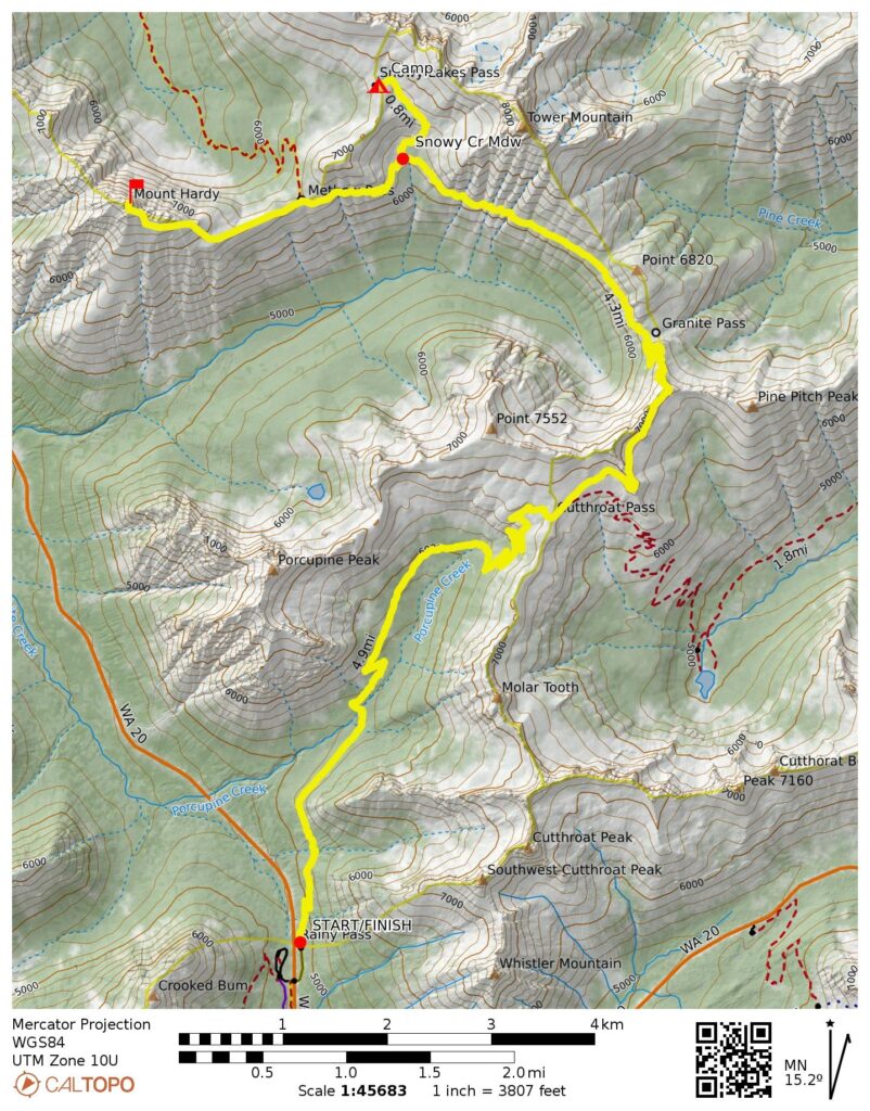
Starting & Ending Point: PCT-Northbound Trailhead at Rainy Pass on Highway 20 (Elev. 4900 feet)
Way Points: Porcupine Creek & Cutthroat Pass & Granite Pass & Snowy Creek Meadow & Lower Snowy Lake & Upper Snowy Lake (trail hike)
Campsite: Upper Snowy Lake (Elev. 6900 feet)
Sidetrip Loop: Snowy Creek Meadow & Methow Pass & Snowy Lakes Ridge (trail hike & off-trail hike)
Summit: Mt. Hardy (rock scramble via Southeast Slope—South Face)
Approximate Stats: 25 miles traveled; 6100 feet gained & lost.
Related Posts
Mount Hardy via Southwest Ridge – June 2011
Mount Hardy attempt via South Face – September 2010
Full Trip Report
Eileen, Lisa, Kevin, and I made a leisurely climb of Mt. Hardy in the Upper Methow Mountains last weekend. We were fortunate that our summit day landed on a blue-sky period between a day of smoke and a day of heavy clouds.
Day 1: Trailhead to Upper Snowy Lake
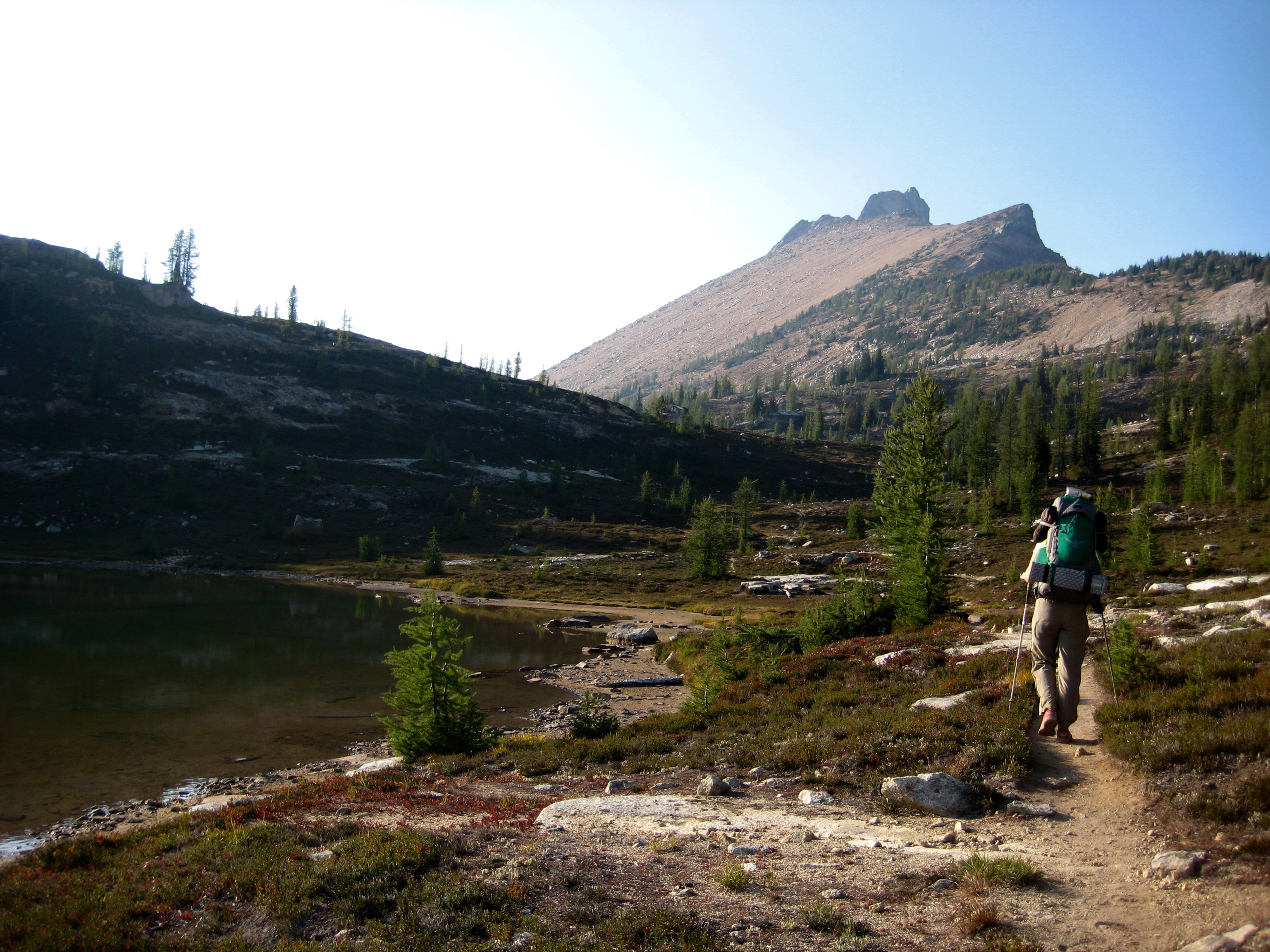
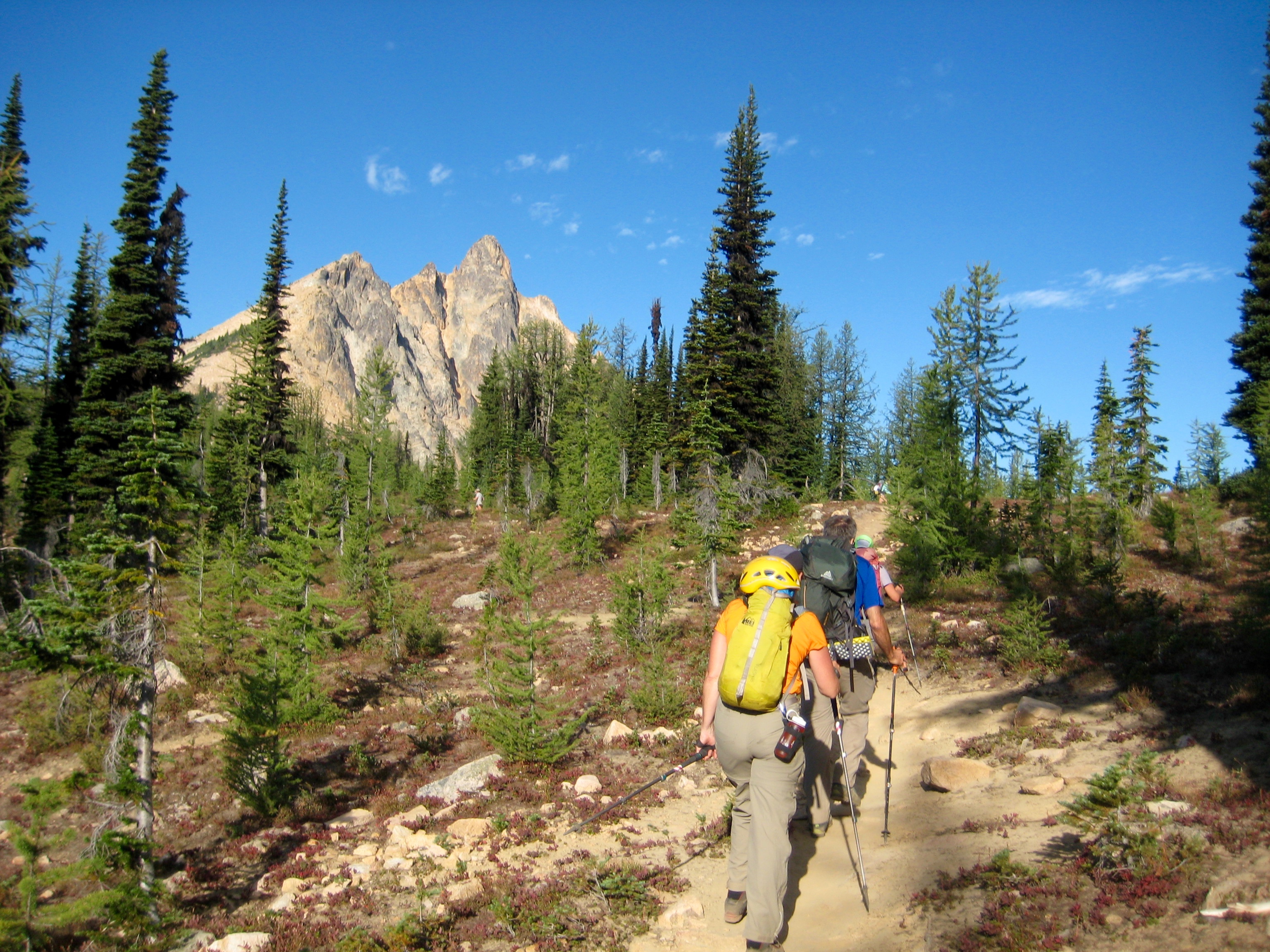
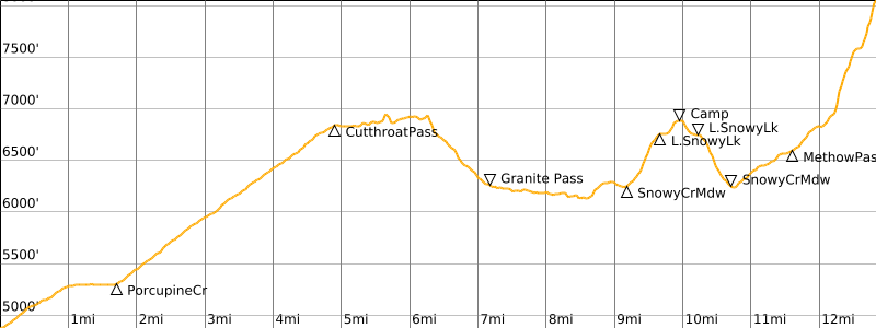
We left the PCT-Northbound TH at Rainy Pass in late morning and hiked up to Cutthroat Pass (2.4 hours + 1900 feet from TH), then down to Granite Pass and over to Snowy Creek Meadow. PCT thru-hikers, all making their final push to the Canadian border, were abundant along the entire trail. Some were very chatty and friendly, whereas others were reticent and strictly business.
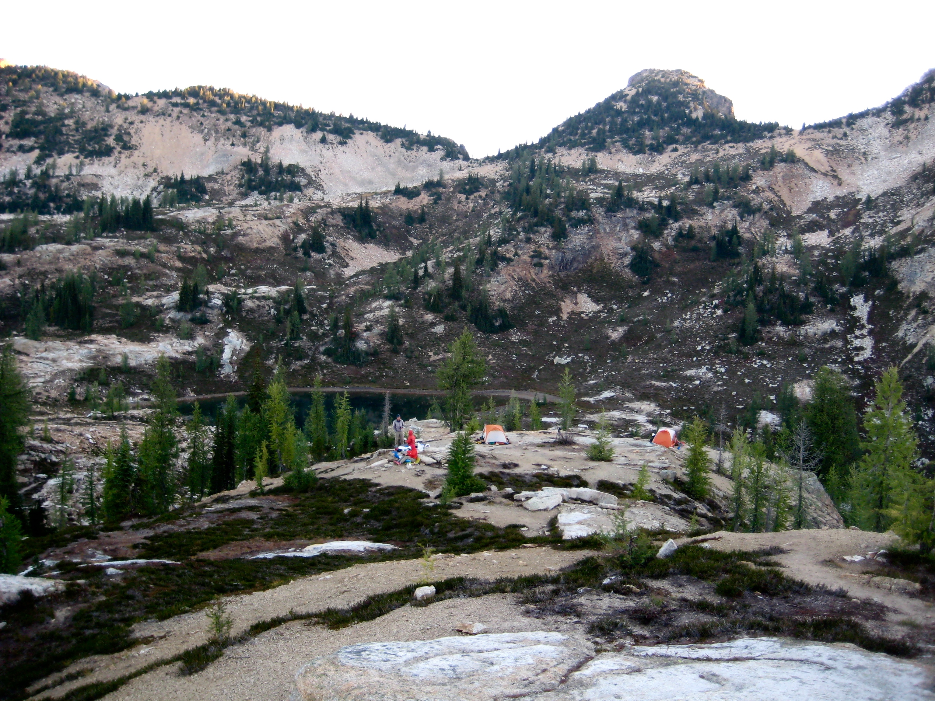
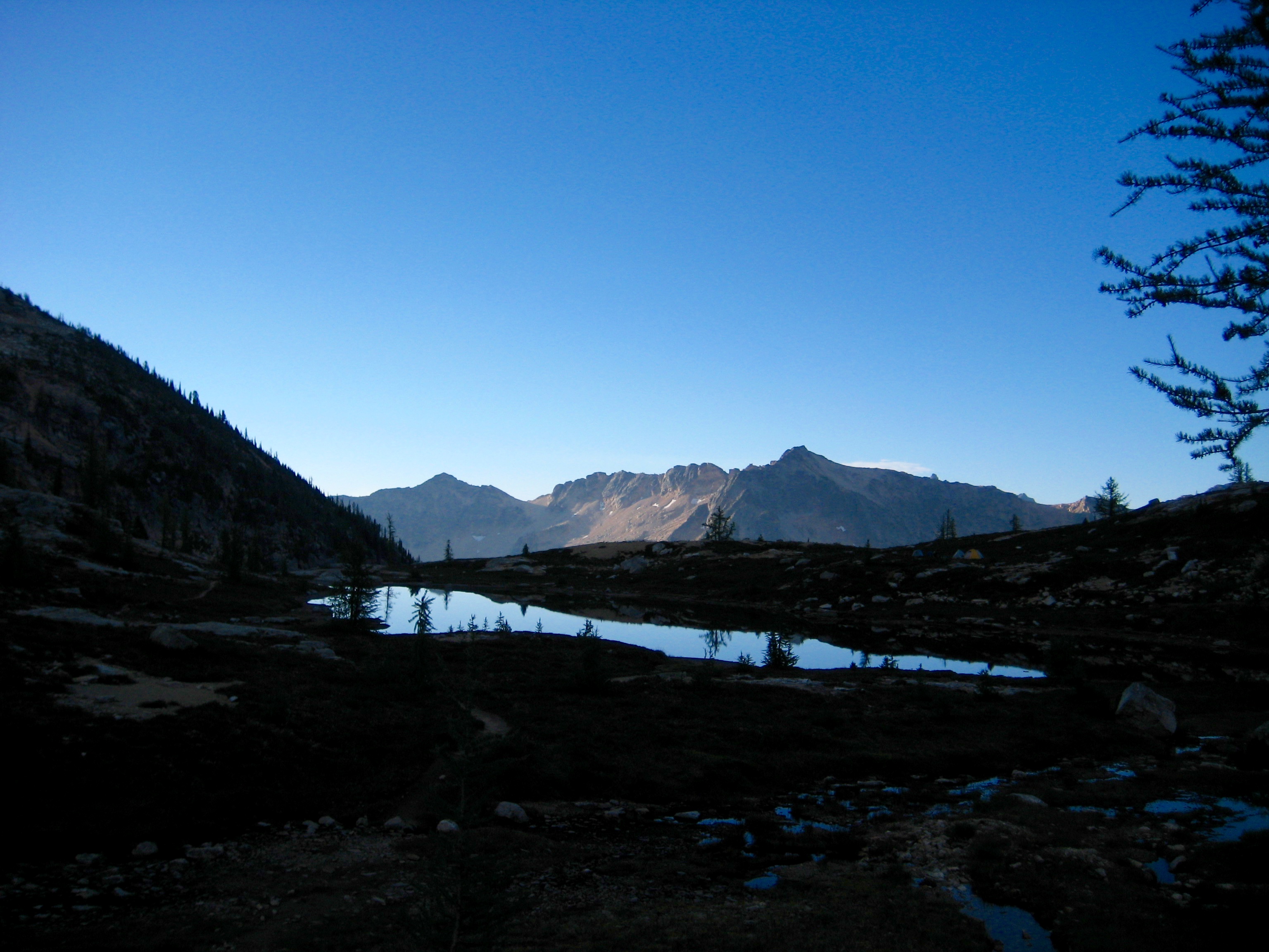
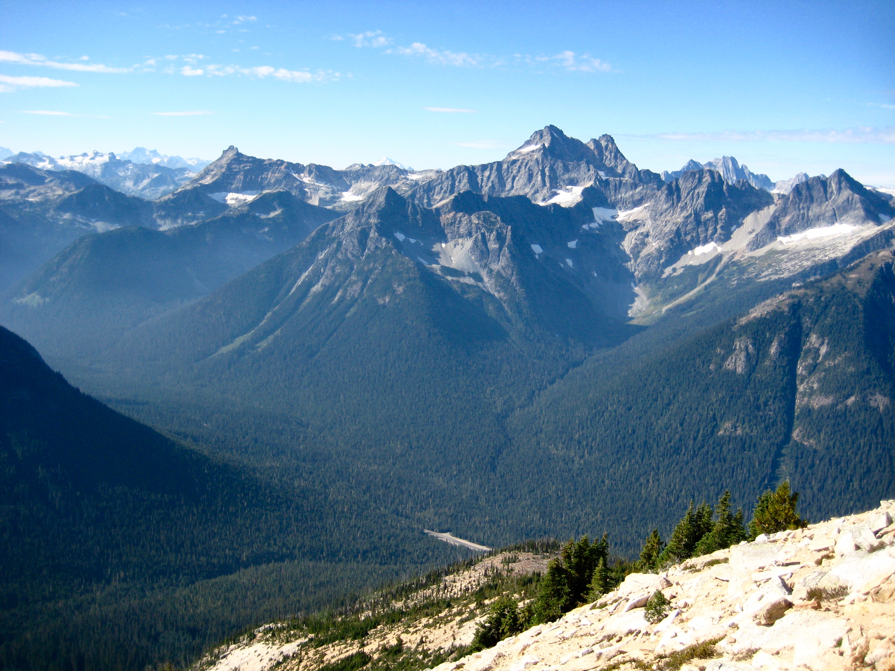
From the meadow, we took a side-trail up to Snowy Lakes and made camp on a slabby bench (6.4 hours + 2900 feet from TH) overlooking the upper lake, which is nestled between the granitic summits of Tower Mountain and Golden Horn. The western sky was very hazy, due to forest fire smoke.

- Hiking Past Lower Snowy Lake
- Camp At Upper Snowy Lake
Day 2: Mt. Hardy Summit Climb
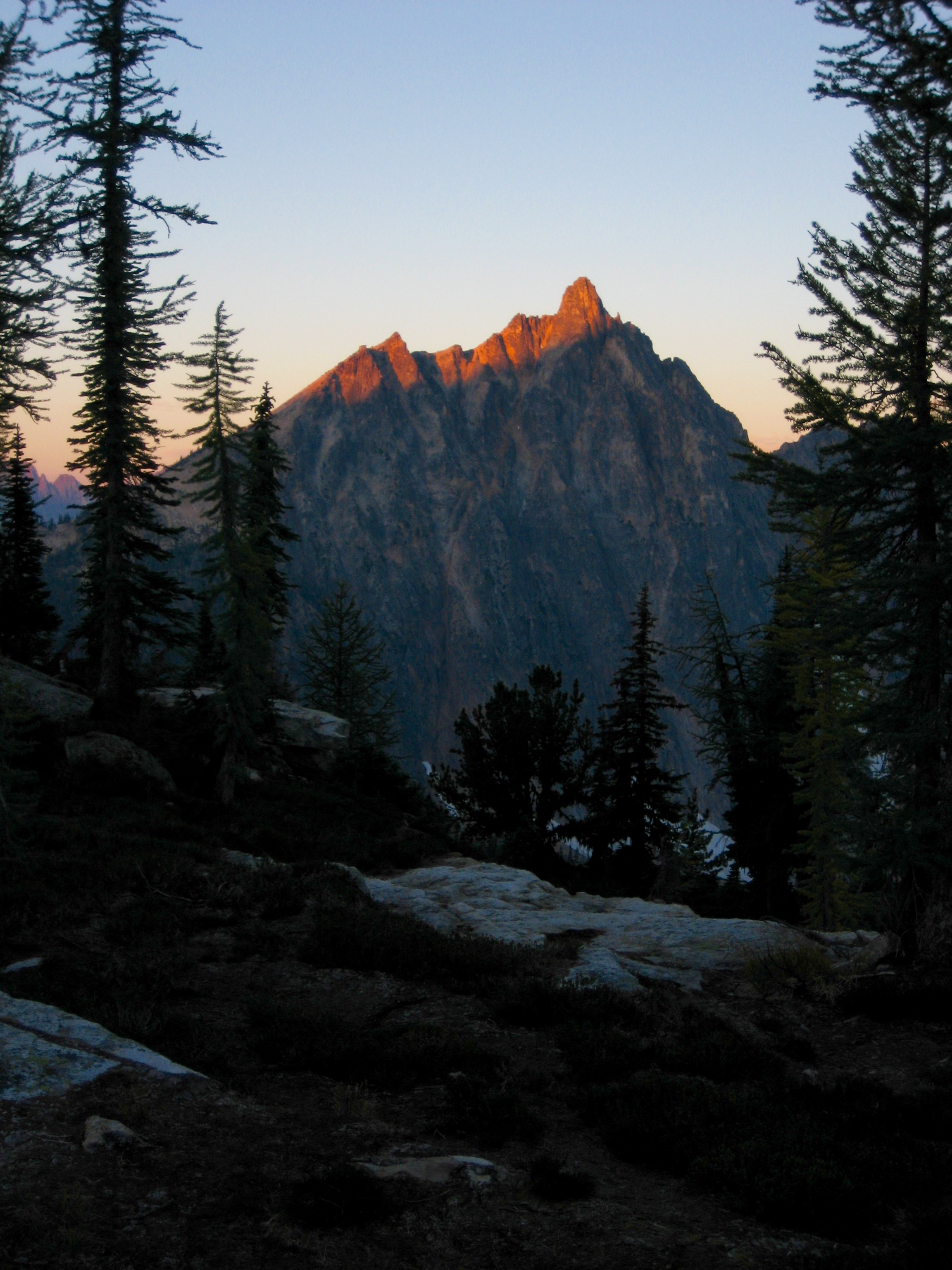
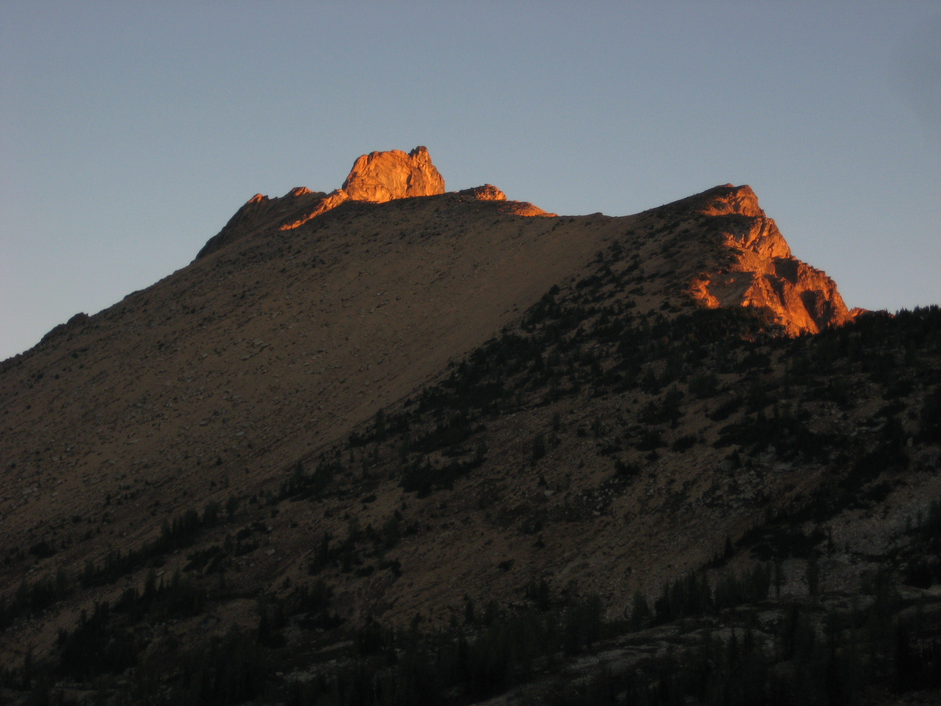
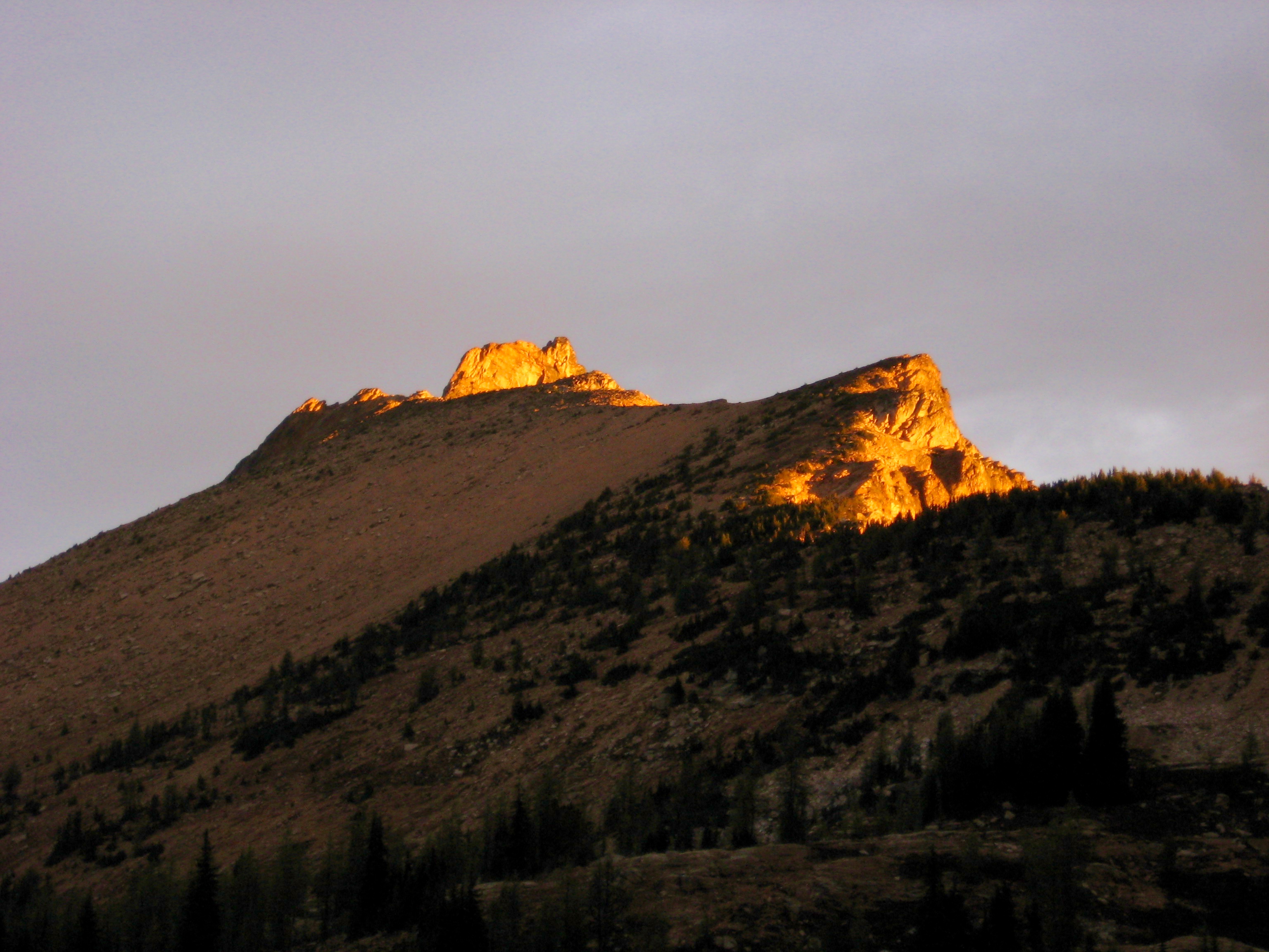
Knowing that rain was due to arrive in the afternoon, we were up at 6:00am and out of camp by 7:30am. The sky was clear, and morning sun lit up the surrounding summits.
- Alpenglow On Mt Hardy & Ragged Ridge
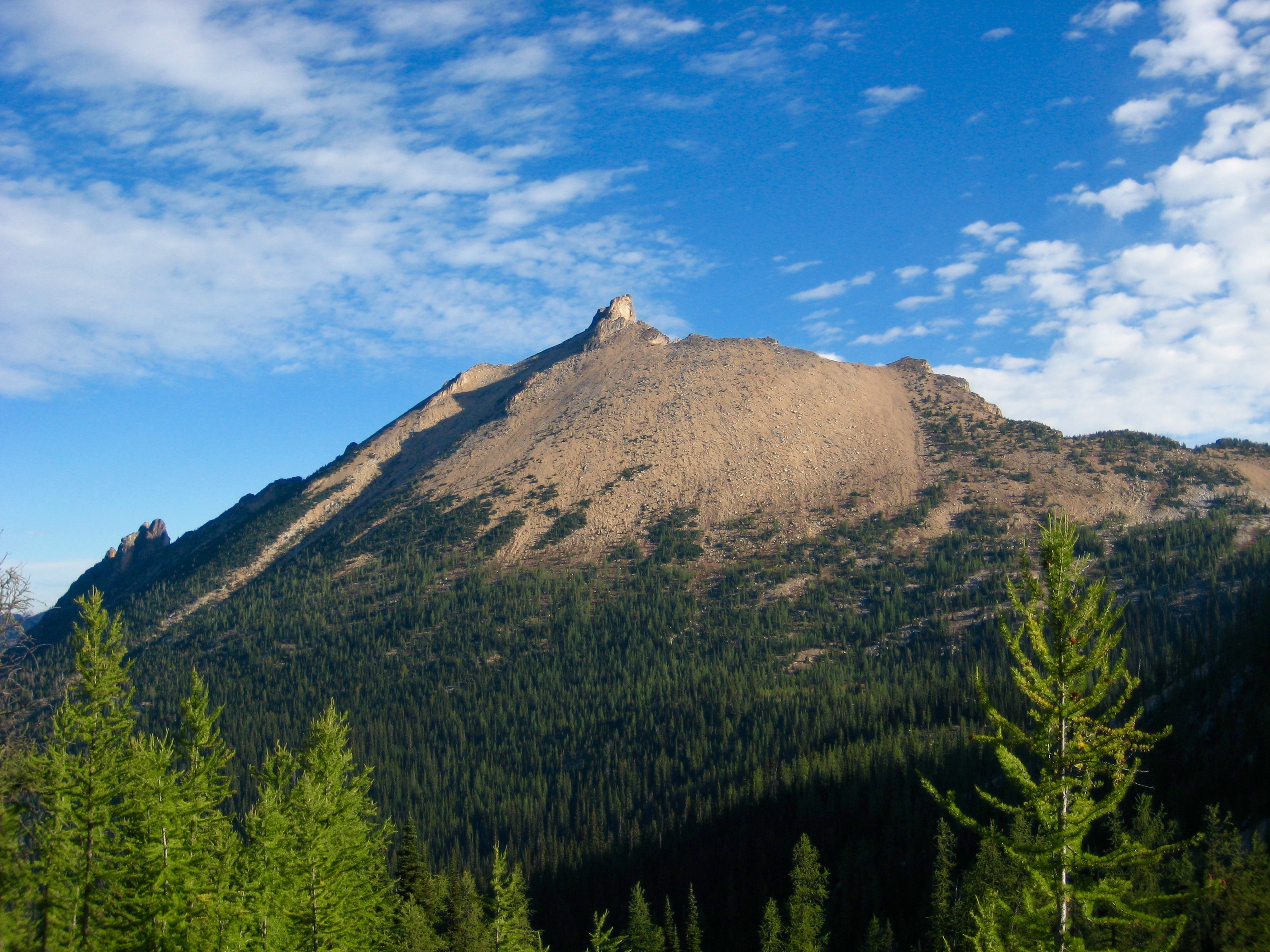
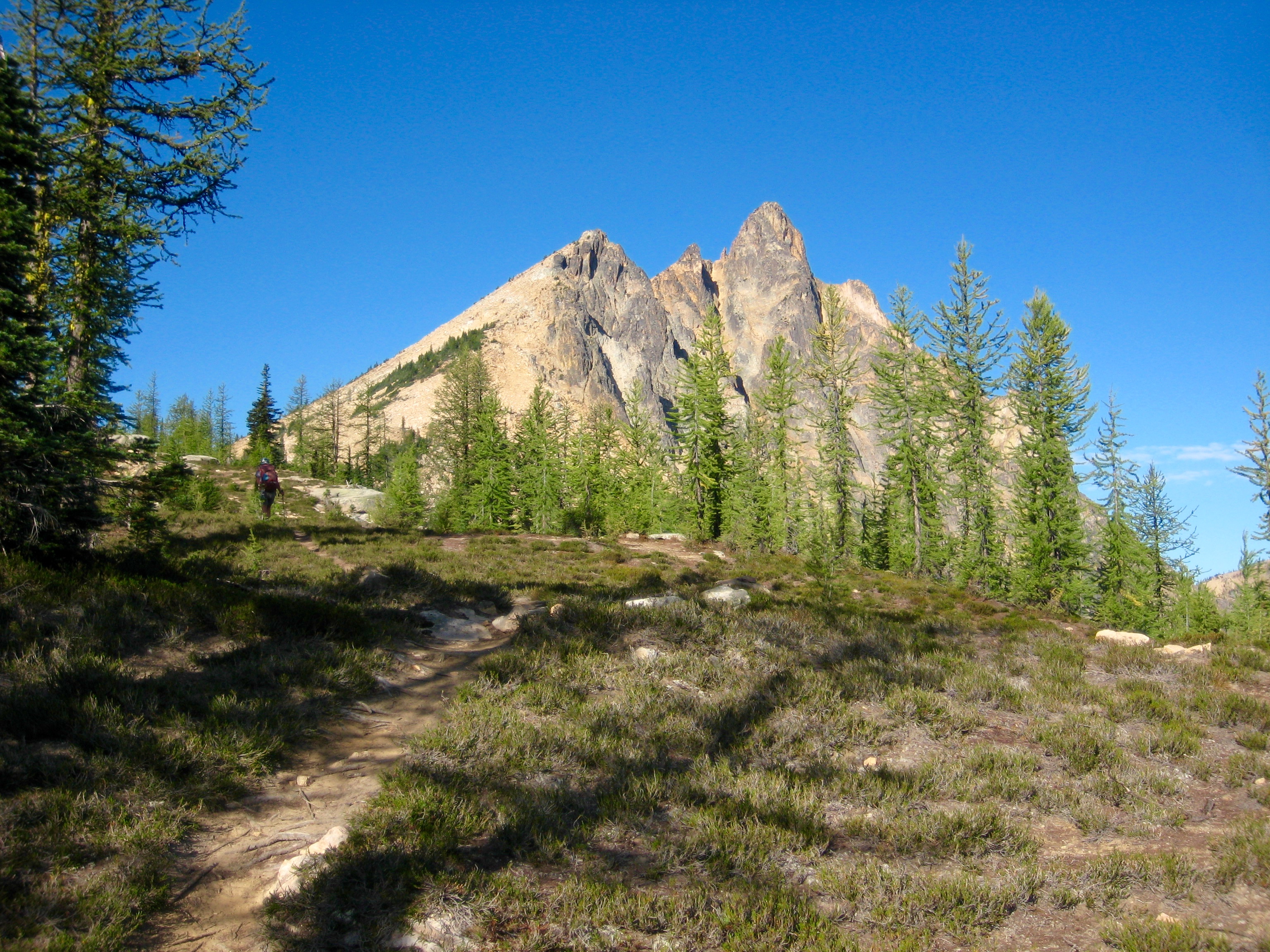
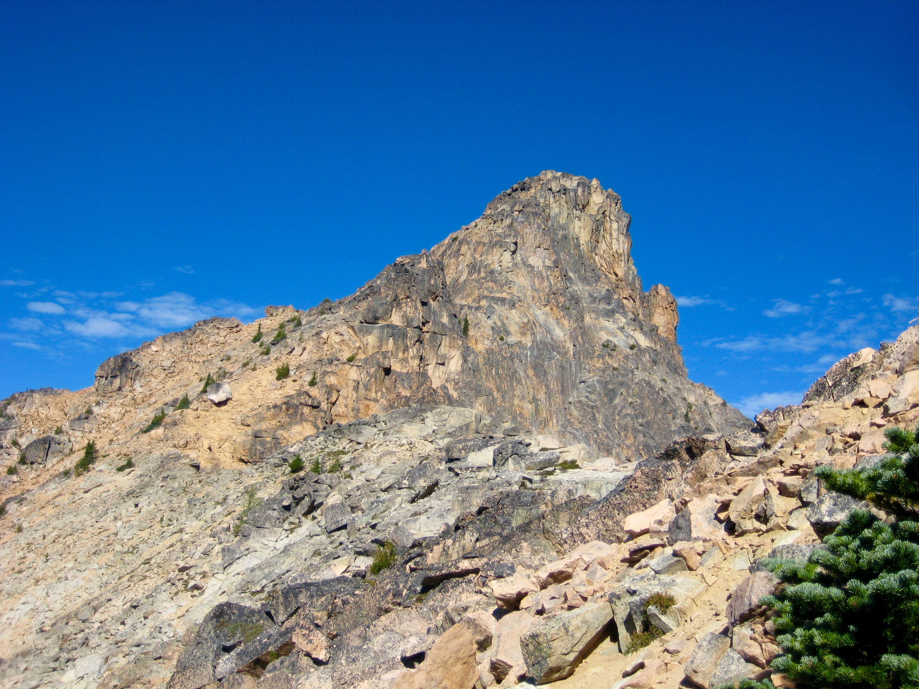
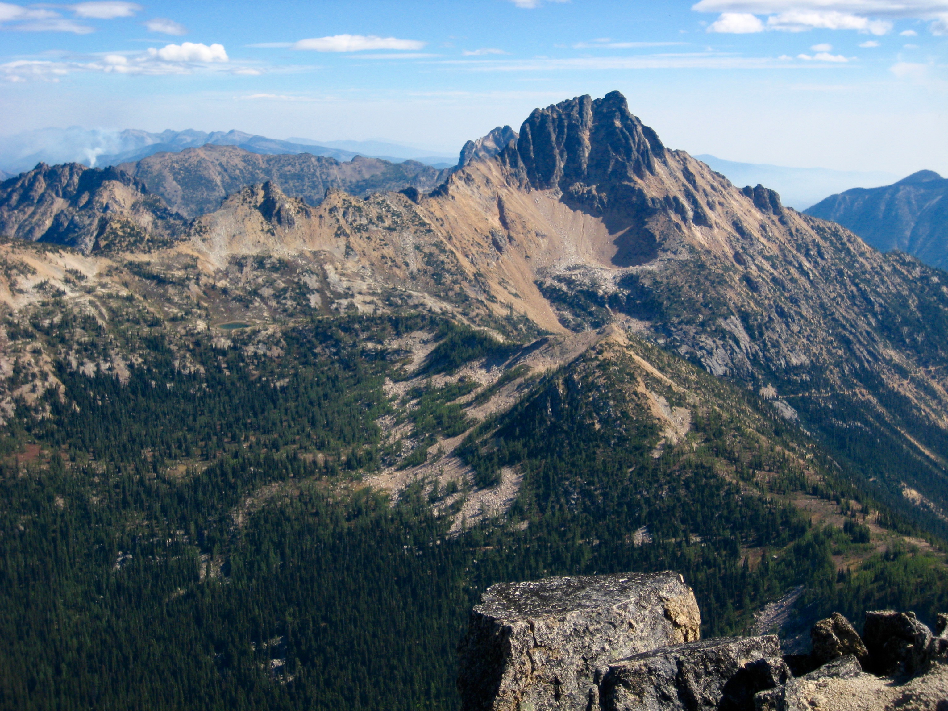
We followed the side-trail back down past the lakes to Snowy Creek Meadow, then hiked the PCT up to Methow Pass (1.2 hours + 350 feet from camp). There, we left the trail and wandered westerly through open terrain to meet the eastern ridge of Mt. Hardy, which stands over the pass like a granitic bullet.
- Hiking Toward Mt Hardy
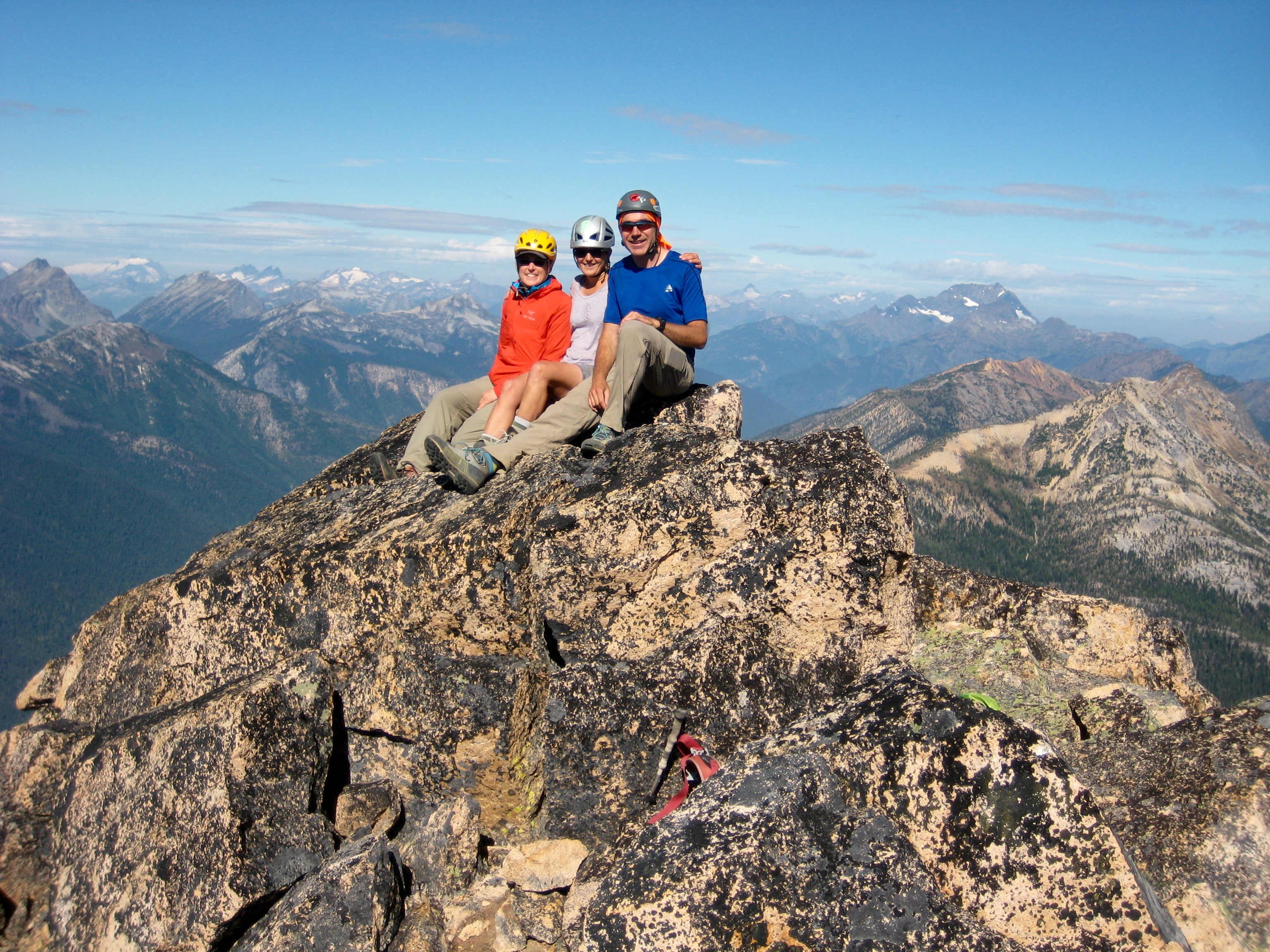
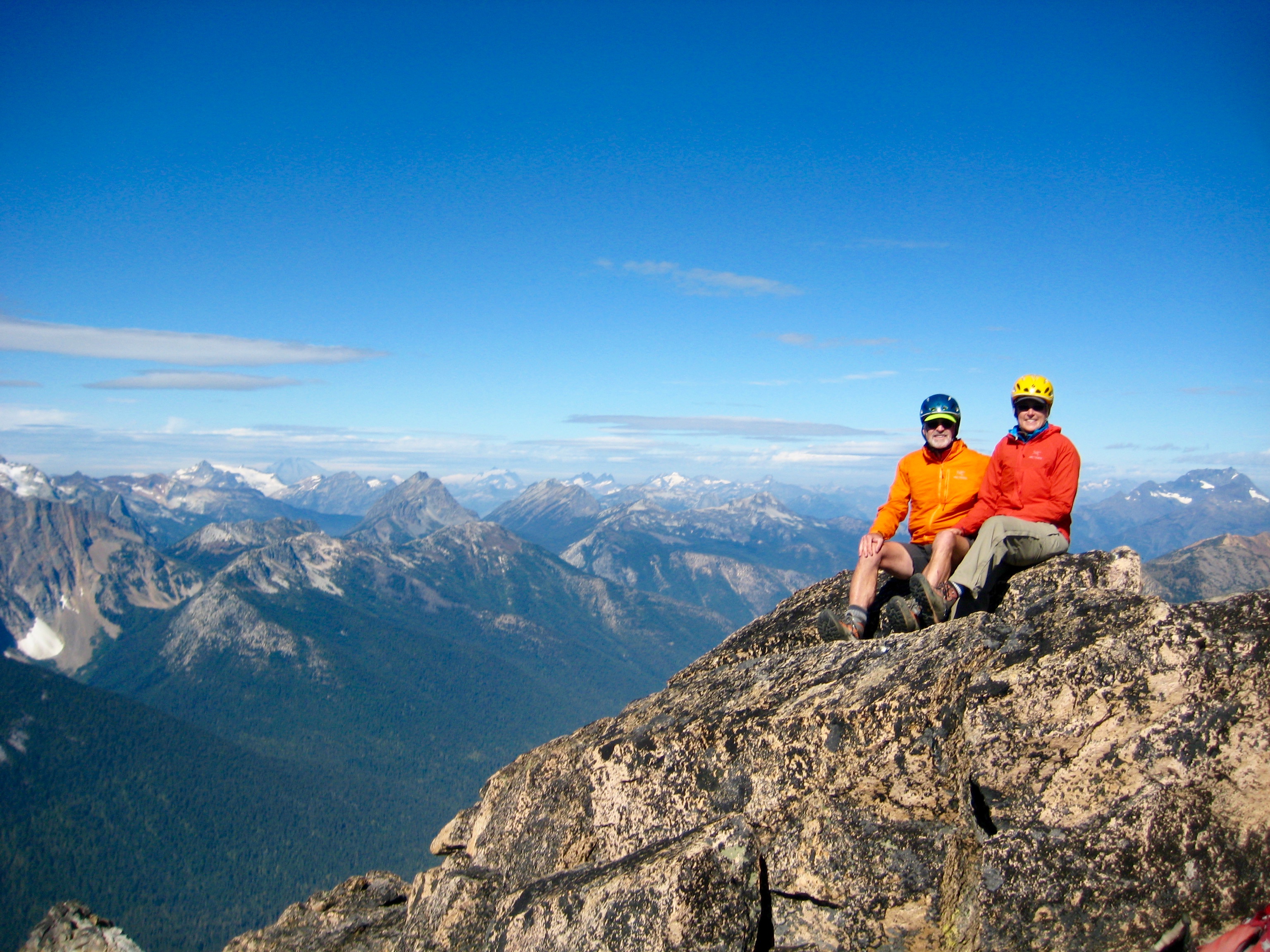
Moderate slopes of sand, scree, and talus led up to a saddle between the summit and eastern knob (false summit). Beyond this saddle, several hundred feet of enjoyable Class 2-3 scrambling ended at the blocky summit (3.2 hours + 1850 feet from camp).
- Mt Hardy Summit From Upper Saddle
- Eileen & Lisa & Kevin On Mt Hardy Summit
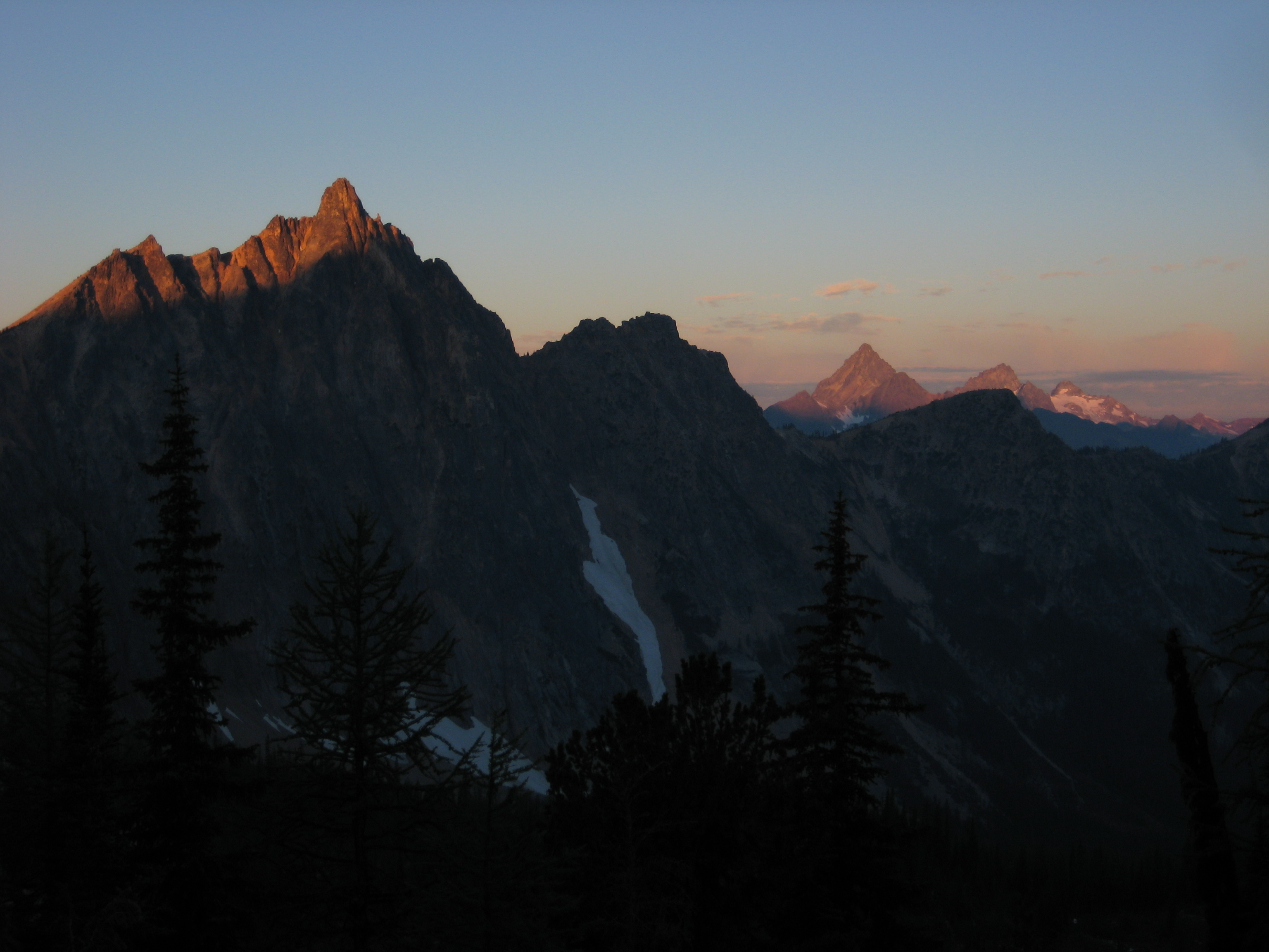
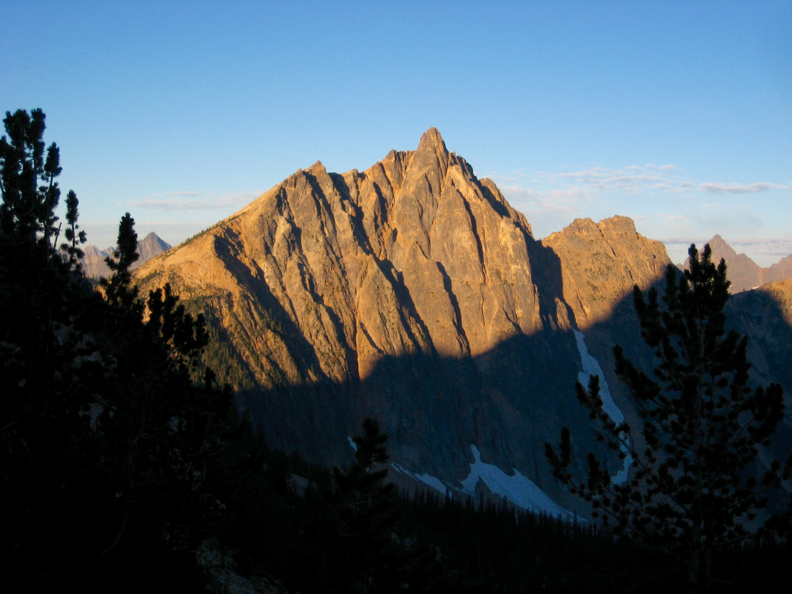
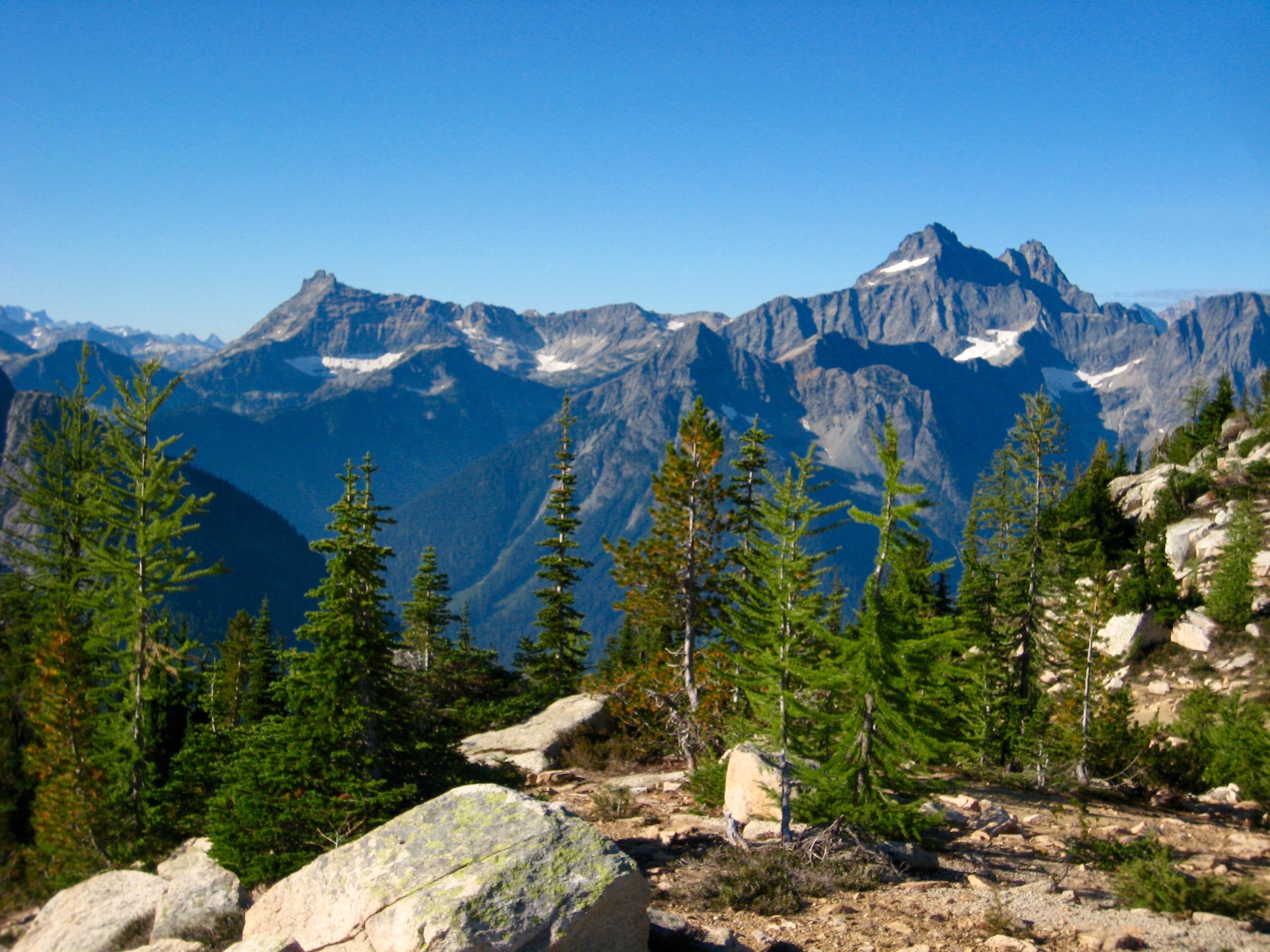
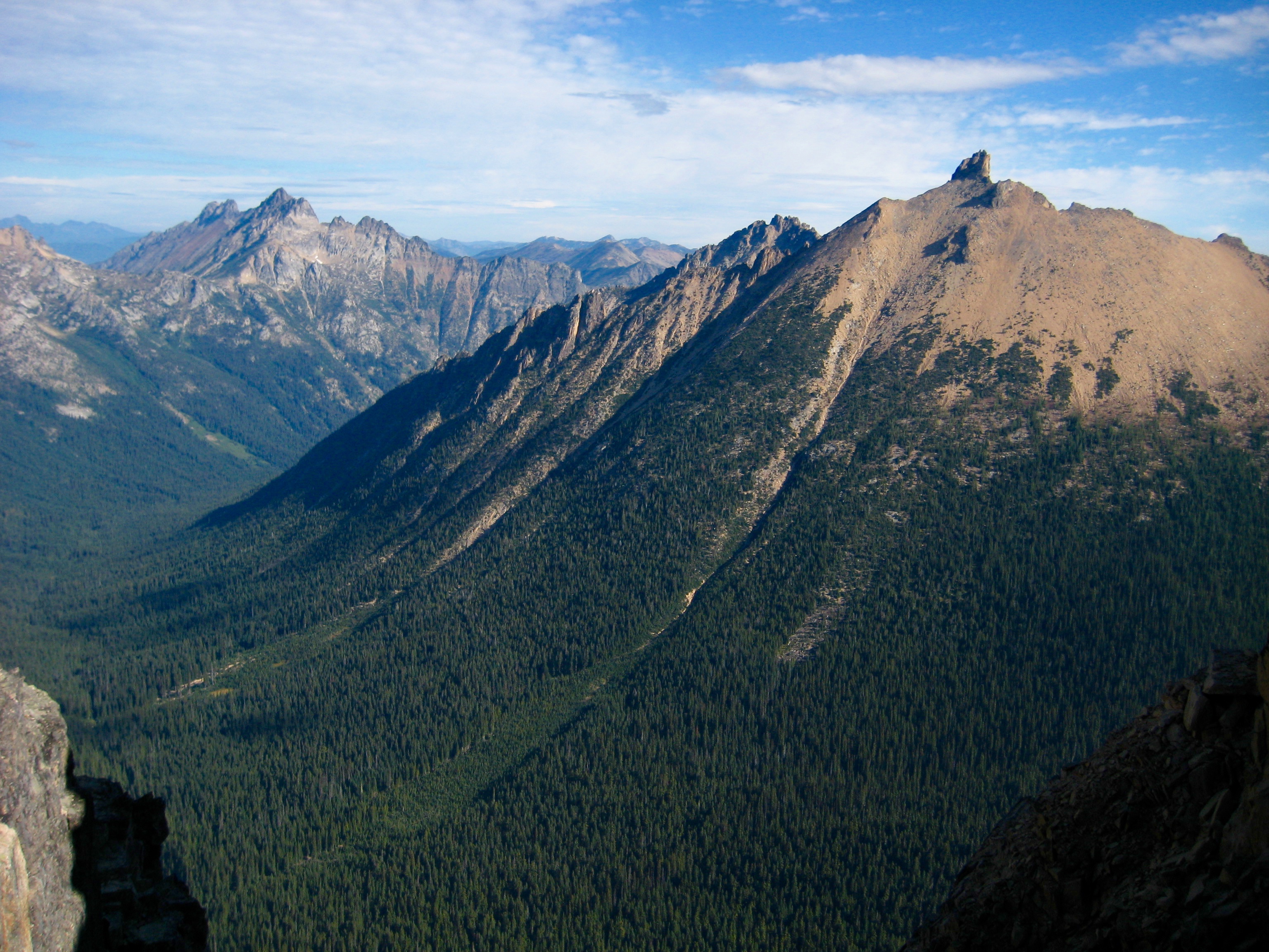
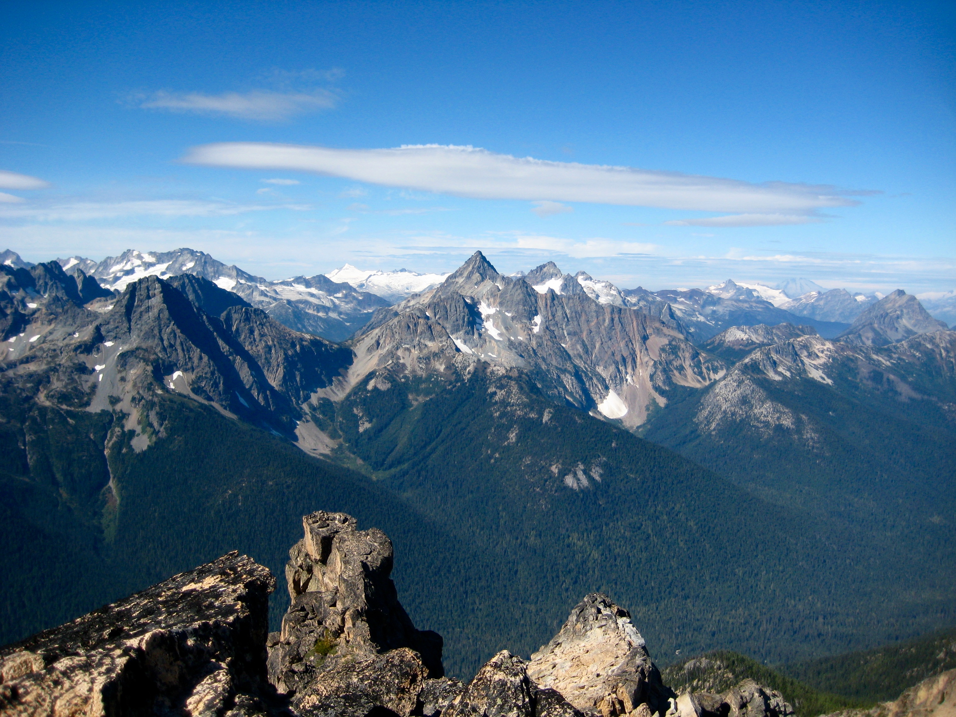
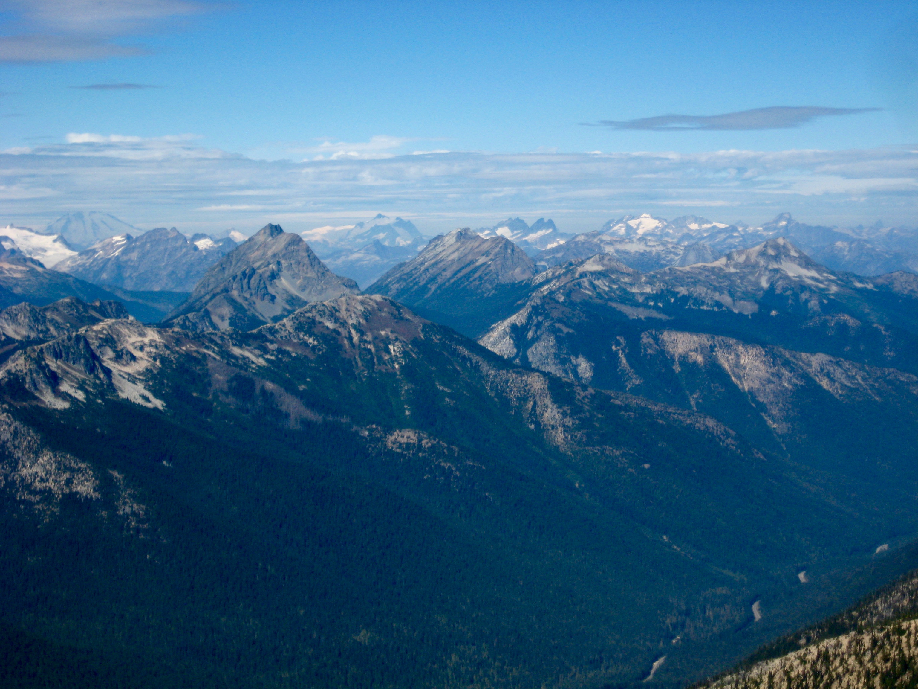
A shift in the winds had cleared out yesterday’s smoke and left us with long-range views.
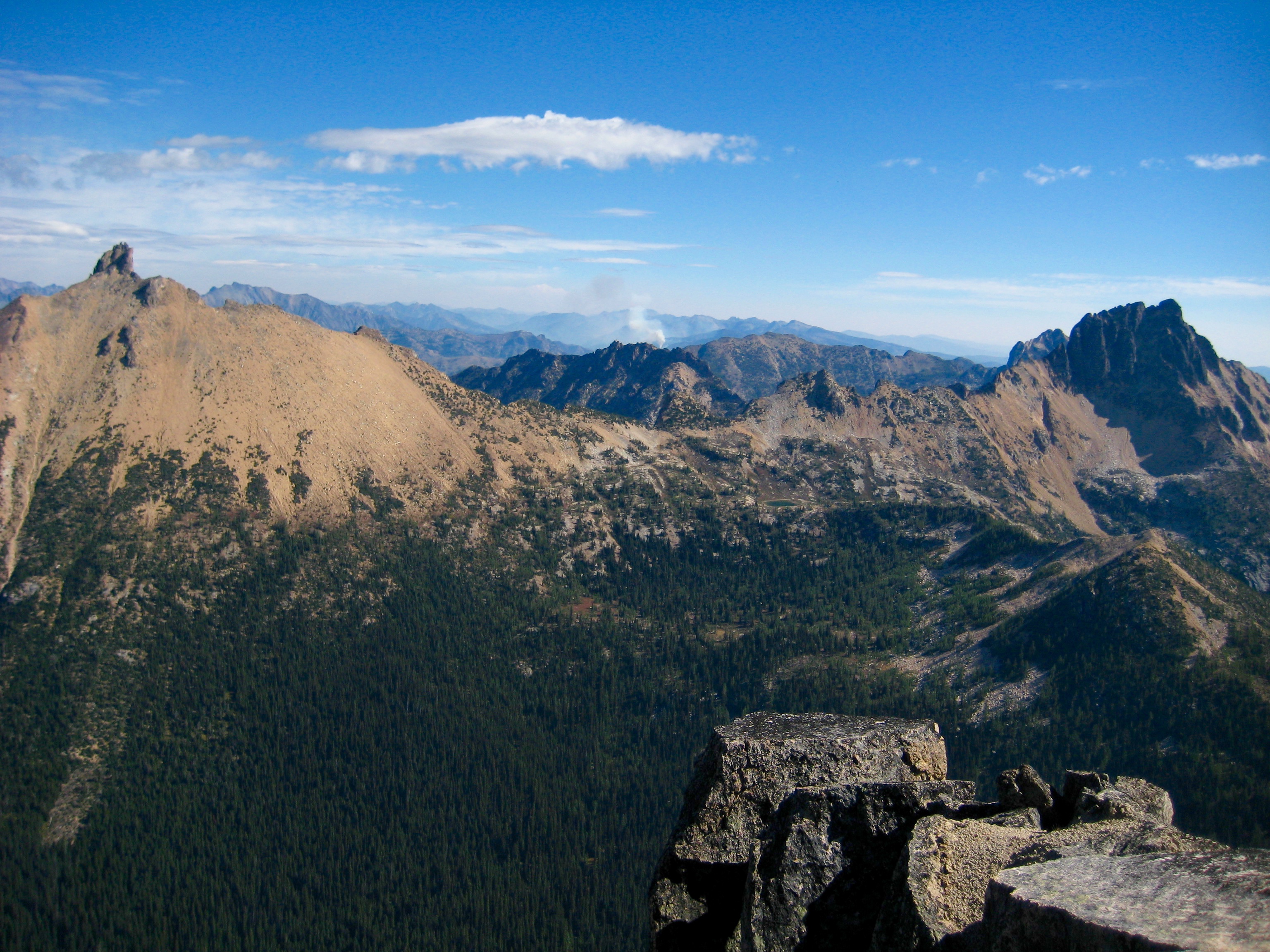
- Corteo Peak To Fisher Peak Pano
- Ragged Ridge & Easy Pass From Mt Hardy
- Mt Ballard & Azurite Pk & Golden Horn From Mt Hardy
The summit register was a soggy clump of paper inside a poorly sealed plastic tube. This would drive some people crazy!
- Golden Horn From Mt Hardy Summit
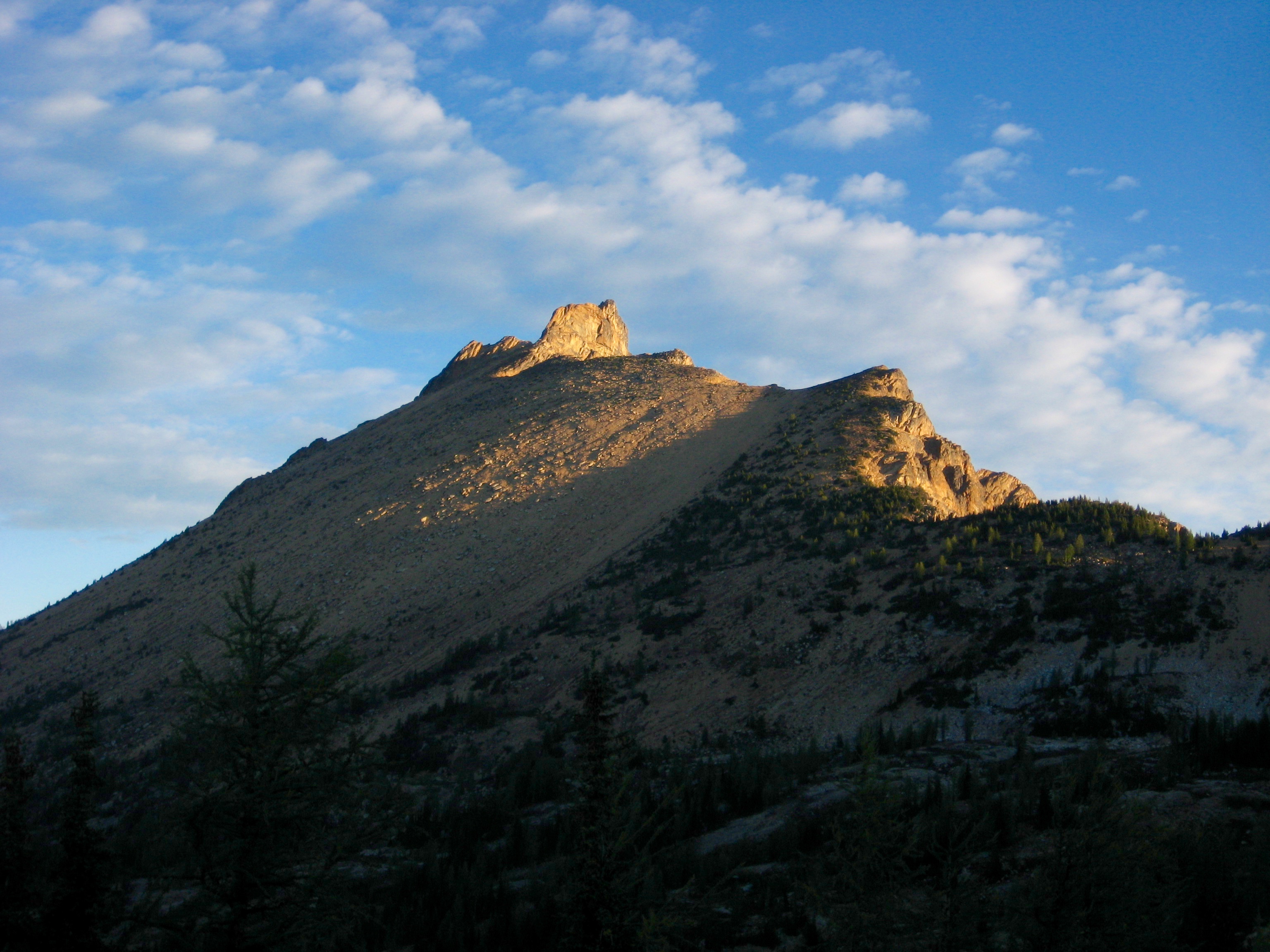
After a long summit stay, we quickly descended to Methow Pass. Lisa continued back to camp along the trail, but Kevin and Eileen and I elected to run the easy ridge northeasterly back to our camp. This was no faster than the trail, but it was more scenic. We all reached camp in the mid-afternoon (2.8 hours + 550 feet from summit).
- Tower Mtn & Snowy Lakes Ridge From Mt Hardy
Upon reaching camp, Eileen and I found that the morning winds had turned our tent upside down and inside out, scattering gear around the vicinity. Fortunately, we were able to retrieve everything.
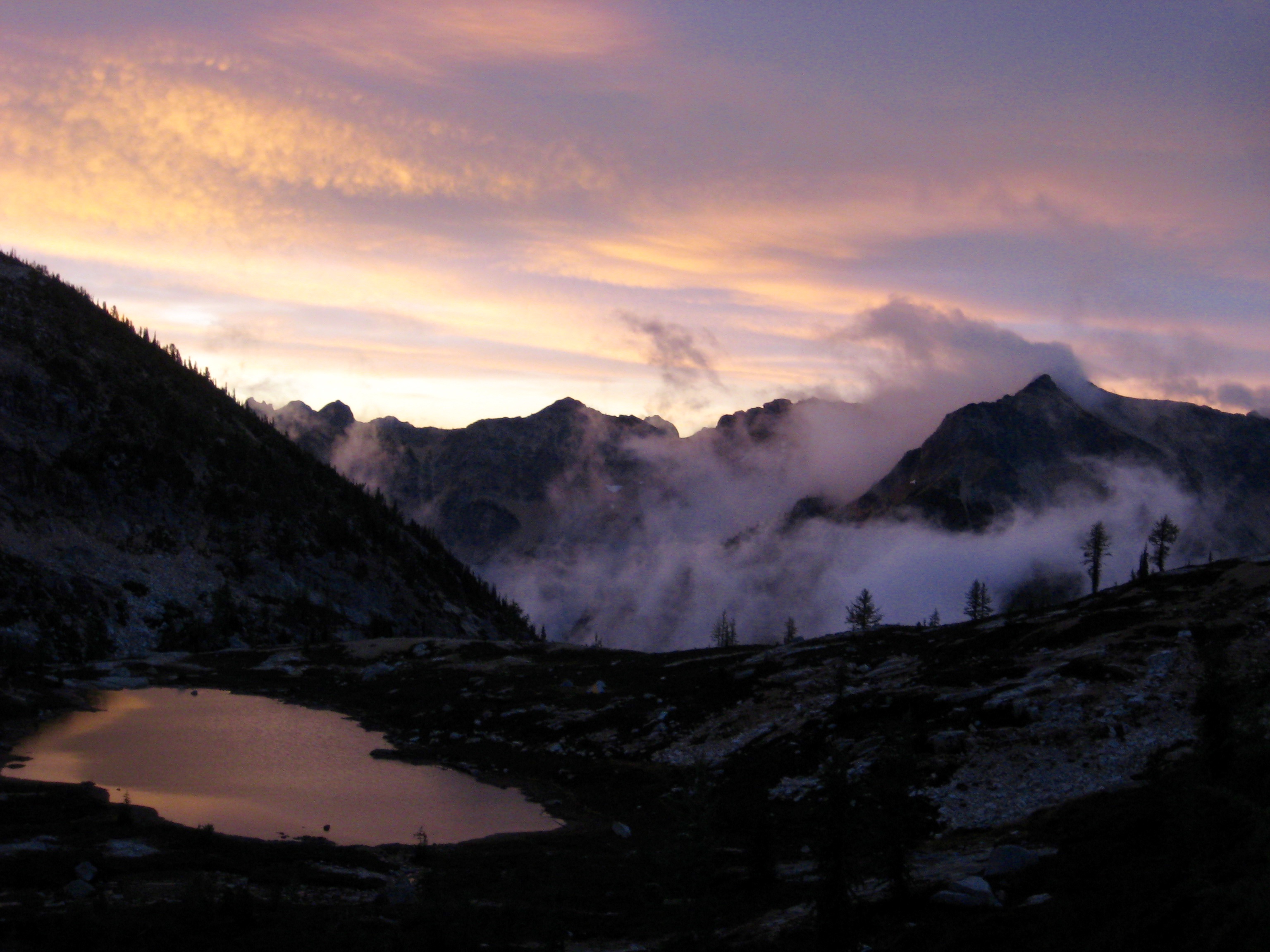
Throughout the afternoon, we watched dark clouds moving in from the west. Raindrops started in the early evening and chased us into our tents for the rest of the night.
Day 3: Upper Snowy Lake to Trailhead
We awoke to low clouds, valley fog, and unexpectedly cold temperatures. It seemed that autumn had arrived during the night.
- Morning Clouds Over Lower Snowy Lake
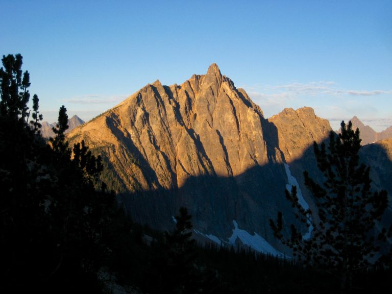
- Alpenglow On Golden Horn
Our hike back down to Rainy Pass was uneventful except for the numerous day-hikers, weekend climbers, and PCT thru-hikers that we met along the way. We reached the busy parking lot in early afternoon (5.6 hours + 750 feet from camp).
Route Map & Profile
…
…
Photo Gallery
Click to enlarge…