Trip Date: August 29 – September 2, 2018
Bear Mountain Climbing Trip
Hannegan Pass
Chilliwack River Cablecar
Indian Creek Suspension Bridge
West Bear Basin
Bear Mountain (7931′)
Trip Report Summary
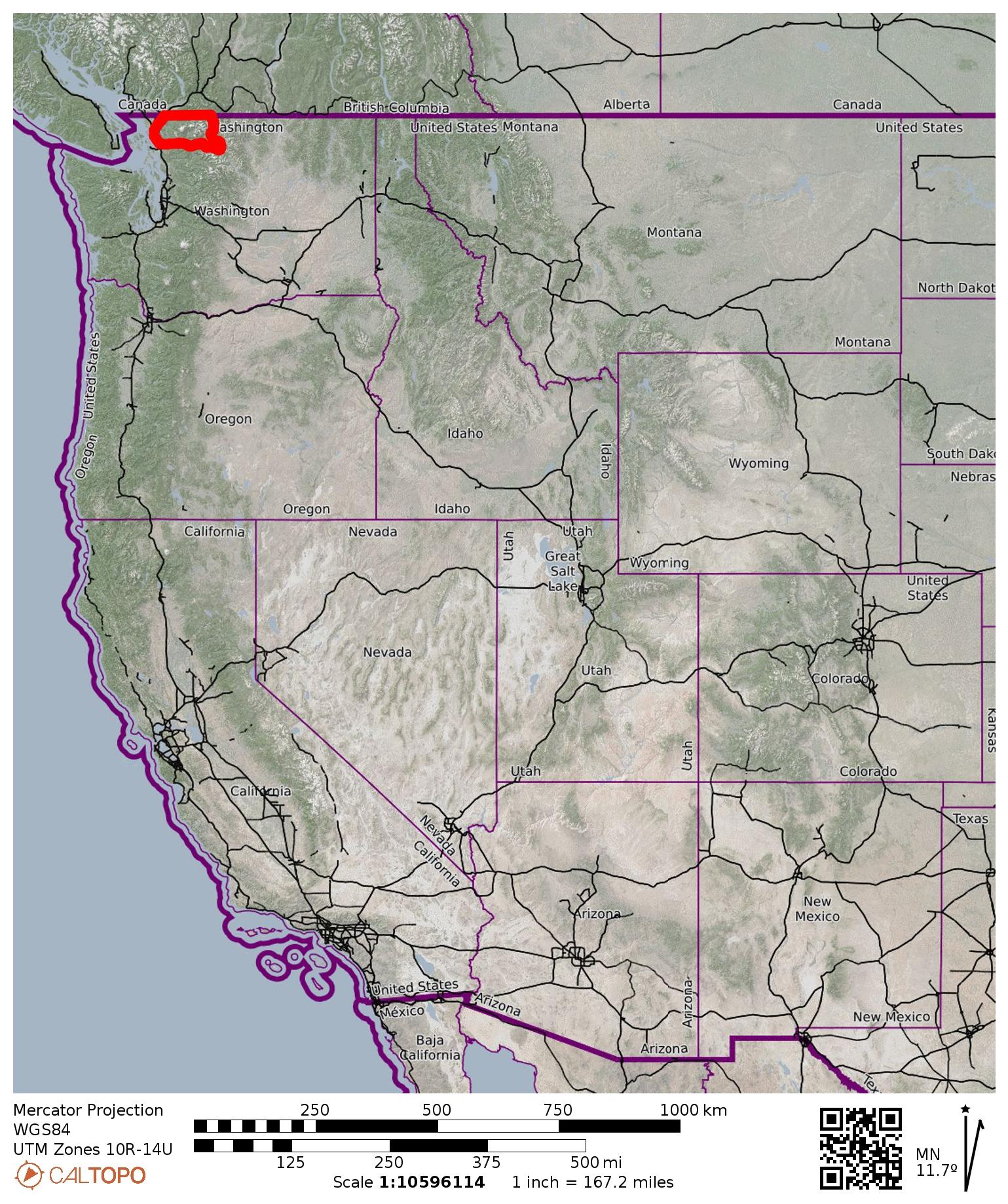
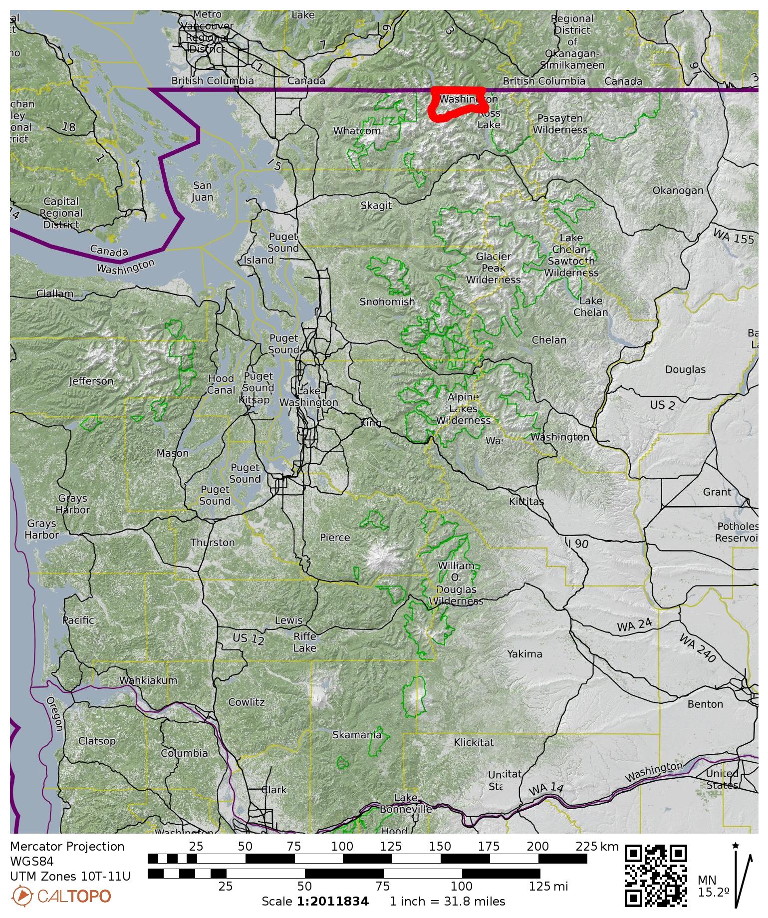
Region: Northwestern Washington Cascades
Sub-Region: American Chilliwack Mountains
Area: North Cascades National Park
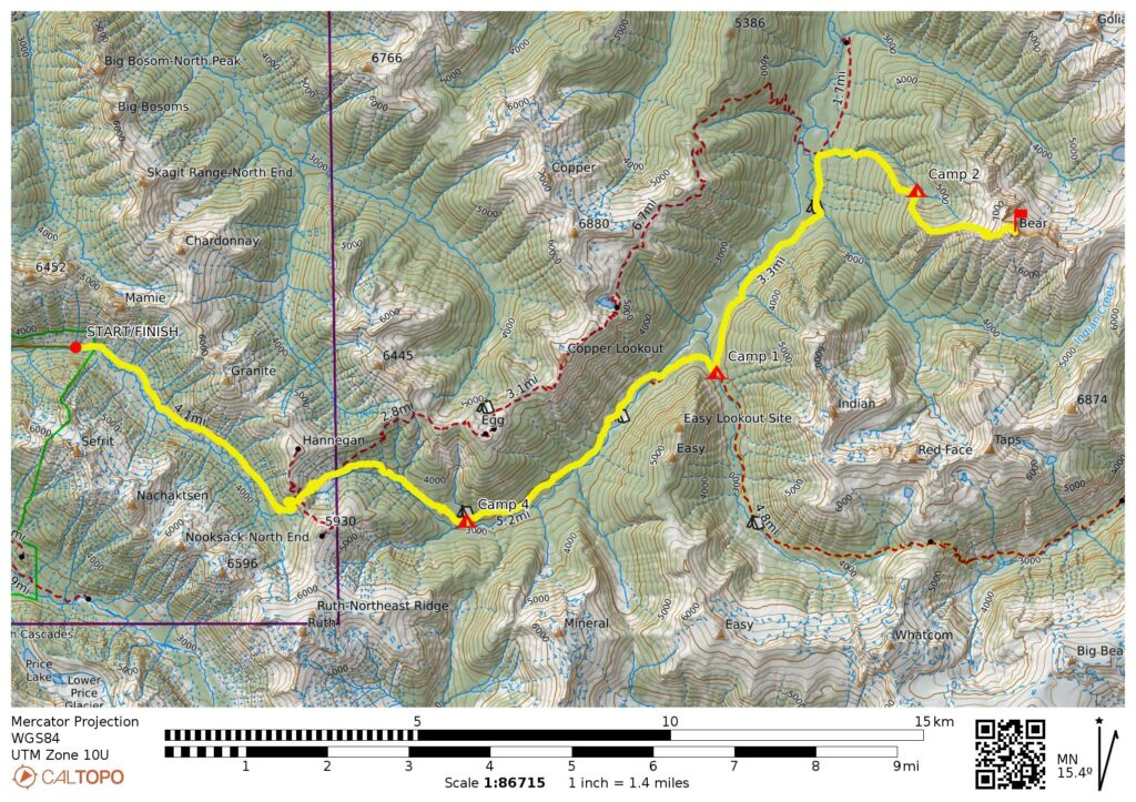
Starting & Ending Point: Ruth Creek Road washout near Hannegan Trailhead (Elev. 3100 feet)
Way Points: Ruth Creek & Hannegan Pass & Copper Creek & US Cabin Camp & Chilliwack River Cablecar & Brush Creek Bridge & Chilliwack River Trail junction & Indian Creek Suspension Bridge & Copper Ridge Trail junction & West Bear Basin (trail hike & off-trail hike & bushwhack)
Campsites: Brush Creek Bridge & West Bear Basin & Copper Creek Camp
Sidetrip: West Ridge Saddle (off-trail hike & bushwhack & rock scramble)
Summit: Bear Mountain (rock scramble & rock climb via West Ridge—West Slope—Upper North Ridge)
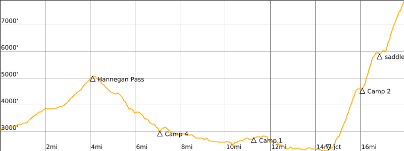
Approximate Stats: 36 miles traveled; 12,500 feet gained & lost.
…
Related Post
Middle Lakes High Traverse + Bear Mountain Attempt via East Ridge – September 2017
Full Trip Report
After getting within 50 vertical feet of Bear Mountain’s spikey summit last year, Fay and Eileen and I were very motivated to make a second attempt. This year, we had a much different strategy: Rather than approaching from the southeast (via Whatcom Pass and Middle Lakes), we elected to approach from the west (via the Chilliwack River Valley) and bushwhack up to a high camp somewhere on the mountain’s western flank. Our strategy played out successfully, but it wasn’t easy. By the time it was all over, we agreed that Bear Mountain really is one “bear” of a mountain!
Day 1: Hannegan Trailhead to Brush Creek Bridge
By spending the previous night at Silver Fir Campground on the Mt. Baker Highway, we were able to reach the Hannegan Trailhead at a reasonably early hour. Good thing, because the entrance road to the normal trailhead parking lot washed out last year; now, all cars are limited either to a small interim parking lot or to road-side parking. Both options fill up fast, especially on a busy holiday weekend.
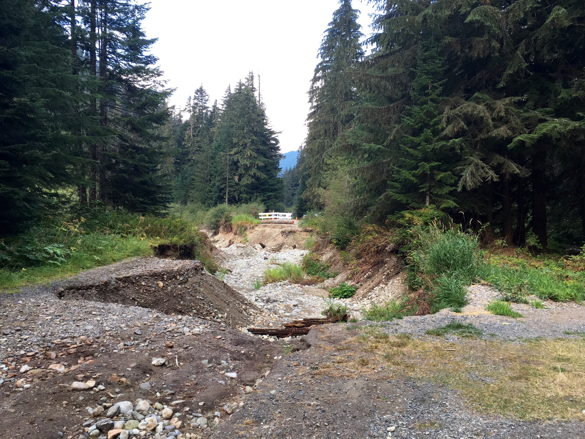
We were underway with backpacks shortly before 8:00am, and I took some time to examine the road washout. It appears that Ruth Creek overflowed its channel, causing water to spill into the main parking lot and subsequently scour a deep channel across the entrance roadway. This is an impressive illustration regarding the tremendous erosive power of running water.

- Looking Up At Hannegan Road Washout
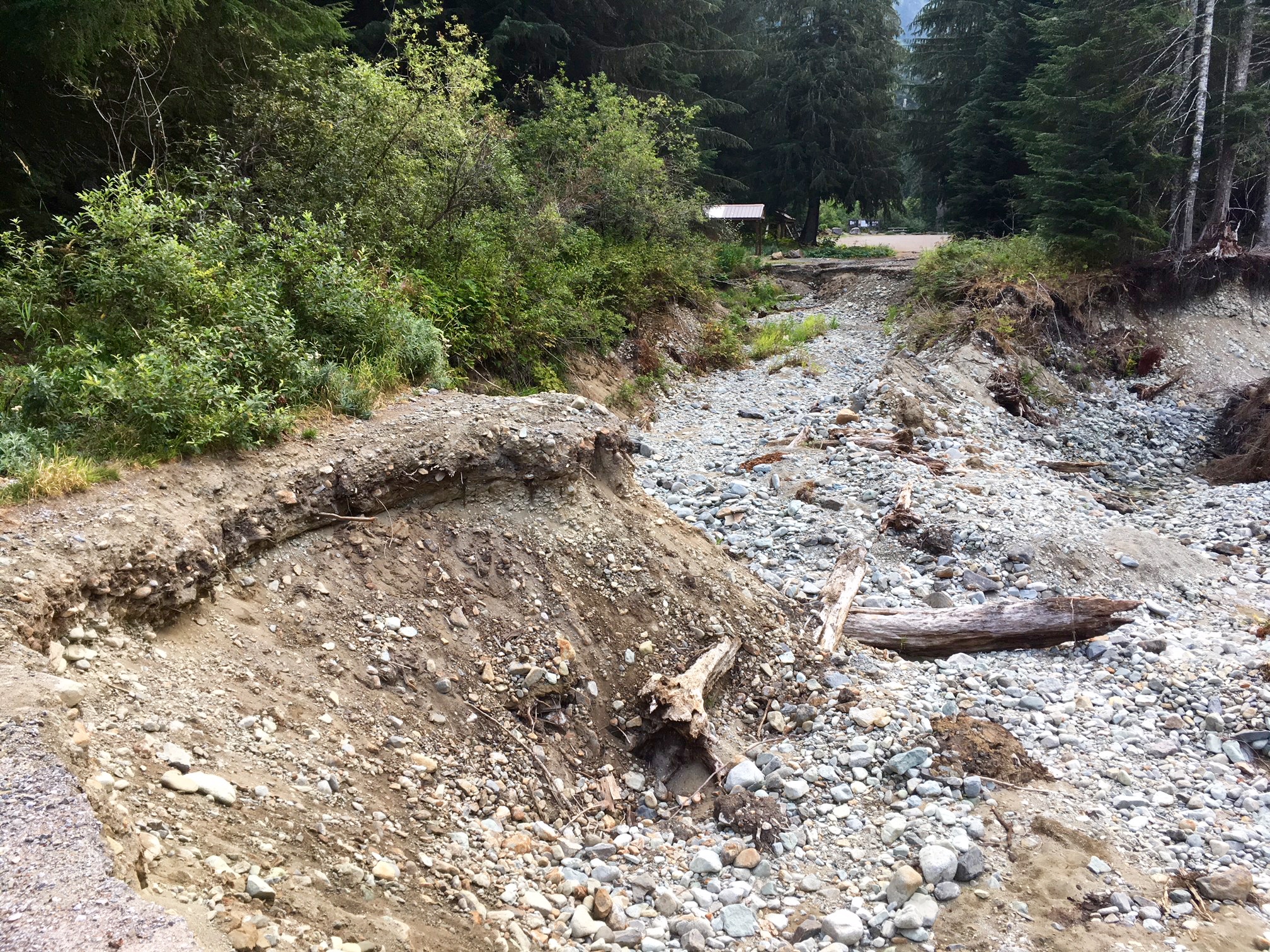
- Looking Back At Hannegan Road Washout
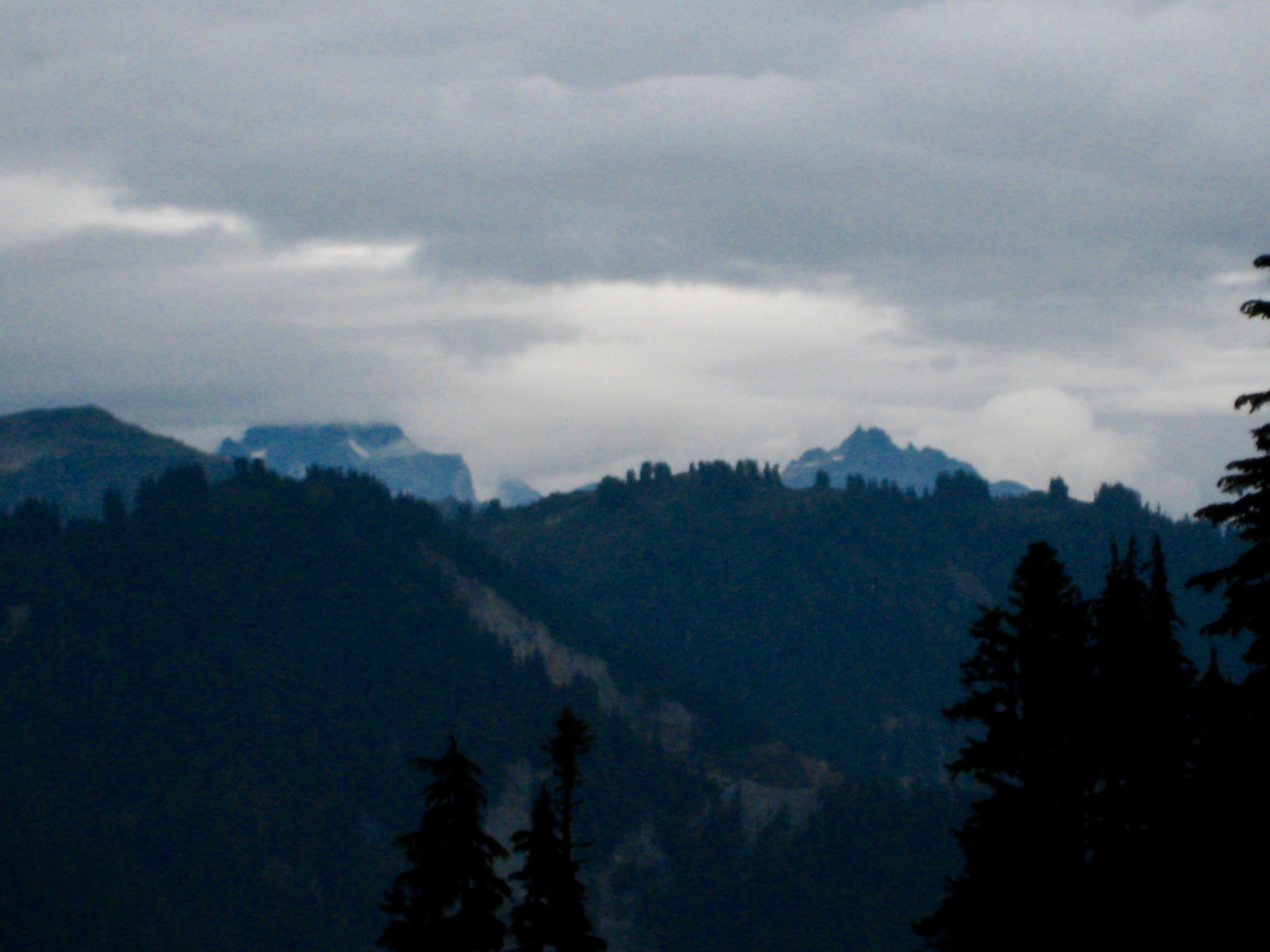
The Hannegan Trail has become far too familiar to all three of us, after having made numerous forays into the area, so we resigned ourselves to a monotonous trudge up to Hannegan Pass. To make things worse, it began raining steadily during our hike. By the time we crested the pass in late morning (2.7 hours + 1900 feet from TH), the weather was cold, wet, and unpromising for any sort of climbing goals. Far to the east, the summits of Mt. Redoubt and Bear Mountain taunted us in the clouds.

- Mt Redoubt & Bear Mtn From Hannegan Pass
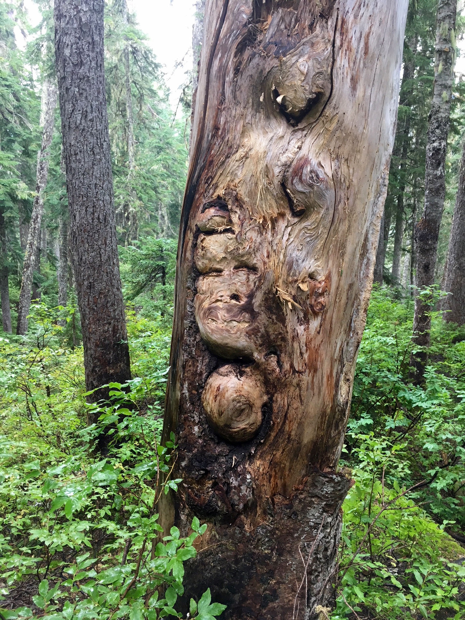
Intermittent rain showers continued as we headed eastward down the Chilliwack River Trail. When staring out the hood of a rain parka, one tends to take a more close-up view of the immediate surroundings. I found myself noticing new or long-forgotten details. For instance, how many times have I walked past this tree trunk and not observed the human-esque face looking back at me?

- Face Tree On Chilliwack Trail
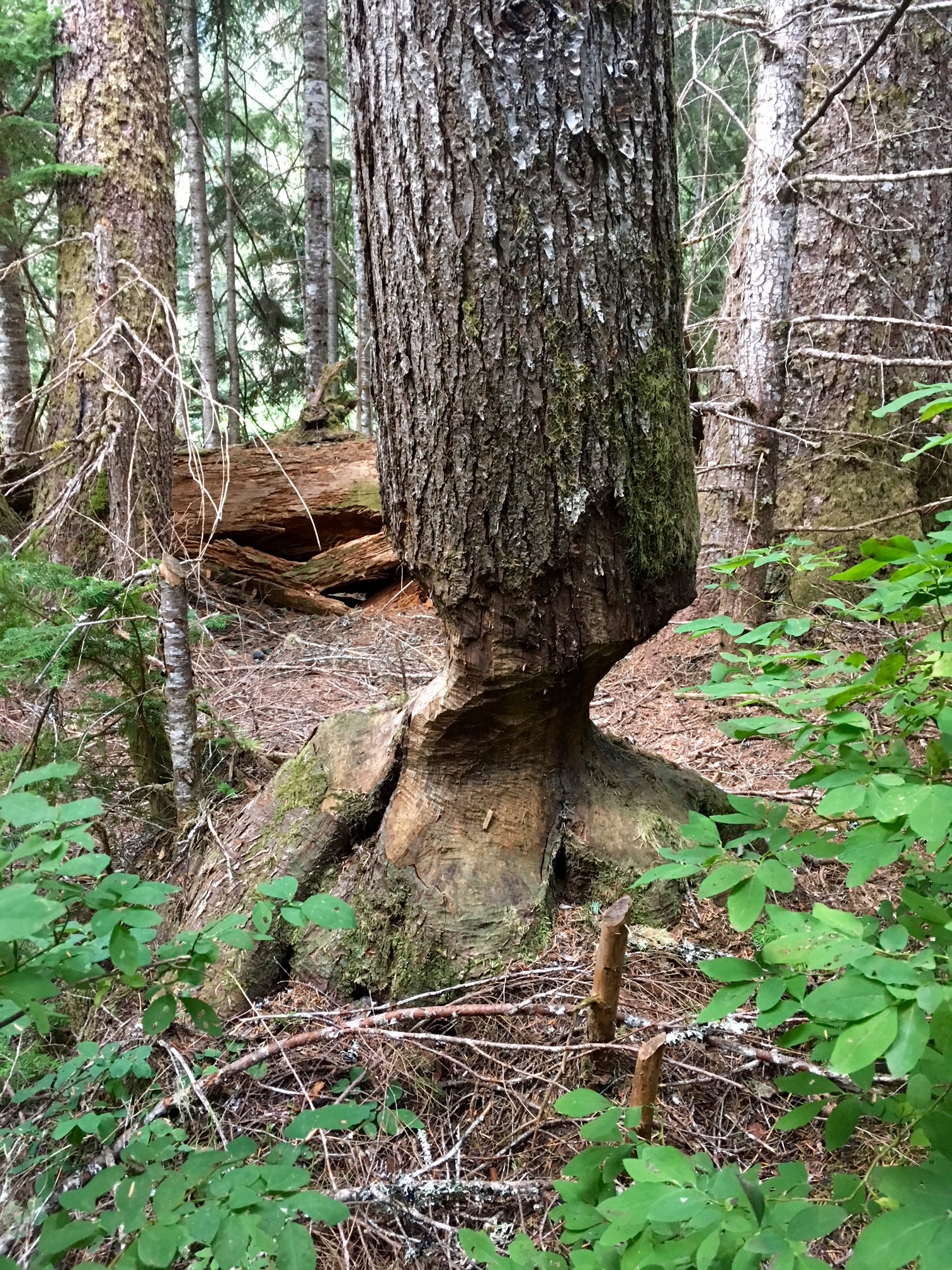
Another fascinating trail-side feature is this beaver-chewed tree located between U.S. Cabin Camp and the Chilliwack River Cablecar. I’m guessing that a couple of overzealous beavers got well into their task of felling the tree before they realized that there is no running water within several hundred yards. “Oops…abort project!!”
- Beaver-Chewed Tree On Chilliwack Trail
An on-going subject of debate leading up our trip was exactly how to approach Bear Mountain. The sparse beta we found indicated that the standard approach left the Chilliwack River Trail at Bear Creek Camp and ascended the northwest ridge, passing Ruta Lake along the way. However, our study of topographic maps indicated that a shorter approach would start at the Copper Ridge Trail junction and ascend the west ridge. We were 50/50 on each option even while hiking in on Day 1. Then, far down the trail that afternoon, we had a fortuitous encounter with an enthusiastic hiker/climber named Josh.
When I mentioned to Josh that we were heading to Bear Mountain, he excitedly reported that he had just come from the Mt. Redoubt area via Bear Mountain earlier in the day (apparently traveling close to the speed of light!) and had found easy, open terrain going down Bear’s west ridge. This was all the endorsement we needed to select the west ridge approach over the northwest ridge (Ruta Lake) approach.
It was early evening when we crossed Brush Creek on a sturdy footbridge (9.5 hours + 2300 feet from TH). An informal campsite next to the creek provided us with a comfortable stopping point for the day.
- Nice Camp At Brush Creek
Day 2: Brush Creek Bridge to West Bear Basin
We awoke to overcast skies but dry weather on Day 2. Our morning task involved an easy 3.5-mile hike down the Chilliwack River Trail, past Indian Creek, to the Copper Ridge Trail junction. Except for one large tree trunk, this stretch of trail was completely logged out.
- Venerable Trail Sign At Brush Creek Junction
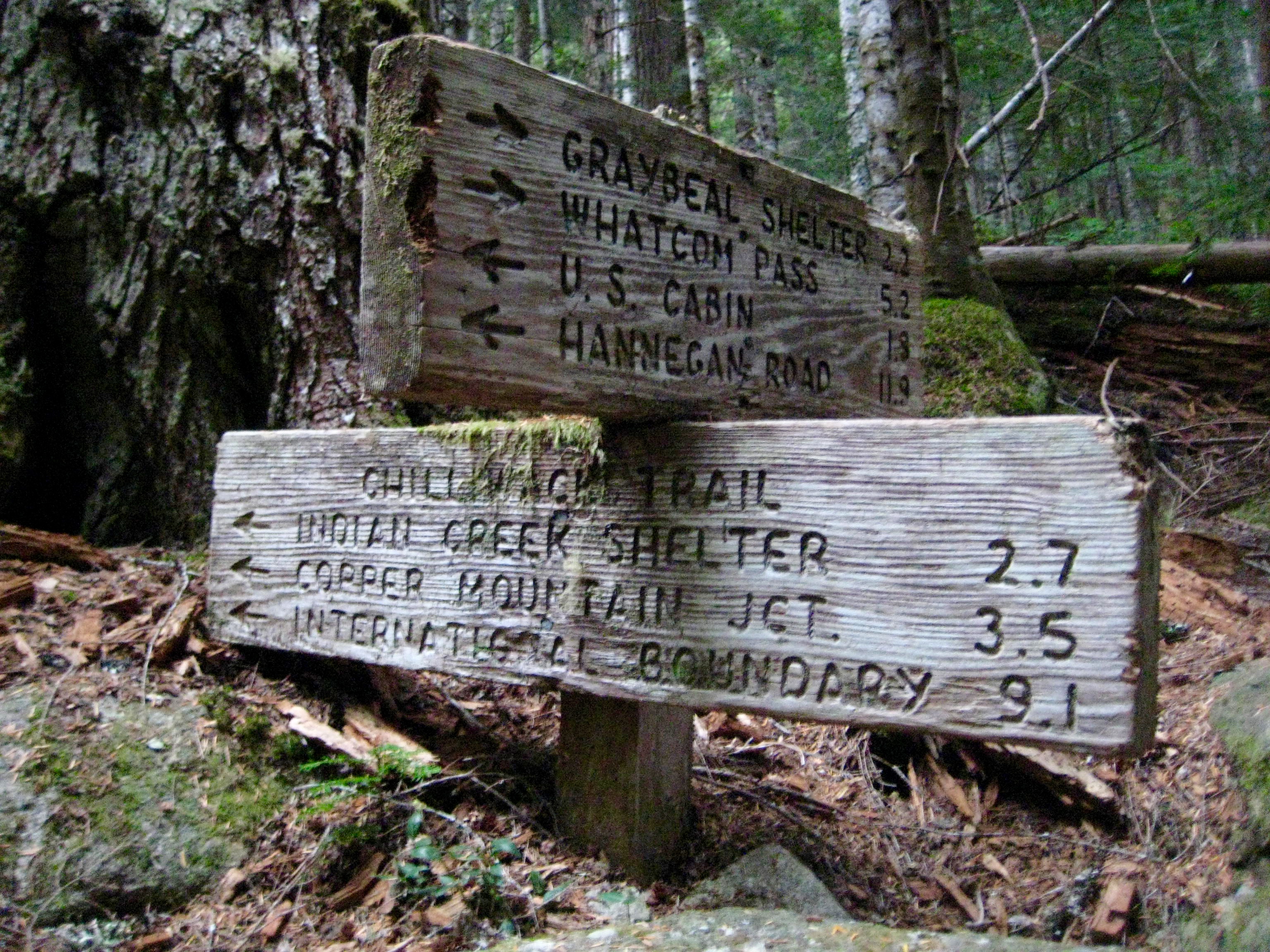
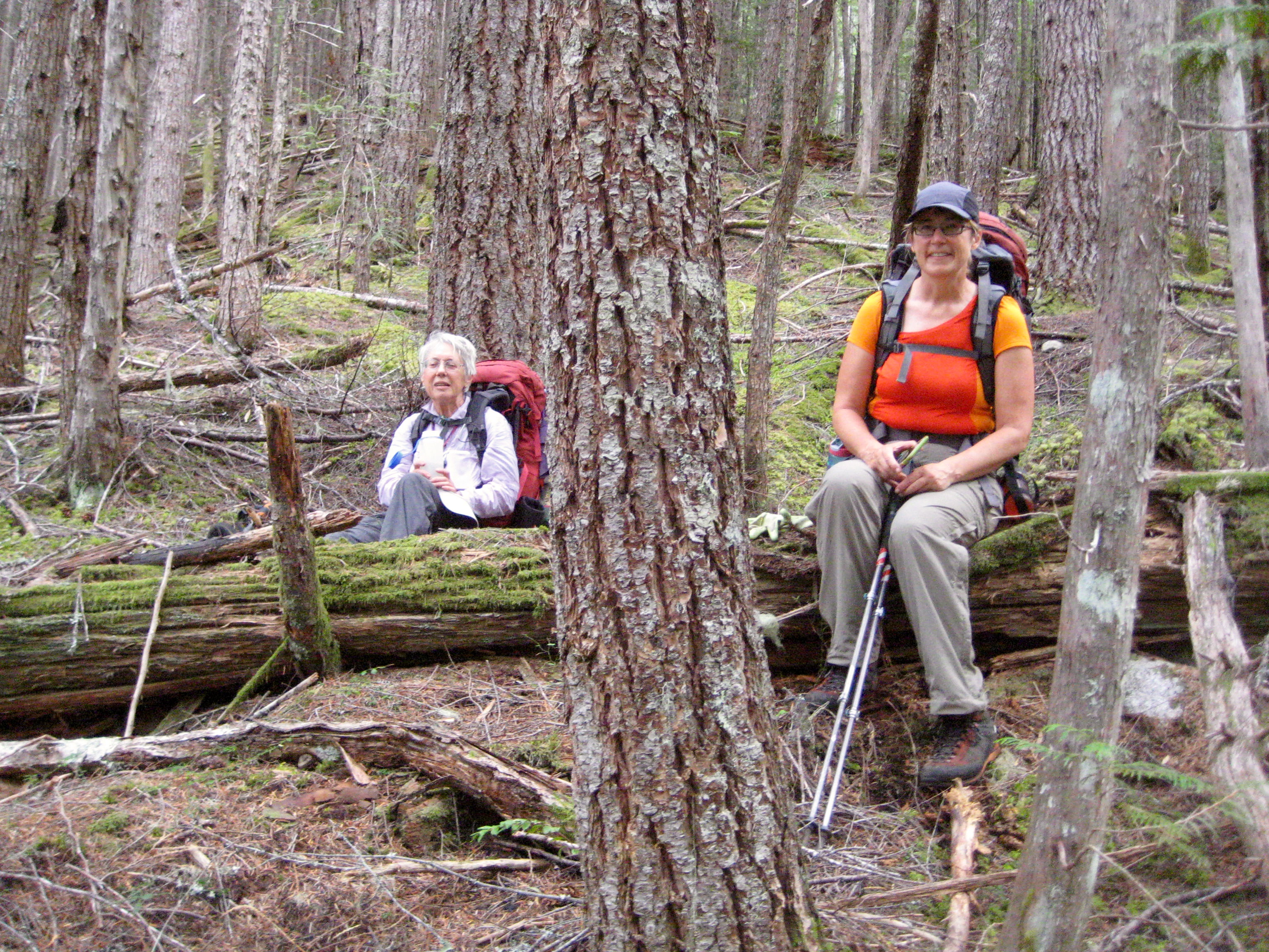
We reached the trail junction—our planned jumpoff point—in late morning (2.7 hours + 200 feet from Brush Creek Camp). Trail shoes and extra food were stashed in a hang-bag near the junction before we started our afternoon task of heading up Bear Mountain’s long west ridge. We began on the left (north) side of a moderate-sized creek, then crossed to the right side farther up. The valley-bottom brush and deadfall timber was as bad as we had feared, but after several hundred feet of gain, we entered nicely open forest with relatively little brush and deadfall. The next several hours of ascent were almost pleasant.
- Fay & Eileen In Open Forest Above Chilliwack River
But, of course, all good things must end, and the open forest was no exception. Above elev. 4600 feet, we became engulfed in thickets of rhododendron bushes, scrub trees, and other manners of green hell. It took more than an hour to traverse ⅓ mile eastward into a major basin (which we dubbed “West Bear Basin”) shown on our maps. We crashed into this 4600-foot basin in early evening (9.7 hours + 2750 feet from Brush Creek Camp) expecting to find a glorious open meadow with wildflowers and babbling streams. Instead, we found a brush-choked hole with small stands of dense, gloomy forest.
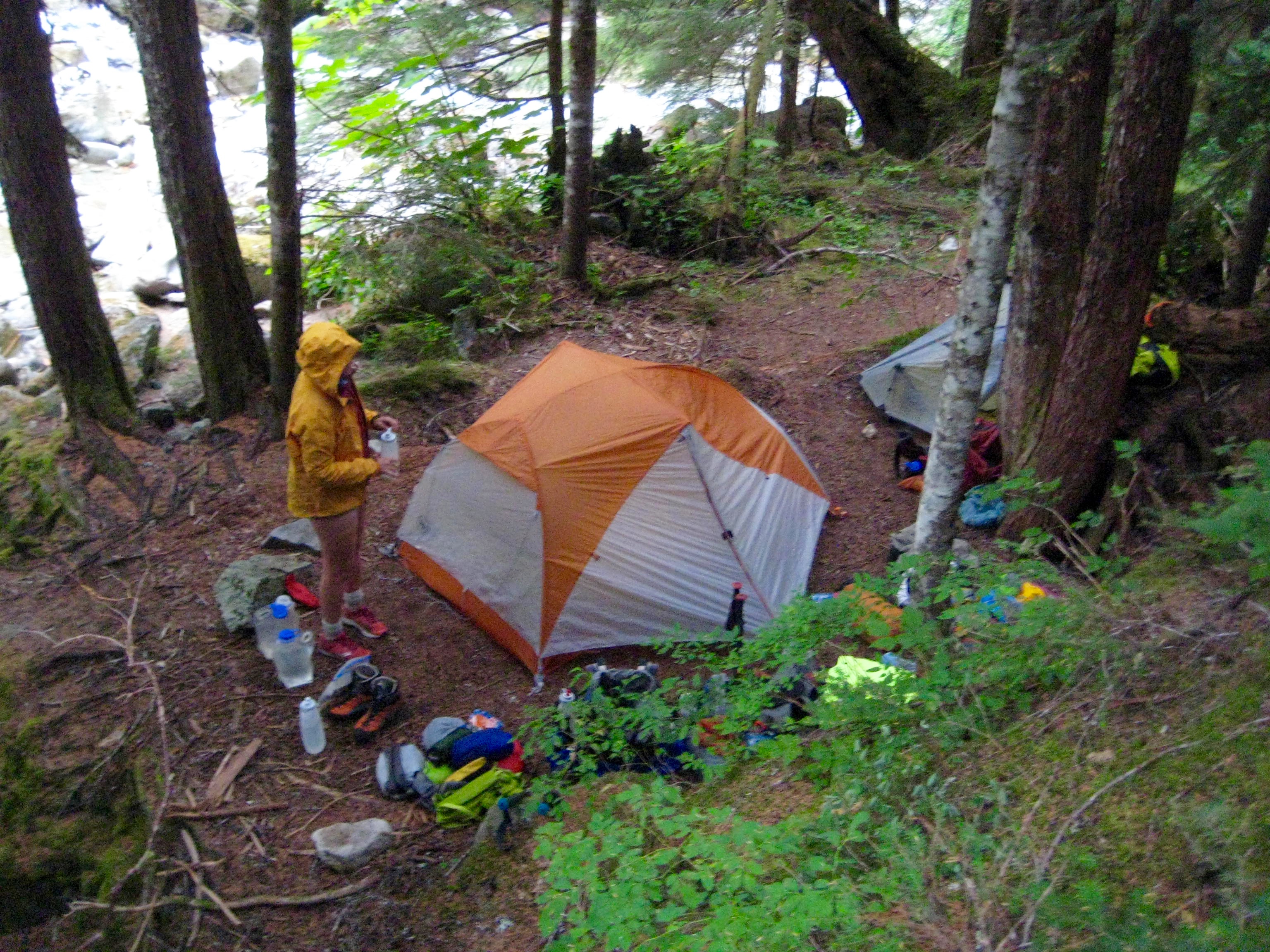
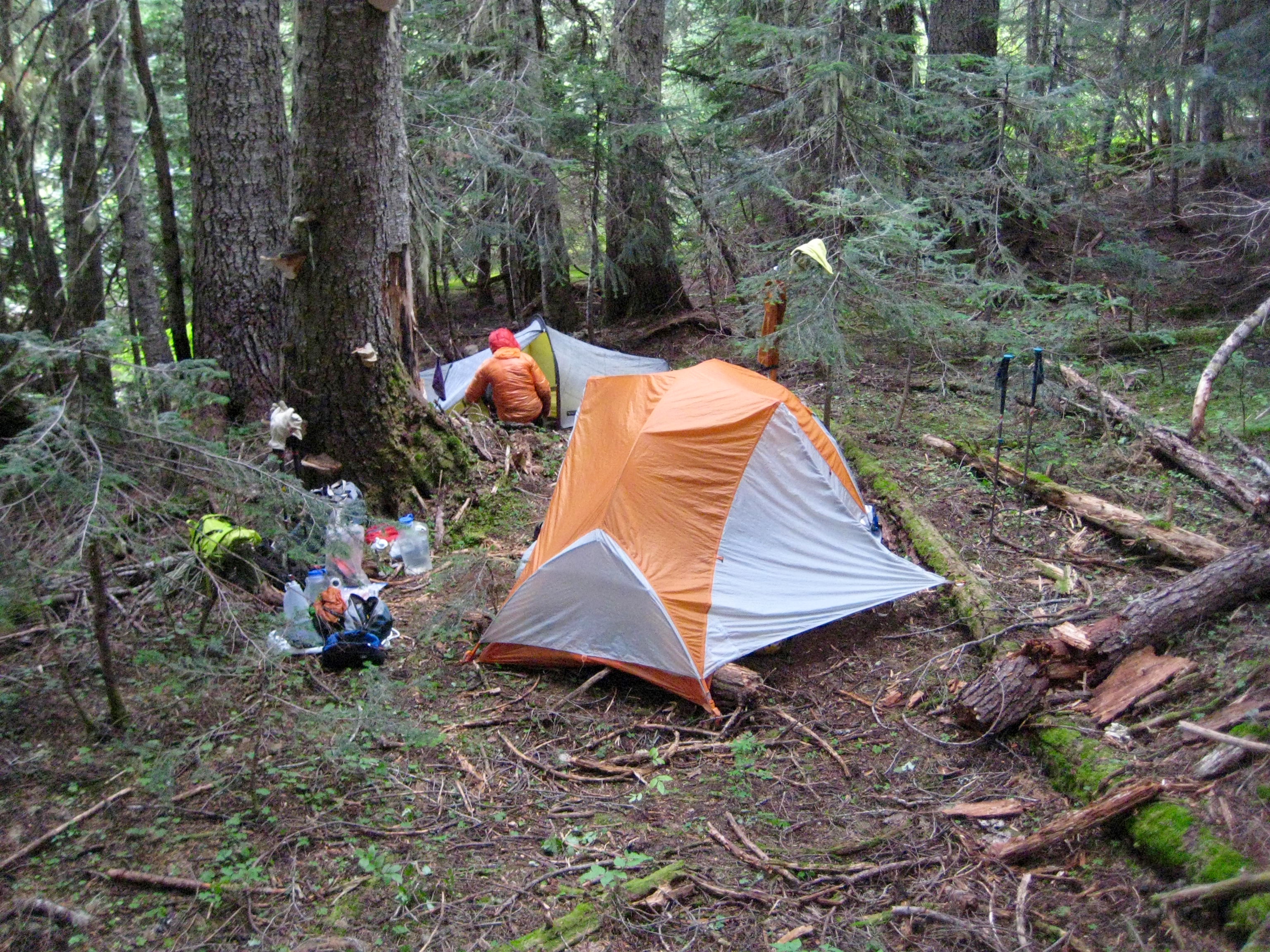
Uninspiring as the basin was, we had no other options, so we set to work scraping out two small tent pads in the thick duff. This became our home for the next two nights. Water was available in a tiny creek that ran through the brush about 50 yards to the northeast.
- Gloomy Camp In West Bear Basin
Day 3: Bear Mtn Summit Climb
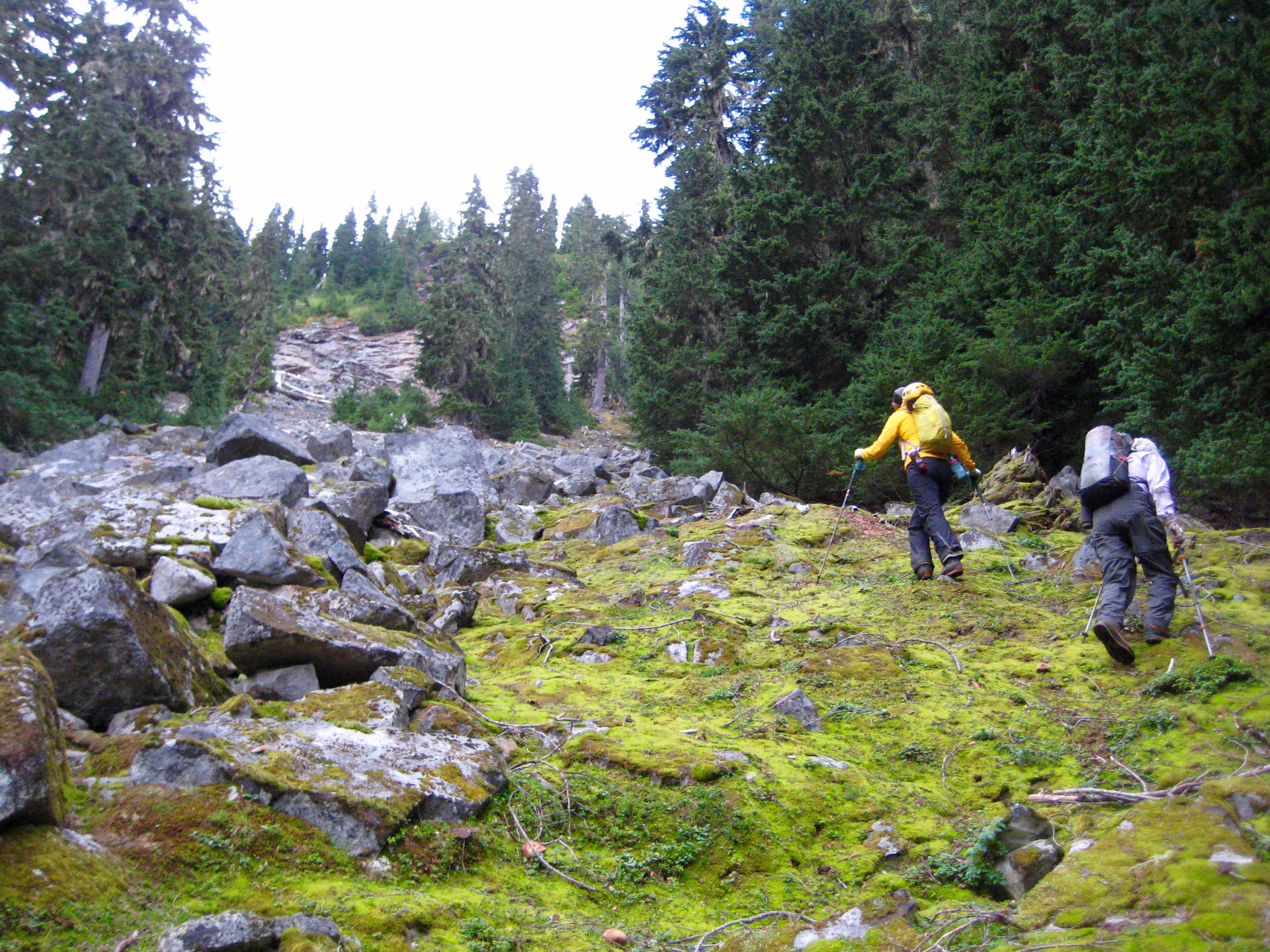
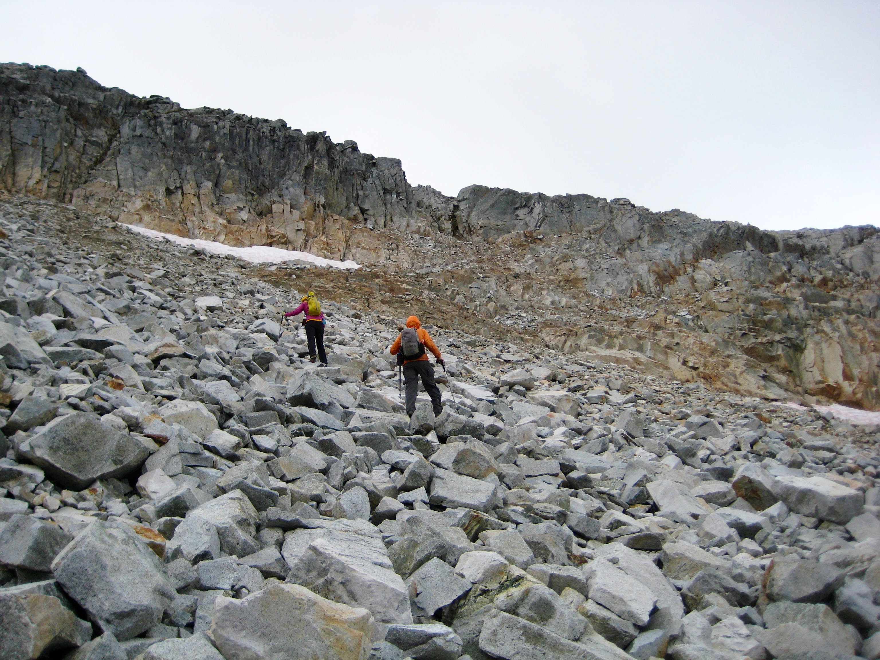
Expecting a long day for our summit bid, we were awake at first light and on the move by 7:30am. Our route out of camp went up a mossy talus field, then angled southwesterly up brushy slopes to intersect the west ridge crest at 5200 feet.
- Heading Up From Camp On Day 3
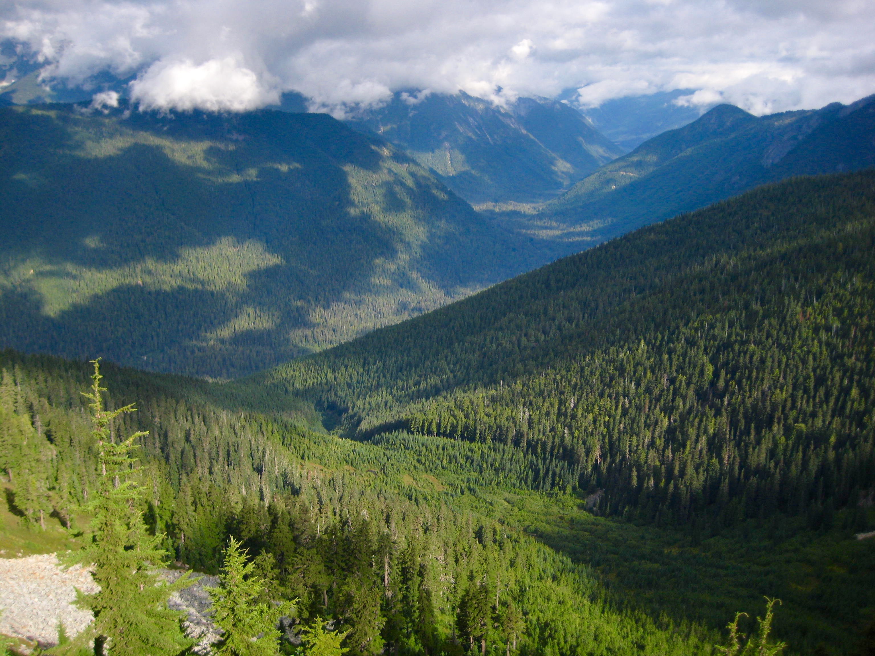
Once on the crest, the terrain improved greatly; rhododendron brush gave way to huckle-heather, and we got our first view of the Chilliwack River Valley below. Sadly, all of the Canadian Chilliwack Mountains remained hidden in the clouds.
- Chilliwack River Valley & West Bear Basin From Ridge
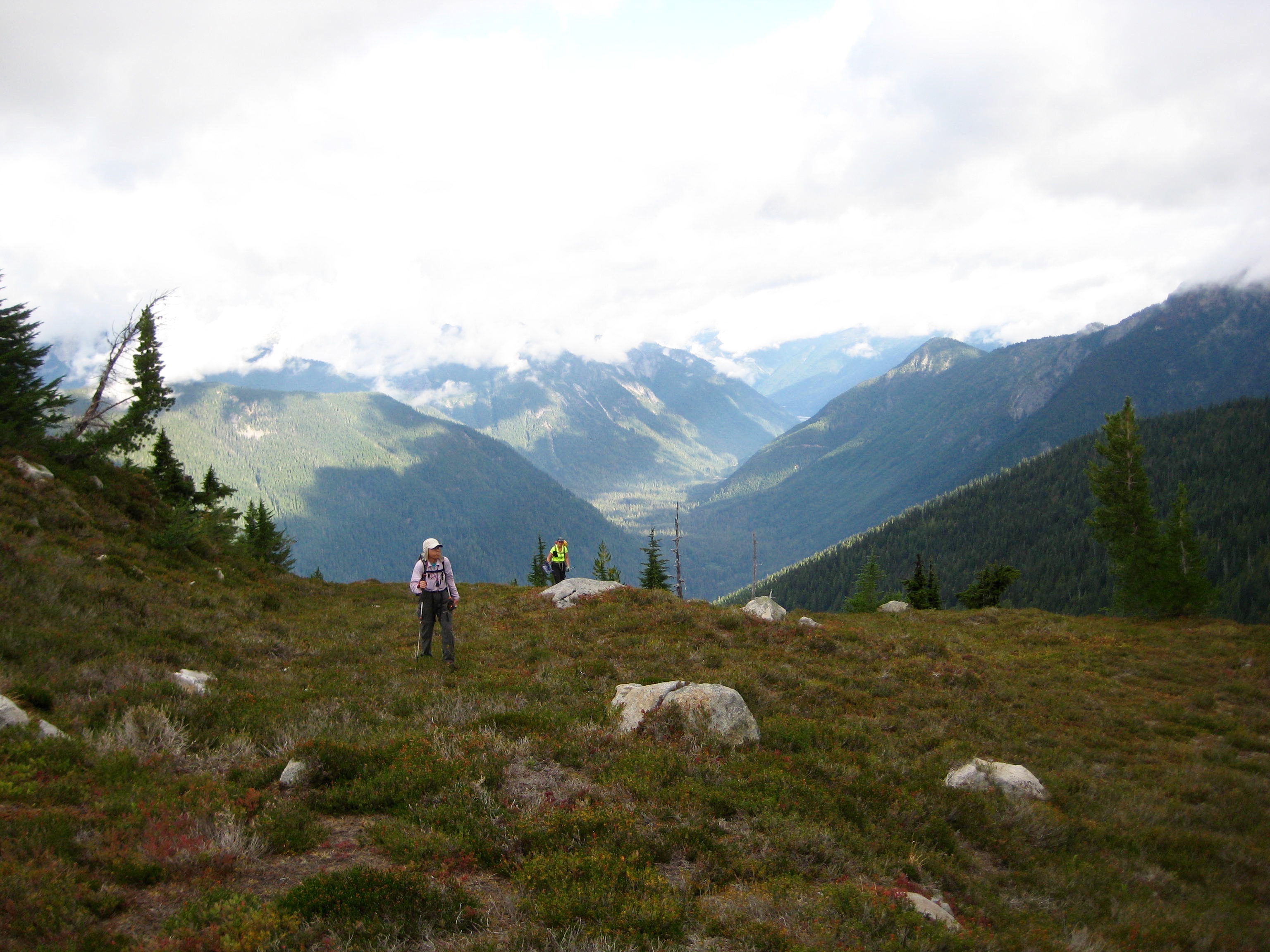
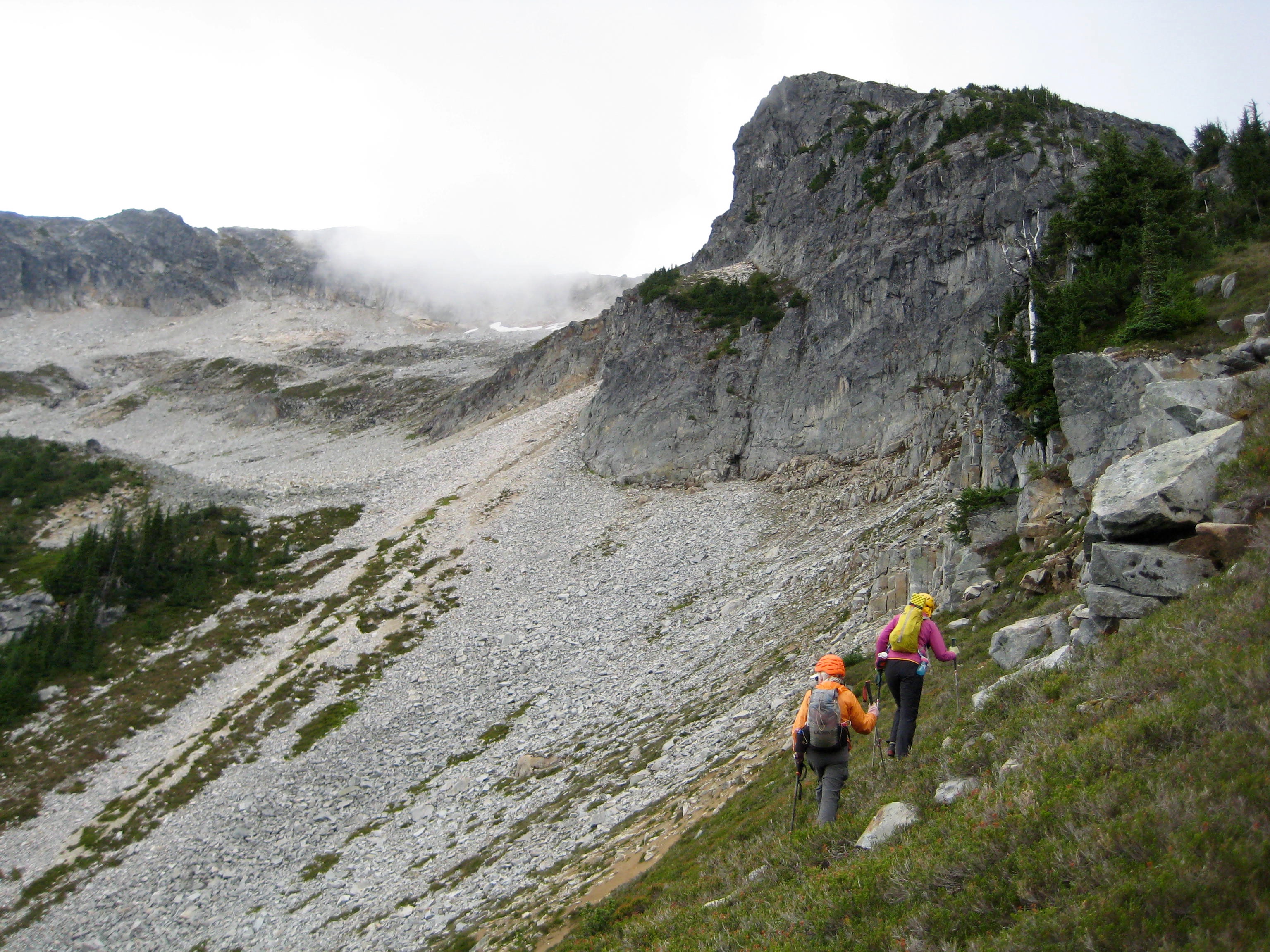
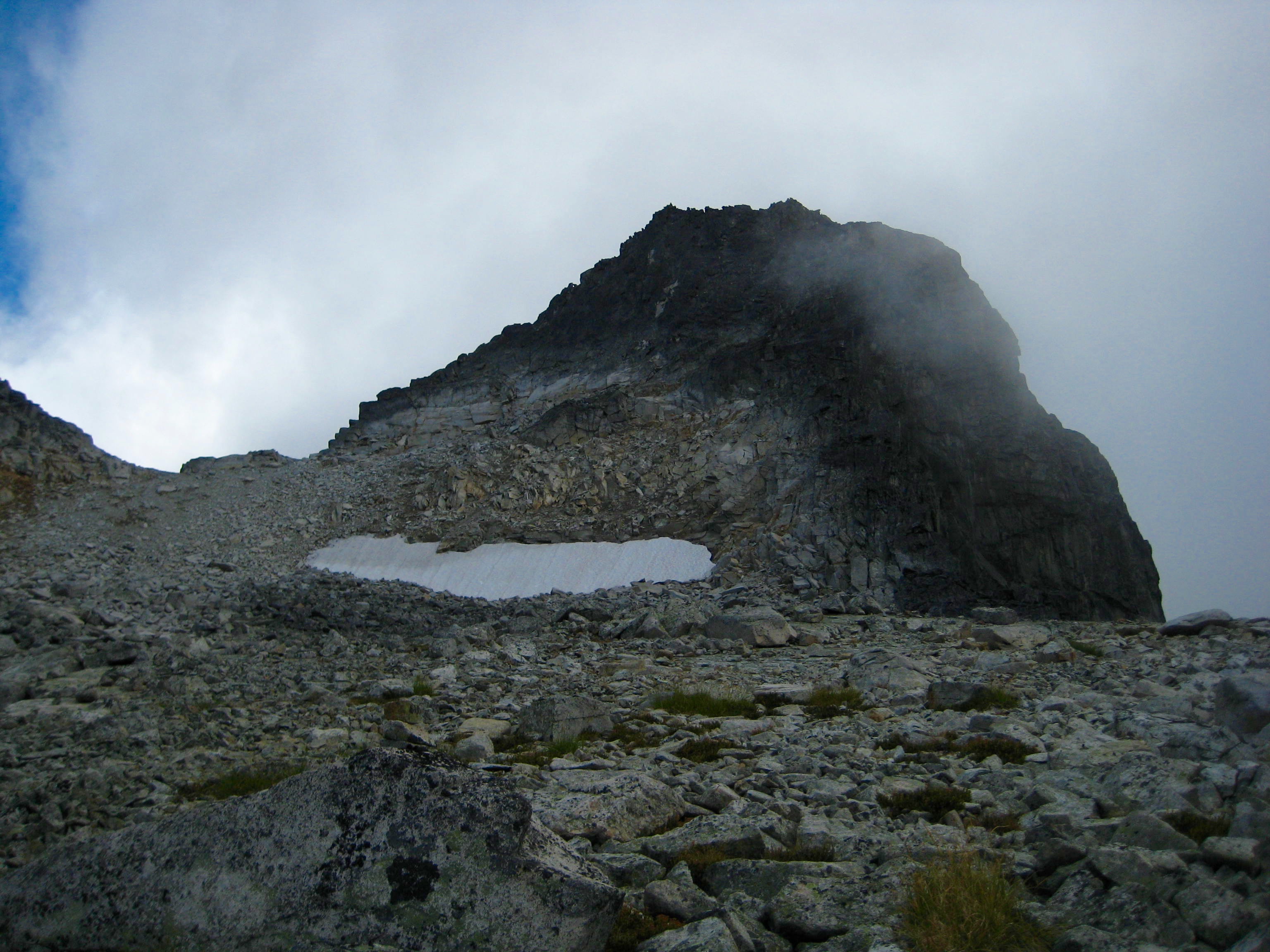
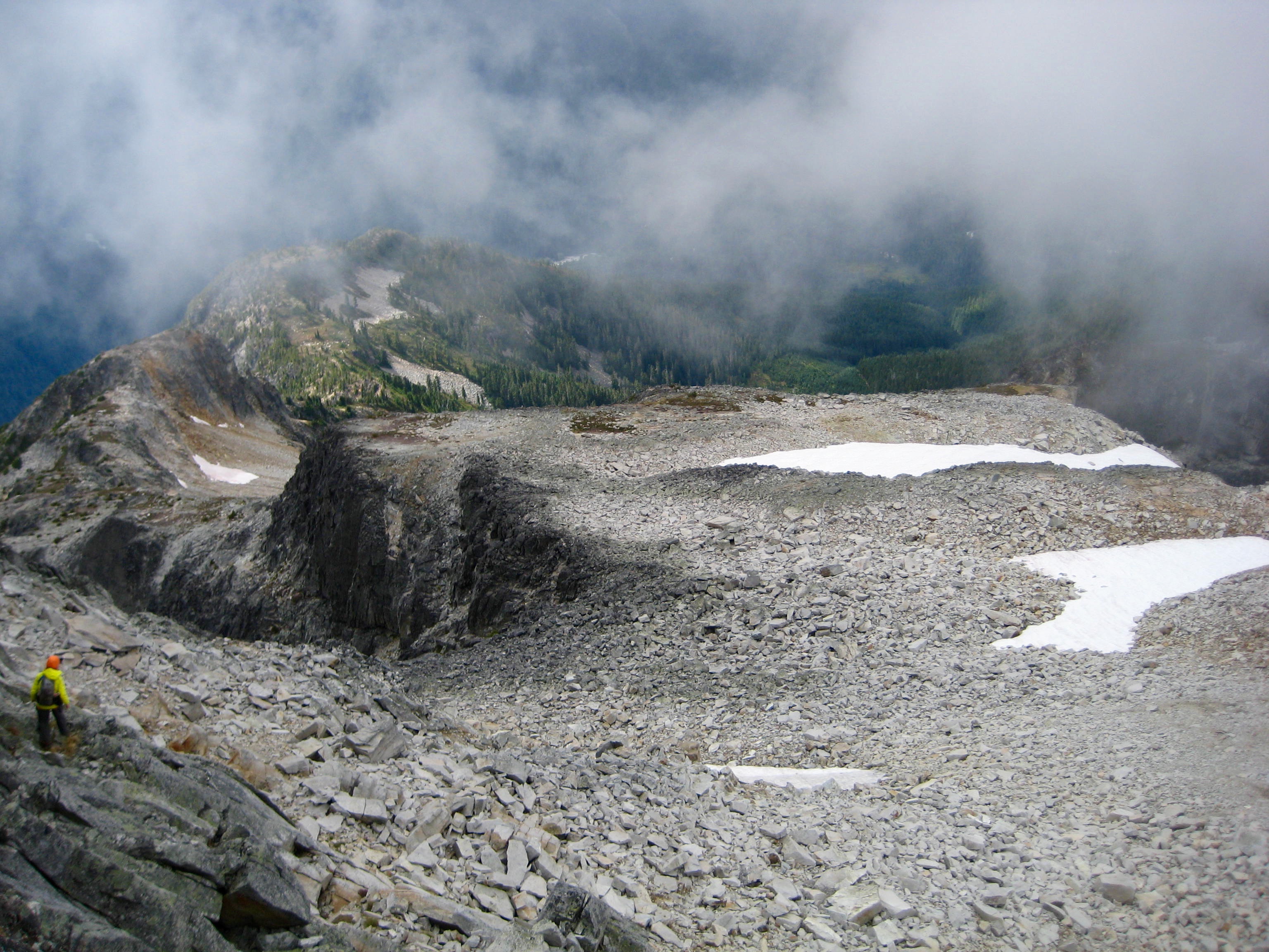
For the next several hours, we worked our way up the ridge either by staying on the crest or by traversing the northern flank. A broad saddle at 5900 feet provided a nice rest stop before traversing into an expansive talus bowl.
- Hiking Thru 5900 Foot Saddle
- Traversing Below West Ridge of Bear Mtn
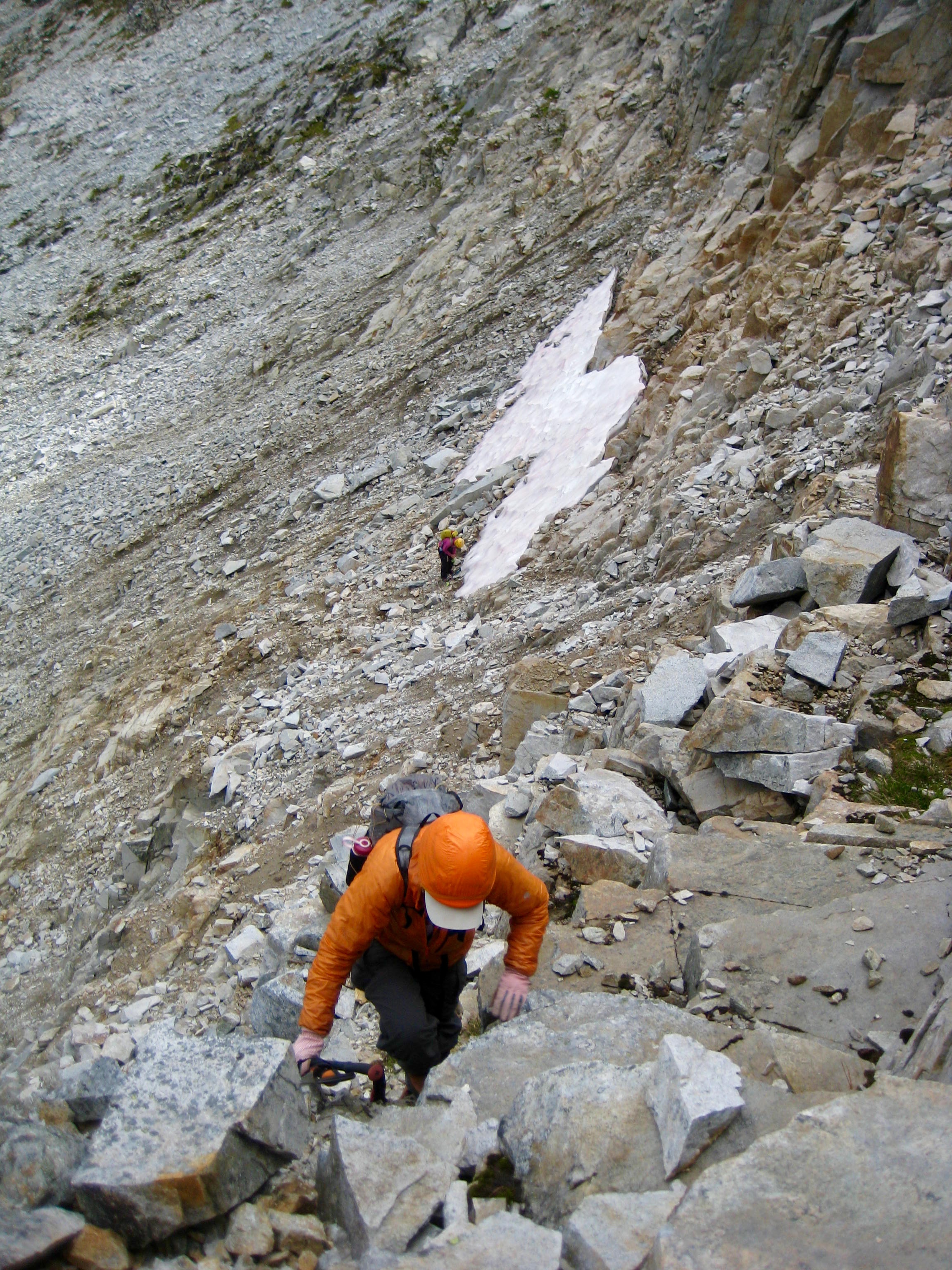
When cliffs blocked our upward progress through the talus bowl, we cut back sharply to the right (south) and scrambled up a Class 2 ramp that put us back on the ridge crest.
- Climbing Toward West Ridge Ramp

- Scrambling Up West Ridge Ramp
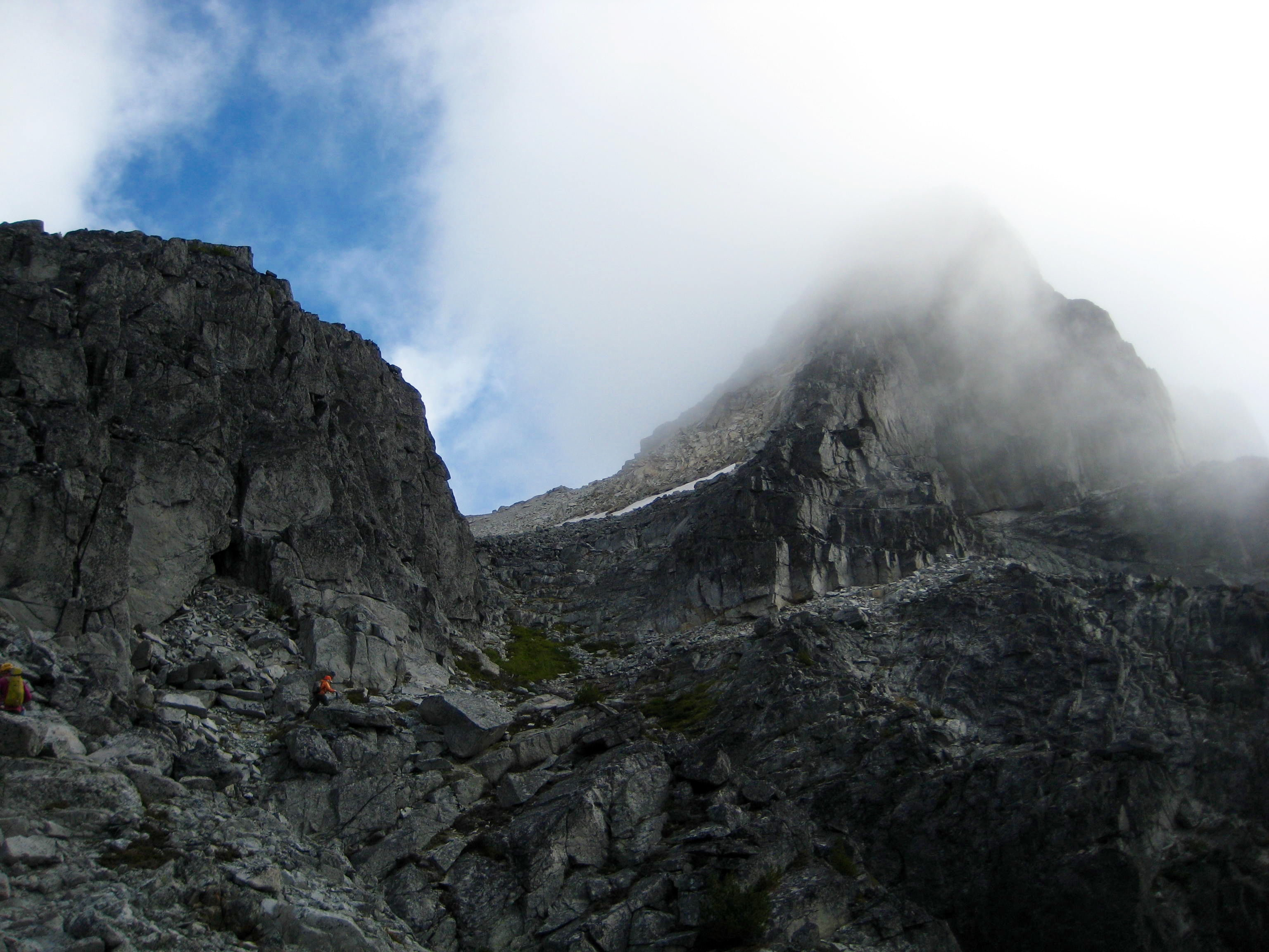
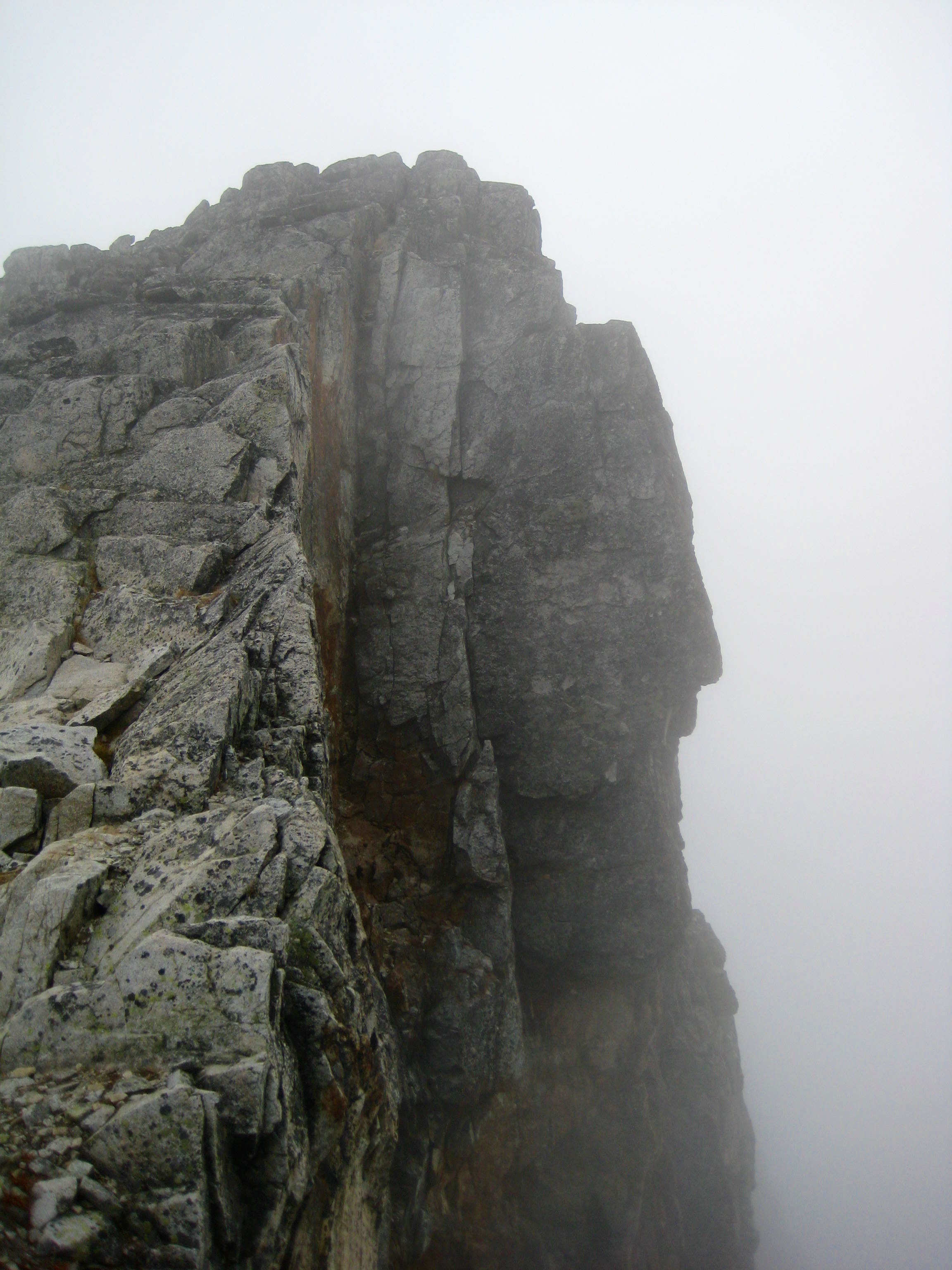
The summit block of Bear Mountain was shrouded in ominous fog above us.
- Foggy Summit From Upper West Ridge
We continued up the ridge crest until it melded into the peak’s high western slope. For a brief moment, the summit block made an appearance.
- Quick View Of Summit Block With North Ridge On Left Skyline
We angled leftward across the west slope until encountering a col that separated us from the vertical east face. Looking straight down at the snowfield 2000 feet below gave us chills.
- Scary Face On Scary East Face
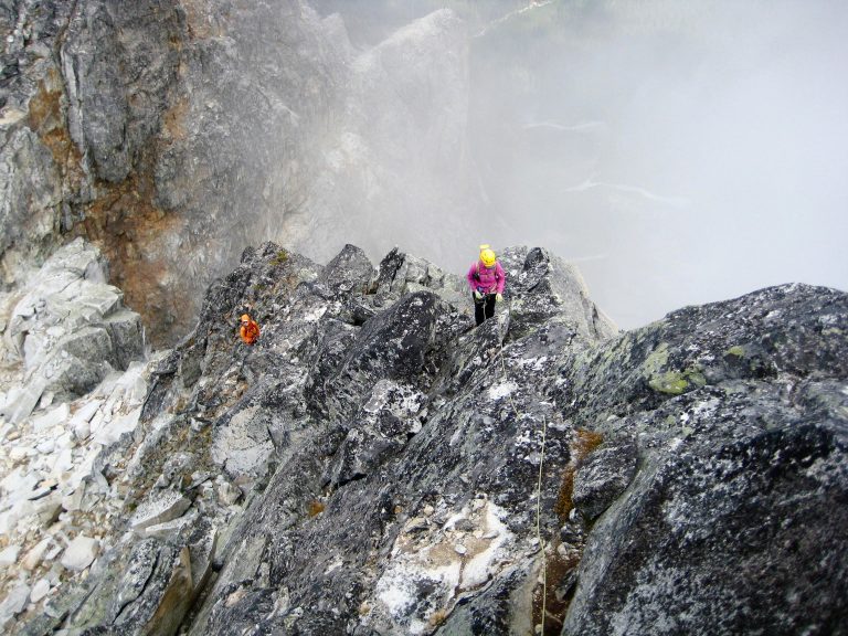
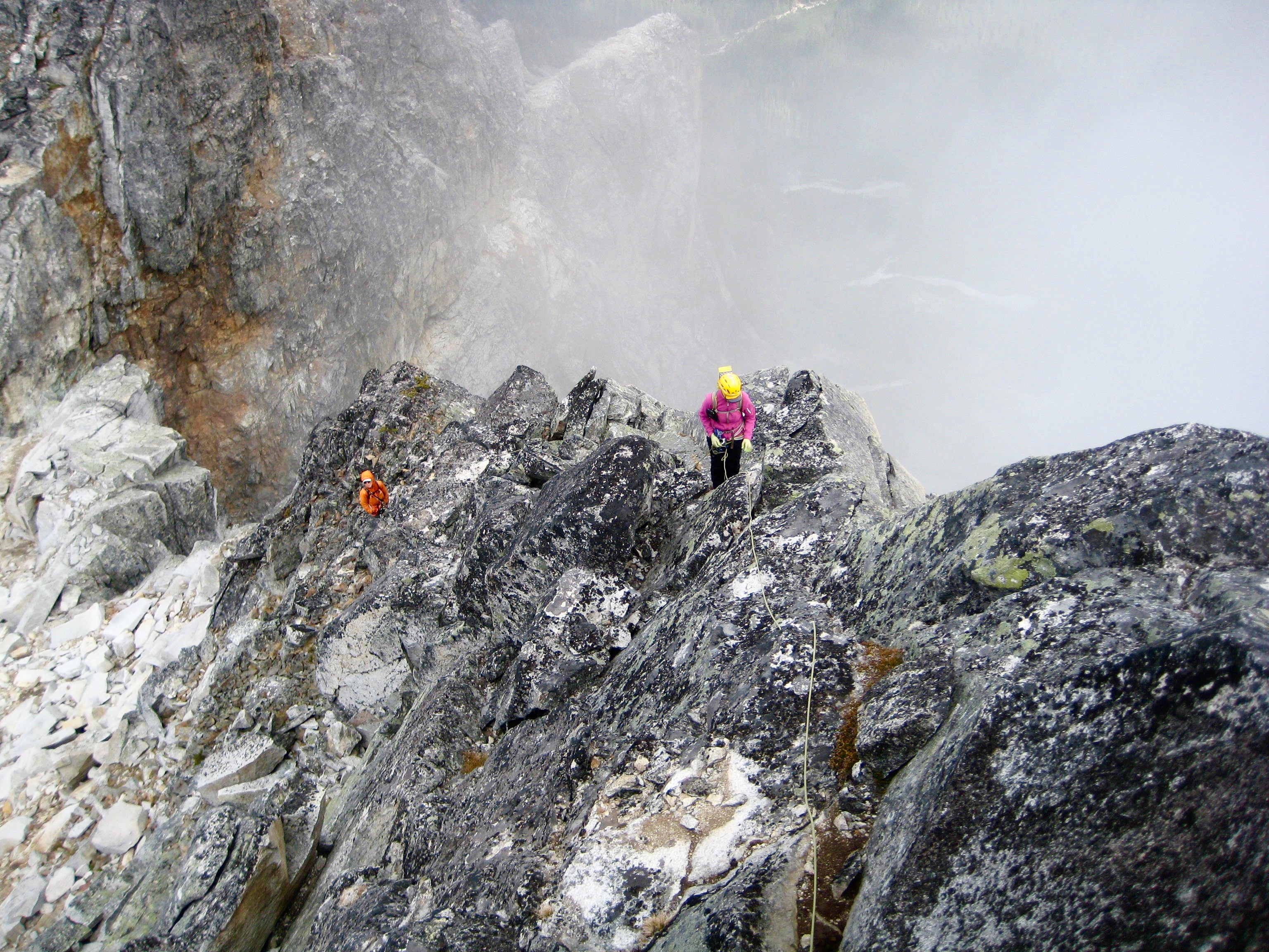
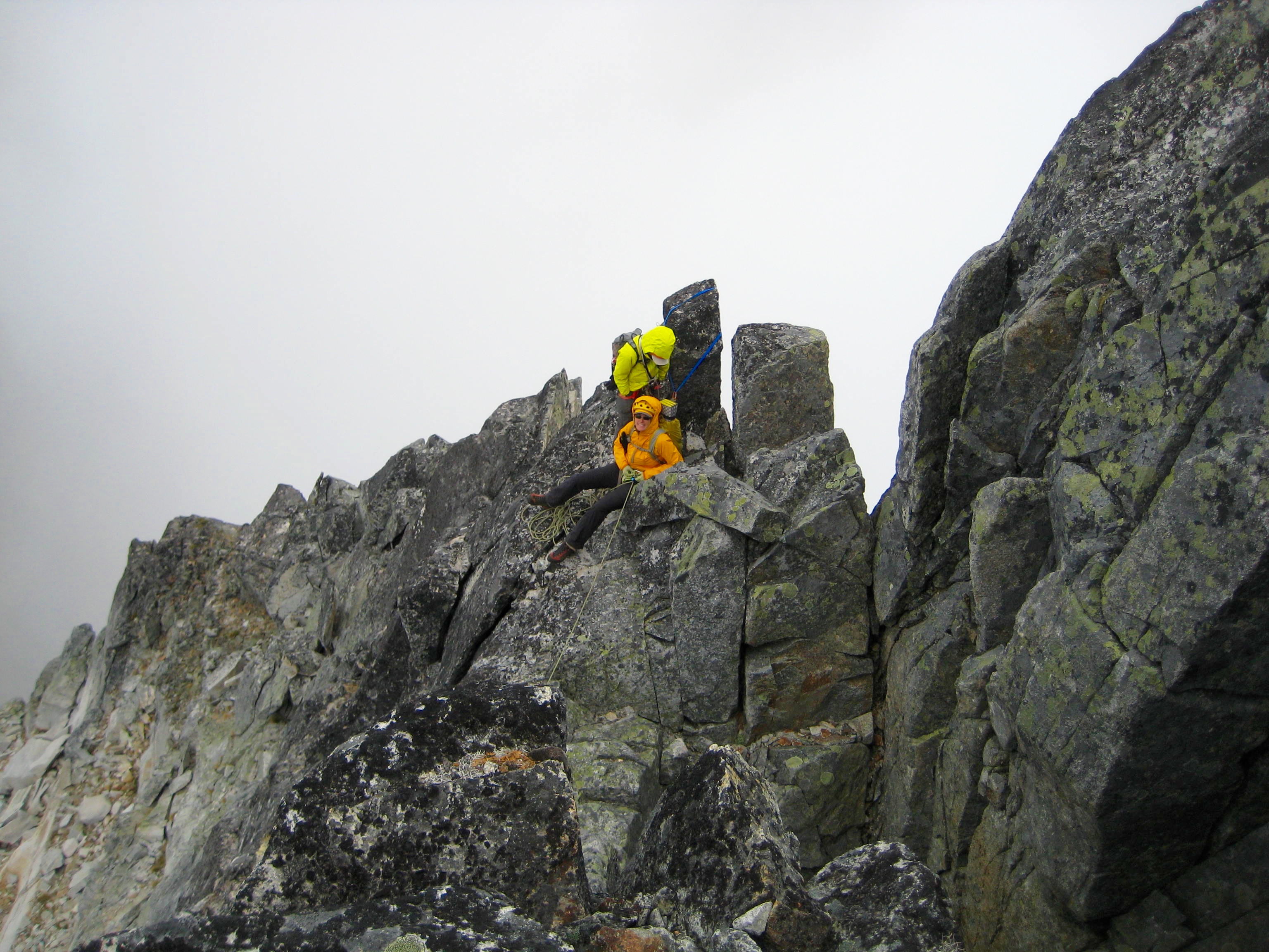
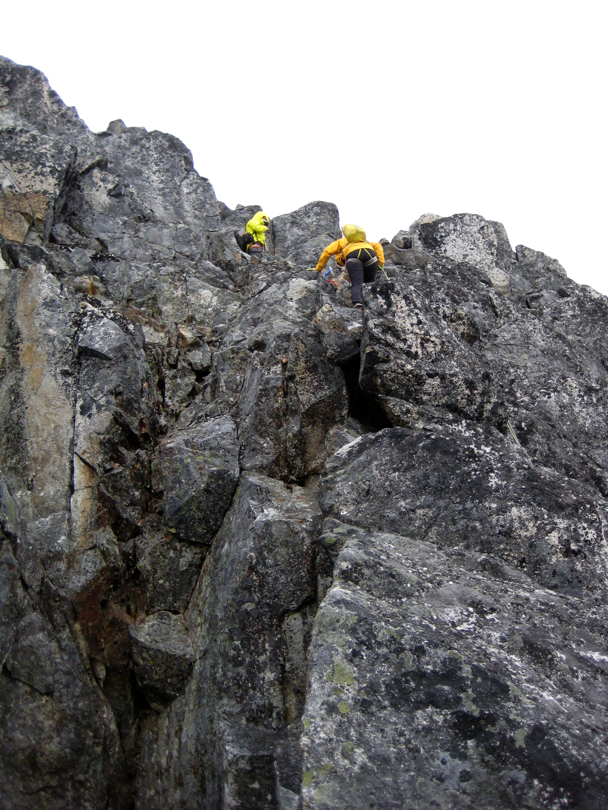
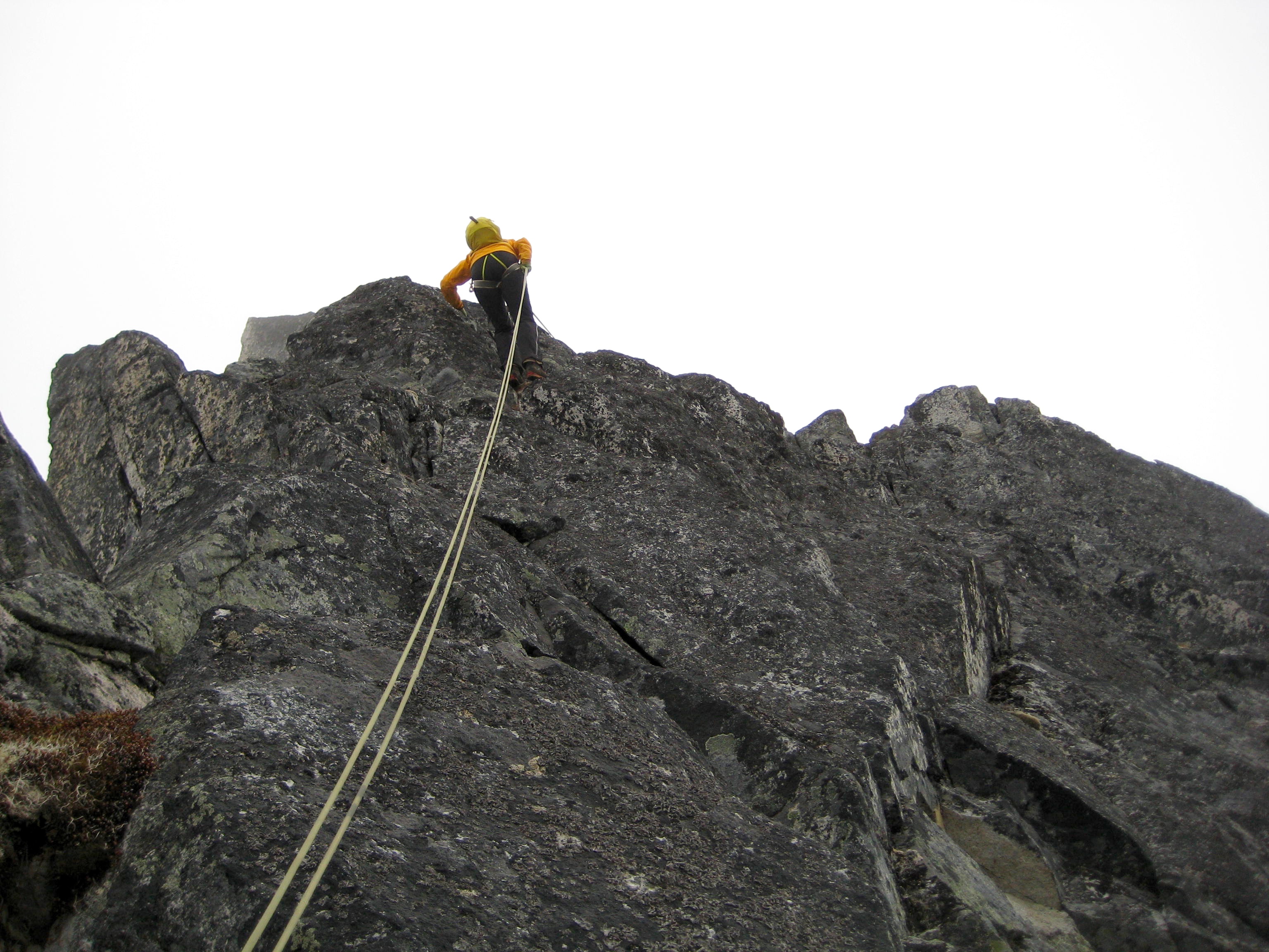
Here, we roped up and began climbing the upper north ridge using a combination of running and fixed belays. The ridge was solid, blocky, and fun granitic rock, with eye-popping exposure on the eastern side. We rated the difficulty as high Class 4. The weather was cold and windy, which added a bit more seriousness.
- Climbing Upper North Ridge of Bear Mtn
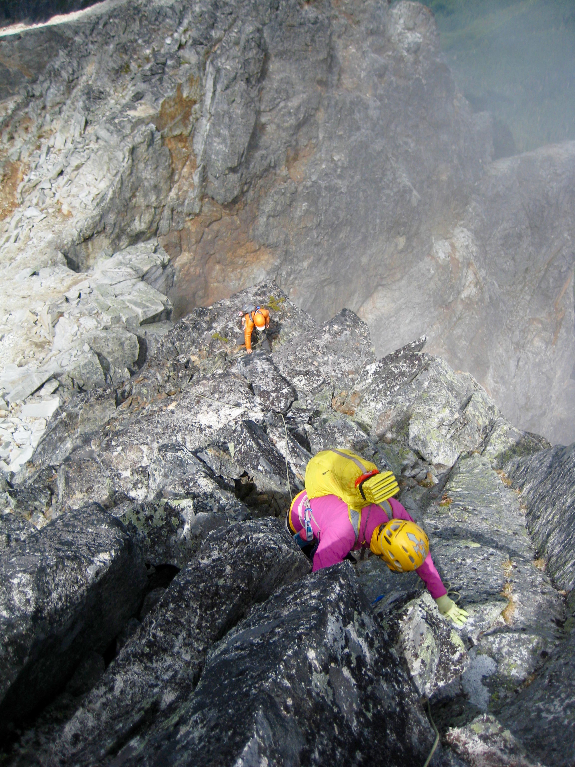
- Climbing Upper North Ridge of Bear Mtn
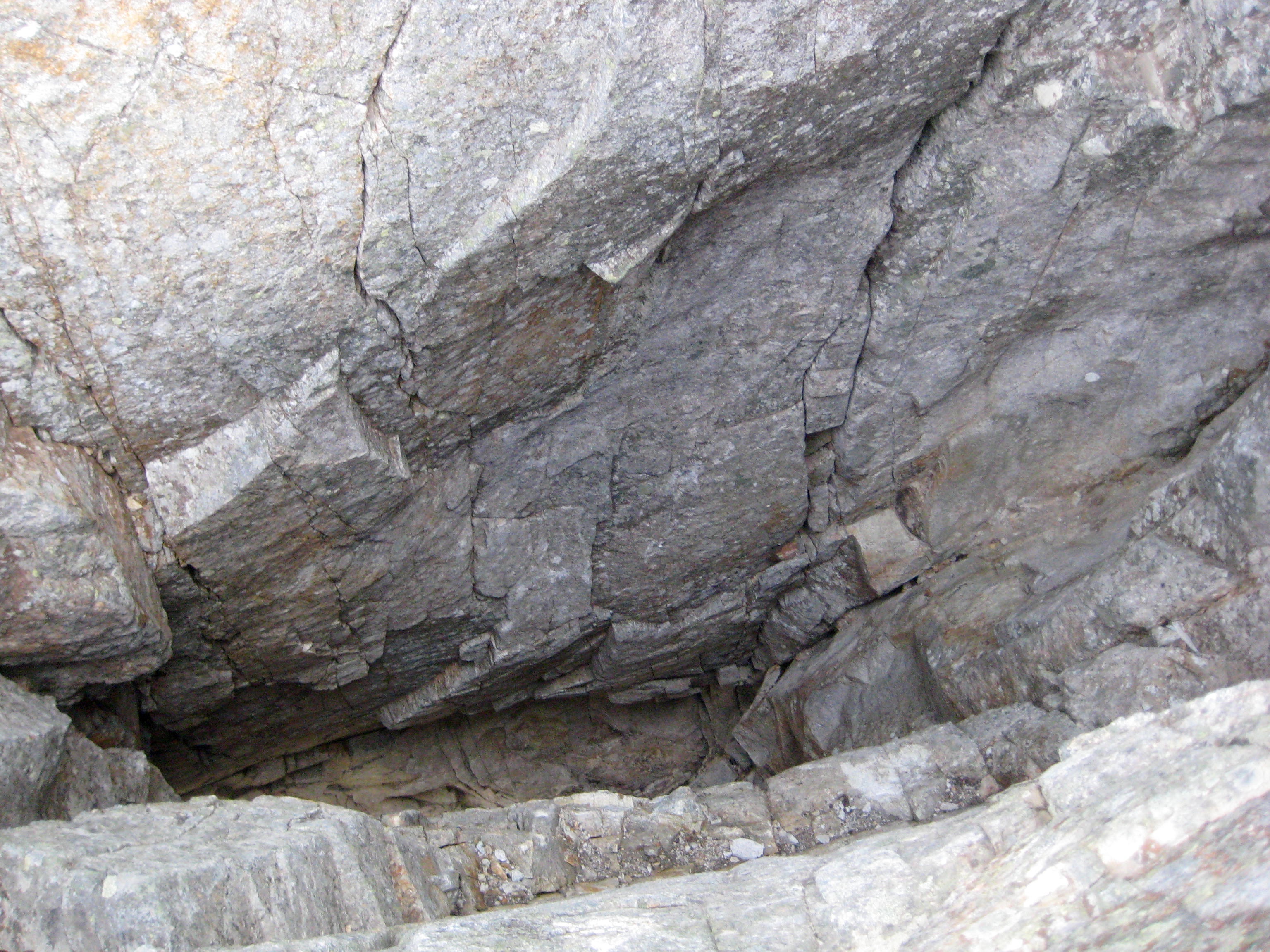
A fascinating geological feature of the north ridge is encountered closely below the summit. I would describe it as something like an elevator shaft that projects 30 or 40 feet vertically into the bedrock, with lateral dimensions on the order of 10 to 20 feet. The cause of this feature might be related to some highly erodible inclusion within the granite. Regardless of cause, it presents yet another form of exposure along the climbing route; you would not want to fall into this shaft!
- Elevator Shaft On Upper North Ridge
From the “elevator shaft,” one belayed Class 5 pitch led to the small summit horn. We topped out in mid afternoon (6.8 hours + 3400 feet from high camp) and spent 45 minutes on the summit.
- Fay & Eileen At Upper Belay Station
- Jim & Eileen & Fay On Bear Mtn Summit
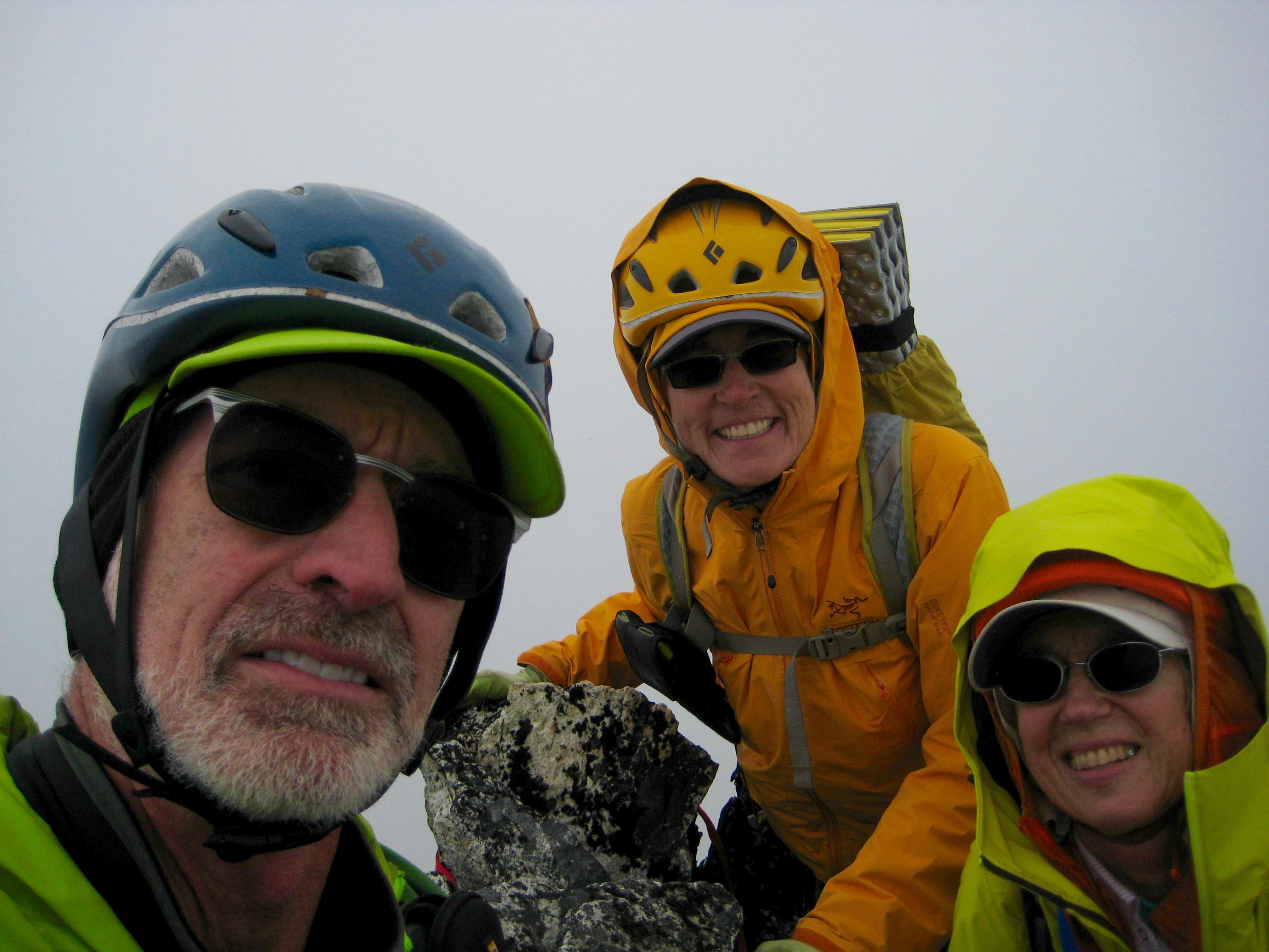
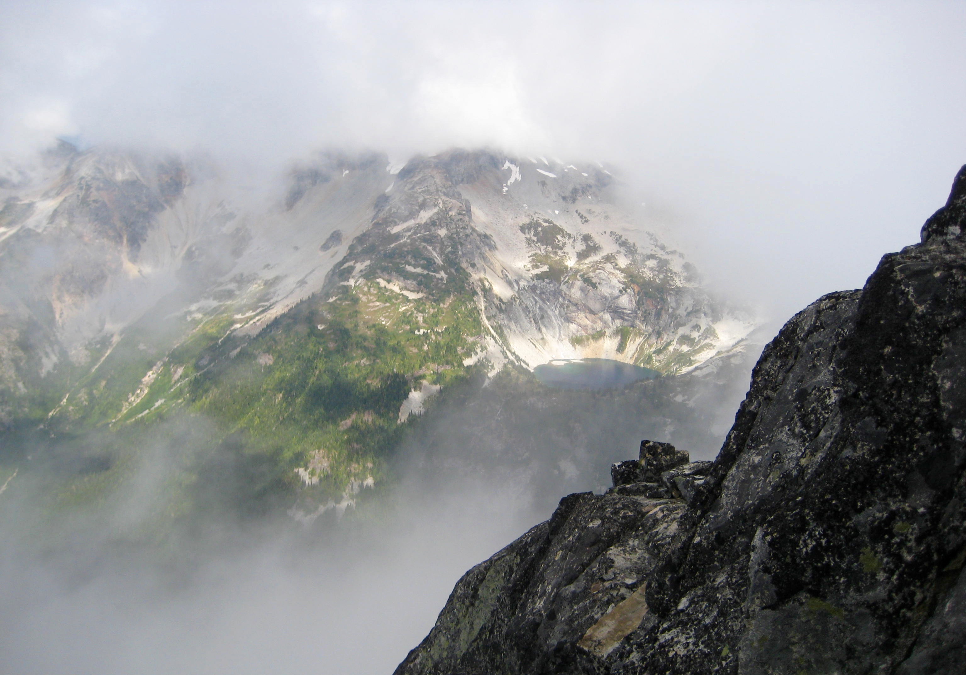
Views were limited due to the swirling clouds, but we managed to get a sneak peek at reclusive Bear Lake to the northeast.

- View Of Bear Lake From Bear Mtn Summit
The summit register was a small pad of paper left in a plastic bottle by Dave Creeden and Mike Collins in 2006. It indicated that Bear Mountain averages about one summit party per year, with approximately equal numbers climbing the standard route and the highly technical north-side routes. Because this register was pretty full, Fay left a new register in a matchbox.
We descended the steep west face by means of two short rappels and some belayed down-climbing.
- First Rappel Off Bear Mtn Summit
- Second Rappel Off Bear Mtn Summit
Once on the easier west slope below, we simply retraced our up-route along the west ridge.
- Starting Descent Of West Ridge
The final patch of brush and field of mossy talus were completed in the dusk, and we stumbled into our meager campsite scant minutes before dark (5.5 hours from summit).
Day 4: West Bear Basin to Copper Creek Camp
To retreat from West Bear Basin, we tried to out-smart the dense brush by first ascending 300 feet above camp and then traversing toward the ridge crest before descending. However, the brush still got the better of us, and it took us nearly 1.5 hours to reach the open forest at elev. 4600 feet. Our progress then increased considerably for the next 2000 vertical feet. Eileen descended most of this distance going backwards (facing uphill), which she finds more comfortable since her knee injuries in July. It created a somewhat humorous scene for Fay and me.
Over the final few hundred feet, we stayed left (south) of the creek. Unfortunately, this was no better than the other side; the brush and deadfall in the valley bottom were thick and tedious. It was early afternoon when we reached the Chilliwack River Trail (4.3 hours from high camp). Our awaiting trail sneakers then independently propelled us 8 miles up the trail to Copper Creek Camp, where we all regrouped just as darkness fell (10.5 hours + 1600 feet from high camp). The large campsite was surprisingly quiet for a holiday weekend, so we had room to stretch out and savor our last night.
Day 5: Copper Creek Camp to Hannegan Trailhead
We awoke to blue skies for the first time during our trip, but the air was still crisp and autumnal. We slowly made our way over Hannegan Pass, stopping to chat with other weekend hikers along the way before reaching the Hannegan Trailhead in mid-afternoon (6.7 hours + 2200 feet from Copper Creek Camp).
Route Maps & Profile
…
…
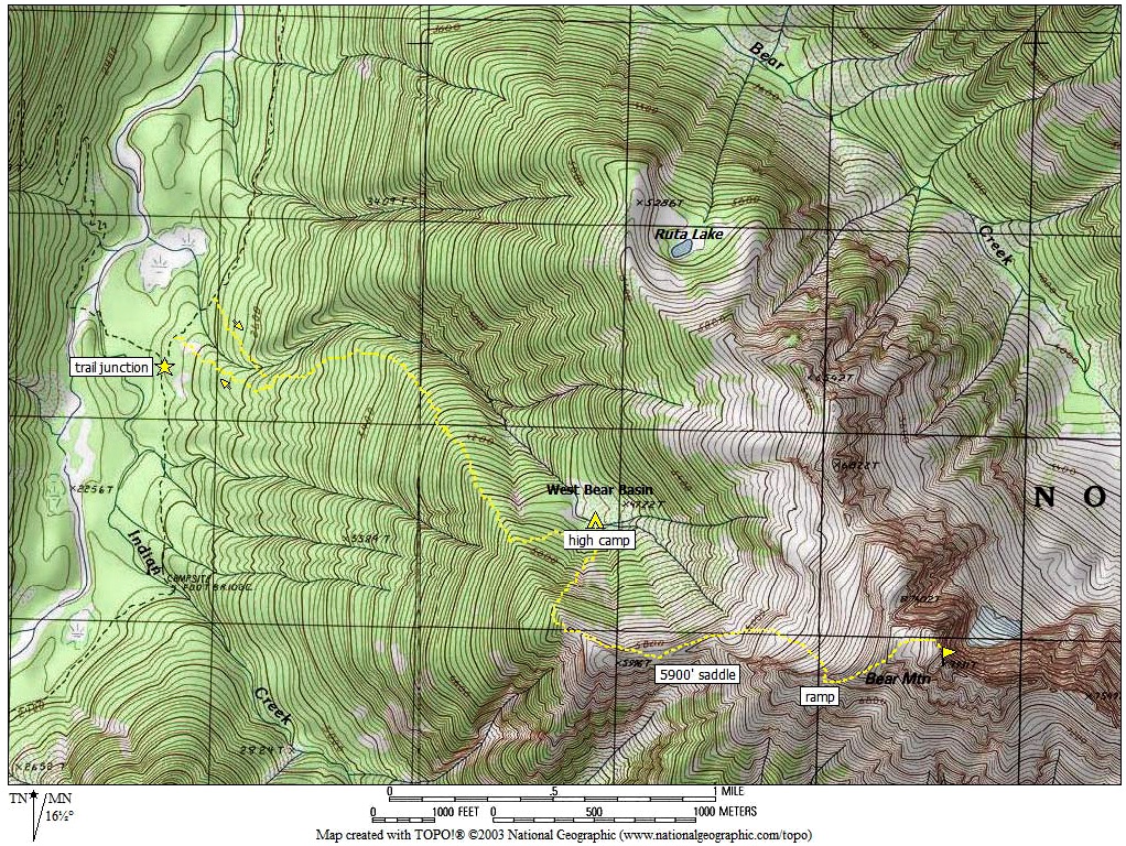
Photo Gallery
Click to enlarge…


