Trip Date: August 30 – September 5, 2017
Bear Mountain Climbing Trip & Middle Lakes High Traverse: Whatcom Pass to Indian Basin
Hannegan Pass
Chilliwack River Cablecar
Whatcom Pass
Middle Lakes
Tiny Lake
East Lakes
Indian Saddle
Indian Basin
Bear Mountain (7931’) attempt
- Trip Report Summary
- Related Post
- Full Trip Report
- Day 1: Trailhead to U.S. Cabin Camp
- Day 2: U.S. Cabin Camp to Middle Lakes
- Day 3: Middle Lakes to Indian Basin
- Day 4: Bear Mountain Summit Attempt
- Day 5: Indian Basin to Middle Lakes
- Day 6: Middle Lakes to Boundary Camp
- Day 7: Boundary Camp to Trailhead
- Route Map
- Photo Gallery
Trip Report Summary
Region: Northwestern Washington Cascades
Sub-Region: American Chilliwack Mountains
Area: North Cascades National Park
Starting & Ending Point: Hannegan Trailhead at end of Ruth Creek Road (Elev. 3100 feet)
Way Points: Ruth Creek & Hannegan Pass & Copper Creek & U.S. Cabin Camp & Chilliwack River Cablecar & Brush Creek & Tapto Creek & Whatcom Pass & Middle Lakes & Tiny Lake & East Lakes & Indian Saddle & Indian Creek & Indian Basin (trail hike & off-trail hike & rock scramble & bushwhack)
Campsites: U.S. Cabin Camp & Middle Lakes & Indian Basin & Middle Lakes & Boundary Camp
Summit Attempt: Bear Mountain (rock scramble to summit notch via East Ridge)
Approximate Stats: 54 miles traveled; 16,300 feet gained & lost; 13 wasp stings suffered.
…
Related Post
Bear Mountain via West Side—Upper North Ridge – September 2018
Full Trip Report
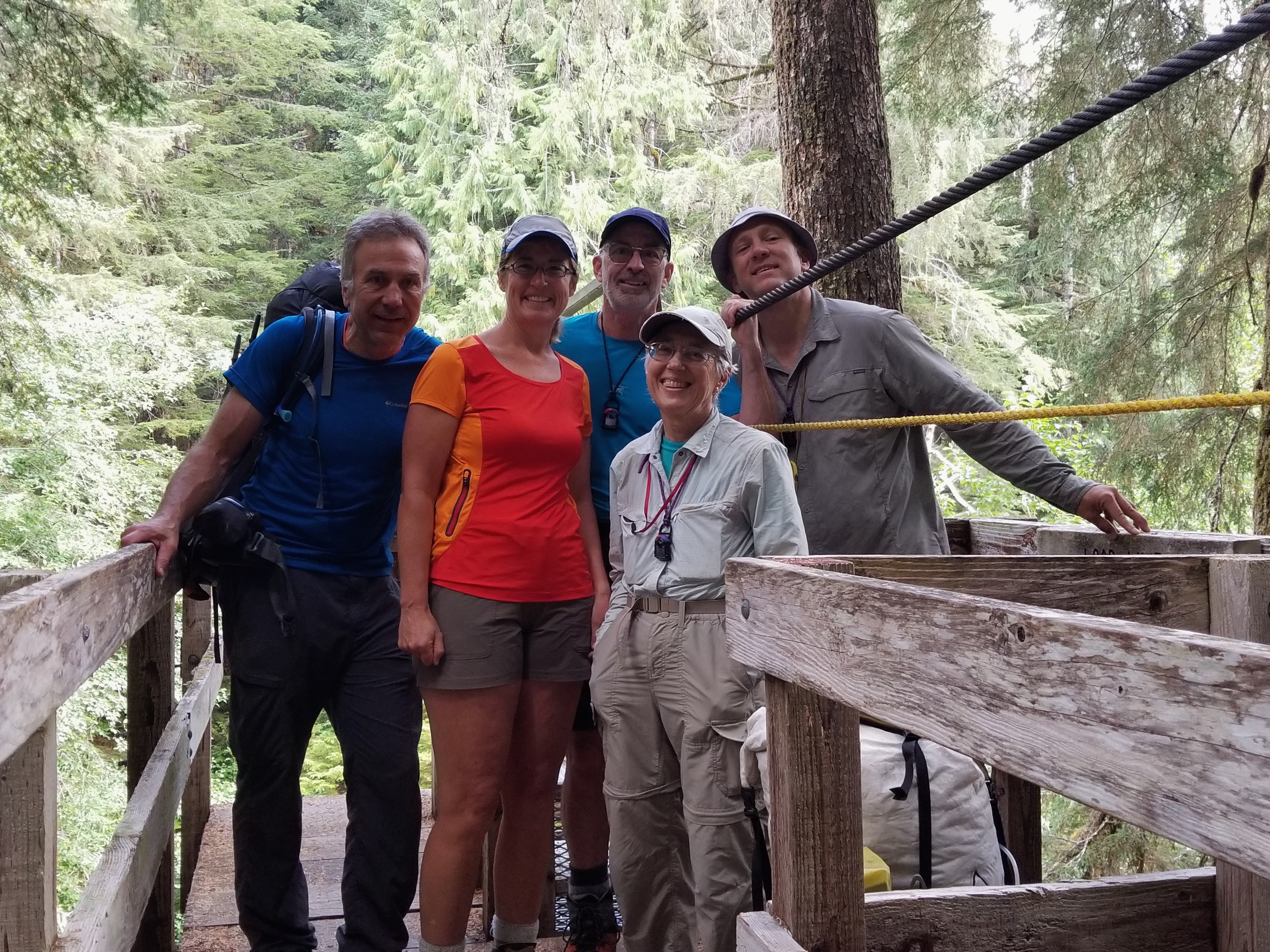
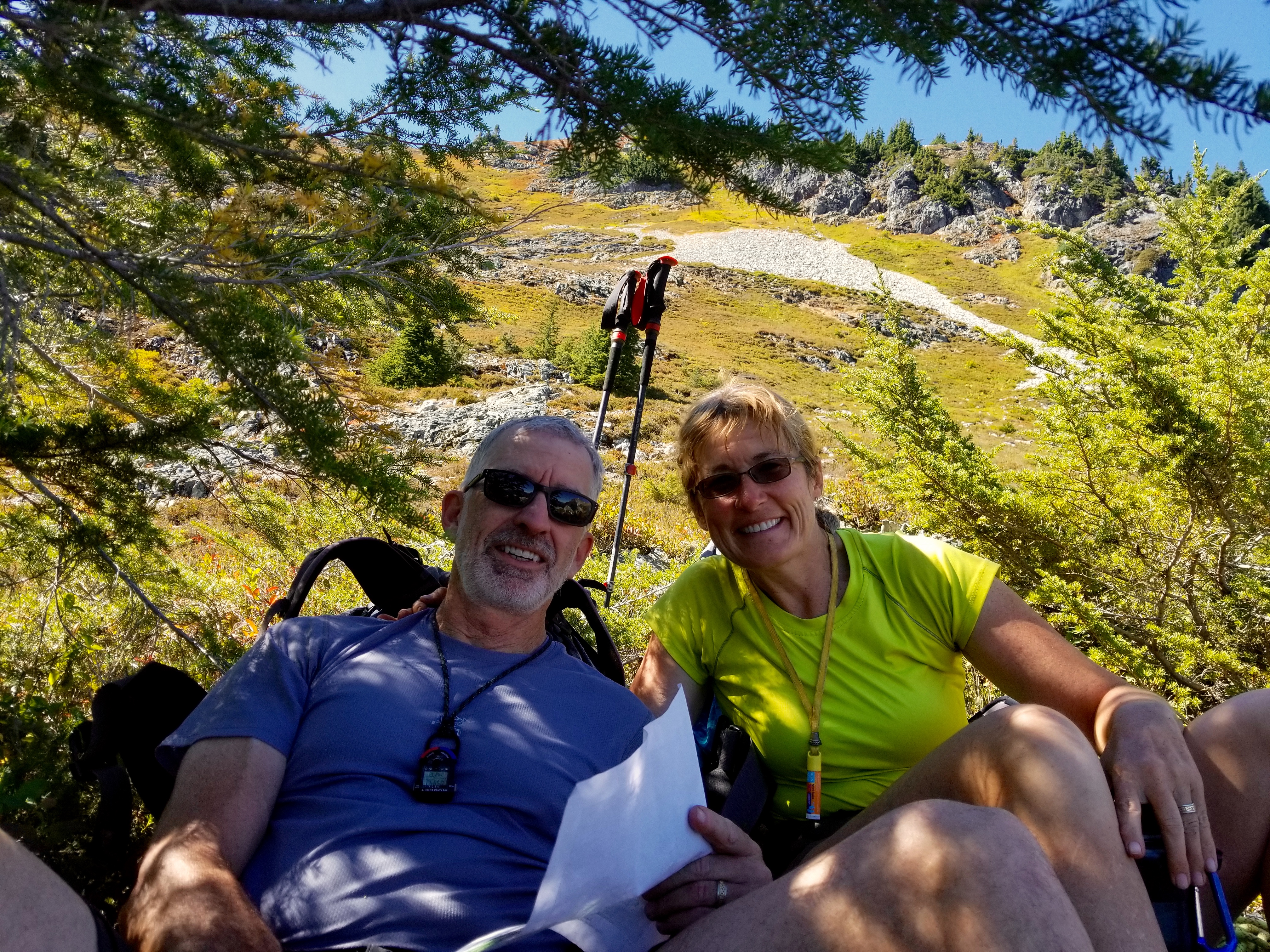
For this year’s Labor Day Weekend trip, Eileen and I were joined by Fay, Lisa, K.Lo, and K.Ko for a journey into the northwestern corner of North Cascades National Park. Our goal was to climb Bear Mountain in the American Chilliwack Mountains using the southwestern portion of the Redoubt High Route as an access line. We didn’t quite make the summit of Bear Mountain, but we experienced some incredible alpine scenery along our Middle Lakes High Traverse.
Day 1: Trailhead to U.S. Cabin Camp
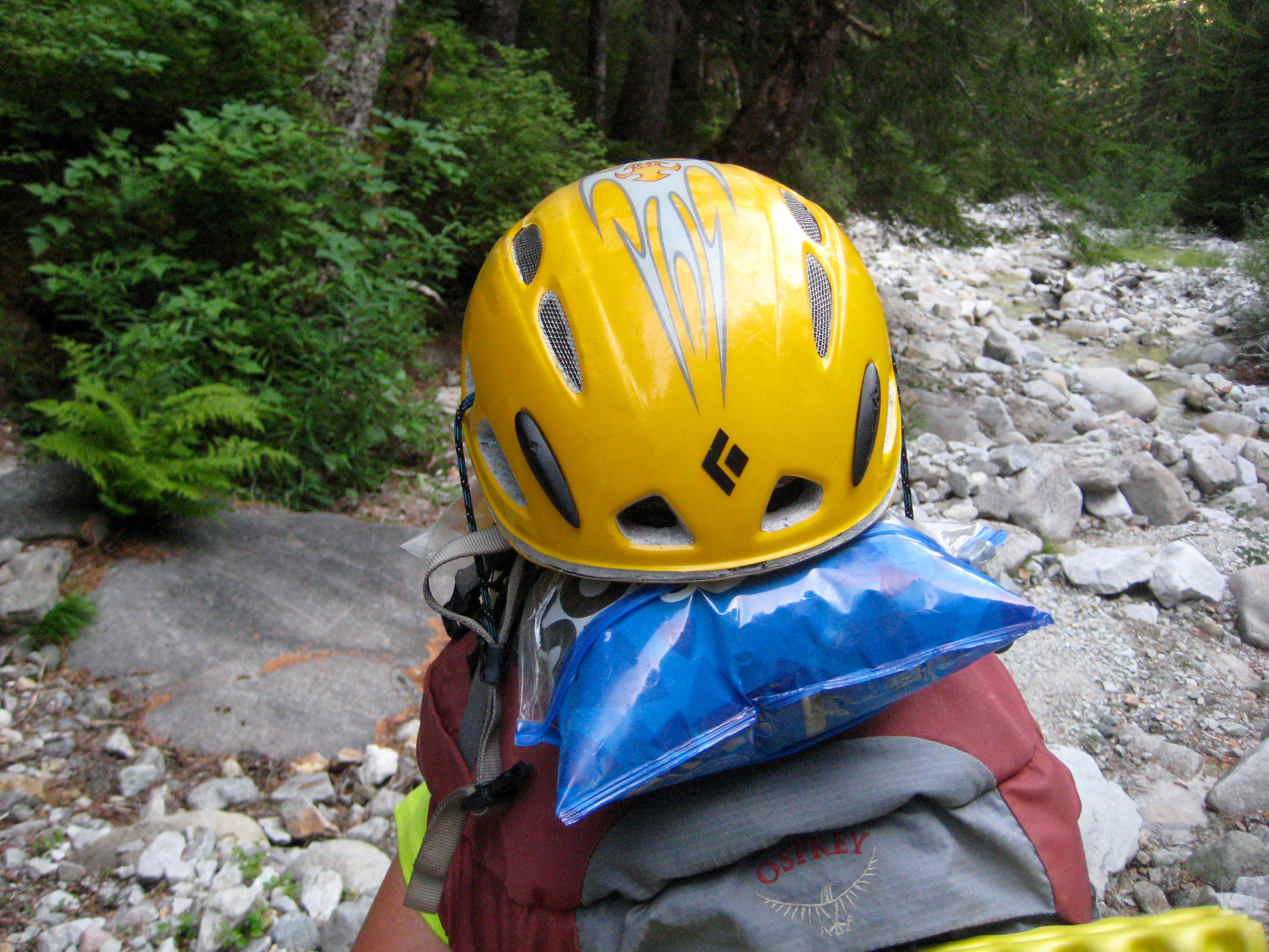
We pulled into the Hannegan Trailhead parking lot at 10:30am and were immediately faced with some difficulty finding a parking spot. This being a Wednesday morning served as an indicator of the popularity of the Hannegan Pass Trail. We split up group gear, shouldered backpacks, and headed up the trail. My main task for the day, aside from repeatedly putting one foot in front of the other, was to ensure that the corn chips lashed to the top of Eileen’s pack remained well protected. A helmet seemed to be in order here.

- Chip Protection on Eileen’s Pack
We cruised over Hannegan Pass in the afternoon heat and then descended 6 miles to U.S. Cabin Camp (6.6 hours from TH), where we bedded down for the night.
Day 2: U.S. Cabin Camp to Middle Lakes
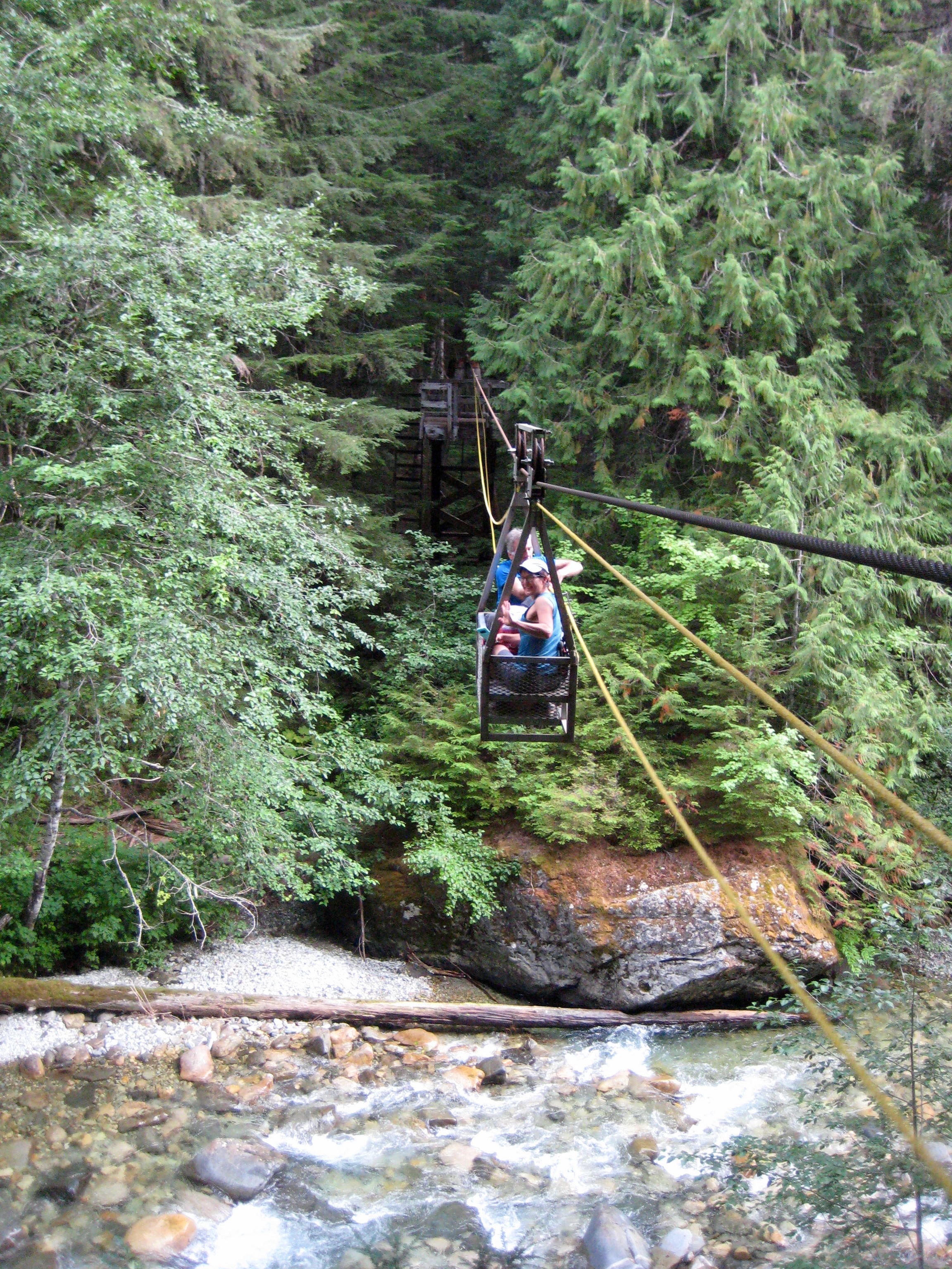
After breaking camp, we made a short hike over to the Chilliwack River Cablecar, made the amusement-park-like crossing, and then continued on to Brush Creek. This segment of trail had been littered with blowdown trees last year, but the trail crews had since done an excellent job of cutting logs and trimming back brush.

- Lisa and Kevin In Chilliwack River Cablecar
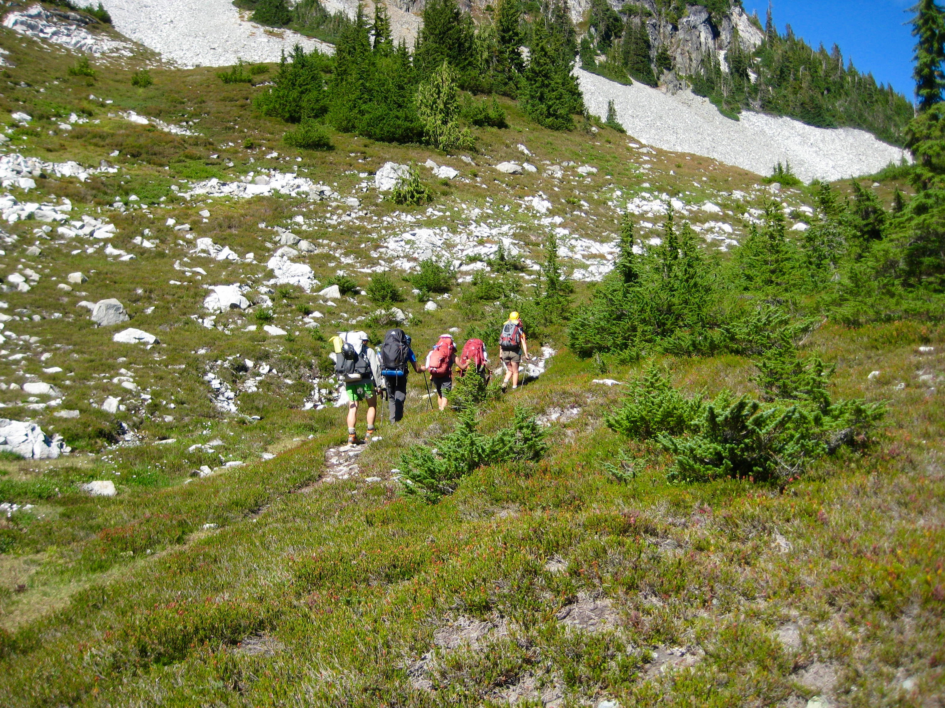
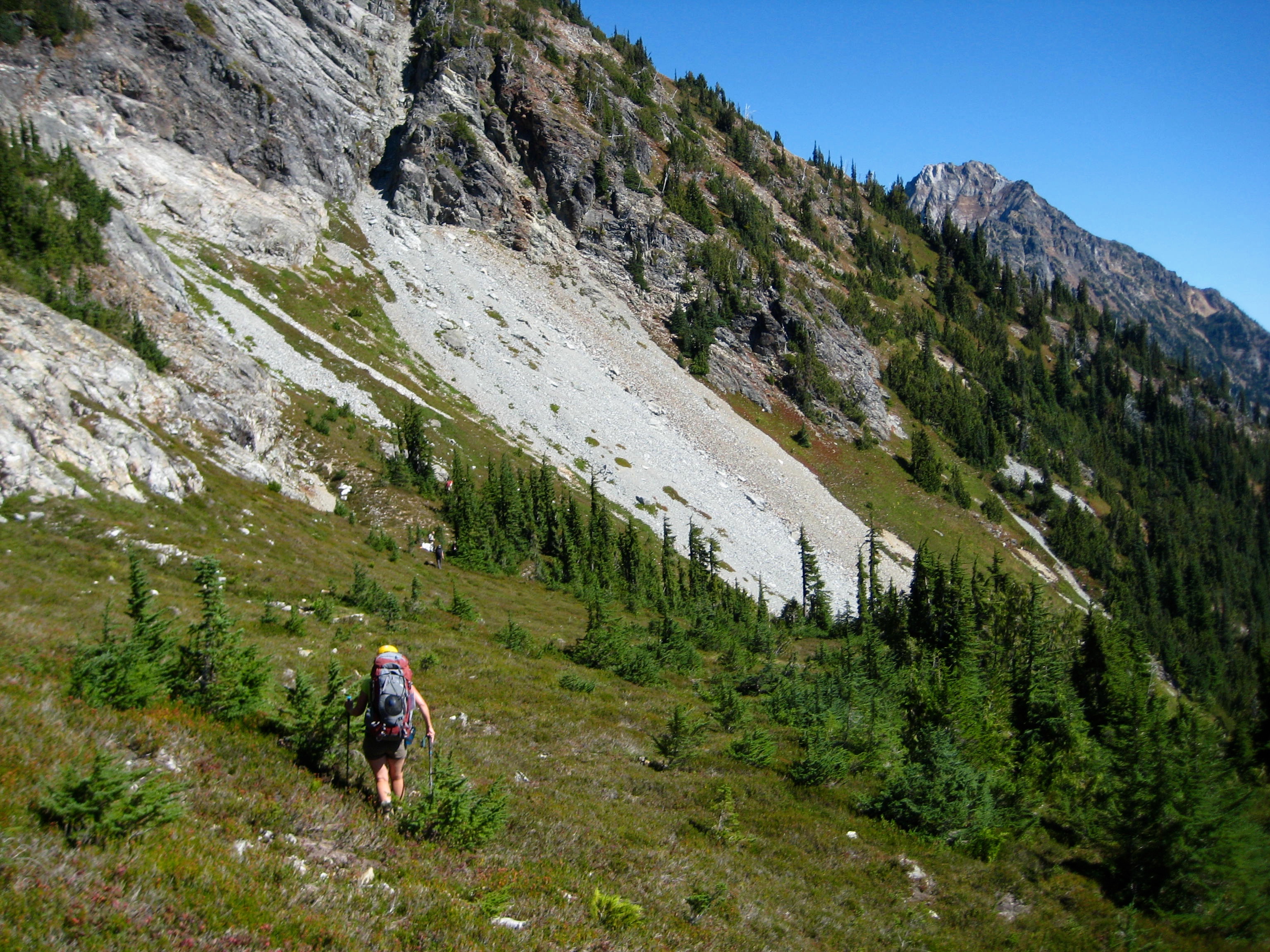
We hiked 6 miles up Brush Creek to Whatcom Pass (6.2 hours from Camp 1), at which point we turned left onto a steep but well-trodden path heading to Tapto Lakes. Several hundred feet up, we veered right and followed a secondary path over to Middle Lakes. The terrain here opened up to beautiful meadows of heather and white granite talus.
- Heading Toward Middle Lakes On Day 2
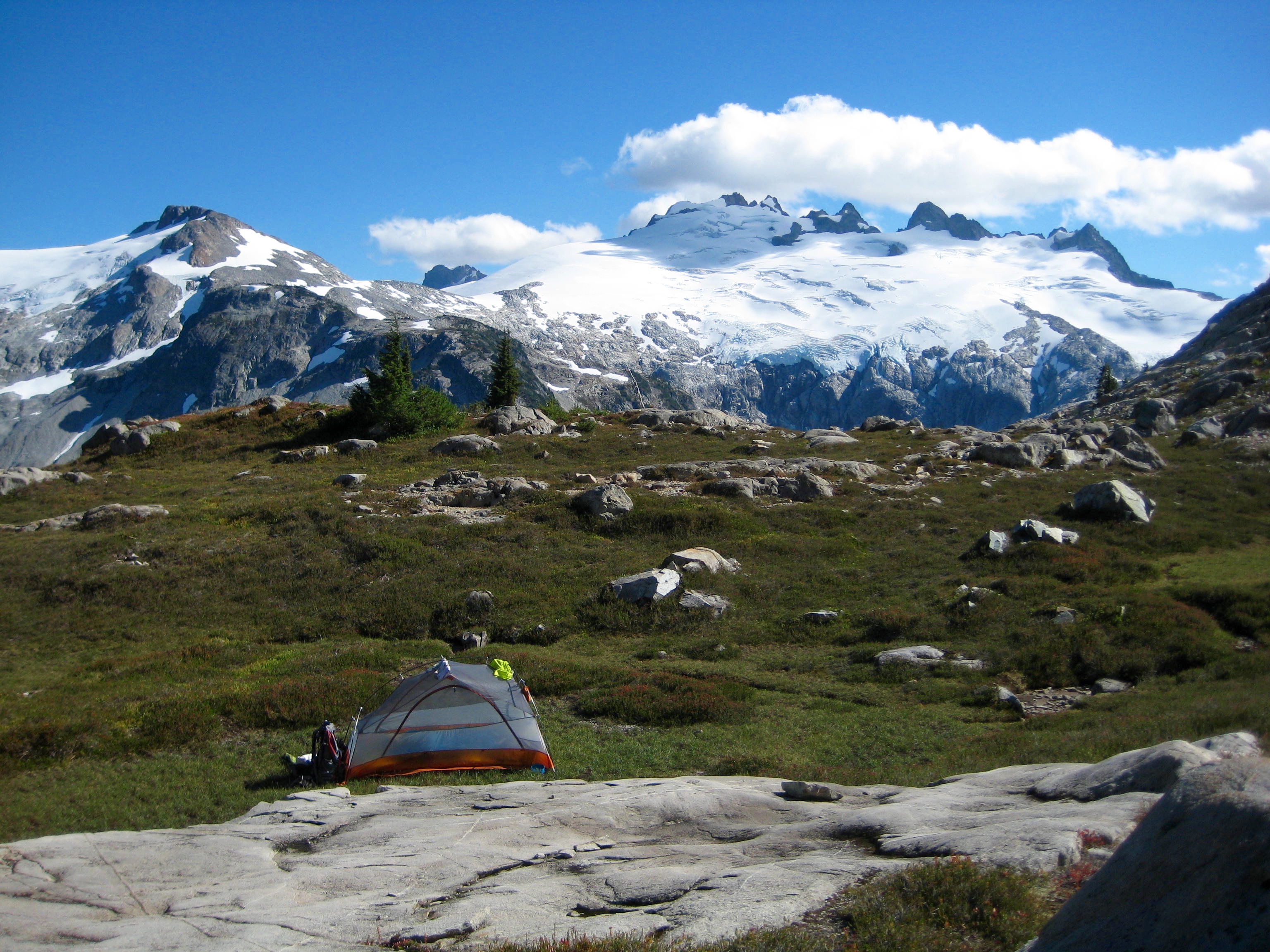
Just before reaching Middle Lakes, we stopped on a large heather plateau and set up camp (7.5 hours + 3450 feet from Camp 1).
- Middle Lakes Meadow Plateau
Lower Middle Lake (is that an oxymoron?) sat below us, amidst a carpet of greenery. Upper Middle Lake sat closely above in a talus bowl. We all took a dip in the lower lake to wash off the day’s sweat.
- Lower Middle Lake
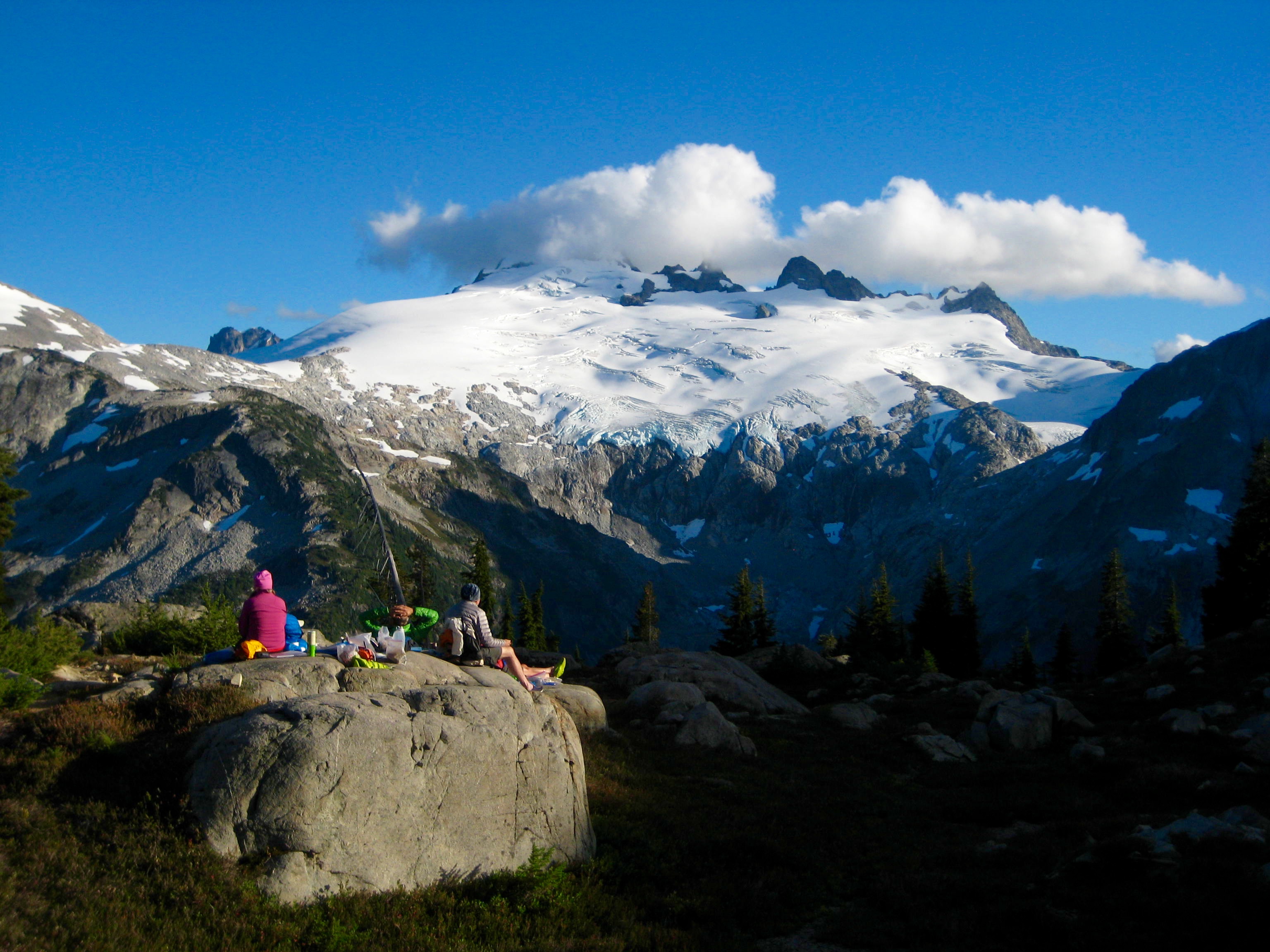
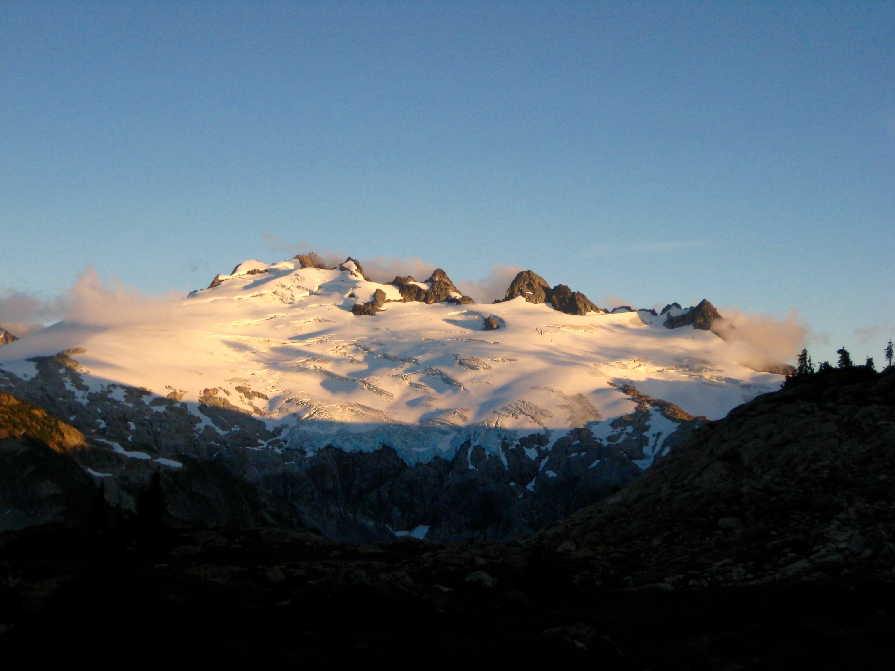
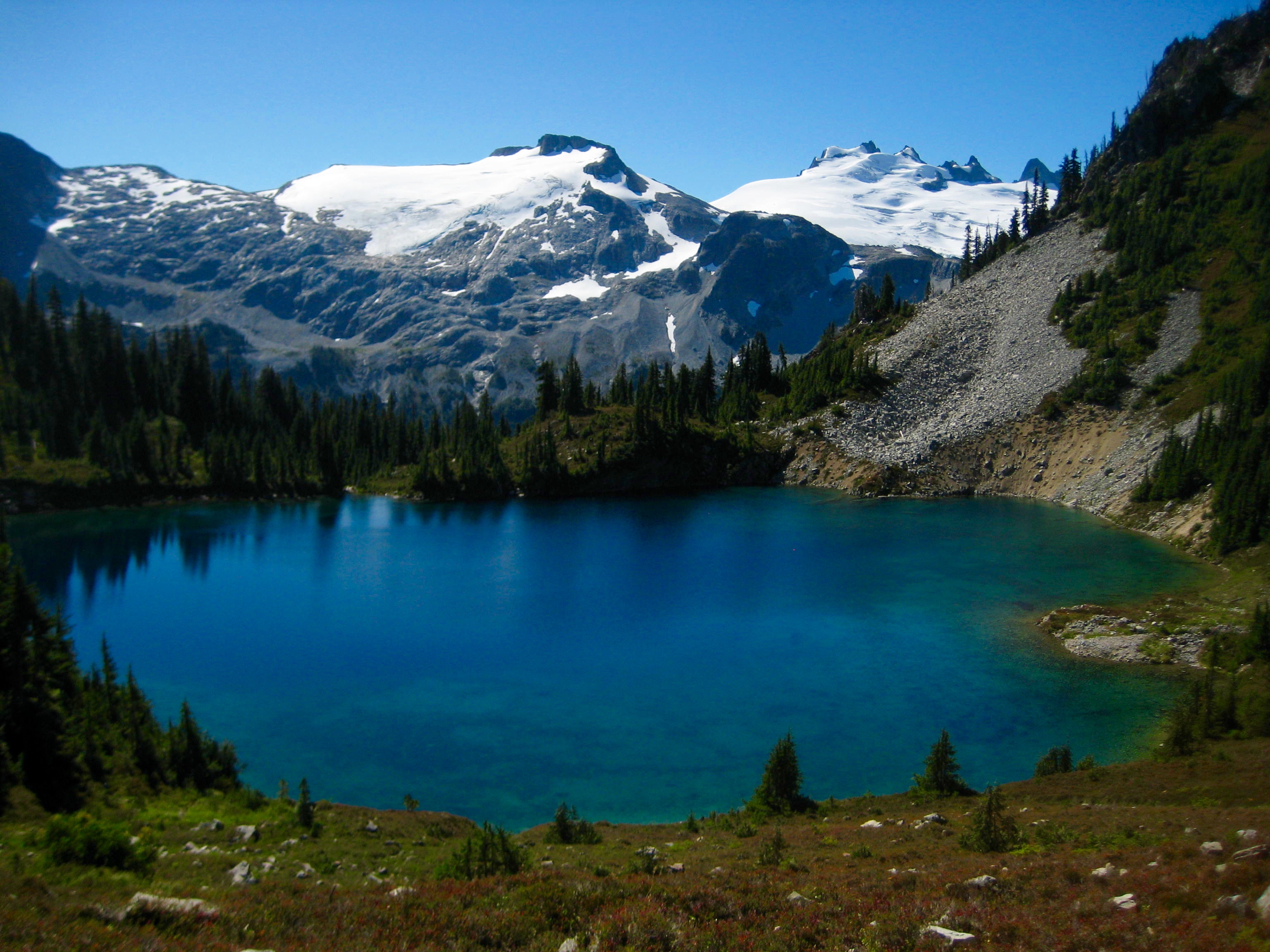
Our campsite kitchen was a rounded granite boulder that provided a most spectacular view of Mt. Challenger. We could hardly take our eyes off the mountain long enough to eat dinner.
- Mt Challenger From Middle Lakes Kitchen
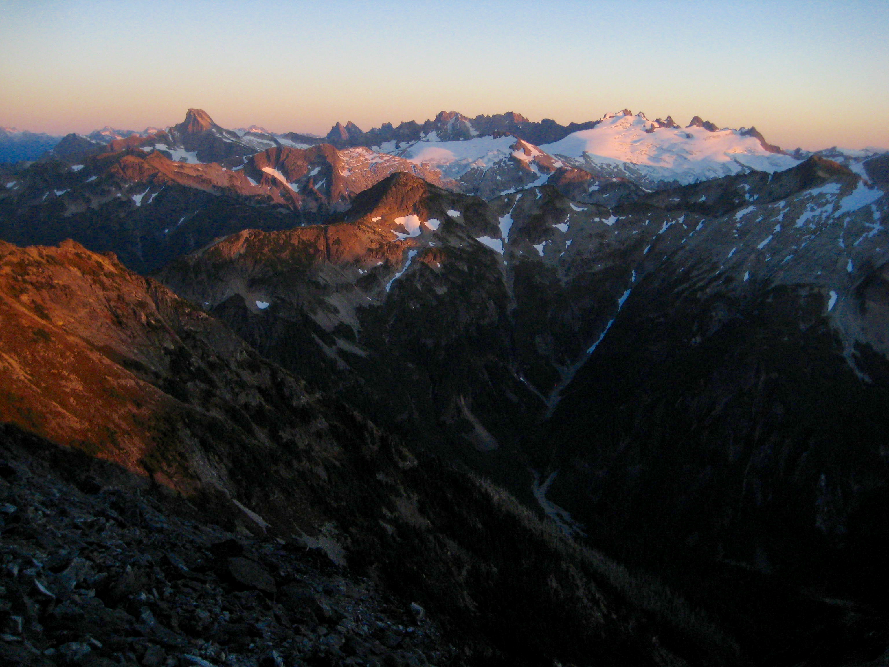
As the evening rolled on, a gibbous moon rose over the mountain, and soft alpenglow washed over the Challenger Glacier. The entire view seemed like a painted mural – too perfect to be real.
- Evening Sun On Mt Challenger
Day 3: Middle Lakes to Indian Basin
More alpenglow was highlighting Whatcom Peak when we arose the next morning. This craggy peak—usually lost in the legendary shadows of Mt. Challenger—never looked as good to me as it did now.
- Morning Sun On Whatcom Peak
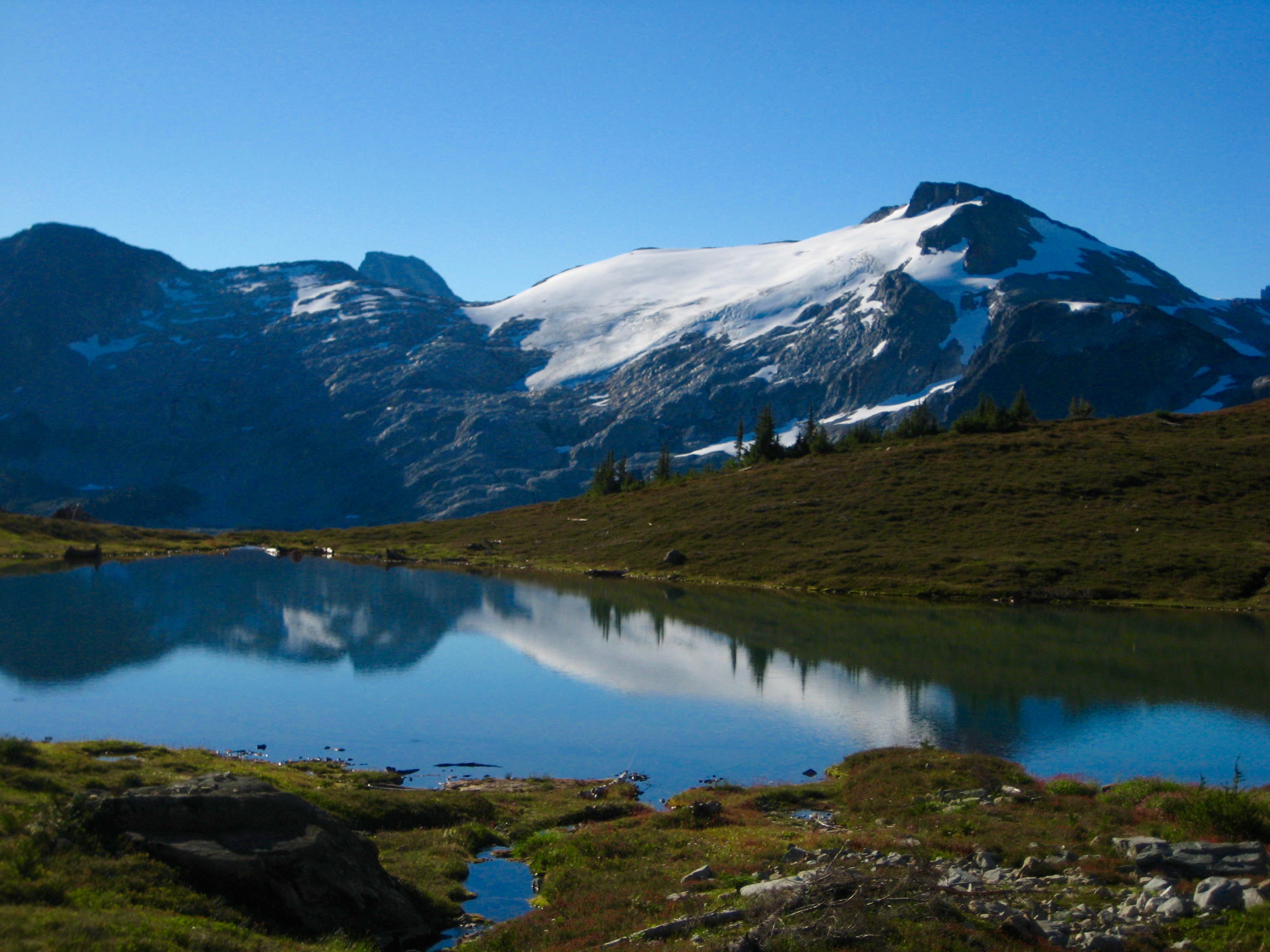
We broke camp and hiked around Lower Middle Lake, which nicely reflected the snowy slopes of Wiley Peak and the dark wedge of Luna Peak.
- Wiley Peak From Lower Middle Lake
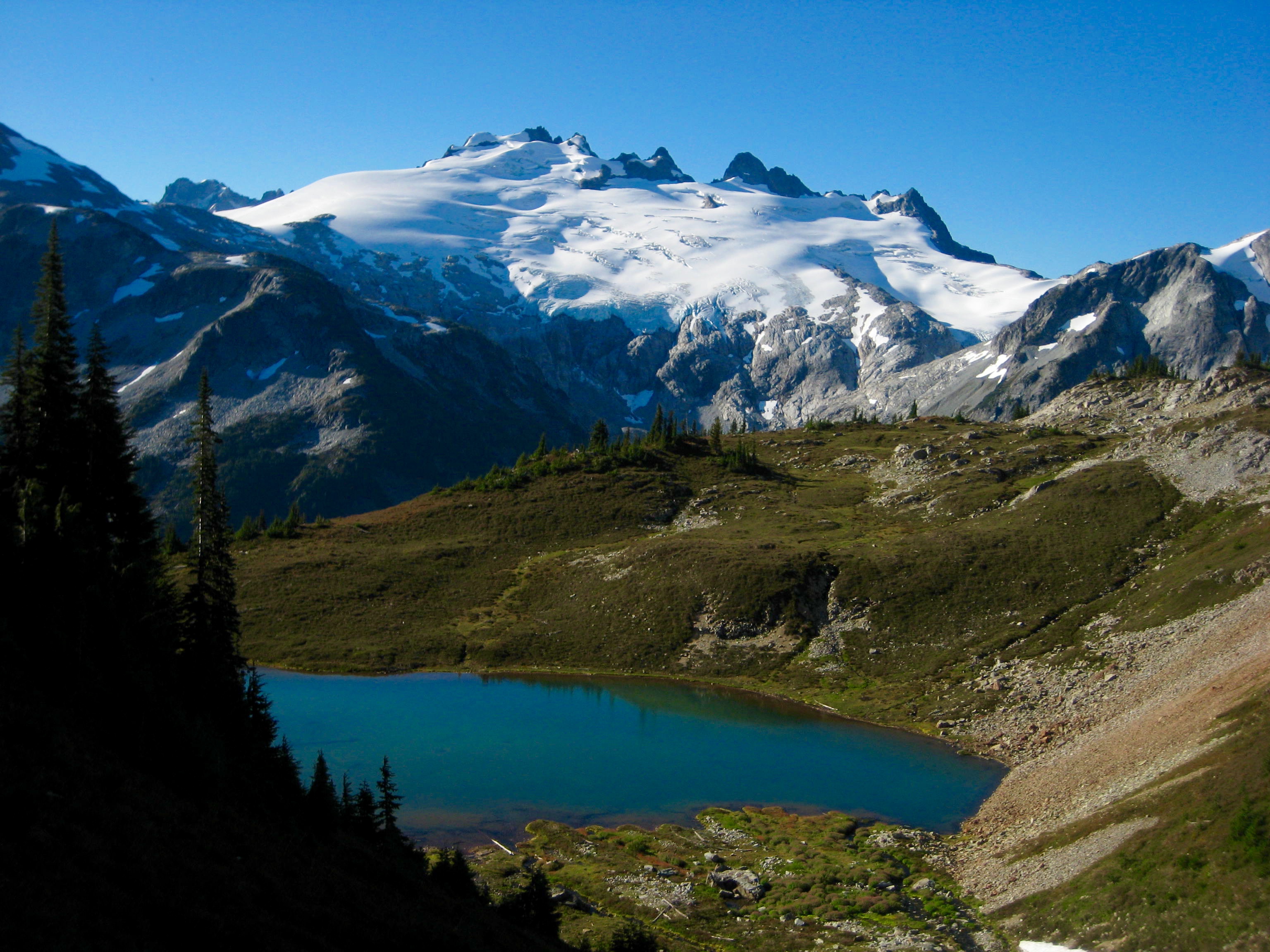
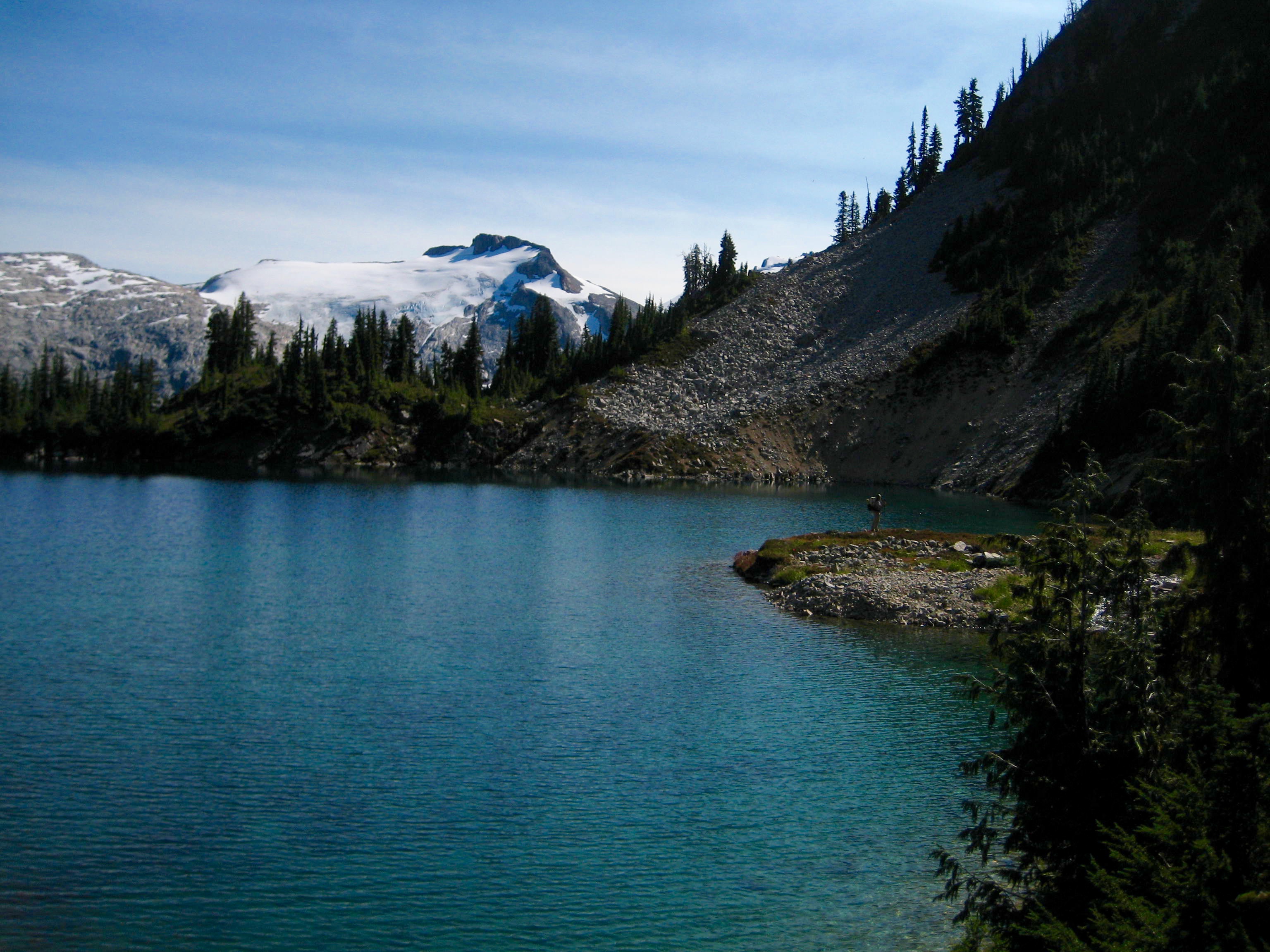
A short rising traverse brought us to the shore of aptly named Tiny Lake. Don’t be fooled by the name of this diminutive pond; it offers a hu-u-u-u-ge view of Mt. Challenger and Wiley Ridge. I think we all instantly fell in love with it.
- Mt Challenger From Tiny Lake
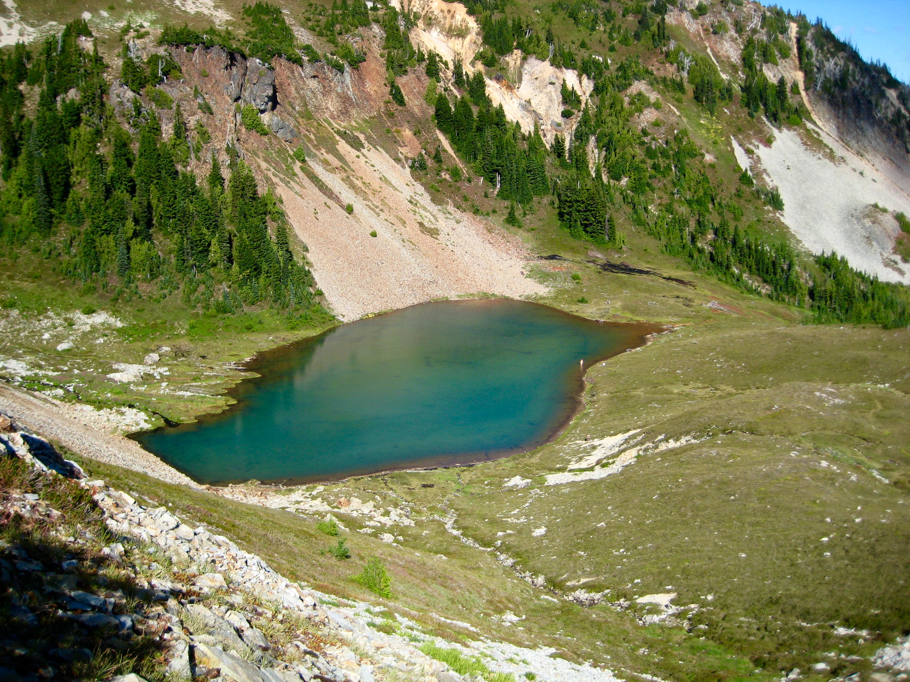
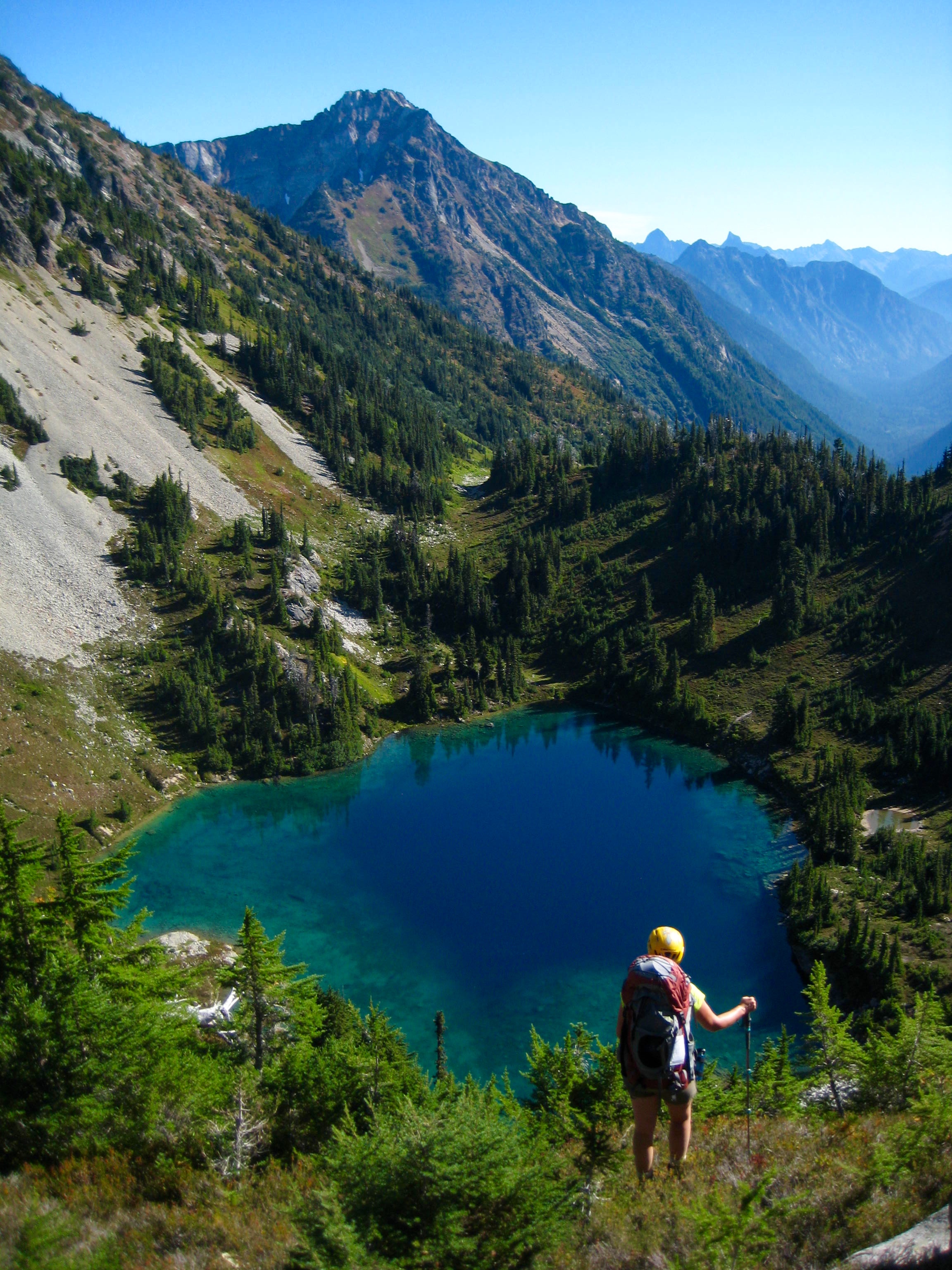
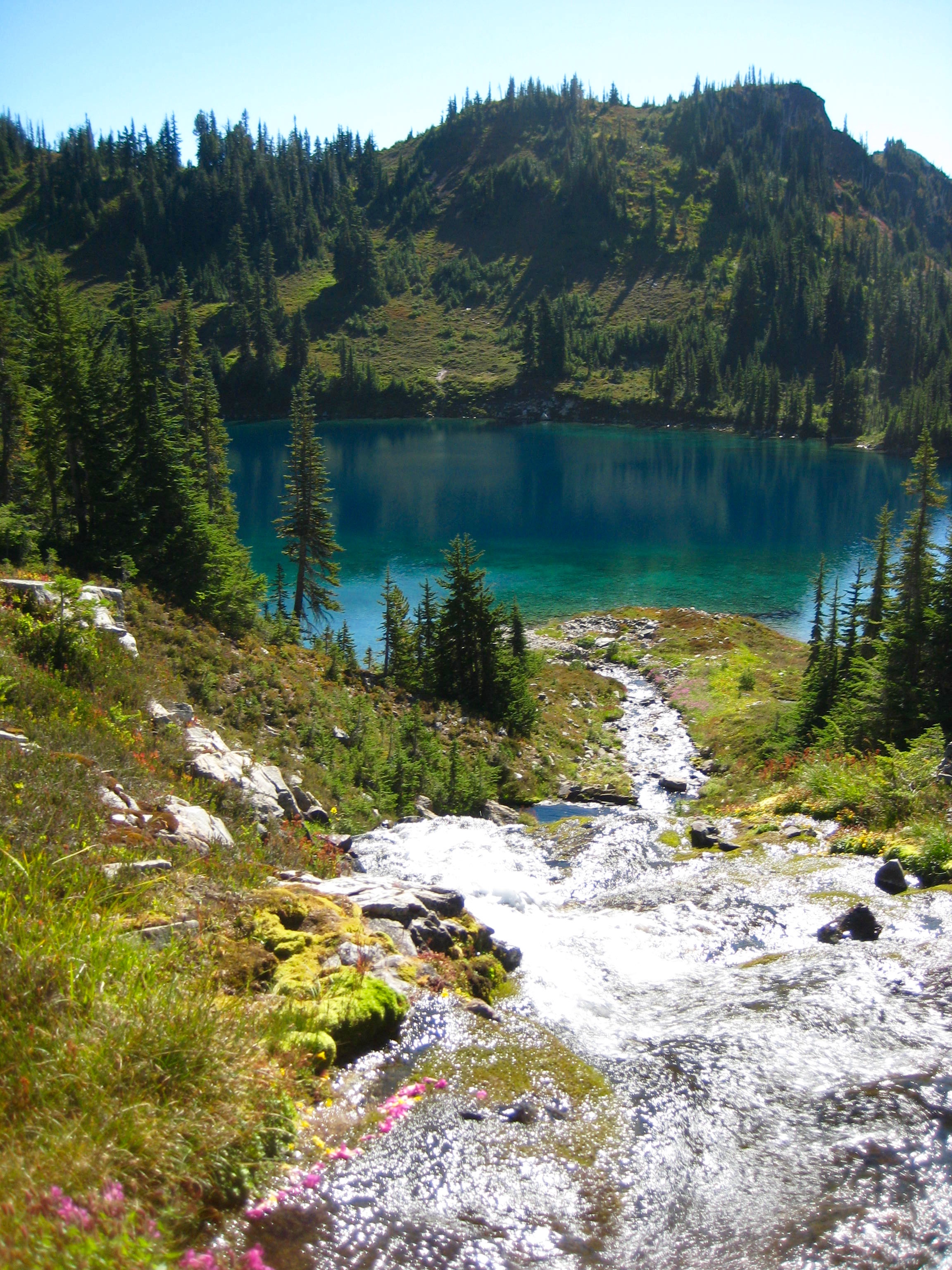
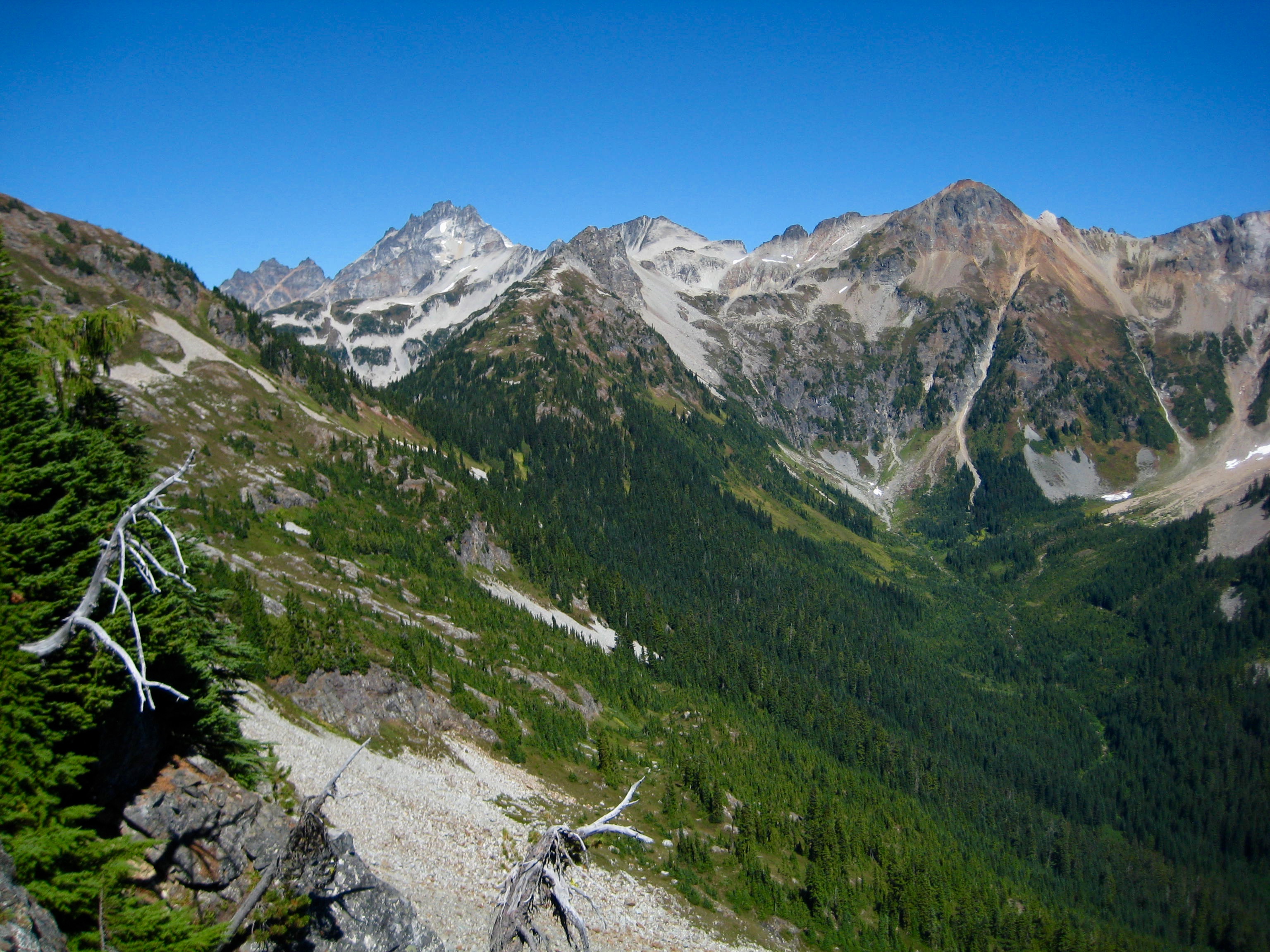
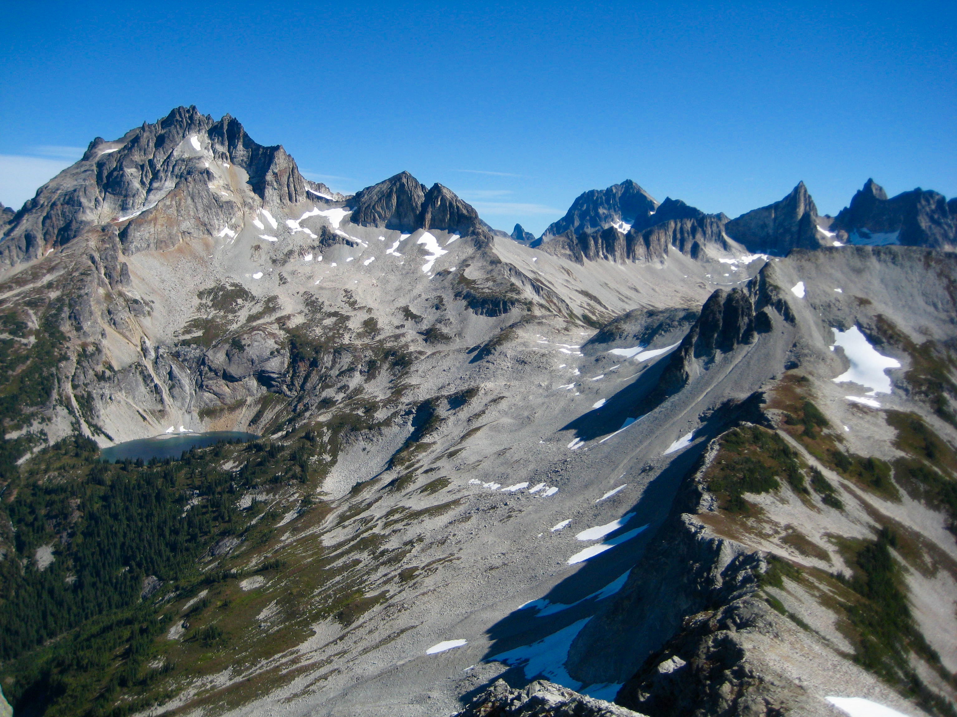
More traversing on a sketchy boot-path took us over a spur ridge and down to a slope overlooking East Lakes. I found Lower East Lake to be especially scenic, due to its variegated colors and deep-green surroundings.
- Looking Down On Lower East Lake
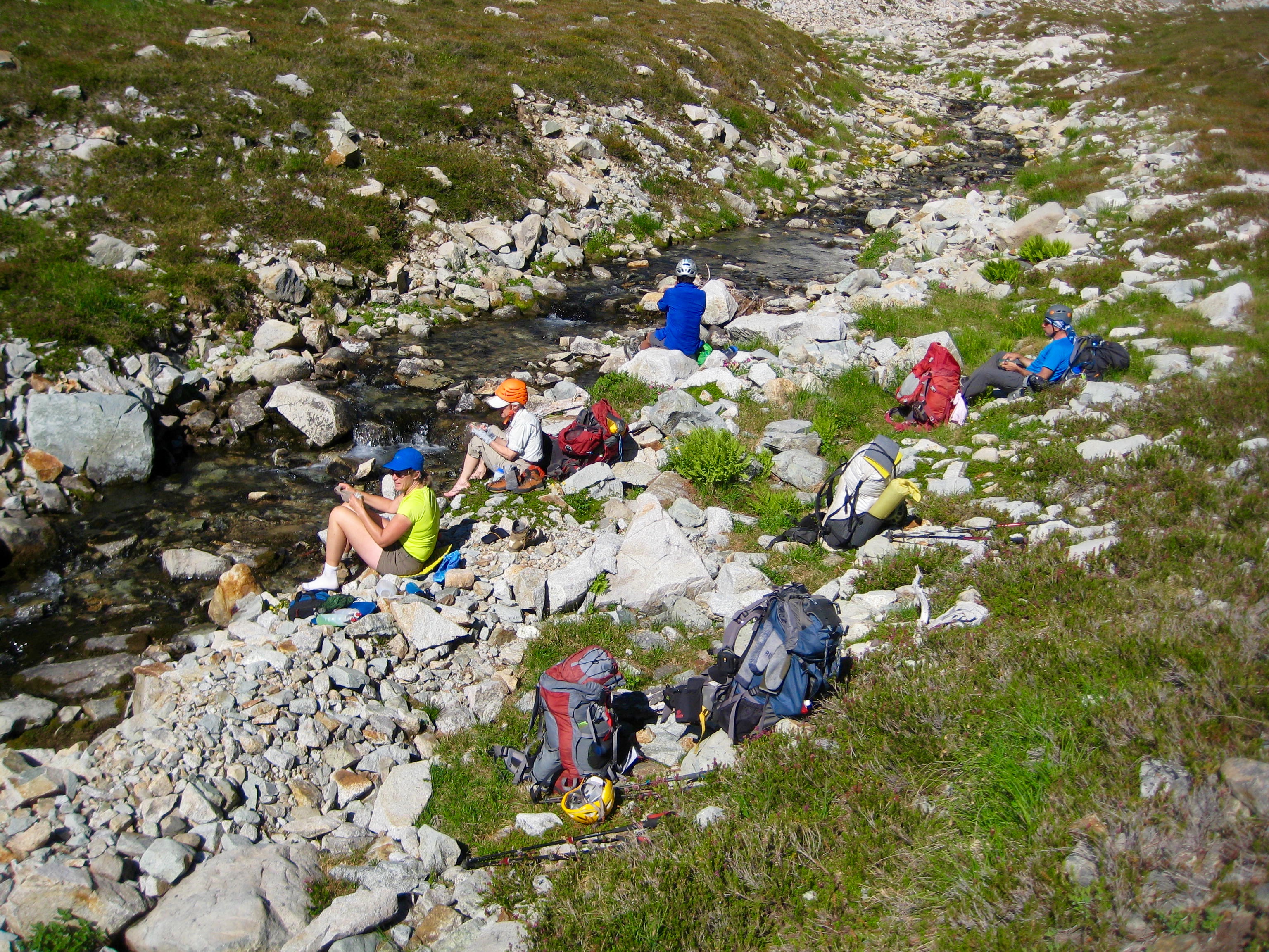
After stopping between the two lakes to cool off and water up, we contoured above the lower lake …
- Wiley Peak From Lower East Lake
…and began a long northeasterly traverse above the Pass Creek valley. All traces of boot-path and other human presence were left behind; once beyond East Lakes, we saw nary a footprint or cairn.
- Traversing Past East Lakes
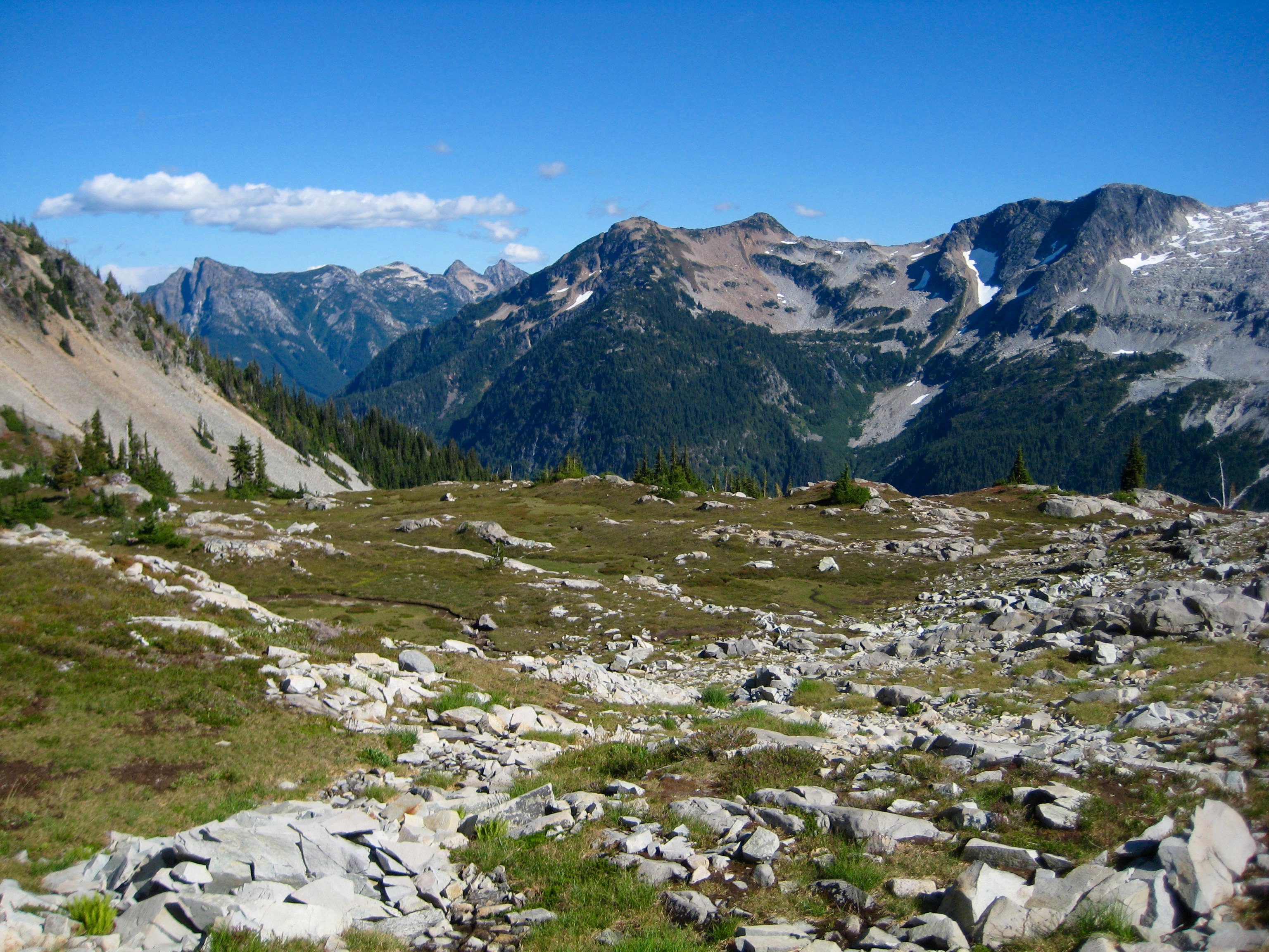
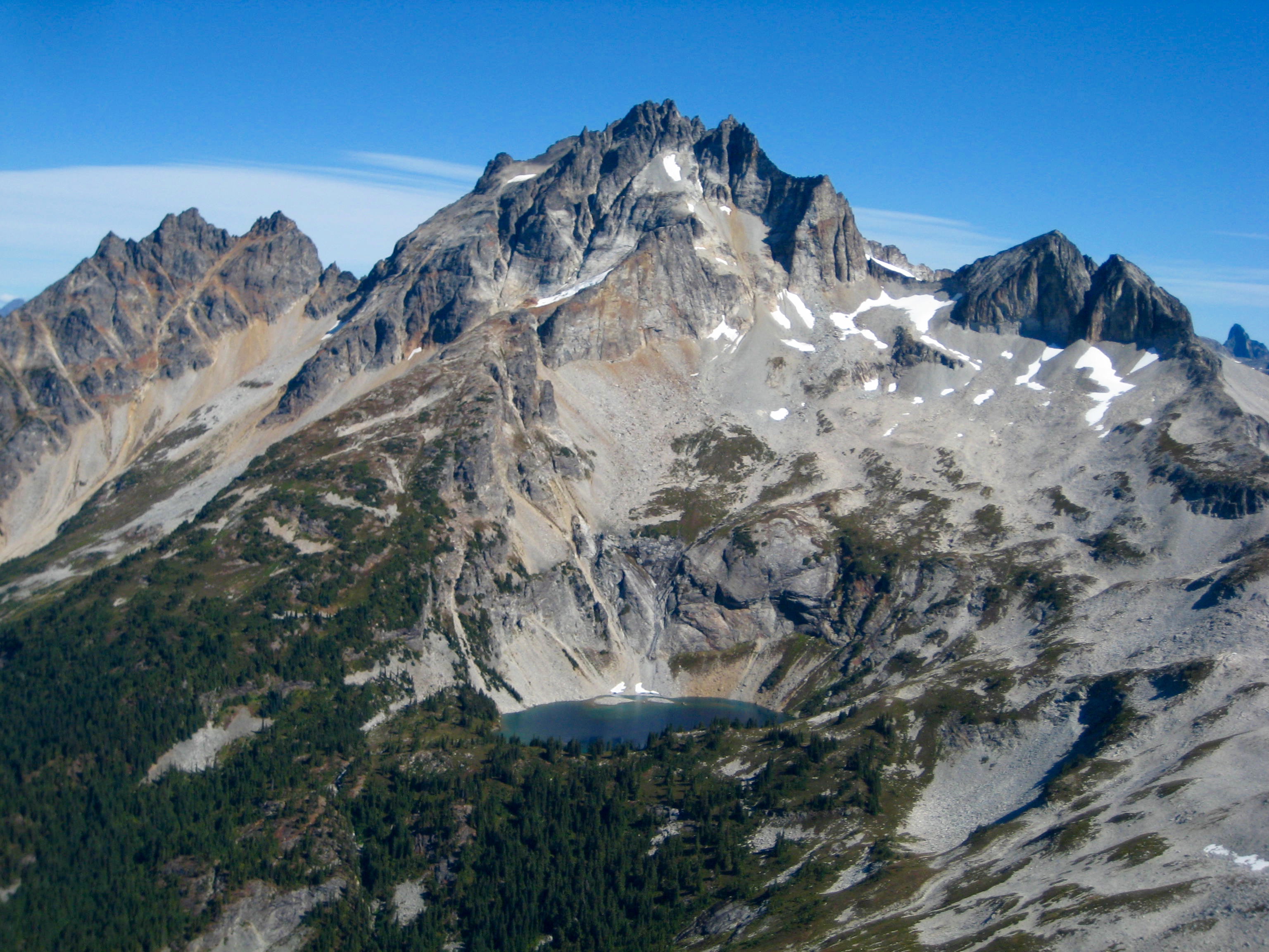
About ¾ mile past East Lakes, our traverse route crossed over a rocky rib that gave us a first look at Mt. Redoubt, Pass Lake, and a 5800-foot saddle between Pass Creek and Indian Creek. The saddle didn’t appear too far away, but it still took us over 2 hours to make the tedious side-hill traverse.
- Mount Redoubt and Pass Lake
Upon arriving at the 5800-foot saddle, we could see Bear Mountain up to the left and Indian Basin down to the right. There was a mile of forest between us and the basin, but we really didn’t think it could be all that bad. Perhaps we should have known better: that mile of forest proved to dish up 2 hours of pure misery for us! Due to a combination of poor route choices and bad luck, we ended up in horrible brush and scrub cedars, with wasp nests scattered throughout.
- Bear Mountain and Indian Basin From Indian Saddle
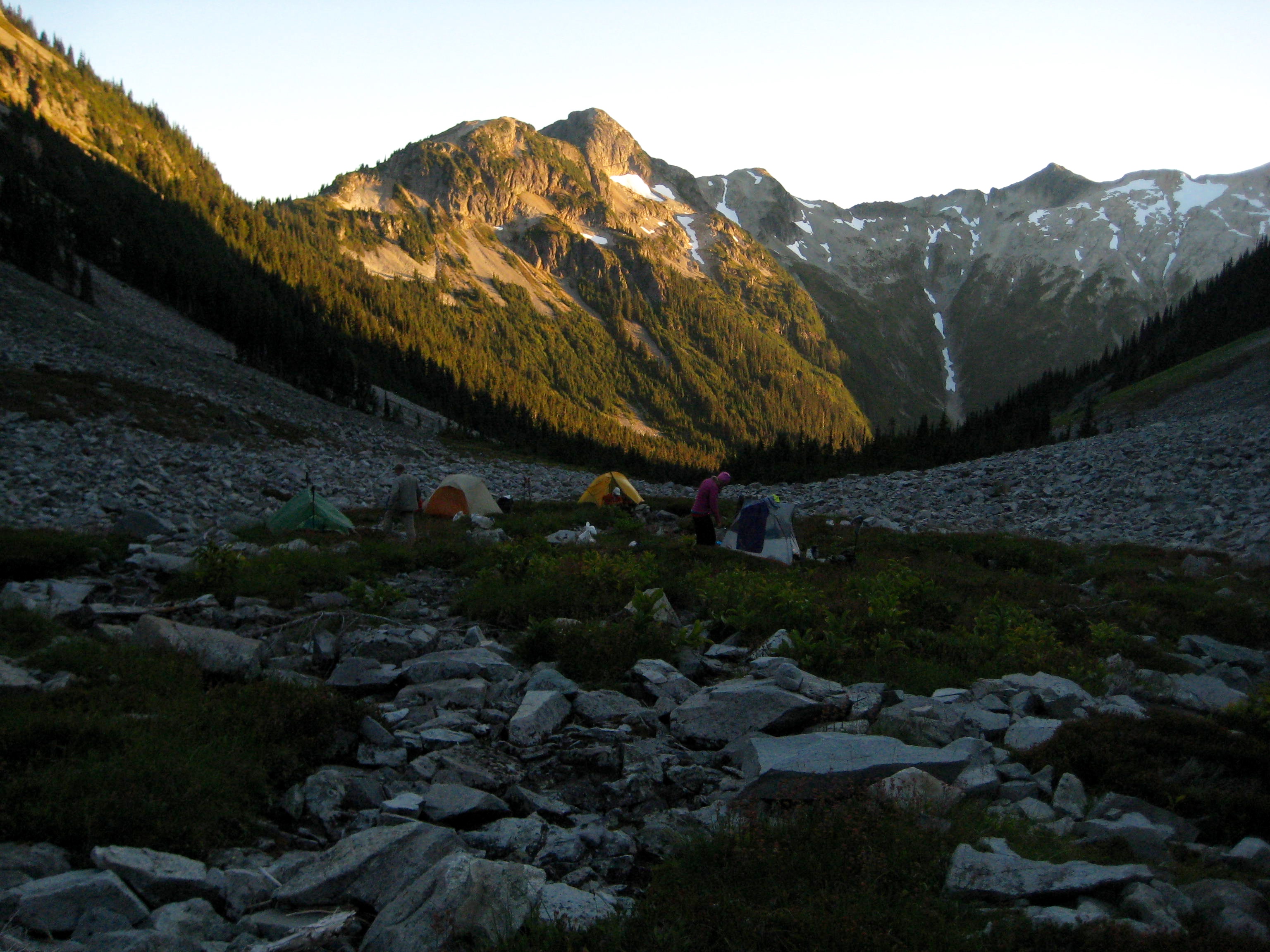
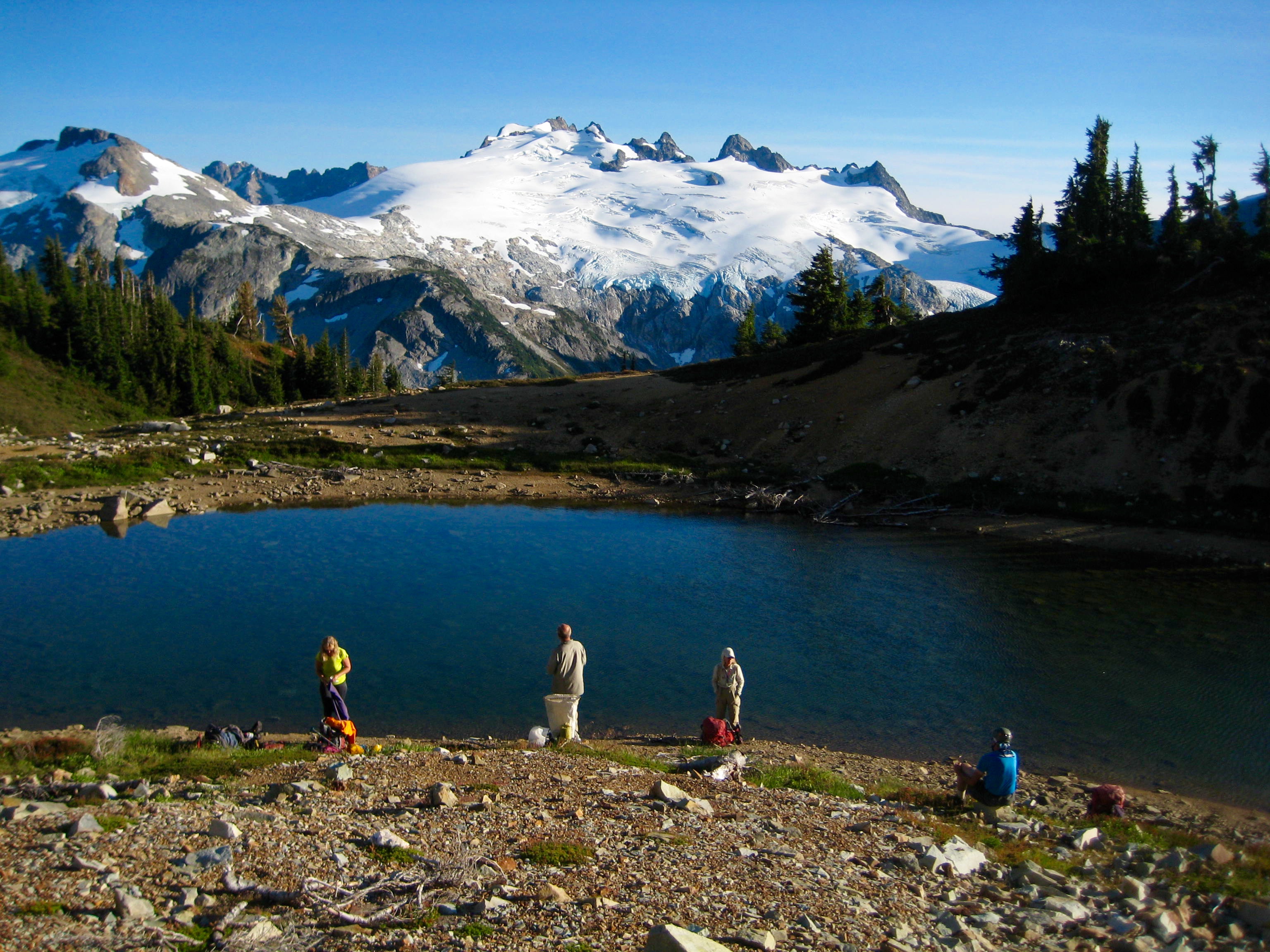
It was around 6:00pm when we stumbled into Indian Basin (9.4 hours + 2150 feet from Camp 2), feeling thoroughly thrashed from our bushwhack. The final cost was 2 lost trekking poles, 10 wasp stings, and countless bloody scratches. As a final insult, the basin had no flat campsites; the surface consisted entirely of talus and lumpy heather. Nonetheless, we all managed eek out reasonably comfortable tent pads by moving rocks and filling holes with gear. Interestingly, the only sign of previous humans in the basin was a solitary clothing button that had been left on a rock near our camp. We speculated that Indian Basin probably goes several years between visits.
- Camp 3 In Indian Basin
Day 4: Bear Mountain Summit Attempt
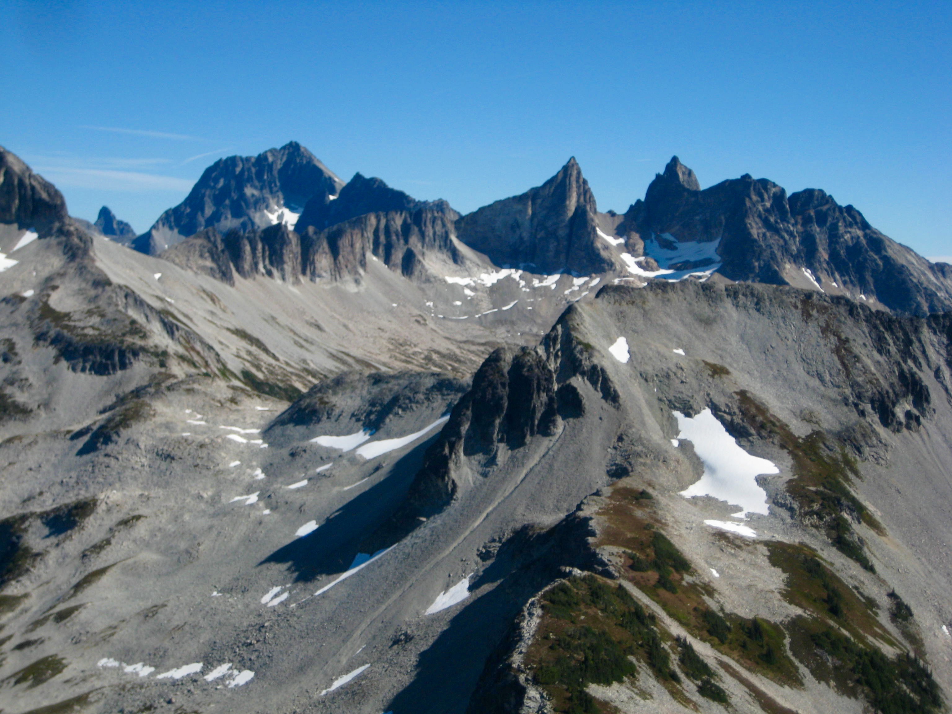
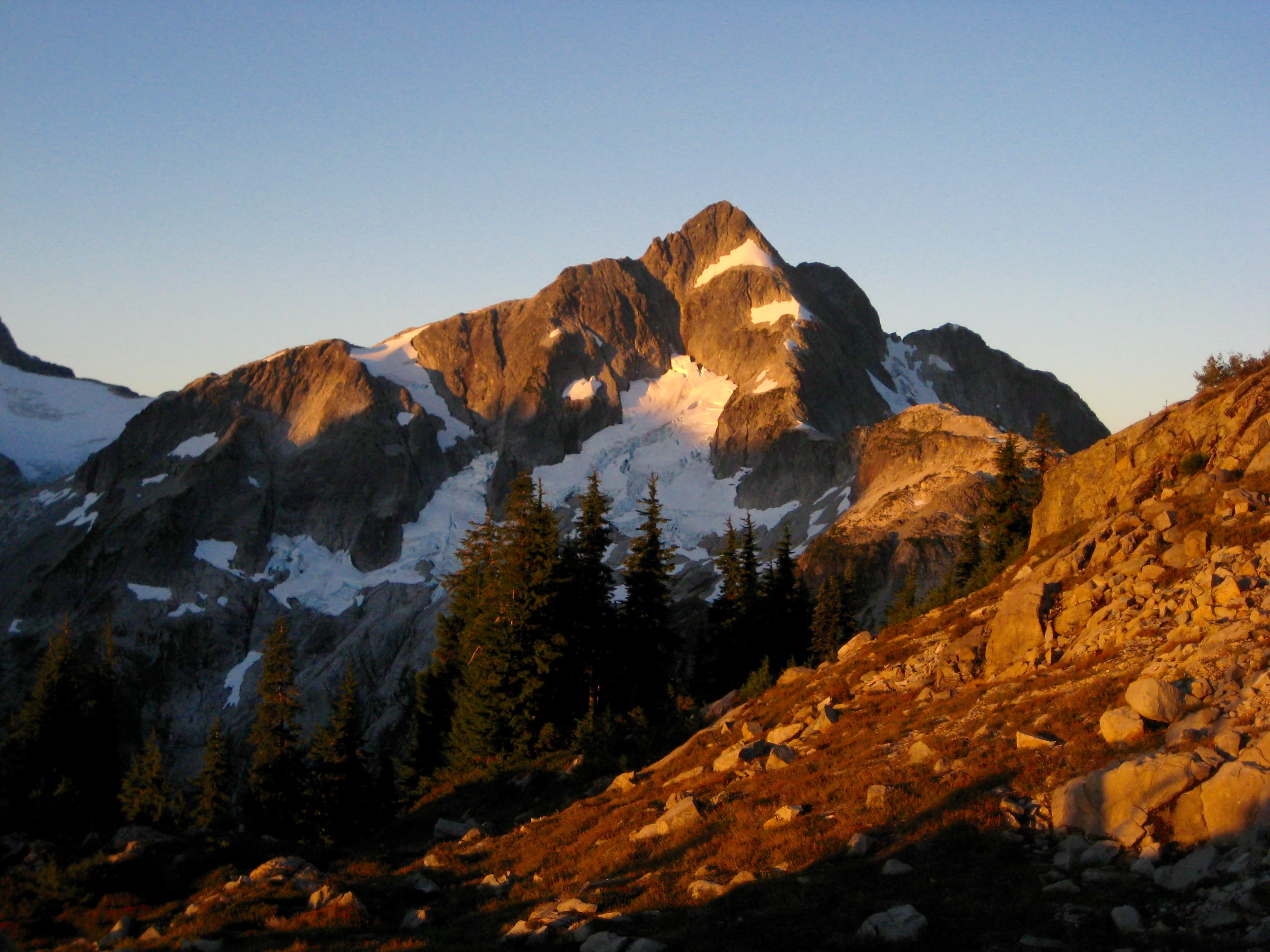
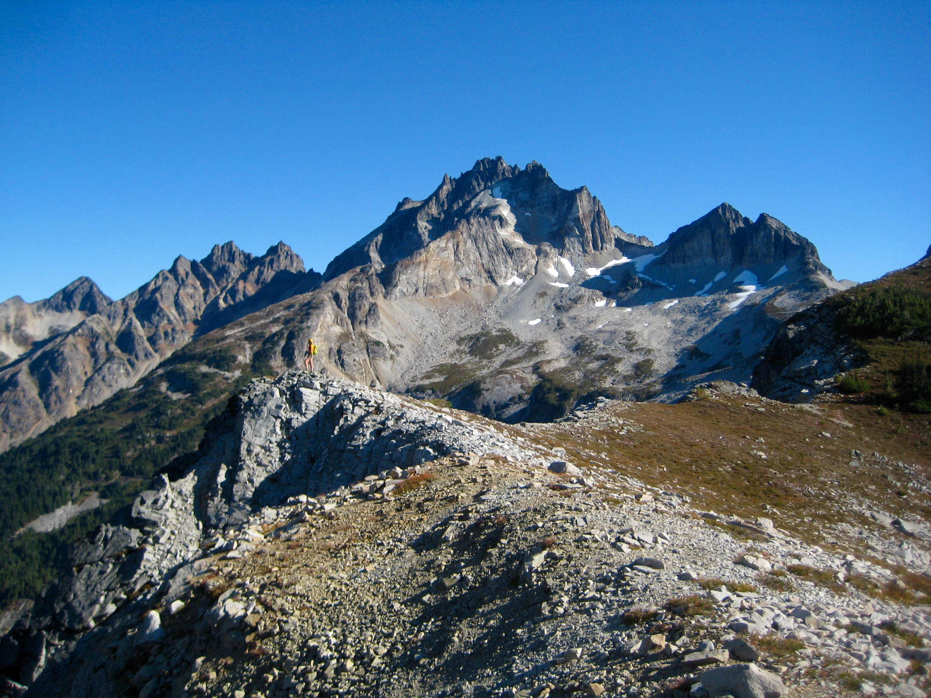
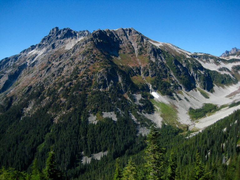
Our climbing day began with clear, blue skies. From camp, we all hiked up a heather and talus slope to reach a saddle between Indian Creek and Bear Creek, then we turned left and followed the smooth ridge southwestward to a rocky knob. The stupendous northeast face of Bear Mountain came into full view here.
- North Face Of Bear Mountain From Saddle
The entire Picket Range sprawled out to the south of us …
- Picket Range From Indian-Bear Saddle
… and Mt. Redoubt rose to the north of us.
- Mount Redoubt From Indian-Bear Saddle
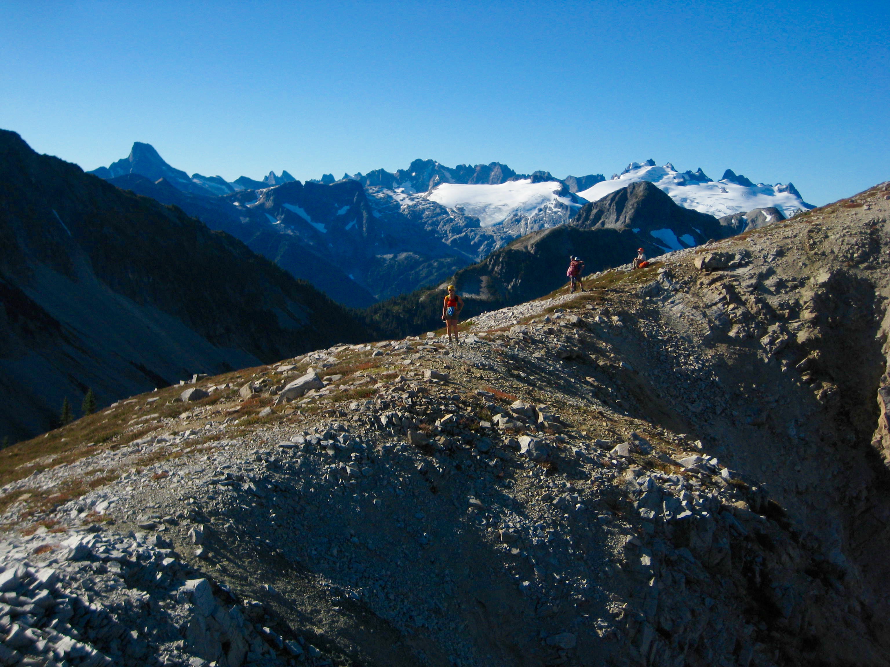
After traversing farther along the ridge, more of the American Chilliwack Mountains came into view. We looked across at Mt. Redoubt, Mt. Spickard, and the Mox Peaks, as well as down at Bear Lake, which must certainly be a lake-bagger’s holy grail. Lisa and K.Lo decided to stay and enjoy the view from here, rather than continuing on toward Bear Mountain.
- Mt Redoubt and Mox Peaks From Indian-Bear Ridge
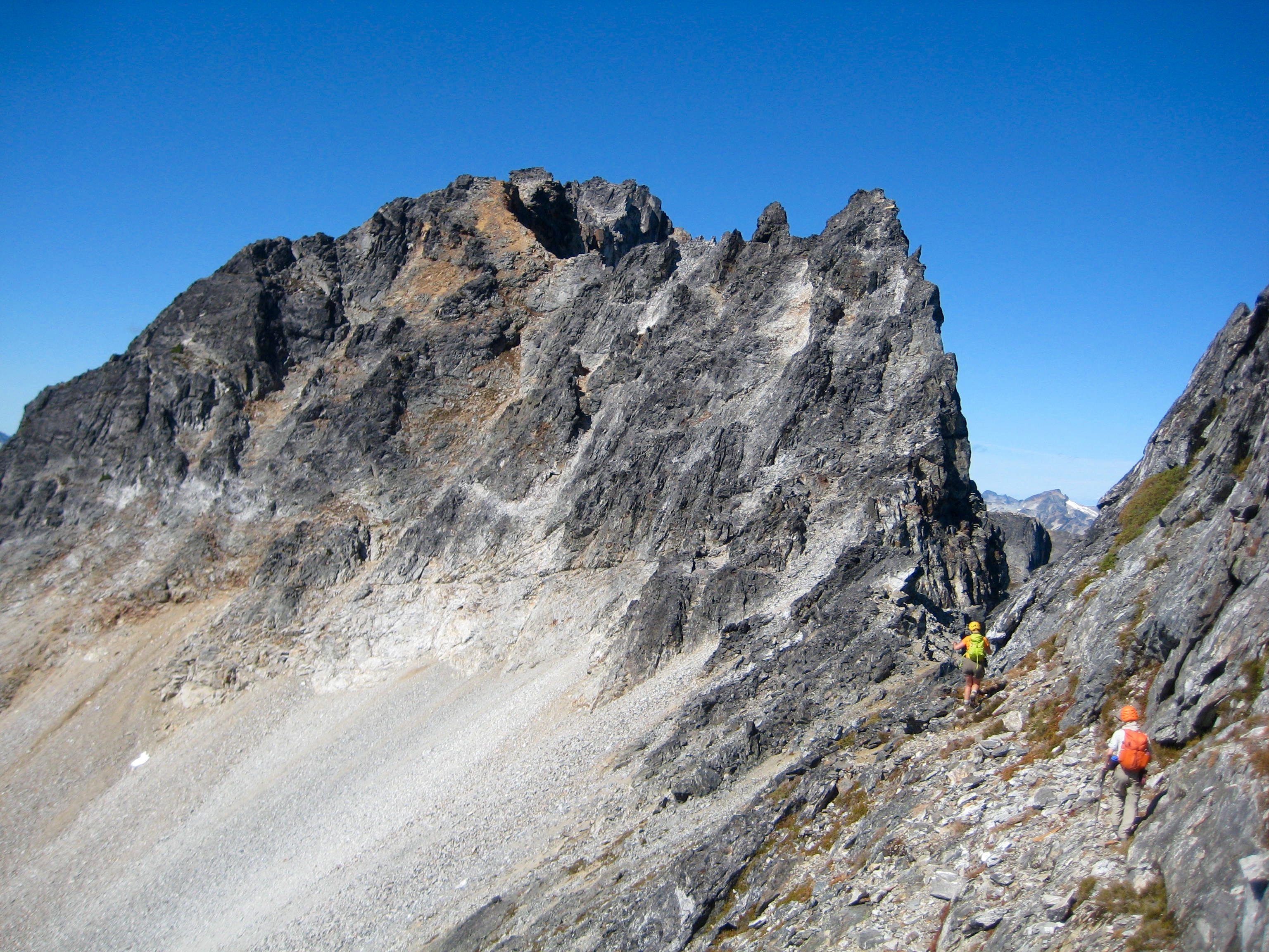
Fay, K.Ko, Eileen, and I began traversing along the craggy east ridge, staying mostly on the southern side. We followed a series of ledges past several ridge horns until the crest steepened, at which point we angled down to a scree slope that stretched beneath the cliffs.
- Bear Mountain Summit Crest
After traversing across the scree, we climbed a Class 2-3 gully that led back up to the ridge crest. We could see the large summit block ahead, but it was a slow process getting to it.
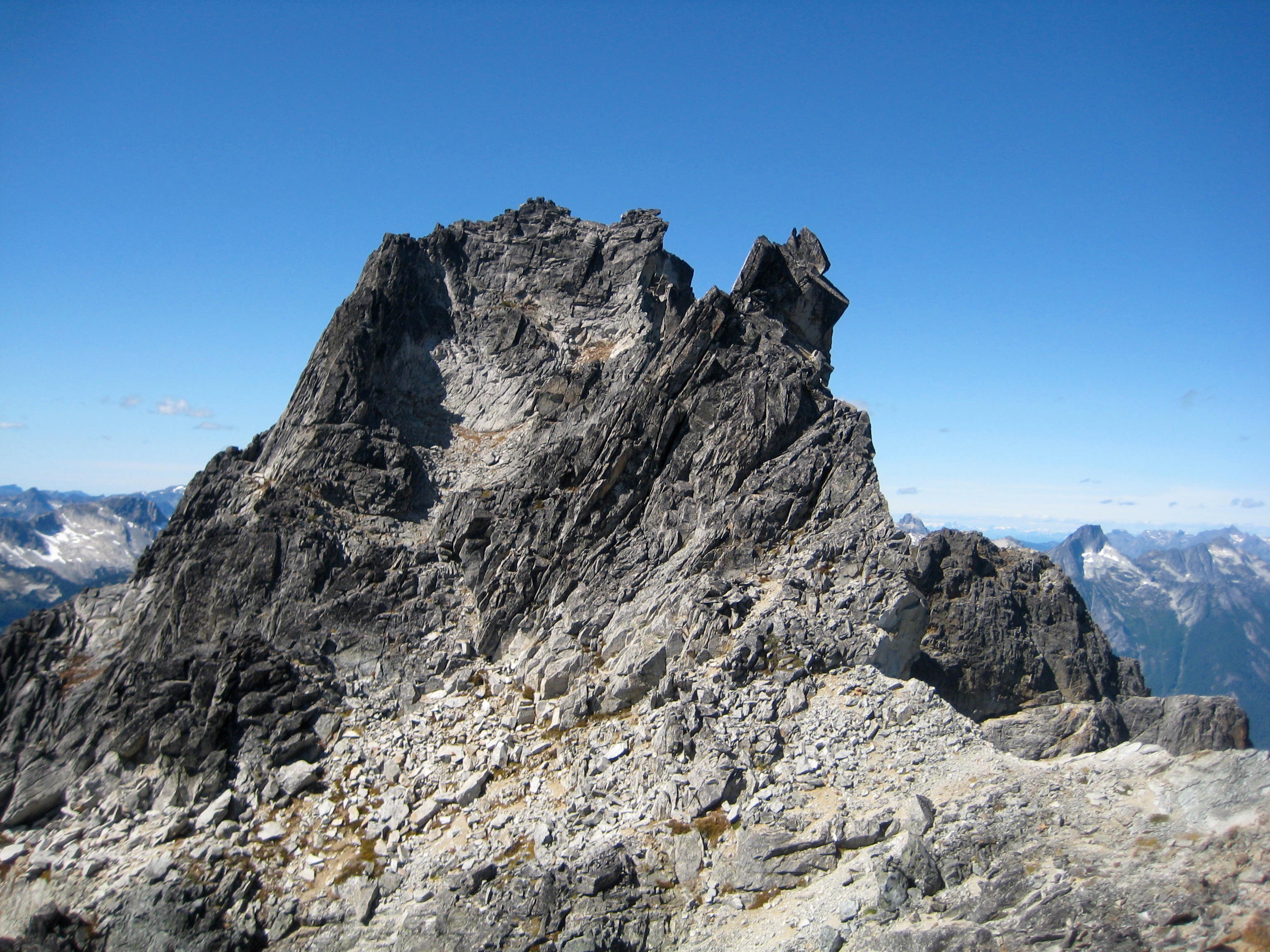
- Bear Mountain Summit and The Bear Claw
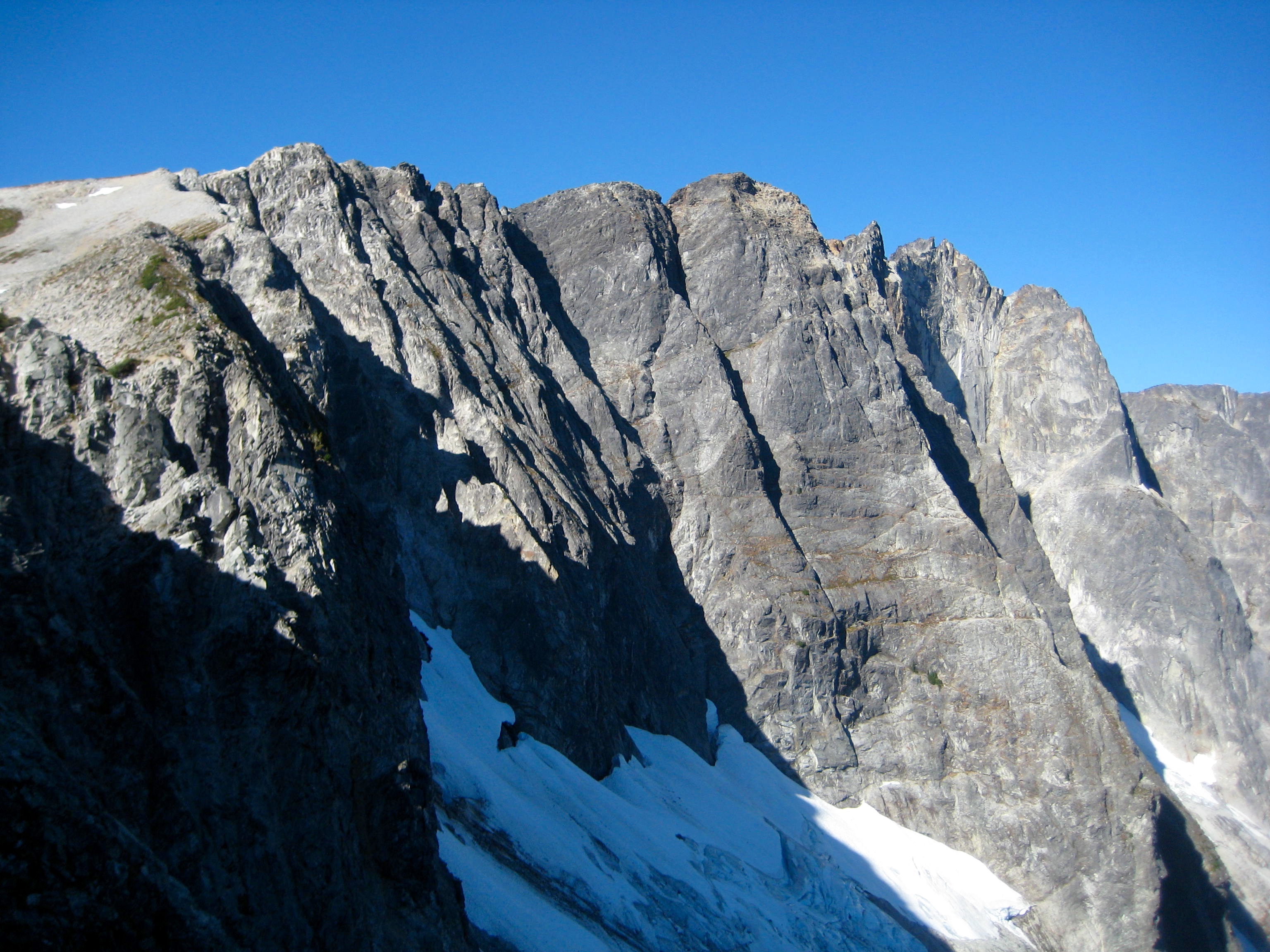
Farther along, the ridge crest became very narrow and steep. We could peer over the edge and see that the north face was considerably overhung. Yikes!
- Fay and Kevin and The Bear Claw On East Ridge
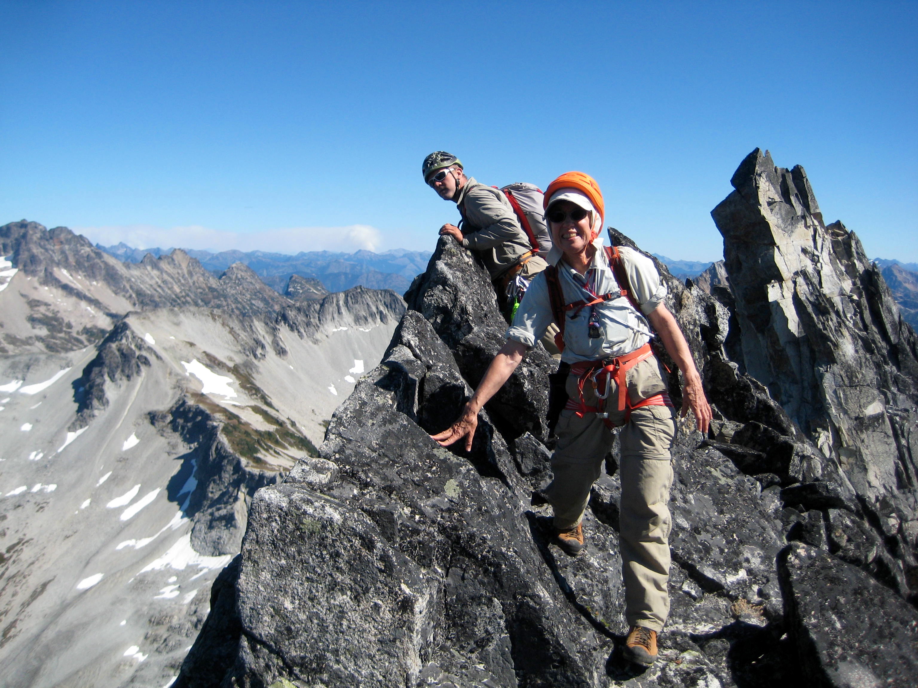
More roped traversing along a series of Class 3-4 ledges ended in a steep gully, which we climbed to a deep “V” notch between the two summit pinnacles. It initially appeared that the southeast pinnacle was higher, and this caused a false start until we realized that the northwest pinnacle is the true summit.
- Climbing Up To Summit Notch
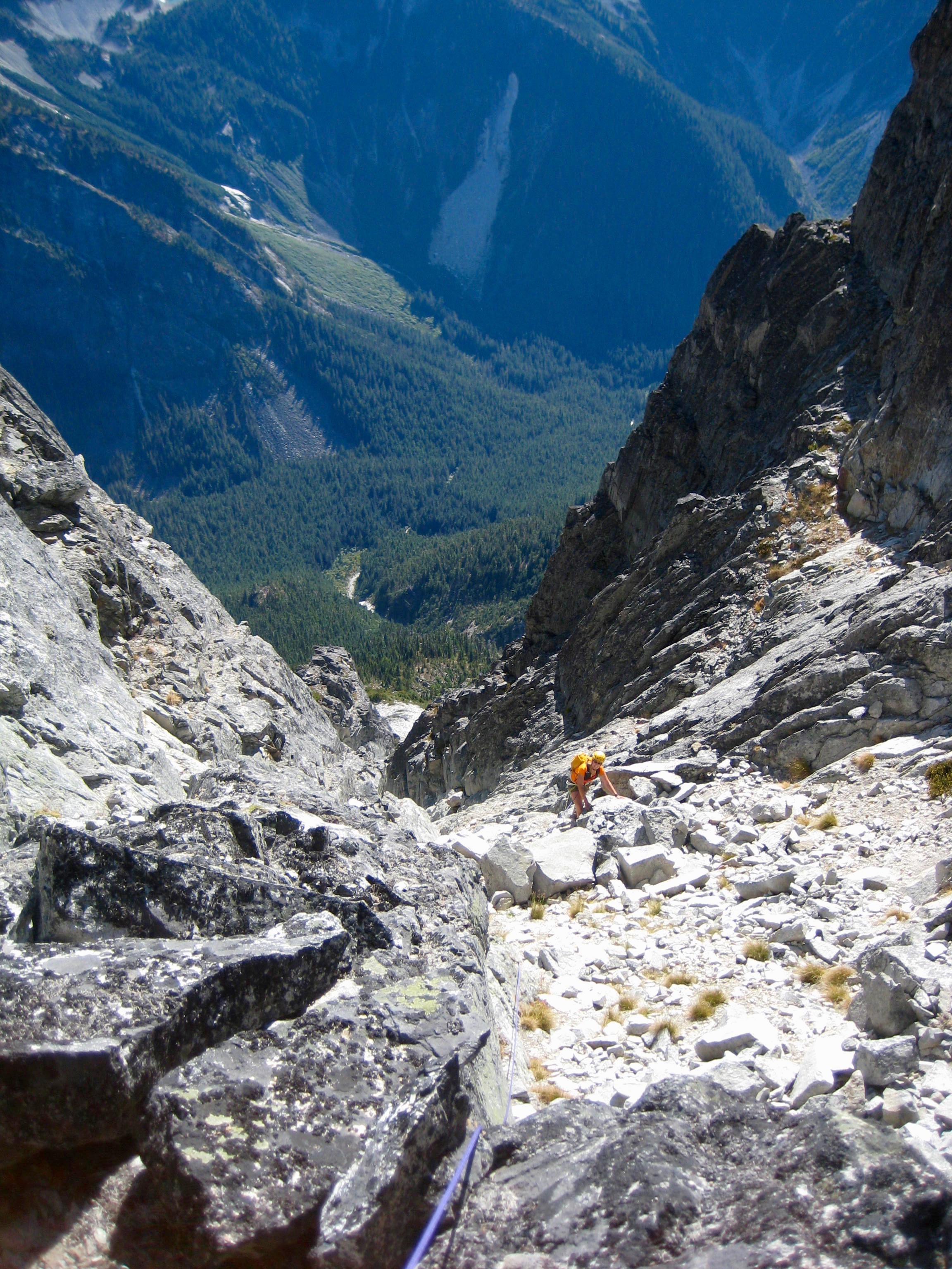
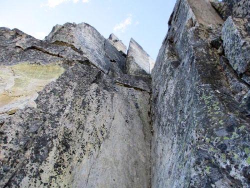
We were dismayed to see that the true summit pinnacle begins with a steep dihedral and then transitions into a vertical face above. I climbed partway up but quickly realized that this would involve mid-Class 5 climbing that exceeded our exposure tolerance and meager gear. We sadly ended our climb here, only 100 feet below the summit. It was 5:00pm when we turned around.

- Dihedral In Bear Mountain Summit Pinnacle
Our traverse back along the ridge took us through the entire evening, which featured dramatic alpenglow on the Picket Range. Darkness caught up to us just before we began our final descent into Indian Basin. Lisa and K.Lo signaled us into camp with their headlamps.
- Alpenglow On Picket Range
Day 5: Indian Basin to Middle Lakes
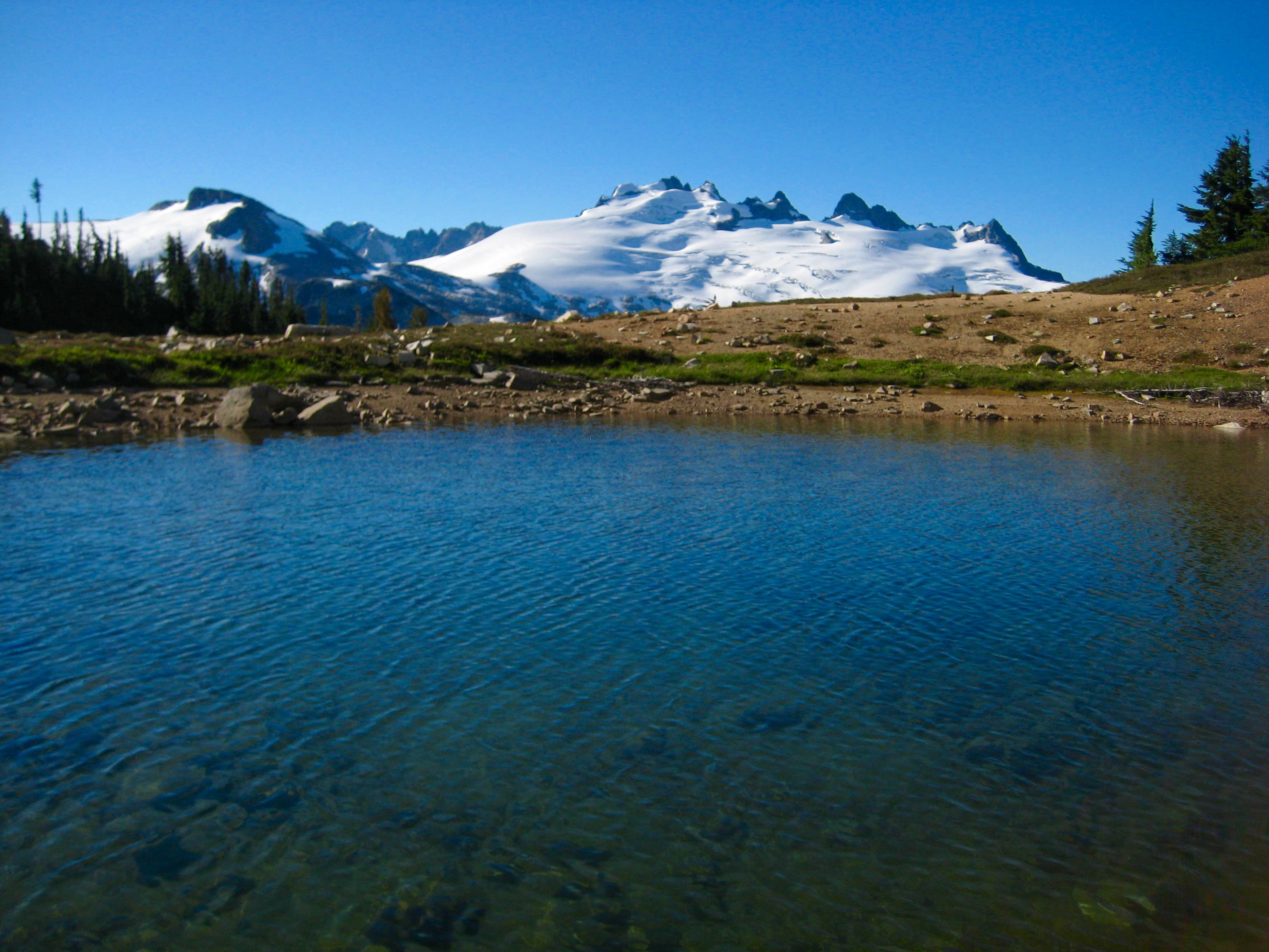
We left Indian Basin and headed back up to the 5800-foot saddle, breaking into two different groups along the way and taking different routes. The “low route” seemed to play out better than the “high route” (despite more wasp stings), but both routes were an improvement on our previous incoming route. From the saddle, we generally retraced our steps back over to East Lakes. The mid-afternoon heat demanded a swim in the lower lake.
- Wiley Peak From Lower East Lake
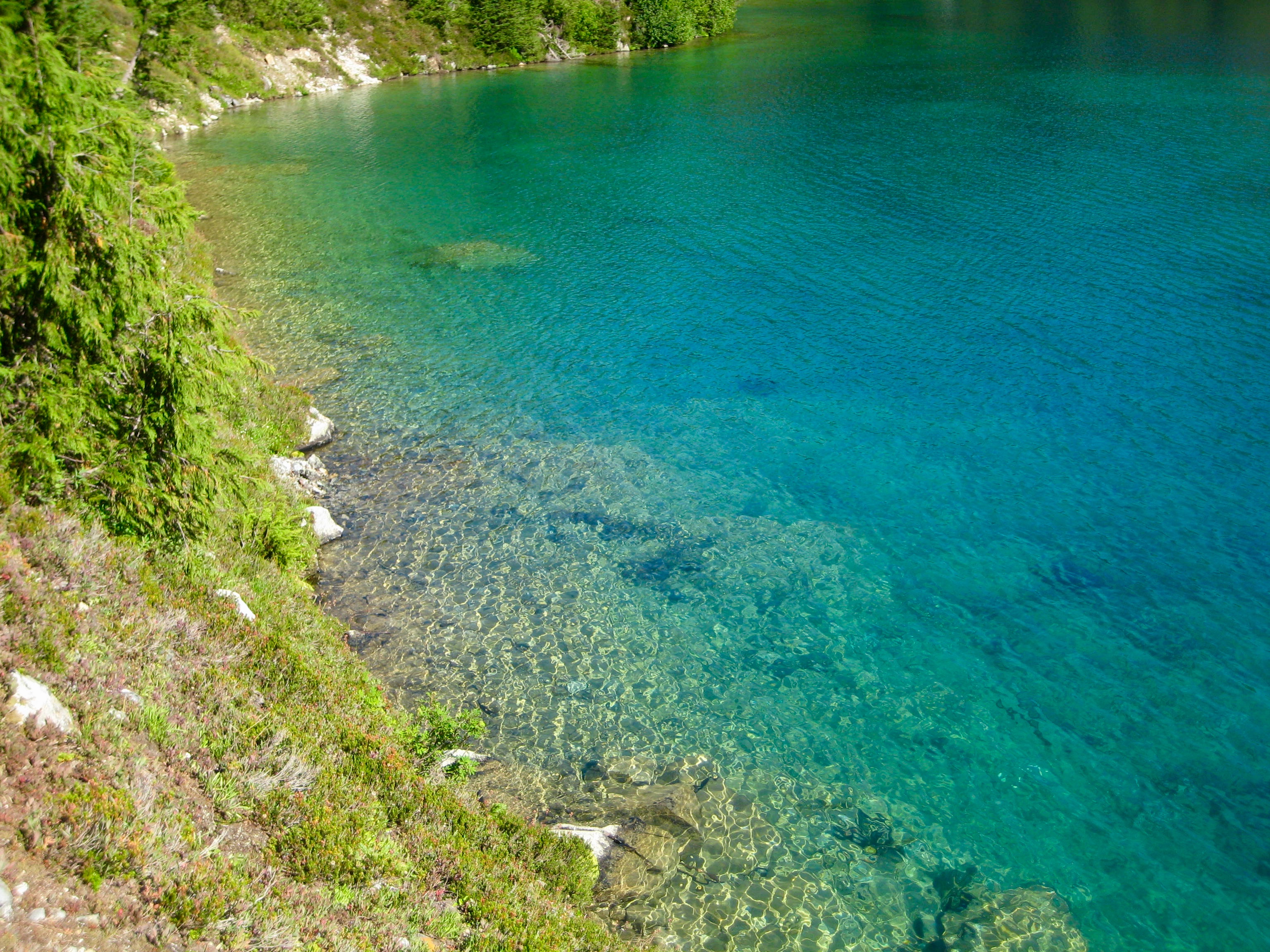
In my opinion, Lower East Lake is the finest gem of the lakes that we visited on this traverse. It has great views, an inviting shoreline, and magic water.
- Lower East Lake Magic Water
By the time we reached Tiny Lake, everyone was ready for another swim. The water here was surprisingly cold and clear. Oh, did I mention the view?
- Swim Break At Tiny Lake
We eventually left Tiny Lake and made our way back over to Middle Lakes, where we again camped on the heather plateau (9.9 hours + 2400 feet from Camp 3). While eating dinner, we watched a towering smoke plume form on the eastern horizon. No doubt this was the Diamond Creek fire currently burning in the Pasayten Wilderness.
Day 6: Middle Lakes to Boundary Camp
The winds had shifted during the night, and we awoke to hazy skies. As we hiked down to the Chilliwack River and up to Boundary Camp (9.0 hours + 2200 feet from Camp 4) for our final night of the trip, the smoke became increasingly thick.
Day 7: Boundary Camp to Trailhead
By the following morning, visibility was a scant ½ mile at Hannegan Pass. We finished our hike down to the trailhead in a gloomy fog.
Route Map
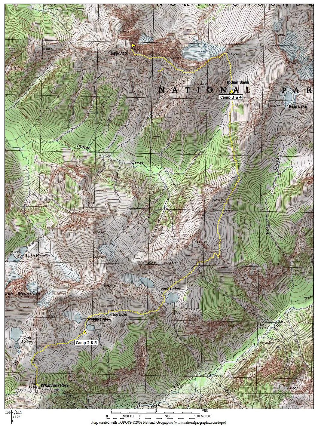
Photo Gallery
Click to enlarge…