Trip Date: July 3-6, 2020
Jack Mountain Climbing Attempt
Ruby Creek
Crater Lake
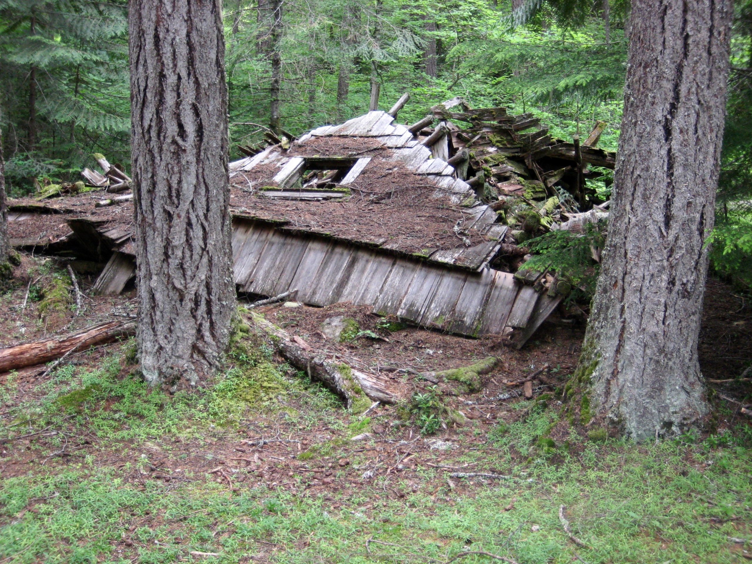
East Crater Mountain Lookout aka Crater Mountain Lookout No. 2
Devil’s Lake
Jerry Lakes
Crater Creek Meadows
Jack Mountain (9066 ft) attempt
Trip Report Summary
Region: Northeastern Washington Cascades
Sub-Region: Upper Skagit Mountains
Area: Pasayten Wilderness
Starting & Ending Point: East Bank Trailhead on Highway 20 (Elev. 1800 feet)
Way Points: Ruby Creek & Crater Creek Bridge & Canyon Creek / Granite Creek Confluence Cabin & Canyon Creek & Crater Lake outlet stream & Crater Lake & East Crater Mountain Lookout & Devils Lake & Jerry Glacier Bench & Jerry Lakes Bowl & Crater–Jerry Saddle & Upper Crater Creek & Crater Creek Meadows (trail hike & off-trail hike & bushwhack & rock scramble & snow climb); return via Jerry Lakes & Devils Lake & East Crater Mountain Lookout (snow climb & rock scramble)
Campsites: Crater Lake & Crater Creek Meadows & East Crater Mountain Lookout
Summit Attempt: Jack Mountain (snow climb to 7500-foot step via Southeast Ridge)
Approximate Stats: 28 miles traveled; 10,900 feet gained & lost.
Related Post
>>> Jack Mountain via Jerry Lakes–South Face–West Ridge – August 2005
Full Trip Report
George and Eileen and I spent Independence Day Weekend in the Jerry Lakes area between Crater Mountain and Jack Mountain. What we encountered was, in short, really bad trail conditions and really good snow conditions—but not what we needed for a climb of the Skagit King.
Day 1: Trailhead to Crater Lake
Our troubles started at the Canyon Creek Trailhead, where we discovered that the Canyon Creek footbridge is now completely gone. And I mean gone, baby, gone! The only vestiges of the relatively new bridge are an abutment and a stairway on the southern shore. Clearly, this is a location that warrants a higher-level bridge…or a zipline.
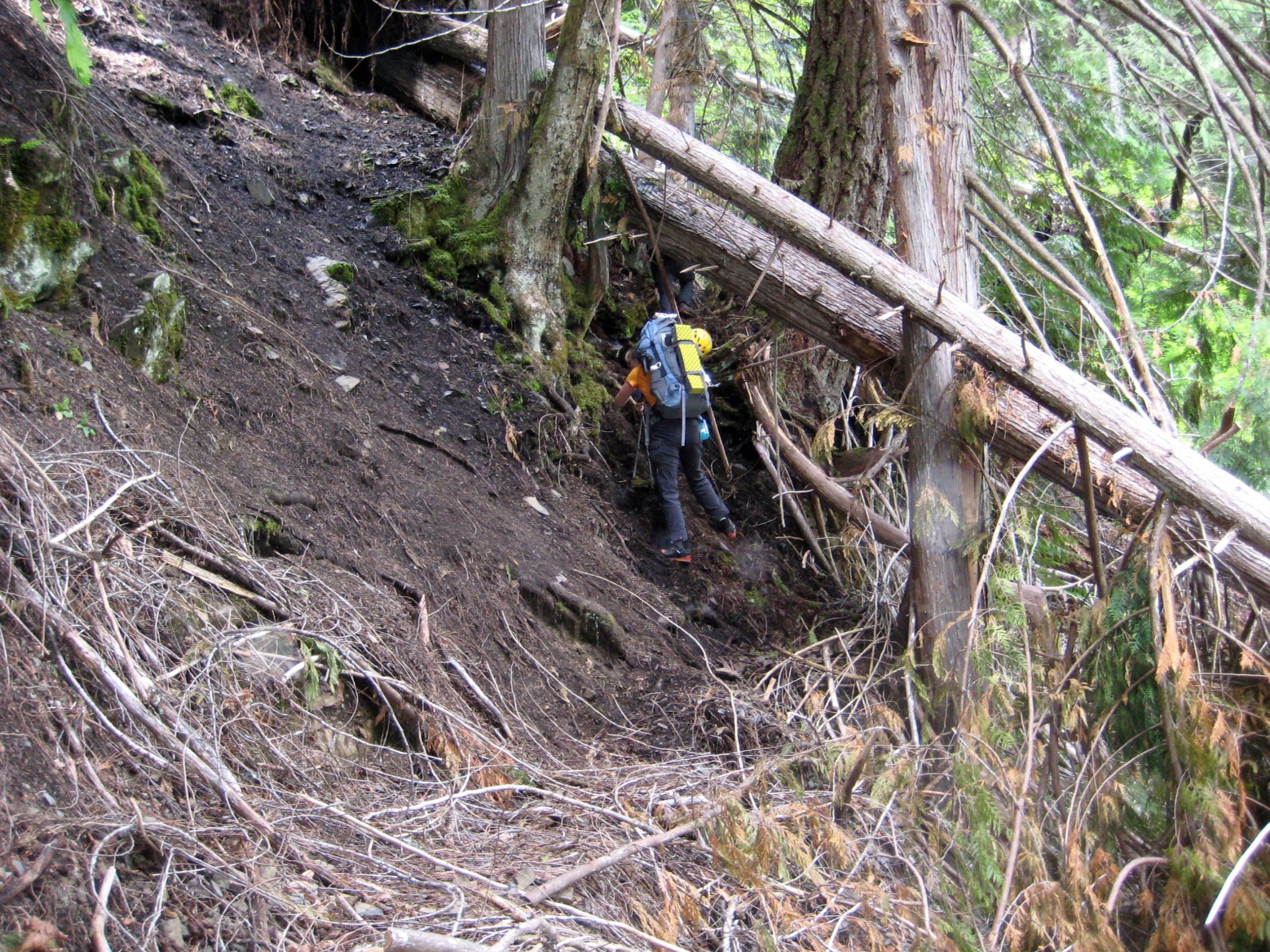
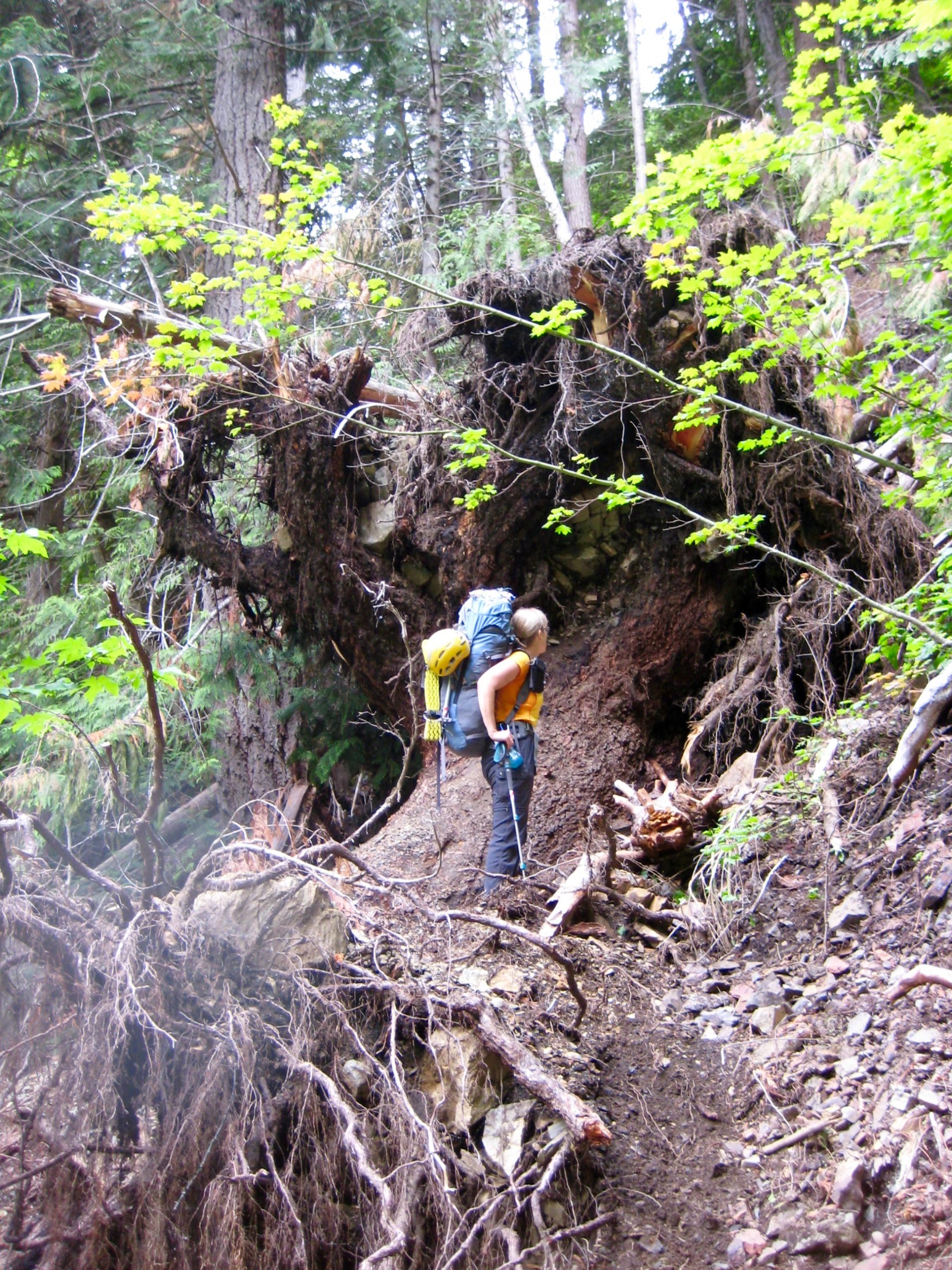
Fording the wide, fully flowing creek was not an option, so we had to drive down to the East Bank Trailhead and start our trip from there. This added 3.3 miles to our approach hike, which wouldn’t have been so bad except that the last mile was a mess of fallen logs, rocks, debris, and overgrown vegetation. The worst spot is just upstream of the missing bridge, where a very large tree has fallen across the trail and triggered a small landslide. Getting over the huge root ball required some gymnastic Class 3 dirt scrambling.
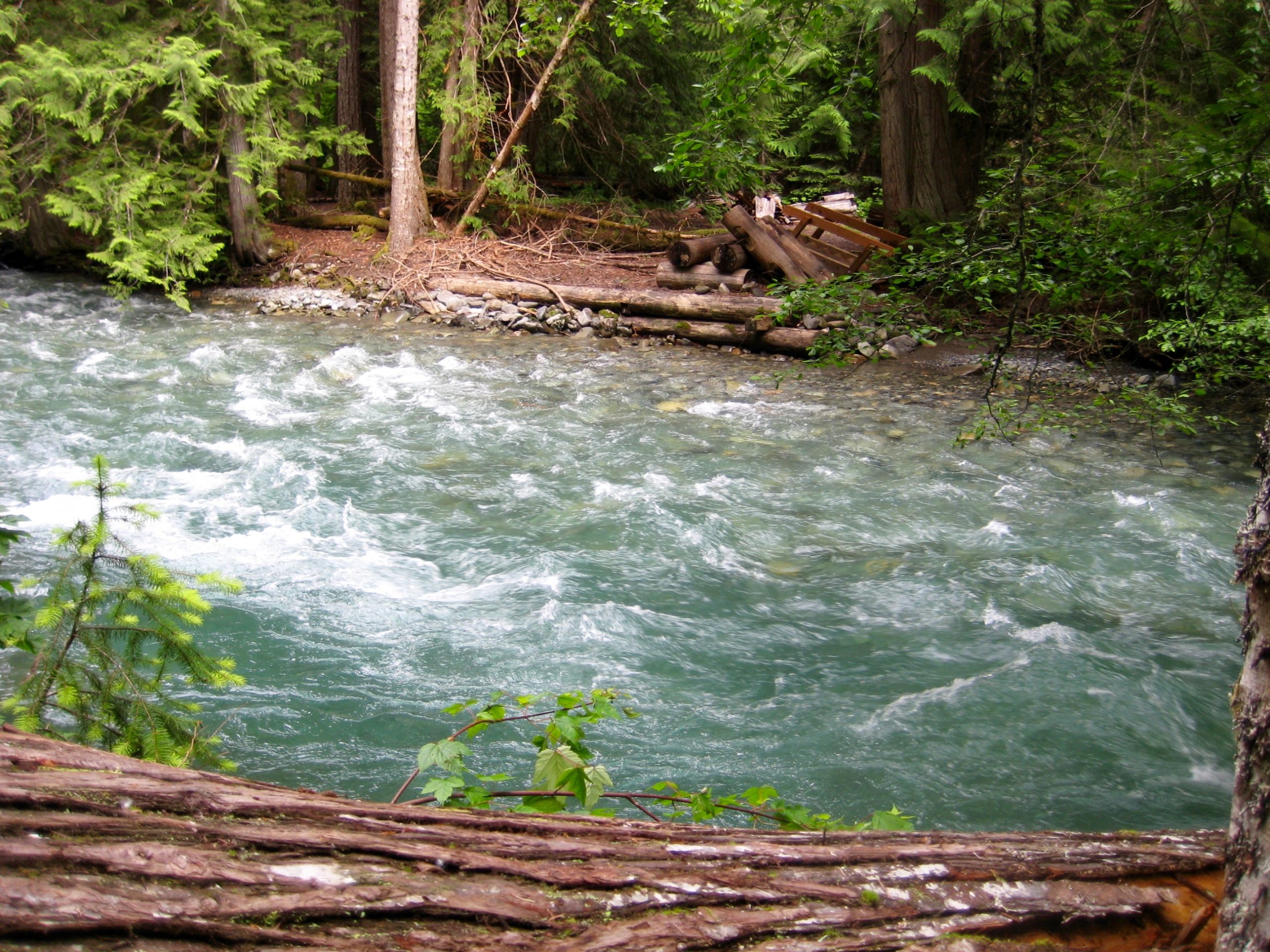
The next mile of trail had several fallen logs, but then conditions got much better. That is, until we encountered the Crater Lake outlet stream at Elev. 4750 feet. Although this is not a particularly large stream, the trail crosses it at a narrow spot between thundering waterfalls (apparently due to poor planning by the trail designers 100 years ago). A slip here would likely result in a long death-ride over the cliff. Yikes!
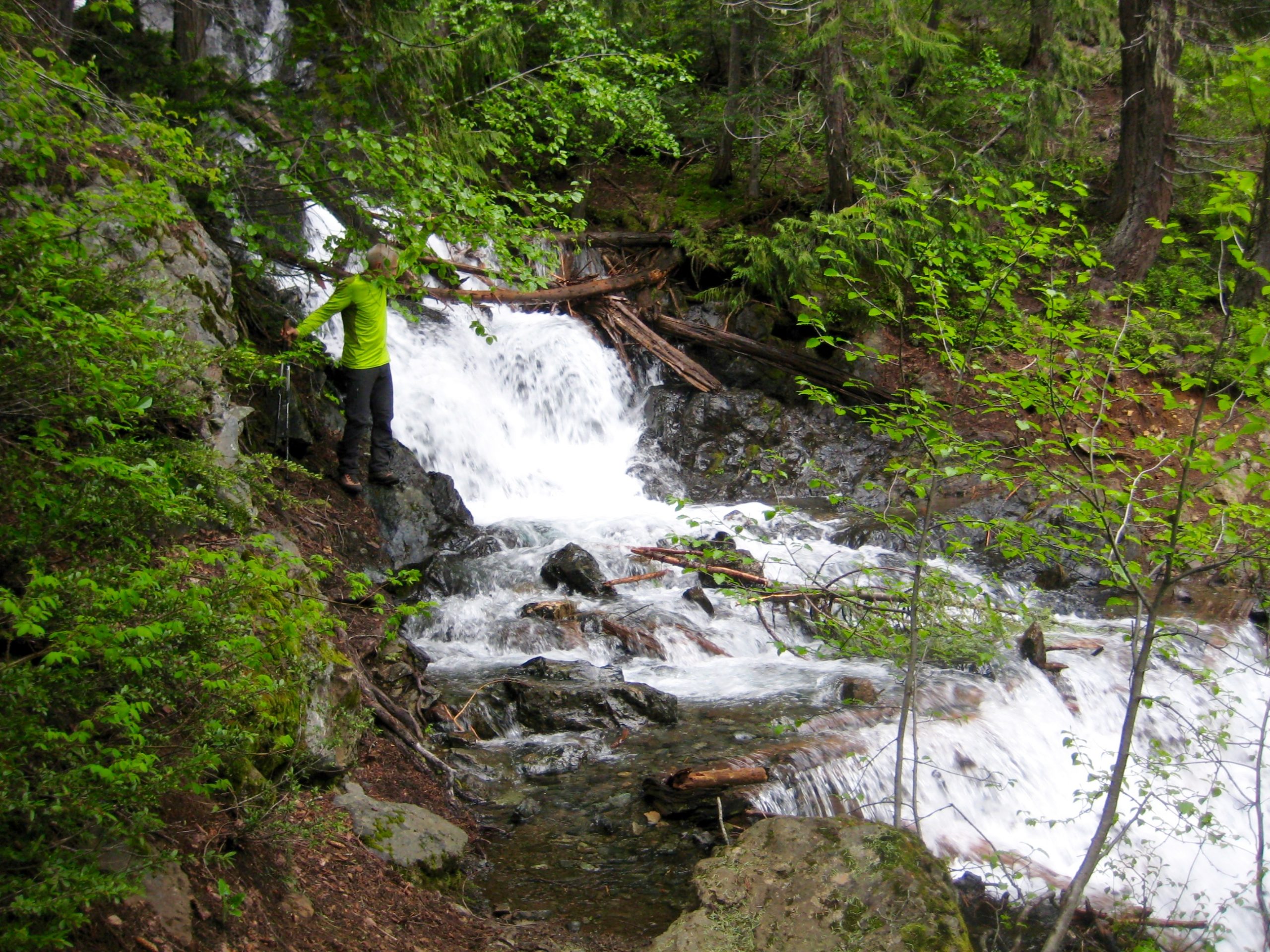
Rather than risk the dangerous stream crossing, we went cross-country up through steep forest and cliff bands for 250 feet along the left side of the stream until able to cross it in a low-gradient location above the waterfalls. (Interestingly, this is the location where USGS and Gaia maps erroneously show the trail crossing the outlet stream; how it ended up getting built between the waterfalls is a mystery.)
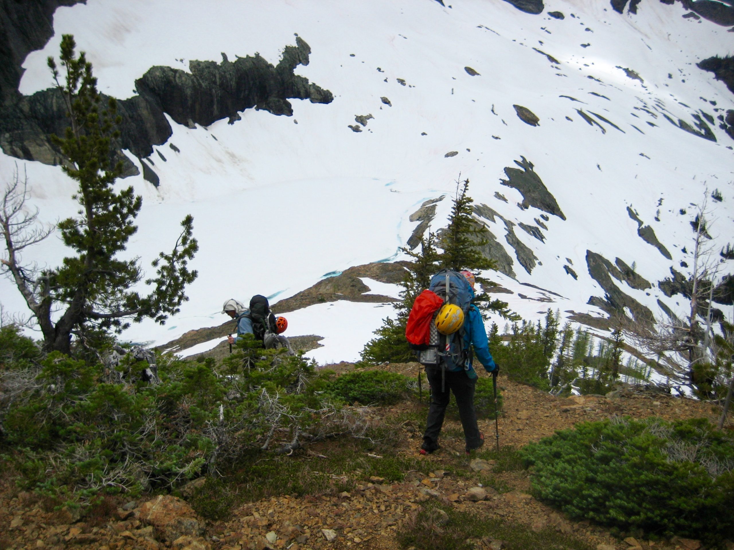
Once across the outlet stream, we traversed northeastward to intersect the trail as it switch-backed toward Crater Lake. Snow patches were encountered just before the lake, but we found bare ground for camping on the lakeshore (7.0 hours + 4300 feet from TH). It had been a tiring and frustrating approach hike.
Day 2: Crater Lake to Crater Creek Meadows
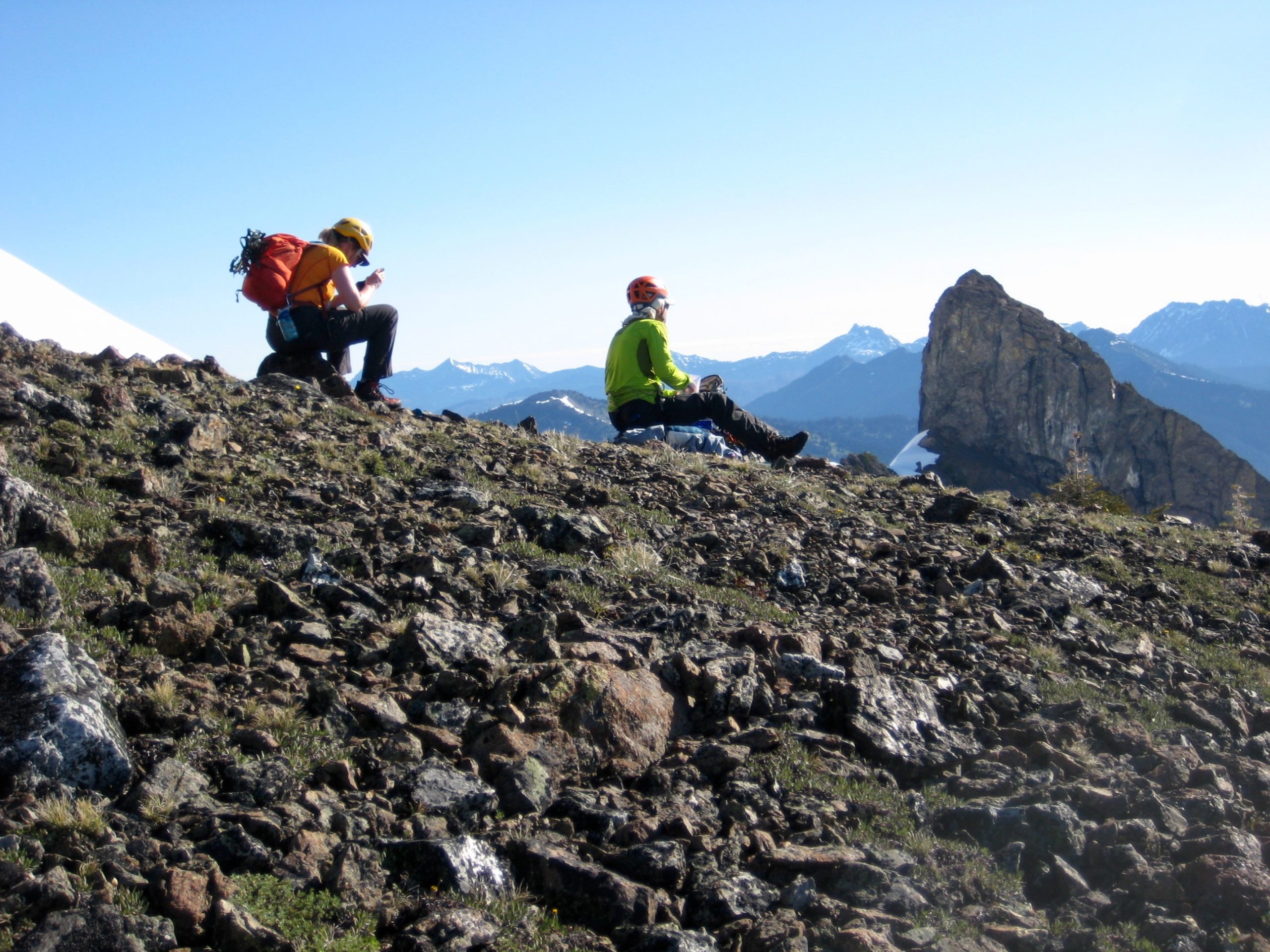
Our next day involved first hiking up to East Crater Mtn Lookout (“Lookout No. 2”). The lower portion of trail was mostly bare, but the upper portion was mostly snow-covered. We stopped for a break at the old lookout site (1.7 hours + 1250 feet from Camp 1), with Devil’s Lake directly below.
From the lookout site, we hiked over the nearby high knoll, then descended to Devil’s Lake at the headwaters of Devils Creek. This descent was easy except for a short segment of muddy Class 3 rock.
We crossed the outlet of Devil’s Lake, then contoured below the Jerry Glacier on nice snow slopes.
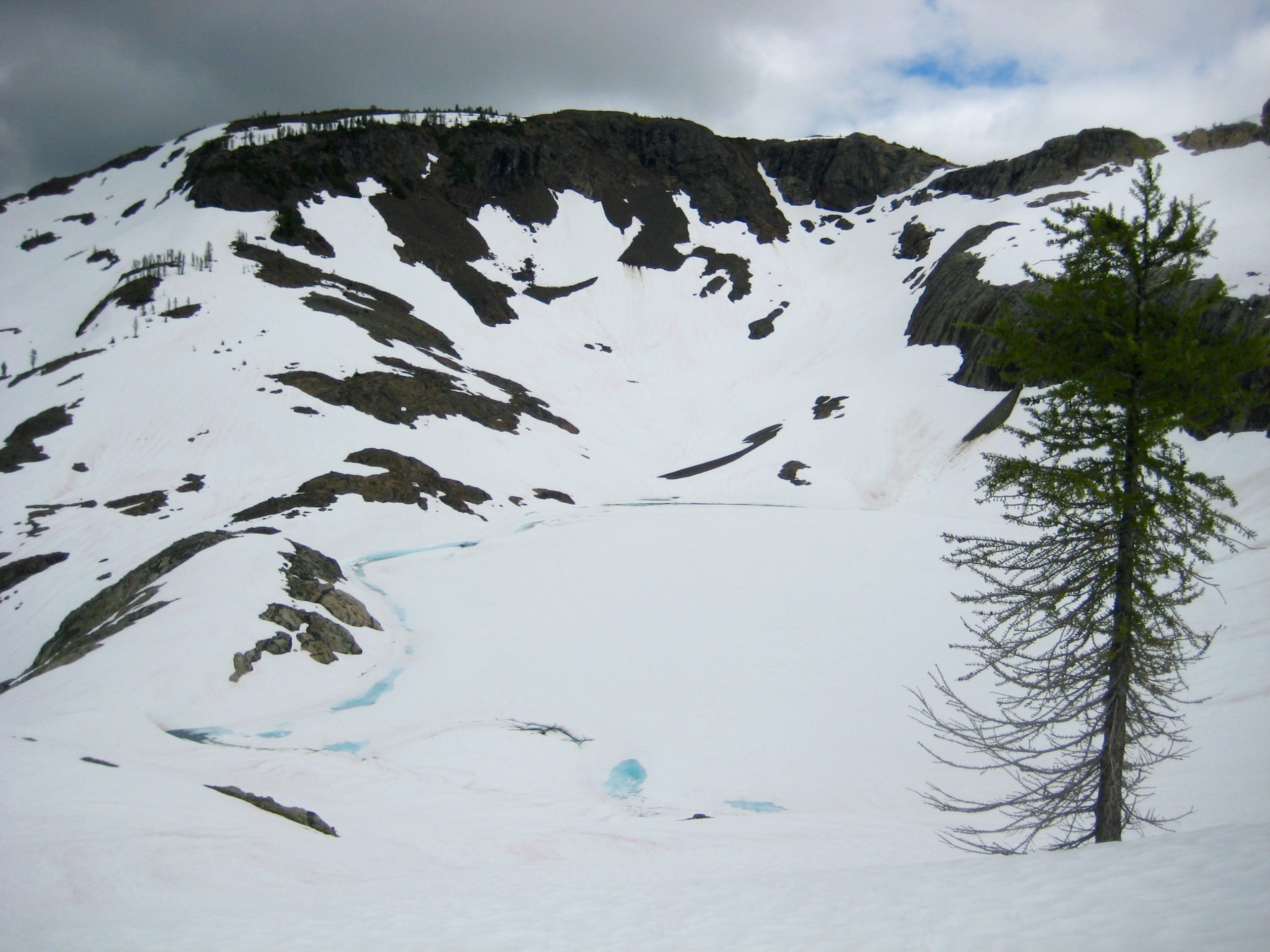
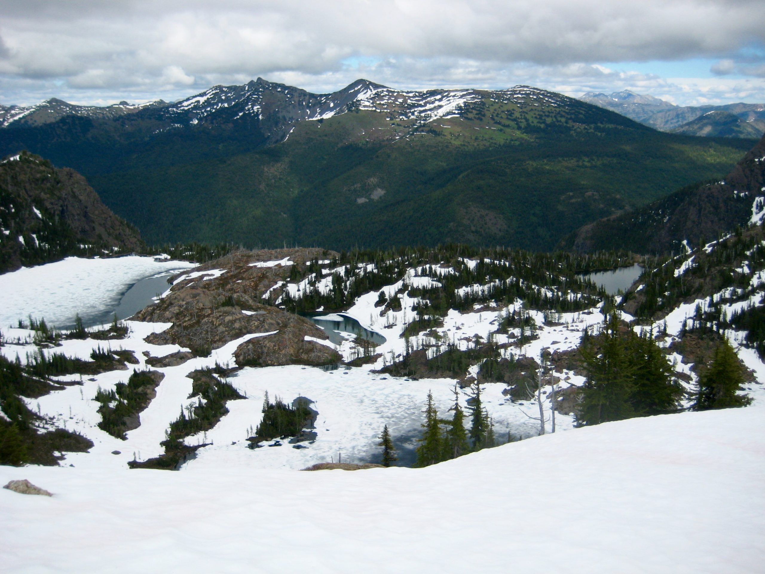
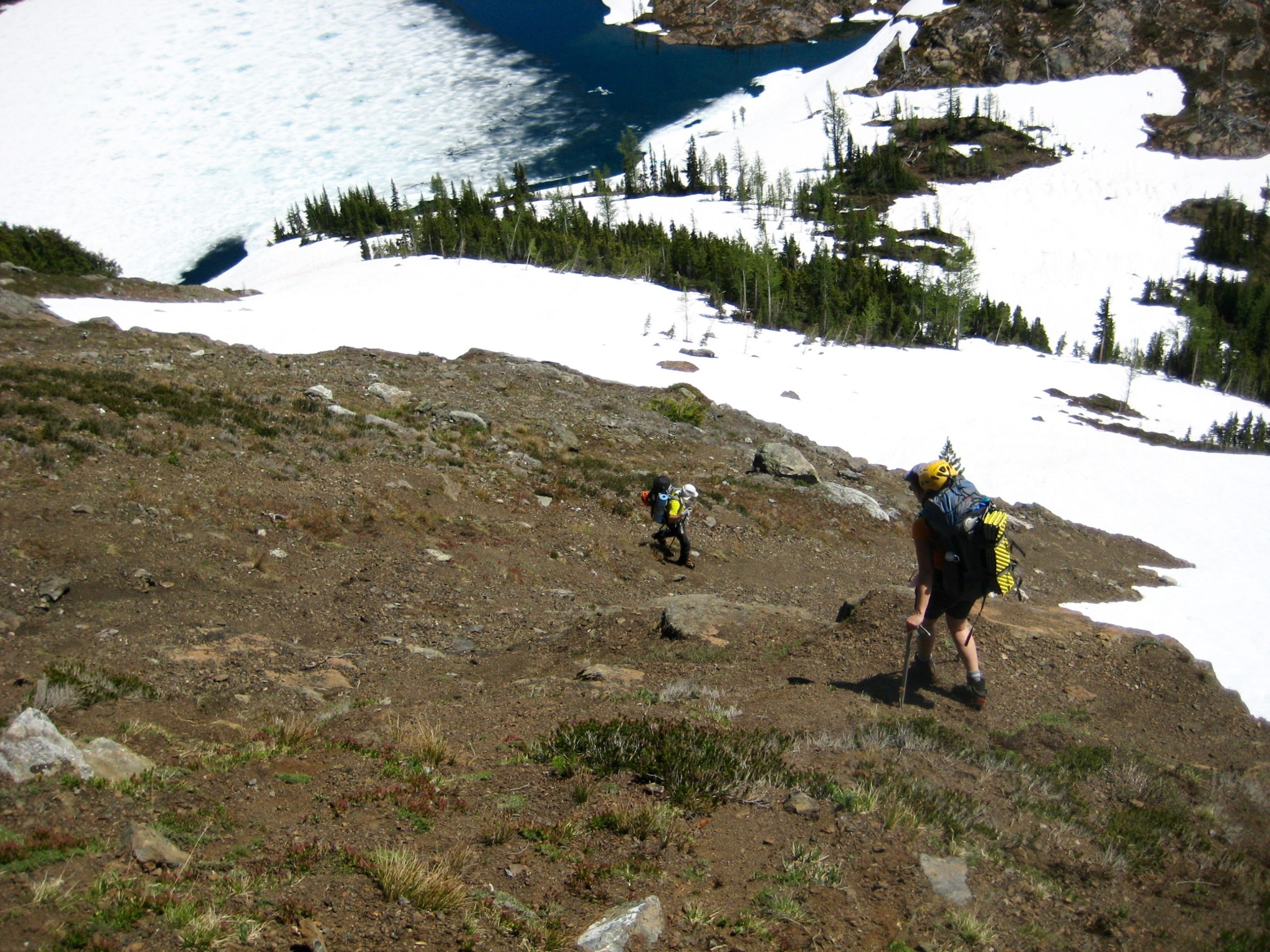
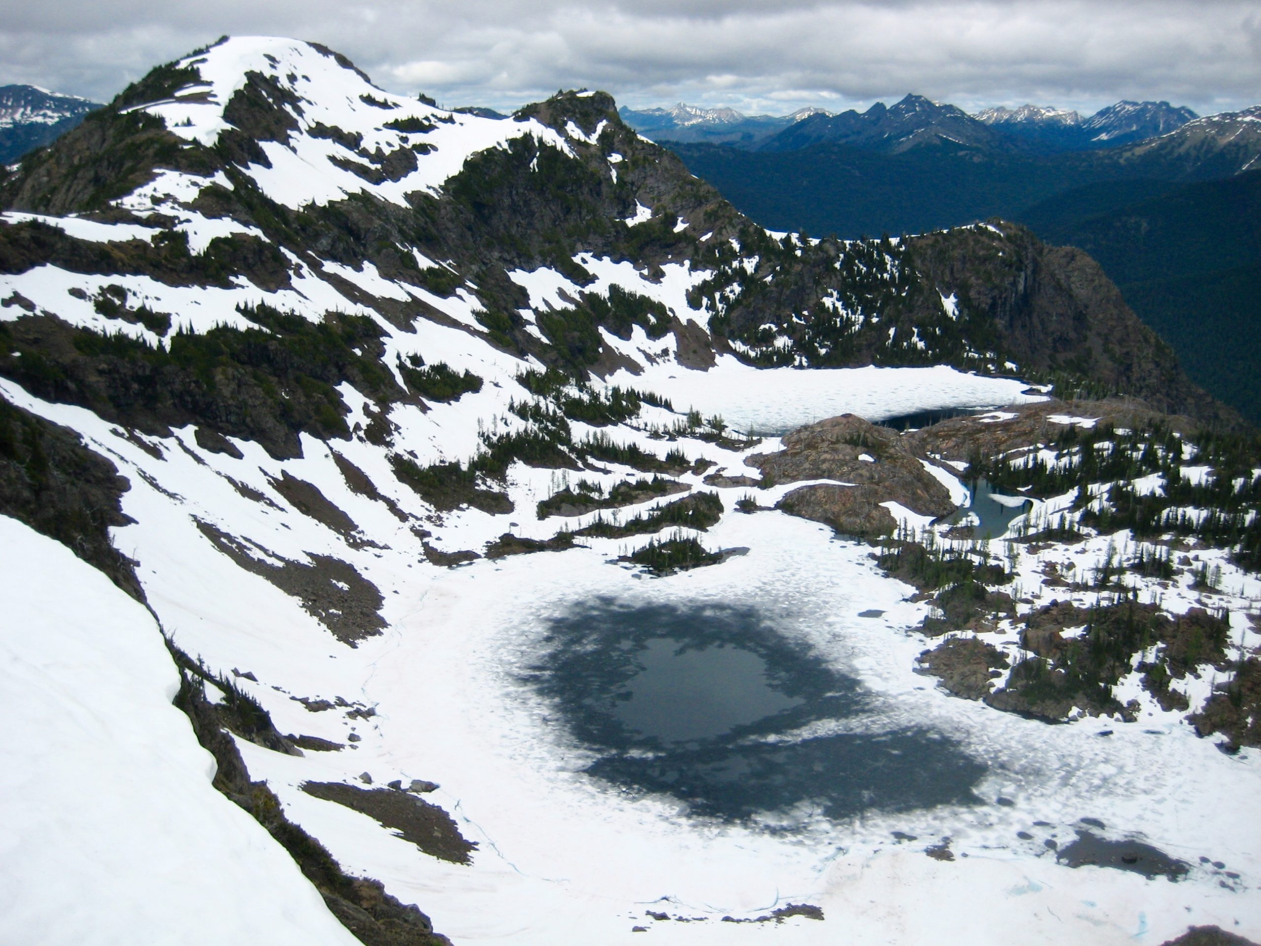
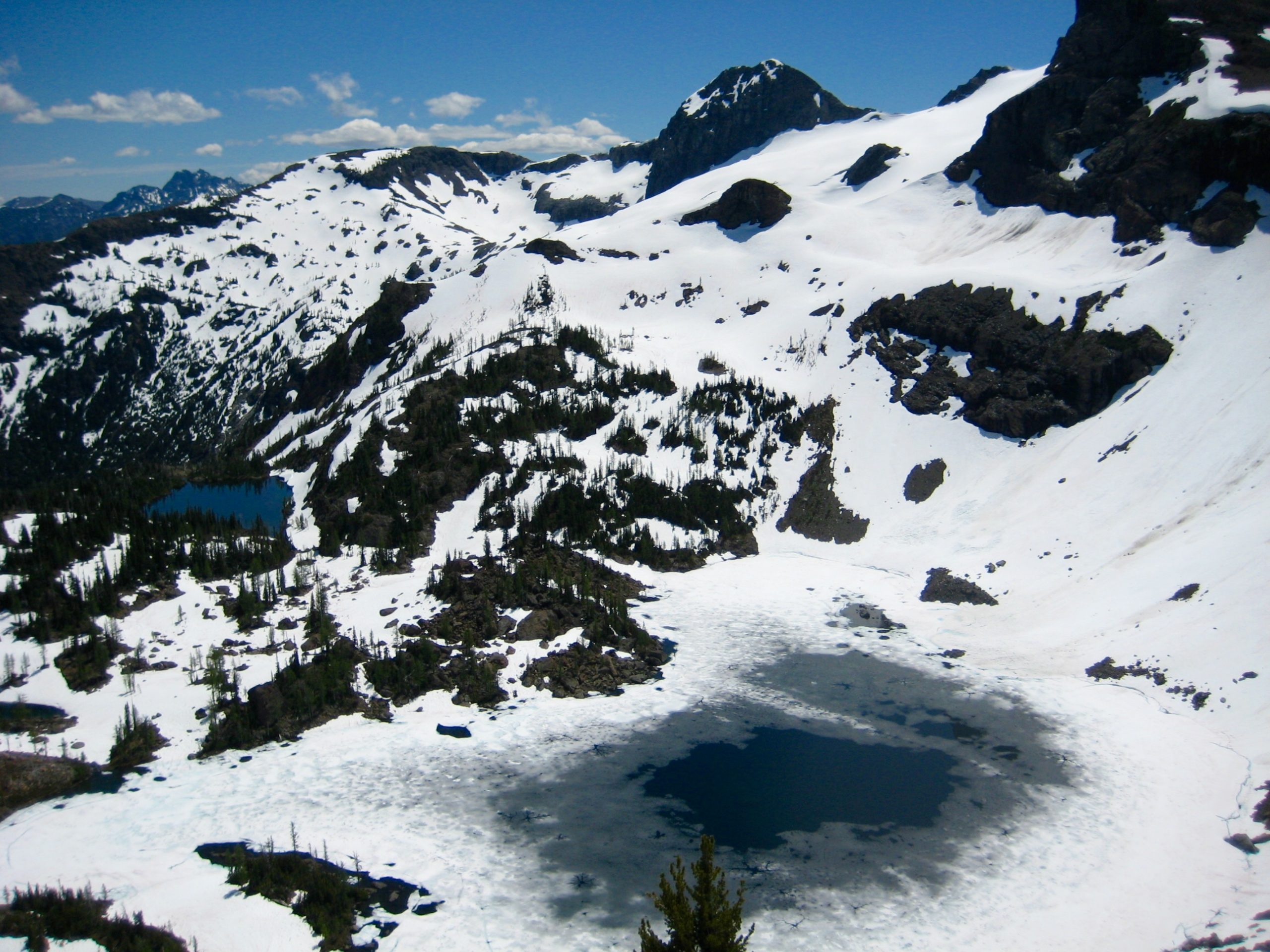
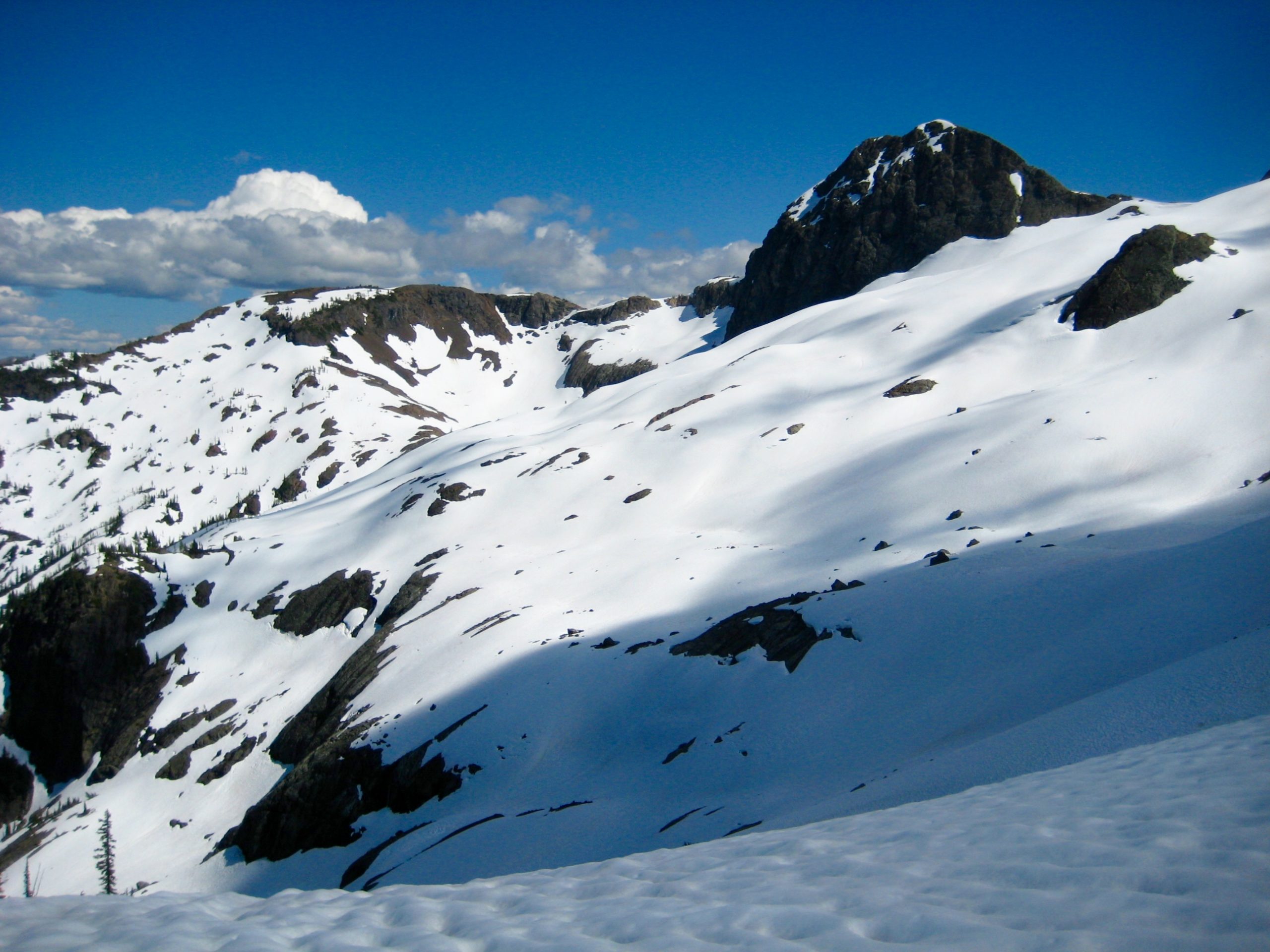
Just past the glacier, we reached a saddle overlooking scenic Jerry Lakes (4.0 hours + 1650 feet from Camp 1). The two small lakes were melted out, whereas the two large lakes were still mostly iced over.
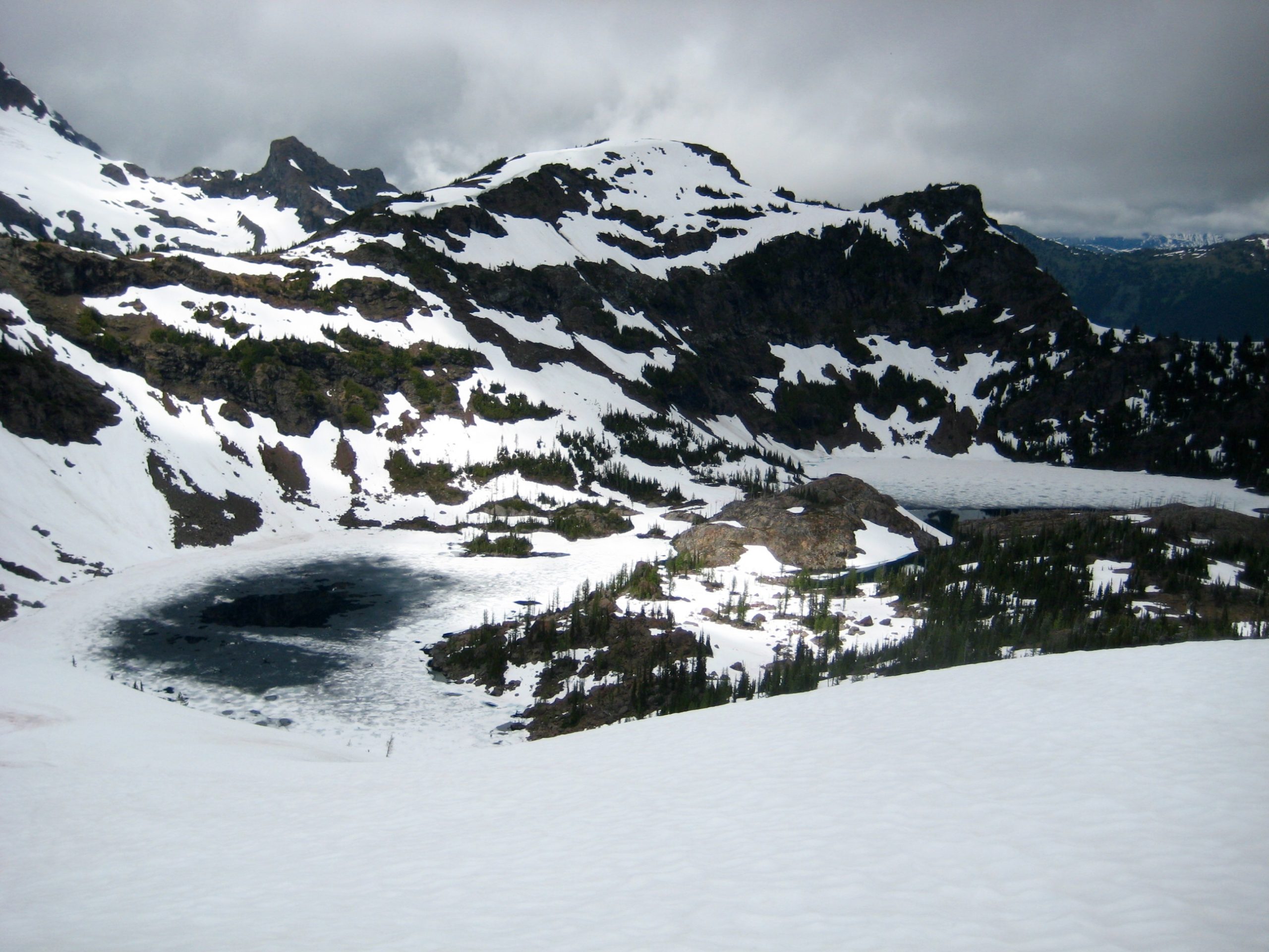
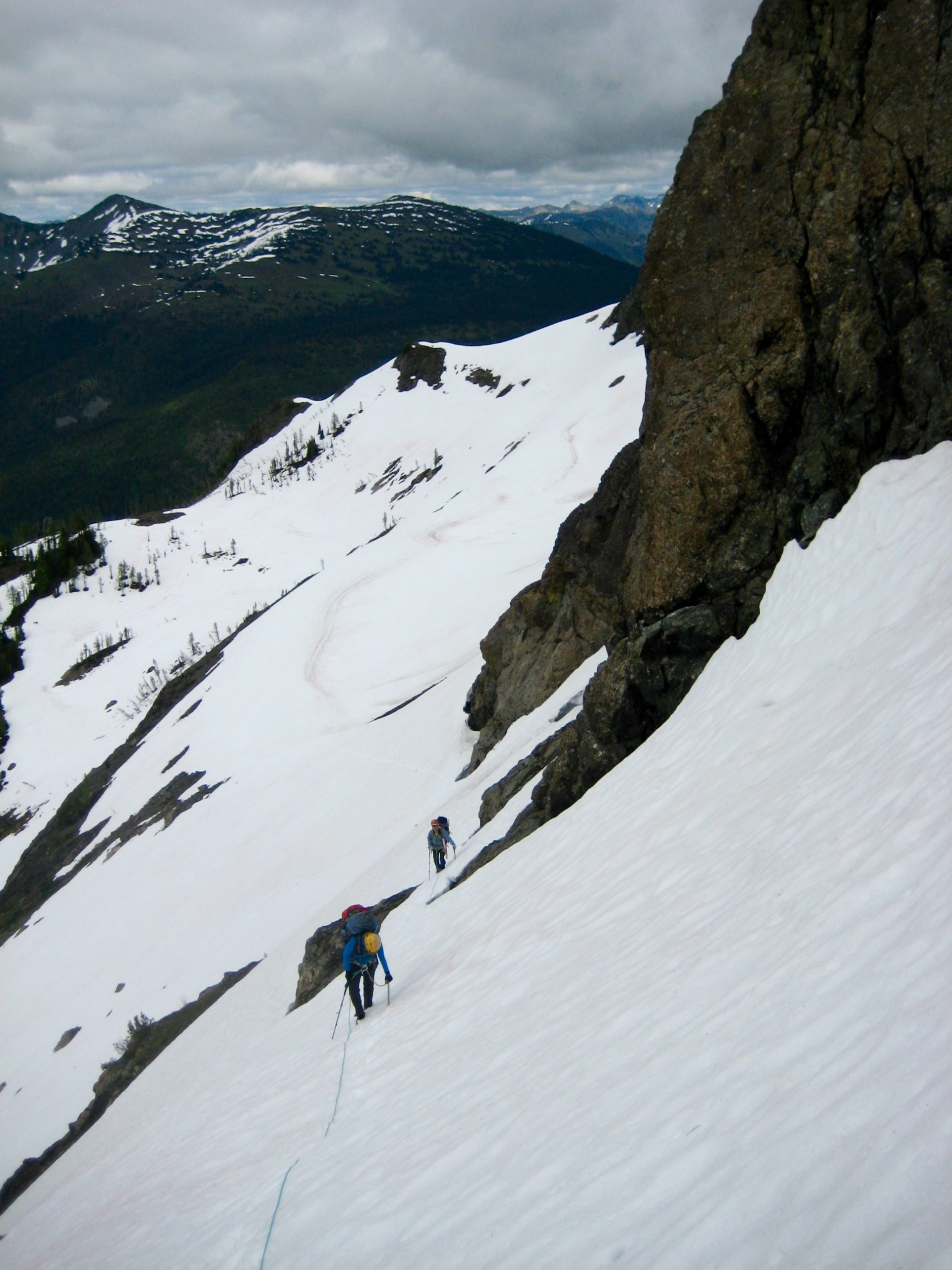
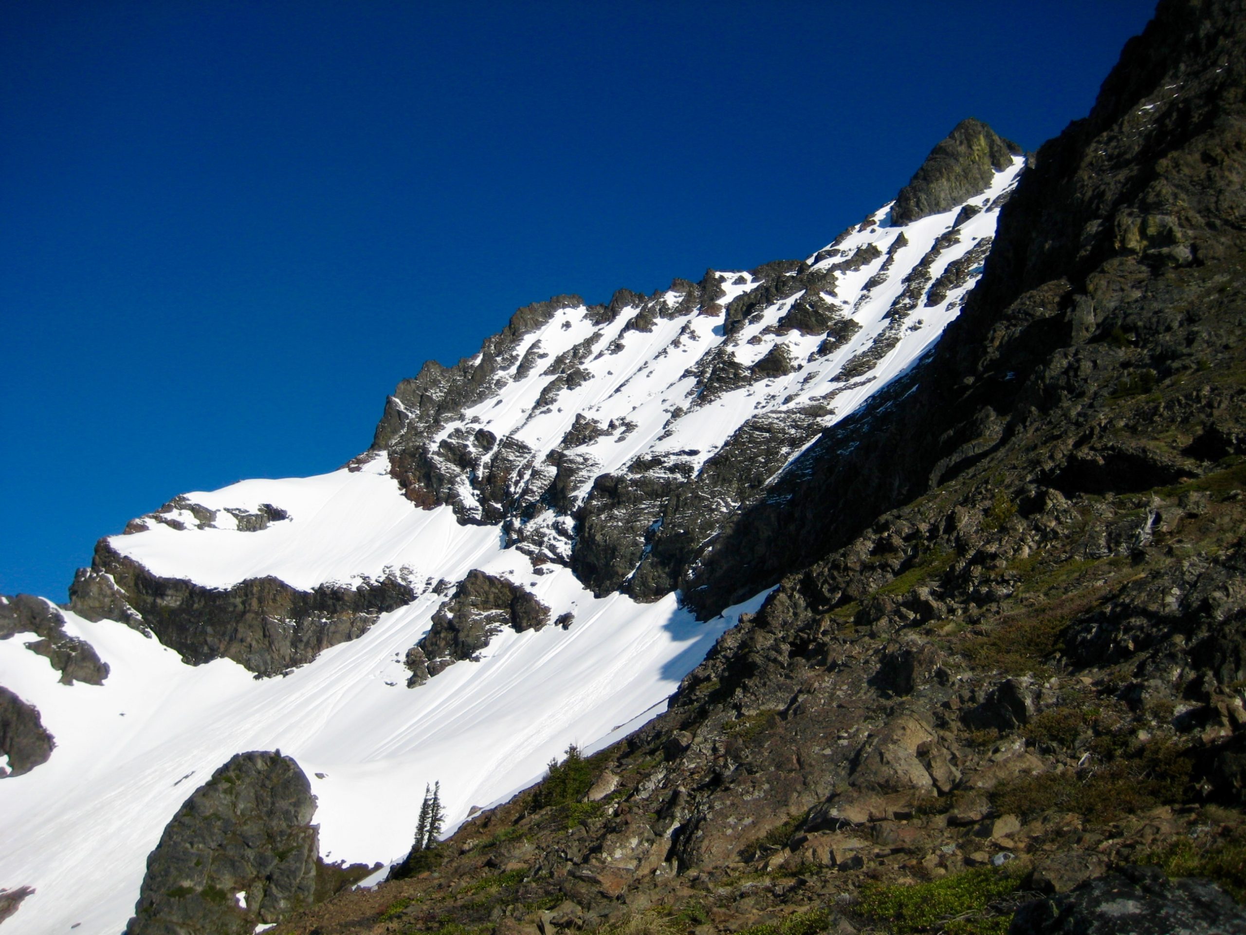
Instead of dropping into the lakes, we stayed high and cramponed up a steep snowfinger, using a rope and two pickets for protection. This turned out to be the technical crux of our weekend.
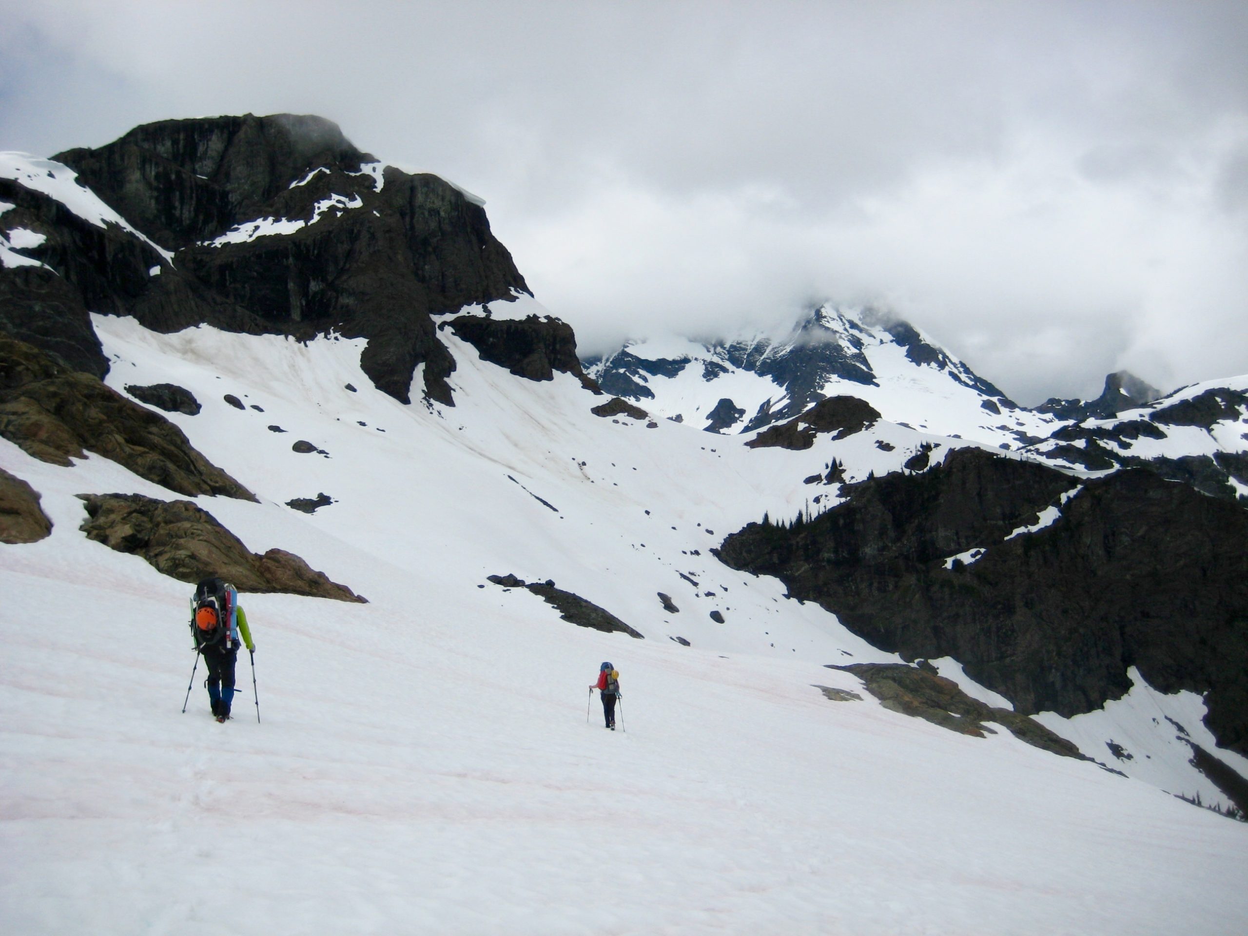
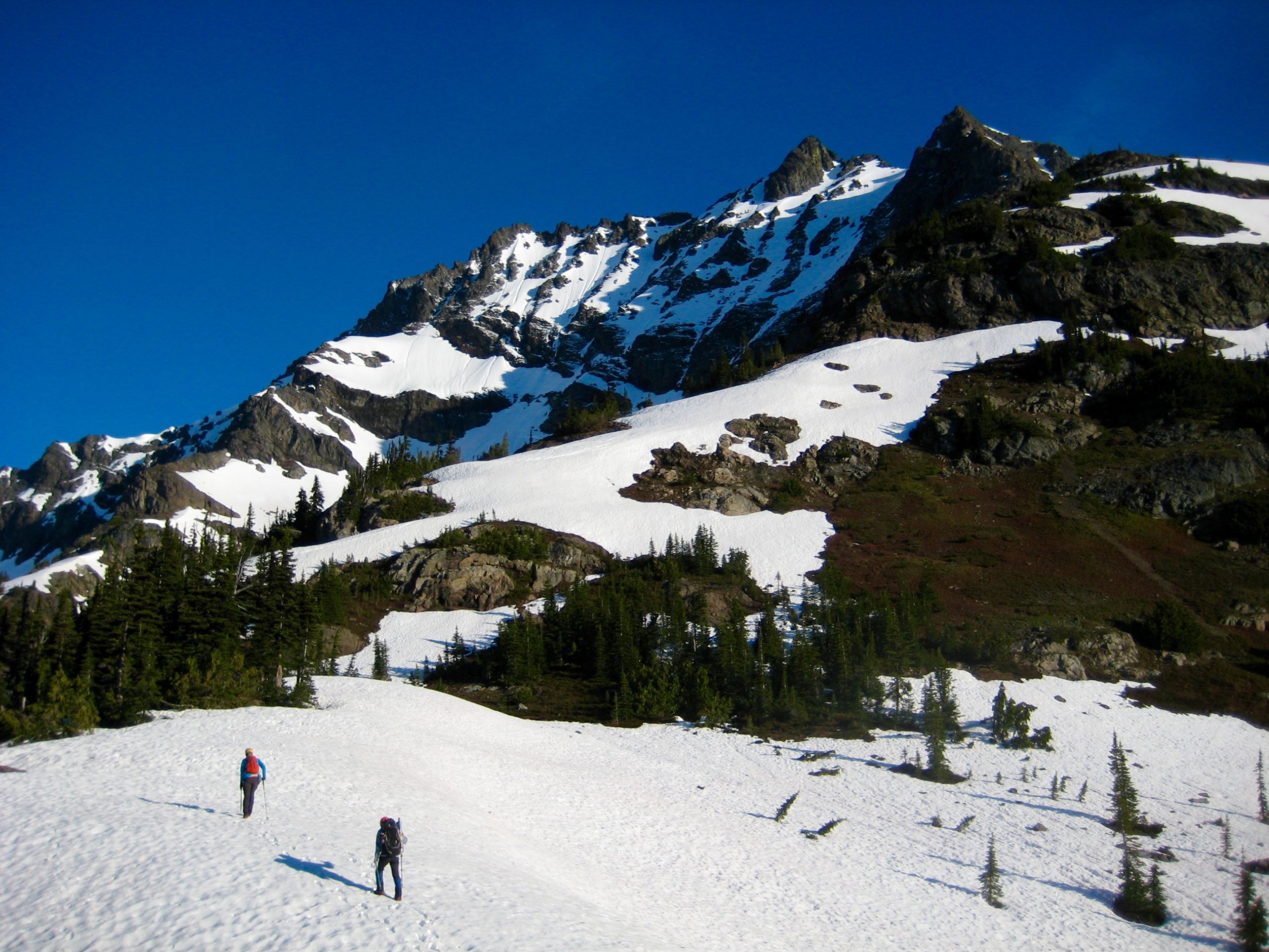
Where the snowfinger ended at a broad ridge crest, we easily hiked around the Jerry Lakes bowl to 6550-foot Crater–Jerry Saddle, then descended northward into Crater Creek Meadows.
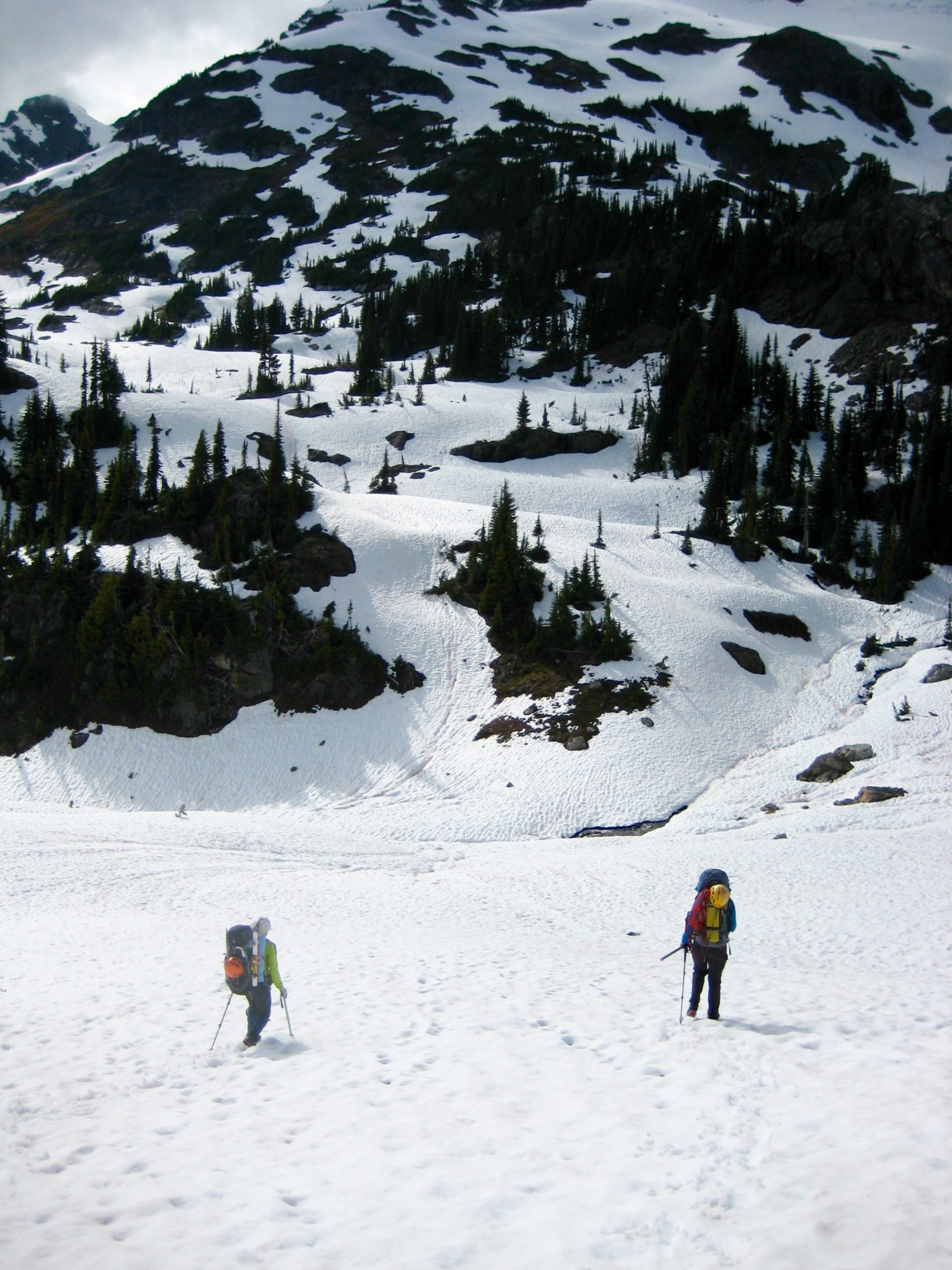
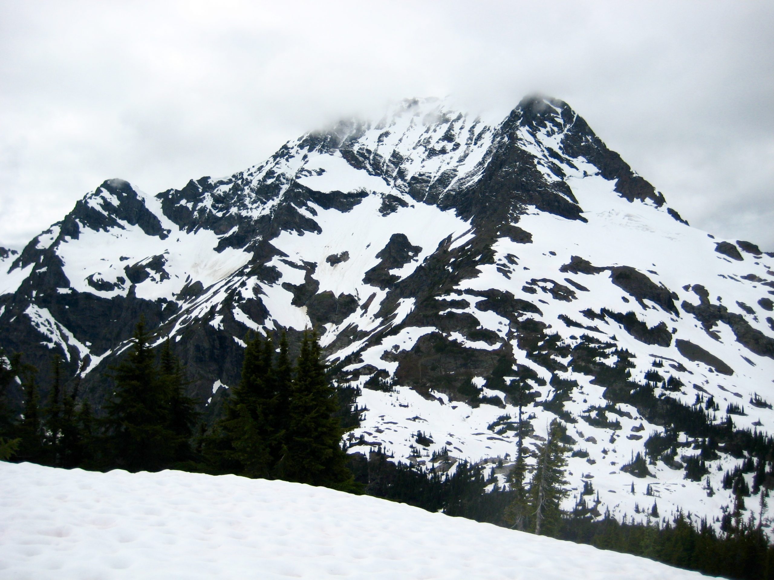
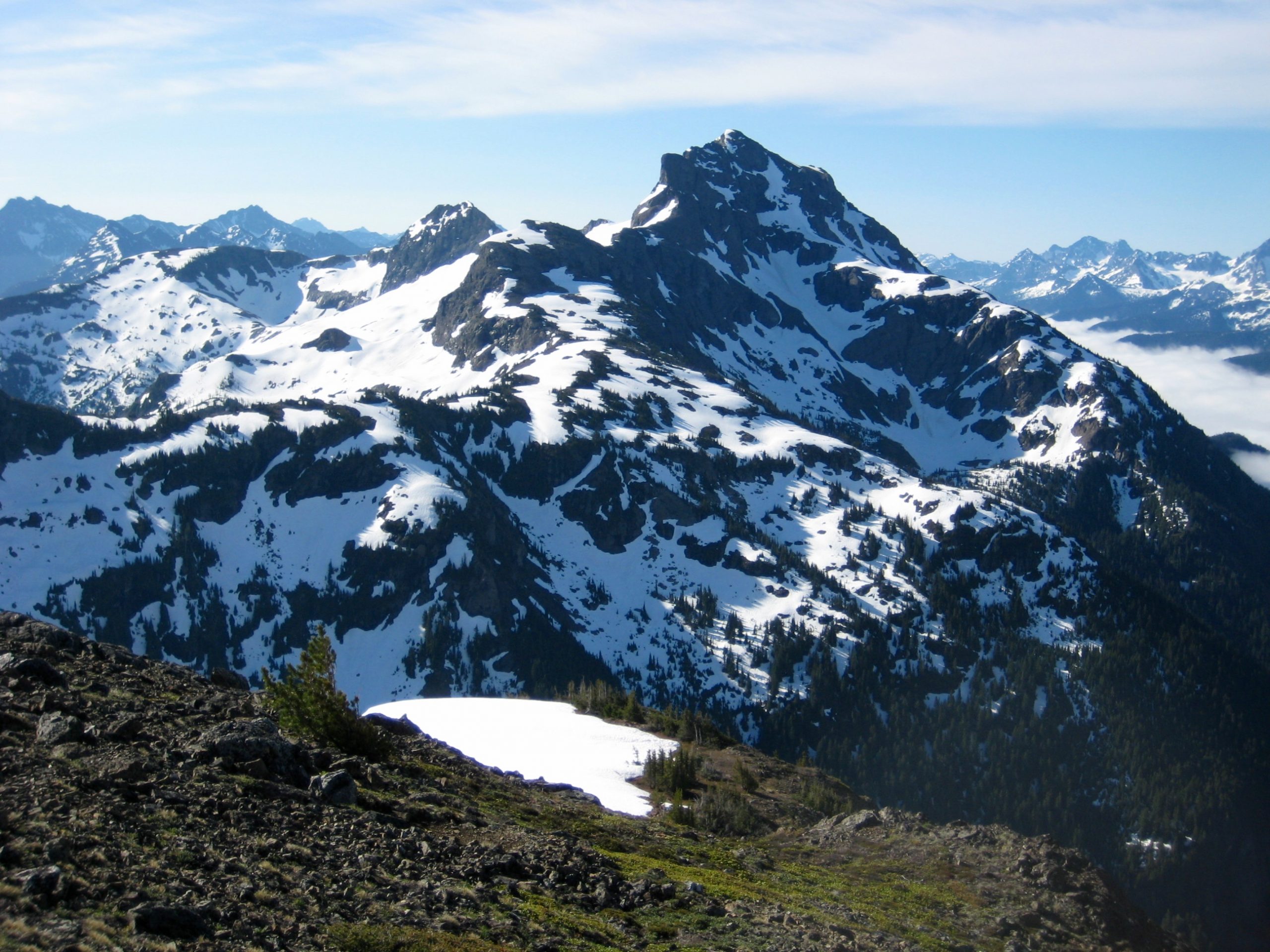
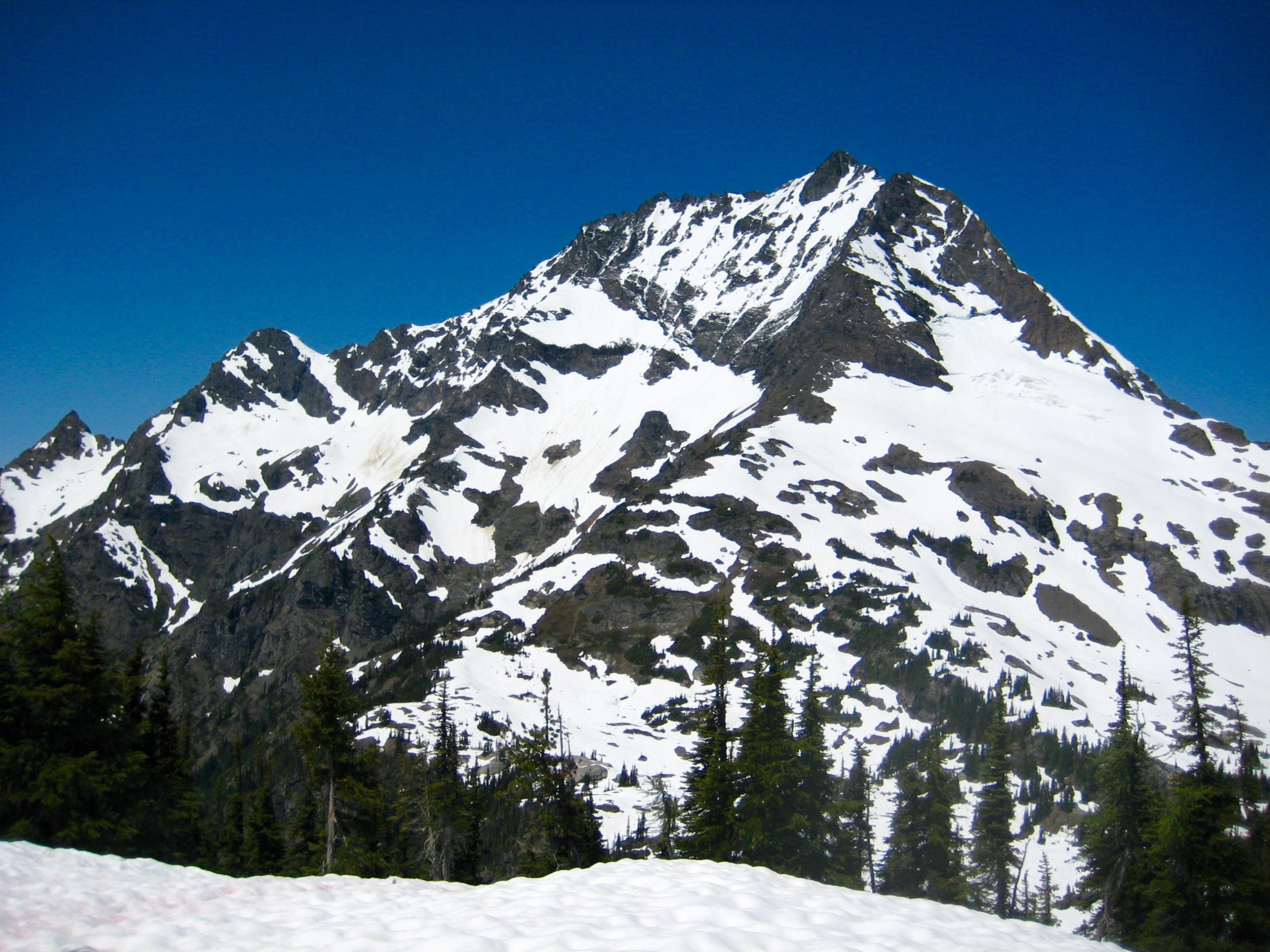
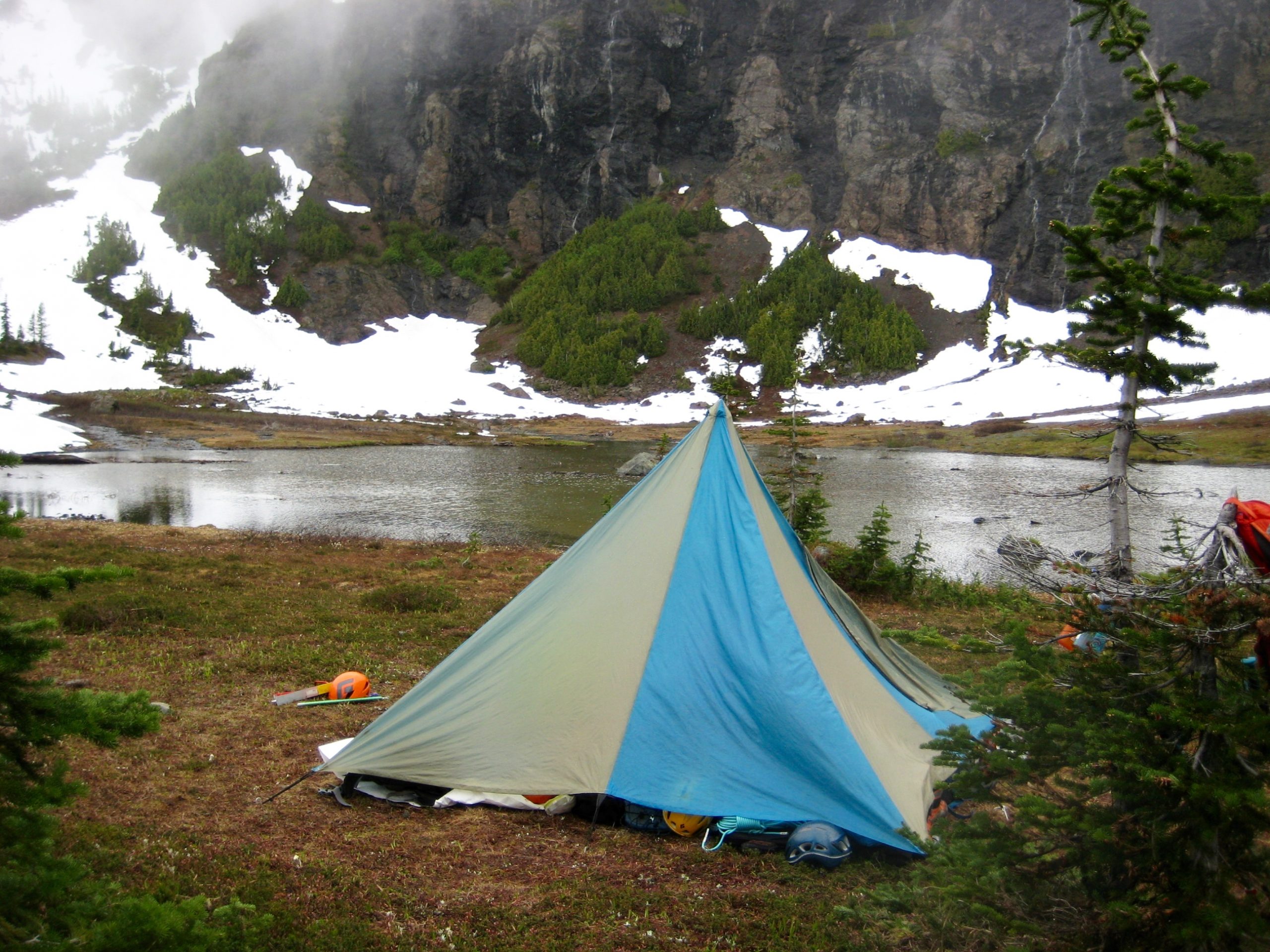
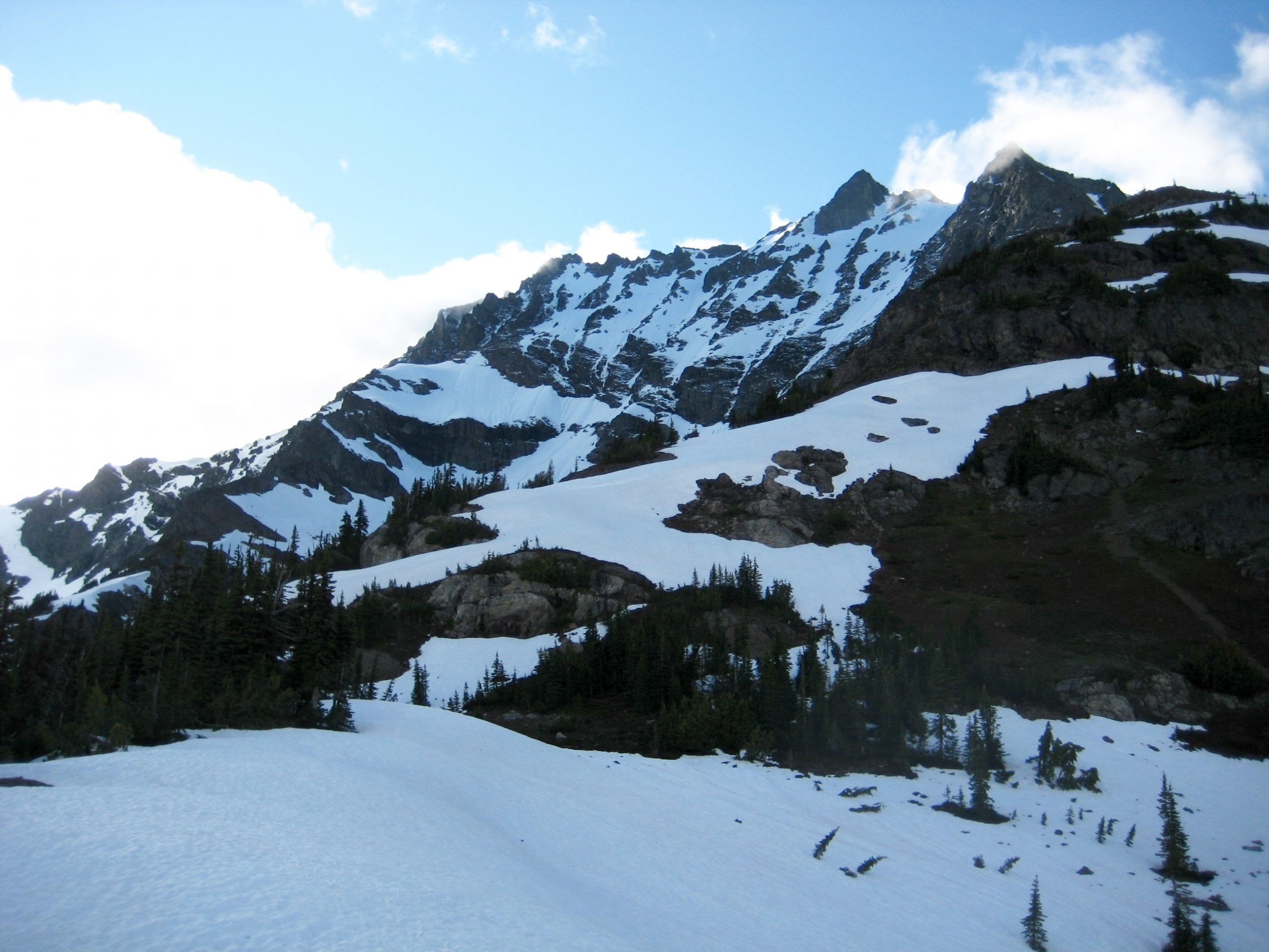
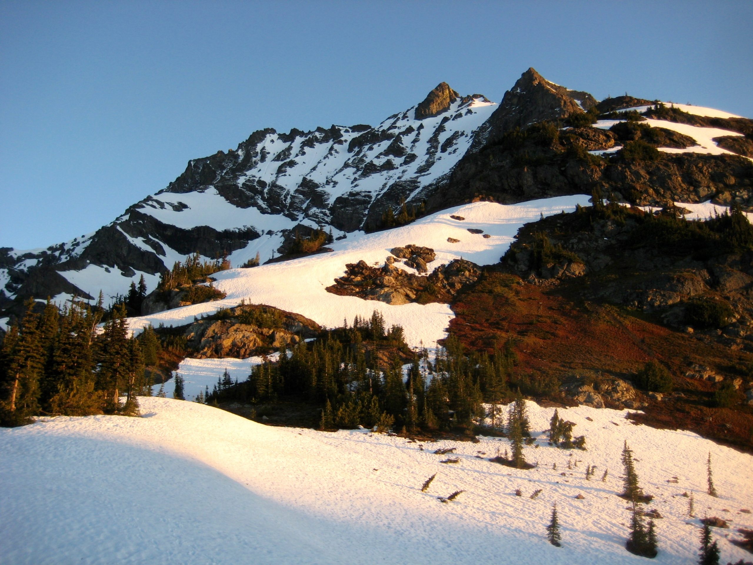
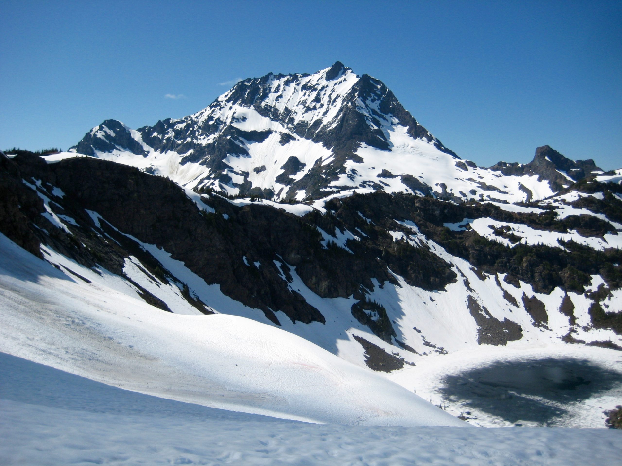
Camp 2 was established on a snowy ridge overlooking Crater Creek valley (7.9 hours + 2500 feet from Camp 1). Our tent sat closely below the massive hulk of Jack Mountain, more appropriately known as Skagit King Mountain.
Day 3 (AM): Jack Mountain Climbing Attempt
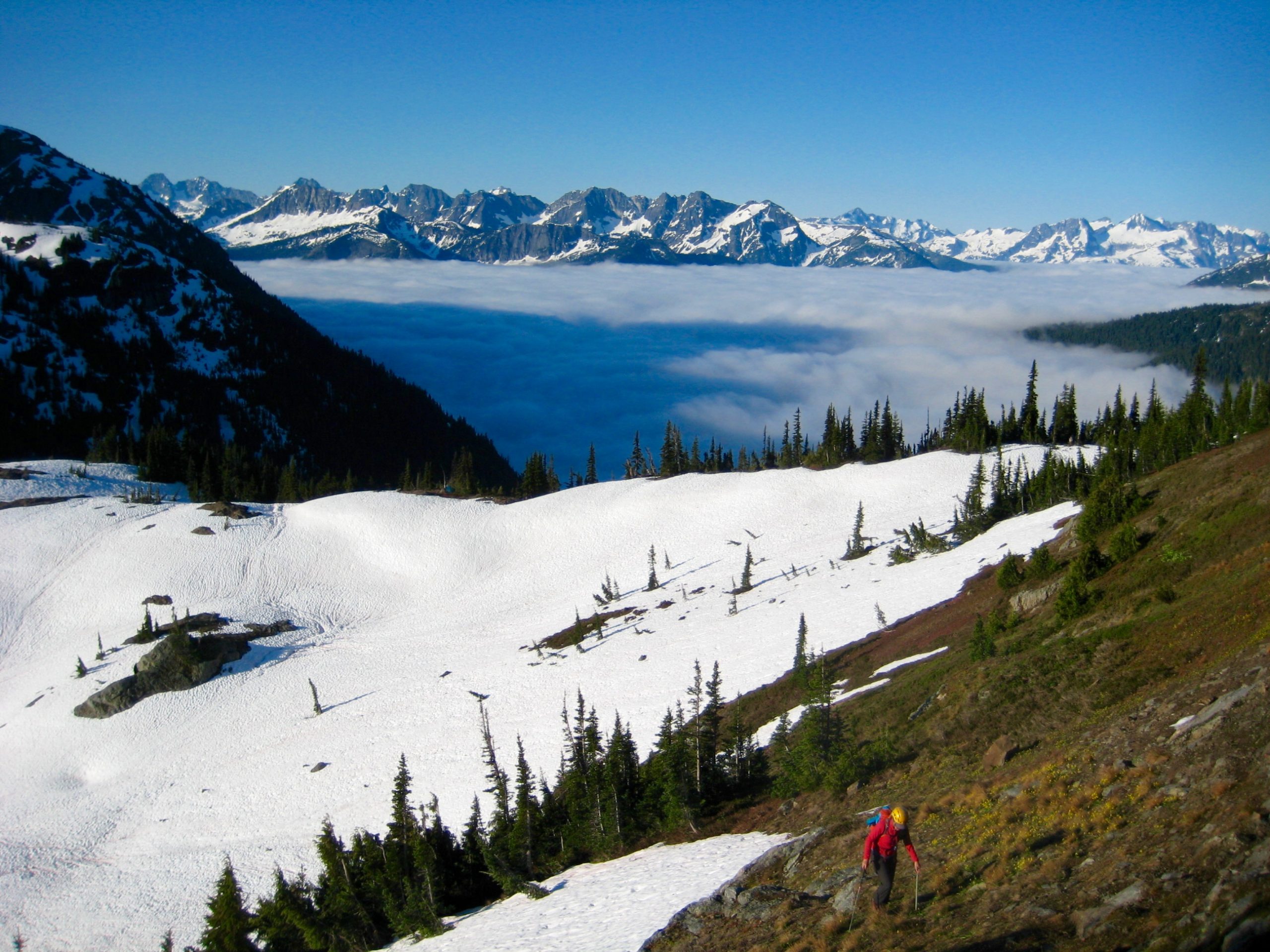
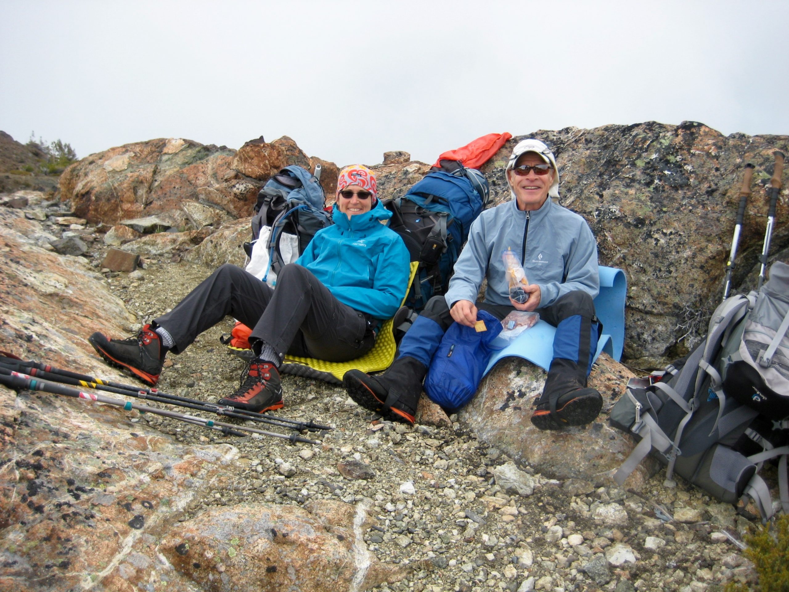
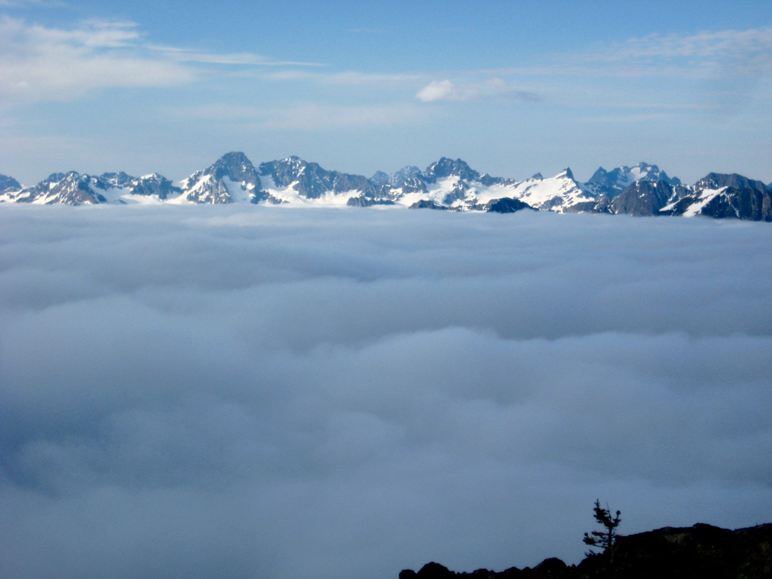
Following two days of cloudy and unsettled weather, we were happy to awake to a blue sky overhead and valley fog below. It promised to be a most excellent day in the mountains!
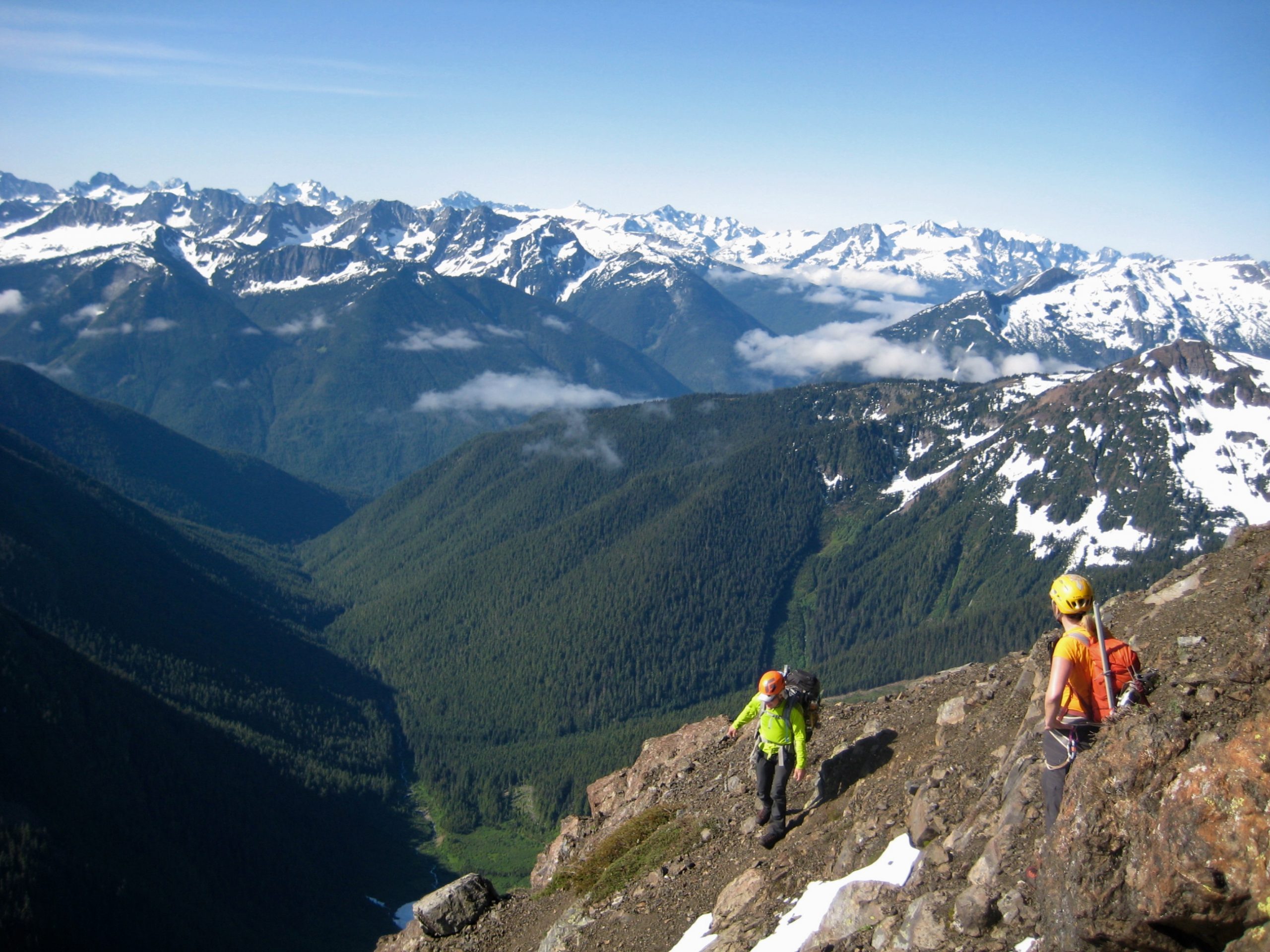
Our plan was to climb Jack Mountain, so we headed up with summit packs. Honestly, though, there was no feeling of optimism in our steps, and we knew why.
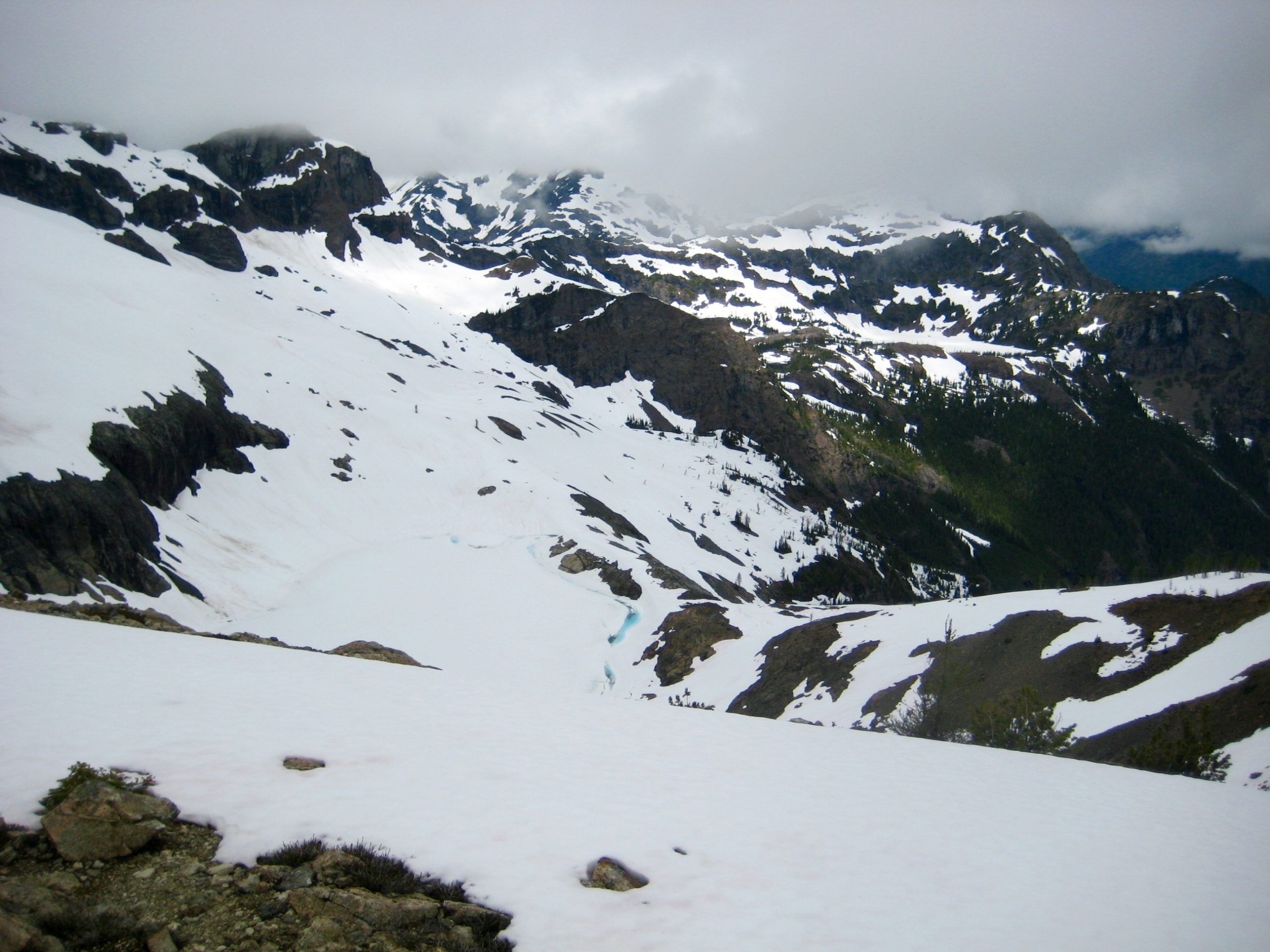
Our climb ended at 7500 feet on Jack’s southeastern ridge, in full view of the south face. The excessive amount of snow on this face—both residual winter snow and recent late-spring snow—looked quite frightful. Having previously done this route in summer conditions, I certainly didn’t like the thought of traversing exposed ledges covered with snow, let alone climbing steep snowfields on the upper face! We reluctantly turned around and headed back to camp.
Day 3 (PM): Crater Creek Meadows to East Crater Mtn Lookout
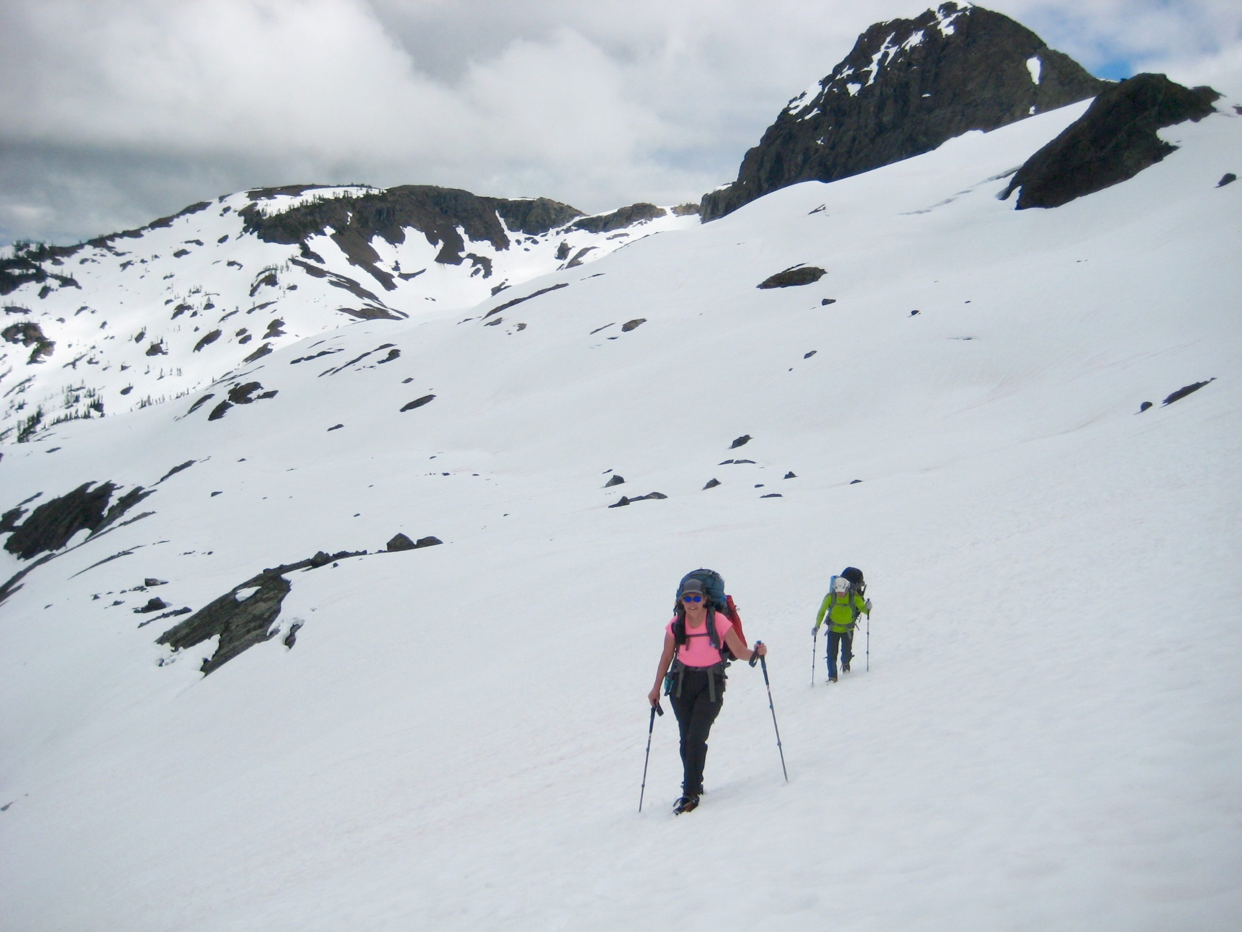
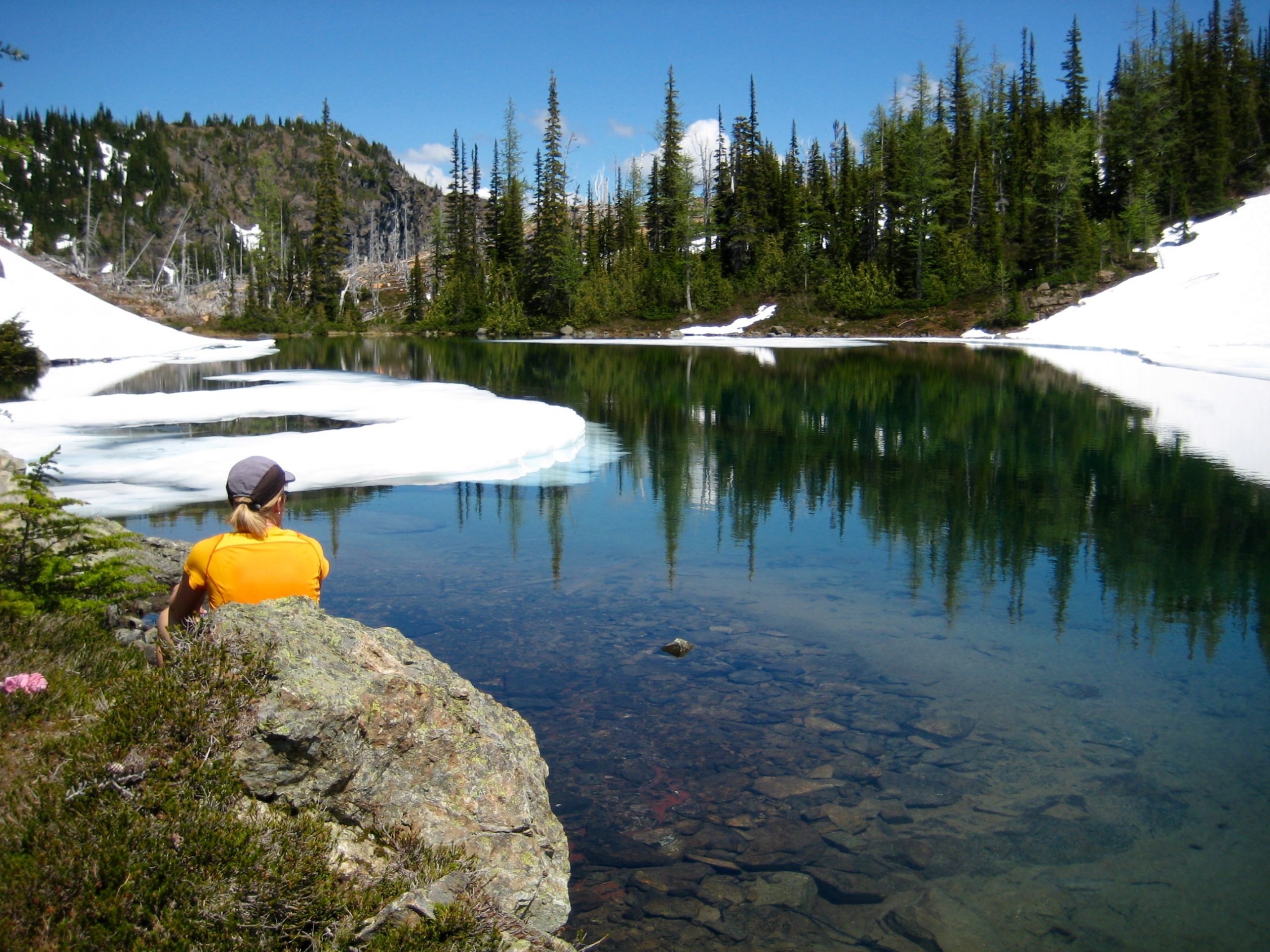
After packing up, we cramponed over the Crater–Jerry Saddle and dropped into Jerry Lakes to enjoy a warm afternoon lunch break. This was our consolation prize.
In mid-afternoon, we headed back over the Jerry Lakes Saddle and retraced our footsteps below the Jerry Glacier to Devil’s Lake. Jack Mountain stood out proudly behind us, as if claiming a victory.
Ascending the ridge above Devil’s Lake turned into a slightly comical episode when we encountered sketchy Class 3 rock immediately below the top. George scrambled up without his pack to establish a fixed line for us. It seemed as though nothing was going to be simple and easy on this trip!
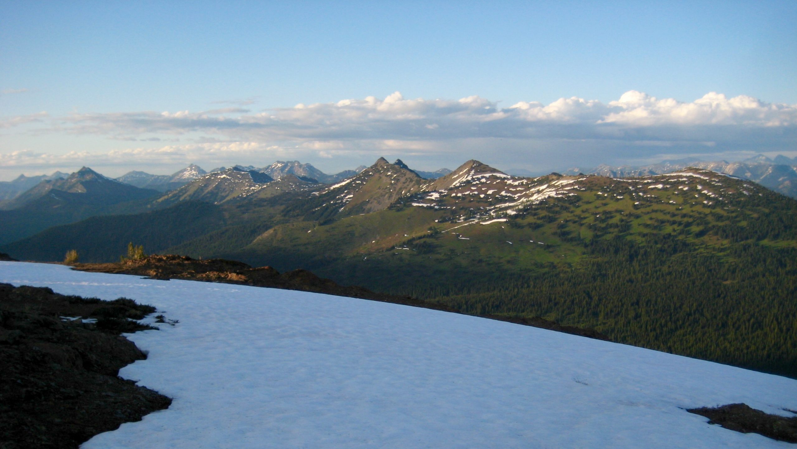
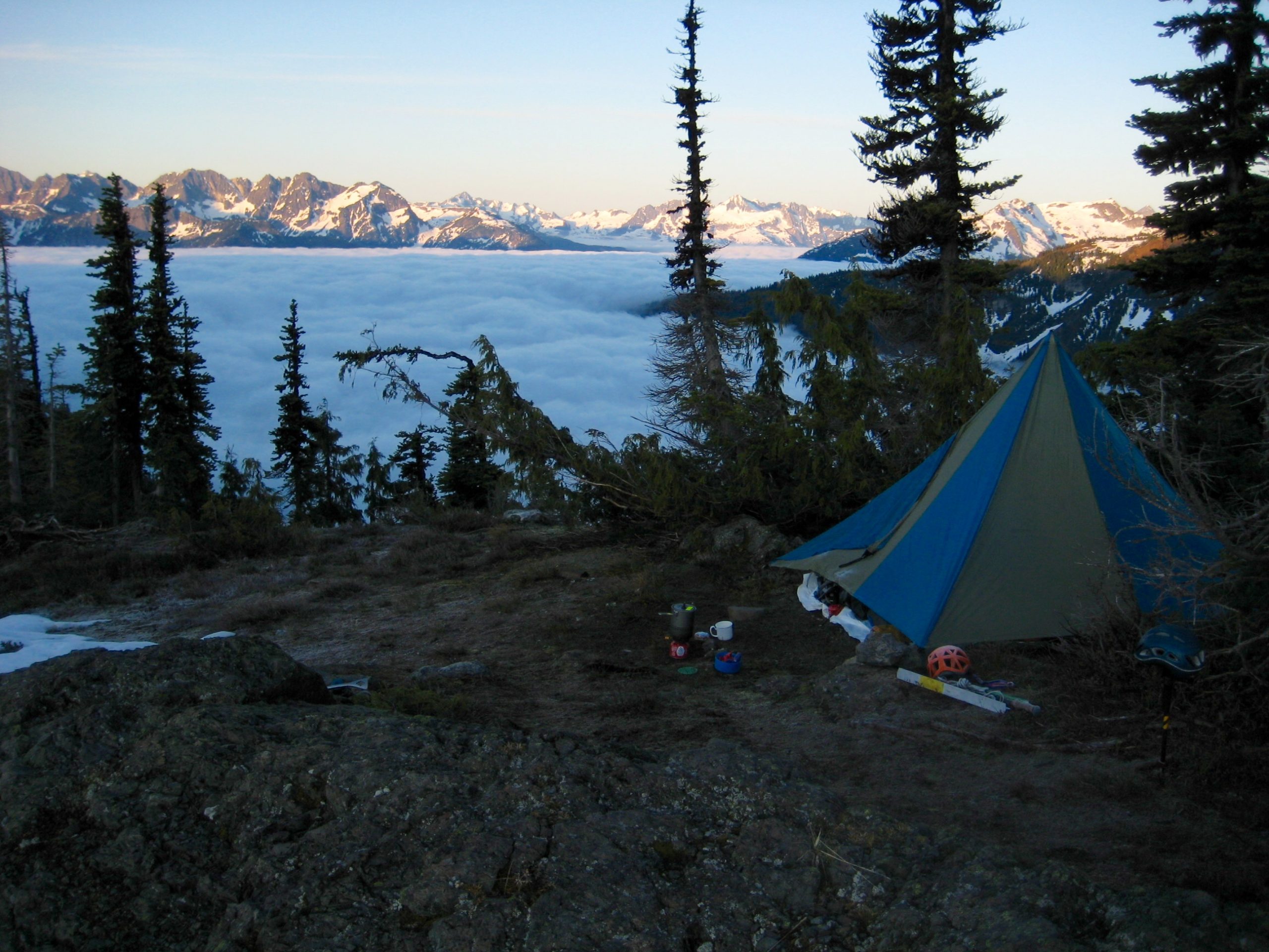
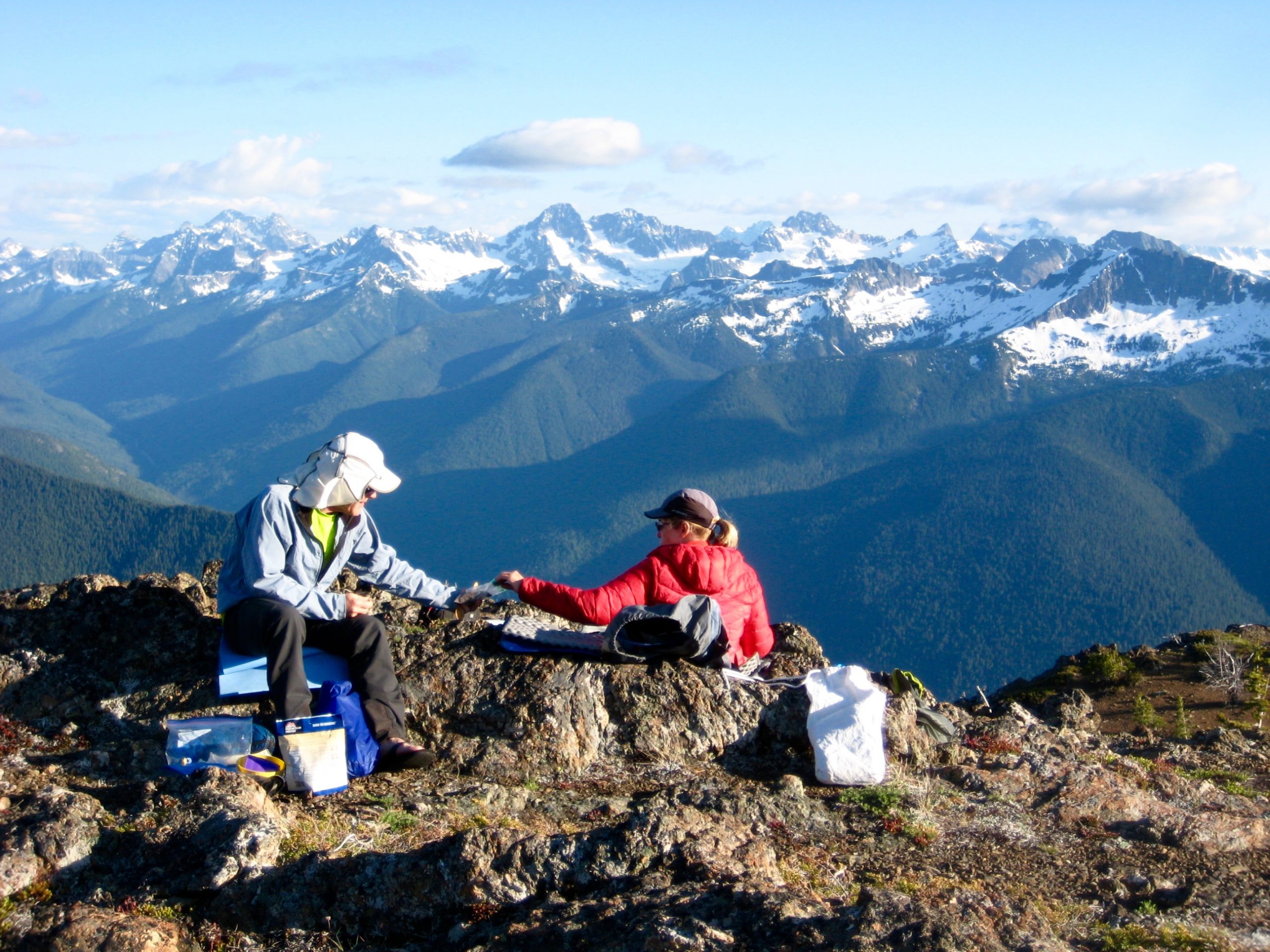
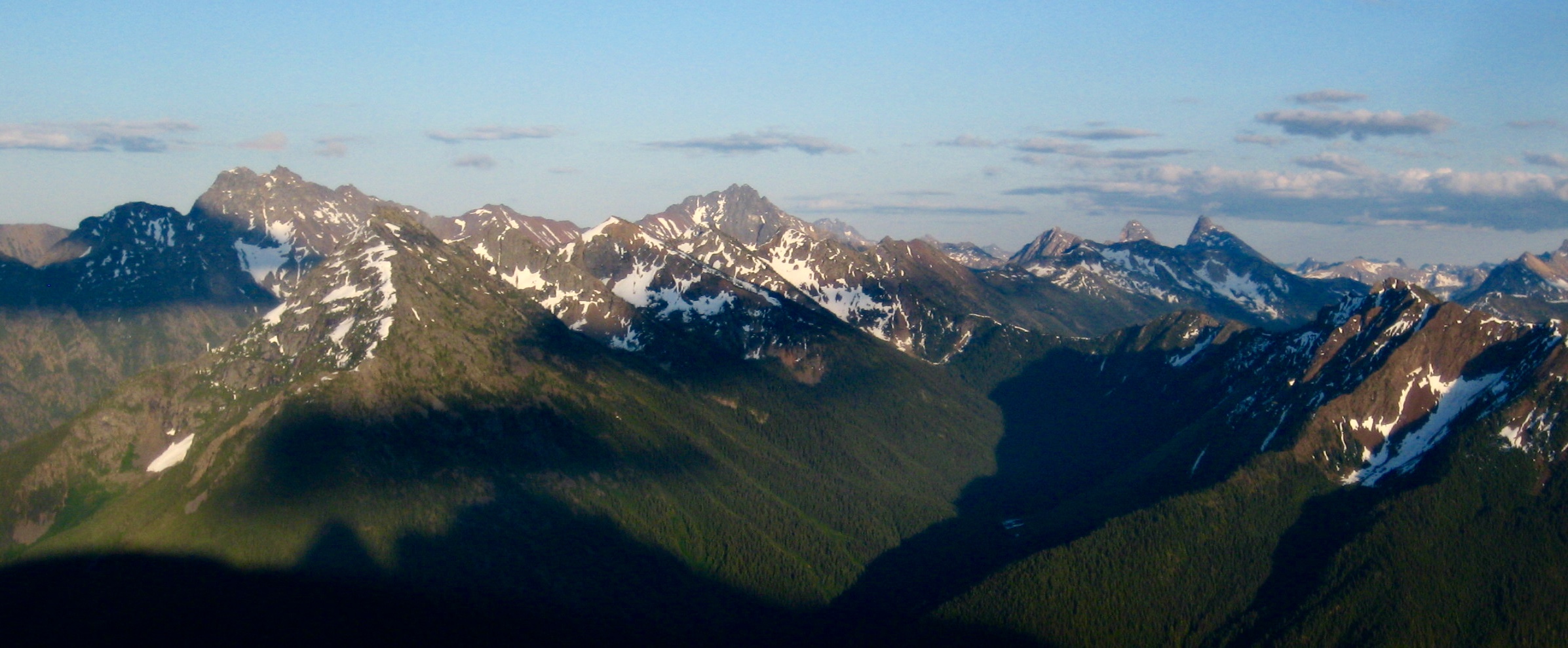
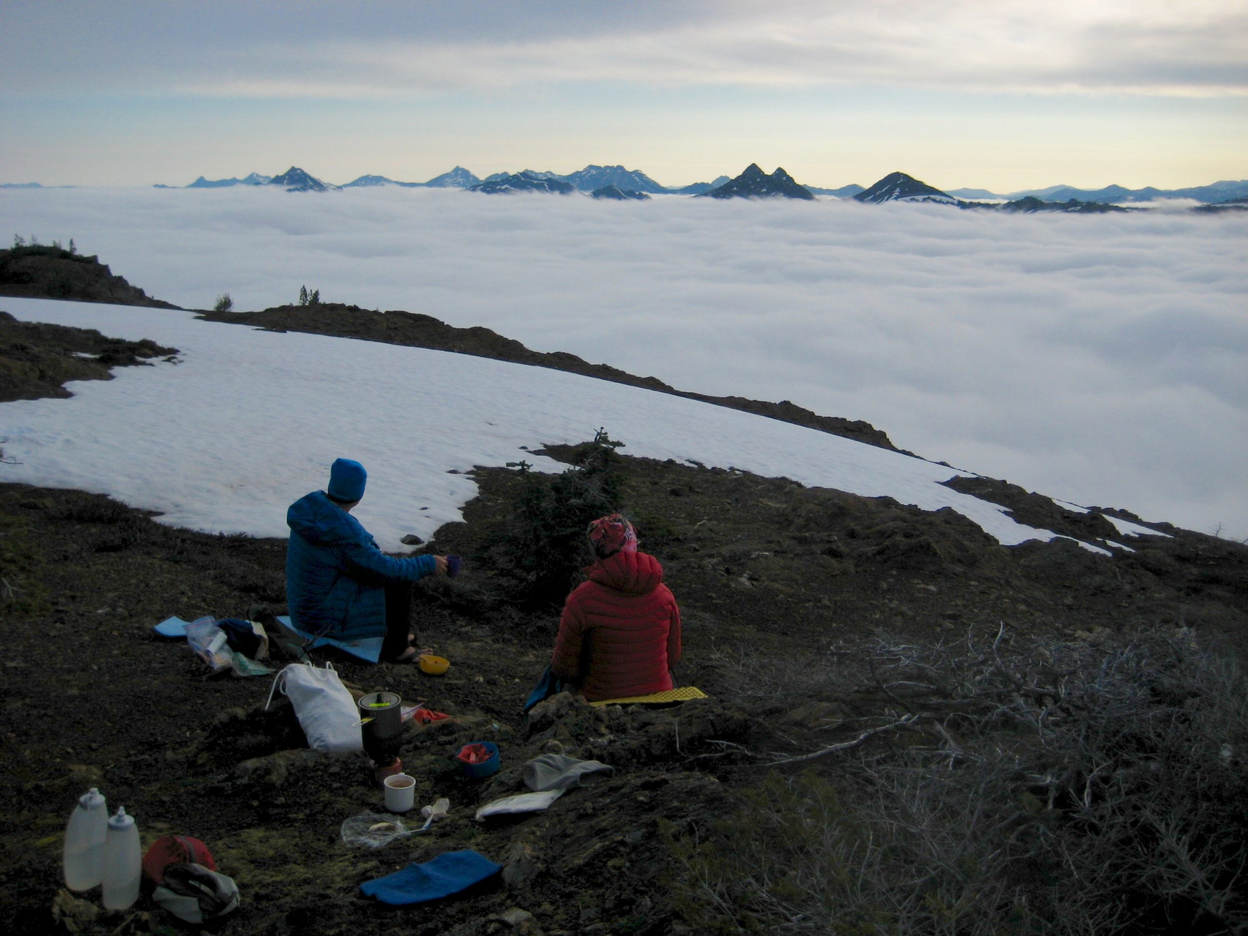
In early evening, we reached to broad summit of East Crater Mtn Lookout (6.5 hours + 2350 feet from Camp 2) and pitched our tent on a gravel pad. This would be a worthy destination in its own right, with views spaning from Mt Winthrop in the Chuchuwanteen Mountains to Colonial Peak in the McAllister Mountains, and Ragged Ridge straight ahead.
Day 4: East Crater Mountain Lookout to Trailhead
It had been a perfectly calm night on the summit, and we awoke to fog filling the valley just a few hundred feet below our camp.
Retracing our route back down the Crater Mountain Trail and along Ruby Creek was tedious and long, especially due to confusion getting through the cliff bands adjacent to the Crater Lake outlet stream. It was past mid-afternoon before we reached the East Bank Trailhead (8.1 hours + 300 feet from Camp 3). No telling when these trails will get their much-needed maintenance, but until that happens, we won’t be eager to revisit the area.
Route Map
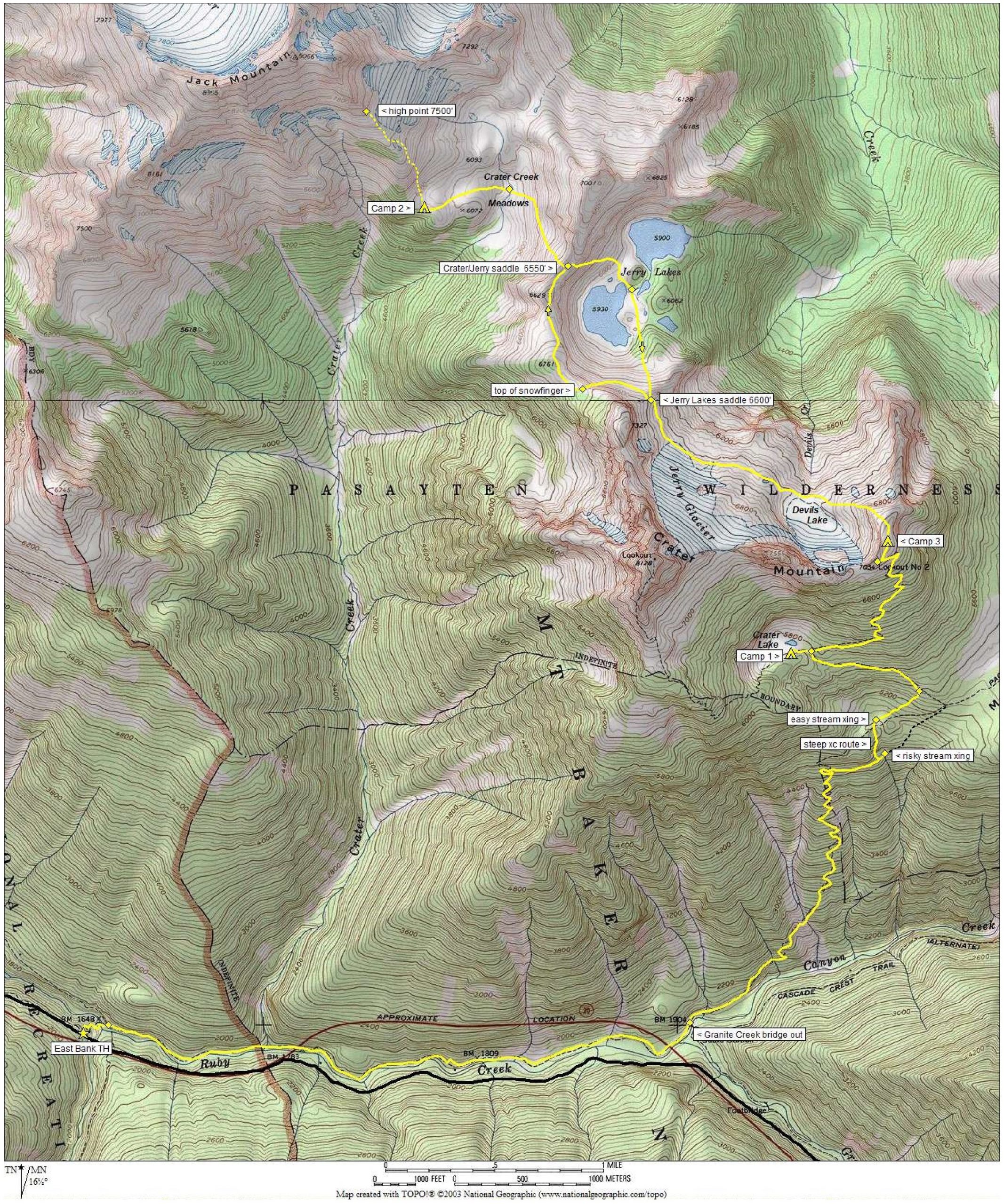
Photo Gallery
Click to enlarge…