Trip Date: August 13-15, 2005
Jack Mountain Climbing Trip
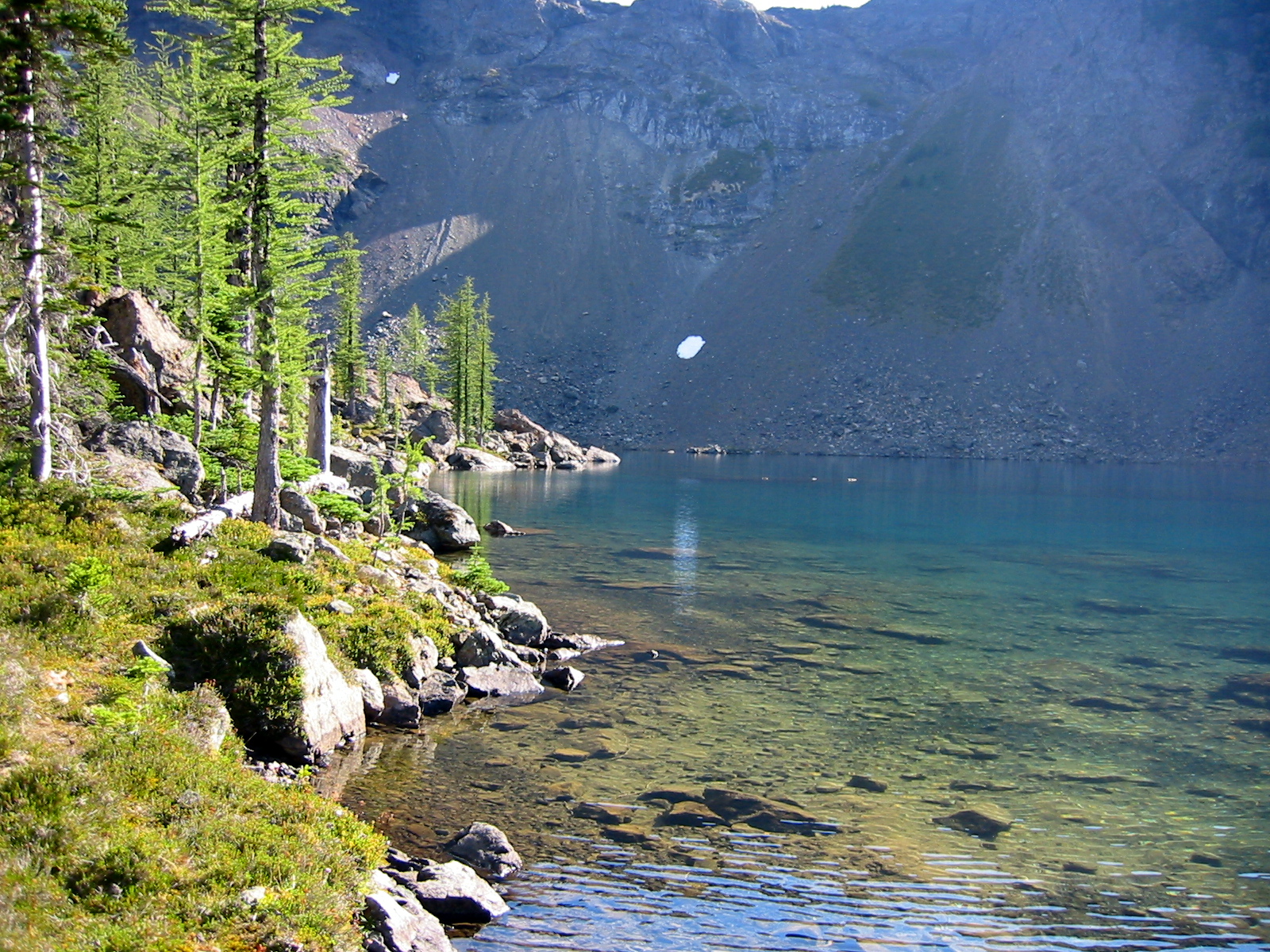
Crater Lake
Crater Mountain Saddle
Jerry Lakes
Crater Creek Meadows
Jack Mountain aka Skagit King Mountain (9066 ft)
Devil’s Lake
East Crater Mountain Lookout aka Crater Mountain Lookout No. 2
Trip Report Summary
Region: Northeastern Washington Cascades
Sub-Region: Upper Skagit Mountains
Area: Pasayten Wilderness
Starting & Ending Point: Canyon Creek Trailhead on Highway 20 (Elev. 1900 feet)
Way Points: Granite Creek & Canyon Creek & Crater Lake & Crater Mountain Saddle & Jerry Glacier & Jerry Lakes & Jerry Ridge Saddle & Upper Crater Creek & Crater Creek Meadows (trail hike & off-trail hike & rock scramble & snow climb); return via Jerry Lakes & Jerry Glacier Bench & Devil’s Lake & East Crater Mountain Lookout (off-trail hike & rock scramble & trail hike)
Campsites: Crater Creek Meadows & Jerry Lakes
Summit: Jack Mountain (rock scramble & rock climb via South Face—West Ridge)
Approximate Stats: 22 miles traveled; 11,500 feet gained & lost.
Related Post
>>> Jack Mountain attempt via East Crater Mountain Lookout–Jerry Lakes – July 2020
Full Trip Report
After having some success on other peaks this summer, I found that Jack Mountain had floated to the very top of my wish list. This same mountain had also floated to the top of Beth’s wish list, but that was primarily due to her many years of cultural-resource work in the Ross Lake area.
Regardless of the reasons, our climbing goals coincided with a period of stable weather in mid-August, and a trip was set. Beth headed out on Friday morning with the intention of camping at Crater Lake that night, then climbing Crater Mountain the next morning; I headed out on Saturday morning with the intention of catching Beth somewhere between Crater Lake and Jerry Lakes.
We both felt well-informed going into the climb, because we had very detailed trip reports from recent ascents by Fay Pullen, Stefan Feller, and Mike Collins. Their reports mentioned the various physical features on Jack Mountain’s South Face route, such as the lower snowfield, the fish-shaped snowfield, the slinged boulder, the waterfall stream, the hidden chimney, and the red gully. These features—all sounding like something from a Hardy Boys novel—would become important navigational landmarks during our climb.
Day 1: Trailhead to Crater Creek Meadows
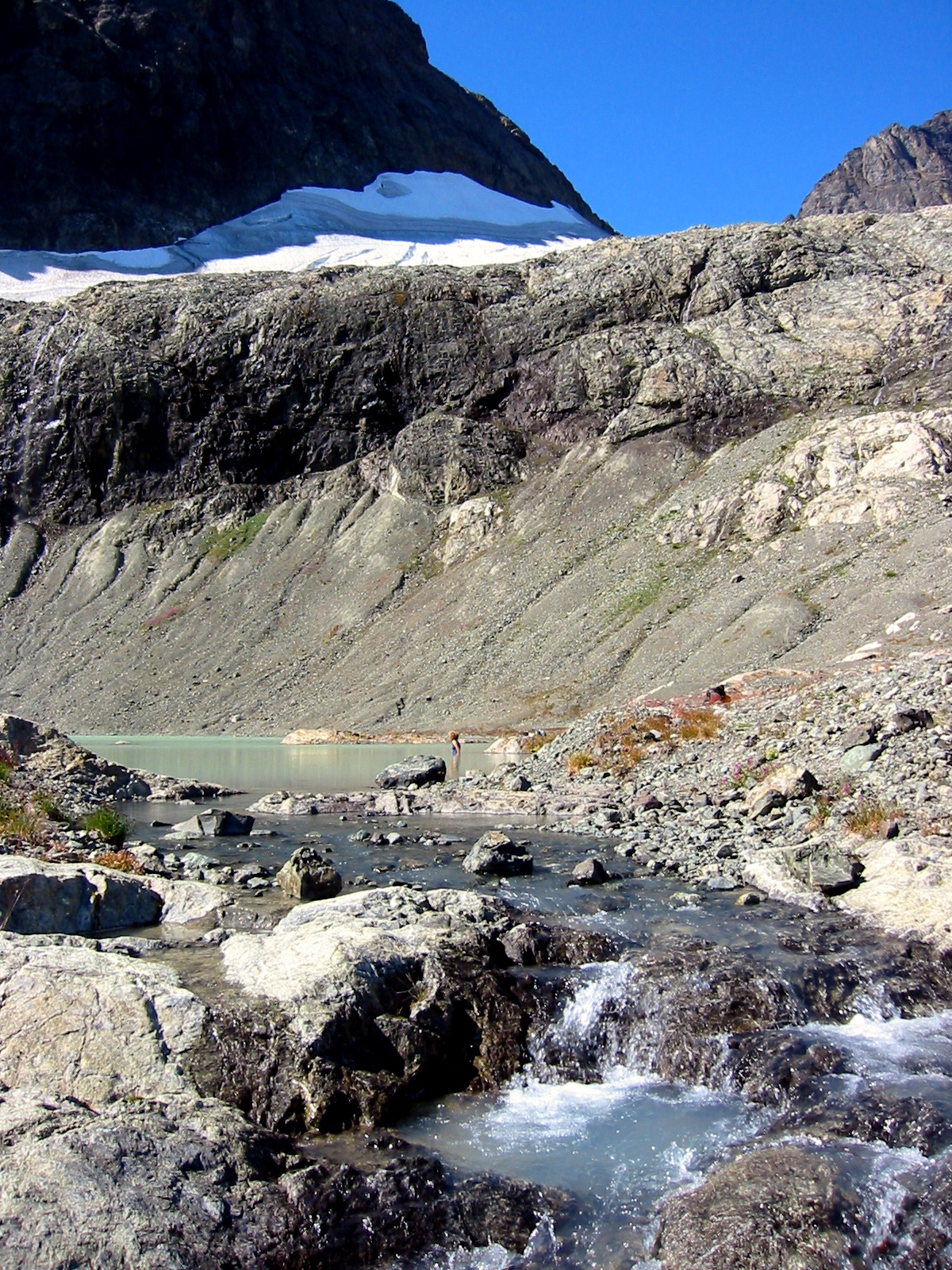
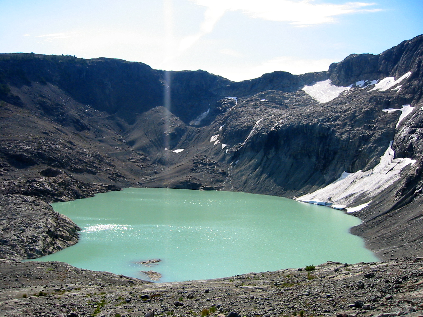
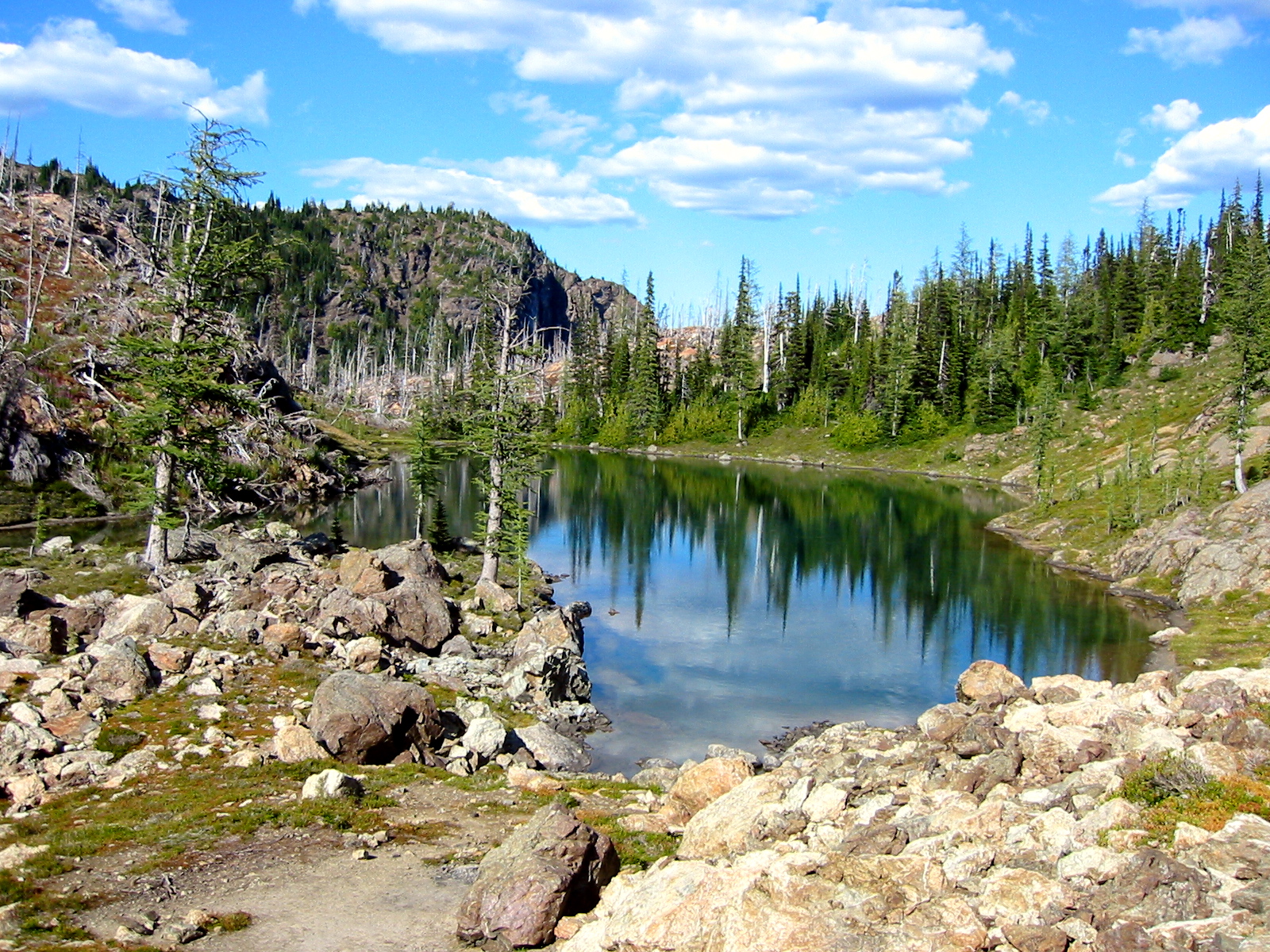
The air was hot and still at 10:30am when I started up the Crater Lake / Jackita Ridge trail on Saturday. I crossed Canyon Creek on a stout log, which a trail crew had installed as a temporary bridge while they constructed a new, permanent bridge. Numerous bone-dry switchbacks fell behind me over the next couple hours, and I arrived at Crater Lake shortly before 1:00pm (2.3 hours from car).
The shallow green lake lured me in with the pretense of a refreshing swim, but it turned into more of a spa-type mud bath. Nonetheless, this momentarily quelled the mid-day heat and erased several hours worth of trail grime. While lounging on the warm and bug-free (except for an occasional horsefly) shore afterwards, I ruminated about these wonderful “salad days” in the mountains: the all-too-short period of tranquility sandwiched between the insect-infested days of mid-summer and the chilly days of autumn.
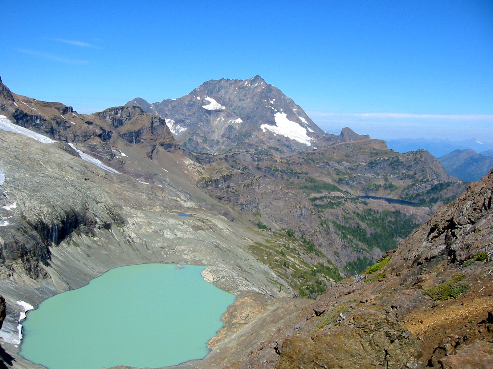
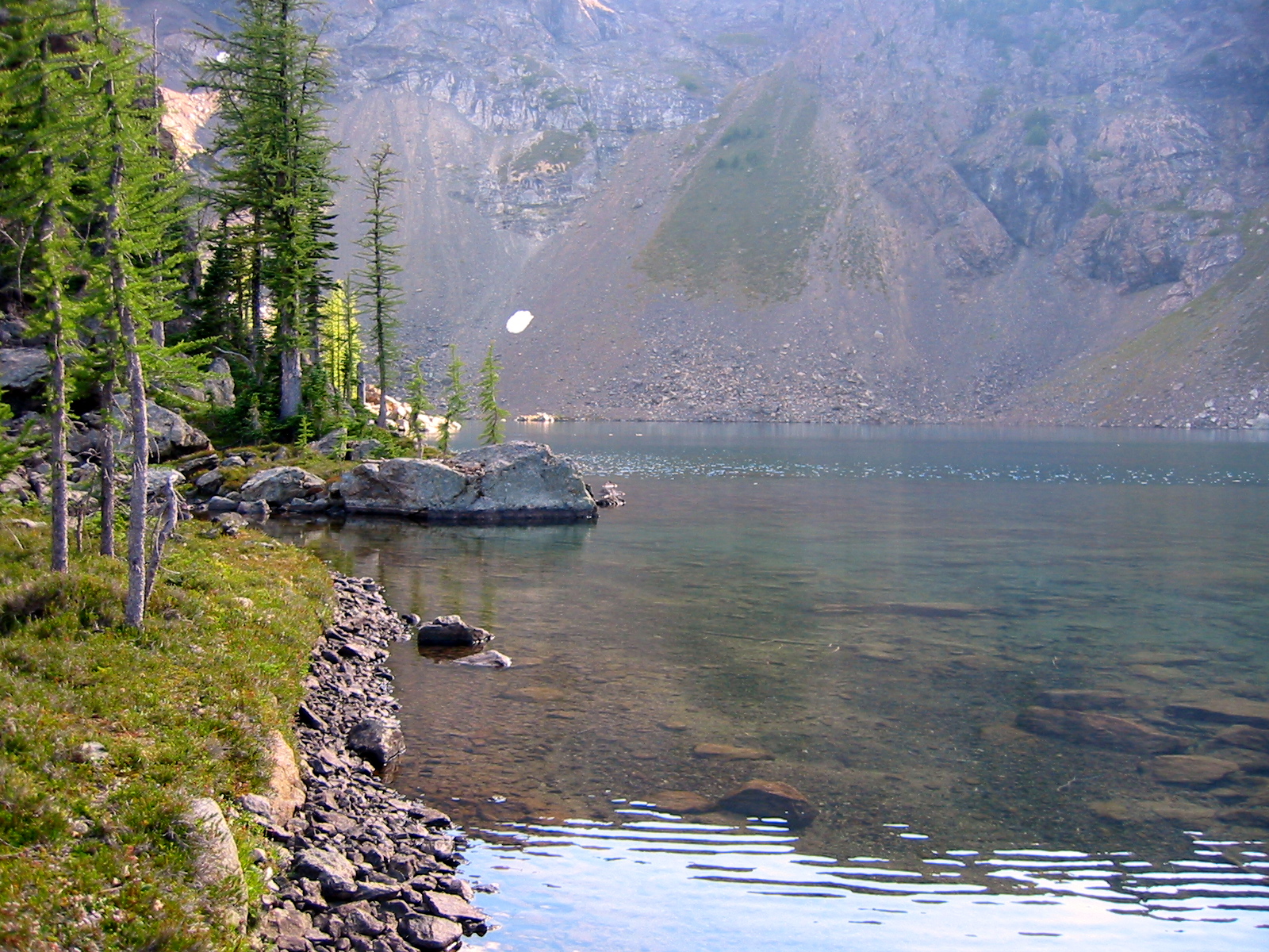
From Crater Lake, I had several options for getting to the Jerry Glacier. It seems that the most common route involves hiking westerly up the trail toward Crater Mountain’s west peak, then traversing northeasterly to a 7200-foot saddle between the west and east peaks. A less common route involves hiking easterly up the trail to East Crater Mountain Lookout (designated “Lookout No. 2” on the map), then descending to a nearby 7000-foot saddle. A third option would be to ascend directly northward to the 7200-foot saddle.
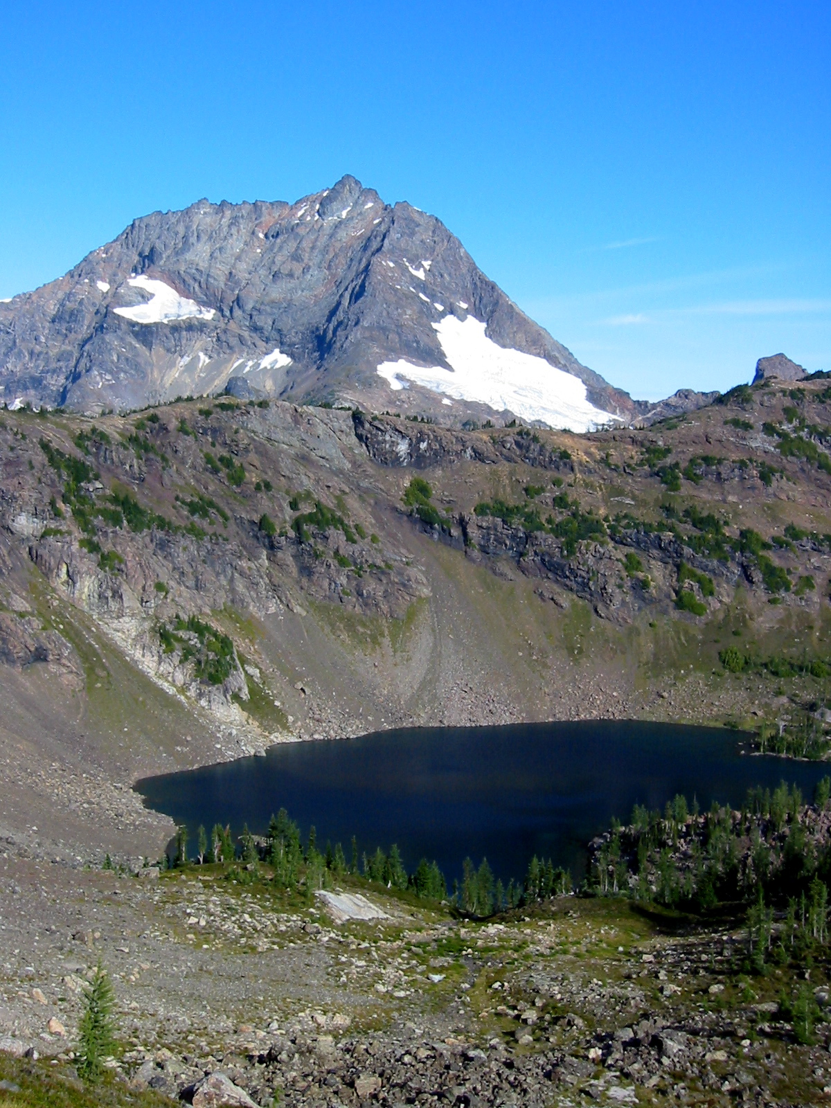
I hadn’t originally intended to take the third option, but the terrain looked pretty reasonable, so that’s what I did. This route played out well, and I reached Crater Mountain Saddle at 2:45pm (4.2 hours from car). Beautiful Jerry Lakes shimmered in the afternoon sun a mile to the north.
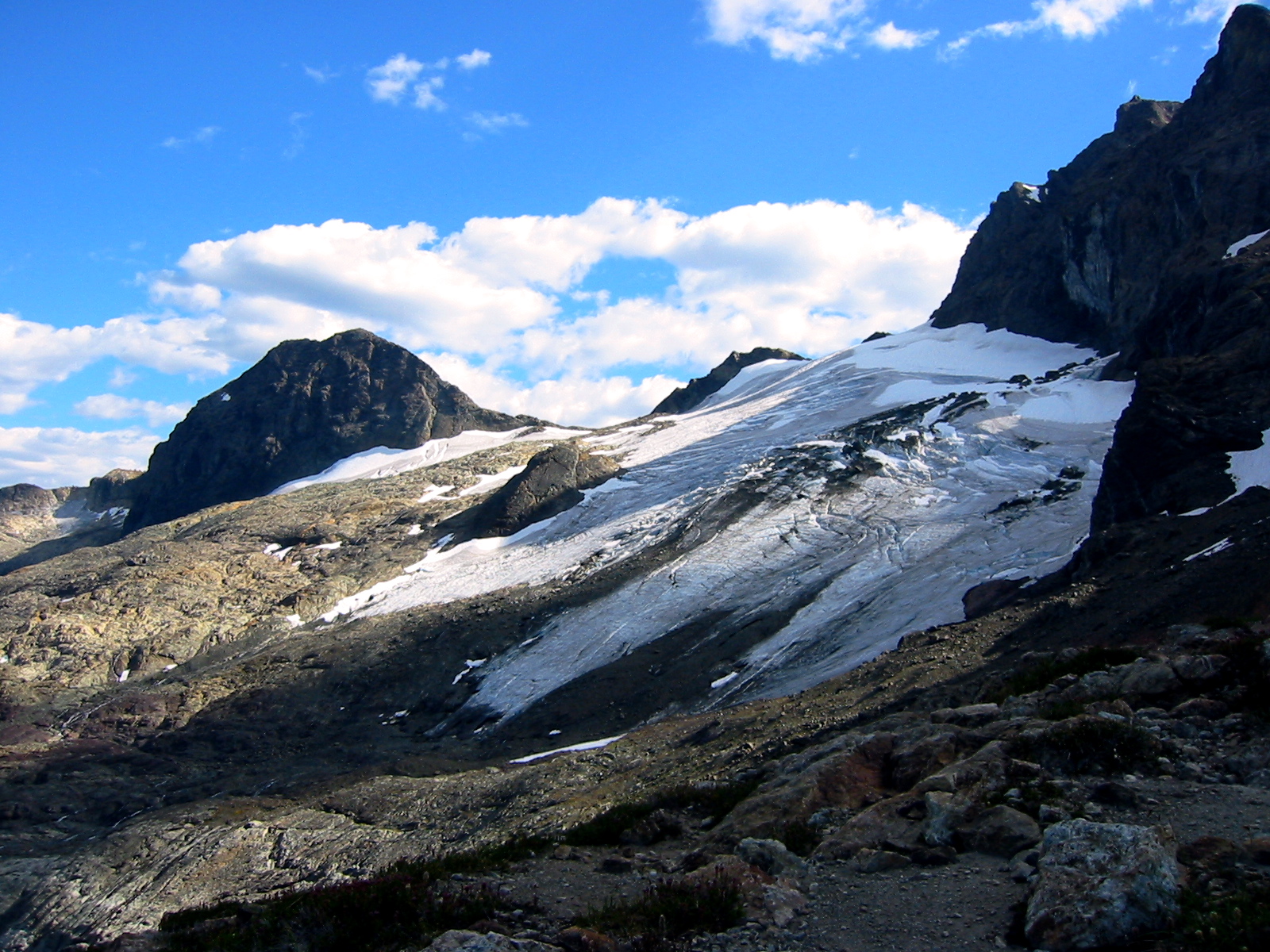
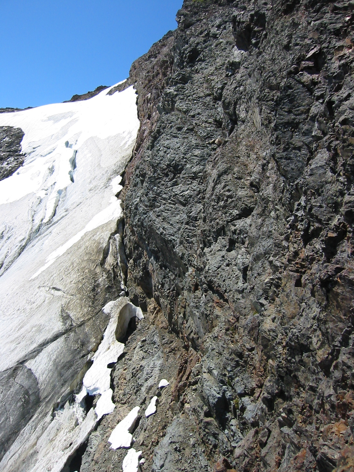
After a photo break, I started down the moderate neve slopes of the upper Jerry Glacier. Beth had left a note in the snow, indicating that she had passed by an hour earlier, and I hurried to catch her. However, the glacier did not yield to quick travel; it became steeper and icier as I descended. Eventually, I was forced to don crampons and weave through a maze of crevasses at the glacier’s snout. Once off the ice, I picked up a crude path that took me across scree slopes to a 6550-foot saddle overlooking the Jerry Lakes basin. Beth was waiting for me at the saddle.

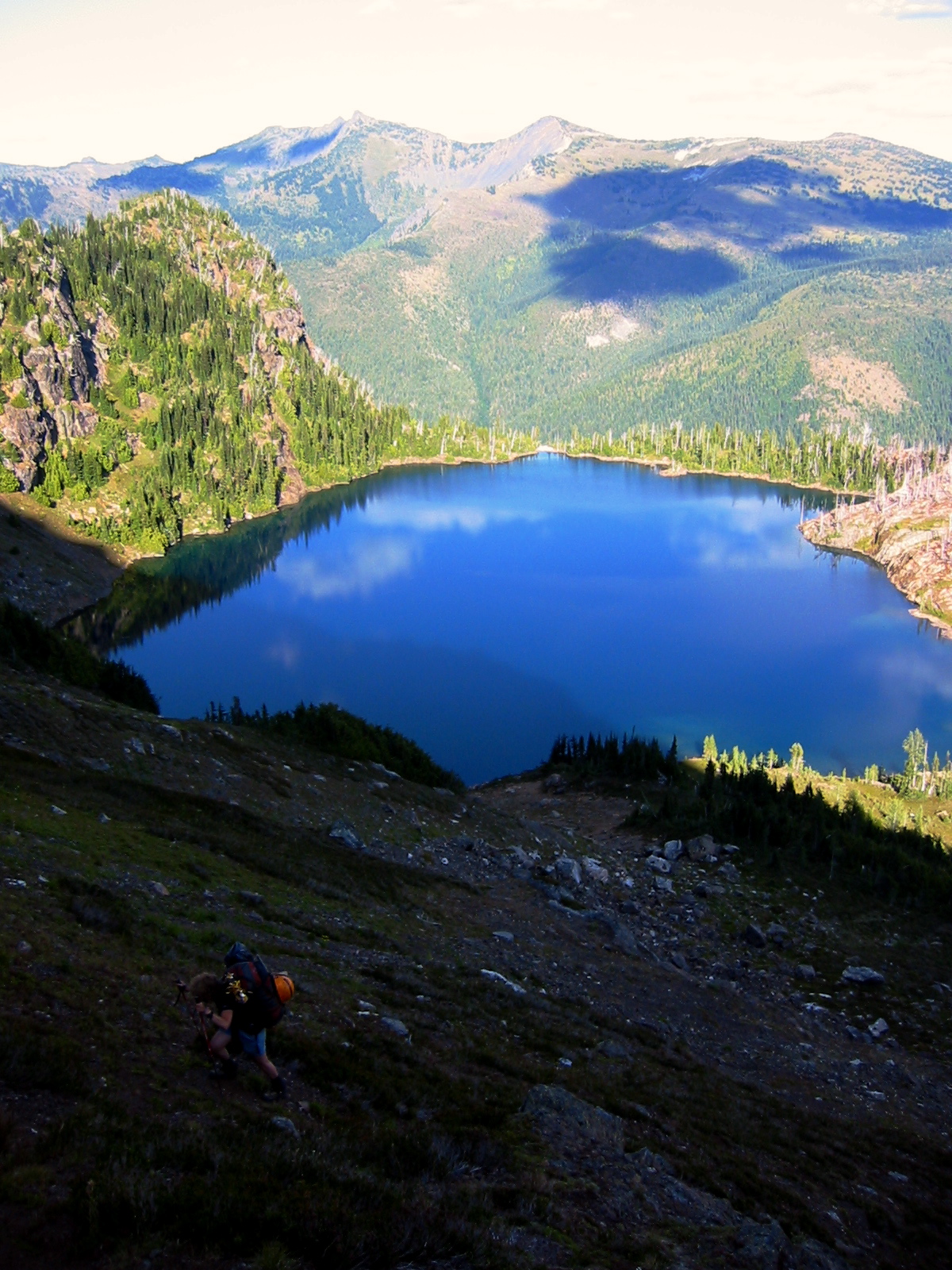
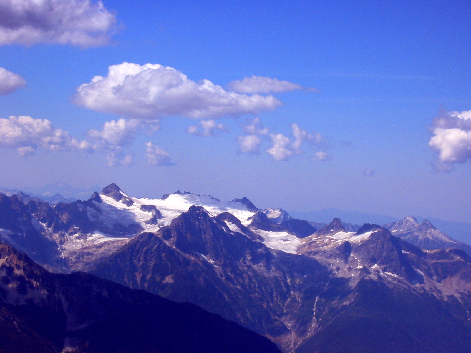
- Jerry Lakes From Jerry Lakes Saddle
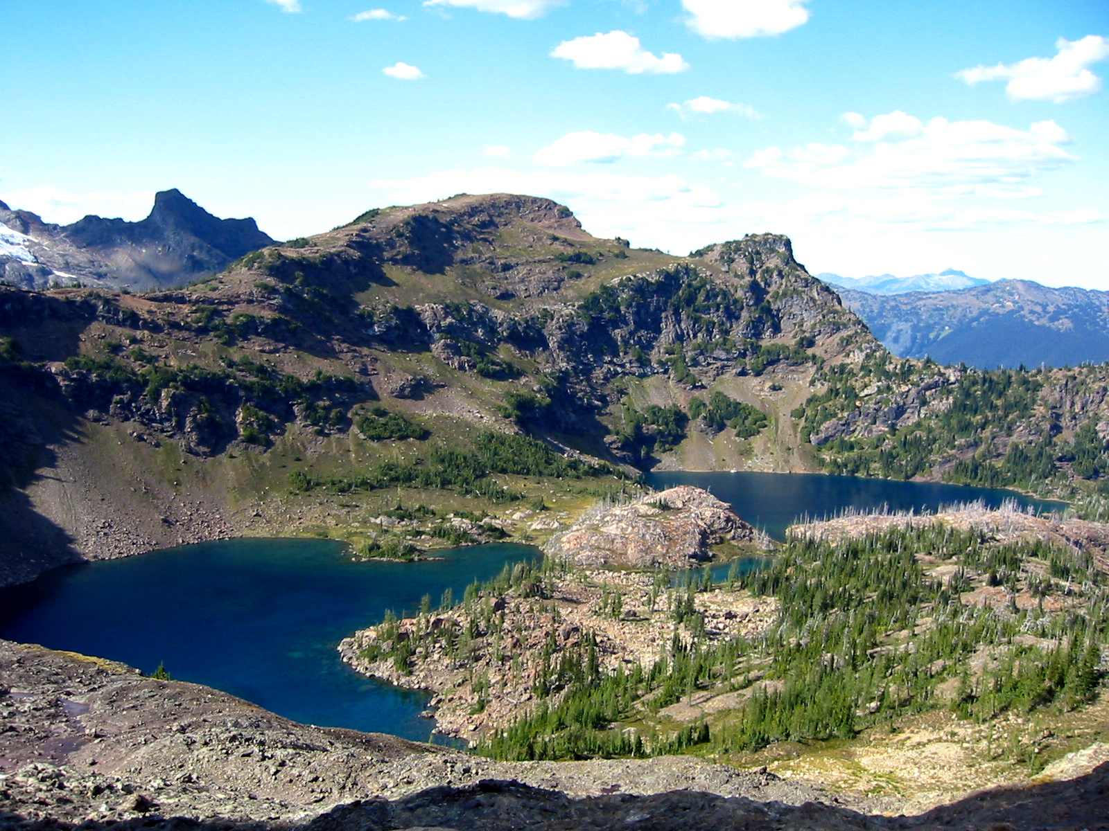
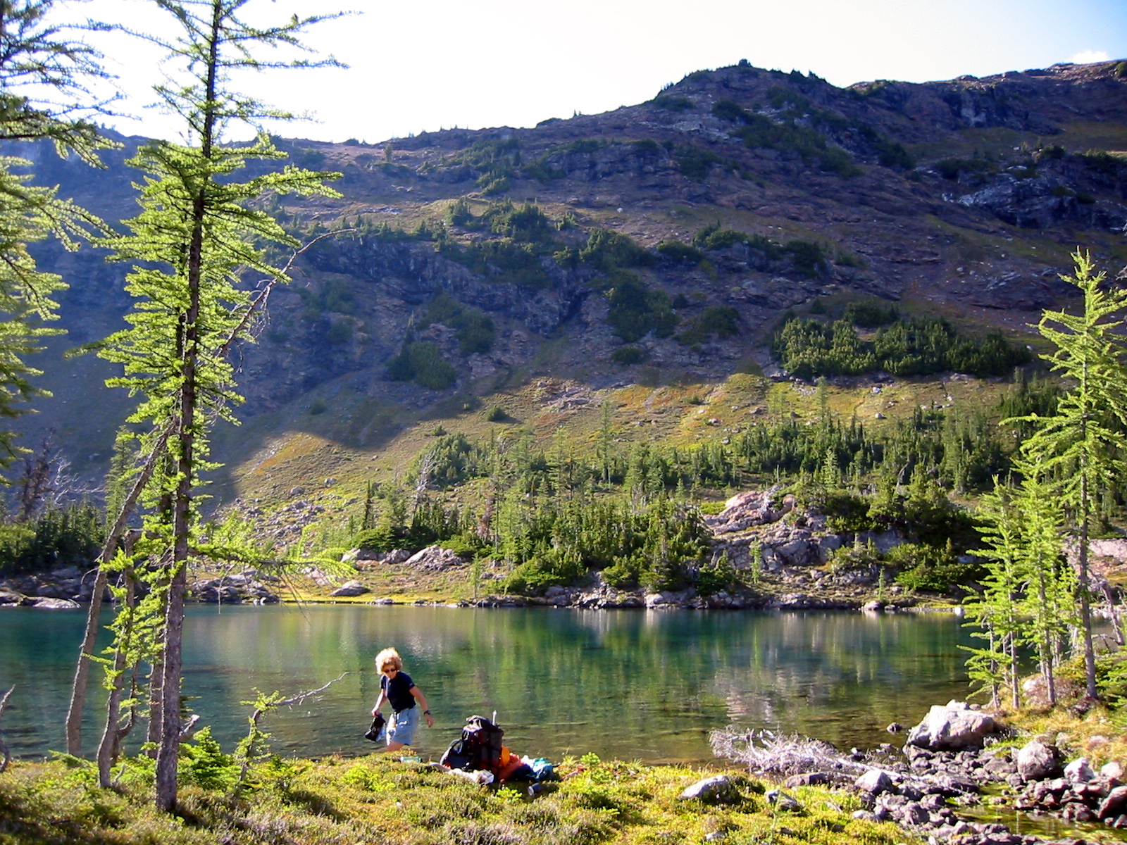
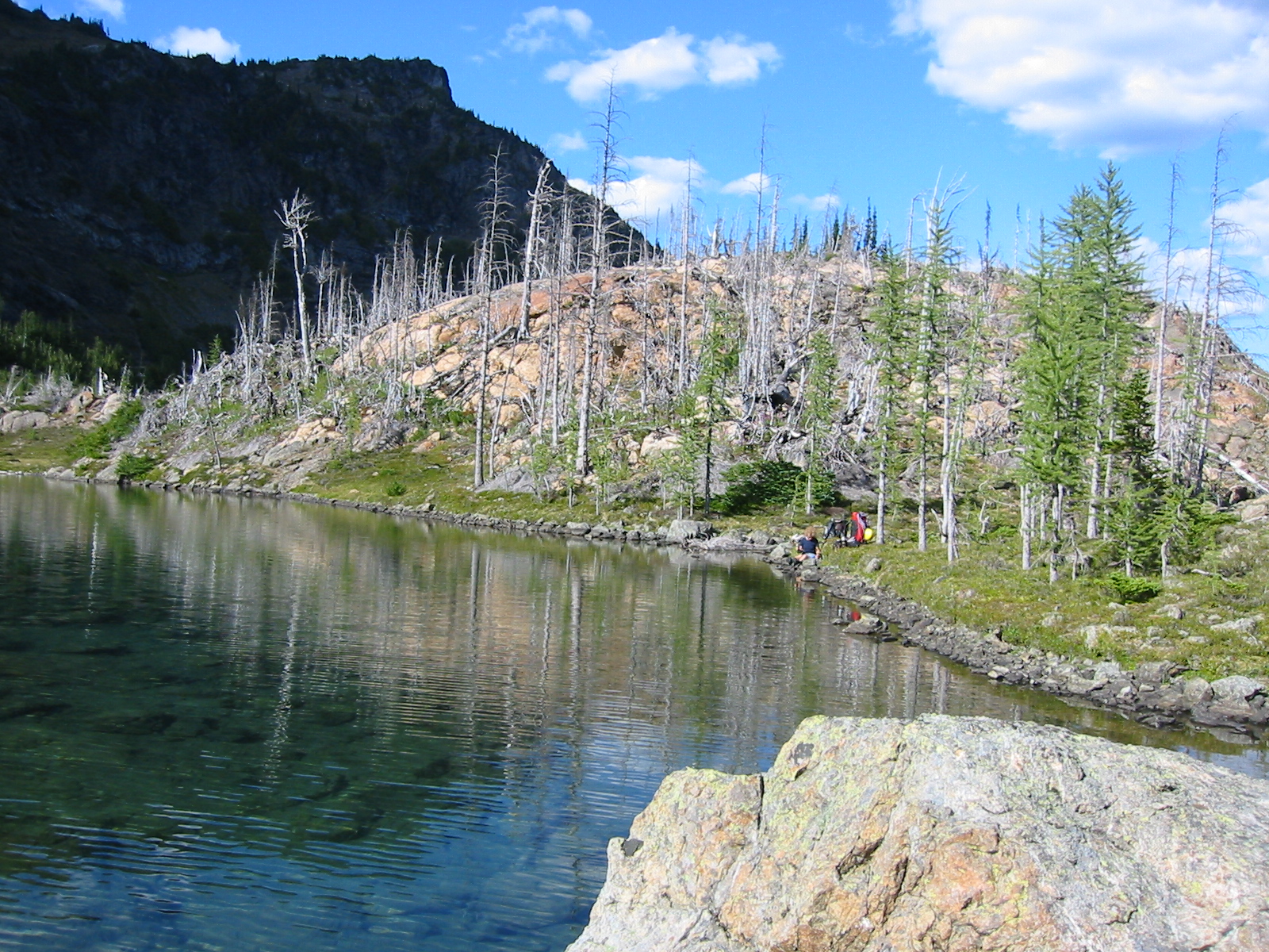
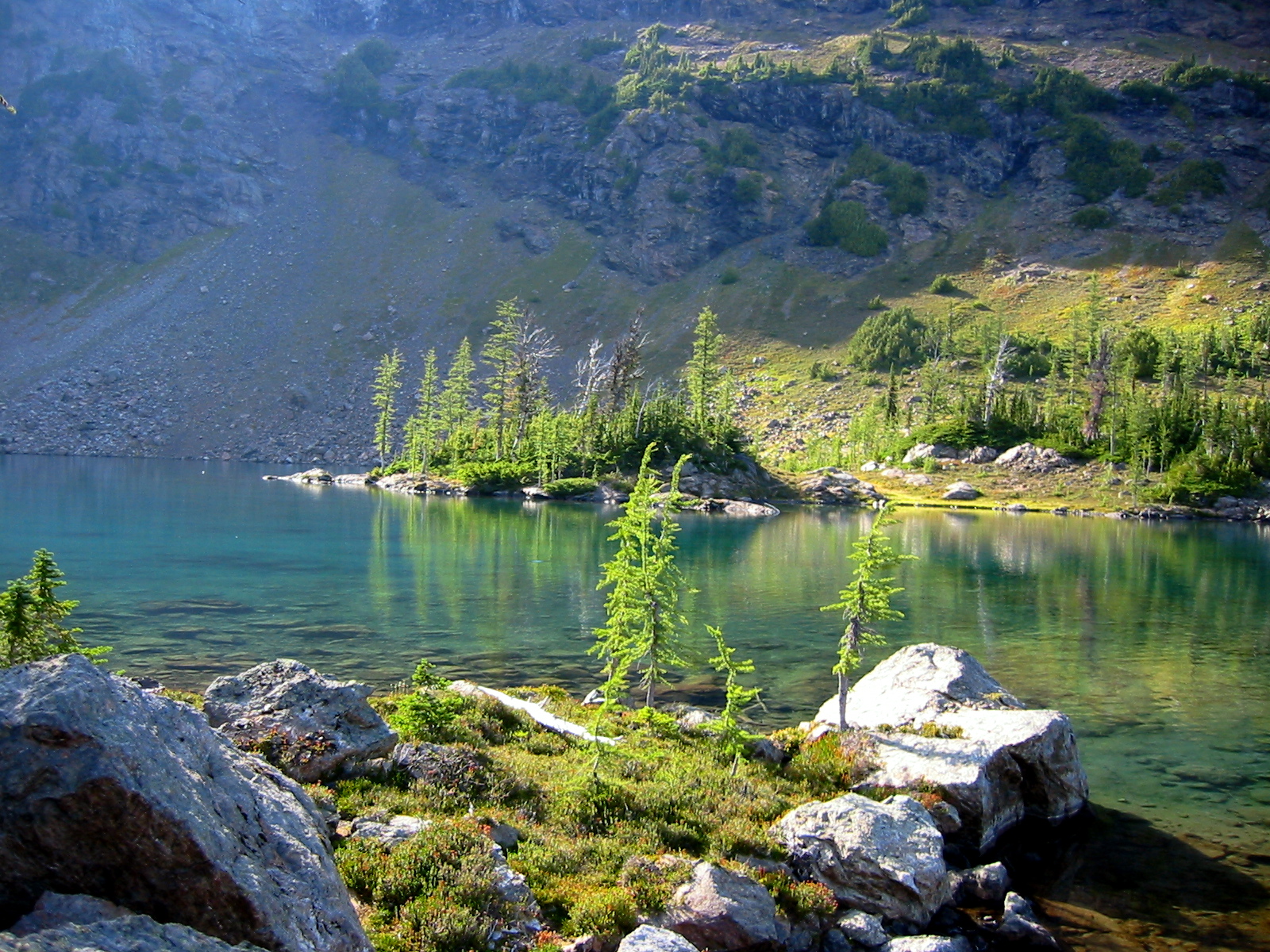
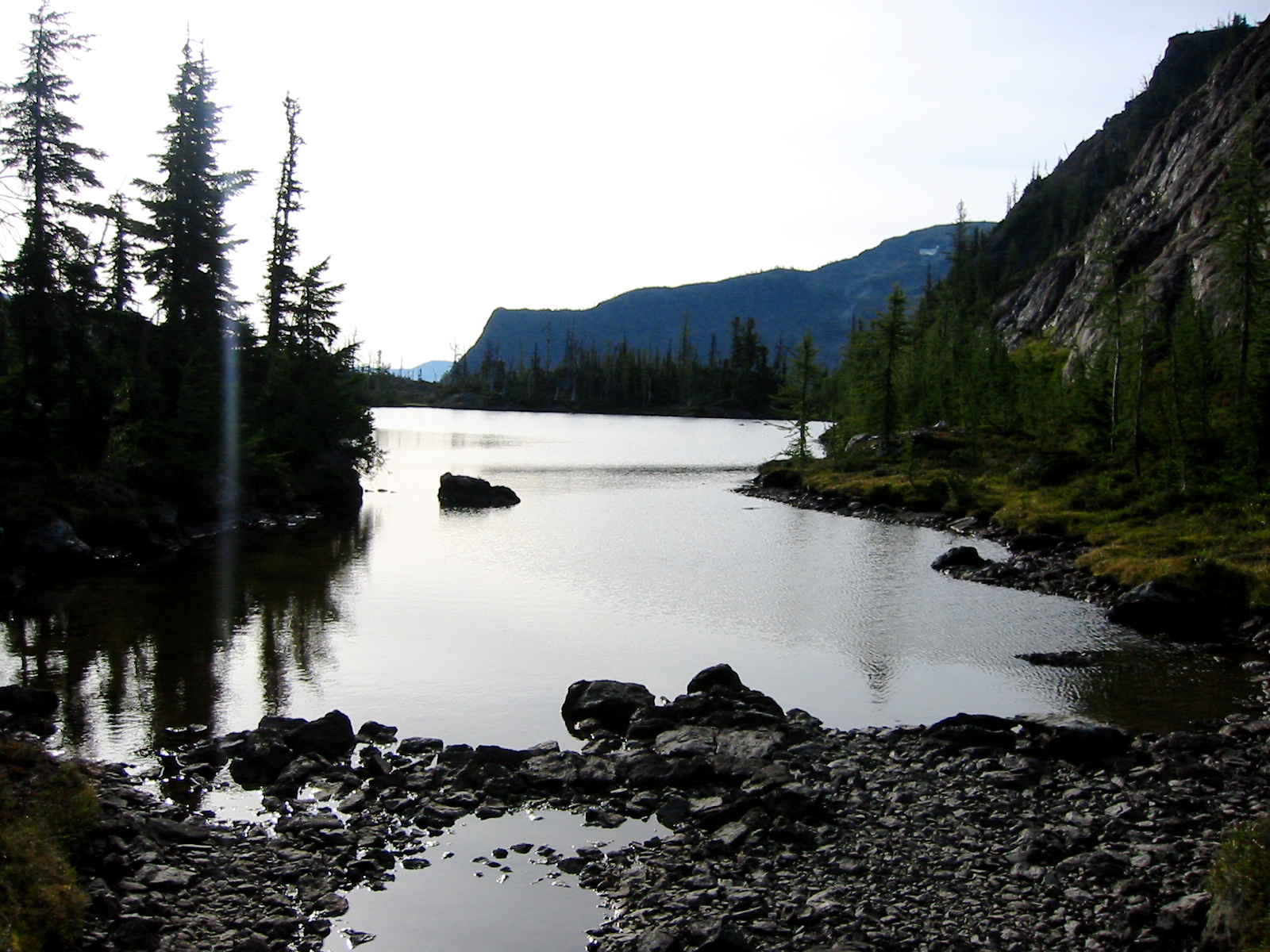
Beth and I had always heard that Jerry Lakes were picturesque, but we now felt that they far exceeded their reputation. Four separate lakes—two large and two small—huddle together in a grassy, boulder-strewn bowl. It was difficult to pass up the delightful campsites here as we hiked between the lakes (6.4 hours from car).
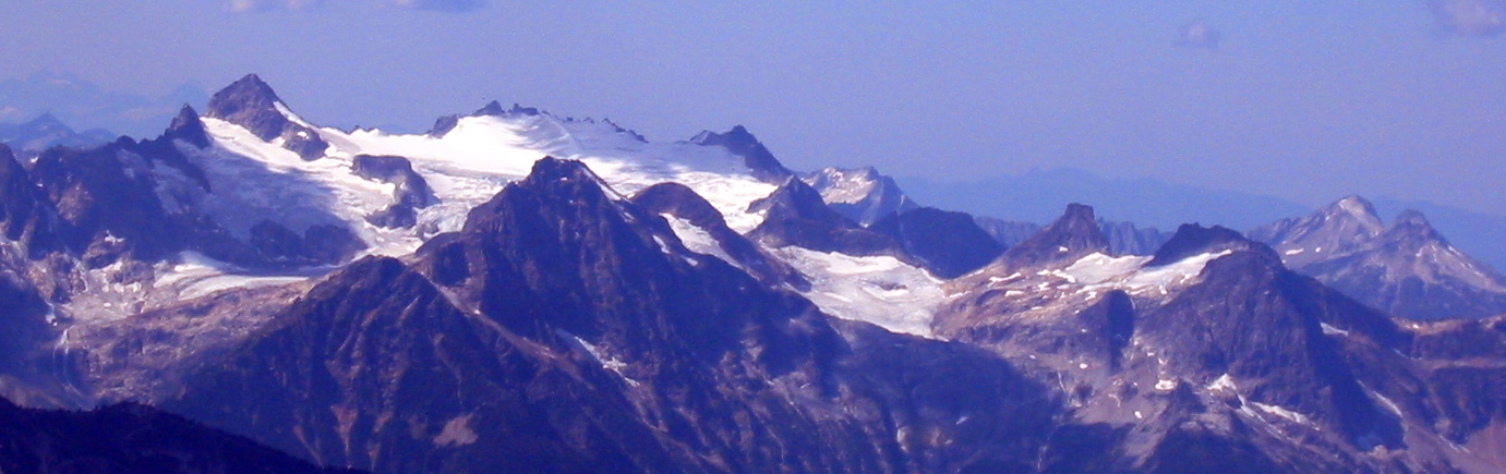
- Middle Jerry Lake
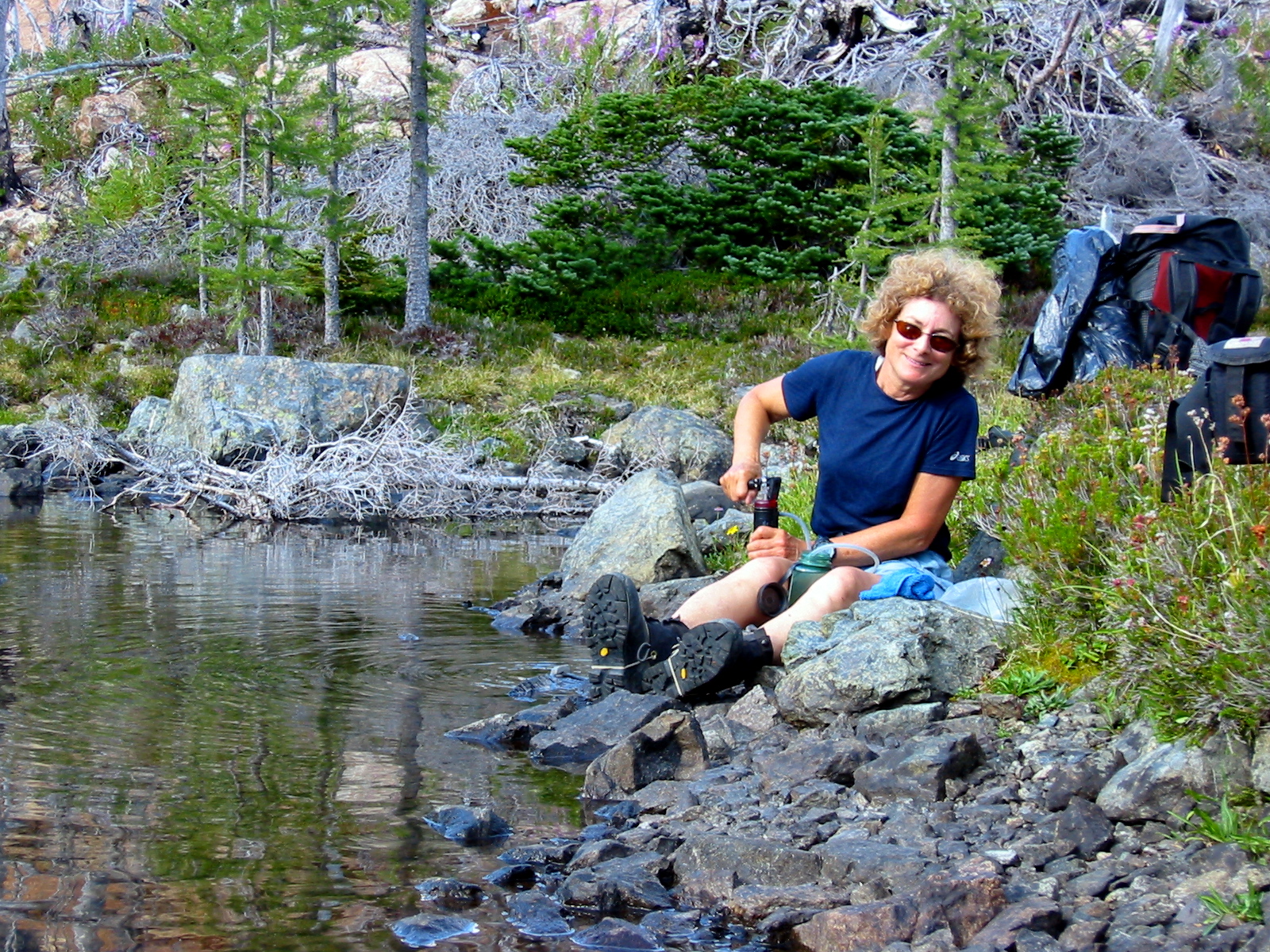
However, the anticipated climbing demands of Jack Mountain seemed to warrant a closer campsite, so we pushed on over the 6550-foot saddle northwest of Jerry Lakes. A faint climber’s path leads up to this saddle, but it does not extend beyond. We descended scree and steep grass northwesterly to Crater Creek at 5800 feet, then ascended heather to a nice camping bench at 6000 feet (8.3 hours from car).
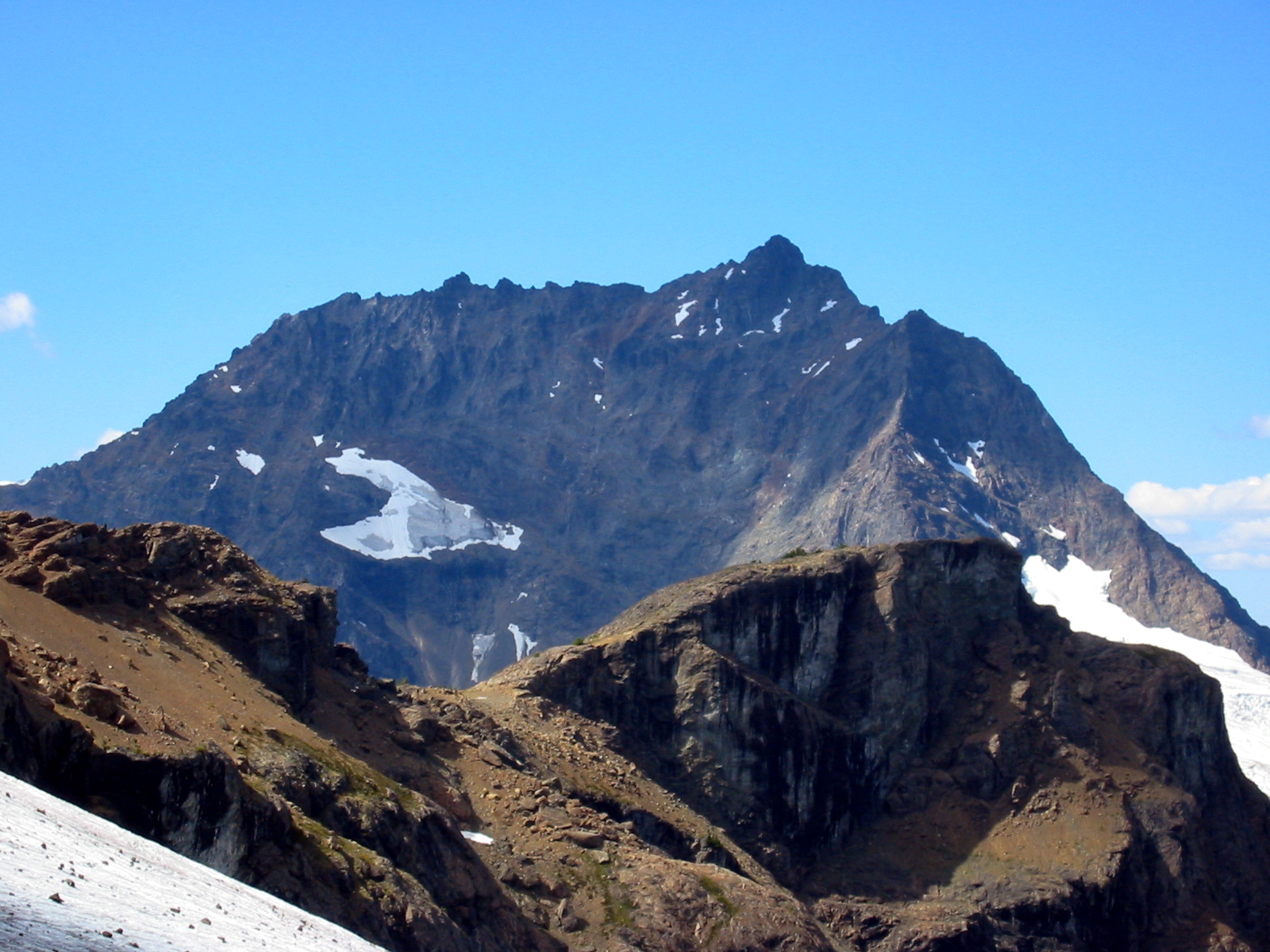
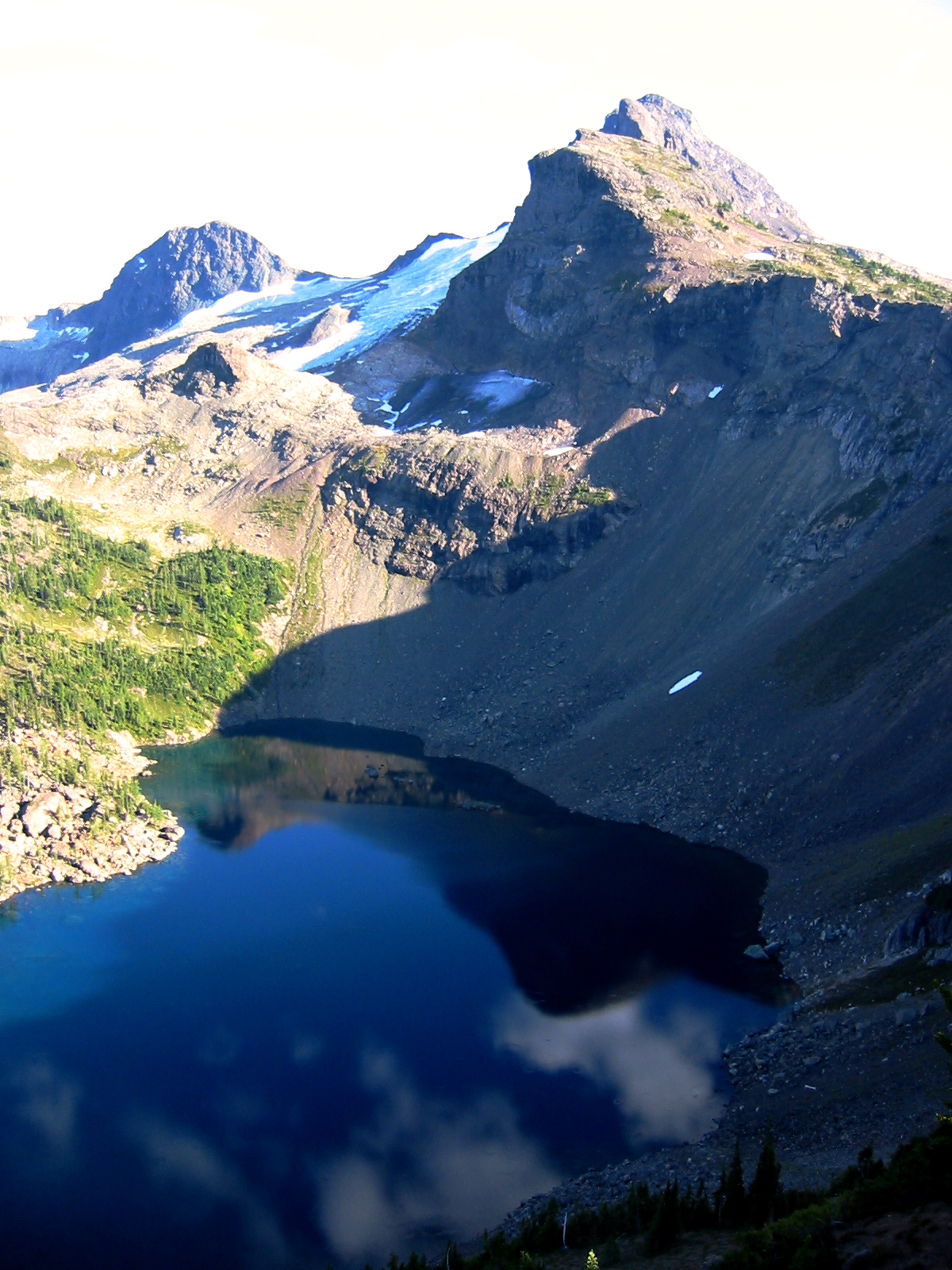
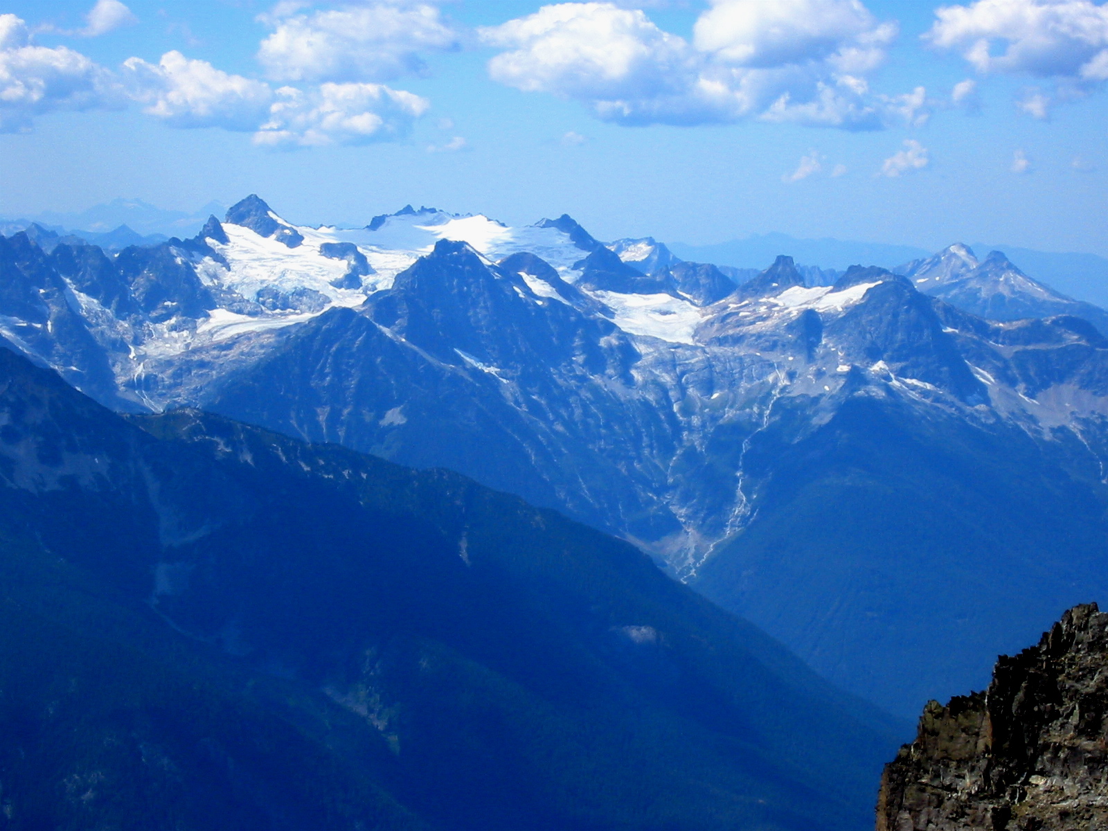
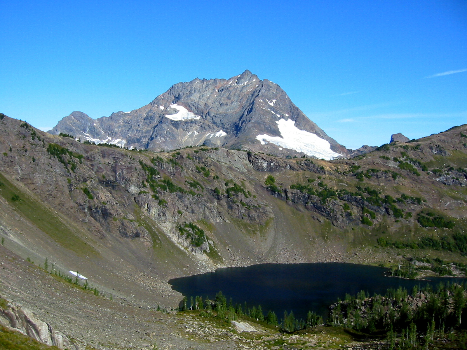
- Jack Mountain From Jerry Lakes Saddle
Day 2 (AM & early PM): Jack Mountain Summit Climb
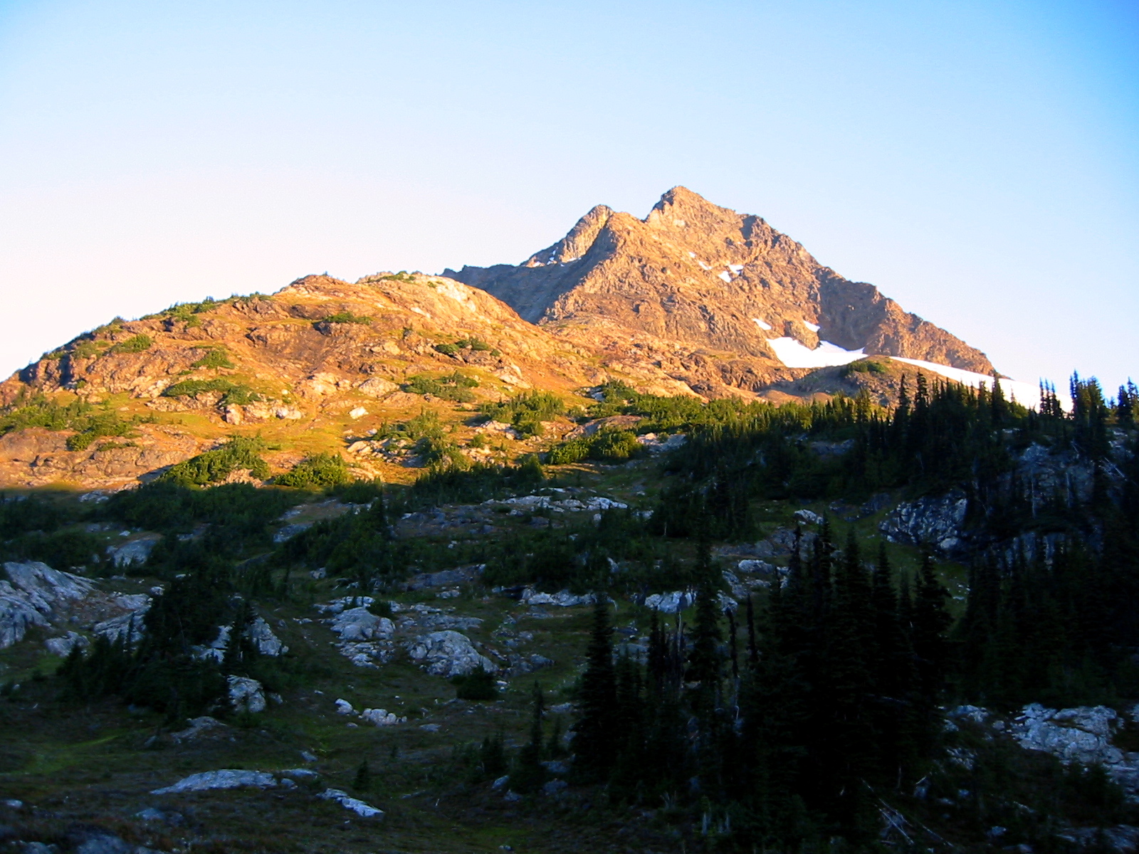
After a warm, starry, bugless night, we awoke at 5:00am and were on our way toward Jack Mountain 90 minutes later. Easy heather and scree slopes ended at a 7000-foot step in the mountain’s Southeast Ridge.
- Morning Alpenglow
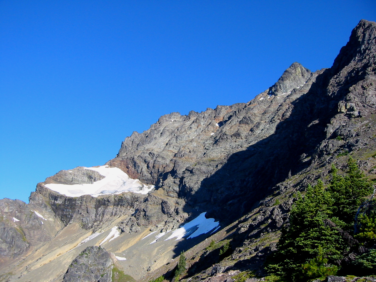
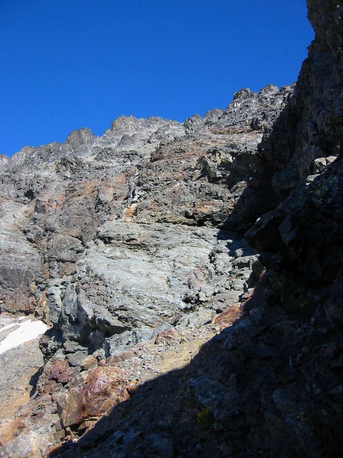
The huge South Face loomed above and left of us. This entire face appears disconcertingly steep and gullied, but the most unsettling feature is a vertical (if not overhanging) cliff band that spans the bottom of the face.

- Cliff Band On South Face
Even with the reliable climbing information we brought, it was hard to envisage a safe route through such a formidable obstacle! We easily identified the fish-shaped snowfield that Mike C. had mentioned, but Beth astutely observed that it actually looks much more like a lobster claw than a fish. I’m sure Franklin W. Dixon would agree.
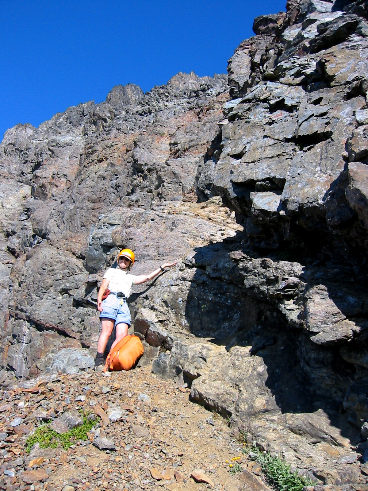
We contoured westward from the ridge step, following faint boot-tracks across steep scree and dirt slopes until encountering a small snowfield. At the upper-left corner of this snowfield, which was firm enough to require crampons for crossing, we continued traversing along a left-slanting ramp.
- Beth Climbing Ramp
In an improbable manner, this ramp slices across the lower portion of the cliff band, leaving only the upper portion to worry about. Eventually, we reached the almost-famous slinged boulder, which is a refrigerator-sized rock with a nylon rope tied around its midriff. We expected to see the waterfall stream nearby, but there was nothing in sight.
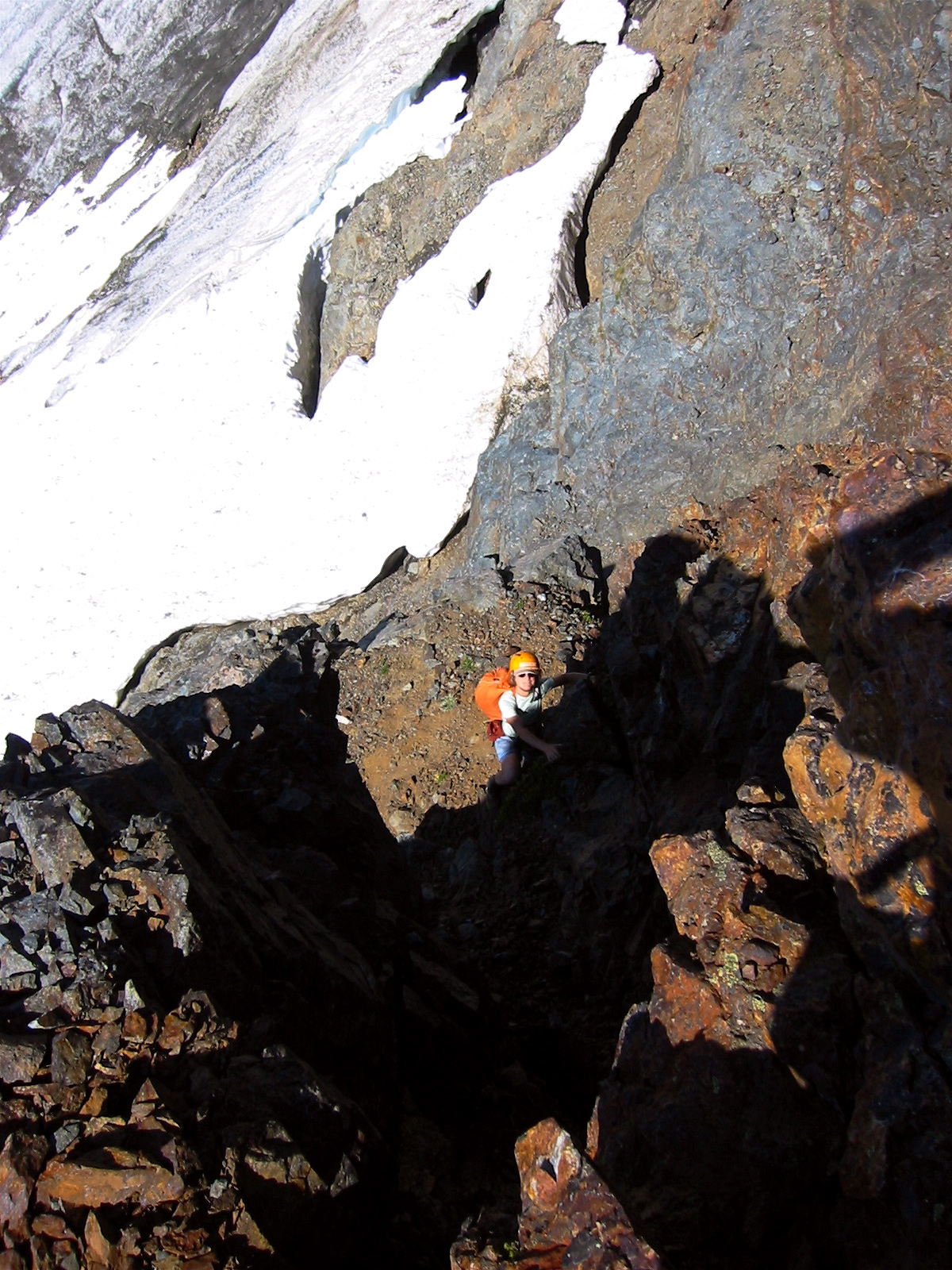
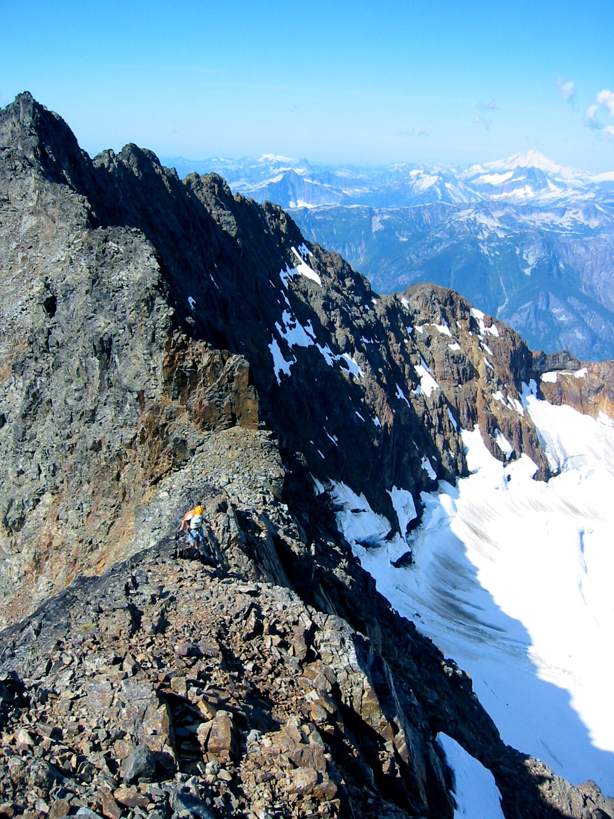
From the slinged boulder, we followed the detailed directions given by Stefan and Mike: rather than climbing the obvious Class 4 face to the right, we went left to find a short Class 4 step leading to a hidden Class 3 chimney.
- Beth Starting Up Chimney
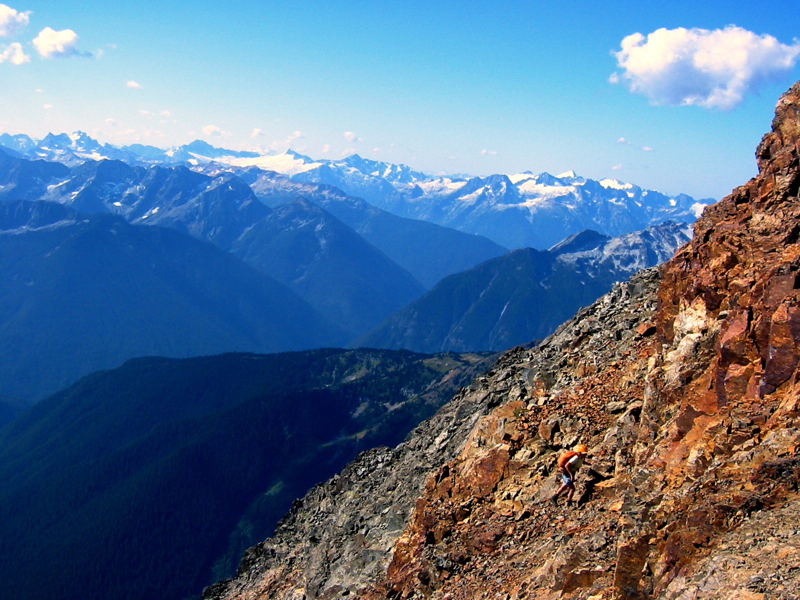
Although the ascent here involves a moderate amount of exposed scrambling, we both felt comfortable going up without a rope. Minutes later, we were surprised to find ourselves above the dreaded cliff band! Now a mere 1000 feet of steep, crumbly face stood between us and the summit ridge.
- Beth On Summit Ridge
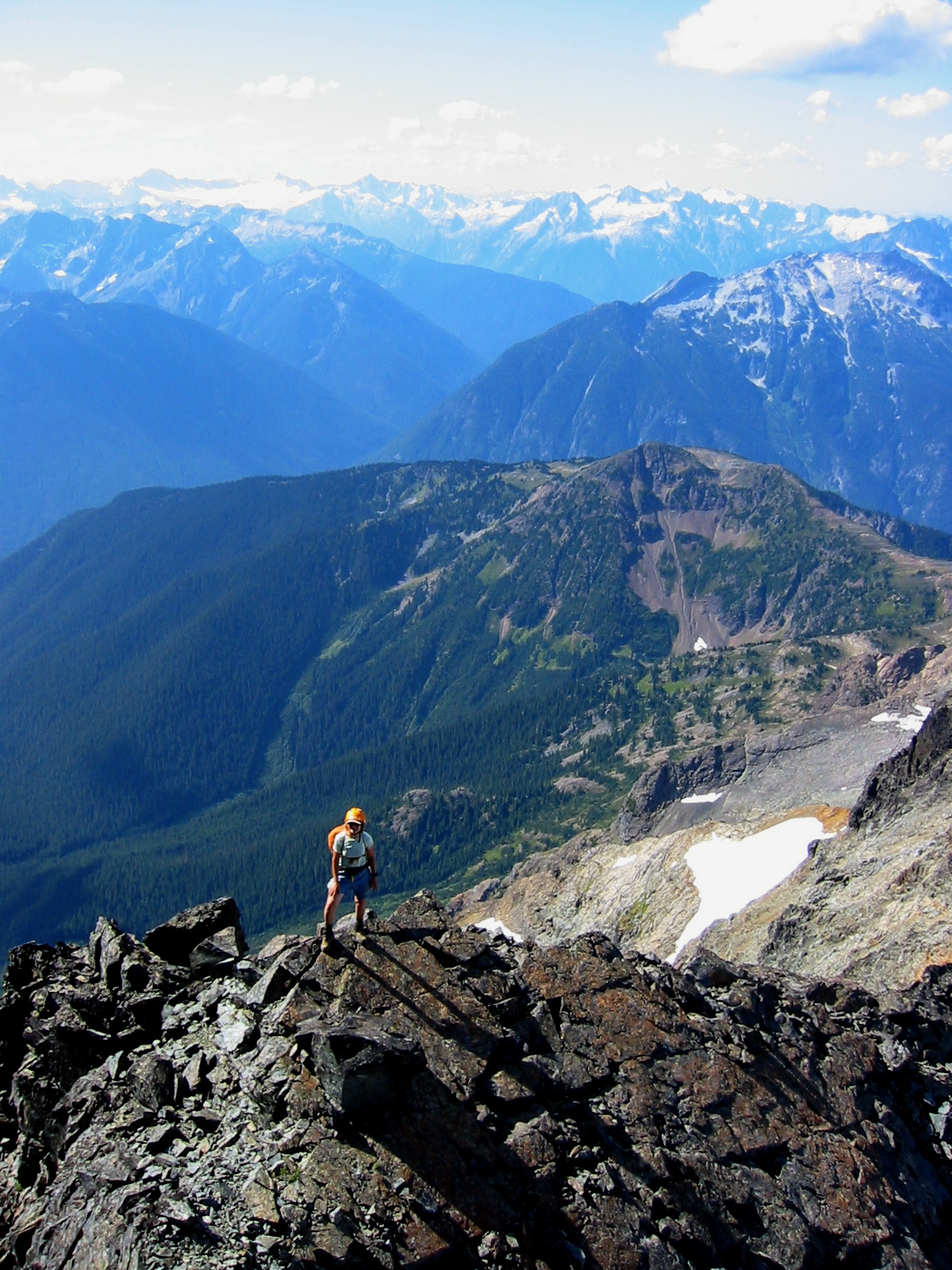
Beth and I carefully scrambled upward on Class 2-3 rock of variable quality, zigzagging across gully-and-rib sequences, always looking for the safest passage. About halfway up, our routes diverged; Beth veered a bit left and climbed a gray rock rib and gully, while I veered right and climbed a red rock gully.
- Beth At South Ridge Notch
We converged at a well-defined notch in the summit ridge, reporting to each other that our respective routes had offered reasonable—even downright fun—scrambling. Another 20 minutes of very enjoyable Class 3 climbing along the airy summit ridge put us on top at 10:45am (4.2 hours from camp).
- Beth On South Ridge
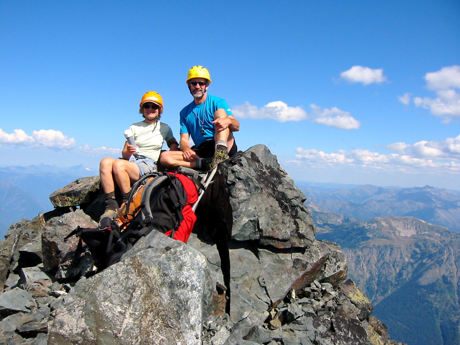
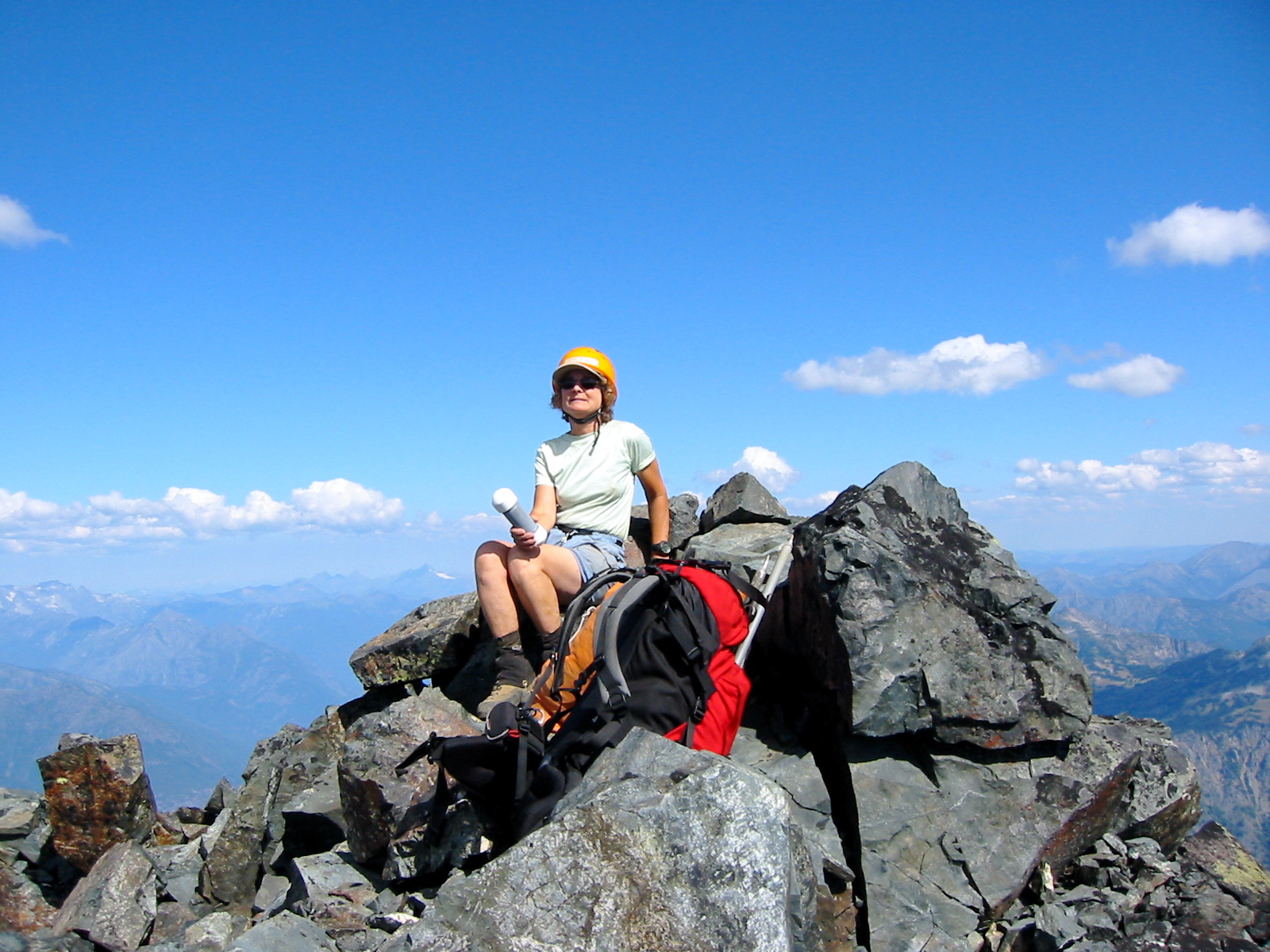
We spent over an hour on the warm summit, admiring the 360-degree panorama.
- Beth and Jim On Summit

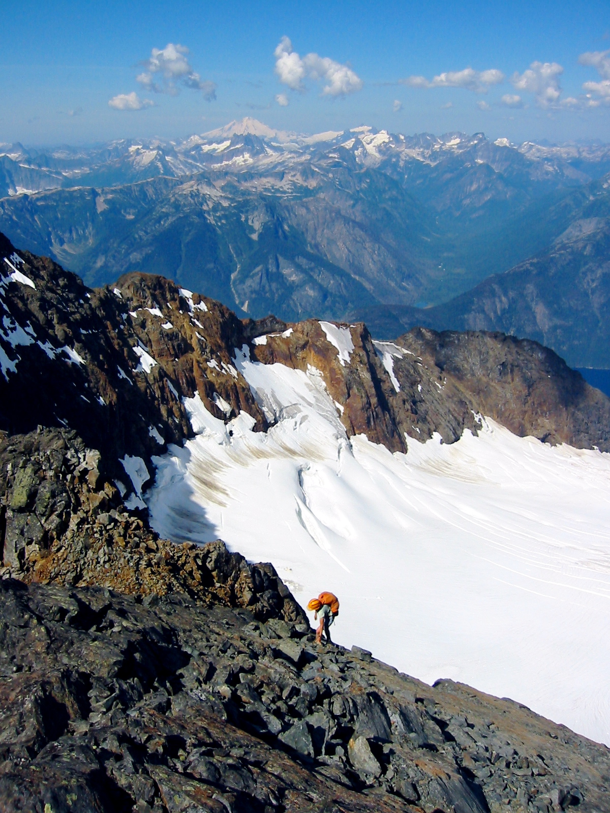
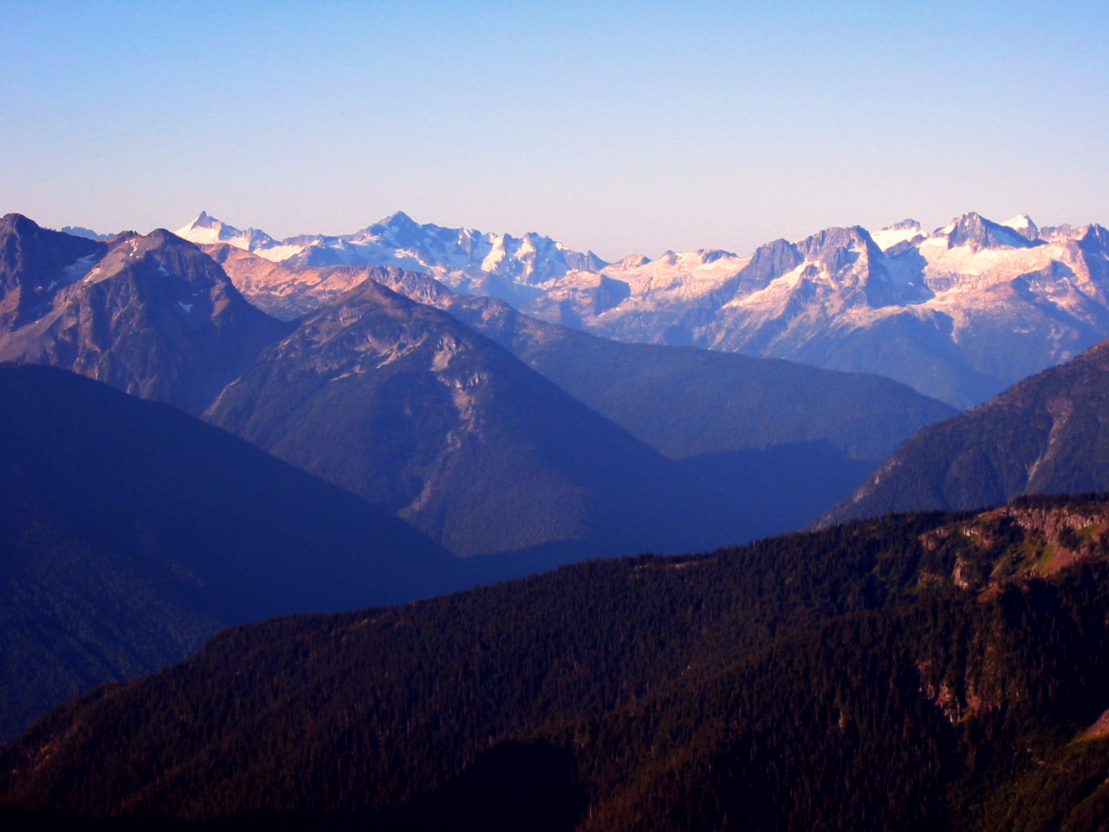
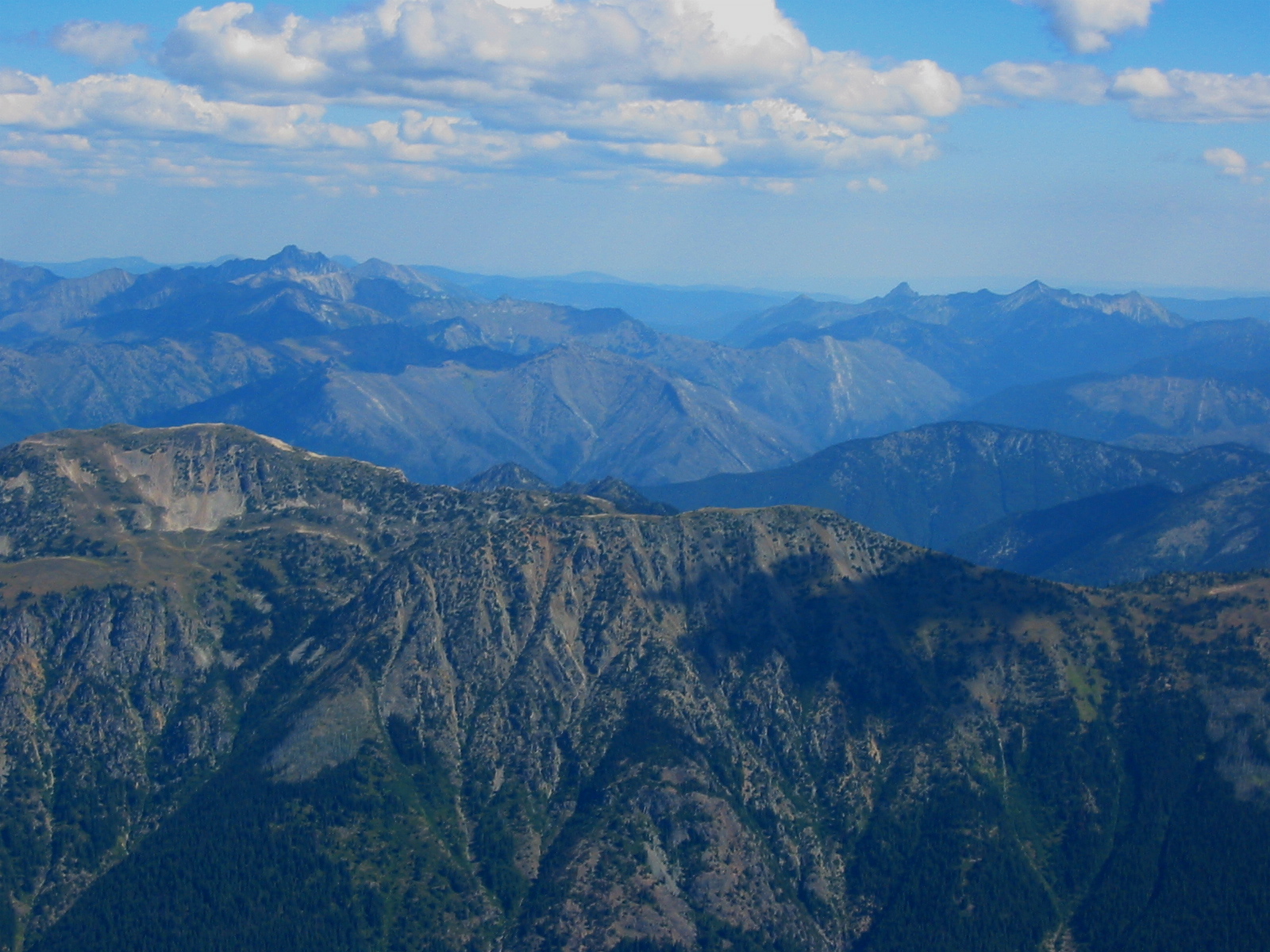
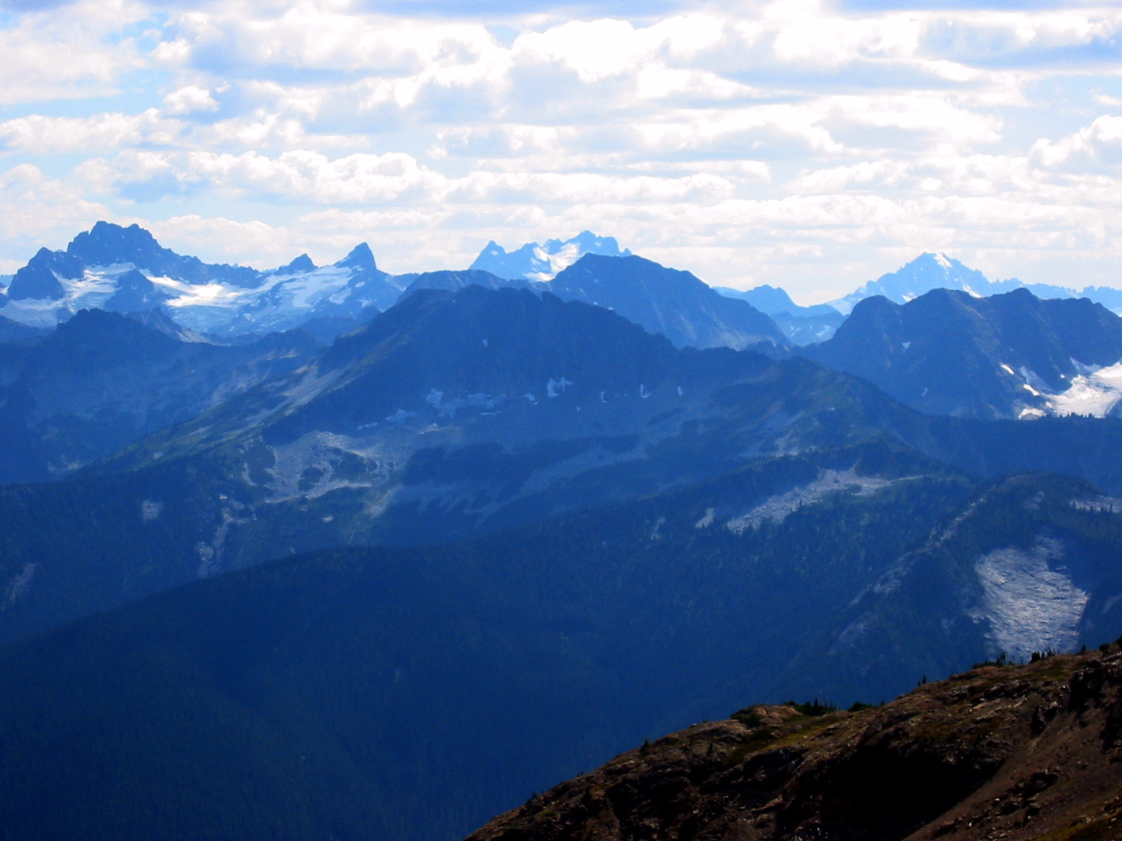
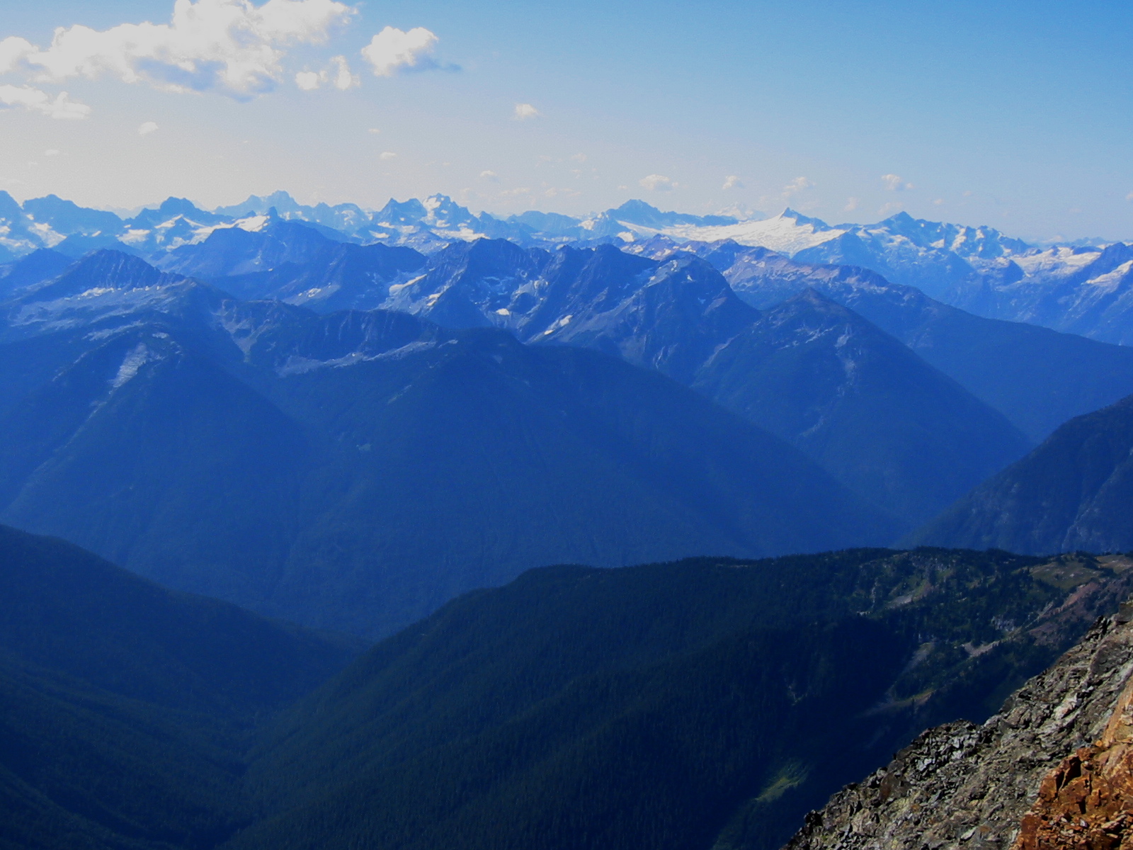
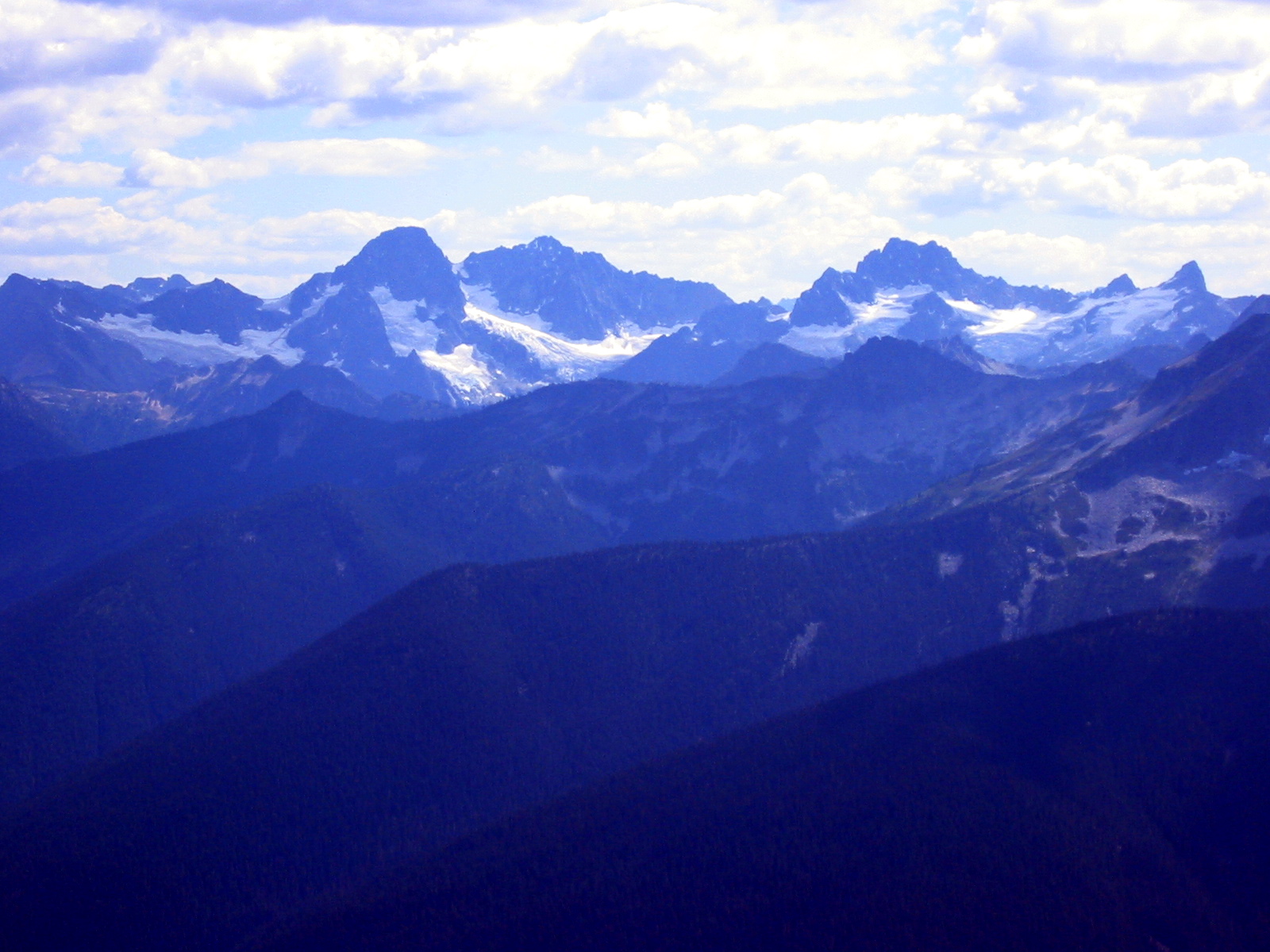
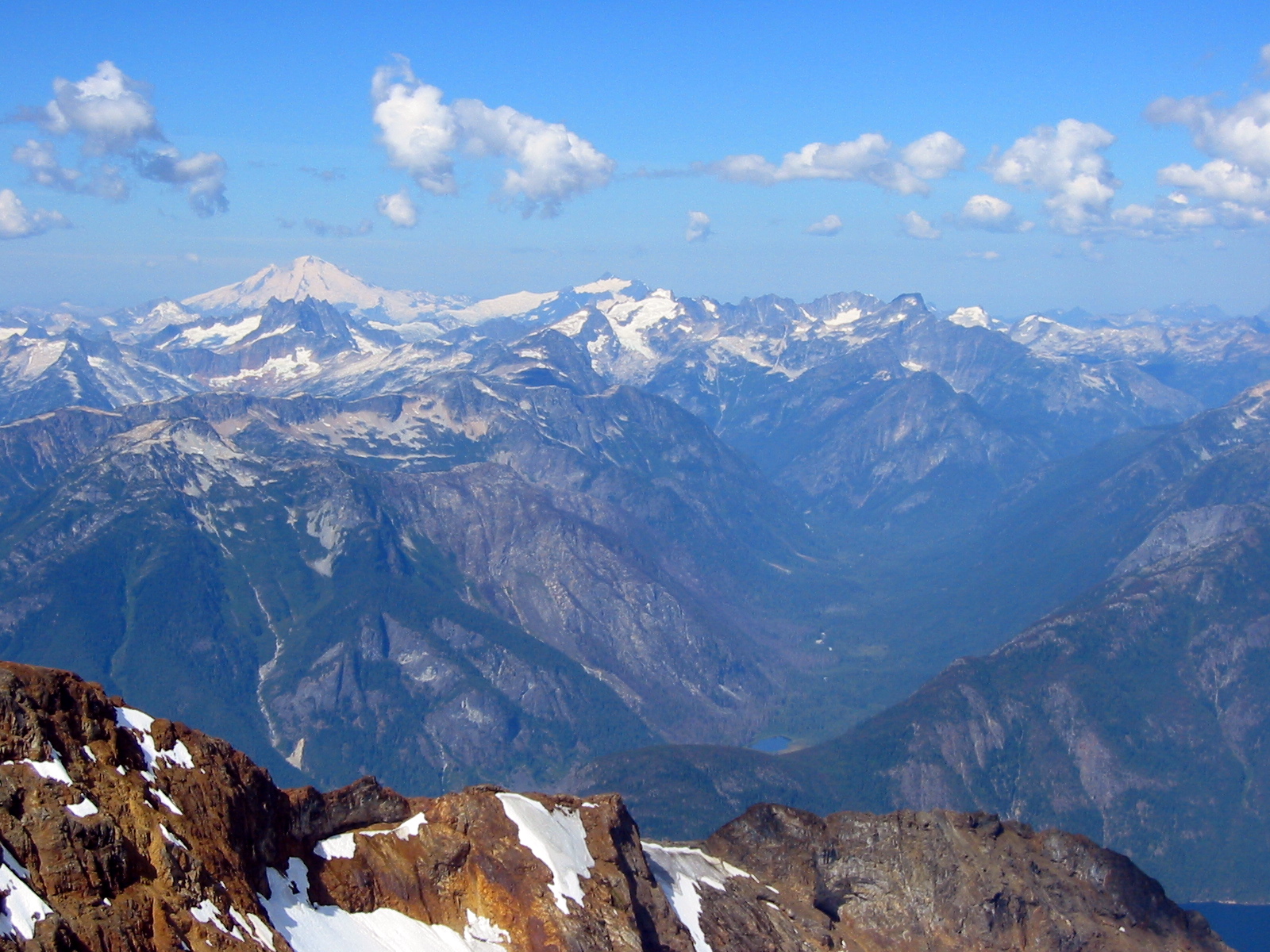
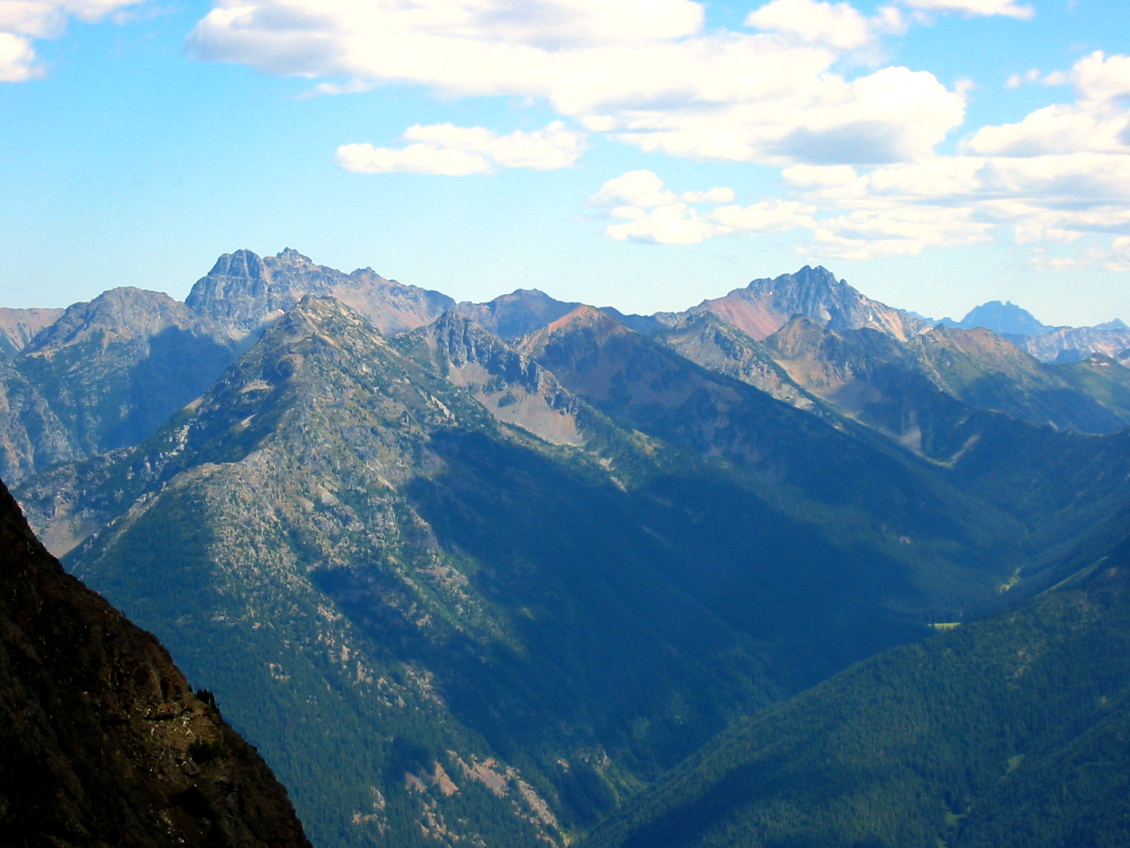
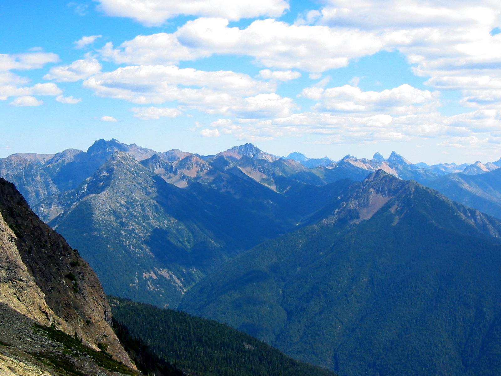
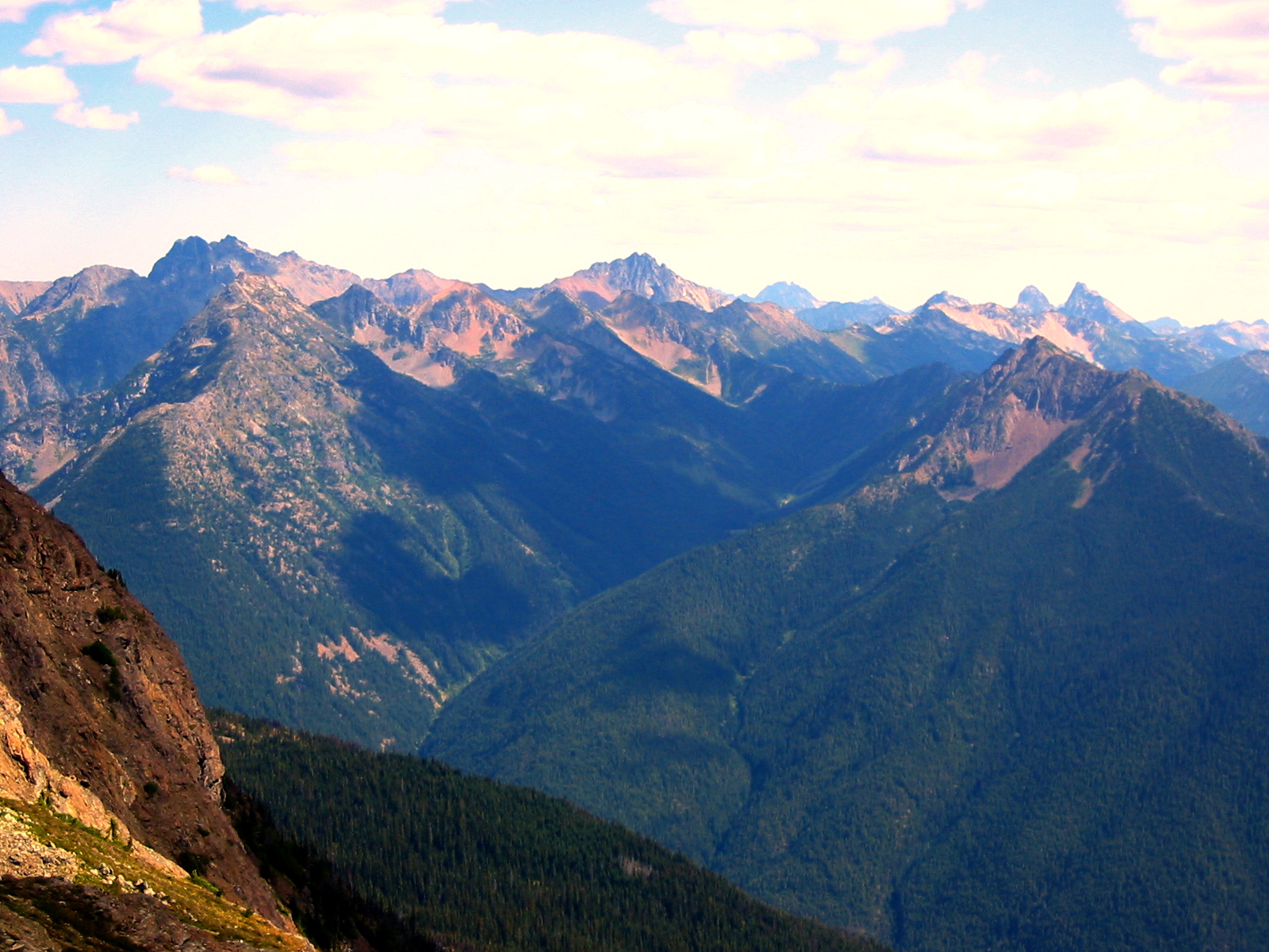
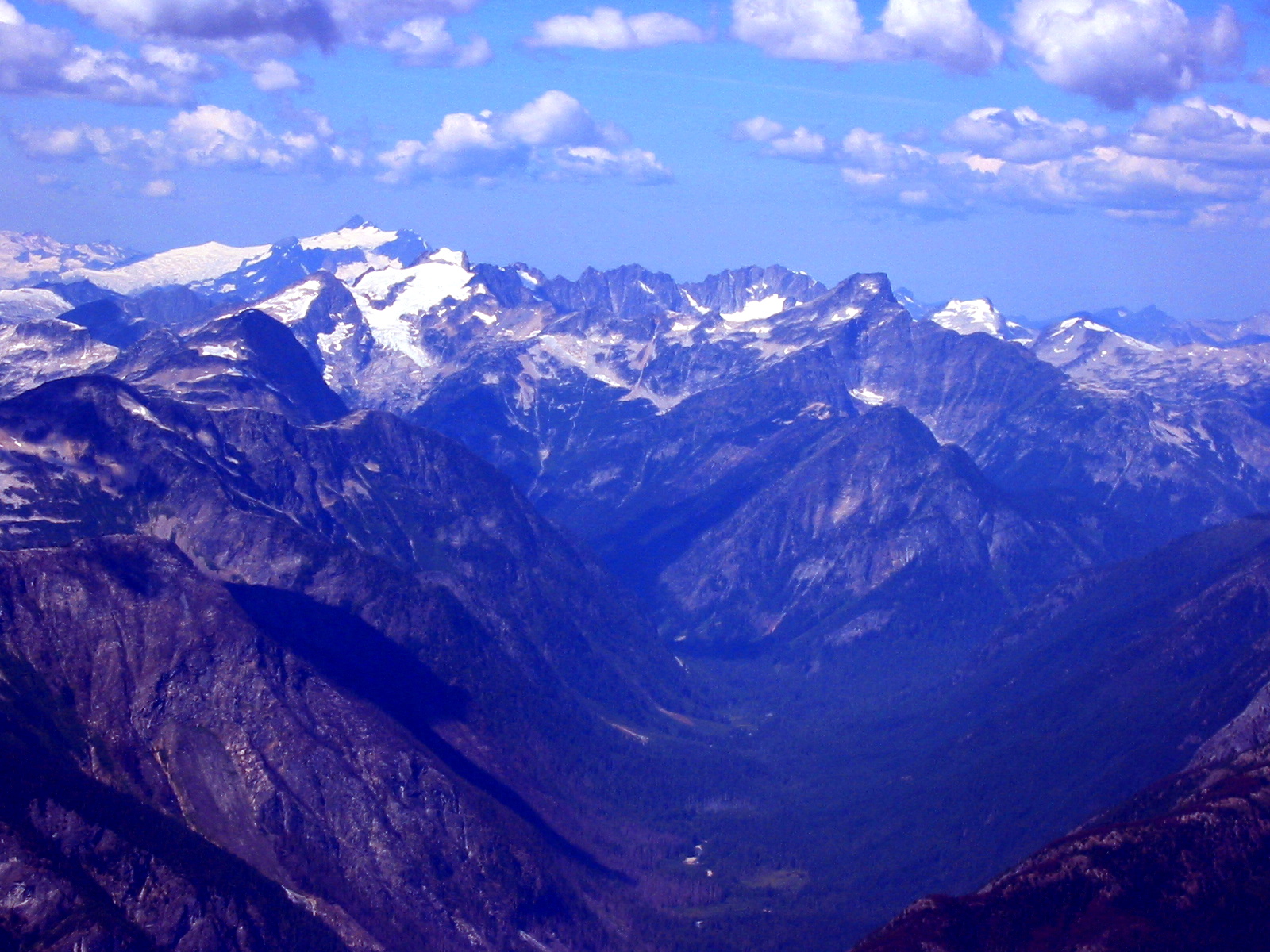
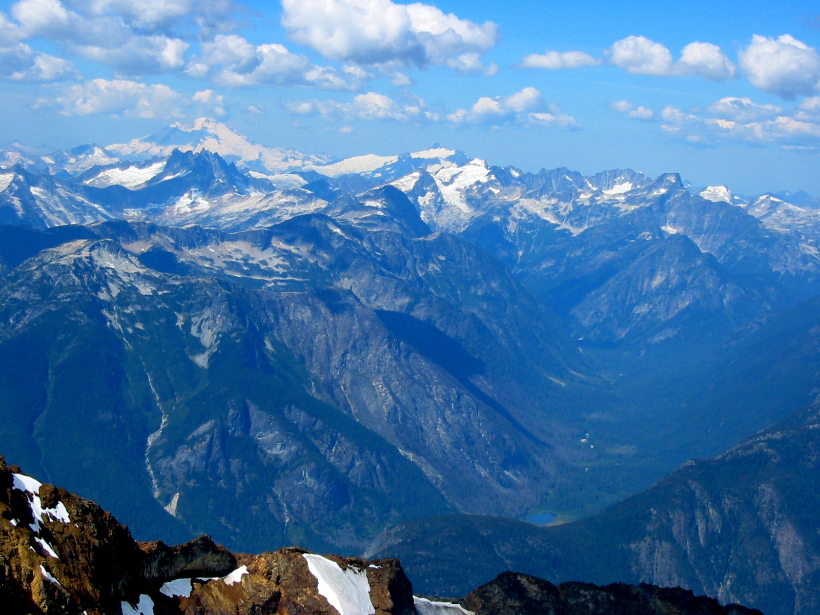
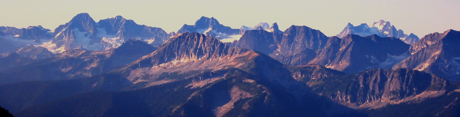
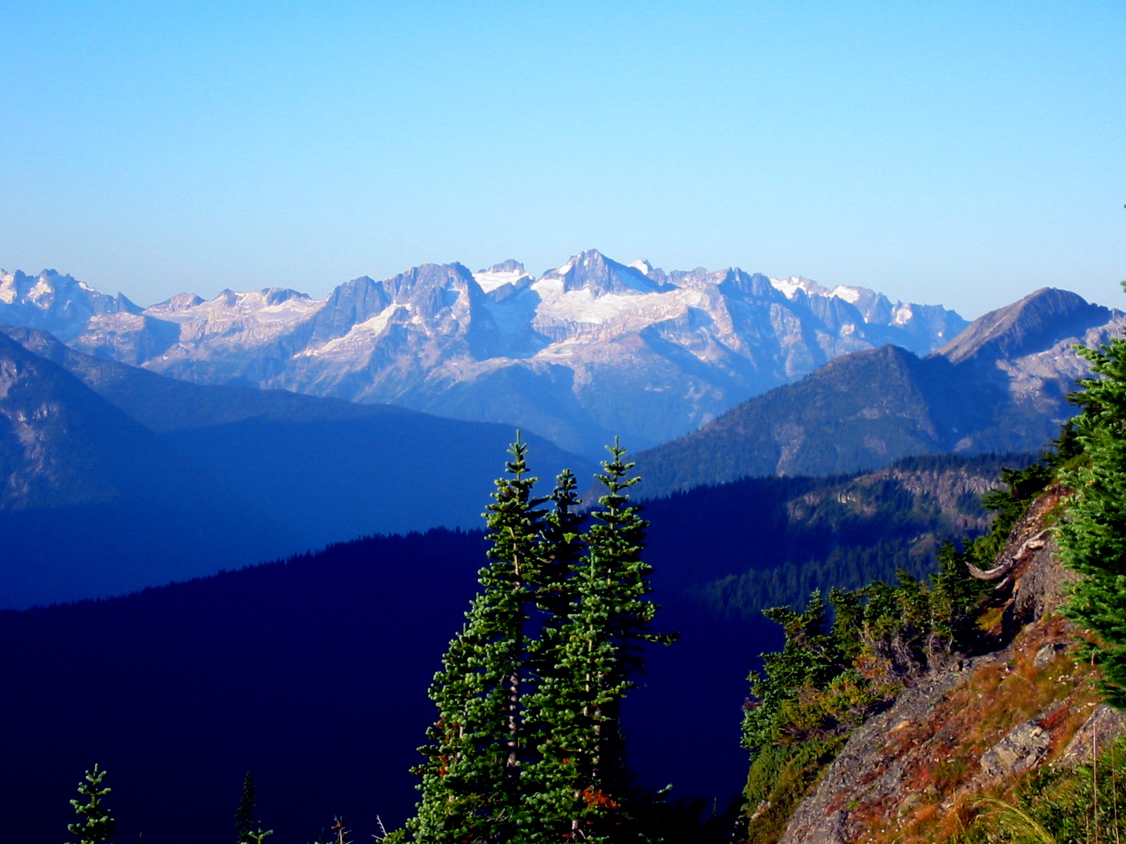
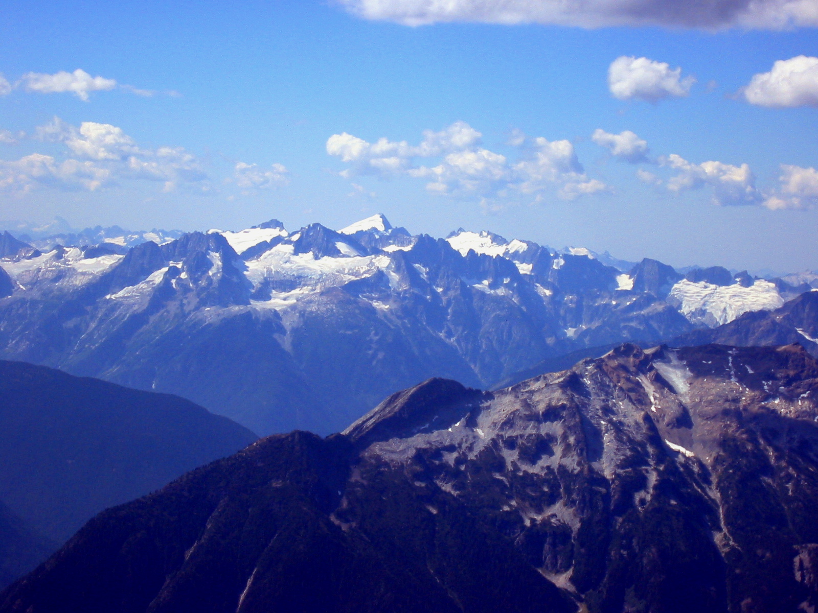
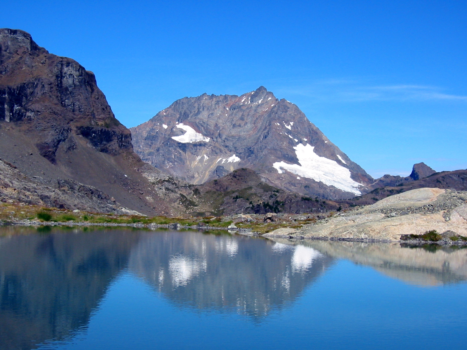
Over the years, I’ve picked Luna, Austera, and Sahale Peaks as my favorite viewpoints for ogling the wild alpine terrain of the North Cascades at close range, but Jack Mountain surely must be the undisputed king as far as seeing the entire North Cascades! From this 9066-foot vantage, it appears that nothing is hidden behind anything else. One can see nearly every ridge between Bacon Peak to the west and Silver Star Mountain to the east, and between Silver Tip Mountain to the north and Eldorado Peak to the south. Only the haze in the air hindered our vision.
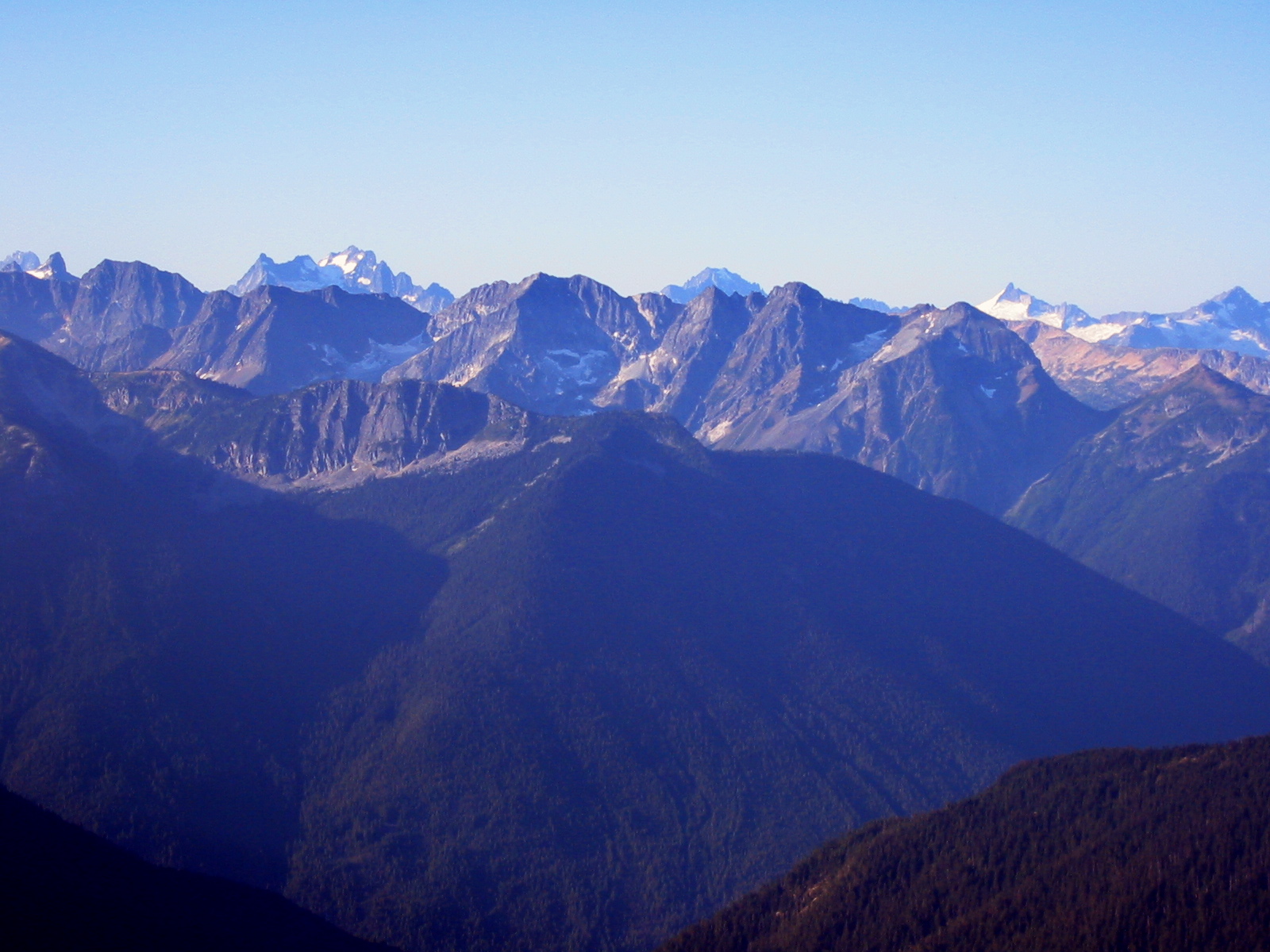
- Mt Redoubt and Mt Spickard From Summit
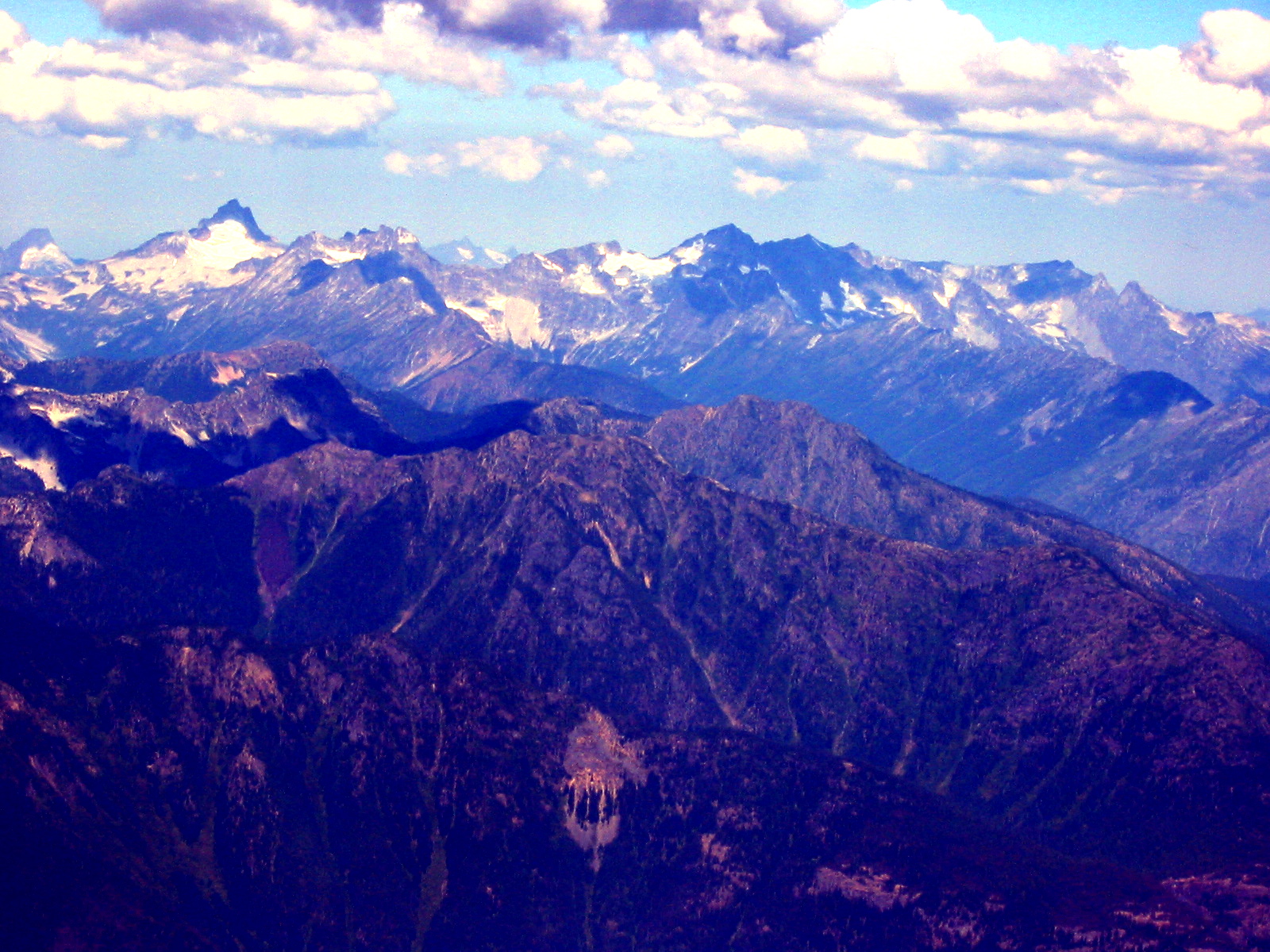
- Tricouni Peak To Dorado Needle Pano

- Ragged Ridge and Mt Logan Pano
The summit register was a big pvc tube left by Mike Torok in 1994. (This must have been a prolific climbing year for Mike; I can’t count the number of his tubes and 1994 registers that I’ve seen on Cascade summits!) Ours was something like the fifth or sixth ascent in 2005, during which two parties even summited on the same day via different routes, but the average seems to be around three parties per year.
We started down at about noon, quickly scrambling back to the ridge notch. At that point, we evaluated our descent route options and immediately chose the gray rock ribs and gully that Beth had ascended; my red gully looked like a steep bowling alley from above. We down-climbed slowly, always trying to avoid dislodging rocks or getting off route.
Somehow, the immense size of Jack Mountain becomes much more evident when staring down the expansive South Face, and it would be quite easy to wander onto bad terrain. We continuously looked for the marker ducks that we’d placed on the way up. I also recognized numerous ducks that Mike C. had placed during his recent climb (yes, I truly can identify his method of construction!).
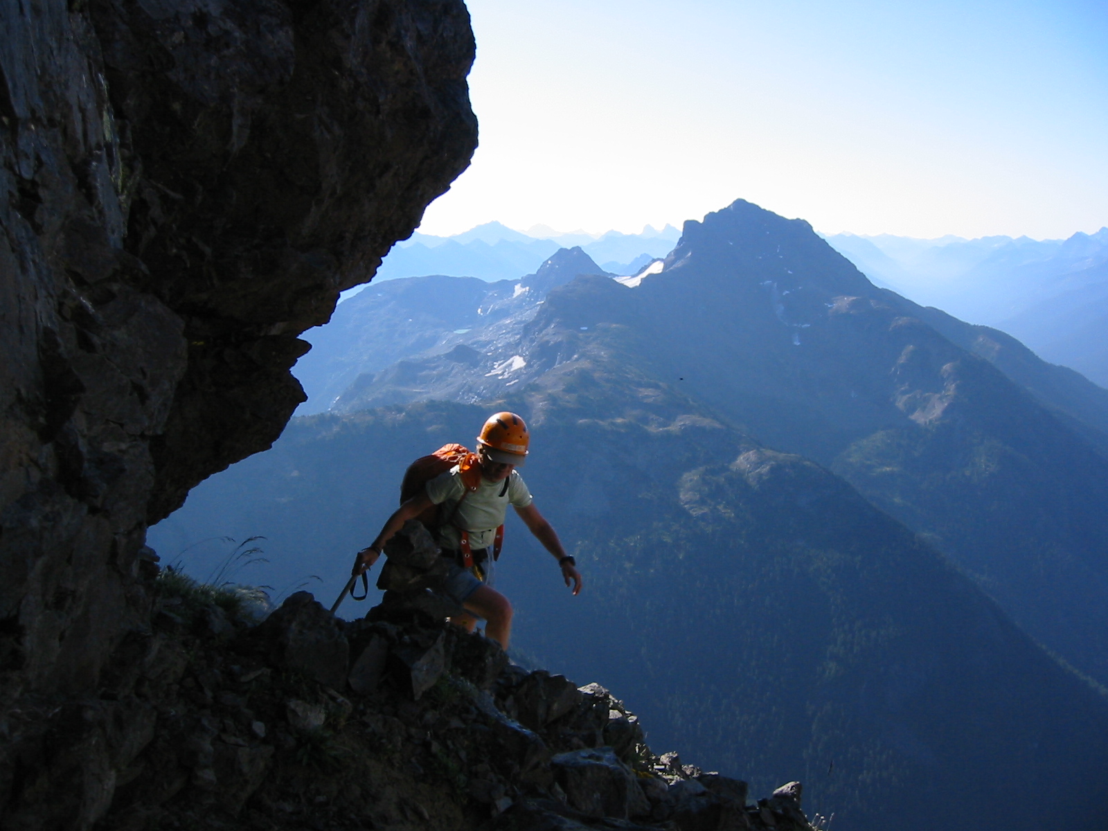
The lower part of the face gave us some route-finding trouble, but we eventually located the hidden chimney cutting through the cliff band. We roped up and belayed each other down the chimney and Class 4 step, perhaps as much to justify hauling a rope, rock gear, and harnesses as for safety. Once down on the ramp, we crossed below the landmark waterfall stream (realizing that now, this late in the season, it flows only in the afternoon) and traversed over to the Southeast Ridge bench. We arrived back in camp at about 4:00pm (4.0 hours from summit).
Day 2 (late PM): Crater Creek Meadows to Jerry Lakes
It would have been nice to simply relax in camp for the remainder of the day, but the Jerry Lakes were calling to us. Actually, they were screaming at me, and I was hell-bent on taking a cool-down swim before dinner. We packed up and labored back up to the 6550-foot saddle in full glare of the afternoon sun. I went ahead and raced down to the lakes just in time to take a dip before the sun set.
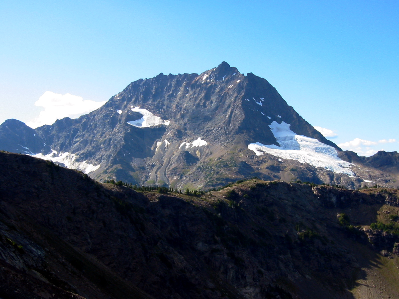
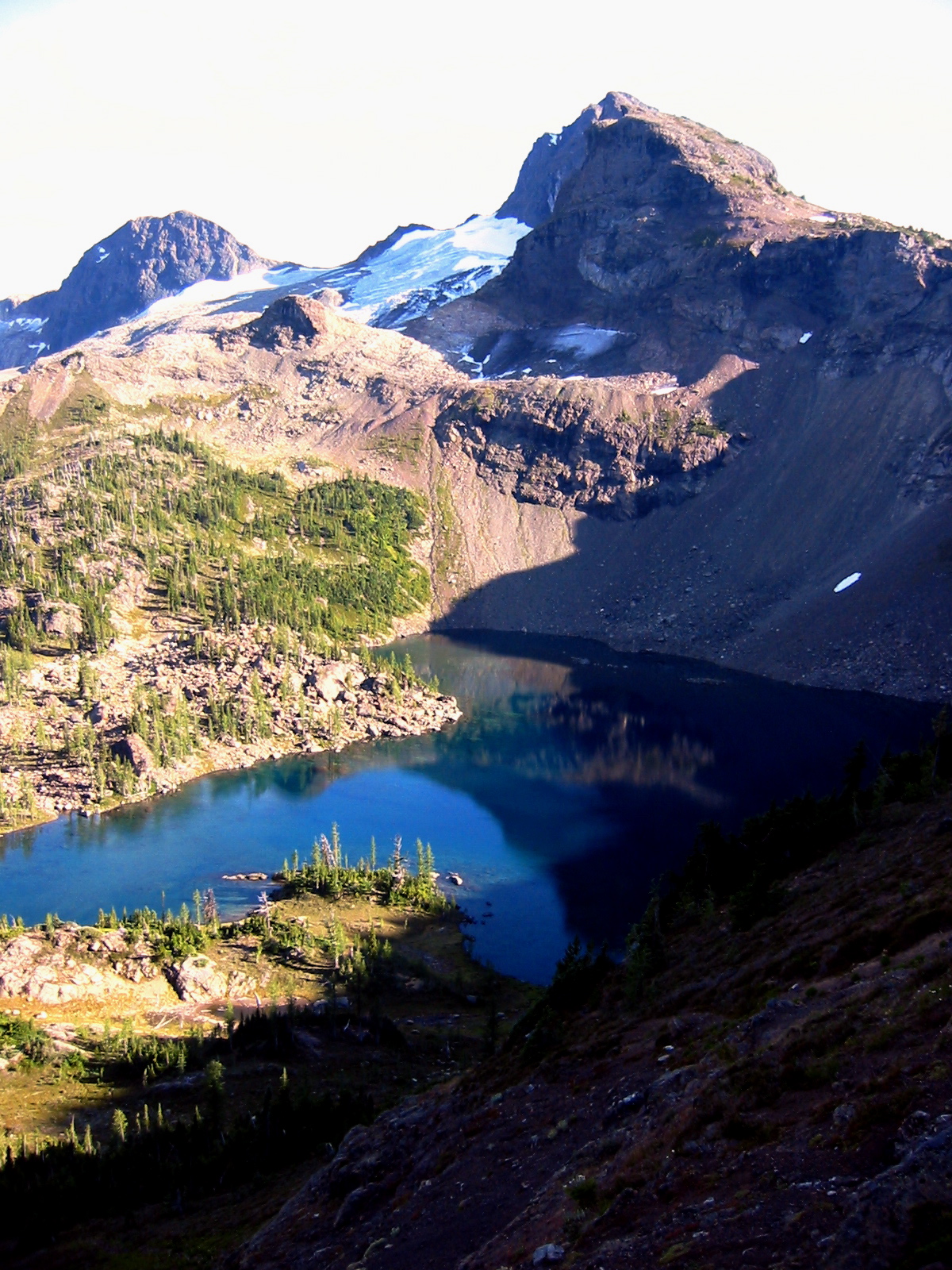
- Upper Jerry Lake and Knob
A solo hiker—the first other party I’d seen since starting out yesterday—was already camped at the lakes. Beth arrived soon after, and it turned out that she knew the hiker (an architect) through her work on the new North Cascades Environmental Learning Center. We visited with him after dinner, during which time a strong evening wind blew across the lakes. By nightfall, the air was once again still and warm.
Day 3: Jerry Lakes to Trailhead
We had a leisurely morning in camp and didn’t start hiking out until 8:30am.
- Upper Jerry Lake At Morning
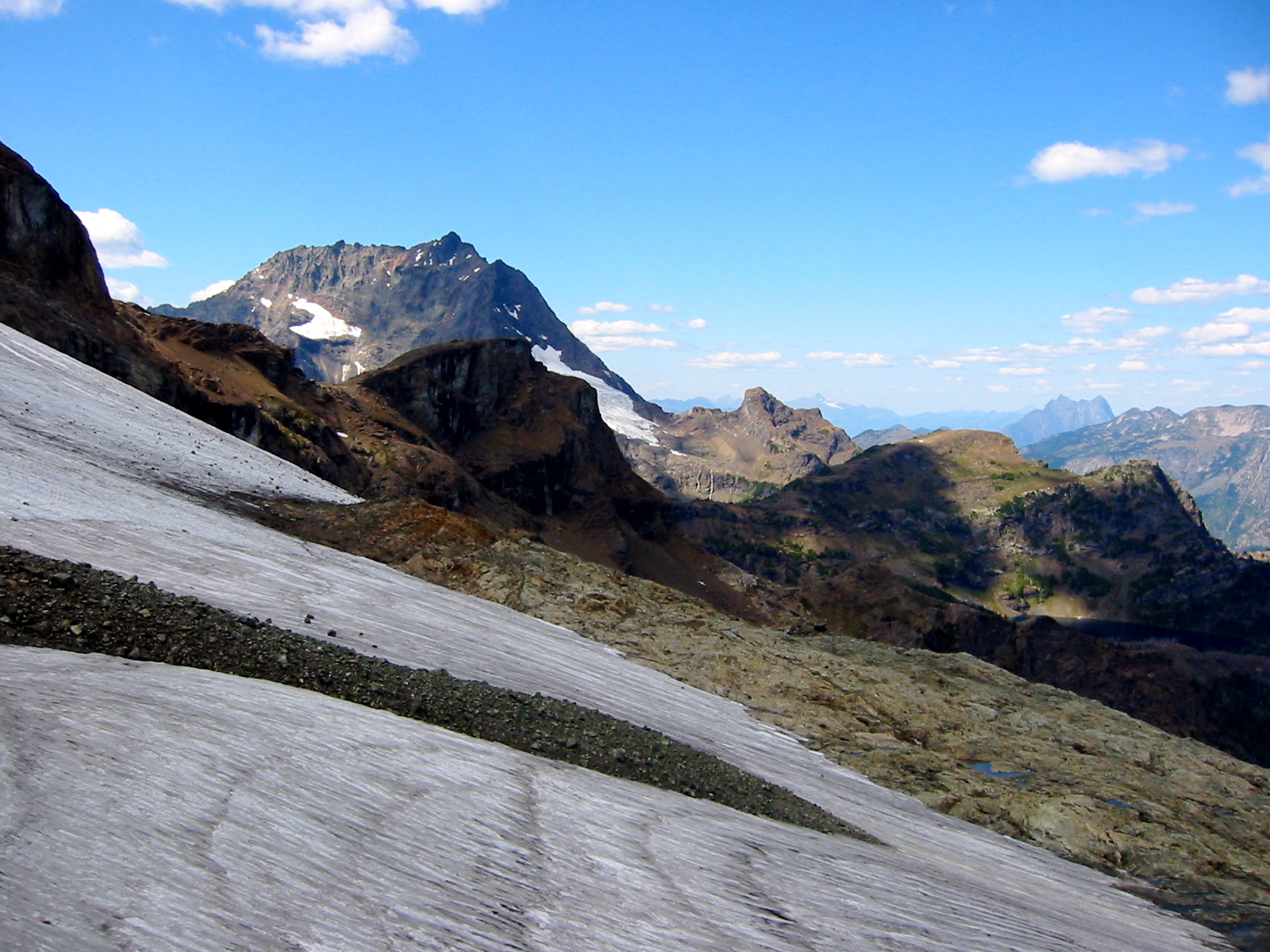
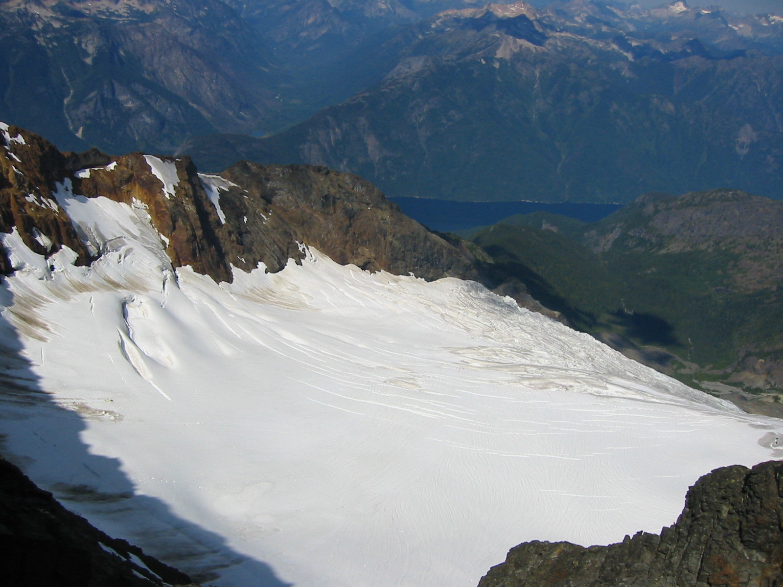
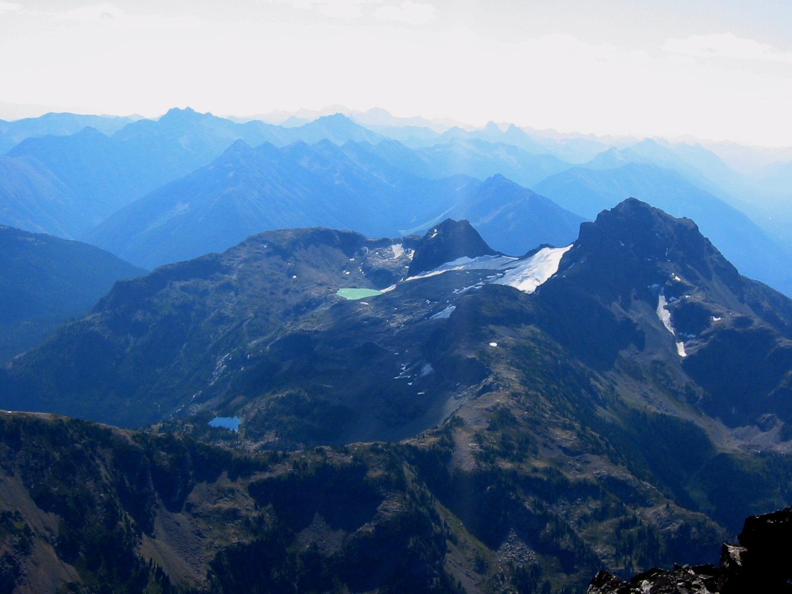
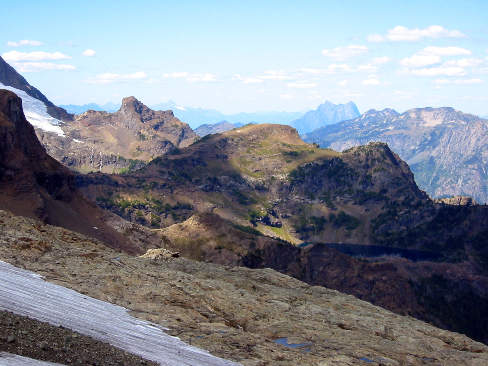
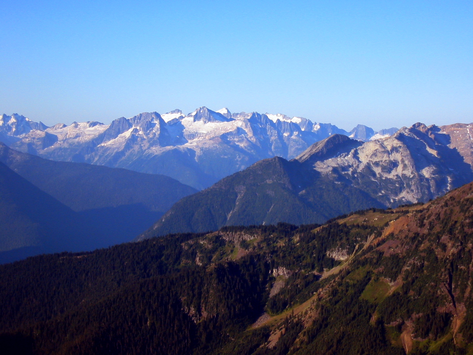
From the saddle above the lakes, we scoped out a route that would avoid the Jerry Glacier entirely. It appeared that we could follow a ledge system below the glacier to a lake at the head of Devils Creek, then ascend a ridge around the lake’s eastern side to reach East Crater Mountain Lookout. Our plan worked like a charm, taking us across easy polished slabs, closely below many ice caves in the glacier’s snout, and past a hidden tarn before arriving at jade-green “Devils Lake” an hour later. This lake shows on topographic maps as a large, white, flat area at the base of a glacier remnant. Obviously, it has formed only in recent decades, as a result of glacial recession. Beth took a dip in the cold water here, while I continued up the scenic ridge to the former lookout site (2.6 hours from camp).
- Jack Mountain and Upper Jerry Lake
After a long lunch break on a view knoll just above the lookout (for some reason, the lookout was built on a lower point several hundred yards away), we began the 5000-foot descent to our vehicles. Intermittent breezes and cloud-cover kept things pleasant on this long, south-facing trail, and we were down by 3:00pm (6.6 hours from camp).
The trail crew working on the new bridge was just finishing their shift as we arrived. They quizzed us about our climb of Jack Mountain, and we traded them fresh information for fresh nectarines. The crew included several old-time Audubon Society members, who reminisced about camping at Jerry Lakes 30 or 40 years ago. One of them mentioned with amusement that the name “Jack Mountain” sounds like some new contrivance to him, because the mountain had always been referred to as “King of the Skagit” in his day. Too bad that such a grand mountain couldn’t have been formally honored with such a grand name, I thought.
Photo Gallery
Click to enlarge…