Trip Date: April 8, 2022
2022 MEXICO ADVENTURE VACATION
El Toro Viewpoint Day Hike & Scramble
Viatores Junction
Mirador el Toro aka The Bull’s Viewpoint
Trip Report Summary
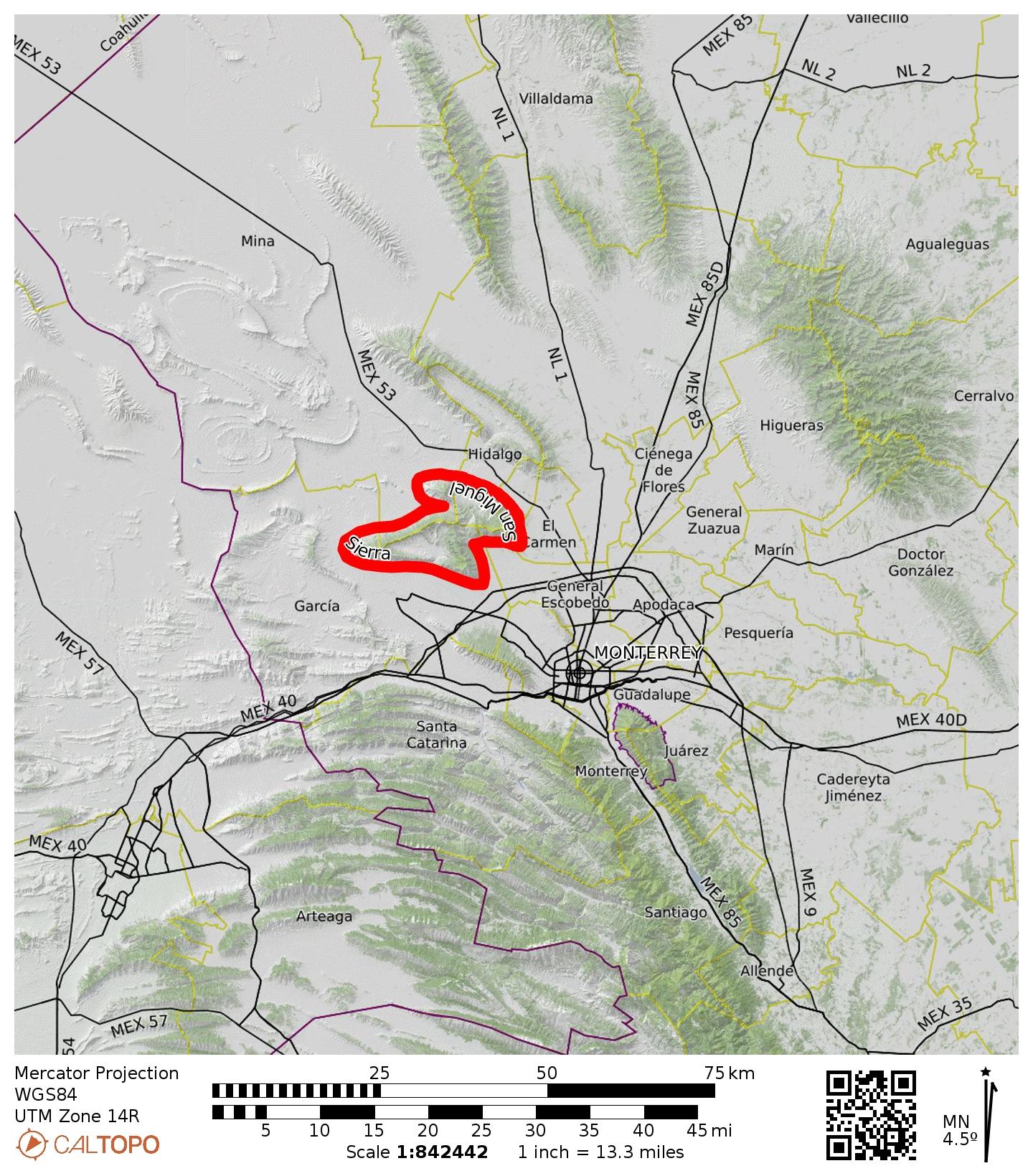
Region: Mexico
Sub-Region: Sierra Madre Oriental (“Eastern Mother Range”)
Sub-Sub-Region: Sierra San Miguel aka Sierra del Fraile (“Friars Range”)
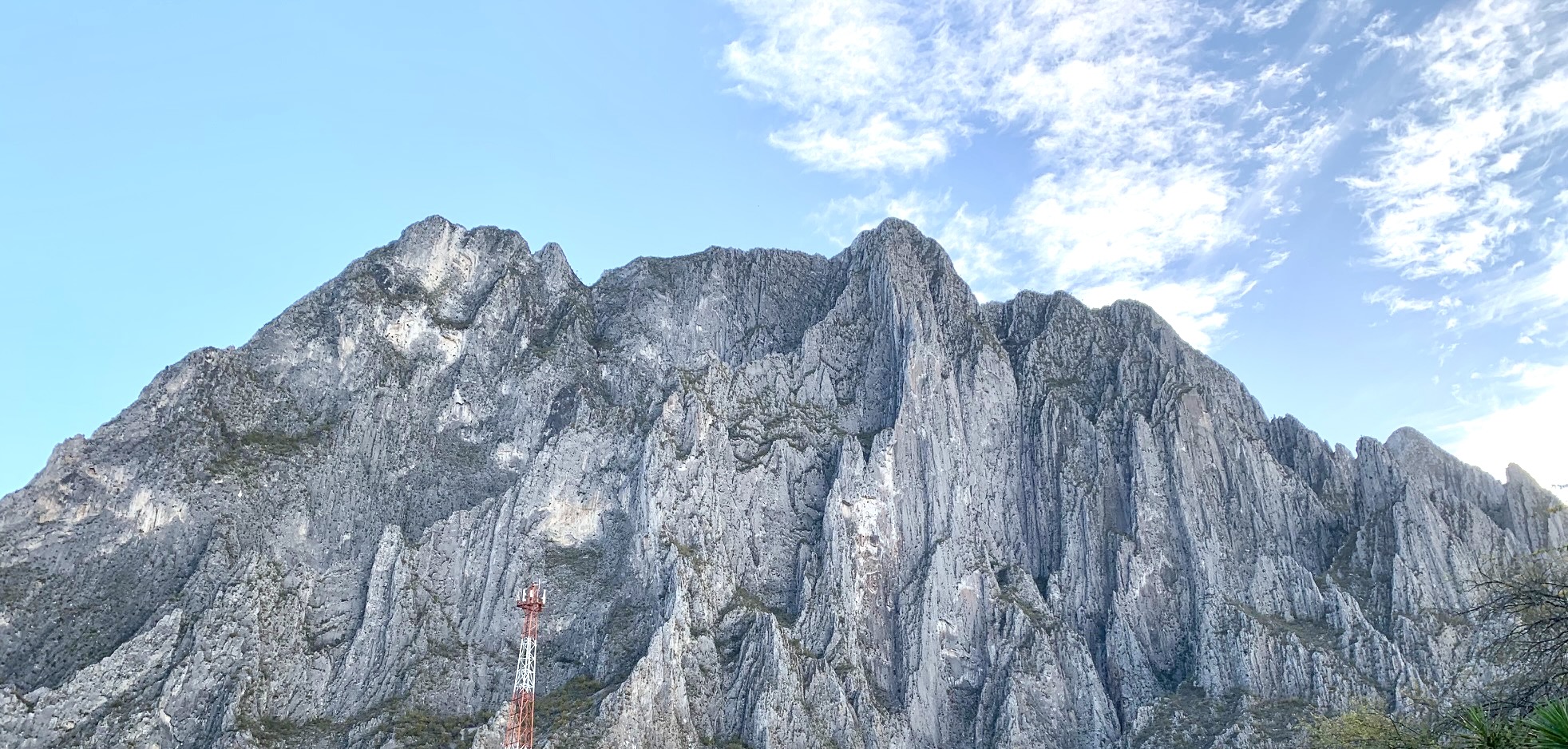
Area: Potrero Chico Recreational Park
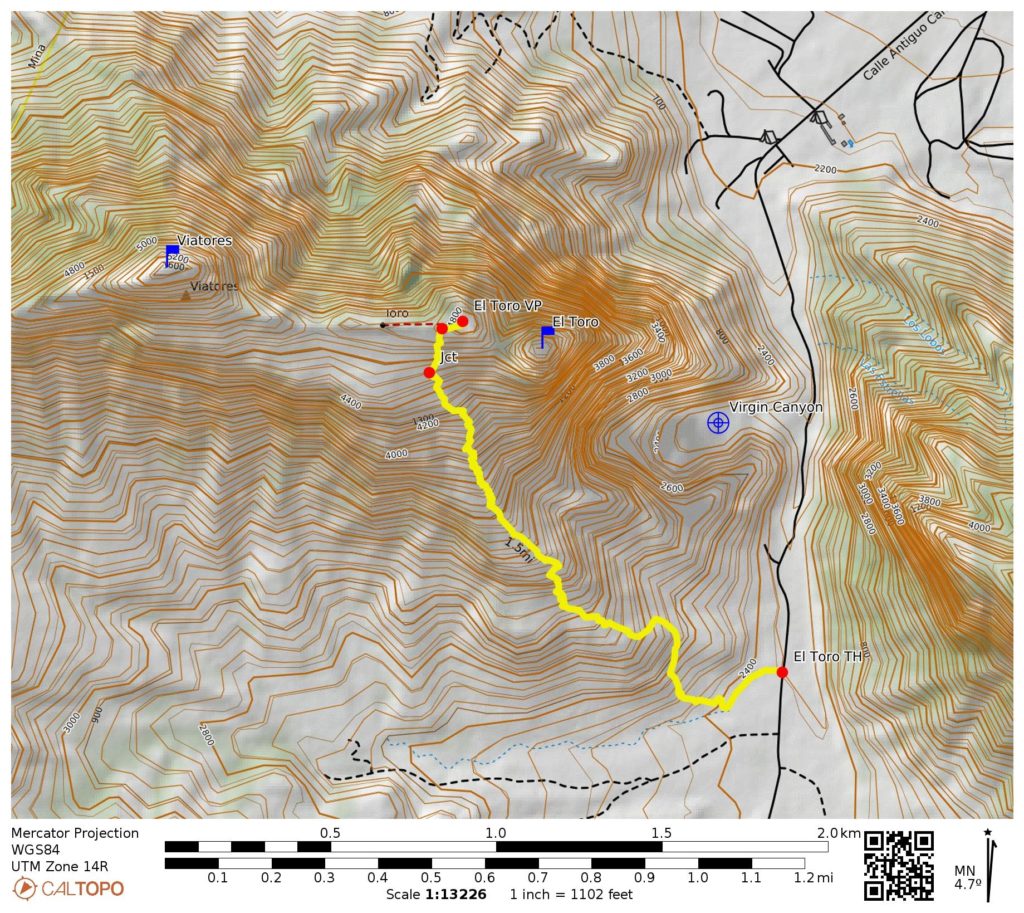
Starting & Ending Point: El Toro Trailhead on Old Potrero Chico Road (Elev. 2400 feet / 730 meters)
Way Points: Viatores Junction & El Toro crest & El Toro Viewpoint (trail hike & rock scramble)
High Point: El Toro Viewpoint (Elev. 4800 feet / 1460 meters)
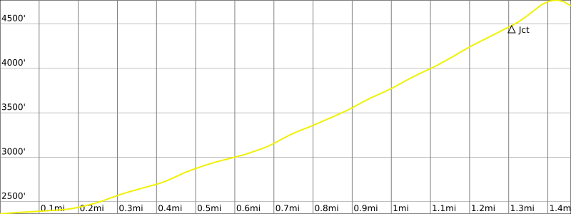
Approximate Stats: 3.0 miles / 4.8 kilometers traveled; 2400 feet / 730 meters gained & lost; 5.0 hours elapsed.
…
Full Trip Report
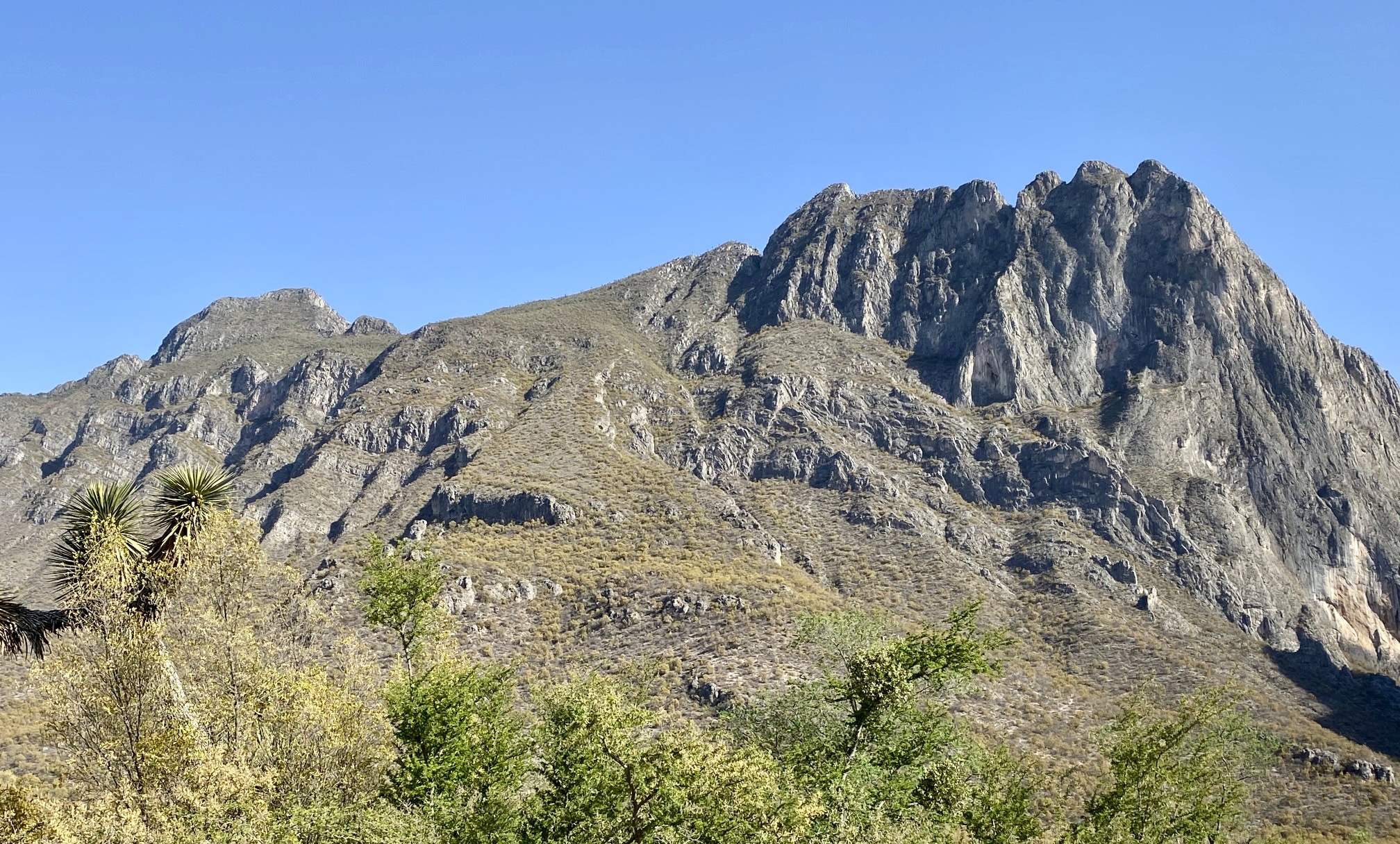
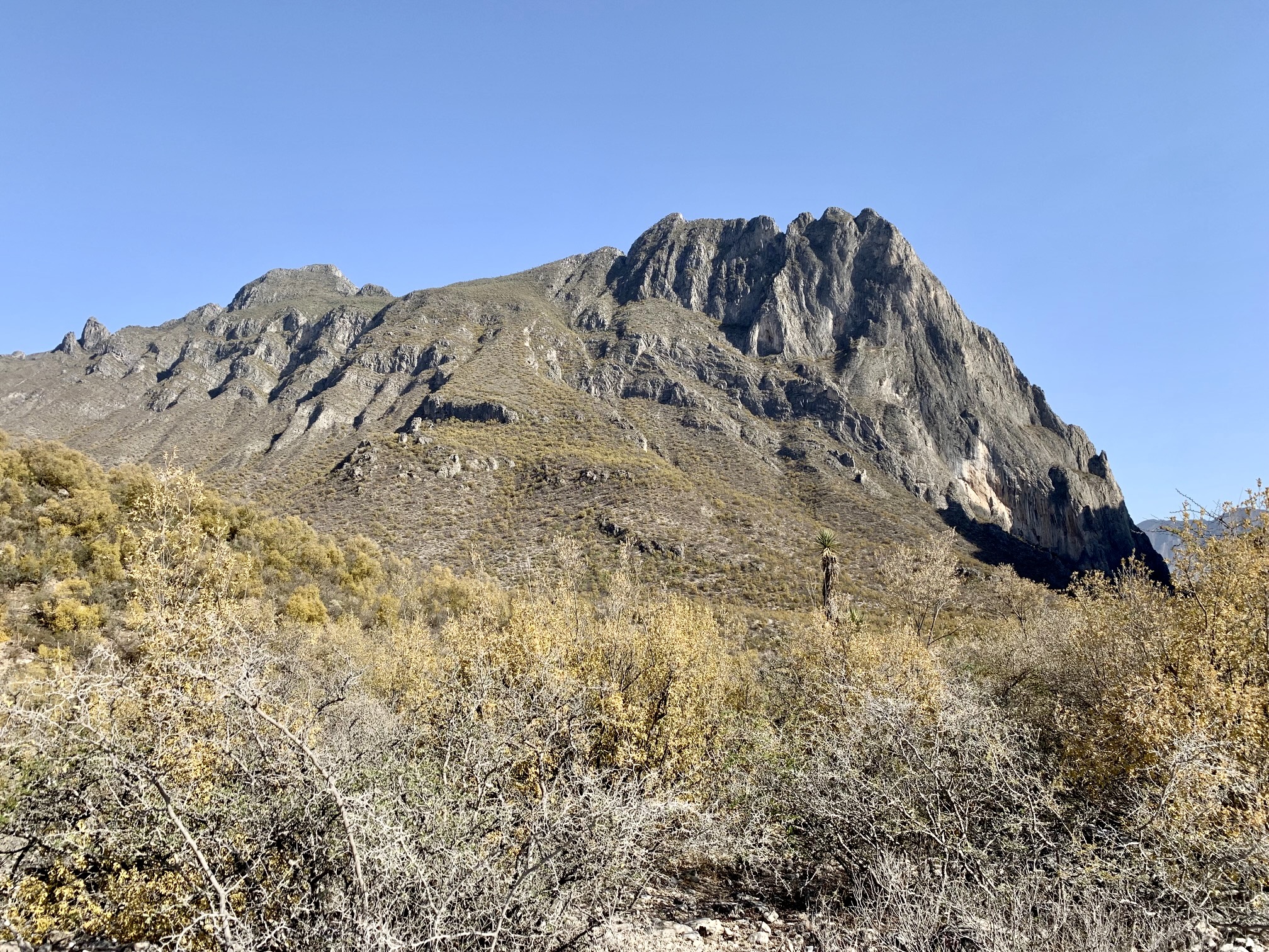
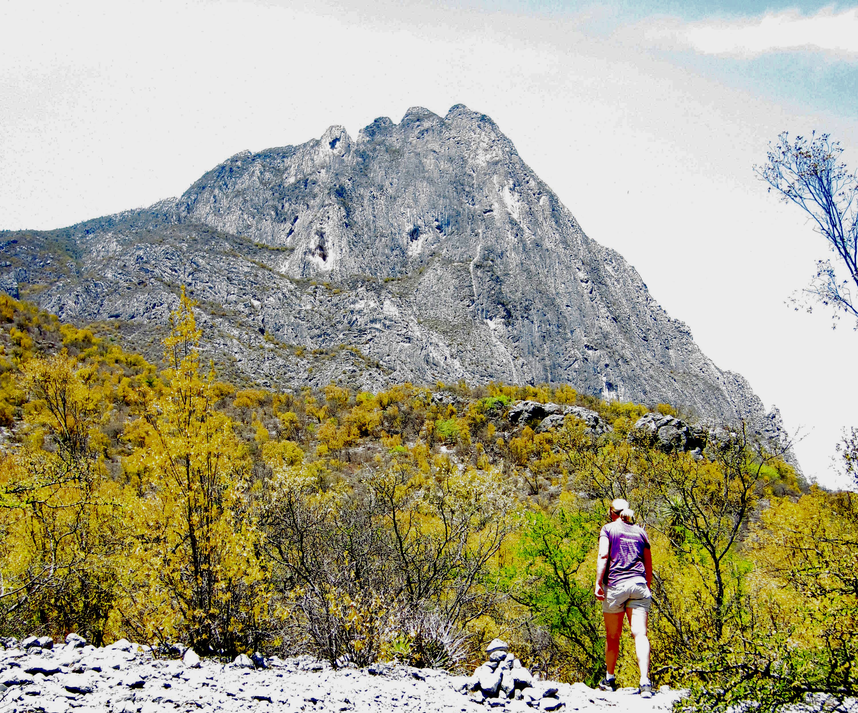
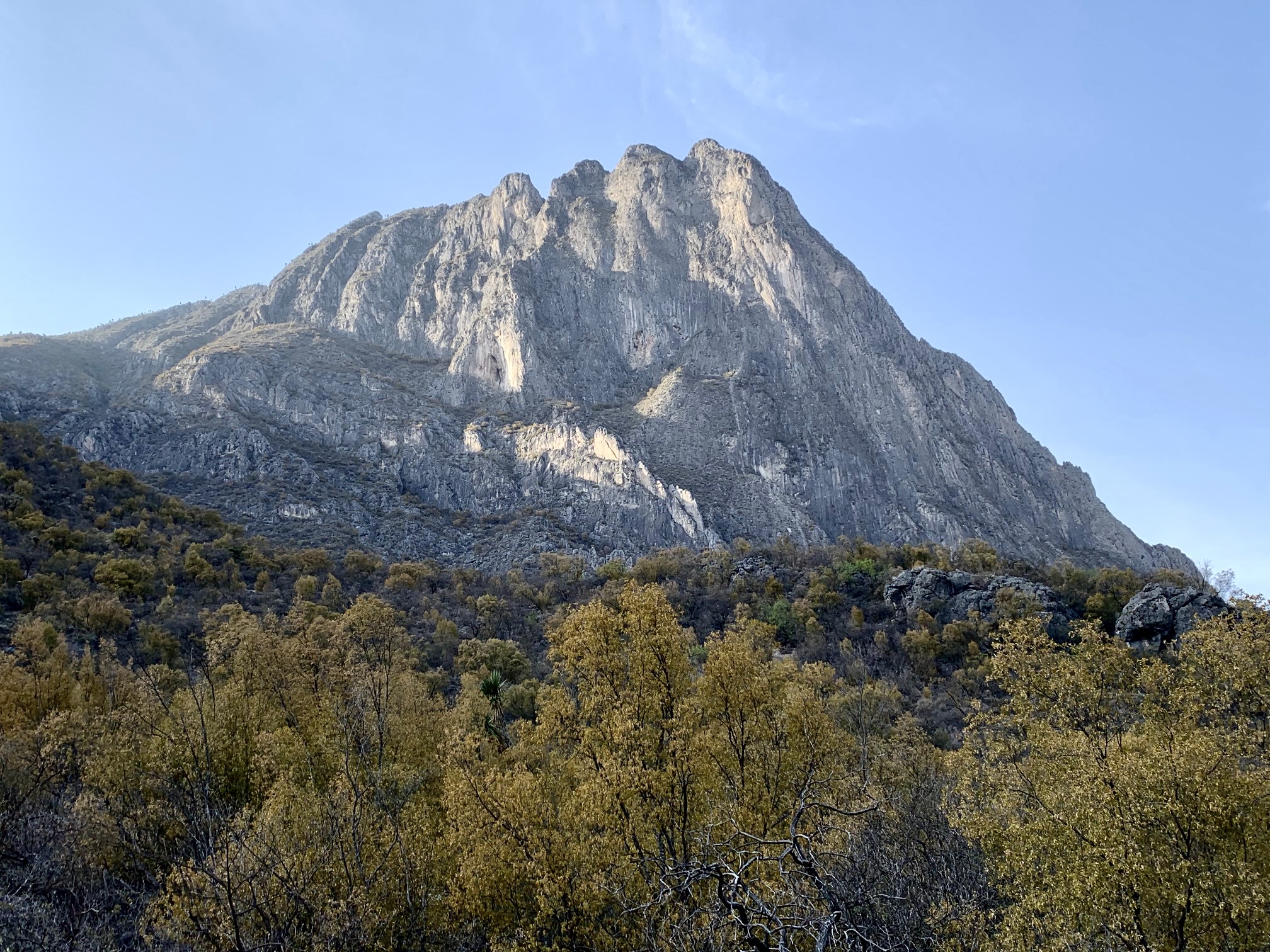
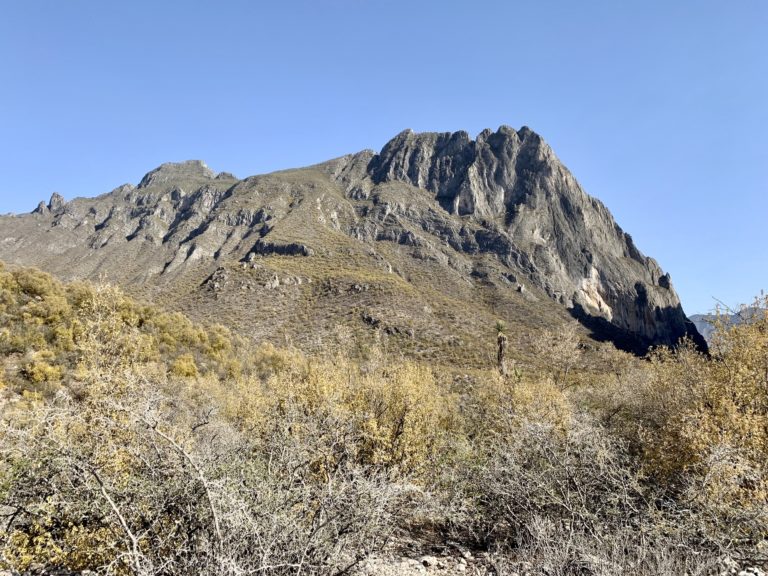
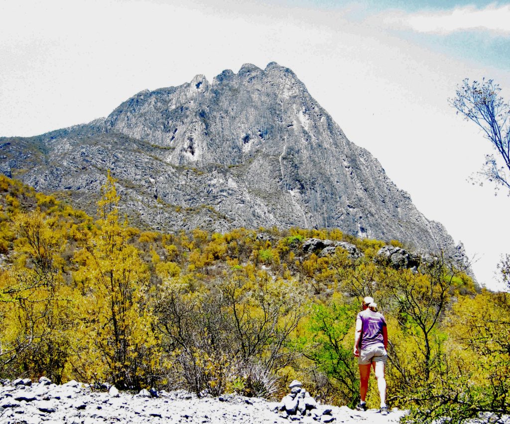
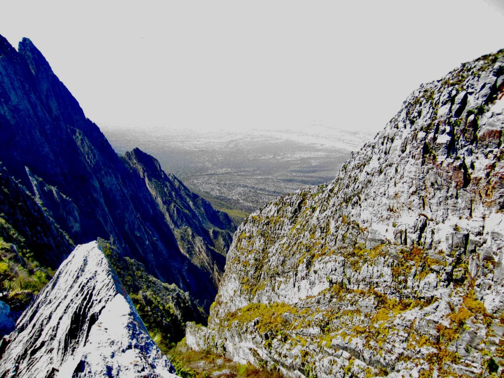
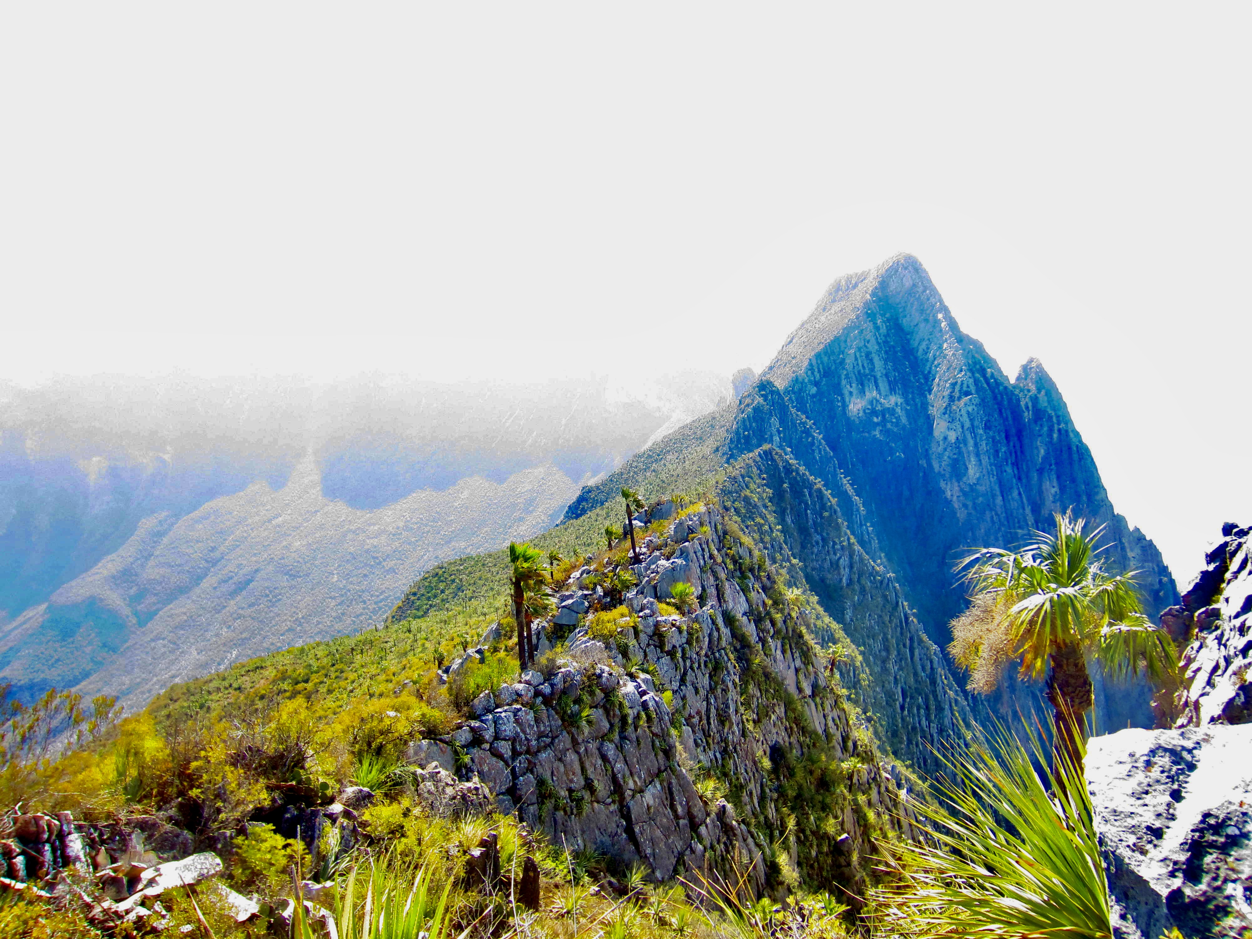
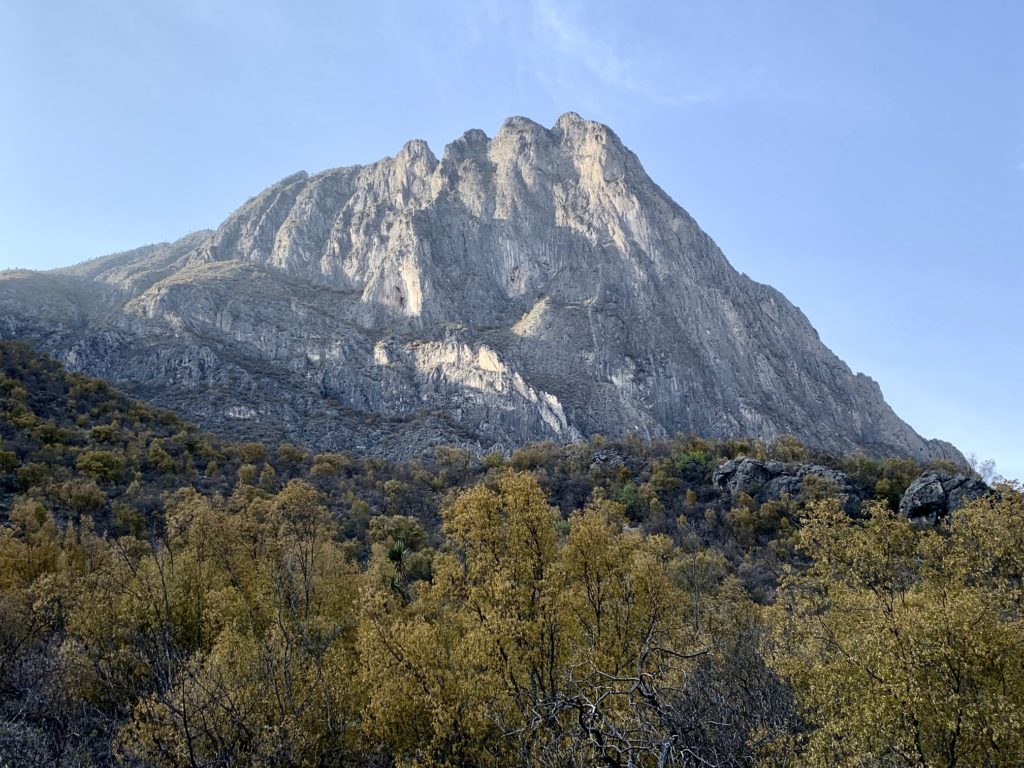
On the last day of our rock-climbing trip to Mexico’s Potrero Chico Recreational Park (“PoCho”), Eileen and I hiked up to El Toro Viewpoint for a better look at the surrounding Sierra San Miguel mountainous region. El Toro is a craggy limestone peak that towers over the western side of PoCho’s entry portal, dominating the view from all nearby campgrounds. The 4900-foot summit of El Toro can be reached via a long (40 pitches!), scary (X-rated!) 5.9 climbing route on the north face, whereas the 4800-foot viewpoint can be reached via a 1½-mile hiking trail on the southeast slope.

.
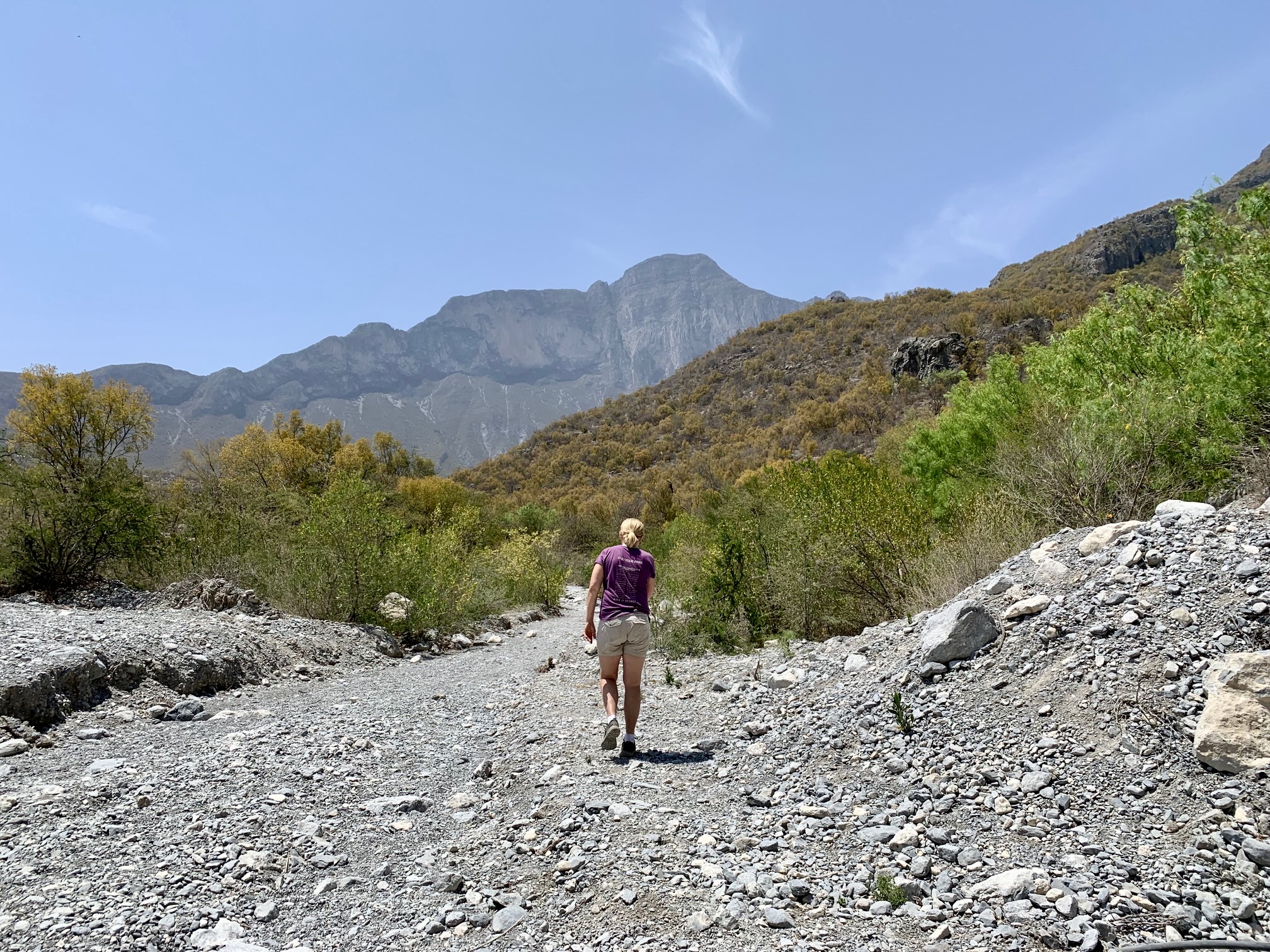
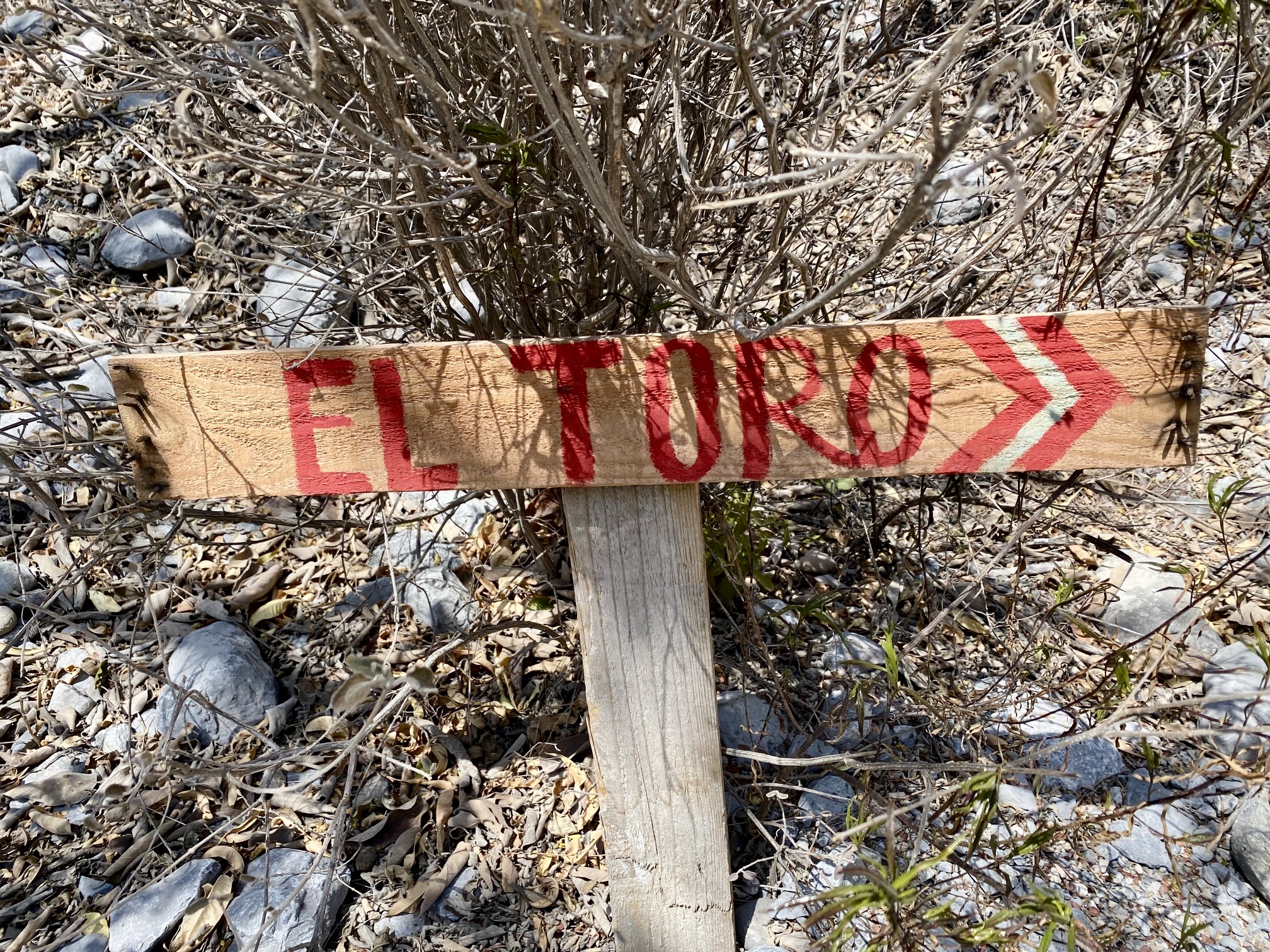
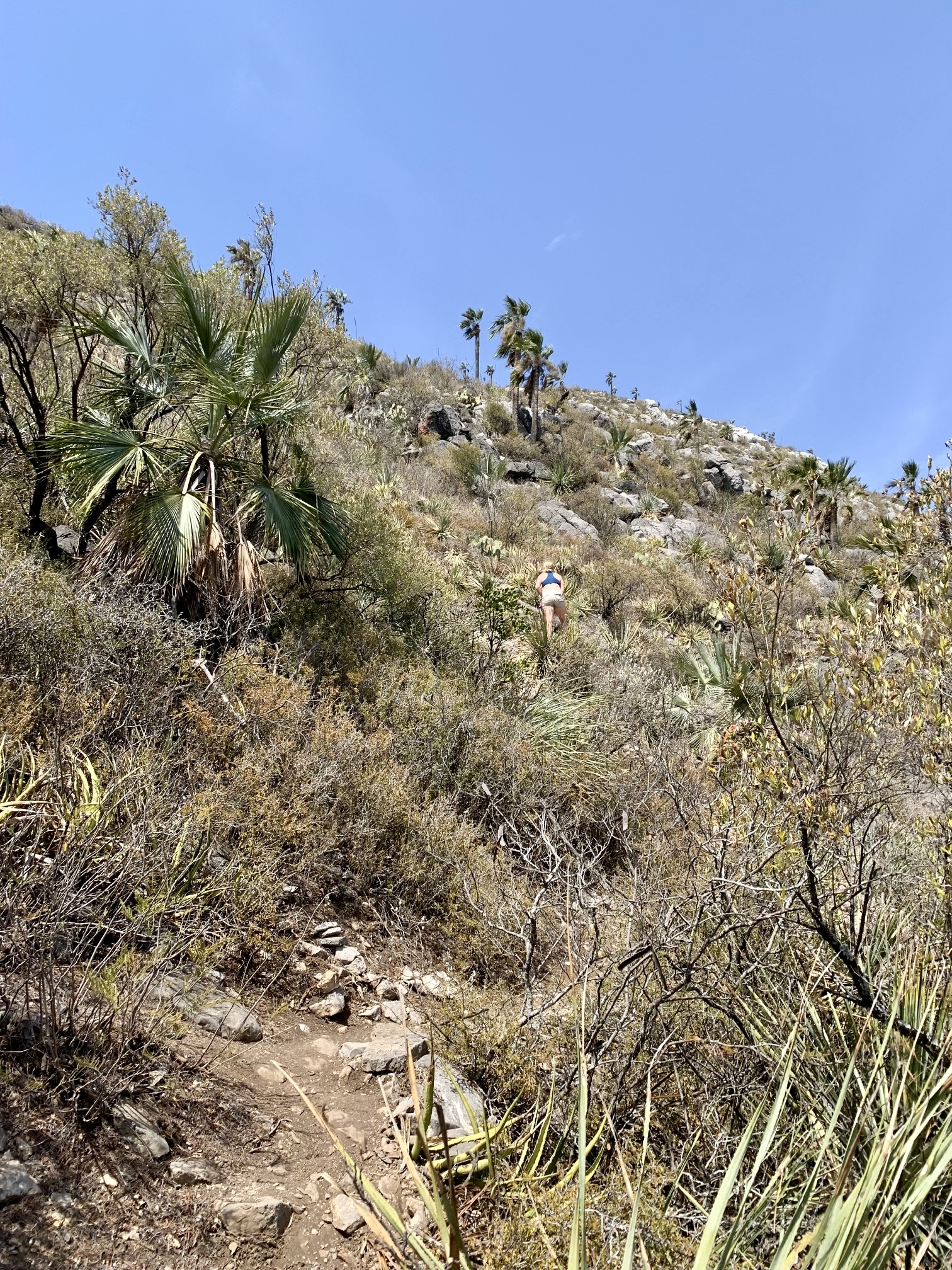
The unmarked El Toro Trailhead is located within a broad drainage wash approximately ¾ mile up Old Potrero Chico Road from the park’s entrance arch. We hiked up the wash for 250 yards, then veered off to the right on a distinct footpath. The lower part of this trail swings back and forth across a densely vegetated hillslope that sweeps upward to meet El Toro’s south face.

.
.
The El Toro Trail is steep and rough but well-trodden and easy to follow. There are a few primitive signs along the way, as well as hundreds of stone ducks and cairns. Myriad cacti, yucca, and other unfriendly plants border the trail, ensuring that hikers stay on track.
.
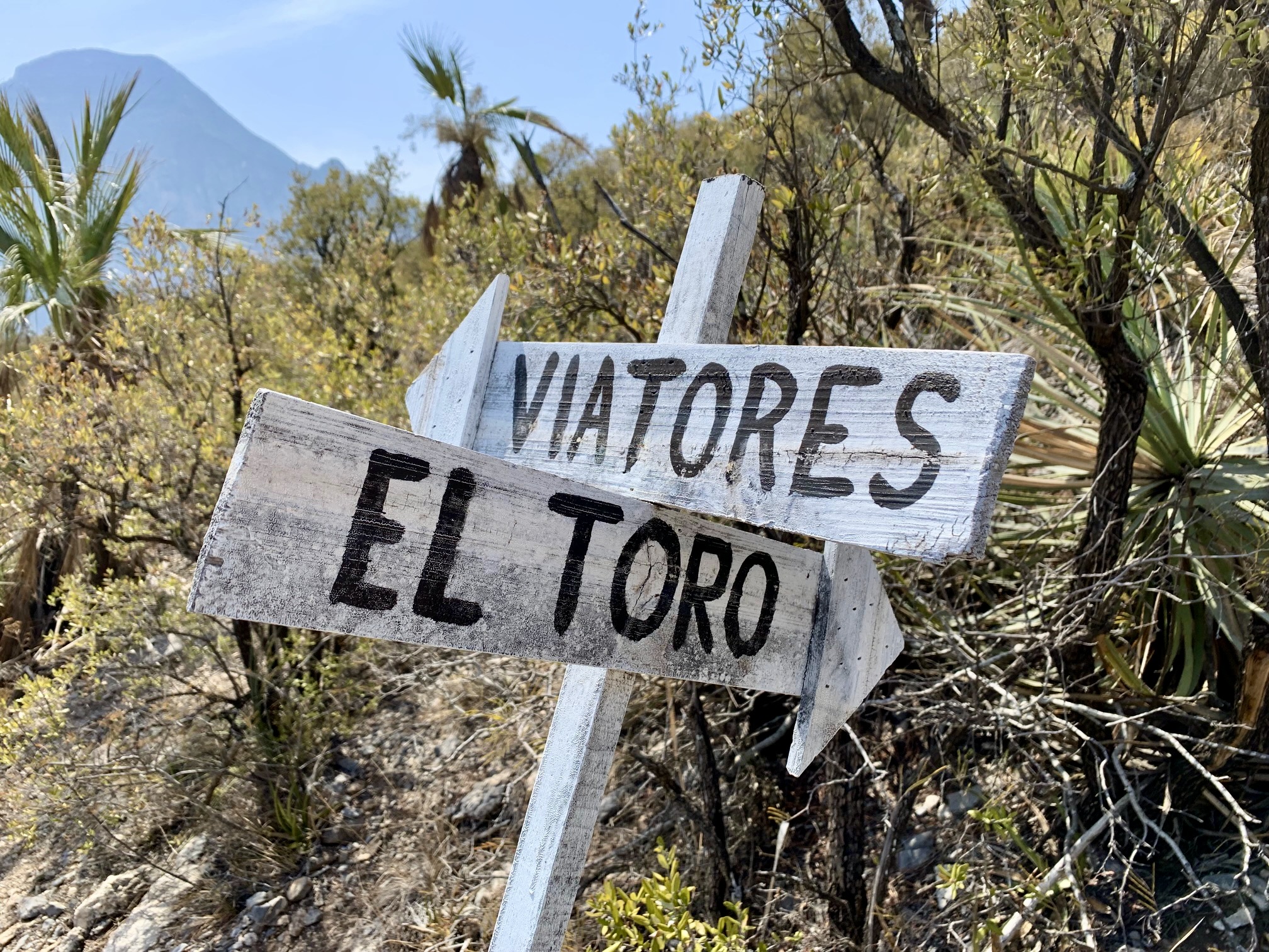
After a steady elevation gain of 2100 feet, the trail splits at a posted junction. One branch heads off to the left (west) toward Viatores, a 5300-foot peak on the Potrero Chico rim. The other branch continues straight uphill toward El Toro Viewpoint.

.
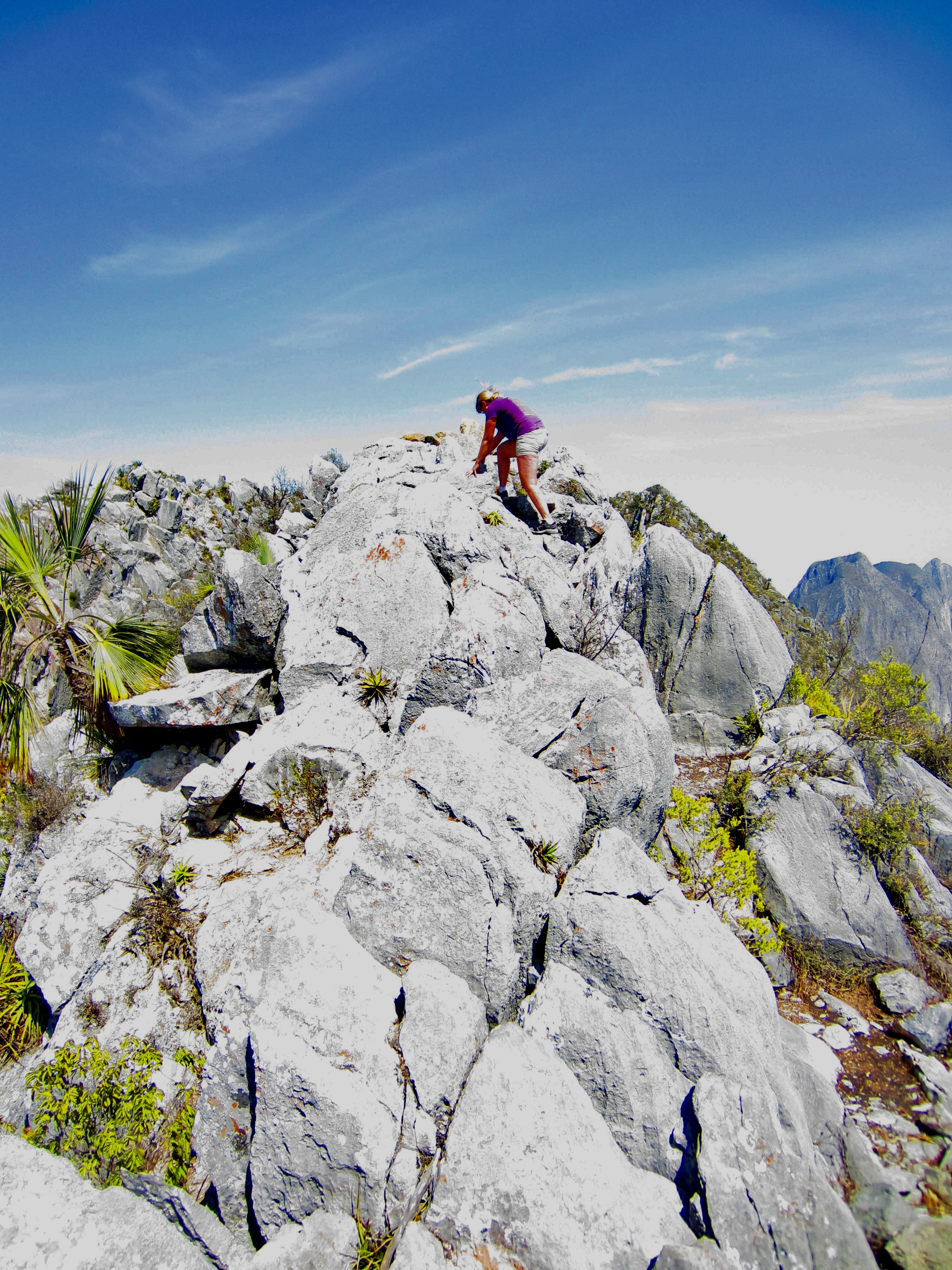
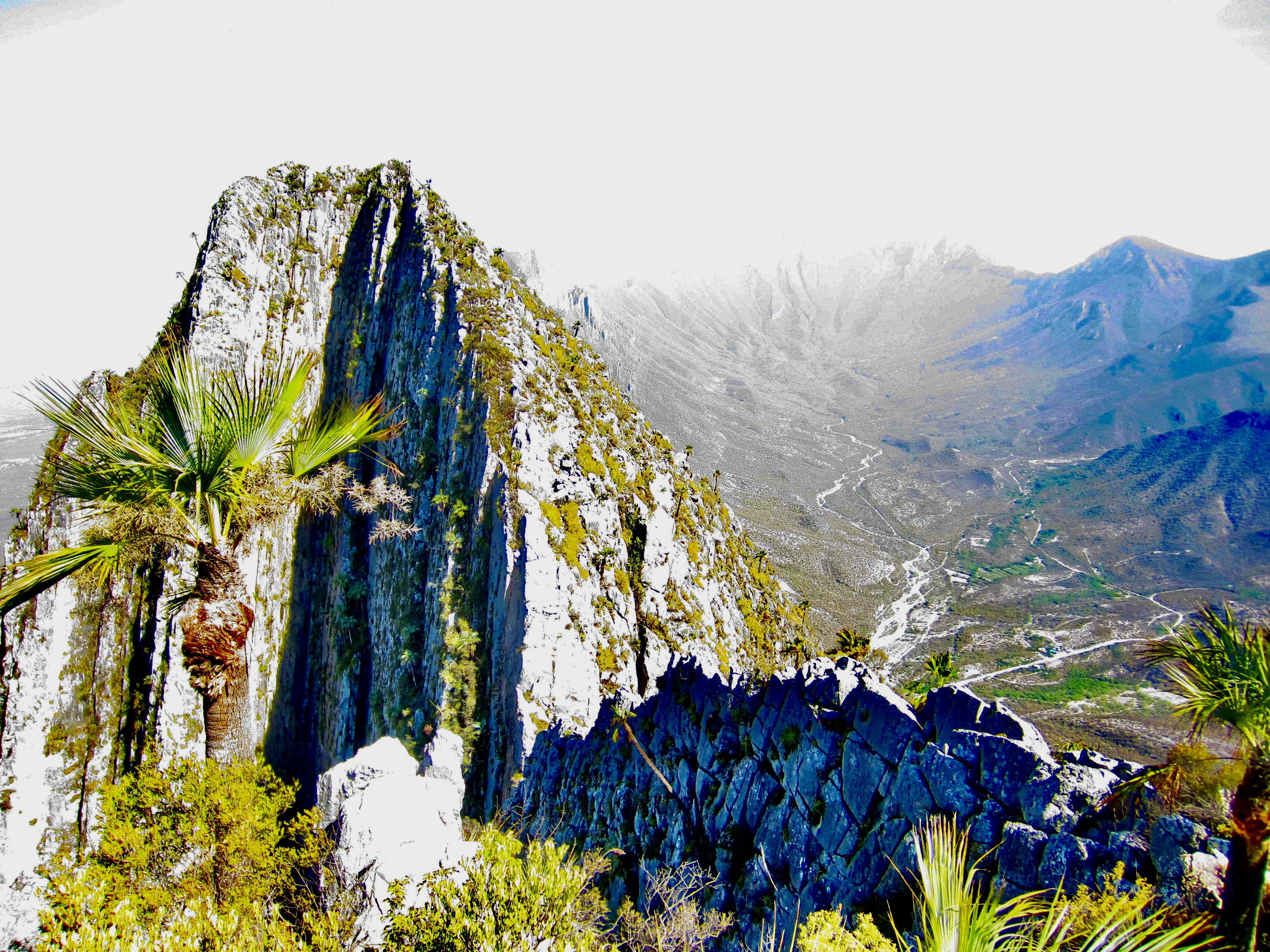
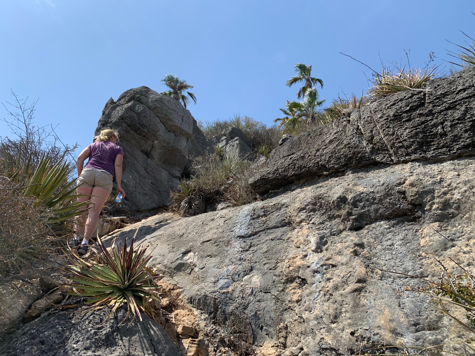
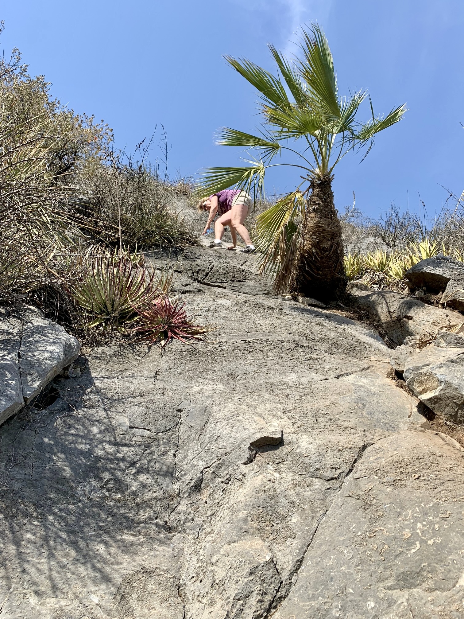
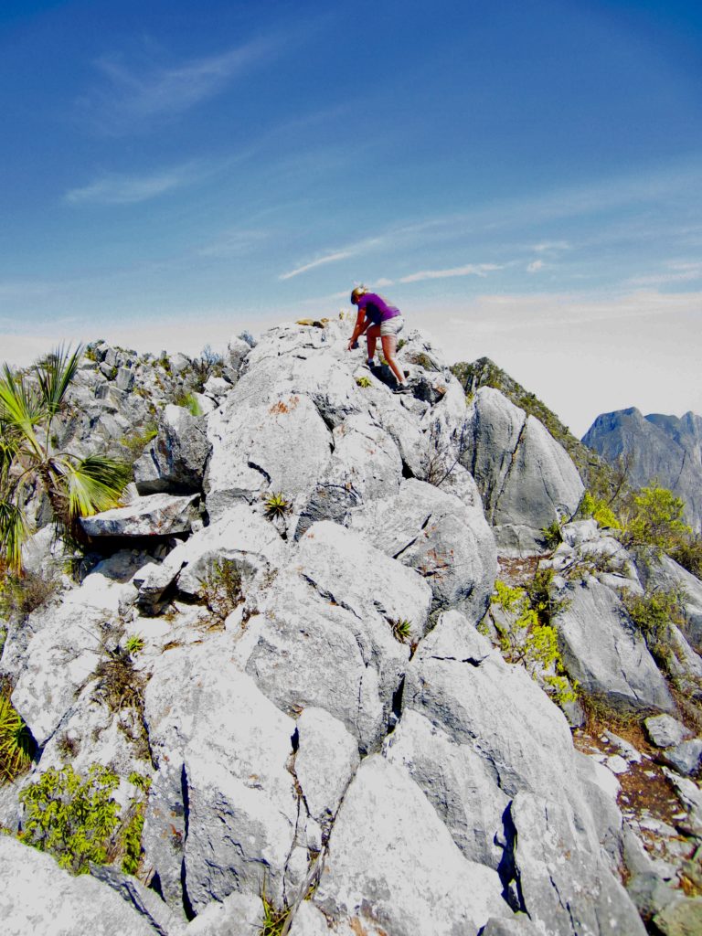
A short distance above Viatores Junction, our trail ascended a series of limestone outcrops that required some Class 2-3 scrambling. We eventually gained El Toro’s narrow ridge crest and got a view out to the north. Unfortunately, the air was very hazy and had a smoky odor, presumably due to a distant brushfire.
.
From where we hit the ridge crest, several different reference maps show that the El Toro Trail turns left and heads down the crest. However, this not only seemed illogical but there was no evidence of a trail in that direction. What made far more sense to us was to turn right and head up the crest toward El Toro’s summit. Our inclination was confirmed by a well-traveled path, so up we went.
.
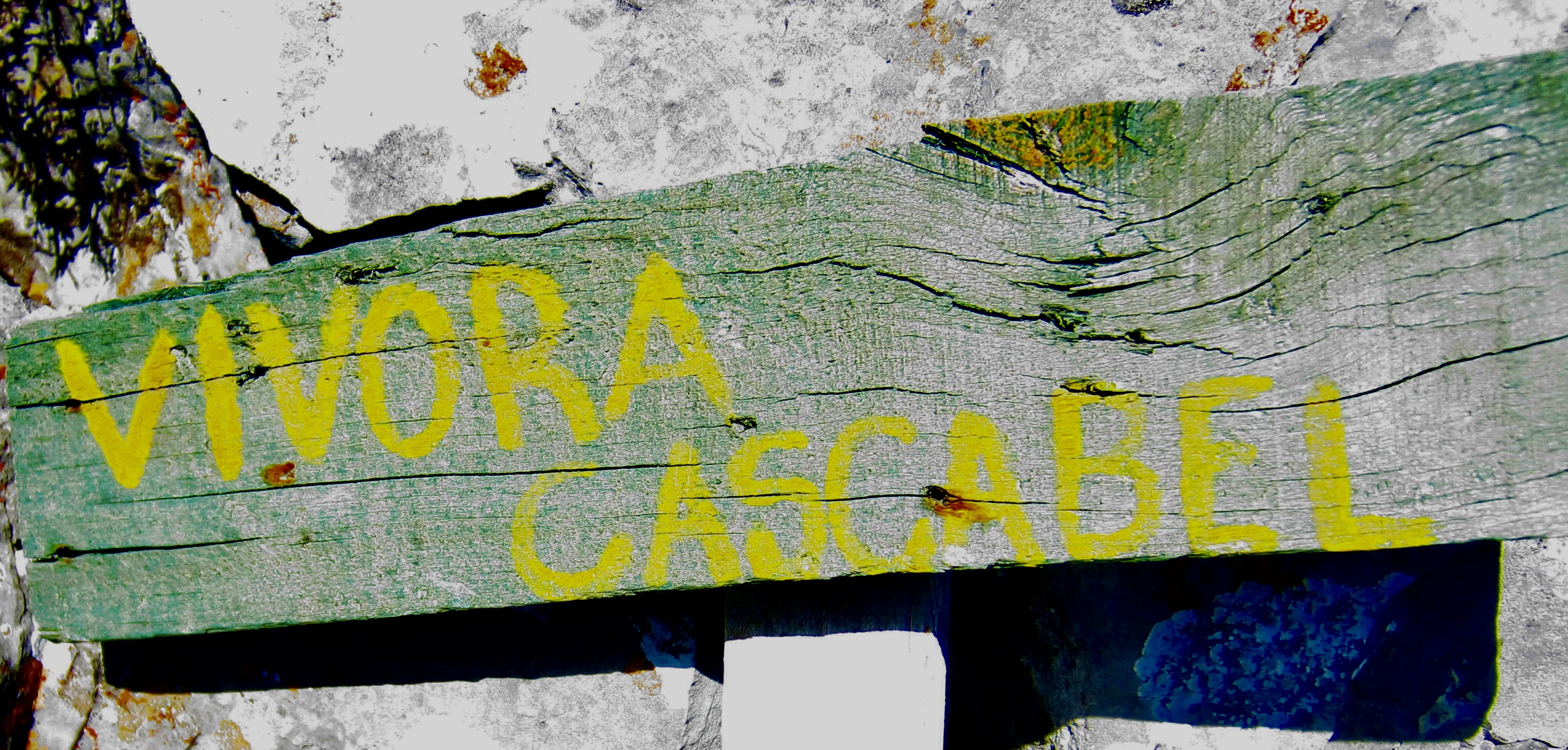
While scrambling eastward along the ridge crest, we soon passed a set of anchor bolts that had no obvious function, followed by a crude sign reading “vivora cascabel.” If I had known at the time that this was likely a misspelling or dialectal spelling of the Spanish term for “rattlesnake” (vibora cascabel), I probably would not have taken a closeup photo of the sign. Yikes!

.
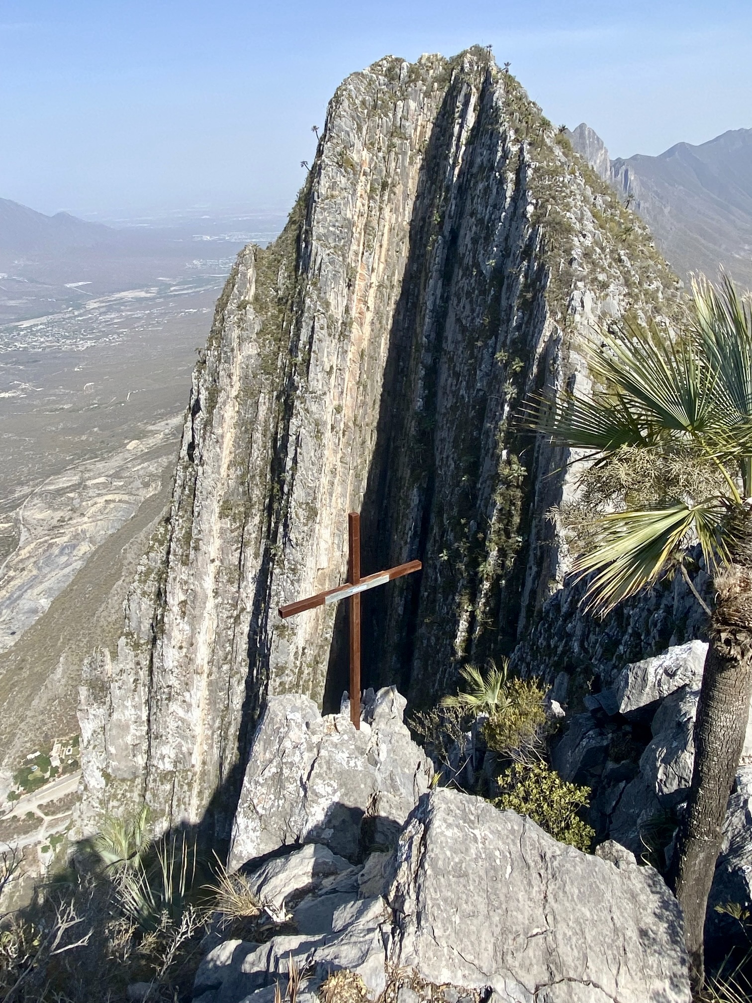
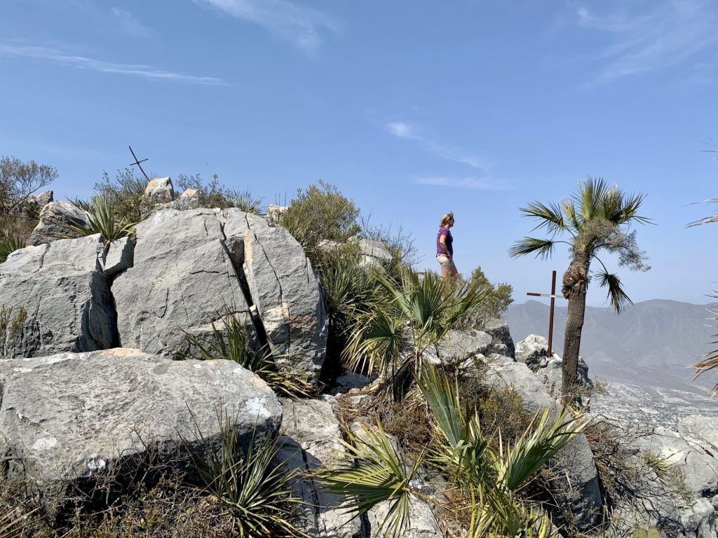
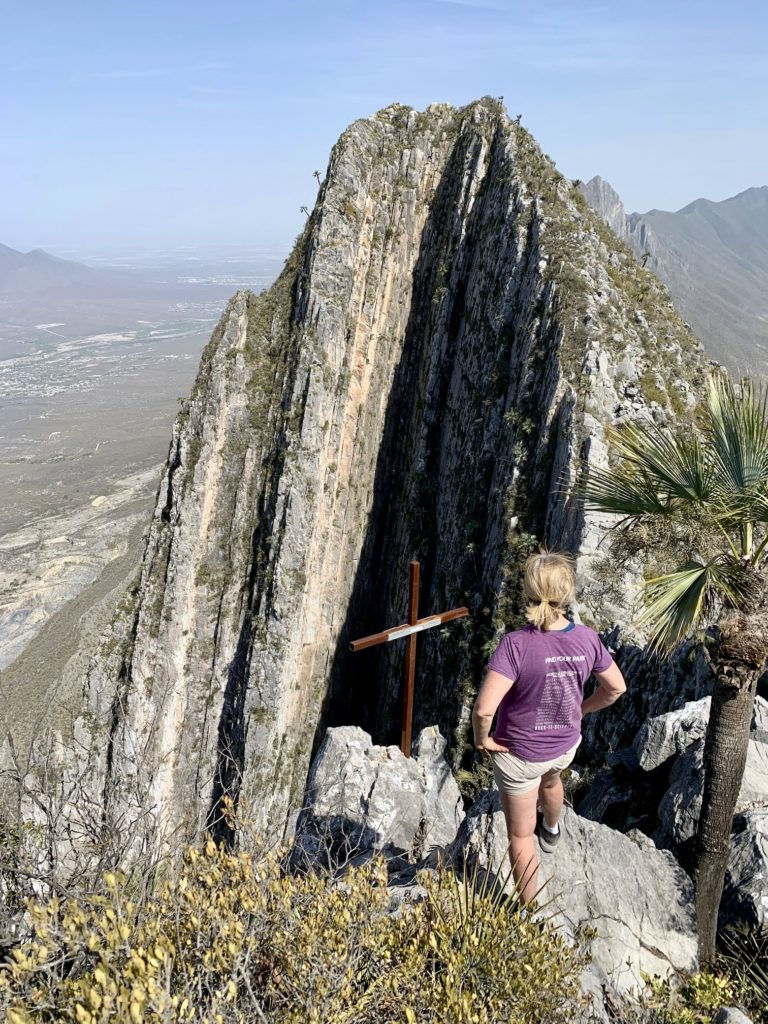
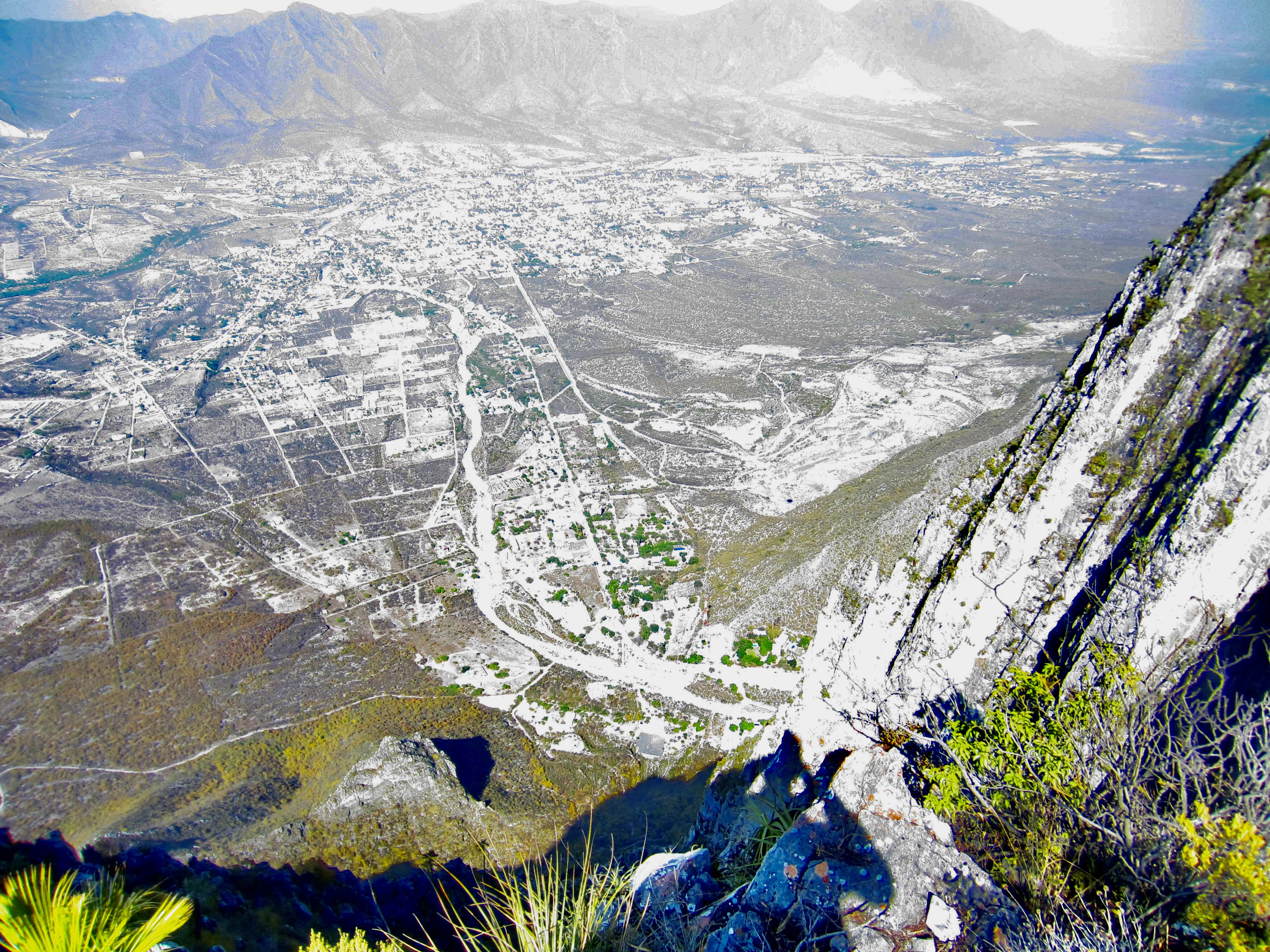
Our ridge scramble ended at a 4800-foot rocky knob (2.3 hours + 2400 feet from TH) situated closely west of, and 100 feet below, the summit horn of El Toro. This knob is decorated with two crucifixes and is blessed with a marvelous view of El Toro’s fantastic north face. Through the hazy air, we could also see the pyramidal summit of Viatores over to the west and the town of Hidalgo down to the northeast.
.
.
.
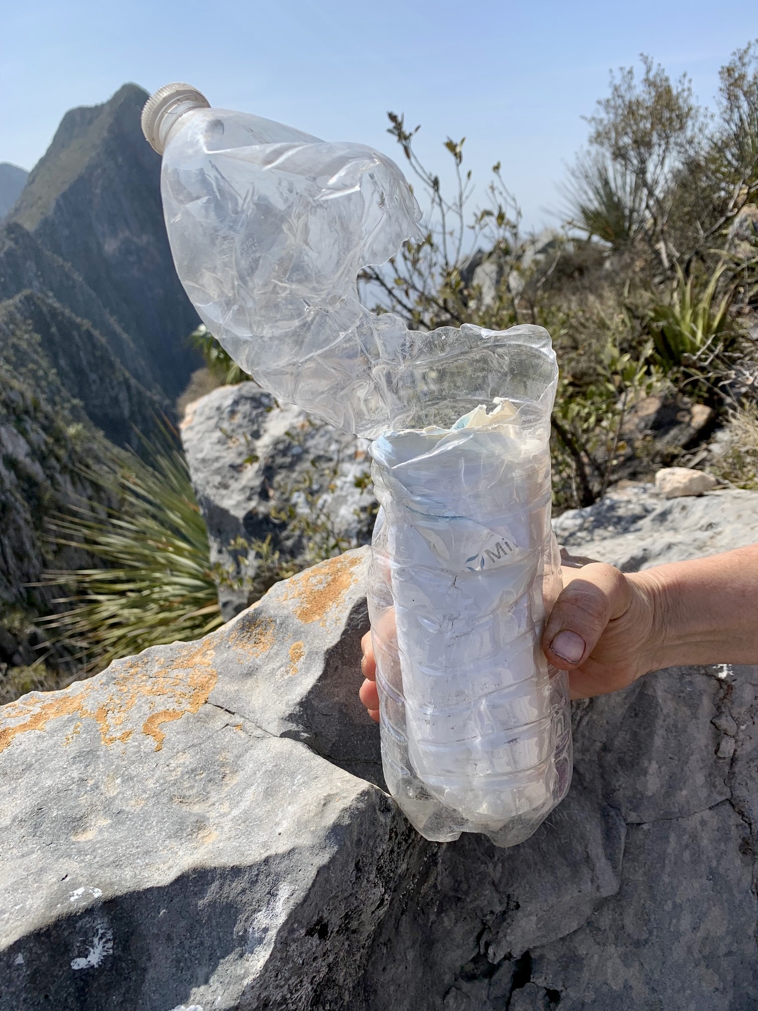
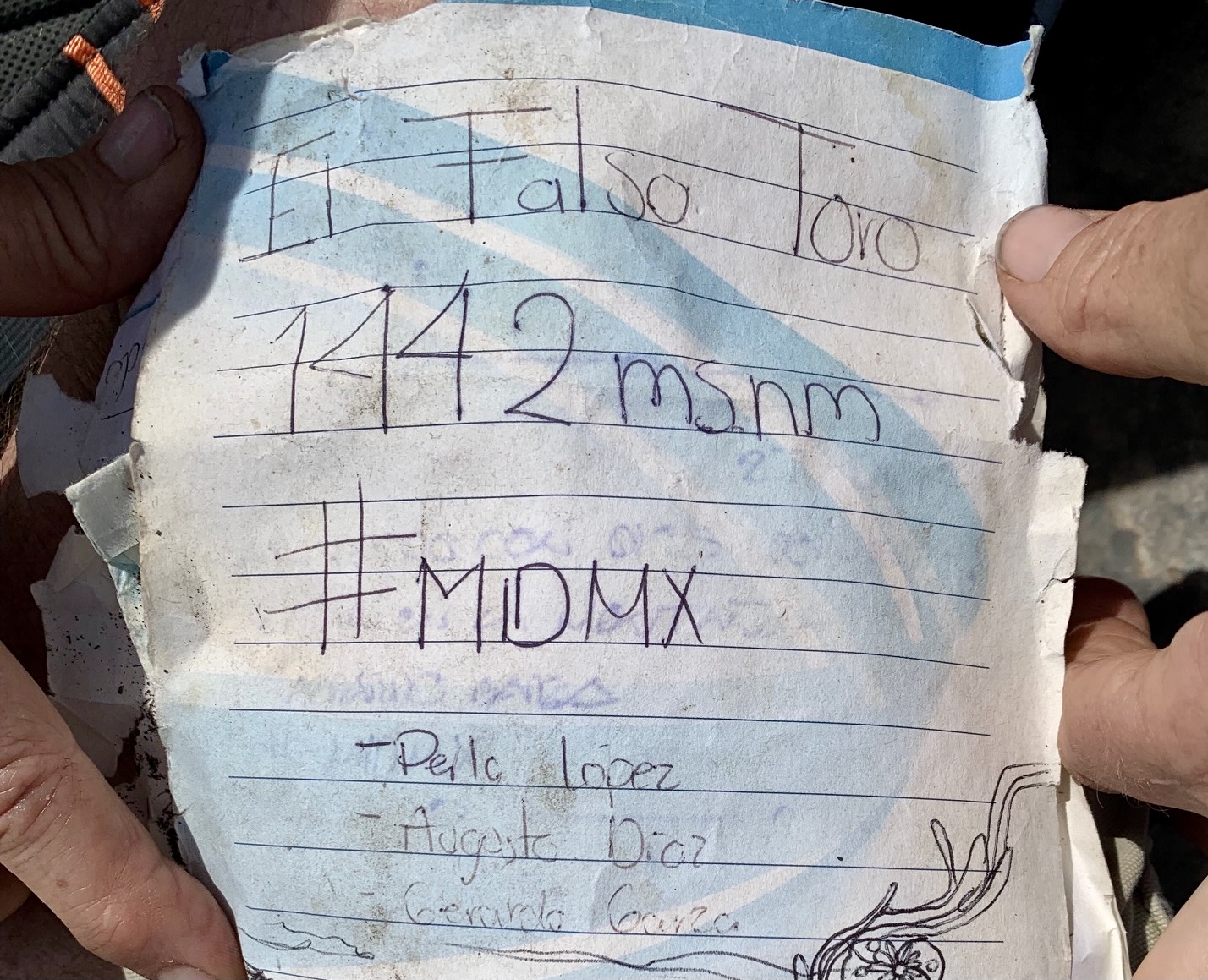
Atop the knob, we found a hiker’s register consisting of a paper pad stuffed into a cheap water bottle. The register identified our location as “El Falso Toro” and showed hundreds of entries over the past couple years. Clearly, this is the El Toro Viewpoint that is intended but mislocated on several maps.
.
Our descent took almost as long as our ascent, due to the steep and rocky nature of the trail. By the time we reached the trailhead (2.2 hours from top), evening sun was highlighting El Toro’s southwestern face. It felt like a perfect way to end our Potrero Chico vacation.
…
Route Map & Profile
…
…
Photo Gallery
Click to enlarge…