Trip Date: September 29 – October 3, 2022
GOLDEN LARCH OUTING: SIMILKAMEEN MOUNTAINS
Cathedral Lakes Hiking & Climbing Loop: Tungsten Creek to Remmel Creek
Chewuch River Valley fka Chewack River Valley
Tungsten Mine
Apex Pass
Cathedral Pass
Cathedral Lakes Basin
Cathedral Peak (8601 ft)
Amphitheater Meadows
Remmel Lake
Remmel Mountain (8685 ft)
- Trip Report Summary
- Related Post
- Full Trip Report
- Day 1: Trailhead to Cinch Creek
- Day 2: Cinch Creek to Upper Cathedral Tarn
- Day 3 (AM): Cathedral Peak Climb
- Day 3 (PM): Upper Cathedral Tarn to Cathedral Creek
- Day 4: Cathedral Creek to Coleman Ridge Trail Junction + Remmel Mtn Hike
- Day 5: Coleman Ridge Trail Junction to Trailhead
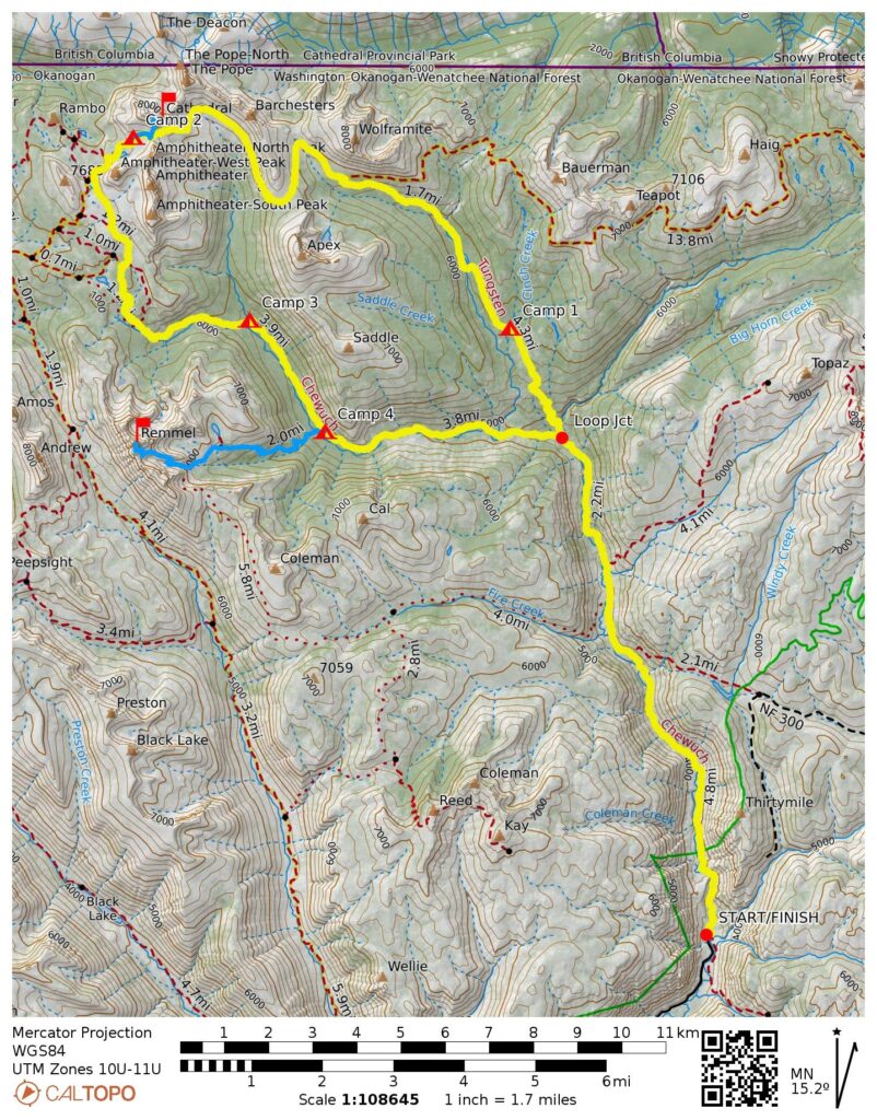
- Route Maps & Profile
- Photo Gallery
Trip Report Summary
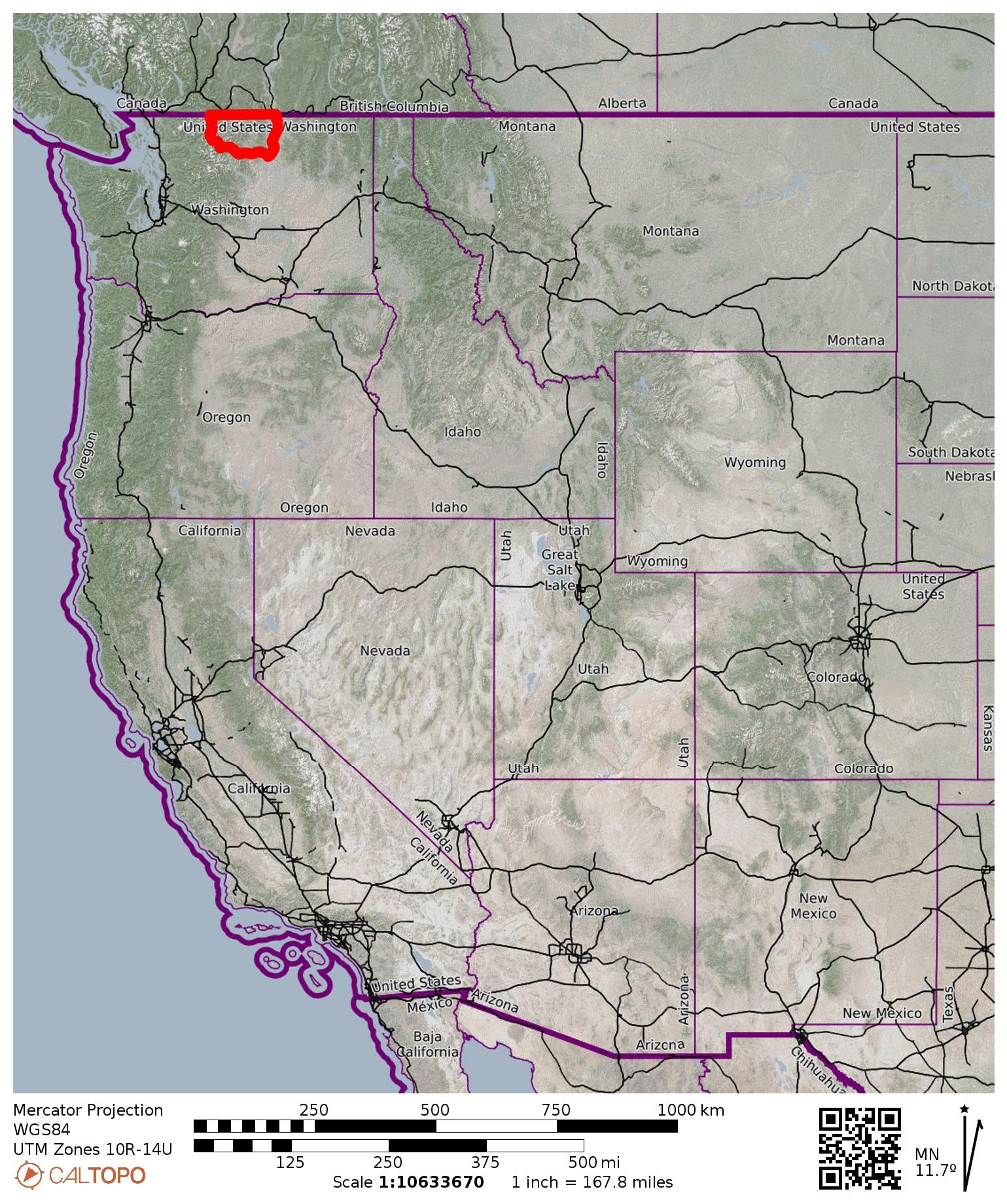
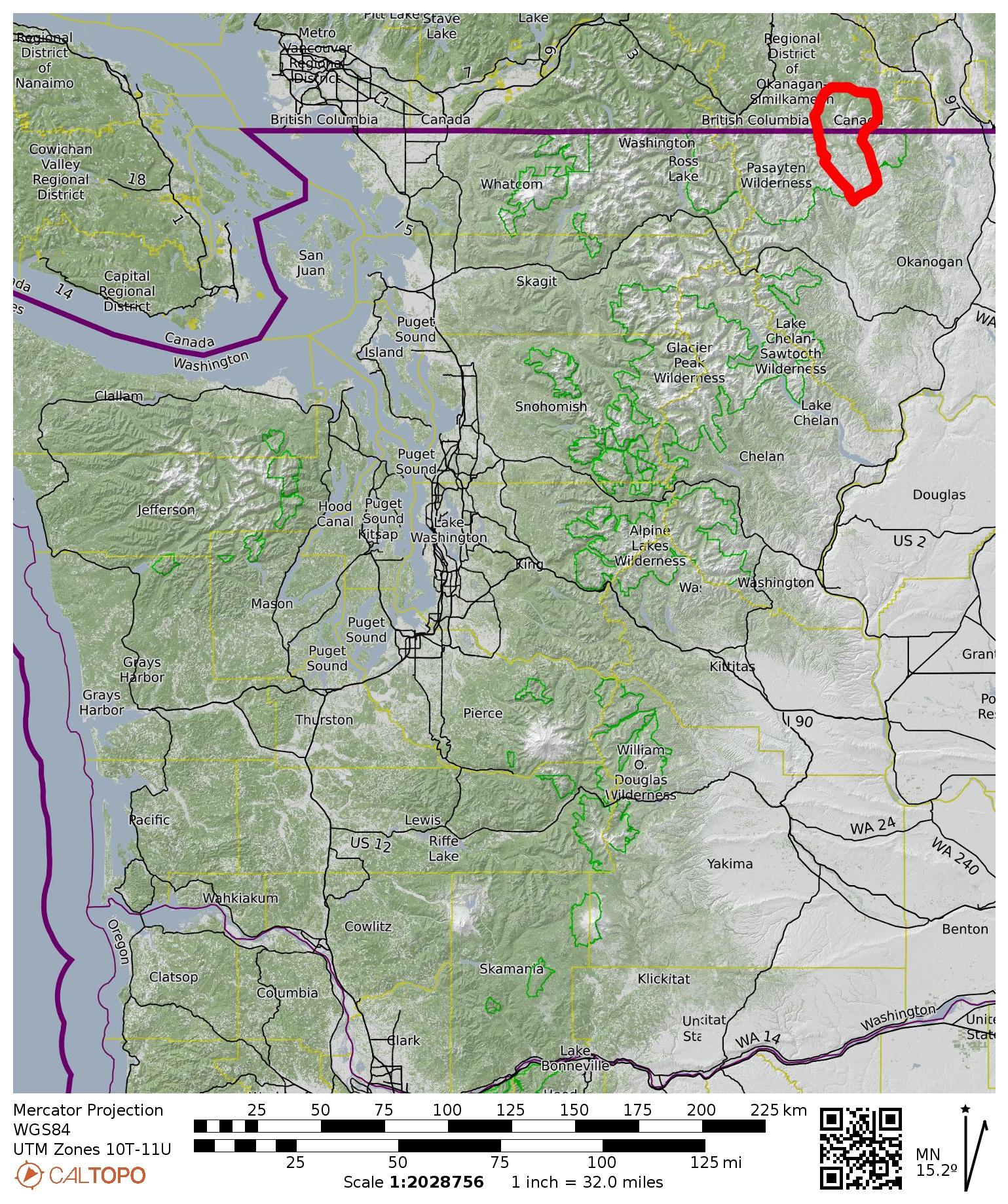
Region: Northeastern Washington Cascades
Sub-Region: Similkameen Mountains
Area: Pasayten Wilderness
Starting & Ending Point: Thirtymile Trailhead at end of Chewuch River Road #5160 (Elev. 3400 feet)
Way Points: Chewuch River Bridge & Chewuch Falls & Pocket Lake & Basin Creek & Horseshoe Creek & Tungsten Creek Trail junction & Cinch Creek & Tungsten Creek & Tungsten Mine & Apex Pass & Cathedral Pass & Upper Cathedral Tarn & Upper Cathedral Lake & Amphitheater Meadows & Lesamiz Trail / Remmel Lake Trail junction & Remmel Creek & Cathedral Creek & Chewuch River Trail / Coleman Ridge Trail junction & Tungsten Creek & Tungsten Creek Trail junction & Horseshoe Creek & Basin Creek & Pocket Lake & Chewuch River Bridge (trail hike & off-trail hike)
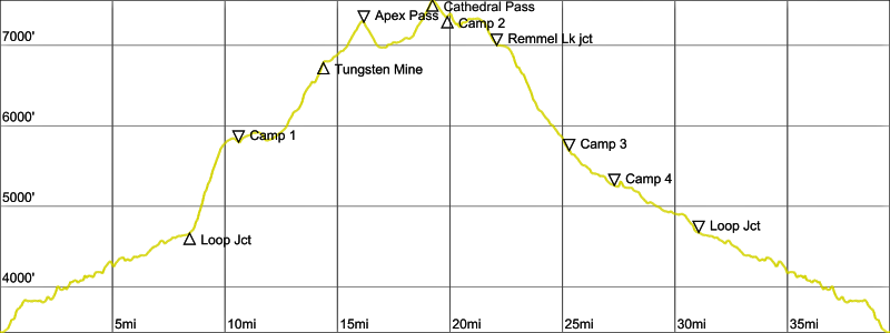
High Point: Cathedral Pass (Elev. 7600 feet)
Campsites: Cinch Creek & Upper Cathedral Tarn & Tungsten Creek / Cathedral Creek confluence & Chewuch River Trail / Coleman Ridge Trail junction
Sidetrip: Cathedral Pass & Cathedral Ridge & Cathedral Peak summit (trail hike & off-trail hike & rock climb)
Summit: Cathedral Peak (ascent & descent via South Slope—West Ridge)
Sidetrip: Remmel Lake (trail hike)
Sidetrip: Four Point Lake Trail junction & Remmel Mountain Summit Trail junction & Remmel Mountain Meadow & Remmel Mountain summit (trail hike)
Summit: Remmel Mountain (ascent & descent via Southeast Side)
Approximate Stats (excluding sidetrips): 40.0 miles traveled; 5000 feet gained & lost.
Approximate Stats (including sidetrips): 50.5 miles traveled; 9700 feet gained & lost.
…
Related Post
Full Trip Report
For this year’s annual Golden Larch Outing, Yoko, Baram, Todd, Kellie, and Gordy joined Eileen and me on a 40-mile backpacking loop through the northeastern part of the Pasayten Wilderness. This was familiar territory for some of us but completely new territory for others. Either way, it provided an opportunity to soak in lots of autumn color and climb two major summits in the Similkameen Mountains. We enjoyed unseasonably warm weather and mostly clear skies, although there was much wildfire smoke obscuring distant views.

Day 1: Trailhead to Cinch Creek
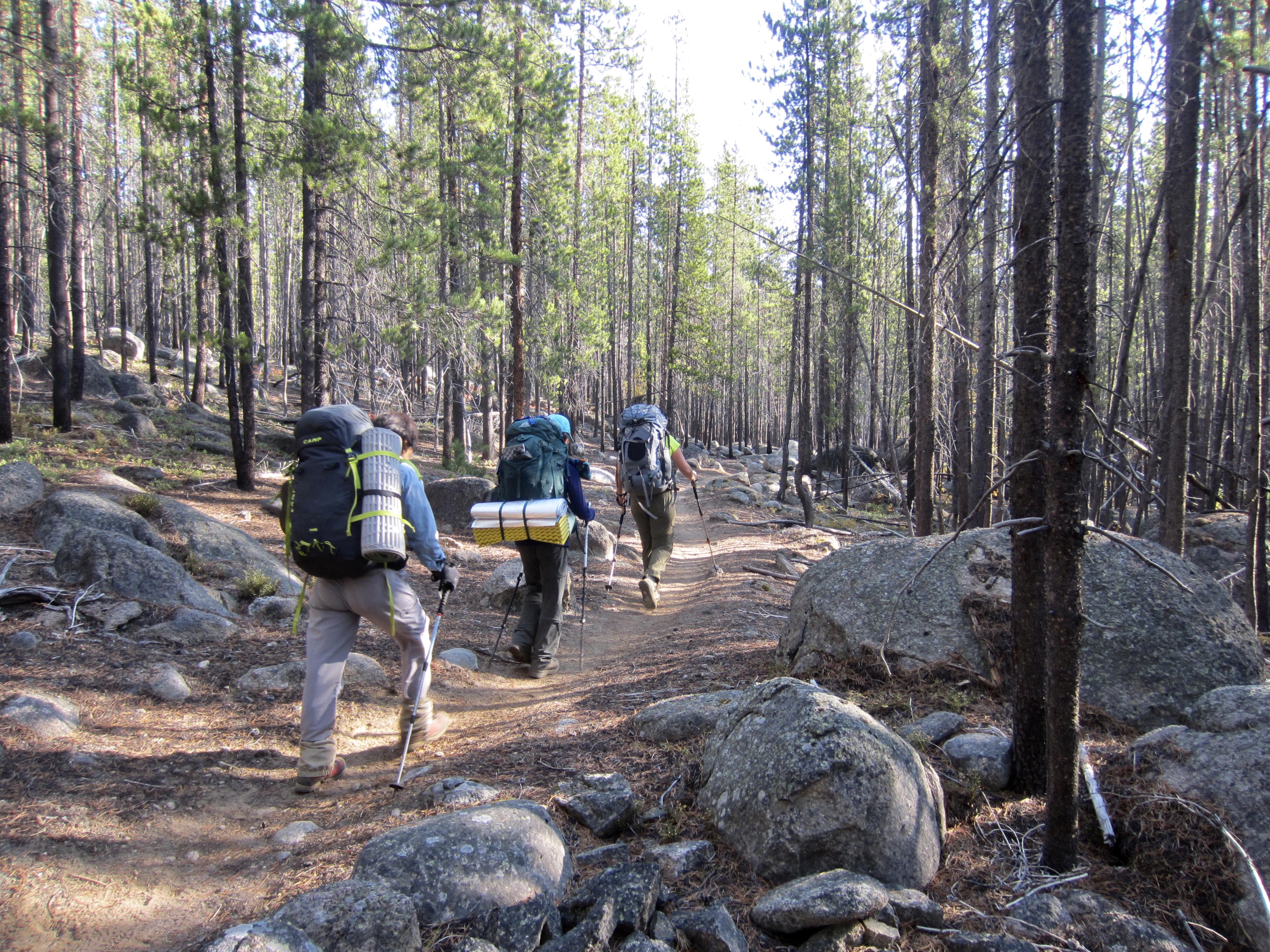
Yoko, Baram, Todd, Eileen, and I met at the Thirtymile Trailhead just before noon on a hazy Thursday. (Kellie and Gordy had arrived earlier this morning in order to get more miles behind them today.) Our quintet headed up the gently graded Chewuch River Trail, soon entering the Pasayten Wilderness and passing through a photogenic mixture of charred and uncharred forest.


After 8 miles of easy hiking, we crossed Horseshoe Creek and came to a key junction at 4700 feet. The Chewuch River Trail went left (east) toward Four Point Lake and Remmel Lake, whereas the Tungsten Creek Trail went right (north) toward Tungsten Mine and Apex Pass.


We took the latter trail, which immediately began switch-backing up a dry hillside. Shortly before 6:00pm, we stopped for the day at a comfortable 5800-foot campsite wedged between two branches of Cinch Creek (5.9 hours + 10.5 miles + 2450 feet from TH). Unbeknownst to us, Kellie and Gordy were camped at Tungsten Mine, just 4 miles up the trail.

Day 2: Cinch Creek to Upper Cathedral Tarn
We awoke to a cool, blue-sky morning, greatly pleased to see that yesterday’s smoky haze had cleared out. Back on the trail, we hiked up to Tungsten Mine and spent a full hour poking around the fascinating collection of ruins, which include concentrator, furnace, and boiler remnants. This mine was opened in 1908, a few years after the International Boundary Commission survey crew discovered tungsten deposits within the granitic bedrock here. Two common tungsten-bearing minerals are recognized in the names of nearby Wolframite Mountain and Scheelite Pass.


Closely uphill from the mine are two log structures that served as housing for the mine workers. As mining operations go, this location was probably regarded as particularly attractive. The smaller structure appears to be maintained by a volunteer group and is in good condition.


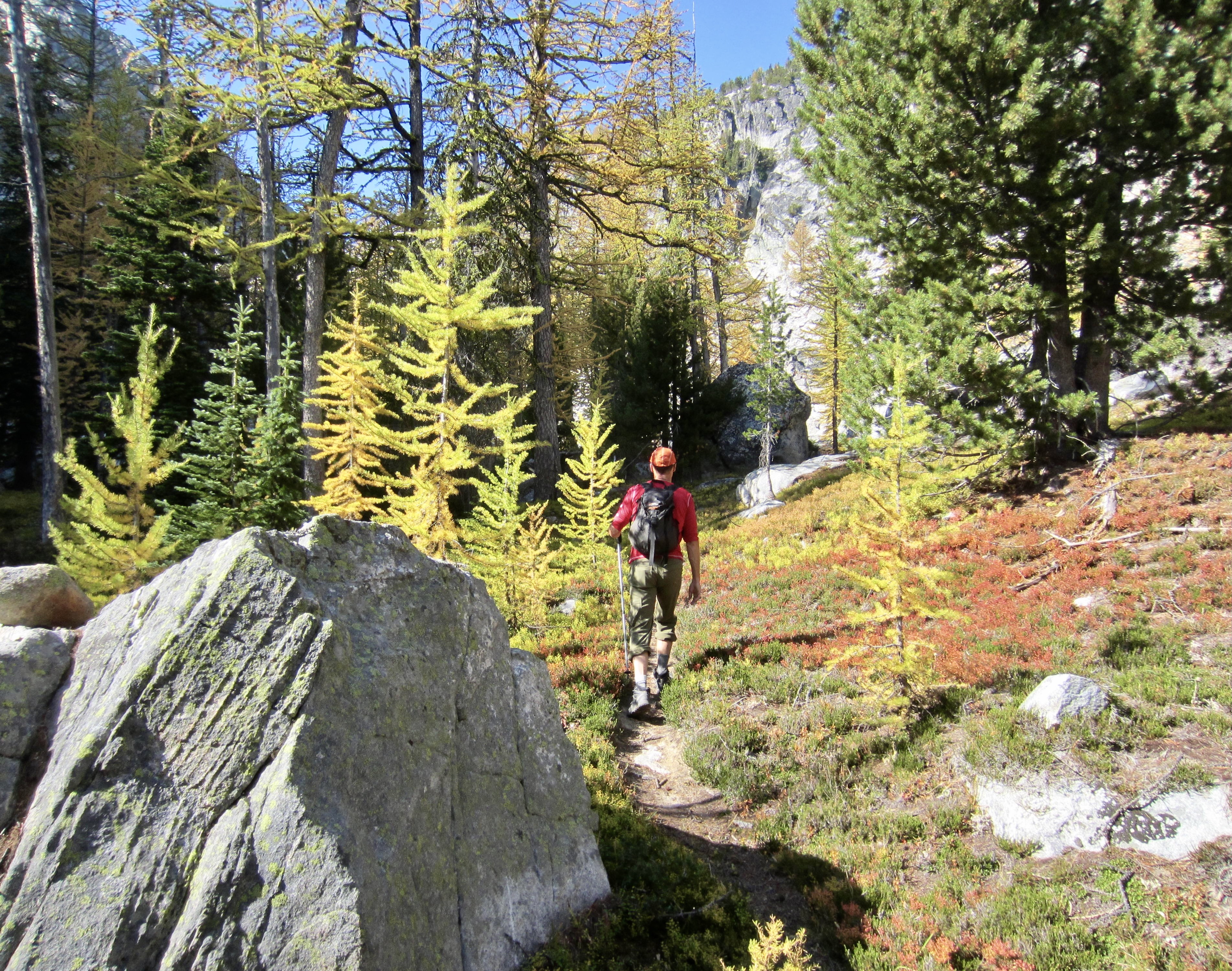
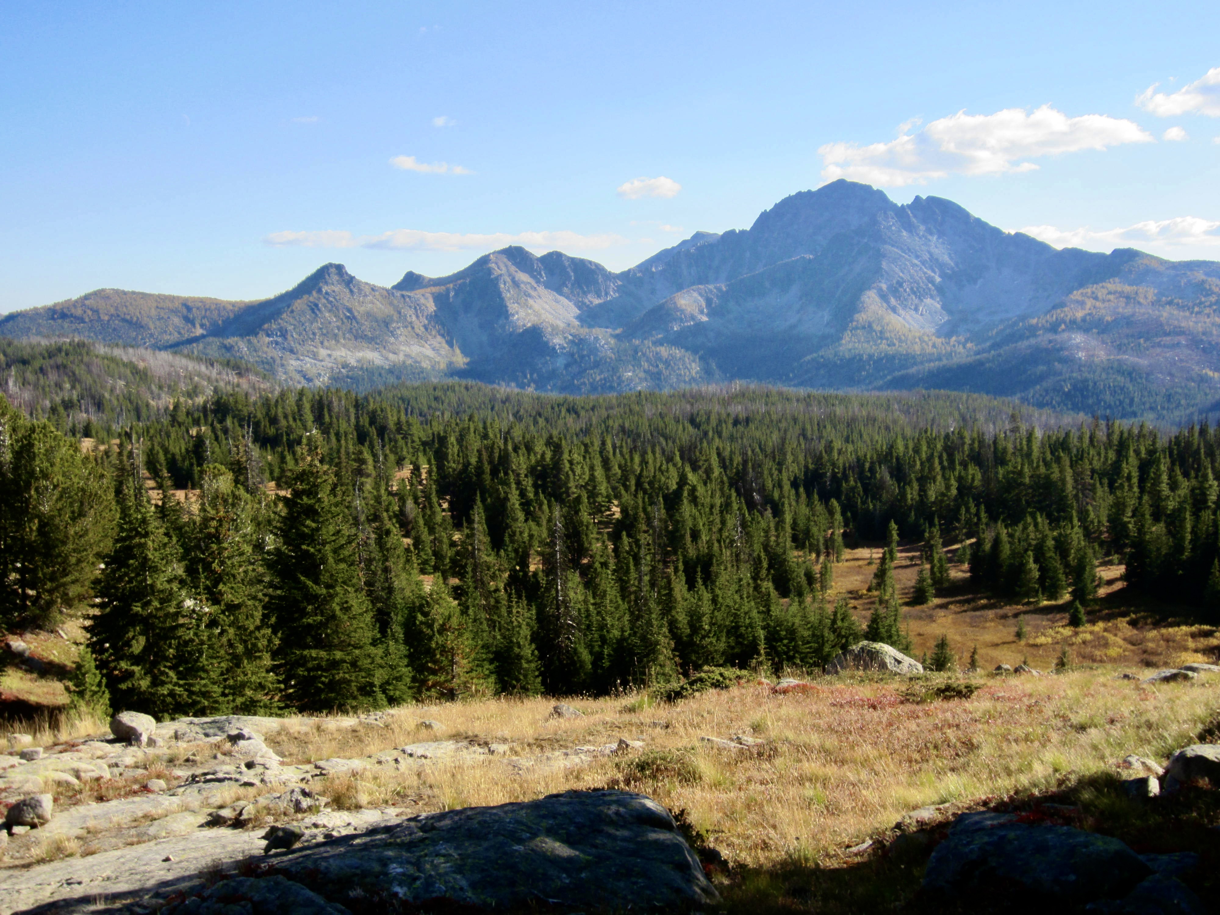
From Tungsten Mine, we turned westward on the Boundary Trail and hiked over 7300-foot Apex Pass. The astounding triangular façade of Cathedral Peak soon came into view, rising above the evergreen and larch forests of upper Cathedral Creek.


When seen from this southeastern vantage, Cathedral Peak bears a remarkable resemblance to certain versions of the famous Paramount Pictures logo.


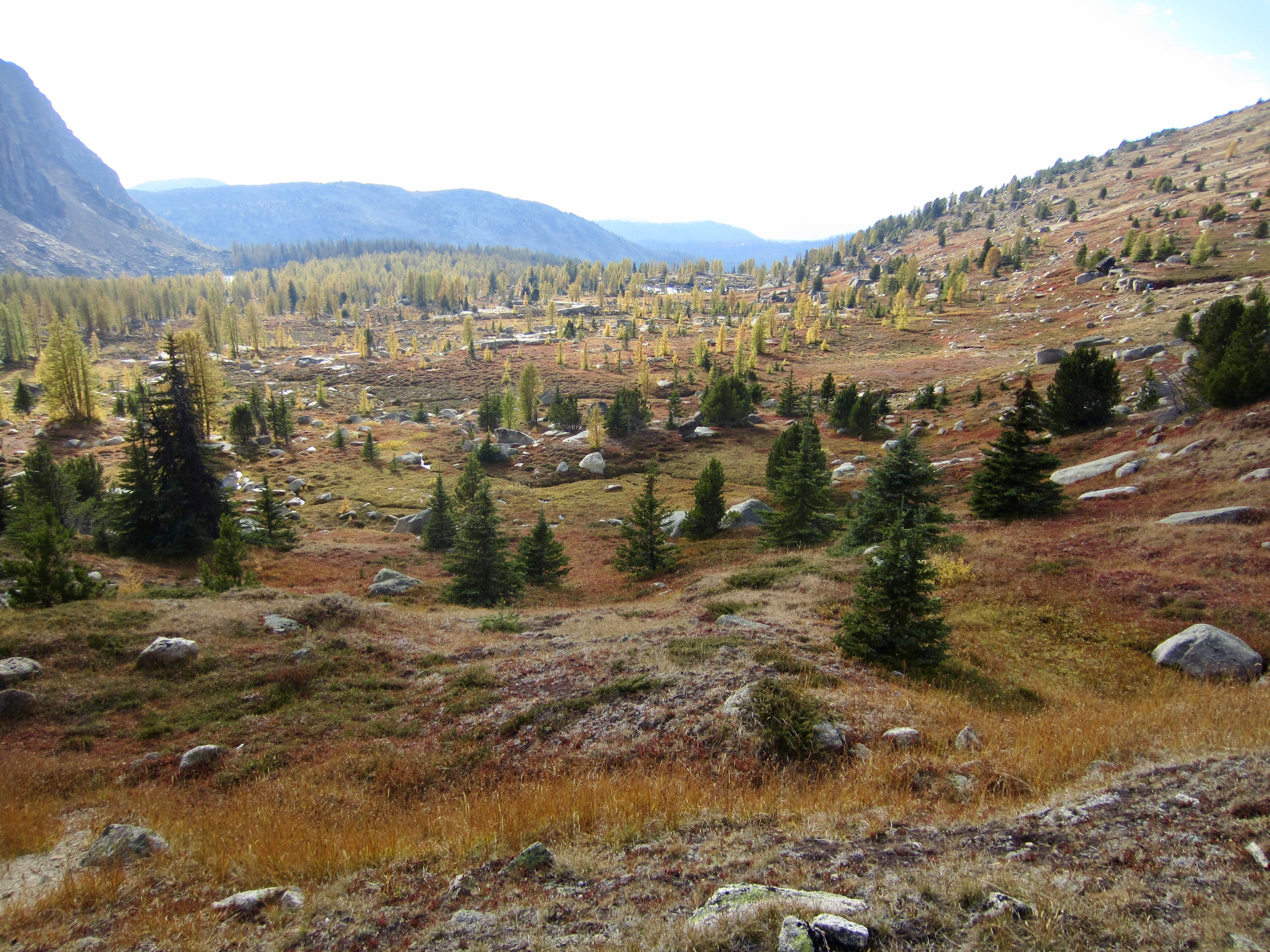
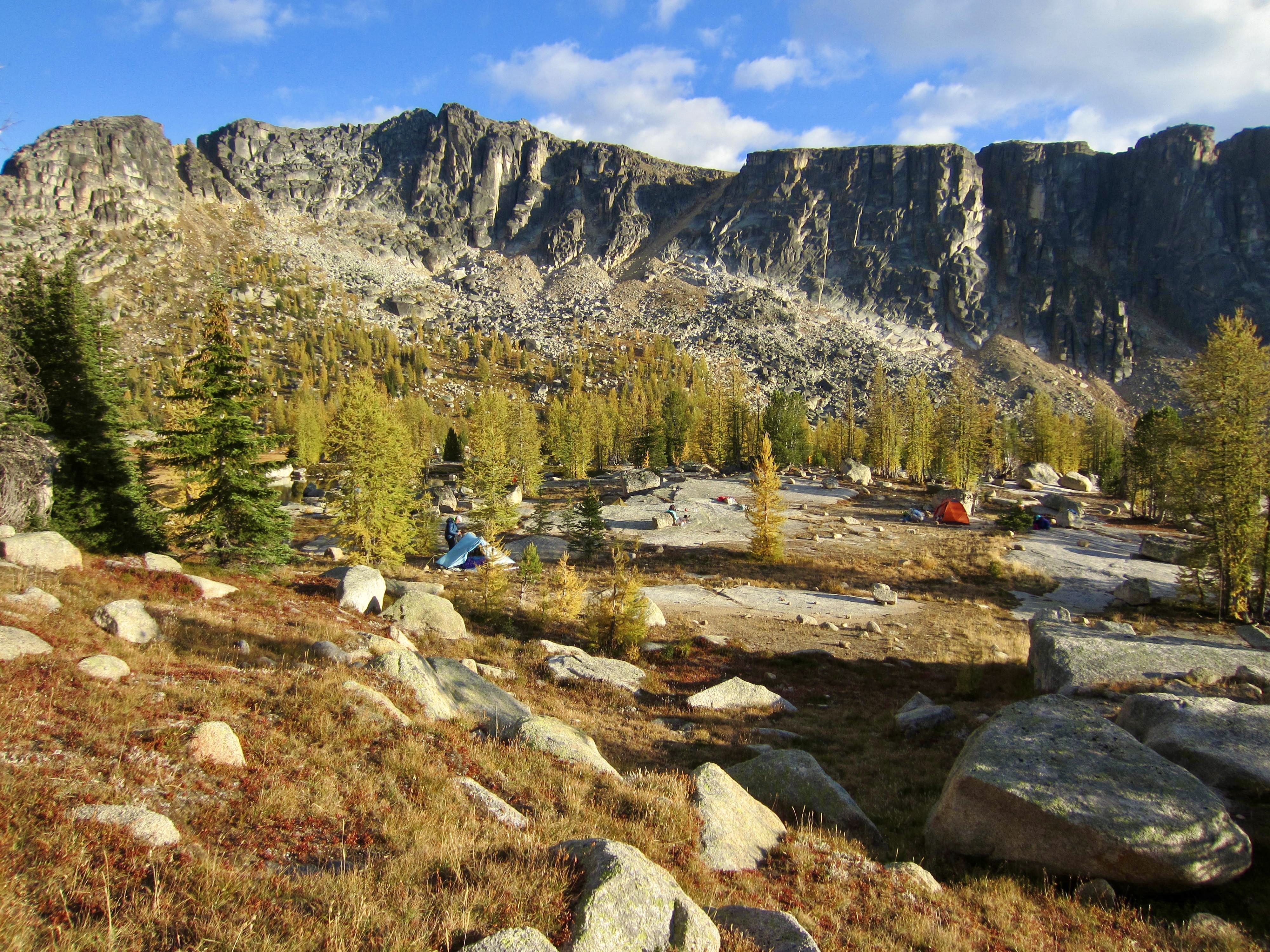
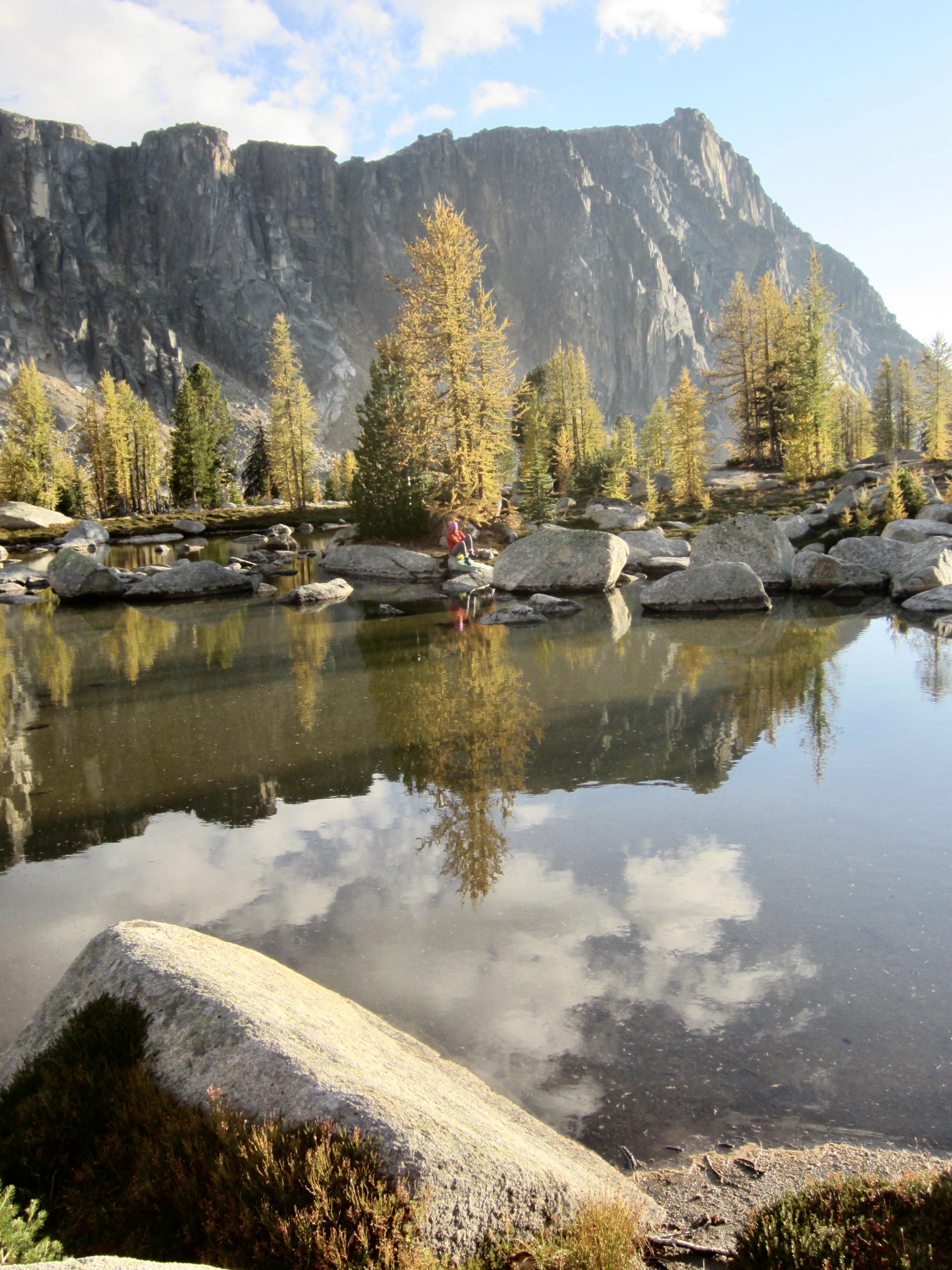
We continued hiking around the headwaters of Cathedral Creek and up to 7600-foot Cathedral Pass—the high point of our basic trail loop (excluding sidetrips). The layered granite walls of Cathedral Peak rose up to our right, and the grassy slopes of Cathedral Lakes Basin sprawled out in front of us.


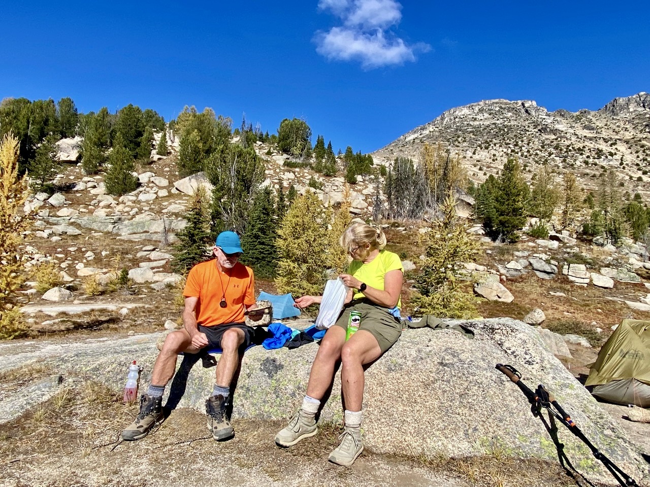
A short hike took us down to Upper Cathedral Tarn (7.1 hours + 9.5 miles + 2150 feet from Camp 1), where Kellie and Gordy were camped. They had scrambled up Amphitheater Mountain after arriving here in the morning. We exchanged updates about our past two days, then pitched our tents on granite slabs or gravel benches and spent the rest of our afternoon relaxing in camp.


Day 3 (AM): Cathedral Peak Climb
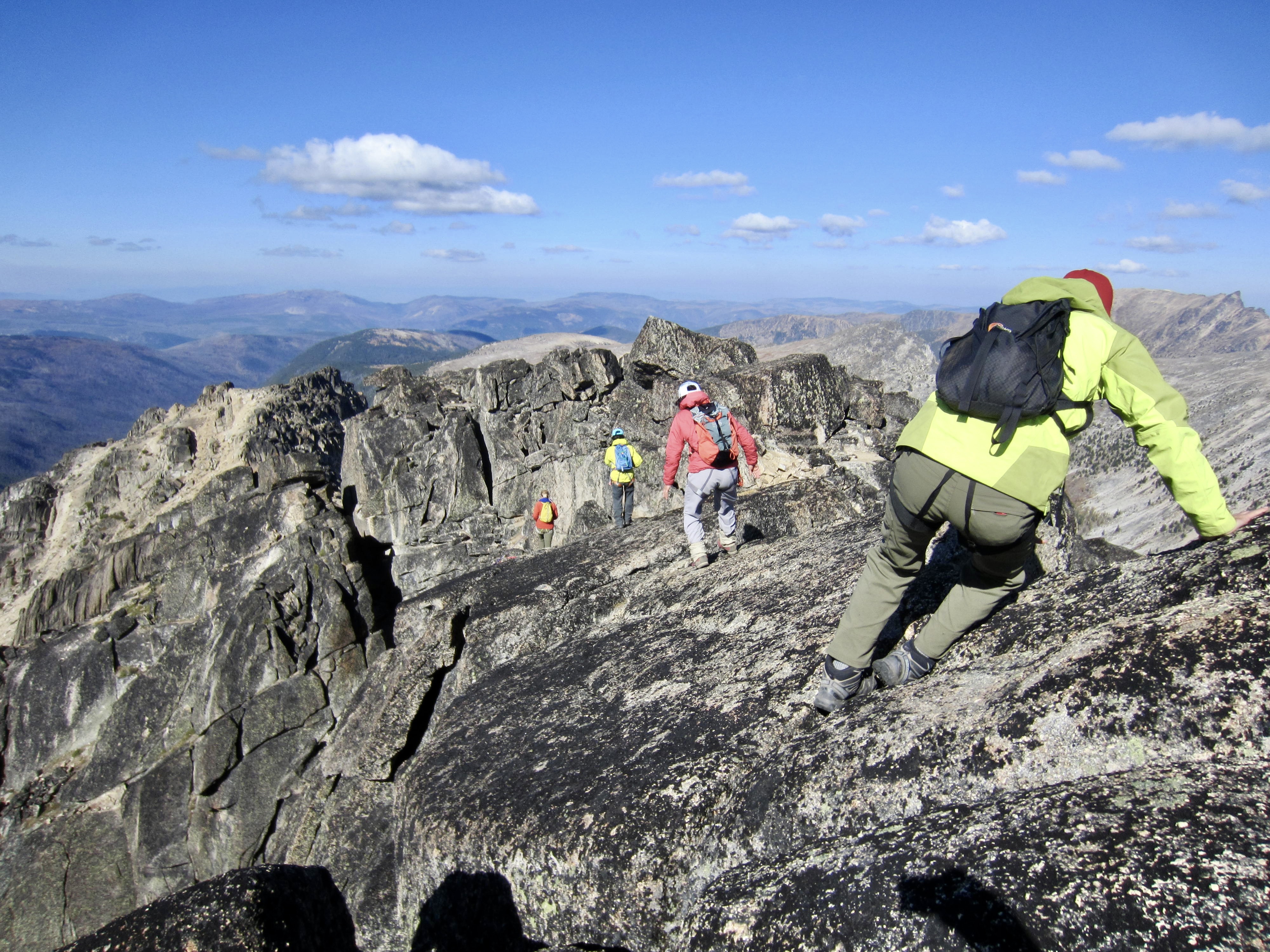
We ate breakfast together before dividing into two groups. Kellie and Gordy headed off at 8:00am to climb the classic and very technical Southeast Buttress route on Cathedral Peak. Baram, Yoko, Todd, Eileen, and I headed off a bit later to climb the equally classic but much easier West Ridge route on the same peak. We started by hiking back up to Cathedral Pass, then ascending sandy slopes and granite slabs toward the West Ridge.


A series of ducks and cairns directed us over Class 2-3 granite outcrops to a hidden cleft that runs parallel to, and just below, the peak’s West Ridge crest. Here, we pulled out our 15-meter scramble rope, and Eileen led a short Class 3-4 pitch up a narrow ramp to the crest.


A short scramble up the crest ended at the infamous step-across closely below the summit. This tricky move involves crossing back over the same rock cleft that we’d passed through minutes earlier, but here the cleft is breathtakingly deep. Anyone falling into it would get stuck like a giant cork! Even though I’d been here before (albeit 18 years ago), my memory was fuzzy, so we all spent some time assessing the move. Eventually, Eileen led across on belay and established a handline. The rest of us then crossed over the cleft using prusik slings for protection.


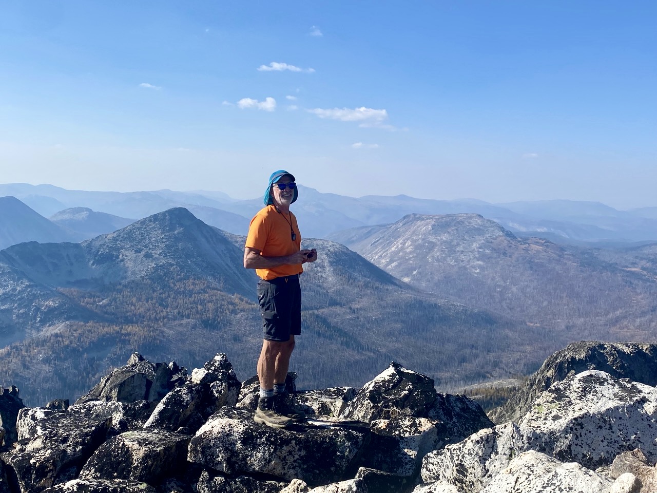
Once everyone was across the cleft, we walked up a tilted slab to the blocky summit. Visibility was better than expected, given the amount of wildfire smoke currently wafting over the Cascades. There was no summit register on top, but there was a survey marker placed by the International Boundary Commission crew circa 1904.


For our descent, we again used a handline and prusik slings to get back across the rock cleft. At a vertical step farther down, we discovered a cannonhole that provided a fun and entertaining alternative to our up-route. It was then a simple scramble and plunge-step down to our camp at Upper Cathedral Tarn (4.9 hours + 1100 feet RT).


Day 3 (PM): Upper Cathedral Tarn to Cathedral Creek
After breaking camp at the tarn, we headed southwestward through Cathedral Lakes Basin on the Boundary Trail, then we turned southeastward through Amphitheater Meadows on an unmarked trail. When our trail veered off toward Amphitheater Mountain, we simply strolled through the beautiful meadows until intersecting the Lesamiz Trail.


Along the way, we encountered a pair of hikers who had just come from Four Point Lake. They reported that the often-used cross-country shortcut over Four Point Saddle and down to Remmel Creek was littered with jack-straw trees, requiring several hours of horrible travel. We had intended to take that shortcut over to Four Point Lake today, but their description completely spooked us and prompted a quick change in plans!


Upon reaching a junction with the Chewuch River Trail, we dropped our backpacks and took a ½-mile sidetrip over to Remmel Lake. This lake sits in a shallow, park-like depression with a fine view of Remmel Mountain. The afternoon was so warm that Todd and I took a dip in the cold water—not something either of us can typically do on a Golden Larch Outing!

Following a restful hour-long sojourn at the lake, we returned to our backpacks and continued hiking down Remmel Creek. All of our trails traveled during the past 2½ days had been thoroughly logged out, but this upper segment of the Chewuch River Trail was spanned by numerous fallen trees. It appeared that horsemen had recently cut out all logs that would obstruct a horse but had left any logs that lay less than 2 or 3 feet off the ground; consequently, we were continually stepping over residual logs.

Although we had hoped to camp somewhere along Remmel Creek, there was no place to pitch even one tent, let alone three tents. We pushed on through fading light toward the confluence of Remmel Creek and Cathedral Creek in hopes of finding a patch of level ground there. Scant minutes before darkness, we rock-hopped across Cathedral Creek and immediately discovered a decent campsite within a cluster of fallen tree trunks (4.6 hours + 250 feet – 2000 feet from Camp 2). It wasn’t pretty, but it was surprisingly comfortable—especially considering that there was no other option.

Day 4: Cathedral Creek to Coleman Ridge Trail Junction + Remmel Mtn Hike
After a clear, cold night, we were heading down the Chewuch River Trail by 9:00am. This trail segment passes through a scorched forest and, like the previous segment, also appeared to be logged out for horse travel but not for human travel. On a positive note, it was reassuring to see thousands of tiny lodgepole pine trees sprouting up on both sides of the trail; nature was slowly but surely renewing the forest.

An hour of brisk hiking took us to a junction with the Coleman Ridge Trail, which provides access to Four Point Lake and Remmel Mountain. We dropped our backpacks at the trail junction, loaded up summit packs, and left a note for Kellie and Gordy, in case they came through here this morning.


Soon after heading up the trail toward Remmel Mountain, we encountered three hikers coming down from Four Point Lake. They warned us about lots of wind-felled trees across the trail, including a large jack-straw mess in the last ½ mile before the lake junction. They advised us to circumvent this mess on the uphill side. The trail was indeed in bad condition, but their advice was good. We worked around all of the fallen logs and arrived at the lake trail junction shortly after noon (1.8 hours + 1450 feet from pack stash).


After watering up at the junction and leaving another note for Kellie and Gordy, we continued up the Coleman Ridge Trail. This abandoned trail contours around the headwaters of Four Point Creek, then climbs to a discreet junction with the Remmel Mountain Summit Trail, which is marked only by a large cairn.


Although the Remmel Mountain Summit Trail is not shown on any map that I’ve ever seen, it remains in remarkably good condition and is extremely scenic. The lower part of the trail wanders through a gorgeous little meadow that was bursting with color on this October day. Some of the larches were near peak gold, whereas others appeared to be a week or two before their peak.


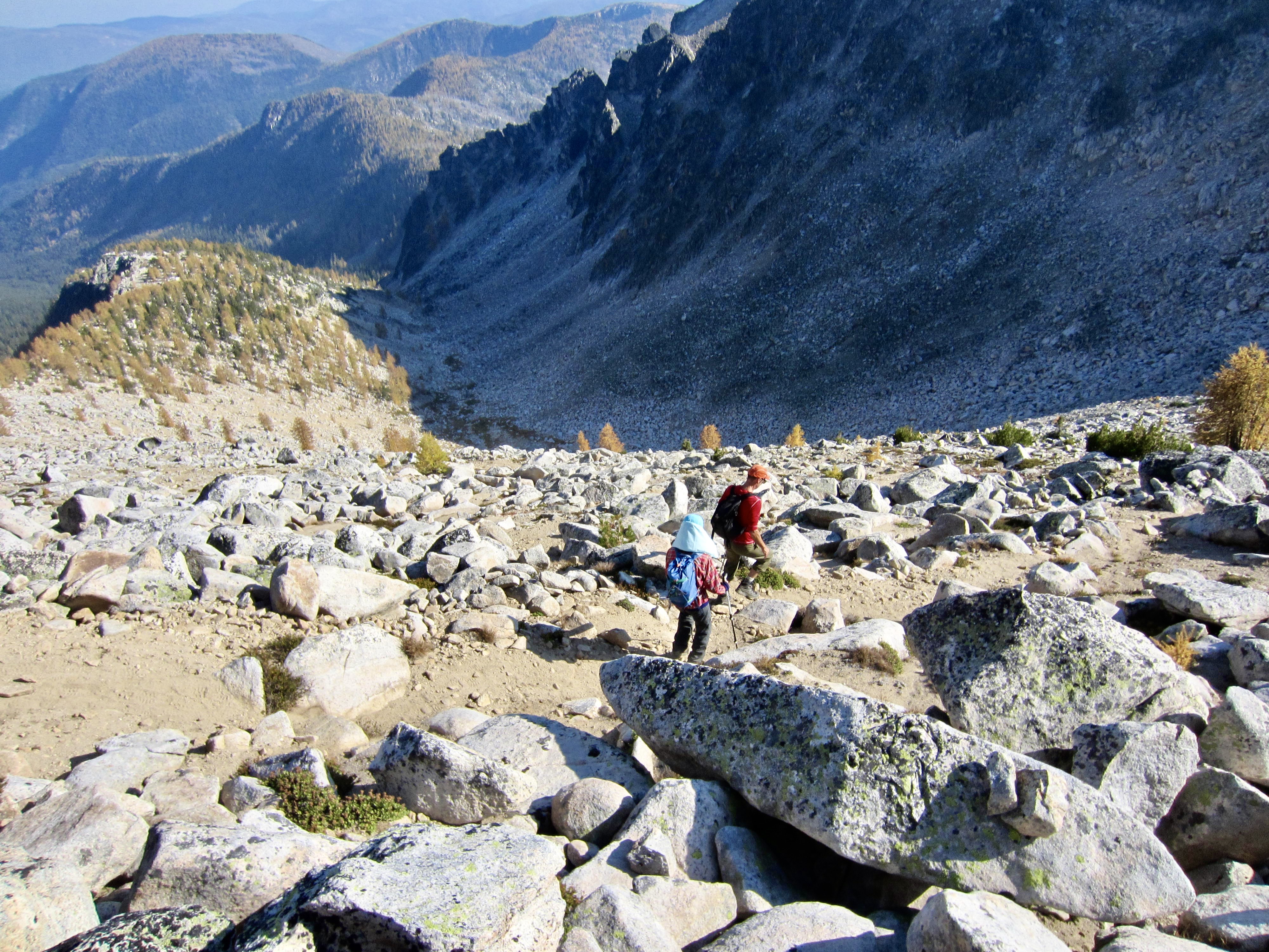
Above the little meadow, the trail begins climbing up a huge talus field on the southeastern slope of Remmel Mountain. This is a good example of a felsenmeer, or “sea of rock.” High on the rock slope, we encountered Kellie and Gordy hiking down from the summit. They had camped near Remmel Lake last night and then taken the cross-country shortcut to Four Point Lake this morning. In understated climber fashion, they described the shortcut as “character building”; however, it was still a full hour faster than our trail route.


After agreeing on a later rendezvous spot, Kellie and Gordy continued their descent while the rest of us proceeded upward. We arrived at the lofty summit in mid-afternoon (3.9 hours + 3350 feet from pack stash). Remmel Mountain is the most prominent peak in the Pasayten Wilderness, but unfortunately, our views today were limited to about 10 or 15 miles due to smoke and haze. Scattered nails, bits of glass, and small chunks of wood presented evidence of the fire lookout cabin that resided here for 20 years, from 1932 to 1952.


Following a half-hour summit break, we headed back down the trail and reached our pack stash at the Chewuch River Trail / Coleman Ridge Trail junction around 6:00pm (3.2 hours from summit). Gordy and Kellie had arrived an hour earlier and pitched their tent in the adjacent forest. The rest of us followed suit, then we all convened on the trail bank for dinner.


Day 5: Coleman Ridge Trail Junction to Trailhead
Upon waking to the coldest morning of our trip, we began a 12-mile hike down the Chewuch River Trail. The day warmed up rather quickly and soon felt very summery, but this was contrasted by the autumnal foliage alongside the trail.


We reached the trailhead in mid-afternoon (6.1 hours + 300 feet – 2100 feet from Camp 4) to conclude a very fun, scenic, and successful Golden Larch Outing.
Route Maps & Profile

…
…
…
Photo Gallery
Click to enlarge…