Trip Date: September 9-13, 2022
Northern Loop Hiking & Climbing Trip
Skyscraper Pass
Skyscraper Mountain (7078 ft)
Mystic Lake
Mystic Pass
Old Desolate (7137 ft)
Carbon River Suspension Bridge
Windy Gap
Sluiskin Mountain: The Chief aka The Sluiskin Chief (7026 ft)
Lake James
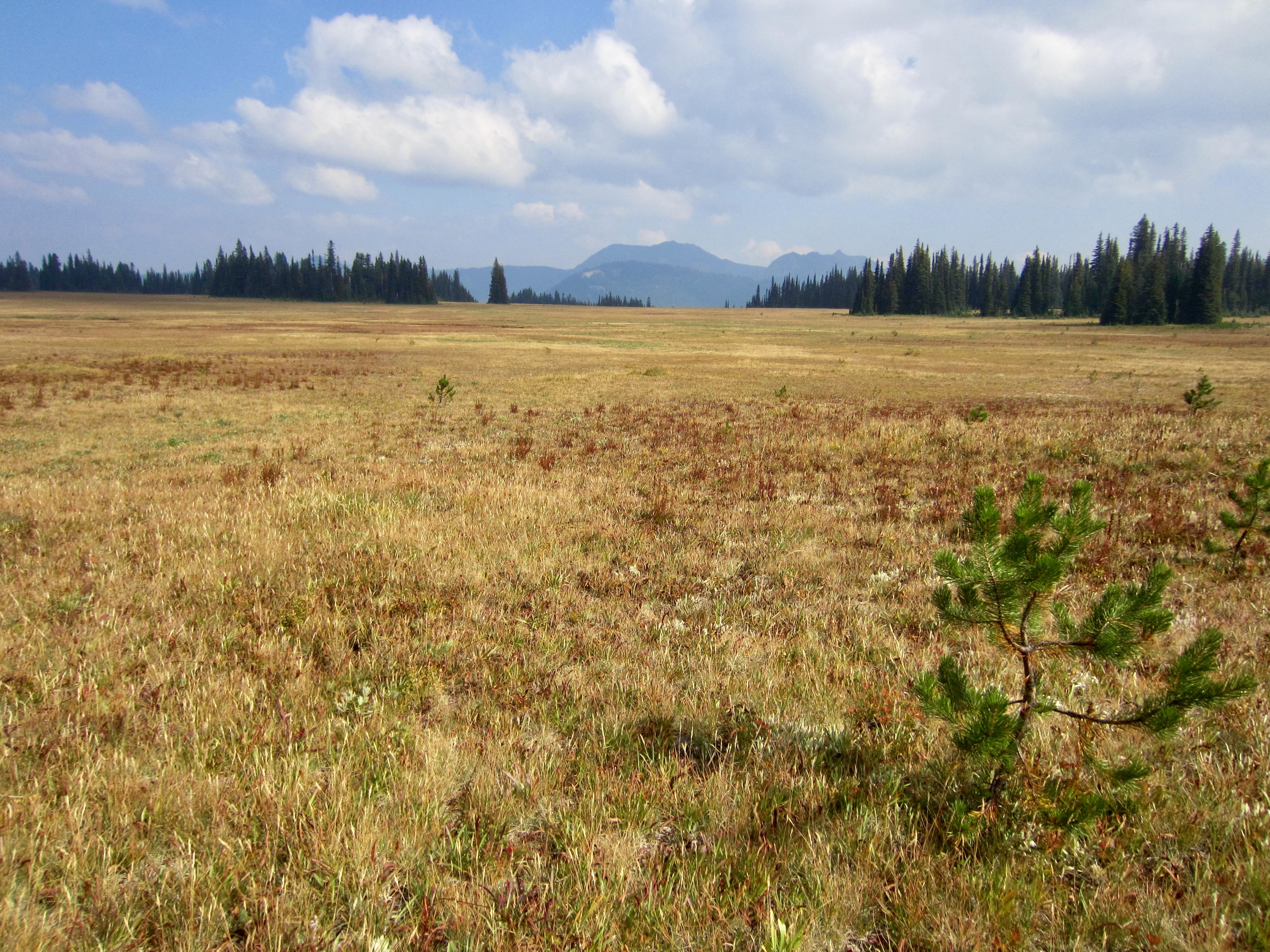
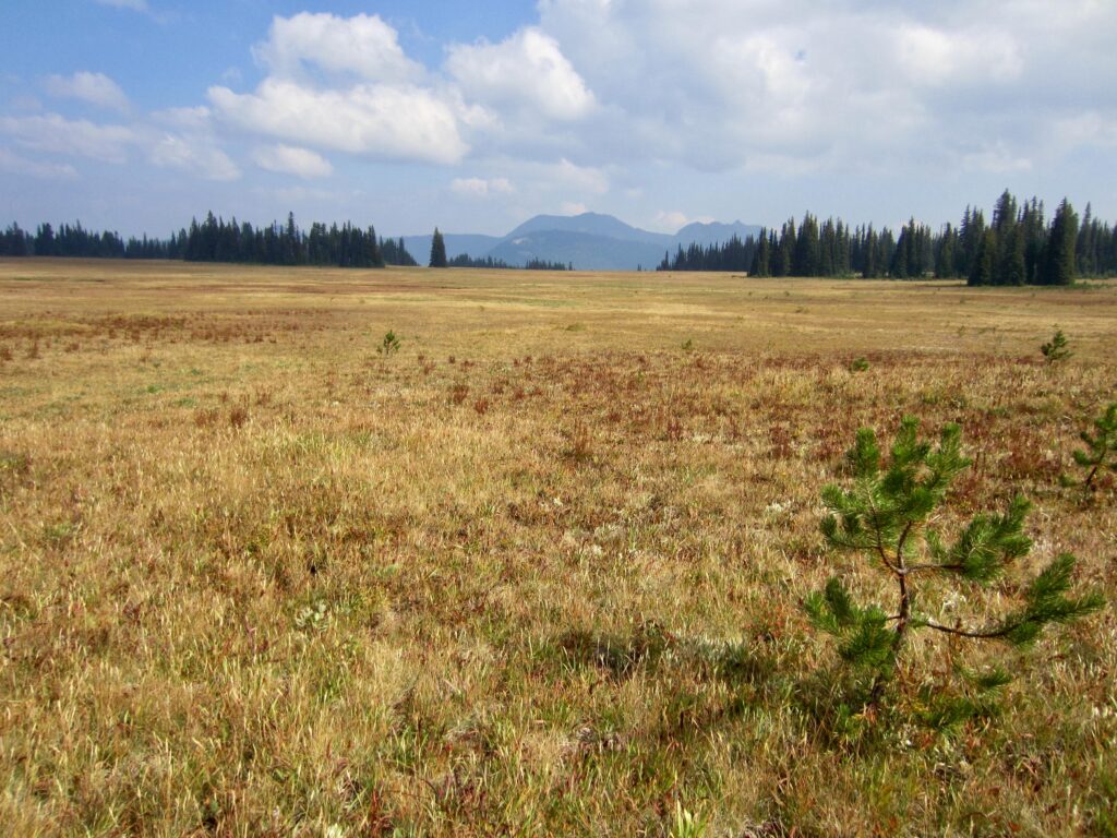
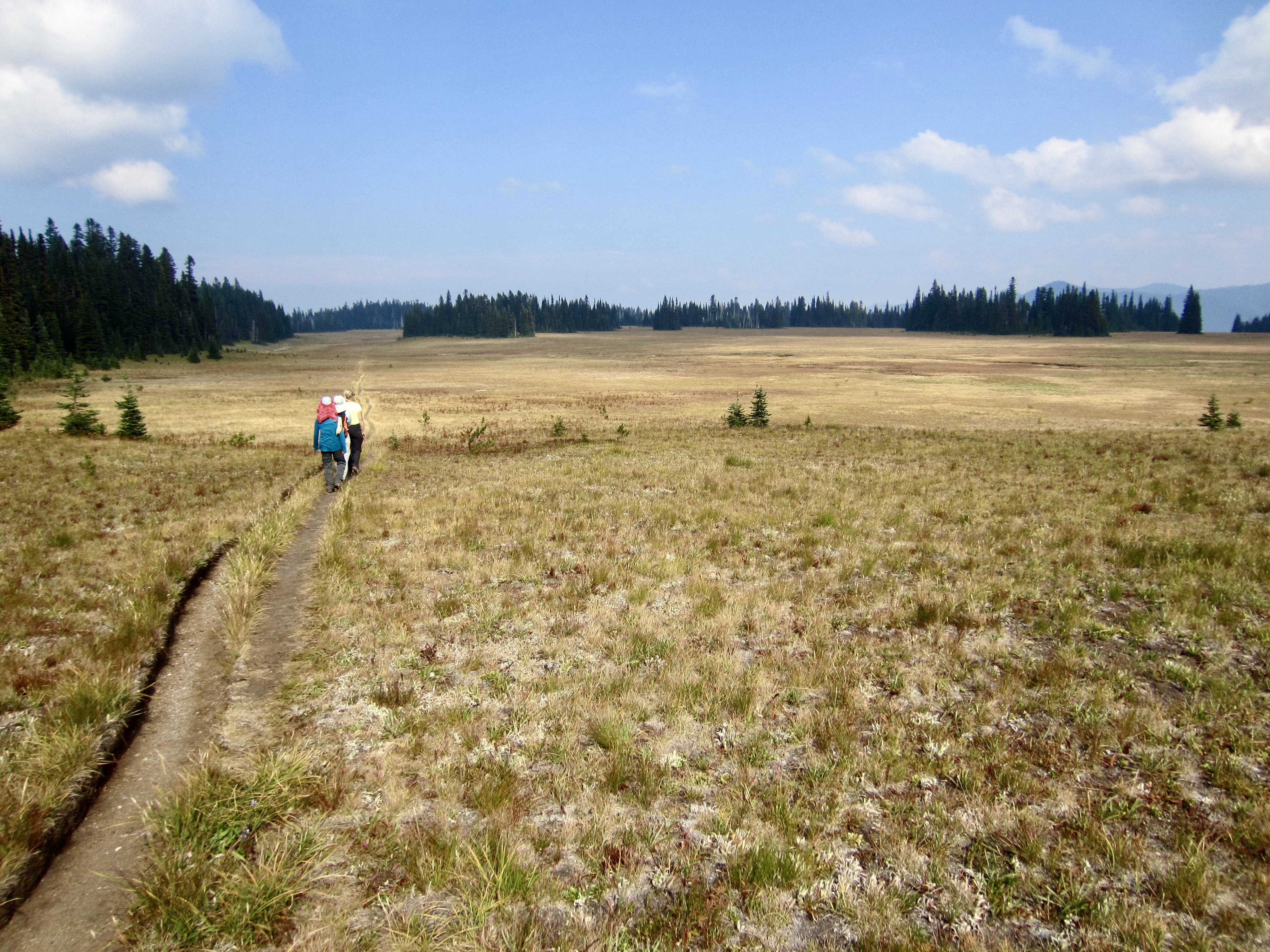
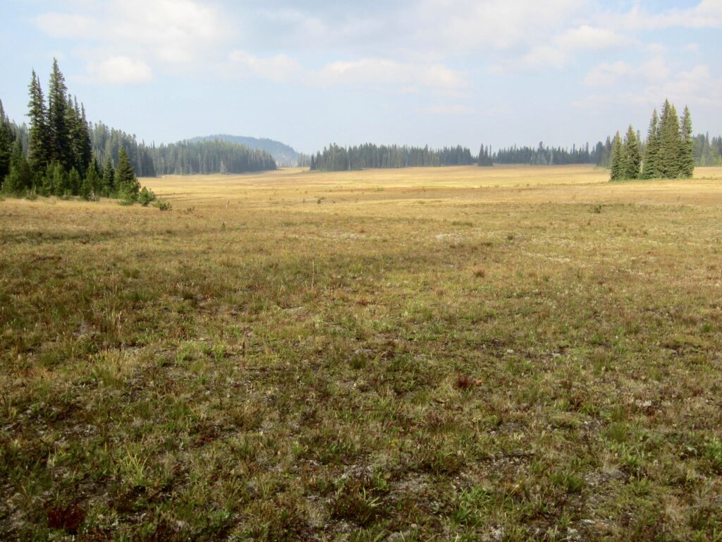
Grand Park
- Trip Report Summary
- Related Posts
- Full Trip Report
- Day 1: Sunrise to Mystic Lake Camp + Skyscraper Mtn
- Day 2: Mystic Lake Camp to Yellowstone Cliffs Camp + Old Desolate
- Day 3: Yellowstone Cliffs Camp to Lake James Camp + Sluiskin Chief
- Day 4: Lake James Camp to Berkeley Park Camp + Grand Park
- Day 5: Berkeley Park Camp to Sunrise
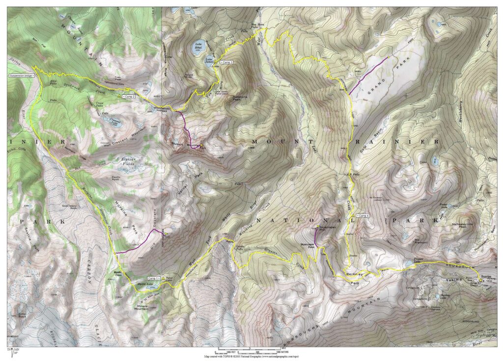
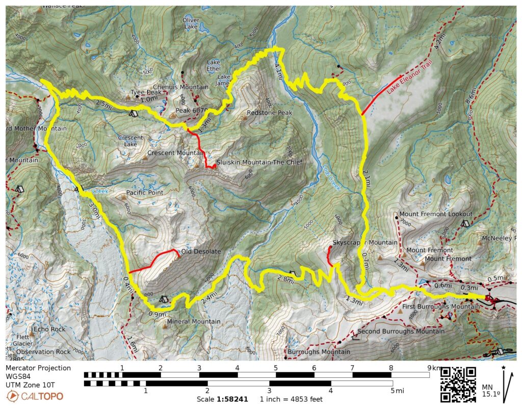
- Route Maps & Profile
- Photo Gallery
Trip Report Summary
Region: Southern Washington Cascades
Sub-Region: Mt. Rainier Massif
Area: Mt. Rainier National Park
Starting & Ending Point: Sourdough Ridge Trailhead at Sunrise Visitor Center at end of Sunrise Park Road (Elev. 6400 feet)
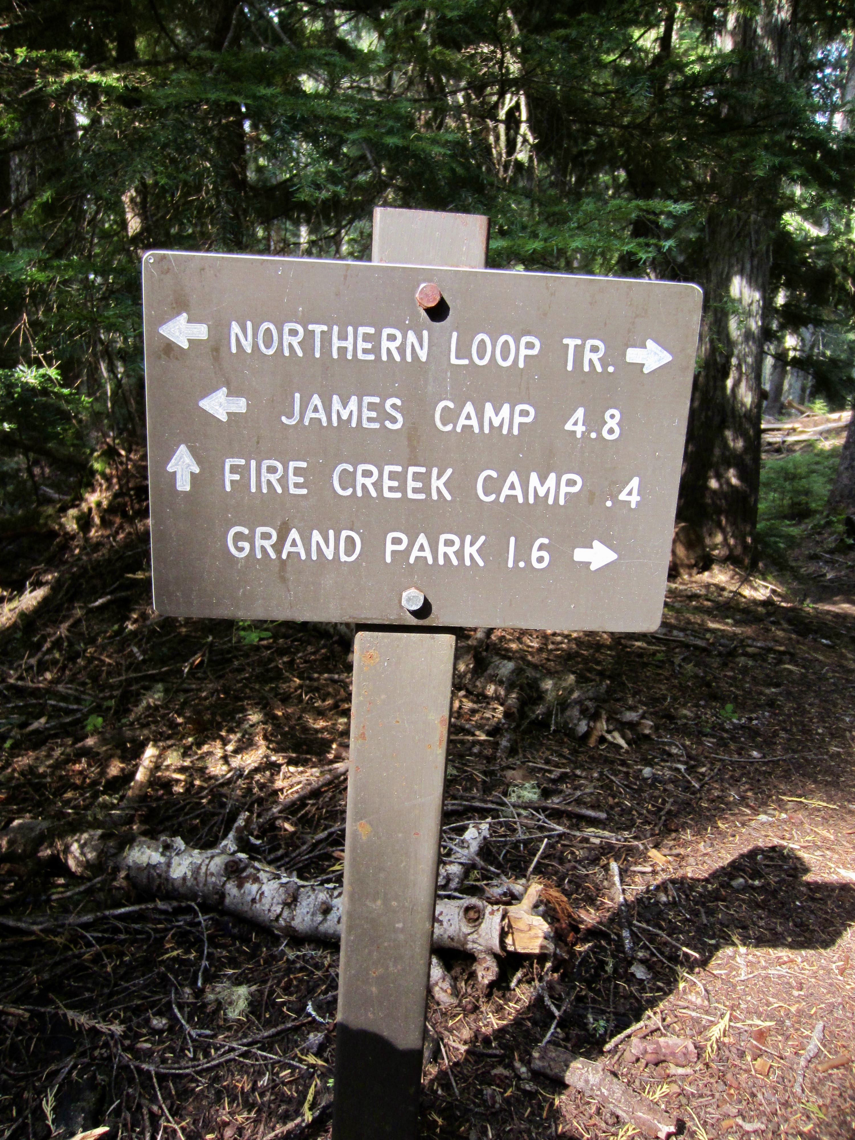
Way Points: Yakima Park & Frozen Lake & Berkeley Junction & Berkeley Park & Skyscraper Pass & Granite Creek & Garda Falls & Winthrop Creek & West Fork White River & Mystic Lake Camp & Mystic Lake & Mystic Pass & Moraine Creek Meadow & Moraine Creek & Dick Creek & Carbon Glacier Viewpoint & Carbon River Suspension Bridge & Spukwush Creek & Yellowstone Cliffs Camp & Windy Gap & Van Horn Creek & Lake James Camp & West Fork White River & Grand Park Junction Lodi Creek & Berkeley Park Camp & Lodi Creek Meadow & Berkeley Park & Berkeley Junction (trail hike)
High Point: Skyscraper Pass (Elev. 6750 feet)
Campsites: Mystic Lake Camp & Yellowstone Cliffs Camp & Lake James Camp & Berkeley Park Camp
Sidetrip: Skyscraper Mountain summit (off-trail hike & rock scramble)
Summit: Skyscraper Mountain (off-trail hike & rock scramble via South Ridge)
Sidetrip: Moraine Park & Old Desolate summit (off-trail hike & rock scramble)
Summit: Old Desolate (rock scramble via West Slope—Northwest Ridge)
Sidetrip: Van Horn Basin & Sluiskin Saddle & Sluiskin Chief summit (trail hike & off-trail hike & rock scramble & rock climb)
Summit: The Sluiskin Chief (rock scramble & rock climb via West Slope—North Ridge)
Sidetrip: Grand Park (trail hike)
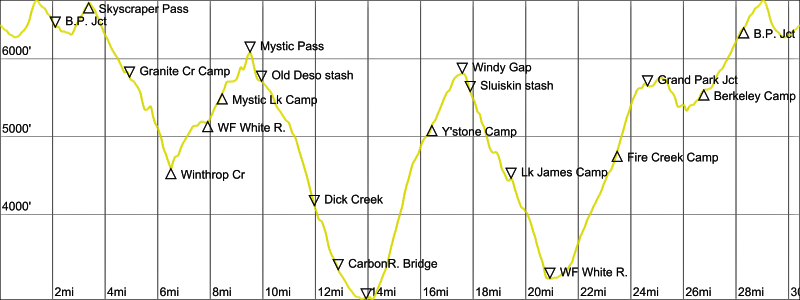
Approximate Stats (excluding sidetrips): 31.2 miles traveled; 9500 feet gained & lost.
Approximate Stats (including sidetrips): 38.0 miles traveled; 13,300 feet gained & lost.
Related Posts
>>> Sluiskin Mountain: The Chief via West Slope—North Ridge – September 2005
>>> Sluiskin Mountain: The Squaw via East Slope—East Face – September 2006
Full Trip Report
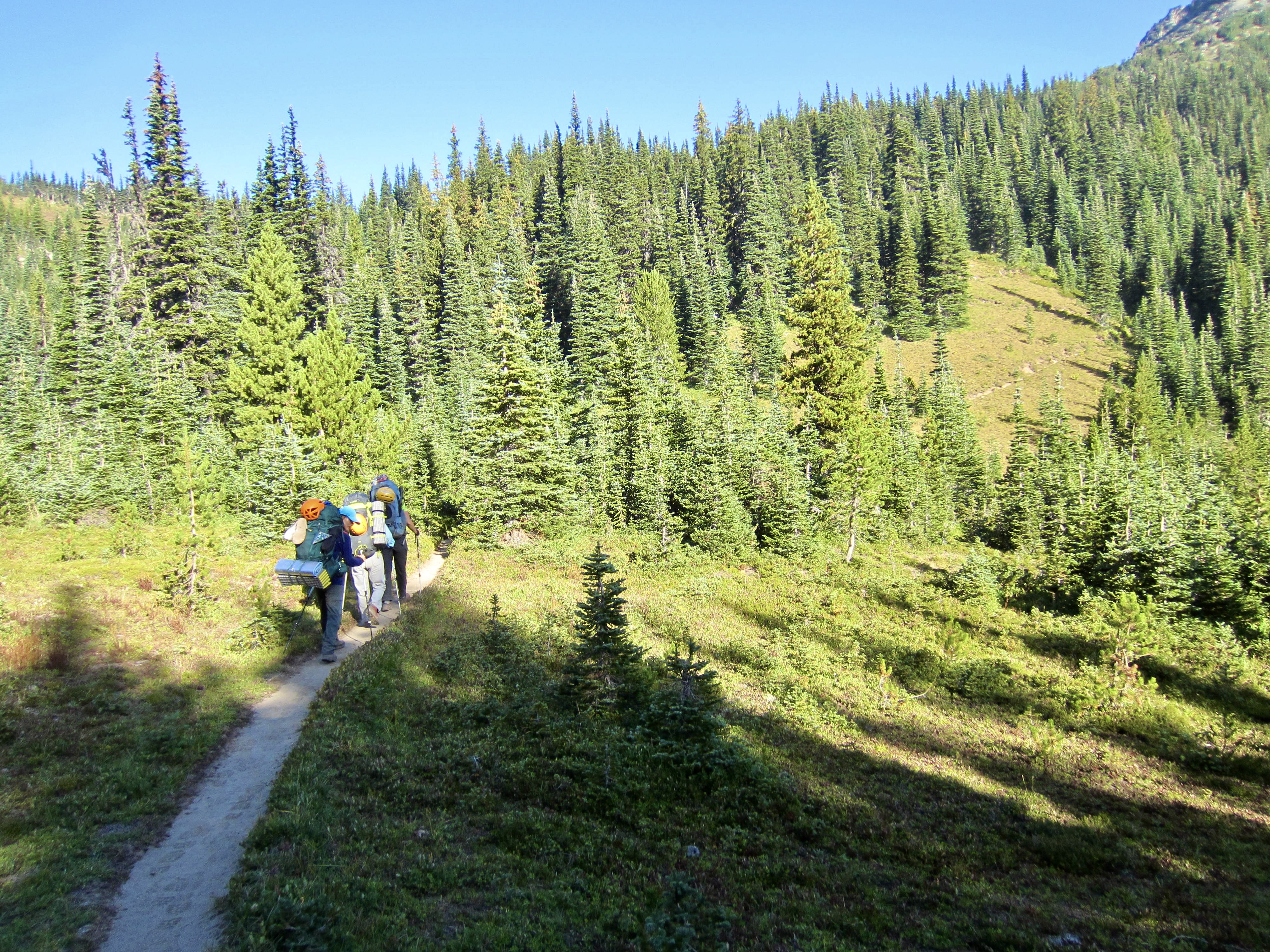
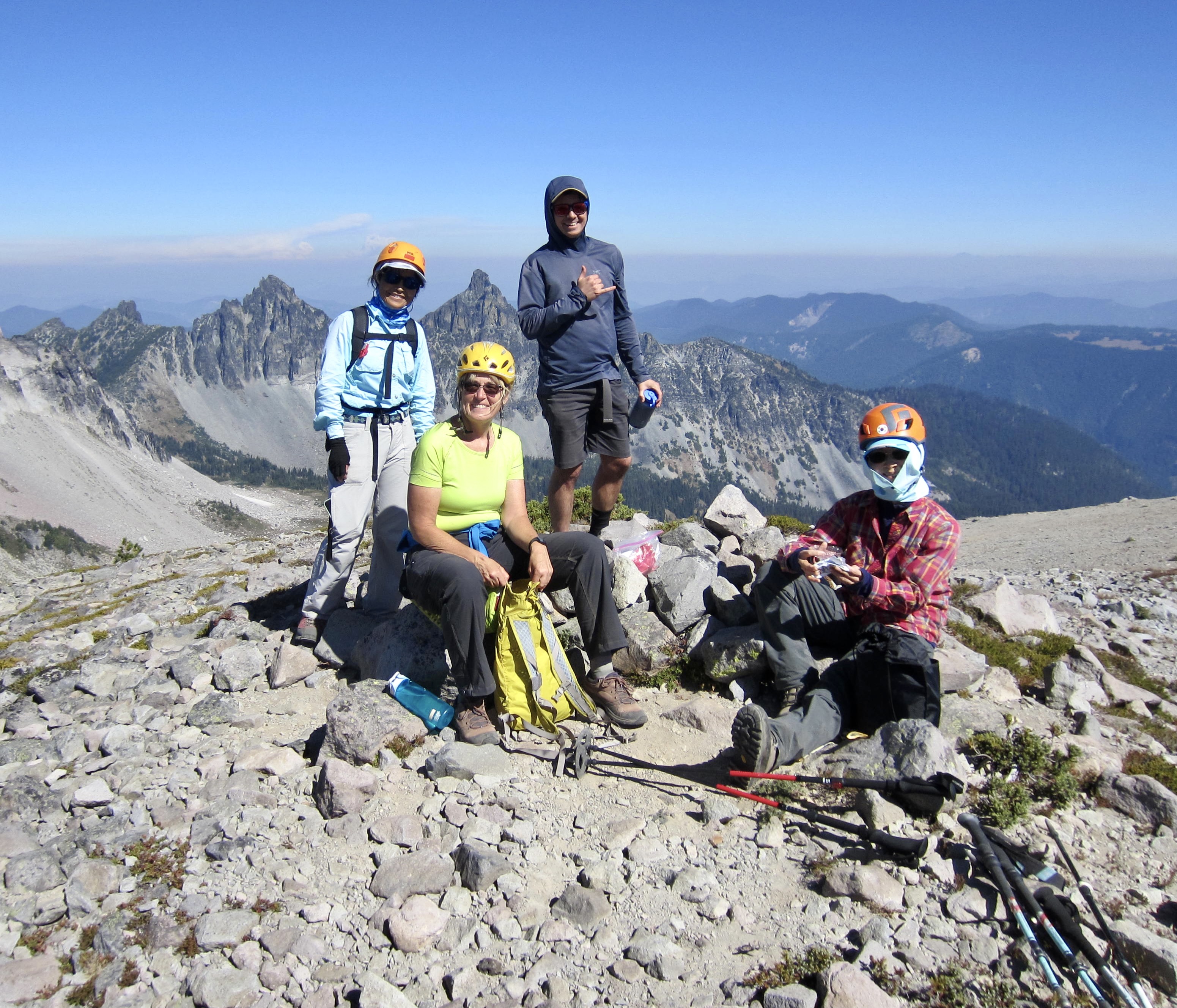
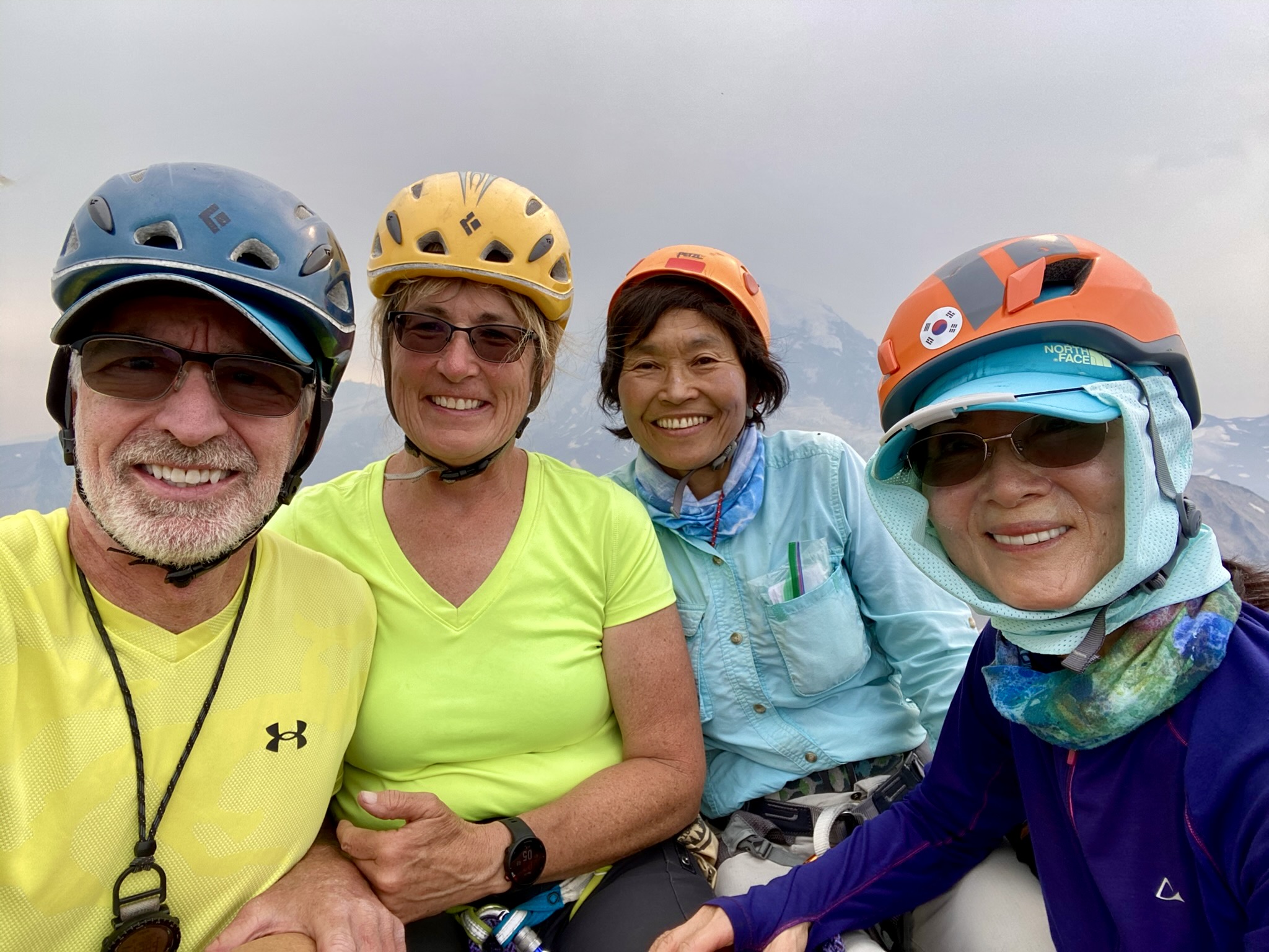
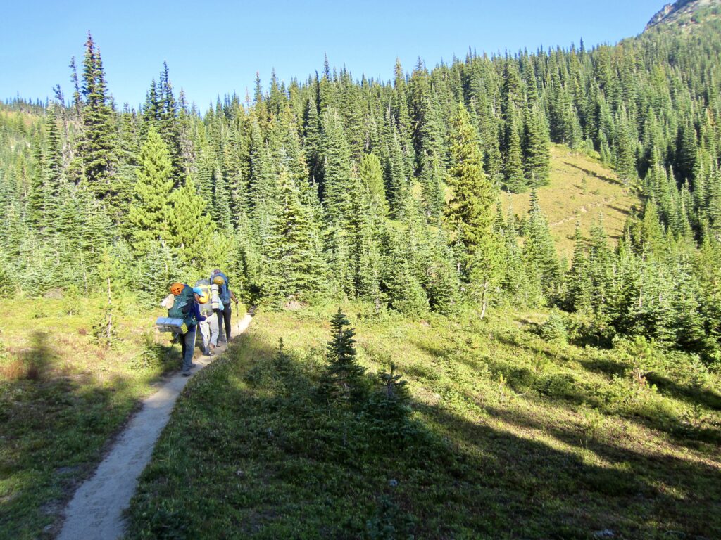
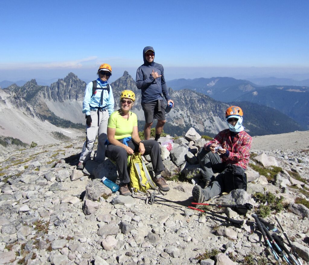
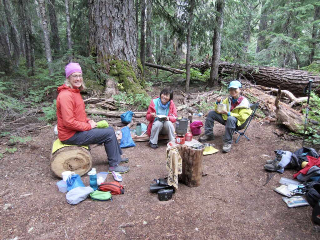
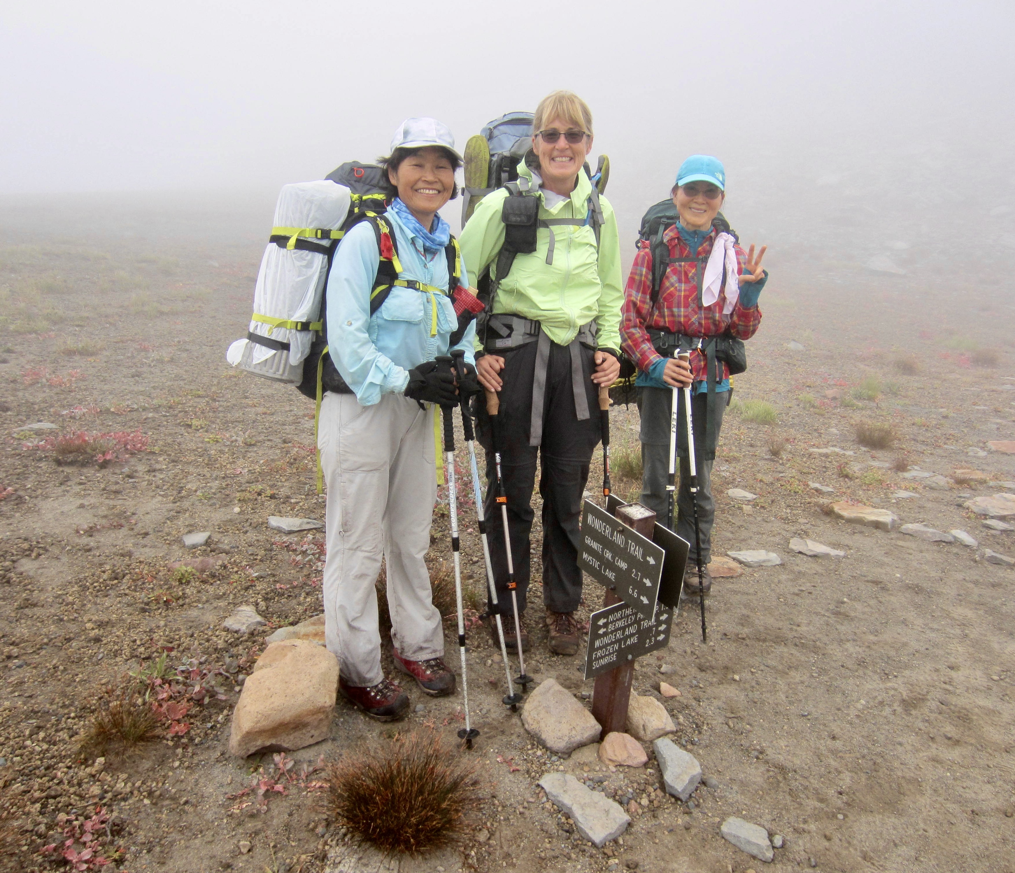
During a week of transitional weather with lots of wildfire smoke hanging in the air, Eileen, Yoko, Baram and I completed a five-day backpacking circuit on the popular Northern Loop Trail in Mt. Rainier National Park. Our relaxed schedule accommodated several nice sidetrips, including three 7000-foot summits. Andrew joined us for a compressed three-day circuit that also included three summits.
The Northern Loop Trail can be accessed from any of five different starting points (Mowich Lake, Carbon River, Huckleberry Creek, Sunrise, or White River Campground) and can be reasonably hiked in either direction. We started and ended our circuit at Sunrise, which has the closest access, and we hiked in a clockwise direction based on campsite availability. Because the southern and western segments of the Northern Loop Trail coincide with the uber-popular Wonderland Trail, those segments tend to see more traffic, and the associated campsites tend to book up sooner.

Day 1: Sunrise to Mystic Lake Camp + Skyscraper Mtn
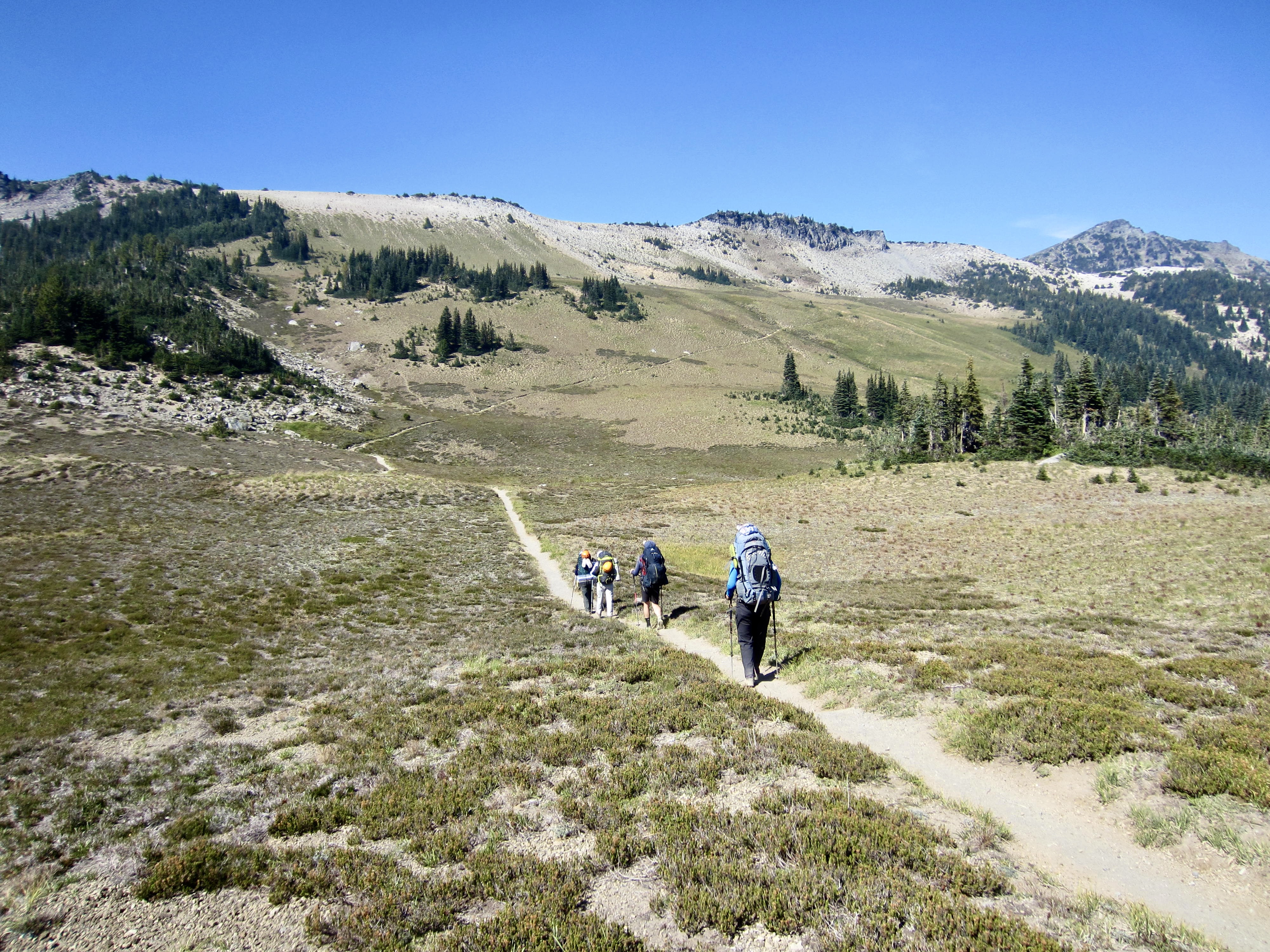
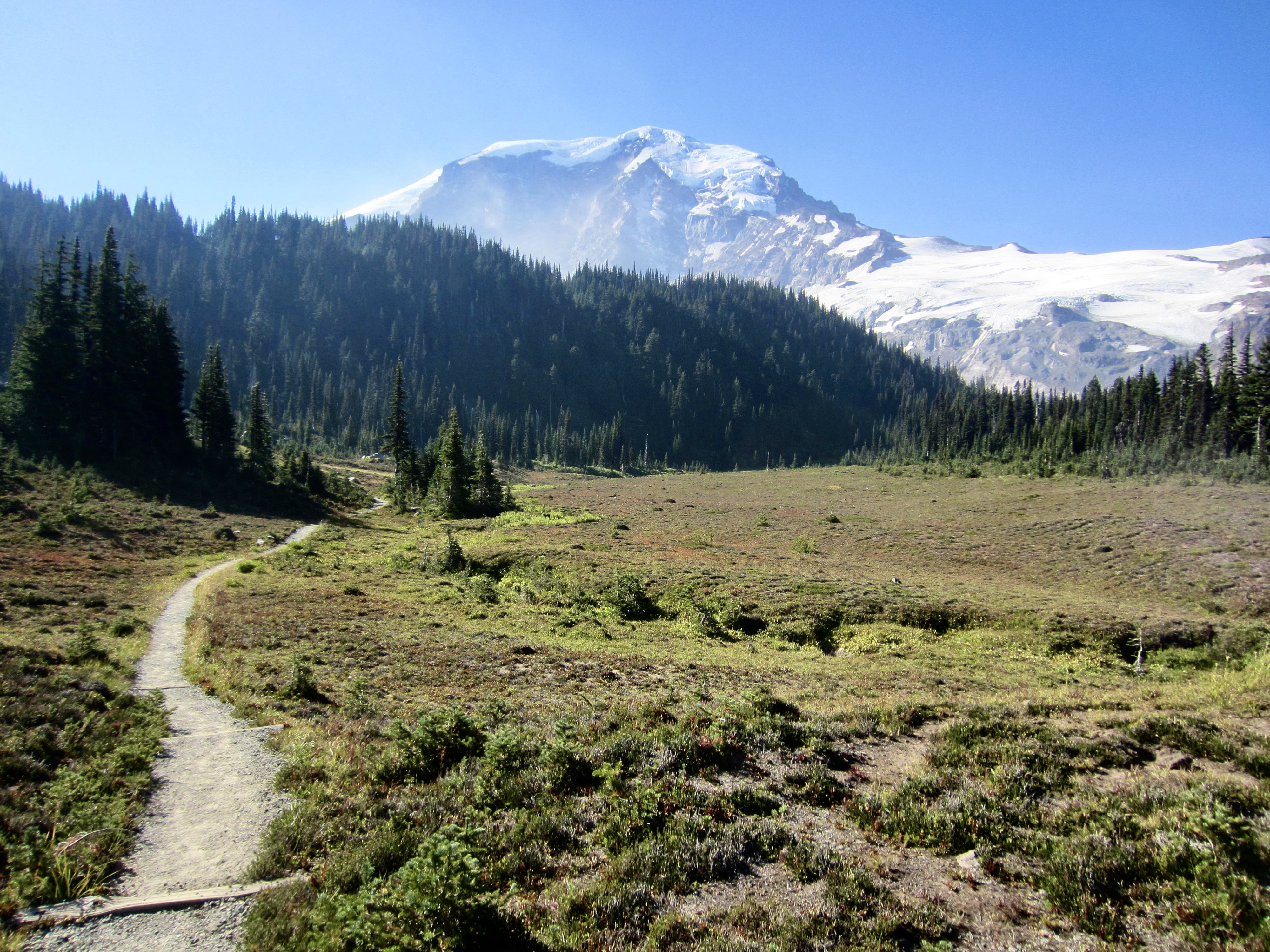
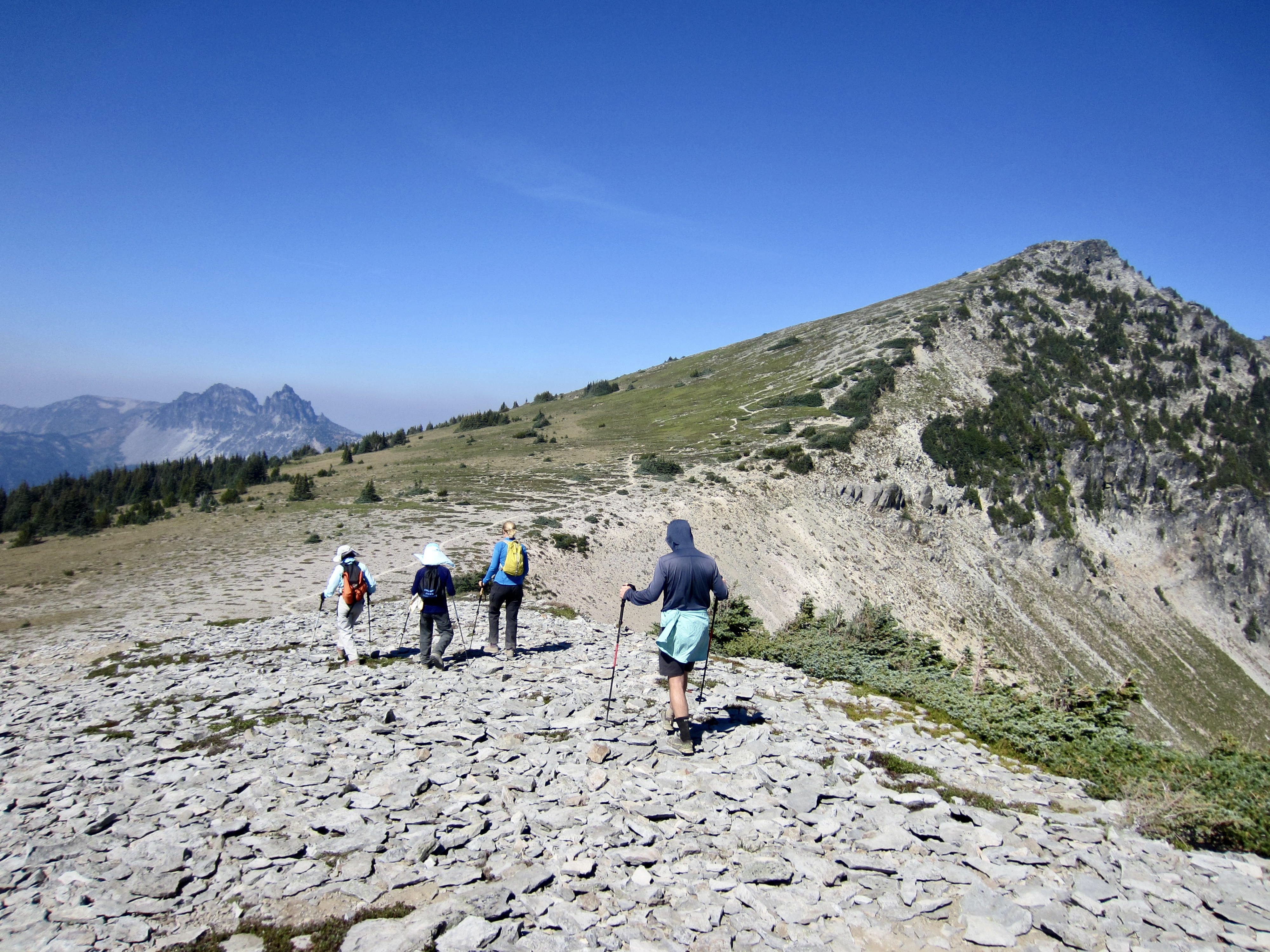
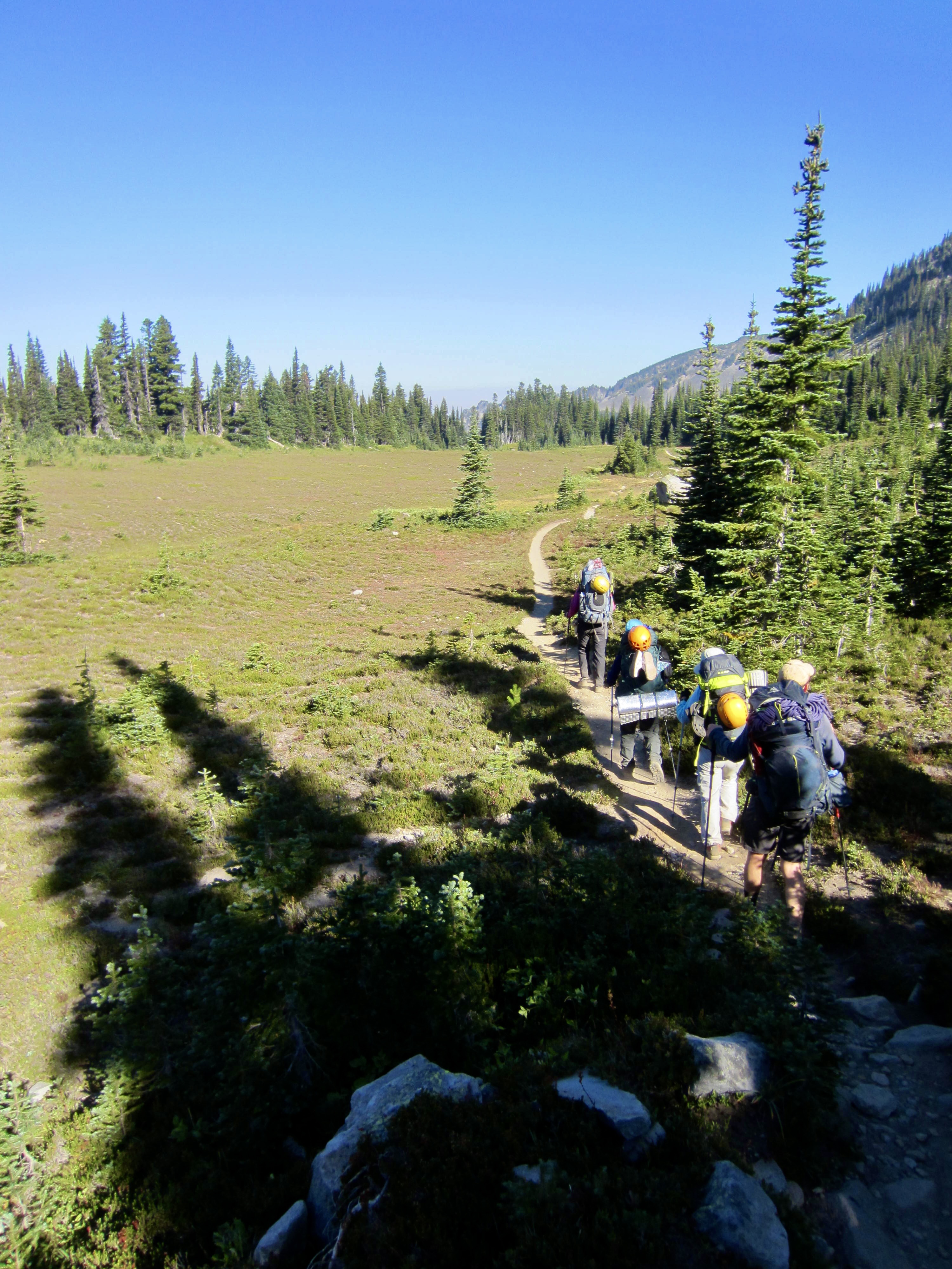
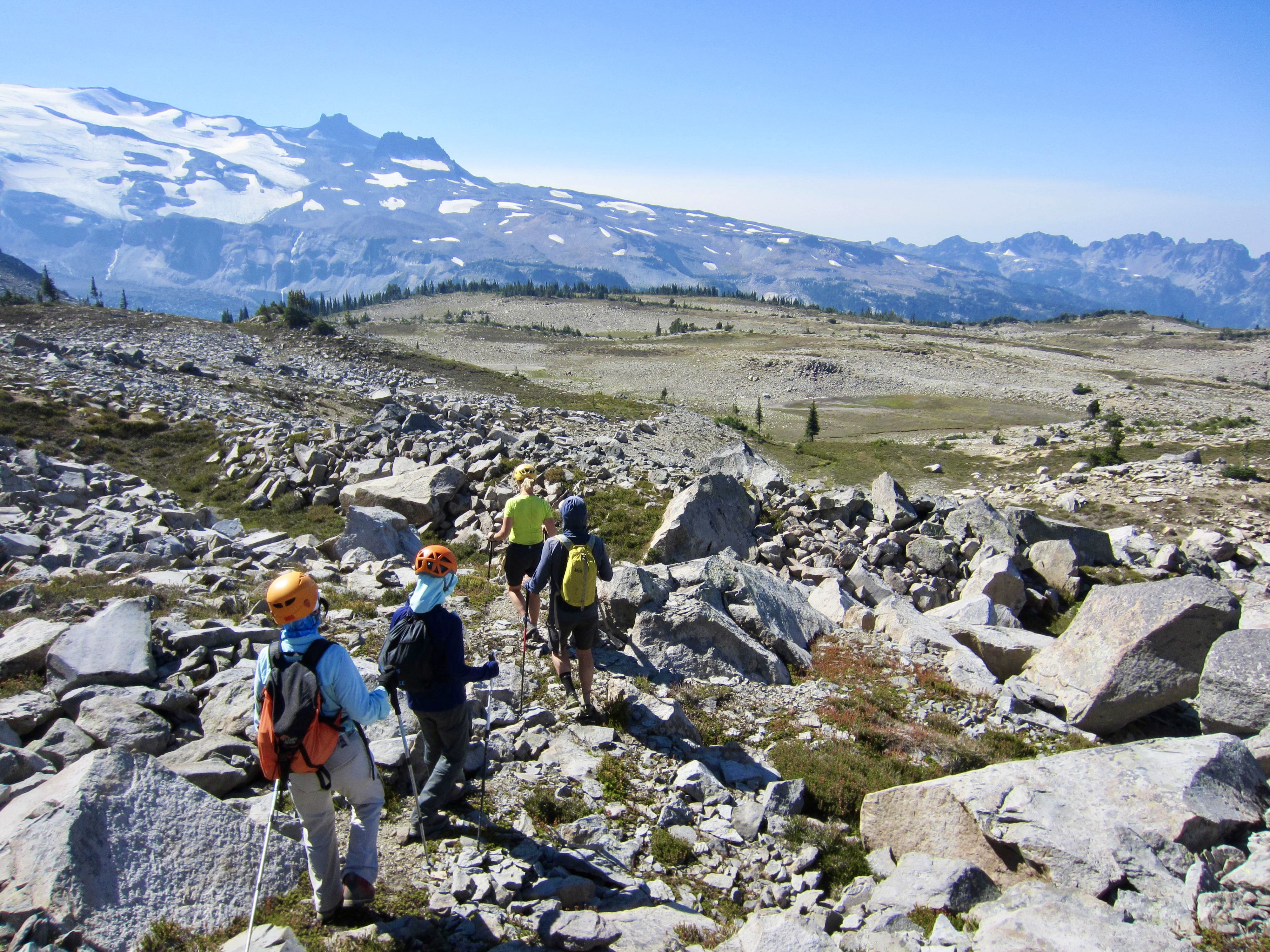
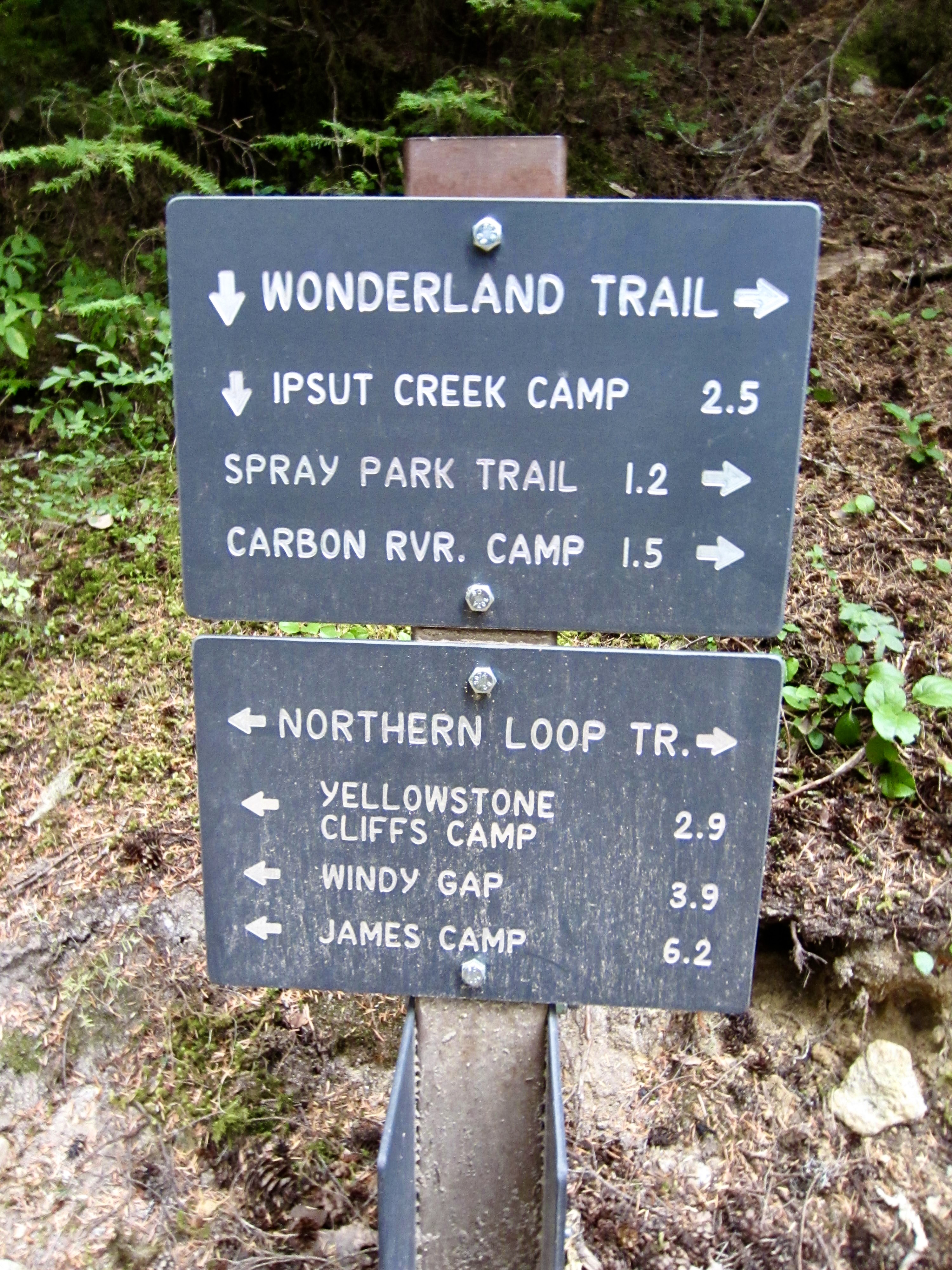
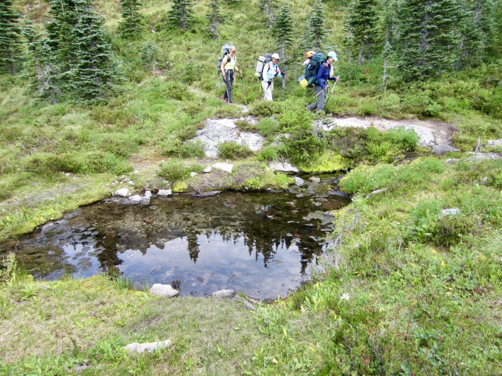
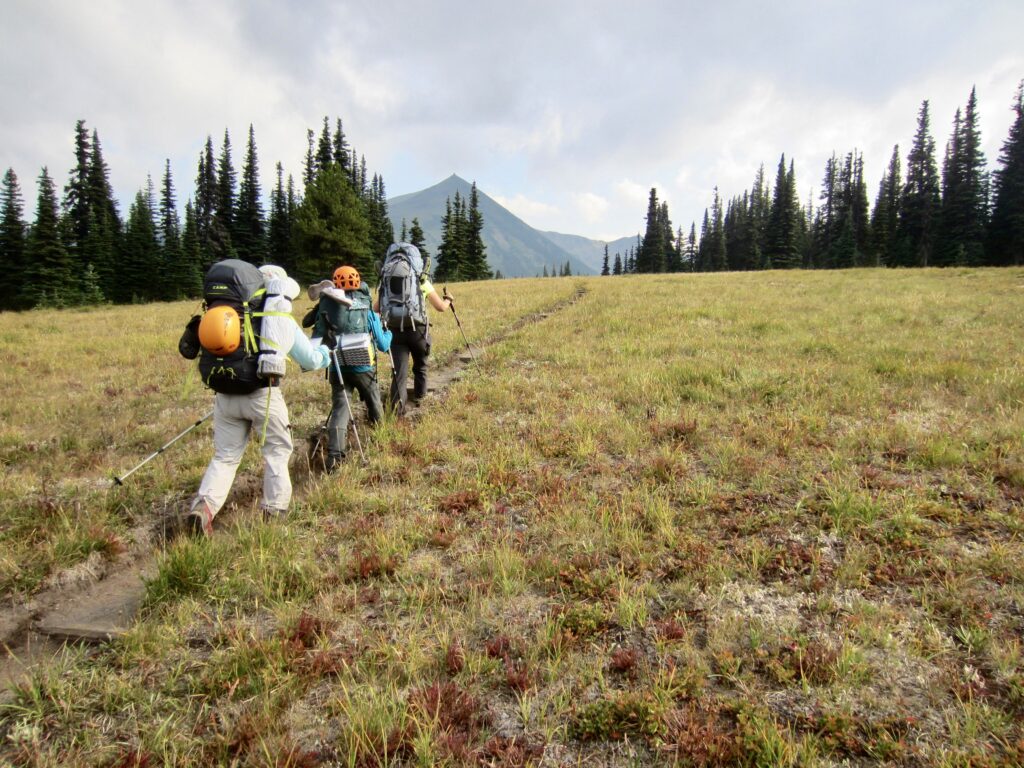
We left Sunrise on a warm but hazy Friday morning and hiked westward through Yakima Park and Berkeley Park. Most of the hiker traffic was left behind at a major junction near Frozen Lake, where many people turned off toward Mt. Fremont Lookout or Burroughs Mountain. A bit farther along, at Berkeley Junction, we stepped onto the official Northern Loop Trail.
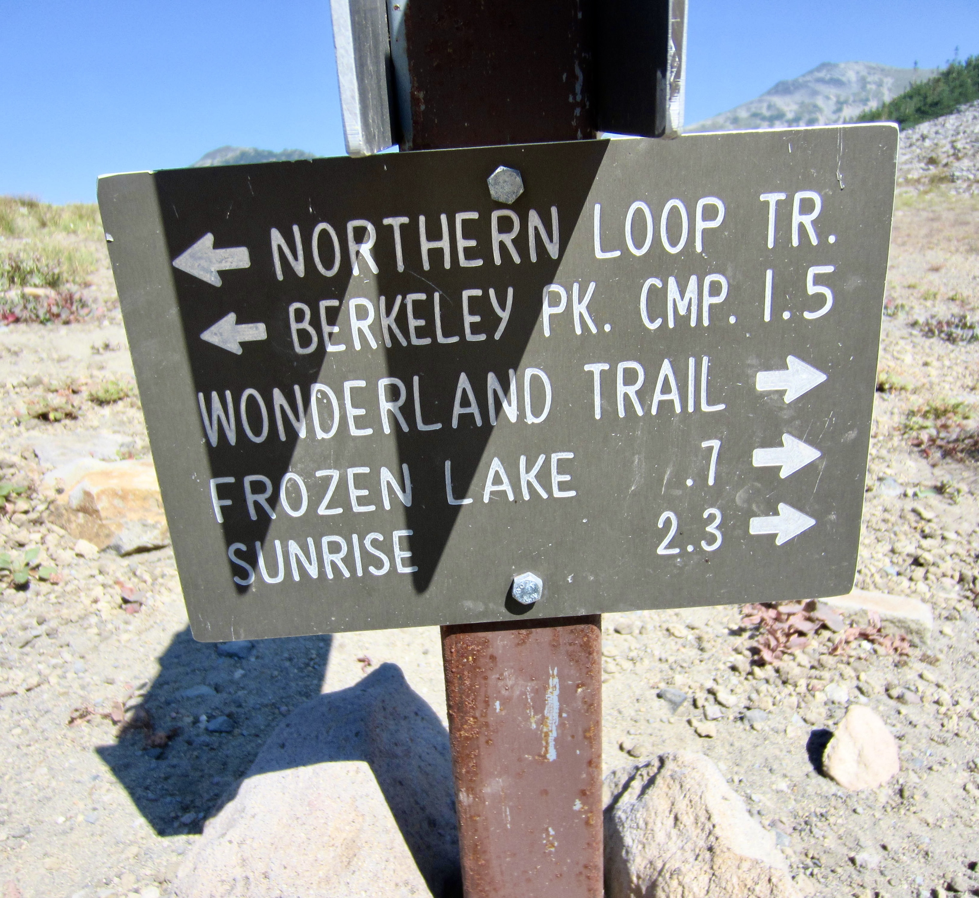
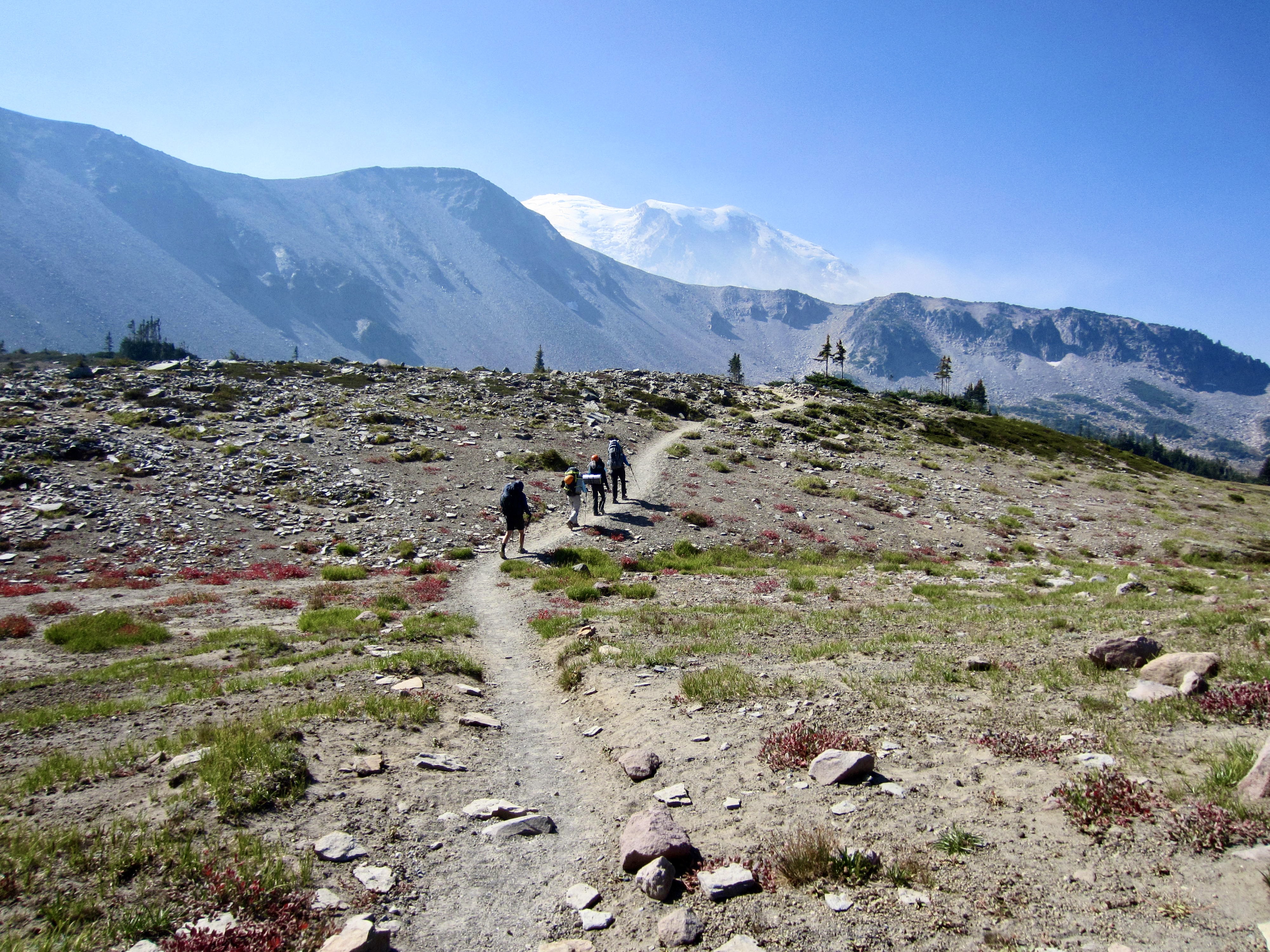

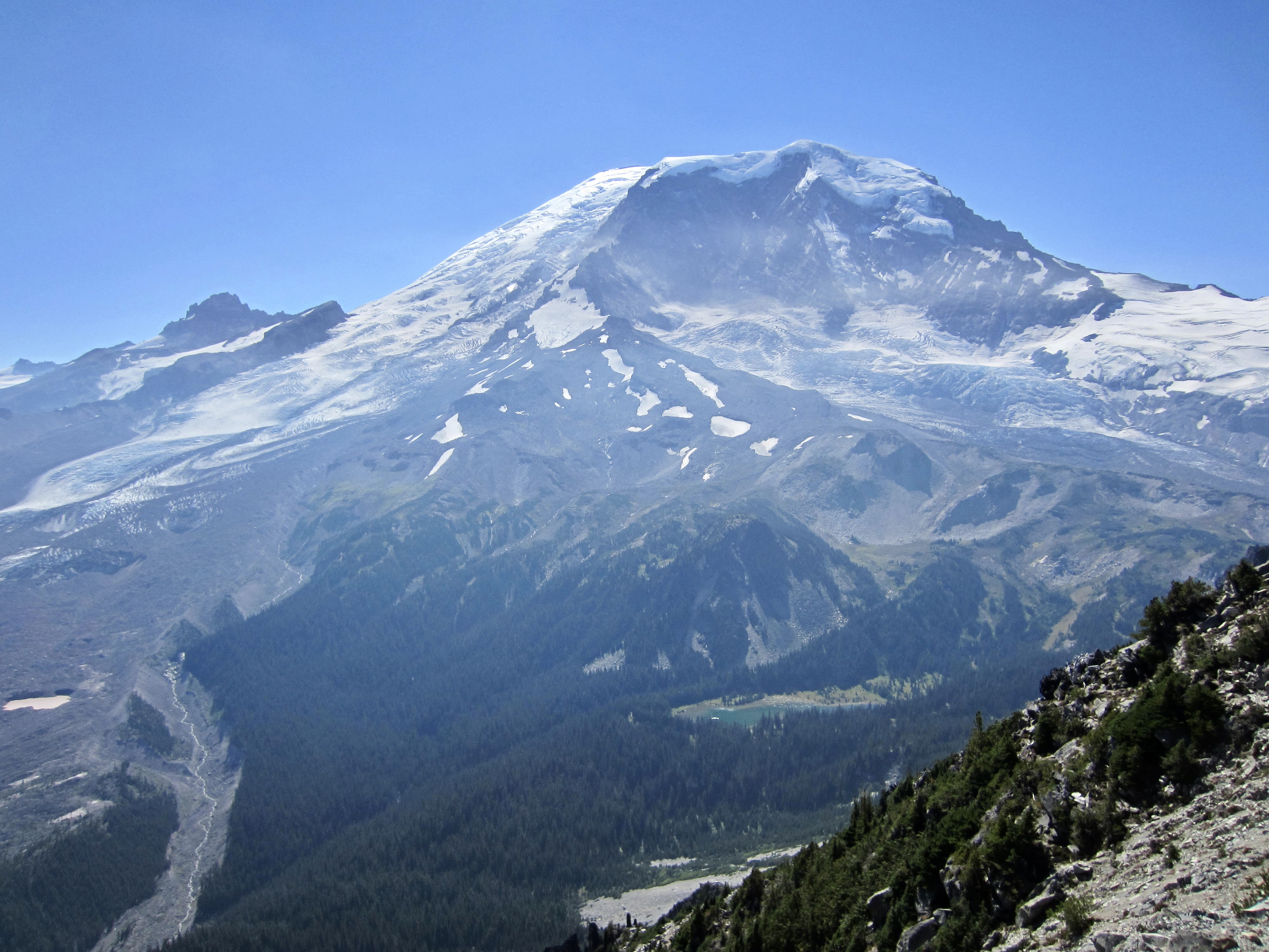
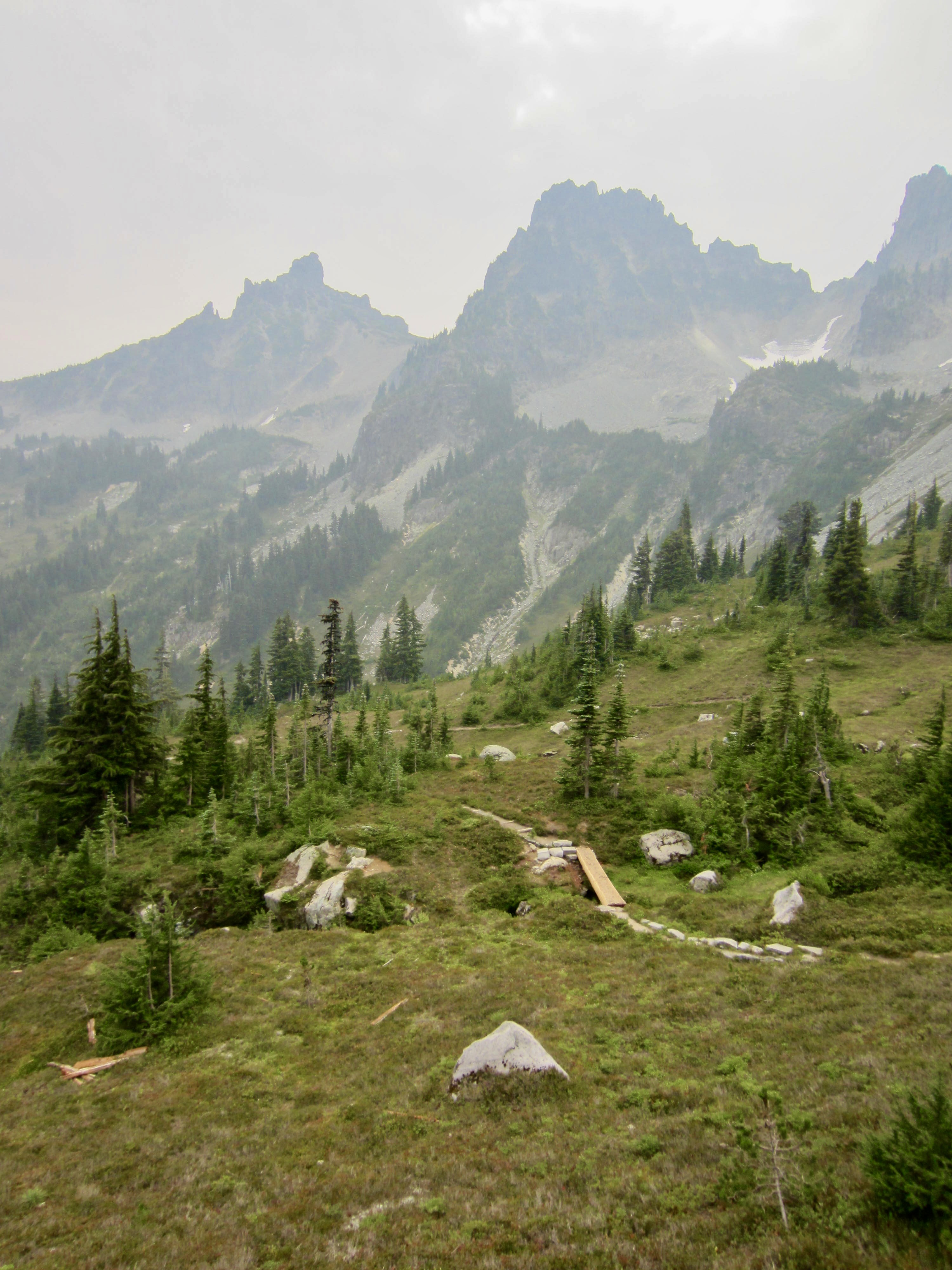
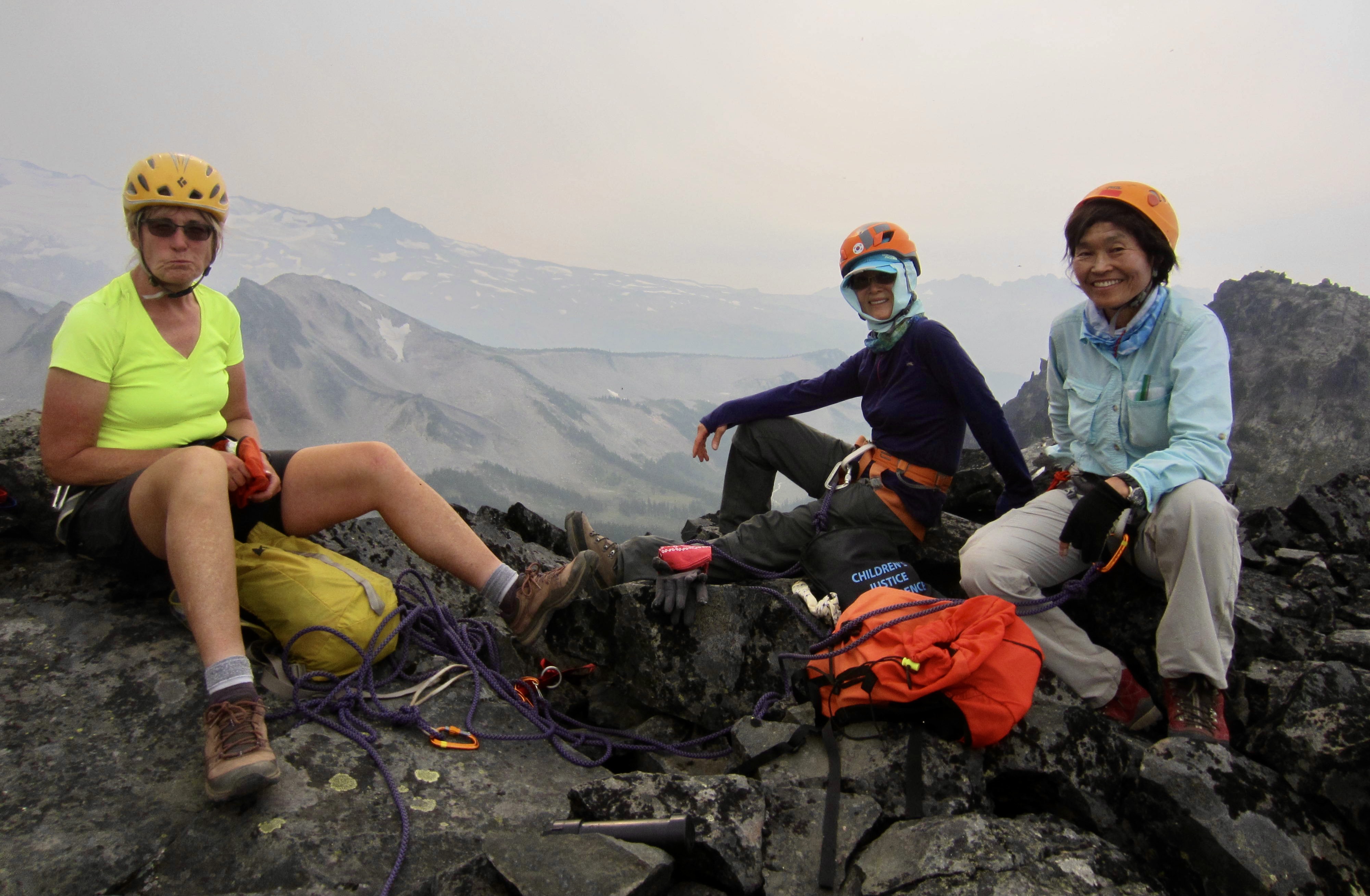
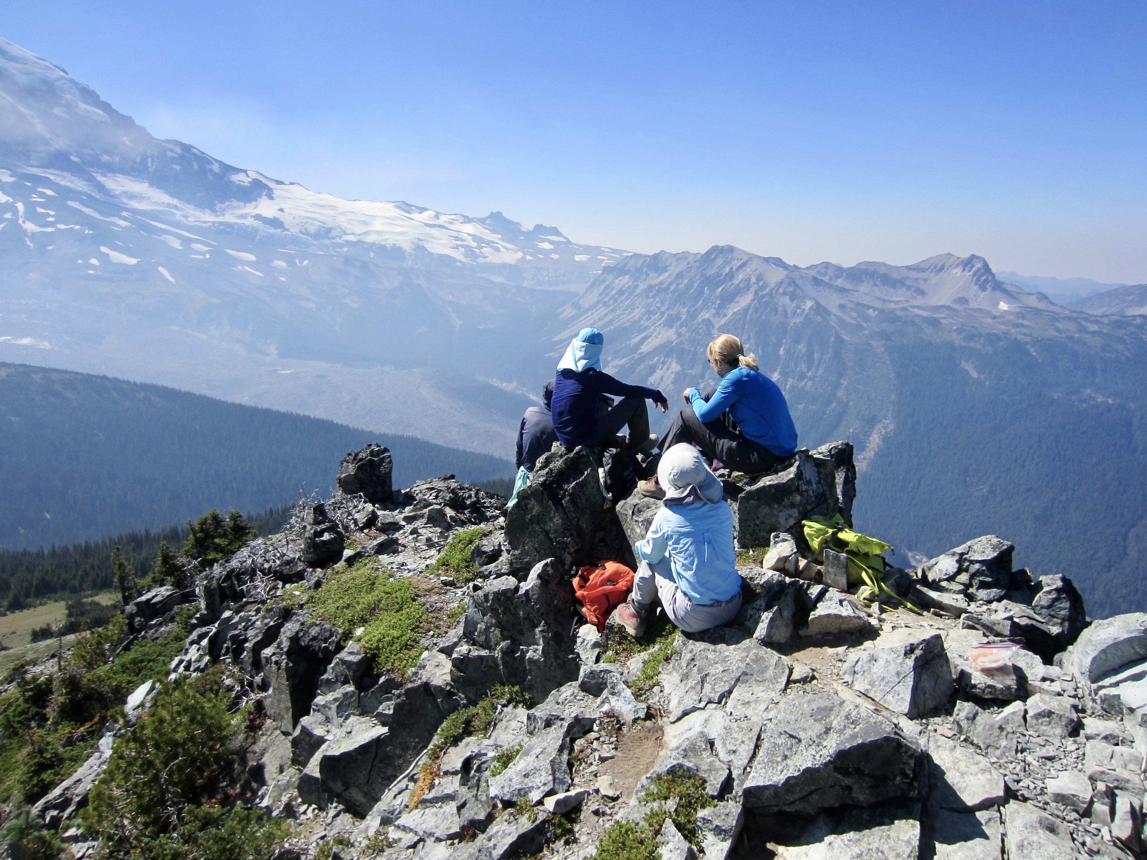
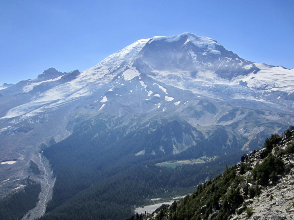
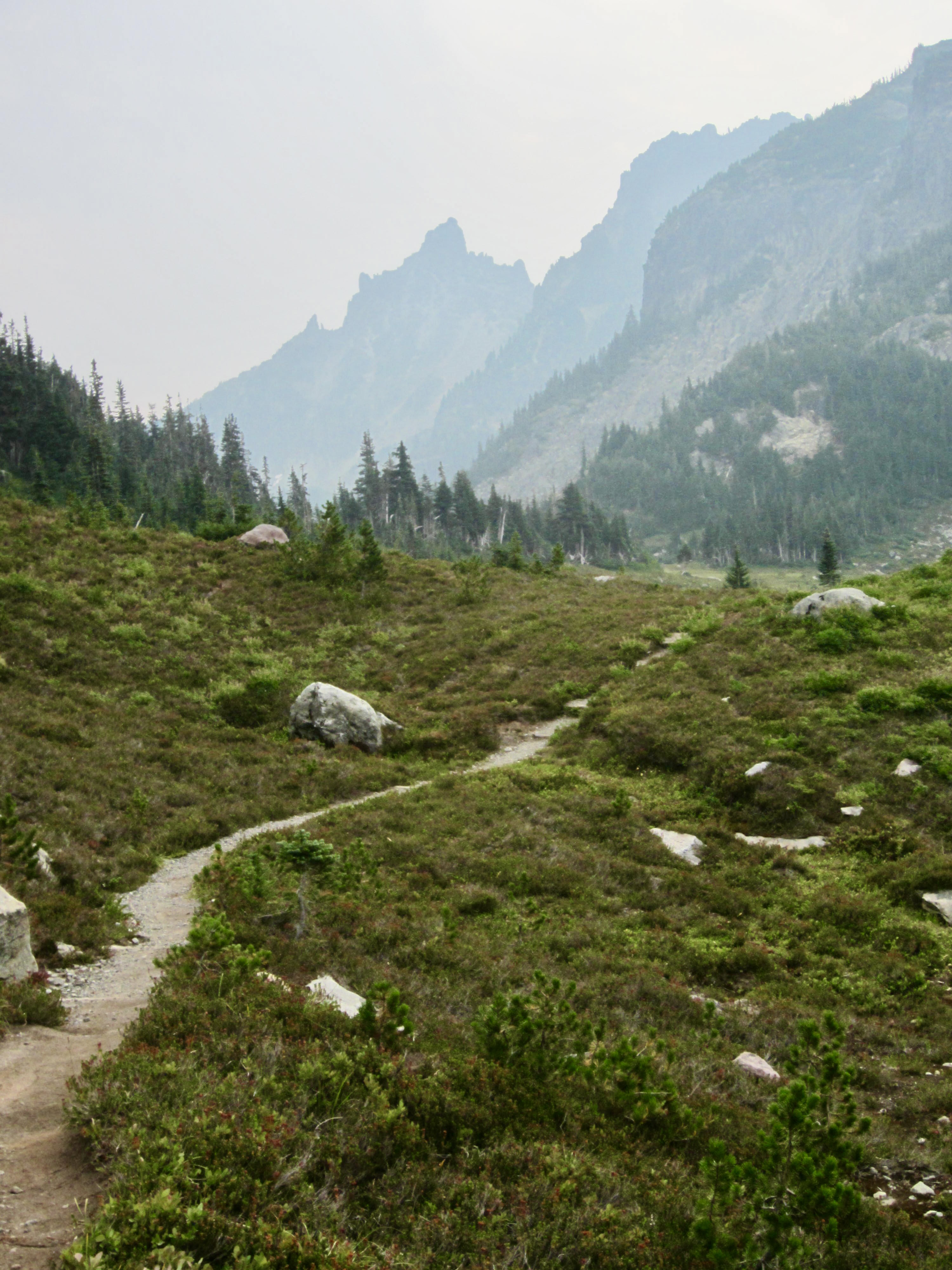
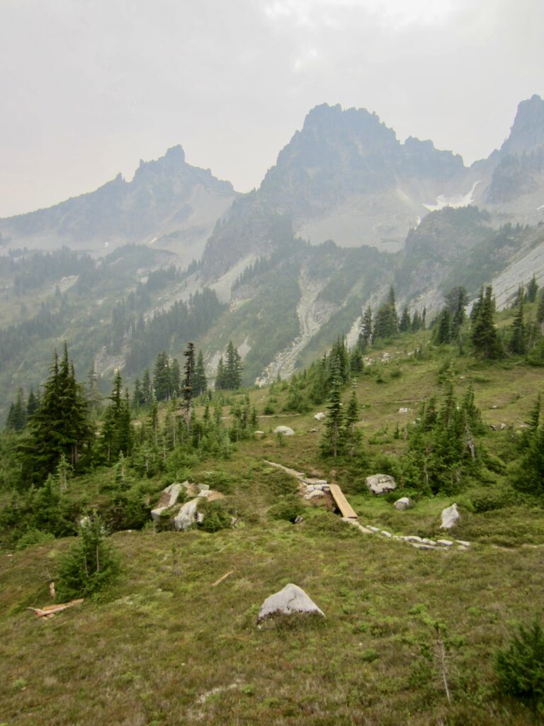
Upon reaching Skyscraper Pass—the high point of the entire Northern Trail Loop—we all dropped our backpacks and took an easy sidetrip up 7078-foot Skyscraper Mountain. This would normally be a fine viewpoint, but visibility today was severely limited due to wildfire smoke originating from both the north and south. At least we could clearly see our next two climbing objectives: Old Desolate and Sluiskin Mountain.

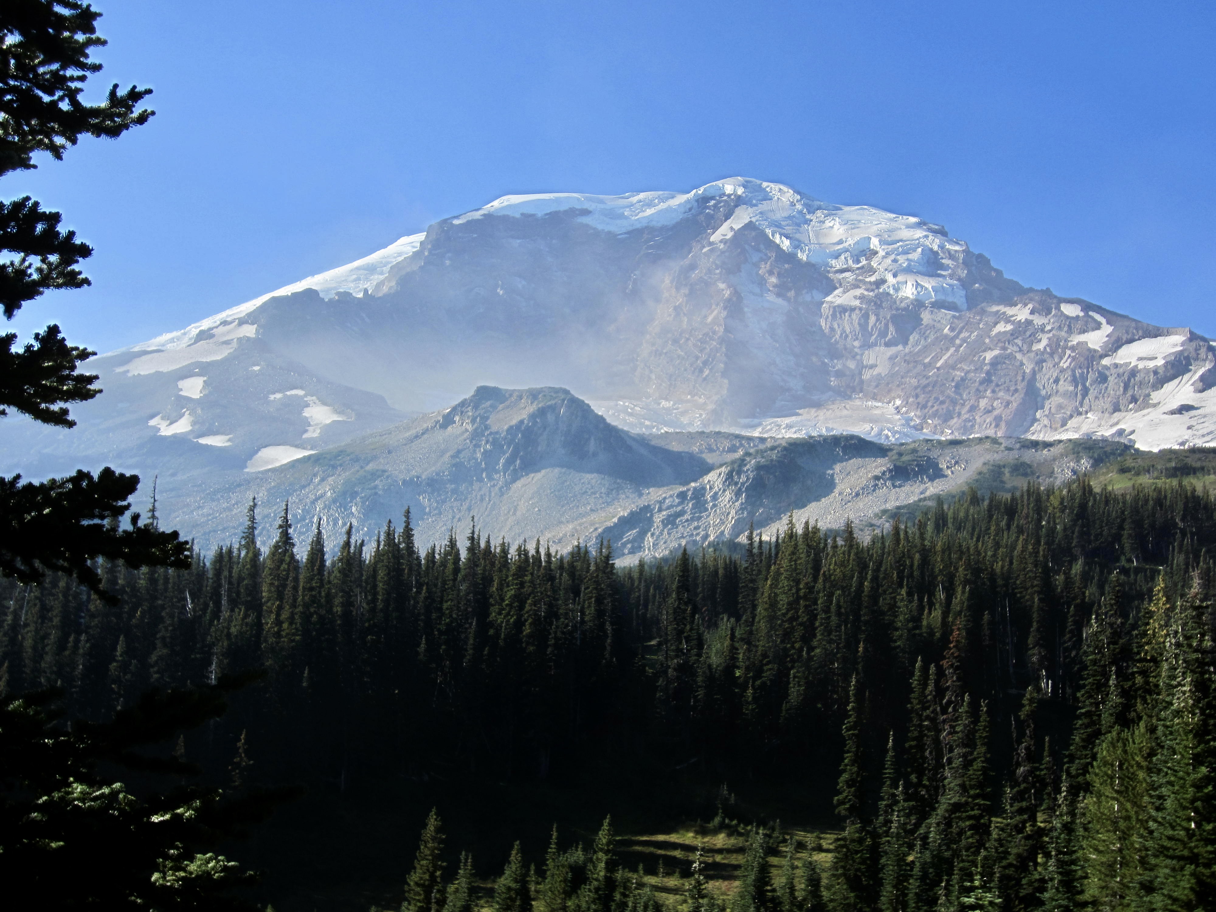
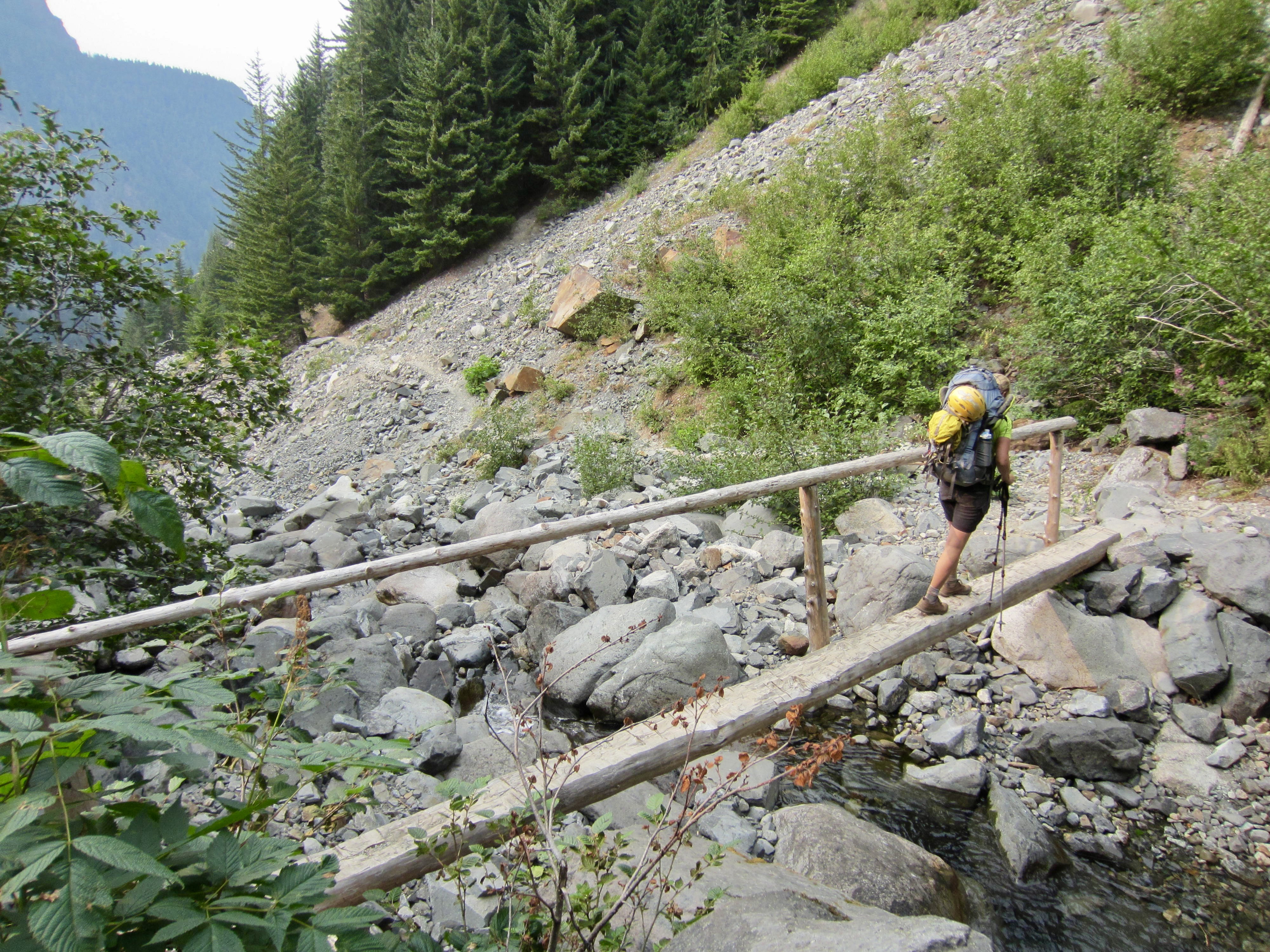
After returning to our backpacks (1.4 hours + 450 feet RT), we began a 2500-foot descent to Winthrop Creek. Andrew soon peeled off to climb Burroughs Mountain for an in-your-face view of Mt Rainier. The rest of us continued downhill, making a water stop at Granite Creek and later crossing frothy Winthrop Creek on a narrow footlog.
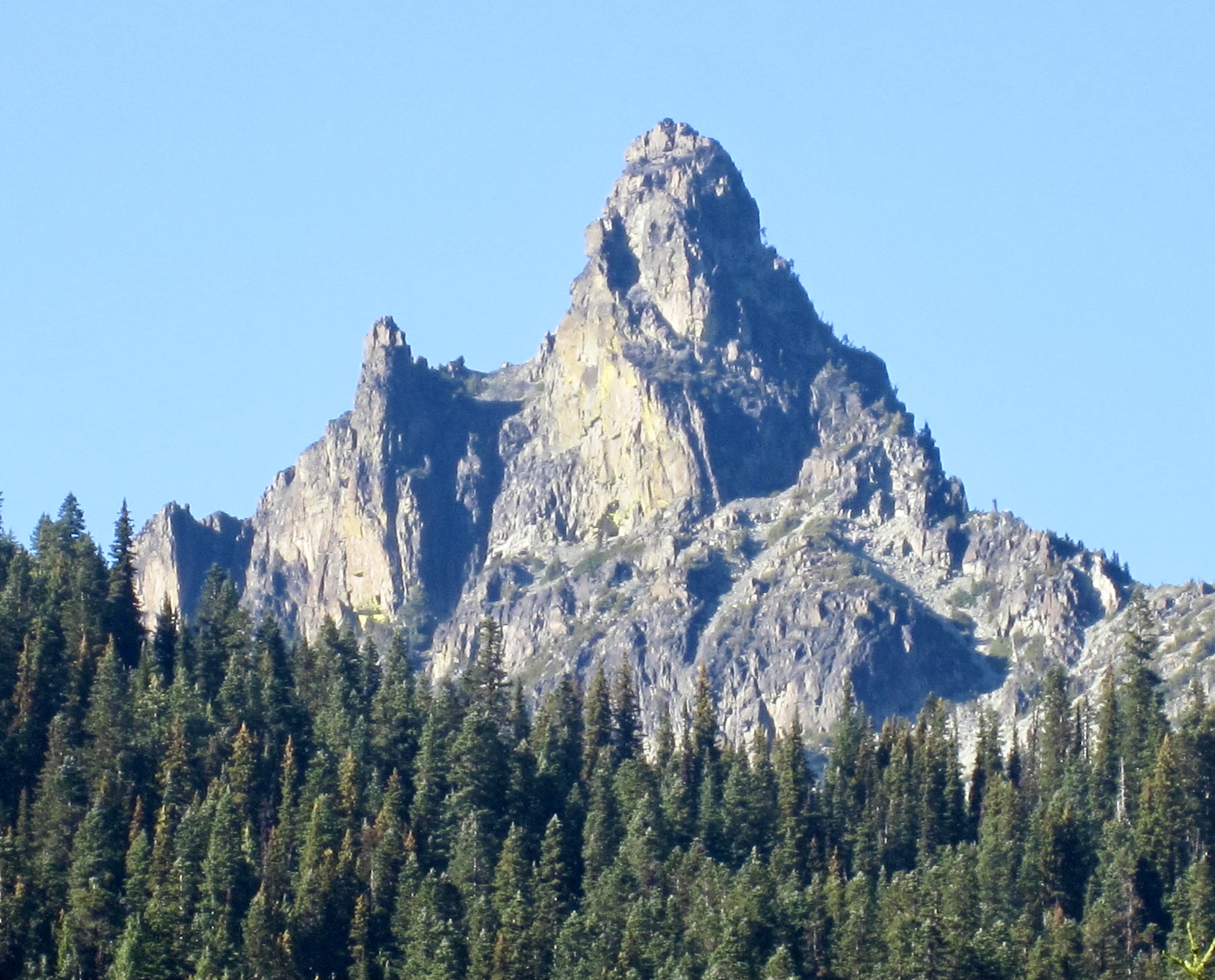
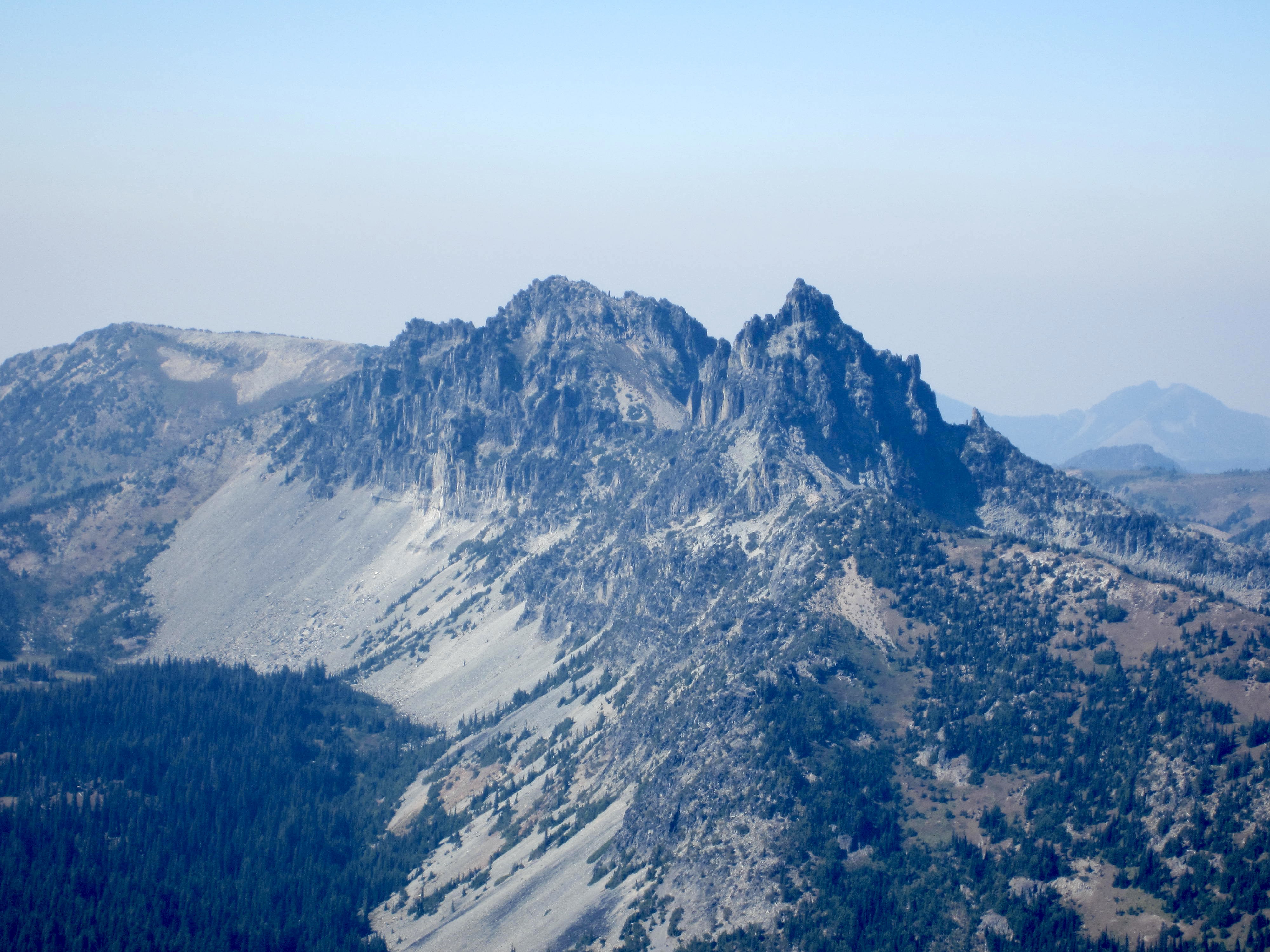
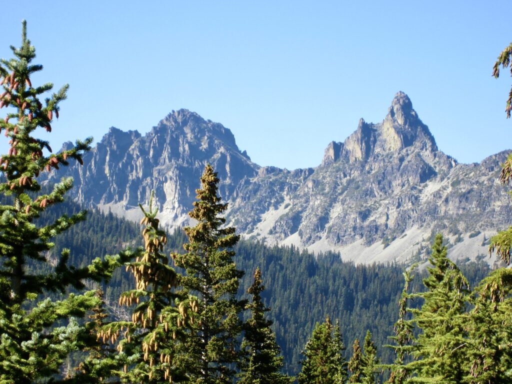
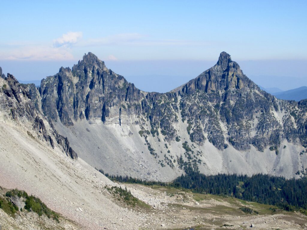
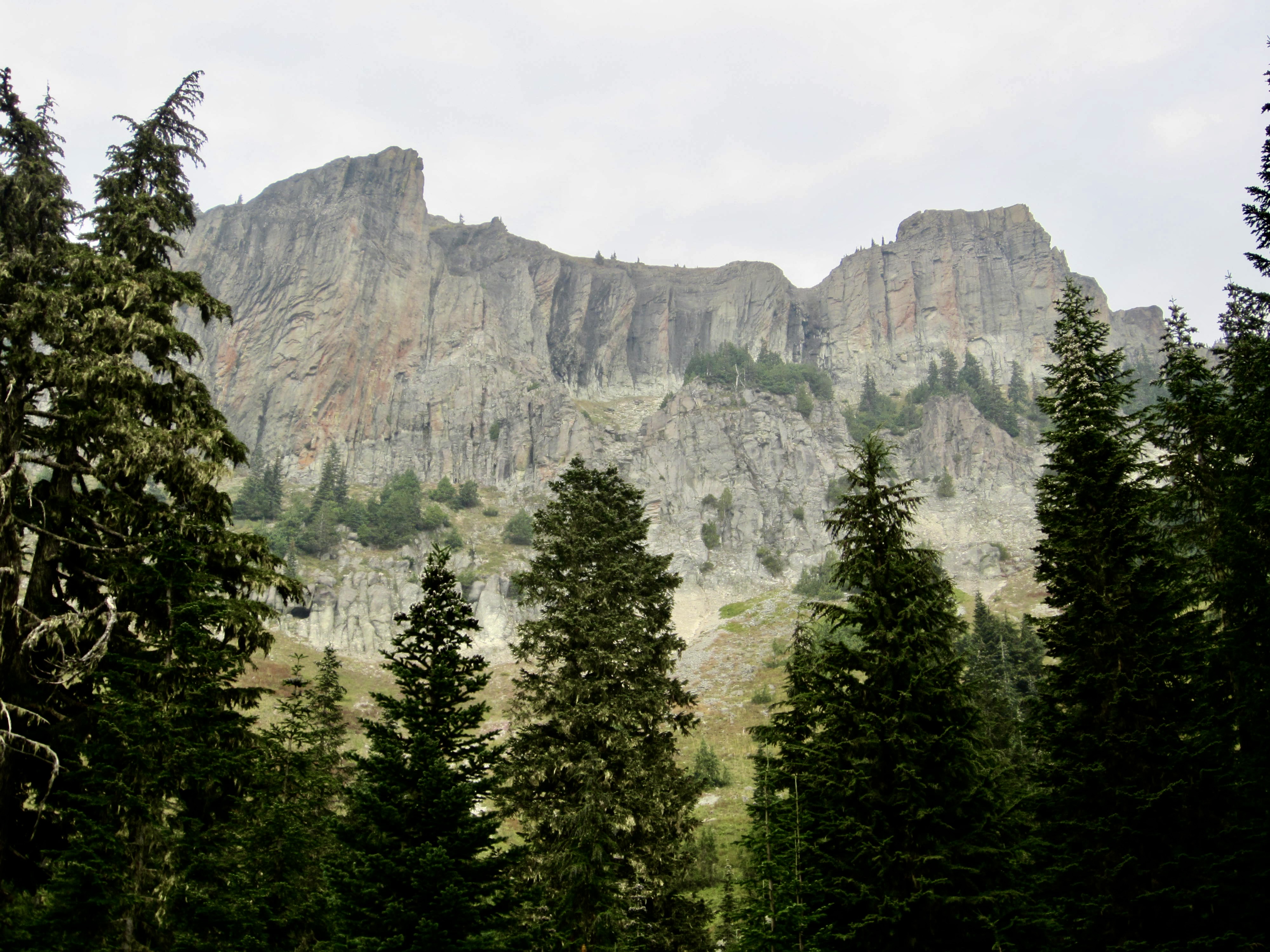
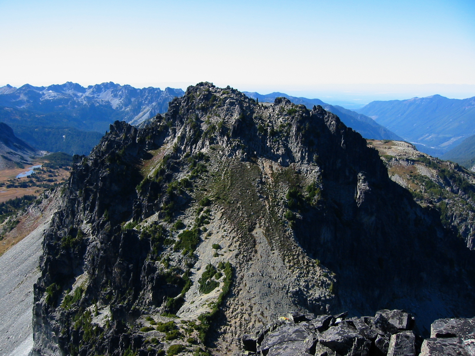
Along the way, we got some enticing glimpses of Sluiskin Mountain and its two principal peaks: The Chief and The Squaw. I regard Sluiskin Mountain as the most impressive landform in this national park aside from Mt. Rainier itself. The sharply pointed Sluiskin Chief, in particular, looks like it was plucked from the Picket Range or the Snoqualmie Mountains!

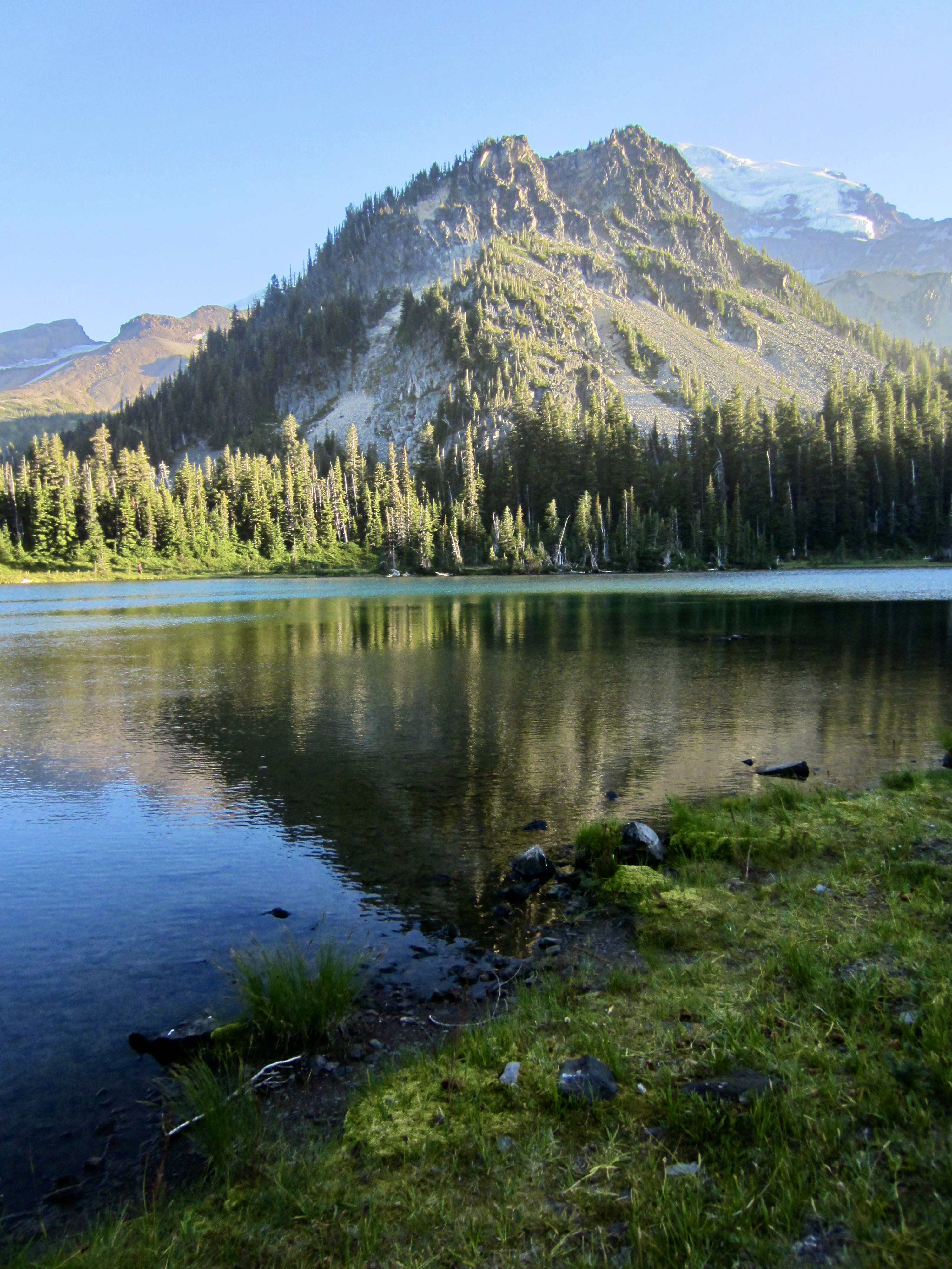
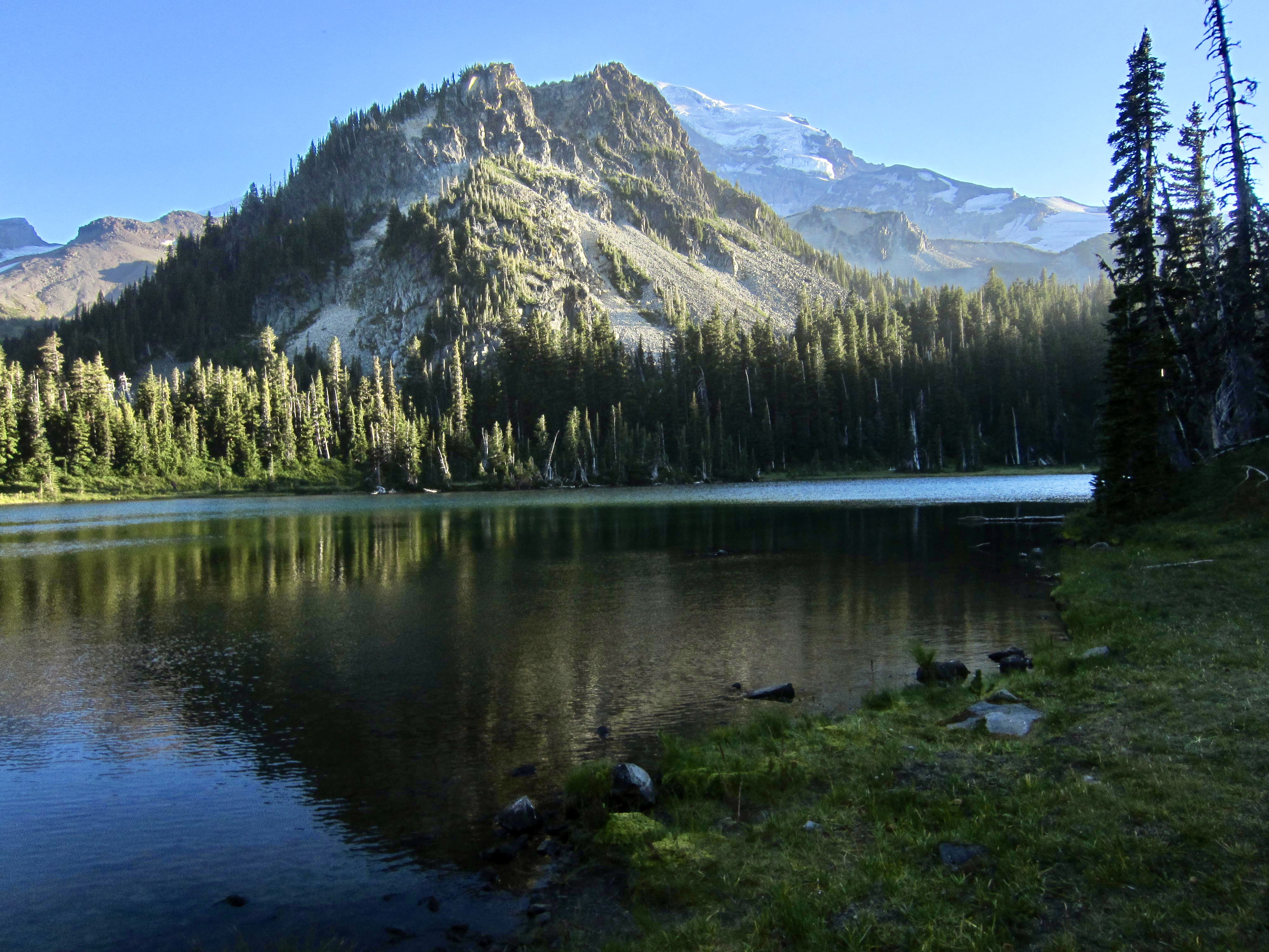
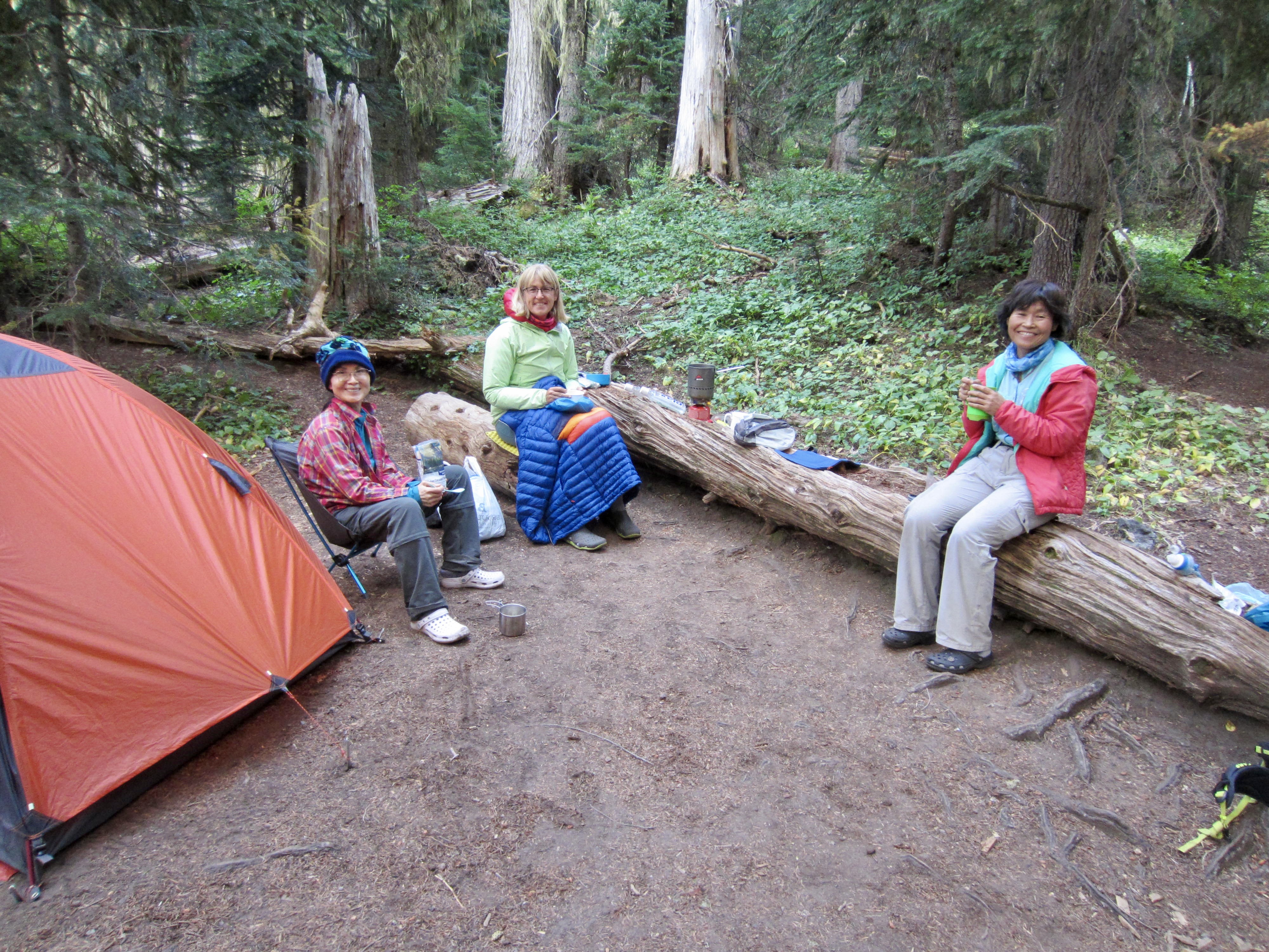
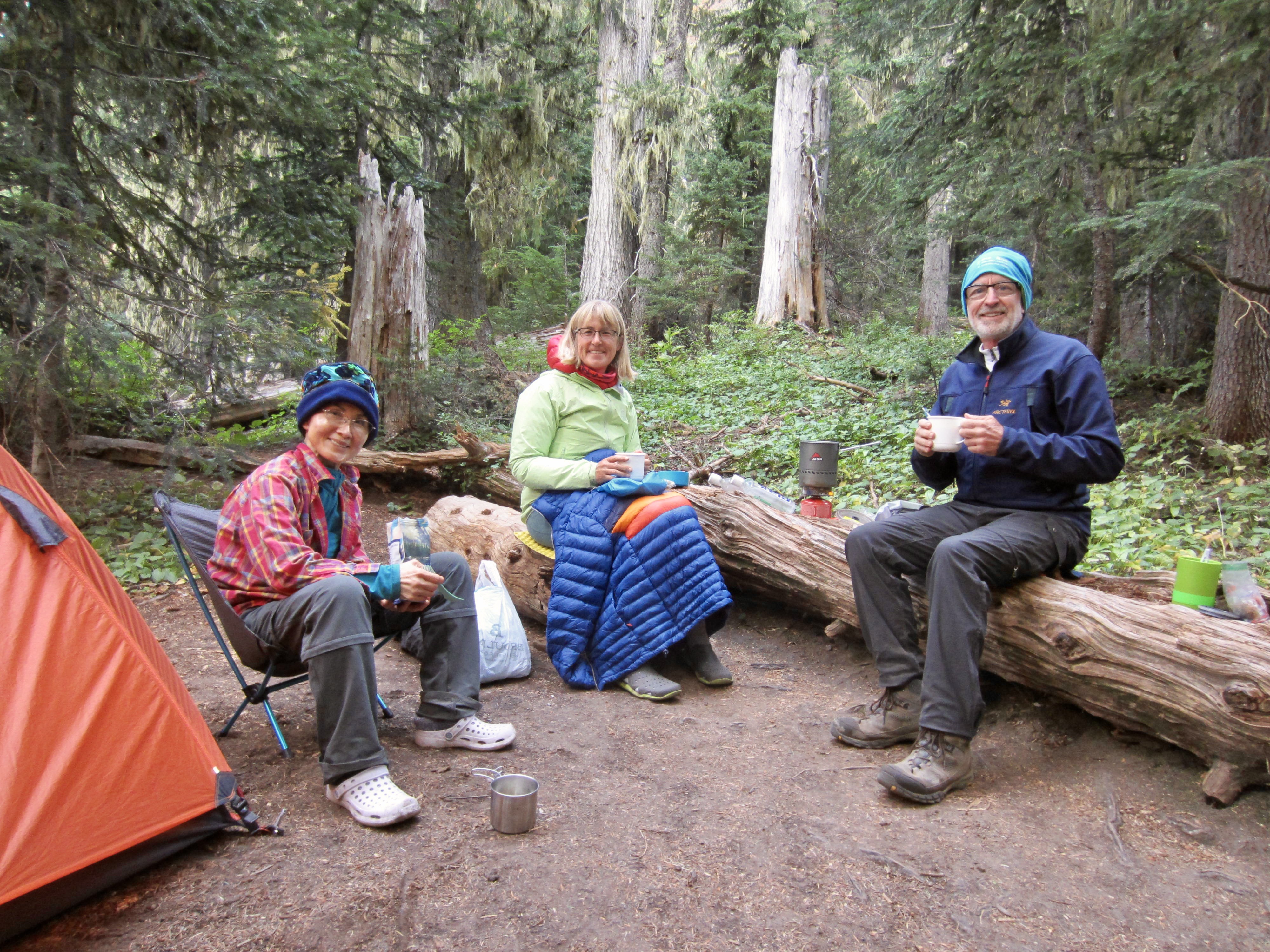
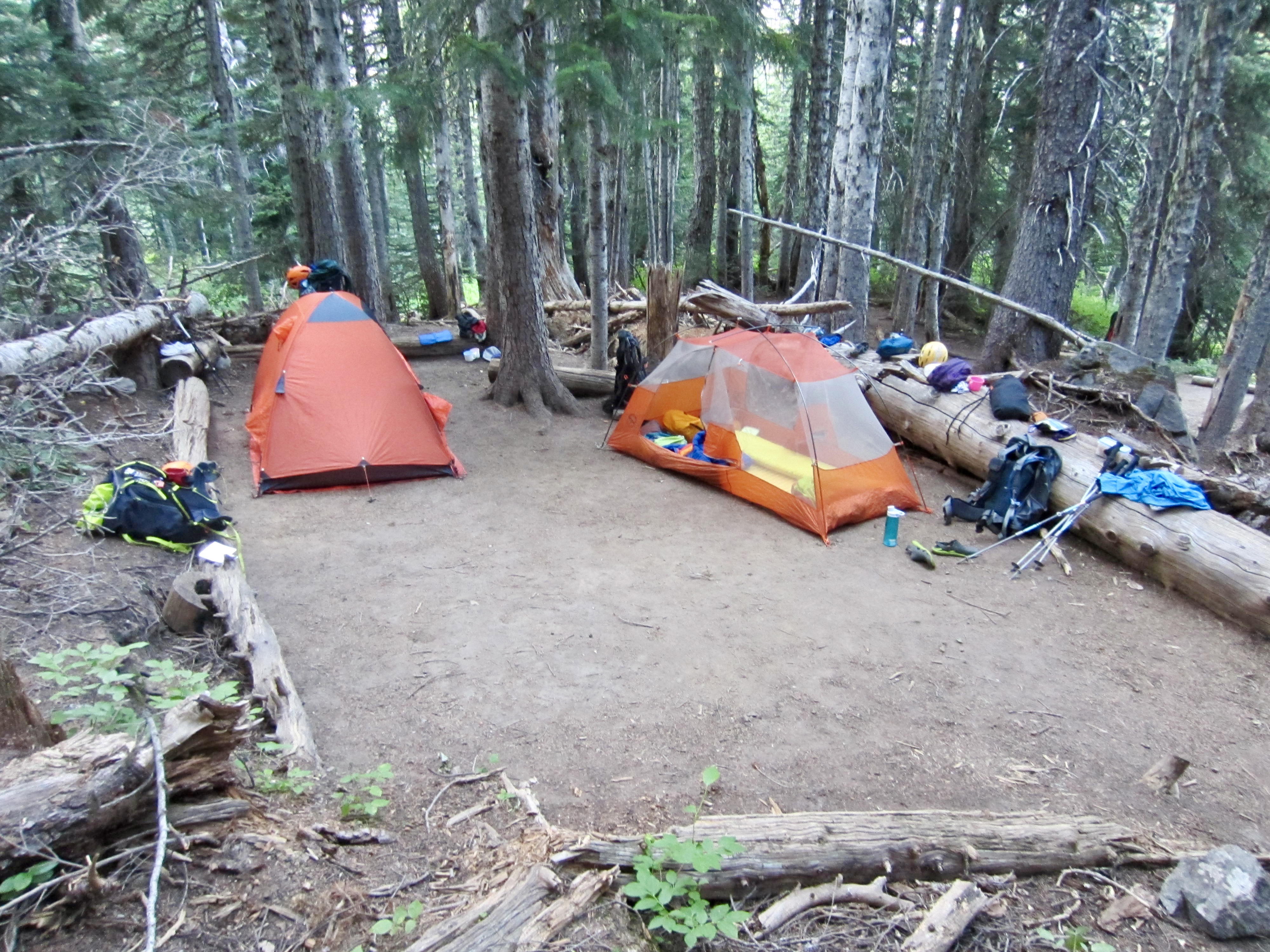
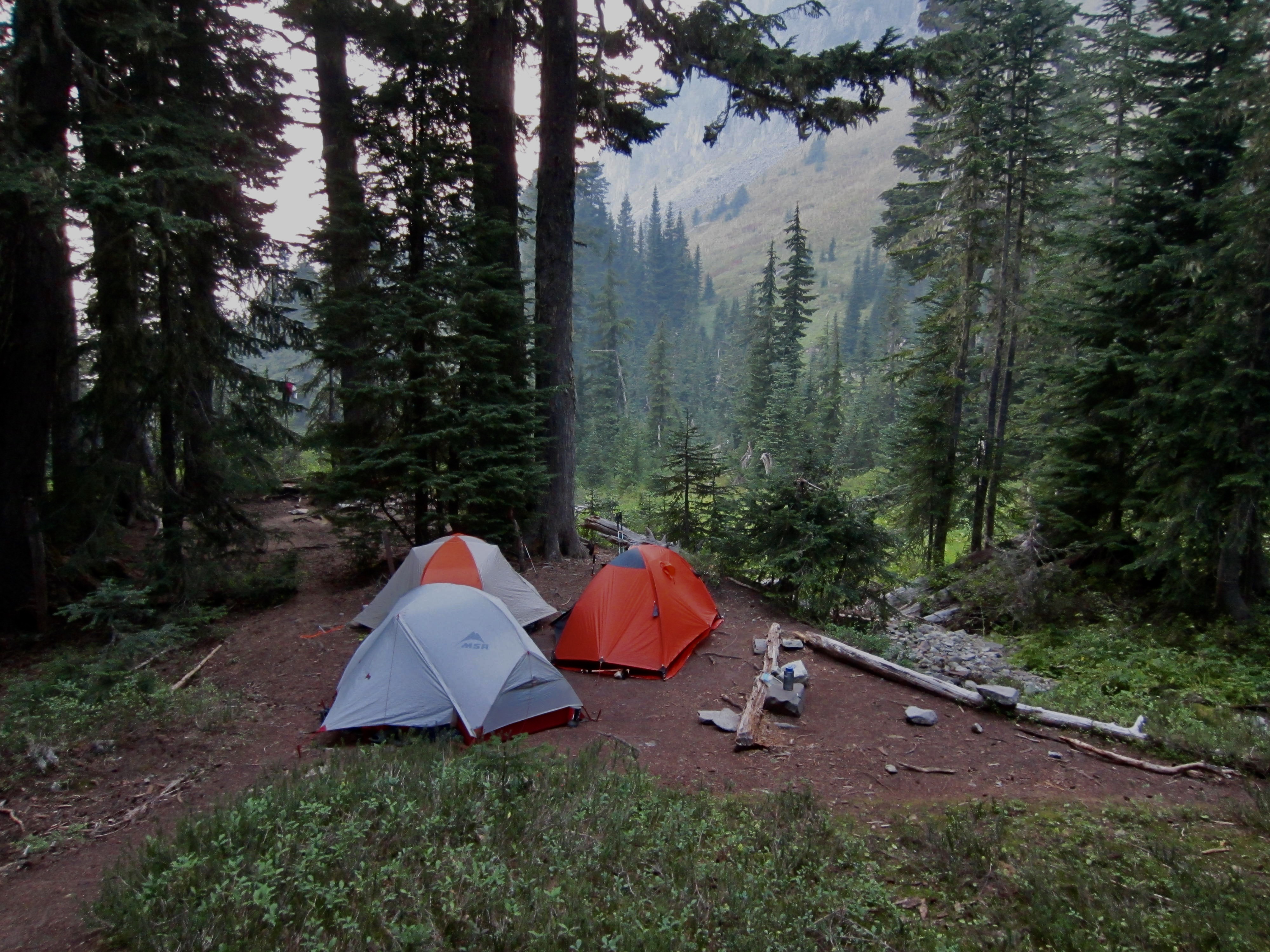
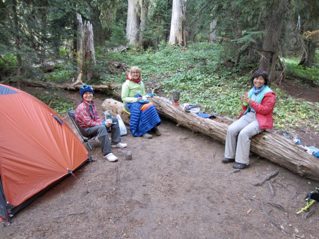
We arrived at Mystic Lake Camp in late afternoon (7.1 hours + 9.4 miles + 2500 feet – 3200 feet from TH, including sidetrip). This functional but uninspiring campsite sits in dense forest 150 vertical feet below Mystic Lake. After setting up tents, we walked up to the lake to catch some evening sunlight. Andrew rolled into camp at 7:30pm, having successfully climbed Burroughs Mountain and been punched in the face with stellar views.

Day 2: Mystic Lake Camp to Yellowstone Cliffs Camp + Old Desolate
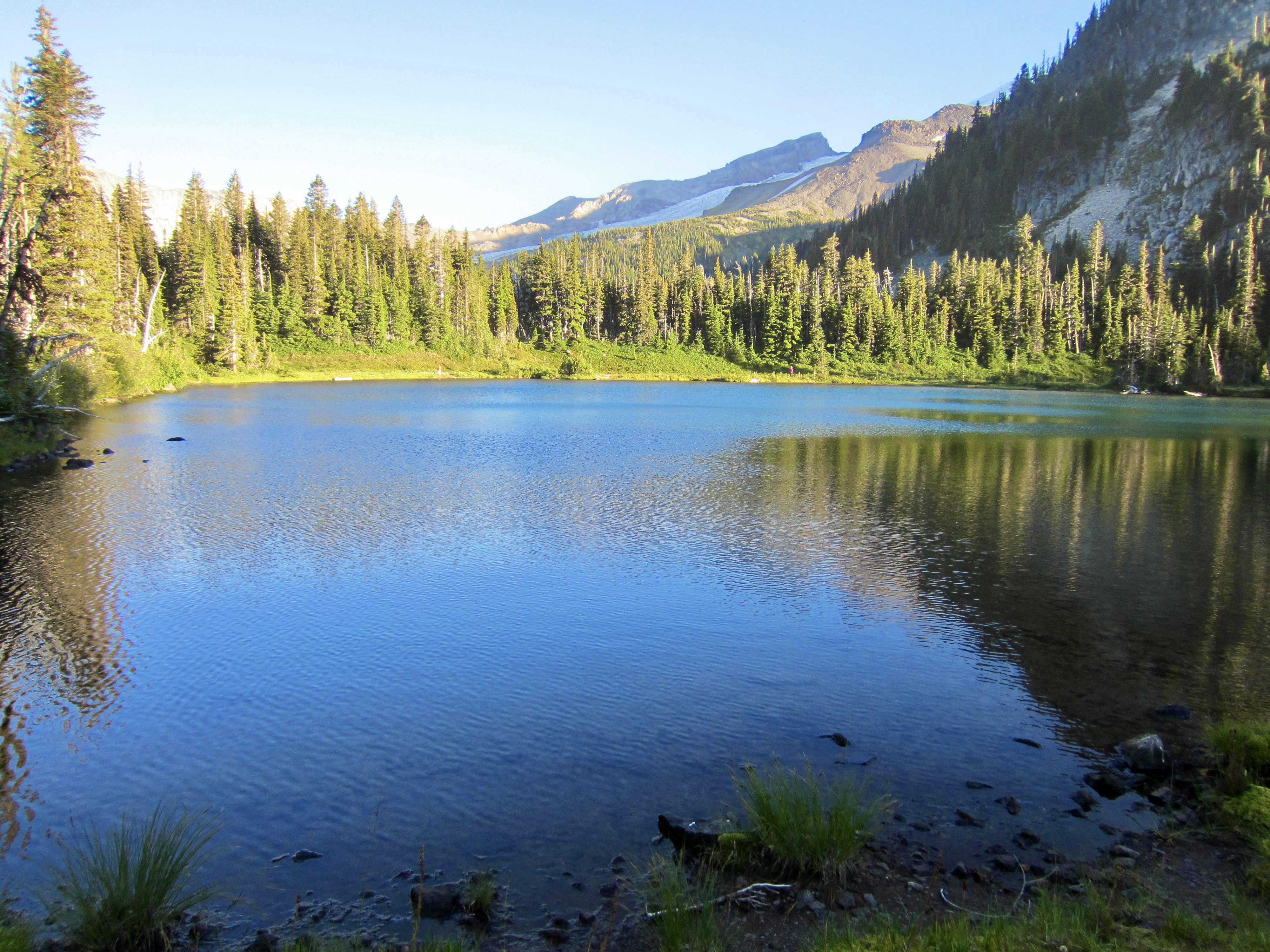
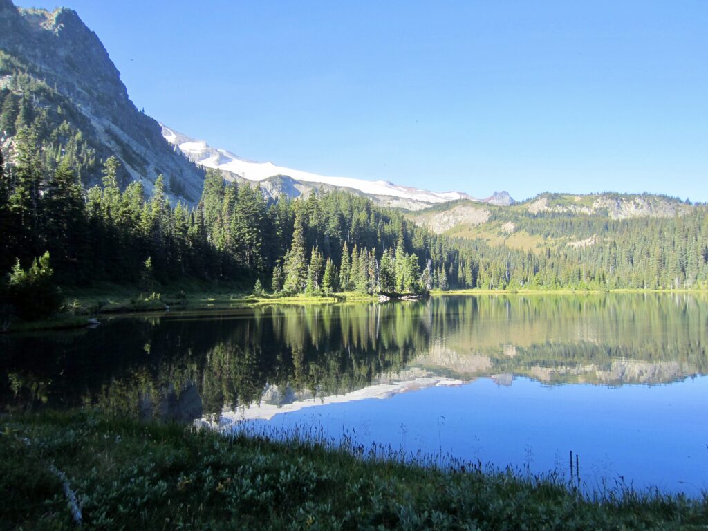
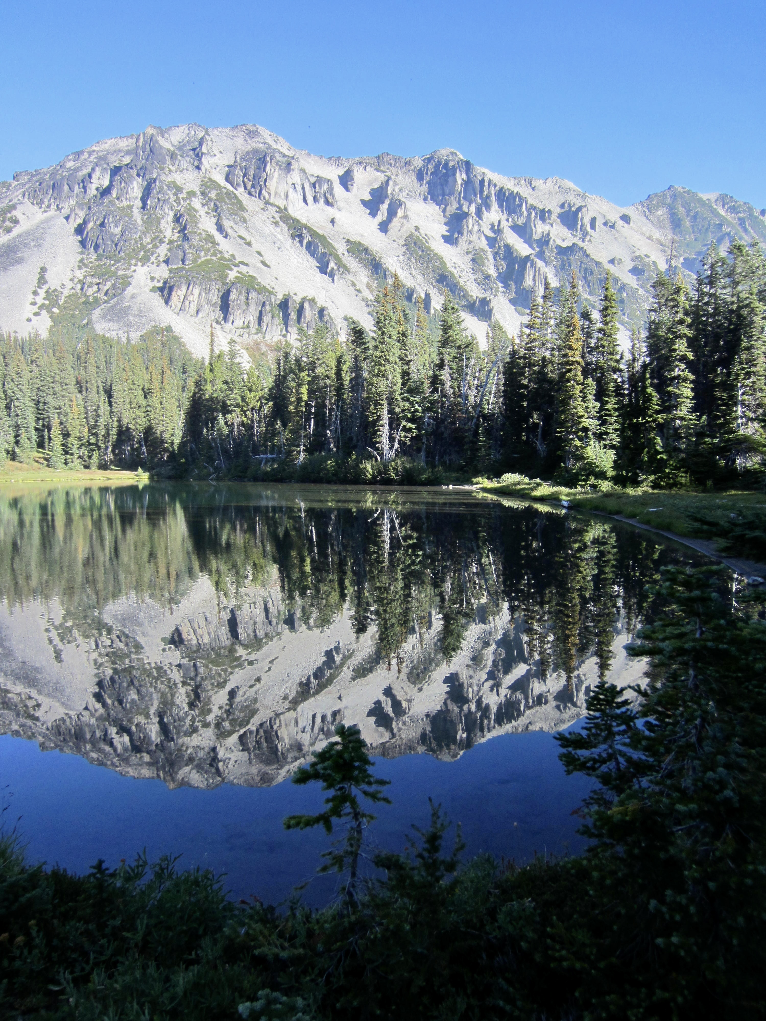
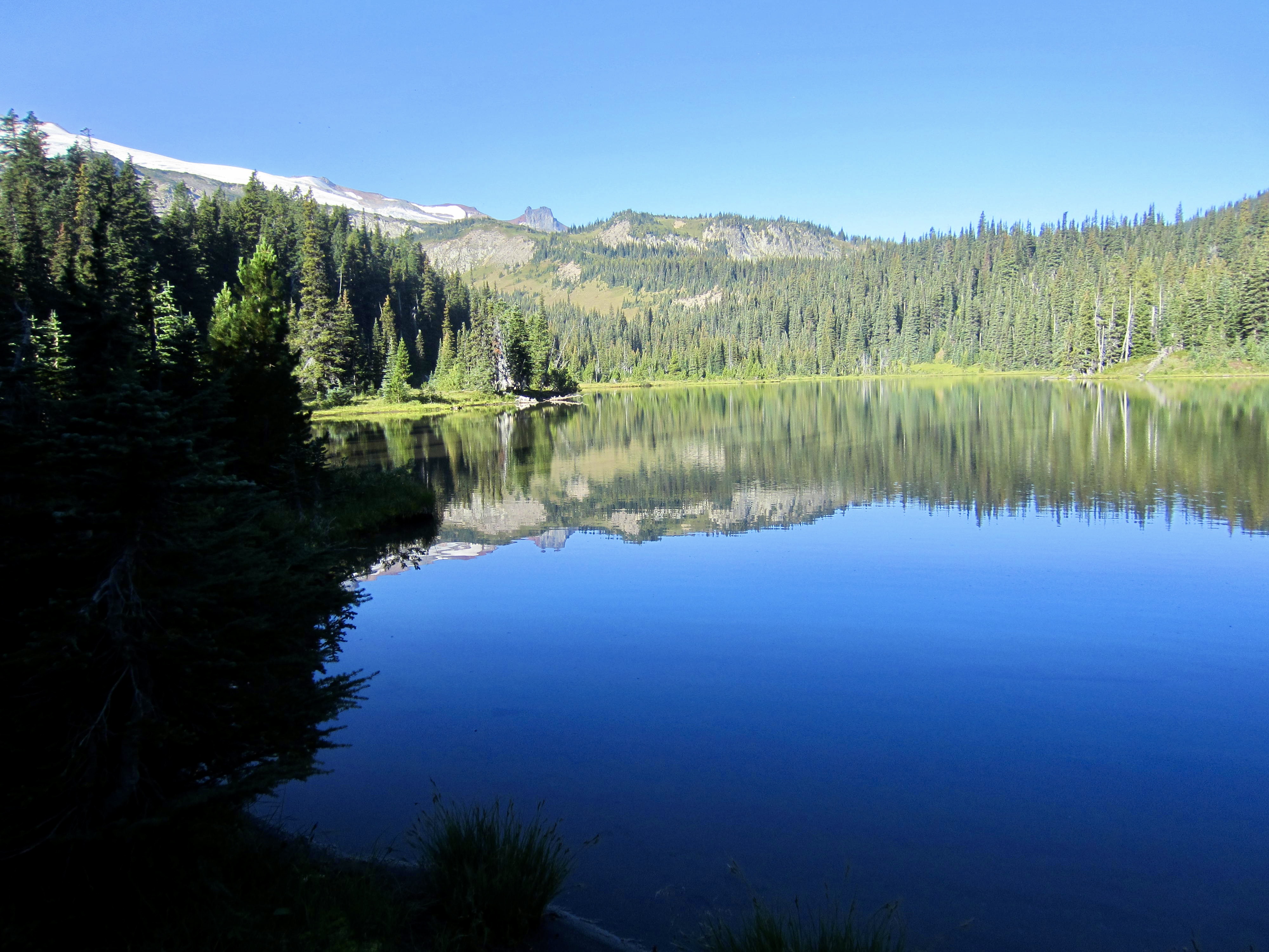
We awoke to a blue sky, thanks to shifting winds that cleared out much of yesterday’s smoke. Everyone was on the move by 8:45am, making a stop at Mystic Lake for some morning ambiance. This beautiful lake more than makes up for the lack of scenic interest at the nearby campsite.
The splendidly constructed Wonderland Trail took us over Mystic Pass and down to Moraine Creek Meadow. Throughout the morning, we met numerous “Wonderlanders” hiking clockwise and “Northern Loopers” hiking counter-clockwise. They were a good source for information regarding trail conditions and water access.

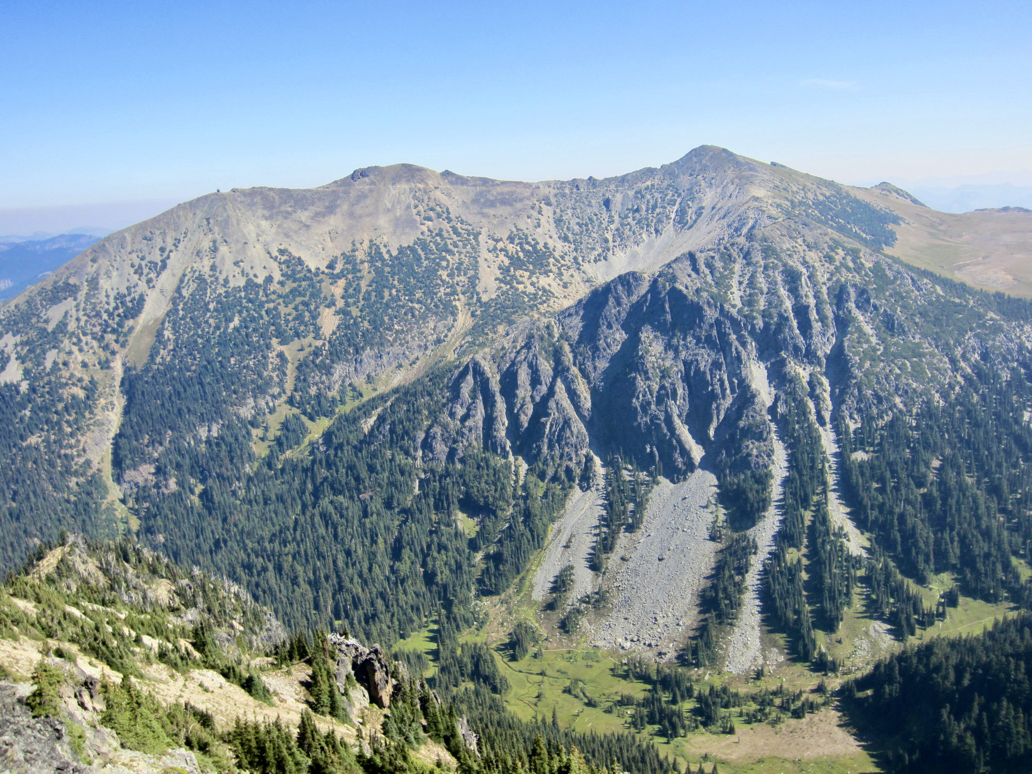
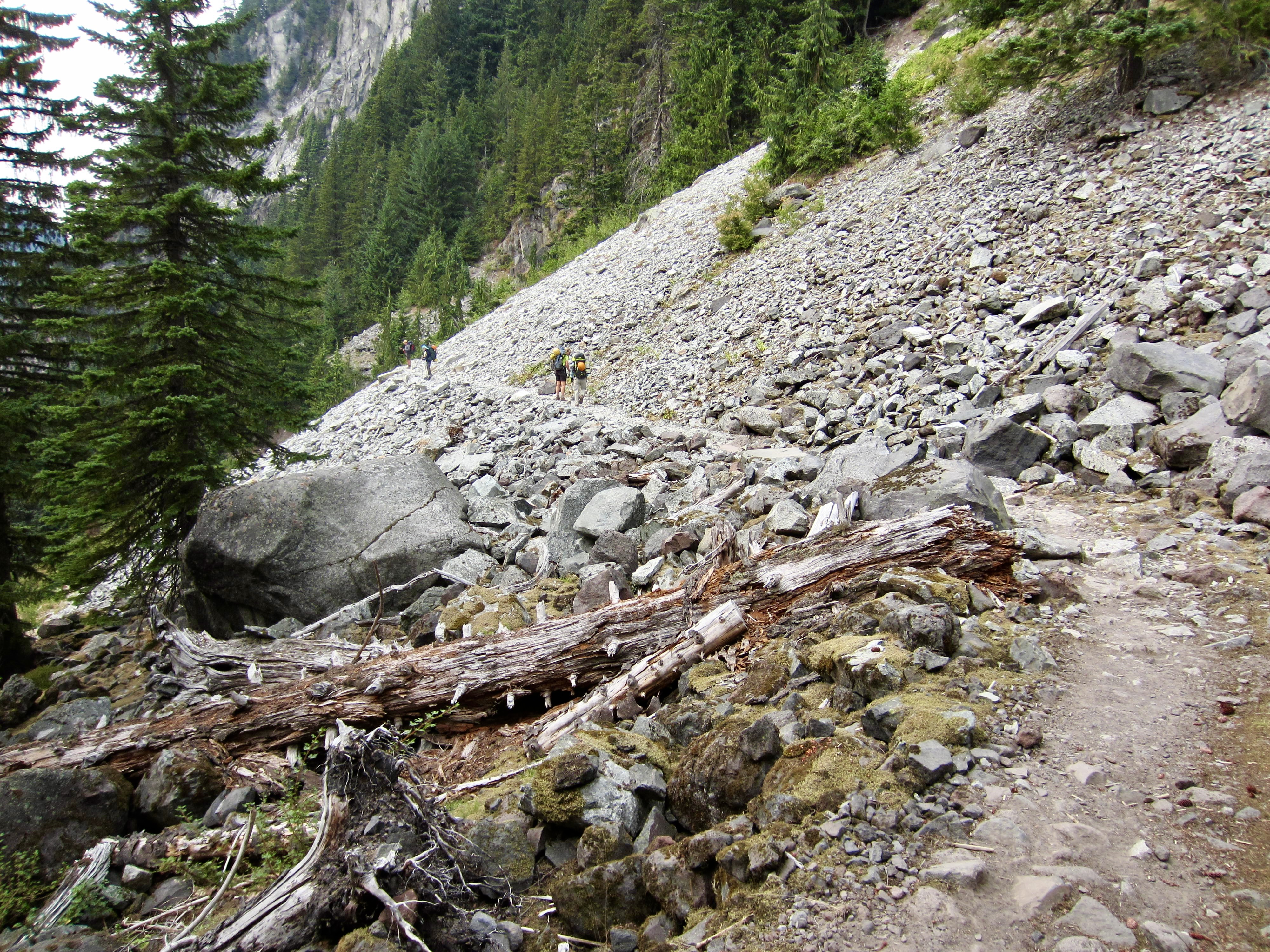
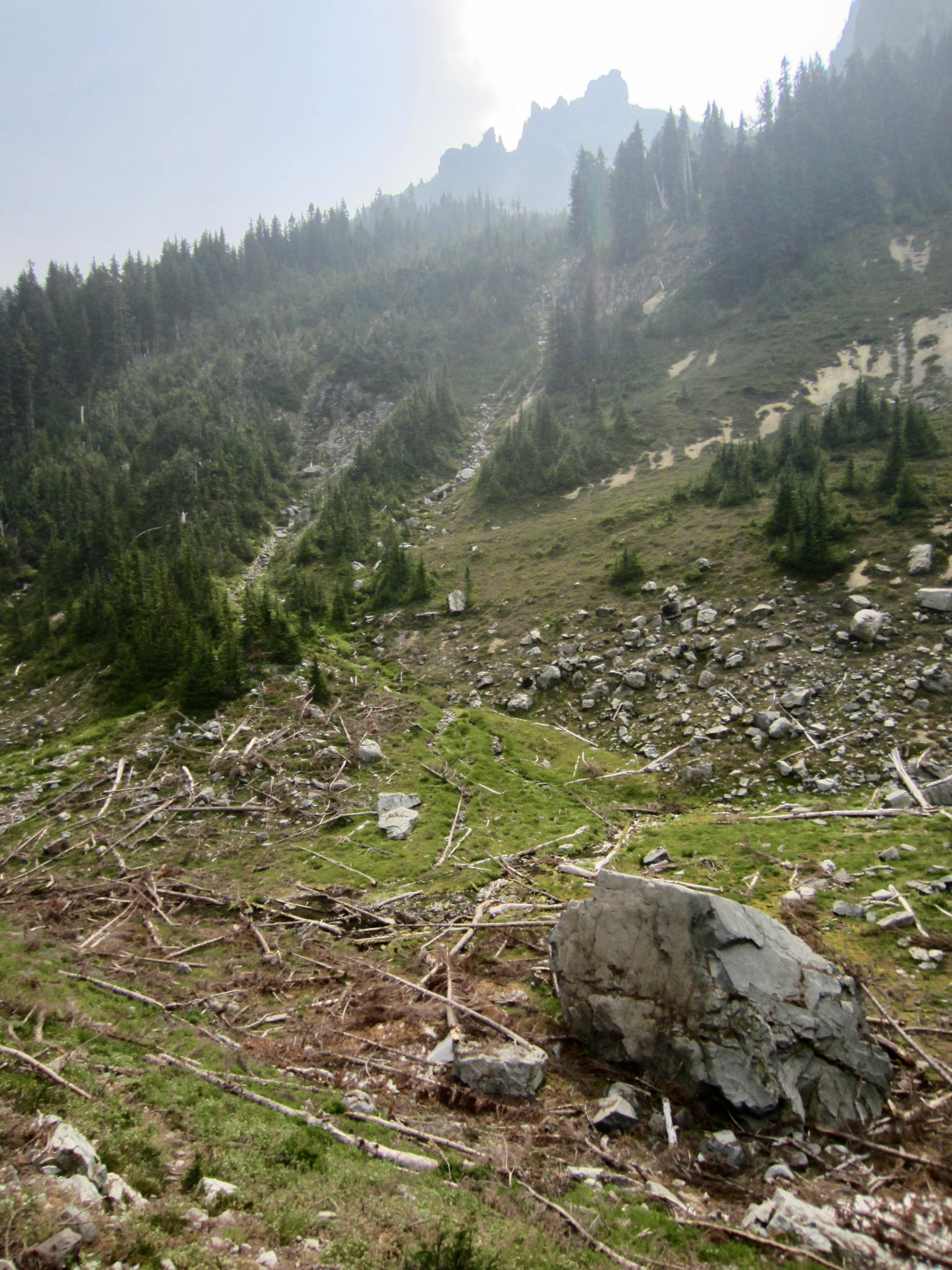
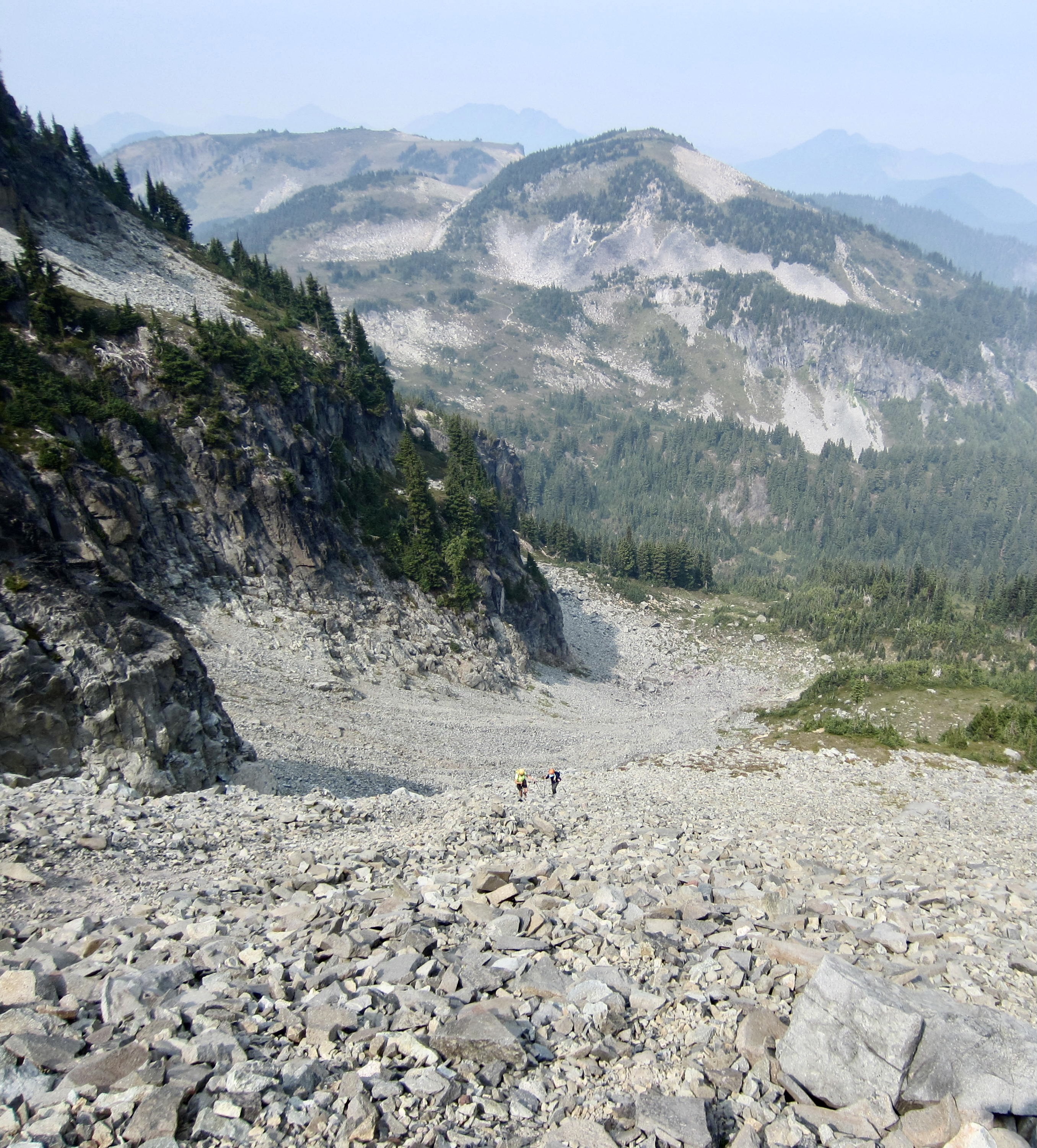
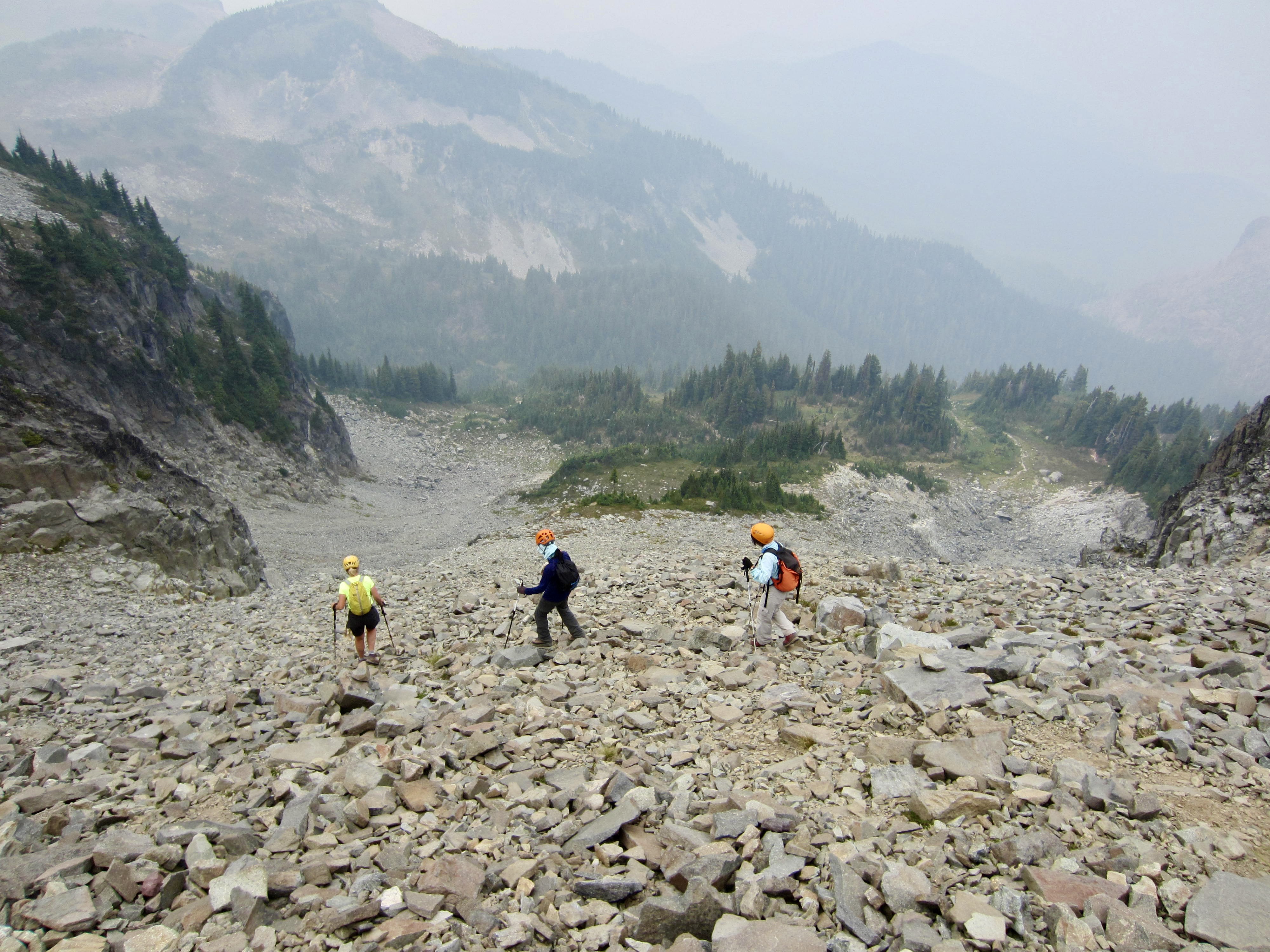
Near the northern end of the meadow, at about 5700 feet, we stashed our backpacks, hung our food bags, and headed eastward up a dry creek channel. This channel ends abruptly in 6400-foot Moraine Park, a rocky bench on the western flank of Old Desolate. From here, it becomes clear that Old Desolate earned its name honestly; the entire mountainside is a huge, barren, sloping field of talus and scree.
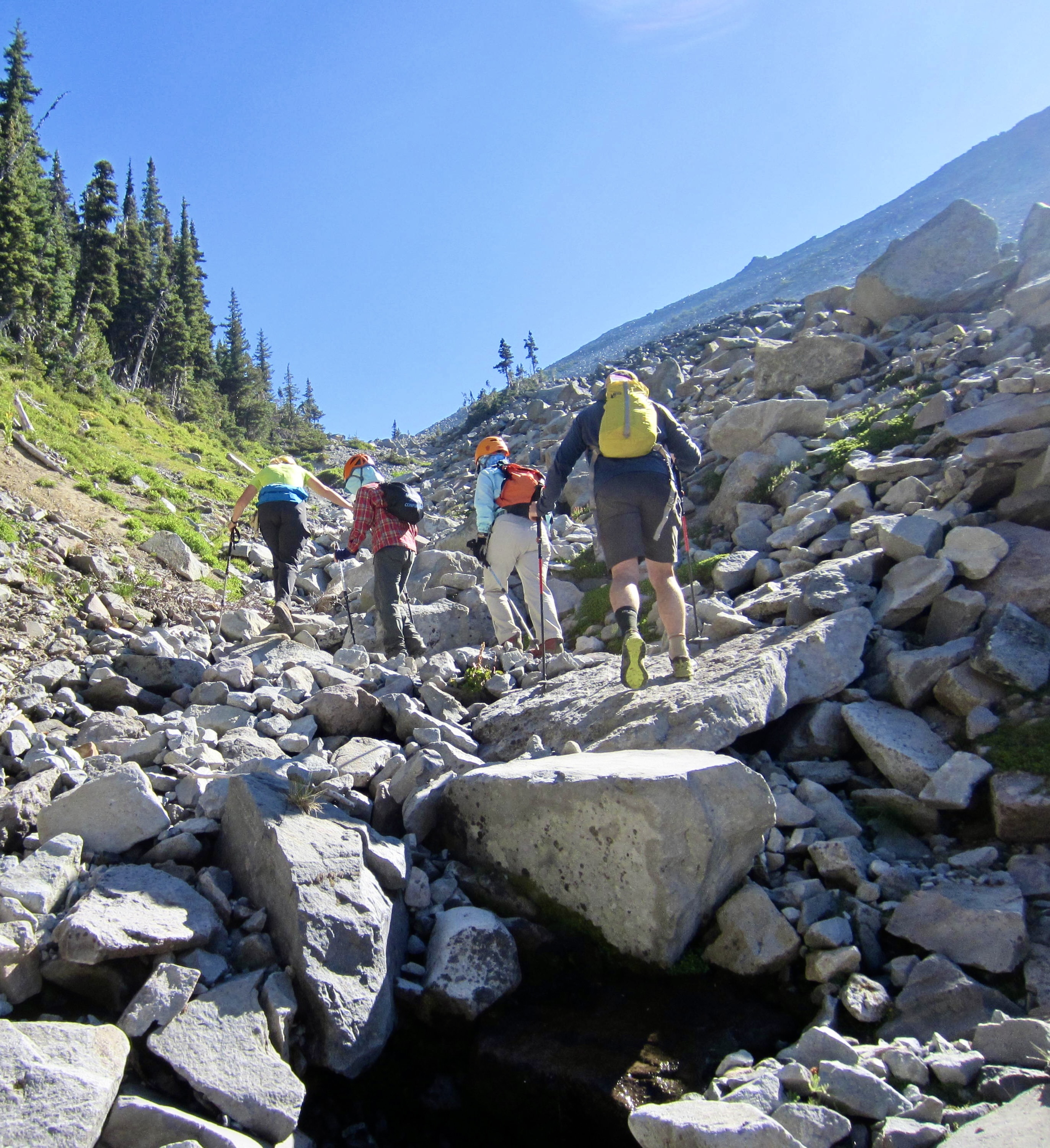
We hiked northeasterly across Moraine Park until just past the summit, then began groveling up the hillslope. The talus was steep and loose and treacherous, requiring great care to avoid rolling rocks onto ourselves or each other, but there did not seem to be a good alternative.
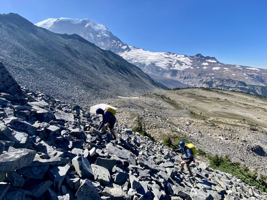
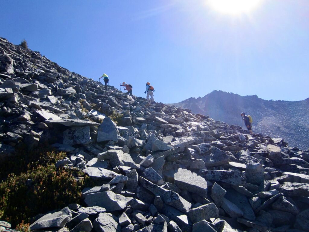
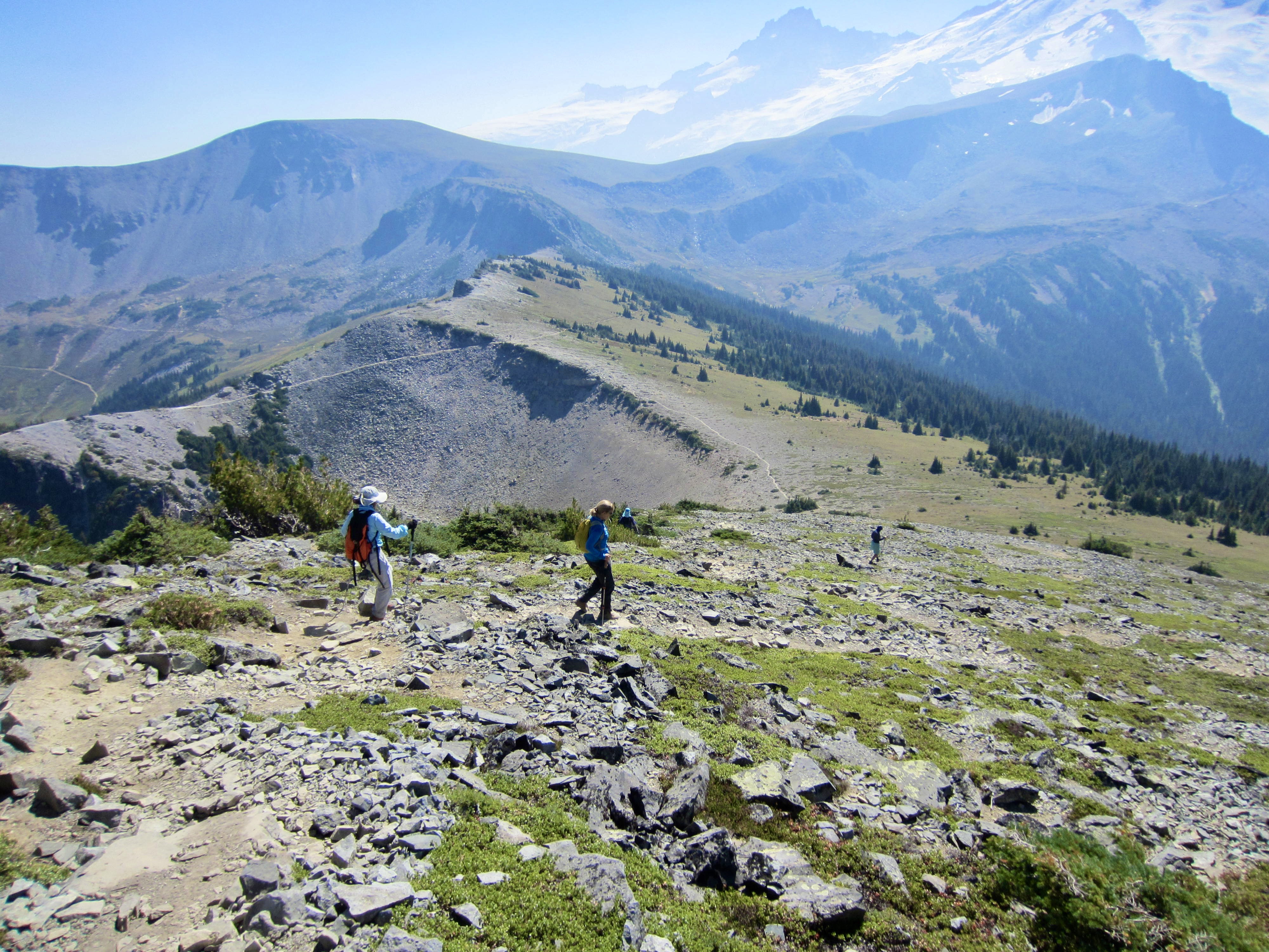
We gained the rounded summit shortly after noon (1.5 hours + 1350 feet from pack stash). Although wildfire smoke was obscuring distant views, the nearby peaks were still visible. Mt. Rainier and Willis Wall dominated the scene to our south, as did Sluiskin Mountain to our north.
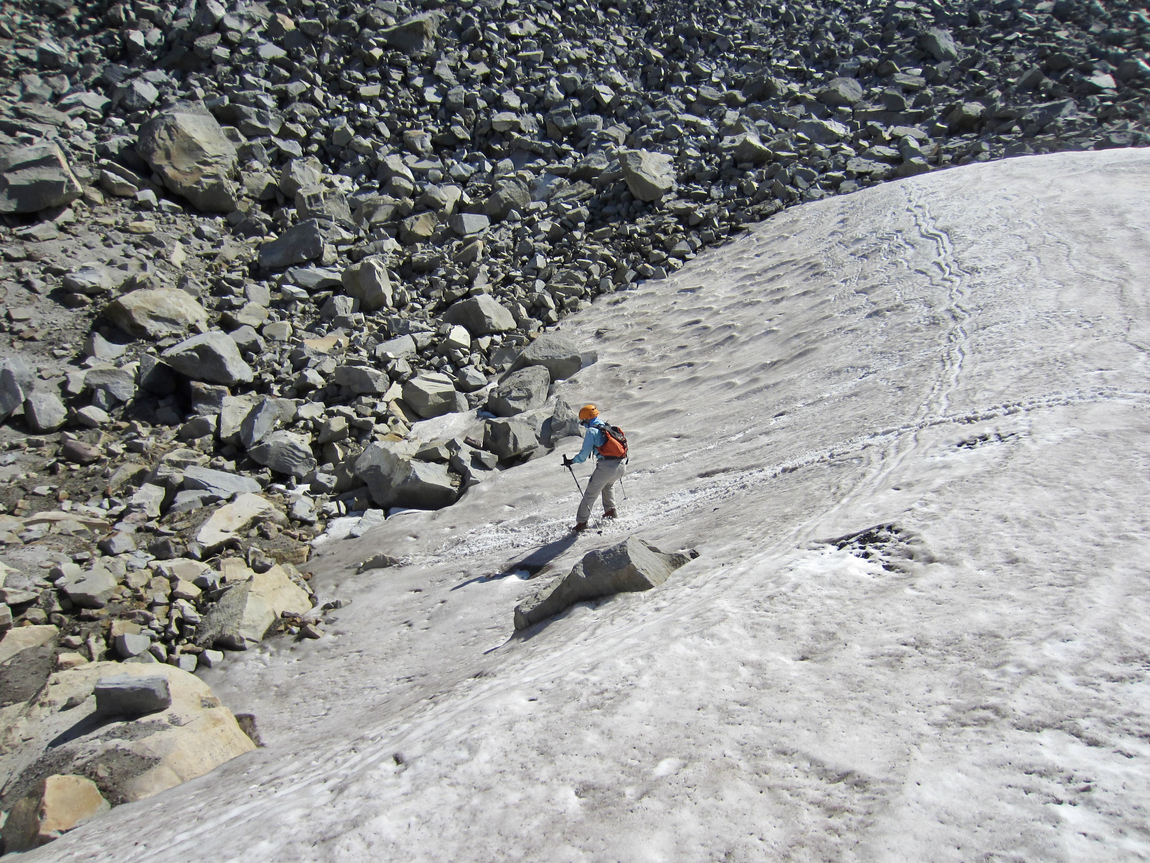
For our descent, we linked together a series of scree ribbons that allowed us to avoid most of the treacherous talus. We stopped briefly in Moraine Park, where Yoko—who could be described as 60-going-on-16—took the opportunity to gleefully play on a snowpatch, then we continued down to our pack stash (1.4 hours from summit). It was a relief to complete the entire climb without incurring any injuries.
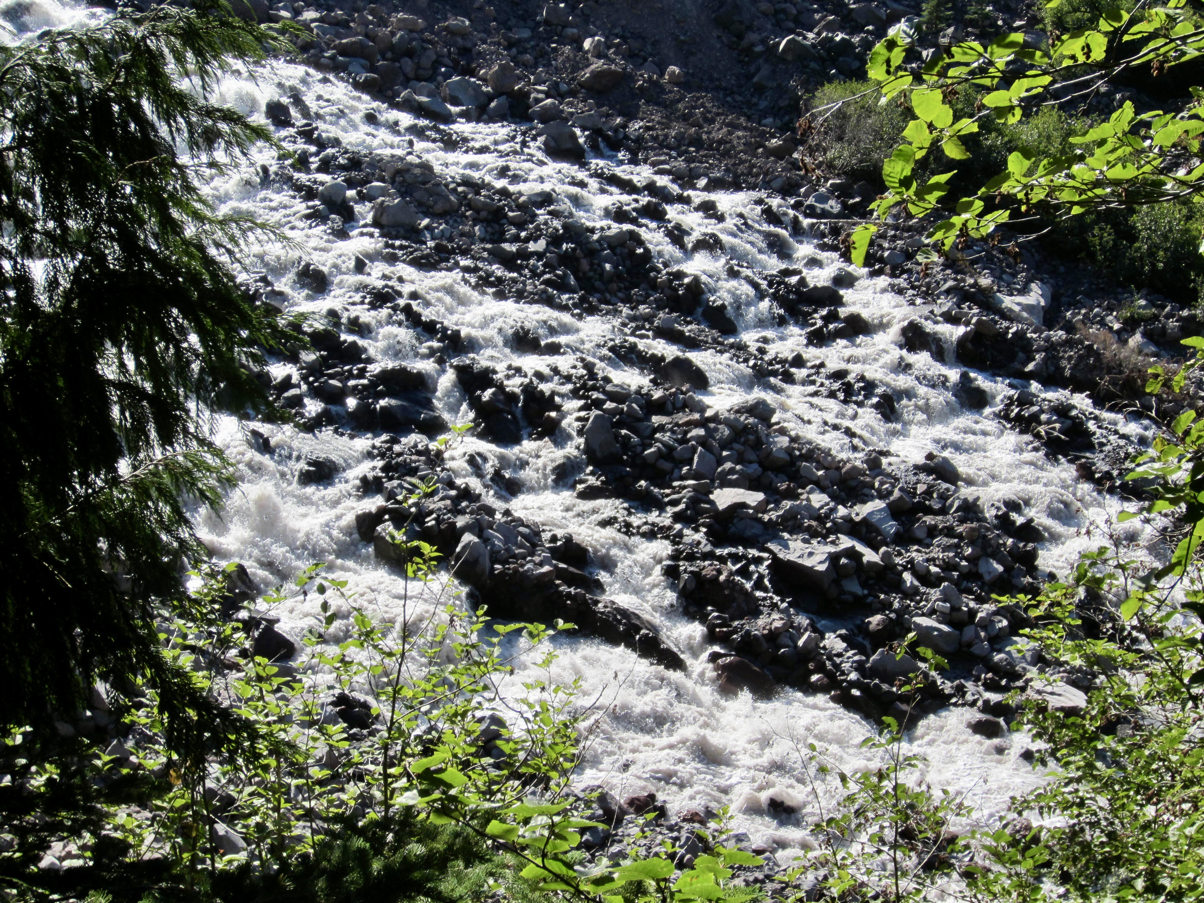
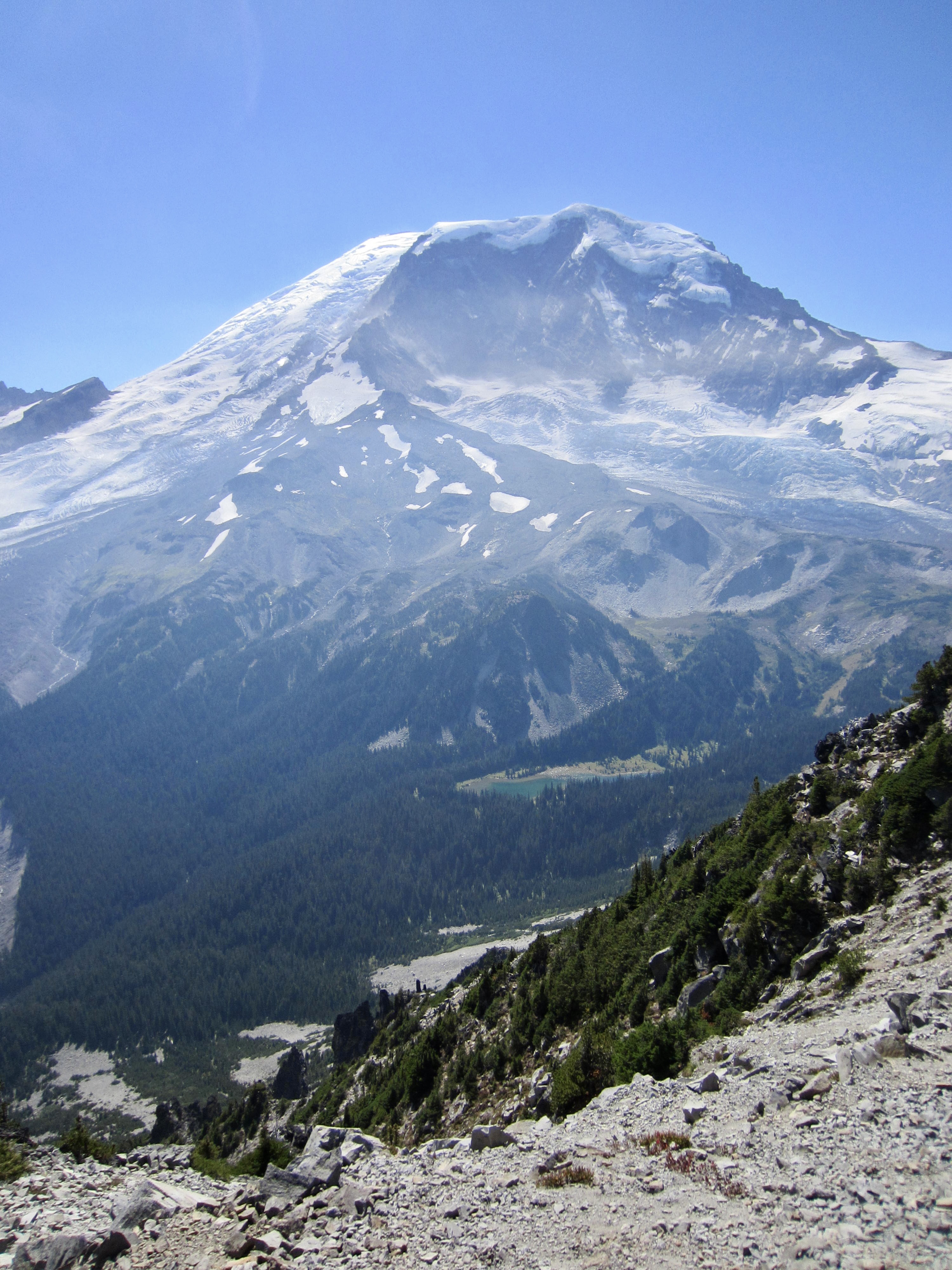
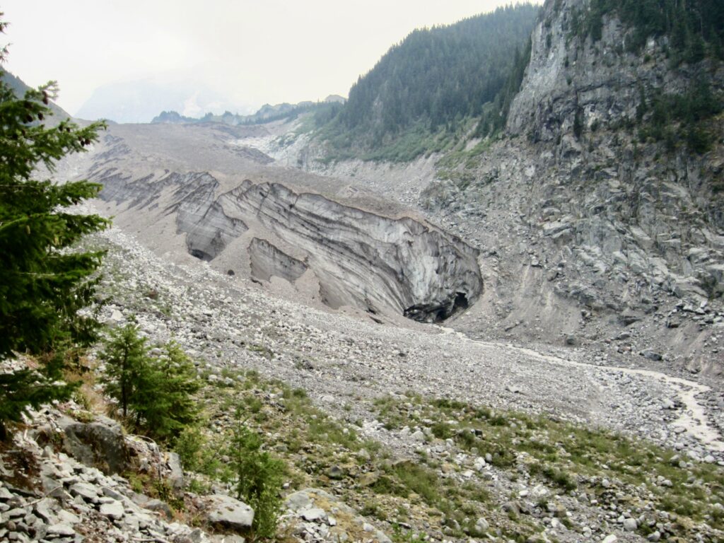
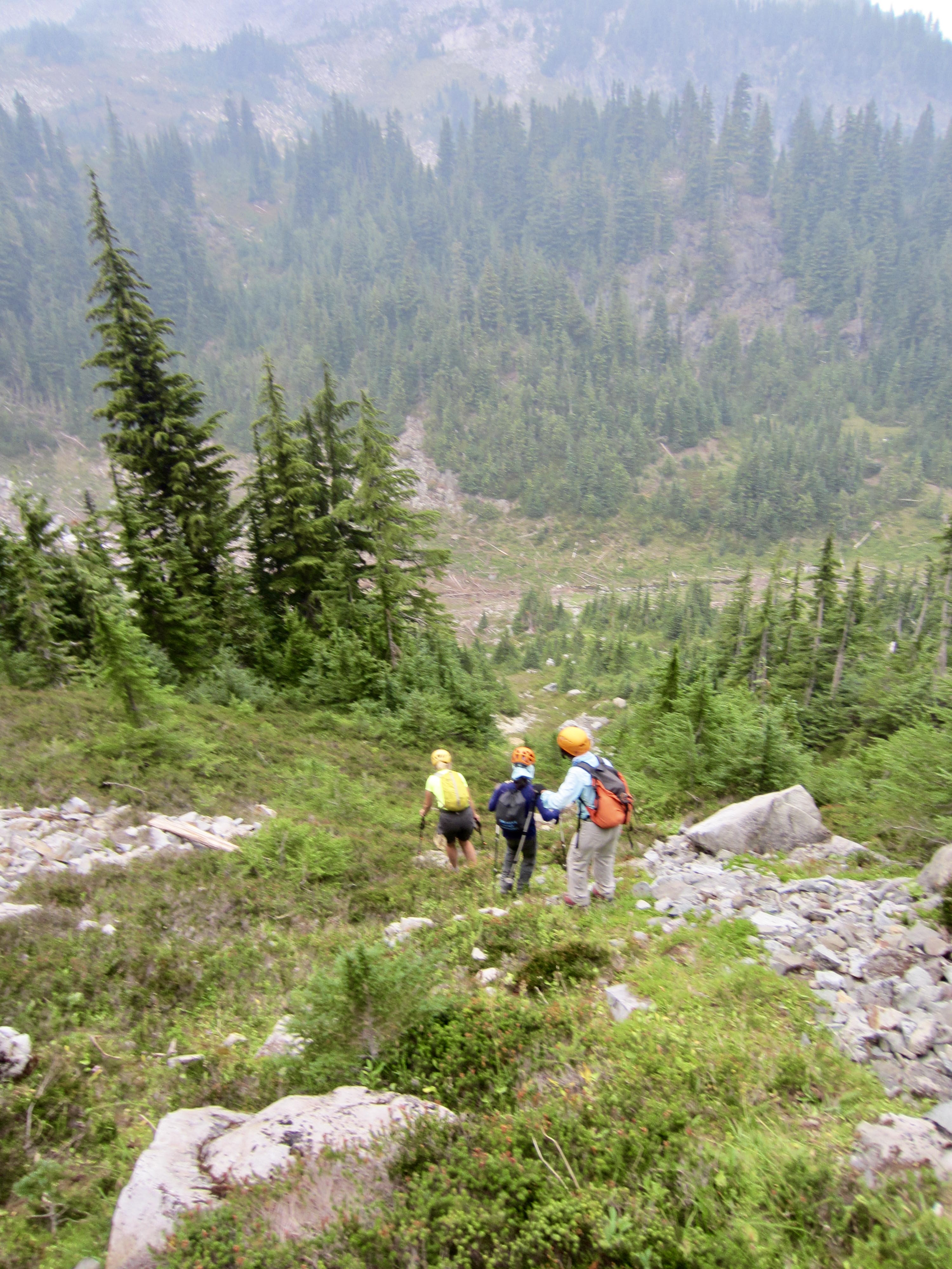
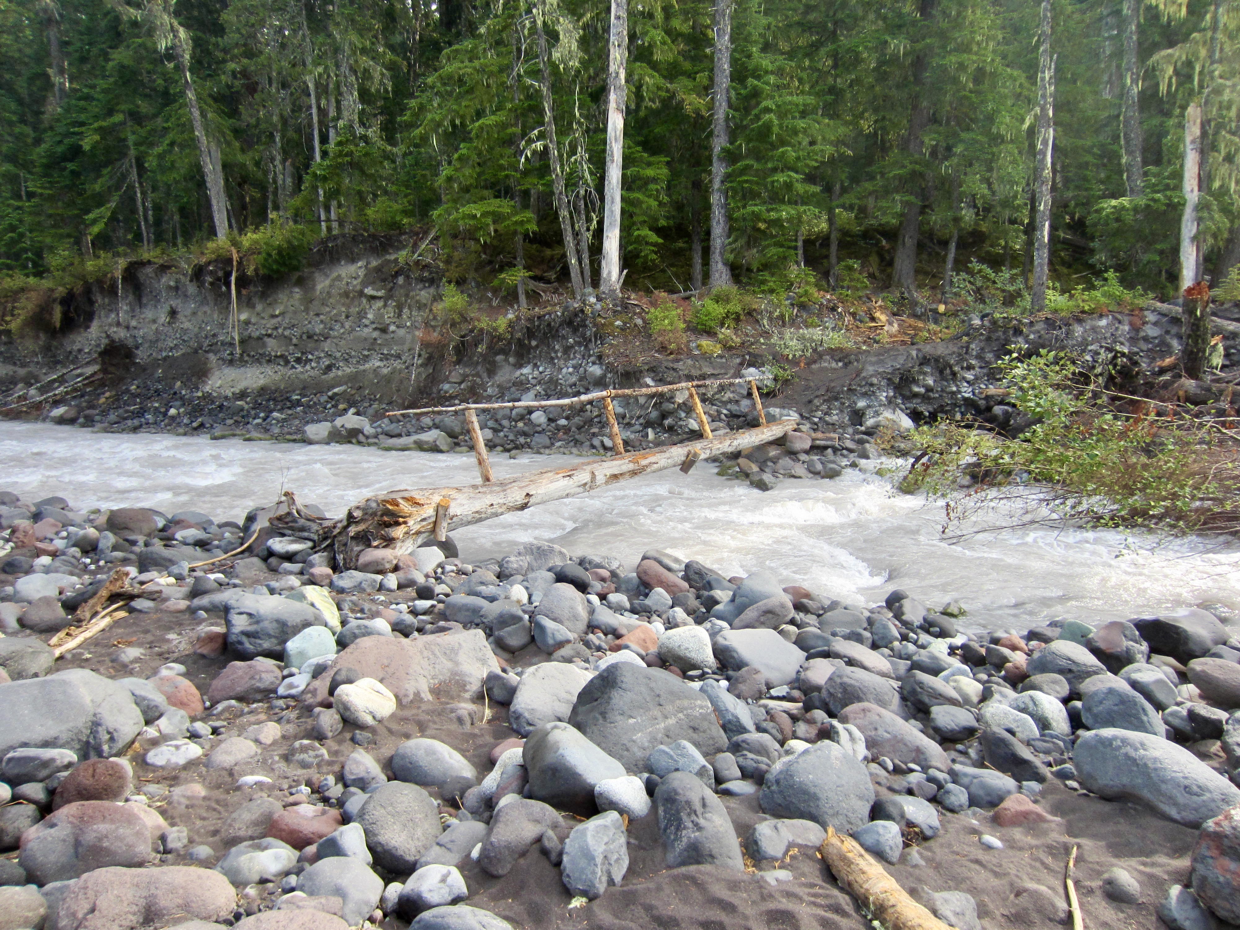
We shouldered our backpacks and began a long descent into the Carbon River Valley. It was fascinating to hike alongside the stagnant tongue of the Carbon Glacier, which currently fills the valley with more than 100 feet of stratified ice and is completely blanketed by rock detritus. The milky gray Carbon River gushes out of a tunnel at the glacier’s snout.
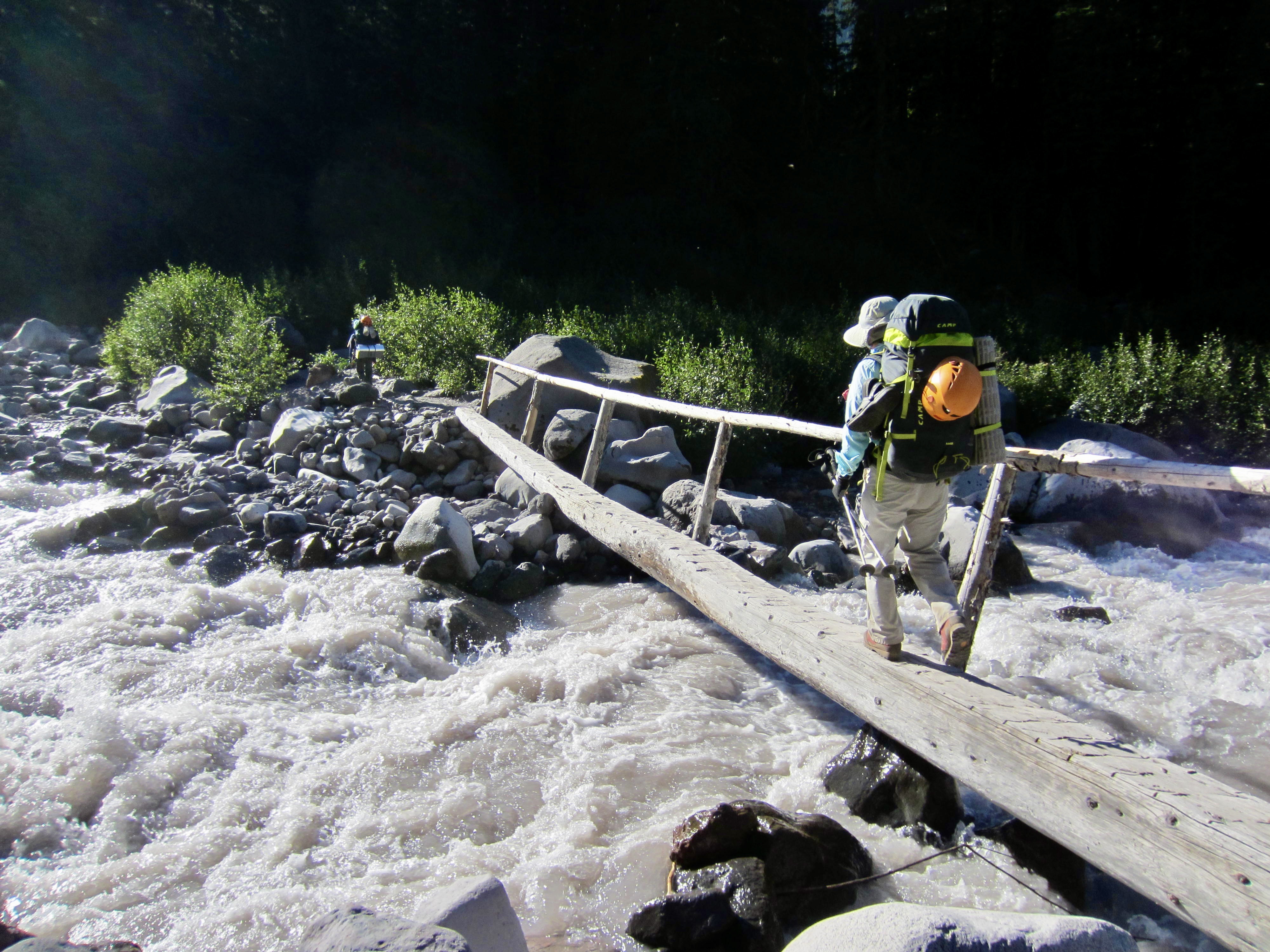
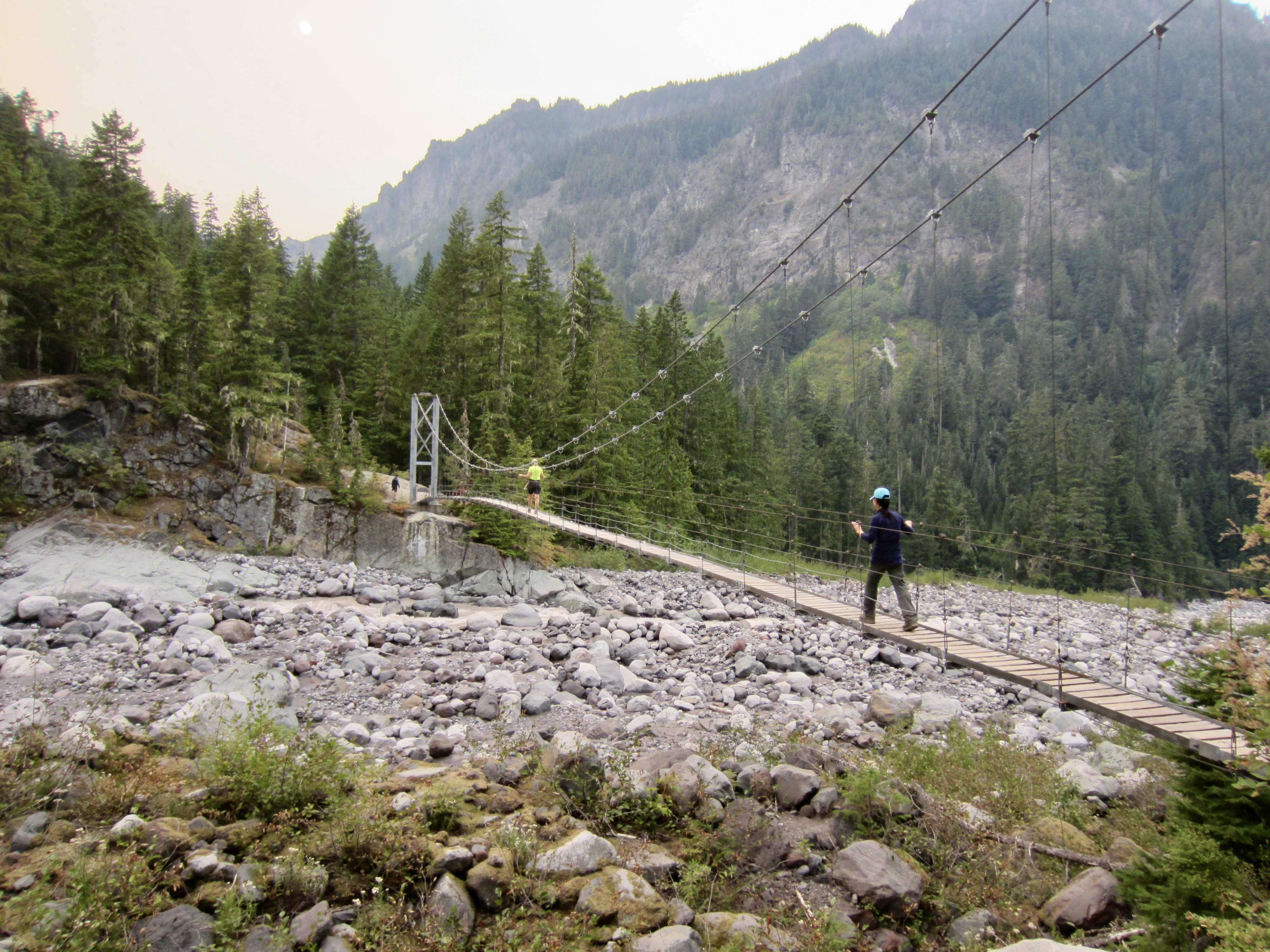
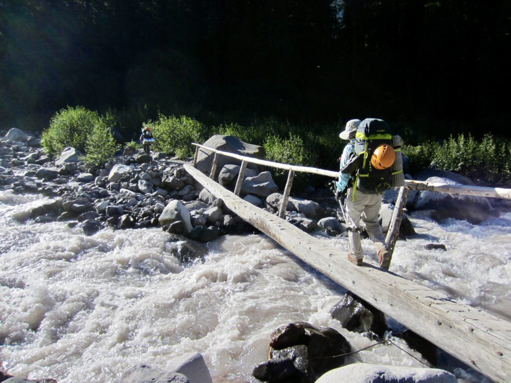
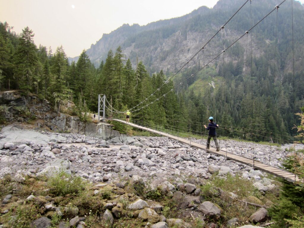
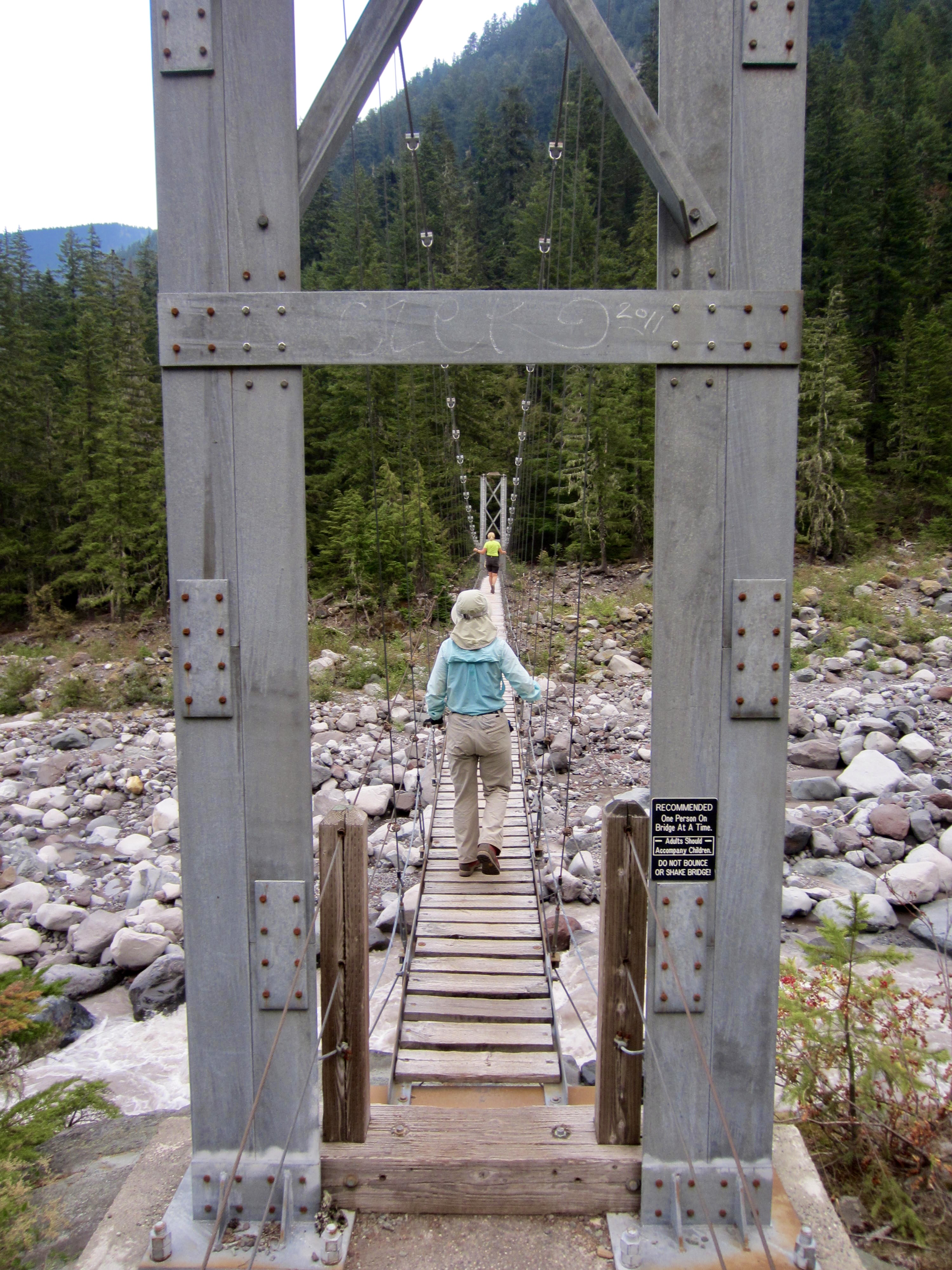
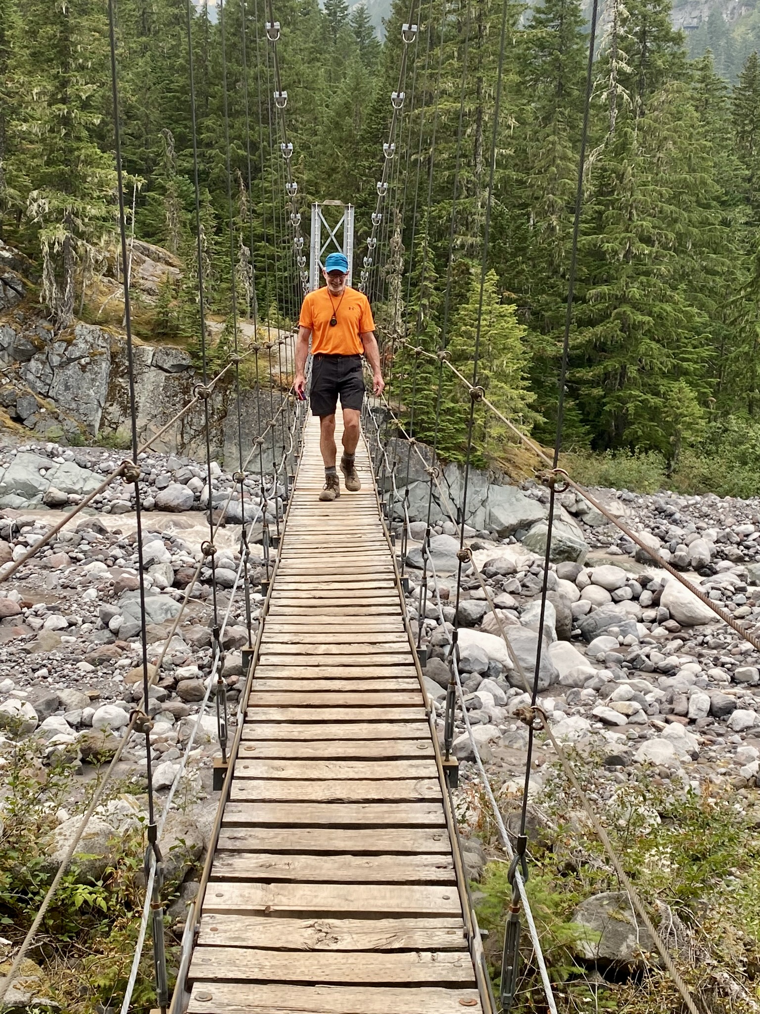
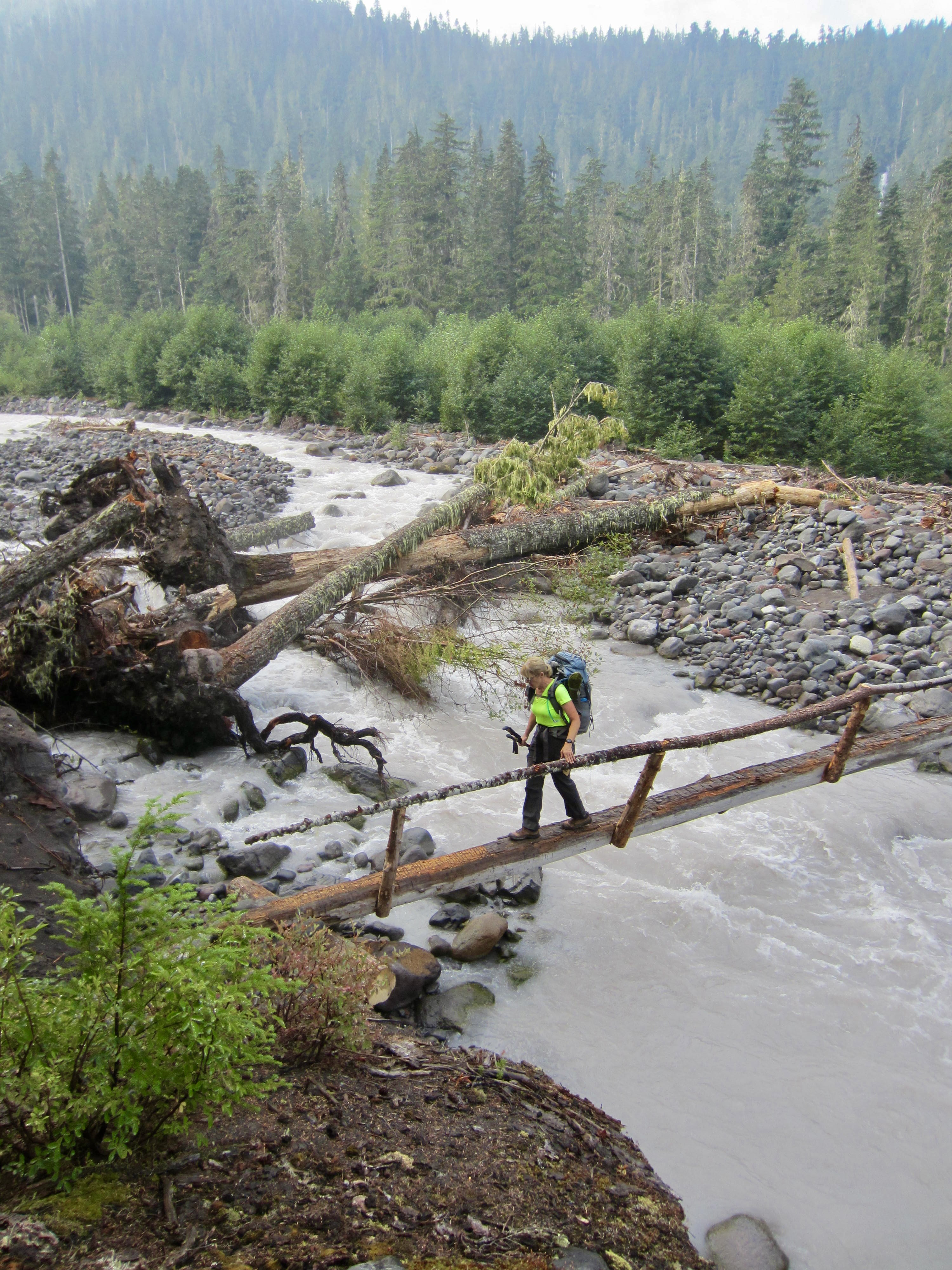
Another highlight of our down-valley hike was a long, narrow suspension bridge that stretches across the Carbon River near its confluence with Cataract Creek. We all took a jaunt across the jiggly span and marveled at the obvious difficulties involved with constructing a backcountry structure of this magnitude.
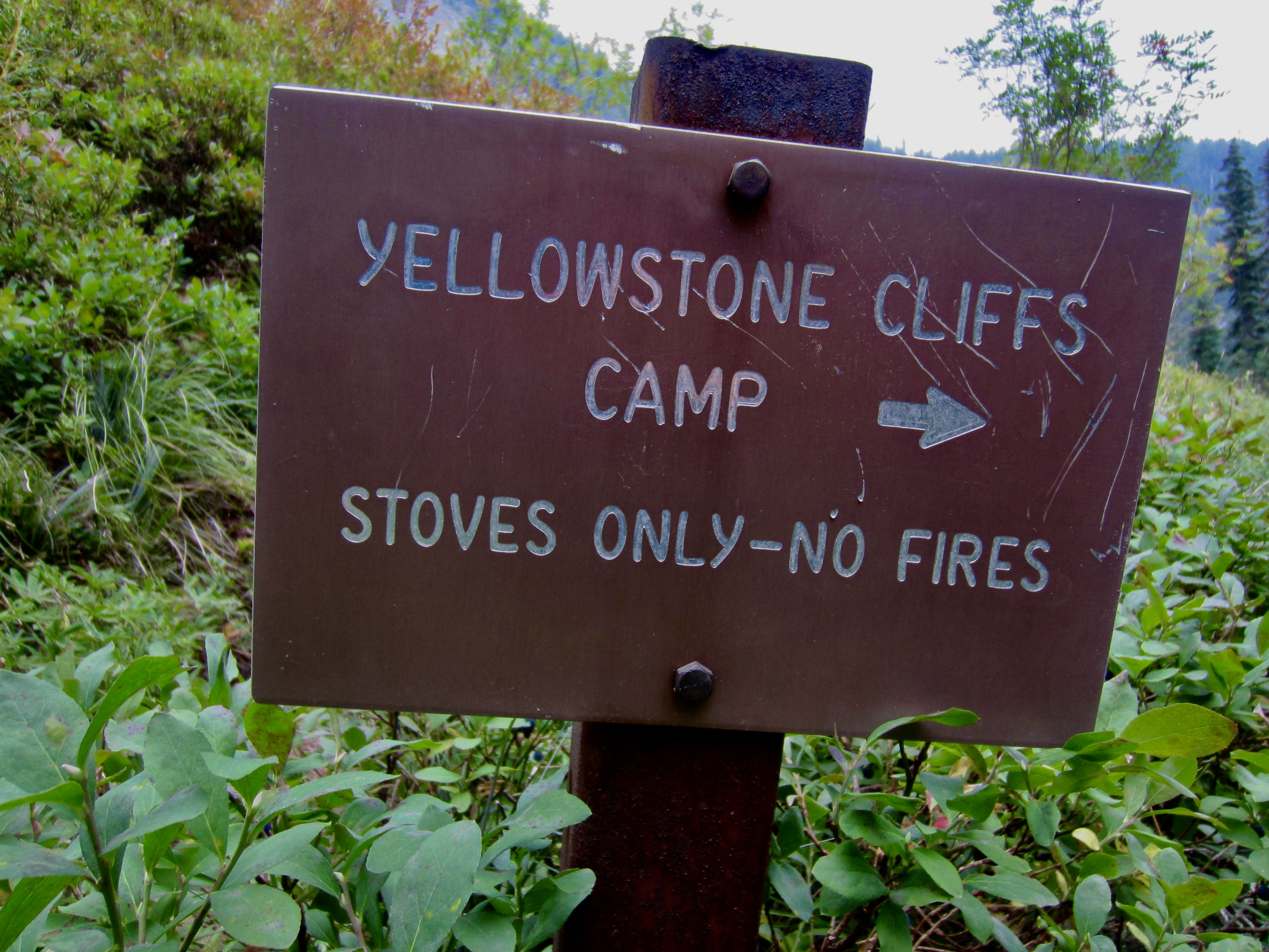
Shortly past the suspension bridge, we came to a junction where the Wonderland Trail turns westward and the Northern Loop Trail turns eastward. From here, the latter trail becomes noticeably steeper, narrower, and rougher. It felt as though we’d turned off a freeway and onto a country roadway! The remainder of our day involved an exhausting 2000-foot hike up to Yellowstone Cliffs Camp. After what seemed like a 4000-foot ascent, we arrived at the campsite scant minutes before dark (11.2 hours + 10.1 miles + 4000 feet – 4500 feet from Camp 1, including sidetrip).
Day 3: Yellowstone Cliffs Camp to Lake James Camp + Sluiskin Chief
Following nighttime rain showers, we awoke to overcast skies and a hope that some of the wildfire smoke would be washed out (unfortunately, it wasn’t). Andrew needed to be home tonight, so he left camp first and hightailed it back to Sunrise, feeling satisfied with his three earned summits.
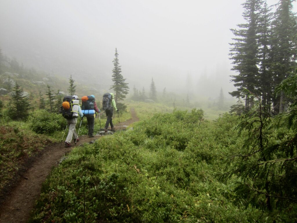
Baram, Yoko, Eileen, and I left camp 45 minutes later, with sights set on our most difficult summit objective: Sluiskin Chief. We hiked up the Northern Loop Trail through steep slopes covered by lush vegetation, beneath the volcanic palisade of Yellowstone Cliffs.
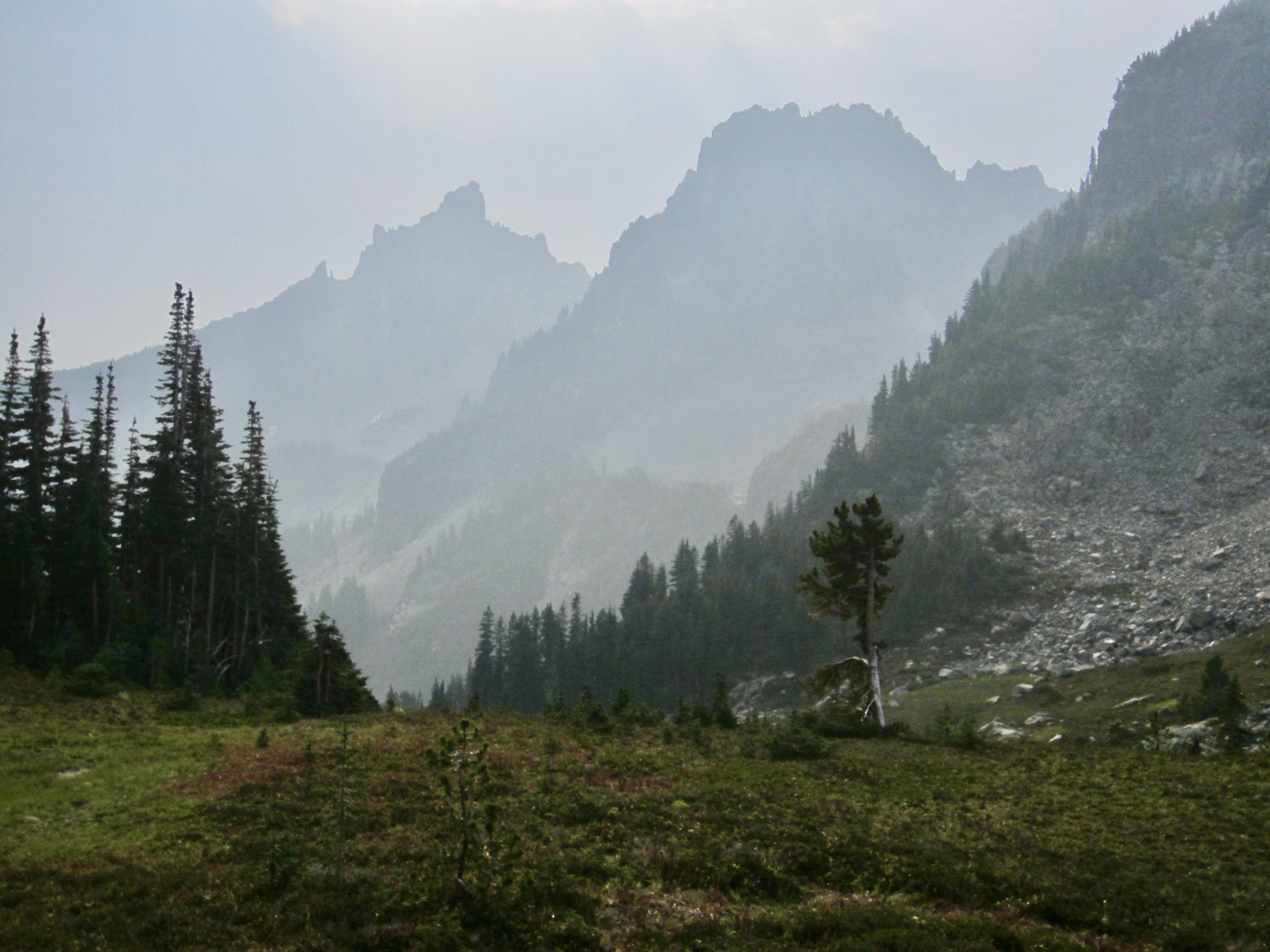
We soon topped out at Windy Gap, a 5800-foot pass consisting of rolling heather fields dotted with three small lakes. Sluiskin Mountain was visible directly ahead, presenting a ghostly silhouette in the smoky atmosphere.
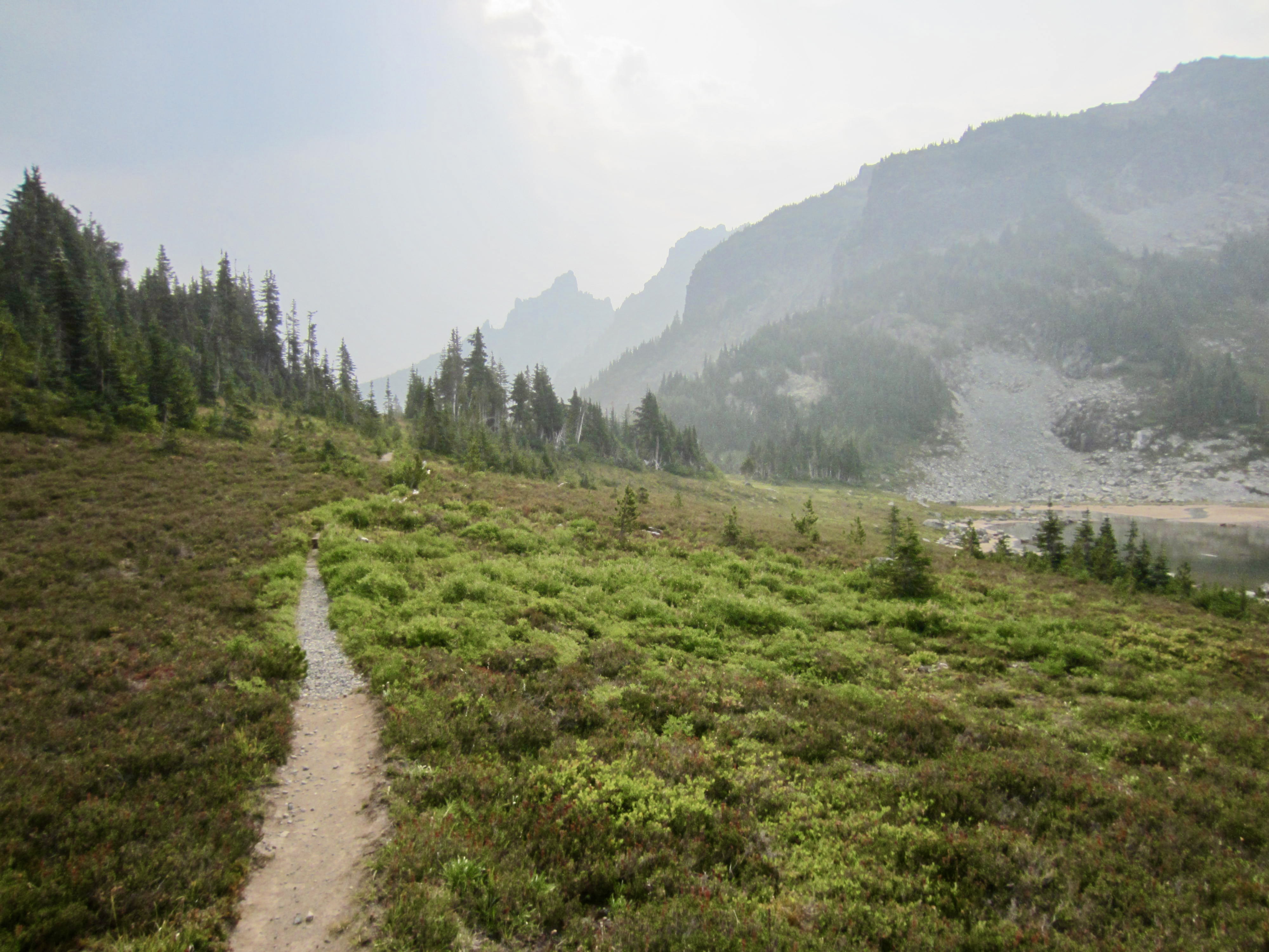

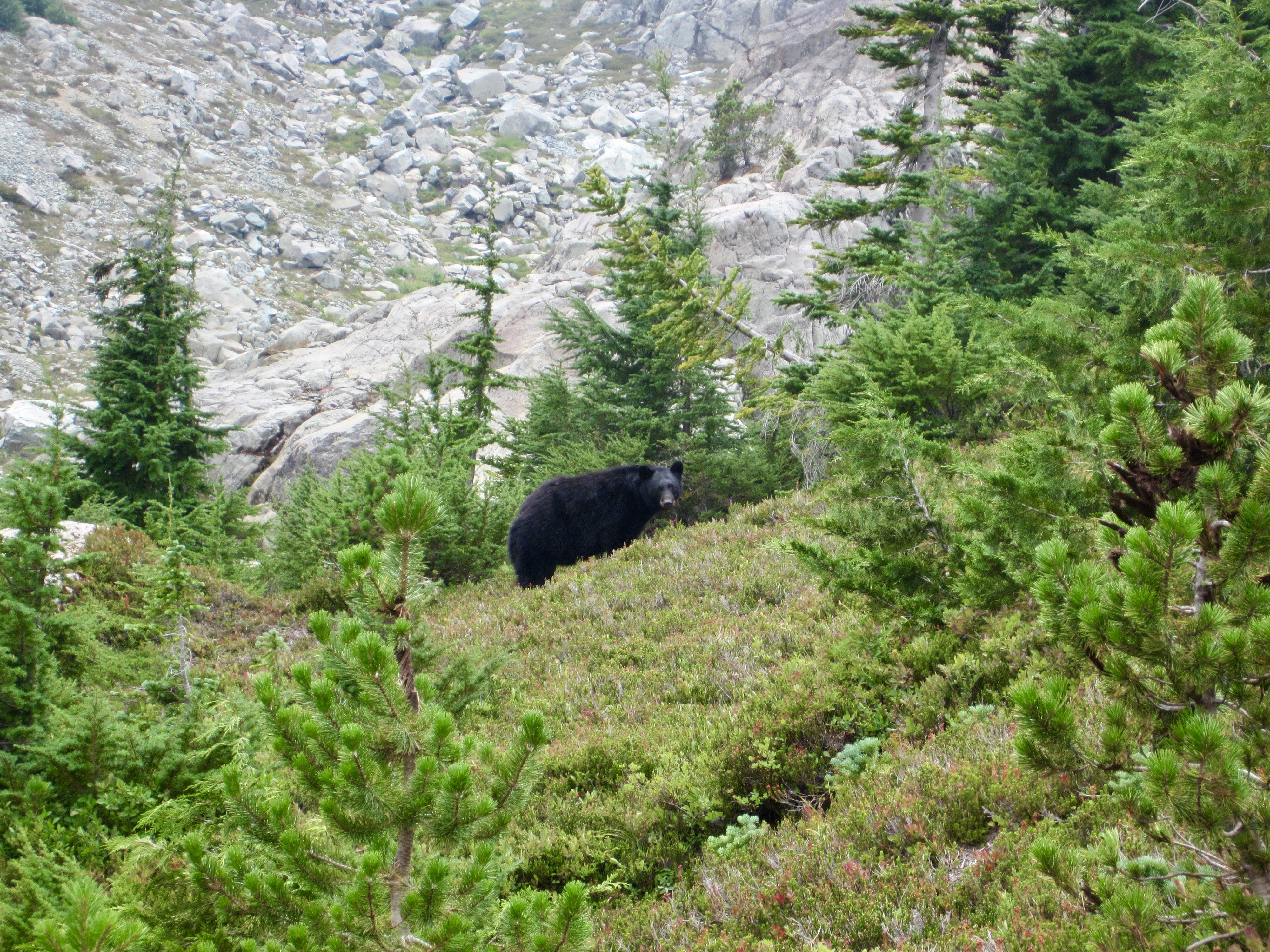
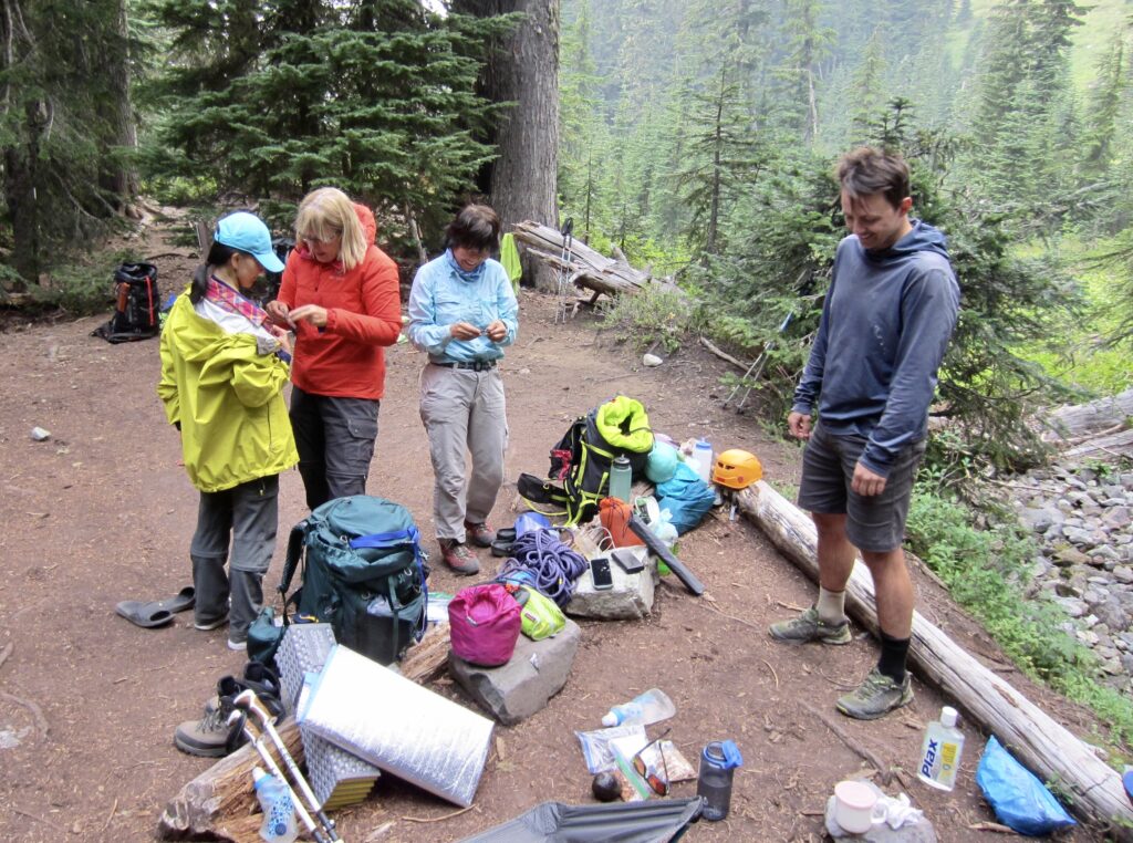
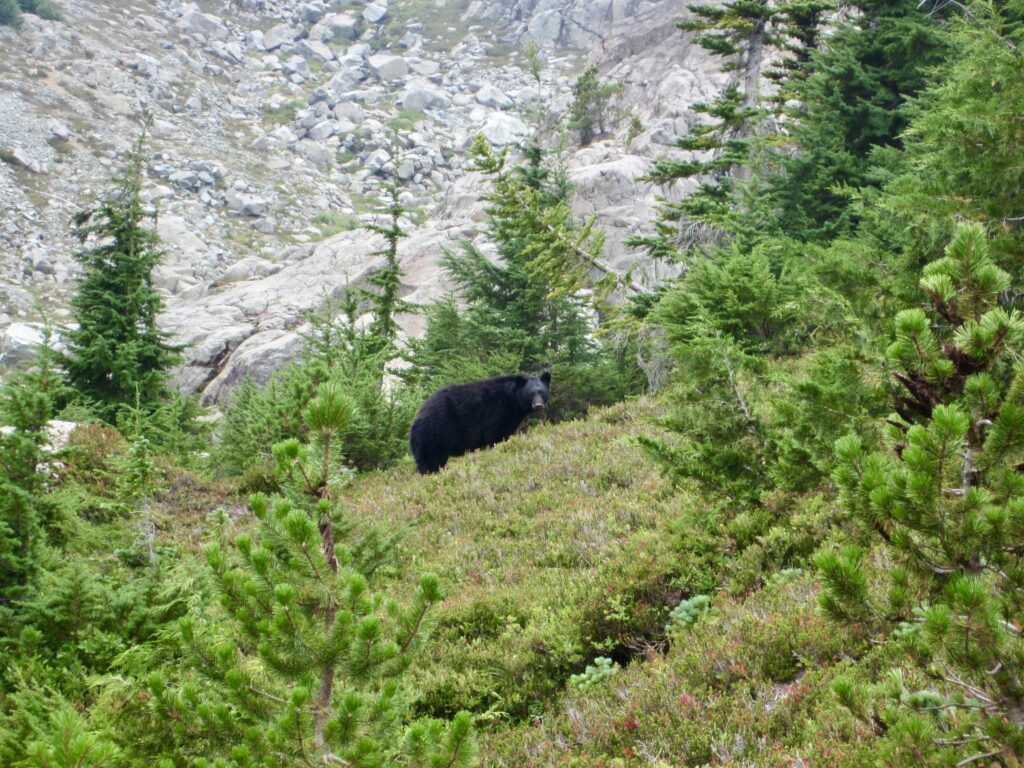
We descended about 150 feet on the eastern side of Windy Gap, dropping onto a meadowy bench and passing a medium-size black bear who was grazing on huckleberry bushes beside the trail. Thankfully, he or she had little interest in us. Just after crossing a short footlog, we stepped off the trail and stashed our backpacks—taking care to hang all of our food far out of reach of the nearby bear!
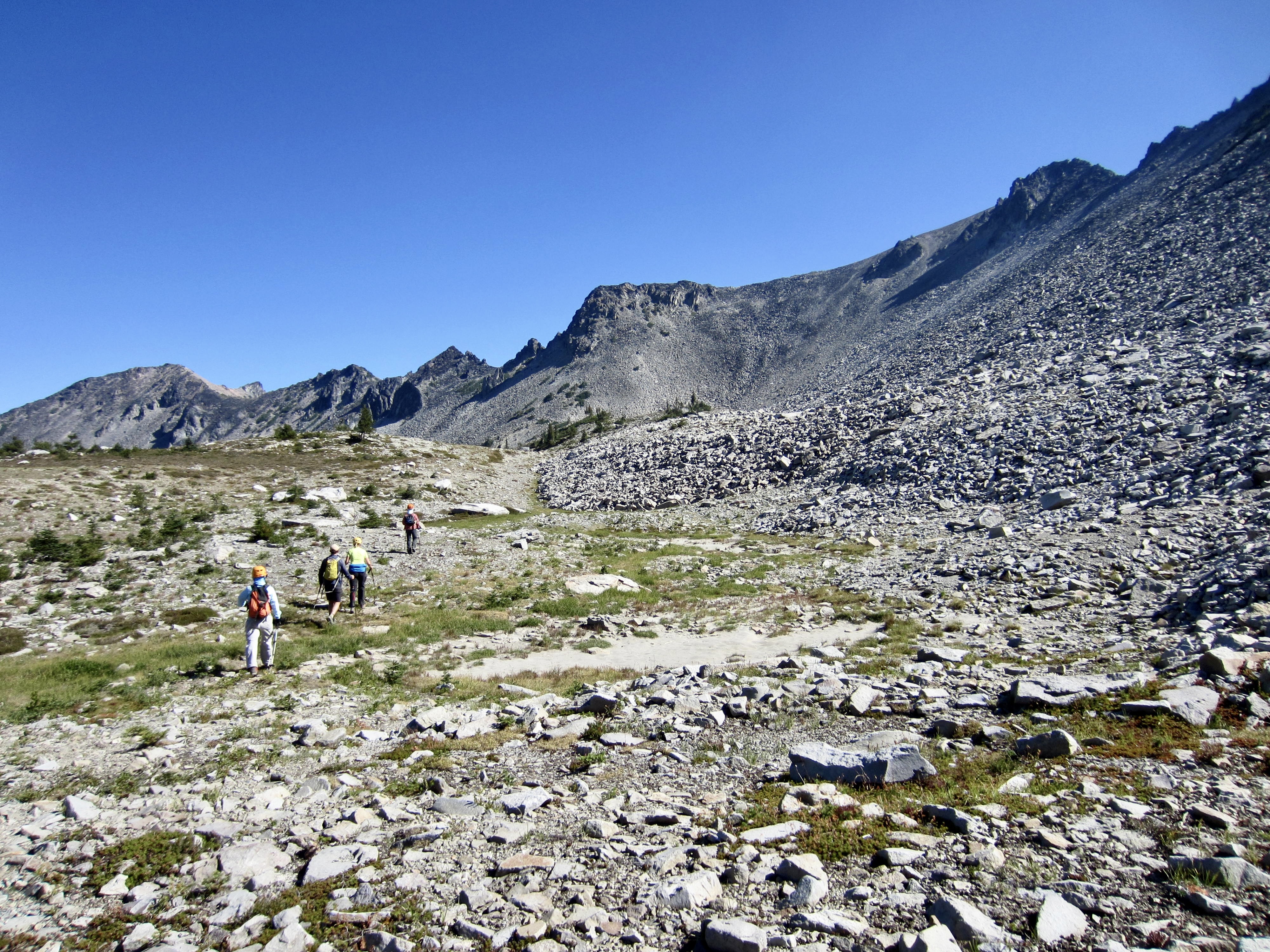
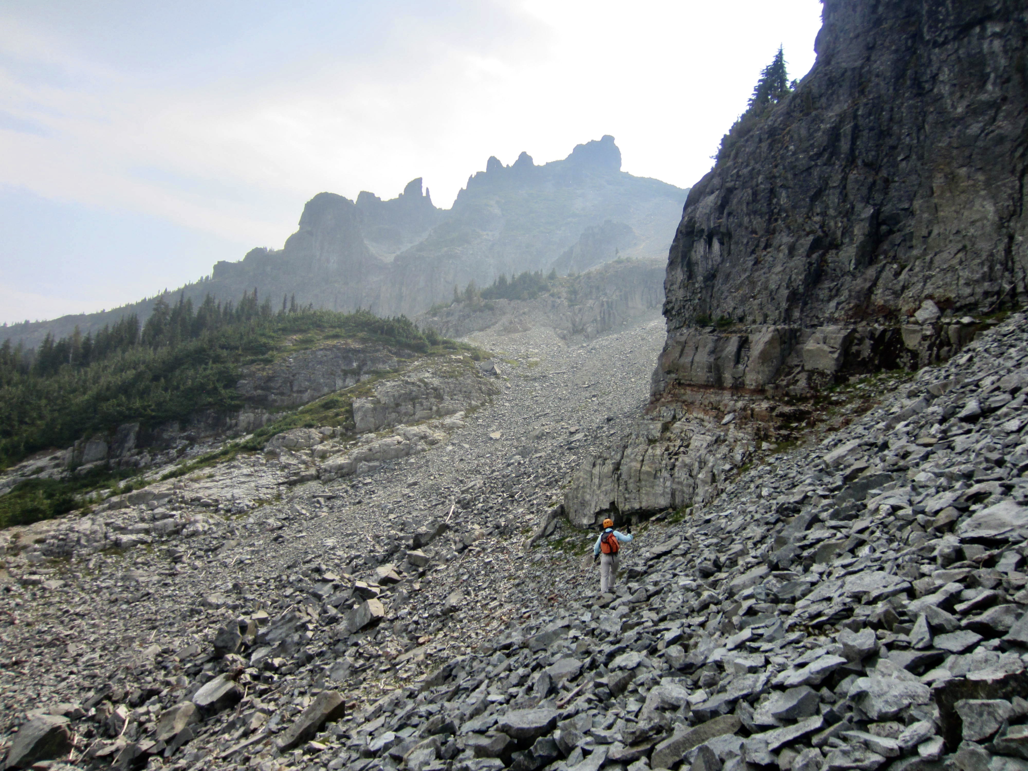
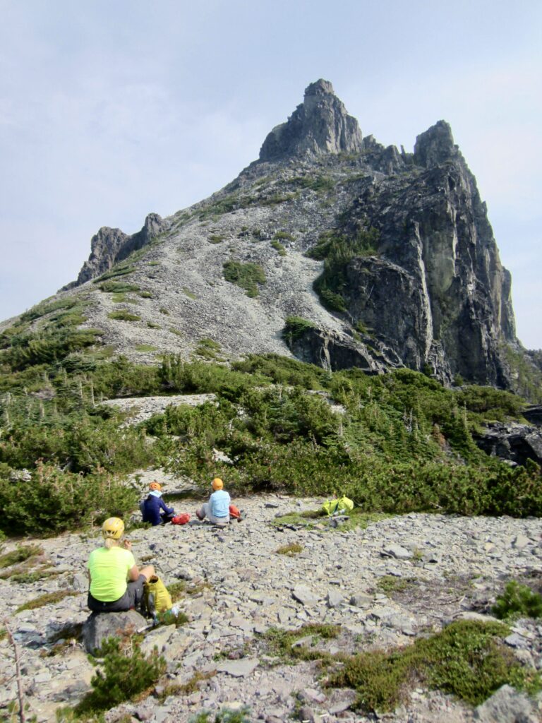
A game path located closely south of the trail led us southeasterly downhill through brush and trees to a small basin at the head of Van Horn Creek. We crossed the creek at 5300 feet, then ascended a grassy, rocky draw due southward. This draw opens onto a broad scree and talus (“scralus”) couloir that divides the two main peaks of Sluiskin Mountain.
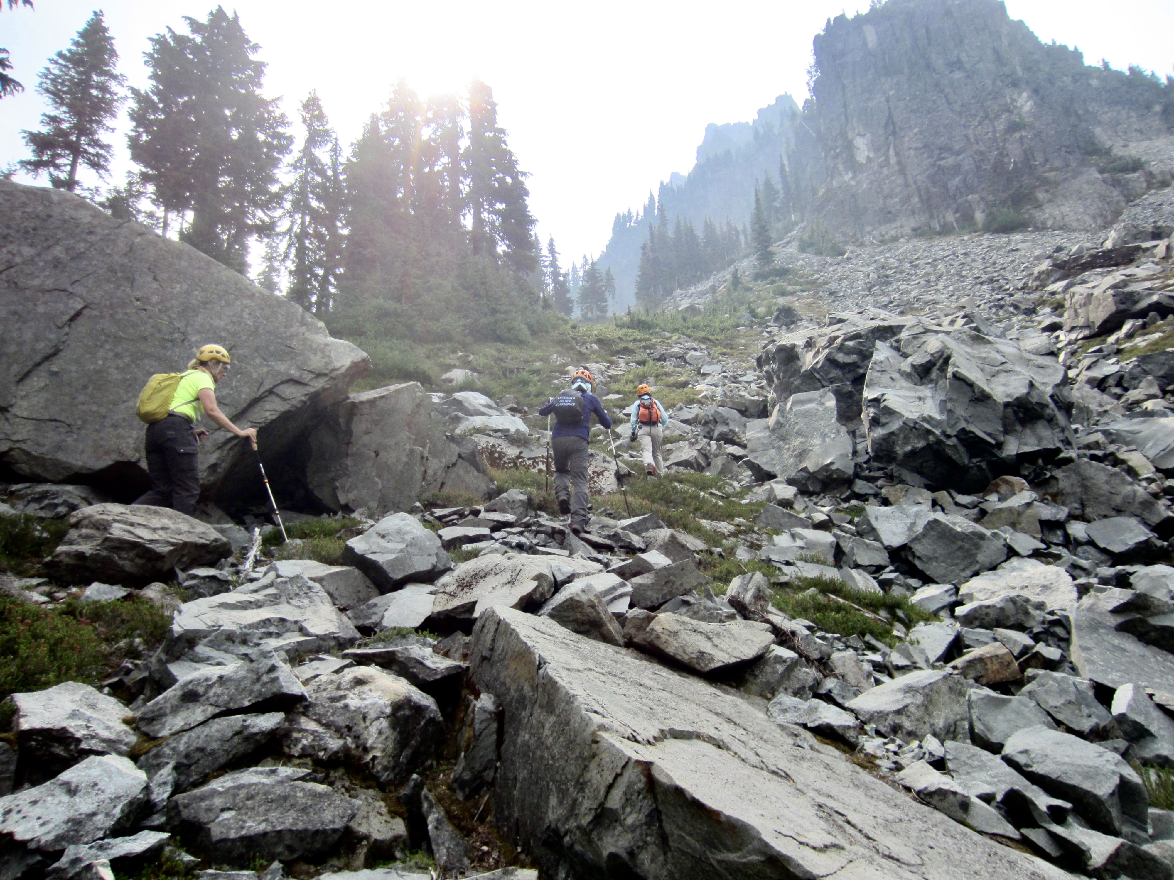
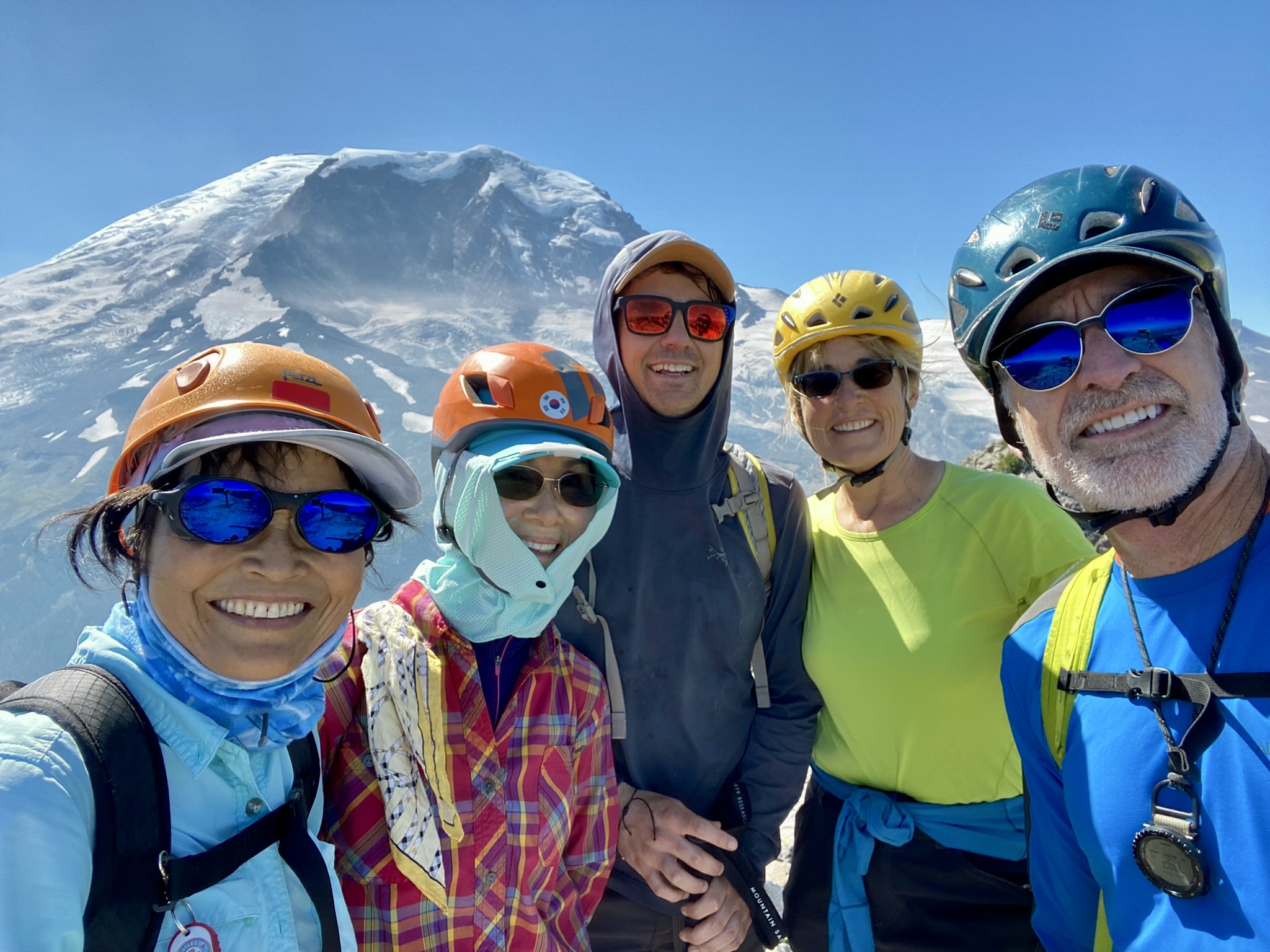
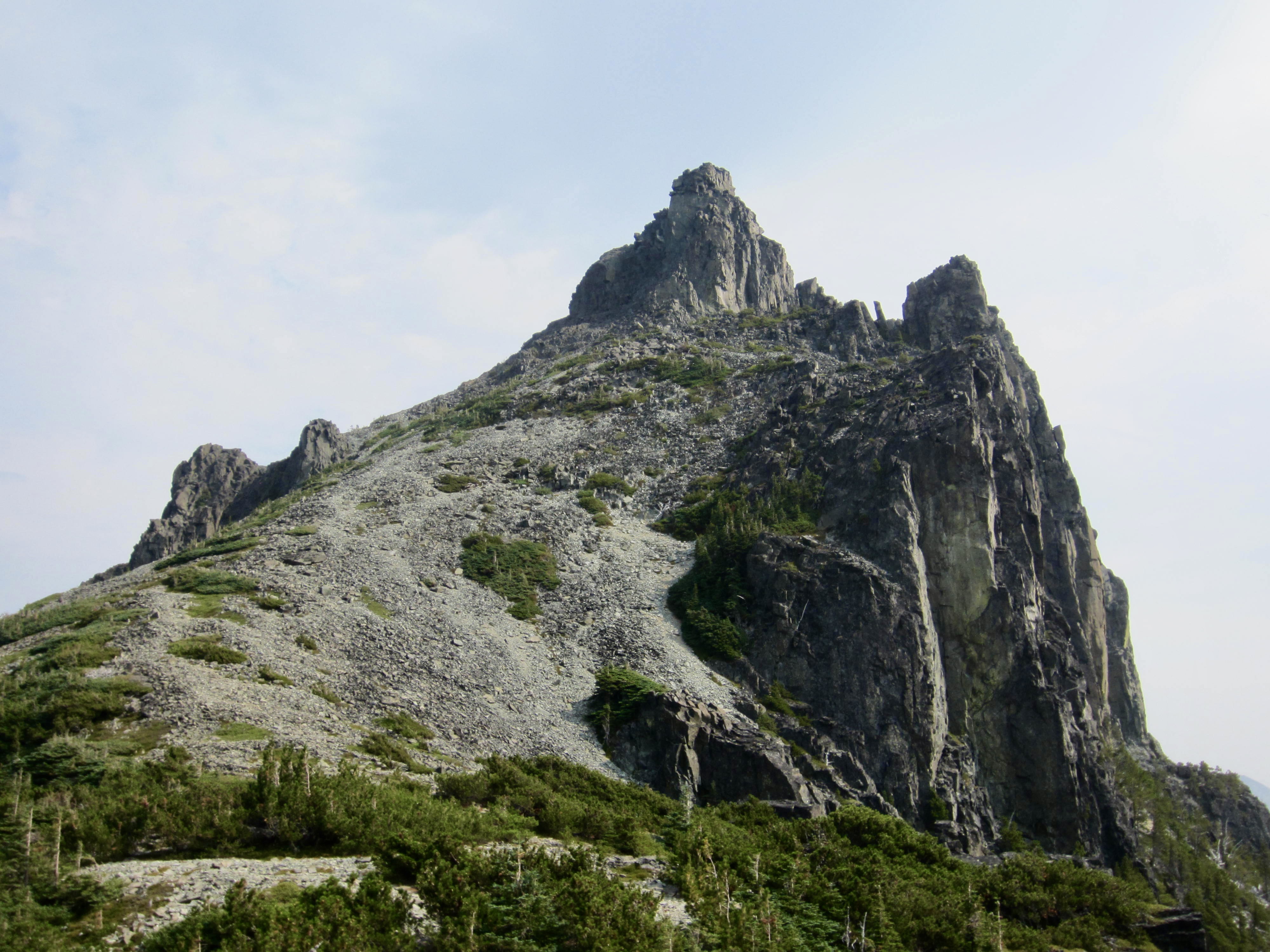
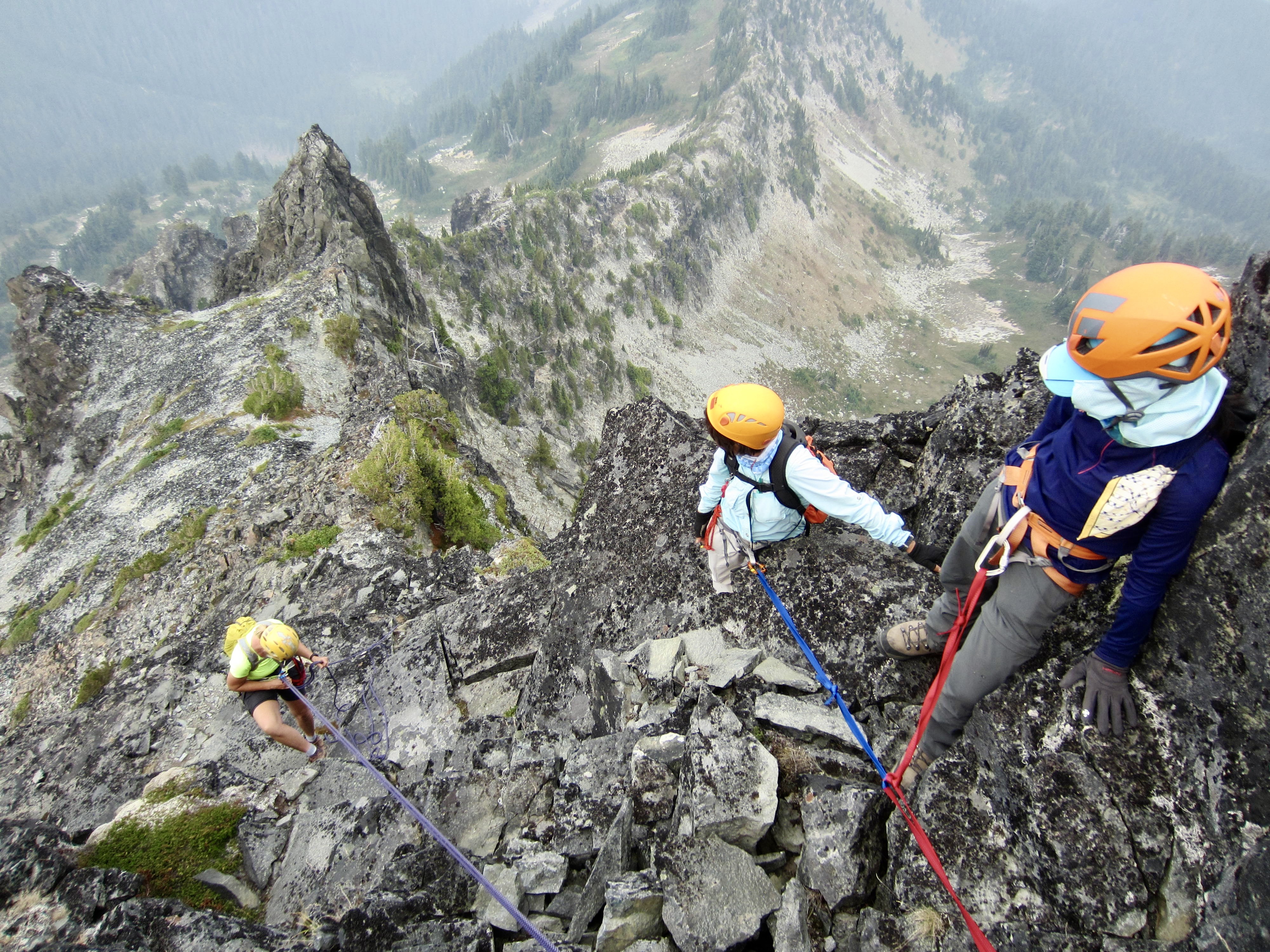
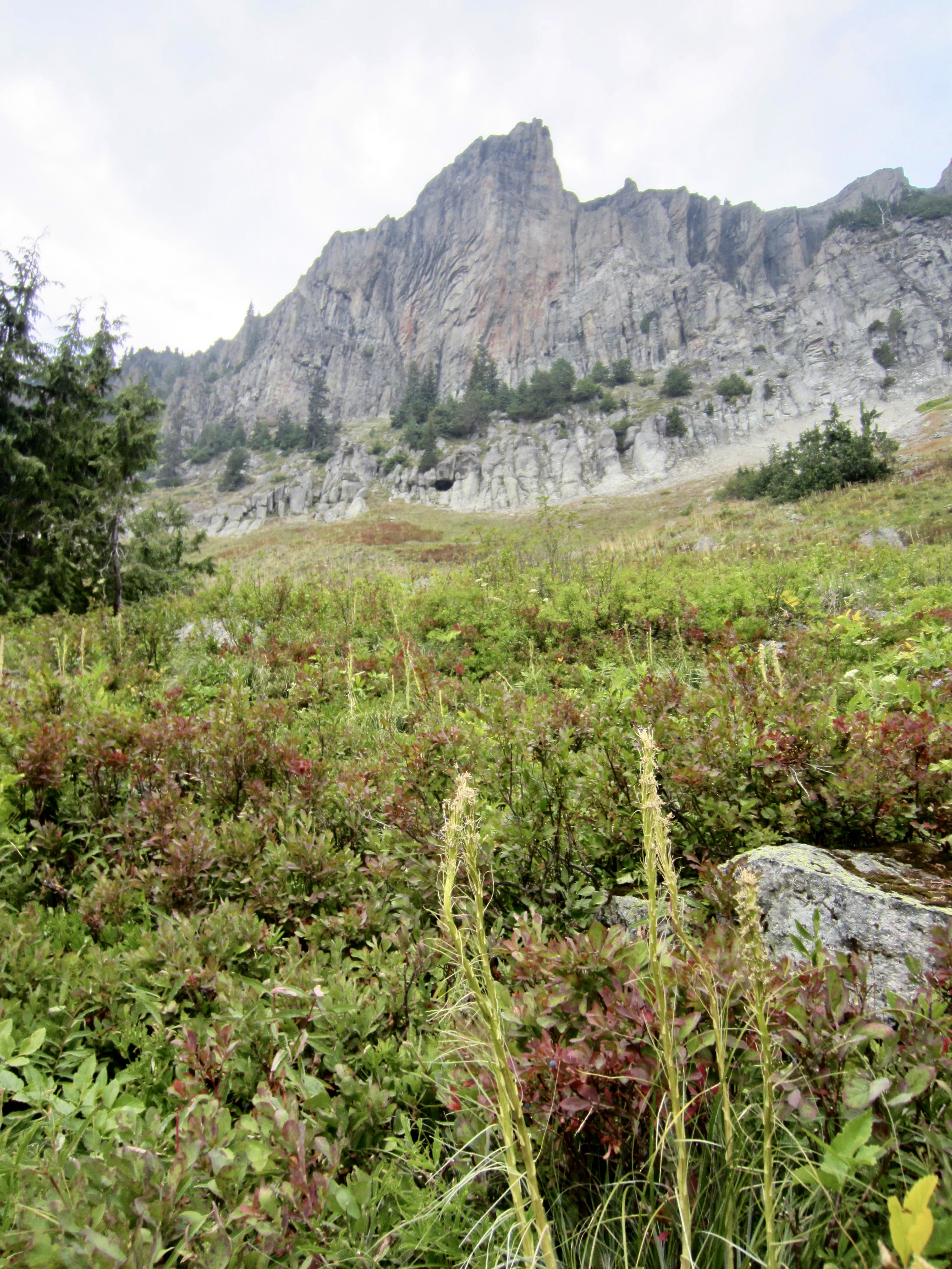
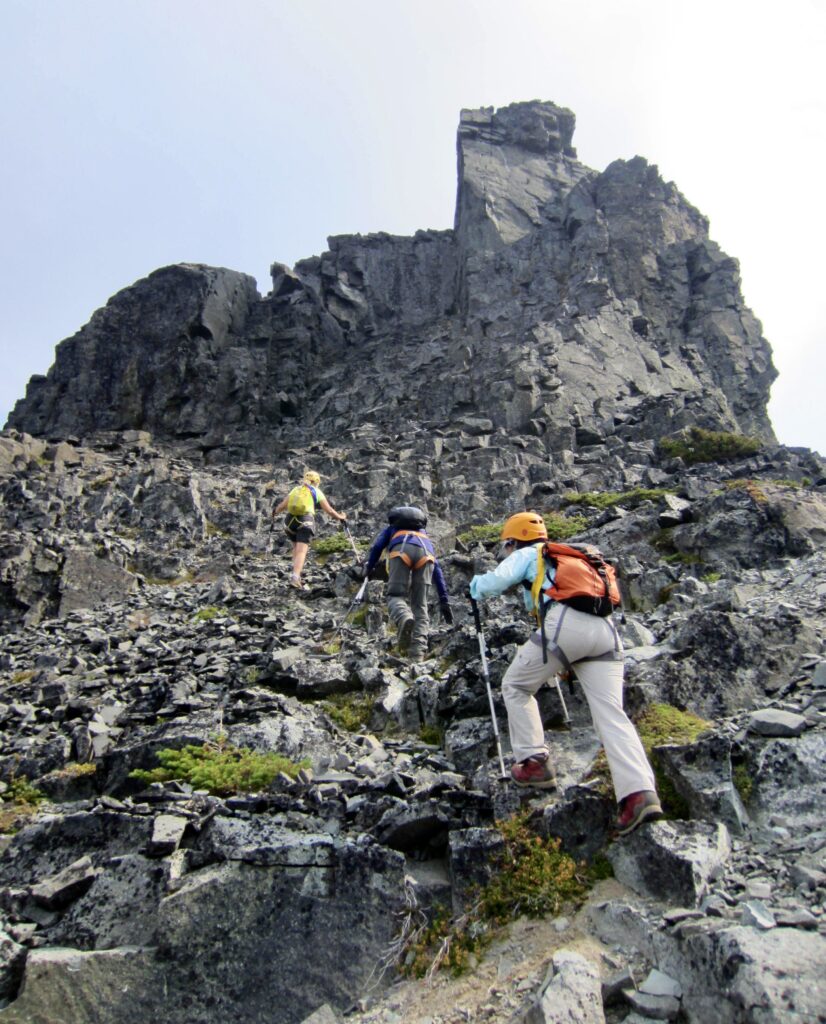
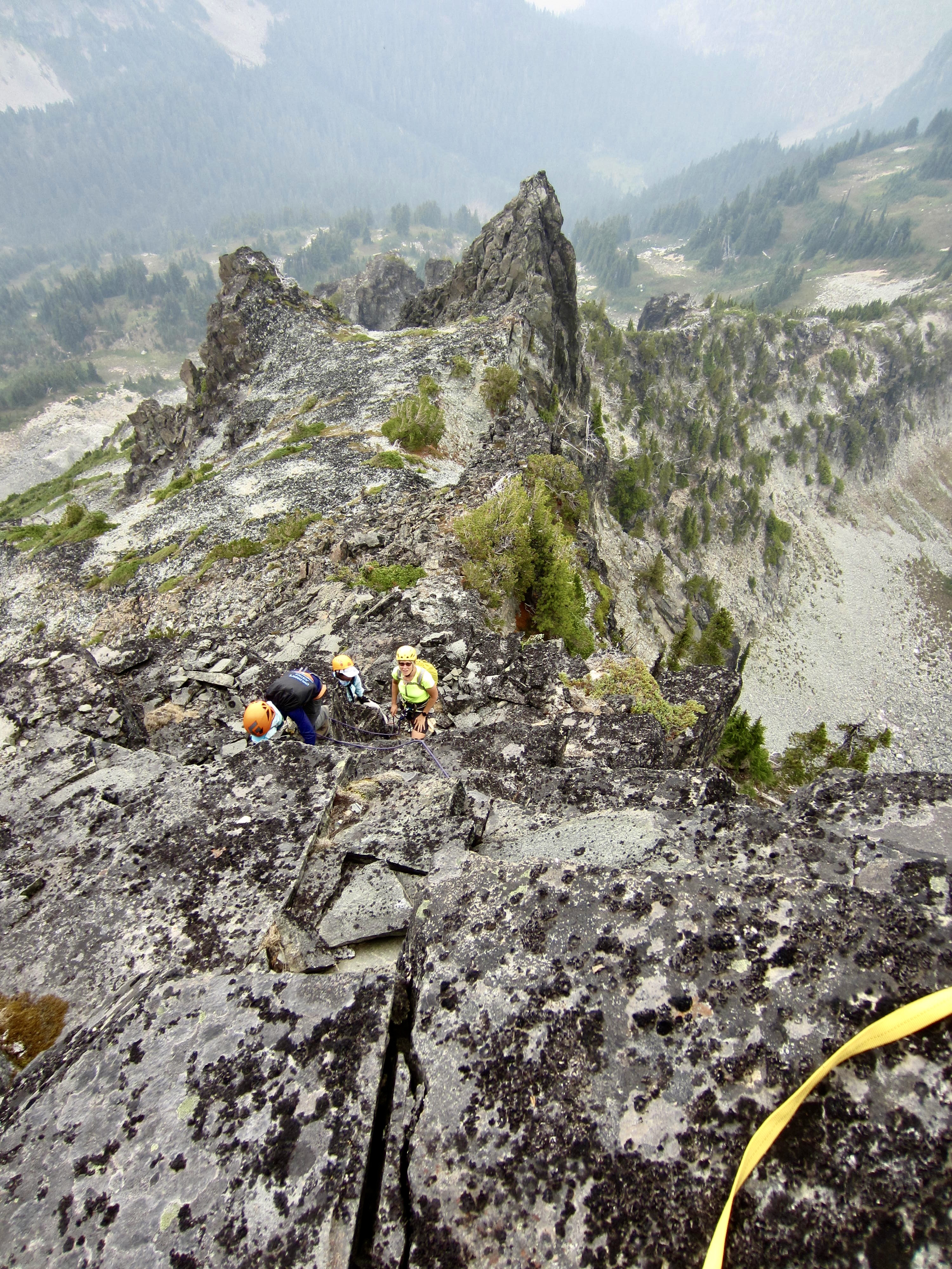
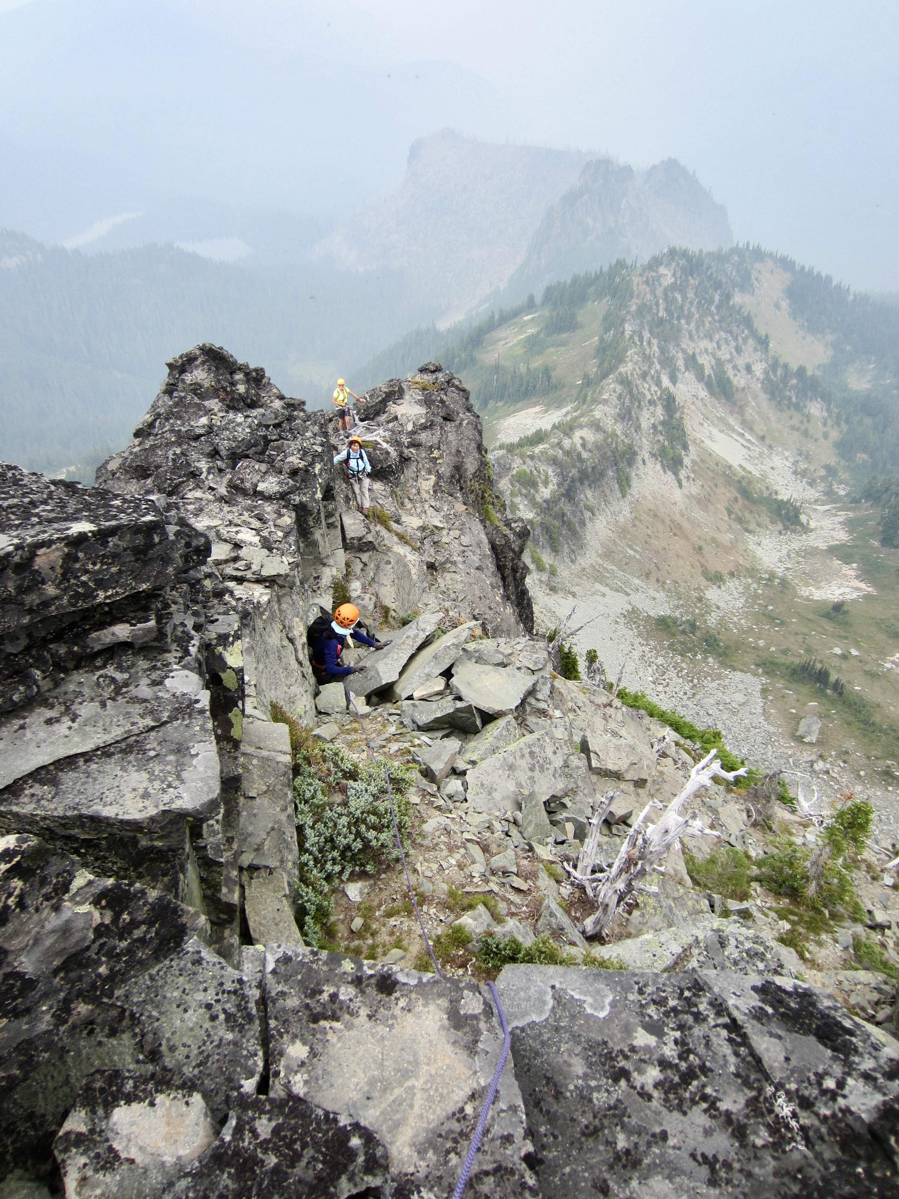
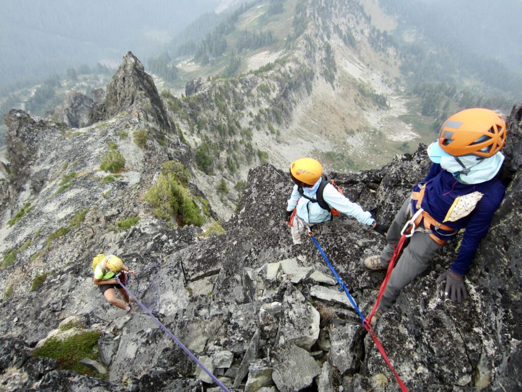
We traversed into the couloir and clawed our way upward for 700 feet until gaining Sluiskin Saddle at 6500 feet. This put us directly between The Chief, an imposing andesite pinnacle, and The Squaw, a slightly lower andesite knob. We took a short break before continuing upward toward The Chief on more scralus slopes interspersed with krummholz patches and rock outcrops.
Upon encountering the vertical walls of the summit block, we took some time to evaluate our options. I had teased out a reasonable Class 4 route during an ascent many years ago, and with the aid of my old trip report, I managed to identify the starting point: a prow of rock on the peak’s north ridge. There are probably other routes up The Chief, but this one had the advantage of familiarity—albeit, only vague familiarity. To my knowledge, though, nobody has found the supposed Class 3 route that Beckey mentions.
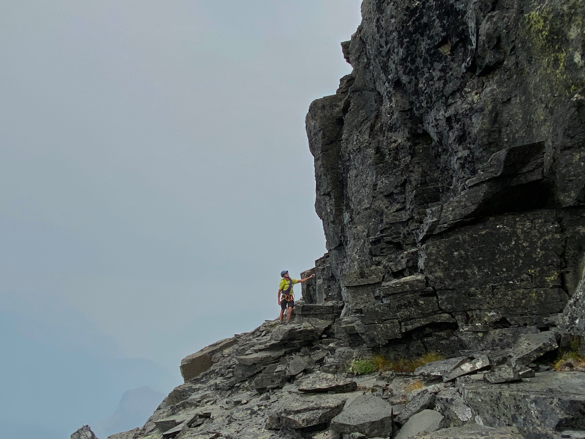
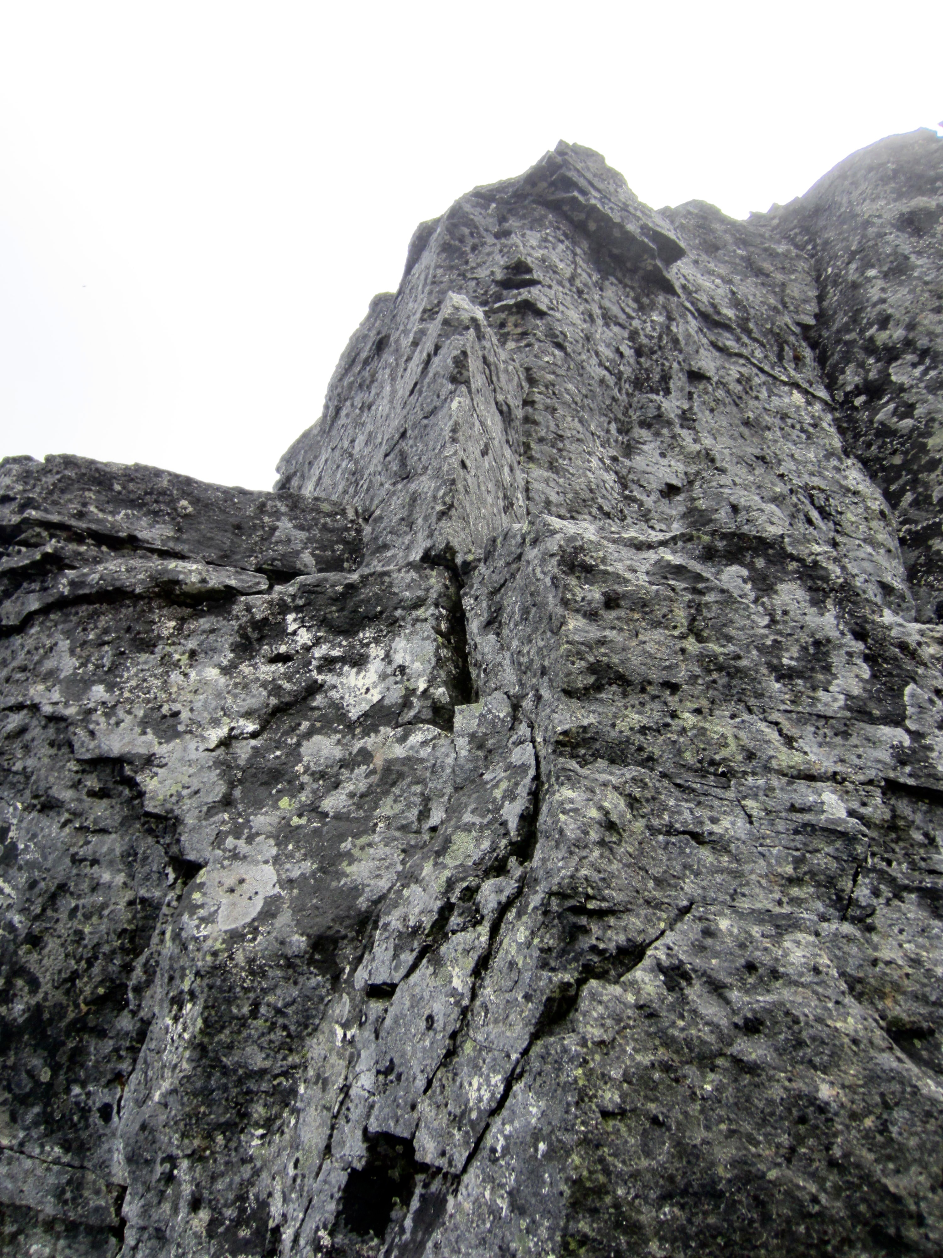
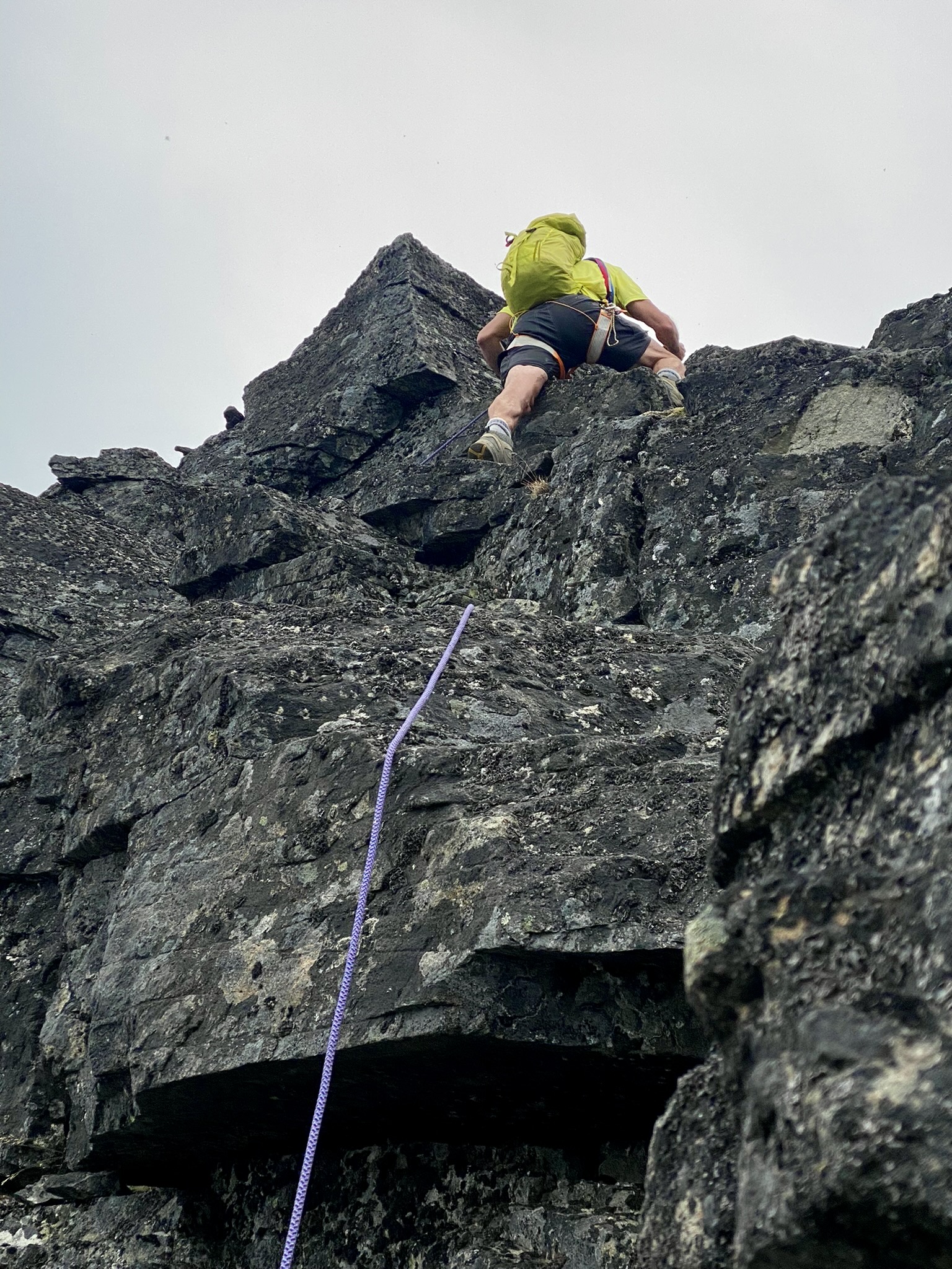
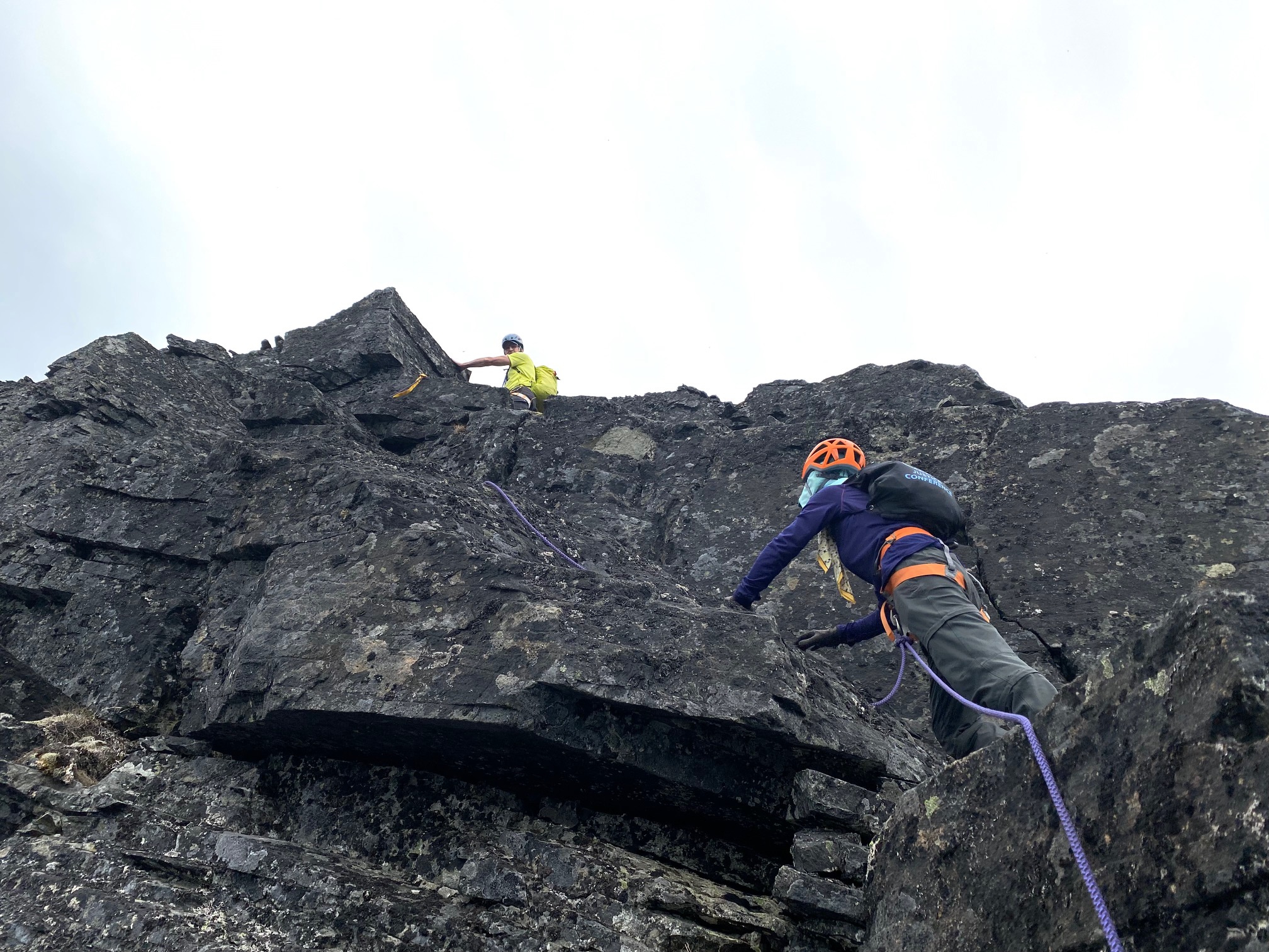
We tied into our 30-meter rope and climbed atop a sloping ledge located on the right (west) side of the north ridge prow. This ledge wraps around to the left (east) side of the ridge but is interrupted by a sharp fin of rock that requires a tricky step-around move. We belayed each other around this crux move, which has moderate exposure and skimpy handholds that require a long arm stretch.
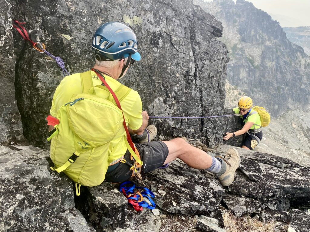
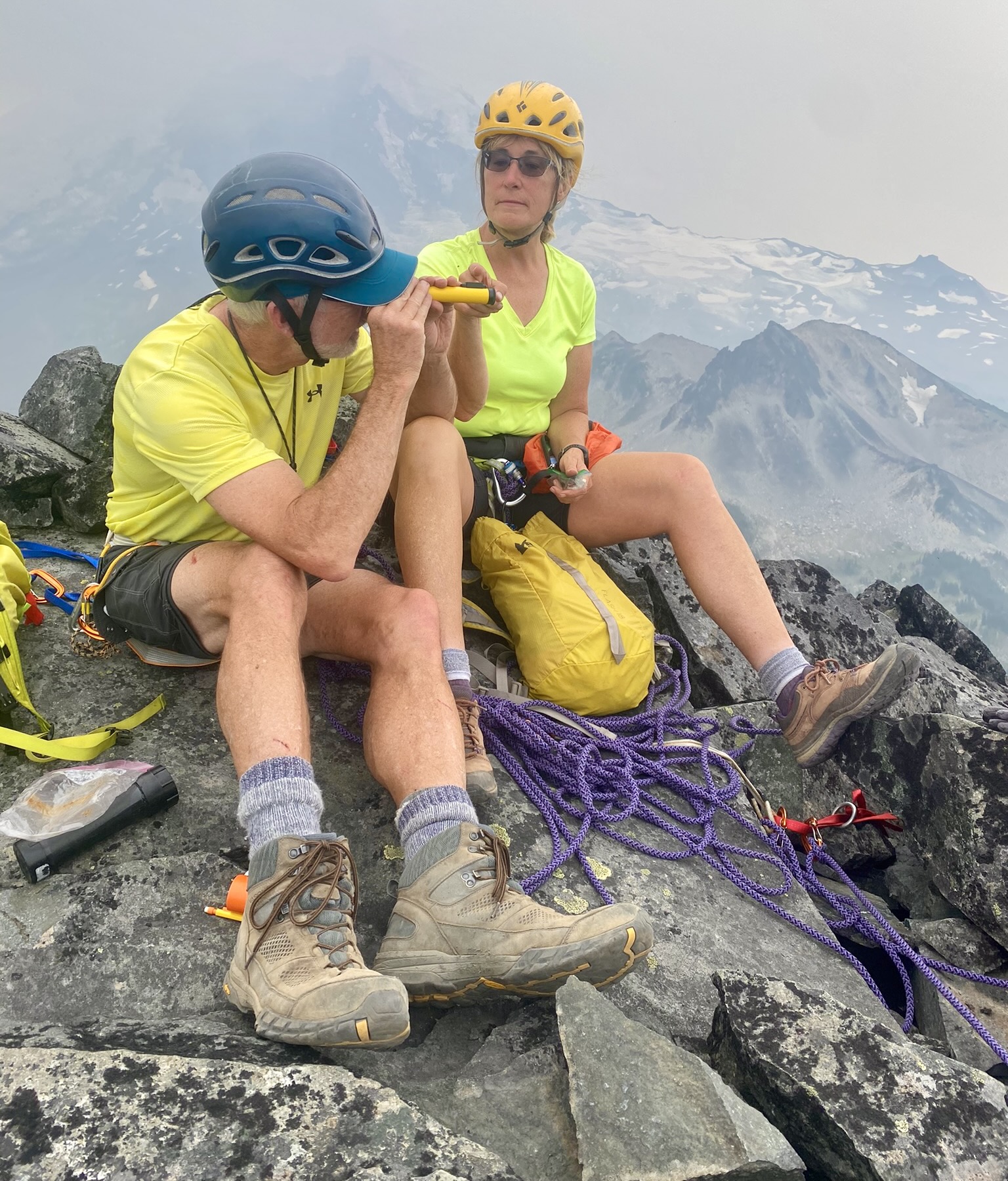
From our position on the left side of the prow, we climbed straight upward on Class 3-4 rock, using protection slings as a running belay. A short but very exposed Class 2-3 traverse across the summit crest put us on top in mid-afternoon (5.6 hours + 2250 feet from Camp 2; 3.7 hours + 1600 feet from pack stash).
The register showed that only three other parties had signed in this year, suggesting that The Chief is seldom climbed despite its great visual appeal. Unfortunately, today’s wildfire smoke was thick enough to obscure everything more than a few miles away, including Mt. Rainier, but that didn’t dissuade us from spending a half-hour on the airy summit.


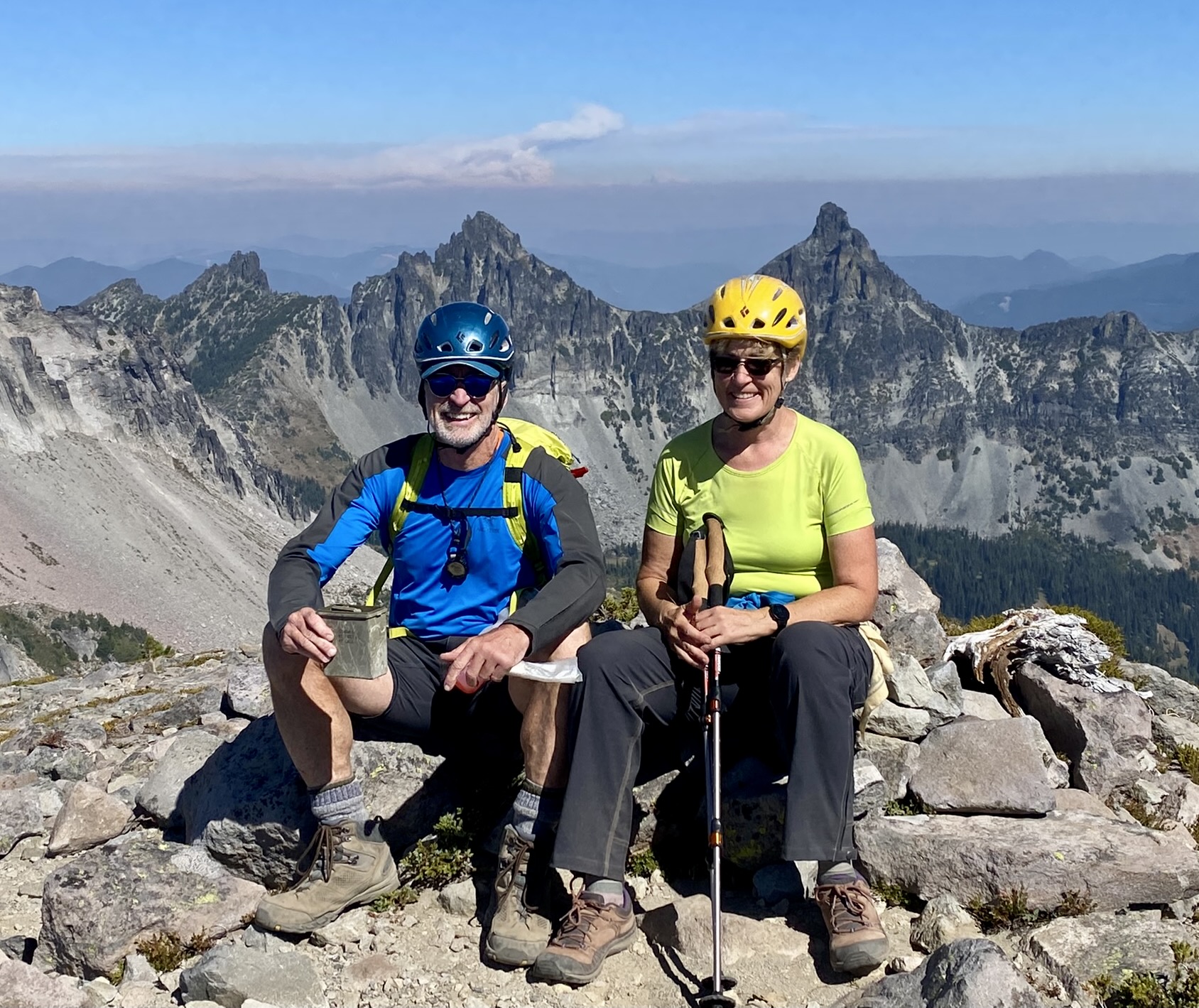
I took the time to investigate a little mystery that had pestered me for many years. During my previous Sluiskin climbs in 2005 and 2006, I noticed that The Squaw appears much higher than the USGS map indicates. Specifically, the map indicates that it has a summit elevation between 6960 feet and 7000 feet, which is 27 to 65 feet lower than The Chief’s 7026-foot summit, yet they seem to be much closer in height. Today, with the aid of a hand transit, I estimated that The Squaw is really only about 10 to 15 feet lower, giving it an elevation on the order of 7010 or 7015 feet.

For our descent, we scrambled back across the summit crest using a running belay and then performed two short rappels down the north ridge. Once off rope, we made a long plunge down to Van Horn Basin and up the game path to our backpack stash (2.7 hours from summit). Happily, there was no evidence that the neighborhood bear had visited during our absence.
The remainder of our evening involved a hike down to Lake James Camp, which we reached shortly after 7:00pm (9.7 hours + 5.4 miles + 2600 feet – 3200 feet from Camp 2, including sidetrip). Before dinner, a friendly volunteer ranger stopped by to check our camping permit and chat about our itinerary. We told him about our bear sighting at Windy Pass earlier today, and he alluded to a somewhat legendary “Berkeley Bear” that is thought to frequent Berkeley Park Camp—our designated campsite for tomorrow night. What were the chances that we’d actually see this mythical creature? Probably slim to none.
Day 4: Lake James Camp to Berkeley Park Camp + Grand Park
We awoke to intermittent rain sprinkles but a forecast of clearing weather. The Northern Loop Trail first took us 1500 feet down to West Fork White River, which we crossed on a high footlog, then took us 2500 feet up to Grand Park.
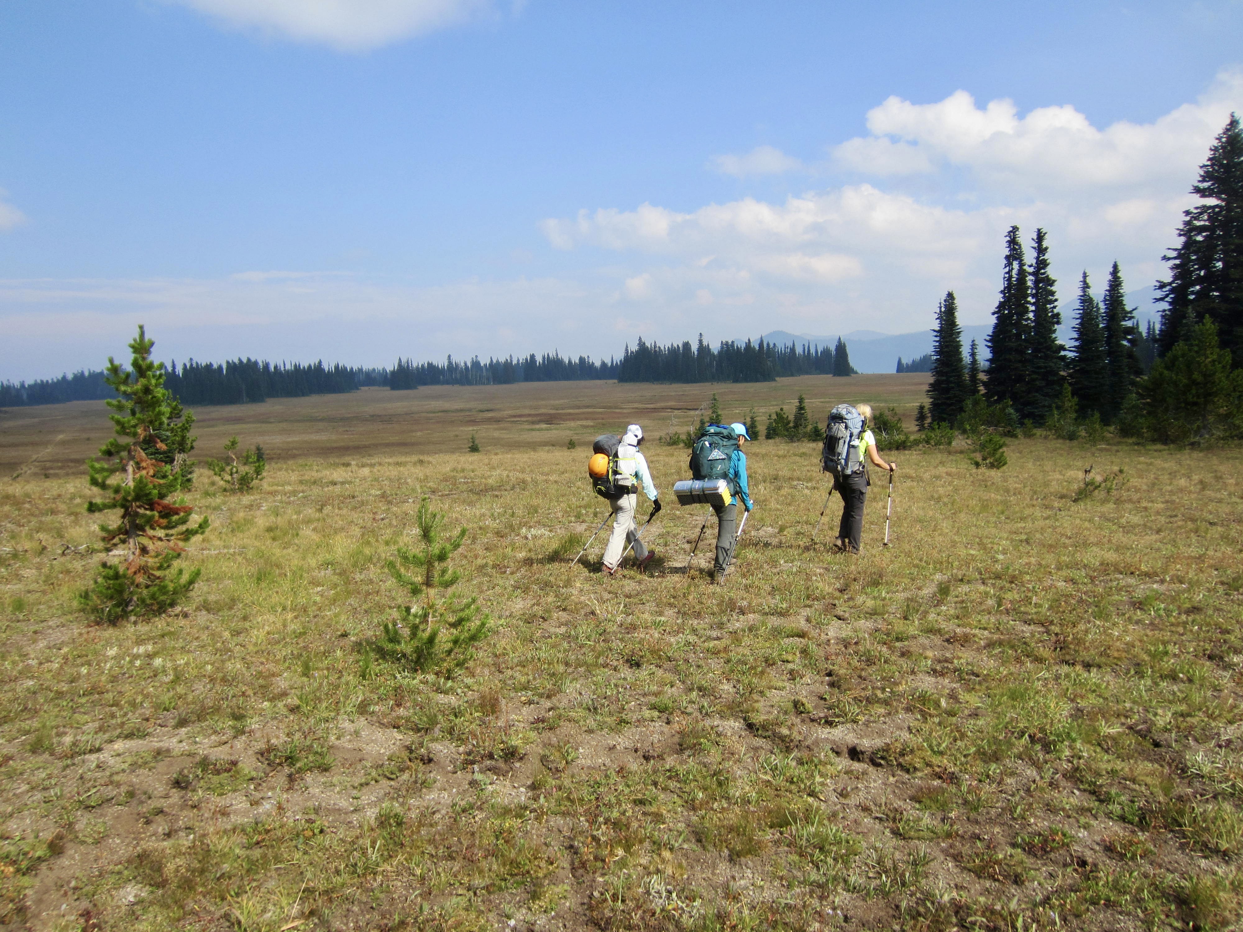
Being the largest and one of the most revered meadows surrounding Mt. Rainier, Grand Park deserved a sidetrip. We dropped our backpacks and hiked a mile northeastward on the Lake Eleanor Trail. I speculated that the remarkably flat topography and dry vegetation here is the result of a thick pyroclastic deposit composed of andesite and pumice fragments ejected from the volcano. Whether my theory is right or wrong, we all agreed that Grand Park is an extra-special place in a national park full of special places.
Following our leisurely stroll through Grand Park, we turned southward on the Northern Loop Trail and hiked up Lodi Creek toward Berkeley Park. The vegetation rapidly transitioned from low-growing heather and huckleberry bushes to leafy and herbaceous plants. Late that afternoon, we pulled into Berkeley Park Camp for our final night of the circuit (7.8 hours + 9.3 miles + 2950 feet – 1850 feet from Camp 3, including sidetrip).
The name of this camp is a bit misleading because it is actually located in Lodi Creek Meadow, about 1 mile below Berkeley Park proper. Nonetheless, it’s a comfortable camp with good water access and an interesting perspective on the Mt. Fremont Lookout cabin perched directly overhead.
Day 5: Berkeley Park Camp to Sunrise
Once again, our morning began with rain sprinkles that soon tapered off. We had a social breakfast and then headed up the trail. A few minutes later, while hiking through a small grove of trees, we heard a loud splash. What could that be? Emerging from the trees, we looked across Lodi Creek and saw a large black bear standing atop a rock outcrop only 20 yards away. YES…it was the legendary Berkeley Bear! The furry bruin shook off a spray of water, turned, and disappeared into the bushes before any of us could even think about pulling out a camera. We all stood in silence for several moments, trying to process this fortuitous incident.
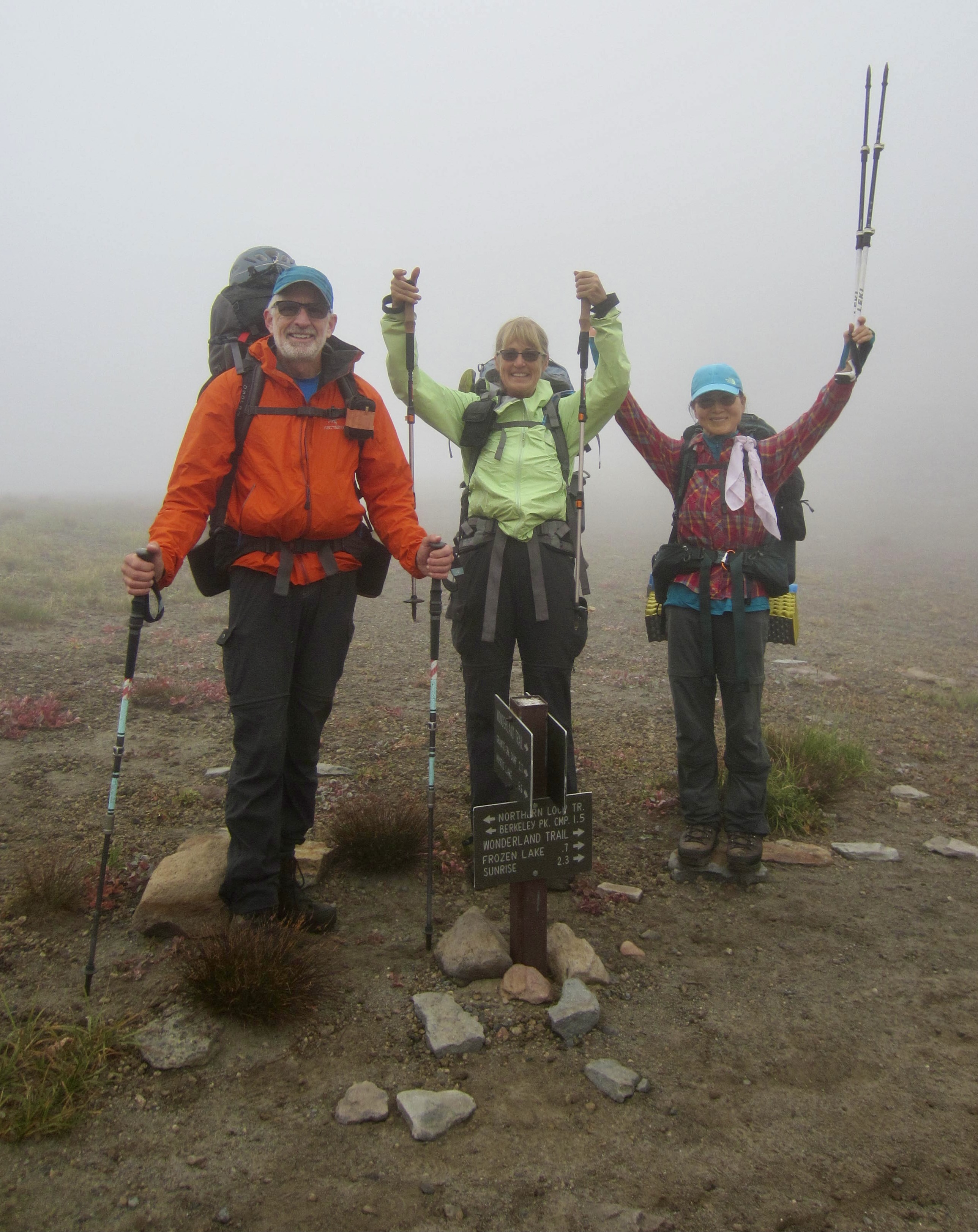
The remainder of our morning was uneventful as we hiked up Lodi Creek and through Berkeley Park in dense fog. We soon encountered a steady stream of day-hikers coming up from Sunrise, and sunlight was starting to poke through by the time we reached the busy parking lot (2.1 hours + 3.8 miles + 1200 feet from Camp 4). Our backpacking circuit on the Northern Loop Trail had delivered many marvelous highlights, lots of ups and downs, and a strong desire to eventually complete the full Wonderland Trail Circuit!
…
Route Maps & Profile
…
…
…
Photo Gallery
Click to enlarge…