Trip Date: July 11, 2004
Boston Peak Day Climb
Cascade Pass
Sahale Arm
Boston–Sahale Saddle
Boston Peak (8894/8883 ft)
Trip Report Summary
Region: Northwestern Washington Cascades
Sub-Region: Thunder Mountains
Area: North Cascades National Park
Starting & Ending Point: Eldorado Trailhead parking lot on Cascade River Road (Elev. 2200 feet)
Way Points: North Fork Cascade River Vehicle Bridge & Cascade Pass Trailhead (bike ride & bike push); Cascade Pass & Sahale Arm & Sahale Camp (trail hike); Sahale Glacier & Sahale Peak Notch & Boston–Sahale Saddle & Boston Peak summit (snow climb & rock scramble & rock climb)
Summit: Boston Peak (rock scramble & snow climb & rock climb via South Ridge—Southeast Ledges—Upper Boston Glacier—East Face Gully)
Approximate Stats: 22 miles traveled (6 miles on bike + 16 miles on foot); 7700 feet gained & lost; 9.3 hours up; 5.5 hours down.
Related Post
>>> Boston Peak Attempt via Boston Basin—Boston-Sahale Saddle—East Face – June 2000
Full Trip Report
I first saw Boston Peak twelve years ago from the summit of Sahale Peak, on a cold October morning. From that chilly vantage, its oxide-stained, bullet-shaped summit tower gave me chills of a different sort. My first attempt to climb it, on a sunny June day seven years later, ended abruptly at the base of that intimidating summit tower. I later heard Boston Peak called “The Red Ogre” by climbers in the know.
Try as I might to keep Boston Peak off my radar screen, it suddenly popped up while I was planning a trip with Mike C last Saturday. It wasn’t really on Mike’s radar screen either, but he gladly joined me for a one-day attempt the following day, via Boston Basin and the Quien Sabe Glacier. We agreed to car-camp along the Cascade River Road that night to facilitate an early start, and because the road was gated at the Eldorado Trailhead, we would take mountain bikes.
Rain pelted our tent in Mineral Creek Campground all night long, and it was still raining lightly when we mounted our bikes at 6:00am Sunday. Although the weatherman promised clearing skies, the prospect of sopping-wet vegetation along the entire trail to Boston Basin prompted me to suggest an alternative approach via Cascade Pass and the Sahale Glacier. Mike had no strong opinions either way—after all, the peak wasn’t even on his list.
We rode and pushed the 3 miles and 1400 vertical feet to the Cascade Pass Trailhead (1.1 hours from car), then dispatched the 6 miles of well-maintained trail ending on Sahale Arm.

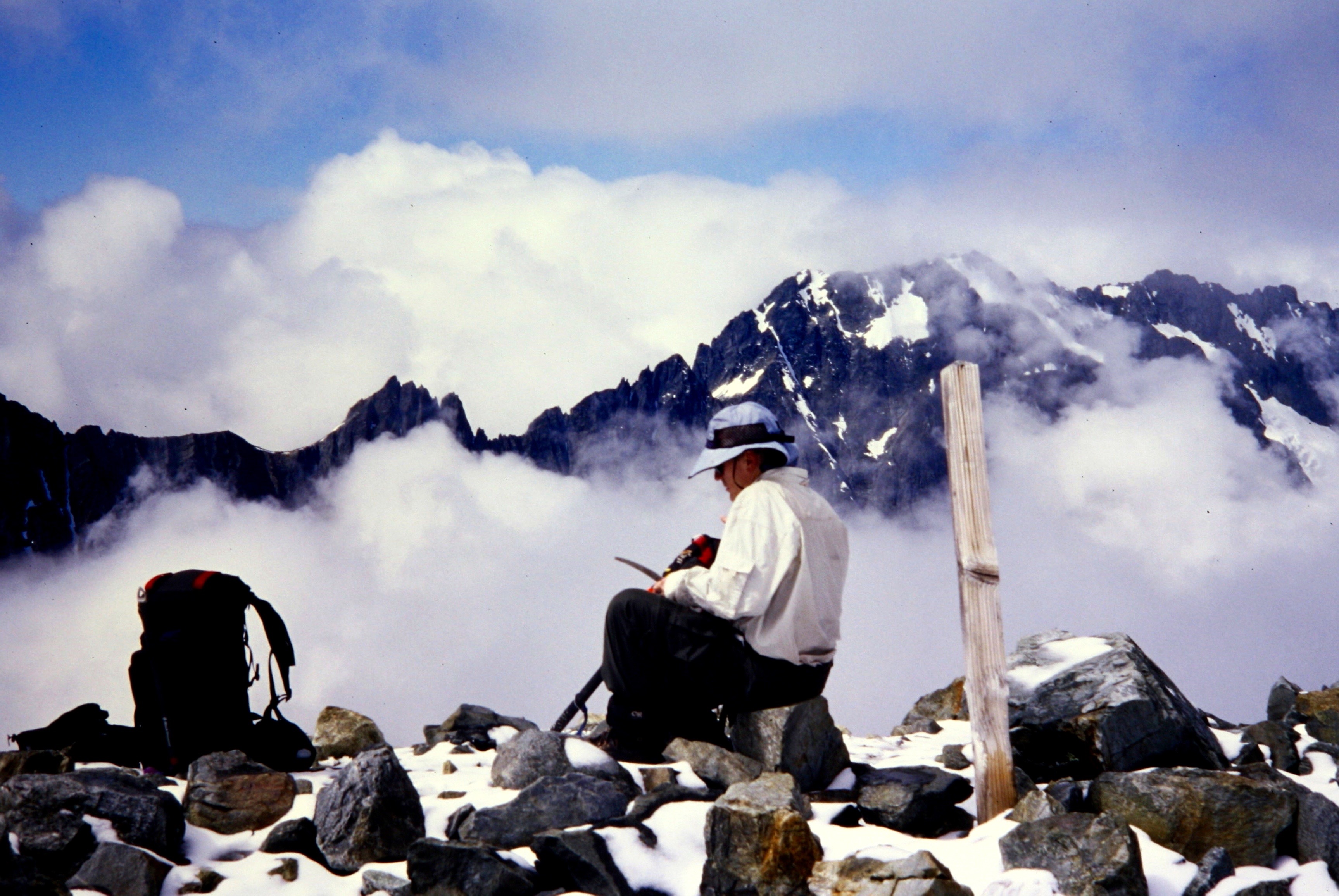
- Mike On Sahale Arm
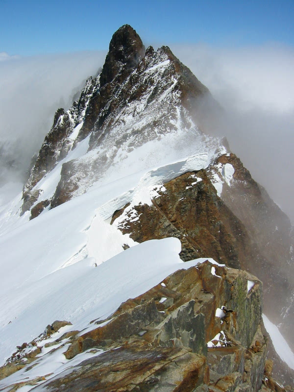
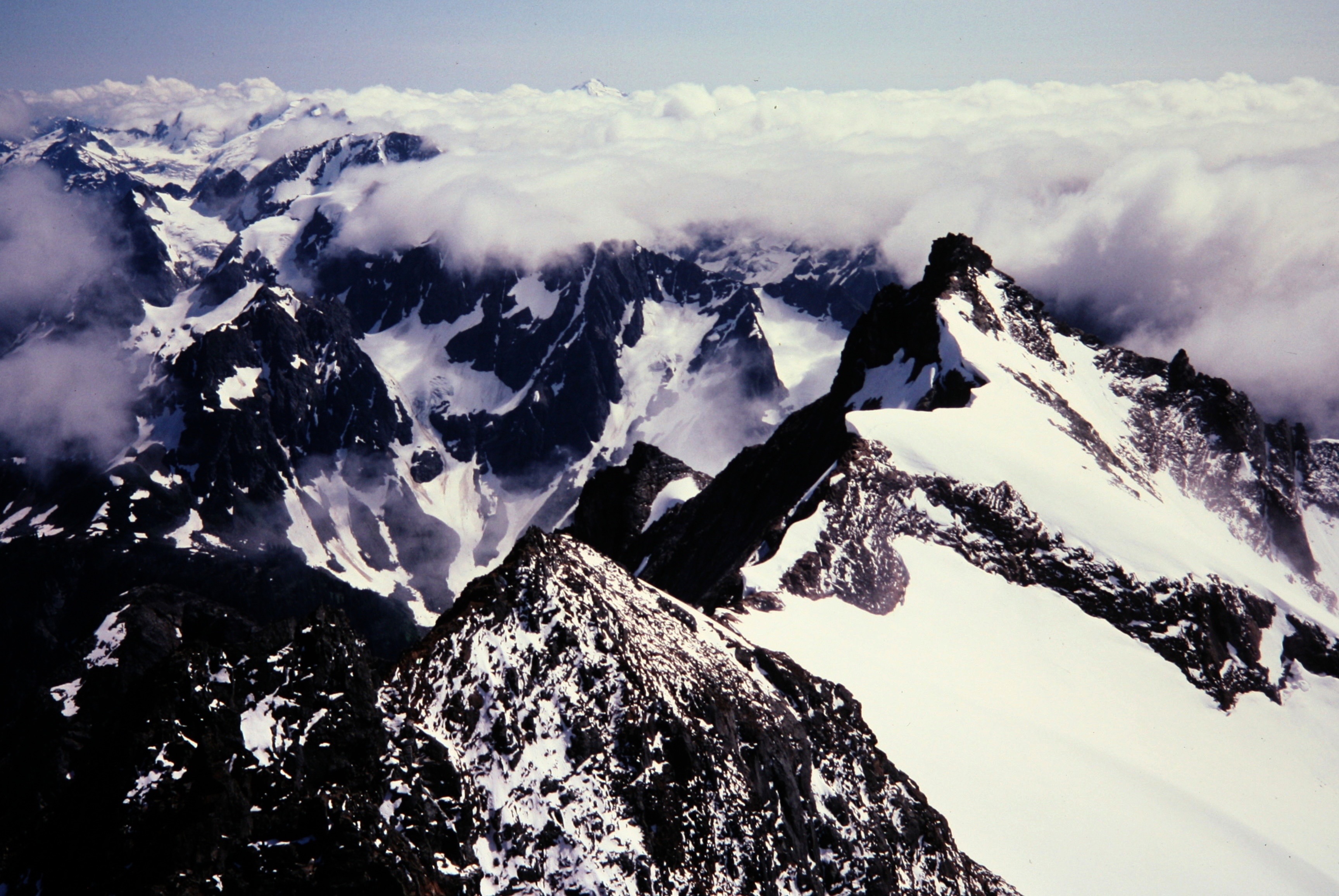
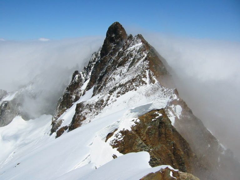
By then, the rain had stopped and the clouds were beginning to break. We traversed up the Sahale Glacier and scrambled a bit of Class 3 rock to the east shoulder of Sahale Peak (6.0 hours from car). There, we got only a brief view of Boston Peak before the clouds rolled in again, but it was enough of a view to see fresh snow dusting the summit tower. Clearly, the Red Ogre was in a grumpy mood today, and this did not bode well for us!

- Boston Peak From Sahale Peak
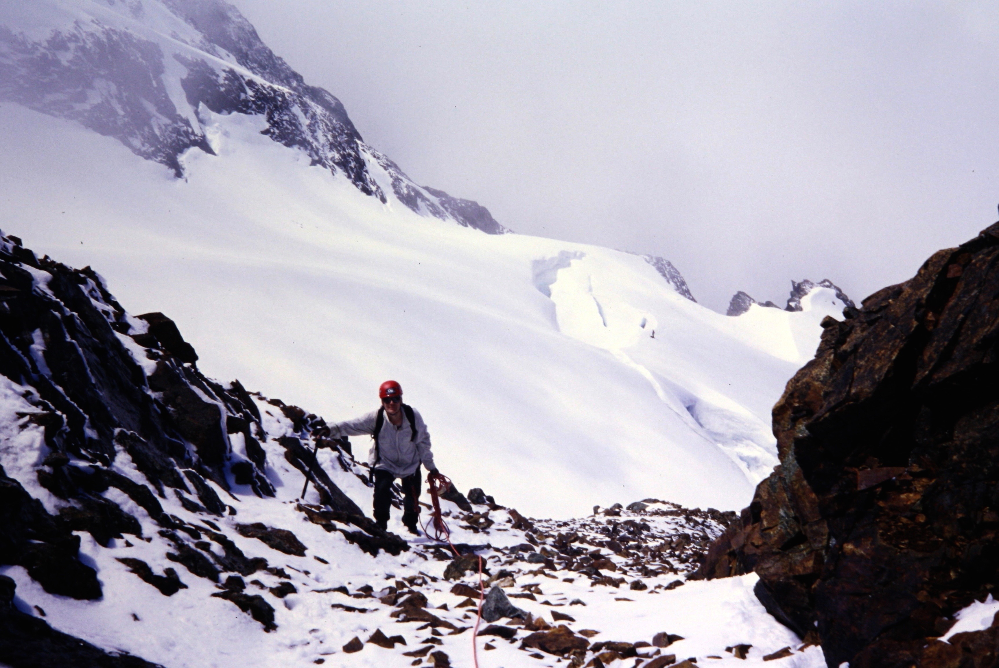
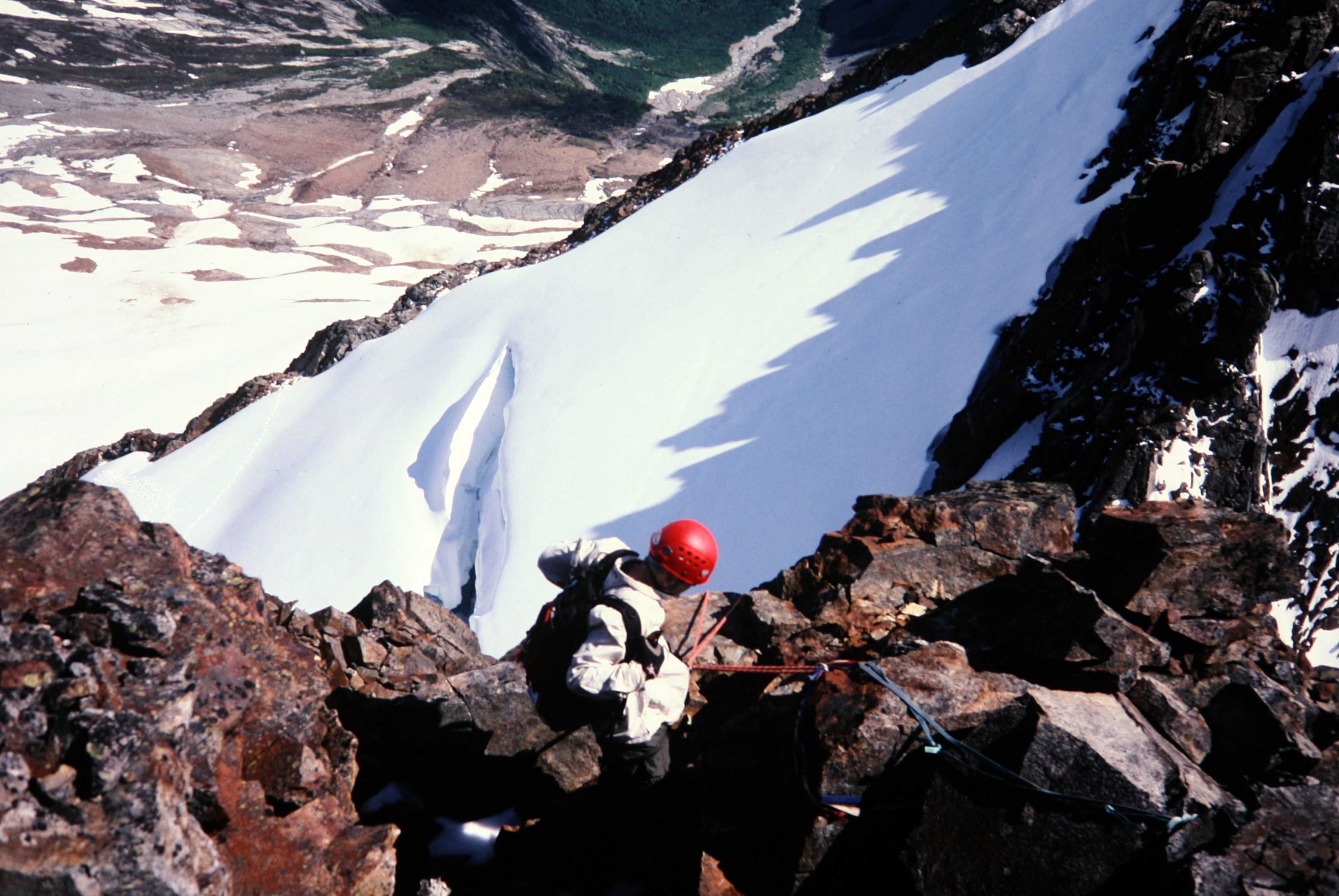
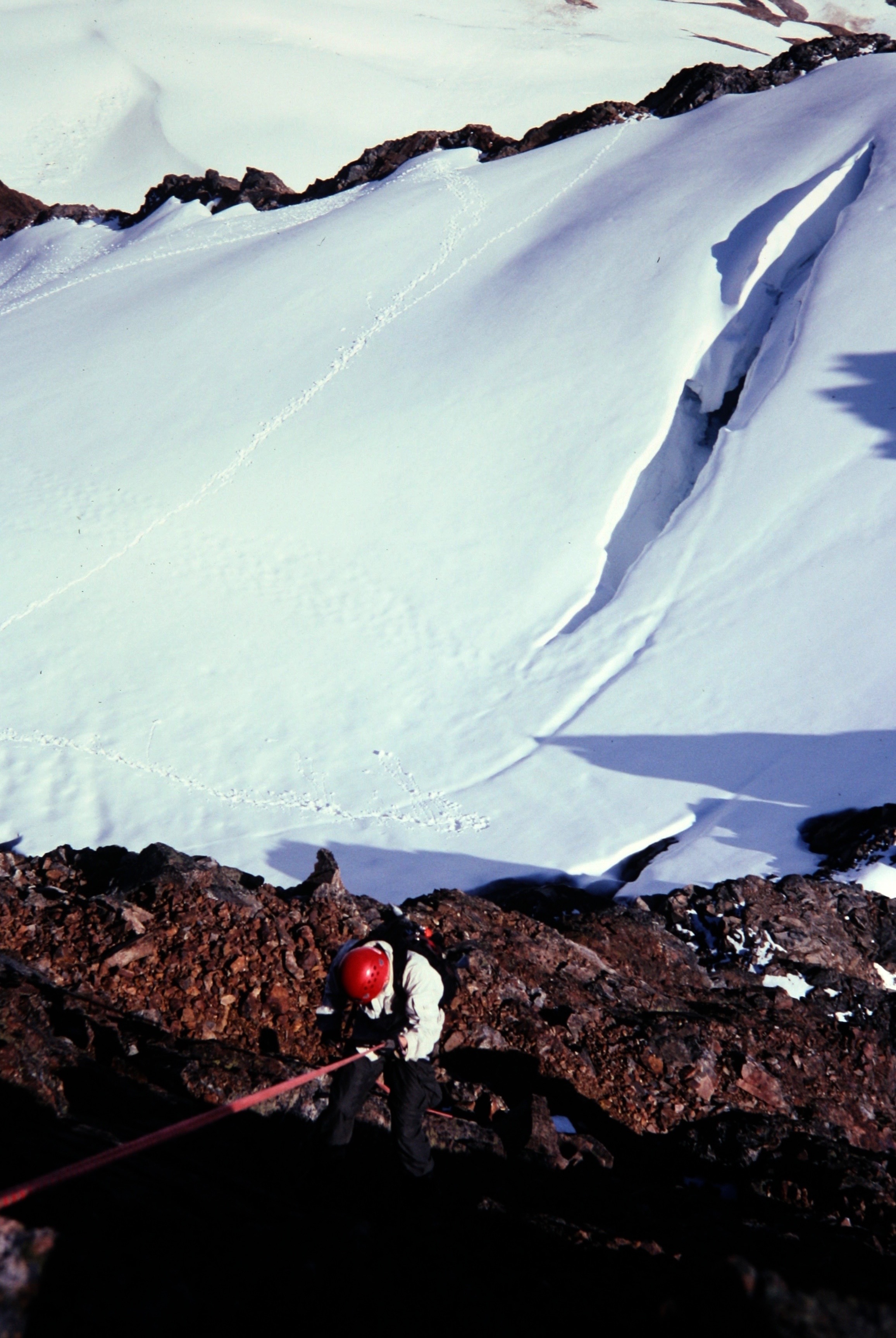
Despite my hesitation about attempting Boston in less-than-ideal conditions, we continued down slippery rock slabs to the Boston–Sahale saddle, then up snow-covered scree to a ridge notch. Thankfully, the southeast face was substantially bare, so we traversed downward across this face on exposed Class 2 ledges to an upper arm of the Boston Glacier.

- Mike Scrambling Above Saddle
Visibility came and went with the ebb and flow of clouds arriving from the north. This gave us trouble both negotiating crevasses on the glacier and selecting a suitable route up the summit block. After two false starts, first near the middle of the glacier arm and then at the top, we decided to try a lower—but still questionable—gully feature on the east face.
Gaining the objective gully required a dicey bergschrund crossing on a 2-foot-wide snowbridge, which I straddled and humped along inelegantly, followed by a steep climb up a snow finger directly above the schrund. After finally reaching the gully base, we didn’t like what we saw: shattered rock and downsloping dirt ledges—all drippy wet—with lots of exposure. Ahhh, the bowels of the Red Ogre!
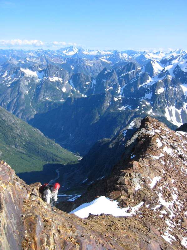
Mike and I started up the gully, scrambling carefully and closely together to minimize rockfall hazards, but it was impossible to not dislodge rocks; many of our potential handholds and footholds immediately broke off with only a little force. We stayed roped up, and I carried a half-dozen runners in hopes of placing them over rock horns as we climbed. This was naïve thinking on my part because there were simply no solid horns to be found.
- Ascending Rocky Gully
After about 200 feet of slow, white-knuckle scrambling up exposed Class 3 crap, we reached an apparent roadblock: a steep step in the gully. Mike tried a narrow slot that was choked with a pile of unstable rocks, but he soon backed down. I inspected two adjacent slots and promptly rejected them, due to the presence of unstable chockstones.
Then and there, I mentally threw in the towel on this pernicious garbage route; as much as I dreaded a descent of the ugly gully, I was prepared to surrender to the Red Ogre. Mike, however, insisted on making one last attempt, up a steep face on the gully’s right side. I balked at the exposure and the risk of getting dead-ended above something we couldn’t downclimb, but he committed to the first few moves and scrambled up 10 feet of unprotectable Class 4 rock.
We were still short-roped together, so I felt obligated to follow. This little face proved to be the turning point in our climb, because it gained us an upper gully that was less steep, drier, and considerably more stable than the lower one. Increasingly better rock quality allowed for a fast and (dare I say it?) pleasant scramble up to the ridge crest …
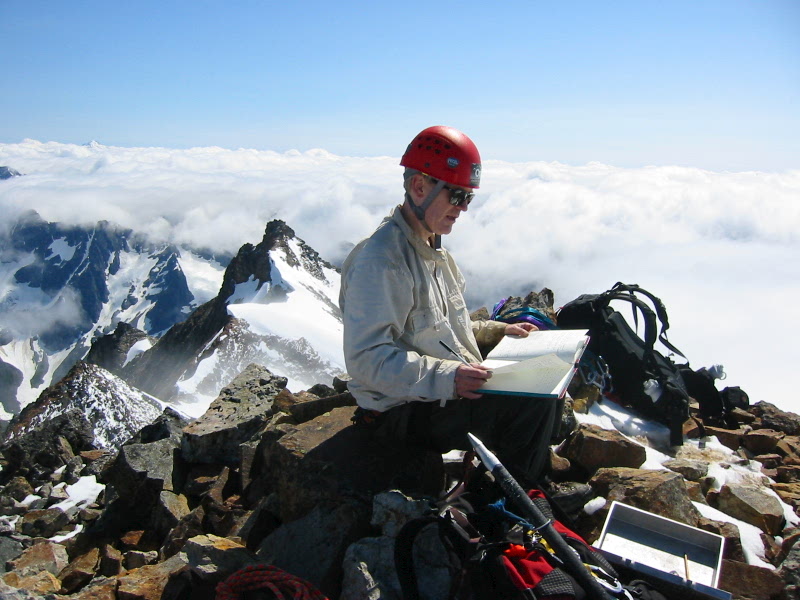
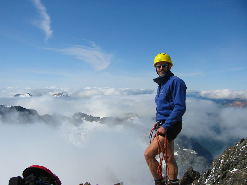
… and then over to the summit horn. We reached the top in mid-afternoon (9.3 hours from car), filled with elation but also apprehension about the descent. Surprisingly, the summit register was a fancy bound journal in a big cast-aluminum Mazama box. “What poor sap hauled that heavy thing up this god-forsaken hunk of junk?” Mike wondered aloud.
- Mike On Boston Peak Summit
The register contained perhaps two or three entries per year dating back several decades, and many of these entries lamented on the impending descent. I was extremely relieved to find a rappel station just below the summit horn, with a hefty chockstone for an anchor. The majority of an hour passed quickly as we watched more and more peaks emerge from the cloudbank surrounding us.
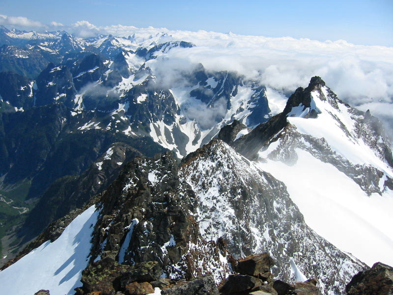
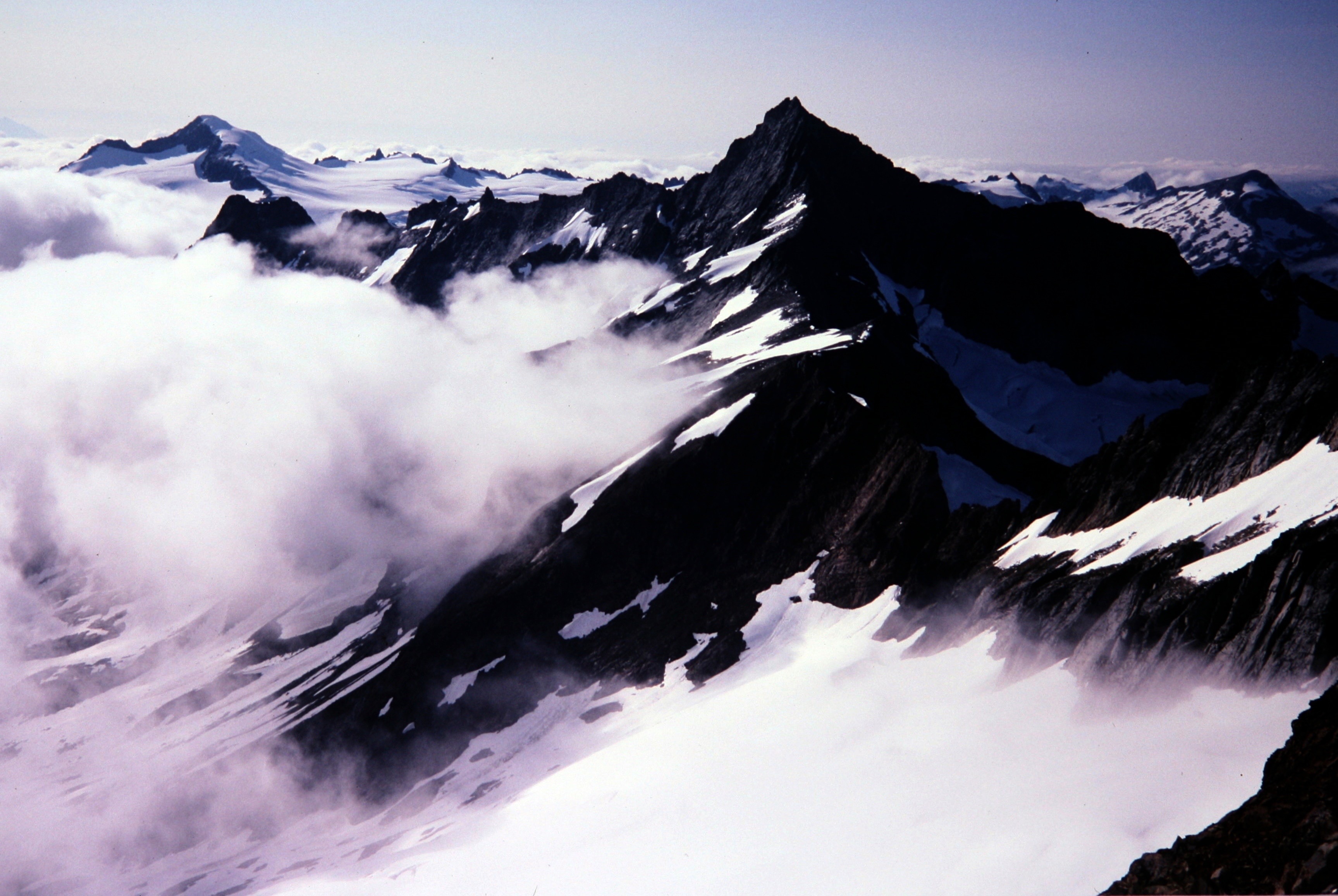
- Sahale Peak From Boston Peak Summit
- Eldorado Peak and Forbidden Peak From Boston Peak
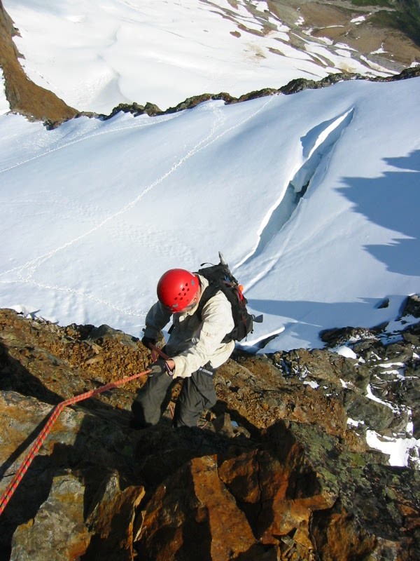
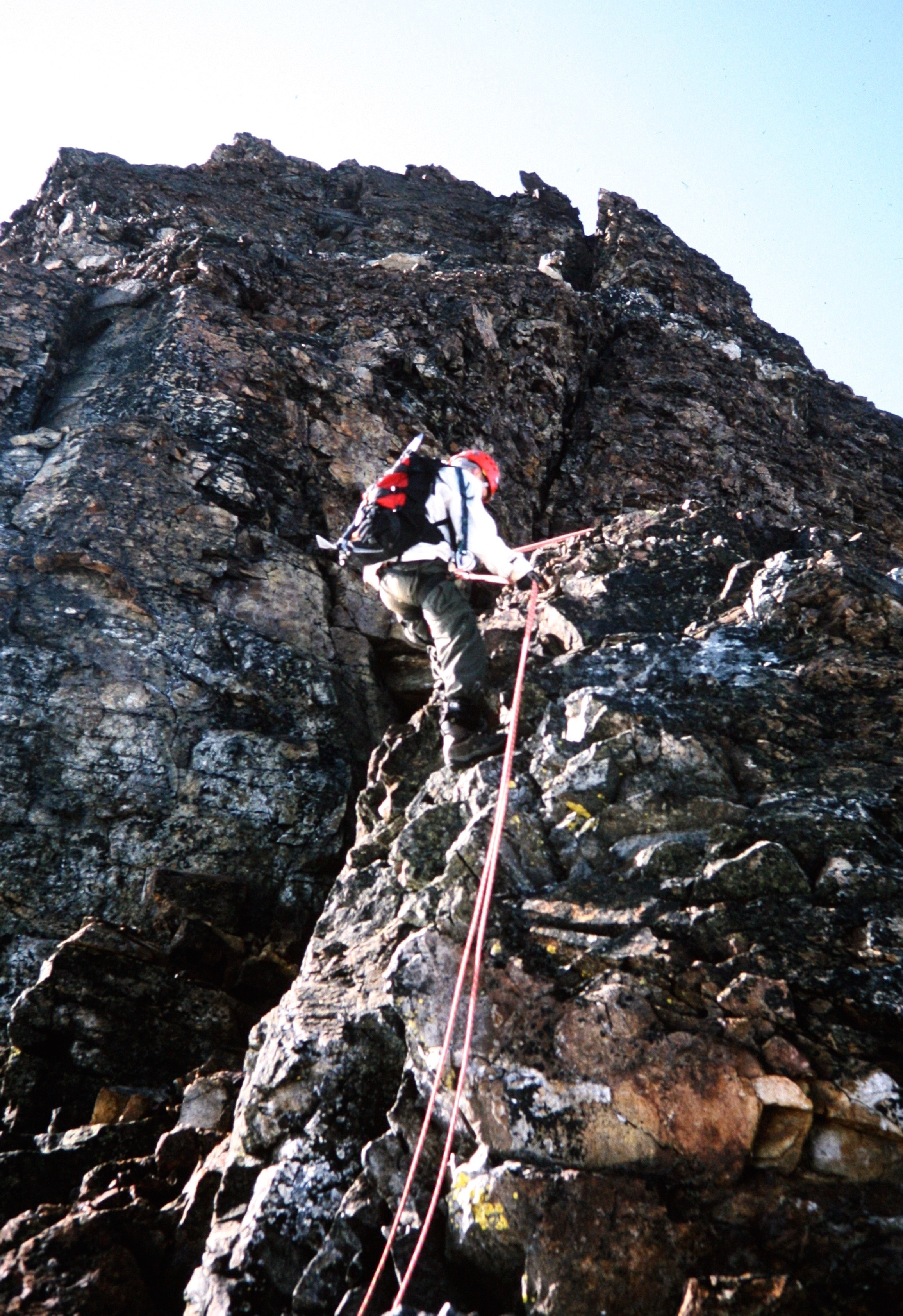
Our descent involved three single-rope rappels down the east buttress.
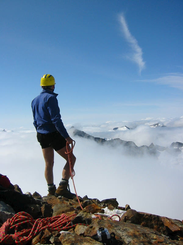
- Starting To Rappel From Boston Peak Summit
The second two anchors didn’t instill me with much confidence, but there were no alternatives by that point.

- Mike Rappelling From Boston Peak Summit
After reaching the uppermost edge of the glacier arm, we backtracked down the glacier, across the southeast face, and over Sahale Peak’s east shoulder. Well…actually, it wasn’t quite that smooth. As I began descending from the Sahale Notch, I heard Mike crying for help above me! He had inadvertently ended up high on the peak—without a rope—and found himself in an awkward predicament! After 15 tense (for him) and frustrating (for me) minutes, he was able to slither down and rejoin me.
I was furious at Mike for being so careless, especially when daylight was so limited. Thankfully, the remainder of our descent was uneventful, and we pedaled into the Eldorado parking lot right at pitch dark (5.5 hours from summit). Even though our day had ended well, I was inclined to hightail down the Cascade River Road with my headlights off, lest the Red Ogre see us trying to escape!
Route Comments
I’ve heard and read that Boston Peak actually has some reasonable Class 3 routes up the east face, but we certainly did not start out on one of them. With better visibility and more time, we might have been able to spot a better line…or not. In the end, we were just delighted to have an alternative descent route.
Gear Comments
A glacier/rappel rope and some rappel slings are probably the only really useful items. I found precious few opportunities for placing protection.
Photo Gallery
Click to enlarge…