Trip Date: November 5, 2019
2019 UTAH ADVENTURE VACATION
Zion Canyon Narrows Exploration: Temple of Sinawava to Wall Street
Zion Canyon (North Fork of Virgin River channel)
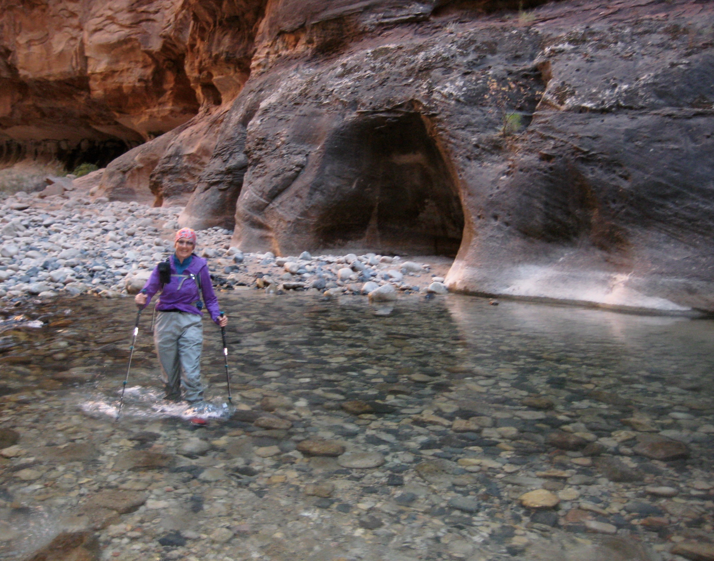
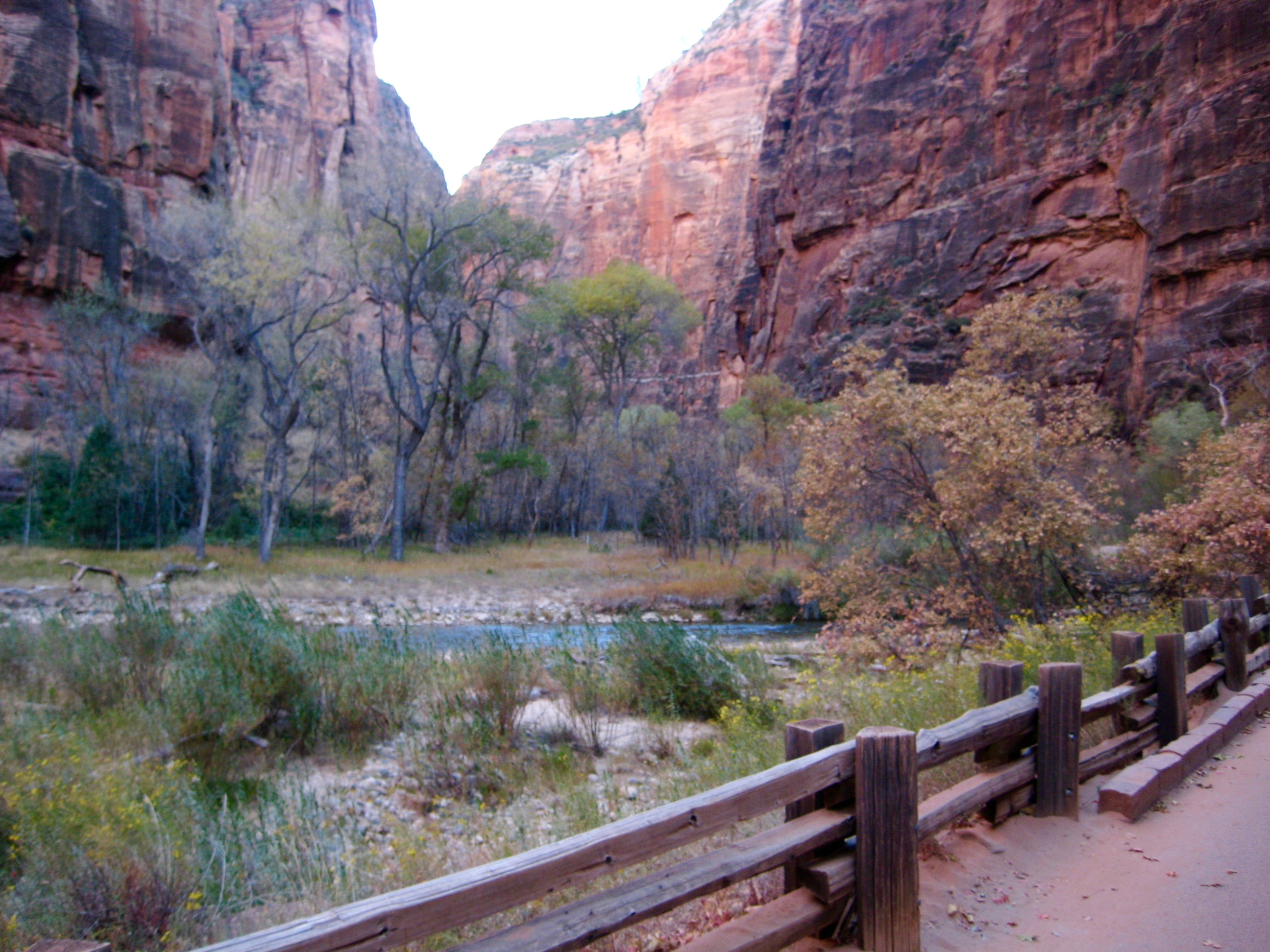
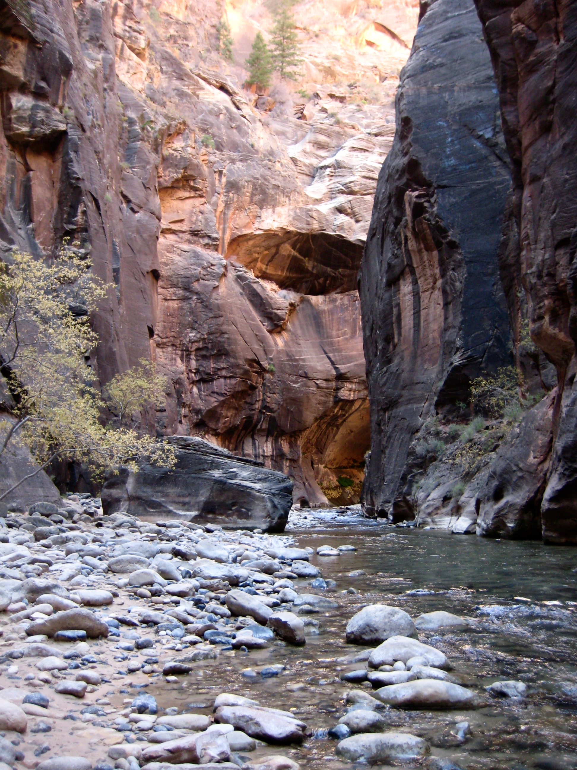
Mouth of the Narrows aka Gateway to the Narrows
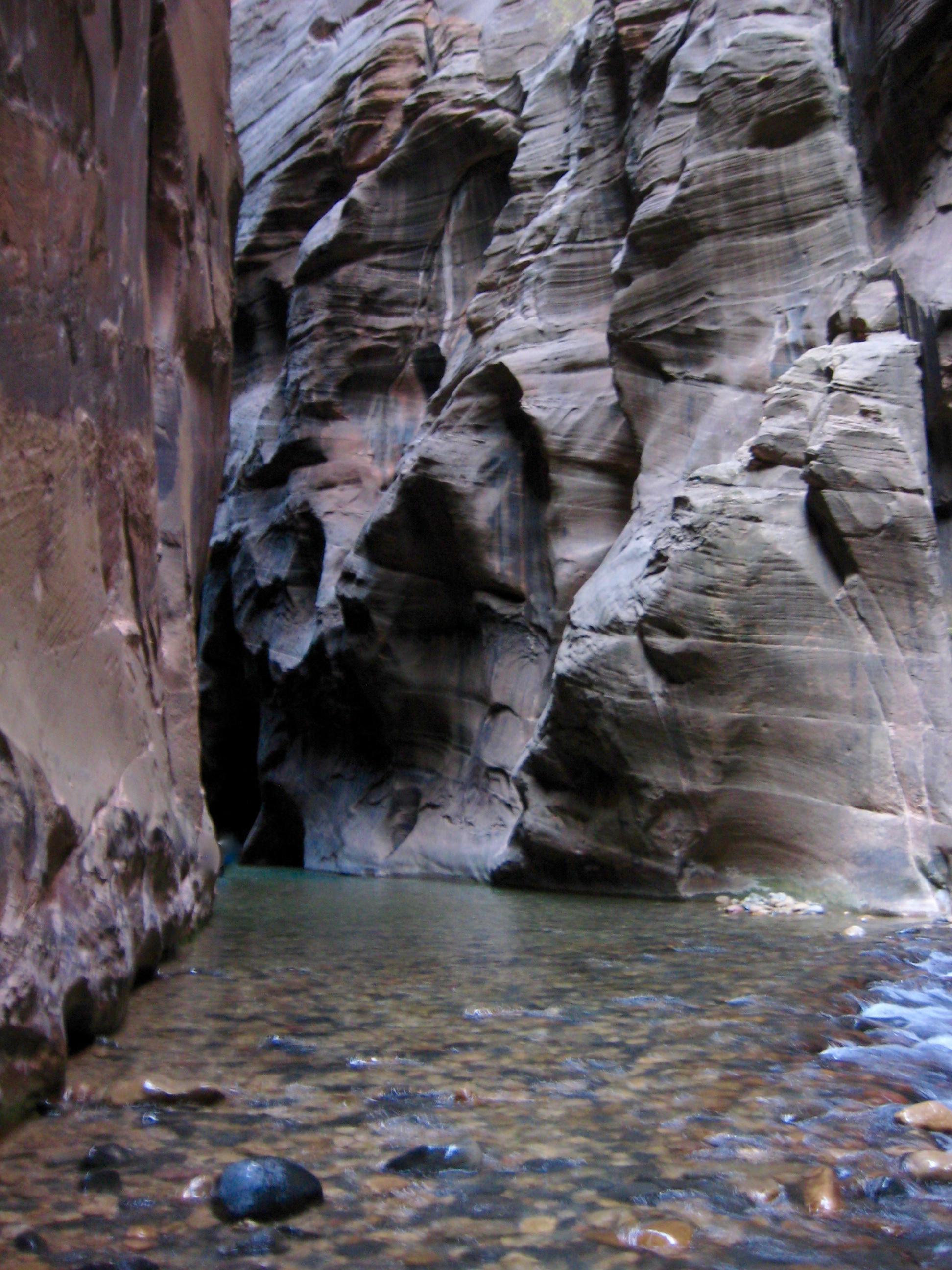
The Zion Narrows
Orderville Canyon Confluence
Wall Street
Imlay Canyon Confluence / Floating Rock
Paired Boulders
Trip Report Summary
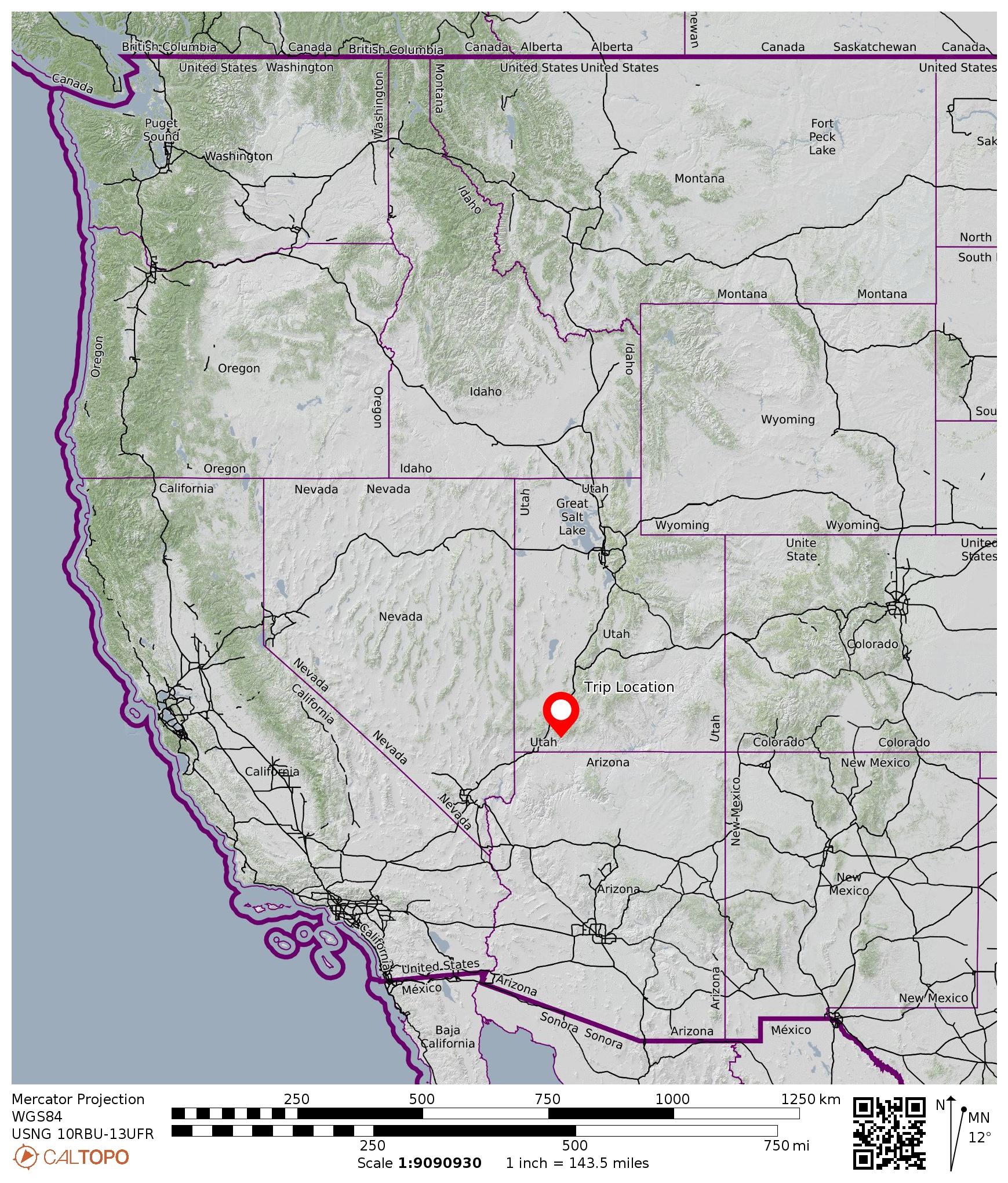
Region: Utah
Sub-Region: Southwestern Utah
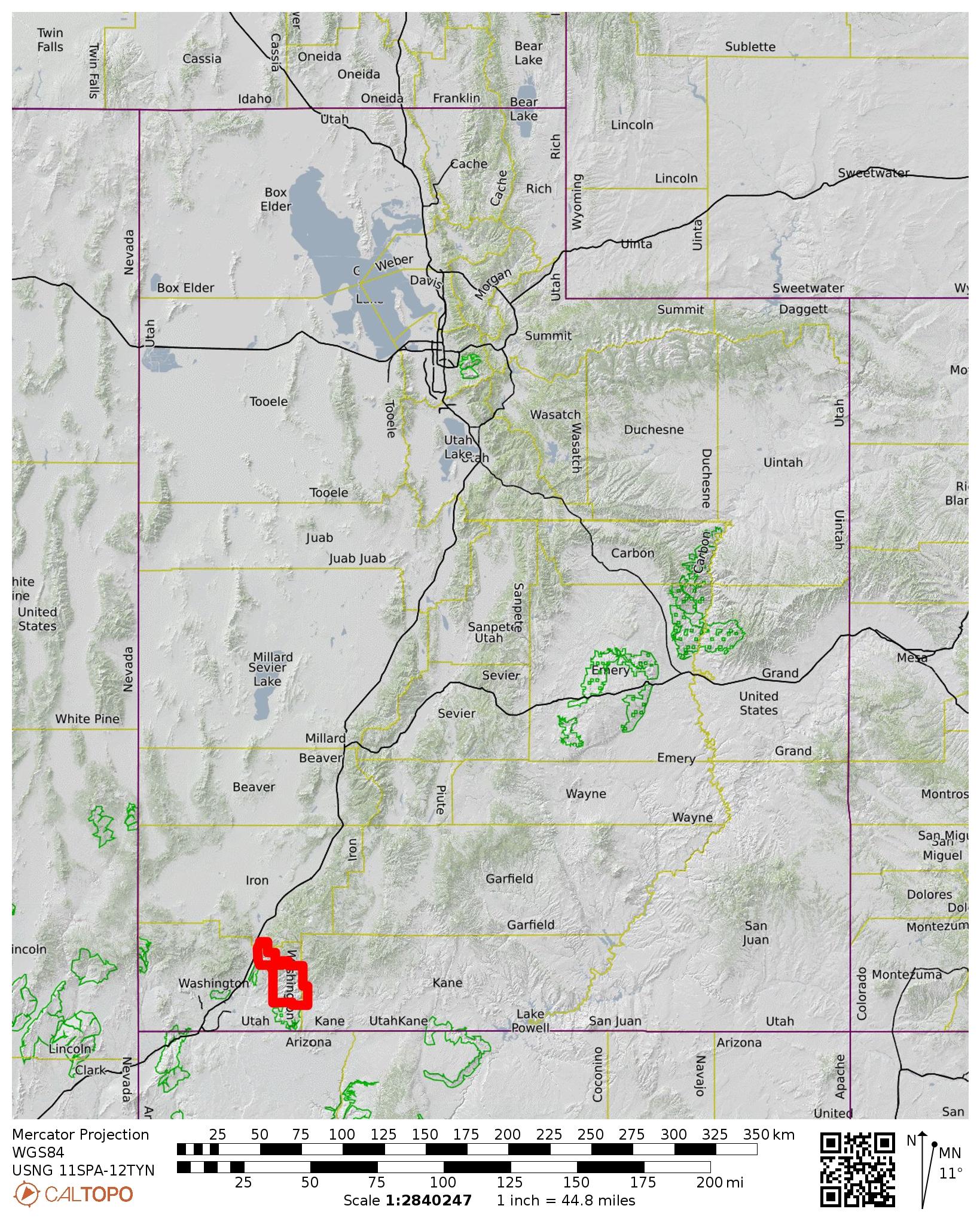
Area: Zion National Park
Starting & Ending Point: Temple of Sinawava Trailhead on Zion Canyon Scenic Drive (Elev. 4450 feet)
Way Points: Mouth of the Narrows (hike via Riverside Walk); North Fork Virgin River & The Narrows & Mystery Falls & Narrows Alcove & Grotto Alcove & Orderville Canyon Confluence & Wall Street & Floating Rock & Paired Boulders (off-trail hike & river wade)
Turnaround Point: 0.2 miles past end of Wall Street & Paired Boulders (Elev. 4680 feet)
Invert: Zion Canyon Narrows (up & back traverse of lower segment)
Approximate Stats: 8.0 miles traveled; 300 feet gained & lost; 3.2 hours up; 2.6 hours down.
…
Full Trip Report
One of the most popular activities in Zion National Park is a “bottom-up” exploration of The Narrows, a dramatically steep-walled segment of Zion Canyon carved out by the North Fork Virgin River. During our Zion vacation, Eileen and I had this activity firmly etched into our must-do list. We went in being pretty naive but came out feeling that we’d had a fascinating and unique Zion adventure.
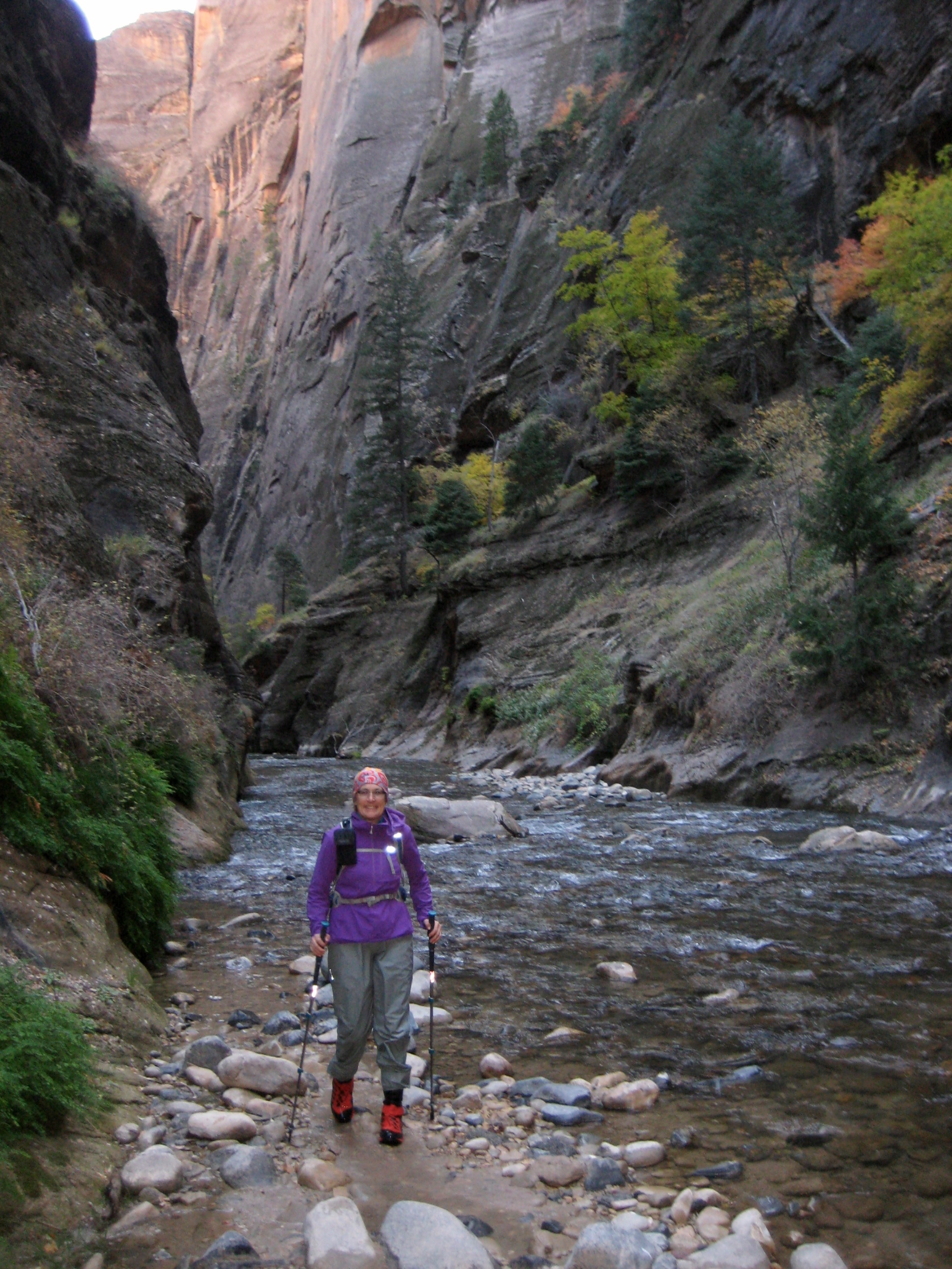
Our Zion Canyon Narrows exploration began in the chilly air of an early November morning. We rode the shuttle bus up to the Temple of Sinawava, dressed in shorts and conventional footwear (water shoes for Eileen; trekking shoes for me), then we hiked 1 mile up the flat, paved Riverside Walk that ends at Mouth of the Narrows (0.4 hours + 70 feet from TH). Here, we stepped off the trail and waded into the Virgin River, along with several dozen other people.
The water was surprisingly frigid. It should have been a clue that EVERYONE ELSE around us was wearing waterproof “dry pants” and specialized canyoneering shoes. But we ignored that fact…for a short while. After wading about 200 yards upstream, our feet were completely numb and we were shivering from heat loss. Hmmm. Perhaps these other tourists knew something we didn’t.
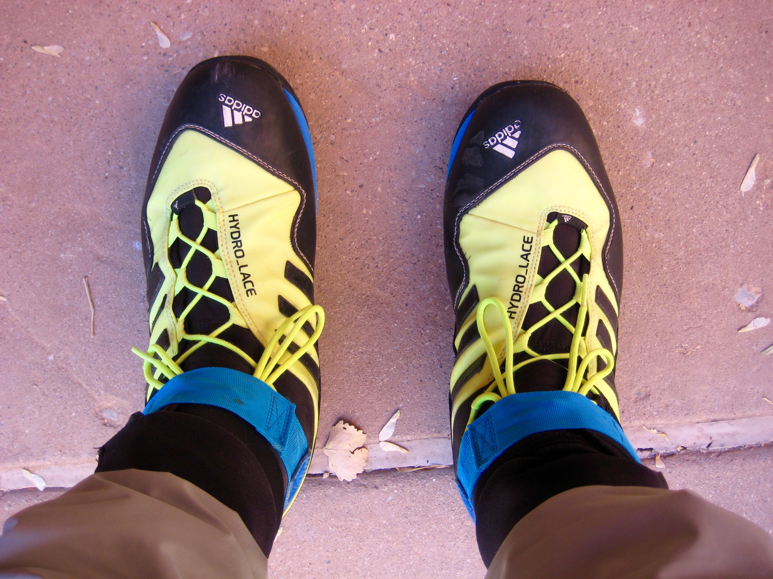
We hastily retreated to the town of Springdale, where dry pants, water socks, and canyoneering shoes could be rented for the reasonable price of $40 per person at Zion Outfitter. Less than 2 hours later, we were back at Mouth of the Narrows for a second attempt. We again plunged into the frigid river and began wading upstream. It went better this time. Our new clothing did an admirable job of fending off the cold, and we were able to keep going.
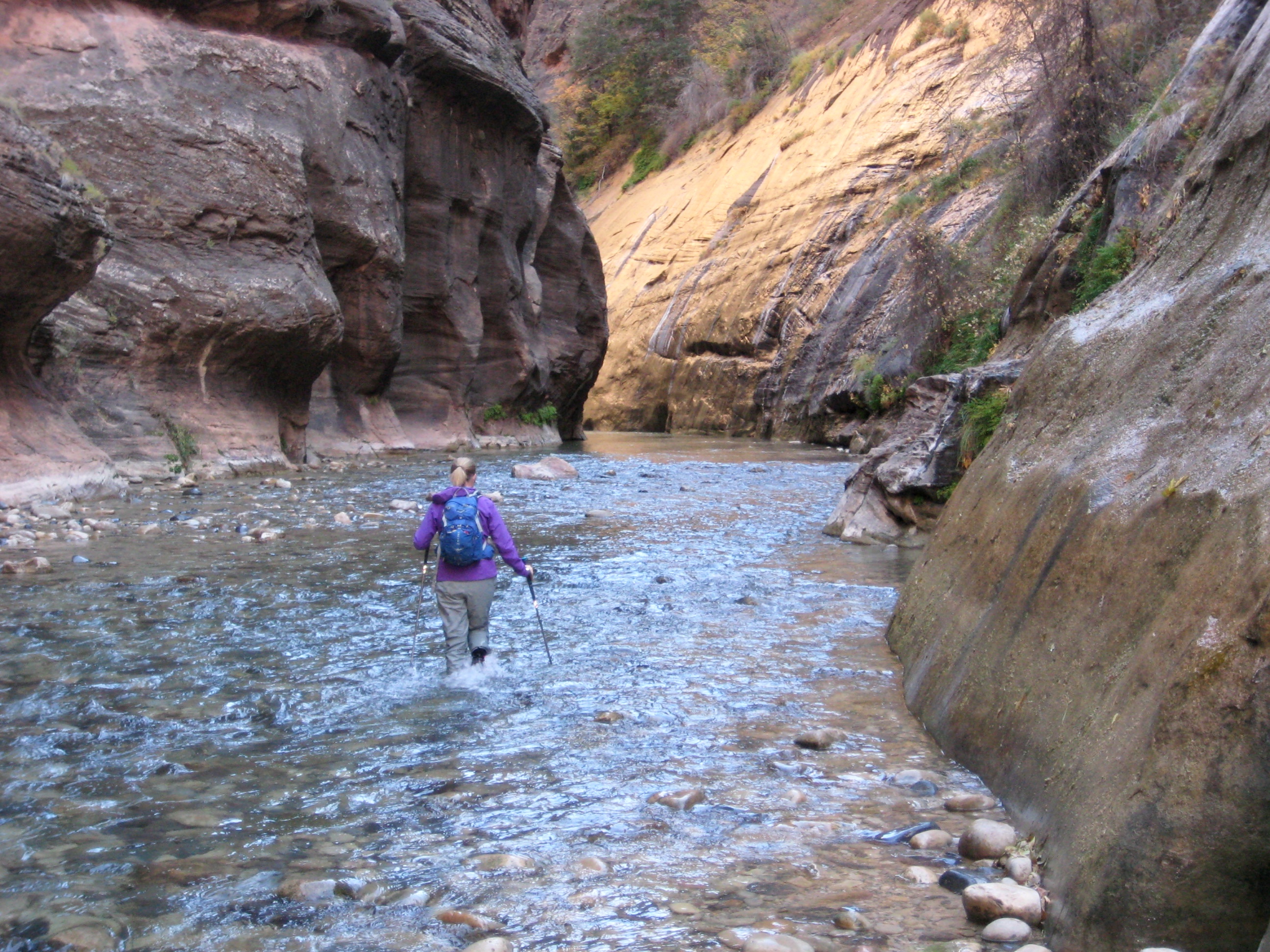
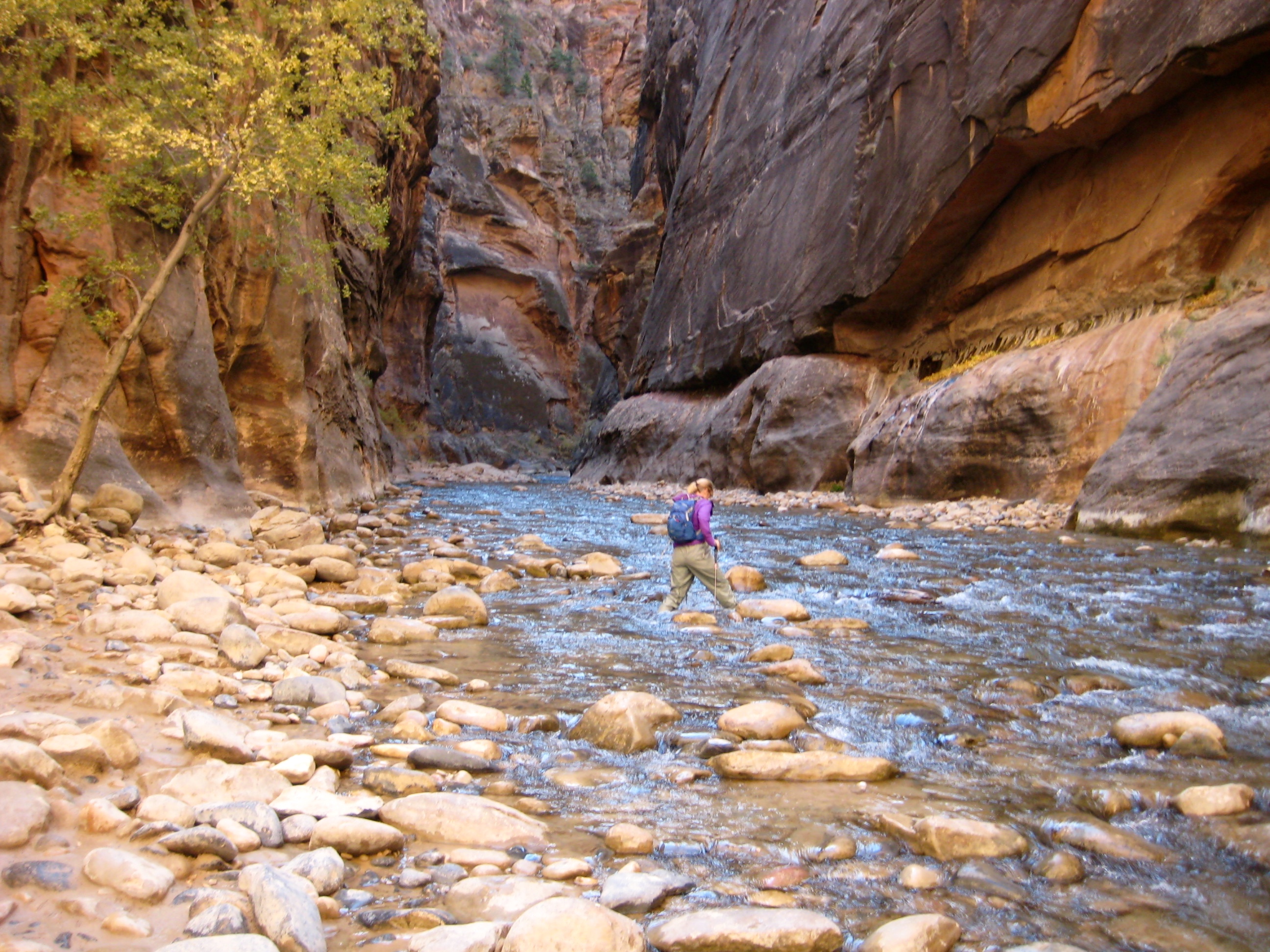
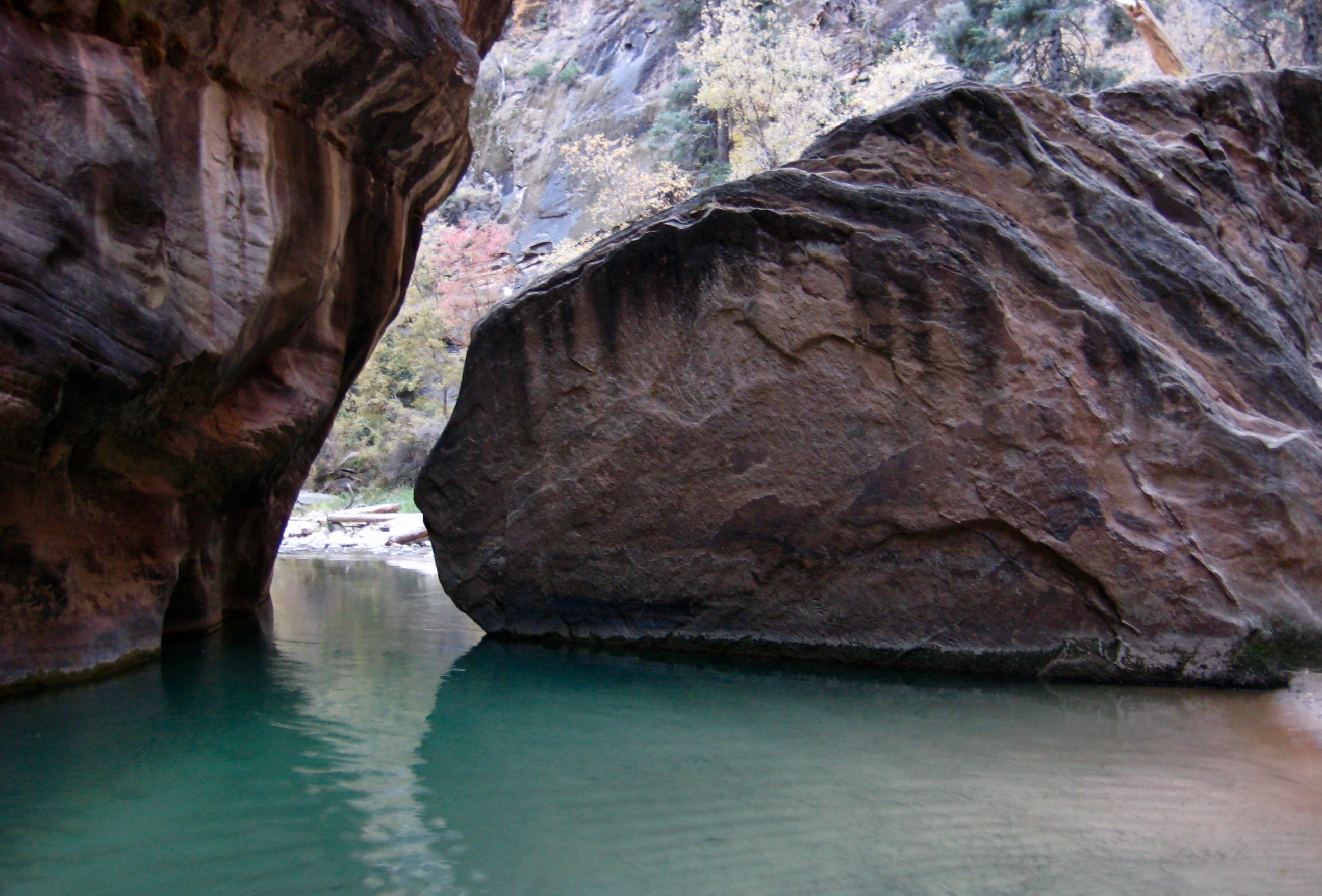
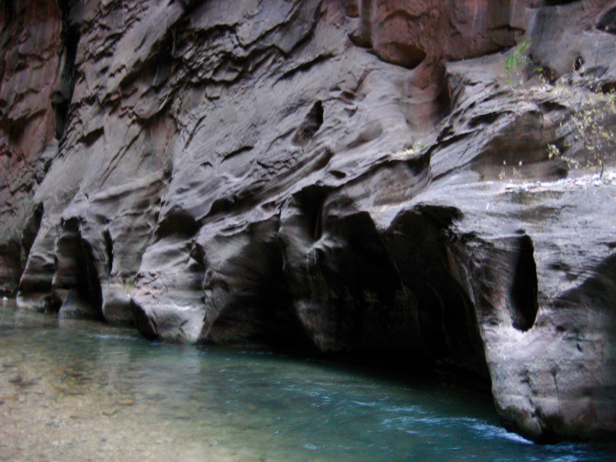
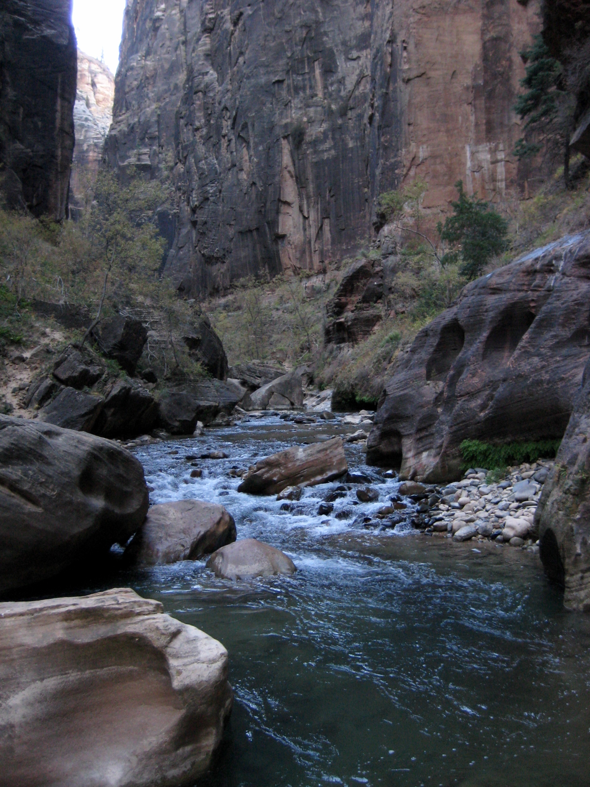
Very quickly, we entered The Narrows proper, where vertical sandstone walls pinch the canyon down to a width of only 30 to 50 feet.
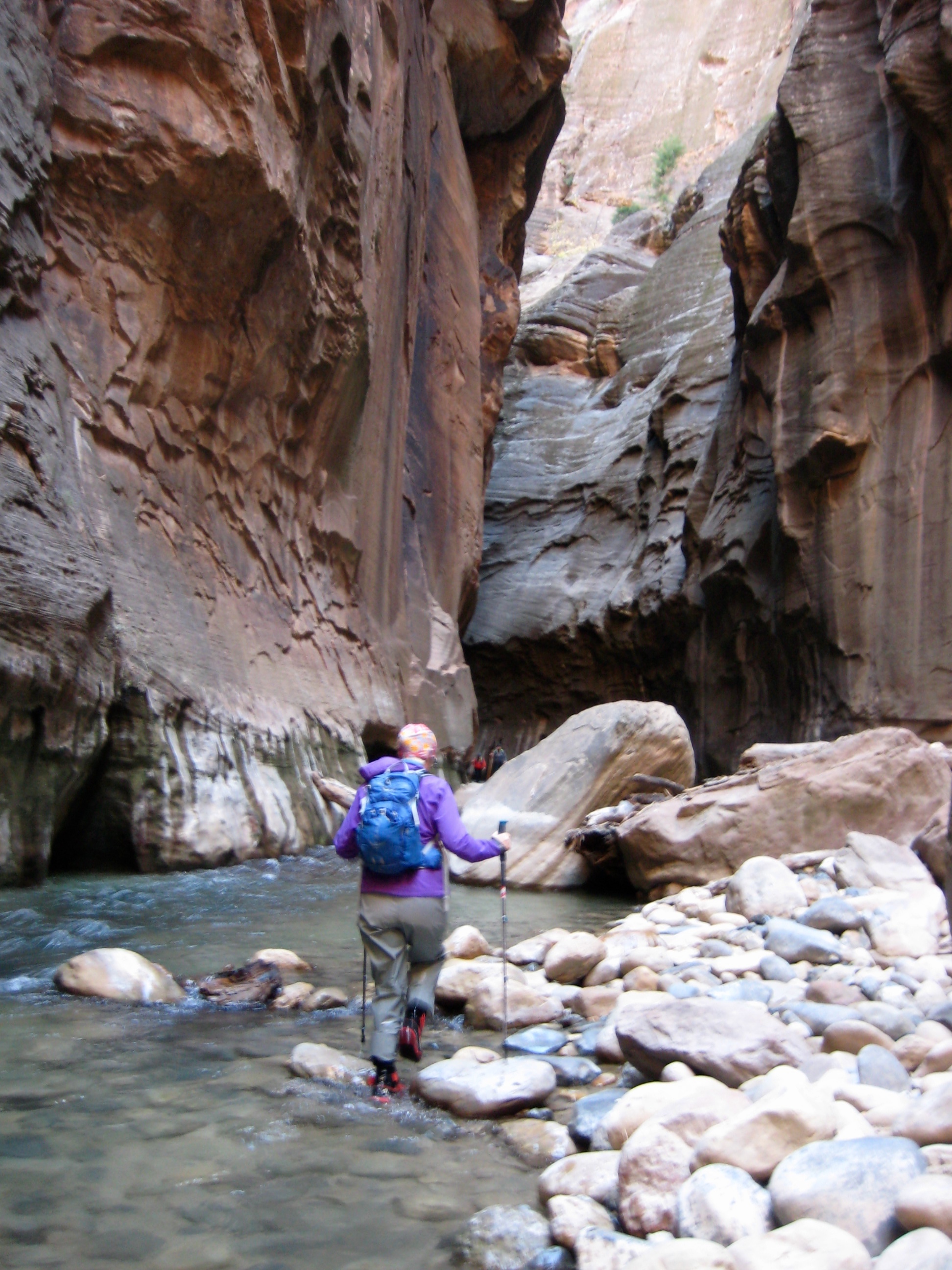
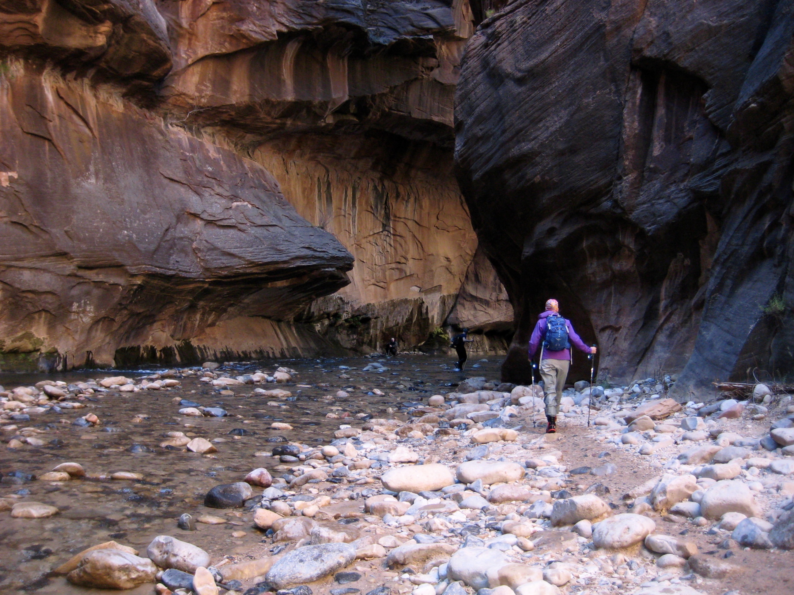
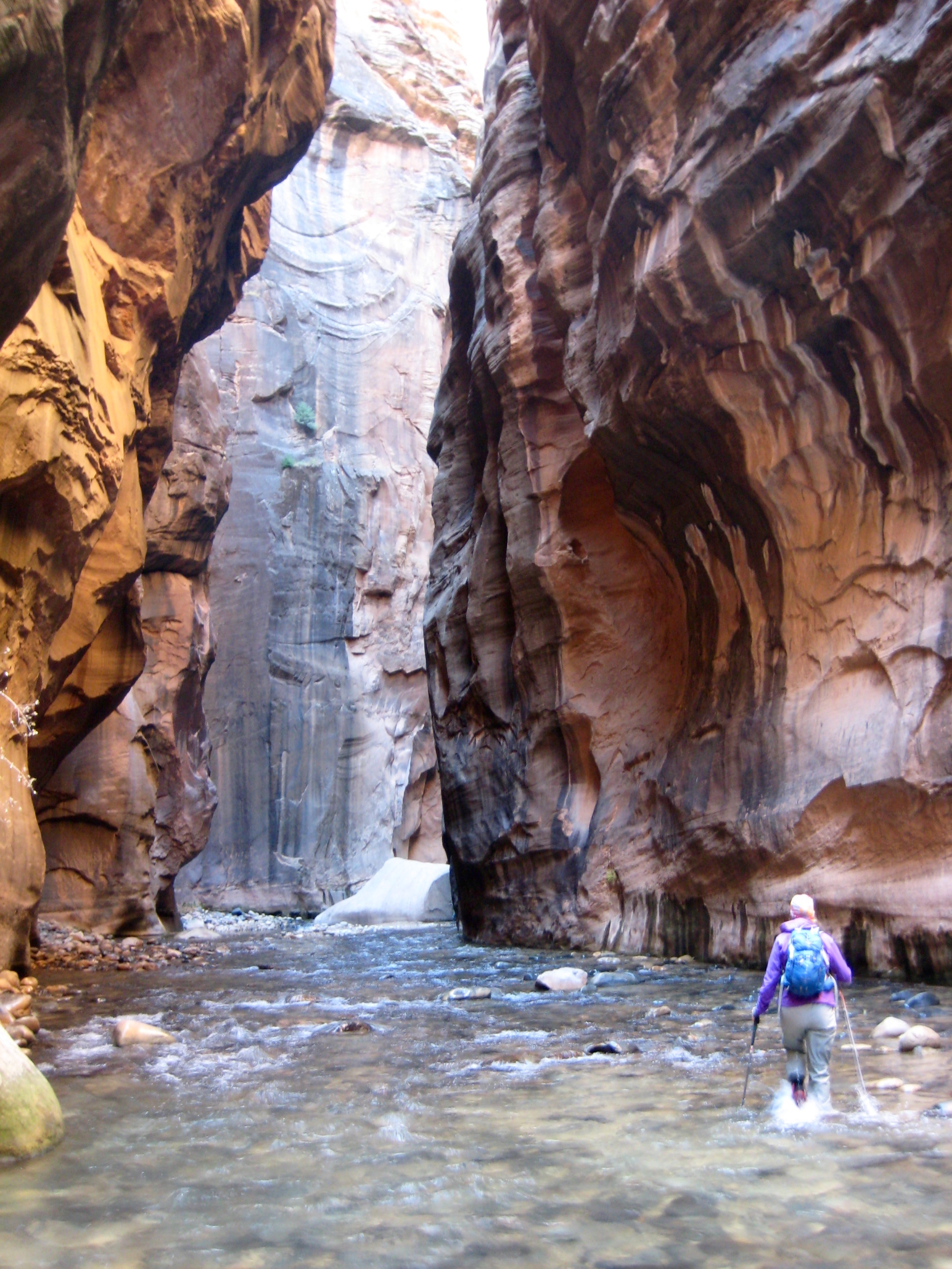
Our route up the river involved countless crossings to avoid deep areas and to take advantage of scattered bits of shoreline. Most exposed shoreline stretches had foot-worn paths that facilitated walking.
Before long, we arrived at a confluence with Orderville Canyon (1.6 hours + 2.5 miles + 270 feet from TH). This is the most significant navigational landmark in the lower part of The Narrows, and it is a turnaround point for most bottom-up travelers.
Beyond Orderville Canyon, the crowds thinned out and we entered a particularly narrow segment of canyon known as “Wall Street.”
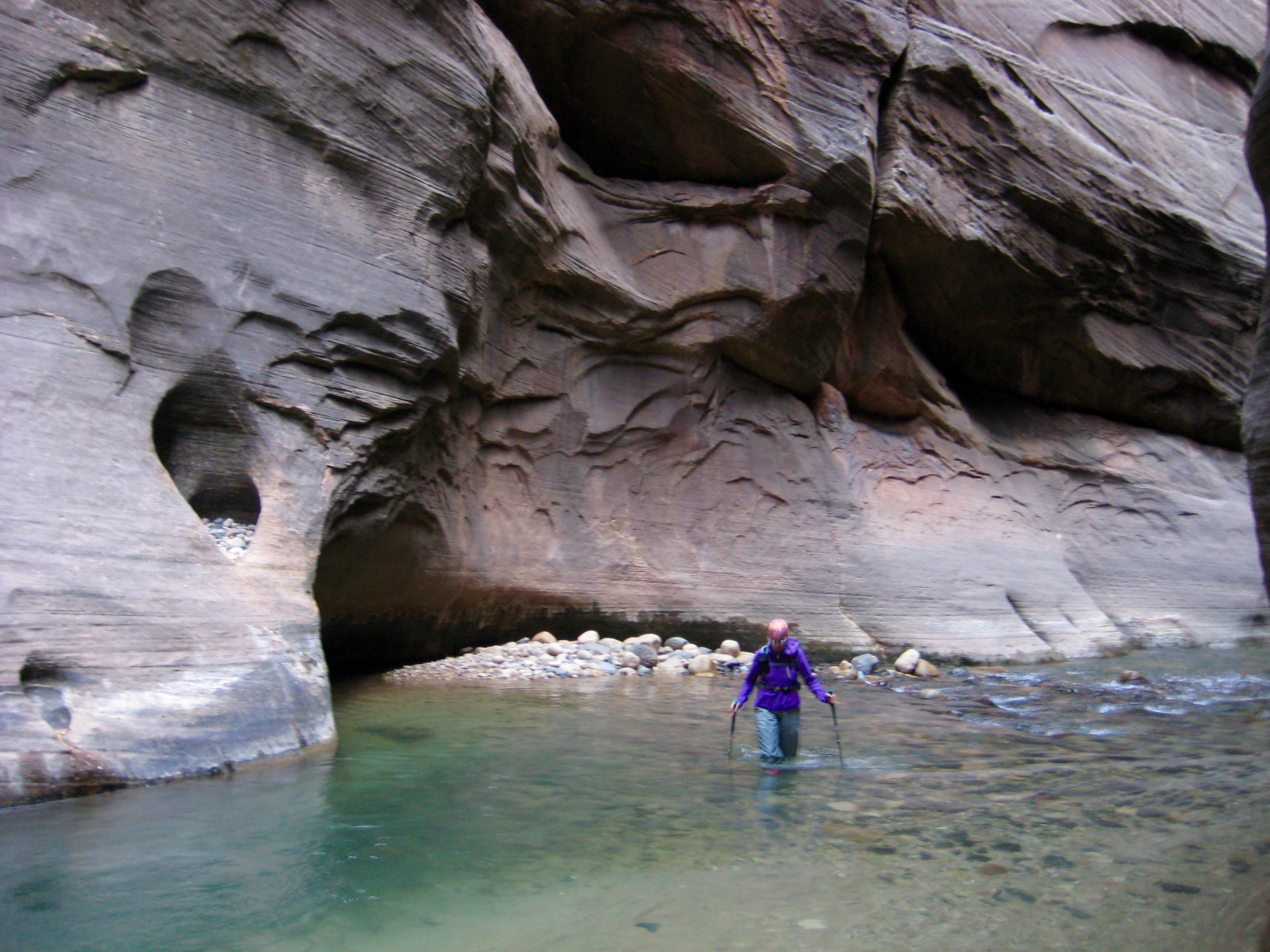
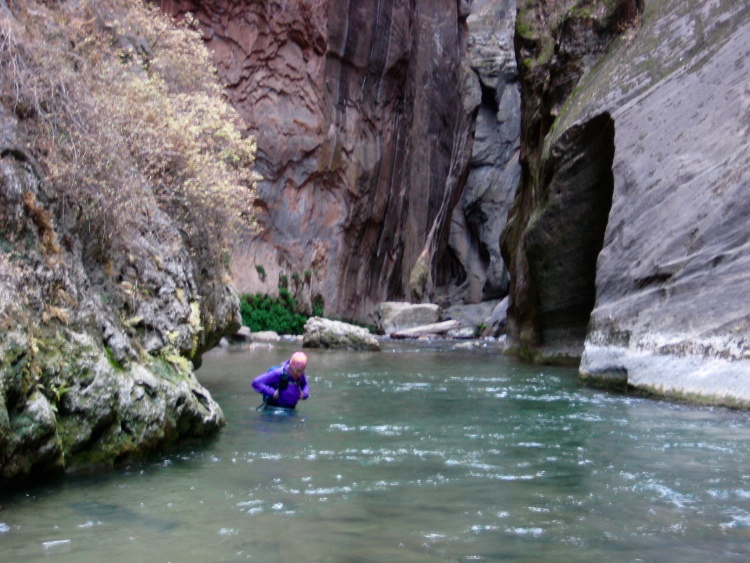
Just beyond “Floating Rock,” Wall Street ends and the canyon widens out again. Additionally, certain parts of the river become deeper; the water was up to, or slightly above, our waist in one or two spots.
By mid-afternoon, we reached a point about 1/2 mile below Big Springs, another significant landmark. It was tempting to push forward, but this seemed to be a logical turnaround point given the time (3.2 hours + 3.7 miles + 270 feet from TH).
Downstream travel was considerably faster, and we made good time getting to Orderville Canyon (1.2 hours from turnaround point). Along the way, we encountered three very tired backpackers who were performing a full top-down canyon traverse. We also encountered a trio of canyoneers who were rappelling into the river after having completed a technical descent of adjacent Imlay Canyon. Clearly, this is the canyoneering epicenter of Zion National Park.
An hour later, we reached Mouth of the Narrows, where our river march ended. One mile of paved trail took us to a waiting shuttle bus at the Temple of Sinawava (2.6 hours + 30 feet from turnaround point). We sloshed onto the bus, plopped down, and agreed that this “signature Zion adventure” was everything we had hoped for and more.
Gear Comments
Before our trip, we’d seen dozens of photos showing large groups of tourists happily wading through The Narrows while wearing shorts, tee-shirts, and sneakers. This attire passes muster in mid-summer, when air temps are in the 90s and 100s, but as Eileen and I discovered, it is woefully inadequate during the chilly days of autumn. We found that dry pants, neoprene water socks, and canyoneering shoes were necessary for comfort—if not downright survival—in November. In fact, shorter folks would be advised to wear “dry bibs” or “dry suits” if traveling beyond Orderville Canyon. Also, most rental packages include a wooden walking stick, which is very useful if you don’t have trekking poles.
Route & Landmark Maps
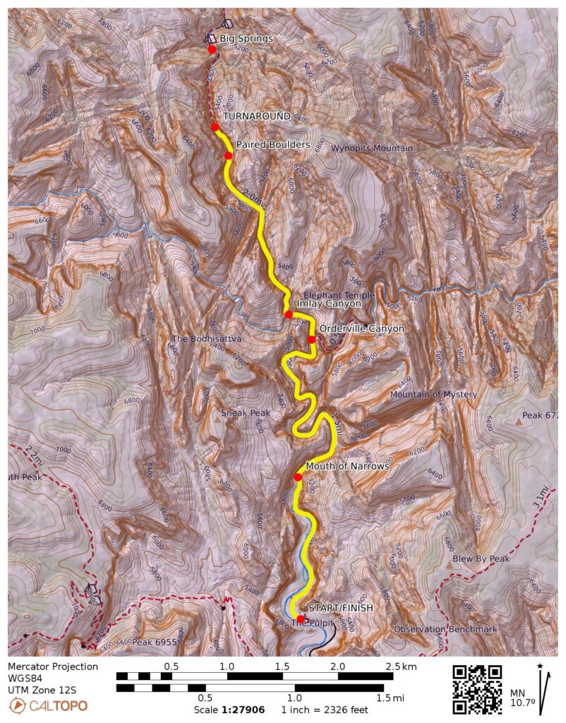
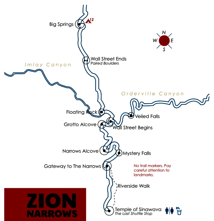
Photo Gallery
Click to enlarge…