Trip Date: August 15-18, 2022
2022 TETON RANGE ADVENTURE OUTING
Teton Crest Trail Traverse: Rendezvous Mountain to String Lake
Marion Lake
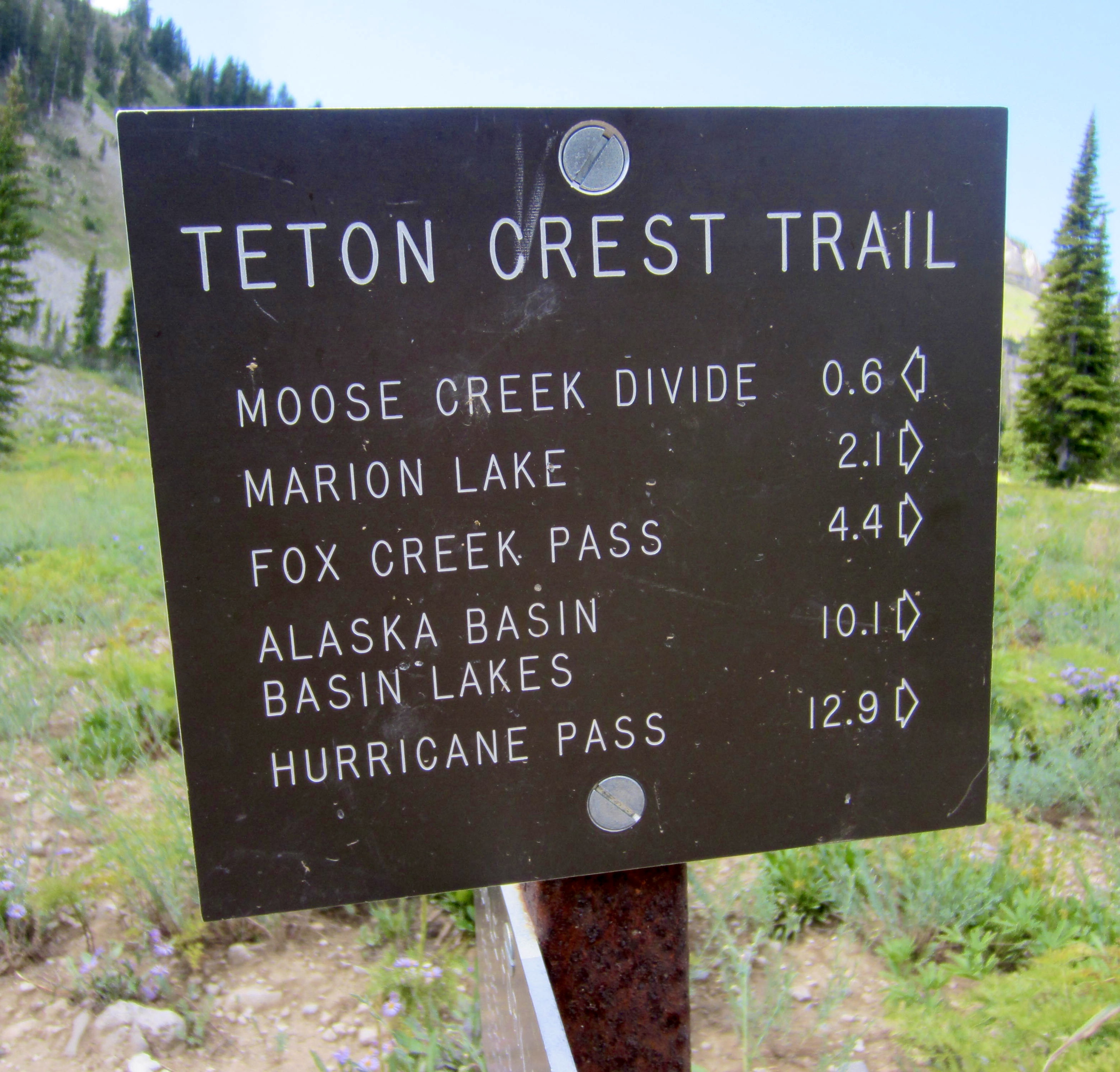
Fox Creek Pass
Death Canyon Shelf
Mount Meek Pass
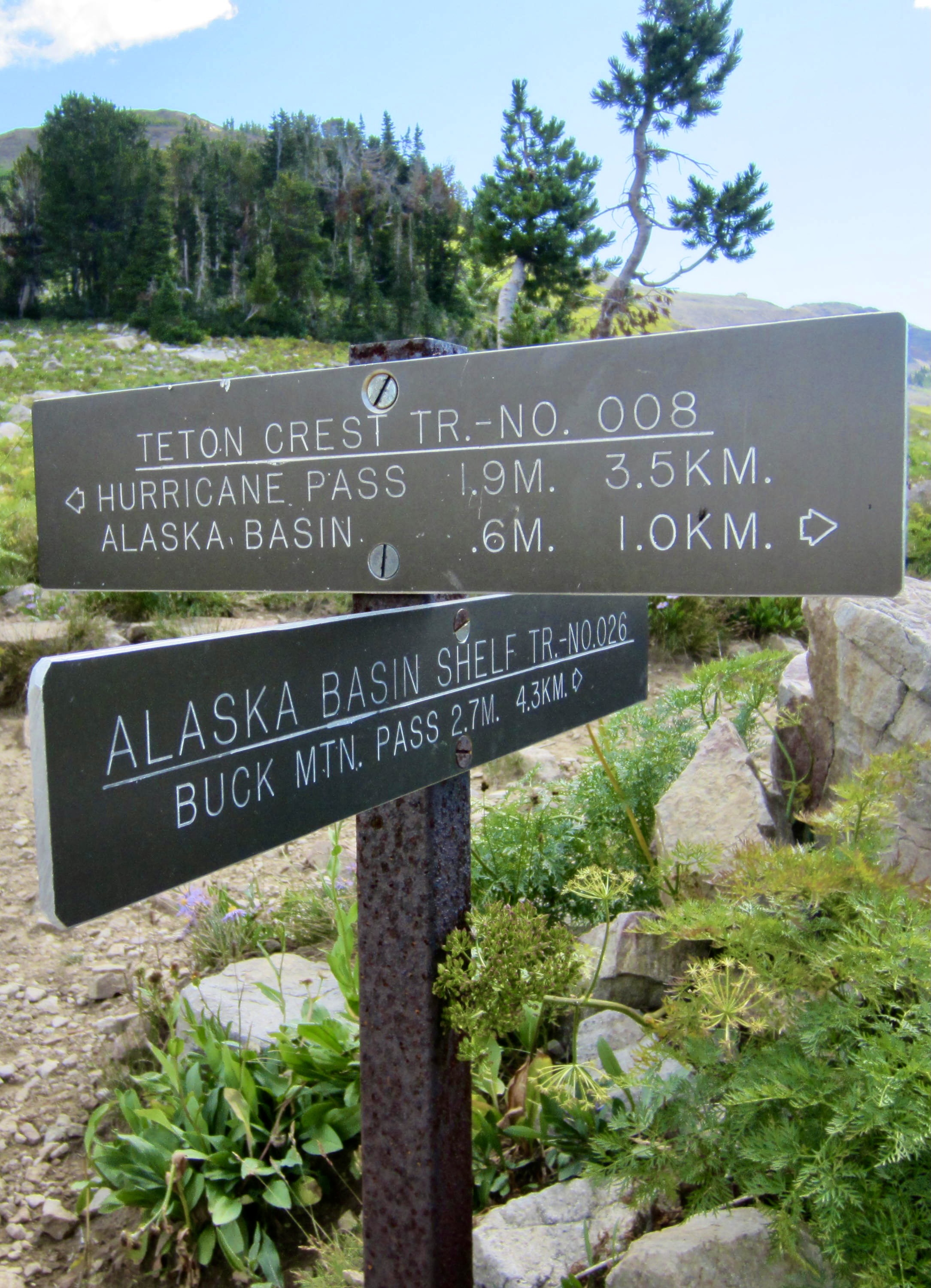
Alaska Basin / Sunset Lake
The Wall / Snowdrift Lake Overlook
Hurricane Pass
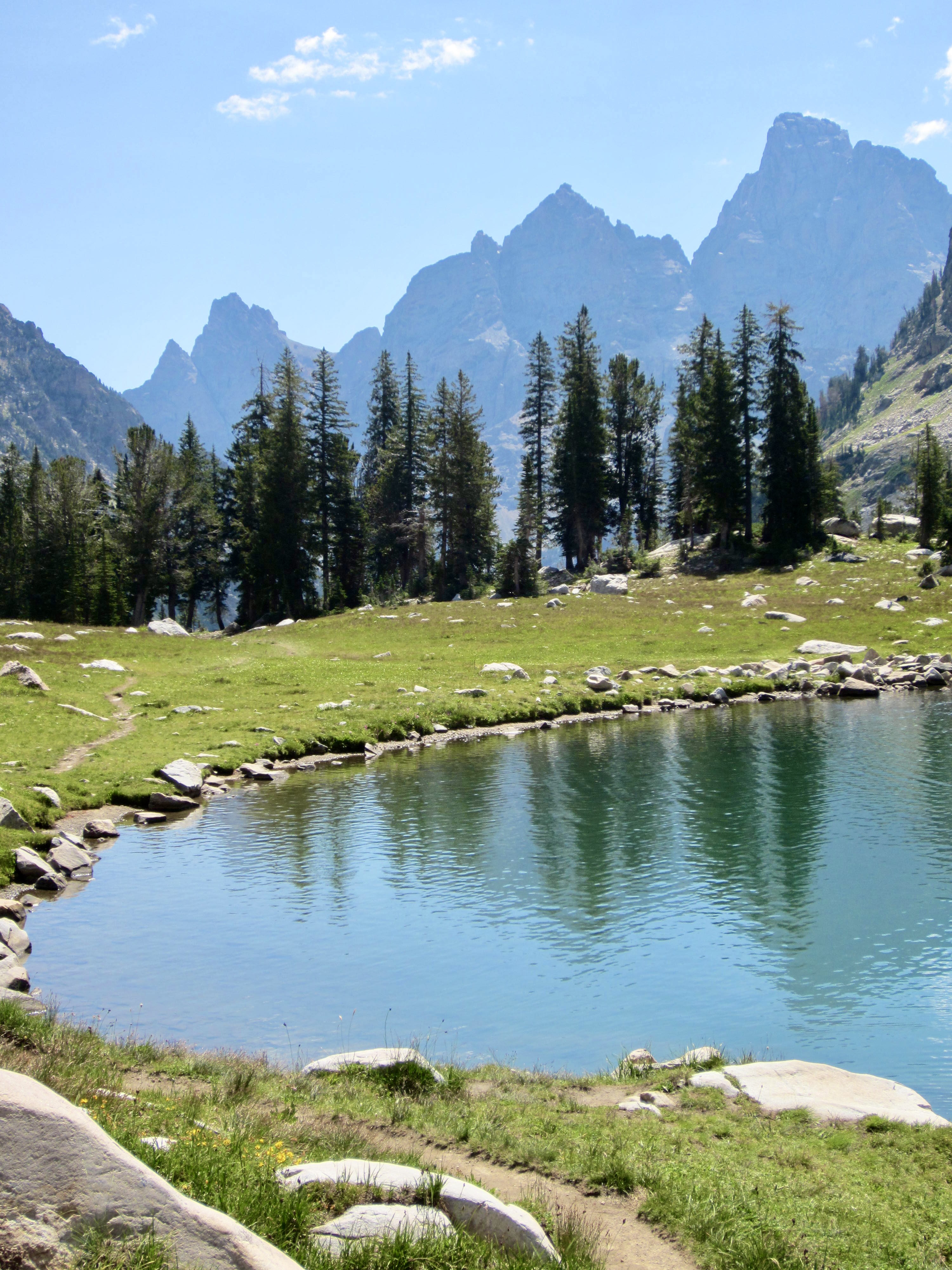
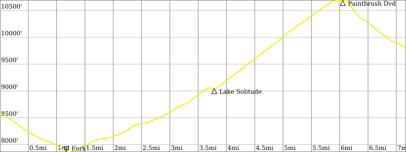
Lake Solitude
Paintbrush Divide
Paintbrush Peak (10,880+ ft)
- Trip Report Summary
- Trip Overview
- Full Trip Report
- Day 0: Car Shuttle
- Day 1: Teton Village to Death Canyon Shelf
- Day 2: Death Canyon Shelf to South Cascade Canyon + The Wall
- Day 3: South Cascade Canyon to Paintbrush Meadows + Paintbrush Peak
- Day 4: Paintbrush Meadows to String Lake
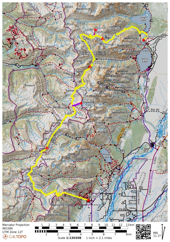
- Route Maps & Profiles
- Photo Gallery
Trip Report Summary
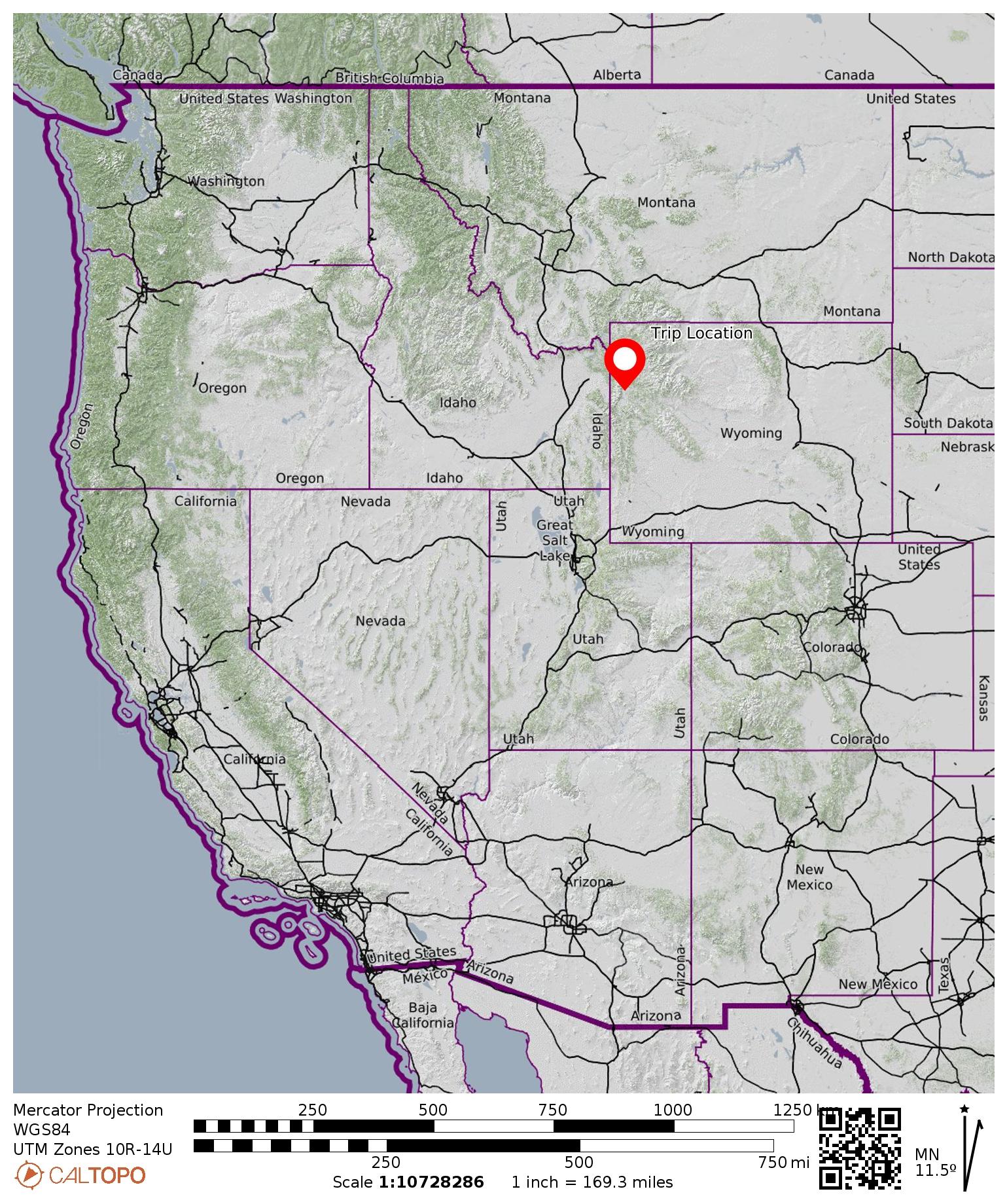
Region: Wyoming Rockies
Sub-Region: Teton Range
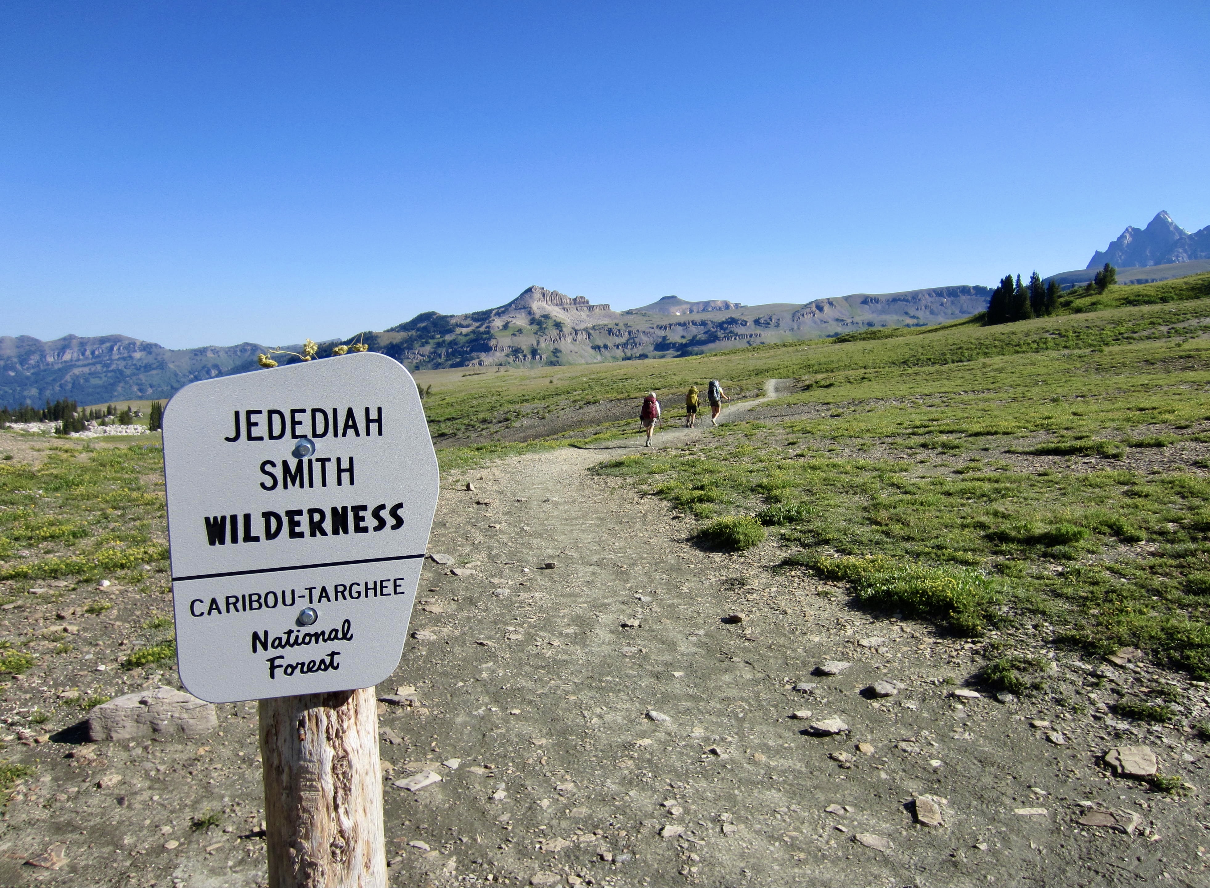
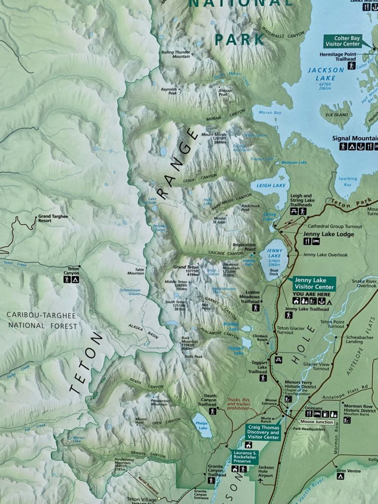
Areas: Grand Teton National Park & Jedediah Smith Wilderness
Starting Point: Jackson Hole Aerial Tramway base station at Teton Village (Elev. 6300 feet)
Way Points: Rendezvous Mountain crest (gondola ride); South Fork Granite Creek & Middle Fork Granite Creek & North Fork Granite Creek & Marion Lake & Fox Creek Pass & Death Canyon Shelf & Mt. Meek Pass & Alaska Basin / South Fork Teton Creek & Sunset Lake & Hurricane Pass & South Fork Cascade Basin & South Fork Cascade Canyon & Cascade Forks & North Fork Cascade Canyon & Lake Solitude & Paintbrush Divide & Upper Paintbrush Meadow & Lower Paintbrush Meadow & Paintbrush Canyon & Leigh Lake Outlet Bridge & String Lake (trail hike)
Ending Point: String Lake / Leigh Lake Trailhead on Jenny Lake Loop Road (Elev. 6900 feet)
High Point: Paintbrush Divide (Elev. 10,700 feet)
Campsites: Death Canyon Shelf & South Fork Cascade Canyon & Upper Paintbrush Meadow
Sidetrip: The Wall / Snowdrift Lake Overlook (off-trail hike)
Summit: Paintbrush Peak (rock scramble via South Ridge)
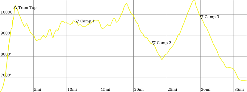
Approximate Stats (excluding sidetrips): 35 miles traveled on foot; 6300 feet gained; 9900 feet lost.
Approximate Stats (including sidetrips): 37 miles traveled on foot; 7600 feet gained; 11,000 feet lost.

…
Trip Overview
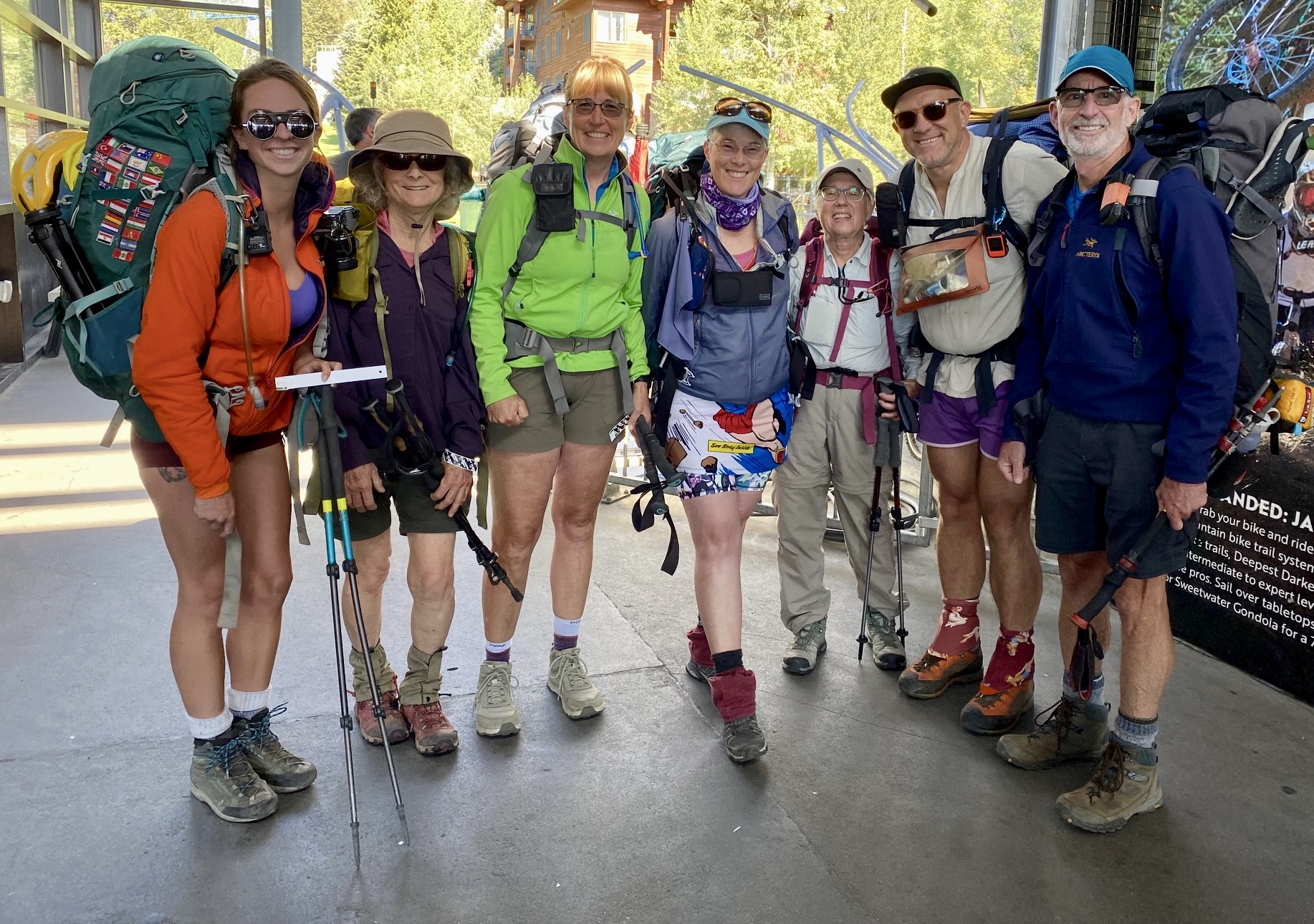
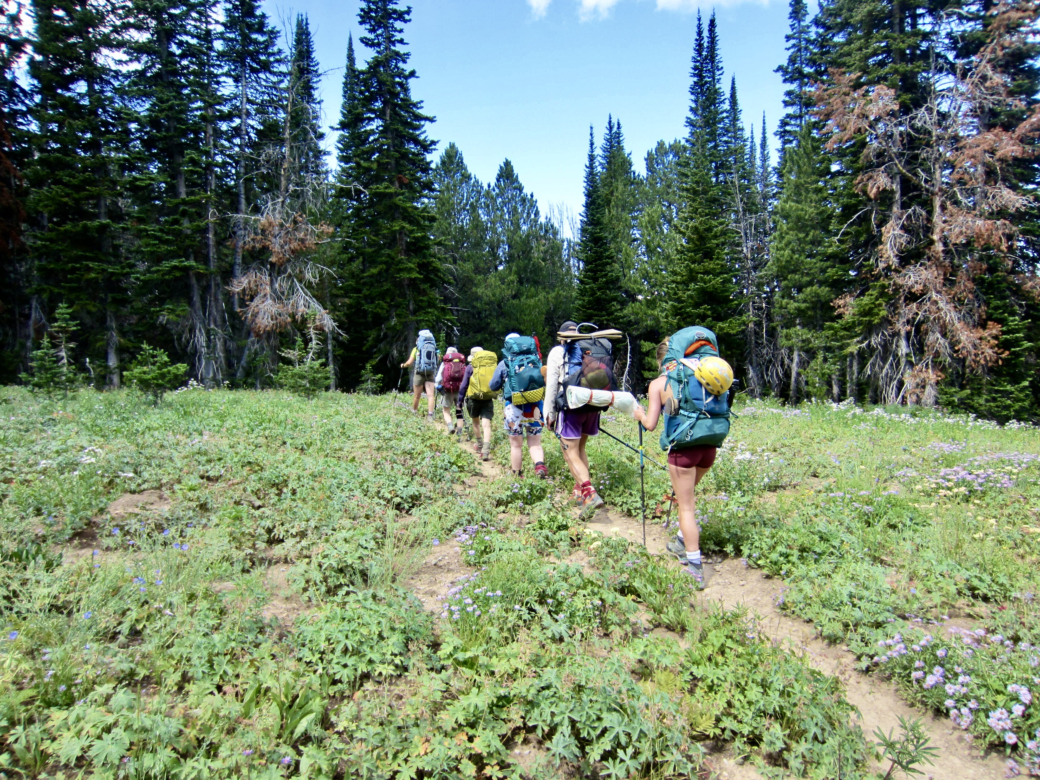
During four days of hot and sunny weather in northwestern Wyoming, Eileen, Brooke, Fay, Beth, Kevin, Maria, and I completed a 35-mile backpacking traverse along the Teton Crest Trail. This scenic trail lies entirely within Grand Teton National Park except for two short segments that cross through the Jedediah Smith Wilderness just outside the park.
…
Starting & Ending Points
The Teton Crest Trail Traverse can readily be done in a north-to-south direction or a south-to-north direction. Either way, the logical northern terminus is the String Lake / Leigh Lake Trailhead off Jenny Lake Loop Road. In contrast, there are multiple options for the southern terminus; these include the Granite Canyon Trailhead, Teton Village, Phillips Canyon Trailhead, Phillips Bench Trailhead, and Coal Creek Trailhead. Our group elected to do a south-to-north traverse starting at Teton Village because this allowed us to ride the Jackson Hole Aerial Tramway up Rendezvous Mountain, thereby saving us many miles and more than 4000 feet of elevation gain. If given an extra day, we might have chosen to start at the Coal Creek Trailhead just for the sake of “completeness and purity.”
Route & Terrain
Despite its name, the Teton Crest Trail does not really follow any sort of topographic crest. Instead, it travels primarily along the western slope of the Teton Range, wandering back and forth across numerous spur ridges, crossing over several high passes, and dropping into several basins and valleys. It attains a maximum elevation of 10,700 feet at Paintbrush Divide and a local minimum elevation of 7800 feet at Cascade Forks. The average trail elevation is approximately 9500 feet.
Campsites & Water
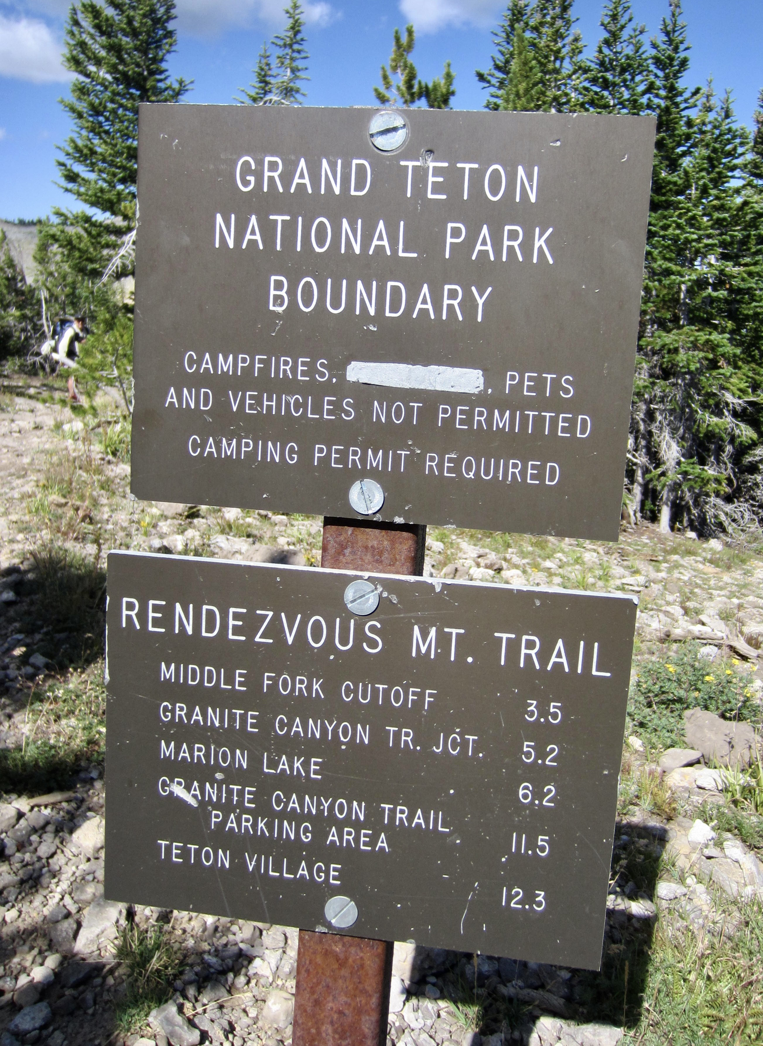
Camping along the Teton Crest Trail is limited either to specific tent sites—of which there are many—or to several delineated zones. Permits are required for all sites and zones within Grand Teton National Park, but no permits are needed for Fox Creek Pass and Alaska Basin, which lie within the Jedediah Smith Wilderness outside of the park. We found drinking and cooking water to be available near all campsites, as well as at many other locations along the entire trail, although this could change later in the season.
Trail Scenery
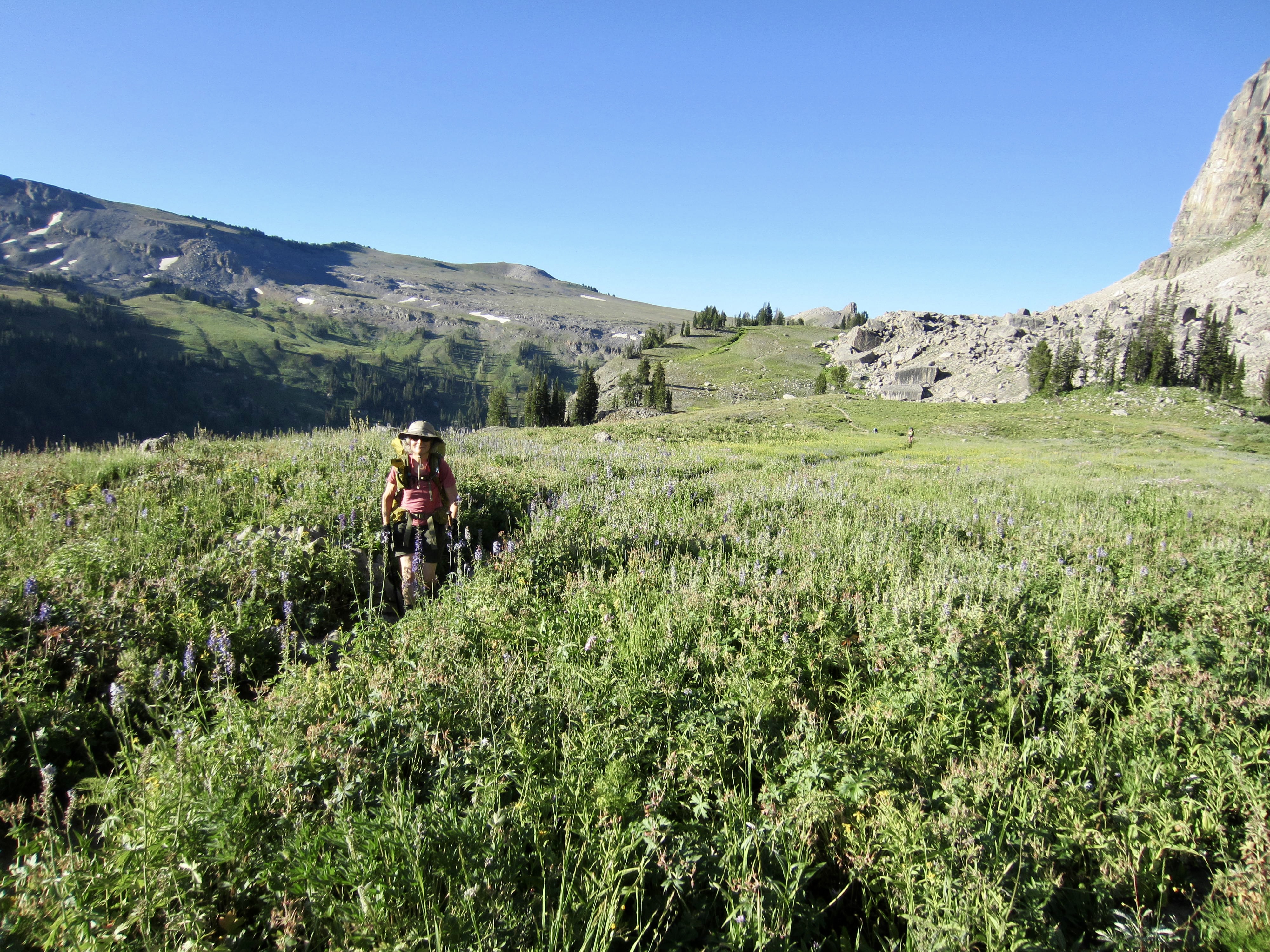
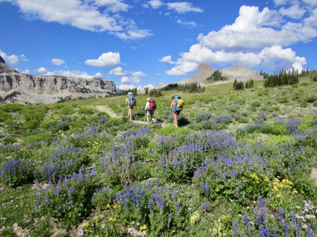
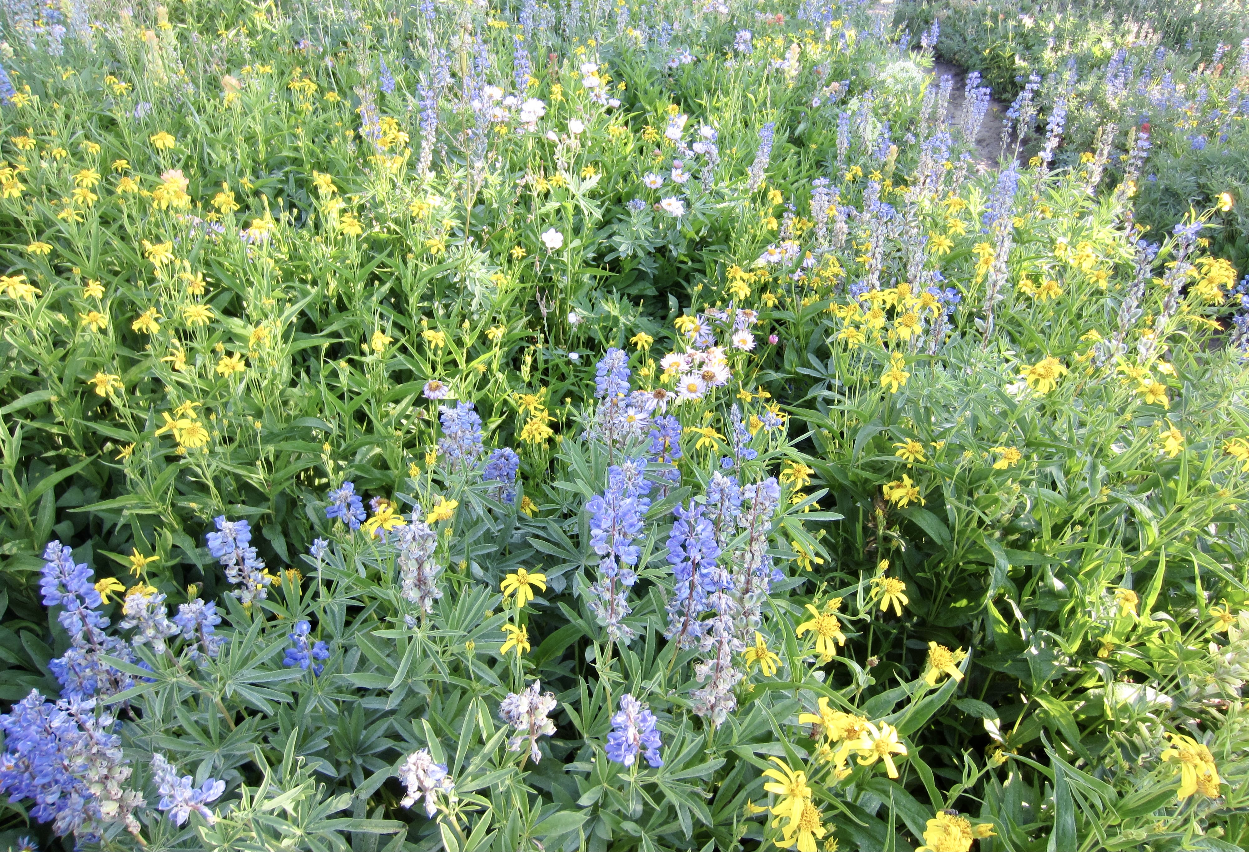
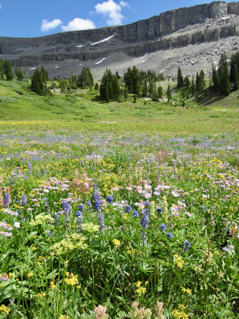
We all expected the trail to offer spectacular views of the major Teton peaks, and these expectations were met or exceeded in abundance; every day delivered stunning new mountain scenery. There were also enough beautiful alpine lakes to provide ample swimming and/or gazing opportunities. The big surprise for all of us, however, was the marvelous variety of wildflowers still blooming in mid-August. Each basin and meadow seemed to be competing for the best color display!

…
Full Trip Report
Day 0: Car Shuttle
After our entire group had assembled at Gros Ventre Campground in Jackson Hole the day before starting, we shuttled two cars up to the String Lake Trailhead located between Jenny Lake and Leigh Lake. This trailhead has a large parking lot at Elev. 6800 feet.
Day 1: Teton Village to Death Canyon Shelf
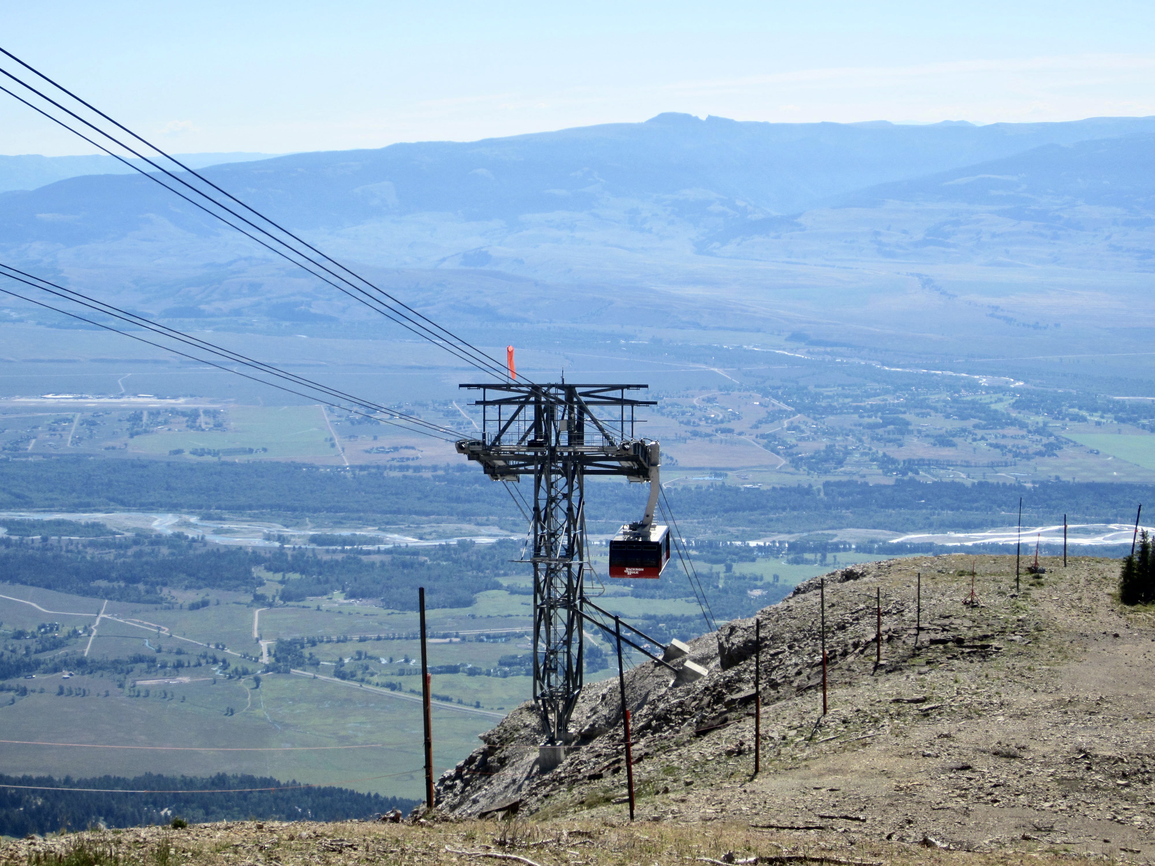
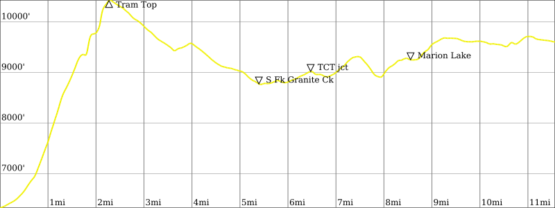
Utilizing our other two cars, we drove over to Teton Village and parked in the Ranch Lot, which provides safe overnight parking for hundreds of vehicles. A free shuttle bus then took us over to the Aerial Tramway base station. Twelve minutes and 4100 vertical feet later, we stepped out of the tram car and onto the crest of Rendezvous Mountain at Elev. 10,400 feet.
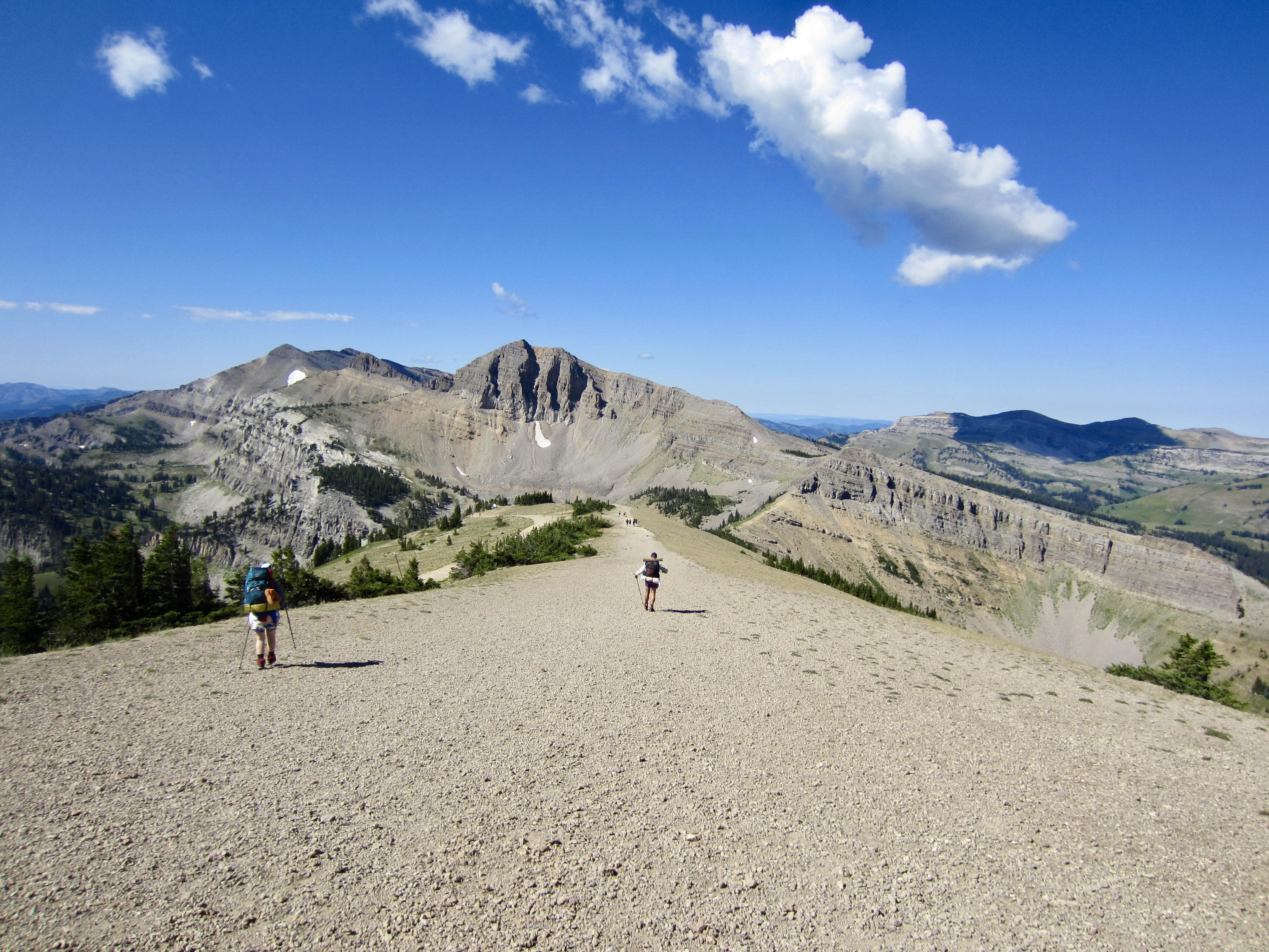
After a mandatory stop for waffles at Corbet’s Cabin near the tram station, we began our hike with a descent to the headwaters of Granite Creek. The Rendezvous Mountain Trail took us through sweeping green meadows, reaching a low point of 8800 feet at South Fork Granite Creek, and then a cut-off trail led over us over to an intersection with the official Teton Crest Trail (TCT) near Middle Fork Granite Creek.
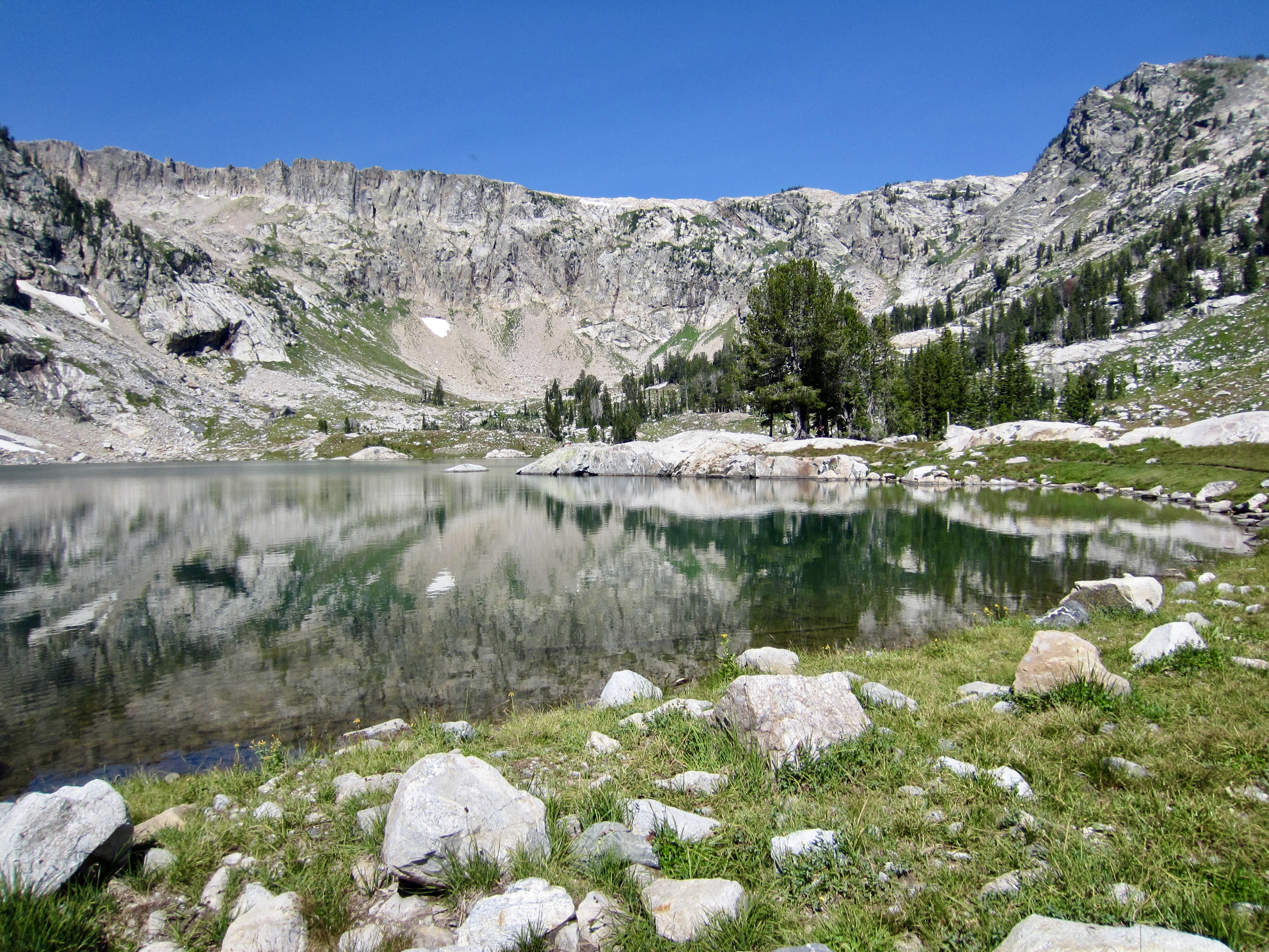
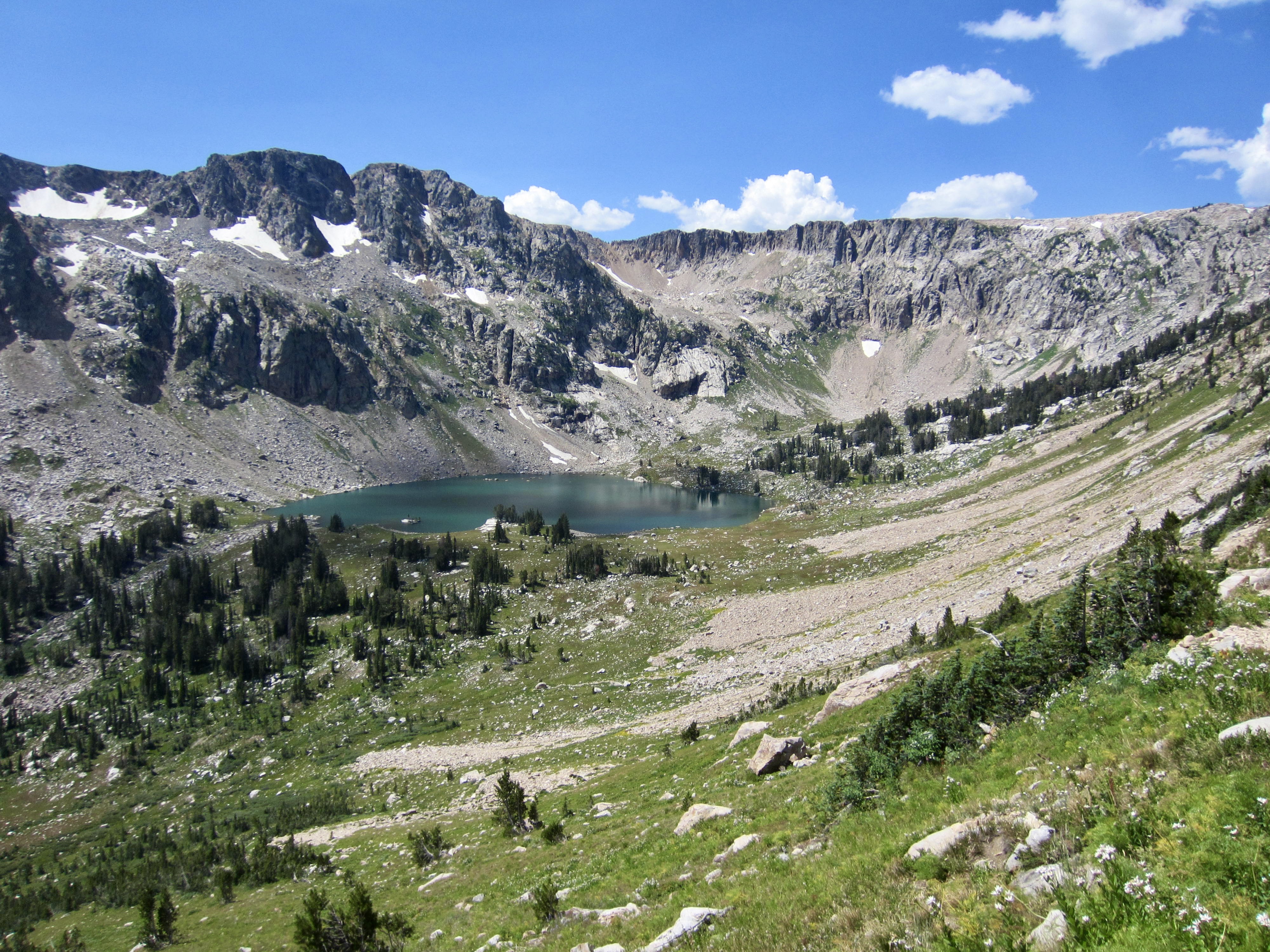
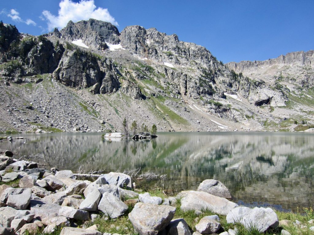
In mid-afternoon, we arrived at Marion Lake, which is tucked below a cliffy cirque on Housetop Mountain. Most of us took a swim in the chilly water before heading northward.

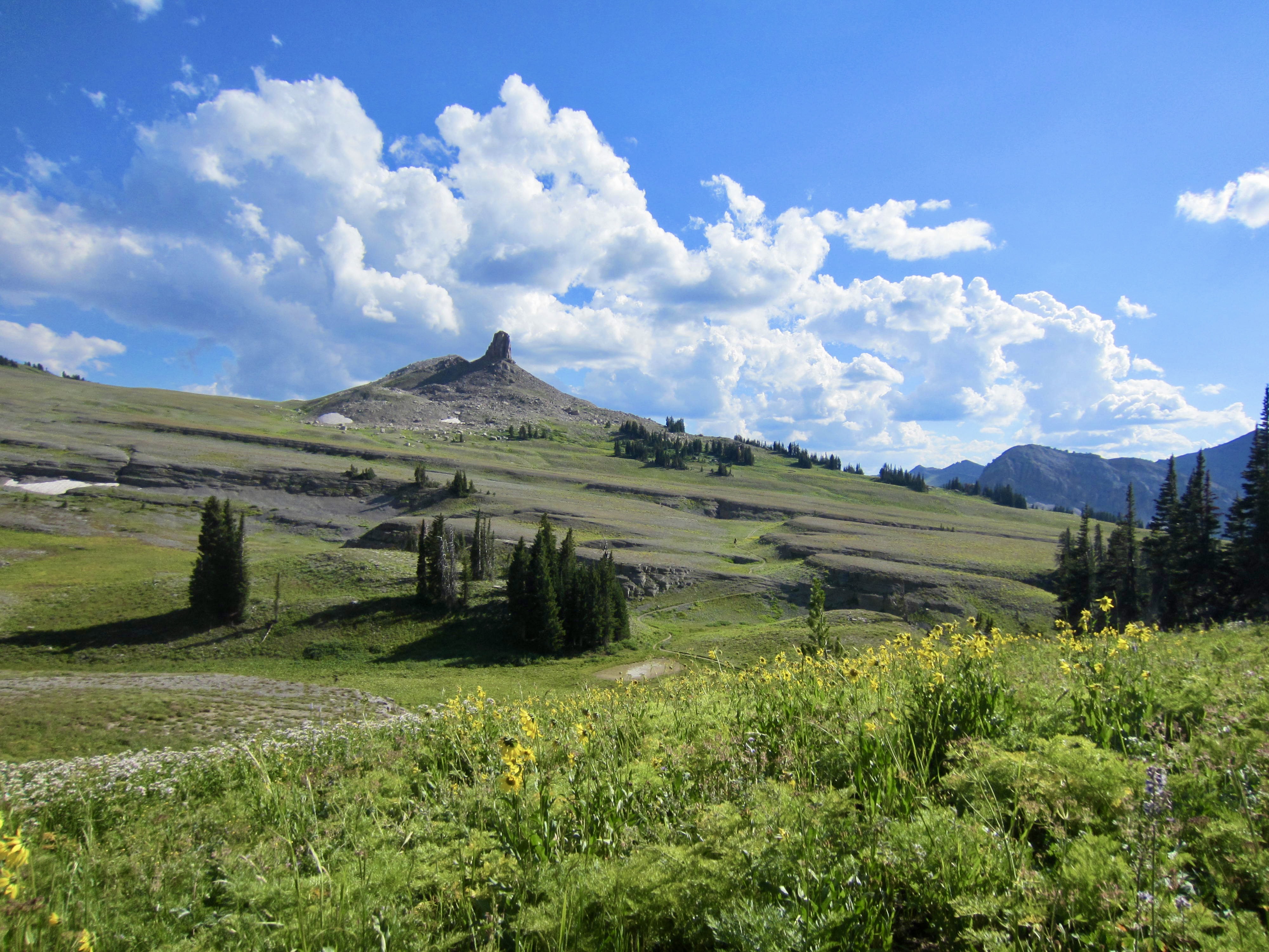
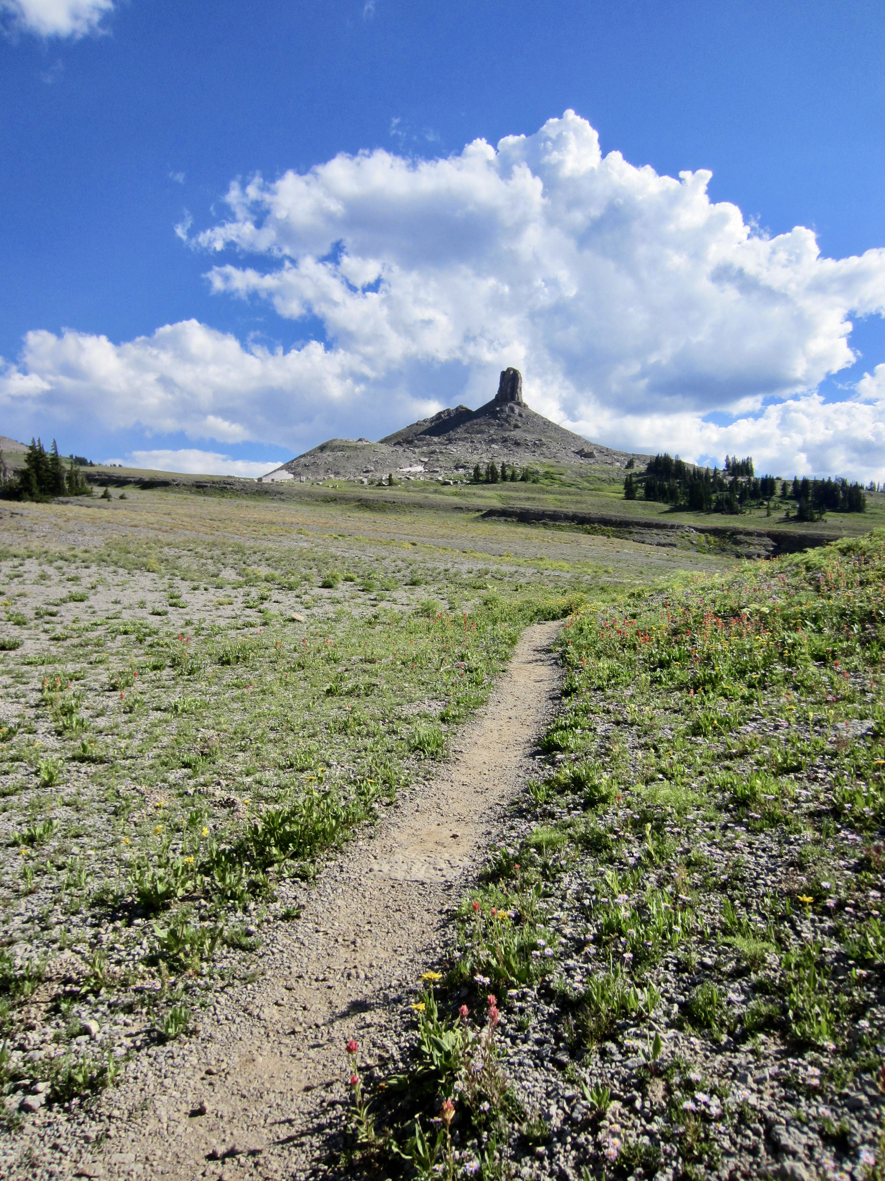
The remainder of our afternoon was spent contouring through sprawling Fox Creek Meadows, which lie just outside the national park. Fossil Mountain and Spearhead Peak served as attractive beacons along our course to Fox Creek Pass. It was tempting to make a sidetrip up Spearhead Peak, but we had neither the time nor the technical gear for such a climb. Maybe next time!
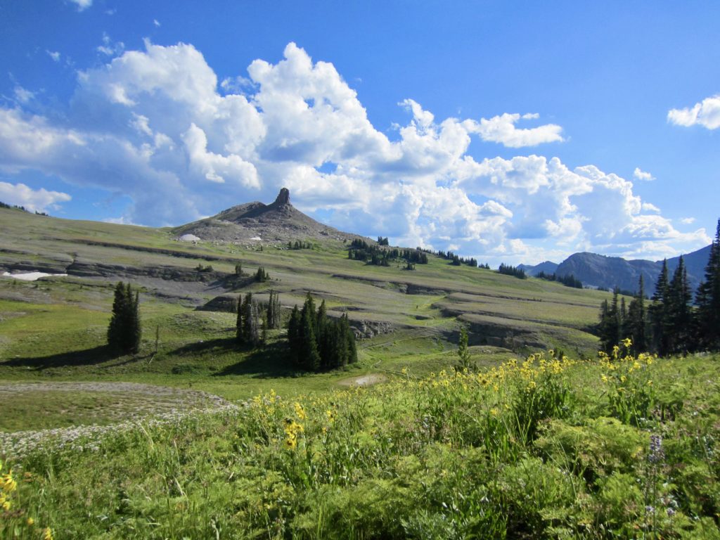
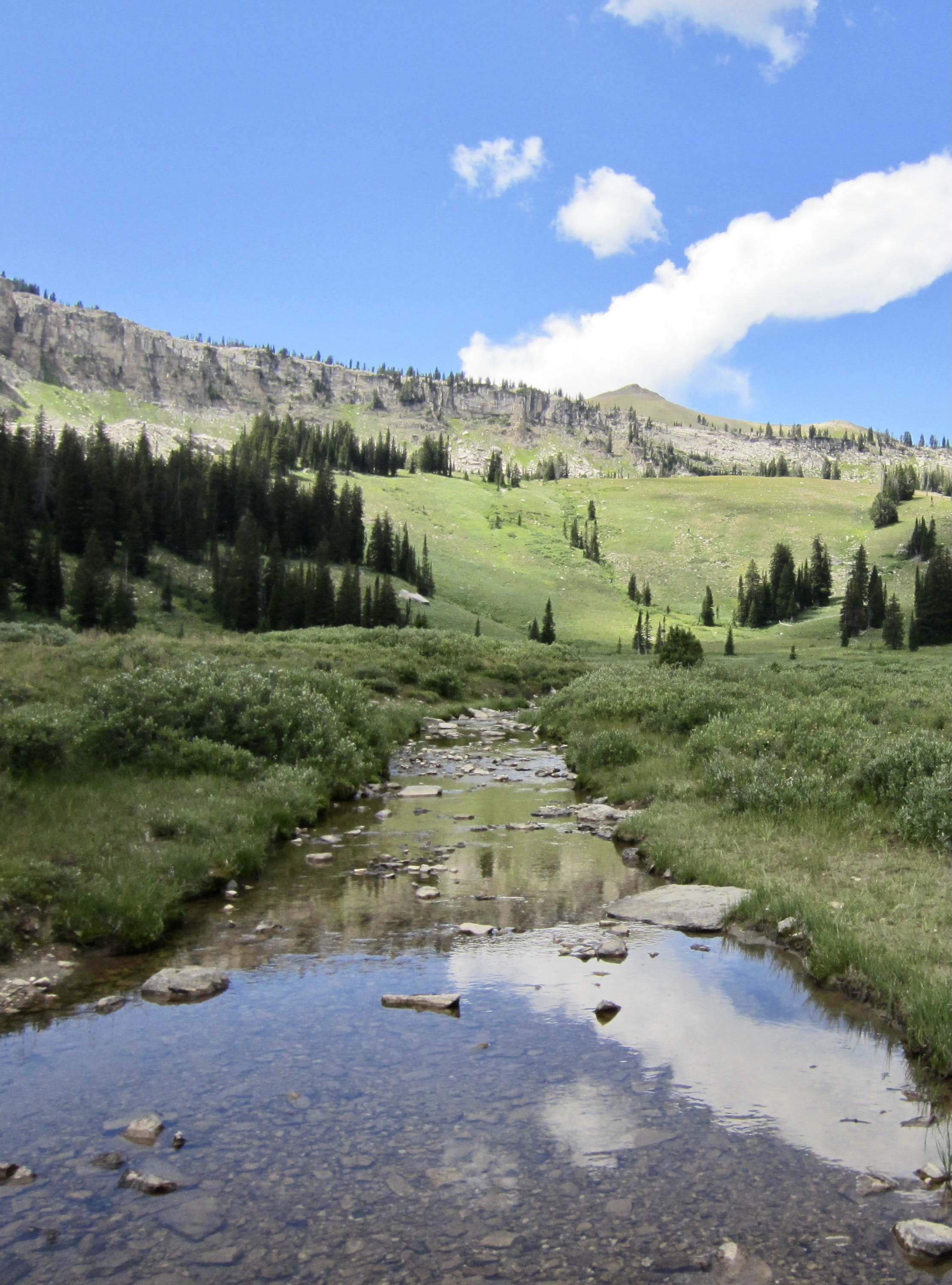
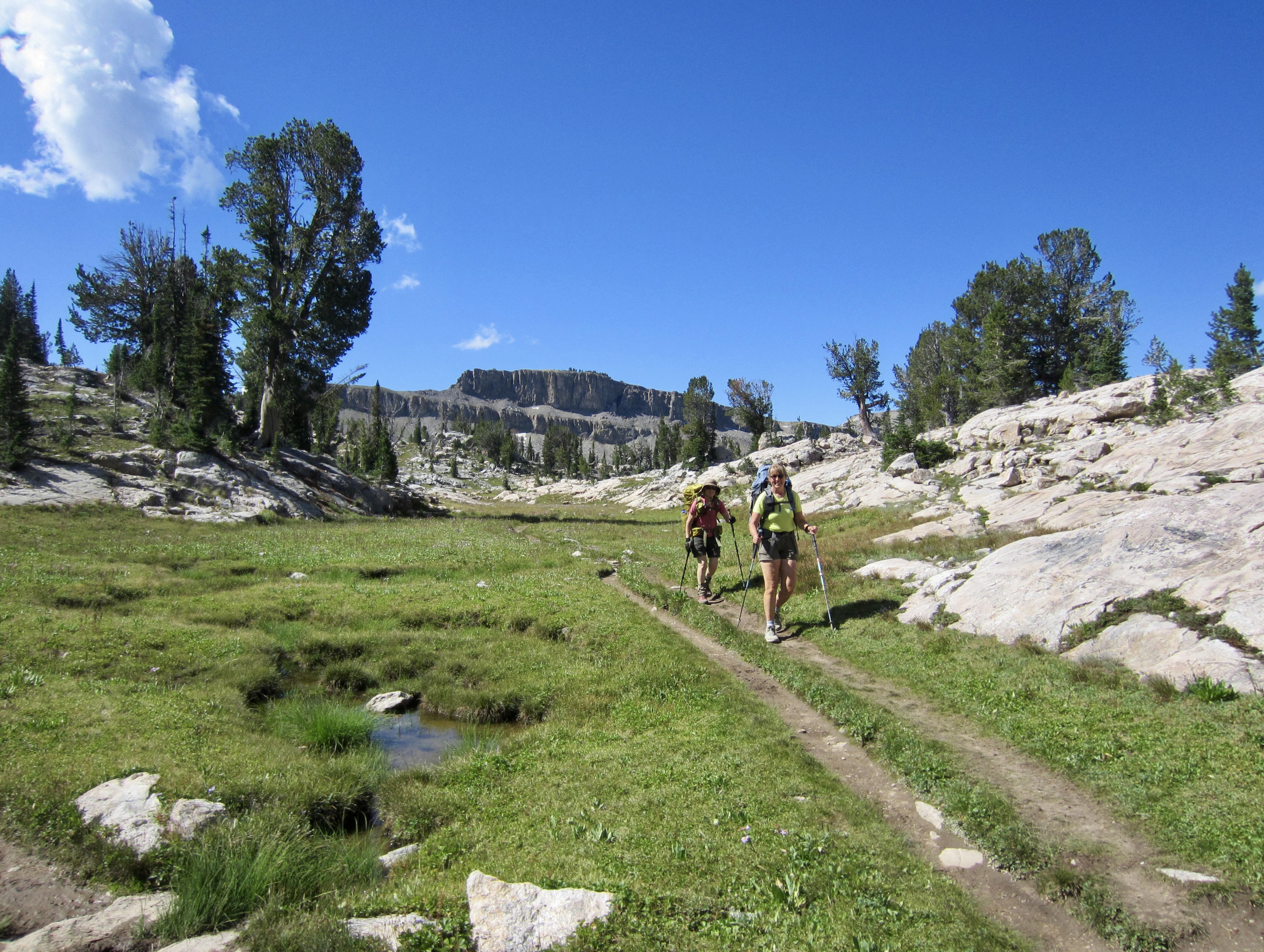
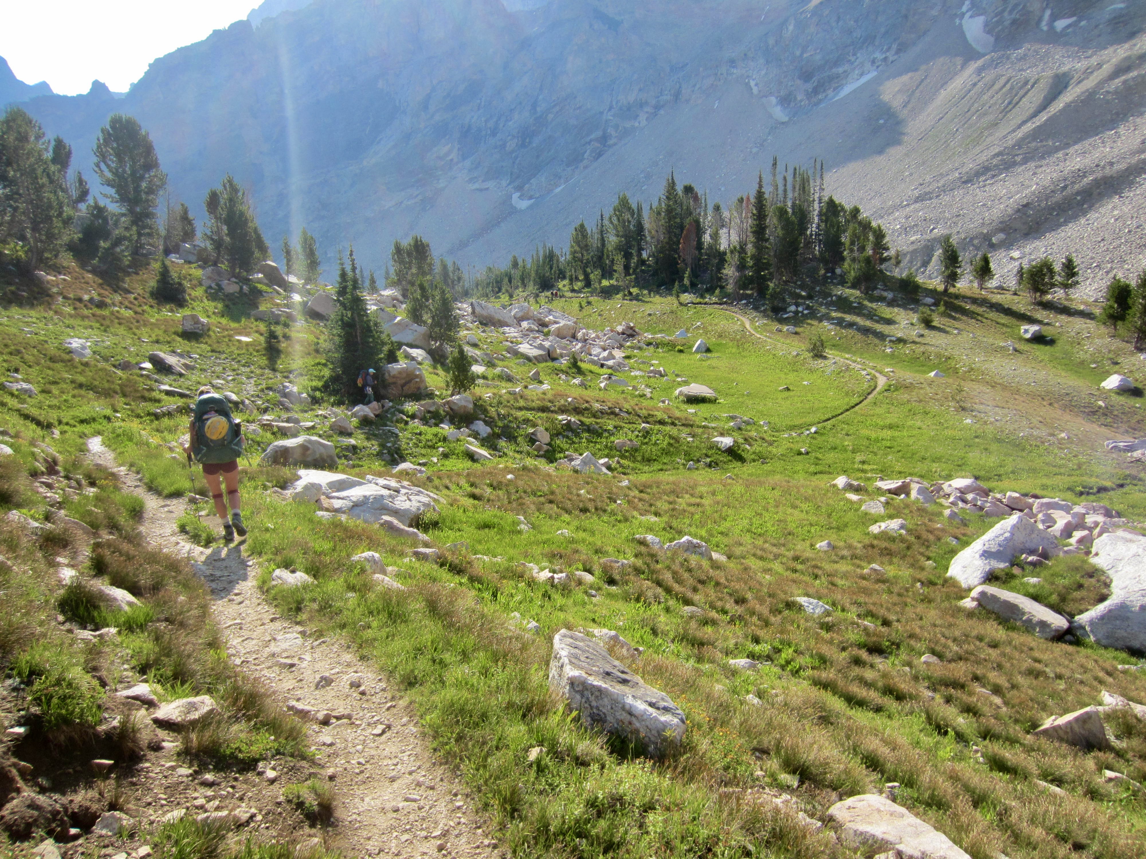
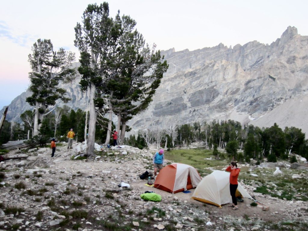
After crossing over Fox Creek Pass, we re-entered the national park and made a short ascent to gain the southernmost end of Death Canyon Shelf. It was 6:00pm when we located a nice campsite on the edge of the shelf, with running water nearby (7.2 hours + 9.3 miles + 1800 feet – 2600 feet from tramway top station).
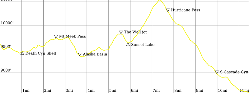
Day 2: Death Canyon Shelf to South Cascade Canyon + The Wall
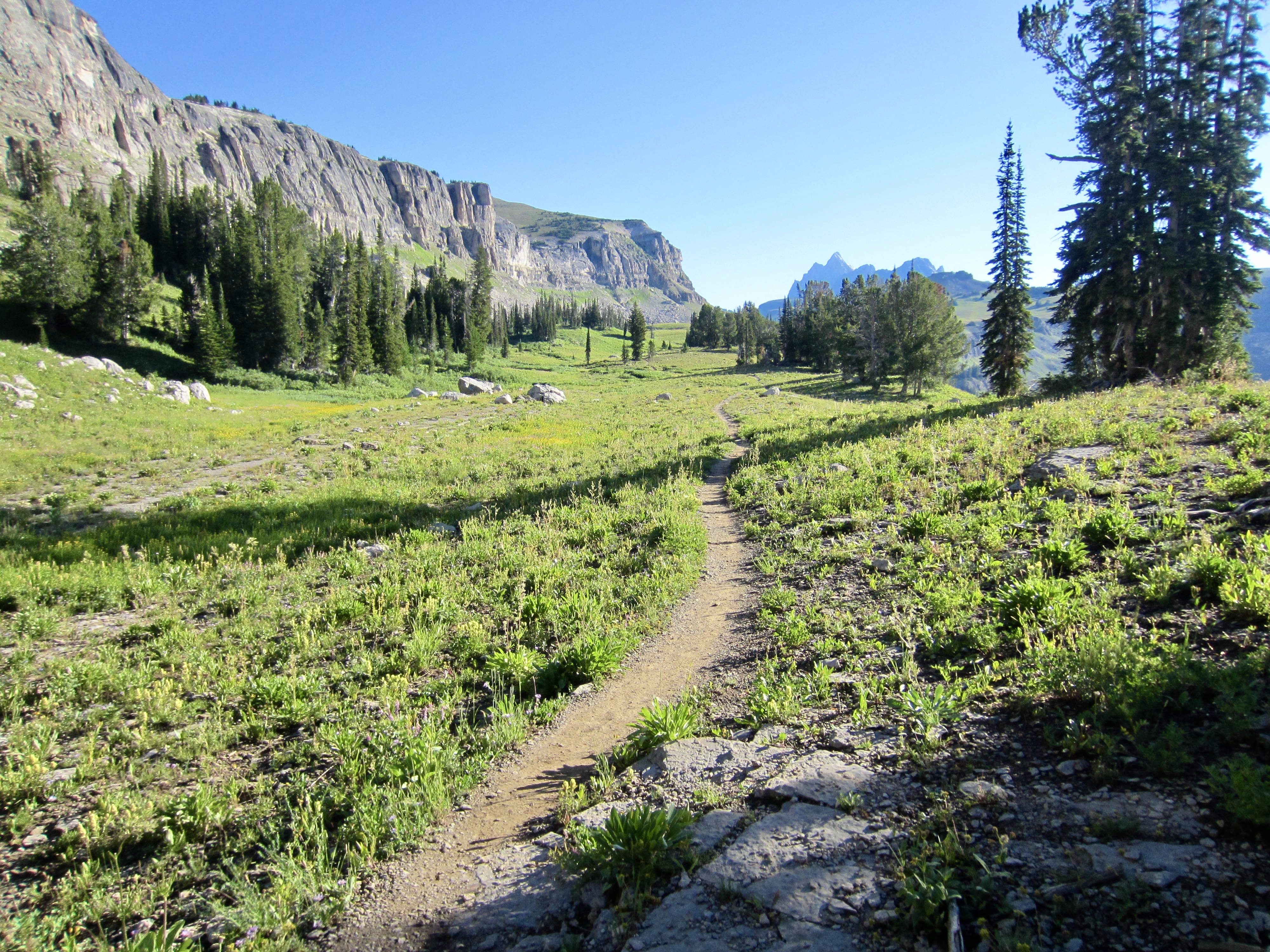
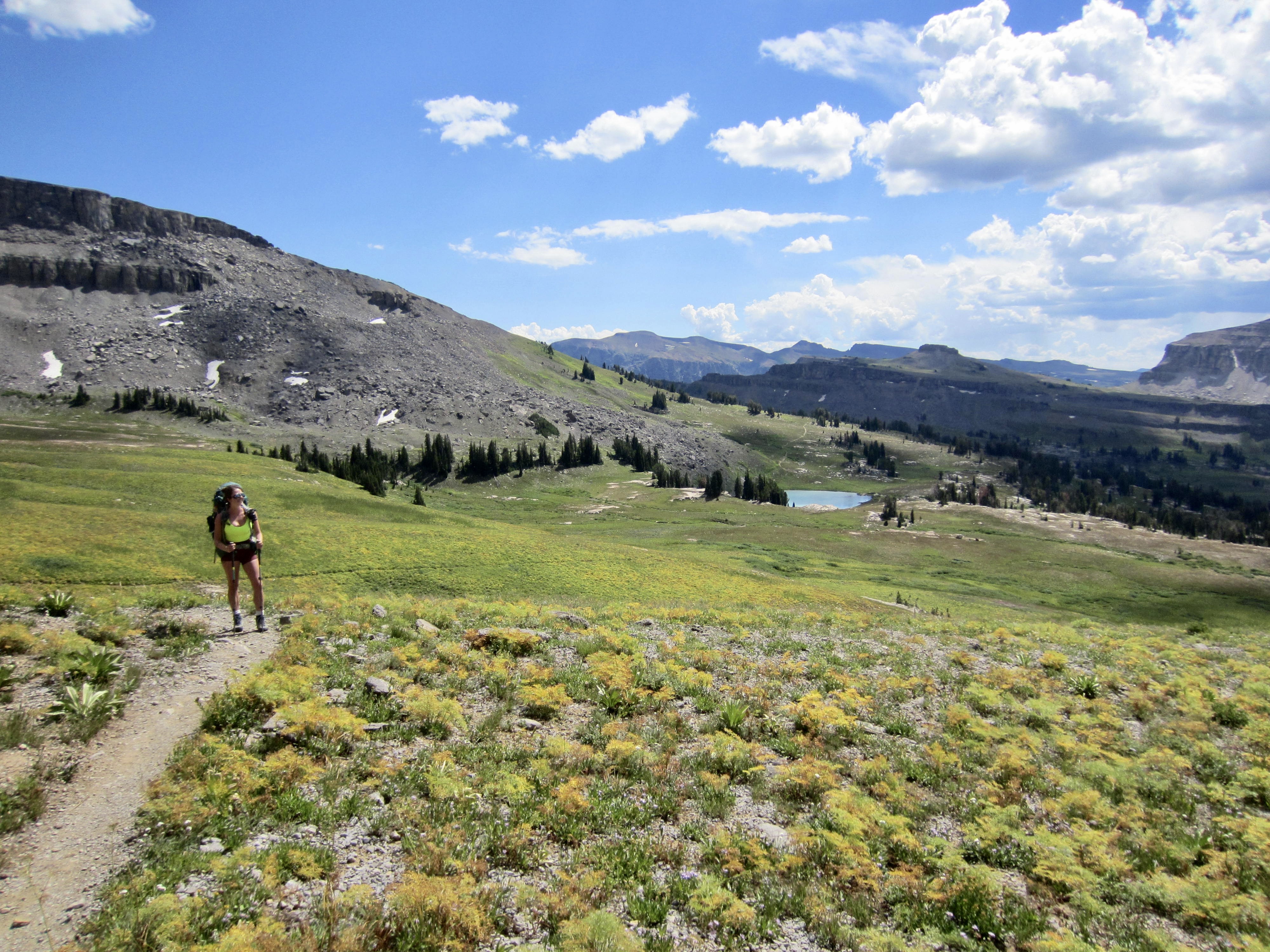
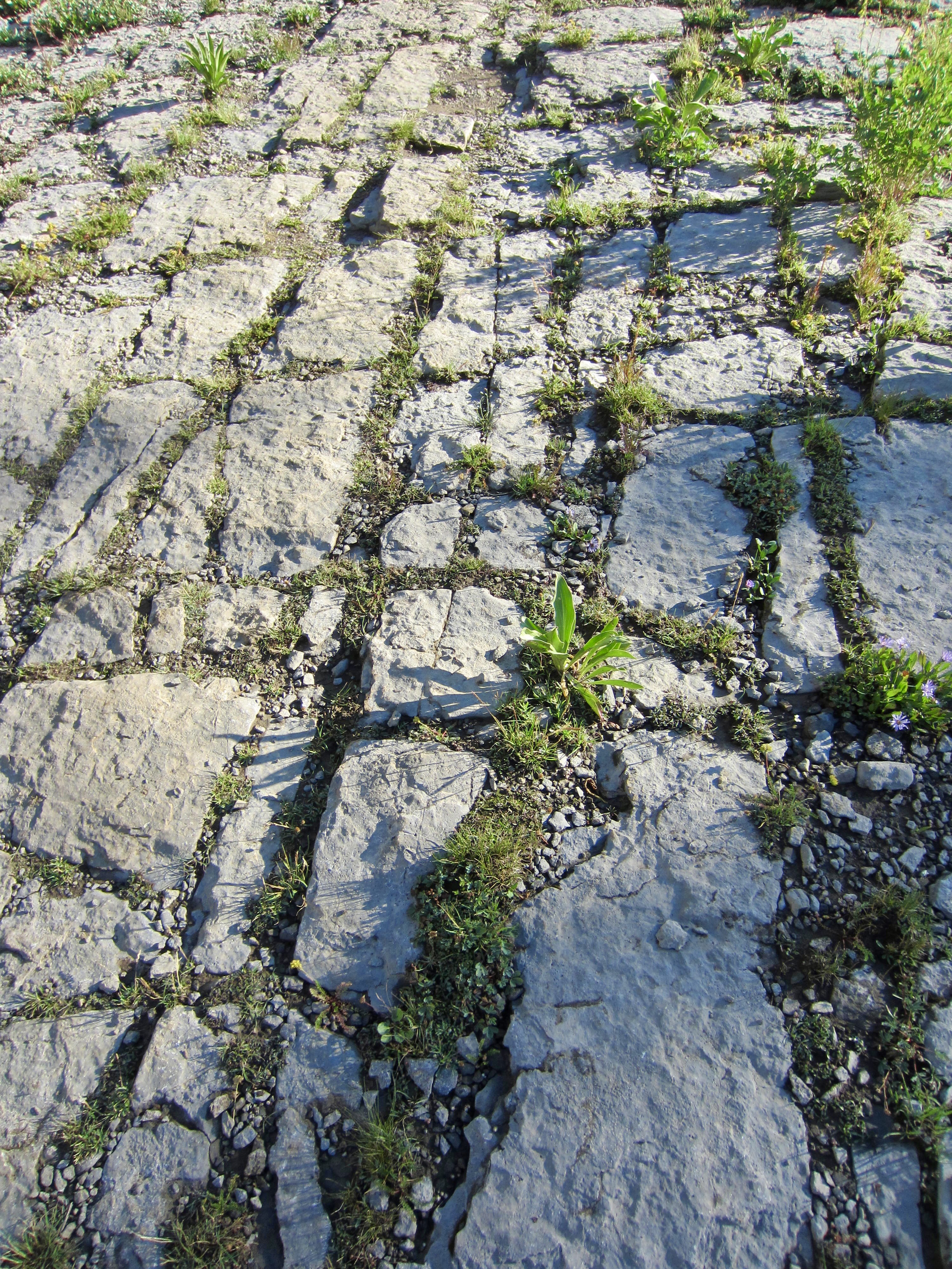
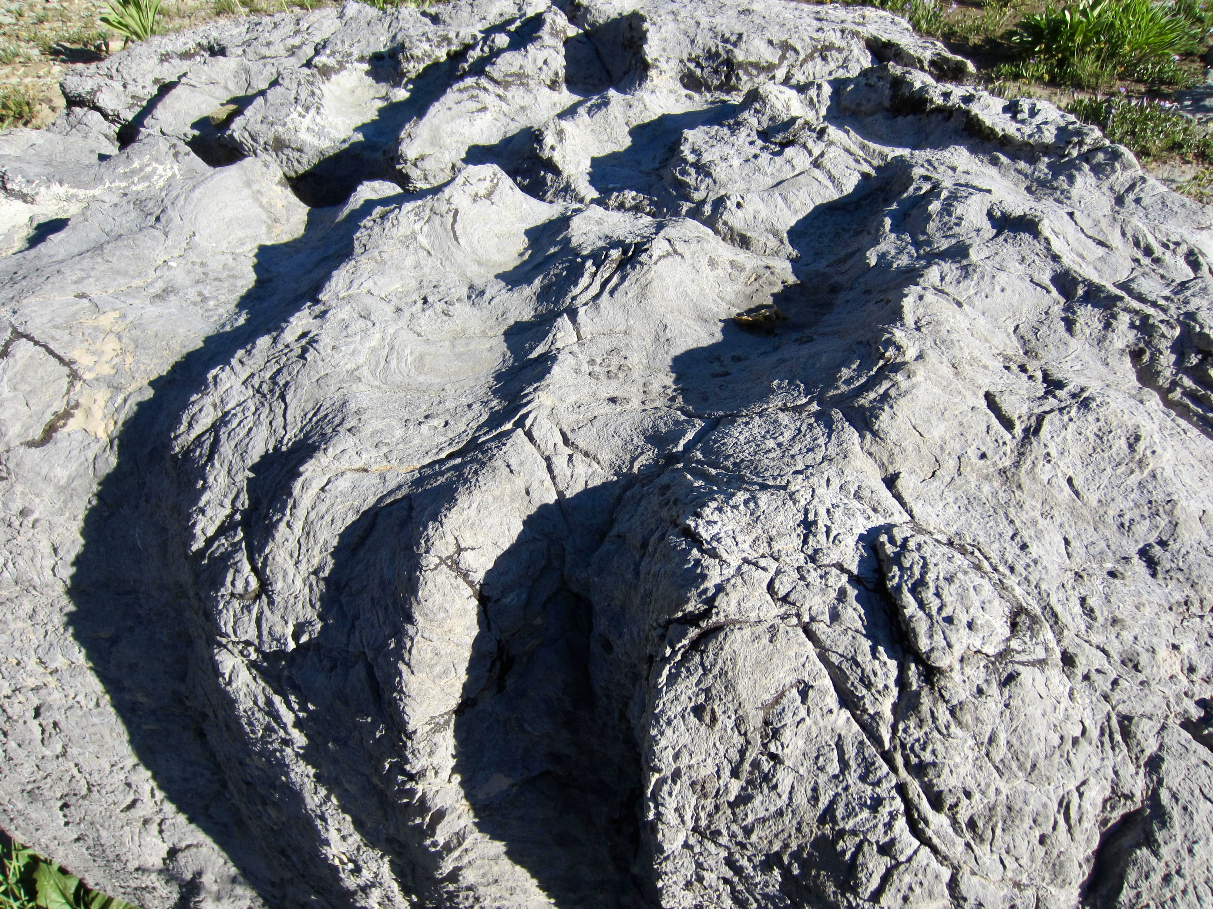
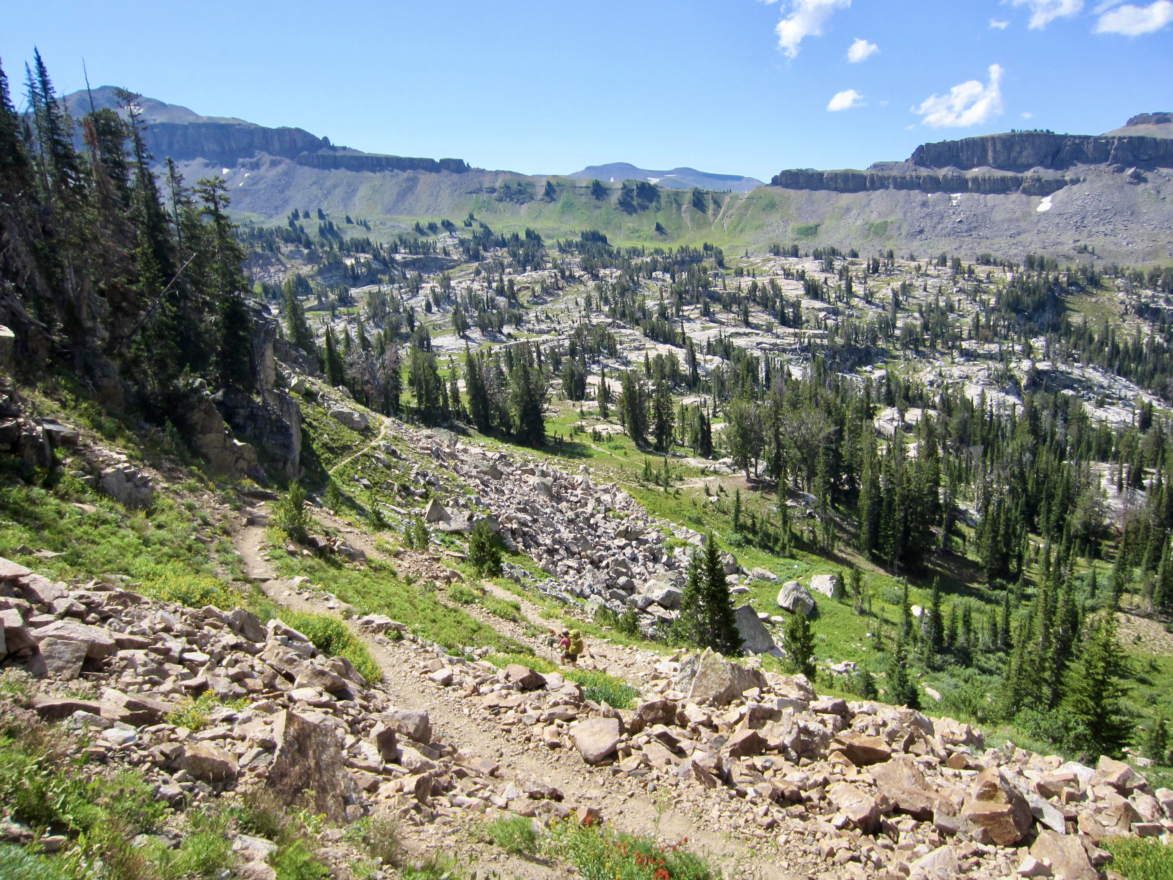
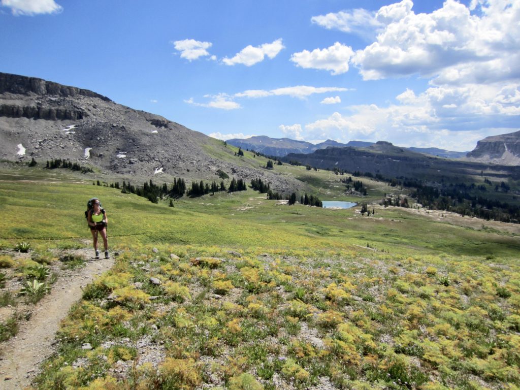
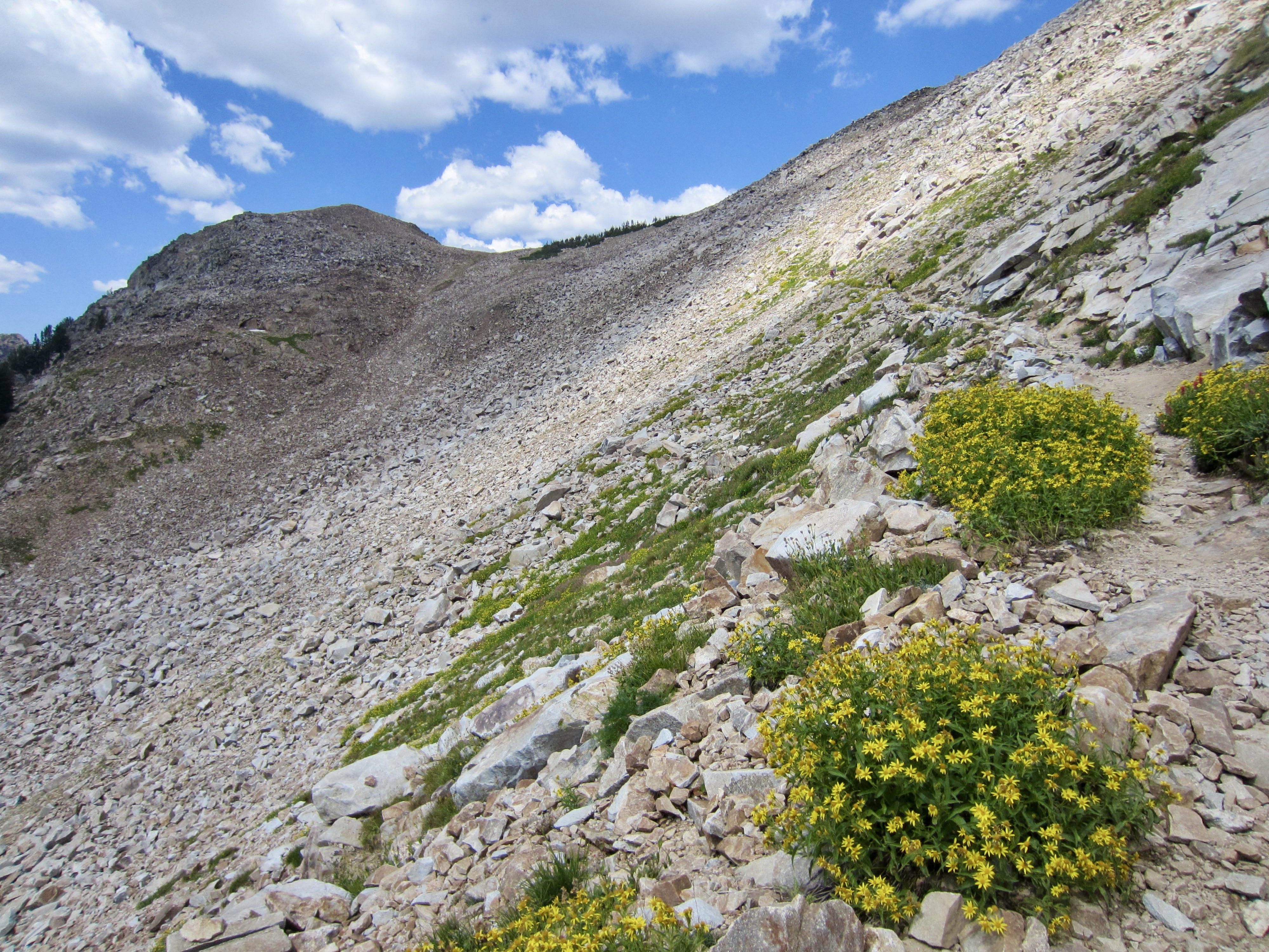
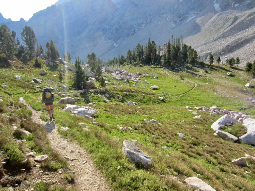
We began our morning with a hike northward on Death Canyon Shelf. Don’t let the morbid name alarm you; this broad, 3-mile-long, natural “shelf,” or bench, is a visual delight. The TCT undulates gently through wildflower fields, passing textured limestone boulders and small groves of evergreen trees.


The shelf consists of an erosion-resistant limestone layer that projects outward 100 to 200 yards from a weaker cliff. In places, the tessellated limestone surface is exposed on the ground, giving the appearance of carefully placed stone pavers.
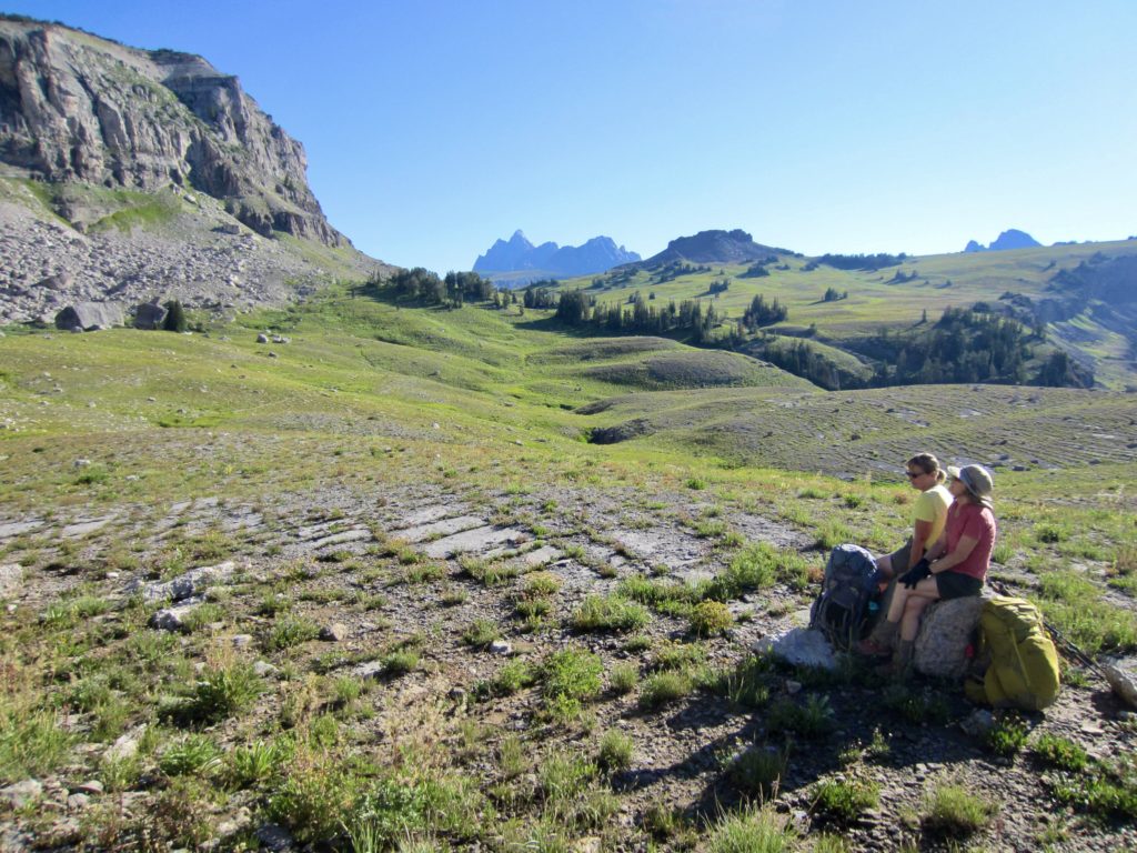
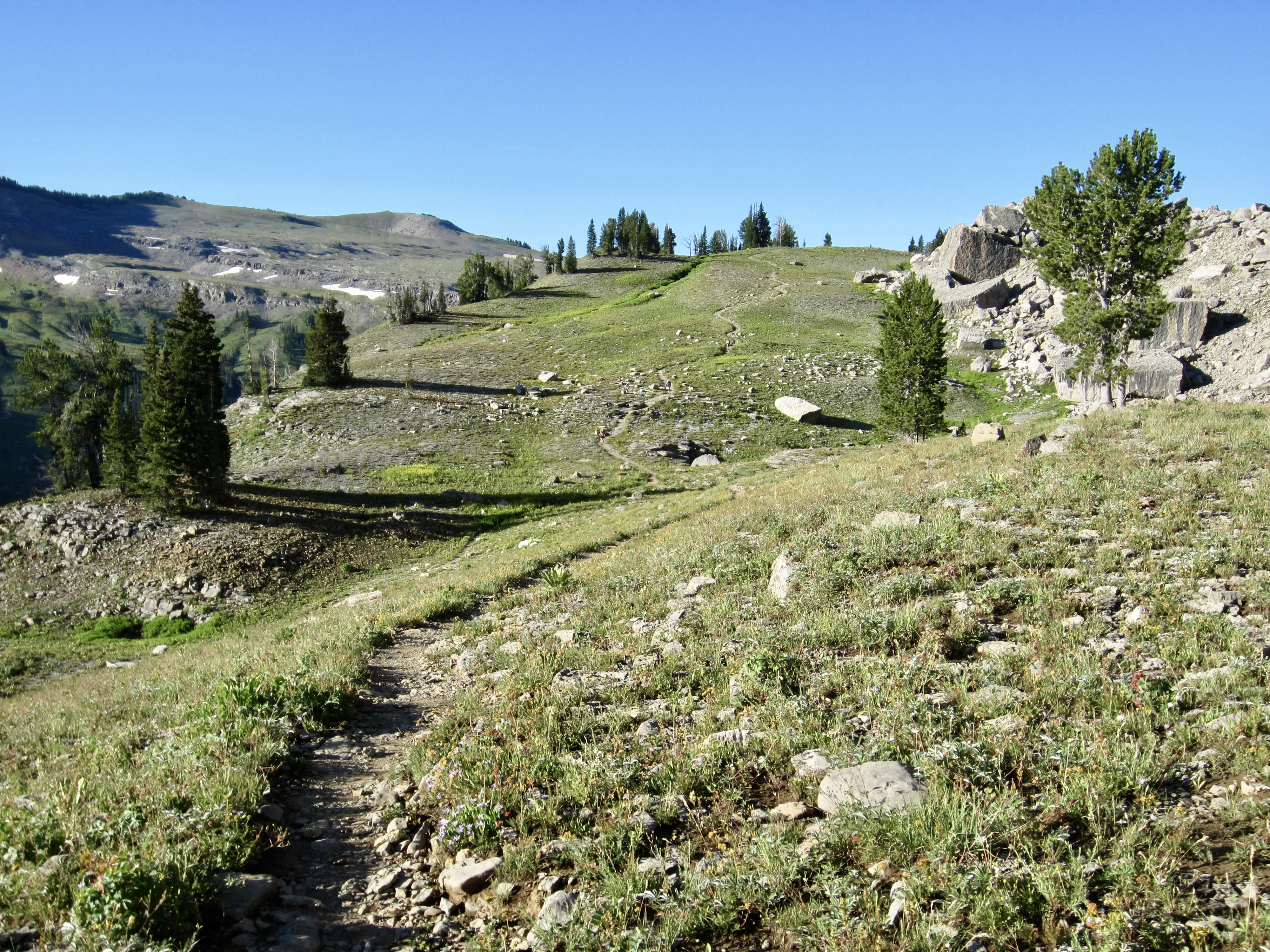
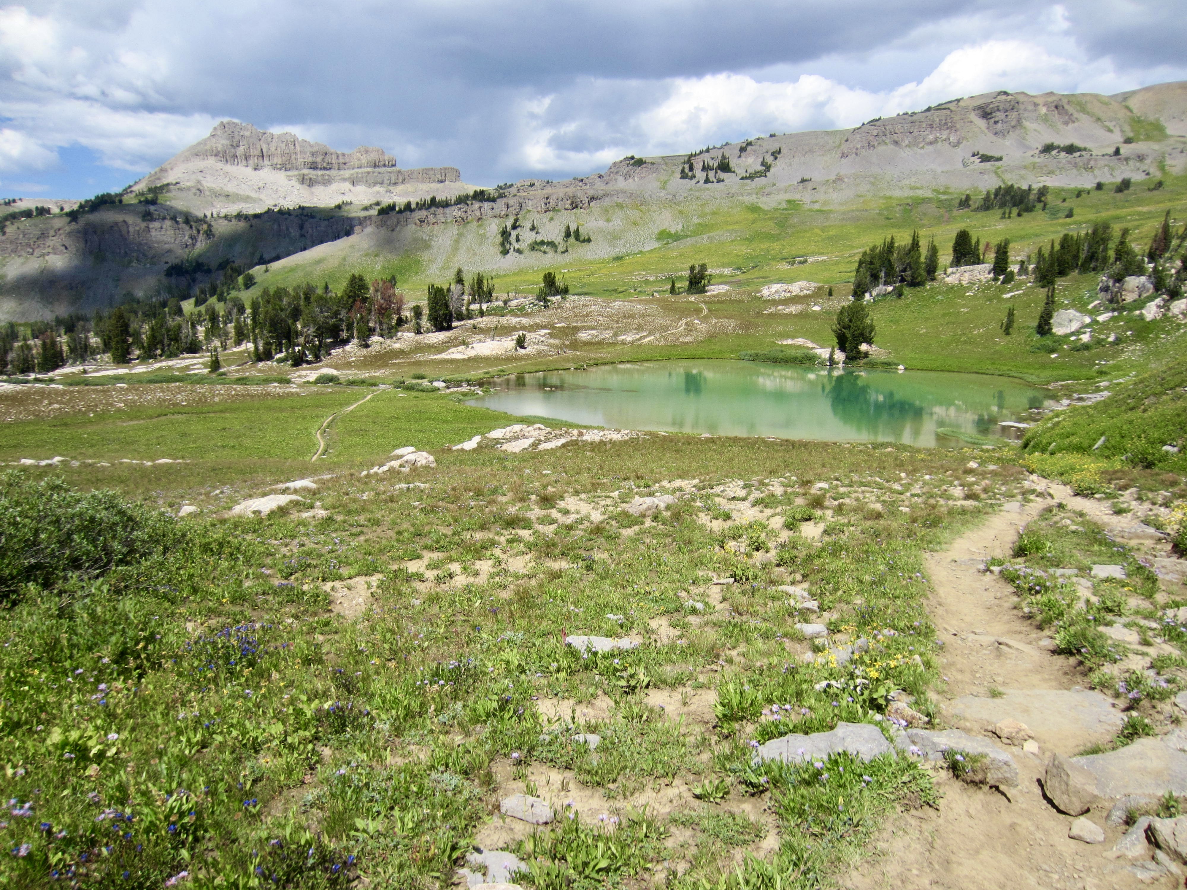
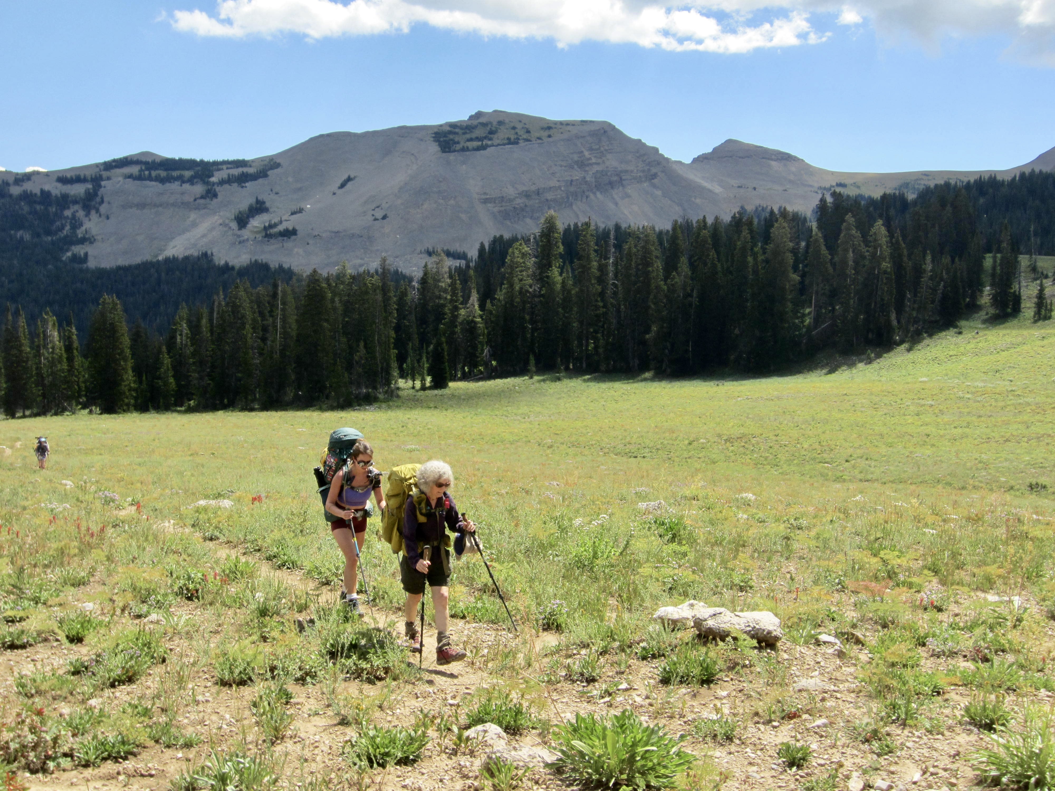
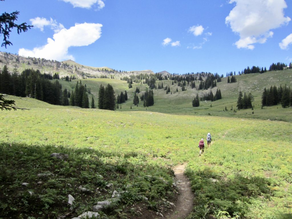
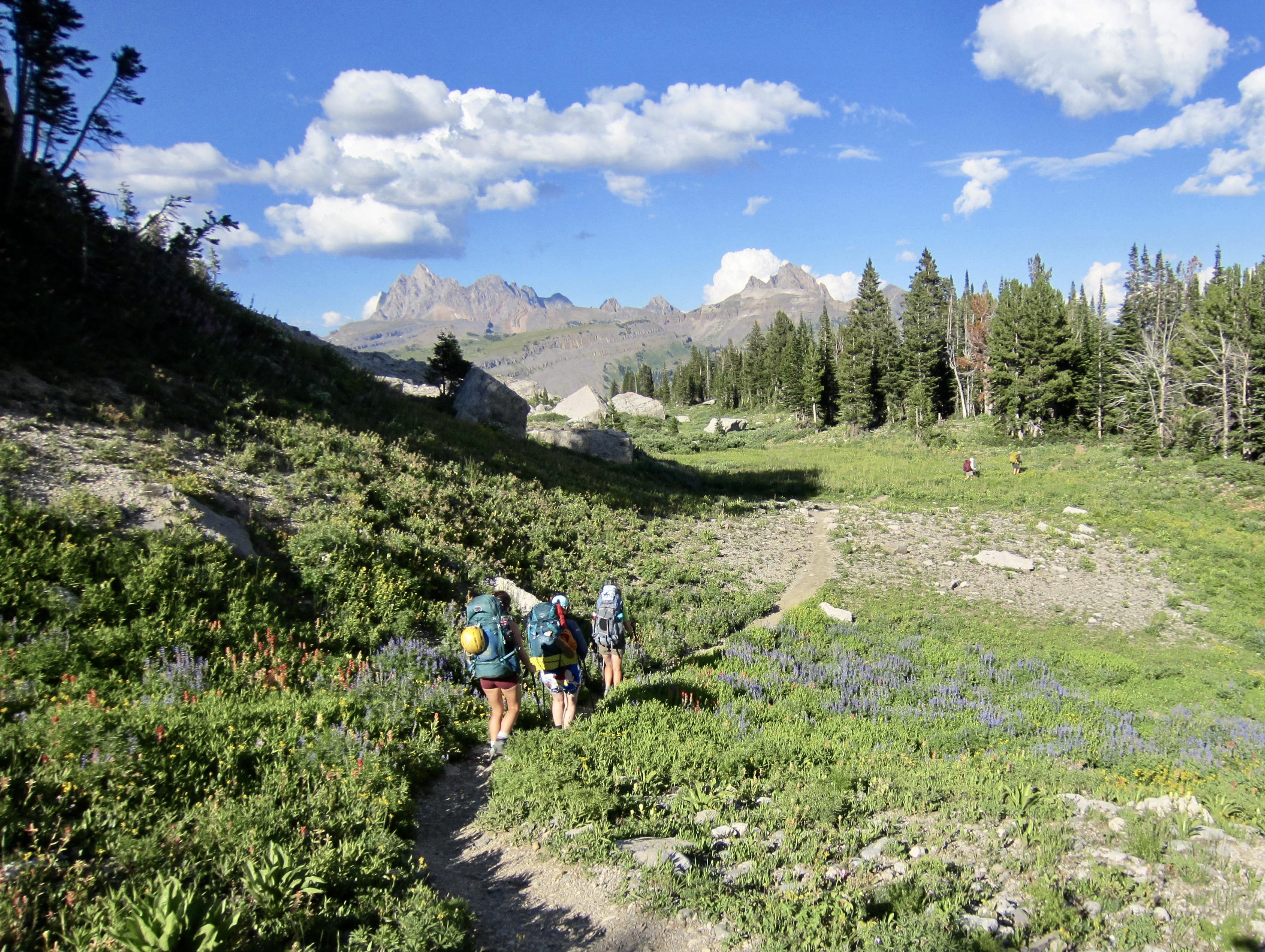
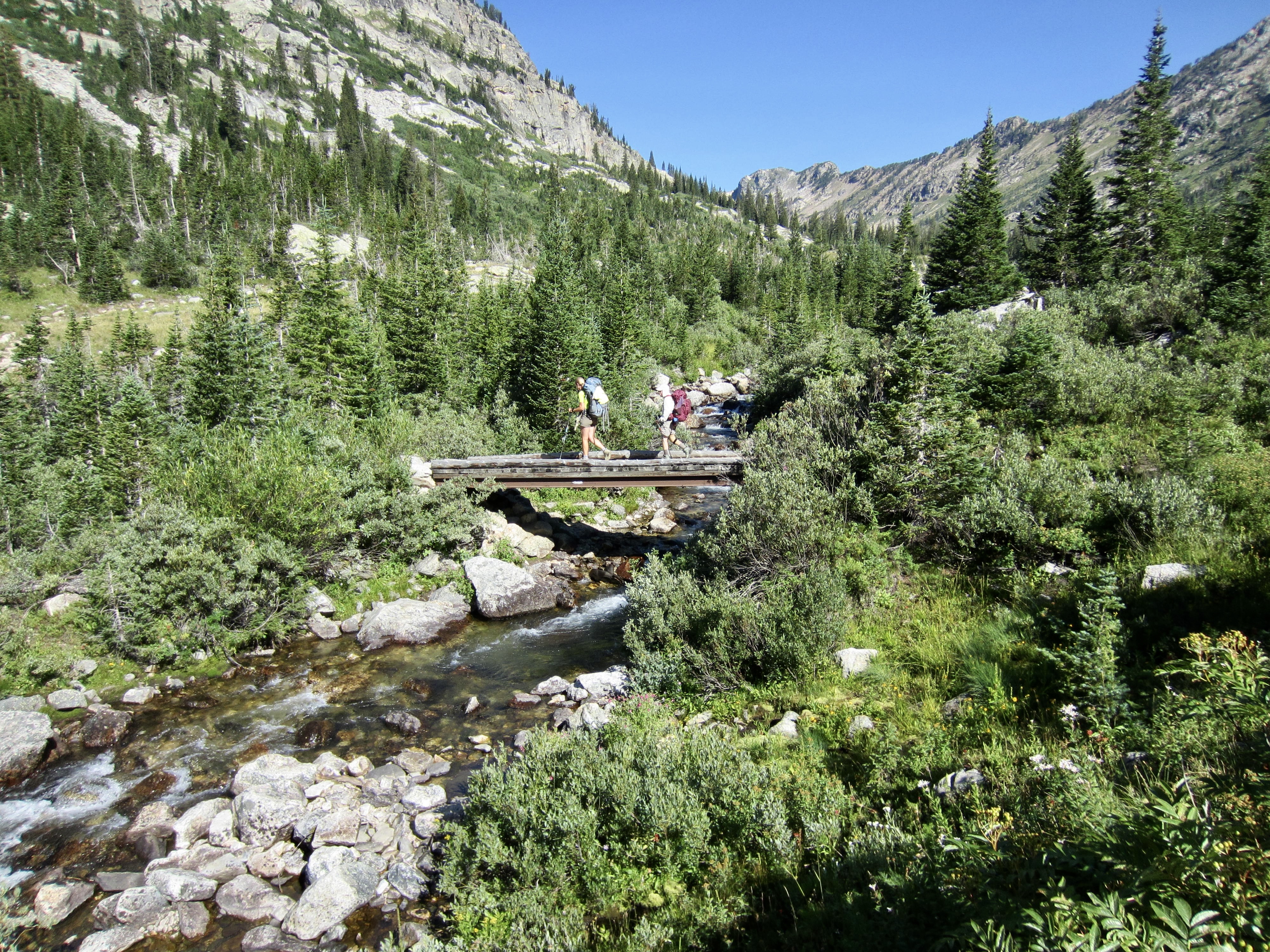
At the northern end of Death Canyon Shelf, the TCT crosses over Mt. Meek Pass and once again leaves the national park on a 4-mile jaunt through the Jedediah Smith Wilderness. We soon rounded a sharp corner and started dropping into one of the most scenic parts of the traverse: Alaska Basin.

A series of switchbacks known as the Sheep Steps led us down to the floor of Alaska Basin, which forms the headwaters of Teton Creek. This basin features expansive meadows, bedrock slabs, and a cluster of small lakes, all guarded by towering Buck Mountain located closely to the east.


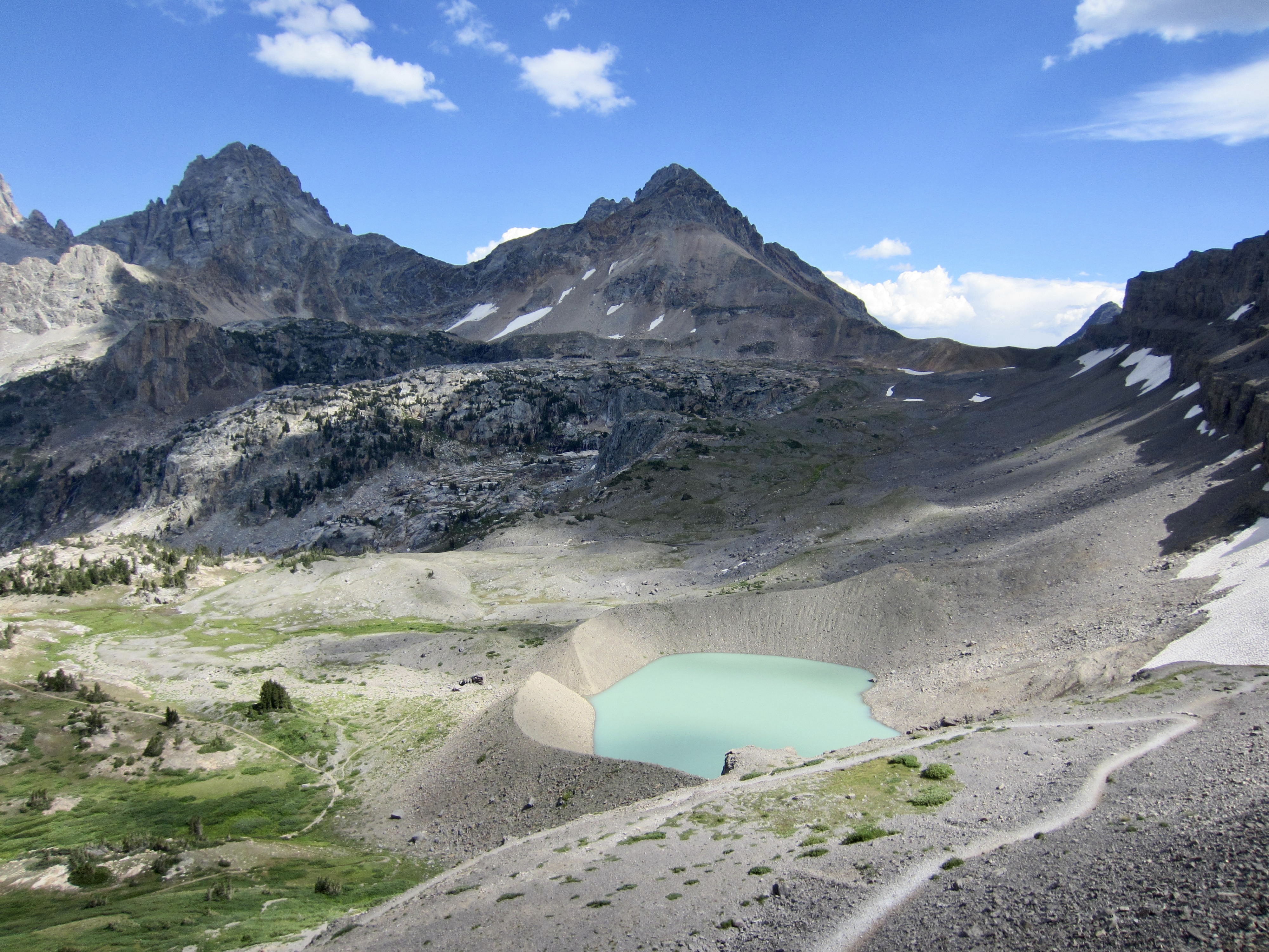
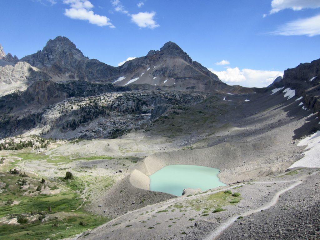
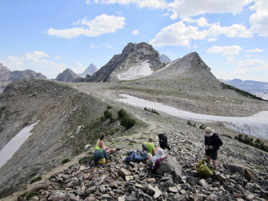
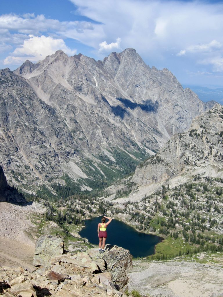
At the northern edge of Alaska Basin, where the TCT reaches a junction atop a small rib, Beth, Brooke, Eileen, and I dropped our backpacks and made an 1100-foot sidetrip up a gentle hillslope of alpine tundra.

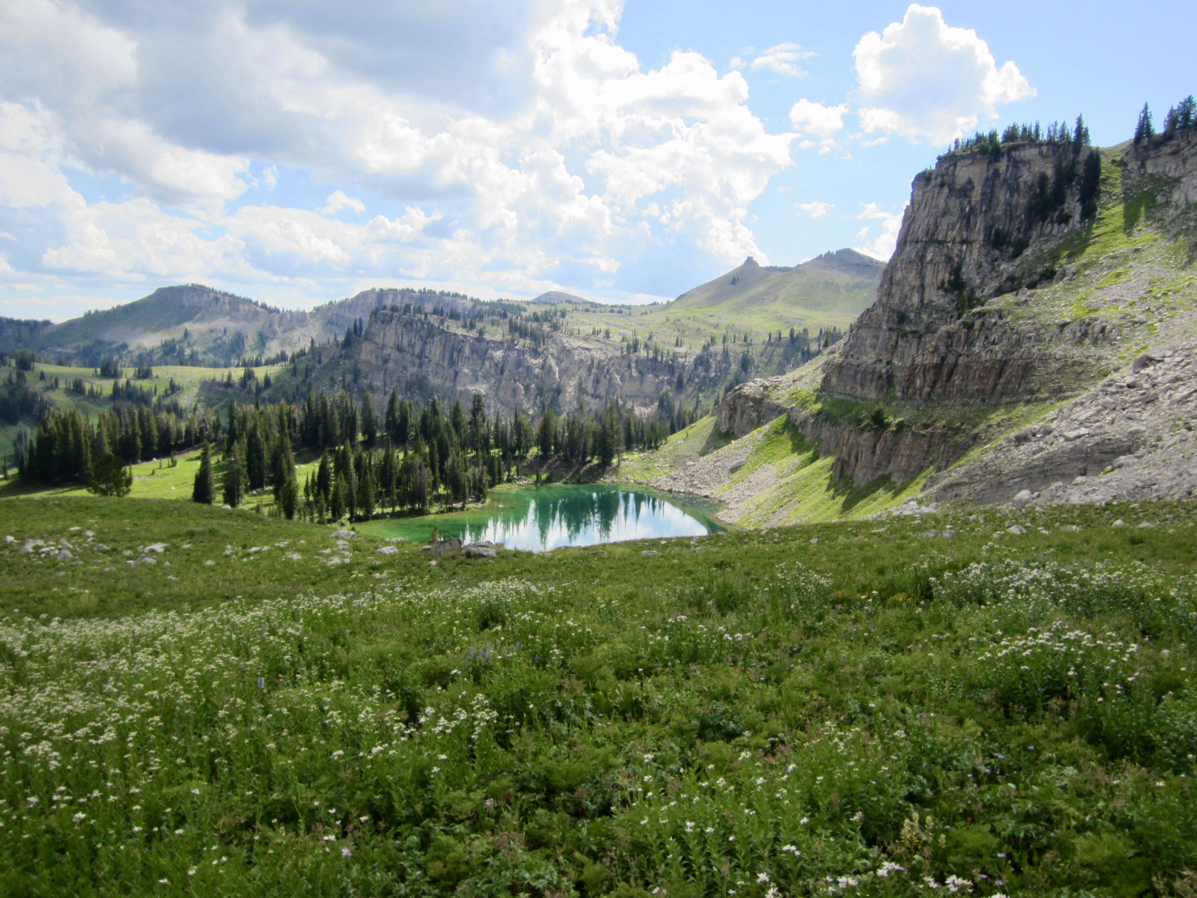
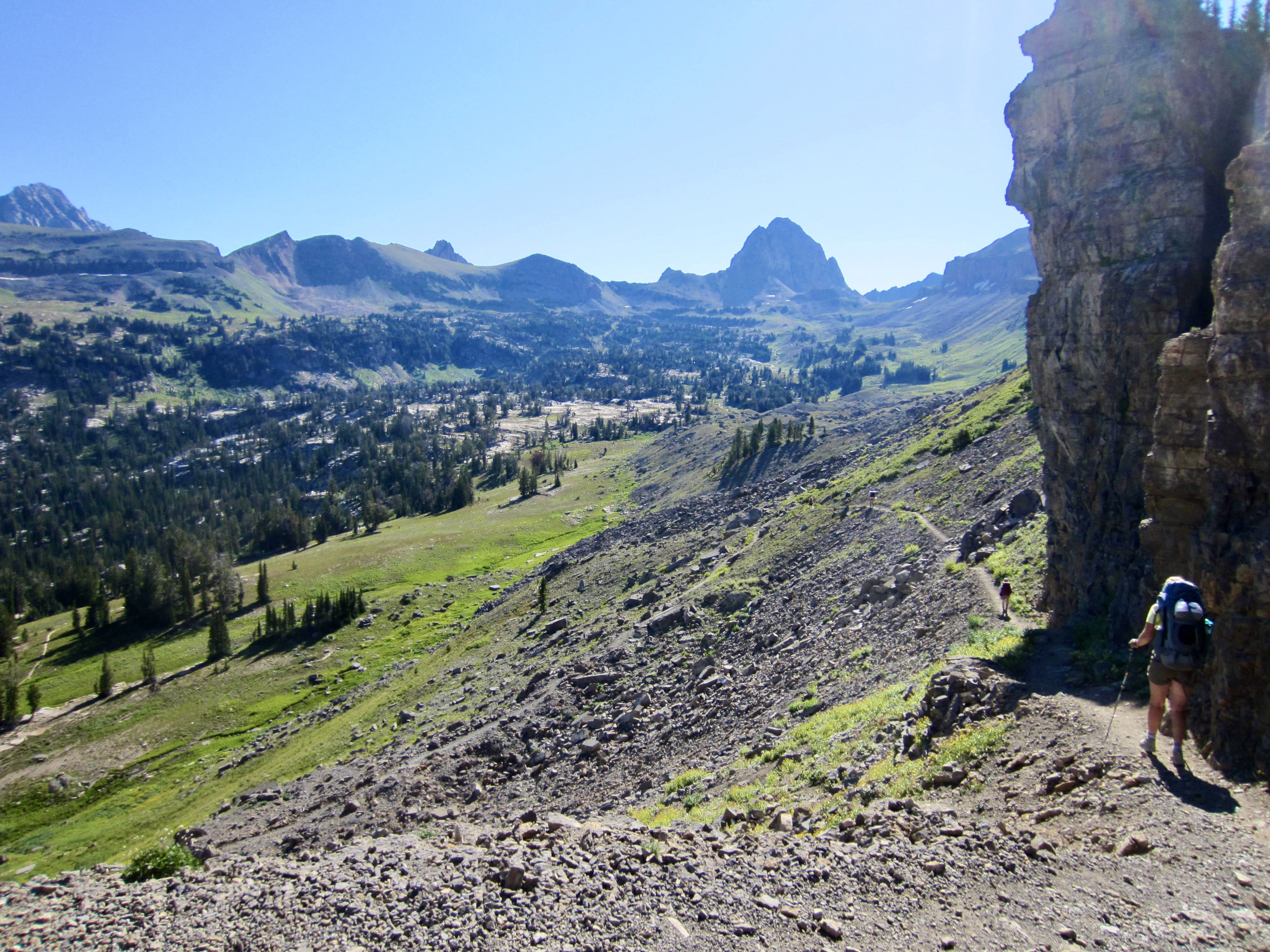
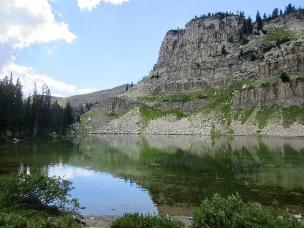
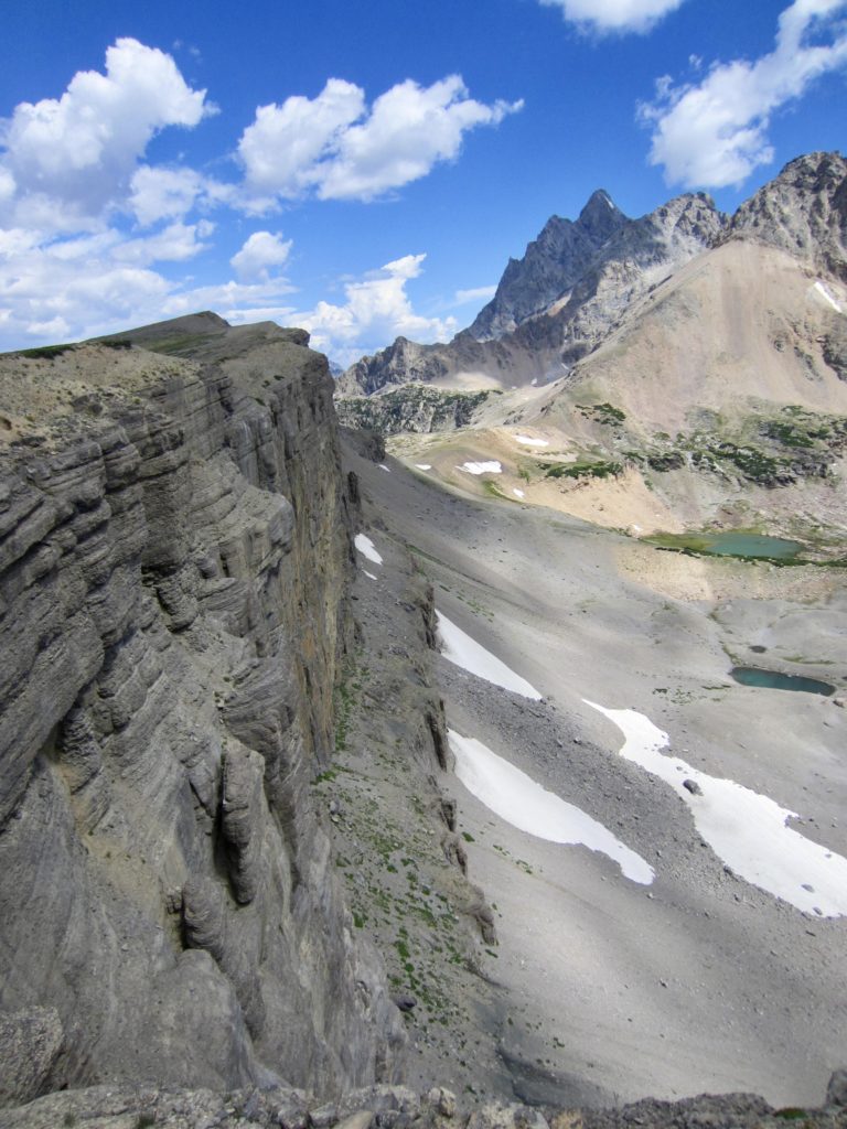
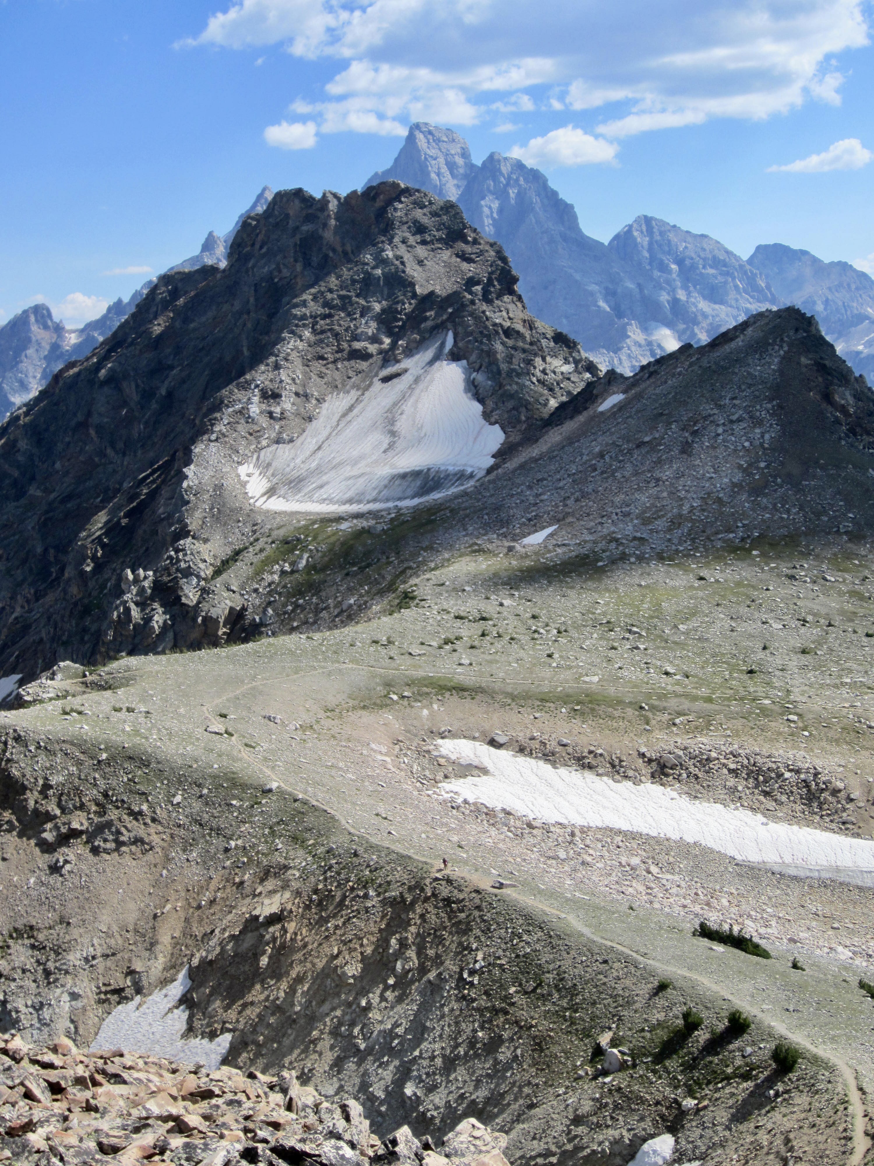
The tundra slope abruptly ended at a tall, vertical, mile-long limestone cliff called The Wall. From this vantage, we could look up at the craggy Teton peaks and down at the turquoise water of Snowdrift Lake.

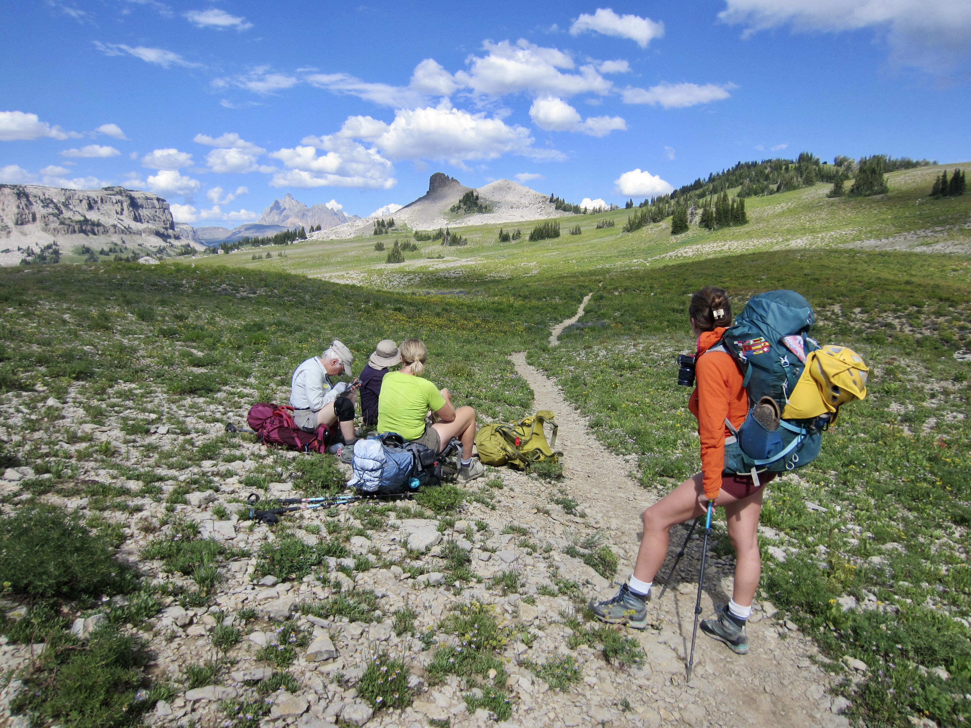
Upon returning to our backpacks, we continued hiking down to pretty little Sunset Lake and then up toward Hurricane Pass. Brooke and I found ourselves at the rear of the peloton, continually stopping to admire the incredible display of wildflowers blanketing the lake basin.

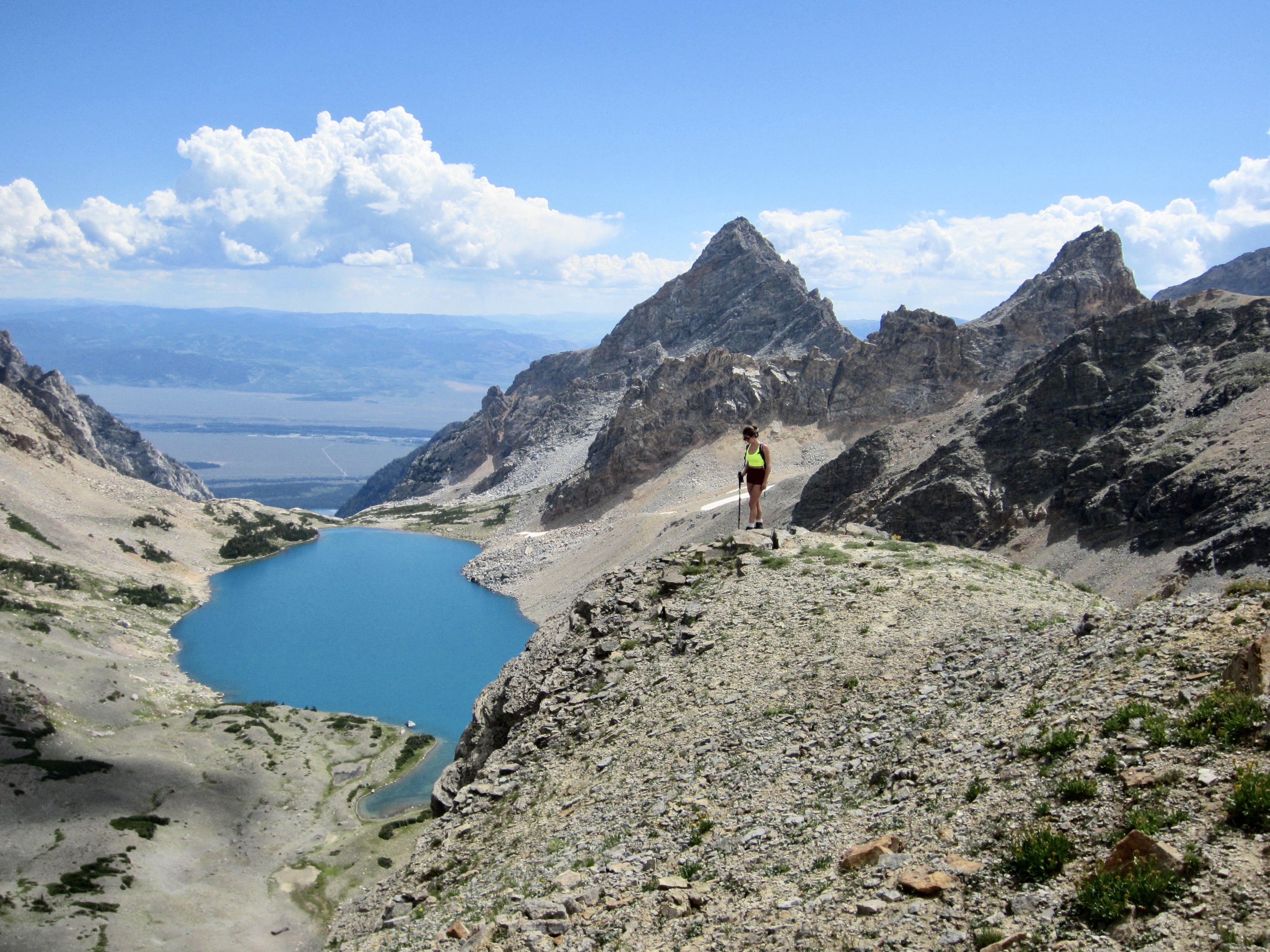
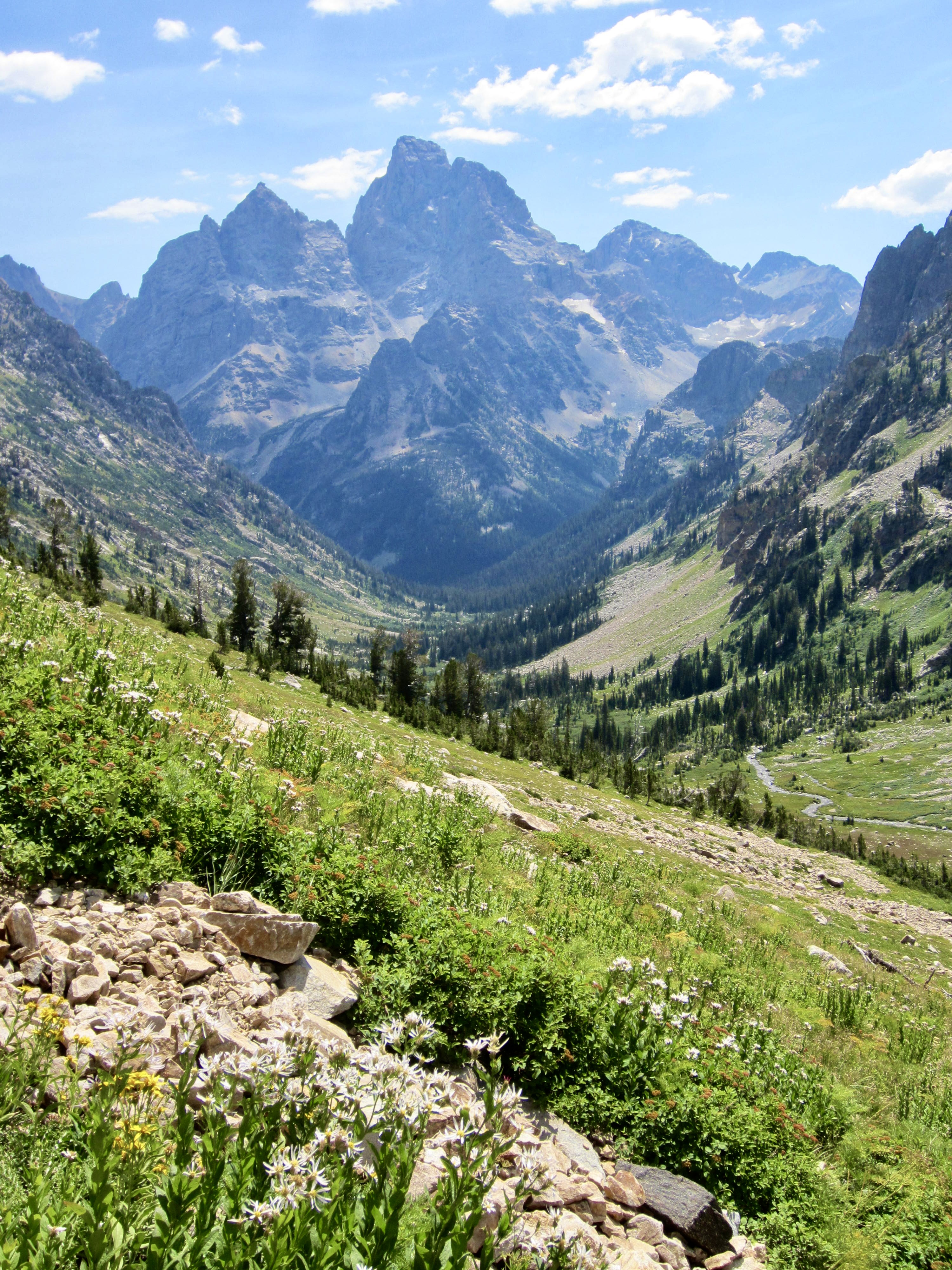
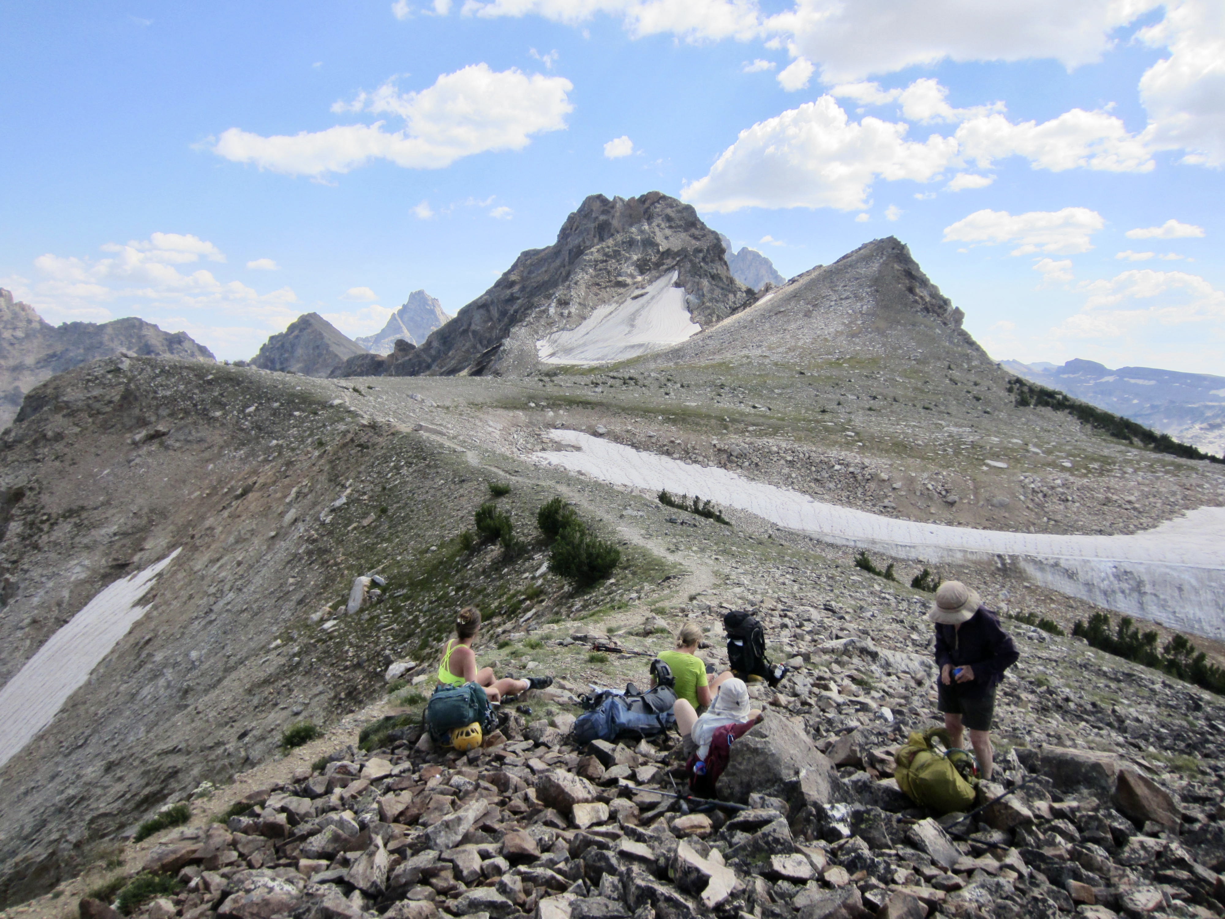
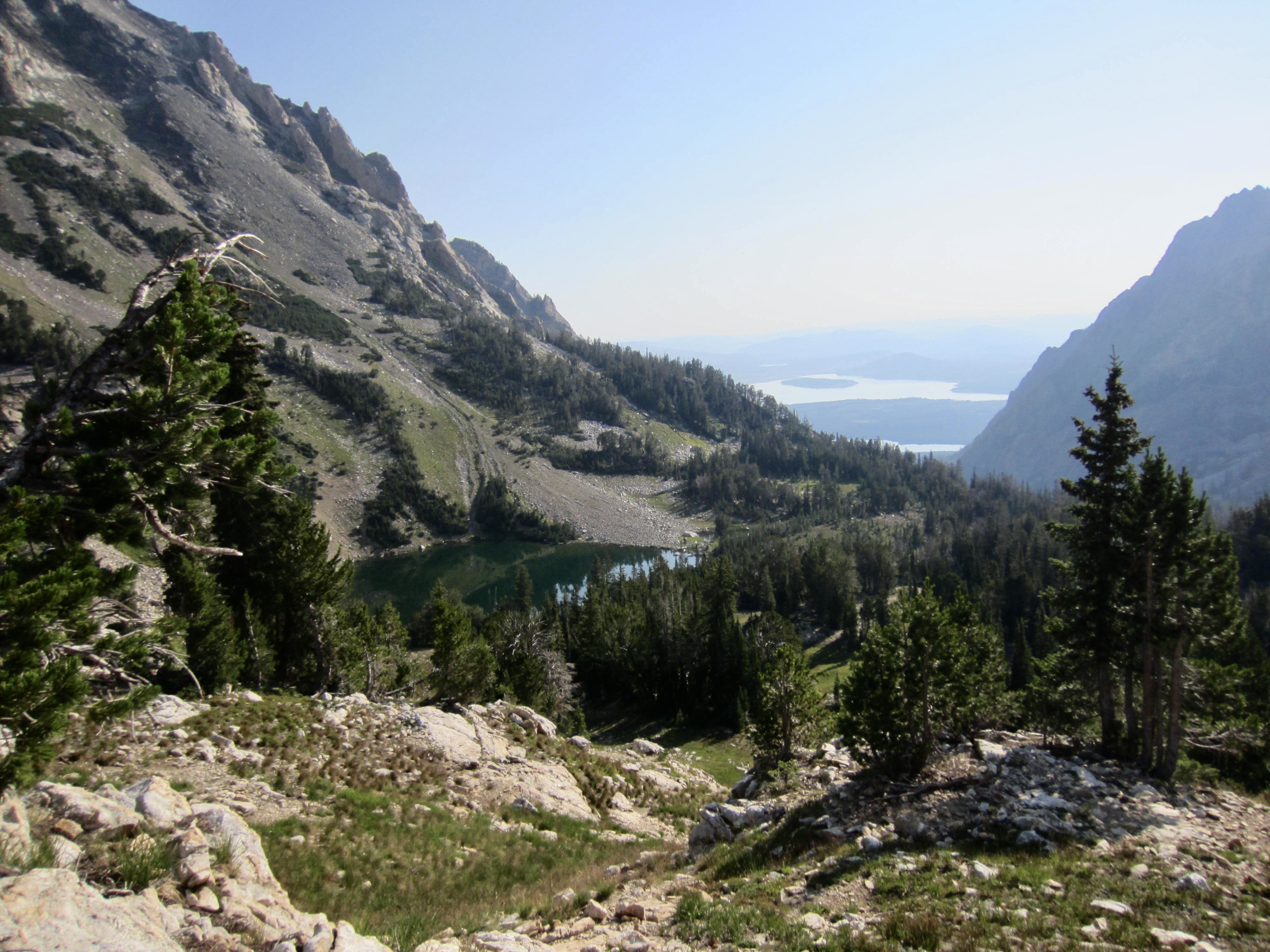
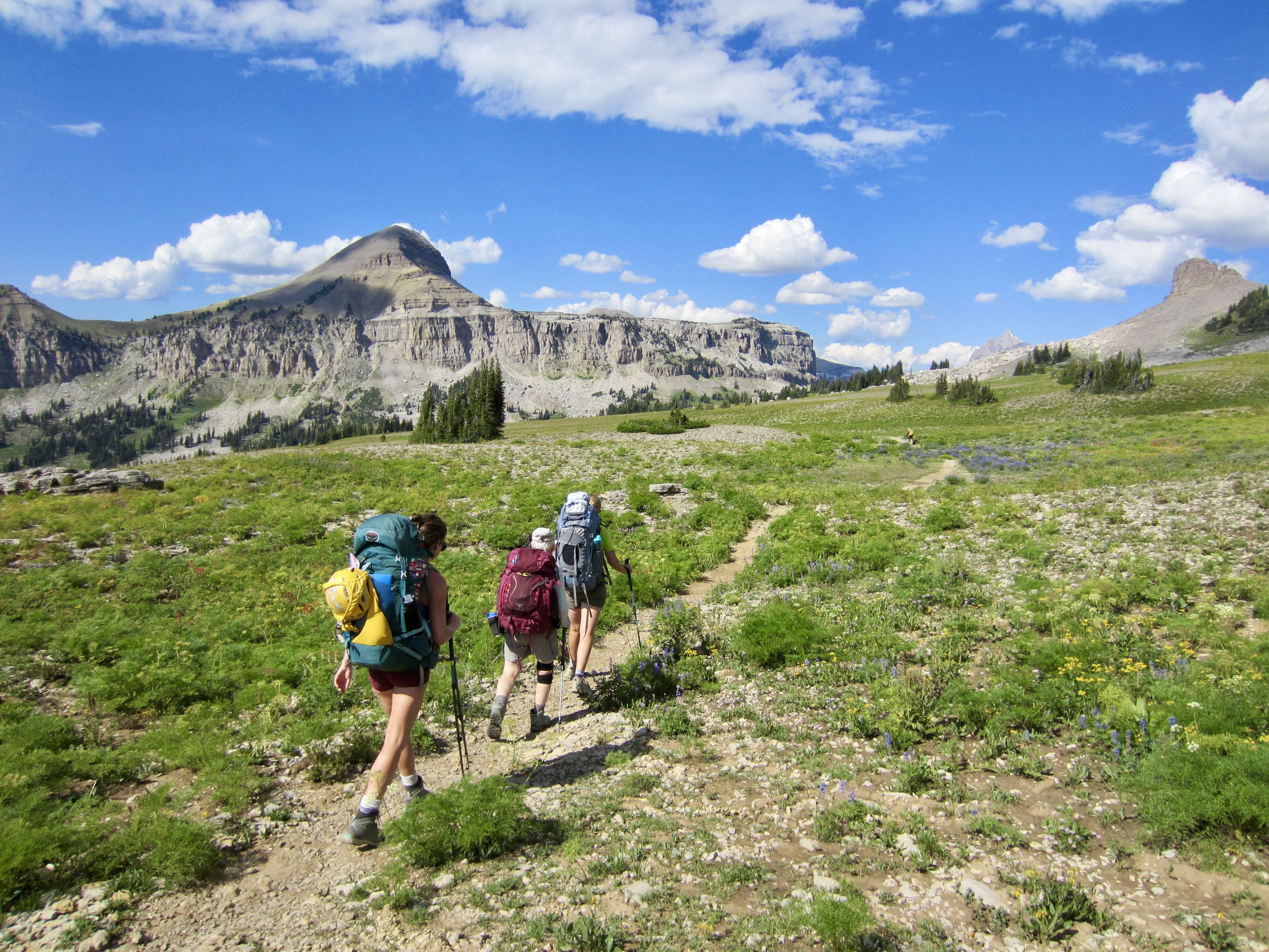
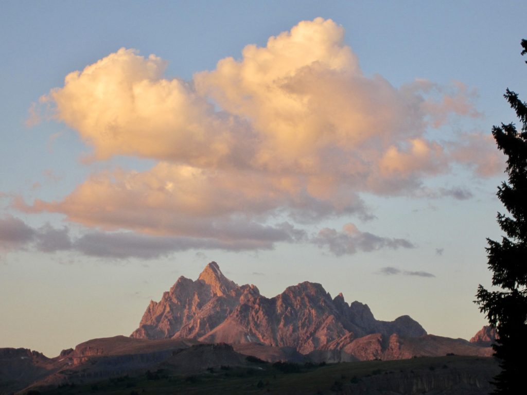
Just before arriving at Hurricane Pass, we entered back into the national park for good. The ridge crest here provides the TCT’s best view of Grand, Middle, and South Teton. Schoolroom Lake, a textbook example of a moraine-dammed lake, could be seen directly below us. Brooke and I lingered near the pass for a half-hour, admiring the peaks and imagining what was to come later in our trip.

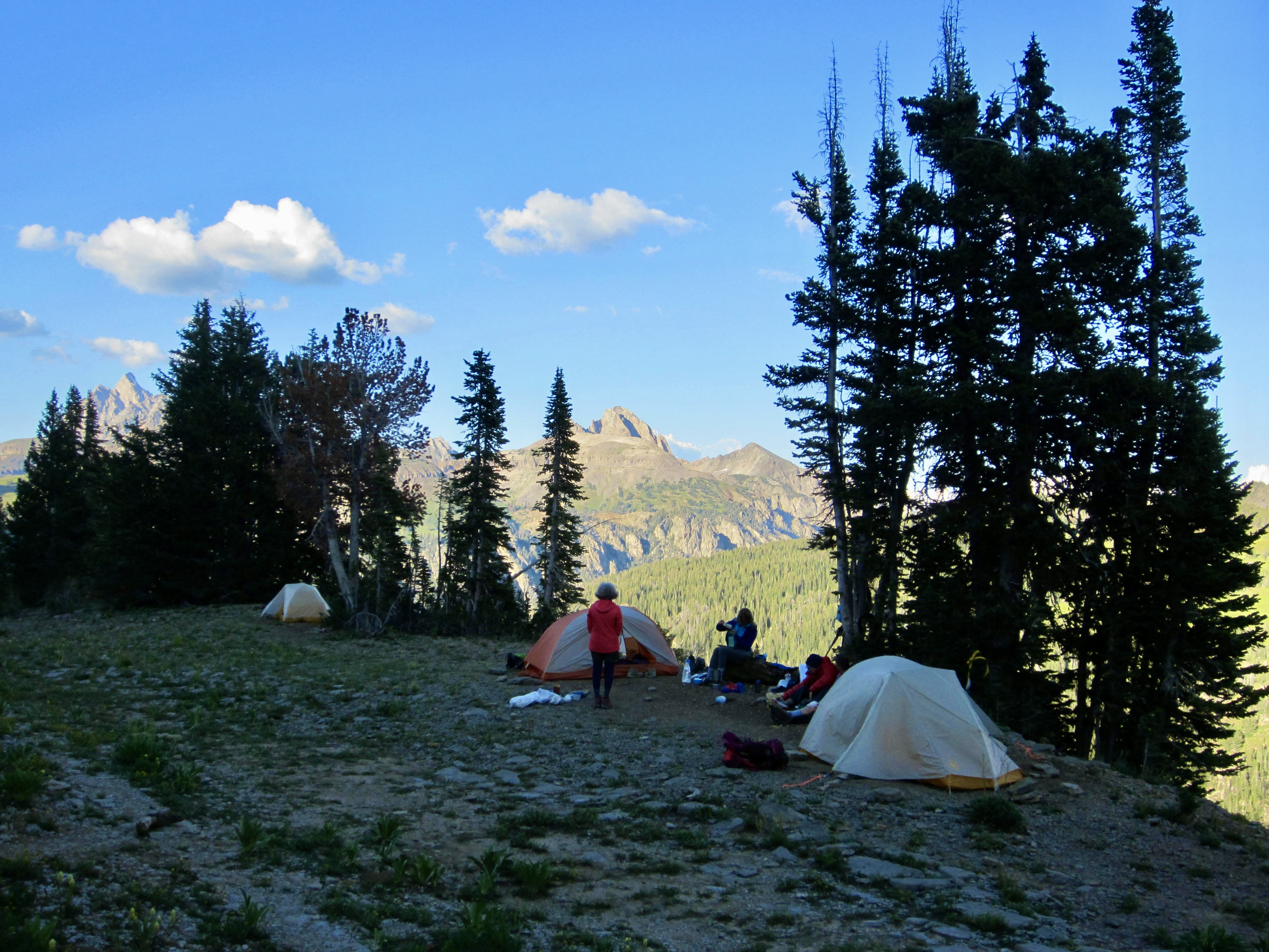
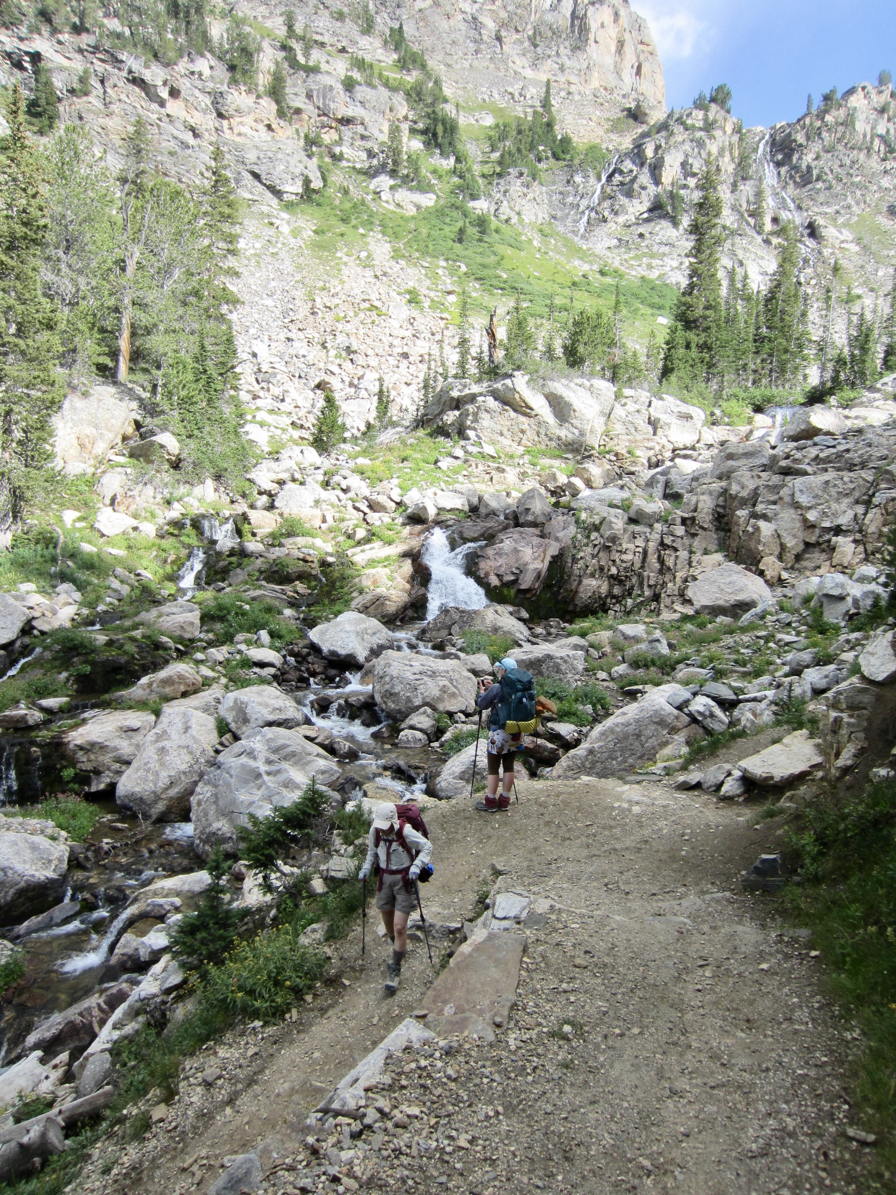
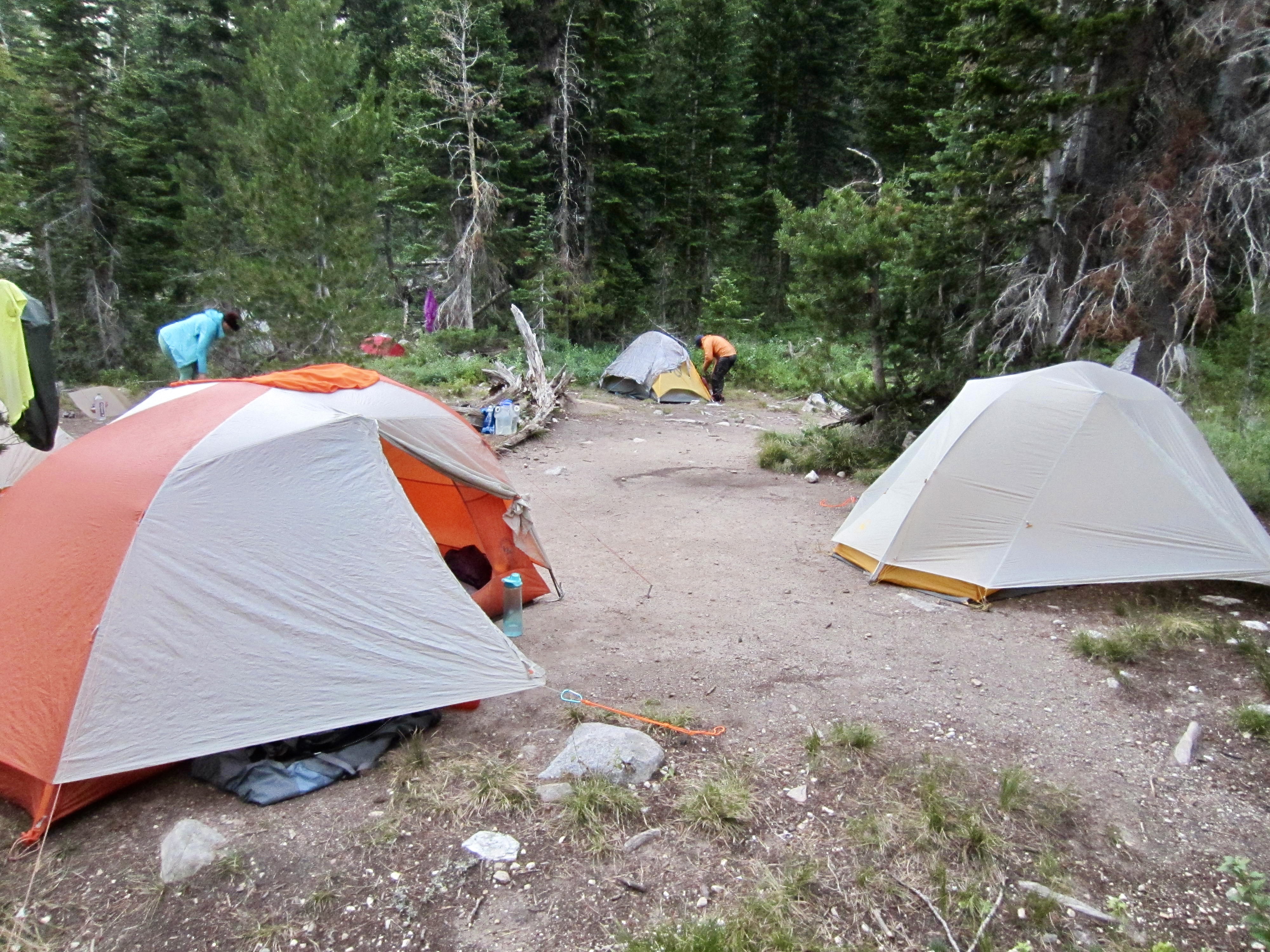
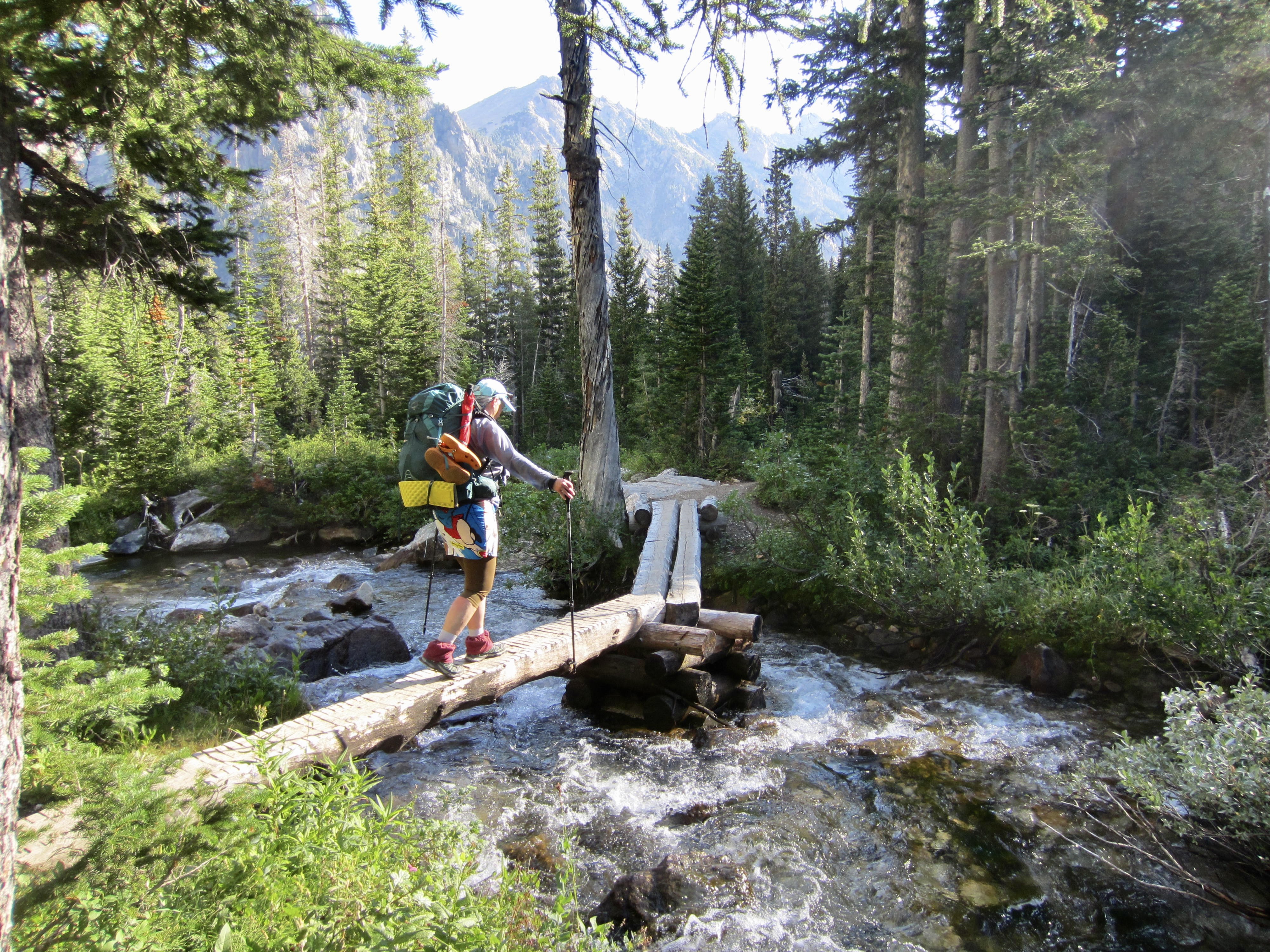
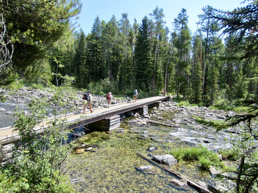
We hiked down the trail from Hurricane Pass and caught up with the rest of our group in South Fork Cascade Canyon. The seven of us then stayed together as we descended through the canyon while being pelted with big raindrops from an unseen thundercloud. At 6:30pm, we pulled into a roomy campsite near mid-canyon, directly beneath the cliffs of Grand Teton and Mt. Owen (10.5 hours + 11.5 miles + 1800 feet – 2800 feet from Camp 2, excluding sidetrip).
…
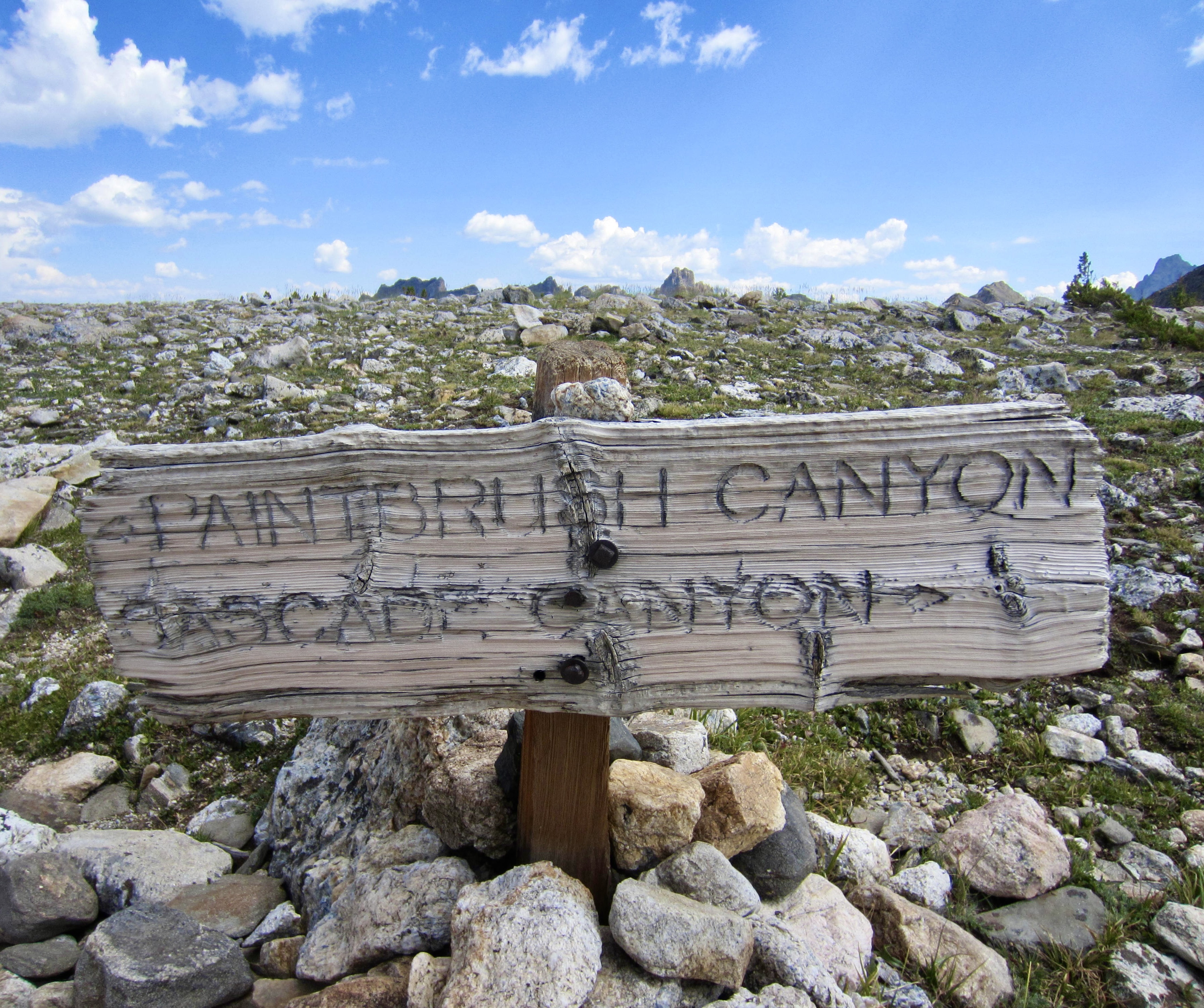
Day 3: South Cascade Canyon to Paintbrush Meadows + Paintbrush Peak
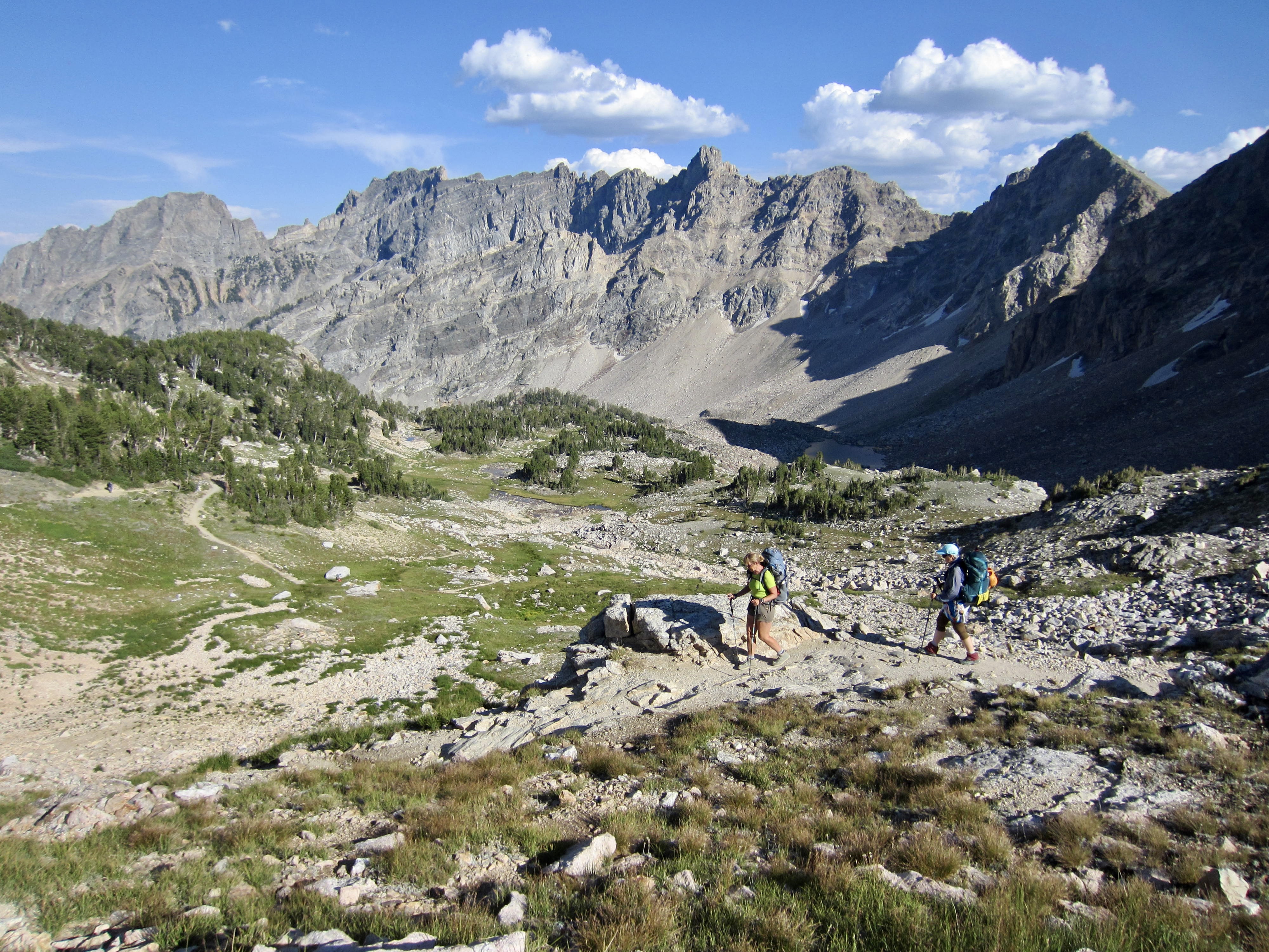
Proceeding northward on the TCT, we hiked down South Fork Cascade Canyon to a trail junction at Cascade Forks, then turned left and headed up through North Fork Cascade Canyon. The number of backpackers and day-hikers increased noticeably in the latter canyon, no doubt due to its accessibility from Jenny Lake.
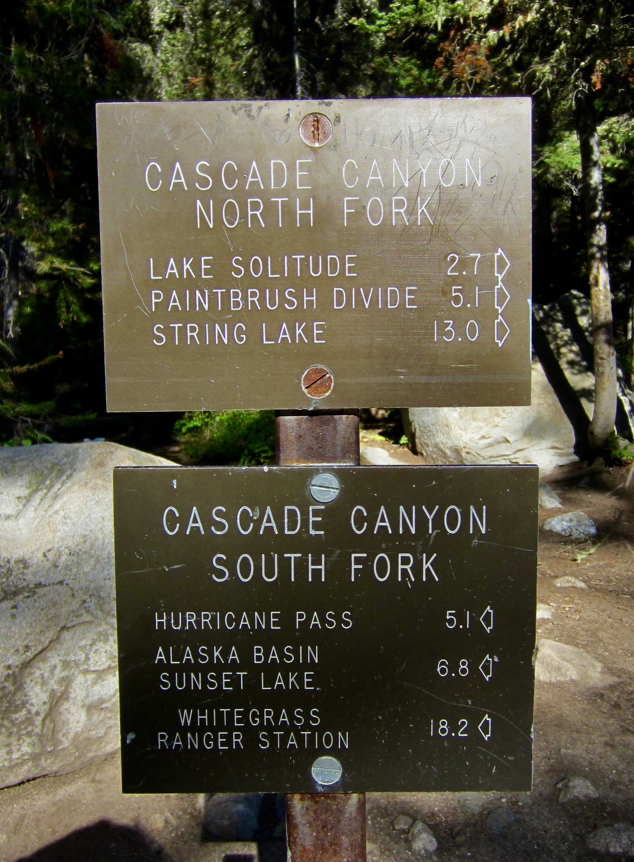
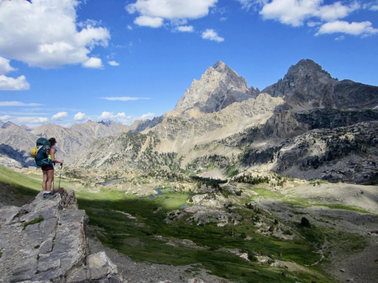
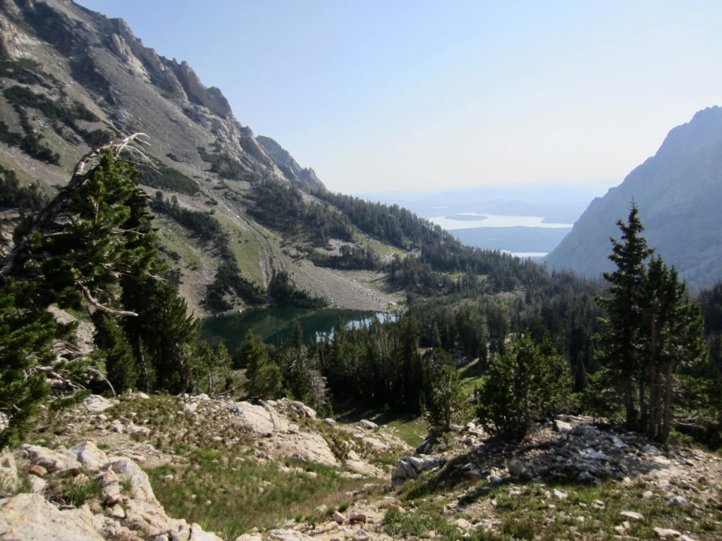
A short climb at the head of North Fork Cascade Canyon delivered us to Lake Solitude, the largest and most popular lake along the TCT. We all stopped here for a long lunch and swimming break in the hot midday sun. Kevin and Brooke couldn’t resist the urge to swim out to a small island in the lake. Geologically, we had moved from a sedimentary terrane (mostly limestone and some sandstone) to an older terrane composed of igneous and metamorphic rock.

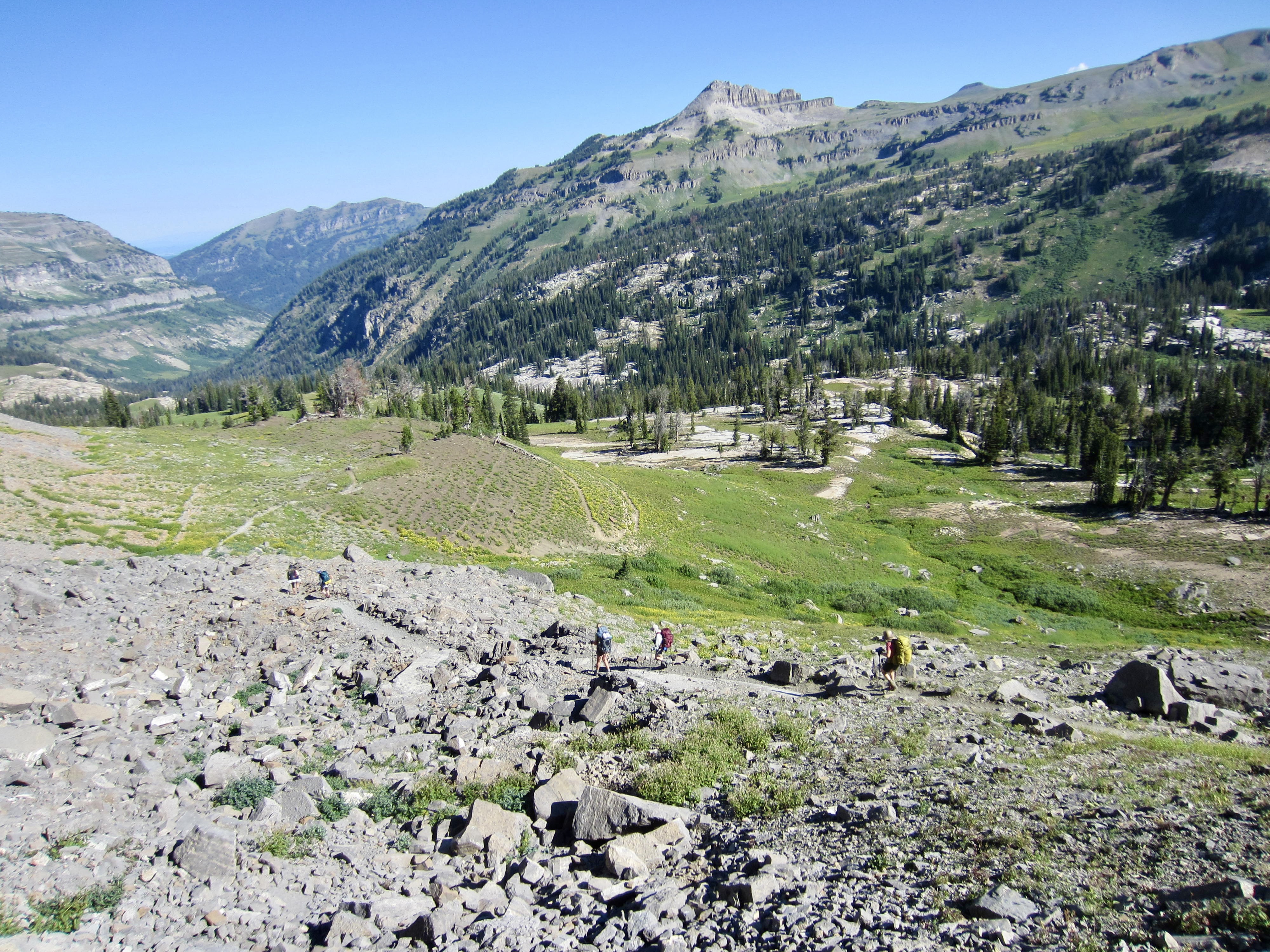
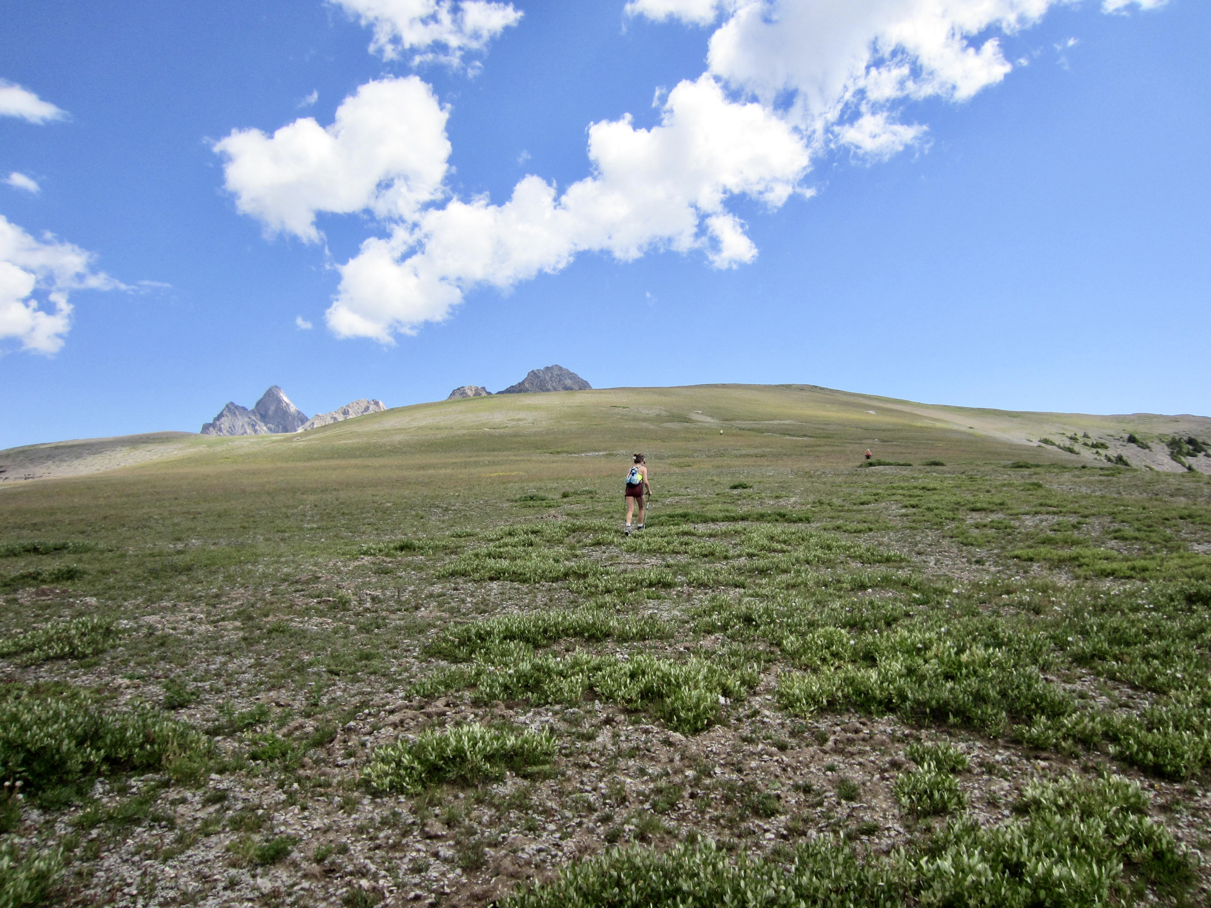
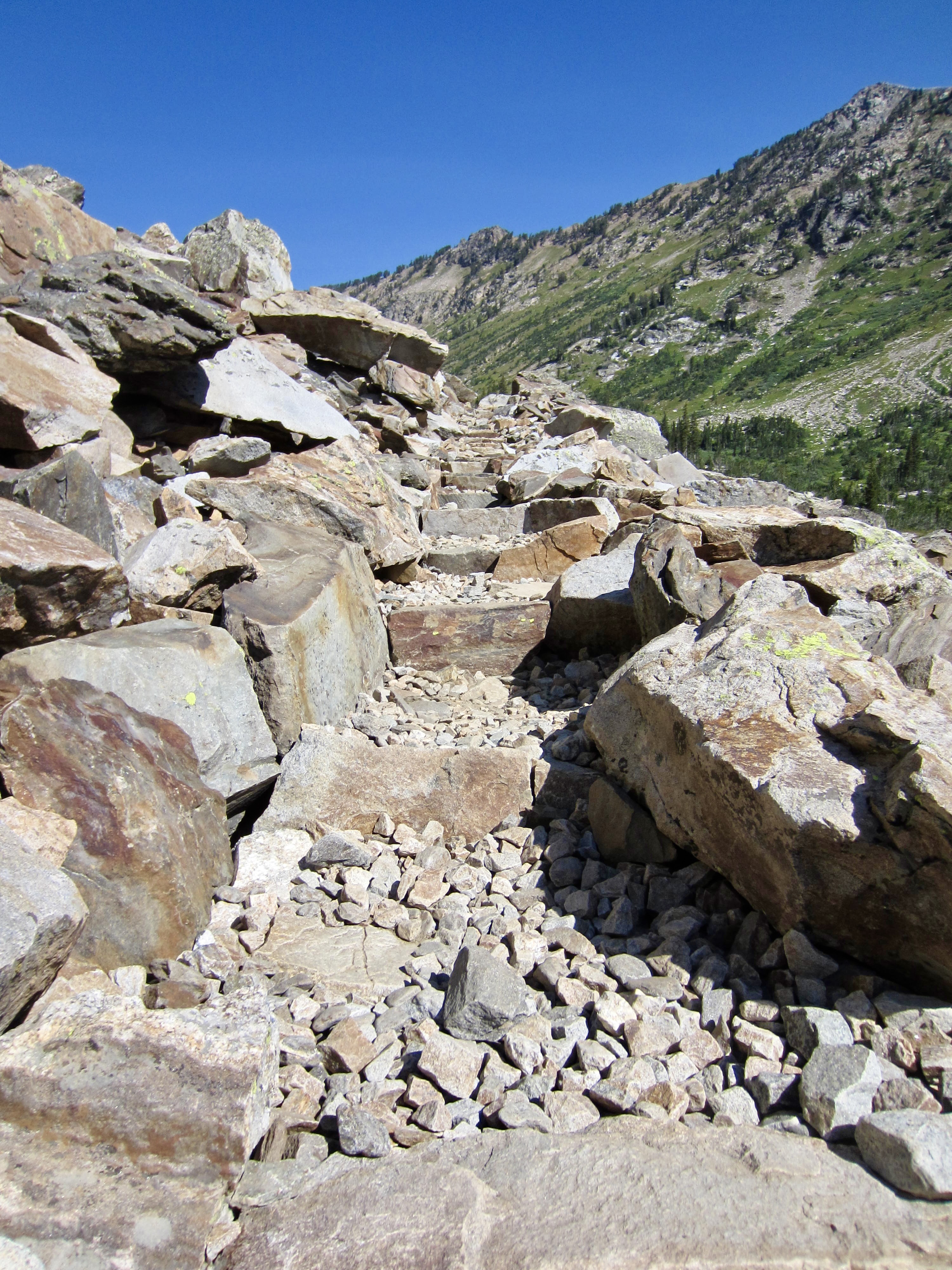
One by one, over the course of an hour, we pried ourselves away from the lake and began a long, hot hike up to Paintbrush Divide on a rocky trail. This 10,700-foot pass represents the high point of the entire TCT and marked the final ascent of our traverse. It was all downhill from here!


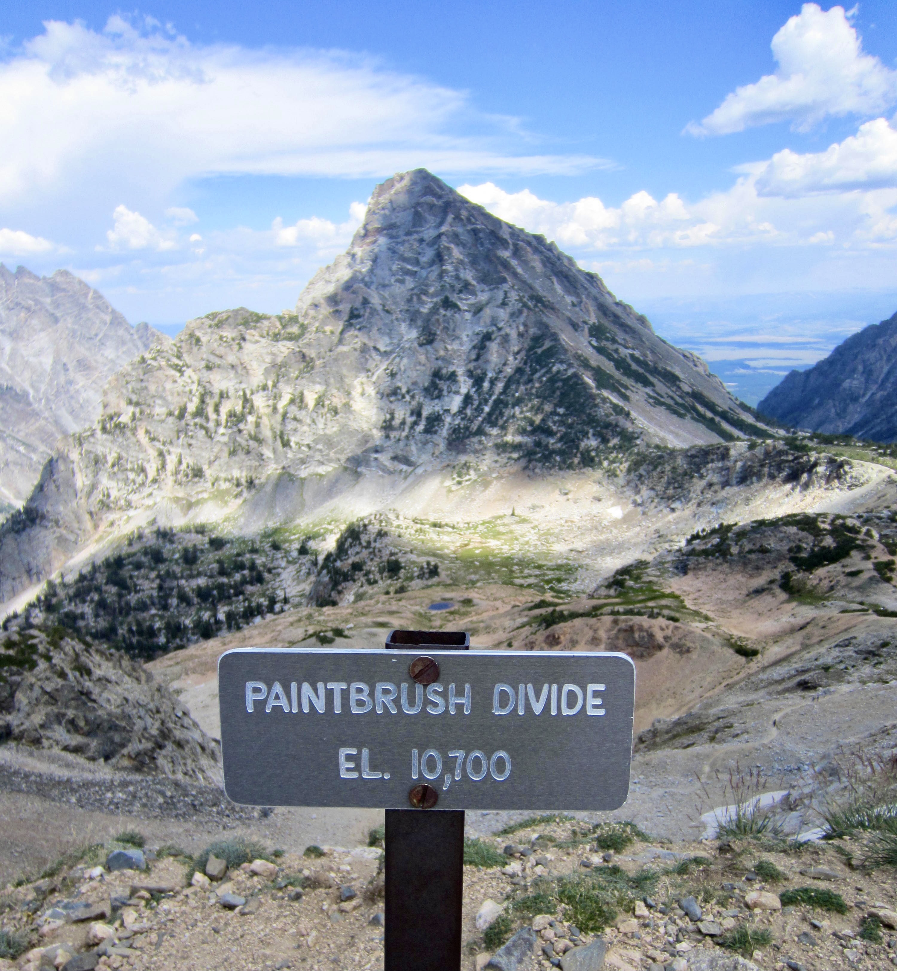
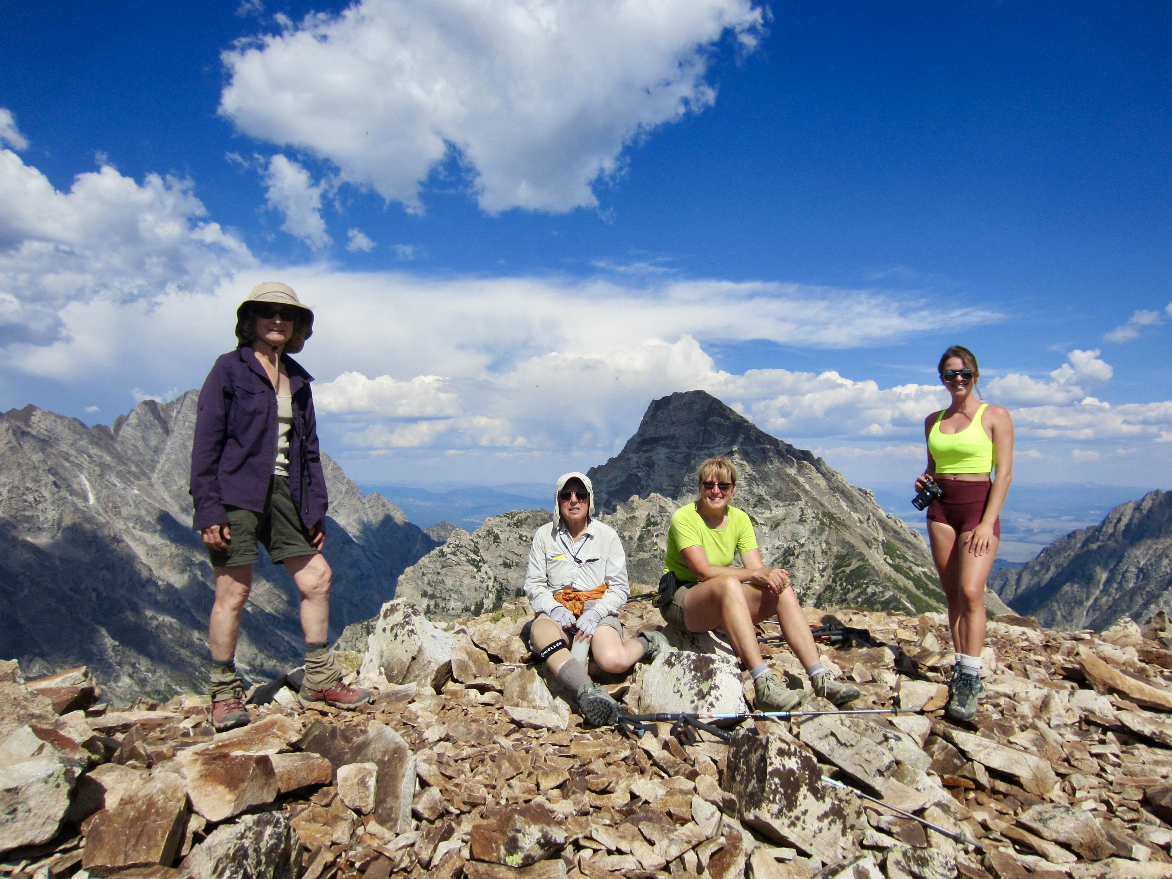
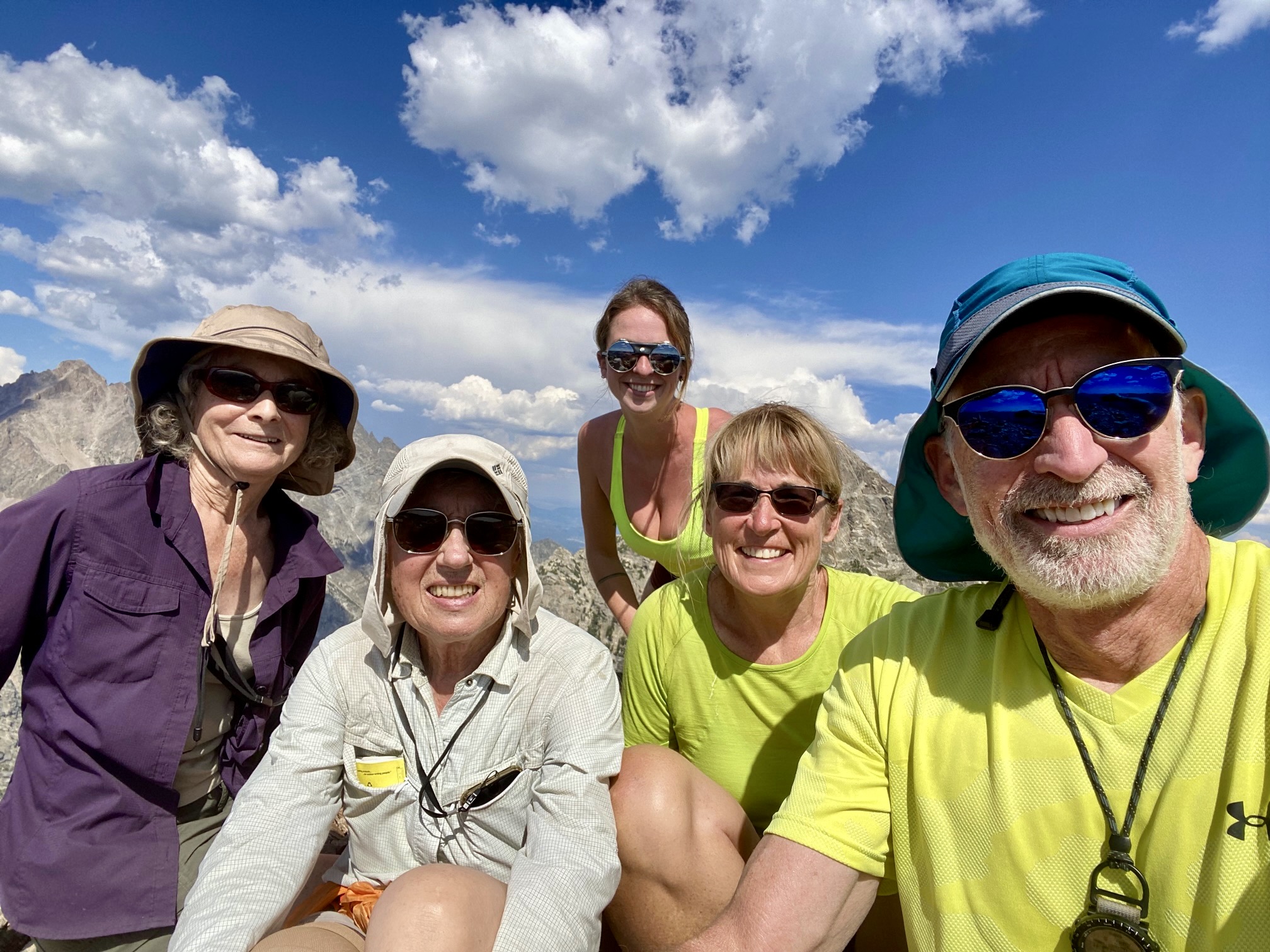
Fay, Beth, Eileen, Brooke, and I took advantage of our high position by making a short climb of nearby Paintbrush Peak. From this 10,900-foot summit, we could see all of the northern Teton peaks, including Mt. Moran and the Grand. More importantly, this was Fay’s first real summit of the year, and she was pretty darn happy about it!
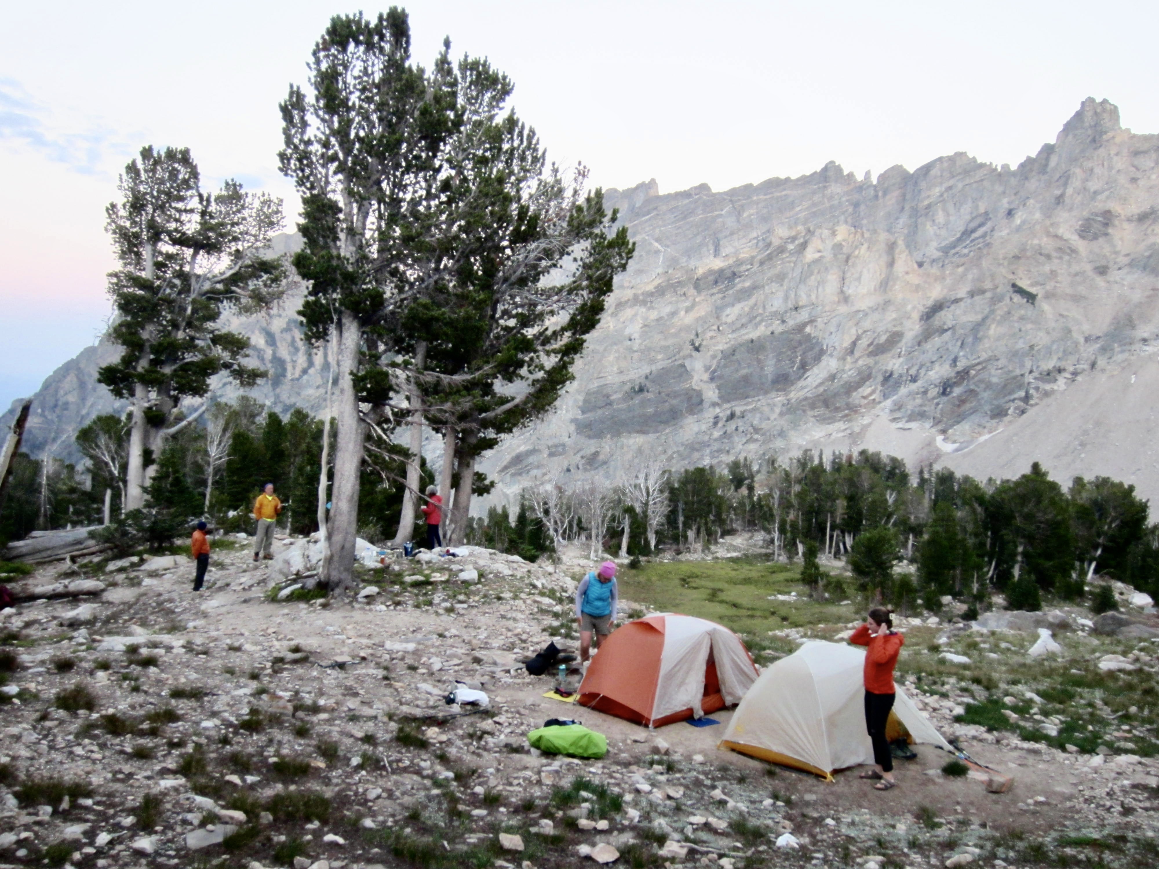
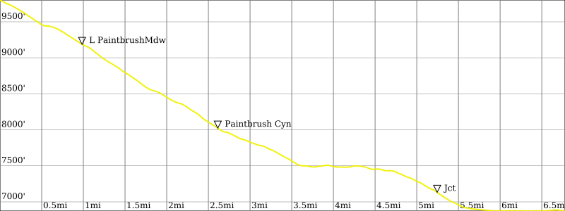
Upon returning to Paintbrush Divide, we reconnected with Kevin and Maria, then descended to Upper Paintbrush Meadow. Some searching around the meadow revealed a fine campsite atop a small rock knob for our last night (9.2 hours + 7.2 miles + 2650 feet – 1450 feet from Camp 2).

Day 4: Paintbrush Meadows to String Lake
Our final day involved a steady descent through Lower Paintbrush Meadow and Paintbrush Canyon. After a few miles of hiking, Brooke bade everyone goodbye and hurried off to complete her bonus-day itinerary, which involved climbs of Middle Teton and South Teton and a sidetrip to Delta Lake (she was on a mission that even Stefan could appreciate).
The rest of us maintained a more relaxed pace down to Leigh Lake, and we stopped for a swim in String Lake before reaching the trailhead in early afternoon (4.5 hours + 6.8 miles + 50 feet – 3050 feet from Camp 3). It had been a fabulous trail traverse for everyone, as well as a tantalizing introduction to Grand Teton National Park for those of us who had never been here before. Eileen and I were thrilled to be spending another week in the area, with high summits in mind!
Route Maps & Profiles
…
…
…
…
…
…
Photo Gallery
Click to enlarge…