Trip Date: April 18, 2024
2024 COLUMBIA PLATEAU ADVENTURE VACATION
Northrup Canyon Hiking & Scrambling Loop
Lower & Upper Northrup Canyon
Old Northrup Homestead
Northrup Lake
Northrup Plateau
Trip Report Summary
Region: Columbia Plateau (Washington)
Sub-Region: Upper Grand Coulee
Area: Steamboat Rock State Park
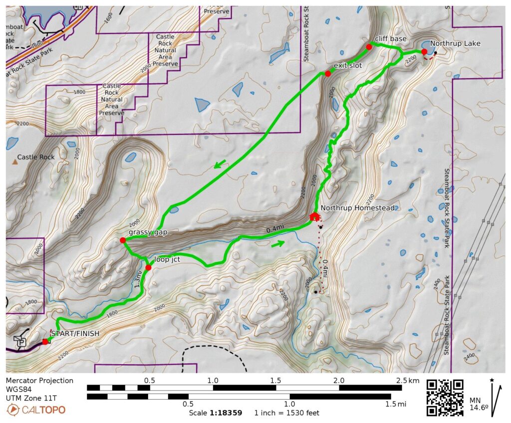
Starting & Ending Point: Northrup Canyon Trailhead at Northrup Canyon Road gate (Elev. 1800 feet)
Way Points: Northrup Creek Bridge & Old Northrup Homestead & Northrup Pond & Northrup Lake & Upper Northrup Canyon invert & cliff base & exit slot & Northrup Plateau & canyon promontory & grassy gap & Northrup Creek crossing (trail hike & off-trail hike & rock scramble)
High Point: Northrup Plateau near exit slot (Elev. 2340 feet)
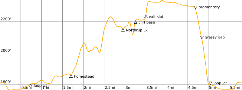
Approximate Stats: 5.8 miles traveled; 1100 feet gained & lost; 6.2 hours elapsed.
Full Trip Report
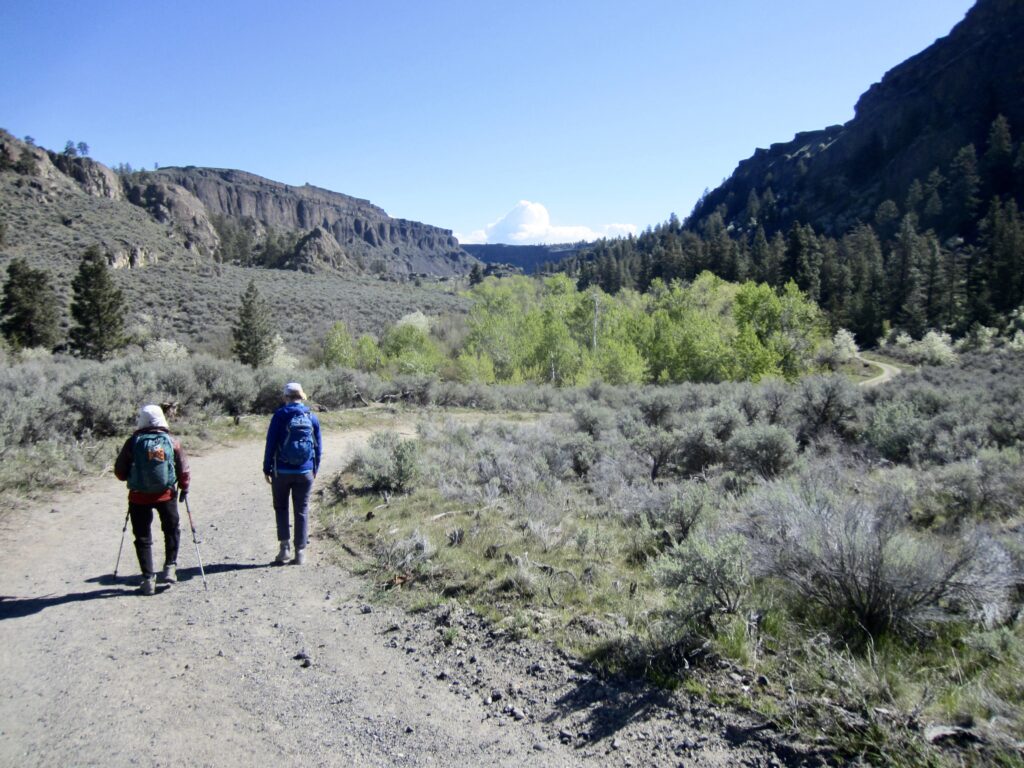
While camped for a week at Steamboat Rock State Park in Upper Grand Coulee, Fay and Eileen and I spent a day exploring Northrup Canyon in the northeastern corner of the park. This canyon offers one of the most popular and scenic day-hikes within Coulee Country. Naturally, the three of us managed to take a routine hike to another level—both literally and figuratively.
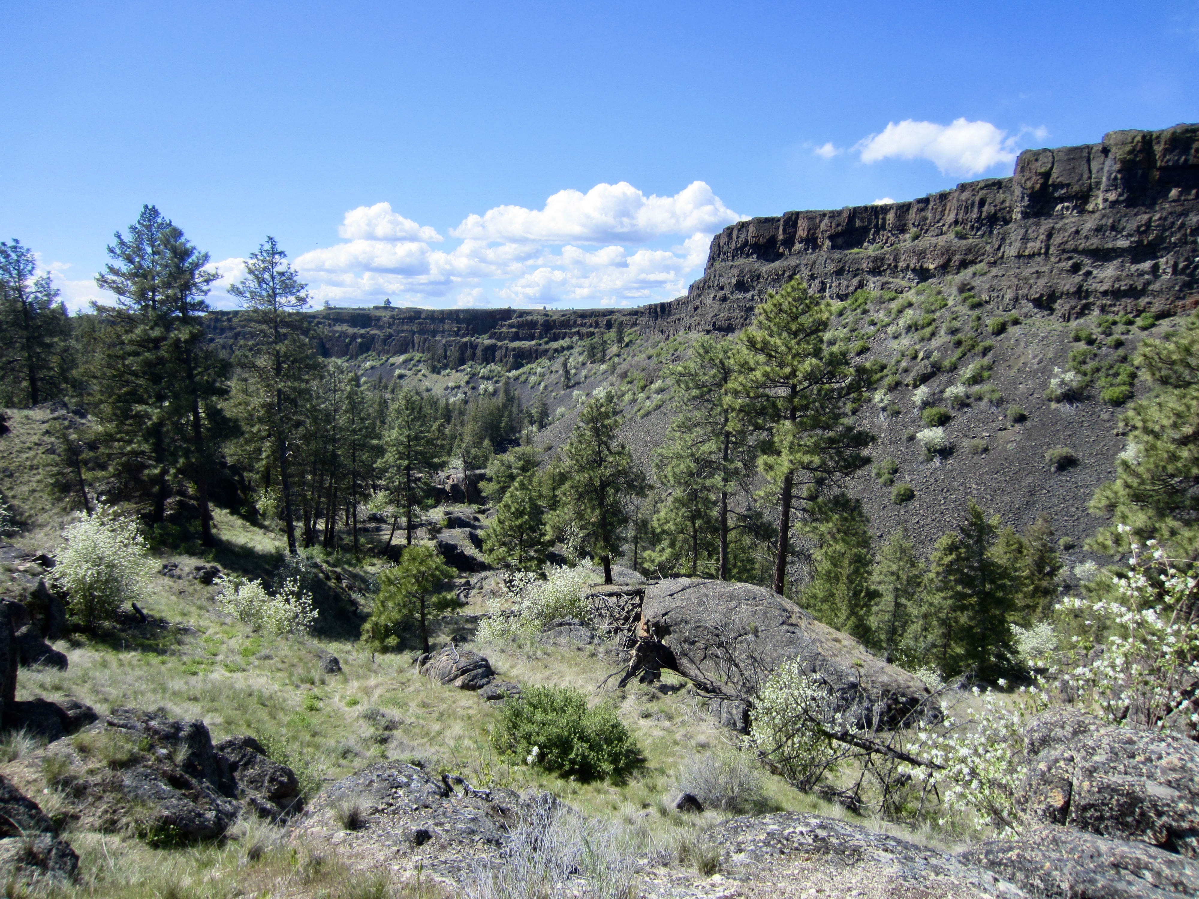
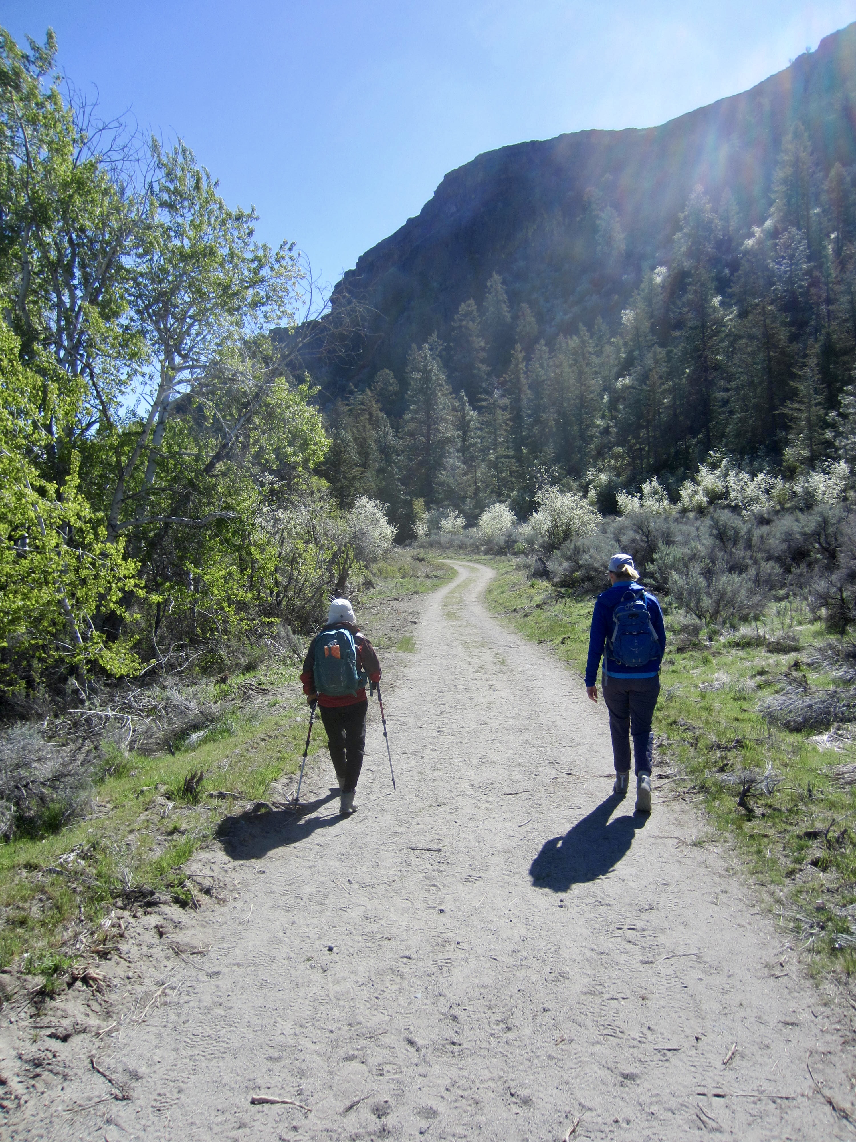
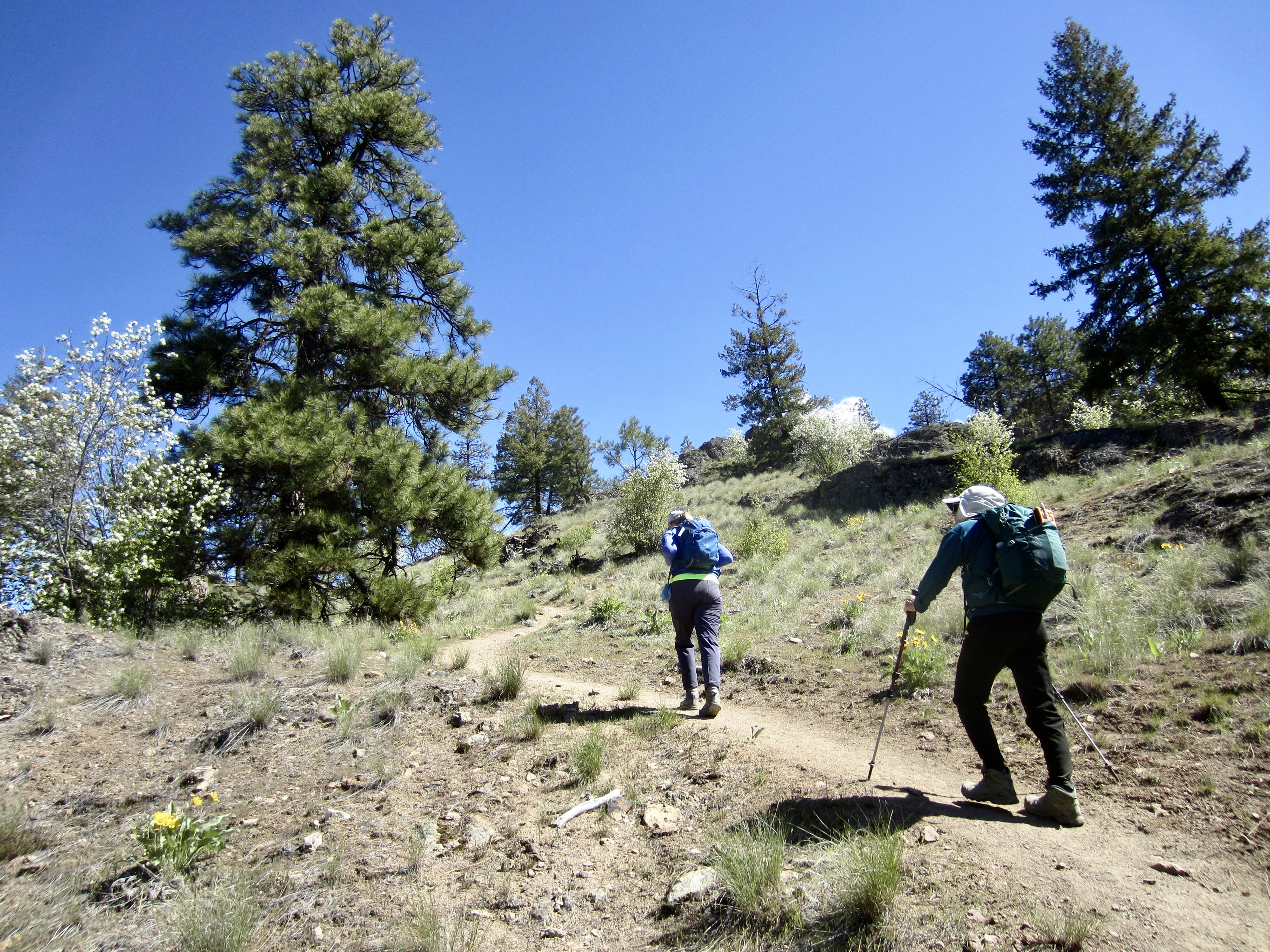
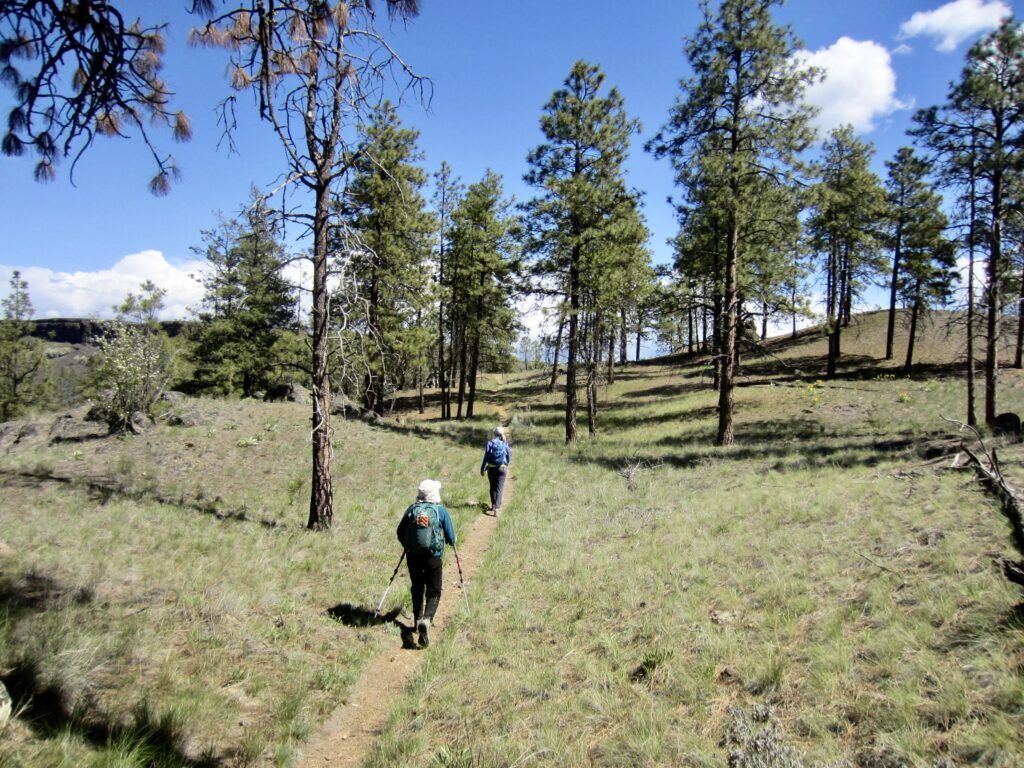
From the Northrup Canyon Trailhead, we followed an old road into the broad canyon, which represents a floodwater-eroded coulee. The winding road took us past outcrops of rounded granite, fields of fragrant sagebrush, clumps of flowering serviceberry (saskatoon) bushes, and groves of quaking aspen trees. It didn’t take us long to discover why this hike is so popular.
.
.
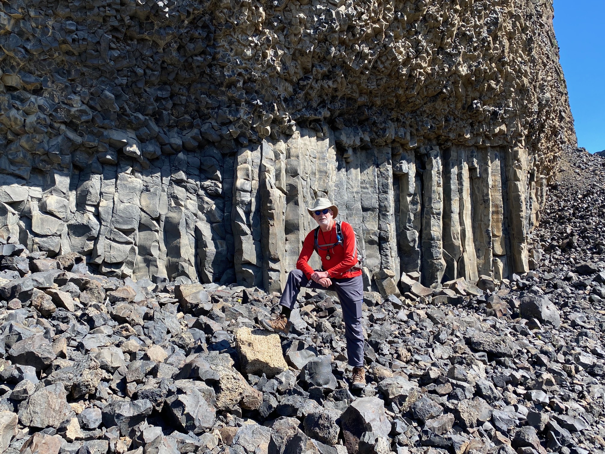
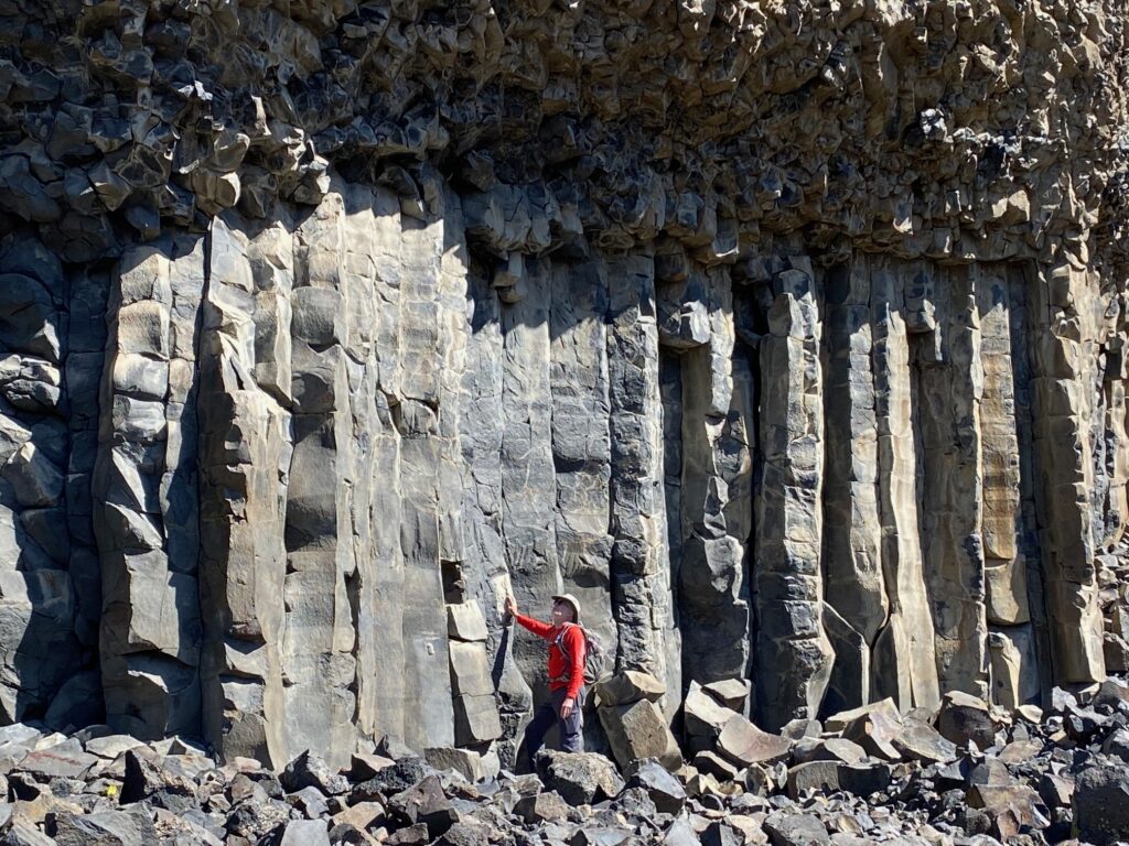
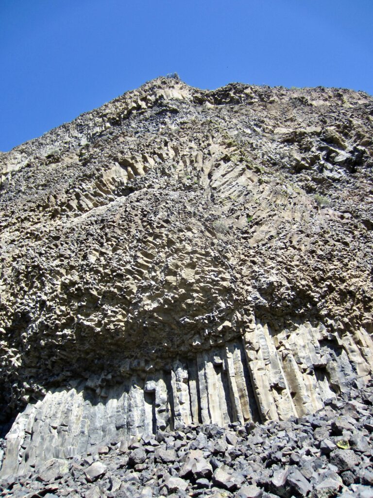
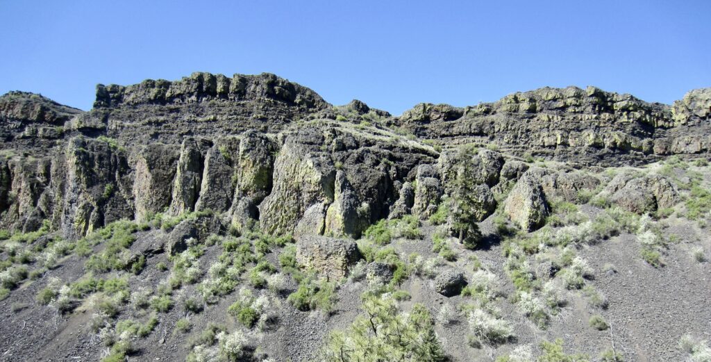
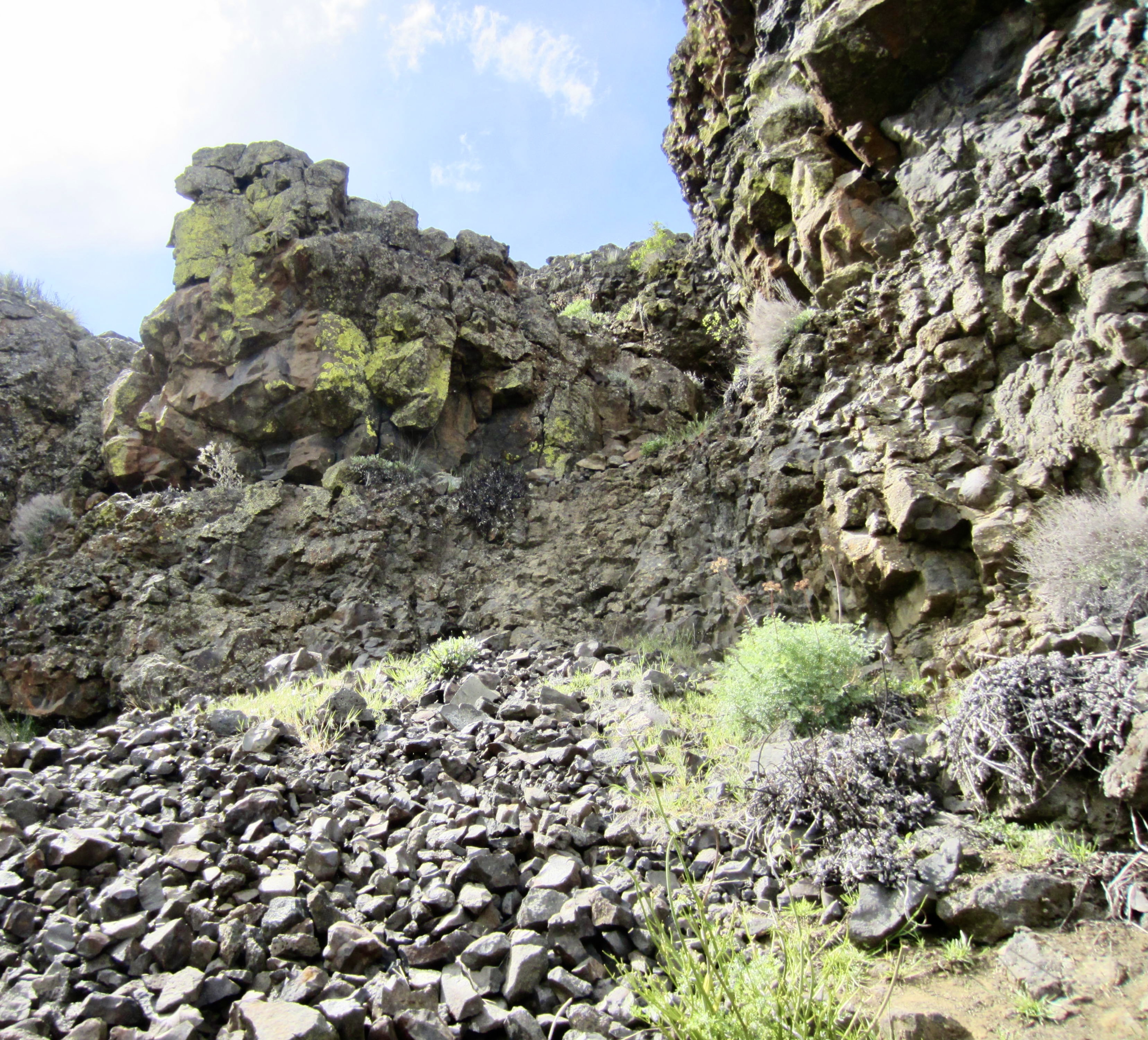
Shortly after crossing Northrup Creek on a relatively new bridge, we paused to marvel at a most bizarre-looking basalt cliff. Here, a 20-foot-high wall of vertical columns is capped by a tall, overhanging brow of chaotically textured basalt. The upper layer consists of smaller columns arranged in every possible orientation—some perpendicular to the cliff face, others forming huge fans and arches. By chance, celebrity geologist Nick Rhyolite happened to walk past at this moment, so we asked him to explain how this crazy deposit formed. Nick made a close examination of the exposed rock but, in the end, was at a rare loss for words.
.
.
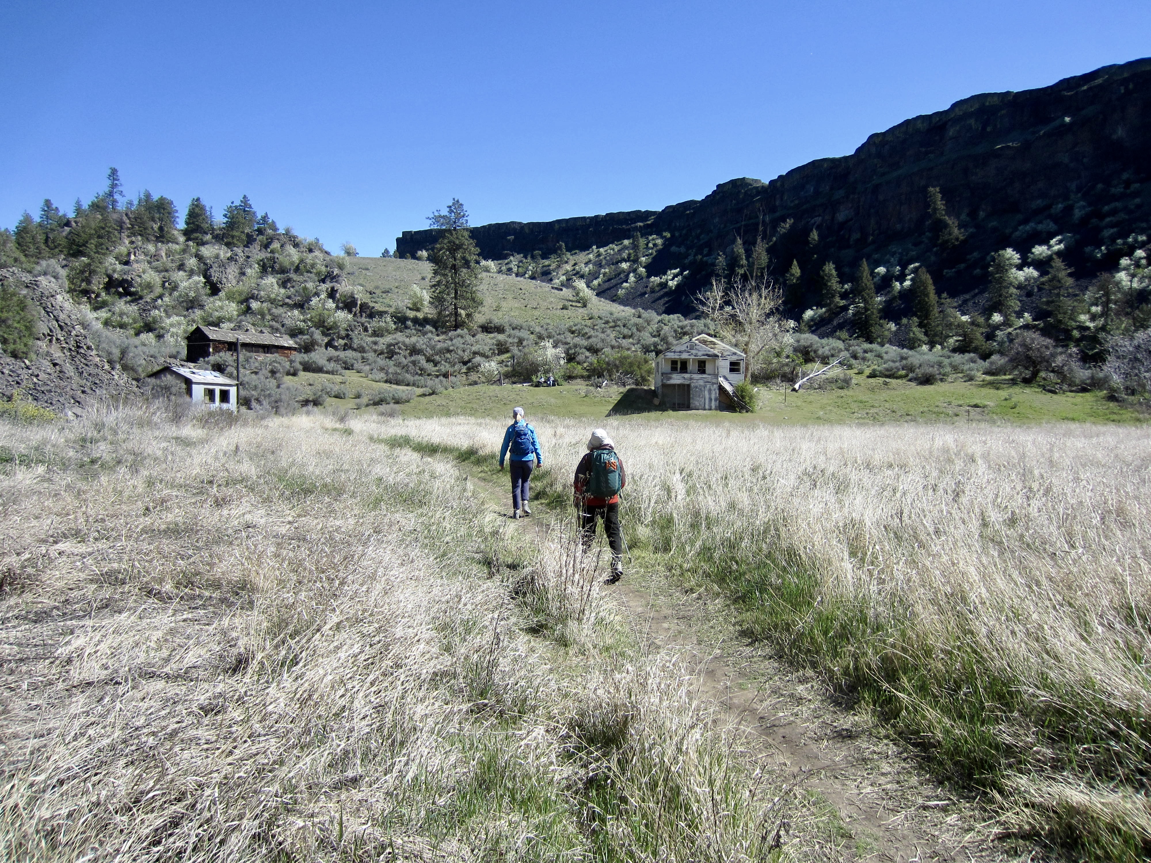
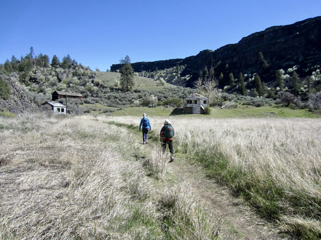
Continuing along the old road, we soon came to the historic Northrup Homestead, which comprises a group of buildings from two different eras. The older buildings were built by John Northrup in the late 1800s, and the newer buildings were built by a State Park employee in the 1930s.
.
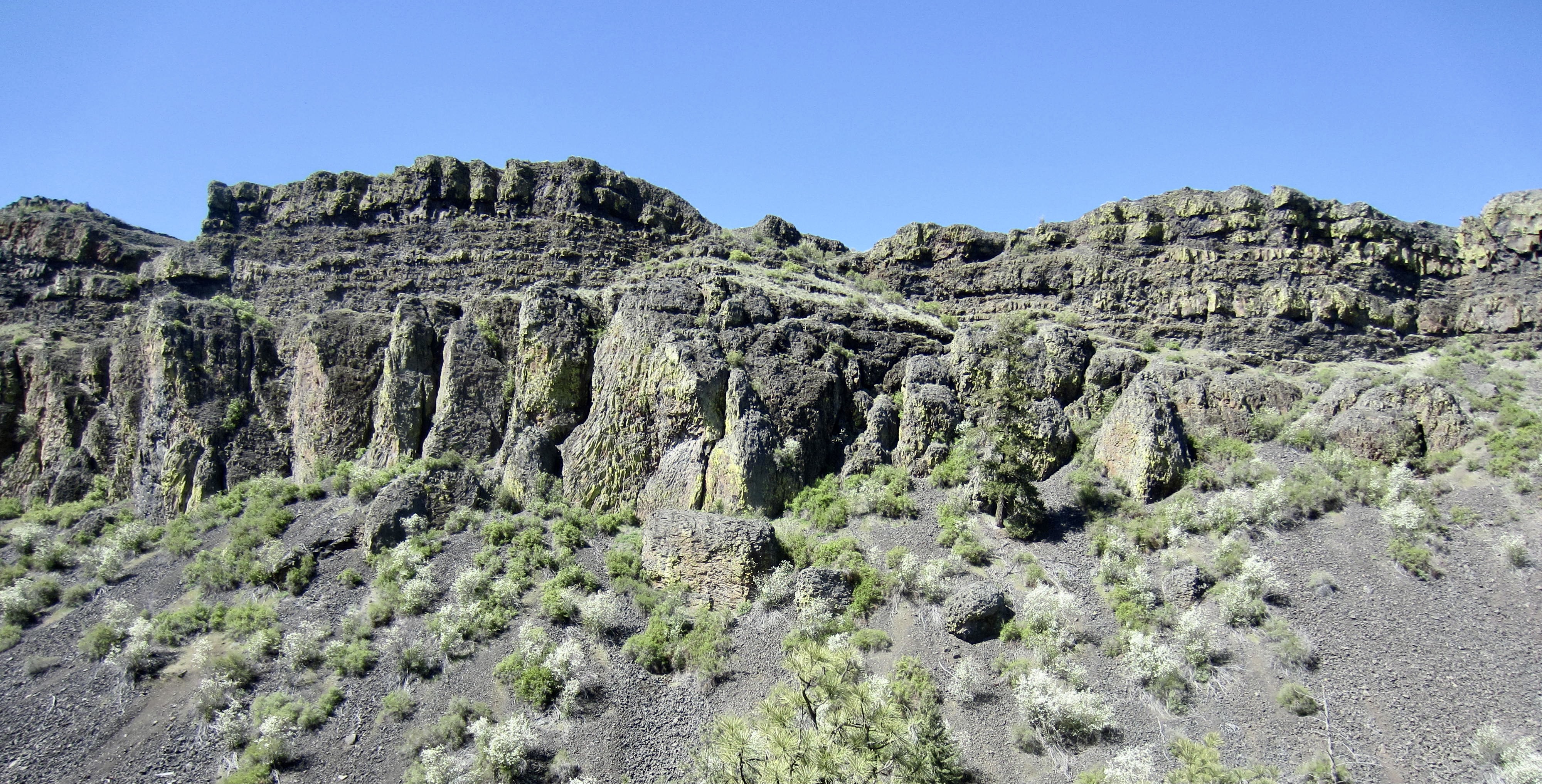
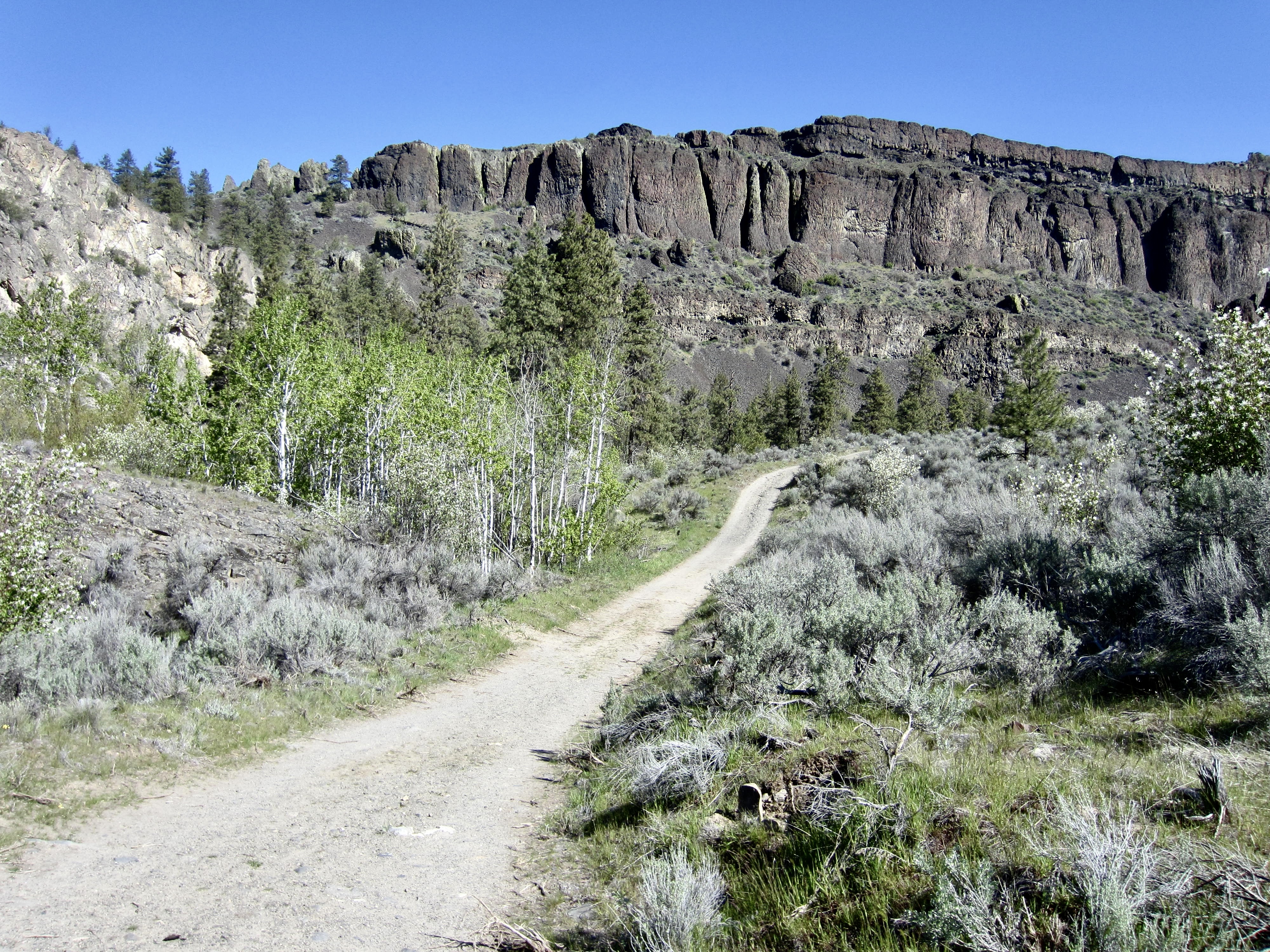
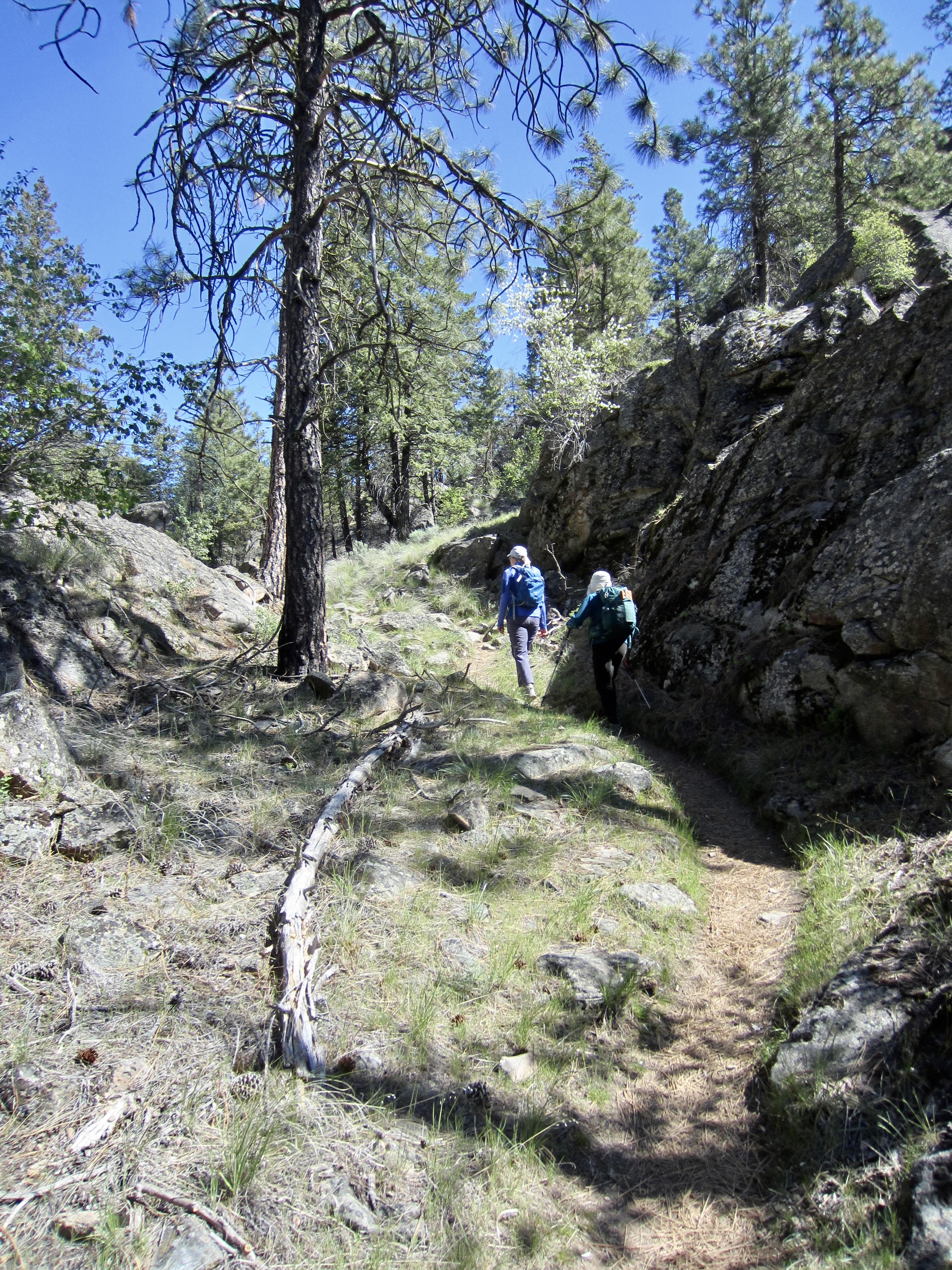
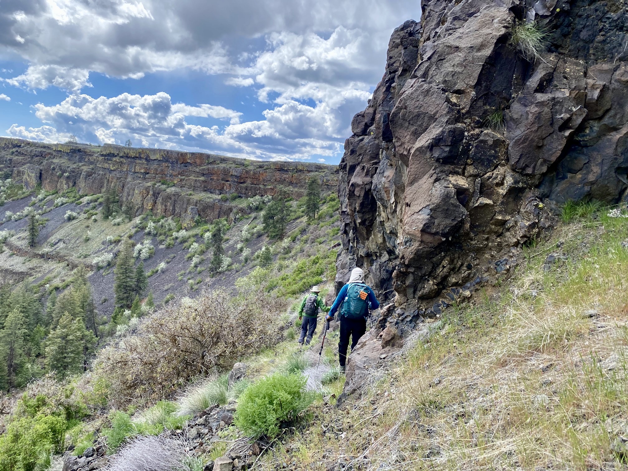
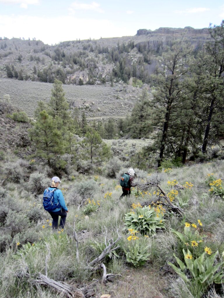
The Northrup Homestead marks the end of the old road and the head of the lower canyon, which features relatively flat terrain. From there, a single-track trail continues northward into the steeper and narrower upper canyon. We hiked past scattered ponderosa pine trees and granite outcrops, far below a palisade of black, brown, and yellow basalt flows.
.
.
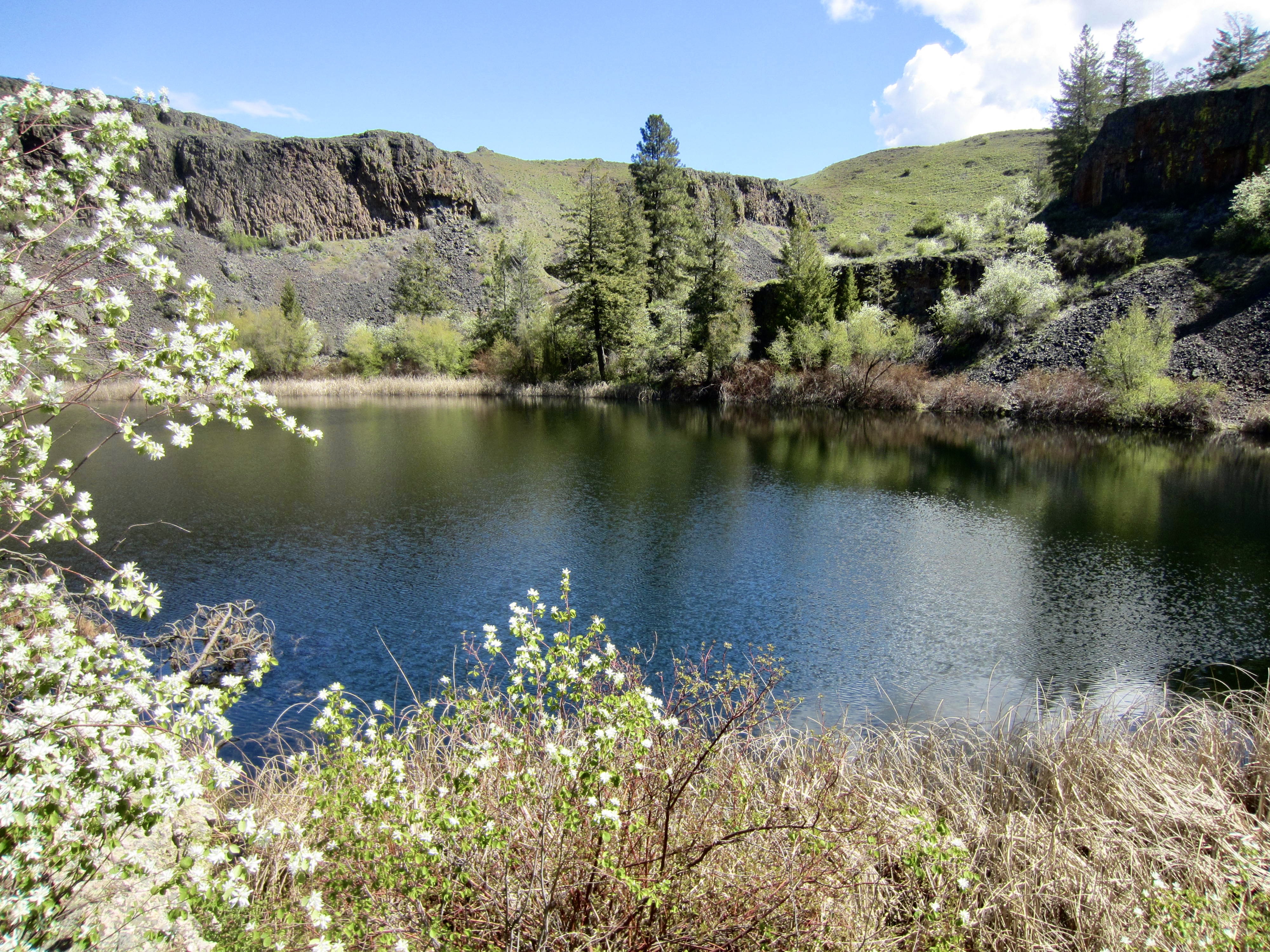
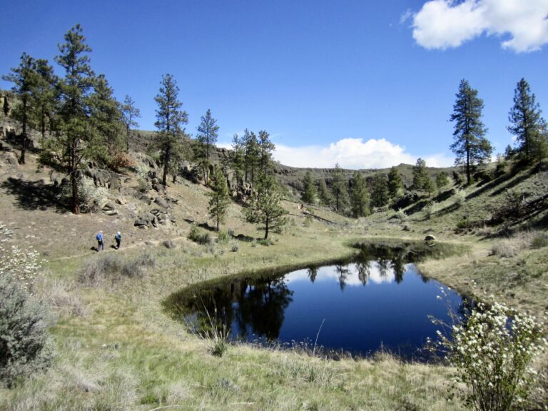
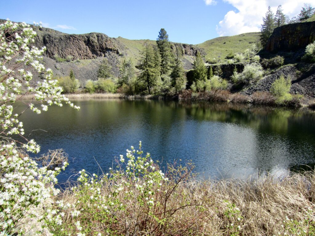
Our trail eventually leveled out and wandered through a beautiful, rolling, grassy ponderosa forest before ending at Northrup Lake (2.1 hours + 3.0 miles + 600 feet from TH). This pretty little lake sits in a rocky bowl ringed with trees, bushes, cattails, and tall grasses.
.
.
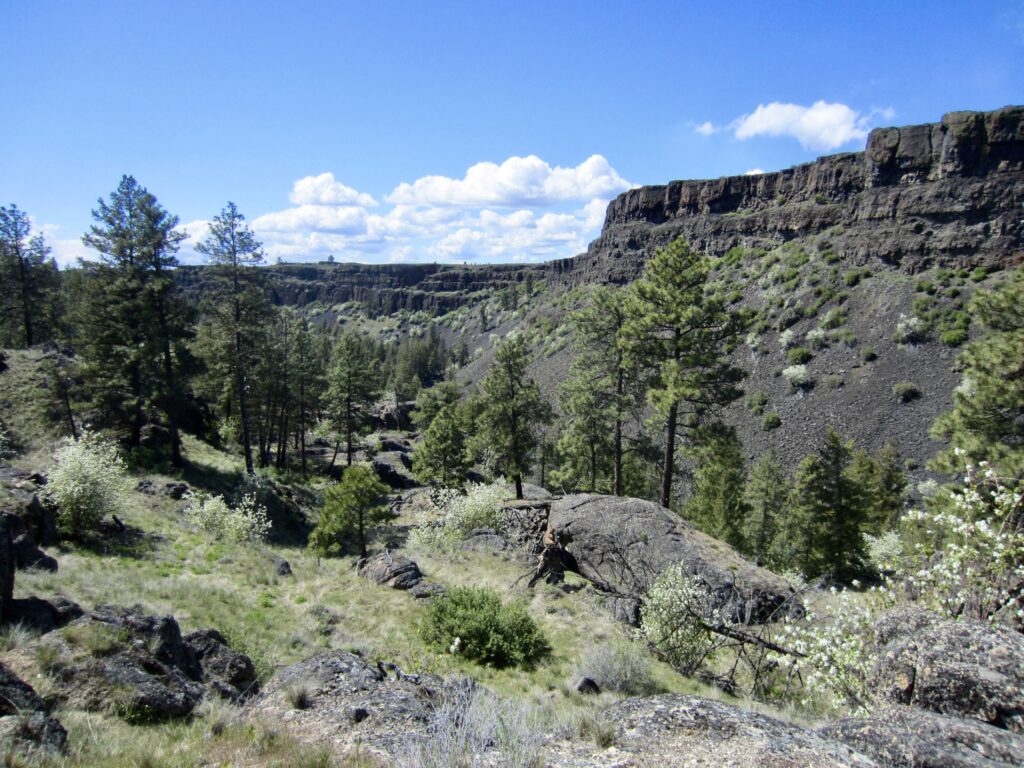
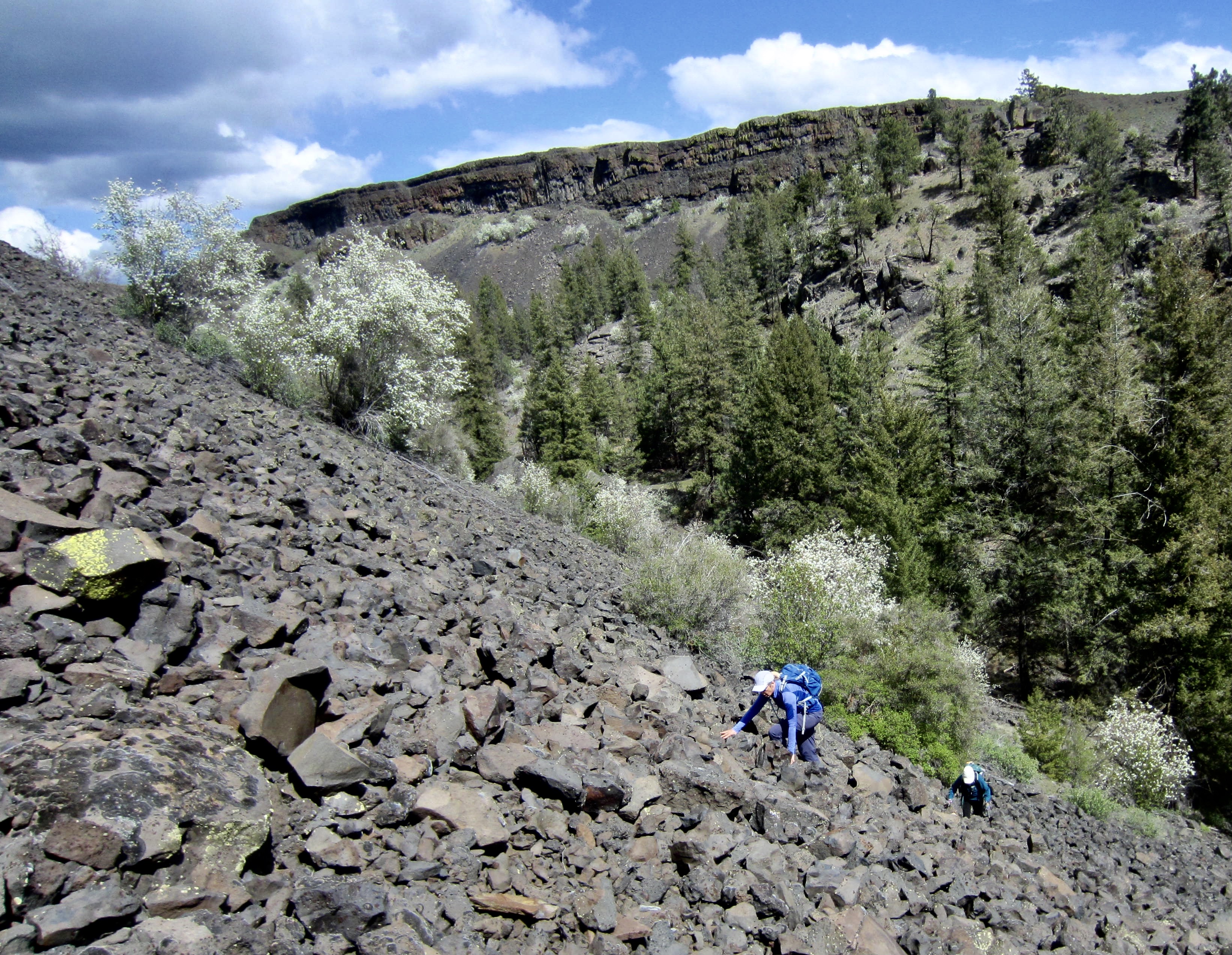
For a lunch spot, we hiked up to a gentle rib that separates Northrup Lake from the upper reaches of Northrup Canyon. This gave us a good view of the basalt cliffs across the canyon. During our hike in, Fay had made some casual comments about wanting to get onto the plateau above the canyon rim. Now, these casual comments were being worked into a serious plan of attack. Our final strategy involved dropping into the canyon invert, scrambling up a talus slope below the cliffs, then traversing leftward (southwesterly) along the cliff base until finding some sort of weakness that would allow us to gain the plateau.
.
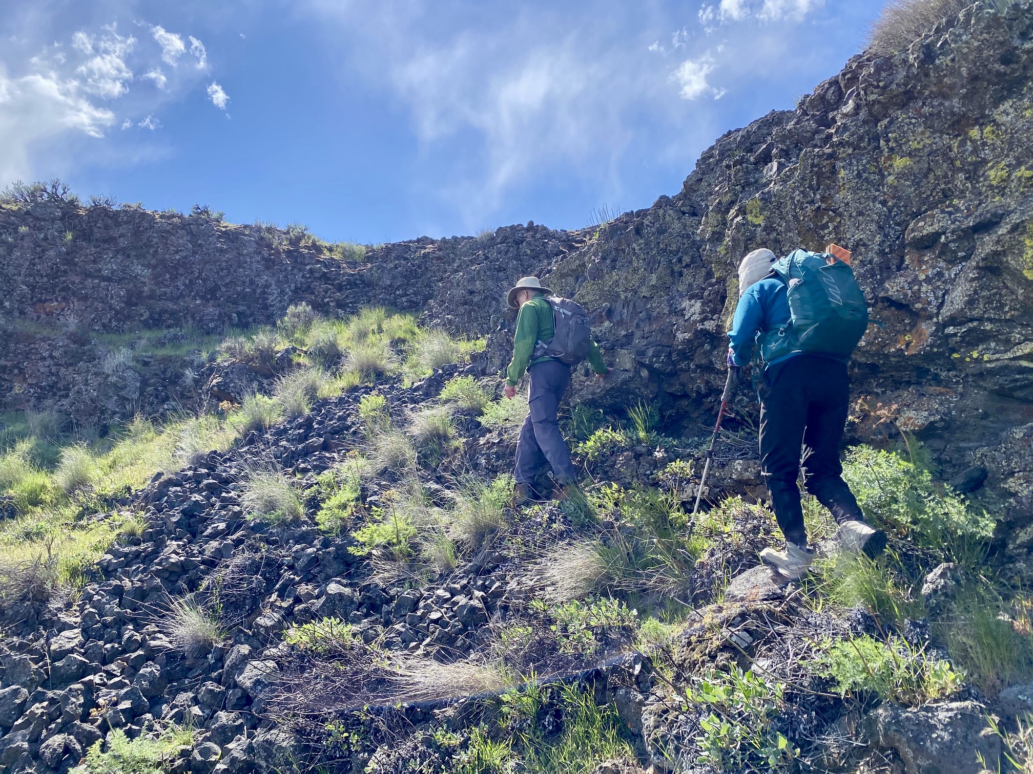
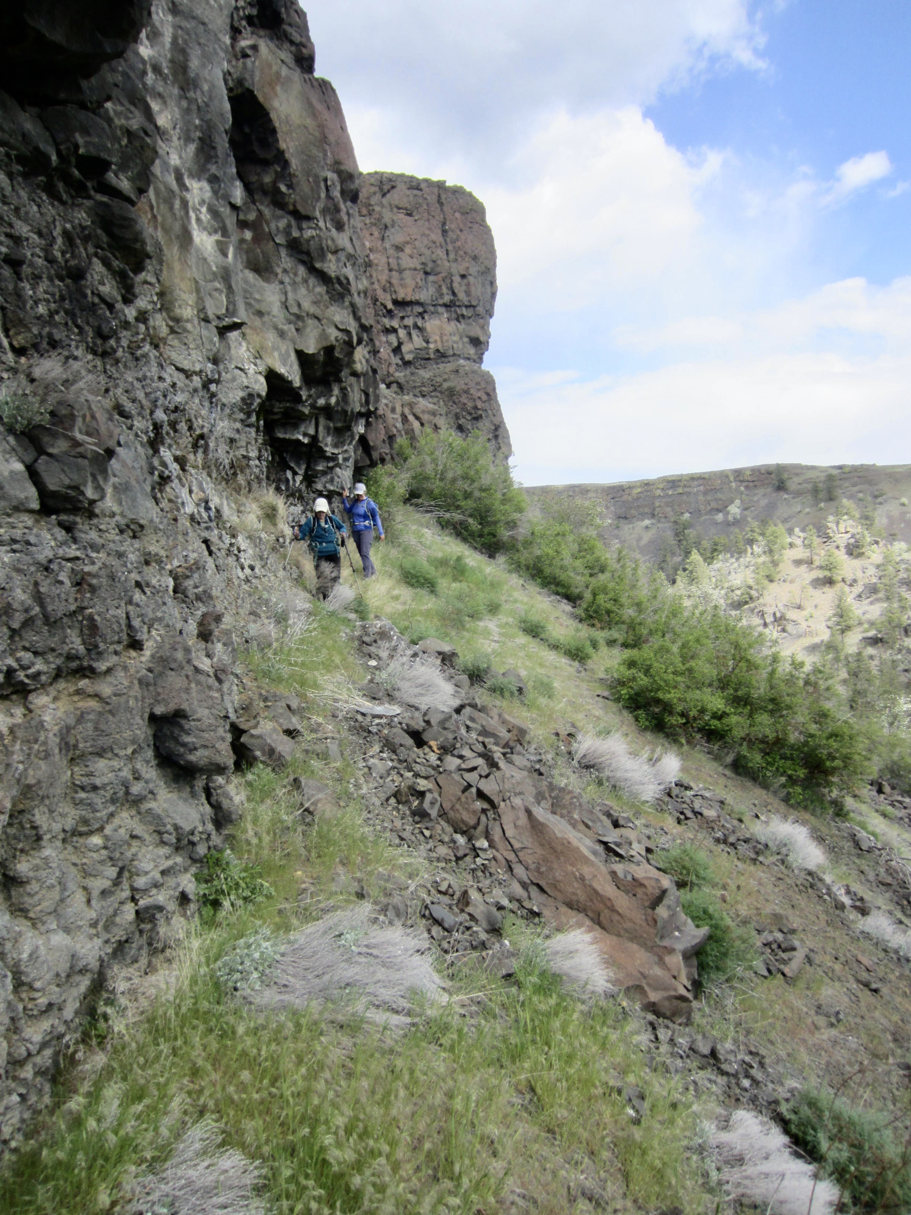
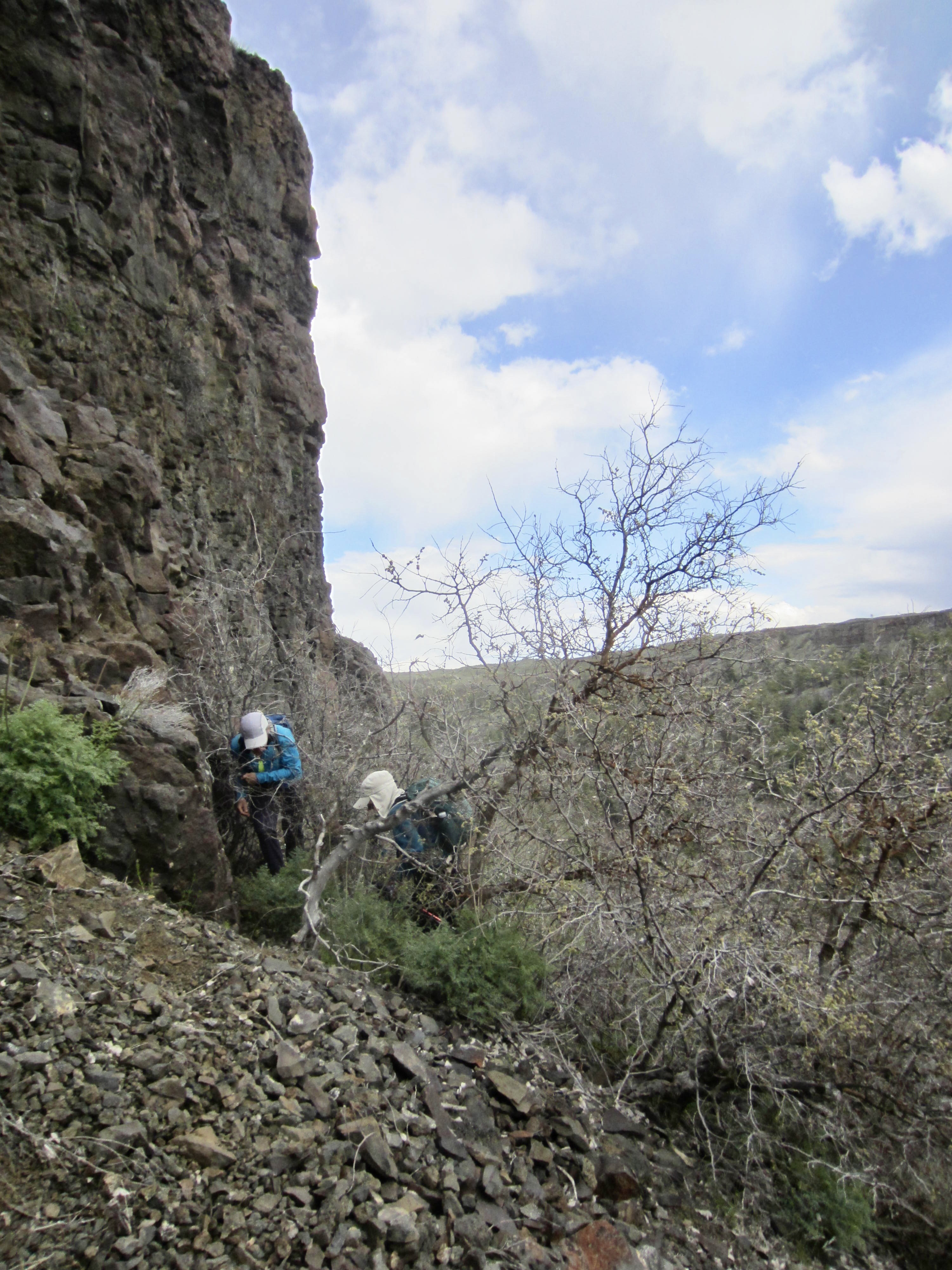
Our planned route proved to be effective if not elegant. After groveling up the talus slope, we found that traversing along the cliff base was easy in some locations but not in others. There were numerous patches of loose scree, as well as several clumps of scraggly, nearly dead trees that required us to detour around or fight through them.
.
.
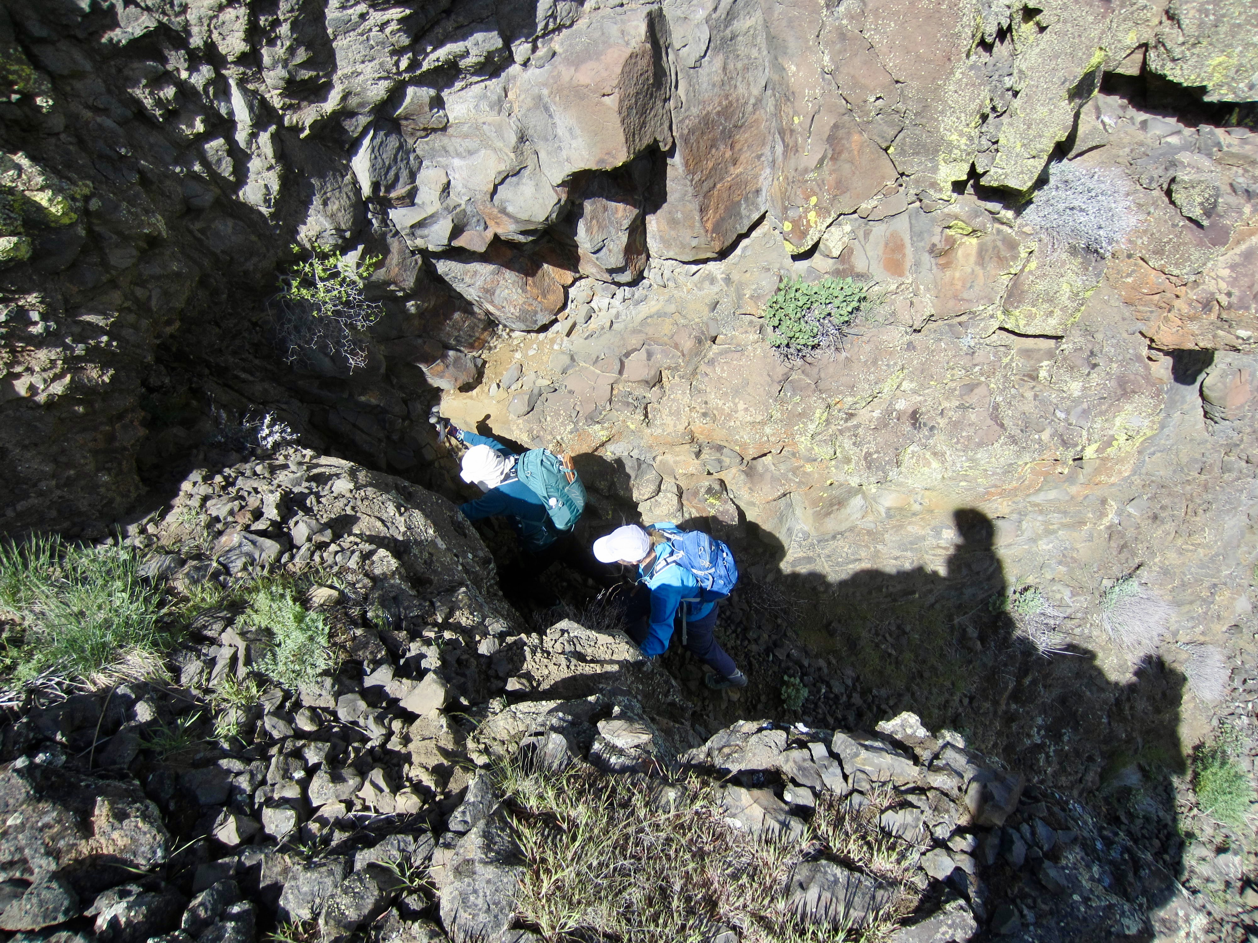
After ¼ mile of traversing below the tall cliff band, we came to a weakness that offered a possible exit route. We poked around a bit and found a short Class 3 slot that would get us up. The rock was fractured and crumbly—like all of the basalt in Northrup Canyon, it seems—but doable. We topped out in mid-afternoon (4.3 hours + 1000 feet from TH).

.
.
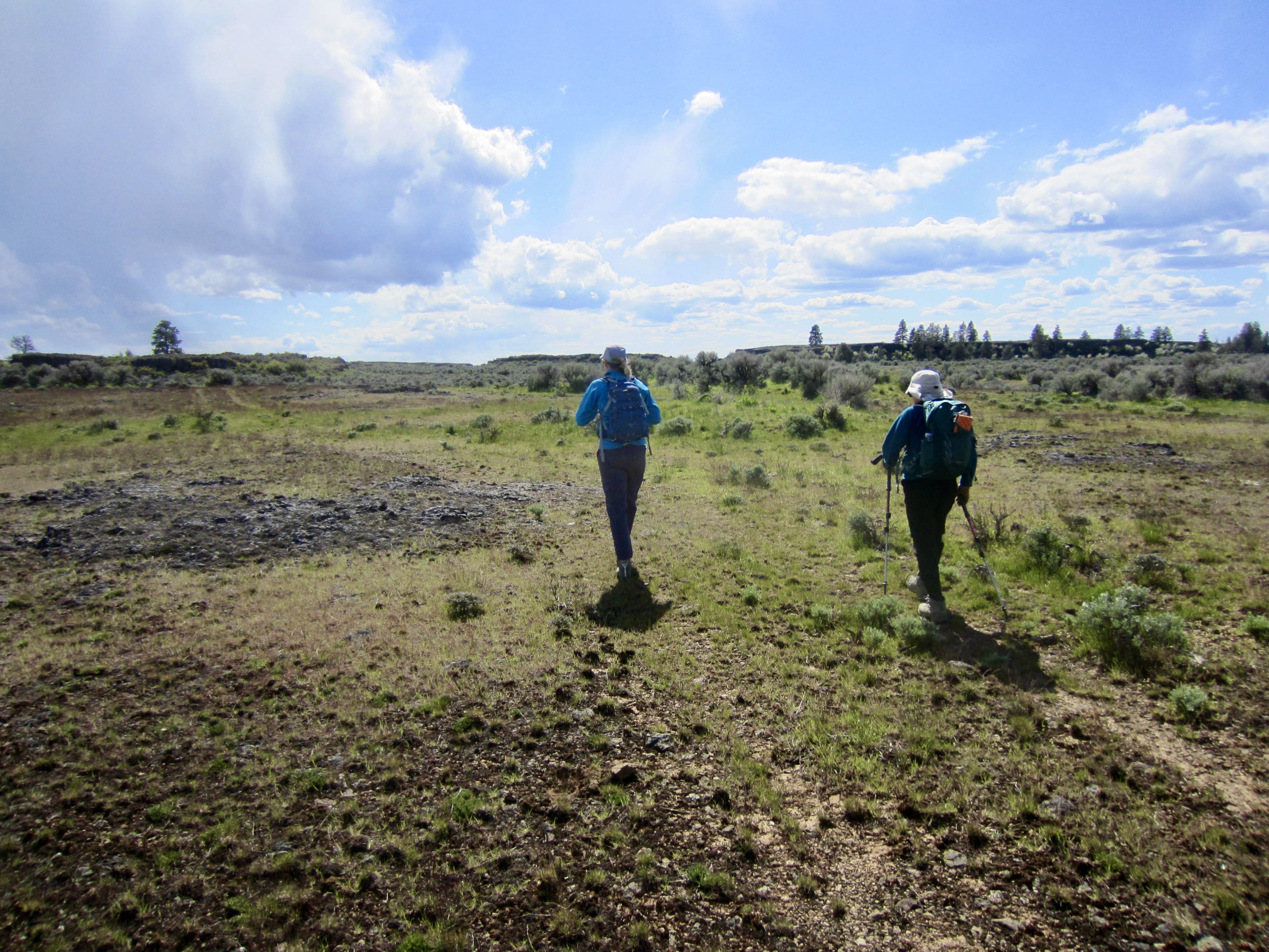
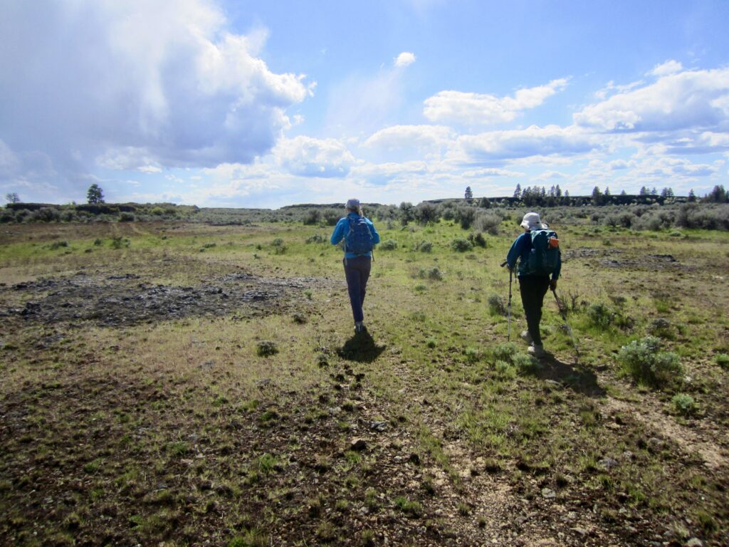
We didn’t know in advance what we would find atop the plateau, so there was a small fear that it might be covered by dense sagebrush or riddled with erosion channels. Thankfully, it turned out to be a remarkably flat surface blanketed with low grasses and dotted with sagebrush. We were able to maintain a brisk pace while making a southwesterly beeline at a fairly uniform elevation of about 2300 feet.
.
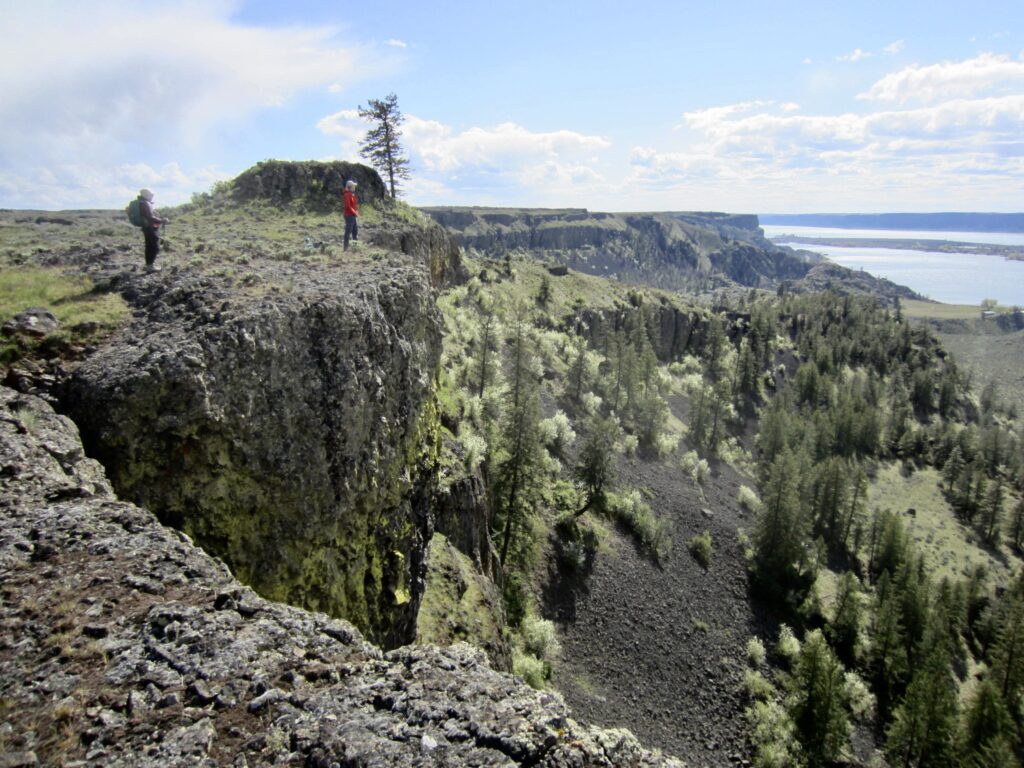
After 1¼ miles of pleasant cross-country hiking, we came to the rim of a deep box canyon that branches northward from Lower Northrup Canyon. This box canyon is guarded by vertical cliffs on all three sides, but a little reconnaissance revealed that we could descend the arm of a promontory between the two canyons.
.
Our descent of the promontory arm led us to a grassy gap at 2070 feet. From there, we turned south and easily dropped down a grassy draw that appeared to represent a geologic contact between the older granite bedrock on our right and the newer basalt flows on our left.
.
After battling through some brush and fallen trees in the Northrup Creek channel, we hiked up the opposite bank until intersecting the old road. From there, it was a simple ¾-mile stroll back to the trailhead to end our loop (6.2 hours + 5.8 miles + 1100 feet total trek). We had to laugh at the fact that this little adventure began as a routine out-and-back hike to Northrup Lake but got sidetracked when Fay saw something shiny up on the canyon rim!
Route Map & Profile
…
…
Photo Gallery
Click to enlarge…