Trip Date: April 19, 2024
2024 COLUMBIA PLATEAU ADVENTURE VACATION
Steamboat Rock Hiking Loop
Steamboat Rock (2312 ft)
Steamboat Rock “Bow”
Point 2285 aka Steamboat Benchmark
Trip Report Summary
Region: Columbia Plateau (Washington)
Sub-Region: Upper Grand Coulee
Area: Steamboat Rock State Park
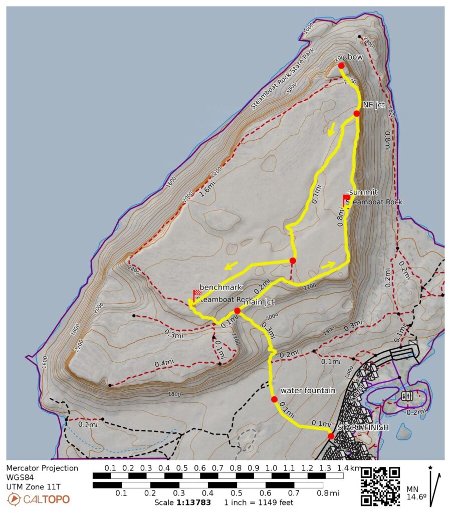
Starting & Ending Point: Steamboat Rock Trailhead on Steamboat Rock State Park entrance road (Elev. 1600 feet)
Way Points: water fountain & main junction & Steamboat Rock summit & Steamboat Rock “bow” & Steamboat Benchmark & split boulder & main junction (trail hike & off-trail hike)
Summit: Steamboat Rock (hike via loop trail)
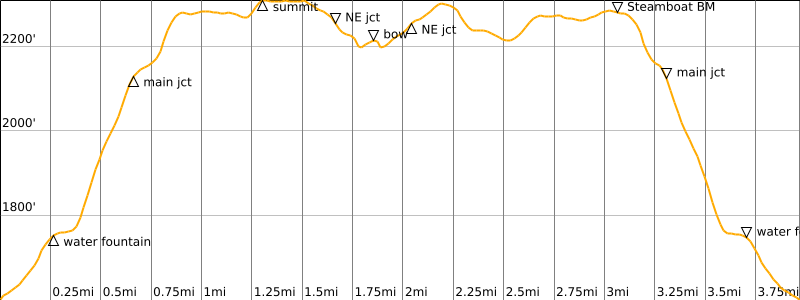
Approximate Stats: 4.0 miles traveled; 970 feet gained & lost; 3.3 hours elapsed.
Full Trip Report
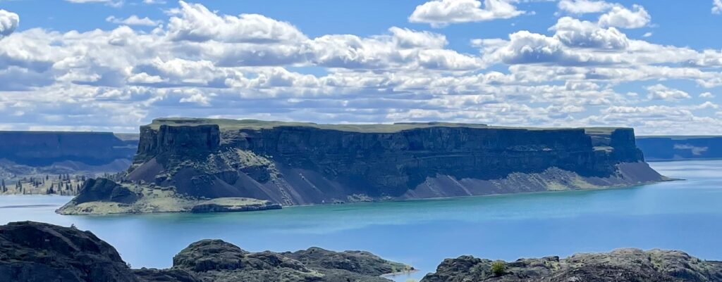
During our last day at Steamboat Rock State Park in Upper Grand Coulee, Fay and Eileen and I did a loop hike over the eponymous landform. Steamboat Rock constitutes a textbook example of a mesa—a flat-topped mountain bounded by steep cliffs—and its location in the middle of Banks Lake creates a striking geomorphic image.
.
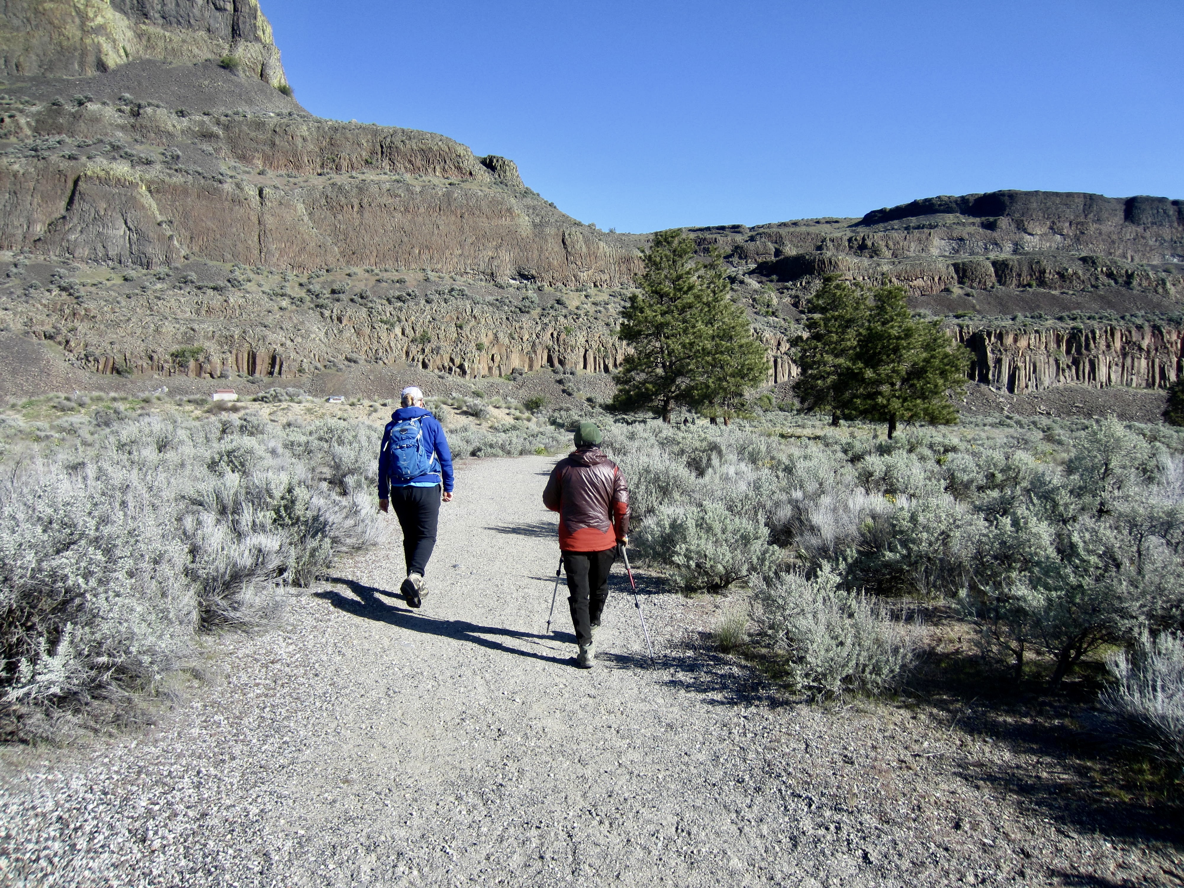
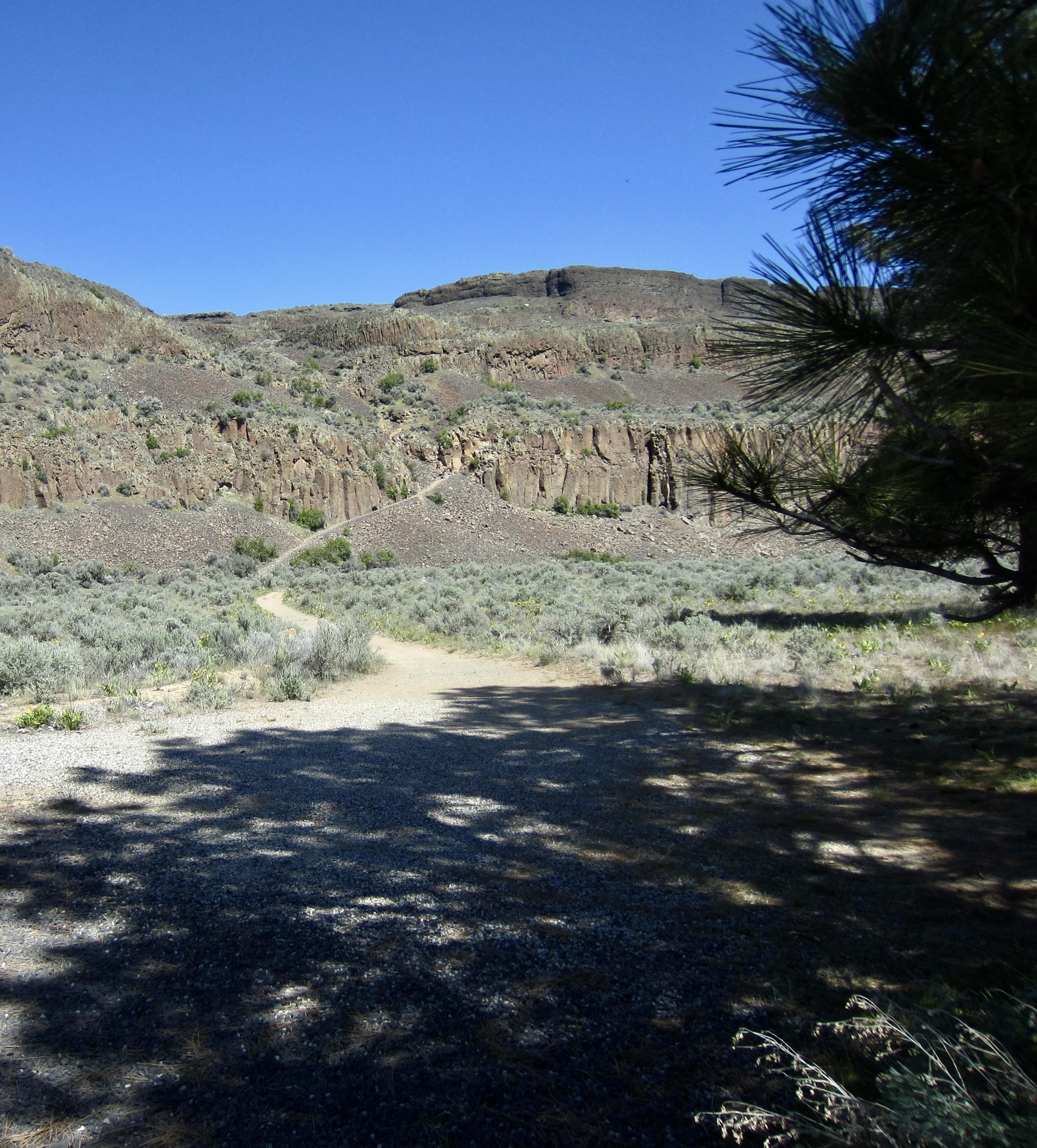
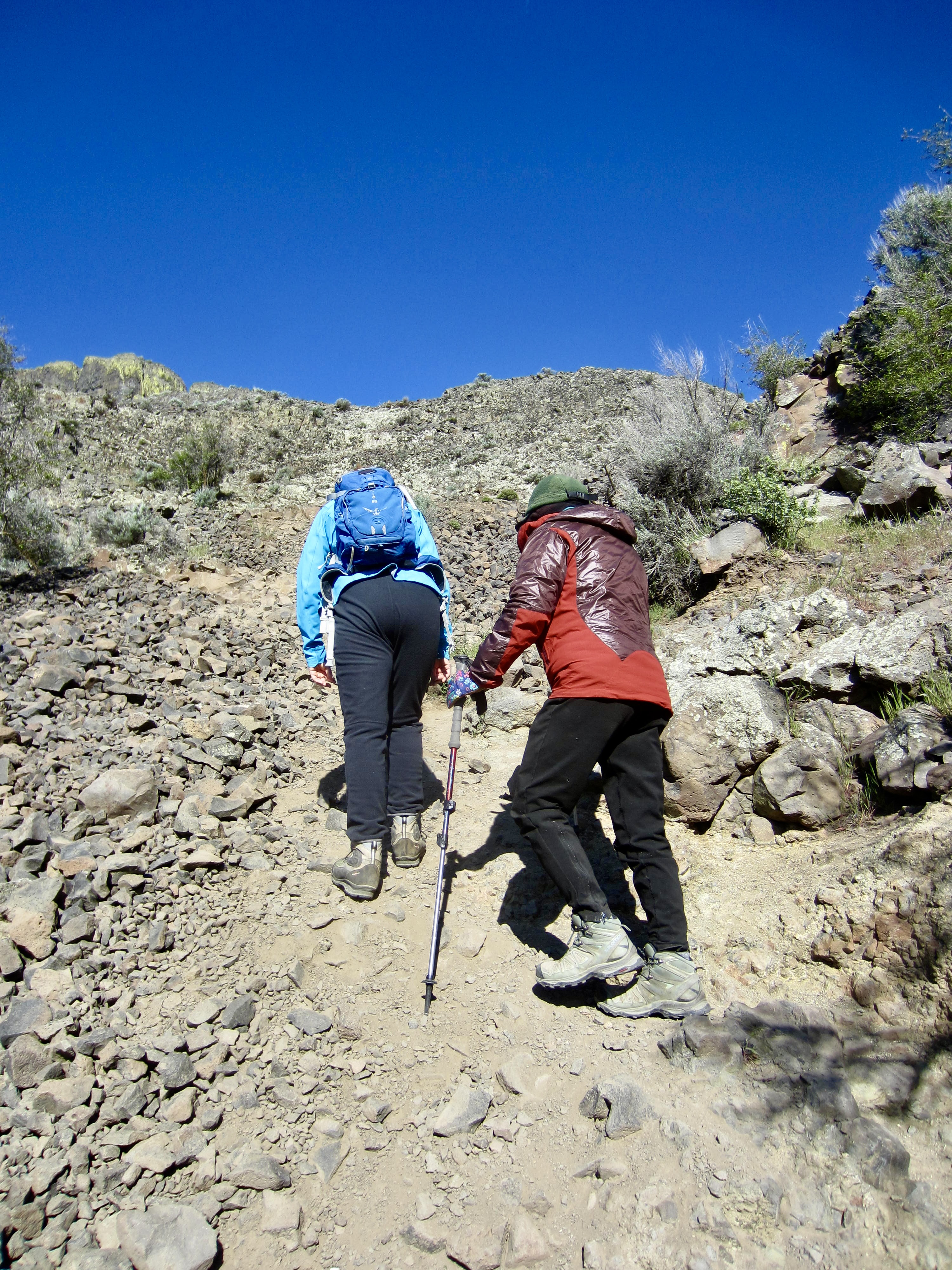
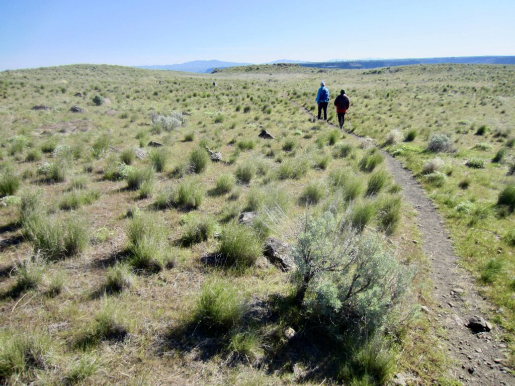
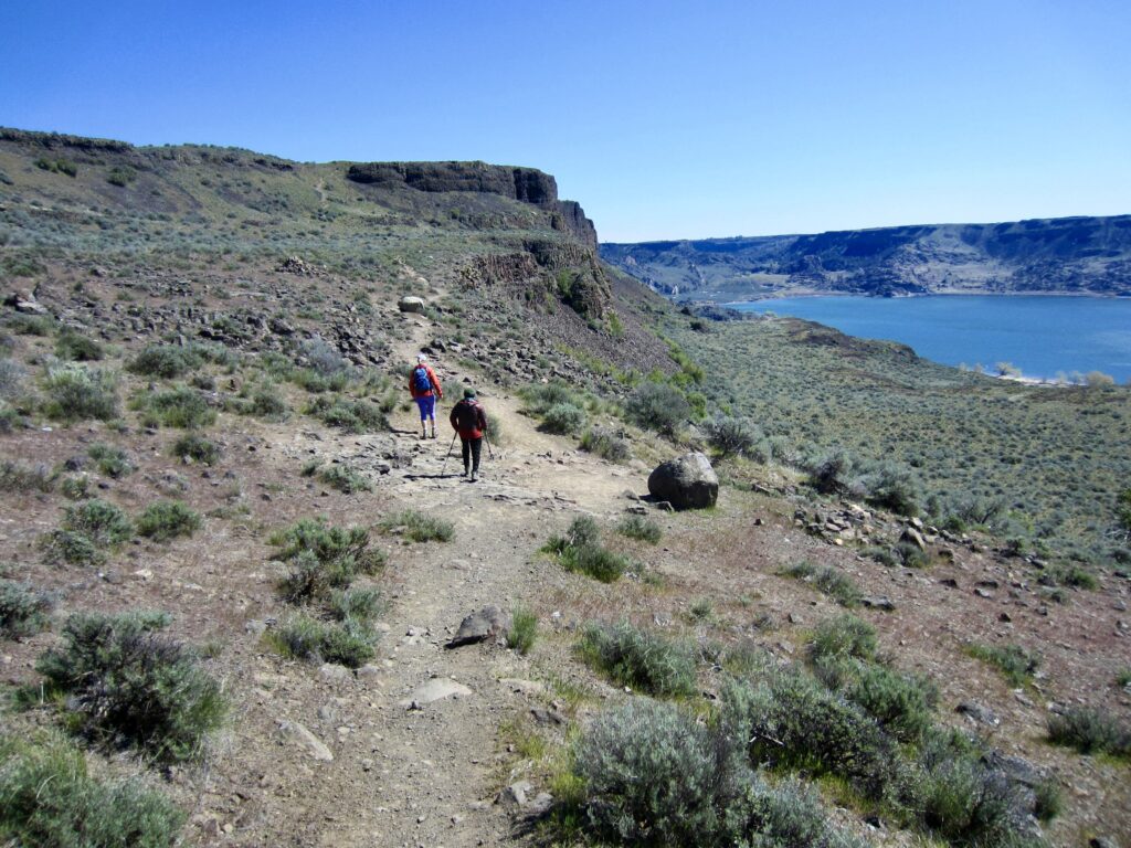
It was a cool, bluebird morning when we headed up the wide trail, which gently curves across the sagebrush lowlands. Shortly after passing a drinking-water fountain (much appreciated by summertime hikers, no doubt), the trail makes a steep climb through a pronounced weakness in the basalt cliffs.

.
.
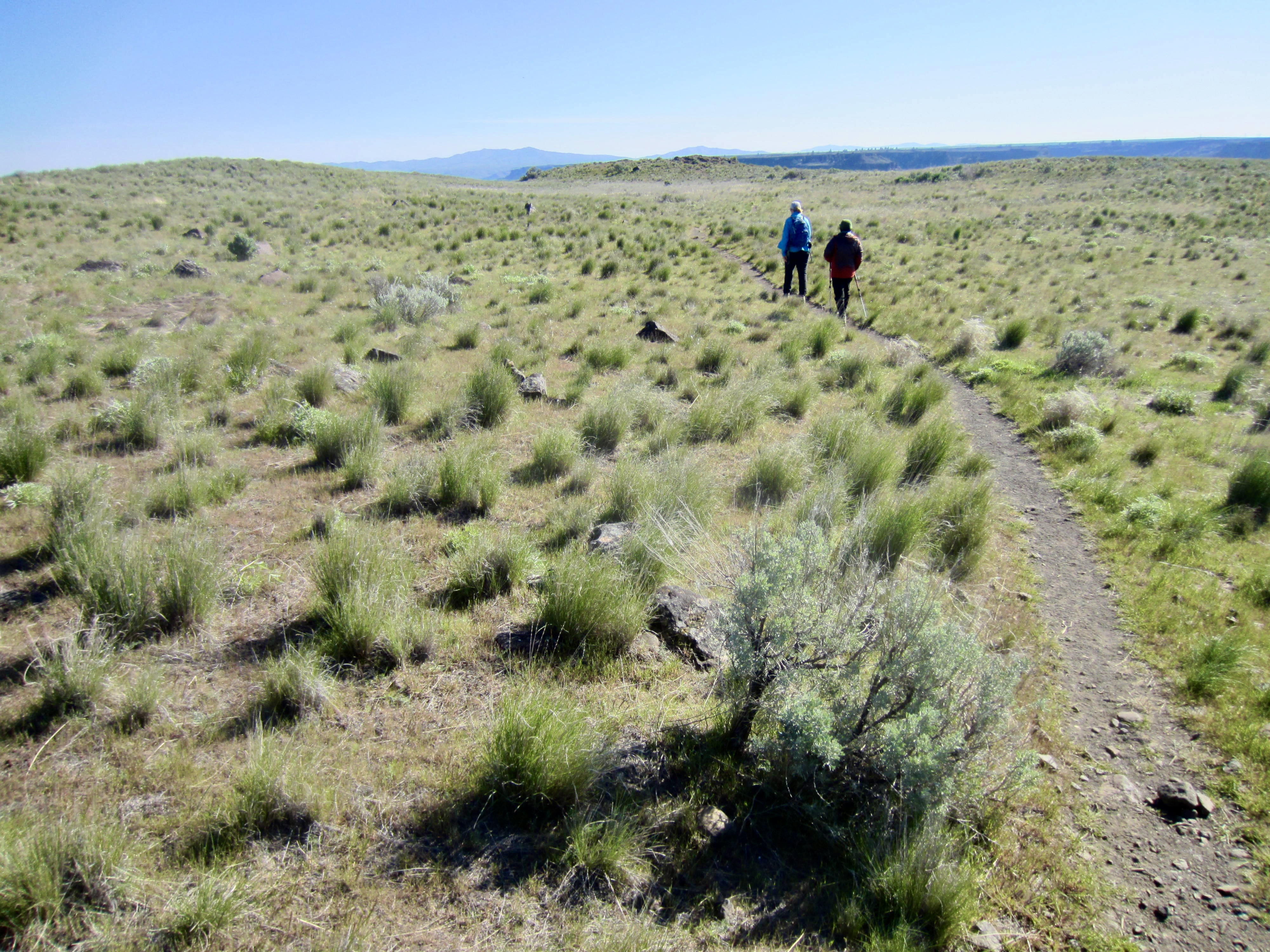
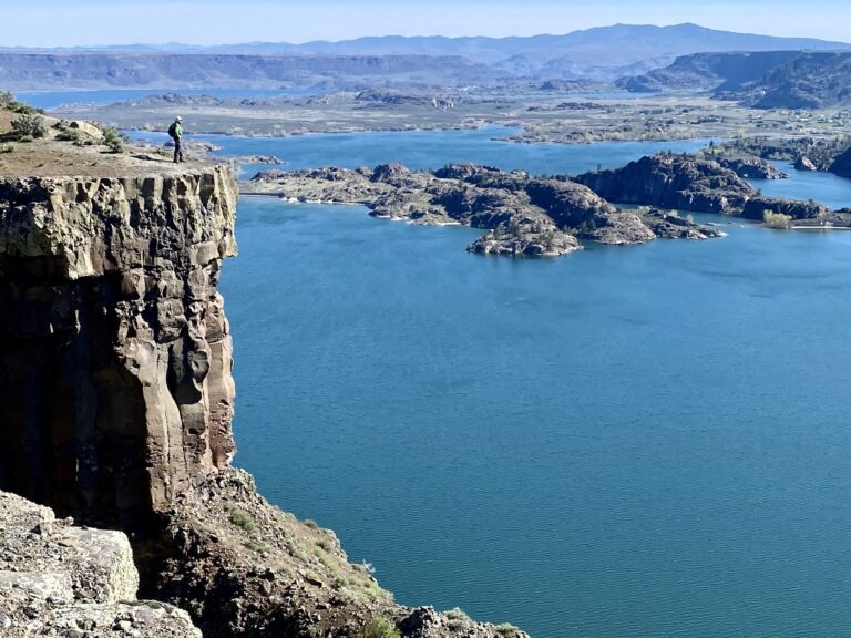
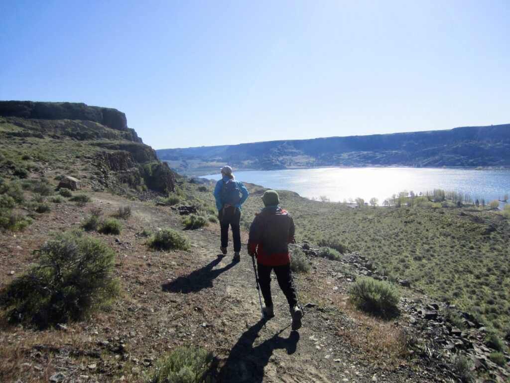
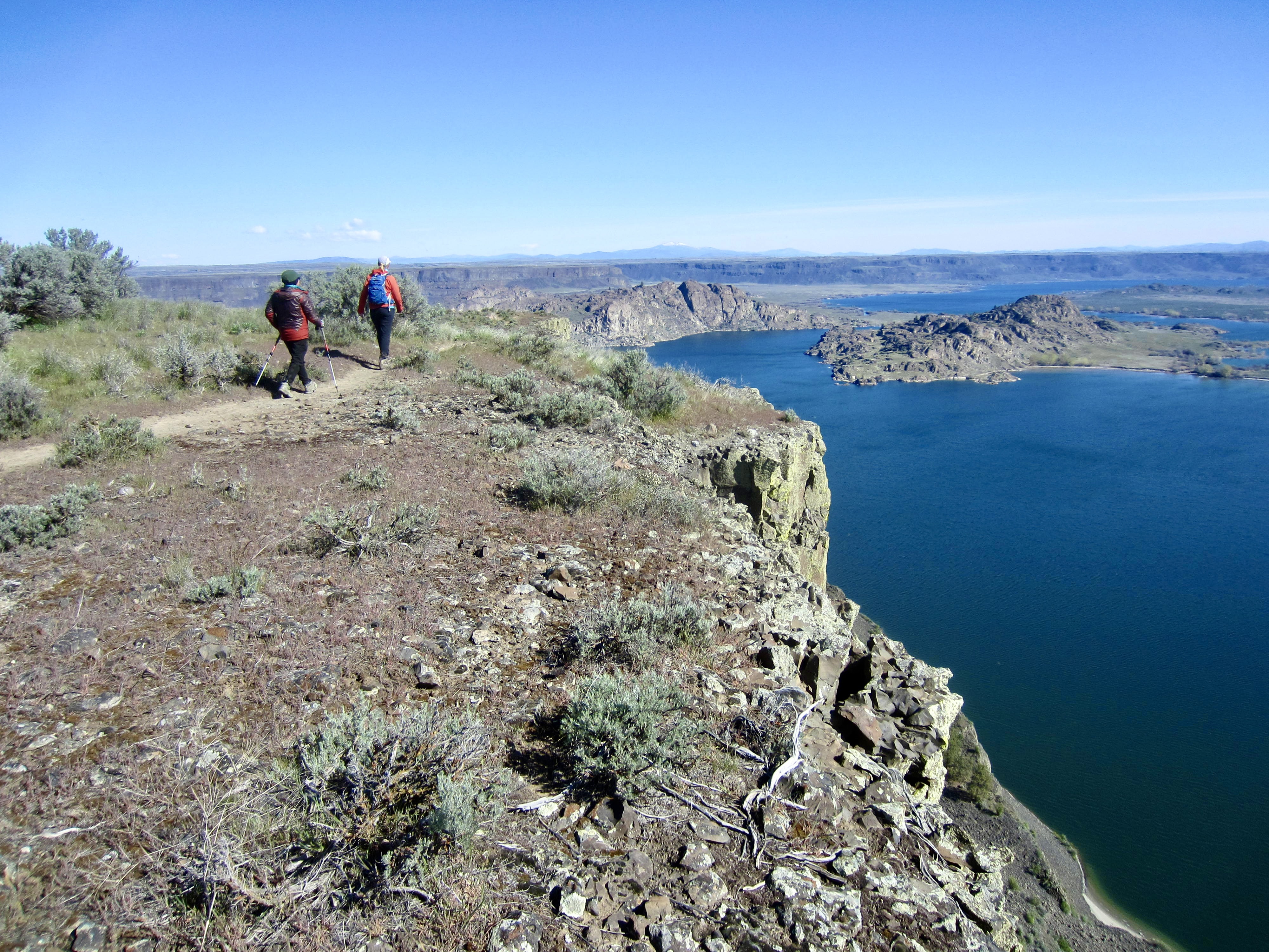
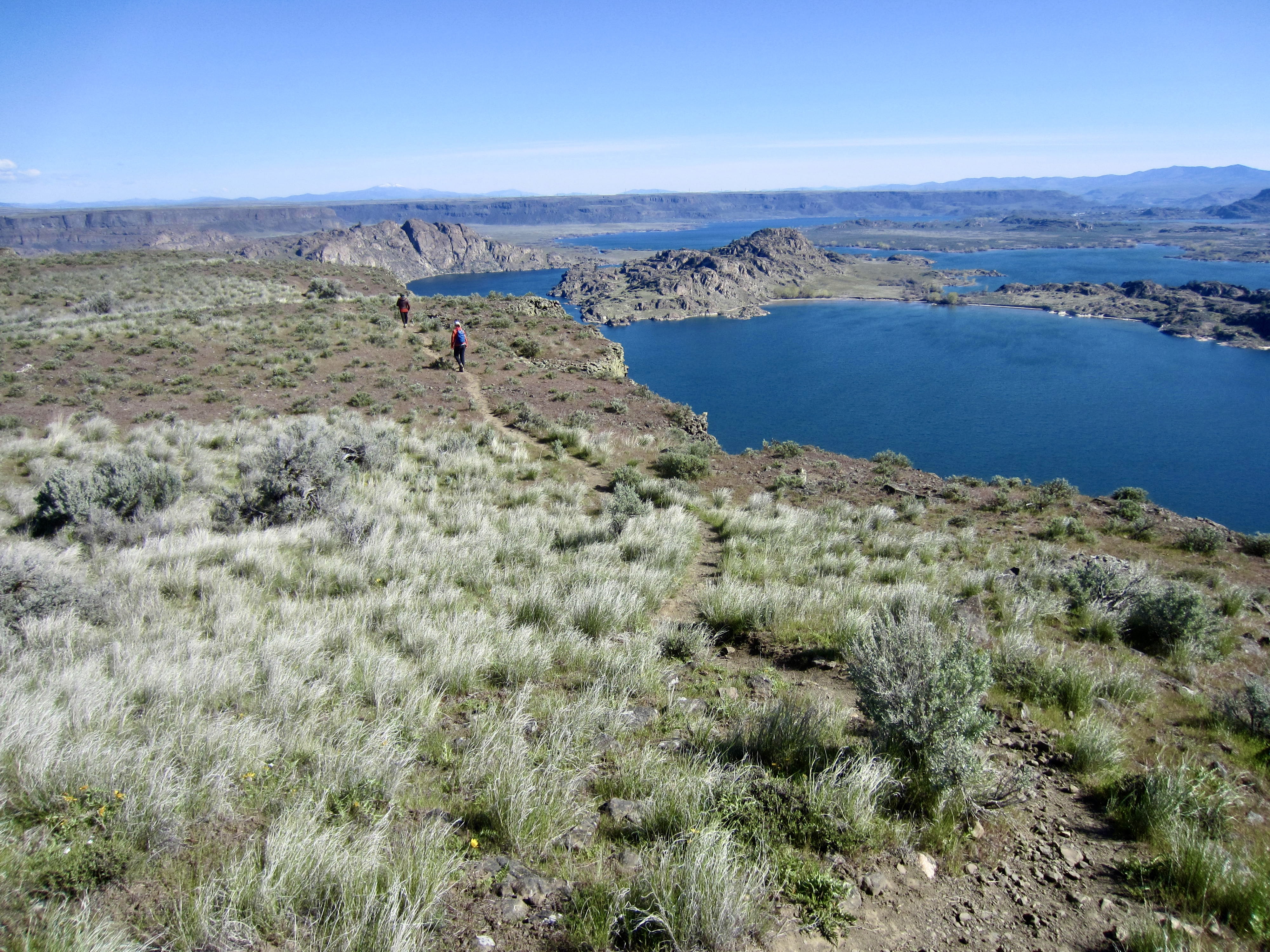
Near the top of the cliff bands, the trail arrives at a major junction marked by a round boulder and large cairn. Here, we turned right and continued hiking northeastward up to the relatively flat upland plateau and then due north along the plateau’s eastern rim. In many places, the trail lies only a few paces from the brink of a 700-foot cliff—not where you would want to be standing on a gusty day!
.
.
It was interesting to see that there are hundreds of granite boulders scattered around the basaltic plateau. Because the basalt flows comprising Steamboat Rock formed above the local granitic bedrock, the presence of granite boulders atop the basalt surface is stratigraphically incongruous. Clearly, these boulders represent erratics that were transported from other locations by floodwaters and/or glaciers.
.
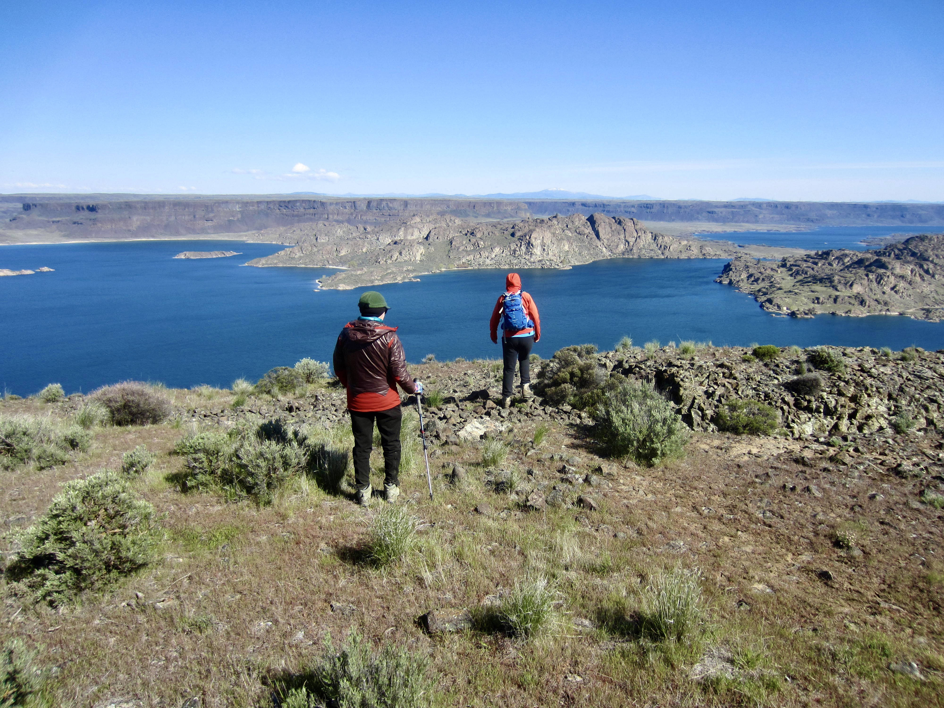
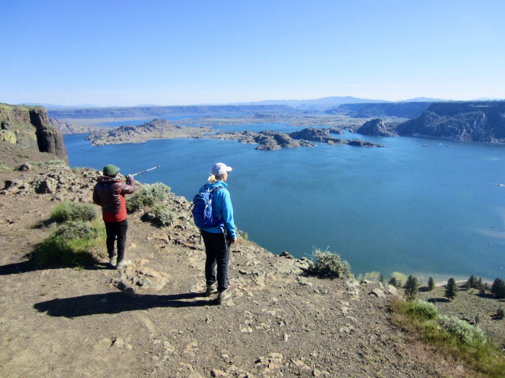
We made a short detour over to the 2312-foot summit of Steamboat Rock before continuing northward to the “bridge deck” of the steamboat. The loop trail turns sharply back to the southwest here, but we decided to check out the ship’s “bow” by following a spur trail down to the “foredeck” and out to the northernmost extent of the upland plateau.
.

.
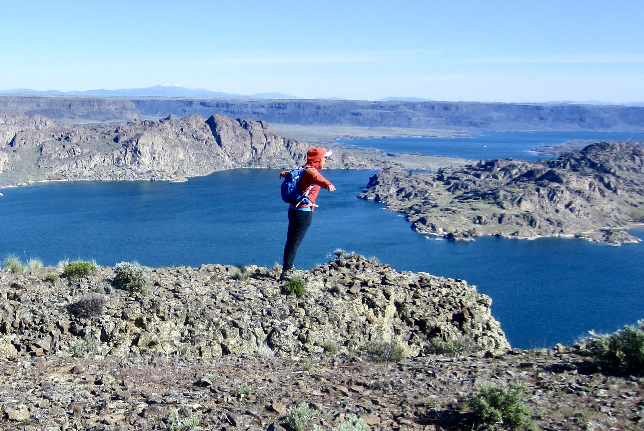
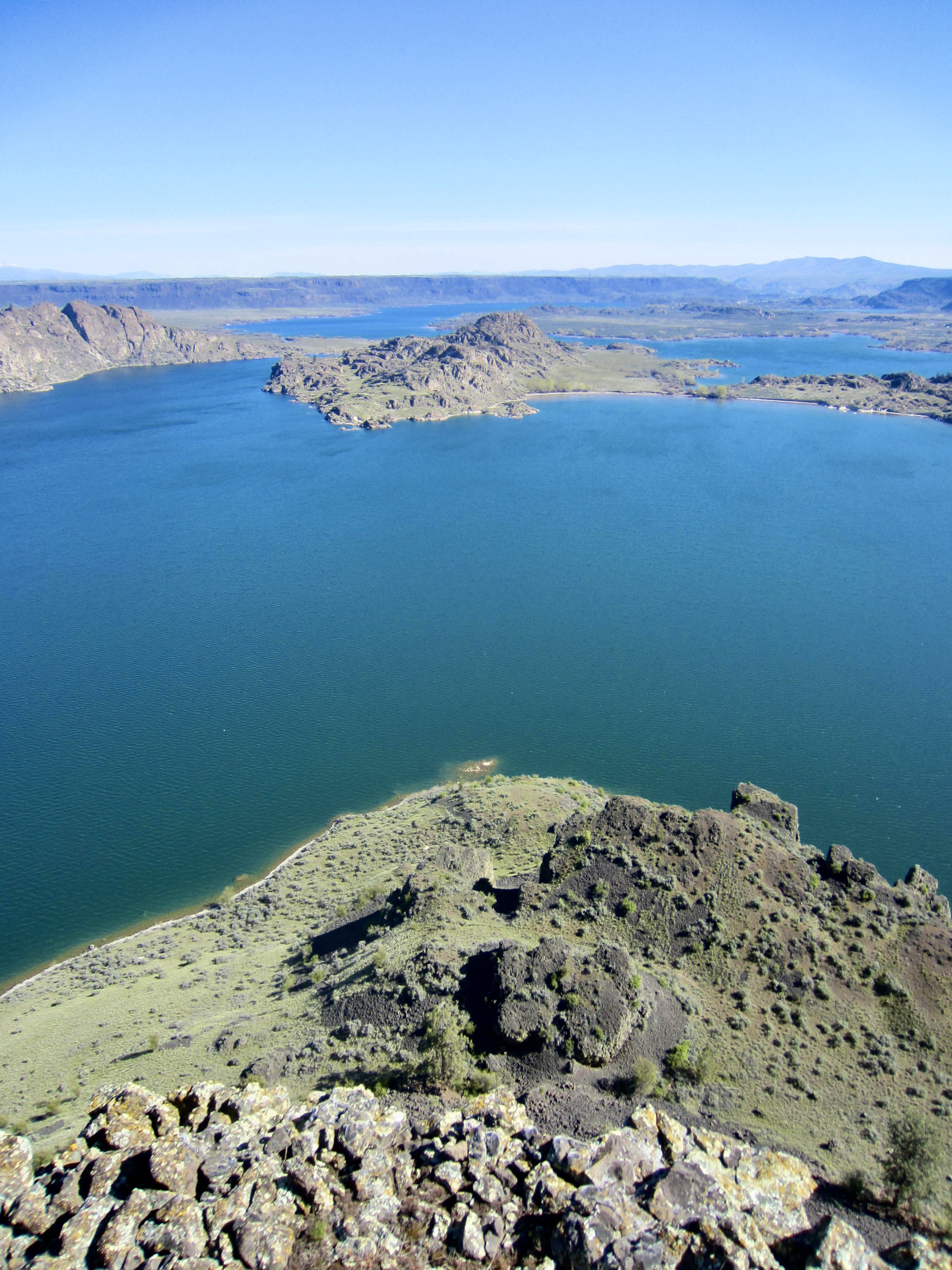
From the “bow” of the steamboat, we could look straight down the “prow” and northerly toward the end of Banks Lake. We could also see the Barker Knobs and Mt. Aegium, which are all part of a granitic peninsula that extends almost entirely across the width of the lake. Making good use of a steady wind, Eileen couldn’t help but do her best impersonation of Kate Winslet on the bow of the Titanic.

.

.
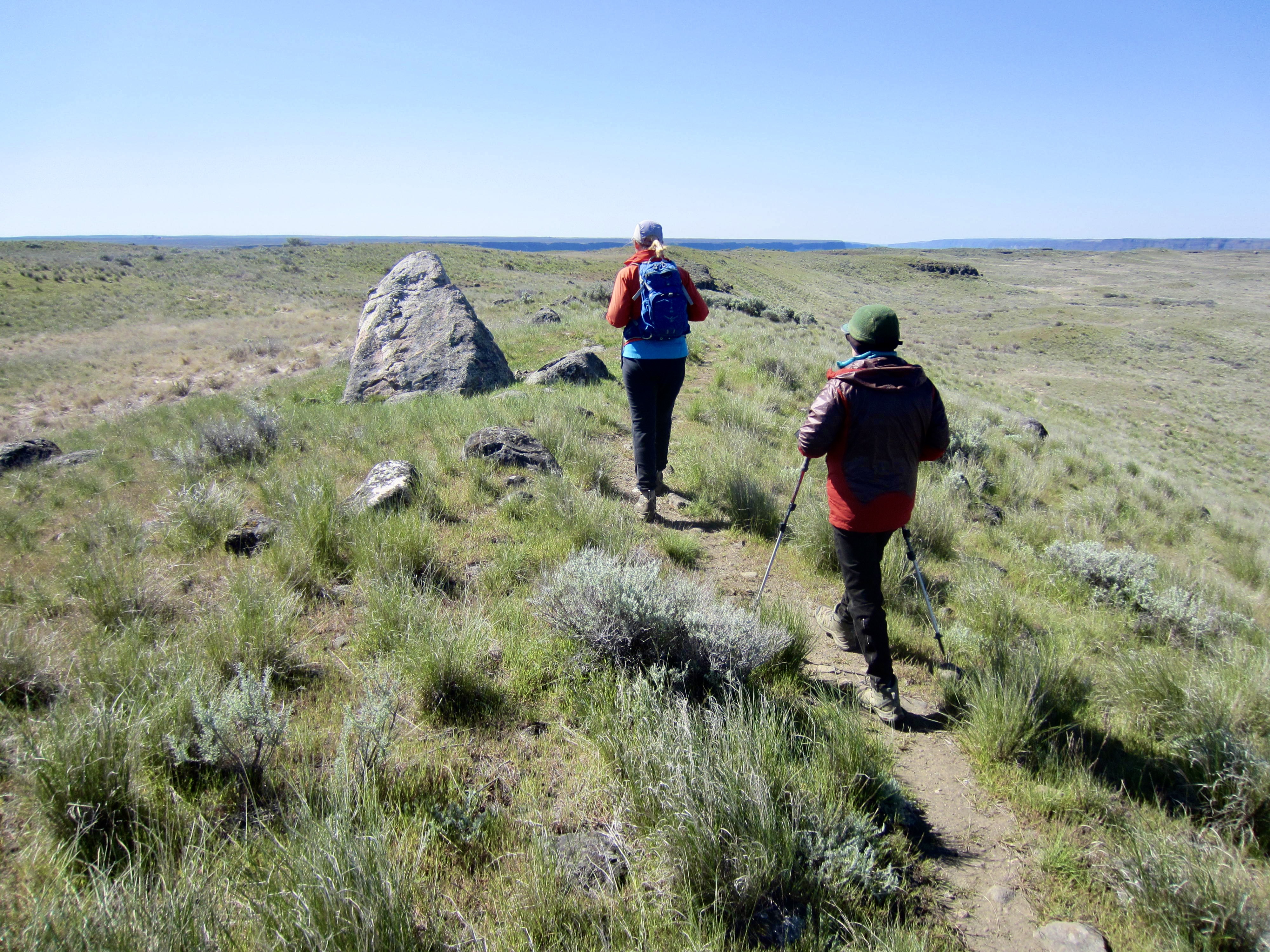
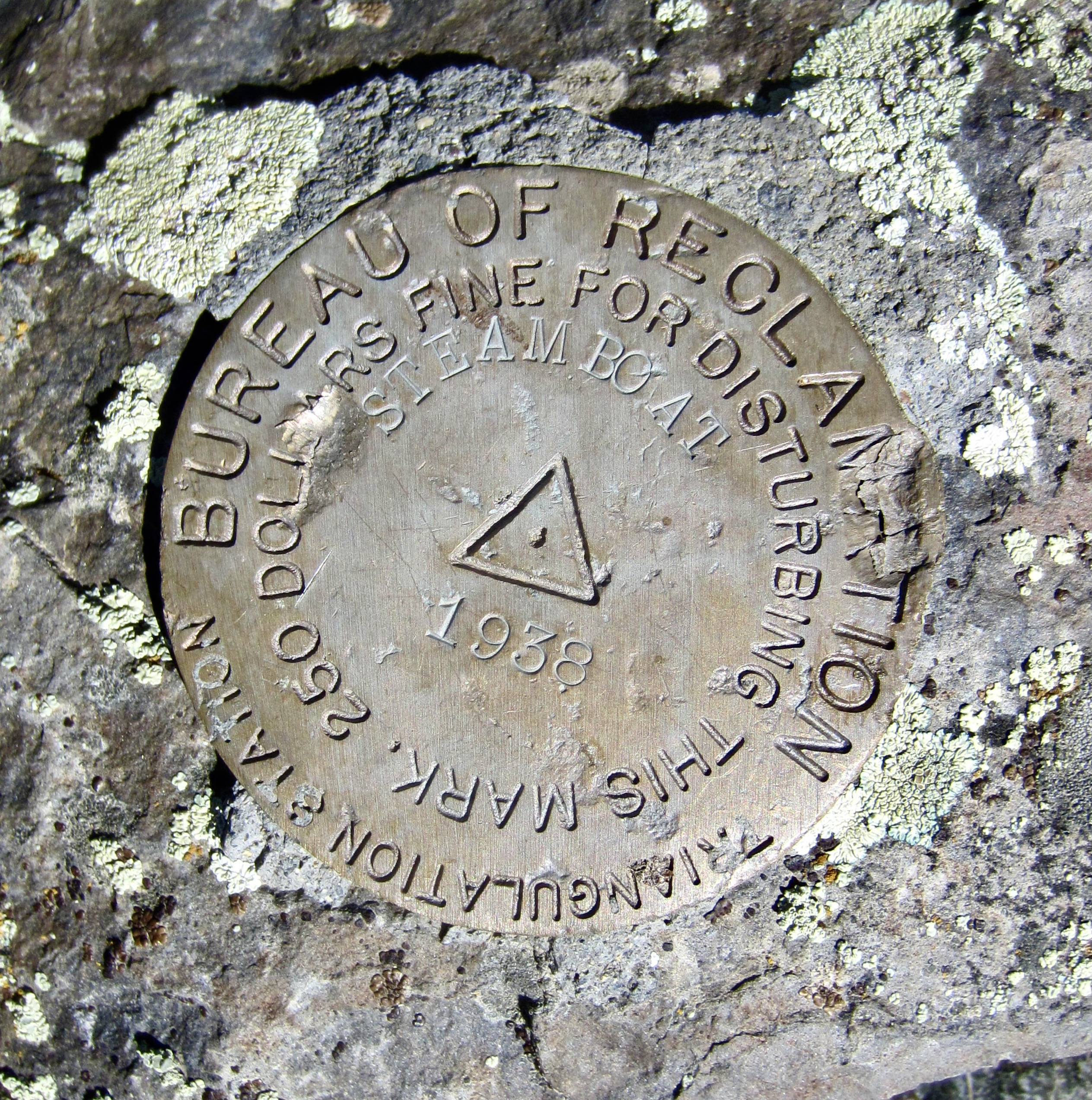
We returned to the loop trail and continued hiking southeasterly across the interior part of the upland plateau. However, just before our trail descended to the main junction, we veered off to the right and traveled cross-country over to the 2285-foot Steamboat Benchmark. This benchmark was placed by the Bureau of Reclamation in 1938, during the construction of Grand Coulee Dam.
.
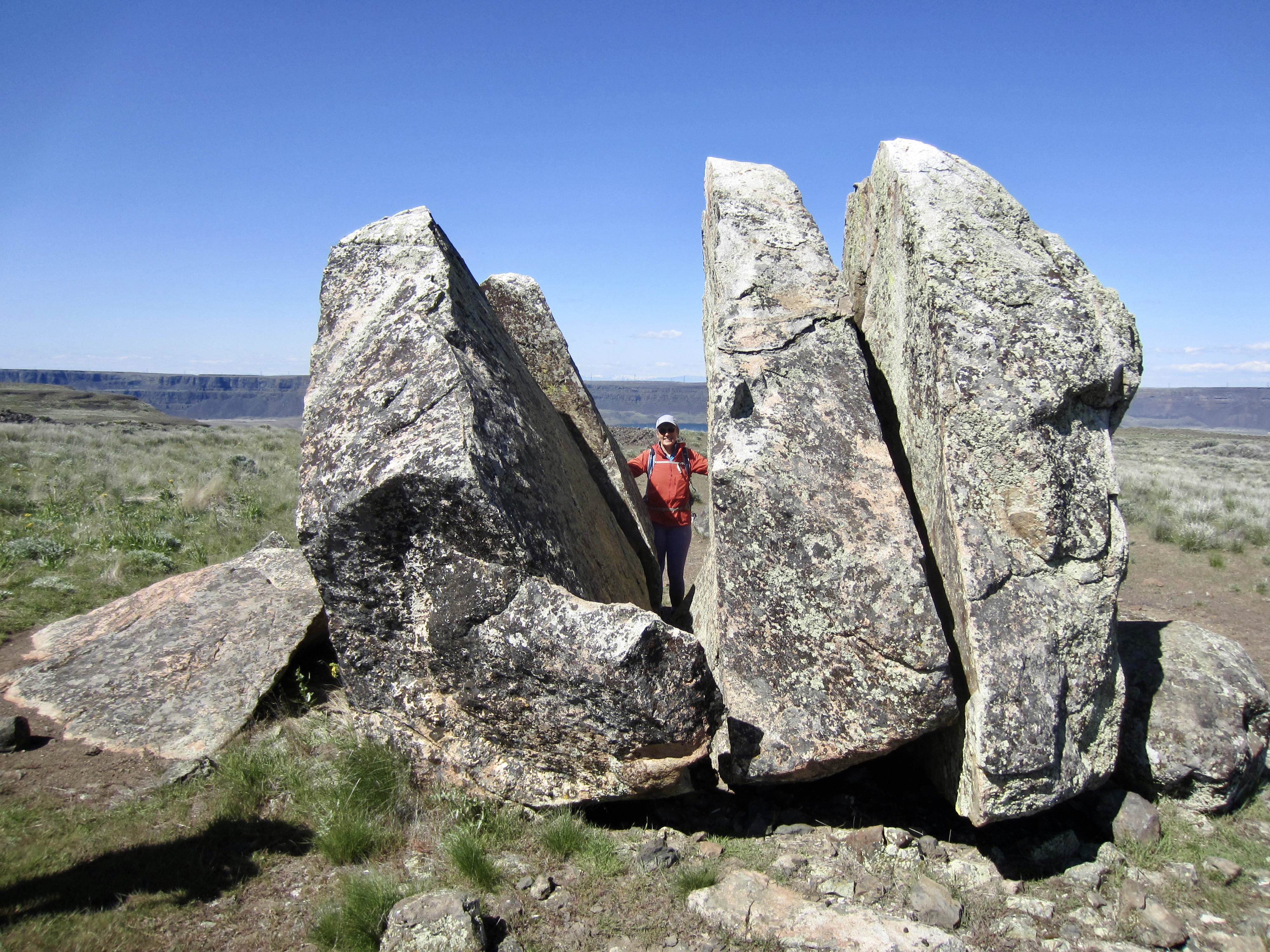
Near the benchmark is a huge granite boulder that has split into several individual pieces, probably due to long-term frost-wedging within natural cracks. Of all the erratic boulders decorating the upland plateau, this split boulder is the most eye-catching and geologically interesting.

.
From the split boulder and benchmark, we followed a well-trodden trail down to the main junction, thereby closing our loop. We then retraced our up-route down through the cliff bands and back to the trailhead, arriving at noon (3.3 hours + 970 feet). This was a fun and scenic way to end a satisfying week in Coulee Country.
.
Route Map & Profile
…
…
Photo Gallery
Click to enlarge…