Trip Date: January 14, 2024
2024 MEXICO ADVENTURE VACATION
Pico Perico Day Hike & Scramble
Bicycle Ledge
Perico Mine
Perico–Piramide Saddle
Pico Perico aka Parakeet Peak (~6600 ft / 2000 m)
Trip Report Summary
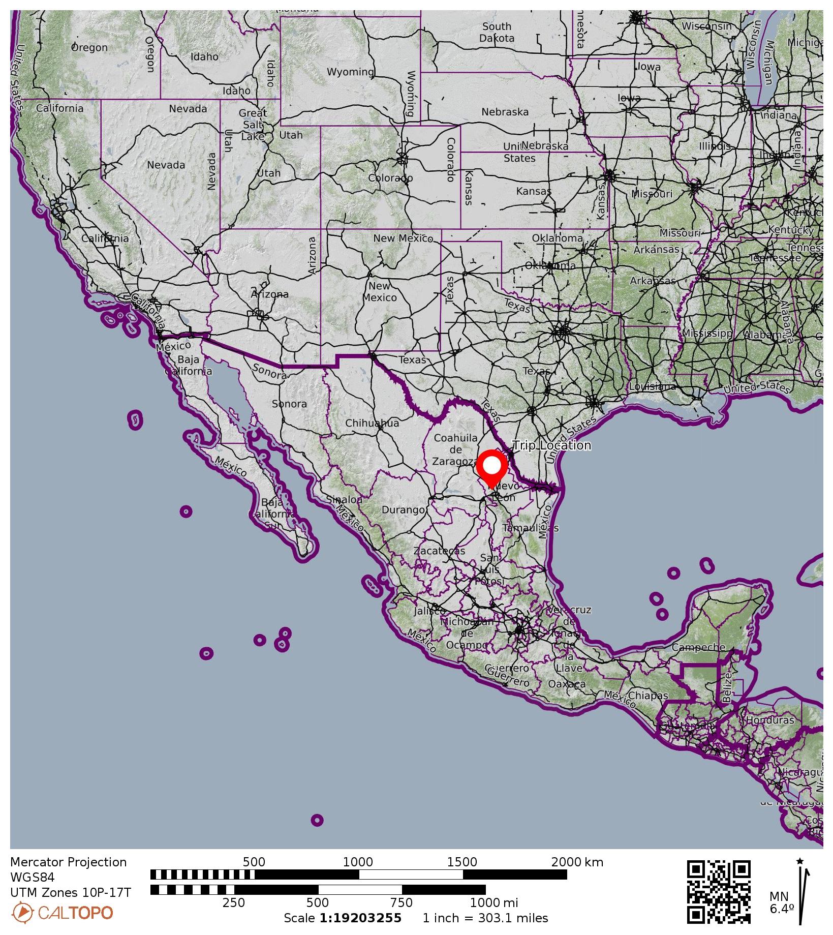
Region: Mexico
Sub-Region: Sierra Madre Oriental (“Eastern Mother Range”)
Sub-Sub-Region: Cerro de las Mitras (“Miters Mountains”)
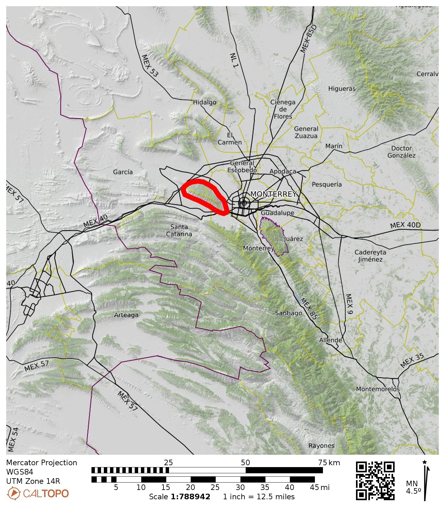
Area: Sierra de las Mitras State Nature Reserve
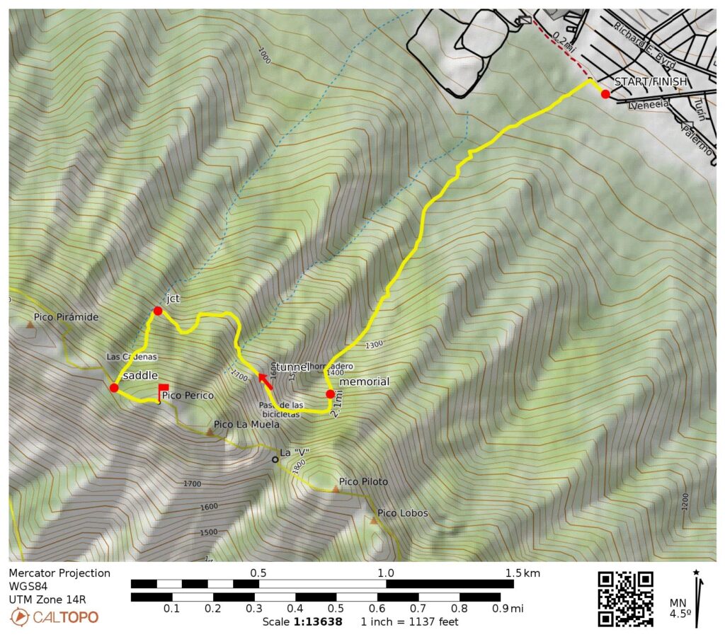
Starting & Ending Point: Pico Perico / Pico Piloto Trailhead at end of Venecia Street (Elev. 2700 feet / 820 meters)
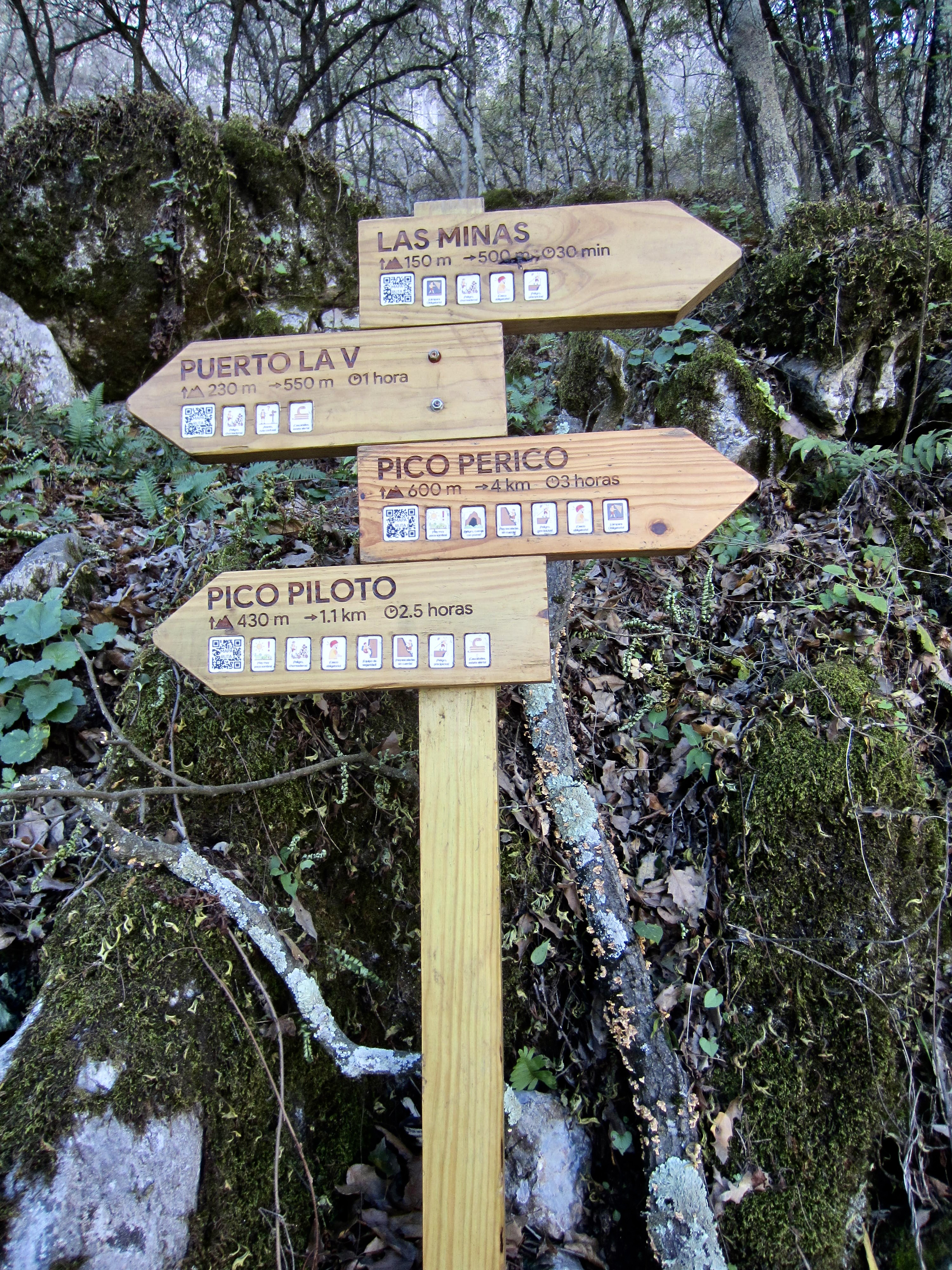
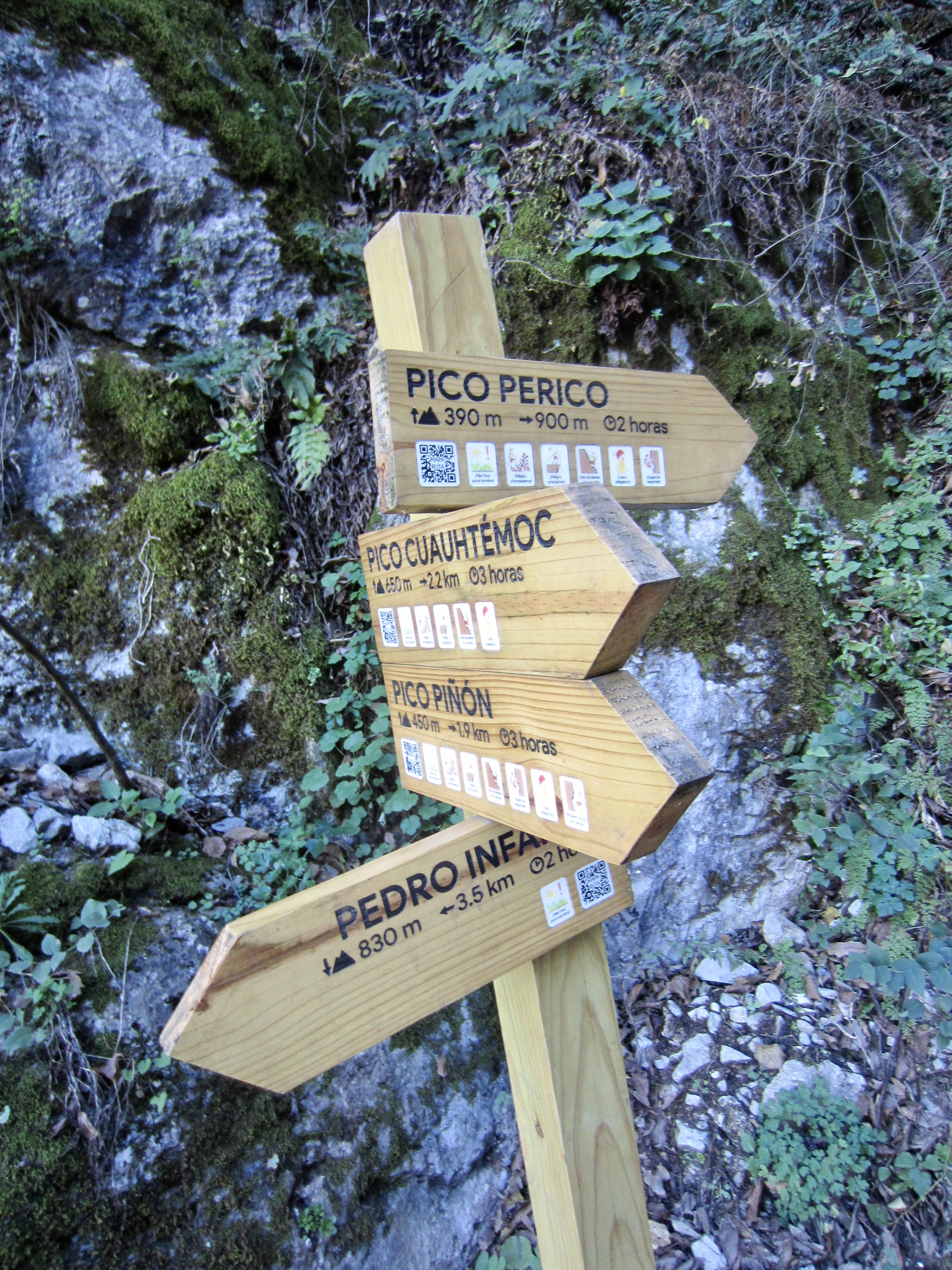
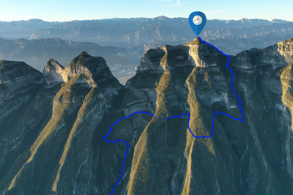
Way Points: Miners Memorial & Pico Perico / Pico Piloto Trail Junction & Perico Mine & Pico Perico / Pico Cuauhtémoc Trail Junction & Perico–Piramide Saddle & Pico Perico summit (trail hike & trail scramble & via ferrata climb)
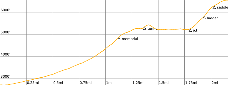
Approximate Stats: 4.5 miles / 7.2 kilometers traveled; 4000 feet / 1220 meters gained & lost; 4.9 hours up; 4.1 hours down.
…
Full Trip Report
While staying in Monterrey for a couple days, Eileen and Brooke and I ascended Pico Perico, a popular summit within the nearby Sierra de las Mitras State Nature Reserve. None of us had done much research ahead of time, so we all expected the ascent to be a fairly simple walk-up in an urban park. How wrong we were! In actuality, it is a multi-faceted adventure trek that involves trail hiking, rock scrambling, via ferrata climbing, outwash slogging, and cave navigation. Getting up and back down this peak provided us with a full day of delights, frustrations, and challenges!

.
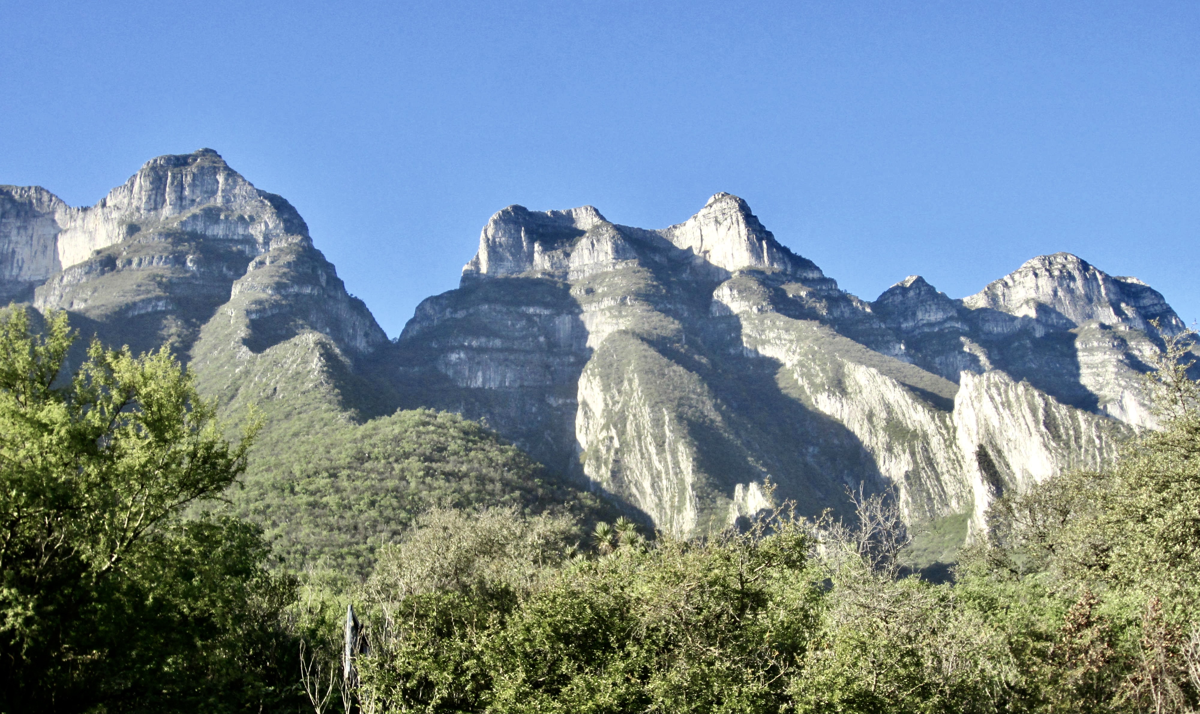
Pico Perico is one of the highest peaks in the compact Cerro de las Mitras sub-range, and both of these geographic names have interesting meanings in English. The word Mitras translates to “miters,” which are the traditional hats worn by Catholic bishops, as a reference to the shape of the various peaks in the sub-range. The name Pico Perico translates to “parakeet’s beak,” presumably referring to the shape of this particular summit.


.
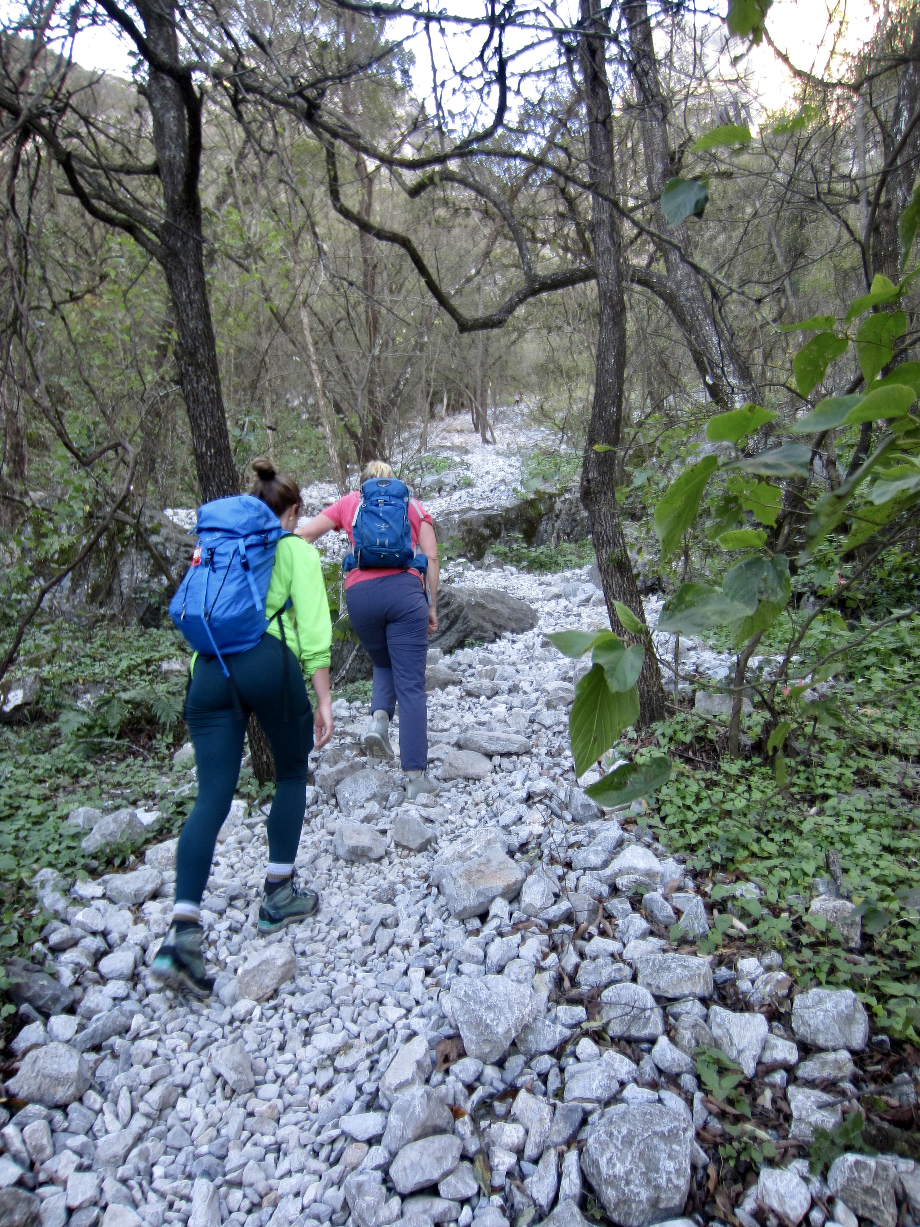
Our trek began at the combined Pico Perico / Pico Piloto Trailhead on a clear but cool Sunday morning. We signed in with the gatekeeper and then headed up the trail. Because this was a pleasant January weekend in the Monterrey area, there were dozens of other hikers going up and down the trail today.
.
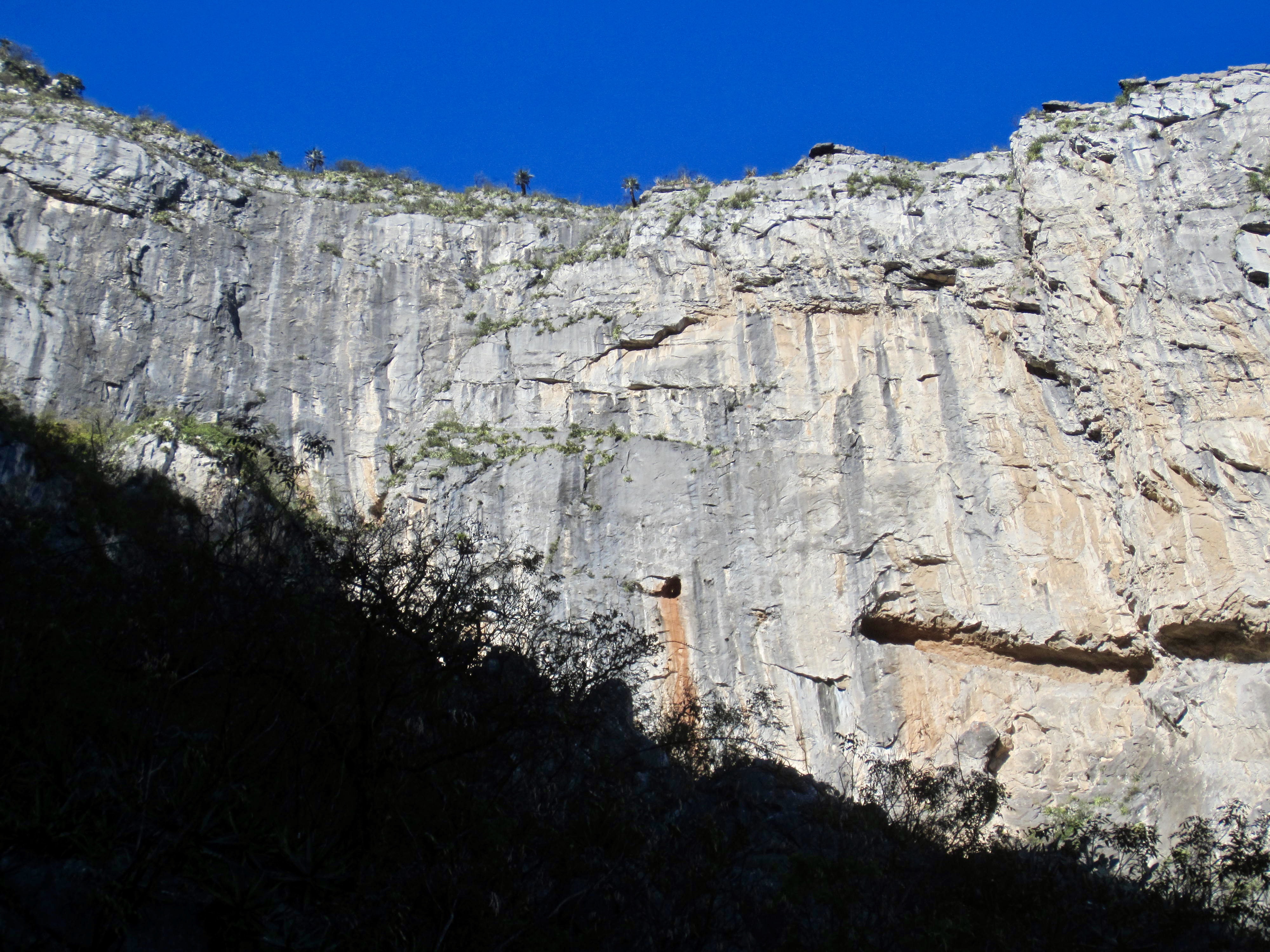
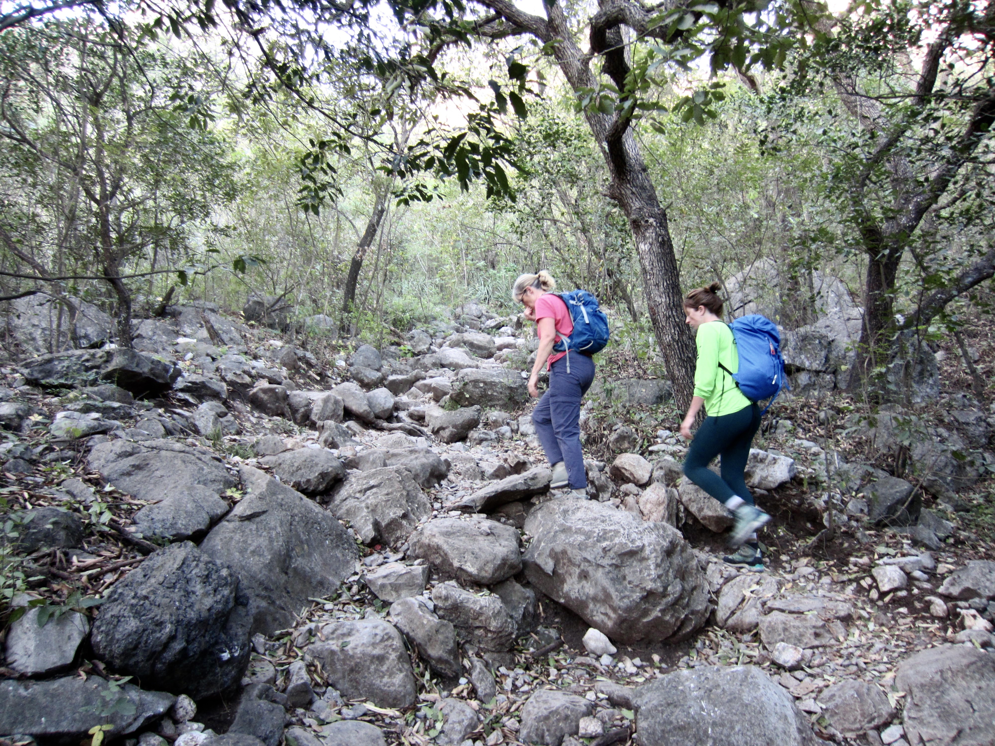
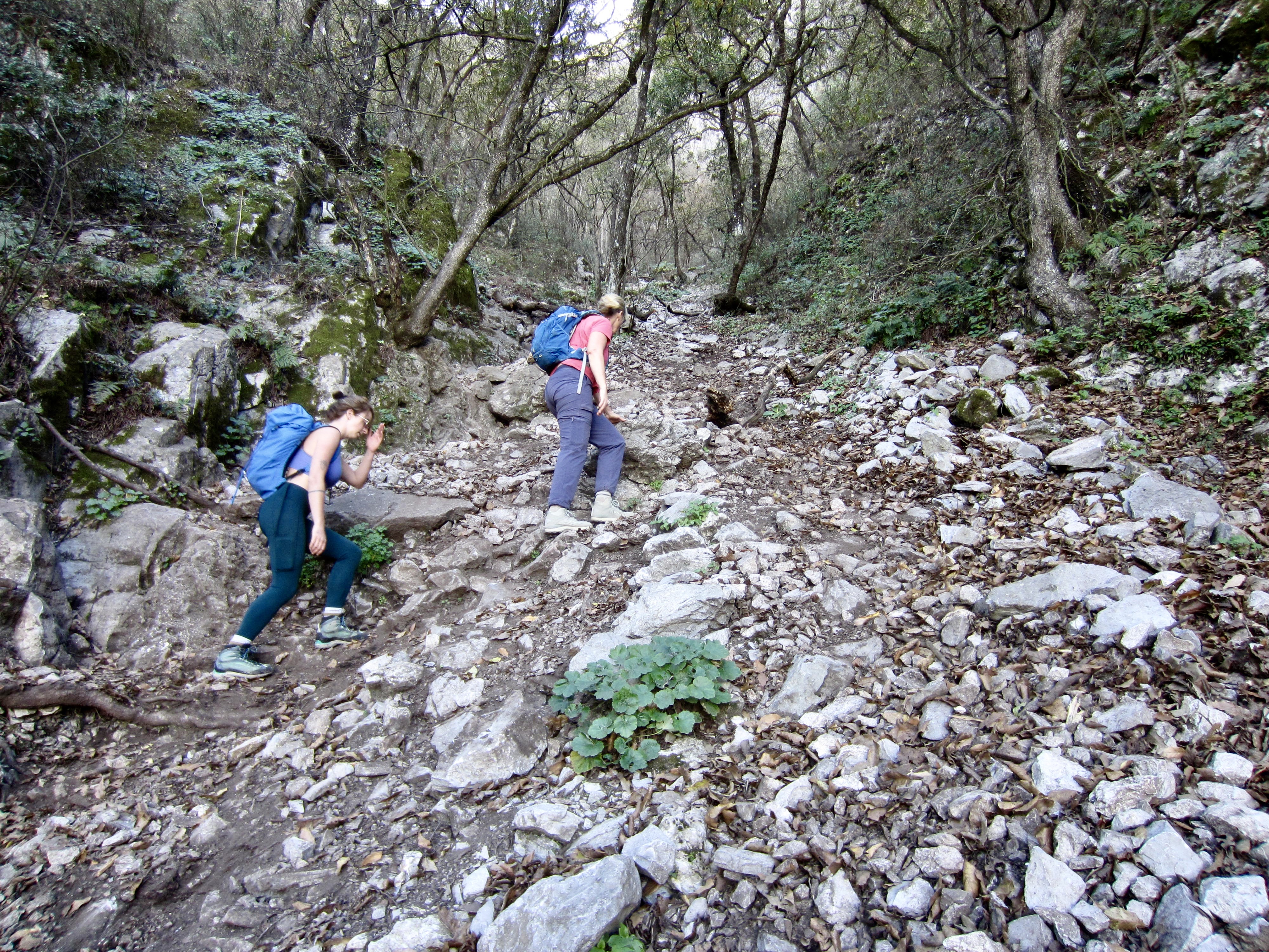
The trail initially gained elevation at a comfortable gradient, following a rocky outwash channel through lowland forest. Farther uphill, we had to do some Class 2-3 scrambling over water-scoured and boot-polished bedrock. The route was generally well-marked with painted arrows and graffiti as it led us toward a huge amphitheater of vertical limestone cliffs.
.

.
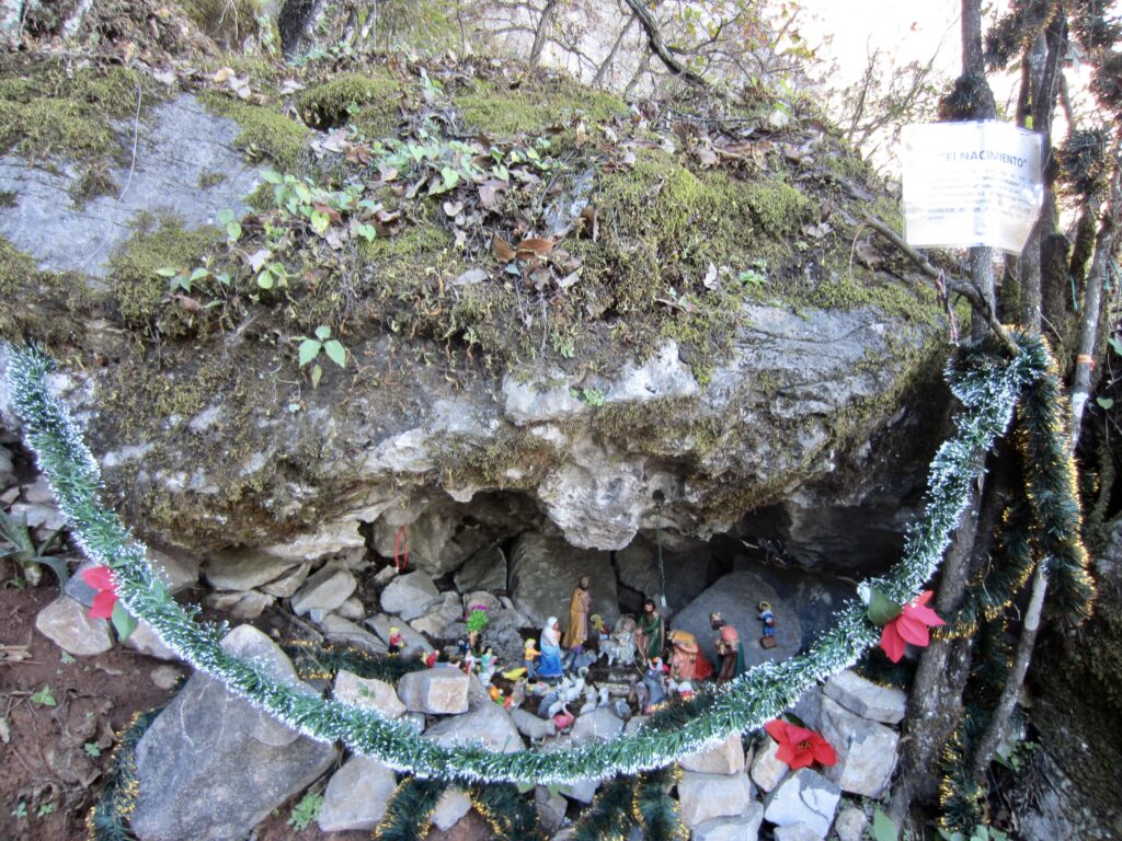
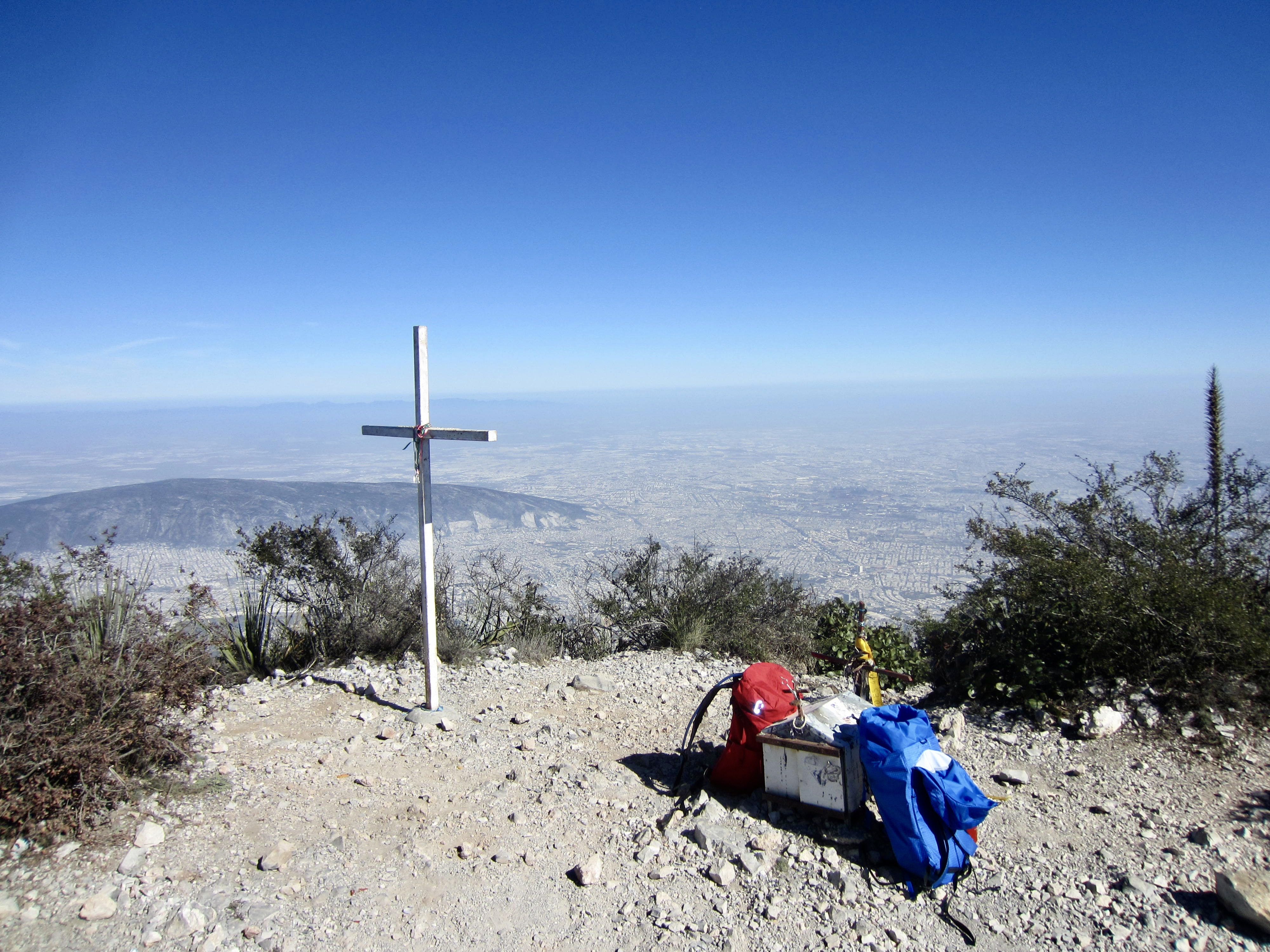
After a steady ascent of 2200 feet / 670 meters, we passed a miniature nativity display tucked into a tiny alcove. An accompanying sign indicated that this display serves as a memorial to all the miners who toiled on the mountain a century ago. Reportedly, the various mining operations around Monterrey recovered small amounts of materials such as silver, lead, and sulfur, in addition to massive amounts of limestone used for cement production.
.
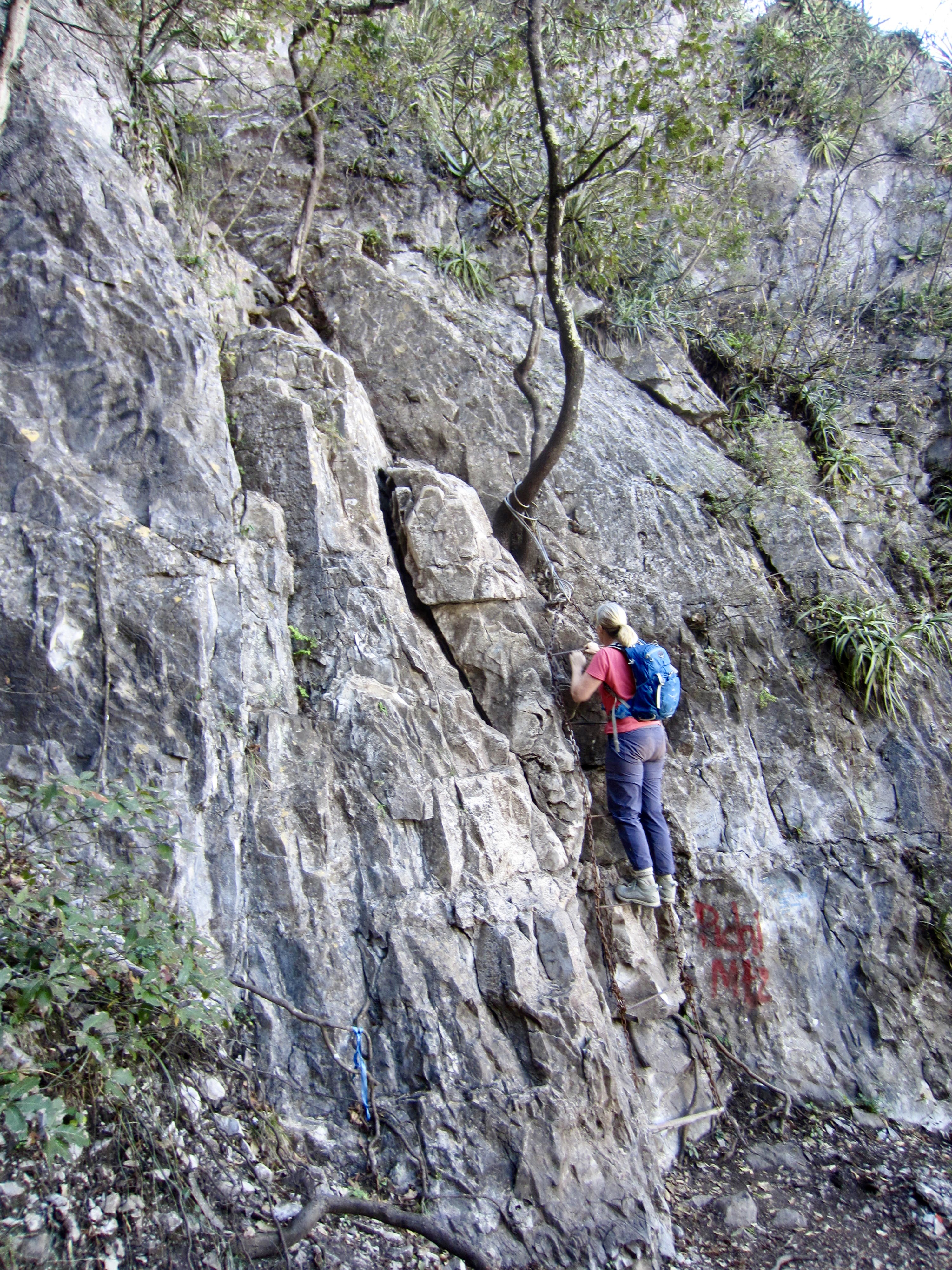
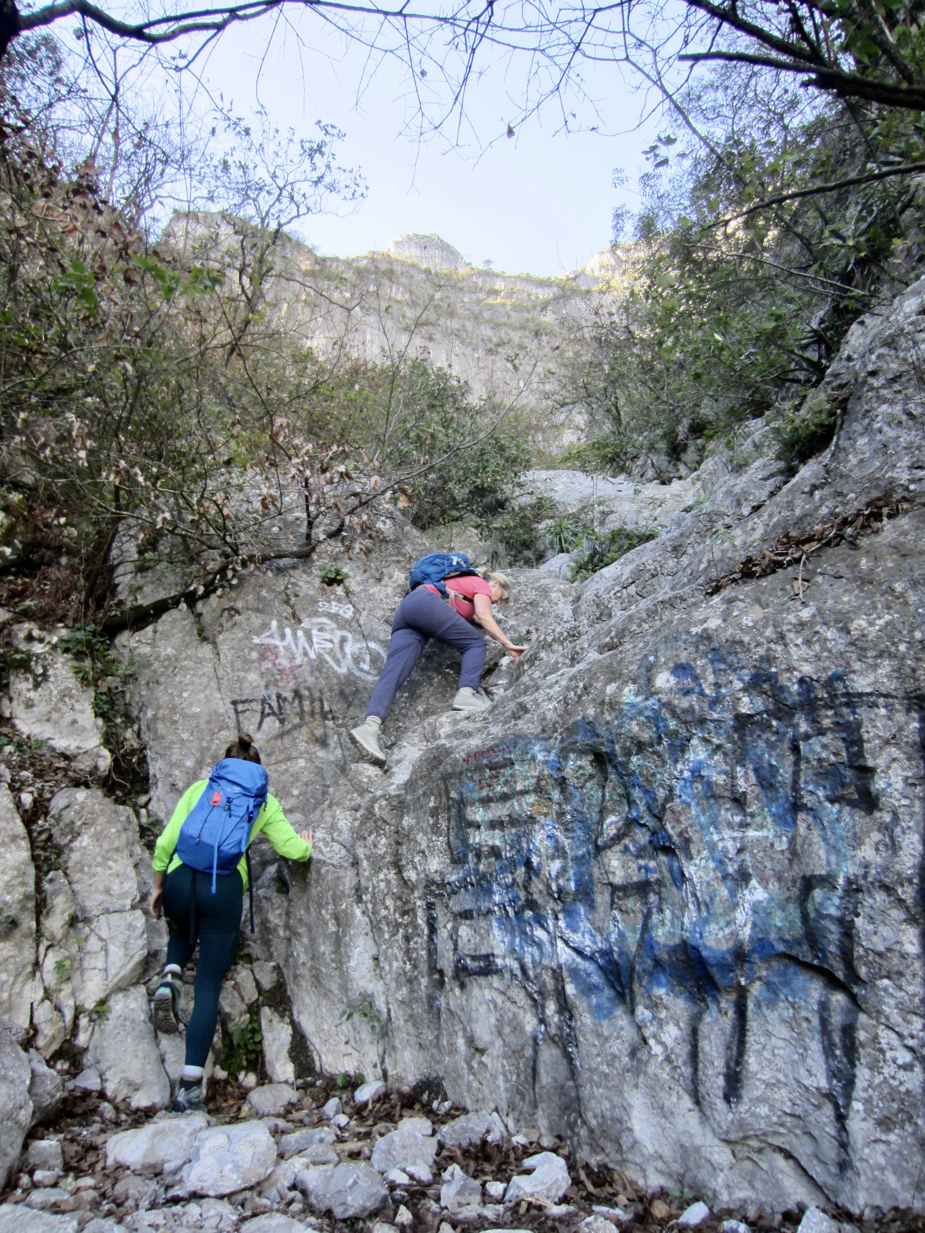
Not far above the miners’ memorial, our trail became steeper, rockier, and poorly defined. In many locations, there were multiple paths to choose from, but they did all seem to intertwine such that any chosen path eventually converged with the other paths. We soon reached a junction sign that directed us to the right along a narrow ledge at the base of the amphitheater. This ledge, called the Paso de las Bicicleta (“Bicycle Passage”) for reasons unknown to me, was blasted into the rock wall by miners long ago.
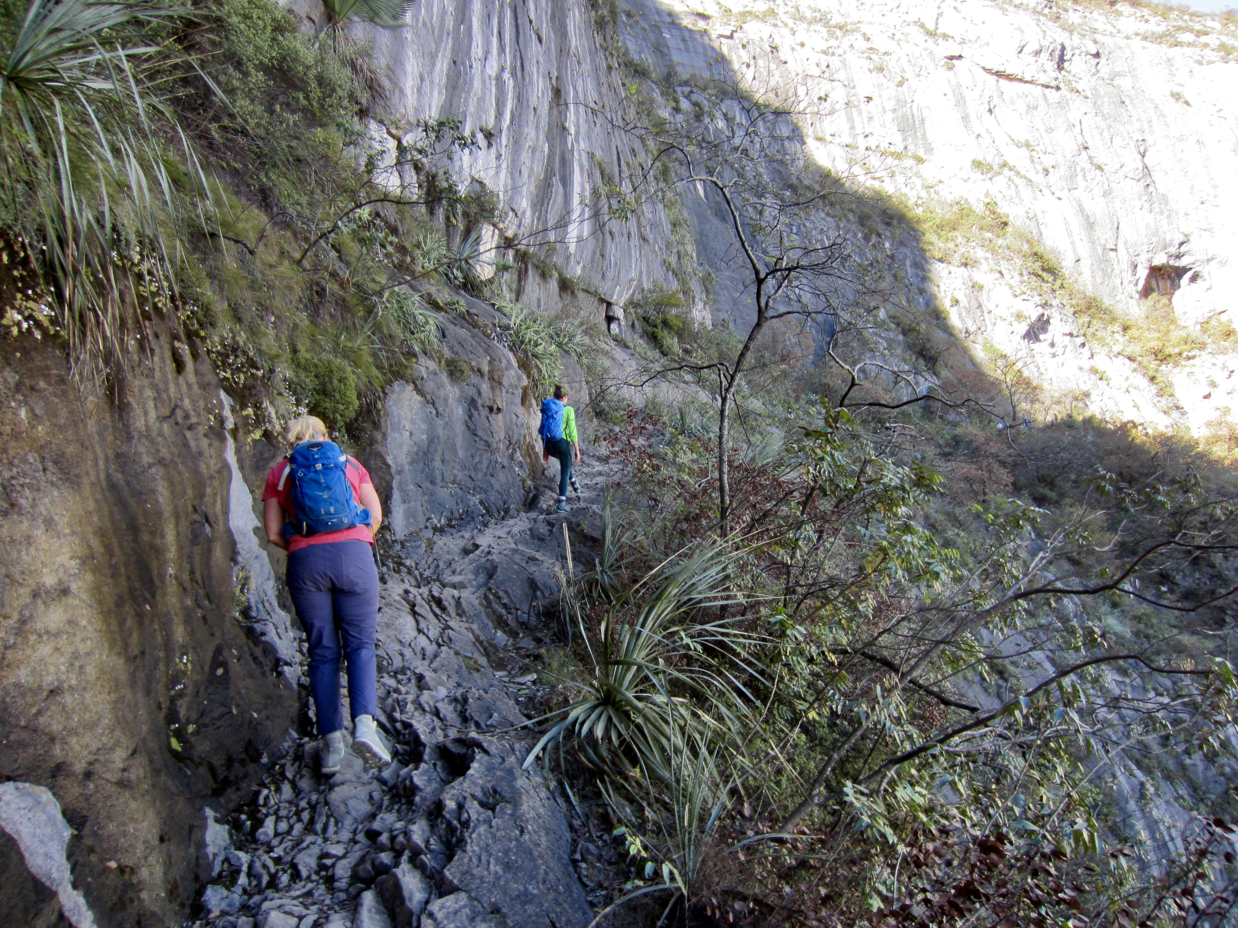
.
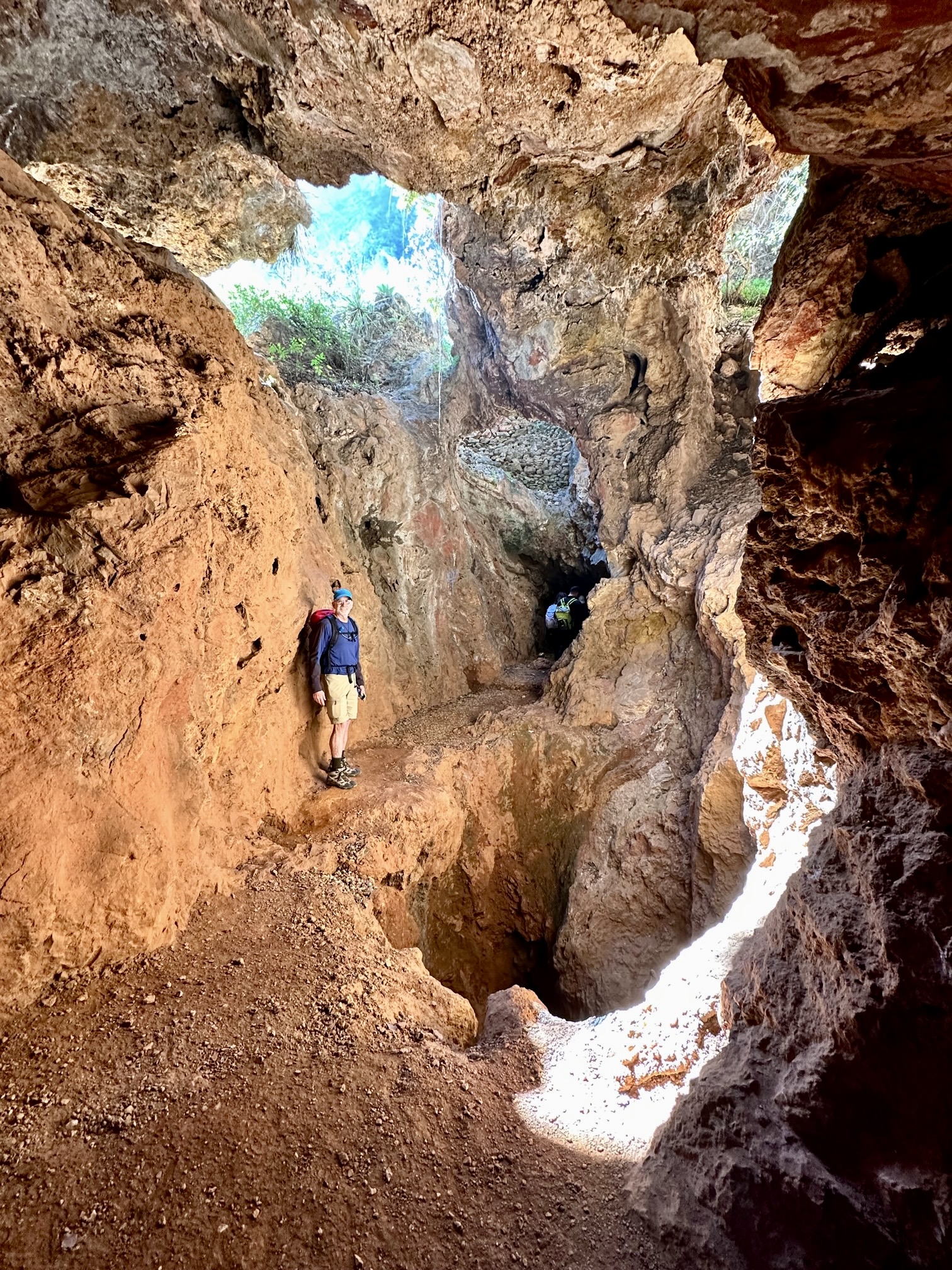
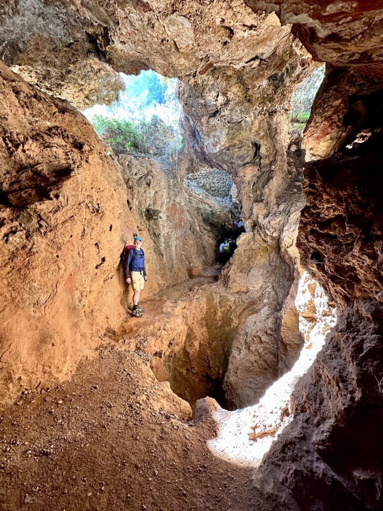
The bicycle ledge traverse brought us to a viewpoint where a dozen people had congregated. Just beyond it was our first major surprise of the ascent: the trail enters a deep cave in the limestone cliff! Closer inspection revealed that this is not a natural cave but, rather, a tunnel that has been excavated into the rock. More specifically, it is a horizontal access passageway, or adit, associated with the century-old Perico Mine.
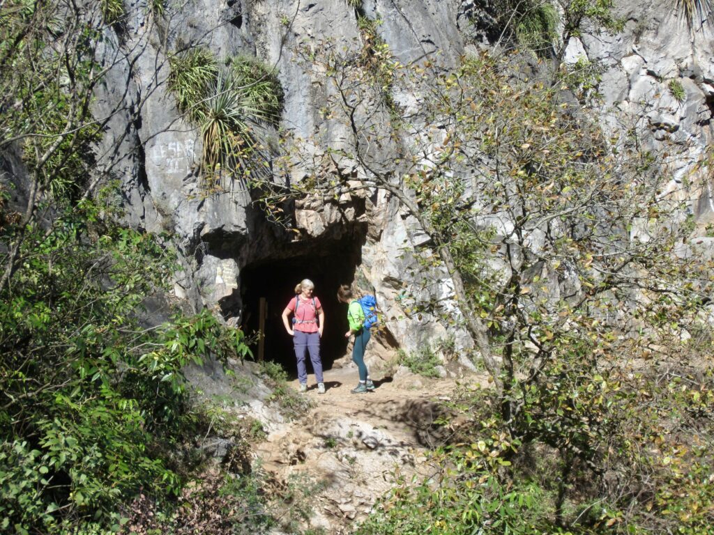
.
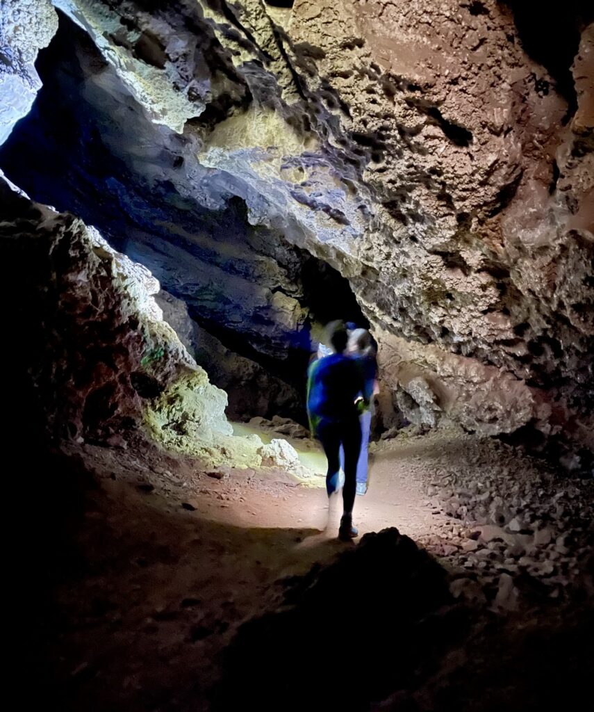
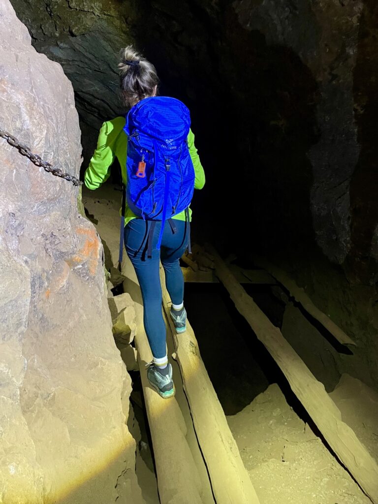
Improbable as it seemed that our route would take us through the mining adit, an official sign clearly beckoned us inside. We pulled out whatever light sources we had available (one headlamp and two cellphone flashlights) and gingerly walked in. The interior was pitch dark and somewhat confusing due to multiple branches. Fortunately, there were enough paint marks on the walls to keep us on course.
.
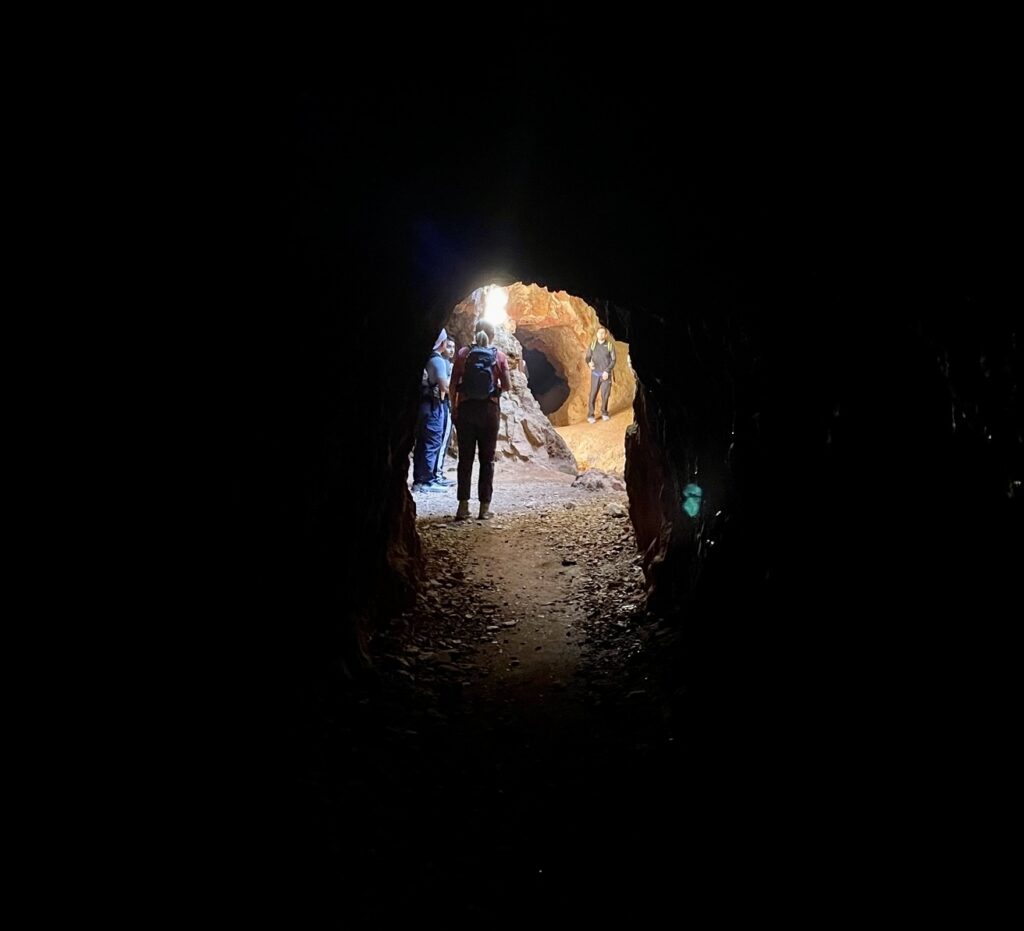
After a short distance, the narrow adit opened onto a larger, natural cavern. Such caverns commonly form within limestone deposits due to water seeping through cracks and dissolving the rock over thousands of years. Several holes in the roof of this cavern allowed in some sunshine that dramatically highlighted the rock textures.
.
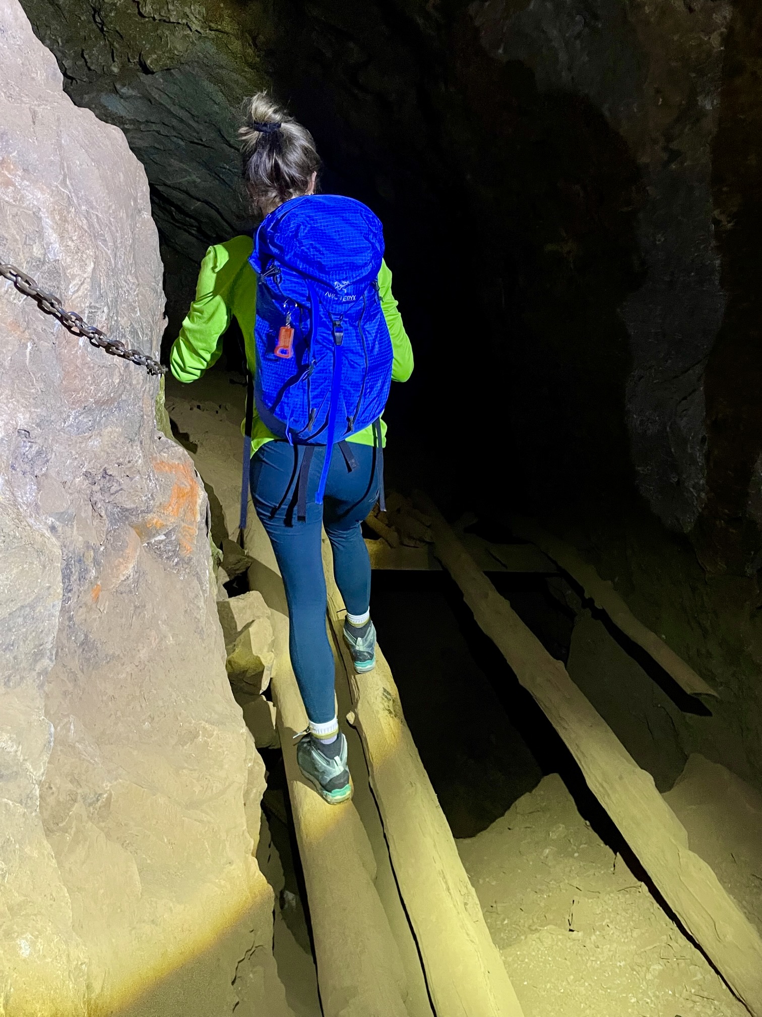
Although navigating through the tunnels is not terribly difficult with the aid of a bright light and a watchful eye, there are a few places that will test your tolerance for exposure. At one location, the route skirts around a scary abyss on a narrow ledge. At two other locations, it is necessary to cross over deep holes on crude wooden timbers. Mind you, none of these features has been engineered for safety!
.
.
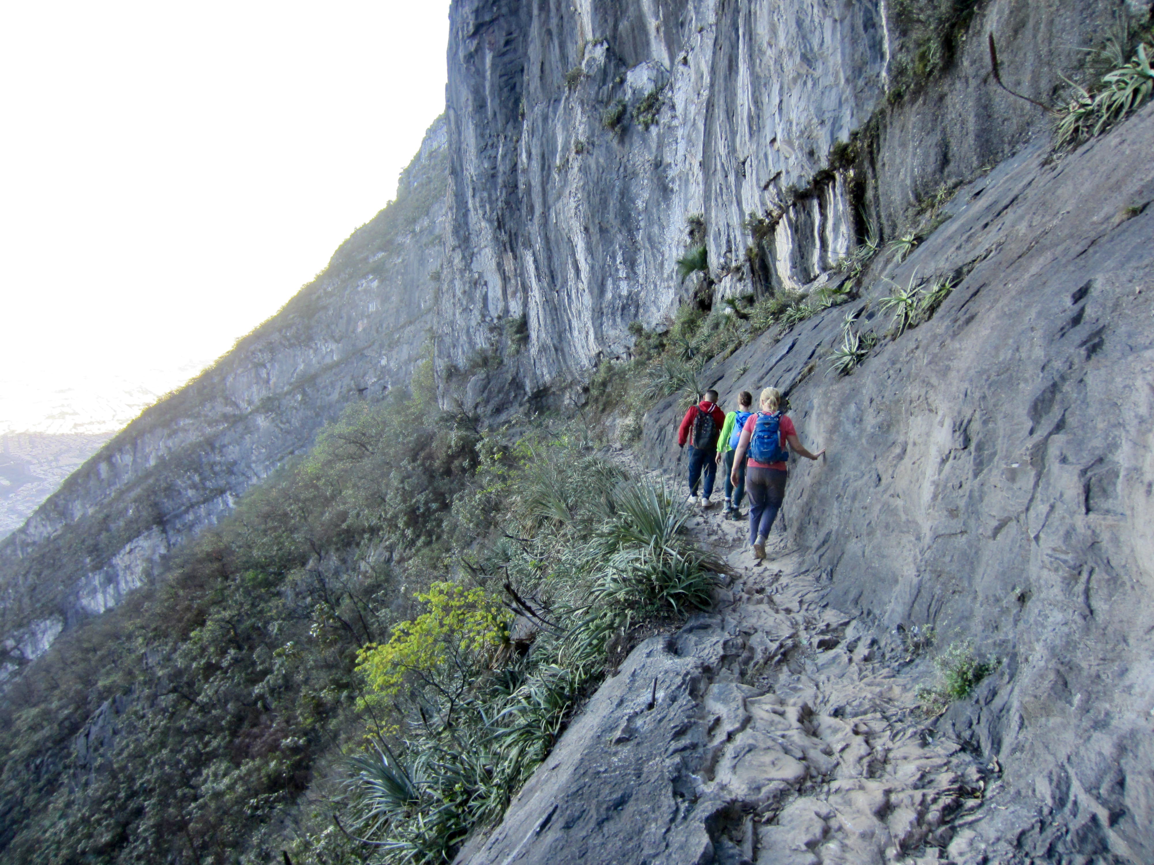
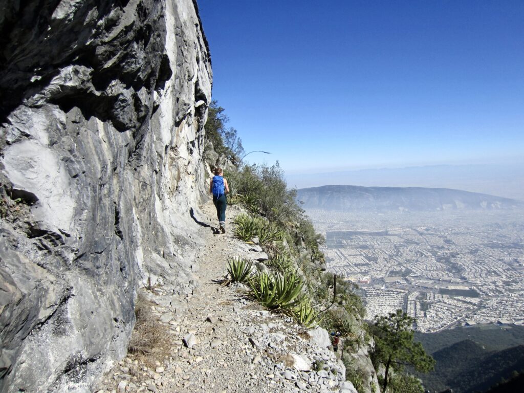
After traveling through the tunnels for about 150 feet / 50 meters, we popped out the other end and continued hiking along a nice ledge very reminiscent of the Kendall Katwalk on the Pacific Crest Trail. This ledge can be seen running across the entire hillside, and drilling marks on the sidewall indicate that the old miners had carved this ledge into the cliff or, perhaps, widened an existing natural ledge. We also observed that the number of other people declined significantly, probably because the mine tunnels serve as either a planned destination or a show-stopper for many hikers.
.
The ledge trail took us around a rock rib and into a shady draw with another marked junction. From here, the route to Pico Cuauhtémoc continues along the ledge, whereas the route to Pico Perico heads straight up a steep outwash channel. This began the worst part of our ascent. There is no defined trail going up, just a network of vague bootpaths that wander back and forth through the loose stones. Rockfall is a real hazard here, such that we wished we’d brought climbing helmets.
.
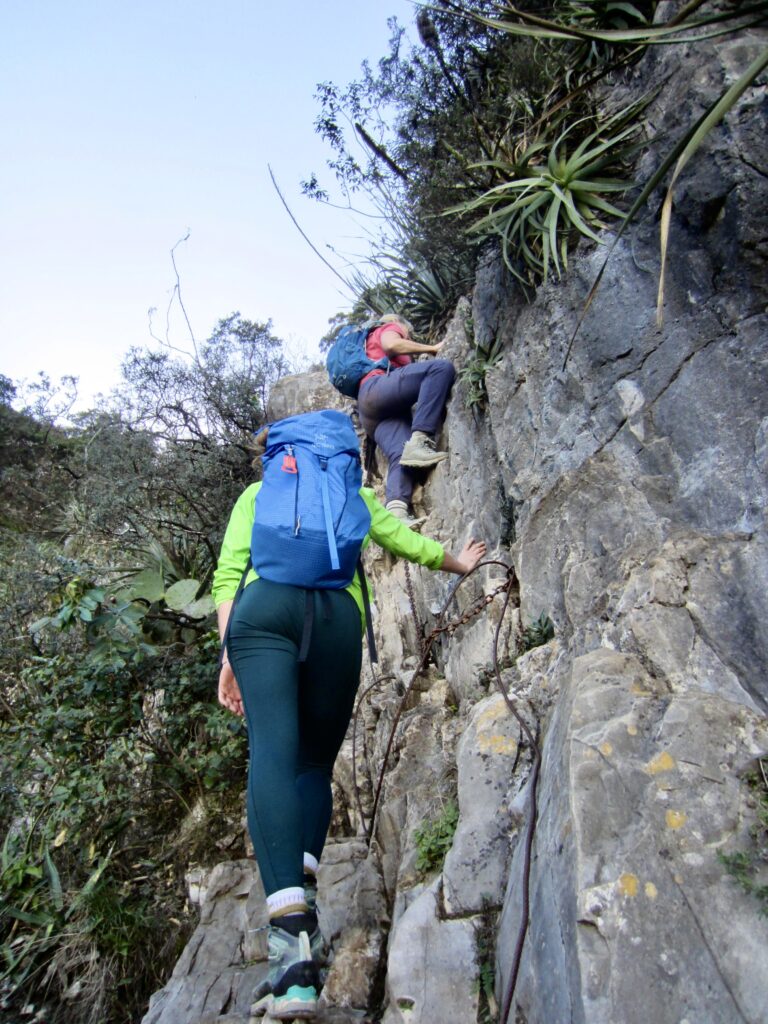
After groveling up the outwash channel for a frustrating half-hour, we came to our second major surprise: a near-vertical rock headwall equipped with a primitive ladder and cable system. We were now into the via ferrata phase of our ascent! One by one, we proceeded up the ladder and then over numerous rock steps that would be rated at full-on Class 4 without the aid of cables and chains. Granted, the entire system here bears little resemblance to the highly engineered via ferrata systems found in Europe, but we were very glad to have it.

.
.
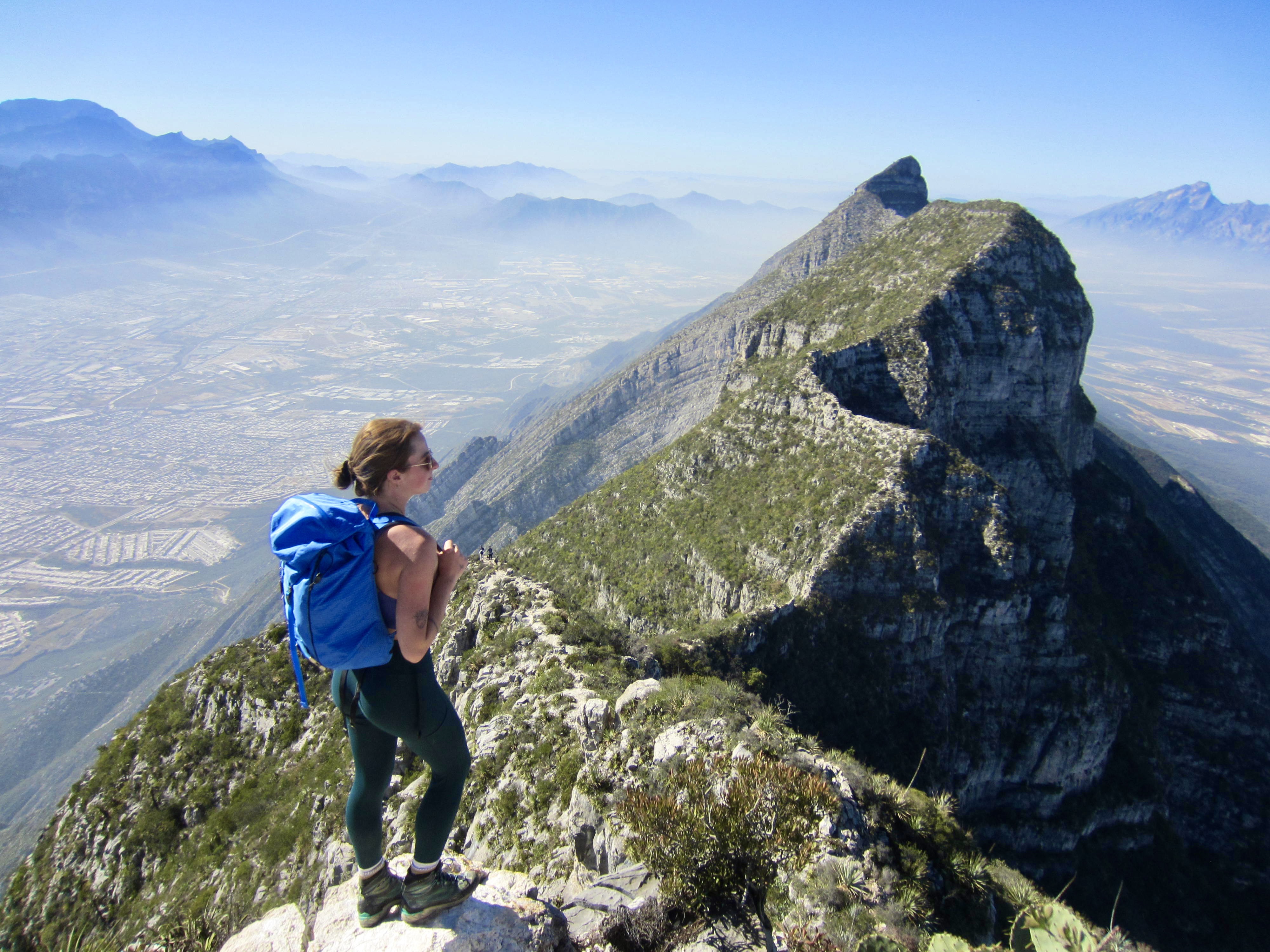
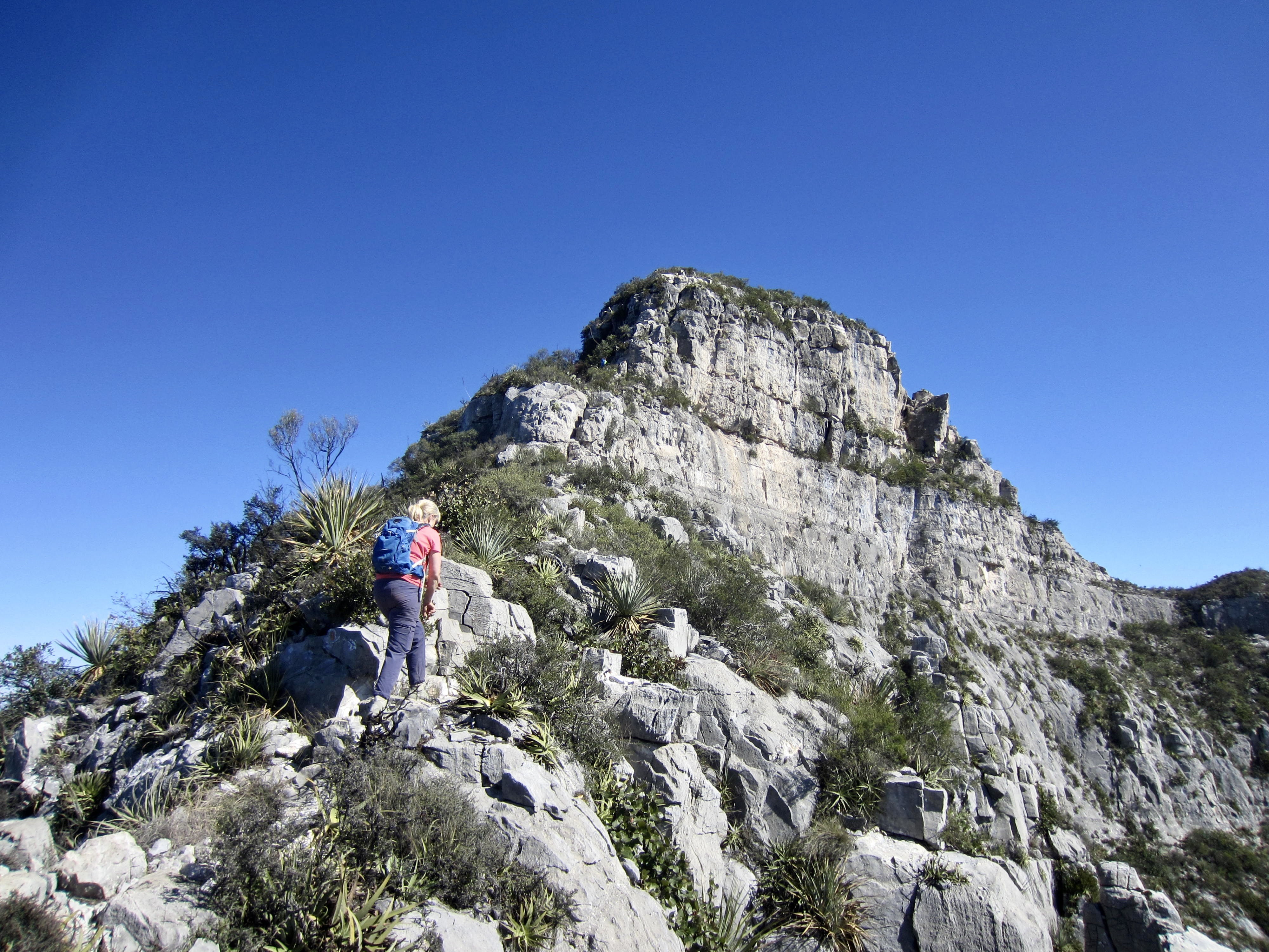
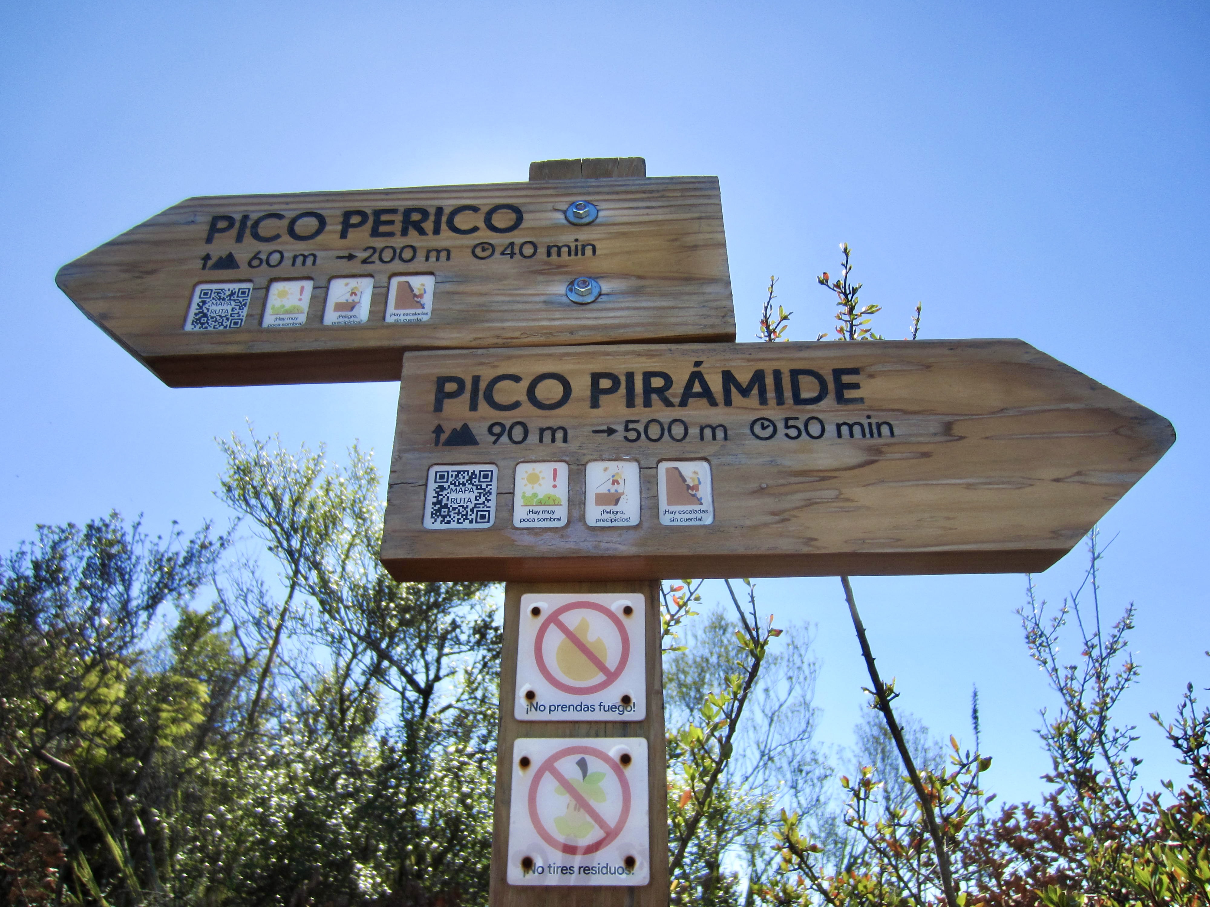
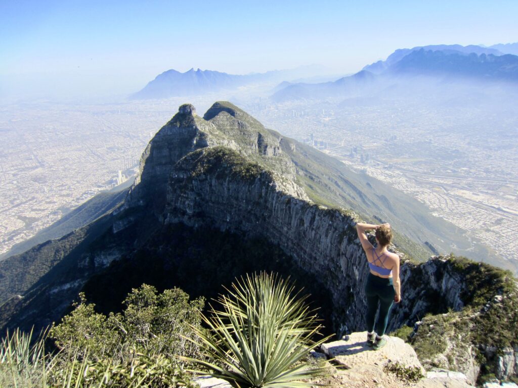
Once past the rock headwall, we were back on a trail that took us to a deep saddle in the ridge crest. A junction sign here steered us to the left (southeast) toward Pico Perico, whereas the right-hand fork leads to Pico Piramide. The remainder of our ascent involved a hike and Class 2-3 scramble up the narrow crest and over one false summit for about 400 feet / 120 meters. We stepped onto the true summit at 2:00pm (4.9 hours + 3900 feet / 1190 meters from TH).
.
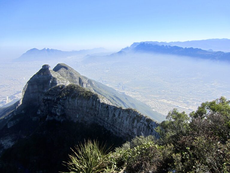
Despite a smog layer hanging over Monterrey, we were able to appreciate the huge urban expanse, as well as many surrounding mountains. The double peaks of Cerro de la Silla (“Saddle Mountain”) far out to the southeast, the sharp horn of nearby Pico Cuauhtémoc, and the high point of Picachos el Fraille (“Friars’ Peaks”) far out to the northwest are especially striking from this vantage.

.
.
We began our descent at 2:30pm and carefully retraced our up-route, which took us back down the crest, over the headwall, down the outwash channel, through the tunnel, across the bicycle ledge, and down the rocky trail. With darkness nipping at our heels, we reached the trailhead scant minutes before headlamp time (4.1 hours from summit) and signed out at the registration shack. It had been an astounding full-day adventure in a totally new area for all three of us—but it would not be our last!

.
Route Map & Profile & Photomap
…
…
…
Photo Gallery
Click to enlarge…