Trip Date: September 9-11, 2021
Mt. Stone Climbing Trip & St. Peter’s Traverse: Upper Lena Lake to Lake of the Angels
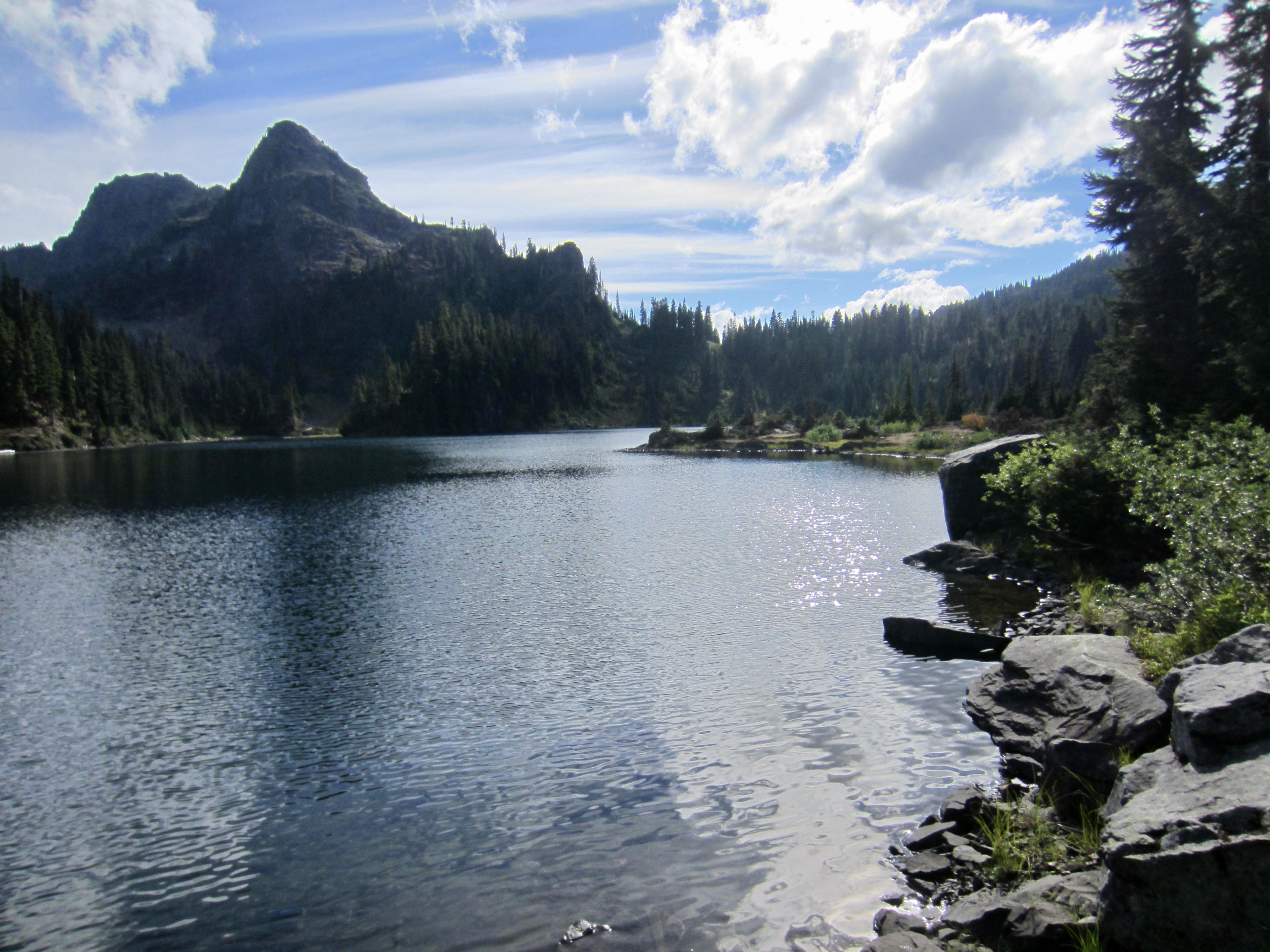
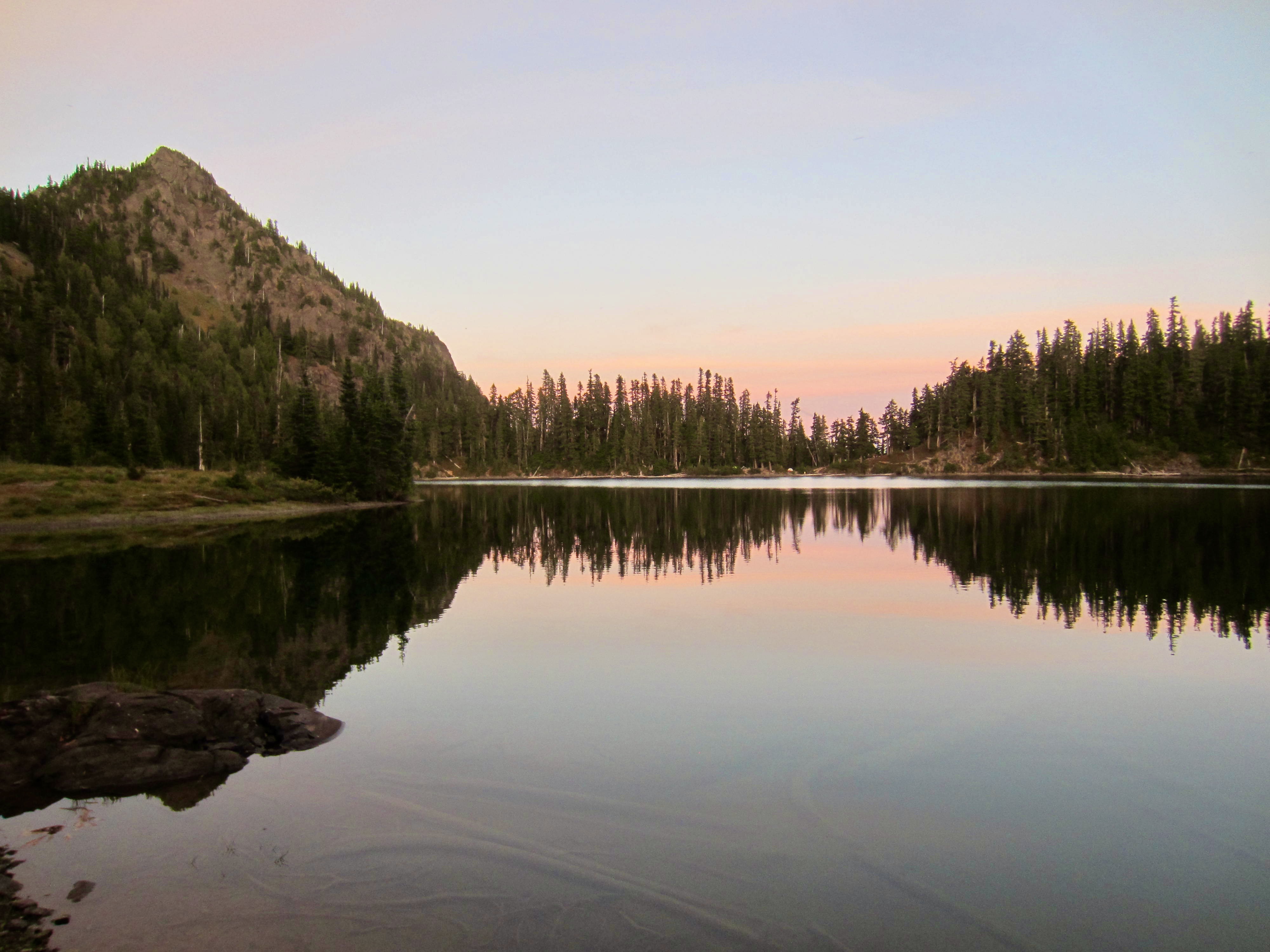
Upper Lena Lake
Scout Pass
Ullin’s Pass
Saint Peter’s Gate
Mount Stone (6612 ft)
Lake of the Angels
Trip Report Summary
Region: Olympic Mountains (Washington)
Sub-Region: Skokomish–Duckabush Group
Areas: Olympic National Forest & Olympic National Park & Mt. Skokomish Wilderness
Starting Point: Lena Lake Trailhead on Hamma Hamma River Road (Elev. 750 feet)
Traverse Way Points: Lena Creek & West Fork Lena Creek & Upper Lena Lake & Scout Lake Trail junction & Lena Tarn & Scout Pass & Upper Scout Lake & Scout Basin & Ullin’s Pass & St. Peter’s Ramp & St. Peter’s Gate & Lake of the Angels & Whitehorse Basin & Pond of the False Prophet & Boulder Creek (trail hike & off-trail hike & rock scramble)
Traverse High Point: St. Peter’s Gate (Elev. 5950 feet)
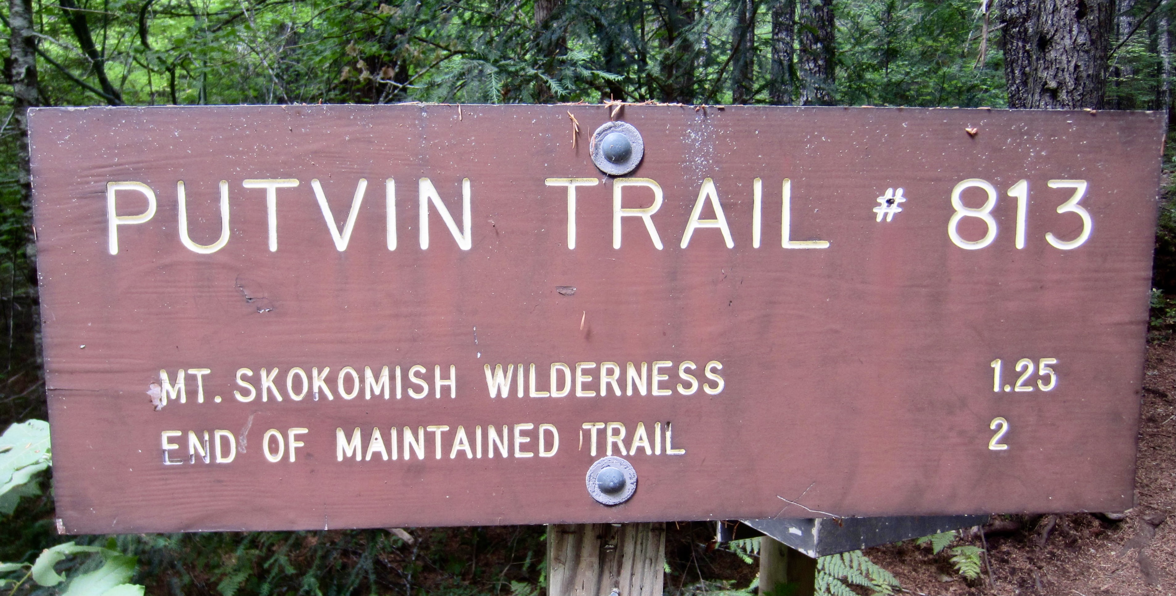
Ending Point: Putvin Trailhead on Hamma Hamma River Road (Elev. 1600 feet)
Campsites: Upper Lena Lake & Lake of the Angels
Summit: Mt. Stone (rock scramble via South Face—Upper West Ridge; descent via West Ridge—Southwest Slope [Route 1] )
Approximate Stats (excluding summit sidetrip): 14.3 miles traveled; 6300 feet gained; 5450 feet lost.
Approximate Stats (including summit sidetrip): 15.1 miles traveled; 7400 feet gained; 6550 feet lost.
Related Posts
>>> Mt Stone via Southwest Slope—West Ridge – July 2010
>>> Mt Stone via South Slope—West Ridge – June 2001
Full Trip Report
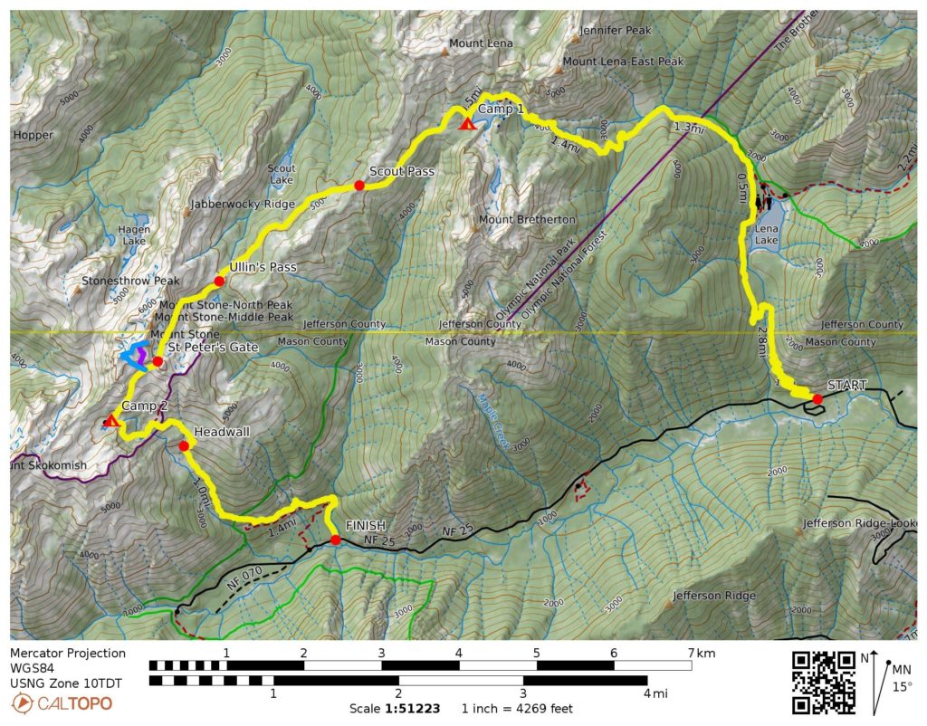
One of the most popular alpine traverses in the Olympic Mountains is the cross-country route from Upper Lena Lake to Lake of the Angels. This scenic route covers a total distance just over 14 miles, including the entry and exit trails, and reaches a high point of 5950 feet at a rocky pass known as “St. Peter’s Gate.” The basic traverse can readily be completed in a weekend, but it also provides opportunities for tucking in several worthwhile summits if more time is allotted. Another nice feature is that the driving distance between starting and ending trailheads on the Hamma Hamma River Road is only about 4 miles, so car-shuttle logistics are fairly simple.
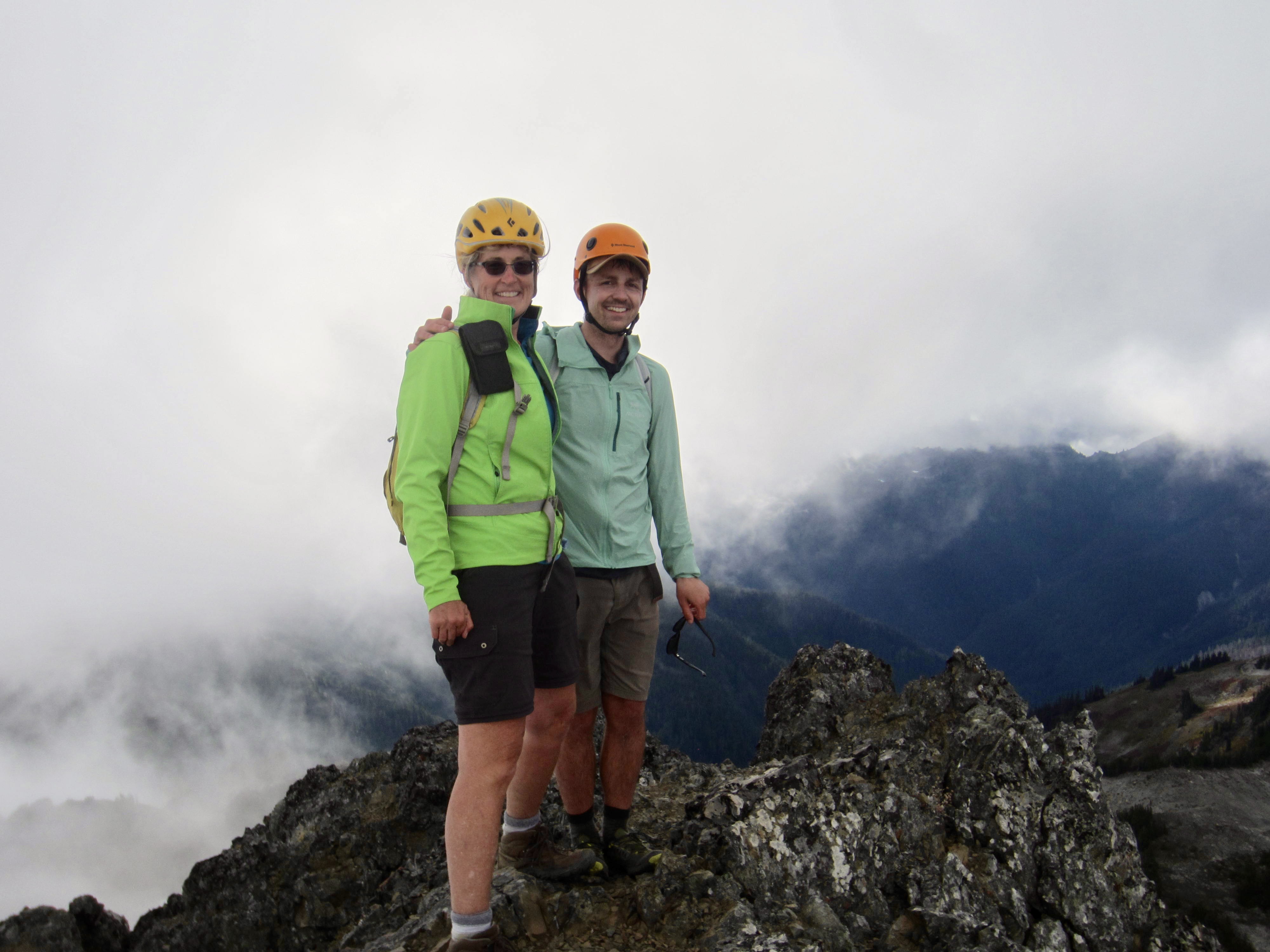
Eileen and I were joined by our friend Andrew, from Colorado, for a pre-Labor Day installment of “St. Peter’s Traverse.” We took three days for the trek in order to accommodate a climb of Mt. Stone on our middle day, and we used a mountain bike to facilitate the car shuttle between trailheads.
Day 1: Lena Lake Trailhead to Upper Lena Lake
On a sunny Thursday morning, Andrew and I dropped off Eileen at the Lena Lake Trailhead (she wanted to get a head start on the trail) before continuing up to the Putvin Trailhead. We stashed a mountain bike in the forest, then drove back to the Lena Lake Trailhead and began hiking just before noon.
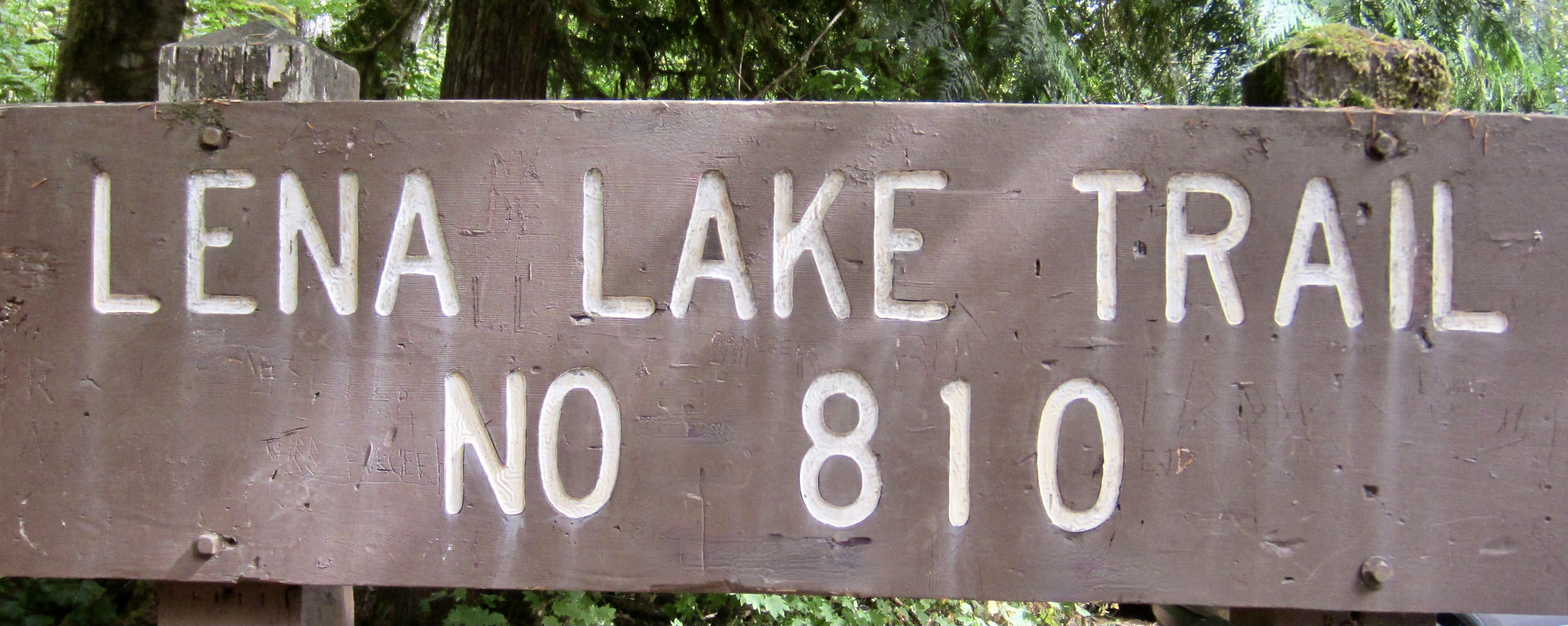
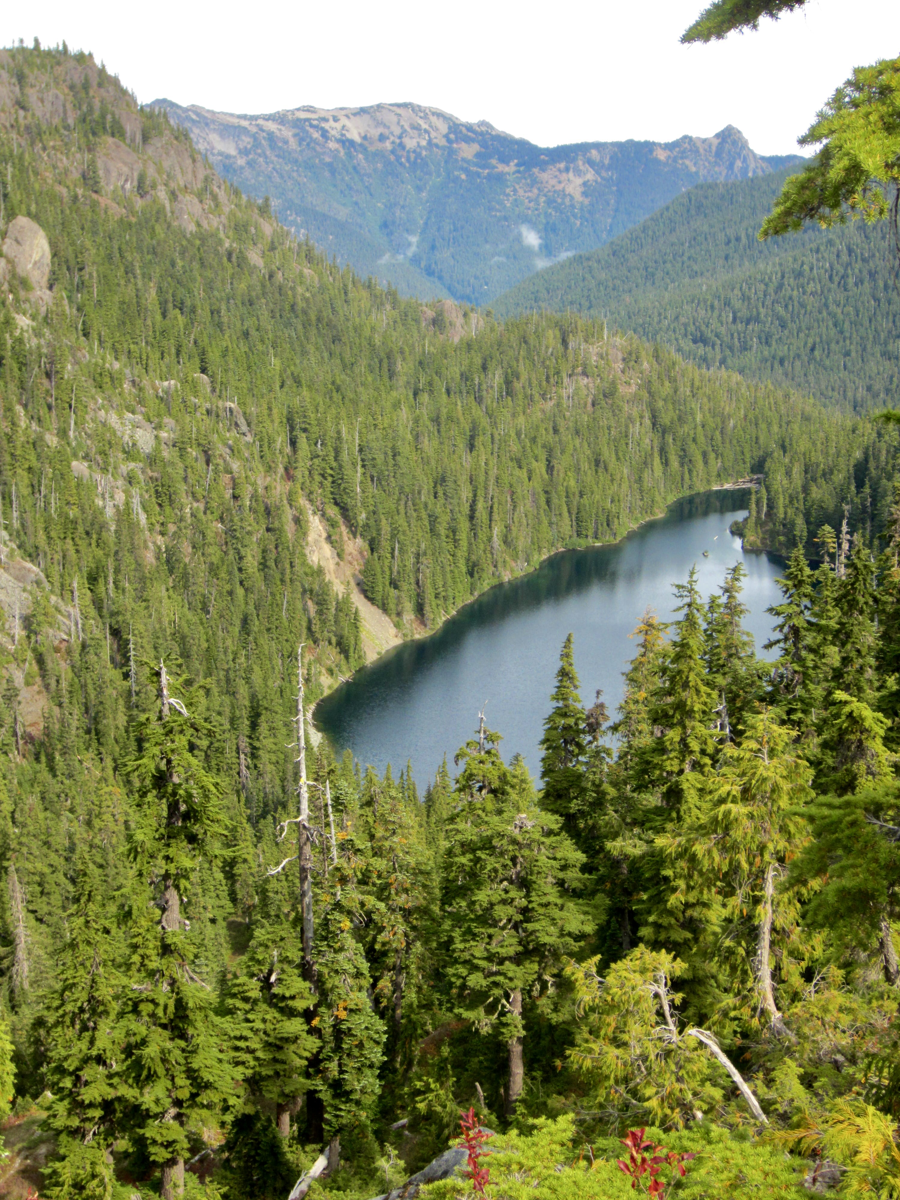
There were dozens of other day-hikers and backpackers on the trail, as well as a Washington Trails Association volunteer crew working on a new bridge over Lena Creek. The 3 miles of trail leading to Lena Lake was well-maintained and well-graded; beyond that, a steep, primitive trail proceeded up the West Fork of Lena Creek. We eventually caught up with Eileen and finished our hike to Upper Lena Lake together, arriving shortly after 4:00pm (4.3 hours + 6.5 miles + 4000 feet from TH).
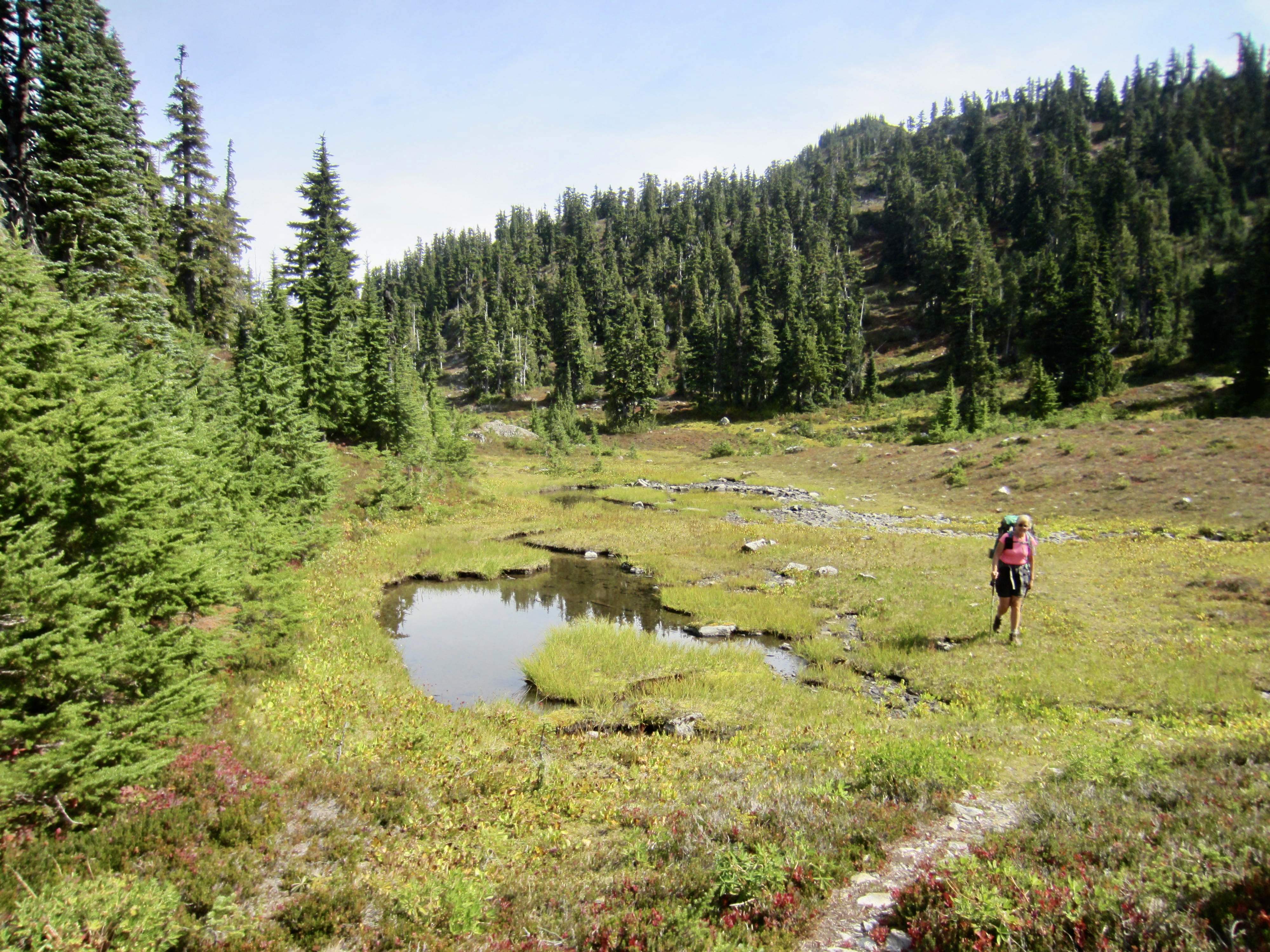
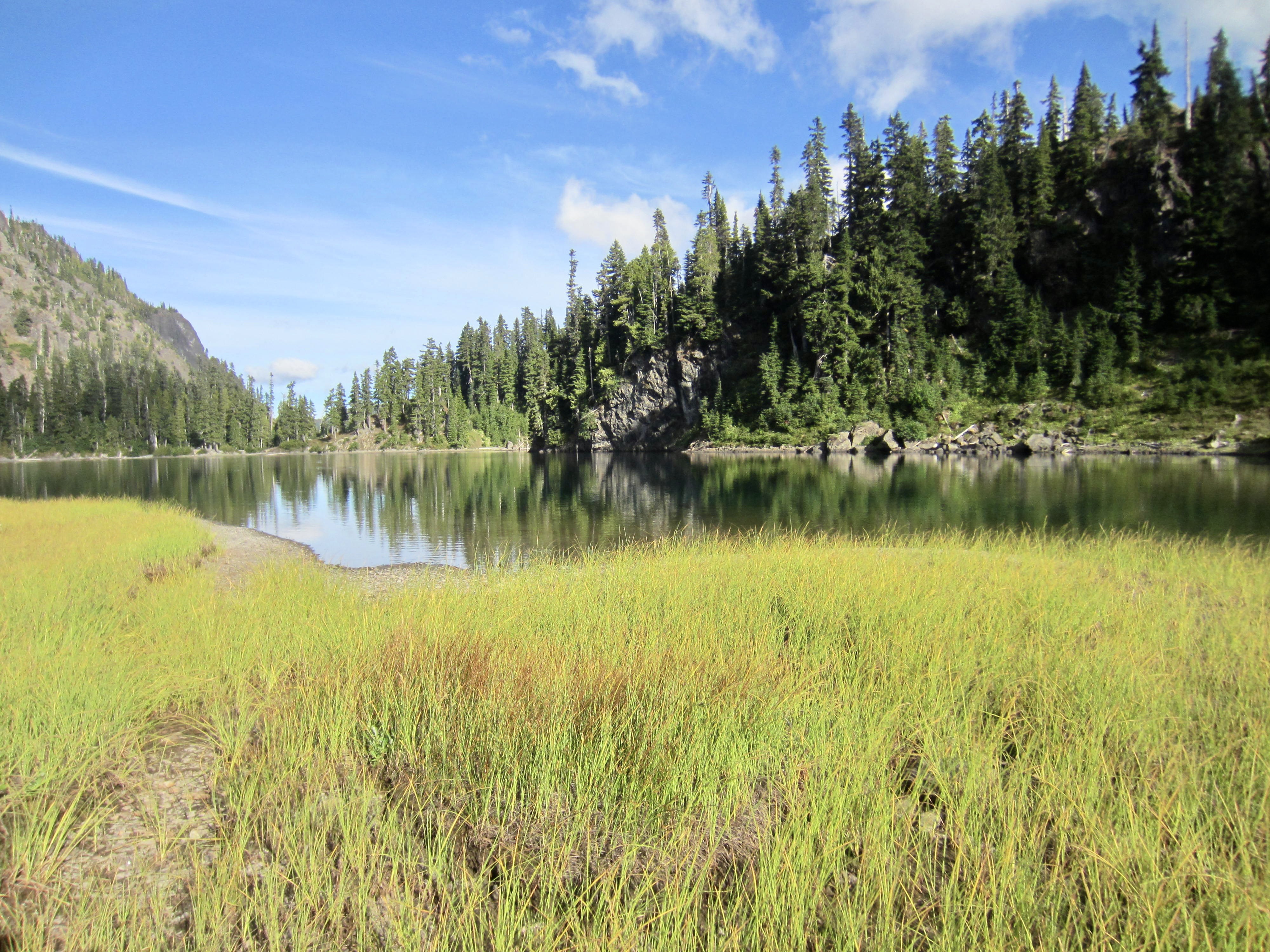
After pitching our tents at two of the lakeshore campsites, we all jumped into the water to wash off the day’s sweat and dust. Upper Lena Lake is an attractive pool situated between Mt. Bretherton and Mt. Lena, and on this warm autumn afternoon, it was especially inviting.
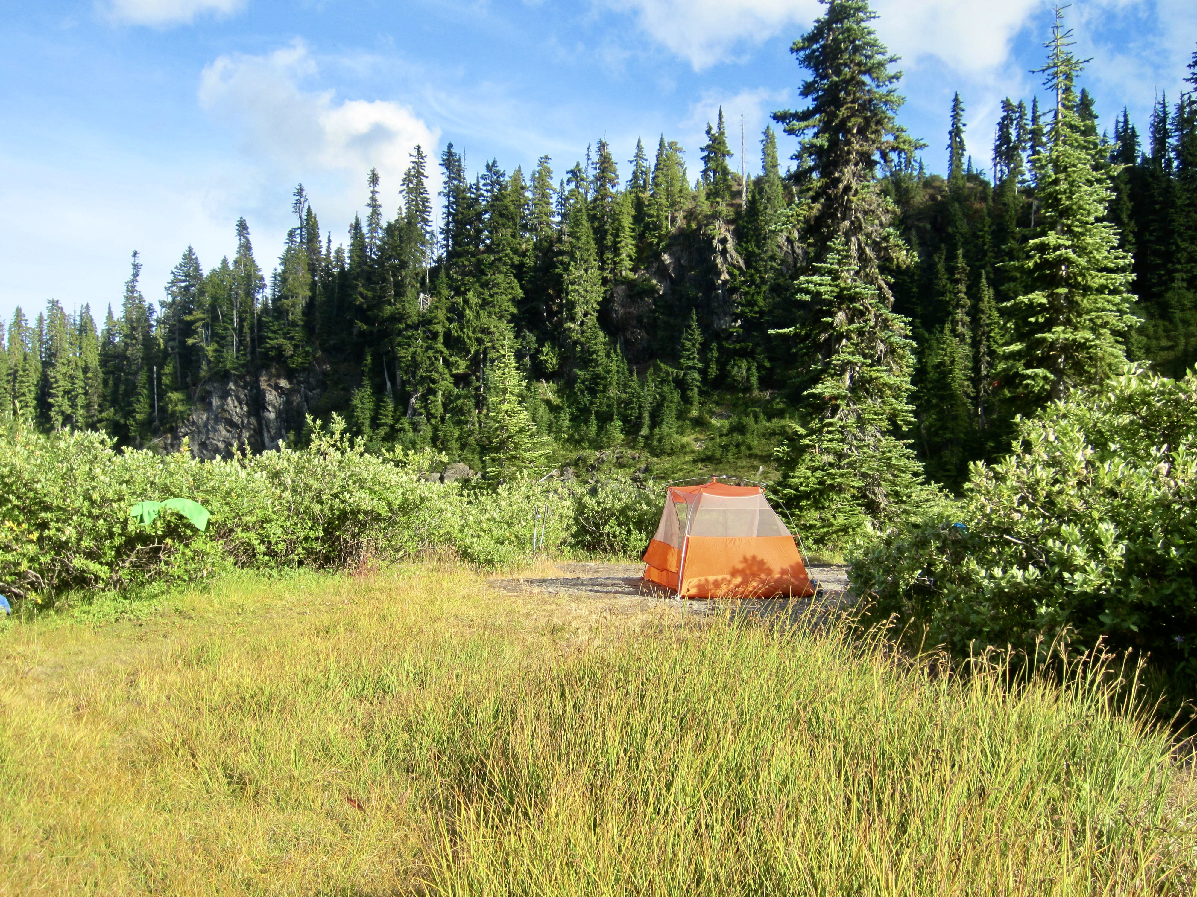
We ate dinner on the shore while evening light reflected off the glass-smooth water surface. Two or three other parties were camped across the lake, but the night was dead-calm and perfectly silent.

Day 2: Upper Lena Lake to Lake of the Angels + Mt. Stone
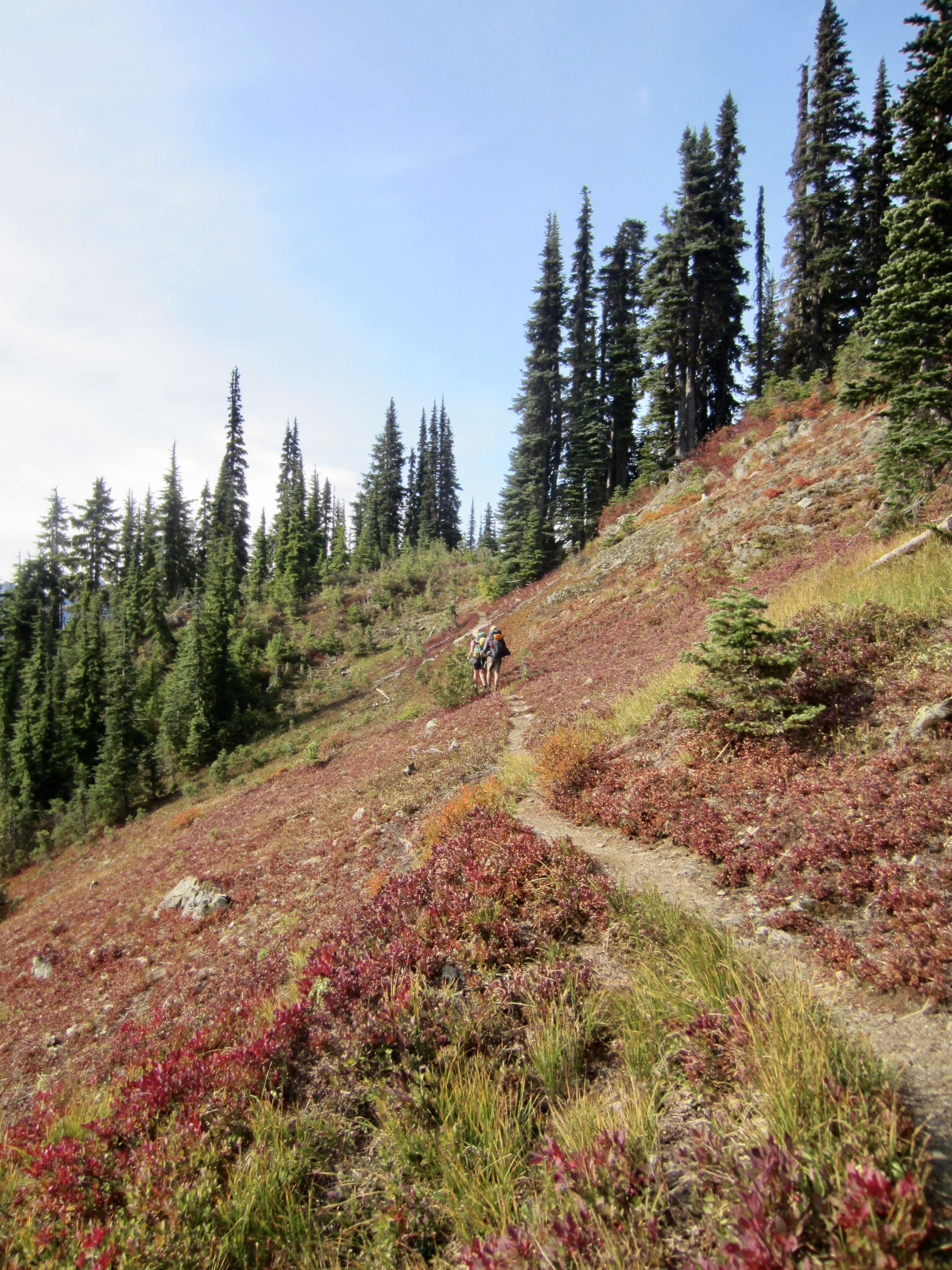
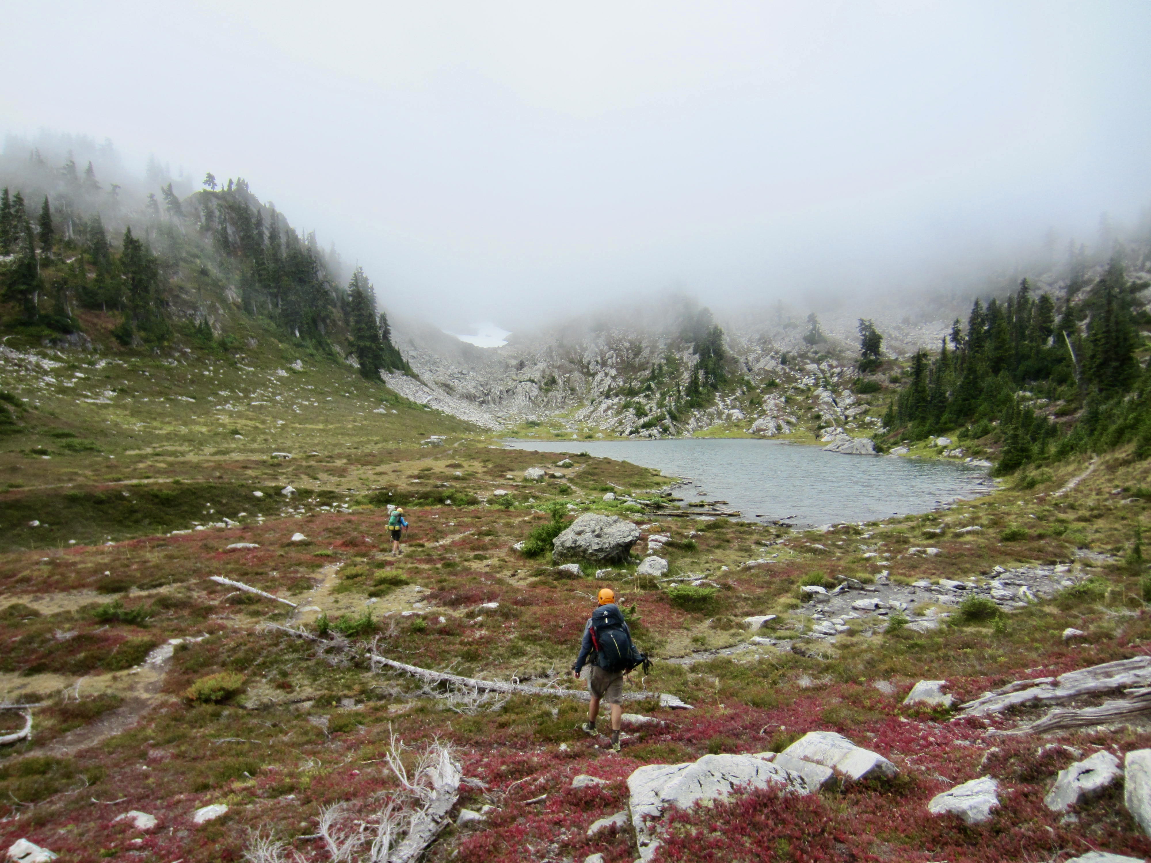
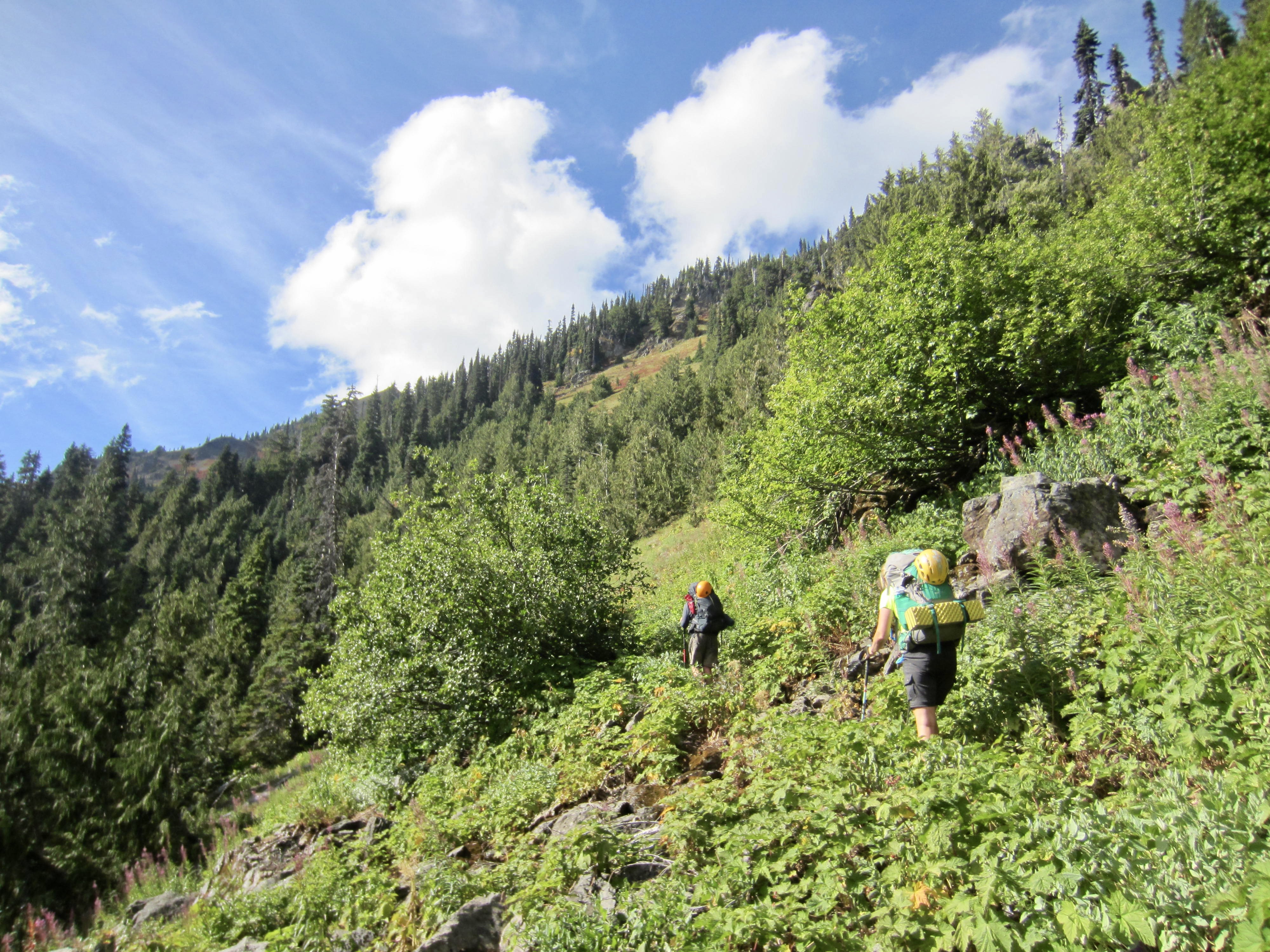
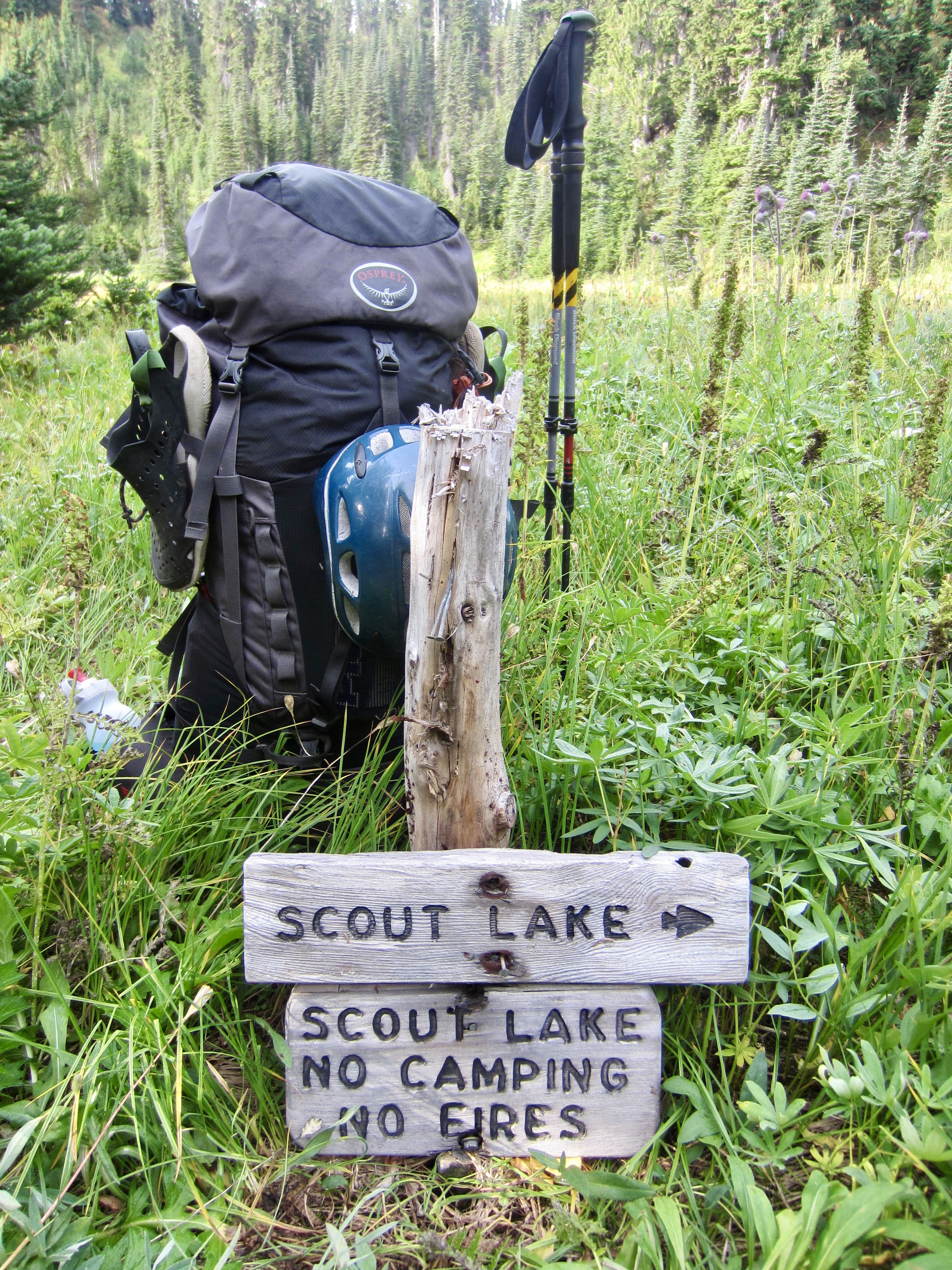
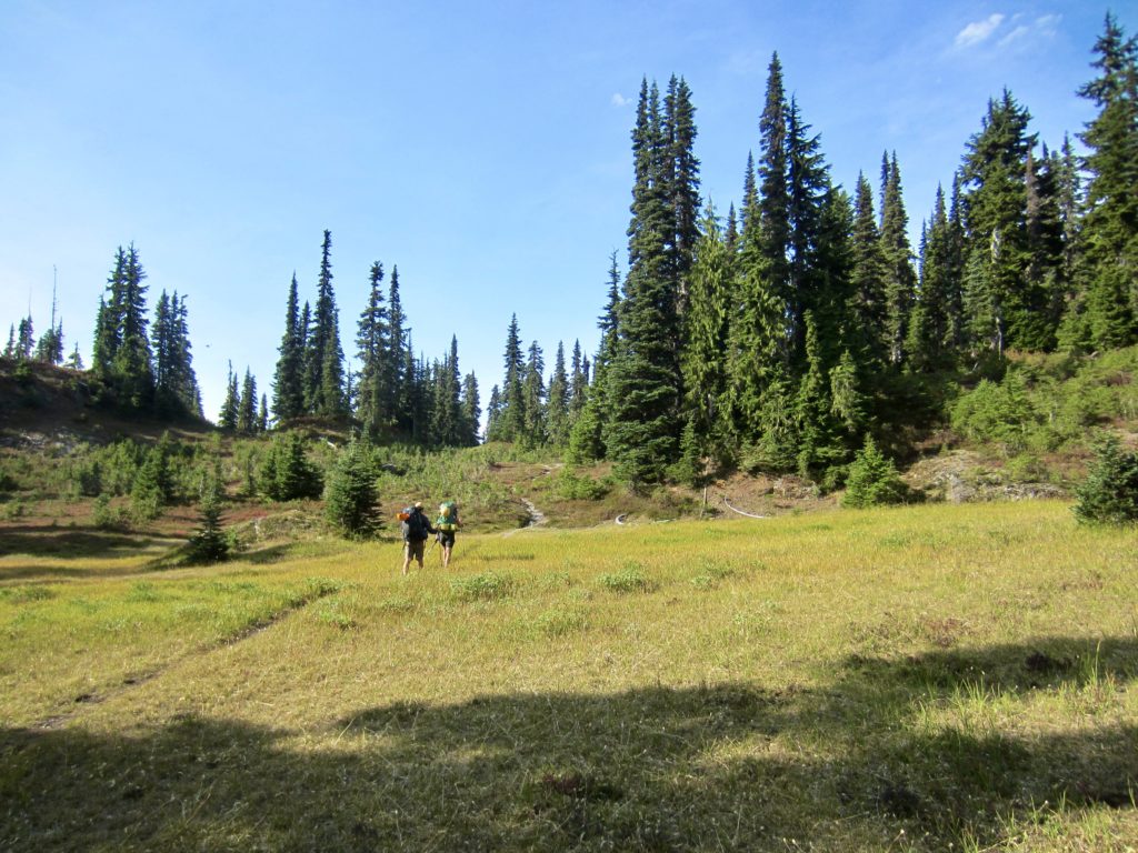
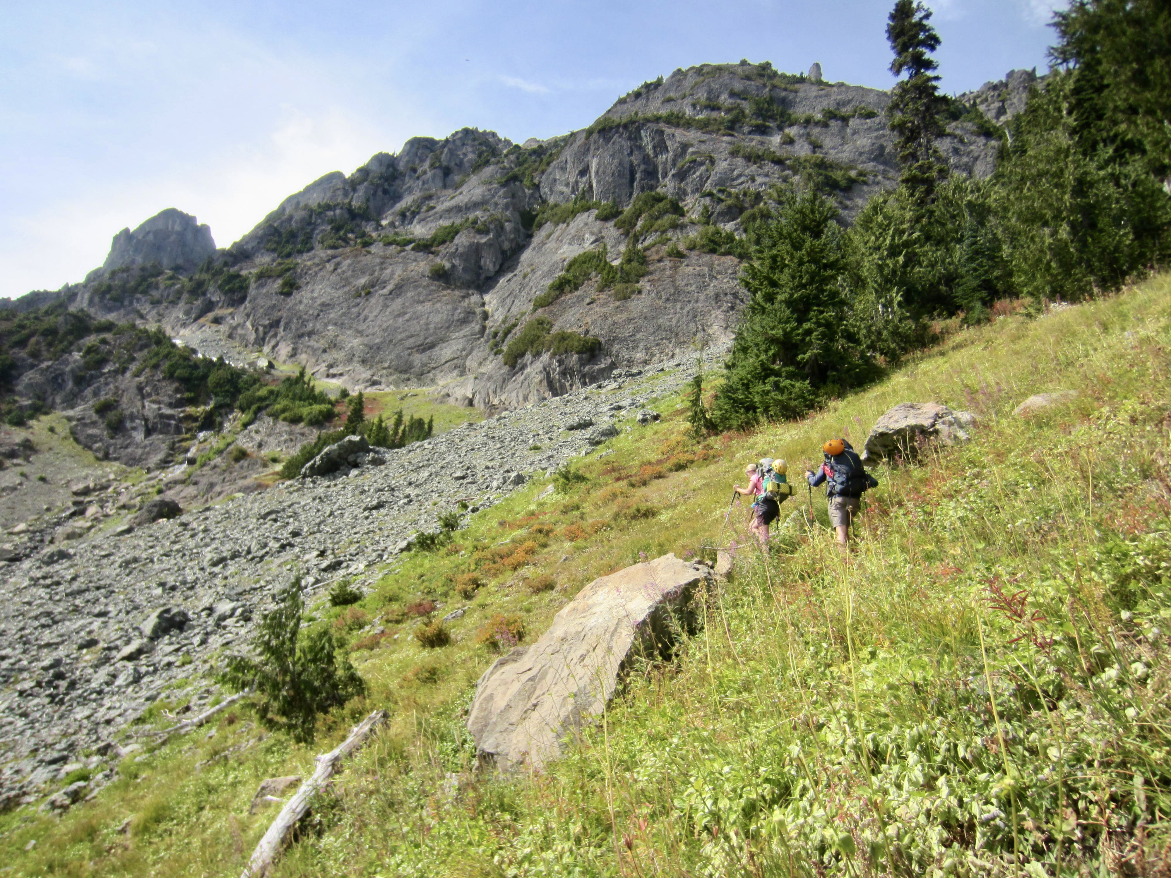
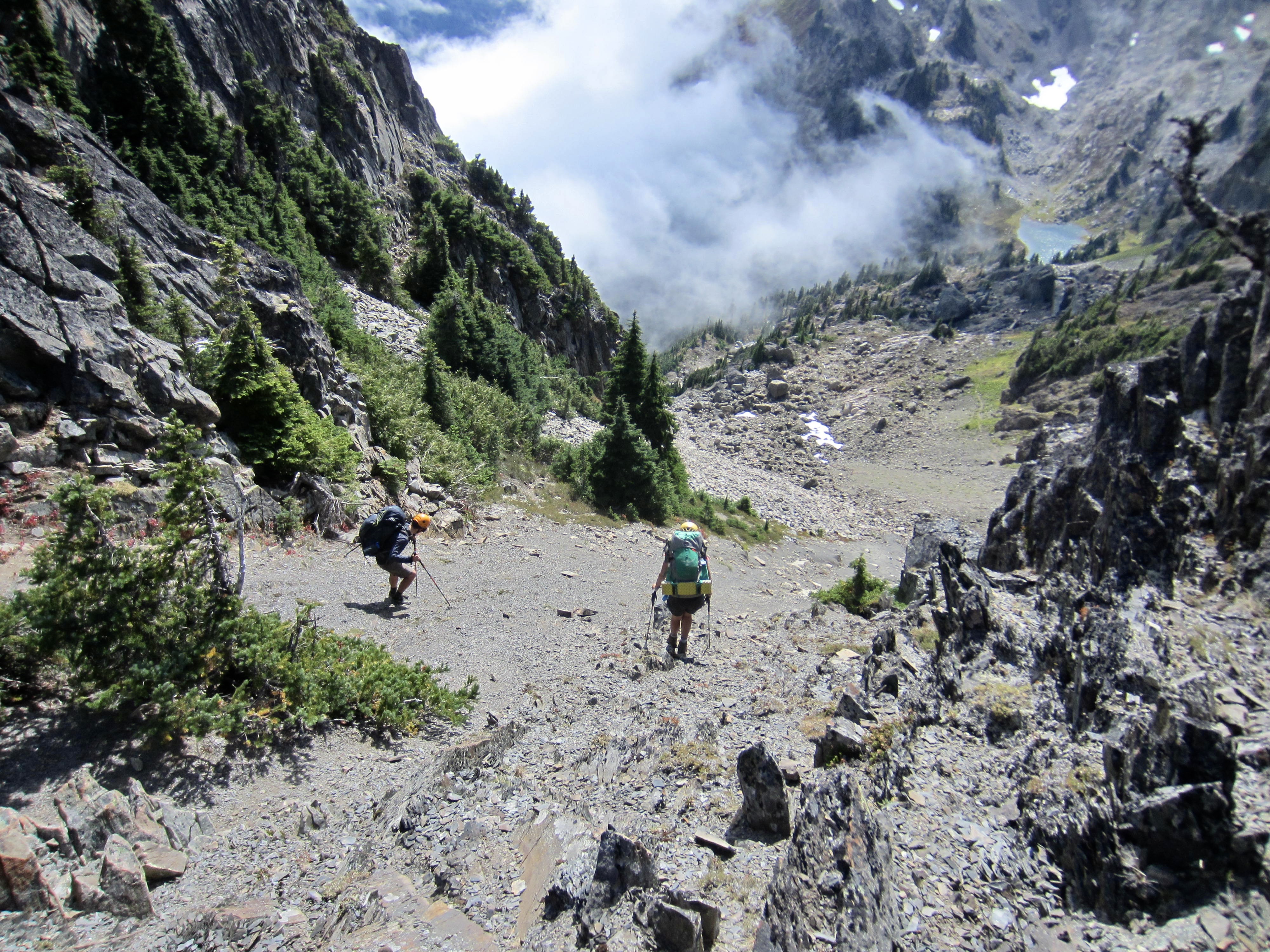
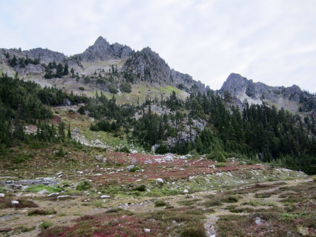
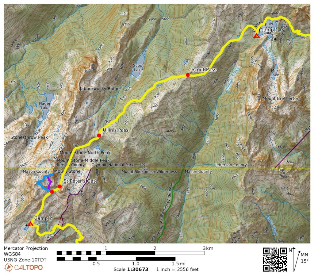
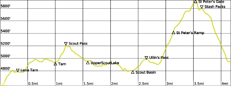
We awoke to clear skies and were underway just after 9:00am. From Upper Lena Lake, we followed the primitive Scout Lake Trail uphill past Lena Tarn on a southwesterly traverse across a series of meadows and huckle-heather slopes. The trail took us over 5200-foot Scout Pass, down to Upper Scout Lake, and high around Scout Lake.
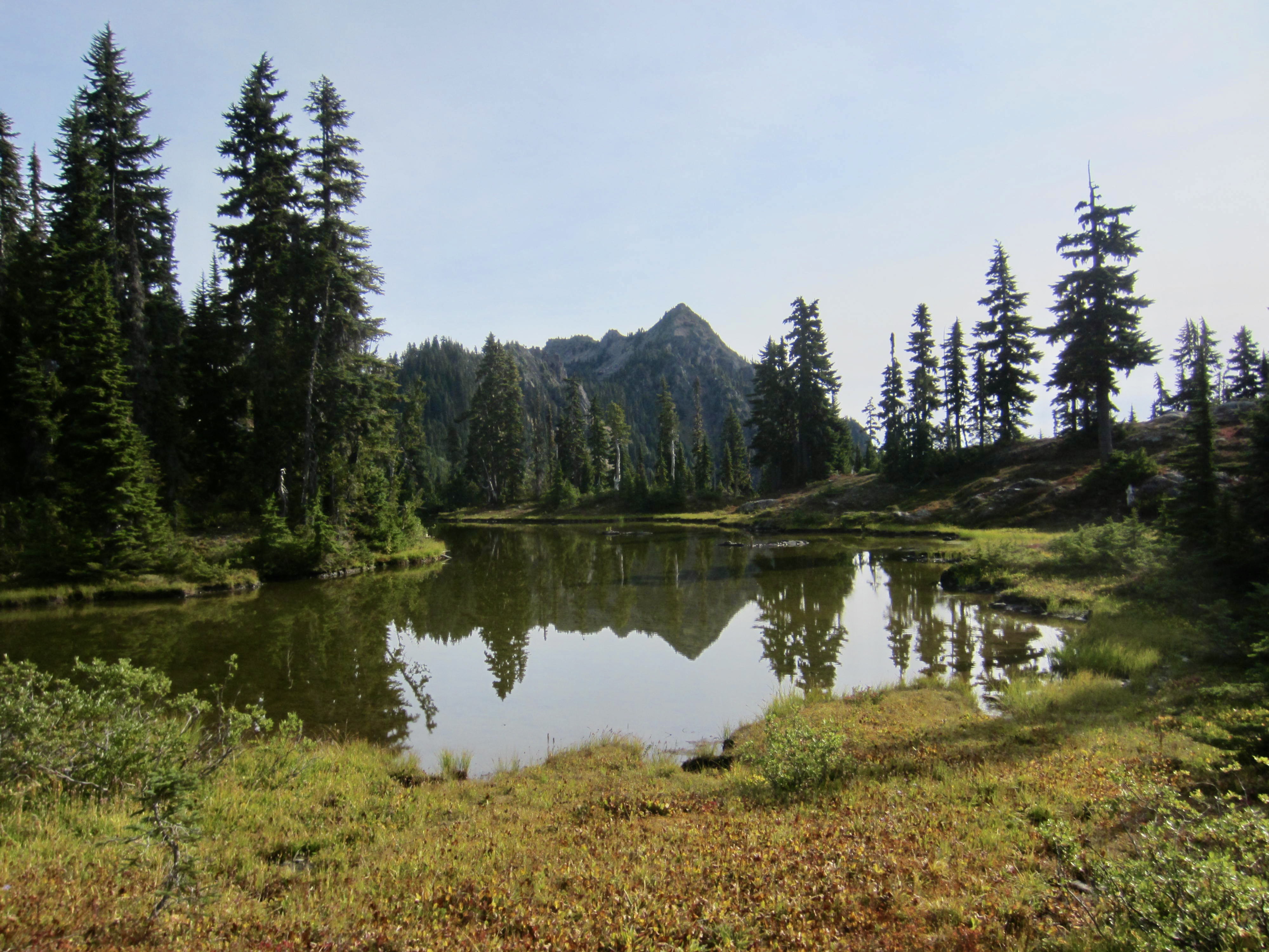
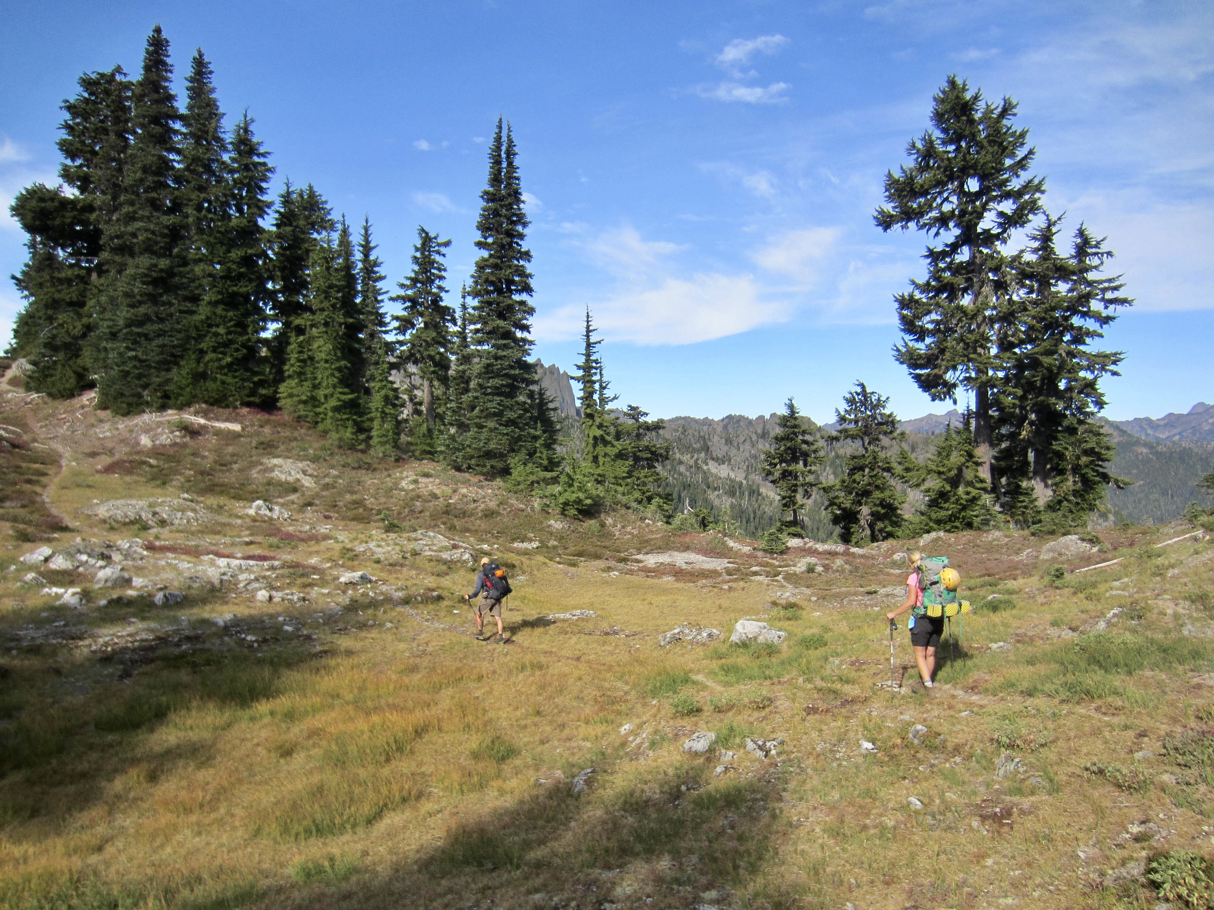
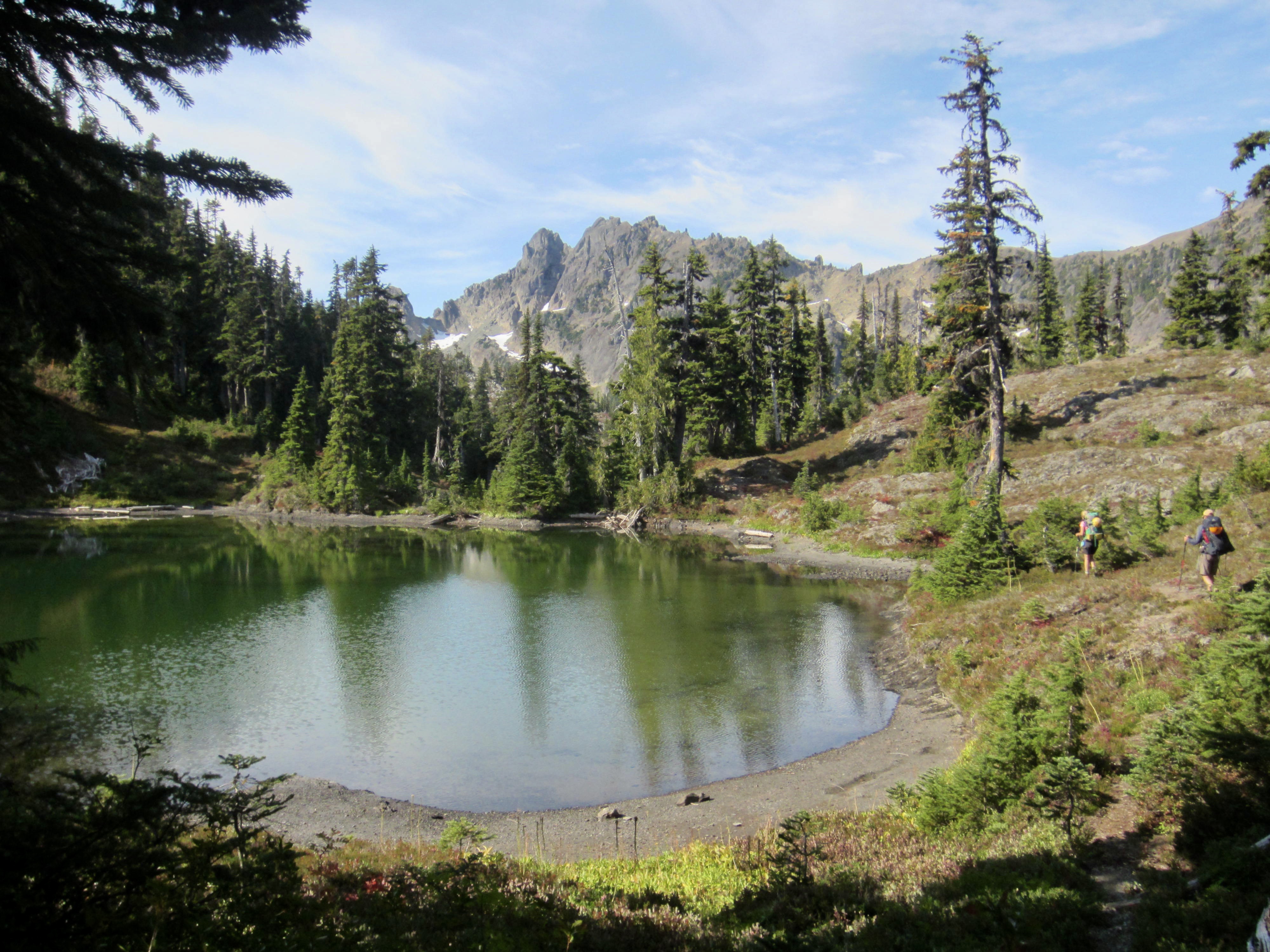
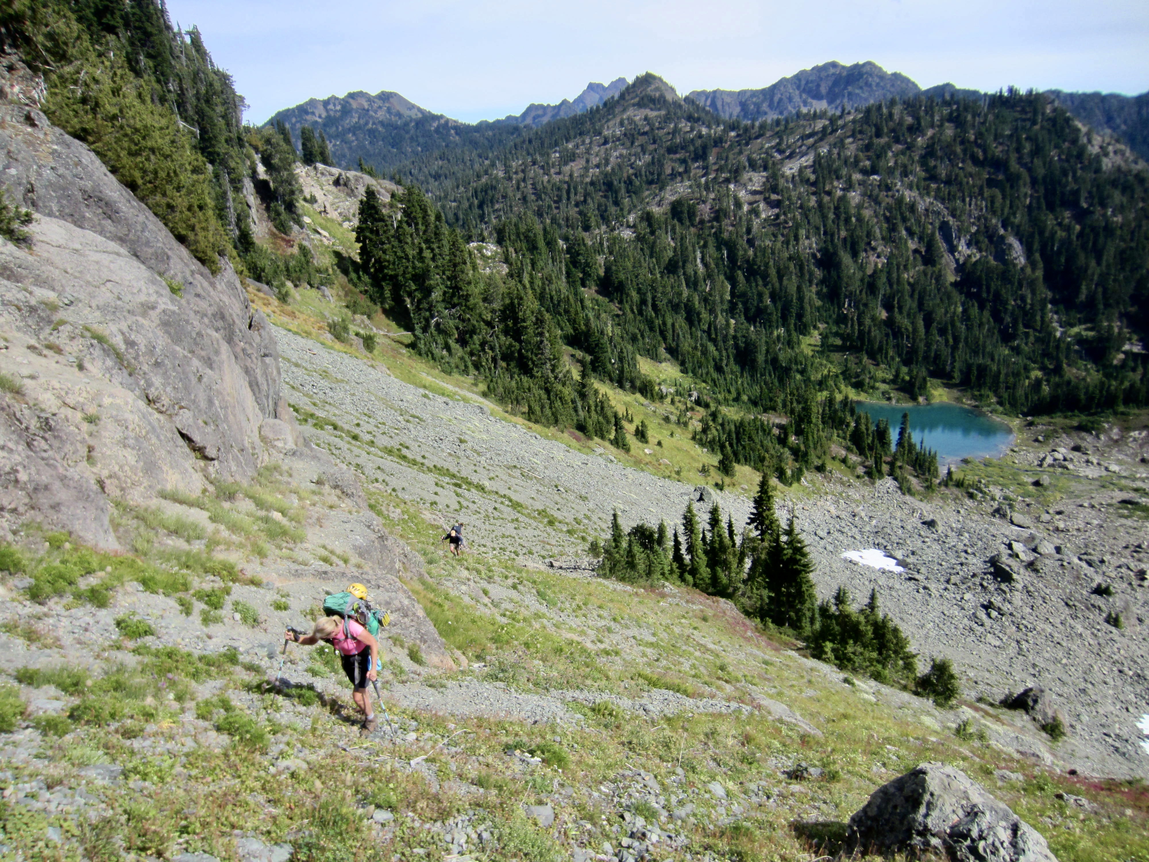
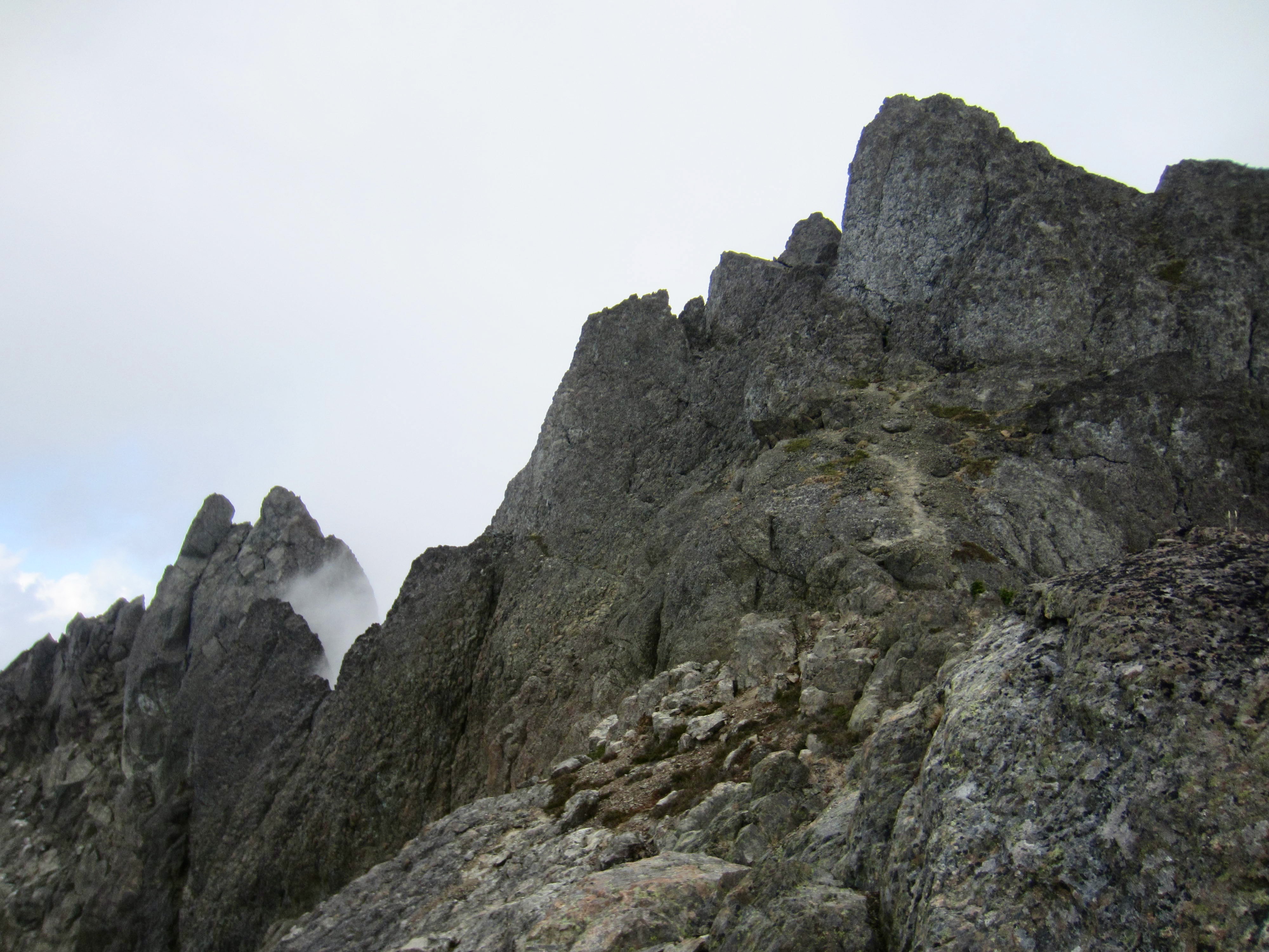
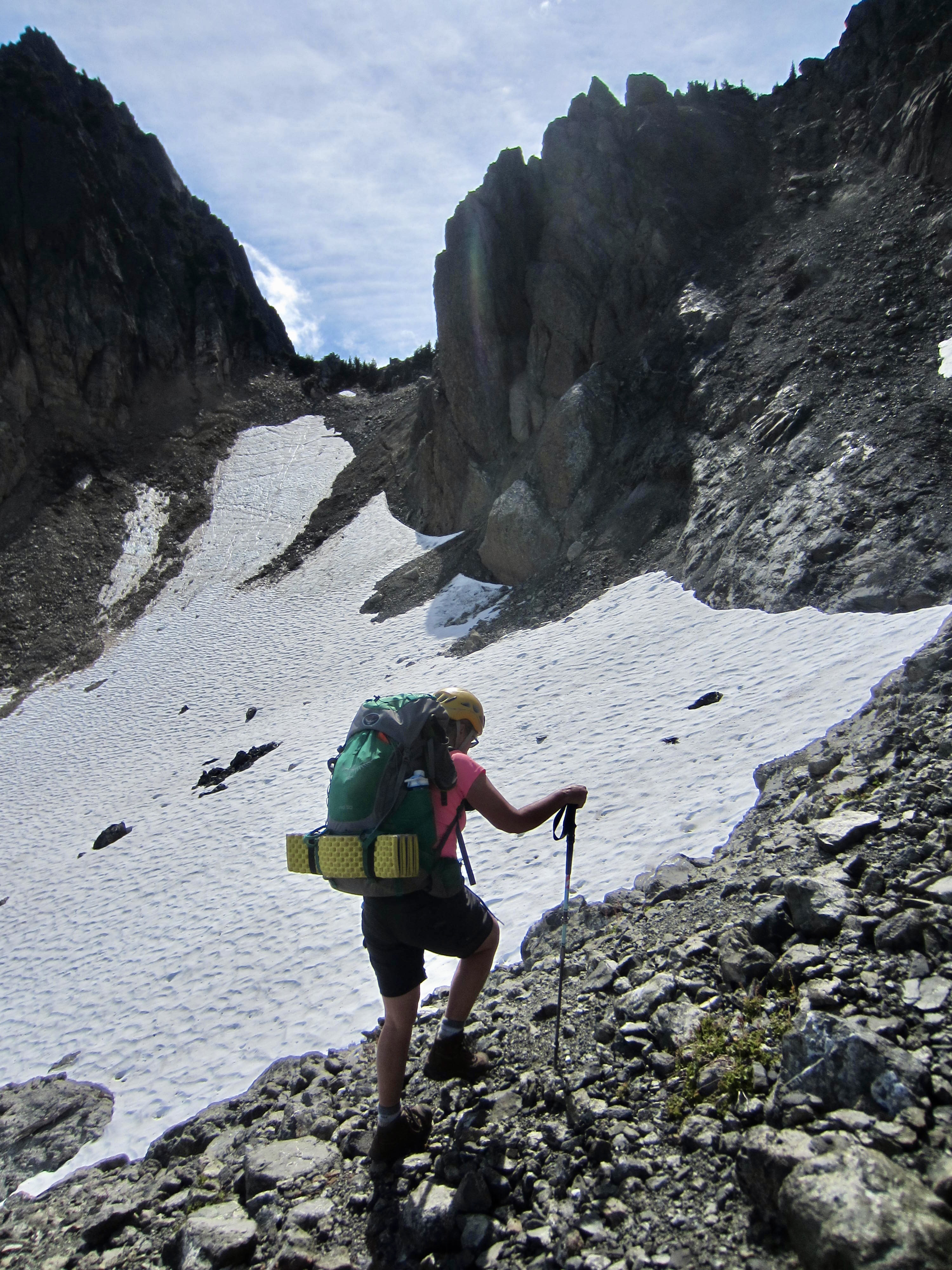
Staying on the trail, we tromped through Scout Basin and up to a 5000-foot pass overlooking two small lakes called “Ullin’s Bathtubs.” St. Peter’s Gate could now be seen as an obvious gap in the southeast ridge of Mt. Stone ahead, and there appeared to be two possible ascent routes. The higher route involved a well-defined snow ramp, so we headed in that direction.
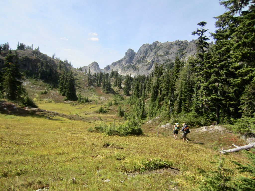
Although the trail ended at Ullin’s Pass, we were easily able to contour above the bathtubs and make a rising traverse toward the snow ramp. The ramp angled across a steep hillslope below Mt. Stone and ended at a grungy moraine.


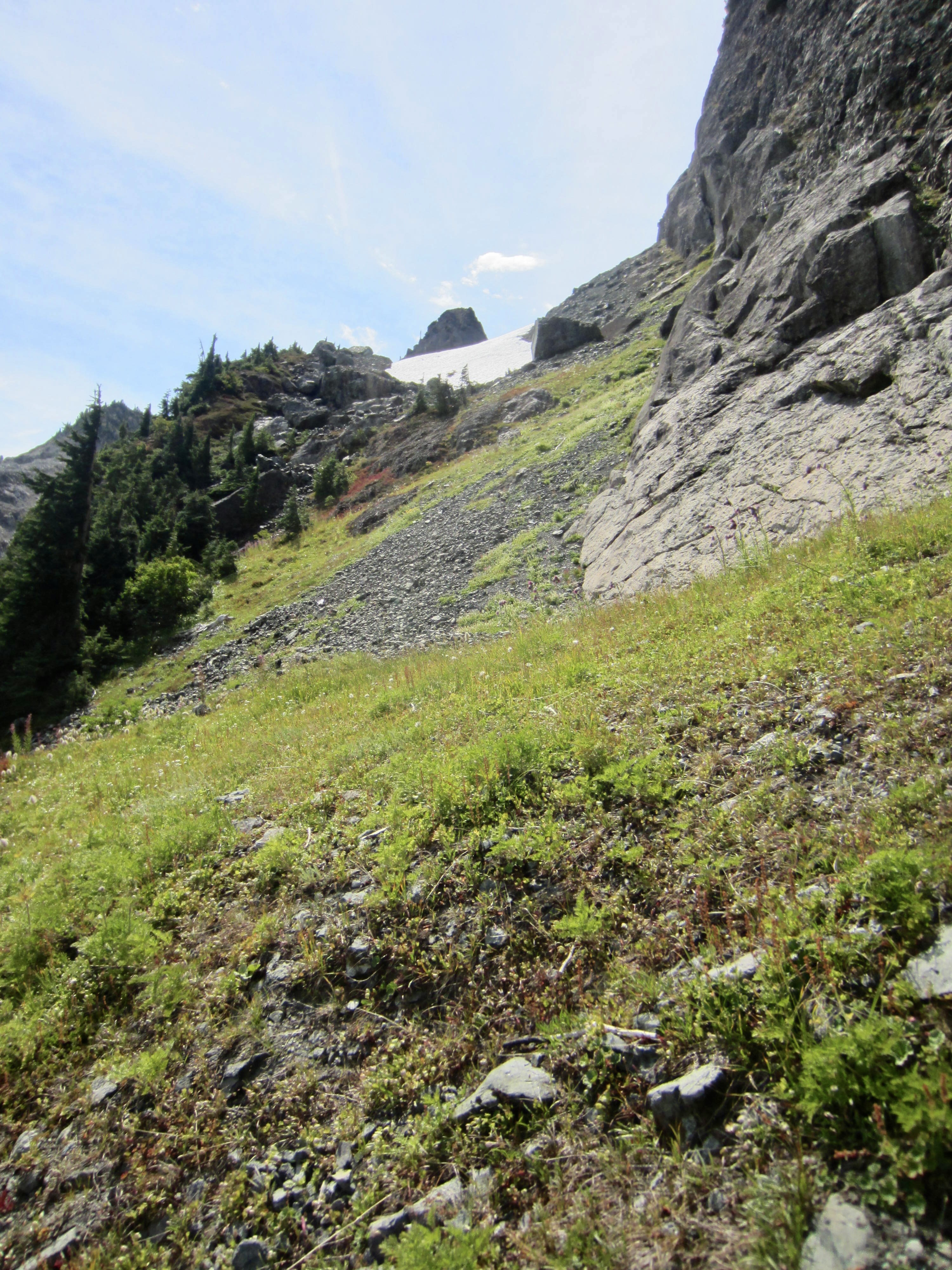
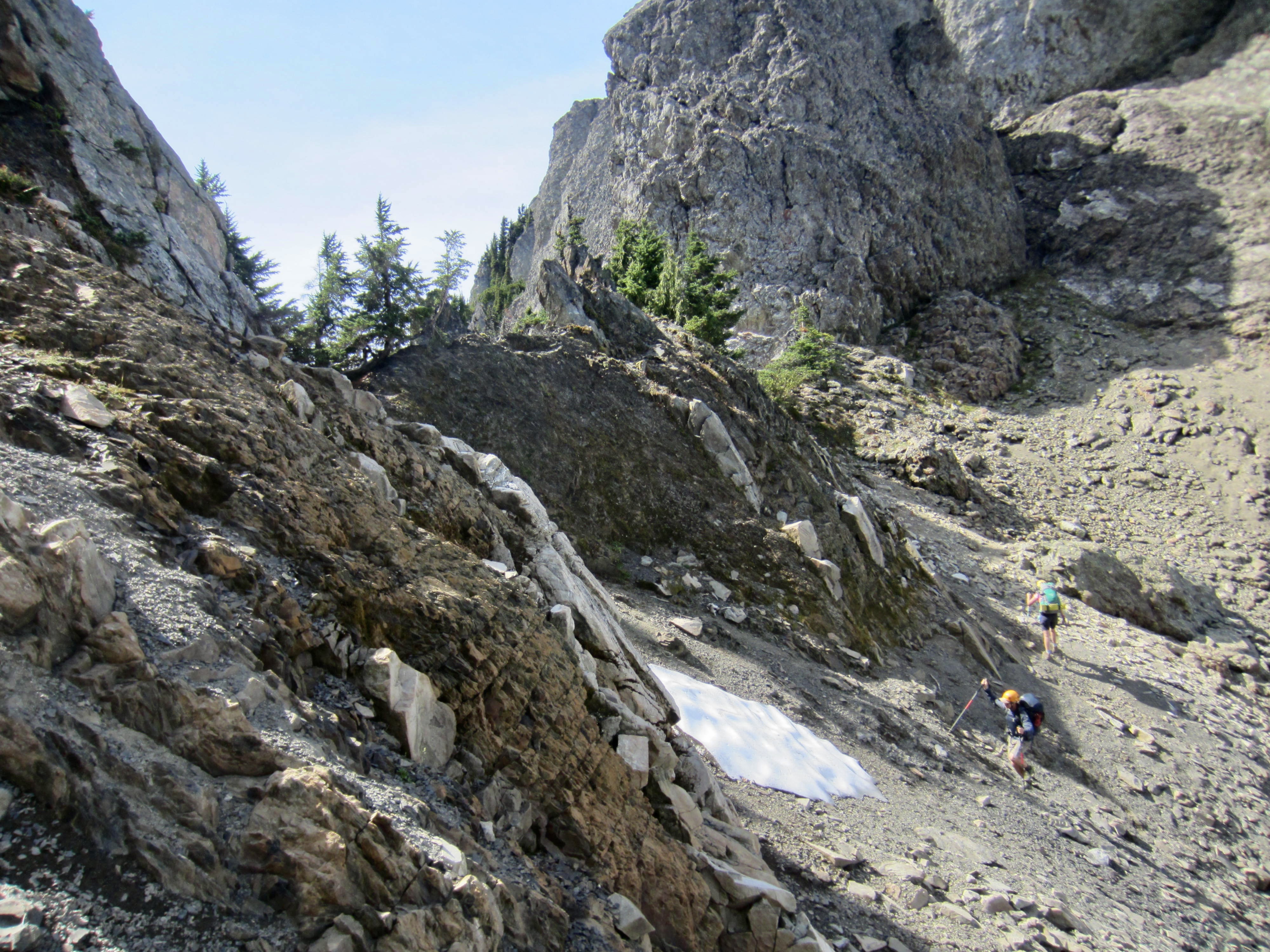
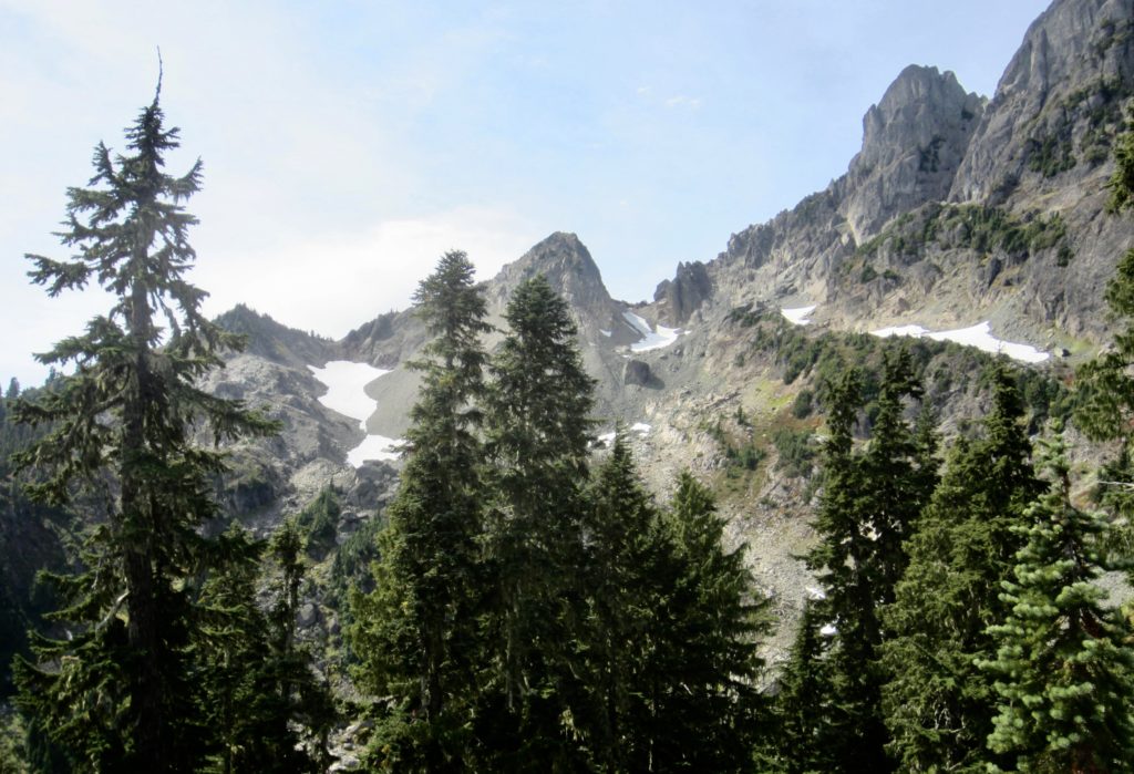
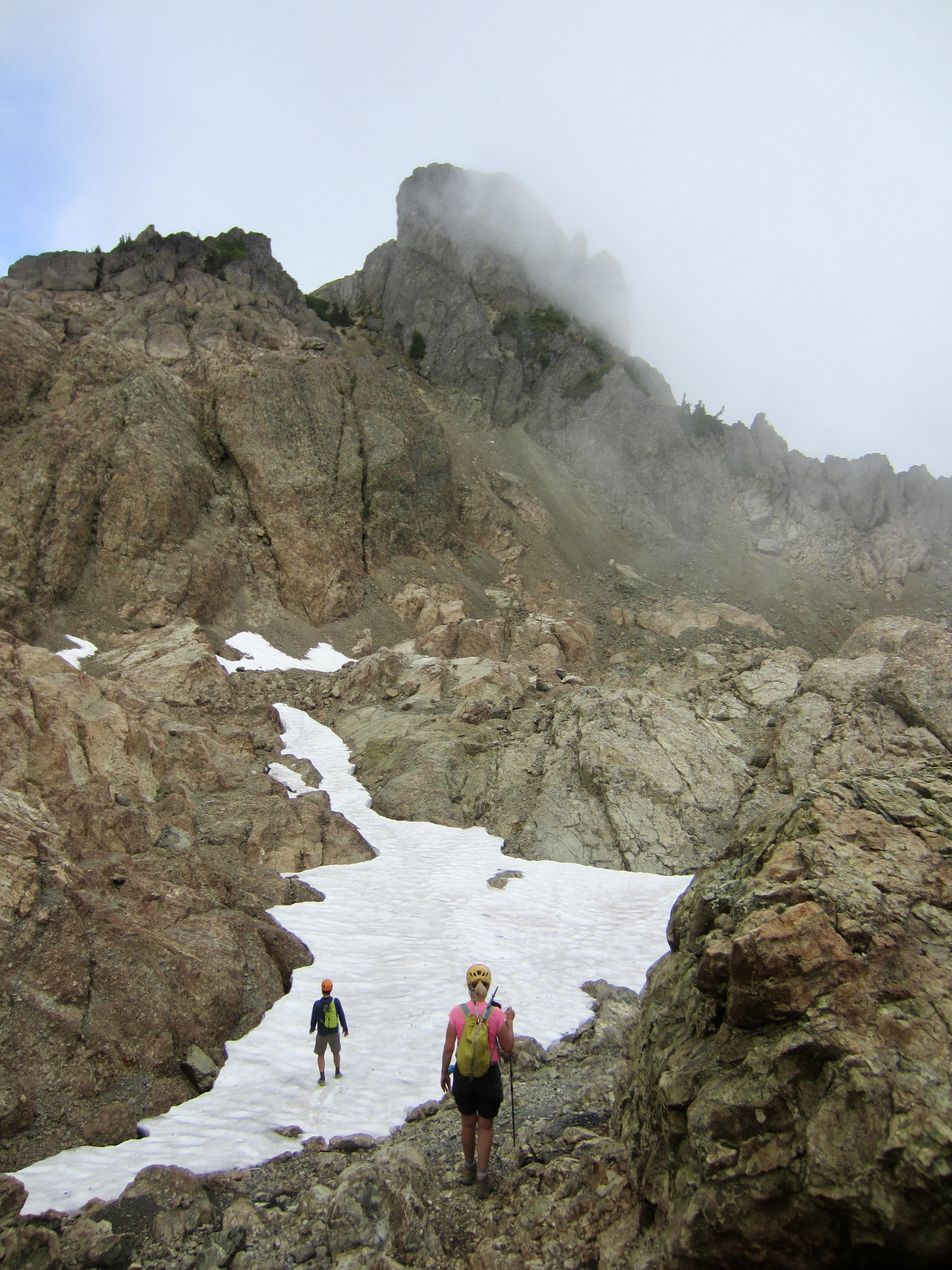
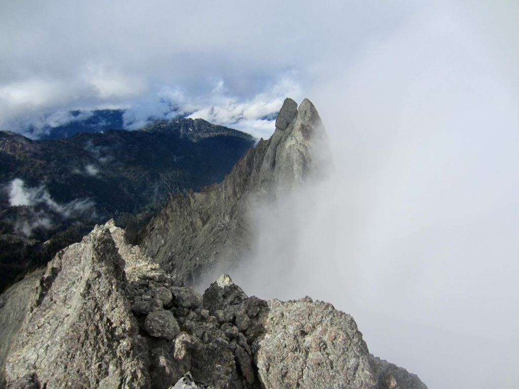
St. Peter’s Gate stood at the head of a large bowl, about 200 vertical feet above us. I suspect that this bowl normally presents a straightforward snow climb, but now the bowl consisted of exposed dirt and mud with a partial covering of icy snow. Yuck!
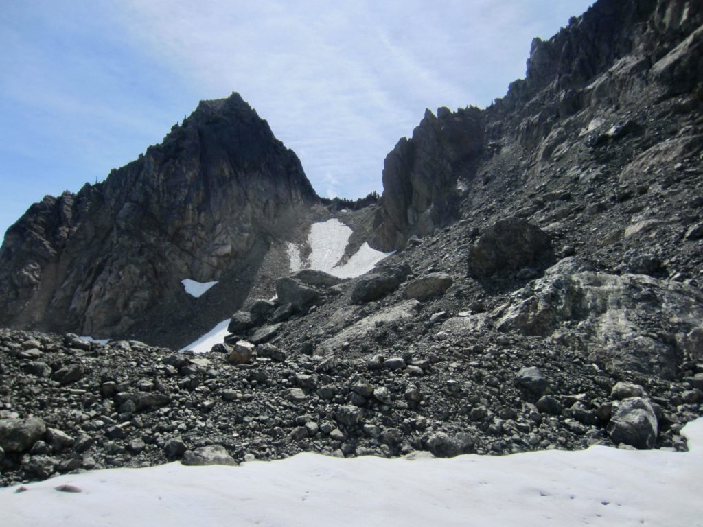
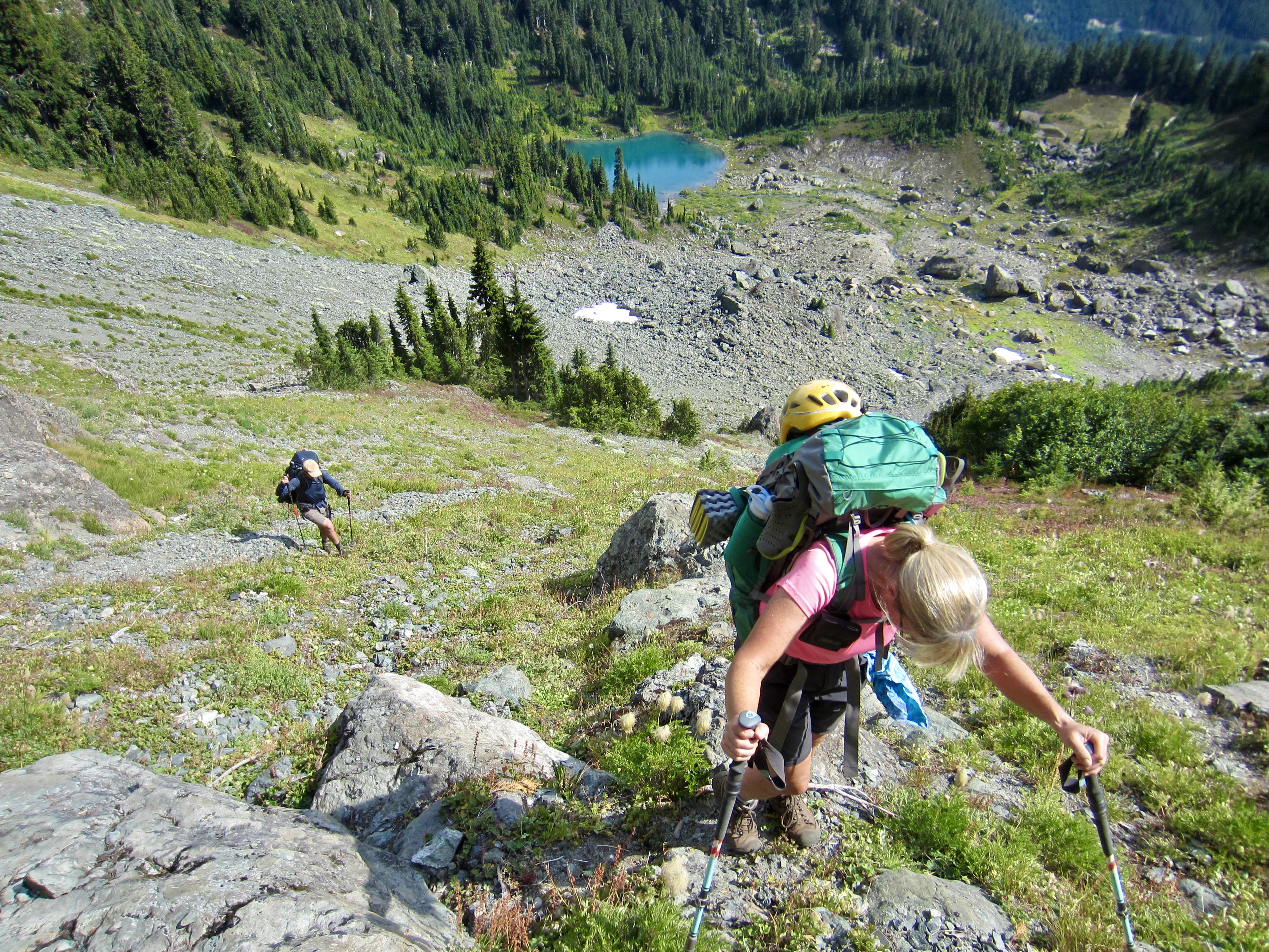
We dropped down the moraine, crossed a snow patch, and then groveled up the steep dirt and mud slope. It wasn’t pretty, but we gained 5950-foot St. Peter’s Gate—the high point of the entire traverse—without incident by early afternoon (5.0 hours + 2200 feet from Camp 1).

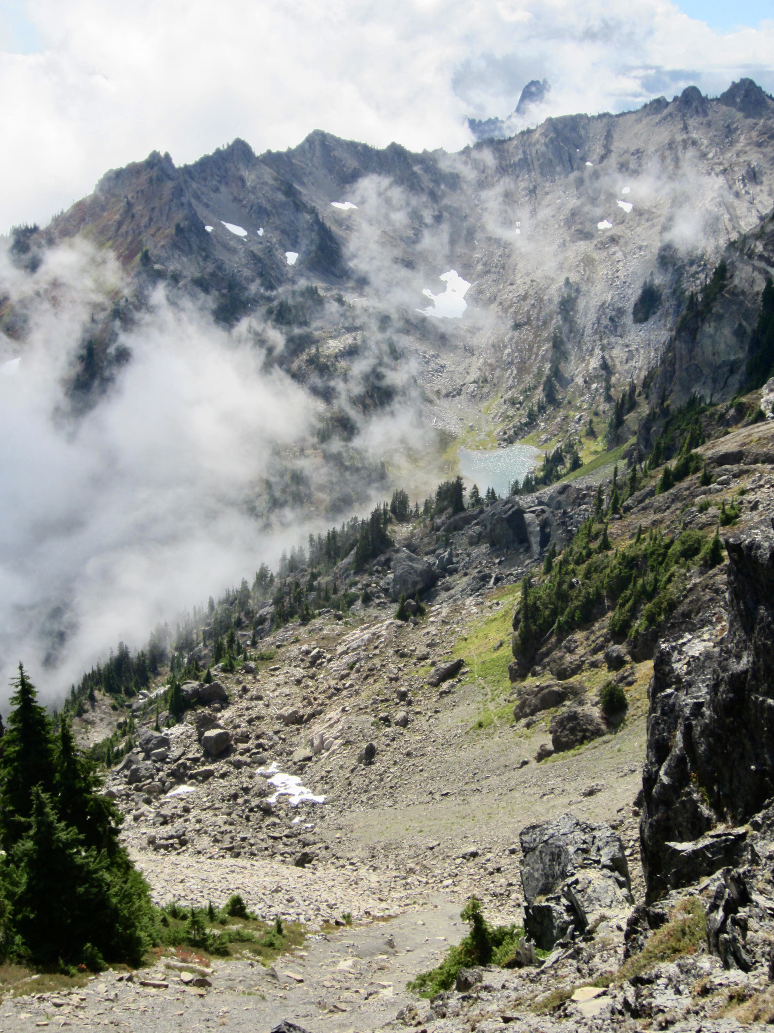
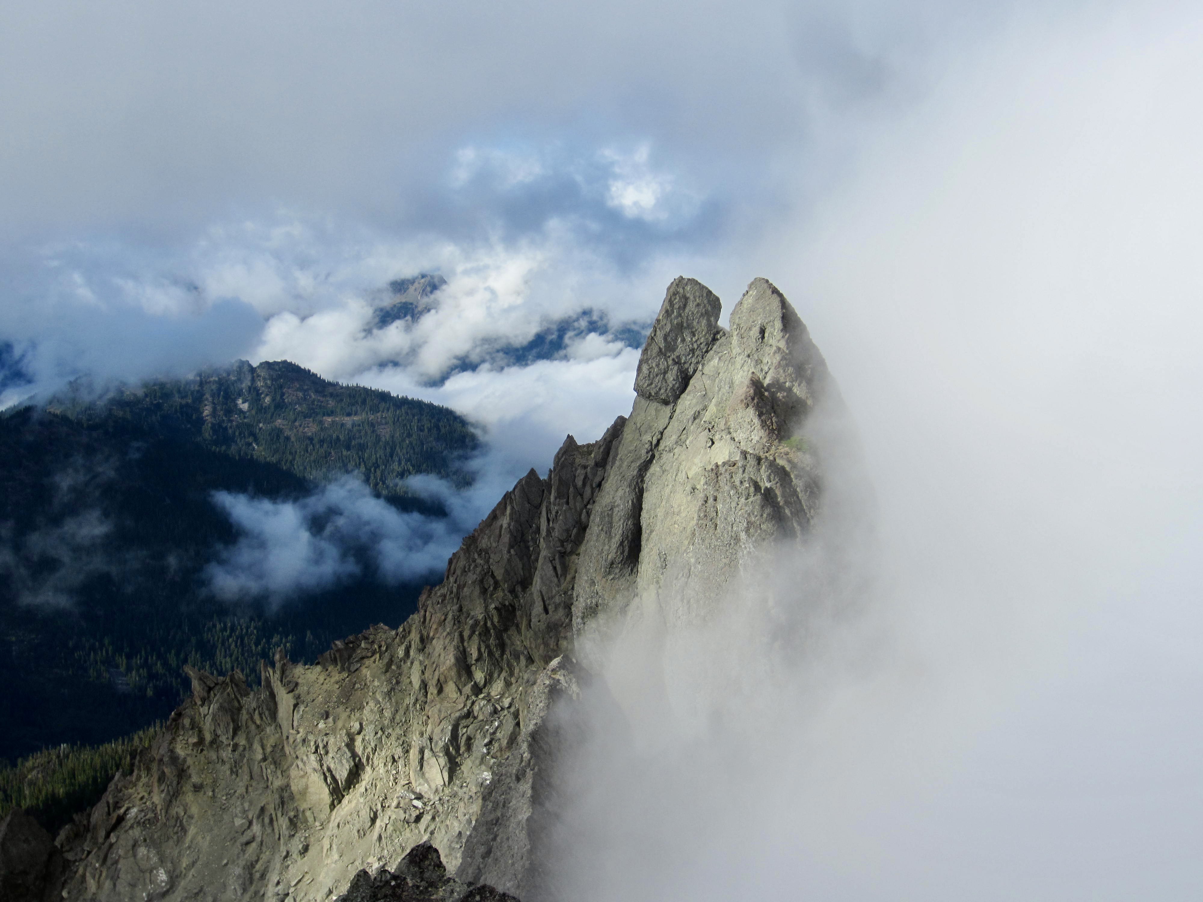
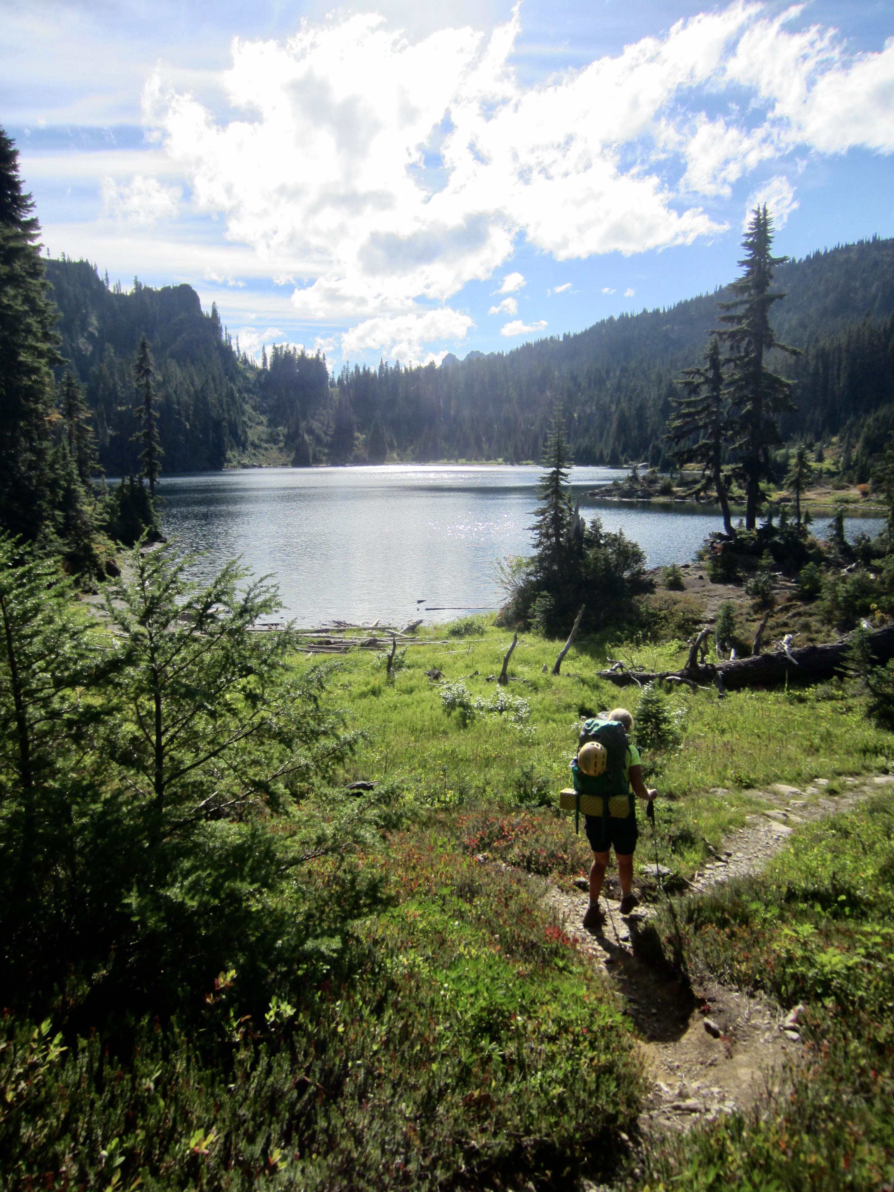
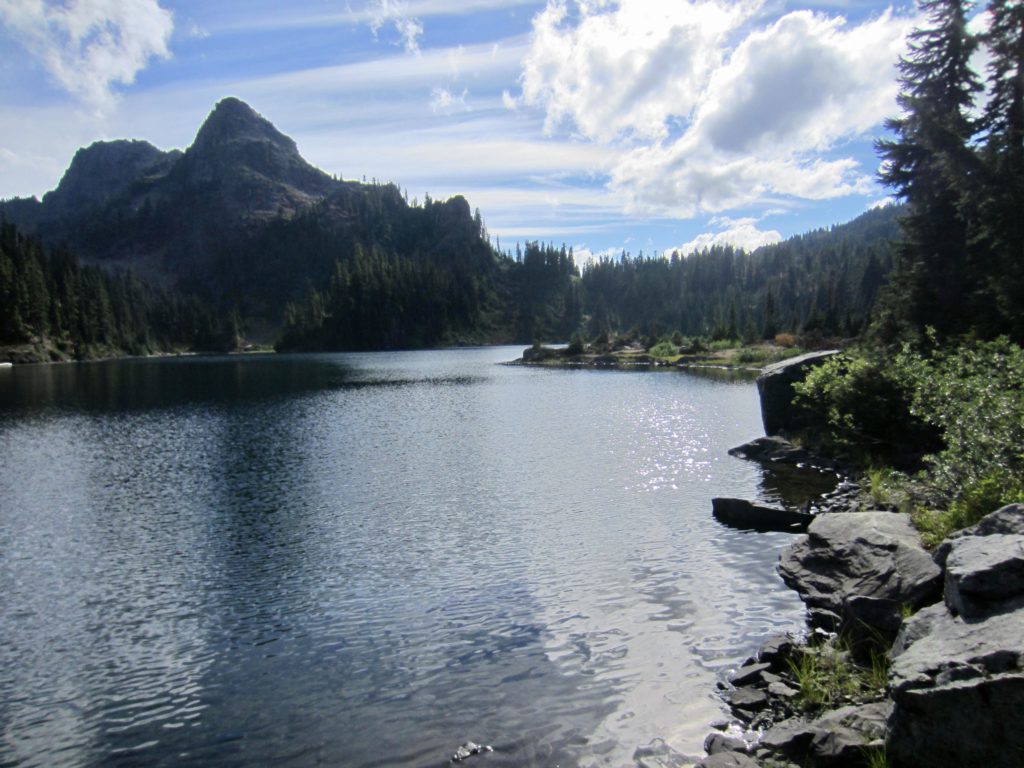
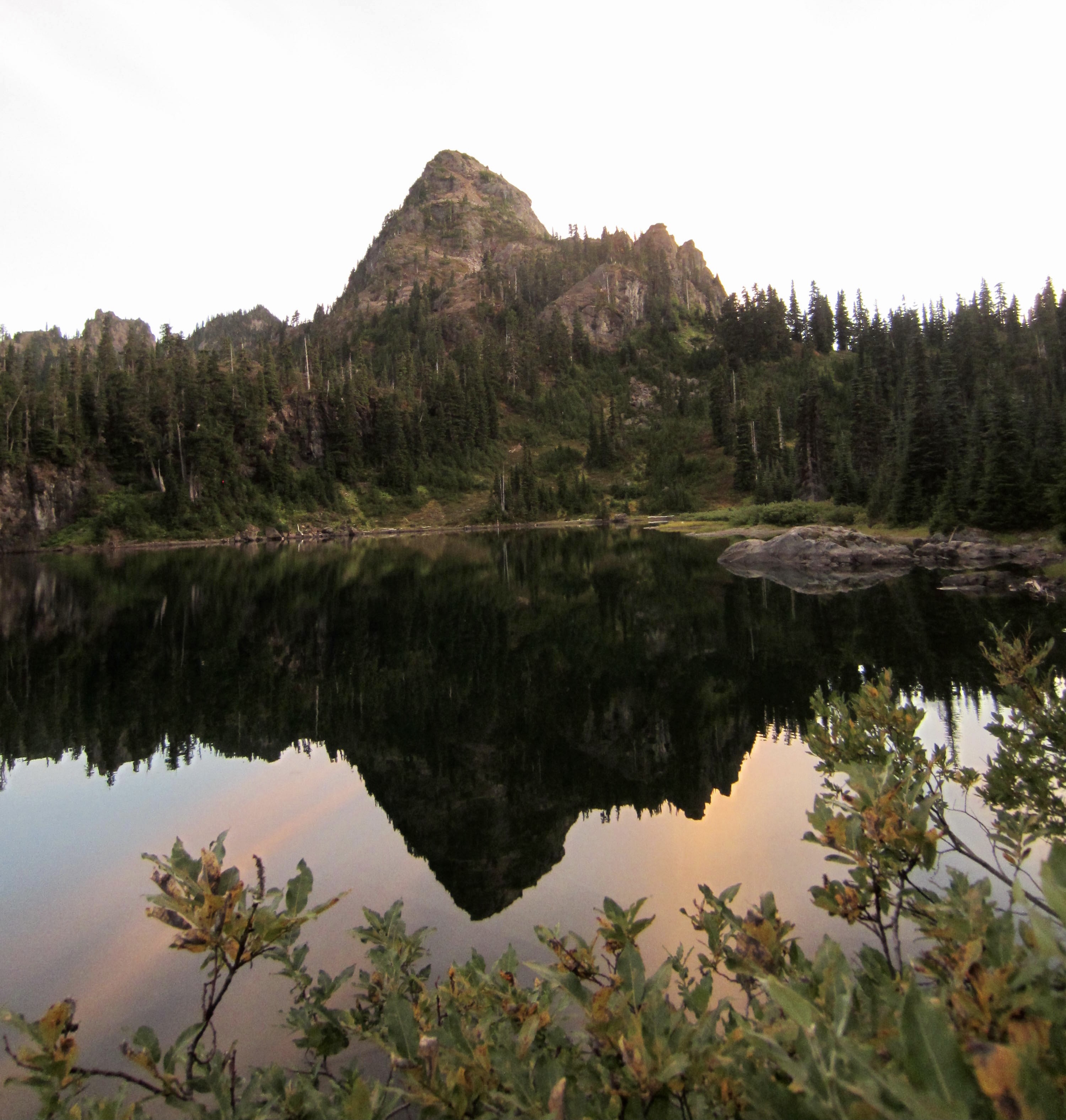
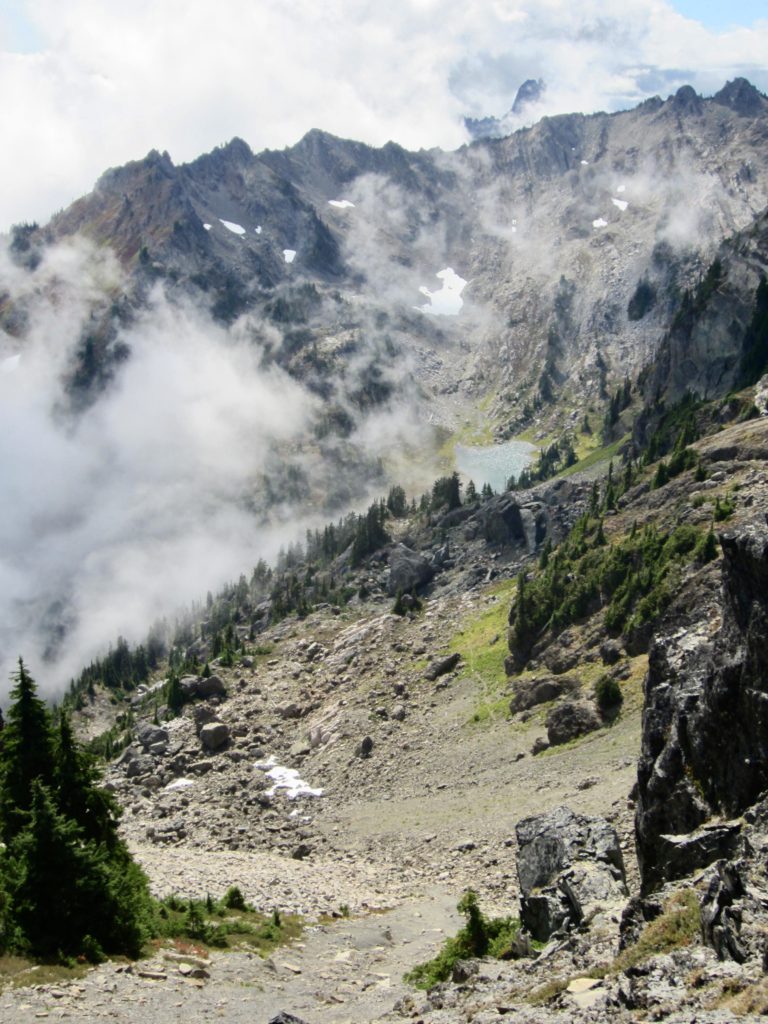
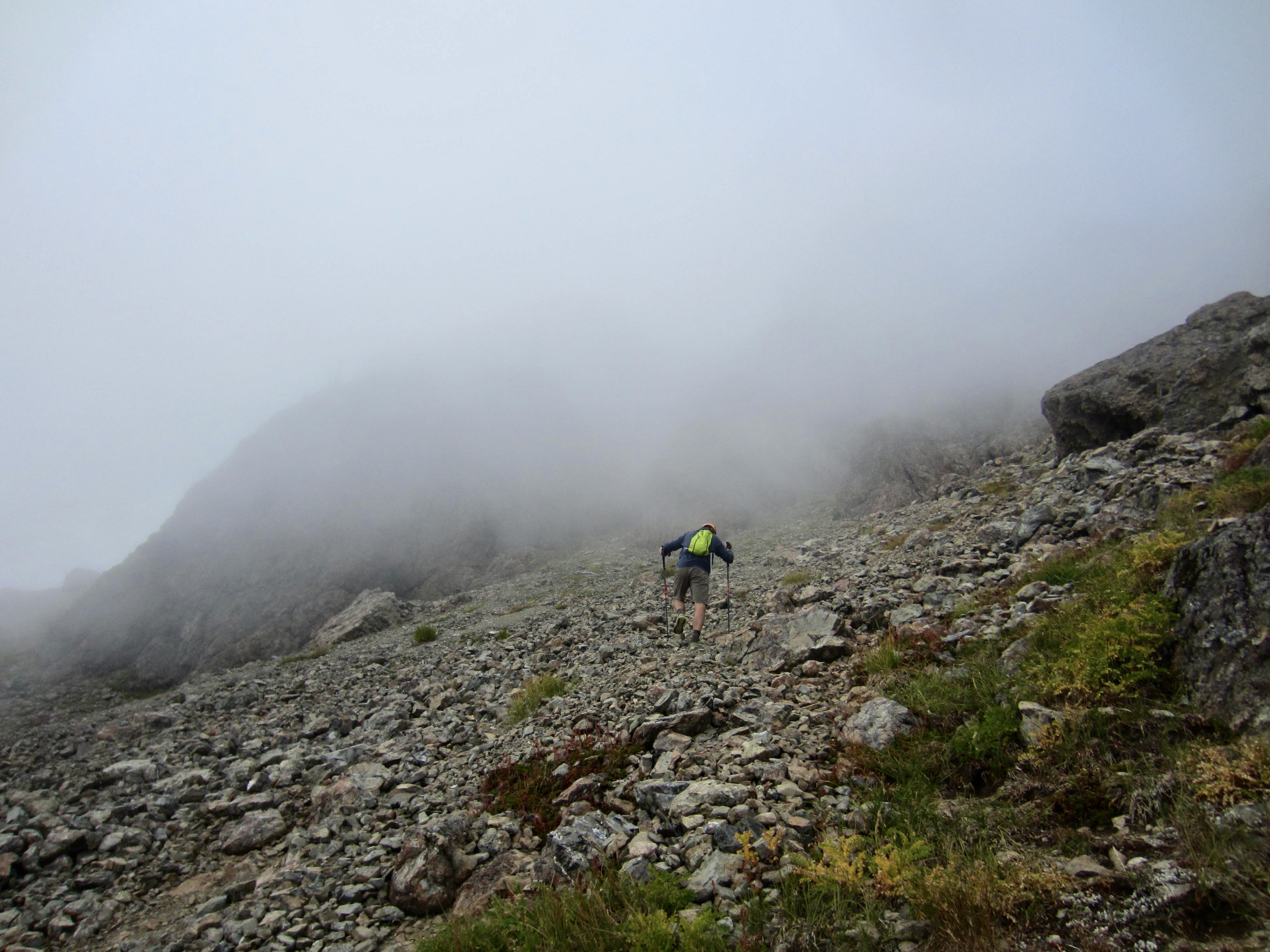
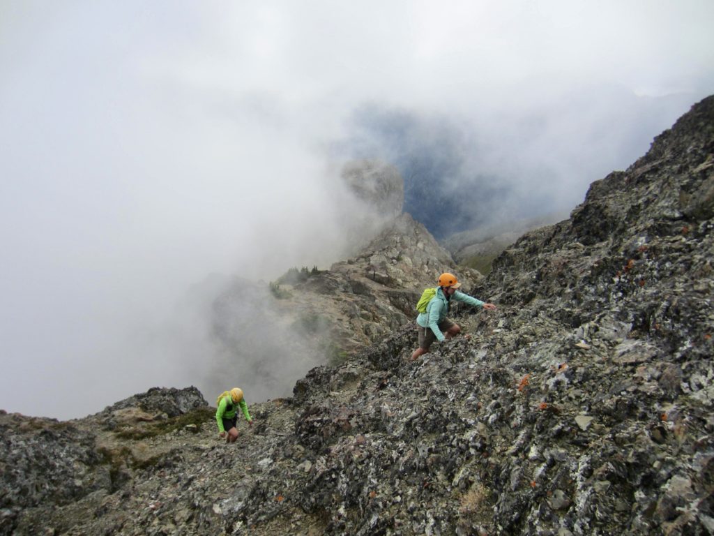
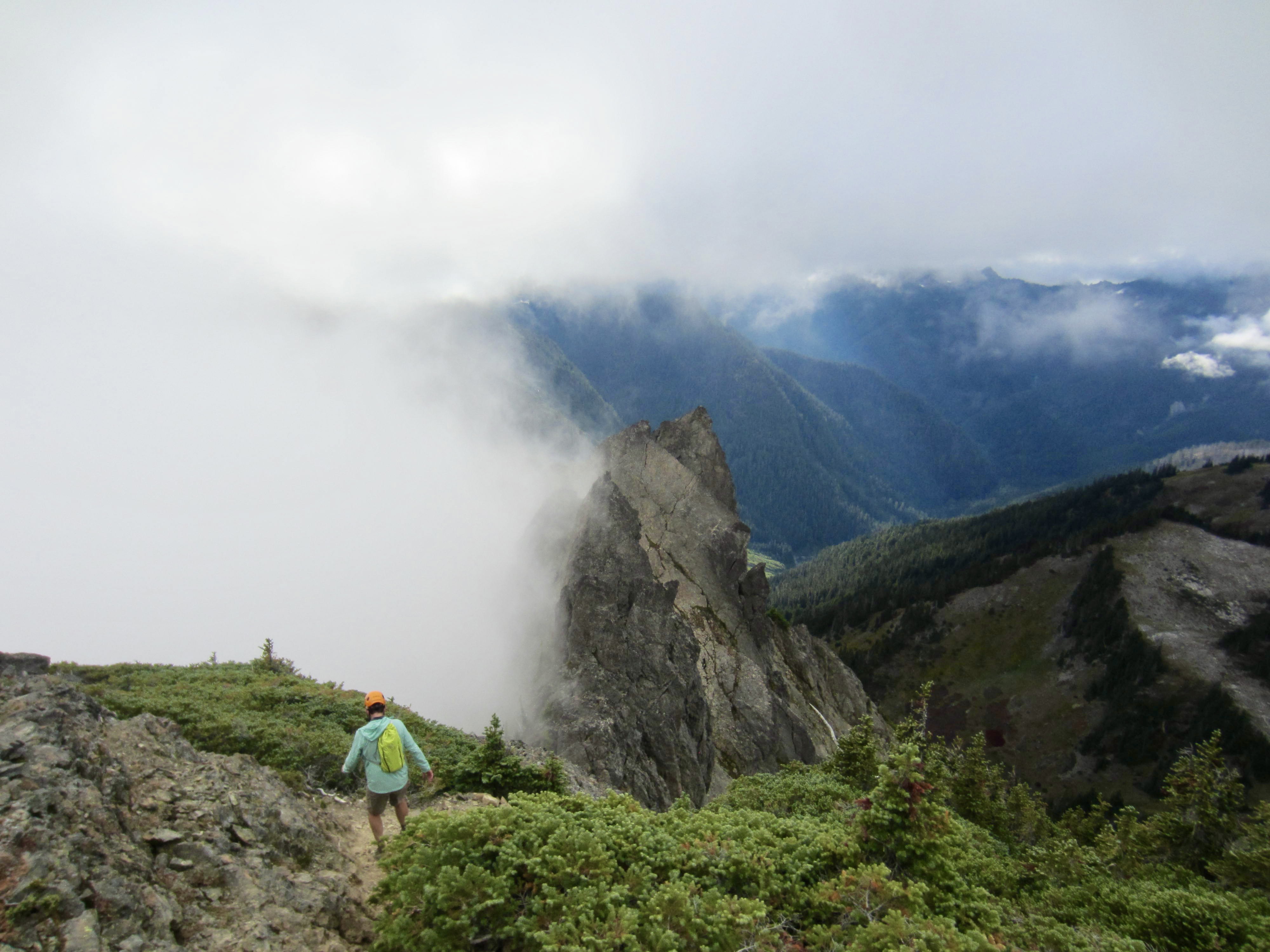
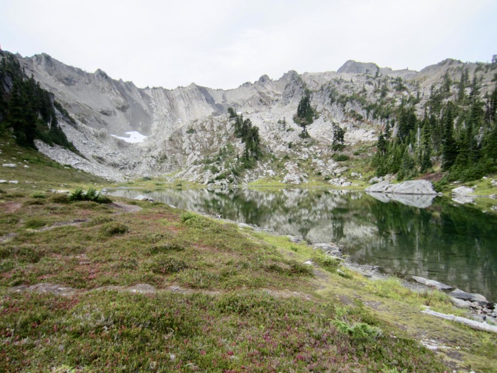
Lake of the Angels sits in a grassy bowl ½ mile southwest of St. Peter’s Gate, appearing as a welcome oasis to trekkers who cross over the rocky pass. To our dismay, however, a tongue of fog was creeping up the valley, and within a few minutes, the lake disappeared from view. Oh no…it was the dreaded marine fog!
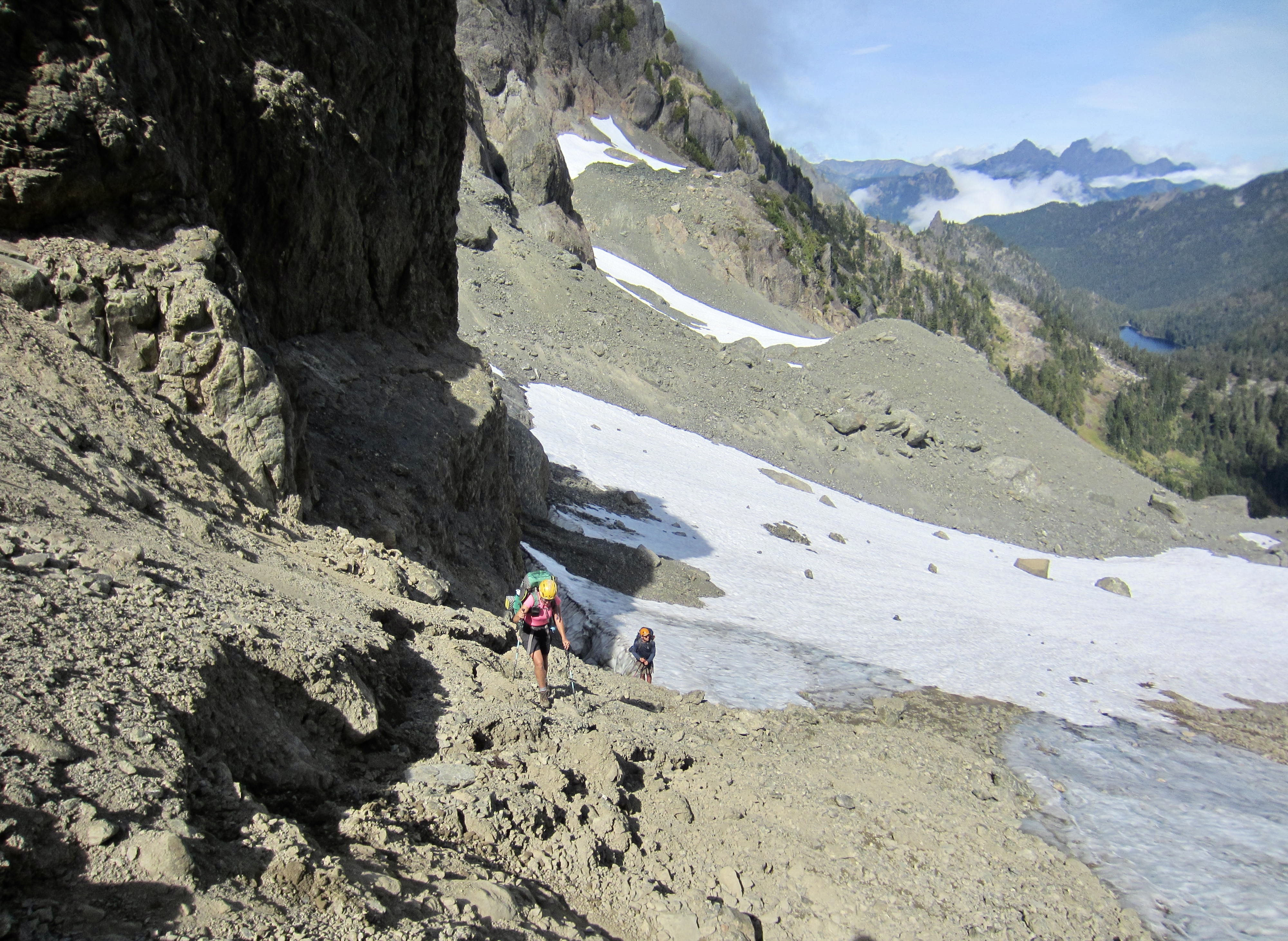
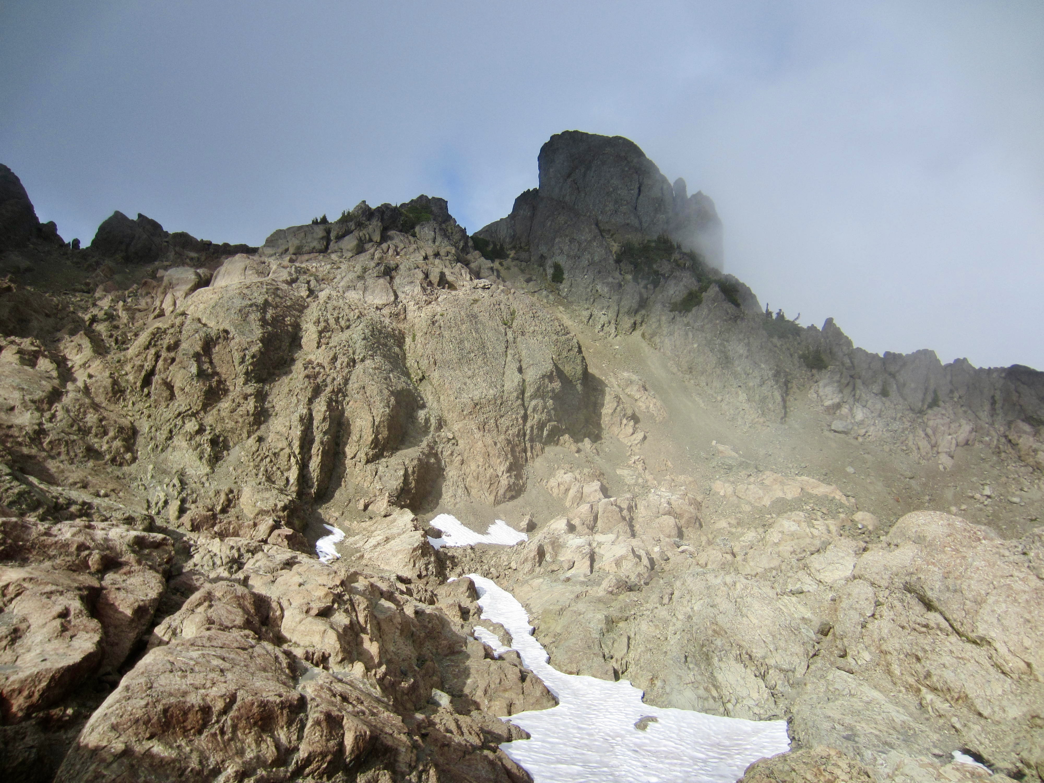
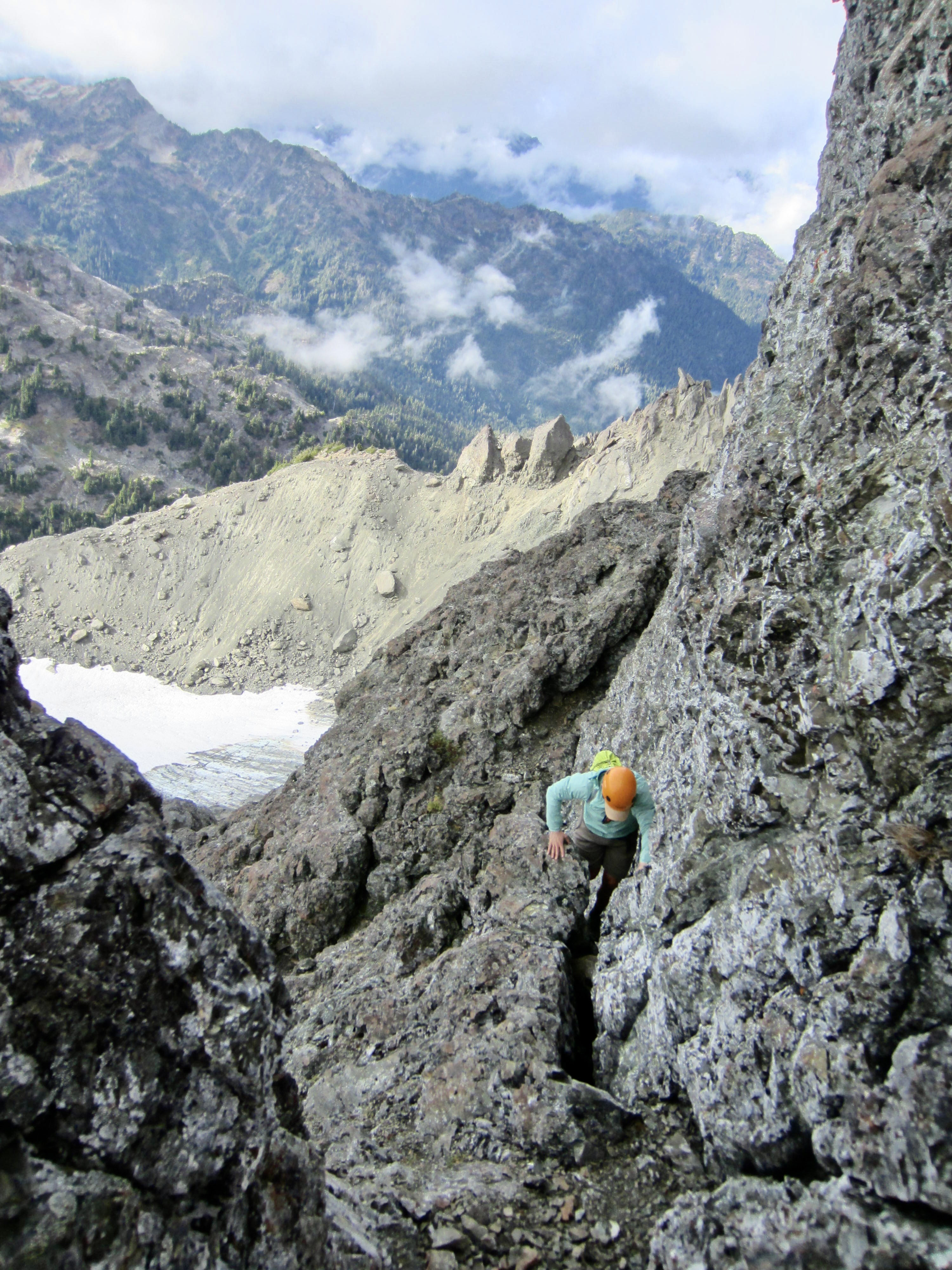
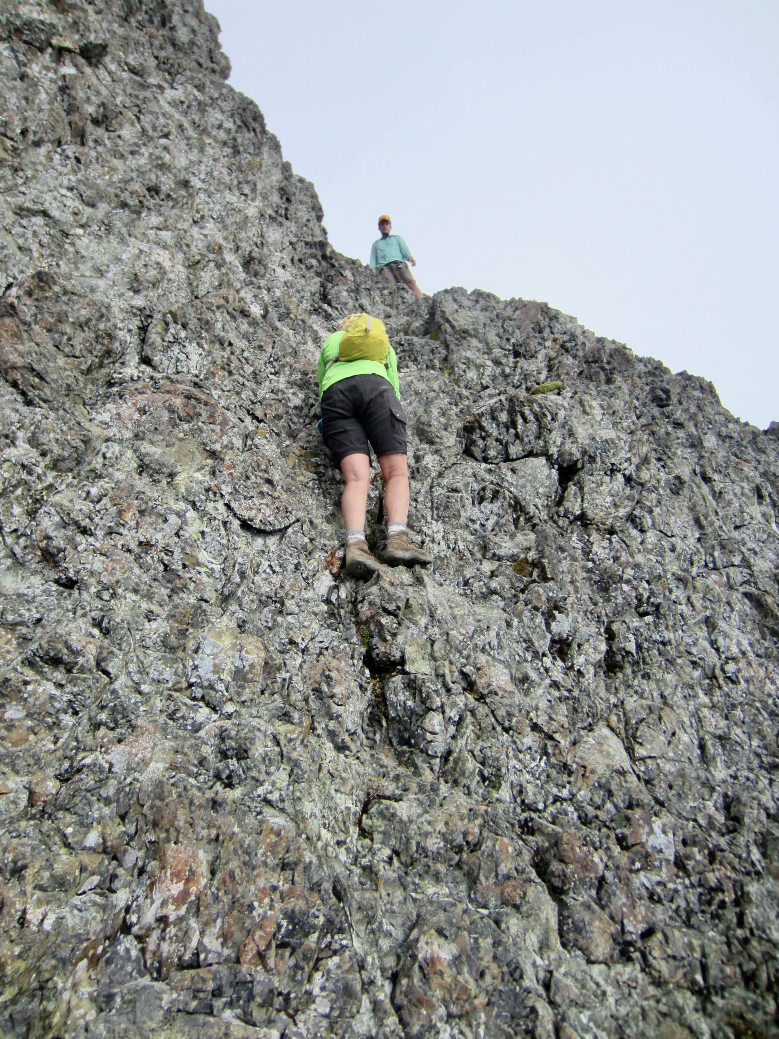
From St. Peter’s Gate, we descended 300 feet on steep dirt and scree until reaching the base of a basalt cliff. There, we stashed our backpacks and headed up Mt. Stone with summit packs, initially following a vague climber’s path.
The fog gave us some navigational problems, such that we soon lost the climber’s path and ended up in a Class 3-4 gully on Mt. Stone’s south face. This gully took us steeply upward to a large, Martian-esque rock bowl directly below the summit block. We easily continued up to the west ridge crest and intersected the standard climbing route, delineated by a bootpath leading up to the right (east). The final 100 feet of our ascent was a fun Class 2-3 scramble on solid pillow basalt.


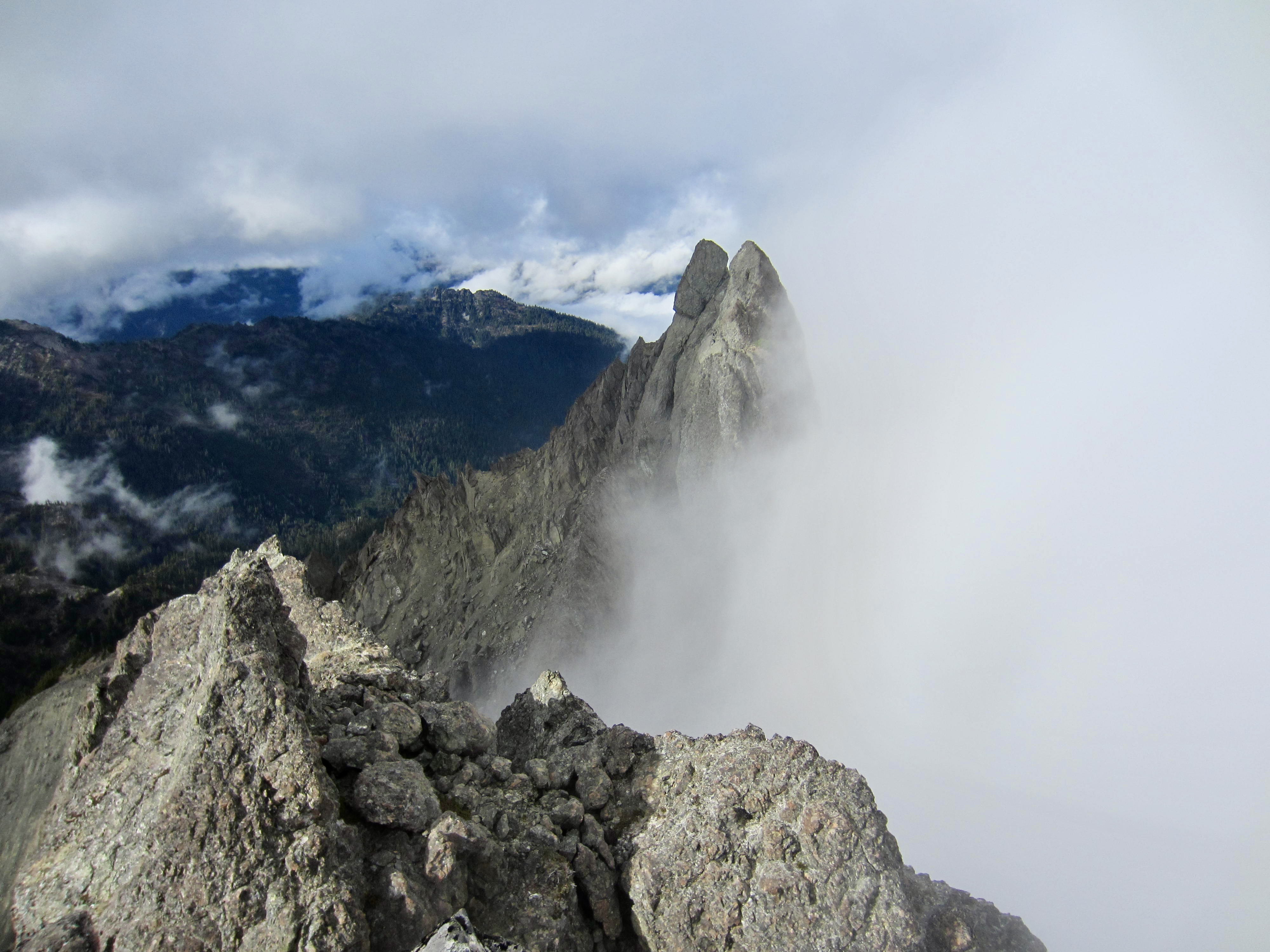
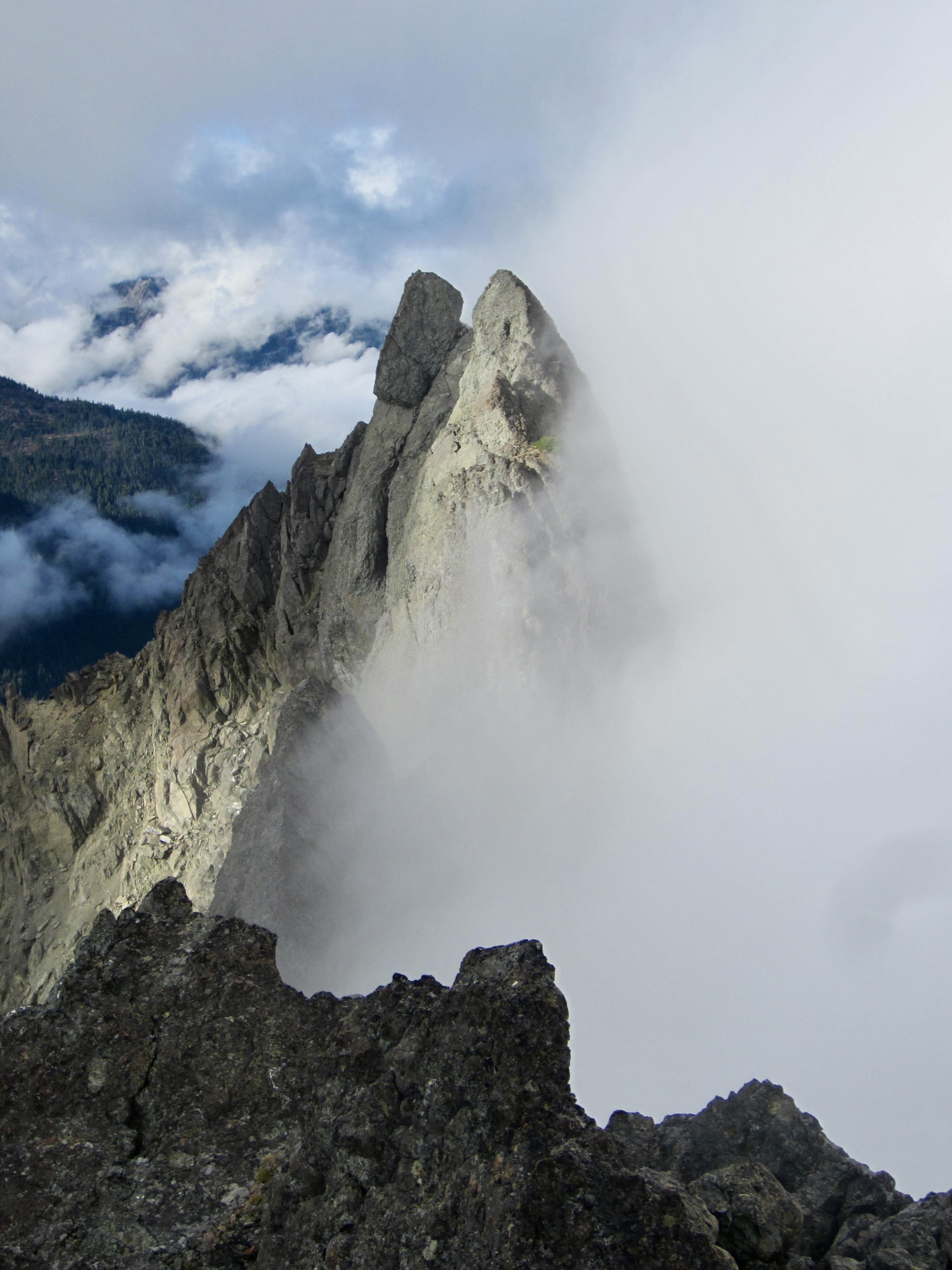
Our summit views were pretty much limited to the twin pinnacles of the north peak, which appeared even more astounding than usual due to the wafting fog. I’ve always appreciated the fact that the south peak is slightly higher than the daunting north peak!
After a short summit break, we down-climbed the Class 3 face and then followed a well-trodden climber’s path down the standard west ridge and southwest slope route. We reached our backpack stash at 6:00pm (3.0 hours + 1100 feet RT) and quickly saddled up.
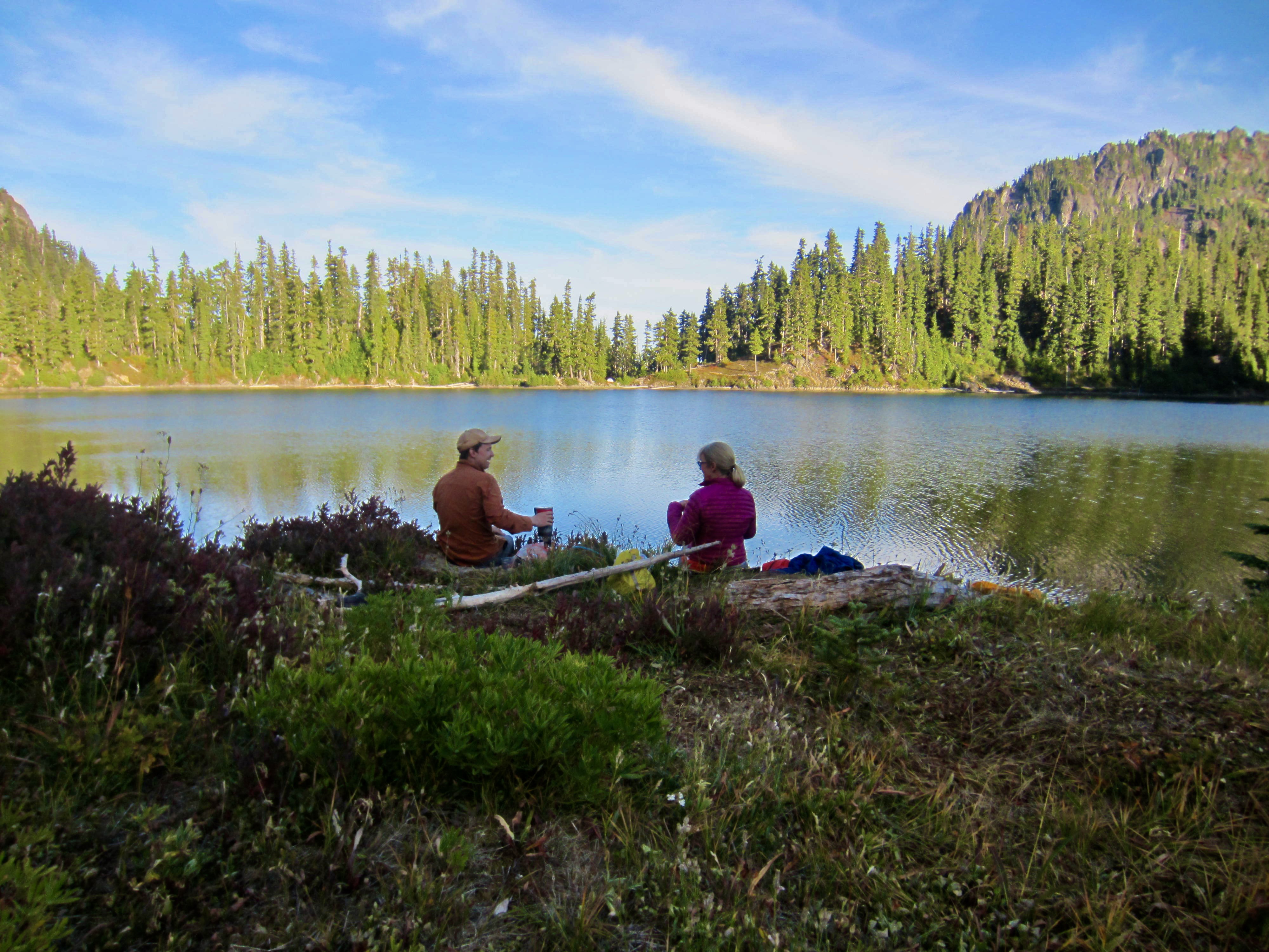
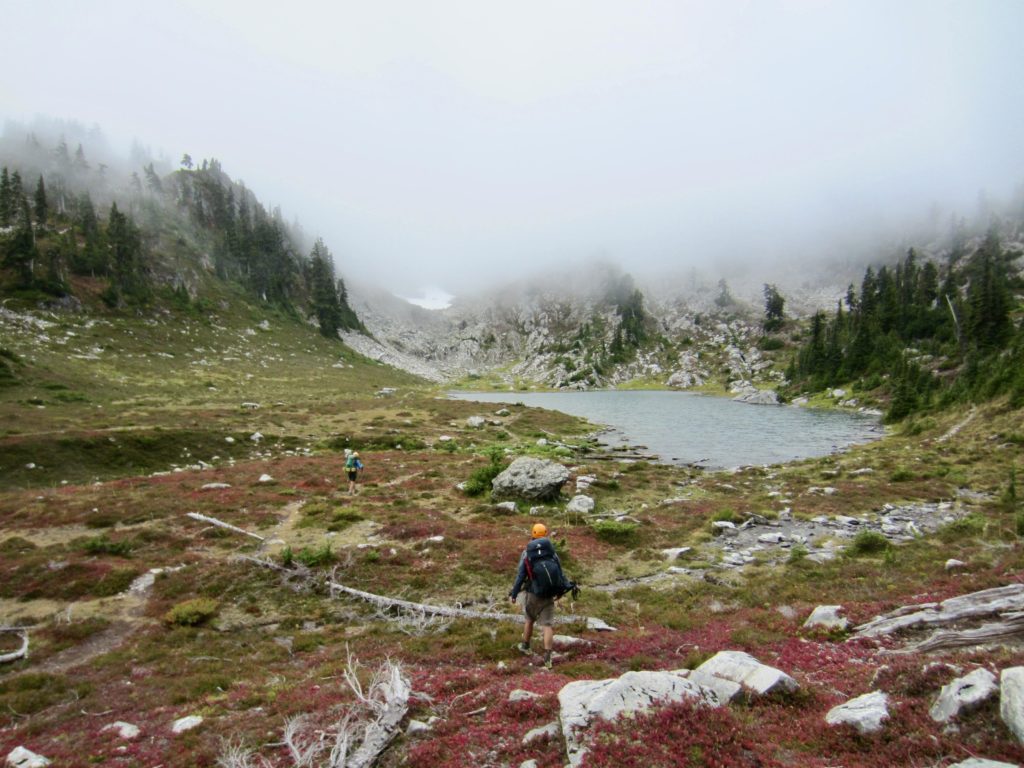
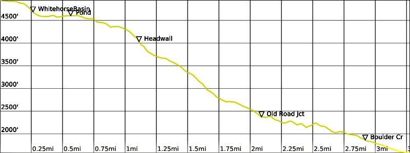
Descending into the fog created a bit more navigational confusion, but we eventually made our way to Lake of the Angels in early evening (9.8 hours + 5.3 miles + 3300 feet from Camp 1, including sidetrip). It didn’t feel so much like an oasis, however; low clouds and cold fog hung over the lake all night.
Day 3: Lake of the Angels to Putvin Trailhead
We were happy to see a high cloud ceiling and many blue patches overhead in the morning. This being a Saturday, the lake basin held a full complement of camping parties—including one guided party from Texas. Apparently, the Olympics’ attraction extends far beyond Washington State!
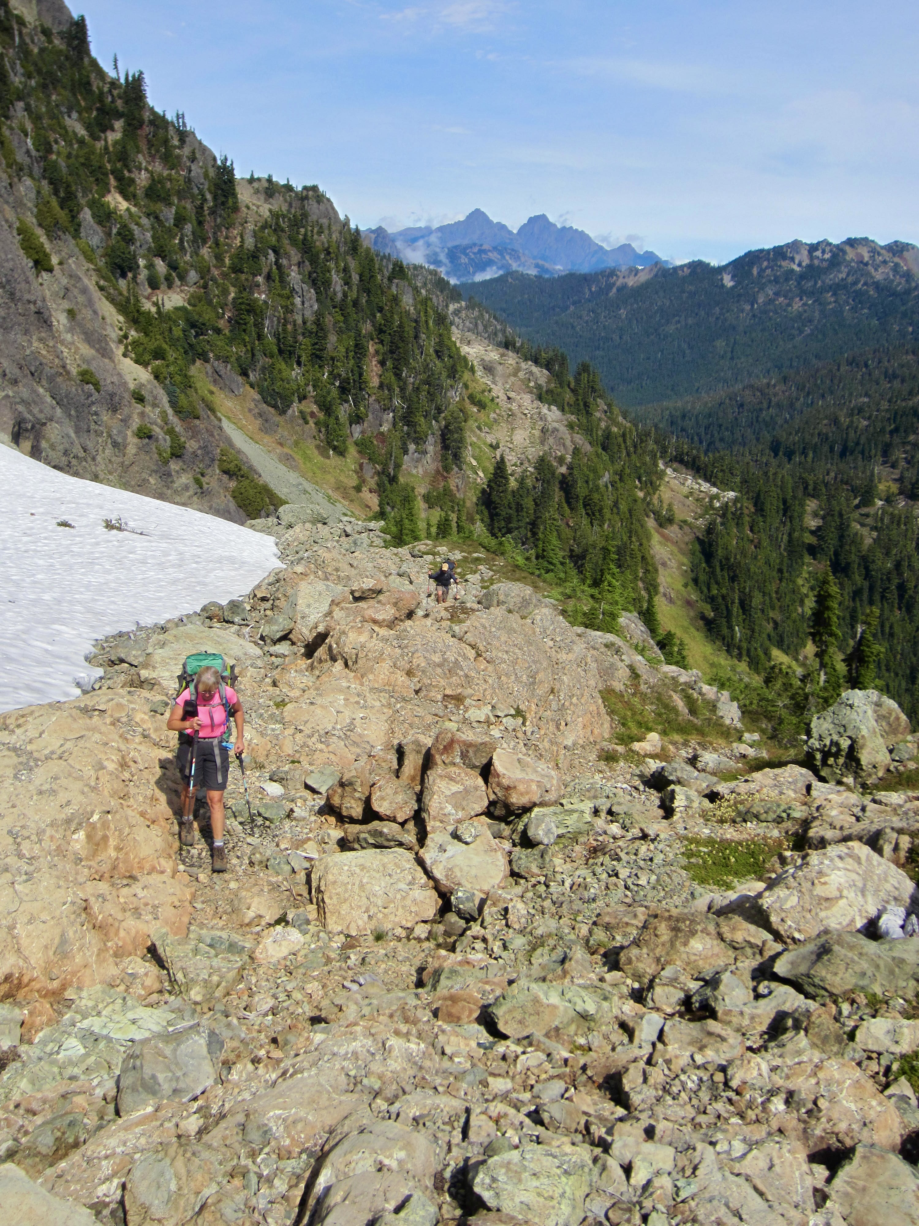
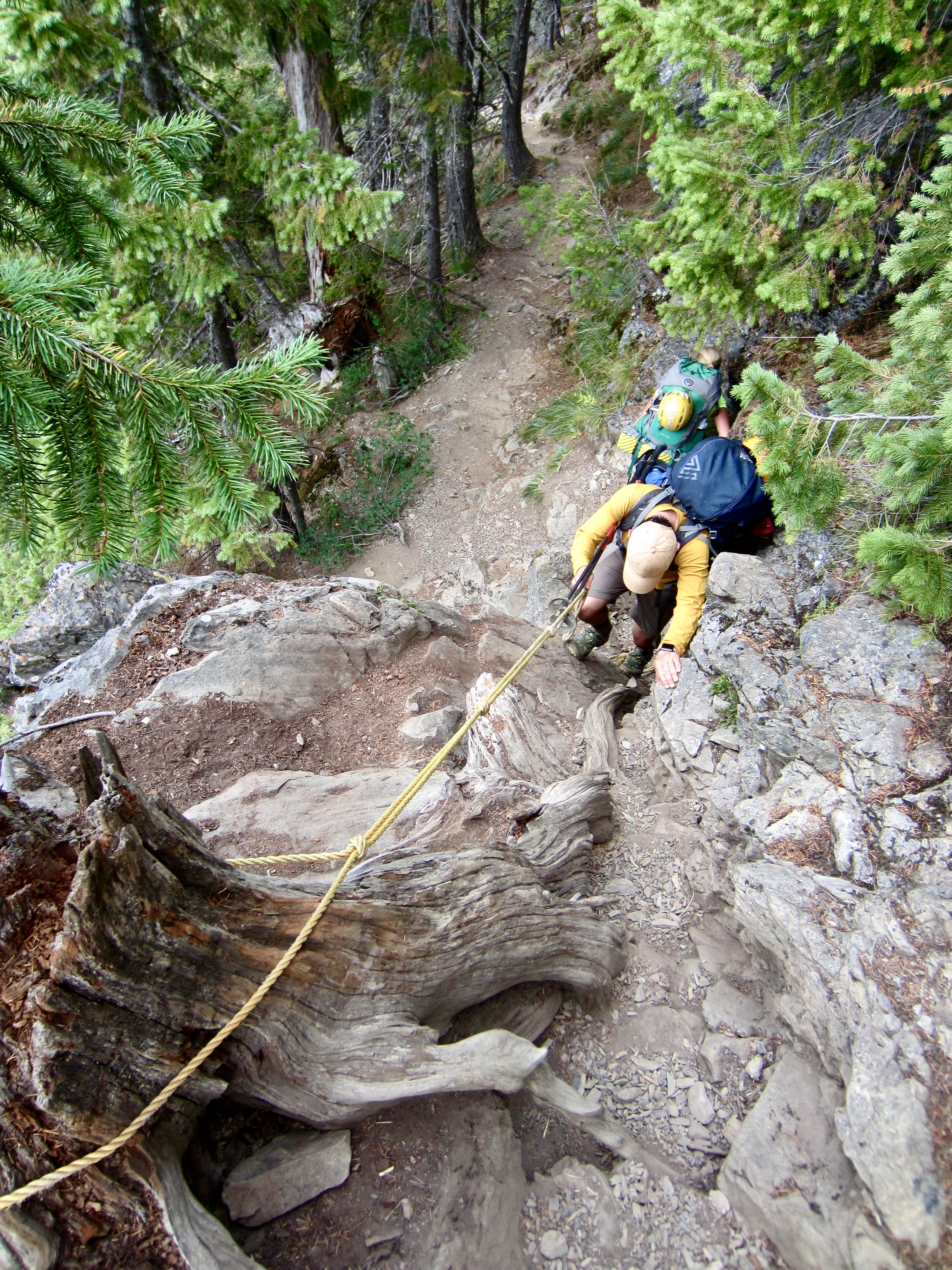
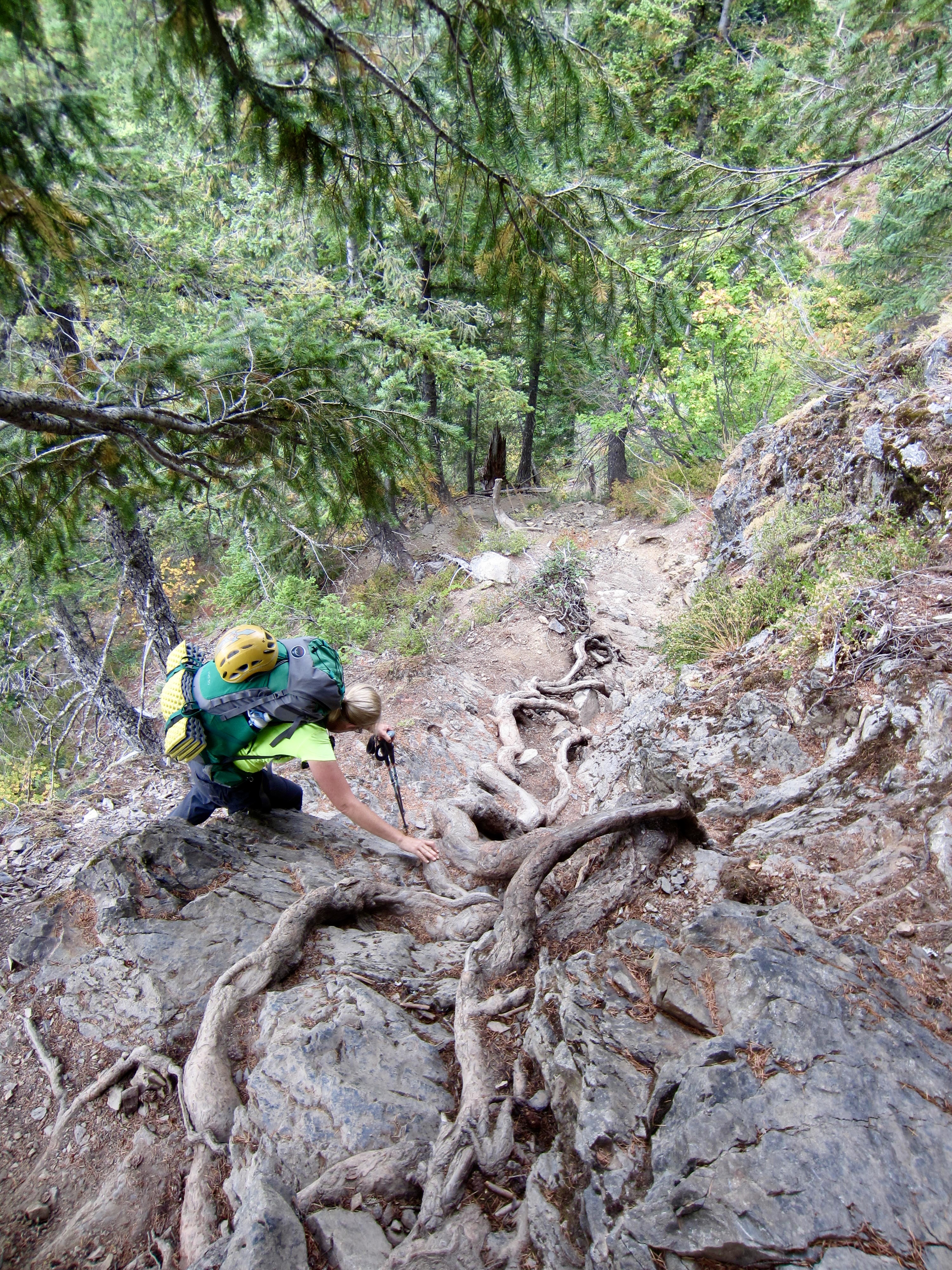
By 9:00am, we were heading down the Putvin Trail, a historic and primitive trail that includes several notable cliff sections. One particularly steep section is, thankfully, equipped with a handline rope, and another is equipped with an anaconda-like tree root.
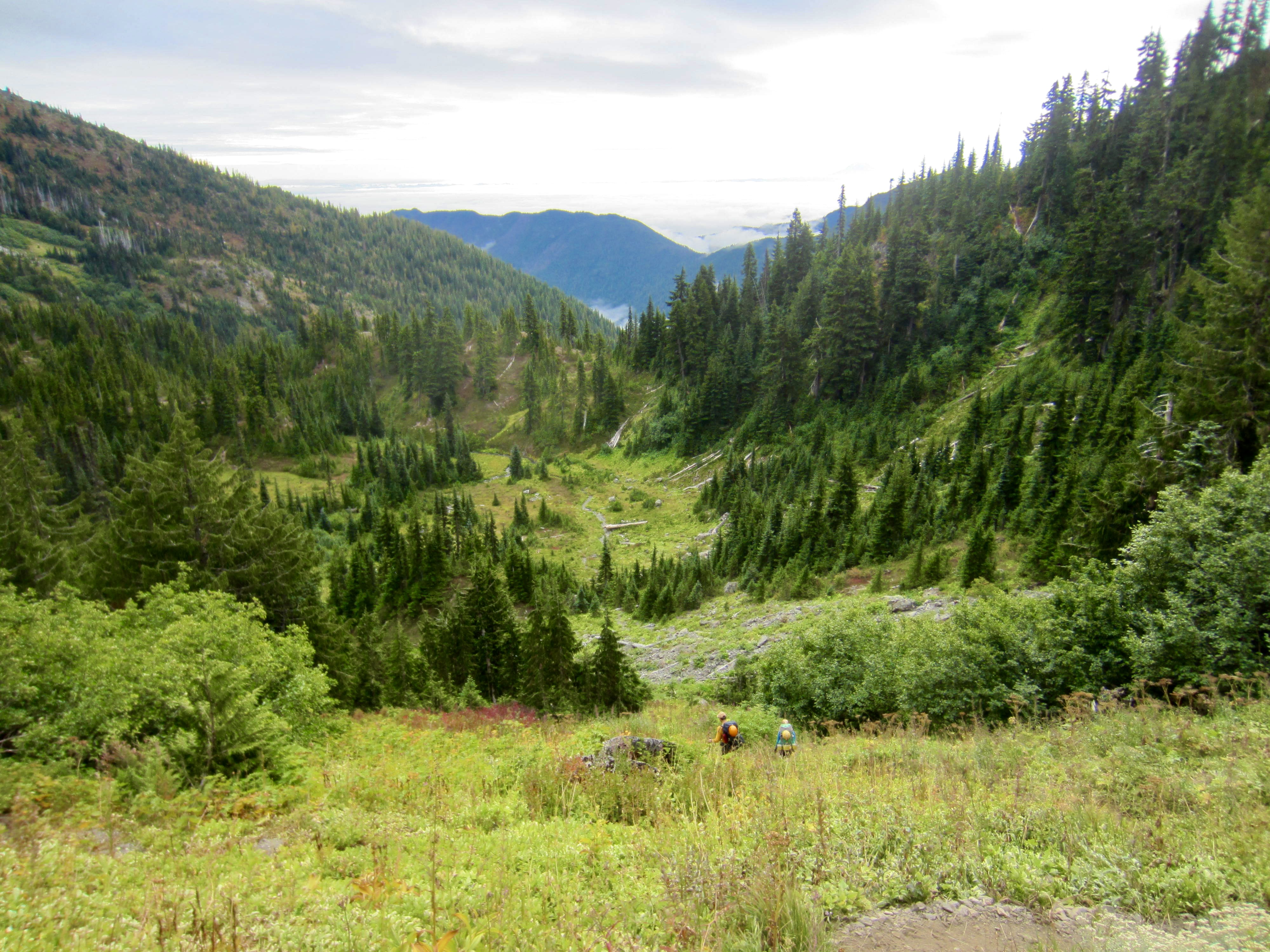
Once on easier terrain, Andrew zoomed ahead to retrieve our car from the Lena Lake Trailhead. Eileen and I reached the Putvin Trailhead just before noon (3.0 hours + 3.3 miles + 100 feet from Camp 2), and Andrew arrived with the car a short time later. Despite the sometimes-uncooperative weather, it had been a splendid alpine traverse.
Route Maps & Profiles
…
…

…
…
…
Photo Gallery
Click to enlarge…