Trip Date: July 6-10, 2021
Mt. Rainier Climbing Trip & Glacier Basin Loop: Burroughs Mountain to Inter Fork
Shadow Lake
Emmons Overlook
Second Burroughs Mountain (7402 ft)
Glacier Basin
Camp Curtis
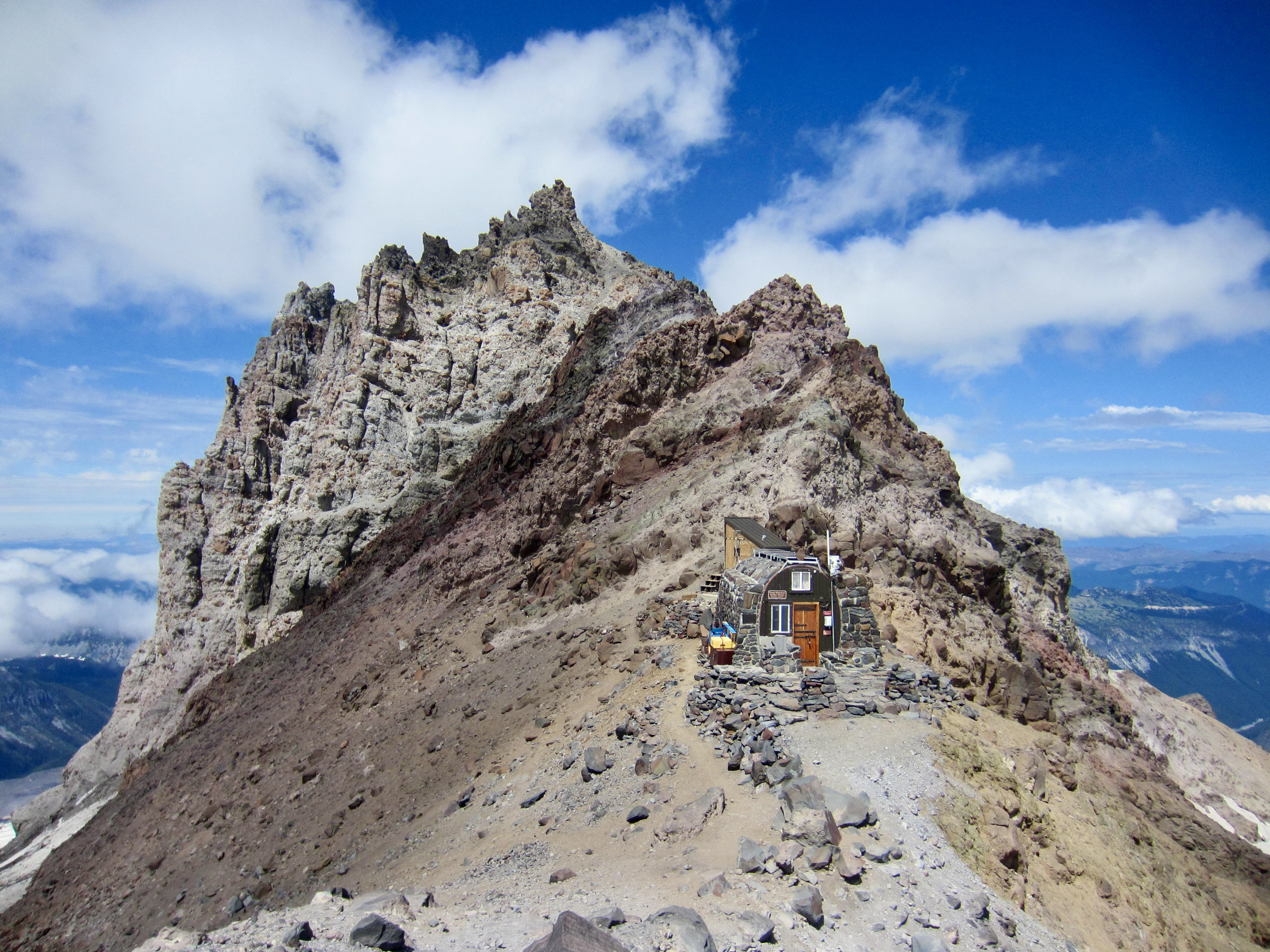
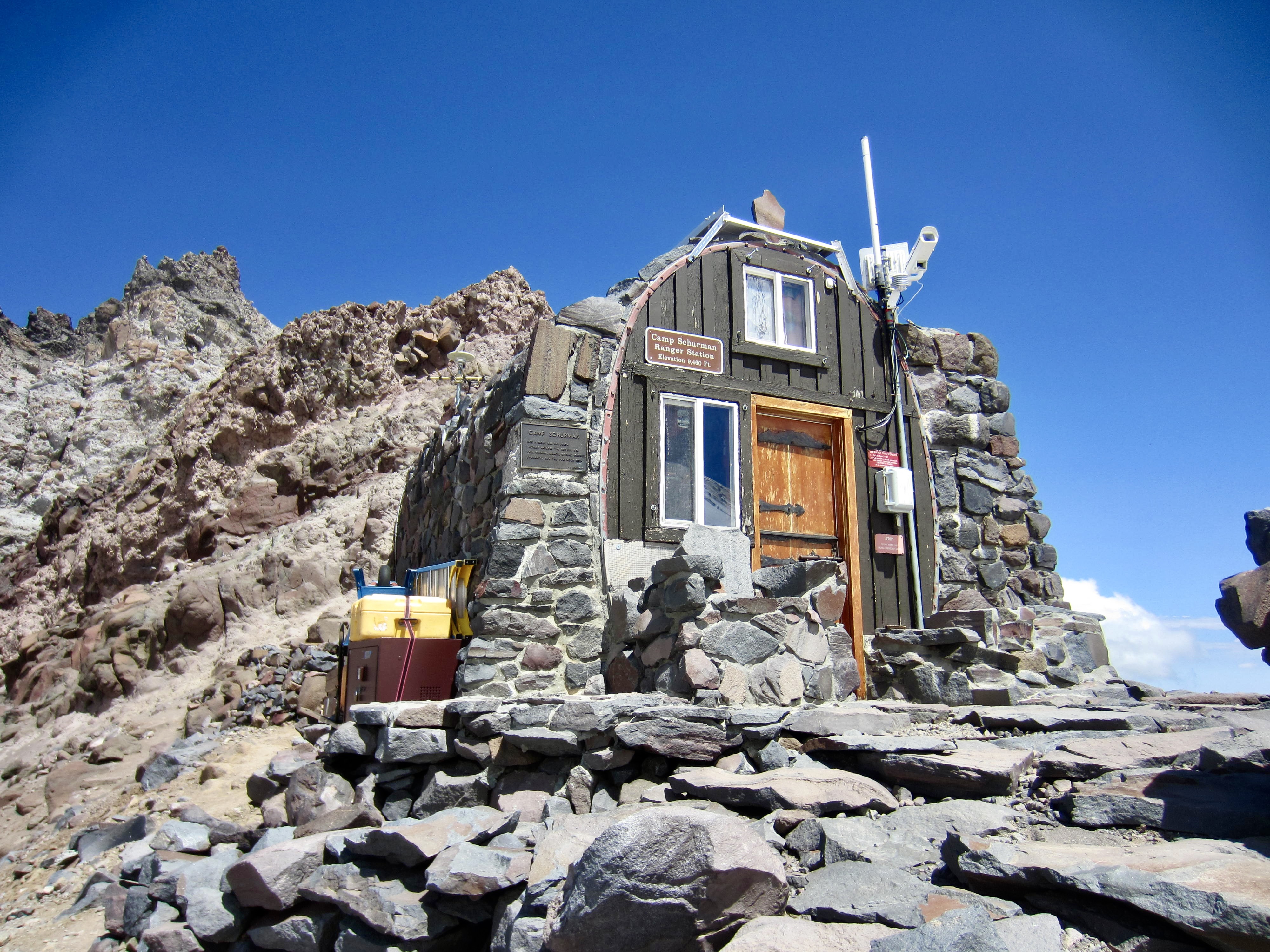
Camp Schurman
Mount Rainier aka Tahoma (14,411/14,400 ft)
- Trip Report Summary
- Related Posts
- Trip Overview
- Full Trip Report
- Day 1 (AM): Sunrise Rim Trailhead to Sunrise Camp
- Day 1 (PM): Second Burroughs Mountain Hike
- Day 2: Sunrise Camp to Glacier Basin to Camp Curtis
- Day 3: Camp Curtis to Camp Schurman
- Night 3 & Day 4 (AM): Mt. Rainier Summit Climb
- Day 4 (PM): Camp Schurman to Upper Glacier Basin
- Day 5: Upper Glacier Basin to Glacier Basin Trailhead
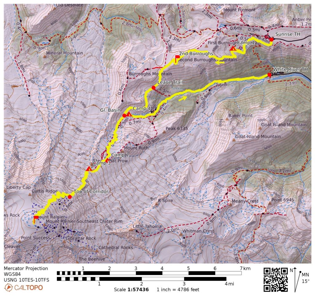
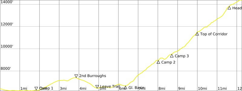
- Route Map & Profile
- Photo Gallery
Trip Report Summary
Region: Southern Washington Cascades
Sub-Region: Mt. Rainier Massif
Area: Mt. Rainier National Park
Starting Point: Sunrise Rim Trailhead within Sunrise Visitor Center parking lot at end of Sunrise Road (Elev. 6400 feet)
Way Points: Shadow Lake & Sunrise Camp & Emmons Overlook & Second Burroughs Mountain summit & Burroughs Mountain Saddle & Upper Glacier Basin & Inter Glacier & Camp Curtis & Lower Emmons Glacier & Camp Schurman; return via Upper Glacier Basin & Lower Glacier Basin & Inter Fork Valley (trail hike & off-trail hike & snow hike & snow climb)
Ending Point: Glacier Basin Trailhead within White River Campground at end of White River Road (Elev. 4350 feet)
Campsites: Sunrise Camp & Camp Curtis & Camp Schurman & Upper Glacier Basin
Sidetrip: Emmons Overlook & Second Burroughs Mountain summit & Burroughs Mountain Saddle (trail hike)
Summit: Second Burroughs Mountain (hike via Burroughs Mountain Trail)
Summit: Mt. Rainier (snow climb & ice climb via Emmons Glacier)
Approximate Stats (excluding sidetrip): 22.5 miles traveled; 10,600 feet gained; 12,650 feet lost.
Approximate Stats (including sidetrip): 28.0 miles traveled; 12,500 feet gained; 14,550 feet lost.
Related Posts
>>> Mount Rainier attempt via Inter Glacier—Emmons Glacier – July 1976
>>> Mount Rainier via Nisqually Glacier—Wilson Glacier—Kautz Glacier – July 1983
>>> Mount Rainier via Nisqually Glacier—Wilson Glacier—Kautz Glacier – July 1976
Trip Overview
When my daughter Brooke and her boyfriend Dan announced that climbing Mt. Rainier was a bucket-list item for them, Eileen and I couldn’t deny them an opportunity. We selected the Emmons Glacier route, which neither of us had done before and is reportedly pretty straightforward. I was particularly interested in this route because it had thwarted me during my first-ever Rainier attempt in 1976. Eileen, feeling satisfied by her previous ascent of the Ingraham Glacier route, was less interested in the Emmons Glacier. Instead, she handled our trip logistics, navigated through the onerous permitting process, and acted as our high-camp manager.
The Emmons Glacier route is typically done as a two- or three-day climb from White River Campground, but Eileen and I laid out a somewhat unconventional approach for our trip. Specifically, we planned it as a five-day climb starting at Sunrise Visitor Center, with successive campsites at Shadow Lake, Camp Curtis, Camp Schurman, and Glacier Basin, then exiting at White River Campground. This served three important purposes: (1) it allowed us to hold an informal “glacier school” for Brooke, who had never been on a big glaciated mountain before; (2) it gave us two nights at or above 9000 feet, for better acclimation; and (3) it provided more time to enjoy the ambiance of Mt. Rainier National Park.
A big uncertainty in our climb was snow and glacier conditions along the route, because Washington State had just suffered through a record-breaking heat wave with sustained temperatures above 100 degrees F. There was no question that June’s extreme “heat dome” had accelerated melting of the snowpack, but we didn’t really know the extent and effects of that melting. It didn’t take long to discover that the extent was massive and the effects were drastic.
Full Trip Report
Day 1 (AM): Sunrise Rim Trailhead to Sunrise Camp
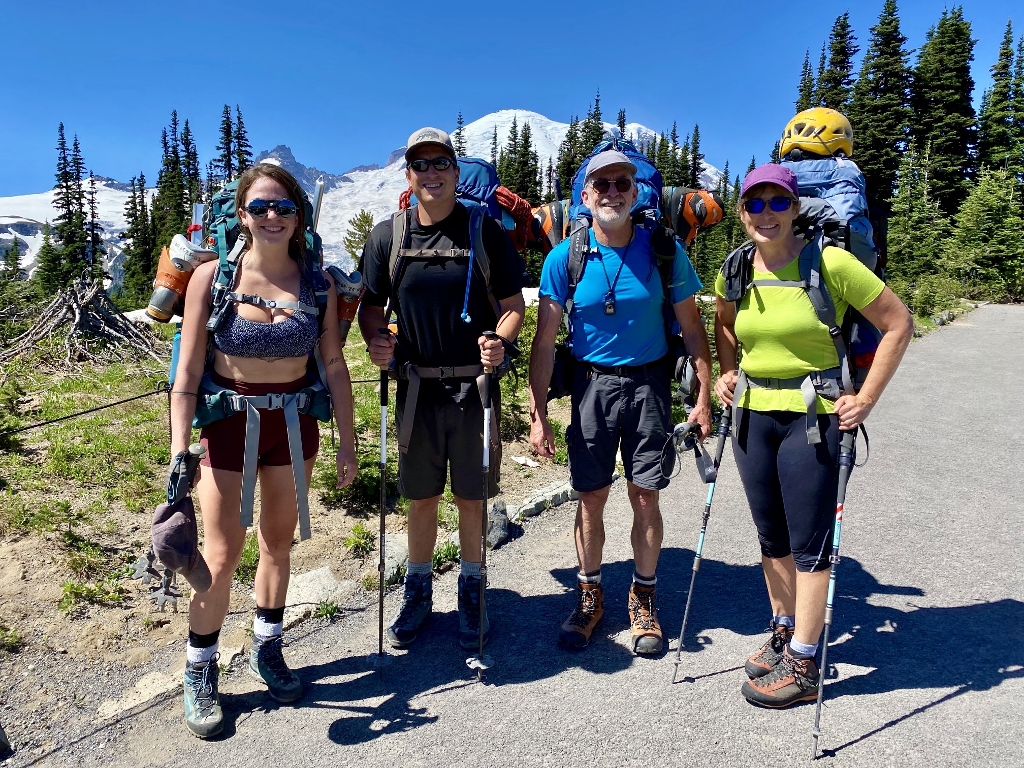
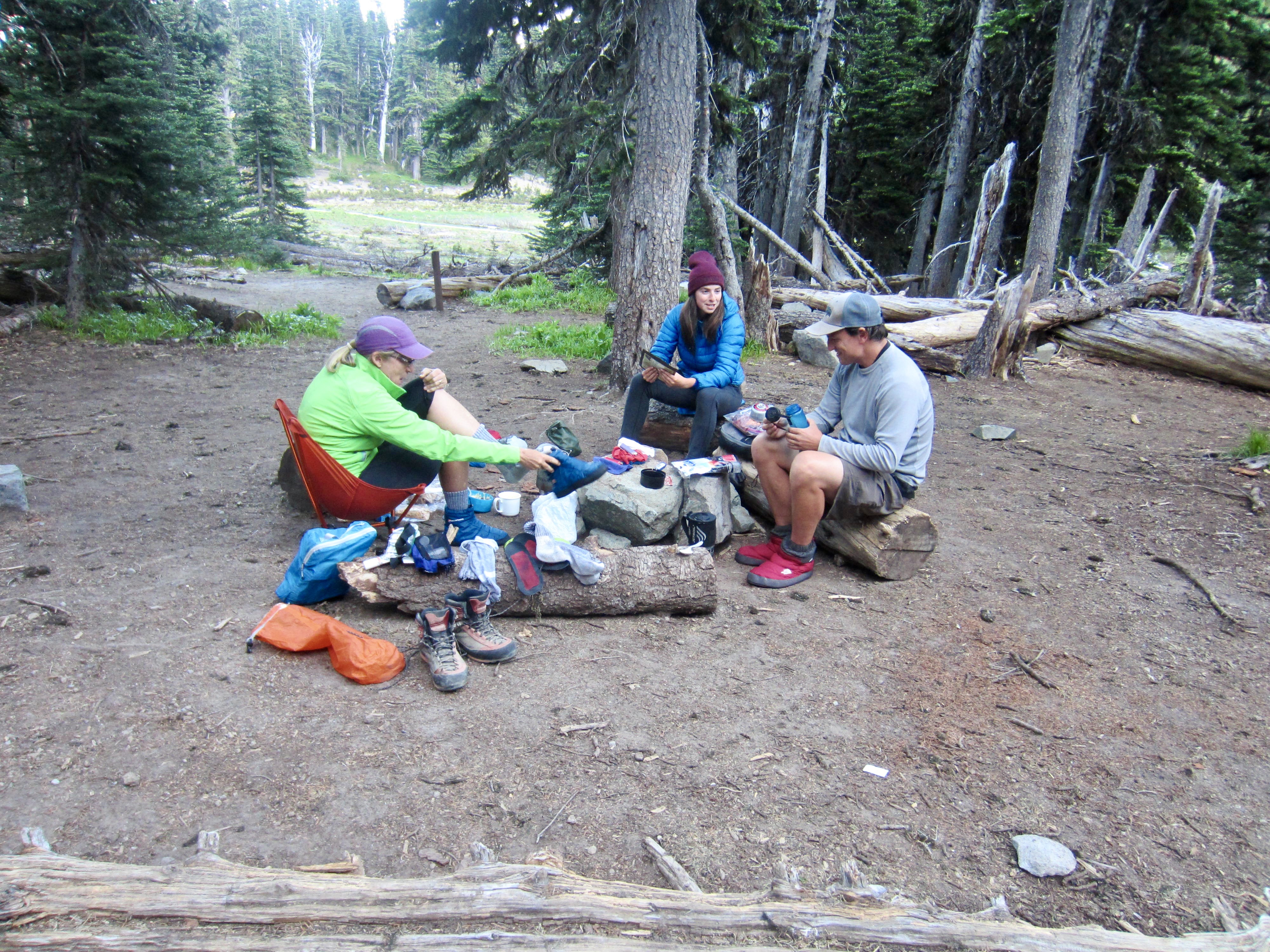
We all met at the White River Ranger Station on Tuesday morning to procure our backcountry camping permits, then dropped Brooke and Dan’s vehicle at White River Campground on our way to Sunrise. Gear was spread out in the parking lot, and backpacks were variously loaded—or even overloaded—with tents, rope, crampons, helmets, pickets, and mountain boots. Under a bright blue sky, we made the easy 1.5-mile hike over to Sunrise Camp near Shadow Lake (0.7 hours + 100 feet from TH).

Day 1 (PM): Second Burroughs Mountain Hike
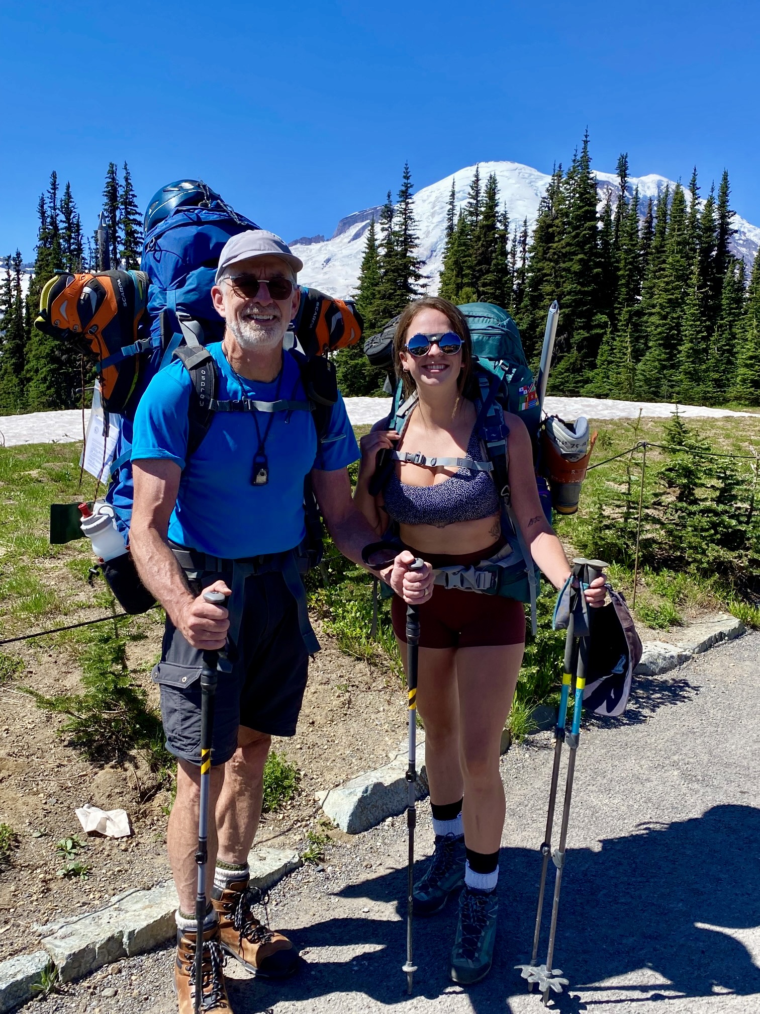
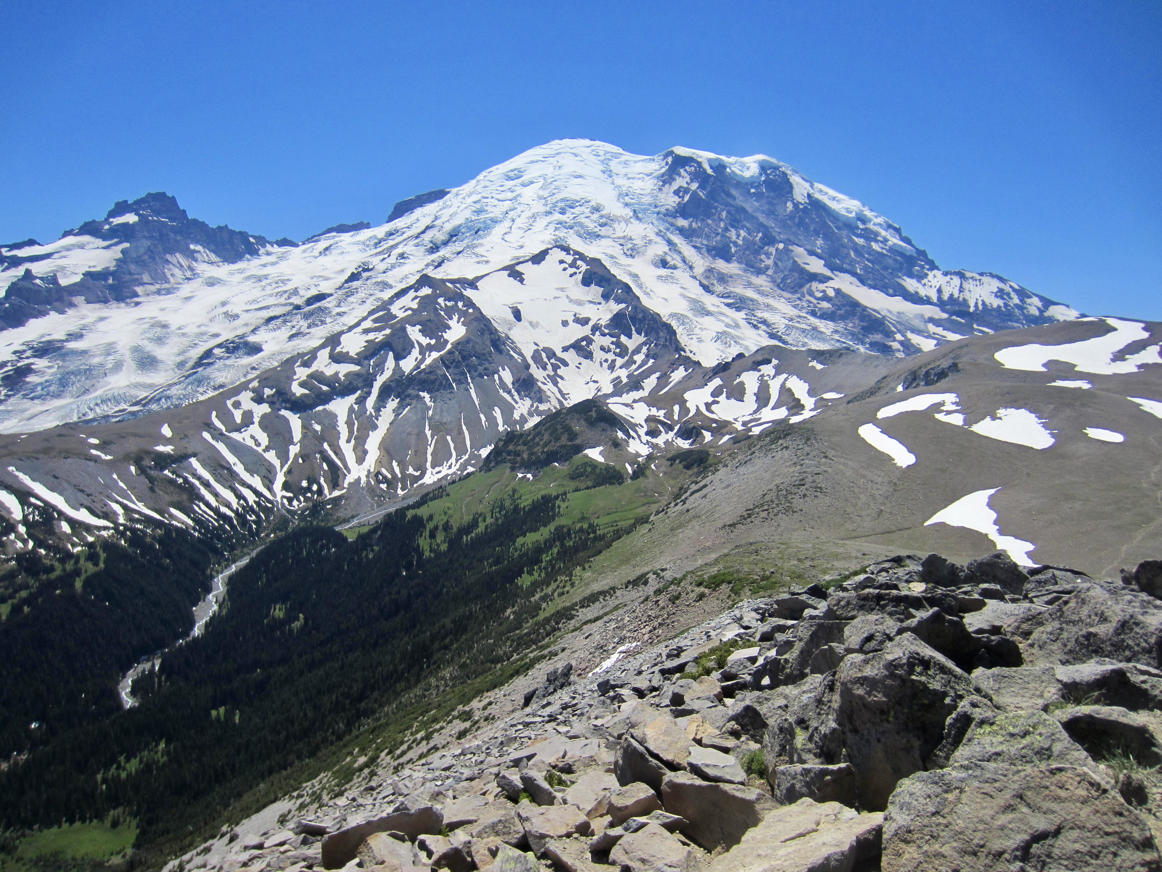
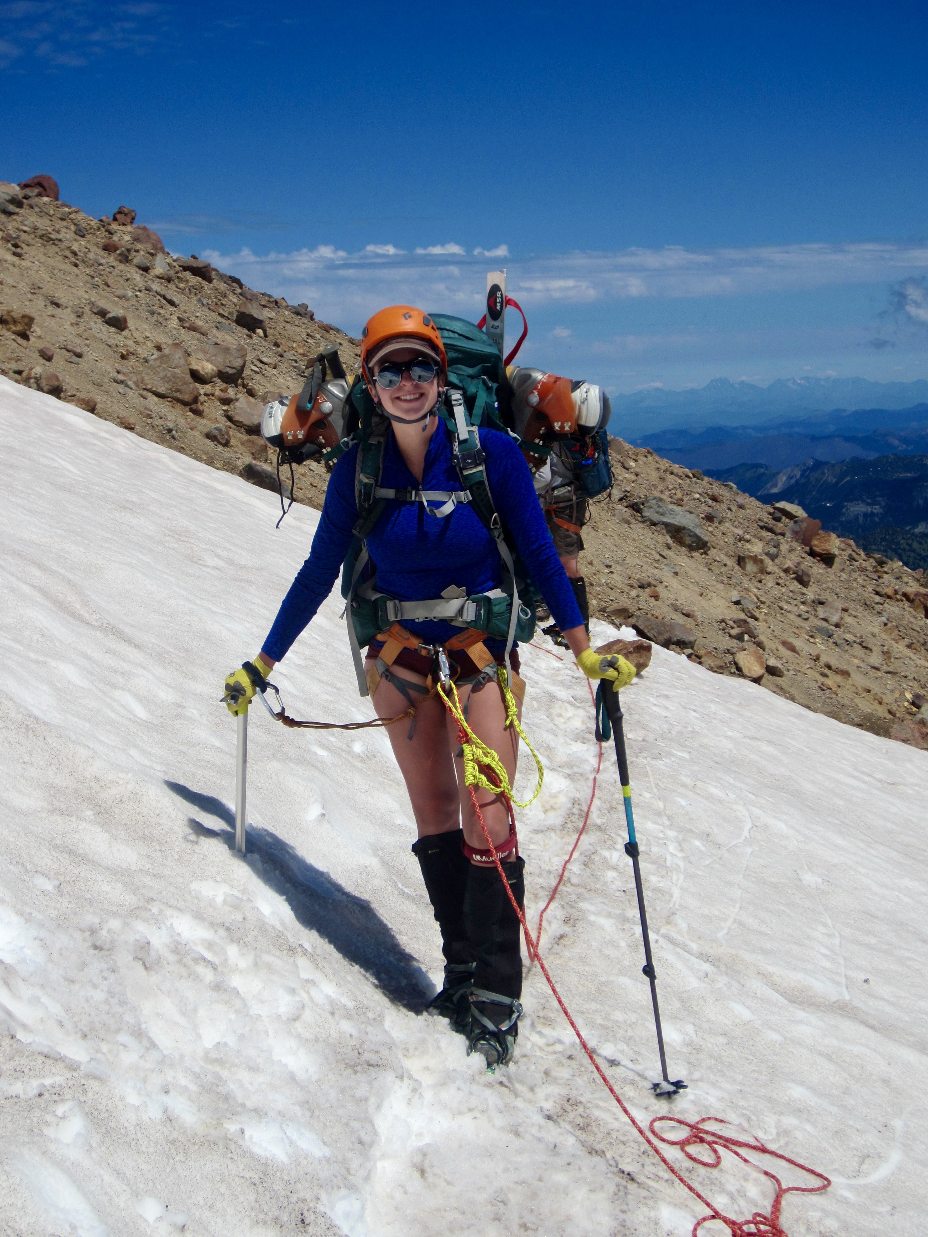
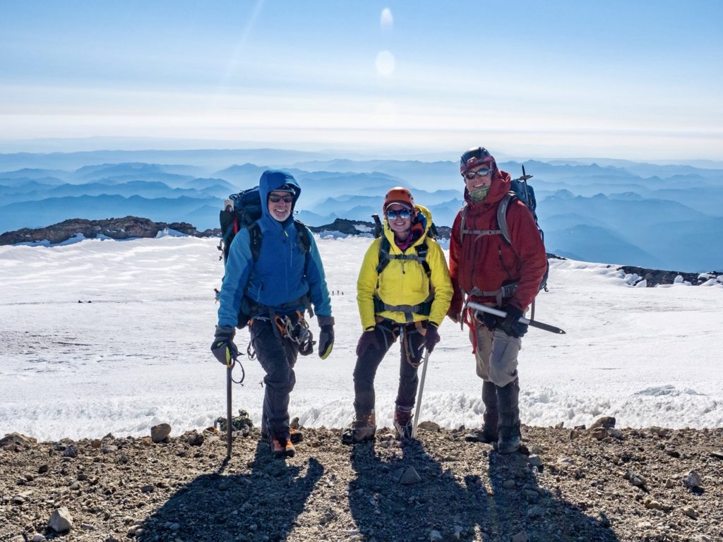
After pitching tents in the group site, we grabbed summit packs and headed up the Burroughs Mountain Trail. The summit of Second Burroughs Mountain offered a marvelous lunch stop with an unobstructed view of our planned climbing route up Mt. Rainier. Using binoculars to spot climbers on the Emmons Glacier—appearing as mere specks of dust against a vast white canvas—Brooke finally gained an appreciation for Rainier’s immensity. For me, it was a reminder of what a long climb lay in store.
The remainder of our afternoon was spent on the remnant snowfields surrounding Burroughs Mountain Saddle. We practiced kicking steps uphill, plunge-stepping downhill, traversing slopes, and arresting slides with an ice axe. After a productive first day in “glacier school,” we all returned to Sunrise Camp for the night (6.2 hours + 2000 feet RT from Camp 1).
Day 2: Sunrise Camp to Glacier Basin to Camp Curtis
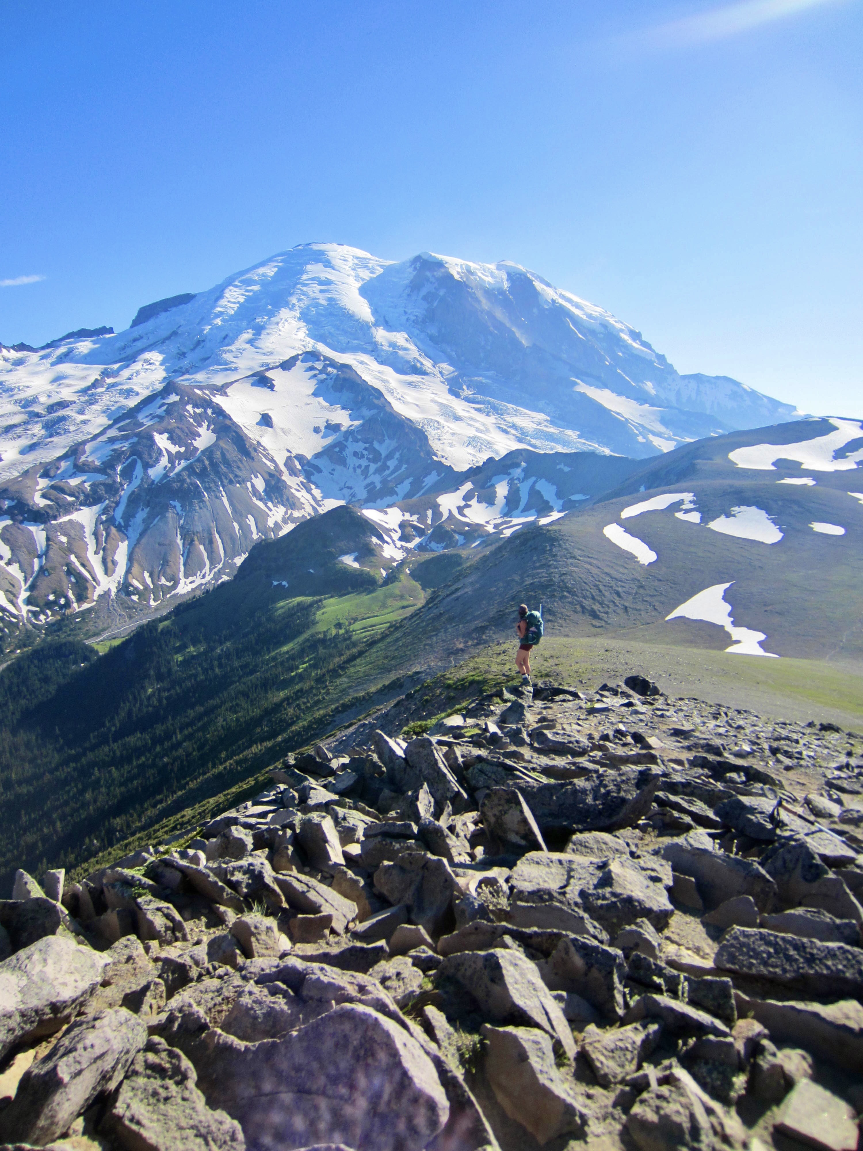
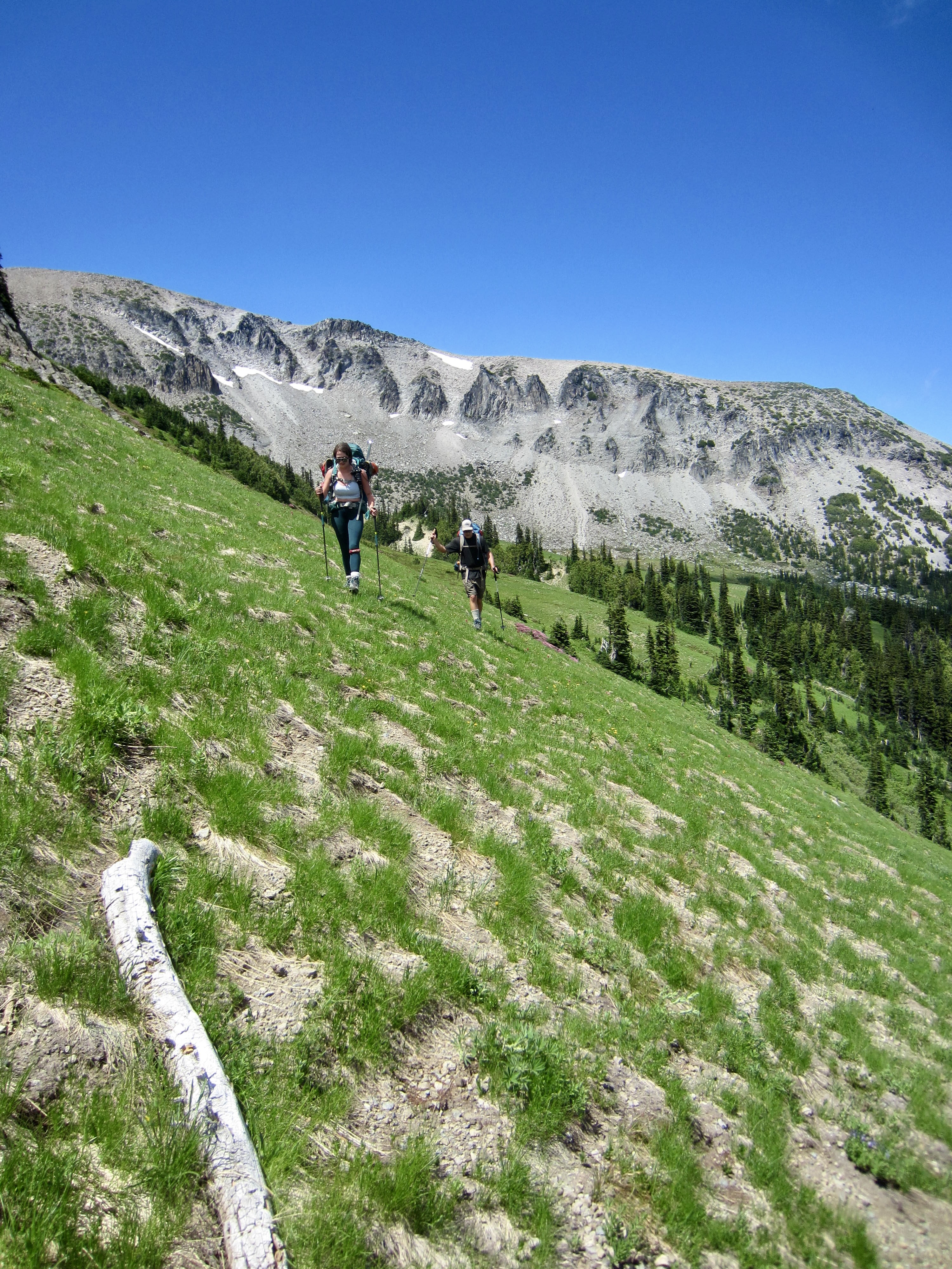
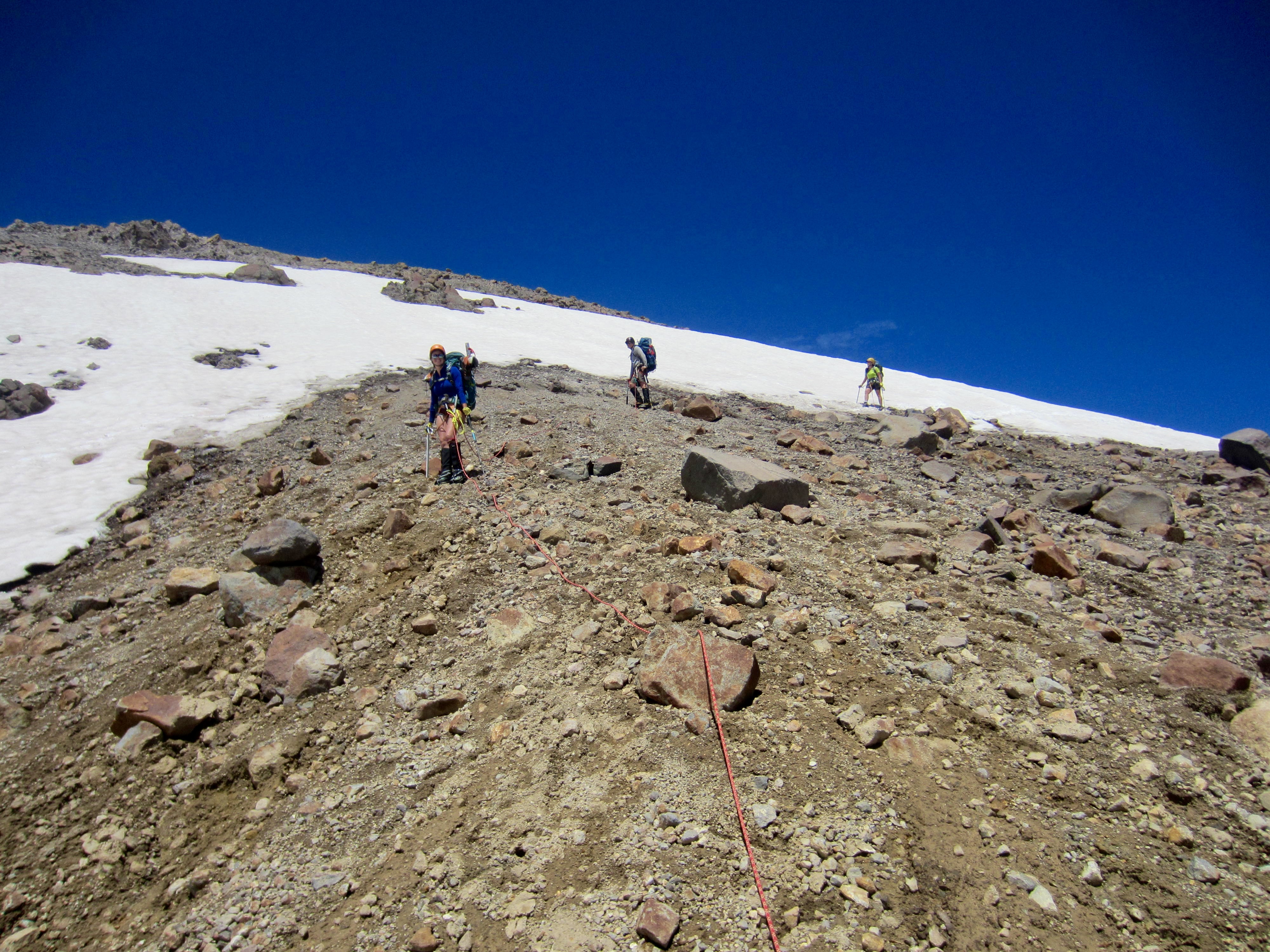
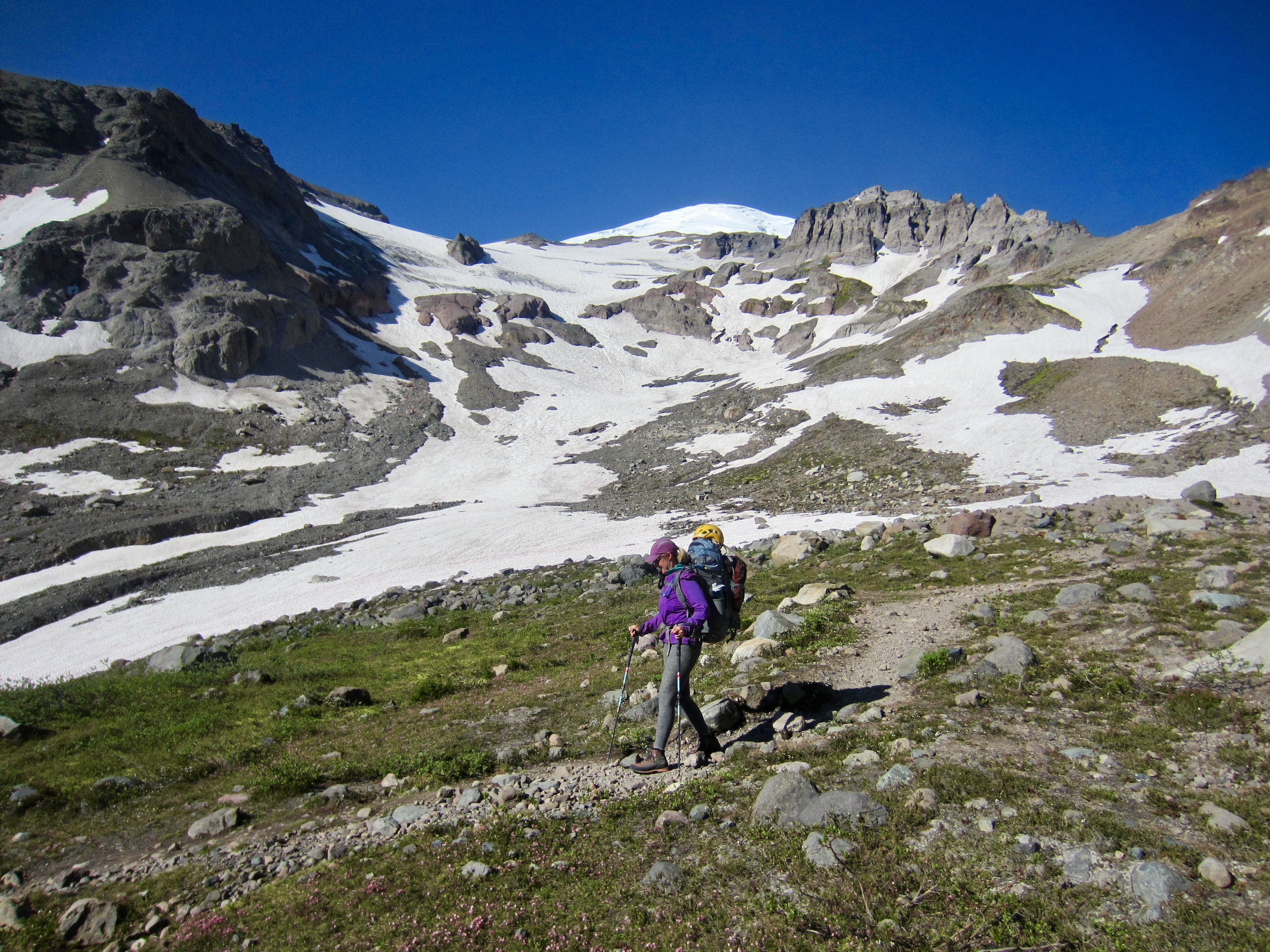
It rained on and off throughout the night, but we awoke at 7:00am to clearing skies and had no more precipitation during the rest of our trip. We broke camp and headed back up the Burroughs Mountain Trail, continuing over Second Burroughs Mountain and down toward Inter Fork Valley.
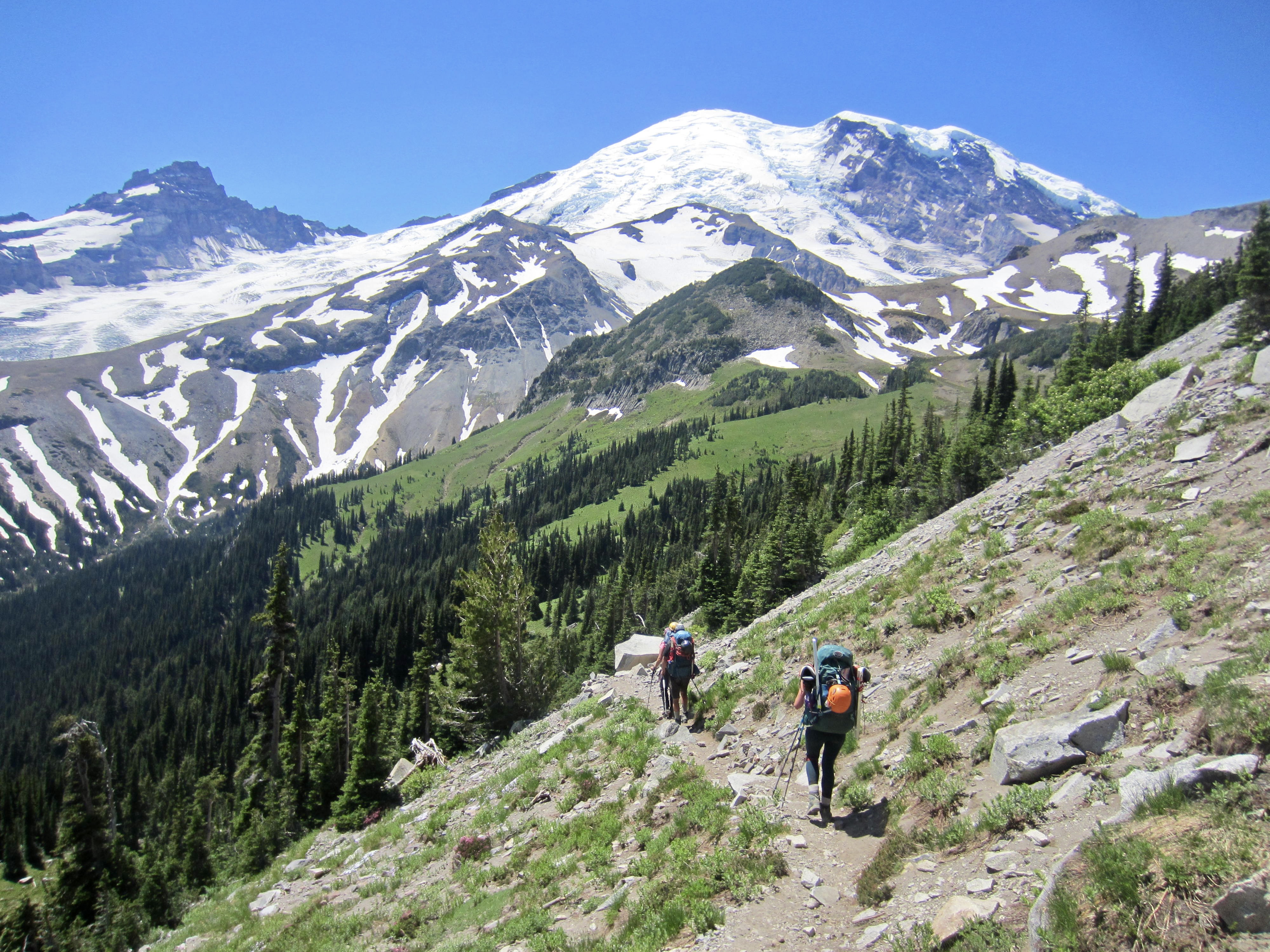
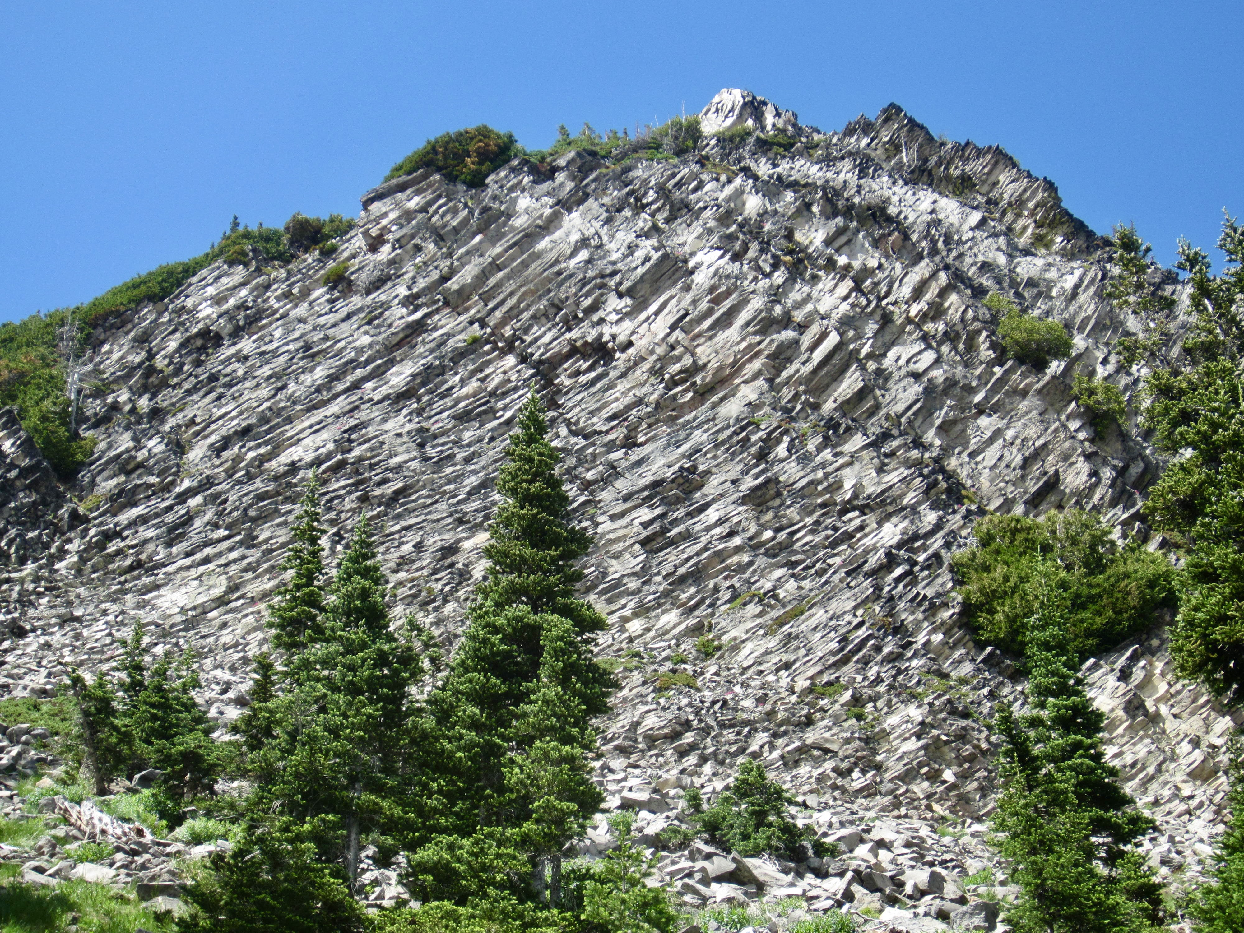
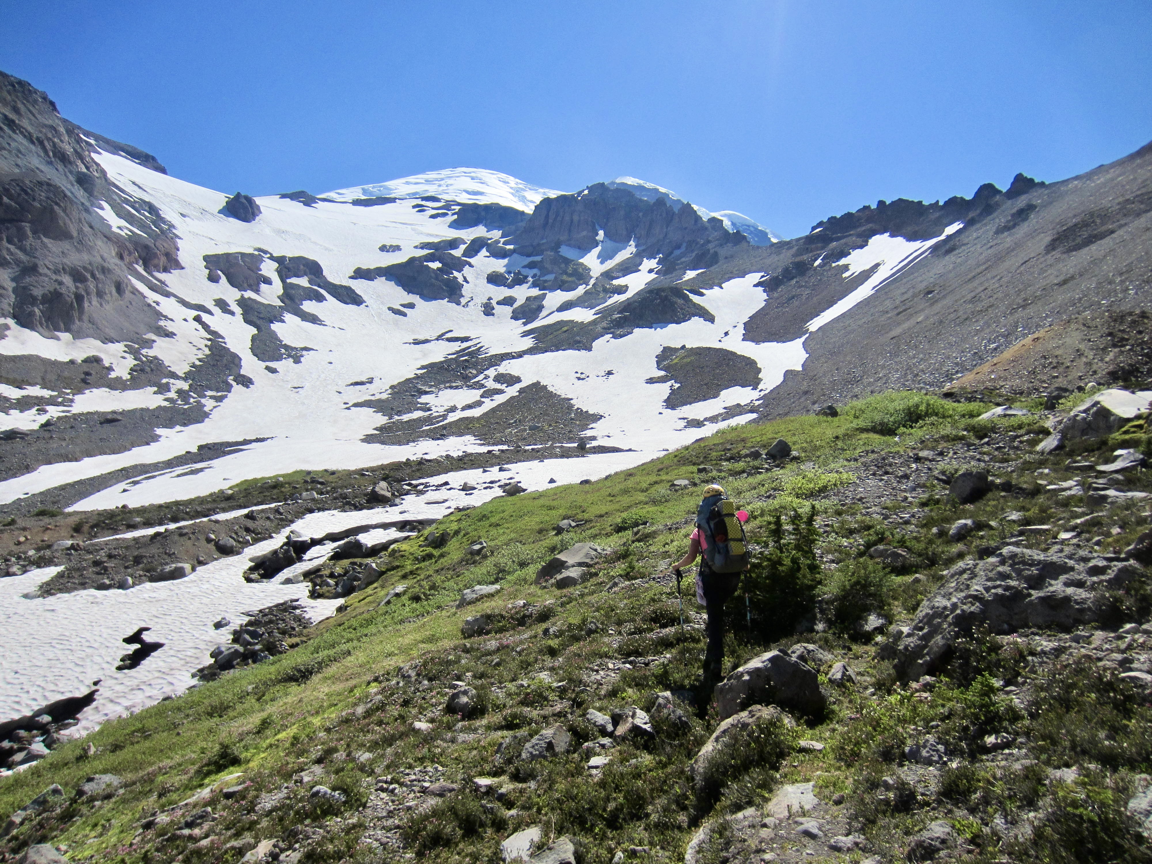
At an elevation of 6400 feet, just before descending a long series of switchbacks, we left the trail and began traversing south toward Glacier Basin. Eileen and I had scoped out this 1-mile traverse route last month, and it appeared to be a good way to get from Burroughs Mountain to Upper Glacier Basin without losing and regaining a lot of elevation. Our high traverse initially took us over a series of scenic grass slopes and benches, passing beneath a tall buttress that exhibited sweeping curves of columnar andesite.
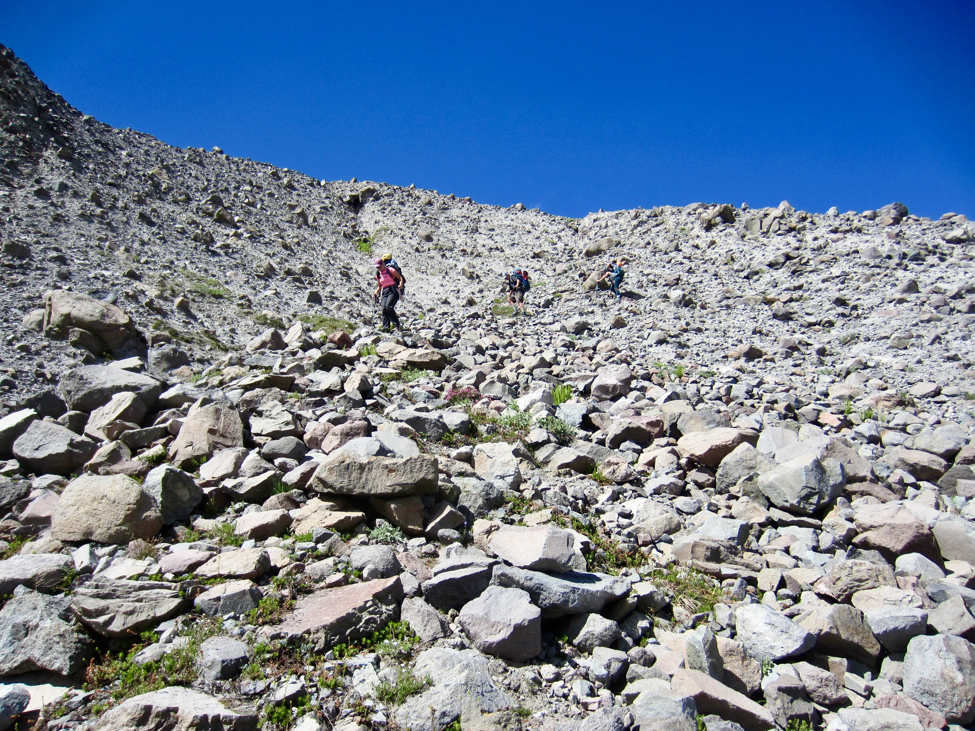
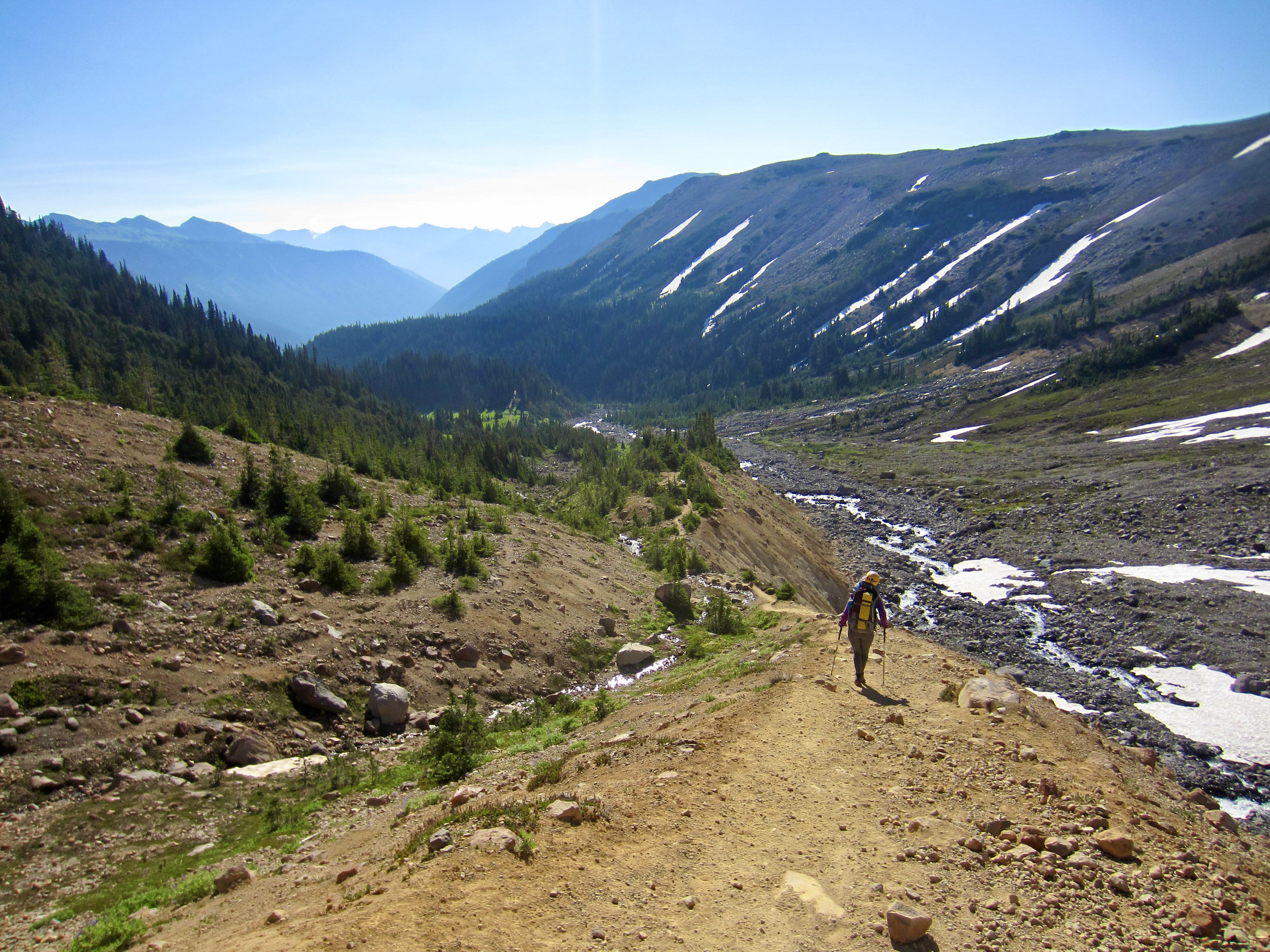
About the time our traverse seemed to be going even better than expected, we encountered a large grove of scrub cedar trees. I tried struggling through the cedars but soon gave up in frustration and backed out. We then took a higher route over the top of the grove, crossing a series of loose talus slopes. After putting the last talus slope behind us, we came to a final obstacle: an eroded stream channel bounded on both sides by a steep headwall of dirt and rubble. Hideous as it looked, we had little choice but to carefully pick our way down.
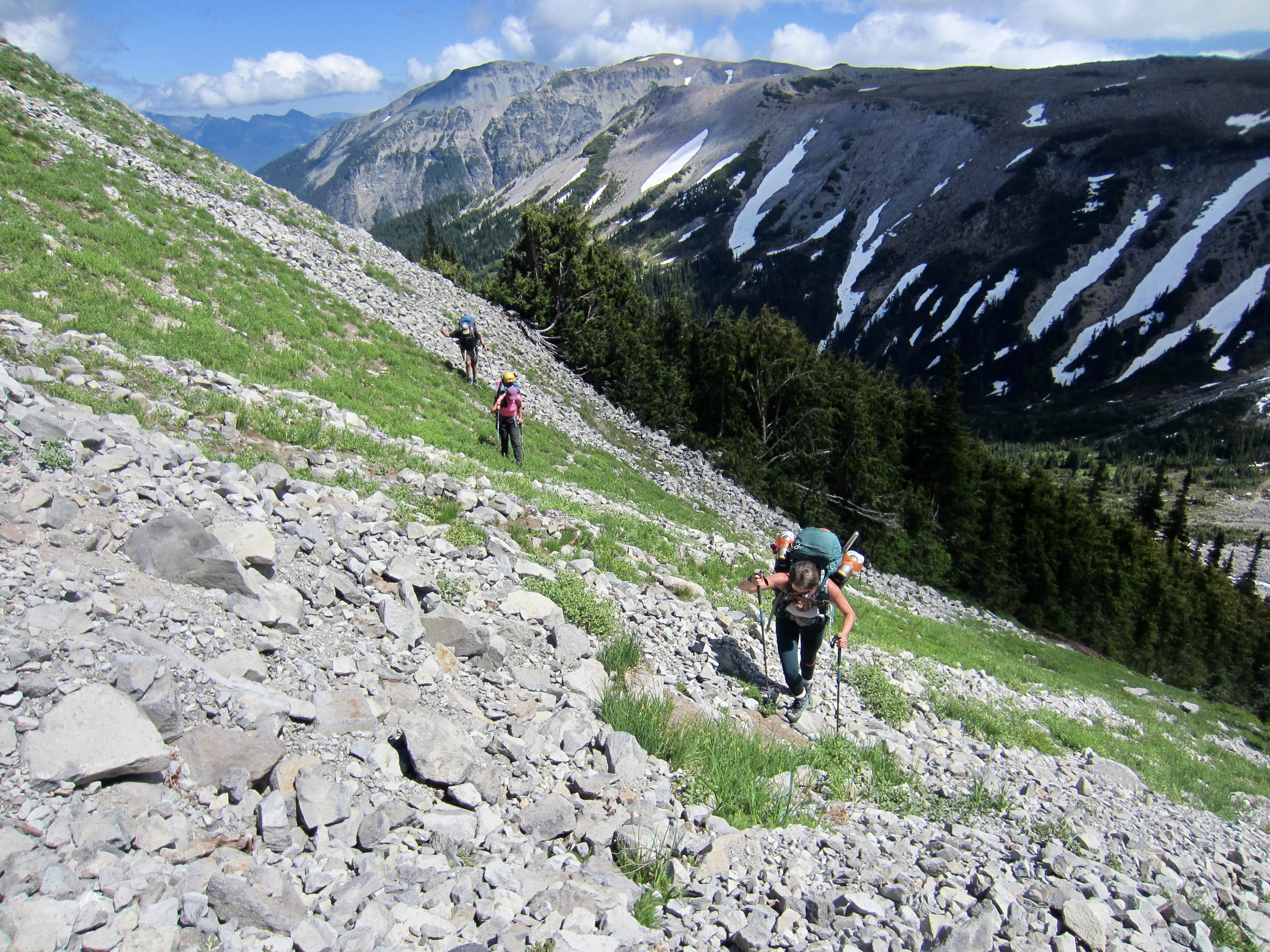
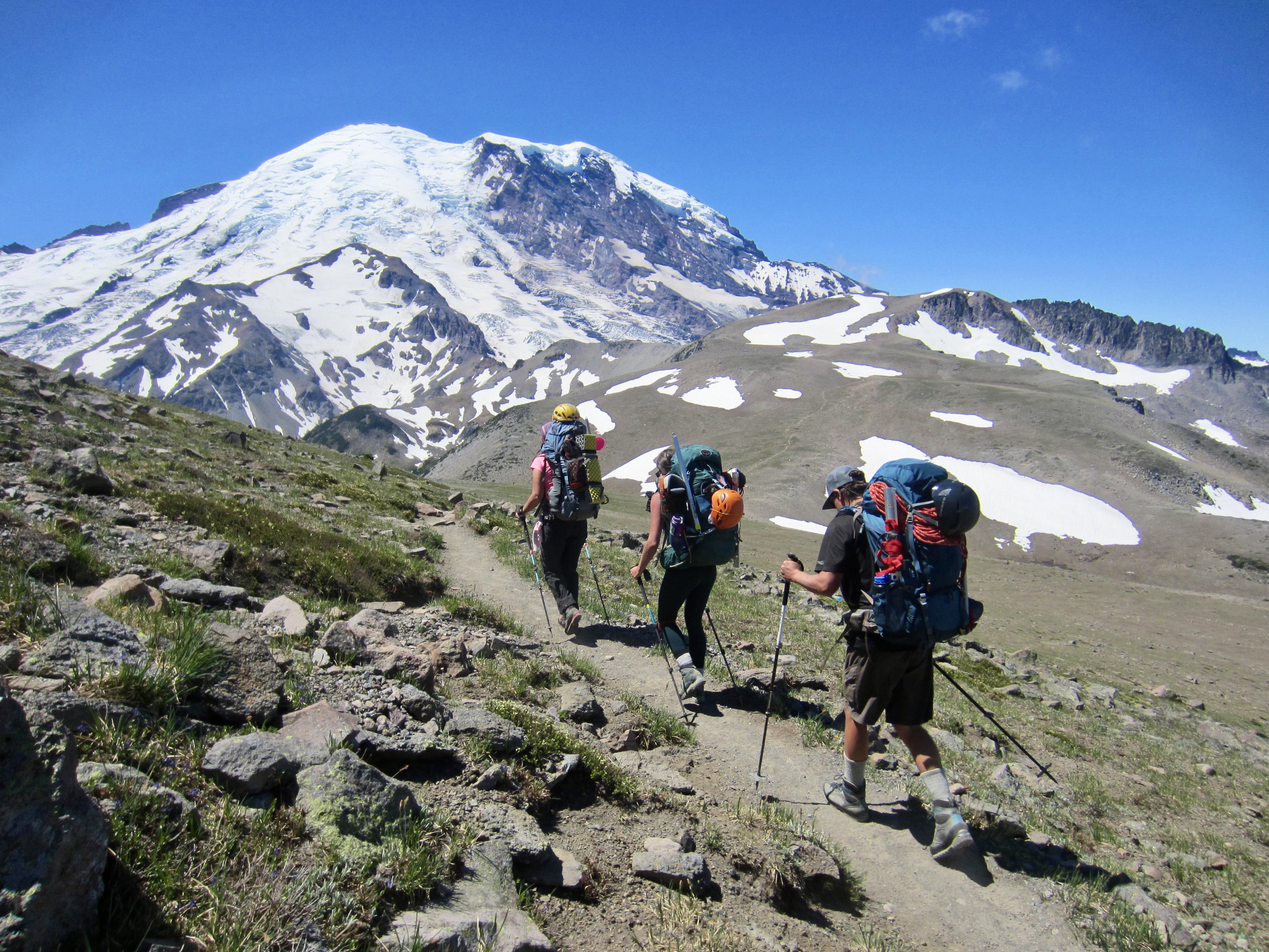
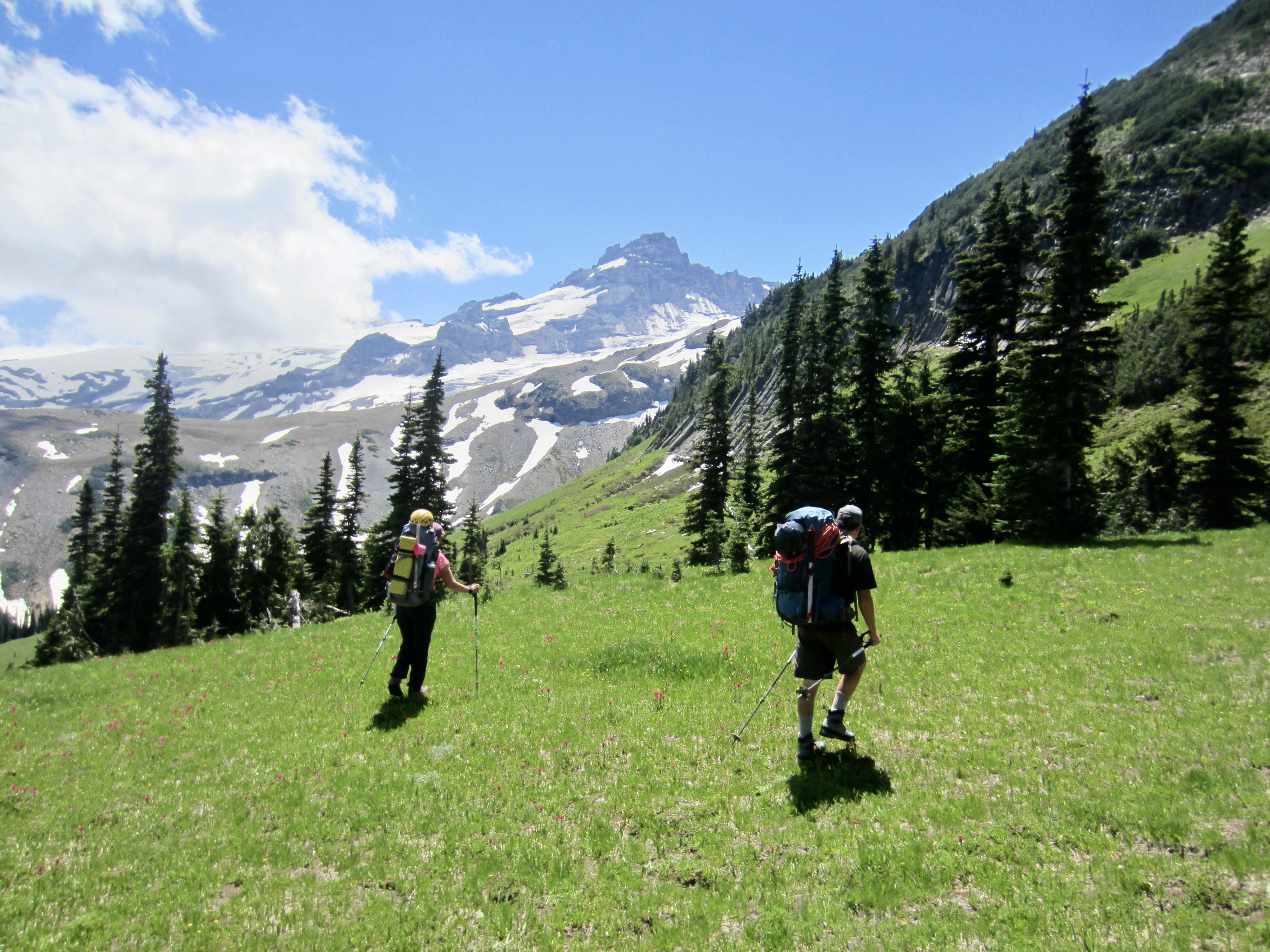
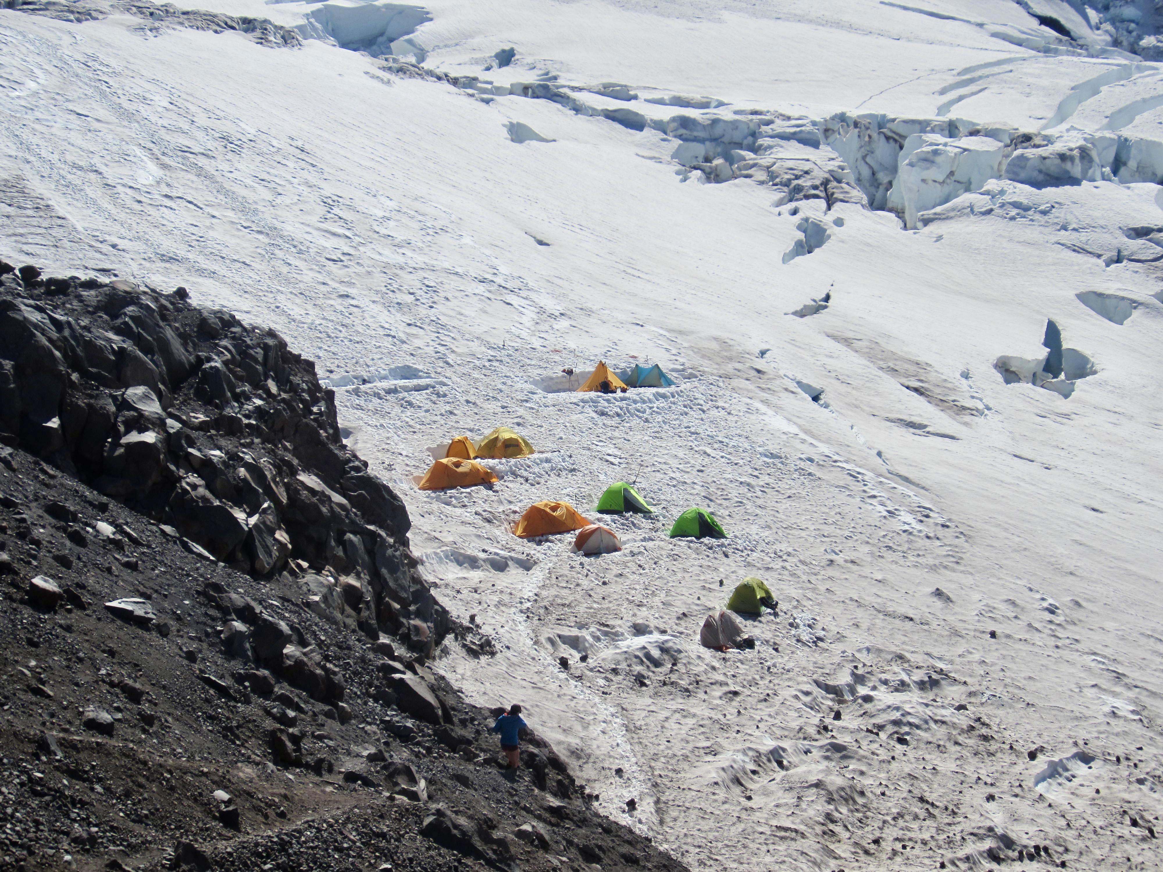
Eventually, the horrible headwall transitioned to the pleasant green slopes of Upper Glacier Basin (5.7 hours + 2100 feet from Camp 1). Our high traverse had been interesting, without a doubt, but I’m not sure whether we saved any time or effort. We all stopped in the basin to relax our nerves, fill up on water, and prepare for a late-afternoon ascent to Camp Curtis.
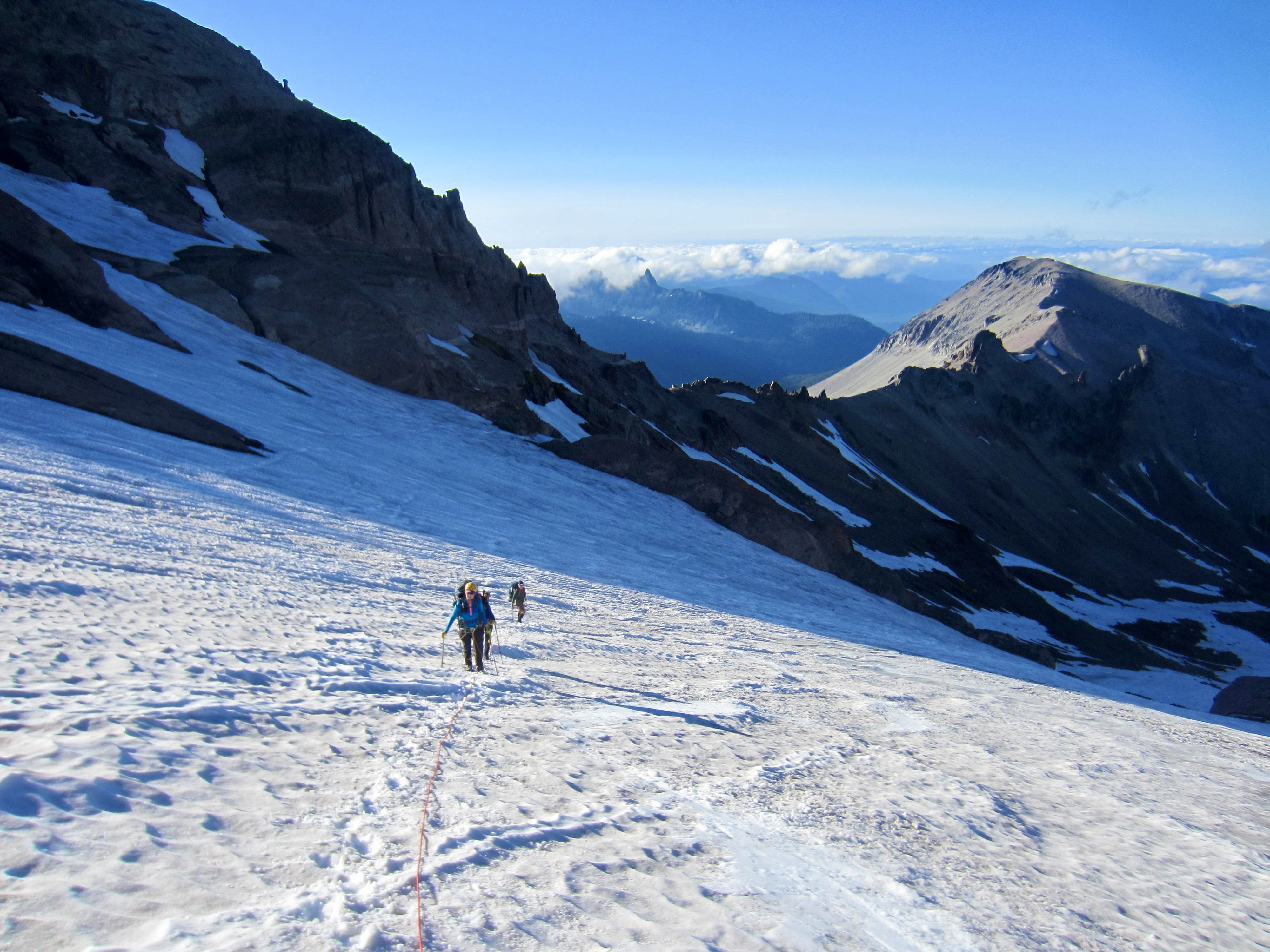
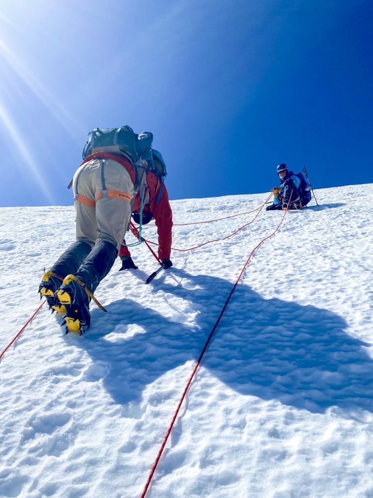
Taking this as an opportunity to continue our “glacier school,” we donned crampons, roped up, and used pickets for running belays through the snow chute leading up to the Inter Glacier. Once above the chute, we followed gentler snow slopes around patches of exposed glacial ice.
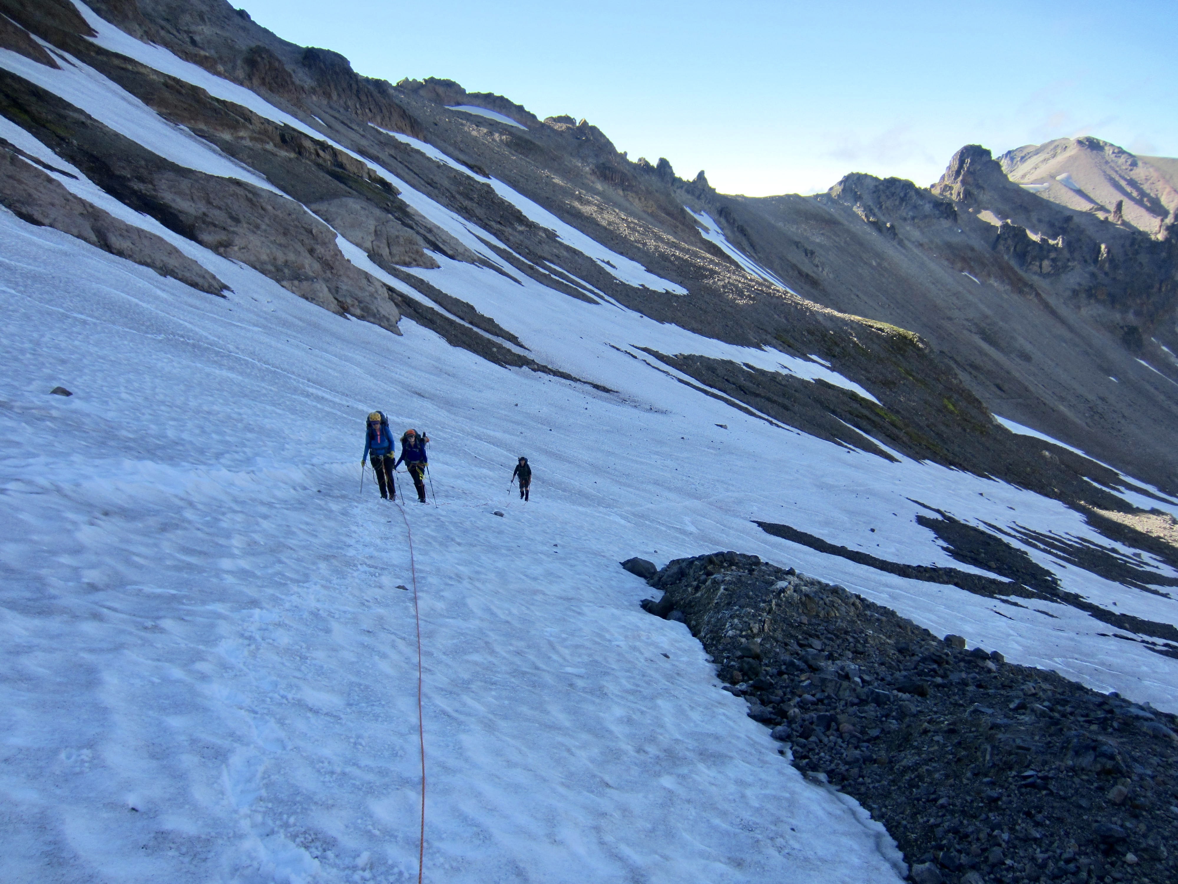
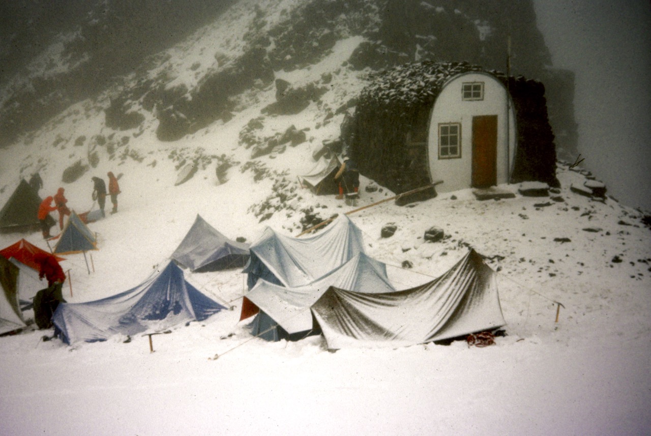
A few minutes before 8:00pm, we reached 9000-foot Camp Curtis (7.8 hours + 4400 feet from Camp 1). Nobody else was camped here tonight, so we had free choice of the six or seven tent pads. Although this campsite is quite primitive compared to nearby Camp Schurman, it worked well as an intermediate camp for us—and it provides a much better view of the northern side of Mt. Rainier National Park.
While melting snow (no running water available here) and eating dinner, we watched the last rays of sunlight tinge Mt. Rainier and color the northwestern horizon. Everybody was now feeling very optimistic about our weather, itinerary, and summit objective.
Day 3: Camp Curtis to Camp Schurman
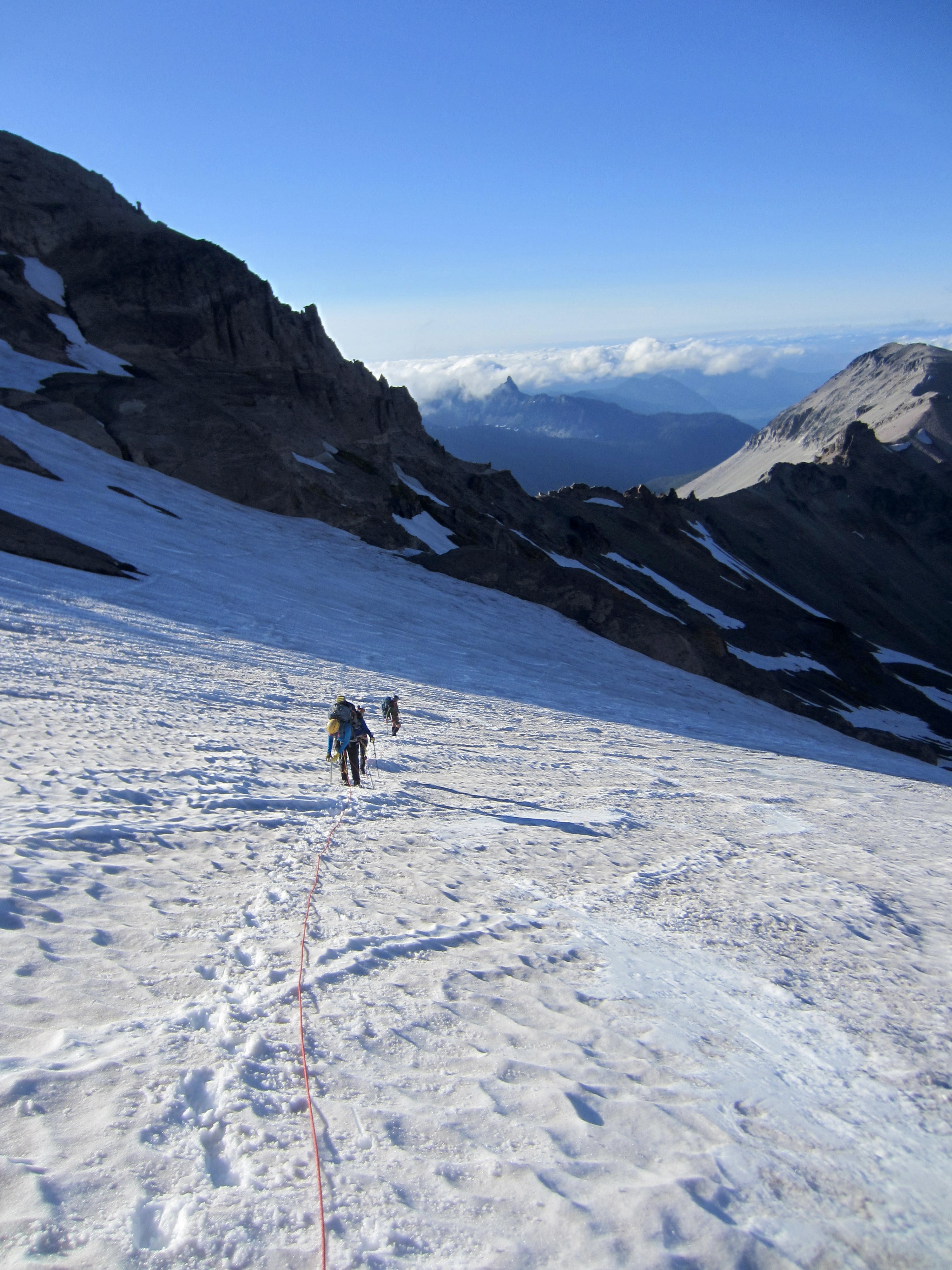
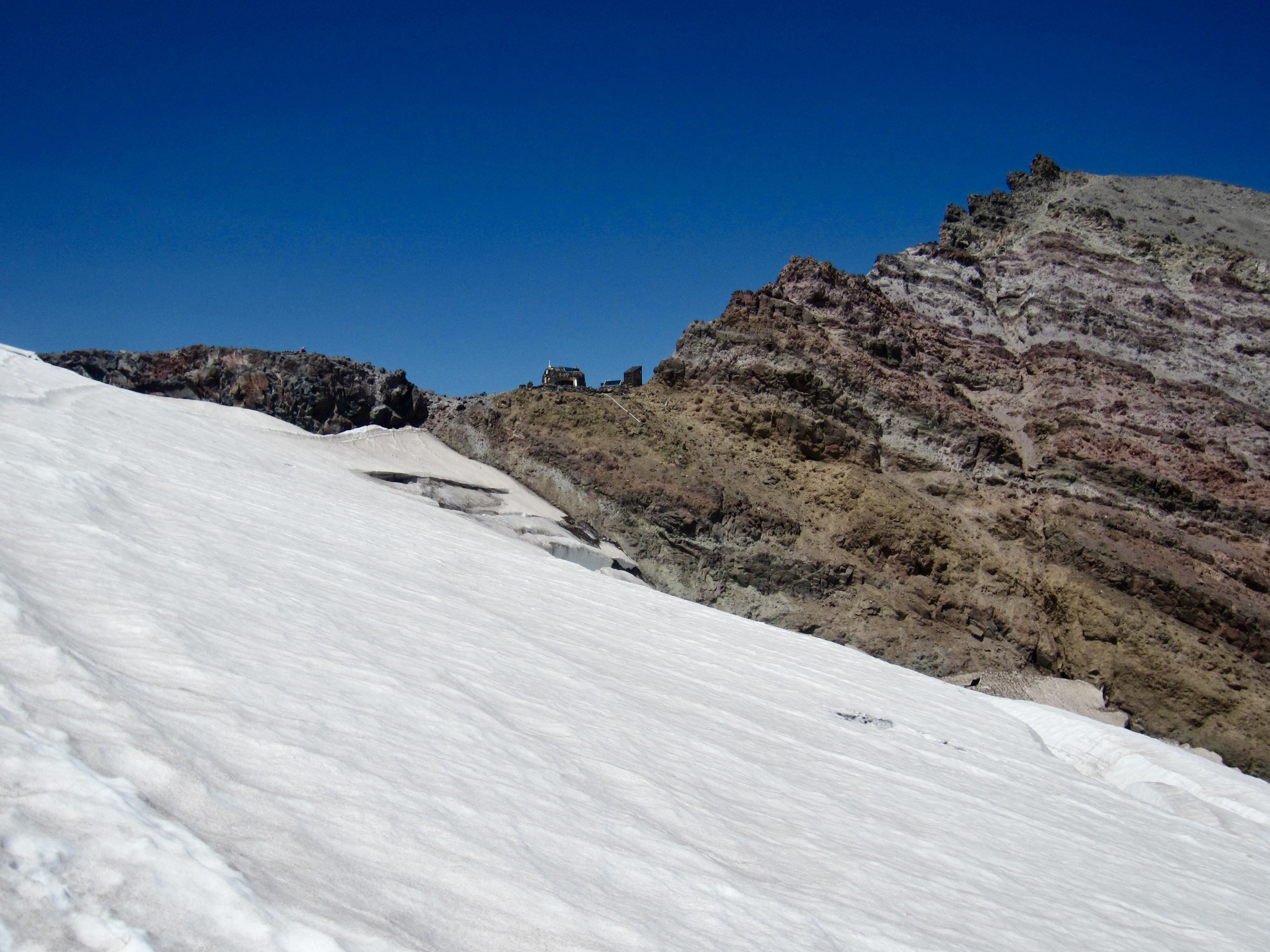
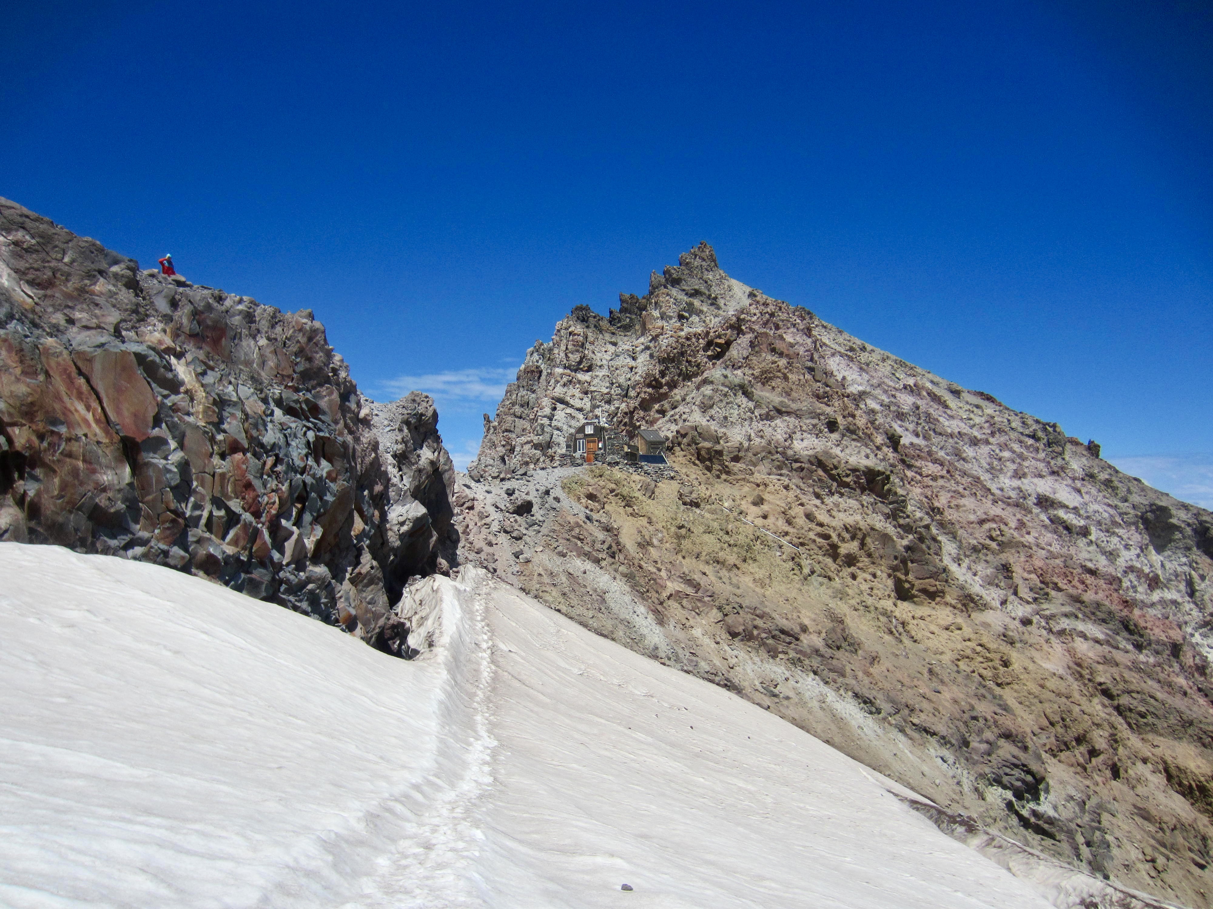
Today was slated to be relatively short and easy, so we slept late and did not get packed up until a bit after noon. From camp, we hiked up the ridge crest 100 yards, contoured over to the left (east) side, and then booted down a muddy slope to reach the Emmons Glacier.
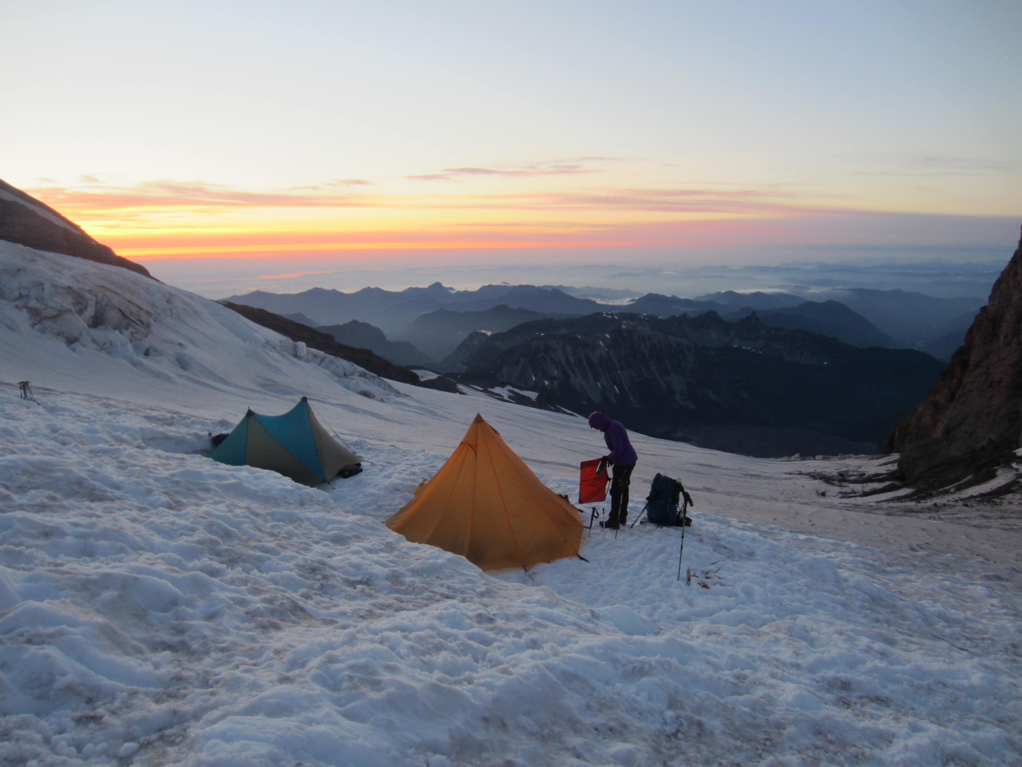
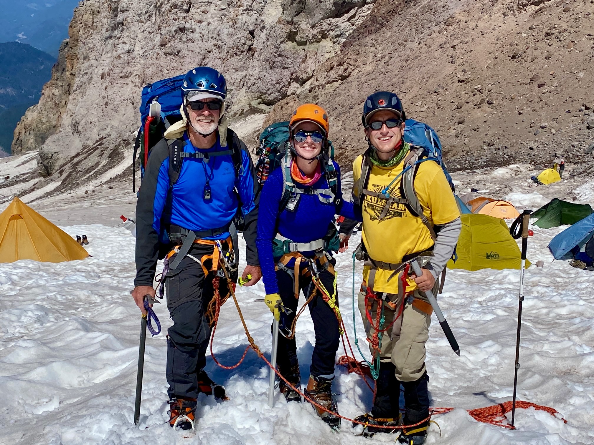
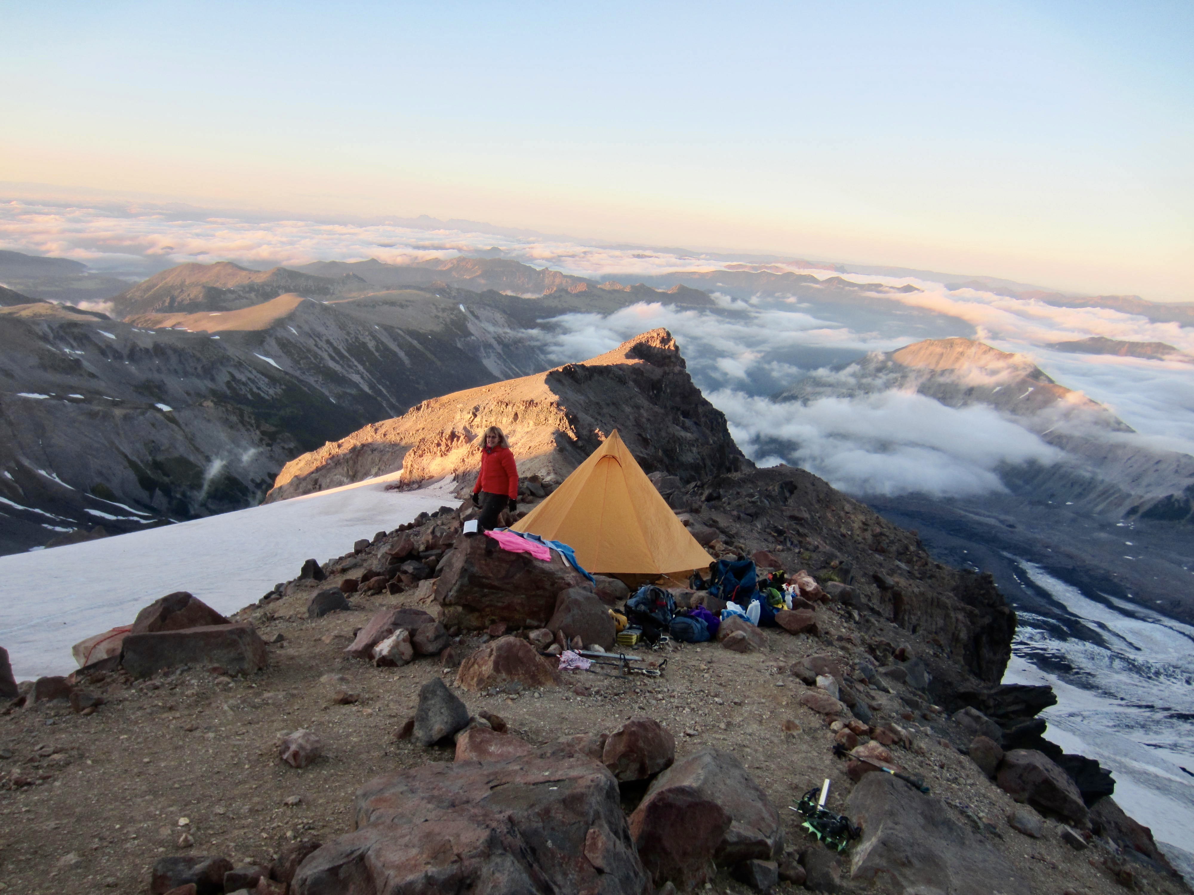
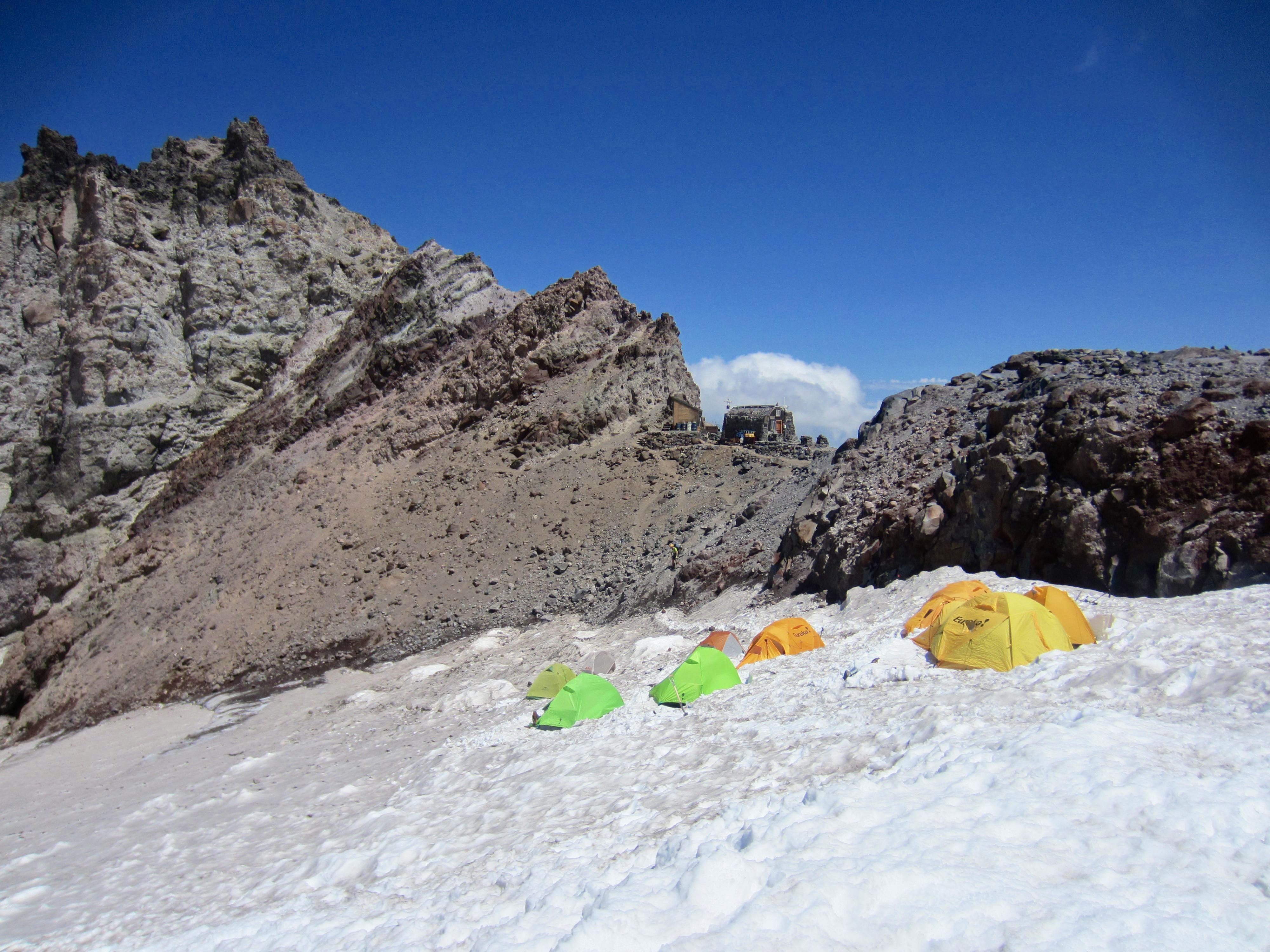
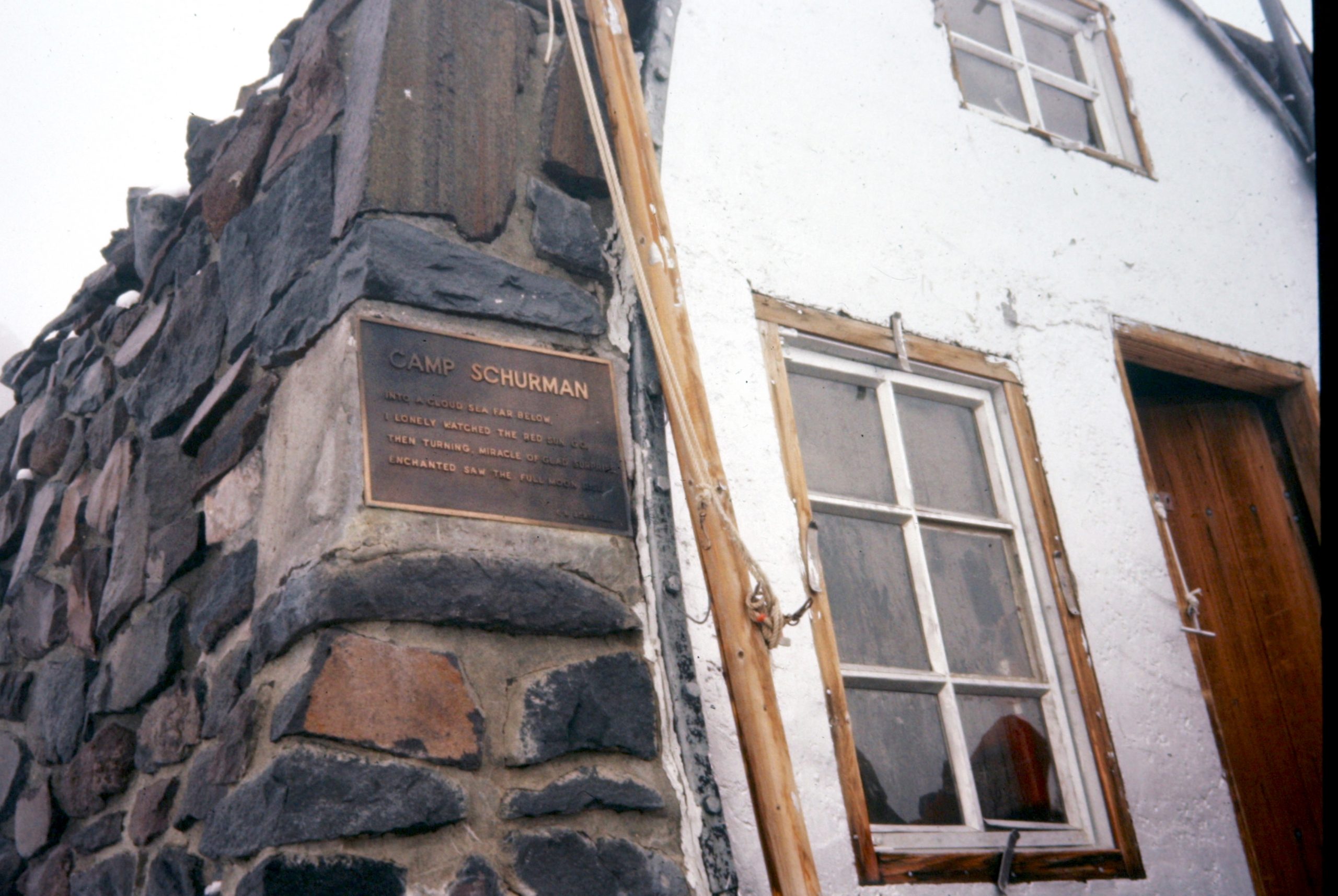
After a brief ascent, Camp Shurman came into view at the base of rugged Steamboat Prow. We swung wide around several crevasses, made a short snow traverse, and scrambled up a dirty gully to the stone shelter (1.2 hours + 500 feet from Camp 2).
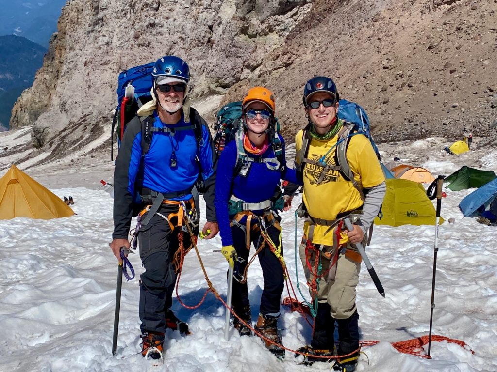
Being early afternoon, the camp was very quiet. A guided party of six climbers was still in the process of descending Mt. Rainier, and a private party of three was resting in preparation for an evening summit bid. Eileen, Brooke, Dan, and I pitched our two tents next to each other on a large snow platform.
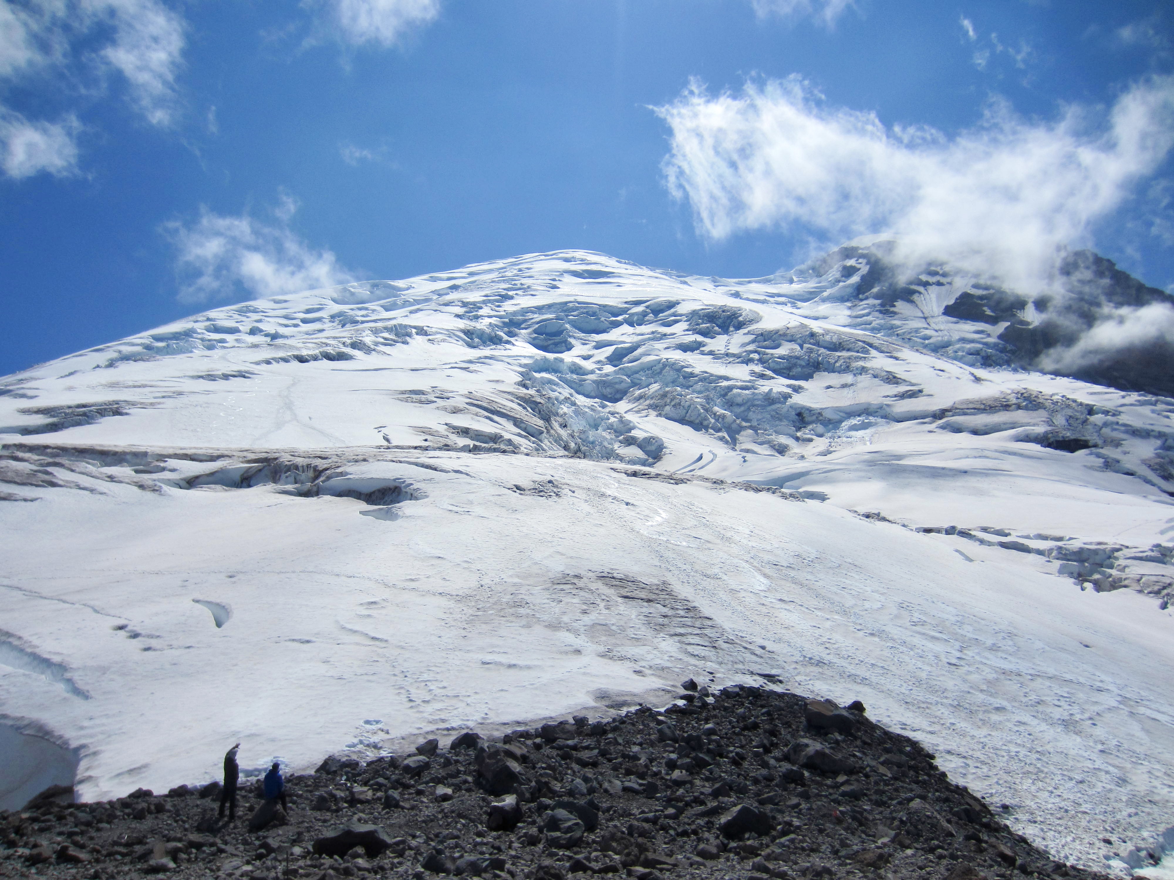
We spent the early part of our afternoon snacking, drinking, melting snow, and roaming around camp. Our eyes were continually drawn to the Emmons Glacier stretching up to the south, in hopes of catching a glimpse of descending climbers.
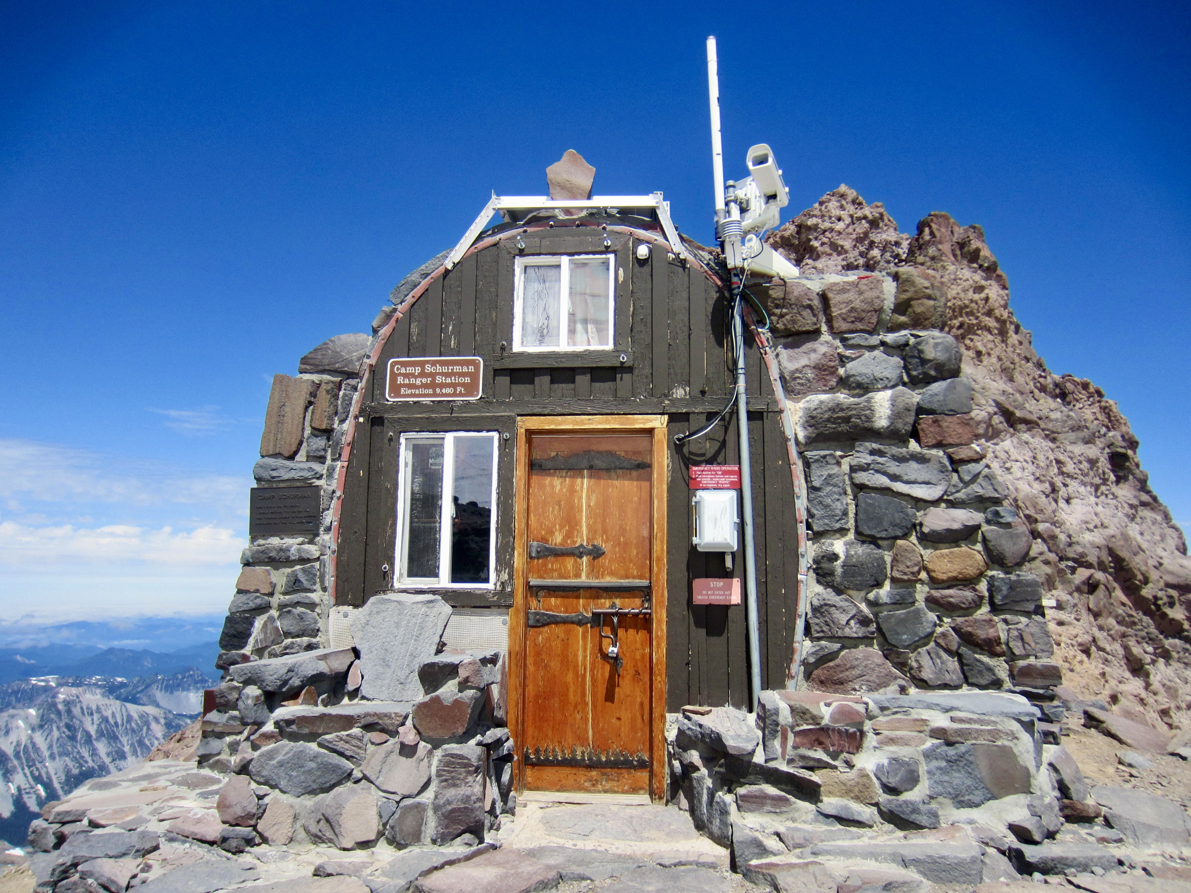
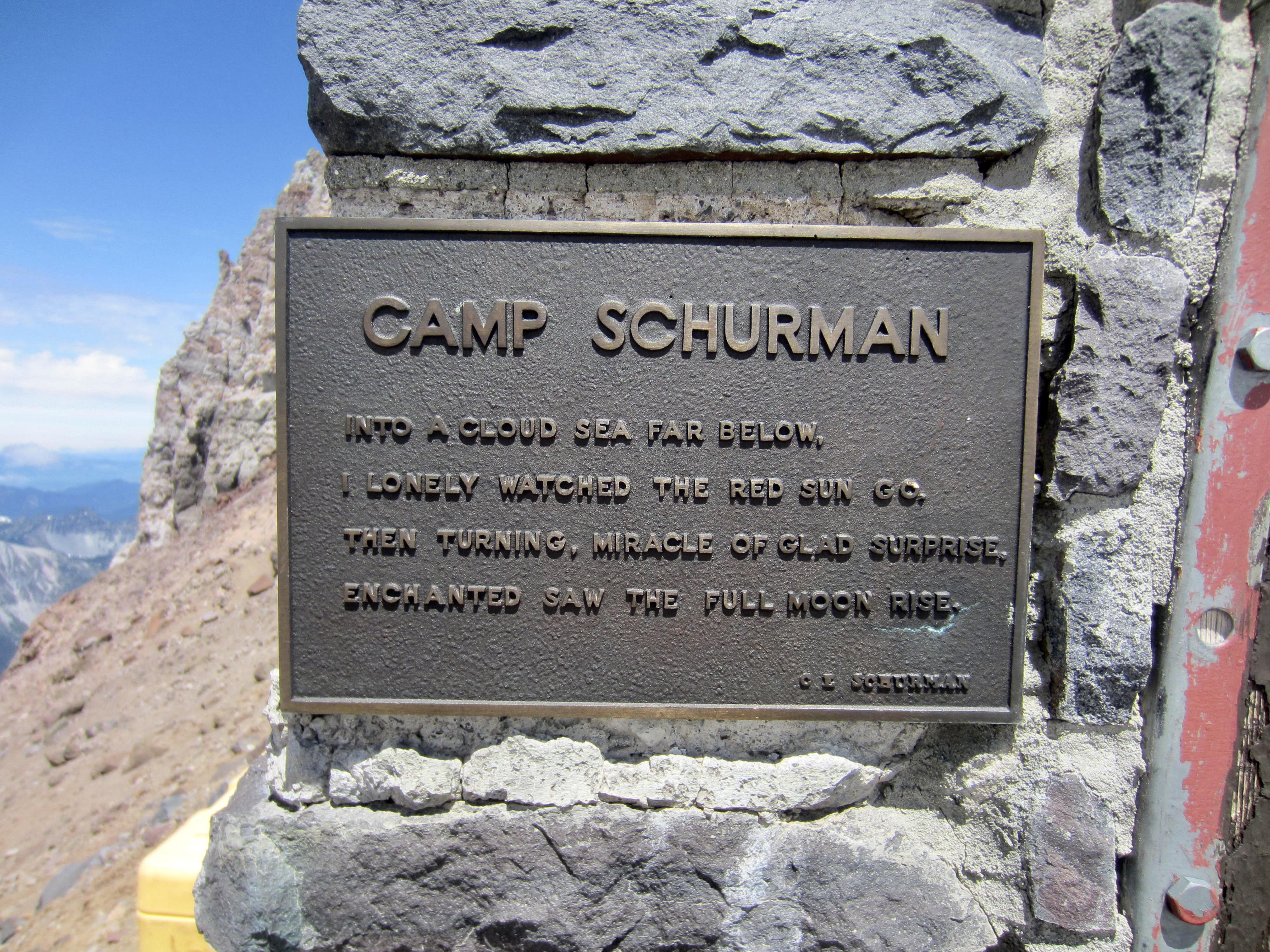
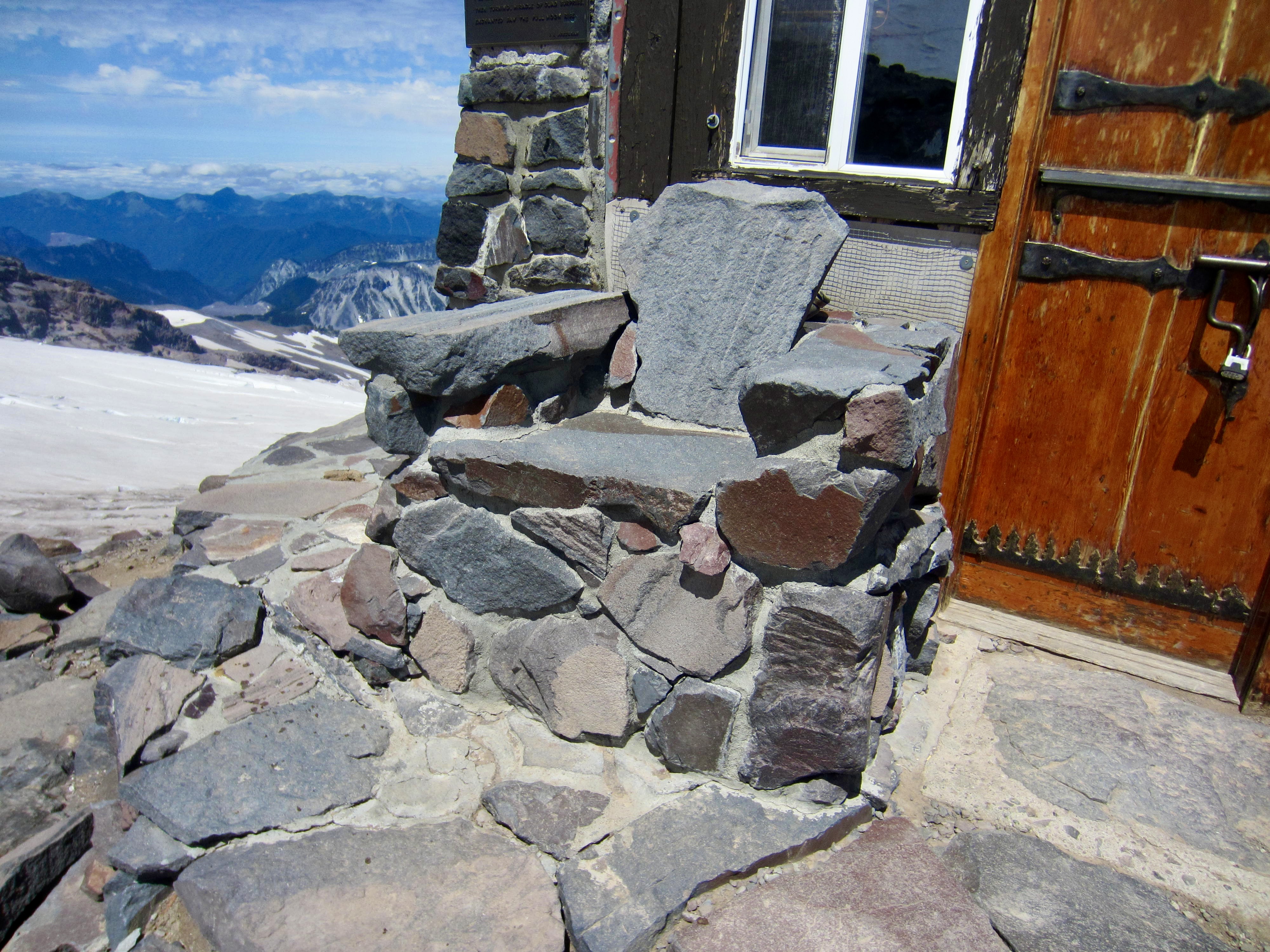
I was especially intrigued by the historic stone shelter (now a ranger station), which had been systematically constructed by volunteers over a period of several years during the 1950s. Because this shelter was the vision of Clark Schurman—a Rainier park ranger, mountain guide, and Boy Scout leader—it was named in his honor. I last saw the building in 1976 and could tell that it has changed a lot since then.
Later that afternoon, Brooke, Dan, and I retired to our tents for the purpose of resting and dozing before our planned midnight summit departure. Unfortunately, this effort coincided with the arrival of the six descending climbers and of four new climbers coming up from Glacier Basin. For the next hour, Camp Schurman took on a very festive (that is, LOUD) atmosphere.
Night 3 & Day 4 (AM): Mt. Rainier Summit Climb
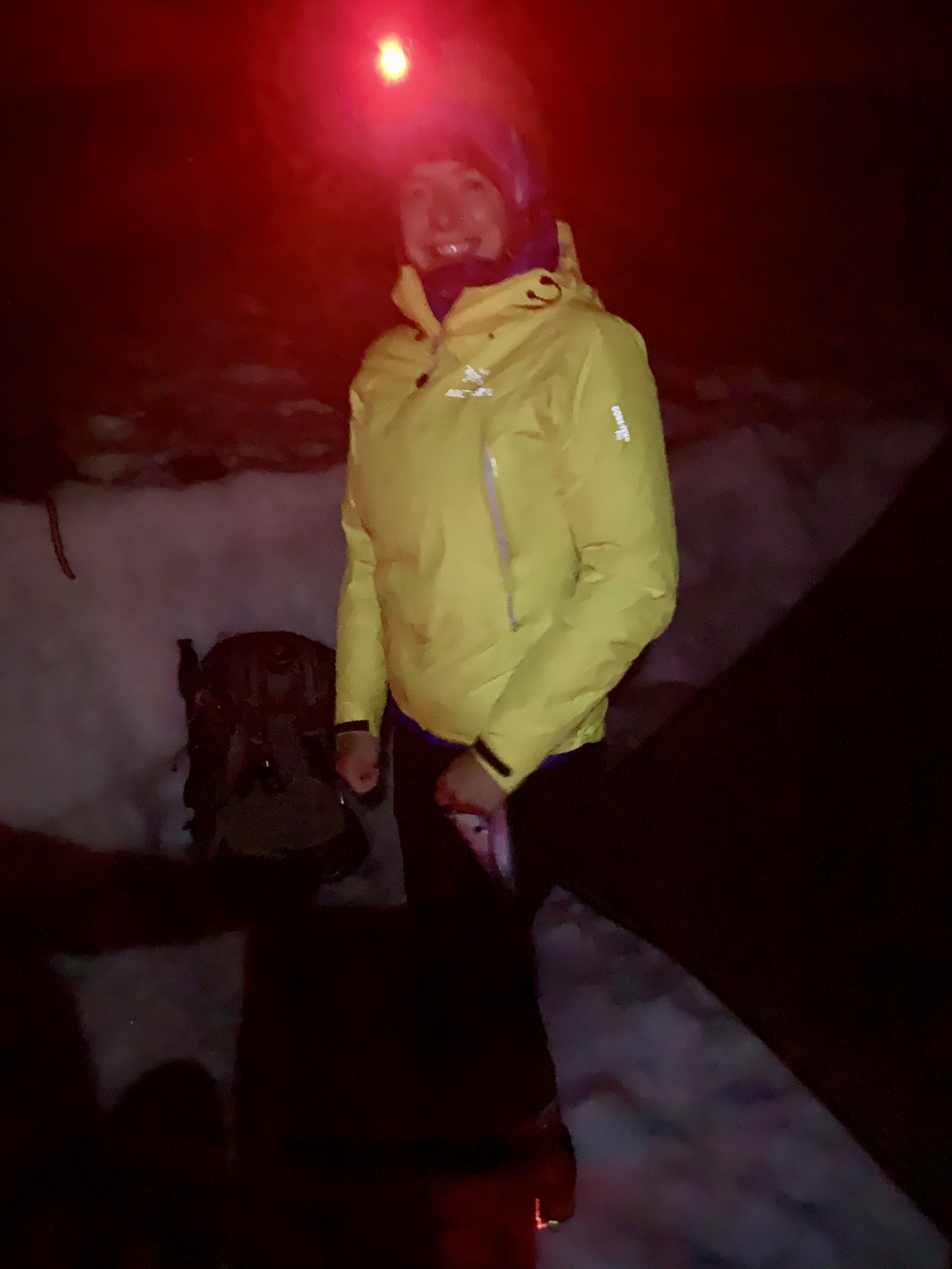
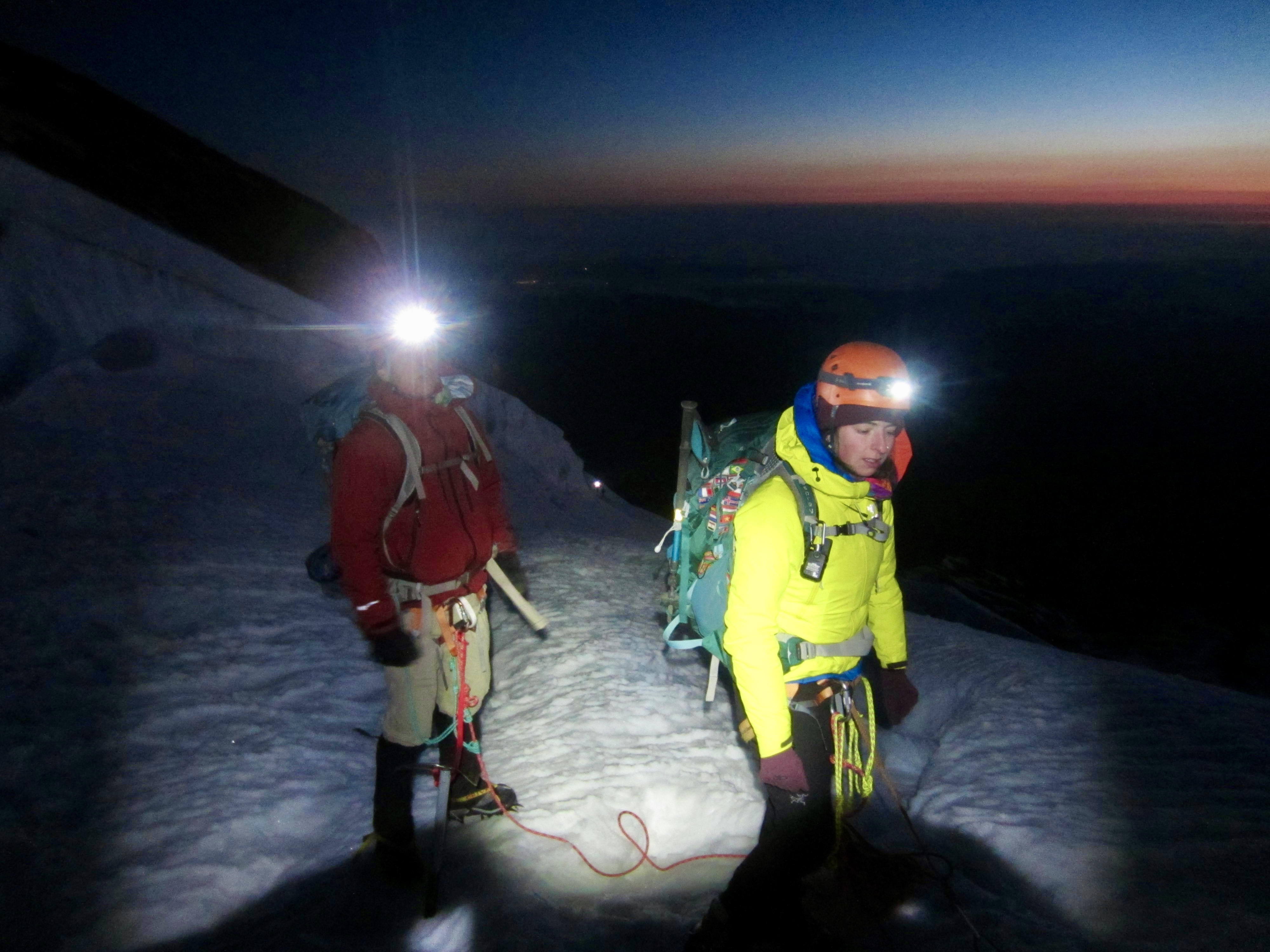
Eileen fired up the campstove at 10:30pm and started boiling water for a late dinner. Brooke, Dan, and I were up by 11:00pm, eating and getting dressed. We stepped out of our tents and were greeted by unexpectedly cold, windy weather and frozen snow. The party of four camped nearby was getting ready at the same time, and we learned that the party of three had left camp 2½ hours earlier.
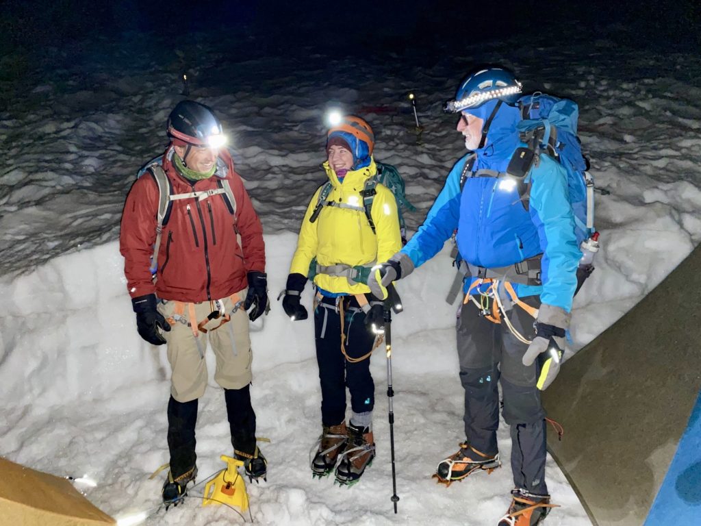
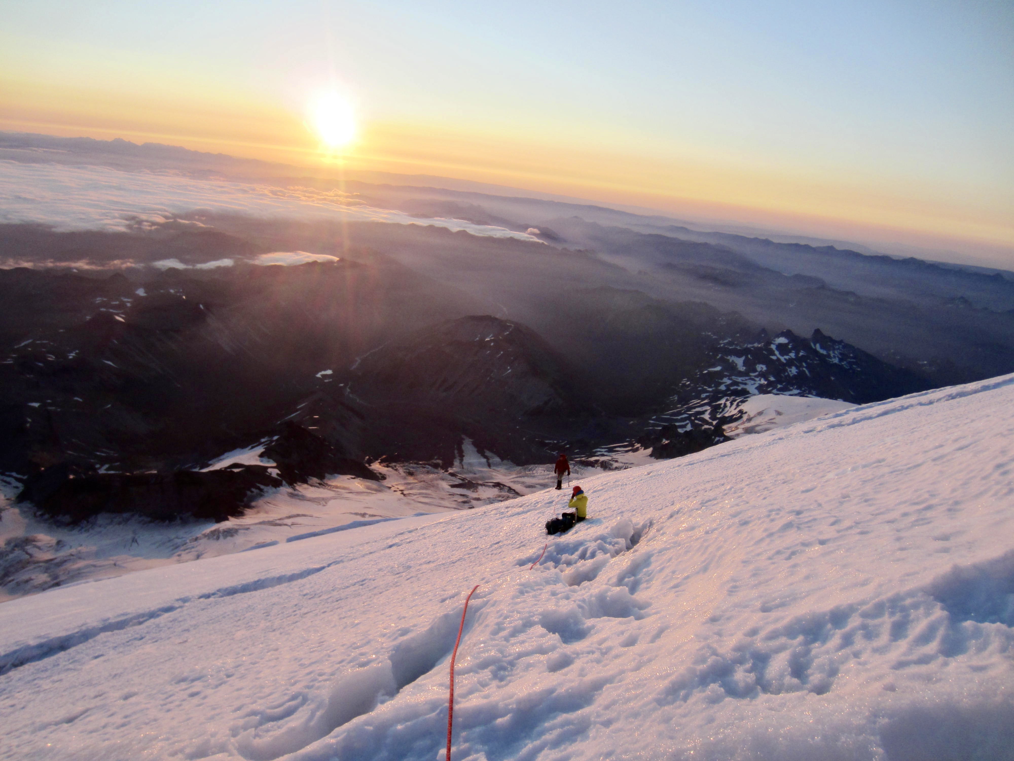
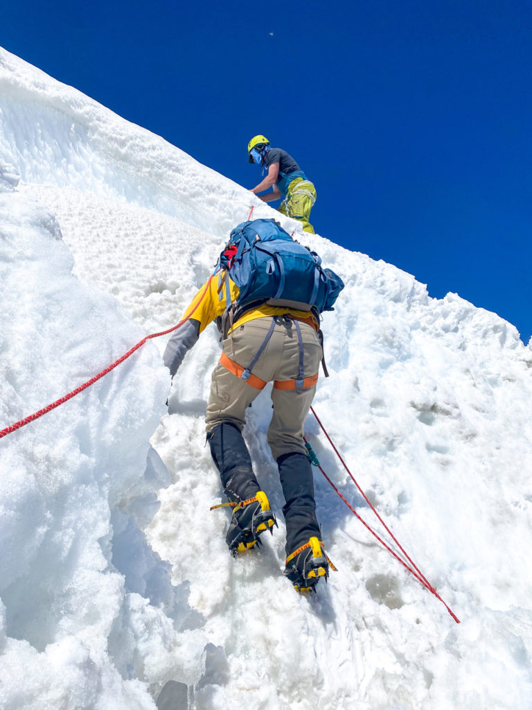
Our two separate rope teams left camp at 12:05am and began heading up the Emmons Glacier by headlamp. There was no talking; just the sound of crampons and ice axes biting into crunchy snow. As difficult and uncomfortable as these midnight starts can be, I will never deny that there is a magical feeling associated with climbing a big mountain in pitch darkness.
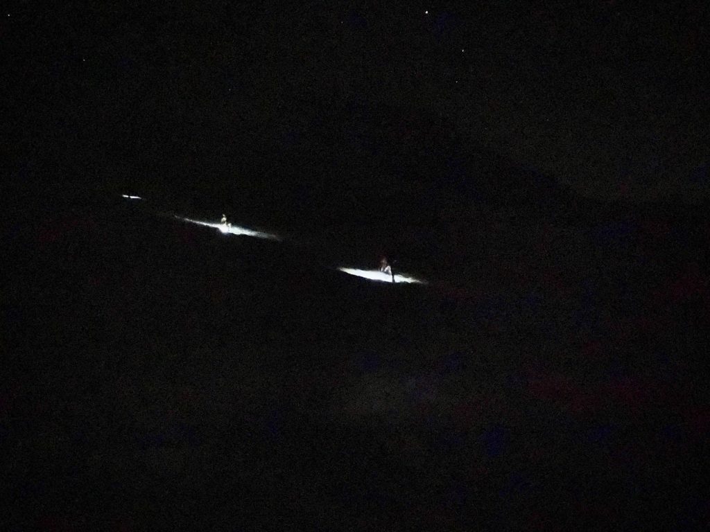
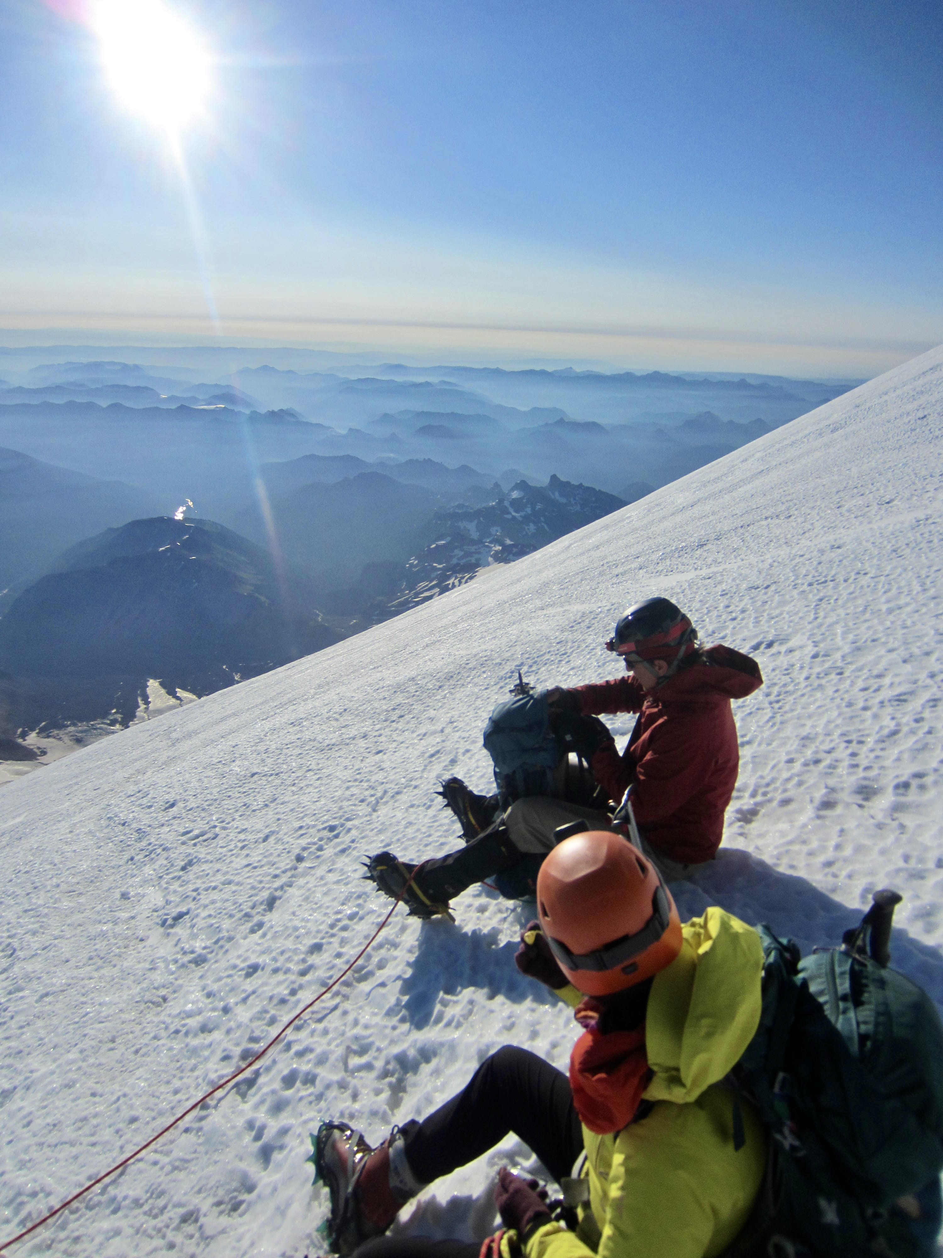
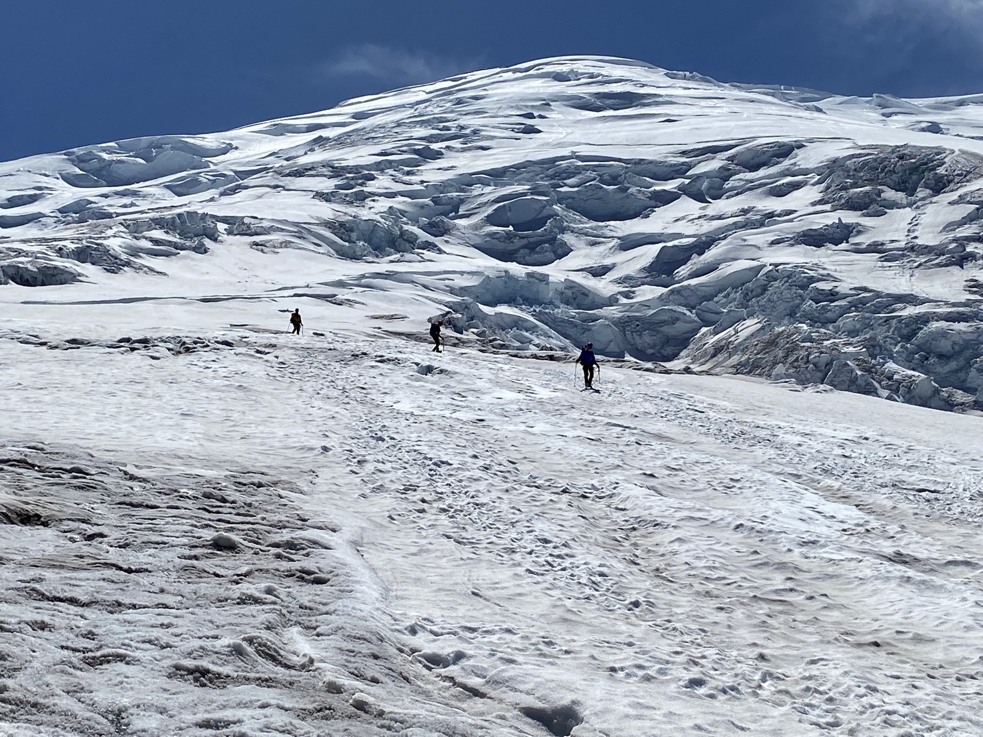
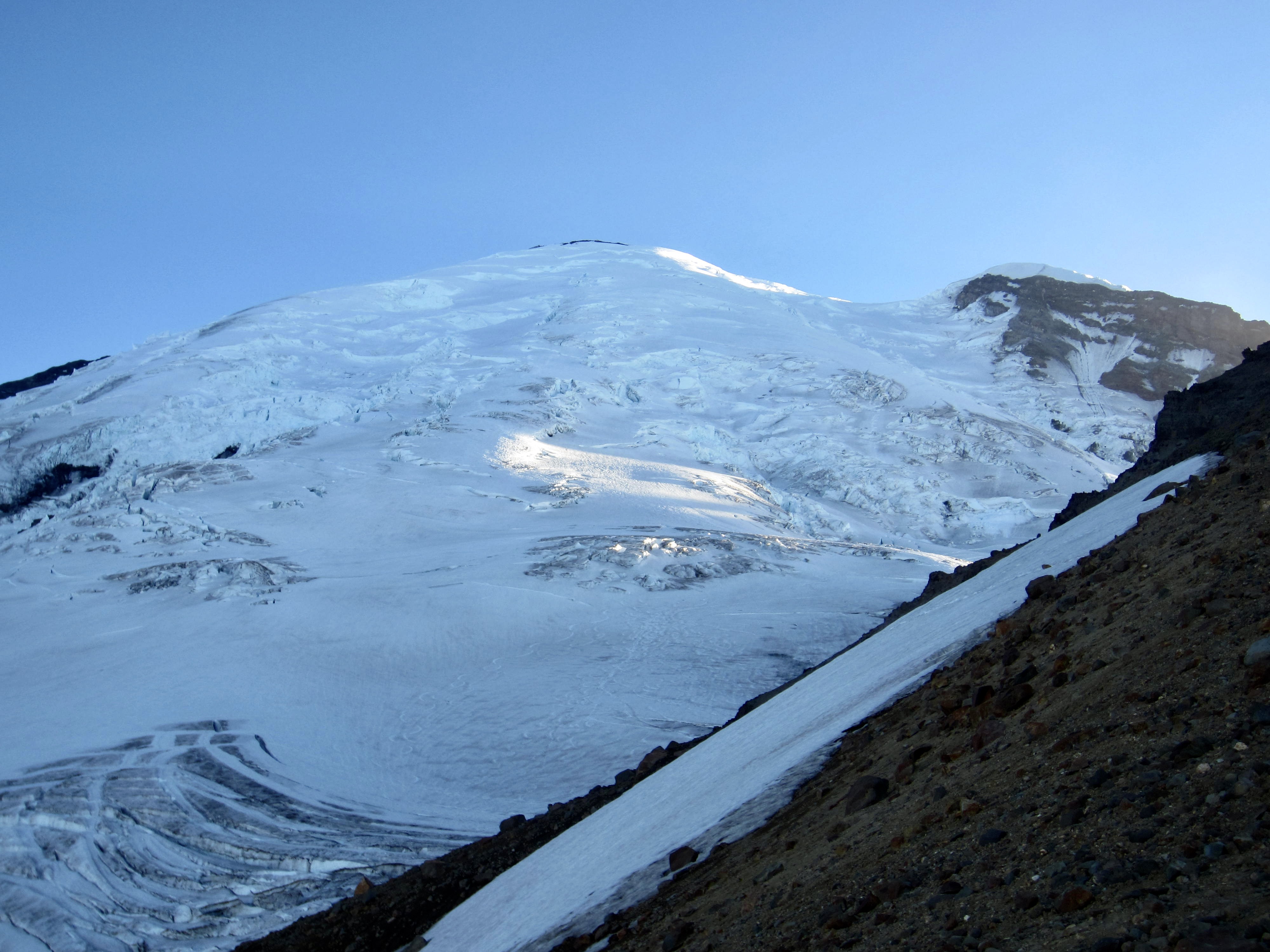
Both of our rope teams remained closely together throughout our ascent of an initially smooth ridge feature called “The Corridor,” and we passed the head-start party of three after about 2 hours (they were moving very slowly). Because the recent heatwave had decimated Rainier’s snow bridges, it was now necessary to make many long traverses back and forth across the middle part of the glacier in order to avoid crevasses. Some of these traversing detours were more than ¼ mile long!

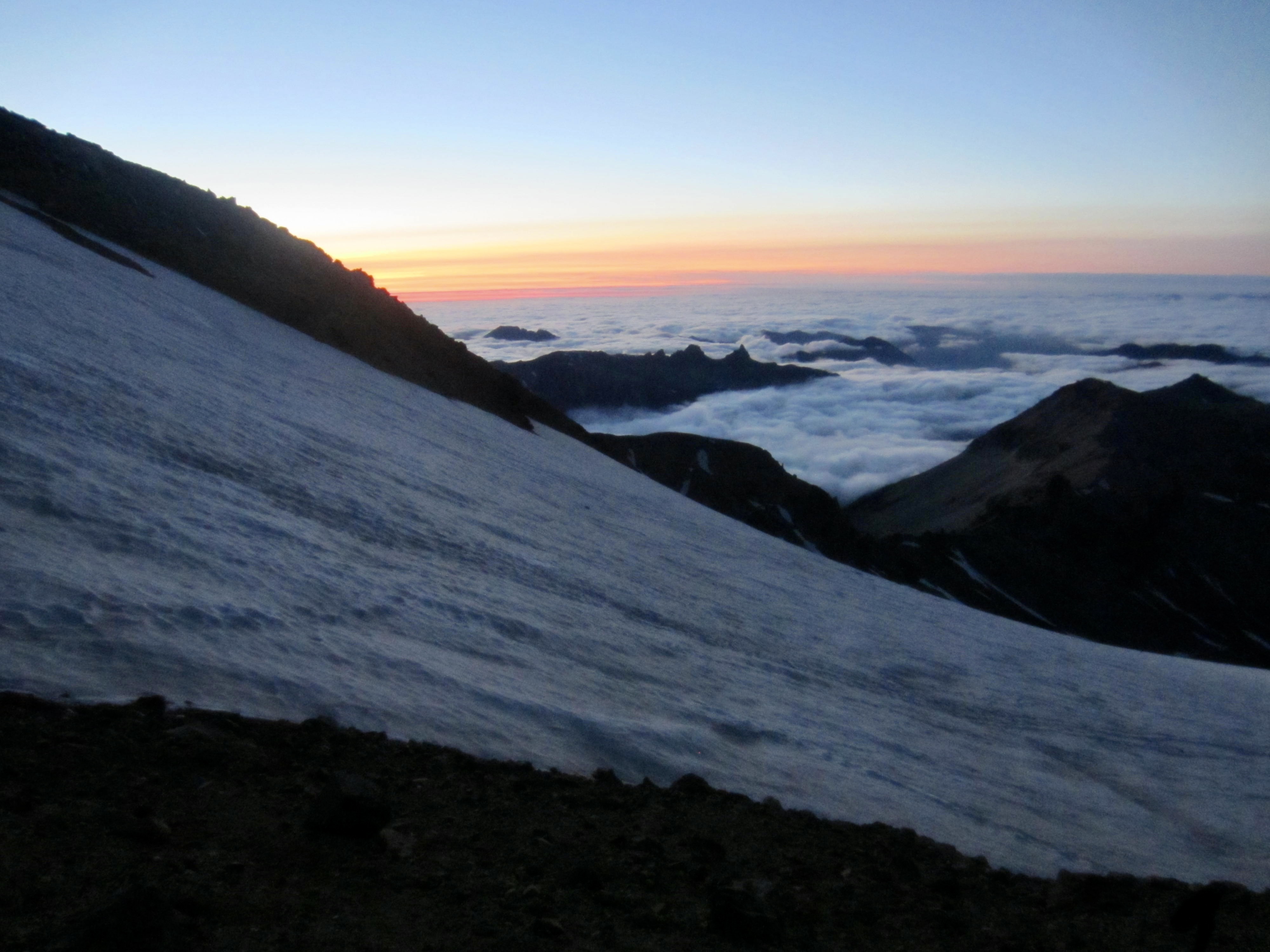
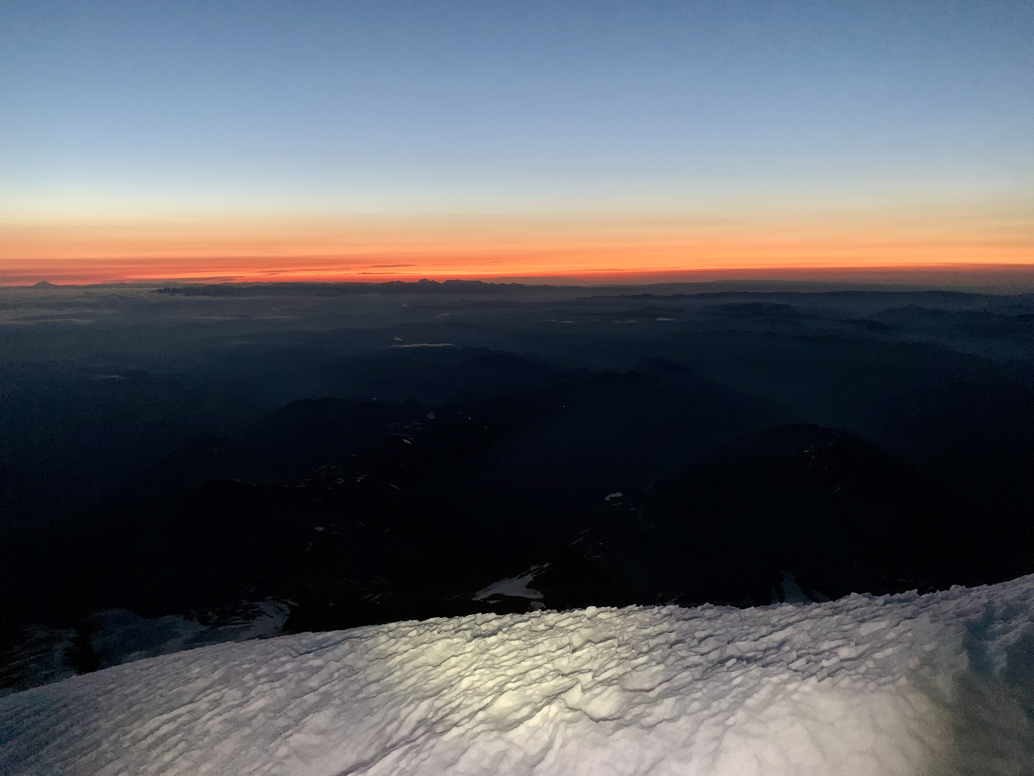
Around 4:00am, after about 2500 vertical feet of climbing, we happily noticed a faint orange glow on the northeastern horizon. The glow gradually became brighter and the sky became lighter, and an hour later, the sun made its much-awaited appearance. What a glorious sight on this cold morning!
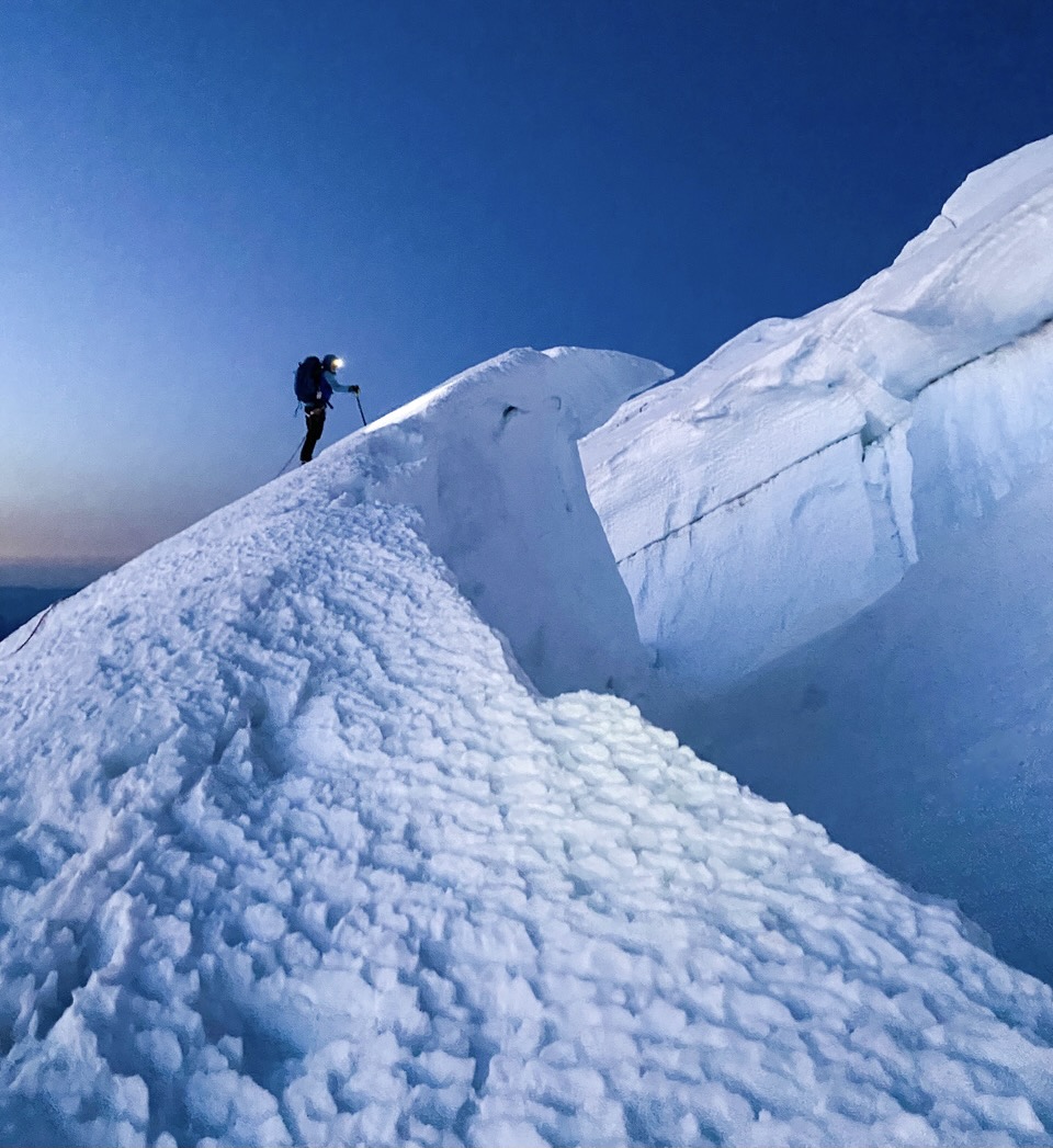
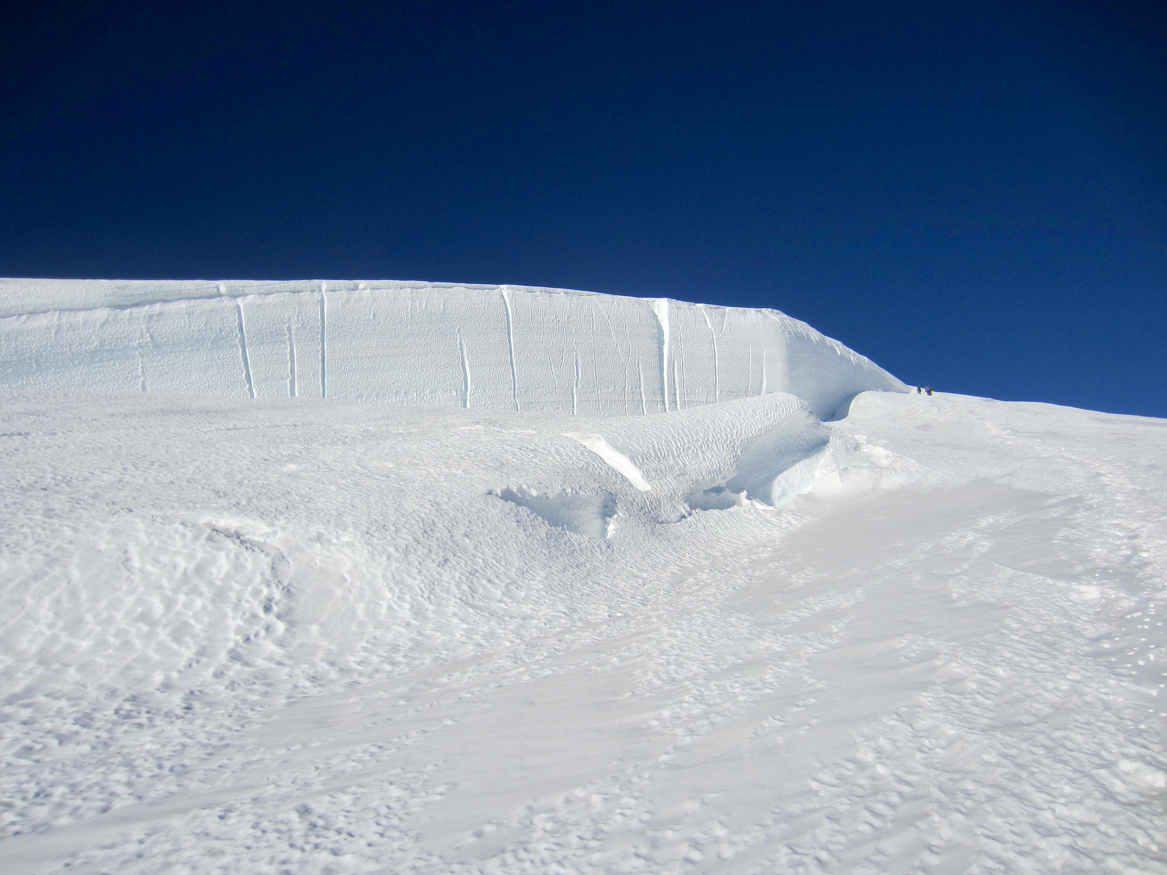
More traversing and two dicey crevasse crossings took us to 13,000 feet, directly below a giant headwall of pure-white ice. This headwall ranges up to at least five stories high and is easily visible from Sunrise—a full 7 miles away! We glimpsed the party of four, who had gradually pulled ahead of us, making an end-run around the right-hand side of the headwall.
After getting around the headwall, we began ascending the convex summit dome. The gradient eases off here, but the icy crust was even harder that ever and required careful footwork.
The barren crater rim soon came into view at the top of the dome. We hurried up the final ice slope—to the extent that we could hurry at 14,000 feet—and scratched our way up the sandy crater rim.
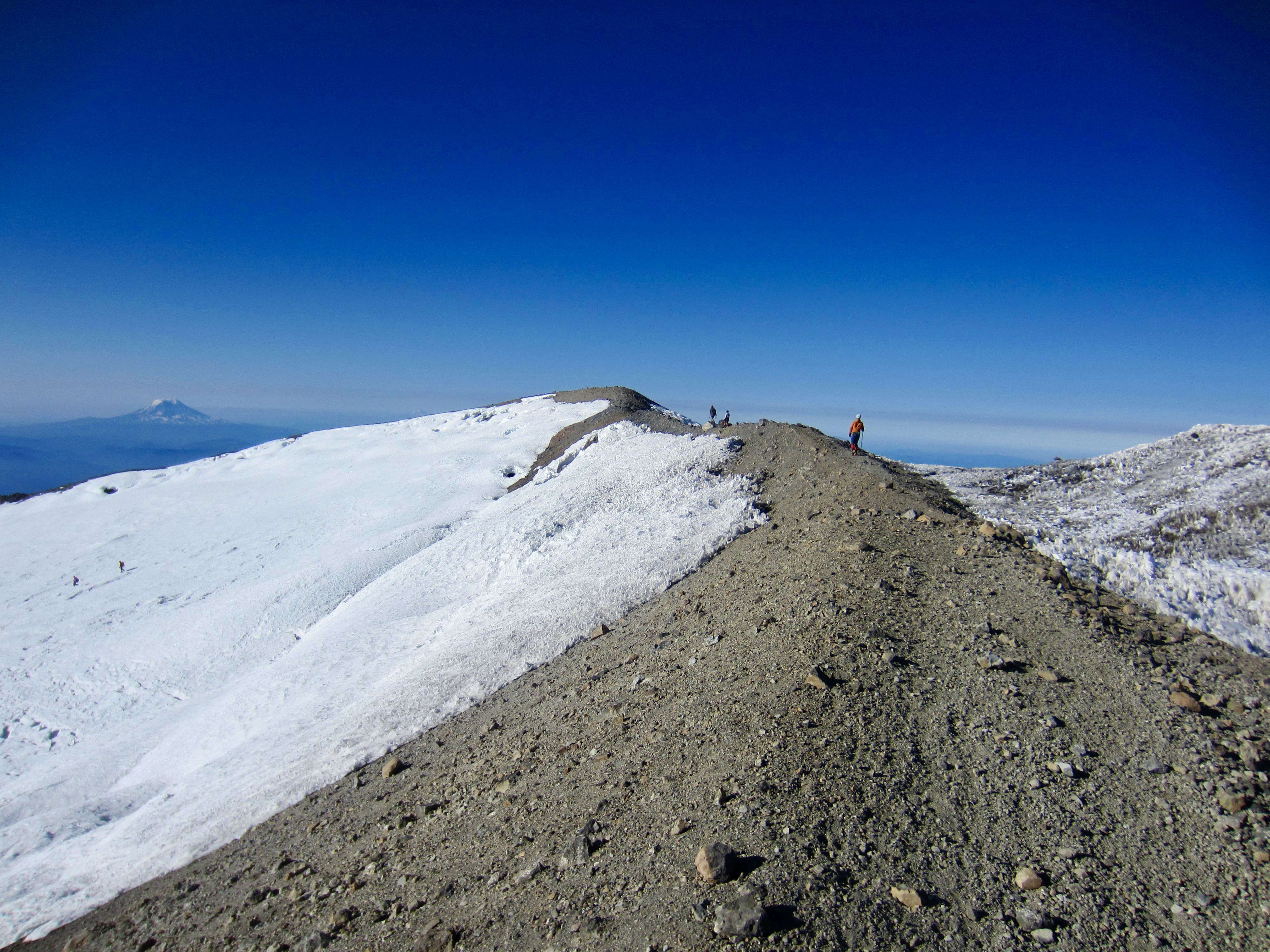
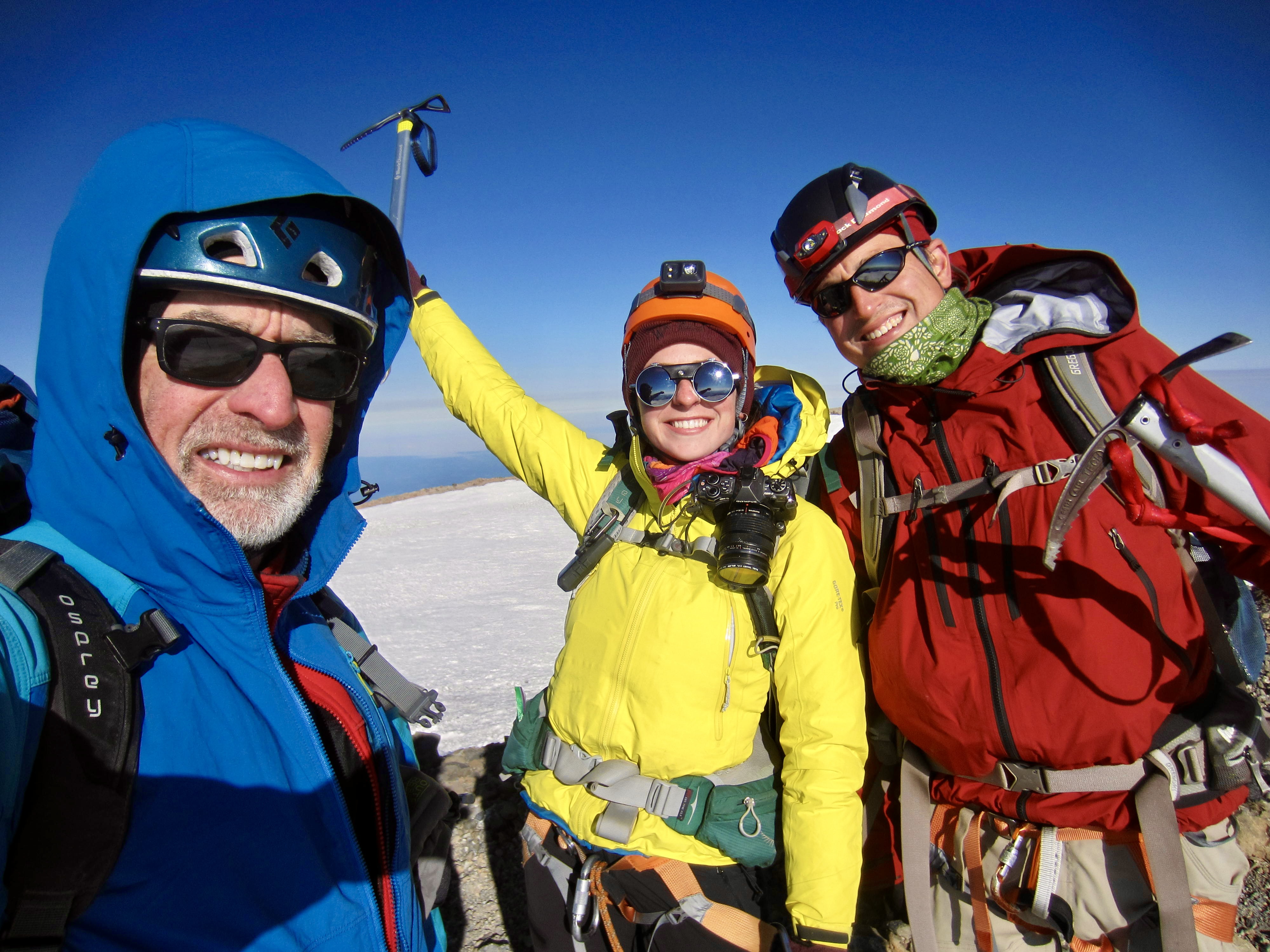
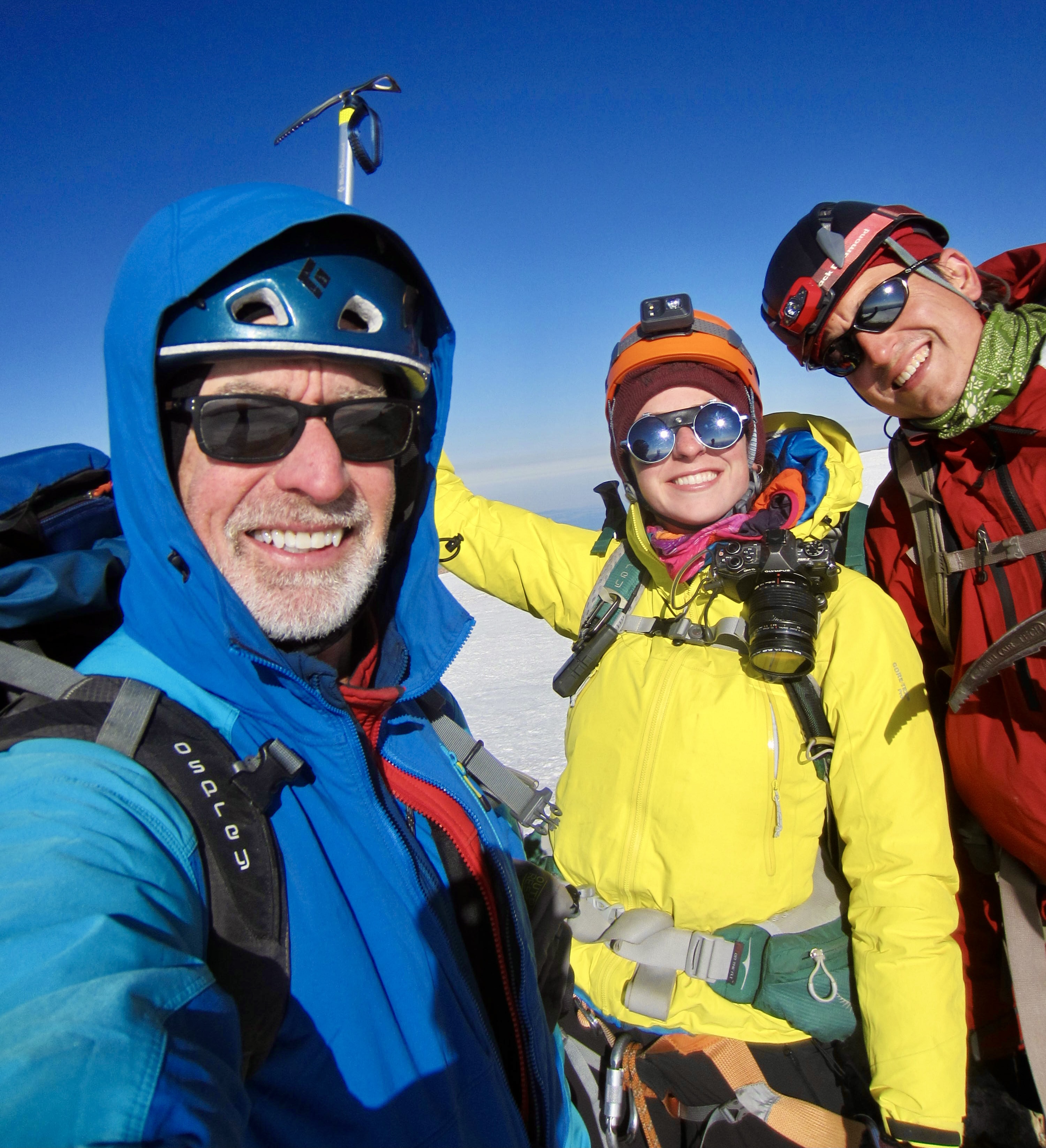
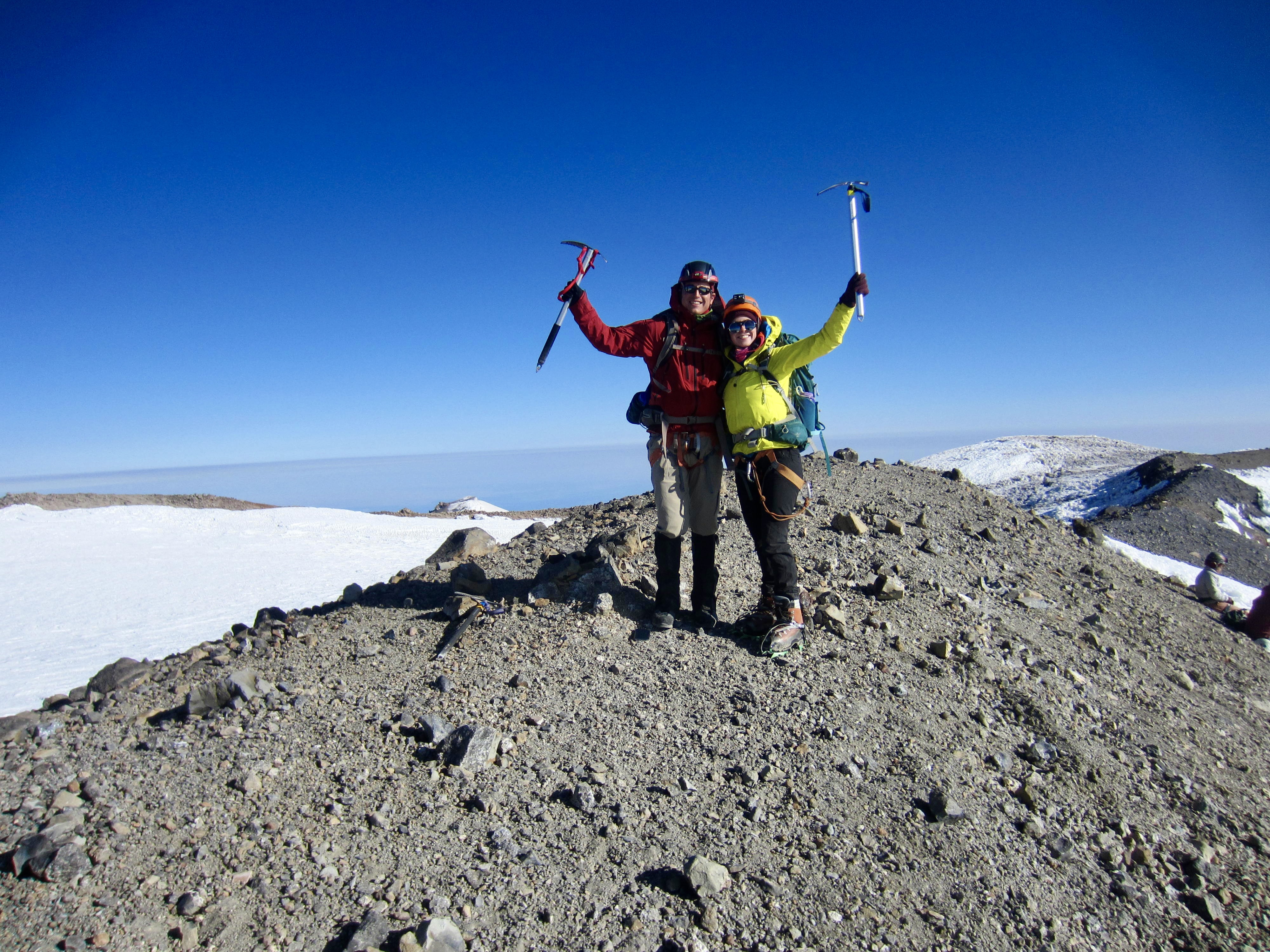
We took a victory stroll along Columbia Crest to reach the summit at 8:05am (8.0 hours + 5100 feet from Camp 3). It was big smiles for everyone, as well as an indescribably special moment for me to have completed this climb with Brooke—45 years to the month after my first Rainier climb!
After taking summit photos, we ducked into a sheltered place below the crater rim and spent a full hour munching, drinking, soaking up the summit atmosphere, and—most important of all—allowing the glacier ice to soften a bit. There had been dozens of climbers milling about the crater when we first arrived, but they eventually disappeared and left us alone in eerie quiet.
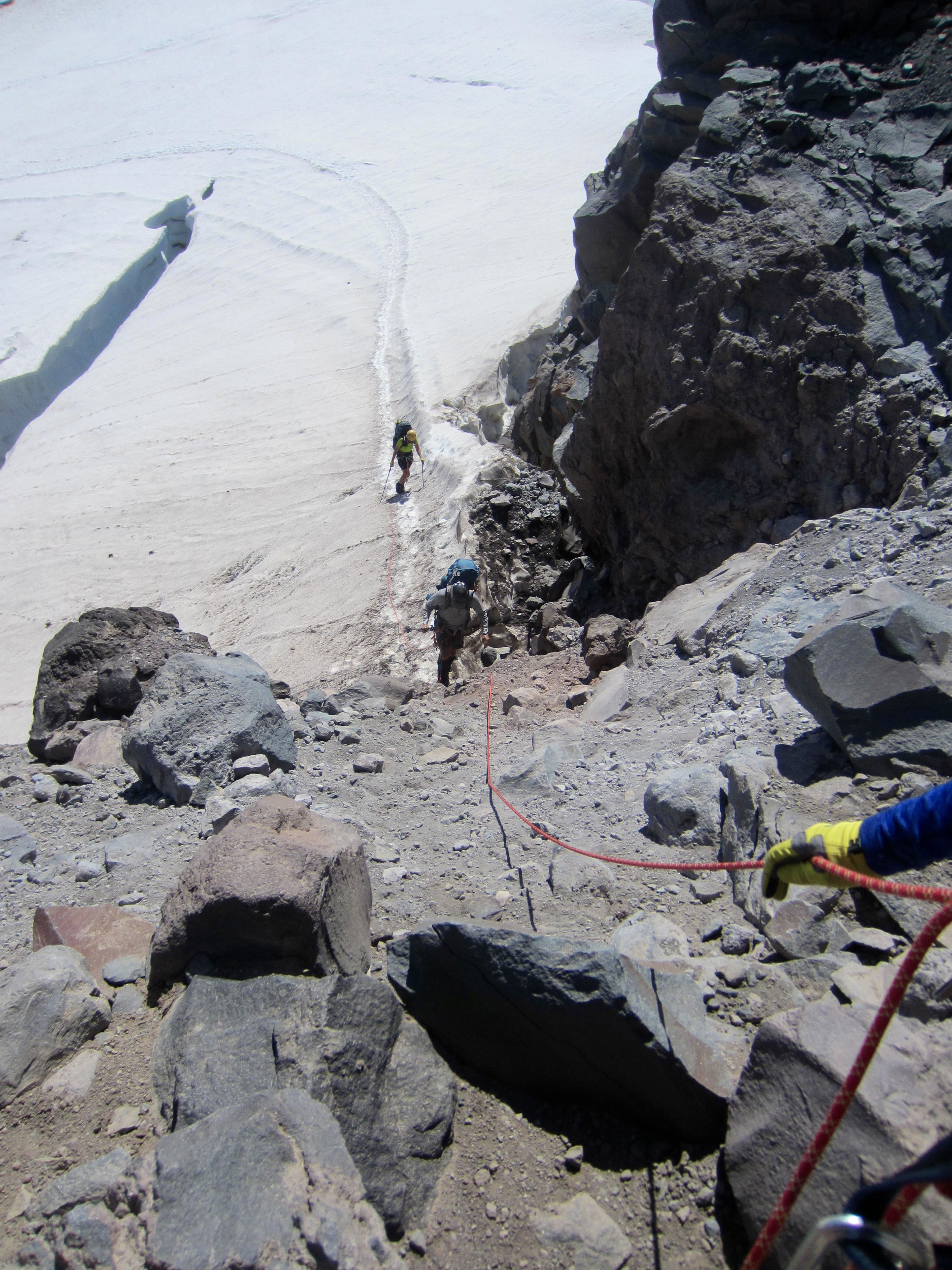
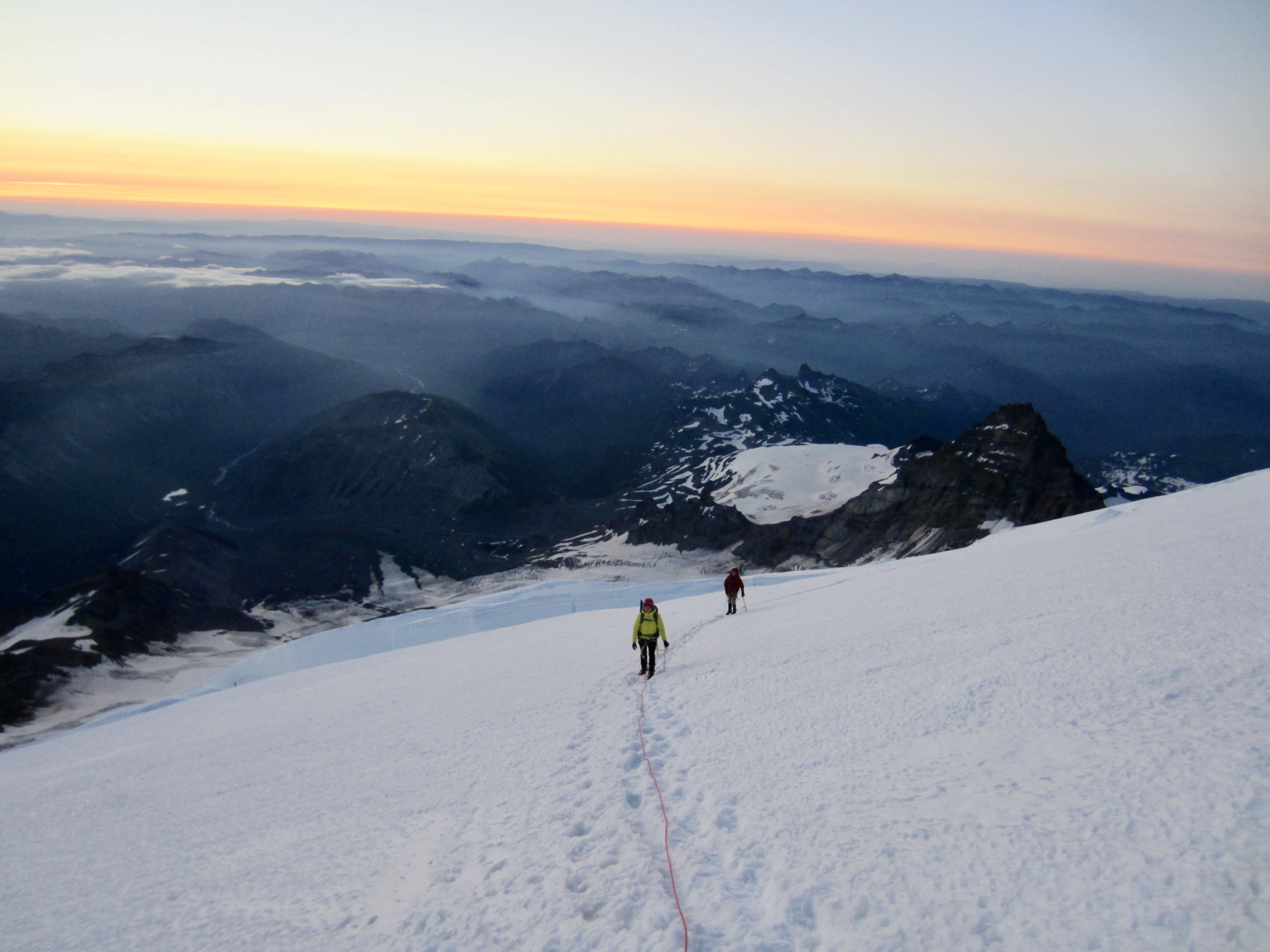
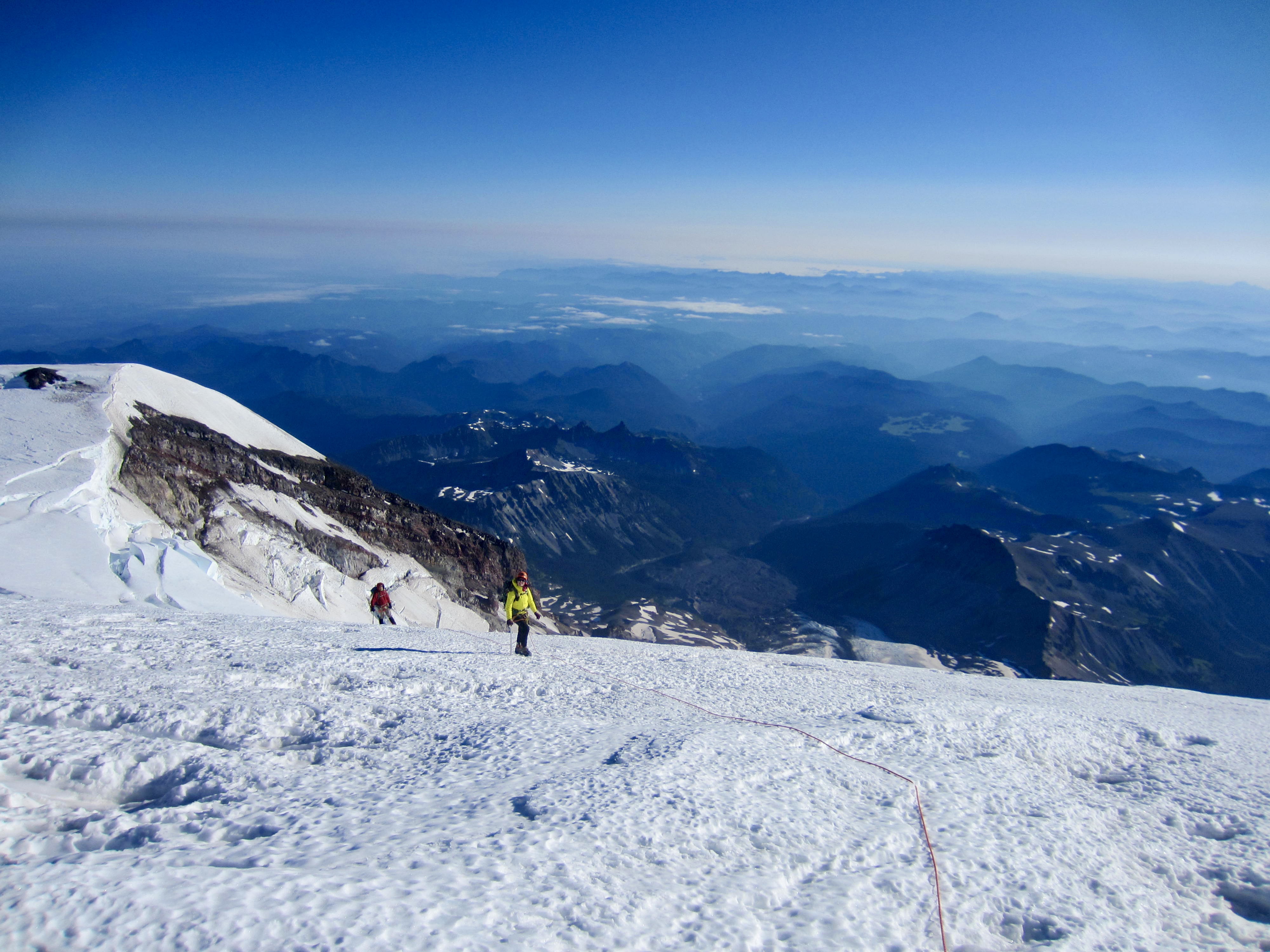
We left the summit at 9:30am and carefully began retracing our up-route down the glacier, setting up a belay at one short pitch near the headwall. Because the hard surface had left us precious few crampon tracks in some locations, our descent required constant vigilance to stay on route.
At one point, we completely lost the track and found ourselves at the top of a 10-foot-high, near-vertical step. What to do? Luck was on our side, because a solo ski-mountaineer was just approaching from below. Following a brief greeting, it was decided that we would belay him up the step using a picket anchor, and then he would belay us down and toss down our picket. In the process, we learned that his name is Barrett McMurtry and that he has climbed up and tele-skied down the Emmons Glacier more than a dozen times this summer!
After descending another 1000 feet, we observed the snow to be softening nicely and were able to increase our speed toward camp. However, this also meant that the snow bridges were weakening considerably; our party experienced four one-legged punch-throughs in the final 500 feet! We motored into Camp Schurman at 2:30pm (5.0 hours + 200 feet from summit) and were enthusiastically greeted by Eileen. She got our full story as we shed gear and clothing in the warm campsite.
I find it astounding that the Emmons Glacier route is purported by many references to be the easiest on Mt. Rainier. Having completed hundreds of snow climbs over many years, I would describe this as one of the most stressful non-technical snow climbs I’ve ever done, owing to the relentlessly exposed slopes and icy conditions. My feelings were anecdotally confirmed by the climbing ranger stationed at Camp Schurman and by the other rope team leader. Whether it’s just a function of this year’s snow conditions or a sign of permanently changing conditions, I can’t say.
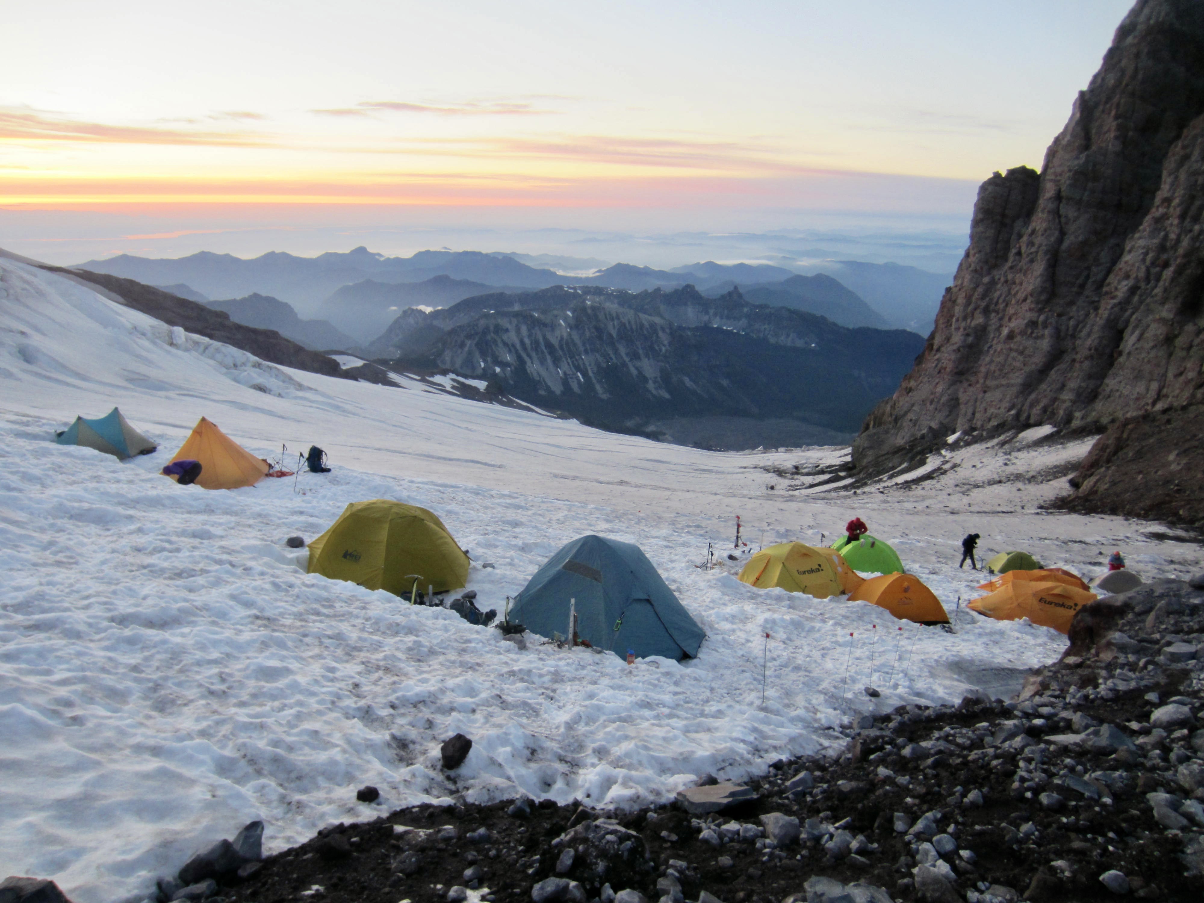
Day 4 (PM): Camp Schurman to Upper Glacier Basin
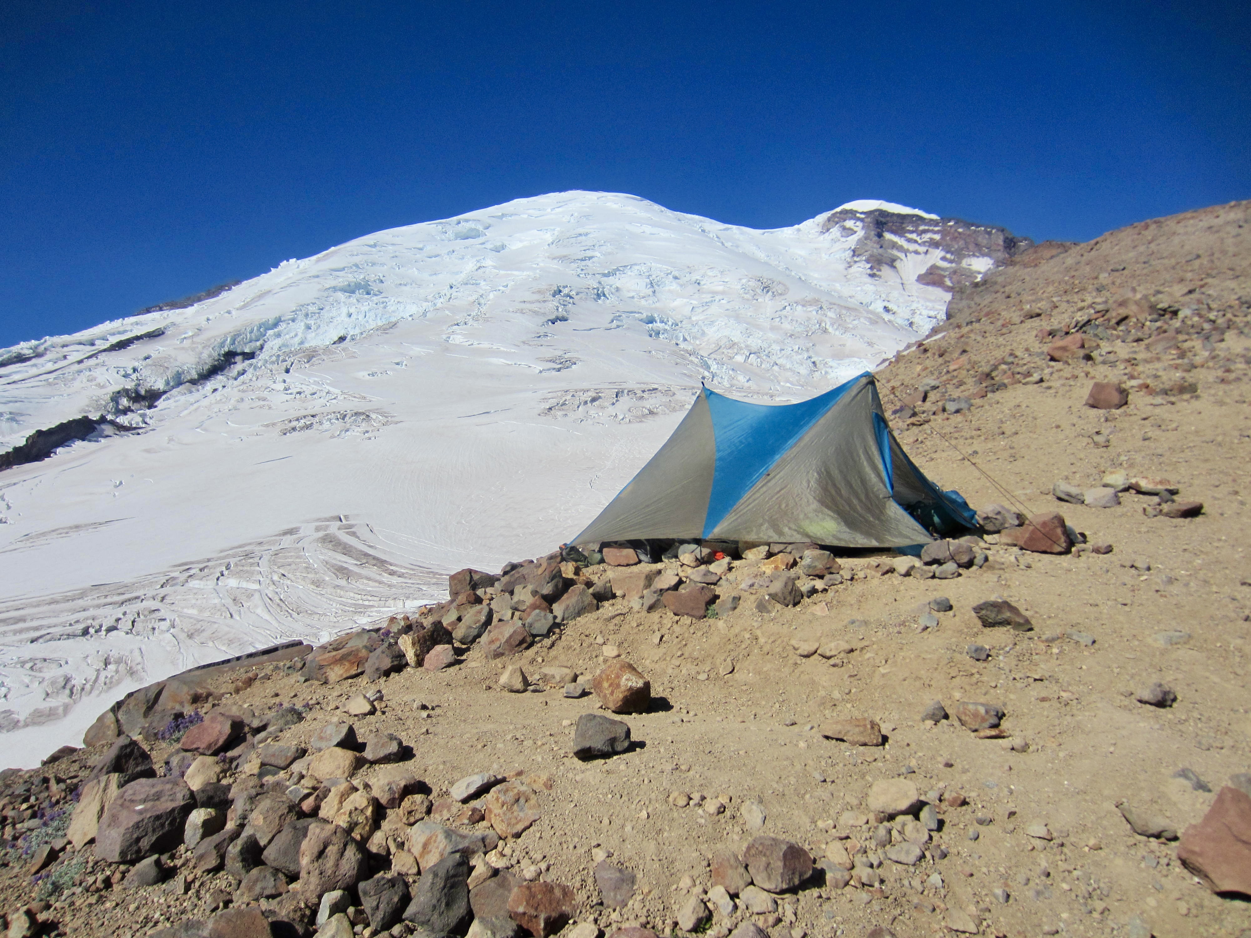
Although it would have been quite nice to spend the remainder of our day relaxing in camp, we all wanted to get some miles behind us before dark. By 5:00pm, we were packed up and beginning our retreat. We hustled back over the ridge at Camp Curtis and descended the Inter Glacier to Upper Glacier Basin (1.8 hours + 100 feet from Camp 3). Eileen and I made camp here, in sight of Mt. Rainier’s glistening summit dome, whereas Brooke and Dan continued hiking out the remaining 4 miles to White River Campground.
Day 5: Upper Glacier Basin to Glacier Basin Trailhead
Eileen and I had a relaxed morning in camp before making a leisurely hike down to White River Campground (2.1 hours + 100 feet from Camp 4). We happily saw that Brooke and Dan had retrieved our vehicle from Sunrise last night and left it waiting for us in the campground. It was a hassle-free ending to an epic adventure!
…
Route Map & Profile
…
…
Photo Gallery
Click to enlarge…