Trip Date: August 23-24, 2023
Mt. Lindeman Climbing Trip
Centre Creek Valley
West Lindeman Basin
Lindeman Pass
Mount Lindeman (7578′)
Trip Report Summary
Region: Canadian Cascades (British Columbia)
Sub-Region: Canadian Chilliwack Mountains
Areas: Yale Land District & Chilliwack Lake Provincial Park
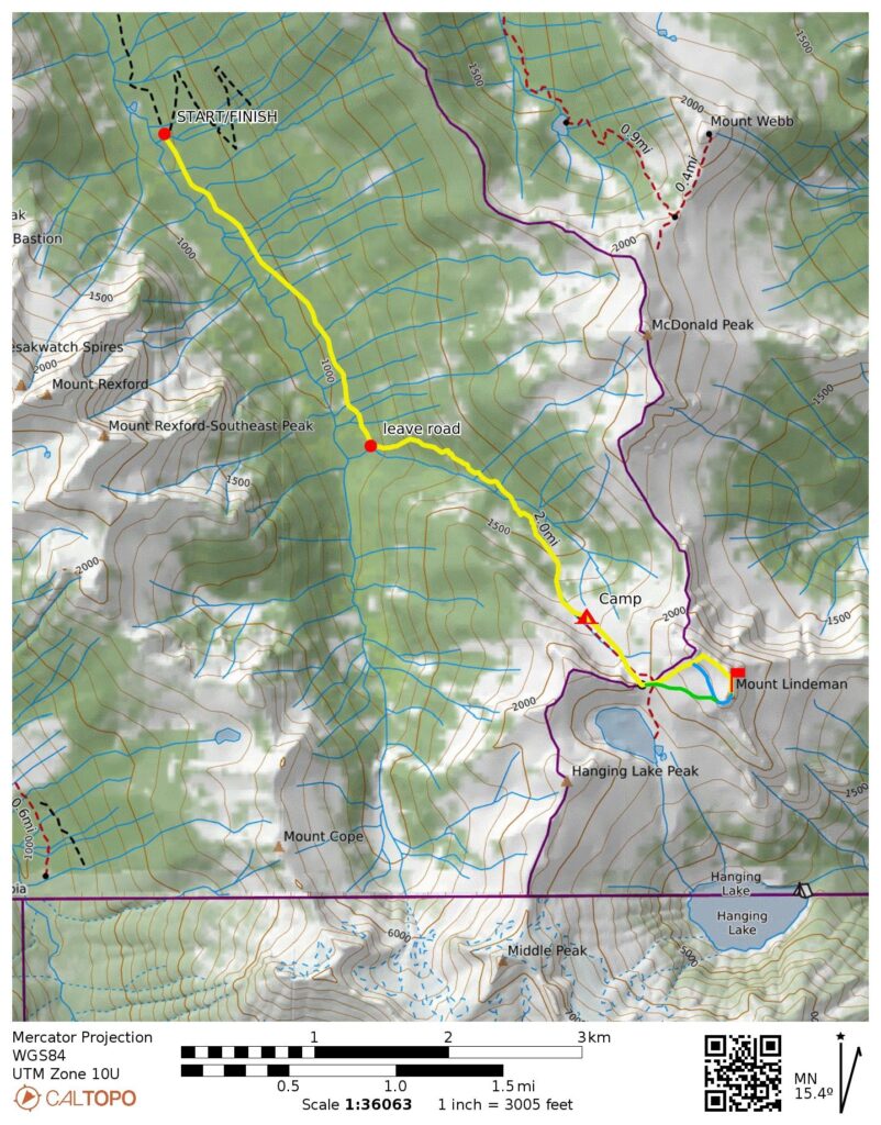
Starting & Ending Point: Mt. Lindeman Trailhead on Centre Creek Road (Elev. 2900 feet)
Way Points: East Fork Centre Creek & East Fork Centre Creek Meadow & West Lindeman Basin (trail hike & trail scramble)
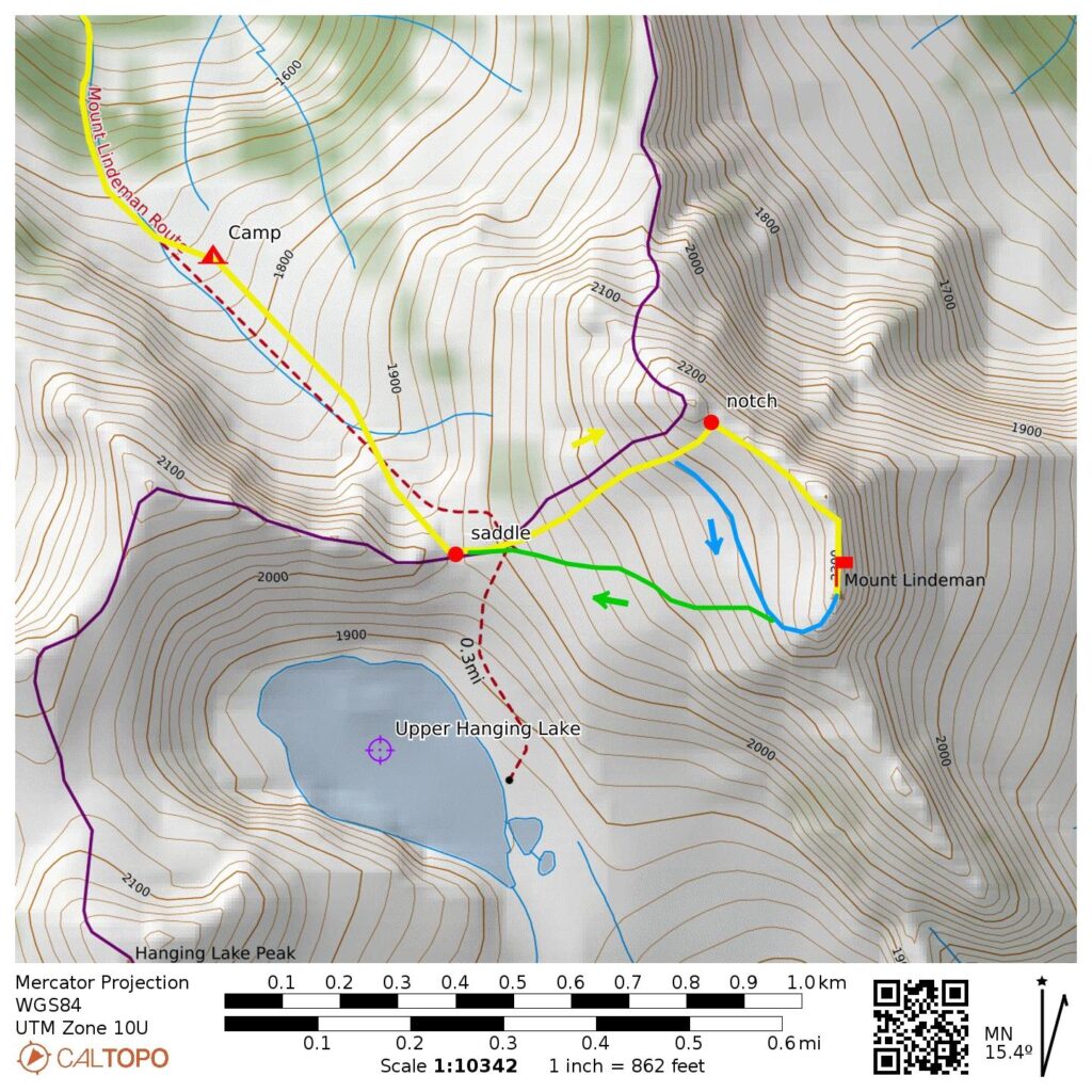
Campsite: West Lindeman Basin (Elev. 5700 feet)
Sidetrip: Lindeman Pass (off-trail hike & rock scramble)
Summit: Mt. Lindeman (off-trail hike & rock scramble via West Cirque–North Ridge)
Summit: Mt. Lindeman (off-trail hike & trail scramble & rock scramble via West Cirque—Southwest Spur)
Approximate Stats (including both summits): 9.2 miles traveled; 5200 feet gained & lost.
Full Trip Report
Eileen and I made our first-ever foray into the Canadian Chilliwack Mountains, with the goal of climbing Mt. Lindeman. Our trip coincided with a period of dense wildfire smoke, but we had a successful climb nonetheless.
Driving Directions & Road Conditions
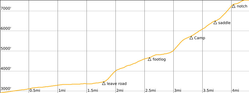
From the town of Chilliwack, drive eastward on Chilliwack Lake Road until just past Riverside Campground, then turn right and cross three branches of the Chilliwack River on three successive bridges before quickly coming to a “T” intersection. Here, turn left and proceed eastward on a wide gravel road for 2.4 miles / 3.9 kilometers to reach another junction, then turn right on Centre Creek Road and head southward up Centre Creek Valley.
Centre Creek Road climbs steadily and twice crosses Centre Creek on sturdy bridges. Overall, this road is in good condition except for the 18 or so drainage ditches that must be crossed, thereby requiring a vehicle with fairly high ground clearance. We were able to drive across all of the ditches in our Honda CRV, although we did scrape the rear bumper at several locations. Conventional passenger cars will not be able to negotiate the bigger ditches without suffering serious undercarriage damage or getting high-centered. A true 4×4 vehicle will have no problem.
At a point 3.7 miles / 6.0 kilometers from the last junction, the main road makes a switchback to the left, and an abandoned road continues straight ahead. This abandoned road represents the beginning of the unmarked Mt. Lindeman Trail. Adequate roadside parking can be found both here (Elev. 2900 feet) and a short distance downhill.
Day 1: Mt Lindeman Trailhead to West Lindeman Basin
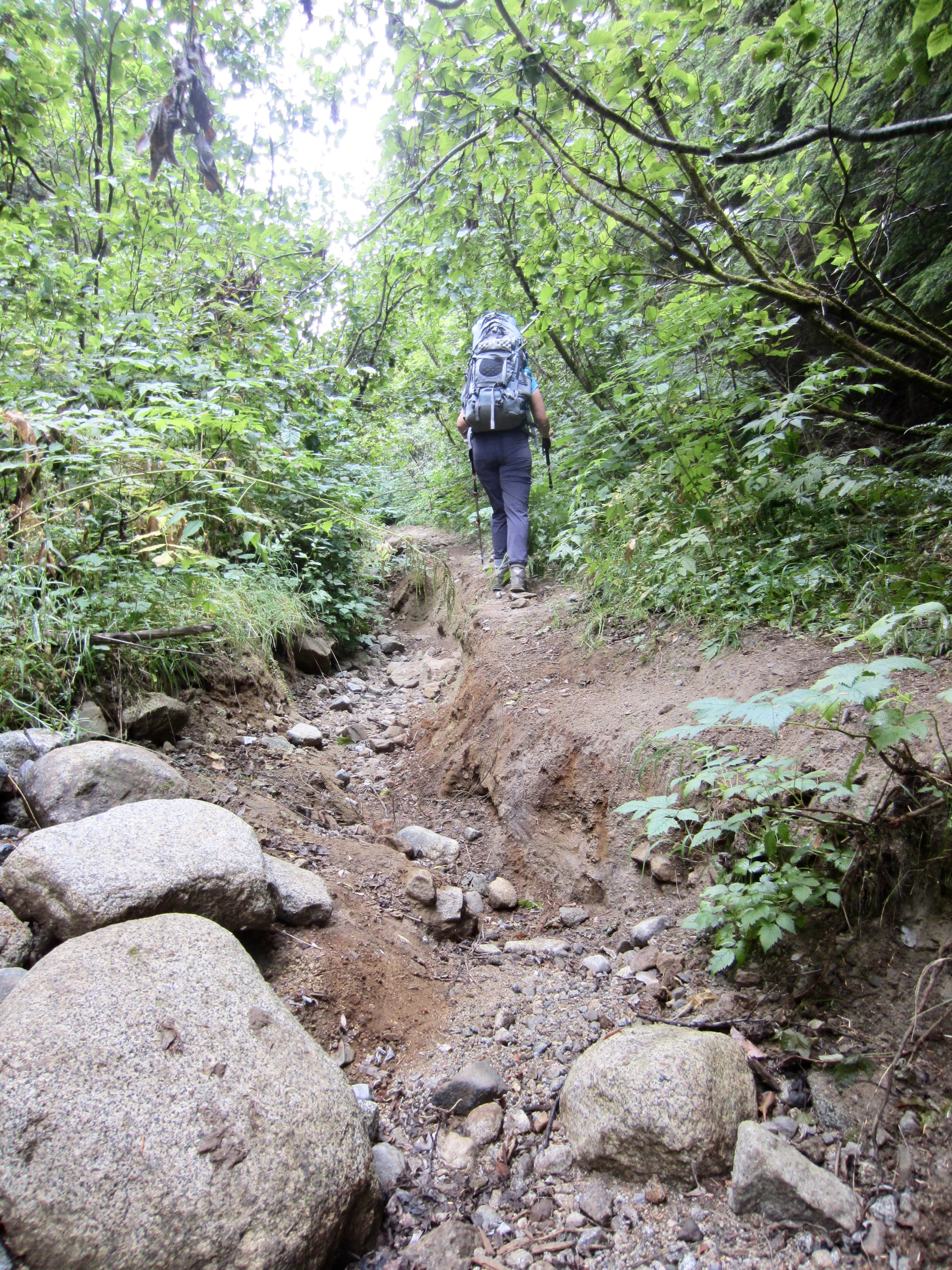
It was early afternoon on a cool, gray, overcast Wednesday when we started hiking up the road-trail. The abandoned road has become very overgrown and eroded, leaving a rough single-track trail through the brush. At a few clearings along the way, Lindeman Pass can be seen straight ahead.
.
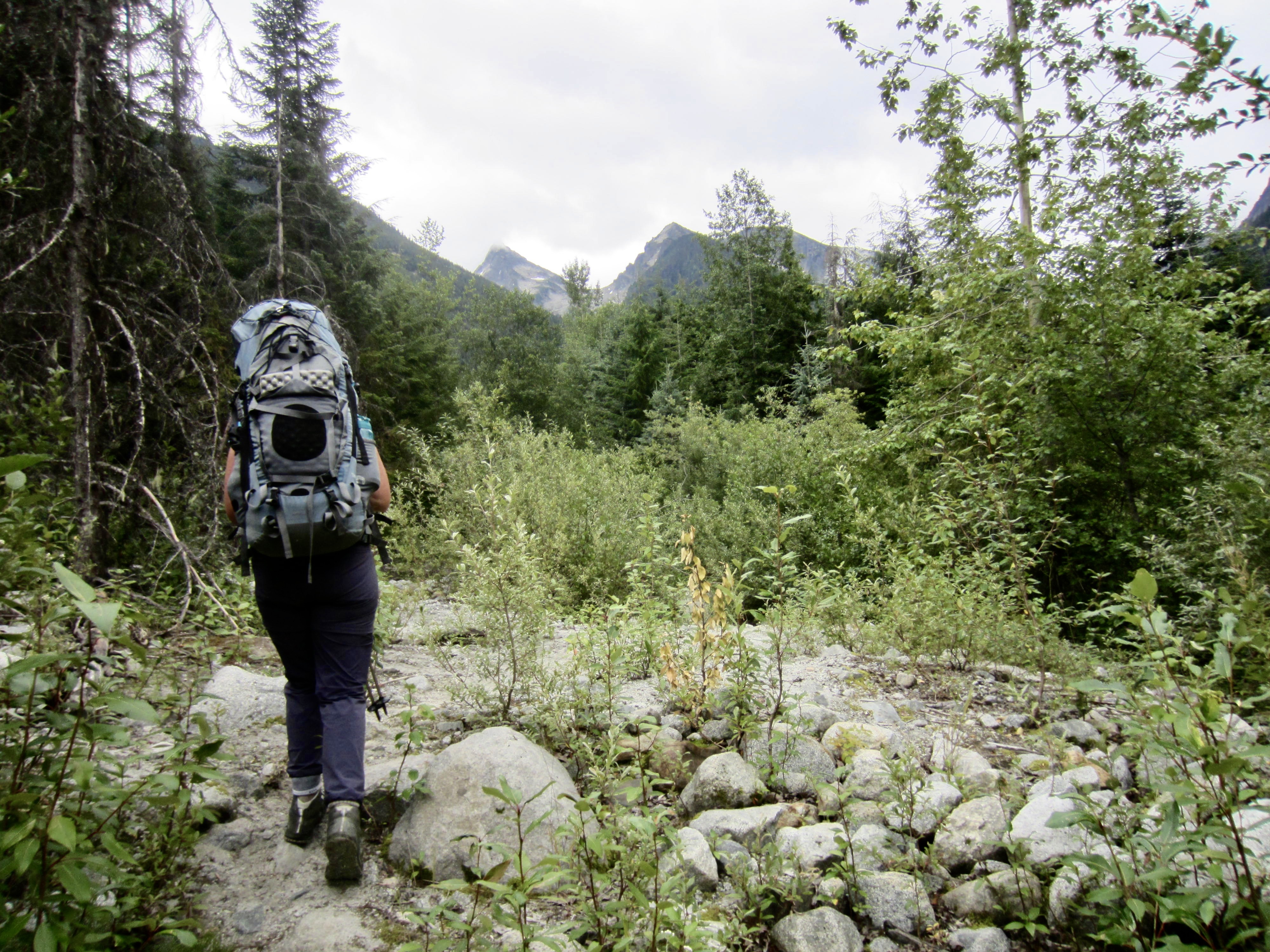
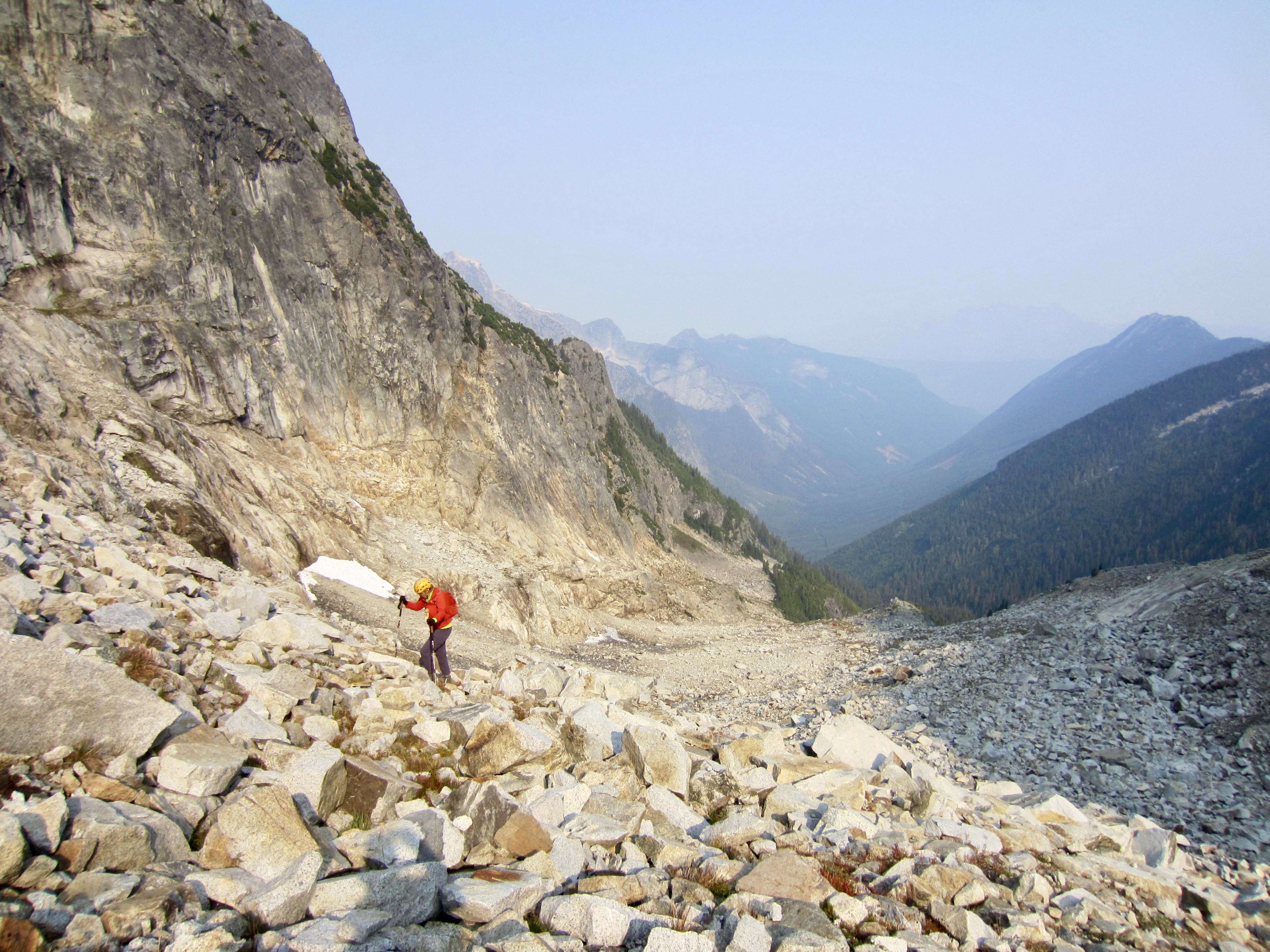
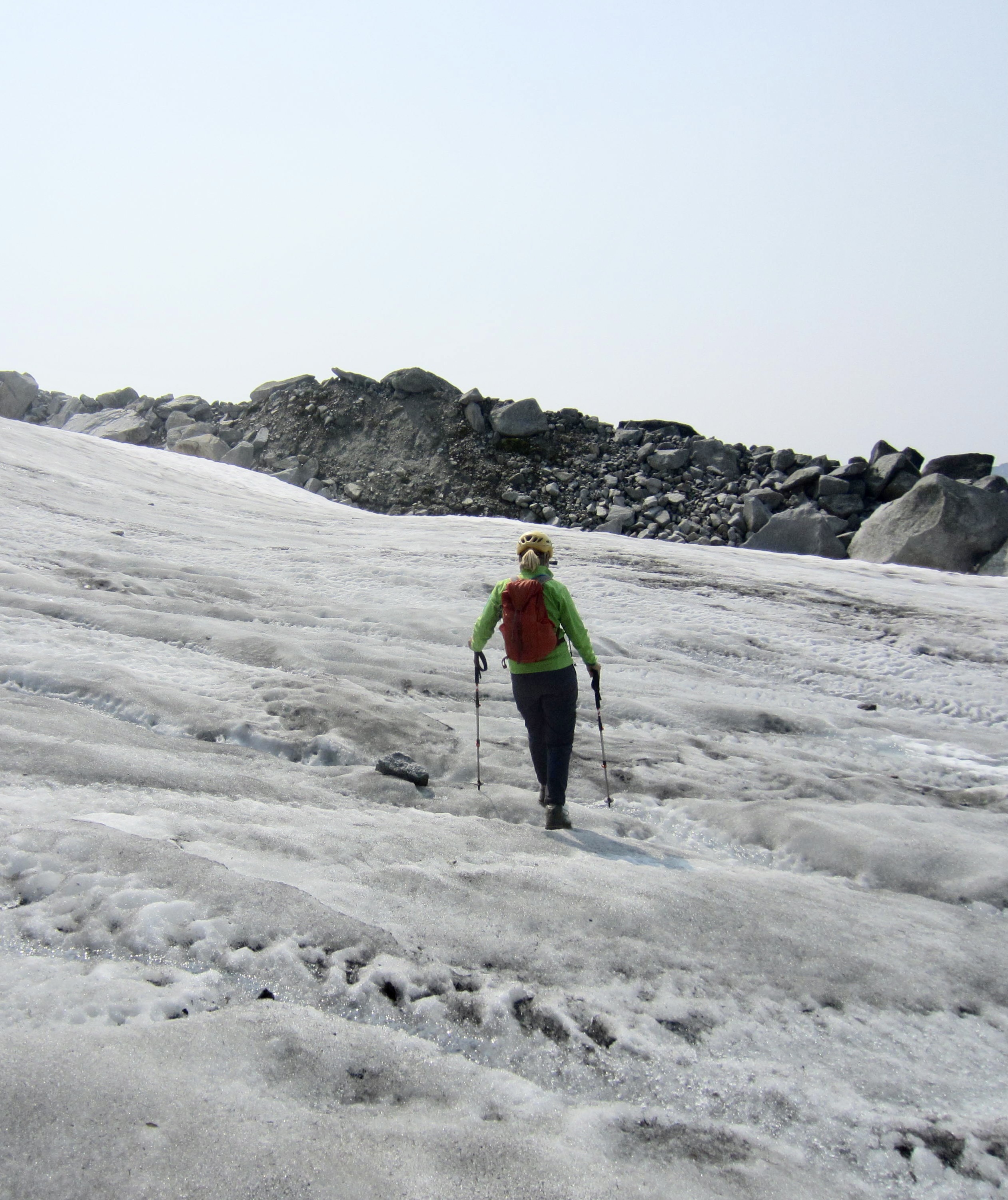
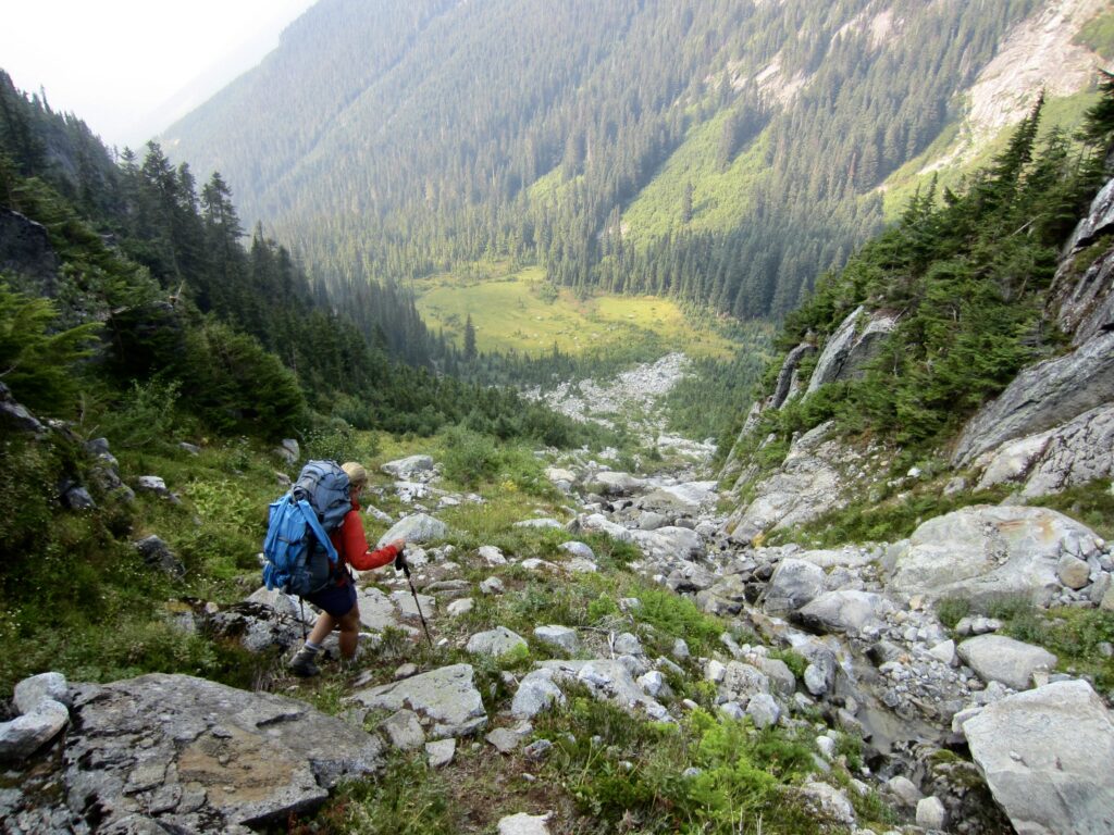
After 1¾ miles, the road-trail comes to East Fork Centre Creek, which emanates from near Lindeman Pass. Here, the trail abruptly turns left and leaves the old roadway, climbing eastward through dense second-growth forest. This part of the trail is steep but very well-defined, and it even exhibits signs of long-ago maintenance (many cut logs and branches). Shortly after crossing the creek on a footlog, the trail skirts around a large, marshy meadow at 4850 feet (3.5 hours + 2000 feet from TH). We worked through a boulderfield and then continued up a steep, narrow, grassy gully.
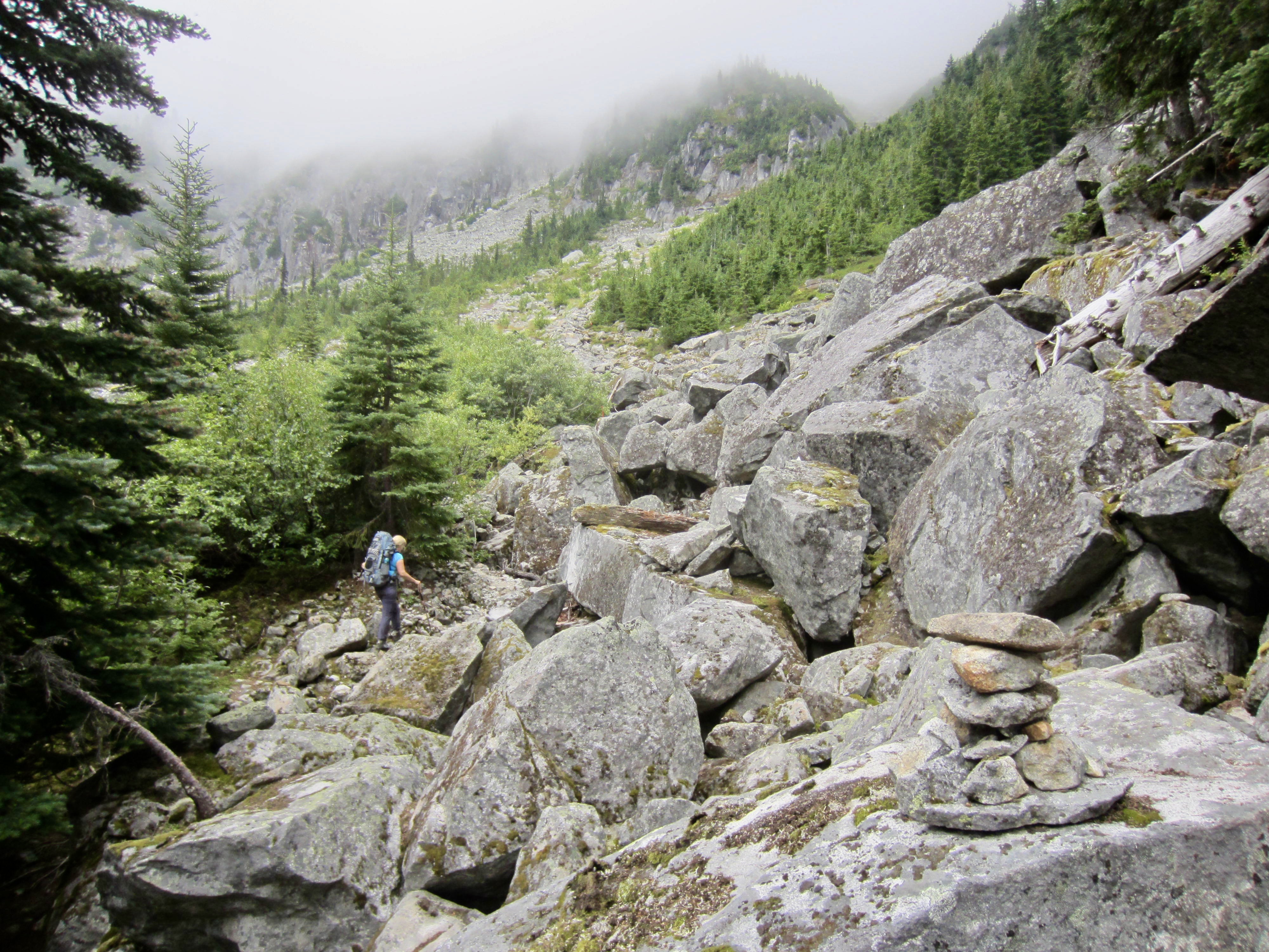
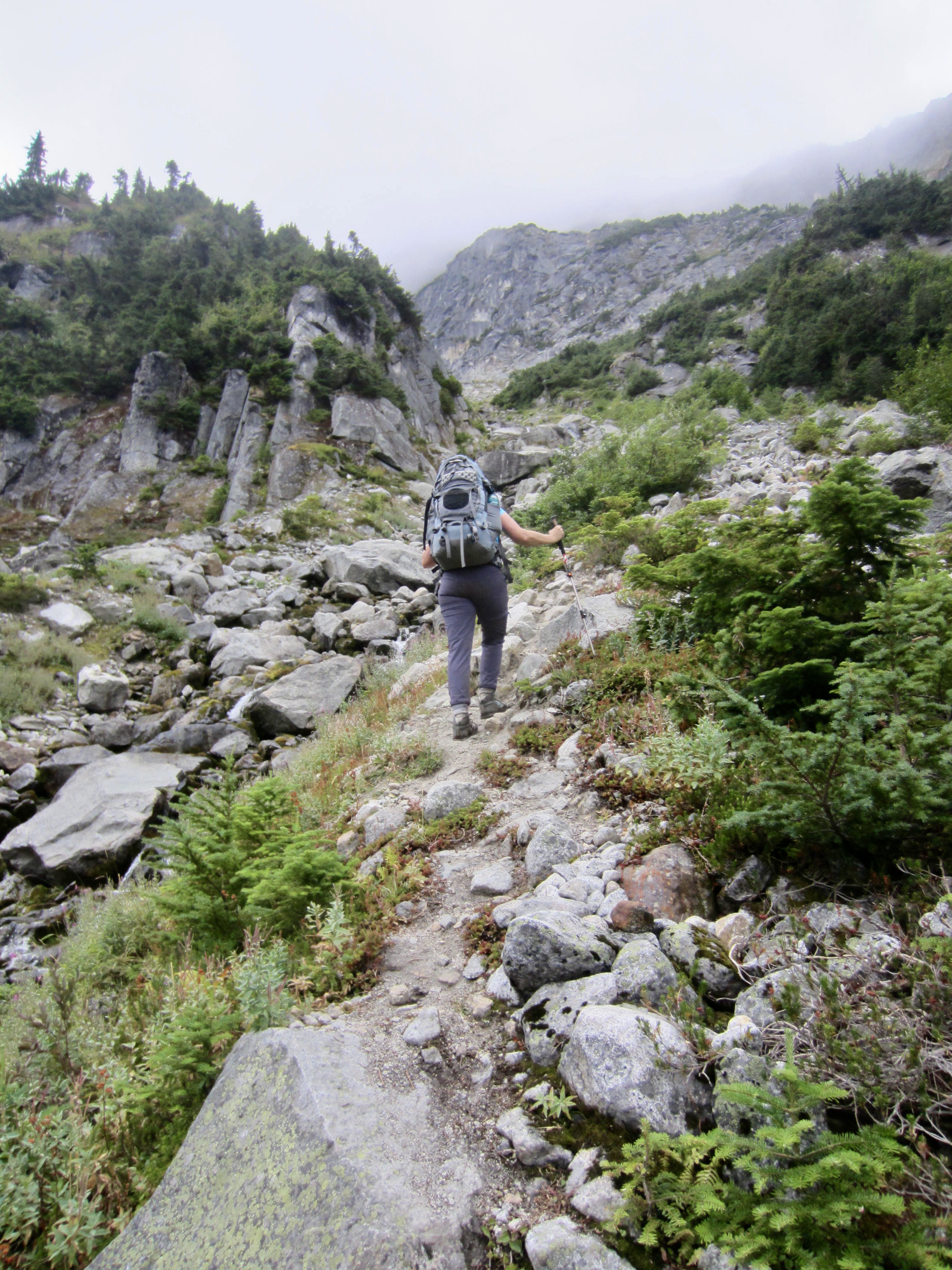
.
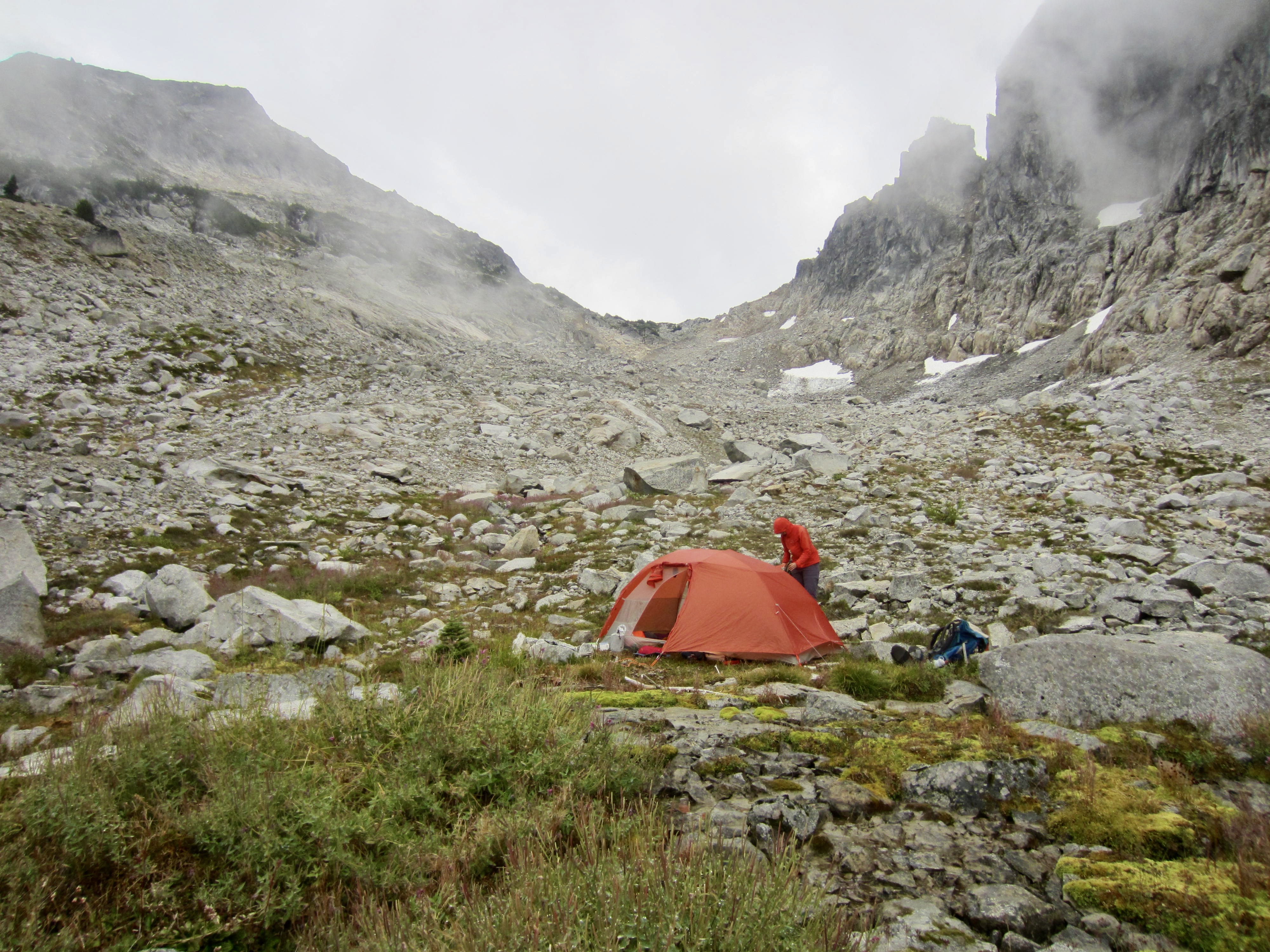
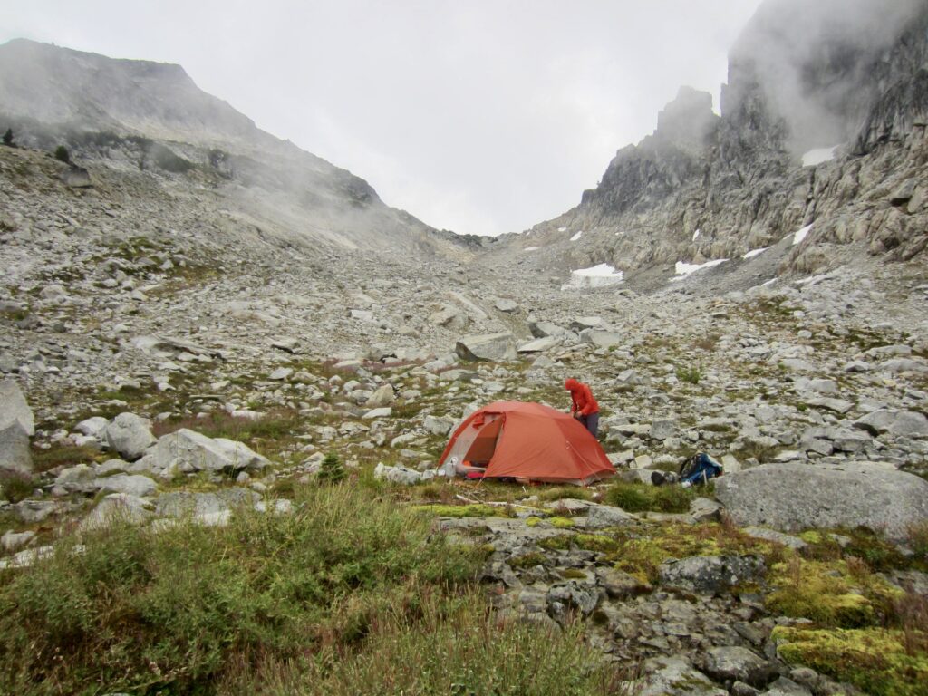
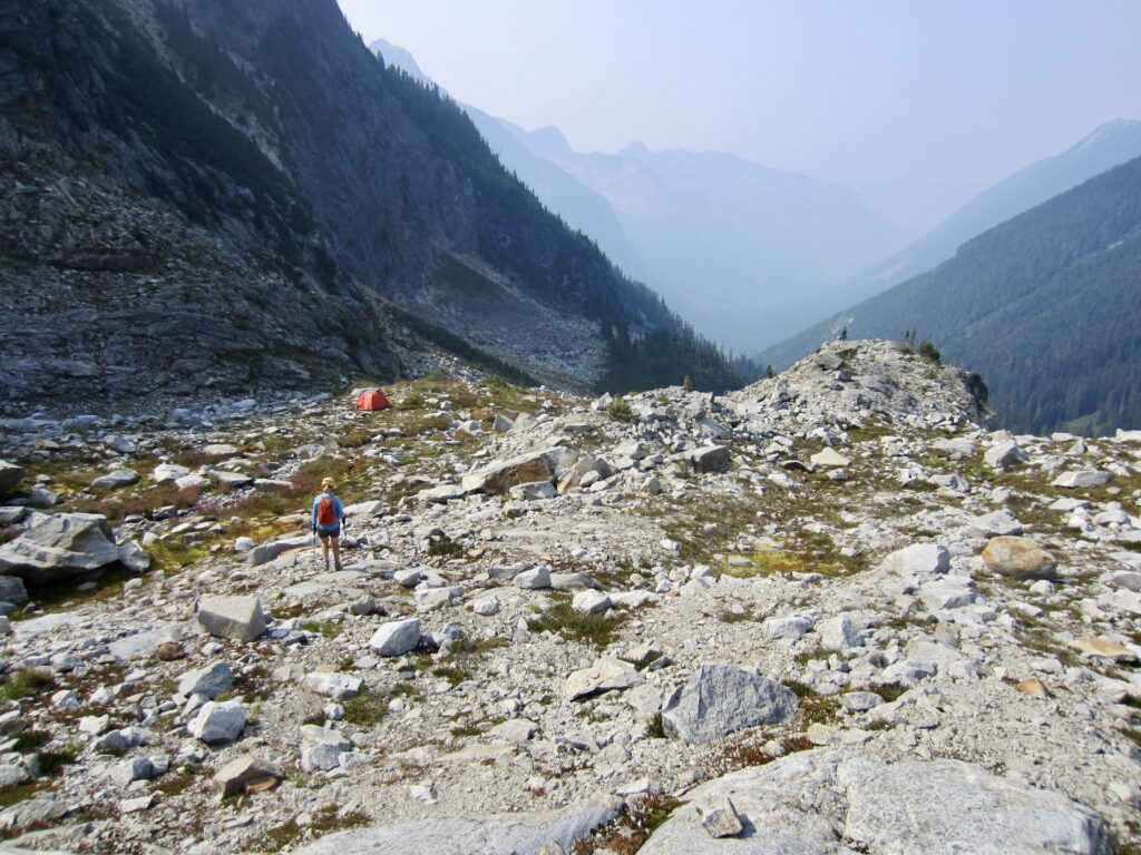
Above the steep gully, the trail enters a large basin located on the western flank of Mt. Lindeman and directly below Lindeman Pass. We found a nice campsite on a well-watered bench at 5700 feet (4.8 hours + 2850 feet from TH).
…
Day 2: Mt Lindeman Summit Climbs + Exit
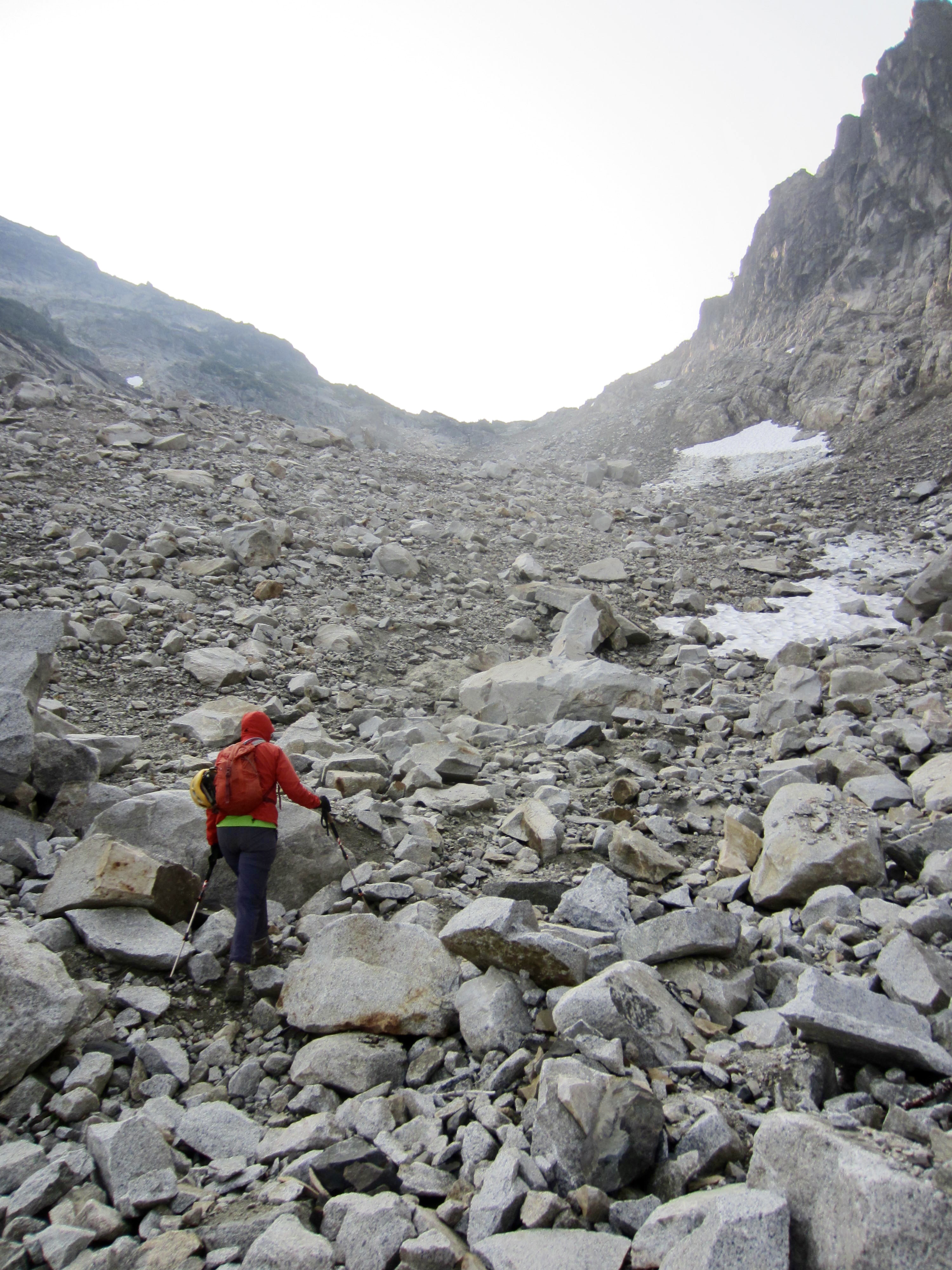
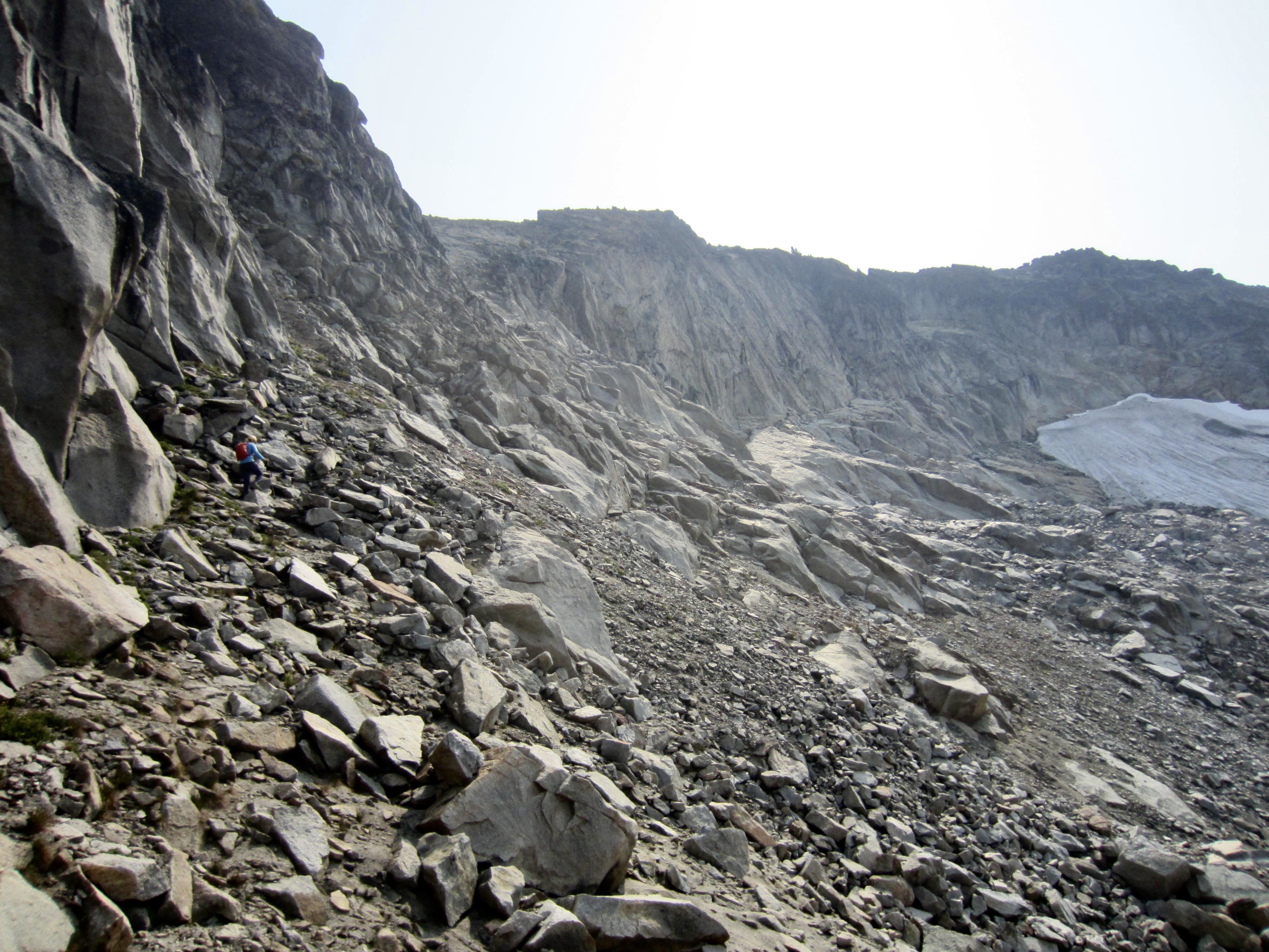
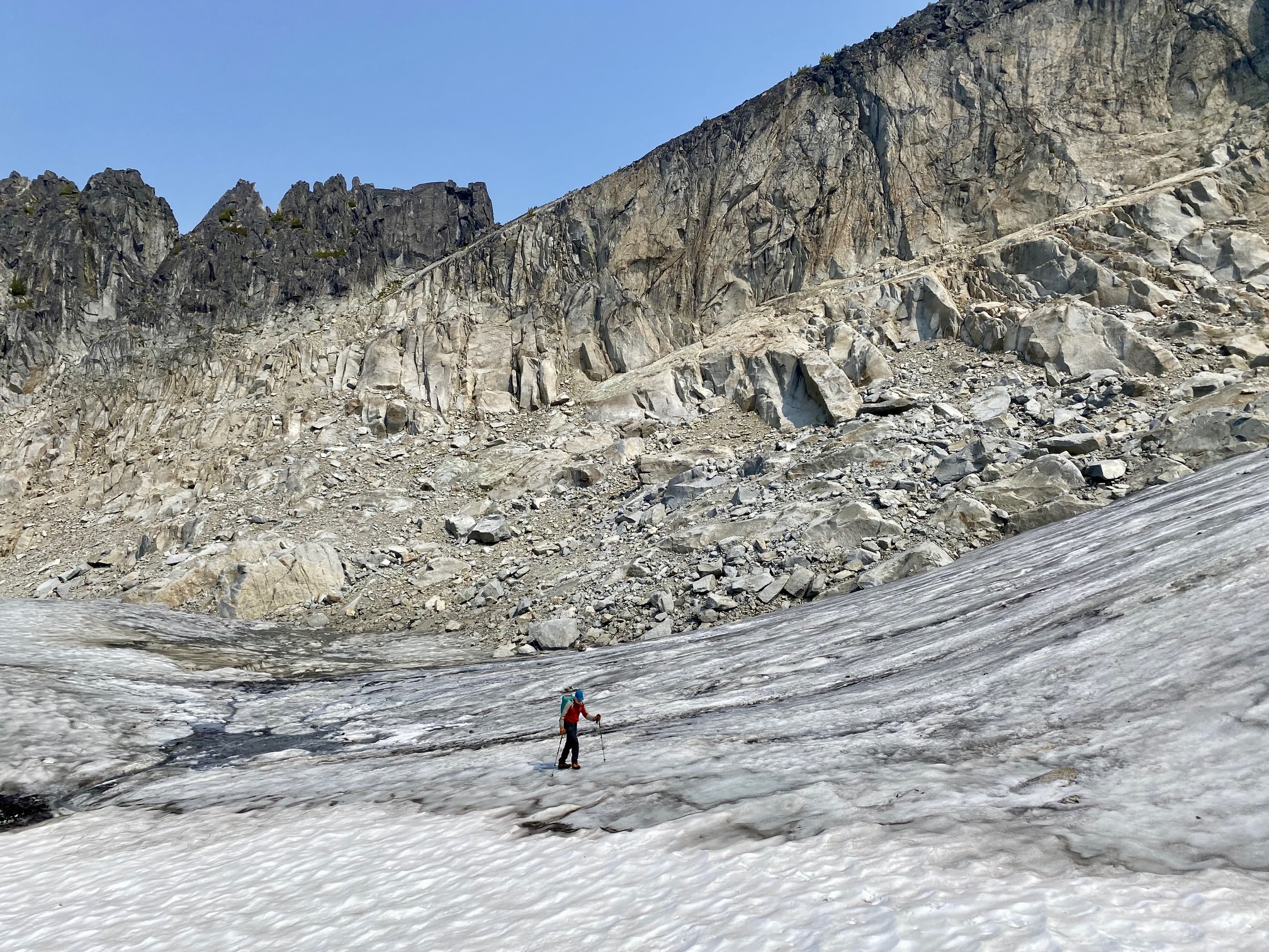
It was disappointing to wake up and see that yesterday’s heavy cloud cover was replaced by thick wildfire smoke. Obviously, long-range views were not in the cards today. Nevertheless, we loaded our summit packs and headed up to Lindeman Pass, slowly hiking over a combination of loose talus and unstable morainal rubble.
.
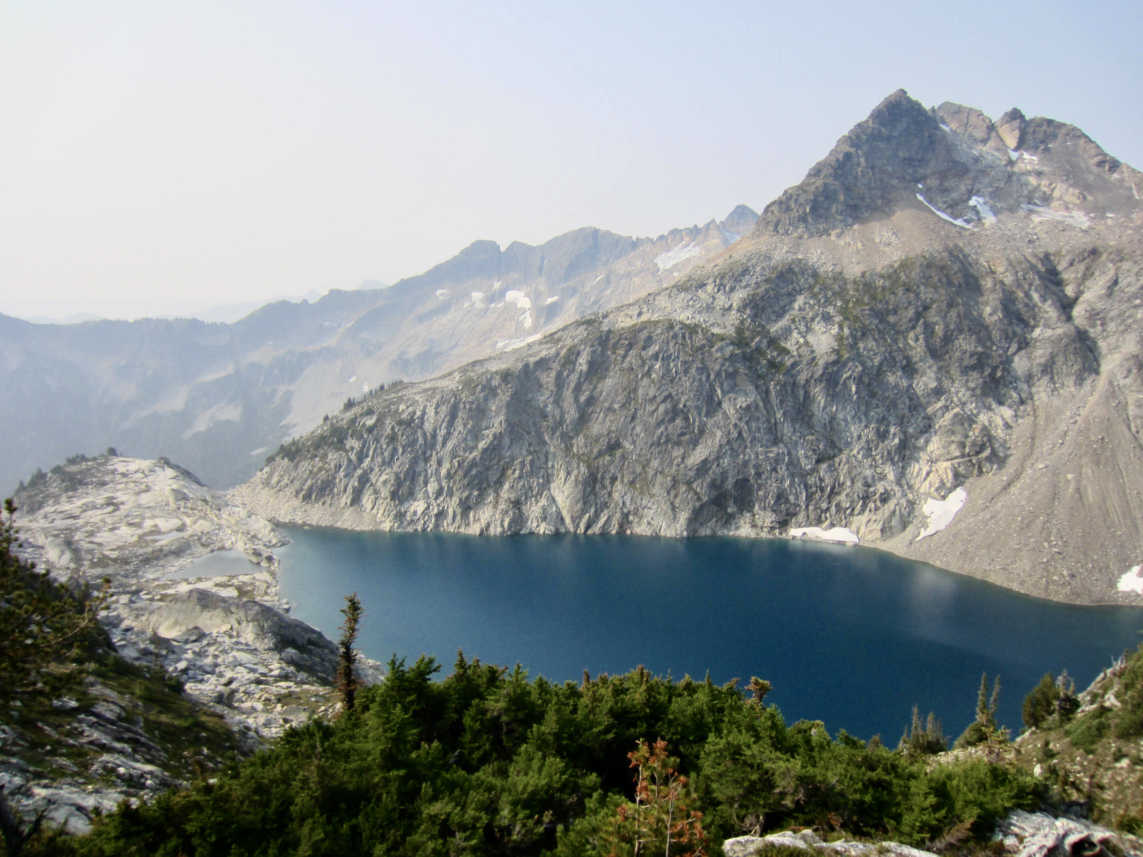
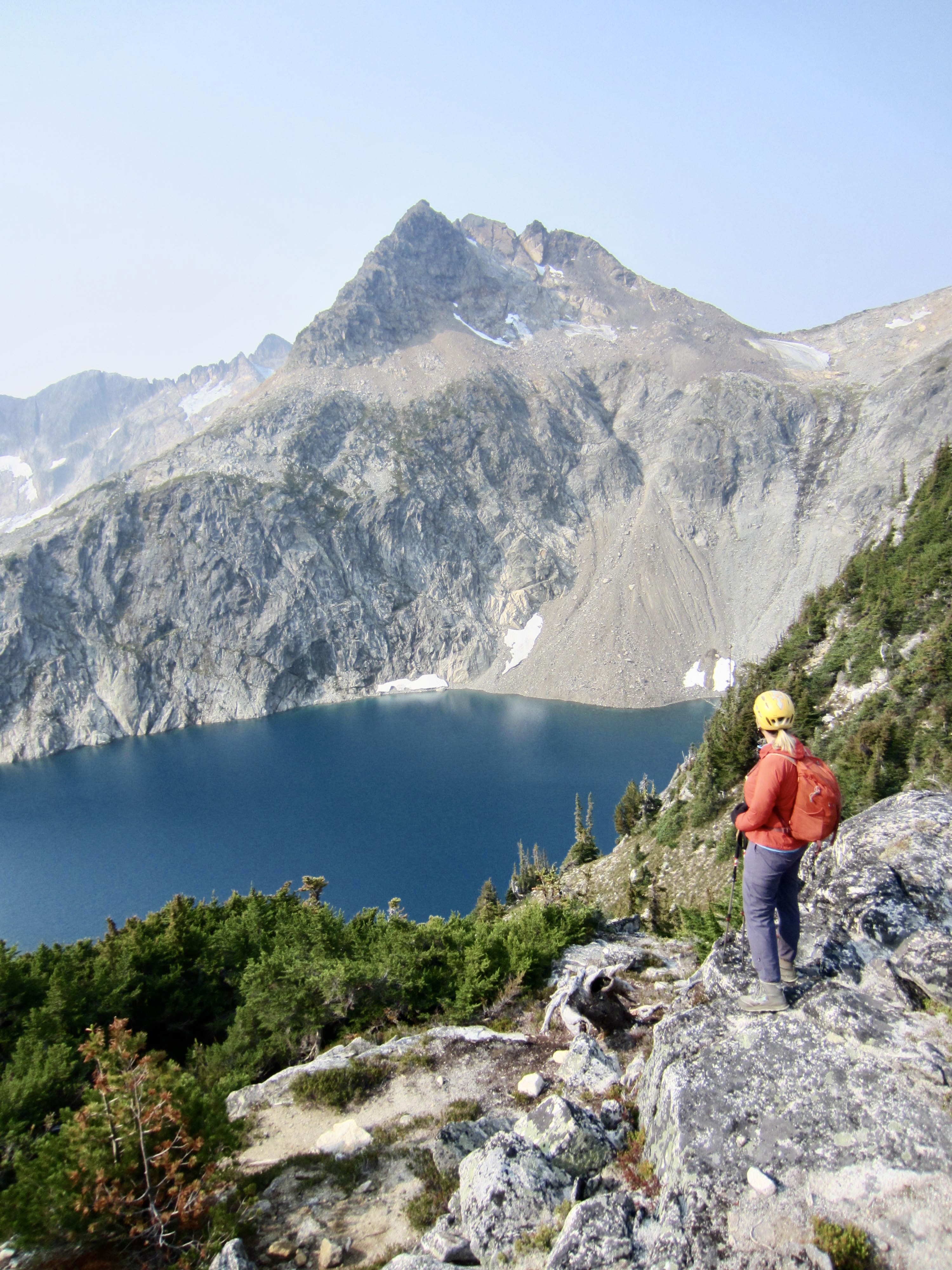
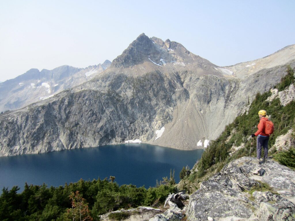
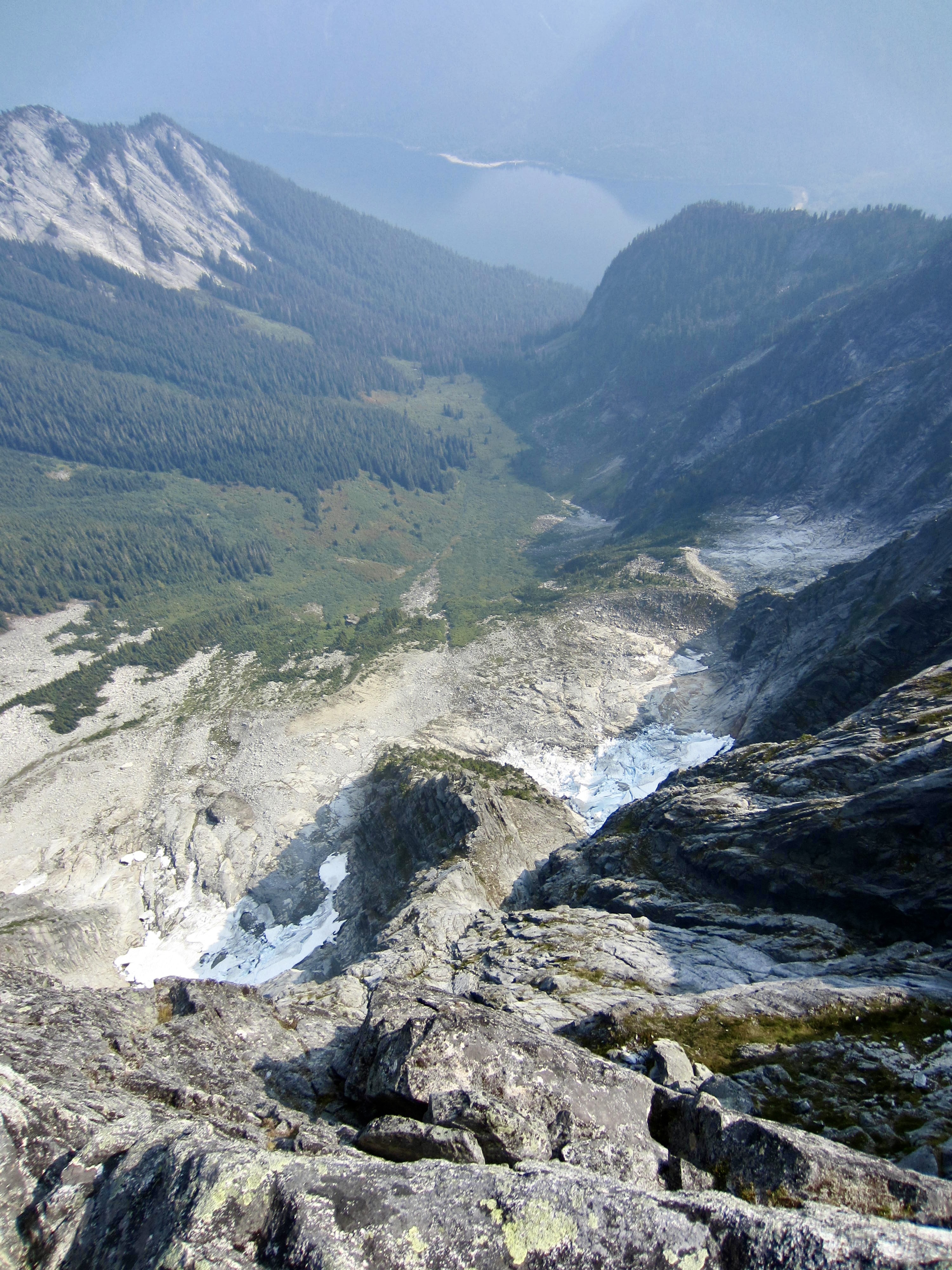
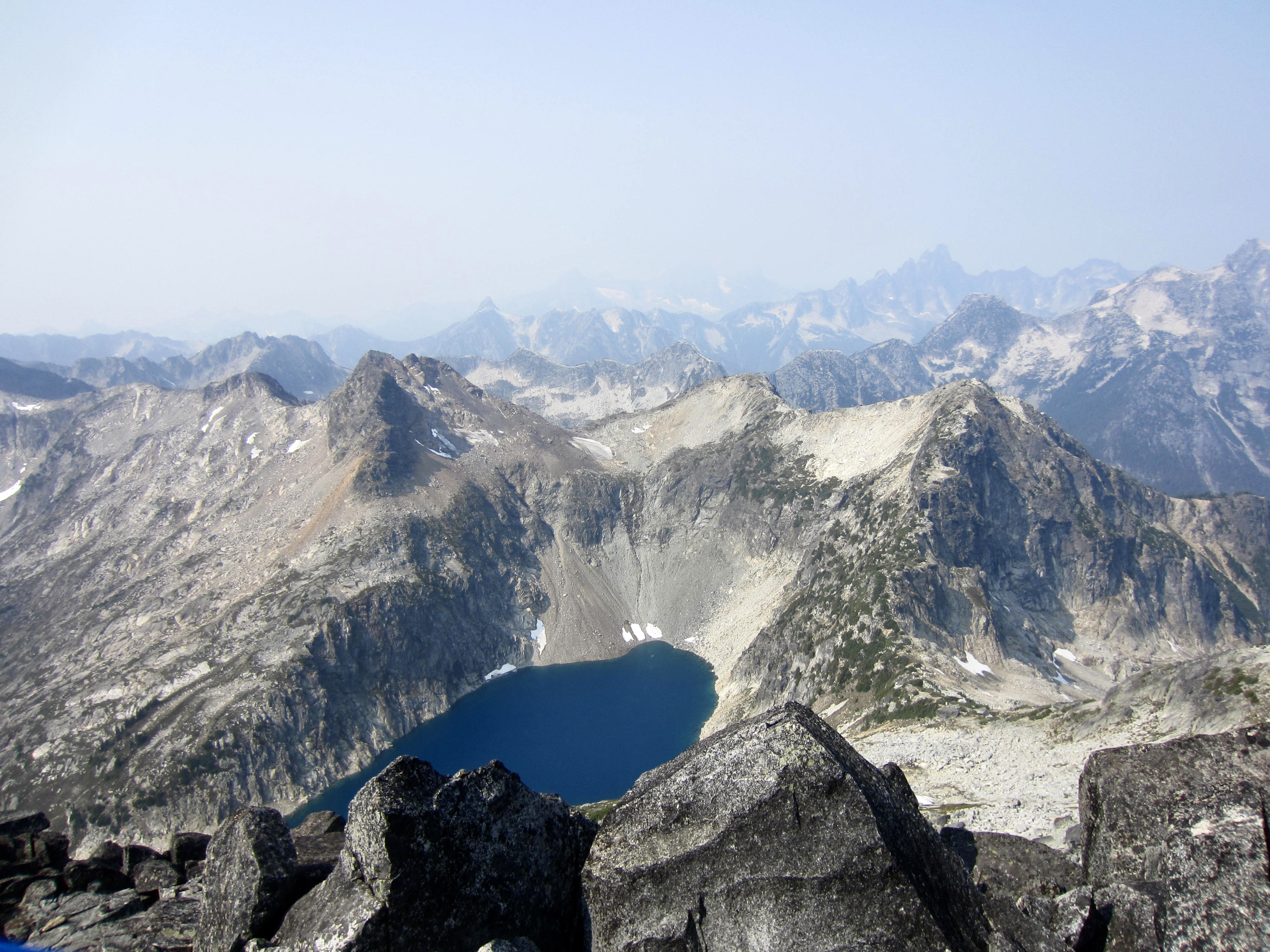
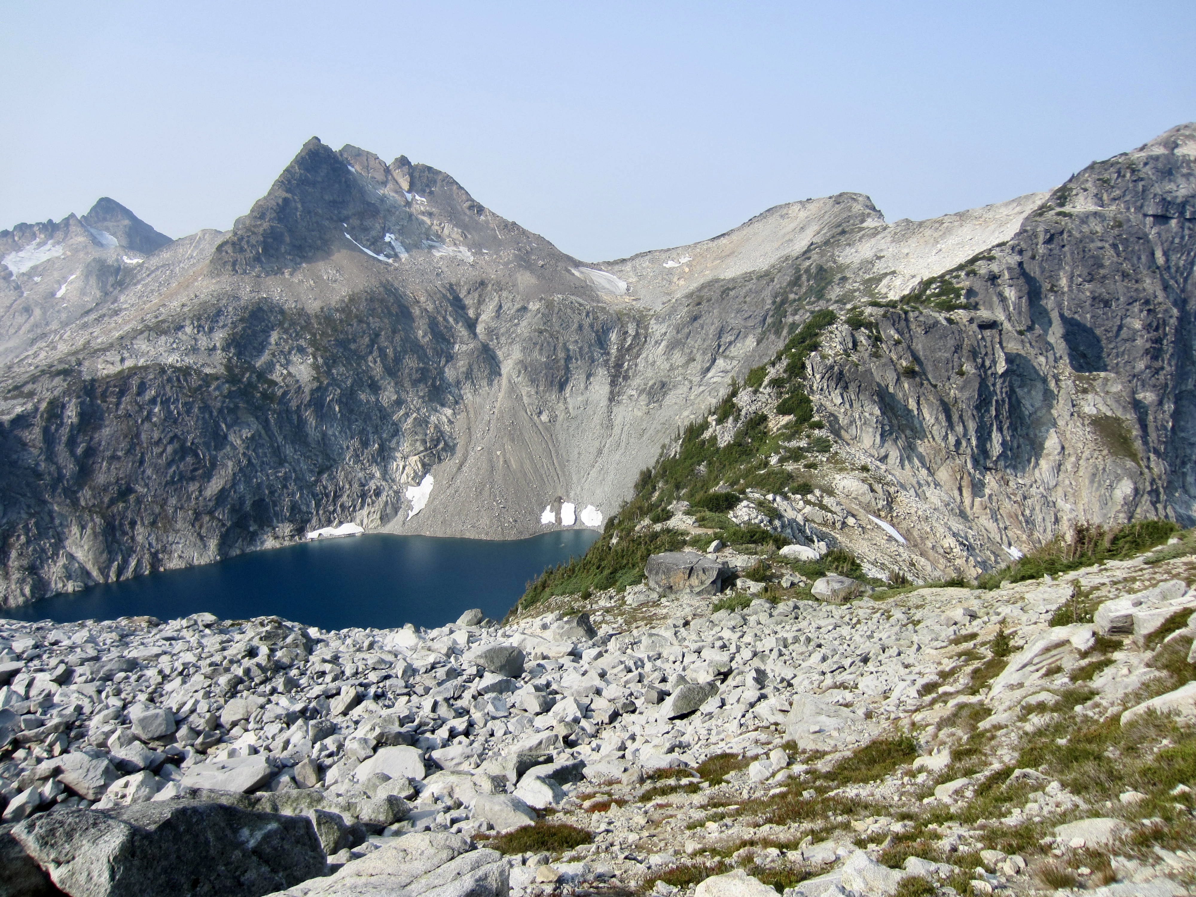
We arrived at the pass (1.1 hours + 800 feet from camp) and admired the short-range views of beautiful Upper Hanging Lake below and craggy Hanging Lake Peak out to the south. On a longer trip, this lake and this peak would have provided worthwhile destinations for us.
.

.
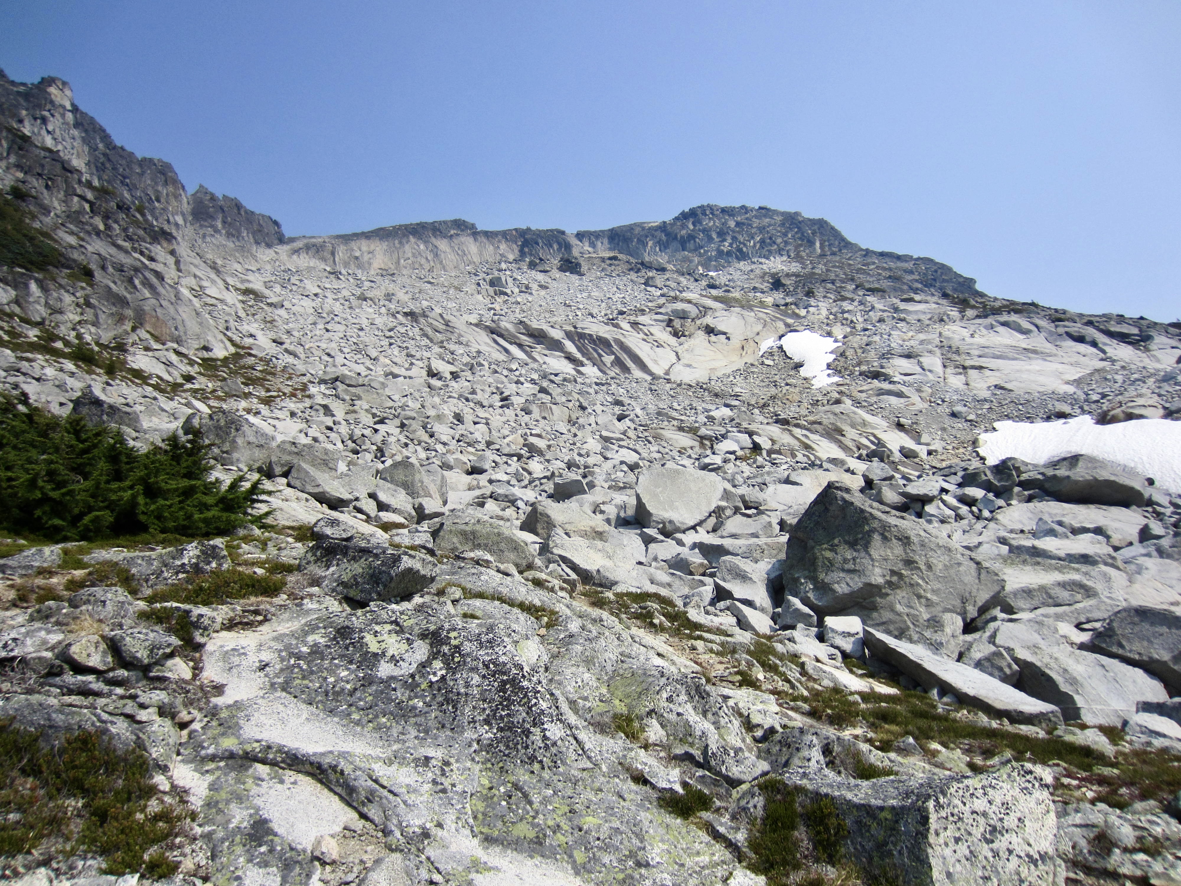
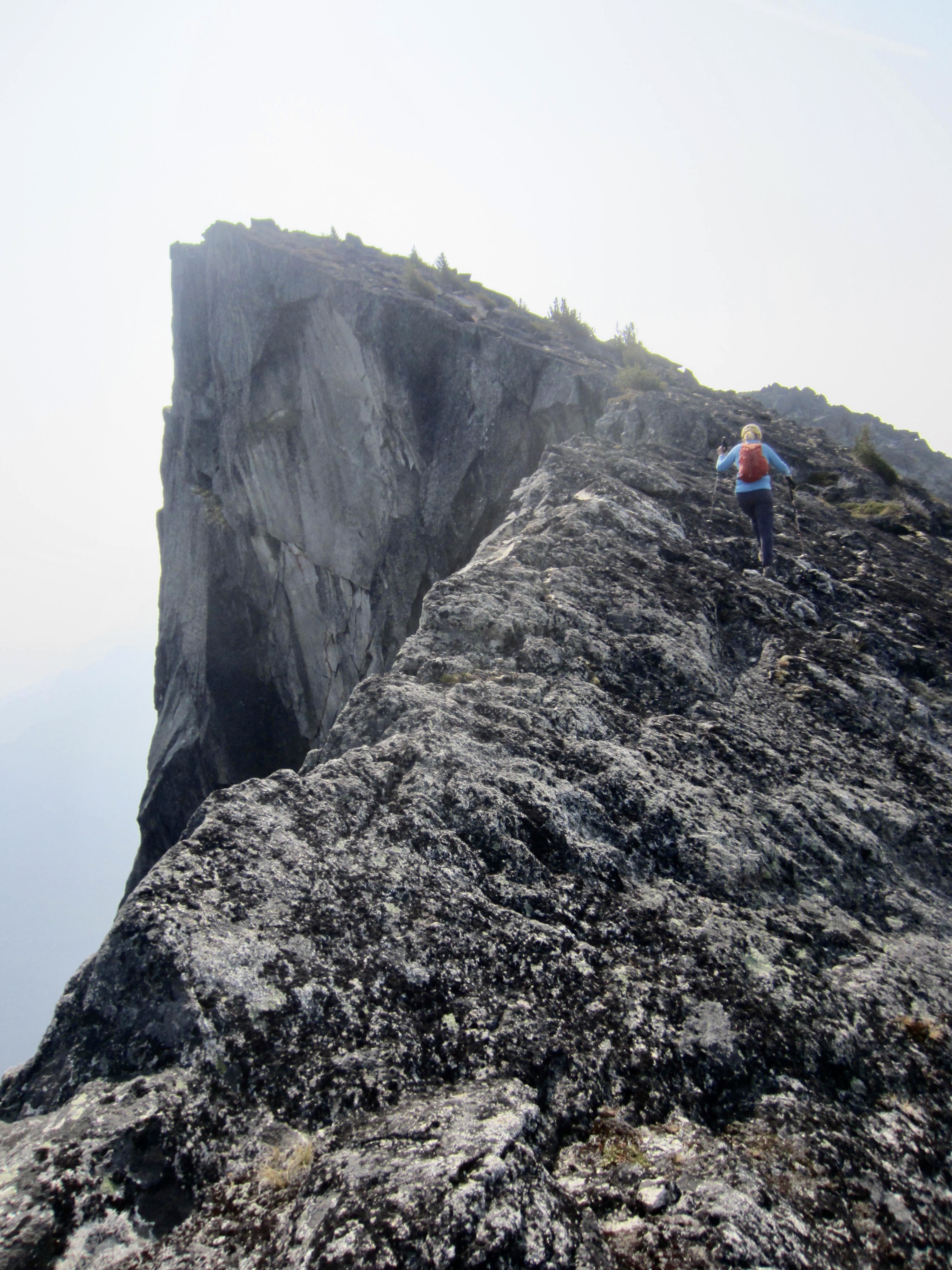
From the pass, Mt. Lindeman’s north ridge and western cirque walls could be clearly seen to our east. We headed up, following bits of bootpath through the rocky terrain and generally hugging the left-hand wall. Near the top of the cirque, a short scramble on a white granite slab brought us to the ridge crest at a small notch.

.
.
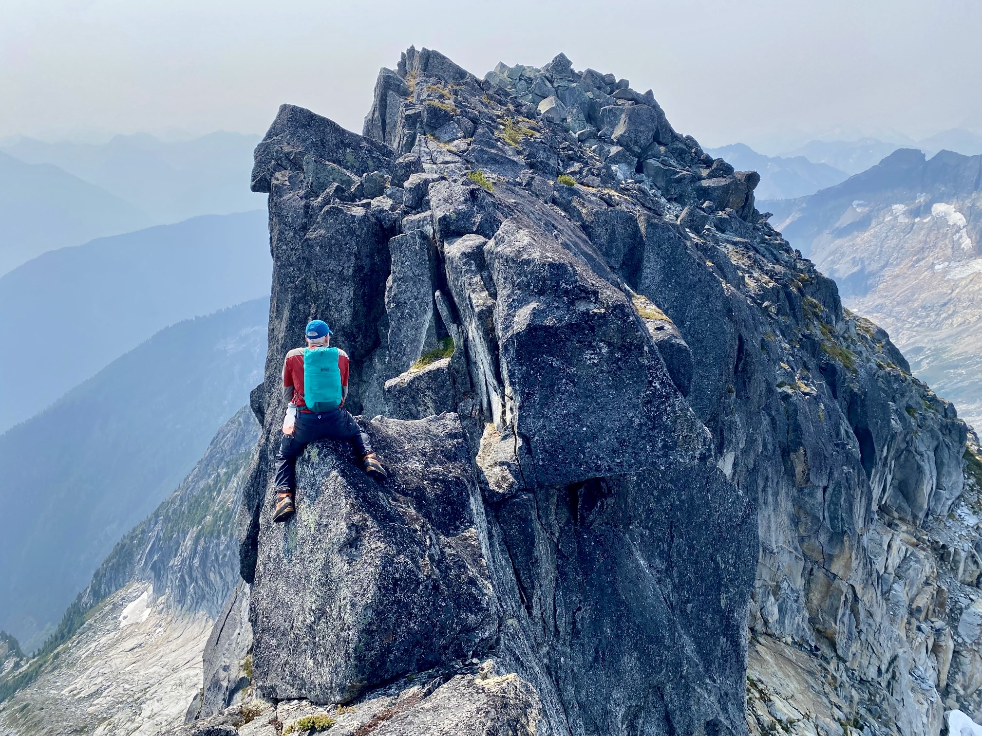
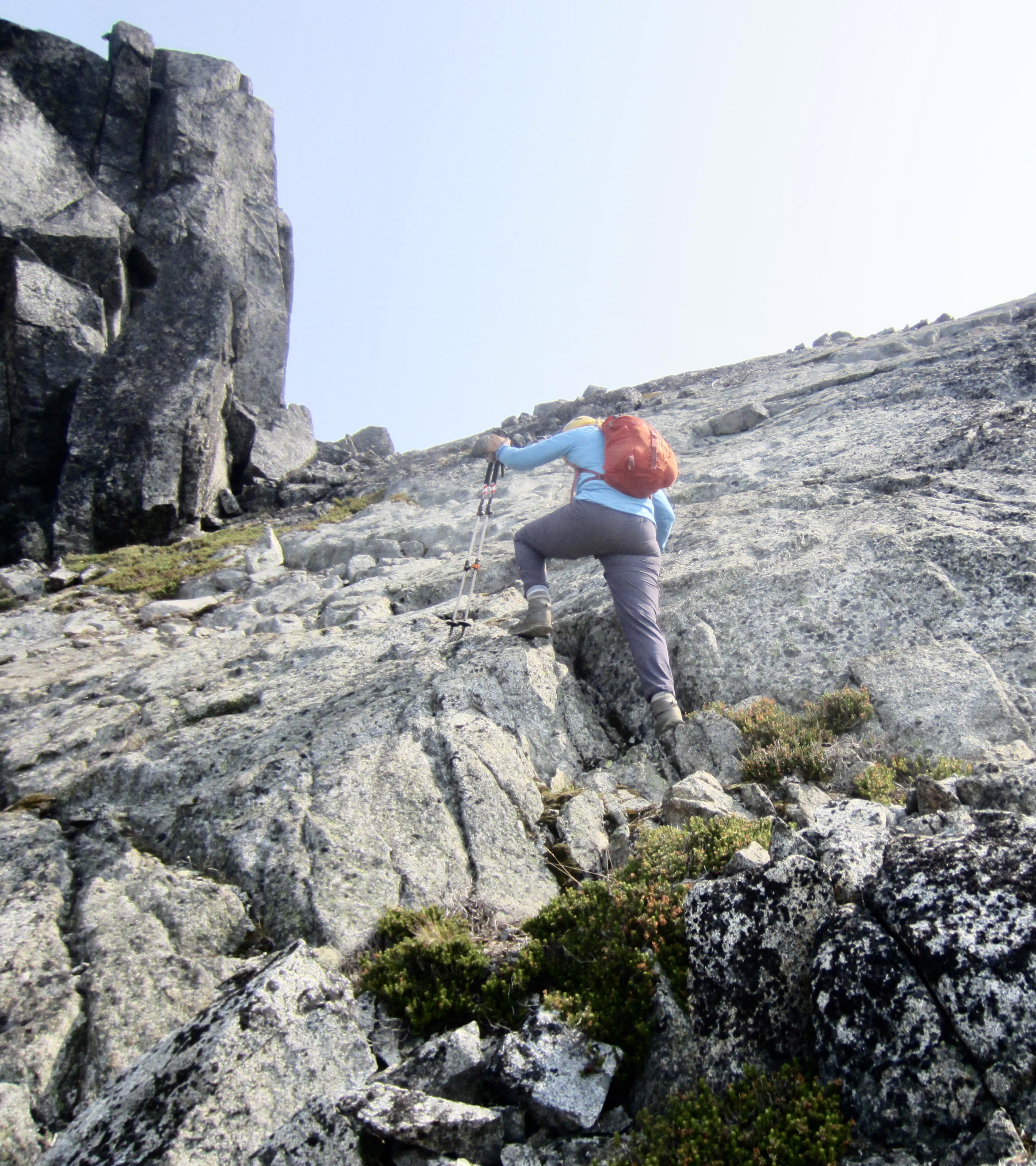
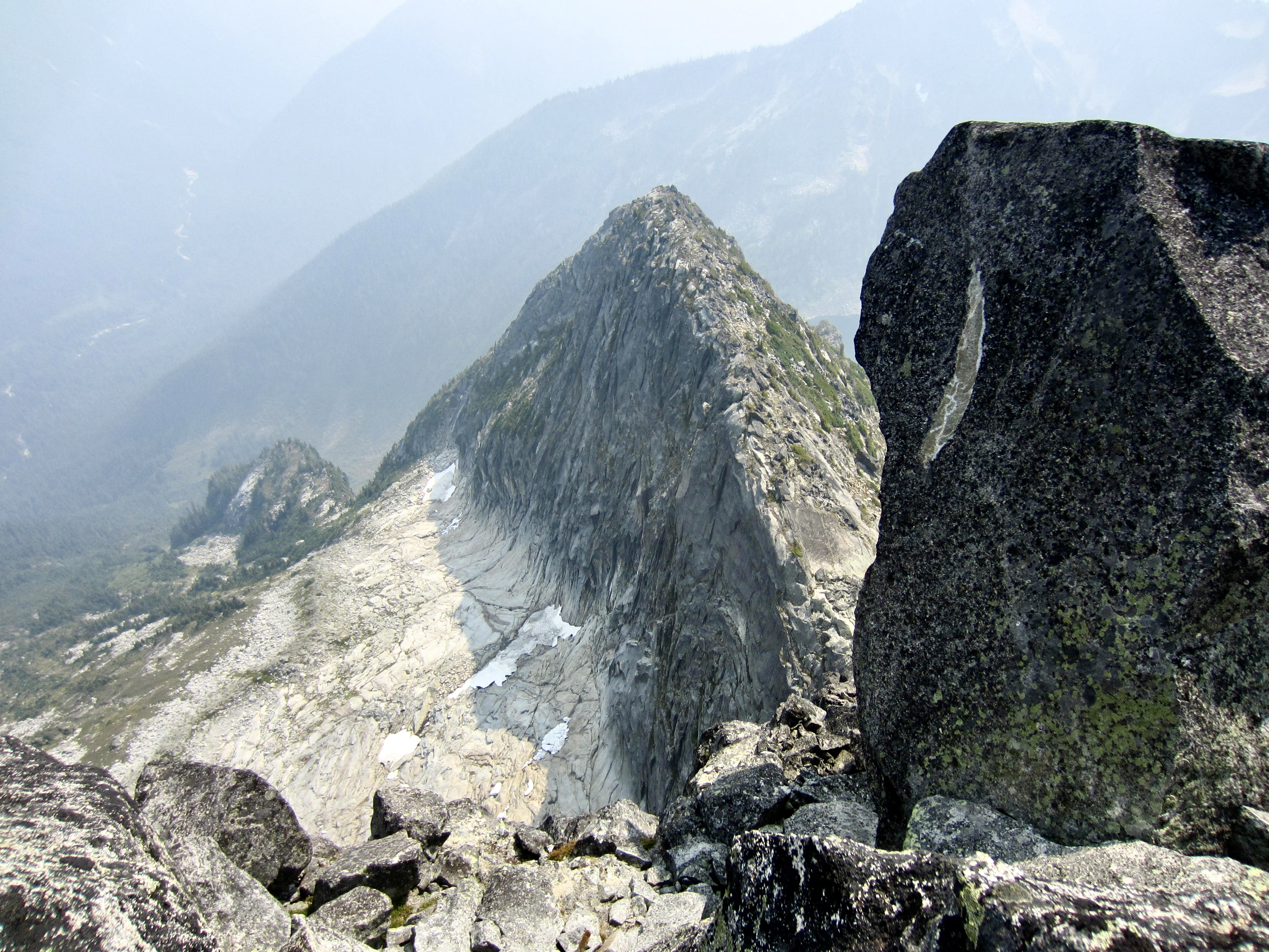
The north ridge of Mt. Lindeman comprises a narrow granitic rim that drops off steeply to the west, plunges near-vertically to the east, and sweeps up dramatically to the summit. We scrambled onward, staying either on or closely below the crest. This was mostly Class 2 travel with a few moves of Class 3 on solid rock.
.
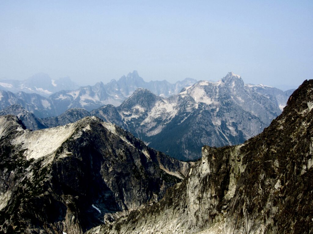
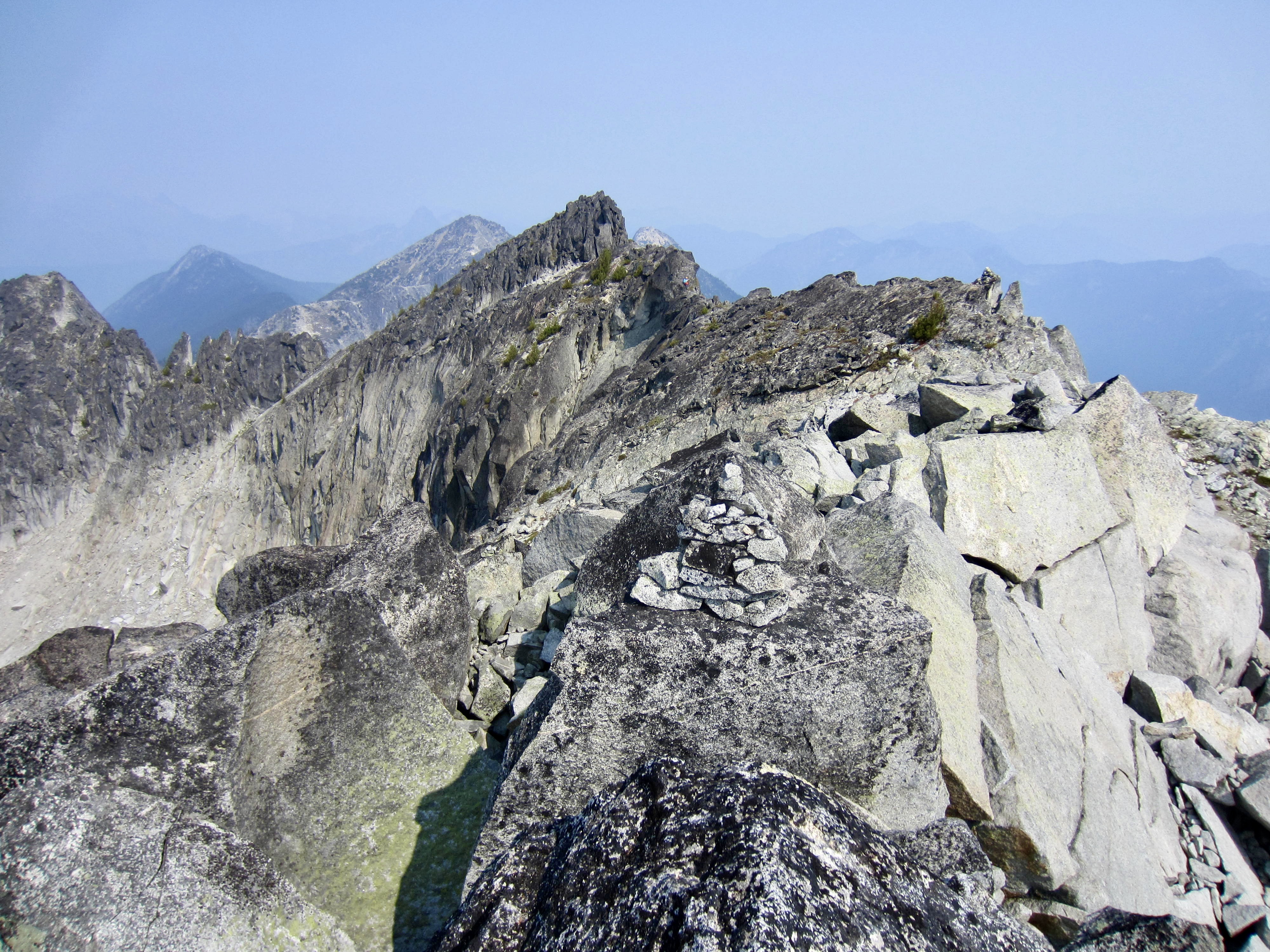
Mt. Slesse and Mt. Rexford—the two rock stars of the Canadian Chilliwacks—soon came into view through the smoky haze to our west. Farther out, American Border Peak was barely visible.
.
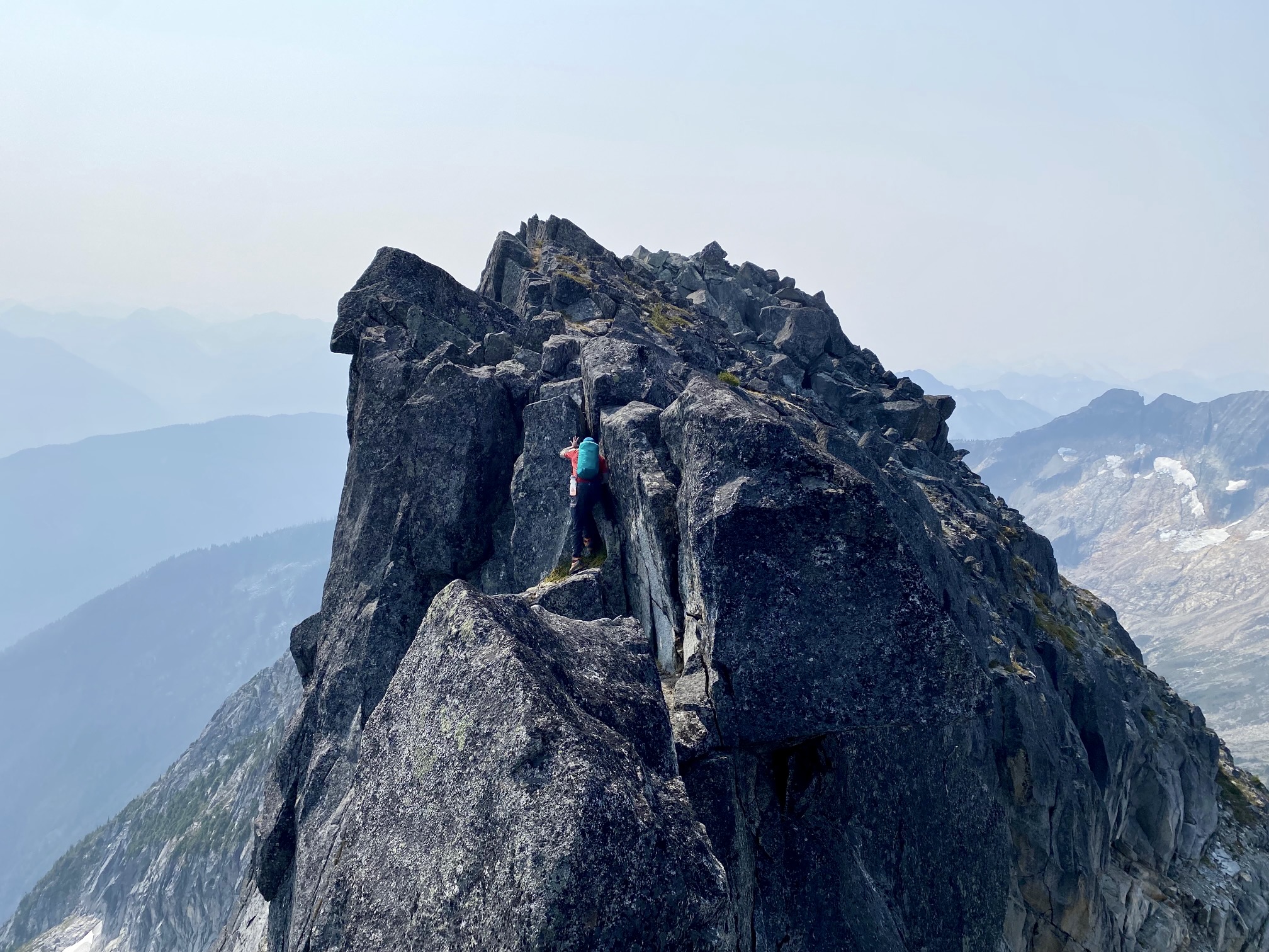
We were making steady progress toward the summit, and having a grand time, but our good moods came to a sudden halt when we reached a constriction in the crest. Further progress would involve scooching along a narrow hogback, making a delicate step across a small gap, and then climbing up a short crack—all of which looked very exposed. A quick inspection revealed that there is no detour around this constriction, as the ridge is vertical or overhanging on both sides. Yikes…isn’t this route supposed to be easy?!
While Eileen watched, I carefully scooted over the hogback au cheval, stepped across the gap, and climbed up the crack. It was a white-knuckle sequence with eye-popping exposure—full-on Class 4, to be sure—and my heart was racing as I completed the moves.

.

.
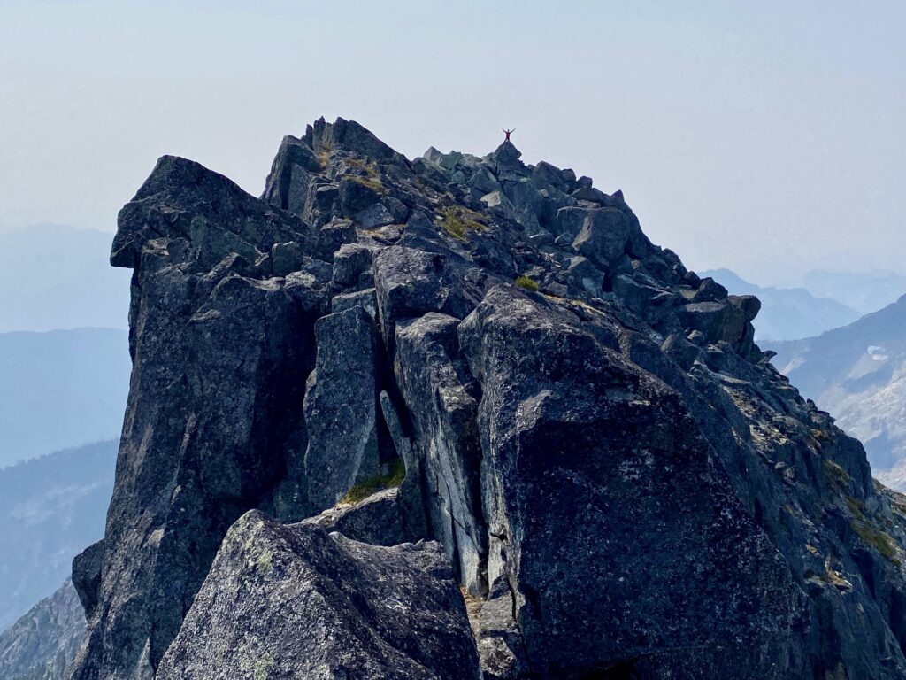
Once across the constriction, I made an easy Class 2-3 scramble over to the summit horn (2.8 hours + 1800 feet from camp). I was too apprehensive to stay long, so I quickly snapped a few photos before heading back. It really didn’t matter that views were so limited.
.
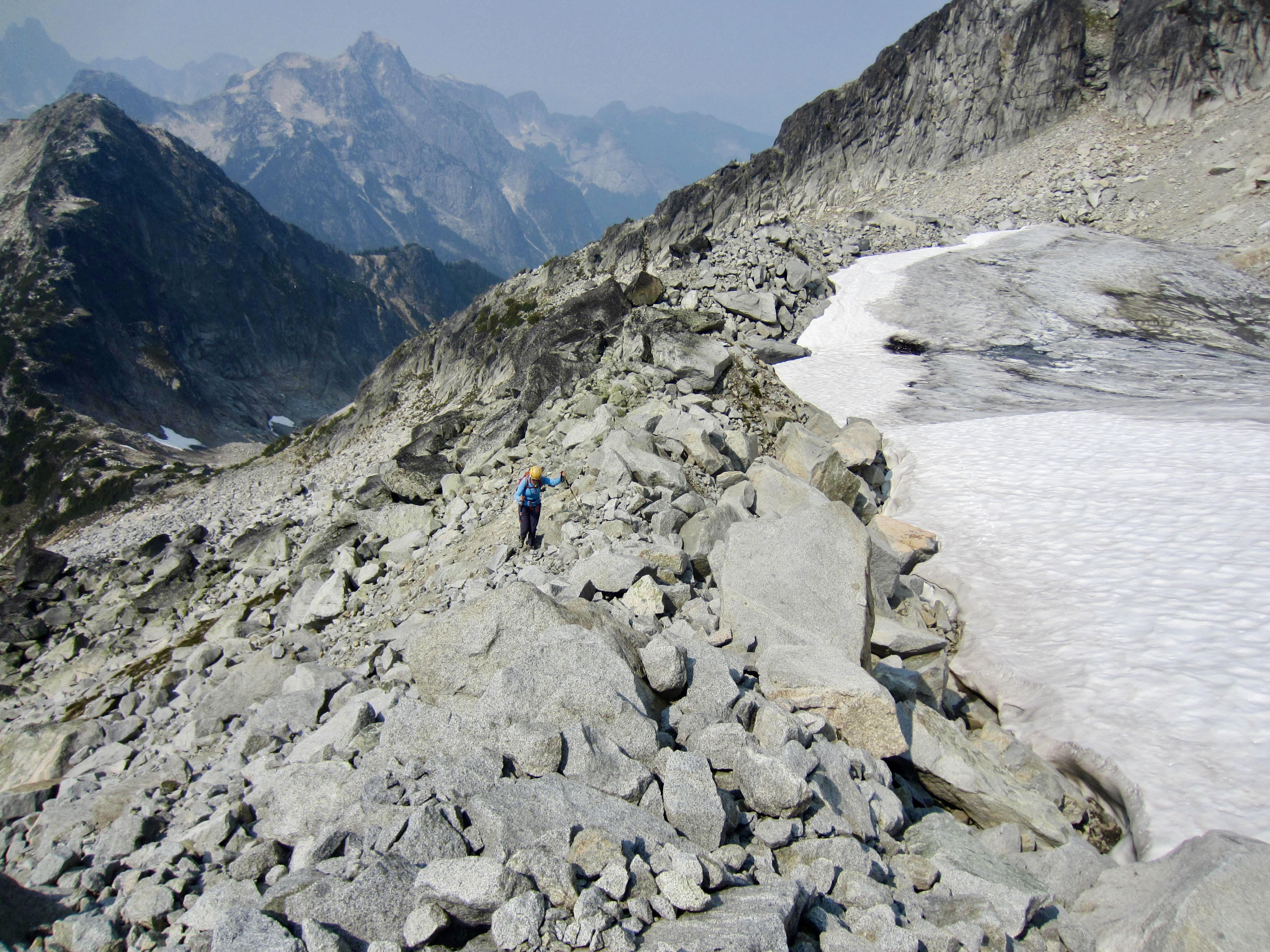
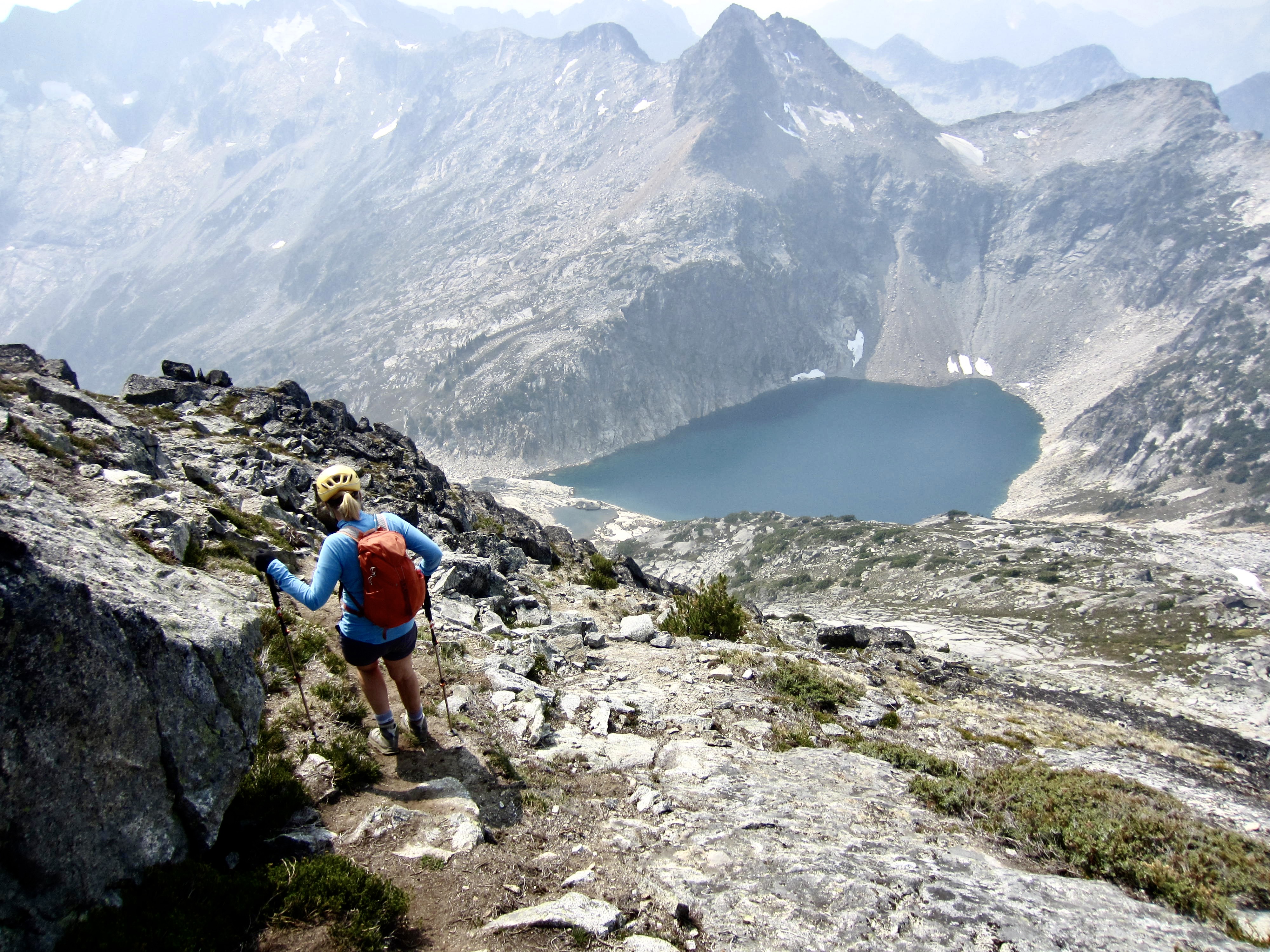
Scrambling back across the constriction was even more nerve-wracking, so I was tremendously relieved to rejoin Eileen on the other side. We took a break to eat some snacks and ponder the fact that this route was much more difficult than expected. Only then did we notice the moderately inclined slope profile over to the south. Ah ha…that must be the “easy” southwest spur! Eileen was still keen to tuck in a summit, so we backtracked along the ridge crest and down to the cirque, then crossed a remnant icefield and marched up a lateral moraine.
.
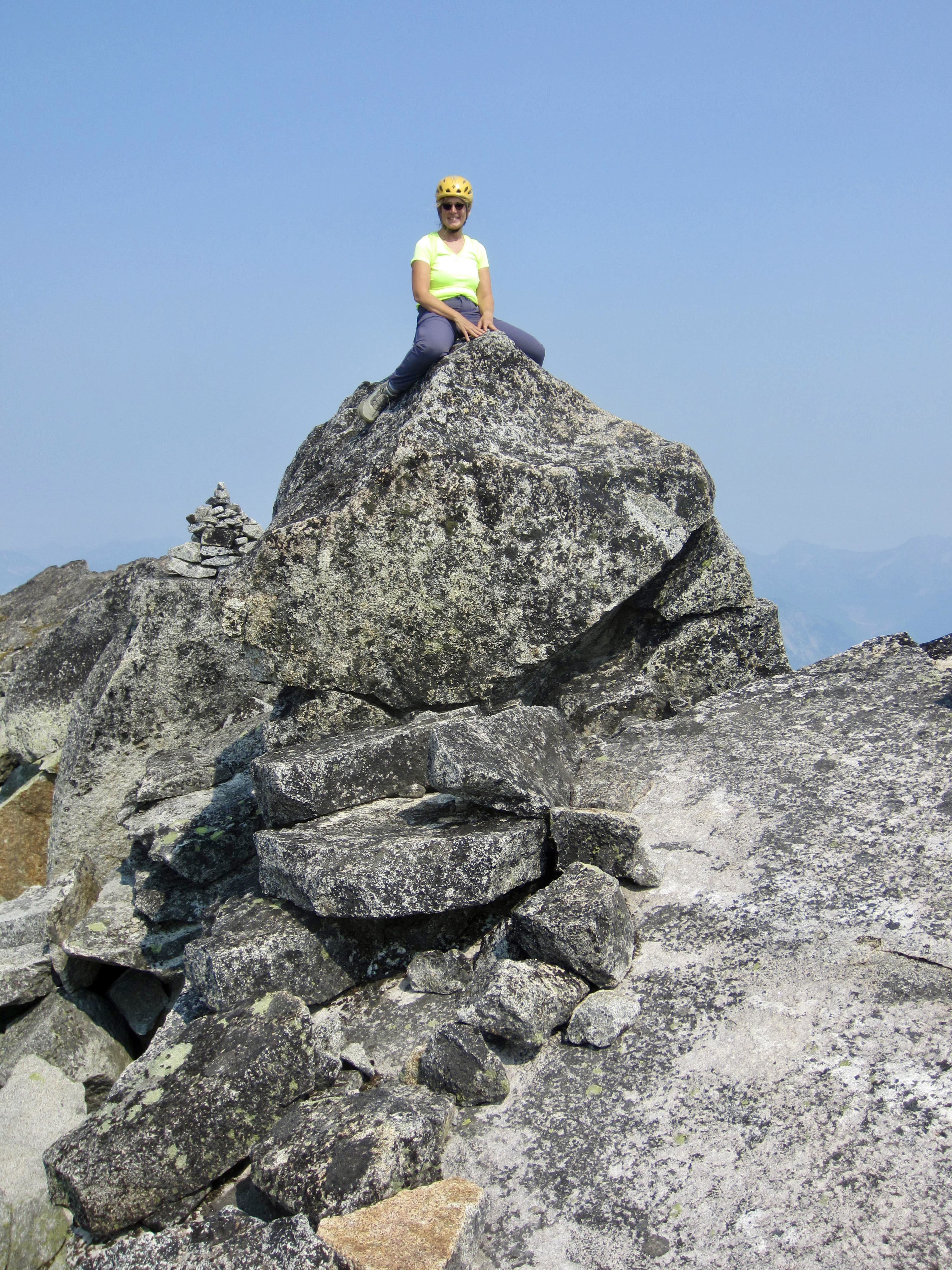
Upon reaching the southwest spur, we intersected a well-worn climber’s path leading to the summit. We headed up and topped out in early afternoon (1.7 hours after leaving summit the first time). Now, I was much more relaxed and better able to take in the local scenery. Considering how steep and rugged Mt. Lindeman is on so many aspects, we thought it remarkable that there is such an easy summit route!
.
.
We hiked back down the southwest spur and then angled over to Lindeman Pass—all the while salivating over the sight of Upper Hanging Lake basking in the warm afternoon sun. If only we had more time! From the pass, we descended to our camp in West Lindeman Basin (1.6 hours from summit).
.
.
We packed up and headed down the trail, which now seemed far steeper than it had during our ascent yesterday. At least the route-finding was easier. We arrived at the trailhead shortly after 7:30pm (3.6 hours from camp), feeling both satisfied and silly that we had managed to make such an adventure out of what should have been a straightforward climb!
…
Route Maps & Profile
…
…
…
Photo Gallery
Click to enlarge…