Trip Date: July 23-29, 2021
Mt. Christie Climbing Trip & Quinault–Skyline Trail Loop: Low Divide to Three Lakes
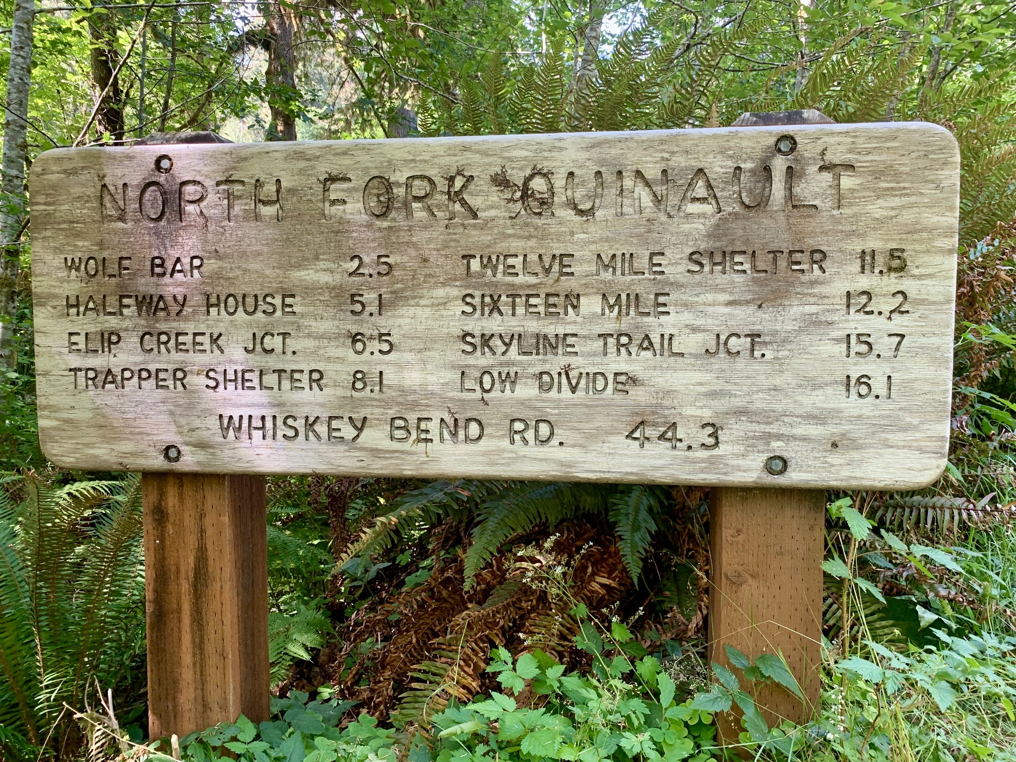
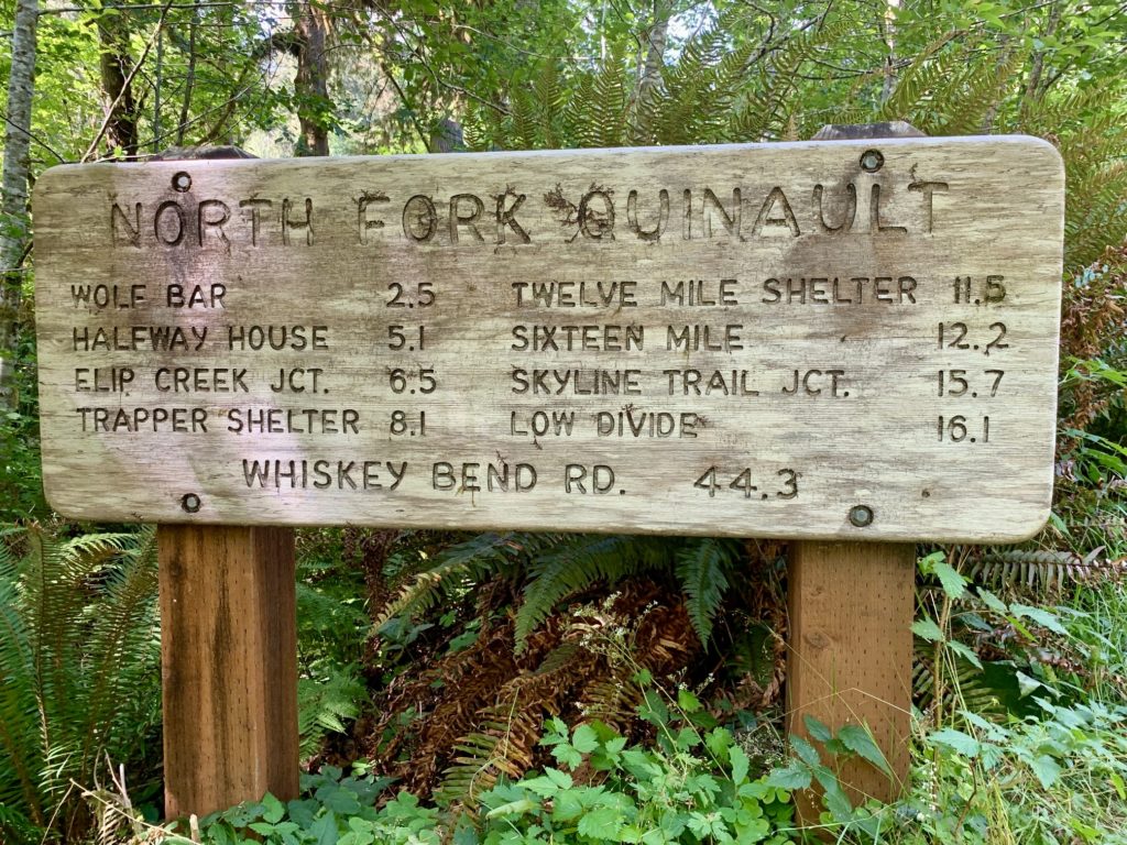
North Fork Quinault River
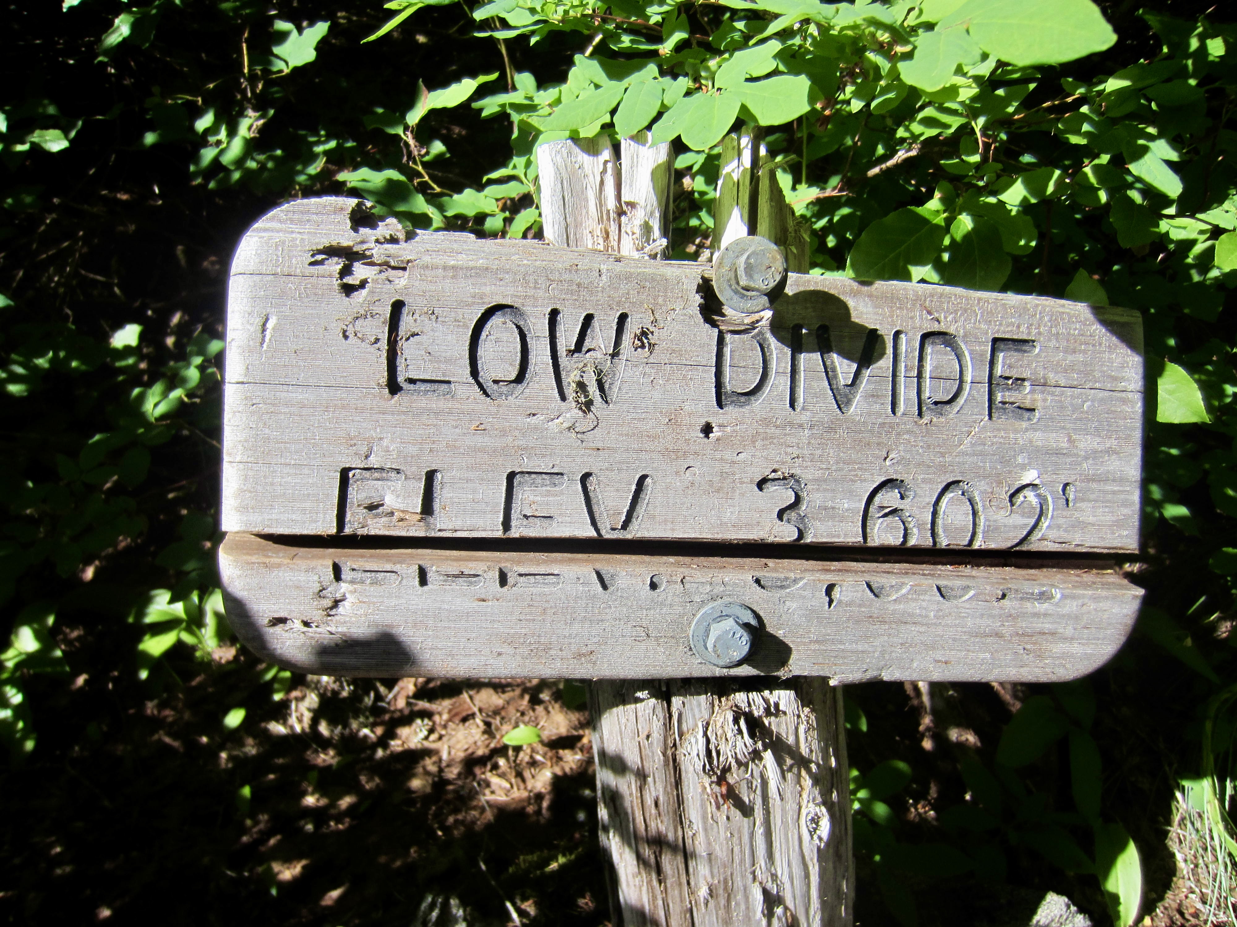
Low Divide
Mount Christie (6177′)
Seattle Meadows
Lower Saghalie Basin
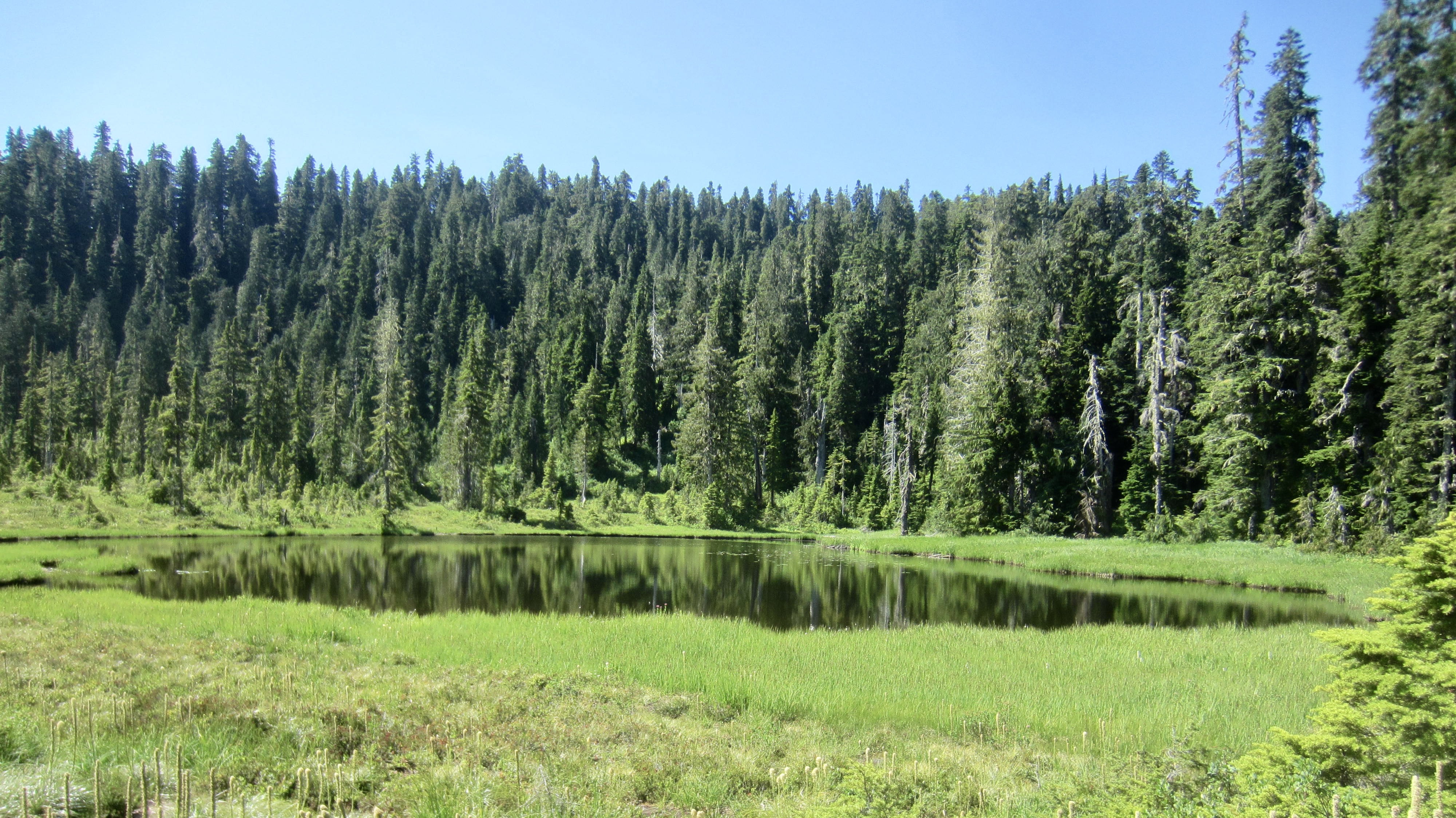
Lake Beauty
Kimta Park
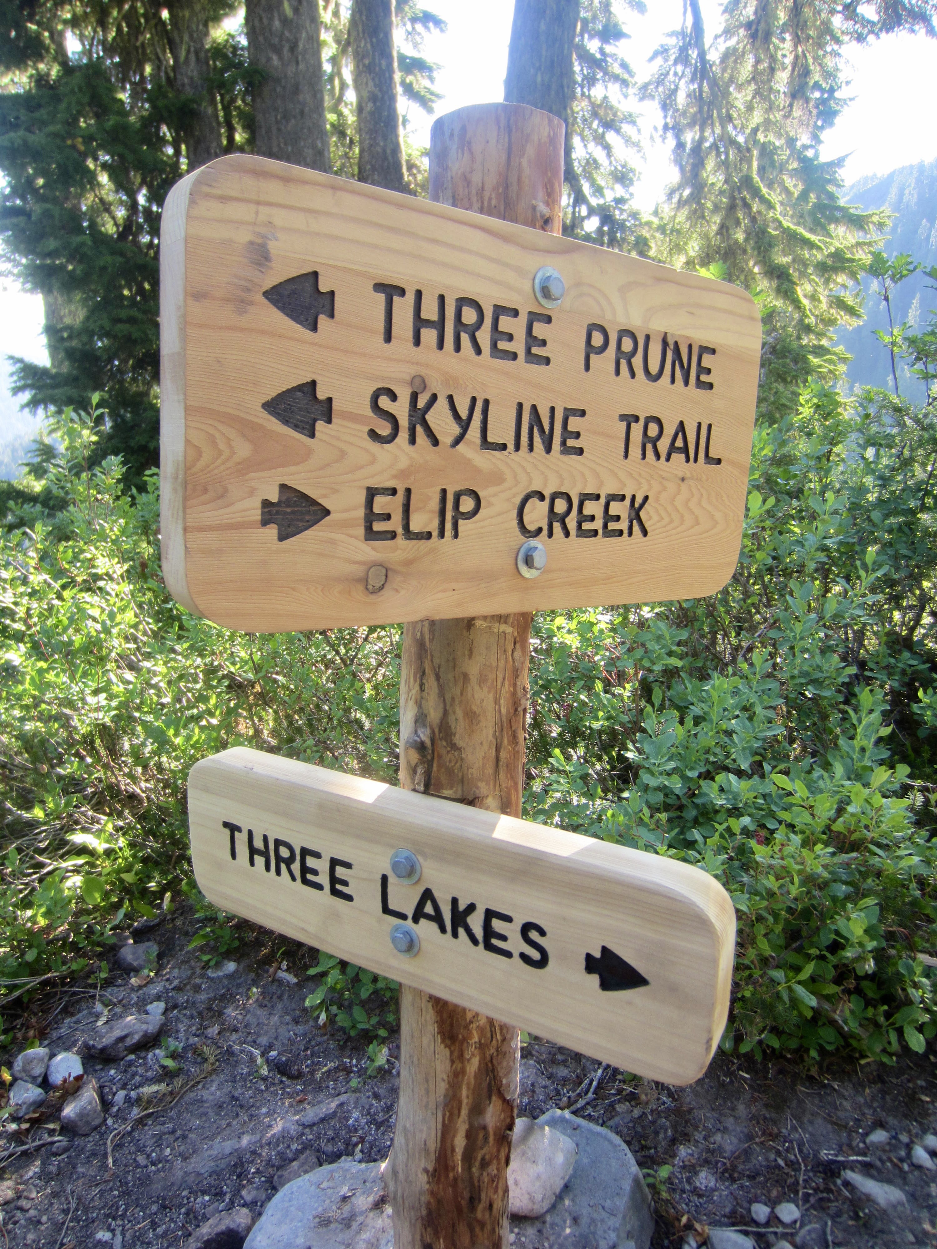
Three Prune Basin
Three Lakes
- Trip Report Summary
- Related Posts
- Full Trip Report
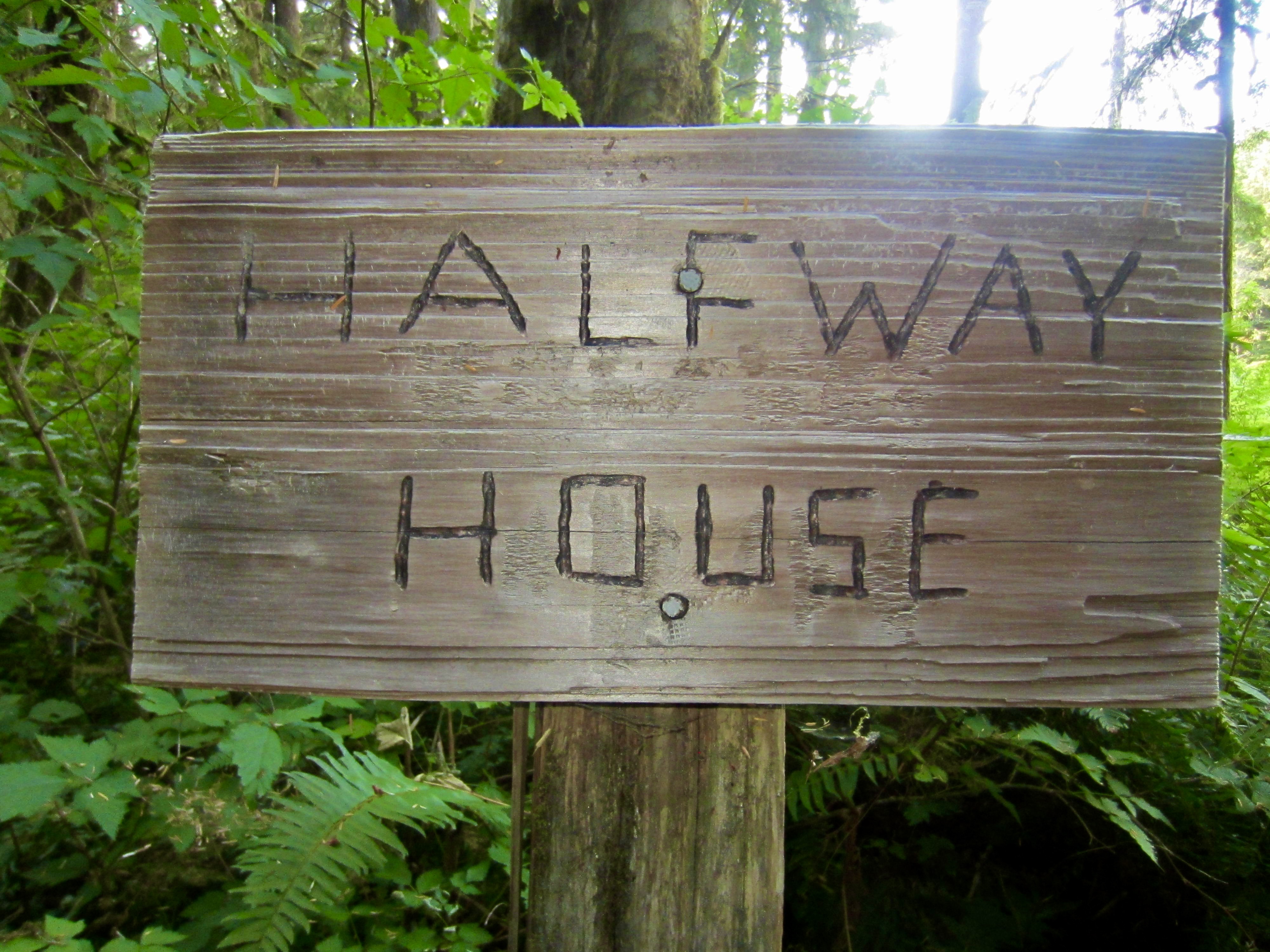
- Day 1: North Fork Trailhead to Halfway House Camp
- Day 2: Halfway House Camp to Low Divide Camp
- Day 3: Mt. Christie Summit Climb
- Day 4: Renegade / Low Divide Camp to Seattle Meadows
- Day 5: Seattle Meadows to Lake Beauty + Saghalie Basin Sidetrip
- Day 6: Lake Beauty to Three Prune Camp
- Day 7: Three Prune Camp to Three Lakes Trailhead
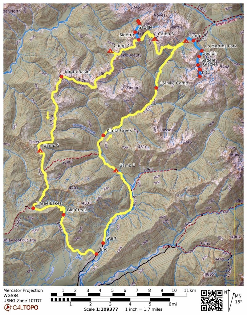
- Route Maps & Profiles
- Photo Gallery
Trip Report Summary
Region: Olympic Mountains (Washington)
Sub-Region: Quinault Group
Area: Olympic National Park
Starting Point: North Fork Quinault River Trailhead at end of North Fork Quinault River Road (Elev. 500 feet)
Way Points: North Fork Quinault River & Wolf Bar Camp & Wild Rose Creek & Halfway House Camp & Squaw Creek & Elip Creek & Francis/Elip Creek Camp & Three Prune Creek & Stalding Creek & Kimta Creek & Trapper Camp Shelter & Twelvemile Camp & North Fork Quinault River ford & Sixteenmile Camp & Christie Creek & Skyline Trail junction & Renegade / Low Divide Camp & Skyline Trail junction & Seattle Meadows & Seattle Creek & Beauty Pass & Lake Beauty & Beauty Pass & Hee Haw Pass & Promise Creek Bench & Promise Creek Pass & Kimta Arm & Kimta Basin & Kimta Park & Three Prune Basin & Elip Tarns & Three Lakes & North Fork Big Creek & Irely Flats & North Fork Quinault River Road (trail hike & trail scramble)
High Point: Promise Creek Bench (Elev. 5340 feet)
Ending Point: Irely Lake / Three Lakes Trailhead on North Fork Quinault River Road (Elev. 500 feet)
Campsites: Halfway House Camp & Renegade / Low Divide Camp & Seattle Meadows & Lake Beauty & Three Prune Camp
Sidetrip 1: Low Divide & Lake Margaret & Martins Park Trail junction & Lower Martins Park (trail hike & trail scramble); North Christie Saddle & East Christie Col & Mt. Christie summit (off-trail hike & snow climb & rock climb & rock scramble)
Summit: Mt. Christie (snow climb & rock climb & rock scramble via North Couloir—North Saddle—Christie Glacier—East Col—Southeast Ridge [Route 3] )
Sidetrip 2: Point 5015 (off-trail hike & rock scramble)
Sidetrip 3: Tarn 4800 & Saddle 4950 & Lower Saghalie Basin (off-trail hike & rock scramble & snow climb & bushwhack)
Approximate Stats (excluding all sidetrips ): 43 miles traveled; 11,000 feet gained & lost.
Approximate Stats (including all sidetrips): 52 miles traveled; 16,500 feet gained & lost.
Related Posts
Mt Meany via Quinault River—Low Divide—Seattle Basin – August 2020
Skyline–Quinault Trail Loop + Mt. Seattle via Southwest Couloir – September 2015
Full Trip Report
The seeds for this weeklong Olympic Mountains trip were planted last summer by Tony and Greg in separate gardens. Tony had proposed the idea of climbing Mt. Christie with his daughter Anna, along with any other interested father-daughter pairs. Independently, Greg had expressed a desire to traverse from Queets Basin to Lake Beauty, thereby repeating a route first completed by the legendary Olympic explorer Herb Chrisler. The two trips were subsequently melded into one, a date was set, and participants were assembled. In the end, nothing went according to our plans, but we did have a grand adventure.
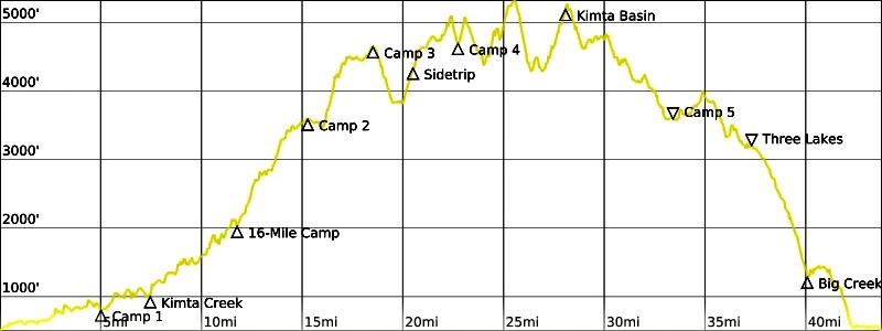
Day 1: North Fork Trailhead to Halfway House Camp
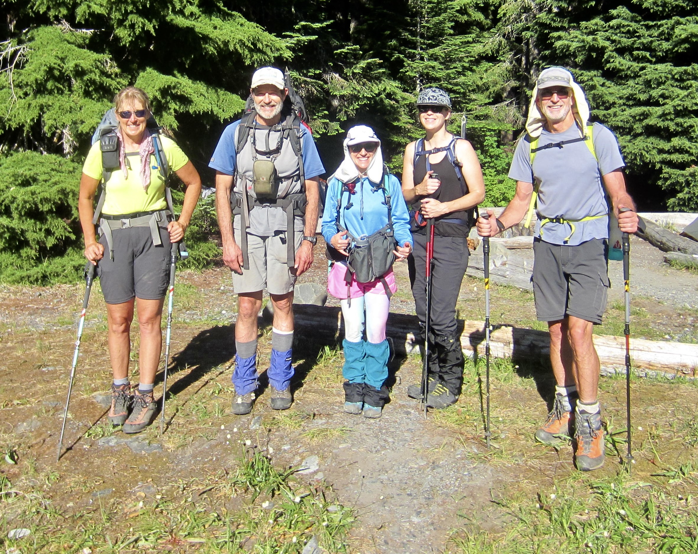
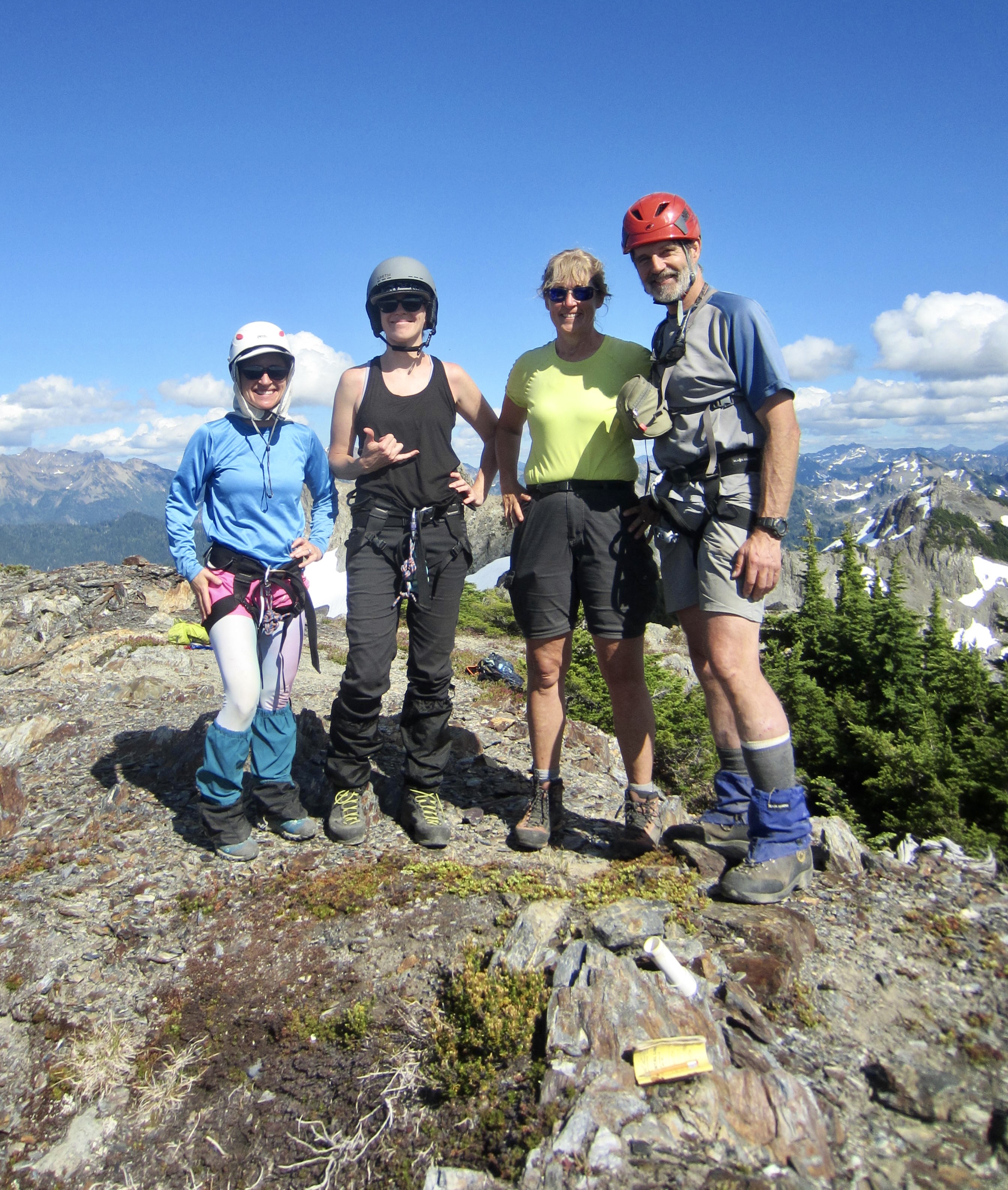
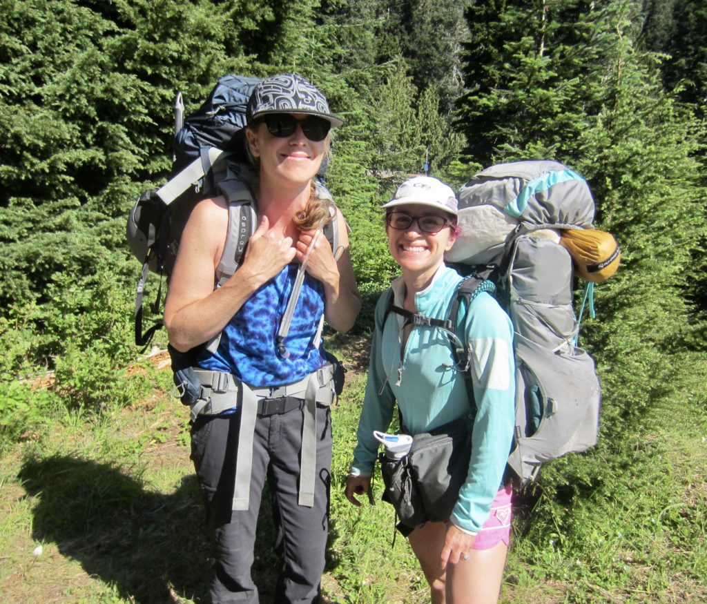
Tony, Greg, Anna, Engre, Eileen, and I met at the North Fork Quinault River Trailhead on a warm Friday afternoon. A variety of climbing gear was distributed among us before we headed up the trail. During our hike, we encountered a large group of climbers returning from Queets Basin, and they reported disparate conditions during their descent to the Elwha River: The Elwha Snowfinger was in excellent condition, whereas the path into Elwha Basin was “a bushwhack from hell.” Disturbing news, indeed! Tony and Greg wondered what had changed there in recent years.
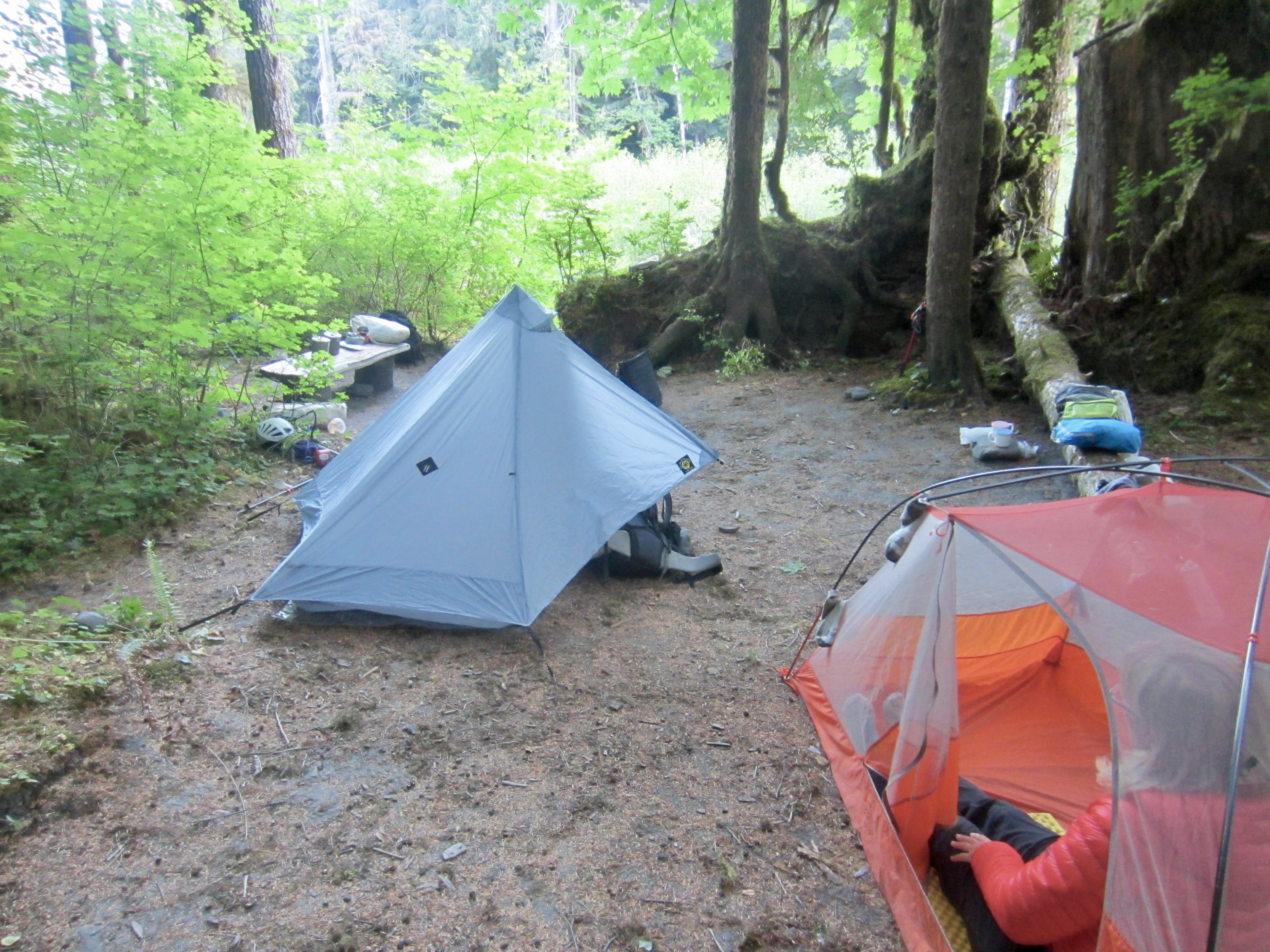
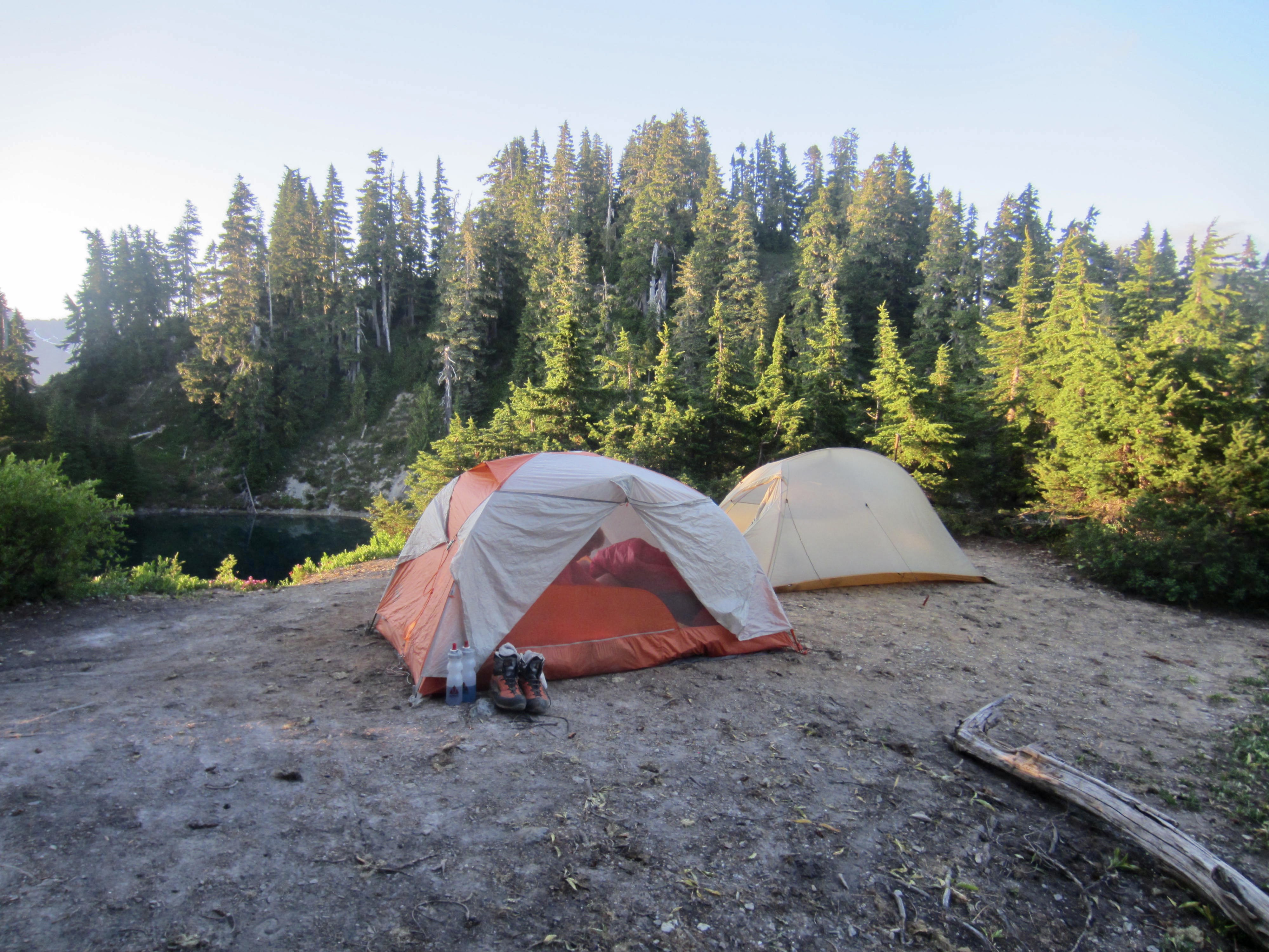
We all arrived at Halfway House Camp in early evening (3.3 hours + 5.1 miles + 600 feet from TH) and set up tents among big evergreen trees, within earshot of the North Fork Quinault River. This comfortable forest campsite is named after a commercial lodge that hosted mountain travelers in the 1920s.
…
Day 2: Halfway House Camp to Low Divide Camp
During breakfast, Tony delivered very disappointing news to our group: He was suffering from severe lower-back pain and would not be continuing on with us. As the most experienced Olympics climber in our group, his absence was not only a setback to our morale but also a critical loss in terms of navigation. We all gave Tony a warm farewell before leaving camp, with Anna now carrying the family flag by herself.
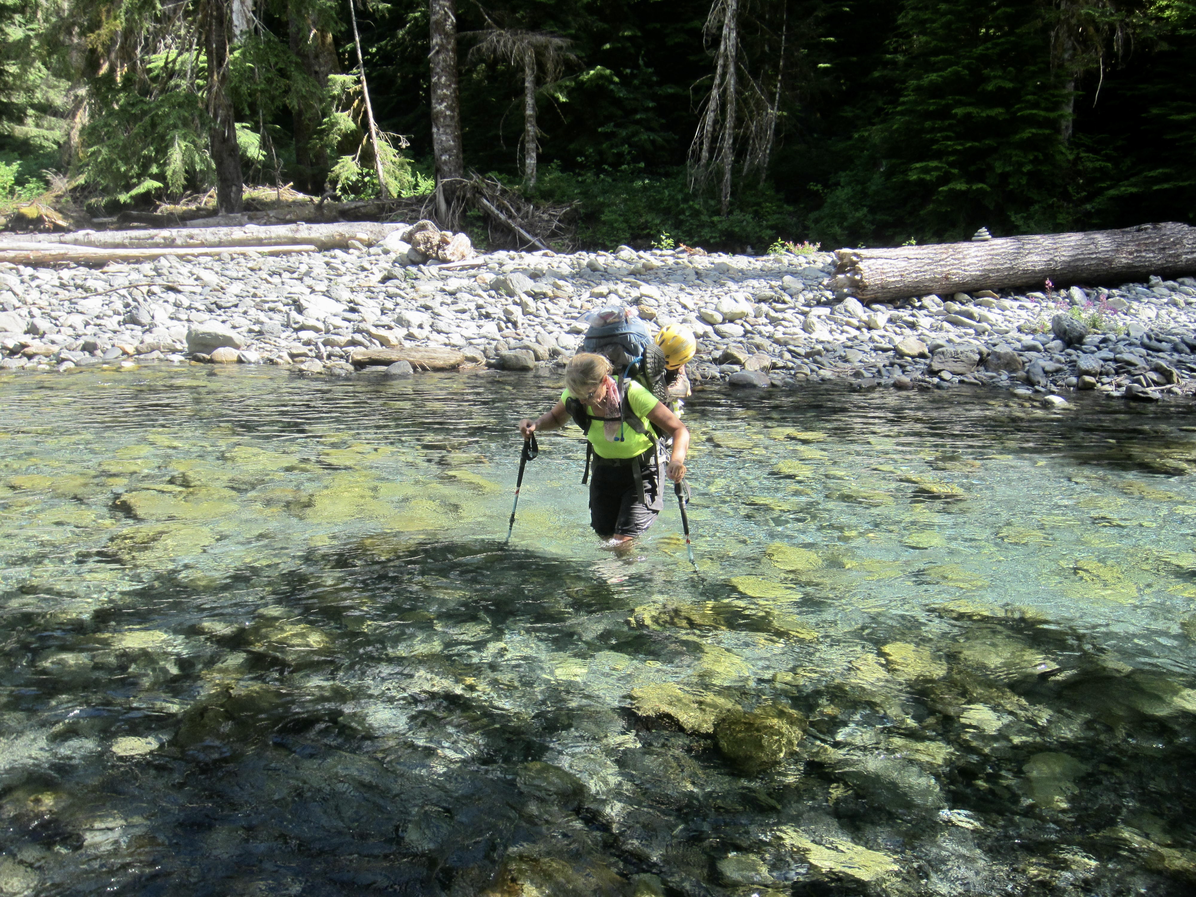
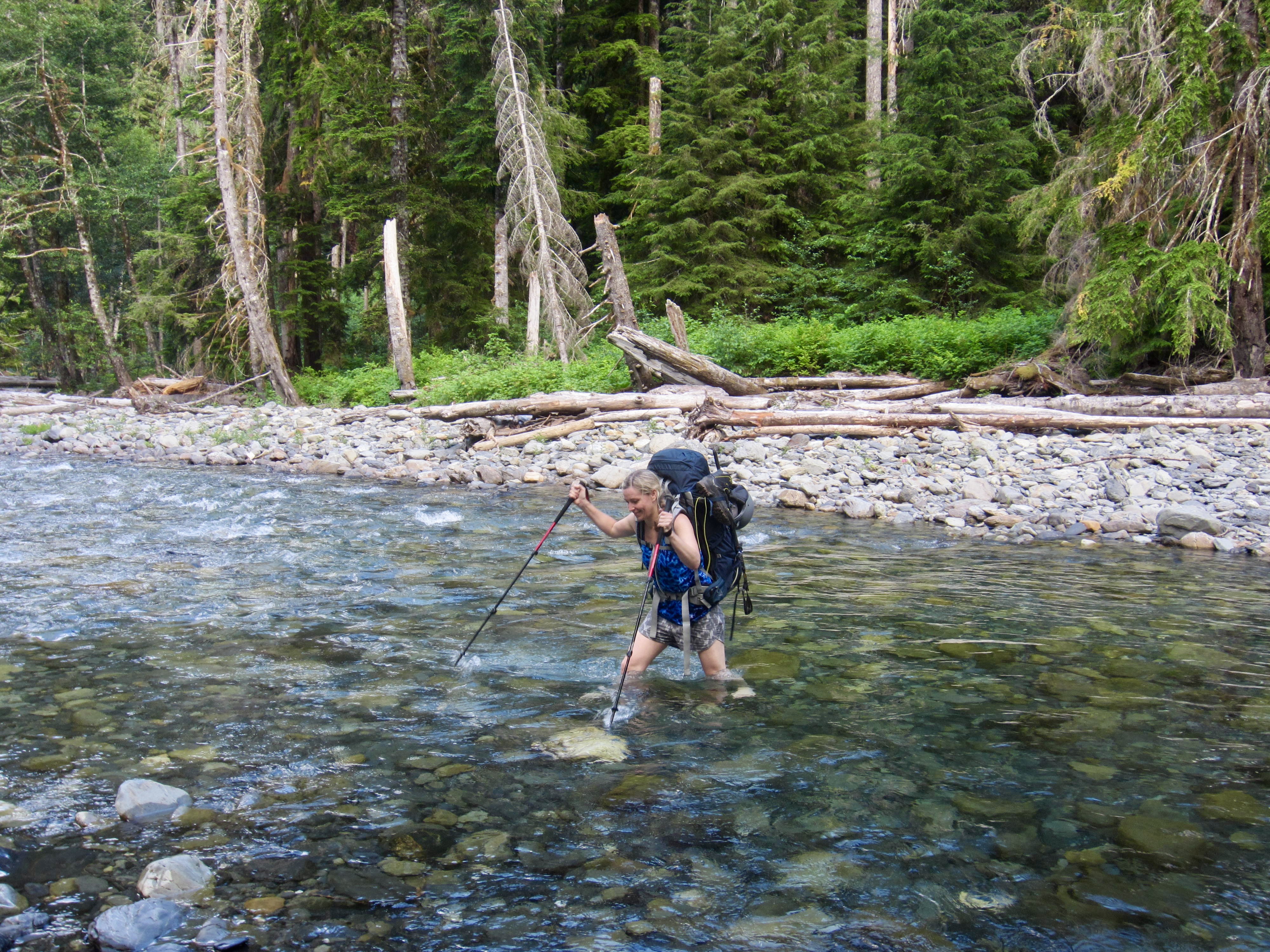
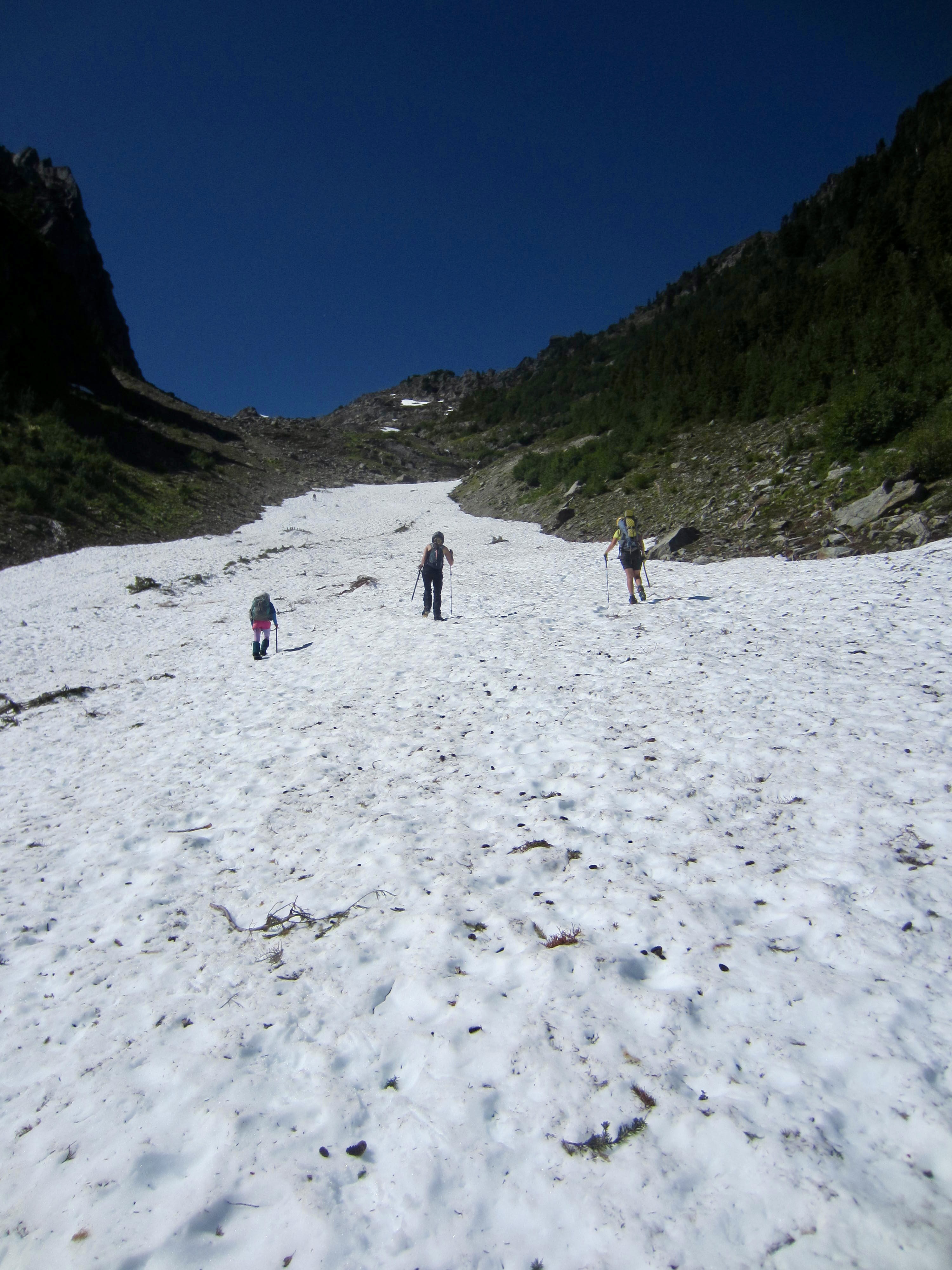
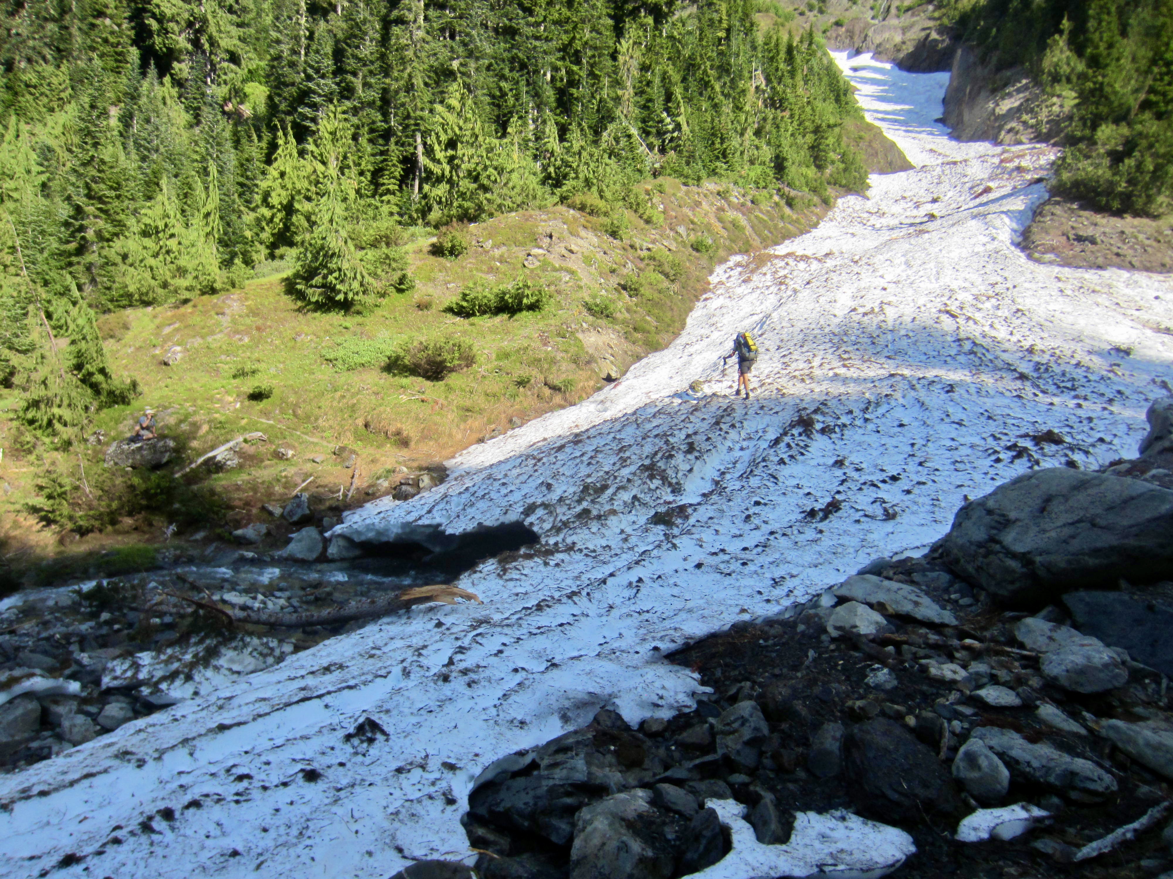
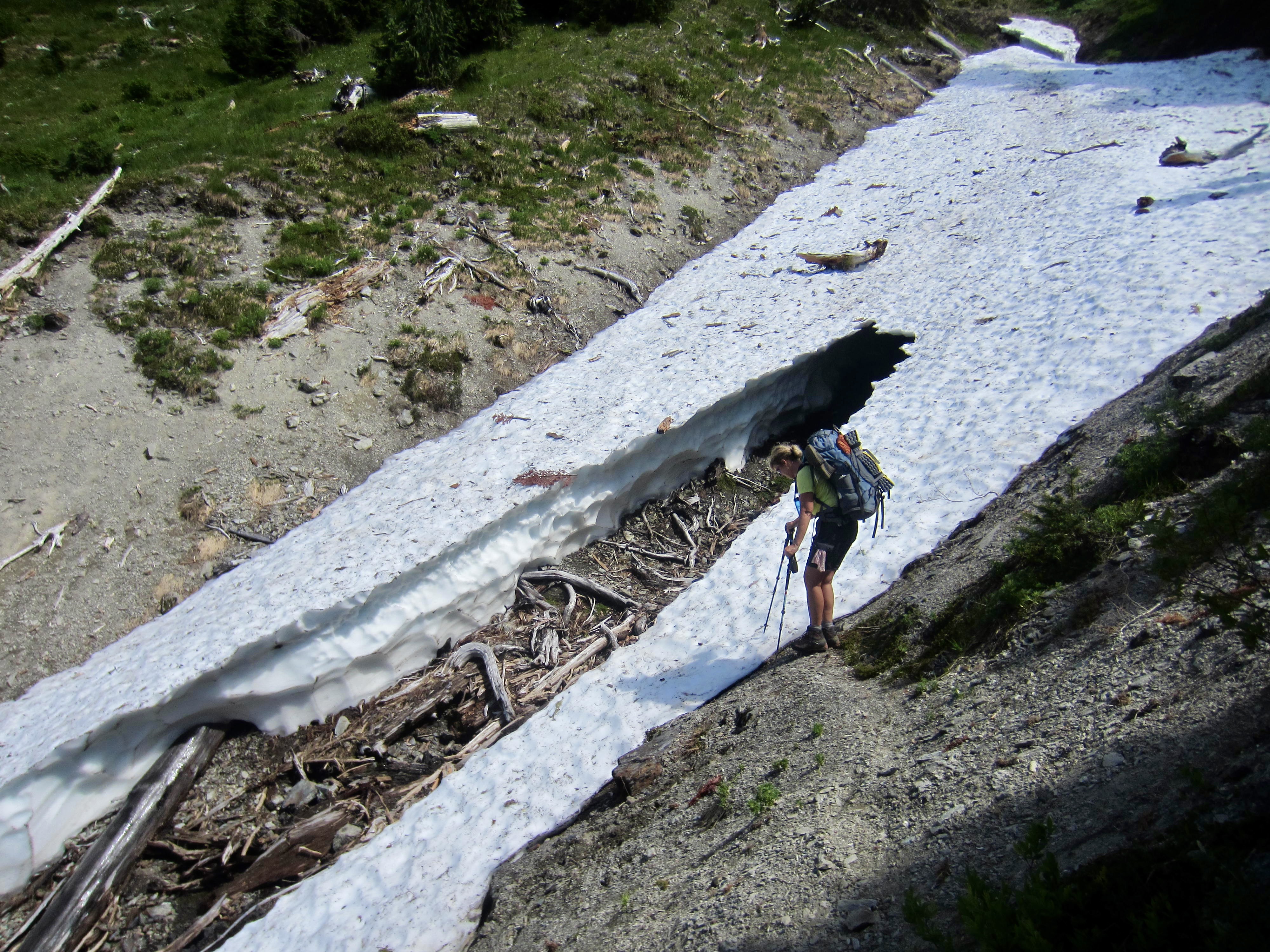
Greg, Anna, Engre, Eileen, and I continued hiking up the river trail, past numerous creeks and campsites. A thigh-deep ford of the river at Sixteenmile Camp (6.0 hours + 1700 feet from Camp 1) provided a refreshing respite from the mid-afternoon heat.
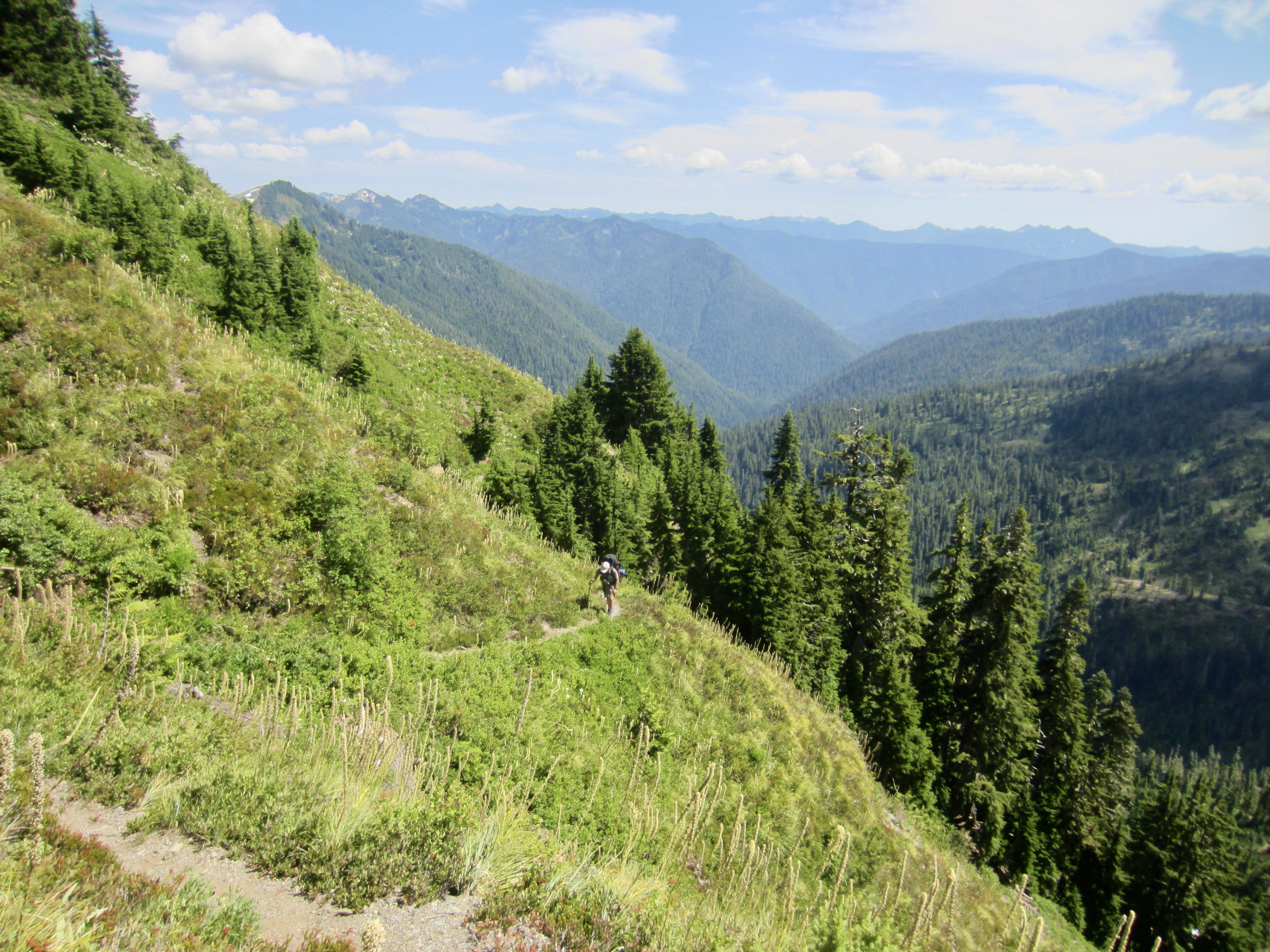
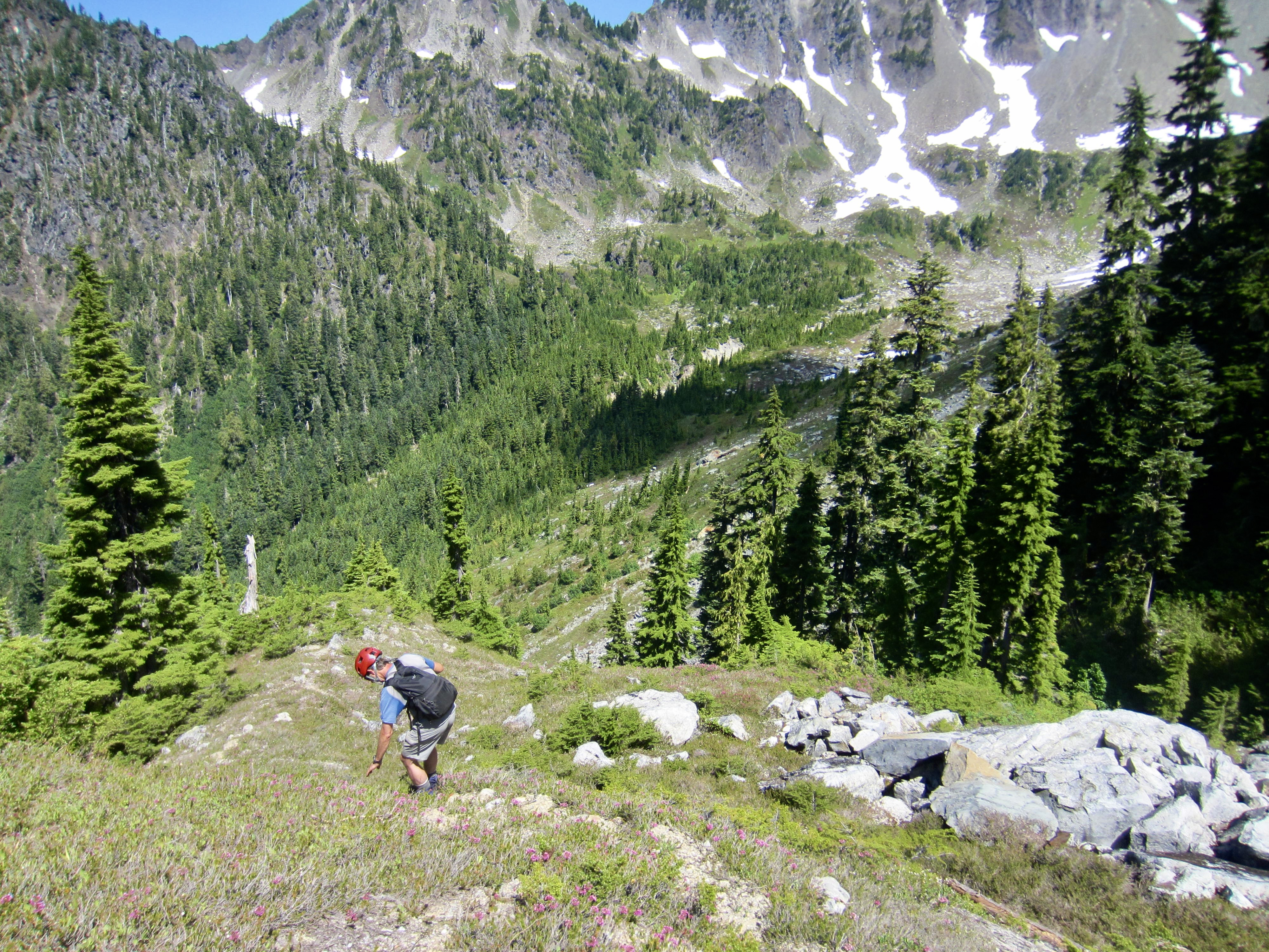
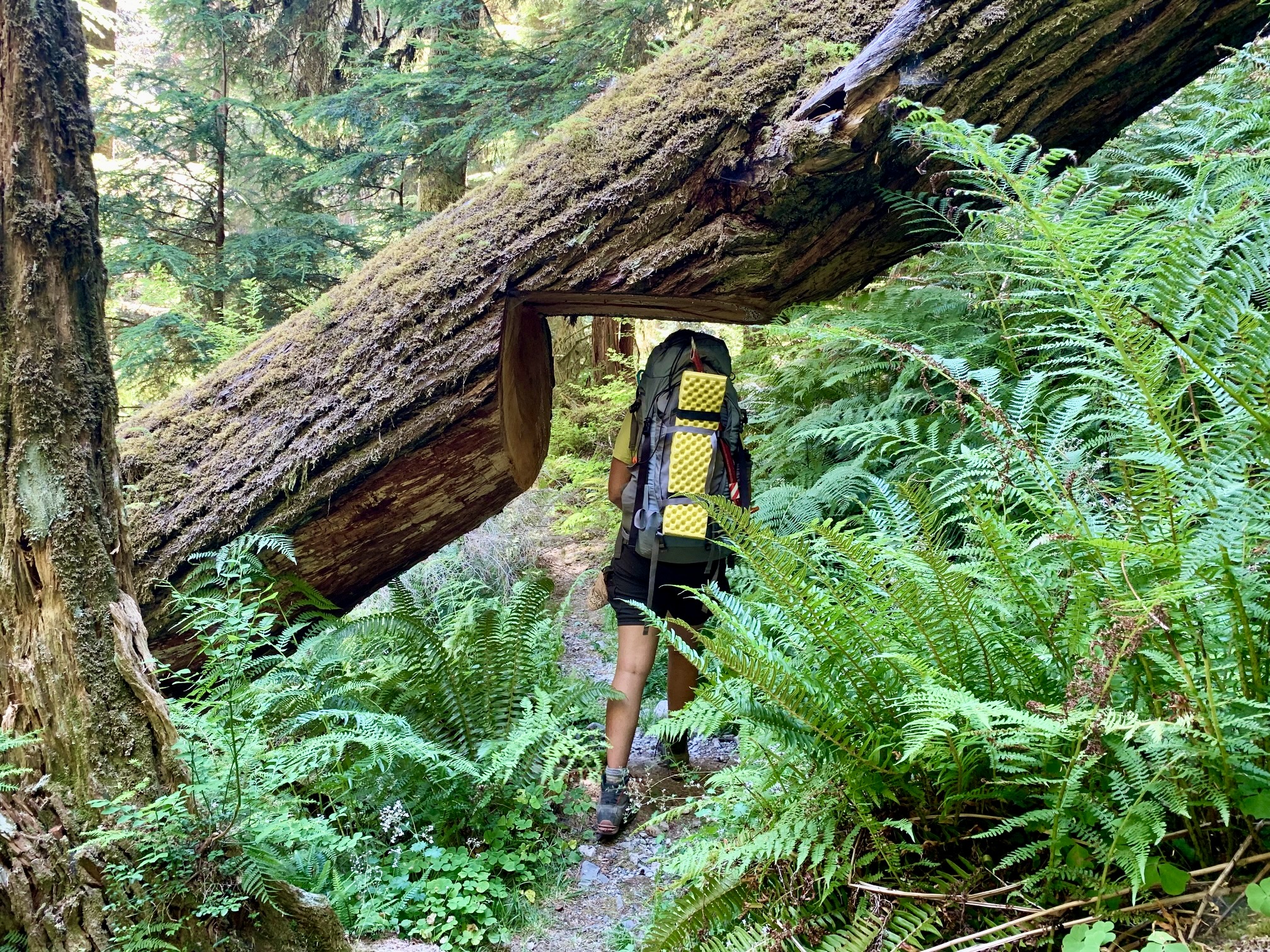
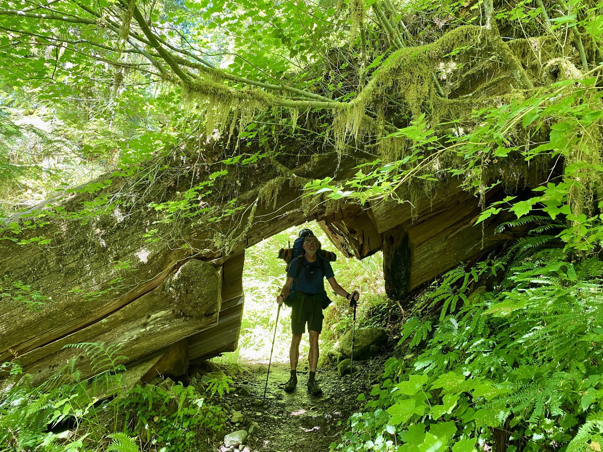
From the river, the trail switch-backed 850 feet up to Christie Creek before starting to ease off. It became apparent during our day’s hike that no maintenance has been done on this trail for at least 2 years; Eileen and I recognized numerous fallen logs from last year’s Quinault hike, including several that required significant detours, gymnastic maneuvers, or even belly-crawling. Ugh.
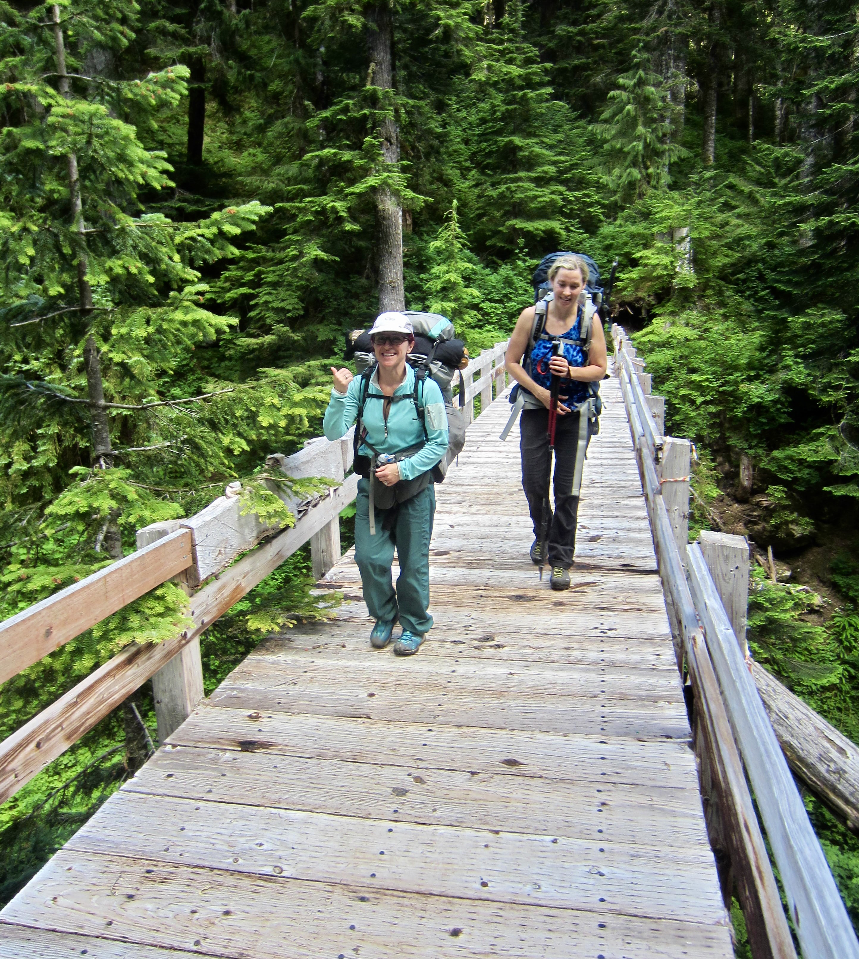
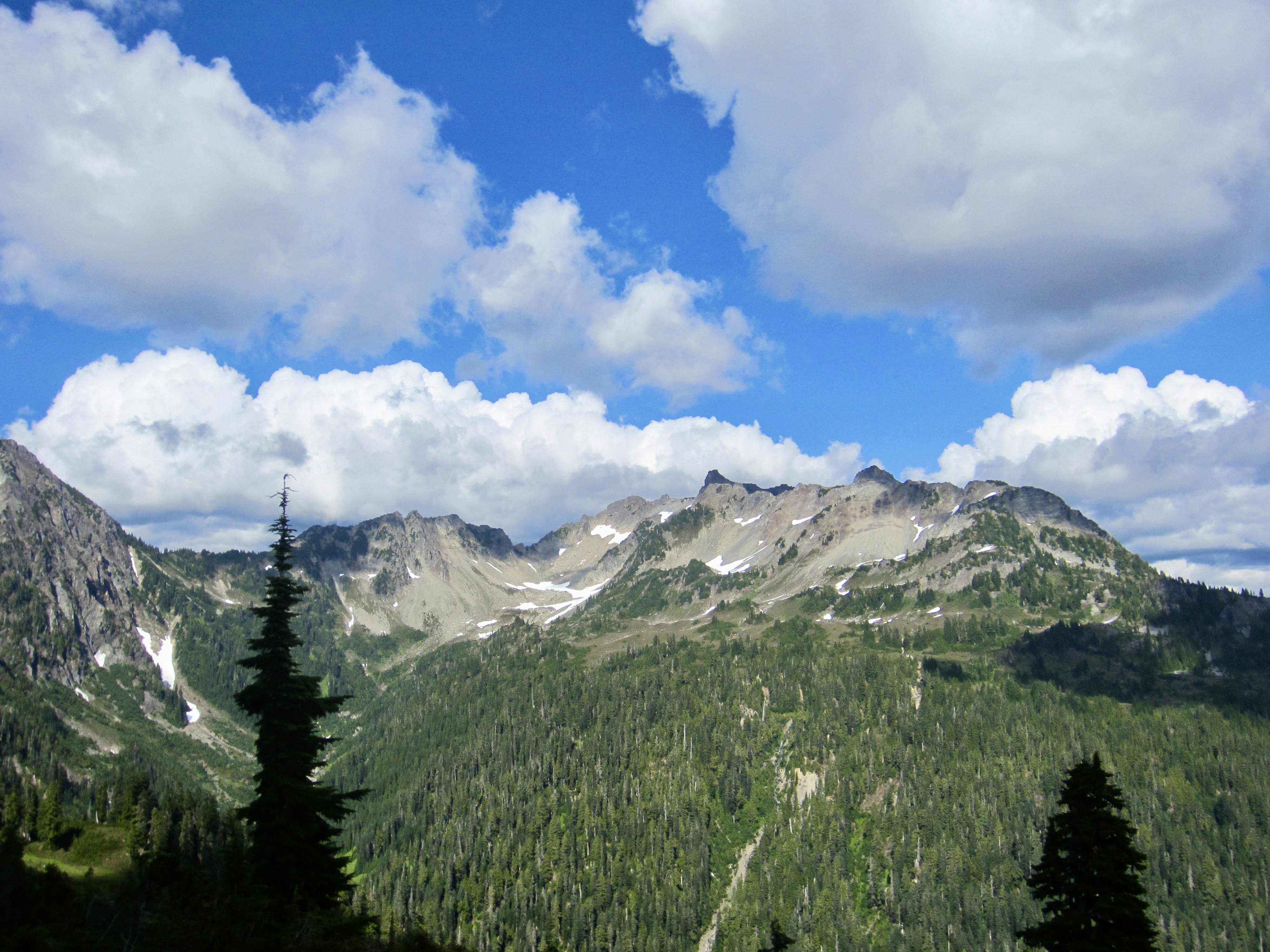
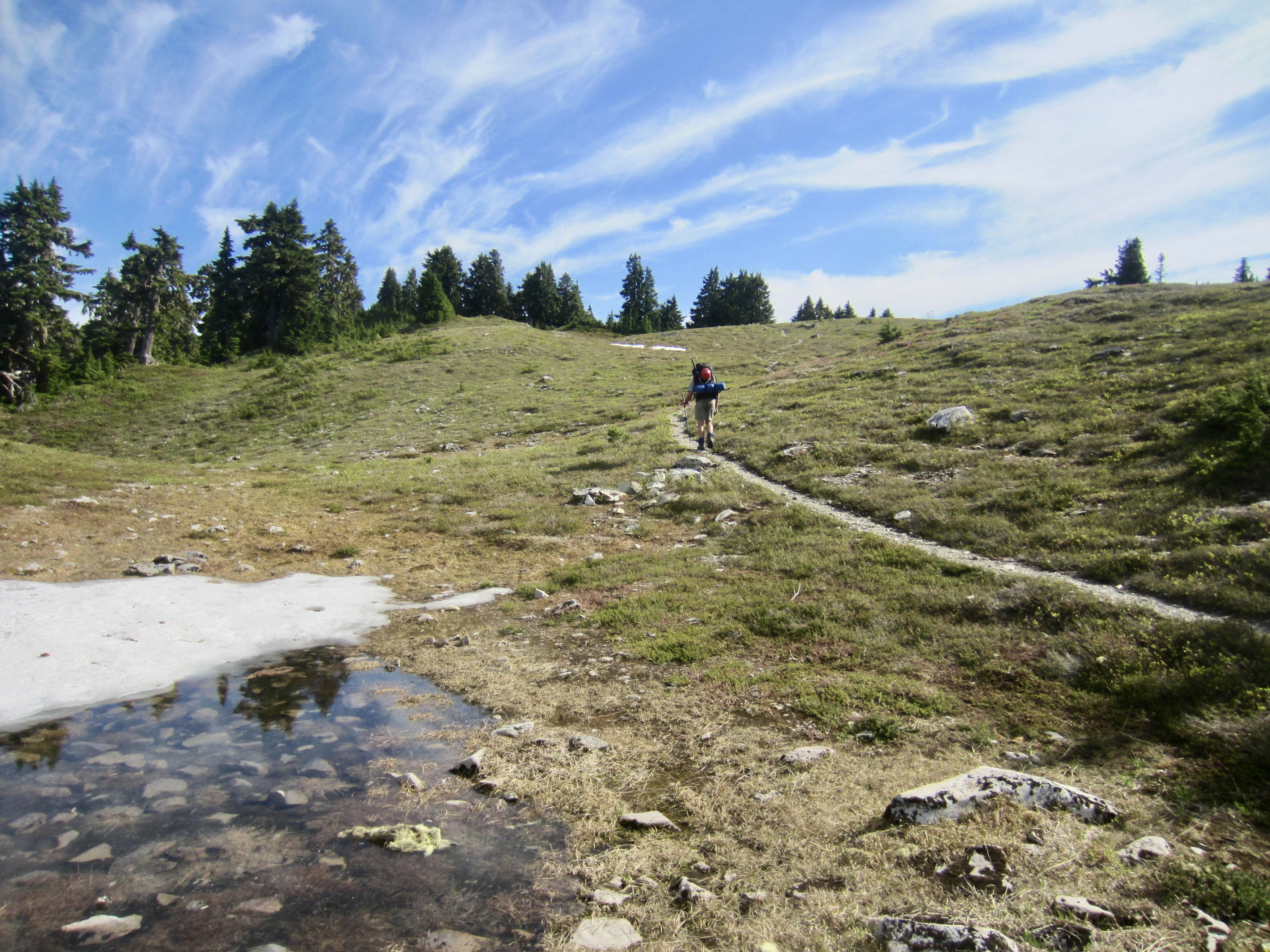
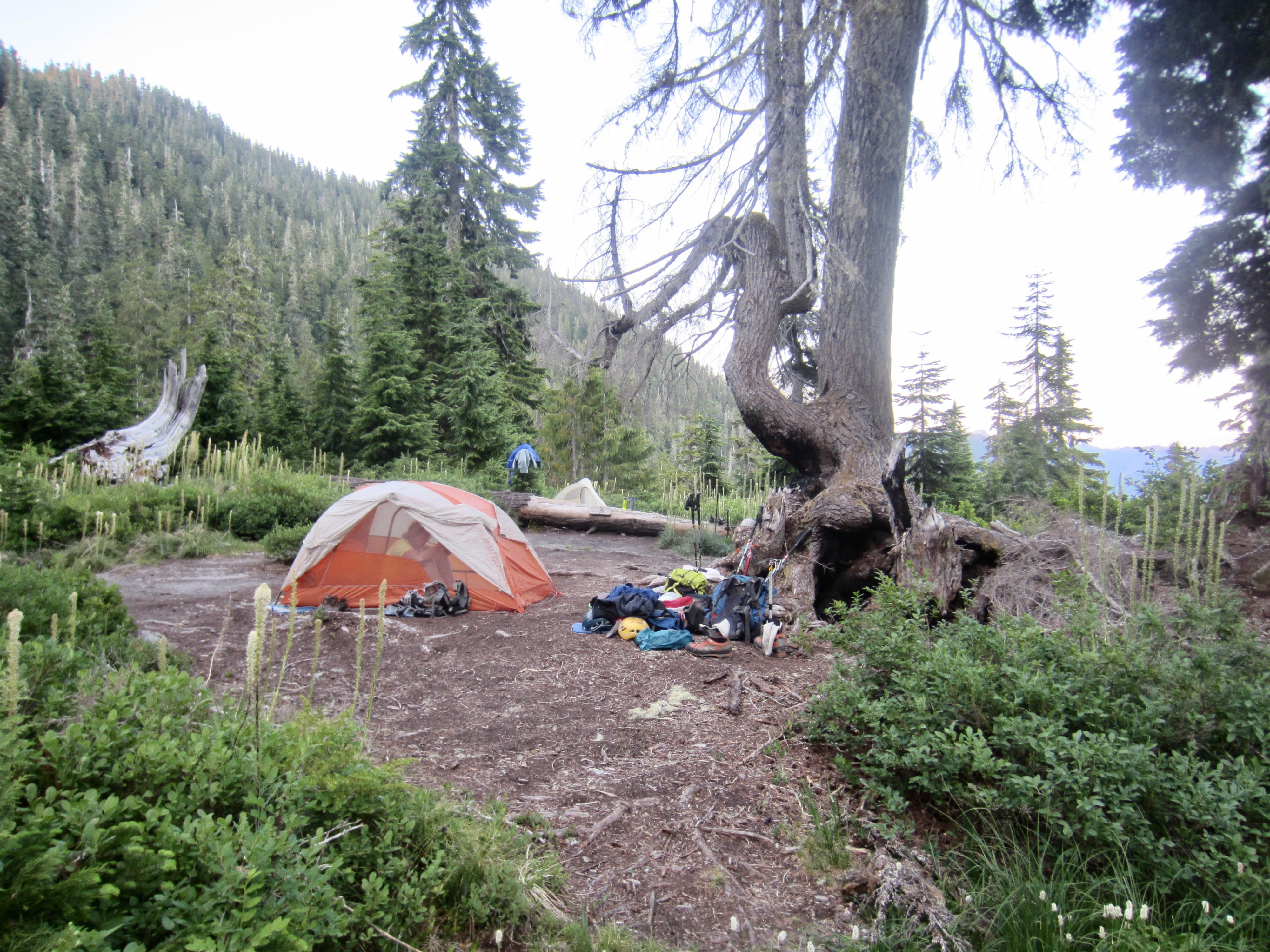
By the time we reached the grassy meadows and brushy thickets of Low Divide, the sun had set behind Skyline Ridge and the evening had cooled off. We strode into Renegade Camp at 8:15pm (10.6 hours + 11.0 miles + 3300 feet from Camp 1) and pitched our tents in a roomy group site with a privy and bear wire nearby.
Day 3: Mt. Christie Summit Climb
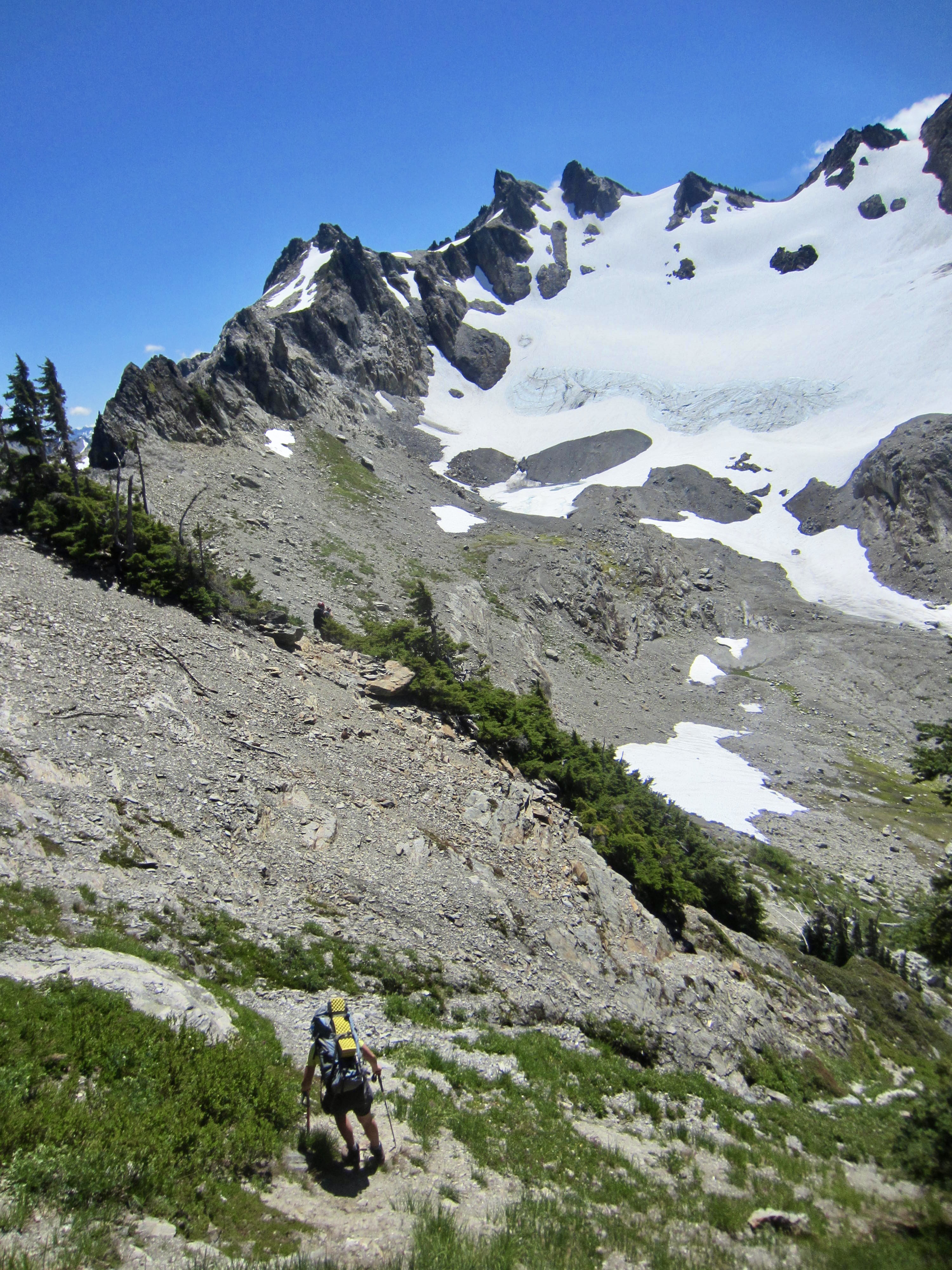
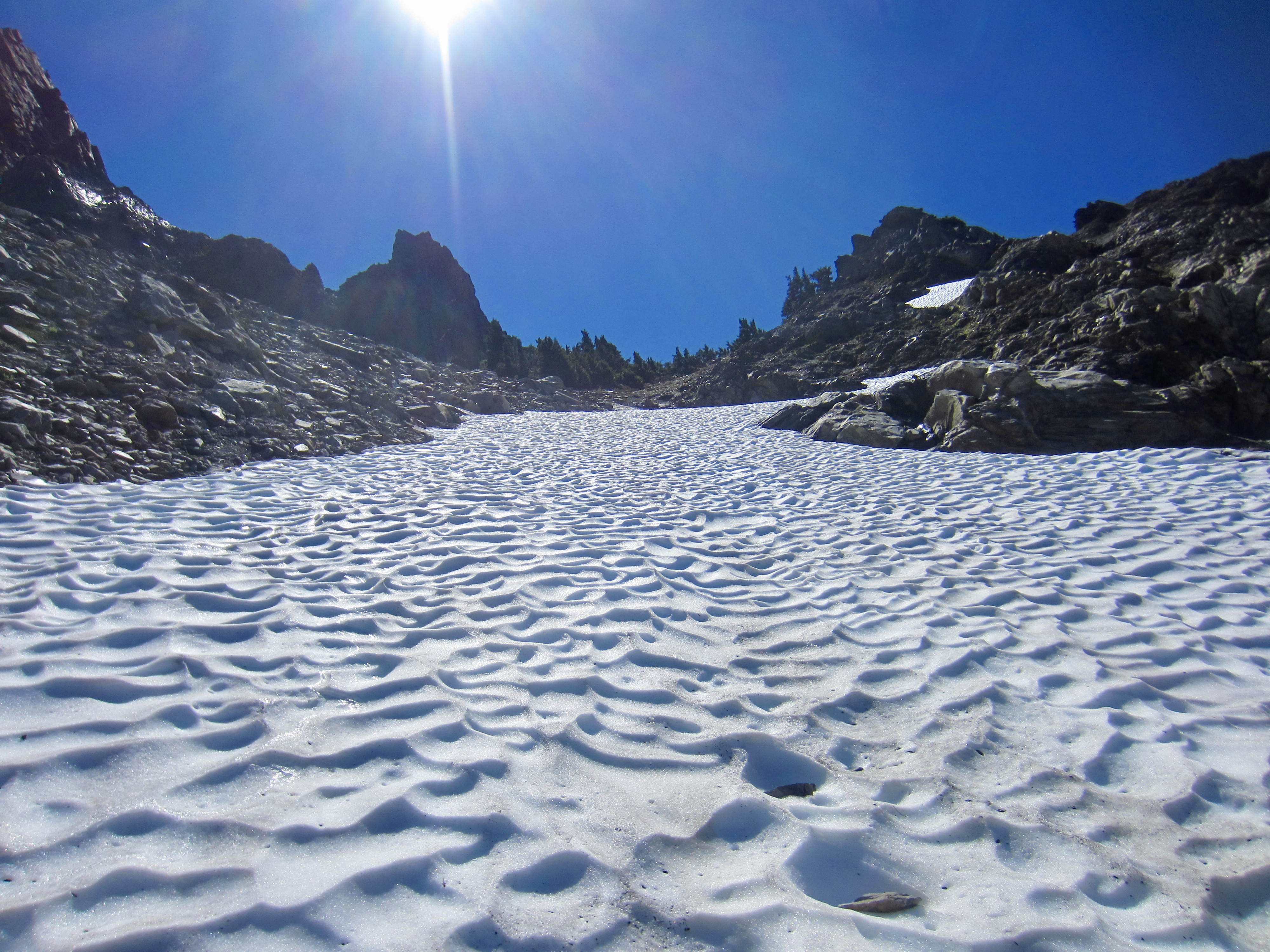
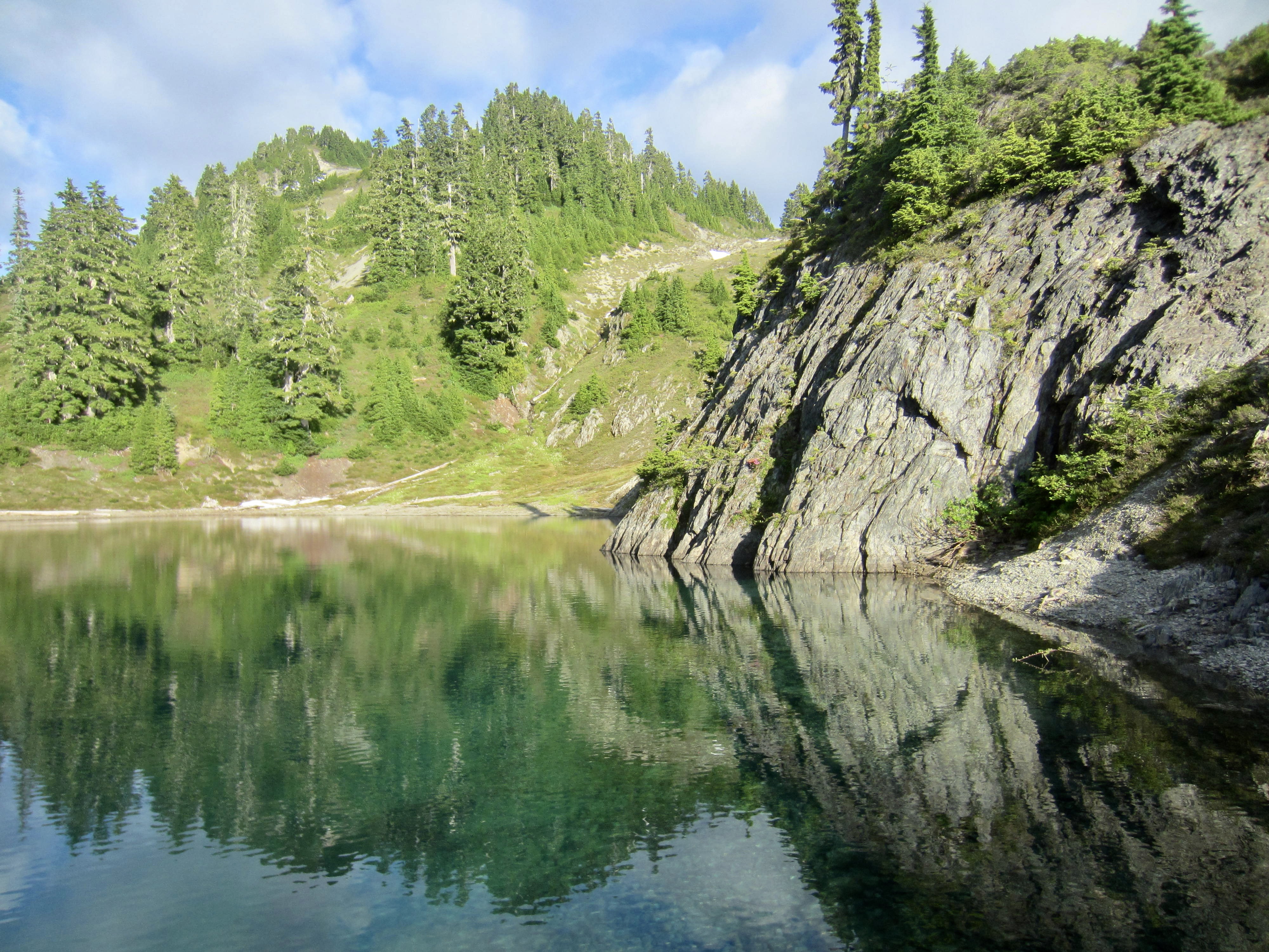
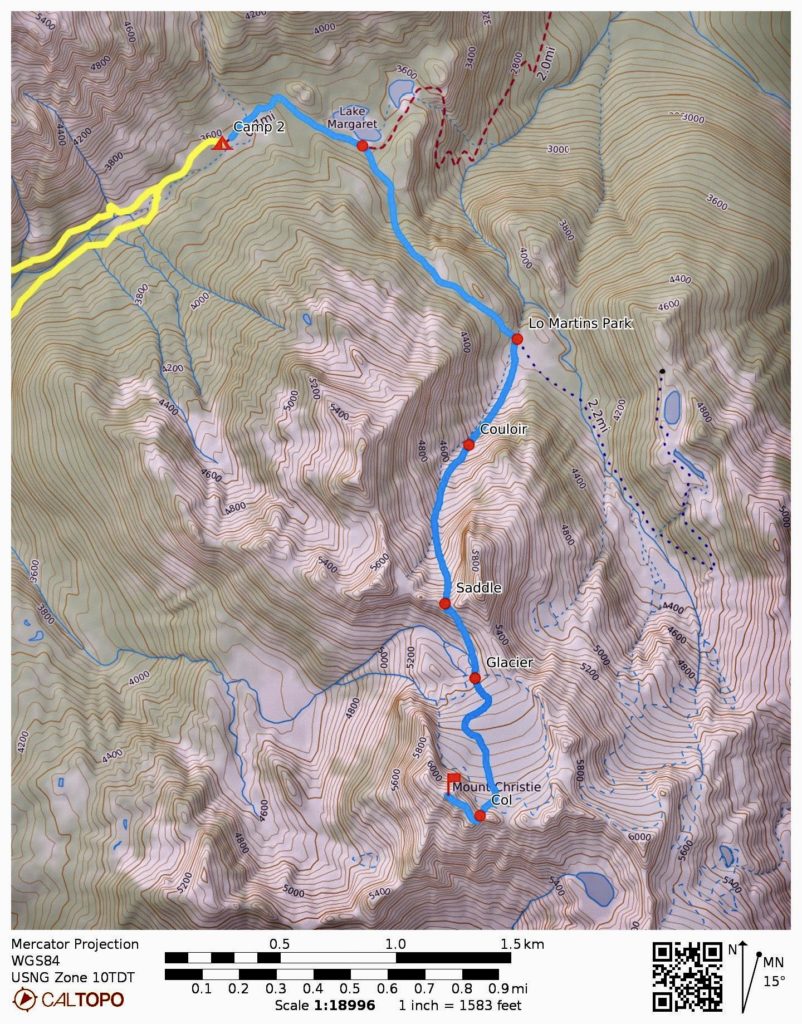
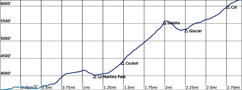
Following yesterday’s long and tiring approach hike, nobody was in a particular hurry to leave for Mt. Christie this morning. Besides, we had a trip report from Fay Pullen indicating that Christie is a very straightforward climb requiring less than a full day. (We probably should have known that nothing in the Olympics is truly straightforward and quick.) Our quintet left camp at 9:00am and hiked up to Low Divide proper, then took the rough fisherman’s trail to Martins Park and Martins Lakes.
From Lower Martins Park, the broad snow-and-rock couloir leading south toward Mt. Christie was clearly visible. We hiked over to the base of the snowfield, donned crampons, and proceeded upward.
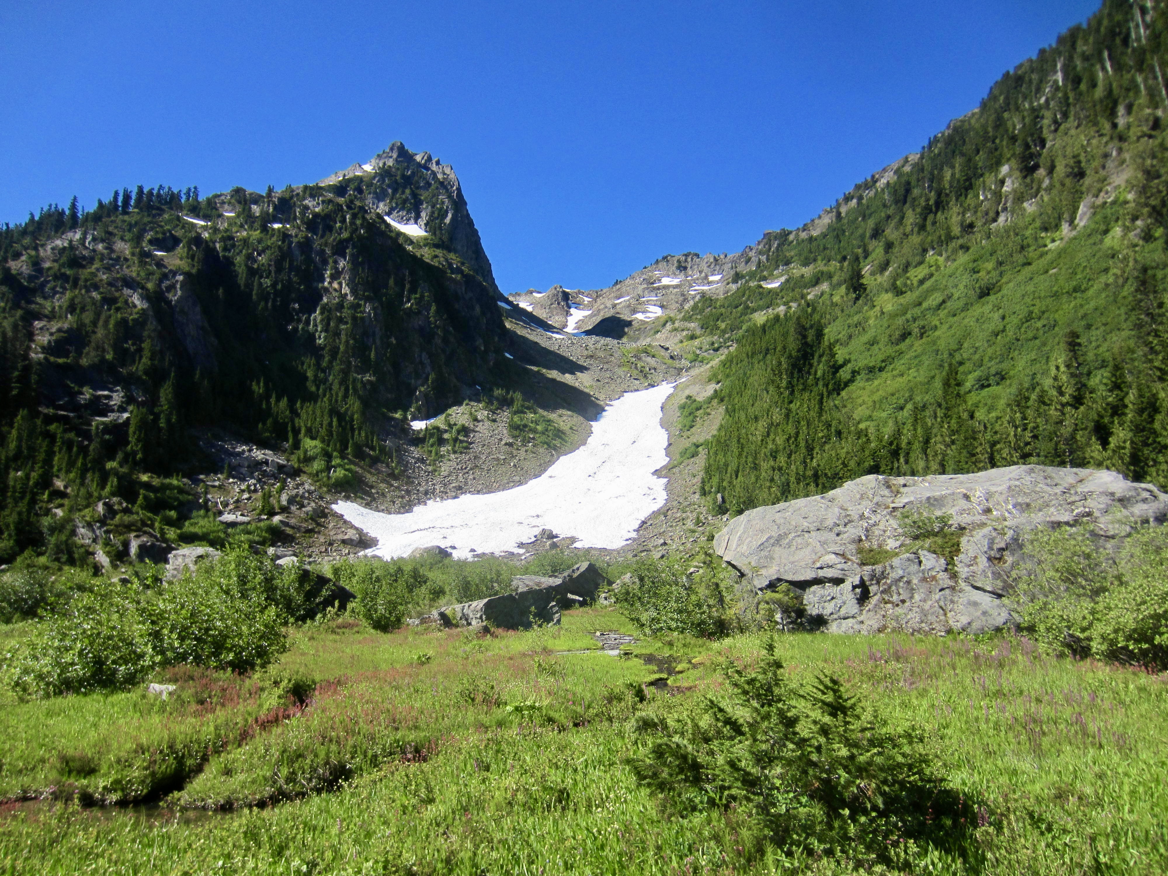

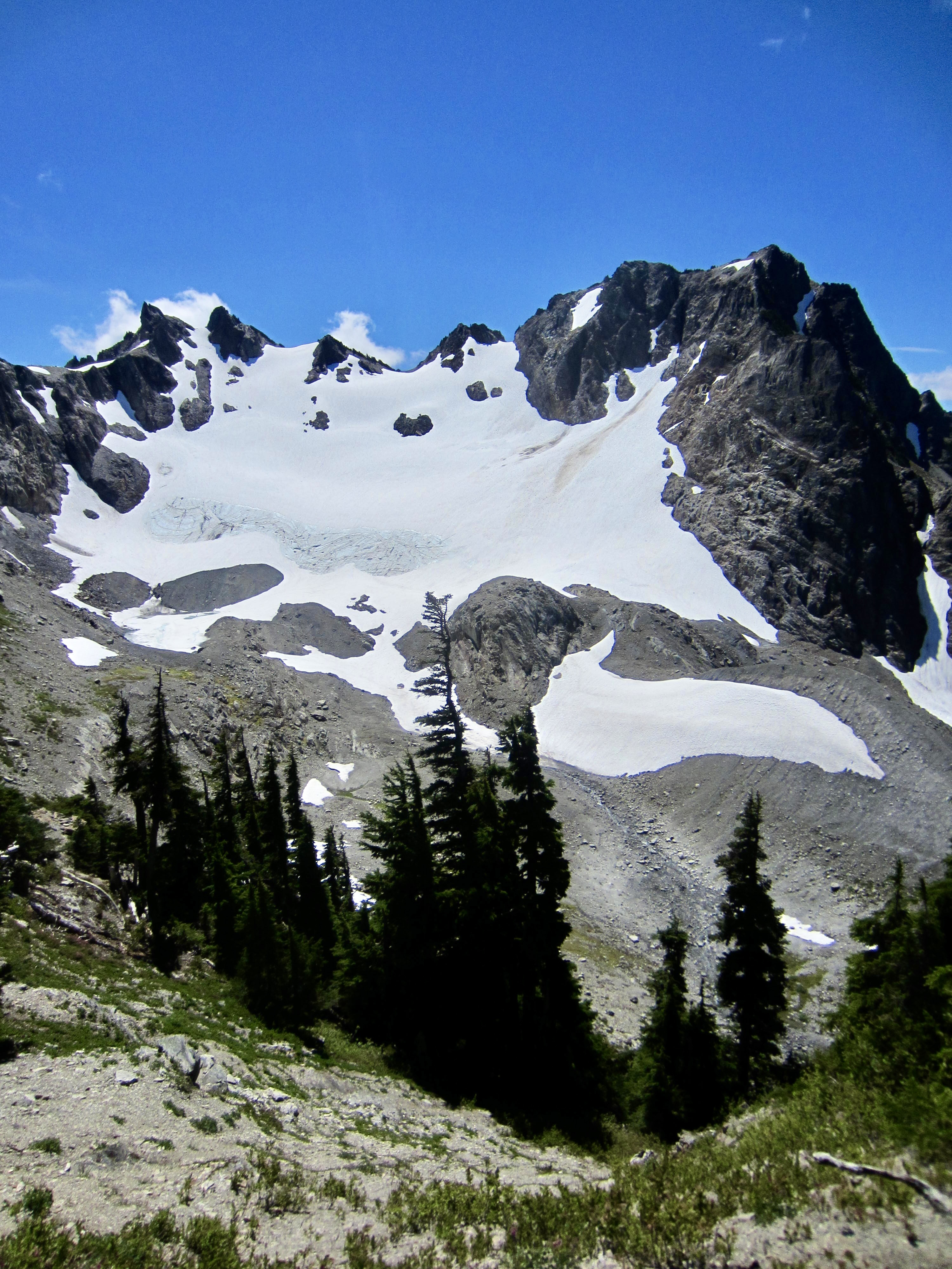
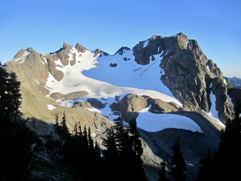
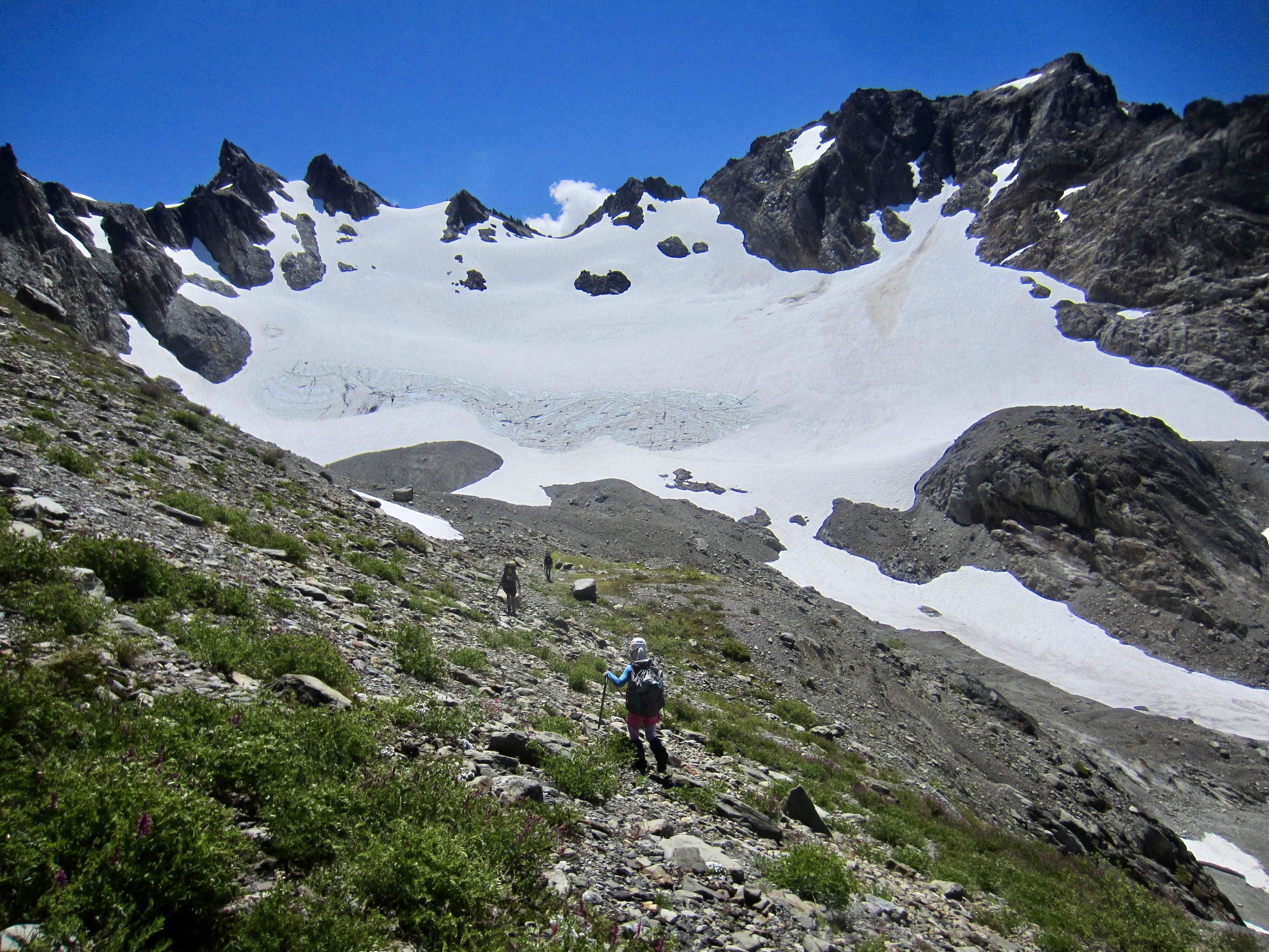
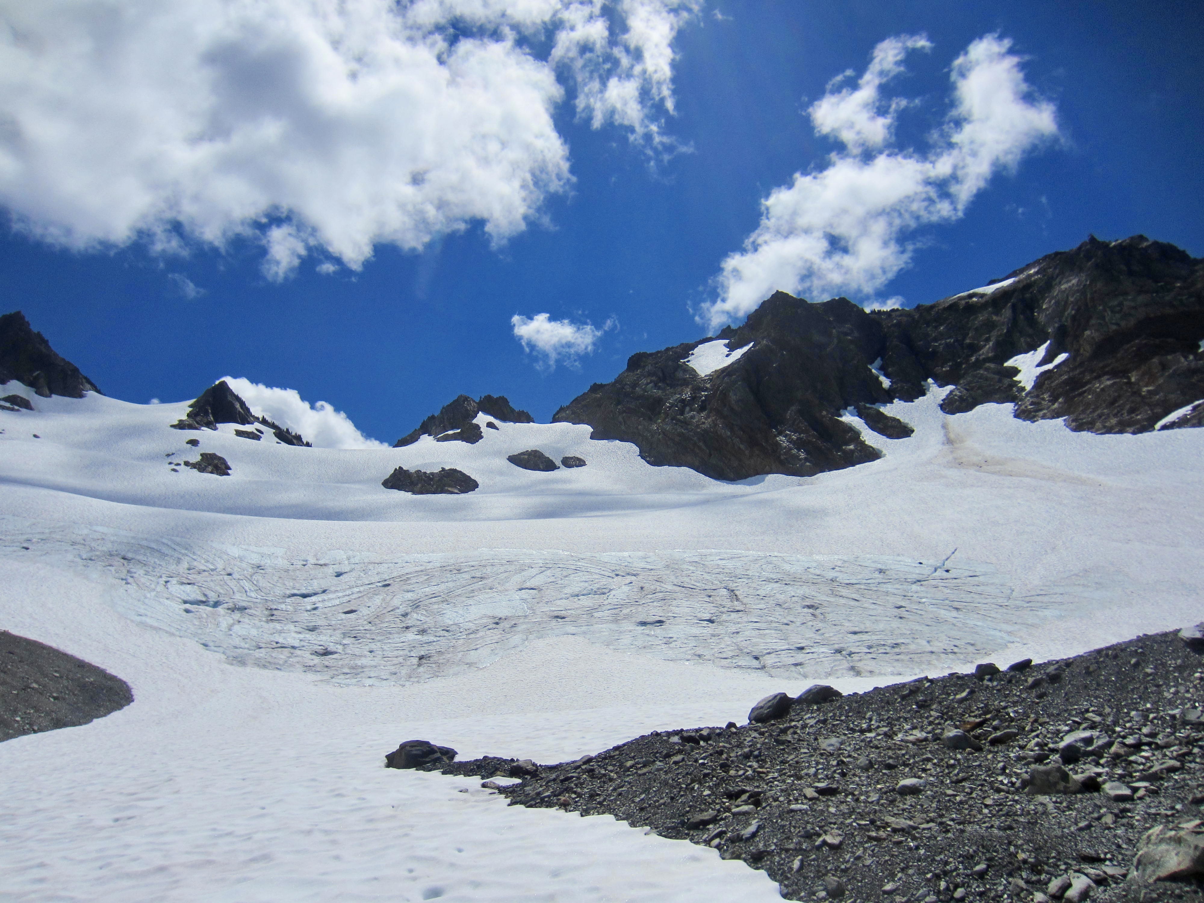
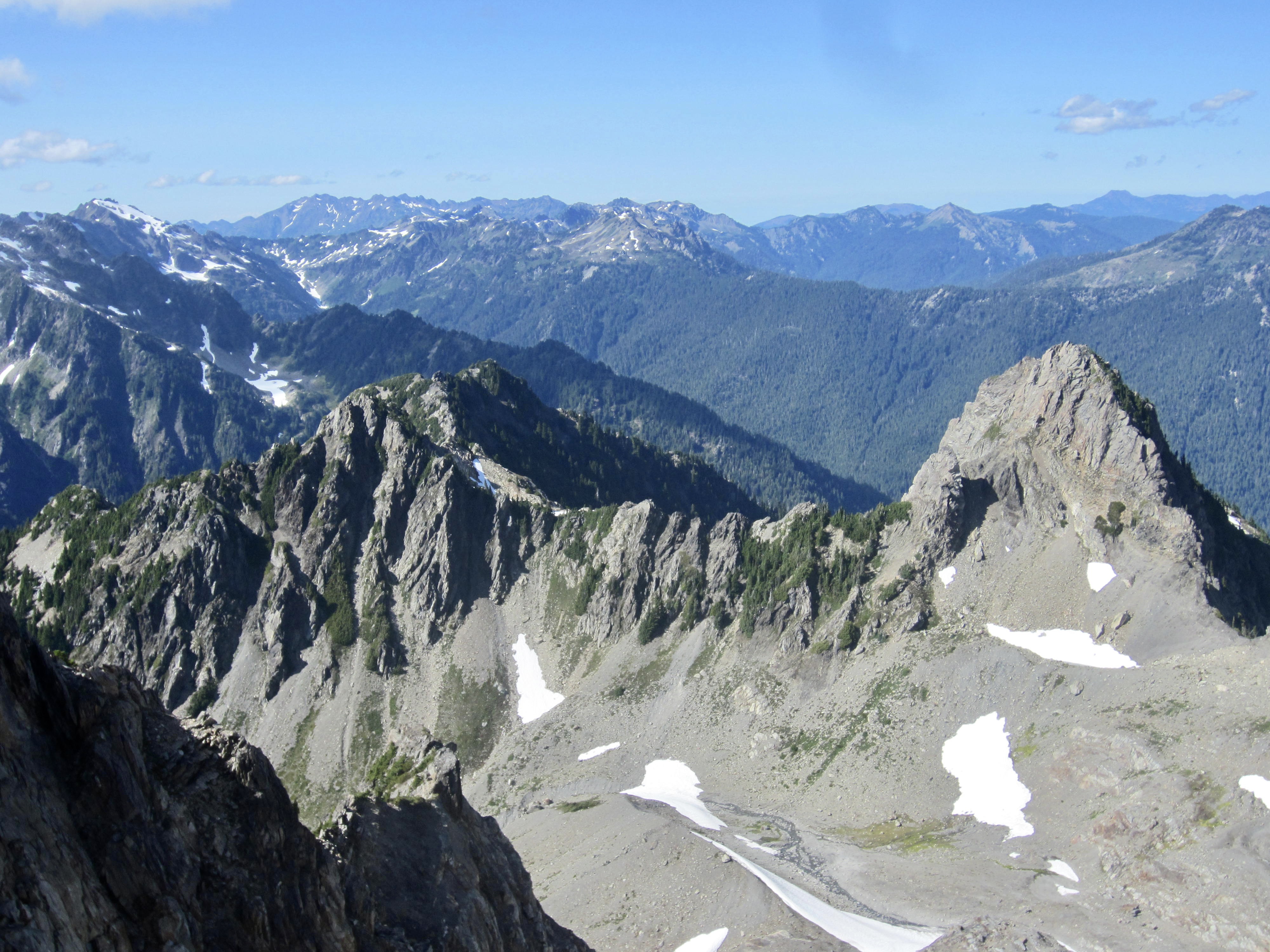
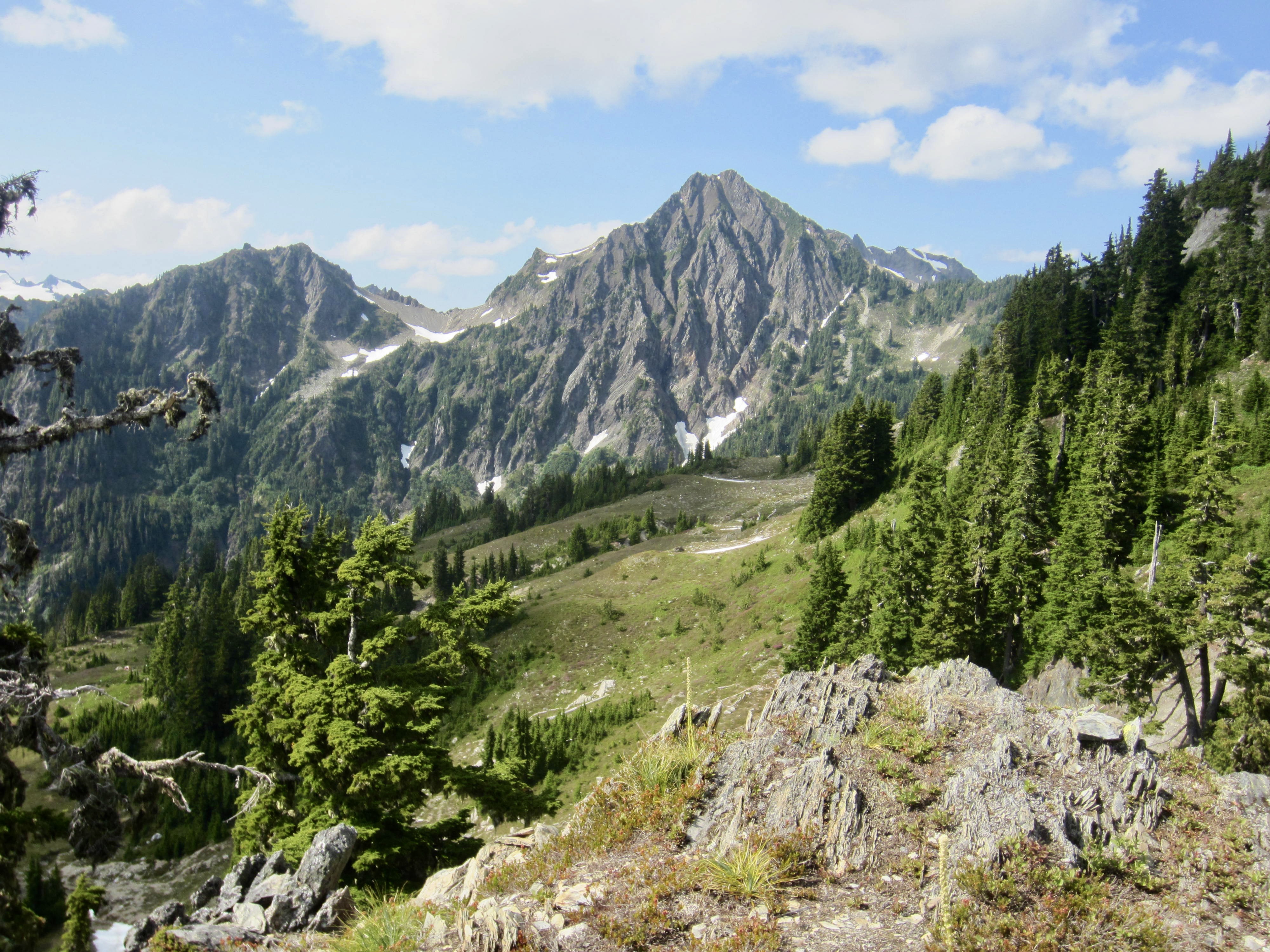
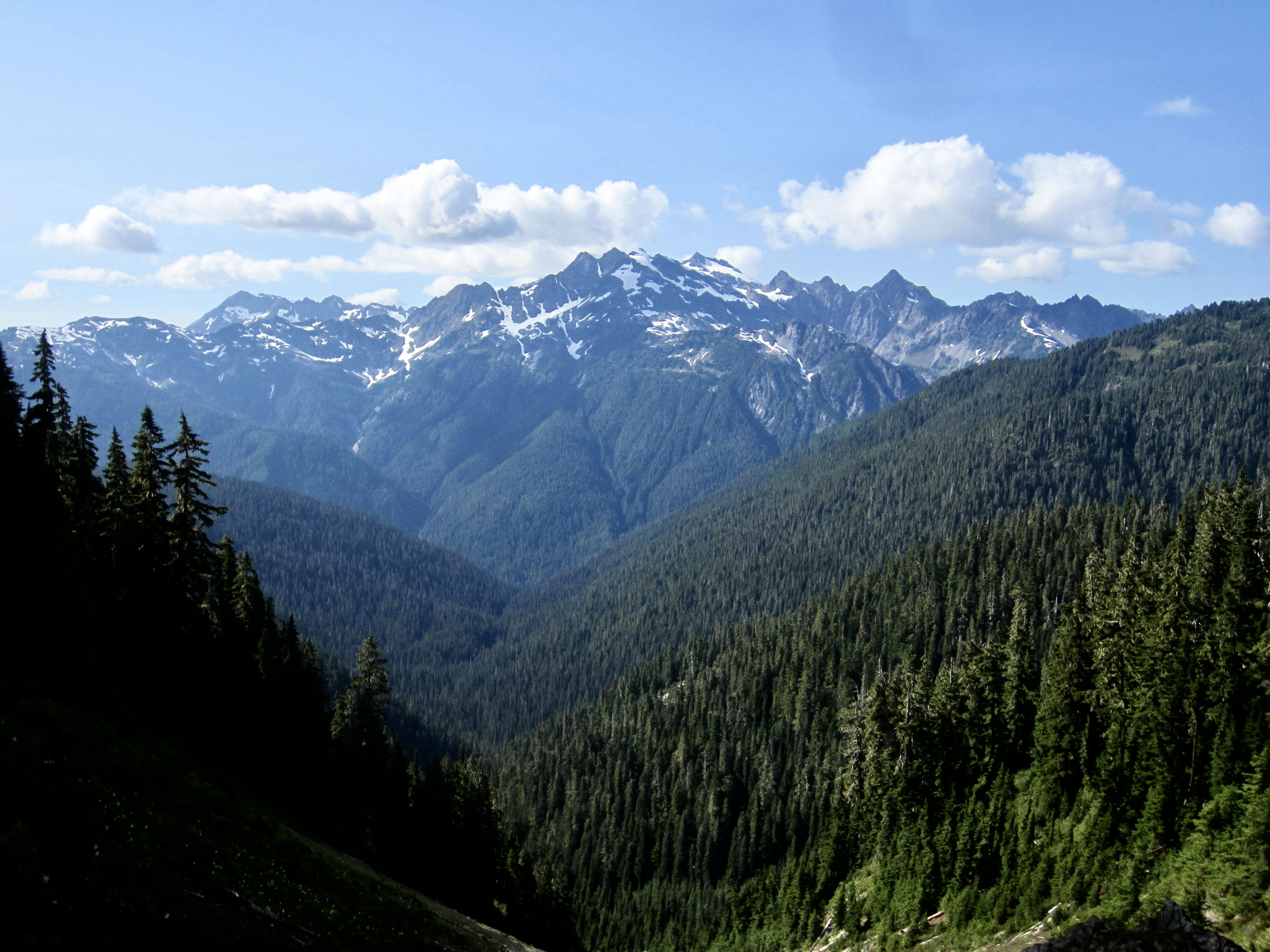
The couloir led us to a 5600-foot ridge saddle (3.5 hours + 2100 feet from Camp 2) with a marvelous view of Mt. Christie’s impressive north side. At a mere 6177 feet, the modest elevation of this mountain belies the fact that it is a complex glaciated massif with multiple peaks and pinnacles.
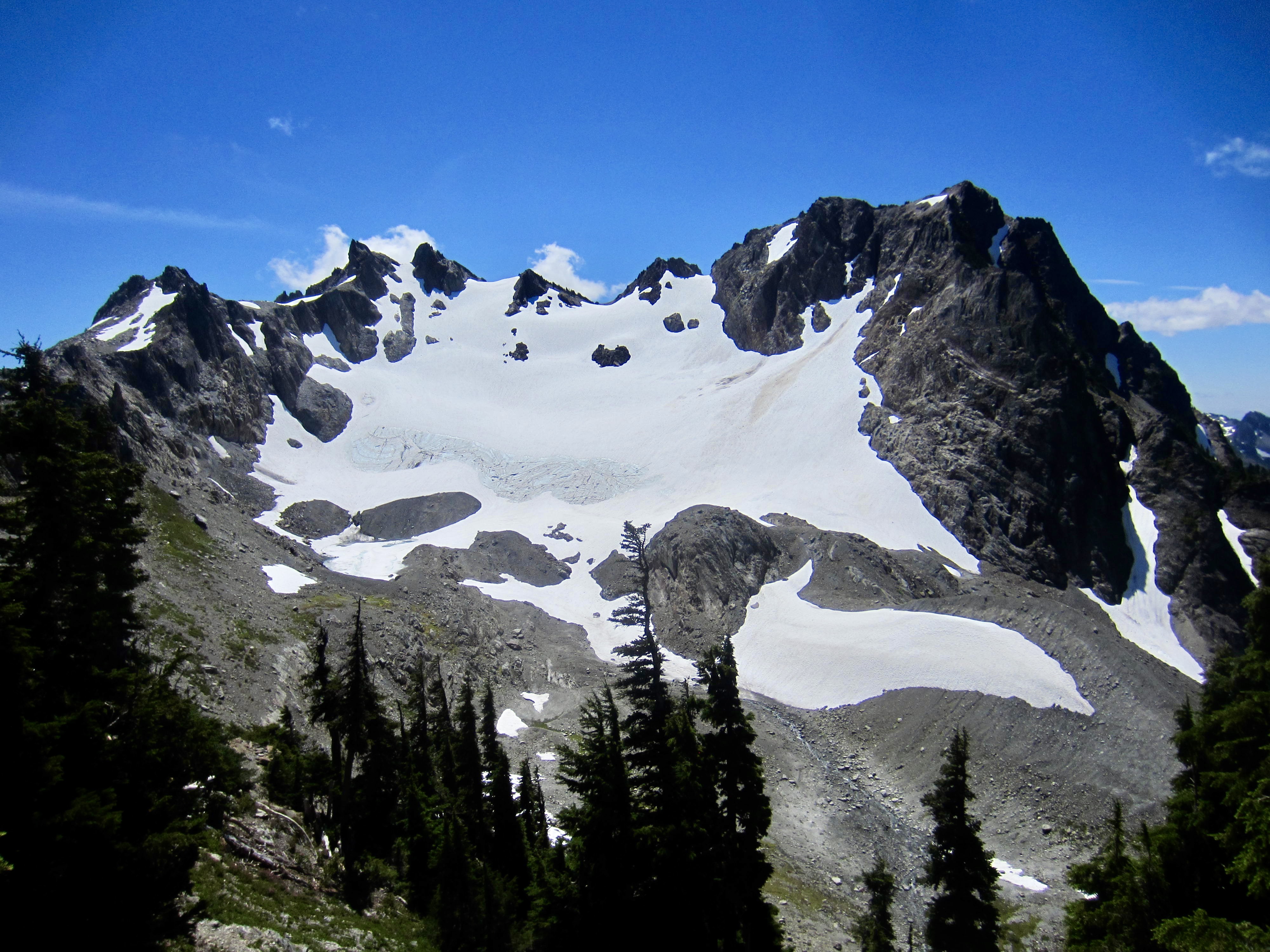
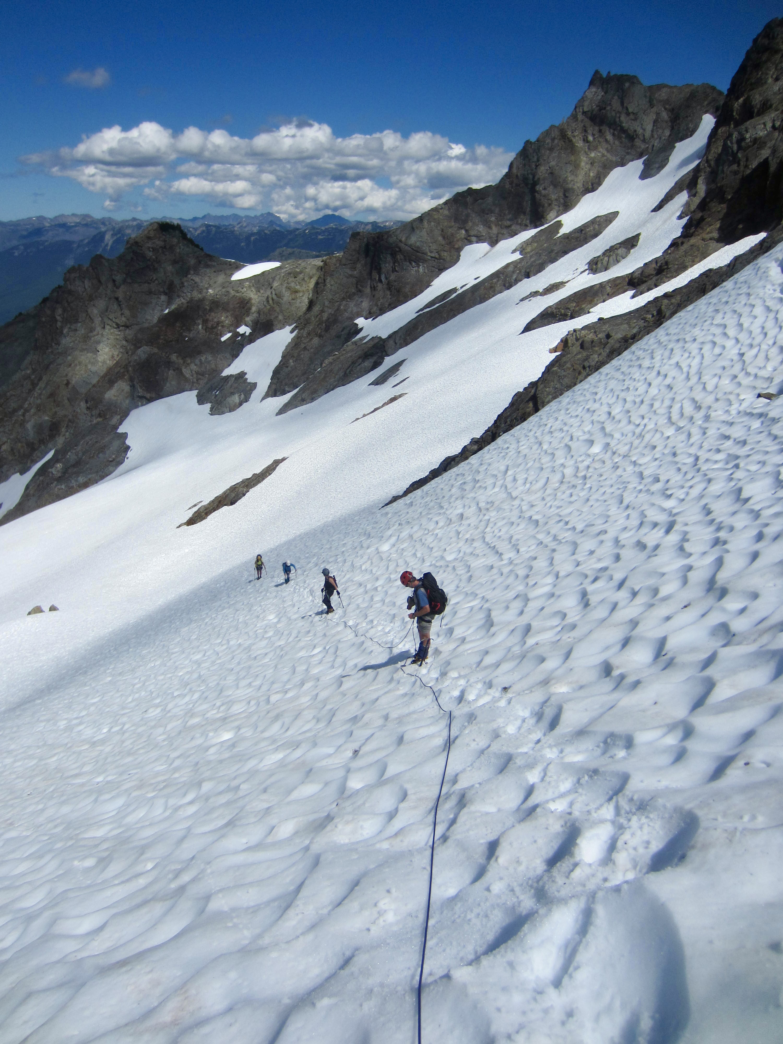
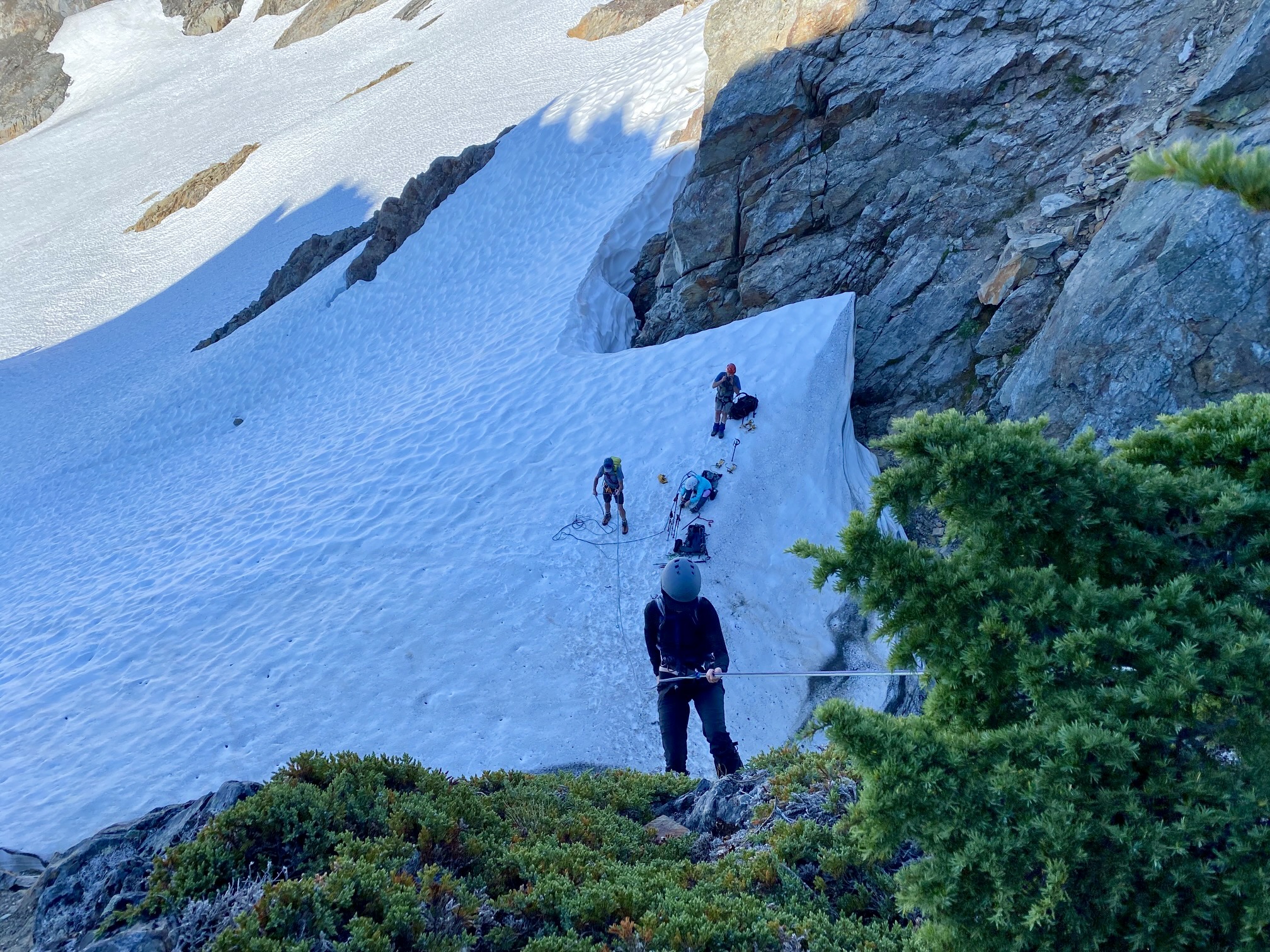
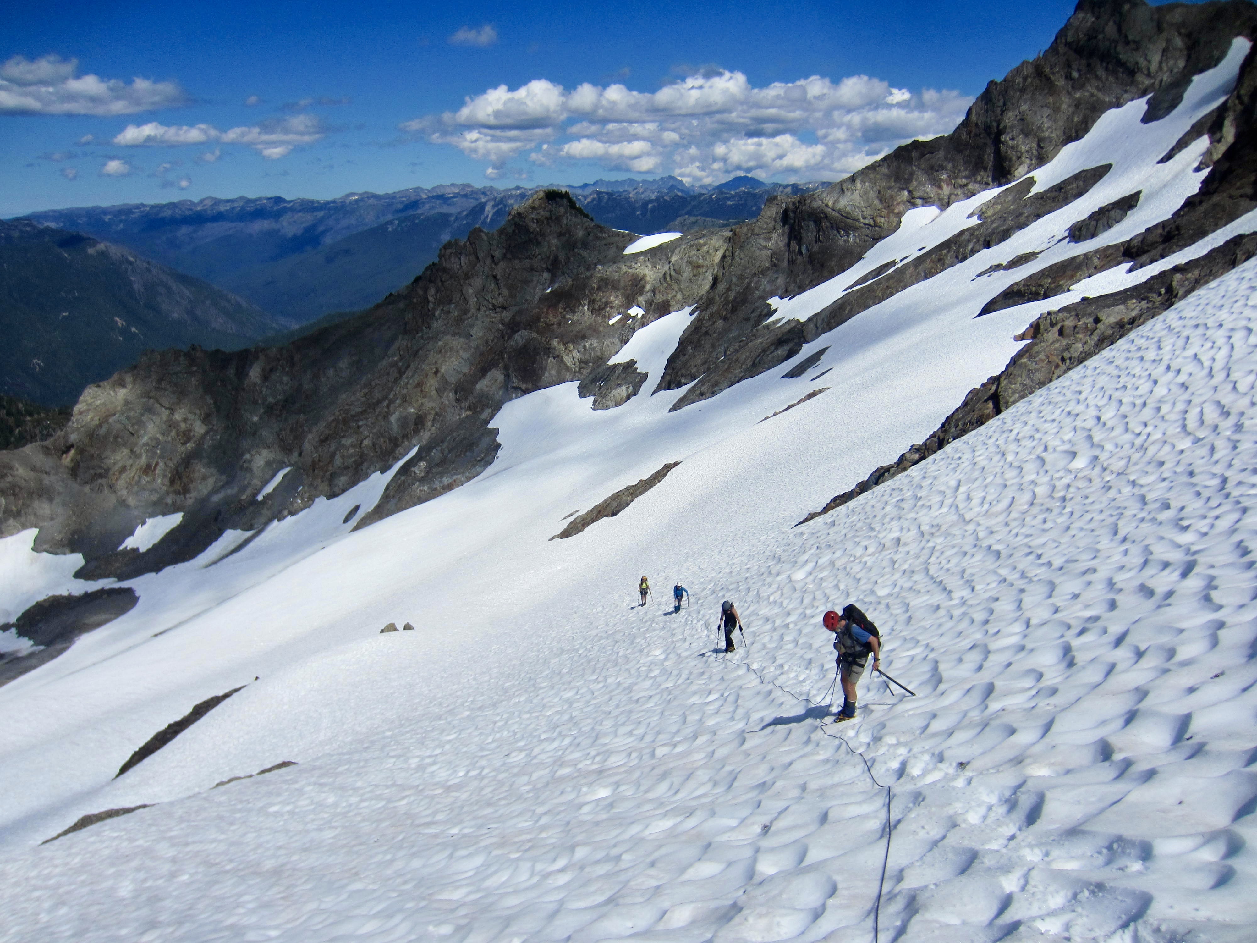
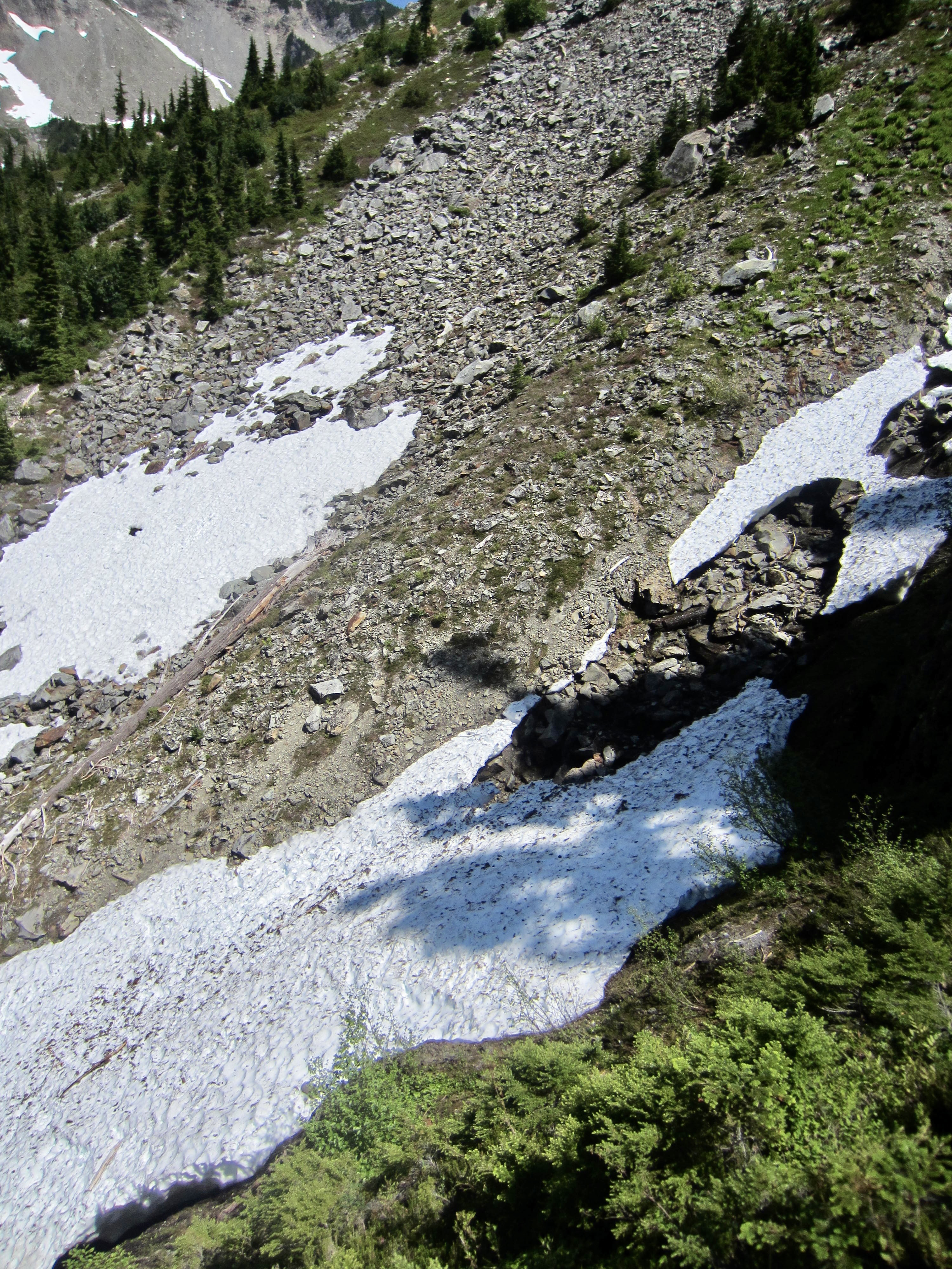
From the ridge saddle, we scrambled down loose, gravelly slopes to reach the lower edge of the Christie Glacier. There did not appear to be any crevasses in this glacier, but the angle was steep enough to prompt us to rope up. Snow conditions were perfect for a crampon ascent.
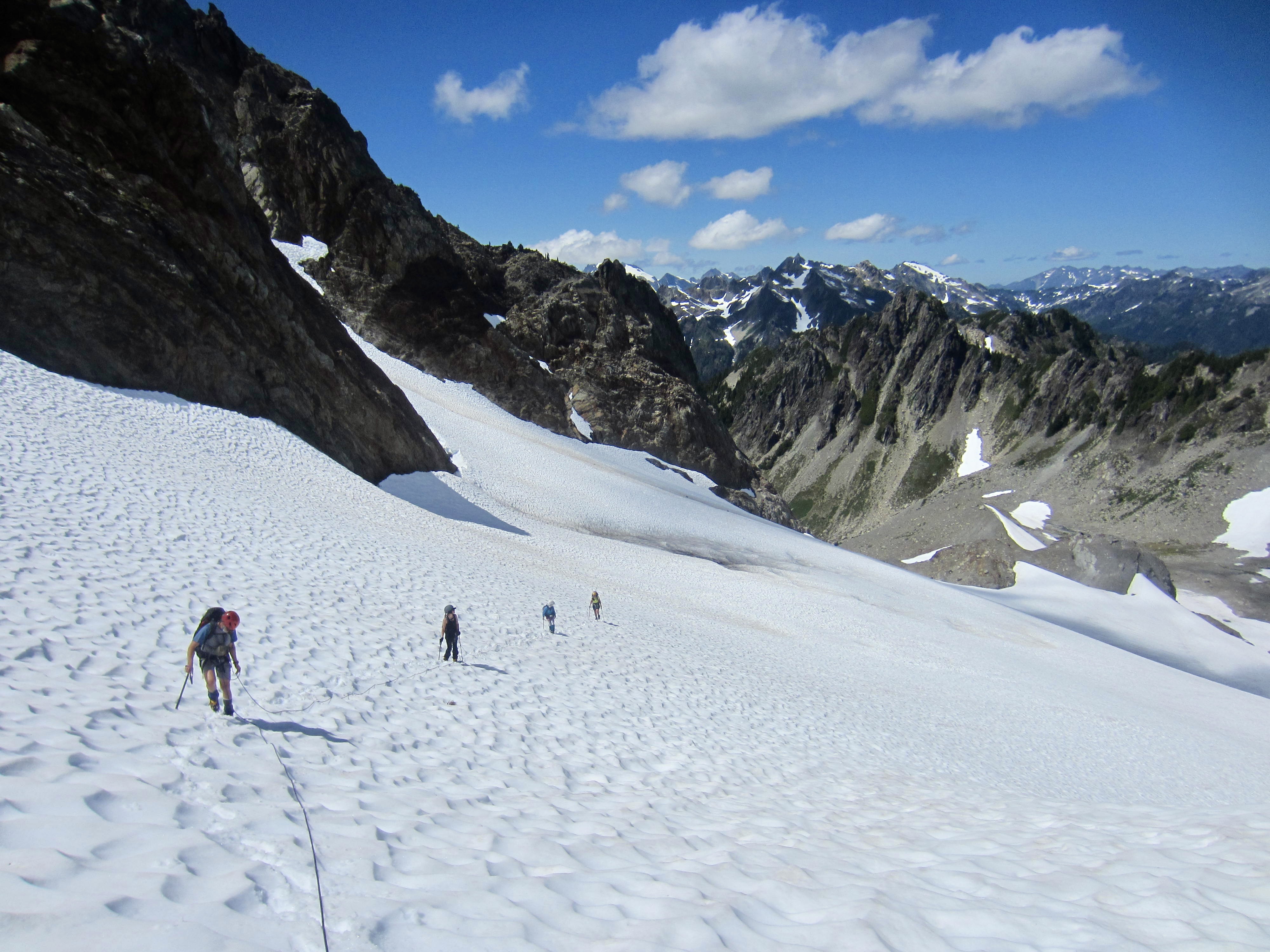
It seemed obvious that we needed to aim for a high col immediately left (east) of the summit block, and this was confirmed by Fay’s trip report. A small moat at the top of the glacier was easily crossed to reach the col. Our climb had gone quite smoothly up to this point, but then things changed dramatically.
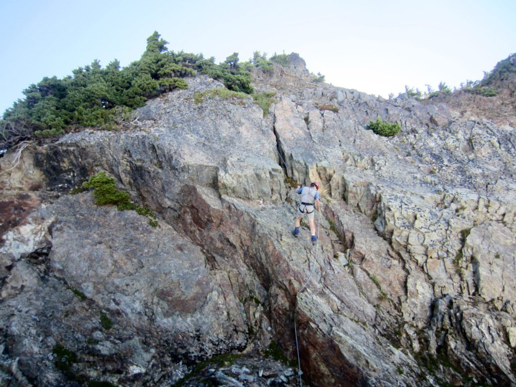
We all expected an easy summit scramble out of the col; instead we were greeted with a chossy, eroded cliff that ranged from very steep to overhanging! To make matters worse, the cliff funneled down to a super-steep dirt gully that plunged for hundreds of feet. It was a truly ugly climbing prospect, but there did not appear to be any alternative.
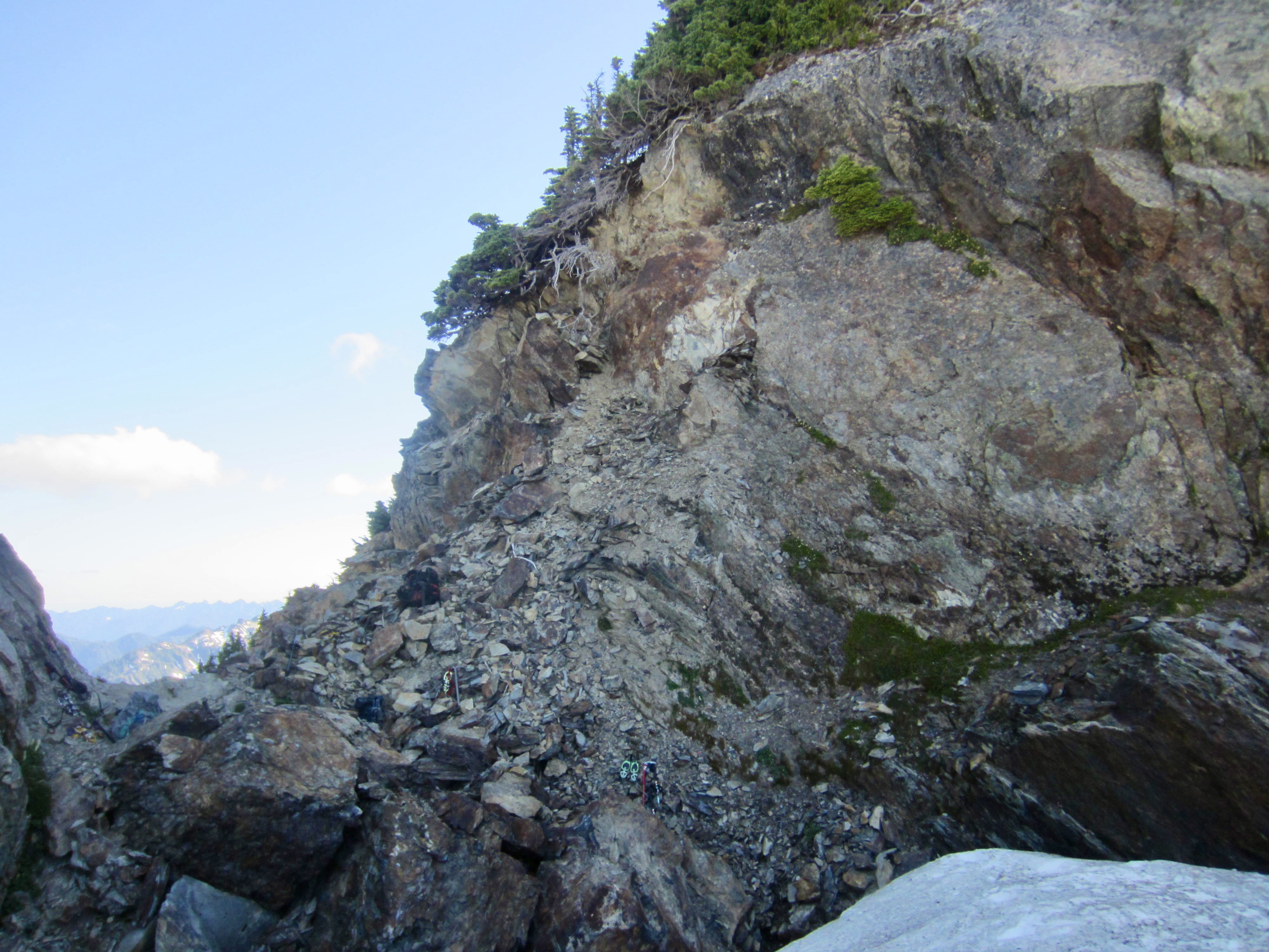
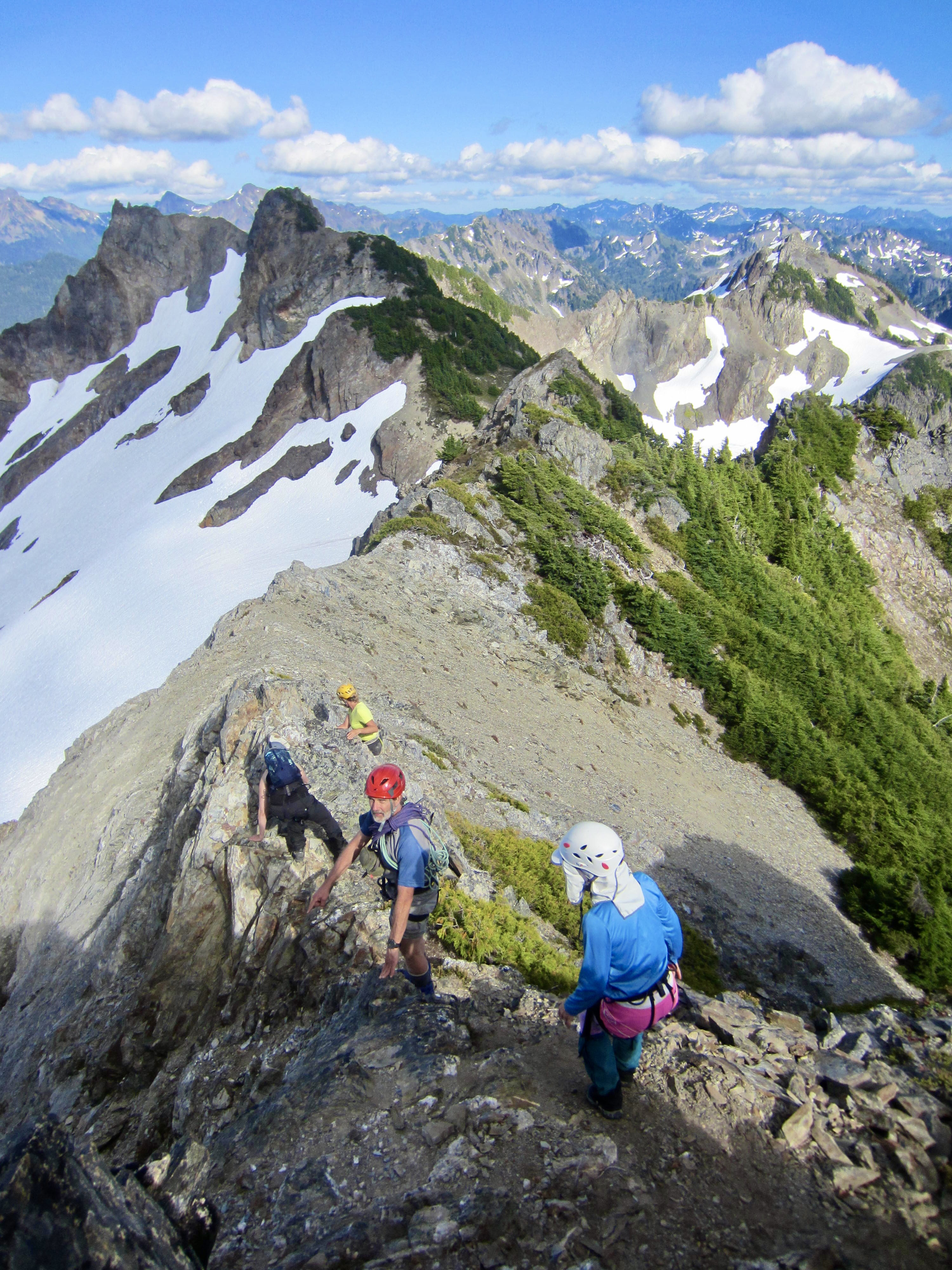
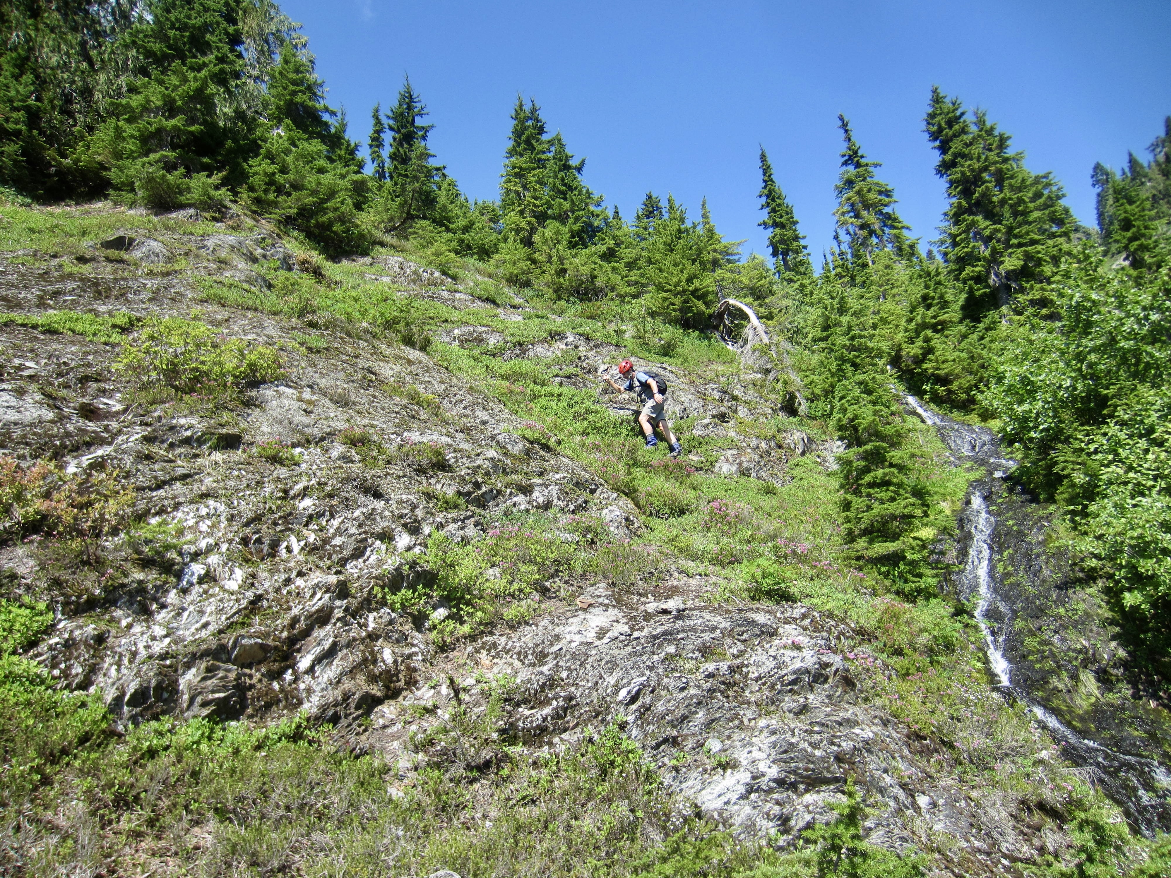
I spent a half hour checking out three different possible routes through the cliff, going back and forth between them, fussing and fretting over the horribly shattered rock, severe exposure, and lousy protection. Eventually, I chose to make a horizontal leftward traverse on a rotten ledge, carefully checking each handhold and foothold. Half of the holds were loose, and some broke off easily, tumbling down the gully and sending up big clouds of dust. After traversing out about 25 feet, I was able to climb straight upward for 15 feet and establish a belay anchor on a small tree trunk. The climbing was never more than Class 4, but it was the diciest series of moves that I’ve had to make in many years!
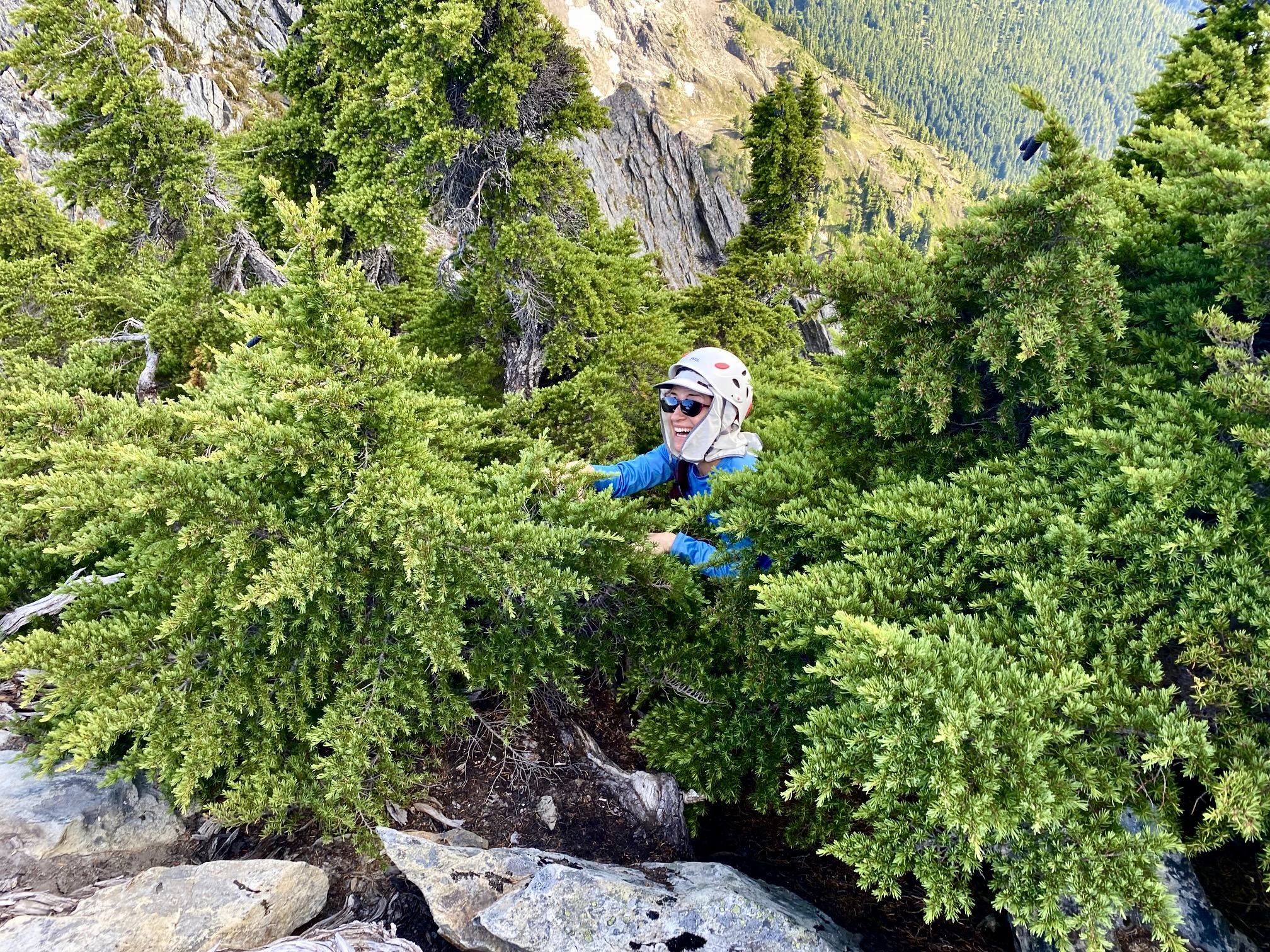
My partners came up to the belay stance one by one, after attacking the cliff climb in various ways. It was a relief to surmount that obstacle, but now we had another obstacle of an entirely different sort: a huge, steep patch of krummholz. Sheesh! Upward progress required a strenuous uphill swimming technique that was equal parts comical and frustrating.

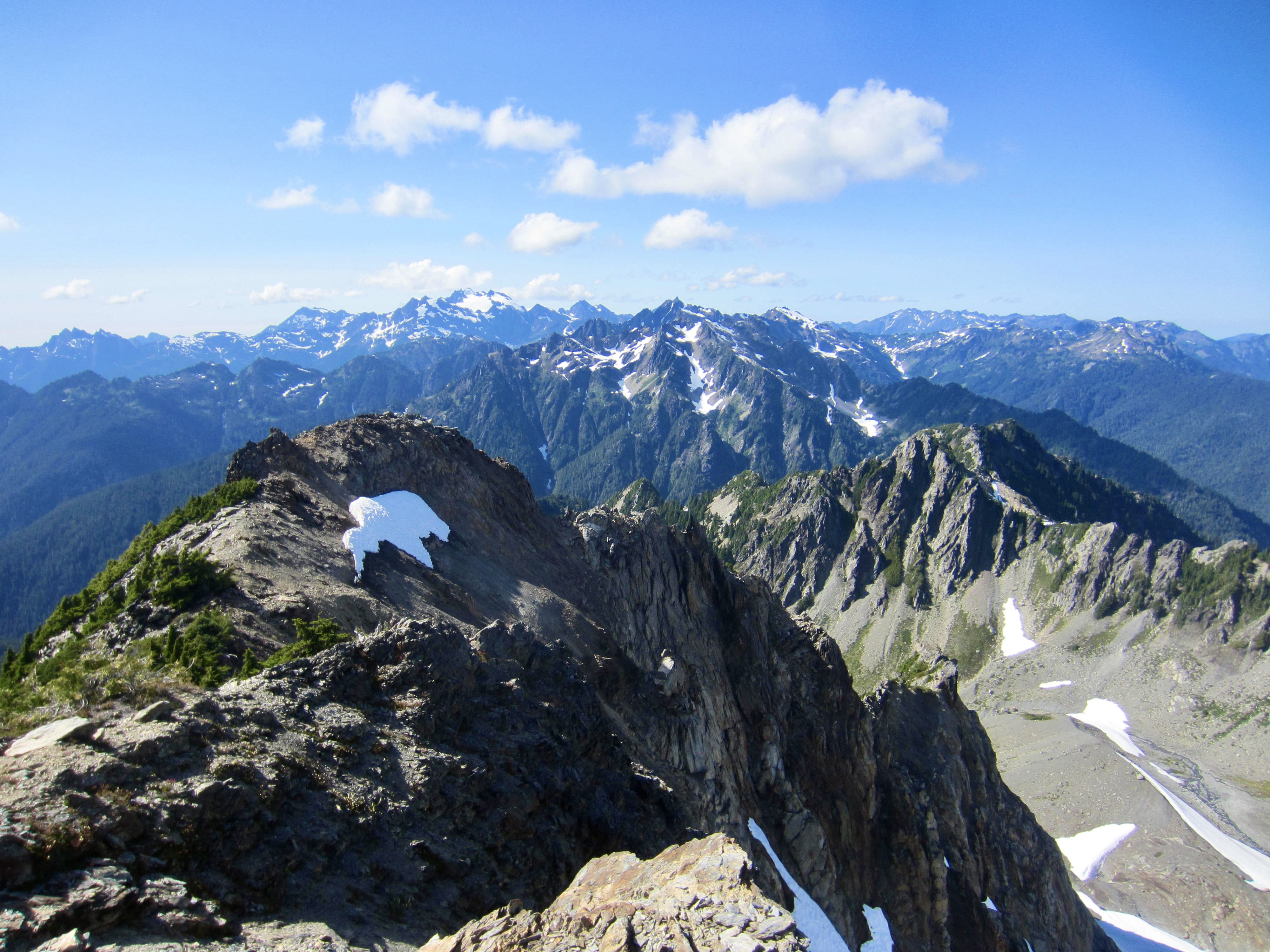
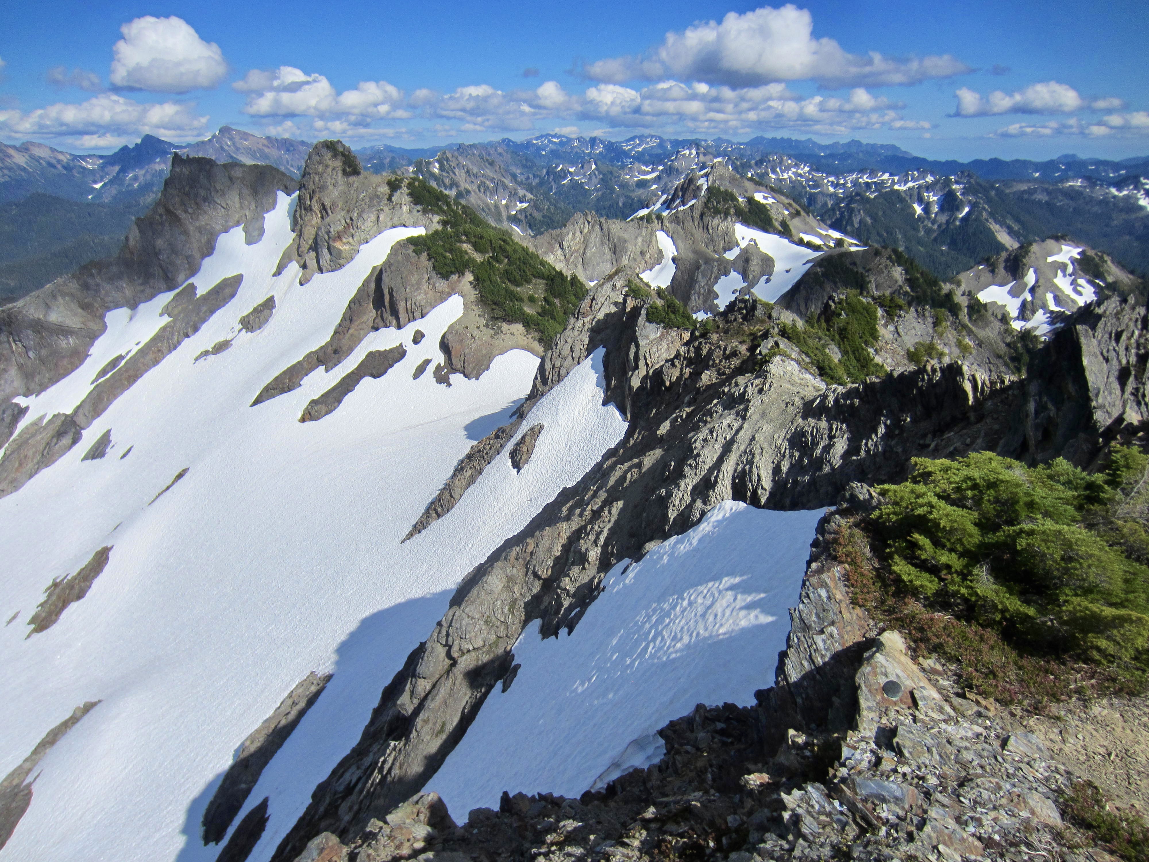
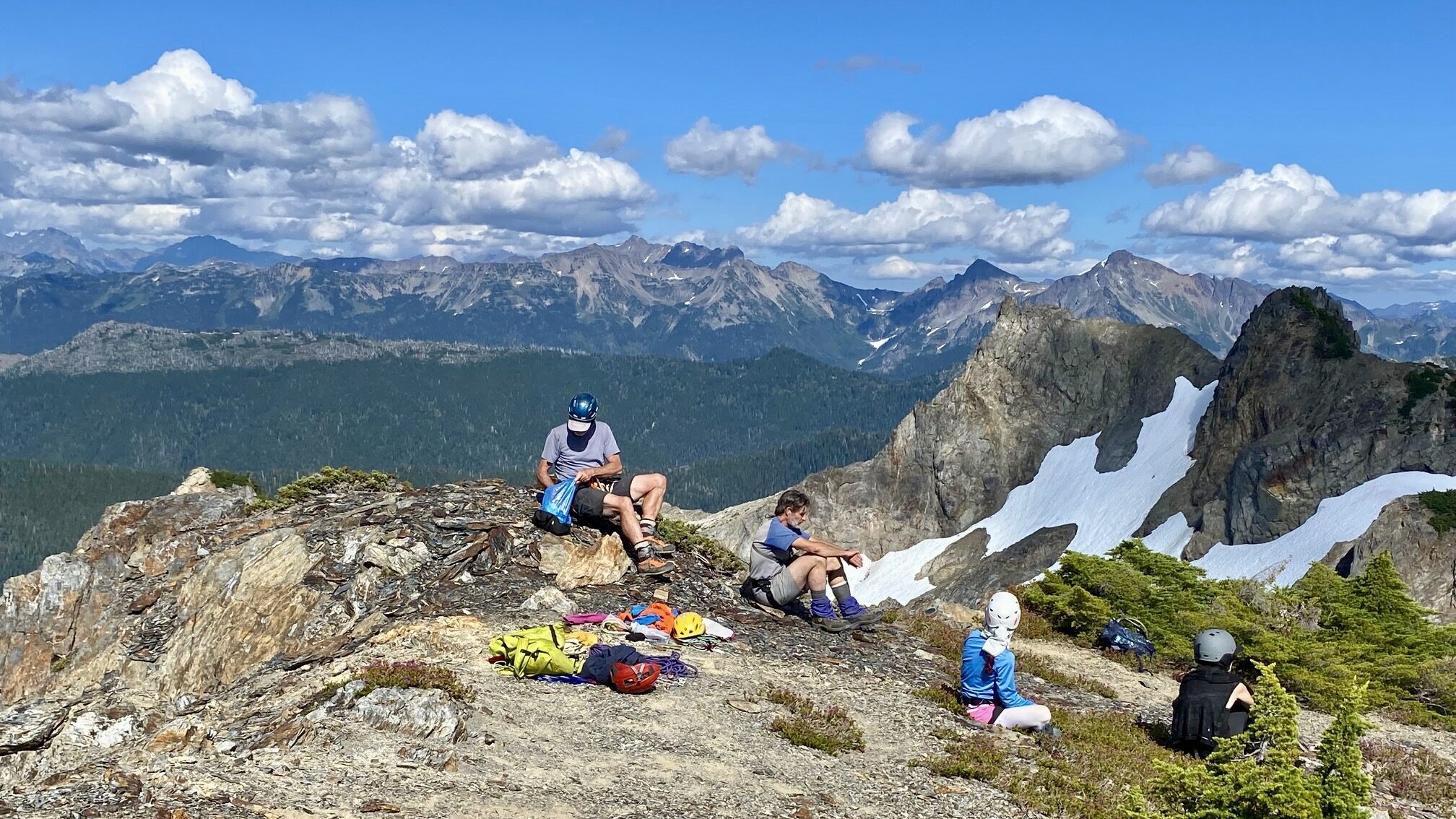
Once past the krummholz, we made a Class 2-3 scramble along the southeast summit ridge and were all on top by 4:20pm (7.4 hours + 3000 feet from Camp 2). The clear air allowed long-range views in all directions.


Fay’s summit register indicated that Mt. Christie sees two or three parties per year, but nobody mentioned any difficulties. Our conclusion was either that a large chunk of rock above the high col peeled off in the past year, or that this year’s snowpack at the col is 10 to 20 feet thinner than normal. In either case, it drastically changed the character of the climbing route.
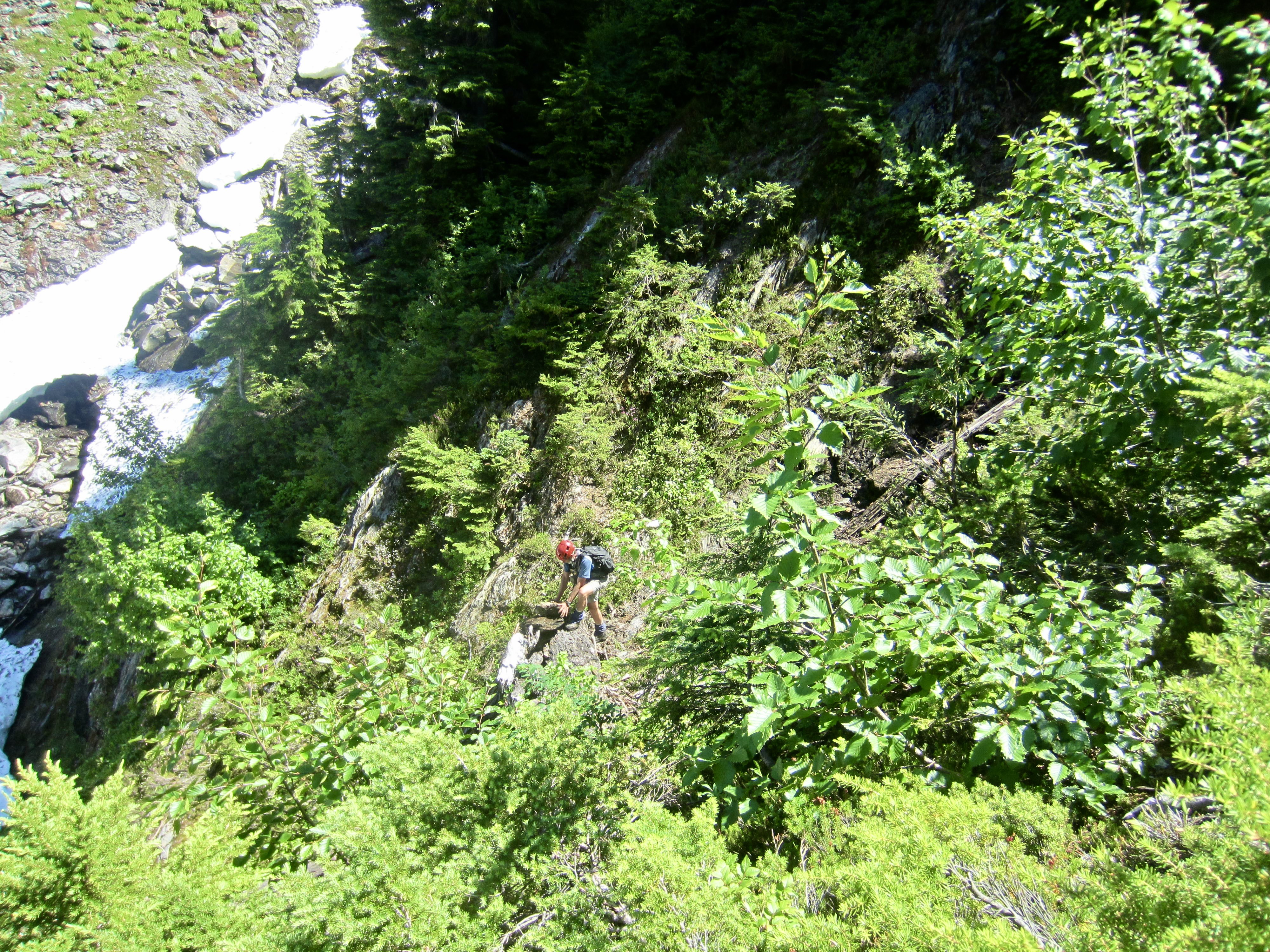
For our descent, we scrambled back down the southeast ridge, battled through the krummholz, and then made one 50-foot rappel down to the col. The absence of any rappel slings above the cliff reinforced our conclusion that the terrain here has changed very recently.

The remainder of our descent was fairly uneventful, and we located the trail in Lower Martins Park just as darkness fell. Our hike back to Low Divide should have been uneventful too, but having to share three headlamps between the five of us resulted in very slow progress. It was 11:00pm when we finally reached our camp (6.2 hours + 400 feet from summit) to end an unexpectedly long 14-hour climb.
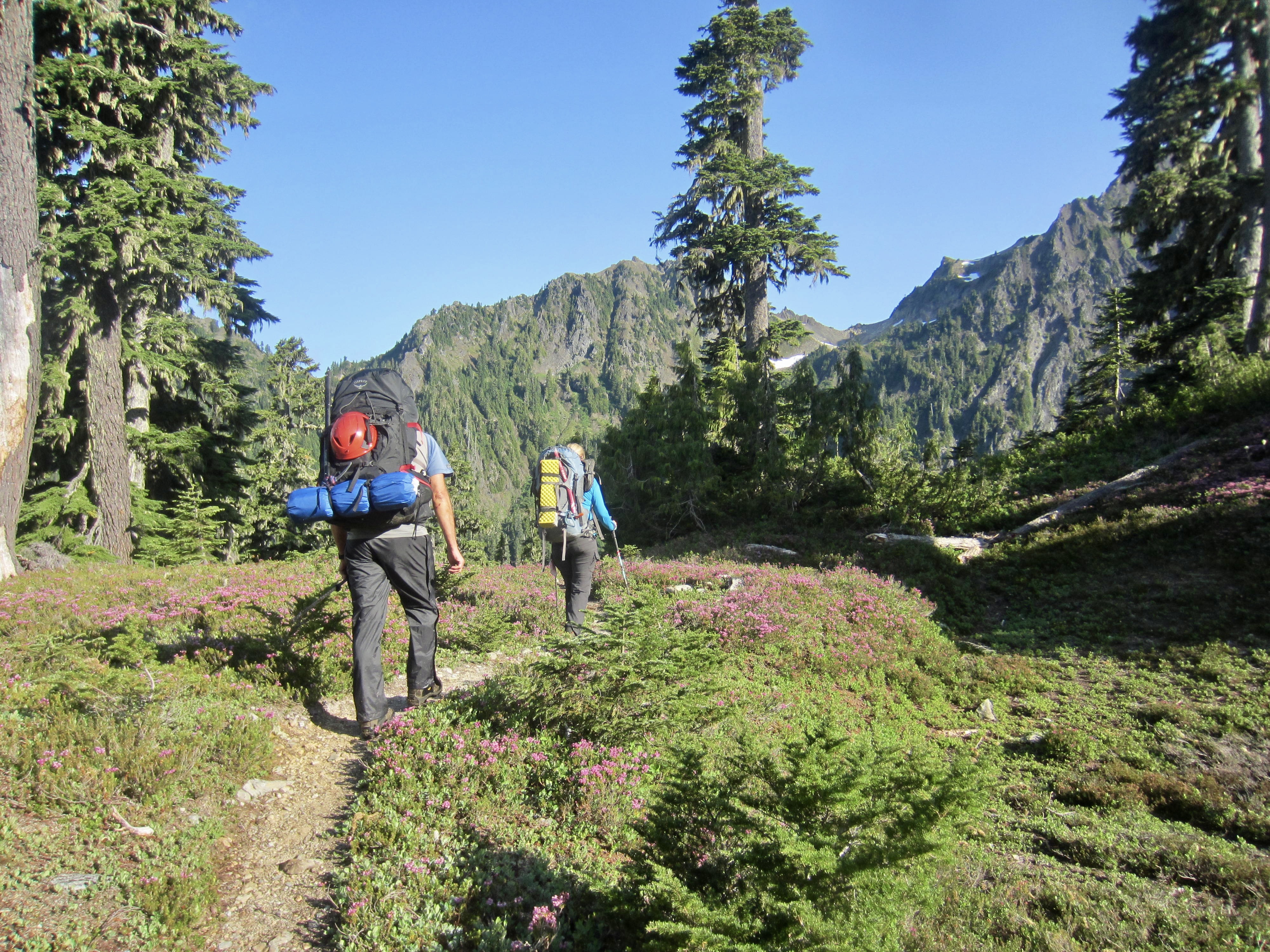
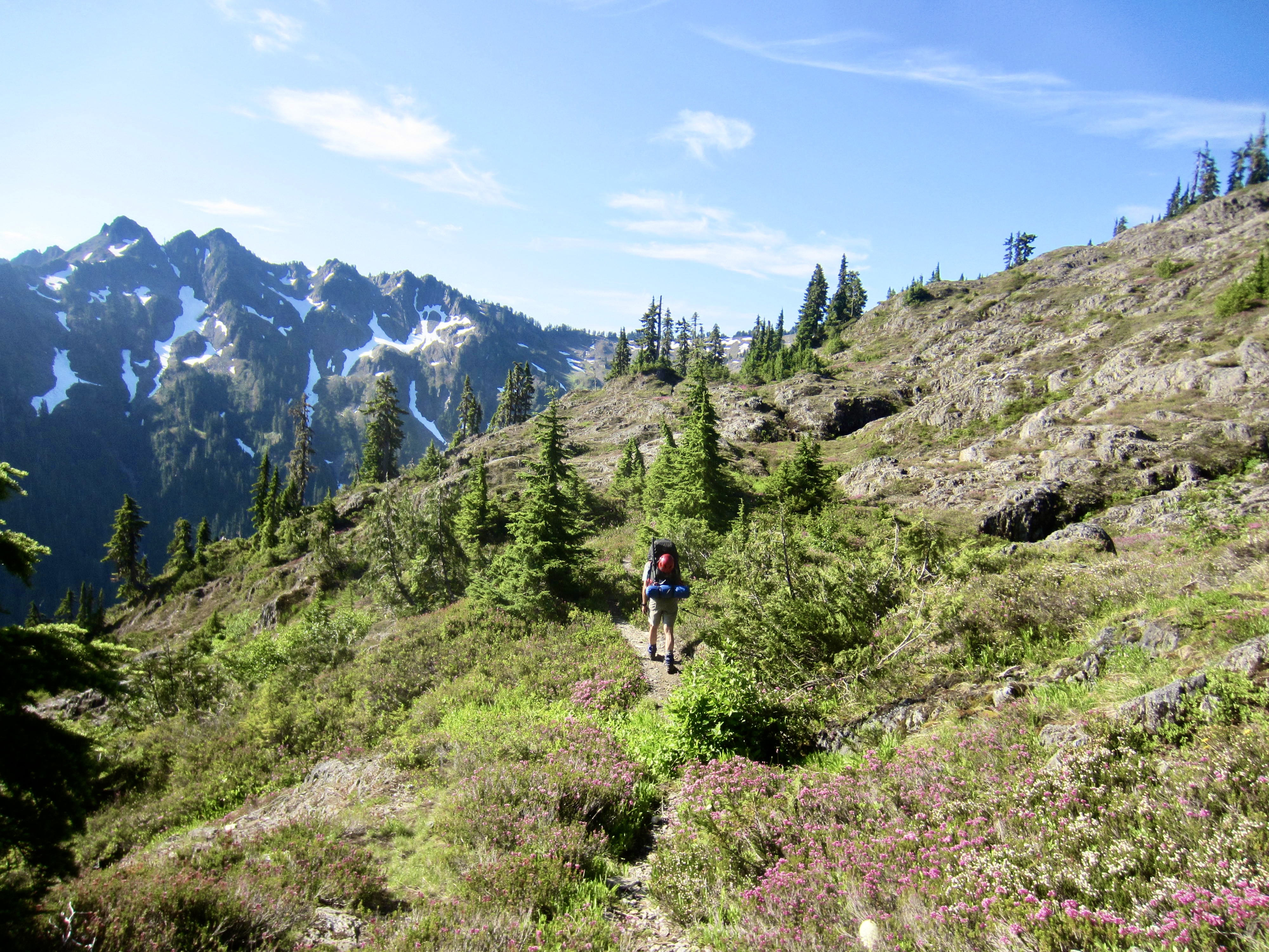
Day 4: Renegade / Low Divide Camp to Seattle Meadows
Our camp slowly came alive with the morning sun, and we fine-tuned our two separate plans while eating breakfast. Anna and Engre planned to spend the next two days hiking back down to the trailhead, stopping at one of the river campsites along the way. They graciously agreed to carry out some of our excess climbing gear.
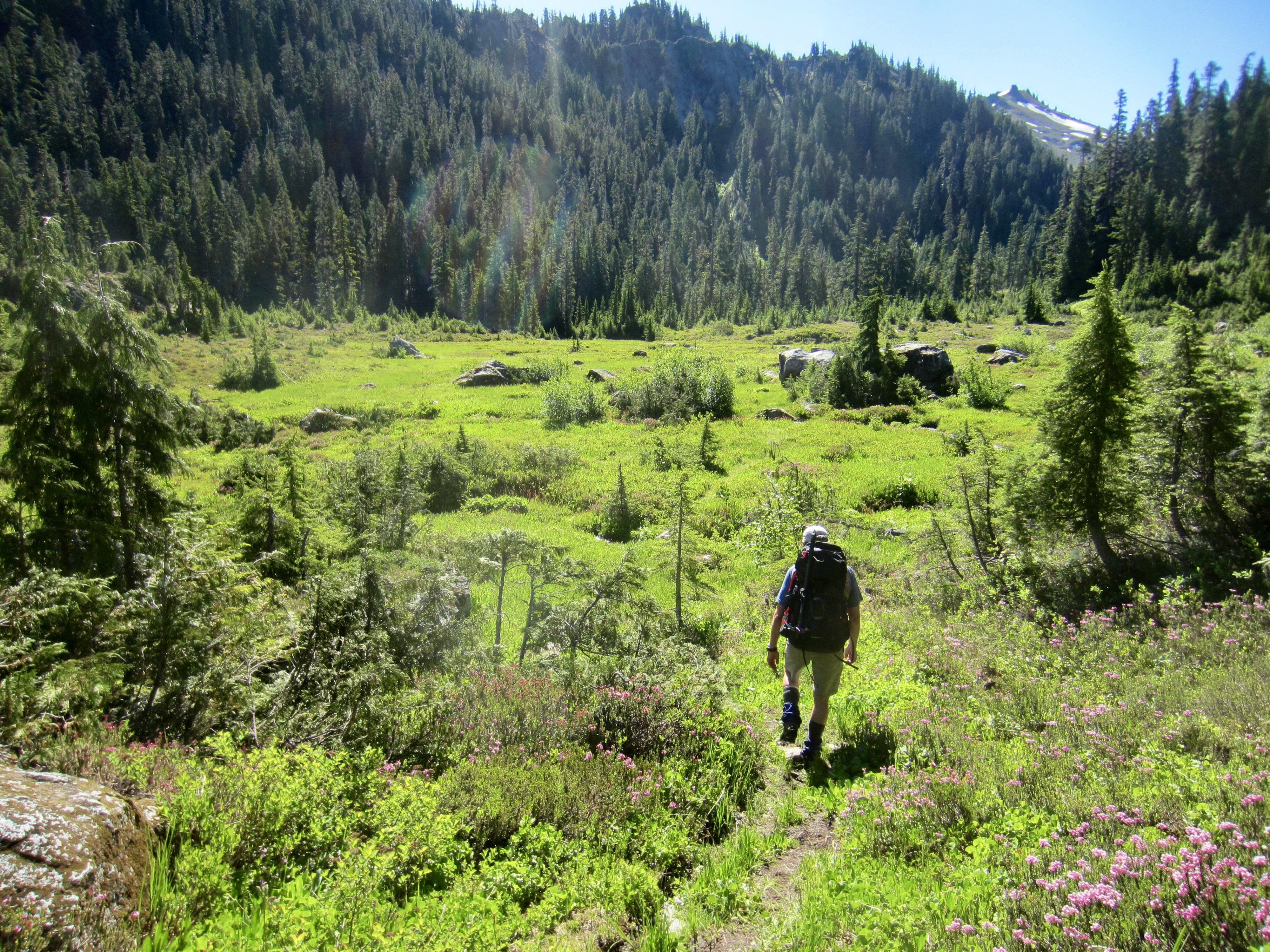
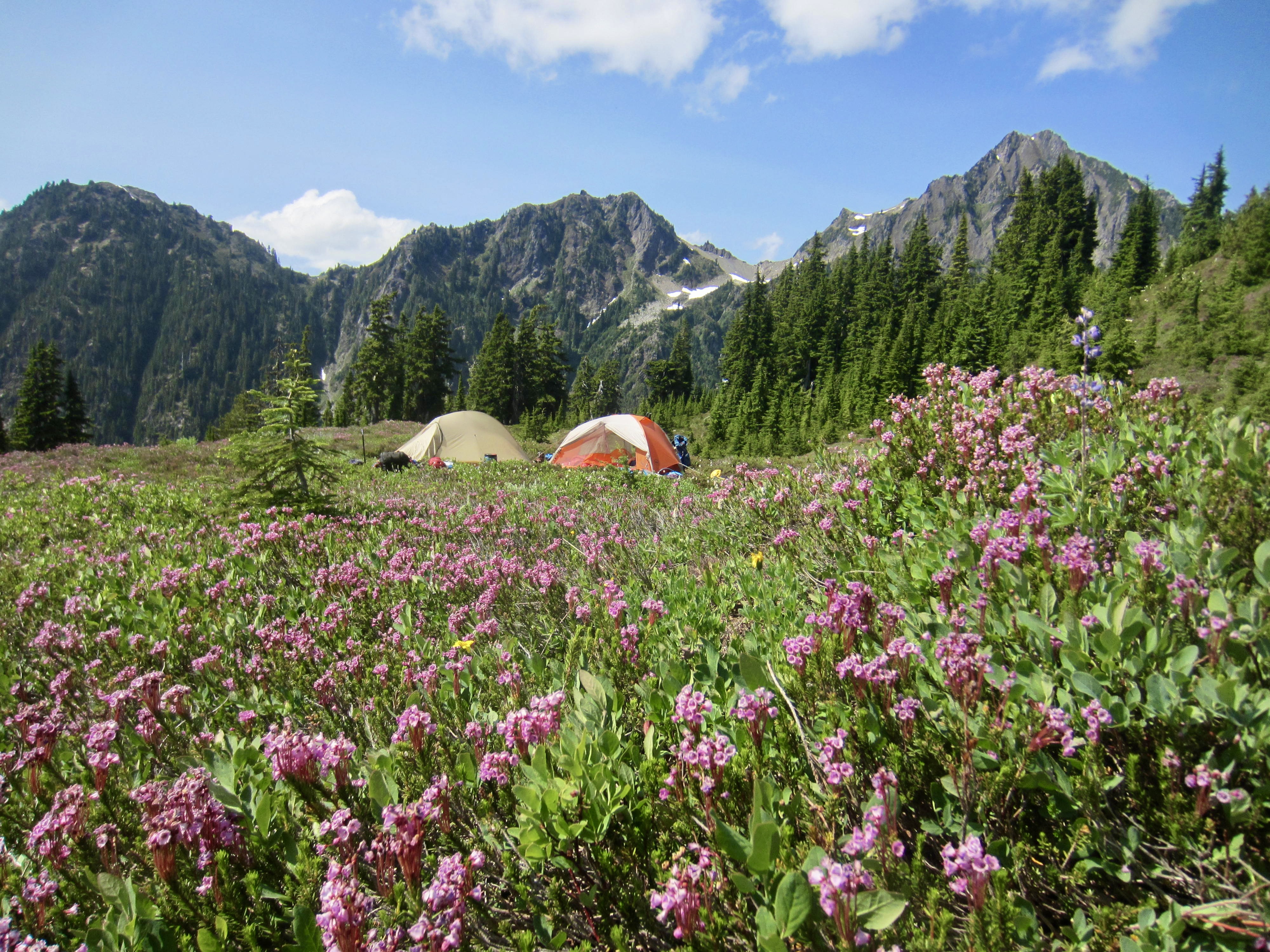
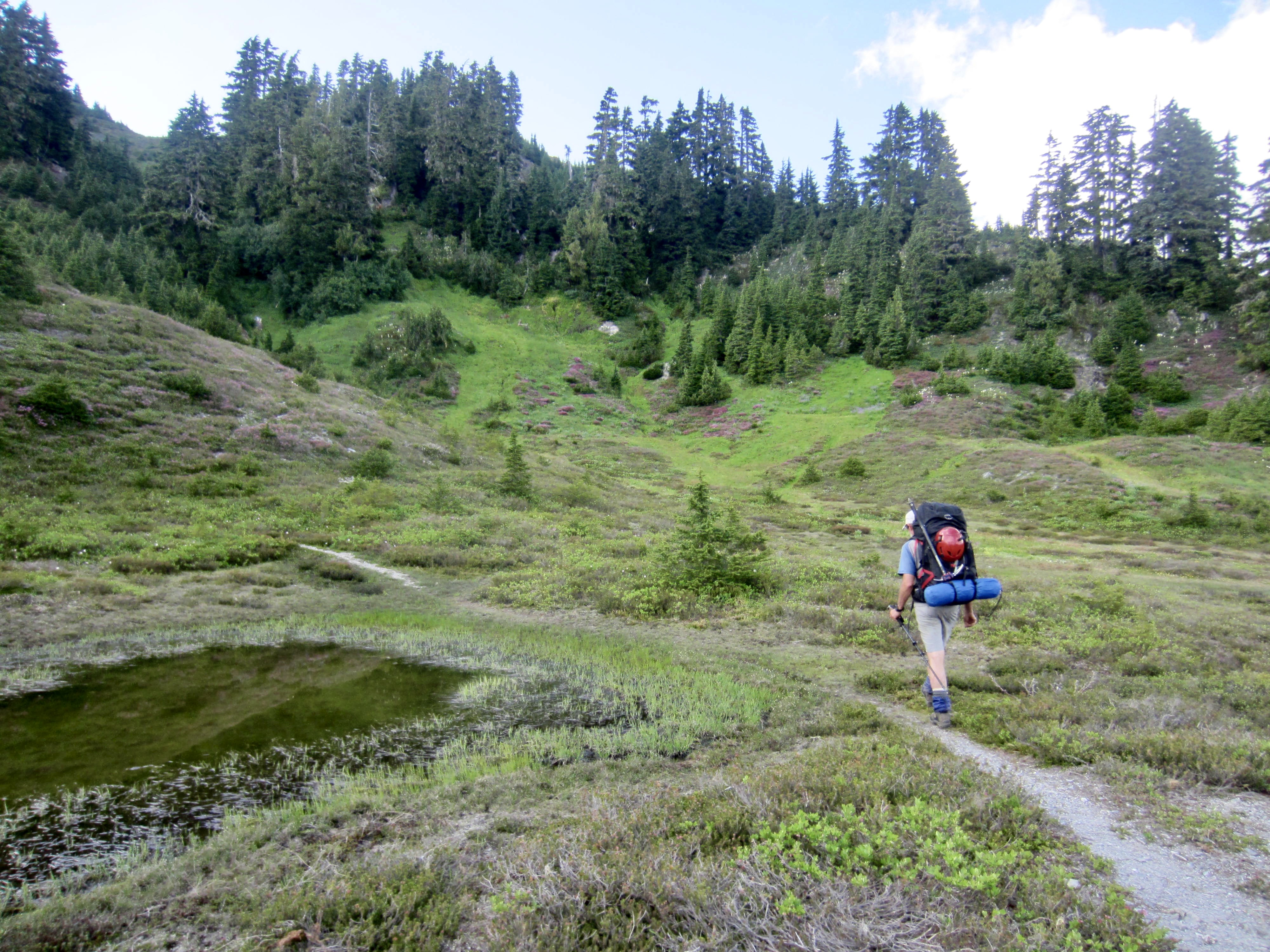
Greg, Eileen, and I had originally planned to hike down to Chicago Camp and then ascend to Queets Basin today, but yesterday’s long climb had thrown a monkey wrench into our schedule and motivation. We instead decided to spend the next four days hiking out the Skyline Trail and making a reconnaissance sidetrip to Saghalie Basin. Today would merely involve moving camp 3½ miles up to Seattle Meadows. By early afternoon, we had Camp 3 established in the meadows near a diurnal stream at 4700 feet (3.2 hours + 3.3 miles + 1200 feet from Camp 2).
While Eileen rested in camp, Greg and I took a short hike and scramble up nearby Point 5015. This rocky knob provided a nice view of Mt. Christie to the southeast and Mt. Noyes to the northwest.

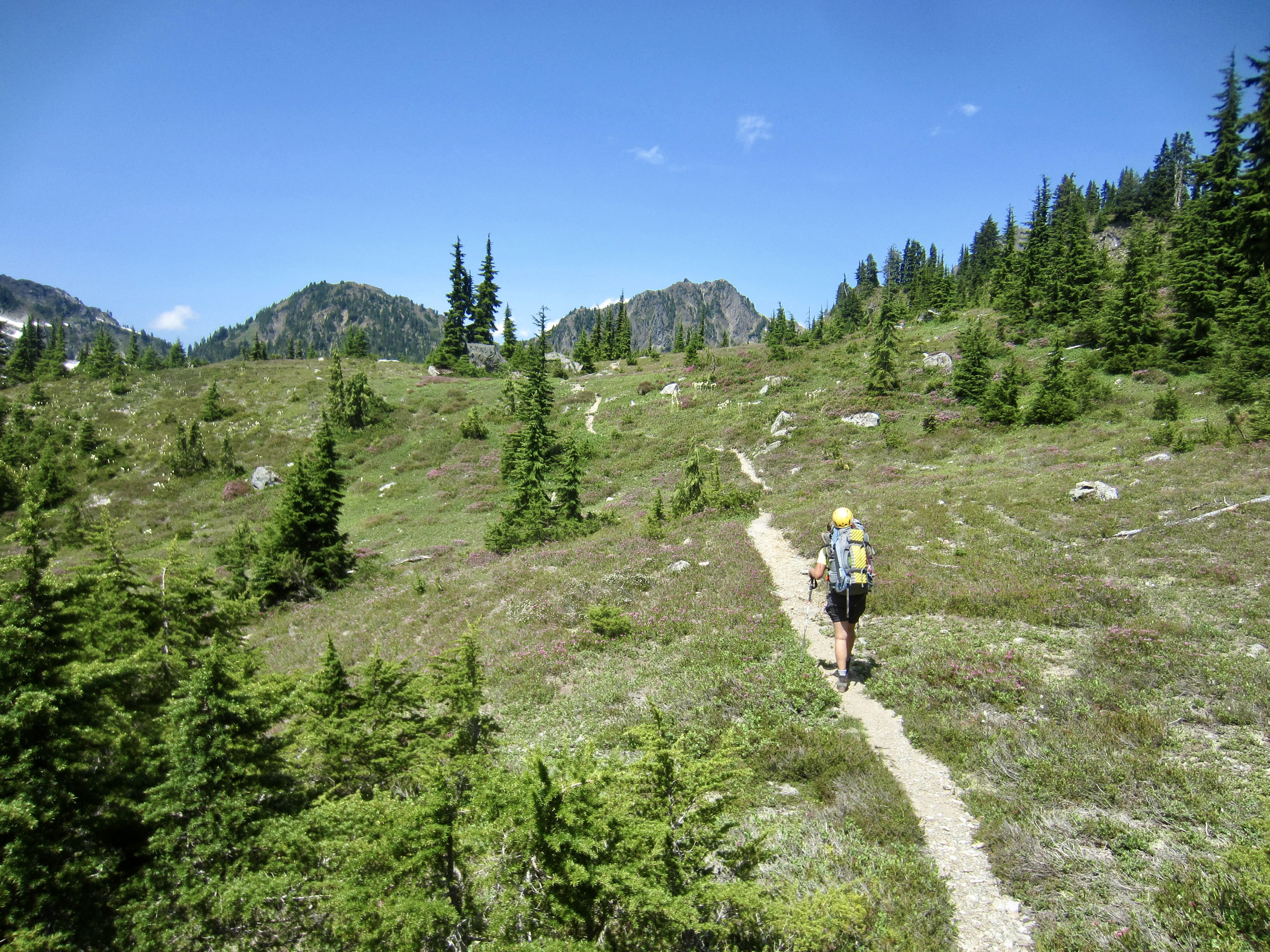
Day 5: Seattle Meadows to Lake Beauty + Saghalie Basin Sidetrip
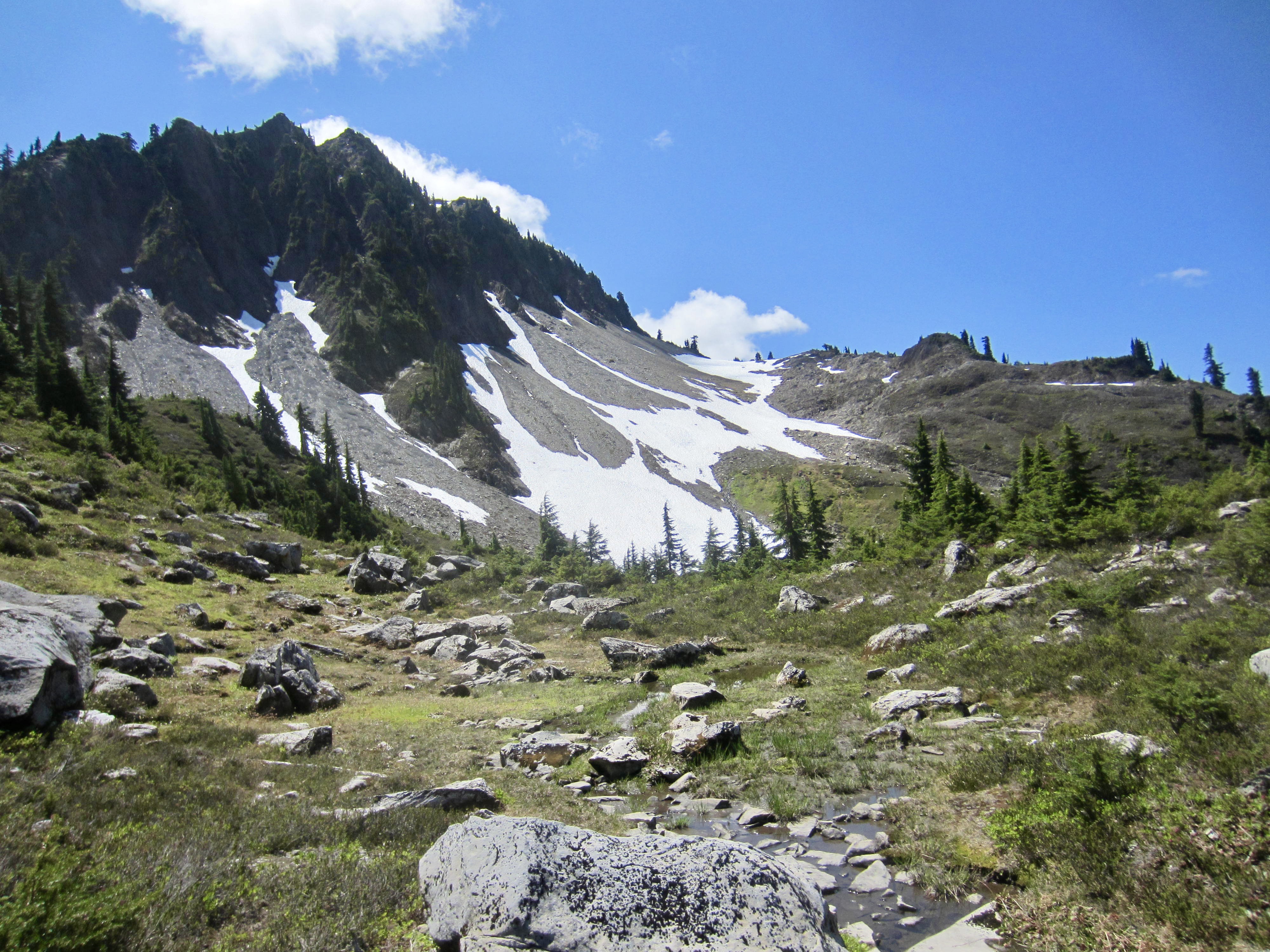
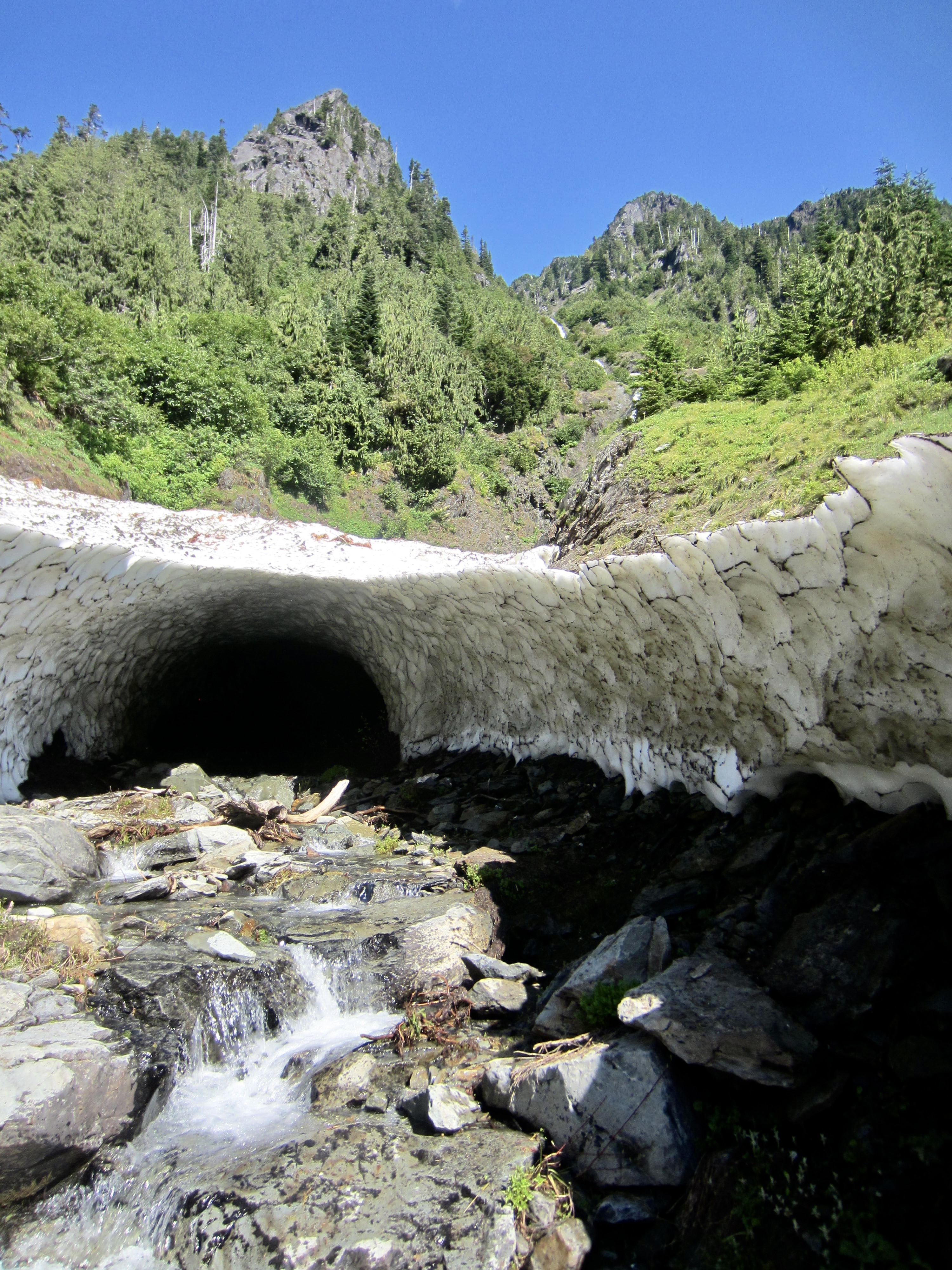
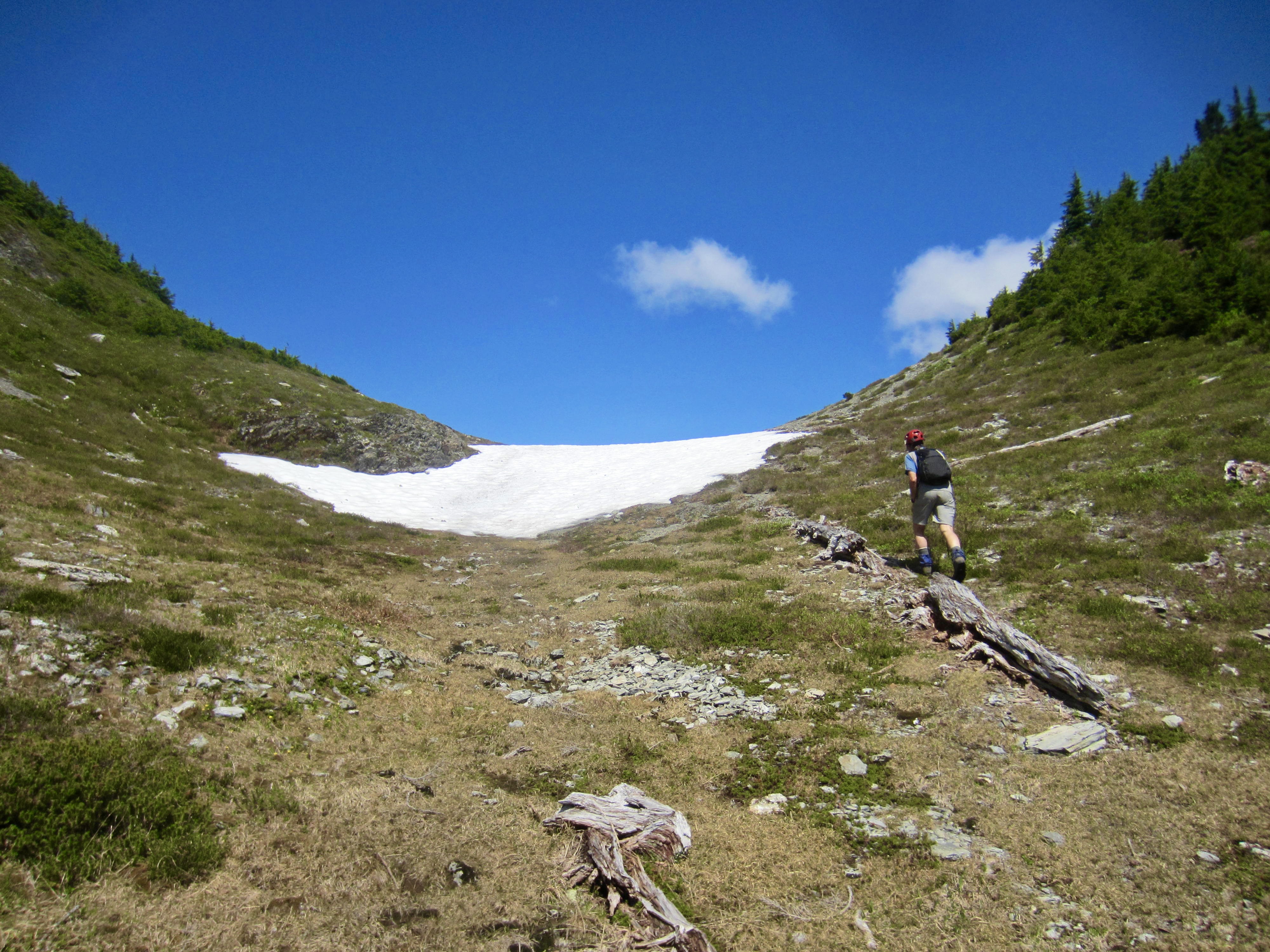
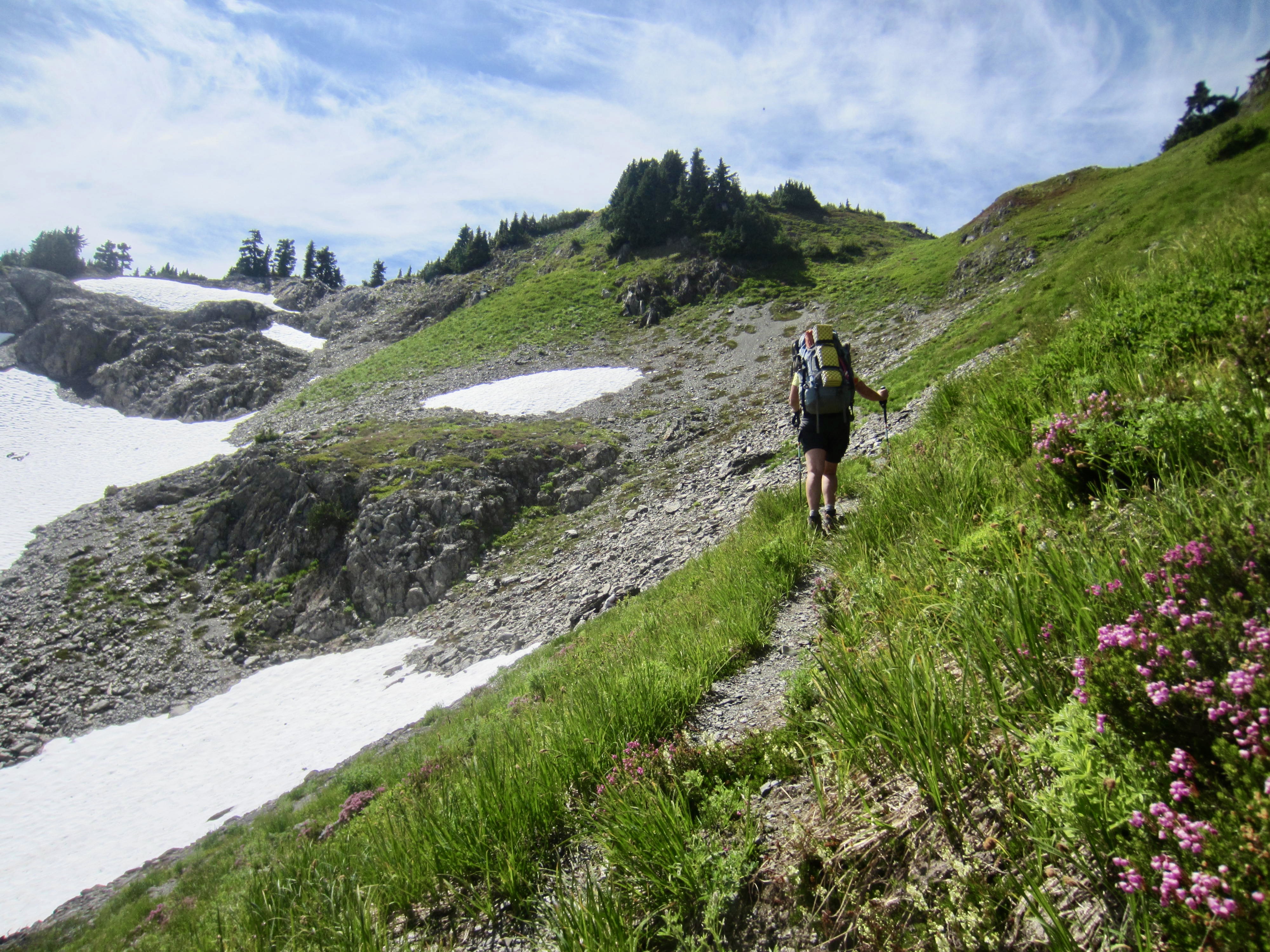
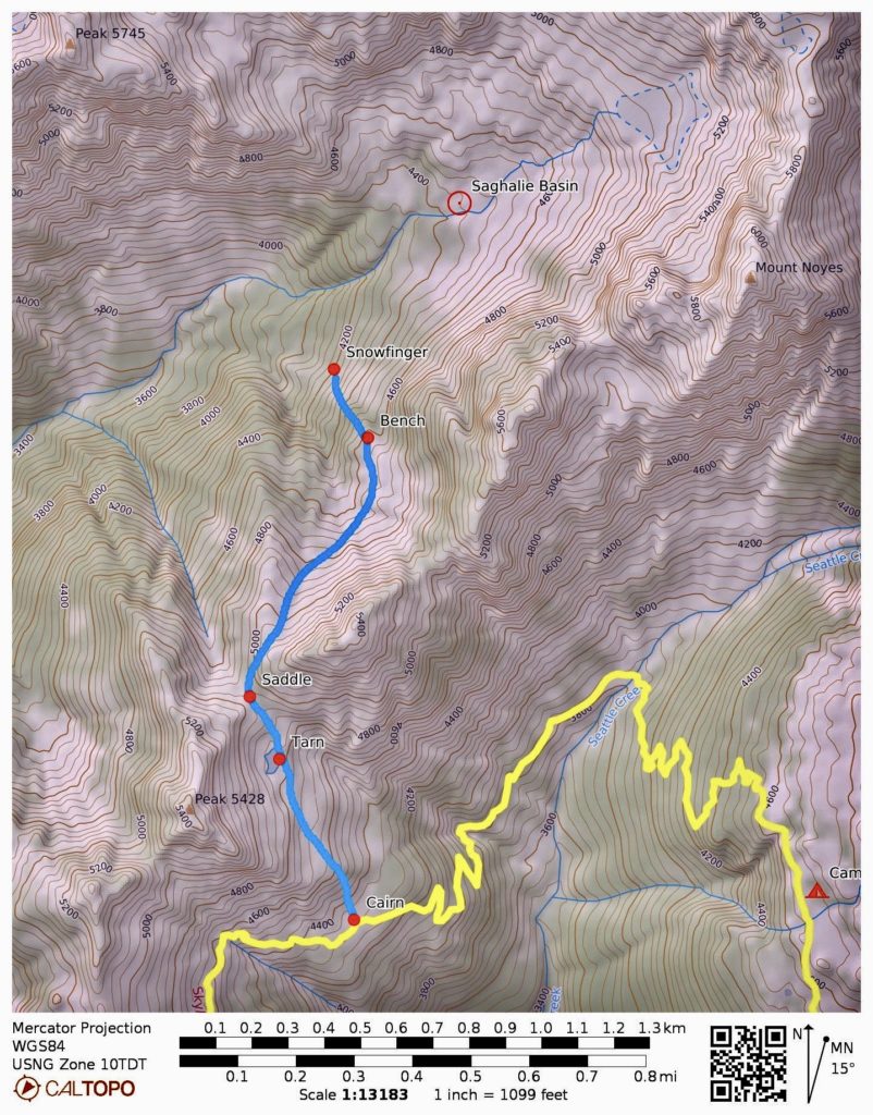
Following a dewy night, we were back on the Skyline Trail before 8:30am. The trail dropped us down to Seattle Creek and up the opposite side to a grassy bench marked with a cairn at 4300 feet (1.9 hours + 600 feet from Camp 3). Greg and I stashed our backpacks here, whereas Eileen continued hiking southward on the Skyline Trail.
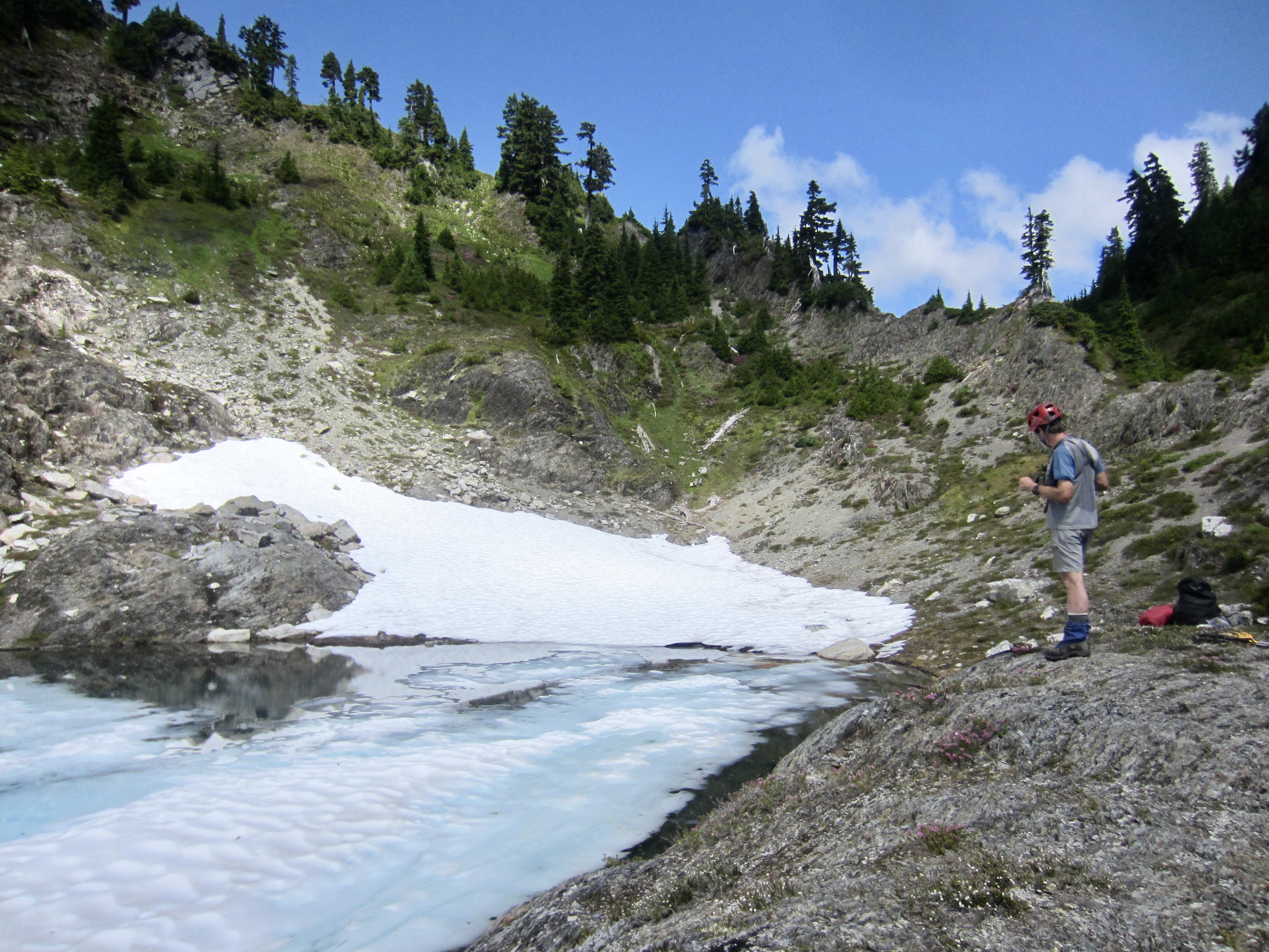
From the grassy bench, Greg and I headed uphill on a cross-country reconnaissance sidetrip to Saghalie Basin. We ascended heather slopes and rock outcrops past a 4800-foot tarn to a 4950-foot saddle, skirted around the western flank of Point 5442, and then descended snowfields northward to a 4600-foot bench. The terrain dropped off steeply from this bench, so we spent an hour teasing out a feasible route down slopes of heather, wet vegetation, and brush. We eventually worked our way down to the top of a snowfinger at 4200 feet, near the lower, southwestern edge of Saghalie Basin. Having successfully completed our goal of finding a reasonable cross-country route between Saghalie Basin and the Skyline Trail, Greg built a large cairn at this point.

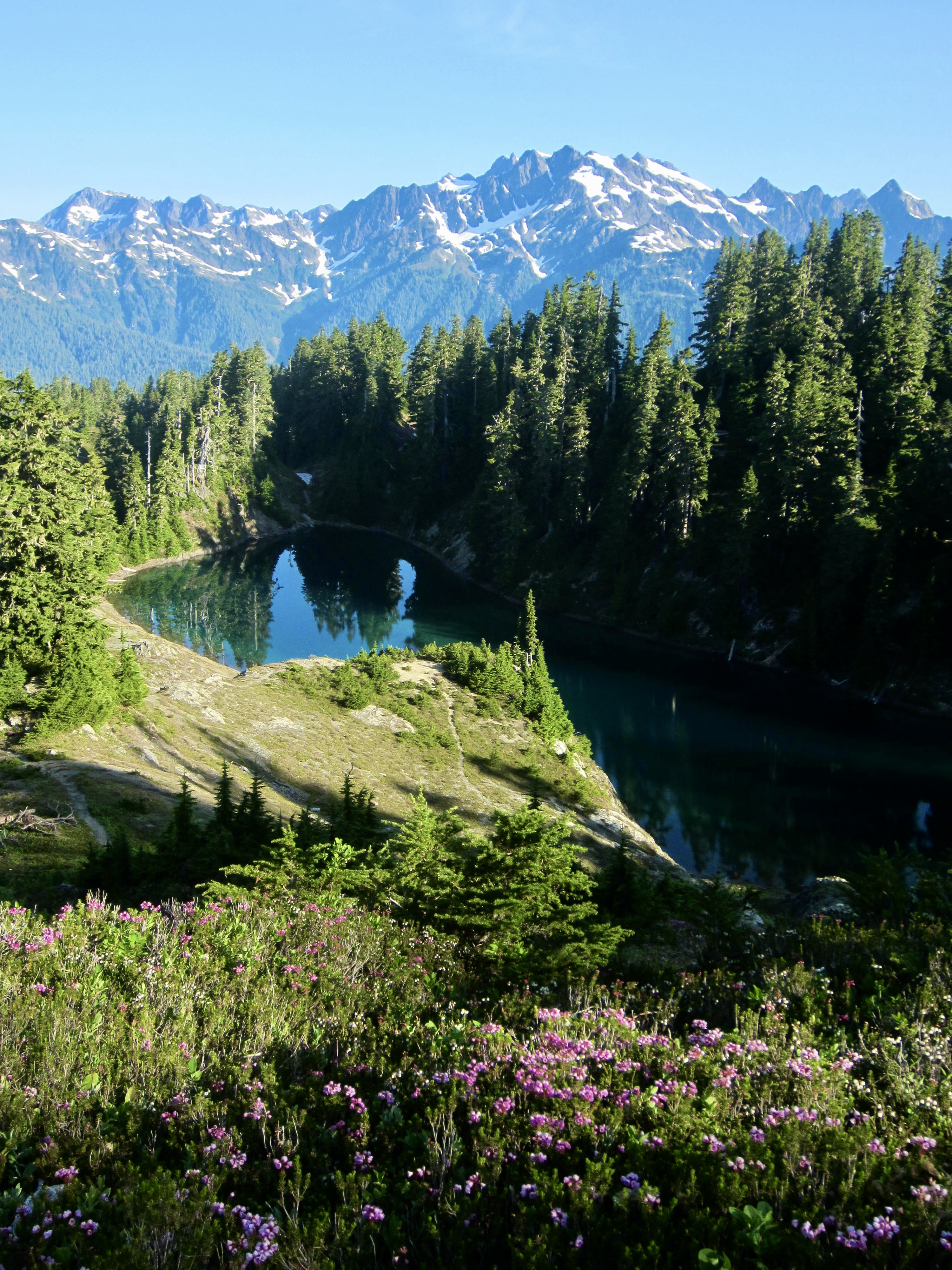
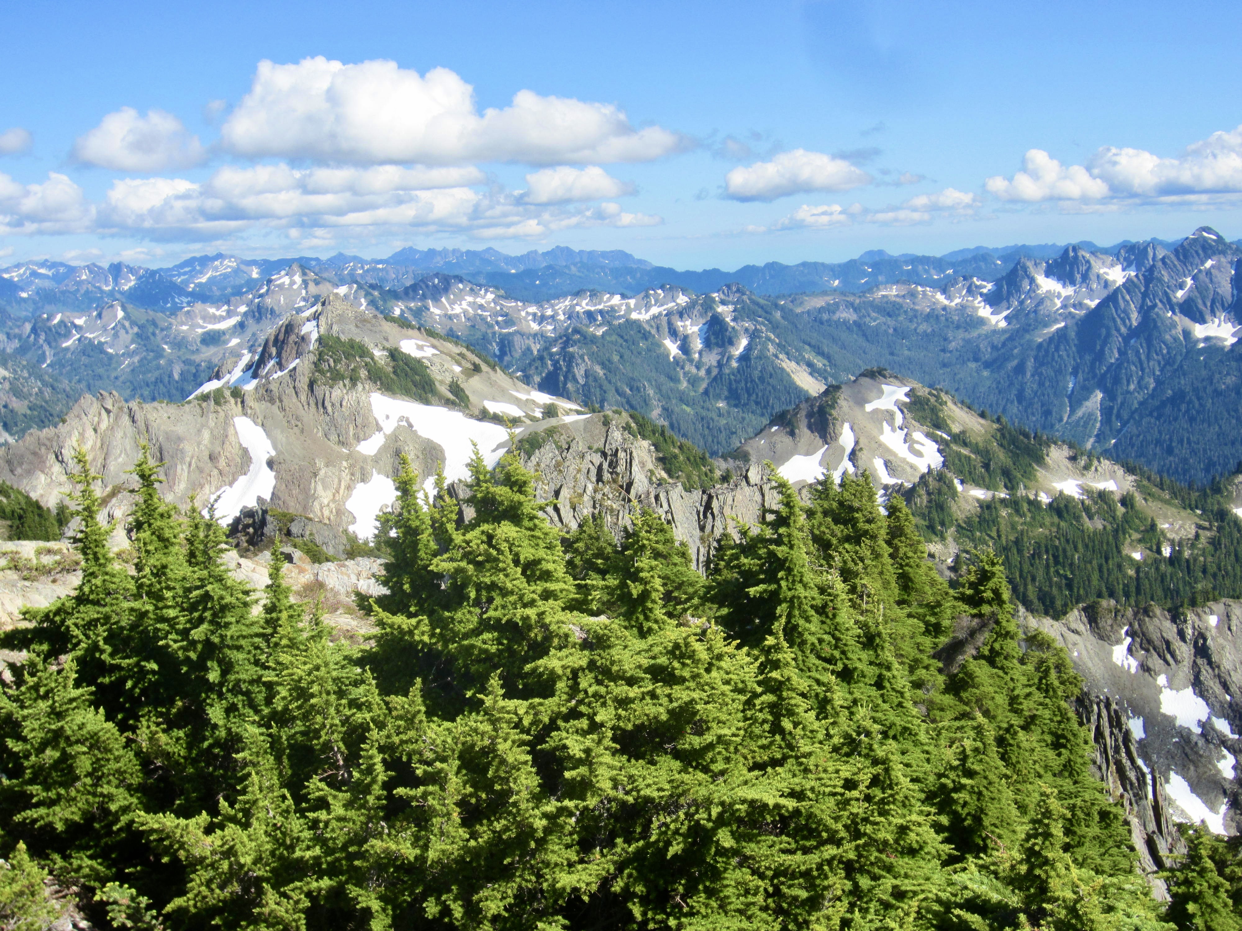
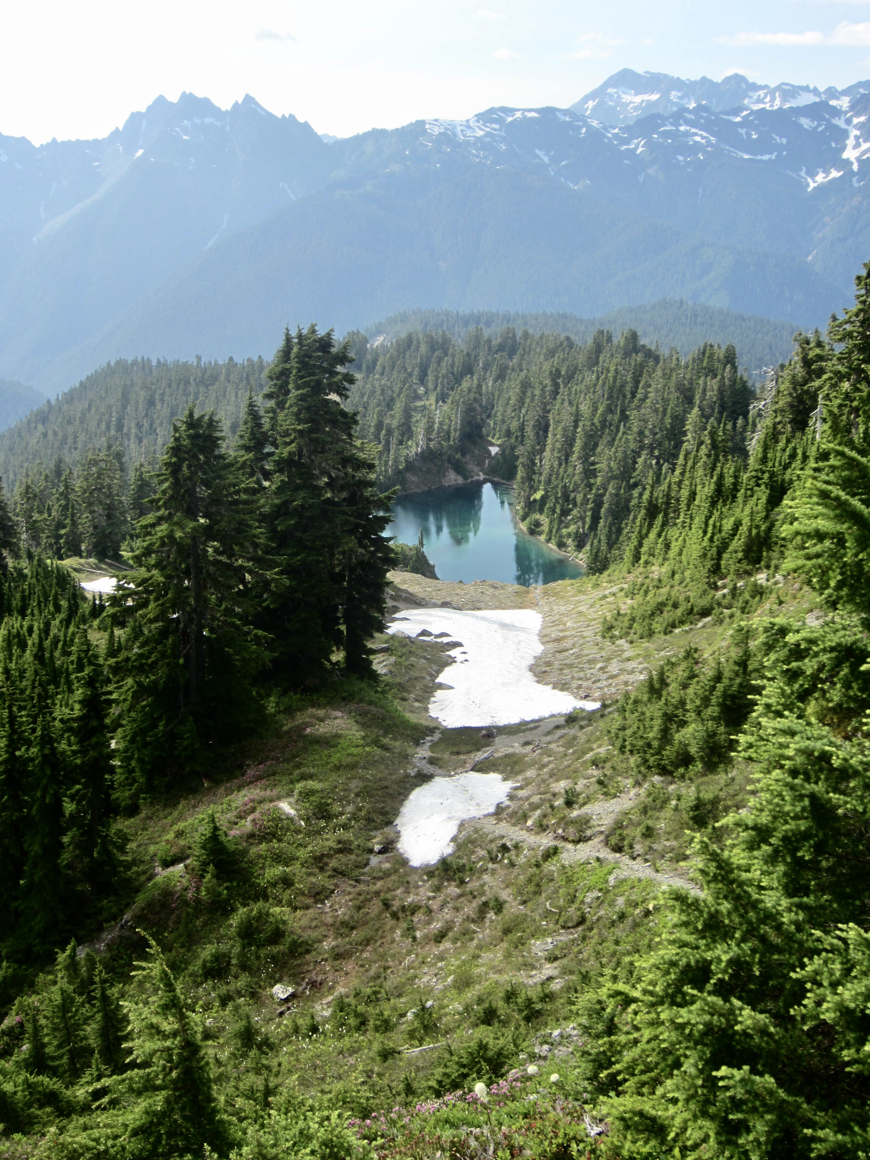
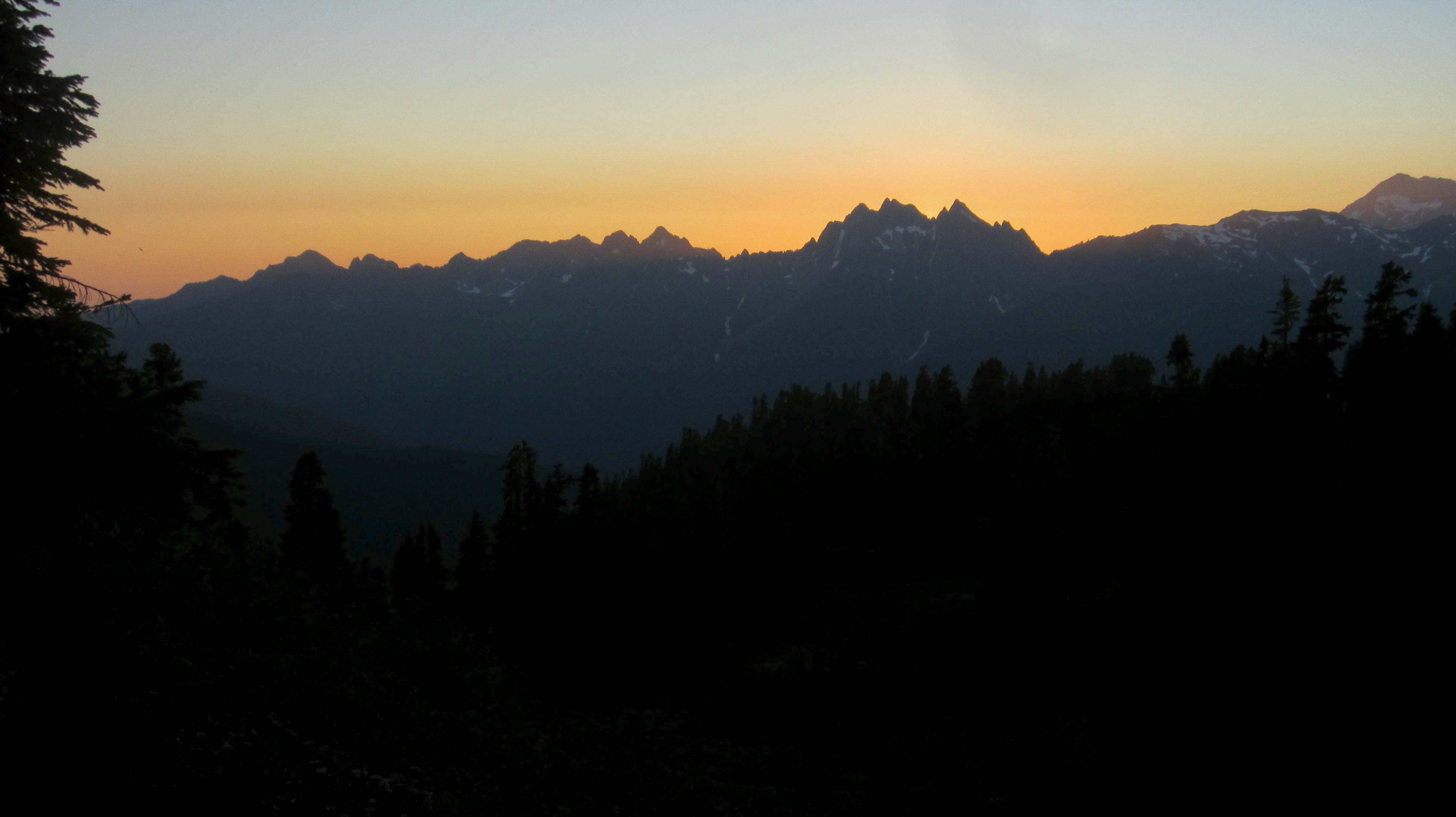
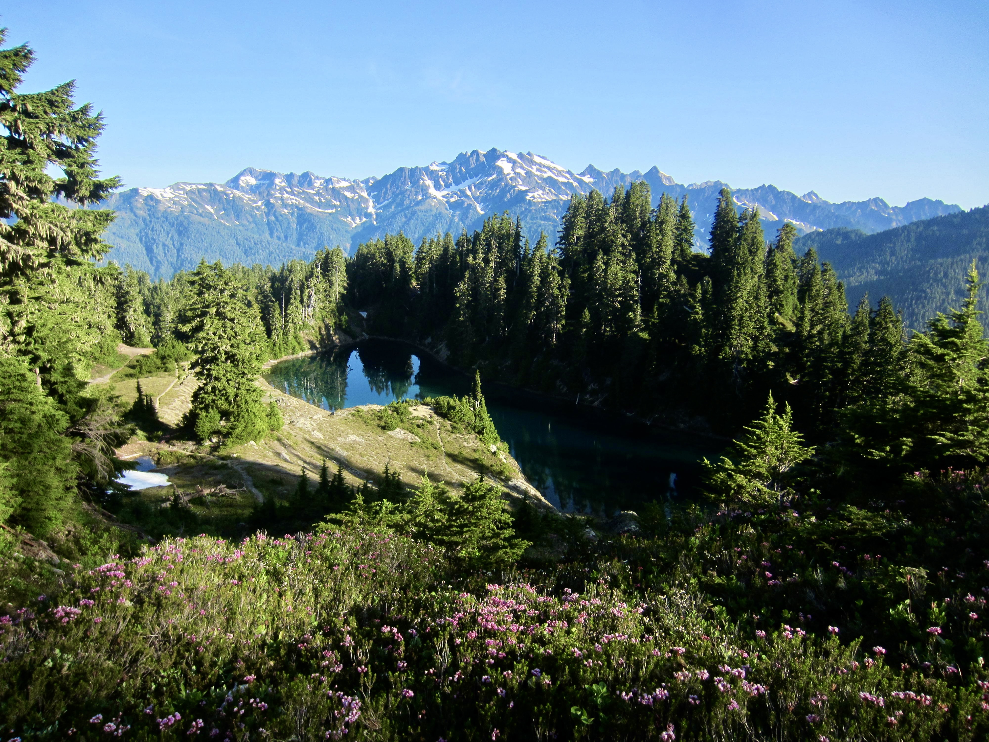
Greg and I returned to our backpack stash by mid-afternoon (3.6 hours + 1700 RT) and continued hiking toward Beauty Lake, where Eileen planned to camp. This segment of the Skyline Trail is very pleasant as it winds in and out of several ravines while maintaining a fairly uniform elevation. At one point, the trail brings hikers up to a ridge gap that affords a perfectly framed view of Mt. Olympus!
In late afternoon, we gained a 5100-foot pass overlooking Beauty Lake, then took a way trail 350 feet down to the lake. It was 6:00pm when we arrived at Eileen’s tent (5.9 hours + 4.3 miles + 1400 feet from Camp 3, excluding reconn sidetrip), and we wasted no time in taking a pre-dinner swim.
Day 6: Lake Beauty to Three Prune Camp
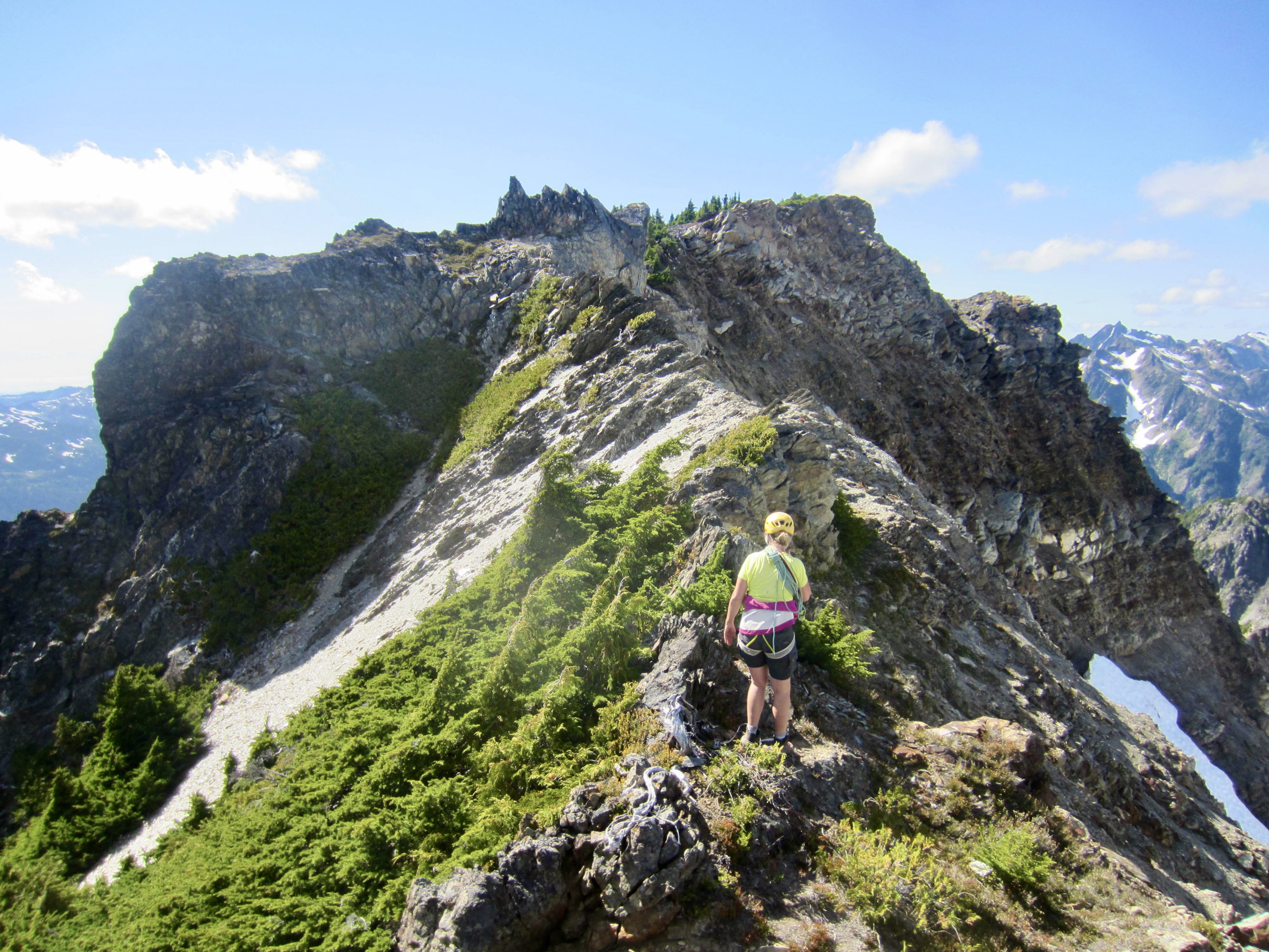
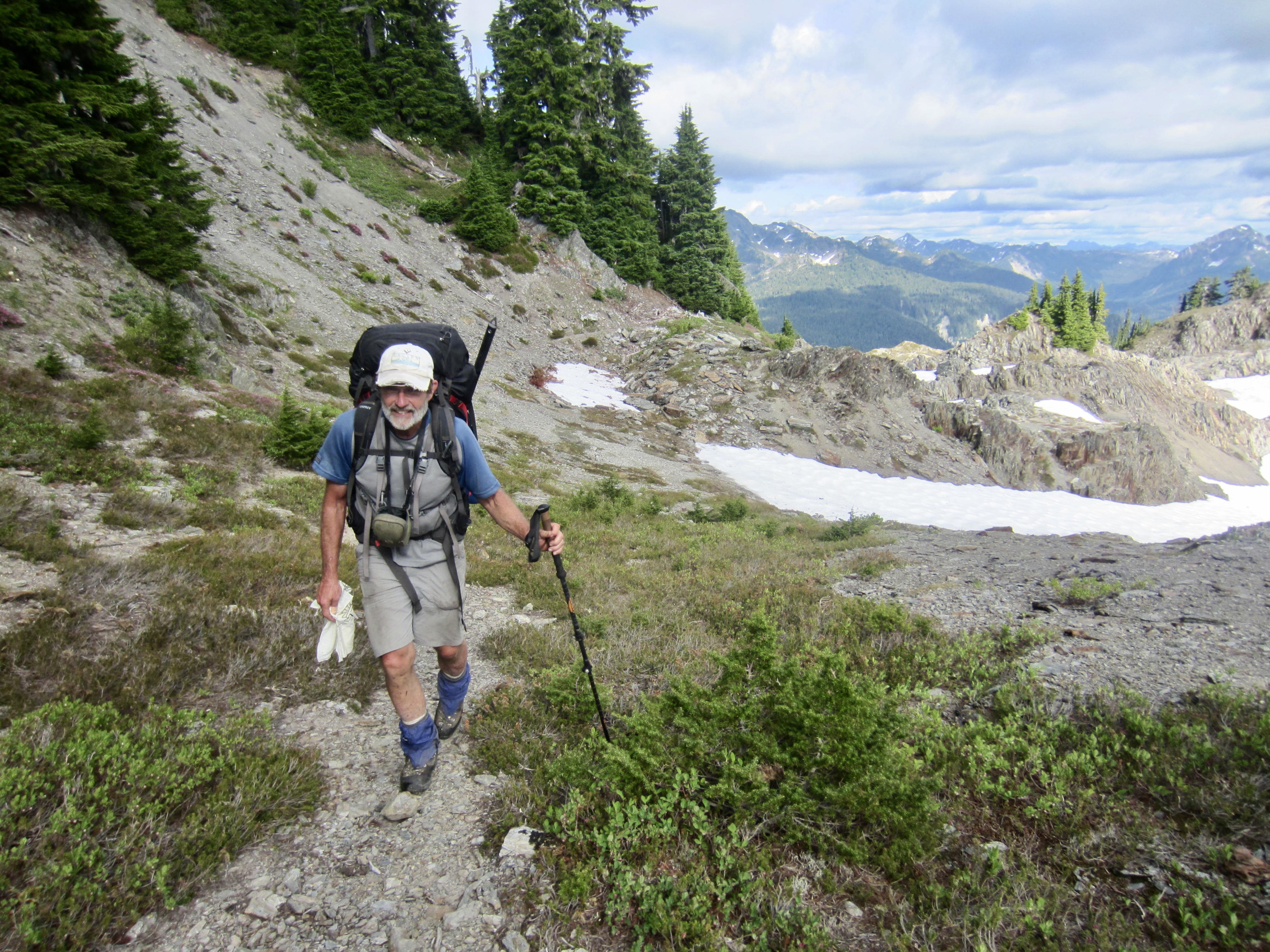
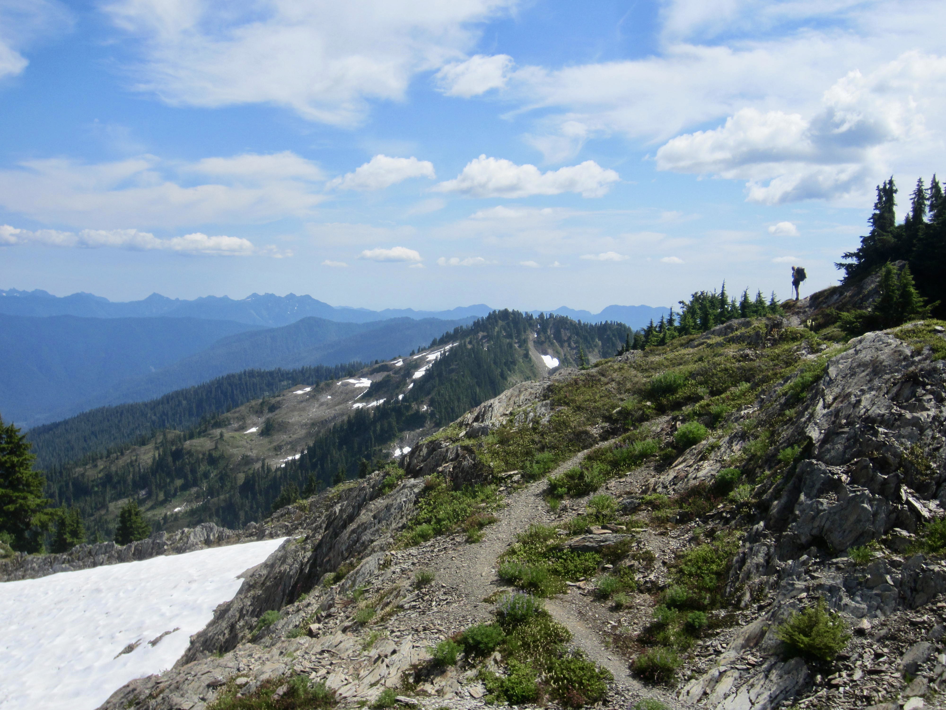
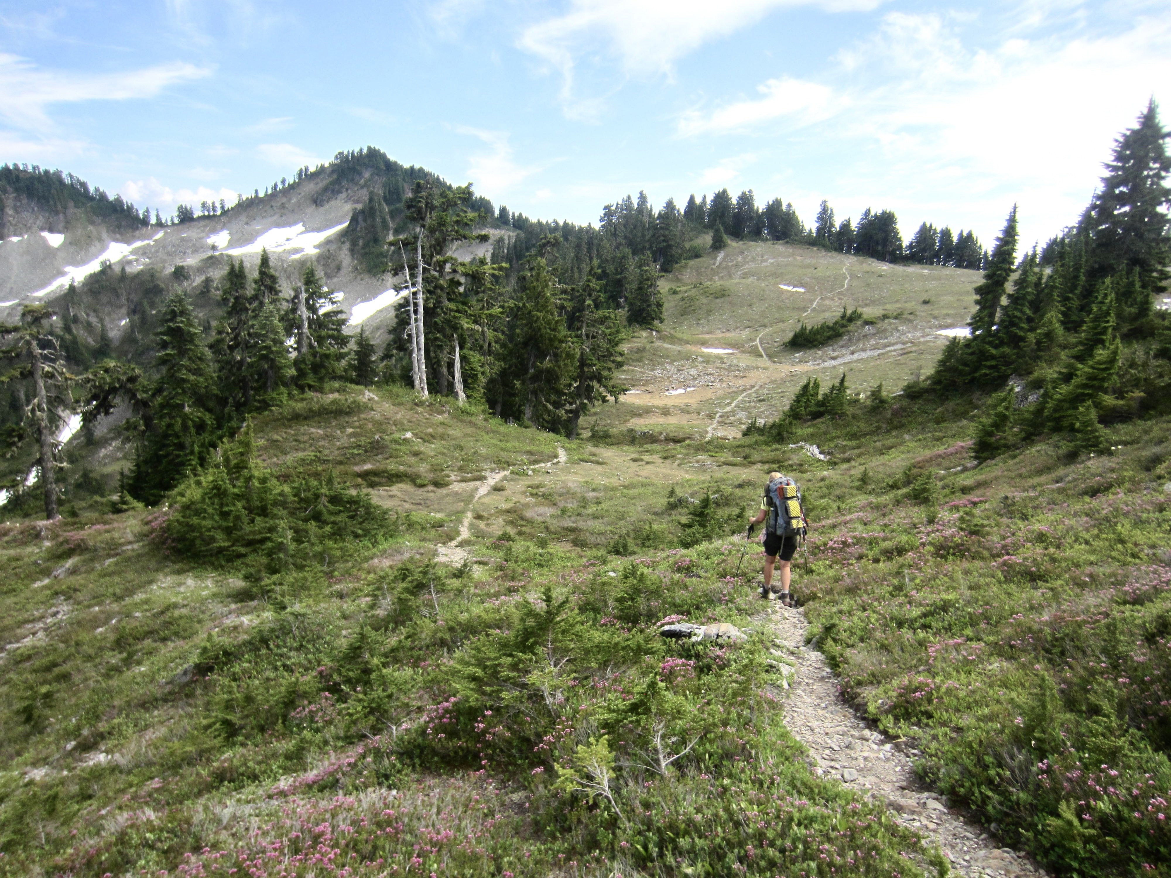
Knowing that today would be our hardest day on the Skyline Trail, we were all out of camp by 8:00am. We hiked back up to Beauty Pass, then continued southward on the main route. For several miles, we crossed numerous ribs and ravines with lots of ups and downs, crossing through 4550-foot Hee Haw Pass and then staying high above Promise Creek. This scenic trail segment is quite primitive and a bit difficult to follow across rock outcrops, although aided by scattered cairns. There are several locations requiring Class 2-3 scrambling or exposed traverses across eroded ledges.
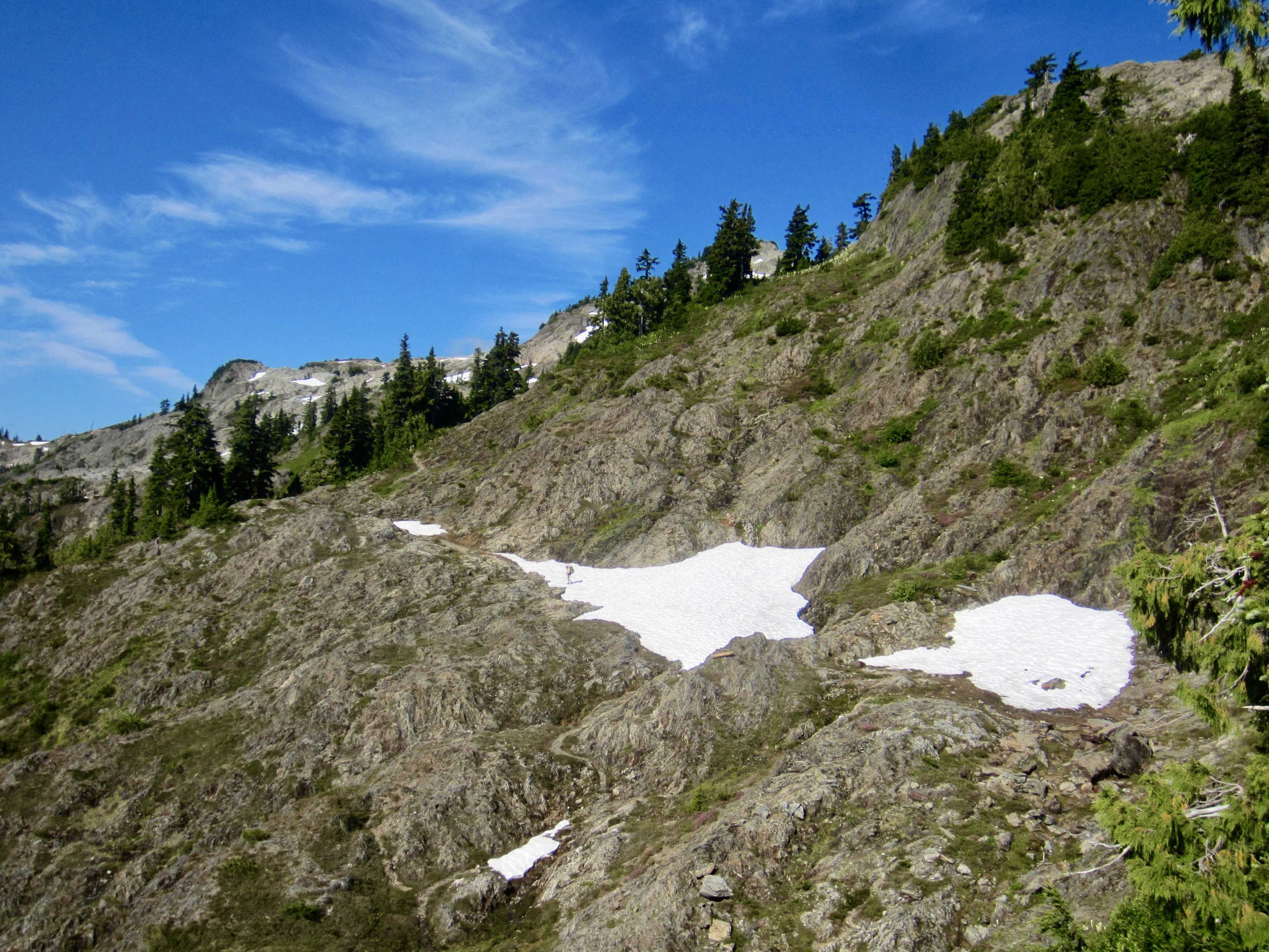
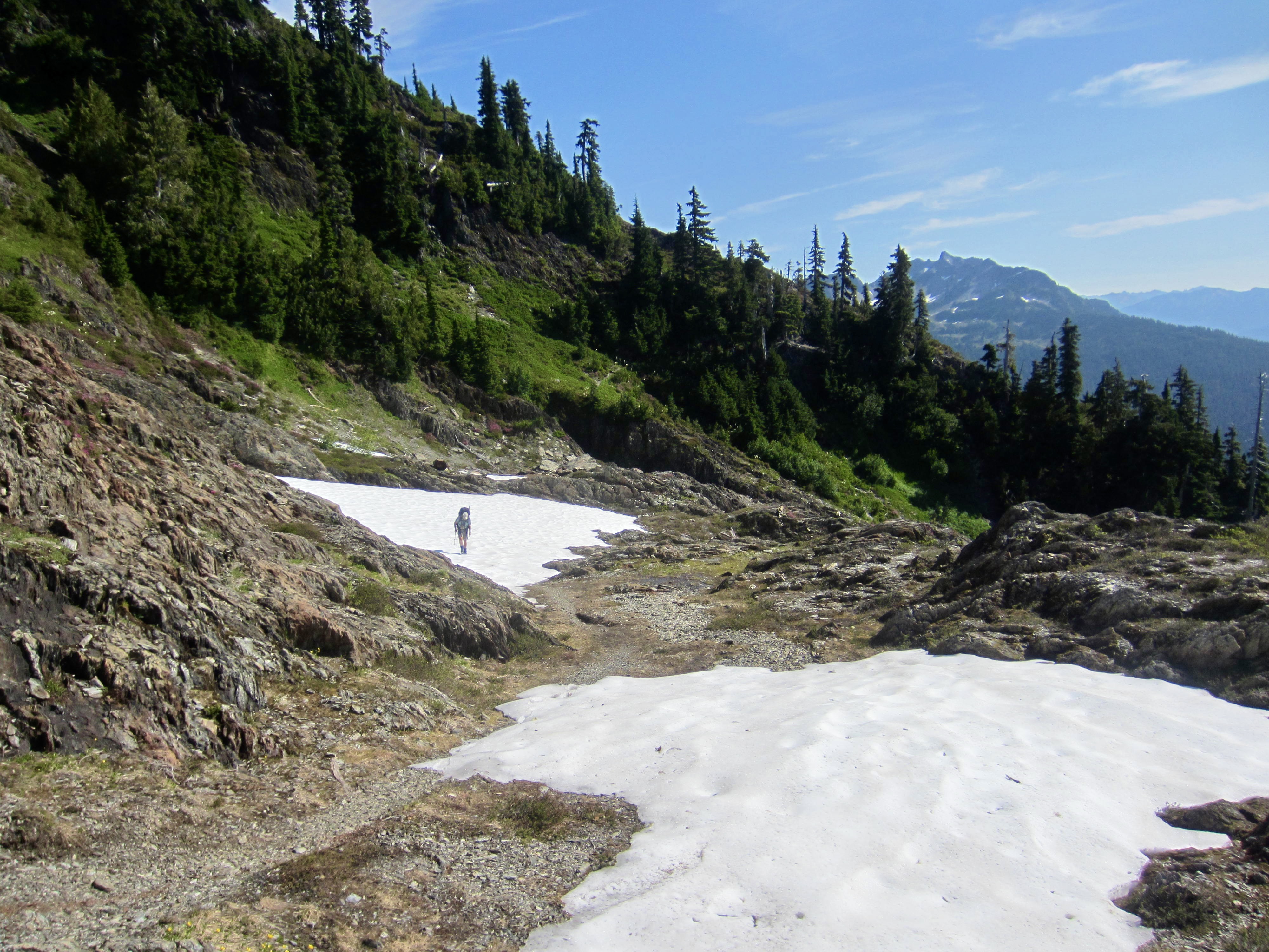
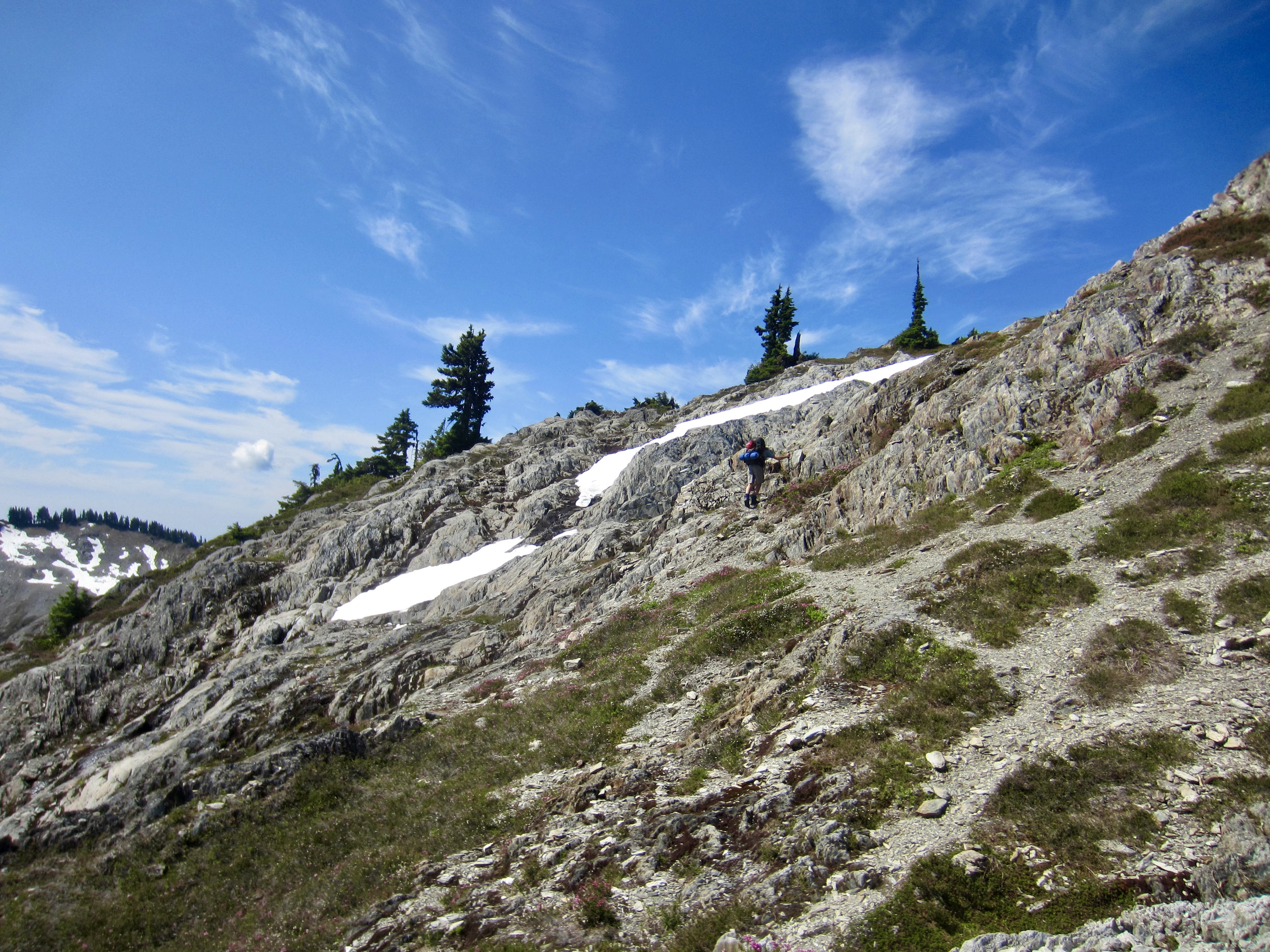
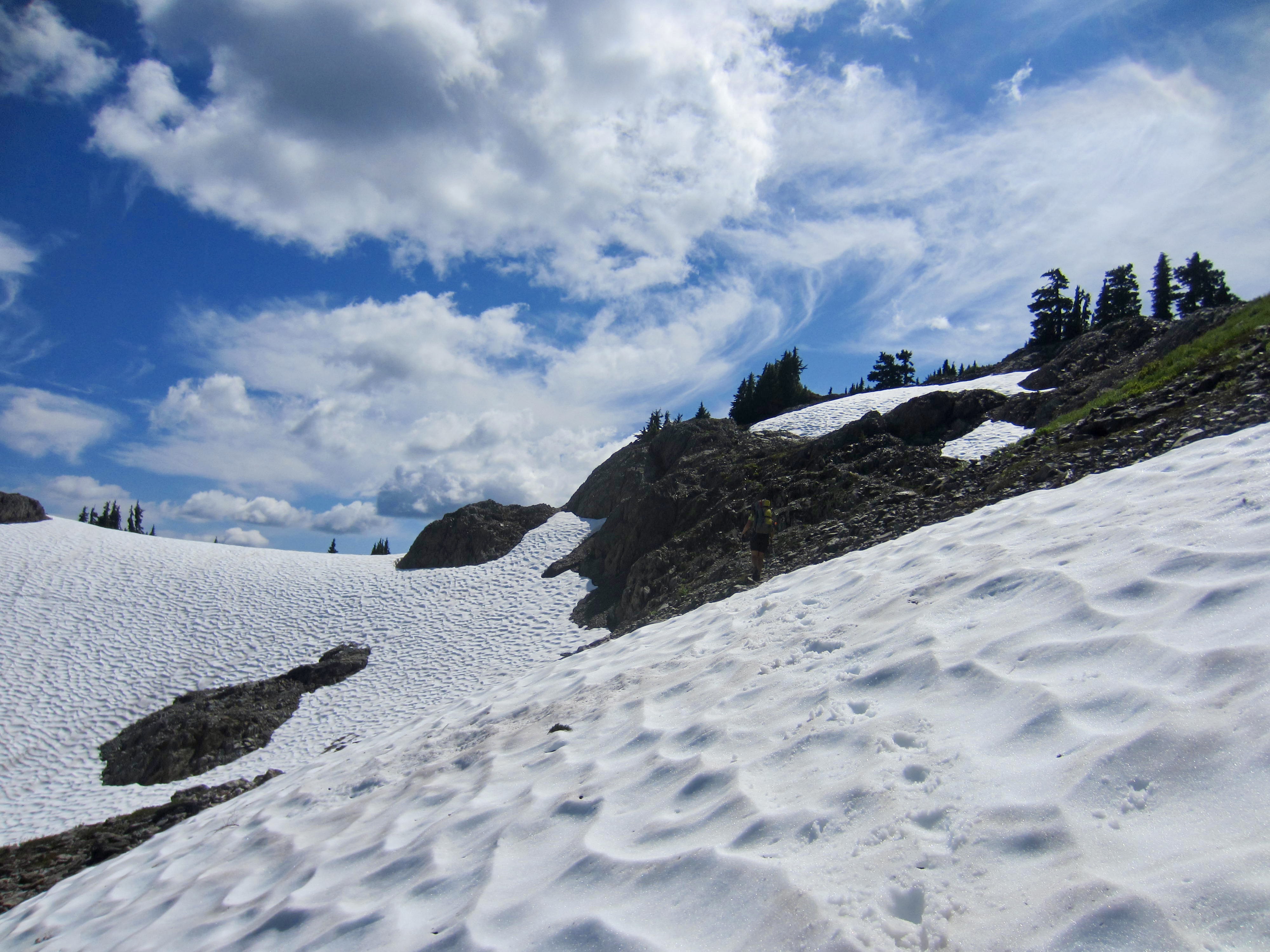
We passed over a 5340-foot bench above Promise Creek—the high point of the entire Skyline Trail—before descending a short distance to 5080-foot Promise Creek Pass, and then we crossed into the Kimta Creek drainage. Inexplicably, the trail plunges 800 vertical feet into the valley and makes a soul-sucking traverse through an old burn area choked with brush, mudholes, tricky creeks, and fallen logs. This low-level traverse is by far the worst part of the Skyline Trail and, to my eye, totally unnecessary. It is a shame that the trail builders (or re-builders) did not keep it higher on Kimta Arm. (We later heard that some parties have completed a high-level cross-country traverse here to avoid the awful drop.)
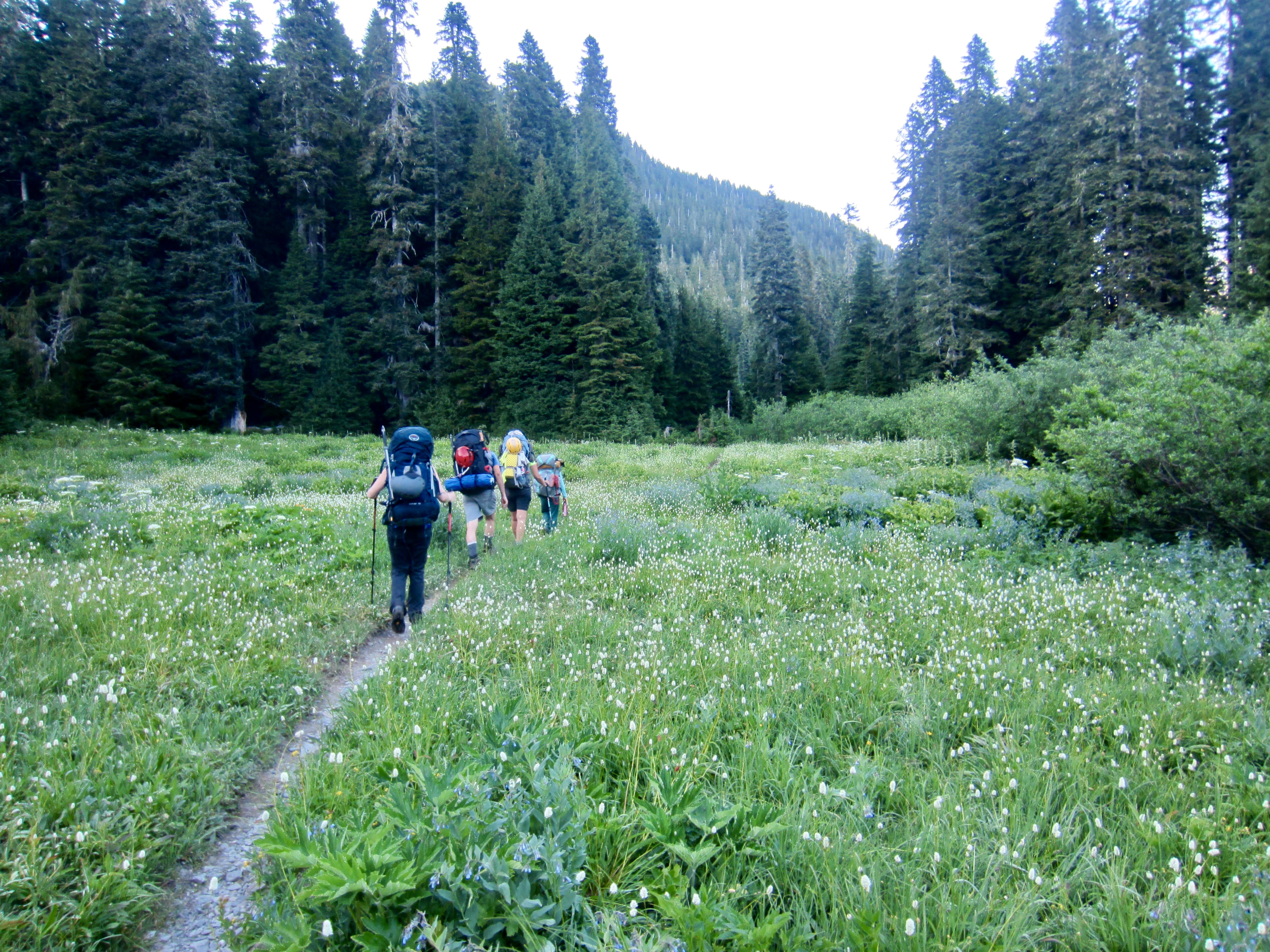
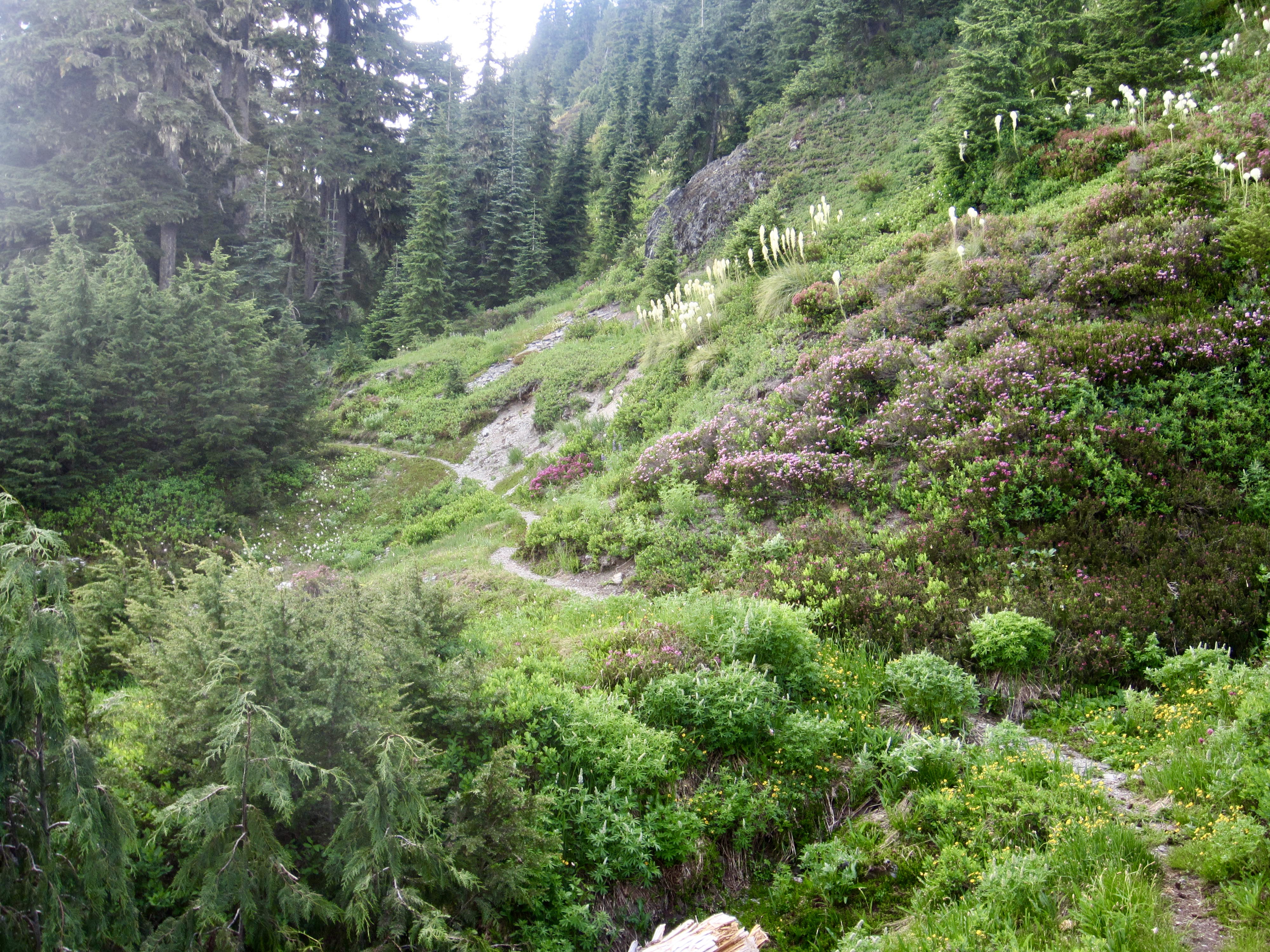
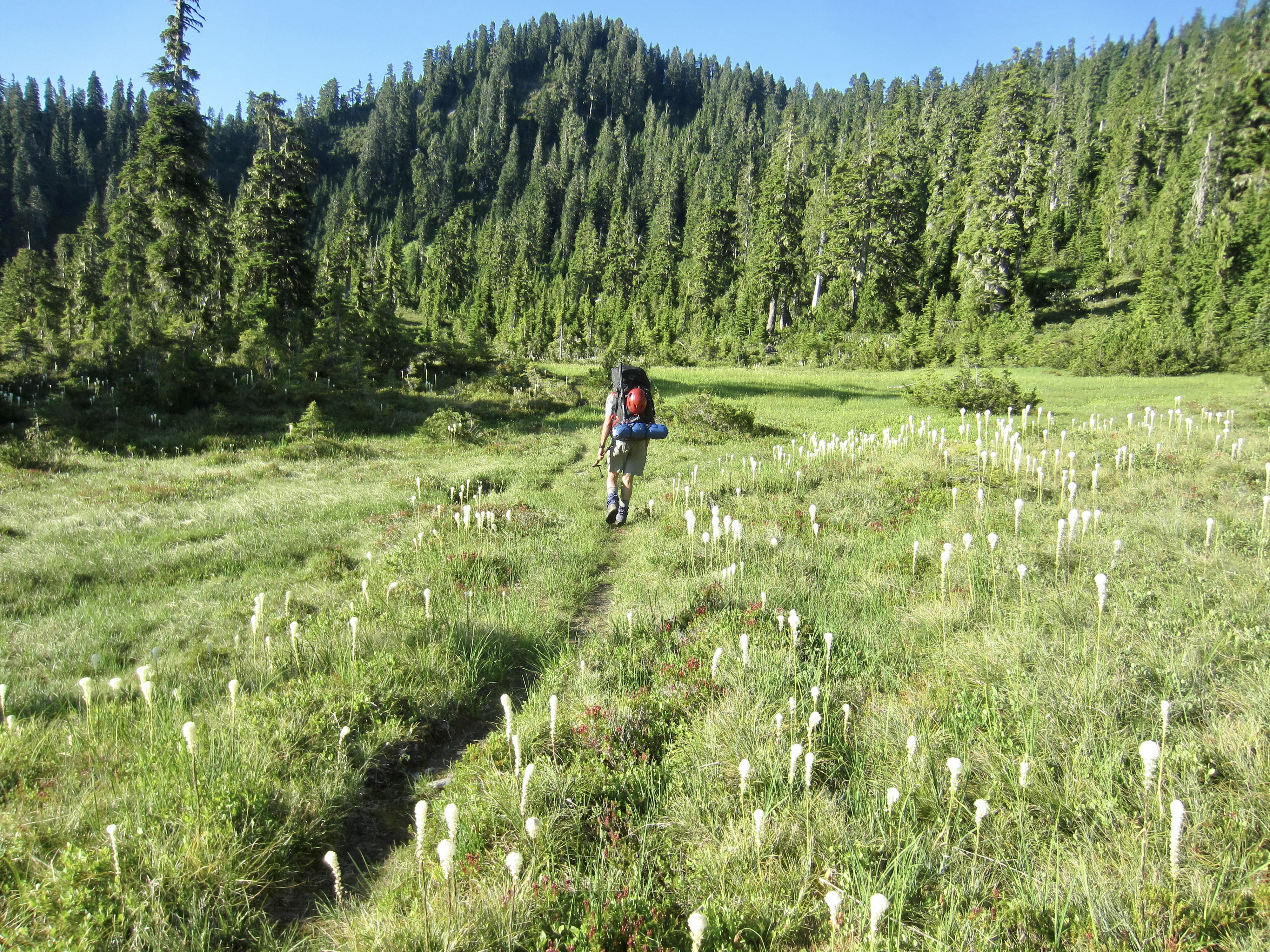
The trail gradually climbs out of the valley and enters Kimta Basin in the southeastern lap of Kimta Peak. Good moods were restored as the trail undulated along the ridge crest and offered views in all directions. We were particularly enchanted by the frequent clusters of beargrass blooms—the most we’d ever seen.

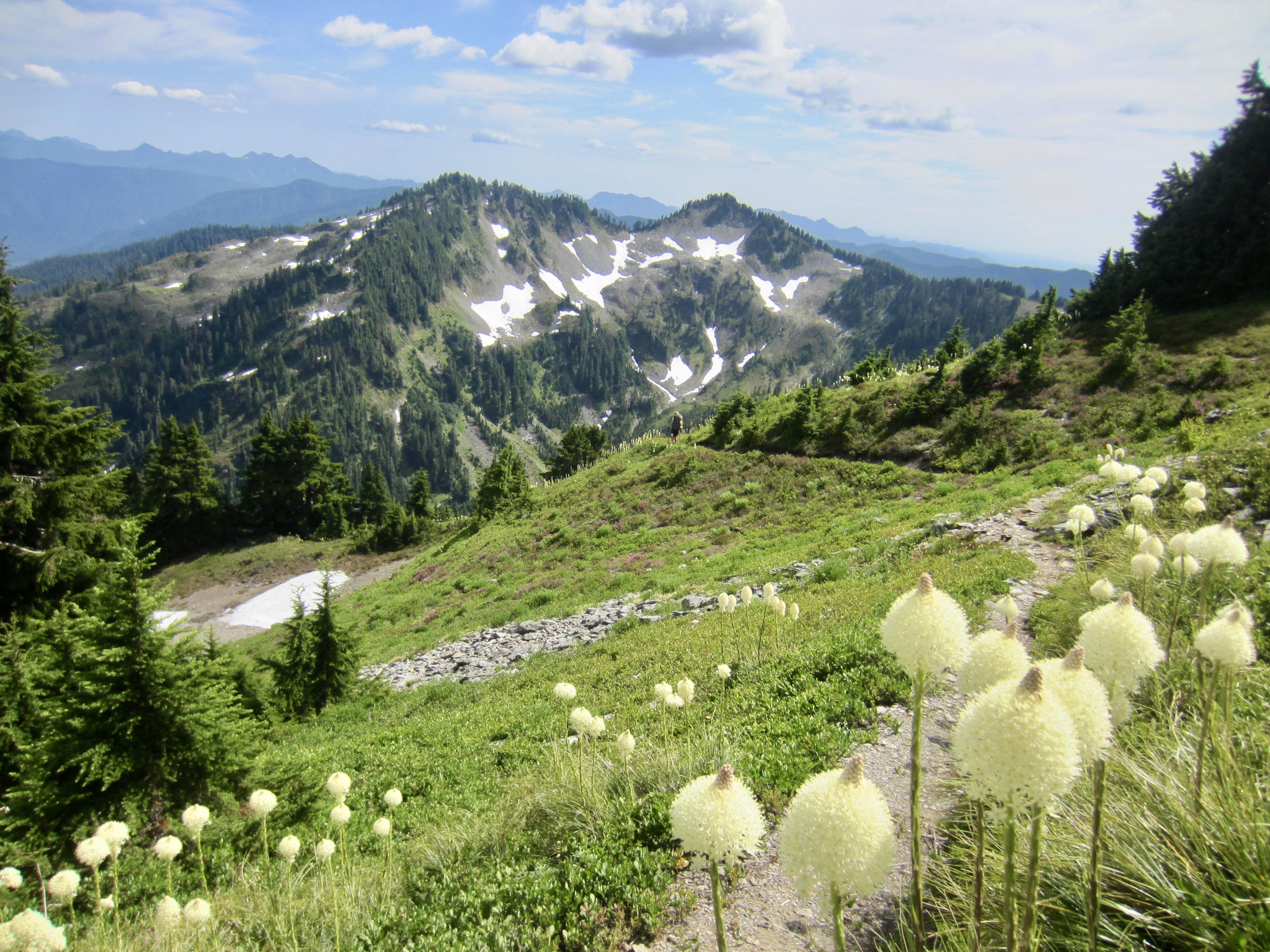
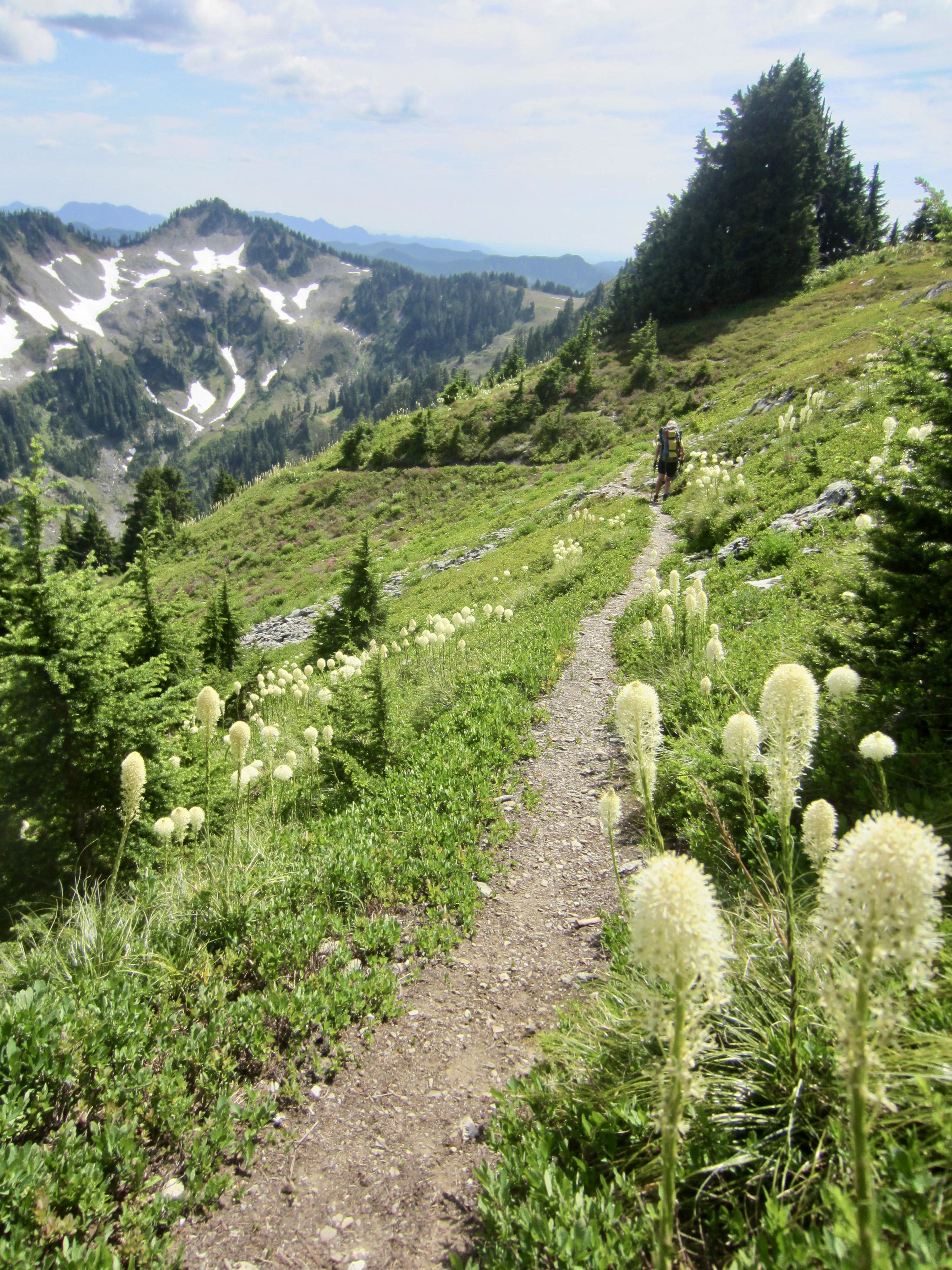
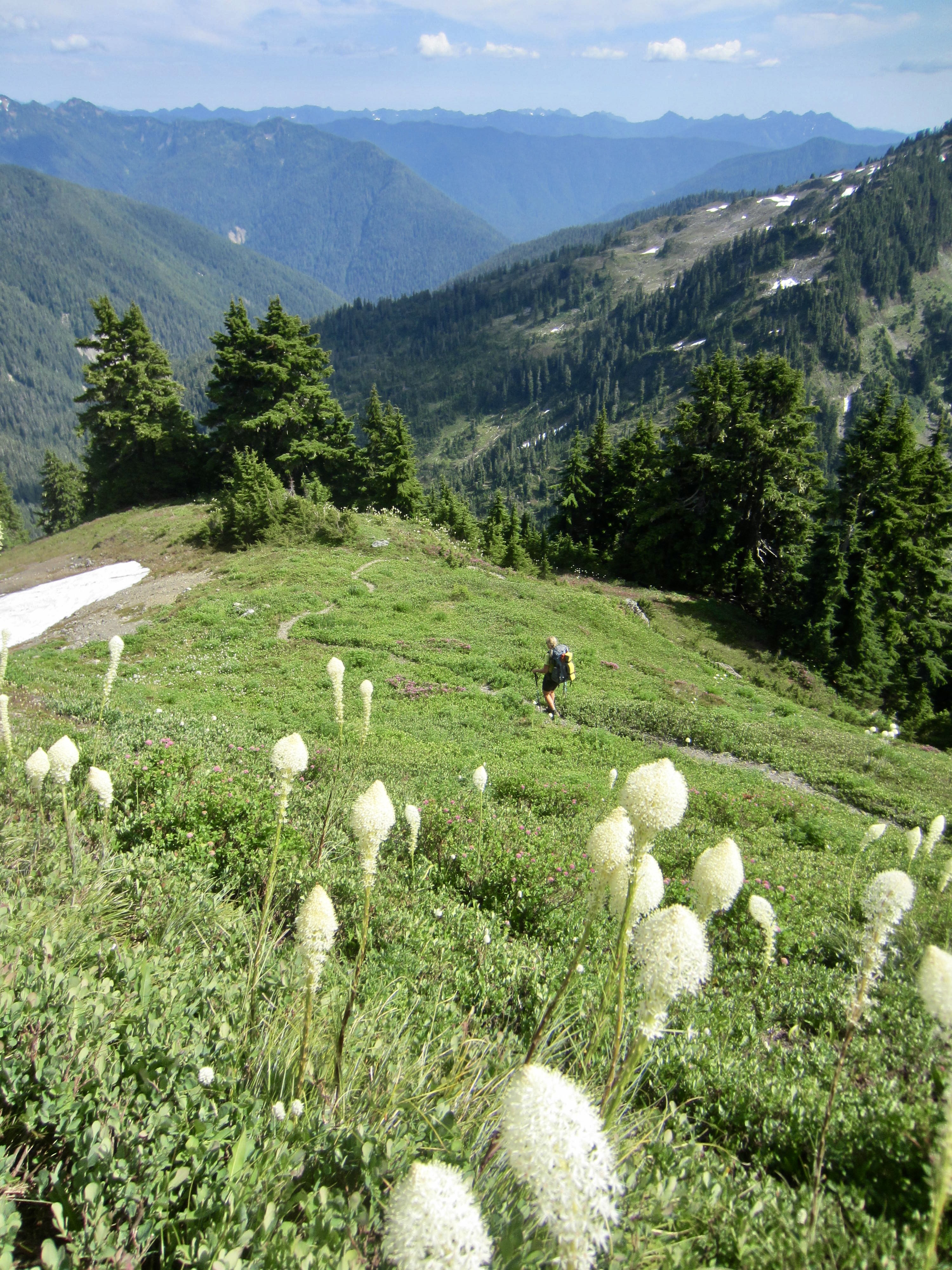
We soon dropped into the delightful grassland of Kimta Park and took a long rest break. Because the entire trail segment between Kimta Basin and Three Prune Basin tends to be very dry, it was necessary for us to double-filter water from a stagnant meltwater pond in Kimta Park.
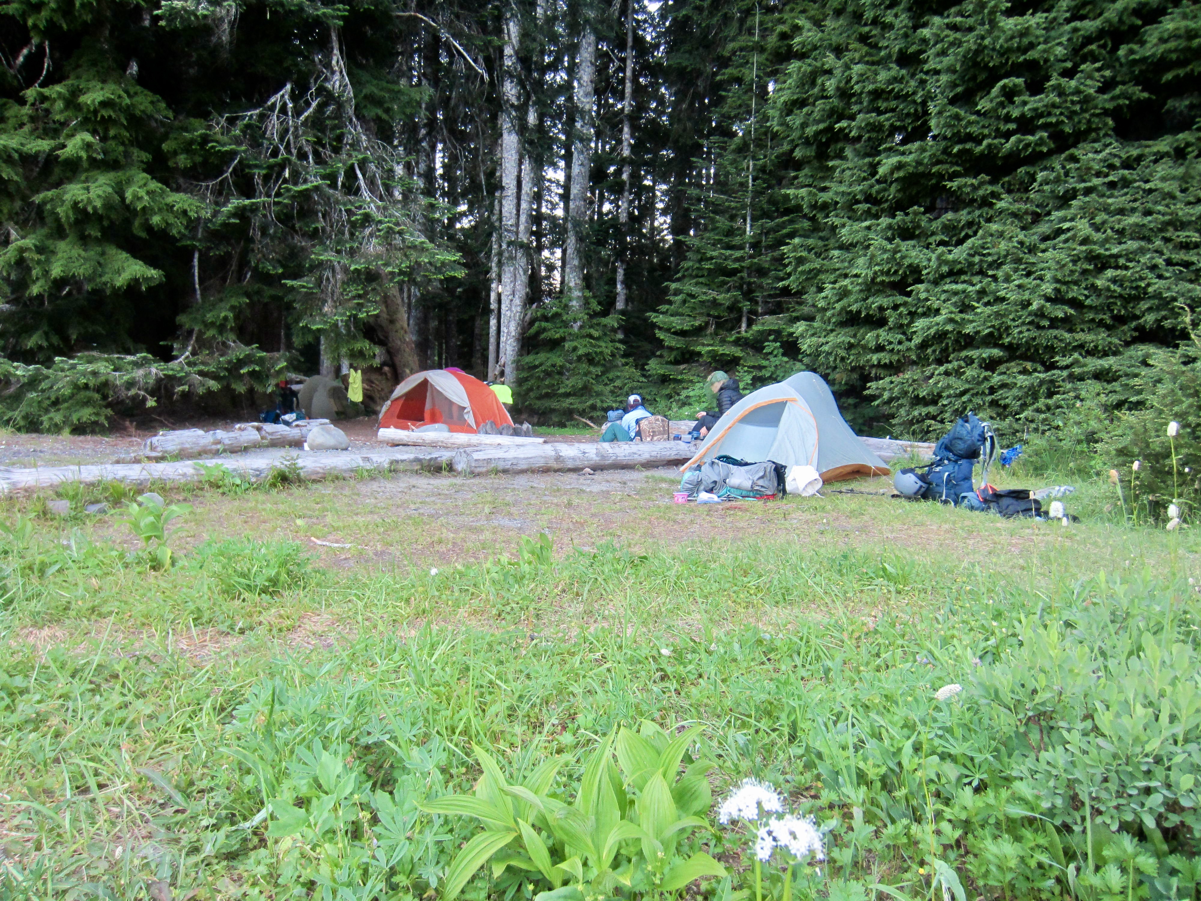
South of Kimta Park, the Skyline Trail wanders around the headwaters of South Fork Kimta Creek and Stalding Creek for several miles before beginning a gradual descent into Three Prune Basin. Greg had sped ahead to camp during this segment and then kindly came back to carry Eileen’s backpack for the last ½ mile. We all rolled into Three Prune Camp shortly after 8:00pm (12.2 hours + 10.7 miles + 3400 feet from Camp 4) to end a long, hot, tiring, and sometimes exasperating day.
Day 7: Three Prune Camp to Three Lakes Trailhead
Eager to get home today, we were all out of camp by 8:00am. The final 4½ miles of Skyline Trail led us past Elip Tarns and the Elip Creek Trail junction to Three Lakes in late morning (3.1 hours + 750 feet from Camp 5). Along the way, we encountered the first other hikers since leaving Low Divide three days ago. Even during this week of perfect summer weather, the Skyline Trail felt like a lonely place.

From Three Lakes, we officially left the Skyline Trail and turned onto the Big Creek / Three Lakes Trail. This latter trail descended into old-growth forest and crossed North Fork Big Creek before leveling out in Irely Flats. We limped into the hot parking lot on the North Fork Quinault River Road at 5:00pm ( 8.8 hours + 10.5 miles + 1000 feet from Camp 5) feeling both satisfied and exhausted by our makeshift trip.
…
Route Maps & Profiles
…
…
…
…
…
Photo Gallery
Click to enlarge…