Trip Date: August 15-20, 2020
Mt. Meany Climbing Trip
North Fork Quinault River
Low Divide
Seattle Basin
Noyes-Cougar Saddle
Meany-Noyes Saddle
Mount Meany (6695′)
- Trip Report Summary
- Related Posts
- Full Trip Report
- Day 1: Trailhead to Francis/Elip Creek Camp
- Day 2: Francis/Elip Creek Camp to Low Divide Camp
- Day 3: Low Divide Camp to Seattle Basin
- Day 4: Mt. Meany Summit Climb
- Day 5: Seattle Basin to Sixteenmile Camp
- Day 6: Sixteenmile Camp to Trailhead
- Route Maps & Profile & Sketch
- Photo Gallery
Trip Report Summary
Region: Olympic Mountains (Washington)
Sub-Region: Quinault Group
Area: Olympic National Park
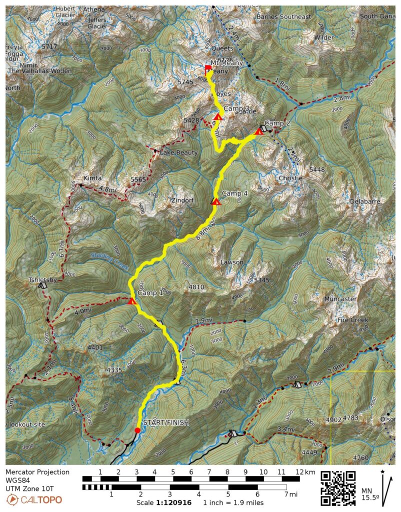
Starting & Ending Point: North Fork Quinault River Trailhead at end of North Fork Quinault River Road (Elev. 500 feet)
Way Points: North Fork Quinault River & Wolf Bar Camp & Halfway House Camp & Wild Rose Creek & Elip Creek & Francis/Elip Creek Camp & Three Prune Creek & Stalding Creek & Kimta Creek & Trapper’s Shelter & Twelvemile Camp & Sixteenmile Camp & Christie Creek & Low Divide & Seattle Meadows & Seattle Basin (trail hike & off-trail hike)
Campsites: Francis/Elip Creek Camp & Renegade / Low Divide Camp & Seattle Basin & Sixteenmile Camp
Sidetrip: Upper Seattle Creek & Noyes-Cougar Saddle & Meany-Noyes Saddle (off-trail hike & rock scramble)
Summit: Mt. Meany (rock scramble & snow climb & rock climb via Southeast Ridge—East Slope—Northeast Face [Route 2] )
Sidetrip: Pinnacle 6280+ (snow climb & rock scramble)
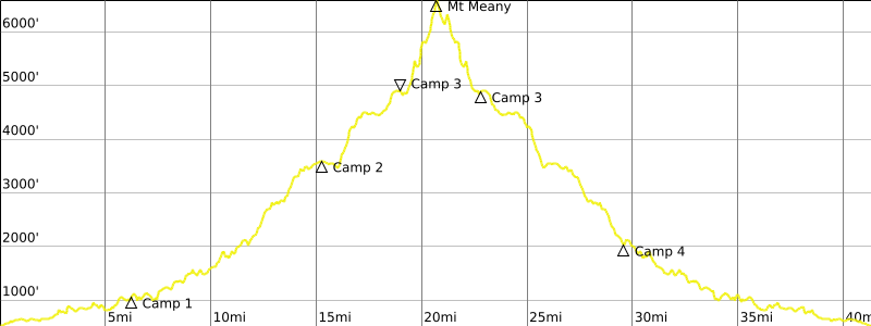
Approximate Stats: 42 miles traveled; 9300 feet gained & lost.
Related Posts
Quinault–Skyline Loop + Mt. Christie via North Couloir – July 2021
Skyline–Quinault Loop + Mt. Seattle via South Ridge – September 2015
Full Trip Report
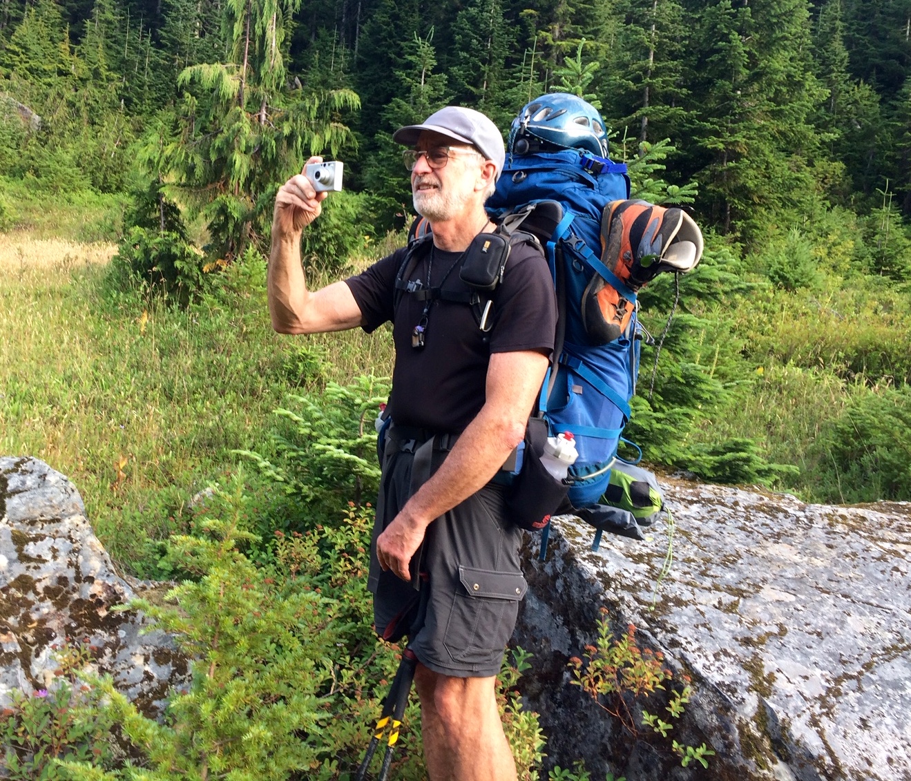
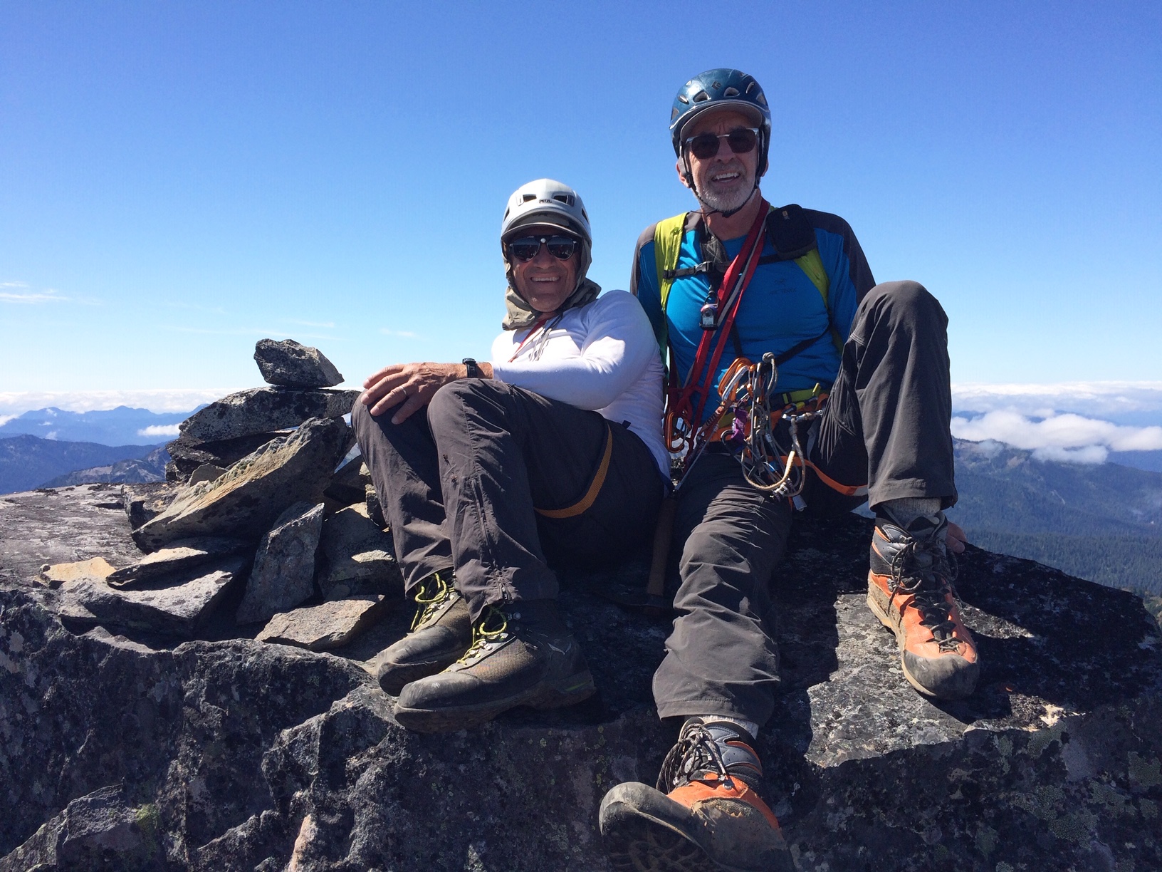
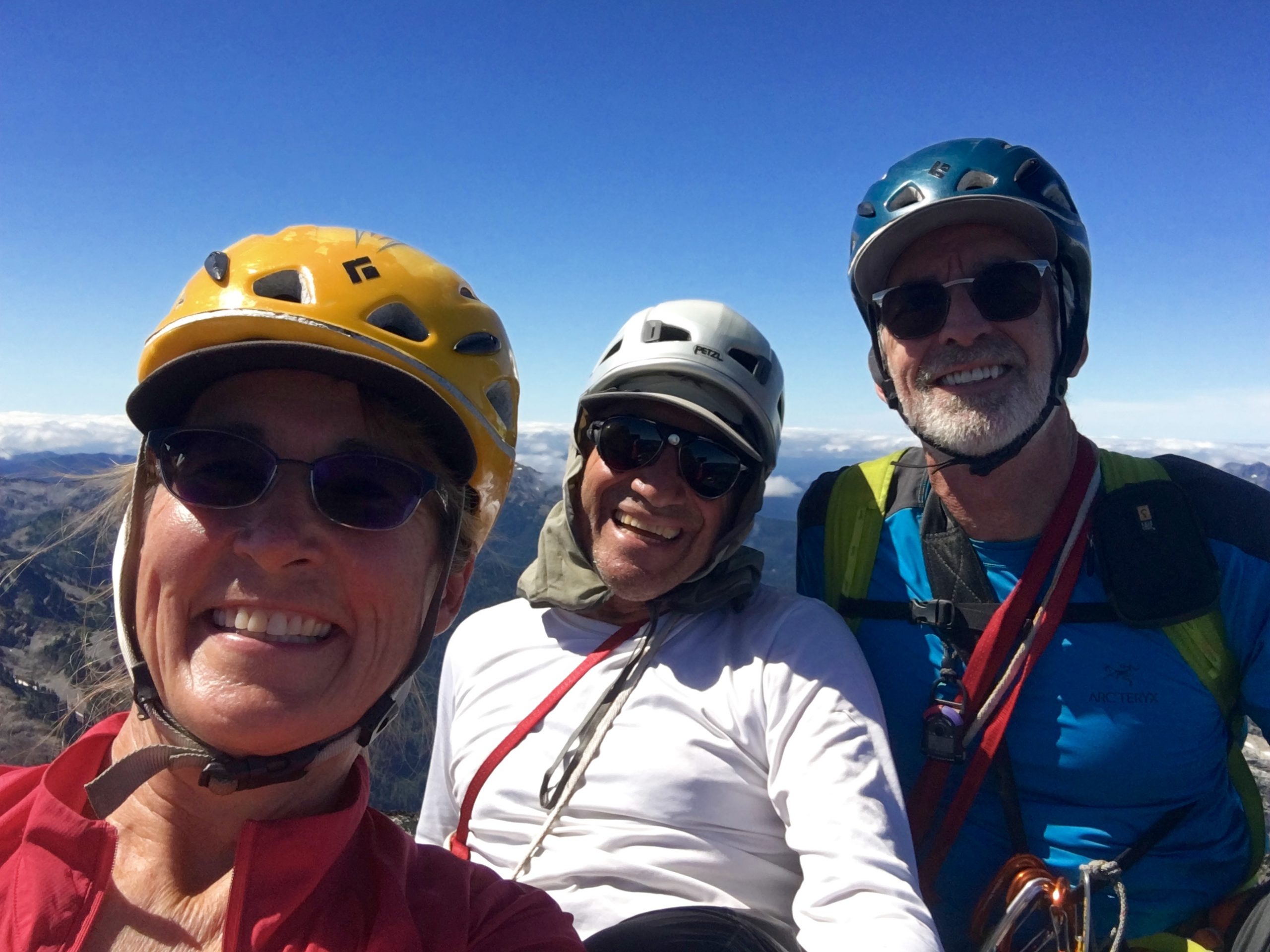
Fay, Tony, Eileen, and I teamed up for a six-day trip into the Olympic Mountains to attempt some much-desired peaks near Low Divide. Fay’s objective was 6476-foot Mt. Queets, which would be a fairly ambitious climb under any circumstances but was amplified by the the fact that she was still recovering from spinal surgery in March. This trip would provide a severe test of her progress. Tony, Eileen, and I were instead focused on 6695-foot Mt. Meany, the highest and most impressive peak in the Quinault Group. Because these two summits are less than 1 mile apart, our approach would be the same.
Day 1: Trailhead to Francis/Elip Creek Camp
On Saturday afternoon, we pulled into the over-capacity parking lot at the North Fork Quinault River Trailhead, amidst a weekend heat wave. My car thermometer read 81 degrees, and higher temperatures were expected on Sunday. As a positive note, there was no rain predicted until Wednesday or Thursday.
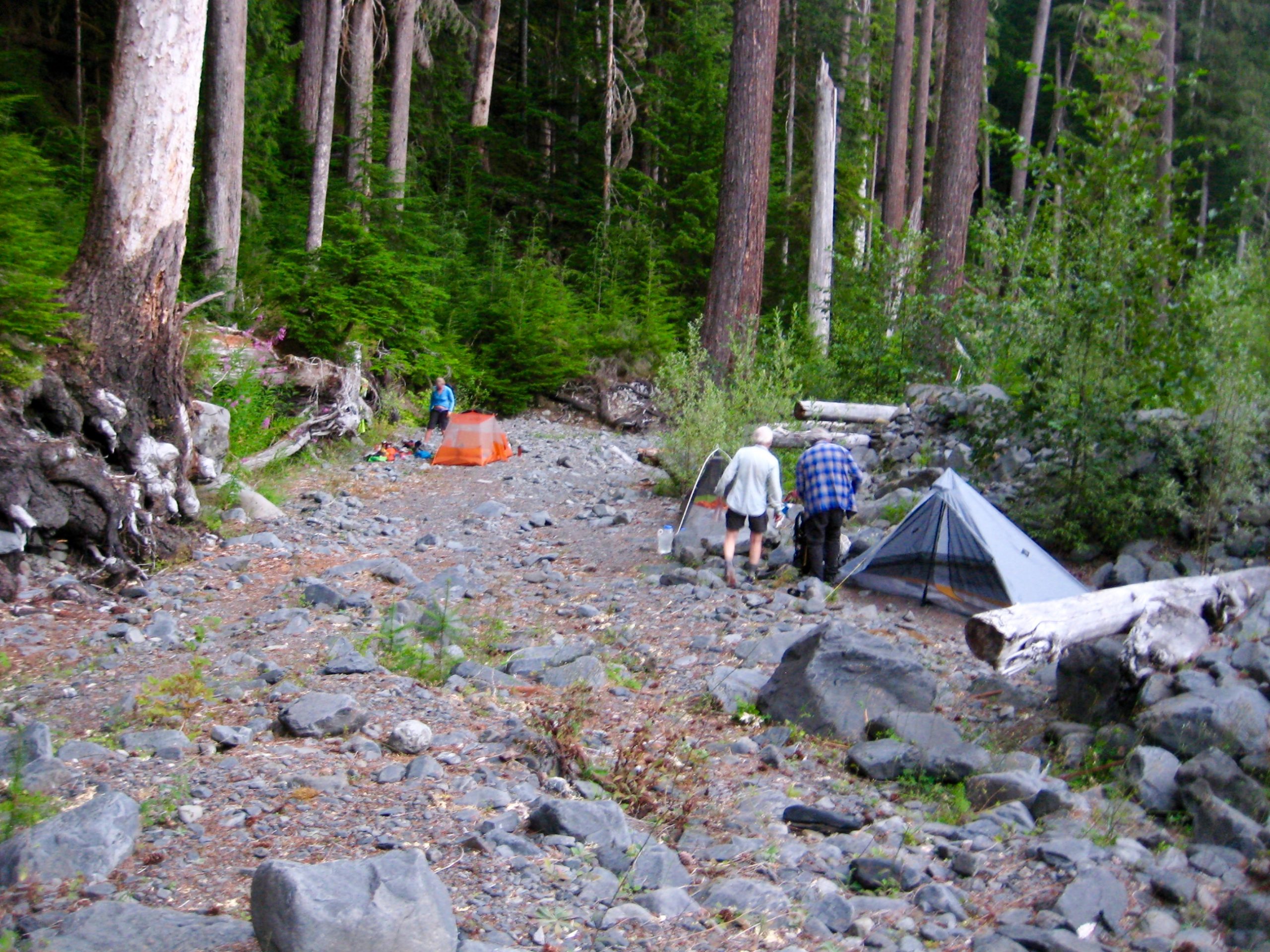
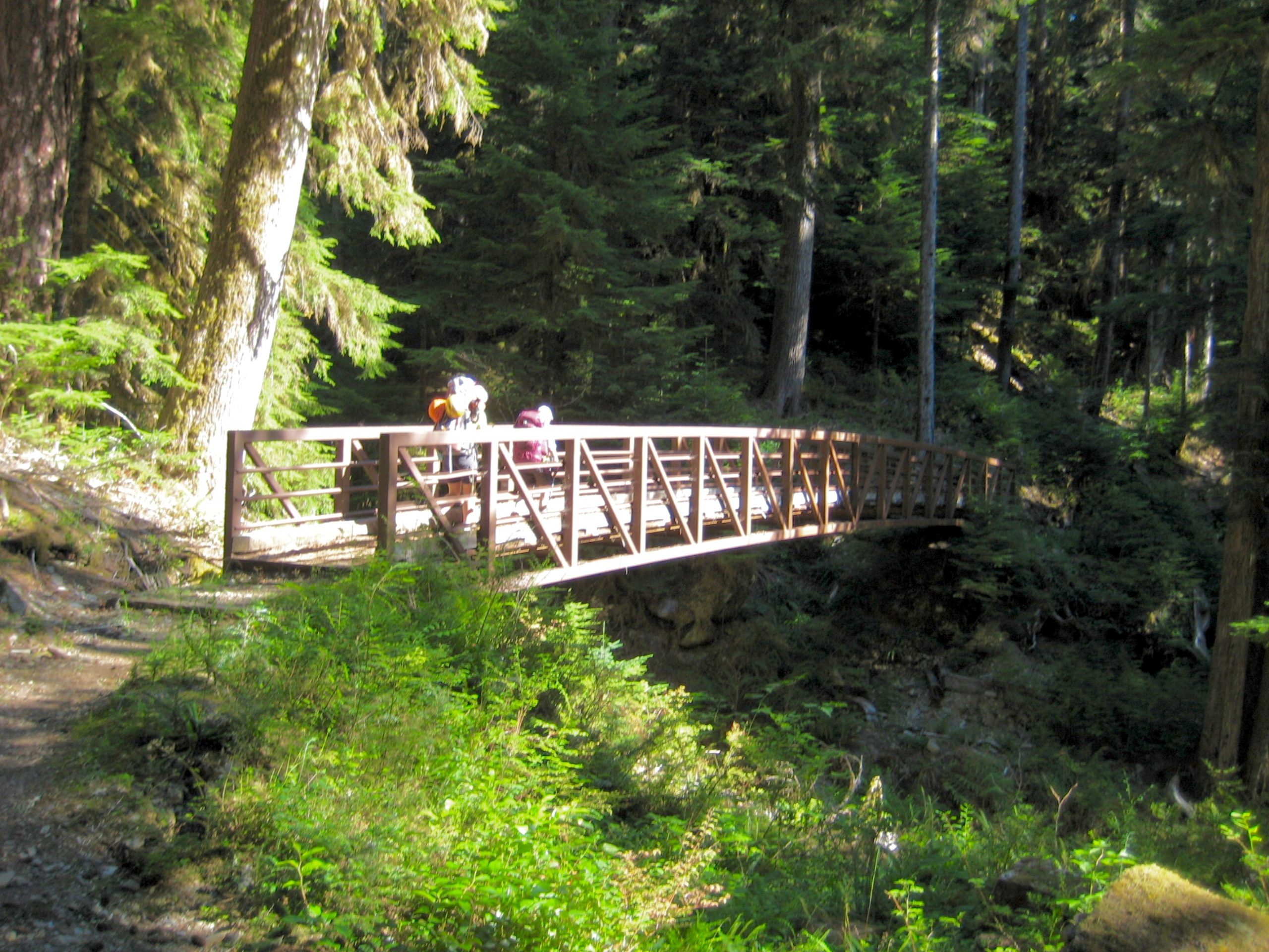
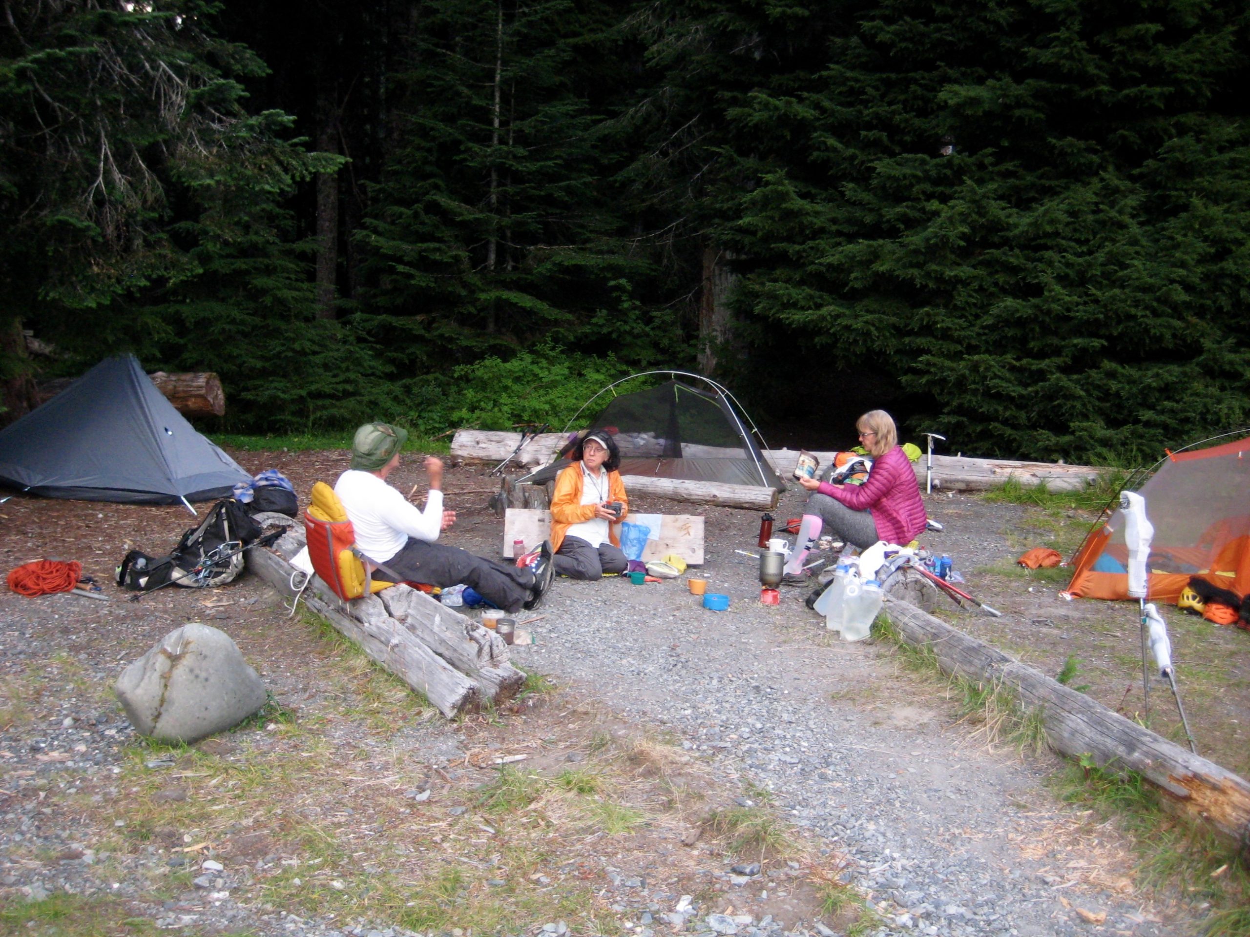
After distributing gear to keep Fay’s pack weight below 20 pounds, we started up the well-maintained trail. The rainforest canopy and frequent side-streams helped to mitigate the blazing sun and stagnant, valley-bottom air, but our overall pace was slow. We did not reach Francis/Elip Creek Camp until 7:45pm (4.8 hours + 800 feet from TH). Although numerous backpackers had arrived before us, this campsite was large enough to accommodate our three tents.
Day 2: Francis/Elip Creek Camp to Low Divide Camp
We were back on the river trail at 9:30am and heading for Low Divide, located 10 miles up-valley. With today’s forecast of very hot weather, the morning coolness was appreciated for a precious hour or two.
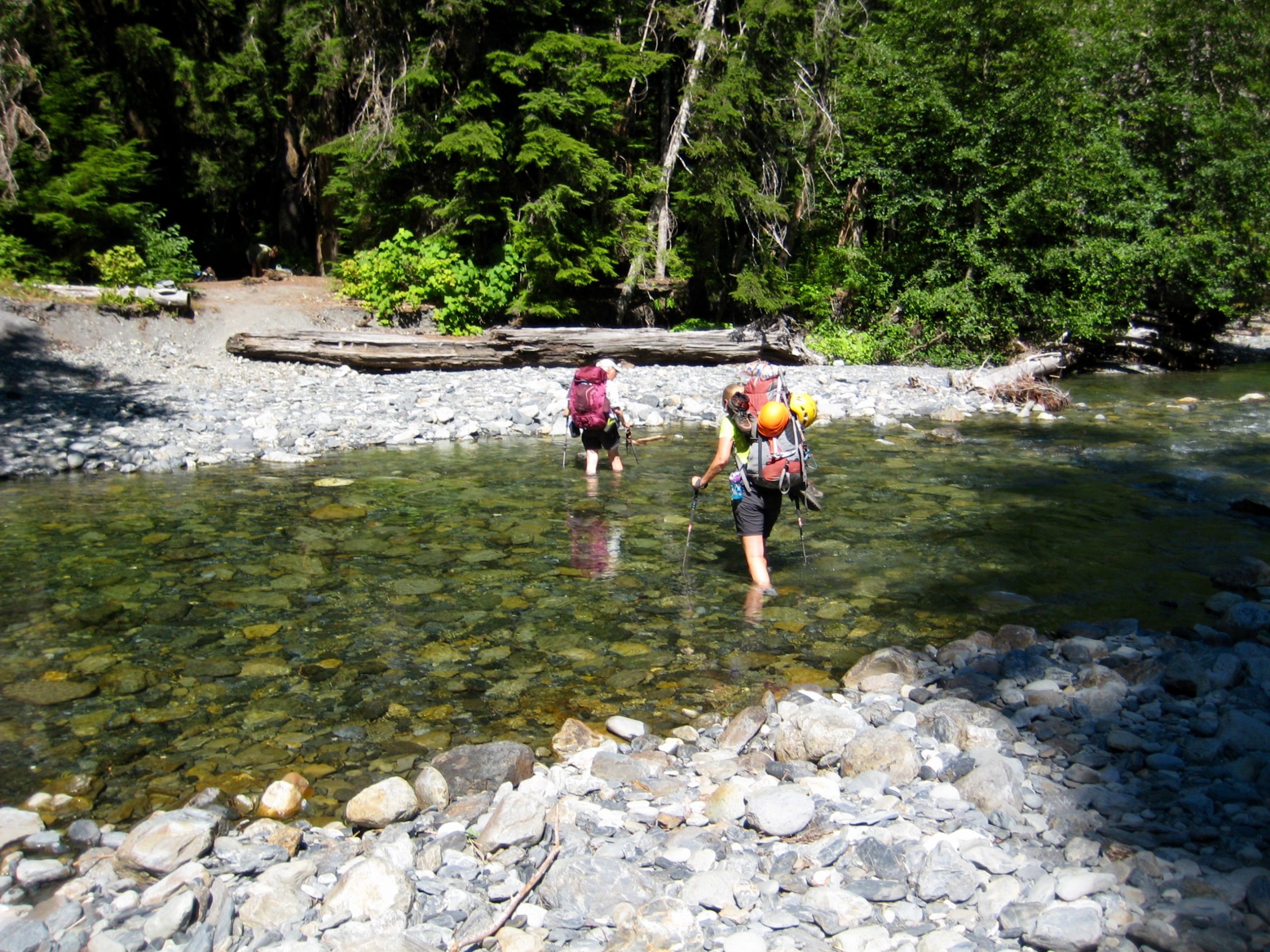
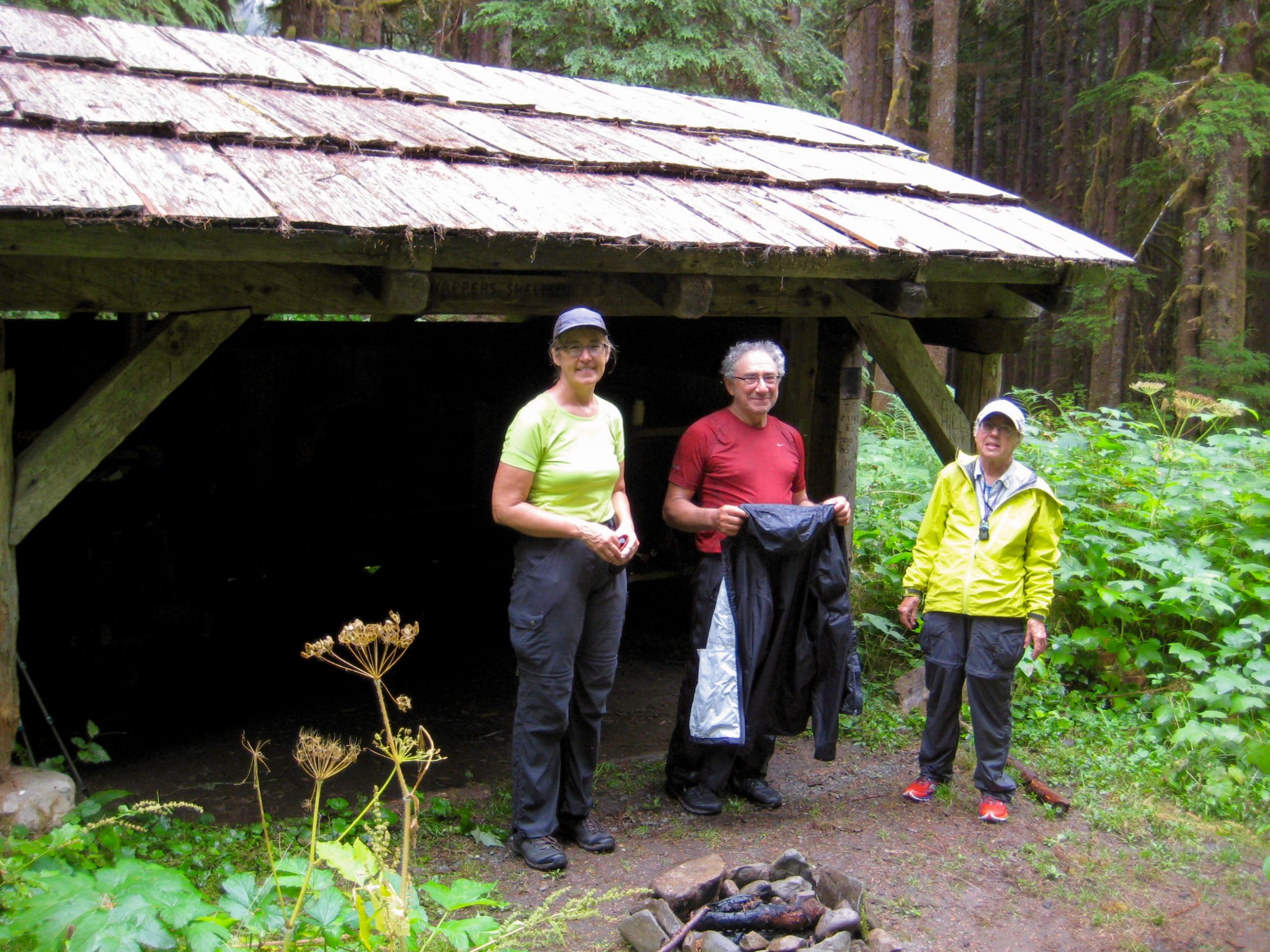
Beyond the uninviting wooden shelter at Trapper’s Camp, the trail steepened noticeably and had received less maintenance. We reached the Quinault River shoreline across from Sixteenmile Camp in early afternoon (4.7 hours + 1350 feet from Camp 1), just as the temperature was peaking around 85 degrees. The mandatory river ford here is usually met with displeasure—if not downright apprehension—by hikers, but not today; we relished the opportunity to cool off in the gentle current.
After taking a long lunch break beside the river, we shouldered packs and continued upward. The late-afternoon heat felt almost oppressive, and our torpid pace averaged barely over 1 mile per hour. Relief finally came as we entered the lush expanse of Low Divide, where both the trail gradient and air temperature greatly eased back.
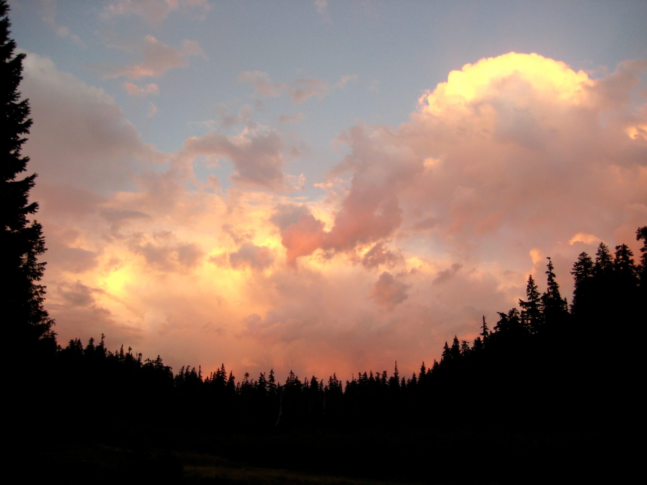
We strolled into Renegade Camp near the shuttered-up ranger station in early evening (9.3 hours + 2850 feet from Camp 1), more than ready to stop for the night. Colorful clouds and hungry insects greeted our arrival.
Day 3: Low Divide Camp to Seattle Basin
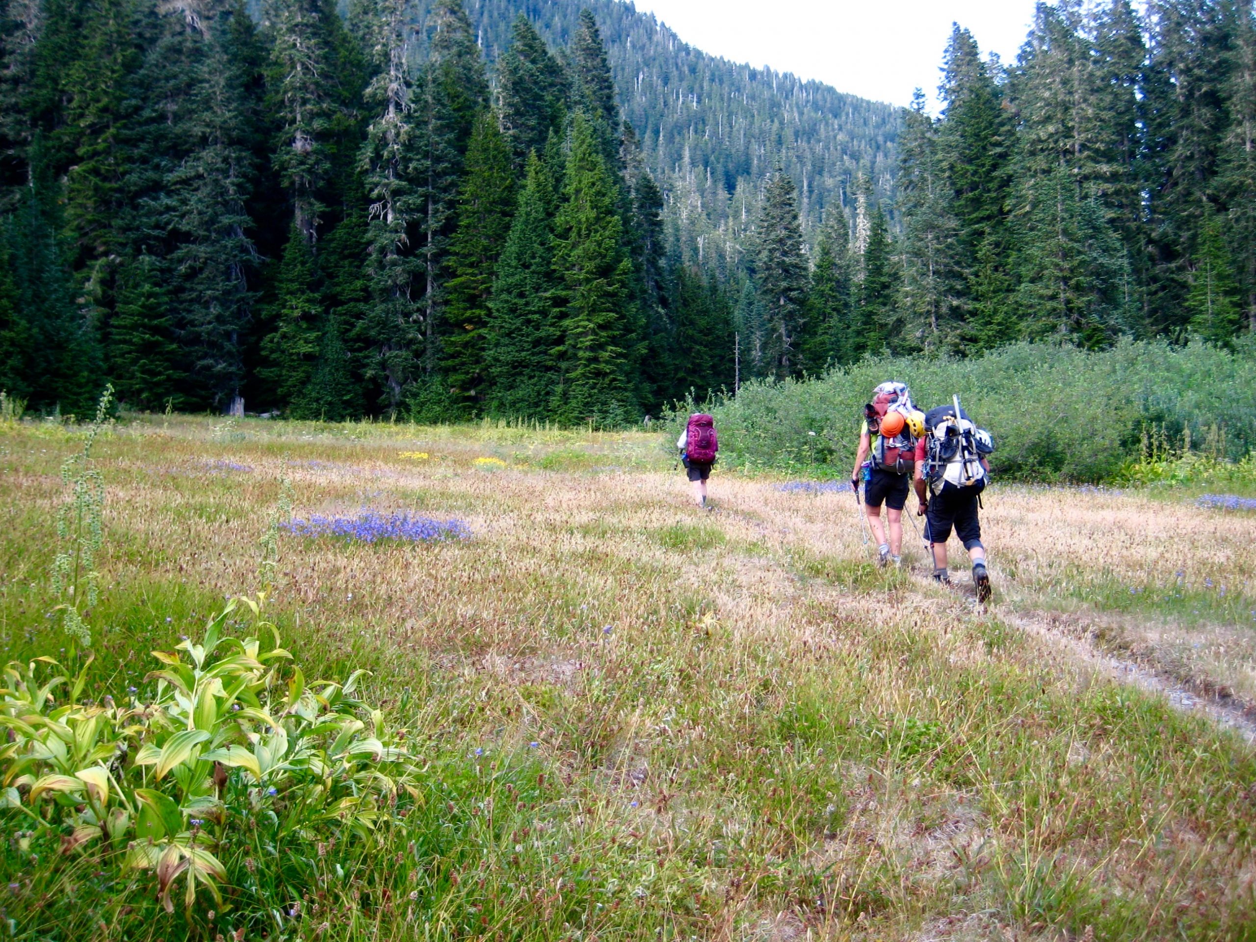
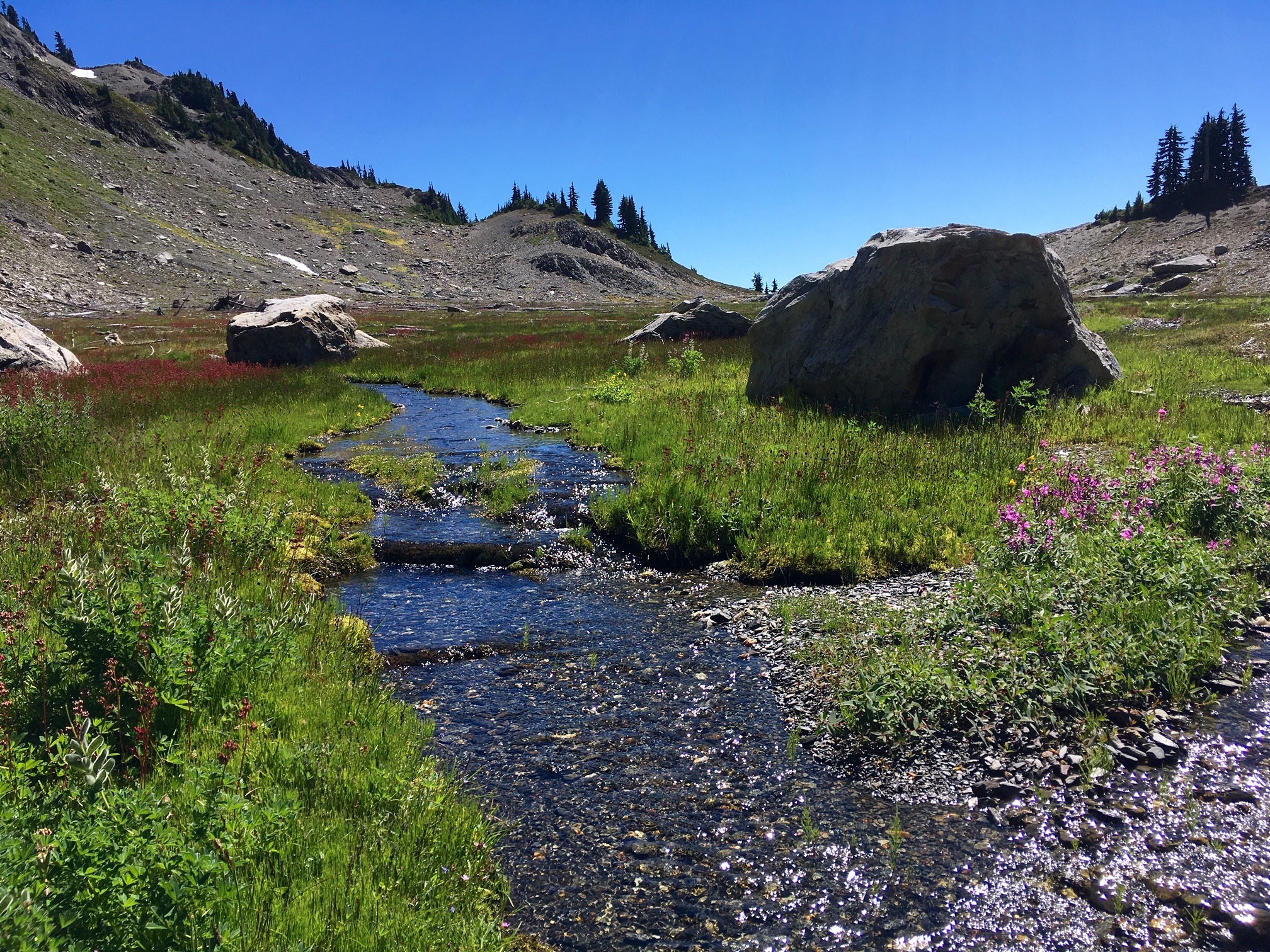
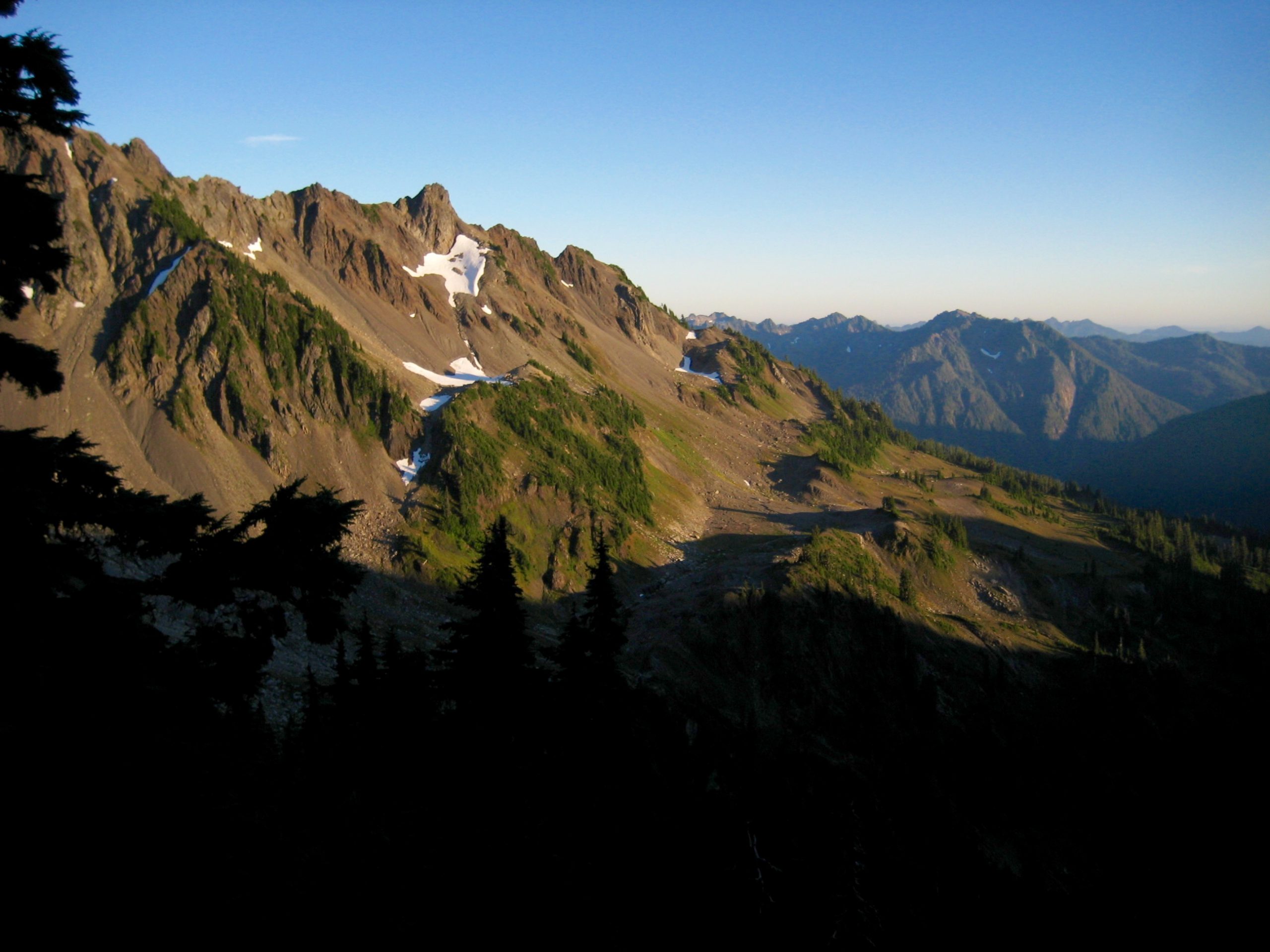
We departed Low Divide shortly after 9:00am and started hiking up the Skyline Trail, happily knowing that our longest and hottest trail segment was now behind us. Today would be shorter, slightly cooler, and much more scenic. After 2 miles of switchbacks, our trail entered the rolling parkland of Seattle Meadows.
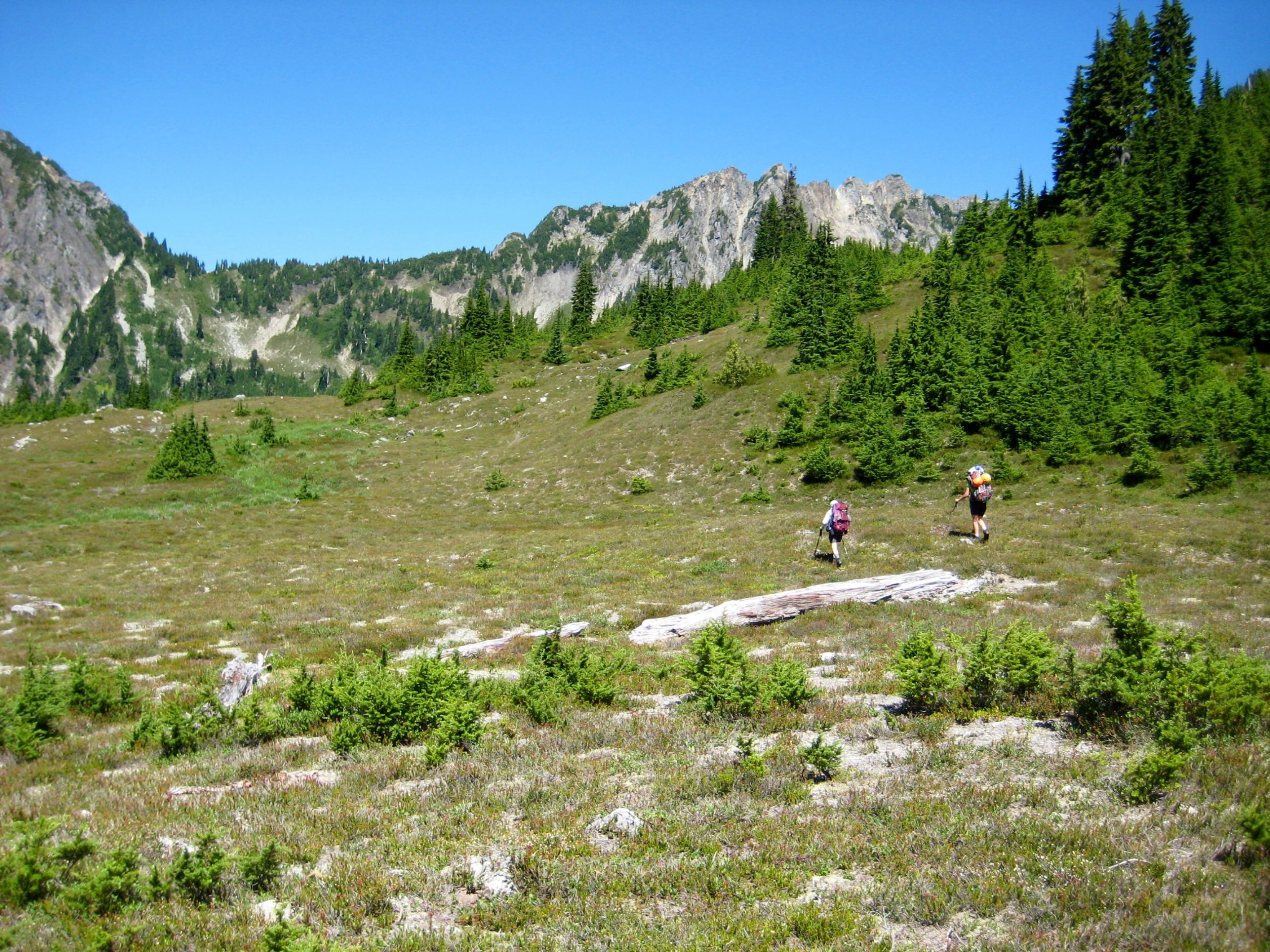
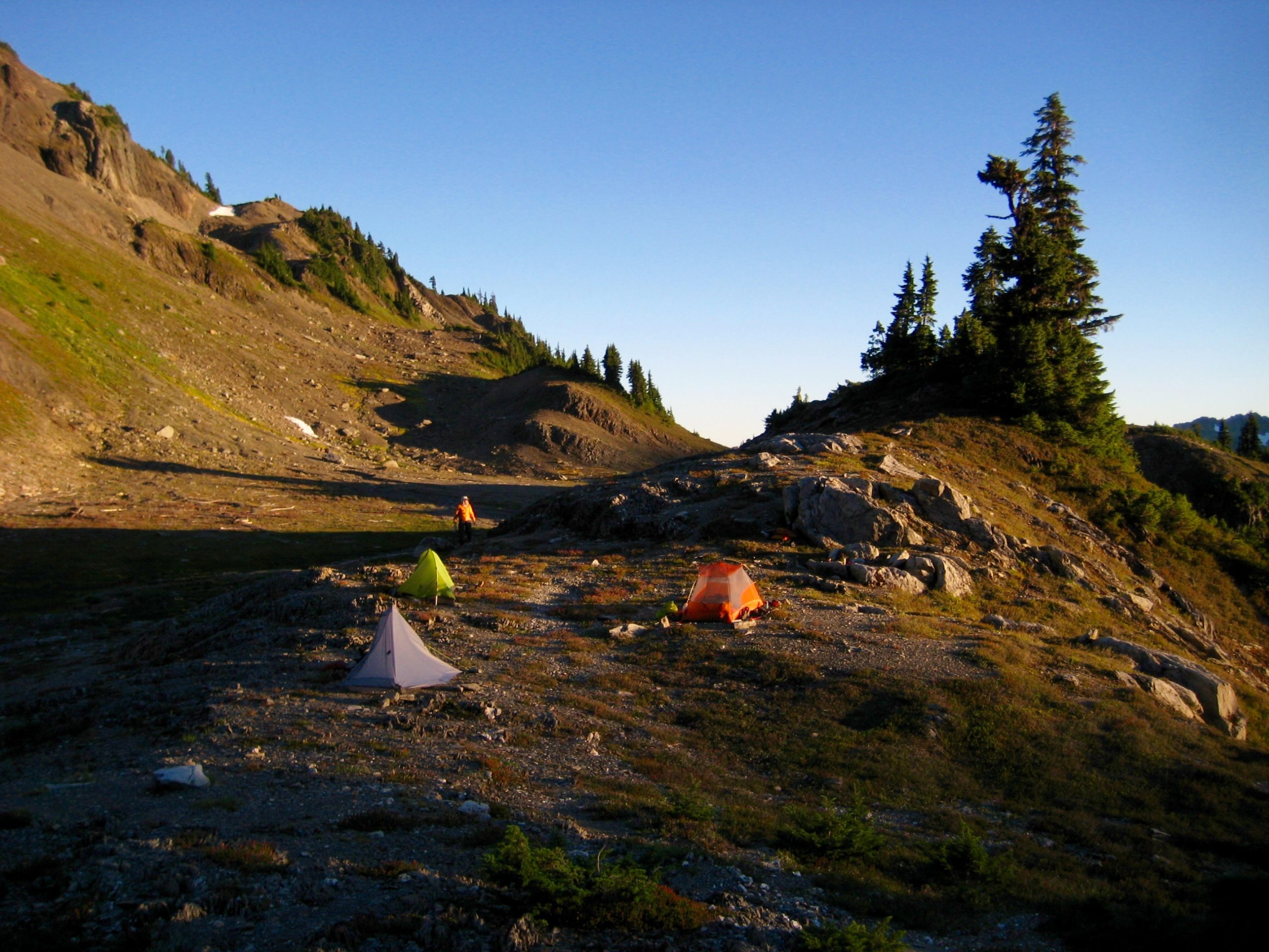
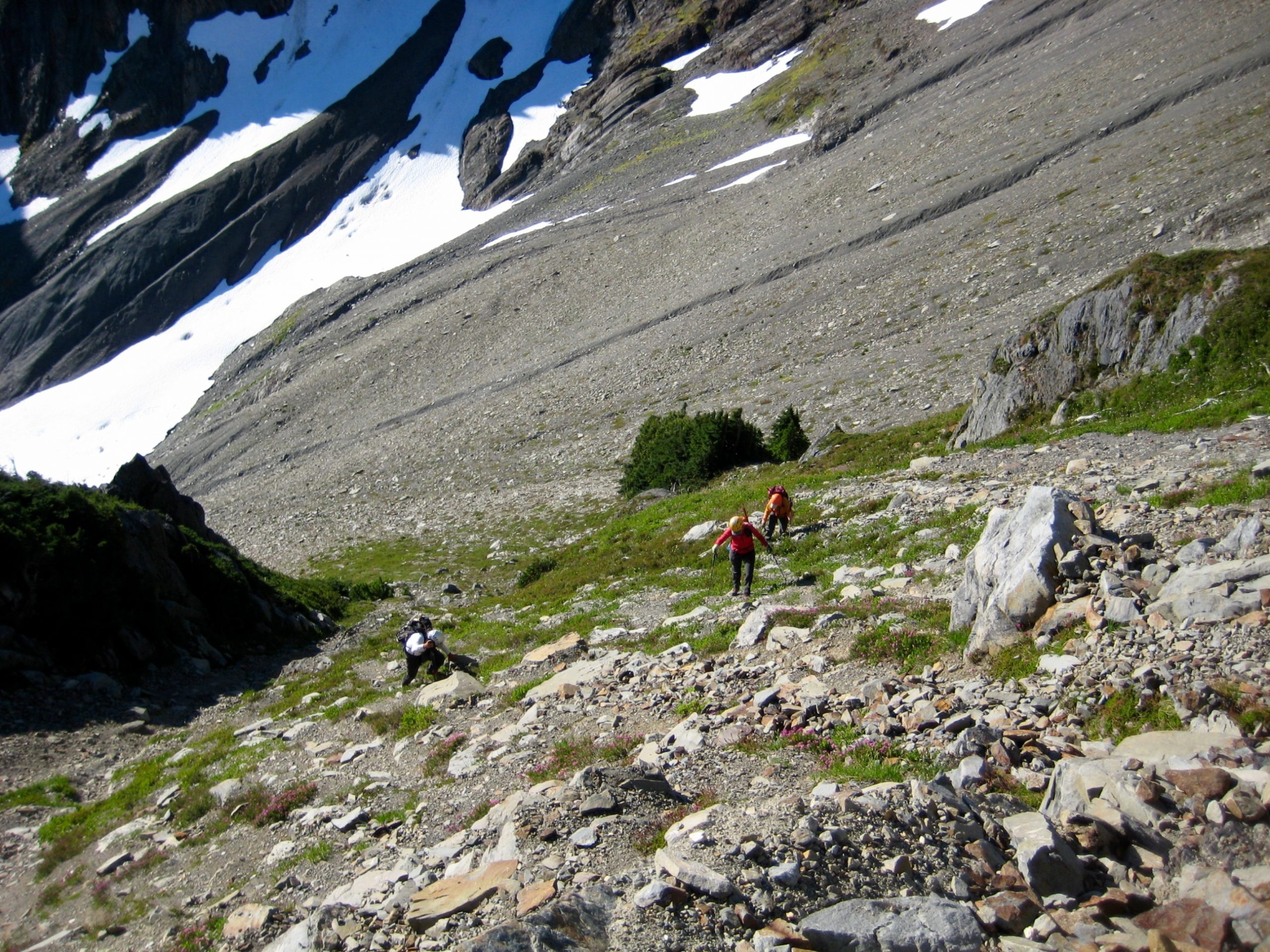
A bit farther along, we left the trail and went cross-country up through heather meadows until reaching the flatter terrain of Seattle Basin (4.8 hours + 1600 feet from Camp 2). It was early afternoon when we established our basecamp on a 4900-foot gravelly rib overlooking the basin.
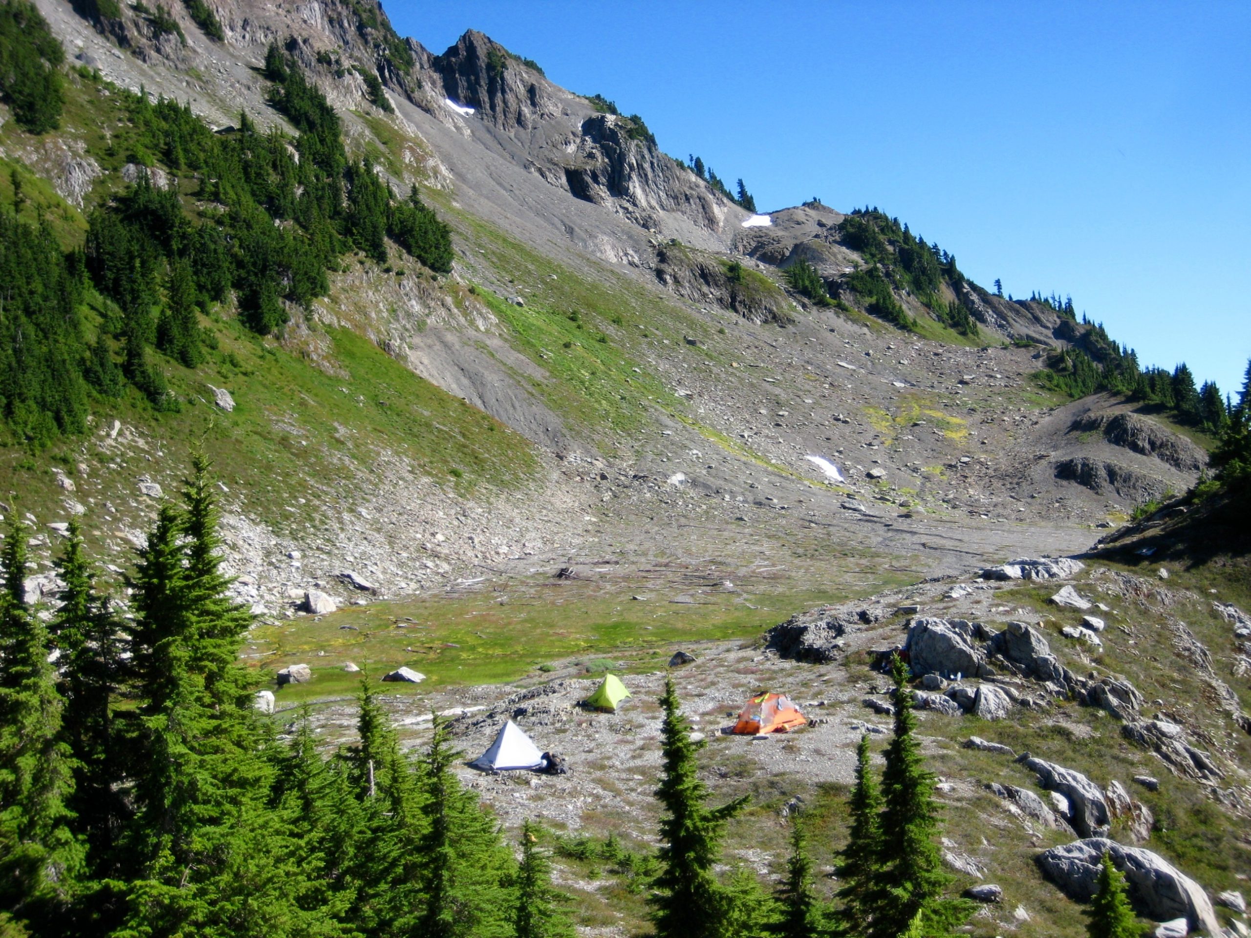
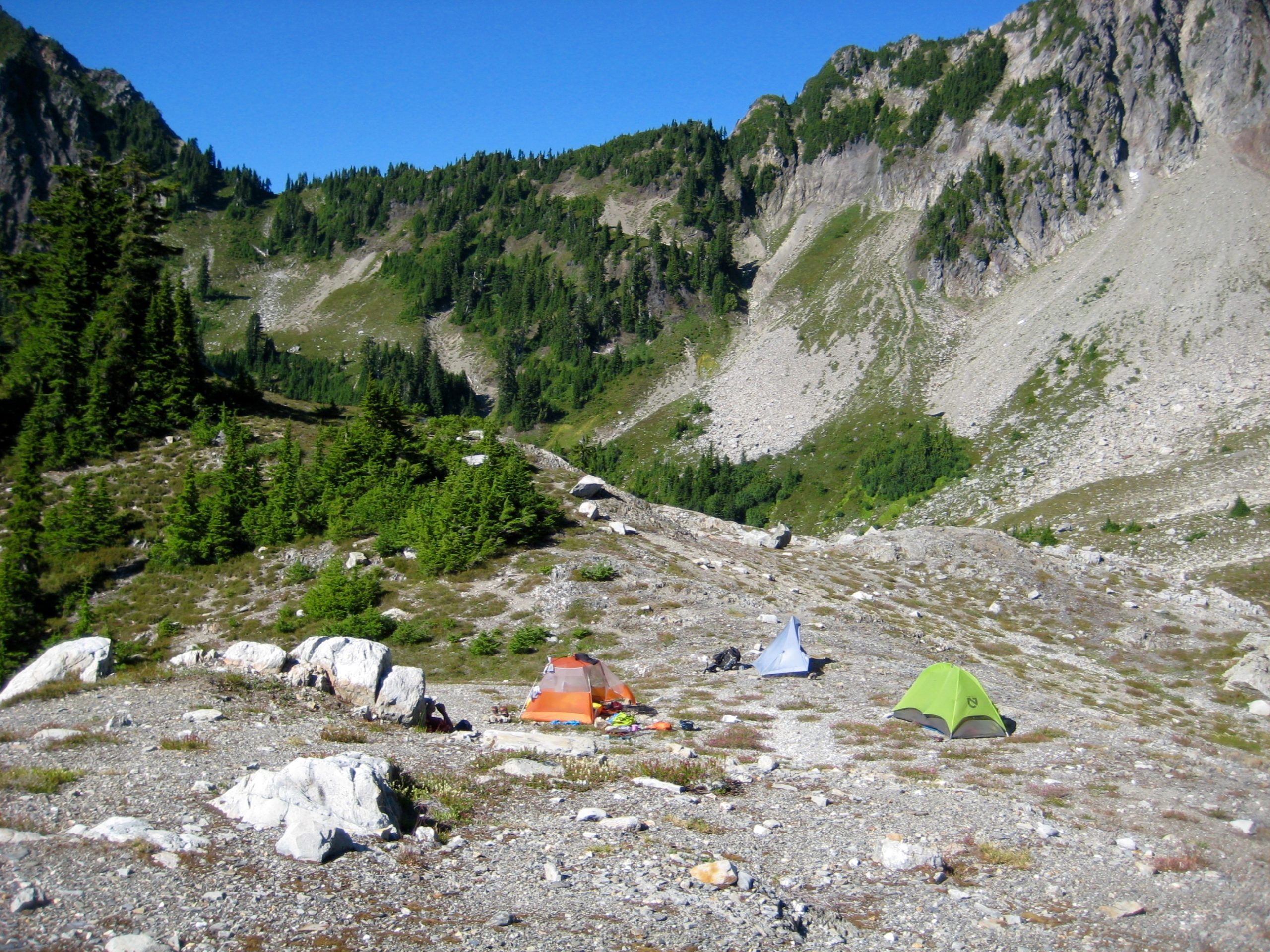
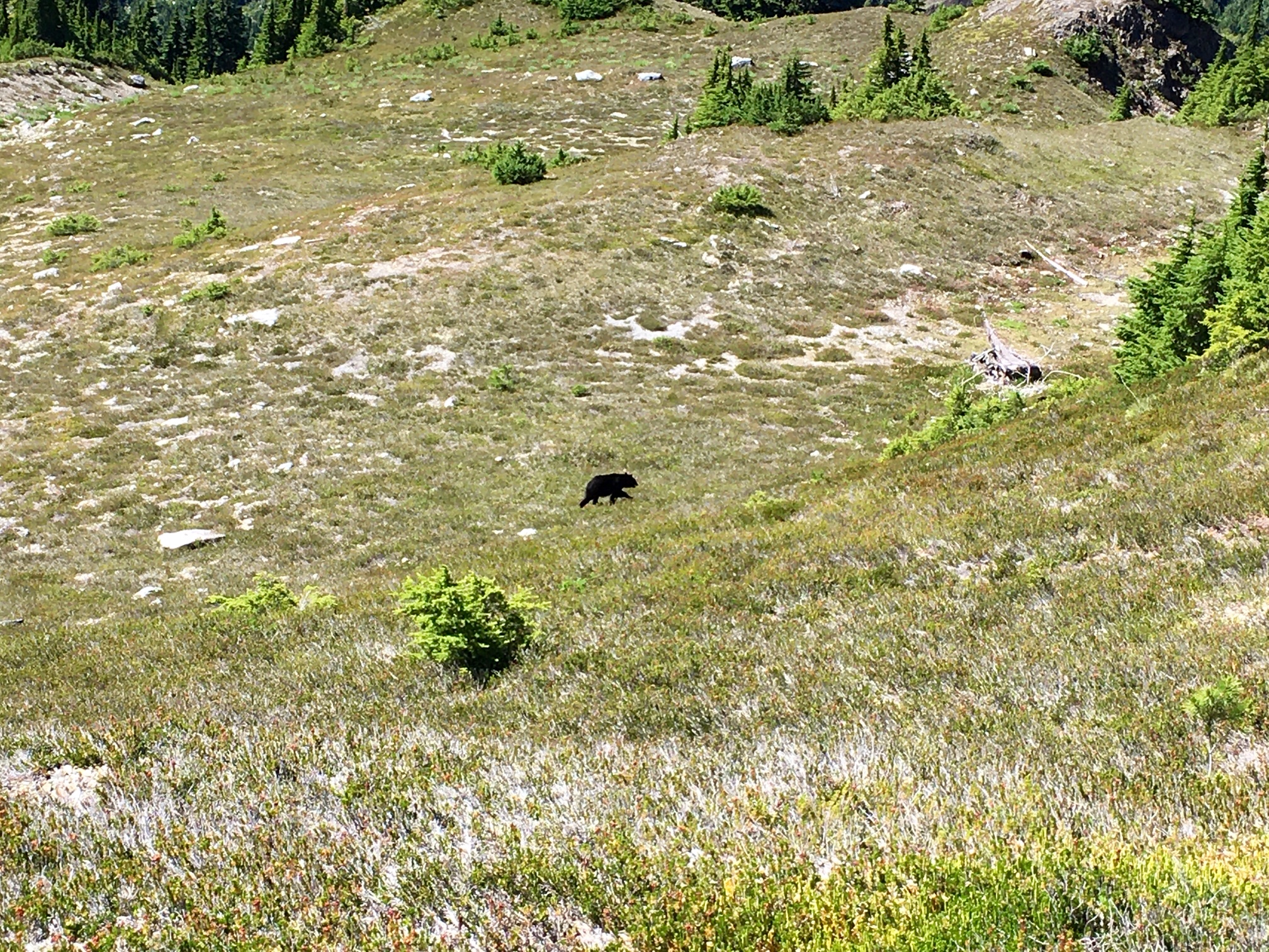
We had ample time to relax, explore the basin, and prepare for tomorrow’s climb. However, a black bear grazing in the huckleberry bushes near camp reminded us to not get too relaxed about food storage!
Day 4: Mt. Meany Summit Climb
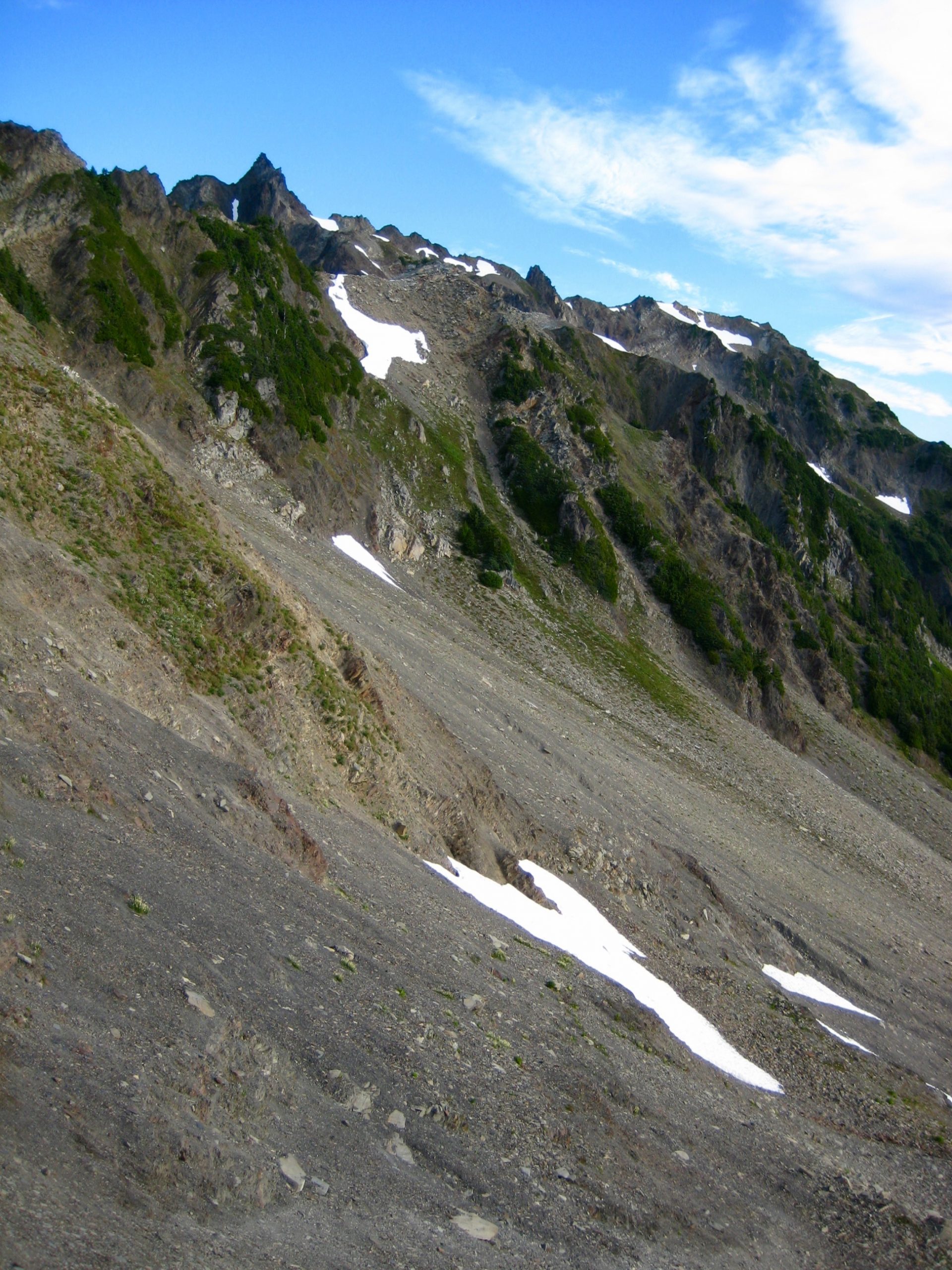
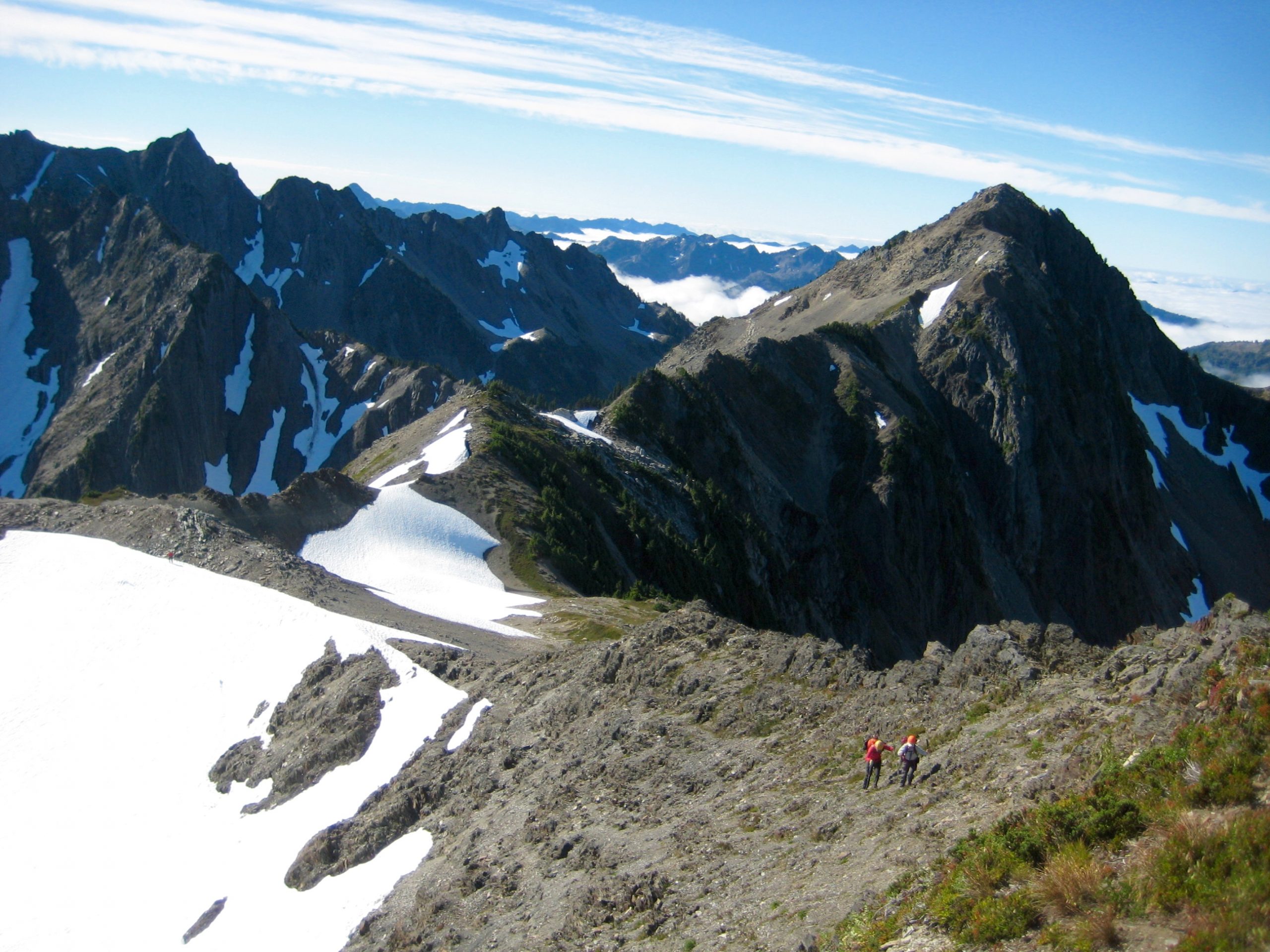
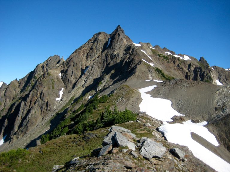
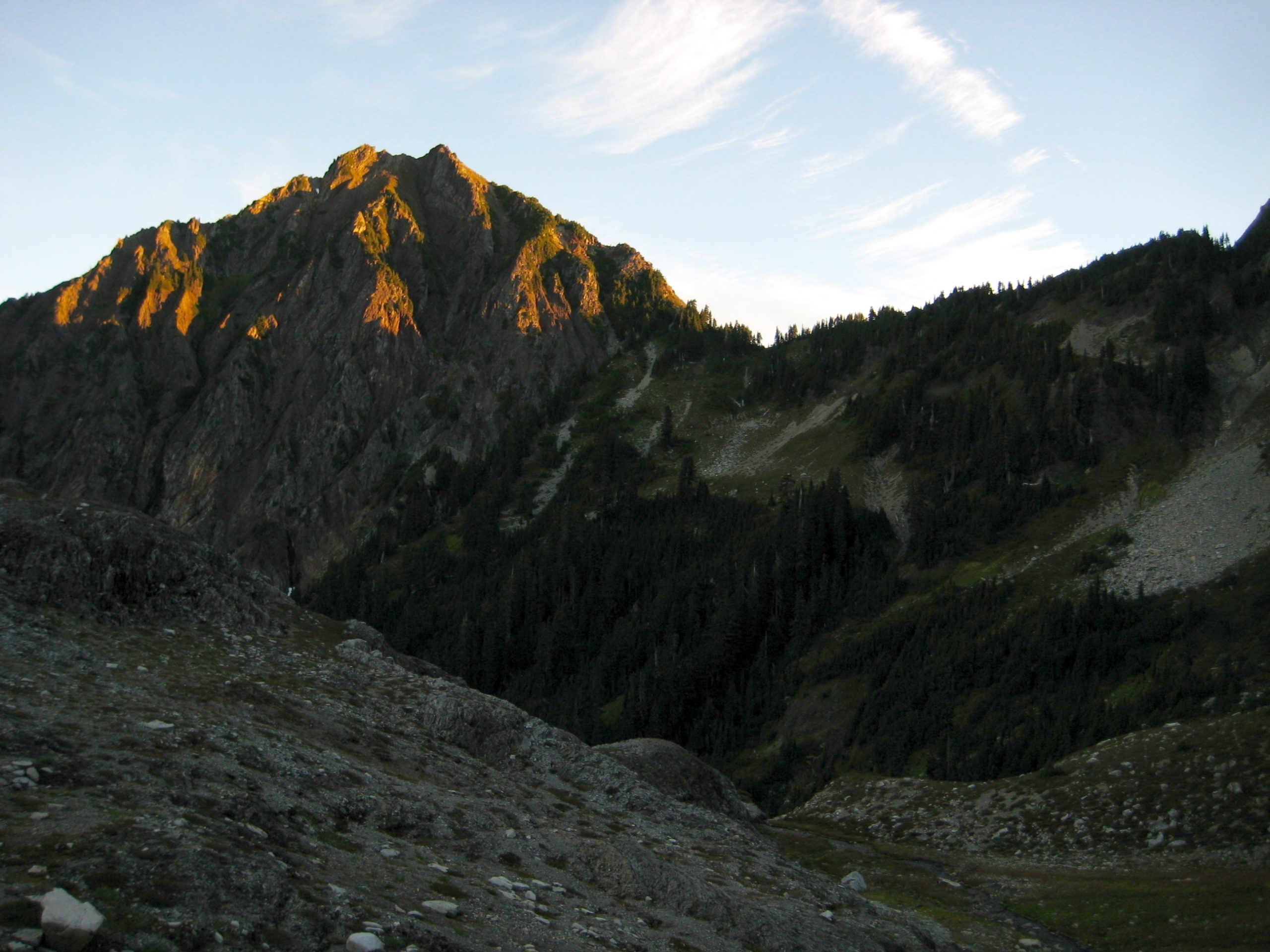
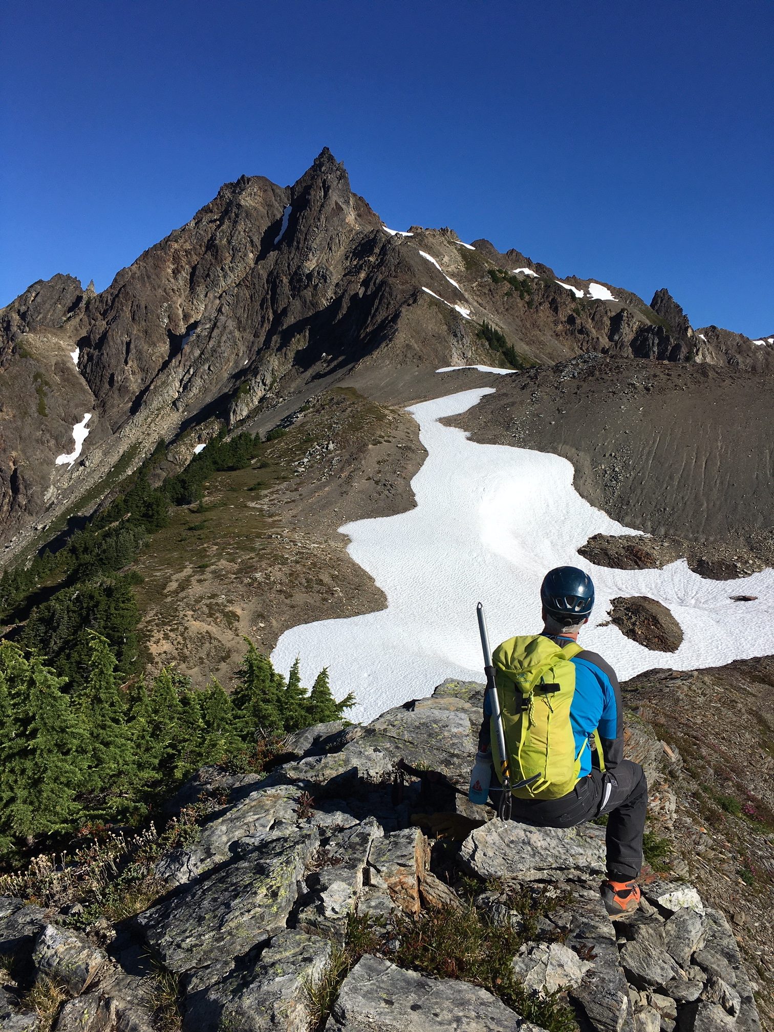
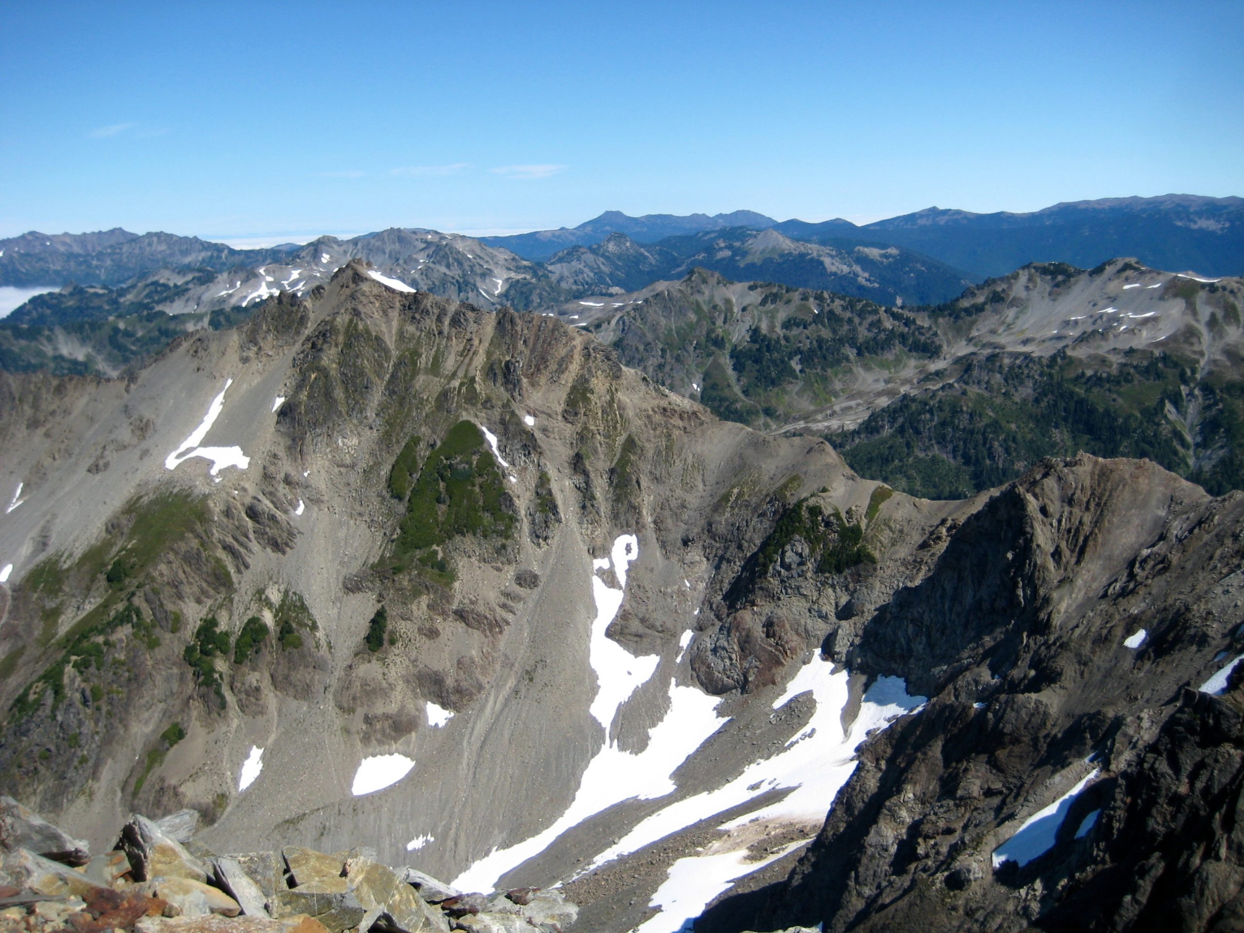
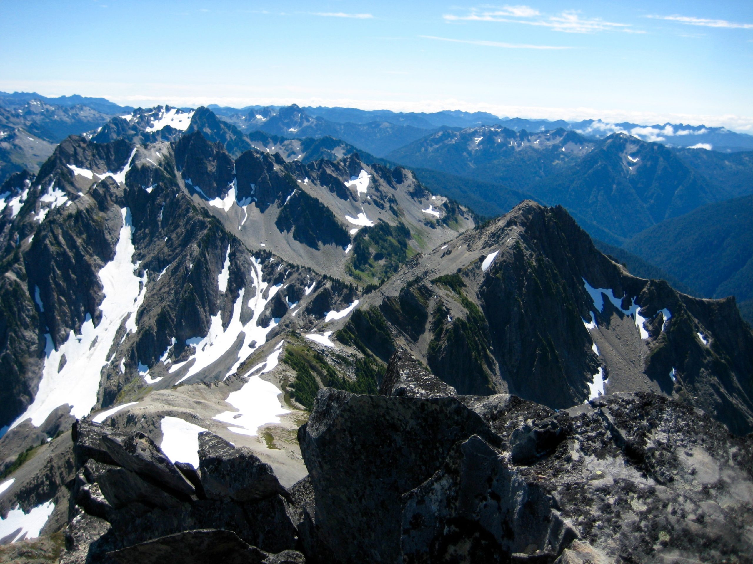
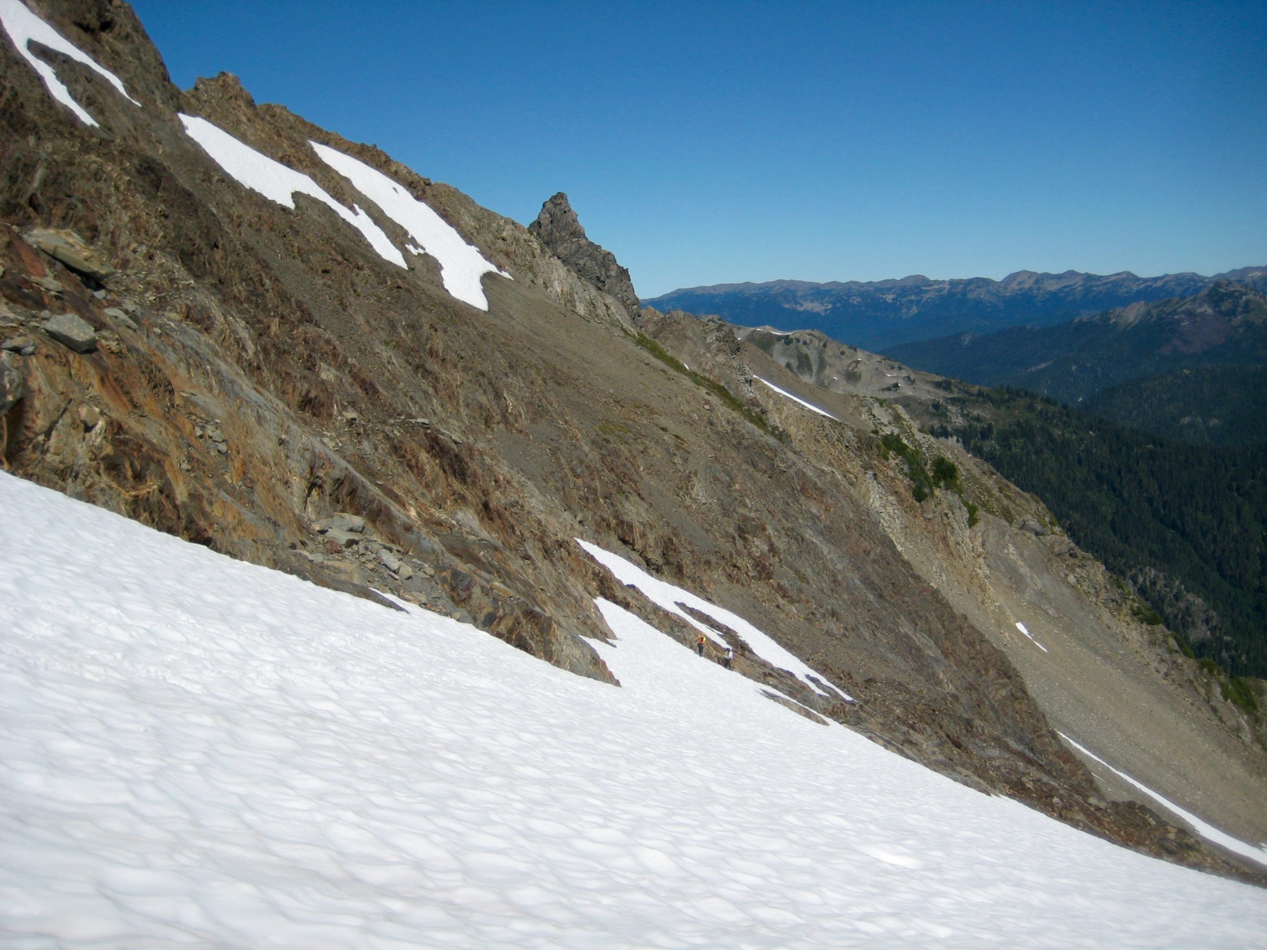
In an uncharacteristic display of motivation, we were all awake at 5:00am and heading out before 6:30am. Our route from camp took us across the head of Seattle Creek and up to the Noyes-Cougar Saddle. There, we got our first view of Mt. Meany and Mt. Queets to the north.
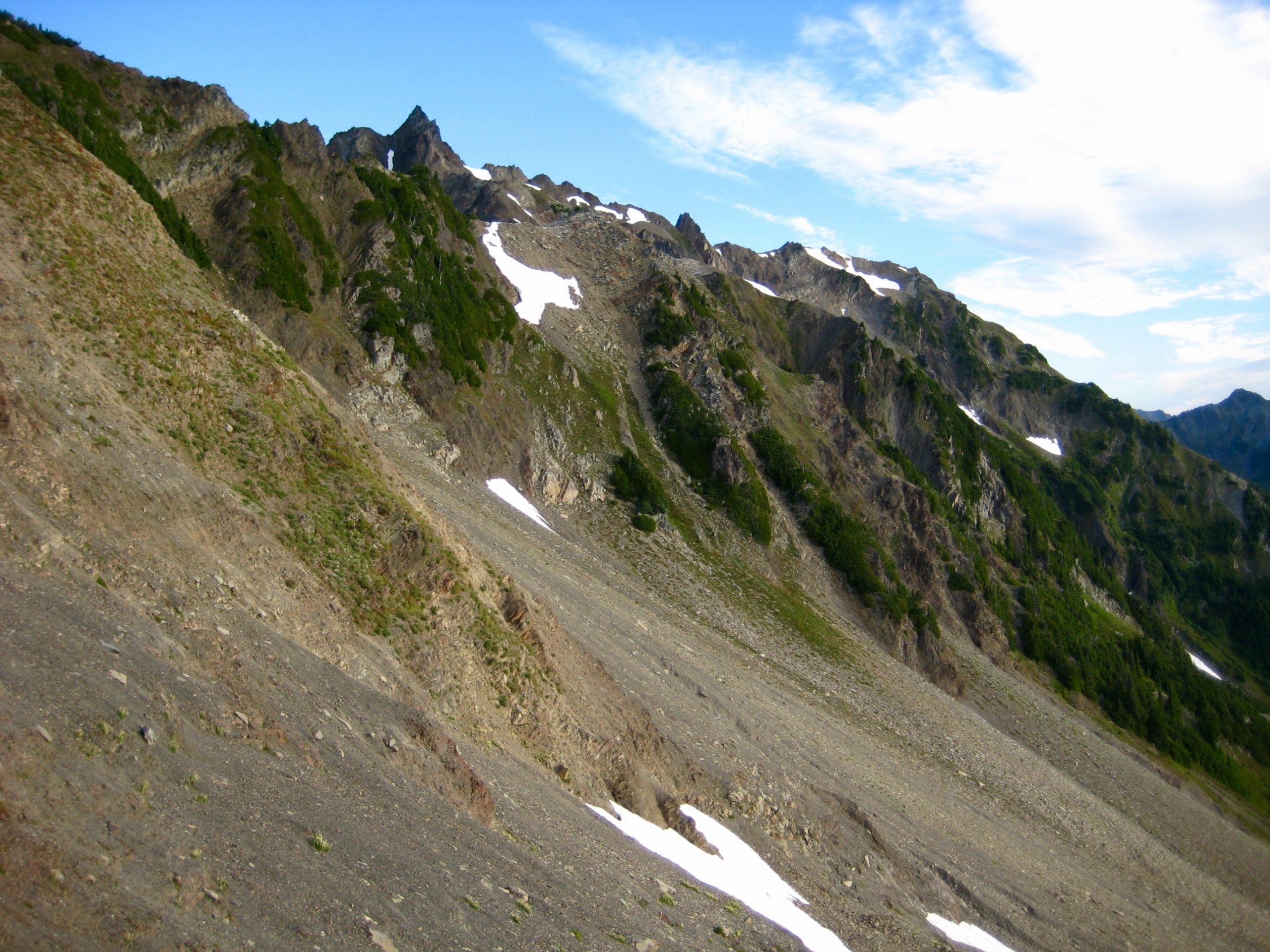
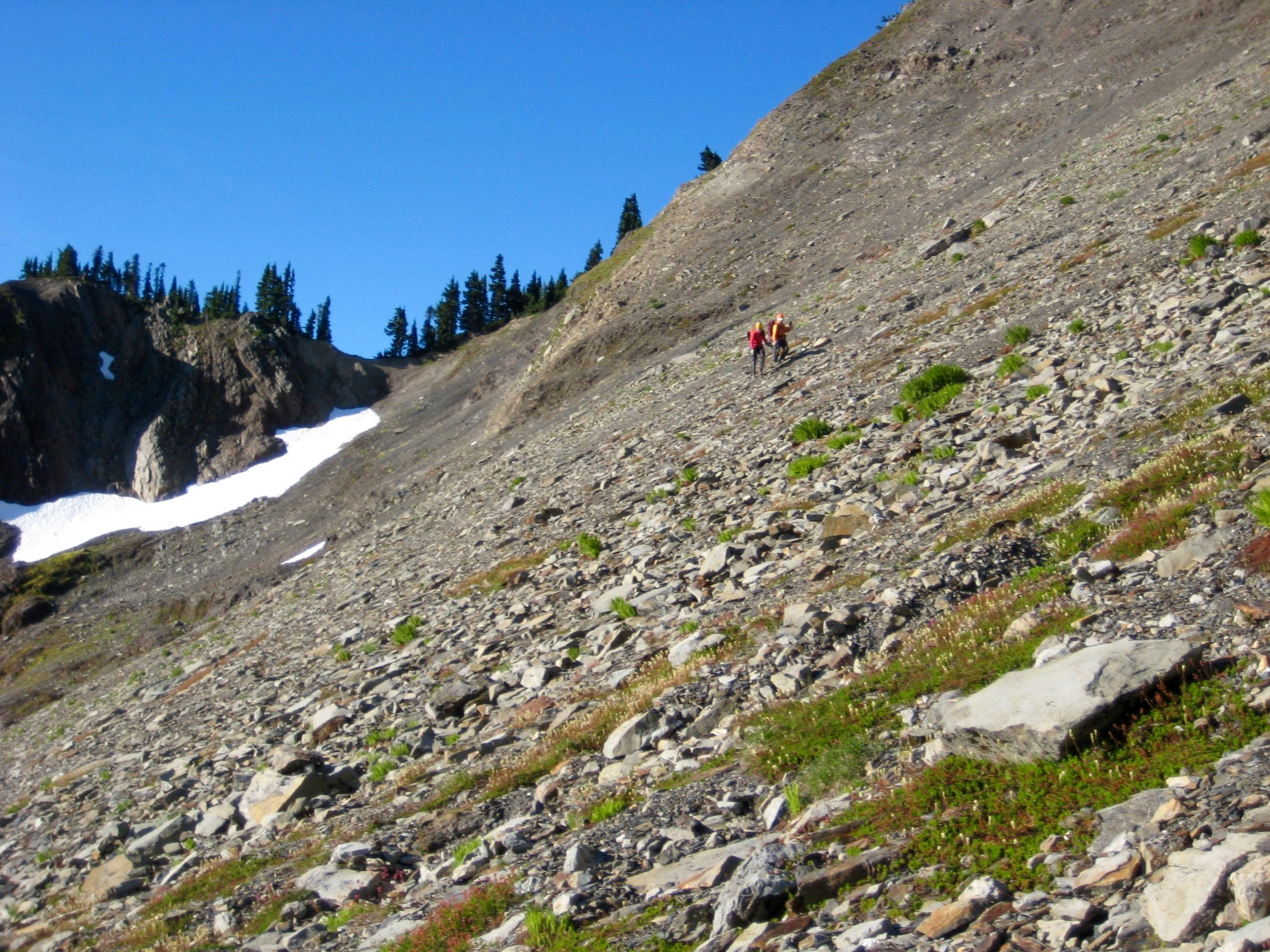
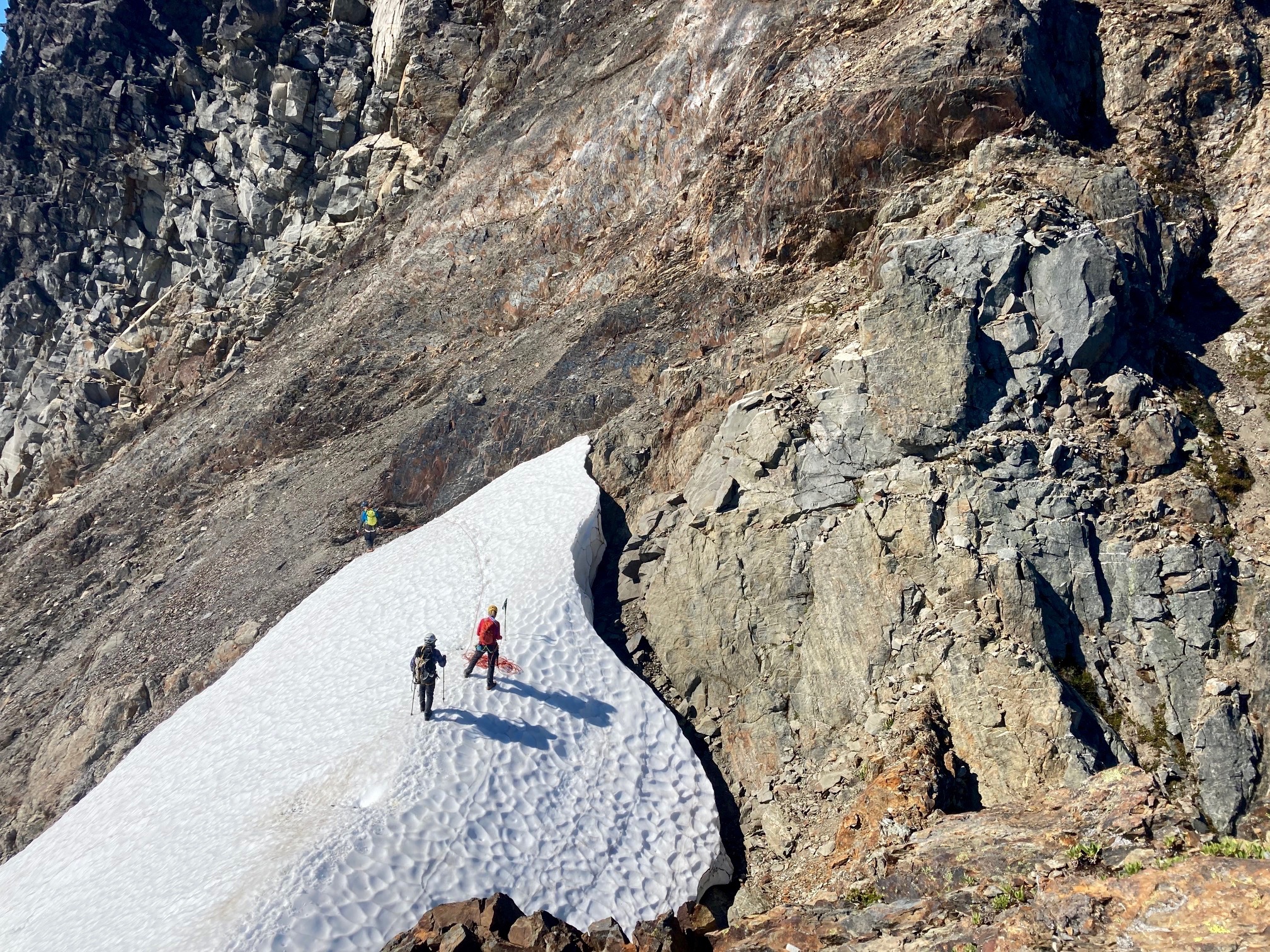
A 100-foot descent from the saddle allowed us to make an unpleasant sidehill traverse beneath Mt. Noyes on compacted dirt and gravel slopes. We then ascended a loose rock couloir to gain a snow saddle between Mt. Noyes and Mt. Meany.
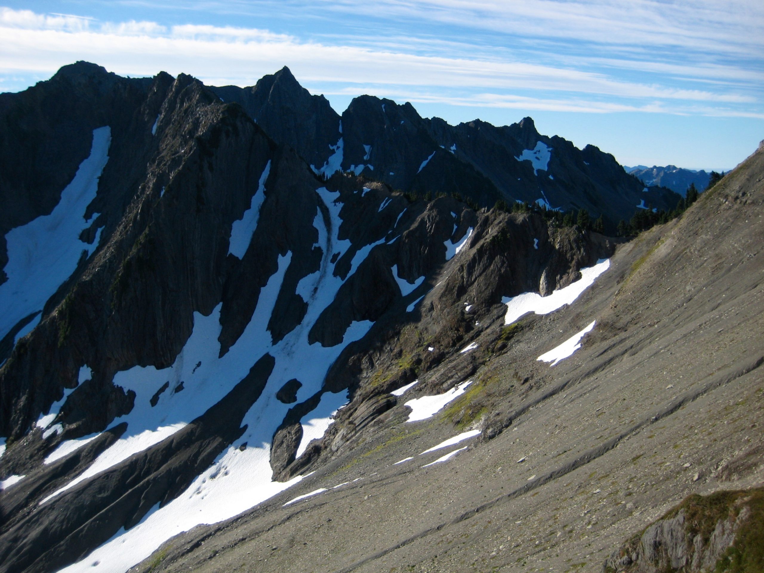
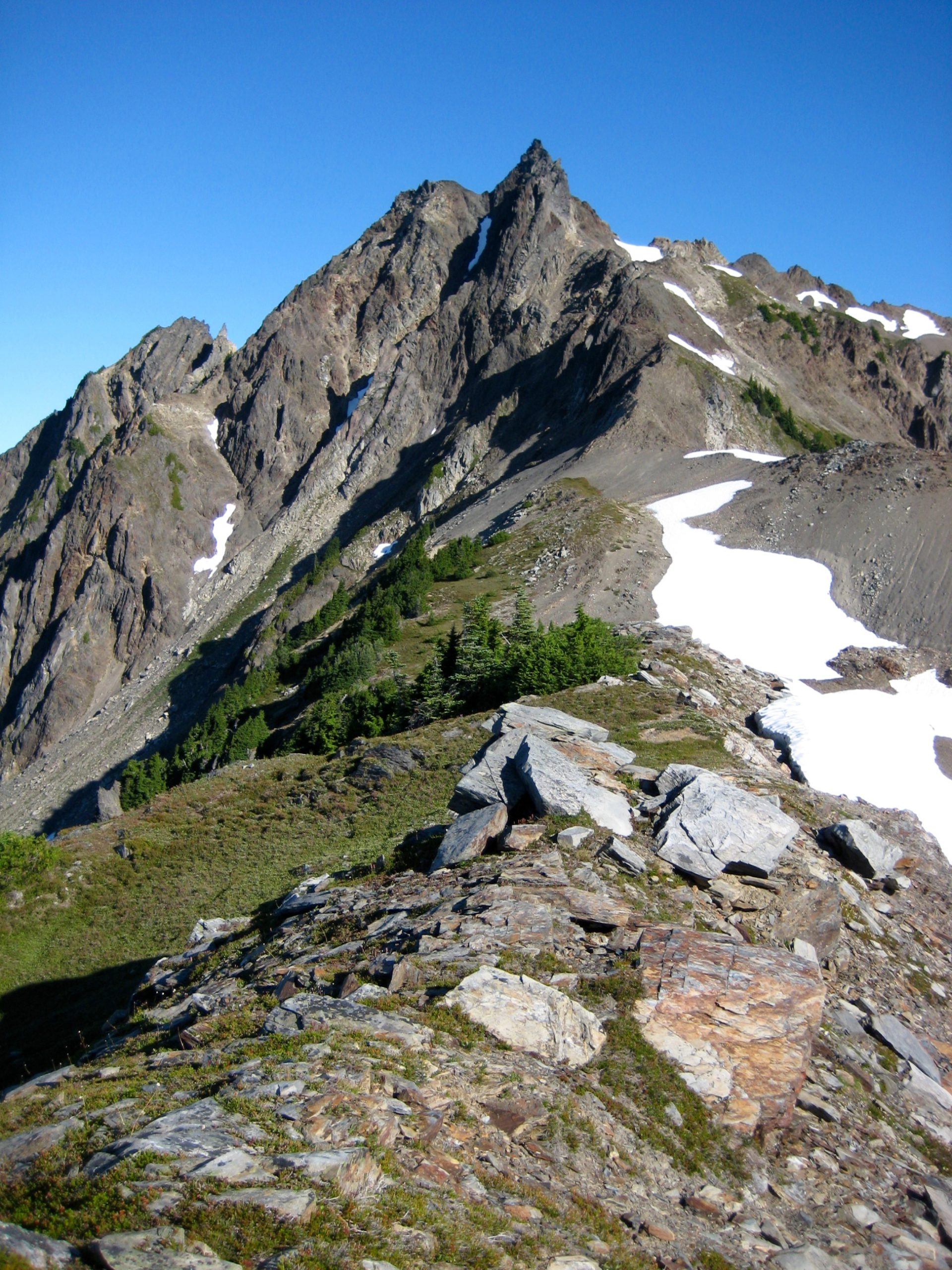
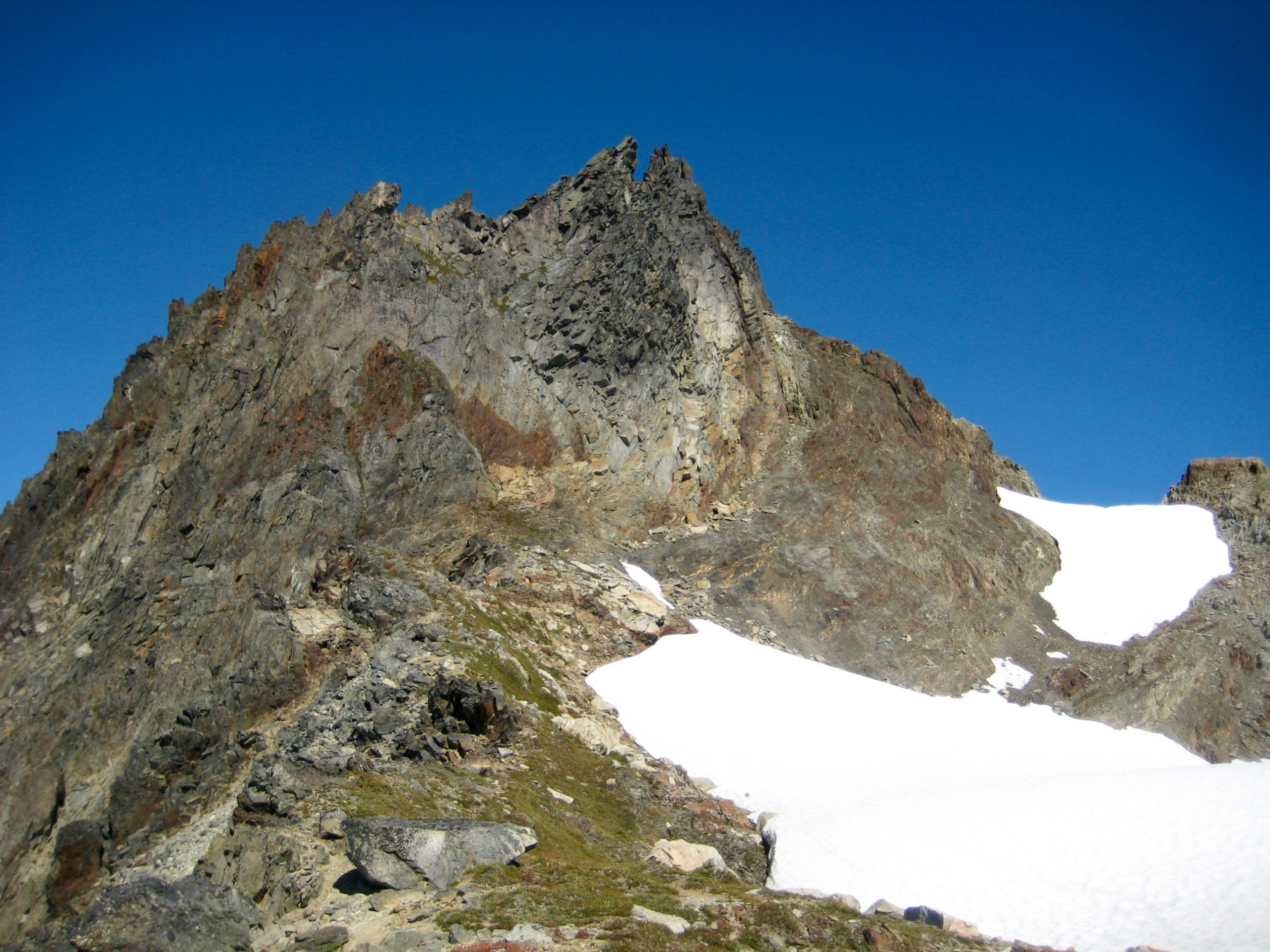
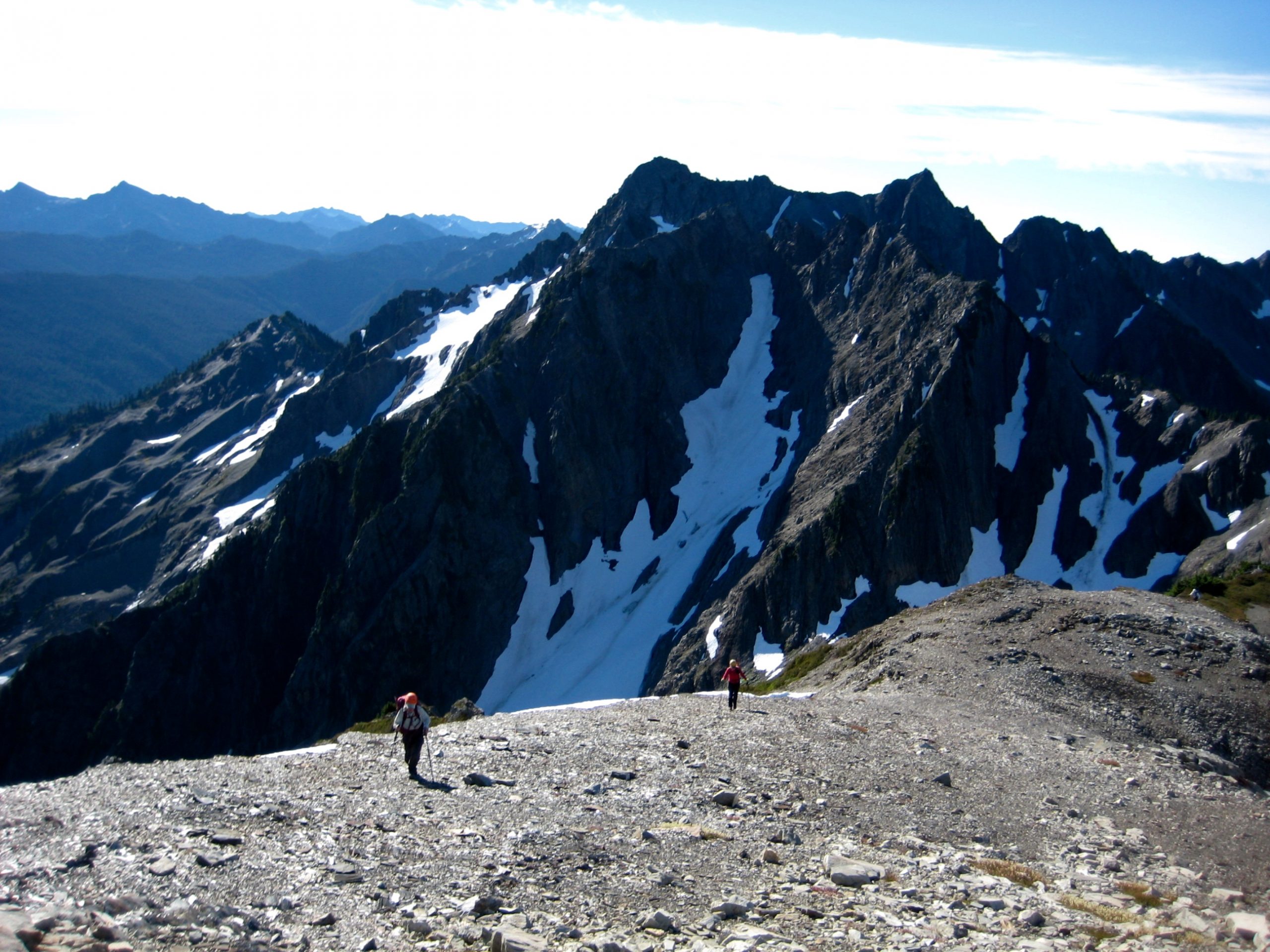
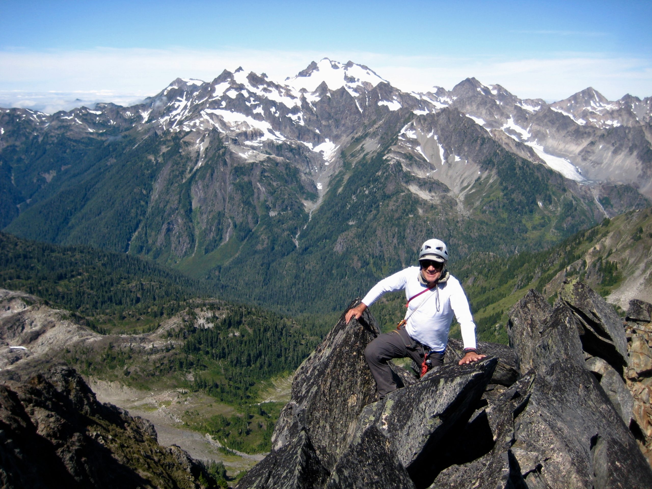
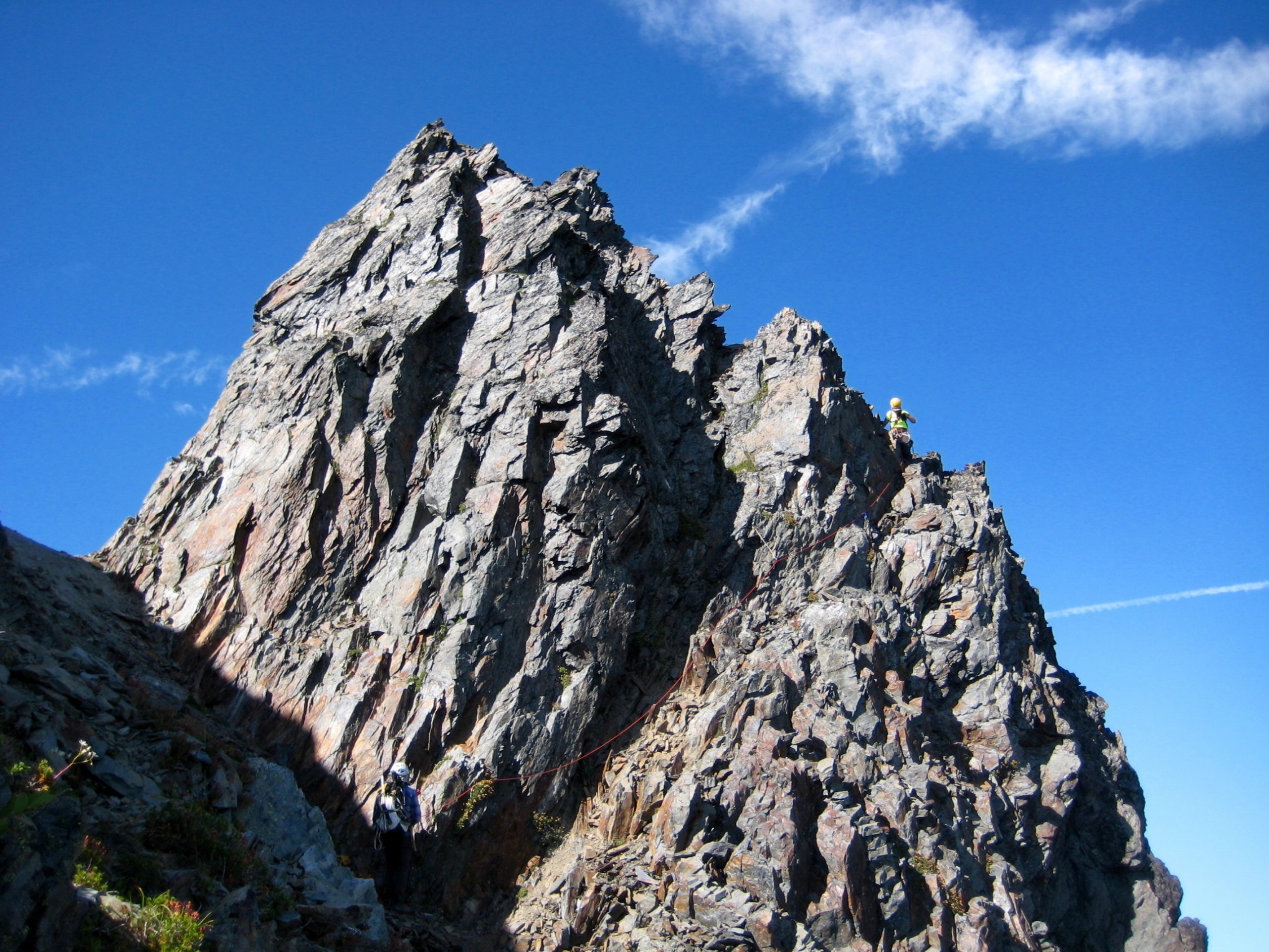
We were now on Mt. Meany’s southeastern ridge and staring at the intimidating summit pinnacle—a perfectly shaped arrowhead of sedimentary rock. Fortunately for Tony, Eileen, and me, Fay had previously climbed this peak and could assure us that the route really isn’t as scary as it appears!
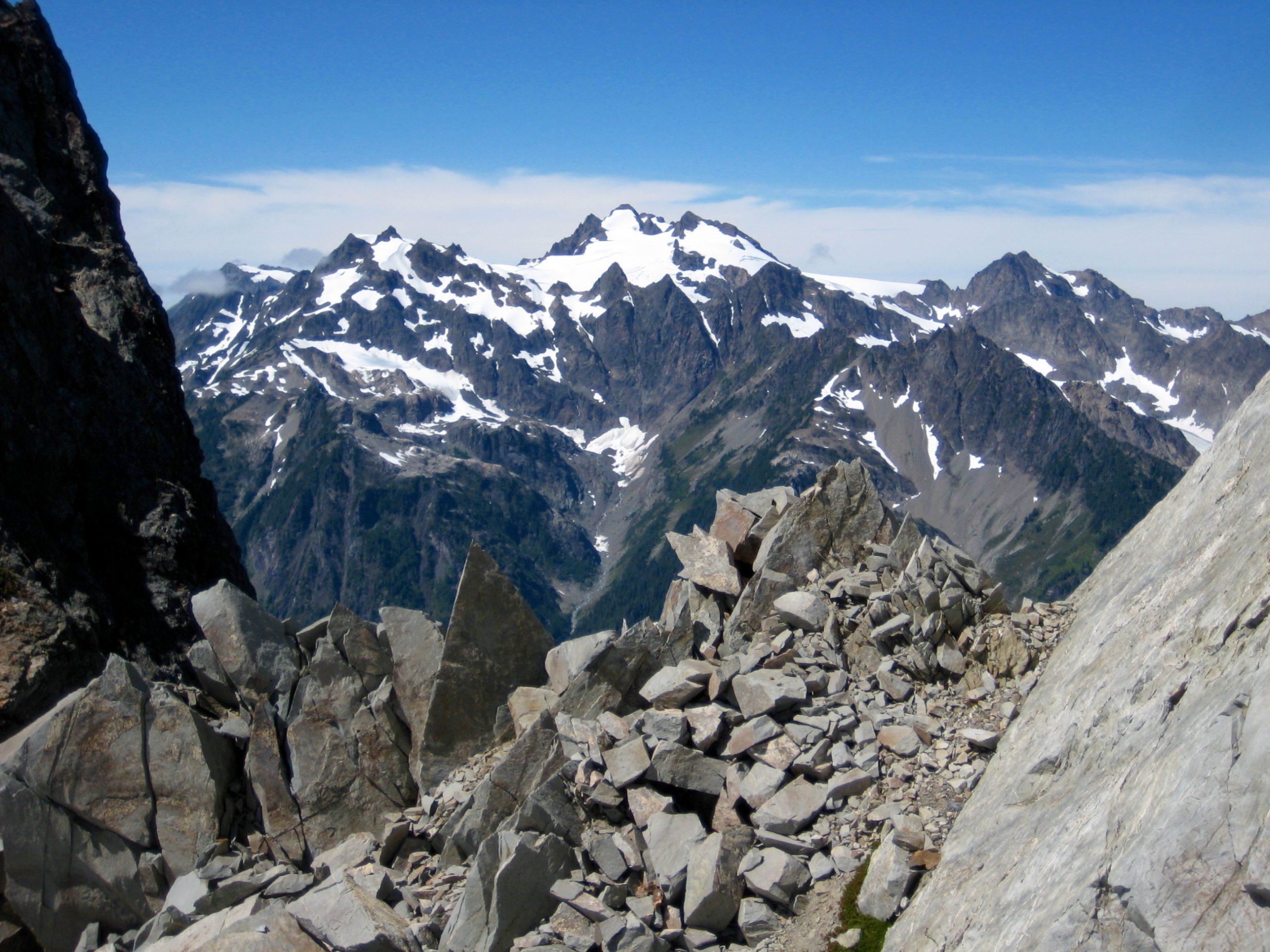
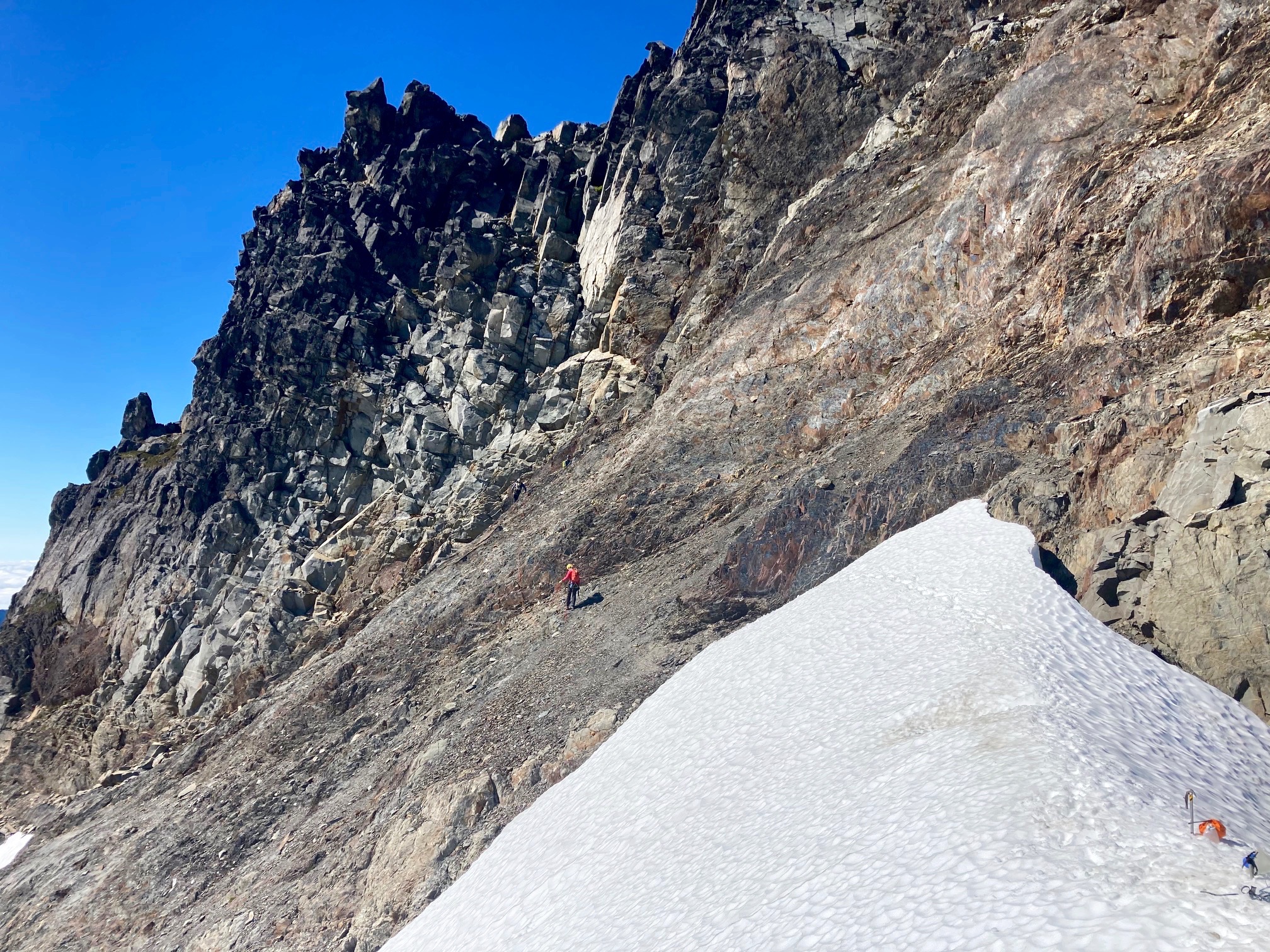
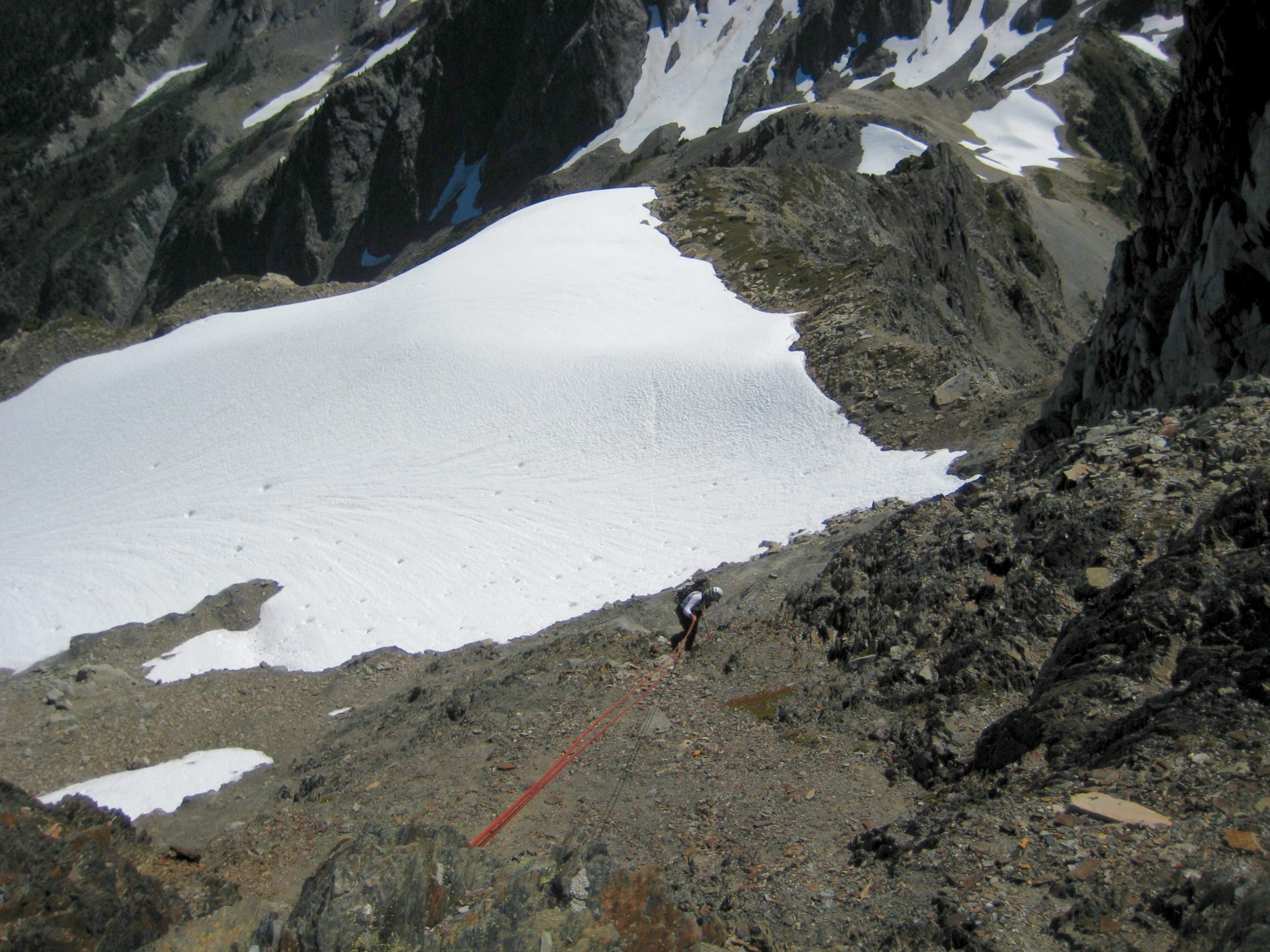
A delightfully easy ridge walk and short scramble deposited all of us at a snow col directly below the northeast face of Mt. Meany (3.8 hours + 1950 feet from Camp 3). From here, the summit towered overhead to our left, Mt. Queets sat a short mile to our right, and Mt. Olympus filled the gap straight ahead.
The snow col marked a departure point for our group. Fay headed off toward Mt. Queets, not knowing anything about the route or difficulties involved. In its typical ultra-succinct style—often providing more comical brevity than useful information—the Olympic climber’s guide merely states “Traverse the narrow ridge from Mt. Meany. Time: 2 hours.” There was no doubt that Fay would have her hands full puzzling out this mystery traverse.
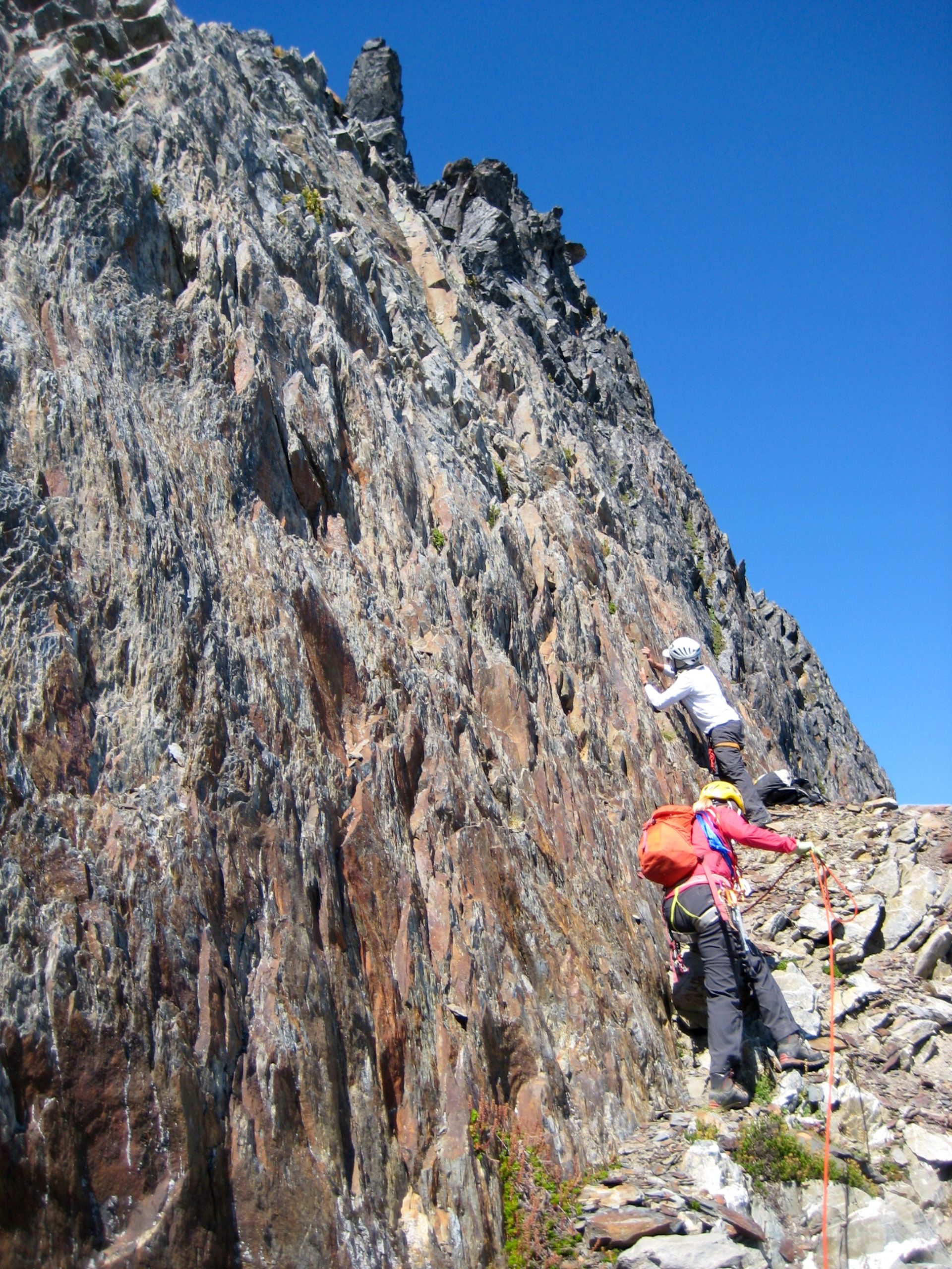
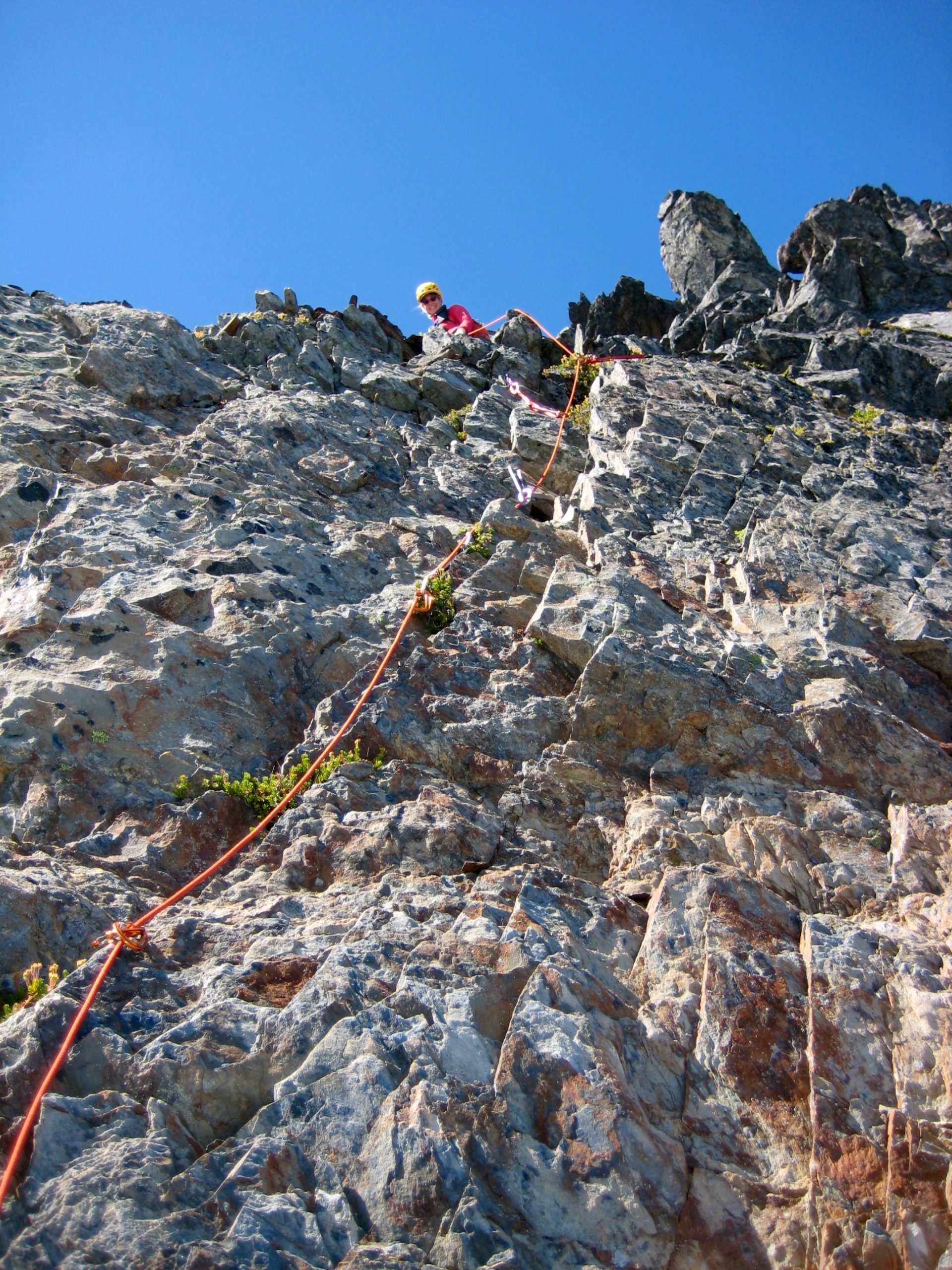
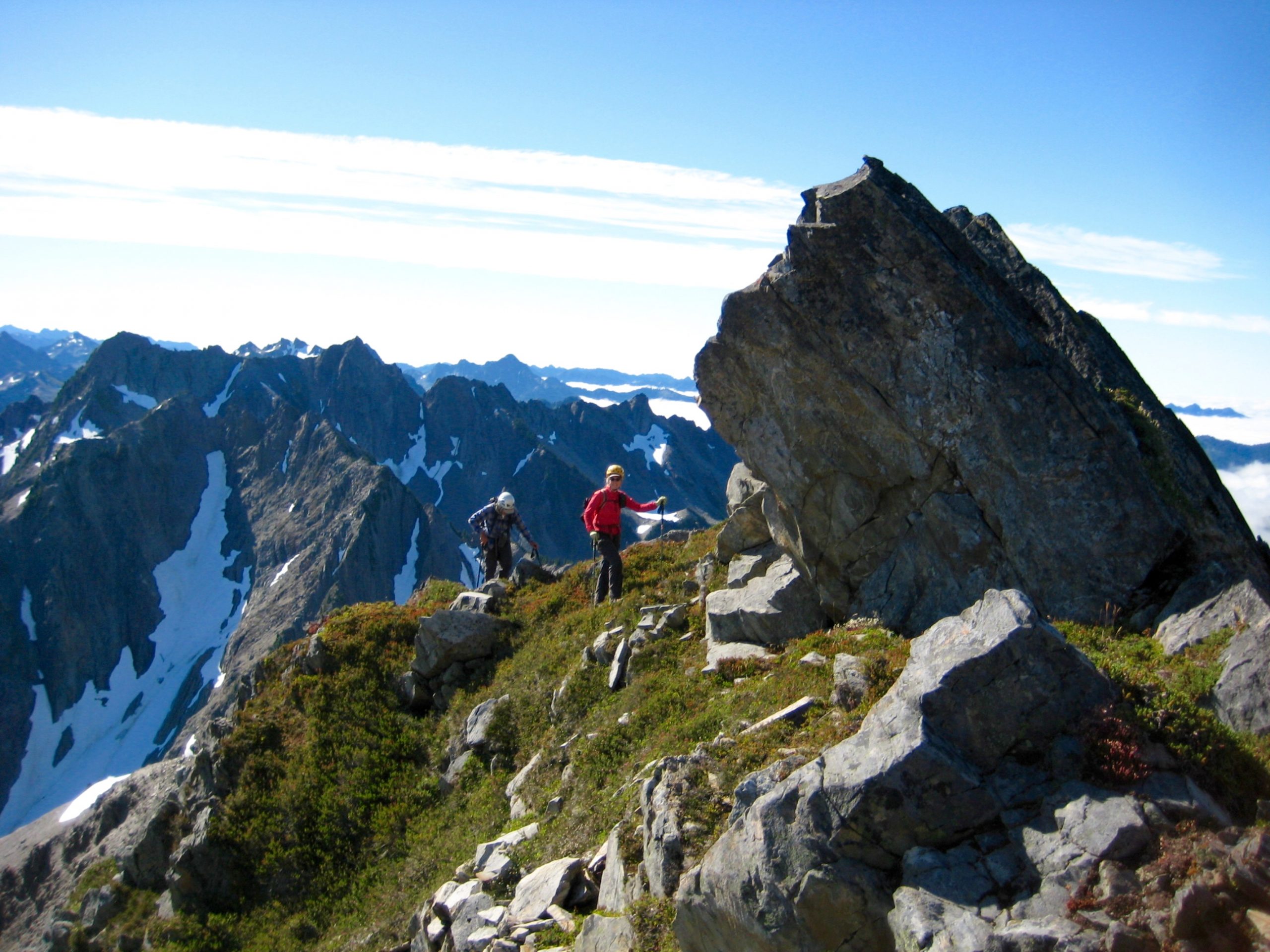
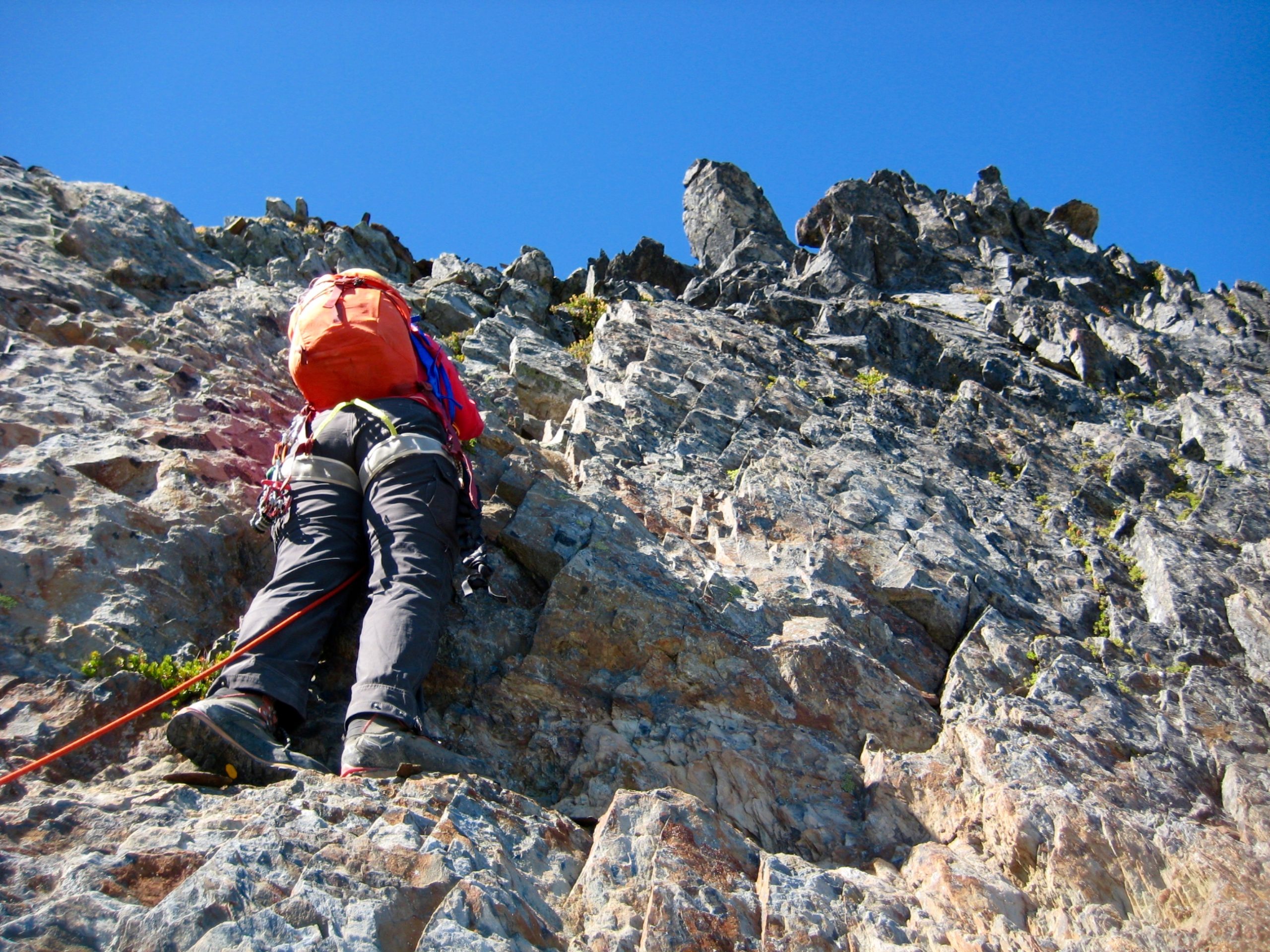
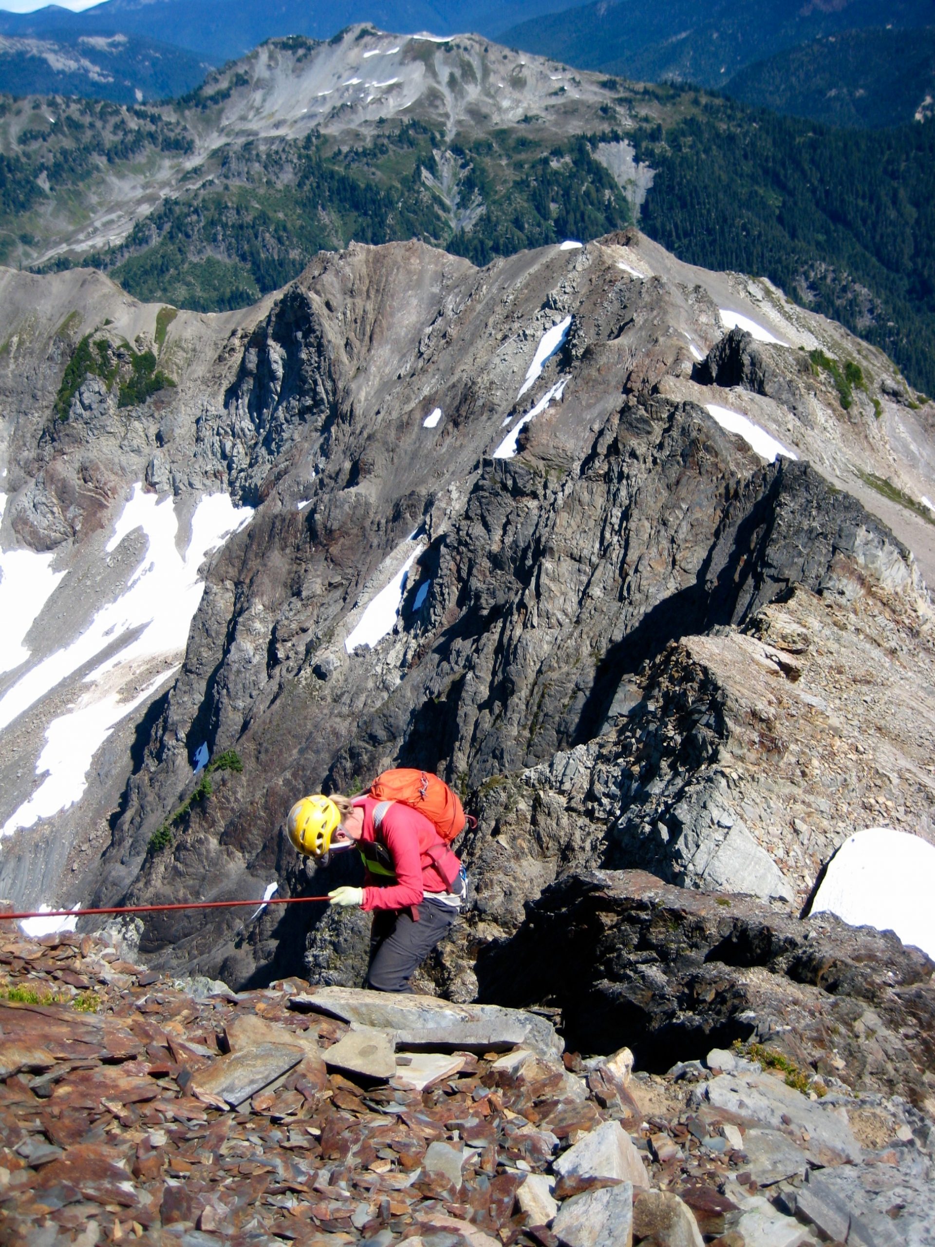
For our climb of Mt. Meany, Tony, Eileen, and I roped up and began teasing out a route on the northeast face. We first traversed out to the left on shattered Class 2-3 rock, then went straight up Class 3-4 rock to a rubble-strewn shoulder.
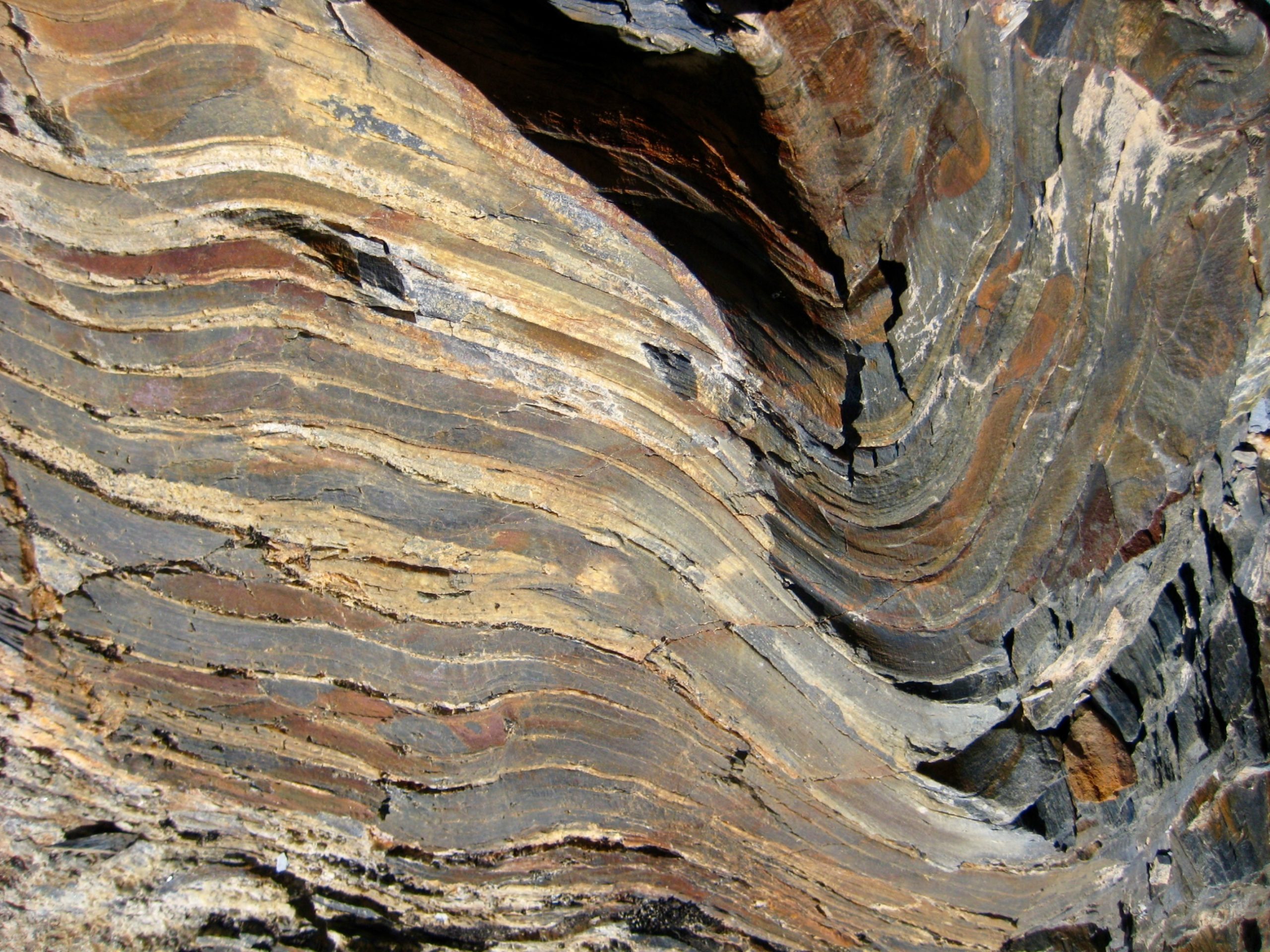
We found ourselves at the base of a steep 25-foot face composed of surprisingly solid sandstone—much like a quartzite, I thought. Eileen eagerly led this face pitch, which had excellent holds and good protection options. A difficulty rating of Class 5.2 seemed appropriate.
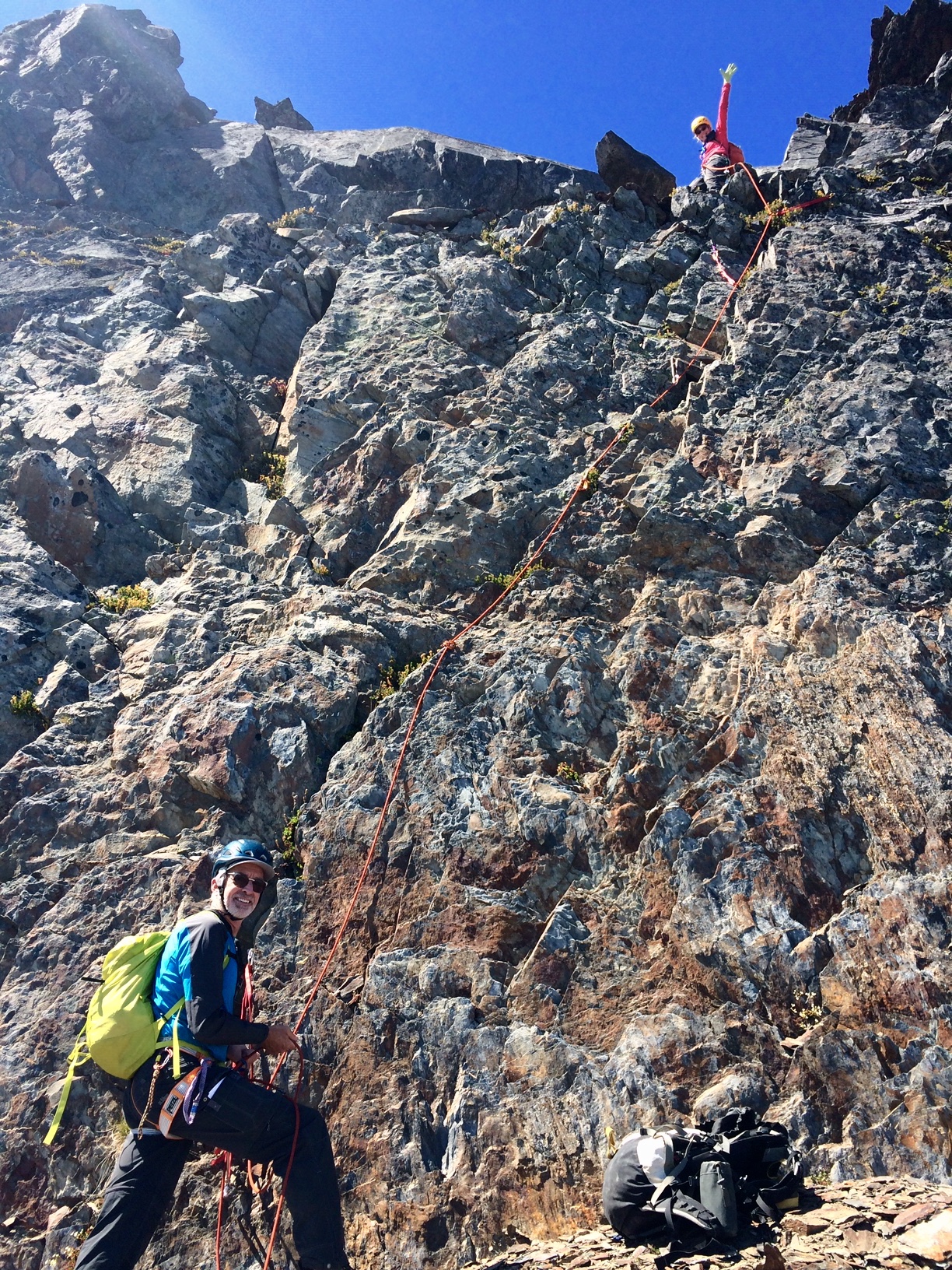
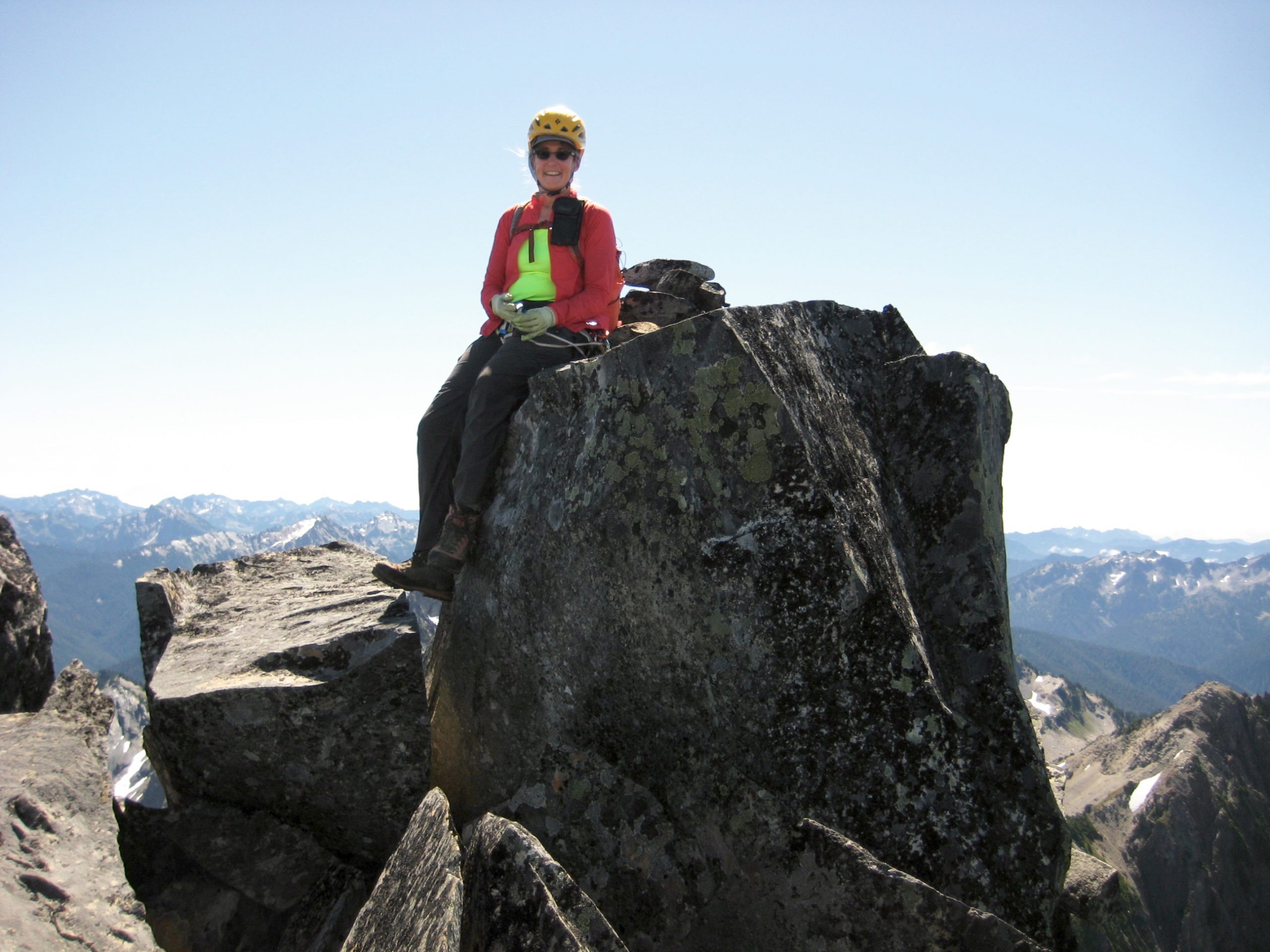
The steep face ended at a rubbly, down-sloping ledge closely below the summit ridge. From there, we scrambled up a slot to the right, then back to the left along an exposed crest consisting of large sandstone blocks and fins. We all reached the summit horn at noon (5.6 hours + 2200 feet from Camp 3).
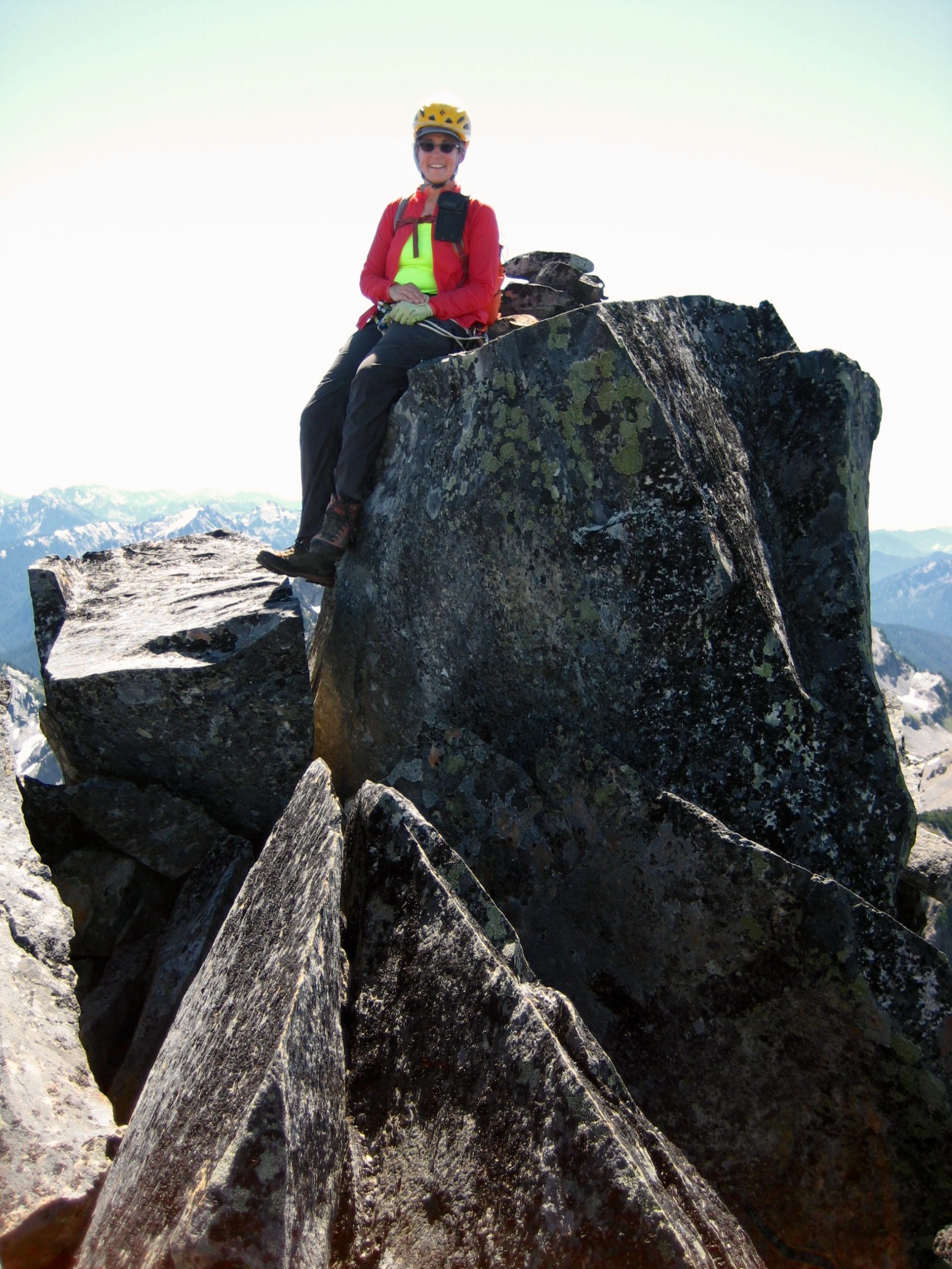
A thorough search of the summit rocks produced a small register tube stuffed with soggy, illegible papers. We were curious to know how many visitors this elusive summit gets over time but can only speculate that it is a very small number.
Our descent involved a down-climb to the sloping ledge, followed by two rappels and a traverse back to the snow col (1.0 hours from summit).
During our ascent and descent of Mt. Meany, we had visually monitored Fay’s progress in traversing the ridge toward Mt. Queets. She was now completely out of sight, but it seemed likely that she could be on or near the summit. In hopes of meeting up on her return, we traversed northward along the ridge until coming to a major obstacle: a 50-foot-high pinnacle that drops off steeply on all sides.
Eileen and Tony and I took turns trying to climb over or around “Pinnacle 6280+” but were consistently met with loose, highly exposed, rock faces. Much too risky for our taste, but this is the sort of impasse that Fay routinely dispatches when there is a critical summit to conquer!
From a ledge high on the pinnacle, Eileen soon spotted Fay traversing back along the ridge crest. Fay eventually appeared again on the eastern side of the ridge, approximately 800 feet below the crest, thereby avoiding the pinnacle entirely. We descended a steep snowfield to intersect her route, then headed back to camp together.
Our sidehill traverse below Mt. Noyes felt longer and more aggravating than before, but we managed to gain the Noyes-Cougar Saddle (7.2 hours + 900 feet from summit) just in time to see alpenglow light up Seattle Basin.
We hurried downhill and all stumbled into camp shortly after dark to end a 14½-hour day. During our headlamp dinner, Fay related the details of her successful but difficult traverse over to Mt. Queets and back. Suffice it to say here that the guidebook’s one-sentence route description proved to be…ahem…inadequate.
Day 5: Seattle Basin to Sixteenmile Camp
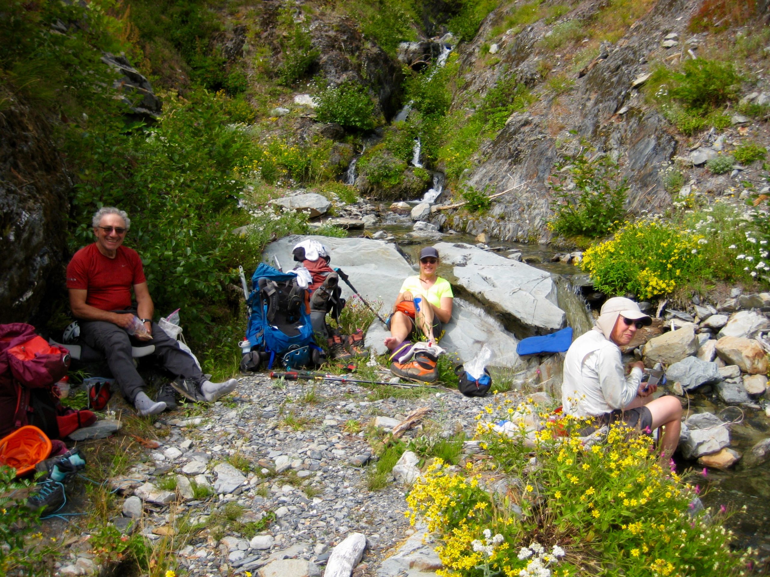
After yesterday’s long climb, we slept late, packed up slowly, and didn’t leave camp until 11:00am. The weather was still sunny and warm, but cirrus clouds drifting in from the west signaled that a change was coming. No matter; we had only trail miles ahead of us now. Our pace was unhurried, and leisurely stops were made at convenient stream crossings.
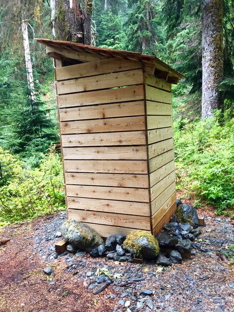
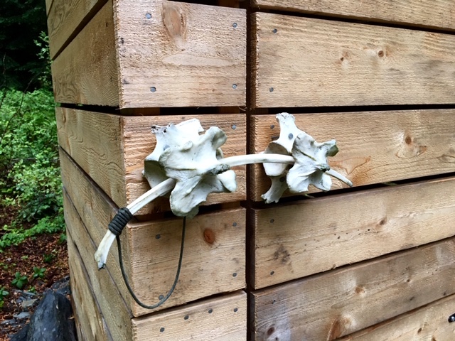
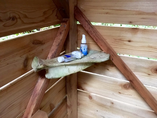
We rolled into Sixteenmile Camp in late afternoon (6.1 hours + 300 feet from Camp 3). The clock prompted us to keep going, but our feet were ready to stop for the day. Our decision was made easier by the fact that this campsite is roomy, comfortable, and appointed with an exceptionally nice privy. How nice can a privy be? Aside from being of the new “open slat” construction, it features an ingenious door latch and a handy interior shelf assembled from large animal bones. The park rangers certainly had fun with this one!
Day 6: Sixteenmile Camp to Trailhead
Raindrops started hitting the rainfly at 2:00am and persisted all night. We awoke at 6:15am, packed up in the rain, and headed out at 7:45am. Intermittent rain showers chased us down the trail for 12 miles as we made brief stops at Trapper’s Shelter, Halfway House, and Wolf Bar.
We hobbled into the trailhead parking lot at 3:30pm (7.8 hours + 600 feet from Camp 4), weighted down by wet gear and clothing, but buoyed up by a full tank of summit memories. The Olympics had just served us another grand adventure!
Route Maps & Profile & Sketch
…
…
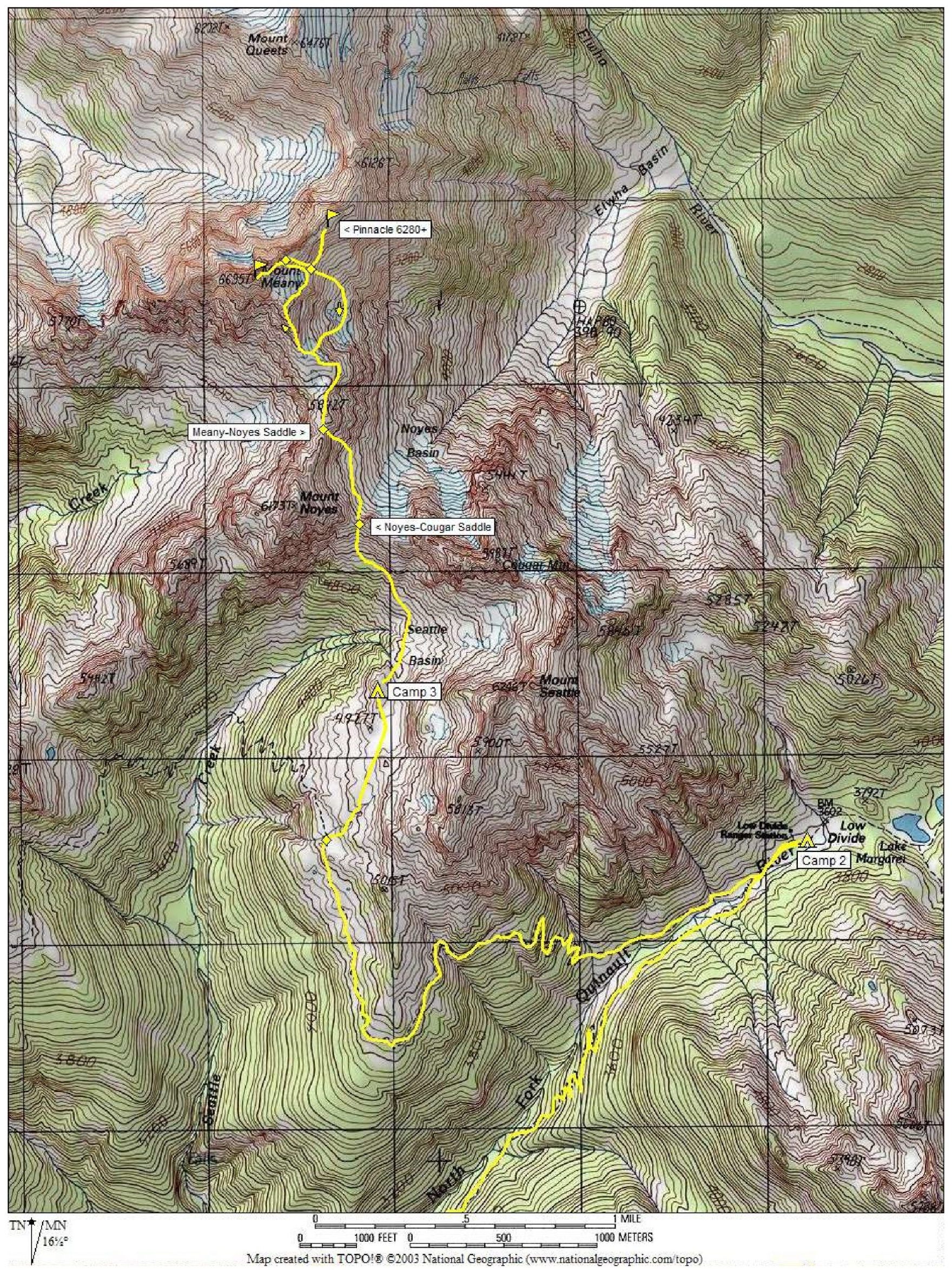
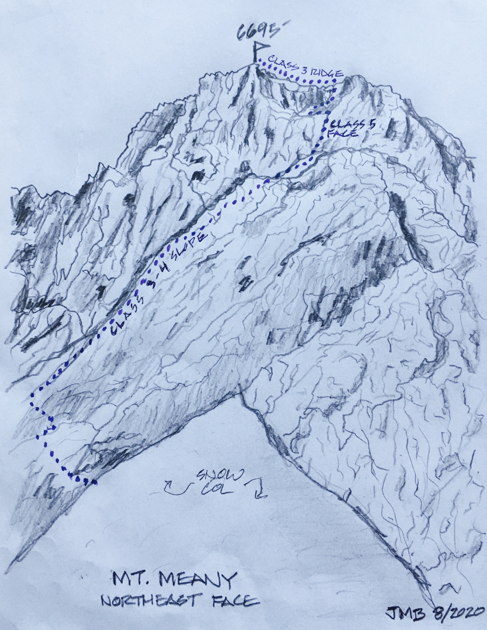
Photo Gallery
Click to enlarge…