Trip Date: July 14-18, 2021
Mt. Buckner Climbing Trip & Sahale Peak Carryover Loop: Sahale Arm to Boston Basin
Cascade Pass
Sahale Arm
Horseshoe Basin / Davenport Mine
Mount Buckner aka Buckner Mountain (~9114′)
Sahale Peak (8680’+)
(Note: inappropriately called Sahale Mountain in some references)
Boston Basin / Boston Mine
- Trip Report Summary
- Related Posts
- Full Trip Report
- Day 1: Cascade River Road Lower Gate to Cascade Pass Trailhead
- Day 2: Cascade Pass Trailhead to Sahale Glacier Camps
- Day 3: Mt. Buckner Summit Climb
- Day 4: Sahale Glacier Camps to Sahale Peak Summit to Boston Basin:
- Day 5: Boston Basin to Cascade River Road Upper Gate
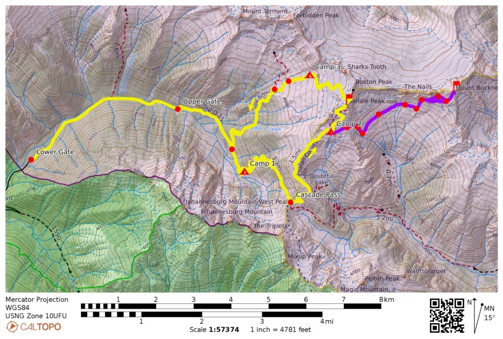
- Route Maps & Sketch
- Photo Gallery
Trip Report Summary
Region: Northwestern Washington Cascades
Sub-Region: Thunder Mountains
Area: North Cascades National Park
Starting Point: Cascade River Road lower gate (Elev. 1950 feet)
Way Points: Eldorado Trailhead & North Fork Cascade River Bridge & Boston Basin Trailhead & Cascade Pass Trailhead (road walk); Cascade Pass & Sahale Arm & Sahale Glacier Camps (trail hike); Sahale Glacier & Sahale Peak summit & Boston–Sahale Saddle & Quien Sabe Glacier & Upper Boston Basin & Boston Mine & Lower Boston Basin (snow climb & rock scramble); Boston Creek & Morning Star Creek & Midas Creek & Boston Basin Trailhead (trail hike & trail scramble); Cascade River Road upper gate (road walk)
Ending Point: Cascade River Road upper gate (Elev. 2450 feet)
Campsites: Cascade Pass Trailhead parking lot & Sahale Glacier Camps at 7600 feet & Upper Boston Basin at 6700 feet
Sidetrip: Horseshoe Basin & Davenport Mine & Mt. Buckner summit (snow climb & rock scramble)
Summit: Mt. Buckner (ascent & descent via Southwest Slope—Southwest Face)
Summit: Sahale Peak (ascent via Sahale Glacier—West Ridge; descent via North Ridge—Quien Sabe Glacier)
Approximate Stats (excluding Mt. Buckner climb): 17 miles traveled; 7,100 feet gained; 6,600 feet lost.
Approximate Stats (including Mt. Buckner climb): 23 miles traveled; 11,600 feet gained; 11,100 feet lost.
Related Posts
Mt Buckner via Southwest Slope—Southwest Face – July 12, 1993
Sahale Peak via Sahale Glacier—South Ridge – October 4, 1992
Full Trip Report
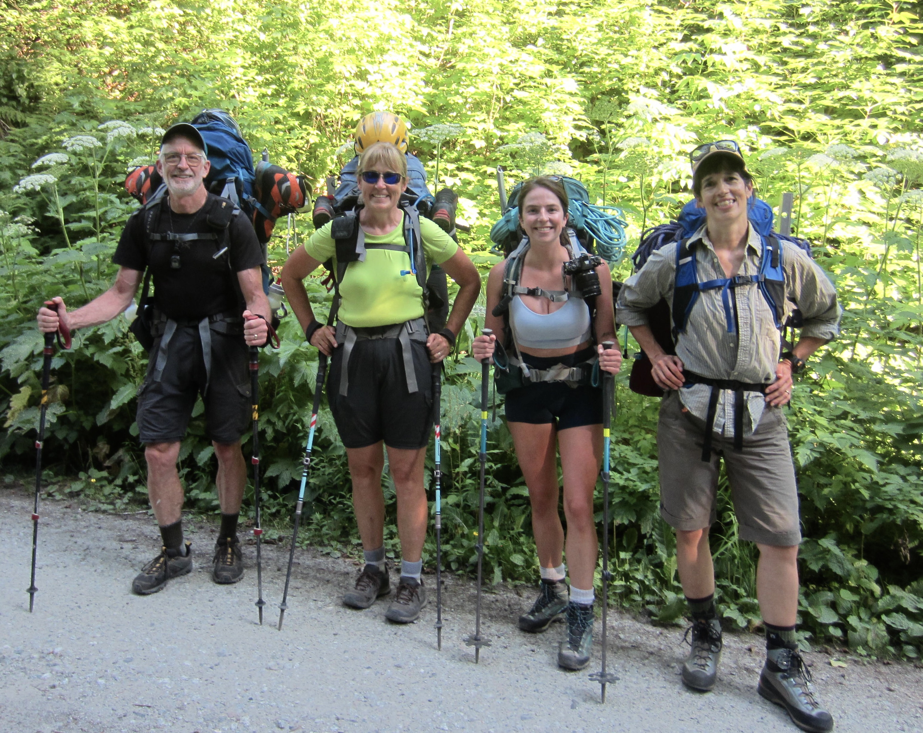
Brooke and Kellie joined Eileen and me for a multi-day climbing trip in the Thunder Mountains of North Cascades National Park. Eileen originally planned this as a four-day trip many months in advance, but we were quite disappointed to later learn that the Cascade River Road was closed at the park boundary—a full 5 miles short of the trailhead—due to repair work. Ultimately, this logistical hiccup added an additional half-day to our itinerary but detracted only slightly from our overall experience.
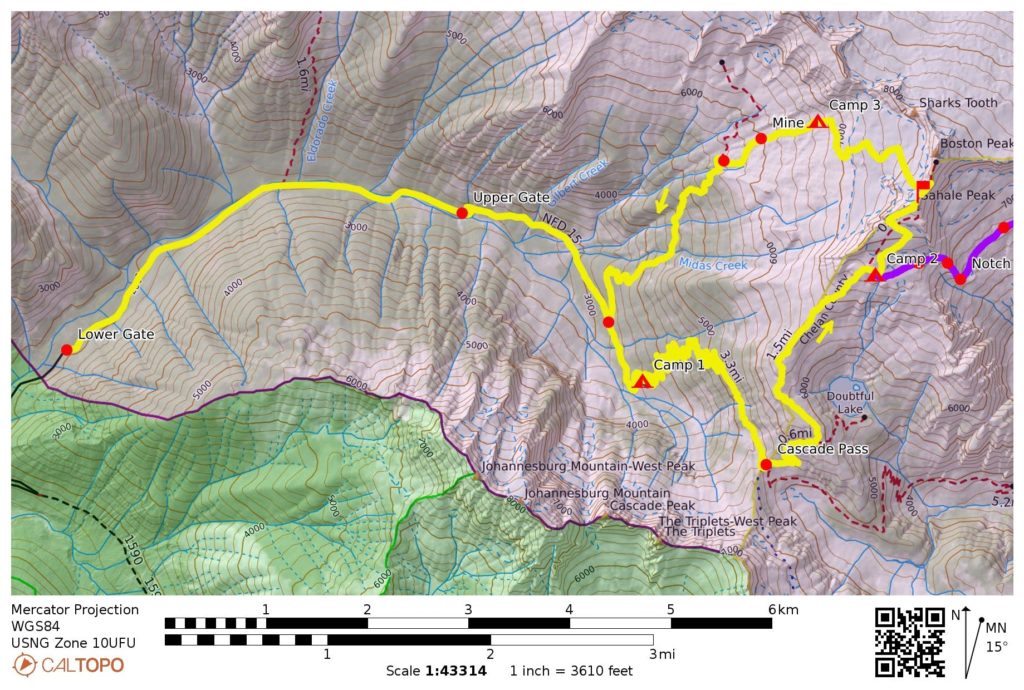
Day 1: Cascade River Road Lower Gate to Cascade Pass Trailhead
We parked at the park boundary gate (Elev. 1950 feet) on a hot Wednesday afternoon and were surprised to see 30 or 40 other cars lining the road. Obviously, the road closure did not dissuade many hikers and climbers from making a trek up the Cascade River or Eldorado Creek. We strapped on backpacks and began our 5-mile road march, taking note of recent repair work at several locations along the way. Overall, the road seemed to be in a fully driveable condition.
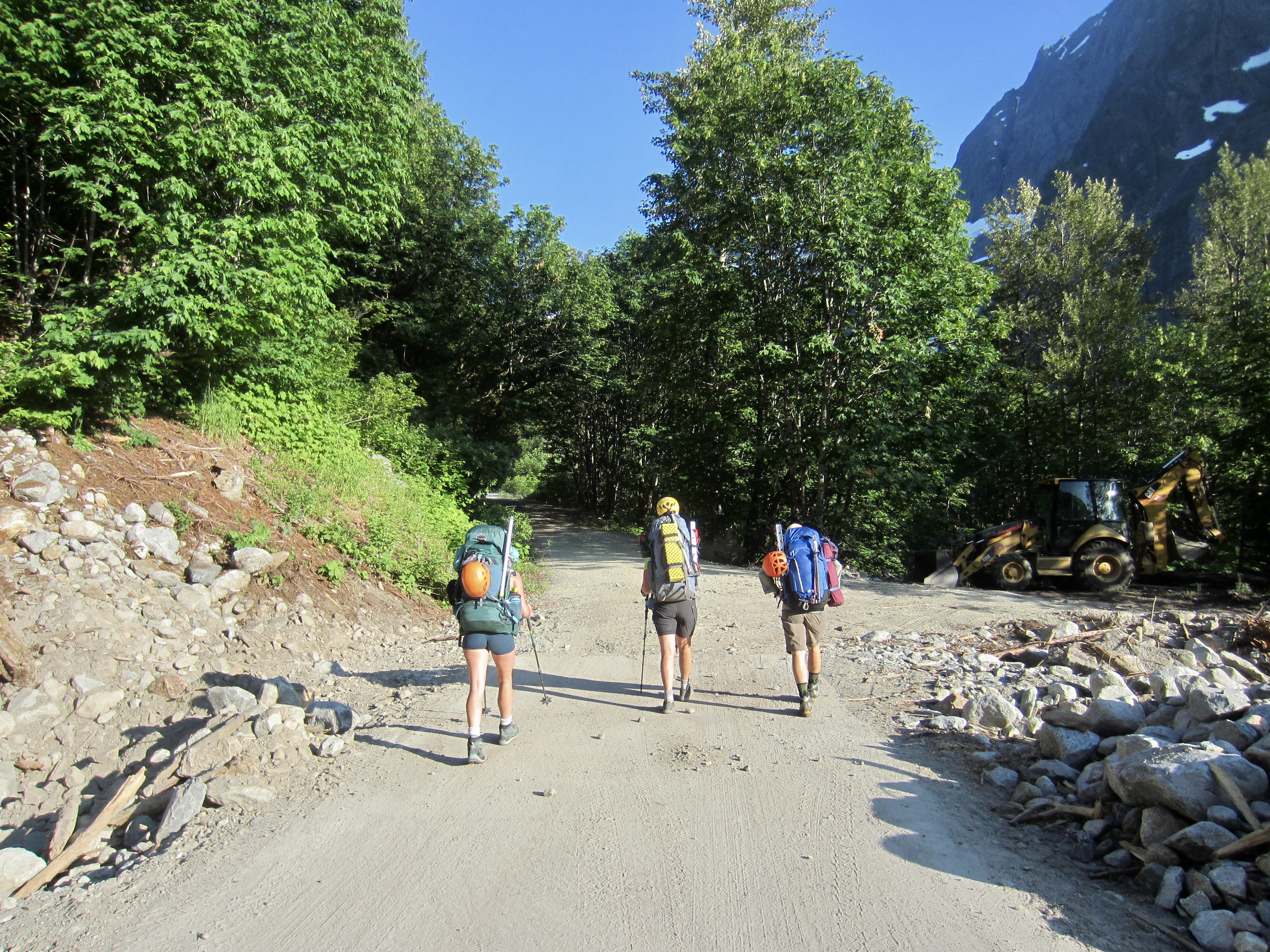
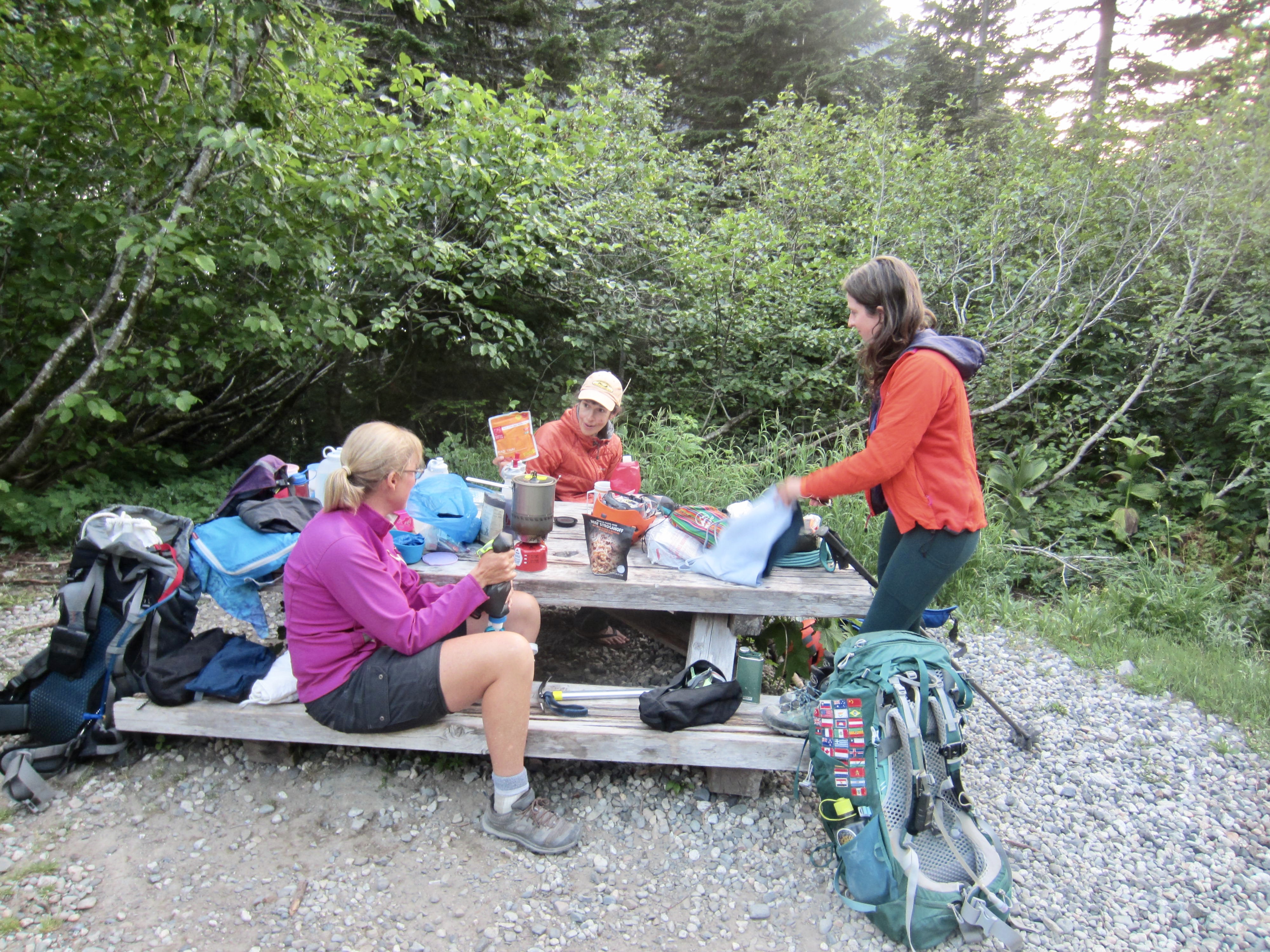
We arrived at the Cascade Pass Trailhead in mid-evening (2.6 hours + 1800 feet from road gate) and pitched our tents in the large parking lot, 100 yards downhill from another party of four that had recently set up camp. A picnic table there gave us a convenient place for dinner in sight of Johannesburg Mountain’s rumbling north face.
Day 2: Cascade Pass Trailhead to Sahale Glacier Camps
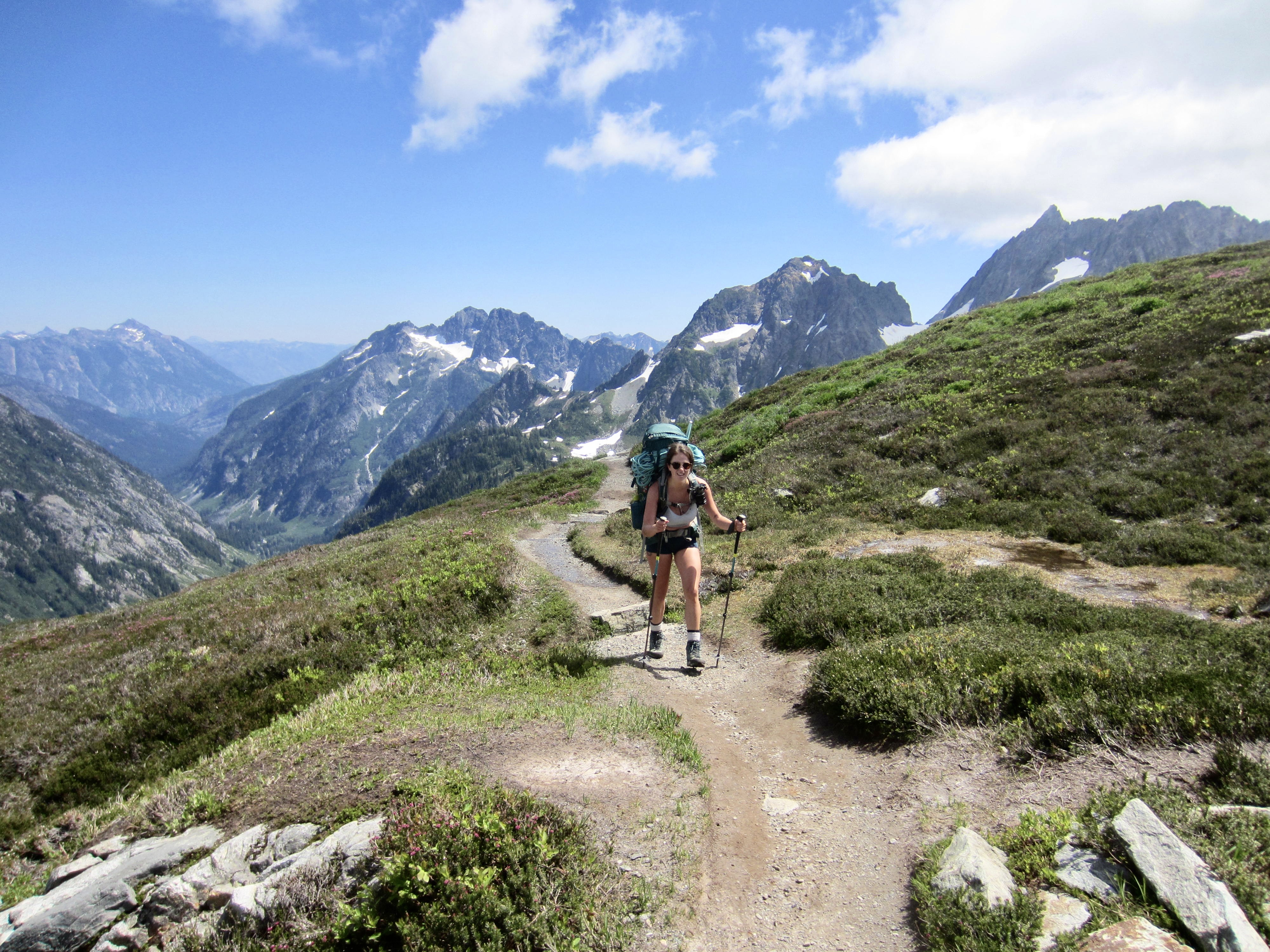
We started up the trail shortly before 10:00am and stopped at Cascade Pass for lunch (2.1 hours + 1800 feet from Camp 1), along with the other party of four. This was Brooke’s first visit to the pass, and she immediately understood why it has become one of the most famous hiking destinations in Washington.
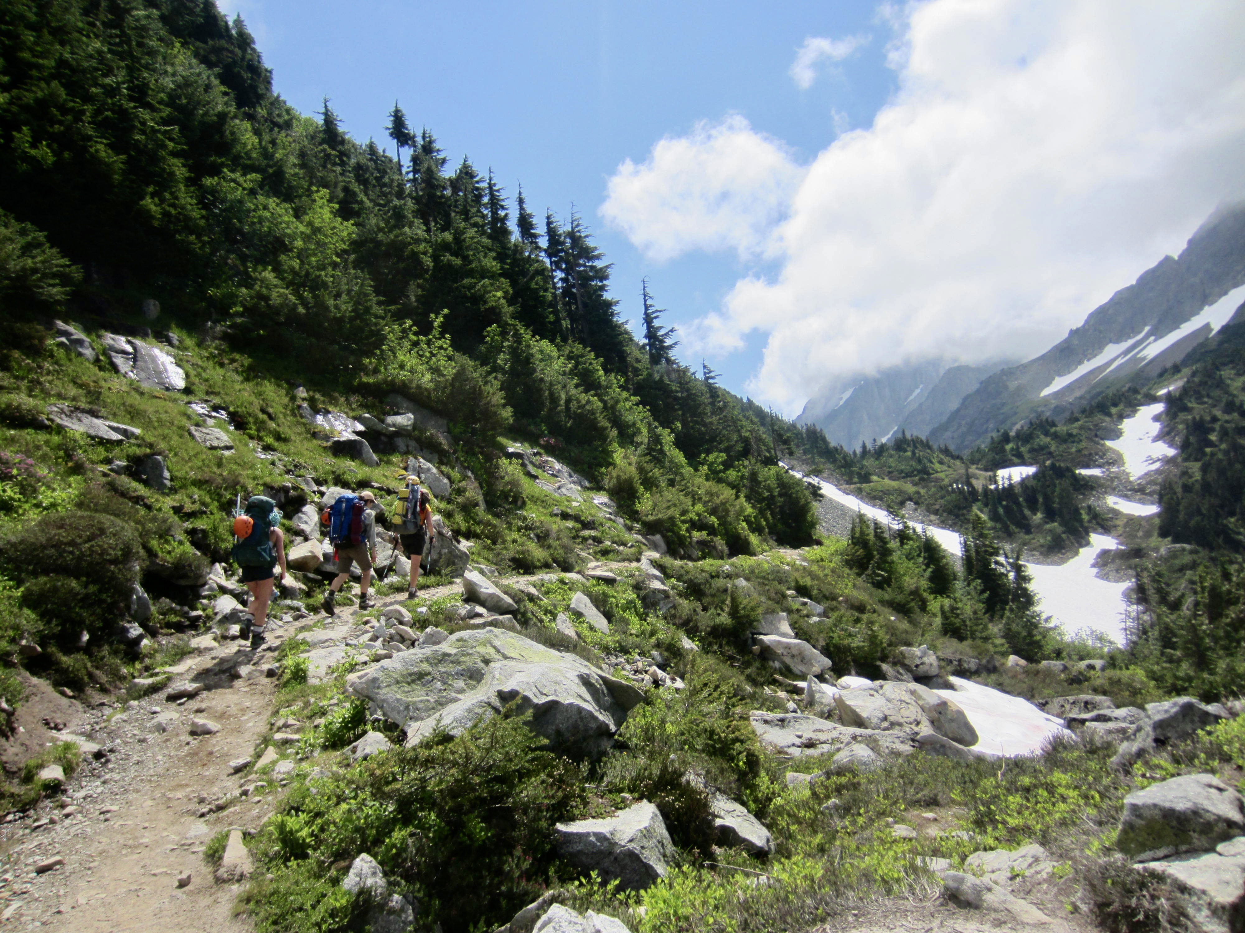
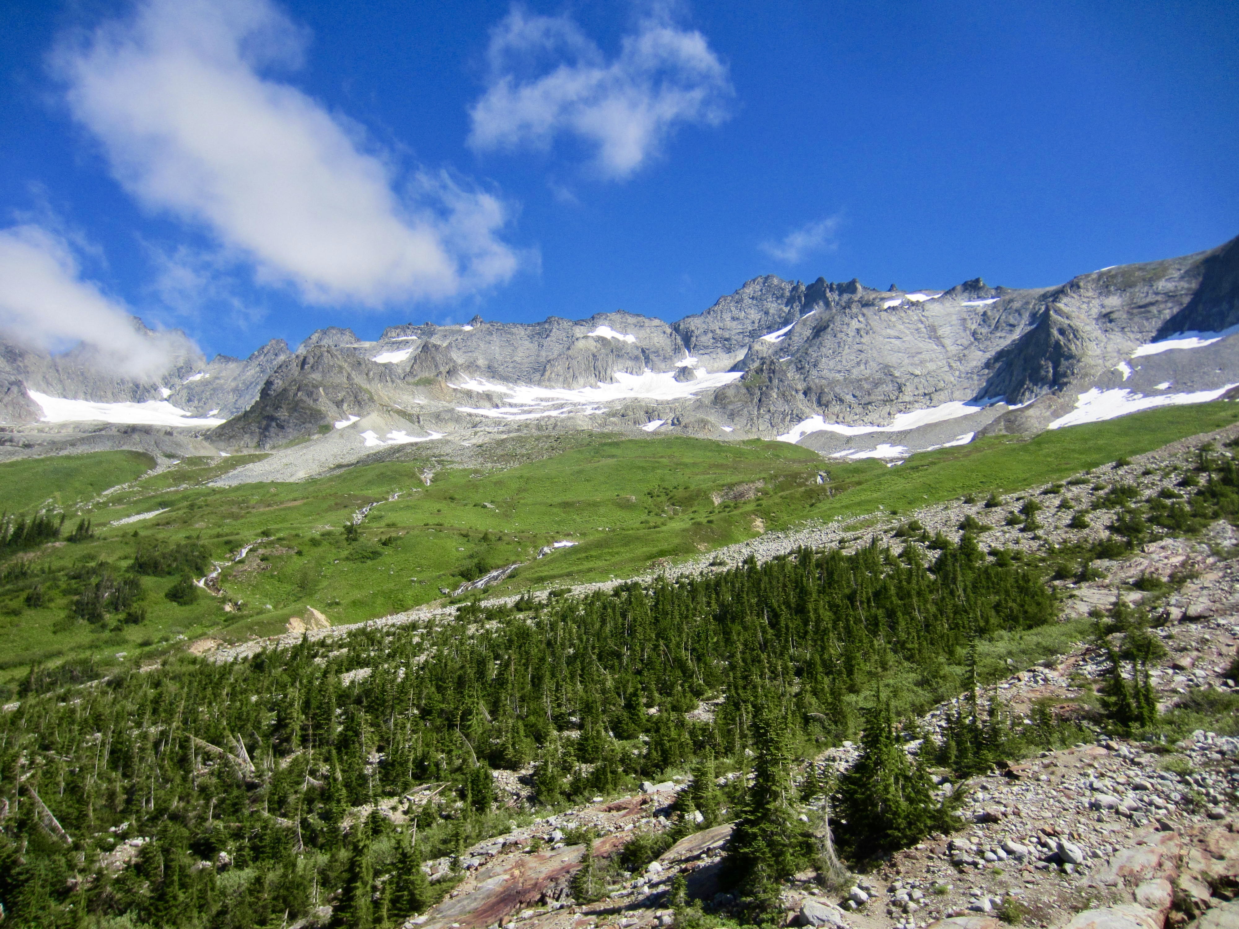
The heart of our afternoon was spent hiking up Sahale Arm and absorbing ever-increasing views in all directions. Although I had been up this trail several times before, it felt like my first time again. Wow…what a gorgeous setting!
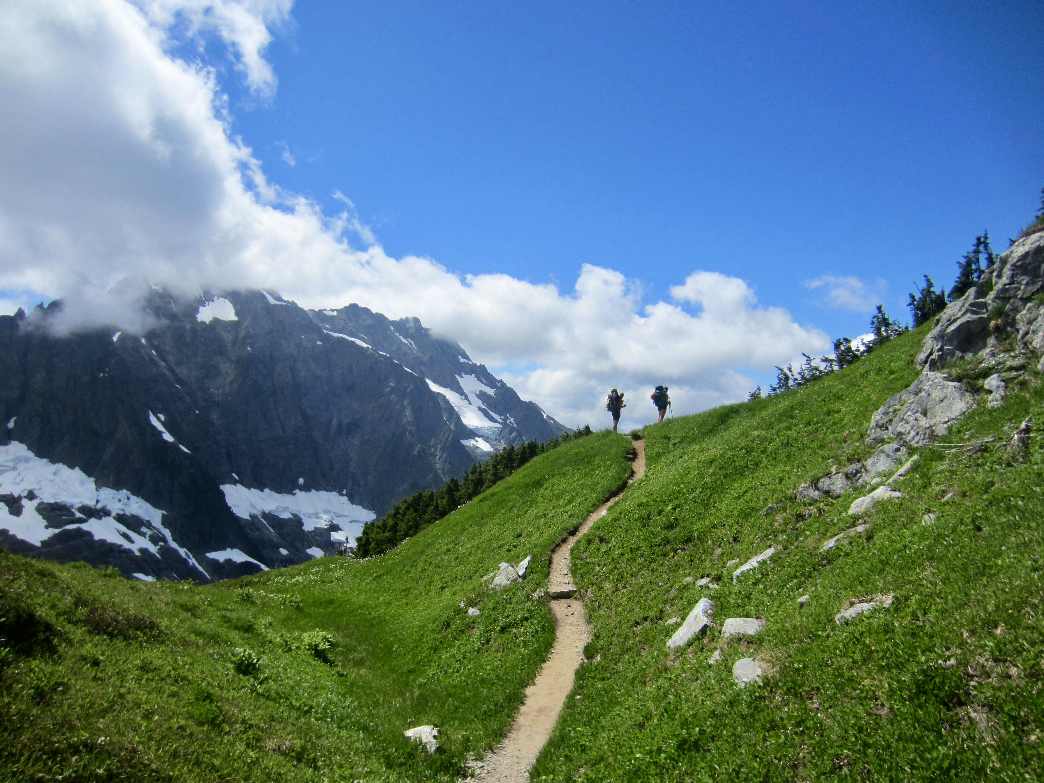
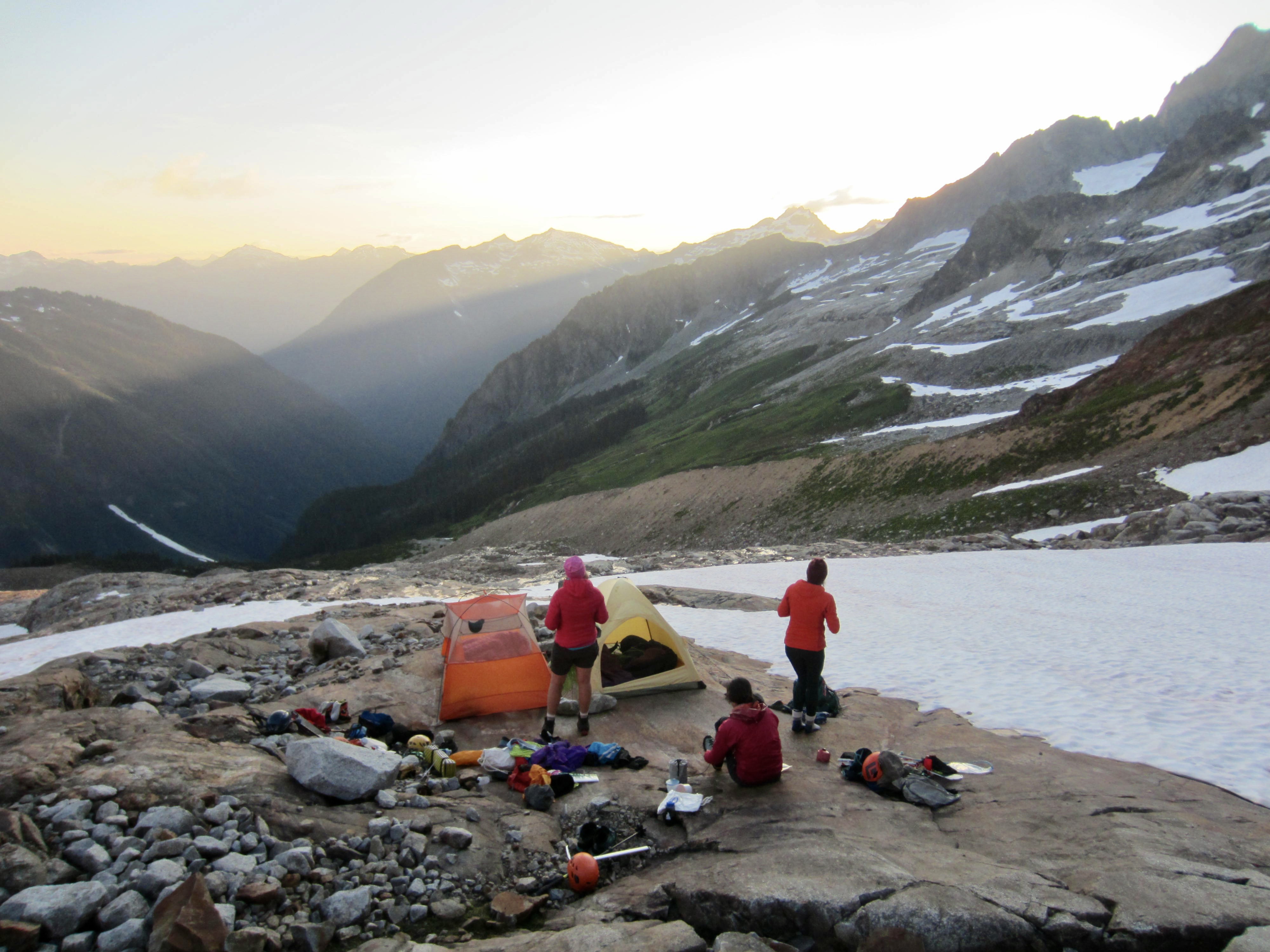
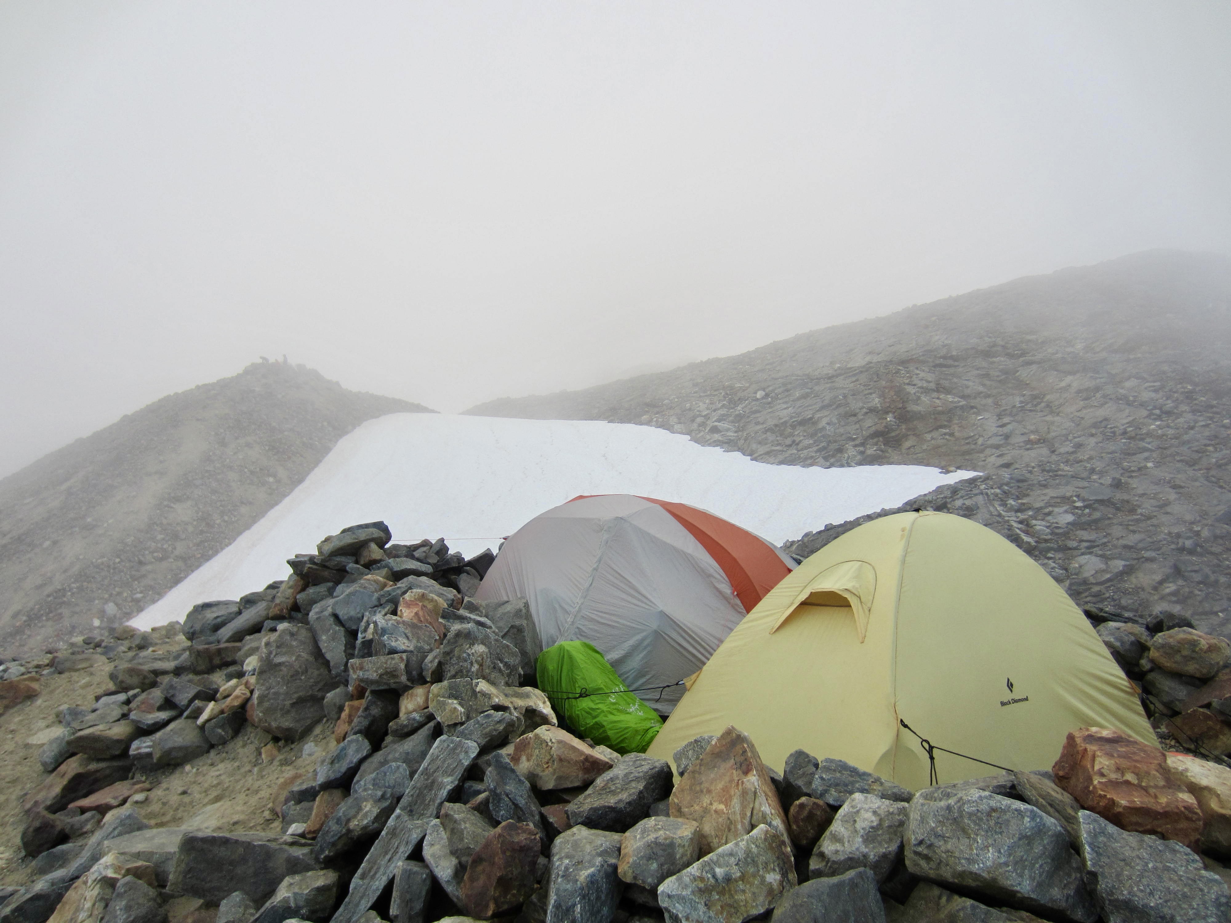
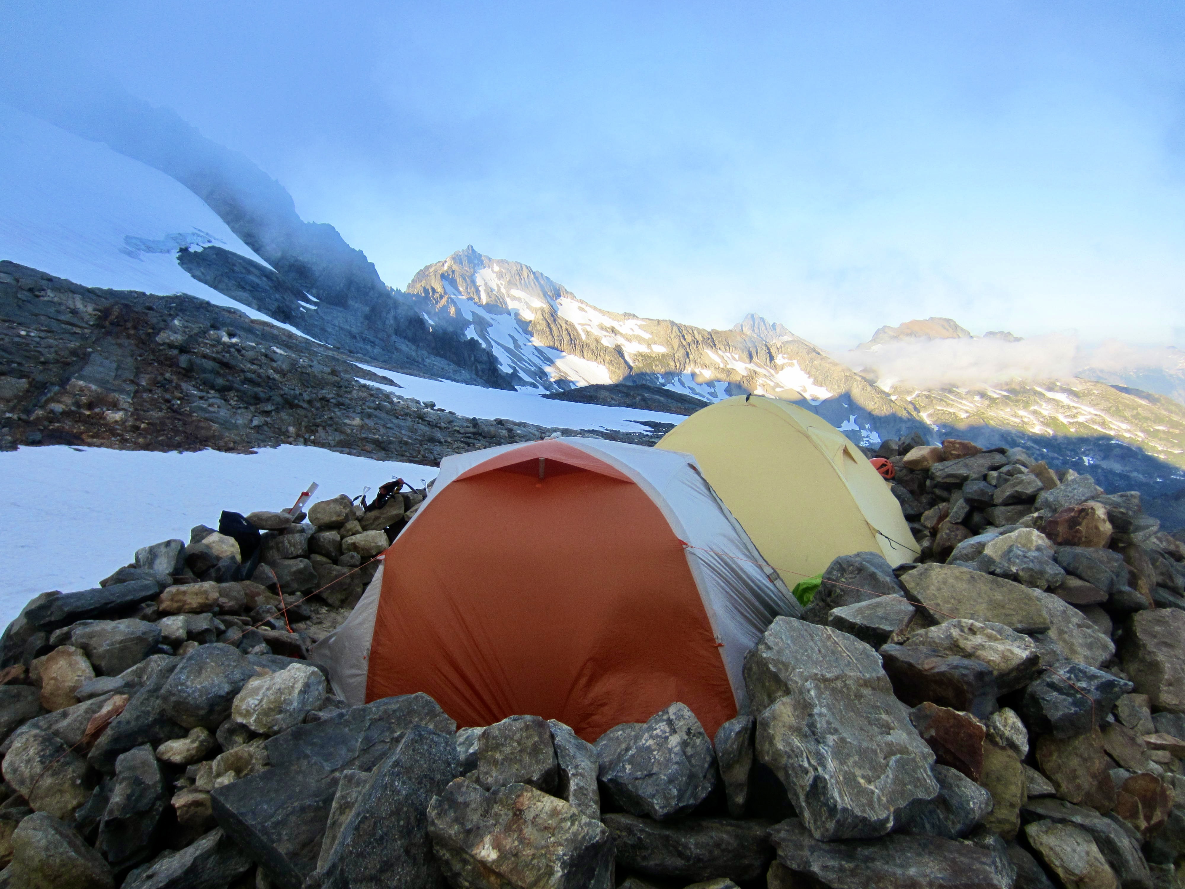
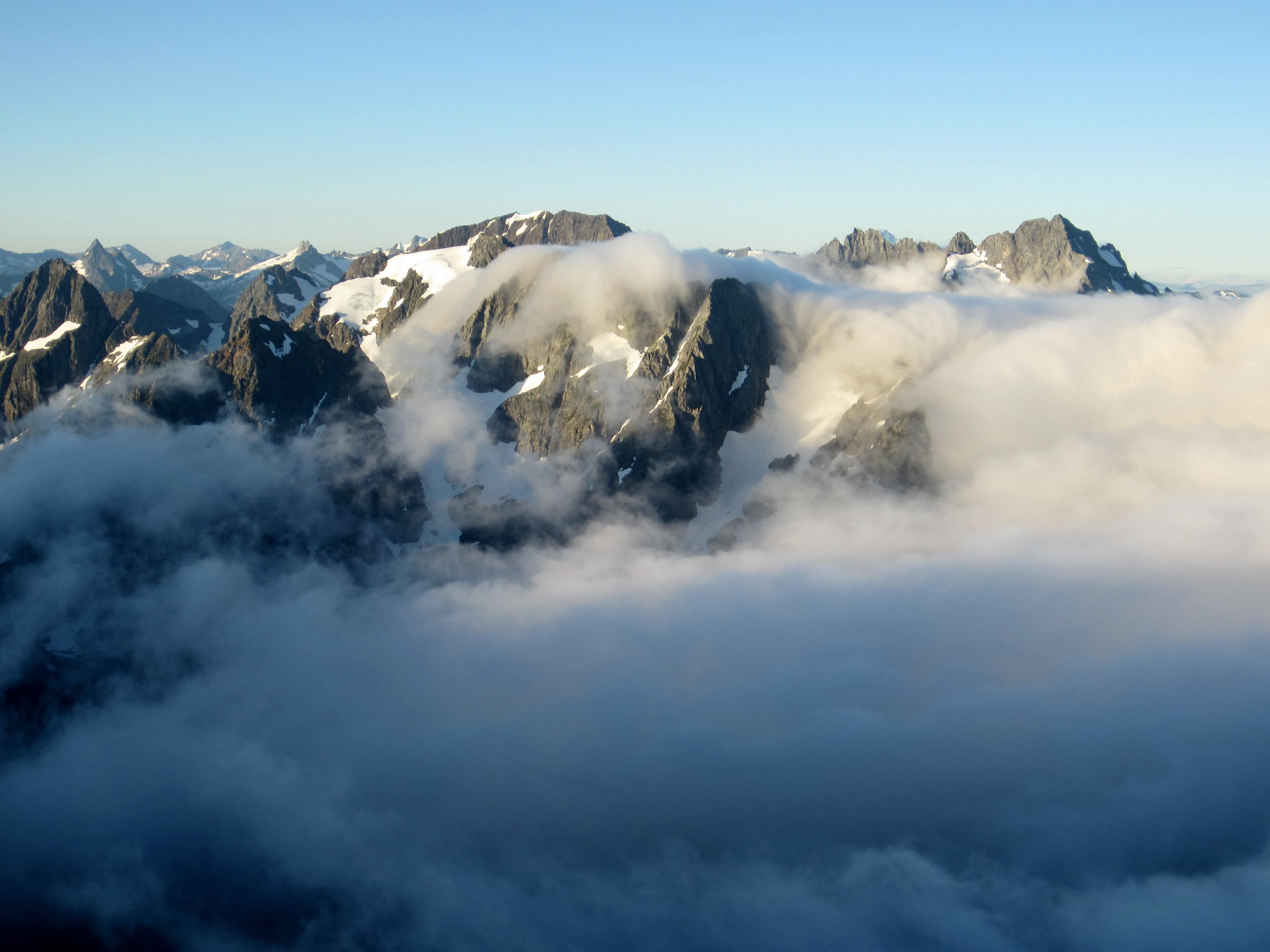
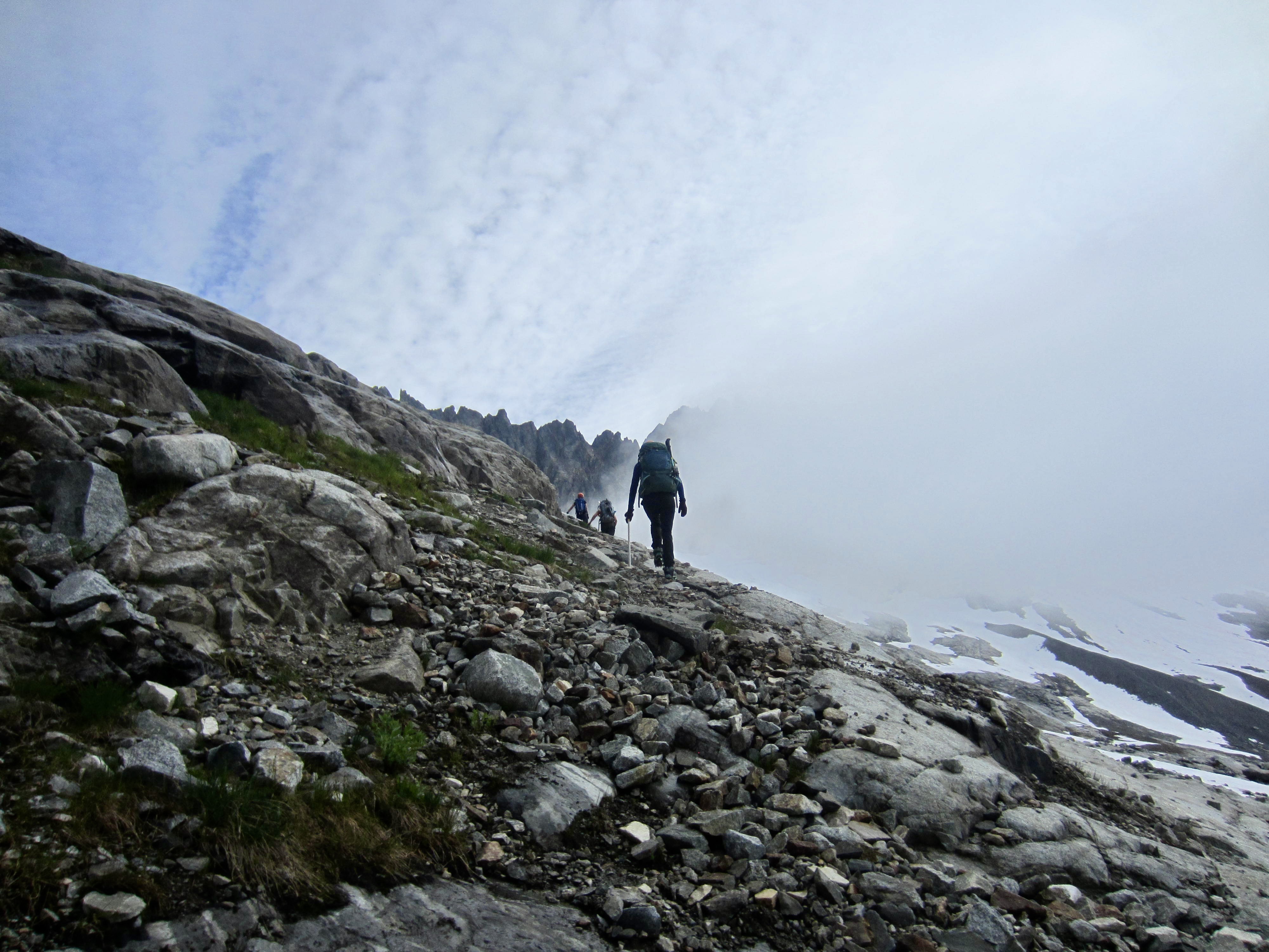
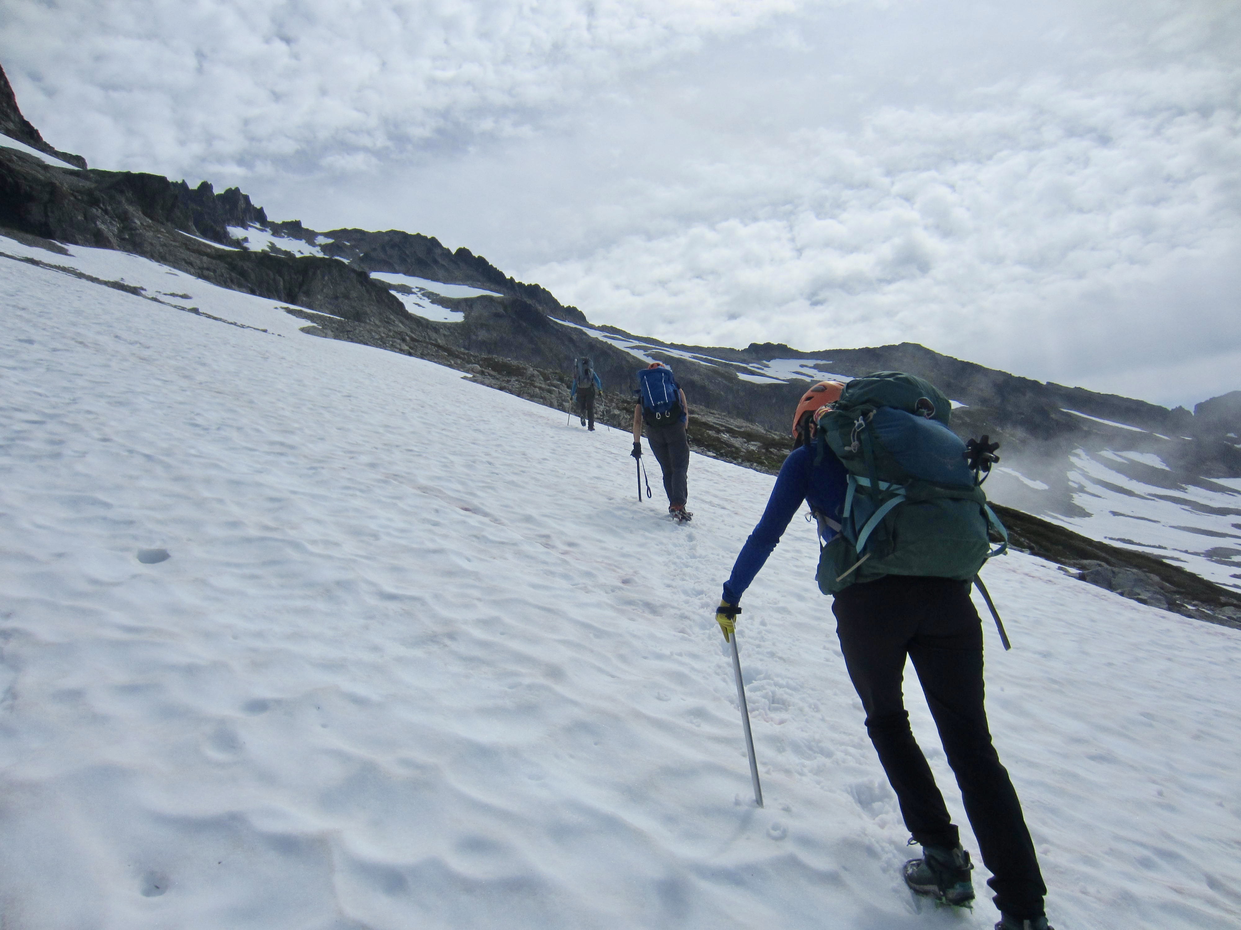
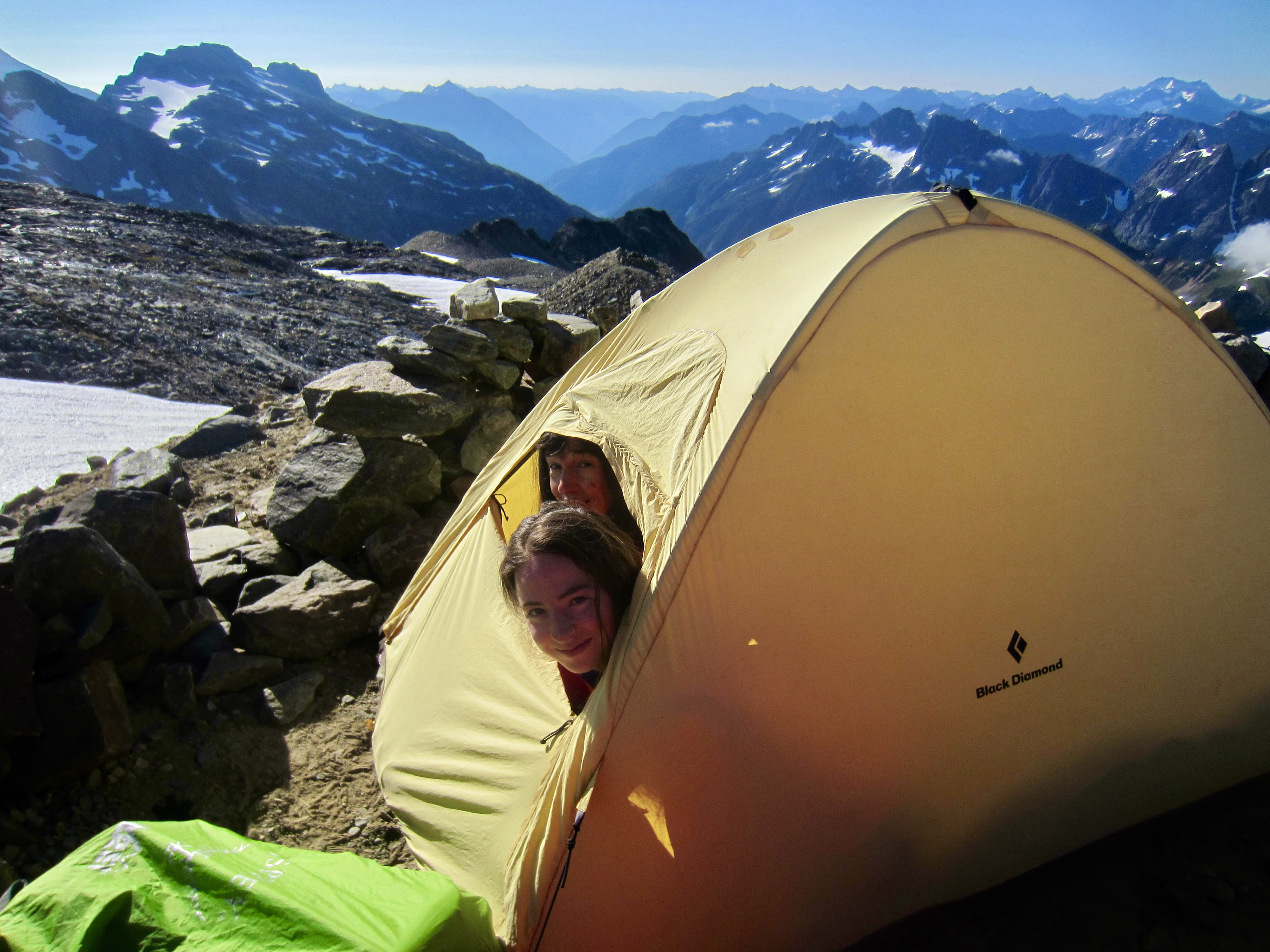
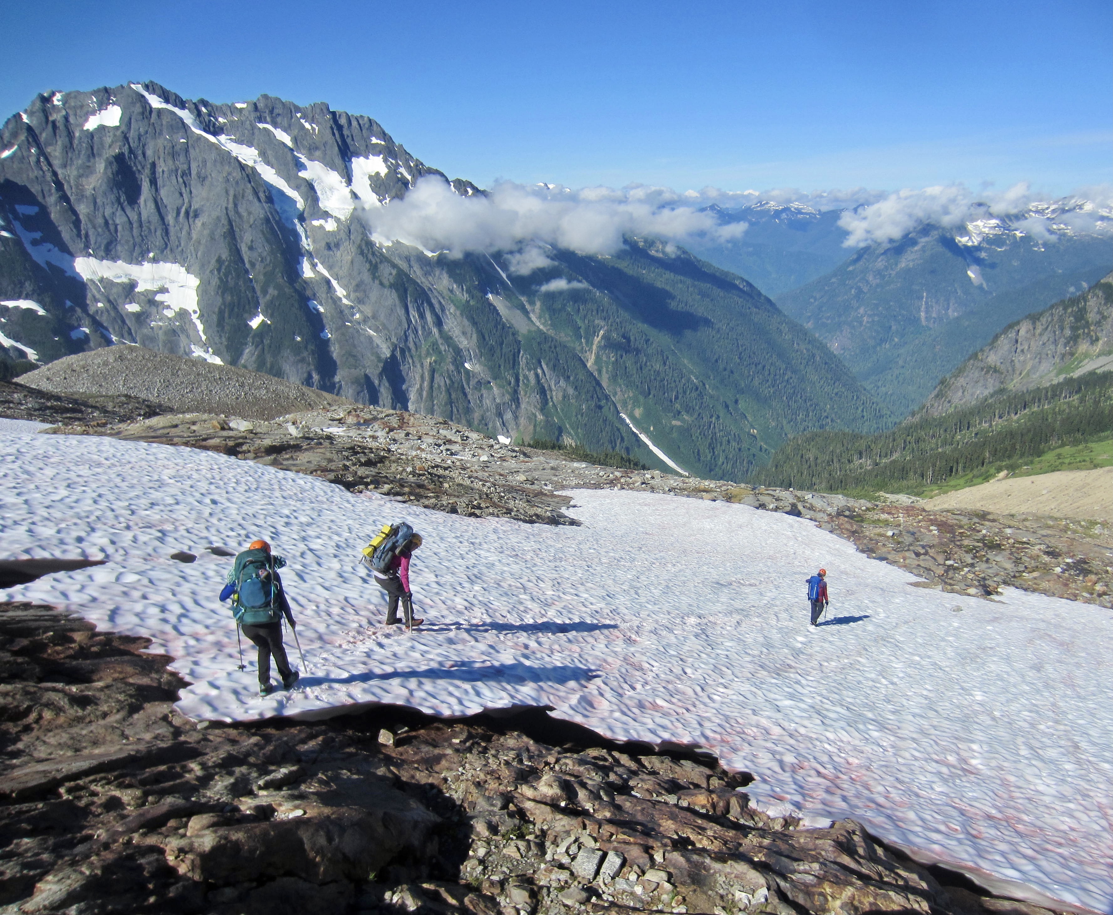
Our trail took us on a wandering tour of heather and wildflower meadows, followed by a steep ascent of rocky moraine slopes until we arrived at 7600-foot Sahale Glacier Camps in late afternoon (6.8 hours + 4000 feet from TH). We set up Camp 2 on a morainal knoll, adjacent to a slightly higher knoll where the other foursome was camped. Unfortunately, our arrival coincided with the arrival of a cold marine fog that wafted in and out all night, giving us only intermittent views of Mt. Buckner, tomorrow’s objective.
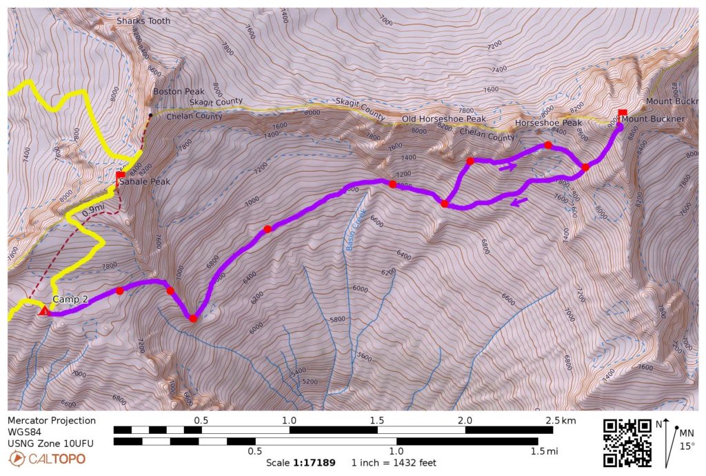
Day 3: Mt. Buckner Summit Climb
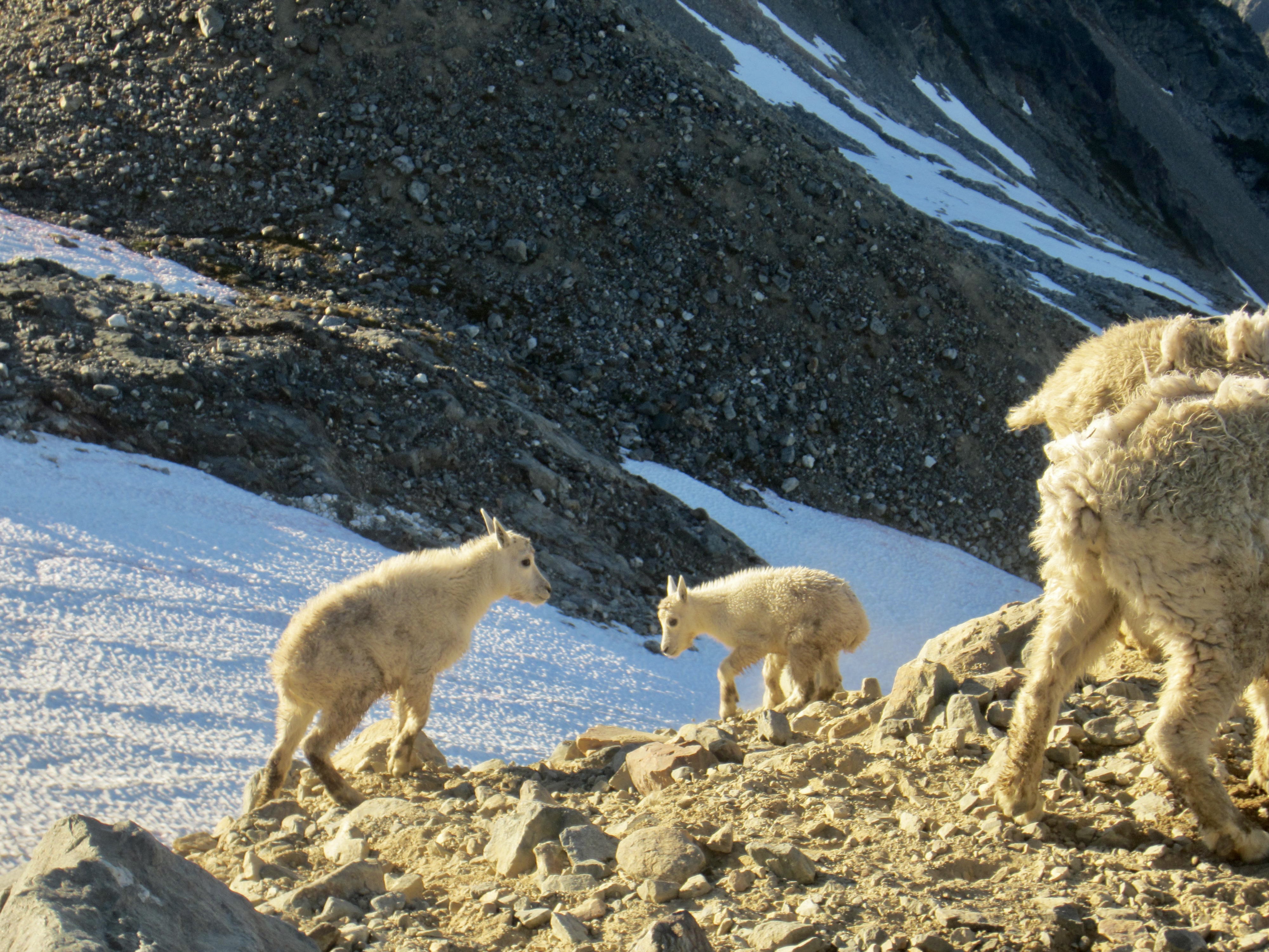
We awoke at 5:45am and were greeted by clear skies above residual valley fog. A family of mountain goats—including two adorable baby goats—entertained us during our breakfast in the sun.
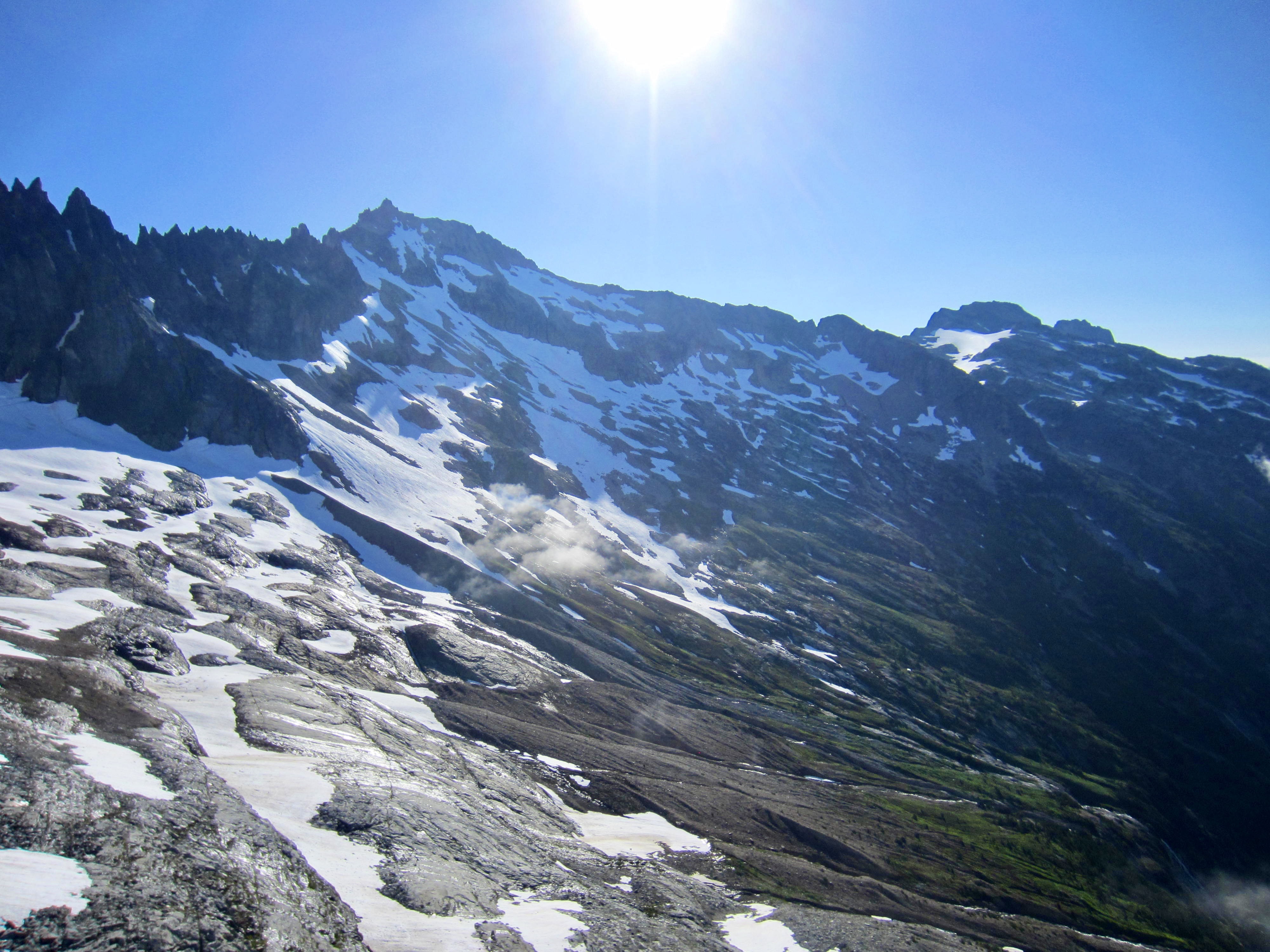
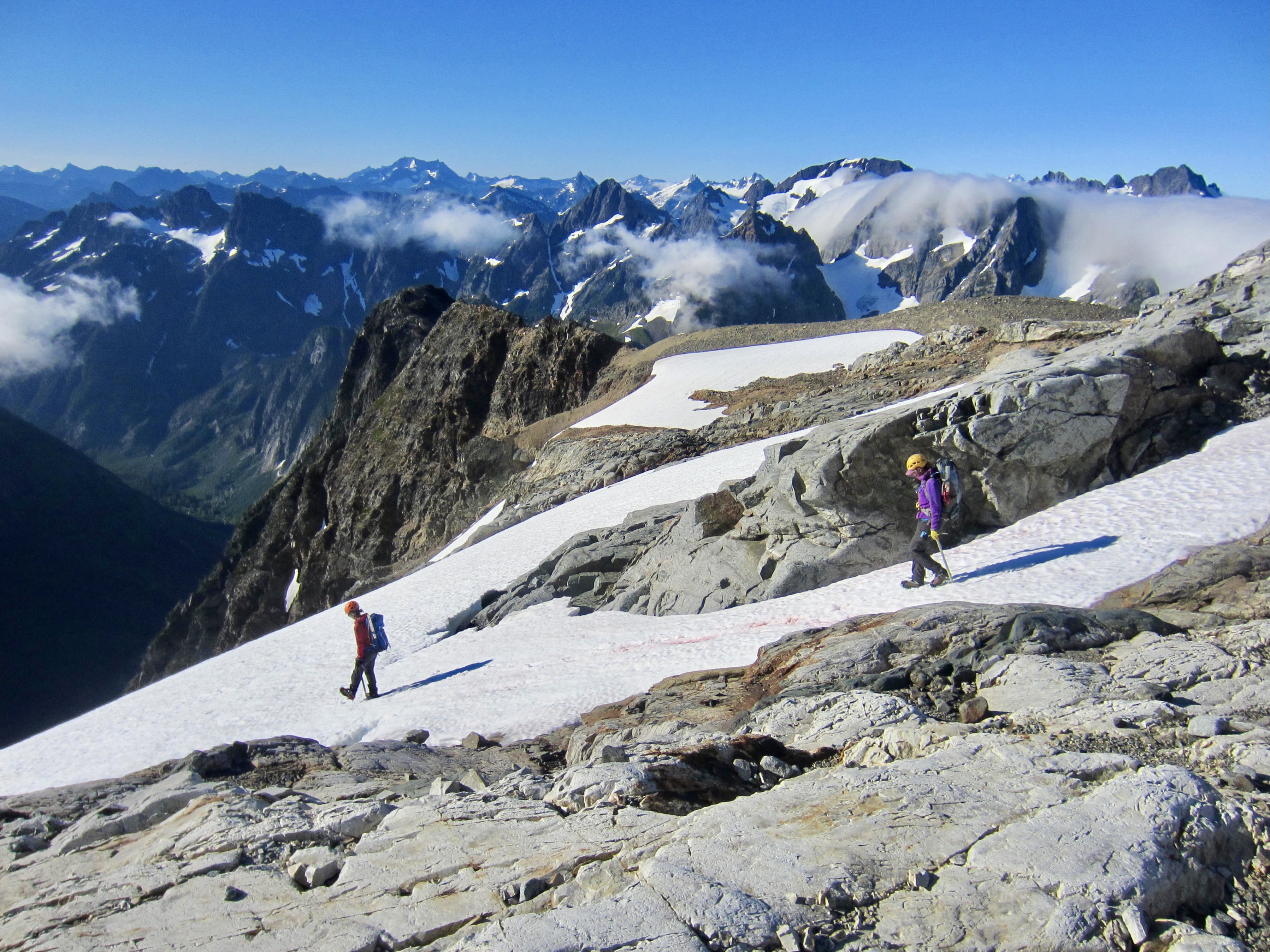
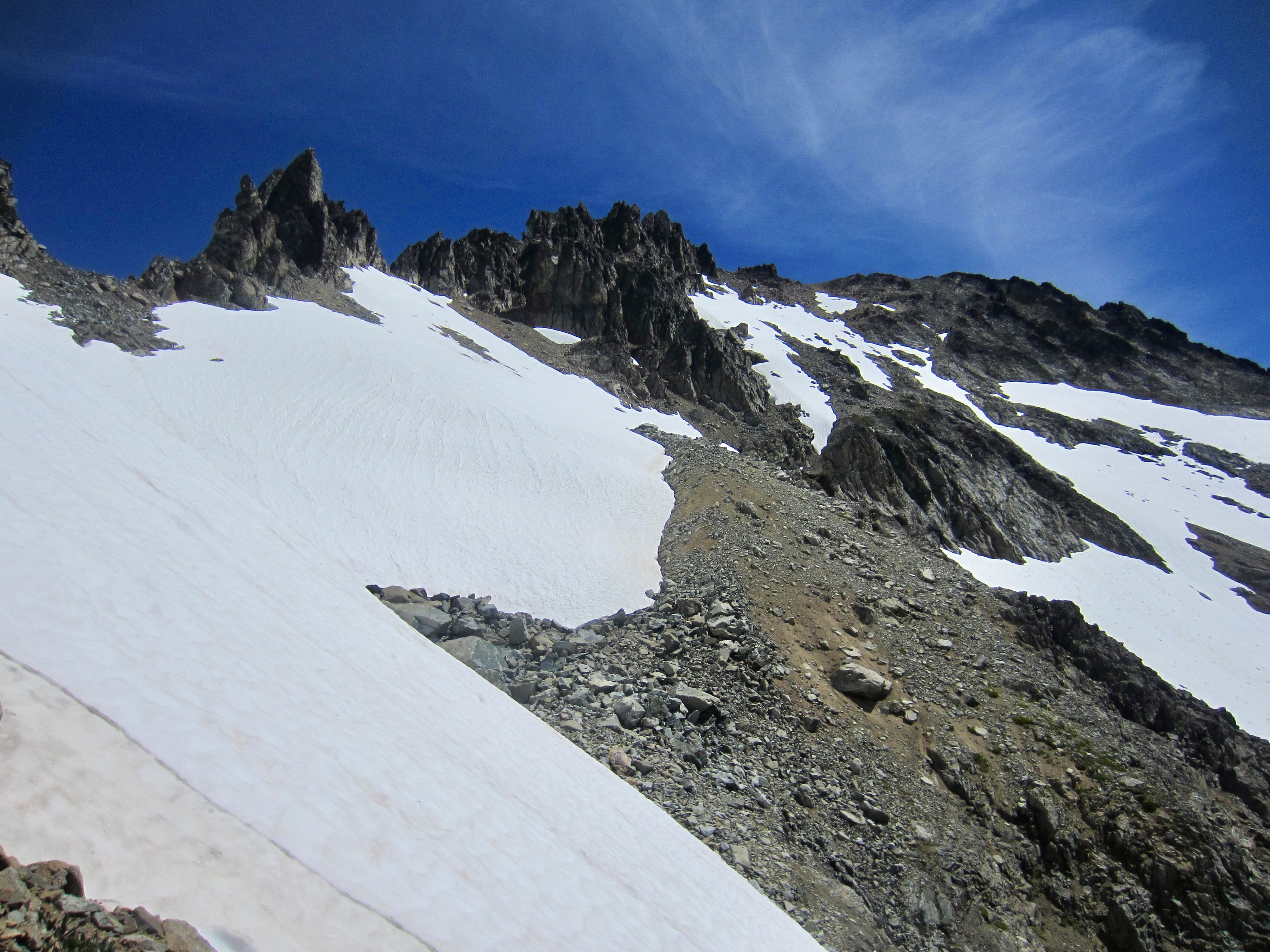
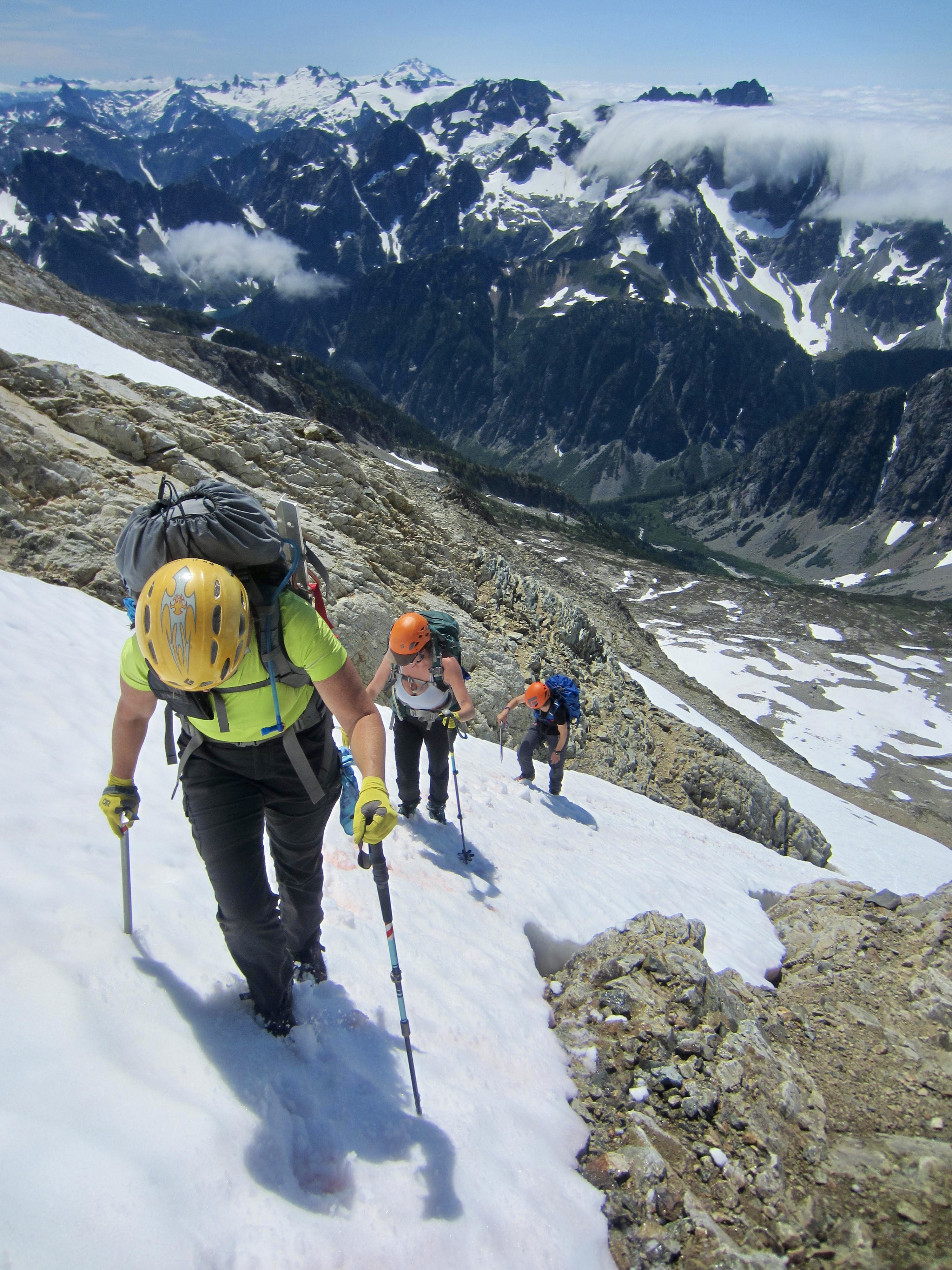
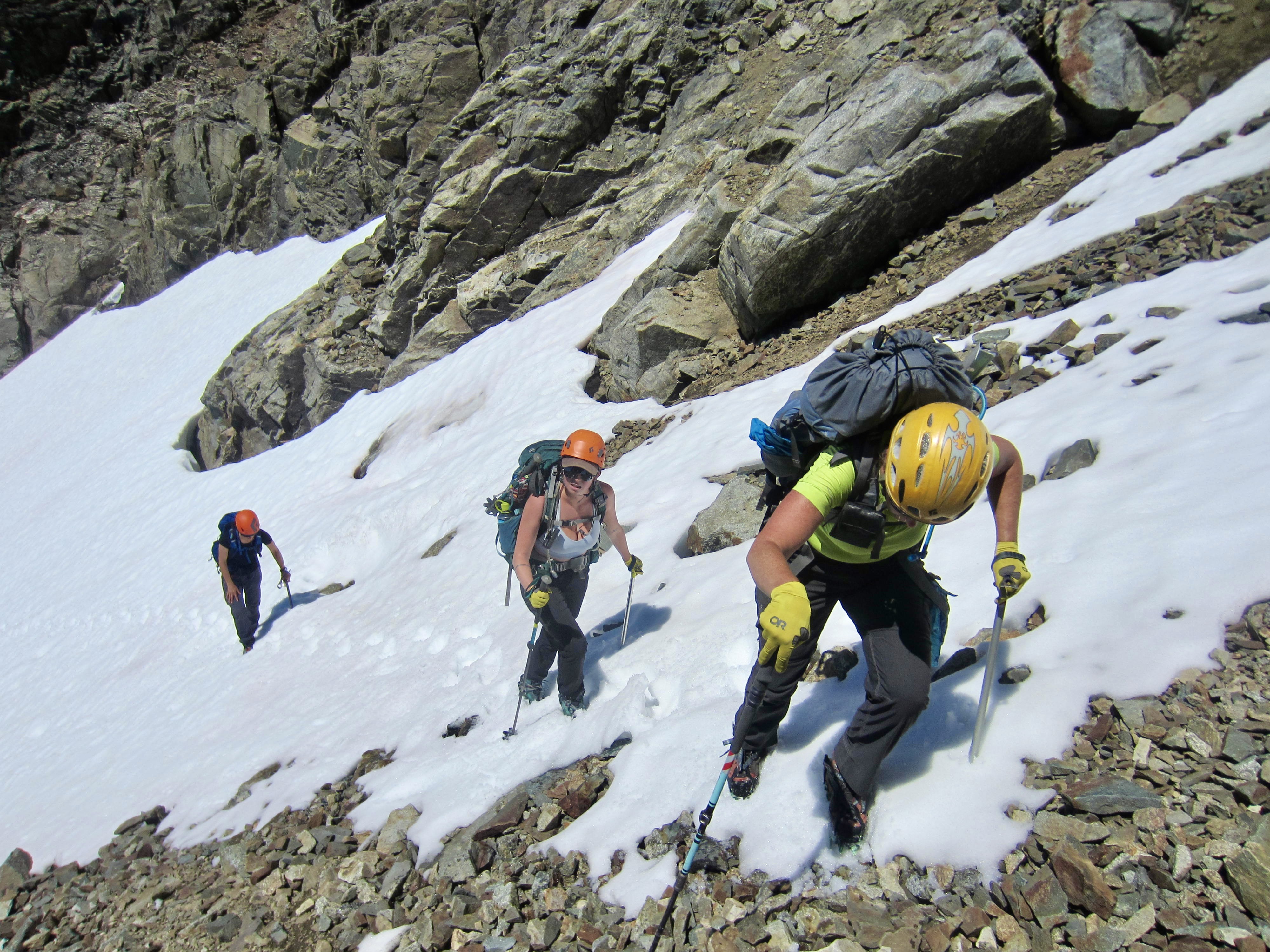
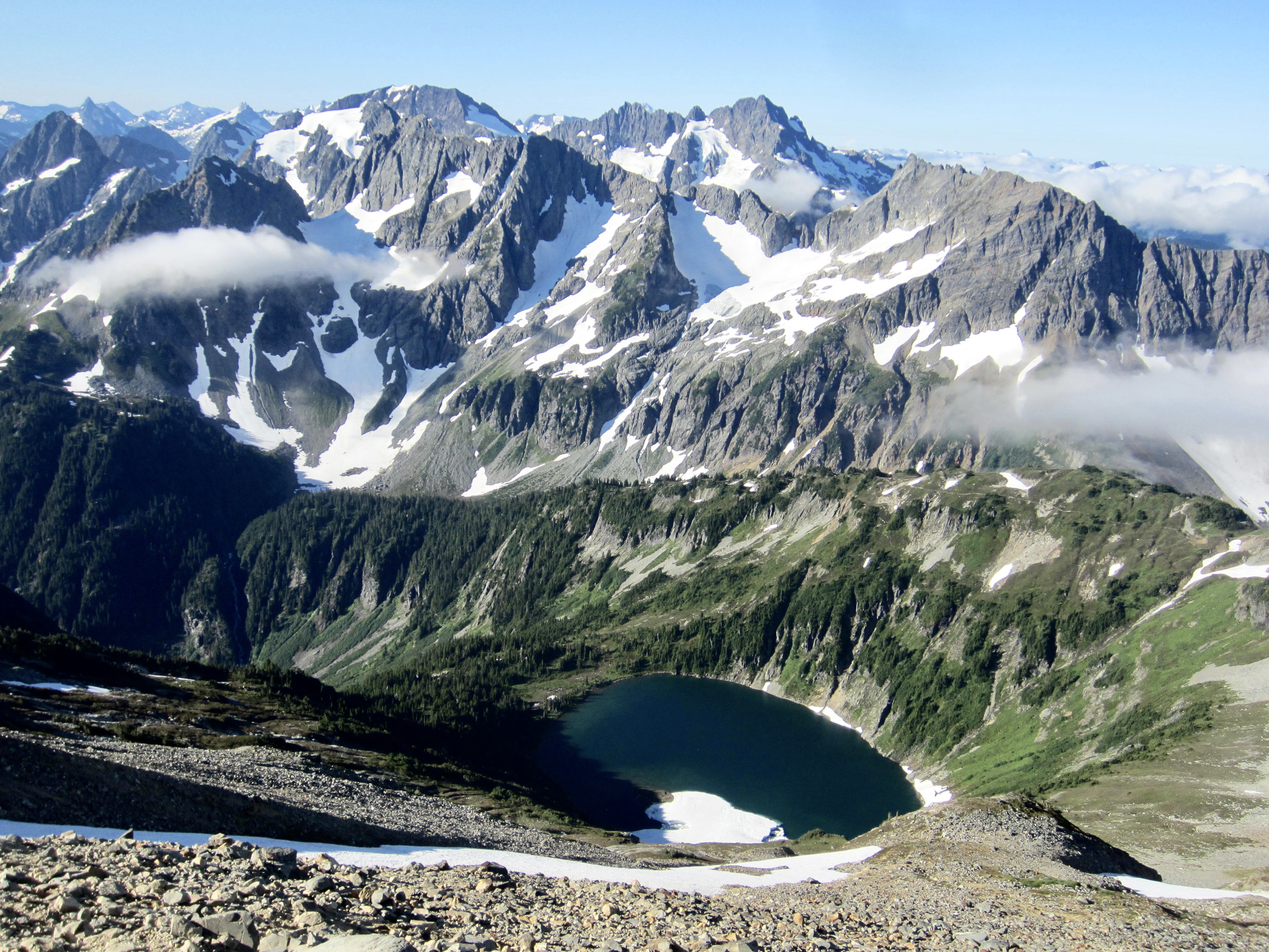
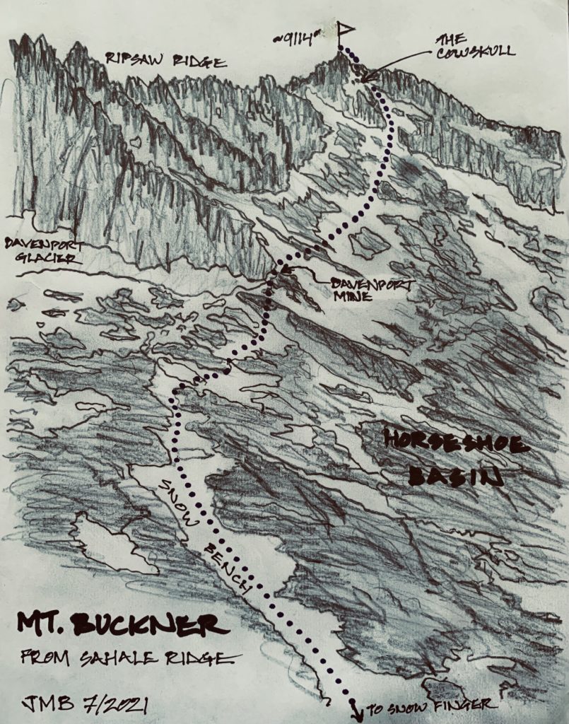
At 7:15am, we left camp with summit packs, walked over to the south ridge of Sahale Peak, and began descending—first on snow and then on Class 1-2 rock. The sweeping curve of Horseshoe Basin stretched out below Ripsaw Ridge and Mt. Buckner’s southwest face.
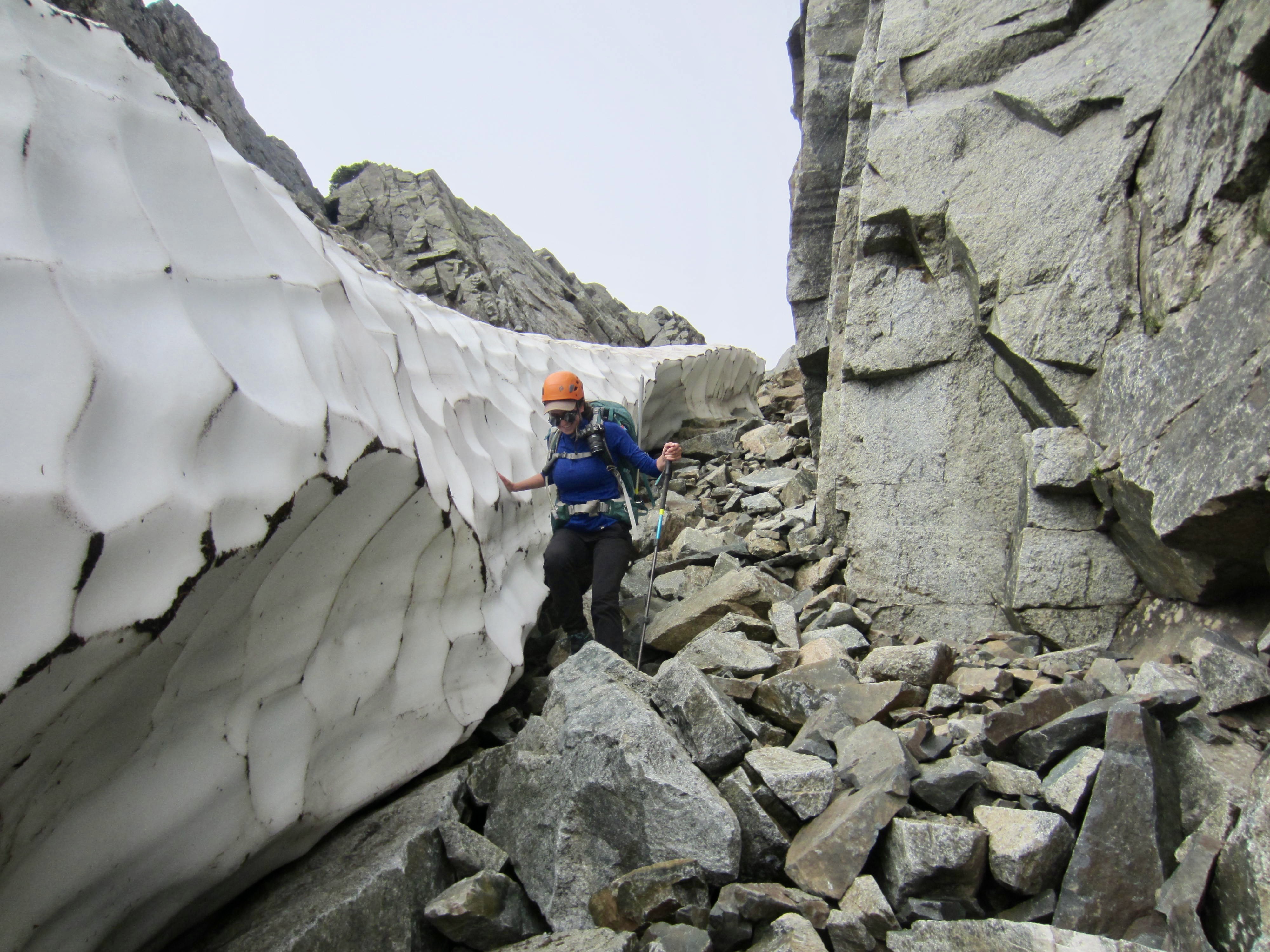
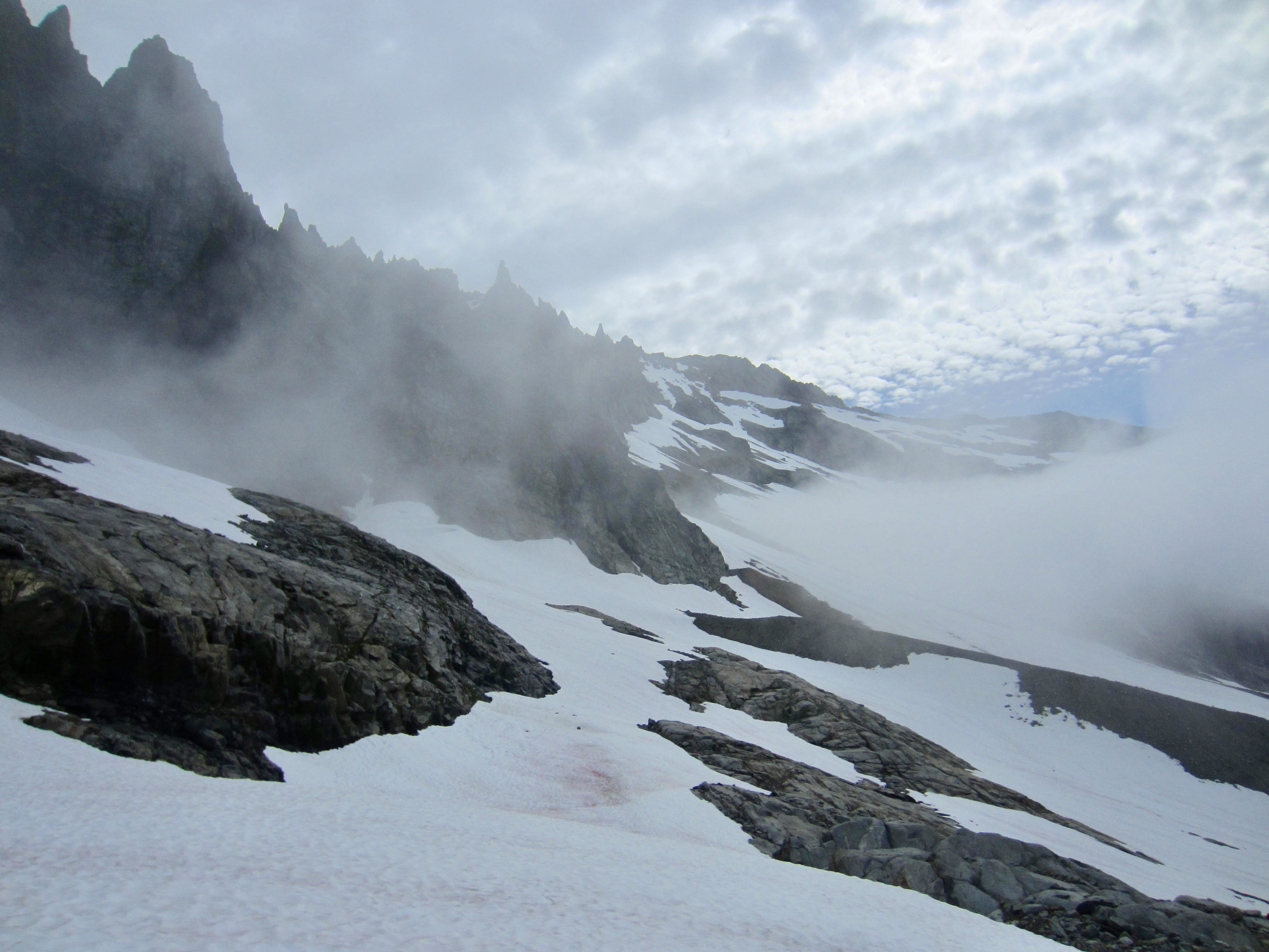
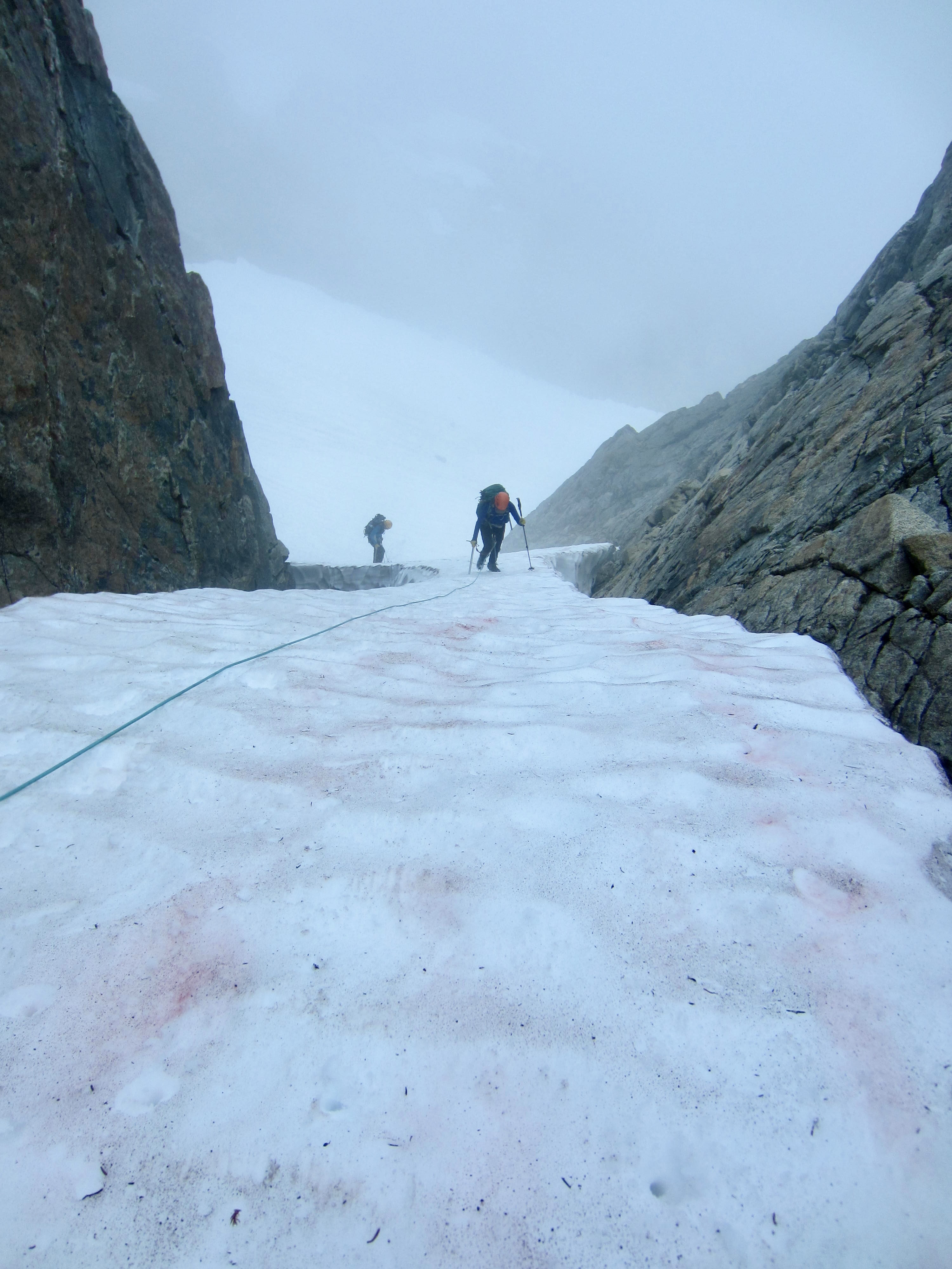
Farther along the ridge, we down-climbed a Class 3 face to gain a 6800-foot notch. This notch marks the top of a steep, snow-filled cleft in the ridge. We descended the cleft by staying in a moat until it became necessary to move onto the snowfinger and frontpoint down to a major snow bench.


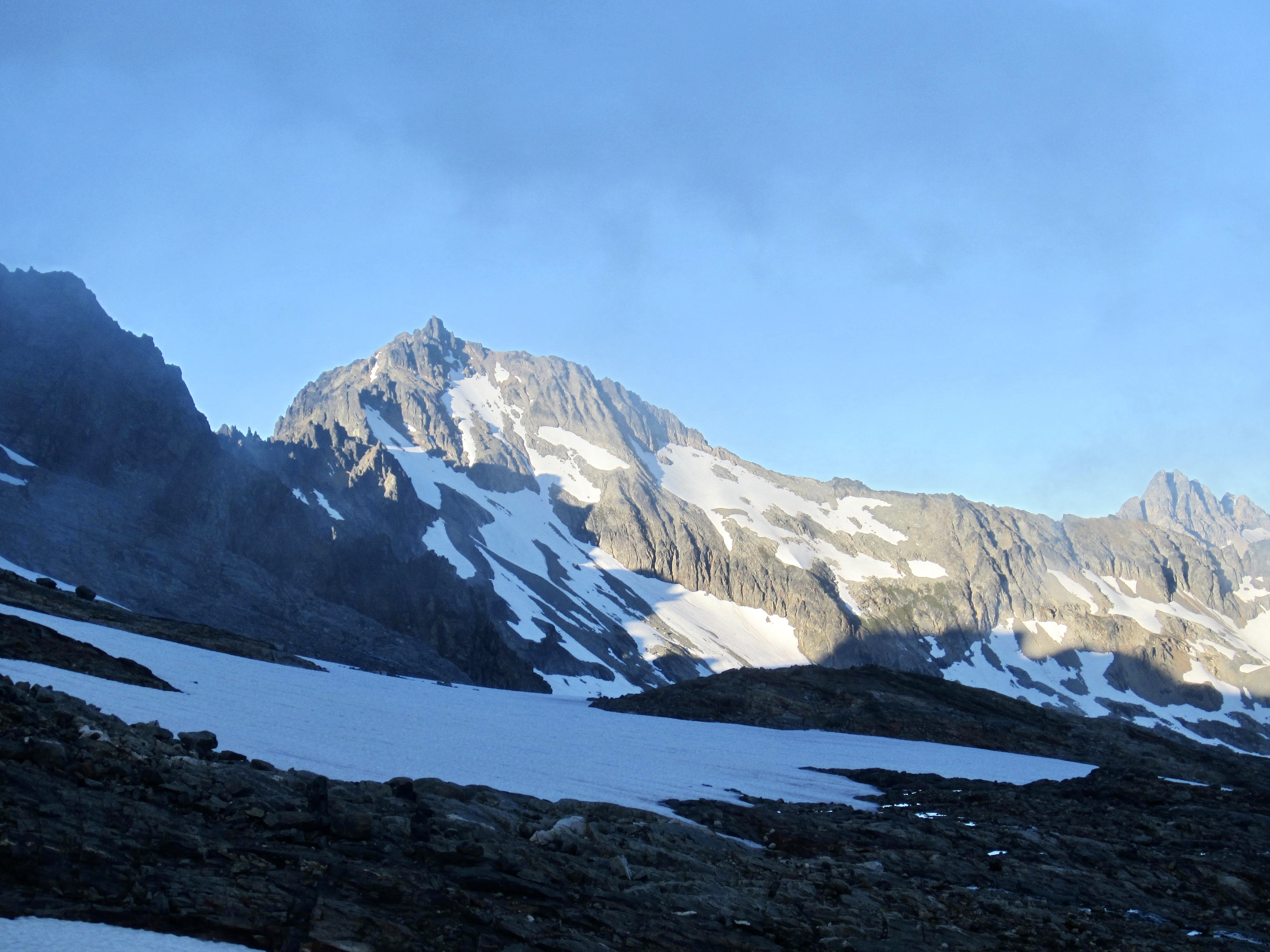
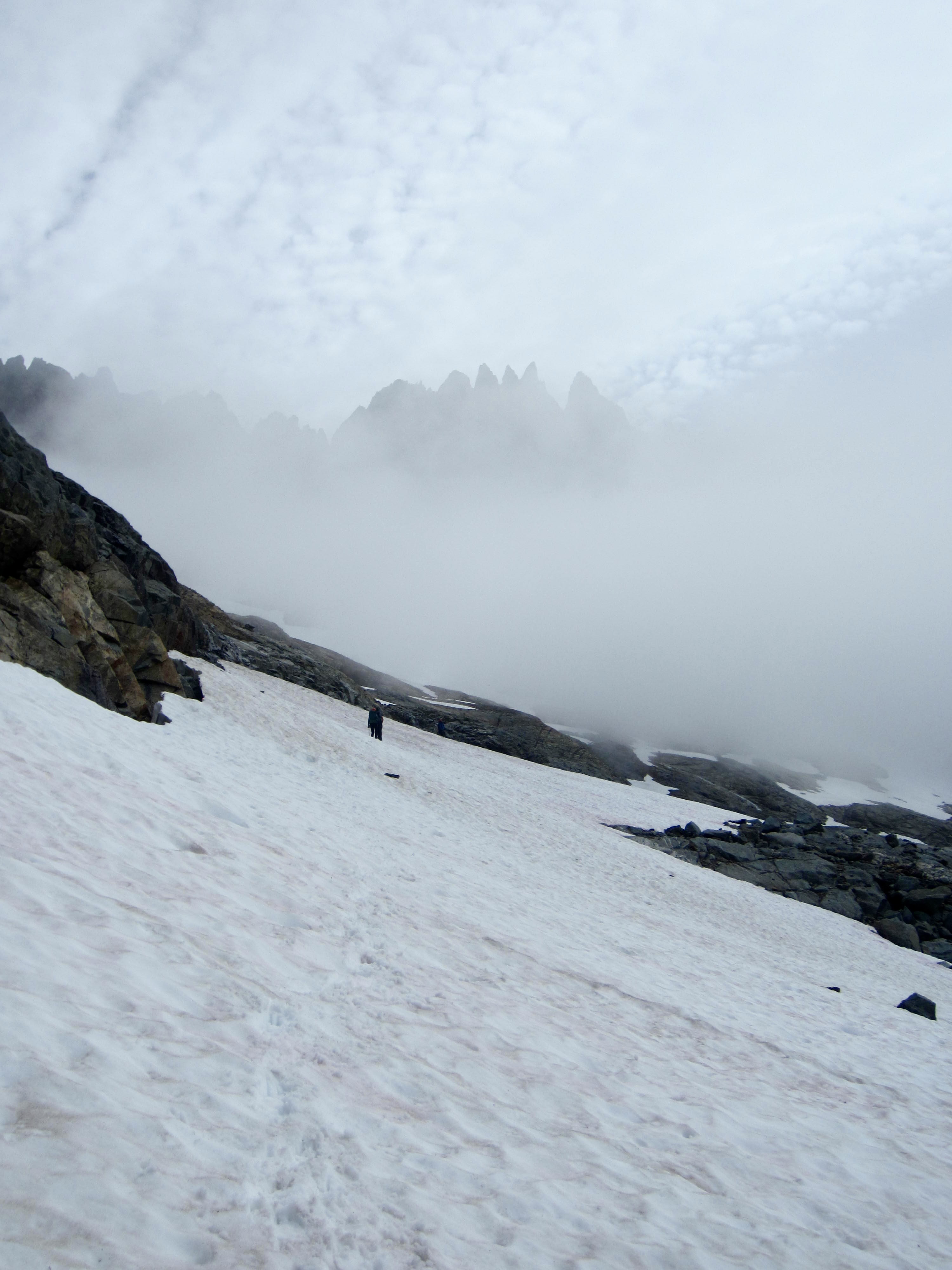
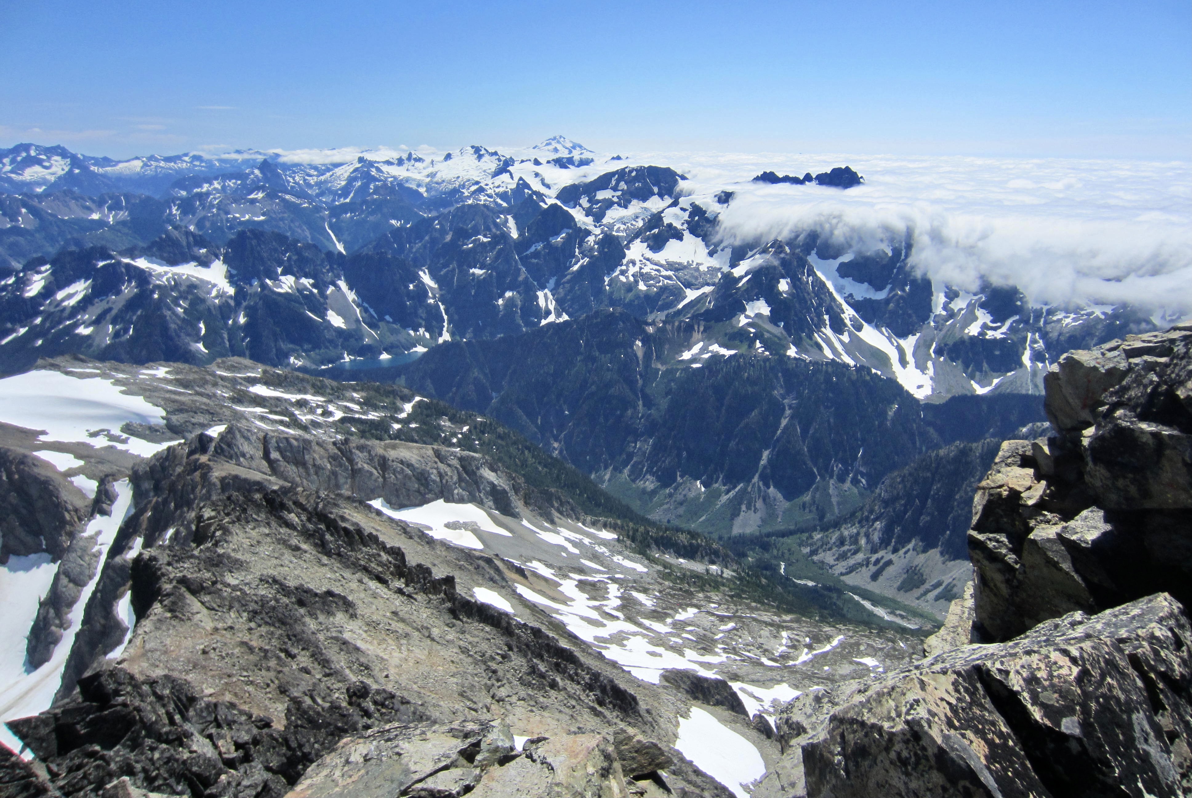
Upon reaching the snow bench, we embarked on a 2-mile-long traverse across Horseshoe Basin. The first mile of our traverse generally stayed between elevations of 6600 and 6800 feet, slightly below a cloud ceiling that hung over Ripsaw Ridge.

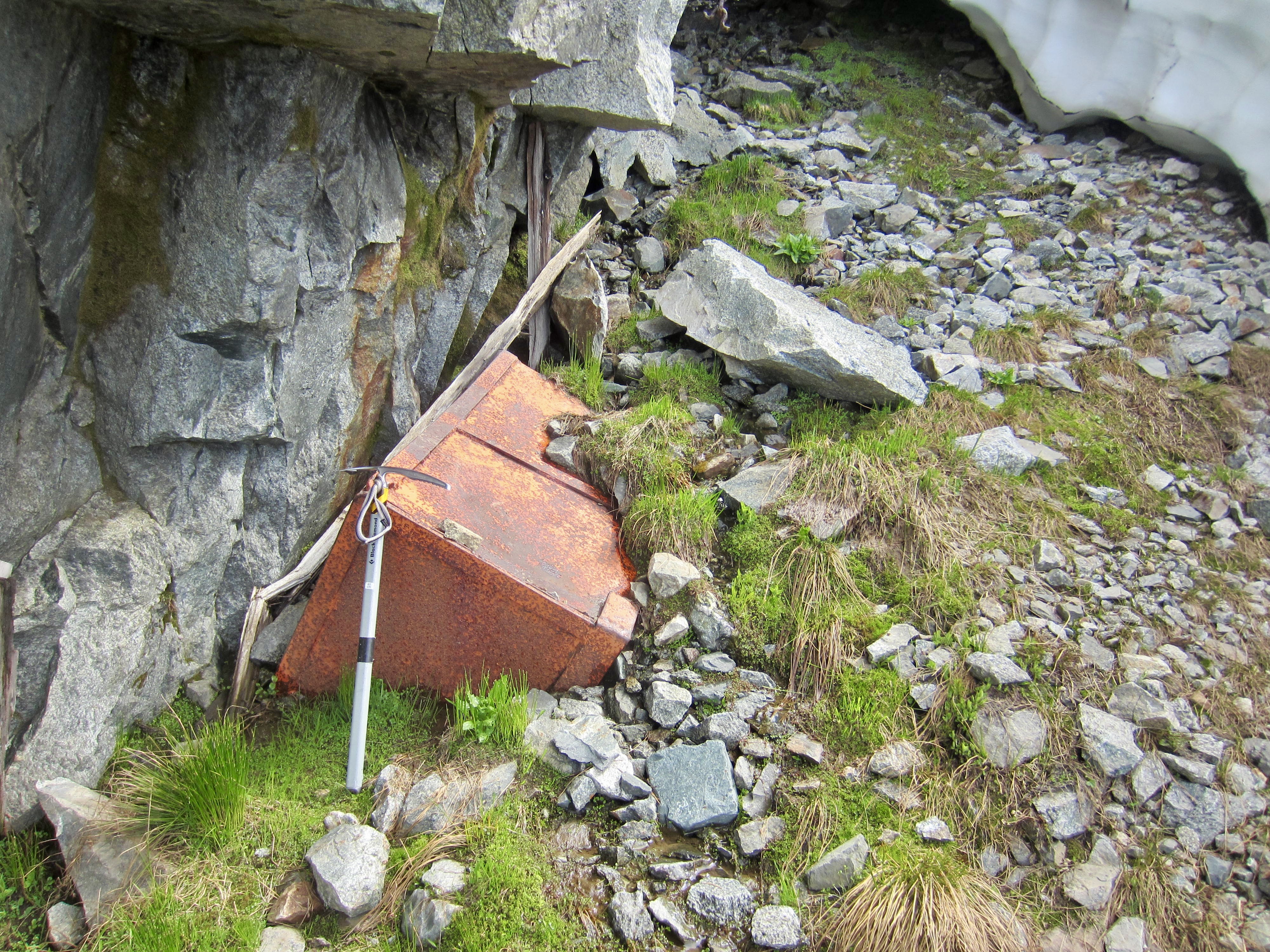
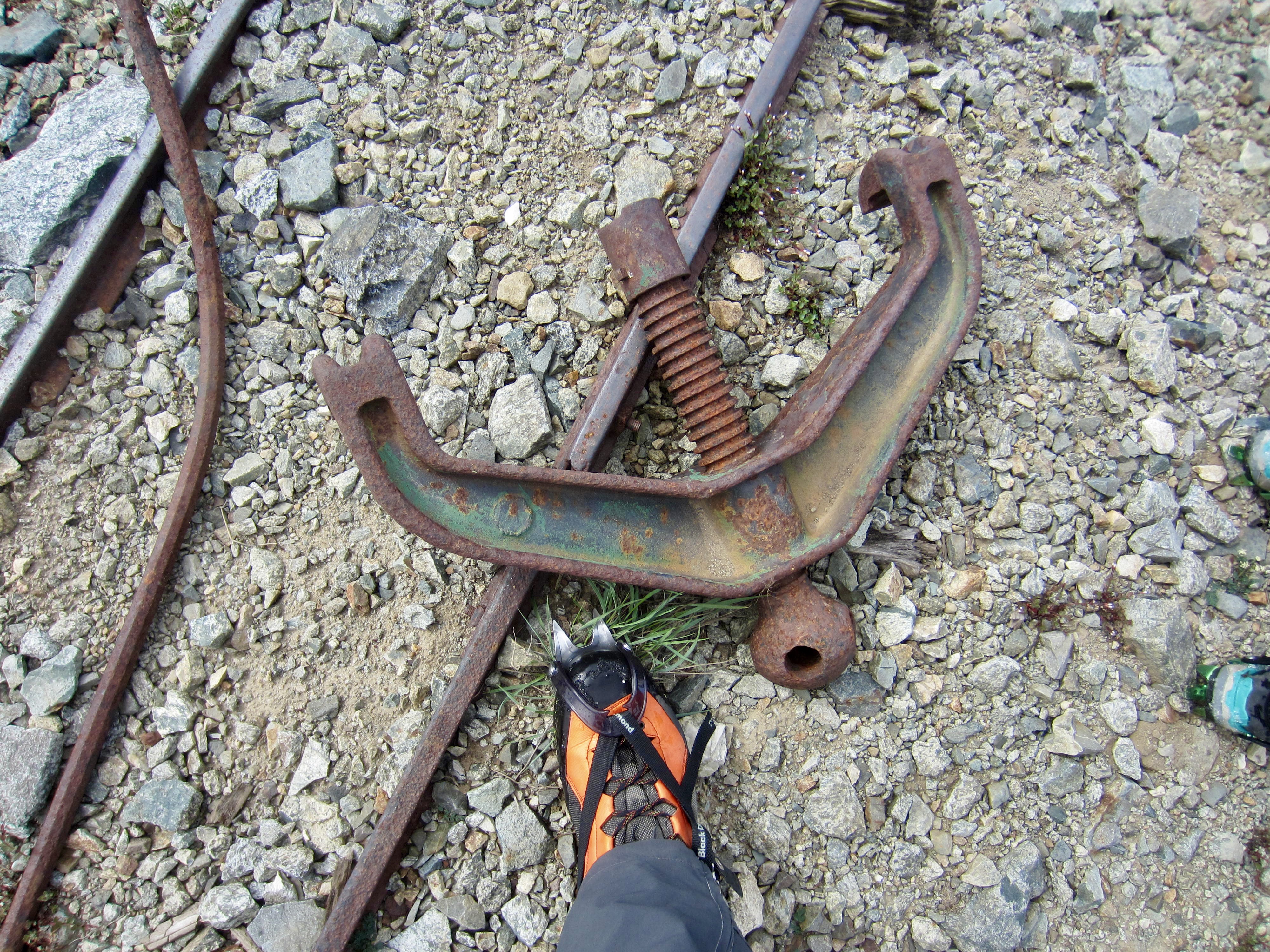
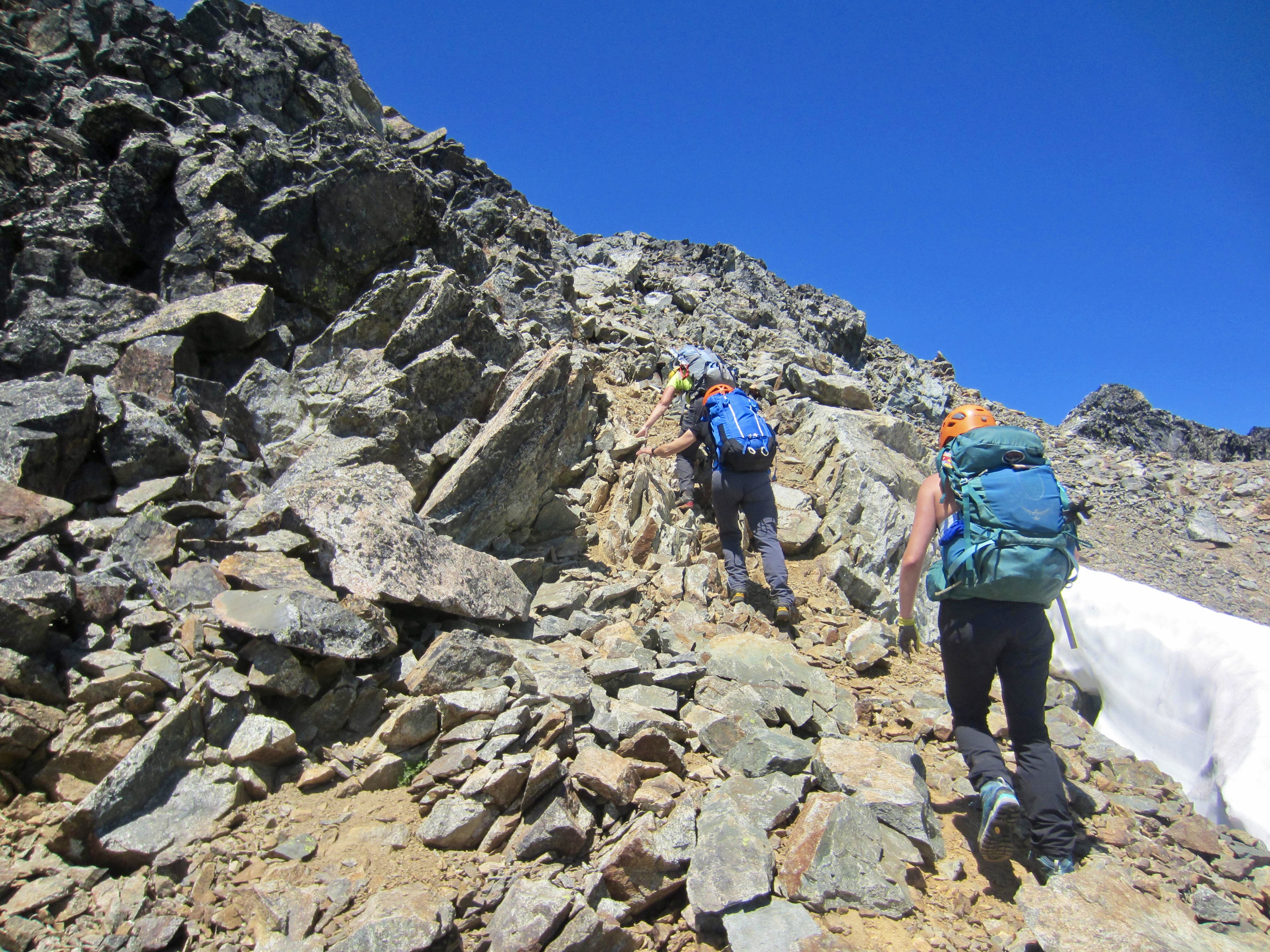
Near the midpoint of our traverse, we angled up to the abandoned Davenport Mine at 7000 feet. There are numerous mining artifacts scattered around this area, including tools, a storage locker, and a cart rail atop a tailings pile.

From Davenport Mine, we continued angling upward across steepening snowfields on the southwest face of Mt. Buckner. A distinctive cowskull-shaped snowfield high on the face provided a navigational landmark below Buckner’s summit. (Earlier in the season, this snowfield looks more like a ghost.)
More easterly traversing took us underneath the cowskull snowfield, at which point we began climbing directly up a snow chute, then up the cowskull itself. Here, the slope inclination approached the limit of our comfort level without using snow protection.

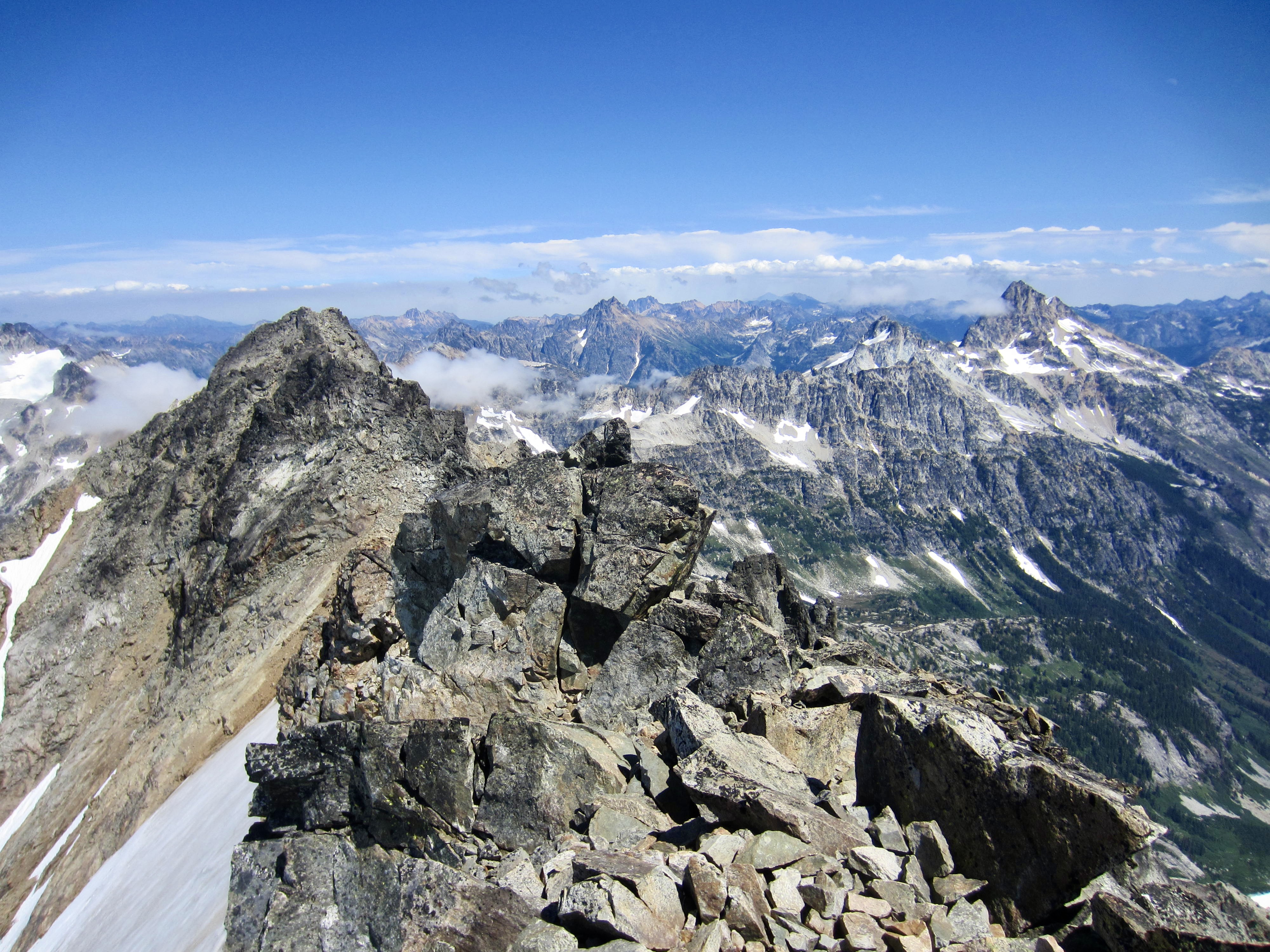
At the top of the cowskull, we stepped off the snow, doffed our crampons, and groveled up loose scree and rubble to reach the summit ridge. A final 100 feet of Class 2-3 rock on the summit block put us on top at 2:00pm (6.8 hours + 3000 feet from Camp 2).
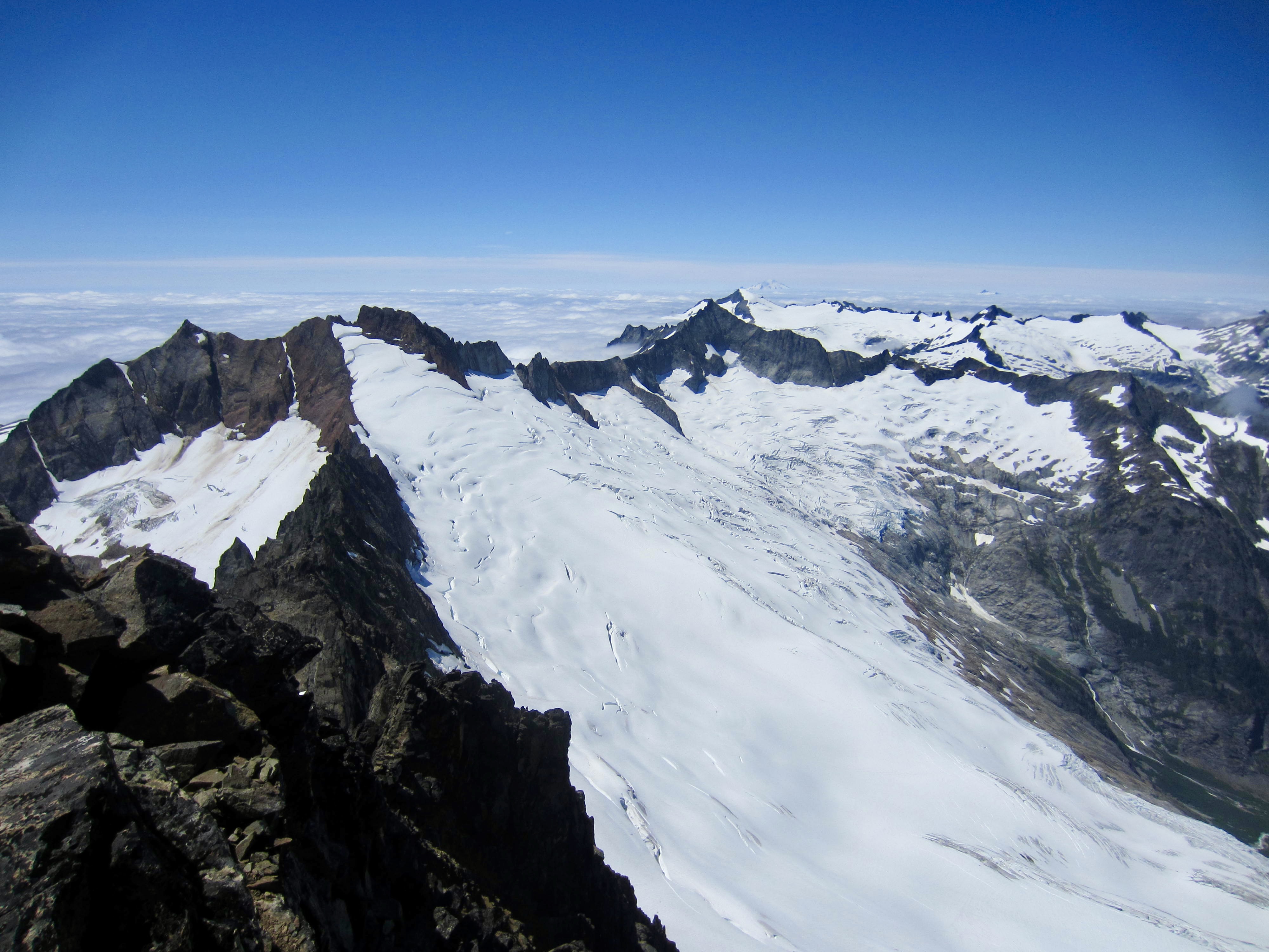
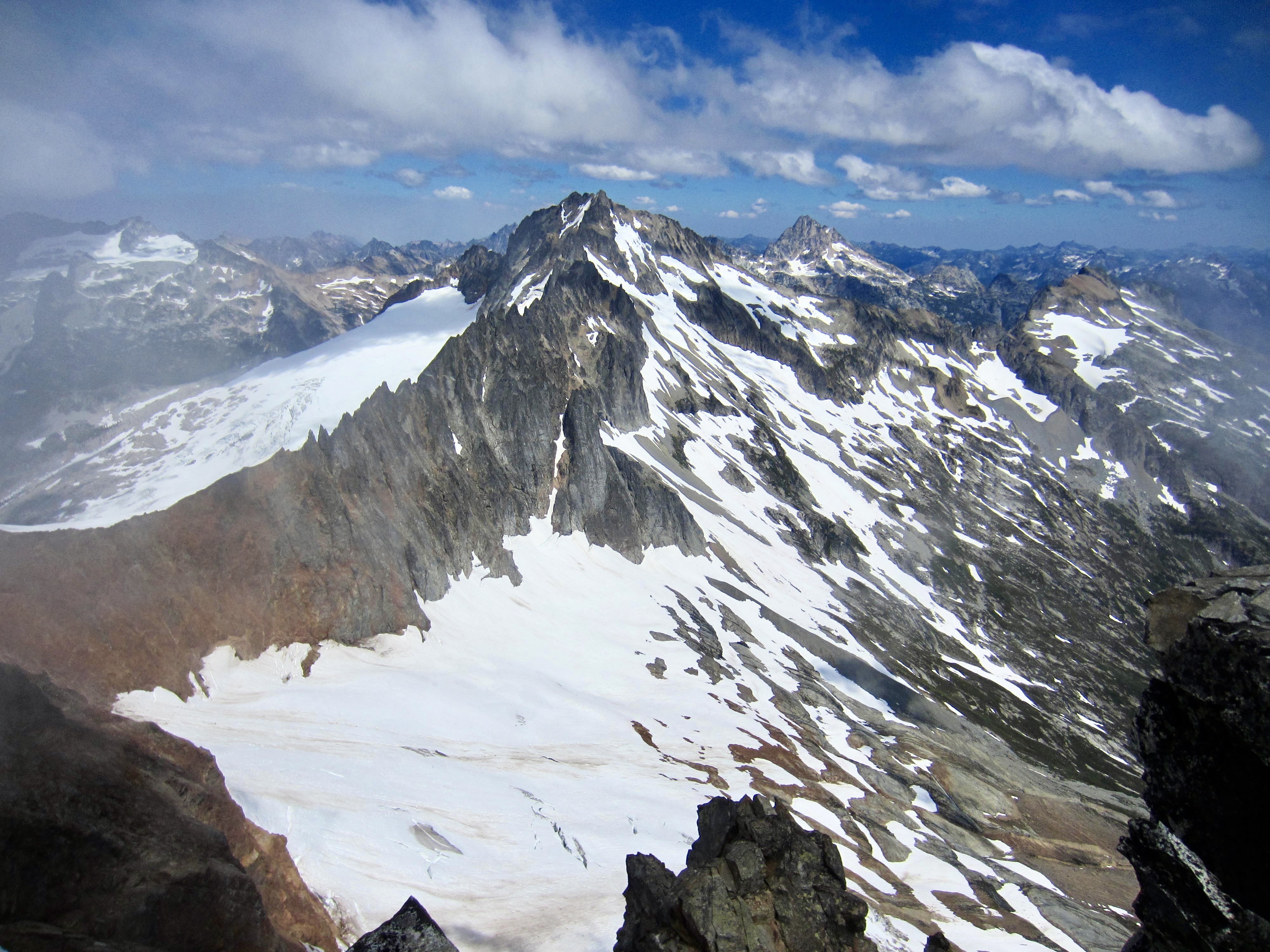
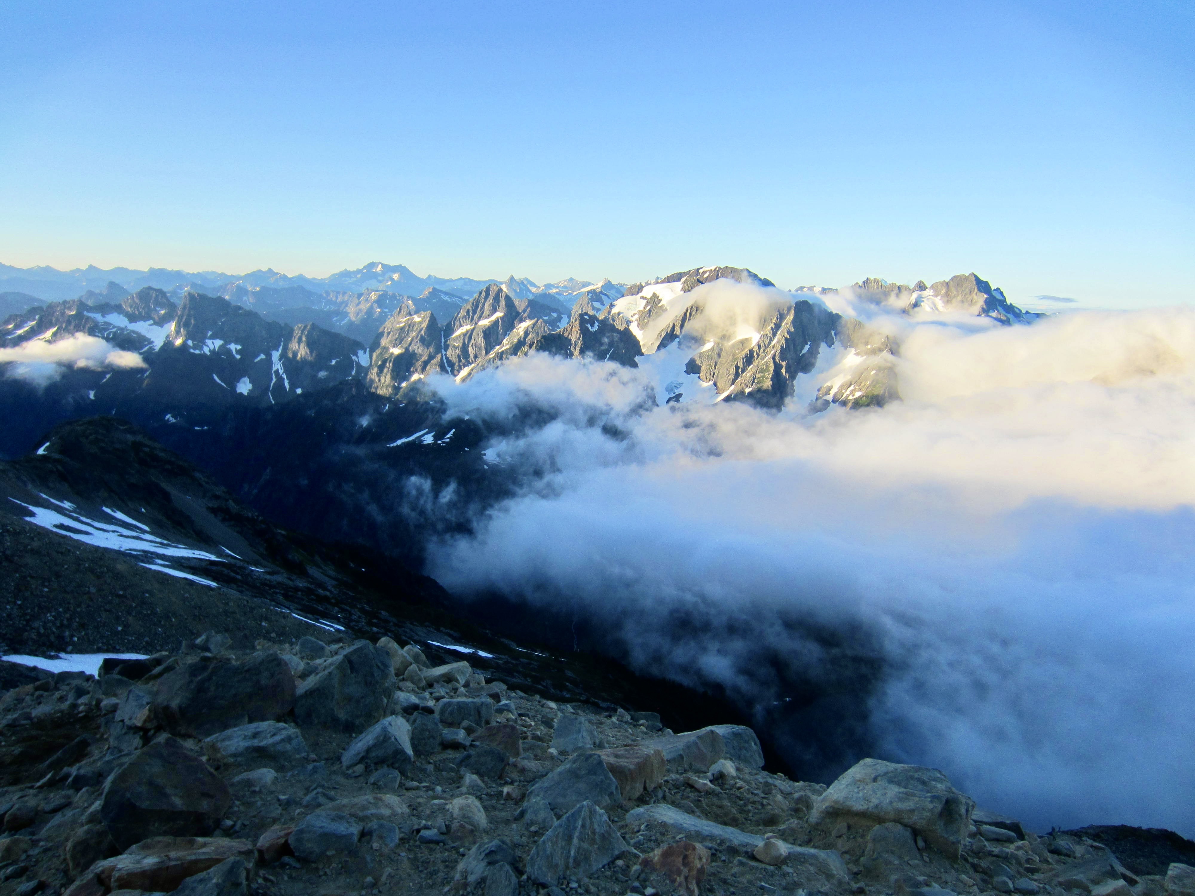
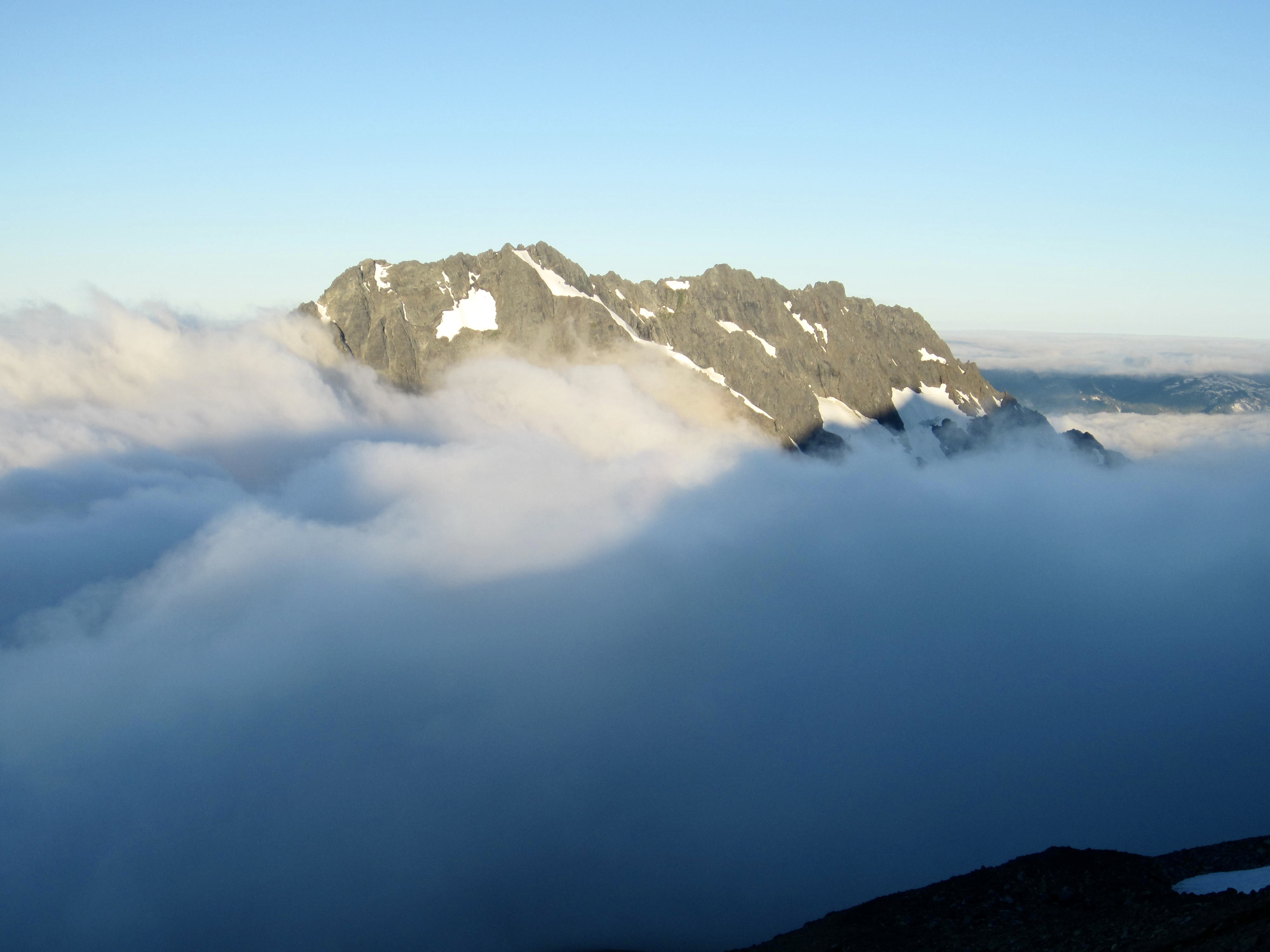
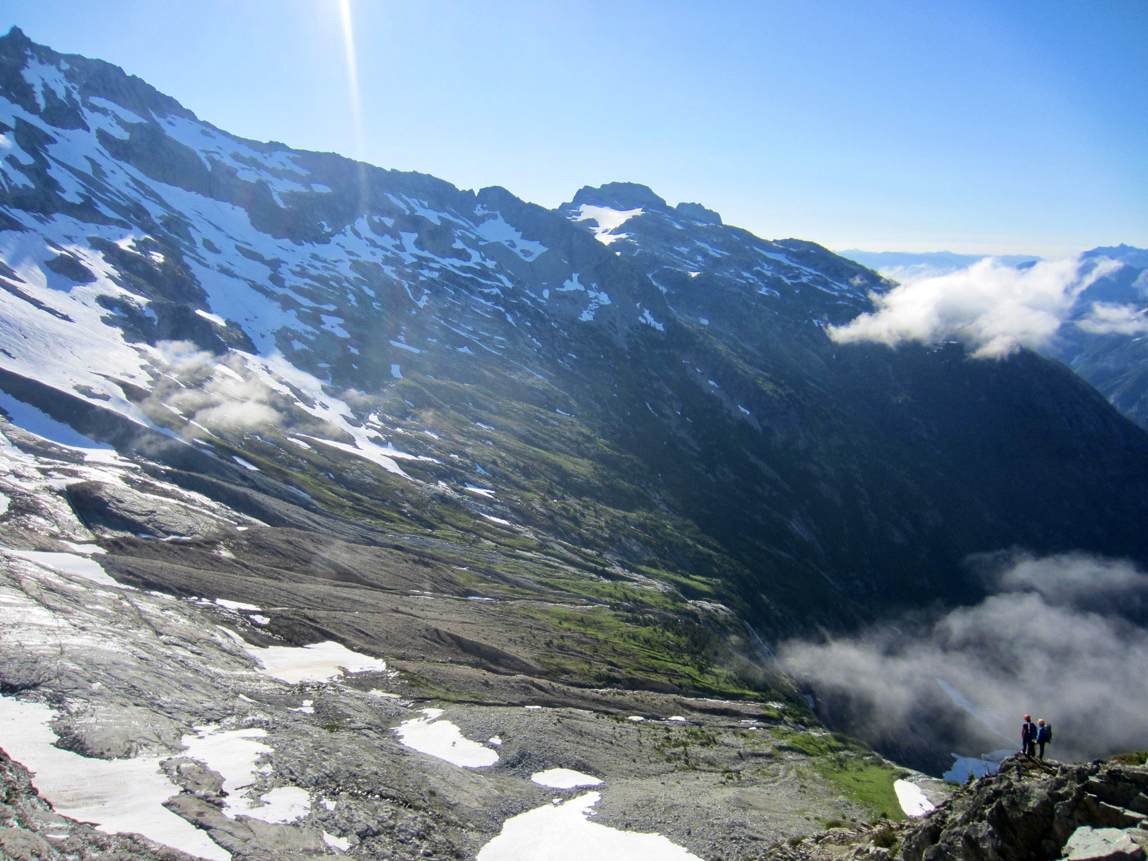
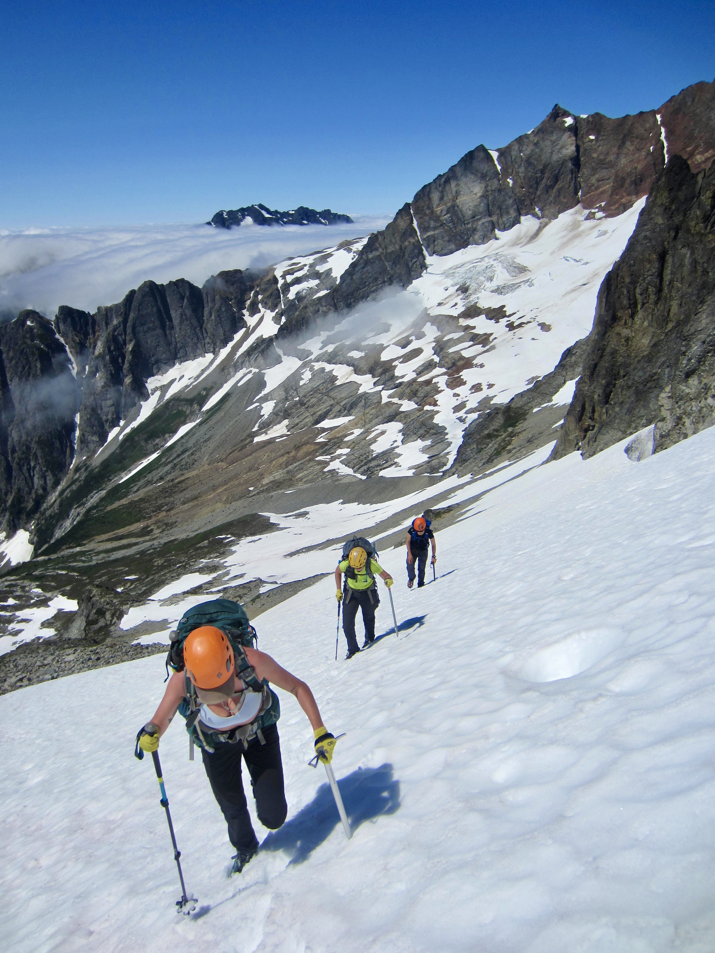
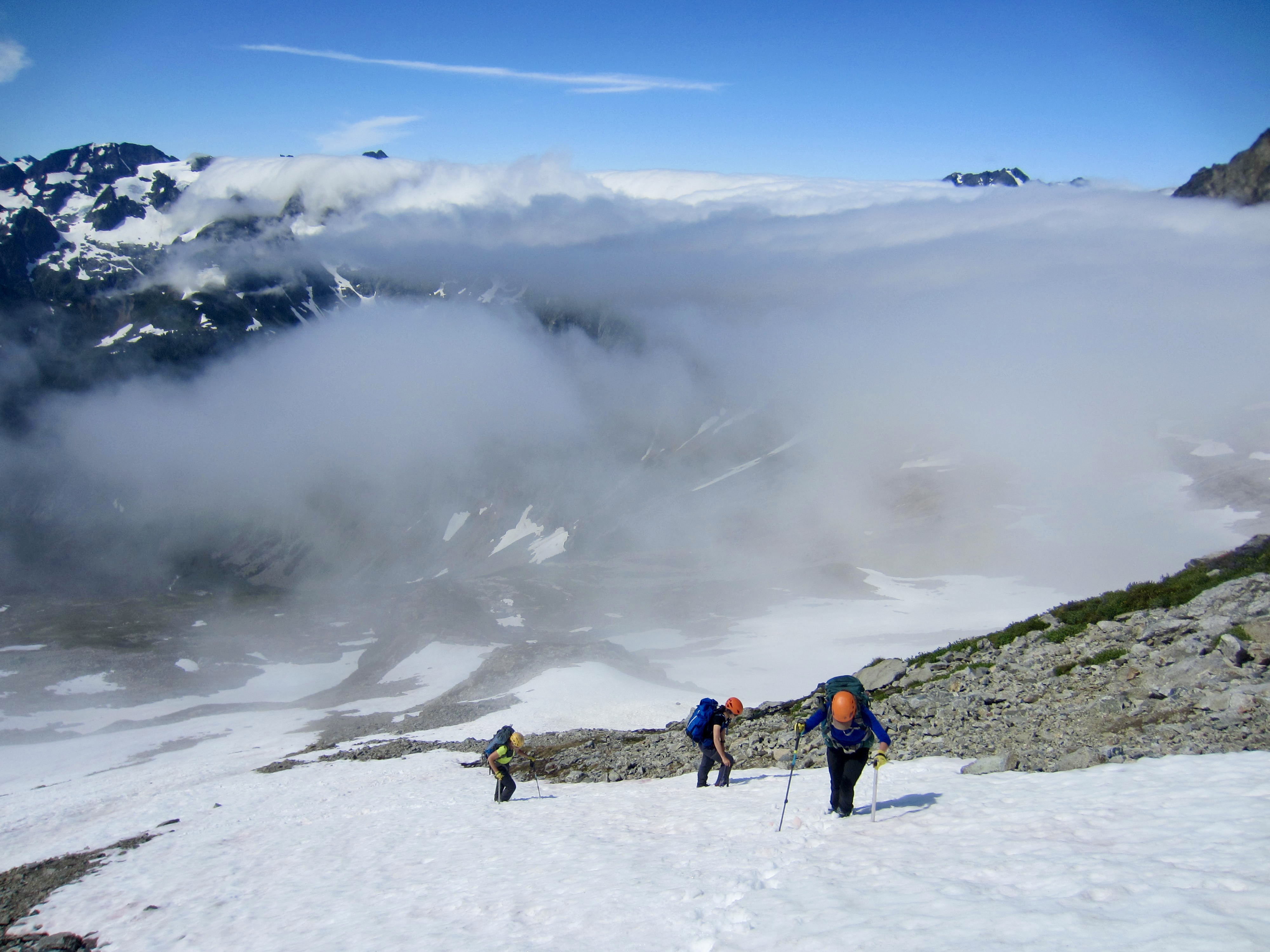
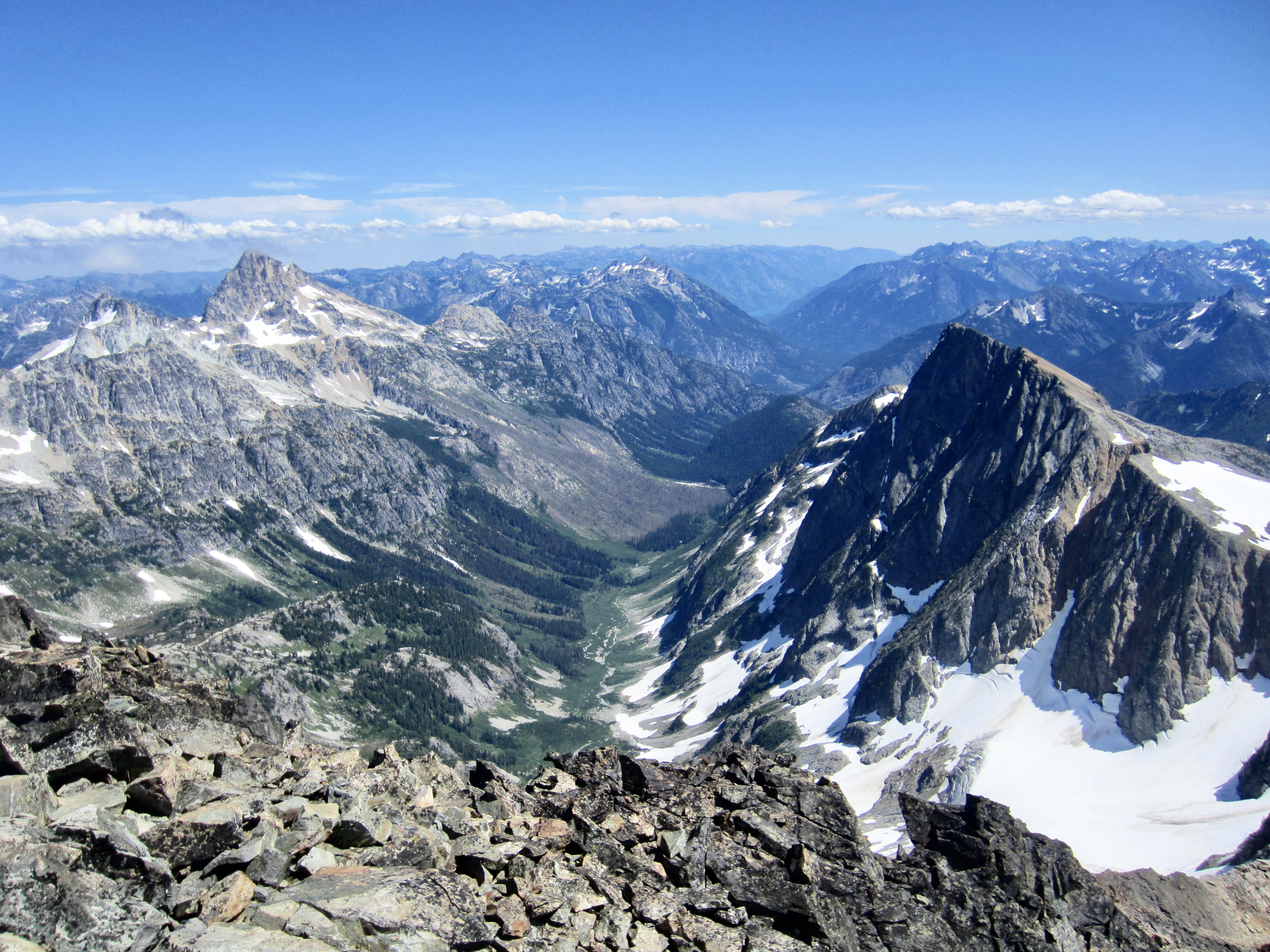
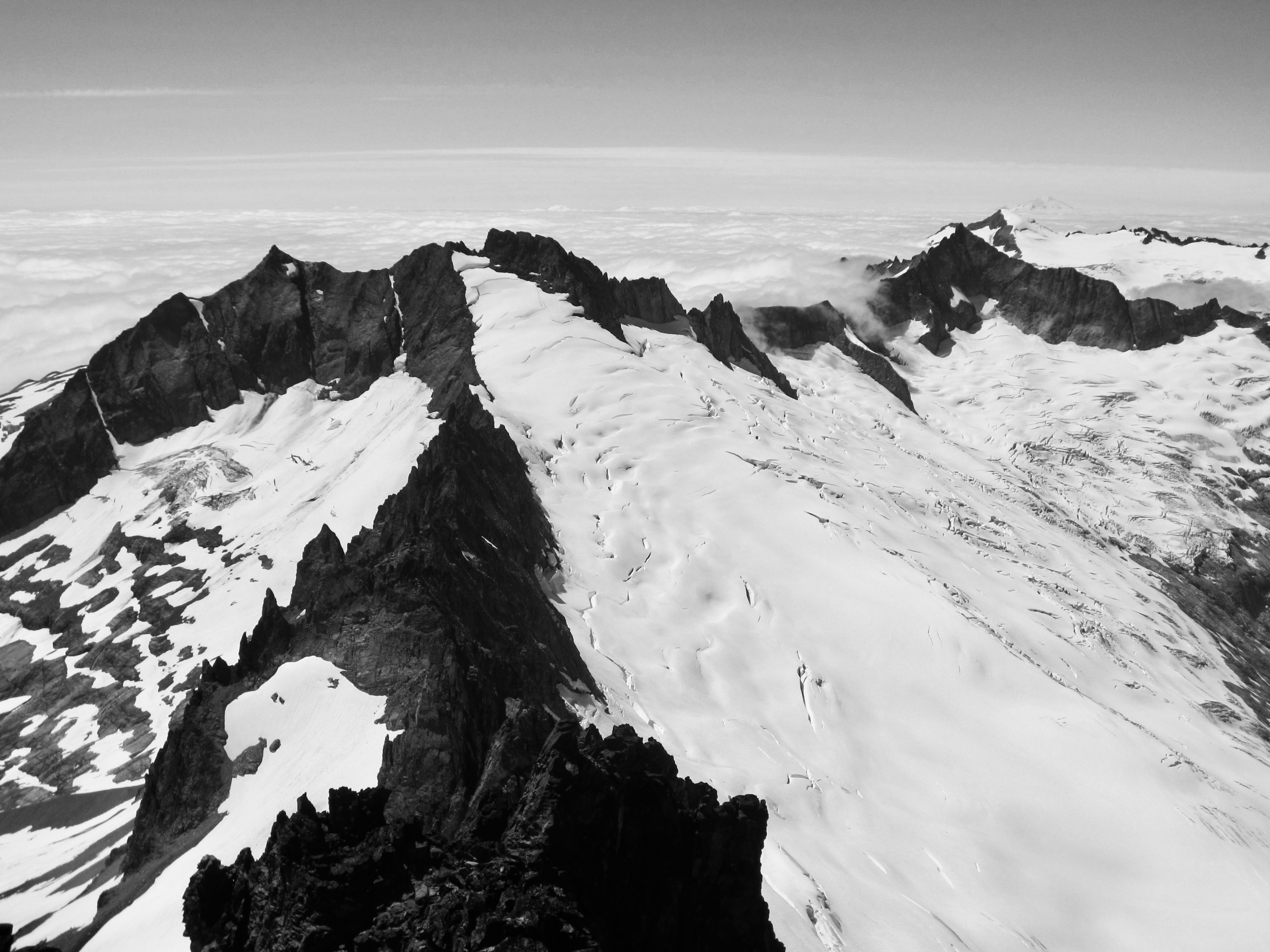
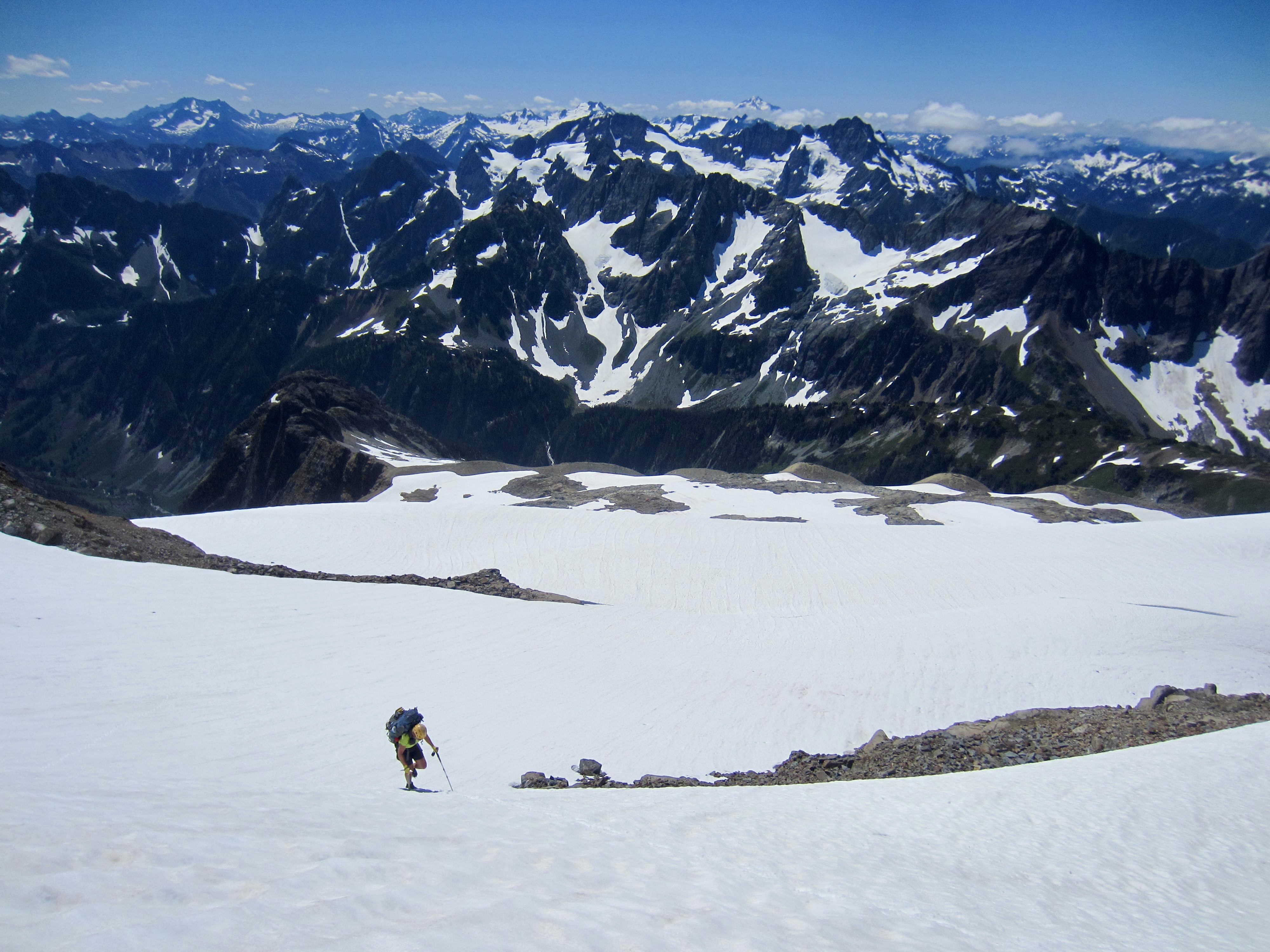
The warm and calm afternoon weather allowed us plenty of time to take in views from the 9000-foot summit. Marine fog filled in every valley to the west, but all of the high peaks stood above the fog deck, and the immense Boston Glacier sprawled out below us.
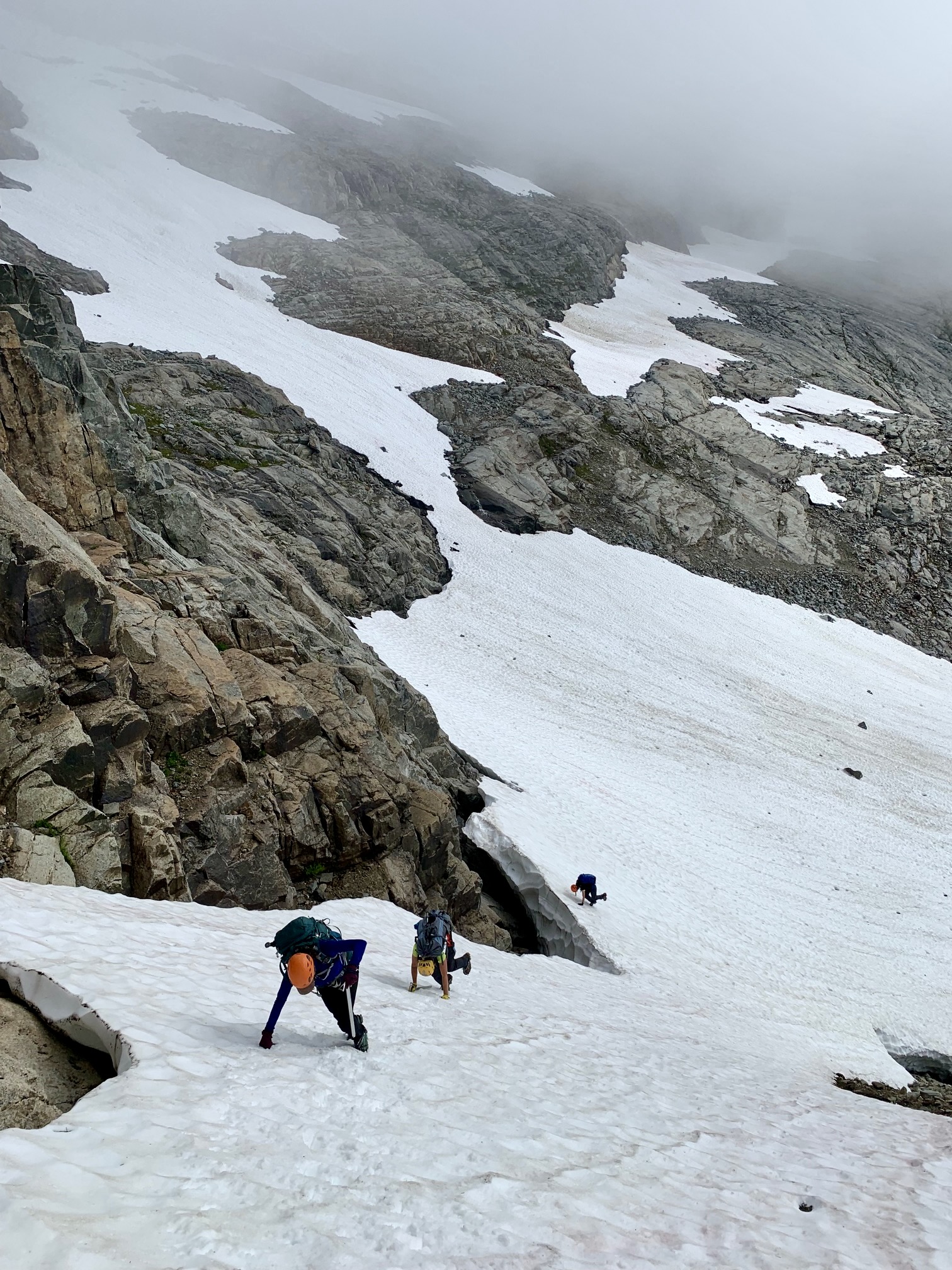
During our descent of the cowskull and snow chute, we roped up and placed snow pickets for running belays. We then took a slightly lower traverse route back to Davenport Mine, where late-afternoon fog rose up to meet us.
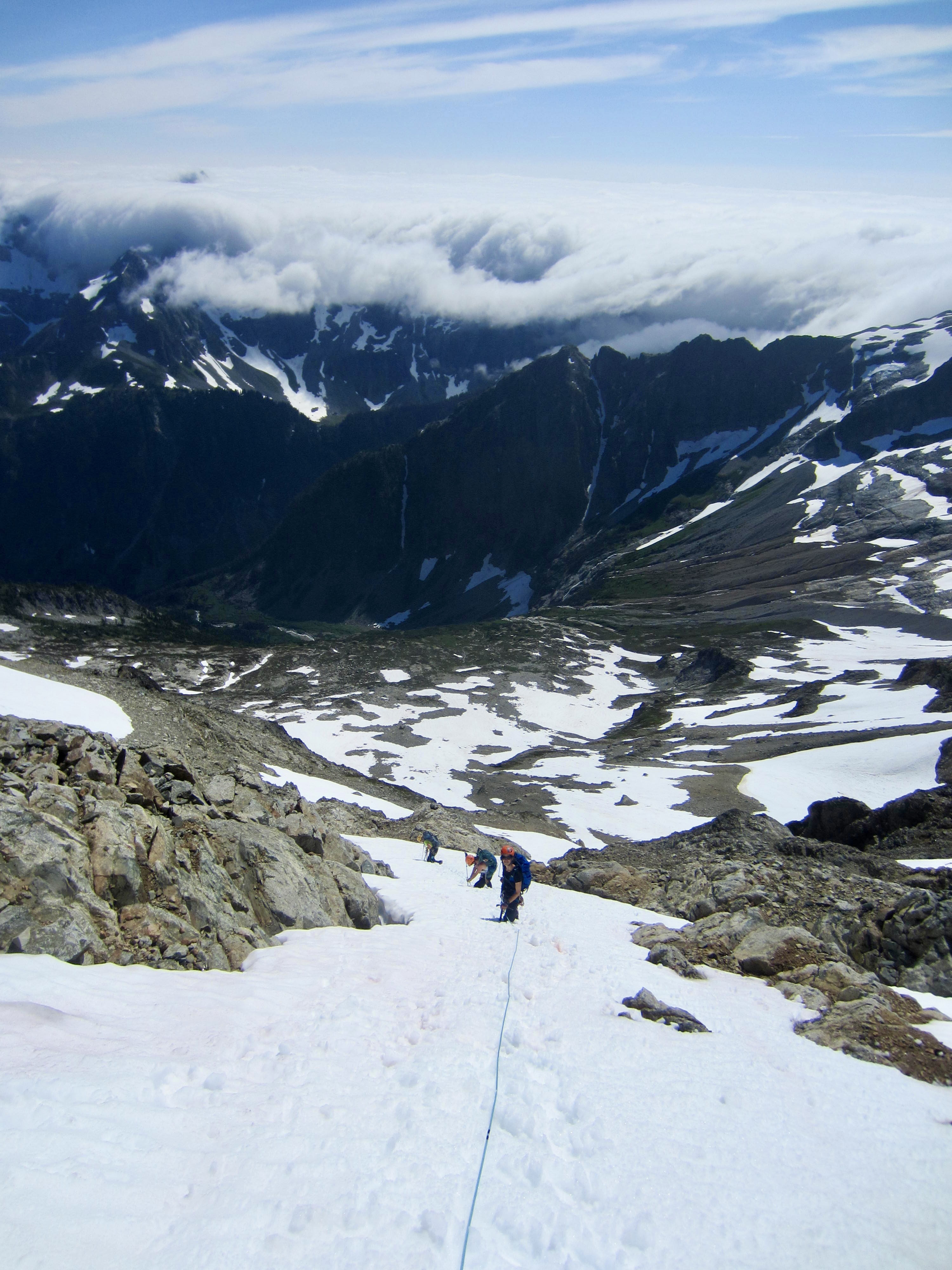
We hurried back along the snow bench and then again roped up for our climb of the steep snowfinger. In fading light, we scrambled back up the rock ridge and booted up the final snowfield. A frigid, foggy gale was blowing across the Sahale Glacier as we tromped into camp scant minutes before dark (6.8 hours + 1500 feet from summit). It had been a successful but tiring 14-hour day.
Day 4: Sahale Glacier Camps to Sahale Peak Summit to Boston Basin:
After a night of steady wind and strong gusts, we awoke to a calm, sunny morning. There was still a thick marine layer to the west, but surely it would dissipate by noon. Wouldn’t it?

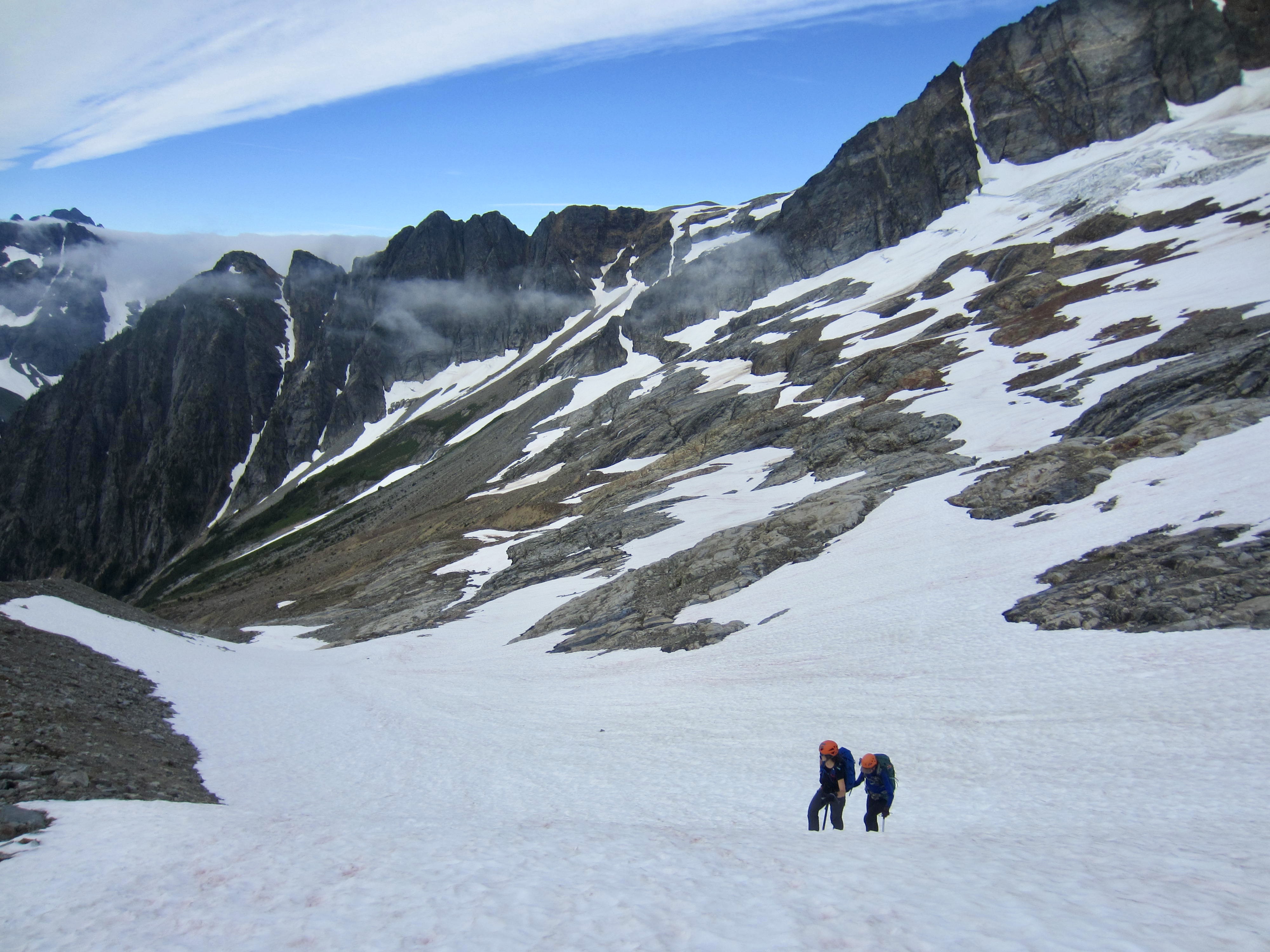
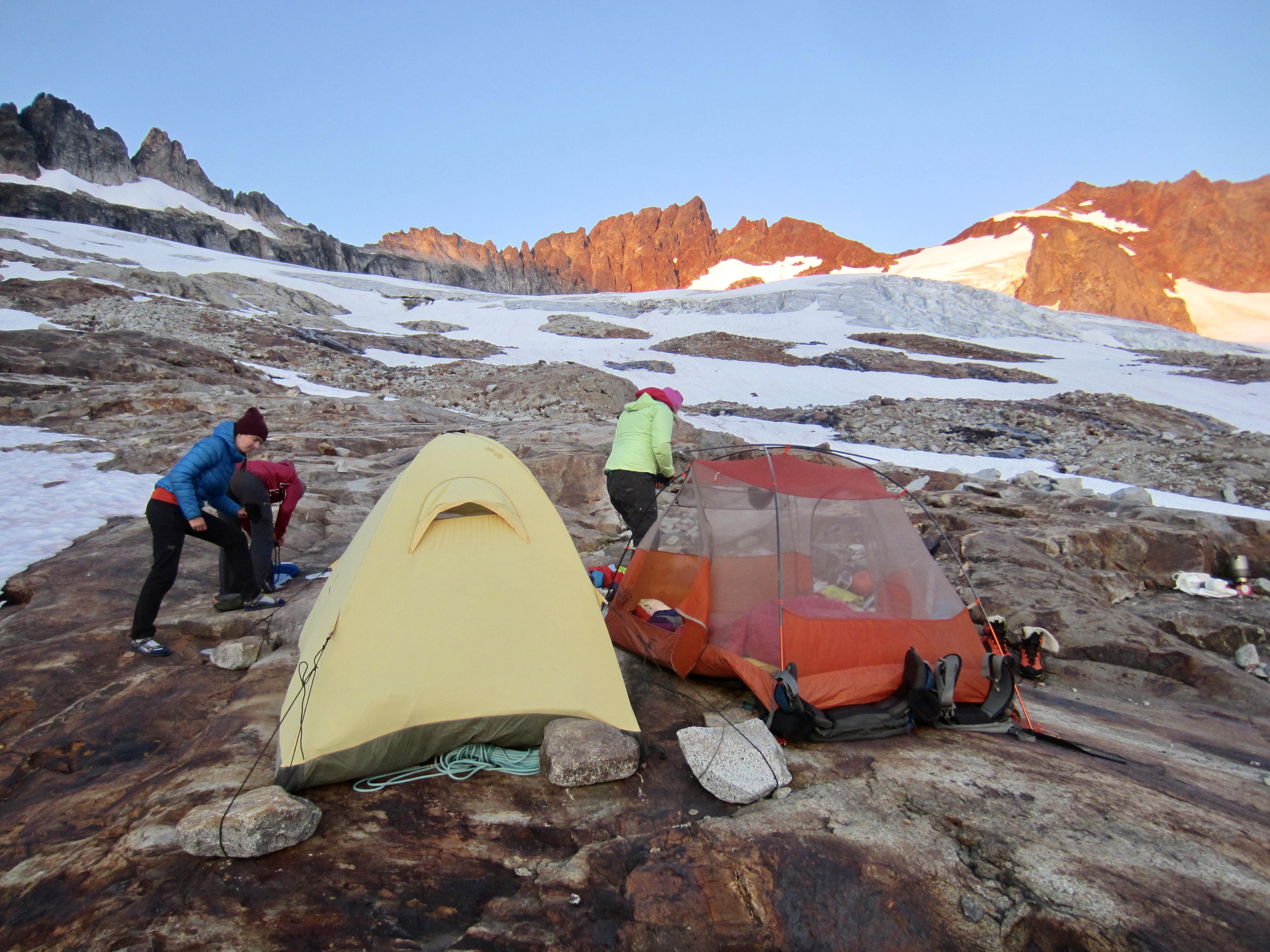
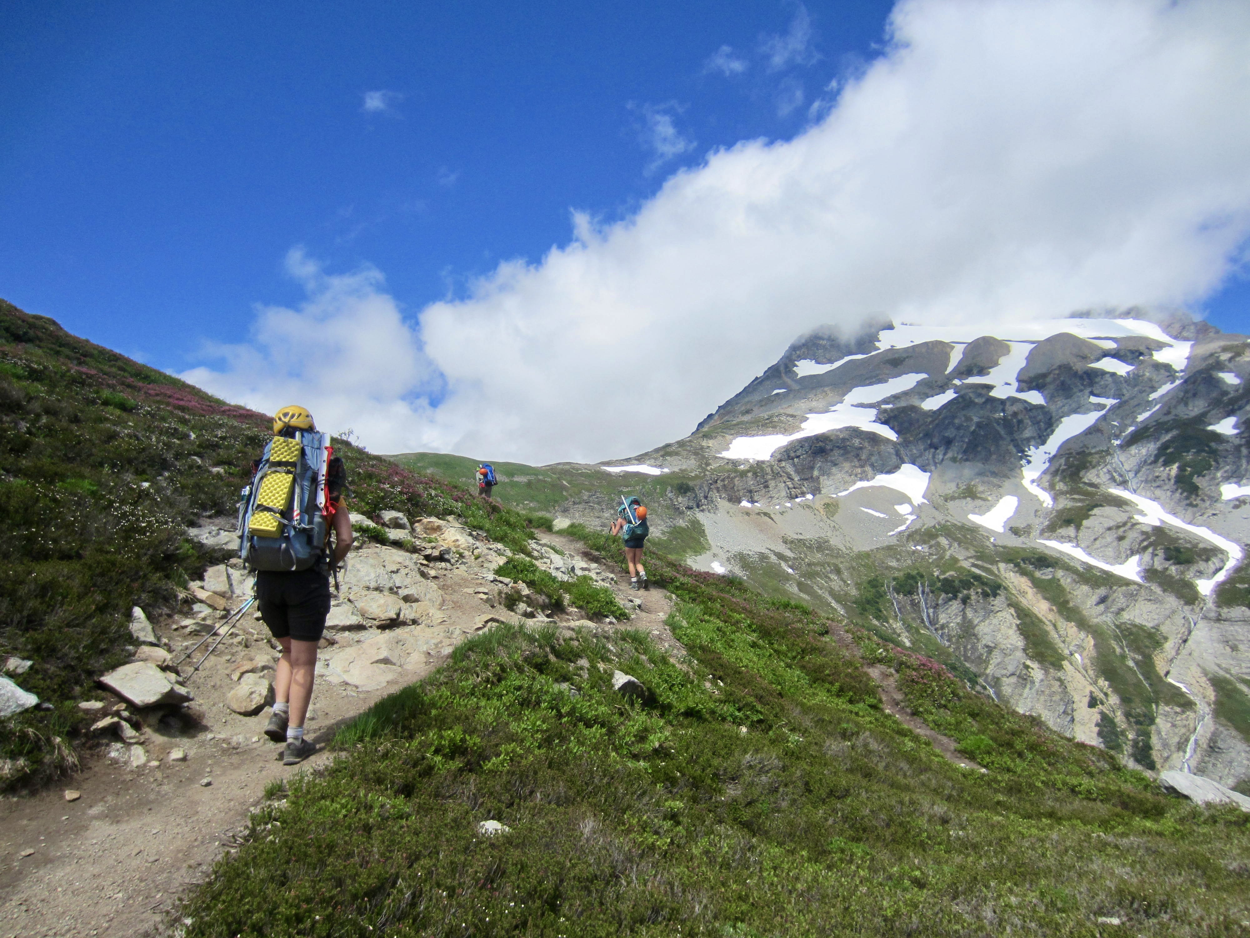
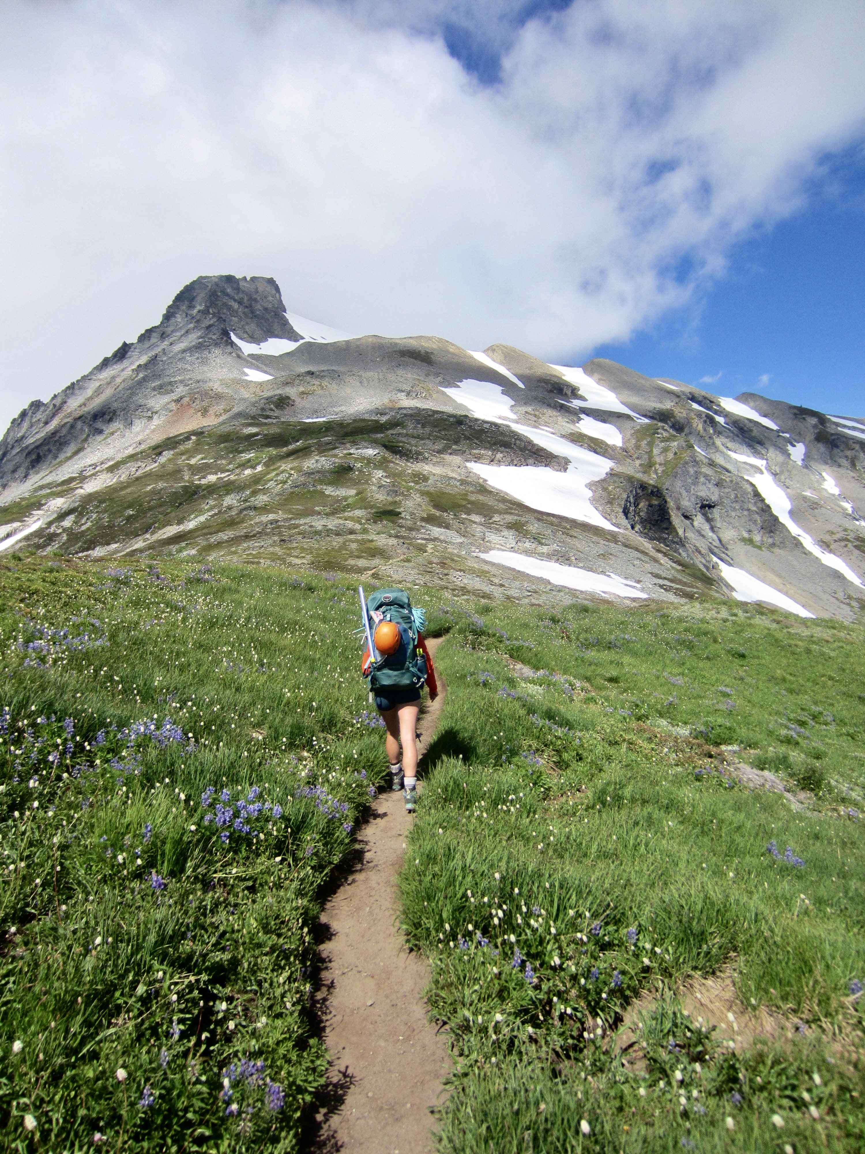
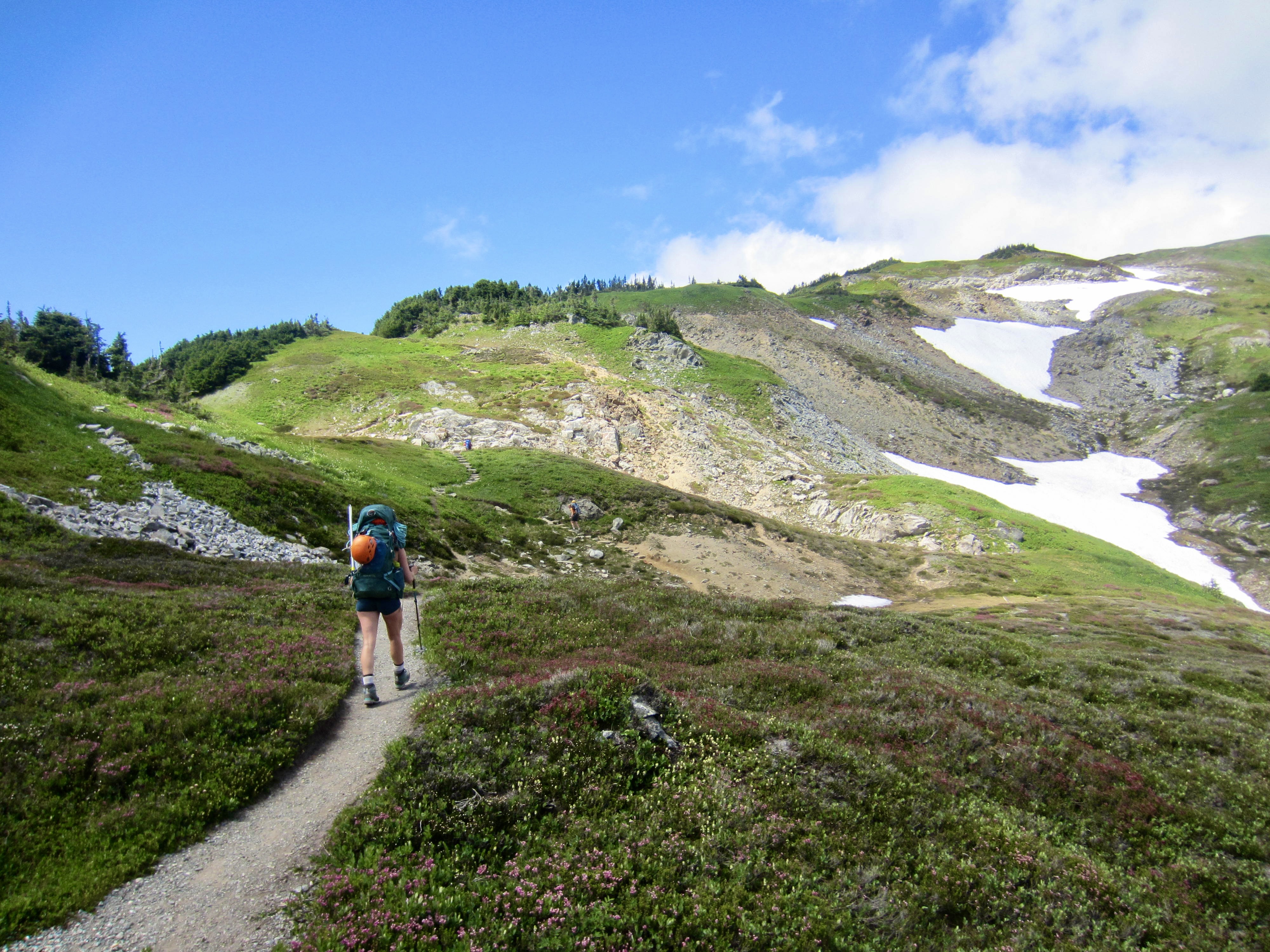
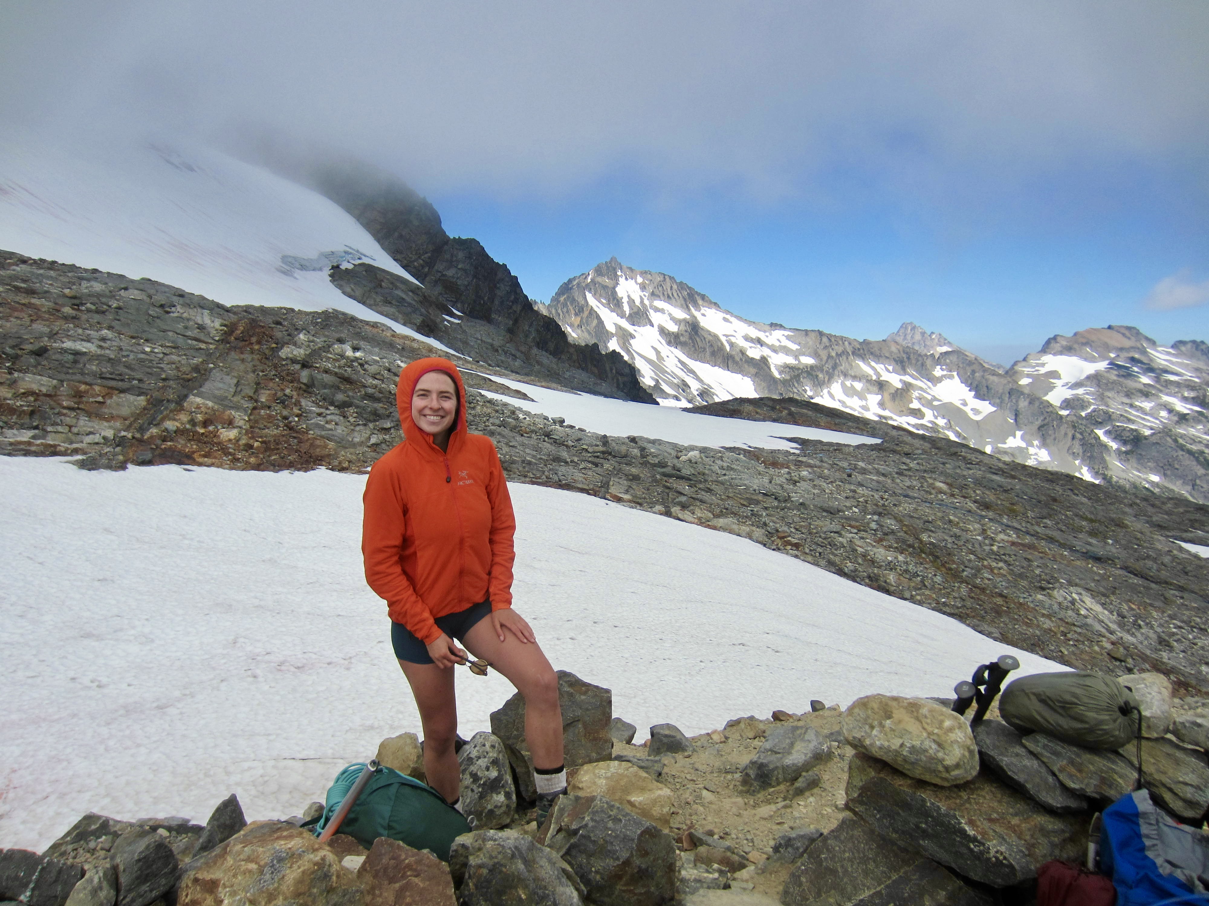
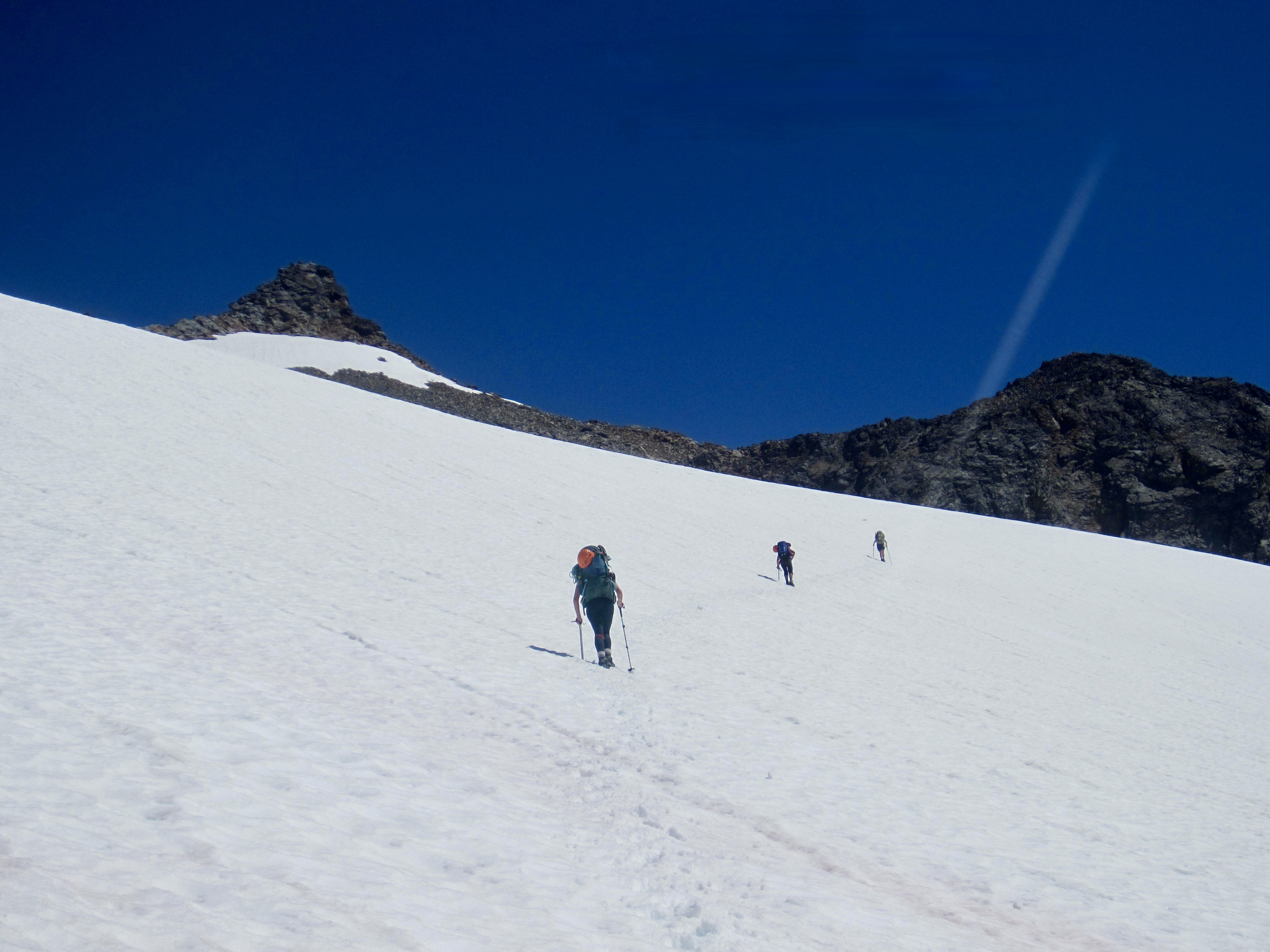
Nobody felt a need to hurry today, so it was nearly 11:00am by the time we were packed and moving. From camp, we cramponed up the Sahale Glacier to reach the base of Sahale Peak.
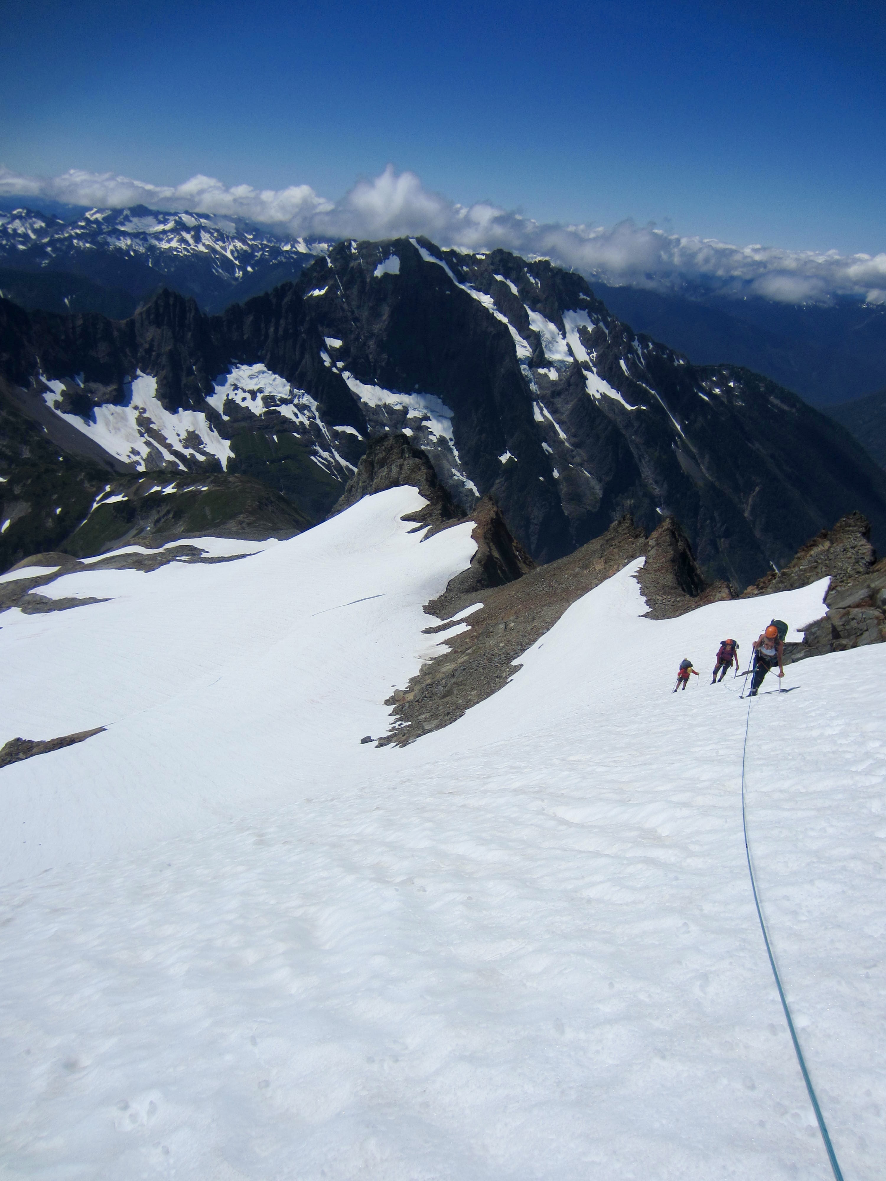
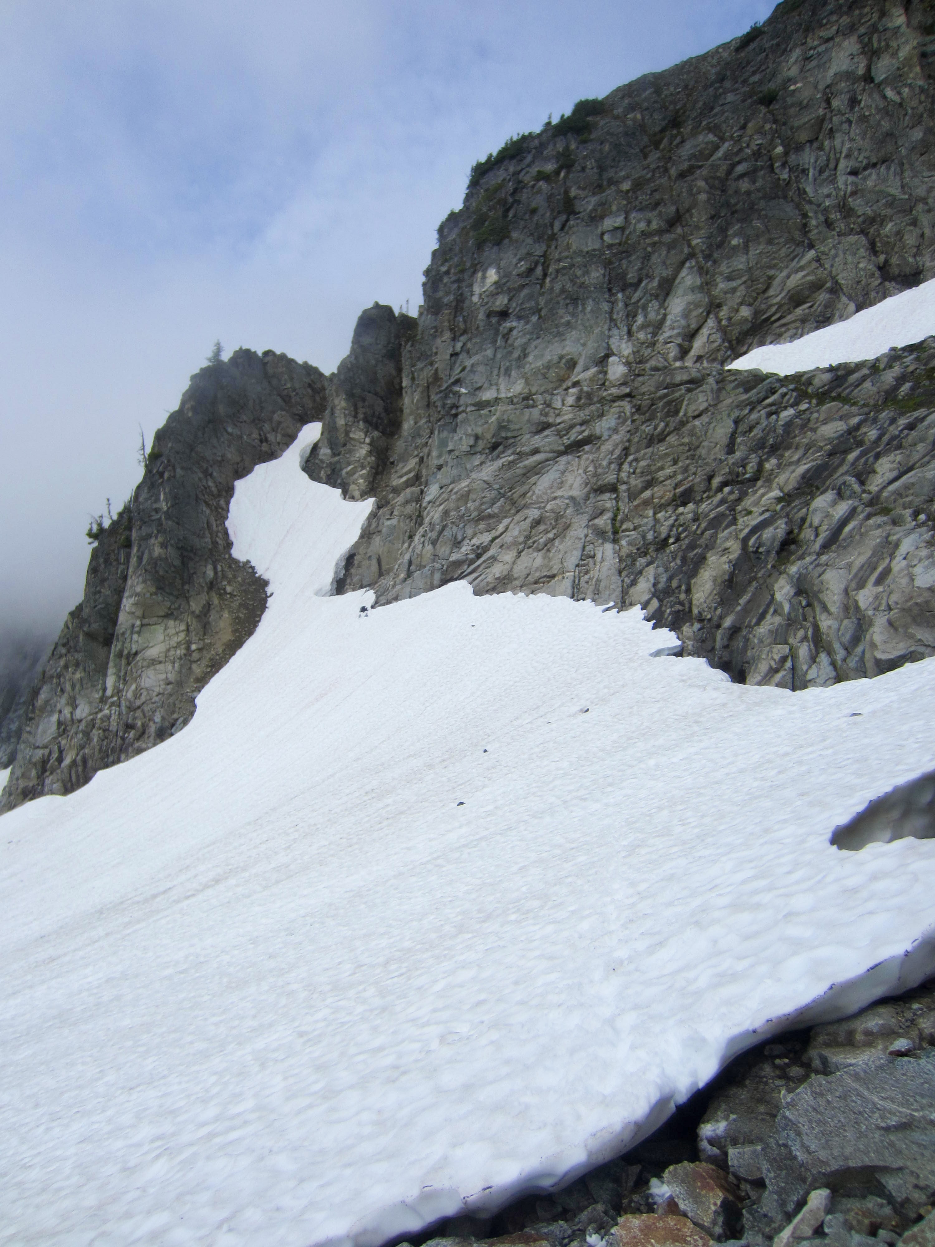
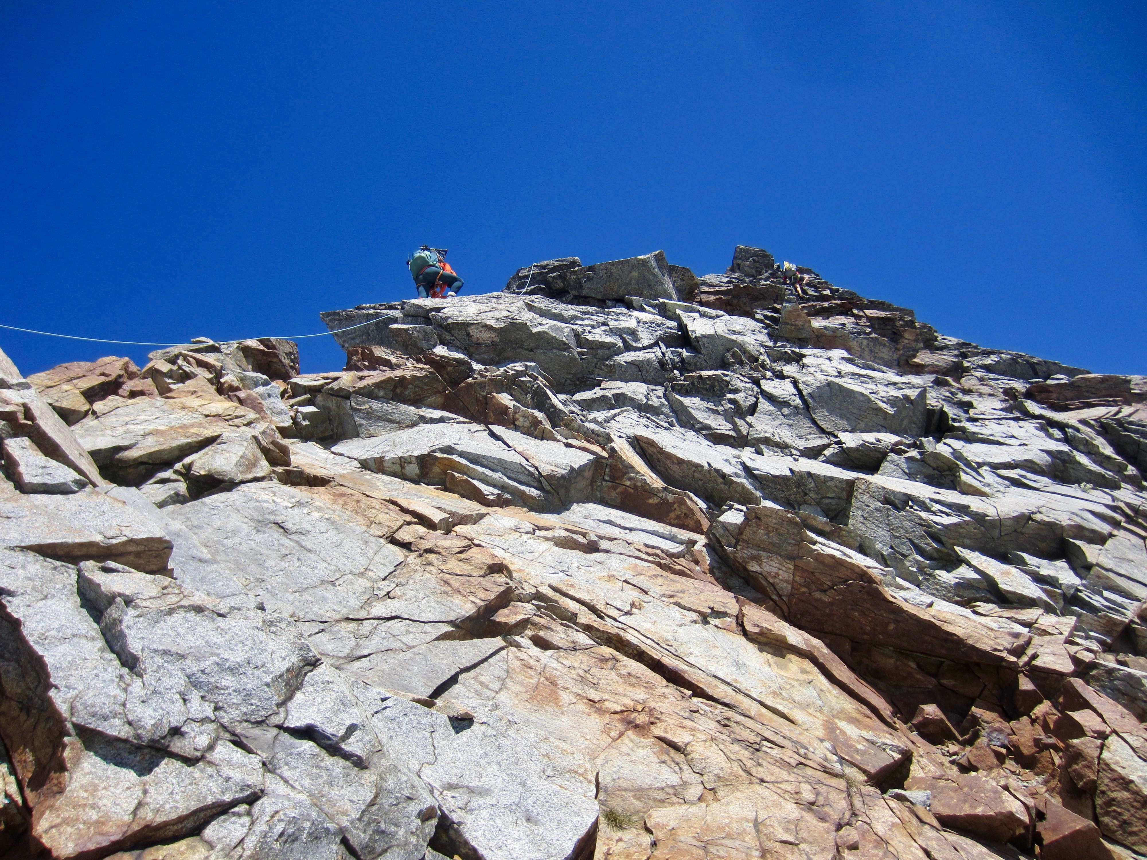
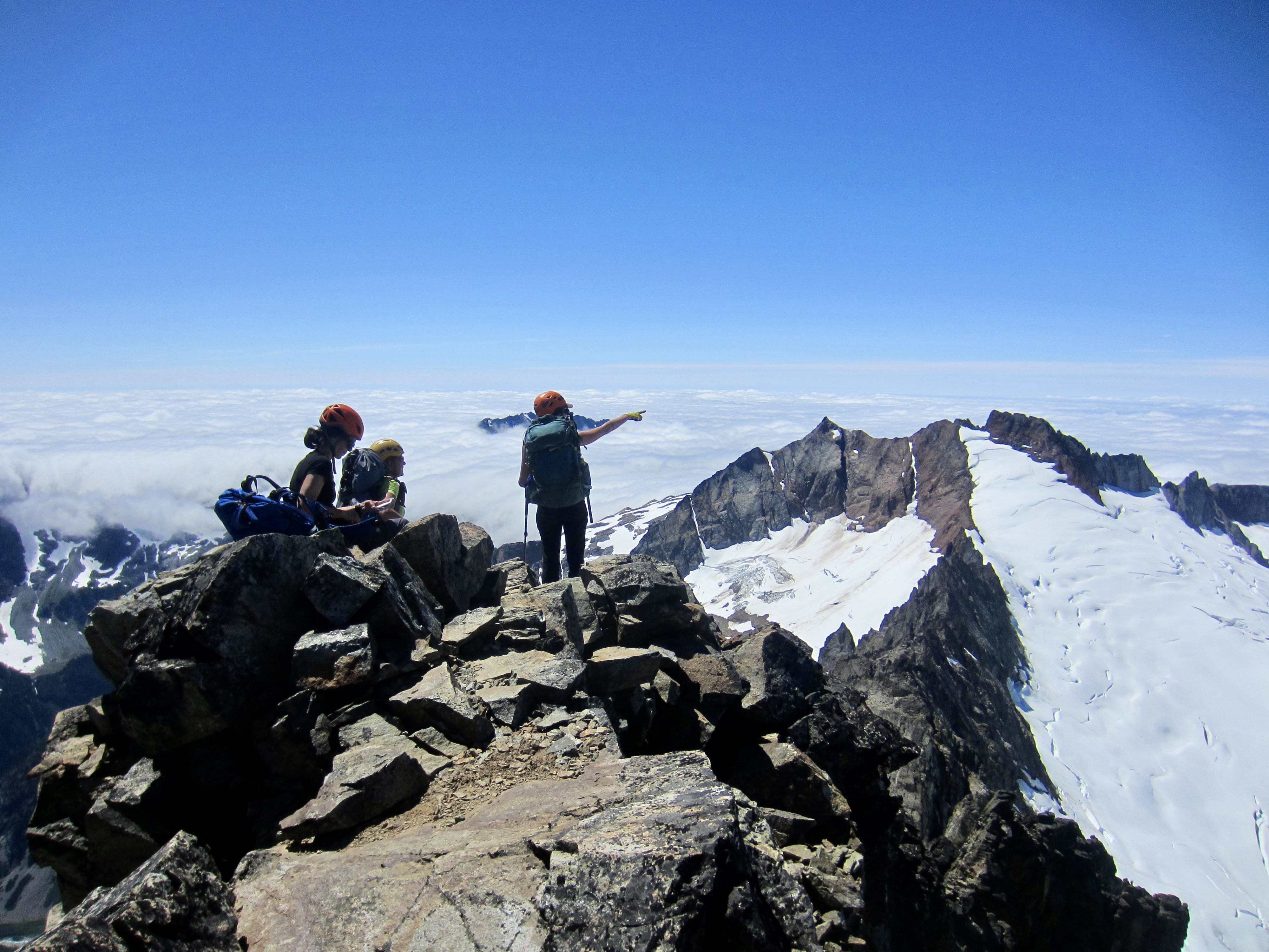
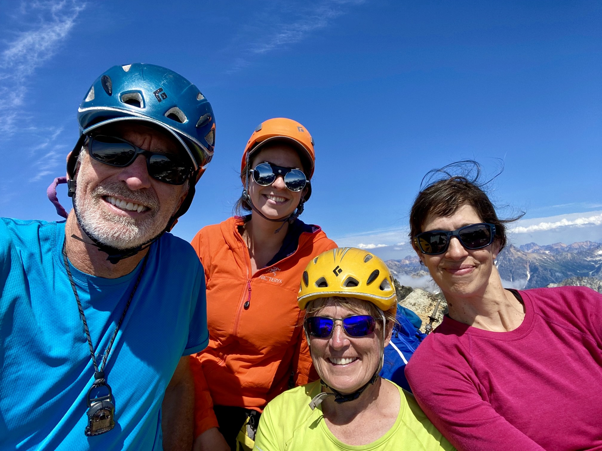
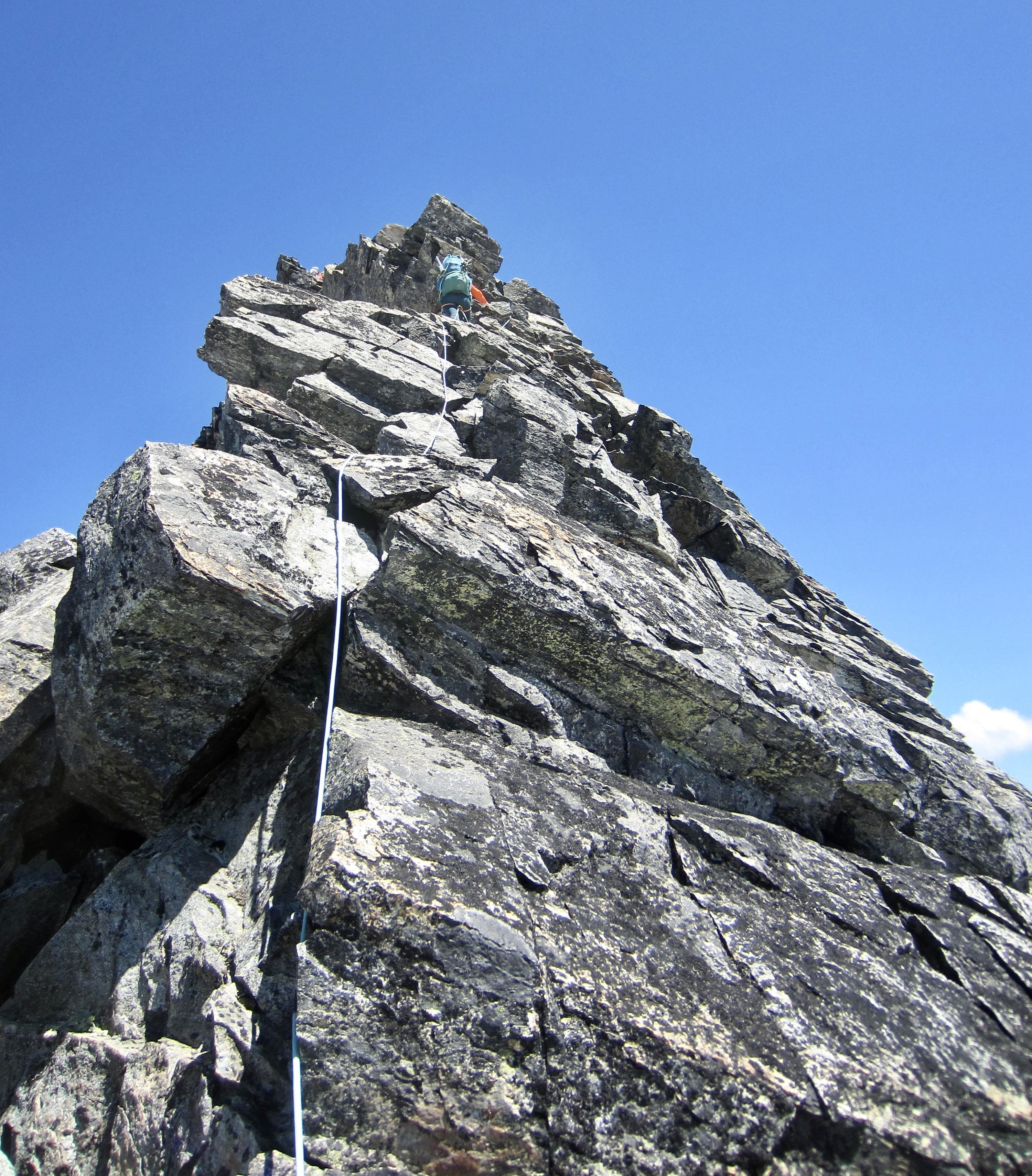
Although both Kellie and I had previously climbed Sahale Peak, neither of us had any recollection of our route up the summit horn. Oh well…the west ridge looked as good as anything. Kellie skillfully led a full rope length up the well-broken but surprisingly solid ridge crest, which ranged from Class 3 to Class 5.0 or so. It was also decided that we might want to do a summit carryover, so backpacks were hauled up.

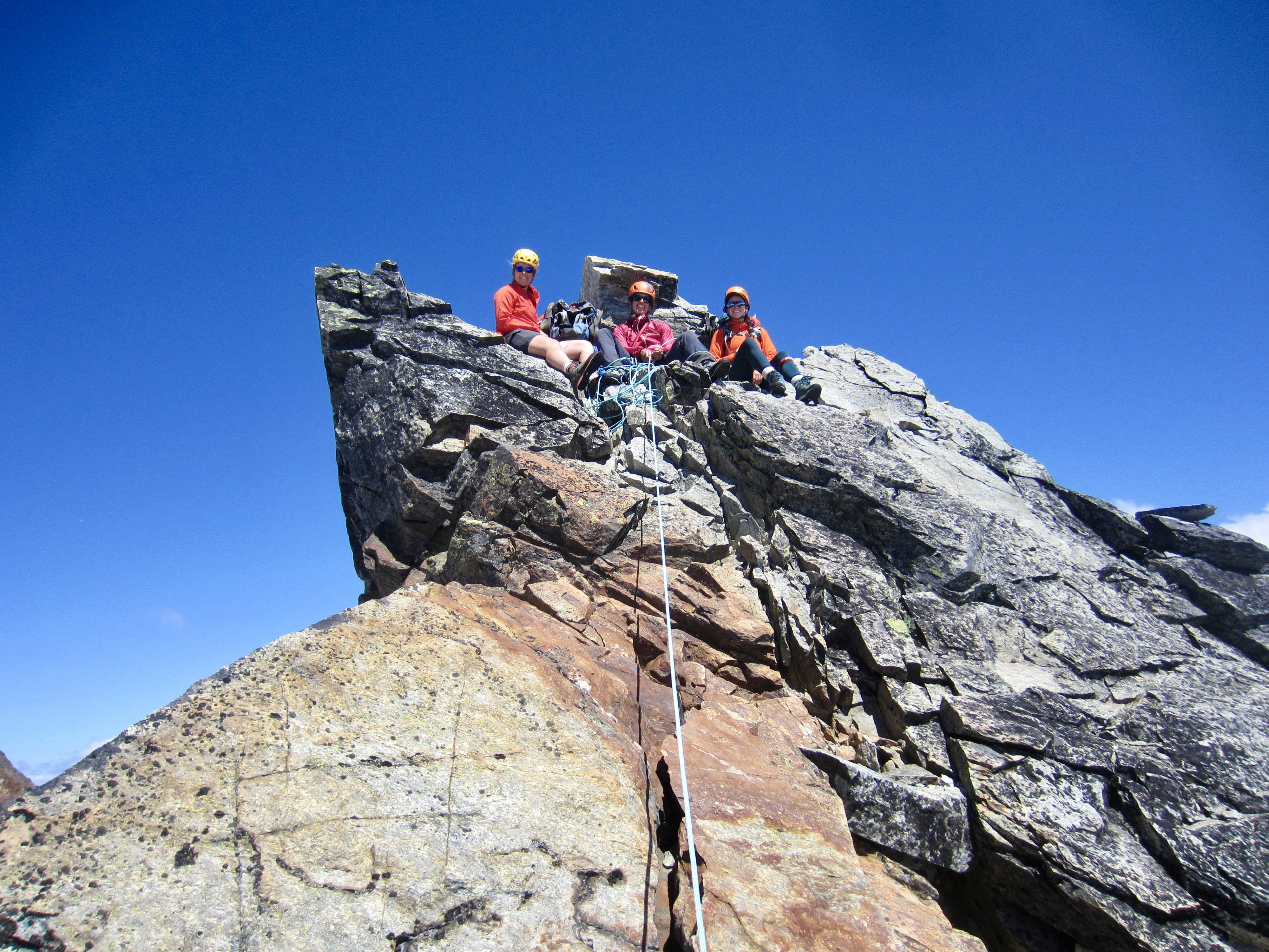
We were all on top by 2:00pm (3.1 hours + 1100 feet from Camp 2) and prepared to complete a summit carryover loop by descending the north ridge and Quien Sabe Glacier. This alpine loop, extending from Sahale Arm to Boston Basin, is a staple outing for local mountain guides and has been on Eileen’s wanna-do list for several years.

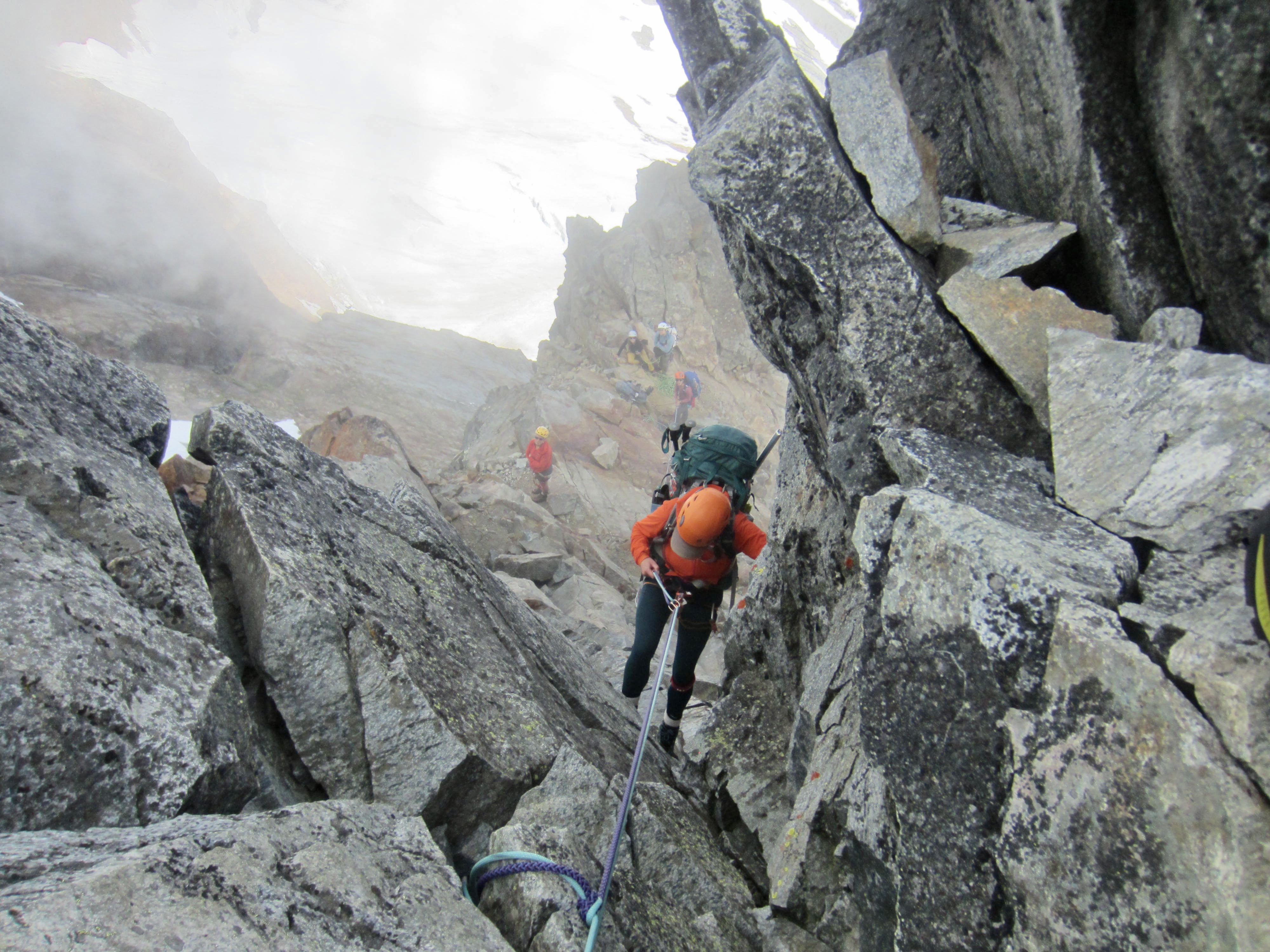
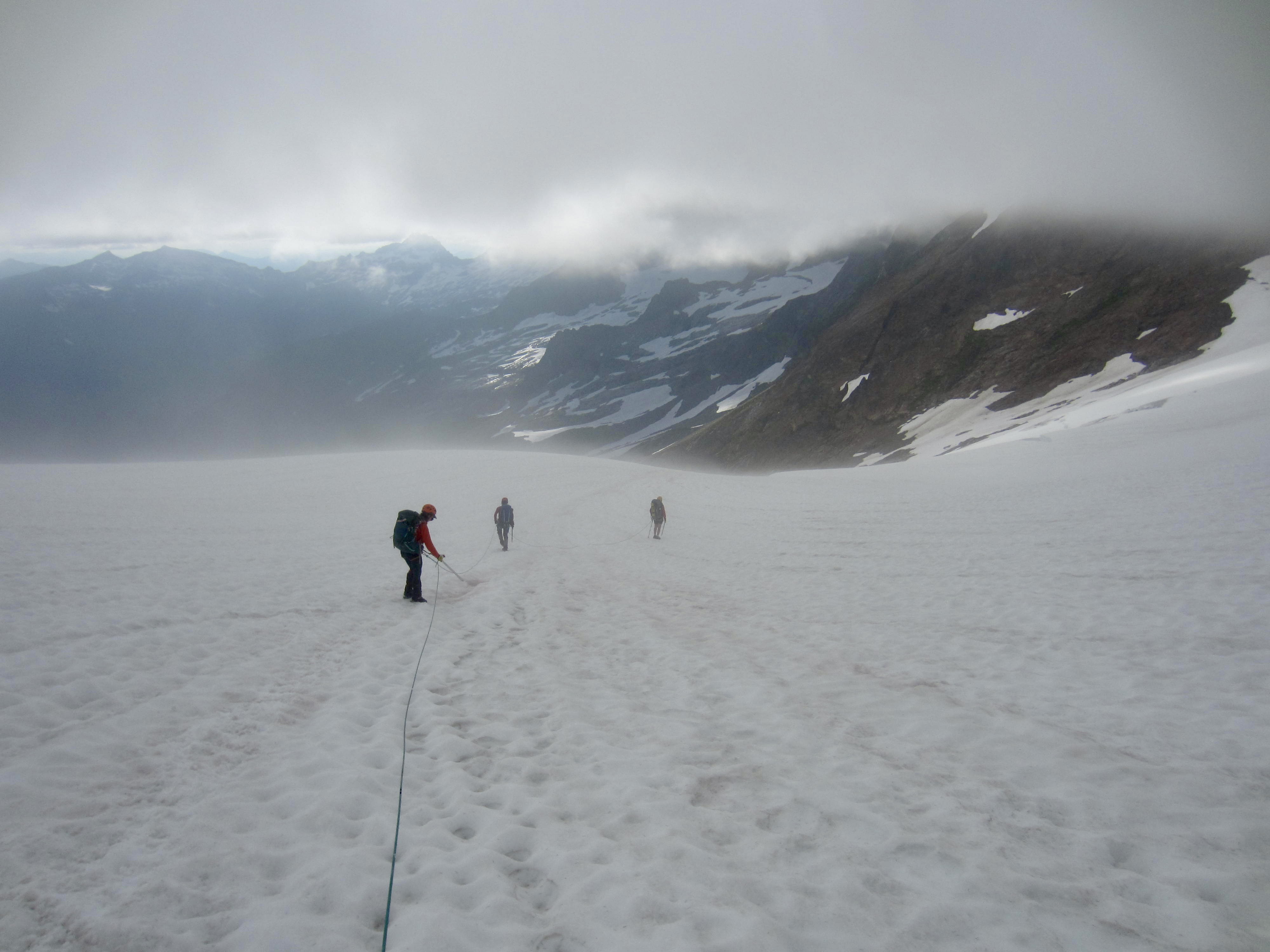
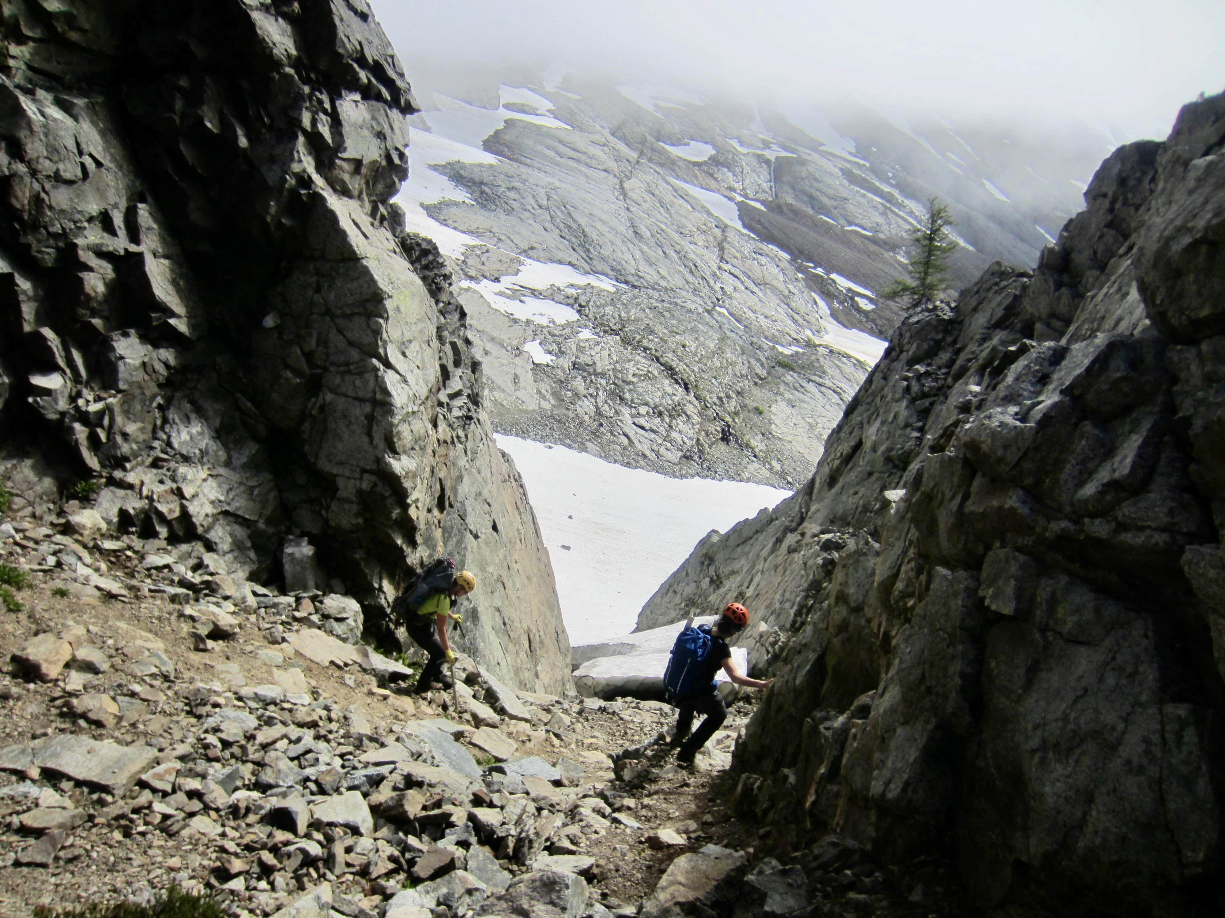
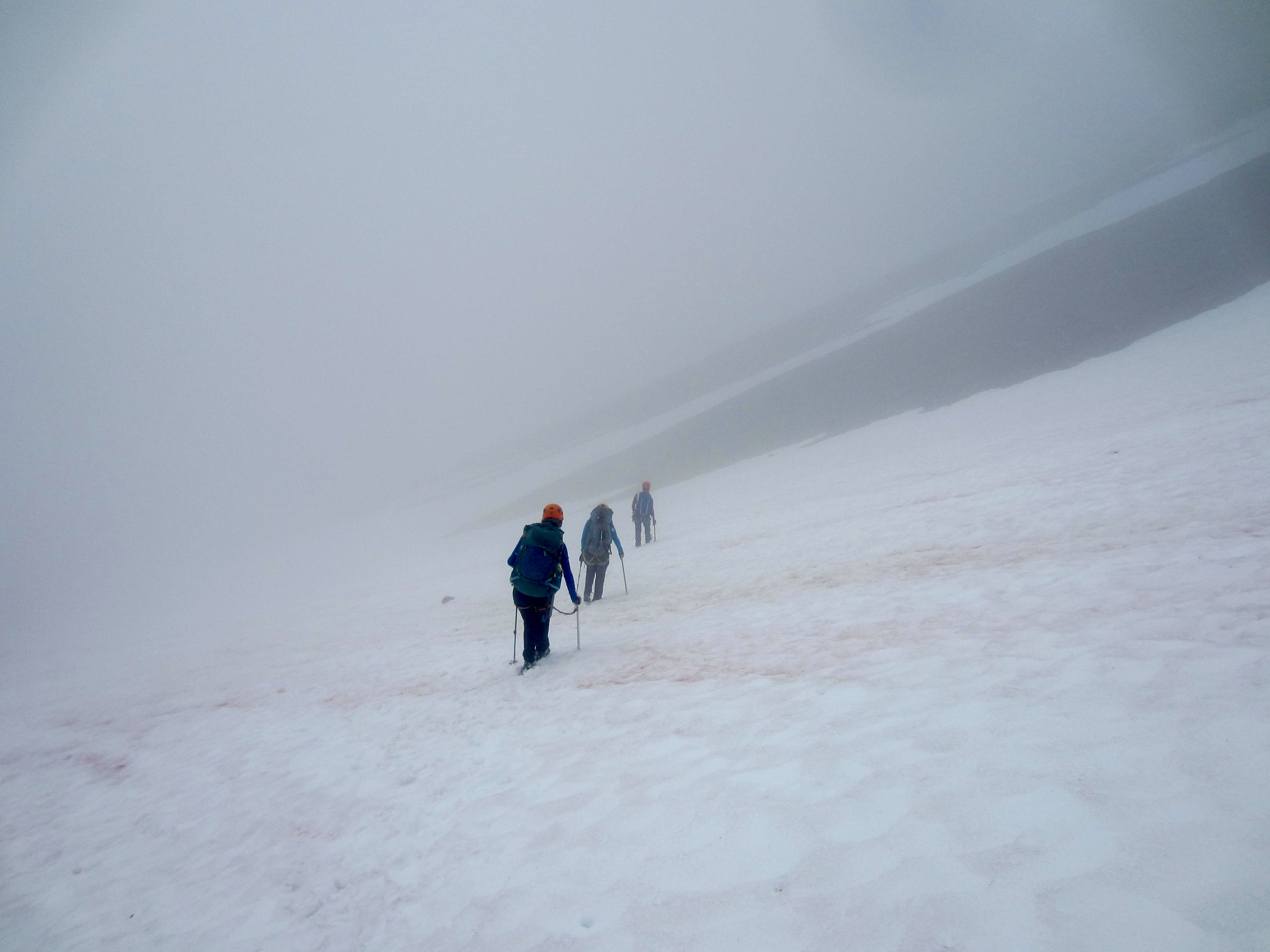
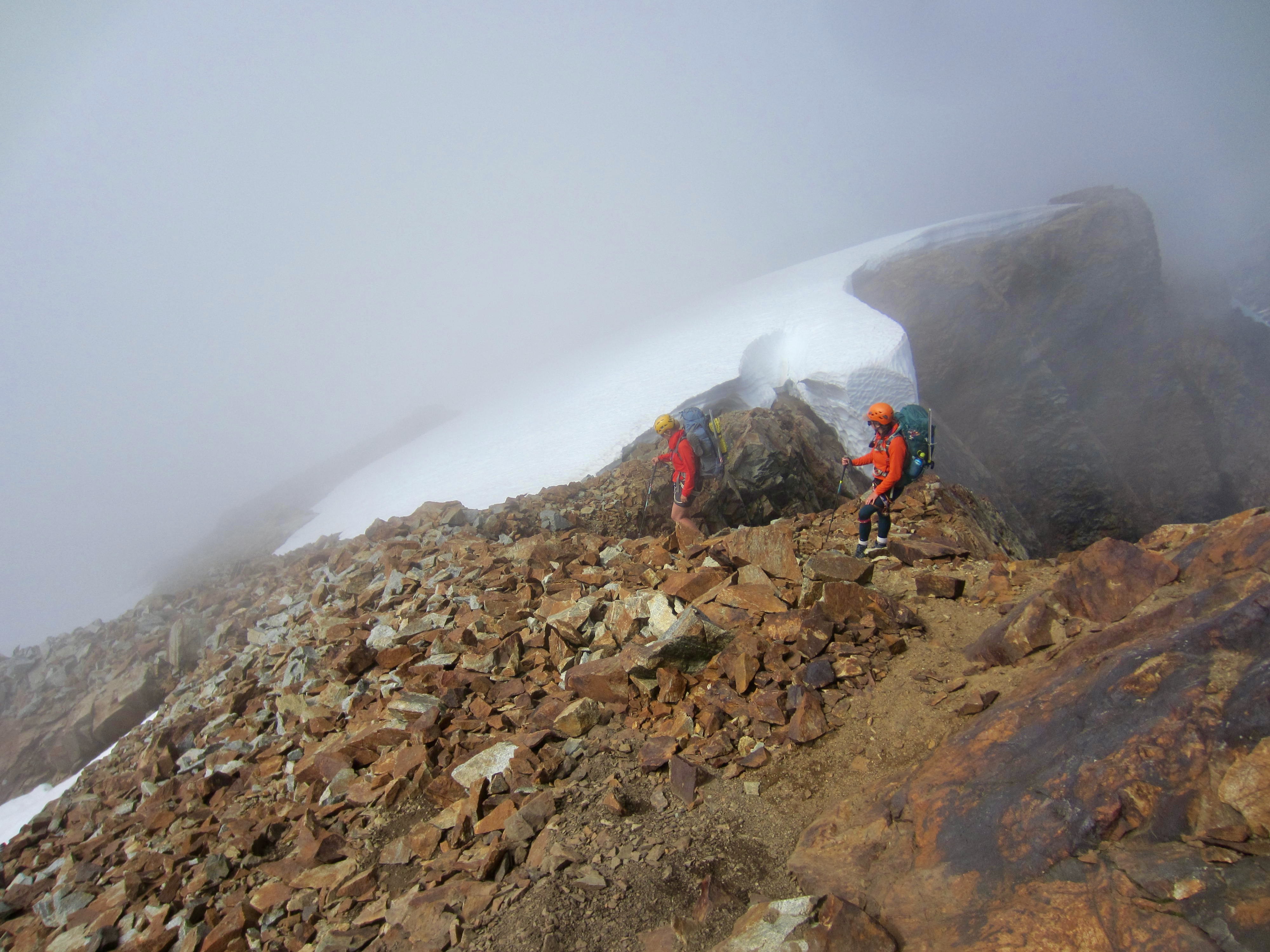
We rappelled down the north side of the summit horn and then scrambled down Class 3-4 rock along Sahale’s rusty north ridge until able to access the top of the Quien Sabe Glacier. Unfortunately, the dreaded marine fog moved in once again and reduced our visibility to 30 yards. This caused us to select a bad starting point for our descent, such that we quickly became cliff-bound and had to climb 200 feet back up to the ridge crest. For our second try, we scrambled farther down the ridge crest to a local low point, then jumped onto the glacier. Eileen led us down through the fog, carefully zigzagging around barely visible crevasses until visibility improved.


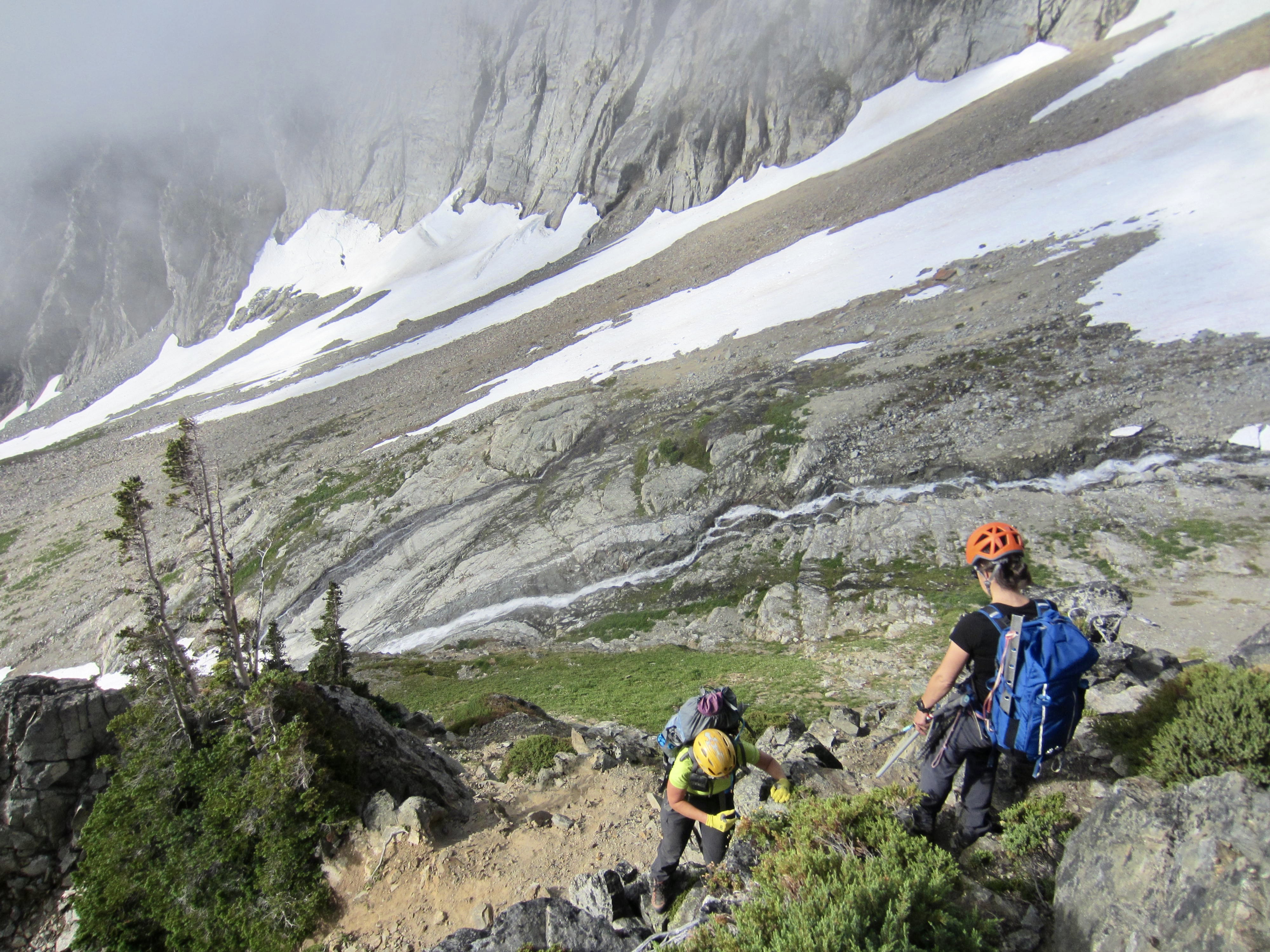
After putting the final crevasses behind us, we reached the uppermost slopes of Boston Basin and stopped on a rock outcrop at 6700 feet in late evening (8.9 hours + 1200 feet from Camp 2). The glacially polished slabs here looked pretty level but were sufficiently inclined to create a challenge for camping; we spent a comical night continuously sliding downhill and frequently skootching back uphill.


…
Day 5: Boston Basin to Cascade River Road Upper Gate
In accordance with the usual pattern for this trip, our day started with valley fog below clear skies. We slowly packed up and ate breakfast in the shadow of Boston Peak, during which time two park rangers came through our camp en route to Sharkfin Tower. It turned out that these individuals were Kevork, the park’s head ranger, and Brian, a ranger-in-training. They checked our permit and continued on their way uphill. Shortly afterwards, Kellie, Brooke, Eileen and I began heading downhill.
Within an hour, we reached the 5600-foot campsites in lower Boston Basin, where we intersected the historic miner’s/climber’s trail. This trail ranges from smooth and well-graded to steep and rough as it drops 3000 feet to the Cascade River Road (3.7 hours from Camp 3).


After a rest stop on the road, we shouldered backpacks in anticipation of a 4-mile walk down to our vehicles at the boundary gate. What a surprise it was to find dozens of cars parked behind an upper gate just 1 mile down the road! Discussions with several hikers there revealed that the park service had opened the lower gate two days earlier. Brooke quickly arranged to hitch a ride down the road with some departing hikers and then drive our vehicle back up, thereby saving us oldsters 3 miles of unwanted road walking. This put a happy cherry on top of a great trip!
…
Route Maps & Sketch
..
…
…
…
Photo Gallery
Click to enlarge…