Trip Date: May 29-31, 2023
Little Tahoma Peak Climbing Trip
Fryingpan Creek
Summer Land aka Summerland
Fryingpan Glacier
Whitman Crest
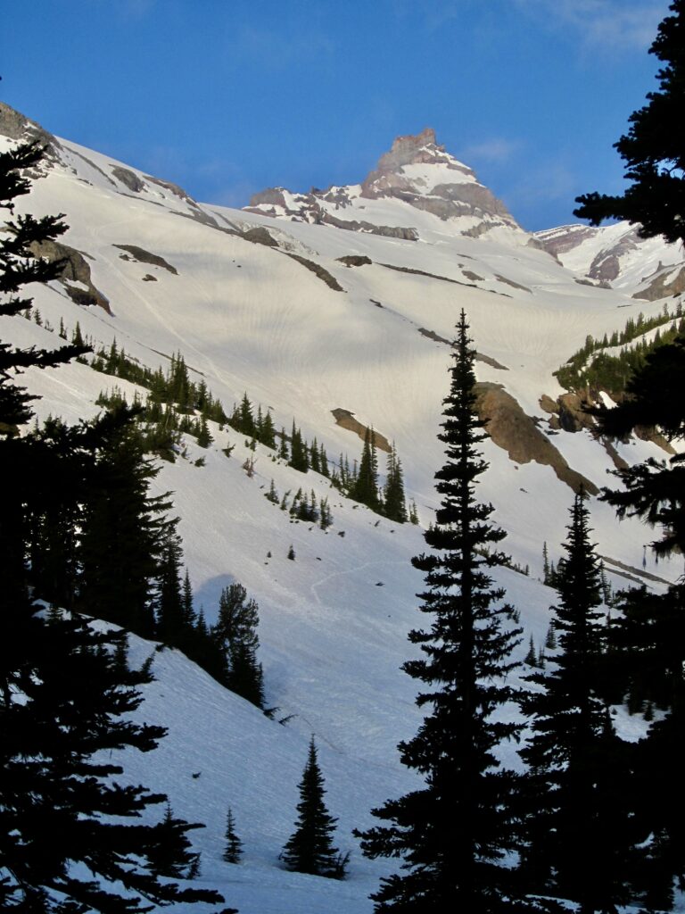
Little Tahoma Peak (11,138′)
Trip Report Summary
Region: Southern Washington Cascades
Sub-Region: Mt. Rainier Massif
Area: Mt. Rainier National Park
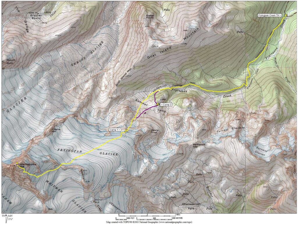
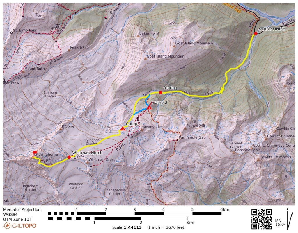
Starting & Ending Point: Fryingpan Creek Trailhead on Sunrise Road (Elev. 3800 feet)
Way Points: Fryingpan Creek footlog & Summer Land & Meany Snowfield outcrop (trail hike & snow hike & snow climb)
Campsites: Meany Snowfield outcrop (Elev. 7350 feet) & Summer Land Shelter (Elev. 5950 feet)
Summit: Little Tahoma Peak (snow climb & rock scramble via Fryingpan Glacier—Whitman Notch—Whitman Glacier—East Ridge)
Approximate Stats: 14.1 miles traveled; 7600 feet gained & lost.
Related Posts
Little Tahoma Peak via Fryingpan Glacier – May 2019
Little Tahoma Peak via Fryingpan Glacier – June 2001
Full Trip Report
Taking advantage of the partial re-opening of Sunrise Road over Memorial Day Weekend, Eileen, Brooke, Kellie, and I met up for a climb of Little Tahoma Peak in Mt. Rainier National Park. This outstanding volcanic satellite has long been a favorite of mine, so I didn’t require much encouragement to attempt a three-peat.
Day 1: Trailhead to Meany Snowfield Camp
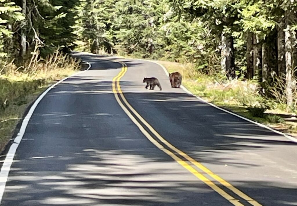
Our trip began auspiciously on a Monday morning that turned out to be much warmer and sunnier than forecasted. After picking up our permits at the White River Ranger Station (and paying the $65 “recovery fee”), we drove over to the the Fryingpan Creek Trailhead. Along the way, we encountered a short delay in the form of a bear family—a mother and two cubs—lazily strolling up the road. Adorable!
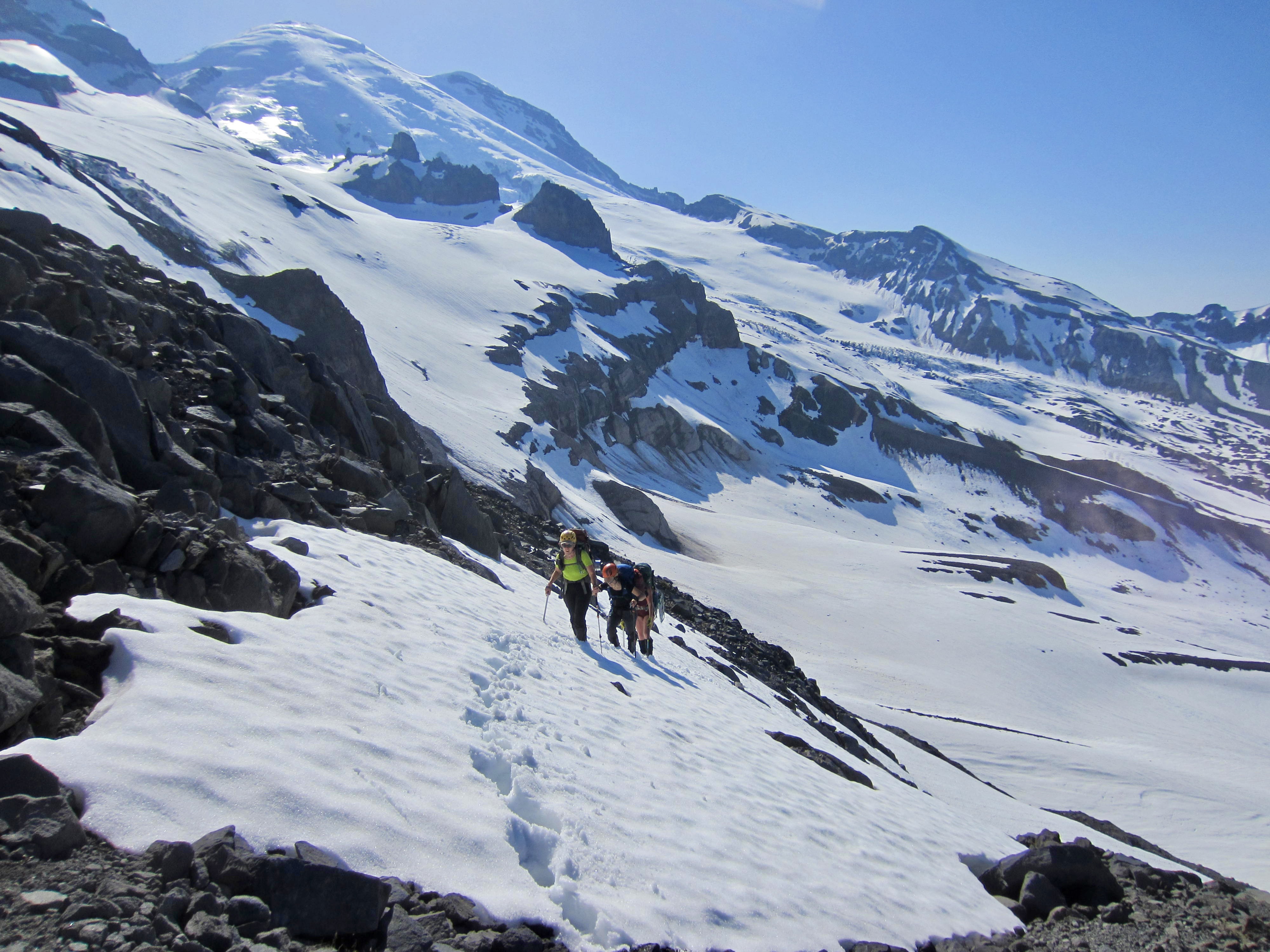
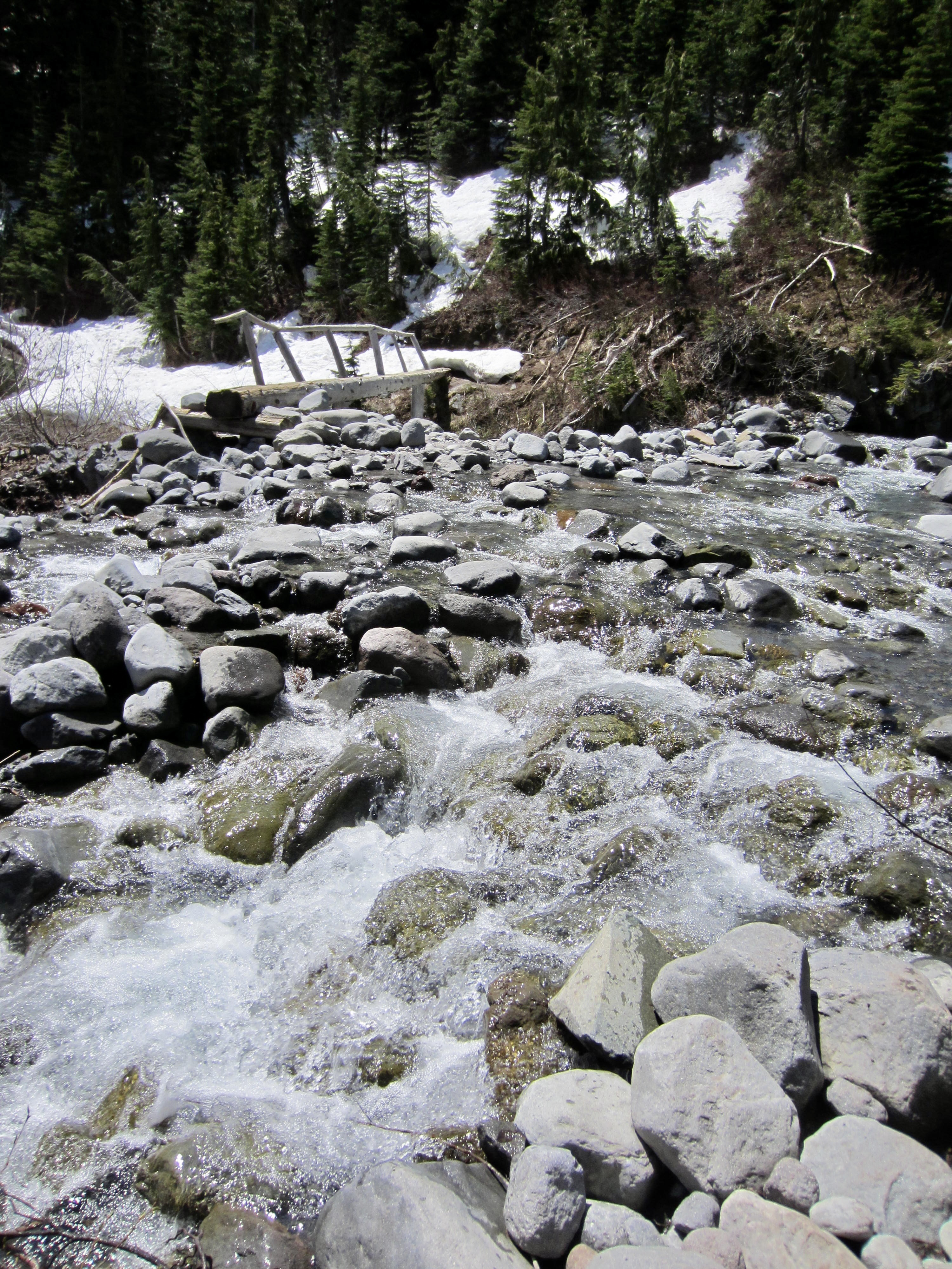
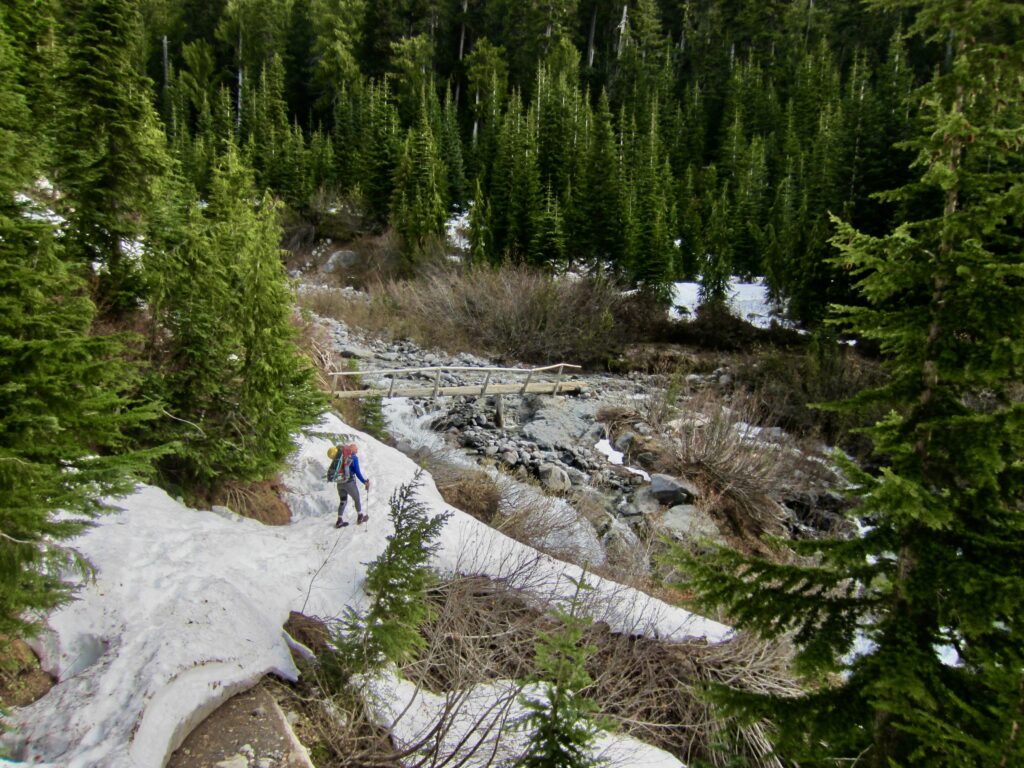
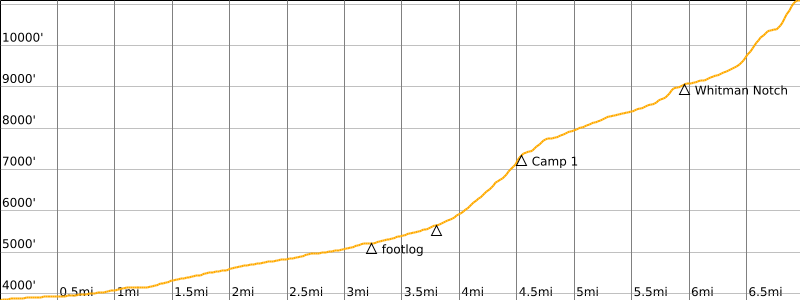
We hiked up the Fryingpan Creek Trail armed with axes, crampons, snowshoes, rope, and pickets to handle a variety of snow conditions. The first 2 miles of trail was 50% covered by patchy snow, and the next mile was 90% snow-covered. Upon arriving at the creek crossing (2.2 hours + 3.2 miles + 1400 feet from TH), we had to execute some careful rock-hopping in order to reach the established footlog.
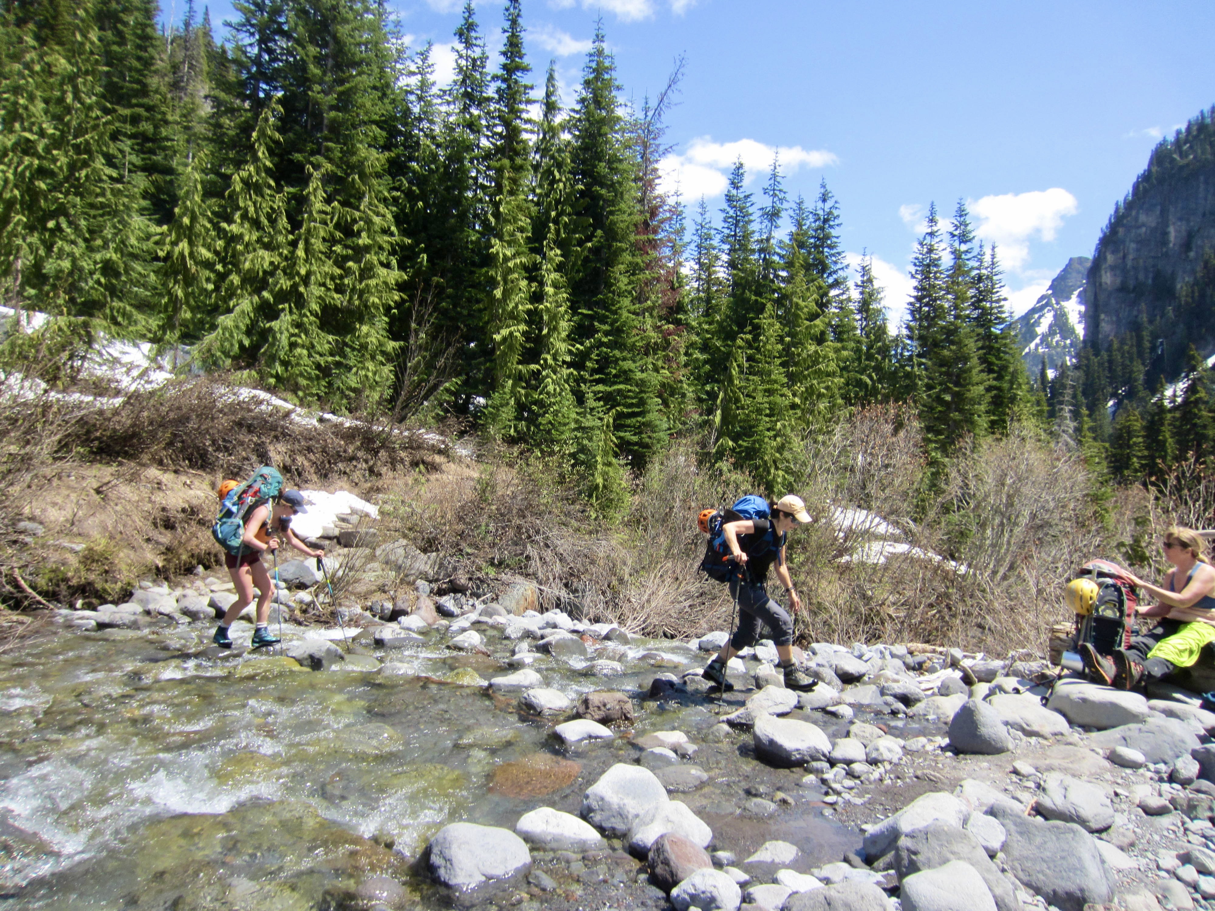
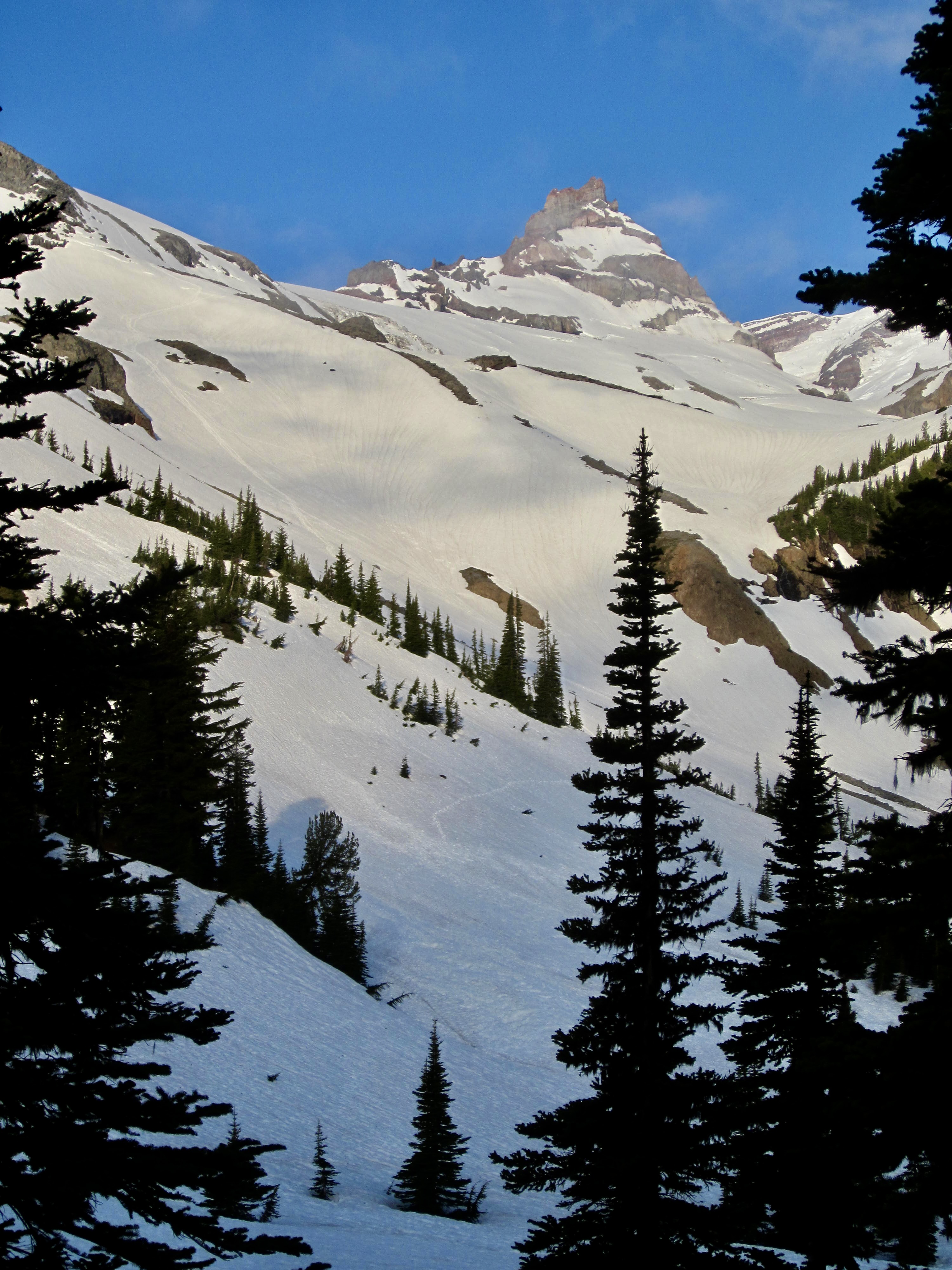
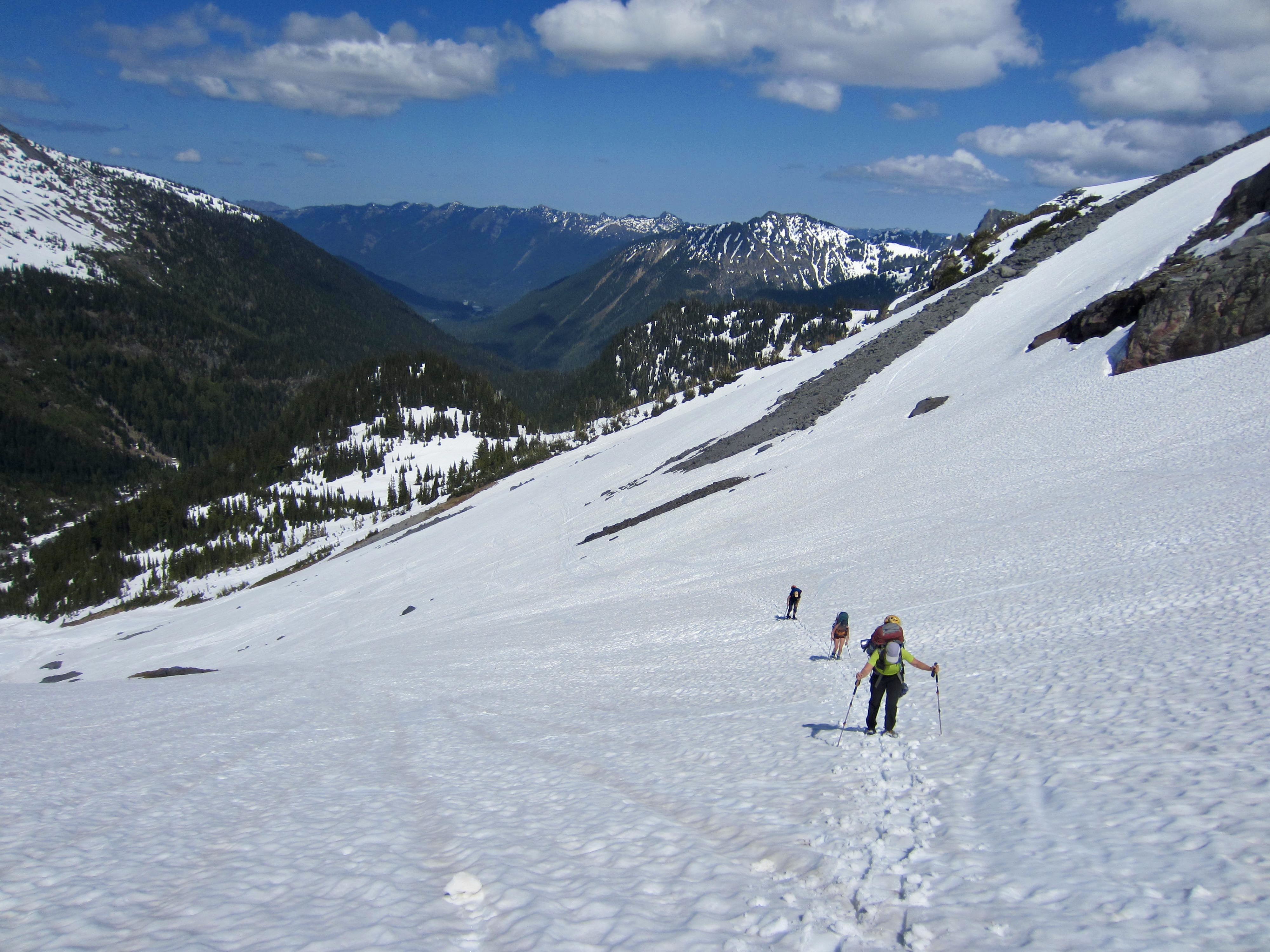
Once across Fryingpan Creek, we took the direct “spring route” to Summer Land, staying northwest of the campground knoll. The mushy afternoon snow and porous avalanche debris in this area made snowshoes advantageous for efficient progress. We continued past Summer Land and began ascending the steeper slopes of the Meany Snowfield.
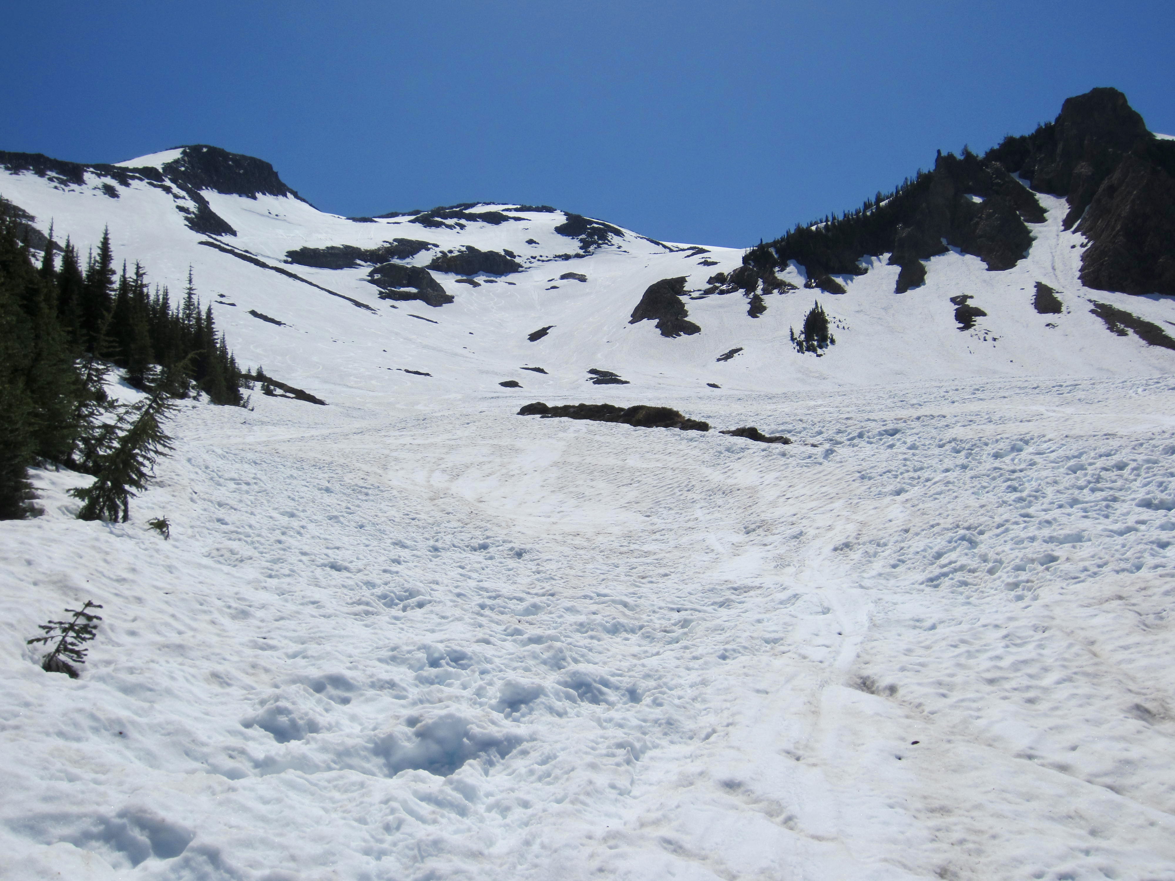
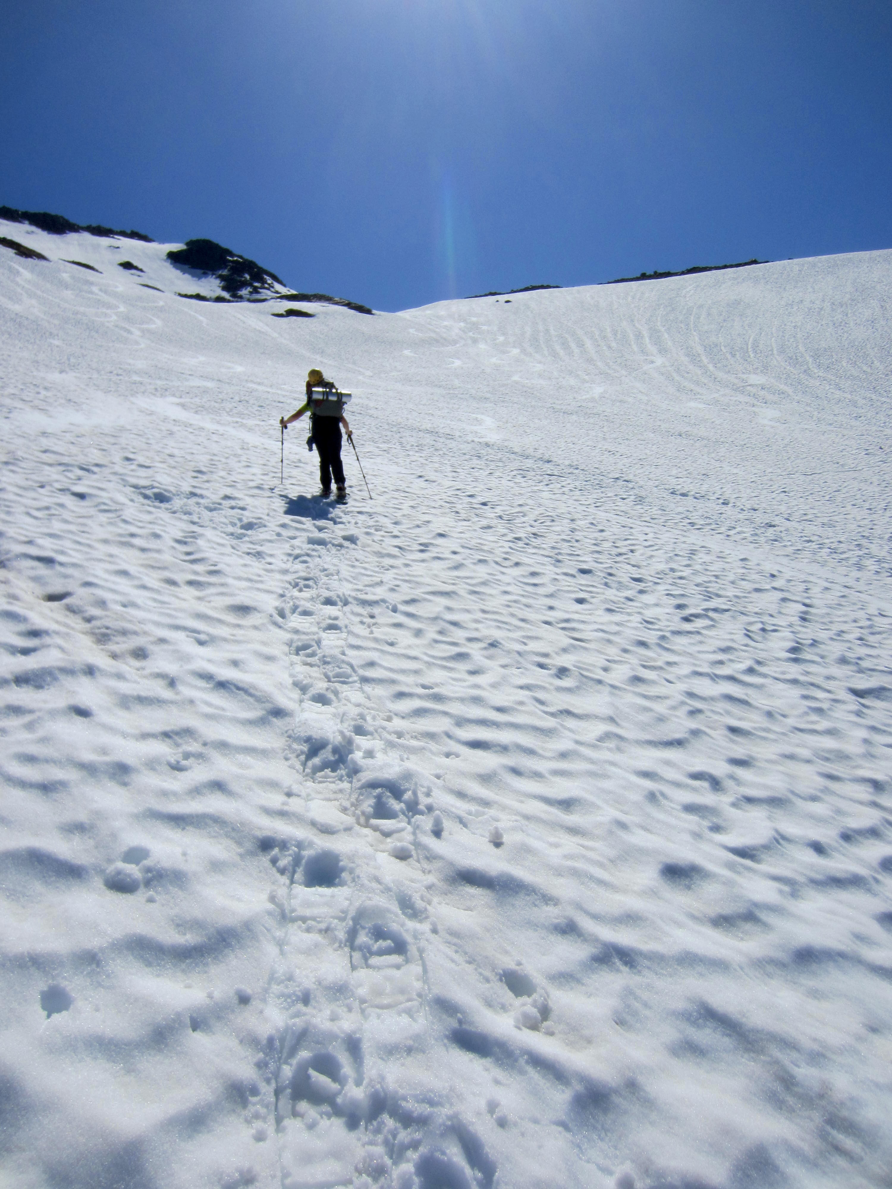
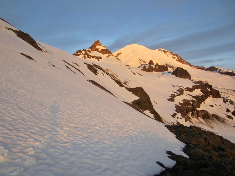
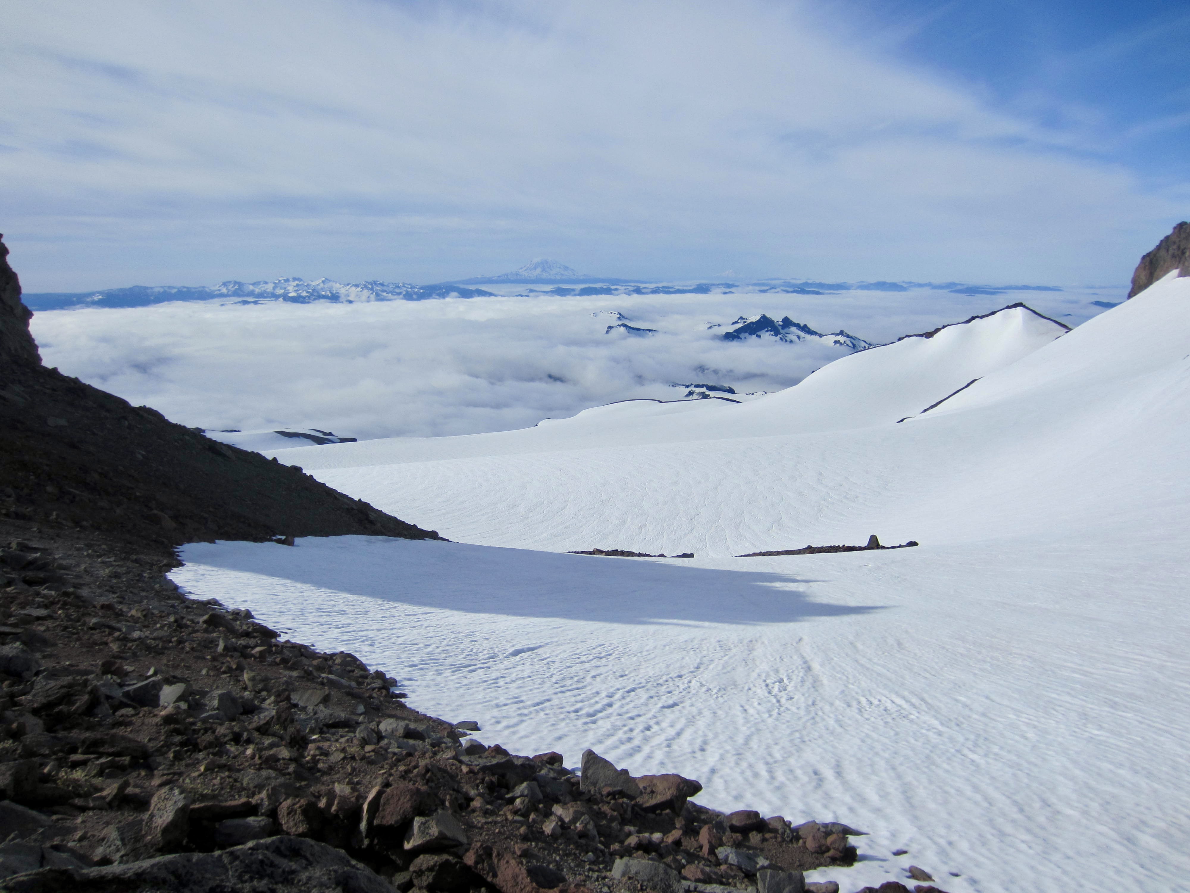
After ascending straight up the fall line to an elevation of 6700 feet, we veered to the right and made a rising traverse toward a cluster of rocky outcrops. There were numerous sets of ski tracks crisscrossing the Meany Snowfield, indicating that Memorial Day Weekend had involved a lot of skier traffic. This came as no surprise to me, because I consider the Fryingpan Glacier to be one of Washington’s Blue Corn Special ski descents.
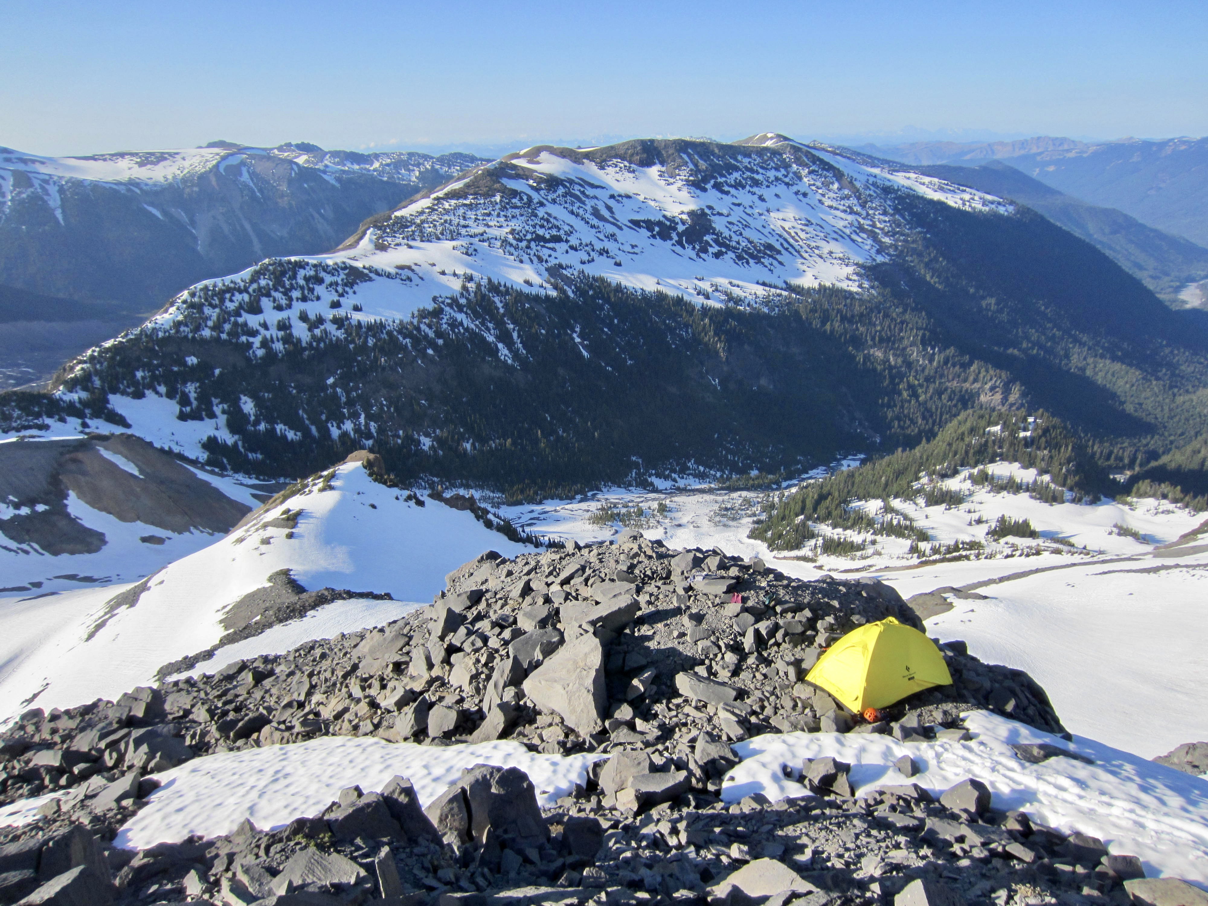
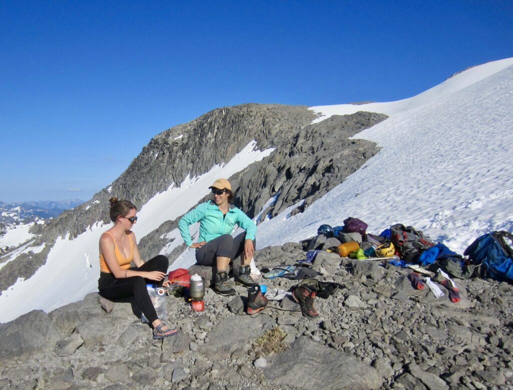
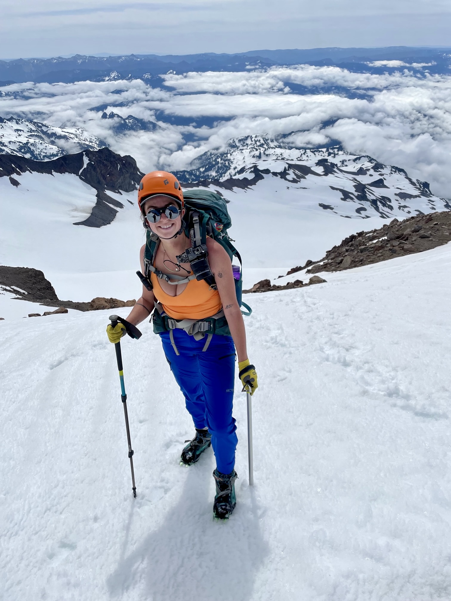
We surmounted a large outcrop at 7350 feet in late afternoon (6.5 hours + 4.5 miles + 3600 feet from TH) and found suitable spots for two tents—one on rock and one on snow. Our campsite offered a marvelous northerly view across Summer Land and Goat Island Mountain, as well as a southwesterly view of Mt. Rainier and Little Tahoma Peak.

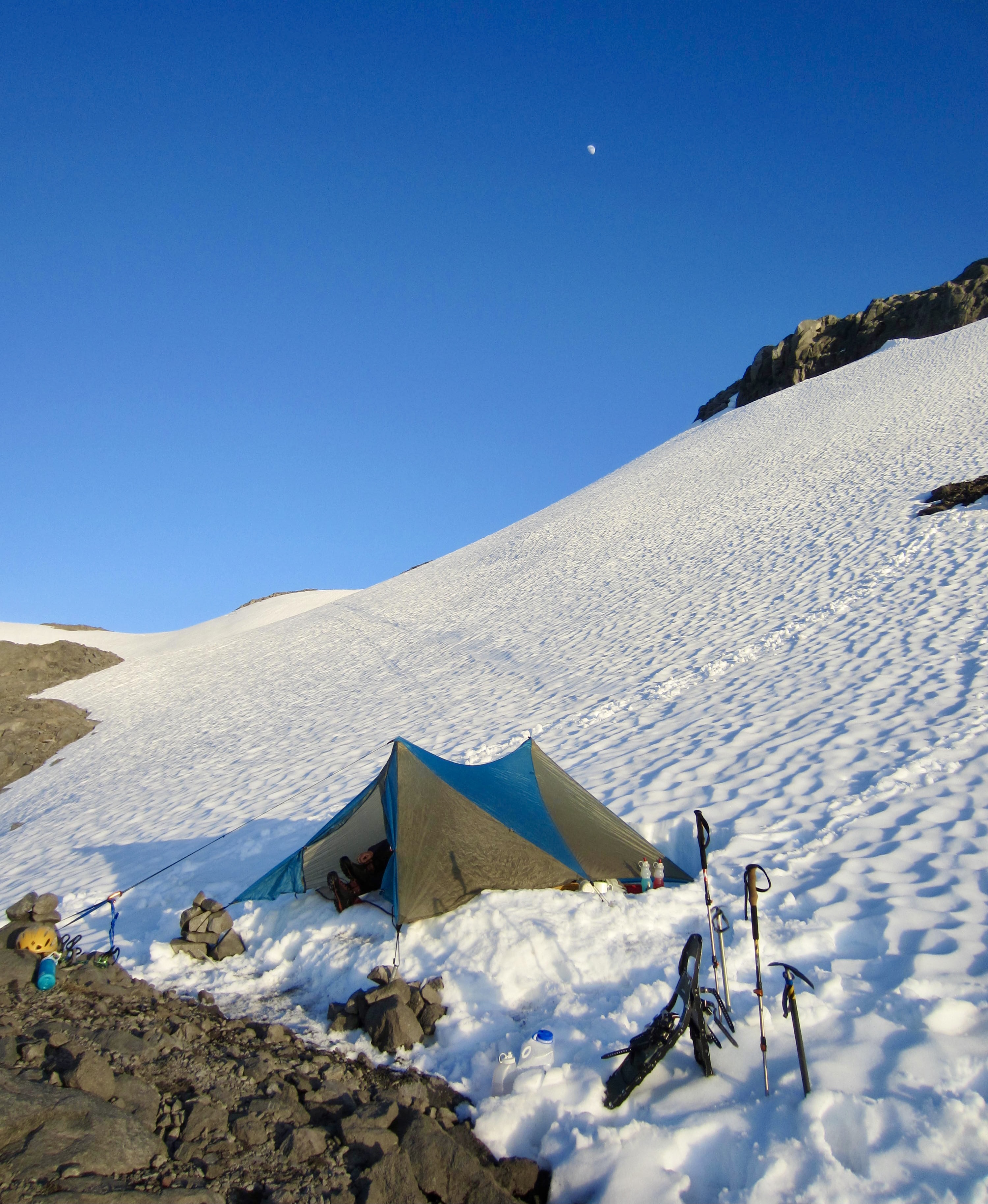
The evening was remarkably warm and calm, especially given such an exposed location. Because there was no running water nearby, Brooke and Kellie took on the task of melting snow while basking in the sun, then we all had a relaxing dinner before retiring to our tents at sundown.
Day 2: Summit Climb + Descent to Summer Land
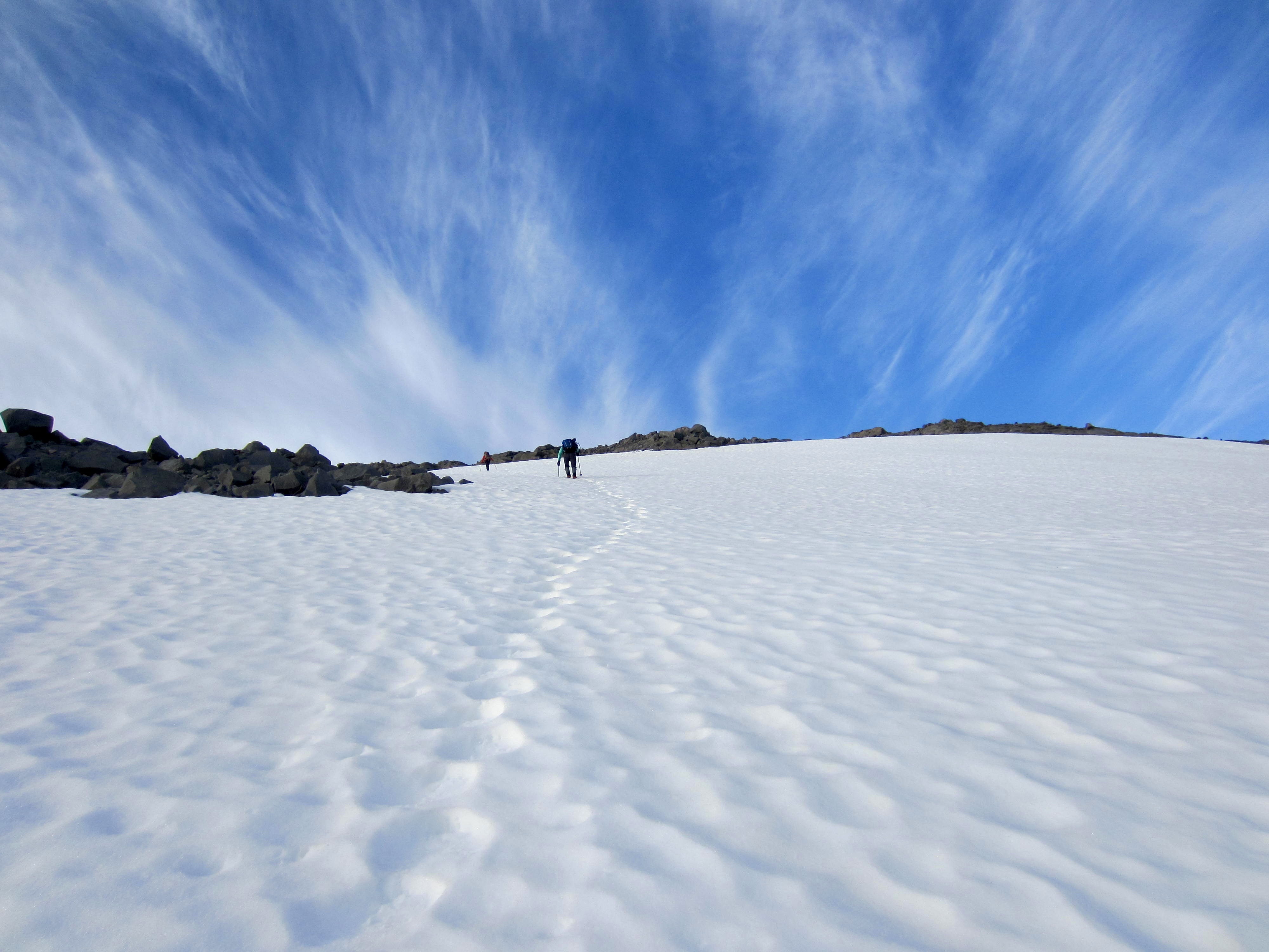
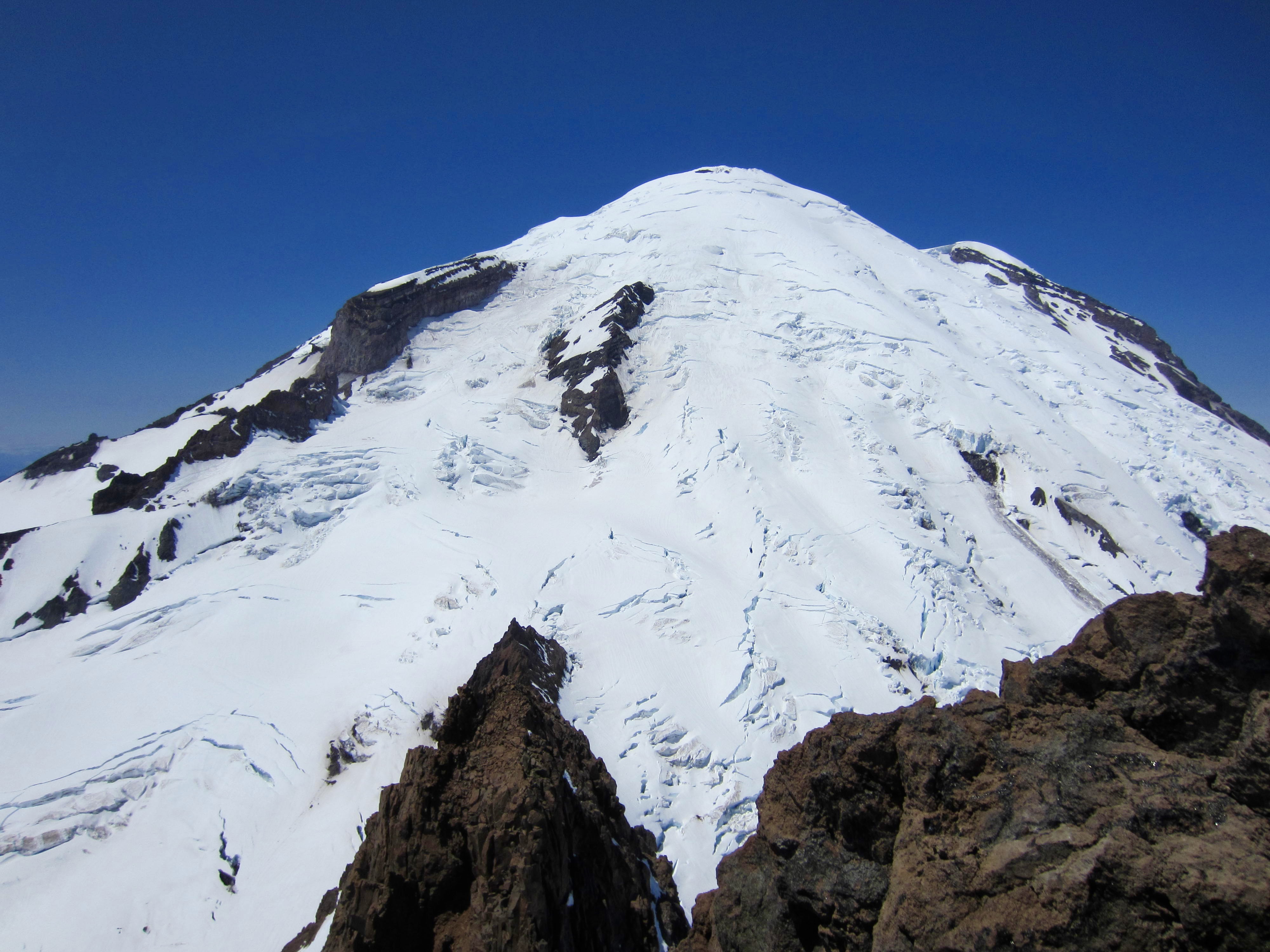
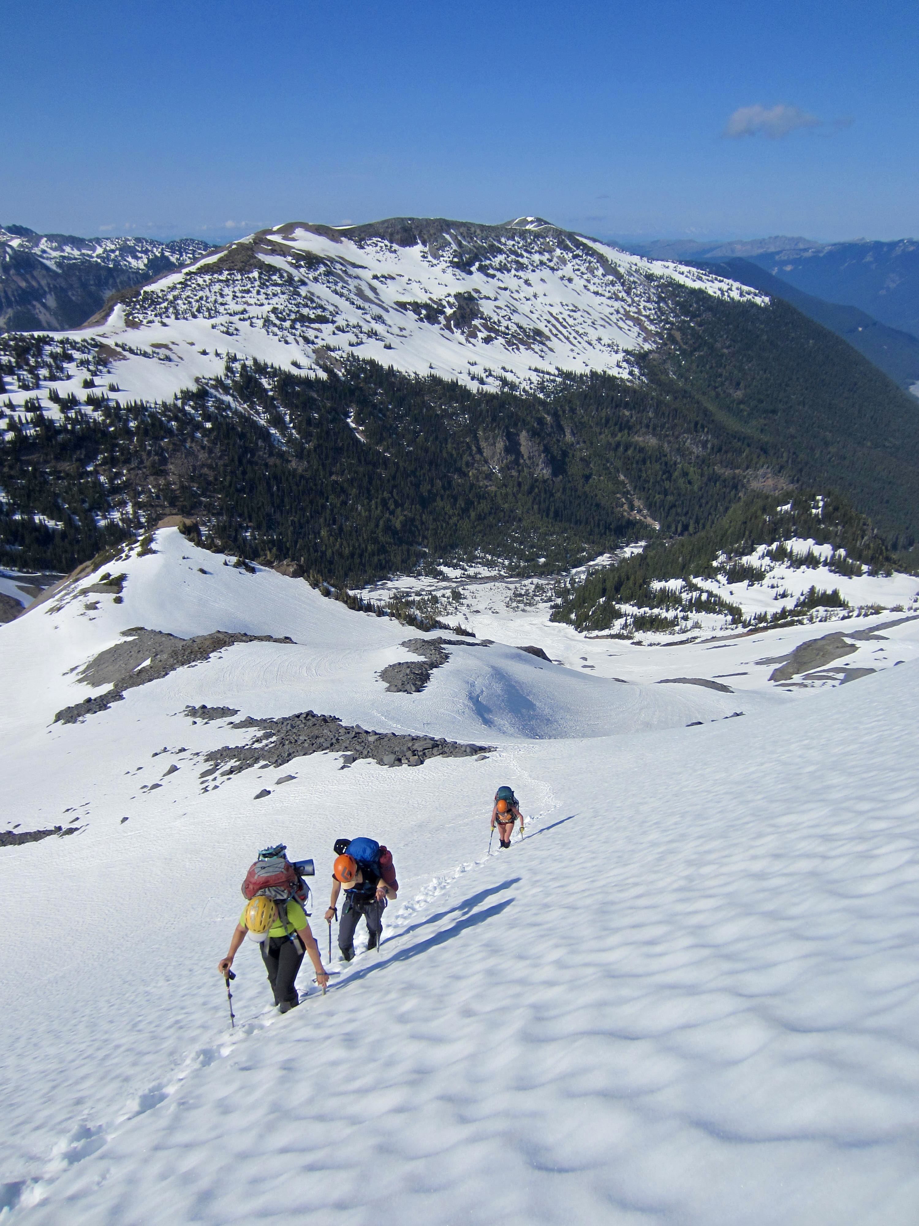
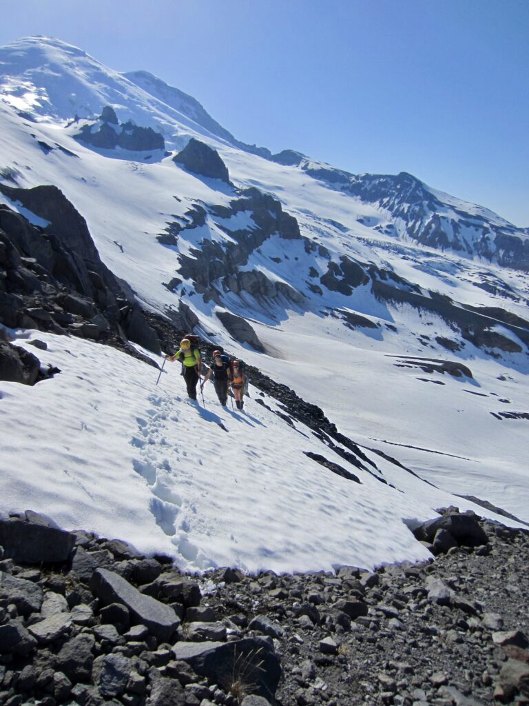
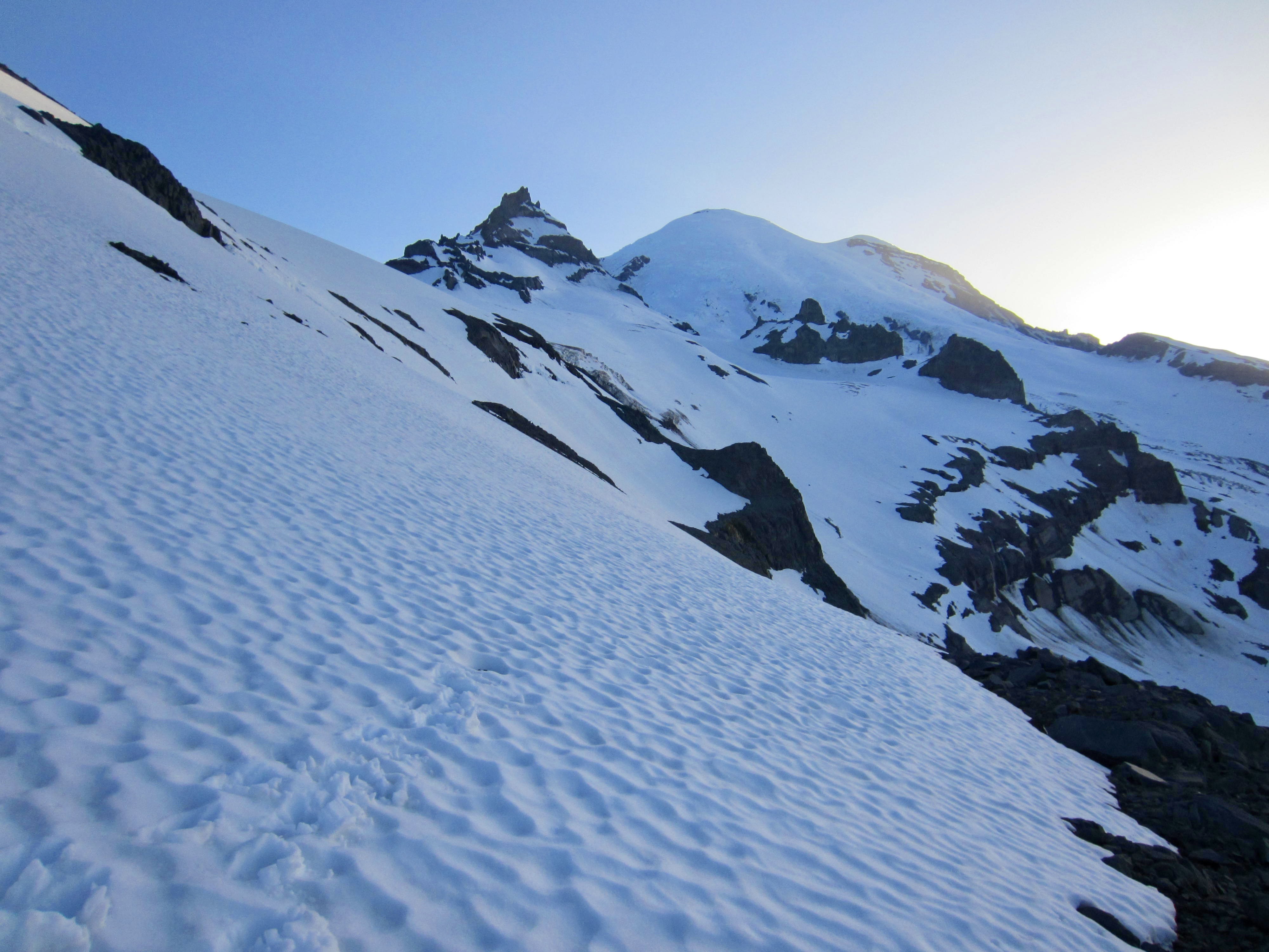
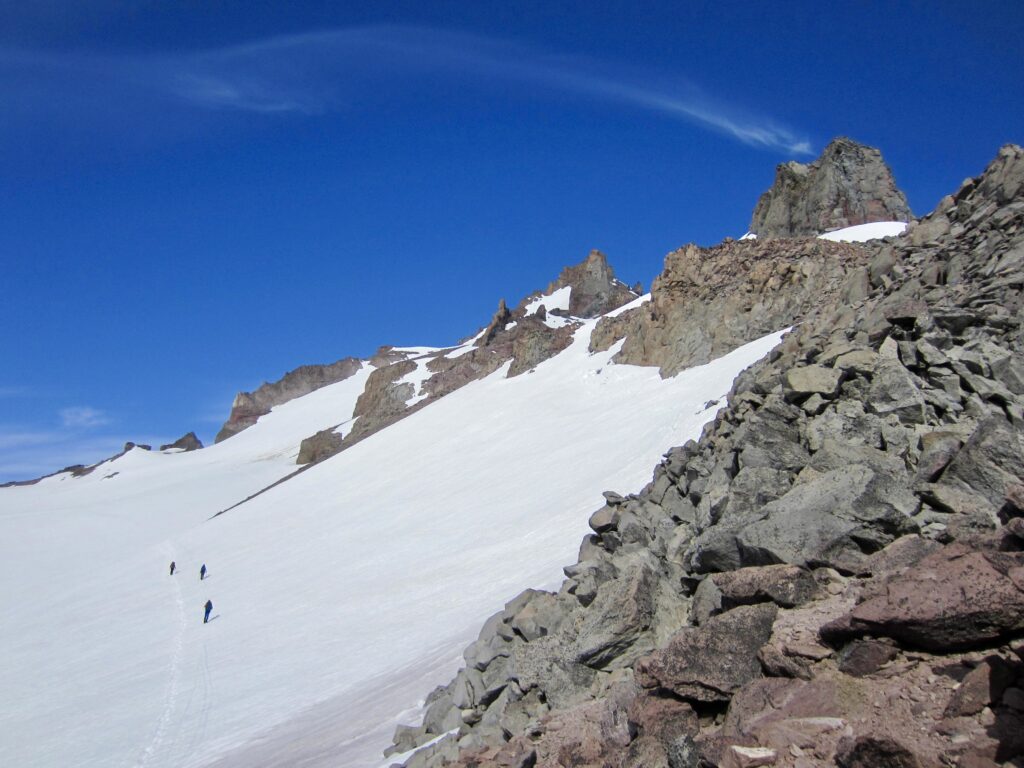
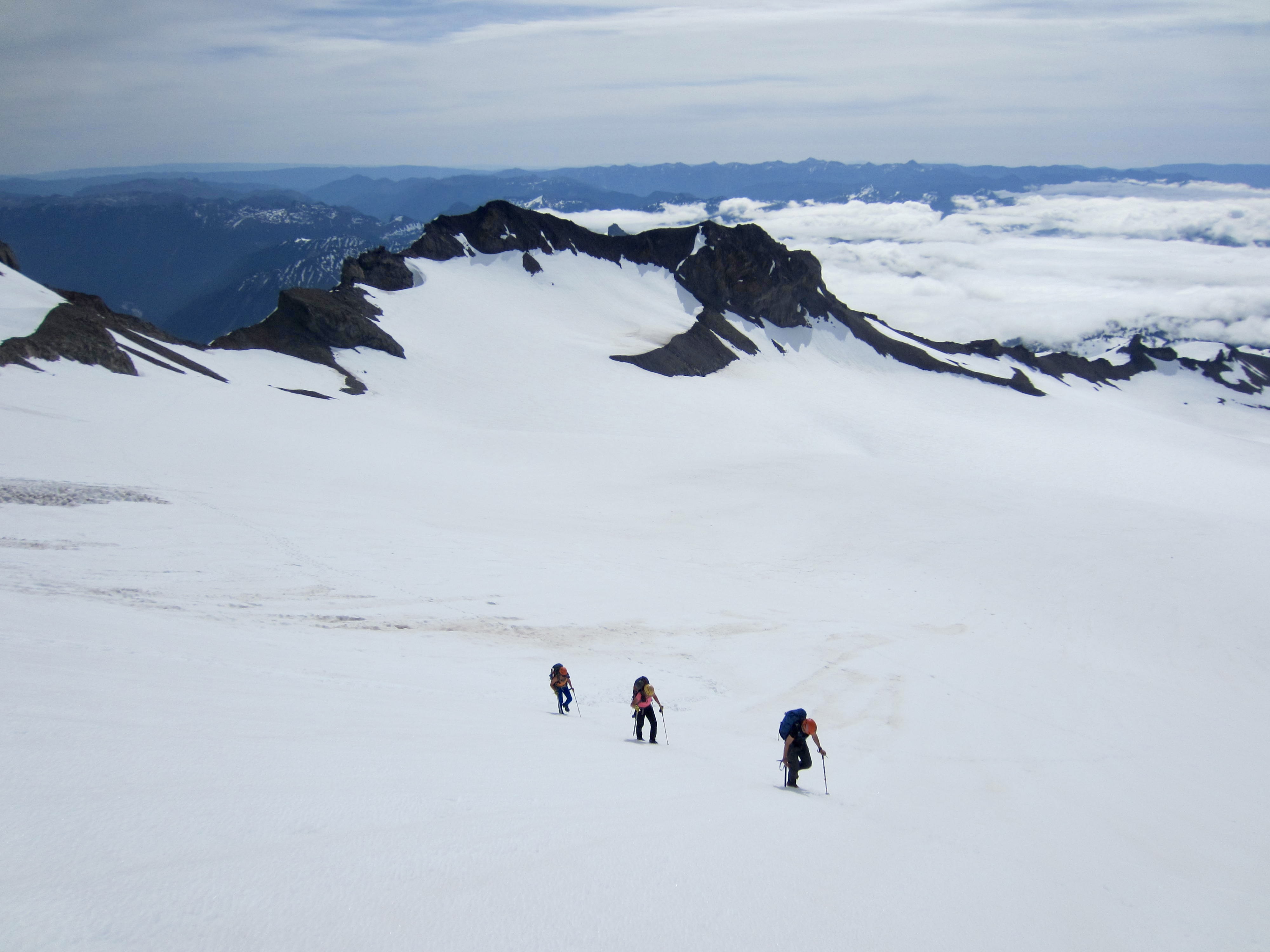
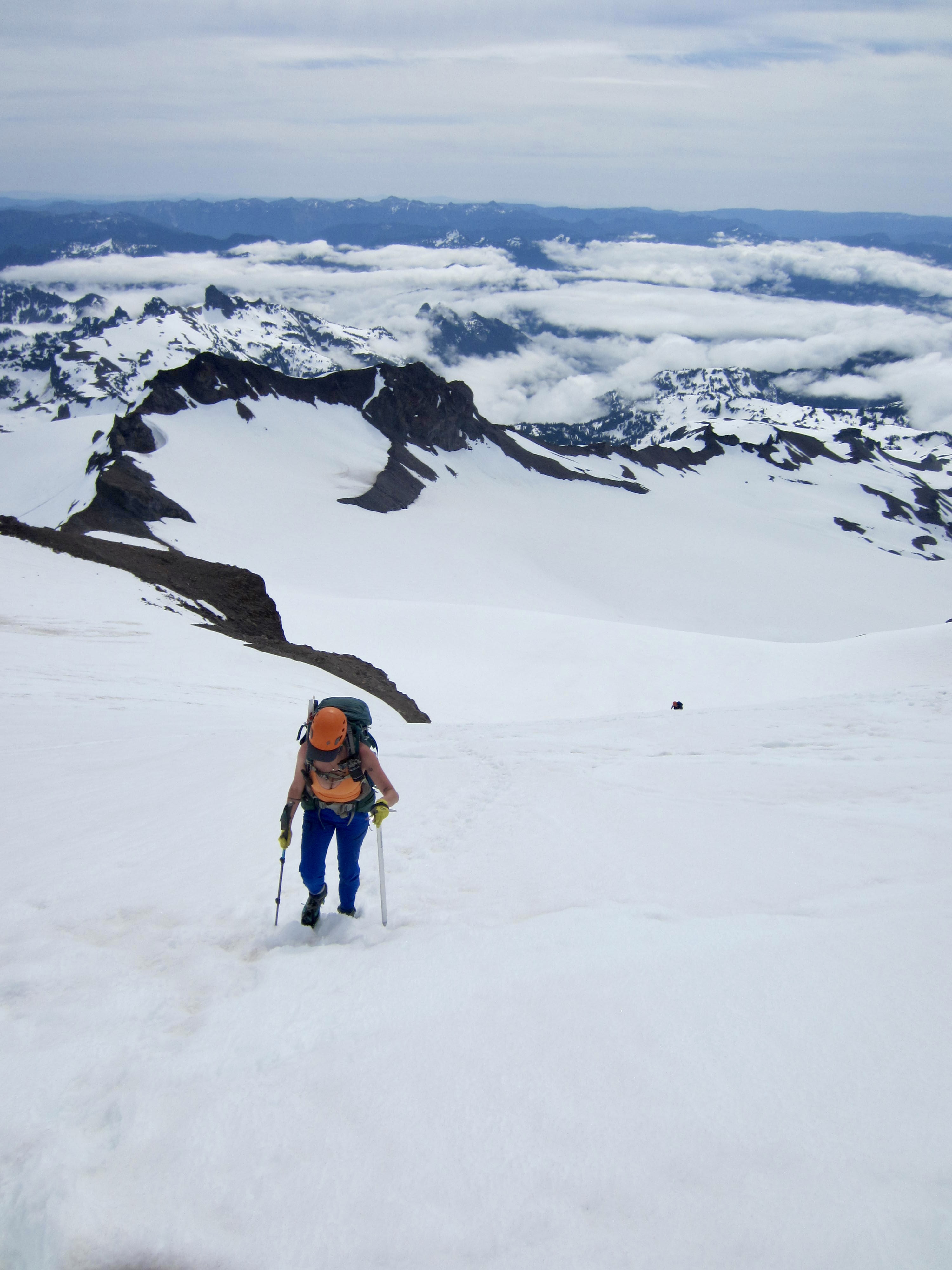
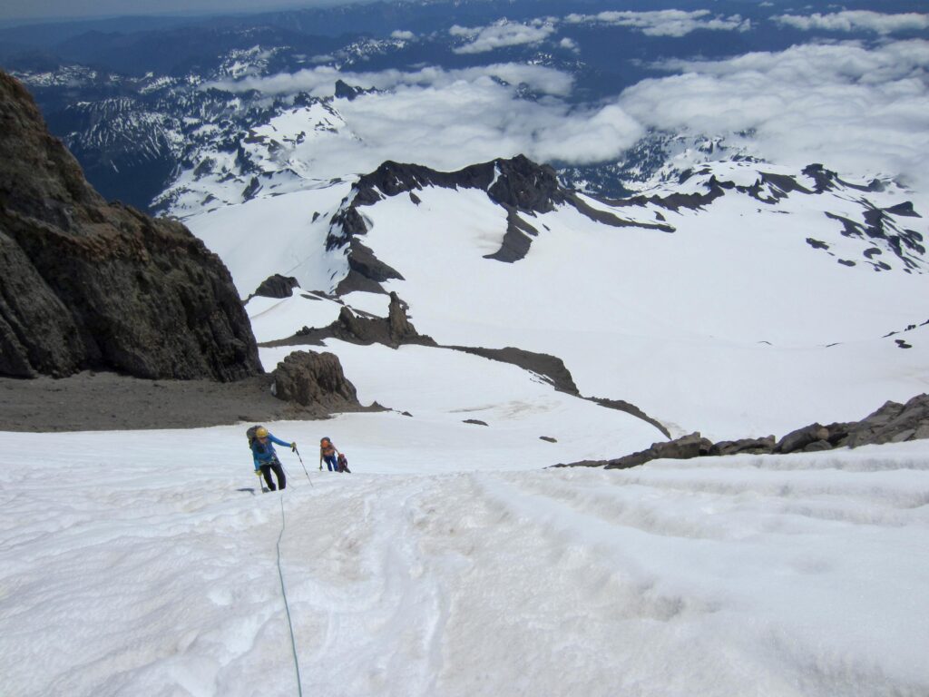
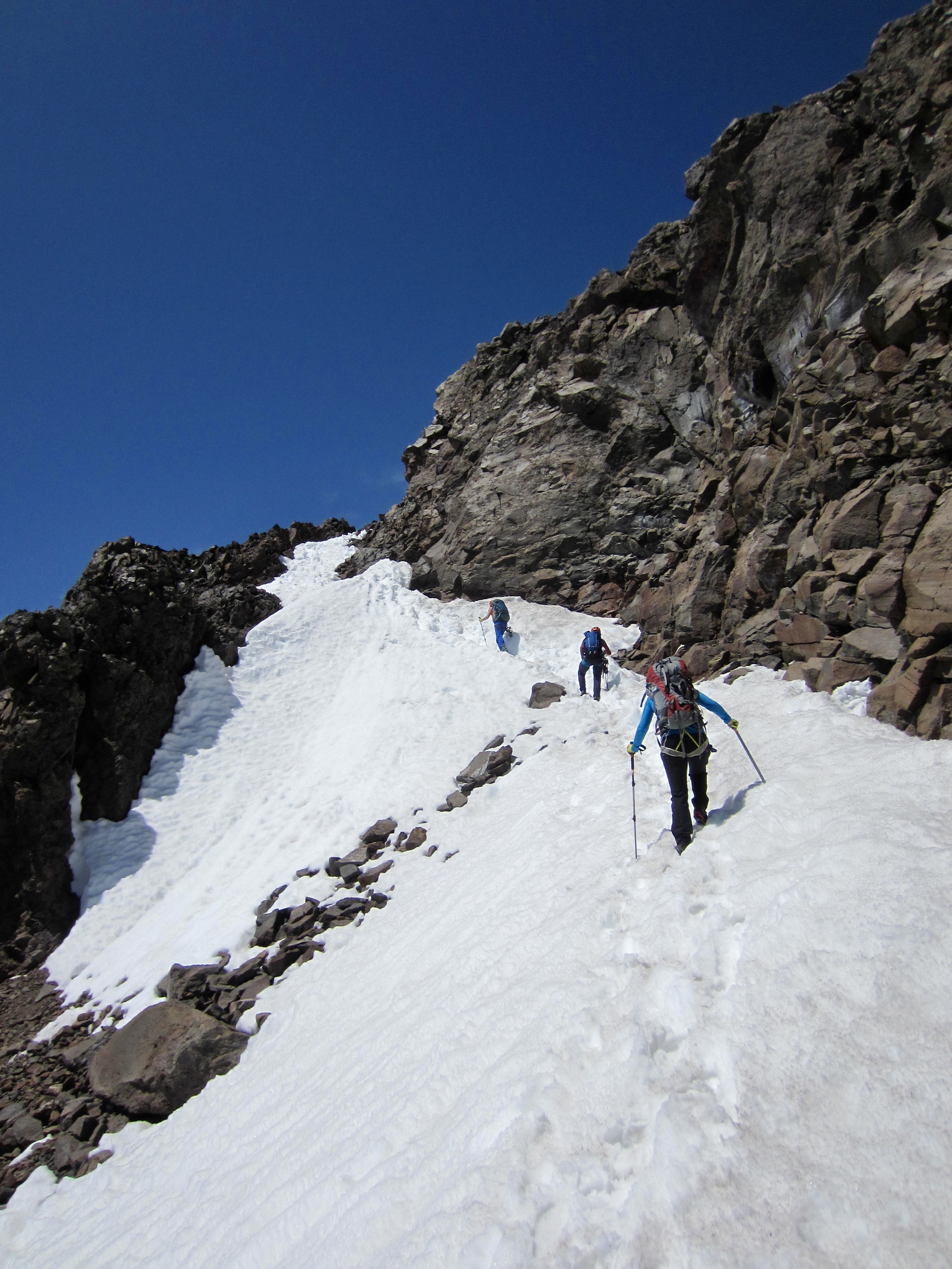
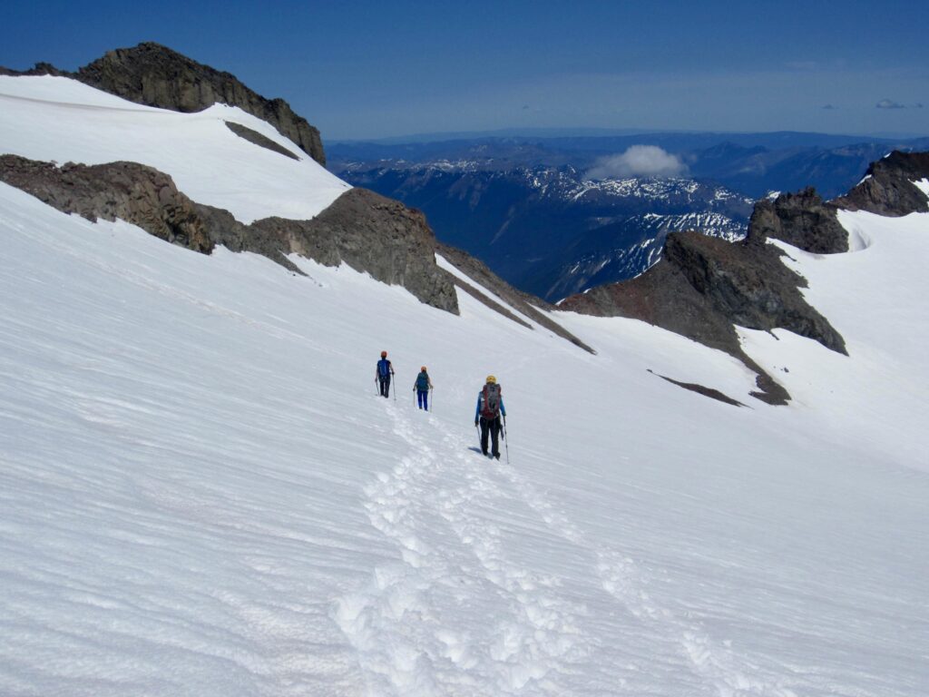
The night had been clear, cold, and windless, putting a rock-hard crust on the snow by morning. We were all underway with crampons at 6:30am. From camp, we climbed a steep slope for 300 feet to gain the lower edge of the Fryingpan Glacier, then we continued angling southwestward up mellower slopes. Whitman Notch served as an obvious visual target in the ridge just left of Little Tahoma Peak.

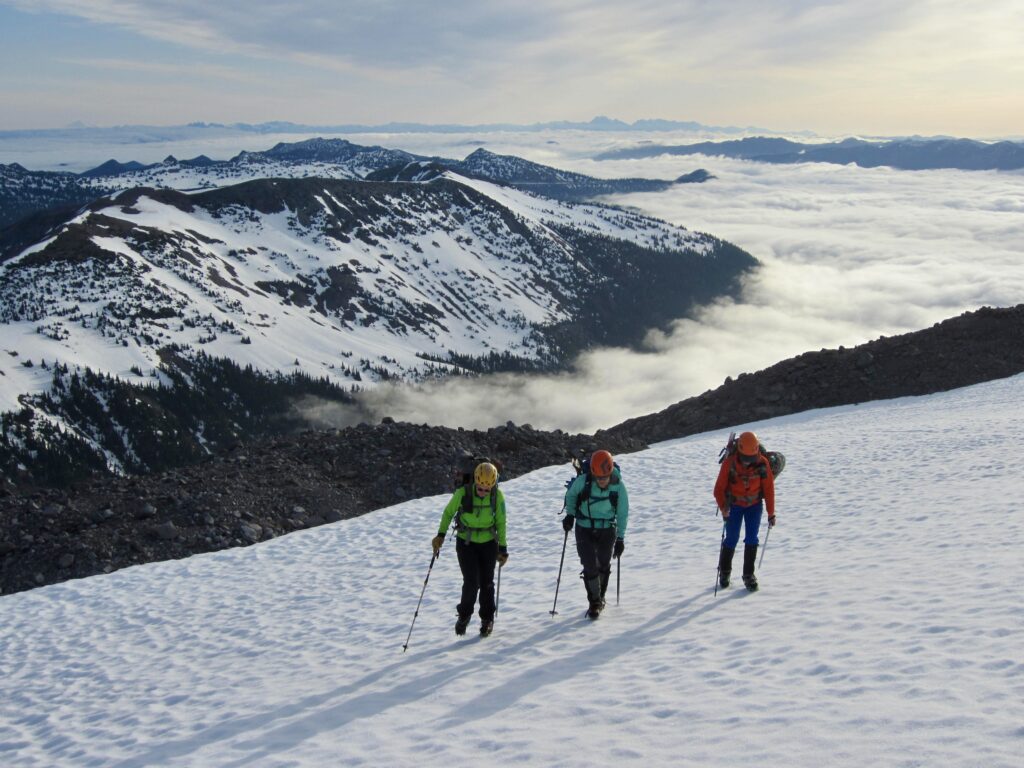
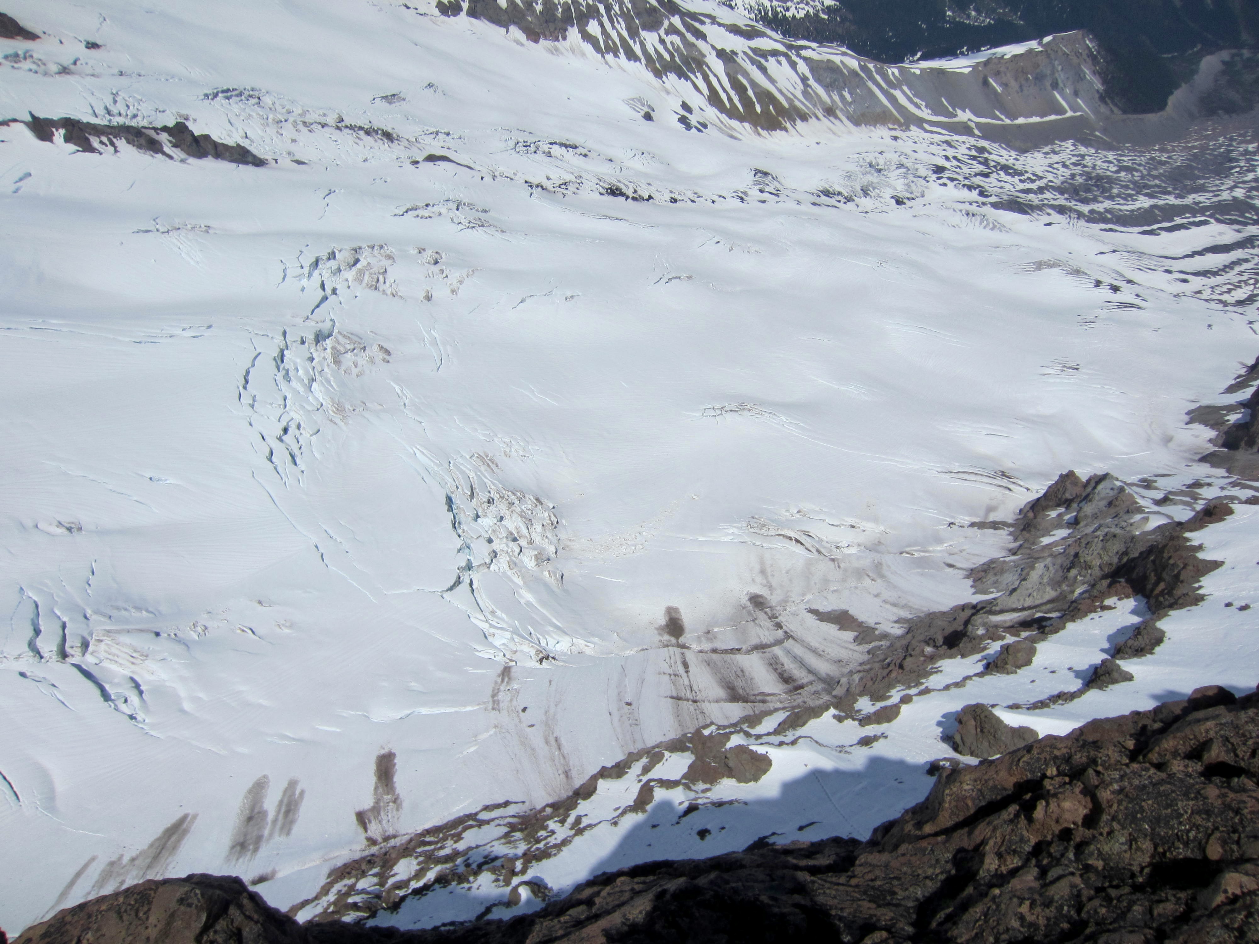
We crossed over 9100-foot Whitman Notch at 8:30am (2.0 hours + 1850 feet from camp) and got our first view of the Whitman Glacier. Boot tracks and ski tracks left by recent climbers and skiers were clearly visible on the snow surface.
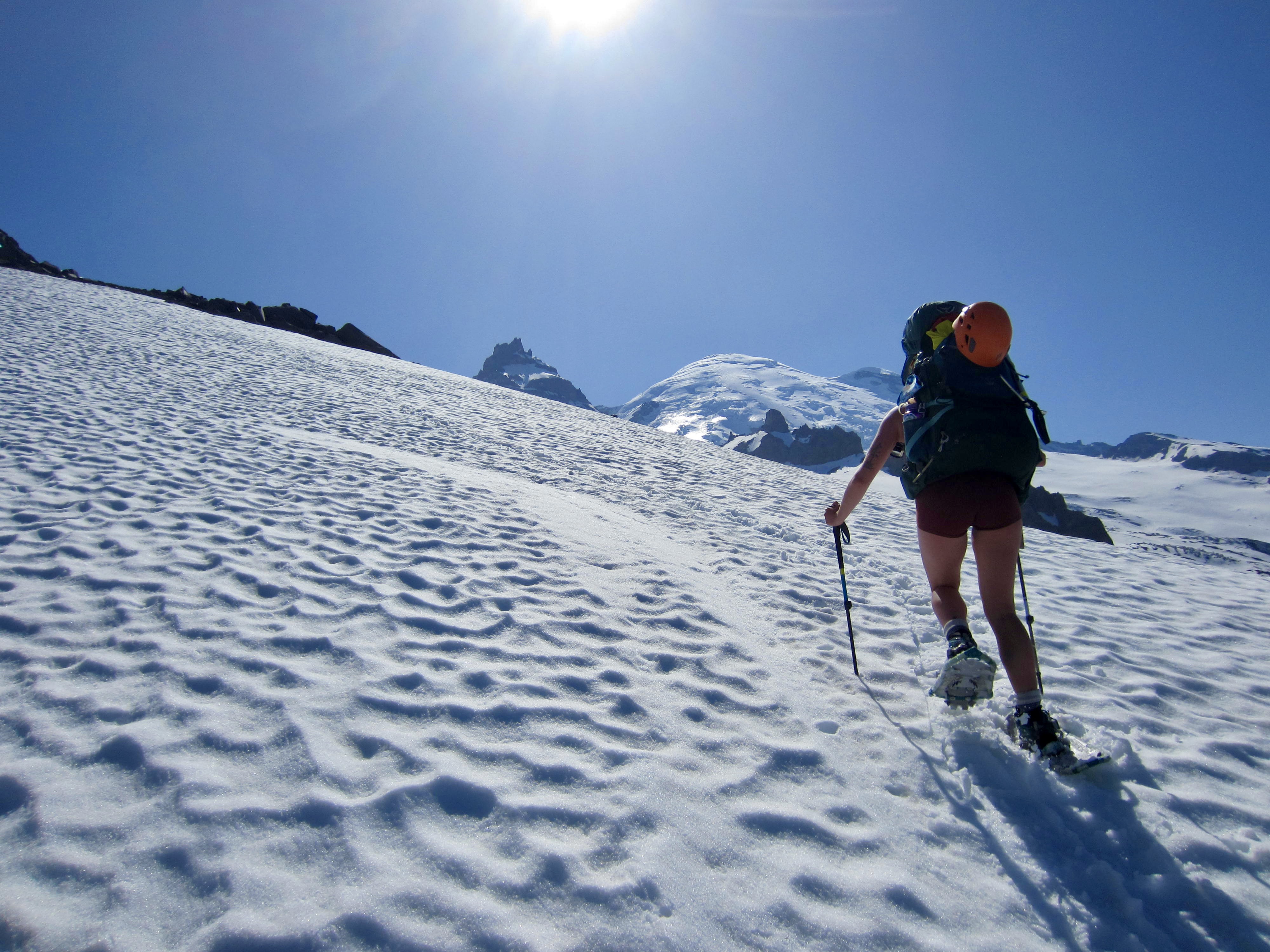
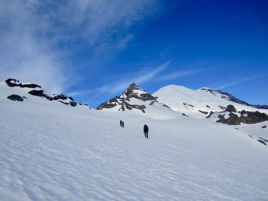
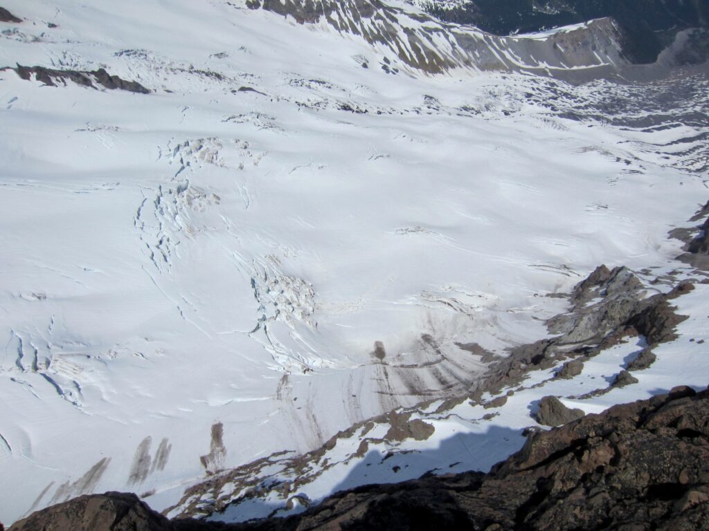
We made a low-angle traverse across the upper Whitman Glacier to get past some cliffs, then we cut sharply uphill on a moderately steep slope. The snow was starting to soften but remained firm enough for crampons. We easily stepped over a bergschrund and stopped at a high southeast shoulder.
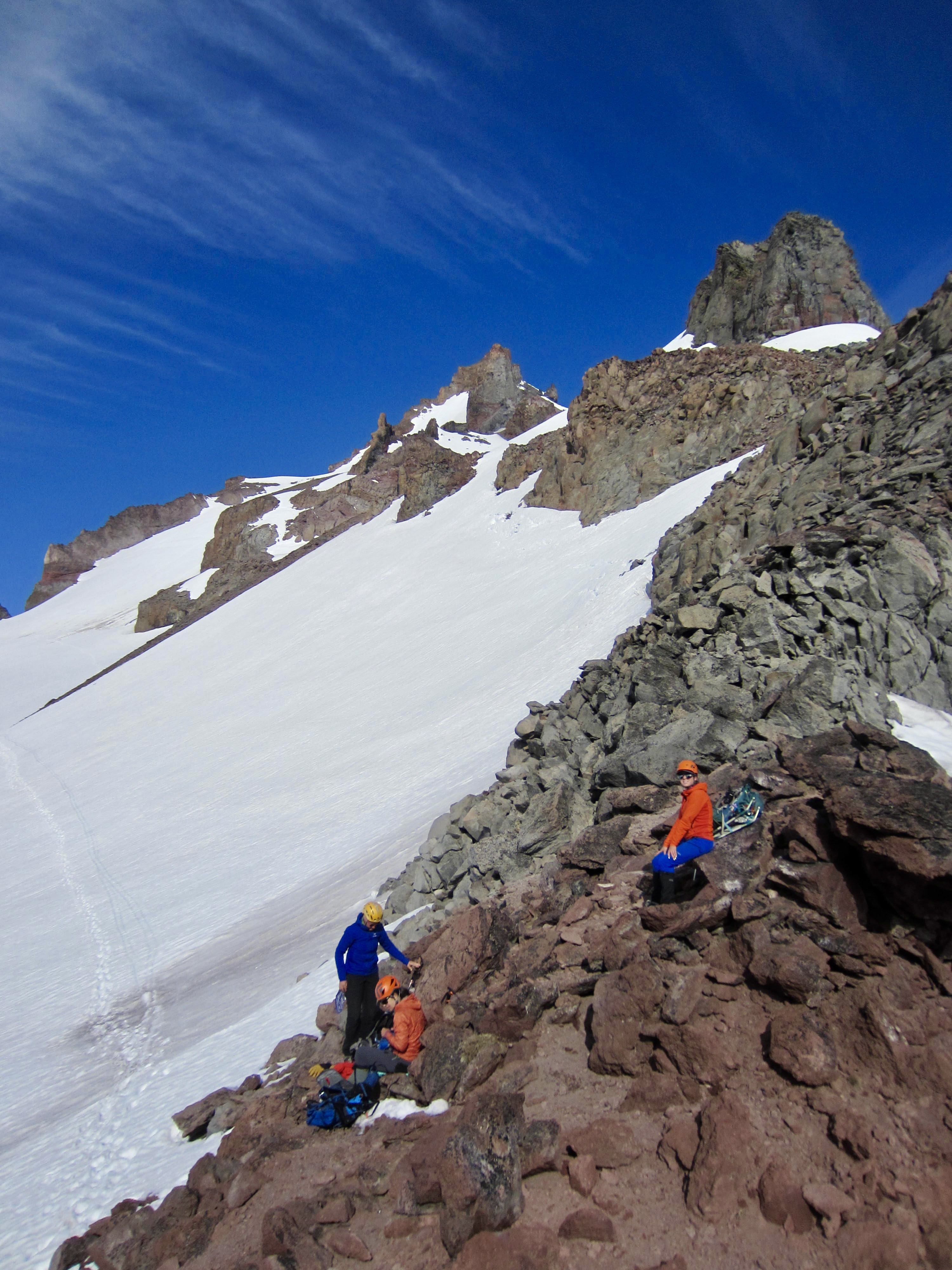
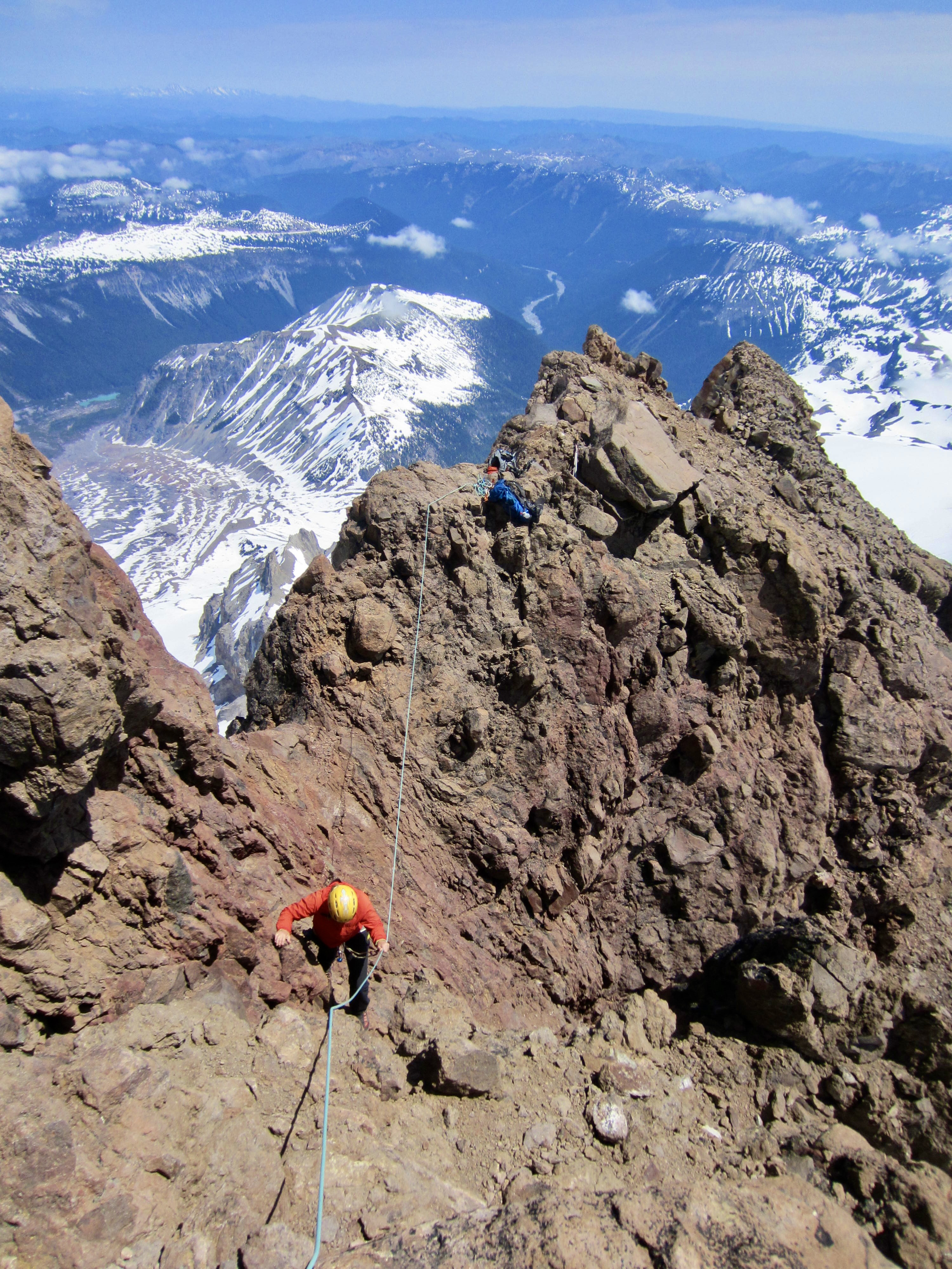
After roping up at the high shoulder, we traversed over to the right until centered in a steep snow couloir, then we climbed the couloir using pickets for protection. The snow ended at a short Class 2-3 rock cleft, which we scrambled up to reach an upper rib. A final patch of steep snow took us upward and leftward to the peak’s east ridge.
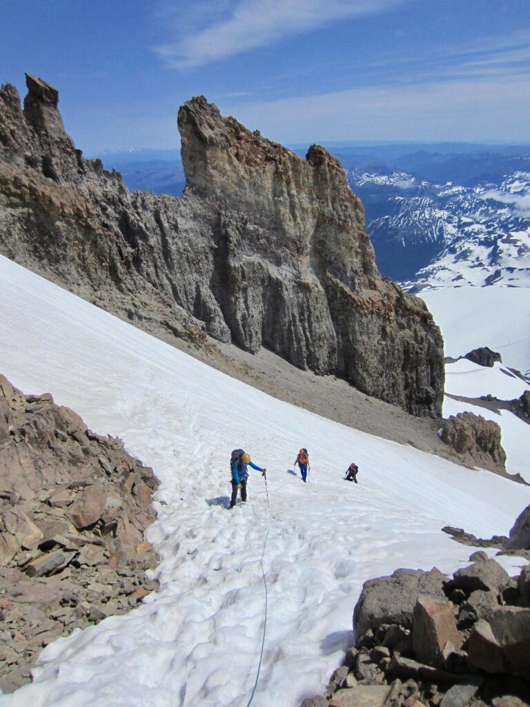
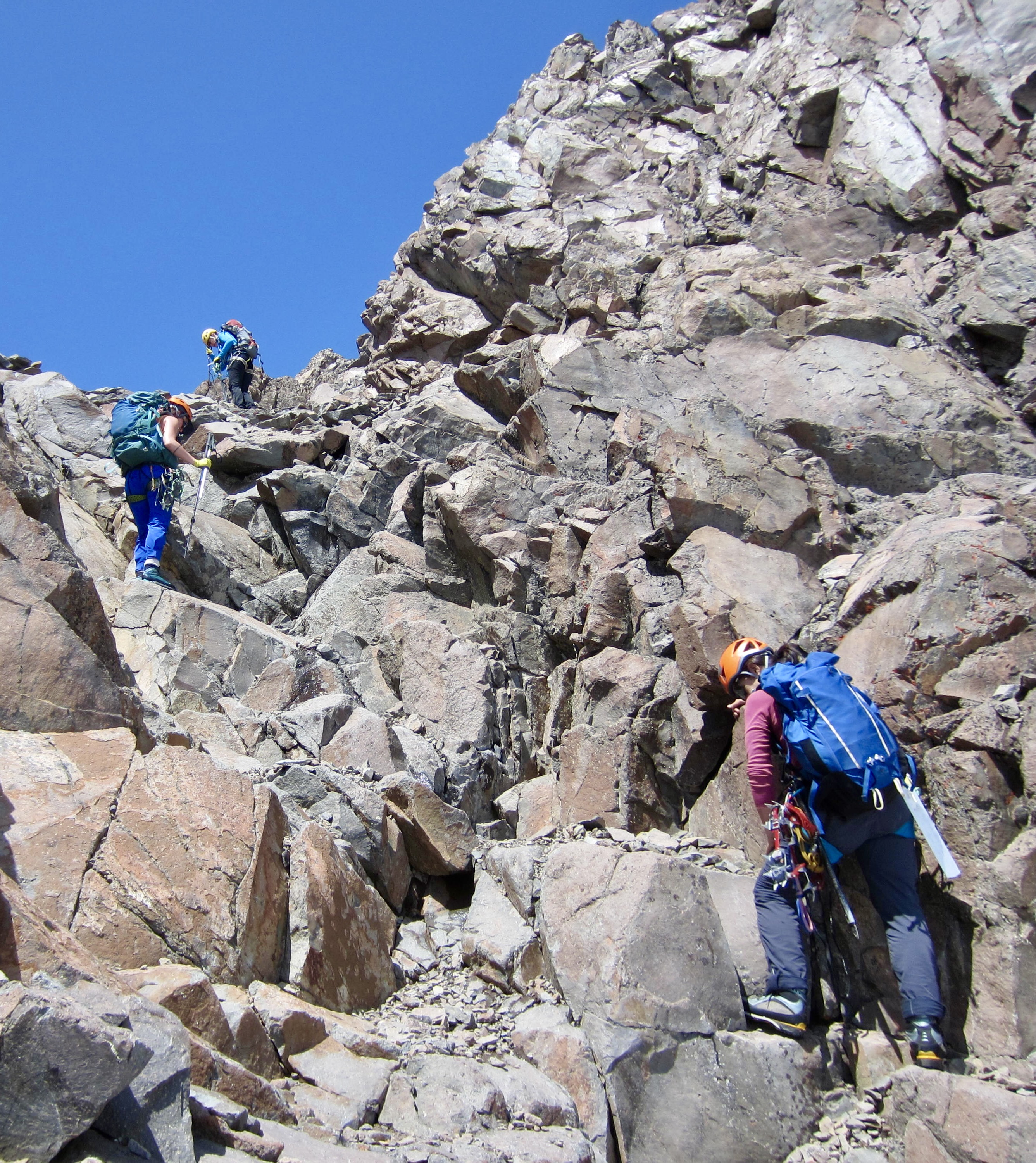
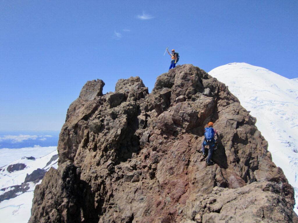
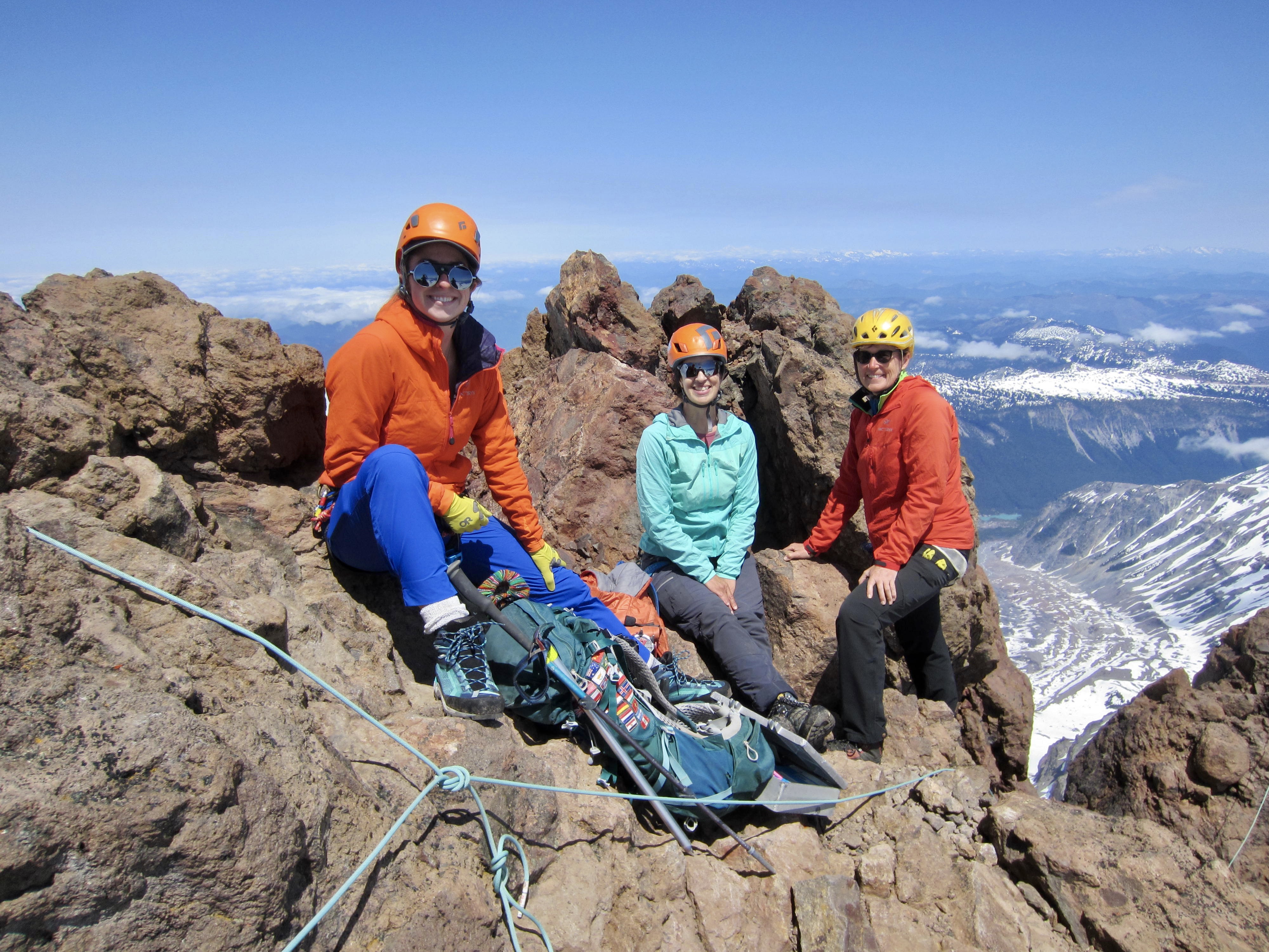
Little Tahoma’s east ridge is a narrow fin of crumbly andesite that plunges 2000 feet to the Emmons Glacier on the northern side. Every climber who steps onto the crest and peers over this dramatic cliff has the same reaction: “Holy crap!”
The east ridge culminates in a small summit block that requires a short but exposed Class 3 scramble across a tiny notch and up the steep face. Thankfully, the rock is fairly solid here. Brooke and Kellie quickly scampered up the summit block sans rope, whereas Eileen and I used a handline for safety. We were all perched on top a bit past noon (6.3 hours + 3800 feet from camp). The summit register showed that three or four parties had preceded us this year—all in the past week.
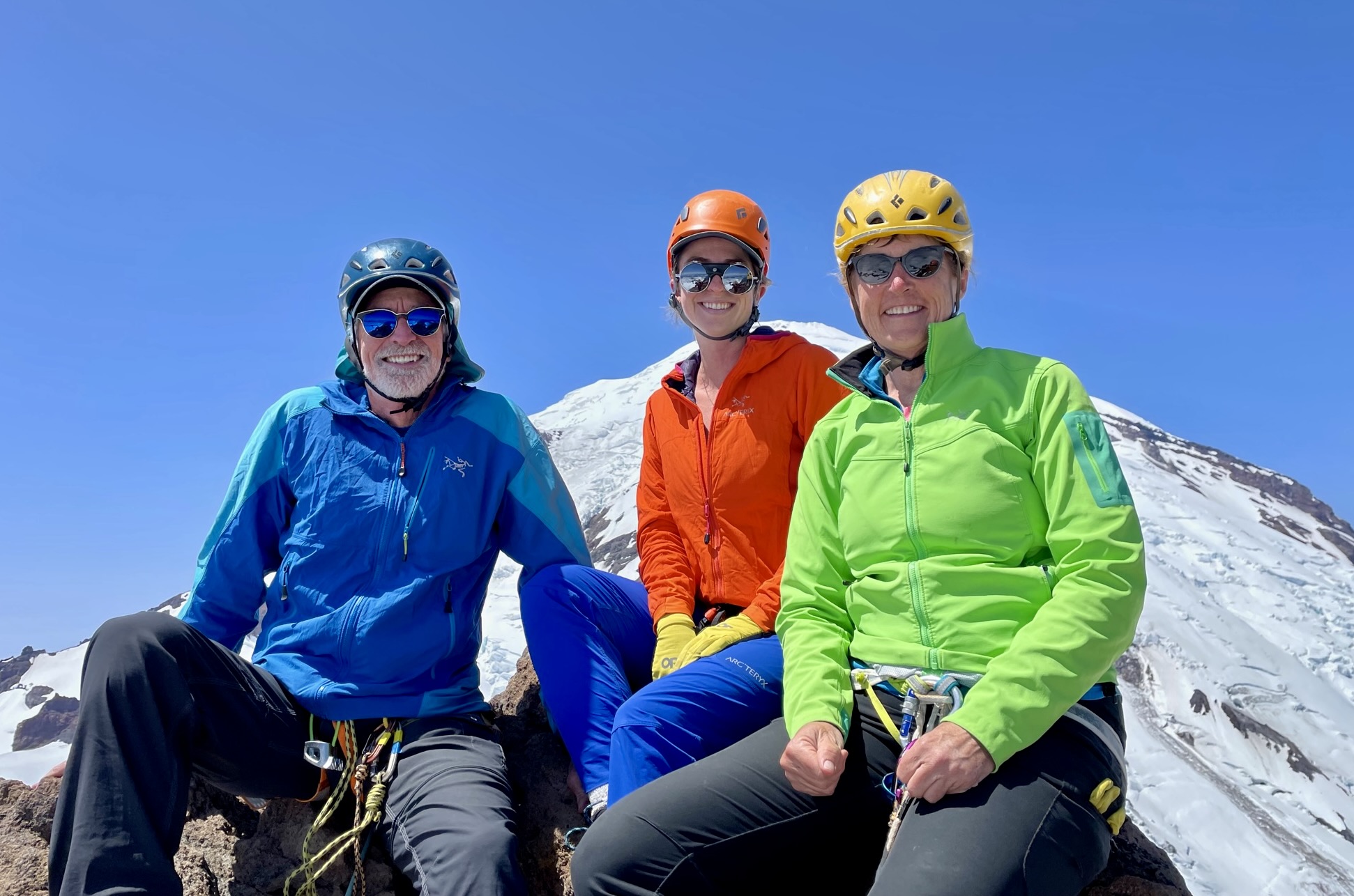
Little Tahoma Peak offers an unrivaled vantage for viewing Mt. Rainier’s eastern flank, with the Ingraham and Emmons Glaciers on full display. In my opinion, this is by far the most elegant side of the mountain. Due to our mid-day timing and excellent visibility, we could see multiple climbing parties—appearing as rows of tiny dots—descending both glaciers.

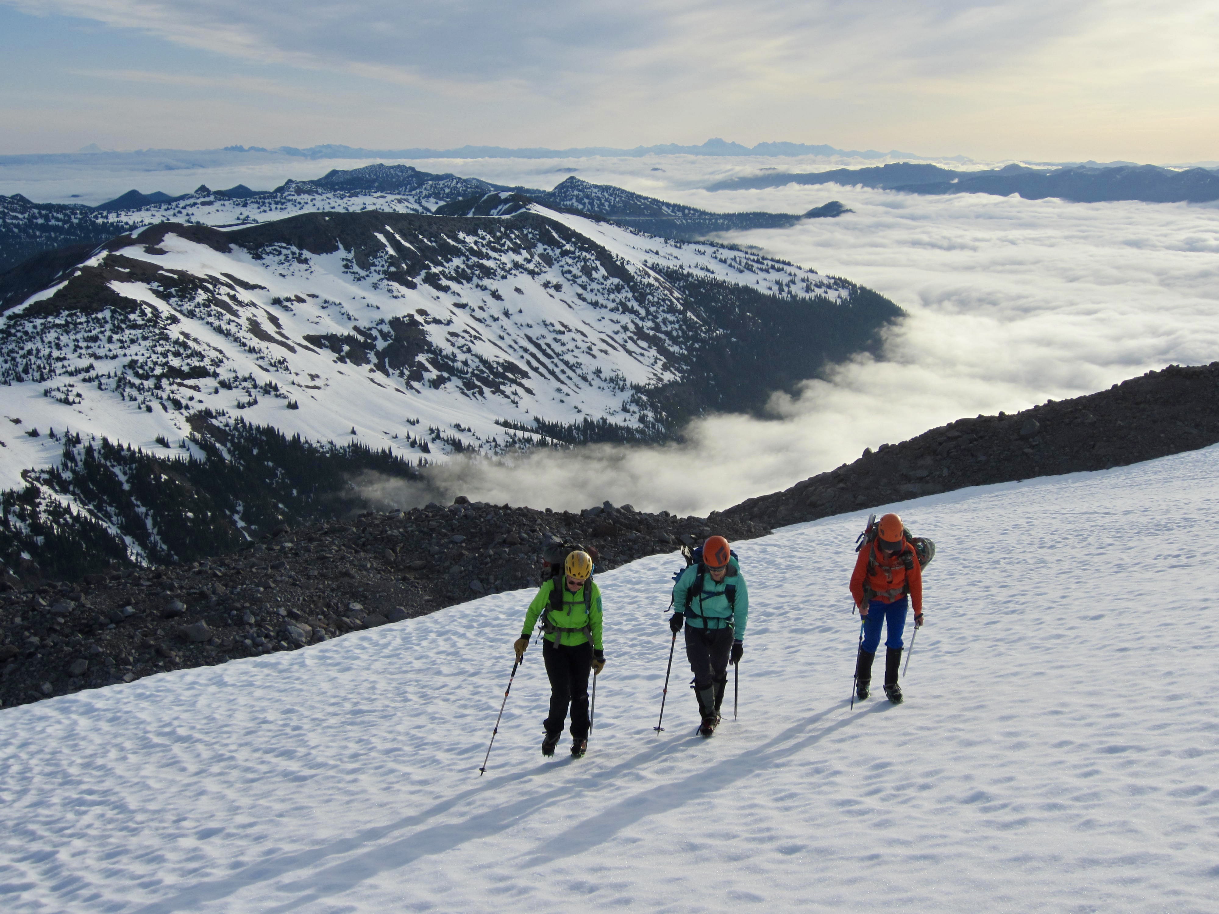
By the time we began our descent, all of the snowfields and glaciers were much softer, with some locations turning to mush. This made for comfortable plunge-stepping, even on the steepest slopes. We arrived back at camp around 4:30pm (3.4 hours from summit), which gave us ample time to pack up and move downhill.
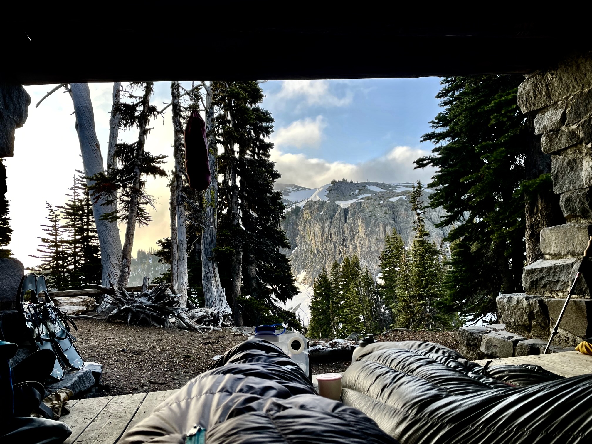
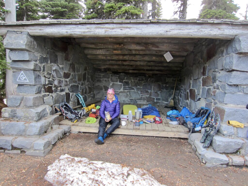
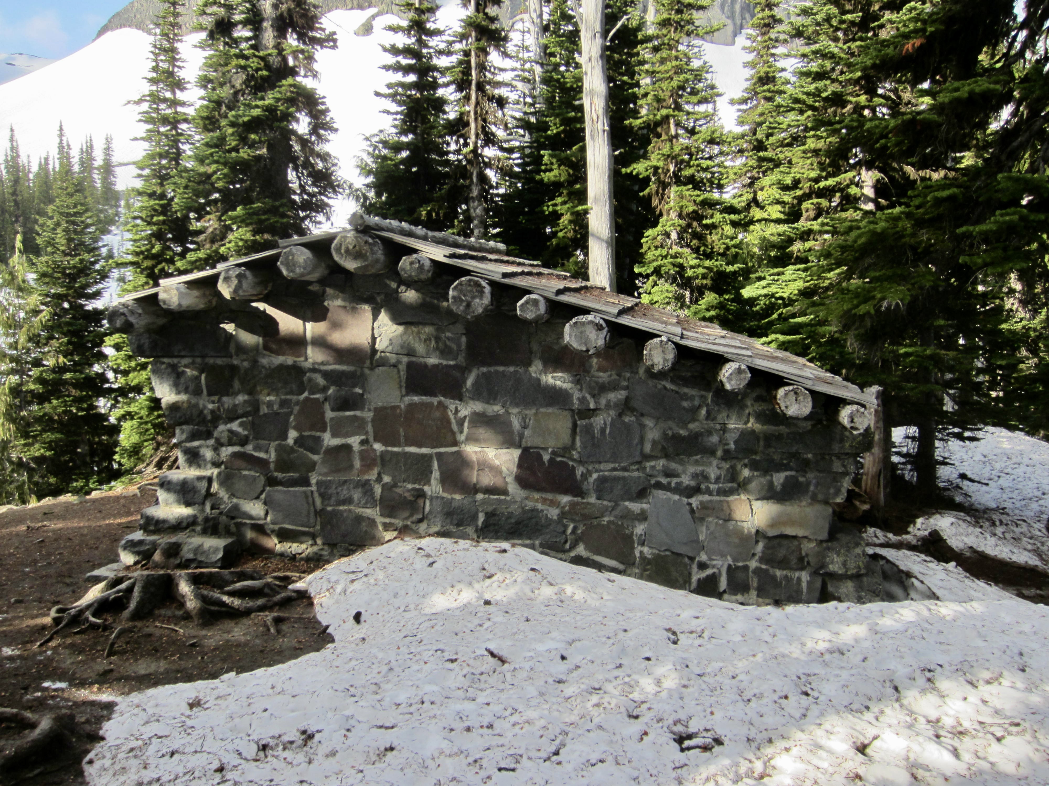
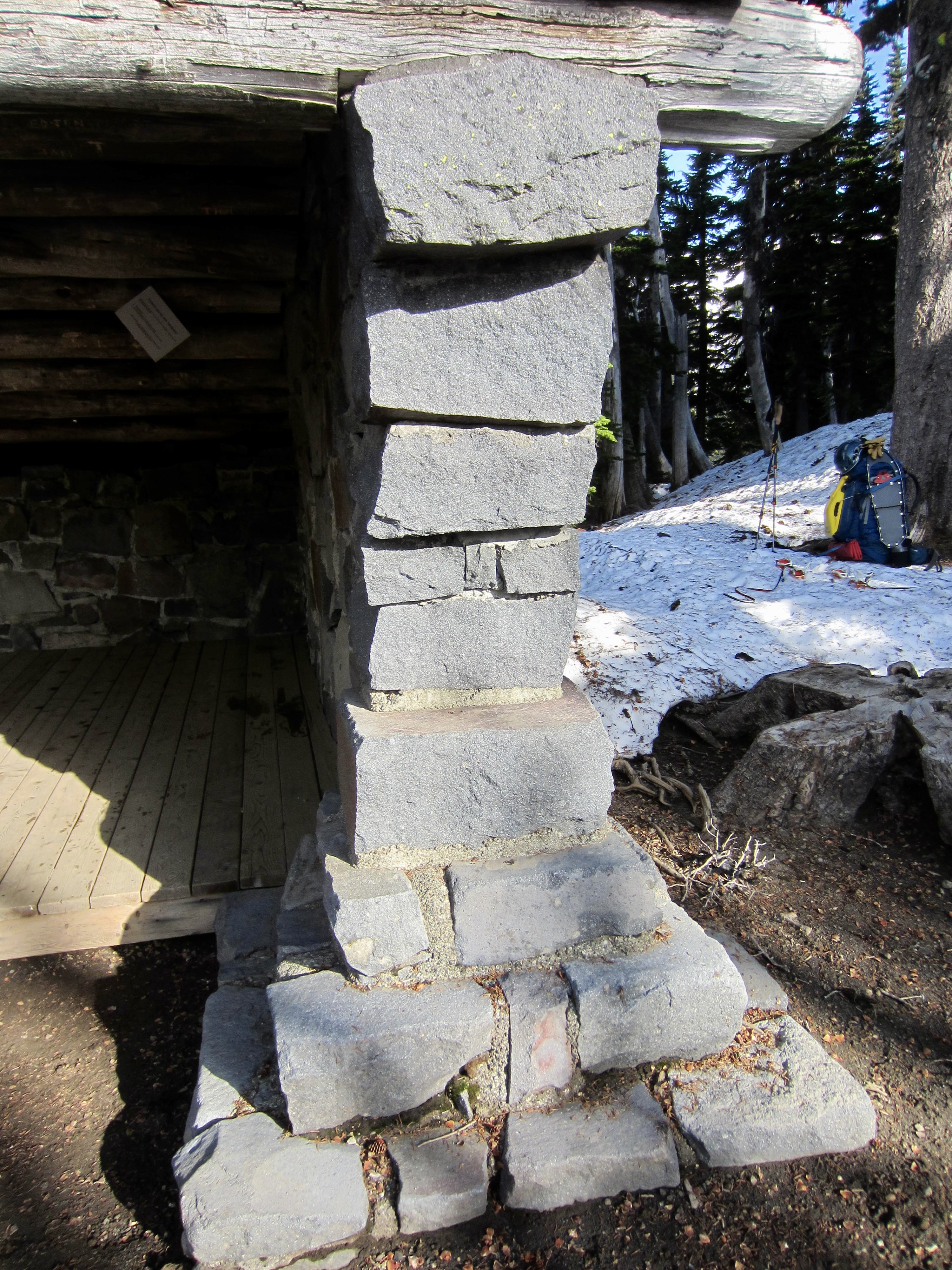
Upon reaching the gentle slopes of Summer Land, Brooke and Kellie elected to continue hiking out to the trailhead. Eileen and I instead opted to spend another night in the backcountry, so we booted over to Summer Land Camp and established a temporary home in the stone shelter. The rest of the campground lay buried under several feet of snow.
Day 3: Summer Land to Trailhead
Although the night had been very foggy, we awoke to clearing weather, with Little Tahoma coming out of the clouds to greet us during breakfast. It was shaping up to be another fine morning, and our good fortune at getting to spend a night in this historic shelter put a cherry on top of a splendid climb.

We packed up, swept out the shelter, and left Summer Land at 8:00am. The cold night had once again put a hard freeze on the snow, so we wore crampons during our descent to the Fryingpan Creek footlog. Once across the creek, it was a straightforward march down to the trailhead, arriving at 10:30am (2.5 hours from shelter).
Route Maps & Profile
…
…
…
Photo Gallery
Click to enlarge…