Trip Date: August 14-17, 2019
2019 PERU ADVENTURE VACATION
Salkantay Trek: Challacancha to Machu Picchu to Ollantaytambo
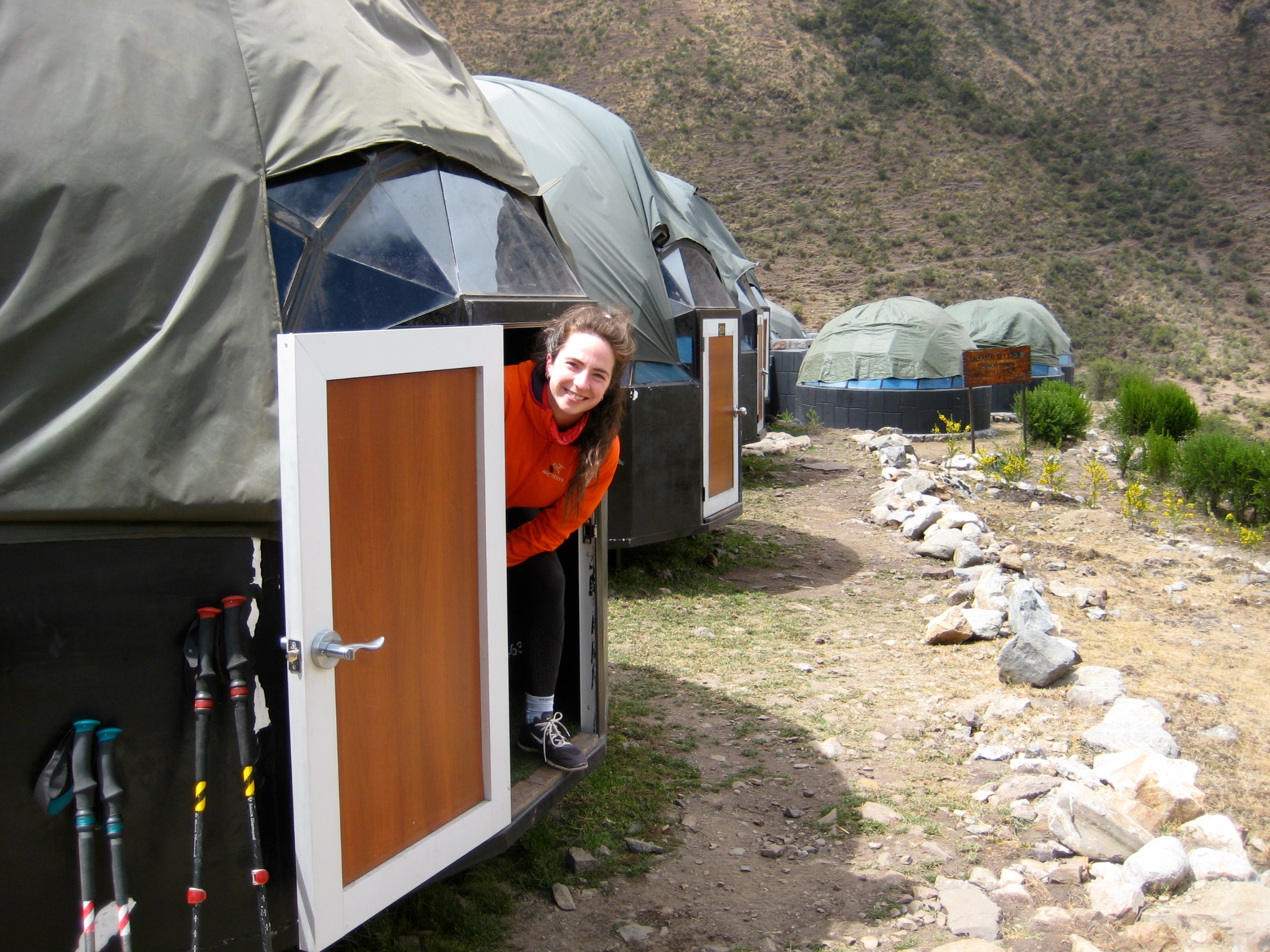
Soraypampa Sky Camp
Lake Humantay
Salkantay Pass (15,200 ft / 4630 meters)
Chaullay Andean Huts
Hidroelectrica
Aguas Calientes aka Machu Picchu Pueblo
Machu Picchu Village
Wayna Picchu Mountain aka Huayna Picchu Mountain (8835 ft / 2690 meters)
- Trip Report Summary
- Trip Overview
- Guide Service
- The Route
- Elevation and Acclimation
- Transportation
- Weather Conditions
- Trail Conditions
- Camping & Accommodations
- Trekking Meals
- Drinking Water
- Nomenclature Comments
- Full Trip Report
- Day 1: Challacancha to Soraypampa
- Day 2: Soraypampa to Chaullay
- Day 3: Chaullay to Aguas Calientes
- Day 4: Aguas Calientes to Machu Picchu to Ollantaytambo
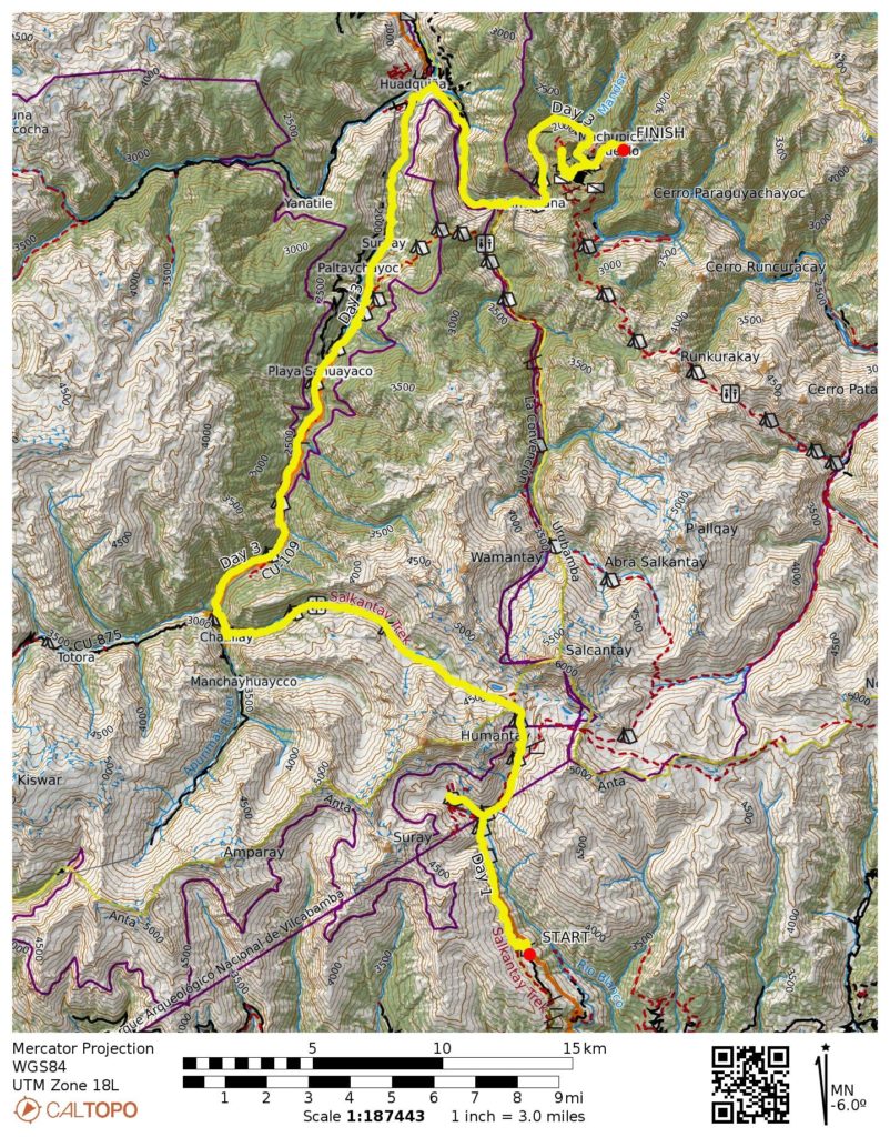
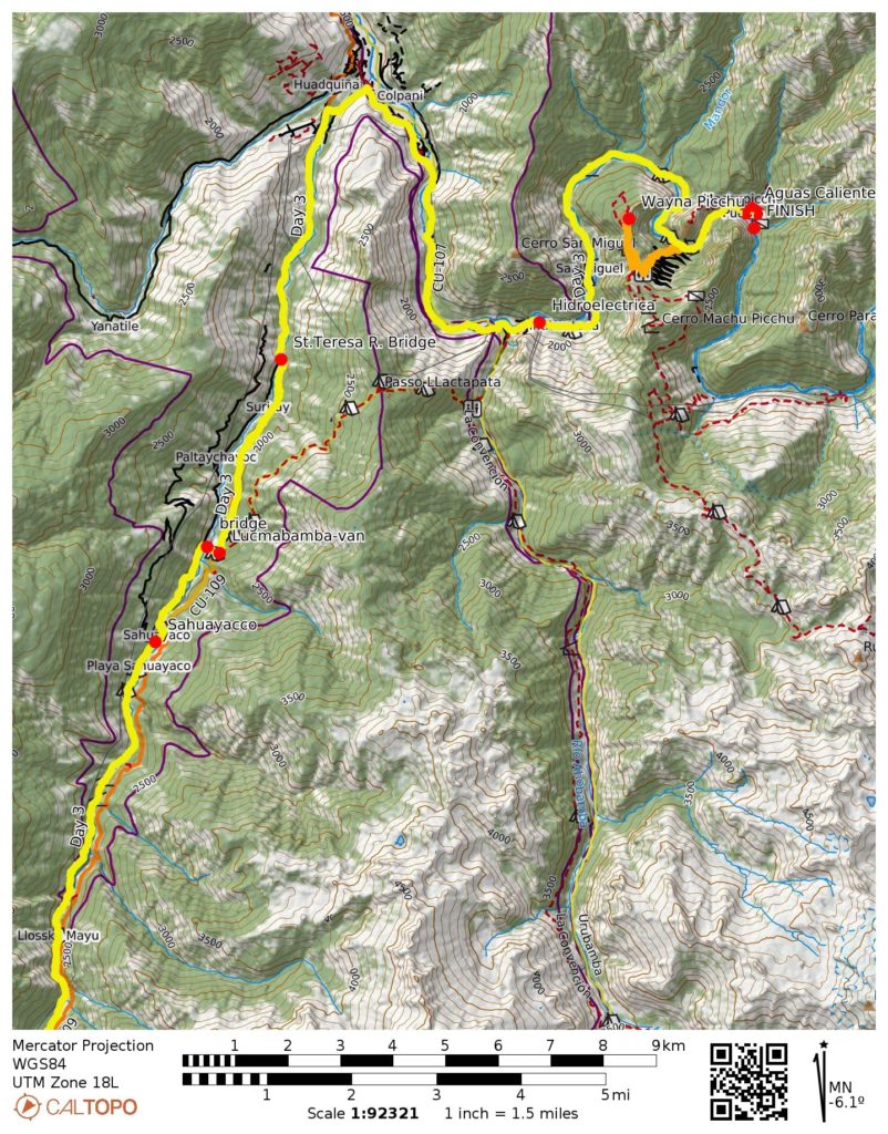
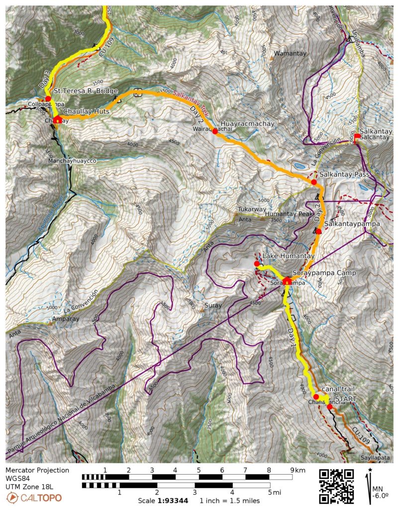
- Route Maps & Profiles
- Photo Gallery
Trip Report Summary
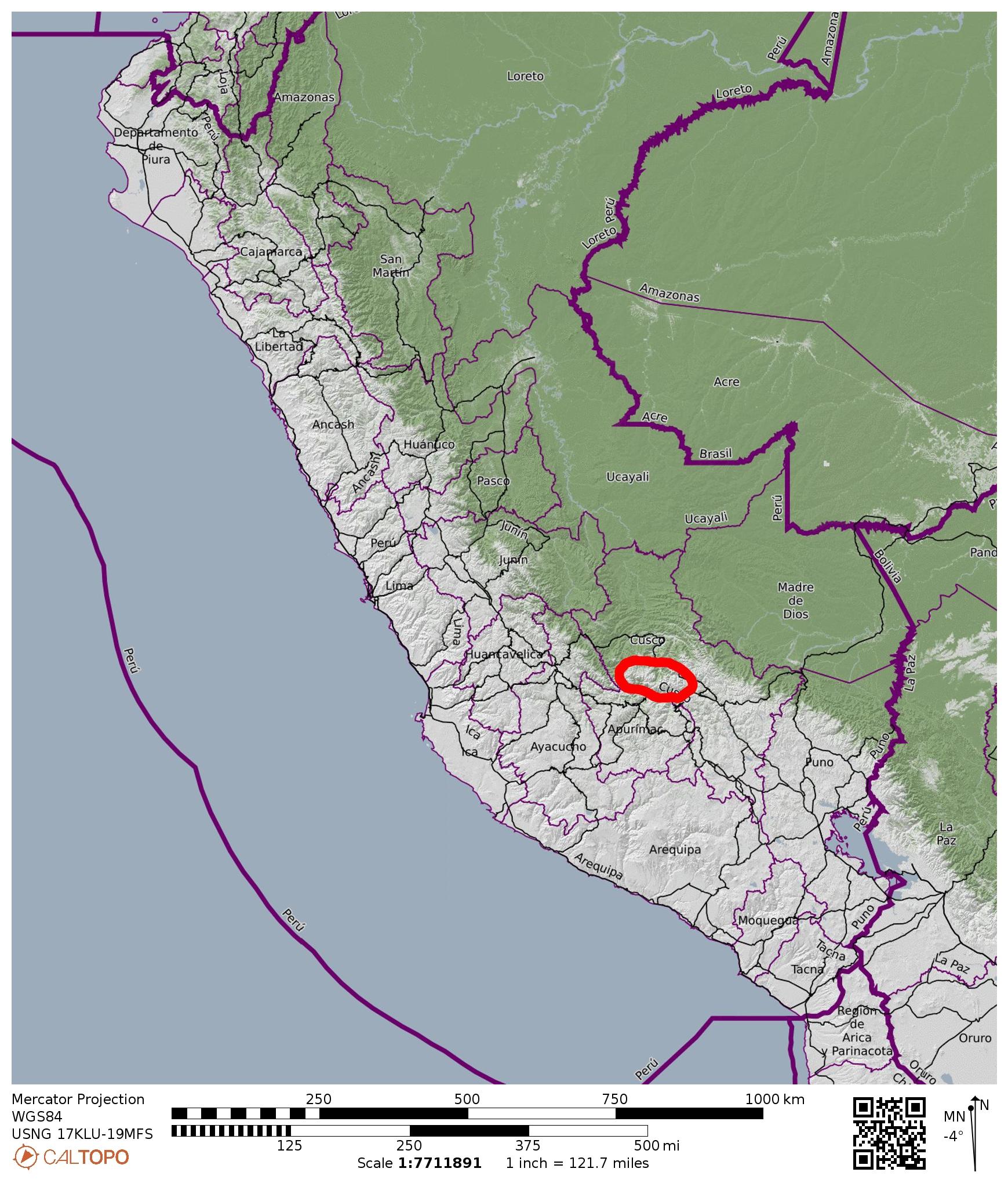
Region: Peru
Sub-Region: Southern Peruvian Andes
Sub-Sub-Region: Cordillera Vilcabamba
Areas: Choquequirao Conservation Area & Machu Picchu Historical Sanctuary
Starting Point: Challacancha Trailhead on Mollepata Road (Elev. 12,000 feet / 3660 meters)
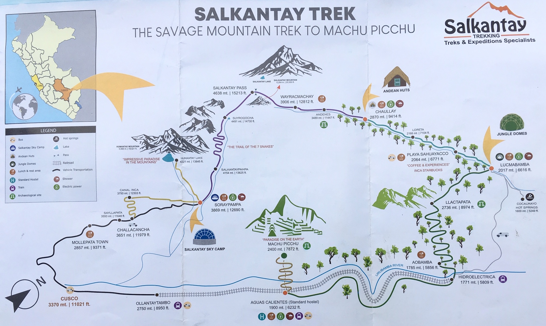
Way Points: Inca Canal & Soraypampa & Salkantaypampa & The Seven Snakes & Soiroccocha & Salkantay Pass & Huayracmachay & Chaullay & St. Teresa River Bridge & Sahuayacco & Lucmabamba (trail hike); St. Teresa River Bridge & Hidroelectrica (van ride); Urubamba River Railroad Bridge & Aguas Calientes (railroad walk); Ollantaytambo (train ride)
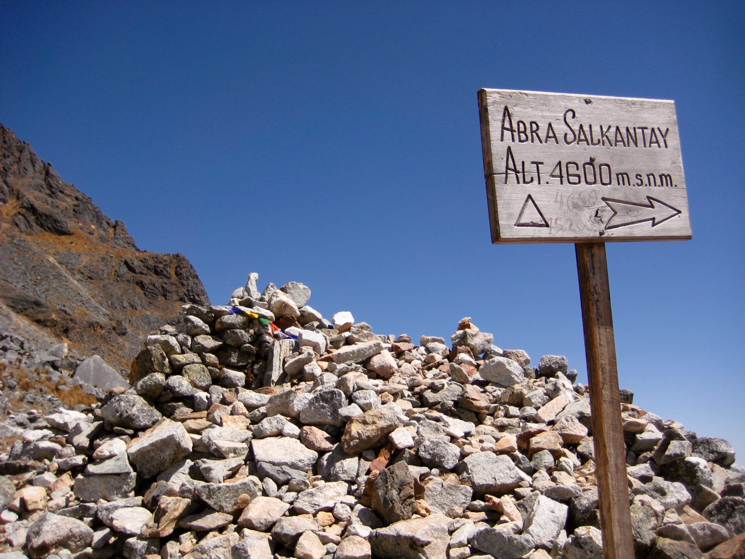
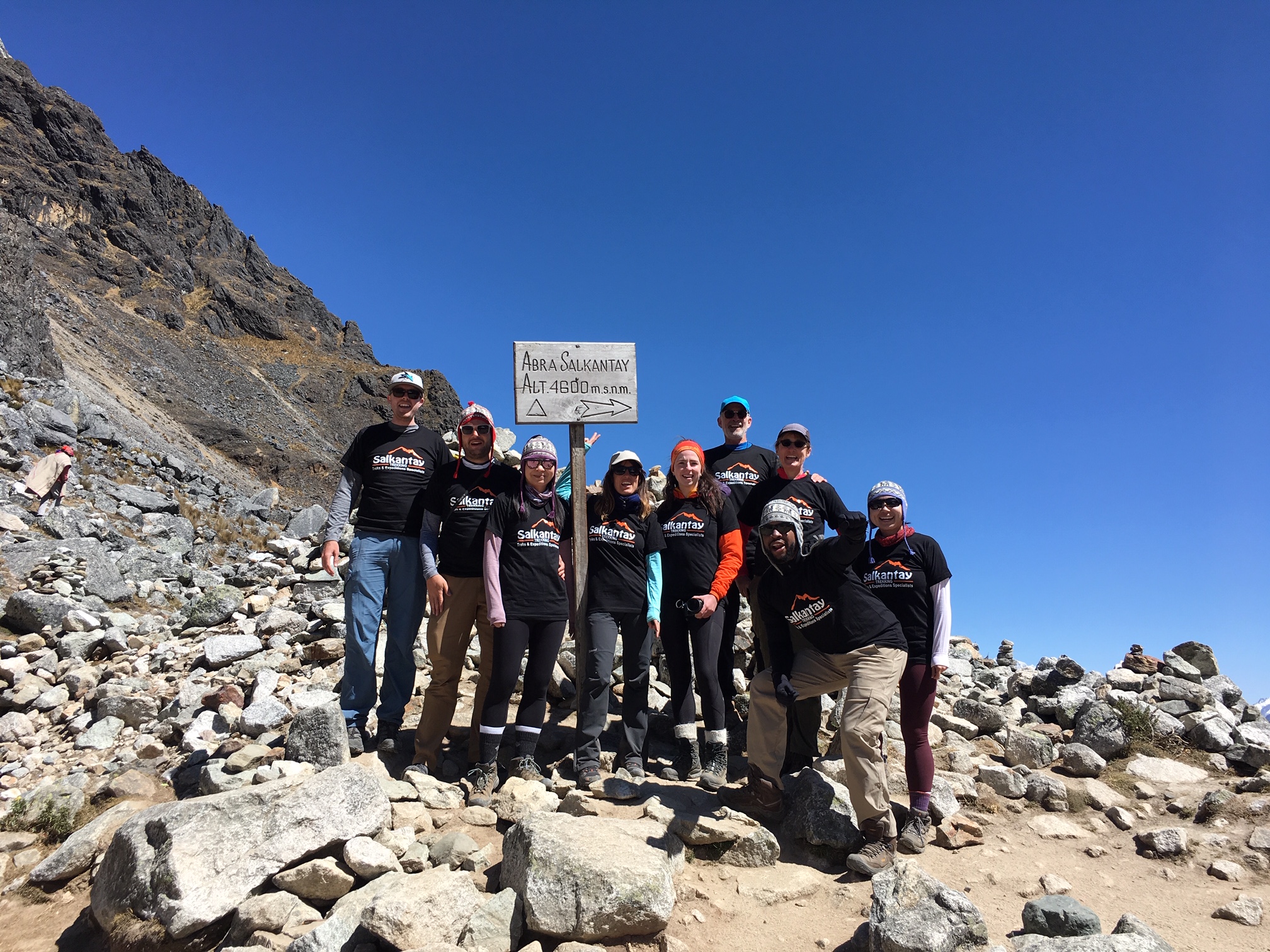
High Point: Salkantay Pass (Elev. 15,200 feet / 4630 meters)
Ending Point on Foot: Aguas Calientes (Elev. 6800 feet / 2070 meters)
Ending Point by Train: Ollantaytambo Train Depot (Elev. 9200 feet / 2800 meters)
Accommodations: Soraypampa Sky Camp & Chaullay Andean Huts & Aguas Calientes Eco Hostel
Sidetrip: Lake Humantay (trail hike)
Sidetrip: Urubamba River Pedestrian Bridge & Machu Picchu Village (road walk & stair climb)
Summit: Wayna Picchu Mountain (climb via Incan stairway)
Guide Service & Guide: Salkantay Trekking Company / Nico
Approximate Stats (including sidetrips): 40 miles / 64 kilometers traveled on foot; 8000 feet / 2440 meters gained; 12,000 feet / 3660 meters lost.

…
Trip Overview
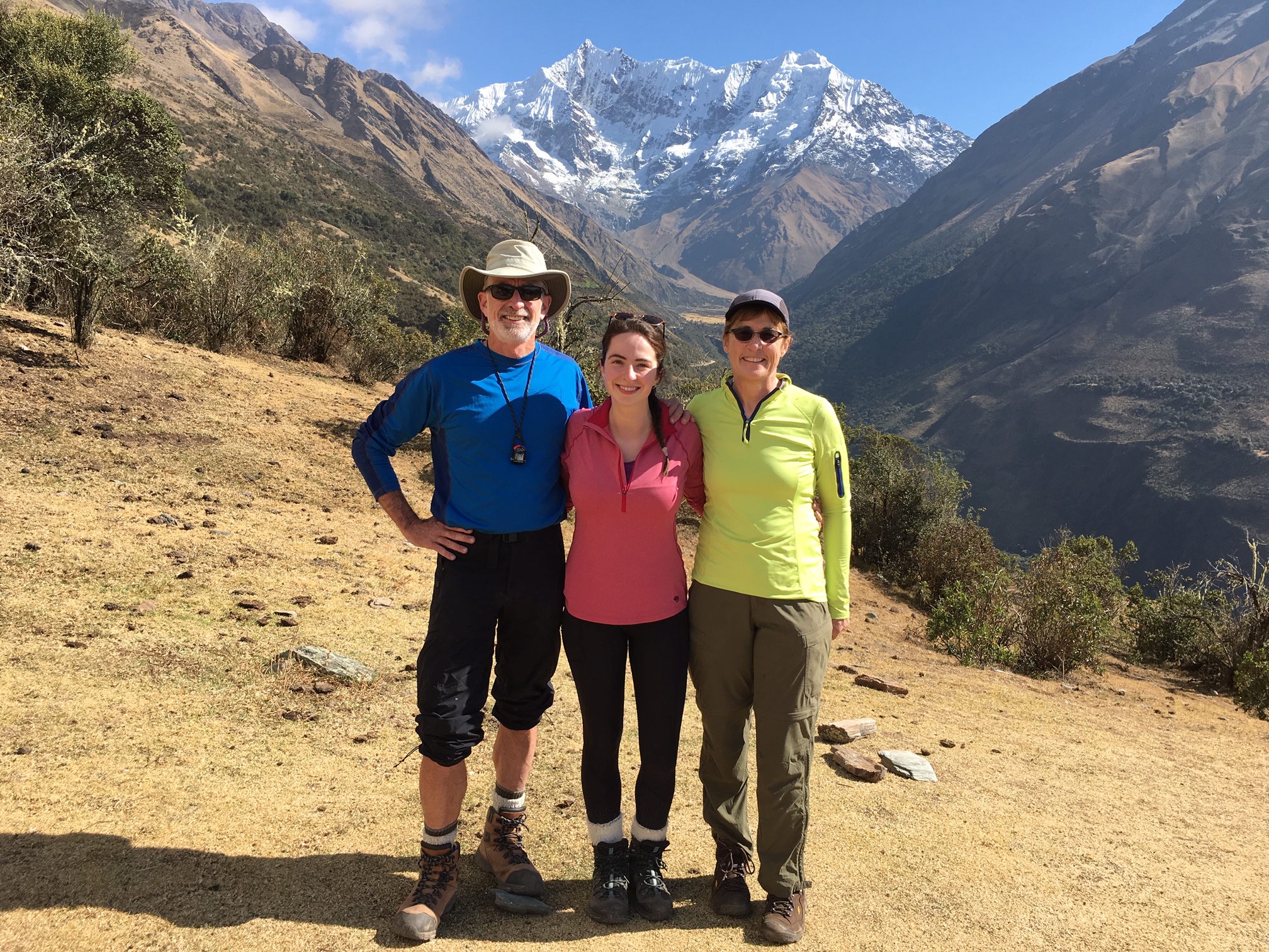
Eileen and Brooke and I started our Peruvian adventure trip with a four-day Salkantay Trek in the Cordillera Vilcabamba, about 40 miles northwest of Cusco. This trek offered several benefits: it gave us a fun hike in a relatively user-friendly area; it provided us with a much-needed acclimation period; and it allowed us to visit world-famous Machu Picchu. In the fashion of modern trekking, our overnight gear and food was carried by pack animals (horses, mules, and donkeys), thereby allowing us to hike with just rucksacks—something I could really get used to!
Guide Service
Brooke made all of our arrangements for this trek, and she chose Salkantay Trekking Company for our guide service. Salkantay has a long history in the area and has earned an excellent reputation. Our guide, Nico, was a native Peruvian with 12 years of local experience. He had previously completed the Salkantay Trek approximately 600 times (yes, SIX HUNDRED!) and was a veritable fountain of knowledge regarding the history, culture, biology, and geology of the area. As with all of the guides we met in Peru, Nico spoke Quechua (“KETCH-wah”) as his first language, Spanish as his second language, and English as his third. He was accompanied by two cooks, one horseman, and four pack horses. In the end, we were all extremely pleased with the company, Nico, and his support team.

The Route
The traditional Salkantay Trek starts at the tiny village of Challacancha and heads northward up to Salkantay Pass, then westward down to the St. Teresa River, then northward down-river to the small town of Hidroelectrica, then eastward up the Urubamba River to the tourist town of Aguas Calientes (aka Machu Picchu Pueblo), and finally up to the ancient village of Machu Picchu. The total distance traveled on foot is approximately 35 to 40 miles, depending on sidetrips taken, and an additional 15 to 20 miles is traveled in a passenger van. From Aguas Calientes, a Perurail train is ridden eastward for 30 miles to the town of Ollantaytambo, making this a truly multi-modal trek.
Elevation and Acclimation
The Salkintay Trek begins at an elevation of 12,000 feet and reaches a high point of 15,200 feet the next day. For people (such as us) who live near sea level, hiking at this high elevation introduces numerous discomforts, including general weakness, breathing difficulties, headaches, and digestive distress—along with the potential for serious edema problems. It is usually advised to spend a week or more at elevations above 10,000 feet before beginning an Andean hike, in order to at least partially acclimate. Brooke took this advice to heart and spent a week in or around Cusco before we embarked on our trek. Eileen and I, unfortunately, did not have this luxury; we went from sea level (in Lima) to the trailhead in approximately 22 hours. Not recommended, but this was our situation.
To help mitigate our high-elevation symptoms, all three of us took Diamox pills and drank the local coca-leaf tea during our trek. This was far from a controlled experiment, so I honestly can’t say whether either substance helped significantly. However, they were both simple, low-cost treatments, so there was little reason not to partake. In the end, we found that a slow (and I mean slooowwww) hiking pace was our best approach to surviving the altitude.
Transportation
The drive from Cusco to Challacancha takes about 3 hours, much of which is on rough dirt roads. The drive from the Ollantaytambo train depot back to Cusco takes about 2 hours. Our trekking company provided all van transport, including pick up and drop off at our hotel. The great convenience of having this transportation handled by the trekking company is certainly worth a significant part of the total package cost.
Weather Conditions
The dry season in Peru extends roughly from May through September, so we did not expect much precipitation during our August trip. At moderate elevations (such as around our campsites), the days were warm and sunny, whereas the nights tended to drop toward freezing. The high point of our trek, 15,200-foot Salkantay Pass, has notoriously foul weather year-round; cold, wind, rain, and/or snow are common even during the dry season. However, we were fortunate to have mild, sunny, calm conditions during our time at the pass.
Trail Conditions
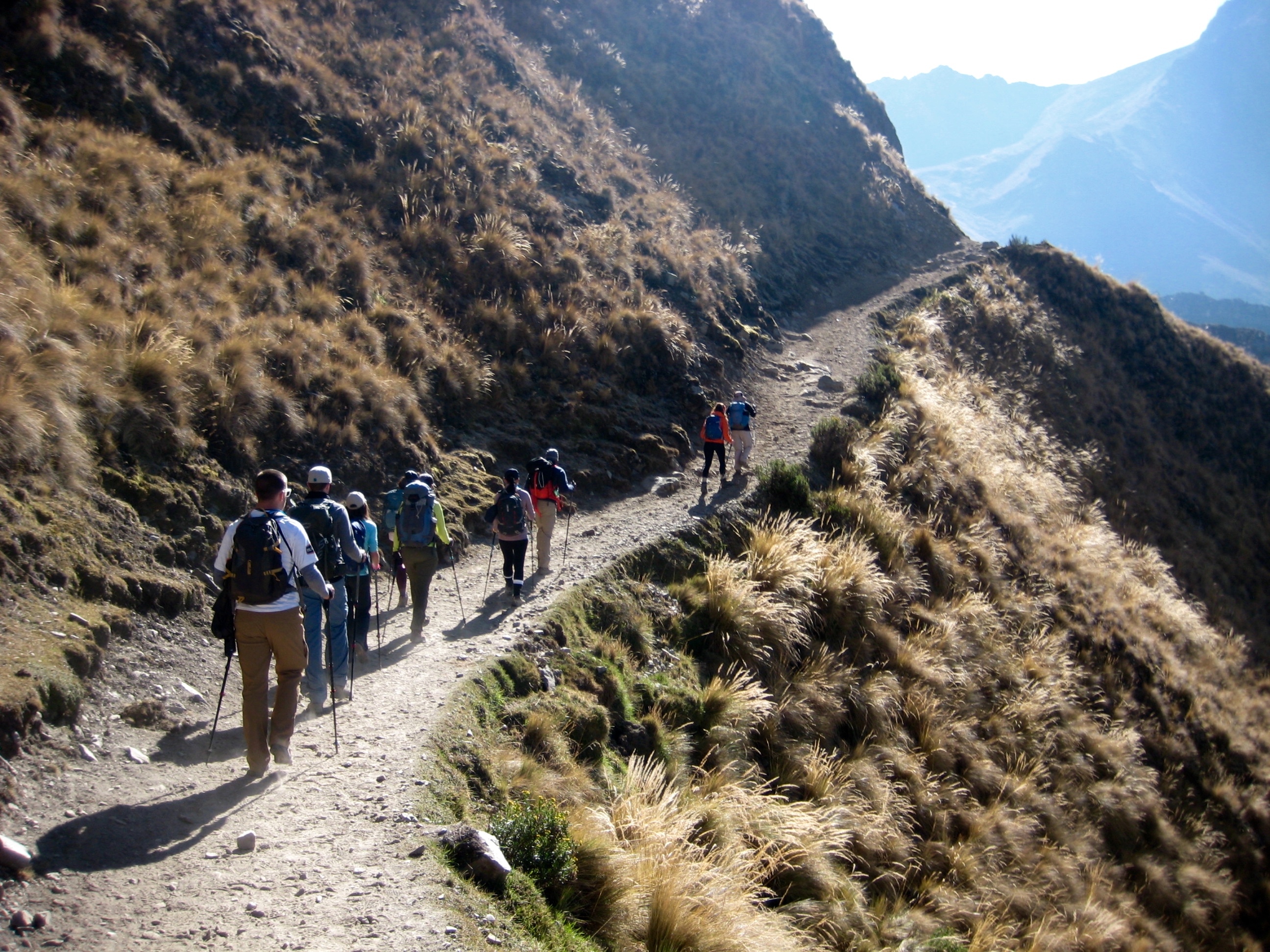
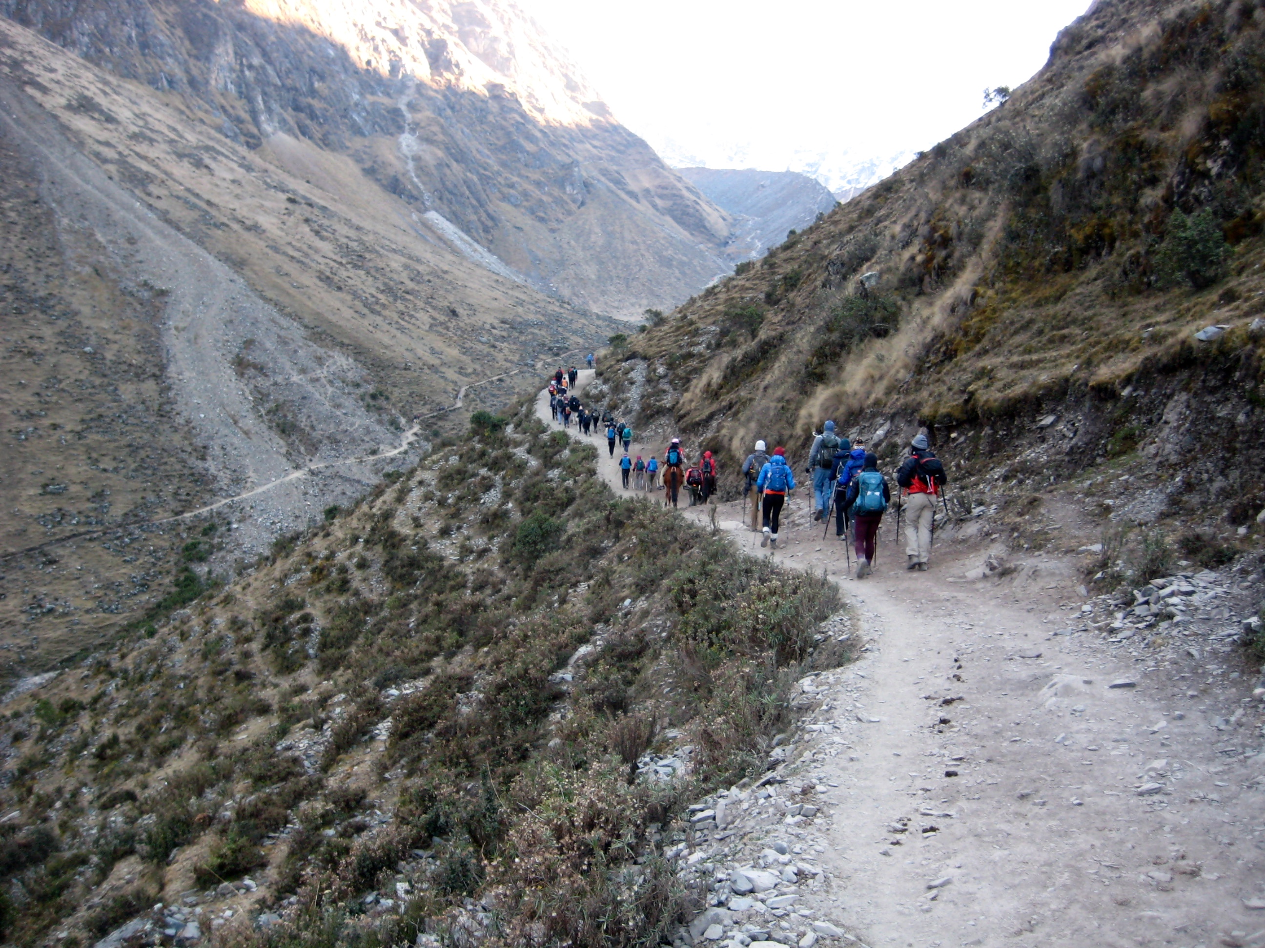
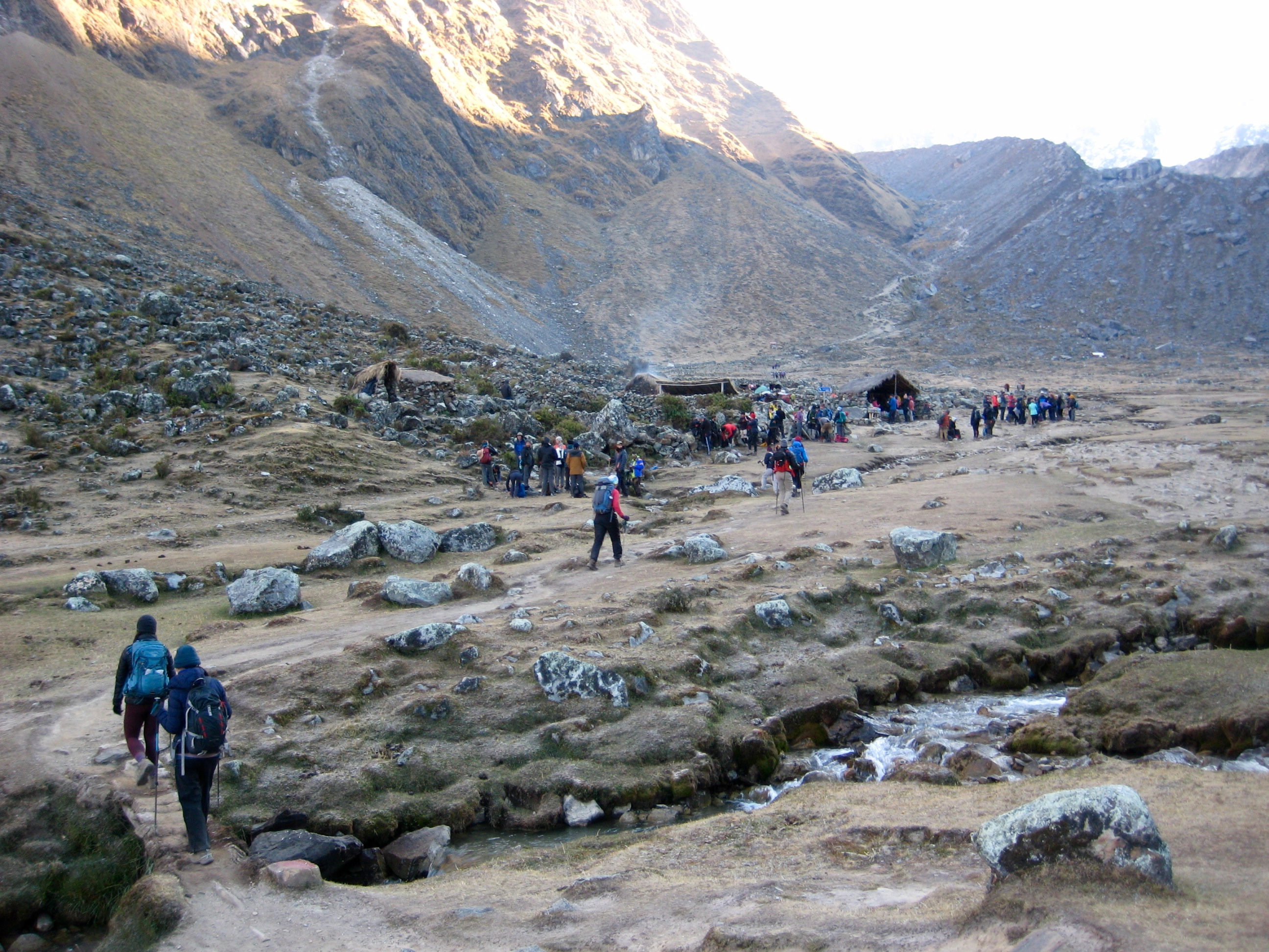
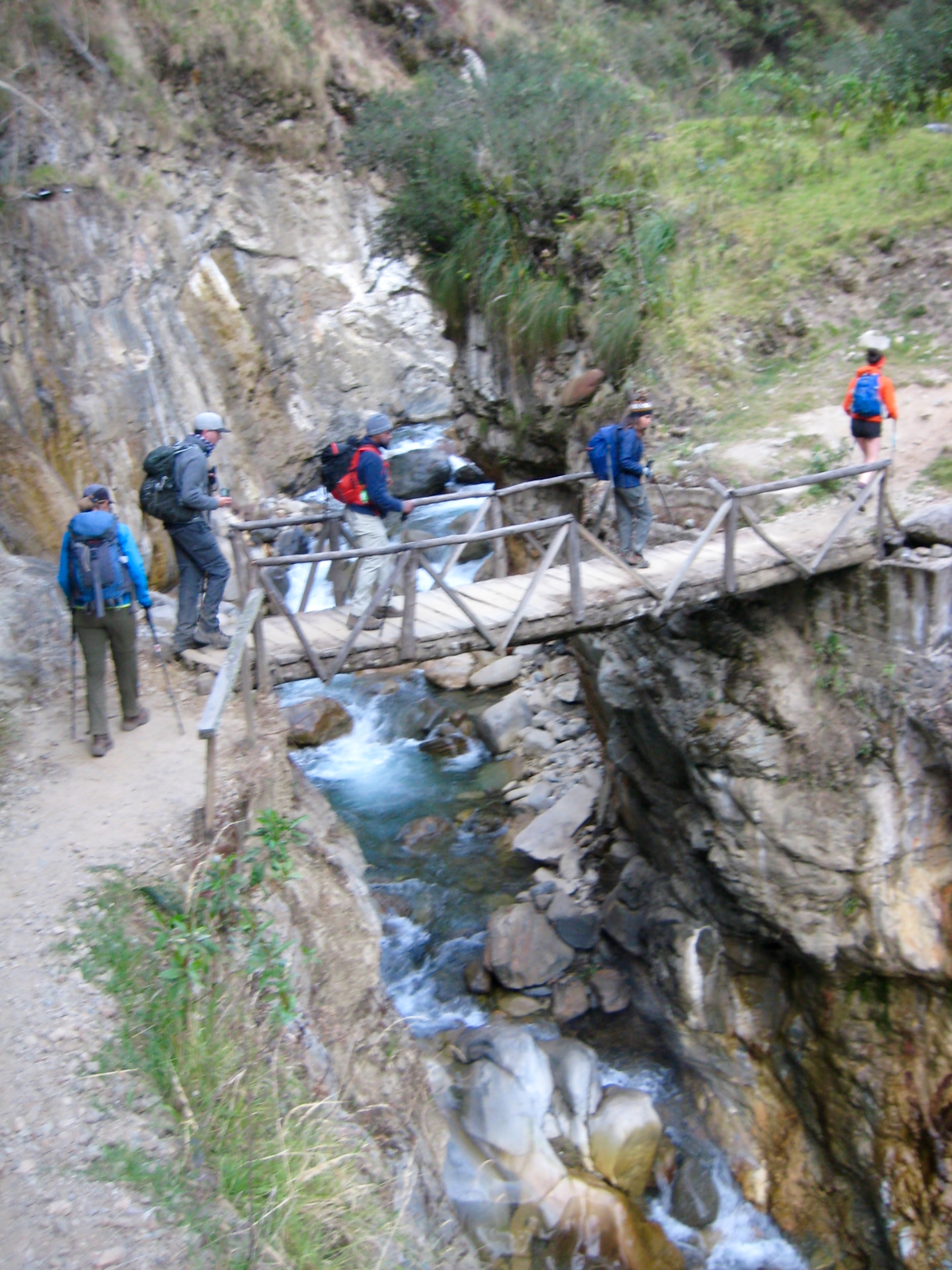
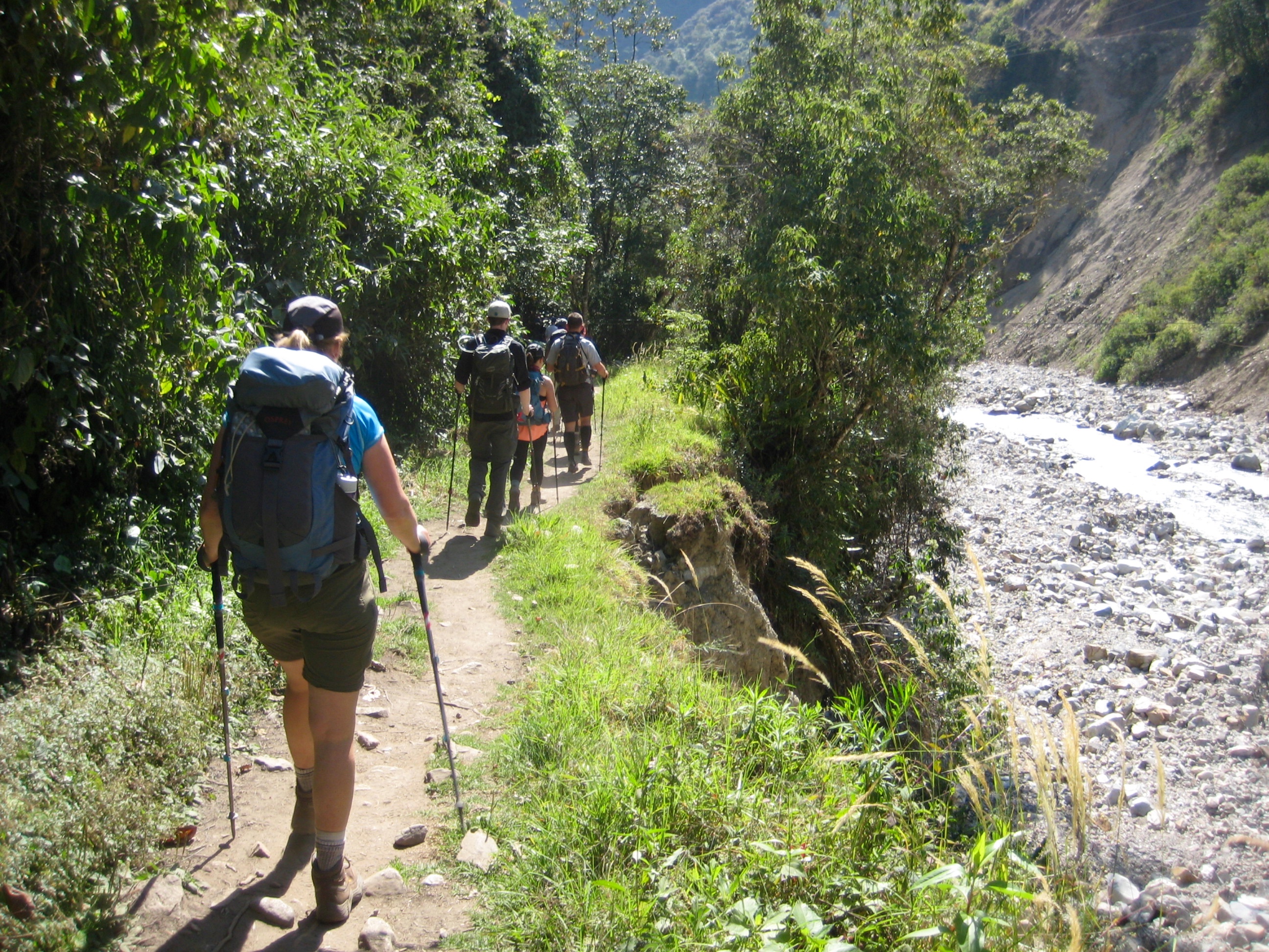
Trail conditions vary greatly along the Salkantay Trek and could be classified as “the good, the bad, and the ugly.” In river valleys, hiker-only trails typically consist of a pleasant, single-track bootpath (“the good”). However, in open alpine areas, there are usually a dozen braided bootpaths cutting through the grass and tundra (“the bad”). It is unfortunate that a single trail was never constructed to control the tremendous growth in hiker traffic here; it seems unlikely that the vegetation will ever recover from the damage already done. Trails that are shared by hikers and pack animals are even worse. The thousands of hooves passing through here every year have churned these trails into a wide swath of loose dirt and rocks, with occasional areas of mud (“the ugly”). It was always a welcome relief to leave the pack trails.
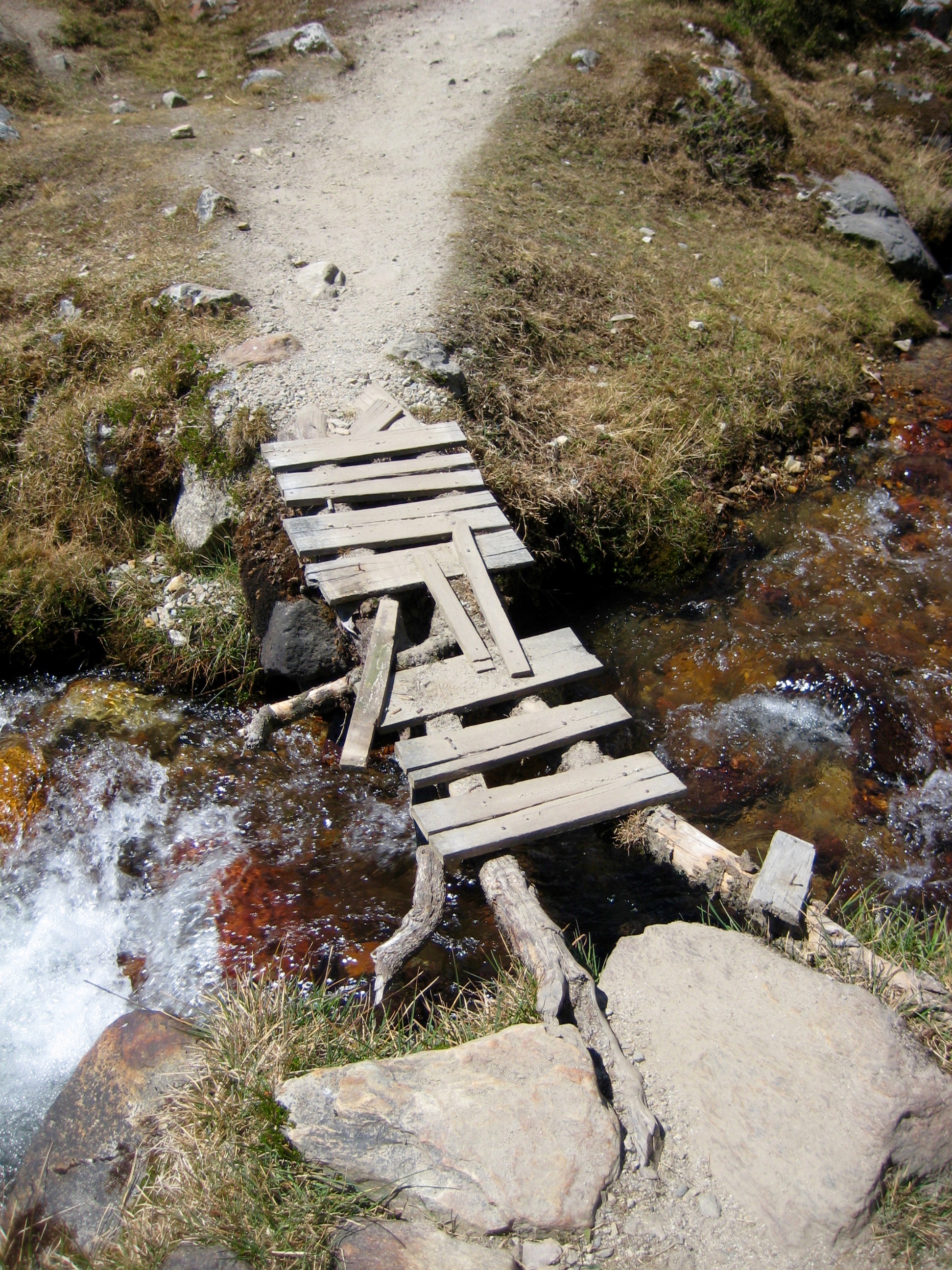
On a humorous note: Where bridges are needed along the trail, they tend to be rather crude but effective. These bridge builders would never be accused of frivolous over-engineering!
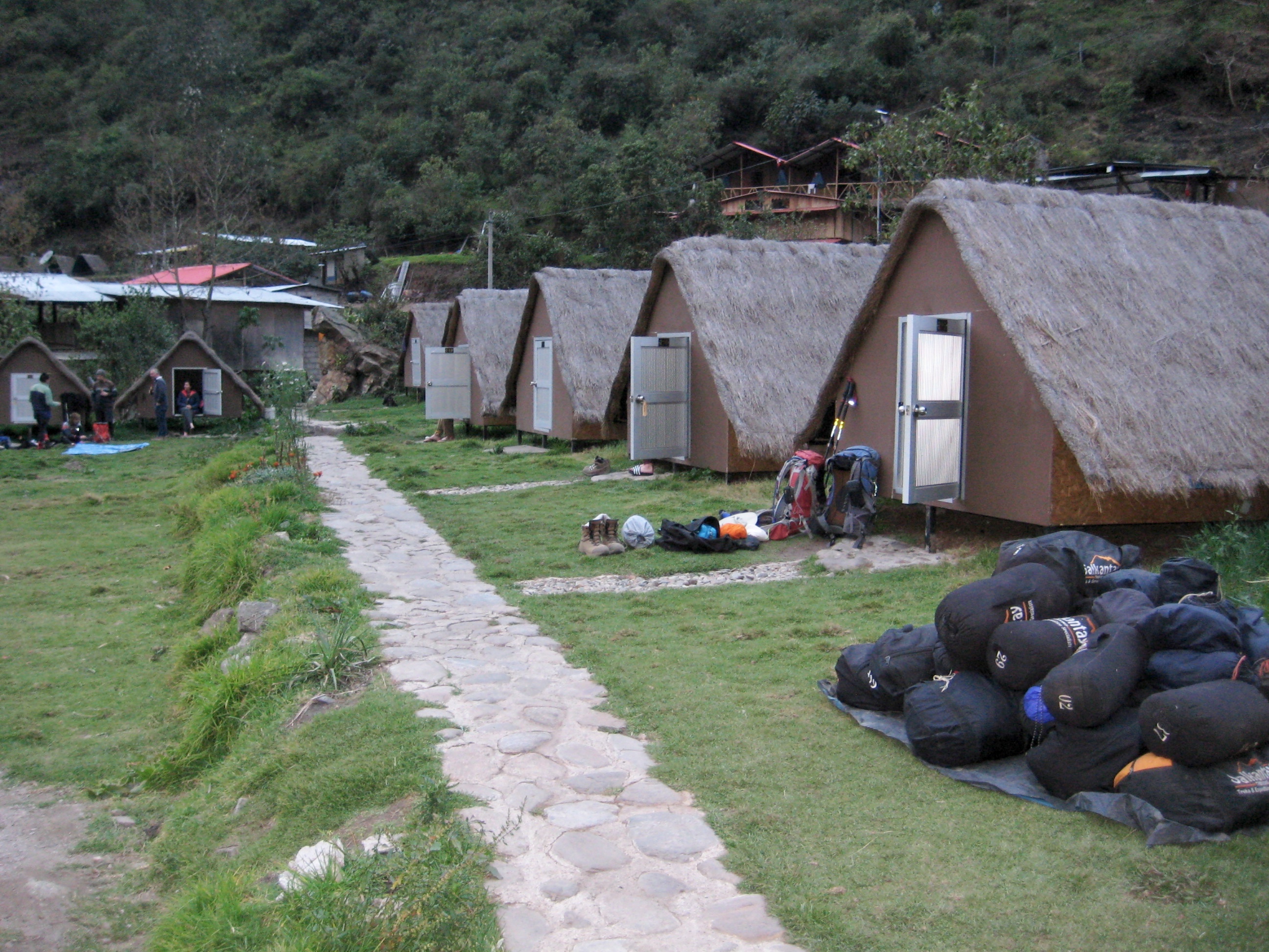
Camping & Accommodations
Every trekking company operating along the Salkantay route has established a series of campsites, spaced at intervals ranging from a half day of hiking to a full day of hiking. These campsites vary considerably, but each one has some type of sleeping shelters (often executed in a creative fashion), a dining hall, and a restroom. Water is also available at each campsite—but see my comments below regarding water. In the town of Aguas Calientes, accommodations may consist of a campground or a hotel, depending on the trekking package. Our package included one night in a comfortable hotel.
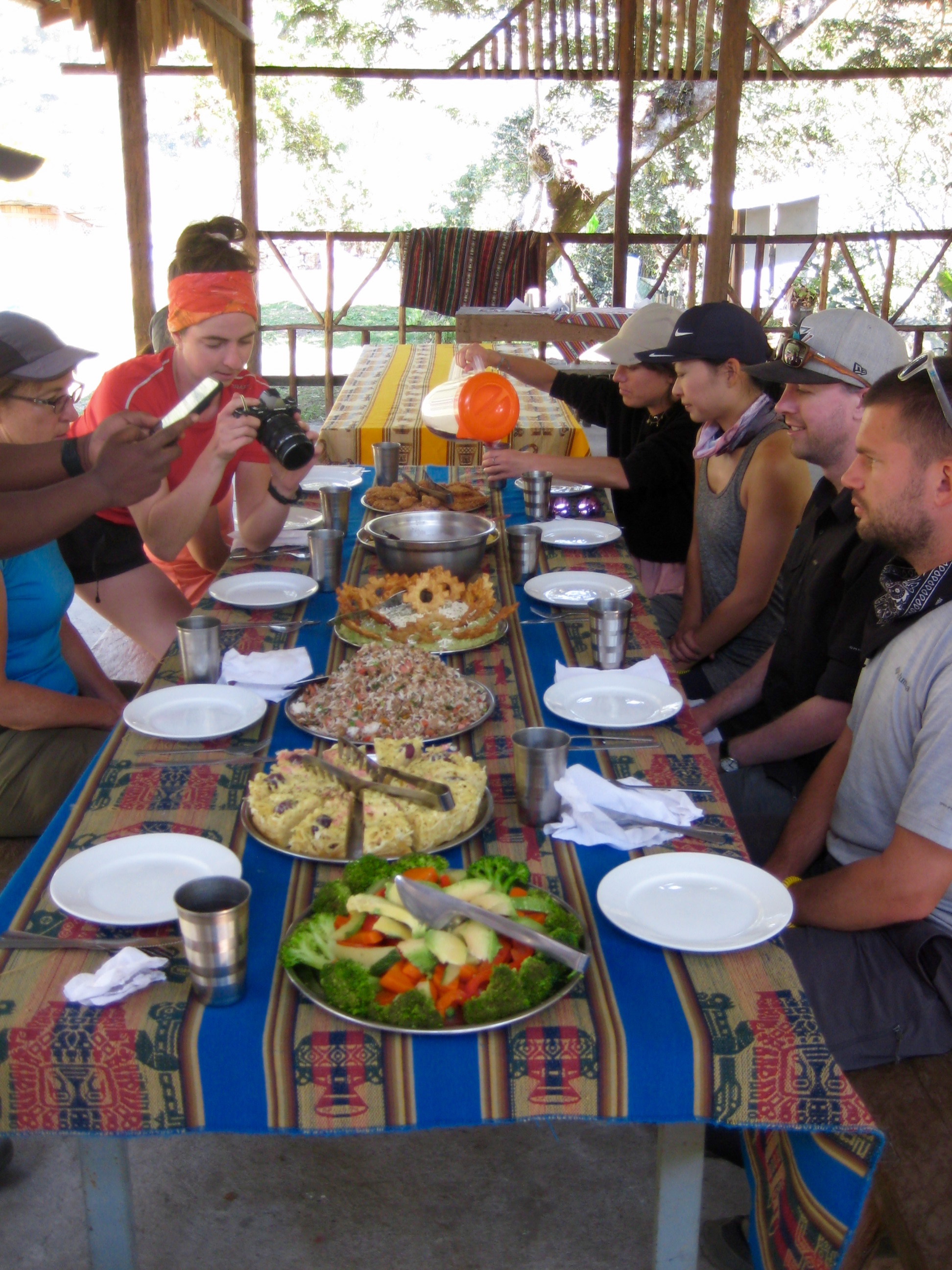
Trekking Meals
All breakfasts, lunches, and dinners were included in our trekking package. In most cases, the meal was a sit-down affair that featured numerous courses of both traditional and modern Peruvian dishes, always served on colorful tablecloths. Quantities were generally large—far more than our group could eat—but we were pleased to learn that all extra food was given to the local residents.
Drinking Water
Cows, sheep, llamas, and other livestock are ubiquitous in the mountains of Peru, as are scattered residences with questionable septic facilities. Consequently, all mountain water is assumed to be contaminated and must be boiled, filtered, or chemically treated. This includes water from campsite spigots, and even water from hotel sinks. The trekking companies supply boiled water to their clients for drinking purposes. On the trail, we used a filter to obtain drinking water from streams.
Nomenclature Comments
Throughout Peru, it is common to see different spellings for the same geographic or cultural names. The oldest, and most common, spelling convention is based on Spanish orthography, which gives us words such as Inca, Salcantay, Huayna Picchu, and Huayracmachay. A newer convention is based on a more phonetic orthography, which gives us the alternative spellings Inka, Salkantay, Wayna Picchu, and Wayracmachay for these same names. Unfortunately, there seems to be little consistency among maps, books, and signs, so it is advisable to maintain a flexible mindset with regard to spellings shown in the text and photos presented here.
Full Trip Report
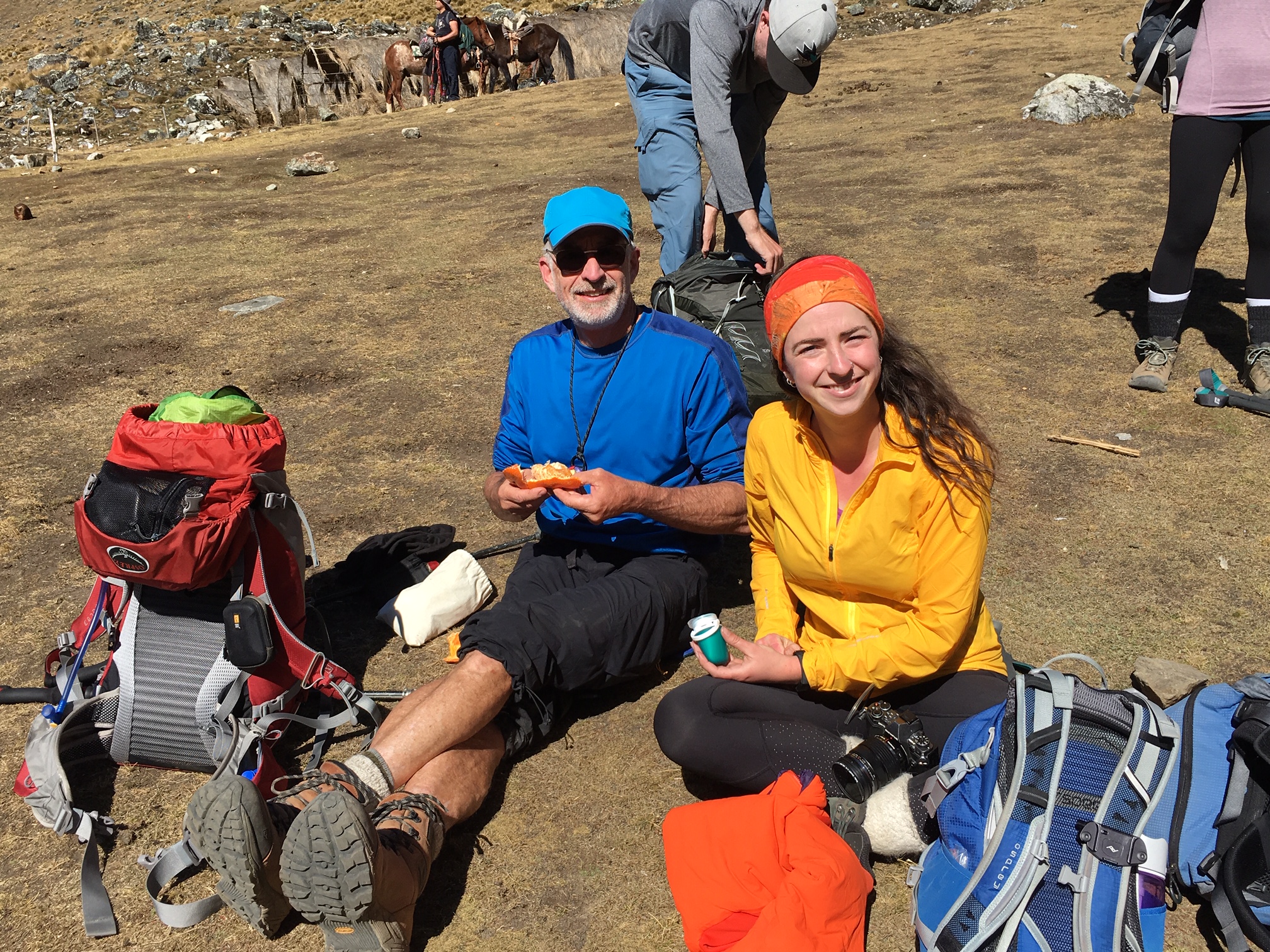
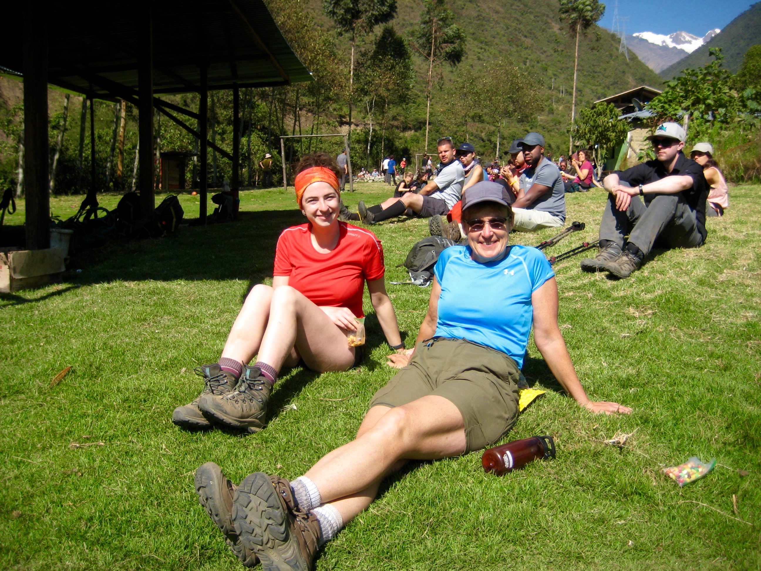
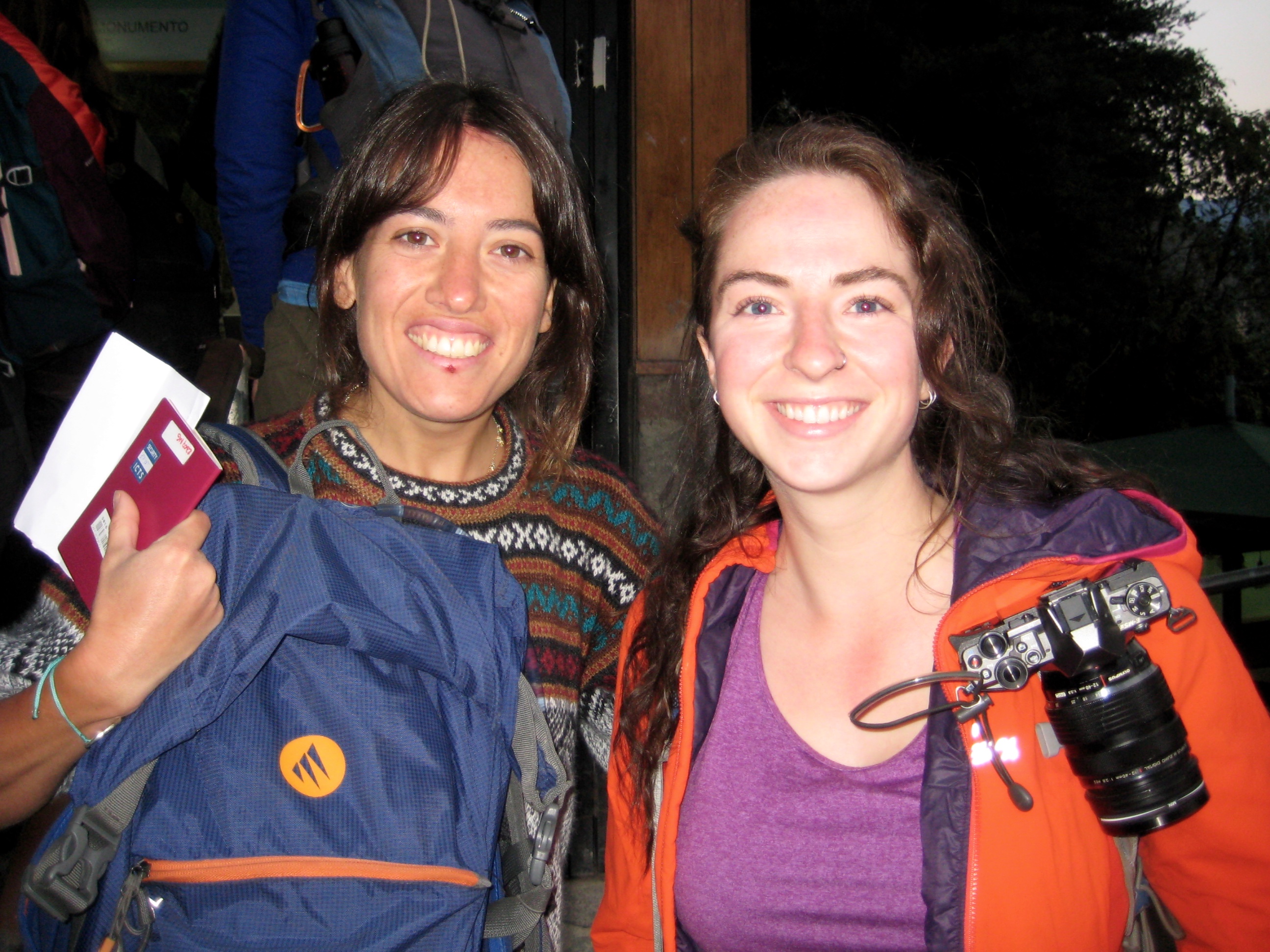
In addition to Eileen, Brooke, and me, our Salkantay trekking party comprised five people from the San Francisco area, and one woman (Clara) from Spain. The camaraderie that developed among our members over four days was one of the highlights of our trip.
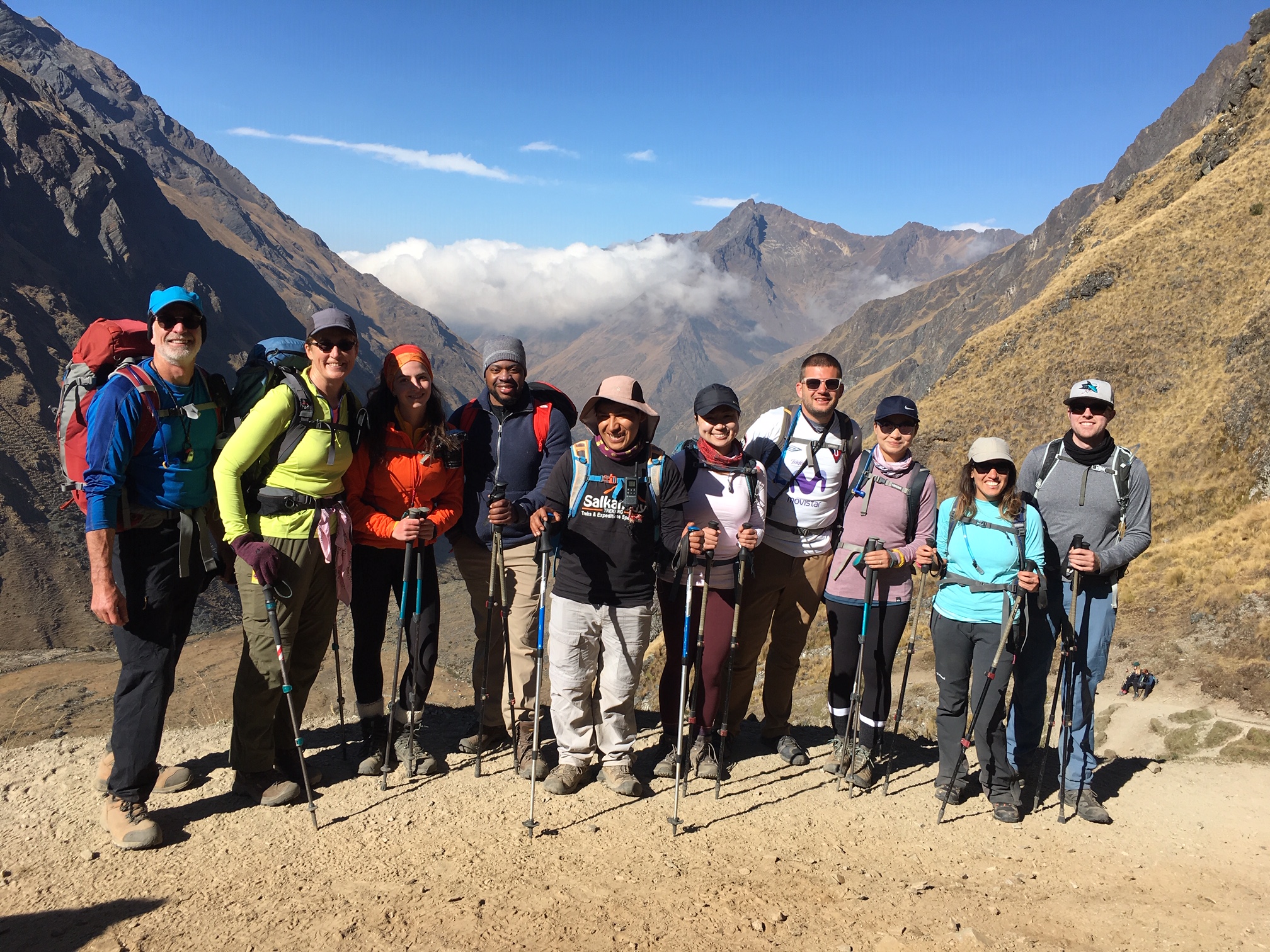
Day 1: Challacancha to Soraypampa
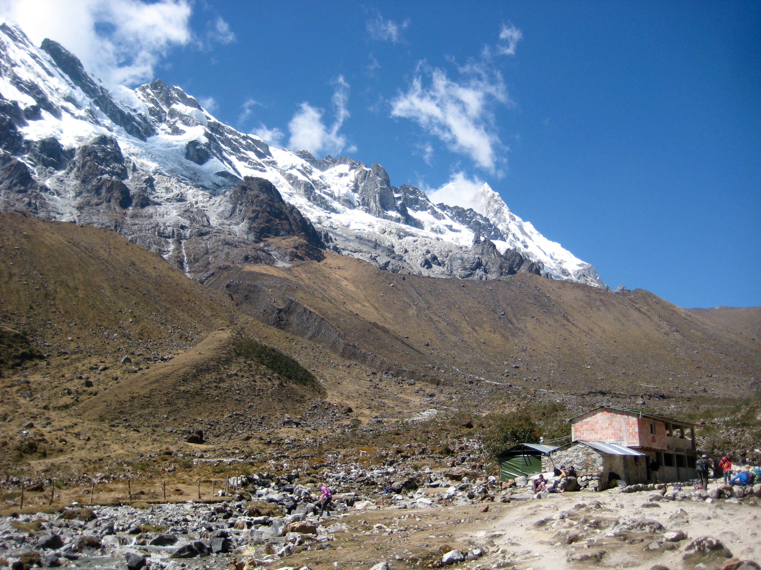
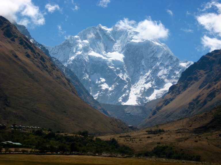
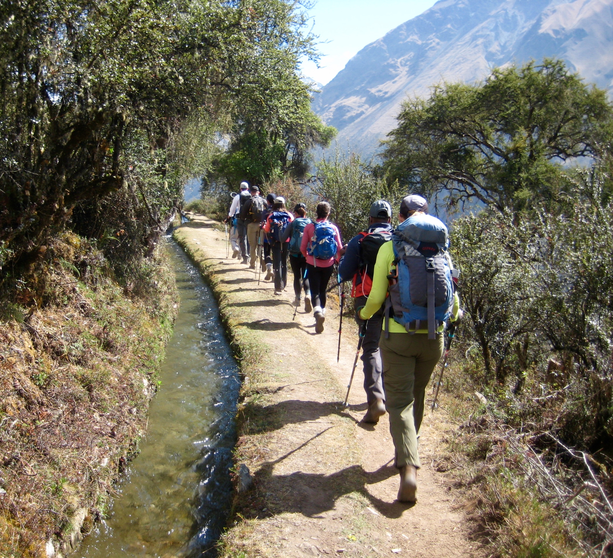
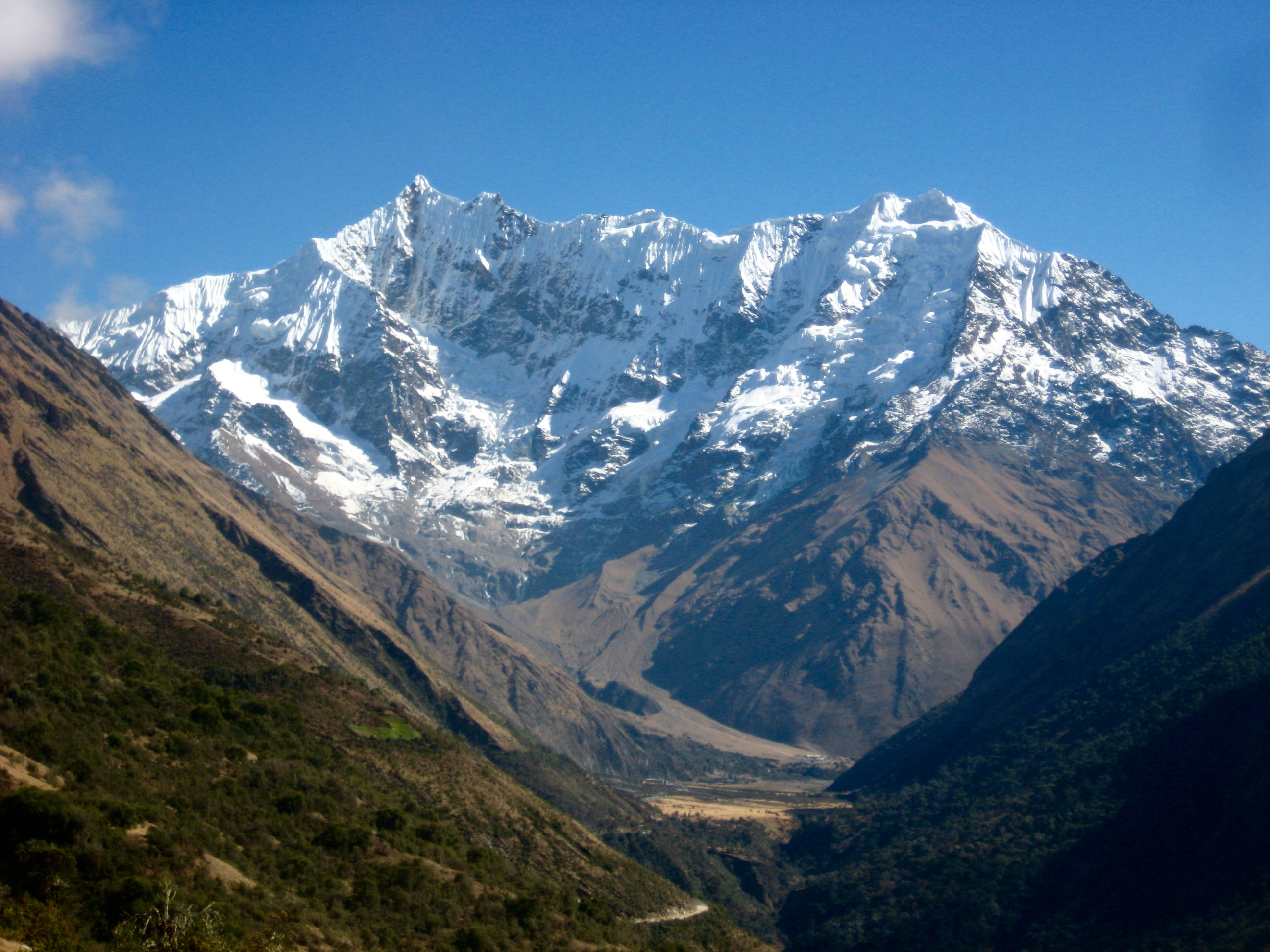
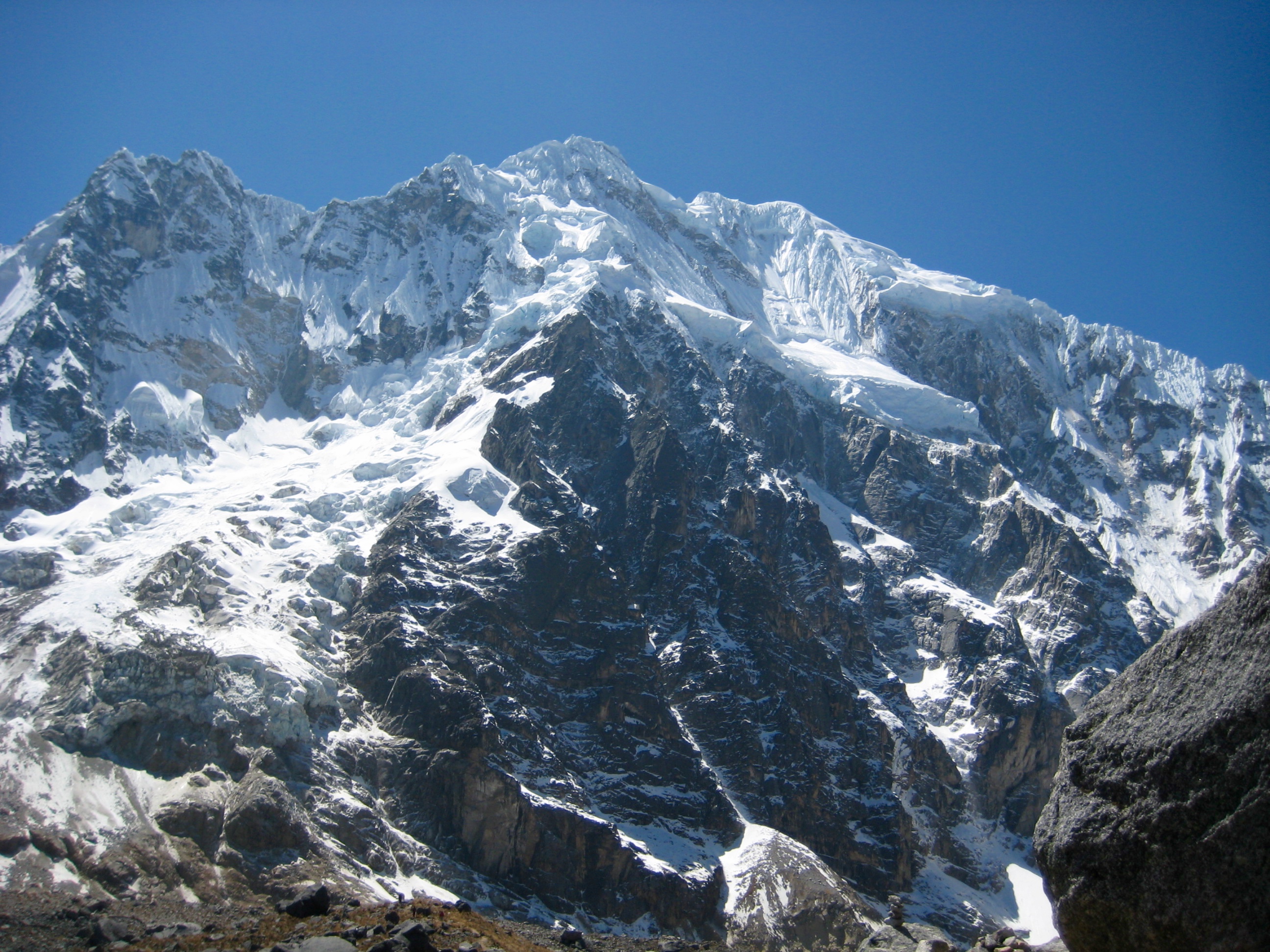
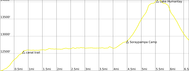
We started hiking from the Challacancha Trailhead on a warm, sunny morning. Beginning a hike at an elevation of 12,000 feet was unfamiliar to all of us sea-level dwellers, but Nico set a slow pace to get us eased in. Our trail initially gained a few hundred feet, then flattened out and followed an old Inca canal for several miles. Views of 20,000-foot Nevado Salkantay and 19,000-foot Nevado Humantay dominated our view.
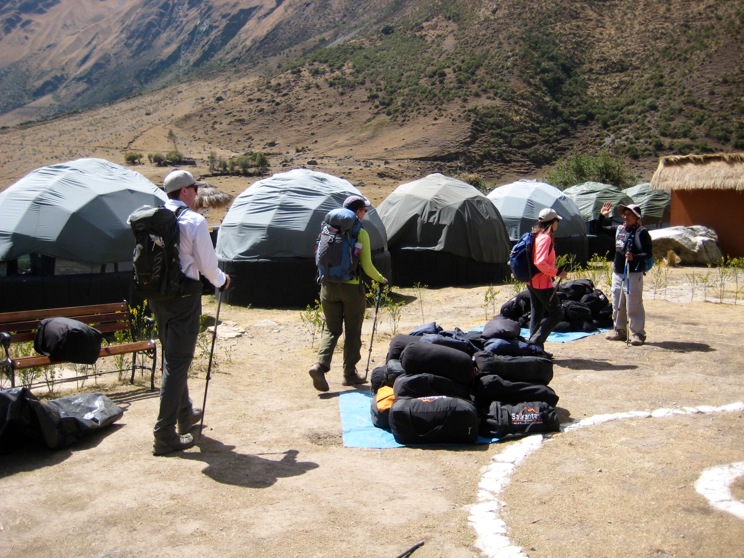
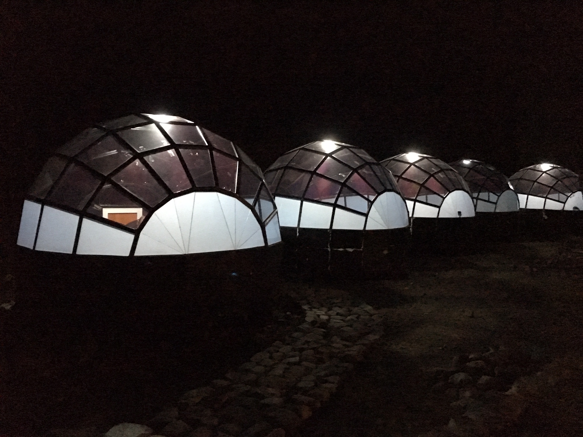
Shortly before noon, we arrived at Soraypampa Sky Camp (2.5 hours + 700 feet from TH). This interesting camp features numerous plastic domes with clear roofs to allow for stargazing at night. We collected our luggage and moved into our assigned domes.
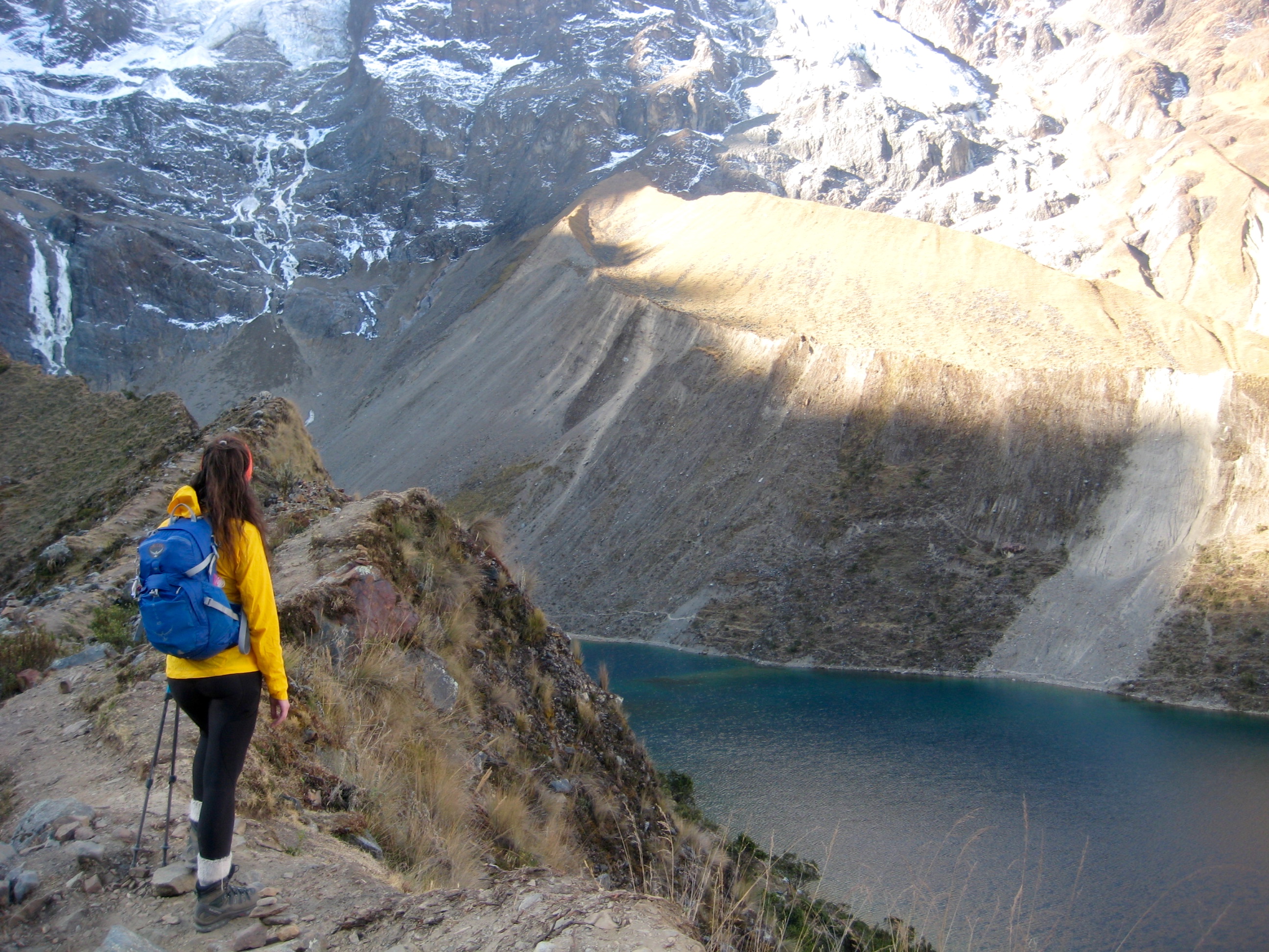
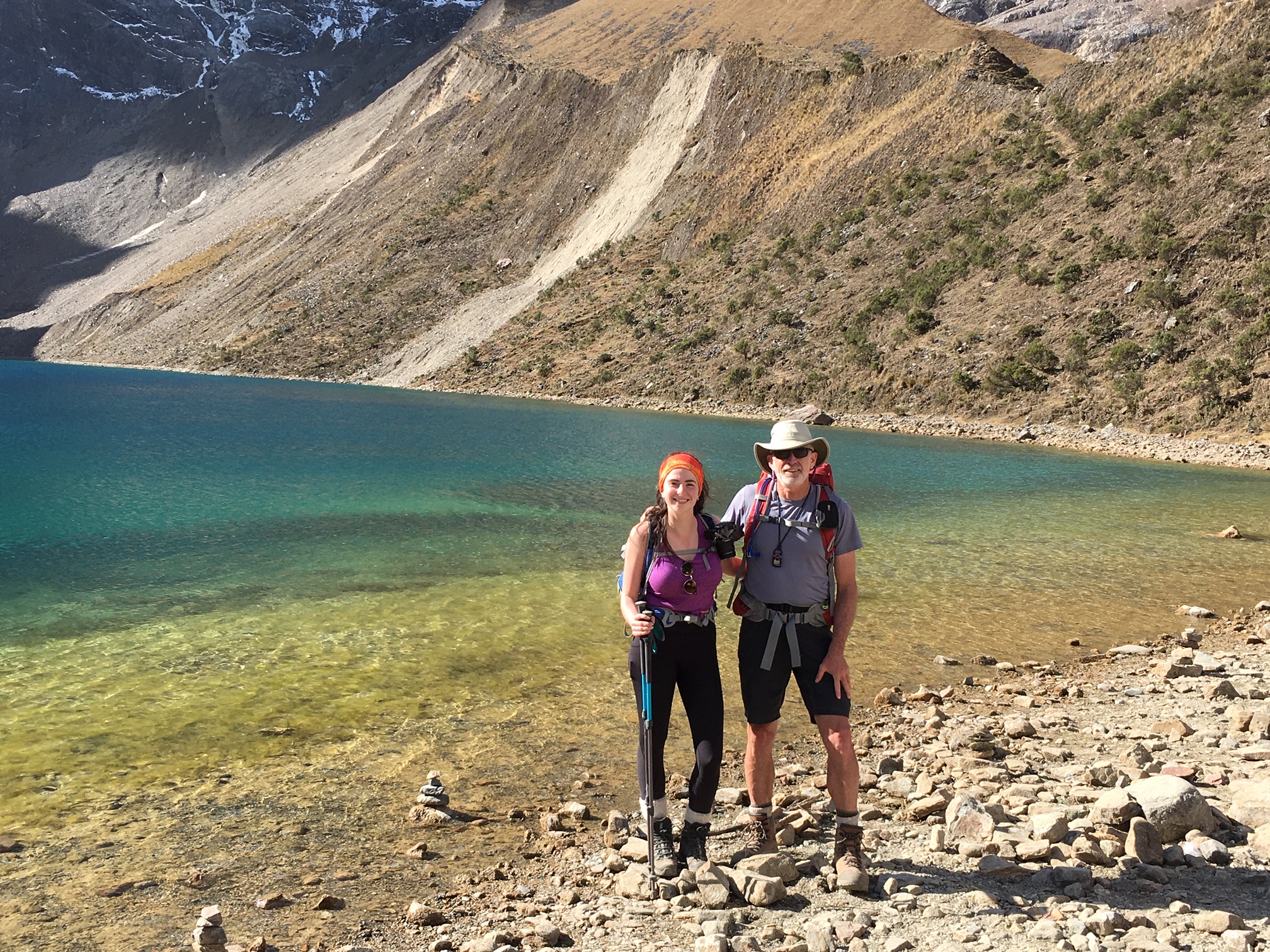
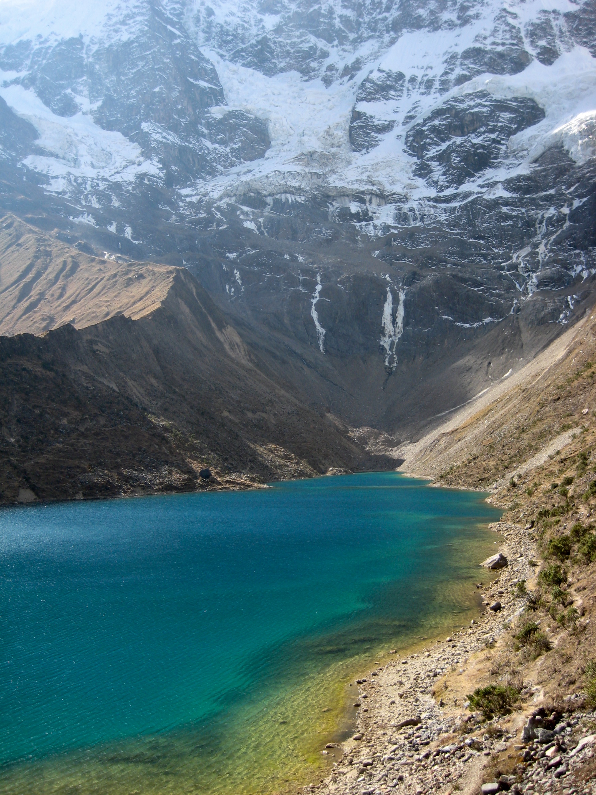
After lunch, Nico took us on a short but steep sidetrip up to Lake Humantay. We were accompanied by a horde of other hikers who were also camped at Soraypampa.
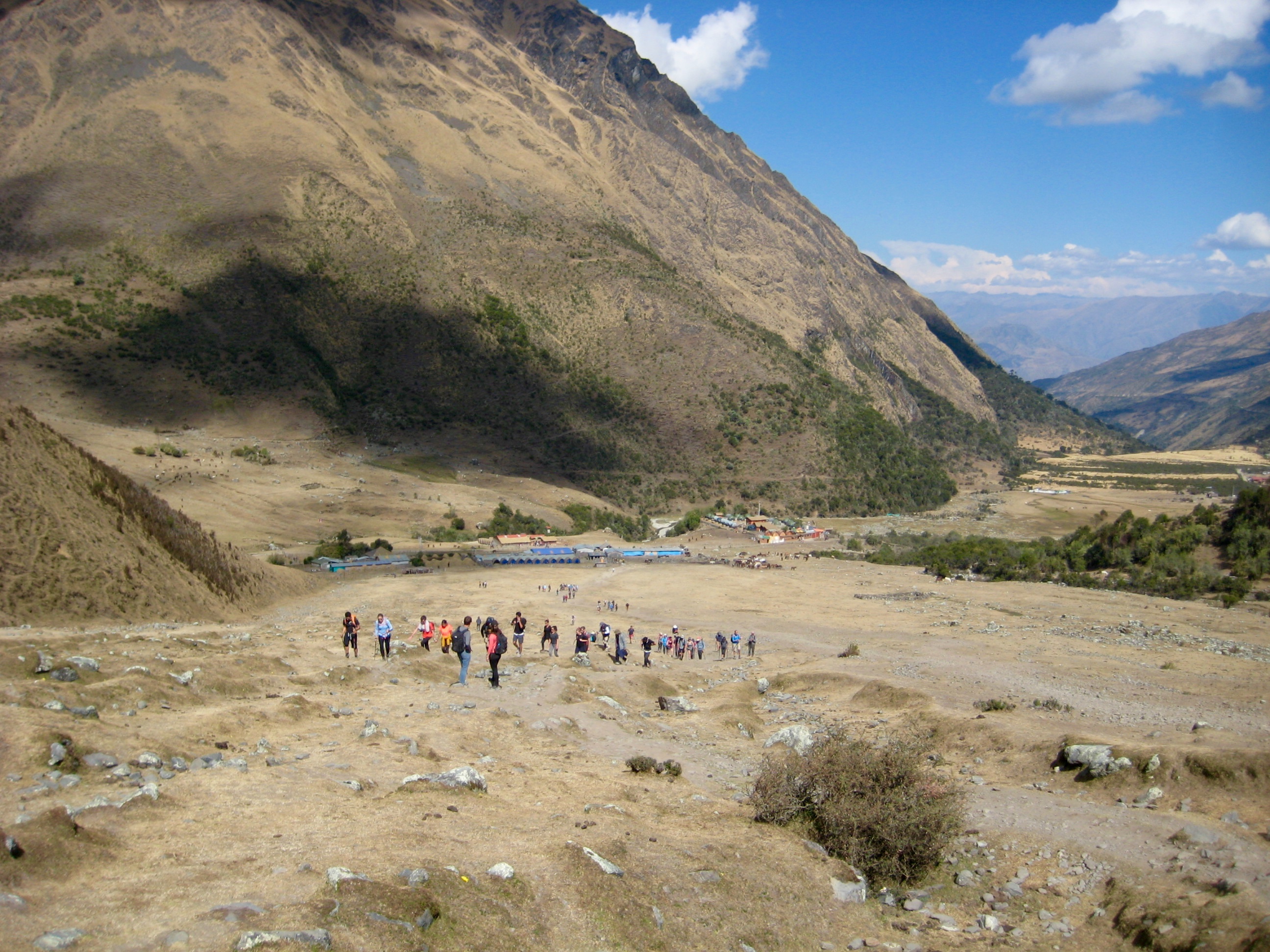
Lake Humantay has a colorful shoreline, a huge, glaciated face rising out of it, and a remarkable fame. On a daily basis, hundreds of people make a one-day trip from Cusco to this lake and back.
We returned to Soraypampa Sky Camp in late afternoon to find that the nylon tarps had been pulled off each dome. (The tarps are installed during the daytime to reduce solar overheating.) Once darkness fell and the lights went on, Sky Camp really came to life!
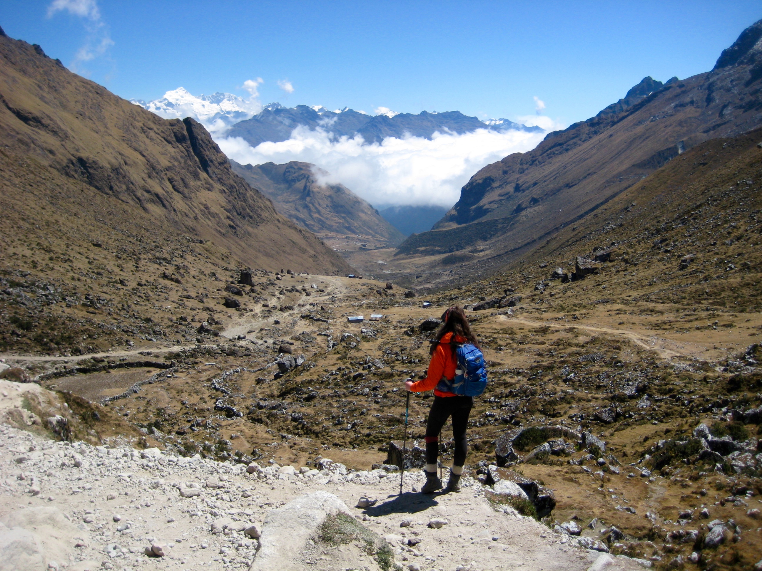
Day 2: Soraypampa to Chaullay
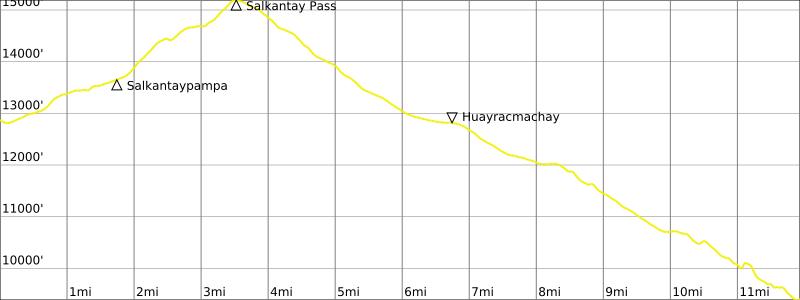
Nico woke us at 4:45am by tapping on our door and offering cups of hot coca tea. We packed up and met in the dining hall for a hearty breakfast, then started hiking at 6:30am.
The trail led through Salkantaypampa (pampa refers to a flat meadow or pasture) and up a series of switchbacks fondly known as “The Seven Snakes.” Farther along, we stopped for a rest at Soiroccocha, another large alpine meadow.
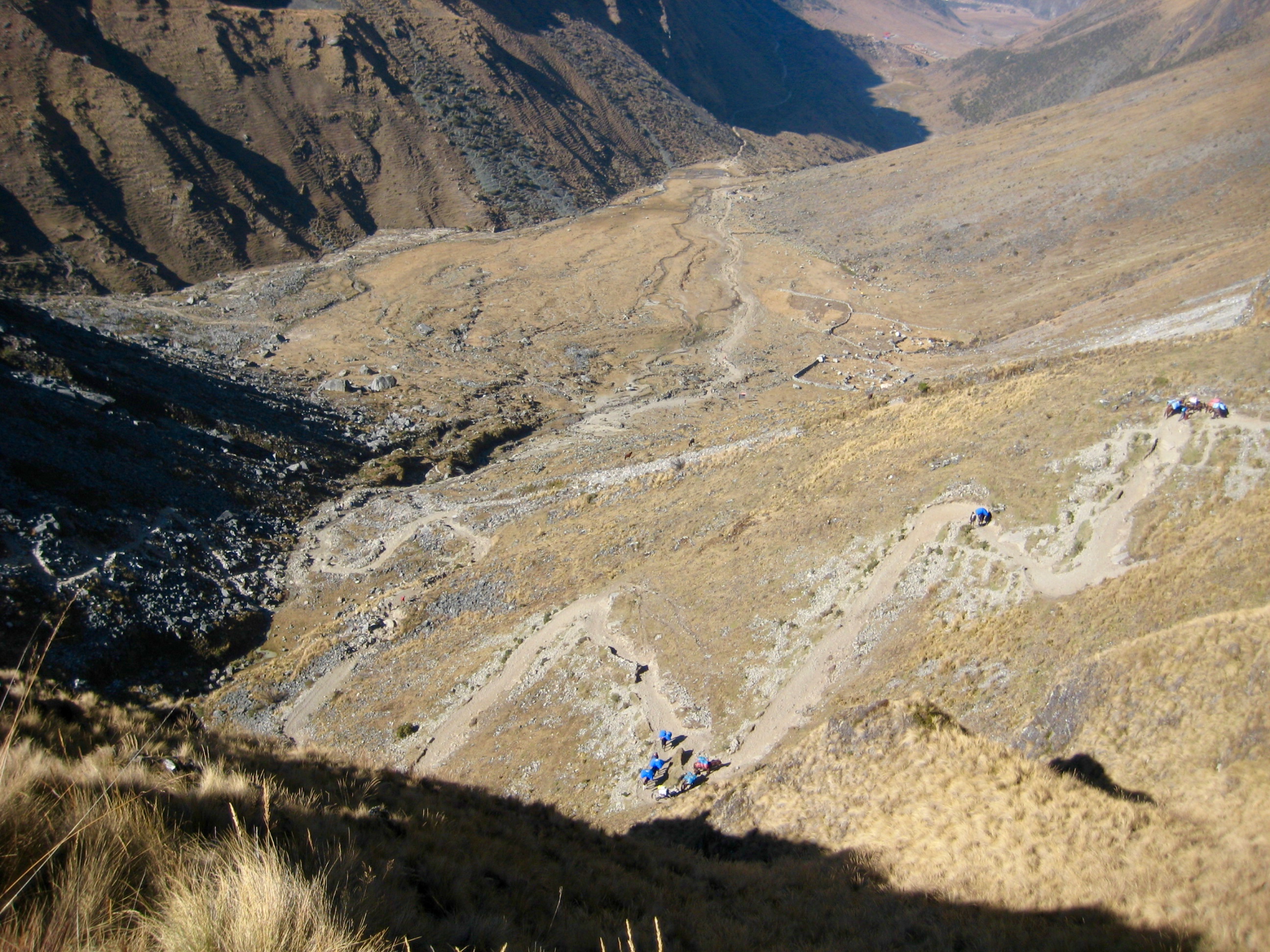
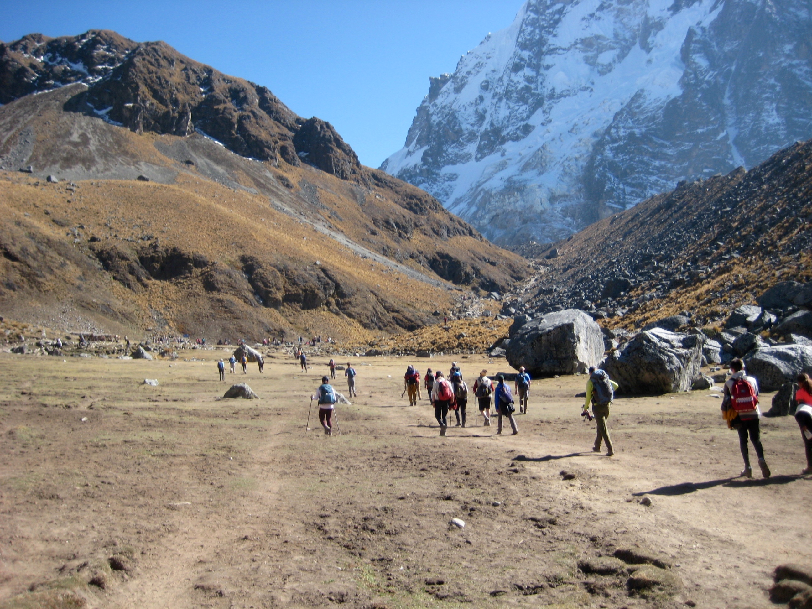
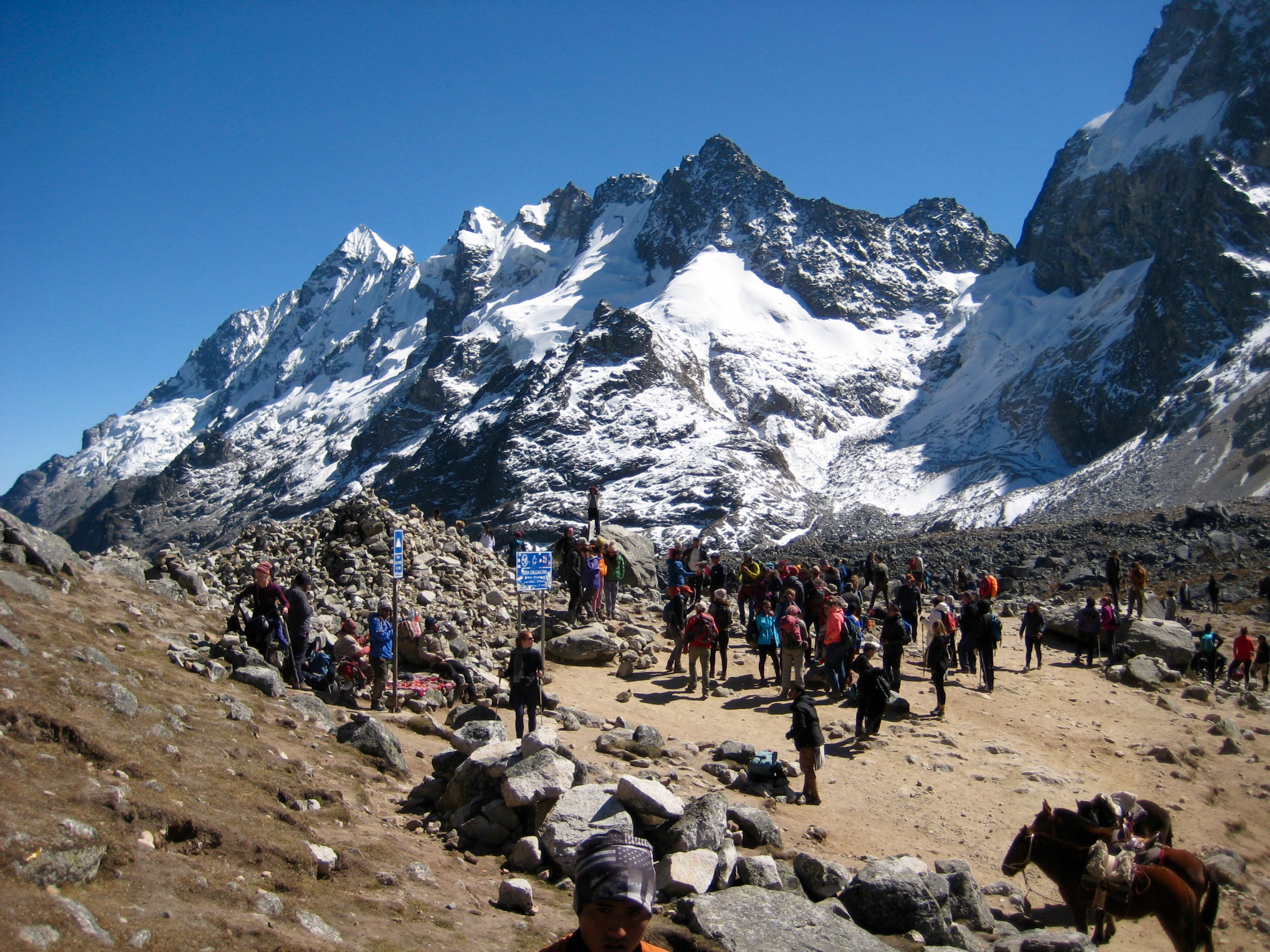
In mid morning, we arrived at 15,200-foot Salkantay Pass (3.8 hours + 2500 feet from Camp 1), along with several hundred other hikers. Nevado Salkantay stands guard over the sacred pass, which was used by the ancient Inca travelers. The weather was surprisingly warm and calm, so Nico took the time to have us re-enact a traditional Incan ritual.
From the pass, we began a 5200-foot descent down the opposite valley. Our afternoon included a lunch stop in Wayracmachay before reaching the village of Chaullay at day’s end.
Our accommodations in Chaullay consisted of small Andean-style, A-frame, thatch-roof huts, updated with wooden walls. Hot showers were available here to wash off the trail dust. Dinner was served in a covered patio.
Day 3: Chaullay to Aguas Calientes
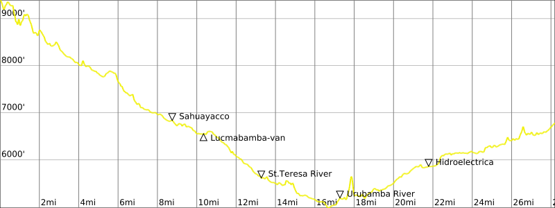
Nico woke us at 5:45am, again bringing coca-leaf tea. We ate breakfast in the covered patio and headed out at 6:40am. Today’s long hike took us down to, and across, the St. Teresa River, then down-river for many miles.
We gradually descended into a cloud forest of green trees and bushes, which was quite a change from the tundra at higher elevations. A “cloud forest” is exposed to high humidity but does not receive enough precipitation to create a true rain forest.
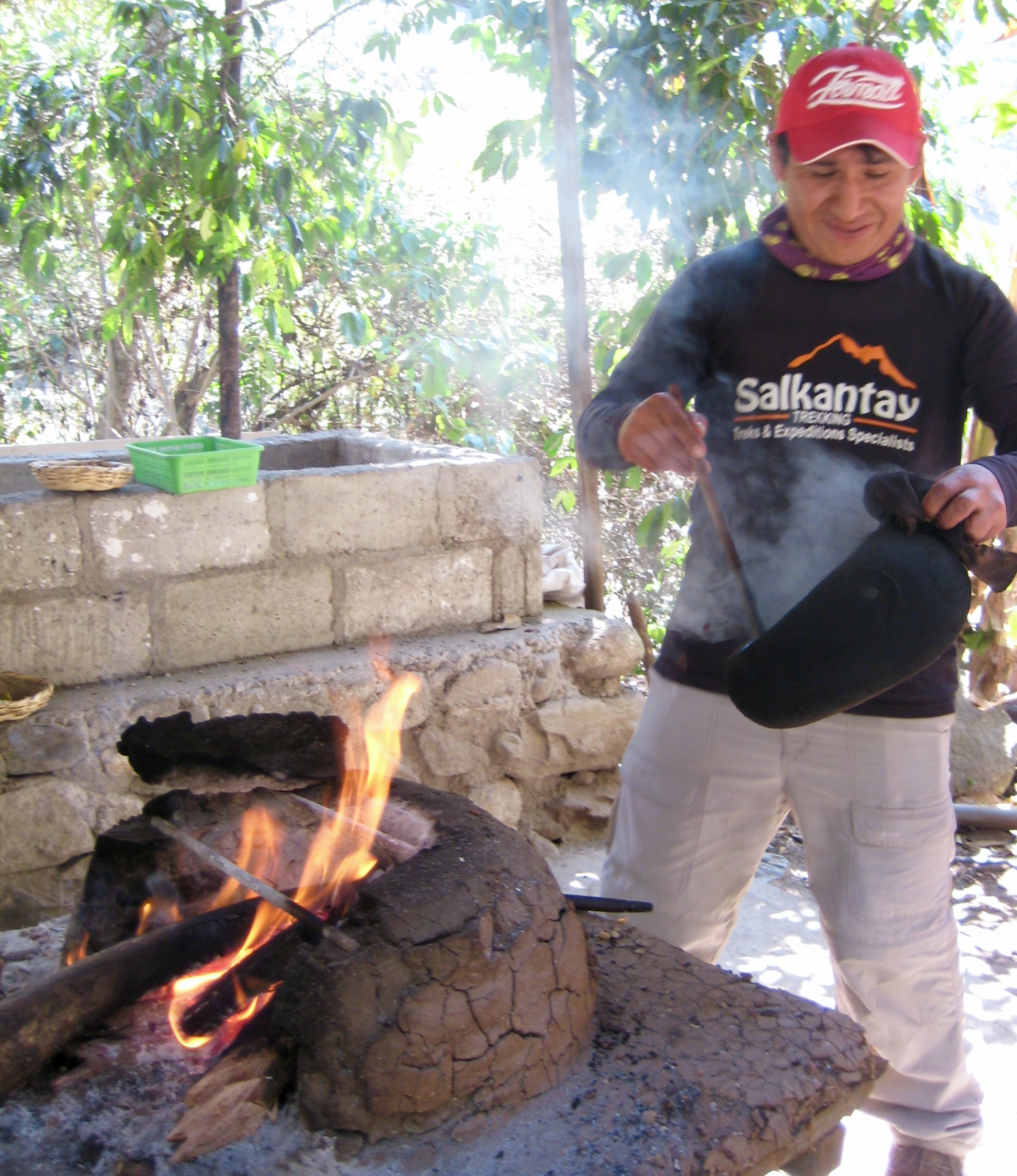
After taking a long break at Sahuayacco, we continued hiking down-valley until reaching a long suspension bridge across the St. Teresa River. We crossed the river and hiked up the opposite bank to a hiker’s camp, at which point a van transported us several miles down a rough road to Lucmabamba (4.4 hours from Camp 2). Lunch was served under a picnic shelter, and this was immediately followed by a hands-on demonstration regarding the process for harvesting, hulling, roasting, and grinding coffee beans to make a cup of joe.
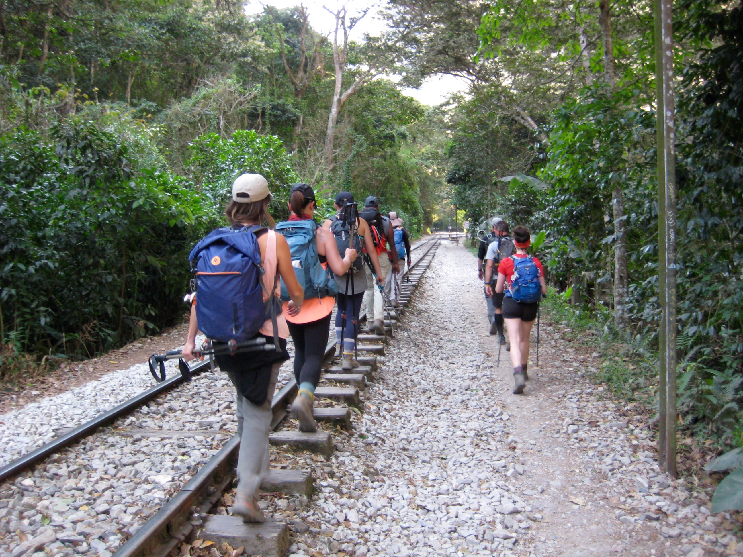
Lunch and coffee consumed, we hauled our luggage back across the river to a second van, which transported us down the road to a train depot at Hidroelectica. It was approximately 6 miles to Aguas Calientes from here, and we had the option of either riding the train or walking the tracks. Eileen was suffering from foot problems, so she opted for the train ride.
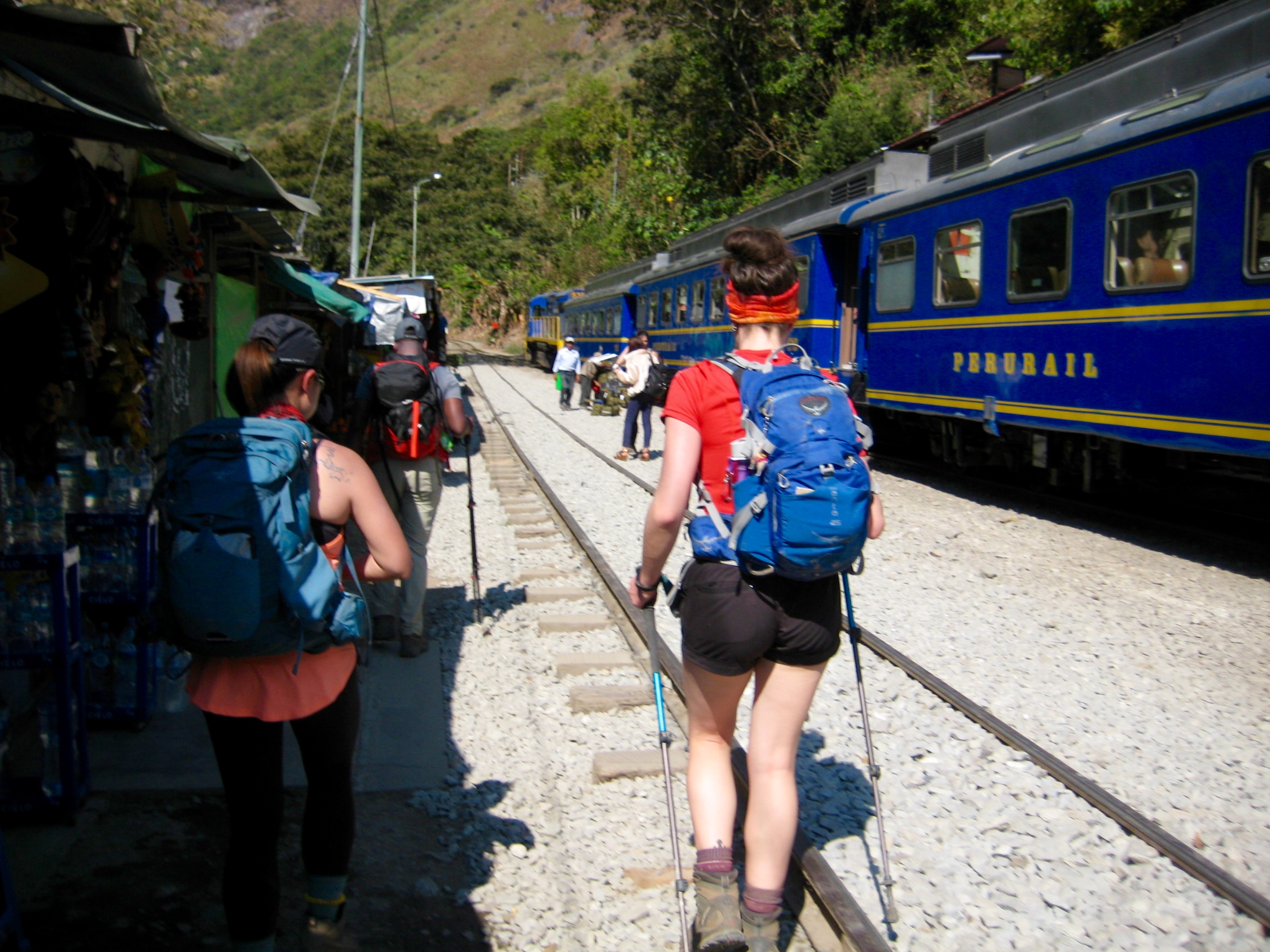
The remainder of our group opted to walk to Aguas Calientes with Nico. After all, it was only 6 miles. However, what we all failed to understand about Nico at the moment was that, despite his small stature (he’s only about 5′-3″ tall), he has a remarkable ability to cover ground quickly and effortlessly. The expected “rail walk” was in fact a 2-hour “power march” with no rest stops!
Our march ended at the center of Aguas Calientes in the late afternoon (9.9 hours from Camp 2). This town exists entirely as a launching point for tourists visiting nearby Machu Picchu; as such, it is packed with hotels, restaurants, souvenir shops, and giddy guests. We checked into our hotel, the Eco Hostel, which sits near the center of town.
Our final dinner of the trek was held at a downtown restaurant, and a major topic of conversation was what to do tomorrow morning. We had the option of either riding a shuttle bus up to Machu Picchu or hiking up the 1800 (reportedly) rock steps. Ultimately, Brooke and Clara and I decided to hike up, whereas everyone else decided to ride up. Either way, it would be an early wake-up time.
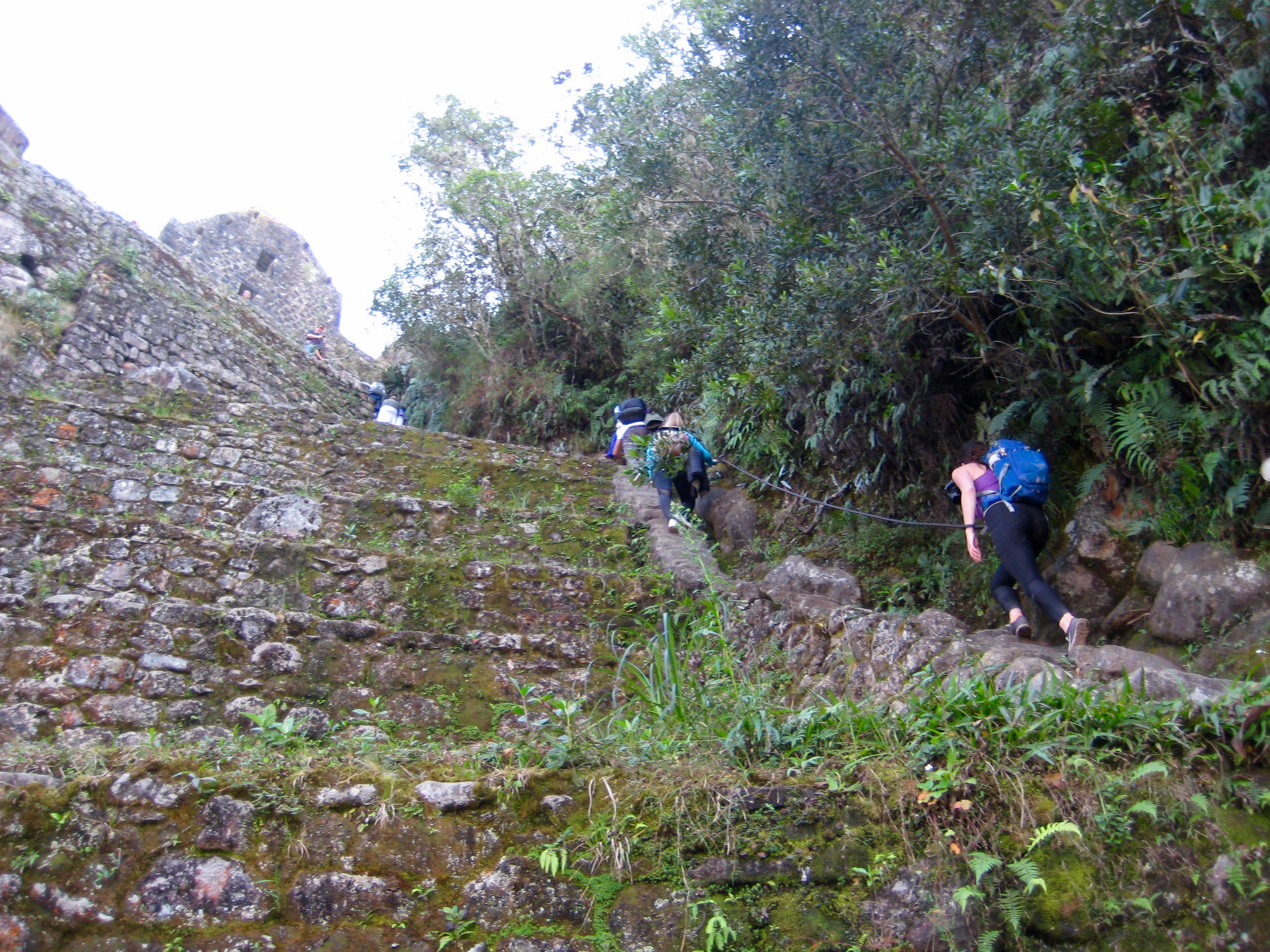
Day 4: Aguas Calientes to Machu Picchu to Ollantaytambo
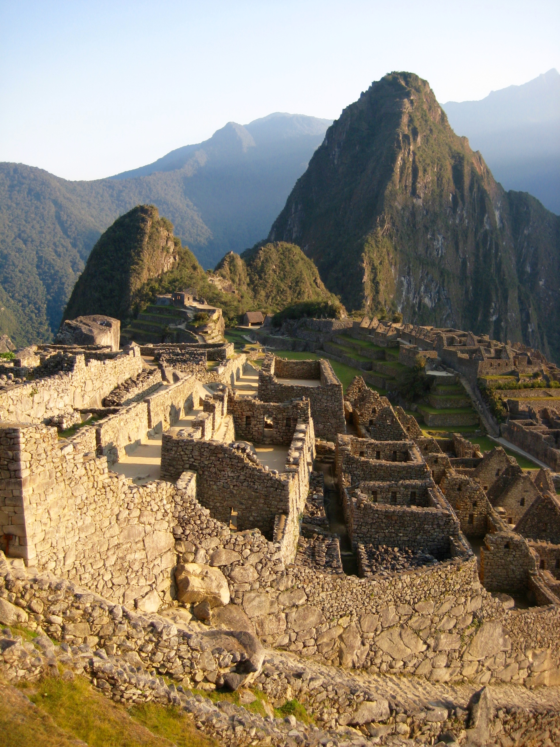
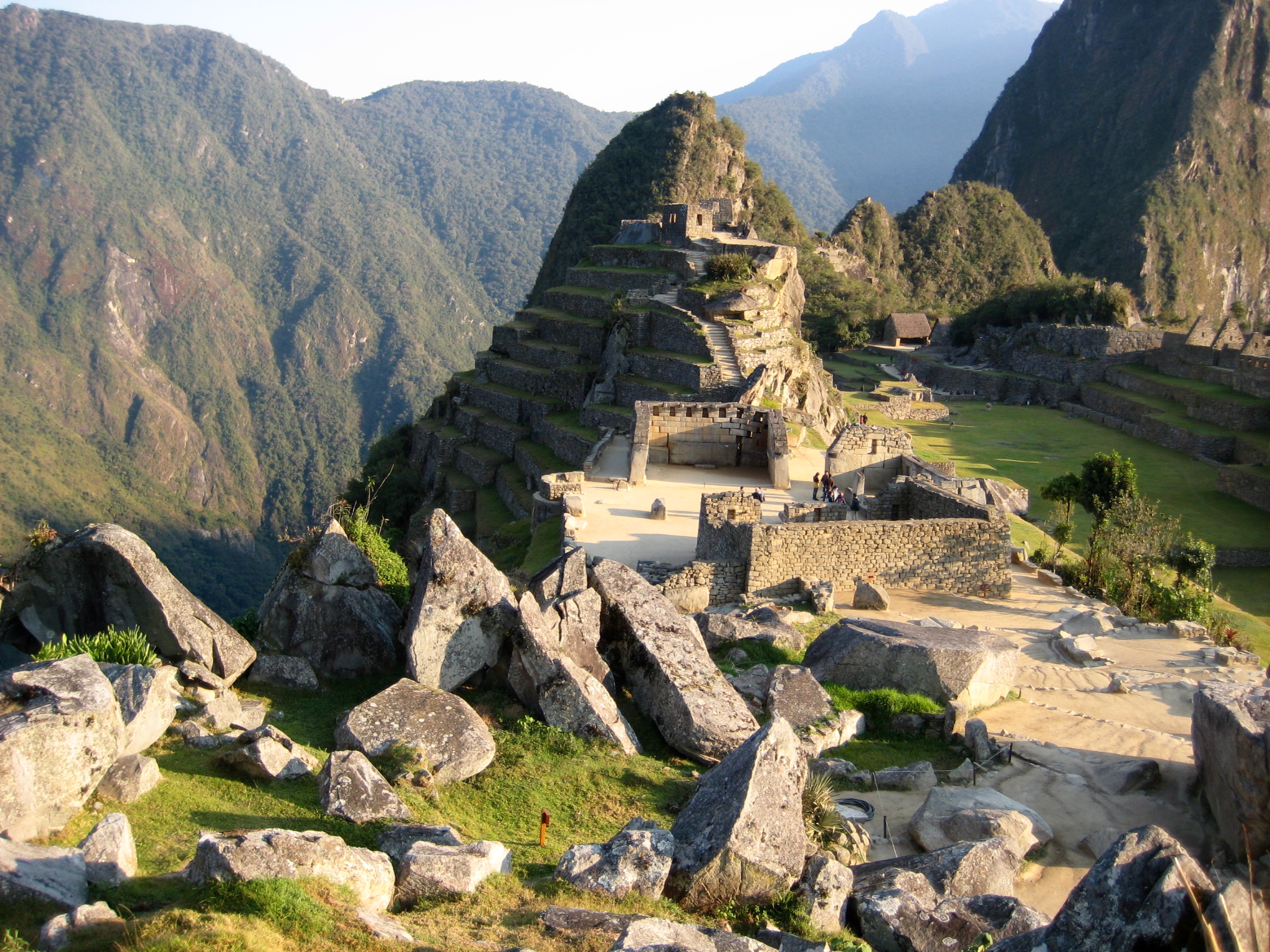
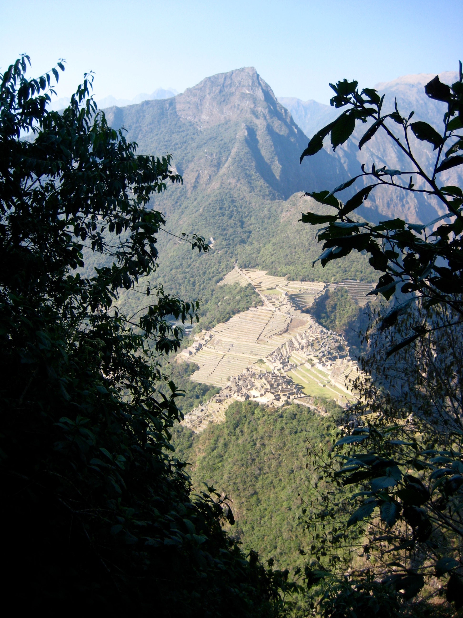
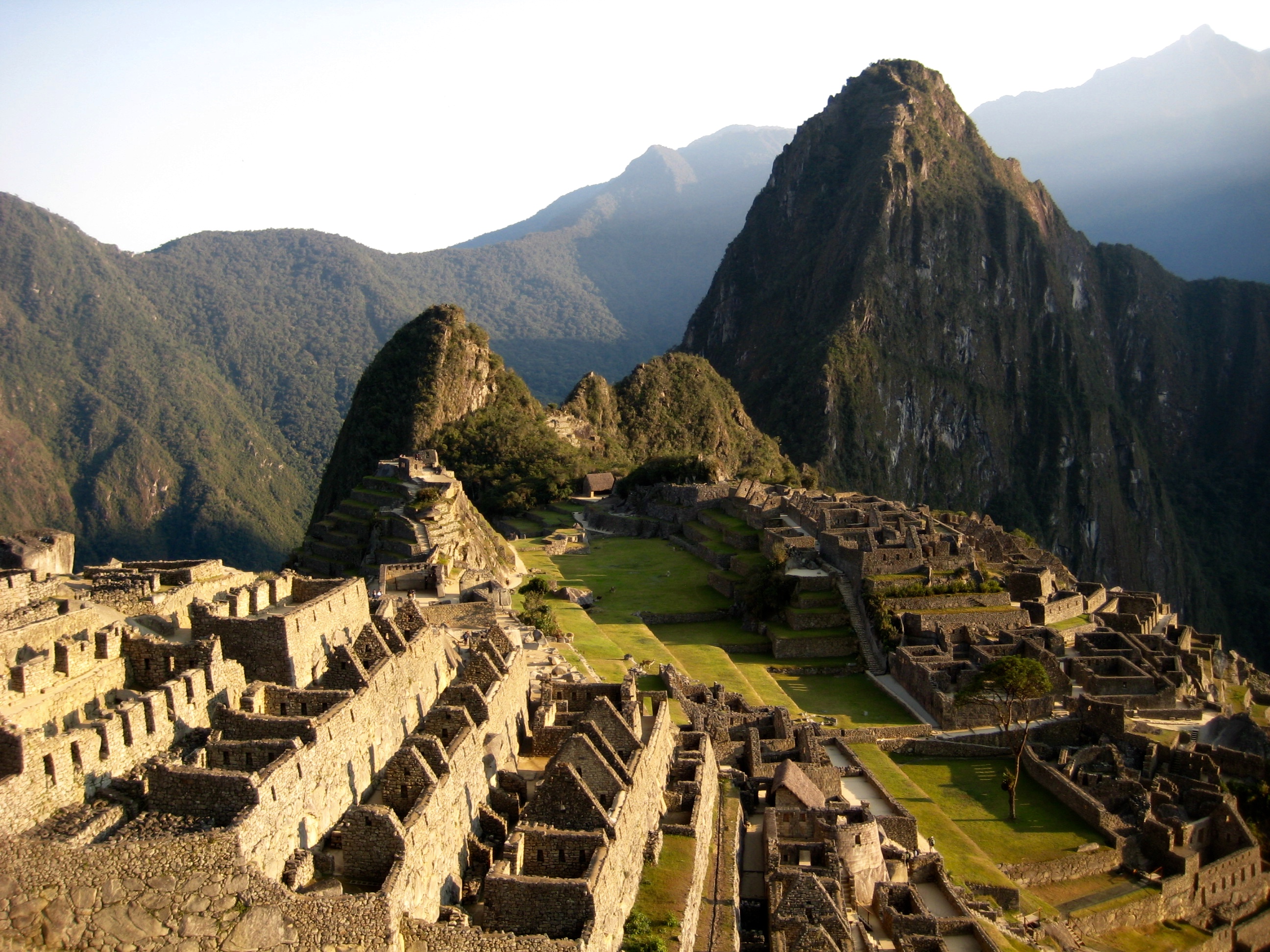
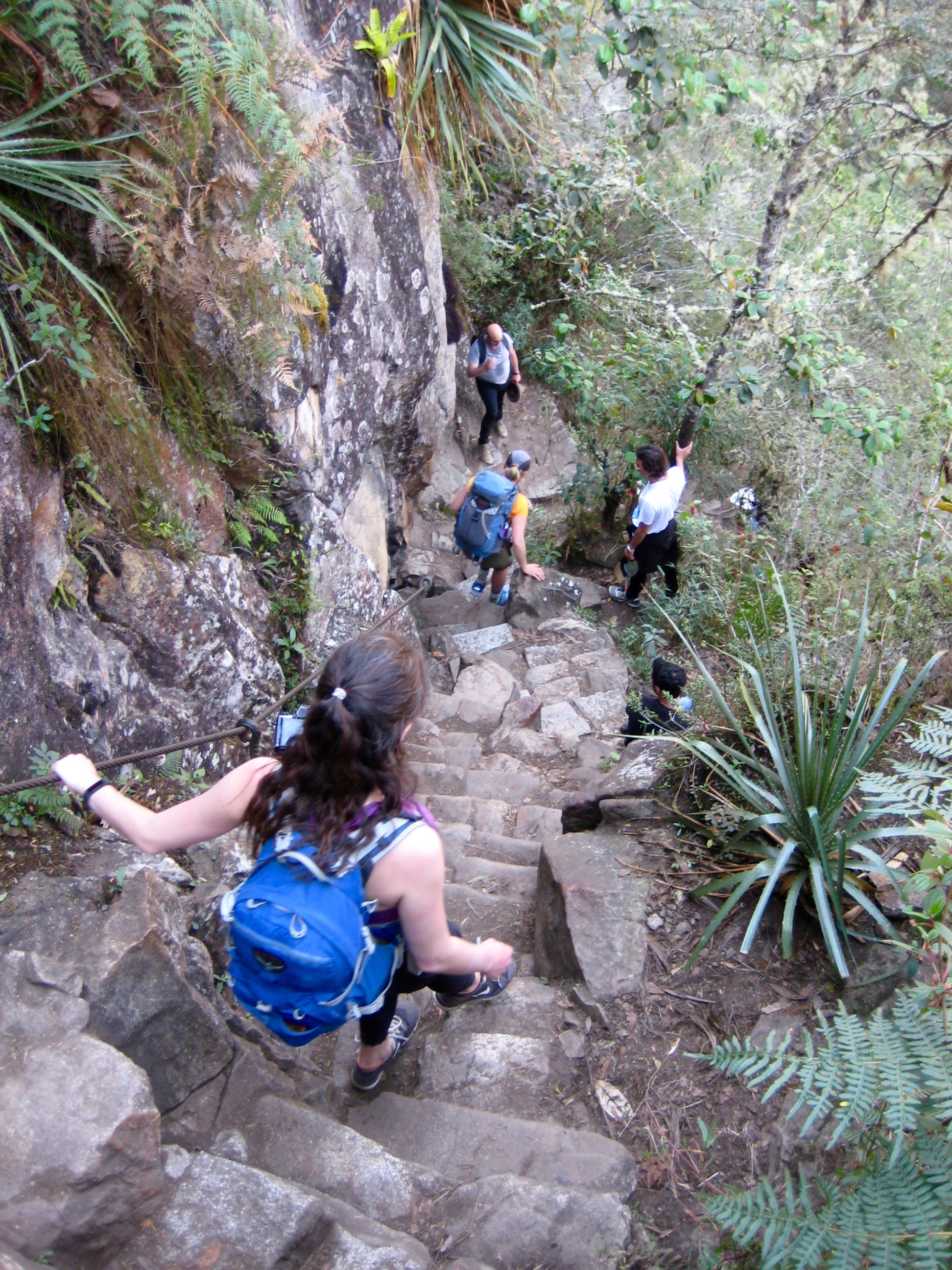
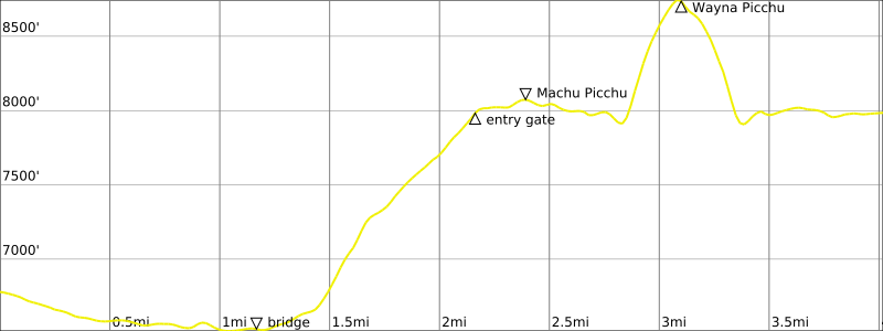
Everyone met in the hotel lobby at 4:00am, prepared for a full morning at Machu Picchu. Brooke, Clara, and I headed out on foot, walking through the dark town and an additional mile down to the lower gate. When the gate opened at 5:00am, we started up the stairway trail, along with several dozen other headlamp-clad hikers. The early morning was comfortably cool, and the many hundreds of stone steps quickly passed under our sneakers. We reached the entry gate at the top of the stairs scant minutes before 6:00am (1.7 hours + 1400 feet from hotel).
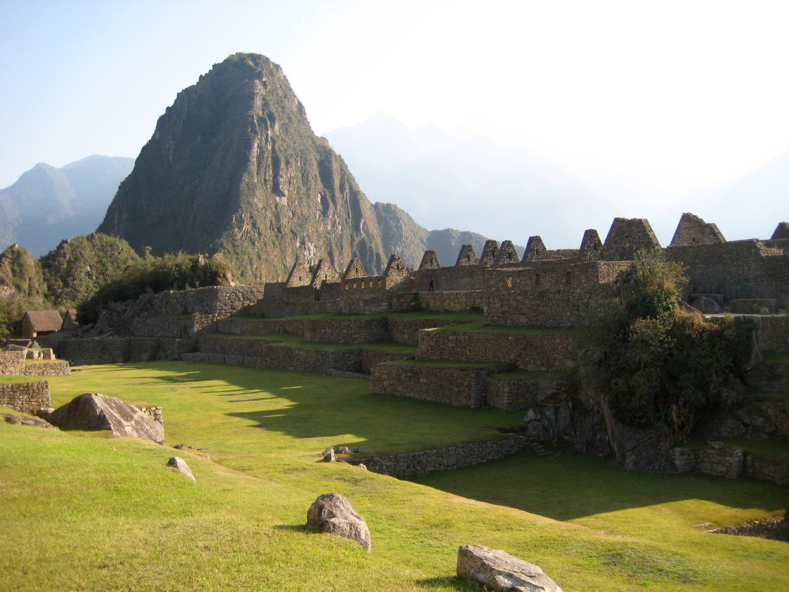
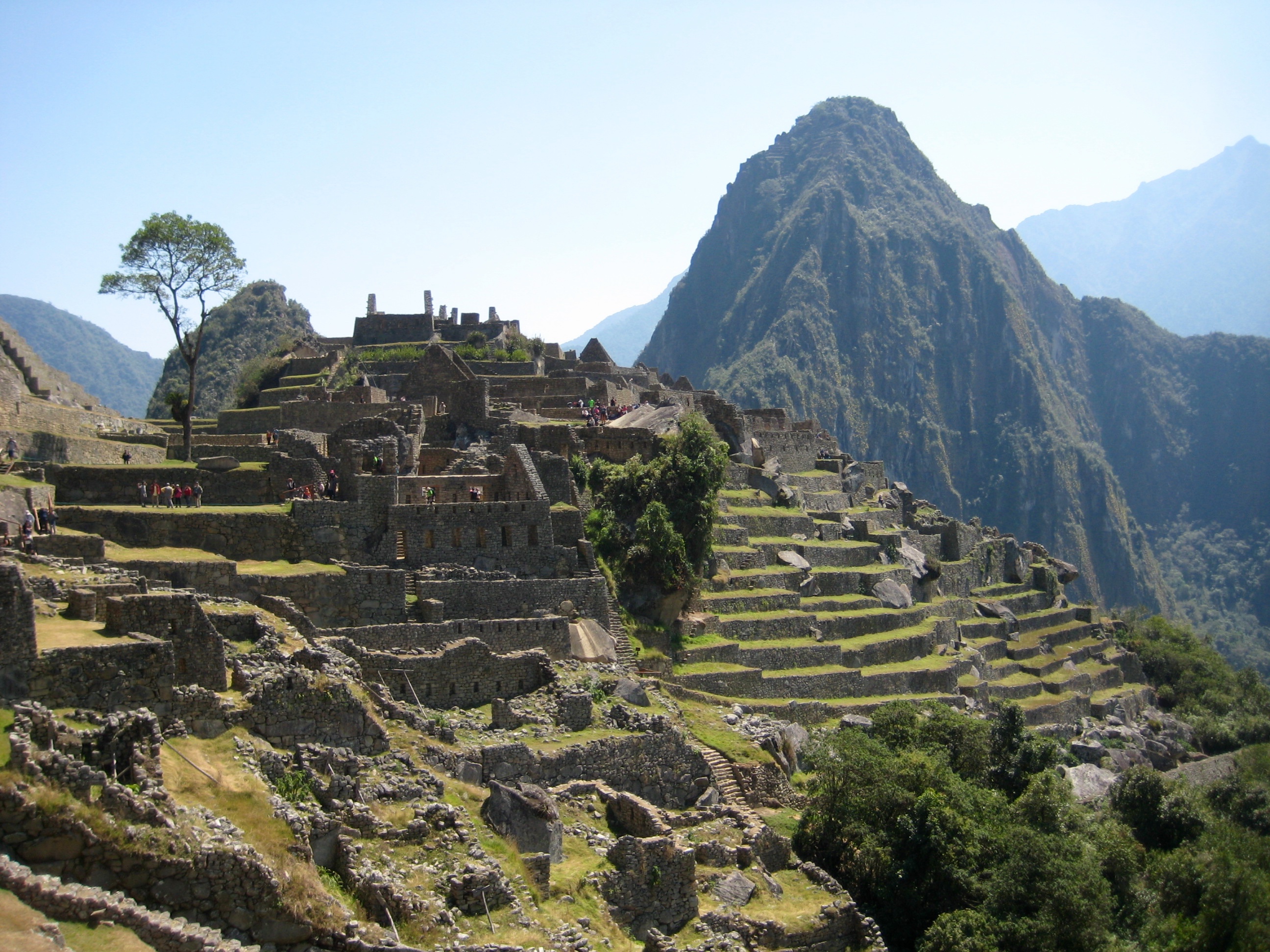
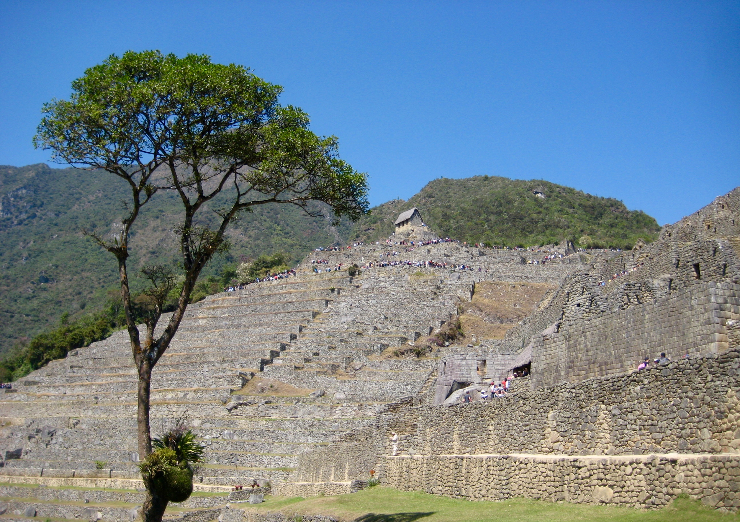
Nico and the rest of our group had arrived moments before, so we all entered the site together. It was an amazing sensation to stroll into Machu Picchu after having seen photographs of this magical place for so many decades! Nico gave a history lesson before turning us loose.
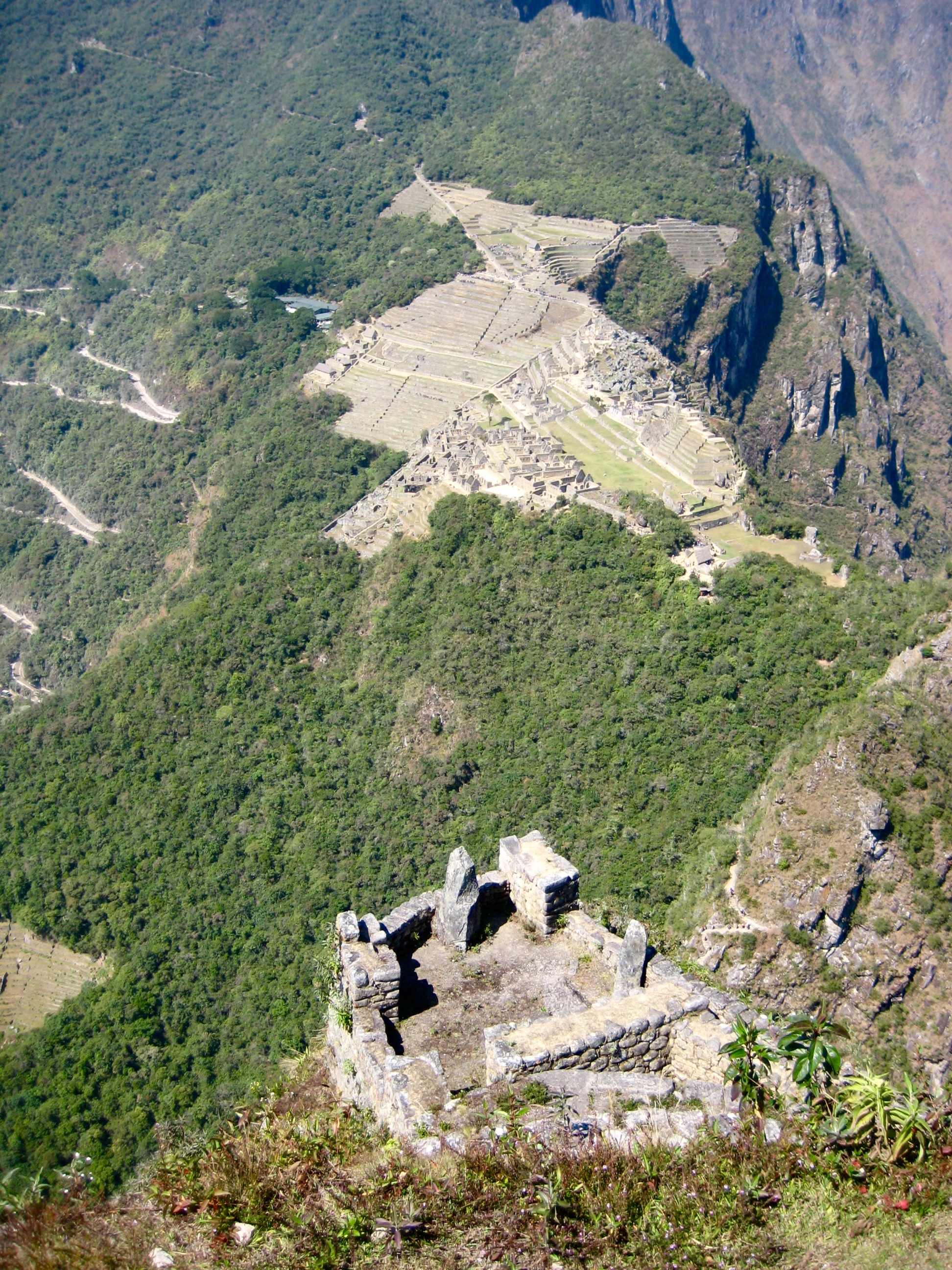
Eileen and Brooke and I had advance tickets to hike up Wayna Picchu Mountain, which offers a somewhat shorter but steeper ascent than nearby Machu Picchu Mountain. We bade goodbye to Nico and headed up the granitic horn. This climb begins by dropping into a notch, then it goes up countless rock steps that were meticulously set into the steep hillside by Inca workers.
Our 1000-foot climb ended on the small, crowded summit. It was an excellent viewpoint for the ancient village and surrounding granitic peaks.
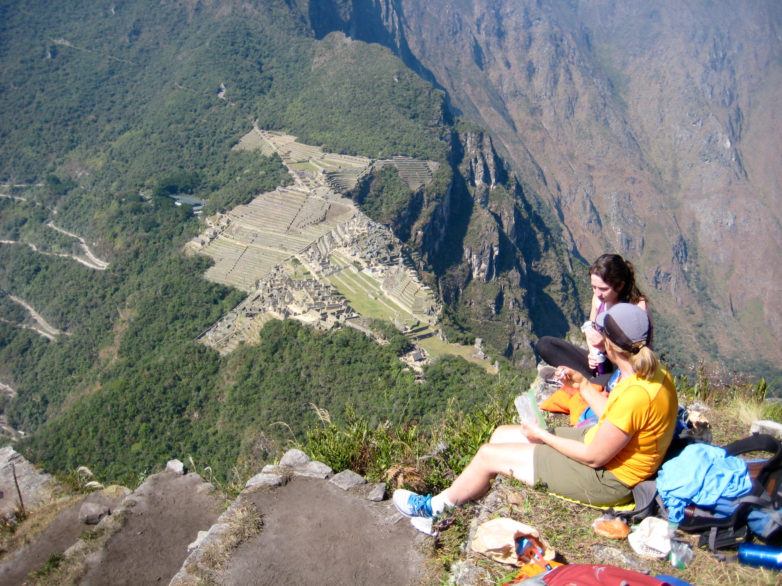
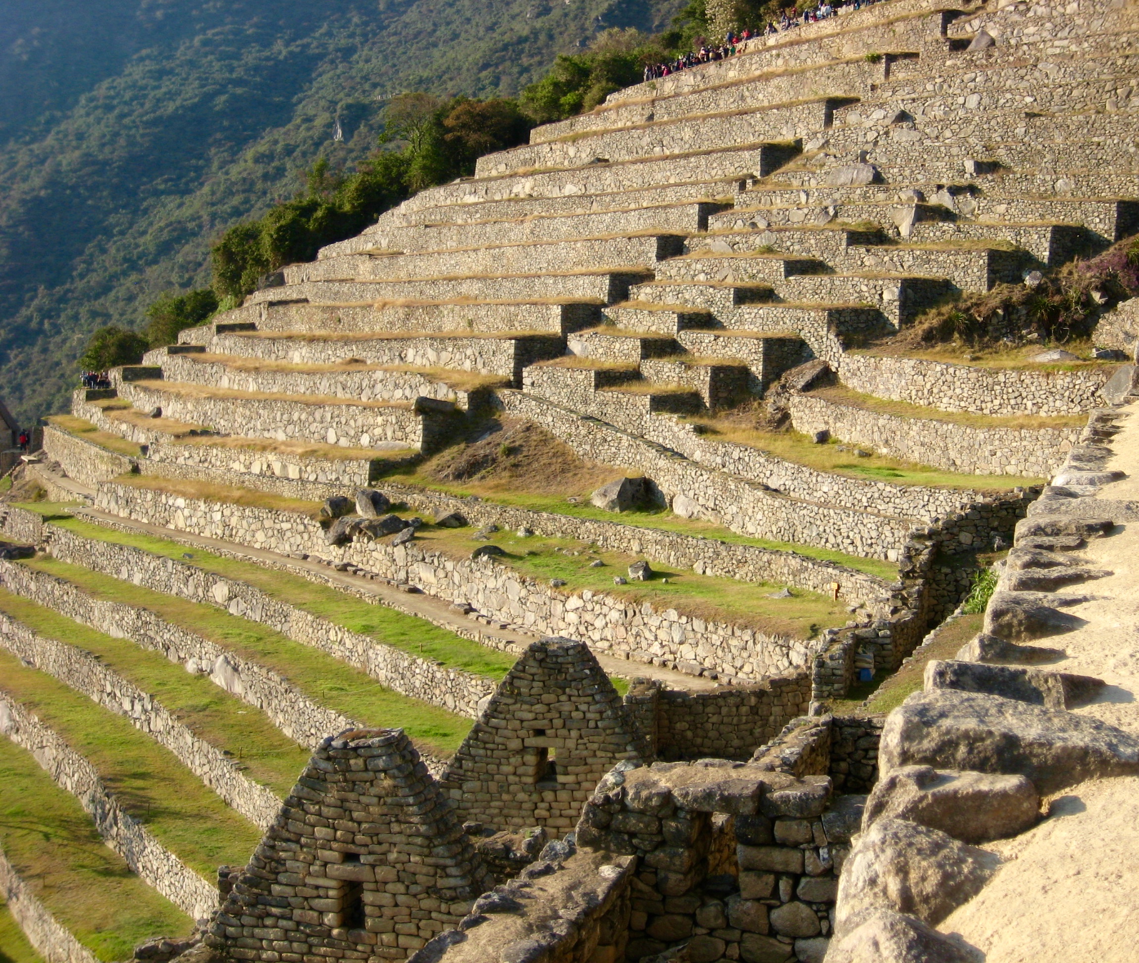
After soaking in the views while eating lunch, we carefully descended to the ancient village and spent some time admiring the rockwork.
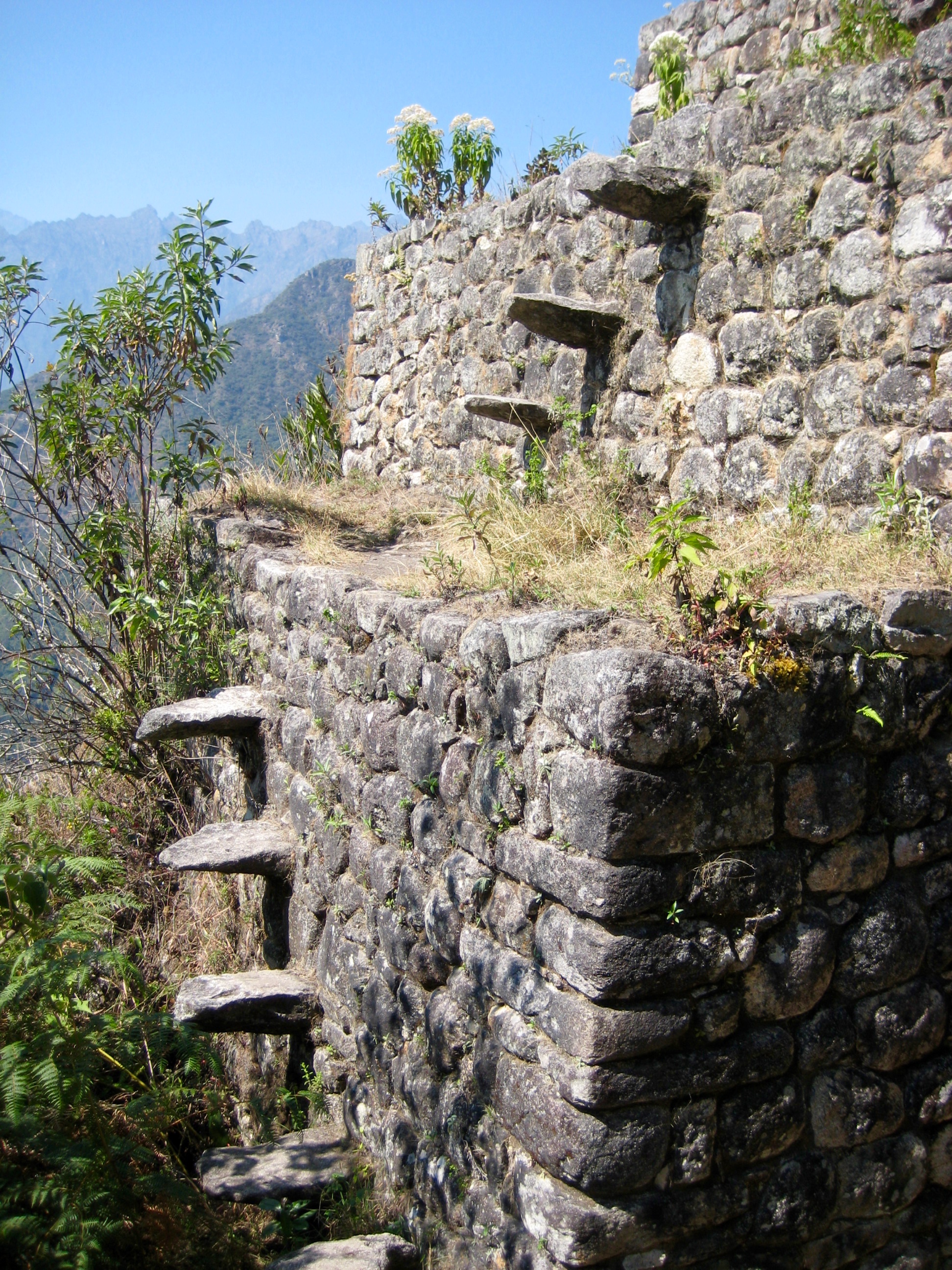
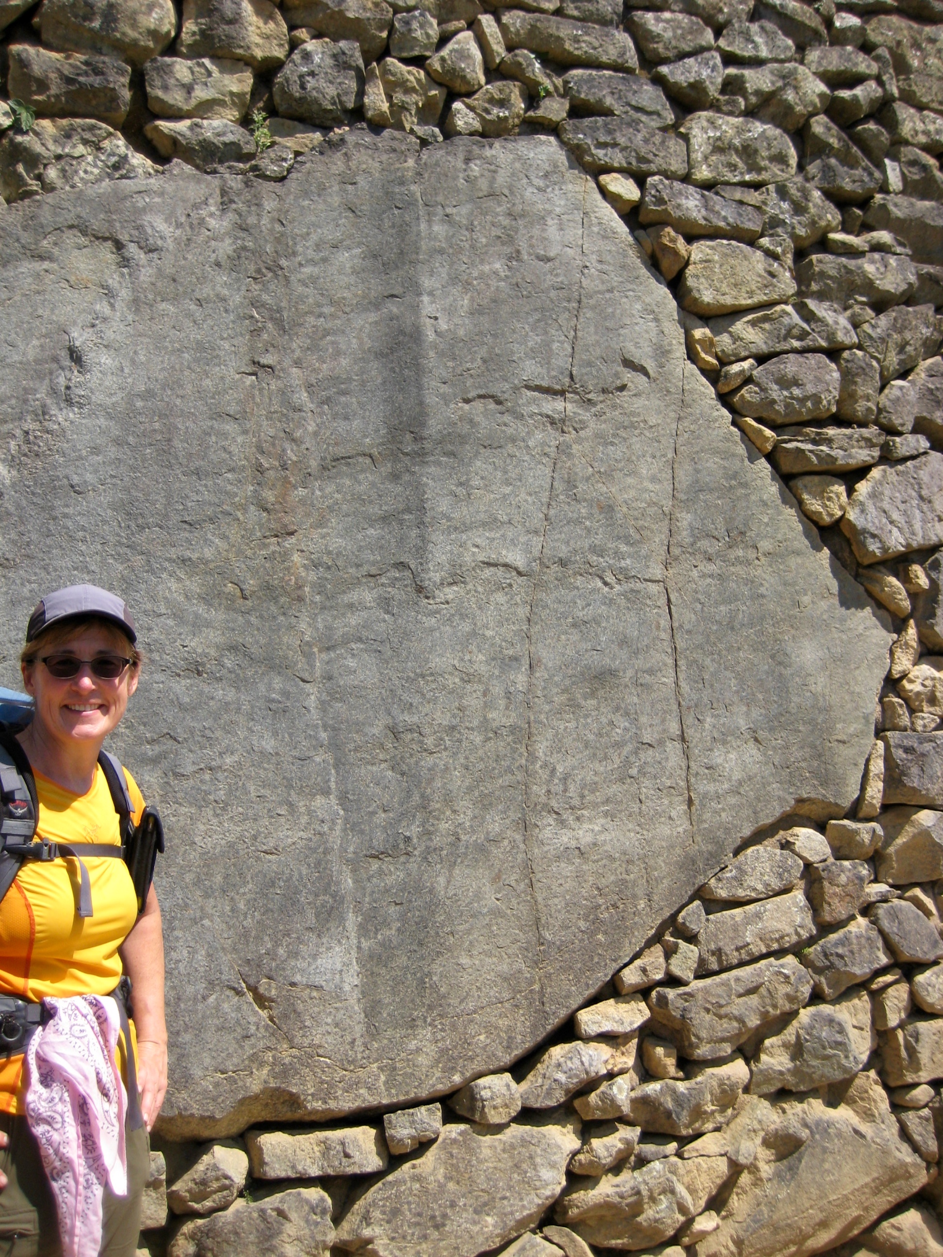
Clearly, the Inca workers were stonemasters and craftsmen, but they were also practical. For instance, if a large rock outcrop sat where they wanted to build a wall, they simply built around the outcrop and then shaved it flush.
We eventually made our way to the main gate and rode a shuttle bus back to town. A few hours later, our entire trekking group was on a train heading to Ollantaytambo. By mid evening, we were all back in Cusco to end a splendid trek.
Route Maps & Profiles
…
…
…
…
…
…
…
Photo Gallery
Click to enlarge…